

Soils of the - Agriculture and Agri-Food Canada
Soils of the - Agriculture and Agri-Food Canada
Soils of the - Agriculture and Agri-Food Canada

Create successful ePaper yourself
Turn your PDF publications into a flip-book with our unique Google optimized e-Paper software.
<strong>Soils</strong> <strong>of</strong> <strong>the</strong><br />
Langley-Vancouver Map Area<br />
RAB Bulletin 18<br />
Province <strong>of</strong> Ministry o f<br />
British Columbia Environment
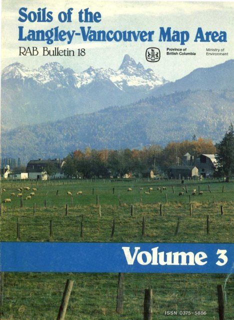
Cover photo : Fraser Valley near Mission .<br />
TOURISM B .C. PHOTO<br />
/Design&Layout<br />
TERRESTRIAL SRJDIES BRANCH
Province <strong>of</strong> British Columbi a<br />
Ministry <strong>of</strong> Environmen t<br />
ASSESSMENT AND PLANNING DIVISIO N<br />
RAB Bulletin 1 8<br />
SOILS OF TH E<br />
LANGLEY-VANCOUVER MAP AREA<br />
Report No. 1 5<br />
British Columbia Soil Survey<br />
VOLUME 3<br />
Description <strong>of</strong> <strong>the</strong> <strong>Soils</strong><br />
by<br />
H . A . Luttmerding, P.Ag .<br />
Kelowna<br />
1981
Canadian Cataloguing in Publication Dat a<br />
Luttmerding, H . A., 1938 -<br />
<strong>Soils</strong> <strong>of</strong> <strong>the</strong> Langley-Vancouver map are a<br />
(RAB bulletin, ISSN 0228-5460 ; 18) (Britis h<br />
Columbia soil survey, ISSN 0375-5886 ; repor t<br />
no . 1 5<br />
Contents : v . 3 . Description <strong>of</strong> <strong>the</strong> soils - -<br />
ISBN 0-7719-8435- 9<br />
1 . <strong>Soils</strong> - British Columbia - Lower Mainlan d<br />
region . 2 . <strong>Soils</strong> - British Columbia - Lowe r<br />
Mainl<strong>and</strong> region - Maps . I . British Columbia .<br />
Ministry <strong>of</strong> Environment . Assessment <strong>and</strong> Plannin g<br />
Division . II . Title . CIII . Title : Description o f<br />
<strong>the</strong> soils .] IV . Series . V . Series : Britis h<br />
Columbia soil survey ; report no . 15 .<br />
S599 .1 .B7L87 631 .4'771133 C81-092013-1<br />
© Copyright 1981 . B .C . Ministry <strong>of</strong> Environment .
INTRODUCTION<br />
The first soil survey <strong>of</strong> <strong>the</strong> Lower Fraser Valley was completed in <strong>the</strong> late 1930's (Kelley <strong>and</strong> Spilsbury, 1939) . Thi s<br />
valuable publication served its users for many years but as agricultural <strong>and</strong> o<strong>the</strong>r l<strong>and</strong> use problems becam e<br />
increasingly complex, <strong>the</strong> realization grew that a more detailed, larger-scale soil survey was required . To meet<br />
this need, a resurvey <strong>of</strong> <strong>the</strong> Lower Fraser Valley was initiated in <strong>the</strong> late 1950's with field mapping completed i n<br />
<strong>the</strong> early 1970's . Included as well in <strong>the</strong> survey area were <strong>the</strong> adjacent Coast Mountains <strong>and</strong> <strong>the</strong> sou<strong>the</strong>rn part o f<br />
<strong>the</strong> Sunshine Coast . The original impetus for <strong>the</strong> resurvey was supplied by <strong>the</strong> Assessment Commissioner, B .C .<br />
Department <strong>of</strong> Finance who requested assistance in developing uniform l<strong>and</strong> assessments in <strong>the</strong> Lower Frase r<br />
Valley. His request (for more detailed soil information) was strongly supported by a variety <strong>of</strong> o<strong>the</strong>r soil <strong>and</strong> lan d<br />
users .<br />
As <strong>the</strong> survey progressed, preliminary reports <strong>and</strong> soil maps (scale 1 :24 000) were prepared, generally on a<br />
municipal base . A total <strong>of</strong> eleven separate maps <strong>and</strong> ten reports were published . This report, <strong>Soils</strong> <strong>of</strong> th e<br />
Langley-Vancouver Map Area, collates, summarizes <strong>and</strong> updates <strong>the</strong> soil information contained in most <strong>of</strong> th e<br />
preliminary series as well as presenting new information not published previously .<br />
Field mapping procedures <strong>and</strong> soil classification techniques changed over <strong>the</strong> period <strong>of</strong> years required for th e<br />
soil survey. Users <strong>of</strong> <strong>the</strong> preliminary maps <strong>and</strong> reports probably have noticed differences in terminology <strong>and</strong> soi l<br />
classification among <strong>the</strong>m . The present report, as much as possible, updates <strong>the</strong> information contained in th e<br />
preliminary series to current st<strong>and</strong>ards (The Canadian System <strong>of</strong> Soil Classification, 1978) <strong>and</strong> presents it in a<br />
uniform, consistent manner. Both hard <strong>and</strong> s<strong>of</strong>t conversions to metric measures occur (because <strong>of</strong> <strong>the</strong> tim e<br />
period during which this report has been compiled) .<br />
<strong>Soils</strong> <strong>of</strong> <strong>the</strong> Langley-Vancouver Map Area encompasses an area bounded on <strong>the</strong> west by <strong>the</strong> Strait <strong>of</strong> Georgi a<br />
<strong>and</strong> on <strong>the</strong> east by 122°00' west longitude (a north-south line passing between Chilliwack <strong>and</strong> Sumas Canal) .<br />
The sou<strong>the</strong>rn boundary is <strong>the</strong> <strong>Canada</strong>-United States <strong>of</strong> America border (49th parallel) while 49°30' nort h<br />
latitude forms <strong>the</strong> nor<strong>the</strong>rn boundary. Included are <strong>the</strong> central <strong>and</strong> western parts <strong>of</strong> <strong>the</strong> Lower Fraser Valley, th e<br />
sou<strong>the</strong>rn part <strong>of</strong> <strong>the</strong> Sunshine Coast <strong>and</strong> <strong>the</strong> sou<strong>the</strong>rn edge <strong>of</strong> <strong>the</strong> Coast Mountains east to Chehalis Lake . User s<br />
will note that some areas, particularly in <strong>the</strong> vicinity <strong>of</strong> metropolitan Vancouver, are not mapped or classified .<br />
These consist mainly <strong>of</strong> areas which were already ei<strong>the</strong>r partially or completely urbanized (or industrialized) a t<br />
<strong>the</strong> time <strong>of</strong> <strong>the</strong> field survey .<br />
<strong>Soils</strong> <strong>of</strong> <strong>the</strong> Langley-Vancouver Map Area is being produced, published <strong>and</strong> distributed in six volumes . Volum e<br />
1 consists <strong>of</strong> soil map mosaics (1 :25 000 scale) with legend, which cover <strong>the</strong> Lower Fraser Valley portion <strong>of</strong> th e<br />
map area . Volume 2 contains soil maps (1 :50 000 scale) with legend, that encompass <strong>the</strong> remainder <strong>of</strong> th e<br />
map area, mainly <strong>the</strong> sou<strong>the</strong>rn Sunshine Coast <strong>and</strong> Coast Mountains . Volume 3 (this publication) describes i n<br />
detail <strong>the</strong> soils mapped <strong>and</strong> classified in volumes 1 <strong>and</strong> 2 . It also generally discusses <strong>the</strong> environmenta l<br />
characteristics <strong>of</strong> <strong>the</strong> map area <strong>and</strong> contains a glossary <strong>and</strong> list <strong>of</strong> references . Volume 4 consists mainly o f<br />
interpretations for specified engineering uses <strong>of</strong> <strong>the</strong> soils described in volume 3 (<strong>and</strong> mapped in volumes 1 an d<br />
2). It contains information regarding soil suitability (or limitations) for septic tank effluent disposal, basemen t<br />
construction <strong>and</strong> o<strong>the</strong>r urban-related l<strong>and</strong> uses . Also included are some interpretations for forest managemen t<br />
concerns as well as interpretations for recreational endeavours . Volume 5 is agriculturally oriented an d<br />
contains information regarding agricultural cropping <strong>and</strong> management . Included also in this volume are revise d<br />
soil capability for agriculture maps which replace those currently available . These maps are prepared at th e<br />
scale <strong>of</strong> <strong>the</strong> soil maps in volumes 1 <strong>and</strong> 2 . They are more detailed than <strong>the</strong> original, provisional series ,<br />
incorporate more definitive climatic data into <strong>the</strong> ratings <strong>and</strong> show improved (drained <strong>and</strong>/or irrigated )<br />
capability ratings as well as ratings when <strong>the</strong>se management inputs are not considered . Volume 6 consists <strong>of</strong><br />
<strong>the</strong> detailed, technical soil pr<strong>of</strong>ile descriptions <strong>of</strong> <strong>the</strong> soils described in Volume 3. It also contains <strong>the</strong> results <strong>of</strong>
chemical <strong>and</strong> physical analyses <strong>of</strong> <strong>the</strong> sampled soils (or individual soil horizons) . Only a limited number o f<br />
copies <strong>of</strong> volume 6 are being produced, mainly for those persons who have day-to-day use for this detailed ,<br />
specific data . Since this information is also stored in <strong>the</strong> British Columbia Soil Information System o<strong>the</strong>rs can, a s<br />
required, request <strong>the</strong> data (or portions <strong>of</strong> it) directly from <strong>the</strong> data file by contacting <strong>the</strong> Assessment an d<br />
Planning Division Map Library, B .C. Ministry <strong>of</strong> Environment, Victoria, B .C . ,<br />
This publication (Volume 3) consists mainly <strong>of</strong> three chapters . Chapter 1 briefly describes <strong>the</strong> physical, socia l<br />
<strong>and</strong> environmental characteristics <strong>of</strong> <strong>the</strong> map area in terms <strong>of</strong> location, climate, vegetation, physiography ,<br />
bedrock <strong>and</strong> surficial deposits. The surficial geologic deposits are discussed in somewhat more detail sinc e<br />
<strong>the</strong>y form a stratification in <strong>the</strong> soil mapping <strong>and</strong> classification methodology . Chapter 2 describes <strong>the</strong> fiel d<br />
mapping methodology <strong>and</strong> soil classification while Chapter 3 describes, in detail, <strong>the</strong> characteristics <strong>of</strong> th e<br />
individual soils as well as making general comment regarding <strong>the</strong>ir suitability (or limitations) for a variety <strong>of</strong> lan d<br />
uses .<br />
iv
HOW TO USE THE SOIL MAPS AND REPORT<br />
Long-term soil resource managers such as farmers usually know <strong>the</strong> characteristics <strong>and</strong> variations <strong>of</strong> <strong>the</strong> soil s<br />
in <strong>the</strong>ir immediate locality. However, unless a soil map <strong>and</strong> report is available, comparison with o<strong>the</strong>r soils in th e<br />
area or region is impossible . Regional (<strong>and</strong> local) similarities <strong>and</strong> differences among soils are evident after a soi l<br />
map has been made . Proven (or new) management techniques on a soil may <strong>the</strong>n be transferred to <strong>the</strong> same o r<br />
similar soils elsewhere with <strong>the</strong> least chance <strong>of</strong> failure . -<br />
To effeciently use this soil survey report (it consists <strong>of</strong> 6 volumes), <strong>the</strong> following procedure is suggested :<br />
(1) Generally locate <strong>the</strong> area <strong>of</strong> concern on <strong>the</strong> "Index <strong>of</strong> Map Sheets" which immediately precede <strong>the</strong> soi l<br />
map mosaics in Volume 1 <strong>and</strong> soil maps in Volume 2 <strong>of</strong> this report . Note <strong>the</strong> number(s) <strong>of</strong> <strong>the</strong> ma p<br />
sheet(s) which cover <strong>the</strong> area under consideration . Generally, l<strong>and</strong>s in <strong>the</strong> Lower Fraser Valley ar e<br />
covered in Volume 1 while areas on <strong>the</strong> Sunshine Coast or in <strong>the</strong> Coast Mountains are contained i n<br />
Volume 2 .<br />
(2) Turn to <strong>the</strong> appropriate map sheet(s) <strong>and</strong> locate in detail <strong>the</strong> area <strong>of</strong> concern . Lakes, creeks, <strong>and</strong> river s<br />
<strong>and</strong> o<strong>the</strong>r natural features as well as cultural detail including main roads, railways, communities, an d<br />
section numbers are shown to assist in location .<br />
(3) Note <strong>the</strong> soil map symbols in <strong>the</strong> map delineations (polygons) which encompass <strong>the</strong> area(s) unde r<br />
consideration .<br />
(4) Consult <strong>the</strong> soil legend for a description <strong>of</strong> <strong>the</strong> soil map symbols . The topographic <strong>and</strong> stoniness clas s<br />
symbols are described here as is <strong>the</strong> soil parent material <strong>and</strong> drainage classification . Also given is th e<br />
name(s) <strong>of</strong> <strong>the</strong> soil(s) identified by a symbol in <strong>the</strong> soil map polygon(s) .<br />
(5) Locate <strong>the</strong> named soil in Volume 3 <strong>of</strong> <strong>the</strong> report . A detailed description <strong>of</strong> <strong>the</strong> soil is given here as wel l<br />
as its general suitability (or limitations) for a variety <strong>of</strong> uses .<br />
(6) Refer to Volumes 4 <strong>and</strong> 5 for specific l<strong>and</strong> use interpretations <strong>of</strong> <strong>the</strong> named soils . Volume 4 deals wit h<br />
engineering characteristics related mainly to urban <strong>and</strong> associated l<strong>and</strong> uses, as well as interpretations<br />
dealing with some forest management concerns <strong>and</strong> recreational endeavour s,. Volume 5 contain s<br />
l<strong>and</strong> capability for agriculture maps which are at <strong>the</strong> same scale as <strong>the</strong> soil maps in Volumes 1 <strong>and</strong> 2 .<br />
These capability maps supercede <strong>the</strong> currently available provisional series (1 :50 000 scale) . They are<br />
at a larger scale, incorporate more definitive climate data <strong>and</strong> show improved (drained <strong>and</strong>/o r<br />
irrigated) ratings as well as ratings when <strong>the</strong>se management inputs are not considered . Also containe d<br />
in Volume 5 are soil groupings <strong>and</strong> interpretations relating to agricultural l<strong>and</strong> management .<br />
(7) Users requiring <strong>the</strong> detailed, site specific, technical soil pr<strong>of</strong>ile descriptions <strong>and</strong> associated physica l<br />
<strong>and</strong> chemical analyses are referred to Volume 6 or, if this information is required only on an irregula r<br />
basis, to <strong>the</strong> British Columbia Soil Information System . (Contact <strong>the</strong> Assessment <strong>and</strong> Planning Divisio n<br />
Map Library, B .C. Ministry <strong>of</strong> Environment, Victoria, B .C .) .<br />
Users <strong>of</strong> <strong>the</strong> soil maps <strong>and</strong> report should note that soils are differentiated on <strong>the</strong> basis <strong>of</strong> characteristics to a<br />
depth <strong>of</strong> a metre or more . Even though several soils have similar surfaces, subsurface <strong>and</strong> subsoil characte r<br />
can vary widely. Users should also underst<strong>and</strong> that each soil exhibits a range <strong>of</strong> properties <strong>and</strong> that boundarie s<br />
between different soils are not necessarily well defined . The boundaries shown on <strong>the</strong> soil maps are <strong>the</strong> bes t<br />
estimate <strong>of</strong> where soil characteristics change sufficiently to warrant identification <strong>of</strong> ano<strong>the</strong>r soil .<br />
v
ACKNOWLEDGEMENTS<br />
The soil survey <strong>of</strong> <strong>the</strong> Langley-Vancouver map area was initially undertaken under <strong>the</strong> auspices <strong>of</strong> <strong>the</strong> Britis h<br />
Columbia Ministry <strong>of</strong> <strong><strong>Agri</strong>culture</strong> <strong>and</strong> field mapping <strong>and</strong> data ga<strong>the</strong>ring was completed while <strong>the</strong> author wa s<br />
with that Ministry. The Ministry's support <strong>and</strong> funding is acknowledged .<br />
Gratefully acknowledged also are <strong>the</strong> numerous persons who assisted in <strong>the</strong> field mapping <strong>and</strong> those wh o<br />
freely supplied guidance <strong>and</strong> direction during <strong>the</strong> course <strong>of</strong> <strong>the</strong> survey . They are too numerous to list here but ar e<br />
individually identified in <strong>the</strong> several published preliminary reports . Specially acknowledged is Dr. T. Lewis wh o<br />
conducted most <strong>of</strong> <strong>the</strong> field mapping <strong>and</strong> data ga<strong>the</strong>ring in <strong>the</strong> Coast Mountains portion <strong>of</strong> this report .<br />
The assistance <strong>and</strong> information provided by Dr . J .E . Armstrong, Geological Survey <strong>of</strong> <strong>Canada</strong>, regarding glacia l<br />
history <strong>and</strong> surficial geology <strong>of</strong> <strong>the</strong> Lower Fraser Valley is also specially acknowledged .<br />
Aerial photographs, used as field map sheets, were provided by Surveys <strong>and</strong> Mapping Branch, Britis h<br />
Columbia Ministry <strong>of</strong> Environment . The excellent soil map mosaics <strong>and</strong> soil legend contained in Volume 1 wer e<br />
prepared by <strong>the</strong> Cartography Section, L<strong>and</strong> Resource Research Institute, <strong><strong>Agri</strong>culture</strong> <strong>Canada</strong>, Ottawa .<br />
Specially acknowledged is <strong>the</strong> contribution <strong>of</strong> Dr . B. Cann, retired, who collated much <strong>of</strong> <strong>the</strong> data from th e<br />
individual preliminary reports <strong>and</strong> prepared draft descriptions <strong>of</strong> many <strong>of</strong> <strong>the</strong> soils contained herein . Th e<br />
positive editorial direction <strong>and</strong> encouragement provided by <strong>the</strong> Editorial Committee under <strong>the</strong> chairmanship o f<br />
P.N . Sprout is acknowledged <strong>and</strong> greatly appreciated . The committee included Dr . T. Lewis (private consultant) ,<br />
M .G . Driehuyzen (British Columbia Ministry <strong>of</strong> <strong><strong>Agri</strong>culture</strong> <strong>and</strong> <strong>Food</strong>) <strong>and</strong> Dr . L. Lavkulich (University <strong>of</strong> Britis h<br />
Columbia) . To all o<strong>the</strong>rs who so cheerfully <strong>and</strong> freely contributed to <strong>the</strong> success <strong>of</strong> this project but are unable t o<br />
be individually acknowledged, <strong>the</strong> author extends a collective, heartfelt thank you .<br />
vii
INTRODUCTION<br />
HOW TO USE THE SOIL MAPS AND REPORT<br />
ACKNOWLEDGEMENTS<br />
TABLE OF CONTENTS<br />
LIST OF FIGURES<br />
LIST OF PLATES<br />
LIST OF TABLES<br />
LIST OF APPENDICES<br />
TABLE OF CONTENTS<br />
CHAPTER ONE-GENERAL DESCRIPTION OF THE ARE A<br />
Location <strong>and</strong> Areal Extent 1<br />
Social <strong>and</strong> L<strong>and</strong> Use Characteristics 1<br />
Climatic Characteristics 3<br />
Vegetation 4<br />
Bedrock 5<br />
Physiography <strong>and</strong> Drainage 5<br />
Surficial Geologic Deposits ' 9<br />
CHAPTER TWO-SOIL CLASSIFICATION AND FIELD MAPPING METHOD S<br />
Soil Classification 1 3<br />
Field Methods <strong>and</strong> Procedures 1 3<br />
CHAPTER THREE-DESCRIPTION OF THE SOIL S<br />
Abbotsford <strong>Soils</strong> (AD) 2 0<br />
Addington <strong>Soils</strong> (AG) 22<br />
Albion <strong>Soils</strong> (AB) 24<br />
Alouette <strong>Soils</strong> (AL) 2 6<br />
Annacis <strong>Soils</strong> (AS) 27<br />
Annis <strong>Soils</strong> (AN) 2 8<br />
Arnold <strong>Soils</strong> (AR) 29<br />
Banford <strong>Soils</strong> (BD) 30<br />
Bates <strong>Soils</strong> (BT) 3 1<br />
Beharrel <strong>Soils</strong> (BL) 33<br />
Benson <strong>Soils</strong> (B) 34<br />
Berry <strong>Soils</strong> (BR) 35<br />
Blackburn <strong>Soils</strong> (BB) 36<br />
Blaney <strong>Soils</strong> (BE) 37<br />
Blundell <strong>Soils</strong> (BU) 38<br />
Bonson <strong>Soils</strong> (BN) 39<br />
Boosey <strong>Soils</strong> (BY) 40<br />
Bose <strong>Soils</strong> (BO) 4 1<br />
Buckerfield <strong>Soils</strong> (BK) 43<br />
Buntzen <strong>Soils</strong> (BZ) 44<br />
Burwell <strong>Soils</strong> (BW) 46<br />
Calkins <strong>Soils</strong> (CN) 47<br />
Cannel) <strong>Soils</strong> (CE) 48<br />
Capilano <strong>Soils</strong> (CP) 49<br />
Carvolth <strong>Soils</strong> (CV) 50<br />
Cascade <strong>Soils</strong> (CC) 5 1<br />
Cheam <strong>Soils</strong> (CM) 5 2<br />
Chehalis <strong>Soils</strong> (CS) 53<br />
Cloverdale <strong>Soils</strong> (CD) 54<br />
Coghlan <strong>Soils</strong> (CG) 56<br />
Columbia <strong>Soils</strong> (CL) 5 7<br />
ix<br />
Page<br />
ii i<br />
v<br />
vi i<br />
i x<br />
xii i<br />
xi v<br />
xv i<br />
xvi i
TABLE OF CONTENTS-(Continued)<br />
Coquitlam <strong>Soils</strong> (CO)<br />
Crescent <strong>Soils</strong> (CT)<br />
Dean <strong>Soils</strong> (DN)<br />
Deas <strong>Soils</strong> (DS)<br />
Defehr <strong>Soils</strong> (DR)<br />
Delta <strong>Soils</strong> (DT)<br />
Dennett <strong>Soils</strong> (DE)<br />
Devil <strong>Soils</strong> (DV)<br />
Dewdney <strong>Soils</strong> (DW)<br />
Dixon <strong>Soils</strong> (DX)<br />
Durieu <strong>Soils</strong> (DU)<br />
Eastcap <strong>Soils</strong> (EP)<br />
Elk <strong>Soils</strong> (EK)<br />
Elphingstone <strong>Soils</strong> (EF)<br />
Embree <strong>Soils</strong> (EM) . .<br />
Errock <strong>Soils</strong> (ER)<br />
Eunice <strong>Soils</strong> (EU)<br />
Fadden <strong>Soils</strong> (FD)<br />
Fairfield <strong>Soils</strong> (F)<br />
Fellows <strong>Soils</strong> (FS)<br />
Gibson <strong>Soils</strong> (GN)<br />
Glen Valley <strong>Soils</strong> (GV)<br />
Golden Ears <strong>Soils</strong> (GE)<br />
Goudy <strong>Soils</strong> (GY)<br />
Grevell <strong>Soils</strong> (G)<br />
Grigg <strong>Soils</strong> (GG)<br />
Grouse <strong>Soils</strong> (GR)<br />
Guichon <strong>Soils</strong> (GU)<br />
Hallert <strong>Soils</strong> (HT)<br />
Hammond <strong>Soils</strong> (HA)<br />
Haney <strong>Soils</strong> (HY)<br />
Harrison <strong>Soils</strong> (HR)<br />
Hatzic <strong>Soils</strong> (HZ)<br />
Hazelwood <strong>Soils</strong> (HD)<br />
Henderson <strong>Soils</strong> (H)<br />
Heron <strong>Soils</strong> (HN)<br />
Hjorth <strong>Soils</strong> (HJ)<br />
Hollyburn <strong>Soils</strong> (HB)<br />
Hoover <strong>Soils</strong> (HV)<br />
Hopedale <strong>Soils</strong> (HP)<br />
Isar <strong>Soils</strong> (IS)<br />
Judson <strong>Soils</strong> (JN)<br />
Katzie <strong>Soils</strong> (KZ)<br />
Kennedy <strong>Soils</strong> (KD)<br />
Kenworthy <strong>Soils</strong> (KW)<br />
Keystone <strong>Soils</strong> (KE)<br />
Kitter <strong>Soils</strong> (K)<br />
Ladner <strong>Soils</strong> (L)<br />
Langdale <strong>Soils</strong> (LE)<br />
Langley <strong>Soils</strong> (LA)<br />
Laxton <strong>Soils</strong> (LX)<br />
Lehman <strong>Soils</strong> (LH)<br />
Lickman <strong>Soils</strong> (LK)<br />
Lions <strong>Soils</strong> (LS)<br />
Livingstone <strong>Soils</strong> (LV)<br />
Lonzo Creek <strong>Soils</strong> (LZ)<br />
x<br />
Page<br />
5 9<br />
6 0<br />
6 2<br />
6 3<br />
6 4<br />
6 5<br />
66<br />
68<br />
69<br />
70<br />
7 1<br />
72<br />
73<br />
74<br />
75<br />
77<br />
78<br />
79<br />
8 0<br />
8 1<br />
8 2<br />
8 3<br />
8 5<br />
8 7<br />
8 8<br />
8 9<br />
9 0<br />
9 1<br />
9 2<br />
9 3<br />
9 4<br />
9 5<br />
9 6<br />
9 7<br />
9 8<br />
9 9<br />
100<br />
10 1<br />
102<br />
103<br />
10 4<br />
10 5<br />
10 6<br />
10 7<br />
10 9<br />
11 0<br />
11 1<br />
11 2<br />
11 4<br />
11 5<br />
11 6<br />
11 7<br />
11 8<br />
11 9<br />
12 0<br />
12 1
Lulu <strong>Soils</strong> (LU)<br />
Lumbum <strong>Soils</strong> (LM)<br />
Lynden <strong>Soils</strong> (LY)<br />
Marble Hill <strong>Soils</strong> (MH)<br />
Marion <strong>Soils</strong> (MN)<br />
Ma<strong>the</strong>ws <strong>Soils</strong> (MW)<br />
Matsqui <strong>Soils</strong> (MQ)<br />
McElvee <strong>Soils</strong> (ME)<br />
McLellan <strong>Soils</strong> (ML)<br />
Milner <strong>Soils</strong> (MR)<br />
Monroe <strong>Soils</strong> (M)<br />
Murrayville <strong>Soils</strong> (MY)<br />
Neaves <strong>Soils</strong> (NV)<br />
Neptune <strong>Soils</strong> (NP)<br />
Nicholson <strong>Soils</strong> (N)<br />
Nicomekl <strong>Soils</strong> (NK)<br />
Niven <strong>Soils</strong> (NN)<br />
Page <strong>Soils</strong> (PE)<br />
Palisade <strong>Soils</strong> (PA)<br />
Paton <strong>Soils</strong> (PN)<br />
Peardonville <strong>Soils</strong> (PD)<br />
Pelly <strong>Soils</strong> (PY)<br />
Pitt <strong>Soils</strong> (P)<br />
Poignant <strong>Soils</strong> (PT)<br />
Porpoise <strong>Soils</strong> (PP)<br />
Prest <strong>Soils</strong> (PR)<br />
Richmond <strong>Soils</strong> (RC)<br />
Roach <strong>Soils</strong> (RH)<br />
Rodgers <strong>Soils</strong> (RG)<br />
Ross <strong>Soils</strong> (RS)<br />
Ryder <strong>Soils</strong> (RD)<br />
S<strong>and</strong>e) <strong>Soils</strong> (SA)<br />
Sardis <strong>Soils</strong> (SD)<br />
Sayres <strong>Soils</strong> (S)<br />
Scat <strong>Soils</strong> (SC)<br />
Seabird <strong>Soils</strong> (SB)<br />
Seaview <strong>Soils</strong> (SV)<br />
Sechelt <strong>Soils</strong> (SL)<br />
Seymour <strong>Soils</strong> (SY)<br />
Shalish <strong>Soils</strong> (SH)<br />
Sim <strong>Soils</strong> (SI)<br />
Spetifore <strong>Soils</strong> (SF)<br />
Stave <strong>Soils</strong> (SE)<br />
Steelhead <strong>Soils</strong> (ST)<br />
Strachan <strong>Soils</strong> (SN)<br />
Sturgeon <strong>Soils</strong> (SG)<br />
Sumas <strong>Soils</strong> (SM)<br />
Summer <strong>Soils</strong> (SR)<br />
Sunshine <strong>Soils</strong> (SS)<br />
Surrey <strong>Soils</strong> (SU)<br />
Triggs <strong>Soils</strong> (TR)<br />
Tsawwassen <strong>Soils</strong> (TS)<br />
TABLE OF CONTENTS-(Continued)<br />
Page<br />
12 2<br />
12 4<br />
12 5<br />
12 6<br />
12 8<br />
12 9<br />
13 0<br />
13 3<br />
13 4<br />
13 5<br />
13 6<br />
13 8<br />
14 0<br />
14 1<br />
142<br />
144<br />
14 5<br />
146<br />
147<br />
148<br />
150<br />
15 1<br />
152<br />
153<br />
154<br />
155<br />
156<br />
157<br />
158<br />
159<br />
160<br />
162<br />
163<br />
164<br />
165<br />
167<br />
168<br />
16 9<br />
170<br />
17 1<br />
17 3<br />
174<br />
175<br />
177<br />
179<br />
18 0<br />
18 1<br />
18 3<br />
18 4<br />
18 5<br />
18 6<br />
18 7<br />
xi
TABLE OF CONTENTS-(Continued)<br />
Tunbridge <strong>Soils</strong> (TU) 18 8<br />
Vedder <strong>Soils</strong> (VD) 1<br />
- 8 9<br />
Vinod <strong>Soils</strong> (V) 19 0<br />
Vye <strong>Soils</strong> (VY) 19 2<br />
Westham <strong>Soils</strong> (WS) 19 4<br />
Westlang <strong>Soils</strong> (WL) 19 6<br />
Whatcom <strong>Soils</strong> (W) 19 7<br />
Whonnock <strong>Soils</strong> (W H) 20 0<br />
Widgeon <strong>Soils</strong> (WG) 20 1<br />
Miscellaneous L<strong>and</strong> Types 203<br />
Anthropogenic (A) 2<br />
- 03<br />
Gravel Pit (GP) 203<br />
Ice (I) 2<br />
- 03<br />
Recent Alluvium (RA) 203<br />
Rock Outcrop (RO) 203<br />
Talus (TA) 203<br />
Tidal Flats (TF) 203<br />
Selected Bibliography 20 5<br />
Glossary 20 9<br />
Page<br />
xii
LIST OF FIGURES<br />
Figure 1 Location <strong>and</strong> extent <strong>of</strong> <strong>the</strong> Langley-Vancouver map area 1<br />
Figure 2<br />
Figure 3<br />
Figure 4<br />
Figure 5<br />
Figure 6<br />
Figure 7<br />
Figure 8<br />
Figure 9<br />
Figure 10<br />
Generalized surficial deposits map <strong>of</strong> <strong>the</strong> Coast Mountains <strong>and</strong> Sunshine Coast portio n<br />
<strong>of</strong> <strong>the</strong> Langley-Vancouver map area 7<br />
A schematic north-south cross-section <strong>of</strong> <strong>the</strong> Sunshine Coast area, showing <strong>the</strong> genera l<br />
relationships between elevation, surficial deposits <strong>and</strong> <strong>the</strong> more common soils 1 5<br />
A schematic cross-section <strong>of</strong> <strong>the</strong> higher mountainous areas (above about 700 m<br />
elevation), showing <strong>the</strong> general relationship between elevation, surficial deposits an d<br />
<strong>the</strong> more common soils 1 6<br />
A schematic cross-section <strong>of</strong> <strong>the</strong> lower mountainous areas (between about 150 an d<br />
700 m elevation) showing <strong>the</strong> general relationship between elevation, surficial deposit s<br />
<strong>and</strong> <strong>the</strong> more common soils 1 6<br />
A schematic cross-section <strong>of</strong> <strong>the</strong> Sumas Valley showing <strong>the</strong> general relationship betwee n<br />
elevation, surficial deposits <strong>and</strong> <strong>the</strong> more common soils 1 7<br />
A schematic cross-section <strong>of</strong> <strong>the</strong> Fraser River flood-plain showing <strong>the</strong> general relationshi p<br />
between elevation, surficial deposits <strong>and</strong> <strong>the</strong> more common soils 1 7<br />
A schematic cross-section <strong>of</strong> <strong>the</strong> Fraser River delta showing <strong>the</strong> general relationshi p<br />
between elevation, surficial deposits <strong>and</strong> <strong>the</strong> more common soils 1 7<br />
A schematic cross-section <strong>of</strong> <strong>the</strong> western upl<strong>and</strong>s showing <strong>the</strong> general relationshi p<br />
between elevation, surficial deposits <strong>and</strong> <strong>the</strong> more common soils 1 8<br />
A schematic cross-section <strong>of</strong> <strong>the</strong> eastern upl<strong>and</strong>s showing <strong>the</strong> general relationshi p<br />
between elevation, surficial deposits <strong>and</strong> <strong>the</strong> more common soils 18<br />
Pag e
LIST OF PLATE S<br />
Plate 1 View northward over downtown Vancouver to <strong>the</strong> Coast Mountains . 2<br />
Plate 2 Log booming area on <strong>the</strong> Fraser River 3<br />
Plate 3 Dyke along <strong>the</strong> Fraser River in Matsqui Valley 6<br />
Plate 4 L<strong>and</strong>scape near <strong>the</strong> Abbotsford Airport showing <strong>the</strong> typical topography <strong>of</strong> Abbotsford soils 20<br />
Plate 5 Abbotsford soil pr<strong>of</strong>ile (Orthic Humo-Ferric Podzol) 2 1<br />
Plate 6 L<strong>and</strong>scape typical <strong>of</strong> soils developed from glaciomarine deposits 23<br />
Plate 7 Albion soil pr<strong>of</strong>ile (Humic Luvic Gleysol) 24<br />
Plate 8 Bates soil pr<strong>of</strong>ile (Gleyed Eluviated Melanic Brunisol) 3 2<br />
Plate 9 Beharrel soil pr<strong>of</strong>ile (Humic Luvic Gleysol) 3 2<br />
Plate 10 Typical mixed, coniferous <strong>and</strong> deciduous second-growth forest on Bose soils : 4 1<br />
Plate 11 Bose soil pr<strong>of</strong>ile (Duric Humo-Ferric Podzol) 4 2<br />
Plate 12 Glacial till covered l<strong>and</strong>scape west <strong>of</strong> Stave Falls 4 4<br />
Plate 13 Buntzen soil pr<strong>of</strong>ile (Duric Ferro-Humic Podzol) 4 5<br />
Plate 14 Cloverdale soil pr<strong>of</strong>ile (Humic Luvic Gleysol) 5 5<br />
Plate 15 Langley soil pr<strong>of</strong>ile (Humic Luvic Gleysol) 55<br />
Plate 16 Columbia soil pr<strong>of</strong>ile (Orthic Humo-Ferric Podzol) 57<br />
Plate 17<br />
L<strong>and</strong>scape typical <strong>of</strong> parts <strong>of</strong> Richmond Municipality, Westham Isl<strong>and</strong> <strong>and</strong> western Delt a<br />
Municipality 60<br />
Plate 18 Crescent soil pr<strong>of</strong>ile (Orthic Gleysol) 6 1<br />
Plate 19 Old growth forest on Dennett soils 67<br />
Plate 20 Dennett soil pr<strong>of</strong>ile (Typic Folisol) 6 7<br />
Plate 21<br />
L<strong>and</strong>scape typical <strong>of</strong> <strong>the</strong> lowl<strong>and</strong> areas near Mud Bay showing <strong>the</strong> undulating topograph y<br />
<strong>of</strong> <strong>the</strong> soils 76<br />
Plate 22 Vegetation on an uncleared area <strong>of</strong> Glen Valley soils 8 3<br />
Plate 23 Glen Valley soil pr<strong>of</strong>ile (Typic Fibrisol) 8 4<br />
Plate 24 Golden Ears soil pr<strong>of</strong>ile (Duric Ferro-Humic Podzol) 8 6<br />
Plate 25 Whonnock soil pr<strong>of</strong>ile (Duric Ferro-Humic Podzol) 8 6<br />
Plate 26 Typical l<strong>and</strong>scape in <strong>the</strong> Sumas Valley 107<br />
Plate 27 Kennedy soil pr<strong>of</strong>ile (Brunisolic Gray Luvisol) 108<br />
Plate 28 A view across an area <strong>of</strong> Ladner soils on <strong>the</strong> lowl<strong>and</strong>s <strong>of</strong> Delta Municipality 11 2<br />
Plate 29 Ladner soil pr<strong>of</strong>ile (Humic Luvic Gleysol) 113<br />
Page<br />
xiv
LIST OF PLATES (Continued)<br />
Plate 30<br />
Lodgepole pine is a common component <strong>of</strong> <strong>the</strong> vegetation on poorly to moderatel y<br />
decomposed Organic soils 12 3<br />
Plate 31 Lulu soil pr<strong>of</strong>ile (Terric Mesisol) 12 3<br />
Plate 32 Marble Hill soil pr<strong>of</strong>ile (Orthic Humo-Ferric Podzol) 12 7<br />
Plate 33 Southward view on Nicomen Isl<strong>and</strong> toward Sumas Mountain 13 0<br />
Plate 34 Matsqui soil pr<strong>of</strong>ile (Eluviated Eutric Brunisol) 13 1<br />
Plate 35 Typical lower slopes along Pitt Lake 149<br />
Plate 36 Typical l<strong>and</strong>scape on <strong>the</strong> upl<strong>and</strong>s north <strong>of</strong> Mission 160<br />
Plate 37 Ryder soil pr<strong>of</strong>ile (Orthic Humo-Ferric Podzol) 16 1<br />
Plate 38 L<strong>and</strong>scape across <strong>the</strong> nearly level, poorly drained, s<strong>and</strong>y Sumas soils 18 1<br />
Plate 39 Vinod soil pr<strong>of</strong>ile (Rego Gleysol :saline <strong>and</strong> peaty phase) 19 1<br />
Plate 40 L<strong>and</strong>scape <strong>of</strong> <strong>the</strong> silty, undulating, lacustrine deposits <strong>of</strong> <strong>the</strong> Sumas Valley 19 2<br />
Plate 41 Vye soil pr<strong>of</strong>ile (Gleyed Gray Luvisol) 19 3<br />
Plate 42 A typical undulating to rolling l<strong>and</strong>scape in which Whatcom soils dominate 19 7<br />
Plate 43 Whatcom soil pr<strong>of</strong>ile (Luvisolic Humo-Ferric Podzol) 19 8<br />
Plate 44 Widgeon Lake 20 2<br />
Plate 45 A view typical <strong>of</strong> <strong>the</strong> Tidal Flats miscellaneous l<strong>and</strong> type 20 2<br />
Plate 46 Urban encroachment onto agricultural l<strong>and</strong> 20 4<br />
Plate 47<br />
Transportation <strong>and</strong> utility corridors occupy substantial <strong>and</strong>s in <strong>the</strong> Langley-Vancouver ma p<br />
area 20 4<br />
xv
LIST OF TABLES<br />
Page<br />
Table .1<br />
Average seasonal (May-Sept.) potential evapo-transpiration (PE), average seasona l<br />
precipitation (P) <strong>and</strong> difference (P-PE), for several stations in or near <strong>the</strong> Langley-Vancouve r<br />
map area 4<br />
Table 2 The relationship between classified soils <strong>and</strong> surficial deposits (soil parent materials )<br />
in <strong>the</strong> Langley-Vancouver map area 1 0<br />
xvi
LIST OF APPENDICES<br />
Appendix A Average Monthly, Annual Mean <strong>and</strong> Extreme Temperatures for Several Stations In or Nea r<br />
<strong>the</strong> Langley-Vancouver Report Area 22 0<br />
Appendix B Mean Monthly <strong>and</strong> Total Annual Precipitation <strong>and</strong> Mean Annual Snowfall for Severa l<br />
Stations In or Near <strong>the</strong> Langley-Vancouver Report Area 22 0<br />
Appendix C Average, Minimum <strong>and</strong> Maximum Frost Free (>0 0 C) Period <strong>and</strong> Average, Minimum an d<br />
Maximum Growing Degree (>5° C) Days for Several Stations In or Near <strong>the</strong> Langley -<br />
Vancouver Report Area 22 1<br />
Appendix D Summary <strong>of</strong> Area Occupied by Individual <strong>Soils</strong> in <strong>the</strong> Langley-Vancouver Report Area 22 2<br />
Appendix E Soil Perviousness Classes 224<br />
Appendix F Soil Drainage Classes 22 5<br />
Appendix G Soil Run<strong>of</strong>f Classes 22 6<br />
Appendix H Topographic Classes 22 6<br />
Appendix I Soil Reaction Classes : 22 7<br />
Appendix J Water Holding Capacity 22 7<br />
Pag e<br />
2
~ ~<br />
~â"l'"ii<<br />
CHAPTER ONE<br />
GENERAL DESCRIPTION O F<br />
THE LANGLEY-VANCOUVER MAP ARE A<br />
LOCATION AND AREAL EXTENT<br />
The Langley-Vancouver map area is located in <strong>the</strong> extreme southwest <strong>of</strong> mainl<strong>and</strong> British Columbia (Figur e<br />
1). It lies immediately north <strong>of</strong> <strong>the</strong> <strong>Canada</strong>-United States <strong>of</strong> America border <strong>and</strong> extends northward into th e<br />
Coast Mountains to 49°30' north latitude . It stretches eastward from <strong>the</strong> Strait <strong>of</strong> Georgia to a north-south lin e<br />
passing between Sumas Canal <strong>and</strong> Chilliwack <strong>and</strong> northward through Chehalis Lake (122°00' north longitude) .<br />
The soil surveyed areas encompass essentially all <strong>of</strong> <strong>the</strong> agricultural l<strong>and</strong> as well as parts <strong>of</strong> urbanized o r<br />
industrialized areas which fall within <strong>the</strong> project boundaries . Included also is <strong>the</strong> forested, mountainous l<strong>and</strong> i n<br />
<strong>the</strong> nor<strong>the</strong>rn part <strong>of</strong> <strong>the</strong> map area <strong>and</strong> on Vedder <strong>and</strong> Sumas Mountains . The total area <strong>of</strong> mapped <strong>and</strong> classifie d<br />
l<strong>and</strong> consists <strong>of</strong> about 402 000 ha <strong>of</strong> which about 189 000 ha are depicted on <strong>the</strong> soil map mosaics (Volume 1 )<br />
<strong>and</strong> 213 000 ha on <strong>the</strong> line maps (Volume 2) .<br />
SOCIAL AND LAND USE CHARACTERISTICS<br />
The Langley-Vancouver map area covers <strong>the</strong> most densely populated part <strong>of</strong> British Columbia an d<br />
competition among agricultural, urban, industrial, recreational <strong>and</strong> forest l<strong>and</strong> uses is very strong . The map are a<br />
_ •~~<br />
S<br />
f 4'<br />
:aét<br />
Bûcc a<br />
3<br />
O P ~ \<br />
WEST VAN C<br />
c<br />
c<br />
N<br />
Wellington* O \<br />
QQ ~Gbriol^ . .A<br />
VANCOUVE R<br />
Figure 1 . Location <strong>and</strong> extent o f<br />
<strong>the</strong> Langley-Vancouver map area .<br />
1
Plate i view northward over downtown Vancouver to <strong>the</strong> Coast Mountains. ftiOtlh Vancouver occupies <strong>the</strong><br />
lower mountain slopes. Stanley Park is <strong>the</strong> forested area on <strong>the</strong> rat _ l<strong>of</strong>t. (Tourism B. C photo).<br />
includes all <strong>of</strong> <strong>the</strong> Regional District <strong>of</strong> Central Fraser Valley, almost all <strong>of</strong> Greater Vancouver Regional District . as<br />
well as parts <strong>of</strong> <strong>the</strong> regional districts <strong>of</strong> Frâser-Cheam . Dewdney-Alo iette <strong>and</strong> Sunshine Coast . Collectively,<br />
incorporated municipalities within <strong>the</strong>se regional districts had ar : red population e l ''?08807 people i n<br />
'47 7 , <strong>of</strong> which over one million were in <strong>the</strong> Greater Vancouve r Tiiii ii : aI Affair s<br />
Housing, 1978) .<br />
- The settled parts <strong>of</strong> <strong>the</strong> map area are well provided with most <strong>of</strong> <strong>the</strong> accepted social amenities . A goo d<br />
network <strong>of</strong> hard-surface highways . roads, <strong>and</strong> streets as well as scheduled ferries provide access to all areas .<br />
International <strong>and</strong> regional air travel facilities are provided by Vancouver International Airport <strong>and</strong> several smalle r<br />
-airports supply facilities for private airplanes . The Vancouver-New Westminster area is <strong>the</strong> main westcoas t<br />
seaport <strong>of</strong> <strong>Canada</strong> <strong>and</strong> contains <strong>the</strong> usual facilities associated with this type <strong>of</strong> enterprise- Electricity an d<br />
telephone service is available throughout <strong>the</strong> area <strong>and</strong> daily mail delivery is prove r '1 almost everywhere . The<br />
larger population centres have community water <strong>and</strong> sewage systems while r as d r, 'hr., wate r<br />
supplies from individual wells <strong>and</strong> dispose <strong>of</strong> sewage through septic systems .<br />
<strong><strong>Agri</strong>culture</strong> is <strong>the</strong> main l<strong>and</strong> user in <strong>the</strong> Lower Fraser Valley . According to <strong>the</strong> British Columbia ' ., -,try <strong>of</strong><br />
<strong><strong>Agri</strong>culture</strong> <strong>and</strong> <strong>Food</strong>, <strong>the</strong> total farm gate value <strong>of</strong> Provincial agricultural production is $750 million (1980) . Of<br />
this, 51% is produced in <strong>the</strong> Valley. Dairying <strong>and</strong> associated forage crops, poultry . beef, small fruits . vegetable s<br />
(including field peas, beans . corn <strong>and</strong> potatoes) <strong>and</strong> some cereal grains are <strong>the</strong> main commodities . Green -<br />
house crops are important in some areas . Urban <strong>and</strong> industrial pressures, although still strong, are controlled o r<br />
2
R<strong>and</strong> designated as agriculture l<strong>and</strong> reserves by <strong>the</strong> British Columbia <strong>Agri</strong>cultural L<strong>and</strong> Commission . Many lar<br />
parcels . particularly in <strong>the</strong> 'upl<strong>and</strong>' areas . are small in size <strong>and</strong> are used basically as urban sites in a ru r :<br />
setting. Adjacent to <strong>the</strong> existing metropolitan area <strong>and</strong> around most <strong>of</strong> <strong>the</strong> larger towns much good agricultura l<br />
l<strong>and</strong> has in <strong>the</strong> past been converted to urban . commercial or industrial uses .<br />
Forestry is a major [<strong>and</strong> use in <strong>the</strong> mountainous nor<strong>the</strong>rn part <strong>of</strong> <strong>the</strong> report area. Several managed ar<br />
protected watersheds north <strong>of</strong> Vancouver provide <strong>the</strong> metropolitan area with abundant, excellent qualit y<br />
domestic water Several provincial <strong>and</strong> regional parks . providing a wide variety <strong>of</strong> year-around . recreationa l<br />
facilities are also present Cottaging <strong>and</strong> water oriented recreation uses are important on <strong>the</strong> Sunshine Coas t<br />
<strong>and</strong> on Bowen <strong>and</strong> Gambier Isl<strong>and</strong>s .<br />
Plate 2 Log booming area on <strong>the</strong> Fraser River. The Fraser River is an importan t<br />
transportation corridor for moving logs to processing mills in <strong>the</strong> Vancouver area .<br />
CLIMATIC CHARACTERISTIC S<br />
The Pacific Climatic Region (Hare <strong>and</strong> Thomas . 1979), into which <strong>the</strong> Langley-Vancouver map area falls ,<br />
-, can generally be characterized as having warm, rainy winters <strong>and</strong> relatively cool, dry summers . During winter a<br />
~-- fairly steady succession <strong>of</strong> low pressure systems moving eastward from <strong>the</strong> Pacific Ocean produce among t h<br />
cloudiest <strong>and</strong> rainiest conditions for any part <strong>of</strong> <strong>Canada</strong> . In contrast. <strong>the</strong> summers have frequent long period s<br />
lit-- =s sunny wea<strong>the</strong>r as high pressure cells extend over <strong>the</strong> coast . Temperatures are warm <strong>and</strong> rainfall is low. Soi l<br />
r<br />
-aim moisture deficiencies frequently develop <strong>and</strong> irrigation is required on many soils to maintain good agricultura l<br />
production .<br />
Appendices A, B <strong>and</strong> C are tables which present a variety <strong>of</strong> climatic data for some representative stato r<br />
in or near <strong>the</strong> Langley-Vancouver map area . Appendix A indicates that mean annual temperatures are quit e<br />
uniform for most lower elevation locations in <strong>the</strong> map area . Substantial reductions however, occur with increase d<br />
elevation (see Hollyburn Ridge) . The range in mean monthly temperatures tends to widen with increase d<br />
distance from <strong>the</strong> ocean, a trend that is slso evident in extreme , iai <strong>and</strong> high temperatures recorded . No t<br />
unexpectedly. mean annual mortal t, xacme high r ineratures al l dec rease with increasing<br />
elevatio n<br />
Appendix B prov aes precipitation dn• . : ' representative statics ; Mean annual precipitation i s<br />
high, mostly much in excess <strong>of</strong> 1000 mm aria -creases inl<strong>and</strong> from <strong>the</strong> ocea' , 1 especial l y .v!Ih .ncrease d<br />
elevation . Snowfall follows a similar trend . Most precipitation occurs during 'h .-<br />
,
during <strong>the</strong> growing season (May to September), average monthly precipitation is frequently less than 50 mm ,<br />
especially in areas at low elevations <strong>and</strong> near to <strong>the</strong> ocean .<br />
Table 1 shows <strong>the</strong> average May to September potential evapotranspiration (PE), average seasona l<br />
precipitation (P) <strong>and</strong> <strong>the</strong>ir difference (P-PE) for several stations in or near <strong>the</strong> Langley-Vancouver .map area . I t<br />
indicates that potential evapotranspiration exceeds precipitation for almost all low elevation locations <strong>and</strong> that ,<br />
particularly in <strong>the</strong> coarser-textured soils, drought conditions are likely to develop . In <strong>the</strong> mountains (Coquitla m<br />
Lake), potential evapotranspiration tends to be lower <strong>and</strong> precipitation higher, making soil moisture deficiencie s<br />
less likely.<br />
TABLE 1<br />
Average seasonal (May-Sept) potential evapotranspiration (PE) ,<br />
average seasonal precipitation (P) <strong>and</strong> difference (P-PE )<br />
for several stations in or near <strong>the</strong> Langley-Vancouver map are a<br />
Station<br />
Avg . Seasonal<br />
PE (mm)<br />
Avg . Seasonal<br />
P (mm)<br />
P-P E<br />
(mm)<br />
Elevatio n<br />
(M)<br />
Abbotsford (airport) 381 306 - 75 6 0<br />
Agassiz (CDA) 340 369 29 1 5<br />
Chilliwack 382 375 -7 7<br />
Coquitlam Lake 327 639 312 16 1<br />
Hope 368 303 -65 3 8<br />
Vancouver (Int. Airport) 379 221 -158 5<br />
White Rock 336 231 -105 61<br />
Source-Air Studies Branch, B .C. Ministry <strong>of</strong> Environmen t<br />
The longest frost-free periods in <strong>Canada</strong> occur on <strong>the</strong> Pacific Coast <strong>of</strong> which <strong>the</strong> Langley-Vancouver ma p<br />
area is part . Appendix C contains frost data for several stations in <strong>the</strong> region <strong>and</strong> shows that <strong>the</strong> average f rostfree<br />
period varies from about 170 to 210 days, depending on location . In <strong>the</strong> mountains, increasing elevation s<br />
produce corresponding decreases in frost-free period . Growing degree days (>5° C) range from about 1700 t o<br />
2100 days for most lower elevation locations .<br />
Hours <strong>of</strong> bright sunshine occur mainly during <strong>the</strong> summer months . Out <strong>of</strong> about 1925 hours per year a t<br />
Vancouver International Airport, 1420 hours occur during May to September, inclusive .<br />
VEGETATIO N<br />
The native vegetation in <strong>the</strong> Langley-Vancouver map area reflects <strong>the</strong> relatively warm temperatures an d<br />
high rates <strong>of</strong> precipitation that occur. The lower elevations (below about 500 m) lie in <strong>the</strong> Coastal Douglas-fi r<br />
Biogeoclimatic Zone (Krajina, 1965) or, by Rowe's classification, in <strong>the</strong> Strait <strong>of</strong> Georgia <strong>and</strong> Sou<strong>the</strong>rn Pacifi c<br />
Coast sections <strong>of</strong> <strong>the</strong> Coast Forest Region (Rowe, 1972) . The dominant natural tree species are coast Douglas -<br />
f ir, western hemlock <strong>and</strong> western red cedar . In many areas this climax forest has ei<strong>the</strong>r been removed or strongl y<br />
altered by logging <strong>and</strong> l<strong>and</strong> clearing . Red alder <strong>and</strong> bigleaf maple <strong>of</strong>ten vigorously invade logged areas, to th e<br />
detriment <strong>of</strong> coniferous regeneration . Arbutus occurs along <strong>the</strong> coastal fringe <strong>and</strong> black cottonwood is usual i n<br />
alluvial areas where Sitka spruce is also present .<br />
Between about 500 <strong>and</strong> 1000 m elevation occurs Krajina's Coastal Western Hemlock Zone (this zone is stil l<br />
part <strong>of</strong> Rowe's Coastal Forest Region). In this cooler <strong>and</strong> moister climate, western hemlock dominates althoug h<br />
western red cedar also occurs as does coast Douglas-fir at <strong>the</strong> lower elevations . Pacific silver fir is common a t<br />
<strong>the</strong> upper elevations <strong>and</strong> yellow cedar is usually also present .<br />
From about 1000 m elevation to tree-line occurs <strong>the</strong> Mountain Hemlock Zone (Krajina) or <strong>the</strong> Coasta l<br />
4
Subalpine Section <strong>of</strong> <strong>the</strong> Subalpine Forest Region (Rowe) . Here mountain hemlock, Pacific silver fir <strong>and</strong> yello w<br />
cedar are <strong>the</strong> dominant trees . This zone grades into <strong>the</strong> Alpine Zone at elevations above 1500 to 1800 m .<br />
Exposed bedrock dominates parts <strong>of</strong> <strong>the</strong> upper Mountain Hemlock Zone <strong>and</strong> much <strong>of</strong> <strong>the</strong> Alpine Zone .<br />
BEDROC K<br />
Exposed bedrock is uncommon south <strong>of</strong> <strong>the</strong> Fraser River except on Sumas, Vedder <strong>and</strong> Chilliwac k<br />
mountains . The rock is usually buried by 150 m or more <strong>of</strong> unconsolidated deposits (Armstrong, 1957) in most o f<br />
<strong>the</strong> valley. Sumas Mountain consists mainly <strong>of</strong> granitic <strong>and</strong> volcanic bedrock, mostly <strong>and</strong>esite, quartz diorite<br />
<strong>and</strong> granodiorite although in <strong>the</strong> Kilgard area some sedimentary rocks also occur . Chilliwack Mountain i s<br />
composed dominantly <strong>of</strong> volcanic rock while Mount Vedder is green graywacke, conglomerate, shale an d<br />
arkose with a strip <strong>of</strong> variable, highly metamorphosed rock along <strong>the</strong> northwest slope .<br />
The extreme sou<strong>the</strong>ast corner <strong>of</strong> <strong>the</strong> map area intrudes into <strong>the</strong> Cascade Mountains which here are mainl y<br />
argillite <strong>and</strong> shale .<br />
The Coast Mountains occupy <strong>the</strong> nor<strong>the</strong>rn part <strong>of</strong> <strong>the</strong> map area <strong>and</strong> are composed dominantly <strong>of</strong> Coasta l<br />
Plutonic rocks including granite, granodiorite <strong>and</strong> quartz diorite (Roddick, 1965) . In a few, isolated areas, suc h<br />
as on Blue Mountain, conglomerate <strong>and</strong> s<strong>and</strong>stone also occur. Grant Hill <strong>and</strong> an area near Silverdale are<br />
basaltic while Nicomen Mountain <strong>and</strong> <strong>the</strong> area south <strong>and</strong> west <strong>of</strong> Chehalis Lake is mainly <strong>and</strong>esite <strong>and</strong> dacit e<br />
porphyry. Remnants <strong>of</strong> <strong>the</strong> Tertiary erosion surface also cap scattered areas elsewhere including Seymour an d<br />
Hollyburn mountains . Central <strong>and</strong> eastern Gambier Isl<strong>and</strong> <strong>and</strong> <strong>the</strong> lower slopes along <strong>the</strong> east side <strong>of</strong> How e<br />
Sound consist <strong>of</strong> a variety <strong>of</strong> volcanic <strong>and</strong> metamorphic rock while most <strong>of</strong> Bowen Isl<strong>and</strong> <strong>and</strong> <strong>the</strong> Mt .<br />
Elphinstone area is greenstone, chert <strong>and</strong> graywacke. Apart from Mt . Elphinstone <strong>and</strong> South Thormanby Islan d<br />
which are mostly volcanic rock, <strong>the</strong> Sunshine Coast (in <strong>the</strong> map area) is mainly Coastal Plutonic rock similar to<br />
that east <strong>of</strong> Howe Sound (Roddick <strong>and</strong> Wordsworth, 1979) .<br />
PHYSIOGRAPHY AND DRAINAG E<br />
The Langley-Vancouver map area contains parts <strong>of</strong> three physiographic subdivisions (Holl<strong>and</strong>, 1976) . Th e<br />
mountainous areas are mainly part <strong>of</strong> <strong>the</strong> Pacific Ranges <strong>of</strong> <strong>the</strong> Coast Mountains, although a small part <strong>of</strong> <strong>the</strong><br />
Skagit Range <strong>of</strong> <strong>the</strong> Cascade Mountains intrudes into <strong>the</strong> extreme sou<strong>the</strong>ast corner <strong>of</strong> <strong>the</strong> map area . The Lowe r<br />
Fraser Valley falls in <strong>the</strong> Fraser Lowl<strong>and</strong> subdivision which, toge<strong>the</strong>r with <strong>the</strong> lower elevations along <strong>the</strong><br />
Sunshine Coast, are part <strong>of</strong> <strong>the</strong> Georgia Lowl<strong>and</strong> .<br />
The Georgia Lowl<strong>and</strong> essentially follows <strong>the</strong> contact between <strong>the</strong> granitic rocks <strong>of</strong> <strong>the</strong> Coast Intrusions an d<br />
older rocks <strong>of</strong> <strong>the</strong> Vancouver Group <strong>and</strong> o<strong>the</strong>rs that lie to <strong>the</strong> west . It is typically a dissected, late Tertiary erosio n<br />
surface which is warped <strong>and</strong> rises gradually east <strong>and</strong> northward until it is sufficiently high in <strong>the</strong> Coas t<br />
Mountains to be completely dissected <strong>and</strong> destroyed. In <strong>the</strong> map area it consists mostly <strong>of</strong> gently slopin g<br />
upl<strong>and</strong> surfaces .<br />
The Fraser Lowl<strong>and</strong> is part <strong>of</strong> <strong>the</strong> Georgia Lowl<strong>and</strong> from which it differs in being <strong>of</strong> depositional ra<strong>the</strong>r tha n<br />
erosional origin . It extends in a triangular shape from Georgia Strait eastward to Laidlaw (about 110 km), <strong>the</strong>nce<br />
sou<strong>the</strong>ast to <strong>the</strong> coast at Bellingham, Washington <strong>and</strong> includes <strong>the</strong> delta <strong>of</strong> <strong>the</strong> Fraser River . It is bounded on th e<br />
north by <strong>the</strong> Pacific Ranges <strong>of</strong> <strong>the</strong> Coast Mountains <strong>and</strong> on <strong>the</strong> sou<strong>the</strong>ast by <strong>the</strong> Skagit Range <strong>of</strong> <strong>the</strong> Cascad e<br />
Mountains, all <strong>of</strong> which rise abruptly from <strong>the</strong> plain .<br />
The Fraser Lowl<strong>and</strong> consists <strong>of</strong> extensive low hills (in this report called upl<strong>and</strong>s) ranging in elevation fro m<br />
about 15 to 300 m separated by wide, flat-bottomed valleys (Armstrong, 1956, 1957, 1960) . The upl<strong>and</strong>s, a s<br />
described by Armstrong, are <strong>of</strong> four main types :<br />
(1) A core <strong>of</strong> glacial till <strong>and</strong> glaciomarine deposits with rolling, hummocky surfaces ;<br />
(2) a core <strong>of</strong> unconsolidated deposits with commonly flat, terraced surfaces <strong>of</strong> glacial outwash ;<br />
(3) a bedrock core overlain by a thin mantle <strong>of</strong> glacial till <strong>and</strong> glaciomarine deposits ; <strong>and</strong><br />
(4) raised marine deltas with a possible core <strong>of</strong> bedrock .<br />
The upl<strong>and</strong>s are separated by flat-bottomed valleys up to 5 km wide <strong>and</strong> ranging in elevation to about 25 m .<br />
The main valleys are <strong>the</strong> present valley <strong>of</strong> <strong>the</strong> Fraser River ; <strong>the</strong> valley occupied by <strong>the</strong> Pitt River from Pitt Lake t o<br />
<strong>the</strong> Fraser River; <strong>the</strong> Alouette River valley from north <strong>of</strong> Haney to <strong>the</strong> Pitt River valley ; <strong>the</strong> upper Nicomekl-Salmo n<br />
River valley ; <strong>the</strong> lower Nicomekl-Serpentine River valley <strong>and</strong> <strong>the</strong> lower part <strong>of</strong> Campbell Creek valley. All <strong>the</strong>s e<br />
5
Plate 3 Dyke along <strong>the</strong> Fraser River in Matsqui valley. The lowl<strong>and</strong>s <strong>of</strong> <strong>the</strong> Lower Frase r<br />
Valley are protected from periodic flooding by an extensive system <strong>of</strong> dykes.<br />
valleys, except <strong>the</strong> present valley <strong>of</strong> <strong>the</strong> Fraser River . are considered to be former embayments <strong>of</strong> <strong>the</strong> sea ark ]<br />
were not cut by <strong>the</strong> present streams .<br />
During <strong>the</strong> Pleistocene, several glacial advances occurred . Ice accumulated to depths <strong>of</strong> at least 2500 rr<br />
<strong>and</strong> <strong>the</strong> l<strong>and</strong> was depressed relative to <strong>the</strong> sea Based on <strong>the</strong> occurence <strong>of</strong> marine foss i ls <strong>the</strong> submergenc e<br />
ounted to at least 180 m <strong>and</strong> may have been as much as 300 m (Armstrong . 195 7<br />
A variety <strong>of</strong> geologic deposits <strong>of</strong> Pleistocene origin have resulted from <strong>the</strong> complex geological history <strong>of</strong> th e<br />
Georgia Lowl<strong>and</strong> These includ e<br />
eral kinds <strong>of</strong> marine <strong>and</strong> glaciomarine deposits . glacial till <strong>and</strong> glacial outwash terraces plains <strong>and</strong> d e<br />
Eolian veneers cover many <strong>of</strong> <strong>the</strong>se deposits, particularly in <strong>the</strong> eastern part <strong>of</strong> <strong>the</strong> map a r rluviu m<br />
<strong>and</strong> s<strong>and</strong>y fluvial deposits <strong>and</strong> organic accumulations <strong>of</strong> Recent origin occur as wel l<br />
Immediately north <strong>of</strong> <strong>the</strong> Georgia Lowl<strong>and</strong> are <strong>the</strong> Pacific Ranges <strong>of</strong> <strong>the</strong> Coast Mourt a<br />
granitic mountains . which rise on a long slope <strong>of</strong> about 15 degrees from <strong>the</strong> Lowl<strong>and</strong>, are deeply incise, :<br />
merous streams <strong>and</strong> rivers . In <strong>the</strong> map area elevations range to 3000 m, culminating usually it steep . r o<br />
s <strong>and</strong> ridges. A few permanent snowfields <strong>and</strong> glaciers occur such as that on Mt . Robie Reid . S : .fr<br />
ogic deposits consist mostly <strong>of</strong> varying depths <strong>of</strong> colluvium on very steep slopes <strong>and</strong> glacial till (rr e i<br />
sits) in more gently sloping areas . Deposits in <strong>the</strong> lower elevation valleys are mostly glacial outwas r<br />
<strong>and</strong> alluvial deposits with glaciolacustrine deposits present in some larger valleys as well .<br />
The Cascade Mountains occur only in <strong>the</strong> extreme sou<strong>the</strong>ast <strong>of</strong> <strong>the</strong> Langley-Vancouver map area <strong>and</strong> her e<br />
consist mainly <strong>of</strong> strongly folded <strong>and</strong> metamorphosed sedimentary <strong>and</strong> volcanic rocks . In <strong>the</strong> map area <strong>the</strong>y are<br />
mainly mantled by steeply sloping colluvium <strong>and</strong> glacial till similar to that in <strong>the</strong> Coast Mountain s<br />
The Fraser River <strong>and</strong> its tributaries (Pitt, Alouette, Coquitlam, Chehalis, Stave . Salmon <strong>and</strong> Sumas i -.<br />
Wilder Canal <strong>and</strong> Norrish, Lagace <strong>and</strong> Whonnock Creeks being <strong>the</strong> larger ones) drain <strong>the</strong> east <strong>and</strong> nor<strong>the</strong>a e .<br />
part <strong>of</strong> <strong>the</strong> map area westward into Georgia Strait . The sou<strong>the</strong>rn fringe along <strong>the</strong> United States border is draine d<br />
- - se- mainly by several small creeks flowing southward into <strong>the</strong> United States . The southwestern part (west <strong>of</strong> Sur re :<br />
<strong>and</strong> Langley municipalities) drains directly into Boundary Bay through Serpentine, Nicomekl <strong>and</strong> Carron .<br />
Rivers . The area north <strong>of</strong> metropolitan Vancouver is drained into Burrard Inlet by Capikano <strong>and</strong> Seymour RI .<br />
<strong>and</strong> Lynn <strong>and</strong> Cypress Creeks . Indian River drains into Indian Arm . Areas along Howe Sound <strong>and</strong> o r<br />
Sunshine Coast are drained by numerous creeks Issuing directly into <strong>the</strong> ocean i•r.th Chapman, Robert s<br />
Langdale <strong>and</strong> Dakota Creeks being among.,<strong>the</strong> lei " is-e s<br />
6
E<br />
F<br />
FG<br />
I<br />
Definition 2<br />
Colluvial : Materials that have reached<br />
<strong>the</strong>ir present position by direct, gravity -<br />
induced movement.<br />
Eolian : Materials transported an d<br />
deposited by wind action .<br />
Fluvial : Materials transported an d<br />
deposited by rivers <strong>and</strong> streams .<br />
Fluvioglacial : Fluvial materials that have<br />
been deposited ei<strong>the</strong>r directly in front <strong>of</strong> ,<br />
or in contact with, glacier ice .<br />
Ice : Areas <strong>of</strong> snow <strong>and</strong> ice where<br />
evidence <strong>of</strong> active movement is present .<br />
Lacustrine : Sediments that have settle d<br />
from suspension in st<strong>and</strong>ing fresh wate r<br />
or have accumulated in <strong>the</strong> margins<br />
through wave action .<br />
Morainal : Materials transported<br />
beneath, beside, on, within or in front o f<br />
a glacier <strong>and</strong> deposited directly fro m<br />
<strong>the</strong> glacier.<br />
0 Organic : Materials resulting from<br />
vegetative growth, decay an d<br />
accumulation ; rate <strong>of</strong> accumulatio n<br />
exceeds that <strong>of</strong> decay.<br />
R Bedrock : Outcrop, <strong>and</strong> rock covered b y<br />
a thin mantle (less than 10 cm thick) <strong>of</strong><br />
unconsolidated mineral <strong>and</strong>/or organi c<br />
materials .<br />
W<br />
W e<br />
Marine : Sediments that have settle d<br />
from suspension in salt or brackis h<br />
water bodies or that have accumulate d<br />
at <strong>the</strong>ir margins through shorelin e<br />
processes .<br />
Glaciomarine : Sediments <strong>of</strong> glacia l<br />
origin, laid down in a marin e<br />
environment in close proximity to glacier<br />
ice .<br />
SURFACE EXPRESSIO N<br />
Definitio n<br />
Blanket : A mantle <strong>of</strong> unconsolidate d<br />
materials thicker than 1 m .<br />
Fan : A fan-shaped form possessing a<br />
perceptible gradient from apex to toe .<br />
Level : A flat or gently sloping surfac e<br />
not broken by marked elevations o r<br />
depressions .<br />
Veneer: Unconsolidated material s<br />
between 10 cm <strong>and</strong> 1 m thick ; if n o<br />
information about <strong>the</strong> underlyin g<br />
stratigraphic unit is supplied, it i s<br />
assumed <strong>the</strong> veneer overlies bedrock .<br />
COMPOSITE UNITS<br />
Composite units are employed when <strong>the</strong> individual<br />
terrain units in a map polygon cannot be delimite d<br />
individually at <strong>the</strong> scale <strong>of</strong> mapping . The components<br />
are indicated in decreasing order <strong>of</strong> abundance . Th e<br />
symbolization is as follows :<br />
/ <strong>the</strong> component in front <strong>of</strong> <strong>the</strong> symbol is mor e<br />
abundant than <strong>the</strong> one that follows .<br />
// <strong>the</strong> component in front <strong>of</strong> <strong>the</strong> symbol i s<br />
considerably more abundant than th e<br />
component that follows .<br />
' Classification modified from Environment <strong>and</strong> L<strong>and</strong> Use Committee Secretariat, 1976 .<br />
2 The deposits are more adequately described in <strong>the</strong> pages under Surficial Geologic Deposits .<br />
_<br />
aL<br />
\ ~, l<br />
CJ<br />
n ~'<br />
~~<br />
~ J~<br />
:-<br />
~ttOrr~~ll7leYR~i~1IenUalh G<br />
(i'<br />
y<br />
v<br />
~<br />
JfTJ<br />
hEir,<br />
~<br />
~l'err<br />
-1~<br />
~ rz a q I w~0qi.~~ ~~m 11 Îa-.~ l' v'~'"`~ ~~~ ~~~~~~~ ~ ~.~E ~ ~ xiuYwxn~-~<br />
~. a• ' . I ~i~a~'~q, ~ ( ni`jr .~n ~ ;~ .,.<br />
~i-`]~~LJt~~, a_,~L~seu Sr: U► r~~~ ."r; - - I pp ~~~~~~ ~r,~~ . ,'F„ ~~, I'~'i ~~` ~,a ~~,,; ~~` -r-~,<br />
~,~~( , ~<br />
-.CbyscdalcJi,l ,~ ~~I .ANGL~~~ f$IL IC~~~ _ ; ~ w . . rf ~tZ ~L ,/=1_ GI I e ~ ~w7 "L ~<br />
~~0 l ~ d~i~ „prf +.-~.,~~.~ - ~.I;r - -r i .. cad •~. ~ H i ~ç-~~<br />
I<br />
~~9eU<br />
aàn l+uxiav 'v7~ 1<br />
~ -_ I ~~~`F1dS[@Y~ elq~ ~ ~, 0-/<br />
- ^~r-~ .~r ly '<br />
~` -<br />
.--<br />
J~~ ~<br />
~: ~<br />
~(~ ~r~~t~~~~~, ~ =~I ~~' , ~~ . 1C - ~ . ~, •~ . . . r ~_~. I F; '~ ~,~ r ~~ , ~<br />
J_,J_lL~~~q~ I t ~~ l'1~L,,~ . .5'v ~r~~~ ~l ~ Créar6r6ôk~ ~° ~~ r~t,~fôt âsi„ôe- C 7 . eooEa~4~ ~~`'<br />
~ :~~~ 1 q bL~~F~.~ NU~~~ IPlyLITYCp~depo~~ ~ ~~_r:ék~1. ~~I~ /'t JÉ/ ~~ rK .~~ 2W II<br />
/ i<br />
7 \ .h 1~ .R.'--`J,J'l ~'JV . \ / I ~-tr-~r-<br />
/~r T - rl E M~J~ EÎG.y<br />
i ~~<br />
°' Gnctia (rG~l [•~,~ Ì ? ~. f ,1~ I UrvIC~PALTV -„ i ~ ~<br />
9f-^(~ é~ 3n I .\ ~~=_ C~•'O.~Ll,._ ilt~ ._:_~IIL~ I' lj7 t -,.<br />
o~ ~<br />
i a,i ' I ~ ~ s II :j~'O~-dnr, I~1iSJ r-~,r o ~°<br />
^/ _ , ~~s ~ _ ` A<br />
rt-~-r ~<br />
`-iI a^^~i ~ ~l( Îun ~~ lûl .,h<br />
li . r ~~~<br />
Dou^l m~ ~r:2 ~-InIIr -I<br />
~~ ~~Ü. _~~ .~ Il~u~~il ~n . ~<br />
~-~~.~ ~,<br />
r ~~<br />
Figure 2 . Generalized surficial deposits map <strong>of</strong> <strong>the</strong> Coast Mountains <strong>and</strong> Sunshine Coast portion <strong>of</strong> <strong>the</strong> Langley-Vancouver map area .
SURFICIAL GEOLOGIC DEPOSITS<br />
Several glaciations, marine submergence <strong>and</strong> rebound, postglacial fluvial action <strong>and</strong> eolian depositio n<br />
have produced a wide variety <strong>of</strong> surficial geologic deposits (soil parent materials) in <strong>the</strong> map area . They vary i n<br />
texture, form <strong>and</strong> extent, <strong>and</strong> range from mostly colluvial <strong>and</strong> morainal materials in <strong>the</strong> mountains to comple x<br />
fluvial <strong>and</strong> glaci<strong>of</strong>luvial, marine <strong>and</strong> glaciomarine, lacustrine <strong>and</strong> glaciolacustrine, organic <strong>and</strong> eolian depôsit s<br />
in <strong>the</strong> valleys . The general characteristics <strong>of</strong> <strong>the</strong> various materials, in <strong>the</strong> context <strong>of</strong> <strong>the</strong> map area, are briefl y<br />
described in <strong>the</strong> following paragraphs . The individual soils developed on each deposit are shown in Table 2 .<br />
(1) Morainal (glacial till) deposits are materials laid down by glacier ice . They are common above abou t<br />
150 m elevation <strong>and</strong> are mainly strongly or steeply sloping . They consist <strong>of</strong> compact, slowly permeable ,<br />
heterogeneous mixtures <strong>of</strong> boulders, stones, gravel, s<strong>and</strong>, silt <strong>and</strong> clay derived mainly from th e<br />
associated granitic bedrock . Textures are moderately coarse, sometimes varying to medium, wit h<br />
gravelly s<strong>and</strong>y loam or s<strong>and</strong>y loam being most common . The deposits are generally deeper than 1 m<br />
<strong>and</strong> usually conform topographically to <strong>the</strong> underlying bedrock . In <strong>the</strong> eastern part <strong>of</strong> <strong>the</strong> map area th e<br />
morainal deposits are usually capped by a veneer <strong>of</strong> eolian material mostly less than 100 cm thick .<br />
Here, <strong>the</strong> surface textures are silt loam or loam .<br />
(2) Colluvial deposits are common in <strong>the</strong> mountains <strong>and</strong> occupy relatively small areas elsewhere . The y<br />
occur mostly on or at <strong>the</strong> base <strong>of</strong> steep slopes <strong>and</strong> on ridge tops <strong>and</strong> consist <strong>of</strong> materials originatin g<br />
from nearby sources which have been redeposited by <strong>the</strong> action <strong>of</strong> gravity. The deposits are usuall y<br />
loose, moderately to rapidly permeable <strong>and</strong> variable in depth to bedrock . Usual textures are gravell y<br />
s<strong>and</strong>y loam with a high proportion <strong>of</strong> stones <strong>and</strong> cobbles . They tend to be unstable <strong>and</strong> in some area s<br />
are still actively accumulating . In <strong>the</strong> eastern part <strong>of</strong> <strong>the</strong> map area, mainly on Sumas <strong>and</strong> Vedde r<br />
mountains <strong>and</strong> near Mission, silty eolian material is mixed into <strong>the</strong> colluvium .<br />
(3) Glaci<strong>of</strong>luvial deposits were laid down by flowing water during glacial advance <strong>and</strong> recession an d<br />
are most common below 250 m elevation . They consist mainly <strong>of</strong> stratified gravels <strong>and</strong> s<strong>and</strong>s, contai n<br />
varying amounts <strong>of</strong> stones, <strong>and</strong> are usually rapidly permeable . The l<strong>and</strong> surfaces are mostly level o r<br />
gently undulating terraces <strong>and</strong> plains, although sometimes, <strong>the</strong>y may be kettled or hummocky ,<br />
particularly in ice-contact areas . Where glacial deltas predominate <strong>the</strong> deposits are usually gently o r<br />
moderately sloping . Most deposits are relatively deep (well in excess <strong>of</strong> 2 m) <strong>and</strong> textures in or near<br />
<strong>the</strong> surface usually vary from gravelly s<strong>and</strong>y loam or loam to s<strong>and</strong> <strong>and</strong> gravel . In <strong>the</strong> eastern part <strong>of</strong> th e<br />
map area, relatively large areas <strong>of</strong> glaci<strong>of</strong>luvial deposits are capped by a silty eolian veneer . Here th e<br />
surface textures are loam or silt loam .<br />
(4) Fluvial deposits consist <strong>of</strong> materials deposited by flowing water since glacial time . They have ei<strong>the</strong> r<br />
been relatively recently deposited or are still in <strong>the</strong> process <strong>of</strong> deposition . Several groups <strong>of</strong> fluvia l<br />
deposits have been identified in <strong>the</strong> Langley-Vancouver map area .<br />
(i) Deltaic deposits occur where moving water carrying sediment discharges into a relatively stil l<br />
water body. In <strong>the</strong> case <strong>of</strong> <strong>the</strong> Langley-Vancouver map area, <strong>the</strong> main receiving waters are Georgi a<br />
Strait <strong>and</strong> Mud Bay. Most <strong>of</strong> Richmond <strong>and</strong> Delta Municipalities <strong>and</strong> <strong>the</strong> Serpentine-Nicomekl Rive r<br />
valley <strong>of</strong> Surrey Municipality are composed <strong>of</strong> <strong>the</strong>se deposits with <strong>the</strong> sediment mainly bein g<br />
provided by <strong>the</strong> Fraser River in <strong>the</strong> first two instances . The surface deposits are stone-free an d<br />
variable in texture, ranging from s<strong>and</strong> to silty clay, with <strong>the</strong> finer textures being most common . Th e<br />
deposits have high groundwater tables <strong>and</strong> <strong>the</strong> mostly s<strong>and</strong>y subsoils (below 1 to 2 m depth) ar e<br />
saline . High contents <strong>of</strong> sulphurous compounds are also common in <strong>the</strong> subsurface <strong>and</strong> subsoi l<br />
layers (Clark, Gobin <strong>and</strong> Sprout, 1961) . These mixed, marine <strong>and</strong> non-marine deltaic deposits"all li e<br />
below 5 m elevation <strong>and</strong>, where not dyked, are subject to periodic flooding, ei<strong>the</strong>r by high tid ės o r<br />
river overflow. Surface topography varies from level to gently rolling .<br />
(ii) Floodplain deposits <strong>of</strong> <strong>the</strong> Fraser <strong>and</strong> o<strong>the</strong>r rivers comprise much <strong>of</strong> <strong>the</strong> lowl<strong>and</strong>s <strong>of</strong> <strong>the</strong> Langléy -<br />
Vancouver map area . The deposits mostly lie below 10 m elevation, have level to gently rollin g<br />
topography <strong>and</strong> include both lateral <strong>and</strong> vertical accretions . Textures range from s<strong>and</strong>y to clayey i n<br />
<strong>the</strong> surface <strong>and</strong> usually grade to s<strong>and</strong> at depths <strong>of</strong> 0 .5 to 2 m . Most areas are affected by hig h<br />
groundwater tables <strong>and</strong> many areas are poorly drained . Periodic flooding during freshet period s<br />
occurs in undyked areas .<br />
(iii) Alluvial deposits, variable in nature, have been laid down by several local streams <strong>and</strong> smalle r<br />
rivers flowing across <strong>the</strong> upl<strong>and</strong>s <strong>and</strong> lowl<strong>and</strong>s <strong>and</strong> in mountain valleys . These include levees ,<br />
floodplains <strong>and</strong> terraces which range in texture from gravel <strong>and</strong> s<strong>and</strong> to silty clay depending on th e<br />
9
TABLE 2<br />
The relationship between classified soils <strong>and</strong> surf icial deposits (soils parent materials )<br />
in <strong>the</strong> Langley-Vancouver map area<br />
Morainal<br />
(Glacial Till )<br />
Deposits<br />
Colluvial<br />
Deposits<br />
(>1 m thick)<br />
Glaci<strong>of</strong>luvial<br />
Deposits<br />
Fluvial Deposits-<br />
Deltaic<br />
S<strong>and</strong>y<br />
Fluvial Deposits-<br />
Floodplain<br />
Fluvial Deposits-<br />
Local Stream s<br />
Silty or silty or silty or<br />
Clayey<br />
S<strong>and</strong>y Clayey S<strong>and</strong>y Clayey<br />
Blaney Cheam Capilano Benson Blundell Dewdney Addington Eastcap Bates<br />
Buntzen Hoover Columbia Neptune Crescent Grevell Alouette Hopedale Carvolt h<br />
Burwell Kenworthy Defehr Seaview Deas Matsqui Annis Sardis Lickma n<br />
Cascade Lions Errock Tsawwassen Delta Seabird Arnold Seymour McElvee<br />
Devil Palisade Haney Embree Beharrel Ros s<br />
Golden Ears Poignant Lynden Guichon Blackburn Si m<br />
Langdale Roach Kilter Bonson Westlan g<br />
Marion Sechelt Ladner Fairfiel d<br />
Porpoise Ma<strong>the</strong>ws Grig g<br />
Steelhead shallow McLellan Hallert<br />
Strachan Colluvial Nicomekl Hammon d<br />
Surrey<br />
S<strong>and</strong>el<br />
Hatzi c<br />
ôve Bedrock<br />
Whonnock<br />
Spetifore<br />
Hazelwood<br />
Vinod<br />
Henderso n<br />
Cannell<br />
Westham<br />
Hjort h<br />
Grouse<br />
Hollyburn<br />
Sayres<br />
Katzi e<br />
Monro e<br />
Neaves<br />
Nive n<br />
Pag e<br />
Pell y<br />
Pitt<br />
Prest<br />
Sturgeon<br />
(iv)<br />
source <strong>of</strong> <strong>the</strong> original sediment <strong>and</strong> <strong>the</strong> velocity <strong>of</strong> <strong>the</strong> streams . The topography is mostly gentl y<br />
undulating to gently rolling . High groundwater tables are usual for at least parts <strong>of</strong> <strong>the</strong> year an d<br />
flooding during freshet periods or after heavy, prolonged rain is common in some areas .<br />
Fluvial fan deposits occupy only scattered areas on <strong>the</strong> upl<strong>and</strong>s <strong>and</strong> lowl<strong>and</strong>s <strong>of</strong> <strong>the</strong> map area bu t<br />
are common in <strong>the</strong> mountain valleys . They usually occur where relatively swiftly flowing stream s<br />
abruptly lose velocity <strong>and</strong> deposit part <strong>of</strong> <strong>the</strong>ir sediment load in a fan shaped pattern . Many are stil l<br />
in <strong>the</strong> process <strong>of</strong> formation . The deposits are usually moderately to excessively stony <strong>and</strong> ar e<br />
variable in texture . Most commonly however, <strong>the</strong>y are coarse or moderately coarse . Topograph y<br />
varies from gently to steeply sloping in <strong>the</strong> direction <strong>of</strong> stream flow .<br />
(5) Glaciomarine deposits are common in Langley, Matsqui, Surrey <strong>and</strong> Maple Ridge Municipalitie s<br />
below about 175 m elevation <strong>and</strong> occupy smaller areas elsewhere . Topographically, <strong>the</strong>y vary fro m<br />
undulating to rolling . They consist <strong>of</strong> massive, compact, very slowly permeable silty to claye y<br />
sediments which have not been preloaded by glacial ice as is <strong>the</strong> case with morainal deposits .<br />
These deposits, which were laid down in near-shore locations during glacial recession <strong>and</strong> subsequently<br />
exposed through isostatic rebound, contain variable amounts (usually minor) <strong>of</strong> stones ,<br />
cobbles <strong>and</strong> gravel incorporated from floating ice . Dark coloured (probably manganese <strong>and</strong> organic )<br />
coatings are common in <strong>the</strong> subsoil along cracks <strong>and</strong> fractures <strong>and</strong> sea shells can be found in som e<br />
locations . In <strong>the</strong> eastern part <strong>of</strong> <strong>the</strong> map area, a thin, silty eolian veneer sometimes covers <strong>the</strong> surface .<br />
1 0
----------------<br />
TABLE 2<br />
The relationship between classified soils <strong>and</strong> surficial deposits (soils parent materials)<br />
in <strong>the</strong> Langley-Vancouver map area-Continued<br />
Marine Lacustrine Glaciolacustrine<br />
Fluvial<br />
Organi c<br />
De osits- Glaciomarine Deposits Deposits Deposits<br />
Eolian Deposits<br />
Fans<br />
Deposits - - Deposits (40-160 c m<br />
Clayey<br />
Lag an d s <strong>and</strong>y silty o r<br />
Littoral<br />
S<strong>and</strong>y silty<br />
deep )<br />
Clayey<br />
Chehalis Albion Berry Bose Kennedy Buckerfield Fellows Coquitlam Laxton Banford<br />
Dean Durieu Cloverdale Boosey Sumas Dixon Tunbridge Elphingston e<br />
Elk Nicholson Langley Heron Fadden Gibso n<br />
Harrison Scat Milner Livingstone Vedder Eolian Goud y<br />
Isar Whatcom Murrayville Vye Veneer Judso n<br />
Paton Stave OVef Lul<br />
Morainal<br />
u<br />
Rodgers<br />
Summer<br />
Deposits Richmon d<br />
Shalish Sunshine Widgeo n<br />
Calkin s<br />
Lonzo Cree k<br />
Ryder orgain c<br />
Deposits<br />
(>160 cm<br />
Eolian<br />
Venee r<br />
ove r<br />
Glacio -<br />
fluvia l<br />
Deposits<br />
Abbostford<br />
Calkin s<br />
Coghlan<br />
Keystone<br />
Lehma n<br />
Marble Hill<br />
Peardonville<br />
deep )<br />
Annaci s<br />
Glen Valle y<br />
Lumbu m<br />
Trigg s<br />
Organic<br />
Deposits<br />
(> 10 c m<br />
deep/Rock)<br />
Dennett<br />
Eunice<br />
(6) Marine deposits are common in <strong>the</strong> central part <strong>of</strong> <strong>the</strong> map area below elevations <strong>of</strong> 200 m . They are<br />
separated into two types .<br />
(i) Clayey sediments which were deposited in marine <strong>of</strong>f-shore locations <strong>and</strong> subsequently expose d<br />
through isostatic rebound after deglaciation comprise <strong>the</strong> first type . The upper elevations <strong>of</strong> <strong>the</strong>se<br />
deposits is about 30 m . They are most prevalent in <strong>the</strong> Hazelmere, Cloverdale <strong>and</strong> Langley area s<br />
<strong>and</strong> consist <strong>of</strong> stone-free deposits which are compact, massive, very slowly permeable <strong>and</strong> whic h<br />
tend to be saline below depths <strong>of</strong> 1 to 2 m . They are mostly gently sloping or rolling <strong>and</strong> hig h<br />
groundwater is usual in <strong>the</strong> more level areas . Sea shells occur in some locations .<br />
(ii) Lag <strong>and</strong> littoral materials which overlie glacial till <strong>and</strong> fine-textured marine <strong>and</strong> glaciomarin e<br />
deposits form <strong>the</strong> second type . These s<strong>and</strong>y <strong>and</strong>/or gravelly deposits formed during isostatic uplif t<br />
as wave action eroded <strong>and</strong> removed <strong>the</strong> finer textured sediments from <strong>the</strong> surface <strong>of</strong> existin g<br />
deposits while redepositing <strong>the</strong> coarser textures as beaches, spits <strong>and</strong> veneers . The lag <strong>and</strong> littora l<br />
materials, usually less than 2 m thick, are rapidly permeable <strong>and</strong> sometimes very stony. They are<br />
common on <strong>the</strong> upl<strong>and</strong>s <strong>of</strong> Surrey <strong>and</strong> Langley Municipalities <strong>and</strong> prevalent on <strong>the</strong> Sunshine Coas t<br />
below elevations <strong>of</strong> 200 m .<br />
(7) Lacustrine deposits consist <strong>of</strong> sediments deposited in lake environments in post-glacial time . In <strong>the</strong><br />
map area <strong>the</strong>y are restricted mainly to <strong>the</strong> Sumas Valley where <strong>the</strong>y range in texture from clayey to<br />
s<strong>and</strong>y <strong>and</strong> occur at elevations below 10 m . The topography varies from level to gently rolling <strong>and</strong> most<br />
1 1
areas have shallow groundwater tables . Sumas Lake, which was located just west <strong>of</strong> <strong>the</strong> presen t<br />
Vedder Canal, was artificially drained in <strong>the</strong> 1920's .<br />
Partially stratified, silty <strong>and</strong> clayey deposits are most common . These are stone-free <strong>and</strong> moderatel y<br />
to slowly pervious . The surfaces in some areas have been modified by fluvial processes . West <strong>of</strong> th e<br />
Vedder Canal, an extensive area <strong>of</strong> poorly drained lacustrine s<strong>and</strong> occurs, <strong>and</strong> scattered through th e<br />
valley are small areas <strong>of</strong> stratified, s<strong>and</strong>y, raised spits, bars <strong>and</strong> beach ridges .<br />
(8) Glaciolacustrine deposits occur north <strong>of</strong> Mission, near <strong>the</strong> south end <strong>of</strong> Coquitlam Lake <strong>and</strong> in th e<br />
Statlu Creek valley. These deposits, laid down in temporary lakes during glacial time, range fro m<br />
s<strong>and</strong>y to silty in texture <strong>and</strong> are moderately stratified <strong>and</strong> compact . Topography is mostly srongl y<br />
undulating to strongly rolling due to post-depositional erosion . A silty eolian capping occurs on th e<br />
deposits north <strong>of</strong> Mission .<br />
(9) Eolian deposits have been briefly discussed in relation to o<strong>the</strong>r surficial deposits . These silty,<br />
permeable deposits, usually less than 1 m thick, mantle most <strong>of</strong> <strong>the</strong> upl<strong>and</strong>s <strong>and</strong> lower mountai n<br />
slopes <strong>of</strong> <strong>the</strong> map area east <strong>of</strong> <strong>the</strong> Langley Valley <strong>and</strong> Haney. They appear to have originated from th e<br />
extensive glacial outwash areas in <strong>the</strong> vicinity <strong>of</strong>, <strong>and</strong> south, from <strong>the</strong> Abbotsford Airport . Som e<br />
volcanic ash may be incorporated in <strong>the</strong> eolian material since some soil properties are similar to thos e<br />
<strong>of</strong> soils derived from volcanic ash elsewhere .<br />
Near Abbotsford, several areas <strong>of</strong> s<strong>and</strong> dunes occur . These s<strong>and</strong>y, moderately to strongly rollin g<br />
deposits are also capped by silty deposits .<br />
10) Organic deposits occupy significant portions <strong>of</strong> <strong>the</strong> Langley-Vancouver map area, particularly on th e<br />
lowl<strong>and</strong>s <strong>of</strong> <strong>the</strong> Lower Fraser Valley. Organic deposits form when <strong>the</strong> rate <strong>of</strong> organic matter accumula -<br />
tion exceeds <strong>the</strong> rate <strong>of</strong> decomposition . Two types <strong>of</strong> organic deposits occur .<br />
(i) The first consists mainly <strong>of</strong> peat derived from accumulations <strong>of</strong> reeds, sedges <strong>and</strong> moss, in variou s<br />
stages <strong>of</strong> decomposition . The accumulations are at least 40 cm thick <strong>and</strong> may range to as much a s<br />
10 m deep but are usually less than 2 m thick . They contain at least 17 percent organic carbon .<br />
These deposits are usually found in depressional or level areas which are poorly drained an d<br />
subject to excess water for long periods . Most areas are associated with deltaic or floodplai n<br />
deposits but some also occur on <strong>the</strong> upl<strong>and</strong>s <strong>and</strong> a few in <strong>the</strong> mountains . In some areas a<br />
proportion <strong>of</strong> mineral material is mixed with <strong>the</strong> organic, usually carried in <strong>and</strong> deposited durin g<br />
flooding by adjacent water courses .<br />
(ii) The second type <strong>of</strong> organic deposit occurs in forested areas <strong>and</strong> consists <strong>of</strong> freely draine d<br />
accumulations <strong>of</strong> needles, leaves, twigs, moss <strong>and</strong> o<strong>the</strong>r forest floor material at least 10 cm thic k<br />
overlying bedrock . These organic deposits are relatively common in <strong>the</strong> mountainous areas ,<br />
particularly at <strong>the</strong> higher elevations on rocky hummocks, ridges <strong>and</strong> knobs devoid <strong>of</strong> mineral soil .<br />
The previous descriptions <strong>of</strong> <strong>the</strong> surficial geologic materials (soil parent materials) have been both brief<br />
<strong>and</strong> general . Readers wishing more detailed, specific information, particularly for <strong>the</strong> Lower Fraser Valle y<br />
portion <strong>of</strong> <strong>the</strong> map area, are referred to several publications listed in "Selected Bibliography" at <strong>the</strong> end <strong>of</strong> thi s<br />
report. These publications include maps showing <strong>the</strong> distribution <strong>and</strong> extent <strong>of</strong> <strong>the</strong> different deposits an d<br />
<strong>the</strong>refore <strong>the</strong>y are not reproduced here . The distribution <strong>of</strong> soil forming deposits in <strong>the</strong> mountainous portion o f<br />
<strong>the</strong> map area, however, have been generally less well defined in publications . Figure 2 has <strong>the</strong>refore bee n<br />
generalized from <strong>the</strong> soil maps in Volume 2 to show <strong>the</strong> general distribution <strong>and</strong> extent <strong>of</strong> <strong>the</strong> surficial deposits i n<br />
<strong>the</strong> mountainous areas .<br />
12
CHAPTER TWO<br />
SOIL CLASSIFICATION AND FIELD MAPPING METHOD S<br />
This chapter discusses briefly <strong>the</strong> rationale <strong>of</strong> soil classification, <strong>the</strong> soil characteristics considered <strong>and</strong> th e<br />
various levels <strong>of</strong> generalization in <strong>the</strong> hierarchy <strong>of</strong> <strong>the</strong> Canadian soil classification system . It also describes th e<br />
field methods <strong>and</strong> procedures employed during <strong>the</strong> survey <strong>of</strong> <strong>the</strong> Langley-Vancouver map area .<br />
SOIL CLASSIFICATIO N<br />
Soil is <strong>the</strong> naturally occurring unconsolidated mineral or organic material at <strong>the</strong> earth's surface which i s<br />
capable <strong>of</strong> supporting plant growth . It develops in response to <strong>the</strong> environment . The kind <strong>of</strong> soil produced is a<br />
function <strong>of</strong> climate, biota, topography <strong>and</strong> soil parent material (surficial geologic deposits) reacting interdepen -<br />
dently over a period <strong>of</strong> time .<br />
Each soil produced is a three-dimensional, naturally occuring body having length, width <strong>and</strong> depth . Th e<br />
objective <strong>of</strong> a soil survey is to identify <strong>the</strong> different kinds <strong>of</strong> soil produced, to separate or classify <strong>the</strong>m by mean s<br />
<strong>of</strong> a classification system <strong>and</strong> to delineate <strong>the</strong>ir areal distribution on a map. <strong>Soils</strong> are classified on morphologica l<br />
characteristics observed in a vertical section (soil pr<strong>of</strong>ile) <strong>and</strong> on <strong>the</strong> physical <strong>and</strong> chemical analysis <strong>of</strong> <strong>the</strong> soi l<br />
pedon . Individual soil pr<strong>of</strong>iles are grouped (classified) according to categories <strong>of</strong> <strong>the</strong> soil classificatio n<br />
employed . The resultant different groups are <strong>the</strong>n delineated on <strong>the</strong> soil map by soil boundaries whic h<br />
encompass areas <strong>of</strong> soil in <strong>the</strong> same group . The kinds <strong>of</strong> morphologic characteristics considered are discusse d<br />
in <strong>the</strong> following section dealing with field methods .<br />
The basic soil mapping unit or category is <strong>the</strong> soil series . A soil series consists <strong>of</strong> a group <strong>of</strong> related pedon s<br />
derived from a similar kind <strong>of</strong> soil parent material which have soil pr<strong>of</strong>iles, textures, <strong>and</strong> soil moisture characteris -<br />
tics that fall within a narrow, defined range . Soil series names are usually place names occurring in <strong>the</strong> localit y<br />
where <strong>the</strong> series was originally classified . The series, however, is not restricted to that locality only .<br />
Soil phases are variations within a soil series or o<strong>the</strong>r hierarchial category due to stoniness, topography ,<br />
depth <strong>of</strong> pr<strong>of</strong>ile or o<strong>the</strong>r features which effect l<strong>and</strong> use . Sometimes soil variants are employed when differin g<br />
soils are identified but occupy such small areas that definition <strong>of</strong> a new soil is not warranted . These areas are<br />
usually classified as a variant <strong>of</strong> <strong>the</strong> established soil series (or o<strong>the</strong>r category) which has most characteristics i n<br />
common with <strong>the</strong> variant .<br />
The first level <strong>of</strong> generalization above <strong>the</strong> soil series is <strong>the</strong> soil family. A soil family consists <strong>of</strong> a group o f<br />
related soils which fall within a range <strong>of</strong> differentiating criteria that is broader than that for soil series . Th e<br />
differentiating criteria include particle size distribution, drainage, permeability, reaction <strong>and</strong> consistence a s<br />
well as o<strong>the</strong>rs that have implications for l<strong>and</strong> use . A soil series should not be classified in more than one soi l<br />
family.<br />
The next level <strong>of</strong> generalization is <strong>the</strong> soil subgroup. A soil subgroup consists <strong>of</strong> a group <strong>of</strong> soils which have<br />
defined common soil horizons which reflect <strong>the</strong> environmental conditions under which <strong>the</strong> soils developed . Soi l<br />
subgroups may be grouped into soil great groups . Soil great groups consist <strong>of</strong> soils which have major soi l<br />
horizons in common which reflect <strong>the</strong> strength <strong>of</strong> <strong>the</strong> dominant soil forming process (or processes) . Th e<br />
broadest level <strong>of</strong> generalization is <strong>the</strong> soil order. A soil order is composed <strong>of</strong> groups <strong>of</strong> soils that have develope d<br />
under broadly similar environmental conditions as expressed by <strong>the</strong> presence (or absence) <strong>of</strong> major, diagnosti c<br />
soil horizons .<br />
Fora complete description <strong>of</strong> <strong>the</strong> soil classification used in this report, refer to <strong>the</strong> Canadian System <strong>of</strong> Soi l<br />
Classification, 1978 <strong>and</strong> The System <strong>of</strong> Soil Classification for <strong>Canada</strong>, 1974, revised .<br />
FIELD METHODS AND PROCEDURE S<br />
As earlier stated, <strong>the</strong> purpose <strong>of</strong> a soil survey is to delineate on a map <strong>the</strong> distribution <strong>of</strong> classified soils . I n<br />
conjunction with <strong>the</strong> maps, a report is usually produced which describes <strong>the</strong> nature <strong>and</strong> properties <strong>of</strong> th e<br />
classified soils . The report may also contain interpretations for various specified soil uses .<br />
The level <strong>of</strong> soil classification employed in <strong>the</strong> Langley-Vancouver map area is basically <strong>the</strong> soil series ,<br />
particularly for l<strong>and</strong>s in <strong>the</strong> Lower Fraser Valley (Volume 1) <strong>of</strong> this report . In <strong>the</strong> mountainous areas (Volume 2) ,<br />
<strong>the</strong> classification approaches <strong>the</strong> soil family level due to lower survey intensity <strong>and</strong> somewhat less precise fiel d<br />
data in <strong>the</strong> more inaccessible areas .<br />
13
To determine <strong>the</strong> areal distribution <strong>of</strong> <strong>the</strong> classified soils, numerous test pits, roadside cuts, ditches, grave l<br />
pits <strong>and</strong> o<strong>the</strong>r exposures were examined <strong>and</strong> described . The soils were examined to determine soil parent<br />
material, texture, structure, consistence, permeability, drainage, colour, horizon sequence <strong>and</strong> depth, roo t<br />
abundance, rooting depth, <strong>and</strong> o<strong>the</strong>r observable <strong>and</strong> measurable features (CanSIS, 1978 ; Walmsley, et .al ,<br />
1980). Vegetation, stoniness, topography, cultural practices <strong>and</strong> o<strong>the</strong>r external features were also noted . Th e<br />
Munsell Colour system was used to identify soil colours . One or more representative soil pr<strong>of</strong>ile <strong>of</strong> eac h<br />
classified soil was described in detail <strong>and</strong> sampled for chemical <strong>and</strong> physical laboratory analyses .<br />
In <strong>the</strong> Lower Fraser Valley, air photographs-approximate scale 1 :15 000-were used as field mappin g<br />
sheets. Soil boundaries were established by bisecting <strong>the</strong>m on roads, ditches, fence lines <strong>and</strong> by numerou s<br />
transects across <strong>the</strong> l<strong>and</strong> . The number <strong>of</strong> soil examinations varied with <strong>the</strong> complexity <strong>of</strong> <strong>the</strong> soil l<strong>and</strong>scape ,<br />
however, it is estimated that, on average, at least one examination was conducted for each 2 to 5 ha <strong>of</strong> l<strong>and</strong> .<br />
The mountainous areas <strong>and</strong> <strong>the</strong> Sunshine Coast were mapped on 1 :30 000 air photographs . At <strong>the</strong> lowe r<br />
elevations on <strong>the</strong> Sunshine Coast all roads were traversed <strong>and</strong> foot transects were conducted across most ma p<br />
delineations . Field checking, however, was less intensive (less <strong>of</strong>ten) than in <strong>the</strong> Lower Fraser Valley . Again, th e<br />
numbers <strong>of</strong> soil examinations varied with <strong>the</strong> complexity <strong>of</strong> <strong>the</strong> soil l<strong>and</strong>scape but it is estimated an average o f<br />
about one inspection occurred for every 5 to 15 ha . Large parts <strong>of</strong> <strong>the</strong> mountainous areas are relativel y<br />
inaccessible . All available roads were utilized with <strong>the</strong> soils along <strong>the</strong>m being examined in detail . The<br />
intervening l<strong>and</strong> was <strong>the</strong>n mainly mapped by air photo interpretation <strong>and</strong> extrapolation from known, describe d<br />
sites. Occasional foot transects were also employed <strong>and</strong> access to l<strong>and</strong> along <strong>the</strong> shores <strong>of</strong> some <strong>of</strong> <strong>the</strong> large r<br />
lakes was afforded by boats . Field inspection <strong>of</strong> several high elevation alpine areas consisted <strong>of</strong> widely space d<br />
spot checks by helicopter .<br />
In many areas, two or more classified soils are so intermingled that it is impractical to separate <strong>the</strong>m at th e<br />
scale <strong>of</strong> mapping . Such areas are mapped as soil complexes . The identified soils are indicated in <strong>the</strong> ma p<br />
symbol <strong>of</strong> each such map delineation in decreasing order <strong>of</strong> areal distribution .<br />
14
CHAPTER THREE<br />
DESCRIPTION OF THE SOIL S<br />
Chapter Three describes <strong>the</strong> characteristics <strong>of</strong> <strong>the</strong> 147 individual soils <strong>and</strong> 7 miscellaneous l<strong>and</strong> type s<br />
classified in <strong>the</strong> Langley-Vancouver map area . Detailed individual soil pr<strong>of</strong>ile descriptions <strong>and</strong> chemical an d<br />
physical analysis are not included . These are presented in Volume 6 <strong>of</strong> this report <strong>and</strong> are also available from th e<br />
British Columbia Soil Information System .<br />
The soils are arranged in alphabetical order <strong>and</strong> <strong>the</strong> soil map symbol is indicated in brackets after <strong>the</strong> soi l<br />
name. For each soil, <strong>the</strong> approximate locale <strong>of</strong> <strong>the</strong> main areas in which it occurs is stated, toge<strong>the</strong>r with <strong>the</strong><br />
general range in elevation, <strong>the</strong> topography, soil parent material, soil texture <strong>and</strong> soil moisture characteristics .<br />
The usual vegetation is given where some natural cover exists . The species listed (after Taylor <strong>and</strong> MacBryde ,<br />
1977) only indicate <strong>the</strong> general nature <strong>of</strong> <strong>the</strong> vegetation <strong>and</strong> are not intended to be complete lists <strong>of</strong> <strong>the</strong> specie s<br />
present. Also presented is a general (representative) soil description to assist report <strong>and</strong> map users i n<br />
identifying <strong>the</strong> soil in <strong>the</strong> field . Soil reaction (pH), except where specified o<strong>the</strong>rwise, is based on measurement s<br />
made in .01 M CaC l 2 . Brief comments related to general l<strong>and</strong> use are given as is <strong>the</strong> soil classification (Canadia n<br />
System <strong>of</strong> Soil Classification, 1978) . The most commonly associated soils are also given <strong>and</strong> brief comment i s<br />
made on how <strong>the</strong>y differ from <strong>the</strong> soil under discussion . Some technical terms may not be familiar to <strong>the</strong> reader ;<br />
most are defined ei<strong>the</strong>r in <strong>the</strong> Glossary or Appendices .<br />
Several schematic, cross-sectional diagrams (Figures 3 to 10) are included to show <strong>the</strong> general l<strong>and</strong>scap e<br />
relationships between <strong>the</strong> more common soils <strong>of</strong> <strong>the</strong> map area .<br />
North<br />
o<br />
VI<br />
b===<br />
Ô<br />
W<br />
UO<br />
c<br />
ô t ô<br />
w<br />
w ~<br />
C<br />
V<br />
tN<br />
o<br />
v<br />
ç<br />
J<br />
5<br />
~<br />
co<br />
o<br />
V)<br />
Sout h<br />
Bedrock<br />
ô<br />
V<br />
U<br />
o<br />
Bedroc k<br />
STRAI T<br />
OF<br />
GEORGI A<br />
Figure 3. A schematic north-south cross-section <strong>of</strong> <strong>the</strong> Sunshine Coast area ,<br />
showing <strong>the</strong> general relationships between elevation, surficial deposits <strong>and</strong> th e<br />
more common soils .<br />
SURFICIAL DEPOSITS<br />
Glaci<strong>of</strong>luvial, Fluvial <strong>and</strong> Littora l<br />
Glaciomarine <strong>and</strong> Glacial Till<br />
Colluvium<br />
Glacial Til l<br />
Glaciomarin e<br />
1 5
y<br />
/~ .<br />
//<br />
Bedroc k<br />
t<br />
Bedroc k<br />
Figure 4. A schematic cross-section <strong>of</strong> <strong>the</strong> higher mountainous areas (abov e<br />
about 700 m elevation), showing <strong>the</strong> general relationship between elevation ,<br />
surficial deposits <strong>and</strong> <strong>the</strong> more common soils .<br />
• Figure 5 . A schematic cross-section <strong>of</strong> <strong>the</strong> lower mountainous areas (betwee n<br />
about 150 <strong>and</strong> 700 m elevation) showing <strong>the</strong> general relationship betwee n<br />
elevation, surficial deposits <strong>and</strong> <strong>the</strong> more common soils .<br />
SURFICIAL DEPOSIT S<br />
Colluvium E-j Fluvial 3 Lacustrine<br />
Q Glacial Till E Fluvial, Glaci<strong>of</strong>luvia l<br />
16
UPLANDS<br />
STREA M<br />
Figure 6. A schematic cross-section <strong>of</strong> <strong>the</strong> Sumas Valley showing <strong>the</strong> genera l<br />
relationship between elevation, surficial deposits <strong>and</strong> <strong>the</strong> more common soils .<br />
E<br />
tn<br />
$N<br />
â<br />
É<br />
UPLAND S<br />
i'<br />
;~<br />
F RASE R<br />
RIVER<br />
411IIw<br />
I, III II<br />
111101 11<br />
Illlii~l<br />
III~~I~<br />
II F<br />
Figure 7. A schematic cross-section <strong>of</strong> <strong>the</strong> Fraser River floodplain showing th e<br />
general relationship between elevation, surficial deposits <strong>and</strong> <strong>the</strong> more<br />
common soils .<br />
West<br />
f c<br />
. .a-~,//,P~i~i . rz<br />
,.S~r . ,!f~ ~~3~, 3.~: .~N'~,/ .o i~- ~ 3,l.~/"~ _ .. . .'. .r w-1.'~/~~ ~ .Ssi _ n'.?;1~.<br />
..n: ,<br />
Figure 8 . A schematic cross-section <strong>of</strong> <strong>the</strong> Fraser River delta showing th e<br />
general relationship between elevation, surficial deposits <strong>and</strong> <strong>the</strong> mor e<br />
common soils .<br />
SURFICIAL DEPOSITS<br />
Silty to Clayey Lacustrine (<strong>and</strong> some Fluvial)<br />
S<strong>and</strong>y Lacustrine (<strong>and</strong> some Fluvial)<br />
S<strong>and</strong>y Fluvial<br />
Silty Fluvial<br />
Clayey Fluvial<br />
S<strong>and</strong>y Deltai c<br />
Silty to Clayey Deltaic<br />
L Organic<br />
3<br />
17
Wes t<br />
. .<br />
Eas t<br />
LOW-<br />
LANDS<br />
Figure 9. A schematic cross-section <strong>of</strong> <strong>the</strong> western upl<strong>and</strong>s showing th e<br />
general relationship between elevation, surficial deposits <strong>and</strong> <strong>the</strong> more<br />
common soils .<br />
West<br />
Figure 10. A schematic cross-section <strong>of</strong> <strong>the</strong> eastern upl<strong>and</strong>s showing th e<br />
general relationship between elevation, surficial deposits <strong>and</strong> <strong>the</strong> mor e<br />
common soils .<br />
SURFICIAL DEPOSITS<br />
Marine Ej Glacial Till Glaci<strong>of</strong>luvial <strong>and</strong> Glacial Til l<br />
Glaciomarine Eolian Glaci<strong>of</strong>luvial <strong>and</strong> some Fluvia l<br />
E. Glaciomarine <strong>and</strong> Glacial Till Glaci<strong>of</strong>luvial, Littoral <strong>and</strong> some Fluvia l<br />
18
Description <strong>of</strong> <strong>the</strong> <strong>Soils</strong>
Location <strong>and</strong> Extent : Abbotsford soils occur mostly in <strong>the</strong> vicinity <strong>of</strong> Abbotsford, Clearbrook, Mission, an d<br />
liopington <strong>and</strong>in <strong>the</strong> Columbia Valley south <strong>of</strong> Cultus Lake . There are about 2120 ha <strong>of</strong> pure map units <strong>and</strong> 295 0<br />
ha <strong>of</strong> soil complexes dominated by Abbotsford soils : <strong>the</strong> complexes are mainly with Marble Hill, Columba an d<br />
Laxton soil s<br />
Topography <strong>and</strong> Elevation : The topography is mostly very gently sloping to undulating with slopes up to 5<br />
percent : lesser areas vary to strongly rolling with slopes to 25 percent . Elevations we dominantly between 20<br />
end 100 m above sea level, but rise to 200 m in <strong>the</strong> Columbia Valley . I -<br />
Plate 4 L<strong>and</strong>scape near <strong>the</strong> Abbotsford<br />
Airport showing <strong>the</strong> typical topography o f<br />
Abbotsford soils. Cole crops, raspberries<br />
<strong>and</strong> strawberries are common crops o n<br />
<strong>the</strong>se soils .<br />
rent Material <strong>and</strong> Texture : Abbotsford soils have generally developed from 20 to 50 cm <strong>of</strong> medium -<br />
textured eollan deposits underlain by stratified gravelly glacial outwash . The surface <strong>and</strong> subsurface texture i s<br />
mostly silt loam, varying sometimes to loam or fine s<strong>and</strong>y loam where <strong>the</strong> surface capping is thin . Th e<br />
underlying gravel <strong>and</strong> gravelly s<strong>and</strong> is usually stony <strong>and</strong> contains lenses <strong>of</strong> coarse <strong>and</strong> medium s<strong>and</strong> . In some<br />
y places, tree uprooting <strong>and</strong> l<strong>and</strong> clearing has mixed some gravel <strong>and</strong> stones into <strong>the</strong> surface soil .<br />
I' l<br />
_, - - .<br />
-foil Moisture Characteristics : Abbotsford soils are well to rapidly drained . They are rapidly to moderatel y<br />
pervious <strong>and</strong> have slow surface run<strong>of</strong>f Water holding capacity is high in <strong>the</strong> upper, silty part . decreasing to low<br />
- ~' in <strong>the</strong> gravelly subsoil_ There are slight drainage restrictions in a few, small areas due to weak cementation in th e<br />
firer subsoil <strong>and</strong> a few. scattered areas are affected by seepage from higher . adiacent l<strong>and</strong> . In some areas ,<br />
such as in <strong>the</strong> vicinity <strong>of</strong> <strong>the</strong> Abbotsford Airport, a groundwater table Is present at depths below at least 2 m .<br />
General Soil Description : In uncleared areas Abbotsford soils have 5 cm or less <strong>of</strong> organic forest litter o n<br />
<strong>the</strong> soil surface . The surface mineral soil is a thin, discontinuous, whitish layer less than 3 cm thick . This leached<br />
layer is underlain by a reddish-brown, silty. friable zone that becomes yellowish-brown or pale brown within 4 0<br />
cm . Common to many . hard, spherical, reddish-brown concretions are usually present in <strong>the</strong> upper part . Below<br />
depths <strong>of</strong> 20 to 50 cm, a usually rapid change to loose, stratified gravel or gravelly s<strong>and</strong> occurs . Cultivated<br />
surfaces vary from 15 to 25 cm in depth <strong>and</strong> are dark reddish brown or dark brown in colour, Soil reaction varie s.<br />
from very strongly to strongly acid throughout . Soil classification is Orthic Homo-Ferric Podzol.<br />
20
n<br />
Plate 5 Abbotsford soil pr<strong>of</strong>ile (Orthic Humo-Ferric Podzol). Abbotsford<br />
soils are well drained soils developed in 20 to 50 cm <strong>of</strong> sri! y<br />
eolian material overlying gravelly glaci<strong>of</strong>luvial deposits ,<br />
. t<br />
Commonly Associated <strong>Soils</strong> : Marble Hill . Columbia, Calkins <strong>and</strong> Laxton soils are <strong>of</strong>ten associated wit h<br />
Abbotsford soils. ei<strong>the</strong>r in soil complexes or in adjacent map polygons . These soils are different fro m<br />
Abbotsford soils in that Marble Hill soils have silty . eolian cappings deeper than 50 cm over gravel whil e<br />
Columbia soils have less than 20 cm <strong>of</strong> silty capping <strong>and</strong> are usually gravelly <strong>and</strong> stony to <strong>the</strong> surface Calkin s<br />
soils are poorly drained while Laxton soils onsist <strong>of</strong> shallow . silty, eci : cappings over medium to fine san d<br />
(mainly duned )<br />
Vegetation : Most areas are . . a ., .sr ; . r •cuitur ._u or urban purposes . The ieii all :1r g forested<br />
areas support mostly coast Dougias-fir, lodgepoie tine <strong>and</strong> red aider . Rooting depth is generally unrestricte d<br />
-General L<strong>and</strong> Use Comments : (t) Abbotsford soils are well suited for most agricultural crops (root crop s<br />
may be unsuited in areas where <strong>the</strong> silty capping is shallow) . However. <strong>the</strong>y tend to be droughty <strong>and</strong> irrigation i s<br />
usually required for good production in most yearn (2) Abbotsford soils are also well suited for urban o r<br />
industrial use because <strong>of</strong> good drainage . high bearing strength <strong>and</strong> ra<strong>the</strong>r gentle topography . There is ,<br />
however, potential for ground water contamination from septic tank effluent due to low filtration capacity <strong>of</strong> th e<br />
.iubsoil gravel <strong>and</strong> coarse s<strong>and</strong> . The gravelly subsoil is usually a good source <strong>of</strong> aggregate . (3) , Fc rmo. arowth i s<br />
moderate, limited mainly by soil moisture deficiencies during <strong>the</strong> latter parts <strong>of</strong> <strong>the</strong> growing s '• : • .. a<br />
limited number <strong>of</strong> plots indicates growth <strong>of</strong> coast Douglas-fir to be between 8 <strong>and</strong> 9 m a:
ADDINGTON SOILS (AG)<br />
Location <strong>and</strong> Extent : Addington soils occur only between Sturgeon Slough <strong>and</strong> <strong>the</strong> south end <strong>of</strong> Pitt Lak e<br />
<strong>and</strong> on Siwash Isl<strong>and</strong> <strong>and</strong> Addington Point . These are about 510 ha <strong>of</strong> pure map units <strong>and</strong> 200 ha <strong>of</strong> soi l<br />
complexes dominated by Addington soils . The complexes are mainly with Sturgeon soils .<br />
Topography <strong>and</strong> Elevation : The topography is gently undulating to slightly depressional with slopes les s<br />
than 2 percent . Addington soils lie below 3 m above sea level .<br />
Parent Material <strong>and</strong> Texture : Addington soils have developed from shallow organic accumulation s<br />
overlying mixed Fraser, Alouette <strong>and</strong> Pitt River alluvium . The surface consists <strong>of</strong> 15 to 40 cm <strong>of</strong> moderately t o<br />
well-decomposed organic material . This overlies silt loam or loam which grades to medium or fine s<strong>and</strong> below<br />
about 100 cm <strong>of</strong> <strong>the</strong> soil surface .<br />
Soil Moisture Characteristics : Addington soils are very poorly drained . They are moderately pervious bu t<br />
<strong>the</strong> groundwater table is ei<strong>the</strong>r near or above <strong>the</strong> soil surface for much <strong>of</strong> <strong>the</strong> year. They also have high wate r<br />
holding capacity <strong>and</strong> slow surface run<strong>of</strong>f . Run<strong>of</strong>f accumulation from adjacent highl<strong>and</strong>s <strong>and</strong> seepage (as wel l<br />
as some flooding) from Pitt River <strong>and</strong> Pitt Lake are usual .<br />
General Soil Description : The surface layer consists <strong>of</strong> 15 to 40 cm <strong>of</strong> grayish-brown to black, muck y<br />
organic material containing many roots <strong>and</strong> with some silt <strong>and</strong> very fine s<strong>and</strong> admixed . Underlying this is a<br />
zone, usually 50 to 75 cm thick, <strong>of</strong> massive, olive-gray to grayish-brown, silty material containing a few, fin e<br />
reddish mottles . Below about 100 cm depth, massive, dark gray s<strong>and</strong>s occur . Soil reaction varies from extremel y<br />
acid in <strong>the</strong> surface to very strongly acid in <strong>the</strong> subsoil . Soil classification is Rego Gleysol:peaty phase.<br />
Commonly Associated <strong>Soils</strong> : Widgeon <strong>and</strong> Sturgeon soils usually occur in close association wit h<br />
Addington soils . Widgeon soils differ from Addington soils in that <strong>the</strong>y consist <strong>of</strong> 40 to 160 cm <strong>of</strong> partially -<br />
decomposed organic material . Sturgeon soils are slightly better drained than Addington soils, <strong>the</strong> surfac e<br />
organic layer is well decomposed <strong>and</strong> <strong>the</strong> subsoil textures are usually silt loam or silty clay loam .<br />
Vegetation : All areas <strong>of</strong> Addington soils are essentially in a natural state <strong>and</strong> support reeds, sedges, ree d<br />
canary grass, skunk cabbage, hardhack, sweet gale <strong>and</strong> o<strong>the</strong>r water tolerant species . A variable moss laye r<br />
(thin) is usually present on <strong>the</strong> soil surface . The rooting depth is generally restricted to <strong>the</strong> upper 60 cm by hig h<br />
watertables .<br />
General L<strong>and</strong> Use Comments : (1) All areas <strong>of</strong> Addington soils are undeveloped <strong>and</strong> extensive artificia l<br />
drainage works are required before <strong>the</strong>se soils can be used for arable agriculture . They however have som e<br />
grazing potential in <strong>the</strong>ir present state . (2) Addington soils have low bearing strengths <strong>and</strong> very high watertables<br />
which makes road <strong>and</strong> building construction difficult . They are not suitable for excavations or septic tanks . (3) I n<br />
<strong>the</strong>ir present state Addington soils are unsuited for wood production because <strong>of</strong> excessive wetness an d<br />
common inundation . (4) Parts <strong>of</strong> <strong>the</strong> Addington soils areas are presently used for waterfowl production an d<br />
refuge <strong>and</strong> this type <strong>of</strong> enterprise could, perhaps, be exp<strong>and</strong>ed .<br />
22
- _ I<br />
Plate 6 L<strong>and</strong>scape typical <strong>of</strong> soils developed from glaciomarine deposits. Whatcom <strong>and</strong> Nicholson soils<br />
occur on <strong>the</strong> tops <strong>and</strong> slopes <strong>of</strong> <strong>the</strong> undulations white Scat <strong>and</strong> Albion soils occupy <strong>the</strong> depression s<br />
17-<br />
-7 ,•,r,<br />
1<br />
I<br />
~<br />
l L _ 1 I<br />
~ r 7 ~<br />
1~ n I<br />
l-<br />
L - ' 1 ~ I!rr I<br />
-- I I " - I .~~~~"~ n # r~ I Â<br />
~~ - -1t- ~<br />
. I I L.=<br />
- t 1 ~ Î _ _<br />
~ i~4- -r -
ALBION SOILS<br />
Location <strong>and</strong> Extent : A Oion soils occur mainly soL . :r . .1 d east <strong>of</strong> Murree- . ?he vicinities <strong>of</strong> Haney,<br />
'l on <strong>and</strong> Webster's Corner with small, scattered areas e sewhere There are _e 280 ha <strong>of</strong> pure map units<br />
rule soil complexes dominated by Albion soils total 2190 ha The complexes are mostly with Scat . Whatco m<br />
<strong>and</strong> Nicholson soils .<br />
Topography <strong>and</strong> Elevation : The topography is slightly depressional to very gently sloping or undulating<br />
with slopes between 1 <strong>and</strong> 5 percent. In complexes with Whatcom or Nicholson soils . Albion soils usuall y<br />
occupy <strong>the</strong> lower topographic l<strong>and</strong>scape positions . The elevational range <strong>of</strong> Albion soils is mainly between 5 0<br />
<strong>and</strong> 100m above sea level .<br />
Parent Material <strong>and</strong> Texture : Albion soils have developed from moderately fine to fine-texture d<br />
glaciomarine deposits In some locations up to 20 cm <strong>of</strong> silty . eolian material ei<strong>the</strong>r overlies or is mixed into th e<br />
surface <strong>of</strong> <strong>the</strong> glaciomarine sediments Surface textures range from silt loam to silty clay loam while subsurfac e<br />
<strong>and</strong> subsoil textures vary from silty clay loam to cla y<br />
Soil Moisture Characteristics : Albion soils are moderately poorly to poorly drained- They are slowly<br />
pervious <strong>and</strong> have high water holding capacity <strong>and</strong> slow surface run<strong>of</strong>f They are subject to run<strong>of</strong>f accumulatio n<br />
<strong>and</strong> seepage from adjacent hinter areas <strong>and</strong> perched ale- nr icihove <strong>the</strong> clavev sensoii a re usual du ri ng<br />
<strong>the</strong> wet parts <strong>of</strong> <strong>the</strong> year<br />
Plate 7 Albion soil pr<strong>of</strong>ile (Humic Luvic Gleysol). These poorl y<br />
drained soils have developed from clayey glaciomarine deposits .<br />
They have a prominent clay accumulation layer in <strong>the</strong> subsoil which<br />
in <strong>the</strong> photo, begins at about 14 in. (35 cm) <strong>and</strong> extends to about 2. 5<br />
ft . (75 cm). A grayish, leached layer overlies it <strong>and</strong>starts at about 6 in<br />
(15 cm). Scat soils are somewhatsimilar to Albion soils, however, <strong>the</strong><br />
surface layer is usually per <strong>and</strong> darker coloured <strong>and</strong> <strong>the</strong> leached<br />
'h ecru n n . ;ation are ovule rle!rrie:i<br />
24
General Soil Description : Albion soils have a dark gray to very dark gray, friable, silty, surface layer, 10 to 2 5<br />
cm thick, which overlies about 15 cm <strong>of</strong> gray, friable to firm, leached, silty material containing many reddish ,<br />
brownish <strong>and</strong> yellowish mottles . Underlying this is about 40 cm <strong>of</strong> dark gray, strongly structured, sticky, claye y<br />
material containing common, yellowish or brownish mottles <strong>and</strong> enriched with clay eluviated from above . Thi s<br />
layer gradually grades to unwea<strong>the</strong>red, gray, clayey, massive, unwea<strong>the</strong>red glaciomarine soil parent material a t<br />
about 110 cm . Soil reaction varies from strongly or very strongly acid in <strong>the</strong> upper part to neutral in <strong>the</strong> subsoil .<br />
Soil classification is Humic Luvic Gleysol .<br />
Commonly Associated <strong>Soils</strong> : Whatcom, Nicholson <strong>and</strong> Scat soils usually occur in close association wit h<br />
Albion soils, ei<strong>the</strong>r in soil complexes or adjacent map polygons . They differ from Albion soils in that Scat soil s<br />
are more poorly drained <strong>and</strong> lack <strong>the</strong> clay accumulation layer in <strong>the</strong> subsurface . Whatcom <strong>and</strong> Nicholson soil s<br />
are reddish-brown in colour, occupy topographically higher l<strong>and</strong>scape positions <strong>and</strong> are well drained .<br />
Vegetation : Most areas are cleared, cultivated <strong>and</strong> used mainly for forage <strong>and</strong> pasture . The remainin g<br />
forested areas support western red cedar, western hemlock, red alder <strong>and</strong> some birch . Rooting is usuall y<br />
restricted below about 60 cm by dense, clayey subsoil layers .<br />
General L<strong>and</strong> Use Comments : (1) Albion soils are moderately suited for agricultural crops, mainly fo r<br />
those that do not suffer excessively from prolonged wet conditions . Use could be improved through subsurfac e<br />
or surface drainage works to remove excess water. Power requirements for cultivation are relatively high due t o<br />
<strong>the</strong> fine textures . (2) Albion soils are poorly suited for urban purposes because <strong>of</strong> poor drainage <strong>and</strong> th e<br />
variable bearing capacity <strong>of</strong> <strong>the</strong> clayey material . Periodic high watertables <strong>and</strong> slow permeability severely limi t<br />
operation <strong>of</strong> septic tank effluent disposal fields . (3) Limited plot data indicates that red alder produces relativel y<br />
well on <strong>the</strong>se soils, averaging about 9 to 11 m 3 <strong>of</strong> wood/ha/yr. Western red cedar appears to be <strong>the</strong> only conife r<br />
suited for growth on Albion soils .<br />
(AB)<br />
25
ALOUETTE SOILS . (AL)<br />
Location <strong>and</strong> Extent : Alouette soils occur only on <strong>the</strong> lowl<strong>and</strong>s <strong>of</strong> Pitt Meadows <strong>and</strong> Coquitlam Municipalities<br />
<strong>and</strong> in <strong>the</strong> sou<strong>the</strong>rn part <strong>of</strong> Pitt Polder . There are about 1460 ha <strong>of</strong> pure map units <strong>and</strong> a fur<strong>the</strong>r 810 ha o f<br />
soil complexes which are dominantly Alouette soils . The complexes are mainly with Pitt, Sturgeon <strong>and</strong> Neave s<br />
soils .<br />
Topography <strong>and</strong> Elevation : Slightly depressional to undulating with slopes less than 3 percent is <strong>the</strong> usua l<br />
topography <strong>of</strong> Alouette soils . All occur at elevations below 5 m above sea level . In complexes with Pitt soils ,<br />
Alouette soils occupy <strong>the</strong> slightly lower l<strong>and</strong>scape positions .<br />
Parent Material <strong>and</strong> Texture : Alouette soils have developed from shallow organic accumulations which ar e<br />
underlain by mixed Fraser, Alouette <strong>and</strong> Pitt river floodplain sediments . Textures consist <strong>of</strong> 15 to 40 cm <strong>of</strong> well -<br />
decomposed (humic) organic material (sometimes containing a proportion <strong>of</strong> silt) overlying silt loam for a metre<br />
or more . At greater depths, medium or fine s<strong>and</strong> usually occurs .<br />
Soil Moisture Characteristics : Alouette soils are poorly to very poorly drained . They are moderately<br />
pervious <strong>and</strong> have high water holding capacity, <strong>and</strong> slow surface run<strong>of</strong>f. In undeveloped areas <strong>the</strong> watertable i s<br />
at or near <strong>the</strong> surface during <strong>the</strong> winter <strong>and</strong> after o<strong>the</strong>r heavy rains . All developed areas are ditched an d<br />
substantial areas are also tile drained .<br />
General Soil Description : The surface <strong>of</strong> Alouette soils consists <strong>of</strong> 15 to 40 cm <strong>of</strong> black or very dark brown ,<br />
friable, well-decomposed organic material . This is underlain by about 15 cm <strong>of</strong> dark grayish brown, silt y<br />
material commonly containing vertical cracks filled with organic matter from above . Below this, <strong>the</strong> soil consist s<br />
<strong>of</strong> massive, grayish-brown to olive-gray silty material to 1 m or more <strong>and</strong> contains common to few, reddish an d<br />
yellowish mottles . Soil reaction varies from extremely acid in <strong>the</strong> upper soil to very strongly acid in <strong>the</strong> subsoil .<br />
Soil classification is Orthic Gleysol : peaty phase .<br />
Commonly Associated <strong>Soils</strong> : Pitt, Sturgeon <strong>and</strong> Neaves soils are usually closely associated with Alouette<br />
soils . Pitt <strong>and</strong> Neaves soils differ from Alouette soils in that <strong>the</strong>ir surfaces are silty (Neaves) or clayey (Pitt) ra<strong>the</strong> r<br />
than organic . Sturgeon soils usually do not have <strong>the</strong> prevalent subsurface cracking <strong>of</strong> Alouette soils . All ,<br />
however, are poorly drained .<br />
Vegetation : Most areas <strong>of</strong> Alouette soils are used for agriculture, mostly for forage <strong>and</strong> pasture . Undevelope d<br />
areas generally support a growth <strong>of</strong> hardhack, sweet gale, reeds <strong>and</strong> sedges . Rooting depths are restricted to<br />
about 60 cm by high groundwater tables .<br />
General L<strong>and</strong> Use Comments : (1) The main agricultural limitations <strong>of</strong> Alouette soils are poor drainag e<br />
(high watertables) <strong>and</strong> susceptibility to surface ponding during <strong>the</strong> winter <strong>and</strong> o<strong>the</strong>r periods <strong>of</strong> heavy rain . The y<br />
are presently used mostly for grass-clover pasture <strong>and</strong> forage production <strong>and</strong> some silage corn <strong>and</strong> oats as wel l<br />
as for blueberries <strong>and</strong> as nursery sites . Improved water control will widen <strong>the</strong> range <strong>of</strong> possible crops . Alouette<br />
soils are very acidic <strong>and</strong> liming to raise <strong>the</strong> pH is beneficial for most crops . (2) Low soil bearing capacity an d<br />
high water tables make road <strong>and</strong> building construction difficult . High watertables discourage basements an d<br />
o<strong>the</strong>r excavations while <strong>the</strong> efficiency <strong>of</strong> septic tank effluent disposal fields is severely impaired . (3) Alouette<br />
soils are estimated to be moderately capable <strong>of</strong> producing forest species tolerant <strong>of</strong> high water tables, such a s<br />
western red cedar. Growth <strong>of</strong> this species is estimated to be about 6 to 8 m 3/ha/yr.<br />
26
ANNACIS SOILS (AS)<br />
Location <strong>and</strong> Extent : Annacis soils occur only along <strong>the</strong> sou<strong>the</strong>rn margin <strong>of</strong> Burns Bog <strong>and</strong> in a small are a<br />
south <strong>of</strong> <strong>the</strong> Pitt Meadows upl<strong>and</strong> . There are about 130 ha <strong>of</strong> pure map units <strong>and</strong> a fur<strong>the</strong>r 260 ha <strong>of</strong> soi l<br />
complexes dominated by Annacis soils . The complexes are mainly with Richmond <strong>and</strong> Lumbum soils .<br />
Topography <strong>and</strong> Elevation : Level to gently undulating with slopes less than 2 percent is <strong>the</strong> usua l<br />
topography. All areas lie less than 5 m above sea level .<br />
Parent Material <strong>and</strong> Texture : Annacis soils have developed from deep organic accumulations whic h<br />
overlie silty deltaic or floodplain sediments . Texturally, <strong>the</strong> surfaces consist <strong>of</strong> 40 cm or less <strong>of</strong> partiall y<br />
decomposed (mesic) organic material . This is underlain by at least 120 cm <strong>of</strong> well-decomposed (humic )<br />
organic material . The underlying mineral material is silty clay loam or silty clay <strong>and</strong>, in <strong>the</strong> Delta area, is usually<br />
saline <strong>and</strong> high in sulphur compounds .<br />
Soil Moisture Characteristics : Annacis soils are very poorly drained . They are moderately to rapidly<br />
pervious <strong>and</strong> have very high water holding capacity <strong>and</strong> slow surface run<strong>of</strong>f . The watertable is at or near th e<br />
surface for most <strong>of</strong> <strong>the</strong> wet winter months but retreats somewhat during <strong>the</strong> summer .<br />
General Soil Description : The surface <strong>of</strong> Annacis soils generally consists <strong>of</strong> about 10 to 30 cm <strong>of</strong> reddish -<br />
brown to black, partially-decomposed, matted reed, sedge <strong>and</strong> woody plant remains . This overlies at least 130<br />
cm <strong>of</strong> black to dark reddish brown, weakly stratified, well-decomposed organic material . The mineral underla y<br />
(which occurs at depths below 150 cm) is massive, gray to greenish-gray, silty clay loam or silty clay <strong>and</strong> i s<br />
usually water saturated <strong>and</strong> sometimes saline . Soil reaction is extremely acid throughout . Soil classification i s<br />
Typic Humisol.<br />
Commonly Associated <strong>Soils</strong> : Lumbum, Richmond <strong>and</strong> Glen Valley soils usually occur in close association<br />
with Annacis soils . They differ from Annacis soils in that Lumbum soils are composed <strong>of</strong> deep, partially -<br />
decomposed organic material while Glen Valley soils consist <strong>of</strong> deep, undecomposed or only slightly decom -<br />
posed organic deposits . Richmond soils are similar in decomposition to Annacis soils but <strong>the</strong> underlyin g<br />
mineral material occurs between 40 <strong>and</strong> 160 cm <strong>of</strong> <strong>the</strong> soil surface .<br />
Vegetation : Small areas are cleared . Uncleared areas support mainly western red cedar, red alder <strong>and</strong> birch ,<br />
understoried by a variety <strong>of</strong> ericaceous shrubs <strong>and</strong> sedges . Moss is usually present on <strong>the</strong> soil surface . Rootin g<br />
is mostly restricted to <strong>the</strong> upper 50 cm by high watertables .<br />
General L<strong>and</strong> Use Comments : (1) If groundwater levels are adequately controlled <strong>and</strong> maintained ,<br />
Annacis soils have good potential for a variety <strong>of</strong> agricultural crops, including forages, annual root crops an d<br />
blueberries . Excessive subsidence <strong>of</strong> <strong>the</strong> organic material can be controlled by lowering groundwater level s<br />
only sufficiently for <strong>the</strong> requirements <strong>of</strong> <strong>the</strong> crops grown . Acid soil characteristics can be controlled by liming .<br />
(2) Very low bearing capacities <strong>and</strong> high watertables make road <strong>and</strong> building construction <strong>and</strong> maintenanc e<br />
difficult <strong>and</strong> costly. Septic tanks effluent disposal is poor due to <strong>the</strong> high watertables .<br />
27
ANNIS SOILS (AN)<br />
Location <strong>and</strong> Extent : Annis soils occupy small, scattered areas throughout <strong>the</strong> lowl<strong>and</strong>s, mainly in Mission ,<br />
Langley, Matsqui, Sumas <strong>and</strong> Pitt Meadows Municipalities . There are about 650 ha <strong>of</strong> pure map units <strong>and</strong> a<br />
fur<strong>the</strong>r 540 ha <strong>of</strong> complexes dominated by Annis soils . The complexes are mostly with Richmond, Hjorth ,<br />
Hazelwood <strong>and</strong> Banford soils .<br />
Topography <strong>and</strong> Elevation : Annis soils are slightly depressional to gently undulating with slopes up to 2<br />
percent . They usually occupy slightly lower l<strong>and</strong>scape positions in relation to adjacent soil s: All Annis soil area s<br />
occur at elevations less than 10 m above sea level .<br />
Parent Material <strong>and</strong> Texture : Annis soils have developed from shallow organic accumulations (between 1 5<br />
<strong>and</strong> 40 cm thick) which overlie moderately fine to fine-textured Fraser River floodplain deposits <strong>and</strong> som e<br />
lacustrine <strong>and</strong> deltaic deposits . Surfaces consist <strong>of</strong> 15 to 40 cm <strong>of</strong> usually well-decomposed organic material .<br />
Subsurface <strong>and</strong> subsoil textures are silty clay loam or silty clay . Below about 1 m depth <strong>the</strong>se grade to mediu m<br />
or fine s<strong>and</strong> which, in <strong>the</strong> deltaic deposits, may be saline .<br />
Soil Moisture Characteristics : Annis soils are poorly to very poorly drained . They are slowly pervious an d<br />
have high waterholding capacity <strong>and</strong> slow surface run<strong>of</strong>f . The watertable is at or near <strong>the</strong> surface for most <strong>of</strong> th e<br />
winter <strong>and</strong> after o<strong>the</strong>r heavy rains as well as during <strong>the</strong> freshet period <strong>of</strong> <strong>the</strong> Fraser River . It however, retreats to a<br />
depth <strong>of</strong> a metre or more during dry summers . The soils <strong>of</strong>ten act as catchments for <strong>the</strong> run<strong>of</strong>f from higher ,<br />
adjacent l<strong>and</strong> . Artificial drainage has been installed in some areas .<br />
General Soil Description : The surface <strong>of</strong> Annis soils consists <strong>of</strong> 15 to 40 cm <strong>of</strong> dusky red to dark brown ,<br />
variably decomposed organic material, sometimes stratified . This is underlain by 50 cm or more <strong>of</strong> massive ,<br />
gray to dark gray, silty clay loam or silty clay which contains few to common, brown <strong>and</strong> reddish-brown mottles .<br />
This zone <strong>the</strong>n ei<strong>the</strong>r grades gradually or changes abruptly to medium or fine s<strong>and</strong> below about 1 m . For most <strong>of</strong><br />
<strong>the</strong> year <strong>the</strong> s<strong>and</strong> is saturated with water. Soil reaction is extremely acid in <strong>the</strong> organic surface <strong>and</strong> grades t o<br />
medium acid in <strong>the</strong> subsoil . Soil classification is Rego Gleysol:peaty phase .<br />
Commonly Associated <strong>Soils</strong> : Banford, Hallert, Gibson, Hjorth <strong>and</strong> Hazelwood soils are all commonl y<br />
associated with Annis soils . Banford <strong>and</strong> Gibson soils differ from Annis soils by respectively consisting <strong>of</strong> 40 t o<br />
160 cm <strong>of</strong> well-decomposed (humic) organic material <strong>and</strong> 40 to 160 cm <strong>of</strong> partially decomposed (mesic )<br />
organic material . The surface <strong>of</strong> Hjorth <strong>and</strong> Hazelwood soils is mineral in texture (silty) while Hallert soils ar e<br />
composed <strong>of</strong> alternating layers <strong>of</strong> organic <strong>and</strong> silty material .<br />
Vegetation : All areas are cleared <strong>and</strong> used mainly for pasture <strong>and</strong> forage . Rooting depth is usually restricte d<br />
to about 60 cm by dense, clayey subsoil textures <strong>and</strong> high watertables .<br />
General L<strong>and</strong> Use Comments : (1) Poor drainage <strong>and</strong> heavy subsoil textures limit <strong>the</strong> utilization <strong>of</strong> Anni s<br />
soils for agriculture . Artificial drainage, where not already installed, will widen <strong>the</strong> range <strong>of</strong> suitable crops fro m<br />
<strong>the</strong> usual pasture <strong>and</strong> forage species to include most annual field crops . Improved drainage will also allo w<br />
earlier cultivation in <strong>the</strong> spring . (2) High watertables <strong>and</strong> variable bearing capacities make road <strong>and</strong> buildin g<br />
construction difficult. Septic tank effluent disposal fields function poorly while basements <strong>and</strong> o<strong>the</strong>r excavations<br />
are impractical due to high watertables .<br />
28
ARNOLD SOILS . (AR)<br />
Location <strong>and</strong> Extent : Arnold soils only occur in a few areas near Arnold Station in western Chilliwhac k<br />
Municipality. There are about 150 ha <strong>of</strong> pure map units <strong>and</strong> 20 ha <strong>of</strong> Arnold-Henderson soil complex .<br />
Topography <strong>and</strong> Elevation : Very gently sloping to undulating with slopes less than 5 percent is <strong>the</strong> usua l<br />
topography <strong>of</strong> Arnold soils . They lie between 5 <strong>and</strong> 10 m above sea level .<br />
Parent Material <strong>and</strong> Texture : Arnold soils have developed from moderately fine textured, stone-free Frase r<br />
River floodplain deposits . These deposits, laid down by periodic flooding <strong>of</strong> <strong>the</strong> Fraser River, consist <strong>of</strong> thin ,<br />
buried, dark-coloured, old surfaces alternating with thicker layers <strong>of</strong> lighter coloured materials . Surface ,<br />
subsurface <strong>and</strong> subsoil textures vary from silt loam to silty clay loam to depths <strong>of</strong> at least 1 m .<br />
Soil Moisture Characteristics : Arnold soils are moderately poorly drained . They are moderately perviou s<br />
<strong>and</strong> have high water holding capacity <strong>and</strong> slow surface run<strong>of</strong>f . A fluctuating groundwater table is present nea r<br />
<strong>the</strong> soil surface during prolonged, rainy periods <strong>and</strong> during <strong>the</strong> freshet stage <strong>of</strong> <strong>the</strong> Fraser River . It retreats t o<br />
depths <strong>of</strong> 1 m or more during <strong>the</strong> latter parts <strong>of</strong> most growing seasons .<br />
General Soil Description : Arnold soils have a dark grayish brown, cultivated, friable, silty surface about 2 0<br />
cm thick, underlain by a grayish-brown, weakly structured, strongly mottled, silty layer between 15 mnd 30 c m<br />
thick . Layers below this consist <strong>of</strong> black, 5 to 20 cm thick, buried, silty, old soil surfaces alternating with gray ,<br />
moderately mottled, silty, 20 to 50 cm thick strata to a depth <strong>of</strong> at least 1 m . The mottles range from reddish t o<br />
yellowish in colour. Soil reaction is medium acid to at least 1 m depth (1 :1 H20) . Soil classification is Orthic Humic<br />
Gleysol.<br />
Commonly Associated <strong>Soils</strong> : Henderson, Blackburn <strong>and</strong> Grigg soils occur in soil complexes with Arnol d<br />
soils or in adjacent map polygons . Henderson soils differ from Arnold soils by having a deep, black, surfac e<br />
layer (up to 80 cm thick) while Blackburn soils differ by being somewhat more poorly drained <strong>and</strong> clayey i n<br />
texture . Grigg soils differ by having a well-defined clay accumulation layer in <strong>the</strong> subsoil .<br />
Vegetation : Native vegetation has essentially all been cleared <strong>and</strong> <strong>the</strong> soils are used for a variety o f<br />
agricultural crops . Rooting is partially restricted below about 70 cm depth by fluctuating groundwater tables .<br />
General L<strong>and</strong> Use Comments : (1) Arnold soils are well suited for most agricultural crops . They are<br />
presently used mostly for production <strong>of</strong> forages, peas, corn <strong>and</strong> o<strong>the</strong>r field crops . The periodically hig h<br />
watertables restrict <strong>the</strong>ir use for perennial crops sensitive to saturated soils . Artificial drainage, where no t<br />
already installed, is feasible <strong>and</strong> alleviates this problem . (2) Variable soil bearing capacities <strong>and</strong> periodic hig h<br />
watertables are limiting for road <strong>and</strong> building construction . Septic tank operation is inefficient <strong>and</strong> excavation s<br />
such as basements are impractical due to periodic high watertables . (3) Productivity <strong>of</strong> black cottonwood o n<br />
Arnold soils is estimated to be between 12 <strong>and</strong> 15 m 3/ha/yr.<br />
29
BANFORD SOILS (BD)<br />
Location <strong>and</strong> Extent : Banford soils occupy scattered locations throughout <strong>the</strong> lowl<strong>and</strong>s, mostly in associa -<br />
tion with Fraser River floodplain deposits . There are about 190 ha <strong>of</strong> pure map units <strong>and</strong> a fur<strong>the</strong>r 390 ha <strong>of</strong> soi l<br />
complexes dominated by Banford soils . The complexes are mainly with Gibson, Annis <strong>and</strong> Niven soils .<br />
Topography <strong>and</strong> Elevation : Depressional to gently undulating with slopes below 2 percent is <strong>the</strong> usua l<br />
topography <strong>of</strong> Banford soils . They lie mostly between 5 <strong>and</strong> 10 m above sea level .<br />
Parent Material <strong>and</strong> Texture : Banford soils have developed from shallow organic accumulations (40 to 16 0<br />
cm thick) which overlie medium to moderately fine textured Fraser River floodplain or lacustrine deposits .<br />
Textures consist <strong>of</strong> 40 to 160 cm <strong>of</strong> well-decomposed (humic), organic material over 50 cm or more <strong>of</strong> silt loam o r<br />
silty clay loam . Some silty material is <strong>of</strong>ten admixed with <strong>the</strong> organic material .<br />
Soil Moisture Characteristics : Banford soils are poorly to very poorly drained . They are moderately<br />
pervious <strong>and</strong> have very high water holding capacity <strong>and</strong> slow surface run<strong>of</strong>f . The watertable is near an d<br />
sometimes at <strong>the</strong> soil surface most <strong>of</strong> <strong>the</strong> winter <strong>and</strong> after heavy, prolonged summer rain . Run<strong>of</strong>f <strong>and</strong> seepag e<br />
from adjacent higher areas also tends to accumulate on Banford soils . Some areas have been ditched <strong>and</strong> a fe w<br />
are tile drained .<br />
General Soil Description : Banford soils consist <strong>of</strong> 40 <strong>and</strong> 160 cm <strong>of</strong> black to very dark gray, well -<br />
decomposed organic material <strong>of</strong>ten containing, in <strong>the</strong> lower part, thin, gray or light gray, silty b<strong>and</strong>s . Th e<br />
underlying mineral deposits are massive, grayish-brown to gray, silt loam or silty clay loam, usually wate r<br />
saturated, <strong>and</strong> contain a few, brownish or yellowish mottles . Soil reaction varies from extremely to very strongl y<br />
acid throughout (1 :1 H 2 0) . Soil classification is Terric Humisol.<br />
Commonly Associated <strong>Soils</strong> : Annis, Gibson, Niven <strong>and</strong> Hazelwood soils are usually closely associate d<br />
with Banford soils . Annis soils differ from Banford soils by having only 15 to 40 cm <strong>of</strong> organic material over th e<br />
underlying mineral soil . Gibson soils are similar to Banford soils except that <strong>the</strong> organic material is only partially -<br />
decomposed . Hazelwood soils have silty to clayey textures to <strong>the</strong> surface while Niven soils consist <strong>of</strong> 30 to 10 0<br />
cm <strong>of</strong> silty mineral soil over organic materials .<br />
Vegetation : Substantial areas <strong>of</strong> Banford soils are cleared <strong>and</strong> cultivated . The remaining uncleared area s<br />
support a variety <strong>of</strong> species, including willow, red alder, salmonberry, thimbleberry, blackberry, sedges, reed s<br />
<strong>and</strong> grasses as well as some western red cedar <strong>and</strong> western hemlock . Rooting depth is restricted to about 50<br />
cm by high groundwater tables .<br />
General L<strong>and</strong> Use Comments : (1) Cleared areas are used mainly for pasture, forages, blueberries an d<br />
some vegetables . Poor drainage <strong>and</strong> high watertables are <strong>the</strong> main restrictions to agricultural use . Wit h<br />
controlled watertables, Banford soils are suitable for a much wider range <strong>of</strong> crops, particularly annuals . Where<br />
tiles or similar material are used for drainage, <strong>the</strong>y should be placed in <strong>the</strong> underlying mineral soil, o<strong>the</strong>rwis e<br />
differential settling in <strong>the</strong> organic material may lead to disruption <strong>of</strong> <strong>the</strong> system . (2) High watertables <strong>and</strong> low<br />
bearing capacities make building <strong>and</strong> road construction difficult <strong>and</strong> expensive . Septic tank effluent disposa l<br />
fields <strong>and</strong> excavations (e .g . basements) are severely limited by <strong>the</strong> high watertables .<br />
30
BATES SOILS (BT)<br />
Location <strong>and</strong> Extent : Bates soils occur mainly in Matsqui, Hatzic <strong>and</strong> Sumas valleys <strong>and</strong> in <strong>the</strong> western par t<br />
<strong>of</strong> Chilliwhack Municipality with smaller, scattered areas elsewhere on <strong>the</strong> lowl<strong>and</strong>s. There are about 700 ha o f<br />
pure map units <strong>and</strong> a fur<strong>the</strong>r 2400 ha <strong>of</strong> soil complexes dominated by Bates soils . The complexes are usuall y<br />
with Lickman, Vye, Buckerfield, Fadden <strong>and</strong> McElvee soils .<br />
Topography <strong>and</strong> Elevation : Topographically, Bates soils are gently undulating to gently rolling with slope s<br />
between 2 <strong>and</strong> 9 percent . When associated with better drained soils, Bates soils occupy <strong>the</strong> slight depression s<br />
<strong>and</strong> lower slopes <strong>of</strong> <strong>the</strong> undulating topography ; when associated with more poorly drained soils, <strong>the</strong>y occup y<br />
<strong>the</strong> tops <strong>and</strong> upper slopes <strong>of</strong> <strong>the</strong> undulations . Elevations range between 5 <strong>and</strong> 15 m above sea level .<br />
Parent Material <strong>and</strong> Texture : Medium <strong>and</strong> some moderately fine textured, stone-free, local strea m<br />
deposits are <strong>the</strong> parent material <strong>of</strong> Bates soils . These overbank deposits, usually at least 1 m thick, were erode d<br />
from surrounding higher areas <strong>and</strong> redeposited as levees <strong>and</strong> o<strong>the</strong>r forms along present <strong>and</strong> ab<strong>and</strong>one d<br />
stream courses during flood periods. They usually overlie Fraser River floodplain or lacustrine deposits .<br />
Surface, subsurface <strong>and</strong> subsoil textures range from silt loam to silty clay loam . S<strong>and</strong> is usually present a t<br />
depths below at least 1 m <strong>and</strong>, occasionally, is encountered between depths <strong>of</strong> 50 <strong>and</strong> 100 cm .<br />
Soil Moisture Characteristics : Bates soils are mostly imperfectly drained with a few areas being moder -<br />
ately poorly drained . They are moderately pervious <strong>and</strong> have high water holding capacity <strong>and</strong> moderate to slow<br />
surface run<strong>of</strong>f . A fluctuating groundwater table is usually present during <strong>the</strong> winter but drops below 1 m durin g<br />
<strong>the</strong> growing season <strong>and</strong> is, in part, related to water levels in adjacent streams .<br />
General Soil Description : Bates soils have a friable, dark brown to dark grayish brown, silty surface laye r<br />
about 20 cm thick which is underlain by a brown to grayish-brown, weakly leached layer about 15 cm thic k<br />
containing faint, reddish <strong>and</strong> yellowish mottles . This leached layer is underlain, in turn, by about 40 cm <strong>of</strong> slightl y<br />
clay enriched, brownish-gray, silty material that is moderately structured <strong>and</strong> contains many, reddish-brown t o<br />
reddish-yellow mottles . It grades to a grayish-brown, massive, moderately mottled, silty subsoil, sometime s<br />
containing thin, grayish-black, old, buried surfaces . S<strong>and</strong> or loamy s<strong>and</strong> usually occurs below 1 m or more an d<br />
occasionally below 50 cm . Soil reaction ranges from strongly acid in <strong>the</strong> surface to slightly acid in <strong>the</strong> subsoil .<br />
Soil classification is Gleyed Eluviated Melanic Brunisol .<br />
Commonly Associated <strong>Soils</strong> : Lickman, Sim, McElvee, Vye, Fadden <strong>and</strong> Buckerfield soils are usuall y<br />
closely associated with Bates soils . These soils differ from Bates soils by being, in <strong>the</strong> case <strong>of</strong> Buckerfield an d<br />
Sim soils, more poorly drained <strong>and</strong> having black surfaces . McElvee soils are also more poorly drained tha n<br />
Bates soils but have a grayish surface . Vye <strong>and</strong> Fadden soils contain well-developed clay accumulation layer s<br />
in <strong>the</strong> subsurface while Lickman soils are well-drained <strong>and</strong> contain smaller amounts <strong>of</strong> organic matter in th e<br />
surface layer .<br />
Vegetation : Natural vegetation has generally been cleared from Bates soils <strong>and</strong> most areas are cultivated .<br />
Small, remaining uncleared areas support a variety <strong>of</strong> mainly deciduous trees <strong>and</strong> shrubs with some wester n<br />
red cedar, coast Douglas-fir <strong>and</strong> occasional Sitka spruce . Rooting depth is relatively unrestricted, extending t o<br />
at least 120 cm .<br />
General L<strong>and</strong> Use Comments : (1) Bates soils are well suited for most agricultural crops althoug h<br />
perennials sensitive to periodic high watertables may be adversely affected during <strong>the</strong> winter. Available wate r<br />
storage capacity is high <strong>and</strong> irrigation is usually required only during years that are drier than usual . Th e<br />
undulating topography sometimes produces uneven crop maturity which may lead to harvesting difficultie s<br />
with some mechanically harvested crops . (2) Basements <strong>and</strong> o<strong>the</strong>r excavations may contain water when th e<br />
watertable is high <strong>and</strong> <strong>the</strong> efficiency <strong>of</strong> septic tank disposal fields is impaired during <strong>the</strong>se periods . (3) Bates<br />
soils appear well suited for growth <strong>of</strong> black cottonwood ; potential yearly production <strong>of</strong> wood is estimated to b e<br />
between 18 <strong>and</strong> 21 m3/ha .<br />
31
n<br />
•-• -<br />
- .-►~~-r~<br />
-<br />
Plate 8 Bates soil pr<strong>of</strong>ile (Gleyed Eluviated Melanic Brun/se q. -<br />
These imperfectly drained, silty soils have developed from loLa l<br />
stream deposits <strong>and</strong> have a moderately leached subsurface layer. In<br />
<strong>the</strong> photo this layer is at 6 to 12 in. (15 to 30 cm). Underlying ;s a<br />
moderately structured, mottled, slightly clay enriched zone to a ' ' I t<br />
2.5 ft. (75 cm) . The dark-coloured b<strong>and</strong>s near <strong>the</strong> bottor, e<br />
pr<strong>of</strong>ile are buried, old surface ,
BEHARREL SOILS .<br />
(BL)<br />
Location <strong>and</strong> Extent : Beharrel soils occur mostly in <strong>the</strong> central part <strong>of</strong> Matsqui Valley with lesser areas i n<br />
Glen Valley. There are about 310 ha <strong>of</strong> pure map units <strong>and</strong> 200 ha <strong>of</strong> soil complexes dominated by Beharrel soils .<br />
The complexes are mainly with Bates <strong>and</strong> Hazelwood soils .<br />
Topography <strong>and</strong> Elevation : Gently sloping to undulating with slopes between 2 <strong>and</strong> 6 percent is <strong>the</strong> usua l<br />
topography <strong>of</strong> Beharrel soils . They lie between 5 <strong>and</strong> 10 m above sea level .<br />
Parent Material <strong>and</strong> Texture : Beharrel soils have developed from moderately fine to fine-textured, verticall y<br />
accreted, stone-free, Fraser River floodplain deposits with some inclusions <strong>of</strong> local stream deposits . Thi n<br />
organic strata alternating with thicker mineral layers are <strong>of</strong>ten present below 50 cm . Surface <strong>and</strong> subsurfac e<br />
textures range from silty clay loam to silty clay. The subsoil is usually silty clay loam, grading gradually to sil t<br />
loam below about 80 cm .<br />
Soil Moisture Characteristics : Beharrel soils are moderately poorly to poorly drained . They are slowly t o<br />
moderately pervious <strong>and</strong> have high water holding capacity <strong>and</strong> moderate to slow surface run<strong>of</strong>f . The watertable<br />
is near <strong>the</strong> surface during much <strong>of</strong> <strong>the</strong> winter but recedes to 1 m or more during <strong>the</strong> growing season . I n<br />
slightly depressional areas surface water accumulates temporarily during heavy, prolonged rains .<br />
General Soil Description : Beharrel soils have a very dark gray, firm, clayey, cultivated surface layer abou t<br />
20 cm thick which is underlain by a gray, leached, 10 cm layer containing common, reddish mottles . This, i n<br />
turn, is underlain by a very firm, strongly structured (prismatic), dark gray or brownish-gray, clay accumulatio n<br />
layer about 20 cm thick containing common, brownish mottles . Under this is 50 cm or more <strong>of</strong> gray or light gray ,<br />
massive, silty material containing some yellowish-brown mottles <strong>and</strong> thin, black organic strata . Soil reactio n<br />
grades from medium acid in <strong>the</strong> upper soil to slightly acid in <strong>the</strong> subsoil (1 :1 H 2 O) . Soil classification is Humic<br />
Luvic Gleysol.<br />
Commonly Associated <strong>Soils</strong> : Hazelwood, Bates, Hallert <strong>and</strong> Sim soils are <strong>of</strong>ten closely associated wit h<br />
Beharrel soils . Hazelwood <strong>and</strong> Sim soils differ from Beharrel soils by having a black surface layer high in organi c<br />
matter. They also lack a well-defined clay accumulation zone in <strong>the</strong> subsurface . Sim soils are also silty ra<strong>the</strong> r<br />
than clayey in texture . Bates soils differ by also being silty as well as occupying slightly higher topographi c<br />
positions <strong>and</strong> being imperfectly drained . Hallert soils differ by consisting <strong>of</strong> alternating strata <strong>of</strong> organic an d<br />
silty material . They are also .more poorly drained than Beharrel soils .<br />
Vegetation : Most areas <strong>of</strong> Beharrel soils are cleared <strong>and</strong> cultivated . The few, small, remaining uncleared area s<br />
support cottonwood, willow <strong>and</strong> o<strong>the</strong>r deciduous trees <strong>and</strong> shrubs . Rooting is restricted mainly to <strong>the</strong> upper 5 0<br />
cm <strong>of</strong> soil, due to <strong>the</strong> periodic high watertables <strong>and</strong> dense, clayey subsurface layers .<br />
General L<strong>and</strong> Use Comments : (1) Beharrel soils are presently used mainly for forages <strong>and</strong> some grai n<br />
although o<strong>the</strong>r annual crops are suited also . Artificial drainage improves productivity <strong>of</strong> <strong>the</strong>se crops as well a s<br />
<strong>the</strong> maintenance <strong>of</strong> overwintering perennials . Heavy, sticky soil textures have high power requirements fo r<br />
cultivation . (2) Relatively low bearing strengths <strong>and</strong> high watertables impede building <strong>and</strong> road construction .<br />
High watertables also make basements <strong>and</strong> o<strong>the</strong>r excavations impractical <strong>and</strong> poor septic tank effluen t<br />
disposal occurs because <strong>of</strong> high watertables <strong>and</strong> slow permeability . (3) Productivity <strong>of</strong> cottonwood on Beharre l<br />
soils is estimated to be between 9 <strong>and</strong> 12 m 3/ha/yr.<br />
33
BENSON SOILS (B)<br />
Location <strong>and</strong> Extent : Benson soils are limited almost exclusively to l<strong>and</strong>s along <strong>the</strong> north margin o f<br />
Boundary Bay in south Delta Municipality. About 90 ha <strong>of</strong> pure map units <strong>and</strong> 130 ha <strong>of</strong> soil complexe s<br />
dominated by Benson soils are mapped . The complexes are mostly with Ma<strong>the</strong>ws soils .<br />
Topography <strong>and</strong> Elevation : Benson soils are slightly depressional to very gently undulating with slopes u p<br />
to 2 percent. Elevations are all below 3 m above sea level .<br />
Parent Material <strong>and</strong> Texture : Moderately coarse textured, stone-free Fraser River deltaic deposits are th e<br />
parent material <strong>of</strong> Benson soils . Surface textures range from loam to s<strong>and</strong>y loam <strong>and</strong> generally becom e<br />
somewhat coarser with depth . Some thin, silty, subsoil strata may be encountered .<br />
Soil Moisture Characteristics : Benson soils are poorly to very poorly drained . They are rapidly to<br />
moderately pervious <strong>and</strong> have moderate to low water holding capacity <strong>and</strong> slow surface run<strong>of</strong>f. The watertabl e<br />
is usually near <strong>the</strong> surface during <strong>the</strong> winter but gradually retreats during summer causing droughty conditions .<br />
Sea water readily seeps through <strong>the</strong> subsurface <strong>and</strong> subsoil sediments causing strongly saline conditions .<br />
General Soil Description : Benson soils have a black or very dark gray, loamy, cultivated surface about 2 0<br />
cm thick, <strong>of</strong>ten containing whitish salt crystals when dry. The surface layer is underlain by about 60 cm <strong>of</strong> gray ,<br />
massive, weakly stratified s<strong>and</strong>y material which grades to greenish-gray, similarily textured material belo w<br />
about 80 cm . Many, prominent yellowish, brownish <strong>and</strong> reddish mottles are present throughout (except in th e<br />
surface layer) <strong>and</strong> salt crystals are usually evident in <strong>the</strong> subsoil . High levels <strong>of</strong> sulphides <strong>and</strong> sulphates are<br />
usually present in <strong>the</strong> subsurface <strong>and</strong> subsoil . Soil reaction grades from medium or strongly acid in <strong>the</strong> surface<br />
to extremely acid in <strong>the</strong> subsoil (1 :1 H 2 O) . Soil classification is Rego Humic Gleysol:saline phase.<br />
Commonly Associated <strong>Soils</strong> : Ma<strong>the</strong>ws, Spetifore <strong>and</strong> Guichon soils are commonly associated wit h<br />
Benson soils . Spetifore soils differ from Benson soils in that <strong>the</strong>y are silty ra<strong>the</strong>r than s<strong>and</strong>y in texture . Guicho n<br />
soils differ by consisting <strong>of</strong> about 50 cm <strong>of</strong> silty to clayey capping over s<strong>and</strong>y material . Both, however, are salin e<br />
<strong>and</strong> poorly drained . Ma<strong>the</strong>ws soils, although similar to Benson soils in texture, are moderately poorly draine d<br />
<strong>and</strong> non-saline .<br />
Vegetation : Benson soils are all cleared . Where not recently cultivated, mainly salt tolerant grasses <strong>and</strong> herb s<br />
occur. Rooting depth restricted to 60 cm or less by strongly saline soil conditions <strong>and</strong> high watertables .<br />
General L<strong>and</strong> Use Comments : (1) Crops are mainly limited to forages because <strong>of</strong> high salinity <strong>and</strong> poo r<br />
drainage during <strong>the</strong> winter. Watertable control <strong>and</strong> irrigation to leach <strong>the</strong> salts <strong>and</strong> alleviate summer drought ar e<br />
required for satisfactory crop production . (2) Basements <strong>and</strong> o<strong>the</strong>r excavations are difficult to construct an d<br />
maintain <strong>and</strong> septic tanks operate poorly because <strong>of</strong> high watertables . Corrosion <strong>of</strong> unprotected undergroun d<br />
installations is likely because <strong>of</strong> strongly saline conditions <strong>and</strong> presence <strong>of</strong> compounds high in sulphur .<br />
34
BERRY SOILS (BR)<br />
Location <strong>and</strong> Extent : Berry soils occur mainly in <strong>the</strong> vicinities <strong>of</strong> Langley, Milner <strong>and</strong> Haney. There are abou t<br />
180 ha <strong>of</strong> pure map units <strong>and</strong> a fur<strong>the</strong>r 960 ha <strong>of</strong> soil complexes dominated by Berry soils . The complexes ar e<br />
mostly with Cloverdale <strong>and</strong> Milner soils .<br />
Topography <strong>and</strong> Elevation : Berry soils are usually very gently sloping to undulating with slopes between 2<br />
to 5 percent . A few, small areas along gullies have slopes to 30 percent . In soil complexes, Berry soils usuall y<br />
occupy intermediate l<strong>and</strong>scape positions between <strong>the</strong> lower lying Cloverdale soils <strong>and</strong> <strong>the</strong> higher Milner soils .<br />
Elevation <strong>of</strong> Berry soils ranges from 15 to 50 m above sea level .<br />
Parent Material <strong>and</strong> Texture : Berry soils have developed from moderately fine to fine-textured, stone-free ,<br />
marine sediments . Silt loam or silty clay loam surface textures are usual . These grade to clay or silty clay in th e<br />
subsurface <strong>and</strong> subsoil .<br />
Soil Moisture Characteristics : Berry soils are imperfectly drained . They are moderately pervious in th e<br />
upper 75 cm or so but become slowly pervious at depths below about 75 cm . Water holding capacity is hig h<br />
<strong>and</strong> surface run<strong>of</strong>f is slow to moderate . A temporary, perched watertable develops above <strong>the</strong> clayey subsoi l<br />
layers during periods <strong>of</strong> heavy rain <strong>and</strong> lateral seepage occurs during <strong>the</strong>se periods also .<br />
General Soil Description : Berry soils have a brown to reddish-brown, friable, silty, cultivated surface abou t<br />
20 cm thick which is underlain by friable, brown to yellowish-brown, silty material about 40 cm thick containin g<br />
few to common, reddish-yellow to strong brown mottles . In turn, this is underlain by about 10 cm <strong>of</strong> light brownis h<br />
gray, leached, silty material containing common, reddish-yellow mottles . The leached layer is abruptly under -<br />
lain by an olive-gray, clay enriched layer about 40 cm thick which is very firm, strongly structured <strong>and</strong> contain s<br />
some reddish, yellowish <strong>and</strong> brownish mottles . This grades gradually at about 1 m depth to dark grayish brown ,<br />
dense, unwea<strong>the</strong>red, clayey marine sediments which contain yellow-brown mottles in <strong>the</strong> upper part . Soi l<br />
reaction varies from strongly to slightly acid in <strong>the</strong> upper 50 cm, <strong>the</strong>n grades to mildly alkaline at depths below 1<br />
m (1 :1 H 2 0). Soil classification is G/eyed Podzolic Gray Luvisol.<br />
Commonly Associated <strong>Soils</strong> : Milner, Cloverdale, Carvolth, <strong>and</strong> Murrayville soils are <strong>of</strong>ten closely associated<br />
with Berry soils . Cloverdale soils differ from Berry soils by being poorly drained <strong>and</strong> having dark gray t o<br />
black surfaces . Milner soils differ by being moderately well drained <strong>and</strong> more reddish in colour. They also lac k<br />
mottling in <strong>the</strong> upper 50 to 75 cm . Murrayville soils consist <strong>of</strong> a s<strong>and</strong>y veneer over clayey marine sediments whil e<br />
Carvolth soils are poorly drained <strong>and</strong> occur on <strong>the</strong> floodplains <strong>of</strong> streams eroded into <strong>the</strong> marine sediments .<br />
Vegetation : Most areas <strong>of</strong> Berry soils are cleared <strong>and</strong> used mainly for pasture <strong>and</strong> forage . Small, uncleare d<br />
areas support coast Douglas-fir, western red cedar, western hemlock along with red alder, birch <strong>and</strong> biglea f<br />
maple . Rooting is restricted mainly to <strong>the</strong> upper 80 cm <strong>of</strong> soil by <strong>the</strong> dense, clayey, subsoil textures .<br />
General L<strong>and</strong> Use Comments : (1) Berry soils are utilized mainly for forages <strong>and</strong> pasture, however, <strong>the</strong> y<br />
are suitable for a wide range <strong>of</strong> crops . Exceptions are those perennials that are susceptible to periodic hig h<br />
watertables over <strong>the</strong> winter months . (2) Variable soil bearing strengths <strong>and</strong> relatively high shrink-swell characteristics<br />
in <strong>the</strong> clayey subsoil may require special consideration when constructing building foundations .<br />
Operation <strong>of</strong> septic tank disposal fields is severely impaired by <strong>the</strong> slow permeability <strong>of</strong> <strong>the</strong> subsoils . (3) Berry<br />
soils appear to be well suited for <strong>the</strong> growth <strong>of</strong> forest crops . Productivity <strong>of</strong> coast Douglas-fir is estimated to b e<br />
about 12 to 15 m 3/ha/yr.<br />
35
BLACKBURN SOILS .<br />
(BB)<br />
Location <strong>and</strong> Extent :<br />
Blackburn soils occur only in <strong>the</strong> western part <strong>of</strong> Chilliwhack Municipality, mainly in <strong>the</strong><br />
vicinity <strong>of</strong> Arnold Station . There are about 70 ha <strong>of</strong> pure map units <strong>and</strong> 140 ha <strong>of</strong> soil complexes dominated b y<br />
Blackburn soils . The complexes are with Pelly, Grigg <strong>and</strong> Henderson soils .<br />
Topography <strong>and</strong> Elevation :<br />
Blackburn soils are slightly depressional to gently undulating with slopes up t o<br />
5 percent . In soil complexes, Blackburn soils usually occupy slightly higher topographic l<strong>and</strong>scape position s<br />
than Pelly soils <strong>and</strong> slightly lower positions than Grigg or Henderson soils . Blackburn soils lie between 5 <strong>and</strong> 1 0<br />
m above sea level .<br />
Parent Material <strong>and</strong> Texture : Blackburn soils have developed from moderately fine textured, stone-free ,<br />
Fraser River floodplain deposits, mainly vertically accreted . The deposits usually contain thin, dark coloure d<br />
lenses <strong>of</strong> buried, inter-flood organic matter accumulations . Surface, subsurface <strong>and</strong> subsoil textures are<br />
generally silty clay loam with inclusions <strong>of</strong> silty clay . Textures usually change to medium or fine s<strong>and</strong> at depths o f<br />
1 m or more .<br />
Soil Moisture Characteristics :<br />
Blackburn soils are poorly to moderately poorly drained . They are moderately<br />
to slowly pervious, have high water holding capacity <strong>and</strong> slow to moderate run<strong>of</strong>f . The watertable is usuall y<br />
near <strong>the</strong> surface during <strong>the</strong> winter but gradually retreats to at least 1 m during most summers . Surface wate r<br />
temporarily accumulates in depressions during heavy rains .<br />
General Soil Description : Blackburn soils have a very dark gray, friable, silty to clayey cultivated surfac e<br />
about 20 cm thick . This is underlain by about 50 cm <strong>of</strong> grayish-brown, strongly vertically cracked, very firm ,<br />
clayey material that grades gradually to 30 cm or more <strong>of</strong> massive, olive-gray, silty deposits . These, in turn, ar e<br />
underlain by s<strong>and</strong>y materials at depths <strong>of</strong> 1 m or more . There are common to many yellowish-brown mottles an d<br />
some dark grey, horizontal lenses throughout (except in <strong>the</strong> cultivated layer) . Soil reaction grades from strongl y<br />
acid in <strong>the</strong> surface to medium acid in <strong>the</strong> subsurface <strong>and</strong> subsoil layers (1 :1 H 2 0) . Soil classification is Orthic<br />
Humic Gleysol .<br />
Commonly Associated <strong>Soils</strong> :<br />
Arnold, Grigg, Pelly <strong>and</strong> Henderson soils are usually closely associate d<br />
with Blackburn soils . Arnold soils differ from Blackburn soils in that <strong>the</strong>y are silty ra<strong>the</strong>r than clayey in texture .<br />
Grigg <strong>and</strong> Henderson soils differ by being imperfectly drained <strong>and</strong> contain well defined clay accumulatio n<br />
layers . In addition, Henderson soils have a very deep (up to 80 cm thick) black, surface layer . Pelly soils are more<br />
poorly drained than Blackburn soils <strong>and</strong> are <strong>of</strong>ten depressional in relation to <strong>the</strong>m .<br />
Vegetation :<br />
The natural vegetation on Blackburn soils has essentially all been cleared <strong>and</strong> <strong>the</strong> soils are<br />
cultivated . The few, small, remaining uncleared areas presently support mostly black cottonwood, vine maple ,<br />
willow <strong>and</strong> a variety <strong>of</strong> shrubs . Rooting is restricted below about 60 cm depth by <strong>the</strong> dense, clayey subsoil an d<br />
high groundwater tables .<br />
General L<strong>and</strong> Use Comments : (1) Present utilization <strong>of</strong> Blackburn soils is mainly for forages <strong>and</strong> som e<br />
field peas <strong>and</strong> corn . The range <strong>of</strong> possible crops can be substantially broadened through artificial drainage b y<br />
controlling <strong>the</strong> watertable <strong>and</strong> removing surface water . (2) Variable soil bearing capacities <strong>and</strong> high watertable s<br />
may require special road <strong>and</strong> building construction methods . Basements <strong>and</strong> o<strong>the</strong>r excavations are difficult t o<br />
construct <strong>and</strong> maintain <strong>and</strong> are likely to contain water during parts <strong>of</strong> <strong>the</strong> year . High watertables <strong>and</strong> slow<br />
permeability make Blackburn soils generally poor for septic tank effluent disposal . (3) Forest crops such a s<br />
black cottonwood appear to be well suited for Blackburn soils . Potential wood production by this species i s<br />
estimated to be between 9 <strong>and</strong> 12 m 3/ha/yr.<br />
36
BLANEY SOILS .<br />
(BE)<br />
Location <strong>and</strong> Extent : Blaney soils occur only on <strong>the</strong> University <strong>of</strong> British Columbia Research Forest, mainl y<br />
near Blaney Lake . About 90 ha <strong>of</strong> soil complexes dominated by Blaney soils are mapped . The complexes are<br />
with Marion <strong>and</strong> Cannell soils .<br />
Topography <strong>and</strong> Elevation : Hilly to strongly rolling with slopes between 15 <strong>and</strong> 50 percent is <strong>the</strong> usua l<br />
topography <strong>of</strong> Blaney soils . They range in elevation from 350 to 450 m above sea level . Blaney soils usuall y<br />
occur in <strong>the</strong> mid- <strong>and</strong> upper slope positions <strong>of</strong> <strong>the</strong> l<strong>and</strong>scape while Cannell soils are mostly on <strong>the</strong> ridges an d<br />
Marion soils on <strong>the</strong> lower slopes <strong>and</strong> in <strong>the</strong> intervening swales .<br />
Parent Material <strong>and</strong> Texture : Blaney soils have developed from moderately coarse to coarse-texture d<br />
morainal (glacial till) deposits derived mainly from granitic rock . The deposits are usually more than 1 m but les s<br />
than 3 m thick over rock . Surface, subsurface <strong>and</strong> subsoil textures vary from gravelly loamy s<strong>and</strong> to gravell y<br />
s<strong>and</strong>y loam <strong>and</strong> are very to excessively stony. The soils are strongly cemented below about 60 cm <strong>of</strong> th e<br />
surface .<br />
Soil Moisture Characteristics : Blaney soils are well to moderately well drained . They are rapidly perviou s<br />
in <strong>the</strong> upper 60 cm or so but are slowly pervious in <strong>the</strong> cemented subsoil . They also have low water holdin g<br />
capacity <strong>and</strong> slow to moderate surface run<strong>of</strong>f . During <strong>and</strong> after heavy rain, a temporary, perched watertabl e<br />
develops quickly above <strong>the</strong> cemented zone <strong>and</strong> telluric seepage moves laterally along its surface .<br />
General Soil Description : Blaney soils have up to 10 cm <strong>of</strong> raw to well-decomposed forest litter on th e<br />
mineral soil surface . This is underlain by 2 to 5 cm <strong>of</strong> light gray, loose, leached s<strong>and</strong>y material, which, in turn, i s<br />
underlain by a gravelly <strong>and</strong> s<strong>and</strong>y zone, about 40 cm thick, which varies in colour from brown <strong>and</strong> dark reddis h<br />
brown to yellowish-brown <strong>and</strong> contains between 8 <strong>and</strong> 12 percent organic matter . It is friable to loose an d<br />
contains scattered, moderately cemented patches, <strong>and</strong> usually, awell-developed root concentration layer nea r<br />
<strong>the</strong> bottom. The soil <strong>the</strong>n changes abruptly to massive, strongly cemented, grayish-brown material similar i n<br />
texture to <strong>the</strong> layer above . The cemented layer continues downward for about 50 cm <strong>and</strong> <strong>the</strong>n grades graduall y<br />
into s<strong>of</strong>ter, grayish-brown soil parent material or overlies bedrock . Soil reaction varies from extremely to ver y<br />
strongly acid throughout . Soil classification is Duric Ferro-Humic Podzol .<br />
Commonly Associated <strong>Soils</strong> : Marion, Cannell <strong>and</strong> Eunice soils generally occur in close association wit h<br />
Blaney soils . Marion soils differ from Blaney soils in that <strong>the</strong>y usually lie in topographically lower l<strong>and</strong>scap e<br />
positions <strong>and</strong> are imperfectly drained . Cannell soils consist <strong>of</strong> less than 100 cm <strong>of</strong> soil over bedrock whil e<br />
Eunice soils are composed <strong>of</strong> 10 cm or more <strong>of</strong> organic forest floor accumulations over bedrock .<br />
Vegetation : The vegetation <strong>of</strong> Blaney soils consists mainly <strong>of</strong> second-growth coast Douglas-fir, wester n<br />
hemlock <strong>and</strong> western red cedar interspersed with various deciduous species . Rooting depth is restricted t o<br />
about 75 cm by <strong>the</strong> cemented subsoil <strong>and</strong> a well defined zone <strong>of</strong> root concentration (root mat) is usually presen t<br />
immediately above <strong>the</strong> cemented zone .<br />
General L<strong>and</strong> Use Comments : (1) Steep slopes, excessive stoniness <strong>and</strong> coarse textures make Blane y<br />
soils unsuitable for agricultural uses . (2) Road <strong>and</strong> building construction is difficult due to steep slopes an d<br />
relatively shallow bedrock . Inefficient operation <strong>of</strong> septic tank disposal fields can be expected due to cemented,<br />
slowly permeable subsoils <strong>and</strong> steep slopes . (3) Blaney soils produce good forest growth althoug h<br />
droughty conditions are limiting during periods <strong>of</strong> low rainfall . Estimated productivity <strong>of</strong> coast Douglas-fir is 9 t o<br />
12 m 3/halyr.<br />
37
BLUNDELL SOILS . (BU )<br />
Location <strong>and</strong> Extent : Blundell soils occur only in Richmond <strong>and</strong> Delta Municipalities . There are about 19 0<br />
ha <strong>of</strong> pure map units <strong>and</strong> 570 ha <strong>of</strong> soil complexes dominated by Blundell soils . The complexes are mainly wit h<br />
Delta, Westham <strong>and</strong> Annis soils .<br />
Topography <strong>and</strong> Elevation : Level to very gently undulating with slopes less than 2 percent is <strong>the</strong> usua l<br />
topography <strong>of</strong> Blundell soils . They are usually slightly depressional in relation to adjacent soils <strong>and</strong> lie a t<br />
elevations less than 3 m above sea level .<br />
Parent Material <strong>and</strong> Texture : Blundell soils have developed from shallow organic deposits (15 to 40 c m<br />
thick) overlying medium-textured, stone-free, Fraser River deltaic deposits . Surfaces consist <strong>of</strong> 15 to 40 cm o f<br />
well-decomposed (humic) organic material containing admixed silt . The subsurface texture is silt loam . Thi s<br />
grades in <strong>the</strong> subsoil to medium or fine s<strong>and</strong> below depths <strong>of</strong> about 1 m . On some <strong>of</strong> <strong>the</strong> small isl<strong>and</strong>s in <strong>the</strong><br />
mouth <strong>of</strong> <strong>the</strong> Fraser River <strong>the</strong> s<strong>and</strong>s may occur at depths between 50 <strong>and</strong> 100 cm . The deposits become salin e<br />
below depths <strong>of</strong> 75 to 100 cm from <strong>the</strong> surface <strong>and</strong> at <strong>the</strong>se depths also usually contain substantial amounts o f<br />
compounds high in sulphur .<br />
Soil Moisture Characteristics : Blundell soils are poorly to very poorly drained . They are moderatel y<br />
pervious <strong>and</strong> have high water holding capacity <strong>and</strong> slow surface run<strong>of</strong>f . The watertable is near <strong>the</strong> surface fo r<br />
most <strong>of</strong> <strong>the</strong> year, withdrawing to about 1 m during <strong>the</strong> latter part <strong>of</strong> <strong>the</strong> growing season . Water accumulates on<br />
<strong>the</strong> surface during <strong>and</strong> after heavy rains .<br />
General Soil Description : Blundell soils have an organic, cultivated surface layer about 25 cm thick, which<br />
is black to very dark brown, friable <strong>and</strong> well-decomposed . It is underlain by about 50 cm <strong>of</strong> massive, grayish -<br />
brown, silty material containing occasional vertical cracks <strong>and</strong> a few reddish-brown to yellowish-red mottles .<br />
This grades to about 50 cm <strong>of</strong> massive, dark gray, silty material which contains hard, reddish <strong>and</strong> brownish<br />
tubules around old root channels, is saline <strong>and</strong> contains compounds high in sulphur in <strong>the</strong> lower part . Below<br />
about 120 cm depth, dark gray, massive, saline s<strong>and</strong> occurs . Soil reaction is extremely acid throughout . Soi l<br />
classification is Rego Gleysol:saline <strong>and</strong> peaty phase .<br />
Commonly Associated <strong>Soils</strong> : Delta, Westham <strong>and</strong> Annis soils usually occur in close association wit h<br />
Blundell soils . Delta <strong>and</strong> Westham soils differ from Blundell soils by having silty ra<strong>the</strong>r organic surface textures .<br />
Annis soils have surfaces similar to Blundell soils but <strong>the</strong> subsurface mineral soil is clayey ra<strong>the</strong>r than silty . Th e<br />
subsoil <strong>of</strong> Annis soils is also usually non-saline .<br />
Vegetation : The Blundell soils are essentially all cleared <strong>and</strong> cultivated . The few, small, remaining uncleared<br />
areas support black cottonwood, willow <strong>and</strong> a variety <strong>of</strong> shrubs . Rooting is generally limited to about 50 c m<br />
depth by high groundwater tables .<br />
General L<strong>and</strong> Use Comments : (1) Blundell soils are mostly used for forages, field peas <strong>and</strong> o<strong>the</strong>r fiel d<br />
crops . With improved drainage, especially winter watertable control, a wider variety <strong>of</strong> crops, particularl y<br />
perennials, is possible . Liming to improve <strong>the</strong> very acid conditions is also favourable . Salinity in <strong>the</strong> subsoil i s<br />
usually sufficiently deep to have little adverse effect on most crops . (2) Poor bearing capacities <strong>and</strong> hig h<br />
watertables make road <strong>and</strong> building construction difficult . Excavations such as basements are usually no t<br />
possible <strong>and</strong> septic tank effluent disposal is poor . The saline subsoils high in sulphur compounds are likely t o<br />
cause deterioration <strong>and</strong> corrosion <strong>of</strong> unprotected buried installations .<br />
38
BONSON SOILS (BN)<br />
Location <strong>and</strong> Extent : Bonson soils occupy limited areas near <strong>the</strong> Alouette <strong>and</strong> North Alouette Rivers north <strong>of</strong><br />
Haney, <strong>and</strong> on <strong>the</strong> lowl<strong>and</strong>s <strong>of</strong> Coquitlam Municipality . There are about 140 ha <strong>of</strong> pure map units <strong>and</strong> a fur<strong>the</strong>r 8 0<br />
ha <strong>of</strong> Bonson- Alouette soil complex .<br />
Topography <strong>and</strong> Elevation : The topography <strong>of</strong> Bonson soils is gently undulating to undulating with slope s<br />
up to 5 percent . The soils usually occupy <strong>the</strong> crests <strong>and</strong> upper slopes <strong>of</strong> <strong>the</strong> undulating l<strong>and</strong>scape . Elevation s<br />
range between 3 <strong>and</strong> 8 m above sea level .<br />
Parent Material <strong>and</strong> Texture : Bonson soils have developed from medium-textured floodplain deposits ,<br />
mainly <strong>of</strong> <strong>the</strong> Alouette, North Alouette <strong>and</strong> Coquitlam Rivers . Surface <strong>and</strong> subsurface textures are silt loam ,<br />
changing in <strong>the</strong> subsoil to medium or coarse granitic s<strong>and</strong> at about 1 m depth .<br />
Soil Moisture Characteristics : Bonson soils are imperfectly drained . They are moderately pervious an d<br />
have high water holding capacity <strong>and</strong> moderate to slow surface run<strong>of</strong>f . The watertables fluctuate, at least in part ,<br />
with changes in <strong>the</strong> water levels in adjacent watercourses . Drainage has probably improved since dyking wa s<br />
installed along <strong>the</strong> North Alouette <strong>and</strong> Alouette Rivers .<br />
General Soil Description : Bonson soils have a very dark grayish brown, triable, cultivated, silty surface ,<br />
about 15 cm thick <strong>and</strong> containing approximately 15 percent organic matter. The surface is underlain by 15 c m<br />
<strong>of</strong> grayish-brown, friable, vesicular, silty material containing a few, brownish mottles . This, in turn, is underlain b y<br />
about 70 cm <strong>of</strong> friable, light grayish brown, silty material containing common to many, prominent, yellowish-re d<br />
<strong>and</strong> .strong brown mottles, especially in <strong>the</strong> lower part . At depths <strong>of</strong> 1 m or more, loose, olive s<strong>and</strong> i s<br />
encountered . Soil reaction is very strongly acid in <strong>the</strong> upper part <strong>and</strong> strongly acid in <strong>the</strong> subsoil . Soi l<br />
classification is Gleyed Sombric Brunisol.<br />
Commonly Associated <strong>Soils</strong> : Alouette, Hammond <strong>and</strong> Sardis soils commonly occur in close association<br />
with Bonson soils . Sardis soils differ from Bonson soils by being gravelly s<strong>and</strong>y in texture while Alouette an d<br />
Hammond soils differ by being poorly drained . Additionally, Alouette soils have an organic surface .<br />
Vegetation : Most Bonson soil areas are cleared <strong>of</strong> natural vegetation . The few, remaining, uncleared area s<br />
support a mixed forest composed <strong>of</strong>, among o<strong>the</strong>rs, western red cedar, black cottonwood, red alder <strong>and</strong> willo w<br />
understoried by a variety <strong>of</strong> shrubs . Rooting is essentially unrestricted to at least 100 cm depth .<br />
General L<strong>and</strong> Use Comments : (1) Drainage conditions are generally satisfactory for most shallow-rooted<br />
annual agricultural crops but improved drainage would benefit <strong>the</strong> deeper rooted annuals as well as mos t<br />
perennials . Liming to improve <strong>the</strong> strongly acid soil conditions is also beneficial for most crops . (2) Soil bearin g<br />
capacities are variable <strong>and</strong> require consideration in building or road construction . Septic tank effluent disposa l<br />
fields are impaired during periods <strong>of</strong> high watertables . (3) Bonson soils appear well suited for <strong>the</strong> growth o f<br />
black cottonwood . Potential annual wood production for this species is estimated to be about 20 m 3/ha/yr.<br />
39
BOOSEY SOILS (BY)<br />
Location <strong>and</strong> Extent : Boosey soils occupy a few, small areas on <strong>the</strong> upl<strong>and</strong>s in <strong>the</strong> western half <strong>of</strong> <strong>the</strong> ma p<br />
area, mainly in Surrey <strong>and</strong> Delta Municipalities . There are about 35 ha <strong>of</strong> pure map units <strong>and</strong> 15 ha <strong>of</strong> soi l<br />
complexes dominated by Boosey soils . The complexes are mainly with Bose <strong>and</strong> Heron soils .<br />
Topography <strong>and</strong> Elevation : Boosey soils are depressional to gently undulating with most slopes less tha n<br />
5 percent . Elevations range from 20 to 100 m above sea level .<br />
Parent Material <strong>and</strong> Texture : The parent material <strong>of</strong> Boosey soils consists <strong>of</strong> 30 to 160 cm <strong>of</strong> gravell y<br />
marine lag or glaci<strong>of</strong>luvial deposits overlying mostly glacial till <strong>and</strong> sometimes, glaciomarine sediments .<br />
Gravelly s<strong>and</strong>y loam or gravelly loamy s<strong>and</strong> are <strong>the</strong> usual surface textures . These grade to gravelly loamy san d<br />
or gravelly s<strong>and</strong> in <strong>the</strong> subsurface . The underlying compact, glacial till is gravelly s<strong>and</strong>y loam while th e<br />
glaciomarine deposits are silty clay loam . The upper part <strong>of</strong> <strong>the</strong> soil is usually moderately stony .<br />
Soil Moisture Characteristics : Boosey soils are poorly drained . They are rapidly pervious in upper s<strong>and</strong> y<br />
<strong>and</strong> gravelly layers but this changes to slowly pervious in <strong>the</strong> underlying glacial till <strong>and</strong> glaciomarine deposits .<br />
Water holding capacity is low <strong>and</strong> surface run<strong>of</strong>f is slow . Boosey soils are <strong>of</strong>ten accumulation areas for run<strong>of</strong> f<br />
<strong>and</strong> seepage from higher, adjacent l<strong>and</strong> <strong>and</strong> watertables perch above <strong>the</strong> compact, subsoil materials . During<br />
periods <strong>of</strong> heavy, prolonged rain surface ponding is common .<br />
General Soil Description : Boosey soils usually have 5 cm or less <strong>of</strong> mostly deciduous forest litter on <strong>the</strong> soi l<br />
surface . This is underlain by about 20 cm <strong>of</strong> friable, very dark brown, gravelly material enriched with organi c<br />
matter that grades to about 50 to 100 cm <strong>of</strong> grayish-brown, loose, gravelly soil containing common, yellowish -<br />
brown mottles . Below this a clear to abrupt change to compact, grayish-brown glacial till or glaciomarin e<br />
deposits containing yellowish-brown mottles occurs . Soil classification is Rego Humic Gleysol .<br />
Commonly Associated <strong>Soils</strong> : Bose <strong>and</strong> Heron soils are usually closely associated with Boosey soils . Bos e<br />
soils differ from Boosey soils by being well to moderately well drained . Heron soils have similar drainage as<br />
Boosey soils but are s<strong>and</strong>y ra<strong>the</strong>r than gravelly in <strong>the</strong> upper part .<br />
Vegetation : Some areas are cleared <strong>and</strong> used mostly for pasture <strong>and</strong> forage . Uncleared areas support mainly<br />
red alder, black cottonwood <strong>and</strong> some maple <strong>and</strong> birch with a relatively dense shrubby understory <strong>and</strong> som e<br />
moss on <strong>the</strong> soil surface . Rooting depths are limited to between 50 <strong>and</strong> 100 cm by perched watertables an d<br />
compact subsoil layers .<br />
General L<strong>and</strong> Use Comments : (1) Use for agriculture is limited by poor drainage, low water holdin g<br />
capacity <strong>and</strong> stoniness . Some areas with adequate outlets can be improved by artificial drainage . Irrigation i s<br />
required to alleviate droughty conditions during most growing seasons . (2) Poor drainage <strong>and</strong> perche d<br />
watertables make construction difficult during wet periods . Septic tank effluent disposal fields are severel y<br />
restricted by high, perched watertables <strong>and</strong> slow subsoil permeability . (3) Boosey soils are moderately suite d<br />
for western red cedar. Estimated potential wood production by this species is 6 to 8 m 3/ha/yr.<br />
40
' - -_) -<br />
r or - '<br />
_ ti _ L ,<br />
-~ s, -Jr -• ,<br />
Plate 10 Typical mixed coniferous <strong>and</strong><br />
deciduous second-growth forest on Bose<br />
soils . Douglas-fir, western red cedar <strong>and</strong><br />
red alder are most prevalent .<br />
• ti Location <strong>and</strong> Extent : Bose soils occupy extensive areas on <strong>the</strong> upl<strong>and</strong>s in <strong>the</strong> western part <strong>of</strong> <strong>the</strong> map area ,<br />
particularly on <strong>the</strong> Sunshine Coast <strong>and</strong>in Delta <strong>and</strong> Surrey Municipalities . About 5400 ha <strong>of</strong> pure map units an d<br />
8030 ha <strong>of</strong> soil complexes dominated by Bose soils are classified . The complexes are with a variety <strong>of</strong> soils but<br />
most commonly are with Capilano . Boosey, Sunshine. Summer <strong>and</strong> Whatcom soils .<br />
Topography <strong>and</strong> Elevation : Bose soils are variable in topography <strong>and</strong> range from gently sloping an d<br />
-~ undulating to steeply sloping <strong>and</strong> strongly rolling . Slope gradients are mostly between 5 <strong>and</strong> 25 percent .<br />
Elevations mostly lie between 10 <strong>and</strong> 100 m above sea level .<br />
j ~ .<br />
Parent Material <strong>and</strong> Texture : The parent material <strong>of</strong> <strong>the</strong> Bose soils is similar to that <strong>of</strong> <strong>the</strong> Boosey so t<br />
consists <strong>of</strong> about 30 to 160 cm <strong>of</strong> moderately to very stony, gravelly marine lag or glaciotluvial deposits overlyin g<br />
moderately coarse-textured glacial till or sometimes moderately fine textured glaciomarine sediments . Gravell y<br />
s<strong>and</strong>y loam or gravelly loamy s<strong>and</strong> are <strong>the</strong> usual surface textures . These grade to gravelly s<strong>and</strong> . gravelly loam y<br />
s<strong>and</strong>, s<strong>and</strong> or gravel in <strong>the</strong> subsurface . Textures abr iptly change in <strong>the</strong> subsoil to gravelly s<strong>and</strong>y loam wher e<br />
glacial till forms <strong>the</strong> underlay or to silty clay loam where glaciomarine deposits are present . Where glacial til l<br />
forms <strong>the</strong> underlay, its upper 25 to 50 cm is usually strongly cemented .<br />
Soil Moisture Characteristics : Bose soils are moderately well to well-drained . They are rapidly perviou s<br />
<strong>the</strong> upper, gravelly part but this changes to slowly pervious in <strong>the</strong> compact glacial till or glaciomarine underl a<br />
They have low water holding capacity . Telluric seepage along <strong>the</strong> surface <strong>of</strong> <strong>the</strong> dense, compact subsoil is us u<br />
after prolonged, heavy rain .<br />
General Soil Description : Bose soils have up to 10 cm <strong>of</strong> organic forest litter on <strong>the</strong> soil surface under whic h<br />
is a discontinuous, light gray, leached, s<strong>and</strong>y layer thinner than 4 cm . This, in turn, is underlain by a dark brown `"_- ^' -<br />
to reddish-brown . loose . gravelly zone about 60 cm thick which grades to a fur<strong>the</strong>r 20 cm or so <strong>of</strong> yellowish- _ .<br />
brown gravelly material . Abruptly underlying this, where glacial till is present . is a very hard . cemented,- n<br />
somewhat platy, s<strong>and</strong>y layer about 50 cm thick, containing common, reddish-brown to grayish-brown mottles .<br />
The cemented layer grades to compact, gray, unwea<strong>the</strong>red glacial till below about 130 cm. In areas where th e<br />
subsoil is <strong>of</strong> glaciomarine origin, <strong>the</strong> cemented layer is ei<strong>the</strong>r only weakly developed or is absent <strong>and</strong> <strong>the</strong> subsoi l<br />
consists <strong>of</strong> massive, silty to clayey materials. Soil reaction varies from strongly acid in <strong>the</strong> surface layers t o<br />
4 1
BOSE (Continued) .<br />
Plate 1 1 Bose soil pr<strong>of</strong>ile (Duric Hurno-Ferric Podzol). Bose soils<br />
have developed from gravelly littoral on glaci<strong>of</strong>luvial veneers overlying<br />
strongly cemented glacial till . In <strong>the</strong> photo, <strong>the</strong> contact betwee n<br />
<strong>the</strong> two deposits is at 3 ft. (90 cm). The soil is moist near <strong>the</strong> contact -<br />
due to lateral seepage above <strong>the</strong> cemented material .<br />
moderately acid in <strong>the</strong> subsoil (1 :1 H 20). Soil classification is Duric Humo-Ferric Podzol in areas where th e<br />
subsoil is glacial till where <strong>the</strong> subsoil is glaciomarine deposits, <strong>the</strong> classification is Orthic Humo-Ferric Podzo l<br />
J<br />
Commonly Associated <strong>Soils</strong> : Capilano, Boosey . Sunshine . Summer, Whatcom <strong>and</strong> Surrey ., . or . ere<br />
closely associated with Bose soils, ei<strong>the</strong>r in soil comlexes or adjacent map polygons . Capilano <strong>and</strong> Sunshin e<br />
soils differ from Bose soils by respectively consisting <strong>of</strong> deep gravelly <strong>and</strong> s<strong>and</strong>y deposits . Boosey sods diffe r<br />
by being poorly drained while Summer soils are s<strong>and</strong>y . imperfectly drained <strong>and</strong> cemented in <strong>the</strong> subsurfac e<br />
ra<strong>the</strong>r than <strong>the</strong> subsoil . Surrey soils have developed from compact glacial till <strong>and</strong> Whatcom soils hav e<br />
developed from silty to clayey glaciomarine deposits . Nei<strong>the</strong>r have a gravelly capping .<br />
Vegetation :<br />
Cleared areas are used mostly for forage or urban purposes . Most areas are uncleared an d<br />
support second-growth coast Douglas-fir. western red cedar, western hemlock, red alder . vine <strong>and</strong> biglea f<br />
maple <strong>and</strong> some birch <strong>and</strong> willow . The understory includes salai . Oregon grape, thimbleberry <strong>and</strong> bracke n<br />
Rooting depths range to about 100 cm, being restricted below that by dense, usually cemented soil layers_ 1<br />
General L<strong>and</strong> Use Comments : (1) Bose soils are limited for agricultural use by low water holdin g<br />
capacity, <strong>and</strong> . sometimes, adverse topography. Irrigation, adequate fertilization as well as stone-picking<br />
improves <strong>the</strong>ir suitability for agricultural uses . (2) Soil bearing capacities for houses <strong>and</strong> similar construction ar e<br />
good (varies to moderate where glaciomarine deposits occur in <strong>the</strong> subsoil), however low subsoil permeabilit y<br />
:r :'o <strong>of</strong>ten strongly sloping topography limit sewage effluent disposal from septic tanks . (3) Forest production i s<br />
moderately good although low soil moisture holding capacities limit growth through dry periods Data from a<br />
limited number <strong>of</strong> plots in- -.aces that growth <strong>of</strong> coast Dc :. ias-fir is about 7 to 9 m' <strong>of</strong> wood'h a<br />
42
BUCKERFIELD SOILS (BK)<br />
Location <strong>and</strong> Extent : Buckerfield soils occur only in Sumas Valley, mainly in <strong>the</strong> western part . There are<br />
about 710 ha <strong>of</strong> pure map units <strong>and</strong> 310 ha <strong>of</strong> soil complexes dominated by Buckerfield soils . The complexes '<br />
are mainly with Vye, Bates <strong>and</strong> Vedder soils .<br />
Topography <strong>and</strong> Elevation : Topographically, Buckerfield soils vary from slightly depressional to gentl y<br />
undulating <strong>and</strong> occasionally, undulating . Slope gradients are less than 4 percent . Elevations range between 5<br />
<strong>and</strong> 10 m above sea level .<br />
Parent Material <strong>and</strong> Texture : Buckerfield soils have developed from moderately fine-textured lacustrin e<br />
deposits, <strong>of</strong>ten underlain by s<strong>and</strong>y material below 1 to 2 m depth . The deposits are <strong>of</strong>ten stratified an d<br />
sometimes contain one or more, thin, old, buried surfaces . Surface textures vary from silty clay loam to silt loa m<br />
<strong>and</strong> subsurface textures are silty clay loam or silty clay . In <strong>the</strong> subsoil below about 75 cm gradation to silt loa m<br />
occurs <strong>and</strong> fur<strong>the</strong>r change to fine loamy s<strong>and</strong> or s<strong>and</strong> is common below 1 m .<br />
Soil Moisture Characteristics : Buckerfield soils are poor to moderately poorly drained with <strong>the</strong> uppe r<br />
slopes <strong>of</strong> <strong>the</strong> undulations being slightly better drained than <strong>the</strong> depressions . They are moderately to slowl y<br />
pervious with <strong>the</strong> subsurface clayey layer being most restricting . Water holding capacity is high <strong>and</strong> surfac e<br />
run<strong>of</strong>f is slow. Watertables rise to near <strong>the</strong> surface during <strong>the</strong> winter <strong>and</strong> surface ponding sometimes occurs .<br />
General Soil Description : Buckerfield soils have a silty, cultivated surface that is about 20 cm thick, friabl e<br />
<strong>and</strong> dark grayish brown or very dark gray in colour . The surface is underlain by about 50 cm <strong>of</strong> very firm, clayey<br />
material containing moderate amounts <strong>of</strong> vertical cracks <strong>and</strong> many yellowish-red or yellowish-brown mottles .<br />
This zone <strong>the</strong>n grades to a massive, dark gray, silty layer about 20 cm thick which, in turn, is underlain by loose ,<br />
gray, medium or fine s<strong>and</strong> at depths greater than 100 cm . Reaction varies from moderately acid in <strong>the</strong> surface t o<br />
slightly acid or neutral in <strong>the</strong> subsoil (1 :1 H 20) . Soil classification is Orthic Humic Gleysol .<br />
Commonly Associated <strong>Soils</strong> : Vye, Bates <strong>and</strong> Vedder soils usually occur in close association wit h<br />
Buckerfield soils, ei<strong>the</strong>r as part <strong>of</strong> soil complexes or in adjacent map polygons . Vye <strong>and</strong> Bates soils differ fro m<br />
Buckerfield soils by being imperfectly ra<strong>the</strong>r than poorly drained (<strong>the</strong>y occupy slightly higher l<strong>and</strong>scap e<br />
positions) . Additionally, Vye soils contain a well defined clay accumulation layer in <strong>the</strong> subsurface . Vedder soils ,<br />
although having similar poor drainage as Buckerfield soils, have a lighter coloured surface which contain s<br />
lesser amounts <strong>of</strong> organic matter .<br />
Vegetation : Most Buckerfield soil areas are cleared <strong>and</strong> used for agriculture . A few, small, uncleared area s<br />
support mainly deciduous species including black cottonwood, maple <strong>and</strong> willow . Rooting depths are usually<br />
restricted to about 60 cm by high watertables <strong>and</strong> clayey subsoil layers .<br />
General L<strong>and</strong> Use Comments : (1) Buckerfield soils are presently used mostly for forage production <strong>and</strong><br />
a variety <strong>of</strong> field crops . These moderately to highly fertile soils are limited mainly by high watertables during <strong>the</strong> .<br />
winter months <strong>and</strong> o<strong>the</strong>r rainy periods . Artificial drainage to control <strong>the</strong> high watertables makes <strong>the</strong>se soil s<br />
suitable for most crops . (2) Soil bearing capacities are variable (mainly low) requiring special consideratio n<br />
during building <strong>and</strong> o<strong>the</strong>r construction . Septic tank disposal fields usually function poorly because <strong>of</strong> hig h<br />
watertables <strong>and</strong> slow permeability. (3) Buckerfield soils appear to be moderately to well suited for <strong>the</strong> growth o f<br />
black cottonwood . Yearly production <strong>of</strong> wood is estimated to be about 9 to 12 m 3/ha .<br />
43
BUNTZEN SOILS<br />
T -<br />
~ . dlk r• -= ~ a+- .<br />
~ -<br />
Plate 12 Glacial till covered l<strong>and</strong>scape<br />
west <strong>of</strong> Stave Falls . Buntzen soils occur on<br />
<strong>the</strong> tops <strong>and</strong> slopes <strong>of</strong> <strong>the</strong> undulations while<br />
Steelhead soils are usual in <strong>the</strong> depressions<br />
<strong>and</strong> intervening swales . Note <strong>the</strong> excellent<br />
leader growth <strong>of</strong> <strong>the</strong> young Douglas -<br />
fir in <strong>the</strong> foreground.<br />
~--<br />
rc ~<br />
a<br />
t -<br />
-~~<br />
y<br />
Location <strong>and</strong> Extent : Buntzen soils are common on <strong>the</strong> lower mountain slopes north <strong>of</strong> <strong>the</strong> Fraser River ,<br />
particularly west <strong>of</strong> <strong>the</strong> Hatzic Valley to Howe Sound . There are about 750 ha <strong>of</strong> pure map units <strong>and</strong> a fur<strong>the</strong> r<br />
13830 ha <strong>of</strong> soil complexes dominated by Buntzen soils . The complexes are mainly with Steelhead soils ; lesse r<br />
areas are with Carmen . Stave <strong>and</strong> Kenworthy soils .<br />
Topography <strong>and</strong> Elevation : The topography <strong>of</strong> Buntzen soils is mostly strongly to very steeply sloping o r<br />
moderately rolling to hilly. Slopes are mainly between 15 <strong>and</strong> 30 percent but can vary from 10 to 50 percent .<br />
Buntzen soils are located between 200 <strong>and</strong> 500 m above sea level <strong>and</strong> usually occupy <strong>the</strong> mid <strong>and</strong> uppe r<br />
slopes <strong>of</strong> <strong>the</strong> uneven l<strong>and</strong>scape .<br />
Parent Material <strong>and</strong> Texture : Moderately coarse to medium-textured glacial till is <strong>the</strong> parent material o f<br />
Buntzen soils There usually is some silty eolian material incorporated into <strong>the</strong> upper 20 to 30 cm . Surface an d<br />
subsurface textures are loam or s<strong>and</strong>y loam containing moderate amounts <strong>of</strong> gravel <strong>and</strong> stones . The subsoil i s<br />
strongly cemented . gravelly s<strong>and</strong>y loam . Few to common, hard, spherical concretions are usually present in th e<br />
upper 60 m or so <strong>of</strong> soil .<br />
r Soil Moisture Characteristics : Buntzen soils are moderately well drained . They are rapidly pervious in th e<br />
upper 100 cm but this decreases abruptly to slow below that . Water holding capacity is moderate . Latera l<br />
telluric seepage is common along <strong>the</strong> surface <strong>of</strong> <strong>the</strong> compact . cemented, subsoil layers during <strong>and</strong> after heavy<br />
rain <strong>and</strong> during snowmelt .<br />
General Soil Description : The surface <strong>of</strong> Buntzen soils usually consists <strong>of</strong> 10 cm or less <strong>of</strong> raw to well -<br />
decomposed, coniferous forest litter which is underlain by a discontinuous gray . leached . s<strong>and</strong>y layer up to 4<br />
cm thick . This, in turn . is underlain by about 75 cm <strong>of</strong> friable . loamy soil which ranges from dark reddish brown i n<br />
<strong>the</strong> upper part to dark brown <strong>and</strong> yellowish-brown in <strong>the</strong> lower part . It contains between 6 <strong>and</strong> 12 percen t<br />
organic matter <strong>and</strong> common to few, hard reddish, spherical concretions . At about 75 to 100 cm depth . a dense .<br />
hard, cemented . s<strong>and</strong>y loam layer occurs which is dark grayish brown, massive or coarsely platy <strong>and</strong> contain s<br />
many yellowish-red to dark red mottles . A zone <strong>of</strong> root accumulation <strong>and</strong> concentration is evident on top <strong>of</strong> thi s<br />
layer. Below about 120 to 150 cm, transition occurs to massive . slightly s<strong>of</strong>ter . grayish-brown, unwea<strong>the</strong>re d<br />
glacial till soil parent material . Soil reaction <strong>of</strong> <strong>the</strong> organic surface is extremely acid while <strong>the</strong> upper mineral soi l<br />
is very acid . This grades to moderately acid below about 100 cm . Soil classification is Duric Ferro-Humic<br />
Podzol.
Plate 13 Buntzen soil pr<strong>of</strong>iie -. -Humic Podzol). N . r .<br />
<strong>the</strong> abrupt upper surface <strong>of</strong> <strong>the</strong> ser e , . eented de-1c layer a t<br />
about 2.5 ft. (64 cm). Very few roots F ee. , -t ense :ire: ree f<br />
mats are common on its surface.<br />
-<br />
,<br />
▪- .- ,. . . o . J 4<br />
Commonly Associated Sow: d <strong>and</strong> Cannell soils <strong>of</strong>ten occur in close association with Bur r<br />
soils. Steelhead soils differ from Buntzen soils by occupying lower slopes <strong>and</strong> slight depressions wher e<br />
drainage is imperfect . Cannelf soils differ by being less than 1 m deep over bedrock . Stave <strong>and</strong> Kenworth y<br />
are sometimes closely associated with Buntzen soils also . Stave soils differ by having developed from 1 to 2 -<br />
s<strong>and</strong>y material over glacial till while Kenworthy soils have developed from gravelly <strong>and</strong> stony colluvial dept :<br />
Vegetation : The usual vegetation is second-growth Douglas-fir, western hemlock <strong>and</strong> western red ceda r<br />
associated vegetation includes vine maple, red alder <strong>and</strong> various ferns <strong>and</strong> shrubs with moss on <strong>the</strong> s o<br />
ace . Rooting is usually unrestrictd to about 100 cm depth but is severely limiter ; ': that by th e<br />
ented horizons . A root mat is usually present immediately above <strong>the</strong> cementa '<br />
al L<strong>and</strong> Use Comments : (1) Buntzen soils have limited use for agriculture- ; . adv c<br />
raphy <strong>and</strong> stoniness . Forage crops <strong>and</strong> pasture are possible in some areas . (2) Soli u epee<br />
40 high <strong>and</strong>, where not limited by steep slopes . Buntzen soils provide good construction - ie s for wee<br />
development . However, <strong>the</strong> dense, slowly permeable subsoils <strong>and</strong> steep slopes are poor for septic tank effluen t<br />
disposal . (3) Forest production is good . Data from a limited number <strong>of</strong> plots indicates annual wood productio r<br />
by Douglas-fir to be about 9 to 12 m 3 /ha .<br />
4 5
BURWELL SOILS (BW)<br />
Location <strong>and</strong> Extent :<br />
Burwell soils occur on <strong>the</strong> lower <strong>and</strong> middle mountain slopes, mostly in <strong>the</strong> Coas t<br />
Range. There are about 460 ha <strong>of</strong> pure map units <strong>and</strong> an additional 3330 ha <strong>of</strong> soil complexes dominated b y<br />
Burwell soils . The complexes are mostly with Strachan <strong>and</strong> Cannell soils .<br />
Topography <strong>and</strong> Elevation :<br />
The topography <strong>of</strong> Burwell soils is very steeply to steeply sloping with slop e<br />
gradients varying between 20 <strong>and</strong> 70 percent . The soils <strong>of</strong>ten occupy ei<strong>the</strong>r slightly depressional or concave<br />
positions in <strong>the</strong> l<strong>and</strong>scape . Elevations range between 150 <strong>and</strong> 700 m above sea level .<br />
Parent Material <strong>and</strong> Texture :<br />
Burwell soils have developed from moderately coarse-textured glacial til l<br />
deposits modified somewhat by colluvial action in <strong>the</strong> upper part . Surface <strong>and</strong> subsurface textures are usuall y<br />
s<strong>and</strong>y loam or gravelly s<strong>and</strong>y loam <strong>and</strong> contain numerous stones <strong>and</strong> some boulders . The subsoil (below abou t<br />
100 cm) is dense, compact, stony, strongly cemented gravelly s<strong>and</strong>y loam or sometimes, gravelly loamy s<strong>and</strong> .<br />
Soil Moisture Characteristics :<br />
Burwell soils are imperfectly drained . They are rapidly to moderatel y<br />
pervious in <strong>the</strong> upper part but this abruptly becomes slow in <strong>the</strong> cemented subsoil . Persistent, lateral, telluri c<br />
seepage above <strong>the</strong> dense, cemented subsoil layers is usual <strong>and</strong> during periods <strong>of</strong> high rainfall, <strong>the</strong> seepag e<br />
commonly comes to <strong>the</strong> surface in shallow, intermittent drainage-ways .<br />
General Soil Description : The surface <strong>of</strong> Burwell soils consists <strong>of</strong> between 10 <strong>and</strong> 20 cm <strong>of</strong> organic fores t<br />
litter, <strong>the</strong> lower half <strong>of</strong> which is black, well-decomposed <strong>and</strong> amorphous . Underlying this is a gray, leached ,<br />
s<strong>and</strong>y layer usually varying from 2 to 5 cm in thickness but sometimes being absent . In turn, this is underlain b y<br />
a s<strong>and</strong>y to gravelly, friable, moderately porous, dark reddish brown zone about 75 cm thick containing a few ,<br />
hard, spherical concretions, some reddish or yellowish mottles <strong>and</strong> between 8 <strong>and</strong> 15 percent organic matter .<br />
Abruptly underlying for about 75 cm is a dense, hard, compact, strongly cemented, massive to coarsely plat y<br />
layer which is olive-gray to grayish-brown in color. It is s<strong>and</strong>y to gravelly in texture <strong>and</strong> contains common ,<br />
reddish or yellowish mottles . A well developed zone <strong>of</strong> organic matter accumulation (derived mainly fro m<br />
decayed roots) is usually present immediately above <strong>the</strong> cemented layer . Below depths <strong>of</strong> about 160 cm th e<br />
cemented layer grades to gray <strong>and</strong> olive-gray, compact, massive, unwea<strong>the</strong>red glacial till soil parent material .<br />
Soil reaction is extremely to very strongly acid in <strong>the</strong> upper 150 cm <strong>the</strong>n gradually changes to medium acid a t<br />
greater depths . Soil classification is Duric Ferro-Humic Podzol.<br />
Commonly Associated <strong>Soils</strong> : Strachan, Cascade, Cannell <strong>and</strong> Eunice soils commonly occur in soi l<br />
complexes with Burwell soils or occupy adjacent map polygons . Strachan <strong>and</strong> Cascade soils differ fro m<br />
Burwell soils by being well or moderately well drained, ra<strong>the</strong>r than imperfectly drained . Cascade soils also<br />
contain a proportion <strong>of</strong> silty, eolian material in <strong>the</strong> upper soil layers . Cannell soils differ by being underlain b y<br />
bedrock within 1 m <strong>of</strong> <strong>the</strong> surface while Eunice soils consist <strong>of</strong> 10 cm or more <strong>of</strong> organic forest litter over bedrock .<br />
Vegetation :<br />
The vegetation on Burwell soils is dominantly coniferous, mainly western hemlock, western re d<br />
cedar <strong>and</strong> coast Douglas-fir; various ericaceous shrubs <strong>and</strong> ferns form <strong>the</strong> understory . Rooting is generall y<br />
unrestricted to about 100 cm depth but is severely limited below that by <strong>the</strong> dense, cemented soil layers .<br />
General L<strong>and</strong> Use Comments :<br />
(1) Burwell soils are not suitable for agricultural or urban purpose s<br />
because <strong>of</strong> excessive slopes <strong>and</strong> stoniness . (2) Forest productivity is high . Limited plot data indicates growth o f<br />
western hemlock <strong>and</strong> western red cedar is about 12 to 15 m 3 /ha/yr. During harvest, special care is required t o<br />
prevent surface erosion <strong>and</strong> to control seepage into road cuts <strong>and</strong> ditches . Slumping <strong>of</strong> steep cut slopes i s<br />
probable .<br />
46
CALKINS SOILS (CN)<br />
Location <strong>and</strong> Extent : Calkins soils occupy small, scattered upl<strong>and</strong> areas in <strong>the</strong> eastern part <strong>of</strong> <strong>the</strong> map area ,<br />
particularly in <strong>the</strong> vicinities <strong>of</strong> Abbotsford, Mission <strong>and</strong> Peardonville . There are about 360 ha <strong>of</strong> pure map unit s<br />
<strong>and</strong> an additional 210 ha <strong>of</strong> soil complexes dominated by Calkins soils . The complexes are mainly with Lonz o<br />
Creek, Ryder <strong>and</strong> Judson soils .<br />
Topography <strong>and</strong> Elevation : Calkins soils are level to gently undulating <strong>and</strong> usually depressional in relatio n<br />
to adjacent l<strong>and</strong> . Slope gradients are less than 3 percent <strong>and</strong> elevations range between 30 <strong>and</strong> 125 m abov e<br />
sea level .<br />
Parent Material <strong>and</strong> Texture : The parent material <strong>of</strong> Calkins soils consists <strong>of</strong> medium-textured eolia n<br />
deposits, 20 to 75 cm thick, overlying mostly glacial till <strong>and</strong> some glaci<strong>of</strong>luvial deposits . Surface <strong>and</strong> subsurface<br />
textures are silt loam or sometimes silty clay loam . Subsoils are gravelly s<strong>and</strong>y loam in glacial till areas o r<br />
s<strong>and</strong> to gravel where glacial outwash is present . Up to 15 cm <strong>of</strong> organic accumulation is present on <strong>the</strong> surfac e<br />
in some areas .<br />
Soil Moisture Characteristics : Calkins soils are poorly to very poorly drained . They are moderatel y<br />
pervious in <strong>the</strong> surface <strong>and</strong> subsurface, however this changes to slowly pervious in <strong>the</strong> compact glacial til l<br />
subsoil . A perched watertable is usually present above <strong>the</strong> restricting subsoil <strong>and</strong> substantial seepage an d<br />
some run<strong>of</strong>f from adjacent, higher areas is usual . Water holding capacity <strong>of</strong> Calkins soils is moderate to hig h<br />
(depending on <strong>the</strong> depth <strong>of</strong> <strong>the</strong> silty capping) <strong>and</strong> surface run<strong>of</strong>f is slow . Surface ponding is usual after heavy ,<br />
prolonged rain .<br />
General Soil Description : Calkins soils have a surface consisting <strong>of</strong> about 20 cm <strong>of</strong> black or very dar k<br />
brown, friable, silty material (sometimes capped by a thin layer <strong>of</strong> black organic material) . This grades to 30 c m<br />
or more <strong>of</strong> olive to olive-gray, massive, silty material containing common, reddish <strong>and</strong> brownish mottles .<br />
Underlying <strong>the</strong> silty material is grayish-brown to olive-brown, compact, glacial till or cemented, s<strong>and</strong>y to gravell y<br />
glacial outwash . Soil reaction is very acid throughout (1 :1 HAD) . Soil classification is Rego Humic Gleysol .<br />
Commonly Associated <strong>Soils</strong> : Ryder, Lonzo Creek, Abbotsford, Marble Hill <strong>and</strong> Judson soils <strong>of</strong>ten occur i n<br />
close association with Calkins soils . Ryder <strong>and</strong> Lonzo Creek soils differ from Calkins soils by being well o r<br />
moderately well drained <strong>and</strong> reddish brown in colour. They consist, however, as do Calkins soils, <strong>of</strong> silty eolia n<br />
cappings over glacial till . Abbotsford <strong>and</strong> Marble Hill soils are also well or moderately well drained but ar e<br />
composed <strong>of</strong> silty eolian cappings over glacial outwash . Judson soils are organic, between 40 <strong>and</strong> 160 c m<br />
deep.<br />
Vegetation : Uncleared areas <strong>of</strong> Calkins soils support a variety <strong>of</strong> moisture tolerant species, mainly wester n<br />
red cedar with some red alder <strong>and</strong> willow understoried by various shrubs, skunk cabbage, .sedges an d<br />
grasses . Rooting depth is usually limited to about 50 cm by <strong>the</strong> high, perched watertables .<br />
General L<strong>and</strong> Use Comments : (1) Undrained areas are mainly suited for forage or pasture production ;<br />
artificial drainage will improve <strong>the</strong> range <strong>of</strong> crops possible . The depressional nature <strong>of</strong> Calkins soils, however ,<br />
<strong>of</strong>ten makes drainage outlets difficult to locate <strong>and</strong> install . (2) High watertables, restricted subsoil permeabilit y<br />
<strong>and</strong> potential for surface ponding make Calkins soils generally unsuitable for urban use . (3) Calkins soils seem<br />
to be well suited for trees such as black cottonwood . Productivity <strong>of</strong> this species is estimated to be about 12 to<br />
15 m 3/ha/yr.<br />
47
CANNELL SOILS . (CE)<br />
Location <strong>and</strong> Extent : Cannell soils are common in <strong>the</strong> mountainous parts <strong>of</strong> <strong>the</strong> report area . There are abou t<br />
470 ha <strong>of</strong> pure map units <strong>and</strong> 24590 ha <strong>of</strong> soil complexes dominated by Cannell soils . The complexes are<br />
usually with Buntzen, Eunice, Lonzo Creek <strong>and</strong> Poignant soils <strong>and</strong> Rock Outcrop l<strong>and</strong> type .<br />
Topography <strong>and</strong> Elevation : Cannell soils are usually ei<strong>the</strong>r strongly to very steeply sloping or moderatel y<br />
rolling to hilly with slope gradients between 20 <strong>and</strong> 60 percent . They mostly occupy <strong>the</strong> tops <strong>and</strong> upper slope s<br />
<strong>of</strong> ridges <strong>and</strong> knobs in <strong>the</strong> uneven l<strong>and</strong>scape . Elevations range between 50 <strong>and</strong> 700 m above sea level .<br />
Parent Material <strong>and</strong> Texture : The parent material <strong>of</strong> Cannell soils is a mixture <strong>of</strong> moderately coarse texture d<br />
colluvium <strong>and</strong> glacial till . The deposits, up to 1 m deep but more commonly between 10 <strong>and</strong> 50 cm thick, overli e<br />
bedrock, usually granitic . In <strong>the</strong> eastern part <strong>of</strong> <strong>the</strong> report area, especially on Sumas <strong>and</strong> Vedder Mountains ,<br />
variable amounts <strong>of</strong> silty eolian deposits ei<strong>the</strong>r overlie or have been incorporated with <strong>the</strong> colluvium <strong>and</strong> glacia l<br />
till . Surface <strong>and</strong> subsurface textures are mostly s<strong>and</strong>y loam or gravelly s<strong>and</strong>y loam, occasionally varying t o<br />
gravelly loamy s<strong>and</strong> . Where <strong>the</strong> eolian deposits are present, loam textures are not uncommon . The soils are<br />
moderately to exceedingly stony .<br />
Soil Moisture Characteristics : Cannell soils are well to rapidly drained . They are rapidly pervious <strong>and</strong> hav e<br />
low to moderate water holding capacity . Where <strong>the</strong> underlying bedrock is relatively massive (i .e . unfractured),<br />
lateral seepage along its surface is common during periods <strong>of</strong> heavy rain (or during snowmelt) .<br />
General Soil Description : Cannell soils have up to 15 cm <strong>of</strong> mixed raw to well-decomposed coniferou s<br />
forest litter <strong>and</strong> moss on <strong>the</strong> mineral soil surface . This is underlain by a loose, gray, leached, s<strong>and</strong>y layer usuall y<br />
less than 6 cm thick which, in turn, is underlain by 10 to 50 cm <strong>of</strong> friable, reddish-brown or dark reddish brown ,<br />
gravelly or s<strong>and</strong>y material containing some hard, spherical concretions . This is usually abruptly underlain b y<br />
bedrock or where <strong>the</strong> bedrock is deeper, a massive, friable to firm gravelly zone, grayish-brown in colour whic h<br />
separates <strong>the</strong> rock from <strong>the</strong> more reddish layer above . A thin, concentrated layer <strong>of</strong> roots <strong>of</strong>ten immediatel y<br />
overlies <strong>the</strong> rock . Soil reaction varies from extremely to very strongly acid throughout . Soil classificatio n<br />
generally is Orthic Humo-Ferric Podzol :lithic phase although in <strong>the</strong> drier parts <strong>of</strong> <strong>the</strong> map area such as on th e<br />
Sunshine Coast, <strong>the</strong> classification sometimes changes to Orthic or Degraded Dystric Brunisol :lithic phase .<br />
Commonly Associated <strong>Soils</strong> : Cannell soils are closely associated with a variety <strong>of</strong> soils but mos t<br />
commonly are associated with Buntzen, Eunice, Lonzo Creek, Strachan, Hoover <strong>and</strong> Poignant soils <strong>and</strong> Roc k<br />
Outcrop l<strong>and</strong> type . Buntzen, Lonzo Creek <strong>and</strong> Strachan soils differ from Cannel) soils by being developed fro m<br />
glacial till deposits more than 1 m deep. Hoover <strong>and</strong> Poignant soils, although colluvial in origin, are also mor e<br />
than 1 m deep. Eunice soils, on <strong>the</strong> o<strong>the</strong>r h<strong>and</strong>, are very shallow, having developed from 10 to 20 cm <strong>of</strong> organi c<br />
forest litter over bedrock. The Rock Outcrop l<strong>and</strong> type consists ei<strong>the</strong>r <strong>of</strong> bedrock exposed at <strong>the</strong> surface o r<br />
covered by less than 10 cm <strong>of</strong> mineral or organic soil material .<br />
Vegetation : Most Cannell soil areas support second-growth forest, mainly Douglas-fir <strong>and</strong> western hemlock .<br />
The usually scanty understory includes various ericaceous shrubs with moss on <strong>the</strong> soil surface . Rooting dept h<br />
is limited to 100 cm or less, depending on <strong>the</strong> depth to <strong>the</strong> underlying bedrock .<br />
General L<strong>and</strong> Use Comments : (1) Cannell soils are generally not suited for, agricultural croppin g<br />
because <strong>of</strong> shallowness to bedrock, steep slopes <strong>and</strong> stoniness . (2) They are also poorly suited for urban <strong>and</strong><br />
similar construction because <strong>of</strong> shallowness to bedrock <strong>and</strong> steep slopes . Although foundation conditions are<br />
good because <strong>the</strong>y can be placed directly on bedrock, basements, underground utilities <strong>and</strong> o<strong>the</strong>r excavation s<br />
are difficult to install . Septic tanks are unsuitable because <strong>of</strong> lack <strong>of</strong> soil depth for effluent disposal, <strong>and</strong> stee p<br />
slopes . Roads are difficult <strong>and</strong> expensive to construct . (3) Forest production is moderate to low, limited b y<br />
shallow rooting depth <strong>and</strong> low soil moisture levels . Limited plot data indicates productivity <strong>of</strong> coast Douglas-fir i s<br />
about 5 to 8 m 3/ha/yr. Special care should be exercised during harvesting to prevent erosion or o<strong>the</strong>r removal o f<br />
<strong>the</strong> limited soil depth present .<br />
48
CAPILANO SOILS . (CP)<br />
Location <strong>and</strong> Extent : Capilano soils occupy substantial areas on <strong>the</strong> upl<strong>and</strong>s <strong>and</strong> along <strong>the</strong> lower mountai n<br />
slopes in <strong>the</strong> western half <strong>of</strong> <strong>the</strong> map area . They are most prevalent between Gibsons <strong>and</strong> Sechelt on th e<br />
Sunshine Coast . There are about 3180 ha <strong>of</strong> pure map units <strong>and</strong> a fur<strong>the</strong>r 2710 ha <strong>of</strong> soil complexes dominate d<br />
by Capilano soils . Complexes are mainly with Bose, Buntzen, Salish <strong>and</strong> Sechelt soils .<br />
Topography <strong>and</strong> Elevation : Moderately to strongly sloping or gently to strongly rolling is <strong>the</strong> usua l<br />
topography <strong>of</strong> Capilano soils . Slope gradients vary between 10 <strong>and</strong> 30 percent <strong>and</strong> elevations generally rang e<br />
between 30 <strong>and</strong> 200 m above sea level .<br />
Parent Material <strong>and</strong> Texture : Parent materials <strong>of</strong> Capilano soils are deep (at least 2 m), coarse-textured ,<br />
stony, glaci<strong>of</strong>luvial <strong>and</strong> deltaic deposits . Included also are deep, gravelly, marine lag deposits . Surface texture s<br />
are mostly gravelly loamy s<strong>and</strong>, varying to gravelly s<strong>and</strong>y loam or Igravelly s<strong>and</strong> in a few areas . Stoniness i s<br />
moderate to excessive . Subsurface <strong>and</strong> subsoil textures vary from stony gravel or gravelly s<strong>and</strong> to, sometimes ,<br />
coarse s<strong>and</strong> . Strongly cemented layers are present between 40 <strong>and</strong> 100 cm depth .<br />
Soil Moisture Characteristics : Capilano soils are well to rapidly drained . They are rapidly pervious an d<br />
have low water holding capacity <strong>and</strong> slow surface run<strong>of</strong>f . The cemented subsoil slightly restricts permeability i n<br />
<strong>the</strong> subsoil .<br />
General Soil Description : Capilano soils have up to 15 cm <strong>of</strong> coniferous forest litter on <strong>the</strong> mineral soi l<br />
surface, <strong>the</strong> lower part <strong>of</strong> which is black <strong>and</strong> well-decomposed . This is underlain by 2 to 5 cm <strong>of</strong> loose, gray ,<br />
leached, s<strong>and</strong>y material which, in turn, is underlain by about 40 cm <strong>of</strong> very friable or loose, dark reddish brow n<br />
to yellowish-red, gravelly or coarse s<strong>and</strong>y material . This grades below about 50 cm to a strongly cemented ,<br />
hard, gravelly zone which varies from brown or strong brown to olive in colour <strong>and</strong> is about 50 cm thick . Below<br />
this, at about 120 cm, gradation to loose, unwea<strong>the</strong>red olive or olive-gray gravel <strong>and</strong> s<strong>and</strong> occurs . Soil reactio n<br />
ranges from extremely acid in <strong>the</strong> upper 50 cm to very strongly acid below that . Soil classification is Ortstein<br />
Humo-Ferric Podzol.<br />
Commonly Associated <strong>Soils</strong> : Bose, Buntzen, Shalish <strong>and</strong> Sechelt soils are <strong>of</strong>ten closely associated wit h<br />
Capilano soils . Buntzen soils differ from Capilano soils by having developed from moderately coarse t o<br />
medium-textured glacial till . Sechelt soils are s<strong>and</strong>y in texture while Shalish soils have developed from fluvial fa n<br />
deposits . Bose soils differ from Capilano soils by having ei<strong>the</strong>r compact, cemented glacial till or clayey<br />
glaciomarine material in <strong>the</strong> subsoil .<br />
Vegetation : Second-growth forests consisting mainly <strong>of</strong> coast Douglas-fir, western hemlock, western re d<br />
cedar, red alder <strong>and</strong> vine maple are <strong>the</strong> usual vegetative cover . Cleared areas are used mainly for urba n<br />
purposes. Rooting is unrestricted to about 50 cm depth but is partially limited by cemented soil condition s<br />
below that .<br />
General L<strong>and</strong> Use Comments : (1) Capilano soils are mainly limited for agricultural use by droughtines s<br />
<strong>and</strong> stoniness, although adverse topography <strong>and</strong> low fertility also are <strong>of</strong>ten limiting . Adequate fertilization an d<br />
irrigation are required for good production <strong>of</strong> any crop . Stone picking is also usually required . (2) Urba n<br />
development is a well suited use <strong>of</strong> Capilano soils although adverse topography may sometimes be restricting .<br />
Although septic tanks function efficiently for sewage effluent disposal, incomplete filtration <strong>of</strong> <strong>the</strong> effluent ma y<br />
occur due to <strong>the</strong> coarse subsoil textures, <strong>and</strong> ground water contamination is possible . Capilano soils als o<br />
provide good sources <strong>of</strong> aggregate . (3) Forest production is moderately good, although low water holdin g<br />
capacity leads to droughty conditions during periods <strong>of</strong> low rainfall . Data from a few plots indicate productivit y<br />
<strong>of</strong> coast Douglas-fir to be about 9 to 12 m 3/ha/yr.<br />
4<br />
49
CARVOLTH SOILS . (CV)<br />
Location <strong>and</strong> Extent : Carvolth soils occur along various streams on <strong>the</strong> upl<strong>and</strong>s, mainly in Langley an d<br />
Surrey Municipalities . There are a total <strong>of</strong> 450 ha <strong>of</strong> pure map units <strong>and</strong> an additional 30 ha <strong>of</strong> Carvolth-Westlan g<br />
soil complex .<br />
Topography <strong>and</strong> Elevation : Carvolth soils are level to undulating <strong>and</strong> usually depressional in relation t o<br />
surrounding soils . Slope gradients are less than 5 percent <strong>and</strong> elevations mostly range between 10 <strong>and</strong> 30 m<br />
above sea level .<br />
Parent Material <strong>and</strong> Texture : Carvolth soils have developed from moderately fine textured, stone-free ,<br />
floodplain deposits <strong>of</strong> local streams . The deposits consist mainly <strong>of</strong> materials originally eroded from moderatel y<br />
fine <strong>and</strong> fine-textured marine <strong>and</strong> glaciomarine upstream sediments . Surface textures vary from silty clay loa m<br />
to silt loam while subsurface <strong>and</strong> subsoil textures are usually silty clay loam or silty clay. A few thin, s<strong>and</strong>y lense s<br />
<strong>and</strong> strata may also occur. Fine-textured marine deposits usually occur at depth .<br />
Soil Moisture Characteristics : Carvolth soils are mostly poorly or very poorly drained although a few ,<br />
imperfectly drained areas along Campbell River are also included . The soils are slowly pervious <strong>and</strong> wate r<br />
holding capacity is high . Surface run<strong>of</strong>f is moderate to slow <strong>and</strong> seepage from higher adjacent soils tends to<br />
accumulate . Flooding during heavy rains is common in most areas .<br />
General Soil Description : Carvolth soils have a friable to firm, cultivated, silty surface layer about 15 c m<br />
thick which is dark grayish brown in colour. It is underlain by grayish-brown or brownish-gray, clayey material, at<br />
least 70 cm thick, that contains common, reddish-brown or yellowish-red mottles <strong>and</strong> breaks in large, hard ,<br />
angular clods . At depth, below 1 m or more, clayey, olive-gray to dark gray, massive, unwea<strong>the</strong>red marine o r<br />
glaciomarine deposits are encountered . Soil reaction varies from medium acid in <strong>the</strong> upper layers to slightl y<br />
acid in <strong>the</strong> subsoil (1 :1 H 2O) . Soil classification is Rego Humic G/eysol.<br />
Commonly Associated <strong>Soils</strong> : Berry, Cloverdale, Milner <strong>and</strong> Westlang soils are <strong>of</strong>ten closely associate d<br />
with Carvolth soils . They all differ from Carvolth soils by having developed from marine deposits . Additionally,<br />
Cloverdale <strong>and</strong> Berry soils have well-defined clay accumulation subsurface layers . Also, Berry <strong>and</strong> Milner soil s<br />
respectively are imperfectly <strong>and</strong> moderately well drained .<br />
Vegetation : Some areas have been cleared for agricultural use, mainly for pasture or forage . The remaining ,<br />
uncleared areas support willow, vine maple, black cottonwood <strong>and</strong> o<strong>the</strong>r mainly deciduous species tolerant o f<br />
high watertables . The undergrowth includes sedges, reeds <strong>and</strong> grasses . Rooting is restricted mainly to th e<br />
upper 50 cm by high watertables <strong>and</strong> dense, clayey subsoils .<br />
General L<strong>and</strong> Use Comments : (1) <strong>Agri</strong>culturally, Carvolth soils are presently mainly restricted to forag e<br />
<strong>and</strong> pasture use by poor drainage <strong>and</strong> potential for flooding . Water control (both flooding <strong>and</strong> groundwater )<br />
improves <strong>the</strong> range <strong>of</strong> crops possible but, in most cases, is relatively costly . (2) Urban or similar construction i s<br />
not suited because <strong>of</strong> high watertables, flooding potential <strong>and</strong> variable soil bearing strengths . Septic tan k<br />
operation is poor because <strong>of</strong> high watertables <strong>and</strong> very slow subsoil permeability .<br />
50
CASCADE SOILS . (CC)<br />
Location <strong>and</strong> Extent : Cascade soils occur only in <strong>the</strong> mountainous areas north <strong>of</strong> <strong>the</strong> Fraser River <strong>and</strong> eas t<br />
<strong>of</strong> <strong>the</strong> Hatzic Valley. There are about 5280 ha <strong>of</strong> soil complexes dominated by Cascade soils ; <strong>the</strong> complexes are<br />
with Burwell <strong>and</strong> Cannell soils .<br />
Topography <strong>and</strong> Elevation : The topography <strong>of</strong> Cascade soils is steeply to very steeply sloping with slop e<br />
gradients between 15 <strong>and</strong> 50 percent . Along gullies, <strong>the</strong> slopes may rise to 80 percent . Elevationally, Cascad e<br />
soils lie between 250 <strong>and</strong> 700 m above sea level .<br />
Parent Material <strong>and</strong> Texture : Cascade soils have developed from moderately coarse textured glacial til l<br />
into whose surface has been incorporated some medium-textured, eolian material . Surface <strong>and</strong> subsurfac e<br />
textures vary from mostly gravelly s<strong>and</strong>y loam to s<strong>and</strong>y loam or loam . The subsoils are gravelly s<strong>and</strong>y loam or ,<br />
sometimes, gravelly loamy s<strong>and</strong> <strong>and</strong> are strongly cemented to indurated . The soils are moderately to very stony.<br />
Soil Moisture Characteristics : Cascade soils are moderately well drained . They are rapidly to moderatel y<br />
pervious in <strong>the</strong> upper 100 cm or so but this changes to slowly pervious in <strong>the</strong> cemented subsoil . Variabl e<br />
amounts <strong>of</strong> telluric seepage flows laterally along <strong>the</strong> surface <strong>of</strong> <strong>the</strong> cemented layer during heavy rainfall o r<br />
snowmelt . Water holding capacity <strong>and</strong> surface run<strong>of</strong>f are moderate .<br />
General Soil Description : The surface <strong>of</strong> Cascade soils consists <strong>of</strong> 10 to 20 cm <strong>of</strong> organic forest litter ,<br />
reddish brown in colour. This is underlain by about 2 to 5 cm <strong>of</strong> gray to pinkish-gray, leached, s<strong>and</strong>y materia l<br />
which, in turn, is underlain by about 80 cm <strong>of</strong> friabl e . to firm, dusky red to strong brown <strong>and</strong> dark reddish brown ,<br />
s<strong>and</strong>y <strong>and</strong> gravelly material containing between 10 <strong>and</strong> 20 percent organic matter . Abruptly below this is a<br />
dense, very hard, massive, strongly cemented, olive-gray, s<strong>and</strong>y to gravelly layer about 50 cm thick whic h<br />
contains many reddish-brown or yellowish-red mottles . Immediately above <strong>the</strong> cemented layer is a well -<br />
developed, dusky red zone <strong>of</strong> root concentration about 10 cm thick . Below about 150 cm depth, <strong>the</strong> cemente d<br />
layer grades into compact, gray, unwea<strong>the</strong>red glacial till . Soil reaction gradually grades from extremely acid i n<br />
<strong>the</strong> organic surface to medium acid in <strong>the</strong> unwea<strong>the</strong>red subsoil . Soil classification is Duric Ferro-Humic Podzol.<br />
Commonly Associated <strong>Soils</strong> : Burwell <strong>and</strong> Cannell soils are generally closely associated with Cascad e<br />
soils . Burwell soils differ from Cascade soils by being imperfectly drained while Cannell soils differ b y<br />
consisting <strong>of</strong> soil less than 1 m deep over bedrock . Cascade soils are similar to <strong>the</strong> Buntzen soils in that <strong>the</strong> y<br />
have developed from similar soil parent materials, occupy <strong>the</strong> same elevational range <strong>and</strong> have <strong>the</strong> same type o f<br />
soil pr<strong>of</strong>ile development . They, however, generally have a more strongly cemented layer <strong>and</strong> contain highe r<br />
amounts <strong>of</strong> Organic matter in <strong>the</strong> upper part than do Buntzen soils .<br />
Vegetation : Cascade soils are all forested, mainly by coast Douglas-fir, western hemlock <strong>and</strong> western re d<br />
cedar. The understory is variable but includes salmonberry <strong>and</strong> elderberry with moss on <strong>the</strong> soil surface .<br />
Rooting is unrestricted to about 100 cm depth but is severely restricted below that by <strong>the</strong> dense, strongl y<br />
cemented layers . A well developed root mat, up to 10 cm thick, is usually present immediately above th e<br />
cemented zone .<br />
General L<strong>and</strong> Use Comments : (1) Very steep slopes <strong>and</strong> stoniness make Cascade soils unsuitable fo r<br />
agriculture; urban uses are severely restricted for <strong>the</strong> same reasons . (2) Forest growth is good . Data from a<br />
limited number <strong>of</strong> plots indicates that coast Douglas-fir produces between 9 <strong>and</strong> 12 m 3 <strong>of</strong> wood/ha/yr. Extra care<br />
should be exercized during harvesting to minimize erosion <strong>and</strong> also to control <strong>and</strong> contain seepage along cu t<br />
slopes <strong>and</strong> road ditches .<br />
51
CHEAM SOILS . (CM )<br />
Location <strong>and</strong> Extent : Cheam soils only occur in a few, scattered areas on <strong>the</strong> upl<strong>and</strong>s . There are about 75 h a<br />
<strong>of</strong> Cheam-Isar soil complex .<br />
Topography <strong>and</strong> Elevation : Cheam soils are strongly to very steeply sloping with slope gradients betwee n<br />
10 <strong>and</strong> 40 percent . They lie between 75 <strong>and</strong> 200 m above sea level .<br />
Parent Material <strong>and</strong> Texture : Cheam soils have developed from coarse-textured colluvial (l<strong>and</strong>slide an d<br />
rockfall) deposits mixed with small amounts <strong>of</strong> alluvial fan deposits . The deposits are more than 1 m deep <strong>and</strong> -<br />
overlie ei<strong>the</strong>r bedrock or glacial till . Surface, subsurface <strong>and</strong> subsoil textures range from gravelly s<strong>and</strong>y loam t o<br />
gravelly loamy s<strong>and</strong> <strong>and</strong> include lenses <strong>of</strong> gravel . High proportions (usually more than 50 percent by volume) o f<br />
angular stones, cobbles <strong>and</strong> boulders are present .<br />
Soil Moisture Characteristics : Cheam soils are well to rapidly drained . They are rapidly pervious <strong>and</strong> have<br />
slow surface run<strong>of</strong>f <strong>and</strong> low water holding capacity. Variable amounts <strong>of</strong> seepage is sometimes present in th e<br />
lower subsoil, near <strong>the</strong> contact with <strong>the</strong> underlying bedrock or glacial till .<br />
General Soil Description : The surface <strong>of</strong> Cheam soils consists <strong>of</strong> a thin layer (usually less than 5 cm thick )<br />
<strong>of</strong> forest litter. This is underlain by a loose to friable, s<strong>and</strong>y, gravelly <strong>and</strong> stony, dark brown or dark reddish brow n<br />
layer about 20 cm thick . This layer, in turn is underlain by a 30 cm thick transitional zone consisting <strong>of</strong> dar k<br />
yellowish brown, gravelly, stony <strong>and</strong> bouldery material that grades to olive-brown, unwea<strong>the</strong>red soil paren t<br />
material below about 60 cm . Soil reaction usually is strongly acid . Soil classification is Orthic Humo-Ferric<br />
Podzol.<br />
Commonly Associated <strong>Soils</strong> : Isar soils are almost always closely associated with Cheam soils . Isar soil s<br />
differ from Cheam soils by being <strong>of</strong> fluvial fan ra<strong>the</strong>r than colluvial origin . They are <strong>of</strong> recent deposition <strong>and</strong> ei<strong>the</strong> r<br />
have no, or only slight soil pr<strong>of</strong>ile development (are regosolic) .<br />
Vegetation : The vegetation on Cheam soils consists mainly <strong>of</strong> second-growth coast Douglas-fir, wester n<br />
hemlock, western red cedar, bigleaf maple, birch <strong>and</strong> red alder, understoried by a variety <strong>of</strong> shrubs <strong>and</strong> herbs .<br />
Rooting is usually unrestricted in <strong>the</strong> upper 75 cm but may be partially impaired below that by numerous stones<br />
<strong>and</strong> boulders .<br />
General L<strong>and</strong> Use Comments : (1) Cheam soils are generally poorly suited for arable agriculture due to<br />
excessive stoniness <strong>and</strong> steep slopes ; some areas may be developed for pasture . (2) Urban uses are als o<br />
restricted by very stony <strong>and</strong> bouldery soils <strong>and</strong> steep slopes ; some areas may also be susceptible to fur<strong>the</strong> r<br />
mass movement hazard . (3) Moderate forest growth occurs <strong>and</strong> is limited by low soil moisture holding capacity .<br />
52
CHEHALIS SOILS (CS)<br />
Location <strong>and</strong> Extent : Chehalis soils are relatively uncommon in <strong>the</strong> map area . They occur mainly in <strong>the</strong><br />
vicinity <strong>of</strong> Norrish Creek east <strong>of</strong> Dewdney . There are about 90 ha <strong>of</strong> pure map units <strong>and</strong> 75 ha <strong>of</strong> soil complexe s<br />
dominated by Chehalis soils . The complexes are with Elk <strong>and</strong> Isar soils .<br />
Topography <strong>and</strong> Elevation : The topography is gently to strongly sloping or, occasionally, undulating, with<br />
slope gradients between 2 <strong>and</strong> 10 percent . Elevations range between 15 <strong>and</strong> 40 m above sea level .<br />
Parent Material <strong>and</strong> Texture : Chehalis soils have developed from coarse-textured alluvial fan deposits .<br />
Surface <strong>and</strong> subsurface textures range from gravelly loamy s<strong>and</strong> to s<strong>and</strong> <strong>and</strong>, sometimes, gravelly s<strong>and</strong>y loam .<br />
Subsoils are gravelly s<strong>and</strong>, coarse s<strong>and</strong> or s<strong>and</strong>y gravel . Stoniness varies, ranging from none on some parts o f<br />
<strong>the</strong> fan aprons to excessively stony near <strong>the</strong> fan apexes .<br />
Soil Moisture Characteristics : Chehalis soils are well to moderately well drained . They are rapidl y<br />
pervious <strong>and</strong> have slow surface run<strong>of</strong>f <strong>and</strong> low water holding capacity . Some <strong>of</strong> <strong>the</strong> lower lying areas hav e<br />
temporary, fluctuating watertables in <strong>the</strong> subsoil when <strong>the</strong> water levels in adjacent streams are high . Som e<br />
potential for flooding exists during periods <strong>of</strong> prolonged, excessive rainfall <strong>and</strong> during rapid snowmelt .<br />
General Soil Description : Chehalis soils usually have 5 cm or less <strong>of</strong> mixed deciduous <strong>and</strong> coniferou s<br />
forest litter at <strong>the</strong> soil surface . This is underlain by 1 to 4 cm <strong>of</strong> grayish-brown, loose, partially leached, s<strong>and</strong> y<br />
material which, in turn, is underlain by about 20 cm <strong>of</strong> loose or very friable, brown or yellowish-brown, s<strong>and</strong>y o r<br />
gravelly material . This grades to loose, unwea<strong>the</strong>red s<strong>and</strong> or gravel below about 30 cm . Soil reaction varies fro m<br />
very strongly to extremely acid throughout . Soil classification is Eluviated Dystric Brunisol.<br />
Commonly Associated <strong>Soils</strong> : Isar <strong>and</strong> Elk soils usually occur in close association with Chehalis soils . Isa r<br />
soils differ from Chehalis soils by having little or no soil pr<strong>of</strong>ile development while Elk soils differ by being poorl y<br />
drained <strong>and</strong> having a black surface layer .<br />
Vegetation : Some areas <strong>of</strong> Chehalis soils have ben cleared for agricultural <strong>and</strong> urban uses . Uncleared area s<br />
support mixed st<strong>and</strong>s <strong>of</strong> coast Douglas-fir, western red cedar, western hemlock, red alder, birch <strong>and</strong> o<strong>the</strong>rs . Th e<br />
understory includes salai, bracken, huckleberry <strong>and</strong> blackberry . Moss usually covers <strong>the</strong> soil surface . Rootin g<br />
is generally unrestricted to at least 100 cm depth .<br />
General L<strong>and</strong> Use Comments : (1) <strong>Agri</strong>cultural suitability is limited by low water holding capacity, lo w<br />
fertility <strong>and</strong> sometimes, stoniness . Adequate fertilization <strong>and</strong> irrigation is required for good crop production . (2 )<br />
Chehalis soils are moderately suited for urban development although in some areas periodic high watertable s<br />
may produce water in basements <strong>and</strong> o<strong>the</strong>r excavations ; some potential for occasional surface flooding als o<br />
exists on <strong>the</strong> lower fan aprons . The soils are well suited for disposal <strong>of</strong> septic tank effluent although incomplet e<br />
filtration by <strong>the</strong> coarse-textured subsoils may lead to contamination <strong>of</strong> <strong>the</strong> groundwater <strong>and</strong> adjacent streams .<br />
(3) Forest growth appears to be moderately good, <strong>and</strong> productivity <strong>of</strong> coast Douglas-fir is estimated at about 8<br />
to 10 m 3/ha/yr. Low soil water holding capacity is limiting during dry summer months .<br />
53
CLOVERDALE SOILS<br />
Location <strong>and</strong> Extent : Cloverdale soils are found mainly near Cloverdale, Hazelmere, Langley, Milner an d<br />
Haney. There are about 2430 ha <strong>of</strong> pure map units <strong>and</strong> 740 ha <strong>of</strong> soil complexes dominated by Cloverdale soils .<br />
The complexes are usually with Milner, Sunshine <strong>and</strong> Berry soils .<br />
Topography <strong>and</strong> Elevation : Cloverdale soils are generally level to gently undulating or gently sloping an d<br />
are slightly depressional in relation to adjacent soils . Slope gradients are usually 2 percent or less, but in smal l<br />
areas sometimes rise to 5 percent . Elevations range from 5 to 30 m above sea level .<br />
Parent Material <strong>and</strong> Texture : The parent material <strong>of</strong> Cloverdale soils is deep, fine-textured, stone-free<br />
marine sediments . Surface textures are silty clay loam or clay loam while subsurface <strong>and</strong> subsoil textures var y<br />
from silty clay to clay.<br />
Soil Moisture Characteristics : The soils are poorly to moderately poorly drained . They are slowly t o<br />
moderately pervious . Surface run<strong>of</strong>f is slow <strong>and</strong> water holding capacity is high . They are subject to run<strong>of</strong> f<br />
accumulation from higher surrounding soils <strong>and</strong> surface ponding is common during periods <strong>of</strong> high rainfall .<br />
General Soil Description : Cloverdale soils have a clayey cultivated surface layer about 15 cm thick which i s<br />
very dark gray or brownish-black, sticky, firm <strong>and</strong> contains between 8 <strong>and</strong> 15 percent organic matter . It i s<br />
underlain by about 10 cm <strong>of</strong> light gray or light grayish brown, silty material which is partially leached <strong>of</strong> clay an d<br />
contains many yellowish or reddish mottles . This, in turn, grades to a grayish-brown or olive-gray, clay enriche d<br />
layer about 40 cm thick which is very firm, very sticky, breaks into coarse, hard prismatic clods <strong>and</strong> contain s<br />
common to many, brownish-yellow or reddish-yellow mottles . Below about 80 cm depth transition occurs t o<br />
massive, very firm, gray or dark gray, unwea<strong>the</strong>red marine sediments which commonly contain yellowis h<br />
mottles. Soil reaction gradually changes from strongly acid in <strong>the</strong> surface to moderately alkaline in <strong>the</strong> lowe r<br />
subsoil . Soil classification is Humic Luvic Gleysol.<br />
Commonly Associated <strong>Soils</strong> : Langley, Livingstone, Milner, Berry, Heron <strong>and</strong> Sunshine soils <strong>of</strong>ten occur i n<br />
close association with Cloverdale soils, ei<strong>the</strong>r in soil complexes or adjacent map polygons . Milner <strong>and</strong> Berry<br />
soils, although also developed from marine sediments, differ from Cloverdale soils by respectively bein g<br />
moderately well <strong>and</strong> imperfectly drained . Their surfaces are reddish to brownish in colour <strong>and</strong> <strong>the</strong> soils occupy<br />
slightly higher l<strong>and</strong>scape positions than do Cloverdale soils . Langley soils are similar to Cloverdale soils bu t<br />
have a deep (up to 40 cm thick), black surface layer containing between 20 <strong>and</strong> 30 percent organic matter .<br />
Livingstone, Heron <strong>and</strong> Sunshine soils have s<strong>and</strong>y surface <strong>and</strong> subsurface layers which overlie clayey material .<br />
Vegetation : Most areas <strong>of</strong> Cloverdale soils are cleared <strong>and</strong> cultivated . Uncleared areas support western re d<br />
cedar, western hemlock, some Sitka spruce, red alder, birch <strong>and</strong> black cottonwood as well as a variety o f<br />
undergrowth, including salmonberry, devil's club, hardhack, elderberry, blackberry <strong>and</strong> o<strong>the</strong>r moisture toleran t<br />
species . Rooting is mainly limited to about 60 cm depth by dense, clayey soil layers <strong>and</strong> high watertabl e<br />
conditions .<br />
General L<strong>and</strong> Use Comments : (1) Most areas <strong>of</strong> Cloverdale soils are used for agricultural production ,<br />
mainly forage, pasture, cereal grain <strong>and</strong> silage corn . The soils are relatively fertile but artificial drainage widen s<br />
<strong>the</strong> range <strong>of</strong> crops possible <strong>and</strong> improves productivity . The heavy textures have high power requirements fo r<br />
cultivation <strong>and</strong> moisture conditions during cultivation should be such that soil structure is not destroyed (i .e .<br />
puddling) . (2) Cloverdale soils are generally not suited for urban development . Soil bearing capacities ar e<br />
variable <strong>and</strong> high shrink-swell conditions are present . High watertables, periodic surface ponding <strong>and</strong> th e<br />
sticky nature <strong>of</strong> <strong>the</strong> soils make basements <strong>and</strong> o<strong>the</strong>r excavations impractical . Septic tank disposal field s<br />
operate poorly because <strong>of</strong> low subsoil permeability <strong>and</strong> high watertables . Corrosion <strong>of</strong> unprotected, burie d<br />
installations is likely because <strong>of</strong> alkaline conditions at depth .<br />
54
Plate 14 Cloverdale soil pro/0e fHumic Luvic Gleysoi) . Thes e<br />
poorly drained soils have developed from clayey marine sediments .<br />
Note <strong>the</strong> leached layer between 7 to 14 in. (18 to 36 cm) <strong>and</strong> th e<br />
strongly structured clay accumulation layer from below that to abou t<br />
2.5 ft. (75 cm)_<br />
Plate 15 Langley soil proue(HumicLuvicGleysol) . Langley soils<br />
are similar to Cloverdale SORB exscaept that <strong>the</strong>y have a deeper, black<br />
surface layer which ee<br />
an_d_, 30pmt organic<br />
matter.<br />
R
COGHLAN SOILS (CG)<br />
Location <strong>and</strong> Extent : Coghlan soils occupy a few areas south <strong>of</strong> Langley <strong>and</strong> in <strong>the</strong> vicinities <strong>of</strong> Hopingto n<br />
<strong>and</strong> <strong>the</strong> Abbotsford Airport . There are about 310 ha <strong>of</strong> pure map units <strong>and</strong> 30 ha <strong>of</strong> Coghlan-Defehr soi l<br />
complex .<br />
Topography <strong>and</strong> Elevation : The topography <strong>of</strong> Coghlan soils varies from level or slightly depressional t o<br />
very gently sloping . Slope gradients are less than 3 percent <strong>and</strong> elevations range from 30 to 50 m above se a<br />
level .<br />
Parent Material <strong>and</strong> Texture : Coghlan soils have developed from coarsetextured glaci<strong>of</strong>luvial deposits<br />
which have small amounts <strong>of</strong> silty eolian material on or mixed into <strong>the</strong> surface . Surface textures vary fro m<br />
gravelly s<strong>and</strong>y loam to loam <strong>and</strong> grade to gravelly s<strong>and</strong> or s<strong>and</strong>y gravel below about 20 cm . The surfaces are<br />
moderately stony <strong>and</strong> a cemented layer is present below about 30 cm .<br />
Soil Moisture Characteristics : Coghlan soils are imperfectly drained . They are rapidly pervious <strong>and</strong> hav e<br />
slow surface run<strong>of</strong>f <strong>and</strong> low water holding capacity . The soils are subject to seepage accumulation from higher ,<br />
adjacent areas <strong>and</strong> a fluctuating, perched watertable is present during periods <strong>of</strong> high precipitation .<br />
General Soil Description : Coghlan soils have a dark gray to grayish-brown, friable, loamy, cultivate d<br />
surface about 15 cm thick which is underlain by 5 to 15 cm <strong>of</strong> light gray, leached, s<strong>and</strong>y material containing a<br />
few reddish mottles . This, in turn, is underlain by about 50 cm <strong>of</strong> yellowish-brown or reddish-brown, hard ,<br />
strongly cemented, gravelly material which grades to loose, gravelly s<strong>and</strong> or gravel below about 80 cm . Soi l<br />
reaction ranges from very strongly acid in <strong>the</strong> surface to medium acid in <strong>the</strong> subsoil . Soil classification is Gleyed<br />
Ortstein Humo-Ferric Podzol.<br />
Commonly Associated <strong>Soils</strong> : Defehr, Lehman, Columbia, Abbotsford <strong>and</strong> Lynden soils are usuall y<br />
closely associated with Coghlan soils . None, however, have cemented subsurface layers . Defehr <strong>and</strong> Lynden<br />
soils differ also by being s<strong>and</strong>y ra<strong>the</strong>r than gravelly in subsoil texture . Lehman soils are poorly drained whil e<br />
Abbotsford soils have silty surface <strong>and</strong> subsurface layers <strong>and</strong> are well drained .<br />
Vegetation : Most areas <strong>of</strong> Coghlan soils are cleared <strong>and</strong> cultivated or used for urban purposes . Uncleare d<br />
areas support a variable forest <strong>of</strong> western red cedar, western hemlock, red alder, willow, birch, black cottonwoo d<br />
<strong>and</strong> vine maple . Rooting depth is moderately restricted below about 40 cm by cemented soil layers .<br />
General L<strong>and</strong> Use Comments : (1) Coghlan soils are limited for agriculture by low fertility <strong>and</strong> low wate r<br />
holding capacity ; <strong>the</strong>se can be improved by adequate fertilization <strong>and</strong> irrigation . The fluctuating watertables ,<br />
particularly present during high rainfall periods, are harmful to perennial crops <strong>and</strong> some watertable control i s<br />
beneficial . (2) Coghlan soils are moderately to poorly suited for urban <strong>and</strong> related development . High periodic<br />
watertables make basement <strong>and</strong> o<strong>the</strong>r excavations difficult to excavate during portions <strong>of</strong> <strong>the</strong> year <strong>and</strong> <strong>the</strong>y ar e<br />
likely to contain water for varying periods . The operation <strong>of</strong> septic tanks is impaired during high watertabl e<br />
periods <strong>and</strong> incomplete filtration by <strong>the</strong> coarse-textured subsoils may potentially contaminate groundwater . (3 )<br />
Coghlan soils seem moderately suited for forest production . Estimated yearly growth <strong>of</strong> western red cedar is 7 t o<br />
9 m 3 <strong>of</strong> wood/ha .<br />
56
COLUMBIA SOILS<br />
Location <strong>and</strong> Extent : Columbia soils occupy substantial areas on <strong>the</strong> upl<strong>and</strong>s <strong>of</strong> <strong>the</strong> Lower Fraser Valley .<br />
The largest areas are in <strong>the</strong> Columbia Valley south <strong>of</strong> Cultus Lake . in <strong>the</strong> vicinities <strong>of</strong> Peardonville <strong>and</strong> Hopington ,<br />
- South <strong>of</strong> Langley <strong>and</strong> in Glen Valley. There are about 3330 ha <strong>of</strong> pure map units <strong>and</strong> 2370 ha <strong>of</strong> soil complexe s<br />
dominated by Columbia soils . The complexes are mostly with Abbotsford . Lehman . Defehr <strong>and</strong> Peardonville<br />
<strong>Soils</strong> .<br />
Topography <strong>and</strong> Elevation :<br />
The topography <strong>of</strong> Columbia soils is usually level to gently undulating w,tr i<br />
_ f slope gradients below 5 percent . Scattered areas are strongly sloping or strongly rolling with slopes to 2 0<br />
-Lori percent <strong>and</strong>, along terrace scarps, slopes may rise to over 60 percent . The soils mainly he between 30 <strong>and</strong> 10 0<br />
m above sea level but range to 200 m above sea level in <strong>the</strong> Columbia Valley .<br />
Plate 16 Columbia soil pr<strong>of</strong>ile (Orthic Humo-Ferric Podzol). These soils have<br />
- - developed in gravelly glacl<strong>of</strong>luvial deposits . Sometimes a thin layer (less than 1 5<br />
,<br />
cm thick) <strong>of</strong> silty eolian material is mixed into <strong>the</strong> surface<br />
Parent Material <strong>and</strong> Texture :<br />
Columbia soils have developed from deep. coarse-textured . stratifie d<br />
glacl<strong>of</strong>luvial deposits, usually with a thin (less than 20 cm thick), silty . eolian veneer mixed into or on <strong>the</strong> surface .<br />
Surface textures range from loam to gravelly loamy s<strong>and</strong> but s<strong>and</strong>y loam or gravelly s<strong>and</strong>y loam are mos t<br />
common . Subsurface <strong>and</strong> subsoil textures are gravel or gravelly s<strong>and</strong> <strong>and</strong> contain some s<strong>and</strong> lenses . Stones<br />
<strong>and</strong> cobbles are common throughout .<br />
5 7<br />
1
Soil Moisture Characteristics : Columbia soils are well to rapidly drained . They are rapidly pervious an d<br />
have slow surface run<strong>of</strong>f <strong>and</strong> low water holding capacity. They are droughty during most summers .<br />
General Soil Description :<br />
Columbia soils usually have 5 cm or less <strong>of</strong> forest litter on <strong>the</strong> soil surface . This i s<br />
underlain by a thin (less than 2 cm), discontinuous, grayish, s<strong>and</strong>y, leached layer, which, in turn, is underlain b y<br />
about 15 cm <strong>of</strong> s<strong>and</strong>y or loamy, friable, reddish-brown, brown or yellowish-brown material . This material grade s<br />
to about 40 cm <strong>of</strong> similarly coloured, loose gravel or gravelly s<strong>and</strong> . Below about 80 cm, unwea<strong>the</strong>red, loose ,<br />
stratified gravel <strong>and</strong> gravelly s<strong>and</strong> occur. Stones <strong>and</strong> cobbles are common throughout . Soil reactions rang e<br />
from strongly acid in <strong>the</strong> surface layers to medium or slightly acid in <strong>the</strong> lower subsoil . Soil classification is Orthic<br />
Humo-Ferric Podzol.<br />
Commonly Associated <strong>Soils</strong> :<br />
Abbotsford, Lynden, Lehman <strong>and</strong> Defehr soils <strong>of</strong>ten occur in soil complexes<br />
with Columbia soils or occupy adjacent l<strong>and</strong>s . Abbotsford soils differ from Columbia soils by having 2 0<br />
to 50 cm <strong>of</strong> silty material over gravel or gravelly s<strong>and</strong> . Lynden soils are s<strong>and</strong>y ra<strong>the</strong>r than gravelly in texture whil e<br />
Lehman <strong>and</strong> Defehr soils respectively, are poorly <strong>and</strong> imperfectly drained .<br />
Vegetation :<br />
Large areas have been cleared <strong>and</strong> are utilized for agricultural or urban uses . Uncleared areas<br />
support a mixed forest which includes coast Douglas-fir, western hemlock, gr<strong>and</strong> fir, red alder, birch <strong>and</strong> maple .<br />
The understory includes salai, bracken, thimbleberry <strong>and</strong> various mosses . O<strong>the</strong>r than impediments imposed<br />
by <strong>the</strong> gravelly subsoil, no restrictions to rooting occur to depths <strong>of</strong> 100 cm or more .<br />
General L<strong>and</strong> Use Comments :<br />
(1) <strong>Agri</strong>culturally, Columbia soils are limited by low water holdin g<br />
capacity, relatively low fertility <strong>and</strong> stoniness . With adequate fertilization <strong>and</strong> irrigation (<strong>and</strong> stone picking a s<br />
required), most crops can be produced satisfactorily. (2) Columbia soils are well suited for urban <strong>and</strong> simila r<br />
uses . They are well drained <strong>and</strong> have good bearing strength <strong>and</strong> level topography . However, effluent fro m<br />
numerous septic tanks can potentially contaminate groundwater through incomplete filtration in <strong>the</strong> coarse -<br />
textured, gravelly subsoil . Columbia soils are usually good sources <strong>of</strong> aggregate . (3) Forest production o n<br />
Columbia soils is moderate . Limited plot data indicates growth <strong>of</strong> coast Douglas-fir to be about 6 to 8 m 3/ha/yr.<br />
Droughtiness during <strong>the</strong> latter parts <strong>of</strong> <strong>the</strong> growing season seems to be <strong>the</strong> main growth limitation .<br />
(CL)<br />
58
COQUITLAM SOILS .<br />
(CO)<br />
Location <strong>and</strong> Extent : Coquitlam soils are only found near <strong>the</strong> south end <strong>of</strong> Coquitlam Lake <strong>and</strong> in <strong>the</strong> Statl u<br />
Creek <strong>and</strong> Chehalis River valleys . There are about 330 ha <strong>of</strong> pure map units .<br />
Topography <strong>and</strong> Elevation : The topography <strong>of</strong> Coquitlam soils is mostly moderately rolling to hilly wit h<br />
slopes between 10 <strong>and</strong> 50 percent . Along gullies <strong>and</strong> escarpments, gradients may rise to over 60 percent .<br />
Elevations lie between 150 <strong>and</strong> 300 m above sea level .<br />
Parent Material <strong>and</strong> Texture : Coquitlam soils have developed from medium-textured, stone-free, usuall y<br />
varved, glaciolacustrine deposits . There may be up to 25 cm <strong>of</strong> organic forest litter on <strong>the</strong> soil surface . Th e<br />
texture <strong>of</strong> <strong>the</strong> surface <strong>and</strong> subsurface <strong>of</strong> <strong>the</strong> mineral soil is usually silty clay loam, varying sometimes to silt loam .<br />
The subsoil is mostly silt loam <strong>and</strong> may contain thin, s<strong>and</strong>y lenses, especially near <strong>the</strong> boundary with Fellow s<br />
soils .<br />
Soil Moisture Characteristics : Coquitlam soils are moderately well drained . They have moderate to slo w<br />
surface run<strong>of</strong>f (depending on steepness <strong>of</strong> slopes) <strong>and</strong> high water holding capacity . They are moderatel y<br />
pervious in <strong>the</strong> surface <strong>and</strong> subsurface mineral soil layers, but this decreases to slowly pervious in <strong>the</strong> compac t<br />
subsoil . A temporary, perched watertable develops over <strong>the</strong> compact subsoil (about 1 m from <strong>the</strong> surface )<br />
during heavy, prolonged rains <strong>and</strong> telluric, lateral seepage occurs .<br />
General Soil Description : Coquitlam soils have from 15 to 25 cm <strong>of</strong> dusky red to dark reddish brow n<br />
organic forest litter on <strong>the</strong> soil surface which is mostly well-decomposed, matted <strong>and</strong> friable . This is abruptl y<br />
underlain by 2 to 10 cm <strong>of</strong> leached, gray to brownish-gray, weakly structured, friable, silty material, which, i n<br />
turn, is also abruptly underlain by a silty layer about 15 cm thick which is strong brown or dark reddish brown ,<br />
moderately to strongly subangular blocky, friable to firm when moist, hard when dry, <strong>and</strong> contains from 10 to 1 5<br />
percent organic matter. The variable colours are due to uneven organic matter distribution . This layer grades t o<br />
about 20 cm <strong>of</strong> yellowish-brown or reddish-brown, moderately structured, friable to firm silty material . Under thi s<br />
is a silty zone about 30 cm thick that is massive, firm, yellowish-brown to olive <strong>and</strong> contains reddish mottles .<br />
Usually, a well-defined layer <strong>of</strong> concentrated roots is present in <strong>the</strong> lower part . This zone grades to very firm ,<br />
varved, olive-gray, silty, unwea<strong>the</strong>red parent material which contains a few yellowish to brownish mottles . Soi l<br />
reaction is extremely acid in <strong>the</strong> upper 60 cm <strong>the</strong>n gradually grades to strongly acid in <strong>the</strong> unwea<strong>the</strong>red parent<br />
material . Soil classification is Orthic Ferro-Humic Podzol .<br />
Commonly Associated <strong>Soils</strong> : Fellows <strong>and</strong> Roach soils usually are closely associated with Coquitlam soils .<br />
Fellows soils differ from Coquitlam soils by being s<strong>and</strong>y ra<strong>the</strong>r than silty in texture . Roach soils differ by bein g<br />
gravelly <strong>and</strong> containing strongly cemented subsurface layers .<br />
Vegetation : All areas are forested, mainly by second-growth coast Douglas-fir, western hemlock <strong>and</strong> wester n<br />
red cedar with red alder, birch <strong>and</strong> vine maple . Rooting is unrestricted in <strong>the</strong> upper 100 cm <strong>of</strong> soil (from th e<br />
surface) but is severely impeded below that by <strong>the</strong> dense, compact subsoil . A well-defined zone <strong>of</strong> roo t<br />
concentration (root mat) is usually present immediately above <strong>the</strong> compact layers .<br />
General L<strong>and</strong> Use Comments : (1) Steep, eroded topography generally limits use <strong>of</strong> Coquitlam soils fo r<br />
agriculture although in <strong>the</strong> few, small areas where <strong>the</strong> topography is suitable, most crops not susceptible to<br />
occasional, perched watertables can be produced . (2) Adverse topography, susceptibility to erosion <strong>and</strong> slow<br />
subsoil permeability (which limits septic tank effluent disposal) generally make Coquitlam soils poorly suited fo r<br />
urban use . (3) Coquitlam soils are well suited for forest growth . Annual wood production by coast Douglas-fi r<br />
<strong>and</strong> western hemlock is estimated to be between 12 <strong>and</strong> 15 m 3/ha . During harvest (<strong>and</strong> o<strong>the</strong>r operations) care i s<br />
required to prevent initiation or enhancement <strong>of</strong> erosion <strong>of</strong> <strong>the</strong> silty material . Operations should be limited to th e<br />
dry summmer months . Rapid brush invasion is likely to be a problem during post-harvest management .<br />
59
Location <strong>and</strong> Extent : Crescent soils are common on Westham <strong>and</strong> Crescent isl<strong>and</strong>s, in <strong>the</strong> sou<strong>the</strong>rn part o f<br />
Richmond Municipality <strong>and</strong> southwest <strong>of</strong> Ladner There are about 990 ha <strong>of</strong> pure map units <strong>and</strong> 1040 ha <strong>of</strong> soi l<br />
complexes dominated by Crescent soils . Most complexes are with Westham <strong>and</strong> Ladner soils .<br />
Topography <strong>and</strong> Elevation : Crescent soils are usually nearly level or gently undulating with slopes les s<br />
than 2 percent minor areas are undulating with slopes to 4 percent . L<strong>and</strong> levelling has occurred in many areas .<br />
Elevations are all less than 5 m above sea level .<br />
Parent Material <strong>and</strong> Texture : The parent material <strong>of</strong> Crescent soils are medium to moderately fine textured ,<br />
stone-free, deltaic deposits <strong>of</strong> <strong>the</strong> Fraser River, usually deeper than 1 m <strong>and</strong> underlain by saline s<strong>and</strong> . Surface ,<br />
subsurface <strong>and</strong> subsoil textures are mainly silt loam, sometimes varying to silty clay loam . At depths <strong>of</strong> 1 m o r<br />
more, textures usually change to s<strong>and</strong> or loamy s<strong>and</strong> <strong>and</strong> at <strong>the</strong>se depths a variety <strong>of</strong> sulphurous compound s<br />
are likely to be present .<br />
Soil Moisture Characteristics : Crescent soils are moderately poorly to poorly drained . They are moderately<br />
pervious <strong>and</strong> have slow surface run<strong>of</strong>f <strong>and</strong> high soil water holding capacity . The watertables are <strong>of</strong>ten nea r<br />
<strong>the</strong> soil surface during winter months but artificial drainage by ditches, subsoil drains <strong>and</strong> pumping is sufficien t<br />
to provide an adequate saturation-free rooting zone during most growing seasons . Some subsoil irrigation i s<br />
also possible by watertable control during dry summer periods . Saline conditions exist below about 120 cm bu t<br />
have little effect on most <strong>of</strong> <strong>the</strong> rooting zone . Almost all areas are protected by dykes from flooding during hig h<br />
tides <strong>and</strong> flood stages <strong>of</strong> <strong>the</strong> Fraser River .<br />
u-<br />
General Soil Description : Crescent soils have a friable to firm, dark grayish brown . silty, cultivated surface<br />
about 20 cm thick which is underlain by about 20 cm <strong>of</strong> dark gray . firm, silty material that breaks to prismatic o r<br />
blocky clods <strong>and</strong> contains many, yellowish-red mottles as well as thin clay skins <strong>and</strong> clay flows . This laye r<br />
grades to at least 50 cm <strong>of</strong> massive, silty material containing common, yellowish-red to dark reddish brow n<br />
7 mottles <strong>and</strong>, in <strong>the</strong> lower part, hard . brownish tubules around old root channels . Underlying this is ei<strong>the</strong>r gray to<br />
olive-gray, saline <strong>and</strong> sulphurous, fine s<strong>and</strong> or alternating lenses <strong>of</strong> s<strong>and</strong> <strong>and</strong> silt containing a few reddish -<br />
brown mottles <strong>and</strong> hard tubules . Soil reaction ranges from medium or strongly acid in <strong>the</strong> surface an d<br />
Plate 17 A l<strong>and</strong>scape typical <strong>of</strong> parts <strong>of</strong><br />
Richmond Municipality, Westham Islan d<br />
<strong>and</strong> western Delta Municipality. Crescent,<br />
Westham, Delta <strong>and</strong> Ladner soils are <strong>the</strong><br />
usual soils developed in <strong>the</strong>se nearly leve l<br />
to gently undulating poorly drained, silty to<br />
clayey deltaic deposits<br />
60
subsurface layers to extremely acid in <strong>the</strong> s<strong>and</strong>y subsoil . Soil classification is mostly Orthic Gleysol. A few smal l<br />
areas <strong>of</strong> Orthic Humic Gleysol are included where <strong>the</strong> surface layer is grayish-black in colour .<br />
Commonly Associated <strong>Soils</strong> : Westham . Ladner <strong>and</strong> Delta soils usually occur in close association wit h<br />
Crescent soils . Westham soils differ from Crescent soils by having darker coloured surfaces, being somewha t<br />
more poorly drained <strong>and</strong> being saline between depths <strong>of</strong> 50 <strong>and</strong> 100 cm . Ladner <strong>and</strong> Delta soils differ by havin g<br />
substantially higher organic matter content in <strong>the</strong> surface : Ladner soils also have well developed cla y<br />
accumulation layers in <strong>the</strong> subsurface .<br />
Vegetation : All areas <strong>of</strong> Crescent soils are cleared <strong>and</strong> cultivated . Rooting is slightly restricted below about 25<br />
cm by dense subsurface soil layers <strong>and</strong> is severely restricted below about 1 m by high watertable <strong>and</strong> salin e<br />
conditions .<br />
General L<strong>and</strong> Use Comments : (1) Crescent soils are considered to be among <strong>the</strong> best agricultural soil s<br />
in <strong>the</strong> Lower Mainl<strong>and</strong> area . Almost all climatically suited crops can be produced . The soils are relatively fertil e<br />
although increased amounts <strong>of</strong> organic matter in <strong>the</strong> surface would help to improve structure <strong>and</strong> decreas e<br />
susceptibility to puddling . Watertables . in most cases . can be artificially maintained at more or less optimu m<br />
evels for good crop production . (2) Crescent soils are poorly suited for urban <strong>and</strong> related construction . Variabl e<br />
soil bearing capacities require special foundation considerations . Basements <strong>and</strong> o<strong>the</strong>r excavations are not<br />
practical because <strong>of</strong> high watertables <strong>and</strong> severe corrosion <strong>of</strong> unprotected underground installations is likel y<br />
due to saline subsoils containing high amounts <strong>of</strong> sulphur compounds . Septic tank effluent disc j ,. ,<br />
`unction poorly because <strong>of</strong> high watertables <strong>and</strong> relatively slow soil permeability .<br />
Plate 18 Crescent soil pr<strong>of</strong>ile (Orthic Gleysol) . These moderately<br />
poorly drained, silty soils have moderately structured layers (zon e<br />
between 1 <strong>and</strong> 2 ft. (30 to 60 cm) depth in photo) <strong>and</strong> are underlain by<br />
fine to medium, dark gray s<strong>and</strong> at depths greater than about 3 f1 . (90<br />
cm)
DEAN SOILS (DN)<br />
Location <strong>and</strong> Extent : Dean soils occupy relatively minor areas, mainly in <strong>the</strong> mountains north <strong>of</strong> <strong>the</strong> Frase r<br />
River. There are about 50 ha <strong>of</strong> pure map units <strong>and</strong> 160 ha <strong>of</strong> soil complexes dominated by Dean soils . Th e<br />
complexes are with Isar <strong>and</strong> Shalish soils .<br />
Topography <strong>and</strong> Elevation : The topography <strong>of</strong> Dean soils varies from gently to strongly sloping with slop e<br />
gradients from 4 to 15 percent . Elevations lie between 300 <strong>and</strong> 500 m above sea level .<br />
Parent Material <strong>and</strong> Texture : Dean soils have developed from coarse-textured, very stony <strong>and</strong> bouldery ,<br />
alluvial fan deposits . Surface textures are gravelly loamy s<strong>and</strong> or gravelly s<strong>and</strong>y loam underlain by gravelly san d<br />
or gravel . Stones, cobbles <strong>and</strong> boulders occupy between 50 <strong>and</strong> 80 percent <strong>of</strong> <strong>the</strong> soil volume <strong>and</strong> subsurfac e<br />
horizons are strongly cemented .<br />
Soil Moisture Characteristics : Dean soils are usually moderately well or sometimes, imperfectly drained .<br />
They are rapidly pervious <strong>and</strong> have slow surface run<strong>of</strong>f <strong>and</strong> low water holding capacity . During <strong>and</strong> after period s<br />
<strong>of</strong> heavy rainfall or during snowmelt, substantial downslope seepage occurs through <strong>the</strong> lower parts <strong>of</strong> th e<br />
subsoil .<br />
General Soil Description : Dean soils have about 10 cm <strong>of</strong> organic forest litter on <strong>the</strong> soil surface, <strong>the</strong> lowe r<br />
half <strong>of</strong> which is black <strong>and</strong> well-decomposed . The surface mineral soil consists <strong>of</strong> gray to dark gray, leached ,<br />
s<strong>and</strong>y material about 2 to 20 cm thick <strong>and</strong> is underlain by about 40 cm <strong>of</strong> dark reddish brown, friable to loose ,<br />
gravelly material containing between 8 <strong>and</strong> 15 percent organic matter. This, in turn, is underlain by about 60 c m<br />
<strong>of</strong> very firm, strongly cemented, yellowish-red to dark reddish brown, gravelly s<strong>and</strong> containing many, stron g<br />
brown mottles . The cemented layer <strong>the</strong>n gradually grades, at about 150 cm depth, to olive, olive-gray or variabl y<br />
coloured, loose, unwea<strong>the</strong>red soil parent material . Stone, cobble <strong>and</strong> boulder content throughout <strong>the</strong> soil varie s<br />
between 50 <strong>and</strong> 80 percent . Soil reaction ranges from extremely acid in <strong>the</strong> upper 40 cm to strongly acid belo w<br />
about 150 cm . Soil classification is Ortstein Ferro-Humic Podzol.<br />
Commonly Associated <strong>Soils</strong> : Isar <strong>and</strong> Shalish soils commonly occur in close association with Dean soils .<br />
Isar soils differ from Dean soils by having little or no soil pr<strong>of</strong>ile development (are regosolic) . Shalish soils are<br />
similar to Dean except that <strong>the</strong>y are well-drained <strong>and</strong> usually have lesser amounts <strong>of</strong> subsoil seepage .<br />
Vegetation : All areas <strong>of</strong> Dean soils are forested with some portions having been logged . Forest cover consist s<br />
mainly <strong>of</strong> western hemlock, western red cedar <strong>and</strong> some coast Douglas-fir . Rooting is restricted below about 50<br />
cm by strongly cemented soil horizons . Additionally, rooting throughout <strong>the</strong> soil is limited by <strong>the</strong> very hig h<br />
content <strong>of</strong> coarse fragments .<br />
General L<strong>and</strong> Use Comments : (1) Dean soils are unsuited for agricultural uses because <strong>of</strong> excessive<br />
stoniness, coarse textures <strong>and</strong> low soil moisture holding capacity . (2) The bouldery nature <strong>of</strong> <strong>the</strong> soils (an d<br />
periodic subsoil seepage) makes excavations <strong>and</strong> similar construction difficult . The high content <strong>of</strong> stones an d<br />
boulders also limits use <strong>of</strong> Dean soils as aggregate sources . (3) Forest growth is very good . Estimated<br />
production <strong>of</strong> western hemlock is about 14 to 18 m 3/halyr. Although water holding capacities are low, subsoi l<br />
seepage seems to provide adequate moisture through most <strong>of</strong> <strong>the</strong> growing season .<br />
62
DEAS SOILS (DS)<br />
Location <strong>and</strong> Extent : Deas soils occur only on <strong>the</strong> lowl<strong>and</strong>s <strong>of</strong> sou<strong>the</strong>ast Delta Municipality. There are abou t<br />
100 ha <strong>of</strong> pure map units <strong>and</strong> 75 ha <strong>of</strong> Deas-Embree soil complex .<br />
Topography <strong>and</strong> Elevation : The topography <strong>of</strong> Deas soils is gently undulating to undulating with slop e<br />
gradients less than 3 percent . L<strong>and</strong> levelling has occurred in some areas . Elevations vary between 2 to 3 m<br />
above sea level .<br />
Parent Material <strong>and</strong> Texture : Deas soils have developed from medium to moderately fine textured, stone -<br />
free Fraser River deltaic deposits composed <strong>of</strong> mixed marine <strong>and</strong> fresh-water sediments . Surface, subsurfac e<br />
<strong>and</strong> subsoil textures are mainly silt loam with some variation to silty clay loam . At depths below about 75 to 10 0<br />
cm, <strong>the</strong> textures usually change to s<strong>and</strong> or interbedded s<strong>and</strong> <strong>and</strong> silt . Below about 75 cm depth <strong>the</strong> deposit s<br />
are generally saline <strong>and</strong> contain high amounts <strong>of</strong> sulphurous compounds .<br />
Soil Moisture Characteristics : Deas soils are poorly drained . They are moderately pervious <strong>and</strong> have slo w<br />
surface run<strong>of</strong>f <strong>and</strong> high water holding capacity . The watertable is near <strong>the</strong> surface during most <strong>of</strong> <strong>the</strong> winter bu t<br />
gradually recedes during <strong>the</strong> growng season . Dykes provide protection from flooding during high tides . Sal t<br />
water seepage through <strong>the</strong> underlying s<strong>and</strong>y strata causes saline conditions below about 75 to 100 cm .<br />
General Soil Description : Deas soils have a black to very dark gray, friable, cultivated surface about 20 c m<br />
thick which contains between 10 <strong>and</strong> 20 percent organic matter. The surface is underlain by about 50 cm <strong>of</strong><br />
grayish-brown to olive-gray, massive, silty material that is firm when moist, hard when dry <strong>and</strong> contain s<br />
common, dark brown mottles . Below this is a massive, silty zone about 20 cm thick which contains common ,<br />
pale yellow mottles <strong>and</strong> is high in sulphur compounds . The soil <strong>the</strong>n gradually grades to dark gray, moderatel y<br />
to strongly saline, fine s<strong>and</strong> or alternating lenses <strong>of</strong> s<strong>and</strong> <strong>and</strong> silt below 80 to 100 cm . Soil reaction is extremel y<br />
acid throughout . Soil classification is Rego Humic Gleysol:saline phase .<br />
Commonly Associated <strong>Soils</strong> : Embree, S<strong>and</strong>el <strong>and</strong> Kitter soils are usually closely associated with Dea s<br />
soils . Embree soils differ from Deas soils by containing an organic layer (10 to 30 cm thick) in <strong>the</strong> subsurface .<br />
S<strong>and</strong>el <strong>and</strong> Kitter soils differ by having grayer surfaces (usually containing less organic matter) . Kitter soils als o<br />
differ by being moderately poorly ra<strong>the</strong>r than poorly drained <strong>and</strong> also are non-saline in <strong>the</strong> upper 100 cm .<br />
Vegetation : All areas are cleared <strong>and</strong> cultivated . Rooting below about 50 cm is restricted by high watertabl e<br />
conditions .<br />
General L<strong>and</strong> Use Comments : (1) Deas soils are presently used for producing forage, cereal <strong>and</strong> o<strong>the</strong> r<br />
field crops . With adequate artificial drainage <strong>and</strong> fertilization most climatically suited crops (except those ver y<br />
susceptible to "wet-feet") can be grown . The saline subsoil conditions are usually sufficiently deep to have littl e<br />
effect on most crops . (2) Deas soils are poorly suited for urban or similar uses . Soil bearing capacities ar e<br />
variable, probably requiring special foundation construction . Basements <strong>and</strong> o<strong>the</strong>r excavations are impractica l<br />
due to high watertables while unprotected underground utility installations are susceptible to corrosion due t o<br />
saline subsoil conditions <strong>and</strong> <strong>the</strong> presence <strong>of</strong> substantial amounts <strong>of</strong> compounds high in sulphur . Hig h<br />
watertables limit efficient operation <strong>of</strong> septic tank disposal fields . (3) Deas soils appear to be moderately suite d<br />
for forest species such as Sitka spruce . Productivity for this species is estimated to be about 5 to 6 m 3/ha/yr.<br />
63
DEFEHR SOILS (DR)<br />
Location <strong>and</strong> Extent : Defehr soils mainly occur in <strong>the</strong> vicinities <strong>of</strong> Haney, Port Hammond, Peardonville <strong>and</strong><br />
Abbotsford Airport although small, scattered areas are also present elsewhere on <strong>the</strong> upl<strong>and</strong>s . There are abou t<br />
360 ha <strong>of</strong> pure map units <strong>and</strong> 380 ha <strong>of</strong> soil complexes dominated by Defehr soils . The complexes are mainl y<br />
with Lehman, Heron <strong>and</strong> Sunshine soils .<br />
Topography <strong>and</strong> Elevation : The topography <strong>of</strong> Defehr soils is very gently to gently sloping <strong>and</strong> undulating .<br />
Slope gradients range between 1 <strong>and</strong> 5 percent <strong>and</strong> elevations lie between 40 <strong>and</strong> 80 m above sea level .<br />
Parent Material <strong>and</strong> Texture : Defehr soils have developed from coarse-textured (mainly s<strong>and</strong>y )<br />
glaci<strong>of</strong>luvial <strong>and</strong> marine lag deposits, at least 2 m deep <strong>and</strong> usually underlain by glacial till or glaciomarine<br />
sediments . A shallow veneer <strong>of</strong> medium-textured, eolian or slopewash material sometimes caps or is mixed into<br />
<strong>the</strong> surface . Surface textures are s<strong>and</strong>y loam or loam while subsurface <strong>and</strong> subsoil textures vary from s<strong>and</strong> t o<br />
gravelly s<strong>and</strong> . Occasional stones are sometimes present .<br />
Soil Moisture Characteristics : Defehr soils are imperfectly drained . They are rapidly pervious <strong>and</strong> have<br />
slow surface run<strong>of</strong>f <strong>and</strong> low water holding capacity. During periods <strong>of</strong> heavy rain, fluctuating, perche d<br />
watertables develop above <strong>the</strong> less permeable geologic materials present at depth .<br />
General Soil Description : Defehr soils have a friable, dark brown or dark yellowish brown, loamy, cultivate d<br />
surface that is about 15 cm thick . The surface is underlain by about 40 cm <strong>of</strong> friable, weakly structured or loose ,<br />
yellowish-brown or pale brown s<strong>and</strong> or loamy s<strong>and</strong> containing few to common, strong brown or reddish-brow n<br />
mottles . This grades, below about 80 cm, to variably coloured, loose, gravelly s<strong>and</strong> or s<strong>and</strong> containing many<br />
reddish or brownish mottles. Surface soil reaction is strongly acid, changing to medium acid in <strong>the</strong> subsurfac e<br />
<strong>and</strong> subsoil. Soil classification is Gleyed Humo-Ferric Podzol.<br />
Commonly Associated <strong>Soils</strong> : Lehman, Sunshine, Heron, Columbia <strong>and</strong> Abbotsford soils <strong>of</strong>ten occur i n<br />
close association with Defehr soils, ei<strong>the</strong>r in soil complexes or in adjacent map polygons . Sunshine soils are<br />
generally similar to Defehr soils, except that <strong>the</strong>y are well-drained <strong>and</strong> contain no mottles in <strong>the</strong> subsurface an d<br />
subsoil . Heron soils, although also s<strong>and</strong>y, are poorly drained . Lehman, Columbia <strong>and</strong> Abbotsford soils are<br />
gravelly ra<strong>the</strong>r than s<strong>and</strong>y in <strong>the</strong> subsoil . Additionally, Lehman soils are poorly drained while Columbia an d<br />
Abbotsford soils are well to rapidly drained . Abbotsford soils also have a silty surface capping from 20 to 50 c m<br />
thick .<br />
Vegetation : Substantial areas <strong>of</strong> Defehr soils are cleared for agricultural or urban uses . Uncleared area s<br />
support a variable forest <strong>of</strong> coast Douglas-fir, western hemlock, western red cedar, red alder, black cottonwoo d<br />
<strong>and</strong> willow. Rooting is generally unrestricted to at least 60 cm depth, <strong>the</strong>n becomes variably restricted by <strong>the</strong><br />
fluctuating watertables .<br />
General L<strong>and</strong> Use Comments : (1) Most cultivated areas <strong>of</strong> Defehr soils are used for forage <strong>and</strong> pastur e<br />
although most o<strong>the</strong>r crops are possible also . Low water holding capacity leads to droughty conditions in th e<br />
summer <strong>and</strong> irrigation is required for good crop production . The fluctuating watertables which may damag e<br />
some perennial crops during <strong>the</strong> winter can be controlled by artificial drainage . (2) Defehr soils are moderatel y<br />
suited for urban <strong>and</strong> related uses . The fluctuating watertables may cause problems with basements <strong>and</strong> o<strong>the</strong> r<br />
excavations . The operation <strong>of</strong> septic tank disposal fields is also impaired during <strong>the</strong> periods <strong>of</strong> high watertables .<br />
(3) Data from a few plots indicate that Defehr soils produce good forest growth . Douglas-fir produces about 1 2<br />
to 15 m 3 <strong>of</strong> wood/ha/yr. The low soil water holding capacity appears to be effectively <strong>of</strong>fset by <strong>the</strong> fluctuatin g<br />
watertables .<br />
64
DELTA SOILS (DT)<br />
Location <strong>and</strong> Extent : Delta soils are common in central <strong>and</strong> western Delta Municipality <strong>and</strong> centra l<br />
Richmond Municipality. There are a total <strong>of</strong> 1130 ha <strong>of</strong> pure map units <strong>and</strong> 1720 ha <strong>of</strong> soil complexes dominate d<br />
by Delta soils . The complexes are mainly with Spetifore, Blundell <strong>and</strong> Ladner soils .<br />
Topography <strong>and</strong> Elevation : Delta soils are very gently undulating with slope gradients less than 3 percent .<br />
Some areas have been partially levelled . Elevations lie between 1 <strong>and</strong> 3 m above sea level .<br />
Parent Material <strong>and</strong> Texture : The parent material <strong>of</strong> Delta soils is medium to moderately fine texture d<br />
Fraser River deltaic deposits, usually 100 cm or more deep <strong>and</strong> overlying medium or fine s<strong>and</strong> . Surface texture s<br />
are mostly silt loam, varying sometimes to silty clay loam . The subsurface is usually silty clay loam while th e<br />
upper subsoil is again silt loam . The lower subsoil textures change to s<strong>and</strong>, loamy s<strong>and</strong> or interbedded san d<br />
<strong>and</strong> silt . Below 75 cm depth, <strong>the</strong> soils are generally saline <strong>and</strong> contain substantial amounts <strong>of</strong> compounds hig h<br />
in sulphur.<br />
Soil Moisture Characteristics : Delta soils are poorly drained . They are moderately pervious <strong>and</strong> have slo w<br />
surface run<strong>of</strong>f <strong>and</strong> high water holding capacity . The watertable is near <strong>the</strong> soil surface during most <strong>of</strong> <strong>the</strong> winte r<br />
but recedes somewhat during <strong>the</strong> summer. Temporary surface ponding during heavy rainfall is common in th e<br />
slight depressions .<br />
General Soil Description : Delta soils have a very dark gray or black, friable to firm, cultivated surface that i s<br />
about 20 cm thick <strong>and</strong> usually contains between 10 <strong>and</strong> 20 percent organic matter . The surface is underlain b y<br />
a grayish-brown, firm to very firm, silty to clayey zone, about 30 cm thick, which breaks to prismatic or block y<br />
clods <strong>and</strong> contains some reddish-brown mottles . Underlying this is about 30 cm <strong>of</strong> dark gray or grayish-brown ,<br />
massive, silty material containing common, reddish-brown mottles as well as light yellowish brown to yello w<br />
mottles in <strong>the</strong> lower part . The lower part is also <strong>of</strong>ten saline <strong>and</strong> high in sulphur compounds . This silty zon e<br />
gradually grades to massive olive-gray, saline, s<strong>and</strong>y or silty material below about 100 cm . Soil reaction i s<br />
extremely to very strongly acid throughout . Soil classification is Orthic Humic Gleysol:saline phase .<br />
Commonly Associated <strong>Soils</strong> : Ladner, Spetifore, Blundell, Westham, Guichon <strong>and</strong> Crescent soils usuall y<br />
occur in close association with Delta soils . Ladner soils differ from Delta soils by having well developed cla y<br />
accumulation layers in <strong>the</strong> subsurface as well as being finer textured . Spetifore soils are similar to Delta soil s<br />
except that <strong>the</strong>y are saline at or near <strong>the</strong> surface . Blundell soils vary by having an organic surface . Guichon soil s<br />
are s<strong>and</strong>y below 50 cm as well as being saline at or near <strong>the</strong> surface . Westham <strong>and</strong> Crescent soils contain lowe r<br />
amounts <strong>of</strong> organic matter in <strong>the</strong> surface ; Crescent soils are also somewhat better drained than Delta soils .<br />
Vegetation : All areas <strong>of</strong> Delta soils are cleared <strong>and</strong> cultivated . Rooting is partially restricted in <strong>the</strong> upper 50 c m<br />
by dense soil strata <strong>and</strong> is severely restricted at lower depths by high watertables .<br />
General L<strong>and</strong> Use Comments : (1) Delta soils are good agricultural soils <strong>and</strong> are utilized for a variety o f<br />
crops, including forages, cereal grain, potatoes, vegetables <strong>and</strong> some small fruits . Watertable control throug h<br />
artificial drainage, however, is required for optimum utilization . The saline subsoil conditions are usuall y<br />
sufficiently deep to not hinder most crops except possibly, near <strong>the</strong> boundaries with <strong>the</strong> more strongly salin e<br />
Spetifore or Guichon soils . (2) Delta soils are poorly suited for urban <strong>and</strong> related uses . Soil bearing capacitie s<br />
are variable (usually low), high watertables preclude basements <strong>and</strong> similar excavations while undergroun d<br />
utility installations are highly susceptible to corrosion if not adequately protected . High watertables an d<br />
relatively slow permeability limit efficient operation <strong>of</strong> septic tank effluent disposal fields. (3) Delta soils are<br />
moderately to poorly suited for most forest crops . Sitka spruce is estimated to produce from 5 to 6 m3 <strong>of</strong> wood/<br />
ha/yr.<br />
65
DENNETT SOILS<br />
Location <strong>and</strong> Extent : Dennett soils are common at <strong>the</strong> higher elevations <strong>of</strong> <strong>the</strong> Coast Mountains . Althoug h<br />
only about 15 ha <strong>of</strong> pure map units are classified, numerous soil complexes dominated by Dennett soils tota l<br />
7060 ha. The complexes are mostly with Sayres, Lions, Palisade, Hollyburn <strong>and</strong> Whonnock soils <strong>and</strong> Roc k<br />
Outcrop <strong>and</strong> Talus l<strong>and</strong> types .<br />
Topography <strong>and</strong> Elevation : Dennett soils are strongly rolling to very hilly with slope gradients ranging fro m<br />
20 to over 70 percent . They occur mostly above 700 m elevation <strong>and</strong> usually occupy <strong>the</strong> tops <strong>and</strong> upper slope s<br />
<strong>of</strong> ridges <strong>and</strong> knobs in <strong>the</strong> mountainous l<strong>and</strong>scape .<br />
Parent Material <strong>and</strong> Texture : Dennett soils have developed from organic forest litter, at least 10 cm an d<br />
usually between 15 <strong>and</strong> 30 cm thick, over bedrock . The deposits are mainly well-decomposed (humic) material .<br />
A thin layer <strong>of</strong> mineral soil, up to 10 cm thick, is sometimes present immediately above <strong>the</strong> bedrock .<br />
Soil Moisture Characteristics : Dennett soils are well to moderately well drained . They are rapidly perviou s<br />
<strong>and</strong> have a low surface run<strong>of</strong>f although substantial lateral seepage along <strong>the</strong> top <strong>of</strong> <strong>the</strong> subsurface bedrock i s<br />
usual, especially where <strong>the</strong> bedrock is massive . Water holding capacity <strong>of</strong> <strong>the</strong> organic material is very high .<br />
General Soil Description : Dennett soils generally consist <strong>of</strong> about 1 to 4 cm <strong>of</strong> raw to partially-decomposed<br />
needles, twigs <strong>and</strong> leaves underlain by about 20 cm <strong>of</strong> dark reddish brown, well-decomposed, humi c<br />
material that is matted to amorphous <strong>and</strong> contains variable amounts <strong>of</strong> mycelia . Underlying this is bedrock ,<br />
usually granitic . A thin (less than 10 cm) layer <strong>of</strong> grayish, leached s<strong>and</strong>y material sometimes occurs betwee n<br />
<strong>the</strong> organic material <strong>and</strong> <strong>the</strong> top <strong>of</strong> <strong>the</strong> hard bedrock . Soil reaction <strong>of</strong> <strong>the</strong> organic material is extremely acid . Soi l<br />
Classification is Typic Folisol .<br />
Commonly Associated <strong>Soils</strong> : Sayres, Palisade <strong>and</strong> Hollyburn soils <strong>and</strong> Rock Outcrop <strong>and</strong> Talus lan d<br />
types usually occur in close association with Dennett soils, ei<strong>the</strong>r in soil complexes or in adjacent ma p<br />
polygons . Sayres <strong>and</strong> Hollyburn soils differ from Dennett soils by consisting <strong>of</strong> 10 to 100 cm <strong>of</strong> mineral soil ove r<br />
bedrock while Palisade soils have developed from colluvium deeper than 1 m . The Rock Outcrop l<strong>and</strong> type<br />
consists <strong>of</strong> exposed rock at <strong>the</strong> l<strong>and</strong> surface while <strong>the</strong> Talus l<strong>and</strong> type is composed <strong>of</strong> actively accumulatin g<br />
stones, boulders <strong>and</strong> gravel on <strong>and</strong> at <strong>the</strong> base <strong>of</strong> steep, rock faces .<br />
Vegetation : The vegetation on Dennett soils is generally coniferous, consisting mainly <strong>of</strong> Pacific silver fir ,<br />
western <strong>and</strong>/or mountain hemlock <strong>and</strong> yellow cedar, <strong>of</strong>ten in an open st<strong>and</strong> . There is usually also a relativel y<br />
dense ericaceous shrub layer <strong>and</strong> soil surface moss cover. Rooting is limited to <strong>the</strong> depth <strong>of</strong> <strong>the</strong> underlyin g<br />
bedrock <strong>and</strong> a layer <strong>of</strong> concentrated roots is <strong>of</strong>ten present on top <strong>of</strong> <strong>the</strong> rock .<br />
General L<strong>and</strong> Use Comments : (1) Dennett soils are unsuitable for agricultural or urban uses because <strong>of</strong><br />
very steep slopes <strong>and</strong> shallow depths to bedrock . (2) Forest production is poor to moderate (usually betwee n<br />
about 2 .8 <strong>and</strong> 5 .5 cubic metres <strong>of</strong> wood/ha/yr) <strong>and</strong> is limited by adverse, high elevation climatic conditions an d<br />
shallowness to bedrock. During forest harvesting, extreme care must be taken to ensure <strong>the</strong> shallow organi c<br />
capping is not removed or destroyed .<br />
66
Plate 20 Dennett soil pr<strong>of</strong>ile (Typic Folisol). These soils consist <strong>of</strong> organic forest litter accumulations over bedrock .<br />
The tape is graduated in 6 in. (15 cm) increments .
DEVIL SOILS (DV)<br />
Location <strong>and</strong> Extent : Devil soils occur only in <strong>the</strong> vicinity <strong>of</strong> Blue Mountain nor<strong>the</strong>ast <strong>of</strong> Haney, where abou t<br />
280 ha <strong>of</strong> pure map units are classified .<br />
Topography <strong>and</strong> Elevation : The topography <strong>of</strong> Devil soils is strongly to moderately rolling with slop e<br />
gradients ranging between 10 <strong>and</strong> 30 percent . Elevations lie between 700 <strong>and</strong> 750 m above sea level .<br />
Parent Material <strong>and</strong> Texture : Devil soils have developed from stony, moderately coarse to coarse-texture d<br />
glacial till, about 80 to 200 cm thick, which overlies <strong>and</strong> is mainly derived from Tertiary s<strong>and</strong>stone an d<br />
conglomerate . S<strong>and</strong>y loam, gravelly s<strong>and</strong>y loam or sometimes loam are <strong>the</strong> usual surface textures while s<strong>and</strong> y<br />
loam, gravelly loamy s<strong>and</strong> or loamy s<strong>and</strong> are usual in <strong>the</strong> subsurface <strong>and</strong> subsoil . In some areas <strong>the</strong> underlyin g<br />
bedrock is partially wea<strong>the</strong>red .<br />
Soil Moisture Characteristics : Devil soils are moderately well drained . They are rapidly to moderatel y<br />
pervious <strong>and</strong> have moderate water holding capacity <strong>and</strong> moderate to slow surface run<strong>of</strong>f. Lateral, telluri c<br />
seepage along <strong>the</strong> surface <strong>of</strong> <strong>the</strong> underlying bedrock is usual during <strong>and</strong> after heavy rain <strong>and</strong> during snowmelt .<br />
General Soil Description : Devil soils have between 10 <strong>and</strong> 20 cm <strong>of</strong> coniferous forest litter on <strong>the</strong> minera l<br />
soil surface, <strong>the</strong> lower half <strong>of</strong> which is well-decomposed, friable <strong>and</strong> very dusky red to dark reddish brown i n<br />
colour. Under this is 5 to 10 cm <strong>of</strong> leached, grayish, s<strong>and</strong>y material which abruptly overlies about 60 cm <strong>of</strong> dar k<br />
reddish brown to yellowish-brown, friable, s<strong>and</strong>y or loamy material that contains between 8 <strong>and</strong> 15 percen t<br />
organic matter. Below this is about 15 cm <strong>of</strong> firm, yellowish-brown, strongly wea<strong>the</strong>red s<strong>and</strong>stone or con -<br />
glomerate which grades to unwea<strong>the</strong>red rock . Soil reaction is extremely acid throughout except in <strong>the</strong> partiall y<br />
wea<strong>the</strong>red rock where it is strongly acid . Soil classification is Orthic Ferro-Humic Podzol.<br />
Commonly Associated <strong>Soils</strong> : Whonnock, Dennett, Sayres <strong>and</strong> Golden Ears soils occupy map polygon s<br />
adjacent to Devil soils . Whonnock <strong>and</strong> Golden Ears soils differ from Devil soils by having developed mainly fro m<br />
glacial till derived from <strong>and</strong> overlying, granitic rock . Both have strongly cemented subsoil layers <strong>and</strong>, additionally,<br />
Whonnock soils are imperfectly drained . Sayres soils differ by having bedrock within 1 m or less <strong>of</strong> th e<br />
surface while Dennett soils consist <strong>of</strong> 10 cm or more <strong>of</strong> organic forest litter over bedrock .<br />
Vegetation : Parts <strong>of</strong> <strong>the</strong> Devil soil areas have been logged . Unlogged areas support a coniferous forest<br />
consisting mainly <strong>of</strong> western hemlock, coast Douglas-fir <strong>and</strong> western red cedar mixed with Pacific silver fir ,<br />
mountain hemlock <strong>and</strong> yellow cedar. Rooting is generally unrestricted to within 15 cm <strong>of</strong> <strong>the</strong> underlying rock .<br />
General L<strong>and</strong> Use Comments : (1) The high elevations (adverse climate) <strong>and</strong> steep topography mak e<br />
Devil soils unsuitable for agricultural or urban uses . (2) Forest production is high . Mean annual increments <strong>of</strong><br />
about 9 to 12 m 3/ha/yr by western hemlock are estimated . (3) The underlying s<strong>and</strong>stone <strong>and</strong> conglomerat e<br />
provides a local aggregate source .<br />
68
DEWDNEY SOILS (DW)<br />
Location <strong>and</strong> Extent : Dewdney soils occur mainly near Hatzic, on Nicomen Isl<strong>and</strong> <strong>and</strong> in <strong>the</strong> Matsqui Valle y<br />
with scattered areas elsewhere on <strong>the</strong> floodplain <strong>of</strong> <strong>the</strong> Fraser River. There are about 110 ha <strong>of</strong> pure map unit s<br />
<strong>and</strong> 810 ha <strong>of</strong> soil complexes dominated by Dewdney soils . The complexes are mainly with Page, Matsqui ,<br />
Fairfield <strong>and</strong> Monroe soils .<br />
Topography <strong>and</strong> Elevation : The topography <strong>of</strong> Dewdney soils is mostly gently to moderately undulatin g<br />
with slope gradients less than 5 percent . The soils are usually ei<strong>the</strong>r slightly depressional or occupy lowe r<br />
l<strong>and</strong>scape positions when related to adjacent, better drained Monroe <strong>and</strong> Matsqui soils <strong>and</strong> lie slightly higher<br />
than <strong>the</strong> more poorly drained Page soils . Elevations range between 5 <strong>and</strong> 15 m above sea level .<br />
Parent Material <strong>and</strong> Texture : Dewdney soils have developed from 20 to 50 cm <strong>of</strong> medium-textured, stone -<br />
free Fraser River floodplain deposits (laterally accreted) overlying s<strong>and</strong> . Surface <strong>and</strong> subsurface textures are<br />
usually silt loam, occasionally varying to loam or very fine s<strong>and</strong>y loam . The subsoil is mostly medium or fin e<br />
s<strong>and</strong>, sometimes containing finer textured lenses .<br />
Soil Moisture Characteristics : Dewdney soils are imperfectly drained <strong>and</strong> moderately pervious . Surfac e<br />
run<strong>of</strong>f is slow to moderate . Water holding capacity is high in <strong>the</strong> upper, silty pay, but low in <strong>the</strong> subsoil . Th e<br />
watertable fluctuates with <strong>the</strong> level <strong>of</strong> <strong>the</strong> Fraser River <strong>and</strong> also rises temporarily during periods <strong>of</strong> heavy rainfall .<br />
General Soil Description : Dewdney soils have a silty, cultivated surface about 20 cm deep which is ver y<br />
dark brown <strong>and</strong> friable . It is underlain by about 10 cm <strong>of</strong> weakly leached, grayish-brown or yellowish-brown ,<br />
friable, silty material containing a few, reddish or yellowish mottles . This, in turn, is underlain by about 15 cm <strong>of</strong><br />
grayish-brown, silty material in which some illuvial clay has accumulated <strong>and</strong> is firm when moist <strong>and</strong> breaks t o<br />
hard, blocky clods when dry . It also contains common, reddish or yellowish mottles . Below about 40 cm depth ,<br />
variably coloured, loose, medium or fine s<strong>and</strong> or alternating silty <strong>and</strong> s<strong>and</strong>y lenses occurs . Reaction varies from<br />
medium acid in <strong>the</strong> surface to slightly acid in <strong>the</strong> subsoil . Casts <strong>and</strong> o<strong>the</strong>r evidence <strong>of</strong> earthworm activity are<br />
prevalent in <strong>the</strong> upper soil layers . Soil classification is Gleyed Eluviated Melanic Brunisol .<br />
Commonly Associated <strong>Soils</strong> : Fairfield, Monroe, Matsqui <strong>and</strong> Page soils are frequently closely associate d<br />
with Dewdney soils, ei<strong>the</strong>r in soil complexes or in adjacent map polygons . Fairfield soils are similar to Dewdney<br />
soils except that <strong>the</strong> silty surface capping over s<strong>and</strong> is more than 50 cm thick . Monroe soils differ from Dewdney<br />
soils by also having a silty capping more than 50 cm thick, in addition to being moderately well drained . Matsqu i<br />
soils are texturally similar to Dewdney soils but differ by being well drained . Page soils differ by being poorl y<br />
drained .<br />
Vegetation : Most areas <strong>of</strong> Dewdney soils are cleared <strong>and</strong> cultivated . Uncleared areas support mainl y<br />
deciduous trees <strong>and</strong> shrubs including black cottonwood, red alder, vine <strong>and</strong> bigleaf maple, willow, cascara ,<br />
salmonberry <strong>and</strong> blackberry as well as scattered western red cedar, coast Douglas-fir <strong>and</strong> Sitka spruce .<br />
Rooting, except for some minor limitations caused by <strong>the</strong> slight clay accumulation in <strong>the</strong> subsurface, i s<br />
essentially unrestricted to at least 75 cm depth .<br />
General L<strong>and</strong> Use Comments : (1) Dewdney soils are valuable agricultural soils . Most crops can be<br />
grown productively although droughty conditions may develop during <strong>the</strong> latter parts <strong>of</strong> most growing seasons ,<br />
unless irrigation is used . Small individual areas <strong>and</strong> intermingling with o<strong>the</strong>r soils causes difficulties fo r<br />
management as individual soil units . (2) Ra<strong>the</strong>r low bearing strengths may cause subsidence problems if heav y<br />
structures are constructed on <strong>the</strong>se soils . Basements <strong>and</strong> o<strong>the</strong>r excavations will probably contain water durin g<br />
periods when <strong>the</strong> watertable is high . Septic tank efficiency also suffers during <strong>the</strong>se periods . (3) Growth o f<br />
black cottonwood <strong>and</strong> similar species is very high . Limited plot data indicates wood production by blac k<br />
cottonwood to be between 18 <strong>and</strong> 21 m 3/ha/yr.<br />
69
DIXON SOILS .<br />
(DX)<br />
Location <strong>and</strong> Extent : Dixon soils occur only in <strong>the</strong> eastern part <strong>of</strong> Sumas Municipality, mainly on <strong>the</strong> floor o r<br />
along <strong>the</strong> margins <strong>of</strong> former Sumas Lake which was drained in <strong>the</strong> 1920's . About 1100 ha <strong>of</strong> Dixon soils ar e<br />
classified as well as 20 ha <strong>of</strong> Dixon-Vye soil complex .<br />
Topography <strong>and</strong> Elevation : The topography is nearly level to gently undulating with slope gradients les s<br />
than 2 percent . Elevations lie between 8 <strong>and</strong> 12 m above sea level .<br />
Parent Material <strong>and</strong> Texture : The parent material <strong>of</strong> Dixon soils is 50 cm or more <strong>of</strong> moderately fine to fine -<br />
textured lacustrine sediments overlying coarse-textured (s<strong>and</strong>y) lacustrine deposits . Surface textures are<br />
mostly silty clay loam <strong>and</strong> some clay loam . Subsurfaces are silty clay loam or silty clay changing abruptly t o<br />
medium or coarse s<strong>and</strong> in <strong>the</strong> subsoil .<br />
Soil Moisture Characteristics : Dixon soils are poorly to very poorly drained <strong>and</strong> are slowly pervious .<br />
Surface run<strong>of</strong>f is slow <strong>and</strong> frequent surface ponding occurs during heavy rain . Water holding capacity is high .<br />
The watertable is at or near <strong>the</strong> surface for most <strong>of</strong> <strong>the</strong> winter <strong>and</strong> recedes somewhat during <strong>the</strong> summe r<br />
because <strong>of</strong> artificial drainage <strong>and</strong> pumping during <strong>the</strong> growing season . Some growing-season subsoil irrigatio n<br />
is provided by controlling water levels in ditches .<br />
General Soil Description : Dixon soils generally have a dark grayish brown to grayish-brown, cloddy ,<br />
cultivated clayey surface layer about 20 cm thick which is low in organic matter (usually less than 4 percent) .<br />
The surface layer is underlain by about 40 cm or more <strong>of</strong> gray, massive, clayey material containing widel y<br />
spaced, vertical cracks <strong>and</strong> common to few, strong brown to reddish-brown mottles . This in turn, is underlain by<br />
loose, very dark gray or gray s<strong>and</strong> below about 80 cm . Soil reaction is medium acid throughout . Soi l<br />
classification is Rego Gleysol.<br />
Commonly Associated <strong>Soils</strong> : Sumas <strong>and</strong> Vedder soils commonly occur in close association with Dixo n<br />
soils . Sumas soils differ from Dixon soils by being s<strong>and</strong>y in texture . Vedder soils are somewhat siltier <strong>and</strong> les s<br />
poorly drained than Dixon soils as well as having a well-structured subsurface layer. Significant areas <strong>of</strong> Dixo n<br />
soils :shallow variant have been classified . These soils are similar to Dixon soils except that <strong>the</strong> underlying san d<br />
occurs within 15 to 50 cm <strong>of</strong> <strong>the</strong> surface ra<strong>the</strong>r than below 50 cm as is <strong>the</strong> usual case . Dixon soils :shallow varian t<br />
are gradational between <strong>the</strong> Dixon soils <strong>and</strong> <strong>the</strong> s<strong>and</strong>y Sumas soils .<br />
Vegetation : Dixon soils are essentially all cleared <strong>and</strong> cultivated . Scattered trees along fence lines are mainl y<br />
black cottonwood <strong>and</strong> willow . Rooting is partly restricted by <strong>the</strong> clayey subsurface layers <strong>and</strong> is severely<br />
restricted below 50 cm by high watertables .<br />
General L<strong>and</strong> Use Comments : (1) High watertables <strong>and</strong> poor drainage presently limit Dixon soils t o<br />
forage, pasture, cereal grains <strong>and</strong> some vegetables . Improved drainage will widen <strong>the</strong> range <strong>of</strong> possible crop s<br />
<strong>and</strong> also assist in improving productivity <strong>of</strong> individual crops . Organic matter additions to <strong>the</strong> surface will improve<br />
soil structure <strong>and</strong> decrease susceptibility to puddling . (2) Dixon soils are unsuited for urban or simila r<br />
construction . Generally low soil bearing strengths lead to subsidence problems if heavy structures are erecte d<br />
<strong>and</strong> high watertables preclude basements or o<strong>the</strong>r excavations . High watertables severely limit <strong>the</strong> operation <strong>of</strong><br />
septic tank disposal fields .<br />
70
DURIEU SOILS (DU)<br />
Location <strong>and</strong> Extent : Durieu soils are almost exclusively restricted to <strong>the</strong> upl<strong>and</strong>s in <strong>the</strong> nor<strong>the</strong>rn part o f<br />
Hatzic Valley. There are about 850 ha <strong>of</strong> pure map units <strong>and</strong> a fur<strong>the</strong>r 290 ha <strong>of</strong> soil complexes dominated b y<br />
Durieu soils . The complexes are mainly with Scat soils .<br />
Topography <strong>and</strong> Elevation : Durieu soils occupy <strong>the</strong> slopes <strong>and</strong> ridge tops <strong>of</strong> <strong>the</strong> undulating to gentl y<br />
rolling topography. Slope gradients vary between 5 <strong>and</strong> 15 percent . Elevations range between 50 <strong>and</strong> 100 m<br />
above sea level .<br />
Parent Material <strong>and</strong> Texture : The parent material <strong>of</strong> Durieu soils is moderately fine textured glaciomarin e<br />
deposits (a few, small areas <strong>of</strong> glacial till are also included) . A shallow capping (up to 20 cm thick) <strong>of</strong> medium -<br />
textured, eolian material usually occurs on, or is mixed into <strong>the</strong> surface . Surface <strong>and</strong> subsurface textures ar e<br />
mostly silt loam but sometimes vary to loam . These grade to compact, weakly stratified silty clay loam or cla y<br />
loam in <strong>the</strong> subsoil . Occasional stones <strong>and</strong> gravel <strong>and</strong> a few boulders are usually present .<br />
Soil Moisture Characteristics : Durieu soils are moderately well drained : They are moderately pervious i n<br />
<strong>the</strong> surface <strong>and</strong> subsurface but become slowly pervious in <strong>the</strong> compact subsoil . Water holding capacity is hig h<br />
<strong>and</strong> surface run<strong>of</strong>f is moderate to slow. Variable amounts <strong>of</strong> lateral seepage develop along <strong>the</strong> surface <strong>of</strong> th e<br />
dense subsoil during periods <strong>of</strong> heavy prolonged precipitation .<br />
General Soil Description : Durieu soils generally have about 5 to 10 cm <strong>of</strong> organic forest litter on <strong>the</strong> soi l<br />
surface, <strong>the</strong> lower half <strong>of</strong> which is black, well-decomposed (humic) <strong>and</strong> friable . This is underlain by a thin (les s<br />
than 2 cm), grayish, discontinuous, leached, silty layer which, in turn, is underlain by about 15 cm <strong>of</strong> friable ,<br />
weakly structured, dark reddish brown, silty material usually containing between 10 <strong>and</strong> 15 percent organi c<br />
matter. Under this is about 50 cm <strong>of</strong> friable, weakly structured, silty material which grades in colour fro m<br />
reddish-brown in <strong>the</strong> upper part to yellow-brown near <strong>the</strong> bottom . Below about 70 cm, unwea<strong>the</strong>red, olive o r<br />
olive-gray, clayey glaciomarine sediments occur which are massive, hard, <strong>and</strong> contain common, dark brown o r<br />
dark yellowish brown mottles . Soil reaction varies from extremely acid near <strong>the</strong> surface to strongly acid in th e<br />
upper part <strong>of</strong> <strong>the</strong> soil parent material . Soil classification is Orthic Ferro-Humic Podzol.<br />
Commonly Associated <strong>Soils</strong> : Scat <strong>and</strong> Judson soils usually occur in close assocation with Durieu soils .<br />
They generally occupy <strong>the</strong> depressional l<strong>and</strong>scape positions in <strong>the</strong> areas <strong>of</strong> Durieu soils <strong>and</strong> are poorly drained .<br />
Additionally, <strong>the</strong> Judson soils are organic in <strong>the</strong> upper 50 to 150 cm .<br />
Vegetation : Small areas <strong>of</strong> Durieu soils have been cleared for pasture or building sites . The majority, howeve r<br />
is in second-growth forest, mostly coast Douglas-fir, western hemlock, western red cedar, red alder, <strong>and</strong> vin e<br />
maple . Rooting depth is generally restricted by <strong>the</strong> dense, compact subsoil to <strong>the</strong> upper 80 cm or so <strong>of</strong> soil .<br />
General L<strong>and</strong> Use Comments : (1) Durieu soils are moderately suited for a variety <strong>of</strong> agricultural crop s<br />
although presently cleared areas are mainly used only for hay <strong>and</strong> pasture . The variable topography restricts <strong>the</strong><br />
range <strong>of</strong> crops <strong>and</strong> crops sensitive to "wet-feet" may suffer during extended periods <strong>of</strong> heavy rainfall . (2 )<br />
Variable bearing strengths may cause differential subsidence if heavy structures are erected . Septic tan k<br />
effluent disposal is limited by <strong>the</strong> slowly permeable subsoil ; lateral seepage is likely to occur along <strong>the</strong> surface<br />
<strong>of</strong> this zone <strong>and</strong> accumulate in depressional areas . (3) Durieu soils are well suited for growth <strong>of</strong> coniferous forest .<br />
Coast Douglas-fir is estimated to have <strong>the</strong> potential <strong>of</strong> producing between 9 <strong>and</strong> 12 m 3 <strong>of</strong> wood/ha/yr.<br />
71
EASTCAP SOILS (EP)<br />
Location <strong>and</strong> Extent : Eastcap soils occur only in <strong>the</strong> larger valleys in <strong>the</strong> mountainous, nor<strong>the</strong>rn part <strong>of</strong> th e<br />
map area . There are about 230 ha <strong>of</strong> pure map units <strong>and</strong> 130 ha <strong>of</strong> soil complexes dominated by Eastcap soils .<br />
The complexes are with Sardis <strong>and</strong> Seymour soils .<br />
Topography <strong>and</strong> Elevation : Gently undulating to undulating with slopes less than 5 percent is <strong>the</strong> usua l<br />
topography. Elevations range between 150 <strong>and</strong> 300 m above sea level .<br />
Parent Material <strong>and</strong> Texture : The parent material <strong>of</strong> Eastcap soils is coarse <strong>and</strong> some moderately coars e<br />
textured, variably stony, alluvial deposits <strong>of</strong> rivers <strong>and</strong> larger streams in <strong>the</strong> mountains . These occur a s<br />
floodplains, isl<strong>and</strong>s <strong>and</strong> low terraces in <strong>the</strong> valley bottoms . Surface textures vary from gravelly s<strong>and</strong> to loamy<br />
s<strong>and</strong> while subsurface <strong>and</strong> subsoil textures range from stony gravel to gravelly s<strong>and</strong> .<br />
Soil Moisture Characteristics : Eastcap soils are mostly imperfectly drained with some slightly depressio -<br />
nal areas varying to poorly drained . They are rapidly pervious <strong>and</strong> have low water holding capacity <strong>and</strong> slo w<br />
surface run<strong>of</strong>f. Groundwater tables generally fluctuate with <strong>the</strong> water levels in <strong>the</strong> adjacent rivers <strong>and</strong> streams .<br />
Flooding is common during periods <strong>of</strong> high water .<br />
General Soil Description : Eastcap soils generally have less than 15 cm <strong>of</strong> variably decomposed, mainl y<br />
deciduous organic forest litter on <strong>the</strong> mineral soil surface . This overlies about 20 cm <strong>of</strong> grayish-brown, weakl y<br />
structured, s<strong>and</strong>y or gravelly material that is <strong>of</strong>ten weakly stratified <strong>and</strong> contains variable amounts <strong>of</strong> reddish o r<br />
brownish mottles, stones <strong>and</strong> cobbles . This zone <strong>the</strong>n grades to loose, gravelly <strong>and</strong> s<strong>and</strong>y material, <strong>of</strong>ten ver y<br />
stony <strong>and</strong> containing reddish mottles . Soil reaction usually varies from very strongly acid in <strong>the</strong> upper part t o<br />
medium or strongly acid in <strong>the</strong> subsoil . Soil classification is Gleyed Regosol.<br />
Commonly Associated <strong>Soils</strong> : Sardis <strong>and</strong> Seymour soils <strong>of</strong>ten occur in close association with Eastca p<br />
soils . Sardis soils differ from Eastcap soils by being somewhat better drained (moderately well) while Seymou r<br />
soils differ by having well developed podzolic soil development <strong>and</strong> being less susceptible to flooding (due t o<br />
somewhat higher l<strong>and</strong>scape positions) .<br />
Vegetation : The vegetation <strong>of</strong> Eastcap soils is mainly deciduous <strong>and</strong> includes cottonwood, alder <strong>and</strong> willo w<br />
with some western red cedar <strong>and</strong> western hemlock also present . Rooting is restricted mainly to <strong>the</strong> upper 60 c m<br />
by <strong>the</strong> coarse-textured, stony subsoil <strong>and</strong> periodic, high watertables .<br />
General L<strong>and</strong> Use Comments : (1) Danger <strong>of</strong> periodic flooding <strong>and</strong> coarse, stony textures generall y<br />
make Eastcap soils unsuitable for agriculture, except perhaps, for pasture . (2) Periodic flooding <strong>and</strong> hig h<br />
groundwater tables also generally preclude Eastcap soils for urban <strong>and</strong> similar uses . (3) Growth <strong>of</strong> forest<br />
species such as cottonwood is generally good (except in depressional locations where <strong>the</strong> drainage become s<br />
poor) . Estimated yearly wood production by cottonwood is in excess <strong>of</strong> 15 m 3/halyr.<br />
72
ELK SOILS (EK)<br />
Location <strong>and</strong> Extent : Elk soils mainly occur along <strong>the</strong> margins <strong>of</strong> Matsqui <strong>and</strong> Glen Valleys with small ,<br />
scattered areas elsewhere in <strong>the</strong> map area. These are about 140 ha <strong>of</strong> pure map units <strong>and</strong> 220 ha <strong>of</strong> soi l<br />
complexes dominated by Elk soils . The complexes are mainly with Isar <strong>and</strong> Harrison soils .<br />
Topography <strong>and</strong> Elevation : Gently to moderately sloping with slope gradients below 8 percent is <strong>the</strong> usua l<br />
topography <strong>of</strong> Elk soils . Elevationally, <strong>the</strong>y range between 10 <strong>and</strong> 50 m above sea level .<br />
Parent Material <strong>and</strong> Texture : The parent material <strong>of</strong> Elk soils is moderately coarse to medium-texture d<br />
alluvial fan deposits . Surface <strong>and</strong> subsurface textures vary from gravelly s<strong>and</strong>y loam to silt loam with <strong>the</strong> latte r<br />
being most common . Subsoils range from gravelly s<strong>and</strong> to gravel or gravelly loamy s<strong>and</strong> . The soils are usuall y<br />
moderately stony, especially in <strong>the</strong> subsurface <strong>and</strong> subsoil .<br />
Soil Moisture Characteristics : Elk soils are poorly drained . They are rapidly to moderately pervious an d<br />
have moderate to slow surface run<strong>of</strong>f <strong>and</strong> moderate water holding capacity . Run<strong>of</strong>f <strong>and</strong> seepage from highe r<br />
adjacent l<strong>and</strong>s as well as seepage from adjacent streams passes through Elk soil areas <strong>and</strong> moderate floodin g<br />
sometimes occurs during heavy, prolonged rains .<br />
General Soil Description : Elk soils generally have a cultivated, loamy surface layer about 15 to 20 cm thic k<br />
which is friable, dark grayish brown to black in colour <strong>and</strong> contains between 15 <strong>and</strong> 25 percent organic matter .<br />
Underlying this is about 15 cm <strong>of</strong> grayish, friable, weakly structured, loamy material containing many t o<br />
common, reddish or brownish mottles <strong>and</strong> variable amounts <strong>of</strong> gravel <strong>and</strong> stones . Below about 40 cm dept h<br />
transition to variably coloured, loose, <strong>of</strong>ten stratified gravels <strong>and</strong> s<strong>and</strong>s containing reddish <strong>and</strong> yellowis h<br />
mottles occurs . Soil reactions vary from strongly to very strongly acid (1 :1 H 2 O) . Soil classification is Rego Humic<br />
Gleysol .<br />
Commonly Associated <strong>Soils</strong> : Isar <strong>and</strong> Harrison soils <strong>of</strong>ten are closely associated with Elk soils . Isar soil s<br />
differ from Elk soils by being well to moderately well drained <strong>and</strong> having little or no soil pr<strong>of</strong>ile development (lac k<br />
<strong>the</strong> dark coloured surface layer) . Harrison soils differ by being well drained <strong>and</strong> reddish-brown in colour .<br />
Vegetation : Substantial areas <strong>of</strong> Elk soils are cleared for agricultural uses . Uncleared areas support a variet y<br />
<strong>of</strong> moisture tolerant species including black cottonwood, western red cedar, red alder, willow, blackberry, skun k<br />
cabbage <strong>and</strong> sedges . Rooting is mainly limited to <strong>the</strong> upper 50 cm <strong>of</strong> soil by coarse subsoil textures an d<br />
saturated soil conditions .<br />
General L<strong>and</strong> Use Comments : (1) Elk soils are mainly used for forage <strong>and</strong> pasture ; o<strong>the</strong>r crops are als o<br />
possible if run<strong>of</strong>f <strong>and</strong> seepage from higher areas <strong>and</strong> adjacent streams is controlled . During dry summers ,<br />
supplemental irrigation is required for good production . (2) Elk soils are generally poorly suited for urban an d<br />
related uses . High watertables prevent basements <strong>and</strong> o<strong>the</strong>r excavations <strong>and</strong> septic tank efficiency is impaired .<br />
Potential for groundwater contamination exists due to incomplete filtration <strong>of</strong> effluent by <strong>the</strong> coarse subsoi l<br />
textures . Occasional flooding in some areas also discourages use as building sites .<br />
73
ELPHINGSTONE SOILS (EF)<br />
Location <strong>and</strong> Extent : Elphingstone soils occur only in small, scattered areas in <strong>the</strong> mountainous, nor<strong>the</strong>r n<br />
part <strong>of</strong> <strong>the</strong> map area . Only 25 ha <strong>of</strong> pure map units <strong>and</strong> 40 ha <strong>of</strong> soil complexes dominated by Elphingstone soil s<br />
are classified . The complexes are with Sayres <strong>and</strong> Whonnock soils .<br />
Topography <strong>and</strong> Elevation : Elphingstone soils vary in topography from depressional to moderatel y<br />
sloping or gently rolling with slopes less than 8 percent . They are found in areas that are depressional in relatio n<br />
to adjacent soils or on lower, seepage <strong>and</strong> run<strong>of</strong>f receiving areas . Mostly <strong>the</strong>y occur between 300 <strong>and</strong> 1200 m<br />
above sea level .<br />
Parent Material <strong>and</strong> Texture : Elphingstone soils have developed from partially decomposed organi c<br />
deposits which are composed mainly <strong>of</strong> sedge, reed <strong>and</strong> grass remains as well as some wood . The organic<br />
deposits, between 40 <strong>and</strong> 160 cm thick, overlie mainly glacial till or sometimes, alluvium . The surface is usuall y<br />
poorly decomposed (fibric) while <strong>the</strong> subsurface <strong>and</strong> subsoil organic material is partly decomposed (mesic) .<br />
The underlying mineral soil is gravelly s<strong>and</strong>y loam or gravelly loam <strong>and</strong> in some areas, particularly near strea m<br />
channels, thin lenses <strong>and</strong> strata <strong>of</strong> silty or s<strong>and</strong>y mineral material sometimes occur in <strong>the</strong> organic deposits .<br />
Soil Moisture Characteristics : Elphingstone soils are very poorly drained . They are moderately perviou s<br />
<strong>and</strong> have very high water holding capacities <strong>and</strong> slow to moderate surface run<strong>of</strong>f . The watertable is at or nea r<br />
<strong>the</strong> surface for most <strong>of</strong> <strong>the</strong> year due to accumulating seepage <strong>and</strong> run<strong>of</strong>f from higher, adjacent areas . At th e<br />
higher elevations snow remains until late spring .<br />
General Soil Description : Elphingstone soils have a surface organic layer, about 10 to 20 cm thick that i s<br />
dark reddish brown to yellowish-brown <strong>and</strong> consists mainly <strong>of</strong> relatively undecomposed sedge, reed <strong>and</strong> gras s<br />
remains . This is underlain by about 70 cm <strong>of</strong> dark reddish brown to yellowish-brown, matted to massive, firm ,<br />
organic material containing variable amounts <strong>of</strong> woody fragments . This zone <strong>the</strong>n grades to about 10 cm o f<br />
black, well-decomposed organic material which is massive, firm <strong>and</strong> sometimes cdntains a proportion <strong>of</strong> silty o r<br />
s<strong>and</strong>y mineral soil material . Underlying this is firm, massive, greenish-gray or brownish-gray, gravelly minera l<br />
soil containing occasional reddish mottles . Soil reaction grades from extremely acid in <strong>the</strong> surface to strongly o r<br />
medium acid in <strong>the</strong> underlying mineral soil . Soil classification is Terric Mesisol .<br />
Commonly Associated <strong>Soils</strong> : Sayres <strong>and</strong> Whonnock soils commonly are found in close association wit h<br />
Elphingstone soils . Both differ from Elphingstone soils by being mineral ra<strong>the</strong>r than organic in composition .<br />
Both are also well to imperfectly drained <strong>and</strong> additionally, Sayres soils have bedrock within 100 cm <strong>of</strong> <strong>the</strong> soi l<br />
surface .<br />
Vegetation : The vegetation on Elphingstone soils consists mainly <strong>of</strong> reeds, sedges <strong>and</strong> grasses with som e<br />
willow, yellow cedar (western red cedar at <strong>the</strong> lower elevations), western <strong>and</strong>/or mountain hemlock, <strong>and</strong> Pacifi c<br />
silver fir as well as a variety <strong>of</strong> herbaceous shrubs <strong>and</strong> herbs . Rooting is restricted to <strong>the</strong> upper 70 cm or less b y<br />
<strong>the</strong> high watertables .<br />
General L<strong>and</strong> Use Comments : (1) Elphinstone soils are not used for agriculture at <strong>the</strong> present time . Poo r<br />
drainage (<strong>and</strong> sometimes flooding) as well as adverse climate (high elevations) generally limit <strong>the</strong>se soils t o<br />
potential pasture or forage uses . Under natural conditions <strong>the</strong>y provide native pasture which is utilized by<br />
wildlife . (2) Limitations similar to those for agriculture as well as low bearing strengths make <strong>the</strong>se soils unsuite d<br />
for urban or similar uses . (3) Forest productivity is very low.<br />
74
EMBREE SOILS : (EM)<br />
Location <strong>and</strong> Extent : Embree soils occur only in <strong>the</strong> sou<strong>the</strong>astern part <strong>of</strong> Delta Municipality <strong>and</strong> in th e<br />
Serpentine-Nicomekl Valley <strong>of</strong> Surrey Municipality . There are about 170 ha <strong>of</strong> pure map units <strong>and</strong> 390 ha <strong>of</strong> soi l<br />
complexes dominated by Embree soils . The complexes are mainly with Blundell, S<strong>and</strong>el, Kitter <strong>and</strong> Goud y<br />
soils .<br />
Topography <strong>and</strong> Elevation : Topographically, Embree soils vary from nearly level to undulating <strong>and</strong> are<br />
<strong>of</strong>ten slightly depressional in relation to adjacent soils . Slope gradients are less than 5 percent <strong>and</strong> elevations li e<br />
between 1 <strong>and</strong> 3 m above sea level .<br />
Parent Material <strong>and</strong> Texture : Embree soils have developed from medium-textured, mixed marine <strong>and</strong> fresh<br />
water deltaic deposits . One or more organic layers, totalling between 10 <strong>and</strong> 50 cm in thickness, occur in th e<br />
subsurface <strong>and</strong> subsoil . The organic layers, as well as <strong>the</strong> mineral material below <strong>the</strong>m, are usually saline an d<br />
contain compounds high in sulphur . Surface texture is mainly silt loam, occasionally varying to silty clay loam ;<br />
subsurface <strong>and</strong> subsoil mineral soil layers have textures that are similar . The organic layers are well to<br />
moderately well decomposed (humic) . Medium to fine s<strong>and</strong> may occur below depths <strong>of</strong> about 100 cm .<br />
Soil Moisture Characteristics : Embree soils are poorly to very poorly drained . They are moderatel y<br />
pervious <strong>and</strong> have high water holding capacity <strong>and</strong> slow surface run<strong>of</strong>f . The watertable is at or near <strong>the</strong> soi l<br />
surface during most <strong>of</strong> <strong>the</strong> winter <strong>and</strong> surface ponding is common during this rainy period . Growing seaso n<br />
watertables gradually recede, due in part to ditching <strong>and</strong> o<strong>the</strong>r artificial drainage .<br />
General Soil Description : Embree soils have a black or very dark brown, friable, silty, cultivated surfac e<br />
which is about 20 cm thick <strong>and</strong> generally contains between 10 <strong>and</strong> 20 percent organic matter . The surface laye r<br />
is underlain by a grayish-brown, firm, moderately-cracked to massive, silty layer about 20 cm thick which, i n<br />
turn, is underlain by about 20 cm <strong>of</strong> black to very dusky red, friable, well-decomposed organic material .<br />
Underlying <strong>the</strong> organic material is at least 40 cm <strong>of</strong> massive, saline, olive-gray or greenish-gray, silty materia l<br />
containing common, yellow to dark brown mottles <strong>and</strong> hard, brownish tubules around old root channels . Th e<br />
sulphur content <strong>of</strong> this zone is high as well . Below 1 m or more, dark gray, loose, medium or fine s<strong>and</strong> usuall y<br />
occurs . Soil reaction is extremely acid throughout . Soil classification is Rego Humic Gleysol:saline phase .<br />
Commonly Associated <strong>Soils</strong> : Goudy, Kitter, S<strong>and</strong>ell <strong>and</strong> Deas soils usually are closely associated wit h<br />
Embree soils . Goudy soils differ from Embree soils by being organic ra<strong>the</strong>r than mineral in texture at <strong>the</strong> surface .<br />
Kitter, S<strong>and</strong>ell <strong>and</strong> Deas soils differ by not having <strong>the</strong> organic layer(s) in <strong>the</strong> subsurface <strong>and</strong> subsoil . Also, Kitte r<br />
soils are non-saline in <strong>the</strong> upper metre or more .<br />
Vegetation : Essentially all areas <strong>of</strong> Embree soils are cleared <strong>and</strong> cultivated for agricultural uses . Rooting i s<br />
unrestricted to about 50 cm, <strong>the</strong>n is severely impeded by high watertables <strong>and</strong> saline subsoil conditions .<br />
General L<strong>and</strong> Use Comments : (1) The main restrictions to agricultural use <strong>of</strong> Embree soils are hig h<br />
watertables . These can usually be artificially controlled . Deep rooted crops are sometimes adversely affected<br />
by <strong>the</strong> saline subsoil . Irrigation would help to wash out <strong>the</strong>se salts as well as maintain good growth during dr y<br />
summers . Embree soils are frequently closely intermingled with o<strong>the</strong>r soils making <strong>the</strong>m difficult to manage a s<br />
individual units . (2) Generally low bearing strengths are likely to cause subsidence problems when heavy urba n<br />
or o<strong>the</strong>r structures are built . High watertables generally preclude basements or o<strong>the</strong>r excavations <strong>and</strong> severel y<br />
impede operation <strong>of</strong> septic tank effluent disposal fields . Highly saline subsoils containing substantial amounts<br />
<strong>of</strong> sulphur are likely to cause severe corrosion <strong>of</strong> inadequately protected underground installations .<br />
75
ical <strong>of</strong> <strong>the</strong> lowl<strong>and</strong> areas near Mud Bay showing <strong>the</strong> undulating topography <strong>of</strong> <strong>the</strong> soils.<br />
<strong>the</strong> tops <strong>of</strong> <strong>the</strong> undulations while Embree <strong>and</strong> Deas soils occupy <strong>the</strong> sk <strong>and</strong> shallowe r<br />
depressions . Goudy soils are usual in <strong>the</strong> deeper depressions . _ _ -<br />
- y<br />
76
ERROCK SOILS (ER)<br />
Location <strong>and</strong> Extent : Errock soils are relatively uncommon <strong>and</strong> occur mainly in <strong>the</strong> vicinity <strong>of</strong> Steelhead .<br />
There are 30 ha <strong>of</strong> pure map units <strong>and</strong> 80 ha <strong>of</strong> Errock-Roach soil complex .<br />
Topography <strong>and</strong> Elevation : The topography <strong>of</strong> Errock soils is level to gently undulating with slopes les s<br />
than 5 percent . The soils are usually slightly depressional in relation to adjacent soils <strong>and</strong> lie at elevations abou t<br />
730 m above sea level .<br />
Parent Material <strong>and</strong> Texture : Errock soils have developed from coarse-textured, gravelly <strong>and</strong> stony<br />
glaci<strong>of</strong>luvial deposits . Surface textures are usually loamy s<strong>and</strong> or s<strong>and</strong>y loam, sometimes gravelly, whil e<br />
subsurfaces <strong>and</strong> subsoils are gravelly s<strong>and</strong> or s<strong>and</strong>y gravel . The soils are very to excessively stony an d<br />
subsurface layers are strongly cemented to indurated .<br />
Soil Moisture Characteristics : Errock soils are imperfectly drained . They are rapidly pervious <strong>and</strong> have<br />
slow surface run<strong>of</strong>f <strong>and</strong> low water holding capacity . Downward water movement is slightly impeded by th e<br />
subsurface cemented layers <strong>and</strong> temporary, perched watertables develop above this zone during periods o f<br />
heavy, prolonged precipitation . The soils are subject to run<strong>of</strong>f <strong>and</strong> seepage from adjacent, higher areas .<br />
General Soil Description : Errock soils generally have between 10 <strong>and</strong> 20 cm <strong>of</strong> coniferous forest litter o n<br />
<strong>the</strong> mineral soil surface, <strong>the</strong> lower half <strong>of</strong> which is well-decomposed . The organic material is underlain by 5 to 1 0<br />
cm <strong>of</strong> gray, strongly leached, s<strong>and</strong>y material which, in turn, is underlain by about 15 cm <strong>of</strong> friable, dark reddis h<br />
brown, s<strong>and</strong>y <strong>and</strong> gravelly material containing about 10 to 20 percent organic matter . This layer is abruptl y<br />
underlain by an extremely firm, very strongly cemented, gravelly <strong>and</strong> stony zone, about 40 cm thick, whic h<br />
varies in colour from yellowish-brown to strong brown <strong>and</strong> contains common, reddish mottles . Below about 60<br />
cm gradual change to loose, stony gravel or gravelly s<strong>and</strong> begins . Soil reaction varies from extremely acid in th e<br />
upper part to strongly acid in <strong>the</strong> subsoil . Soil classification is Gleyed Ortstein Ferro-Humic Podzol .<br />
Commonly Associated <strong>Soils</strong> : Roach soils commonly occur in close association with Errock soils . They are<br />
similar to Errock soils except for being well, ra<strong>the</strong>r than imperfectly, drained . They tend to occupy slightly highe r<br />
topographic l<strong>and</strong>scape positions than do Errock soils .<br />
Vegetation : Coast Douglas-fir, western red cedar <strong>and</strong> western hemlock are <strong>the</strong> dominant tree cover . Rootin g<br />
is mainly restricted to <strong>the</strong> upper 30 cm by <strong>the</strong> cemented subsurface layer <strong>and</strong> coarse, stony textures .<br />
General L<strong>and</strong> Use Comments : (1) Errock soils are generally poorly suited for agricultural use because o f<br />
excessive stoniness, low fertility, shallow rooting depth <strong>and</strong> low water holding capacity. Any arable agricultura l<br />
use will require substantial irrigation, stone-clearing <strong>and</strong> fertilization for satisfactory production . (2) Errock soil s<br />
have high bearing strength for urban types <strong>of</strong> construction although stony, cemented soil conditions make<br />
excavations for basements <strong>and</strong> underground utilities difficult . Septic tank effluent disposal fields shoul d<br />
operate efficiently (if installed below <strong>the</strong> cemented zone), however, potential groundwater contamination i s<br />
possible because <strong>of</strong> poor filtration by <strong>the</strong> coarse subsoils . Errock soils have potential as aggregate sources . (3 )<br />
Limited plot data indicates Errock soils produce good growth <strong>of</strong> western hemlock <strong>and</strong> Douglas-fir, about 9 to 1 2<br />
m3 <strong>of</strong> wood/ha/yr. The low soil water holding capacities seem to be <strong>of</strong>fset by <strong>the</strong> restricted drainage .<br />
77
EUNICE SOILS (EU)<br />
Location <strong>and</strong> Extent : Eunice soils are common on <strong>the</strong> lower mountain slopes north <strong>of</strong> <strong>the</strong> Fraser River an d<br />
on parts <strong>of</strong> <strong>the</strong> Sunshine Coast . About 170 ha <strong>of</strong> pure map units are classified as well as 7300 ha <strong>of</strong> soi l<br />
complexes dominanted by Eunice soils . The complexes are mainly with Cannell, Hoover, Paton <strong>and</strong> Poignant<br />
soils <strong>and</strong> Rock Outcrop l<strong>and</strong> type .<br />
Topography <strong>and</strong> Elevation : Strongly to very steeply sloping or moderately rolling to hilly with slope s<br />
between 10 <strong>and</strong> 50 percent is <strong>the</strong> usual topography <strong>of</strong> Eunice soils . They usually occupy <strong>the</strong> tops <strong>and</strong> uppe r<br />
slopes <strong>of</strong> rocky ridges <strong>and</strong> knolls below 700 m above sea level .<br />
Parent Material <strong>and</strong> Texture : Eunice soils have developed from 10 cm or more <strong>of</strong> coniferous organi c<br />
material (litter) overlying bedrock . The upper 5 cm <strong>of</strong> organic material is partially decomposed to raw while th e<br />
lower part is usually well-decomposed (humic) . Less than 10 cm <strong>of</strong> s<strong>and</strong>y material sometimes lies between th e<br />
organic material <strong>and</strong> <strong>the</strong> top <strong>of</strong> <strong>the</strong> bedrock .<br />
Soil Moisture Characteristics : Eunice soils are well to rapidly drained . The organic material is rapidl y<br />
pervious <strong>and</strong> has high water holding capacity. Substantial amounts <strong>of</strong> lateral seepage flows along <strong>the</strong> bedroc k<br />
surface during prolonged heavy precipitation, especially where <strong>the</strong> bedrock is relatively massive .<br />
General Soil Description : Eunice soils generally have a surface layer about 5 cm thick consisting o f<br />
partially decomposed <strong>and</strong> undecomposed leaves, needles, twigs <strong>and</strong> moss . This is underlain by about 10 c m<br />
<strong>of</strong> black, matted, friable, well-decomposed (humic) organic material which, in turn, is abruptly underlain b y<br />
massive to fractured, mainly granitic bedrock . Sometimes a thin (less than 10 cm), grayish, strongly leached ,<br />
s<strong>and</strong>y layer lies between <strong>the</strong> organic material <strong>and</strong> bedrock . Soil reaction is extremely acid . Soil classification i s<br />
Typic Folisol .<br />
Commonly Associated <strong>Soils</strong> : Cannell, Hoover, Paton <strong>and</strong> Poignant soils <strong>and</strong> Rock Outcrop l<strong>and</strong> type <strong>of</strong>te n<br />
are closely associated with Eunice soils ei<strong>the</strong>r in soil complexes or in adjacent map units . Cannell soils diffe r<br />
from Eunice soils by consisting <strong>of</strong> 10 to 100 cm <strong>of</strong> mineral soil over bedrock, while Hoover, Paton <strong>and</strong> Poignan t<br />
soils differ by being composed <strong>of</strong> more than 1 m <strong>of</strong> colluvial mineral soil over bedrock . Rock Outcrop l<strong>and</strong> type<br />
differs from Eunice soils by having less than 10 cm <strong>of</strong> organic or mineral soil over bedrock, or has rock expose d<br />
'at <strong>the</strong> l<strong>and</strong> surface .<br />
Vegetation : The natural vegetation is dominantly coniferous, mainly coast Douglas-fir, western hemlock, re d<br />
alder <strong>and</strong> some western red cedar. Arbutus is also present in <strong>the</strong> coastal areas . Undergrowth is sparse <strong>and</strong> a<br />
moss layer usually covers <strong>the</strong> ground surface . Rooting is generally restricted to <strong>the</strong> depth <strong>of</strong> <strong>the</strong> organic materia l<br />
although some roots are established in fractures in <strong>the</strong> underlying bedrock .<br />
General L<strong>and</strong> Use Comments : (1) Eunice soils are unsuited for agricultural use because <strong>of</strong> extrem e<br />
shallowness to bedrock <strong>and</strong> steep topography. (2) Eunice soils are also very limited for urban <strong>and</strong> related uses .<br />
Although foundation conditions are good (bedrock), basements, underground utility installations <strong>and</strong> street s<br />
have to be constructed in rock . Insufficient soil exists for septic tank installation . (3) Forest growth is low t o<br />
moderate being severely limited by shallow rooting depth <strong>and</strong> droughty conditions during <strong>the</strong> growing season .<br />
Limited plot data indicates potential productivity <strong>of</strong> Douglas-fir to range from about 3 .5 to 7 .5 m 3 <strong>of</strong> wood/ha/yr.<br />
During forest harvesting, extreme care is required to prevent removal or destruction <strong>of</strong> <strong>the</strong> organic layer . Shoul d<br />
this happen, severe, long lasting site deterioration occurs .<br />
78
FADDEN SOILS (FD)<br />
Location <strong>and</strong> Extent : Fadden soils occur only in scattered areas in <strong>the</strong> western part <strong>of</strong> Sumas Valley, mainl y<br />
south <strong>of</strong> Kilgard . There are about 280 ha <strong>of</strong> pure map units <strong>and</strong> 45 ha <strong>of</strong> soil complexes dominated by Fadde n<br />
soils . The complexes are mostly with Bates <strong>and</strong> Vye soils .<br />
Topography <strong>and</strong> Elevation : Fadden soils are gently undulating to undulating with slopes up to 4 percent .<br />
They commonly occupy <strong>the</strong> tops <strong>and</strong> upper slopes <strong>of</strong> <strong>the</strong> undulating l<strong>and</strong>scape . Usual elevations are betwee n<br />
5 <strong>and</strong> 10 m above sea level .<br />
Parent Material <strong>and</strong> Texture : Fadden soils have developed from moderately fine to medium-texture d<br />
lacustrine deposits . At depths greater than 1 m s<strong>and</strong> is <strong>of</strong>ten encountered <strong>and</strong> thin, buried, old, surfaces ar e<br />
sometimes present at about 90 cm depth . Surface textures are silt loam or silty clay loam ; subsurface an d<br />
subsoil textures are generally silty clay loam or silty clay, changing to medium or coarse s<strong>and</strong> below 1 m or more .<br />
Soil Moisture Characteristics : Fadden soils are imperfectly drained . They are moderately pervious an d<br />
have high water holding capacity <strong>and</strong> slow to moderate surface run<strong>of</strong>f . The fluctuating groundwater table i s<br />
usually high during <strong>the</strong> wet, winter months but recedes during <strong>the</strong> drier, summer period . In slightly depressiona l<br />
locations, occasional surface ponding occurs after heavy rains .<br />
General Soil Description : Fadden soils have a black to very dark brown, friable, silty, cultivated surface tha t<br />
is between 15 <strong>and</strong> 20 cm thick . It is underlain by about 20 cm <strong>of</strong> gray to grayish-brown, friable, leached, silt y<br />
material containing a few, strong brown mottles . Under this is a dark grayish brown to dark gray, clay enriche d<br />
layer about 50 cm thick which has strong, coarse, prismatic structure <strong>and</strong> many, strong brown mottles ,<br />
particularly in <strong>the</strong> lower part . The soil <strong>the</strong>n grades, below 1 m or more, to loose s<strong>and</strong> containing reddish-brown<br />
mottles . Soil reaction grades from strongly acid in <strong>the</strong> surface to slightly acid in <strong>the</strong> subsoil . Abundant casts an d<br />
o<strong>the</strong>r evidence <strong>of</strong> earthworm activity is present in <strong>the</strong> surface layers . Soil classification is Gleyed Gray Brown<br />
Luvisol.<br />
Commonly Associated <strong>Soils</strong> : Bates, Vye, Vedder <strong>and</strong> Buckerfield soils <strong>of</strong>ten occur in dose associatio n<br />
with Fadden soils, ei<strong>the</strong>r in soil complexes or adjacent map polygons . Bates soils are similar to Fadden soil s<br />
except that <strong>the</strong> well defined clay accumulation layer in <strong>the</strong> subsoil is absent . Vye soils are also similar to Fadde n<br />
but have lighter coloured surfaces containing less organic matter. Vedder <strong>and</strong> Buckerfield soils differ fro m<br />
Fadden soils by being poorly drained <strong>and</strong> usually lie in slightly lower topographic l<strong>and</strong>scape positions whe n<br />
compared to <strong>the</strong> imperfectly drained Fadden soils .<br />
Vegetation : All areas <strong>of</strong> Fadden soils are cleared <strong>and</strong> cultivated . Rooting is partially restricted below about 6 0<br />
cm by <strong>the</strong> clayey subsoil layers <strong>and</strong> fluctuating winter watertables although roots commonly penetrate t o<br />
depths <strong>of</strong> 100 cm .<br />
General L<strong>and</strong> Use Comments : (1) Fadden soils are well suited for most agricultural crops although high ,<br />
periodic watertables hinder <strong>the</strong> overwintering <strong>of</strong> some perennials <strong>and</strong> <strong>the</strong> growth <strong>of</strong> o<strong>the</strong>r crops particularl y<br />
sensitive to "wet-feet" . Artificial drainage <strong>and</strong> periodic subsoiling to loosen <strong>the</strong> dense, clayey subsurface layer s<br />
lessens <strong>the</strong>se problems . (2) Variable (usually low) soil bearing strengths can produce subsidence problems i f<br />
heavy structures are erected <strong>and</strong> high, periodic watertables discourage basements <strong>and</strong> o<strong>the</strong>r excavations . Th e<br />
operation <strong>of</strong> septic tank disposal fields is restricted by periodic high groundwater <strong>and</strong> relatively low subsoi l<br />
permeability. (3) Fadden soils appear well suited for forest crops such as cottonwood . Potential productivity fo r<br />
this species is estimated at about 9 to 12 m 3 <strong>of</strong> wood/ha/yr.<br />
79
FAIRFIELD SOILS (F)<br />
Location <strong>and</strong> Extent : Fairfield soils are common on <strong>the</strong> Fraser River floodplain ; <strong>the</strong> largest areas are o n<br />
Nicomen Isl<strong>and</strong> <strong>and</strong> in Matsqui Valley . Pure map units total about 820 ha while soil complexes dominated b y<br />
Fairfield soils account for 2880 ha . The complexes are mostly with Monroe, Page <strong>and</strong> Dewdney soils .<br />
Topography <strong>and</strong> Elevation : Fairfield soils are usually gently undulating to gently rolling with slope s<br />
between 2 <strong>and</strong> 6 percent . They usually occupy <strong>the</strong> lower slopes <strong>and</strong> shallow depressions when associated wit h<br />
Monroe soils <strong>and</strong> <strong>the</strong> upper slopes <strong>and</strong> lower ridges where associated with Page soils . From 5 to 10 m above<br />
sea level is <strong>the</strong> usual elevational range .<br />
Parent Material <strong>and</strong> Texture : Fairfield soils have developed from medium <strong>and</strong> some moderately fin e<br />
textured, laterally accreted, stone-free, Fraser River floodplain deposits, 50 cm or more deep, that overlie s<strong>and</strong> .<br />
Surface <strong>and</strong> subsurface textures are mostly silt loam, occasionally varying to very fine s<strong>and</strong>y loam or silty clay<br />
loam . The upper subsoil is also silt loam but with increased depth, grades to s<strong>and</strong> or loamy s<strong>and</strong>, sometime s<br />
containing thin, silty lenses .<br />
Soil Moisture Characteristics : Fairfield soils are imperfectly drained. They are moderately pervious an d<br />
have high water holding capacity <strong>and</strong> slow to moderate surface run<strong>of</strong>f . A fluctuating groundwater table i s<br />
present, whose height is partially dependent on <strong>the</strong> water level in <strong>the</strong> Fraser River (seepage occurs through th e<br />
s<strong>and</strong>y underlay). It also rises into <strong>the</strong> upper soil layers during periods <strong>of</strong> heavy rain . Areas lying outside th e<br />
dykes are susceptible to flooding during <strong>the</strong> freshet period .<br />
General Soil Description : Fairfield soils have a friable to firm, dark grayish brown to dark brown, silty,<br />
cultivated surface layer which is about 20 cm thick . It is underlain by about 20 cm <strong>of</strong> partially leached, grayish -<br />
brown or light brownish gray, firm to friable, silty material containing common, brownish or reddish mottles . Thi s<br />
partially leached zone <strong>the</strong>n grades to grayish-brown, firm, moderately prismatic structured, slightly cla y<br />
enriched, silty material about 35 cm thick . Brownish <strong>and</strong> reddish mottles are present also . This layer, in turn ,<br />
grades to a massive, grayish, silty zone up to 30 cm thick <strong>and</strong> again, containing reddish <strong>and</strong> brownish mottles .<br />
Below this is olive-gray to grayish-brown, medium to fine s<strong>and</strong> . Soil reaction varies from strongly to moderatel y<br />
acid in <strong>the</strong> upper soil layers <strong>and</strong> grades to moderately or slightly acid in <strong>the</strong> subsoil . Soil classification is G/eyed<br />
Eluviated Melanic Brunisol .<br />
Commonly Associated <strong>Soils</strong> : Monroe, Page, Dewdney, Matsqui <strong>and</strong> Hjorth soils are generally closel y<br />
associated with Fairfield soils, ei<strong>the</strong>r in soil complexes or adjacent map polygons . Dewdney soils are similar t o<br />
Fairfield soils except that <strong>the</strong> underlying s<strong>and</strong> occurs between 20 <strong>and</strong> 50 cm <strong>of</strong> <strong>the</strong> surface . Monroe an d<br />
Matsqui soils differ by being well or moderately well drained (occupy higher topographic l<strong>and</strong>scape position s<br />
relative to Fairfield soils) while Page <strong>and</strong> Hjorth soils are poorly drained <strong>and</strong> lie at lower elevations in th e<br />
undulating l<strong>and</strong>scape .<br />
Vegetation : Almost all areas <strong>of</strong> Fairfield soils are cleared, cultivated <strong>and</strong> used for a variety <strong>of</strong> agricultura l<br />
crops . Small, uncleared areas (usually located outside <strong>the</strong> dykes) have dominantly deciduous vegetation ,<br />
including black cottonwood, red alder, vine <strong>and</strong> bigleaf maple, willow, salmonberry, <strong>and</strong> blackberry . Rooting i s<br />
essentially unrestricted to at least 75 cm for most vegetation although species very sensitive to fluctuatin g<br />
watertables will be limited to depths less than 75 cm .<br />
General L<strong>and</strong> Use Comments : (1) Fairfield soils are among <strong>the</strong> best in <strong>the</strong> Lower Fraser Valley. They are<br />
suitable for most crops except those very sensitive to a fluctuating watertable <strong>and</strong> occasional "wet-feet" .<br />
Fairfield soils frequently occur as small areas <strong>and</strong> are <strong>of</strong>ten closely intermingled with o<strong>the</strong>r soils <strong>the</strong>reb y<br />
providing problems for management on an individual basis . (2) Ra<strong>the</strong>r low bearing strengths may caus e<br />
problems for heavy structures through differential settling . Basements <strong>and</strong> o<strong>the</strong>r excavations are likely t o<br />
contain water during periods when <strong>the</strong> watertable is high . Septic tank effluent disposal is also impaired durin g<br />
<strong>the</strong>se periods . (3) Black cottonwood <strong>and</strong> hybrid European poplars do very well on Fairfield soils . Limited plo t<br />
data indicates potential wood production by cottonwood is in excess <strong>of</strong> 15 m 3/ha/yr.<br />
80
FELLOWS SOILS .<br />
(FS)<br />
Location <strong>and</strong> Extent : Fellows soils occur only near <strong>the</strong> sou<strong>the</strong>rn end <strong>of</strong> Coquitlam Lake <strong>and</strong> in <strong>the</strong> Statl u<br />
Creek-Chehalis River valleys . There are about 330 ha <strong>of</strong> pure map units <strong>and</strong> 1920 ha <strong>of</strong> soil complexe s<br />
dominated by Fellows soils . The complexes are with Coquitlam <strong>and</strong> Roach soils .<br />
Topography <strong>and</strong> Elevation : The topography <strong>of</strong> Fellows soils is mostly moderately rolling to hilly with slop e<br />
gradients between 10 <strong>and</strong> 50 percent, but along gullies or on escarpments, <strong>the</strong> gradients increase to over 6 0<br />
percent . Elevations range between 150 <strong>and</strong> 300 m above sea level .<br />
Parent Material <strong>and</strong> Texture : Fellows soils have developed from moderately coarse to coarse-texture d<br />
glaciolacustrine deposits . There usually is 10 to 20 cm <strong>of</strong> dominantly well-decomposed organic forest litter o n<br />
<strong>the</strong> soil surface . The texture <strong>of</strong> <strong>the</strong> surface mineral soil <strong>and</strong> upper part <strong>of</strong> <strong>the</strong> subsurface is s<strong>and</strong>y loam, o r<br />
sometimes, fine s<strong>and</strong>y loam ; <strong>the</strong> lower subsurface <strong>and</strong> subsoil are loamy s<strong>and</strong> or fine to medium s<strong>and</strong> . The<br />
subsoil is usually varved .<br />
Soil Moisture Characteristics : Fellows soils are moderately well to well drained <strong>and</strong> moderately pervious .<br />
Downward water movement is impeded in some areas by weak to moderate, discontinuous cementation a t<br />
depths below 70 cm . A temporary, perched watertable develops in <strong>the</strong> zone <strong>of</strong> cementation during heavy ,<br />
prolonged rain <strong>and</strong> lateral, telluric seepage occurs . Water holding capacity is moderate <strong>and</strong> surface run<strong>of</strong>f i s<br />
usually slow, except in areas <strong>of</strong> steeper slopes where it increases to moderate .<br />
General Soil Description : Fellows soils generally have between 10 <strong>and</strong> 20 cm <strong>of</strong> organic forest litter on th e<br />
mineral soil surface, most <strong>of</strong> which is black, matted <strong>and</strong> well-decomposed (humic) . This is underlain by a<br />
strongly leached, s<strong>and</strong>y layer that is gray or reddish-gray, weakly structured <strong>and</strong> from 1 to 5 cm thick . Abruptl y<br />
under this is a 10 to 20 cm thick, dark reddish brown zone <strong>of</strong> weakly structured, friable, s<strong>and</strong>y materia l<br />
containing between 10 <strong>and</strong> 25 percent organic matter <strong>and</strong> variable amounts <strong>of</strong> spherical, hard concretions .<br />
This organic matter enriched zone grades to about 40 cm <strong>of</strong> friable, weakly to moderately structured, s<strong>and</strong> y<br />
material which is dark yellowish brown to reddish-brown in colour (colour variation is due to uneven organi c<br />
matter distribution) . It, in turn, grades to about 50 cm <strong>of</strong> firm, olive-gray to dark gray, s<strong>and</strong>y material which i s<br />
discontinuously weakly to moderately cemented, massive (breaks horizontally along varves when disturbed )<br />
<strong>and</strong> contains common, prominent, brown to dark yellowish brown mottles . Below about 100 cm depth, loose ,<br />
massive, dark gray, unwea<strong>the</strong>red s<strong>and</strong> occurs . Soil reaction grades from extremely acid in <strong>the</strong> organic surfac e<br />
<strong>and</strong> upper mineral soil to strongly or medium acid in <strong>the</strong> lower subsoil . Soil classification is usually Orthic Ferro-<br />
Humic Podzol . A few areas <strong>of</strong> Duric Ferro-Humic Podzol are also included where <strong>the</strong> subsoil cementation i s<br />
relatively continuous .<br />
Commonly Associated <strong>Soils</strong> : Coquitlam <strong>and</strong> Roach soils commonly occur in association with Fellow s<br />
soils . Coquitlam soils are similar to Fellows soils except that <strong>the</strong>y are silty ra<strong>the</strong>r than s<strong>and</strong>y in texture <strong>and</strong> do no t<br />
have subsoil cementation . Roach soils differ by being gravelly <strong>and</strong> stony as well as having strongly cemente d<br />
subsurface layers .<br />
Vegetation : The vegetation on Fellows soils consists mainly <strong>of</strong> second-growth coast Douglas-fir, wester n<br />
hemlock <strong>and</strong> western red cedar, toge<strong>the</strong>r with red alder, birch <strong>and</strong> some vine <strong>and</strong> bigleaf maple . Rooting i s<br />
unrestricted to depths <strong>of</strong> 70 cm or so but is impeded below this in some areas by discontinuous cementation .<br />
General L<strong>and</strong> Use Comments : (1) None <strong>of</strong> <strong>the</strong> Fellows soil areas are presently cleared or cultivated .<br />
Where topography is suitable, <strong>the</strong>y have potential for most agricultural crops if supplemental irrigation i s<br />
available . Adequate liming <strong>and</strong> fertilization is also required . (2) Relatively level areas are suitable for urban an d<br />
similar uses . Care is required to prevent erospn <strong>of</strong> <strong>the</strong> s<strong>and</strong>y deposits . (3) Forest growth is good ; estimate d<br />
mean annual increments for Douglas-fir are 9to 12 m 3/ha/yr. Soil moisture deficiencies during <strong>the</strong> latter parts o f<br />
dry summers are somewhat limiting .<br />
5<br />
81
GIBBON SOILS (GN)<br />
Location <strong>and</strong> Extent : Gibson soils occupy scattered areas on <strong>the</strong> Fraser River floodplain as well as smal l<br />
areas in Sumas Valley. The largest areas are in Glen <strong>and</strong> Matsqui Valleys . Pure map units total about 960 ha whil e<br />
soil complexes dominated by Gibson soils occupy a fur<strong>the</strong>r 230 ha . The complexes are mainly with Banford an d<br />
Lumbum soils .<br />
Topography <strong>and</strong> Elevation : Slightly depressional, level, or gently undulating with slopes less than 2<br />
percent is <strong>the</strong> usual topography <strong>of</strong> Gibson soils . They lie between 3 <strong>and</strong> 10 m above sea level .<br />
Parent Material <strong>and</strong> Texture : Gibson soils have developed from partly decomposed organic deposits ,<br />
between 40 <strong>and</strong> 120 cm thick, that overlie moderately-fine to medium-textured Fraser River floodplain an d<br />
some lacustrine deposits . The organic material consists mainly <strong>of</strong> sedge, reed <strong>and</strong> o<strong>the</strong>r deciduous plan t<br />
remains . Surfaces are usually partly (mesic) to well (humic) decomposed while <strong>the</strong> underlying organic materia l<br />
is mainly partly decomposed, sometimes containing a few, thin undecomposed layers . The subsoil mineral soi l<br />
is silt loam or silty clay loam .<br />
Soil Moisture Characteristics : Gibson soils are very poorly to poorly drained . They are moderatel y<br />
pervious <strong>and</strong> have very high water holding capacity <strong>and</strong> slow surface run<strong>of</strong>f . The watertable is near, an d<br />
sometimes at <strong>the</strong> surface for most <strong>of</strong> <strong>the</strong> winter <strong>and</strong> early parts <strong>of</strong> <strong>the</strong> growing season, <strong>the</strong>n retreats somewha t<br />
during <strong>the</strong> drier summer months .<br />
General Soil Description : Gibson soils usually have a very dark brown to black, friable, granular, well -<br />
decomposed, organic, cultivated surface layer about 20 cm thick . This is underlain by between 20 <strong>and</strong> 100 c m<br />
<strong>of</strong> partly decomposed, dark reddish brown to yellowish-brown, weakly stratified to matted, organic materia l<br />
(individual plant remains are partially recognizable) . The mineral subsoil, occurring at depths between 40 an d<br />
120 cm is massive, gray to olive-gray <strong>and</strong> silty. Soil reactions vary from strongly to extremely acid in <strong>and</strong> near th e<br />
surface to strongly acid in <strong>the</strong> lower subsoil . Soil classification is Terric Mesisol .<br />
Commonly Associated <strong>Soils</strong> : Banford , Hallert, Lumbum <strong>and</strong> Glen Valley soils are usually closel y<br />
associated with Gibson soils . Banford soils are similar to Gibson soils except that <strong>the</strong> organic material is wel l<br />
decomposed ra<strong>the</strong>r than only partly decomposed . Lumbum soils are also similar except that <strong>the</strong> partl y<br />
decomposed organic material is deeper than 120 cm . Glen Valley soils differ by consisting <strong>of</strong> deep (more tha n<br />
120 cm), raw or only weakly decomposed organic deposits . Hallert soils differ by being composed <strong>of</strong><br />
alternating organic <strong>and</strong> silty strata .<br />
Vegetation : Some areas <strong>of</strong> Gibson soils are cleared <strong>and</strong> cultivated for agricultural uses . Uncleared area s<br />
mainly support a variety <strong>of</strong> water tolerant, deciduous plants including willow, bog birch, blackberry, skun k<br />
cabbage, hardhack, sedges <strong>and</strong> reeds as well as some western red cedar <strong>and</strong> western hemlock . Rooting i n<br />
undrained areas is restricted to about 50 cm depth ; it is usually deeper in areas with adequate watertabl e<br />
control .<br />
General L<strong>and</strong> Use Comments : (1) Poor drainage is <strong>the</strong> main agricultural limitation <strong>of</strong> Gibson soils . Wit h<br />
adequate water control <strong>and</strong> fertilization, hay, pasture, vegetables <strong>and</strong> o<strong>the</strong>r crops can be productively grown .<br />
Overdraining will likely cause accelerated decomposition <strong>and</strong> subsidence . Watertable control which permit s<br />
progressive lowering <strong>of</strong> <strong>the</strong> watertable during <strong>the</strong> growing season is generally most satisfactory . (2) Very low<br />
bearing strength <strong>and</strong> high watertables generally preclude most urban-type construction unless <strong>the</strong> organi c<br />
material is removed or pre-loaded . Excavations will generally contain water <strong>and</strong> septic tank operation i s<br />
severely impaired by high watertables .<br />
82
GLEN VALLEY SOIL S<br />
Location <strong>and</strong> Extent : Glen Valley soils occur on both <strong>the</strong> lowl<strong>and</strong>s <strong>and</strong> upl<strong>and</strong>s <strong>of</strong> <strong>the</strong> map area east fro m<br />
Delta Municipality. The main areas are located on <strong>the</strong> floodplains <strong>of</strong> <strong>the</strong> Fraser <strong>and</strong> Pitt Rivers . There are abou t<br />
330 ha <strong>of</strong> pure map units <strong>and</strong> 720 ha <strong>of</strong> soil complexes dominated by Glen Valley soils . The complexes are<br />
mainly with Gibson . Lumbum . Judson, Triggs <strong>and</strong> Widgeon soils .<br />
Topography <strong>and</strong> Elevation :<br />
The topography <strong>of</strong> Glen Valley soils varies from sngr ty uepresswna to revel o r<br />
gently sloping . Slope gradients are less than 2 percent . Most areas lie between 3 <strong>and</strong> 10 m above sea level r. r r<br />
a few. scattered areas on <strong>the</strong> upl<strong>and</strong>s ranging to 100 m above sea leve l<br />
Parent Material <strong>and</strong> Texture : Deep (more than 120 cm). undecomposed to weakly decomposed o r !j .i ~ c<br />
deposits composed mainly <strong>of</strong> reeds, sedges, grasses <strong>and</strong> o<strong>the</strong>r deciduous material form <strong>the</strong> parent material o f<br />
Glen Valley soils Scattered . old tree roots are found in <strong>the</strong> organic material as well . Surfaces vary from poorl y<br />
decomposed (fibric) in uncleared areas to partly decomposed (mesic) In some cultivated fields The subsurface<br />
<strong>and</strong> subsoil organic material is mostly fibric with, sometimes . a few, thin b<strong>and</strong>s <strong>of</strong> mesic material . The<br />
underlying mineral material . usually encountered at depths greater than 2 m, is silty clay loam or silty cla y<br />
Soil Moisture Characteristics : Glen Valley soils are very poorly drained . They are moderately pervious anu<br />
have slow surface run<strong>of</strong>f <strong>and</strong> very high water holding capacity . The watertable is at or near <strong>the</strong> surface for mos t<br />
<strong>of</strong> <strong>the</strong> winter months <strong>and</strong> retreats slightly in <strong>the</strong> latter parts <strong>of</strong> <strong>the</strong> growing season Glen Valley soils <strong>of</strong>ten act a s<br />
accumulation areas for seepage <strong>and</strong> run<strong>of</strong>f from higher, adjacent l<strong>and</strong>s .<br />
General Soil Description : The surface <strong>of</strong> Glen Valley soils usually consists <strong>of</strong> partially-decomposed reeds .<br />
sedge <strong>and</strong> some moss remains . It is about 15 cm thick <strong>and</strong> is very dusky red to dark reddish brown in color .<br />
Underlying <strong>the</strong> surface layer for at least 100 cm is dark reddish brown . yellowish-brown or yellowish-red .<br />
r • undecomposed organic material that is weakly stratified <strong>and</strong> consists mainly <strong>of</strong> undecomposed sedge an d<br />
reed remains . Occasional mossy lenses <strong>and</strong> old tree roots are also present . The underlying mineral material .<br />
usually occurring at depths greater than 2 m, is clayey . massive <strong>and</strong> gray to greenish-gray or olive-gray in colo r<br />
Soil reaction <strong>of</strong> <strong>the</strong> organic material varies from extremely to very strongly acid while <strong>the</strong> mineral underlay i s<br />
moderately to strongly acid . Soil classification is Typic Fibrisol.<br />
Plate 22 Vegetation on an unclearel<br />
area <strong>of</strong> Glen Valley soils . The vegetation on<br />
<strong>the</strong>se deep. organic soils is mainl y<br />
deciduous.<br />
83
GLEN VALLEY (Continued)<br />
(GV)<br />
Plate 23 Glen Valley soil pr<strong>of</strong>ile (Typic FibrisoO . These very<br />
poorly drained <strong>and</strong> slightly decomposed organic soils have developed<br />
from organic deposits deeper than 160 cm . The organic<br />
material is mainly composed <strong>of</strong> sedge, reed <strong>and</strong> grass remains .<br />
Commonly Associated <strong>Soils</strong> : Banford . Gibson . Widgeon . Triggs <strong>and</strong> Lumbum soils are commonly closel y<br />
associated with Glen Valley soils . Triggs soils differ from Glen Valley soils by being composed <strong>of</strong> deep.<br />
undecomposed, organic accumulations consisting mainly <strong>of</strong> moss . Lumbum soils are also composed <strong>of</strong> dee p<br />
organic accumulations, but <strong>the</strong>se are partially-decomposed (mesic) . Banford . Gibson <strong>and</strong> Widgeon soils are<br />
organic also . however <strong>the</strong> underlying mineral material occurs with 40 to 120 cm <strong>of</strong> <strong>the</strong> surface . Additionally,<br />
Gibson <strong>and</strong> Widgeon soils are partially-decomposed while Banford soils are well-decomposed .<br />
Vegetation : A few areas are cleared, cultivated <strong>and</strong> used mainly for pasture, forages or blueberries .<br />
Uncleared areas support mainly willow . red alder, birch . hardhack, skunk cabbage . sedges. reeds <strong>and</strong> o<strong>the</strong> r<br />
deciduous species with scattered western red cedar western hemlock <strong>and</strong> iodgepole pine . Rooting depth i s<br />
usually restricted to <strong>the</strong> upper 40 cm by <strong>the</strong> high watertables ,<br />
General L<strong>and</strong> Use Comments : (1) Poor drainage <strong>and</strong> for some crops, extreme acidity are <strong>the</strong> mai n<br />
agricultural limitations <strong>of</strong> Glen Valley soils . With adequate watertable control <strong>and</strong> fertilization a variety <strong>of</strong><br />
vegetables . blueberries, hay <strong>and</strong> pasture <strong>and</strong> o<strong>the</strong>r crops can be produced . Overdraining will cause accelerated<br />
decomposition <strong>and</strong> subsidence <strong>of</strong> <strong>the</strong> organic material Water control which permits progressive lowerin g<br />
<strong>of</strong> <strong>the</strong> watertable during <strong>the</strong> growing season is generally most satisfactory . Very low bearing strengths limi t<br />
equipment to types that are relatively light or equipped with flotation-type tires or treads . (2) Very low bearin g<br />
strengths <strong>and</strong> high watertables preclude most construction unless <strong>the</strong> organic material is removed or pre -<br />
loaded . Excavations will generally contain water <strong>and</strong> septic tank effluent disposal is unsatisfactory.<br />
84
GOLDEN EARS SOILS . (GE)<br />
t .<br />
Location <strong>and</strong> Extent : Golden Ears soils are relatively common at <strong>the</strong> higher elevations in <strong>the</strong> mountainous ,<br />
nor<strong>the</strong>rn part <strong>of</strong> <strong>the</strong> map area . Soil complexes dominated by Golden Ears soils total about 12 210 ha . The<br />
complexes are mostly with Whonnock <strong>and</strong> Sayres soils .<br />
Topography <strong>and</strong> Elevation : Steeply to very steeply sloping or strongly rolling to hilly with slope gradient s<br />
between 15 <strong>and</strong> 40 percent is <strong>the</strong> usual topography <strong>of</strong> Golden Ears soils . In small areas <strong>the</strong> slopes may rise t o<br />
60 percent . Elevations are generally in excess <strong>of</strong> 700 m above sea level .<br />
Parent Material <strong>and</strong> Texture : Golden Ears soils have developed from moderately coarse textured, ston y<br />
<strong>and</strong> sometimes bouldery, glacial till derived mainly from granitic bedrock . Organic forest litter, between 15 an d<br />
25 cm thick <strong>and</strong> mainly well-decomposed (humic) occurs on <strong>the</strong> soil surface . The surface, subsurface an d<br />
subsoil mineral soil textures are gravelly s<strong>and</strong>y loam or s<strong>and</strong>y loam, varying sometimes to gravelly loamy s<strong>and</strong> .<br />
The subsoil layers are strongly cemented .<br />
Soil Moisture Characteristics : Golden Ears soils are moderately well drained . The upper 80 to 100 cm i s<br />
moderately to rapidly pervious ; this decreases to slowly pervious in <strong>the</strong> cemented subsoil . Surface run<strong>of</strong>f i s<br />
moderate to slow <strong>and</strong> water holding capacity is very high in organic surface but decreases to low in <strong>the</strong> minera l<br />
soil. Lateral, telluric seepage develops along surface <strong>of</strong> <strong>the</strong> cemented layer during <strong>and</strong> after heavy rains, an d<br />
during snowmelt .<br />
General Soil Description : Golden Ears soils have about 20 cm <strong>of</strong> organic forest litter on <strong>the</strong> mineral soi l<br />
surface . The organic material consists <strong>of</strong> about 2 to 5 cm <strong>of</strong> undecomposed needles, twigs <strong>and</strong> moss <strong>and</strong> abou t<br />
15 cm <strong>of</strong> well-decomposed, black to very dusky red, matted to amorphous humic material . This is abruptly<br />
underlain by 5 to 10 cm <strong>of</strong> gray to dark gray, friable, strongly leached, s<strong>and</strong>y material which, in turn, is underlai n<br />
by about 10 cm <strong>of</strong> very dark reddish brown to black, weakly structured, s<strong>and</strong>y material containing between 1 0<br />
<strong>and</strong> 20 percent organic matter. This layer grades to about 50 cm <strong>of</strong> strong brown to reddish-brown, friable to<br />
firm, moderately structured, s<strong>and</strong>y <strong>and</strong> gravelly material in which <strong>the</strong> colours are intermixed due to uneve n<br />
organic matter distribution . At about 80 to 100 cm depth, a strongly cemented layer which is very to extremel y<br />
firm, <strong>and</strong> yellowish-brown to grayish-brown in colour occurs . This layer is about 50 cm thick <strong>and</strong> grade s<br />
gradually into unwea<strong>the</strong>red, massive, grayish glacial till . Usually a zone <strong>of</strong> root concentration up to 10 cm thic k<br />
is present immediately above <strong>the</strong> cemented layer . Soil reactions are extremely acid in .<strong>the</strong> upper 50 cm an d<br />
grade to very strongly or strongly acid in <strong>the</strong> lower subsoil . Soil classification is Duric Ferro-Humic Podzol.<br />
Commonly Associated <strong>Soils</strong> : Sayres, Whonnock, Dennett, <strong>and</strong> Palisade soils are usually closely associ -<br />
ated with Golden Ears soils . Whonnock soils are similar to Golden Ears soils except <strong>the</strong>y are imperfectl y<br />
drained . Sayres soils differ from Golden Ears by being underlain by bedrock within 100 cm <strong>of</strong> <strong>the</strong> surface, whil e<br />
Dennett soils differ by consisting <strong>of</strong> 10 cm or more <strong>of</strong> organic forest litter overlying bedrock . Palisade soils diffe r<br />
by being derived from colluvium <strong>and</strong> do not contain cemented subsoil layers .<br />
Vegetation : The vegetation on Golden Ears soils is mostly Pacific silver fir, western hemlock <strong>and</strong> some yello w<br />
cedar, with western red cedar also present in <strong>the</strong> lower parts <strong>of</strong> <strong>the</strong> soils' elevation range . Rooting depth is mainl y<br />
limited to about 100 cm by <strong>the</strong> cemented subsoils . Strong concentrations <strong>of</strong> roots (root mats) are <strong>of</strong>ten presen t<br />
on <strong>the</strong> surface <strong>of</strong> <strong>the</strong> cemented layers .<br />
General L<strong>and</strong> Use Comments : (1) Steep slopes, stoniness <strong>and</strong> adverse climate (high elevations) mak e<br />
Golden Ears soils unsuitable for agriculture ; most urban <strong>and</strong> related construction is also limited for <strong>the</strong> sam e<br />
reasons . (2) Forest growth is good . Limited plot data indicates wood production by Pacific silver fir <strong>and</strong> wester n<br />
hemlock at elevations below 900 m to be between 9 <strong>and</strong> 12 m3/ha/yr. With increasing elevations above 900 m<br />
growth correspondingly decreases due to increasingly harsh climatic conditions .<br />
85
Plate 24 Golden Ears soil pr<strong>of</strong>ile (Doric Ferro-Humic Podzol).<br />
These soils have developed from glacial till above elevations o f<br />
700m . Note <strong>the</strong> thick gray, leached horizon under about 8 in . (20 cm)<br />
Cf organic forest litter. The strongly cemented duric layer begins at<br />
about 2.5 ft. (75 cm).<br />
Plate 25 Whonnock soil pr<strong>of</strong>ile (Doric Ferro-Humic Podzol) .<br />
These soils have developed from glacial till similar to that forming <strong>the</strong><br />
parent material <strong>of</strong> Golden Ears soils . They, however, occur in imperfectly<br />
drained areas <strong>and</strong> this is reflected in <strong>the</strong> increased depth o f<br />
organic forest litter. in <strong>the</strong> photo <strong>the</strong> organic material is about 2 ft. (60<br />
cm) thick. The strongly cemented duric layer begins at about 3 ft. (90<br />
cm) .<br />
86
GOODY SOILS (GY)<br />
Location <strong>and</strong> Extent : Goudy soils occur only in sou<strong>the</strong>astern Delta Municipality <strong>and</strong> in <strong>the</strong> Serpentine -<br />
Nicomekl Valley <strong>of</strong> Surrey Municipality . There are about 210 ha <strong>of</strong> pure map units <strong>and</strong> 120 ha <strong>of</strong> soil complexe s<br />
dominated by Goudy soils . The complexes are mainly with Embree <strong>and</strong> Vinod soils .<br />
Topography <strong>and</strong> Elevation : Topographically, Goudy soils are depressional to gently undulating wit h<br />
slopes less than 2 percent . They all lie below 3 m above sea level .<br />
Parent Material <strong>and</strong> Texture : Goudy soils have developed from well-decomposed organic deposits, 40 t o<br />
120 cm thick, which overlie medium to moderately-fine textured, mixed marine <strong>and</strong> freshwater deltaic deposits .<br />
The deposits are strongly saline within 50 cm <strong>of</strong> <strong>the</strong> surface <strong>and</strong> contain high amounts <strong>of</strong> sulphur compounds .<br />
The organic material is well-decomposed (humic) while <strong>the</strong> subsoil varies from silt loam to silty clay loam .<br />
Soil Moisture Characteristics : Goudy soils are very poorly drained . They are moderately pervious <strong>and</strong><br />
have slow surface run<strong>of</strong>f <strong>and</strong> high water holding capacity . The groundwater table is near or at <strong>the</strong> surface for a<br />
large part <strong>of</strong> <strong>the</strong> year, particularly during <strong>the</strong> winter . Run<strong>of</strong>f from adjacent, higher soils contributes to surfac e<br />
ponding during <strong>and</strong> after heavy rains .<br />
General Soil Description : Goudy soils generally have a well-decomposed, cultivated, organic surfac e<br />
layer about 20 cm thick which is very dark gray to black in colour <strong>and</strong> is friable when moist but hard when dry .<br />
This is underlain by about 40 cm <strong>of</strong> black to reddish-brown, well to moderately decomposed organic materia l<br />
that is weakly stratified, firm when moist <strong>and</strong> hard when dry . Underlying this, in turn, is massive, olive-gray t o<br />
gray, silty material <strong>of</strong>ten containing yellowish mottles . This layer also is strongly saline <strong>and</strong> high in sulphu r<br />
compounds . The lower part <strong>of</strong> <strong>the</strong> overlying organic material is also commonly saline . Soil reactions are<br />
extremely acid throughout . Soil classification is Terric Humisol:saline phase .<br />
Commonly Associated <strong>Soils</strong> : Vinod, Embree, Richmond, S<strong>and</strong>el <strong>and</strong> Lulu soils <strong>of</strong>ten are closed associ -<br />
ated with Goudy soils . Richmond <strong>and</strong> Lulu soils are organic <strong>and</strong> in that respect are similar to Goudy soils .<br />
However, <strong>the</strong>y are usually non-saline . Lulu soils are also only partially decomposed . Vinod soils differ by havin g<br />
only 15 to 40 cm <strong>of</strong> organic material over a saline mineral underlay while Embree <strong>and</strong> S<strong>and</strong>el soils are mineral t o<br />
<strong>the</strong> surface .<br />
Vegetation : Most areas <strong>of</strong> Goudy soils are cleared <strong>and</strong> cultivated . Small, remaining areas <strong>of</strong> "natural "<br />
vegetation consists mainly <strong>of</strong> species tolerant <strong>of</strong> high watertables <strong>and</strong> strong salinity . Rooting depth is mainl y<br />
restricted to about 50 cm by <strong>the</strong> poorly drained <strong>and</strong> saline soil conditions .<br />
General L<strong>and</strong> Use Comments : (1) Poor drainage <strong>and</strong> moderate to strong salinity limit Goudy soils t o<br />
mainly forage <strong>and</strong> pasture use . Their suitability for o<strong>the</strong>r crops can be improved by artificial drainage which ,<br />
toge<strong>the</strong>r with irrigation, helps wash out <strong>the</strong> excess salts . (2) Low bearing strengths <strong>and</strong> high watertables as wel l<br />
as periodic flooding precludes use for most urban <strong>and</strong> related uses . Septic tank operation is poor <strong>and</strong> corrosio n<br />
<strong>of</strong> buried, unprotected underground installations is likely. Management <strong>of</strong> Goudy soils as individual parcels i s<br />
hindered by <strong>the</strong>ir small areas, scattered distribution <strong>and</strong> intimate association with o<strong>the</strong>r soils .<br />
87
GREVELL SOILS (G)<br />
Location <strong>and</strong> Extent : Grevell soils are found on <strong>the</strong> Fraser River floodplain east from its confluence with th e<br />
Pitt River. They are mainly located near <strong>the</strong> river margins <strong>and</strong> on isl<strong>and</strong>s in <strong>the</strong> river . About 300 ha <strong>of</strong> pure unit s<br />
<strong>and</strong> 670 ha <strong>of</strong> soil complexes dominated by Grevell soils occur. The complexes are mainly with Seabird ,<br />
Dewdney <strong>and</strong> Matsqui soils .<br />
Topography <strong>and</strong> Elevation : The topography <strong>of</strong> Grevell soils is mainly gently undulating to gently rolling wit h<br />
slopes less than 8 percent . The soils generally occupy <strong>the</strong> tops <strong>and</strong> upper slopes <strong>of</strong> <strong>the</strong> ridges <strong>and</strong> undulations .<br />
Elevations range between 4 <strong>and</strong> 12 m above sea level .<br />
Parent Material <strong>and</strong> Texture : Coarse-textured (s<strong>and</strong>y), stone-free Fraser River floodplain deposits form th e<br />
parent material <strong>of</strong> Grevell soils . Surface textures are usually loamy s<strong>and</strong>, sometimes varying to s<strong>and</strong>y loam o r<br />
s<strong>and</strong> while subsurface <strong>and</strong> subsoil textures are medium to coarse s<strong>and</strong>, sometimes changing to gravelly san d<br />
at depth. Thin, finer textured lenses occasionally occur in <strong>the</strong> subsoil as do thin, buried, old surface layers .<br />
Soil Moisture Characteristics : Grevell soils are well to moderately well drained . They are rapidly perviou s<br />
<strong>and</strong> have slow surface run<strong>of</strong>f <strong>and</strong> low water holding capacity. A very temporary watertable may develop in th e<br />
subsoil during <strong>the</strong> freshet stage <strong>of</strong> <strong>the</strong> Fraser River <strong>and</strong> during this time, temporary flooding may also occur i n<br />
areas that are not protected by dykes .<br />
General Soil Description : In uncultivated areas, Grevell soils generally have a very thin organic surfac e<br />
layer (less than 2 cm thick) consisting mostly <strong>of</strong> deciduous leaves <strong>and</strong> twigs . This is underlain by a thin (les s<br />
than 5 cm), discontinuous, grayish-brown, s<strong>and</strong>y layer slightly enriched with organic matter which grades to 1<br />
m or more <strong>of</strong> loose, grayish s<strong>and</strong> sometimes containing a few, weak, reddish or brownish mottles in <strong>the</strong> lowe r<br />
part . Soil reactions are usually slightly acid or neutral in <strong>the</strong> upper part <strong>and</strong> neutral or mildly alkaline at depth (1 : 1<br />
H 20) . Soil classification is Orthic Regosol.<br />
Commonly Associated <strong>Soils</strong> : Matsqui, Seabird, Monroe, Dewdney <strong>and</strong> Fairfield soils commonly occur i n<br />
close association with Grevell soils . Seabird soils have textures similar to Grevell soils, however <strong>the</strong>y ar e<br />
imperfectly drained . Matsqui <strong>and</strong> Dewdney soils differ from Grevell soils by having between 20 <strong>and</strong> 50 cm <strong>of</strong><br />
silty material overlying s<strong>and</strong> while Monroe <strong>and</strong> Fairfield soils have more than 50 cm <strong>of</strong> silty material over s<strong>and</strong> .<br />
Additionally, Dewdney <strong>and</strong> Fairfield soils are imperfectly drained .<br />
Vegetation : In uncleared areas <strong>the</strong> vegetation on Grevell soils is mainly deciduous <strong>and</strong> includes blac k<br />
cottonwood, red alder, willow, vine maple as well as a variable shrub cover . Some coast Douglas-fir, western re d<br />
cedar <strong>and</strong> occasional Sitka spruce may also be present . Rooting depth is essentially unrestricted .<br />
General L<strong>and</strong> Use Comments : (1) Because <strong>of</strong> low water storage capacity, irrigation is required fo r<br />
satisfactory production <strong>of</strong> most crops . However with irrigation <strong>and</strong> adequate fertilization most crops can b e<br />
grown productively. Flooding by <strong>the</strong> Fraser River during freshet periods in undyked areas will limit production i n<br />
some years . (2) Where dyked, Grevell soils probably provide <strong>the</strong> best sites for farmsteads <strong>and</strong> simila r<br />
construction on <strong>the</strong> Fraser River floodplain . They generally occur on <strong>the</strong> highest parts <strong>of</strong> <strong>the</strong> floodplain, are wel l<br />
drained <strong>and</strong> have moderate soil bearing strength . (3) Forest growth <strong>of</strong> cottonwood is good . Limited plot data<br />
indicates potential wood production by this species <strong>of</strong> 12 to 15 m 3/ha/yr.<br />
88
GRIGG SOILS (GG )<br />
Location <strong>and</strong> Extent : Grigg soils occur only on <strong>the</strong> lowl<strong>and</strong>s <strong>of</strong> <strong>the</strong> eastern part <strong>of</strong> <strong>the</strong> map area, south o f<br />
Chilliwack Mountain . There are 55 ha <strong>of</strong> pure map units <strong>and</strong> 110 ha <strong>of</strong> soil complexes dominated by Grigg soils .<br />
The complexes are mainly with Blackburn <strong>and</strong> Monroe soils .<br />
Topography <strong>and</strong> Elevation : The topography <strong>of</strong> Grigg soils is undulating to gently rolling with slope s<br />
between 3 <strong>and</strong> 8 percent . They lie between 7 <strong>and</strong> 10 m above sea level .<br />
Parent Material <strong>and</strong> Texture : Laterally <strong>and</strong> vertically accreted, moderately-fine textured, stone-free, Frase r<br />
River floodplain deposits form <strong>the</strong> parent material <strong>of</strong> Grigg soils . Surface <strong>and</strong> subsurface textures are usuall y<br />
silty clay loam, varying sometimes to silt loam . The clay accumulation layer in <strong>the</strong> lower subsurface <strong>and</strong> uppe r<br />
subsoil is mainly silty clay or clay. The lower subsoil is silty clay loam or silty clay, grading to medium or fine san d<br />
below depths <strong>of</strong> at least 1 m .<br />
Soil Moisture Characteristics : Grigg soils are imperfectly to moderately poorly drained . They are<br />
moderately to slowly pervious <strong>and</strong> have high water holding capacity <strong>and</strong> moderate to slow surface run<strong>of</strong>f .<br />
Winter watertables are high but retreat to below 1 m during most growing seasons . Where Grigg soils occupy<br />
slightly depressional positions (in relation to adjacent soils), surface ponding commonly occurs during heav y<br />
rains .<br />
General Soil Description : Grigg soils generally have a surface consisting <strong>of</strong> 15 to 20 cm <strong>of</strong> dark gray, fir m<br />
when moist <strong>and</strong> hard when dry, silty, cultivated material . The surface is underlain by about 20 cm <strong>of</strong> gray t o<br />
grayish-brown, leached, silty material which is blocky, hard when dry <strong>and</strong> contains some reddish <strong>and</strong>'yellowis h<br />
mottles . This grades to a clay accumulation zone about 40 cm thick composed <strong>of</strong> grayish, clayey material whic h<br />
has strong blocky structure <strong>and</strong> is hard when dry <strong>and</strong> sticky <strong>and</strong> plastic when wet . It contains many reddish an d<br />
yellowish mottles <strong>and</strong> clay flows <strong>and</strong> skins are well expressed . The clay enriched layer <strong>the</strong>n grades to massive ,<br />
gray, silty material below about 80 cm <strong>and</strong> loose, medium or fine s<strong>and</strong> below 1 m or more . Soil reactions var y<br />
from strongly or very strongly acid in <strong>the</strong> upper layers to medium or slightly acid in <strong>the</strong> lower subsoil . Soi l<br />
classification is Gleyed Gray Luvisol. In some moderately poorly drained, slightly depressional areas, <strong>the</strong> soi l<br />
classification is Orthic Luvic Gleysol .<br />
Commonly Associated <strong>Soils</strong> : Pelly, Blackburn, Arnold <strong>and</strong> Monroe soils commonly are closely associate d<br />
with Grigg soils, ei<strong>the</strong>r in soil complexes or adjacent map polygons . Pelly, Blackburn <strong>and</strong> Arnold soils all diffe r<br />
from Grigg soils by being somewhat more poorly drained . They also do not have a well defined, subsoil cla y<br />
accumulation layer. Monroe soils occupy slightly higher l<strong>and</strong>scape positions than do Grigg soils <strong>and</strong> are wel l<br />
drained .<br />
Vegetation : All areas <strong>of</strong> Grigg soils have been cleared <strong>and</strong> are cultivated . Black cottonwood, willow <strong>and</strong> o<strong>the</strong> r<br />
deciduous trees are common along fences <strong>and</strong> field boundaries . Rooting depth is mainly restricted to <strong>the</strong> uppe r<br />
60 cm by <strong>the</strong> well-developed clay accumulation layer <strong>and</strong> periodically high watertables .<br />
General L<strong>and</strong> Use Comments : (1) Most areas <strong>of</strong> Grigg soils are used for forage production <strong>and</strong> pastur e<br />
as well as corn <strong>and</strong> field peas . Underdrainage to control winter <strong>and</strong> spring watertables assists in maintainin g<br />
consistently high yields, especially <strong>of</strong> perennial crops . Subsoiling to open <strong>the</strong> clayey subsoil improves wate r<br />
permeability <strong>and</strong> rooting depth . (2) Relatively low bearing strengths can potentially cause subsidence <strong>of</strong> heav y<br />
structures while basements <strong>and</strong> o<strong>the</strong>r excavations will probably contain water through part <strong>of</strong> <strong>the</strong> year . Efficien t<br />
septic tank effluent disposal is impaired by slow subsoil permeability <strong>and</strong> periodically high watertables . (3 )<br />
Grigg soils seem moderately suited for forest crops such as cottonwood . This species is estimated to potentiall y<br />
produce about 9 to 12 m3/ha/yr <strong>of</strong> wood on Grigg soils .<br />
89
GROUSE SOILS (GR)<br />
Location <strong>and</strong> Extent : Grouse soils occupy small, scattered areas at <strong>the</strong> upper elevations in <strong>the</strong> mountainous,<br />
nor<strong>the</strong>rn part <strong>of</strong> <strong>the</strong> map area . There are about 250 ha <strong>of</strong> soil complexes dominated by Grouse soils .<br />
Most complexes are with Hollyburn <strong>and</strong> Dennett soils <strong>and</strong> Rock Outcrop l<strong>and</strong> type .<br />
Topography <strong>and</strong> Elevation : The topography <strong>of</strong> Grouse soils is generally moderately rolling to hilly wit h<br />
slopes between 10 <strong>and</strong> 30 percent . The soils usually occupy slightly depressional locations or lower slop e<br />
positions where seepage accumulates . Elevations are 1000 m or more above sea level .<br />
Parent Material <strong>and</strong> Texture : Grouse soils have developed from moderately coarse <strong>and</strong> coarse-textured ,<br />
stony colluvium, glacial till or mixed colluvium <strong>and</strong> till that is less than 1 m thick over bedrock . Between 15 an d<br />
30 cm <strong>of</strong> mostly well-decomposed organic material usually covers <strong>the</strong> mineral soil surface . The mineral soil i s<br />
mainly gravelly s<strong>and</strong>y loam or s<strong>and</strong>y loam in texture sometimes varying to gravelly loamy s<strong>and</strong> .<br />
Soil Moisture Characteristics : Grouse soils are imperfectly drained . They are rapidly pervious <strong>and</strong> hav e<br />
moderate water holding capacity <strong>and</strong> slow surface run<strong>of</strong>f. The soils <strong>of</strong>ten occur in areas where snow accumul -<br />
ates <strong>and</strong> remains into late spring or early summer. A fluctuating, perched watertable is usually present abov e<br />
<strong>the</strong> bedrock during heavy rains or snowmelt, or during run<strong>of</strong>f <strong>and</strong> seepage from adjacent, higher areas . It is als o<br />
a zone <strong>of</strong> lateral, telluric seepage where <strong>the</strong> bedrock is relatively massive .<br />
General Soil Description : Grouse soils generally have a dark reddish brown to black, matted, well -<br />
decomposed, organic surface, about 25 cm thick, <strong>and</strong> <strong>of</strong>ten containing some s<strong>and</strong>y windblown materia l<br />
derived from local sources . This grades to between 10 <strong>and</strong> 20 cm <strong>of</strong> black, friable, weakly structured, s<strong>and</strong>y soi l<br />
usually containing 10 to 30 percent organic matter. Under this is a layer, about 5 cm thick, <strong>of</strong> gray to grayish -<br />
black, leached, friable, s<strong>and</strong>y material which, in turn, is underlain by about 20 cm <strong>of</strong> dark brown to dark reddis h<br />
brown, weakly structured, friable, s<strong>and</strong>y to gravelly material containing variable amounts <strong>of</strong> yellowish or reddis h<br />
mottles . Abruptly under this layer is bedrock, usually granitic . Soil reaction varies from extremely acid in th e<br />
organic surface to strongly acid in <strong>the</strong> mineral soil above <strong>the</strong> bedrock . Soil classification is G/eyed Sombric<br />
Ferro-Humic Podzol:lithic phase.<br />
Commonly Associated <strong>Soils</strong> : Hollyburn, Dennett <strong>and</strong> Sayres soils <strong>and</strong> Rock Outcrop <strong>and</strong> Talus l<strong>and</strong> type s<br />
generally are closely associated with Grouse soils . Dennett soils differ from Grouse soils by consisting <strong>of</strong> 10 c m<br />
or more <strong>of</strong> coniferous organic material overlying bedrock . Both Hollyburn <strong>and</strong> Sayres soils are composed o f<br />
materials similar in depth <strong>and</strong> texture to Grouse soils . They are, however, well ra<strong>the</strong>r than imperfectly draine d<br />
<strong>and</strong> nei<strong>the</strong>r contains <strong>the</strong> dark coloured, organic matter enriched s<strong>and</strong>y layer below <strong>the</strong> organic surface .<br />
Vegetation : Grouse soils occur in <strong>the</strong> lower alpine <strong>and</strong> subalpine parkl<strong>and</strong> areas <strong>and</strong> <strong>the</strong> vegetation is typical<br />
<strong>of</strong> <strong>the</strong>se zones . It includes, among o<strong>the</strong>rs, scattered yellow cedar <strong>and</strong> mountain hemlock, various hea<strong>the</strong>rs ,<br />
blueberries, sedges <strong>and</strong> grasses . Rooting is restricted to <strong>the</strong> depth <strong>of</strong> soil above bedrock (less than 1 m) .<br />
General L<strong>and</strong> Use Comments : (1) Harsh, high elevation climate, stoniness <strong>and</strong> adverse topograph y<br />
preclude use <strong>of</strong> Grouse soils for any sort <strong>of</strong> arable agriculture, although limited amounts <strong>of</strong> natural grazing are<br />
sometimes available . (2) Limitations similar to those for agriculture preclude most urban <strong>and</strong> related uses a s<br />
well . (3) Forest growth is also poor, due mainly to <strong>the</strong> inclement climate . (4) Spectacular scenery makes Grous e<br />
<strong>and</strong> associated soils attractive for hiking <strong>and</strong> similar recreational uses . Trails <strong>and</strong> o<strong>the</strong>r construction should b e<br />
carefully located to prevent damage to <strong>the</strong> relatively fragile, slow to recover, plant communities .<br />
90
GUICHON SOILS (GU)<br />
Location <strong>and</strong> Extent : Guichon soils occur only in south Delta Municipality, west <strong>of</strong> <strong>the</strong> Boundary Bay Airport .<br />
There are 370 ha <strong>of</strong> pure map units <strong>and</strong> 95 ha <strong>of</strong> soil complexes dominated by Guichon soils . The complexes<br />
mainly are with Spetifore <strong>and</strong> Ladner soils .<br />
Topography <strong>and</strong> Elevation : Guichon soils are nearly level to very gently undulating with slopes less than 2<br />
percent. They all lie less than 3 m above sea level .<br />
Parent Material <strong>and</strong> Texture : Guichon soils have developed from medium to moderately fine texture d<br />
deltaic deposits, 30 to 80 cm thick, which overlie moderately-coarse textured sediments . Surface <strong>and</strong> subsurface<br />
textures are silty clay loam or silt loam . The subsoil is loamy s<strong>and</strong> or s<strong>and</strong>y loam, frequently containing thin ,<br />
silty lenses . The subsurface <strong>and</strong> subsoil are strongly saline <strong>and</strong> usually high in sulphur compounds .<br />
Soil Moisture Characteristics : Guichon soils are poorly drained . They are moderately pervious <strong>and</strong> have<br />
slow surface run<strong>of</strong>f <strong>and</strong> moderate water holding capacity. The watertable is at or near <strong>the</strong> surface during th e<br />
winter <strong>and</strong> surface ponding commonly occurs during heavy rain . The s<strong>and</strong>y subsoil is subject to salt-wate r<br />
seepage from nearby Boundary Bay .<br />
General Soil Description : Guichon soils have a black or very dark gray, friable, silty, cultivated surface ,<br />
about 20 cm thick, which becomes hard when dry. It is underlain by about 30 cm <strong>of</strong> strongly blocky or prismatic ,<br />
gray or olive-gray, very firm, silty to clayey material which contains common to many, yellowish-red to yellowish -<br />
brown mottles <strong>and</strong> some clay films on ped surfaces. This is underlain or grades to olive-gray, massive, s<strong>and</strong> y<br />
material which contains a few, strong brown mottles . Ditch faces <strong>and</strong> o<strong>the</strong>r exposures frquently have precipi -<br />
tated salts below about 20 cm depth . Soil reactions are very strongly or strongly acid in <strong>the</strong> surface an d<br />
subsurface <strong>and</strong> grade to slightly acid in subsoil. Soil classification is Orthic Humic Gleysol:saline phase.<br />
Commonly Associated <strong>Soils</strong> : Ladner, Benson, Ma<strong>the</strong>ws <strong>and</strong> Spetifore soils are usually closely associate d<br />
with Guichon soils . Ladner soils differ from Guichon by consisting <strong>of</strong> 1 m or more <strong>of</strong> silty to clayey soil befor e<br />
encountering <strong>the</strong> subsoil s<strong>and</strong>s . They also have a well defined clay accumulation layer in <strong>the</strong> subsurface .<br />
Benson <strong>and</strong> Ma<strong>the</strong>ws soils differ by being dominantly s<strong>and</strong>y in texture ; as well, Ma<strong>the</strong>ws soils are non-saline .<br />
Spetifore soils differ by consisting <strong>of</strong> deep, silty materials .<br />
Vegetation : All Guichon soil areas are cleared <strong>and</strong> cultivated . Salt tolerant species tend to invade pasture s<br />
<strong>and</strong> o<strong>the</strong>r perennial crops . Rooting is mostly restricted to <strong>the</strong> upper 50 cm by saline subsoil conditions <strong>and</strong> hig h<br />
watertables .<br />
General L<strong>and</strong> Use Comments : (1) Guichon soils are mainly used for forage production although fiel d<br />
crops such as oats <strong>and</strong> canning peas are also grown . Rooting depth <strong>and</strong> water penetration can be improved b y<br />
subsoiling, especially coupled with underdrainage or o<strong>the</strong>r watertable control . Irrigation is required for goo d<br />
crop production during dry summers <strong>and</strong> also assists in leaching <strong>the</strong> soil <strong>of</strong> excess salts . (2) Generally low soi l<br />
bearing strengths may cause subsidence problems if heavy structures are erected <strong>and</strong> excavations will usuall y<br />
contain water, especially during <strong>the</strong> winter. Unprotected buried utilities <strong>and</strong> similar installations are likely t o<br />
suffer from severe corrosion . Septic tank effluent disposal is severely impaired by <strong>the</strong> high watertables .<br />
91
HALLERT SOILS (HT)<br />
Location <strong>and</strong> Extent : Hallert soils occur on <strong>the</strong> Fraser River floodplain, mainly in Matsqui <strong>and</strong> Glen Valley s<br />
<strong>and</strong> usually near <strong>the</strong> margins <strong>of</strong> organic soil areas . There are about 790 ha <strong>of</strong> pure map units <strong>and</strong> 140 ha <strong>of</strong> soi l<br />
complexes dominated by Hallert soils . Most complexes are with Banford <strong>and</strong> Niven soils .<br />
Topography <strong>and</strong> Elevation : The topography <strong>of</strong> Hallert soils varies from level to very gently sloping or gentl y<br />
undulating . Slope gradients are less than 2 percent <strong>and</strong> most areas lie between 3 <strong>and</strong> 7 m above sea level .<br />
Parent Material <strong>and</strong> Texture : Hallert soils have developed from medium-textured, Fraser River floodplai n<br />
deposits that contain organic lenses <strong>and</strong> strata. The surface texture is mainly silt loam <strong>and</strong> contains hig h<br />
amounts <strong>of</strong> organic matter. In some areas <strong>the</strong> organic matter content is sufficient for <strong>the</strong> surface to be organi c<br />
(humic) . The subsurface <strong>and</strong> subsoil consists <strong>of</strong> alternating layers <strong>of</strong> silt loam or silty clay loam <strong>and</strong> variabl y<br />
decomposed organic material .<br />
Soil Moisture Characteristics : Hallert soils are poorly to very poorly drained . They are moderatel y<br />
pervious <strong>and</strong> have slow surface run<strong>of</strong>f <strong>and</strong> high water holding capacity . The watertables are near an d<br />
sometimes at <strong>the</strong> soil surface for most <strong>of</strong> <strong>the</strong> winter <strong>and</strong> surface ponding is common during heavy rains .<br />
General Soil Description : Hallert soils generally have a silty, cultivated surface layer about 20 cm thic k<br />
which is grayish-brown to black, friable <strong>and</strong> contains between 15 <strong>and</strong> 25 percent organic matter . This i s<br />
underlain by a zone 50 cm or more thick consisting <strong>of</strong> alternating b<strong>and</strong>s <strong>of</strong> gray or brownish-gray, massive, silt y<br />
material <strong>and</strong> dark brown to dusky red, variably decomposed organic material (mostly sedge, reed <strong>and</strong> gras s<br />
remains). Sometimes <strong>the</strong> organic material is disseminated throughout ra<strong>the</strong>r than being in b<strong>and</strong>s . At depth ,<br />
gradation to massive, grayish silt or silt loam occurs . Soil reaction in <strong>the</strong> surface is extremely or very strongl y<br />
acid <strong>and</strong> grades to moderately to strongly acid in <strong>the</strong> subsoil (1 :1 H8O) . Soil classification is Rego Humi c<br />
Gleysol . In <strong>the</strong> scattered areas where <strong>the</strong> surface is organic, <strong>the</strong> classification is Rego Gleysol.peaty phase.<br />
Commonly Associated <strong>Soils</strong> : Banford, Niven <strong>and</strong> Gibson soils are frequently closely associated wit h<br />
Hallert soils . Banford <strong>and</strong> Gibson soils differ from Hallert soils by being organic in <strong>the</strong> upper 40 to 120 cm <strong>of</strong> soi l<br />
while Niven soils consist <strong>of</strong> 20 to 50 cm <strong>of</strong> silty material overlying organic material 40 cm or more thick .<br />
Vegetation : Most areas are cleared <strong>and</strong> cultivated . The vegetation on uncleared areas is mainly deciduou s<br />
<strong>and</strong> includes willow, red alder, birch, blackberry, salmonberry, hardhack, sedges <strong>and</strong> grasses . Some wester n<br />
red cedar <strong>and</strong> western hemlock are also present . Rooting is mainly restricted to <strong>the</strong> upper 50 cm by hig h<br />
watertables .<br />
General L<strong>and</strong> Use Comments : (1) Poor drainage is <strong>the</strong> main limitation for agriculture <strong>of</strong> Hallert soils . Th e<br />
main crops at present are forage <strong>and</strong> pasture <strong>and</strong> blueberries . With adequate watertable control a variety <strong>of</strong><br />
vegetables <strong>and</strong> field crops are possible . (2) Hallert soils are generally unsuited as urban sites because o f<br />
subsidence problems due to low soil bearing strengths . High watertables make basements <strong>and</strong> o<strong>the</strong>r excava -<br />
tions impractical <strong>and</strong> septic tank operation is severely impaired .<br />
92
HAMMOND SOILS . (HA)<br />
Location <strong>and</strong> Extent : Hammond soils occur only on <strong>the</strong> Alouette River floodplain north <strong>of</strong> Haney, <strong>and</strong> in th e<br />
vicinity <strong>of</strong> Coquitlam . About 180 ha <strong>of</strong> pure map units <strong>and</strong> 300 ha <strong>of</strong> soil complexes dominated by Hammon d<br />
soils are classified . The complexes are with Alouette, Bonson <strong>and</strong> Sturgeon soils .<br />
Topography <strong>and</strong> Elevation : Hammond soils are slightly depressional to gently undulating with slopes les s<br />
than 2 percent . They lie between 2 <strong>and</strong> 6 m above sea level .<br />
Parent Material <strong>and</strong> Texture : Hammond soils have developed from medium-textured, stone-free deposit s<br />
<strong>of</strong> <strong>the</strong> Alouette <strong>and</strong> Coquitlam Rivers. These deposits, usually 1 m or more thick, overly s<strong>and</strong> . Surface ,<br />
subsurface <strong>and</strong> subsoil textures are silt loam or loam, changing to s<strong>and</strong> or loamy s<strong>and</strong> below about 1 m .<br />
Soil Moisture Characteristics : Hammond soils are poorly to very poorly drained . They are moderatel y<br />
pervious <strong>and</strong> have high water holding capacity <strong>and</strong> slow surface run<strong>of</strong>f . The watertable is near <strong>and</strong> sometime s<br />
at <strong>the</strong> surface for most <strong>of</strong> <strong>the</strong> winter <strong>and</strong> surface ponding is common after heavy rains . Periodic flooding from th e<br />
Alouette River also occurs in some areas .<br />
General Soil Description : Hammond soils generally have a cultivated surface layer about 20 cm thick ,<br />
consisting <strong>of</strong> dark brown, dark yellowish-brown or black, friable, silty material containing 20 to 30 percen t<br />
organic matter. This is underlain by about 80 cm <strong>of</strong> olive-gray, gray or olive, massive, silty material containin g<br />
common, prominent, yellowish-red to strong brown mottles located mainly around old root channels . Below<br />
about 1 m, loose, gray or olive-gray s<strong>and</strong> occurs . Soil reaction varies from extremely acid in <strong>the</strong> upper part t o<br />
very strongly acid in <strong>the</strong> subsoil . Soil classification is Rego Humic G/eysol .<br />
Commonly Associated <strong>Soils</strong> : Bonson, Alouette <strong>and</strong> Sturgeon soils are usually closely associated wit h<br />
Hammond soils . Bonson soils diffr from Hammond soils by occupying slightly higher l<strong>and</strong>scape positions an d<br />
being imperfectly drained . Alouette <strong>and</strong> Sturgeon soils both have organic surfaces in contrast to <strong>the</strong> silt y<br />
surface <strong>of</strong> Hammond soils .<br />
Vegetation : Most Hammond soil areas are cleared <strong>and</strong> cultivated . Uncleared areas support mainly deciduous<br />
vegetation including willow, black cottonwood, red alder, blackberry <strong>and</strong> o<strong>the</strong>r shrubs ; scattered wester n<br />
red cedar, western hemlock <strong>and</strong> Sitka spruce also occur . Rooting is restricted mainly to <strong>the</strong> upper 50 cm <strong>of</strong> soi l<br />
by <strong>the</strong> high watertables .<br />
General L<strong>and</strong> Use Comments : (1) Most areas are presently used for forage <strong>and</strong> pasture production an d<br />
for blueberries . Poor drainage is <strong>the</strong> main agricultural limitation . Its improvement will allow production <strong>of</strong> a muc h<br />
wider range <strong>of</strong> crops, including vegetables <strong>and</strong> field crops . Adequate fertilization is also required, includin g<br />
liming to improve <strong>the</strong> extremely acid surface conditions . (2) Urban or similar use is limited due to potentia l<br />
subsidence problems because <strong>of</strong> low soil bearing strengths ; basements <strong>and</strong> o<strong>the</strong>r excavations will commonl y<br />
contain water <strong>and</strong> septic tank operation is severely impaired by high watertables . (3) Hammond soils are<br />
moderately well suited for forest species such as cottonwood . Potential wood growth <strong>of</strong> this species is estimate d<br />
to be from 9 to 12 m 3/ha/yr.<br />
93
HANEY SOILS (HY)<br />
Location <strong>and</strong> Extent : Haney soils are mainly located north <strong>of</strong> Haney in <strong>the</strong> vicinity <strong>of</strong> <strong>the</strong> Haney Correctiona l<br />
Institute <strong>and</strong> along <strong>the</strong> lower slopes <strong>of</strong> <strong>the</strong> Alouette Valley south <strong>of</strong> Alouette Lake . There are about 490 ha <strong>of</strong> pur e<br />
map units <strong>and</strong> 1140 ha <strong>of</strong> soil complexes dominated by Haney soils . The complexes are with Judson an d<br />
Nicholson soils .<br />
Topography <strong>and</strong> Elevation : The topography <strong>of</strong> Haney soils varies from moderately or strongly rolling to<br />
very steeply sloping . Most slope gradients are between 10 <strong>and</strong> 30 percent, but some rise to 50 percent .<br />
Elevations range from 150 to 200 m above sea level .<br />
Parent Material <strong>and</strong> Texture : Haney soils have developed from coarse-textured, stony to very stony, weakl y<br />
stratified, kames, eskers <strong>and</strong> o<strong>the</strong>r glaci<strong>of</strong>luvial (mainly ice-contact) deposits that are kettled in some areas .<br />
Surface textures are loamy s<strong>and</strong> or gravelly loamy s<strong>and</strong> . The subsurface <strong>and</strong> subsoil are gravelly s<strong>and</strong> or s<strong>and</strong> y<br />
gravel . Coarse fragments (stones, cobbles, boulders <strong>and</strong> gravel) occupy between 50 <strong>and</strong> 80 percent <strong>of</strong> <strong>the</strong> soi l<br />
volume . Moderate cementation is sometimes present below about 2 m .<br />
Soil Moisture Characteristics : Haney soils are mostly well to rapidly drained ; some moderately wel l<br />
drained areas on lower slopes <strong>and</strong> in slight depressions are also included . They are rapidly pervious <strong>and</strong> hav e<br />
low water holding capacity <strong>and</strong> slow surface run<strong>of</strong>f . On lower slopes <strong>and</strong> in shallow depressions intermitten t<br />
lateral seepage occurs in <strong>the</strong> lower subsoil .<br />
General Soil Descripition : Haney soils usually have from 8 to 15 cm <strong>of</strong> organic forest litter on <strong>the</strong> minera l<br />
soil surface . The upper part consists mainly <strong>of</strong> undecomposed needles, twigs, leaves <strong>and</strong> moss while <strong>the</strong> lowe r<br />
half is moderately to well-decomposed, dark reddish brown to black <strong>and</strong> matted . This is underlain by 1 to 5 c m<br />
<strong>of</strong> gray, leached, s<strong>of</strong>t, s<strong>and</strong>y material . In turn, this is underlain by about 120 cm <strong>of</strong> loose, very stony gravelly san d<br />
or s<strong>and</strong>y gravel grading in colour from dark reddish brown in <strong>the</strong> upper part through strong brown to grayish -<br />
brown near <strong>the</strong> bottom . Below 120 cm is loose, very stony, unwea<strong>the</strong>red gravelly s<strong>and</strong> or s<strong>and</strong>y gravel ,<br />
sometimes containing moderately cemented patches <strong>and</strong> lenses . Soil reaction grades from extremely acid i n<br />
<strong>the</strong> organic surface layers to medium acid below 75 cm . Soil classification is Orthic Humo-Ferric Podzol.<br />
Commonly Associated <strong>Soils</strong> : Judson soils are organic <strong>and</strong> poorly drained <strong>and</strong> occupy some <strong>of</strong> th e<br />
deeper depressions in <strong>the</strong> Haney soil areas while <strong>the</strong> silty Nicholson soils occur on <strong>the</strong> hummocks <strong>and</strong> ridges o f<br />
glaciomarine materials that in some areas protrude through <strong>the</strong> glaci<strong>of</strong>luvial deposits .<br />
Vegetation : The vegetation on Haney soils consists mostly <strong>of</strong> second-growth coast Douglas-fir, wester n<br />
hemlock <strong>and</strong> some western red cedar with red alder <strong>and</strong> vine maple ; shrubs include salal, huckleberry an d<br />
thimbleberry. Rooting depth is usually at least 100 cm although <strong>the</strong> coarse, stony textures limit root distribution .<br />
General L<strong>and</strong> Use Comments : (1) Haney soils are limited in use for agriculture by stoniness, advers e<br />
topography <strong>and</strong> low water holding capacity. In less topographically severe areas, irrigation, stone-picking an d<br />
adequate fertilization will probably lead to moderate forage <strong>and</strong> pasture production . (2) High bearing capacities<br />
<strong>and</strong> good drainage make Haney soils attractive for urban <strong>and</strong> similar sites . Adverse topography may b e<br />
limiting in some areas <strong>and</strong> excavation <strong>of</strong> basements <strong>and</strong> underground utilities may be difficult due to high ston e<br />
content . Septic tank effluent disposal is efficient although potential for groundwater contamination exists due t o<br />
incomplete filtration by <strong>the</strong> coarse textures . Haney soils are also aggregate sources ; several gravel pits are<br />
present. (3) Forest growth is moderate . Limited plot data indicates wood production by coast Douglas-fir i s<br />
between 7 <strong>and</strong> 10 m3/ha/yr.<br />
94
HARRISON SOILS . (HR)<br />
Location <strong>and</strong> Extent : Harrison soils occupy scattered, lower elevation areas, mainly in <strong>the</strong> eastern part <strong>of</strong> th e<br />
map area north <strong>of</strong> <strong>the</strong> Fraser River. There are about 610 ha <strong>of</strong> pure map units <strong>and</strong> 270 ha <strong>of</strong> soil complexe s<br />
dominated by Harrison soils . The complexes are mainly with Isar <strong>and</strong> Shalish soils .<br />
Topography <strong>and</strong> Elevation : The topography <strong>of</strong> Harrison soils is mostly moderately to steeply slopin g<br />
although gently or very steeply sloping areas also occur. Slope gradients range from 5 to 30 percent an d<br />
elevations vary between 20 <strong>and</strong> 175 m above sea level .<br />
Parent Material <strong>and</strong> Texture : Harrison soils have developed from coarse to moderately coarse textured ,<br />
usually stony, alluvial fan deposits, commonly with a shallow capping <strong>of</strong> silty, eolian material mixed into <strong>the</strong><br />
surface . Surface textures are mainly gravelly s<strong>and</strong>y loam, gravelly loam or loam grading to gravelly s<strong>and</strong> o r<br />
s<strong>and</strong>y gravel in <strong>the</strong> subsurface <strong>and</strong> subsoil .<br />
Soil Moisture Characteristics : Harrison soils are generally well to rapidly drained, with small areas alon g<br />
some fan aprons being moderately well drained . They are rapidly pervious <strong>and</strong> have low water holding capacit y<br />
<strong>and</strong> slow surface run<strong>of</strong>f .<br />
General Soil Description : Harrison soils generally have a thin (usually less than 5 cm), surface organi c<br />
layer consisting <strong>of</strong> raw to well-decomposed forest litter. This is underlain by a discontinuous, grayish, leached ,<br />
s<strong>and</strong>y layer less than 3 cm thick . In turn, this is abruptly underlain by about 20 cm <strong>of</strong> friable, loamy or s<strong>and</strong> y<br />
material which is dark brown to reddish-brown in colour <strong>and</strong> contains variable amounts <strong>of</strong> gravels <strong>and</strong> stones ,<br />
<strong>and</strong> a few, fine, spherical concretions . This zone grades to unwea<strong>the</strong>red, loose gravelly s<strong>and</strong> or gravel at abou t<br />
40 cm . Soil reactions vary from very strongly acid in <strong>the</strong> upper part <strong>of</strong> <strong>the</strong> soil to moderately acid in <strong>the</strong> subsoil .<br />
Soil classification is Orthic Humo-Ferric Podzol.<br />
Commonly Associated <strong>Soils</strong> : Isar, Elk <strong>and</strong> Shalish soils are <strong>of</strong>ten closely associated with Harrison soils .<br />
Isar soils differ from Harrison soils by having little soil development (are regosolic) while Elk soils differ by bein g<br />
poorly drained <strong>and</strong> having black surfaces . Shalish soils differ by having strongly cemented subsoil layers .<br />
Vegetation : Small areas are cleared <strong>and</strong> cultivated . Uncleared areas support second-growth coast Douglasfir,<br />
western red cedar, some western hemlock, red alder, bigleaf <strong>and</strong> vine maple <strong>and</strong> birch as well a s<br />
huckleberry, thimbleberry, salal <strong>and</strong> bracken . Rooting is generally unrestricted except for moderate limitation s<br />
imposed by coarse, stony subsoil textures .<br />
General L<strong>and</strong> Use Comments : (1) Harrison soils have limited agricultural use because <strong>of</strong> droughtiness ,<br />
stoniness <strong>and</strong> adverse topography. Irrigation <strong>and</strong> stone-picking improves <strong>the</strong>ir value for forage, pasture an d<br />
o<strong>the</strong>r crops . (2) Urban <strong>and</strong> similar uses are moderately suited to <strong>the</strong>se soils . The soils have high bearin g<br />
strength <strong>and</strong> good drainage . Excessive stoniness in <strong>the</strong> subsoil may cause problems in excavating basement s<br />
<strong>and</strong> underground utilities while adverse topography may be limiting in some areas . Efficient septic tank effluent<br />
disposal occurs although incomplete filtration by <strong>the</strong> coarse subsurface textures may lead to ground wate r<br />
contamination . Harrison soils are also potential sources <strong>of</strong> aggregate . (3) Forest growth is moderately goodabout<br />
9 to 12 m 3/ha/yr <strong>of</strong> wood production by coast Douglas-fir is indicated from limited plot data .<br />
95
HATZIC SOILS (HZ)<br />
Location <strong>and</strong> Extent : Hatzic soils are found only in <strong>the</strong> Hatzic Valley north <strong>of</strong> Hatzic Lake where 170 ha o f<br />
pure map units <strong>and</strong> 20 ha <strong>of</strong> Hatzic-Sim soil complex are classified .<br />
Topography <strong>and</strong> Elevation : Hatzic soils are level to very gently sloping or undulating with slopes less tha n<br />
2 percent . They are usually slightly depressional in relation to adjacent soils <strong>and</strong> lie between 4 <strong>and</strong> 6 m abov e<br />
sea level .<br />
Parent Material <strong>and</strong> Texture : The parent material <strong>of</strong> Hatzic soils are fine-textured, vertically accreted ,<br />
stone-free Fraser River floodplain deposits . Surface textures are silty clay loam or silty clay ; subsurfaces an d<br />
subsoils are silty clay or clay.<br />
Soil Moisture Characteristics : Hatzic soils are poorly drained . They are slowly pervious <strong>and</strong> have hig h<br />
water holding capacity <strong>and</strong> slow surface run<strong>of</strong>f . The watertable is near, <strong>and</strong> sometimes at, <strong>the</strong> soil surface fo r<br />
most <strong>of</strong> <strong>the</strong> winter <strong>and</strong> during <strong>the</strong> freshet period <strong>of</strong> <strong>the</strong> Fraser River . Surface ponding commonly occurs durin g<br />
heavy rains .<br />
General Soil Description : Hatzic soils have a very dark gray to gray, clayey, cultivated surface layer abou t<br />
15 cm thick that is subangular blocky in structure <strong>and</strong> sticky <strong>and</strong> plastic when wet . It is underlain by about 10 cm<br />
<strong>of</strong> grayish-brown, partially leached, silty to clayey material that is blocky in structure, plastic when wet ; har d<br />
when dry <strong>and</strong> contains common, strong brown mottles . This, in turn, is underlain by a clayey zone about 30 c m<br />
thick which is grayish-brown to dark gray, has well defined prismatic structure, is very plastic when wet an d<br />
contains common, strong brown to yellowish-red mottles . Clay flows <strong>and</strong> skins are common on <strong>the</strong> pe d<br />
surfaces . This zone grades to gray, massive, plastic, unwea<strong>the</strong>red parent material containing some yellowish o r<br />
reddish mottles . Soil reaction is mainly very strongly acid in <strong>the</strong> upper soil <strong>and</strong> grades to medium or strongl y<br />
acid in <strong>the</strong> subsoil . Soil classification is Orthic Luvic Gleysol .<br />
Commonly Associated <strong>Soils</strong> : Sim soils sometimes occur in soil complexes with Hatzic soils . They diffe r<br />
from Hatzic soils by having black surfaces <strong>and</strong> silty ra<strong>the</strong>r than clayey textures .<br />
Vegetation : Essentially all areas <strong>of</strong> Hatzic soils have been cleared <strong>and</strong> are cultivated . The few, small ,<br />
remaining, uncleared areas support willow, black cottonwood <strong>and</strong> some western red cedar as well as hardhack ,<br />
sedges, reeds <strong>and</strong> grass . Rooting is mainly limited to <strong>the</strong> upper 40 to 50 cm by <strong>the</strong> dense, clayey subsoil an d<br />
high watertables .<br />
General L<strong>and</strong> Use Comments : (1) Hatzic soils, at present, are mainly used for forage production o r<br />
pasture. They are severely limited by excess moisture but can be improved by artificial drainage which widen s<br />
<strong>the</strong> range <strong>of</strong> suited crops . The slow permeability, however, requires that tile lines be closely spaced . The heav y<br />
textures necessitate high power requirements for cultivation <strong>and</strong> also provide conditions that easily lead t o<br />
puddling <strong>and</strong> compaction . (2) Housing or similar construction is generally unsuitable on Hatzic soils . Soi l<br />
bearing strengths are relatively low <strong>and</strong> shrink-swell potentials are high . Basements <strong>and</strong> o<strong>the</strong>r excavations wil l<br />
usually contain water <strong>and</strong> septic tank effluent disposal is severely impaired by <strong>the</strong> low soil permeability <strong>and</strong> hig h<br />
watertables .<br />
96
HAZELWOOD SOILS (HD)<br />
Location <strong>and</strong> Extent : Hazelwood soils occupy scattered areas on <strong>the</strong> Fraser River floodplain, mostly i n<br />
Matsqui Valley. There are about 490 ha <strong>of</strong> pure map units <strong>and</strong> 230 ha <strong>of</strong> soil complexes dominated b y<br />
Hazelwood soils . The complexes are mainly with Beharrel, Sim <strong>and</strong> Annis soils .<br />
Topography <strong>and</strong> Elevation : Hazelwood soils vary in topography from level to undulating . Slope gradients<br />
are less than 3 percent <strong>and</strong> elevations lie between 3 <strong>and</strong> 7 m above sea level .<br />
Parent Material <strong>and</strong> Texture : Moderately fine to fine-textured, vertically accreted, stone-free, Fraser Rive r<br />
floodplain deposits, 1 m or more thick overlying s<strong>and</strong>, are <strong>the</strong> parent material <strong>of</strong> Hazelwood soils . Surface an d<br />
subsurface textures are mainly silty clay, sometimes varying to silty clay loam or clay while <strong>the</strong> subsoil texture s<br />
are usually silty clay loam or silt loam . Loamy s<strong>and</strong> or s<strong>and</strong> occurs below depths <strong>of</strong> 100 cm or more .<br />
Soil Moisture Characteristics : Hazelwood soils are poorly drained. They are slowly pervious <strong>and</strong> hav e<br />
high water holding capacity <strong>and</strong> slow surface run<strong>of</strong>f. The watertable is near <strong>and</strong> sometimes at <strong>the</strong> surface fo r<br />
most <strong>of</strong> <strong>the</strong> winter but retreats to about 1 m depth during <strong>the</strong> latter part <strong>of</strong> most summers . Surface pondin g<br />
commonly occurs during periods <strong>of</strong> heavy rain .<br />
General Soil Description : Hazelwood soils have a black or very dar, : gray, friable, cultivated, clayey<br />
surface layer that is about 20 cm thick <strong>and</strong> contains between 20 <strong>and</strong> 30 percent organic matter . It is underlain b y<br />
a gray to dark gray, clayey layer, about 40 cm thick, which has moderate prismatic structure, is very firm whe n<br />
moist <strong>and</strong> contains many to common, reddish mottles . This layer <strong>the</strong>n grades through massive, gray, silt y<br />
material containing a few yellowish mottles to loose s<strong>and</strong> below 100 cm depth . Soil reaction generally grade s<br />
from very strongly or strongly acid in <strong>the</strong> upper soil to medium acid below about 50 cm depth (1 :1 H 20) . Soi l<br />
classification is Orthic Humic Gleysol .<br />
Commonly Associated <strong>Soils</strong> : Beharrel, Annis <strong>and</strong> Hallert soils <strong>of</strong>ten occur closely associated wit h<br />
Hazelwood soils, ei<strong>the</strong>r in soil complexes or adjacent map polygons . Beharrel soils differ from Hazelwood soil s<br />
by being somewhat less poorly drained <strong>and</strong> contain less organic matter in <strong>the</strong> surface layer. They also have a<br />
well-defined clay accumulation layer in <strong>the</strong> subsurface which Hazelwood soils do not have . Annis soil differ by<br />
having an organic surface layer <strong>and</strong> Hallert soils differ by consisting <strong>of</strong> alternating organic <strong>and</strong> silty lenses t o<br />
depths <strong>of</strong> 1 m or more .<br />
Vegetation : Essentially all areas <strong>of</strong> Hazelwood soils are cleared <strong>and</strong> cultivated . A few, scattered remnants o f<br />
native vegetation include black cottonwood, willow, vine maple, red alder, scattered western red cedar ,<br />
salmonberry <strong>and</strong> blackberry. Rooting is mainly restricted to <strong>the</strong> upper 50 cm by <strong>the</strong> high watertables <strong>and</strong> th e<br />
dense, clayey soil conditions .<br />
General L<strong>and</strong> Use Comments : (1) Hazelwood soils are presently used mainly for forage <strong>and</strong> pasture ,<br />
although some silage corn <strong>and</strong> o<strong>the</strong>r field crops are also grown . The main agricultural limitation is poo r<br />
drainage . Artificial water control will increase productivity (<strong>and</strong> range <strong>of</strong> crops possible) by promoting improve d<br />
aeration <strong>and</strong> rooting depth . Tile lines will require relatively close spacing because <strong>of</strong> low soil permeability . (2 )<br />
Urban <strong>and</strong> similar uses are not suited to Hazelwood soils . Relatively low bearing strengths <strong>and</strong> high shrink-swel l<br />
characteristics may lead to potential foundation instability ; basements <strong>and</strong> o<strong>the</strong>r excavations will <strong>of</strong>ten contai n<br />
water <strong>and</strong> septic tank effluent disposal is severely impaired by high watertables <strong>and</strong> slow soil permeability . (3 )<br />
Hazelwood soils appear moderately suited for <strong>the</strong> growth <strong>of</strong> forest crops such as cottonwood . Estimated<br />
potential annual wood production by this species is 9 to 12 m 3/ha/yr.<br />
97
HENDERSON SOILS (H )<br />
Location <strong>and</strong> Extent : Henderson soils occur only in <strong>the</strong> eastern part <strong>of</strong> <strong>the</strong> map area in <strong>the</strong> vicinity <strong>of</strong><br />
Greendale . There are about 190 ha <strong>of</strong> pure map units <strong>and</strong> 40 ha <strong>of</strong> Henderson-Arnold soil complex .<br />
Topography <strong>and</strong> Elevation : The topography <strong>of</strong> Henderson soils varies from gently undulating to undulating<br />
with slopes between 1 <strong>and</strong> 5 percent . The soils range from 5 to 8 m above sea level .<br />
Parent Material <strong>and</strong> Texture : Moderately fine textured, stone-free, Fraser River floodplain deposits for m<br />
<strong>the</strong> parent material <strong>of</strong> Henderson soils . Surface <strong>and</strong> subsurface textures are usually silty clay loam, varying<br />
sometimes to silt loam while subsoil textures are mostly silty clay in <strong>the</strong> upper part <strong>and</strong> grade to silt loam an d<br />
sometimes s<strong>and</strong> below 1 m .<br />
Soil Moisture Characteristics : Henderson soils are mostly imperfectly drained with variation to moderately<br />
poorly drained in some shallow depressions . They are moderately to slowly pervious <strong>and</strong> have high wate r<br />
holding capacity <strong>and</strong> moderate to slow surface run<strong>of</strong>f . A fluctuating watertable is present which is usually hig h<br />
during <strong>the</strong> winter, during <strong>the</strong> freshet period <strong>of</strong> <strong>the</strong> Fraser River <strong>and</strong> after heavy, prolonged rains .<br />
General Soil Description : Henderson soils have a deep (50 to 80 cm thick), organic matter enriched, ver y<br />
dark brown to dark grayish brown layer at <strong>the</strong> soil surface, <strong>the</strong> upper 20 cm <strong>of</strong> which is cultivated <strong>and</strong> friable t o<br />
firm when moist . Underlying <strong>the</strong> cultivated layer is a zone about 30 cm thick which is firm when moist, hard whe n<br />
dry <strong>and</strong> grades into a very firm to hard, clay enriched layer about 20 cm thick that has strong prismatic structure .<br />
Underlying this is ano<strong>the</strong>r clay enriched layer that is grayish-brown to gray, strongly prismatic, very firm an d<br />
contains many strong brown to reddish-brown mottles . These latter two layers contain clay flows <strong>and</strong> skins o n<br />
ped faces <strong>and</strong> in pores . Occuring below about 100 cm is massive, olive-gray, silt loam that grades, in som e<br />
areas, to loose s<strong>and</strong> at depth . Soil reaction grades from strongly or medium acid in <strong>the</strong> upper part to slightly aci d<br />
below 100 cm (1 :1 H 2 O) . Soil classification is Gleyed Gray Brown Luvisol . In a few areas where <strong>the</strong> clay enriche d<br />
layers are less well developed, <strong>the</strong> classification is Gleyed Eluviated Melanic Brunisol.<br />
Commonly Associated <strong>Soils</strong> : Blackburn, Arnold, Bates <strong>and</strong> Fadden soils <strong>of</strong>ten occur in close associatio n<br />
with Henderson soils . All differ from Henderson soils by ei<strong>the</strong>r not having <strong>the</strong> deep, organic matter enriched ,<br />
dark coloured surface layer or have a layer which is much thinner . Blackburn <strong>and</strong> Arnold soils also lie at slightl y<br />
lower l<strong>and</strong>scape positions <strong>and</strong> are more poorly drained .<br />
Vegetation : Henderson soils are essentially all cleared <strong>and</strong> cultivated . The few, small, remaining areas o f<br />
native vegetation include black cottonwood, western red cedar, willow, various deciduous shrubs, sedges an d<br />
grass . Rooting extends to at least 100 cm although it is somewhat restricted below 60 cm by <strong>the</strong> clay enriche d<br />
layers .<br />
General L<strong>and</strong> Use Comments : (1) Henderson soils are good agricultural soils presently used mainly fo r<br />
hay <strong>and</strong> pasture . They are also well suited to most o<strong>the</strong>r crops (except those very sensitive to occasional hig h<br />
watertables) . (2) Urban <strong>and</strong> similar construction may be potentially affected by <strong>the</strong> relatively low soil bearin g<br />
strengths <strong>and</strong> water may occur in basements <strong>and</strong> o<strong>the</strong>r excavations during periods when watertables are high .<br />
Septic tank effluent disposal is also restricted during <strong>the</strong>se periods .<br />
98
HERON SOILS (HN )<br />
Location <strong>and</strong> Extent : Heron soils occupy scattered areas on <strong>the</strong> upl<strong>and</strong>s, mainly in <strong>the</strong> western part <strong>of</strong> th e<br />
map area . There are about 410 ha <strong>of</strong> pure map units <strong>and</strong> 1540 ha <strong>of</strong> soil complexes dominated by Heron soils .<br />
The soil complexes are mostly with Scat, Sunshine, Summer, Boosey <strong>and</strong> Cloverdale soils .<br />
Topography <strong>and</strong> Elevation : The topography <strong>of</strong> Heron soils varies from depressional to gently undulating o r<br />
undulating with slopes less than 5 percent . When in complexes with better drained soils, Heron soils usuall y<br />
occupy slightly depressional locations . Elevations range between 20 <strong>and</strong> 100 m above sea level .<br />
Parent Material <strong>and</strong> Texture : Heron soils have developed from coarse-textured (s<strong>and</strong>y) littoral o r<br />
glaci<strong>of</strong>luvial deposits which overlie fine textured marine or moderately fine-textured glaciomarine deposits .<br />
Occasionally <strong>the</strong> underlay is glacial till . The depth <strong>of</strong> <strong>the</strong> s<strong>and</strong>y overlay varies from about 50 cm to 2 m bu t<br />
usually is 80 to 150 cm . Surface textures are s<strong>and</strong>y loam or fine s<strong>and</strong>y loam with some variation to loamy s<strong>and</strong> o r<br />
loam while subsurfaces are usually loamy s<strong>and</strong> or s<strong>and</strong> . The underlays range from silty clay loam to clay i n<br />
texture .<br />
Soil Moisture Characteristics : Heron soils are poorly drained . They are rapidly pervious in <strong>the</strong> s<strong>and</strong> y<br />
material but this changes to slowly pervious in <strong>the</strong> clayey underlay. They have moderate to low water holdin g<br />
capacity <strong>and</strong> slow surface run<strong>of</strong>f . A perched watertable exists above <strong>the</strong> compact, dense underlay which is fe d<br />
by rainfall <strong>and</strong> run<strong>of</strong>f <strong>and</strong> seepage from adjacent, higher ground . Surface ponding sometimes occurs durin g<br />
periods <strong>of</strong> high rainfall .<br />
General Soil Description : Heron soils usually have 5 to 10 cm <strong>of</strong> raw to well-decomposed forest litter on th e<br />
soil surface . This is underlain by 10 to 15 cm <strong>of</strong> very dark brown to black, friable, s<strong>and</strong>y mineral soil . Under this i s<br />
about 80 cm <strong>of</strong> grayish, loose s<strong>and</strong> which contains common to many, yellowish-brown to yellowish-red mottle s<br />
<strong>and</strong> scattered, weakly-cemented patches . Under <strong>the</strong> s<strong>and</strong>, at about 100 cm depth, is gray, massive, dense ,<br />
clayey material containing some reddish or yellowish mottles . Soil reaction ranges from extremely or ver y<br />
strongly acid near <strong>the</strong> surface to medium or strongly acid in <strong>the</strong> subsoil (1 :1 H 2 O) . Soil classification is Rego<br />
Humic Gleysol.<br />
Commonly Associated <strong>Soils</strong> : Sunshine, Summer, Boosey, Scat <strong>and</strong> Cloverdale soils usually occur i n<br />
close association with Heron soils . Sunshine <strong>and</strong> Summer soils differ from Heron soils by being, respectively ,<br />
well <strong>and</strong> imperfectly drained . Boosey, Scat <strong>and</strong> Cloverdale soils, although poorly drained, differ texturally fro m<br />
Heron soils . Boosey soils are gravelly in <strong>the</strong> upper part while Scat <strong>and</strong> Cloverdale soils are clayey .<br />
Vegetation : Scattered areas <strong>of</strong> Heron soils are cleared <strong>and</strong> cultivated . On uncleared areas a second-growt h<br />
forest usually occurs, including western red cedar, western hemlock, red alder, willow <strong>and</strong> black cottonwood .<br />
Rooting depth is mainly restricted to 50 to 75 cm by <strong>the</strong> high watertables <strong>and</strong> dense subsoil .<br />
General L<strong>and</strong> Use Comments : (1) <strong>Agri</strong>culturally, Heron soils are presently used mainly for pasture an d<br />
hay. They are limited by poor drainage <strong>and</strong> relatively low fertility as well as by droughty conditions during th e<br />
latter parts <strong>of</strong> dry growing seasons . However, with adequate watertable control, <strong>and</strong> fertilization <strong>and</strong> irrigation a s<br />
required, a variety <strong>of</strong> crops can be satisfactorily produced . (2) Heron soils are limited for urban <strong>and</strong> similar use s<br />
by high watertables . Basements <strong>and</strong> o<strong>the</strong>r excavations will usually contain water during parts <strong>of</strong> <strong>the</strong> year. Septi c<br />
tank effluent disposal is impaired by <strong>the</strong> high watertables <strong>and</strong> slow permeability in <strong>the</strong> lower subsoil . Effluent wil l<br />
tend to flow laterally above <strong>the</strong> dense subsoil <strong>and</strong> perhaps collect <strong>and</strong> surface in depressions . (3) Heron soil s<br />
are moderately suited for western red cedar <strong>and</strong> estimated potential wood production by this species is 6 to 8<br />
m3/ha/yr.<br />
99
HJORTH SOILS (HJ )<br />
Location <strong>and</strong> Extent : Hjorth soils occupy scattered locations on <strong>the</strong> Fraser River floodplain, mainly in th e<br />
vicinity <strong>of</strong> Dewdney. There are about 220 ha <strong>of</strong> pure map units <strong>and</strong> 280 ha <strong>of</strong> soil complexes dominated by Hjort h<br />
soils . The complexes are mostly with Fairfield, Page <strong>and</strong> Annis soils .<br />
Topography <strong>and</strong> Elevation : Topographically, Hjorth soils vary from nearly level to gently undulating o r<br />
undulating with slope gradients less than 5 percent . They are usually slightly depressional in relation t o<br />
associated, better drained soils <strong>and</strong> lie at elevations between 3 <strong>and</strong> 10 m above sea level .<br />
Parent Material <strong>and</strong> Texture : Hjorth soils have developed from medium-textured, stone-free, laterall y<br />
accreted Fraser River floodplain deposits that usually are at least 50 cm deep <strong>and</strong> overlie s<strong>and</strong> at depth . In a few<br />
areas <strong>the</strong> silty overlay is between 20 <strong>and</strong> 50 cm thick . Surface, subsurface <strong>and</strong> subsoil textures are usually sil t<br />
loam with some variation to silty clay loam . The coarse-textured underlay is usually s<strong>and</strong> or loamy s<strong>and</strong> .<br />
Soil Moisture Characteristics : Hjorth soils are poorly to moderately poorly drained . They are moderatel y<br />
pervious <strong>and</strong> have high water holding capacity <strong>and</strong> slow surface run<strong>of</strong>f . Watertables are near <strong>and</strong> sometimes a t<br />
<strong>the</strong> surface during most <strong>of</strong> <strong>the</strong> winter <strong>and</strong> during <strong>the</strong> freshet stage <strong>of</strong> <strong>the</strong> Fraser River . Surface ponding i s<br />
common during heavy rain <strong>and</strong> areas outside <strong>the</strong> dykes commonly flood during <strong>the</strong> freshet season .<br />
General Soil Description : Hjorth soils have a dark grayish brown to dark brown, silty, cultivated surfac e<br />
layer about 20 cm thick which is friable to firm when moist . It is underlain by about 20 cm <strong>of</strong> grayish-brown t o<br />
gray, firm, blocky, silty material containing yellowish-red mottles . This, in turn, is underlain by about 50 cm <strong>of</strong><br />
gray or olive-gray, massive, silty material containing common, yellowish-brown or yellowish-red mottles . Thi s<br />
zone <strong>the</strong>n grades to olive-gray, loose, prominantly mottled s<strong>and</strong> below about 100 cm . Soil reaction varies fro m<br />
strongly to medium acid throughout . Soil classification is Orthic Humic Gleysol.<br />
Commonly Associated <strong>Soils</strong> : Fairfield, Page, <strong>and</strong> Annis soils are <strong>of</strong>ten closely associated with Hjort h<br />
soils, ei<strong>the</strong>r in soil complexes or adjacent map polygons . Page soils differ from Hjorth soils by lacking <strong>the</strong> wel l<br />
defined, organic matter enriched, dark coloured surface . Annis soils are more clayey in texture than Hjorth soil s<br />
<strong>and</strong> have an organic surface layer . Fairfield soils differ from Hjorth soils by being imperfectly drained ; <strong>the</strong>y als o<br />
lie at slightly higher l<strong>and</strong>scape positions . Hjorth : shallow variant soils are mapped in a few areas . These are<br />
similar to <strong>the</strong> described Hjorth soils except that <strong>the</strong> underlying s<strong>and</strong> occurs between 20 <strong>and</strong> 50 cm depth ra<strong>the</strong> r<br />
than below 50 cm as is <strong>the</strong> usual case .<br />
Vegetation : Most Hjorth soil areas are cleared <strong>and</strong> cultivated . The few, remaining, uncleared areas support ,<br />
among o<strong>the</strong>rs, black cottonwood, red alder, willow <strong>and</strong> western red cedar. Rooting depth is generally restricte d<br />
to between 50 <strong>and</strong> 75 cm by <strong>the</strong> high watertables .<br />
General L<strong>and</strong> Use Comments : (1) High watertables during <strong>the</strong> winter <strong>and</strong> parts <strong>of</strong> <strong>the</strong> growing season ar e<br />
<strong>the</strong> main agricultural limitation <strong>of</strong> Hjorth soils . These relatively fertile soils, presently mainly used for pasture, ha y<br />
<strong>and</strong> some cereal grain, can be quite productive for a variety <strong>of</strong> crops if watertables are controlled . (2) Hjorth soil s<br />
are generally unsuited for urban or similar uses . Low soil bearing strengths can cause subsidence problems i f<br />
heavy structures are erected . Basements <strong>and</strong> o<strong>the</strong>r excavations will be below <strong>the</strong> watertable for parts <strong>of</strong> <strong>the</strong> yea r<br />
<strong>and</strong> septic tank effluent disposal is severely impaired by high watertables . (3) Hjorth soils appear well suited fo r<br />
black cottonwood <strong>and</strong> potential annual wood production by this species is estimated to be about 12 to 1 5<br />
m 3/ha .<br />
100
HOLLYBURN SOILS (HB)<br />
Location <strong>and</strong> Extent : Hollyburn soils are relatively common at <strong>the</strong> higher elevations <strong>of</strong> <strong>the</strong> mountainous ,<br />
nor<strong>the</strong>rn part <strong>of</strong> <strong>the</strong> map area . About 620 ha <strong>of</strong> pure map units <strong>and</strong> 8760 ha <strong>of</strong> soil complexes dominated by<br />
Hollyburn soils are mapped . The complexes are mainly with Dennett, Sayres <strong>and</strong> Grouse soils <strong>and</strong> Roc k<br />
Outcrop l<strong>and</strong> type .<br />
Topography <strong>and</strong> Elevation : The topography <strong>of</strong> Hollyburn soils is mostly moderately rolling to hilly wit h<br />
slope gradients between 10 <strong>and</strong> 50 percent . Elevations are generally 1000 m or more above sea level .<br />
Parent Material <strong>and</strong> Texture : Hollyburn soils have developed from moderately coarse to coarse-textured ,<br />
stony deposits <strong>of</strong> colluvium, glacial till or mixed colluvium <strong>and</strong> till which are less than 1 m deep <strong>and</strong> overli e<br />
bedrock . There is usually 5 to 10 cm <strong>of</strong> variably decomposed organic material on <strong>the</strong> mineral soil surface . Th e<br />
textures <strong>of</strong> <strong>the</strong> mineral soil are mainly gravelly s<strong>and</strong>y loam or s<strong>and</strong>y loam, with some variation to gravelly loam y<br />
s<strong>and</strong> .<br />
Soil Moisture Characteristics : Hollyburn soils are well to moderately well drained . They are rapidl y<br />
pervious <strong>and</strong> have low water holding capacity <strong>and</strong> moderate to slow surface run<strong>of</strong>f. Lateral seepage along <strong>the</strong><br />
underlying bedrock surface is usual during heavy rains <strong>and</strong> snowmelt, especially where <strong>the</strong> bedrock is relativel y<br />
massive .<br />
General Soil Description : Hollyburn soils generally have 5 to 10 cm <strong>of</strong> variably decomposed organi c<br />
material on <strong>the</strong> mineral soil surface . This is underlain by up to 5 cm <strong>of</strong> discontinuous, leached, gray, friable ,<br />
s<strong>and</strong>y material which, in turn, is underlain by about 30 cm <strong>of</strong> s<strong>and</strong>y material which is weakly structured, friabl e<br />
<strong>and</strong> ranges in colour from reddish-brown or yellowish-brown near <strong>the</strong> top to brown or dark brown near th e<br />
bottom . This zone ei<strong>the</strong>r directly overlies bedrock or is separated from <strong>the</strong> bedrock by a s<strong>and</strong>y zone that is olive -<br />
gray to gray, massive <strong>and</strong> friable . Soil reaction grades from extremely acid in <strong>the</strong> surface to strongly acid abov e<br />
<strong>the</strong> underlying bedrock . Soil classification is mainly Orthic Humo-Ferric Podzol:lithic phase with some incl u<br />
sions <strong>of</strong> Orthic Ferro-Humic Podzol :lithic phase <strong>and</strong> Sombric Humo-Ferric Podzol :lithic phase where organi c<br />
matter enrichment <strong>of</strong> <strong>the</strong> surface <strong>and</strong> subsurface mineral soil layers is higher than usual .<br />
Commonly Associated <strong>Soils</strong> : Grouse, Dennett <strong>and</strong> Sayres soils <strong>and</strong> Rock Outcrop l<strong>and</strong> type generally ar e<br />
closely associated with Hollyburn soils . Grouse soils differ from Hollyburn soils by being imperfectly draine d<br />
<strong>and</strong> having a well defined, organic matter enriched, dark coloured, surface mineral soil layer . Dennett soil s<br />
differ by consisting <strong>of</strong> 10 cm or more <strong>of</strong> organic material over bedrock while Sayres soils differ by having well -<br />
developed organic matter accumulation layers in <strong>the</strong> subsurface . The Rock Outcrop l<strong>and</strong> type differs b y<br />
consisting ei<strong>the</strong>r <strong>of</strong> less than 10 cm <strong>of</strong> soil material (organic or mineral) over bedrock or has rock exposed at th e<br />
l<strong>and</strong> surface .<br />
Vegetation : Hollyburn soils occur in <strong>the</strong> subalpine parkl<strong>and</strong> <strong>and</strong> in lower alpine areas . The vegetation i s<br />
typical <strong>of</strong> this zone <strong>and</strong> includes, among o<strong>the</strong>rs, scattered, usually stunted, yellow cedar, mountain hemloc k<br />
<strong>and</strong> Pacific silver fir as well as various hea<strong>the</strong>rs, blueberries, sedges <strong>and</strong> mosses . Rooting is restricted to th e<br />
depth <strong>of</strong> soil above bedrock (less than 1 m) .<br />
General L<strong>and</strong> Use Comments : (1) High elevations, harsh climate, adverse topography, <strong>and</strong> shallownes s<br />
to bedrock preclude agricultural uses <strong>of</strong> Hollyburn soils . Similar limitations also prevent urban <strong>and</strong> related uses .<br />
(2) Forest growth is poor, mainly due to <strong>the</strong> inclement climate . (3) Spectacular scenery makes hiking <strong>and</strong> similar<br />
recreational uses attractive . Trails <strong>and</strong> o<strong>the</strong>r construction should be carefully located to prevent damage to th e<br />
relatively fragile, slow to recover plant communities .<br />
101
HOOVER SOILS (HV)<br />
Location <strong>and</strong> Extent : Hoover soils occur on <strong>the</strong> lower mountain slopes, mainly north <strong>of</strong> Mission . About 75 h a<br />
<strong>of</strong> pure map units <strong>and</strong> 1220 ha <strong>of</strong> several soil complexes dominated by Hoover soils are mapped . Th e<br />
complexes are mainly with Cannell, Kenworthy <strong>and</strong> Buntzen soils <strong>and</strong> Rock Outcrop l<strong>and</strong> type .<br />
Topography <strong>and</strong> Elevation : The topography <strong>of</strong> Hoover soils is mostly steeply to very steeply sloping o r<br />
strongly rolling to hilly with slope gradients between 15 <strong>and</strong> 60 percent . Some extremely sloping areas also<br />
occur with slopes in access <strong>of</strong> 60 percent . Hoover soils generally lie between 200 <strong>and</strong> 600 m above sea level .<br />
Parent Material <strong>and</strong> Texture : Hoover soils have developed from moderately coarse to coarse-textured ,<br />
stony colluvial deposits, usually 1 m or more thick . These usually overlie bedrock, or sometimes, glacial till . At<br />
<strong>the</strong> lower elevations, small amounts <strong>of</strong> silty, eolian material is mixed into <strong>the</strong> surface . Surface, subsurface an d<br />
subsoil textures are usually s<strong>and</strong>y loam or gravelly s<strong>and</strong>y loam . Lenses <strong>of</strong> gravelly loamy s<strong>and</strong> or loa m<br />
sometimes also occur .<br />
Soil Moisture Characteristics : Hoover soils are moderately well to well drained . They are rapidly perviou s<br />
in <strong>the</strong> colluvial material but this changes to slow in <strong>the</strong> underlying glacial till . They have moderate to lo w<br />
waterholding capacity <strong>and</strong> generally slow surface run<strong>of</strong>f . Lateral, telluric seepage above <strong>the</strong> glacial till o r<br />
bedrock during <strong>and</strong> after periods <strong>of</strong> heavy rain or snowmelt is usual .<br />
General Soil Description : Hoover soils usually have 5 to 10 cm <strong>of</strong> raw to well-decomposed coniferou s<br />
forest litter <strong>and</strong> moss on <strong>the</strong> mineral soil surface . This is underlain by about 4 to 8 cm <strong>of</strong> grayish, leached, ver y<br />
friable, s<strong>and</strong>y material, which, in turn, is abruptly underlain by about 30 cm <strong>of</strong> dark brown or dark reddish brown ,<br />
friable, s<strong>and</strong>y material containing substantial amounts <strong>of</strong> angular gravel <strong>and</strong> stones . Below this is about 10 to 2 0<br />
cm <strong>of</strong> similarly textured material which is friable, yellowish-brown in colour <strong>and</strong> commonly contains a fe w<br />
reddish or brownish mottles in <strong>the</strong> lower part . The soil <strong>the</strong>n grades to about 40 cm <strong>of</strong> dark gray or olive-gray ,<br />
friable, unwea<strong>the</strong>red colluvium containing a thin, well defined root mat immediately above <strong>the</strong> underlyin g<br />
glacial till or bedrock . The underlying till (if present) is hard, dense, olive-gray in colour <strong>and</strong> usually less than 5 0<br />
cm thick over bedrock . The upper soil reaction is extremely or very strongly acid <strong>and</strong> grades to strongly o r<br />
medium acid in <strong>the</strong> lower subsoil . Soil classification is Orthic Humo-Ferric Podzol.<br />
Commonly Associated <strong>Soils</strong> : Cannell, Eunice <strong>and</strong> Buntzen soils <strong>and</strong> Rock Outcrop l<strong>and</strong> type usuall y<br />
occur in close association with Hoover soils . Cannell soils differ from Hoover soils by consisting <strong>of</strong> between 1 0<br />
<strong>and</strong> 100 cm <strong>of</strong> soil over bedrock while Eunice soils differ by having 10 cm or more <strong>of</strong> organic material ove r<br />
bedrock . Buntzen soils have developed from glacial till <strong>and</strong> have strongly cemented layers in <strong>the</strong> subsurfac e<br />
<strong>and</strong> subsoil .<br />
Vegetation : The vegetation <strong>of</strong> Hoover soils consists mostly <strong>of</strong> second-growth forest, dominantly coas t<br />
Douglas-fir, western hemlock <strong>and</strong> western red cedar . Rooting is generally unrestricted in <strong>the</strong> colluvial materia l<br />
but is severely restricted below about 1 m depth by <strong>the</strong> underlying compact glacial till or bedrock .<br />
General L<strong>and</strong> Use Comments : (1) Hoover soils are unsuited for agriculture due to very steep slopes an d<br />
stoniness . (2) Hoover soils are also unsuited for urban development due to steep to very steep slopes an d<br />
shallowness to bedrock . (3) A limited number <strong>of</strong> plot measurements indicate Hoover soils are moderately suite d<br />
for forest growth . Measured growth <strong>of</strong> coast Douglas-fir ranges from about 6 .5 to 8 m3/ha/yr.<br />
102
HOPEDALE SOILS (HP)<br />
Location <strong>and</strong> Extent : Hopedale soils occupy scattered locations on <strong>the</strong> lowl<strong>and</strong>s <strong>of</strong> <strong>the</strong> map area, mainly i n<br />
<strong>the</strong> eastern half. The largest areas are in Glen <strong>and</strong> Hatzic Valleys <strong>and</strong> east <strong>of</strong> Vedder Canal . There are about 250<br />
ha <strong>of</strong> pure map units <strong>and</strong> 530 ha <strong>of</strong> soil complexes dominated by Hopedale soils . Most complexes are wit h<br />
McElvee, Isar <strong>and</strong> Sardis soils .<br />
Topography <strong>and</strong> Elevation : Gently undulating to undulating or gently sloping with slope gradient s<br />
between 2 <strong>and</strong> 5 percent is <strong>the</strong> usual topography <strong>of</strong> Hopedale soils . They occupy slightly depressiona l<br />
locations when associated with better drained soils <strong>and</strong> lie between 4 <strong>and</strong> 10 m above sea level .<br />
Parent Material <strong>and</strong> Texture : Hopedale soils have developed from medium-textured, stone-free, loca l<br />
stream deposits <strong>and</strong> some fan deposits . The deposits are between 20 <strong>and</strong> 50 cm thick <strong>and</strong> lie over coarse -<br />
textured sediments . Surface <strong>and</strong> subsurface textures are mostly silt loam, sometimes varying to loam, whil e<br />
subsoils are s<strong>and</strong> or loamy s<strong>and</strong>, occasionally gravelly <strong>and</strong> containing loamy lenses .<br />
Soil Moisture Characteristics : Hopedale soils are poorly drained . They are moderately to rapidly perviou s<br />
<strong>and</strong> have moderate water holding capacity <strong>and</strong> slow surface run<strong>of</strong>f. High watertables are usual for most <strong>of</strong> <strong>the</strong><br />
winter <strong>and</strong> after heavy rains ; seepage from adjacent streams is common also .<br />
General Soil Description : Hopedale soils have a grayish-brown, friable, silty, cultivated surface laye r<br />
between 15 <strong>and</strong> 20 cm thick . This is underlain by about 25 cm <strong>of</strong> olive-gray or grayish-brown, friable to firm ,<br />
massive to medium blocky, silty material containing common to many, yellowish-red to strong brown mottles .<br />
This is ei<strong>the</strong>r abruptly underlain or grades to gray or dark gray s<strong>and</strong>y deposits that are variably mottled an d<br />
sometimes contain thin, silty lenses . Soil reaction is usually medium acid throughout (1 :1 H 2 O) . Soil classification<br />
is mainly Rego Gleysol; some Orthic Gleysol also occurs where <strong>the</strong> subsurface layer is moderatel y<br />
structured .<br />
Commonly Associated <strong>Soils</strong> : McElvee, Sardis, Isar <strong>and</strong> Bates soils are usually closely associated wit h<br />
Hopedale soils . Sardis <strong>and</strong> Isar soils differ from Hopedale soils by being better drained <strong>and</strong> having s<strong>and</strong>y an d<br />
gravelly textures throughout . McElvee soils are similar to Hopedale except that <strong>the</strong> silty capping over s<strong>and</strong> i s<br />
more than 50 cm thick . Bates soils differ by being imperfectly drained <strong>and</strong> also have 50 cm or more <strong>of</strong> silty<br />
material over s<strong>and</strong> .<br />
Vegetation : Most areas <strong>of</strong> Hopedale soils are cleared <strong>and</strong> cultivated . Uncleared areas support, amon g<br />
o<strong>the</strong>rs, black cottonwood, western red cedar, red alder, willow, vine <strong>and</strong> bigleaf maple, salmonberry, thimblebe -<br />
rry, sedges, grass . Rooting is mainly limited to <strong>the</strong> upper 75 cm by high watertables .<br />
General L<strong>and</strong> Use Comments : (1) Hopedale soils are used mainly for hay, pasture <strong>and</strong> some corn, pea s<br />
<strong>and</strong> o<strong>the</strong>r field crops . Poor drainage during <strong>the</strong> winter <strong>and</strong> early part <strong>of</strong> <strong>the</strong> growing season <strong>and</strong> somewha t<br />
droughty conditions during <strong>the</strong> latter part <strong>of</strong> <strong>the</strong> summer are <strong>the</strong> main agricultural limitations . Watertable contro l<br />
<strong>and</strong> irrigation make <strong>the</strong>se soils capable <strong>of</strong> producing a wide range <strong>of</strong> crops . (2) High watertables <strong>and</strong> moderat e<br />
bearing capacities limit Hopedale soils for urban <strong>and</strong> related uses . Excavations such as basements wil l<br />
probably contain water during parts <strong>of</strong> <strong>the</strong> year <strong>and</strong> efficient functioning <strong>of</strong> septic tanks is impaired by <strong>the</strong> hig h<br />
watertables . Potential groundwater contamination may occur if numerous septic tanks are installed, due t o<br />
incomplete filtration by <strong>the</strong> coarse textured subsoils . (3) Hopedale soils are well suited for black cottonwoo d<br />
<strong>and</strong> potential annual wood production by this species is estimated to be between 12 <strong>and</strong> 15 m3/ha .<br />
103
ISAR SOILS (IS)<br />
Location <strong>and</strong> Extent : Isar soils are scattered throughout <strong>the</strong> map area <strong>and</strong> usually occur near where rapidl y<br />
flowing mountain streams issue into larger valleys . About 1140 ha <strong>of</strong> pure map units <strong>and</strong> 1240 ha <strong>of</strong> soi l<br />
complexes dominated by Isar soils are mapped . The complexes are mainly with Chehalis, Elk, Harrison an d<br />
Shalish soils .<br />
Topography <strong>and</strong> Elevation : Isar soils vary from gently to steeply sloping with slope gradients between 5<br />
<strong>and</strong> 30 percent . The steeper slopes usually occur near <strong>the</strong> fan apexes . Elevations range between 10 <strong>and</strong> 100 m<br />
above sea level .<br />
Parent Material <strong>and</strong> Texture : Coarse-textured, moderately to very stony alluvial fan deposits form th e<br />
parent material <strong>of</strong> Isar soils . Surface textures vary from loamy s<strong>and</strong> to gravelly loamy s<strong>and</strong> while subsurface an d<br />
subsoil textures range from gravelly s<strong>and</strong> to gravel . Stoniness varies from moderately stony on <strong>the</strong> fan aprons t o<br />
excessively stony near <strong>the</strong> fan apexes-usually 50 percent or more <strong>of</strong> <strong>the</strong> soil volume consists <strong>of</strong> stones ,<br />
cobbles <strong>and</strong> boulders .<br />
Soil Moisture Characteristics : Isar soils are rapidly to well drained . They are rapidly pervious <strong>and</strong> have lo w<br />
water holding capacity <strong>and</strong> slow surface run<strong>of</strong>f . They have variable amounts <strong>of</strong> telluric seepage at depth an d<br />
some areas are susceptible to flooding during heavy rains by overflow from adjacent streams .<br />
General Soil Description : Isar soils have 5 to 10 cm <strong>of</strong> mixed, deciduous <strong>and</strong> coniferous forest litter on th e<br />
soil surface, <strong>the</strong> lower half <strong>of</strong> which is usually black <strong>and</strong> well-decomposed . Underlying this may be less than 1 0<br />
cm <strong>of</strong> grayish-brown, very friable, s<strong>and</strong>y material slightly enriched with organic matter. The usual underlay,<br />
however, is 1 m or more <strong>of</strong> loose, variably coloured, gravel or gravelly s<strong>and</strong> containing numerous stones ,<br />
cobbles <strong>and</strong> boulders . Soil reactions are very strongly to extremely acid throughout . Soil classification is Orthic<br />
Regosol.<br />
Commonly Associated <strong>Soils</strong> : Harrison, Shalish, Elk <strong>and</strong> Chehalis soils usually occur closely associate d<br />
with Isar soils . Harrison <strong>and</strong> Shalish soils differ from Isar soils by having podzolic soil development <strong>and</strong> th e<br />
upper soil layers are reddish to brownish in colour . Additionally, Shalish soils are strongly cemented in th e<br />
subsurface <strong>and</strong> subsoil . Elk soils differ by being poorly drained <strong>and</strong> having dark coloured surfaces enriched<br />
with organic matter. Chehalis soils differ by having weak soil development intermediate between Isar an d<br />
Harrison soils .<br />
Vegetation : Some areas are roughly cleared <strong>and</strong> used for pasture . Uncleared areas support a variable forest ,<br />
including coast Douglas-fir, red alder, willow, vine <strong>and</strong> bigleaf maple, dogwood, western hemlock, western re d<br />
cedar, salmonberry, salal <strong>and</strong> huckleberry . O<strong>the</strong>r than restrictions imposed by <strong>the</strong> coarse, stony textures ,<br />
rooting depth is unimpaired .<br />
General L<strong>and</strong> Use Comments : (1) Isar soils are mostly poorly suited for agricultural use due to lo w<br />
moisture holding capacities <strong>and</strong> high stone contents . Some areas can be improved by stone-picking an d<br />
irrigation for pasture <strong>and</strong> hay production . Speciality crops such as Christmas trees may also be suited . (2 )<br />
Urban <strong>and</strong> similar uses are moderately to poorly suited for Isar soils . Basements <strong>and</strong> o<strong>the</strong>r excavations may b e<br />
difficult to construct due to high stone content . Septic tank effluent disposal is efficient although incomplet e<br />
filtration by <strong>the</strong> coarse textures may lead to ground water contamination . Potential flooding may also severel y<br />
limit some areas . Isar soils are potential aggregate sources although screening to remove <strong>the</strong> numerous stone s<br />
will probably be required . (3) Forest growth is moderately good . Limited plot data indicates that potential woo d<br />
production by coast Douglas-fir <strong>and</strong> western hemlock is usually between 9 <strong>and</strong> 12 m 3/ha/yr.<br />
104
JUDSON SOILS (JN)<br />
Location <strong>and</strong> Extent : Judson soils occupy scattered locations throughout <strong>the</strong> upl<strong>and</strong>s <strong>of</strong> <strong>the</strong> map area .<br />
There are about 910 ha <strong>of</strong> pure map units <strong>and</strong> 560 ha <strong>of</strong> soil complexes dominated by Judson soils . Th e<br />
complexes are mainly with Heron, Scat, Calkins <strong>and</strong> Ross soils .<br />
Topography <strong>and</strong> Elevation : Topographically, Judson soils range from slightly depressional to level o r<br />
gently undulating with slopes less than 2 percent . They mostly lie at elevations between 15 <strong>and</strong> 100 m abov e<br />
sea level .<br />
Parent Material <strong>and</strong> Texture : Judson soils have developed from 40 to 160 cm <strong>of</strong> mostly well-decompose d<br />
organic material overlying ei<strong>the</strong>r glaciomarine or glacial till deposits . The organic material is usually well -<br />
decomposed (humic), containing, sometimes, partly-decomposed strata . The mineral subsoil textures var y<br />
from silty clay loam or silty clay in glaciomarine areas to s<strong>and</strong>y loam or loam where <strong>the</strong> underlay is glacial till .<br />
Soil Moisture Characteristics : Judson soils are very poorly to poorly drained . They are moderatel y<br />
pervious in <strong>the</strong> organic material but this decreases to slowly pervious in <strong>the</strong> compact mineral underlay . Wate r<br />
holding capacity is very high <strong>and</strong> surface run<strong>of</strong>f is slow . Judson soils are accumulation areas for seepage an d<br />
run<strong>of</strong>f from adjacent, higher soils <strong>and</strong> <strong>the</strong>y have a more or less permanent, perched watertable . They are also<br />
susceptible to flooding during periods <strong>of</strong> heavy rainfall .<br />
General Soil Description : Judson soils generally have about 5 cm <strong>of</strong> undecomposed forest litter on <strong>the</strong> soi l<br />
surface . This is underlain by between 50 <strong>and</strong> 120 cm <strong>of</strong> mainly black to reddish-brown, friable, weakly stratified ,<br />
well-decomposed organic material, sometimes containing partially-decomposed strata <strong>and</strong> old tree roots .<br />
Underlying this is massive, compact, gray to olive-gray, glaciomarine or glacial till material . Soil reaction i s<br />
generally extremely to very strongly acid throughout . Soil classification is usually Terric Humisol with a few<br />
inclusions <strong>of</strong> Terric Mesisol where <strong>the</strong> organic material is only partly-decomposed (mesic) ra<strong>the</strong>r than well -<br />
decomposed .<br />
Commonly Associated <strong>Soils</strong> : Scat, Glen Valley, Heron, Calkins <strong>and</strong> Ross soils <strong>of</strong>ten are closely associ -<br />
ated with Judson soils . Scat, Heron, Calkins <strong>and</strong> Ross soils all differ from Judson soils by being mineral i n<br />
texture, ra<strong>the</strong>r than organic . All are poorly drained, however . Glen Valley soils differ by consisting <strong>of</strong> deep, mostl y<br />
undecomposed organic material mainly <strong>of</strong> sedge, reed <strong>and</strong> grass origin .<br />
Vegetation : Some Judson soil areas are cleared <strong>and</strong> used mostly for pasture <strong>and</strong> forage . Uncleared area s<br />
support, among o<strong>the</strong>rs, western red cedar, western hemlock, willow, red alder, bog birch, lodgepole pine ,<br />
hardhack, Labrador tea, sedges <strong>and</strong> various mosses . Rooting depth is restricted to <strong>the</strong> upper 50 to 75 cm b y<br />
<strong>the</strong> high watertables .<br />
General L<strong>and</strong> Use Comments : (1) <strong>Agri</strong>culturally, Judson soils are mainly limited by poor drainage ,<br />
particularily during <strong>the</strong> winter <strong>and</strong> early parts <strong>of</strong> <strong>the</strong> growing season . Adequate watertable control will allow a<br />
relatively wide range <strong>of</strong> crops to be grown . Adequate outlets for artificial drainage are sometimes difficult t o<br />
locate due to <strong>the</strong> <strong>of</strong>ten depressional nature <strong>of</strong> Judson soils . Overdraining can cause rapid subsidence <strong>of</strong> th e<br />
organic material ; <strong>the</strong> best watertable control is one which allows progressive lowering <strong>of</strong> <strong>the</strong> watertable a s<br />
required by <strong>the</strong> crop . (2) Urban <strong>and</strong> similar uses are unsuited for Judson soils . Low soil bearing strengths an d<br />
high watertables preclude most construction . Excavations generally contain water <strong>and</strong> septic tank operation i s<br />
severely impeded .<br />
105
KATZIE SOILS (KZ)<br />
Location <strong>and</strong> Extent : Katzie soils occur only in <strong>the</strong> vicinity <strong>of</strong> Fort Langley <strong>and</strong> in thé sou<strong>the</strong>rn part <strong>of</strong> Pit t<br />
Meadows Municipality. About 170 ha <strong>of</strong> pure map units <strong>and</strong> 250 ha <strong>of</strong> complexes dominated by Katzie soils ar e<br />
mapped . The complexes are mainly with Fairfield <strong>and</strong> Pitt soils .<br />
Topography <strong>and</strong> Elevation : Katzie soils are gently to moderately undulating with slopes between 2 <strong>and</strong> 8<br />
percent . They usually occupy <strong>the</strong> lower slopes <strong>and</strong> shallow depressions when associated with better draine d<br />
soils <strong>and</strong> <strong>the</strong> upper slopes <strong>and</strong> ridge tops when intermingled with poorer drained soils . All areas lie less than 6<br />
m above sea level .<br />
Parent Material <strong>and</strong> Texture : The parent material <strong>of</strong> Katzie soils are fine to moderately fine textured Frase r<br />
River floodplain deposits . Surface textures are mostly silty clay loam while subsurface <strong>and</strong> subsoils ar e<br />
dominantly silty clay. S<strong>and</strong>y materials sometimes occur at depths below 1 m or more .<br />
Soil Moisture Characteristics : Katzie soils are moderately poorly drained . They are moderately to slowl y<br />
pervious <strong>and</strong> have high water holding capacity <strong>and</strong> moderate to slow surface run<strong>of</strong>f. Groundwater tables are<br />
usually high during <strong>the</strong> winter <strong>and</strong> freshet period <strong>of</strong> <strong>the</strong> Fraser River but retreat to depths <strong>of</strong> 1 m or more over th e<br />
drier, summer period .<br />
General Soil Description : The surface layer <strong>of</strong> Katzie soils usually consists <strong>of</strong> 20 to 40 cm <strong>of</strong> very dark gray<br />
to black, silty to clayey, organic enriched material which is blocky to granular in structure <strong>and</strong> friable to firm whe n<br />
moist . The upper 20 cm are usually cultivated . Underlying <strong>the</strong> organic matter enriched surface layer is about 3 0<br />
cm <strong>of</strong> grayish-brown, clayey material which is coarsely vertically cracked <strong>and</strong> contains common to many, stron g<br />
brown to reddish mottles . This, in turn, is underlain by at least 50 cm <strong>of</strong> massive, gray to olive-gray, claye y<br />
material which contains common, strong brown to yellow red mottles . Soil reactions vary from moderately o r<br />
strongly acid in <strong>the</strong> upper part to slightly acid at about 1 m depth (1 :1 H 20) . Soil classification is Orthic Humic<br />
Gleysol.<br />
Commonly Associated <strong>Soils</strong> : Pitt <strong>and</strong> Fairfield soils are closely associated in <strong>the</strong> l<strong>and</strong>scape with Katzi e<br />
soils . Pitt soils differ from Katzie by being poorly drained <strong>and</strong> usually lie in slightly lower l<strong>and</strong>scape positions .<br />
Fairfield soils, on <strong>the</strong> o<strong>the</strong>r h<strong>and</strong>, are imperfectly drained <strong>and</strong> lie somewhat higher than Katzie soils . They als o<br />
have a thinner surface layer containing less organic matter <strong>and</strong> are silty ra<strong>the</strong>r than clayey in texture .<br />
Vegetation : Most areas <strong>of</strong> Katzie soils are cleared <strong>and</strong> cultivated . Scattered remnants <strong>of</strong> natural vegetatio n<br />
includes western red cedar, Sitka spruce, black cottonwood, willow <strong>and</strong> various shrubs . Rooting extends to<br />
about 80 cm <strong>and</strong> is restricted below that by <strong>the</strong> fine subsoil textures <strong>and</strong> high winter watertables .<br />
General L<strong>and</strong> Use Comments : (1) Although Katzie soils currently are mainly used for forage <strong>and</strong> pasture ,<br />
o<strong>the</strong>r crops are also suited, especially those which can tolerate temporary high watertables . Artificial drainag e<br />
will fur<strong>the</strong>r widen <strong>the</strong> range <strong>of</strong> crops possible . The usually intimate intermingling with o<strong>the</strong>r soils make s<br />
individual management <strong>of</strong> Katzie soils difficult . (2) Even though Katzie soils tend to occupy <strong>the</strong> highe r<br />
l<strong>and</strong>scape positions in <strong>the</strong> areas where <strong>the</strong>y occur, <strong>the</strong>y are severely limited for urban <strong>and</strong> similar uses . Soi l<br />
bearing strengths are relatively low, excavations such as basements will probably contain water during winte r<br />
<strong>and</strong> o<strong>the</strong>r high watertable periods . Slow permeability severely limits <strong>the</strong> operation <strong>of</strong> septic tanks .<br />
106
KENNEDY SOILS<br />
,<br />
-n<br />
Plate 26 A t ypical l<strong>and</strong>scape in <strong>the</strong> Sumas Vii+ey D-- r vis is s r-7 associated forage (grass-clover) production is<br />
one <strong>of</strong> <strong>the</strong> main l<strong>and</strong> uses. The farmstead in <strong>the</strong> sir_ c> is located on a s<strong>and</strong>y beach ridge where well<br />
drained Ken^r" ; s occur<br />
Location <strong>and</strong> Extent : Ken- ecl y soils occupy small, scattered areas in <strong>the</strong> Sumas Valley where 250 n~a <strong>of</strong> pur e<br />
nap units are mapped .<br />
Topography <strong>and</strong> Elevation : Kennedy soils are undulating to strongly rolling with slopes mainly between 5<br />
<strong>and</strong> 25 percent . They occupy <strong>the</strong> highest l<strong>and</strong>scape positions <strong>and</strong> usually lie between 6 <strong>and</strong> 12 m above se a<br />
leve l<br />
Parent Material <strong>and</strong> Texture : Coarse-textured (s<strong>and</strong>y) spits, bars, beaches <strong>and</strong> similar stratified lacustrin e<br />
posits form <strong>the</strong> parent material <strong>of</strong> Kennedy soils . Surface textures vary from loamy s<strong>and</strong> to fine s<strong>and</strong>y loa m<br />
le subsurface <strong>and</strong> subsoil textures are usually medium or fine s<strong>and</strong>, sometimes containing thin, s<strong>and</strong>y loan -<br />
lenses .<br />
Soil Moisture Characteristics : Kennedy soils are well to rapidly drained . They are rapidly pervious an c<br />
have low water holding capacity <strong>and</strong> slow surface run<strong>of</strong>f .<br />
eneral Soil Description : Kennedy soils generally have a dark brown to reddish-brown, weakly structure d<br />
friable, s<strong>and</strong>y surface layer about 30 cm thick which is underlain by a loose, partially leached, yellowish -<br />
brown to pale brown s<strong>and</strong>y zone which is about 25 cm thick . This, in turn, is underlain by a zone up to 300 c m<br />
c consisting <strong>of</strong> numerous, dark yellowish brown, friable to firm, clay enriched, s<strong>and</strong>y lamellae or b<strong>and</strong>s up t o<br />
•, sit . thick alternating with loose . grayish-brown to gray. partially leached layers . This zone <strong>the</strong>n grades to loose<br />
grayish s<strong>and</strong> Soil reactions range from strongly or very strongly acid in <strong>the</strong> surface <strong>and</strong> subsurface t o<br />
moderately acid in <strong>the</strong> lower subsoil . Soil classification is mostly Brunisolic Gray Luvisol with a few Podzoli c<br />
Gray Luvisol inclusions
: -<br />
Vt .<br />
KENNEDY (Continued)<br />
(KD<br />
Commonly Associated <strong>Soils</strong> : Bates, Buckertield, Lickman, Vedder <strong>and</strong> Vye soils are all <strong>of</strong>ten closel y<br />
associated with Kennedy soils . They all differ from Kennedy soils by being silty ra<strong>the</strong>r than s<strong>and</strong>y in texture an d<br />
he in lower l<strong>and</strong>scape positions . Additionally. Buckerfield <strong>and</strong> Vedder soils are poorly drained while Bates an d<br />
Vye soils are imperfectly draine d<br />
Vegetation :<br />
Most Kennedy soil areas are cleared <strong>and</strong> uses er for crop production or farmsteads . Th e<br />
remaining native vegetation includes coast Douglas-fir western red cedar, Sitka spruce, vine <strong>and</strong> bio ea t<br />
maple , red alder <strong>and</strong> various shrubs . Roots penetrate at least to 100 cm dept h<br />
General L<strong>and</strong> Use Comments : ('i) <strong>Agri</strong>culturally, Kennedy soils are im :tea by crecghtln« : :., ; .e r se<br />
topography With irrigation <strong>and</strong> adequate fertilization, however, most crops can be satisfactory produced .<br />
Small, scattered. variable shaped locations make management as individual soil units difficult (2) Kenned y<br />
soils occupy <strong>the</strong> topographically highest parts <strong>of</strong> <strong>the</strong> l<strong>and</strong>scape <strong>and</strong> are <strong>the</strong> location <strong>of</strong> many <strong>of</strong> <strong>the</strong> presen t<br />
'armsteads . Bearing strengths are moderate . watertables are usually below 2 m <strong>and</strong> septic tank effluent<br />
:1sposal is eft; These mode rately L rhg n sr.iied s e re nlst: ootentlal Ines :ea :, ' .,-actio n<br />
7<br />
d<br />
Plate 27<br />
Kennedy soil pr<strong>of</strong>ile (Brunisolic Gray Luvisol). These<br />
soils have developed on s<strong>and</strong>y lacustririe beach ridges <strong>and</strong> spits in.<br />
<strong>the</strong> Sumas Valley Note <strong>the</strong> numerous . thin clay enriched lenses in<br />
<strong>the</strong> subsurface <strong>and</strong> subsoil.<br />
.4.<br />
r -<br />
10 8<br />
1-i<br />
_-<br />
rr<br />
_<br />
_
KENWORTHY SOILS (KW)<br />
Location <strong>and</strong> Extent : Kenworthy soils are located on <strong>the</strong> lower mountain slopes north <strong>of</strong> <strong>the</strong> Fraser River ,<br />
mainly in Mission <strong>and</strong> Maple Ridge Municipalities . There are about 230 ha <strong>of</strong> pure map units <strong>and</strong> 920 ha <strong>of</strong> soi l<br />
complexes dominated by Kenworthy soils . The complexes are mostly with Hoover, Cannell <strong>and</strong> Steelhead soils .<br />
Topography <strong>and</strong> Elevation : Kenworthy soils are generally steeply to extremely sloping or sometimes ,<br />
strongly rolling to very hilly. Most slope gradients are between 30 <strong>and</strong> 60 percent although some may be as lo w<br />
as 20 percent or as high as 80 percent . Elevations range between 150 <strong>and</strong> 600 m above sea level .<br />
Parent Material <strong>and</strong> Texture : The parent material <strong>of</strong> Kenworthy soils are mostly moderately coarse an d<br />
some coarse-textured, somewhat unstable colluvial deposits, at least 1 m thick that contain some silty eolia n<br />
material on or mixed into <strong>the</strong> surface . The deposits contain a very high proportion <strong>of</strong> angular gravel <strong>and</strong> stone -<br />
sized rock fragments throughout. Surface, subsurface <strong>and</strong> subsoil textures vary from gravelly loamy s<strong>and</strong> t o<br />
gravelly loam although gravelly s<strong>and</strong>y loam is <strong>the</strong> most common .<br />
Soil Moisture Characteristics : Kenworthy soils are mostly well drained with some moderately well draine d<br />
areas on lower slopes . They are rapidly pervious <strong>and</strong> have moderate to low water holding capacity <strong>and</strong> slow<br />
surface run<strong>of</strong>f. Intermittent telluric seepage is usually present in <strong>the</strong> lower subsoil <strong>of</strong> areas located near <strong>the</strong> bas e<br />
<strong>of</strong> long slopes .<br />
General Soil Description : Kenworthy soils generally have 5 to 10 cm <strong>of</strong> well to undecomposed, organi c<br />
forest litter on <strong>the</strong> mineral soil surface . Under this is 2 cm or less <strong>of</strong> discontinuous, grayish, leached, mineral<br />
material which, in turn, is underlain by about 60 cm <strong>of</strong> friable, loamy to s<strong>and</strong>y material which varies from dar k<br />
reddish brown in <strong>the</strong> upper part to reddish-brown or yellowish-brown in <strong>the</strong> lower part . It contains at least 4 0<br />
percent (by volume) angular gravels <strong>and</strong> stones as well as common, fine, hard, reddish concretions . In turn, thi s<br />
is underlain by a layer about 60 cm thick which is loose, dark yellowish brown or yellowish-brown, contains up t o<br />
80 percent coarse fragments <strong>and</strong> is transitional to <strong>the</strong> colluvial soil parent material . The parent material is loos e<br />
<strong>and</strong> contains up to 80 percent coarse fragments <strong>and</strong> common to few, yellowish or reddish mottles . Soil reaction s<br />
vary from very strongly or extremely acid in <strong>the</strong> upper soils to medium acid in <strong>the</strong> subsoil . Soil classification i s<br />
generally Orthic Humo-Ferric Podzol although a few, small inclusions <strong>of</strong> Orthic Dystric Brunisol or Orthi c<br />
Regosol also occur where <strong>the</strong> soils are unstable .<br />
Commonly Associated <strong>Soils</strong> : Cannell, Eunice, Hoover, Buntzen <strong>and</strong> Steelhead soils <strong>of</strong>ten occur in clos e<br />
association with Kenworthy soils . Cannell <strong>and</strong> Eunice soils differ from Kenworthy soils by respectively, consisting<br />
<strong>of</strong> less than 100 cm <strong>of</strong> mineral soil over bedrock <strong>and</strong> 10 cm or more <strong>of</strong> organic soil over rock . Hoover soil s<br />
differ by containing substantially lower volumes <strong>of</strong> coarse fragments in <strong>the</strong> soil as well as overlying glacial till .<br />
Buntzen <strong>and</strong> Steelhead soils have developed from glacial till <strong>and</strong> contain strongly cemented layers in th e<br />
subsoil . Additionally, Steelhead soils are imperfectly drained .<br />
Vegetation : The vegetation on Kenworthy soils consists generally <strong>of</strong> second-growth coast Douglas-fir ,<br />
western hemlock <strong>and</strong> western red cedar with some red alder, vine maple <strong>and</strong> o<strong>the</strong>r deciduous species . O<strong>the</strong> r<br />
than moderate limitations imposed by high gravel <strong>and</strong> stone contents, rooting depths are essentially unrestricted<br />
to at least 100 cm .<br />
General L<strong>and</strong> Use Comments : (1) Very steep slopes <strong>and</strong> stoniness make Kenworthy soils unsuitable fo r<br />
agricultural uses . (2) They are also unsuited for urban uses because <strong>of</strong> <strong>the</strong> steep slopes <strong>and</strong> unstable nature o f<br />
<strong>the</strong> soils . Downslope soil creep is evident by soil accumulations on up-slope sides <strong>of</strong> trees, curved (pistol-butt) ,<br />
lower parts <strong>of</strong> tree trunks, <strong>and</strong> stone stripes . (3) Forest growth is usually good although moisture deficiencie s<br />
occur during long, dry periods . Potential annual wood production by Douglas-fir is estimated to be between 9<br />
<strong>and</strong> 12 m 3/ha . When forest harvesting is undertaken, extreme care should be taken to prevent surface erosio n<br />
<strong>and</strong> perhaps slumping in some areas . In <strong>the</strong> steeper areas, surface soil creep may cause problems with fores t<br />
regeneration, ei<strong>the</strong>r natural or planted .<br />
109
KEYSTONE SOILS . (KE)<br />
Location <strong>and</strong> Extent : Keystone soils occur north <strong>of</strong> <strong>the</strong> Fraser River, mainly in <strong>the</strong> western parts <strong>of</strong> Missio n<br />
<strong>and</strong> eastern parts <strong>of</strong> Maple Ridge Municipalities . There are 430 ha <strong>of</strong> pure map units <strong>and</strong> 1040 ha <strong>of</strong> soi l<br />
complexes dominated by Keystone soils . Most complexes are with Stave soils ; a few areas are complexes wit h<br />
Roach, Errock or Whatcom soils .<br />
Topography <strong>and</strong> Elevation : The topography <strong>of</strong> Keystone soils is mostly gently to moderately sloping o r<br />
undulating to gently rolling with slopes between 3 <strong>and</strong> 10 percent . A few, very steeply sloping areas alon g<br />
gullies <strong>and</strong> escarpments also occur ; here <strong>the</strong> slopes may rise to over 50 percent . Keystone soils generally li e<br />
between 30 <strong>and</strong> 150 m above sea level .<br />
Parent Material <strong>and</strong> Texture : Keystone soils have developed from coarse-textured glaci<strong>of</strong>luvial deposit s<br />
with variable amounts <strong>of</strong> silty eolian material mixed into <strong>the</strong> upper 25 cm . Surface textures vary from s<strong>and</strong>y loa m<br />
to silt loam, although loam is most common . Subsurface <strong>and</strong> subsoil textures are gravelly s<strong>and</strong> or gravel . Th e<br />
surfaces are moderately stony <strong>and</strong> <strong>the</strong> lower subsoil is strongly cemented to indurated . Usually <strong>the</strong>re are<br />
moderate to many, fine, hard concretions in <strong>the</strong> surface .<br />
Soil Moisture Characteristics : Keystone soils are dominantly well drained, varying to moderately wel l<br />
drained in a few areas where <strong>the</strong> subsoil cementation is shallow. They are rapidly pervious <strong>and</strong> have low wate r<br />
holding capacity <strong>and</strong> slow surface run<strong>of</strong>f . Slight restrictions to downward water movement is caused by th e<br />
cementation in <strong>the</strong> subsoil .<br />
General Soil Description : Keystone soils usually have 5 to 10 cm <strong>of</strong> variably decomposed, organic fores t<br />
litter on <strong>the</strong> soil surface . This overlies 2 to 5 cm <strong>of</strong> friable, grayish, leached loamy material which is underlain b y<br />
about 20 cm <strong>of</strong> dark reddish brown or reddish-brown, friable, loamy soil . Under this is about 50 cm <strong>of</strong> loose<br />
gravel or gravelly s<strong>and</strong> containing few to common, distinct mottles in <strong>the</strong> lower part . Abruptly underlying this a t<br />
about 80 cm depth is 20 to 40 cm <strong>of</strong> hard, massive, strongly cemented, variably colored gravel or gravelly san d<br />
containing many, prominent, yellowish or reddish mottles . A distinct root accumulation zone (root mat) up to 5<br />
cm thick is frequently present above <strong>the</strong> cementation . Soil reaction grades from extremely acid in <strong>the</strong> organi c<br />
surface horizons to strongly acid in <strong>the</strong> subsoil . Soil classification is Duric Humo-Ferric Podzol .<br />
Commonly Associated <strong>Soils</strong> : Stave, Roach <strong>and</strong> Errock soils are <strong>of</strong>ten closely associated with Keyston e<br />
soils . Roach <strong>and</strong> Errock soils lack <strong>the</strong> loamy surface layer (are gravelly to <strong>the</strong> surface) <strong>and</strong> <strong>the</strong> cemented layer s<br />
begin in <strong>the</strong> subsurface . Additionally, Errock soils are imperfectly drained . Stave soils differ by being mainl y<br />
s<strong>and</strong>y ra<strong>the</strong>r than gravelly in <strong>the</strong> subsurface <strong>and</strong> subsoils . Also, compact glacial till or glaciomarine deposits<br />
occur within 1 to 2 m <strong>of</strong> <strong>the</strong> soil surface .<br />
Vegetation : Some areas <strong>of</strong> Keystone soils are cleared <strong>and</strong> cultivated, mainly for forage or pasture . Uncleared<br />
areas mostly support a variable, second-growth forest consisting <strong>of</strong>, among o<strong>the</strong>rs, coast Douglas-fir, wester n<br />
hemlock, western red cedar <strong>and</strong> red alder. Rooting to about 80 cm is unrestricted but is severely limited below<br />
that by strong soil cementation . Appreciable root concentrations (root mats) <strong>of</strong>ten occur immediately above th e<br />
cementation .<br />
General L<strong>and</strong> Use Comments : (1) Keystone soils are moderately suited for agricultural cropping .<br />
Moderately stony surfaces, sometimes adverse topography <strong>and</strong> low water holding capacity are <strong>the</strong> mai n<br />
limitations . If stones are cleared <strong>and</strong> irrigation is available, most crops can be successfully grown . (2) Keyston e<br />
soils are well suited for urban uses . They are well-drained, have high bearing capacity <strong>and</strong> <strong>the</strong> topography i s<br />
usually suitable . Septic tank effluent fields should function well if installed below <strong>the</strong> cemented subsoil layer . A<br />
potential for groundwater contamination exists however, due to incomplete filtration by <strong>the</strong> coarse-texture d<br />
subsoil material . Potential aggregate sources are available in Keystone soil areas . (3) Keystone soils are<br />
moderately to well suited for forest growth although some growth limitations are imposed by droughty conditions<br />
during dry summers . Data from a limited number <strong>of</strong> plots indicates potential annual wood growth b y<br />
Douglas-fir to be between 9 <strong>and</strong> 12 m 3/ha .<br />
110
KITTER SOILS (K)<br />
Location <strong>and</strong> Extent : Kitter soils are mainly found in <strong>the</strong> sou<strong>the</strong>rn part <strong>of</strong> Delta Municipality <strong>and</strong> in th e<br />
western part <strong>of</strong> <strong>the</strong> Nicomekl-Serpentine Valley in Surrey Municipality . About 180 ha <strong>of</strong> pure map units <strong>and</strong> 124 0<br />
ha <strong>of</strong> a variety <strong>of</strong> soil complexes dominated by Kitter soils are mapped . The complexes are mostly with Delta ,<br />
Embree, Ladner, S<strong>and</strong>el <strong>and</strong> Goudy soils .<br />
Topography <strong>and</strong> Elevation : The topography <strong>of</strong> Kitter soils is mostly undulating with a few areas very gentl y<br />
rolling . Slopes are between 2 <strong>and</strong> 6 percent . The soils occupy <strong>the</strong> topographically highest positions in th e<br />
related l<strong>and</strong>scape <strong>and</strong> in some areas have been partially levelled . Elevations range from 1 to 3 m above se a<br />
level .<br />
Parent Material <strong>and</strong> Texture : The parent material <strong>of</strong> Kitter soils are medium-textured, stone-free, deltai c<br />
deposits . Surface <strong>and</strong> subsurface textures are usually silt loam, occasionally varying to silty clay loam or loam .<br />
Subsoil textures are similar in <strong>the</strong> upper part but become s<strong>and</strong>y at depths below about 100 to 150 cm . Saline soi l<br />
conditions are usual below about 125 cm depth <strong>and</strong> at <strong>the</strong>se depths, substantial amounts <strong>of</strong> compounds high i n<br />
sulphur also usually occur.<br />
Soil Moisture Characteristics : Kitter soils are moderately poorly drained . They are moderately perviou s<br />
<strong>and</strong> have high water holding capacity <strong>and</strong> moderate to slow surface run<strong>of</strong>f . High groundwater tables an d<br />
excessive rainfall cause saturated conditions during <strong>the</strong> winter months . During <strong>the</strong> growing season watertable s<br />
usually recede sufficiently to provide a saturation-free zone adequate for most crops .<br />
General Soil Description : Kitter soils generally have a dark grayish brown or dark brown, silty cultivate d<br />
surface layer about 20 cm thick which is fine-blocky in structure <strong>and</strong> friable to firm when moist . The surface laye r<br />
is underlain by a dark grayish brown, silty zone approximately 30 cm thick, which contains many, prominent ,<br />
reddish-brown to yellowish-brown mottles <strong>and</strong>, in <strong>the</strong> upper part, common clay films on ped surfaces <strong>and</strong> some<br />
old root channels . It is firm when moist <strong>and</strong> hard when dry <strong>and</strong> contains common vertical cracks . This zone, i n<br />
turn, is underlain by about 40 cm <strong>of</strong> dark grayish brown, silty material which is massive or weakly stratified (few ,<br />
fine s<strong>and</strong>y lenses) <strong>and</strong> contains common, reddish-brown or yellowish-red mottles . It grades below about 100<br />
cm depth to olive-gray, silty, saline, soil parent material that contains some reddish-brown mottles <strong>and</strong> hard ,<br />
brownish tubules around old root channels . Surface soil reaction varies according to management practise s<br />
but usually is strongly acid . This grades to extremely acid below about 75 cm . Soil classification is Orthic<br />
Gleysol.<br />
Commonly Associated <strong>Soils</strong> : Embree, Delta <strong>and</strong> Goudy soils are <strong>of</strong>ten closely associated with Kitter soils .<br />
All are more poorly drained than Kitter soils <strong>and</strong> usually lie in slightly lower topographic positions . Embree an d<br />
Delta soils have dark gray or black, silty surfaces <strong>and</strong> are saline within 100 cm <strong>of</strong> <strong>the</strong> surface . As well, Embree<br />
soils have an organic layer in <strong>the</strong> subsurface . Goudy soils have organic surface <strong>and</strong> subsurface layers <strong>and</strong> are<br />
saline also .<br />
Vegetation : Essentially all areas <strong>of</strong> Kitter soils are cleared <strong>and</strong> cultivated . Rooting is restricted mainly to th e<br />
upper 60 to 75 cm by <strong>the</strong> massive subsoil <strong>and</strong> <strong>the</strong> periodically high watertables .<br />
General L<strong>and</strong> Use Comments : (1) Kitter soils are good agricultural soils but <strong>the</strong>ir small areal extent in an y<br />
one location <strong>and</strong> very irregular boundaries make <strong>the</strong>m difficult to manage separately from adjacent, usuall y<br />
more poorly drained soils . They are sufficiently drained for good production <strong>of</strong> most annual crops but perennial s<br />
usually suffer during <strong>the</strong> winter when watertables are high . (2) Urban <strong>and</strong> similar uses are restricted by variabl e<br />
bearing strengths <strong>and</strong> periodically high watertables . Basements <strong>and</strong> o<strong>the</strong>r excavations will probably contai n<br />
water during parts <strong>of</strong> <strong>the</strong> year <strong>and</strong> septic tank effluent distribution fields operate poorly due to high water tables<br />
<strong>and</strong> relatively slow permeability . Underground installations require special protection from corrosion by th e<br />
saline subsoils .<br />
111
Location <strong>and</strong> Extent : Ladner soils occurMainly in Delta Municipality. Lesser areas are found in Richmon d<br />
Municipality <strong>and</strong> In <strong>the</strong> Serpentine-Nicomekl Valley . There are about 1220 ha <strong>of</strong> pure map units <strong>and</strong> 450 ha <strong>of</strong> soi l<br />
Complexes dominated by Ladner soils . The complexes are mostly with Delta <strong>and</strong> Guichon soils .<br />
Topography <strong>and</strong> Elevation : The topography <strong>of</strong> Ladner soils varies from level to gently undulating wit h<br />
slopes less than 2 percent . L<strong>and</strong> levelling has occurred in some areas . Elevations vary from 1 to 3 m above se a<br />
. -~ - level .<br />
parent Material <strong>and</strong> Texture : Ladner soils have developed from moderately fine <strong>and</strong> some fine-textured .<br />
stone-free . mixed marine <strong>and</strong> freshwater deltaic deposits which are underlain by s<strong>and</strong>y materials at depth s<br />
below 100 cm or more . Surface textures are mostly silty clay loam with variations to silt loam, subsurfaces are<br />
usually silty clay <strong>and</strong> subsoil textures range from silty clay loam to silt loam . Below about 120 cm, textures<br />
erne s<strong>and</strong>ier <strong>and</strong> saline conditions are usually encountered . The deposits below about 75 cm usually als o<br />
in substantial amounts <strong>of</strong> compounds high in sulphur:<br />
Plate 28 A view across an area o f<br />
Ladner soils on <strong>the</strong> lowl<strong>and</strong>s <strong>of</strong> Delta Municipality.<br />
Potatoes, in <strong>the</strong> foreground . <strong>and</strong><br />
corn, oats <strong>and</strong> pasture in <strong>the</strong> middle dis -<br />
tance, are being produced on <strong>the</strong>se nearly<br />
level soils .<br />
Soil Moisture Characteristics : Ladner soils are moderately poorly to poorly drained . They are moderatel y<br />
to slowly pervious <strong>and</strong> have high water holding capacity <strong>and</strong> slow surface run<strong>of</strong>f . High watertables are usual<br />
ring <strong>the</strong> winter <strong>and</strong> surface pending is common during <strong>and</strong> after heavy rains . The watertable usually recede s<br />
to 100 cm or more during <strong>the</strong> summer .<br />
General Soil Description : Ladner soils generally have a very dark gray. firm, silty to clayey, cultivate d<br />
surface layer between 15 <strong>and</strong> 20 cm thick. it is underlain by 5 to 10 cm <strong>of</strong> grayish, partially leached, very firm .<br />
silty to clayey material containing common, reddish-brown mottles . This, in turn, is underlain by a clayey laye r<br />
about 30 cm thick which is grayish-brown . very firm <strong>and</strong> plastic . has strong . prismatic structure <strong>and</strong> contain s<br />
many reddish or brownish mottles. Well-developed clay flows in pores <strong>and</strong> root channels <strong>and</strong> on ped surface s<br />
are also present . This clay enriched layer grades to about 40 cm <strong>of</strong> gray or dark gray, massive, silty materia l<br />
containing a few, reddish or yellowish mottles . Gradual change <strong>the</strong>n occurs to dark gray or olive-gray, saline .<br />
massive, silty material (with a few, thin, s<strong>and</strong>y lenses) containing common, yellow mottles <strong>and</strong> hard, reddish o r<br />
brownish tubules around old root channels. Surface <strong>and</strong> subsurface soil reaction is variable depending o n<br />
management practises but is usually very strongly or stronf; , , ow about 50 cr hanges to extremel y<br />
acid . Soil classification is Humic Luvic Gleys<strong>of</strong><br />
112
(L)<br />
Commonly Associated <strong>Soils</strong> : Delta <strong>and</strong> Guichon soils <strong>of</strong>ten occur in close association with Ladner soil s<br />
Delta soils differ from Ladner soils by being somewhat more silty in texture <strong>and</strong> lack <strong>the</strong> well-developed cla y<br />
accumulation zone in <strong>the</strong> subsurface . Guichon soils differ by having saline, s<strong>and</strong>y material within 50 cm <strong>of</strong> thi :<br />
surface <strong>and</strong> also lack a well-defined clay accumulation zon e<br />
Vegetation :<br />
The native vegetation on Ladner soils has essentially all been removed by l<strong>and</strong> clearing an d<br />
cultivation . Rooting is mainly restricted to <strong>the</strong> upper 60 cm by dense subsurface soils <strong>and</strong> high watertable s<br />
General L<strong>and</strong> Use Comments : (1) Ladner soils are used for a variety <strong>of</strong> agricultural crops . Annual crop<br />
generally do well since high watertables tend to recede during <strong>the</strong> growing season . Perennials, however, suff e<br />
during winter months <strong>and</strong> artificial drainage is beneficial . Subsoiling improves water movement <strong>and</strong> rootin g<br />
depth. Puddling is a problem <strong>and</strong> <strong>the</strong> soils should not be cultivated when wet . (2) Low or variable bearin g<br />
strengths <strong>and</strong> high watertables limit Ladner soils for urban or .related uses . Foundations require speci a<br />
considerations <strong>and</strong> basements or o<strong>the</strong>r excavations will probably contain water for at least part <strong>of</strong> <strong>the</strong> yea '<br />
Septic tank effluent disposal is restricted by high watertables <strong>and</strong> low soil permeability . Underground install a<br />
tions . such as utilities, require special protection from corrosion by <strong>the</strong> saline subsoils . (3) Ladner soils appe a .<br />
moderately suited for western red cedar. Annual potential wood production by this species is estimated to be<br />
between 6 .5 <strong>and</strong> 8 m 3lha .<br />
Plate 29 Ladner son pr<strong>of</strong>+ e Humic Luvic Gleysol) . These moderately<br />
poorly drained, clayey soils have developed from deltaic deposits.<br />
They have a strongly leached grayish layer (6 to 11 in . (15 to 2 7<br />
cm) in <strong>the</strong> photo) under <strong>the</strong> cultivated surface . This is underlain by a<br />
clay enriched layer about 12 in . (30 cm) thick. Dark gray s<strong>and</strong> .<br />
usually saline . is present below depths <strong>of</strong> 3 ft (90 cm) or more.
LANGDALE SOILS (LE)<br />
Location <strong>and</strong> Extent : Langdale soils occur only on <strong>the</strong> lower mountain slopes <strong>of</strong> <strong>the</strong> Sunshine Coast, mainly<br />
between Gibsons <strong>and</strong> Sechelt . There are about 2420 ha <strong>of</strong> pure map units <strong>and</strong> 1910 ha <strong>of</strong> Langdale-Cannell soi l<br />
complex .<br />
Topography <strong>and</strong> Elevation : The topography <strong>of</strong> Langdale soils is mainly moderately to steeply sloping wit h<br />
slope gradients between 5 <strong>and</strong> 30 percent . Some small, gently sloping or hilly areas also occur . Elevation s<br />
range between 250 <strong>and</strong> 700 m above sea level .<br />
Parent Material <strong>and</strong> Texture : Langdale soils have developed from moderately coarse textured glacial til l<br />
overlain by variable depths <strong>of</strong> similarily textured, moderately stony slopewash . The surface, subsurface an d<br />
subsoil textures are mostly s<strong>and</strong>y loam with some variation to gravelly s<strong>and</strong>y loam or loamy s<strong>and</strong> .<br />
Soil Moisture Relationships : Langdale soils are well to moderately well drained . They are rapidly perviou s<br />
in <strong>the</strong> surface <strong>and</strong> subsurface layers . This changes to moderately or slowly pervious in <strong>the</strong> lower subsoil due t o<br />
<strong>the</strong> presence <strong>of</strong> discontinuous, weak to moderate cementation <strong>and</strong> dense, compact unwea<strong>the</strong>red glacial till .<br />
Water holding capacity is low to moderate <strong>and</strong> surface run<strong>of</strong>f is slow . Temporary downslope telluric seepage i s<br />
usually present in <strong>the</strong> zone above <strong>the</strong> cementation or above <strong>the</strong> dense till during periods <strong>of</strong> heavy rain o r<br />
snowmelt .<br />
General Soil Description : Langdale soils usually have 5 to 10 cm <strong>of</strong> variably decomposed, organic fores t<br />
litter on <strong>the</strong> mineral soil surface . Under this is a gray, discontinuous, leached, friable, s<strong>and</strong>y layer up to 5 c m<br />
thick . This is abruptly underlain by about 30 cm <strong>of</strong> yellowish-brown to reddish-brown, friable, s<strong>and</strong>y material<br />
containing a few weakly cemented pockets . Underneath this is yellowish to brownish, friable, s<strong>and</strong>y materia l<br />
which varies to firm in weakly to moderately cemented, discontinuous lenses <strong>and</strong> pockets . A few reddis h<br />
mottles are also present . Below about 100 cm, grayish, compact, unwea<strong>the</strong>red glacial till occurs which contain s<br />
a few reddish mottles in <strong>the</strong> upper soil . Soil reaction usually varies from extremely acid in <strong>the</strong> upper part t o<br />
moderately acid in <strong>the</strong> lower subsoil . Soil classification is mostly Orthic Humo-Ferric Podzol . Some small area s<br />
<strong>of</strong> Orthic Ferro-Humic Podzol are also included at <strong>the</strong> upper parts <strong>of</strong> <strong>the</strong> elevational range . Scattered areas <strong>of</strong><br />
Duric Humo-Ferric Podzol are also present where <strong>the</strong> cementation in <strong>the</strong> subsoil is well developed .<br />
Commonly Associated <strong>Soils</strong> : Cannell, Capilano <strong>and</strong> Golden Ears soils <strong>of</strong>ten are closely associated wit h<br />
Langdale soils . Cannell soils differ from Langdale soils by being underlain by bedrock within 1 m <strong>of</strong> <strong>the</strong> surface .<br />
Capilano soils usually lie at somewhat lower elevations than Langdale soils <strong>and</strong> are coarse-textured (gravelly )<br />
while Golden Ears soils occur at higher elevations <strong>and</strong> have well-developed, organic matter enriched subsur -<br />
face layers <strong>and</strong> are strongly cemented in <strong>the</strong> subsoil .<br />
Vegetation : The vegetation <strong>of</strong> Langdale soils consists mainly <strong>of</strong> second-growth Douglas-fir, western hemloc k<br />
<strong>and</strong> western red cedar with occasional western white pine as well as red alder <strong>and</strong> vine maple . Rooting depth i s<br />
generally unrestricted to at least 1 m .<br />
General L<strong>and</strong> Use Comments : (1) <strong>Agri</strong>culturally, Langdale soils are limited by adverse topography ,<br />
stoniness <strong>and</strong> low water holding capacity. With adequate irrigation (<strong>and</strong> fertilization) <strong>the</strong> more topographicall y<br />
subdued areas can produce adequate forage <strong>and</strong> similar crops . (2) Langdale soils, except in steeply slopin g<br />
areas, are generally suited for urban development, especially if sewage ga<strong>the</strong>ring systems are installed . Septi c<br />
tanks may lead to subsoil seepage if <strong>the</strong>y are installed in large numbers . (3) Forest growth is good . Estimate d<br />
mean annual increments <strong>of</strong> coast Douglas-fir are 9 to 12 m 3/halyr. Droughtiness during <strong>the</strong> latter part <strong>of</strong> th e<br />
growing season is sometimes limiting .<br />
114
LANGLEY SOILS (LA)<br />
Location <strong>and</strong> Extent : Langley soils occur mainly in <strong>the</strong> vicinity <strong>of</strong> Milner where about 320 ha <strong>of</strong> pure ma p<br />
units are mapped .<br />
Topography <strong>and</strong> Elevation : The topography <strong>of</strong> Langley soils varies from level to very gently sloping o r<br />
gently undulating with slopes less than 2 percent . Elevations range from 15 to 20 m above sea level .<br />
Parent Material <strong>and</strong> Texture : Langley soils have developed from deep, fine-textured, stone-free, marin e<br />
sediments . The surface texture is usually silty clay loam, sometimes varying to silt loam or clay loam, an d<br />
contains between 20 <strong>and</strong> 30 percent organic matter. The sub-surfaces are silty clay or clay while <strong>the</strong> subsoil i s<br />
heavy clay or clay .<br />
Soil Moisture Characteristics : Langley soils are moderately poorly to poorly drained . They are slowl y<br />
pervious <strong>and</strong> have high water holding capacity <strong>and</strong> slow surface run<strong>of</strong>f . During <strong>the</strong> winter <strong>and</strong> o<strong>the</strong>r periods o f<br />
heavy rain, perched watertables develop above <strong>the</strong> very slowly permeable subsoil <strong>and</strong> surface pondin g<br />
sometimes occurs .<br />
General Soil Description : Langley soils have a surface layer about 35 cm thick which is black to very dar k<br />
brown, friable, granular <strong>and</strong> silty to clayey in texture . The upper 20 cm is cultivated <strong>and</strong> contains between 20 an d<br />
30 percent organic matter. Underlying <strong>the</strong> surface layer is about 10 cm <strong>of</strong> grayish, silty, leached materia l<br />
containing a few reddish mottles . This, in turn, is underlain by about 40 cm <strong>of</strong> gray or dark gray, dense, verticall y<br />
cracked, very firm <strong>and</strong> plastic, clayey material containing common yellowish-brown mottles <strong>and</strong> well-define d<br />
clay flows on ped surfaces. This <strong>the</strong>n grades to gray, dense, extremely firm, clayey soil parent materia l<br />
containing common, brownish mottles <strong>and</strong> dark brown coatings <strong>and</strong> stains on clod surfaces . Soil reactio n<br />
varies from strongly or medium acid in <strong>the</strong> upper 50 cm to neutral in <strong>the</strong> subsoil (1 :1 H 2 O). Soil classification i s<br />
Humic Luvic Gleysol. (See Plate 15, page 55 . )<br />
Commonly Associated <strong>Soils</strong> : Cloverdale <strong>and</strong> Livingstone soils <strong>of</strong>ten occupy map polygons adjacent t o<br />
Langley soils . Cloverdale soils differ from Langley soils by having a surface layer which is only 10 to 20 cm thic k<br />
while Livingstone soils differ by having s<strong>and</strong>y surface <strong>and</strong> subsurface textures .<br />
Vegetation : Essentially all areas <strong>of</strong> Langley soils are cleared <strong>and</strong> cultivated . A few, small, relatively un -<br />
disturbed areas, such as along fences, support a few Sitka spruce <strong>and</strong> western red cedar as well as a variety o f<br />
shrubs, grass <strong>and</strong> sedges . Rooting is mainly restricted to <strong>the</strong> upper 60 cm by <strong>the</strong> dense subsoil <strong>and</strong> perche d<br />
watertable .<br />
General L<strong>and</strong> Use Comments : (1) Langley soils are limited for agricultural use mainly by <strong>the</strong> hig h<br />
perched, winter watertables that affect perennial crops . Annual crops generally do well although cultivation an d<br />
planting in <strong>the</strong> spring is delayed by wet soil conditions . Artificial drainage is beneficial-tile lines require clos e<br />
spacing due to slow soil permeability. (2) Urban uses are limited by high periodic watertables which affec t<br />
basements <strong>and</strong> o<strong>the</strong>r excavations. Septic tank effluent disposal is severely impaired by very slow soil permeability<br />
<strong>and</strong> high watertables . (3) Langley soils are only moderately suited for tree growth . Potential annua l<br />
wood production by western red cedar is estimated to be between 5 <strong>and</strong> 6 .5 m 3/ha . Growth is limited by <strong>the</strong><br />
dense subsoils <strong>and</strong> wet conditions .<br />
115
LAXTON SOILS (LX)<br />
Location <strong>and</strong> Extent : Laxton soils occur in scattered areas on <strong>the</strong> upl<strong>and</strong>s, mainly in <strong>the</strong> vicinity o f<br />
Abbotsford, near Mission <strong>and</strong> along <strong>the</strong> margins <strong>of</strong> Matsqui Valley . There are about 150 ha <strong>of</strong> pure map units an d<br />
570 ha <strong>of</strong> soil complexes dominated by Laxton soils . The complexes are usually with Abbotsford, Marble Hil l<br />
<strong>and</strong> Ryder soils .<br />
Topography <strong>and</strong> Elevation : The topography <strong>of</strong> Laxton soils varies from gently sloping <strong>and</strong> undulating t o<br />
steeply sloping <strong>and</strong> strongly rolling . Most slopes are between 5 <strong>and</strong> 25 percent but along gullies <strong>and</strong> .<br />
escarpments <strong>the</strong>y rise to over 60 percent . Elevations range between 25 <strong>and</strong> 100 m above sea level .<br />
Parent Material <strong>and</strong> Texture : Laxton soils have developed from deep, eolian deposits that are medium -<br />
textured near <strong>the</strong> surface <strong>and</strong> coarse-textured in <strong>the</strong> subsoil . They usually are duned although relatively leve l<br />
areas also occur <strong>and</strong>, in <strong>the</strong>se areas, some glaci<strong>of</strong>luvial s<strong>and</strong>s may be included . Surface textures vary from fin e<br />
s<strong>and</strong>y loam to silt loam while subsurface <strong>and</strong> subsoil textures consist <strong>of</strong> s<strong>and</strong>, fine s<strong>and</strong> or loamy s<strong>and</strong> .<br />
Soil Moisture Characteristics : Laxton soils are well to rapidly drained . They are rapidly pervious <strong>and</strong> have<br />
low to medium water holding capacity .<br />
General Soil Description : In uncleared areas Laxton soils have up to 5 cm <strong>of</strong> raw to well-decompose d<br />
leaves, needles <strong>and</strong> o<strong>the</strong>r organic forest litter on <strong>the</strong> mineral soil surface . This is underlain by about 20 cm o f<br />
reddish-brown to yellowish-brown, very friable, silty or very fine s<strong>and</strong>y material . Occasionally, a thin, discontinuous,<br />
gray, leached layer is present at <strong>the</strong> top <strong>of</strong> this zone . The brownish soil, in turn, is underlain by a<br />
transition zone <strong>of</strong> loose, yellowish-brown fine s<strong>and</strong> that is very friable <strong>and</strong> about 50 cm thick . Below about 80 cm ,<br />
light brownish yellow or light olive brown, loose, fine to medium s<strong>and</strong> occurs, sometimes containing below 10 0<br />
cm, thin (less than 2 cm) dark brown lamellae slightly enriched with clay . Soil reactions vary from medium t o<br />
strongly acid throughout . Soil classification is mostly Orthic Humo-Ferric Podzolalthough a few small areas <strong>of</strong><br />
Orthic or Eluviated Dystric Brunisol also occur .<br />
Commonly Associated <strong>Soils</strong> : Abbotsford, Marble Hill, Ryder <strong>and</strong> Lonzo Creek soils usually occur closel y<br />
associated with Laxton soils . All have silty eolian surfaces similar to Laxton soils but vary in subsoil texture an d<br />
deposits . In Abbotsford soils, gravel or s<strong>and</strong>y gravel occurs at depths between 20 <strong>and</strong> 50 cm <strong>of</strong> <strong>the</strong> surface . I n<br />
Marble Hill soils, <strong>the</strong> gravels occur at depths greater than 50 cm . Ryder <strong>and</strong> Lonzo Creek soils have compact ,<br />
loamy glacial till at depths <strong>of</strong>, respectively, greater than 50 cm <strong>and</strong> between 20 <strong>and</strong> 50 cm <strong>of</strong> <strong>the</strong> soil surface .<br />
Vegetation : Most areas <strong>of</strong> Laxton soils are cleared <strong>and</strong> are ei<strong>the</strong>r cultivated or used for urban sites . Scattered ,<br />
uncleared areas support a mixed second-growth forest <strong>of</strong> coast Douglas-fir, red alder, vine <strong>and</strong> bigleaf mapl e<br />
<strong>and</strong> birch, understoried by a variety <strong>of</strong> shrubs <strong>and</strong> herbs, including Oregon grape, huckleberry <strong>and</strong> bracken .<br />
Rooting depth is unrestricted to at least 100 cm .<br />
General L<strong>and</strong> Use Comments : (1) Low water holding capacity <strong>and</strong>, in some locations, adverse topogra -<br />
phy restrict Laxton soils for agricultural uses . However, with adequate irrigation <strong>and</strong> fertilization as required ,<br />
most crops can be satisfactorily produced . (2) Except for steeply sloping areas, Laxton soils are well suited fo r<br />
most urban <strong>and</strong> related uses . They are well drained, easy to excavate, <strong>and</strong> are well suited for septic tank effluen t<br />
disposal . They also provide sources for s<strong>and</strong> . (3) Forest growth is moderate due to droughty conditions durin g<br />
<strong>the</strong> latter part <strong>of</strong> <strong>the</strong> growing season . Potential annual wood production by coast Douglas-fir is estimated a t<br />
about 6 to 7.5 m 3/ha .<br />
116
LEHMAN SOILS .<br />
(LH)<br />
Location <strong>and</strong> Extent : Lehman soils occupy small, scattered locations throughout <strong>the</strong> upl<strong>and</strong>s <strong>of</strong> <strong>the</strong> map<br />
area but are most common in <strong>the</strong> eastern half . About 130 ha <strong>of</strong> pure map units <strong>and</strong> 610 ha <strong>of</strong> soil complexe s<br />
dominated by Lehman soils are mapped . The complexes are mostly with Coghlan, Judson, Defehr an d<br />
Columbia soils .<br />
Topography <strong>and</strong> Elevation : Lehman soils vary from level to very gently sloping or undulating <strong>and</strong> are <strong>of</strong>te n<br />
slightly depressional in relation to adjacent soils . The slopes are usually less than 4 percent <strong>and</strong> elevation s<br />
range between 30 <strong>and</strong> 100 m above sea level .<br />
Parent Material <strong>and</strong> Texture : Lehman soils have developed from coarse-textured glaci<strong>of</strong>luvial deposits<br />
(<strong>and</strong> some fluvial deposits) which have up to 30 cm <strong>of</strong> medium-textured eolian material on, or mixed into, th e<br />
surface . Surface textures are loam or silt loam while subsurface <strong>and</strong> subsoil textures are gravelly s<strong>and</strong>, s<strong>and</strong> o r<br />
gravel, <strong>of</strong>ten stratified . Moderate amounts <strong>of</strong> stones are present in <strong>the</strong> surface where <strong>the</strong> eolian capping i s<br />
shallow.<br />
Soil Moisture Characteristics : Lehman soils are poorly drained . They are rapidly pervious <strong>and</strong> have low t o<br />
moderate water holding capacity <strong>and</strong> slow surface run<strong>of</strong>f . They are subject to run<strong>of</strong>f <strong>and</strong> seepage from higher,<br />
adjacent l<strong>and</strong> <strong>and</strong> perched watertables develop above impermeable glacial till or glaciomarine sediment tha t<br />
usually occurs at depth .<br />
General Soil Description : Lehman soils (in uncleared areas) have up to 5 cm <strong>of</strong> raw to well-decomposed ,<br />
mainly deciduous, organic forest litter on <strong>the</strong> mineral soil surface . Under this is about 15 cm <strong>of</strong> black or very dark<br />
gray, weakly structured, friable, silty soil which, in turn, is underlain by an olive-gray or grayish-brown, friable ,<br />
moderately structured, loamy to s<strong>and</strong>y layer about 10 cm thick containing common, strong brown to reddish -<br />
brown mottles . This is abruptly underlain by at least 100 cm <strong>of</strong> stratified loose gravel or gravelly s<strong>and</strong> whic h<br />
contains many, prominent, strong brown or reddish-brown mottles . Surface soil reaction is usually very strongl y<br />
acid while subsurface <strong>and</strong> subsoil reactions vary from strongly to medium acid (1 :1 H 20) . Soil classification i s<br />
Orthic Humic Gleysol .<br />
Commonly Associated <strong>Soils</strong> : Coghlan, Defehr, Columbia <strong>and</strong> Judson soils <strong>of</strong>ten occur in close associa -<br />
tion with Lehman soils . Coghlan <strong>and</strong> Defehr soils differ from Lehman soils by being imperfectly ra<strong>the</strong>r tha n<br />
poorly drained . They also have reddish or brownish surfaces ra<strong>the</strong>r than <strong>the</strong> black surface <strong>of</strong> Lehman soils .<br />
Also, Coghlan soils have strongly cemented subsurface layers . Columbia soils differ by being well-drained ,<br />
while Judson soils consist <strong>of</strong> organic materials between 40 <strong>and</strong> 160 cm deep .<br />
Vegetation : Many areas <strong>of</strong> Lehman soils are cleared <strong>and</strong> cultivated . The remaining natural vegetatio n<br />
includes western red cedar, western hemlock, willow, red alder, black cottonwood <strong>and</strong> vine maple, understorie d<br />
by cascara, salmonberry, skunk cabbage, ferns <strong>and</strong> o<strong>the</strong>rs . Rooting depth is mainly restricted to <strong>the</strong> upper 50<br />
cm by <strong>the</strong> periodic high watertables <strong>and</strong> gravelly subsoil textures .<br />
General L<strong>and</strong> Use Comments : (1) Lehman soils are limited agriculturally by high watertables during th e<br />
winter months <strong>and</strong>, in <strong>the</strong> summer after <strong>the</strong> perched watertables recede, by droughty conditions . Artificia l<br />
drainage <strong>and</strong> irrigation are both required for good crop production . (2) High watertables during parts <strong>of</strong> <strong>the</strong> yea r<br />
limit use <strong>of</strong> Lehman soils for urban or similar uses . Basements <strong>and</strong> o<strong>the</strong>r excavations can be expected t o<br />
contain water during <strong>the</strong>se periods <strong>and</strong> septic tank effluent disposal is severely restricted . Lehman soil areas<br />
provide potential aggregate sources . Extraction should only occur during <strong>the</strong> drier parts <strong>of</strong> <strong>the</strong> year . (3) Lehma n<br />
soils appear moderately suited for forest crops such as cottonwood . Potential annual wood production i s<br />
estimated at between 9 <strong>and</strong> 12 m 3/ha .<br />
117
LICKMAN SOILS (LK)<br />
Location <strong>and</strong> Extent : Lickman soils occur in small, scattered lowl<strong>and</strong> locations in <strong>the</strong> eastern half <strong>of</strong> <strong>the</strong> ma p<br />
area . About 250 ha <strong>of</strong> Lickman soils <strong>and</strong> 170 ha <strong>of</strong> soil complexes dominated by Lickman soils are mapped . Th e<br />
complexes are mainly with Sardis <strong>and</strong> Bates soils .<br />
Topography <strong>and</strong> Elevation : Lickman soils vary from gently undulating to undulating with slopes between 1<br />
<strong>and</strong> 5 percent <strong>and</strong> usually occupy <strong>the</strong> topographically highest parts <strong>of</strong> <strong>the</strong> related l<strong>and</strong>scapes . Elevation s<br />
range from 5 to 15 m above sea level .<br />
Parent Material <strong>and</strong> Texture : The parent material <strong>of</strong> Lickman soils is medium-textured, stone-free ,<br />
deposits <strong>of</strong> local streams which flow across various parts <strong>of</strong> <strong>the</strong> lowl<strong>and</strong>s . The deposits, which overlie s<strong>and</strong>, ar e<br />
usually at least 50 cm thick although small areas where <strong>the</strong> deposits are between 20 <strong>and</strong> 50 cm thick also occur .<br />
Surface <strong>and</strong> subsurface textures are usually silt loam or loam, varying sometimes to fine s<strong>and</strong>y loam or s<strong>and</strong> y<br />
loam . The subsoil is mostly fine s<strong>and</strong>y loam in <strong>the</strong> upper part, changing to s<strong>and</strong> below depths <strong>of</strong> 50 cm or more .<br />
Soil Moisture Characteristics : Lickman soils are moderately well to well drained . They are moderatel y<br />
pervious <strong>and</strong> have moderate water holding capacity <strong>and</strong> slow surface run<strong>of</strong>f . A temporary groundwater tabl e<br />
usually develops in <strong>the</strong> lower part <strong>of</strong> <strong>the</strong> subsoil during <strong>and</strong> after heavy rains <strong>and</strong> during periods when <strong>the</strong> wate r<br />
levels in adjacent streams are high .<br />
General Soil Description : Lickman soils have a dark grayish brown or grayish-brown, friable, cultivated ,<br />
silty surface layer about 20 cm thick . The surface is underlain by about 10 cm <strong>of</strong> grayish-brown, friable, partiall y<br />
leached, weakly structured, silty material . In turn, this is underlain by a moderately blocky, slightly cla y<br />
enriched, firm to friable, dark grayish brown, silty or fine s<strong>and</strong>y zone about 30 cm thick . The clay enrichmen t<br />
usually occurs as thin b<strong>and</strong>s or lenses . A gradual change to loose, medium or fine s<strong>and</strong> occurs below about 6 0<br />
cm . Soil reaction grades from medium or strongly acid in <strong>the</strong> surface to slightly acid in <strong>the</strong> subsoil (1 :1 HAD). Soi l<br />
classification is Eluviated Eutric Brunisol . Lickman soil :shallow variant occurs in scattered areas . It is similar to<br />
<strong>the</strong> described Lickman soil except that <strong>the</strong> s<strong>and</strong>y subsoil occurs between 20 <strong>and</strong> 50 cm <strong>of</strong> <strong>the</strong> surface ra<strong>the</strong> r<br />
than below 50 cm as is <strong>the</strong> usual case .<br />
Commonly Associated <strong>Soils</strong> : Bates, Hopedale, McElvee <strong>and</strong> Sim soils are <strong>of</strong>ten closely associated wit h<br />
Lickman soils . Bates soils differ from Lickman soils by being imperfectly drained <strong>and</strong> usually have a darke r<br />
coloured surface . Hopedale, McElvee <strong>and</strong> Sim soils all differ by being poorly drained ; Sim soils also have a<br />
black surface. All usually lie in somewhat lower l<strong>and</strong>scape positions compared to Lickman soils .<br />
Vegetation : Most Lickman soil areas are cleared <strong>and</strong> cultivated . Scattered remnants <strong>of</strong> forest include coas t<br />
Douglas-fir, western hemlock, black cottonwood, vine <strong>and</strong> bigleaf maple <strong>and</strong> red alder, understoried by a<br />
variety <strong>of</strong> shrubs <strong>and</strong> forbs . Rooting is unrestricted to at least 100 cm depth .<br />
General L<strong>and</strong> Use Comments : (1) Lickman soils are suited for most agricultural crops . Droughtiness ,<br />
however, is a problem during most growing seasons, particularily in areas mapped as shallow variant, an d<br />
irrigation is required for good production . Management <strong>of</strong> Lickman soils as individual parcels is <strong>of</strong>ten difficul t<br />
because <strong>of</strong> very irregular soil boundaries <strong>and</strong> small individual areas . (2) Lickman soils provide some <strong>of</strong> th e<br />
better building sites on <strong>the</strong> lowl<strong>and</strong>s because <strong>the</strong>y usually occur in <strong>the</strong> topographically highest l<strong>and</strong>scap e<br />
positions. Septic tank effluent disposal is usually efficient although some restrictions may occur durin g<br />
occasional high watertables .<br />
118
LIONS SOILS (LS)<br />
Location <strong>and</strong> Extent : Lions soils occupy scattered, small areas at <strong>the</strong> upper elevations in <strong>the</strong> mountainous ,<br />
nor<strong>the</strong>rn part <strong>of</strong> <strong>the</strong> map area . About 160 ha <strong>of</strong> soil complexes dominated by Lions soils are mapped . The<br />
complexes are mostly with Dennett, Hollyburn, <strong>and</strong> Sayres soils <strong>and</strong> with Talus <strong>and</strong> Rock Outcrop l<strong>and</strong> types .<br />
Topography <strong>and</strong> Elevation : The topography <strong>of</strong> Lions soils is very steeply to extremely sloping with slop e<br />
gradients greater than 40 percent . The soils generally lie at elevations greater than 800 m above sea level .<br />
Parent Material <strong>and</strong> Texture : Lions soils have developed from deep, moderately coarse to coarse -<br />
textured, very stony <strong>and</strong> bouldery, colluvial deposits consisting mainly <strong>of</strong> stabilized talus <strong>and</strong> avalanche trac k<br />
debris . Surface, subsurface <strong>and</strong> subsoil textures range from gravelly s<strong>and</strong>y loam to loam which is intersperse d<br />
between <strong>the</strong> numerous boulders <strong>and</strong> stones . Coarse fragments generally occupy at least 80 percent <strong>of</strong> <strong>the</strong> soi l<br />
volume .<br />
Soil Moisture Characteristics : Lions soils are moderately well to well drained . They are rapidly perviou s<br />
<strong>and</strong> have low water holding capacity <strong>and</strong> slow surface run<strong>of</strong>f . Telluric downslope seepage in <strong>the</strong> lower subsoil i s<br />
usual, ei<strong>the</strong>r flowing over bedrock, or less commonly, over glacial till .<br />
General Soil Description : Lions soils usually have a 10 to 20 cm thick, mainly well-decomposed, matted ,<br />
organic surface layer derived mostly from deciduous plant remains . The organic layer is underlain by about 1 0<br />
to 30 cm <strong>of</strong> very dark gray to dark brown, friable, weakly structured, loamy material containing between 10 an d<br />
30 percent organic matter. At least 50 percent <strong>of</strong> <strong>the</strong> soil volume is occupied by stones <strong>and</strong> boulders . This <strong>the</strong> n<br />
grades to a loamy zone about 40 cm thick which is reddish-brown or yellowish-brown, friable, <strong>and</strong> extremel y<br />
stony <strong>and</strong> bouldery which, in turn, gradually grades to loamy or s<strong>and</strong>y, gray to grayish-brown, very stony an d<br />
bouldery material below about 80 cm . Soil reaction is extremely acid throughout . Soil classification is mostl y<br />
Sombric Humo-Ferric Podzol although some areas <strong>of</strong> Orthic Sombric Brunisol also occur in areas which are<br />
ei<strong>the</strong>r only partially stabilized or have been stabilized for only a short time .<br />
Commonly Associated <strong>Soils</strong> : Dennett, Hollyburn <strong>and</strong> Sayres soils <strong>and</strong> Rock Outcrop <strong>and</strong> Talus l<strong>and</strong> type s<br />
usually are closely associated with Lions soils . Hollyburn <strong>and</strong> Sayres soils differ from Lions soils by bein g<br />
underlain by bedrock within 100 cm <strong>of</strong> <strong>the</strong> surface . They also lack <strong>the</strong> dark coloured, organic matter enriched ,<br />
surface mineral soil layer. Dennett soils differ by being composed <strong>of</strong> 10 cm or more <strong>of</strong> organic material ove r<br />
bedrock . Rock Outcrop l<strong>and</strong> type differs by consisting <strong>of</strong> less than 10 cm <strong>of</strong> mineral or organic soil over bedroc k<br />
or having exposed rock at <strong>the</strong> surface while Talus l<strong>and</strong> type is composed <strong>of</strong> actively accumulating, colluvia l<br />
materials .<br />
Vegetation : The vegetation <strong>of</strong> Lions soils consists mainly <strong>of</strong> deciduous shrubs <strong>and</strong> herbs . It includes Sitk a<br />
alder, willow, mountain ash, copper bush, hellebore, salmonberry, <strong>and</strong> ferns as well as some scattered mountai n<br />
hemlock <strong>and</strong> yellow cedar, ei<strong>the</strong>r as individuals or in groups . The growth is usually lush due to telluric subsoi l<br />
seepage . Rooting depth is unrestricted to at least 100 cm although root distribution is severely limited by th e<br />
high number <strong>of</strong> stones <strong>and</strong> boulders in <strong>the</strong> soil .<br />
General L<strong>and</strong> Use Comments : (1) Extreme slopes <strong>and</strong> stoniness as well as potential instability preclud e<br />
use <strong>of</strong> Lions soils for agriculture <strong>and</strong> urban uses . (2) Forest growth <strong>of</strong> coniferous species is generally poor . I f<br />
logging or road construction is considered, extreme caution is required to prevent reactivating downslop e<br />
movement . Additionally, snow avalanche hazard is very high .<br />
119
LIVINGSTONE SOILS (LV)<br />
Location <strong>and</strong> Extent : Livingstone soils occur only in <strong>the</strong> Langley Valley in <strong>the</strong> vicinities <strong>of</strong> Langley an d<br />
Milner. There are about 170 ha <strong>of</strong> pure map units <strong>and</strong> 440 ha <strong>of</strong> soil complexes dominated by Livingstone soils .<br />
The complexes are mainly with Murrayville, Cloverdale <strong>and</strong> Summer soils .<br />
Topography <strong>and</strong> Elevation : Topographically, Livingstone soils vary from very gently to gently sloping o r<br />
gently undulating with slopes between 1 <strong>and</strong> 5 percent . Elevations range between 15 to 25 m above sea level .<br />
Parent Material <strong>and</strong> Texture : The parent material <strong>of</strong> Livingstone soils is moderately coarse-textured, ston -<br />
free, littoral deposits, usually between 30 <strong>and</strong> 100 cm thick, which overlie fine-textured marine deposits .<br />
Surface textures are loam or s<strong>and</strong>y loam, subsurface textures are loamy s<strong>and</strong> or s<strong>and</strong> <strong>and</strong> <strong>the</strong> subsoil varies<br />
from clay to heavy clay .<br />
Soil Moisture Characteristics : Livingstone soils are imperfectly to moderately poorly drained . They are<br />
rapidly to moderately pervious in <strong>the</strong> surface <strong>and</strong> subsurface, changing to slowly pervious in <strong>the</strong> clayey subsoil .<br />
They have moderate to low water holding capacity <strong>and</strong> slow surface run<strong>of</strong>f . Perched watertables develop abov e<br />
<strong>the</strong> very slowly permeable subsoil during rainy periods <strong>and</strong> lateral seepage occurs at <strong>the</strong>se times .<br />
General Soil Description : Livingstone soils have a black to very dark gray, friable, cultivated, loam y<br />
surface about 20 cm deep which contains about 15 percent organic matter. This is abruptly underlain by abou t<br />
10 cm <strong>of</strong> reddish-gray or gray, leached, friable, s<strong>and</strong>y material which, in turn, is underlain by about 20 cm o f<br />
reddish-brown, friable to firm, moderately structured, s<strong>and</strong>y material containing weakly cemented clods . Thi s<br />
zone also contains many, prominent, strong brown mottles . Underlying this is a clayey layer about 10 cm thic k<br />
which is gray to light gray, very firm, vertically cracked, partially leached, <strong>and</strong> contains many, prominen t<br />
reddish-brown to yellowish-red mottles . Under this is a gray, clayey layer about 40 cm thick which is very firm<br />
when moist <strong>and</strong> hard when dry, has strong, prismatic structure <strong>and</strong> contains many well-defined clay flows an d<br />
prominent, yellowish-red mottles . Below about 100 cm, this clay enriched layer grades to greenish-gray ,<br />
massive, clayey soil parent material containing a few, brown mottles . Soil reaction ranges from very strongly aci d<br />
in <strong>the</strong> surface to slightly acid in <strong>the</strong> upper part <strong>of</strong> <strong>the</strong> clayey subsoil . Soil classification is Gleyed Sombric Humo -<br />
Ferric Podzol.<br />
Commonly Associated <strong>Soils</strong> : Summer, Cloverdale <strong>and</strong> Murrayville soils are usually closely associate d<br />
with Livingstone soils . Summer soils differ from Livingstone soils by being imperfectly drained ; also also contai n<br />
strongly cemented subsurface layers . Cloverdale soils differ by lacking <strong>the</strong> s<strong>and</strong>y overlay <strong>and</strong> are clayey to th e<br />
surface . Murrayville soils are texturally similar to Livingstone soils but are imperfectly drained <strong>and</strong> lack <strong>the</strong> well -<br />
defined, black surface layer .<br />
Vegetation : Almost all areas <strong>of</strong> Livingstone soils are cleared <strong>and</strong> cultivated . The small, scattered, remainin g<br />
uncleared areas support western red cedar, western hemlock, cottonwood <strong>and</strong> red alder, understoried b y<br />
hardhack, sedges, skunk cabbage <strong>and</strong> o<strong>the</strong>r moisture tolerant species . Rooting is mainly restricted to th e<br />
upper 60 cm by <strong>the</strong> dense subsoil <strong>and</strong> perched watertables .<br />
General L<strong>and</strong> Use Comments : (1) Livingstone soils are moderately well suited for agricultural use .<br />
Artificial drainage should be installed to control <strong>the</strong> perched watertables during <strong>the</strong> winter . Irrigation i s<br />
beneficial during dry summers after <strong>the</strong> watertables disappear. (2) Urban uses <strong>of</strong> Livingstone soils are limite d<br />
by high water tables, <strong>and</strong> variable bearing strengths <strong>of</strong> <strong>the</strong> underlying clay . Water is likely in basements an d<br />
o<strong>the</strong>r excavations during <strong>the</strong> winter months <strong>and</strong> septic tank effluent disposal is severely impeded by <strong>the</strong> dense ,<br />
slowly permeable subsoil <strong>and</strong> high watertables . (3) Livingstone soils appear moderately suited for tree specie s<br />
such as western red cedar. Estimated potential mean annual increment <strong>of</strong> this species is about 6 .5 to 8 m3/ha .<br />
120
LONZO CREEK SOILS ,(LZ)<br />
Location <strong>and</strong> Extent : Lonzo Creek soils occupy substantial upl<strong>and</strong> areas in <strong>the</strong> eastern part <strong>of</strong> <strong>the</strong> ma p<br />
area . About 510 ha <strong>of</strong> pure map units <strong>and</strong> 9420 ha <strong>of</strong> soil complexes dominated by Lonzo Creek soils ar e<br />
mapped . The complexes are mostly with Ryder, Cannell, Poignant <strong>and</strong> Abbotsford soils .<br />
Topography <strong>and</strong> Elevation : Lonzo Creek soils are mostly gently to strongly rolling although undulating o r<br />
hilly areas also occur . Slopes vary from 3 to 50 percent but most commonly are between 8 <strong>and</strong> 25 percent .<br />
Elevations range from 20 to 300 m above sea level .<br />
Parent Material <strong>and</strong> Texture : Lonzo Creek soils have developed from shallow (20 to 50 cm thick), medium -<br />
textured, stone-free eolian deposits that overlie moderately coarse textured, compact glacial till . The texture o f<br />
<strong>the</strong> eolian material is mostly silt loam, occasionally varying to loam or fine s<strong>and</strong>y loam while <strong>the</strong> glacial till i s<br />
gravelly s<strong>and</strong>y loam or loam .<br />
Soil Moisture Characteristics : Lonzo Creek soils are well to moderately well drained . They are moderatel y<br />
pervious in <strong>the</strong> silty eolian capping ; this changes to moderately or slowly pervious in <strong>the</strong> underlying glacial till .<br />
They have moderate water holding capacity <strong>and</strong> slow to moderate surface run<strong>of</strong>f . Very temporary perche d<br />
watertables develop above <strong>the</strong> glacial till during periods <strong>of</strong> heavy rain <strong>and</strong> lateral seepage occurs during <strong>the</strong>se<br />
times also .<br />
General Soil Description : Lonzo Creek soils, in uncleared areas, generally have up to 5 cm <strong>of</strong> variabl y<br />
decomposed ; organic forest litter on <strong>the</strong> soil surface . The organic material is underlain by between 20 <strong>and</strong> 5 0<br />
cm <strong>of</strong> reddish-brown to yellowish-brown, friable, weakly structured, silty material containing variable amounts o f<br />
fine, rounded concretions . Underlying <strong>the</strong> silty material, <strong>of</strong>ten abruptly, is pale brown or grayish-brown, massiv e<br />
to weakly stratified, compact, moderately stony, loamy glacial till . Soil reaction varies from medium to strongl y<br />
acid throughout (1 :1 H2 O). Soil classification is Orthic Humo-Ferric Podzol.<br />
Commonly Associated <strong>Soils</strong> : Ryder, Abbotsford, Marble Hill, Poignant <strong>and</strong> Cannell soils <strong>of</strong>ten occu r<br />
closely associated with Lonzo Creek soils, ei<strong>the</strong>r in soil complexes or occupying adjacent map polygons .<br />
Ryder soils are similar to Lonzo Creek soils except that <strong>the</strong> depth <strong>of</strong> <strong>the</strong> silty eolian capping is greater than 5 0<br />
cm . Abbotsford <strong>and</strong> Marble Hill soils differ from Lonzo Creek soils by being underlain by gravelly glacio-fluvia l<br />
materials ra<strong>the</strong>r than glacial till . Poignant soils differ by being composed <strong>of</strong> mixed silty eolian material <strong>and</strong> ston y<br />
colluvium while Cannell soils differ by being underlain by bedrock within 100 cm <strong>of</strong> <strong>the</strong> surface .<br />
Vegetation : Substantial areas <strong>of</strong> Lonzo Creek soils are currently cleared <strong>and</strong> cultivated . The uncleared areas<br />
support second-growth forest, mainly consisting <strong>of</strong> coast Douglas-fir, western hemlock, red alder, bigleaf an d<br />
vine maple <strong>and</strong> some western red cedar. Rooting is mostly restricted to <strong>the</strong> upper 50 cm by <strong>the</strong> compact ,<br />
subsoil glacial till . Root concentrations (root mat) <strong>of</strong>ten occur immediately above <strong>the</strong> glacial till .<br />
General L<strong>and</strong> Use Comments : (1) Lonzo Creek soils are suited for most agricultural crops althoug h<br />
adverse topography is limiting in some areas . The soils tend to be droughty <strong>and</strong> irrigation is required in mos t<br />
years to ensure good production . (2) Lonzo Creek soils are moderately suited for urban <strong>and</strong> related uses . Th e<br />
underlying glacial till provides firm foundations although its relatively low permeability limits septic tank effluen t<br />
disposal . Adverse topography is limiting in some areas <strong>and</strong> surface erosion is likely to occur in areas <strong>of</strong> bar e<br />
soils . (3) Forest production is moderately high, limited mainly by droughty conditions during <strong>the</strong> latter part <strong>of</strong> th e<br />
growing season . Data from a limited number <strong>of</strong> plots indicates that <strong>the</strong> potential annual wood production b y<br />
coast Douglas-fir is between 7 .5 <strong>and</strong> 9 m3/ha.<br />
121
LULU SOILS<br />
Location <strong>and</strong> Extent : Lulu soils occupy scattered areas in Richmond Municipality, <strong>the</strong> Serpentine-Nicomek l<br />
Valley <strong>and</strong> <strong>the</strong> eastern lowl<strong>and</strong>s <strong>of</strong> Delta Municipality. There are about 280 ha <strong>of</strong> pure map units <strong>and</strong> 1180 ha o f<br />
soil complexes dominated by Lulu soils . Most complexes are with Richmond, Lumbum <strong>and</strong> Triggs soils .<br />
Topography <strong>and</strong> Elevation : Lulu soils are generally level to very gently sloping or gently undulating wit h<br />
slopes less than 2 percent . They are <strong>of</strong>ten slightly depressional in relation to adjacent mineral soils <strong>and</strong> li e<br />
between 1 <strong>and</strong> 4 m above sea level .<br />
Parent Material <strong>and</strong> Texture : Lulu soils have developed from partially decomposed organic deposits ,<br />
between 40 <strong>and</strong> 160 cm thick, which overlie moderately fine or fine-textured deltaic sediments . Surfaces var y<br />
from undecomposed to well-decomposed, depending on whe<strong>the</strong>r <strong>and</strong> how long <strong>the</strong>y have been cultivated . Th e<br />
subsurface deposits are partially decomposed (mesic) <strong>and</strong> consist <strong>of</strong> mixed moss, sedge <strong>and</strong> shrub remains i n<br />
<strong>the</strong> upper part <strong>and</strong> mainly sedges <strong>and</strong> reeds in <strong>the</strong> lower part . The underlying subsoil mineral material is silt y<br />
clay loam or silty clay . It is usually moderately to strongly saline <strong>and</strong> high in sulphur compounds . A few areas o f<br />
Lulu soils are mapped where once deeper organic deposits have been partially excavated for commerical peat .<br />
Soil Moisture Characteristics : Lulu soils are very poorly drained . They are moderately pervious <strong>and</strong> hav e<br />
very high waterholding capacity <strong>and</strong> slow surface run<strong>of</strong>f . The watertable is near, or sometimes at, <strong>the</strong> soi l<br />
surface for most <strong>of</strong> <strong>the</strong> winter <strong>and</strong> during rainy periods <strong>of</strong> <strong>the</strong> summer ; some areas are subject to surfac e<br />
ponding .<br />
General Soil Description : Lulu soils usually have about 15 cm <strong>of</strong> black to reddish-brown, friable, partiall y<br />
decomposed (mesic), cultivated organic material at <strong>the</strong> surface . This is underlain by between 30 <strong>and</strong> 140 cm o f<br />
dark brown or dark reddish brown, weakly stratified, partially decomposed organic material in which individua l<br />
moss, sedge <strong>and</strong> woody plant remains are identifiable . Under <strong>the</strong> organic material is gray or greenish-gray ,<br />
massive, clayey material which is usually saline <strong>and</strong> contains common to few, yellowish mottles . Soil reaction s<br />
are extremely acid throughout . Soil classification is Terric Mesisol.<br />
Commonly Associated <strong>Soils</strong> : Lumbum, Richmond, Triggs <strong>and</strong> Vinod soils <strong>of</strong>ten occur in close association<br />
with Lulu soils . Lumbum soils are similar to Lulu soils except that <strong>the</strong> partially decomposed, organi c<br />
material is more than 160 cm deep. Richmond soils differ by consisting dominantly <strong>of</strong> well-decompose d<br />
(humic) organic material <strong>and</strong> Triggs soils differ by being composed <strong>of</strong> deep, essentially raw organic materia l<br />
derived mainly from moss . Vinod soils differ by consisting <strong>of</strong> 15 to 40 cm <strong>of</strong> organic material over saline, clayey ,<br />
mineral soil .<br />
Vegetation : Uncleared areas <strong>of</strong> Lulu soils support variable vegetation including birch, shore pine, hardhack ,<br />
Labrador tea, western red cedar, western hemlock, bracken <strong>and</strong> several mosses . Rooting is mainly restricted to<br />
<strong>the</strong> upper 50 cm by high groundwater tables . Saline subsoil conditions are usually sufficiently deep to have littl e<br />
effect on growth <strong>of</strong> most plants .<br />
General L<strong>and</strong> Use Comments : (1) Lulu soils are limited for agricultural use by high watertables an d<br />
extreme acidity. Adequate water table control <strong>and</strong> liming will allow production <strong>of</strong> most annual crops which ar e<br />
not very sensitive to "wet-feet". Perennial crops are mainly limited to those able to withst<strong>and</strong> high watertable s<br />
during <strong>the</strong> winter months . Artificial drainage should provide watertable control sufficient for <strong>the</strong> crops grown .<br />
Overdraining will accelerate subsidence <strong>and</strong> decomposition <strong>of</strong> <strong>the</strong> organic material which, in some areas, ma y<br />
cause <strong>the</strong> saline subsoil to depress crop growth . (2) Urban <strong>and</strong> similar uses are poorly suited for Lulu soils .<br />
Bearing strengths are very low <strong>and</strong> high watertables preclude basements or similar excavations . High waterta -<br />
bles also make septic tanks unsuitable . Severe corrosion <strong>of</strong> unprotected in-ground installations, such a s<br />
utilities, is likely due to <strong>the</strong> saline subsoil conditions .<br />
122
(LU )<br />
Pate 30 Lodgepole pine is a common<br />
component <strong>of</strong> <strong>the</strong> vegetation on many <strong>of</strong> <strong>the</strong><br />
slightly to moderately decomposed organic<br />
soils .<br />
Plate 31 Lulu soil pr<strong>of</strong>ile (Terric Mesisol) . These soils consist <strong>of</strong> 40 to<br />
160 cm <strong>of</strong> moderately decomposed organic material over saline, silty<br />
ptp <strong>the</strong> organic deposits are 2 5 ft . (75 cm)<br />
g (Shrin kiaccel aç !I oca coiIS<br />
_ _A<br />
rr -<br />
123
LUMBUM SOILS (LM)<br />
Location <strong>and</strong> Extent : Lumbum soils occur throughout <strong>the</strong> upl<strong>and</strong>s <strong>and</strong> lowl<strong>and</strong>s <strong>of</strong> <strong>the</strong> report area . The<br />
largest areas, however, are found on <strong>the</strong> lowl<strong>and</strong>s <strong>of</strong> Richmond, Delta <strong>and</strong> Surrey Municipalities . About 2830 h a<br />
<strong>of</strong> pure map units <strong>and</strong> 1950 ha <strong>of</strong> soil complexes dominated by Lumbum soils are mapped . The complexes are<br />
mostly with Triggs, Glen Valley, Lulu, Gibson <strong>and</strong> Judson soils .<br />
Topography <strong>and</strong> Elevation : The usual topography <strong>of</strong> Lumbum soils varies from level to very gently slopin g<br />
or gently undulating with slopes less than 2 percent . Elevations range from 1 to 100 m above sea level .<br />
Parent Material <strong>and</strong> Texture : Lumbum soils have developed from deep, partially-decomposed, organi c<br />
deposits at least 160 cm thick . Surfaces vary in decomposition, ranging from essentially undecomposed (fibric )<br />
in some uncleared areas to well-decomposed (humic) in areas that have been cultivated for a number <strong>of</strong> years .<br />
Subsurface <strong>and</strong> subsoil organic material is partially-decomposed (mesic) <strong>and</strong> is derived from mixtures o f<br />
sedges, reeds <strong>and</strong> moss . The underlying mineral sediments are usually ei<strong>the</strong>r clayey deltaic, silty floodplain o r<br />
clayey glaciomarine deposits . The deltaic deposits are usually saline. In a few areas, varying amounts <strong>of</strong><br />
surface organic material have been removed by peat harvesting .<br />
Soil Moisture Characteristics : Lumbum soils are very poorly drained . They are moderately pervious an d<br />
have very high water holding capacity <strong>and</strong> slow surface run<strong>of</strong>f . The watertable is near, <strong>and</strong> sometimes at, <strong>the</strong> soi l<br />
surface for most <strong>of</strong> <strong>the</strong> winter <strong>and</strong> during heavy, prolonged, summer rains . Surface ponding is likely durin g<br />
<strong>the</strong>se times .<br />
General Soil Description : The surface <strong>of</strong> Lumbum soils in cultivated areas consists <strong>of</strong> partially-decomposed,<br />
black to dark reddish brown, friable organic material about 20 cm thick . In uncleared area, it consists <strong>of</strong><br />
about 20 cm <strong>of</strong> yellowish-red to dark reddish brown, spongy, weakly to partially decomposed material . Th e<br />
surface layer is underlain by at least 140 cm <strong>of</strong> dark reddish brown to dark brown or yellowish-brown, weakl y<br />
stratified, partially-decomposed (mesic) organic material varying in composition from sedge <strong>and</strong> reed remain s<br />
to mostly moss . The degree <strong>of</strong> decomposition generally increases with increasing depth <strong>and</strong> occasional pieces<br />
<strong>of</strong> wood are usually scattered throughout . Soil reaction is extremely acid throughout . Soil classification is Typic<br />
Mesisol .<br />
Commonly Associated <strong>Soils</strong> : Lulu, Triggs, Gibson <strong>and</strong> Judson soils <strong>of</strong>ten occur in close association with<br />
Lumbum soils . Lulu <strong>and</strong> Gibson soils differ from Lumbum soils by consisting <strong>of</strong> between 40 <strong>and</strong> 160 cm o f<br />
partially-decomposed organic material over mineral sediments . The mineral subsoils <strong>of</strong> Lulu soils are usually<br />
saline while those in Gibson soils are non-saline . Judson soils differ from Lumbum by consisting <strong>of</strong> 40 t6160 c m<br />
<strong>of</strong> well-decomposed organic material over mostly glaciomarine deposits . Triggs soils differ by consisting o f<br />
deep, undecomposed, organic deposits composed mainly <strong>of</strong> moss .<br />
Vegetation : Uncleared areas support a variety <strong>of</strong> plants, including birch, shore pine, western red cedar,<br />
western hemlock, red alder, Labrador tea, bracken, blackberry, salai, sedges <strong>and</strong> several mosses . Rooting is<br />
mostly restricted to <strong>the</strong> upper 50 cm by <strong>the</strong> high, groundwater tables .<br />
General L<strong>and</strong> Use Comments : (1) <strong>Agri</strong>culturally, Lumbum soils are limited by high watertables an d<br />
extreme acidity. Acidity can be improved by liming, <strong>the</strong> amount required dependent on <strong>the</strong> crops grown .<br />
Artificial drainage is required to control <strong>the</strong> high watertables . Watertable control should be sufficient for th e<br />
crops grown ; overdraining is likely to cause undue subsidence <strong>and</strong> decomposition . Low bearing strengths ma y<br />
require "flotation-type" <strong>of</strong> equipment for cultivation . (2) Urban <strong>and</strong> related uses are not suited for Lumbum soils .<br />
Low bearing strengths are likely to cause severe foundation problems, periodic flooding is possible an d<br />
basements <strong>and</strong> similar excavations are not possible due to high watertables . High groundwater also make s<br />
septic tanks unsuitable for sewage disposal .<br />
124
LYNDEN SOILS (LY)<br />
Location <strong>and</strong> Extent : Lynden soils occur mainly on <strong>the</strong> upl<strong>and</strong>s south <strong>of</strong> Langley <strong>and</strong> near Pitt Meadows .<br />
About 1200 ha <strong>of</strong> pure map units <strong>and</strong> 450 ha <strong>of</strong> soil complexes dominated by Lynden soils are mapped . Th e<br />
complexes are mostly with Sunshine <strong>and</strong> occasionally, Heron soils .<br />
Topography <strong>and</strong> Elevation : Very gently to gently sloping <strong>and</strong> undulating with slopes less than 5 percent i s<br />
<strong>the</strong> usual topography <strong>of</strong> Lynden soils . Elevations range from 15 to 30 m above sea level .<br />
Parent Material <strong>and</strong> Texture : Lynden soils have developed from deep, coarse-textured (s<strong>and</strong>y), mainl y<br />
glaci<strong>of</strong>luvial <strong>and</strong> some littoral deposits . Surface textures are generally loamy s<strong>and</strong>, occasionally varying t o<br />
s<strong>and</strong>y loam . Subsurface <strong>and</strong> subsoil textures are medium to coarse s<strong>and</strong> . Occasional gravel <strong>and</strong> stones are<br />
sometimes present in <strong>the</strong> surface <strong>and</strong> subsurface .<br />
Soil Moisture Characteristics : Lynden soils are well to rapidly drained . They are rapidly pervious <strong>and</strong> have<br />
low water holding capacity <strong>and</strong> slow surface run<strong>of</strong>f. The permeability is slightly restricted in some areas b y<br />
weak, discontinous, subsoil cementation .<br />
General Soil Description : Uncleared areas <strong>of</strong> Lynden soils generally have up to 5 cm <strong>of</strong> raw to well -<br />
decomposed needles, leaves <strong>and</strong> o<strong>the</strong>r organic forest litter on <strong>the</strong> soil surface . This is underlain by a<br />
discontinous, gray, loose, strongly leached layer less than 5 cm thick which, in turn, is underlain by a friable t o<br />
loose, s<strong>and</strong>y zone about 50 cm thick that ranges from dark reddish brown in <strong>the</strong> upper part to reddish-brown o r<br />
yellowish-brown in <strong>the</strong> lower part . Below about 60 cm depth this grades to loose, single-grained s<strong>and</strong>. Soi l<br />
reaction ranges from extremely acid in <strong>the</strong> upper soil to medium acid below about 75 cm . Soil classification is<br />
Orthic Humo-Ferric Podzol.<br />
Commonly Associated <strong>Soils</strong> : Columbia, Lehman, Coghlan, Sunshine <strong>and</strong> Heron soils commonly are<br />
closely associated with Lynden soils . The upper portion <strong>of</strong> Sunshine soils is texturally similar to Lynden soils bu t<br />
is underlain at 1 to 2 m by compact glaciomarine or glacial till deposits . Columbia soils differ from Lynden soils<br />
by being gravelly <strong>and</strong> stony while Coghlan soils differ by being imperfectly drained <strong>and</strong> having strongl y<br />
cemented subsurface layers . Lehman <strong>and</strong> Heron soils are poorly drained .<br />
Vegetation : Cleared areas are ei<strong>the</strong>r cultivated or used for residential development . Uncleared areas support<br />
second-growth forest, including mainly coast Douglas-fir <strong>and</strong> scattered red alder <strong>and</strong> western red cedar . Th e<br />
understory includes, among o<strong>the</strong>rs, bracken, salai, Oregon grape, huckleberry, trailing blackberry <strong>and</strong> moss .<br />
Rooting depth is unrestricted .<br />
General L<strong>and</strong> Use Comments : (1) Droughtiness is <strong>the</strong> main agricultural limitation <strong>of</strong> Lynden soils an d<br />
irrigation is required for good crop production. Coarse textures limit <strong>the</strong> soils' nutrient holding ability <strong>and</strong> fertilize r<br />
applications should usually be as several smaller applications during <strong>the</strong> growing season ra<strong>the</strong>r than as one o r<br />
two large applications . (2) Lynden soils are well suited for urban uses . Topography is moderate ; <strong>the</strong>y are wel l<br />
drained <strong>and</strong> easy to excavate . A potential limitation if many septic tanks are installed is incomplete septic tan k<br />
sewage effluent filtration by <strong>the</strong> coarse textures which may lead to groundwater contamination . Lynden soils are<br />
sources <strong>of</strong> s<strong>and</strong> <strong>and</strong> sometimes, at depth, gravel . (3) Forest growth is moderate, limited mainly by drought y<br />
conditions due to <strong>the</strong> soils' low water holding capacity. Annual potential wood growth by coast Douglas-fir i s<br />
estimated at between 6 .5 <strong>and</strong> 8 m 3/ha .<br />
125
MARBLE HILL SOIL S<br />
Location <strong>and</strong> Extent : Marble Hill soils occupy substantial upl<strong>and</strong> areas throughout <strong>the</strong> eastern part <strong>of</strong> th e<br />
map area . The largest areas are in <strong>the</strong> vicinities <strong>of</strong> Abbotsford <strong>and</strong> Mission . About 1610 ha <strong>of</strong> pure map units an d<br />
1830 ha <strong>of</strong> soil complexes dominated by Marble Hill soils are mapped . The complexes are usually wit h<br />
Abbotsford, Ryder, Calkins <strong>and</strong> Laxton soils .<br />
Topography <strong>and</strong> Elevation : Topographically, Marble Hill soils vary from very gently sloping or gentl y<br />
undulating to hilly with slopes between 2 <strong>and</strong> 40 percent . Usually, however, <strong>the</strong>y are undulating to gently rollin g<br />
with slopes from 4 to 15 percent . Elevations mostly lie between 30 <strong>and</strong> 100 m above sea level but some areas<br />
rise to 200 m .<br />
Parent Material <strong>and</strong> Texture : Marble Hill soils have developed from medium-textured, stone-free, eolia n<br />
deposits, greater than 50 cm thick, which overlie gravelly glaci<strong>of</strong>luvial deposits . The eolian material is mostly sil t<br />
loam, sometimes varying to loam or fine s<strong>and</strong>y loam, while <strong>the</strong> underlying glaci<strong>of</strong>luvial deposits are ei<strong>the</strong>r s<strong>and</strong> y<br />
gravel or gravelly s<strong>and</strong> .<br />
Soil Moisture Characteristics : Marble Hill soils are well drained . They are moderately pervious <strong>and</strong> have<br />
moderate to high water holding capacity <strong>and</strong> slow surface run<strong>of</strong>f .<br />
General Soil Description : In uncleared areas Marble Hill soils have up to 5 cm <strong>of</strong> raw to well-decomposed ,<br />
organic forest litter on <strong>the</strong> mineral soil surface . This is underlain by 50 cm or more <strong>of</strong> friable, weakly structured ,<br />
silty material which ranges from dark reddish brown in <strong>the</strong> upper part to dark yellowish brown at depth an d<br />
contains variable amounts <strong>of</strong> rounded, hard, reddish concretions . The subsoil below <strong>the</strong> silty eolian material i s<br />
loose, single-grained gravel or gravelly s<strong>and</strong>, sometimes containing weakly cemented patches . Soil reaction i s<br />
strongly acid throughout . Soil classification is Orthic Humo-Ferric Podzol.<br />
Commonly Associated <strong>Soils</strong> : Abbotsford, Ryder, Lonzo Creek, Calkins <strong>and</strong> Laxton soils <strong>of</strong>ten occur i n<br />
close association with Marble Hill soils . The surfaces <strong>of</strong> Abbotsford <strong>and</strong> Laxton soils are similar to that <strong>of</strong> Marbl e<br />
Hill soils . In Abbotsford soils however, <strong>the</strong> gravelly underlay occurs between 20 <strong>and</strong> 50 cm <strong>of</strong> <strong>the</strong> surface while ,<br />
in Laxton soils, <strong>the</strong> underlay is s<strong>and</strong>y . Ryder <strong>and</strong> Lonzo Creek soils also have surfaces similar to Marble Hil l<br />
soils, however <strong>the</strong>ir subsoil is compact glacial till ra<strong>the</strong>r than gravelly glaci<strong>of</strong>luvial deposits . The glacial till i n<br />
Ryder soils occurs at depths greater than 50 cm while, in Lonzo Creek soils it is encountered between 20 <strong>and</strong> 5 0<br />
cm <strong>of</strong> <strong>the</strong> surface . Calkins soils differ from Marble Hill soils by being poorly drained <strong>and</strong> having a black surface .<br />
Vegetation : Substantial areas <strong>of</strong> Marble Hill soils are cleared <strong>and</strong> cultivated . Uncleared areas support a<br />
variable forest which includes coast Douglas-fir, western hemlock, red alder, vine <strong>and</strong> bigleaf maple an d<br />
western red cedar. The undergrowth includes salai, bracken, Pacific dogwood, trailing blackberry <strong>and</strong> moss .<br />
Rooting depth is unrestricted .<br />
General L<strong>and</strong> Use Comments : (1) Marble Hill soils are suited for most agricultural crops althoug h<br />
adverse topography is limiting in some areas . They tend to become droughty during dry growing seasons an d<br />
irrigation is required to maintain good productivity . (2) Marble Hill soils are generally well suited for urban an d<br />
related uses . They are well-drained <strong>and</strong> <strong>the</strong> subsoil gravels provide good foundation conditions . Potentially,<br />
groundwater contamination can occur if septic tanks are intensively installed, due to incomplete filtration by th e<br />
coarse-textured subsoil . Areas <strong>of</strong> Marble Hill soils are potential aggregate sources . (3) Forest productivity i s<br />
moderate to high ; <strong>the</strong> main limitation seems to be soil moisture deficiencies during <strong>the</strong> latter parts <strong>of</strong> mos t<br />
growing seasons . Data from a limited number <strong>of</strong> plots indicates potential annual wood production by coas t<br />
Douglas-fir is about 7 .5 to 9 m 3/ha .<br />
126
L<br />
r4 .<br />
Li- -_, -<br />
Plate 32 Marble Hill soil pr<strong>of</strong>ile (Orthic Humo-Ferric Podzol).<br />
_<br />
These soils have developed in 50 cm or more <strong>of</strong> silty eolian material<br />
9<br />
gib<br />
overlying gravelly glaci<strong>of</strong>luvial deposits. In <strong>the</strong> photo <strong>the</strong> contact ~`<br />
between <strong>the</strong> two deposits is at about 2.5 ft. (75 cm). The darker •<br />
colour <strong>of</strong> <strong>the</strong> upper soil is due to its being moister than <strong>the</strong> underlying - - : ~- ; ~•'<br />
gravelly material .<br />
_<br />
127
MARION SOILS (MN)<br />
Location <strong>and</strong> Extent : Marion soils occur only in a few, small areas, mostly on <strong>the</strong> University <strong>of</strong> Britis h<br />
Columbia Research Forest . It is mapped only as a secondary soil in soil complexes, usually with Blaney soils .<br />
Topography <strong>and</strong> Elevation : Marion soils are strongly to steeply sloping or moderately to strongly rolling ,<br />
with slopes between 10 <strong>and</strong> 30 percent . They usually occupy lower slope positions or shallow depressions i n<br />
<strong>the</strong> uneven l<strong>and</strong>scape . Elevations lie in <strong>the</strong> vicinity <strong>of</strong> 400 m above sea level .<br />
Parent Material <strong>and</strong> Texture : Marion soils have developed from moderately coarse to coarse-textured ,<br />
stony glacial till derived mainly from granitic rock . The deposits are usually more than 1 m but less than 3 m dee p<br />
over bedrock . Surface, subsurface <strong>and</strong> subsoil textures vary from gravelly loamy s<strong>and</strong> to gravelly s<strong>and</strong>y loam .<br />
Discontinuous, moderate cementation is <strong>of</strong>ten present in <strong>the</strong> subsurface while <strong>the</strong> subsoil is continuously ,<br />
strongly cemented below about 70 cm .<br />
Soil Moisture Characteristics : Marion soils are imperfectly drained . They are rapidly pervious in th e<br />
surface <strong>and</strong> subsurface but this decreases abruptly to slowly pervious in <strong>the</strong> cemented subsoil . They have low<br />
to moderate water holding capacity <strong>and</strong> slow to moderate surface run<strong>of</strong>f . During <strong>the</strong> rainy winter <strong>and</strong> after o<strong>the</strong> r<br />
heavy rains a periodic, perched watertable develops above <strong>the</strong> cemented subsoil <strong>and</strong> variable amounts o f<br />
telluric seepage develops along <strong>the</strong> surface <strong>of</strong> <strong>the</strong> cemented layer .<br />
General Soil Description : Marion soils generally have from 10 to 25 cm <strong>of</strong> organic forest litter on <strong>the</strong> minera l<br />
soil surface, <strong>the</strong> lower half <strong>of</strong> which is black, friable <strong>and</strong> well-decomposed . This is abruptly underlain by 5 to 1 0<br />
cm <strong>of</strong> grayish, strongly leached, friable, s<strong>and</strong>y material, which, in turn, is underlain by about 25 cm <strong>of</strong> dar k<br />
brown or dark reddish brown, blocky, firm, discontinuously cemented, s<strong>and</strong>y or gravelly material containin g<br />
between 10 <strong>and</strong> 15 percent organic matter. This grades to about 50 cm <strong>of</strong> olive-brown or olive, discontinuousl y<br />
cemented, firm, s<strong>and</strong>y or gravelly material containing many, prominent dark reddish brown or reddish-brow n<br />
mottles. The lower 5 cm usually contains a well-defined zone <strong>of</strong> root concentration (root mat) . Abruptl y<br />
underlying this is a massive, gravelly or s<strong>and</strong>y zone at least 25 cm thick that is gray or olive-gray, very strongl y<br />
cemented to indurated <strong>and</strong> contains common, strong brown mottles . This cemented zone <strong>the</strong>n graduall y<br />
grades below 1 m to grayish, unwea<strong>the</strong>red glacial till or overlies bedrock . Soil reaction ranges from extremel y<br />
acid in <strong>the</strong> upper soil to strongly acid below about 70 cm . Soil classification is usually Duric Ferro-Humic Podzol.<br />
Ortstein Ferro-Humic Podzols also occur in a few areas where <strong>the</strong> subsurface layers are more strongl y<br />
cemented than usual .<br />
Commonly Associated <strong>Soils</strong> : Blaney, Cannell <strong>and</strong> Eunice soils are usually closely associated with Mario n<br />
soils . Blaney soils are similar to Marion soils except that <strong>the</strong>y are well to moderately well drained, ra<strong>the</strong>r tha n<br />
imperfectly drained <strong>and</strong> lack <strong>the</strong> well-defined mottling on <strong>the</strong> subsoil . Cannell soils differ from Marion soils b y<br />
having bedrock within 1 m <strong>of</strong> <strong>the</strong> surface while Eunice soils differ by consisting <strong>of</strong> 10 cm or more <strong>of</strong> organic fores t<br />
litter over bedrock .<br />
Vegetation : Most areas <strong>of</strong> Marion soils have been logged in <strong>the</strong> past . Currently <strong>the</strong>y support a second-growt h<br />
forest consisting mainly <strong>of</strong> western hemlock, western red cedar <strong>and</strong> coast Douglas-fir interspersed with re d<br />
alder <strong>and</strong> vine maple . Rooting depth restricted to about 75 cm by <strong>the</strong> cemented subsoil .<br />
General L<strong>and</strong> Use Comments : (1) Marion soils are poorly suited for agriculture because <strong>of</strong> advers e<br />
topography <strong>and</strong> stoniness . (2) Urban <strong>and</strong> related uses are also poorly suited for Marion soils . Steep slopes ,<br />
periodic perched watertables <strong>and</strong> seepage as well as relatively shallow bedrock are all limitations . Inefficient<br />
septic tank operation can be expected due to cemented, slowly permeable subsoils <strong>and</strong> steep slopes . (3 )<br />
Forest growth is good . Data from a limited number <strong>of</strong> plots indicates annual potential wood production b y<br />
western hemlock <strong>and</strong> western red cedar to be between 12 <strong>and</strong> 15 m 3/ha .<br />
128
MATHEWS SOILS (MW)<br />
Location <strong>and</strong> Extent : Ma<strong>the</strong>ws soils are found only along Boundary Bay in Delta Municipality where abou t<br />
110 ha <strong>of</strong> pure map units are classified .<br />
Topography <strong>and</strong> Elevation : Ma<strong>the</strong>ws soils are gently undulating to undulating with slopes between 1 <strong>and</strong> 3<br />
percent . They occupy <strong>the</strong> highest locations in <strong>the</strong> associated l<strong>and</strong>scape <strong>and</strong> elevations are about 2 m abov e<br />
sea level .<br />
Parent Material <strong>and</strong> Texture : Ma<strong>the</strong>ws soils have developed from medium-textured, stone-free, usuall y<br />
stratified, mixed marine <strong>and</strong> freshwater deltaic deposits which grade to s<strong>and</strong> below depths <strong>of</strong> 1 m or more . Th e<br />
surface texture is usually loam, with some variations to s<strong>and</strong>y loam or silt loam while <strong>the</strong> subsurface is ei<strong>the</strong>r fin e<br />
s<strong>and</strong>y loam, fine loamy s<strong>and</strong> or s<strong>and</strong>y loam . The subsoil varies from silt loam to silty clay loam in <strong>the</strong> upper par t<br />
to increasingly s<strong>and</strong>y conditions at greater depths . Saline conditions are encountered at depths <strong>of</strong> 1 m or more .<br />
Soil Moisture Characteristics : Drainage <strong>of</strong> Ma<strong>the</strong>ws soils varies from moderately poor to poor . They are<br />
moderately pervious <strong>and</strong> have moderate water holding capacity <strong>and</strong> slow s u'rface run<strong>of</strong>f . A groundwater table i s<br />
near <strong>the</strong> soil surface during most .<strong>of</strong> <strong>the</strong> rainy winter months but recedes sufficiently during <strong>the</strong> summer t o<br />
produce droughty conditions in <strong>the</strong> latter part <strong>of</strong> <strong>the</strong> growing season .<br />
General <strong>Soils</strong> Description : Ma<strong>the</strong>ws soils have a black to very dark brown, friable, granular, cultivated ,<br />
loamy surface about 20 cm thick . It is underlain by about 30 cm <strong>of</strong> grayish-brown to gray, s<strong>and</strong>y material whic h<br />
is weakly platy, friable, partially leached <strong>and</strong> contains common, prominent, yellowish-red to dark brown mottles .<br />
This material grades to thin, alternating s<strong>and</strong>y <strong>and</strong> silty b<strong>and</strong>s which are gray or olive-gray <strong>and</strong> contain som e<br />
brownish mottles . Soil reaction varies from extremely acid in <strong>the</strong> surface <strong>and</strong> subsurface to medium acid in th e<br />
upper subsoil, <strong>the</strong>n becoming increasingly more acid with increasing depth . Soil classification is Orthic Humic<br />
Gleysol.<br />
Commonly Associated <strong>Soils</strong> : Guichon, Benson <strong>and</strong> Delta soils are usually associated with Ma<strong>the</strong>ws soils .<br />
Guichon soils differ from Ma<strong>the</strong>ws soils by being saline within 50 to 75 cm <strong>of</strong> <strong>the</strong> soil surface while Benson soil s<br />
differ by being both s<strong>and</strong>y <strong>and</strong> saline throughout . Delta soils are somewhat more poorly drained than Ma<strong>the</strong>w s<br />
soils <strong>and</strong> are silty in texture .<br />
Vegetation : All areas <strong>of</strong> Ma<strong>the</strong>ws soils are cleared <strong>and</strong> cultivated . Rooting depth is generally restricted to<br />
about 75 cm by <strong>the</strong> high winter watertables .<br />
General L<strong>and</strong> Use Comments : (1) Ma<strong>the</strong>ws soils are suited for most annual crops although perennial s<br />
suffer from high watertables during <strong>the</strong> winter. Artificial drainage is required for winter watertable control .<br />
Irrigation is beneficial for good productivity during <strong>the</strong> summer. (2) High watertables <strong>and</strong> variable soil bearin g<br />
strengths limit Ma<strong>the</strong>ws soils for urban <strong>and</strong> related uses . Basements <strong>and</strong> o<strong>the</strong>r excavations are likely to contai n<br />
water during parts <strong>of</strong> <strong>the</strong> year while septic tank operation is severely limited by high watertables . Corrosion <strong>of</strong><br />
unprotected, in-ground installations is likely because <strong>of</strong> saline soil conditions at depth .<br />
129
- MATSQUI SOILS<br />
Location <strong>and</strong> Extent : Matsebi sois occupy scattered locations on <strong>the</strong> Fraser River floodplain, mostly i n<br />
Matsqui Valley <strong>and</strong> on Nicorner Isl<strong>and</strong> . About 250 ha <strong>of</strong> pure map units <strong>and</strong> 1330 ha <strong>of</strong> soil complexe s<br />
dominated by Matsqui soils are classified . The complexes are generally with Monroe, Fairfield . Grevell ,<br />
Dewdney <strong>and</strong> Page soil s<br />
Topography <strong>and</strong> Elevation : The topography <strong>of</strong> Matsqui soils is mostly undulating to gently rolling wit h<br />
some variation to gently undulating or moderately rolling . Slopes range from 1 to 10 percent . The soils usuall y<br />
occur on <strong>the</strong> higher parts <strong>of</strong> <strong>the</strong> associated l<strong>and</strong>scape <strong>and</strong> elevations range between 4 <strong>and</strong> 15 m above se a<br />
level .<br />
Plate 33 Southward view over Nicome n<br />
Isl<strong>and</strong> towards Sumas Mountain. The undulating<br />
lowl<strong>and</strong> is typical <strong>of</strong> <strong>the</strong> silty Frase r<br />
River floodplain . Well drained Monroe o r<br />
Matsqui soils are usual on <strong>the</strong> upper part o f<br />
<strong>the</strong> undulations, imperfectly drained Fair -<br />
field or Dewdney soils are general on <strong>the</strong><br />
slopes while poorly drained Page soils occupy<br />
<strong>the</strong> deeper smiles.<br />
Parent Material <strong>and</strong> Texture : The parent material <strong>of</strong> Matsqui soils is shallow (15 to 50 cm thick), stone-free ,<br />
- medium-textured, laterally accreted Fraser River floodplain deposits that overlie s<strong>and</strong> . Surface <strong>and</strong> subsurfac e<br />
- textures are mostly silt loam with some variation to fine s<strong>and</strong>y loam or loam while <strong>the</strong> subsoils are medium or fin e<br />
s<strong>and</strong>, sometimes containing thin, finer textured lenses<br />
Soil Moisture Characteristics : Matsqui soils are well to rr s .a .;ru :eiy well drained . They are moderately to<br />
rapidly pervious <strong>and</strong> have moderate water holding capacity ana slow to moderate surface run<strong>of</strong>f . Areas outsi d e<br />
<strong>the</strong> dykes may flood during <strong>the</strong> freshet season . depending on <strong>the</strong> height to which <strong>the</strong> Fraser River ris s<br />
- Temporary groundwater tables <strong>of</strong>ten develop in <strong>the</strong> lower subsoil during periods when <strong>the</strong> river is high or afte r<br />
- heavy, prolonged rai d<br />
. General Soil Description : Matsqui sods have a grayish-brown to dark grayish brown, friable . silty,<br />
cultivated surface about 20 cm thick, This is underlain by about 10 cm <strong>of</strong> brown or pale brown, weakly platy ,<br />
friable, partially leached, silty material . Under this, in turn, is about 10 cm <strong>of</strong> brown to dark brown, friable ,<br />
moderately blocky, silty material which is slightly enriched with eluviated clay <strong>and</strong> contains moderate amount s<br />
<strong>of</strong> clay flows <strong>and</strong> clay skins . This is underlain, usually abruptly, by grayish-brown to yellowish-brown, loose ,<br />
single-grained s<strong>and</strong> containing thin, finer textured b<strong>and</strong>s . Few to common, dark reddish brown to yellowish-re- 1<br />
mottles sometimes occur below about 75 cm depth . Casts <strong>and</strong> o<strong>the</strong>r evidence <strong>of</strong> earthworm activity are <strong>of</strong>i i<br />
present in <strong>the</strong> upper soil . Soil reaction varies from strongly or medium acid in <strong>the</strong> _caper part to menl _ -<br />
slightly acid in <strong>the</strong> subsoil . Soil classification is Eluviated Eutric Brunisol.<br />
130
=-'~ squi soil pr<strong>of</strong>ile (Eluviated Eutric Brunisol) . The soil typically con -<br />
sisfs Bin . (20 cm) <strong>of</strong> cultivated. silty material underlain by about 4 in . (10<br />
- cm)<br />
red, silty material underlain by s<strong>and</strong> containing thin clay<br />
enriched le s at 2 ft. (60 ) depth. yL I = n<br />
Commonly Associated <strong>Soils</strong> : Monroe . Grevell . Dewdney. Fairfield, Seabird <strong>and</strong> Page soils usually occu r<br />
close association with Matsqui soils . Monroe soils are similar to Matsqui soils except that <strong>the</strong> depth to <strong>the</strong><br />
erlying s<strong>and</strong> is more than 50 cm . Grevell <strong>and</strong> Seabird soils differ from Matsqui soils by being s<strong>and</strong>y to <strong>the</strong><br />
rface . Seabird soils are also imperfectly drained . Fairfield <strong>and</strong> Dewdney soils have silty textures in <strong>the</strong> uppe r<br />
part similar to Matsqui soils, however, <strong>the</strong>y also are imperfectly drained . Page soils are usually depressional i n<br />
relation to Matsqui soils <strong>and</strong> are poorly drained .<br />
Vegetation : Most areas <strong>of</strong> Matsqui sorts are cleared <strong>and</strong> cultivated. The natural vegetation in <strong>the</strong> remaining ,<br />
t, tcleared areas is variable <strong>and</strong> includes black cottonwood, birch, coast Douglas-fir, western red cedar, vin e<br />
.Md bigleaf maple, occasional Sitka spruce, red alder, thimbleberry . salmonberry <strong>and</strong> blackberry. Rooting i s<br />
ricted to depths <strong>of</strong> at least 100 cm .
MATSQU I<br />
(Continued)<br />
(MQ)<br />
General L<strong>and</strong> Use Comments : (1) Matsqui soils are suited for most agricultural crops although advers e<br />
topography may be somewhat limiting in a few areas. Droughtiness is common during <strong>the</strong> latter parts <strong>of</strong> mos t<br />
growing seasons because <strong>of</strong> relatively low waterholding capacity <strong>and</strong> irrigation is needed to maintain goo d<br />
productivity. Irrigation water is usually readily available from <strong>the</strong> nearby river, from sloughs or <strong>the</strong> relativel y<br />
shallow groundwater table . Matsqui soils rarely occur as large areas ; usually <strong>the</strong>y are intimately intermixed wit h<br />
o<strong>the</strong>r soils which makes <strong>the</strong>ir individual management difficult . If l<strong>and</strong> levelling is undertaken care should b e<br />
exercised to avoid exposing <strong>the</strong> subsoil s<strong>and</strong> at <strong>the</strong> surface . The best method is to strip <strong>and</strong> stockpile <strong>the</strong> silty<br />
surface material, level <strong>the</strong> underlying s<strong>and</strong>, <strong>the</strong>n respread <strong>the</strong> silty material back on <strong>the</strong> surface . (2) Matsqu i<br />
soils provide some <strong>of</strong> <strong>the</strong> better locations for building sites on <strong>the</strong> floodplain l<strong>and</strong>scape since <strong>the</strong>y occur in th e<br />
higher topographic positions . Variable bearing strengths however, may cause uneven subsidence if heav y<br />
structures are erected. Septic tank efficiency may be impeded during <strong>the</strong> freshet season when groundwate r<br />
levels can rise to about 1 m from <strong>the</strong> soil surface . Excavations may also contain water during this period . (3 )<br />
Growth <strong>of</strong> black cottonwood is moderately good on Matsqui soils . Data from a limited number <strong>of</strong> plots indicate s<br />
that black cottonwood potentially can produce between 12 <strong>and</strong> 15 m 3/ha <strong>of</strong> wood per year. Isl<strong>and</strong>s in <strong>the</strong> Frase r<br />
River <strong>and</strong> o<strong>the</strong>r areas susceptible to periodic flooding or with poor access may be best used for crops such a s<br />
cottonwood or hybrid European poplars .<br />
132
McELVEE SOILS (ME)<br />
Location <strong>and</strong> Extent : McElvee soils occur in scattered locations throughout <strong>the</strong> map area ; <strong>the</strong> largest areas ,<br />
however, occur on <strong>the</strong> lowl<strong>and</strong>s in <strong>the</strong> eastern half . There are about 260 ha <strong>of</strong> pure map units <strong>and</strong> 340 ha <strong>of</strong> soi l<br />
complexes dominated by McElvee soils . Most complexes are with Hopedale <strong>and</strong> Bates soils .<br />
Topography <strong>and</strong> Elevation : Topographically, McElvee soils are gently undulating, undulating or gentl y<br />
sloping with slopes from 1 to 4 percent . In complexes with better drained soils, <strong>the</strong>y usually occupy lower o r<br />
depressional l<strong>and</strong>scape positions . Elevations generally lie between 5 <strong>and</strong> 20 m above sea level .<br />
Parent Material <strong>and</strong> Texture : McElvee soils have developed from medium-textured, stone-free, loca l<br />
stream deposits at least 50 cm deep, which overlie coarse-textured (s<strong>and</strong>y) sediments . Surface textures are<br />
usually silt loam, varying in a few areas to loam . Subsurface <strong>and</strong> upper subsoil textures are also mostly silt loa m<br />
with some loam or silty clay loam <strong>and</strong> sometimes, thin, s<strong>and</strong>y b<strong>and</strong>s . The lower subsoil grades to medium o r<br />
coarse s<strong>and</strong> .<br />
Soil Moisture Characteristics : McElvee soils are poorly drained . They-are moderately pervious <strong>and</strong> have<br />
high to moderate water holding capacity <strong>and</strong> slow surface run<strong>of</strong>f . Watertables are near <strong>the</strong> surface during mos t<br />
<strong>the</strong> winter <strong>and</strong> after heavy, prolonged rains . Seepage from adjacent streams <strong>and</strong> higher l<strong>and</strong> is common an d<br />
temporary .surface ponding occurs in some areas .<br />
General Soil Description : McElvee soils have dark grayish brown to grayish-brown, friable, silty, cultivated<br />
surfaces about 20 cm thick . Underlying this is 30 cm or more <strong>of</strong> massive, grayish-brown, firm, silty materia l<br />
containing common to many, yellowish or reddish mottles <strong>and</strong>, sometimes, thin, s<strong>and</strong>y lenses . This <strong>the</strong>n ei<strong>the</strong> r<br />
changes abruptly or gradually grades to loose, coarse s<strong>and</strong> . Soil reaction is usually medium acid throughou t<br />
(1 :1 H2 O). Soil classification is mostly Rego Gleysolwith some inclusions <strong>of</strong> Orthic Gleysol where small amounts<br />
<strong>of</strong> eluviated clay have accumulated in <strong>the</strong> subsurface .<br />
Commonly Associated <strong>Soils</strong> : Hopedale, Bates <strong>and</strong> Sim soils <strong>of</strong>ten are closely associated with McElve e<br />
soils . Hopedale soils are similar to McElvee soils except that <strong>the</strong> underlying s<strong>and</strong> is encountered between 2 0<br />
<strong>and</strong> 50 cm <strong>of</strong> <strong>the</strong> surface . Bates soils have textures similar to McElvee soils but usually occupy slightly highe r<br />
l<strong>and</strong>scape positions <strong>and</strong> are imperfectly drained . Sim soils differ by having black surfaces in contrast to th e<br />
grayish colours <strong>of</strong> McElvee soils .<br />
Vegetation : Most areas <strong>of</strong> McElvee soils are cleared <strong>and</strong> cultivated . Uncleared areas support, among o<strong>the</strong>rs ,<br />
black cottonwood, western red cedar, red alder, willow, vine <strong>and</strong> bigleaf maple, salmonberry, thimbleberry ,<br />
blackberry, sedges <strong>and</strong> grass . Rooting depth is usually restricted to about 75 cm by high watertables .<br />
General L<strong>and</strong> Use Comments : (1) Poor drainage, <strong>the</strong> main agricultural limitation <strong>of</strong> McElvee soils, limit s<br />
<strong>the</strong> overwintering <strong>of</strong> most perennial crops . Annual crops are usually less affected but wet soil conditions ca n<br />
retard planting times . Artificial drainage is beneficial for good production <strong>of</strong> all crops . (2) McElvee soils are<br />
poorly suited for most urban or related uses . Variable soil bearing strengths may cause uneven subsidence i f<br />
heavy structures are erected <strong>and</strong> basements or o<strong>the</strong>r excavations are likely to contain water for at least part o f<br />
<strong>the</strong> year. Septic tank effluent disposal is severely impeded by <strong>the</strong> high watertables . (3) McElvee soils appea r<br />
well suited for forest crops such as black cottonwood . Potential annual wood production by this species i s<br />
estimated at 12 to 15 m 3/ha .<br />
133
McLELLAN SOILS (ML)<br />
Location <strong>and</strong> Extent : McLellan soils are found only in <strong>the</strong> Serpentine Valley <strong>of</strong> Surrey Municpality wher e<br />
about 15 ha <strong>of</strong> pure map units <strong>and</strong> 210 ha <strong>of</strong> soil complexes dominated by McLellan soils are classified . Th e<br />
complexes are mainly with Vinod <strong>and</strong> Richmond soils .<br />
Topography <strong>and</strong> Elevation : McLellan soils are gently undulating to undulating with slopes between 1 <strong>and</strong> 5<br />
percent . They occur mainly as low, sinuous ridges with depressed centers <strong>and</strong> occupy slightly highe r<br />
topographic positions than <strong>the</strong> adjacent soils . They all lie less than 2 m above sea level .<br />
Parent Material <strong>and</strong> Texture : McLellan soils have developed from moderately fine to fine-textured, mixe d<br />
marine <strong>and</strong> freshwater deltaic deposits which have been exposed by <strong>the</strong> subsidence <strong>and</strong> decomposition o f<br />
organic deposits which formerly covered <strong>the</strong>m . Surface <strong>and</strong> subsurface textures vary from silty clay loam to silt y<br />
clay ; <strong>the</strong> upper subsoil textures are similar but gradually change to silt loam below about 60 cm . Salin e<br />
conditions usually occur below 1 m <strong>and</strong> at this depth substantial amounts <strong>of</strong> compounds high in sulphur occu r<br />
also.<br />
Soil Moisture Characteristics : McLellan soils are poorly drained . They are slowly pervious <strong>and</strong> have hig h<br />
water holding capacity <strong>and</strong> moderate surface run<strong>of</strong>f . Watertables are near <strong>the</strong> surface for most <strong>of</strong> <strong>the</strong> rainy<br />
winter period but retreat somewhat over <strong>the</strong> growing season .<br />
General Soil Description : McLellan soils have a clayey, cultivated surface about 20 cm thick which is dar k<br />
grayish brown or grayish-brown, blocky, firm when moist <strong>and</strong> very hard when dry . It consists <strong>of</strong> mixed organi c<br />
(peaty) material <strong>and</strong> clayey mineral sediments <strong>and</strong> contains variable amounts <strong>of</strong> reddish mottles . The surface i s<br />
underlain by about 30 cm <strong>of</strong> dark grayish brown to grayish-brown, massive to coarsely prismatic, claye y<br />
material which is firm when moist, sticky when wet <strong>and</strong> contains variable amounts <strong>of</strong> reddish mottles . Vertical<br />
cracks up to 2 cm wide <strong>and</strong> at intervals <strong>of</strong> 10 to 30 cm develop when <strong>the</strong> soil dries . This zone grades to dar k<br />
gray, massive, silty material containing common, reddish mottles mostly confined to old root channels an d<br />
becomes saline at about 100 cm . Soil reactions range from strongly acid in <strong>the</strong> surface to extremely acid in th e<br />
subsoil (1 :1 H 2 O) . Soil classification is usually Orthic Gleysol with some included Orthic Humic Gleysol wher e<br />
<strong>the</strong> surface is darker than usual .<br />
Commonly Associated <strong>Soils</strong> : Vinod <strong>and</strong> Richmond soils are generally closely associated with McLella n<br />
soils . Both usually lie in slightly lower l<strong>and</strong>scape positions than do McLellan soils . Vinod soils differ fro m<br />
McLellan soils by having between 15 <strong>and</strong> 40 cm <strong>of</strong> organic material on <strong>the</strong> soil surface while Richmond soil s<br />
differ by consisting <strong>of</strong> 40 to 160 cm <strong>of</strong> well-decomposed organic material .<br />
Vegetation : Most areas are cleared <strong>and</strong> cultivated . Scattered, uncleared areas support a variety <strong>of</strong> vegetatio n<br />
including bog birch, western red cedar, shore pine, red alder, willow, Labrador tea, hardhack, bracken, an d<br />
various mosses . Rooting is limited mainly to <strong>the</strong> upper 50 cm by <strong>the</strong> dense subsoil <strong>and</strong> high watertables . In th e<br />
subsurface <strong>and</strong> subsoil <strong>the</strong> roots are mostly concentrated along vertical cracks .<br />
General L<strong>and</strong> Use Comments : (1) Poor drainage <strong>and</strong> dense subsoils are <strong>the</strong> main agricultural limitation s<br />
<strong>of</strong> McLellan soils . Perennial crops suffer during <strong>the</strong> winter <strong>and</strong> annuals are depressed by restricted rootin g<br />
depths . Artificial drains <strong>and</strong> subsoiling helps to improve both moisture movement <strong>and</strong> rooting depth . The soil s<br />
tend to puddle easily <strong>and</strong> should not be cultivated when wet . McLellan soils occupy small, irregularly shape d<br />
areas making <strong>the</strong>m difficult to manage separately from adjacent soils . (2) McLellan soils are unsuited for urba n<br />
<strong>and</strong> related uses . Variable bearing strengths cause foundation problems ; excavations are likely to contain wate r<br />
due to high watertables <strong>and</strong> occasional flooding is likely . Septic tanks function poorly because <strong>of</strong> hig h<br />
watertables <strong>and</strong> low soil permeability. Corrosion <strong>of</strong> unprotected underground installations is likely due to salin e<br />
subsoil conditions .<br />
134
MILNER SOILS (ML)<br />
Location <strong>and</strong> Extent : Milner soils occupy substantial areas in <strong>the</strong> Langley Valley <strong>and</strong> near Cloverdale an d<br />
Hazelmere . Although only about 95 ha <strong>of</strong> pure map units are classified, a fur<strong>the</strong>r 1500 ha <strong>of</strong> soil complexe s<br />
dominated by Milner soils also occur. The complexes are mainly with Cloverdale, Berry, Carvolth <strong>and</strong> Sunshin e<br />
soils .<br />
Topography <strong>and</strong> Elevation : Most areas <strong>of</strong> Milner soils are gently undulating to gently rolling with slopes to 9<br />
percent . A few areas along gullies <strong>and</strong> stream banks are steeply sloping or strongly rolling with slopes to 3 0<br />
percent . In soil complexes with more poorly drained soils, Milner soils occur in <strong>the</strong> topographically highes t<br />
l<strong>and</strong>scape positions . Elevations range from 5 to 30 m above sea level .<br />
Parent Material <strong>and</strong> Texture : Milner soils have developed from deep, fine to moderately fine textured ,<br />
stone-free marine deposits . Surface textures are usually silt loam, varying occasionally to loam or silty clay loam .<br />
Subsurface textures vary from silty clay loam to clay loam while <strong>the</strong> compact subsoil ranges from clay to silt y<br />
clay.<br />
Soil Moisture Characteristics : Milner soils are moderately well drained . They are moderately pervious i n<br />
<strong>the</strong> surface <strong>and</strong> subsurface but this decreases to slowly pervious in <strong>the</strong> subsoil . They have high water holdin g<br />
capacity <strong>and</strong> slow to moderate surface run<strong>of</strong>f . During heavy rains a temporary, perched watertable develop s<br />
above <strong>the</strong> slowly permeable subsoil .<br />
General Soil Description : Milner soils, in uncleared areas, have up to 5 cm <strong>of</strong> raw to well-decomposed ,<br />
organic forest litter on <strong>the</strong> soil surface . The surface mineral soil consists <strong>of</strong> about 20 cm <strong>of</strong> dark reddish brown t o<br />
yellowish-red, friable, weakly structured, silty material usually containing numerous, hard, spherical concretions<br />
. This is underlain by a dark yellowish brown to yellowish-brown, silty zone about 30 cm thick which i s<br />
friable to firm, moderately subangular blocky in structure <strong>and</strong> contains occasional concretions . In turn, this i s<br />
underlain by about 15 cm <strong>of</strong> olive to olive-gray, firm, moderately structured, partially leached, silty materia l<br />
which grades to about 50 cm <strong>of</strong> grayish-brown to olive-gray, very firm, prismatic structured clayey materia l<br />
enriched with eluviated clay. The clay enriched layer <strong>the</strong>n grades below 1 m to massive, grayish-brown, clayey,<br />
marine sediments that are very firm . These sediments fracture conchoidally <strong>and</strong> have dark brown or blac k<br />
coatings along fracture faces <strong>and</strong> contain common, yellowish-brown mottles . Soil reaction in <strong>the</strong> upper 70 c m<br />
varies from very strongly to extremely acid, <strong>the</strong>n gradually increases to slightly acid below about 200 cm . Soi l<br />
classification is Luvisolic Humo-Ferric Podzol.<br />
Commonly Associated <strong>Soils</strong> : Berry, Cloverdale <strong>and</strong> Sunshine soils are commonly associated with Milne r<br />
soils . Berry soils have textures similar to Milner soils but are imperfectly drained <strong>and</strong> usually lie at slightly lowe r<br />
l<strong>and</strong>scape positions . Cloverdale soils differ by being poorly drained <strong>and</strong> having dark gray or black surfaces .<br />
Sunshine soils differ by being s<strong>and</strong>y in <strong>the</strong> upper 50 to 150 cm .<br />
Vegetation : Substantial areas <strong>of</strong> Milner soils are cleared <strong>and</strong> cultivated . Uncleared areas support a variabl e<br />
forest which includes coast Douglas-fir, western red cedar, some western hemlock, gr<strong>and</strong> fir <strong>and</strong> Sitka spruce ,<br />
red alder <strong>and</strong> vine maple . The understory includes blackberry, thimbleberry, elderberry, salmonberry, bracken ,<br />
salai, <strong>and</strong> various ferns <strong>and</strong> grasses . Rooting depth is mainly limited to about 70 cm by dense, clayey subsoi l<br />
layers .<br />
General L<strong>and</strong> Use Comments : (1) Milner soils are generally well suited for most agricultural crop s<br />
although temporary perched watertables may inhibit growth <strong>of</strong> those crops strongly susceptible to <strong>the</strong>s e<br />
conditions . Adverse topography may also be limiting in some locations . (2) Urban or related uses are onl y<br />
moderately suited for Milner soils . Variable soil bearing strengths <strong>and</strong> high shrink-swell conditions in <strong>the</strong> subsoi l<br />
may require special foundation considerations while excavations, due to slow permeability, will probabl y<br />
contain water during periods <strong>of</strong> heavy rainfall . Septic tank disposal fields generally function poorly because <strong>of</strong><br />
slow subsoil permeability. (3) Forest growth on Milner soils appears to be moderately good . Estimated potentia l<br />
annual wood production <strong>of</strong> coast Douglas-fir is about 9 to 12 m 3/ha .<br />
135
MONROE SOILS<br />
Location <strong>and</strong> Extent : Monroe soils are common on <strong>the</strong> floodplain <strong>of</strong> <strong>the</strong> Fraser River east from th e<br />
confluence with <strong>the</strong> Pitt River. The largest areas are in Matsqui Valley <strong>and</strong> on Nicomen Isl<strong>and</strong> . About 110 ha <strong>of</strong><br />
pure map units <strong>and</strong> 1290 ha <strong>of</strong> soil complexes dominated by Monroe soils are classified . The complexes are<br />
mostly with Fairfield, Matsqui <strong>and</strong> Page soils .<br />
Topography <strong>and</strong> Elevation : Monroe soils are mostly gently undulating or undulating, sometimes varying t o<br />
gently or moderately rolling . Slope gradients are less than 10 percent . The soils occupy <strong>the</strong> topographicall y<br />
higher l<strong>and</strong>scape positions when in complexes with poorer drained soils . Elevations range from about 4 to 15 m<br />
above sea level .<br />
Parent Material <strong>and</strong> Texture : Monroe soils have developed from medium-textured, stone-free Fraser Rive r<br />
floodplain deposits that are more than 50 cm deep <strong>and</strong> overlie coarse-textured deposits, mainly s<strong>and</strong> . Surface<br />
<strong>and</strong> subsurface textures are usually silt loam, occasionally varying to fine s<strong>and</strong>y loam, loam or silty clay loam .<br />
The upper subsoil textures are similar but change at depth to s<strong>and</strong> or loamy s<strong>and</strong>, sometimes interstratified wit h<br />
thin, finer textured b<strong>and</strong>s .<br />
Soil Moisture Characteristics : Monroe soils are moderately well to well drained . They are moderatel y<br />
pervious <strong>and</strong> have high water holding capacity <strong>and</strong> slow to moderate surface run<strong>of</strong>f . Temporary groundwate r<br />
tables may develop in <strong>the</strong> subsoil during <strong>the</strong> freshet period on <strong>the</strong> Fraser River or during heavy, prolonged rain .<br />
General Soil Description : Monroe soils generally have a grayish-brown, friable, cultivated silty surfac e<br />
about 20 cm thick which is underlain by about 15•cm <strong>of</strong> brown or brownish-gray, friable, weakly subangula r<br />
blocky to fine platy, partially leached, silty material . In turn, this is underlain by a dark brown to dark yellowis h<br />
brown, friable, moderately subangular blocky zone about 50 cm thick that is slightly enriched with eluviate d<br />
clay in <strong>the</strong> upper part <strong>and</strong> contains scattered clay flows <strong>and</strong> skins . It grades with increasing depth to loose san d<br />
or, sometimes, s<strong>and</strong> interspersed with thin, finer textured b<strong>and</strong>s <strong>and</strong> contains few to common, brownish o r<br />
reddish mottles below about 100 cm . Casts <strong>and</strong> o<strong>the</strong>r evidence <strong>of</strong> earthworm activity are usually present in <strong>the</strong><br />
upper 50 cm . Soil reactions vary from very strongly or strongly acid in <strong>the</strong> surface <strong>and</strong> grade to medium o r<br />
slightly acid at depth . Soil classification is Eluviated Eutric Brunisol .<br />
Commonly Associated <strong>Soils</strong> : Fairfield, Matsqui, Dewdney <strong>and</strong> Page soils are usually associated in th e<br />
undulating l<strong>and</strong>scape with Monroe soils . Fairfield soils differ from Monroe soils by being imperfectly drained<br />
<strong>and</strong> usually lie in slightly lower l<strong>and</strong>scape positions . Matsqui soils have textures similar to Monroe soils but th e<br />
underlying s<strong>and</strong> occurs within 20 to 50 cm <strong>of</strong> <strong>the</strong> surface ; Dewdney soils are similar to Matsqui soils an d<br />
additionally, are imperfectly drained . Page soils, generally depressional in relation to Monroe soils, are poorl y<br />
drained .<br />
Vegetation : Most Monroe soil areas are cleared <strong>and</strong> cultivated . The remaining, small, uncleared area s<br />
support, among o<strong>the</strong>rs, black cottonwood, red alder, vine <strong>and</strong> bigleaf maple, birch, coast Douglas-fir, wester n<br />
red cedar, occasional Sitka spruce, blackberry, thimbleberry, salmonberry, <strong>and</strong> grass . Rooting is unrestricted to<br />
at least 100 cm depth .<br />
136
(M)<br />
General L<strong>and</strong> Use Comments : (1) Monroe soils are well suited for most agricultural crops althoug h<br />
adverse topography may be somewhat limiting in a few areas . Irrigation is beneficial during dry summers t o<br />
maintain good production . If l<strong>and</strong> levelling is undertaken, care should be taken to avoid exposing <strong>the</strong> s<strong>and</strong> y<br />
subsoil material since this will lower <strong>the</strong> soil's water holding capacity. A suggested method is to stockpile th e<br />
silty upper material, level <strong>the</strong> underlying s<strong>and</strong>, <strong>the</strong>n spread <strong>the</strong> stockpiled soil . Monroe soils usually occupy<br />
relatively small, individual areas with convoluted boundaries making <strong>the</strong>m difficult to manage as discrete units .<br />
(2) Monroe soils are among <strong>the</strong> better building sites on <strong>the</strong> Fraser River floodplain . The soils are relatively wel l<br />
drained although variable bearing strengths may require special foundation construction . Septic tanks usuall y<br />
function well. Where not dyked, Monroe soil areas are susceptible to flooding during <strong>the</strong> Fraser River freshe t<br />
period . (3) Monroe soils are well suited for <strong>the</strong> production <strong>of</strong> forest crops such as black cottonwood <strong>and</strong> dat a<br />
from a limited number <strong>of</strong> plots indicates this species potentially produces between 12 <strong>and</strong> 15 m 3/ha <strong>of</strong> wood pe r<br />
year. Production <strong>of</strong> black cottonwood <strong>and</strong> hybrid European poplars should be considered for relativel y<br />
inaccessible areas such as <strong>the</strong> isl<strong>and</strong>s in <strong>the</strong> Fraser River, or undyked areas susceptible to flooding .<br />
137
MURRAYVILLE SOIL S<br />
Location <strong>and</strong> Extent : Murrayville soils occupy scattered, upl<strong>and</strong> areas, mainly in <strong>the</strong> Langley Valley <strong>and</strong> o n<br />
Bowen Isl<strong>and</strong> . There are about 35 ha <strong>of</strong> pure map units <strong>and</strong> 740 ha <strong>of</strong> soil complexes dominated by Murrayvill e<br />
soils . The complexes are with Livingstone, Berry, Bose, Sunshine <strong>and</strong> Milner soils .<br />
Topography <strong>and</strong> Elevation : The topography <strong>of</strong> Murrayville soils varies from gently undulating to moder -<br />
ately rolling with slopes up to 15 percent . Elevations are between 15 <strong>and</strong> 40 m above sea level in <strong>the</strong> Langley<br />
Valley but rise to over 100 m on Bowen Isl<strong>and</strong> .<br />
Parent Material <strong>and</strong> Texture : Murrayville soils have developed from about 50 to 100 cm <strong>of</strong> moderatel y<br />
coarse to medium-textured, stone-free littoral or fluvial deposits that overlie fine-textured marine sediments .<br />
Surface textures are loam or fine s<strong>and</strong>y loam while subsurface textures vary from loamy fine s<strong>and</strong> to s<strong>and</strong>y loam .<br />
The texture <strong>of</strong> <strong>the</strong> underlying marine sediments varies from clay to silty clay .<br />
Soil Moisture Characteristics : Murrayville soils are mostly imperfectly drained with some moderately wel l<br />
drained inclusions . They are moderately pervious in <strong>the</strong> surface <strong>and</strong> subsurface layers but this decreases to<br />
slowly pervious in <strong>the</strong> clayey subsoil . These soils have moderate water holding capacity <strong>and</strong> slow surfac e<br />
run<strong>of</strong>f . Perched watertables above <strong>the</strong> dense subsoil are usual during <strong>the</strong> winter <strong>and</strong> o<strong>the</strong>r times <strong>of</strong> prolonge d<br />
rain .<br />
General Soil Description : Murrayville soils have up to about 5 cm <strong>of</strong> organic forest litter on <strong>the</strong> soil surface .<br />
This is underlain by a dark reddish brown, friable, loamy layer about 20 cm thick that contains scattered, fine ,<br />
spherical concretions . This layer grades to about 50 cm <strong>of</strong> dark brown to dark yellowish brown, very friable, fin e<br />
s<strong>and</strong>y material containing few to common, reddish mottles in <strong>the</strong> lower part . This, in turn, is underlain, <strong>of</strong>te n<br />
abruptly, by about 10 cm <strong>of</strong> olive-brown, firm, blocky, partially leached, clayey material containing common ,<br />
brownish or yellowish mottles . Under this is about 50 cm <strong>of</strong> olive-gray, very firm, prismatic structured, dense ,<br />
clayey material slightly enriched with eluviated clay, <strong>and</strong> containing few to common clay skins <strong>and</strong> flows as wel l<br />
as common to many, prominent, yellowish-red mottles . Below about 130 cm, massive, clayey, olive-gray ,<br />
unwea<strong>the</strong>red marine sediments occur containing common, reddish mottles . Soil reaction varies from strongly t o<br />
moderately acid in <strong>the</strong> upper 70 cm, <strong>the</strong>n gradually increases to neutral below about 100 cm (1 :1 HAD) . Soi l<br />
classification is mostly Gleyed Humo-Ferric Podzol, with some Luvisolic Humo-Ferric Podzol present where<br />
subsoil eluvial clay enrichment is greater than usual .<br />
Commonly Associated <strong>Soils</strong> : Berry, Milner, Livingstone, Sunshine <strong>and</strong> Bose soils <strong>of</strong>ten occur in clos e<br />
association with Murrayville soils . Berry <strong>and</strong> Milner soils differ from Murrayville soils by lacking <strong>the</strong> loamy t o<br />
s<strong>and</strong>y surface <strong>and</strong> subsurface textures ; <strong>the</strong>y are silty instead . Livingstone soils have textures similar to<br />
Murrayville soils but are moderately poorly to poorly drained <strong>and</strong> have black surfaces . Sunshine soils differ b y<br />
having s<strong>and</strong>y surface, subsurface <strong>and</strong> subsoil textures <strong>and</strong> are well to moderately well drained . Bose soils have<br />
gravelly surface <strong>and</strong> subsurface textures .<br />
Vegetation : Most Murrayville soil areas are cleared <strong>and</strong> cultivated . Uncleared areas support, among o<strong>the</strong>rs ,<br />
black cottonwood, coast Douglas-fir, western red cedar, red alder, vine maple, blackberry, thimbleberry ,<br />
salmonberry, bracken <strong>and</strong> grass . Rooting is mainly restricted to <strong>the</strong> zone above <strong>the</strong> dense subsoil, usuall y<br />
about 90 cm, but some roots penetrate to in excess <strong>of</strong> 100 cm .<br />
138
General L<strong>and</strong> Use Comments : (1) Murrayville soils are well suited for most agricultural crops . They are<br />
friable, relatively level <strong>and</strong> have good rooting depth . Irrigation is beneficial during most summers for ensurin g<br />
good growth . Periodic high watertables may adversely affect crops sensitive to periodic wet conditions . Thi s<br />
applies mainly to overwintering perennial crops since <strong>the</strong> perched watertables are most prevalent during thi s<br />
period . Murrayville soils are usually intimately intermingled with o<strong>the</strong>r soils, <strong>and</strong> for this reason are usuall y<br />
difficult to manage on an individual basis . (2) Urban or similar uses for Murrayville soils are somewhat limited b y<br />
variable bearing strengths <strong>and</strong> high shrink-swell potential <strong>of</strong> <strong>the</strong> subsoil clay <strong>and</strong> <strong>the</strong>se may require specia l<br />
foundation considerations . Excavations will probably contain water during parts <strong>of</strong> <strong>the</strong> year <strong>and</strong> septic tan k<br />
effluent disposal is limited by low subsoil permeability. (3) Murrayville soils are well suited for forest crops suc h<br />
as Douglas-fir. This species is estimated to produce from 12 to 15 m 3/ha <strong>of</strong> wood per year.<br />
(MY)<br />
139
NEAVES SOILS (NV)<br />
Location <strong>and</strong> Extent : Neaves soils occur only in nor<strong>the</strong>rn Pitt Meadows Municipality <strong>and</strong> in <strong>the</strong> Pitt Polde r<br />
area . There are 240 ha <strong>of</strong> pure map units <strong>and</strong> 85 ha <strong>of</strong> soil complexes dominated by Neaves soils . The<br />
complexes are mostly with Alouette <strong>and</strong> Sturgeon soils .<br />
Topography <strong>and</strong> Elevation : Neaves soils are mainly level to gently undulating ; a few areas are undulating .<br />
Slopes are all less than 3 percent . Neaves are usually slightly depressional in relation to adjacent soils <strong>and</strong> li e<br />
less than 4 m above sea level .<br />
Parent Material <strong>and</strong> Texture : Neaves soils have developed from medium-textured, stone-free, mixe d<br />
floodplain deposits <strong>of</strong> <strong>the</strong> Alouette, Pitt <strong>and</strong> Fraser Rivers which are more than 50 cm thick <strong>and</strong> overlie s<strong>and</strong> . Th e<br />
surface texture is silt loam <strong>and</strong> contains about 10 percent organic matter ; <strong>the</strong> subsurface <strong>and</strong> upper subsoil are<br />
also usually silt loam but vary occasionally to loam . The lower subsoil gradually changes to s<strong>and</strong> or loamy san d<br />
below about 80 cm .<br />
Soil Moisture Characteristics : Neaves soils are poorly to very poorly drained . They are moderatel y<br />
pervious <strong>and</strong> have high water holding capacity <strong>and</strong> slow surface run<strong>of</strong>f . The watertable is near, <strong>and</strong> sometime s<br />
at, <strong>the</strong> soil surface during most <strong>of</strong> <strong>the</strong> winter but recedes slightly during <strong>the</strong> growing season . Surface ponding i s<br />
common after heavy rains .<br />
General Soil Description : Neaves soils have a very dark grayish brown to dark grayish brown, friable t o<br />
firm, silty, cultivated surface layer about 20 cm thick . It contains about 10 percent organic matter in variou s<br />
stages <strong>of</strong> decomposition . The surface layer is underlain by about 30 cm <strong>of</strong> dark grayish brown, firm, massive ,<br />
silty material containing few to common, yellowish-brown mottles . This <strong>the</strong>n grades to about 40 cm <strong>of</strong> grayish -<br />
brown, gray, or dark gray, massive, silty or loamy material containing common, prominent, yellowish-red to<br />
strong brown mottles <strong>and</strong> old, vertical, dead roots . Under this is dark gray to greenish-gray, massive, s<strong>and</strong> y<br />
material, usually saturated . Soil reaction gradually increases from extremely acid in <strong>the</strong> surface to medium aci d<br />
below about 100 cm depth . Soil classification is Rego Gleysol.<br />
Commonly Associated <strong>Soils</strong> : Alouette, Pitt <strong>and</strong> Sturgeon soils <strong>of</strong>ten occur in close association wit h<br />
Neaves soils . Alouette <strong>and</strong> Sturgeon soils differ from Neaves soils by having organic surfaces between 15 an d<br />
40 cm thick . Pitt soils lie in slightly higher l<strong>and</strong>scape positions <strong>and</strong> are clayey in texture .<br />
Vegetation : Most areas <strong>of</strong> Neaves soils are cleared <strong>and</strong> cultivated . Uncleared areas support willow, hardhack ,<br />
sedges, reeds, <strong>and</strong> o<strong>the</strong>r moisture tolerant species . Rooting depth is mainly restricted to <strong>the</strong> upper 50 cm b y<br />
high groundwater tables .<br />
General L<strong>and</strong> Use Comments : (1) Poor drainage limits Neaves soils for most agricultural crops an d<br />
artificial drainage is required for good production . The high watertables are particularly damaging for perennials<br />
during <strong>the</strong> winter months . Liming is beneficial to ameliorate <strong>the</strong> extremely acid surface conditions . (2 )<br />
Urban <strong>and</strong> related uses are not suited for Neaves soils . Variable soil bearing strengths require specia l<br />
foundation considerations ; watertables are at or near <strong>the</strong> surface for most <strong>of</strong> <strong>the</strong> year <strong>the</strong>reby makin g<br />
basements <strong>and</strong> o<strong>the</strong>r excavations impractical <strong>and</strong> periodic surface flooding is likely . Septic tank effluen t<br />
disposal is severely impaired by <strong>the</strong> poor drainage conditions .<br />
140
NEPTUNE SOILS (NP)<br />
Location <strong>and</strong> Extent : Neptune soils only occur in a few, small areas in south Delta Municipality where <strong>the</strong> y<br />
are mapped as a secondary component <strong>of</strong> soil complexes dominated by Tsawassen soils .<br />
Topography <strong>and</strong> Elevation : The topography <strong>of</strong> Neptune soils varies from gently undulating to undulatin g<br />
with slopes less than 3 percent . All areas lie less than 5 m above sea level .<br />
Parent Material <strong>and</strong> Texture : Neptune soils have developed in man-made (midden) deposits <strong>of</strong> shells an d<br />
o<strong>the</strong>r sea-life overlying or mixed with coarse-textured beach deposits . Surface <strong>and</strong> subsurface textures consis t<br />
<strong>of</strong> mixed shell remnants <strong>and</strong> s<strong>and</strong> while subsoil textures gradually become dominantly s<strong>and</strong> with increasin g<br />
depth .<br />
Soil Moisture Characteristics : Neptune soils are moderately well to well drained . They are rapidl y<br />
pervious <strong>and</strong> have low water holding capacity <strong>and</strong> slow surface run<strong>of</strong>f . Groundwater tables rise periodically int o<br />
<strong>the</strong> lower subsoil during <strong>the</strong> winter months .<br />
General Soil Description : Neptune soils, where not cultivated, have a thin layer (less than 5 cm thick) o f<br />
organic forest litter on <strong>the</strong> soil surface . This is underlain by a black to grayish-black, loose mixture <strong>of</strong> s<strong>and</strong> an d<br />
shell fragments . This usually extends to a depth <strong>of</strong> at least 50 cm, <strong>the</strong>n gradually grades to grayish, loose san d<br />
containing a few, reddish or yellowish mottles below about 100 cm . Soil classification varies form Orthic Regosol<br />
to Humic Regosol depending on <strong>the</strong> thickness <strong>of</strong> <strong>the</strong> dark coloured surface layer .<br />
Commonly Associated <strong>Soils</strong> : Tsawwassen soils occur in association with Neptune soils . They differ fro m<br />
Neptune soils by lacking shell fragments in <strong>the</strong> surface <strong>and</strong> subsurface . The colour <strong>of</strong> <strong>the</strong> surface layer o f<br />
Tsawwassen soils is also much lighter than that <strong>of</strong> Neptune soils .<br />
Vegetation : The few, remaining remnants <strong>of</strong> native vegetation are variable in composition but include coas t<br />
Douglas-fir, western red cedar, Sitka spruce, red alder <strong>and</strong> willow . Rooting depth is unrestricted to at least 100<br />
cm .<br />
General L<strong>and</strong> Use Comments : Neptune soils occupy only a few, small sites <strong>and</strong> are not important in a n<br />
areal context . They are however, archeological sites related to <strong>the</strong> native peoples <strong>of</strong> <strong>the</strong> Lower Mainl<strong>and</strong> . The y<br />
are limited agriculturally by low waterholding capacities <strong>and</strong> irrigation is required for good agricultural production<br />
. (2) For urban uses <strong>the</strong>y are limited by periodic groundwater tables which limit construction <strong>of</strong> basement s<br />
<strong>and</strong> o<strong>the</strong>r excavations . Septic tank effluent disposal is usually adequate although incomplete filtration ma y<br />
occur due to <strong>the</strong> coarse texture <strong>of</strong> <strong>the</strong> subsoil .<br />
141
NICHOLSON SOILS<br />
Location <strong>and</strong> Extent : Nicholson soils occur throughout <strong>the</strong> upl<strong>and</strong>s <strong>of</strong> <strong>the</strong> map area but are most common i n<br />
Langley, Surrey <strong>and</strong> Matsqui Municipalities . About 640 ha <strong>of</strong> pure map units <strong>and</strong> 4820 ha <strong>of</strong> soil complexe s<br />
dominated by Nicholson soils are mapped . The complexes are usually with Whatcom, Scat, Albion, Bose an d<br />
Sunshine soils .<br />
Topography <strong>and</strong> Elevation : The topography <strong>of</strong> Nicholson soils is mostly undulating to moderately rollin g<br />
with slopes between 2 <strong>and</strong> 15 percent . Some steeply or very steeply sloping gullies <strong>and</strong> escarpments with<br />
slopes over 50 percent also occur. Nicholson soils are usually located on <strong>the</strong> tops <strong>and</strong> upper slopes <strong>of</strong> th e<br />
ridges <strong>and</strong> knolls in <strong>the</strong> uneven l<strong>and</strong>scape . Elevations range from 15 to 115 m above sea level .<br />
Parent Material <strong>and</strong> Texture : Nicholson soils have developed from moderately fine <strong>and</strong> sometimes fine -<br />
textured, compact, glaciomarine deposits which contain a few pebbles <strong>and</strong> stones . In <strong>the</strong> eastern half <strong>of</strong> <strong>the</strong><br />
map area, variable amounts <strong>of</strong> silty, eolian material, up to 25 cm thick, ei<strong>the</strong>r overlies or is mixed into <strong>the</strong> surfac e<br />
<strong>of</strong> <strong>the</strong> glaciomarine deposits . Surface textures are usually silt loam, with some variation to loam or silty clay loam .<br />
Subsurface textures are silt loam or silty clay loam while <strong>the</strong> subsoil ranges from silty clay loam to silty clay or ,<br />
occasionally, clay.<br />
Soil Moisture Characteristics : Nicholson soils are generally moderately well drained although som e<br />
imperfectly drained areas are also included . They are moderately pervious in <strong>the</strong> surface <strong>and</strong> subsurface layers<br />
but this decreases to slowly pervious in <strong>the</strong> compact subsoil . They have high soil moisture holding capacity <strong>and</strong><br />
moderate to slow surface run<strong>of</strong>f, depending on steepness <strong>of</strong> <strong>the</strong> slopes . A temporary, perched watertabl e<br />
usually develops above <strong>the</strong> compact subsoil during periods <strong>of</strong> heavy rain <strong>and</strong> lateral seepage along <strong>the</strong> surfac e<br />
<strong>of</strong> <strong>the</strong> compact material occurs at this time .<br />
General Soil Description : Nicholson soils, when cultivated, have a dark reddish brown, weakly structured ,<br />
friable, silty surface about 15 cm thick . This is underlain by a yellowish-red to reddish-brown, friable, weakl y<br />
structured zone about 20 cm thick that contains variable amounts <strong>of</strong> small, sherical, hard, reddish-brow n<br />
concretions (<strong>the</strong>se somtimes occur in <strong>the</strong> surface also) . Under this, in turn, is a firm, subangular blocky ,<br />
yellowish-brown to pale brown, silty, partially leached zone about 10 cm thick which contains few to common ,<br />
reddish mottles . The leached zone grades to gray or dark grayish brown, clayey material about 50 cm thick tha t<br />
is very firm when moist, extremely hard when dry, cracks into coarse, prismatic peds, <strong>and</strong> contains numerou s<br />
clay flows on ped surfaces . This clay enriched zone grades to dark grayish brown or brown, compact, clayey ,<br />
unwea<strong>the</strong>red glaciomarine sediments below about 100 cm . The unwea<strong>the</strong>red material fractures conchoidall y<br />
<strong>and</strong> has black castings on fracture faces . Soil reaction gradually increases from very strongly acid in <strong>the</strong> surfac e<br />
to slightly acid or neutral below about 100 cm . The unwea<strong>the</strong>red material fractures conchoidally <strong>and</strong> has blac k<br />
coatings on fracture faces . Soil reaction gradually increases from very strongly acid in <strong>the</strong> surface to slightl y<br />
acid or neutral below about 100 cm . Soil classification is mainly Podzolic Gray Luvisol although some Orthi c<br />
Humo-Ferric Podzol areas are also included where <strong>the</strong> clay enrichment in <strong>the</strong> subsoil is not sufficient to meet th e<br />
criteria <strong>of</strong> Luvisolic soils .<br />
Commonly Associated <strong>Soils</strong> : Whatcom, Scat, Albion, Sunshine <strong>and</strong> Bose soils are usually closel y<br />
associated with Nicholson soils, ei<strong>the</strong>r as components <strong>of</strong> soil complexes or occupying adjacent map polygons .<br />
Whatcom soils are similar to Nicholson soils except that <strong>the</strong> clay enriched subsoil layer occurs at greater depth .<br />
Scat <strong>and</strong> Albion soils both differ from Nicholson soils by being poorly drained ; <strong>the</strong>y also have black surfaces .<br />
Sunshine <strong>and</strong> Bose soils differ by respectively having s<strong>and</strong>y <strong>and</strong> gravelly surface <strong>and</strong> subsurface layers ove r<br />
clayey deposits similar to those <strong>of</strong> Nicholson soils .<br />
Vegetation : Substantial areas <strong>of</strong> Nicholson soils are cleared <strong>and</strong> cultivated . The remaining, uncleared areas<br />
support a variable second-growth forest including coast Douglas-fir, western red cedar, red alder, vine maple ,<br />
cascara <strong>and</strong> some western hemlock . The understory contains a variety <strong>of</strong> species including thimbleberry,<br />
salmonberry, bracken, blackberry, <strong>and</strong> moss . Rooting is mainly restricted to <strong>the</strong> upper 50 to 60 cm by th e<br />
dense, compact, clayey subsoil .<br />
142
(N)<br />
General L<strong>and</strong> Use Comments : (1) Except where severely limited by adverse topography, Nicholson soil s<br />
are generally moderately to well suited for most agricultural crops. Annual crops usually do well althoug h<br />
rooting restrictions due to <strong>the</strong> dense subsoil may sometimes be somewhat limiting . Perennial crops very<br />
susceptible to temporary, perched watertables will suffer during <strong>the</strong> winter months <strong>and</strong> artificial drainage may<br />
be beneficial for <strong>the</strong>se crops . L<strong>and</strong> levelling which exposes <strong>the</strong> dense, clayey subsoil is discouraged . Not onl y<br />
will several years <strong>of</strong> intensive soil management such as substantial manuring <strong>and</strong> deep plowing be required t o<br />
return <strong>the</strong> soil to its previous productivity, trafficability will also be reduced because <strong>of</strong> <strong>the</strong> clayey nature <strong>of</strong> th e<br />
new surface soil. Nicholson soils are usually intimately intermingled with o<strong>the</strong>r soils which <strong>of</strong>ten makes <strong>the</strong> m<br />
difficult to manage as discrete areas . (2) Nicholson soils are moderately to poorly suited for urban or simila r<br />
uses. Soil bearing strengths are variable <strong>and</strong> excavation is difficult due to high clay contents . Sediment yield<br />
from run<strong>of</strong>f is high . Excavations are likely to contain water through parts <strong>of</strong> <strong>the</strong> year <strong>and</strong> septic tank disposa l<br />
fields will function inefficiently due to <strong>the</strong> low soil permeability . (3) Trees grow well although rooting depth i s<br />
somewhat restricted by <strong>the</strong> dense subsoil . Data from a limited number <strong>of</strong> plots indicates potential annual woo d<br />
production by Douglas-fir to be between 9 <strong>and</strong> 12 m 3/ha. Wood-lots or similar uses should be considered i n<br />
areas where adverse topography limits agricultural uses .<br />
143
NICOMEKL SOILS (NK)<br />
Location <strong>and</strong> Extent : Nicomekl soils occur only on <strong>the</strong> lowl<strong>and</strong>s <strong>of</strong> Surrey Municipality near Mud Bay <strong>and</strong> i n<br />
<strong>the</strong> Serpentine-Nicomekl valley. About 30 ha <strong>of</strong> pure map units <strong>and</strong> 150 ha <strong>of</strong> soil complexes dominated b y<br />
Nicomekl soils are mapped . The complexes are mostly with S<strong>and</strong>el <strong>and</strong> Goudy soils .<br />
Topography <strong>and</strong> Elevation : Nicomekl soils are gently undulating to undulating with slopes less than 5<br />
percent . They usually occupy slightly higher topographic positions when compared to adjacent soils but all li e<br />
less than 3 m above sea level .<br />
Parent Material <strong>and</strong> Texture : The parent material <strong>of</strong> Nicomekl soils are medium to moderately fine texture d<br />
local stream deposits, mainly from <strong>the</strong> Nicomekl <strong>and</strong> Serpentine rivers, that are mixed with some deltai c<br />
deposits . Surface <strong>and</strong> subsurface textures are mostly silt loam with some loam or silty clay loam inclusions .<br />
Subsoil textures are similar in <strong>the</strong> upper part but grade to loam or fine s<strong>and</strong>y loam <strong>and</strong> sometimes s<strong>and</strong> at depth .<br />
Saline conditions <strong>and</strong> compounds high in sulphur are usually present below 100 cm depth .<br />
Soil Moisture Characteristics : Nicomekl soils are poorly drained . They are moderately pervious <strong>and</strong> hav e<br />
high water holding capacity <strong>and</strong> slow surface run<strong>of</strong>f . The groundwater table is near <strong>the</strong> soil surface for most o f<br />
<strong>the</strong> winter, after prolonged heavy rain <strong>and</strong> during o<strong>the</strong>r periods when <strong>the</strong> water levels in <strong>the</strong> adjacent rivers ar e<br />
high .<br />
General Soil Description : Nicomekl soils generally have a black, friable, granular, cultivated silty surfac e<br />
layer about 20 cm deep which contains between 15 <strong>and</strong> 25 percent organic matter . The surface layer i s<br />
underlain by grayish-brown to gray, silty material about 30 cm thick which is firm when moist, very hard when dr y<br />
<strong>and</strong> contains vertical cracks between 10 <strong>and</strong> 20 cm apart . Common, reddish mottles are also present . This laye r<br />
<strong>the</strong>n grades to massive, dark gray to gray, silty material 50 cm or more thick . Common, reddish mottles are usua l<br />
in <strong>the</strong> upper part ; <strong>the</strong>se change to yellowish below about 1 m <strong>and</strong> at this depth, compounds high in sulphur ar e<br />
also present . Soil reaction grades from strongly acid in <strong>the</strong> surface to extremely acid in <strong>the</strong> subsoil (1 :1 H 2 0) . Soi l<br />
classification is Orthic Humic Gleysol.<br />
Commonly Associated <strong>Soils</strong> : S<strong>and</strong>el, Embree, Kitter <strong>and</strong> Goudy soils are usually closely associated wit h<br />
Nicomekl soils . S<strong>and</strong>el soils differ from Nicomekl soils by lacking <strong>the</strong> dark coloured surface layer <strong>and</strong> bein g<br />
saline within 100 cm <strong>of</strong> <strong>the</strong> surface . Embree soils also differ by being saline within 1 m <strong>of</strong> <strong>the</strong> surface in additio n<br />
to containing an organic b<strong>and</strong>, usually 10 to 40 cm thick, in <strong>the</strong> subsurface . Kitter soils are somewhat bette r<br />
drained than Nicomekl soils <strong>and</strong> lack a black surface layer . Goudy soils have organic surface <strong>and</strong> subsurfac e<br />
layers as well as being saline below about 50 cm .<br />
Vegetation : Nicomekl soils are essentially all cleared <strong>and</strong> cultivated . A few, relatively natural, uncleared area s<br />
such as those along fence lines support mostly deciduous species including willow, blackberry, sedges, reeds<br />
as well as some western red cedar. Rooting depth is usually restricted to <strong>the</strong> upper 60 cm by high groundwate r<br />
tables <strong>and</strong> relatively dense subsoil layers .<br />
General L<strong>and</strong> Use Comments : (1) Nicomekl soils are used mainly for agricultural crops . High watertables<br />
<strong>and</strong> poor drainage limit production <strong>and</strong> perennials suffer during <strong>the</strong> winter months . Artificial drainage i s<br />
required for good watertable control <strong>and</strong> improved productivity . (2) Urban <strong>and</strong> similar uses are generally no t<br />
suited for Nicomekl soils . Variable, usually low, soil bearing strengths <strong>of</strong>ten require that special foundations b e<br />
considered while excavations such as basements will contain water for large portions <strong>of</strong> <strong>the</strong> year. Septic tan k<br />
effluent disposal fields are inefficient due to high watertables <strong>and</strong> saline subsoil conditions will likely caus e<br />
severe corrosion <strong>of</strong> unprotected, underground installations .<br />
144
NIVEN SOILS (NN)<br />
Location <strong>and</strong> Extent : Niven soils occupy small, scattered areas on <strong>the</strong> Fraser River floodplain, usually nea r<br />
<strong>the</strong> boundary between organic <strong>and</strong> mineral soils . About 160 ha <strong>of</strong> pure map units <strong>and</strong> 85 ha <strong>of</strong> soil complexes<br />
dominated by Niven soils are mapped . The complexes are usually with Hallert, Hjorth or Annis soils .<br />
Topography <strong>and</strong> Elevation : Niven soils are nearly level to gently undulating with slopes less than 2 percen t<br />
<strong>and</strong> <strong>of</strong>ten are slightly depressional in relation to adjacent soils . Elevations lie less than 10 m above sea level .<br />
Parent Material <strong>and</strong> Texture : Niven soils have developed from moderately fine to medium-textured Frase r<br />
River floodplain deposits, usually 30 to 80cm thick, which overlie variably decomposed, organic materials .<br />
Surface <strong>and</strong> subsurface textures are silty clay loam or silt loam . The textures <strong>of</strong> <strong>the</strong> upper subsoil, where th e<br />
mineral deposits are sufficiently thick, are similar . Generally, however, <strong>the</strong> subsoil is variably decompose d<br />
organic material, <strong>of</strong>ten containing thin, silty b<strong>and</strong>s .<br />
Soil Moisture Characteristics : The drainage <strong>of</strong> Niven soils is poor to very poor. They are moderatel y<br />
pervious <strong>and</strong> have high water holding capacity <strong>and</strong> slow surface run<strong>of</strong>f . The groundwater table is near, an d<br />
sometimes at, <strong>the</strong> soil surface for most <strong>of</strong> <strong>the</strong> winter although it recedes somewhat during <strong>the</strong> growing season .<br />
Surface ponding is common after heavy, prolonged rains .<br />
General Soil Description : Niven soils generally have a dark gray to gray, silty, cultivated surface layer ,<br />
about 15 cm thick, which is friable to firm <strong>and</strong> moderately subangular blocky structured . It is underlain by about<br />
30 cm <strong>of</strong> massive, gray, very firm, silty to clayey material containing common, dark brown to reddish-brow n<br />
mottles . This <strong>the</strong>n grades to about 15 cm <strong>of</strong> alternating thin b<strong>and</strong>s <strong>of</strong> gray, massive, silty material <strong>and</strong> very dar k<br />
brown, partially to well-decomposed organic material . Under this is 50 cm or more <strong>of</strong> mainly dark brown ,<br />
massive, peat or muck which usually contains some silt, ei<strong>the</strong>r disseminated through <strong>the</strong> organic material o r<br />
occurring as occasional, thin, gray b<strong>and</strong>s . Soil reaction varies from strongly to very strongly acid in <strong>the</strong> surfac e<br />
to medium or strongly acid in <strong>the</strong> subsoil (1 :1 H 20) . Soil classification is Rego Gleysol.<br />
Commonly Associated <strong>Soils</strong> : Hallert, Hjorth, Annis <strong>and</strong> Hazelwood soils are <strong>of</strong>ten closely associated wit h<br />
Niven soils . Hallert soils differ from Niven soils by consisting <strong>of</strong> alternating organic <strong>and</strong> silty mineral b<strong>and</strong>s to 1 m<br />
or more . Hjorth, Annis <strong>and</strong> Hazelwood soils all lack <strong>the</strong> subsoil organic material that is present in Niven soils .<br />
Additionally, Hjorth soils differ by being silty throughout, while Annis soils have an organic surface layer an d<br />
Hazelwood soils are clayey.<br />
Vegetation : Most areas <strong>of</strong> Niven soils are cleared <strong>and</strong> cultivated . Uncleared areas support a variety <strong>of</strong><br />
moisture tolerant species including western red cedar, willow, vine maple, red alder, skunk cabbage, sedge s<br />
<strong>and</strong> reeds . Rooting depth is mainly restricted to <strong>the</strong> upper 50 cm by <strong>the</strong> high, prolonged groundwater tables .<br />
General L<strong>and</strong> Use Comments : (1) The main agricultural limitation <strong>of</strong> Niven soils is poor drainage . Mos t<br />
perennial crops suffer substantially during <strong>the</strong> winter months while cultivation <strong>and</strong> planting is retarded durin g<br />
<strong>the</strong> spring . Artificial drainage is required for adequate watertable control . The watertable, however, should not<br />
be lowered more than necessary for good crop growth in order to avoid undue subsidence <strong>of</strong> <strong>the</strong> underlyin g<br />
organic material . (2) Urban <strong>and</strong> similar uses are not suited to Niven soils . Soil bearing strengths are low, hig h<br />
watertables preclude basements <strong>and</strong> o<strong>the</strong>r excavations, periodic surface flooding is probable <strong>and</strong> septic tan k<br />
effluent disposal fields are severely inhibited by high groundwater levels .<br />
7<br />
145
PAGE SOILS (PE)<br />
Location <strong>and</strong> Extent : Page soils occupy substantial areas <strong>of</strong> <strong>the</strong> Fraser River floodplain, particularly o n<br />
Nicomen Isl<strong>and</strong> <strong>and</strong> in Matsqui Valley . About 580 ha <strong>of</strong> pure map units <strong>and</strong> 1600 ha <strong>of</strong> soil complexe s<br />
dominated by Page soils are mapped . The complexes are mostly with Fairfield, Hjorth, Prest, <strong>and</strong> Dewdne y<br />
soils .<br />
Topography <strong>and</strong> Elevation : The topography <strong>of</strong> Page soils varies from nearly level to very gently sloping an d<br />
undulating . Slope gradients are less than 4 percent . The soils usually occupy l<strong>and</strong>scape positions which ar e<br />
slightly lower or depressional in relation to adjacent soils <strong>and</strong> elevations generally are less than 10 m above se a<br />
level .<br />
Parent Material <strong>and</strong> Texture : Page soils have developed from medium to moderately fine textured Frase r<br />
River floodplain deposits, at least 50 cm thick, which overlie medium to fine s<strong>and</strong> . Surface <strong>and</strong> subsurfac e<br />
textures are silt loam or silty clay loam ; <strong>the</strong> upper subsoil has similar textures but changes to s<strong>and</strong> or loamy san d<br />
below depths <strong>of</strong> 50 cm or more . A few areas where <strong>the</strong> underlying s<strong>and</strong> is encountered between 20 <strong>and</strong> 50 c m<br />
below <strong>the</strong> surface are also included .<br />
Soil Moisture Characteristics : Page soils are poorly to moderately poorly drained . They are moderately t o<br />
slowly pervious <strong>and</strong> have high water holding capacity <strong>and</strong> slow surface run<strong>of</strong>f . Watertables are near <strong>the</strong> soi l<br />
surface for most <strong>of</strong> <strong>the</strong> winter <strong>and</strong> during <strong>the</strong> freshet period <strong>of</strong> <strong>the</strong> Fraser River but gradually recede after that .<br />
Surface ponding is common during heavy rains due to relatively slow infiltration <strong>and</strong> percolation rates <strong>and</strong> run<strong>of</strong> f<br />
accumulation from adjacent, higher areas .<br />
General Soil Description : Page soils have a dark gray, firm, subangular blocky, silty, cultivated surfac e<br />
about 15 cm thick . The surface is underlain by a silty to clayey zone about 40 cm thick which is firm, block y<br />
structured <strong>and</strong> contains many, prominent, strong brown to reddish mottles . This zone <strong>the</strong>n grades to a massive ,<br />
gray, silty layer about 30 cm thick containing common, reddish or brownish mottles . Underlying this ar e<br />
alternating s<strong>and</strong>y <strong>and</strong> silty lenses or loose s<strong>and</strong> . Soil reactions usually range from strongly acid in <strong>the</strong> surface t o<br />
medium acid in <strong>the</strong> subsoil . Soil classification is Orthic Gleysol. A few, small areas <strong>of</strong> Page:shallow variant soils<br />
are also mapped . These soils are similar to <strong>the</strong> usual Page soils except that <strong>the</strong> underlying s<strong>and</strong> occurs withi n<br />
20 to 50 cm <strong>of</strong> <strong>the</strong> surface ra<strong>the</strong>r than below 50 cm as is <strong>the</strong> usual case .<br />
Commonly Associated <strong>Soils</strong> : Fairfield, Monroe, Hjorth <strong>and</strong> Dewdney soils are closely associated wit h<br />
Page soils . Hjorth soils differ from Page soils by having a black surface but are poorly drained similar to Pag e<br />
soils . Fairfield <strong>and</strong> Dewdney soils usually lie topographically higher than Page soils <strong>and</strong> are imperfectl y<br />
drained . Monroe soils are also topographically higher <strong>and</strong> are well drained .<br />
Vegetation : Most areas are cleared <strong>and</strong> cultivated . Remaining natural vegetation is mostly deciduous <strong>and</strong><br />
includes, among o<strong>the</strong>rs, willow, birch, black cottonwood, red alder, sedges <strong>and</strong> reeds . Rooting depth i s<br />
restricted mainly to <strong>the</strong> upper 60 cm by <strong>the</strong> high groundwater tables .<br />
General L<strong>and</strong> Use Comments : (1) <strong>Agri</strong>culturally, Page soils are limited by high watertables <strong>and</strong> poo r<br />
drainage . Most perennial crops,suffer substantially during <strong>the</strong> winter months while high watertables interfere<br />
with cultivation <strong>and</strong> crop growth during <strong>the</strong> spring freshet period . Artificial drainage should be installed to<br />
achieve <strong>the</strong> soils' production potential . Because <strong>of</strong> Page soils' usual depressional l<strong>and</strong>scape position, adequate<br />
drainage outlets-are sometimes difficult to locate . Page soils are usually intimately intermixed with o<strong>the</strong>r soil s<br />
<strong>and</strong> <strong>the</strong>refore are <strong>of</strong>ten difficult to manage on an individual basis . (2) Page soils are poorly suited for urban o r<br />
simmer-es . They have variable, usually low, bearing strengths ; basements <strong>and</strong> similar excavations are likely t o<br />
contain water for at least part <strong>of</strong> <strong>the</strong> year <strong>and</strong> surface flooding is likely in some areas . Effluent disposal fro m<br />
septic tanks is severely impaired by high groundwater tables . (3) Trees such as cottonwood appear well suite d<br />
for growth on Page soils . Data from a limited number <strong>of</strong> plots indicates annual potential wood production by thi s<br />
species to be between 12 <strong>and</strong> 15 m3/ha.<br />
146
PALISADE SOILS (PA)<br />
Location <strong>and</strong> Extent : Palisade soils are relatively common at <strong>the</strong> upper elevations in <strong>the</strong> mountainous ,<br />
nor<strong>the</strong>rn part <strong>of</strong> <strong>the</strong> map area . About 190 ha <strong>of</strong> pure map units <strong>and</strong> 3630 ha <strong>of</strong> soil complexes dominated b y<br />
Palisade soils are mapped . The complexes are mostly with Sayres, Dennett <strong>and</strong> Whonnock soils <strong>and</strong> Talus <strong>and</strong><br />
Rock Outcrop l<strong>and</strong> types .<br />
Topography <strong>and</strong> Elevation : Palisade soils are usually very steeply sloping with some variation to extremel y<br />
sloping . Slope gradients are in excess <strong>of</strong> 30 percent <strong>and</strong> elevations range upwards from 800 m above sea level .<br />
Parent Material <strong>and</strong> Texture : Palisade soils have developed from moderately coarse textured, ston y<br />
colluvial deposits at least 1 m deep <strong>and</strong> overlying mostly bedrock or sometimes, compact glacial till . The soi l<br />
surface consists <strong>of</strong> mostly well-decomposed organic forest litter up to 25 cm thick . The upper mineral soi l<br />
material varies from gravelly loam to gravelly s<strong>and</strong>y loam <strong>and</strong> grades to gravelly s<strong>and</strong>y loam or gravelly loam y<br />
s<strong>and</strong> with increasing depth . Coarse fragment content varies from about 30 to 50 percent in <strong>the</strong> upper part <strong>of</strong> th e<br />
mineral soil to between 50 <strong>and</strong> 80 percent below 100 cm .<br />
Soil Moisture Characteristics : Palisade soils are moderately well drained . They are moderately to rapidly<br />
pervious <strong>and</strong> have moderate to low water holding capacity <strong>and</strong> moderate surface run<strong>of</strong>f . Telluric downslop e<br />
seepage is usual below about 100 cm depth during snowmelt <strong>and</strong> heavy rains .<br />
General Soil Description : Palisade soils generally have from 15 to 25 cm <strong>of</strong> organic forest litter on <strong>the</strong> soi l<br />
surface which consists mainly <strong>of</strong> black to very dusky red, friable, well-decomposed material . This is underlai n<br />
by a 5 to 10 cm thick, grayish-brown or gray, friable, strongly leached, s<strong>and</strong>y layer which, in turn, is abruptl y<br />
underlain by a dark brown to very dusky red, friable, weakly structured, loamy or s<strong>and</strong>y zone about 50 cm thick .<br />
This zone grades to about 50 cm <strong>of</strong> brown to dark brown, friable, s<strong>and</strong>y material containing common, reddish o r<br />
yellowish mottles in <strong>the</strong> lower part . Under this is massive, firm, olive-brown or grayish-brown, gravelly, un -<br />
wea<strong>the</strong>red colluvial parent material that contains variable amounts <strong>of</strong> reddish mottles . Angular gravel, stones ,<br />
cobbles <strong>and</strong> boulders occupy about 30 to 50 percent (by volume) <strong>of</strong> <strong>the</strong> upper mineral soil <strong>and</strong> increase t o<br />
between 50 <strong>and</strong> 80 percent in <strong>the</strong> lower depths . Soil reaction is extremely acid in <strong>the</strong> upper 100 cm, <strong>the</strong> n<br />
decreases to very strongly or strongly acid . Soil classification is Orthic Ferro-Humic Podzol .<br />
Commonly Associated <strong>Soils</strong> : Sayres, Dennett, Whonnock <strong>and</strong> Golden Ears soils <strong>and</strong> Rock Outcrop an d<br />
Talus l<strong>and</strong> types are usually closely associated with Palisade soils . Whonnock <strong>and</strong> Golden Ears soils differ fro m<br />
Palisade soils by having developed from glacial till <strong>and</strong> contain strongly cemented subsoil layers . Also ,<br />
Whonnock soils are imperfectly drained . Sayres soils differ from Palisade soils by being underlain by bedroc k<br />
within 100 cm <strong>of</strong> <strong>the</strong> surface while Dennett soils consist <strong>of</strong> 10 cm or more <strong>of</strong> organic material over bedrock . Th e<br />
Talus l<strong>and</strong> type differs by consisting <strong>of</strong> actively accumulating colluvial debris while <strong>the</strong> Rock Outcrop l<strong>and</strong> typ e<br />
consists ei<strong>the</strong>r <strong>of</strong> exposed bedrock or bedrock covered by less than 10 cm <strong>of</strong> mineral or organic soil .<br />
Vegetation : Unlogged areas <strong>of</strong> Palisade soils support old-growth coniferous forests consisting mostly <strong>of</strong><br />
Pacific silver fir, mountain hemlock <strong>and</strong> yellow cedar with a relatively dense ericaceous shrub layer <strong>and</strong> soi l<br />
surface moss cover. In <strong>the</strong> lower part <strong>of</strong> <strong>the</strong> soils' elevational range some western hemlock <strong>and</strong> western re d<br />
cedar are intermixed . Rooting depth is essentially unrestricted . Most roots, however, are concentrated in th e<br />
upper 100 cm .<br />
General L<strong>and</strong> Use Comments : (1) Very steep slopes preclude any use <strong>of</strong> Palisade soils for agriculture . (2 )<br />
Steep slopes <strong>and</strong> potentially unstable conditions also preclude urban <strong>and</strong> related development . (3) Fores t<br />
growth is moderate, limited mainly by <strong>the</strong> adverse climatic conditions present at <strong>the</strong> high elevations in whic h<br />
Palisade soils are found . Potential annual wood production by western hemlock <strong>and</strong> Pacific silver fir is estimate d<br />
to be between 6 <strong>and</strong> 8 m 3/ha . Palisade soils appear relatively stable under presently forested conditions bu t<br />
logging road construction will likely make <strong>the</strong> steeper areas relatively unstable, particularly if high cut slopes are<br />
produced <strong>and</strong> adequate culverting is not installed to control seepage <strong>and</strong> run<strong>of</strong>f .<br />
147
PATON SOILS<br />
Location <strong>and</strong> Extent : Paton soils occupy scattered locations throughout <strong>the</strong> mountainous, nor<strong>the</strong>rn part o f<br />
<strong>the</strong> map area, usually intermingled with or near <strong>the</strong> base <strong>of</strong> steep, rocky areas . About 90 ha <strong>of</strong> pure map unit s<br />
<strong>and</strong> 2840 ha <strong>of</strong> soil complexes dominated by Paton soils are mapped . The complexes are mostly with Cannel l<br />
<strong>and</strong> Eunice soils <strong>and</strong> Rock Outcrop <strong>and</strong> Talus l<strong>and</strong> types .<br />
Topography <strong>and</strong> Elevation : The topography <strong>of</strong> Paton soils ranges from steeply to extremely sloping wit h<br />
slope gradients from 20 to over 60 percent . Most areas, however, are very steeply sloping with gradient s<br />
between 30 <strong>and</strong> 60 percent . Elevations range upward from sea level to about 675 m .<br />
Parent Material <strong>and</strong> Texture : Paton soils have developed from very stony, bouldery <strong>and</strong> gravelly, coarse -<br />
textured colluvial <strong>and</strong> alluvial-colluvial fan deposits that usually occur on or near <strong>the</strong> base <strong>of</strong> steep, rocky areas .<br />
Included also are some stabilized talus accumulations . The deposits are usually more than 2 m thick an d<br />
usually are underlain by bedrock . Surface <strong>and</strong> subsurface textures range from gravel to gravelly loamy san d<br />
<strong>and</strong> from 50 <strong>and</strong> 80 percent angular coarse fragments are usually present . The subsoil generally consists o f<br />
stony <strong>and</strong> bouldery, angular gravel containing 80 percent or more coarse fragments .<br />
Soil Moisture Characteristics : Paton soils are well to rapidly drained . They are rapidly pervious <strong>and</strong> have<br />
low moisture holding capacity <strong>and</strong> slow surface run<strong>of</strong>f . Telluric downslope seepage <strong>of</strong>ten occurs in <strong>the</strong> lowe r<br />
subsoil (above <strong>the</strong> underlying bedrock) after heavy rain .<br />
General Soil Description : Paton soils usually have up to 10 cm <strong>of</strong> brownish to black organic forest litter o n<br />
<strong>the</strong> soil surface . This is underlain by a thin, discontinuous, grayish, s<strong>and</strong>y layer up to 3 cm thick which, in turn, i s<br />
underlain by about 80 cm <strong>of</strong> very friable to loose, very gravelly material which varies in colour from dark reddis h<br />
brown to dark brown <strong>and</strong> contains 50 to 80 percent angular stones, cobbles <strong>and</strong> boulders . The soil <strong>the</strong> n<br />
changes to about 80 cm <strong>of</strong> loose, yellowish-brown, very gravelly material containing about 80 percent angula r<br />
stones, cobbles <strong>and</strong> boulders. Unwea<strong>the</strong>red, gravelly, stony <strong>and</strong> bouldery soil parent material occurs below<br />
about 160 cm . Soil reaction is extremely acid in <strong>the</strong> organic surface layer <strong>and</strong> very strongly acid in <strong>the</strong> minera l<br />
soil . Soil classification is Orthic Ferro-Humic Podzol.<br />
Commonly Associated <strong>Soils</strong> : Cannell, Eunice, Strachan <strong>and</strong> Burwell soils <strong>and</strong> Rock Outcrop <strong>and</strong> Talu s<br />
l<strong>and</strong> types are usually closely associated with Paton soils . Strachan <strong>and</strong> Burwell soils differ from Paton soils by<br />
being developed in glacial till <strong>and</strong> having strongly cemented subsoil layers . Burwell soils are also imperfectl y<br />
drained . Cannell soils differ by consisting <strong>of</strong> less than 100 cm <strong>of</strong> soil over bedrock while Eunice soils differ b y<br />
being composed <strong>of</strong> more than 10 cm <strong>of</strong> organic material over bedrock . The Rock Outcrop l<strong>and</strong> type differs b y<br />
consisting <strong>of</strong> rock ei<strong>the</strong>r exposed at, or occurring within 10 cm <strong>of</strong> <strong>the</strong> l<strong>and</strong> surface . Talus l<strong>and</strong> type consists <strong>of</strong><br />
actively accumulating, colluvial rock debris . In some locations, stabilized talus deposits form <strong>the</strong> paren t<br />
material <strong>of</strong> Paton soils .<br />
Vegetation : The vegetation on Paton consists mostly <strong>of</strong> coast Douglas-fir with some western hemlock an d<br />
western red cedar. Red alder <strong>and</strong> vine maple also occur, especially in somewhat unstable locations or in logge d<br />
areas . Arbutus is a common component <strong>of</strong> <strong>the</strong> vegetation at <strong>the</strong> lower elevations along <strong>the</strong> sea coast . Rooting i s<br />
unrestricted although limitations to root distribution are imposed by <strong>the</strong> severely stony, bouldery <strong>and</strong> gravell y<br />
soil conditions .<br />
General L<strong>and</strong> Use Comments : (1) Paton soils are unsuited for agricultural uses due to excessive slope s<br />
<strong>and</strong> very stony, coarse textured soils . (2) Paton soils are also unsuited for urban <strong>and</strong> similar uses due to stee p<br />
slopes <strong>and</strong>, in some areas, instability. Many areas are at or near <strong>the</strong> angle <strong>of</strong> repose <strong>and</strong> undercutting will lead t o<br />
cut-slope ravelling <strong>and</strong> increased downslope movement . Some areas are also susceptible to periodic colluvia l<br />
additions by rock <strong>and</strong> o<strong>the</strong>r debris from upslope locations . Some areas <strong>of</strong> Paton soils are moderately suited as<br />
sources <strong>of</strong> aggregate <strong>and</strong> fill . (3) Forest growth is moderate, limited mainly by <strong>the</strong> stony nature <strong>of</strong> <strong>the</strong> soil <strong>and</strong> it s<br />
low water holding capacity. Potential annual wood production by coast Douglas-fir is estimated at between 6 . 5<br />
<strong>and</strong> 9 m 3/ha . During logging <strong>and</strong> road construction special care to avoid soil disturbance <strong>and</strong> exposure i s<br />
148
equired to ensure soil instability is not increased . Paton soils usually occur as small, discontinuous areas<br />
intermingled among Rock Outcrops <strong>and</strong> soils shallow to bedrock which make <strong>the</strong>m difficult to manag e<br />
individually .<br />
(PN)<br />
Plate 35 1pical lower slopes along Pitt Lake consisting <strong>of</strong> shallow colluvial <strong>and</strong> alluvial deposits (Cannel/<br />
<strong>and</strong> Paton soils), shallow organic accumulations over bedrock (Eunice soils) <strong>and</strong> exposed bedrock. Cottaging is<br />
an important recreational use <strong>of</strong> <strong>the</strong> shores <strong>of</strong> Pitt Lake . (Tourism B.C. photo).<br />
149
PEARDONVILLE SOILS .<br />
(PD)<br />
Location <strong>and</strong> Extent : Peardonville soils occur mainly in <strong>the</strong> vicinity <strong>of</strong> Peardonville <strong>and</strong> on <strong>the</strong> upl<strong>and</strong>s wes t<br />
<strong>of</strong> Matsqui Valley where 600 ha <strong>of</strong> pure map units <strong>and</strong> 160 ha <strong>of</strong> soil complexes dominated by Peardonville soil s<br />
are mapped . The complexes are usually with Columbia <strong>and</strong> Calkins soils .<br />
Topography <strong>and</strong> Elevation : The topography <strong>of</strong> Peardonville soils is mostly gently to moderately rolling wit h<br />
slopes between 6 <strong>and</strong> 15 percent . A few areas range to very steeply sloping or hilly with gradients to 60 percent .<br />
Elevations range between 50 <strong>and</strong> 100 m above sea level .<br />
Parent Material <strong>and</strong> Texture : Peardonville soils have developed in 50 to 100 cm <strong>of</strong> medium-textured eolia n<br />
deposits that overlie moderately coarse to coarse-textured, heterogeneous ice-contact deposits . Surface an d<br />
subsurface textures are silt loam or loam <strong>and</strong> become moderately stony where <strong>the</strong> silty capping is shallow . Th e<br />
subsoils vary from loamy s<strong>and</strong> to gravel where glaci<strong>of</strong>luvial materials are dominant, to gravelly s<strong>and</strong>y loam o r<br />
loam where lenses <strong>and</strong> pockets <strong>of</strong> glacial till occur .<br />
Soil Moisture Characteristics : Peardonville soils are well drained . They are moderately pervious <strong>and</strong> have<br />
moderate to high waterholding capacity. Surface run<strong>of</strong>f is slow to moderate, depending on <strong>the</strong> steepness <strong>of</strong> th e<br />
slopes .<br />
General Soil Description : Peardonville soils, when under forest, have up to 10 cm <strong>of</strong> brownish to black ,<br />
variably decomposed, organic litter on <strong>the</strong> mineral soil surface . This is underlain by about 60 cm <strong>of</strong> dark reddis h<br />
brown to dark yellowish brown, weakly structured, friable, silty material which contains scattered, hard, reddish ,<br />
spherical concretions . Under this is about 15 cm <strong>of</strong> friable, yellowish-brown, s<strong>and</strong>y material which contain s<br />
some stones . Under this is loose, gravelly <strong>and</strong> s<strong>and</strong>y material containing pieces <strong>and</strong> lenses <strong>of</strong> compact loam y<br />
till . Soil reaction grades from very strongly acid in <strong>the</strong> surface organic layer through strongly or medium acid i n<br />
<strong>the</strong> upper 50 cm <strong>of</strong> <strong>the</strong> mineral soil to slightly acid in <strong>the</strong> subsoil (1 :1 H20) . Soil classification is Orthic Humo -<br />
Ferric Podzol. A shallow variant <strong>of</strong> Peardonville soils is mapped in a few areas . It is similar to <strong>the</strong> usua l<br />
Peardonville soils except that <strong>the</strong> silty surface capping is 20 to 50 cm thick ra<strong>the</strong>r than <strong>the</strong> usual 50 cm or mor e<br />
thick .<br />
Commonly Associated <strong>Soils</strong> : Columbia, Abbotsford, Marble Hill, Calkins, Ryder <strong>and</strong> Lonzo Creek soil s<br />
are closely associated with Peardonville soils . All except Columbia soils are similar to Peardonville soils in tha t<br />
<strong>the</strong>y have silty, eolian surfaces . They vary, however, in subsoil materials or drainage . Ryder <strong>and</strong> Lonzo Creek<br />
soils differ by being respectively underlain with glacial till at depths greater than 50 cm <strong>and</strong> between 20 <strong>and</strong> 5 0<br />
cm . Marble Hill <strong>and</strong> Abbotsford soils differ by being respectively underlain by gravelly glaci<strong>of</strong>luvial materials a t<br />
depths <strong>of</strong> greater than 50 cm <strong>and</strong> between 20 <strong>and</strong> 50 cm <strong>of</strong> <strong>the</strong> surface . Columbia soils are gravelly to <strong>the</strong><br />
surface while Calkins soils are poorly drained .<br />
Vegetation : Most <strong>of</strong> <strong>the</strong> topographically suited areas <strong>of</strong> Peardonville soils are cleared <strong>and</strong> cultivated fo r<br />
agricultural crops . Uncleared areas support a mixed, second-growth forest, dominantly coast Douglas-fir, re d<br />
alder <strong>and</strong> vine maple with undergrowth that includes salmonberry, thimbleberry, bracken, <strong>and</strong> cascara .<br />
Rooting depth is usually unrestricted although in locations where glacial till is dominant in <strong>the</strong> subsoil, som e<br />
impediment occurs due to its compact nature .<br />
General L<strong>and</strong> Use Comments : (1) Where not topographically limited, Peardonville soils are suited fo r<br />
most crops if irrigation is available . O<strong>the</strong>rwise, <strong>and</strong> especially where <strong>the</strong> silty surface capping is thin, drought y<br />
conditions develop during <strong>the</strong> latter part <strong>of</strong> most growing seasons . (2) Peardonville soils are variably suited fo r<br />
urban <strong>and</strong> similar development . Steeply sloping areas are unsuited while <strong>the</strong> more level areas are well suited .<br />
The soils are well drained <strong>and</strong> high watertables are not a problem . Septic tank effluent disposal fields generall y<br />
work well although groundwater contamination is a possibility due to inefficient filtration by <strong>the</strong> coarse-texture d<br />
subsoil if numerous systems are installed . Surface erosion is probable during heavy, prolonged rain in steepl y<br />
sloping, vegetation-free areas . (3) Peardonville soils are moderately well suited for forest production . Potentia l<br />
annual wood production by coast Douglas-fir is estimated to be between 7 .5 <strong>and</strong> 9 m3/ha .<br />
150
PELLY SOILS (Pl )<br />
Location <strong>and</strong> Extent : Pelly soils occur only as small areas in Chilliwhack Municipality, south <strong>and</strong> west o f<br />
Chilliwack Mountain . About 30 ha <strong>of</strong> pure map units <strong>and</strong> 25 ha <strong>of</strong> soil complexes dominated by Pelly soils are<br />
mapped . The complexes are with Blackburn <strong>and</strong> Annis soils .<br />
Topography <strong>and</strong> Elevation : Pelly soils are nearly level to gently undulating . They have slopes up to 2<br />
percent <strong>and</strong> usually are slightly depressional in relation to adjacent soils . Elevations vary between 5 <strong>and</strong> 10 m<br />
above sea level .<br />
Parent Material <strong>and</strong> Texture : The parent material <strong>of</strong> Pelly soils are moderately fine to medium-textured ,<br />
stone-free, Fraser River floodplain deposits at least 50 cm thick which overlie s<strong>and</strong> . Surface textures are usuall y<br />
silty clay loam with some variation to silt loam or silty clay . Subsurface textures are similar while <strong>the</strong> subsoi l<br />
gradually changes to silt loam with depth <strong>and</strong> sometimes contains lenses <strong>of</strong> s<strong>and</strong> or loamy s<strong>and</strong> .<br />
Soil Moisture Characteristics : Pelly soils are poorly drained . They are slowly to moderately pervious an d<br />
have high water holding capacity <strong>and</strong> slow surface run<strong>of</strong>f . Groundwater tables are near <strong>the</strong> surface during mos t<br />
<strong>of</strong> <strong>the</strong> winter <strong>and</strong> during <strong>the</strong> freshet period on <strong>the</strong> Fraser River but recede gradually over <strong>the</strong> growing season .<br />
Surface ponding is common during heavy, prolonged rains due to slow permeability <strong>and</strong> run<strong>of</strong>f accumulatio n<br />
from adjacent, higher areas .<br />
General Soil Description : Pelly soils generally have a silty, cultivated surface layer about 20 cm thick whic h<br />
is friable <strong>and</strong> very dark grayish brown in colour. It is underlain by a gray to dark gray, firm, sticky, coarsel y<br />
structured, silty to clayey zone about 20 cm thick that contains few to common, yellowish-brown mottles . Thi s<br />
zone is underlain by 40 cm or more <strong>of</strong> gray to olive-gray, firm, sticky, massive, silty material containing commo n<br />
to few, yellowish-red mottles . At depth, <strong>the</strong> silty material <strong>of</strong>ten contains lenses <strong>of</strong> s<strong>and</strong> . Soil reaction ranges fro m<br />
strongly acid in <strong>the</strong> surface <strong>and</strong> subsurface to medium or slightly acid in <strong>the</strong> subsoil (1 :1 H 20). Soil classificatio n<br />
is Orthic Humic Gleysol .<br />
Commonly Associated <strong>Soils</strong> : Blackburn, Annis <strong>and</strong> Grigg soils are commonly closely associated wit h<br />
Pelly soils . Annis soils differ from Pelly by having between 15 <strong>and</strong> 40 cm <strong>of</strong> organic material at <strong>the</strong> soil surface .<br />
Blackburn soils differ by containing buried (dark coloured), old surface layers in <strong>the</strong> subsurface <strong>and</strong> subsoil .<br />
They usually also lie slightly higher than Pelly soils <strong>and</strong> are somewhat less poorly drained . Grigg soils differ b y<br />
being imperfectly drained <strong>and</strong> contain a well-defined clay accumulation layer in <strong>the</strong> subsurface .<br />
Vegetation : All areas <strong>of</strong> Pelly soils are cleared <strong>and</strong> cultivated . Natural vegetation along fences <strong>and</strong> in simila r<br />
locations includes black cottonwood, thimbleberry, salmonberry, blackberry, willow, sedges <strong>and</strong> grass . Rootin g<br />
is mainly restricted to <strong>the</strong> upper 60 cm by <strong>the</strong> high groundwater levels <strong>and</strong> massive subsoil .<br />
General L<strong>and</strong> Use Comments : (1) Poor drainage <strong>and</strong> high groundwater levels are <strong>the</strong> main agricultura l<br />
limitation <strong>of</strong> Pelly soils . Artificial drainage is required for good crop production, particularly for overwintering o f<br />
perennial crops <strong>and</strong> will also allow earlier cultivation in <strong>the</strong> spring . Pelly soils are usually closely intermingle d<br />
with o<strong>the</strong>r, usually somewhat better drained soils which makes <strong>the</strong>m difficult to manage individually . (2) Urban<br />
<strong>and</strong> similar developments are poorly suited for Pelly soils . High watertables preclude basements or o<strong>the</strong> r<br />
excavations <strong>and</strong> variable bearing strengths may require special foundations . High watertables <strong>and</strong> relativel y<br />
slow permeability severely impede septic tank effluent disposal . Periodic flooding during heavy rains is a severe<br />
urban limitation .<br />
151
PITT SOIL<br />
(P)<br />
Location <strong>and</strong> Extent : Pitt soils occur only in Pitt Meadows <strong>and</strong> Coquitlam Municipalities <strong>and</strong> in <strong>the</strong> sout h<br />
parts <strong>of</strong> Pitt Polder. About 910 ha <strong>of</strong> pure map units <strong>and</strong> 700 ha <strong>of</strong> soil complexes dominantly Pitt soils ar e<br />
mapped . Most complexes are with Alouette <strong>and</strong> Katzie soils .<br />
Topography <strong>and</strong> Elevation : Topographically, Pitt soils are gently undulating to undulating with slopes les s<br />
than 4 percent . They usually occupy slightly higher l<strong>and</strong>scape positions than adjacent soils <strong>and</strong> <strong>of</strong>ten occur a s<br />
slightly raised, sinuous, discontinuous ridges . Elevations are less than 4 m above sea level .<br />
Parent Material <strong>and</strong> Texture : Pitt soils have developed from moderately fine textured, stone-free, mixe d<br />
floodplain deposits <strong>of</strong> <strong>the</strong> Fraser, Alouette <strong>and</strong> Pitt Rivers . Surface textures are ei<strong>the</strong>r silt loam or silty clay loa m<br />
while <strong>the</strong> subsurface is mainly silty clay loam with some variation to silty clay. The subsoil is silt loam to at least 7 5<br />
cm depth, <strong>the</strong>n sometimes gradually grades to more s<strong>and</strong>y material .<br />
Soil Moisture Relationships : Pitt soils are poorly to moderately poorly drained . They are slowly to<br />
moderately pervious <strong>and</strong> have high water holding capacity, <strong>and</strong> slow to moderate surface run<strong>of</strong>f . Groundwate r<br />
tables are near <strong>the</strong> surface for most <strong>of</strong> <strong>the</strong> rainy winter period but usually gradually recede during <strong>the</strong> growin g<br />
season .<br />
General Soil Description : Pitt soils generally .have a black, moderately structured, friable, cultivated, silt y<br />
surface layer about 20 cm thick that contains about 20 percent organic matter. This is underlain by about 30 c m<br />
<strong>of</strong> gray, very firm, coarsely prismatic, silty to clayey soil containing many to common, strong brown to yellowish -<br />
red mottles <strong>and</strong>, in <strong>the</strong> upper part, common clay flows on crack surfaces <strong>and</strong> in old root channels . This zone i s<br />
<strong>the</strong>n underlain by at least 30 cm <strong>of</strong> massive, friable to firm, dark gray to olive-gray, silty material containin g<br />
common to few, dark brown to yellowish-red mottles, mainly along old root channels . At greater depths s<strong>and</strong> i s<br />
sometimes encountered . Soil reaction grades from extremely acid in <strong>the</strong> surface to strongly or medium acid i n<br />
<strong>the</strong> lower subsoil . Soil classification is Orthic Humic Gleysol.<br />
Commonly Associated <strong>Soils</strong> : Alouette <strong>and</strong> Katzie soils are <strong>of</strong>ten in close association with Pitt soils .<br />
Alouette soils usually lie in slightly lower l<strong>and</strong>scape positions than do Pitt soils <strong>and</strong> have organic surfaces fro m<br />
15 to 40 cm thick . Katzie soils differ from Pitt soils by being somewhat less poorly drained ; <strong>the</strong>y also have<br />
strongly mottled subsurface layers <strong>and</strong> usually lie in slightly higher l<strong>and</strong>scape positions .<br />
Vegetation : Almost all areas <strong>of</strong> Pitt soils are cleared <strong>and</strong> cultivated . Vegetation along fence lines <strong>and</strong> in o<strong>the</strong> r<br />
uncleared locations includes black cottonwood, western red cedar, blackberry, salmonberry, hardhack ,<br />
sedges <strong>and</strong> grass . Rooting is restricted mainly to <strong>the</strong> upper 60 cm by <strong>the</strong> high groundwater tables <strong>and</strong> dens e<br />
soil material .<br />
General L<strong>and</strong> Use Comments : (1) Poor drainage <strong>and</strong> high watertables are <strong>the</strong> main agricultural limitatio n<br />
<strong>of</strong> Pitt soils <strong>and</strong> artificial drainage is beneficial for crop production, especially for maintenance <strong>of</strong> perennia l<br />
crops . Severe acidity is also a problem for some crops <strong>and</strong> this can be ameliorated by adequate liming . Pitt soil s<br />
are usually closely intermingled with o<strong>the</strong>r soils (<strong>of</strong>ten Alouette) which makes <strong>the</strong>m difficult to manag e<br />
individually. (2) Pitt soils are poorly suited for urban or similar uses . Variable bearing strengths make specia l<br />
foundations a consideration while high watertables generally preclude basements <strong>and</strong> o<strong>the</strong>r excavations . Hig h<br />
watertables <strong>and</strong> relatively low permeability severely impede efficient disposal <strong>of</strong> septic tank effluent . (3) Pit t<br />
soils appear moderately suited for <strong>the</strong> growth <strong>of</strong> trees such as black cottonwood . Potential annual woo d<br />
production by this species is estimated at 12 to 15 m 3/ha .<br />
152
POIGNANT SOILS (PT)<br />
Location <strong>and</strong> Extent : Poignant soils occur in <strong>the</strong> eastern part <strong>of</strong> <strong>the</strong> map area, mainly along <strong>the</strong> lowe r<br />
mountain slopes adjacent to <strong>the</strong> Fraser Valley . About 2630 ha <strong>of</strong> soil complexes dominated by Poignant soils ar e<br />
mapped ; <strong>the</strong> complexes are usually with Lonzo Creek <strong>and</strong> Cannell soils .<br />
Topography <strong>and</strong> Elevation : Poignant soils are steeply to extremely sloping ; most slope gradients ar e<br />
between 30 <strong>and</strong> 70 percent. Elevations range from about 20 to 600 m above sea level .<br />
Parent Material <strong>and</strong> Texture : The parent material <strong>of</strong> Poignant soils is a medium to moderately coars e<br />
textured, stony, mixture <strong>of</strong> silty eolian deposits <strong>and</strong> colluvium . 'The deposits are deeper than 1 m <strong>and</strong> overli e<br />
bedrock . Surface textures vary from gravelly silt loam to gravelly s<strong>and</strong>y loam, <strong>the</strong> subsurface is mostly gravell y<br />
s<strong>and</strong>y loam or gravelly loam while <strong>the</strong> subsoil varies from gravelly s<strong>and</strong>y loam to gravelly loamy s<strong>and</strong> . Stones ,<br />
cobbles, <strong>and</strong> sometimes boulders are common throughout <strong>the</strong> soil .<br />
Soil Moisture Relationships : Poignant soils are well drained . They are rapidly pervious <strong>and</strong> have moderat e<br />
to low water holding capacity <strong>and</strong> moderate to slow surface run<strong>of</strong>f . Temporary telluric seepage occurs in som e<br />
areas along <strong>the</strong> surface <strong>of</strong> <strong>the</strong> underlying bedrock after heavy rain .<br />
General Soil Description : Poignant soils generally have up to 10 cm <strong>of</strong> variably decomposed organi c<br />
forest litter on <strong>the</strong> soil surface . This is underlain by about 20 cm <strong>of</strong> reddish-brown to dark brown, friable, weakl y<br />
structured, silty to loamy material containing variable amounts <strong>of</strong> fine, spherical concretions <strong>and</strong> usually 30 t o<br />
60 percent coarse fragments (gravel, stones <strong>and</strong> cobbles) . This zone <strong>the</strong>n grades into about 30 cm <strong>of</strong> friable t o<br />
loose, yellowish-brown to brown, s<strong>and</strong>y or loamy material containing between 40 <strong>and</strong> 70 percent coars e<br />
fragments . Under this, in turn, is 50 cm or more <strong>of</strong> loose, gravelly <strong>and</strong> stony colluvium which overlies bedrock or ,<br />
occasionally, glacial till . Soil reactions vary from very strongly or strongly acid in <strong>the</strong> upper soil to medium or<br />
slightly acid in <strong>the</strong> lower subsoil . Soil classification is usually Orthic Humo-Ferric Podzol although smal l<br />
inclusions <strong>of</strong> Orthic Dystric Brunisol also occur in areas that are somewhat unstable .<br />
Commonly Associated <strong>Soils</strong> : Lonzo Creek, Cannell <strong>and</strong> Eunice soils <strong>and</strong> Rock Outcrop l<strong>and</strong> type usuall y<br />
are closely associated with Poignant soils . Lonzo Creek soils differ from Poignant soils by consisting <strong>of</strong> 20 to 5 0<br />
cm <strong>of</strong> silty aeolian material over glacial till . Cannell soils differ by being underlain by bedrock within 100 cm o f<br />
<strong>the</strong> surface while Eunice soils differ by being composed <strong>of</strong> 10 cm or more <strong>of</strong> organic material over bedrock . Th e<br />
Rock Outcrop l<strong>and</strong> type consists ei<strong>the</strong>r <strong>of</strong> exposed rock or rock covered by less than 10 cm <strong>of</strong> mineral or organi c<br />
material .<br />
Vegetation : The usual vegetation on Poignant soils is second-growth forest that includes coast Douglas-fir ,<br />
some western red cedar <strong>and</strong> western hemlock, red alder, vine <strong>and</strong> bigleaf maple <strong>and</strong> a variable shrub cover .<br />
Rooting, except for limitations imposed by stoniness, is essentially unrestricted down to <strong>the</strong> underlyin g<br />
bedrock .<br />
General L<strong>and</strong> Use Comments : (1) Excessive slopes <strong>and</strong> stoniness make Poignant soils unsuitable fo r<br />
agricultural use . (2) Excessive slopes, relative shallowness to bedrock <strong>and</strong> potential instability also mak e<br />
Poignant soils unsuited for urban uses . (3) Forest growth is moderate, limited somewhat by low water holdin g<br />
capacity <strong>and</strong> resultant droughty conditions during most growing seasons . Poignant soils are frequently closel y<br />
intermingled with soils <strong>of</strong> differing character making <strong>the</strong>m difficult to manage individually. Estimated annual<br />
wood production by coast Douglas-fir is about 6 .5 to 9 m 3/ha .<br />
153
PORPOISE SOILS (PP)<br />
Location <strong>and</strong> Extent : Porpoise soils occur only on <strong>the</strong> Sunshine Coast where <strong>the</strong>y occupy small areas in th e<br />
western part . About 280 ha <strong>of</strong> soil complexes dominated by Porpoise soils are classified ; <strong>the</strong> complexes are<br />
mostly with Cannell, Eunice <strong>and</strong> Langdale soils .<br />
Topography <strong>and</strong> Elevation : Topographically, Porpoise soils are moderately rolling to hilly or very steepl y<br />
sloping with slopes varying from 10 to 50 percent . Usually <strong>the</strong>y are ei<strong>the</strong>r depressional or occupy lower slop e<br />
positions, particularly when associated with Cannell or Eunice soils . Elevations range betwee n ' 100 <strong>and</strong> 200 m<br />
above sea level .<br />
Parent Material <strong>and</strong> Texture : The parent material <strong>of</strong> Porpoise soils is stony, moderately coarse to medium -<br />
textured glacial till . Surface textures are ei<strong>the</strong>r s<strong>and</strong>y loam or gravelly s<strong>and</strong>y loam, ; subsurface <strong>and</strong> subsoi l<br />
textures are similar with some variation to gravelly loamy s<strong>and</strong> or loam . The subsoil, below about 1 m depth, i s<br />
compact <strong>and</strong> usually contains discontinuous, moderately cemented patches <strong>and</strong> lenses .<br />
Soil Moisture Characteristics : Porpoise soils are well to moderately well drained . They are moderatel y<br />
pervious <strong>and</strong> have moderate to low water holding capacity <strong>and</strong> slow surface run<strong>of</strong>f . Temporary perche d<br />
watertables develop above <strong>the</strong> compact subsoil during periods <strong>of</strong> heavy rain <strong>and</strong> telluric, lateral subsoi l<br />
seepage is present during <strong>the</strong>se times .<br />
General Soil Description : Porpoise soils generally have up to 12 cm <strong>of</strong> variably decomposed organi c<br />
forest litter on <strong>the</strong> soil surface . Under this is up to 5 cm <strong>of</strong> grayish, friable, strongly leached, s<strong>and</strong>y material . I n<br />
turn, this is underlain by about 50 cm <strong>of</strong> friable, reddish-brown to dark reddish brown, s<strong>and</strong>y material which i s<br />
very stony <strong>and</strong> sometimes contains scattered, moderately cemented patches, particularly in <strong>the</strong> lower part .<br />
This zone <strong>the</strong>n grades to about 50 cm <strong>of</strong> yellowish-brown to grayish-brown, friable to firm, s<strong>and</strong>y <strong>and</strong> ston y<br />
material which sometimes contains reddish mottles in <strong>the</strong> lower part . Below about 1 m depth, compact ,<br />
relatively unwea<strong>the</strong>red soil parent material occurs which is brownish-gray, <strong>and</strong> contains scattered, moderatel y<br />
cemented patches <strong>and</strong> few to common, reddish <strong>and</strong> yellowish mottles in <strong>the</strong> upper part . Soil reaction varies<br />
from extremely or very strongly acid in <strong>the</strong> surface <strong>and</strong> subsurface to very strongly or strongly acid in <strong>the</strong> subsoil .<br />
Soil classification is Orthic Humo-Ferric Podzol in most areas although a few Eluviated Dystric Brunisols als o<br />
occur, particularly at <strong>the</strong> lower elevations .<br />
Commonly Associated <strong>Soils</strong> : Cannell, Eunice <strong>and</strong> Langdale soils are generally closely associated wit h<br />
Porpoise soils . Langdale soils are similar to Porpoise soils except <strong>the</strong>y are s<strong>and</strong>ier in texture <strong>and</strong> contai n-fewe r<br />
stones . Cannell soils differ from Porpoise soils by being underlain by bedrock within 100 cm <strong>of</strong> <strong>the</strong> surface whil e<br />
Eunice soils differ by consisting <strong>of</strong> 10 cm or more <strong>of</strong> organic material over bedrock .<br />
Vegetation : Most areas <strong>of</strong> Porpoise soils have been logged <strong>and</strong> now support second-growth st<strong>and</strong>s <strong>of</strong> mostl y<br />
coast Douglas-fir with lesser amounts <strong>of</strong> western hemlock, western red cedar, red alder <strong>and</strong> vine maple .<br />
Rooting is generally unrestricted to about 100 cm, <strong>the</strong>n is somewhat impeded by <strong>the</strong> compact subsoil .<br />
General L<strong>and</strong> Use Comments : (1) Steep slopes <strong>and</strong> stony conditions severely limit Porpoise soils fo r<br />
agricultural uses . Pasture <strong>and</strong> forages can be produced in all except <strong>the</strong> most steep locations . (2) Urban uses o f<br />
Porpoise soils is also limited by adverse slopes . Numerous installations <strong>of</strong> septic tank effluent disposal field s<br />
may cause lateral effluent seepage along <strong>the</strong> surface <strong>of</strong> <strong>the</strong> compact subsoil . (3) Forest growth <strong>of</strong> species suc h<br />
as Douglas-fir appears to be good . Potential annual wood production by this species is estimated at between 9<br />
<strong>and</strong> 12 m 3/ha .<br />
154
PREST SOILS (PR)<br />
Location <strong>and</strong> Extent : Prest soils occur in numerous, small, depressional locations on <strong>the</strong> floodplain <strong>of</strong> th e<br />
Fraser River. There are about 600 ha <strong>of</strong> pure map units <strong>and</strong> 340 ha <strong>of</strong> soil complexes dominated by Prest soils .<br />
Most complexes are with Page soils <strong>and</strong> occasionally, with Fairfield, Dewdney <strong>and</strong> Seabird soils .<br />
Topography <strong>and</strong> Elevation : Prest soils are nearly level to gently undulating with slopes less than 5 percent .<br />
They are generally depressional in relation to adjacent soils <strong>and</strong> <strong>of</strong>ten occur in me<strong>and</strong>er channels <strong>and</strong> o<strong>the</strong> r<br />
similar l<strong>and</strong>scape positions on <strong>the</strong> floodplain . Elevations are generally less than 10 m above sea level .<br />
Parent Material <strong>and</strong> Texture : Prest soils have developed from medium <strong>and</strong> moderately fine textured Frase r<br />
River floodplain deposits that are usually at least 50 cm thick, <strong>and</strong> overlie medium or fine s<strong>and</strong> . Surface texture s<br />
range from silt loam to silty clay loam while <strong>the</strong> subsurface usually is silty clay loam or silty clay . The subsoil i s<br />
mostly silt loam in <strong>the</strong> upper part, sometimes containing s<strong>and</strong>y lenses, <strong>and</strong> changes to s<strong>and</strong> or loamy s<strong>and</strong> a t<br />
depth . In uncultivated areas, a shallow organic layer, less than 15 cm thick, is sometimes present on <strong>the</strong> minera l<br />
soil surface .<br />
Soil Moisture Characteristics : Prest soils are very poorly drained . They are moderately to slowly perviou s<br />
<strong>and</strong> have high water holding capacity <strong>and</strong> slow surface run<strong>of</strong>f . The watertable is ei<strong>the</strong>r near or above <strong>the</strong> soi l<br />
surface for most <strong>of</strong> <strong>the</strong> winter <strong>and</strong> during <strong>the</strong> freshet period <strong>of</strong> <strong>the</strong> Fraser River, <strong>the</strong>n recedes slightly during th e<br />
latter part <strong>of</strong> <strong>the</strong> summer. Surface ponding is usual during heavy rains .<br />
General Soil Description : Under natural conditions Prest soils have a thin (usually less than 10 cm thick )<br />
layer <strong>of</strong> organic material derived mainly from reeds, sedge <strong>and</strong> grass on <strong>the</strong> soil surface . This is underlain b y<br />
about 20 cm <strong>of</strong> grayish-brown or brownish-gray, firm, weakly structured silty to clayey material containin g<br />
common to many, dark red to reddish-brown mottles . This grades to about 30 cm <strong>of</strong> gray, massive, very firm, silt y<br />
or clayey material containing common, yellowish-brown mottles . Under this is gray or olive-gray, massive, silt y<br />
material containing a few, variably coloured mottles <strong>and</strong>, sometimes, b<strong>and</strong>s <strong>of</strong> dark gray s<strong>and</strong> or loamy s<strong>and</strong> .<br />
Soil reaction varies from very strongly or strongly acid in <strong>the</strong> upper soil to slightly acid in <strong>the</strong> subsoil (1 :1 H 2 O) .<br />
Soil classification is mostly Rego Gleysol with occasional variation to Rego Gleysol : peaty phase where th e<br />
organic surface layer is more than 15 cm thick . In a few areas, a shallow variant <strong>of</strong> Prest soils has been mapped .<br />
The shallow variant is similar to <strong>the</strong> usual Prest soils except that <strong>the</strong> underlying s<strong>and</strong> occurs within 20 to 50 cm o f<br />
<strong>the</strong> soil surface ra<strong>the</strong>r than below at least 50 cm as is usually <strong>the</strong> case .<br />
Commonly Associated <strong>Soils</strong> : Page, Hjorth <strong>and</strong> Fairfield soils are <strong>of</strong>ten closely associated with Prest soils ,<br />
ei<strong>the</strong>r as components <strong>of</strong> soil complexes or occupying adjacent map polygons . Page soils are similar to Pres t<br />
soils except that <strong>the</strong>y are poorly ra<strong>the</strong>r than very poorly drained <strong>and</strong> occur in slightly higher l<strong>and</strong>scap e<br />
locations . Hjorth soils are similar to Page soils except that <strong>the</strong>y have black surfaces . Fairfield soils differ fro m<br />
Prest soils by being imperfectly drained <strong>and</strong> lie substantially higher in <strong>the</strong> l<strong>and</strong>scape .<br />
Vegetation : The natural vegetation <strong>of</strong> Prest soils is mostly reeds, sedges, grasses <strong>and</strong> o<strong>the</strong>rs adapted to ver y<br />
poorly drained conditions, with willow <strong>and</strong> black cottonwood also sometimes present . Rooting depth is mainl y<br />
restricted to 30 cm by <strong>the</strong> high watertables .<br />
General L<strong>and</strong> Use Comments : (1) Poor drainage, high watertables <strong>and</strong> periodic flooding severely limi t<br />
Prest soils for agriculture . Artificial drainage is required for essentially al j crops (except reed canary grass whic h<br />
is very tolerant <strong>of</strong> excess moisture) . However, due to <strong>the</strong> depressional nature <strong>of</strong> Prest soils, drainage outlets ar e<br />
usually difficult to locate <strong>and</strong> install . (2) Urban uses are unsuited for Prest soils . High watertables preclud e<br />
basements <strong>and</strong> o<strong>the</strong>r excavations <strong>and</strong> periodic flooding is usual . Septic tank effluent disposal is severel y<br />
impaired by <strong>the</strong> very high watertables . In some locations Prest soils can be excavated <strong>and</strong> used as wate r<br />
storage areas, perhaps for irrigation <strong>of</strong> adjacent soils .<br />
155
RICHMOND SOILS (RC)<br />
Location <strong>and</strong> Extent : Richmond soils are common in <strong>the</strong> Serpentine-Nicomekl Valley <strong>and</strong> also occur on th e<br />
lowl<strong>and</strong>s <strong>of</strong> Richmond <strong>and</strong> Delta Municipalities . About 300 ha <strong>of</strong> pure map units <strong>and</strong> 1390 ha <strong>of</strong> soil complexe s<br />
dominated by Richmond soils are mapped ; <strong>the</strong> complexes are mainly with Vinod, Lulu, <strong>and</strong> Annacis soils .<br />
Topography <strong>and</strong> Elevation : The topography <strong>of</strong> Richmond soils is level to gently undulating . Slop e<br />
gradients are less than 2 percent <strong>and</strong> elevations lie below 3 m above sea level .<br />
Parent Material <strong>and</strong> Texture : Richmond soils have developed from 40 to 160 cm <strong>of</strong> mainly well-decomposed<br />
organic material that overlies moderately fine <strong>and</strong> medium-textured deltaic deposits . Included are som e<br />
areas from which once deeper peat deposits have been mined . Surfaces vary from moderately to well -<br />
decomposed, depending on <strong>the</strong> length <strong>of</strong> time <strong>the</strong>y have been cultivated . The subsurface organic material i s<br />
well-decomposed (humic) while <strong>the</strong> underlying mineral soil is silt loam or silty clay loam <strong>and</strong> usually salin e<br />
(except for some locations close to <strong>the</strong> Fraser River) . The mineral soil generally contains substantial amounts o f<br />
compounds high in sulphur .<br />
Soil Moisture Relationships : Richmond soils are very poorly drained . They are moderately pervious an d<br />
have very high water holding capacity <strong>and</strong> slow surface run<strong>of</strong>f. The groundwater tables are near, or sometime s<br />
at <strong>the</strong> soil surface during most <strong>of</strong> <strong>the</strong> winter <strong>and</strong> early spring but usually recede somewhat during <strong>the</strong> growin g<br />
season . Surface ponding during heavy, prolonged rains is common, due in part to accumulation <strong>of</strong> run<strong>of</strong>f fro m<br />
adjacent soils at higher elevations .<br />
General Soil Description : Richmond soils generally have a cultivated surface layer about 20 cm thic k<br />
which is black to dark reddish brown, friable, somewhat granular <strong>and</strong> well to moderately well decomposed . It i s<br />
underlain by between 30 <strong>and</strong> 100 cm <strong>of</strong> black, brownish-black or dark reddish brown, massive (when wet), well -<br />
decomposed organic material which is friable when moist <strong>and</strong> hard when dry ; vertical cracks develop o n<br />
drying . The organic material is underlain by gray to olive-gray, massive, silty material, <strong>of</strong>ten containing th e<br />
vertical remains <strong>of</strong> old plant stems <strong>and</strong> roots . Yellowish mottles are common, particularly where <strong>the</strong> material i s<br />
saline . Soil reaction is extremely acid throughout <strong>and</strong> soil classification is Terric Humisol.<br />
Commonly Associated <strong>Soils</strong> : Vinod, Lumbum, Lulu, Annis, Blundell, Goudy <strong>and</strong> S<strong>and</strong>el soils are all <strong>of</strong>te n<br />
closely associated with Richmond soils . Vinod <strong>and</strong> Annis soils differ from Richmond soils by having onl y<br />
between 15 <strong>and</strong> 40 cm <strong>of</strong> organic material over clayey mineral soil ; Vinod soils are also strongly saline in th e<br />
mineral underlay. Lulu <strong>and</strong> Goudy soils have depths <strong>of</strong> organic material similar to Richmond soils but in Lul u<br />
soils, <strong>the</strong> organic material is partially (mesic) ra<strong>the</strong>r than well-decomposed while Goudy soils are strongly salin e<br />
within 50 cm <strong>of</strong> <strong>the</strong> surface . Lumbum soils differ by consisting <strong>of</strong> more than 160 cm <strong>of</strong> partially-decompose d<br />
organic material . S<strong>and</strong>e) soils differ by being silty to <strong>the</strong> surface while Blundell soils consist <strong>of</strong> 15 to 40 cm <strong>of</strong><br />
well-decomposed organic soil over silty mineral material .<br />
Vegetation : Most areas <strong>of</strong> Richmond soils are cleared <strong>and</strong> cultivated . The few, remaining uncleared areas<br />
support moisture tolerant vegetation that includes sedges, reeds, western red cedar, birch, red alder, blackbe -<br />
rry, hardhack, moss <strong>and</strong> grass . Rooting is mostly restricted to <strong>the</strong> upper 50 cm by <strong>the</strong> high groundwater table s<br />
<strong>and</strong> where <strong>the</strong> organic material is shallow, by <strong>the</strong> saline subsoils .<br />
General L<strong>and</strong> Use Comments : (1) <strong>Agri</strong>culturally, Richmond soils are limited mainly by high watertable s<br />
(especially during <strong>the</strong> winter) <strong>and</strong> very acid soil conditions . The acid conditions can be improved by liming o r<br />
similar soil amendments while artificial drainage is required to control <strong>the</strong> high watertables . Watertable contro l<br />
sufficient only to meet <strong>the</strong> crop requirements is usually best . Overdraining accelerates <strong>the</strong> subsidence an d<br />
decomposition <strong>of</strong> <strong>the</strong> organic material <strong>and</strong> eventually will bring <strong>the</strong> saline subsoil into <strong>the</strong> range <strong>of</strong> crop roots . (2)<br />
Urban or similar uss are not suited for Richmond soils . Low bearing strengths require special foundatio n<br />
considerations while high watertables preclude basements <strong>and</strong> o<strong>the</strong>r excavations as well as severely limitin g<br />
septic tank effluent disposal . Underground utility <strong>and</strong> o<strong>the</strong>r installations are likely to corrode rapidly if not<br />
adequately protected .<br />
156
ROACH SOILS (RH)<br />
Location <strong>and</strong> Extent : Roach soils occur on <strong>the</strong> upl<strong>and</strong>s <strong>and</strong> at <strong>the</strong> lower elevations in <strong>the</strong> mountains north <strong>of</strong><br />
<strong>the</strong> Fraser River, mainly in <strong>the</strong> vicinity <strong>of</strong> Steelhead <strong>and</strong> in <strong>the</strong> Norrish <strong>and</strong> Statlu Creek valleys . About 1810 ha <strong>of</strong><br />
pure map units <strong>and</strong> 2390 ha <strong>of</strong> soil complexes dominated by Roach soils are mapped . The complexes are<br />
mostly with Errock, Keystone, Buntzen, Fellows <strong>and</strong> Stave soils .<br />
Topography <strong>and</strong> Elevation : Roach soils have variable topography, ranging from undulating or moderatel y<br />
sloping to very steeply sloping or hilly. Slope gradients range from 5 to 50 percent . Elevations usually li e<br />
between 150 m <strong>and</strong> 500 m above sea level .<br />
Parent Material <strong>and</strong> Texture : The parent material <strong>of</strong> Roach soils is coarse-textured, gravelly <strong>and</strong> stony ,<br />
<strong>of</strong>ten stratified glaci<strong>of</strong>luvial deposits . In some areas, small areas <strong>of</strong> alluvial fan deposits are included . Surface<br />
textures vary from gravelly loamy s<strong>and</strong> to gravelly s<strong>and</strong>y loam . In a few locations a thin (less than 15 cm thick) ,<br />
loam surface layer is present . The subsurface <strong>and</strong> subsoil range from stony gravel to gravelly s<strong>and</strong> <strong>and</strong> ar e<br />
strongly cemented .<br />
Soil Moisture Characteristics : Roach soils are moderately well to well drained . They are rapidly perviou s<br />
<strong>and</strong> have low water holding capacity <strong>and</strong> slow surface run<strong>of</strong>f . Temporary, perched watertables sometime s<br />
develop above <strong>the</strong> cemented layer during <strong>and</strong> after heavy, prolonged rains <strong>and</strong> telluric subsoil seepage occur s<br />
in this zone during <strong>the</strong>se times, particularly in areas with long, uniform slopes .<br />
General Soil Description : Roach soils generally have between 8 <strong>and</strong> 15 cm <strong>of</strong> organic forest litter on th e<br />
soil surface, <strong>the</strong> lower half <strong>of</strong> which is black to dark reddish brown <strong>and</strong> well to moderately decomposed . Unde r<br />
this is 5 to 10 cm <strong>of</strong> gray to pinkish-gray, friable, strongly leached, s<strong>and</strong>y material which, in turn, is abruptl y<br />
underlain by about 15 cm <strong>of</strong> dark reddish brown, friable, stony, gravelly <strong>and</strong> s<strong>and</strong>y material containin g<br />
scattered, moderately cemented pockets . Below this occurs a zone about 50 to 150 cm thick which is dark<br />
reddish brown in <strong>the</strong> upper part <strong>and</strong> yellowish-red, reddish-brown or yellowish-brown in lower part, is ver y<br />
strongly cemented, extremely hard, <strong>and</strong> consists mainly <strong>of</strong> stony gravel <strong>and</strong> s<strong>and</strong>y gravel . This cemented zon e<br />
<strong>the</strong>n gradually grades into loose, stony <strong>and</strong> gravelly unwea<strong>the</strong>red soil parent material . Soil reaction varies fro m<br />
extremely acid near <strong>the</strong> surface to strongly acid in <strong>the</strong> subsoil . Soil classification is dominantly Ortstein Ferro-<br />
Humic Podzol although small areas <strong>of</strong> Duric Ferro-Humic Podzol are also included .<br />
Commonly Associated <strong>Soils</strong> : Errock, Keystone, Fellows <strong>and</strong> Stave soils <strong>of</strong>ten occur in close associatio n<br />
with Roach soils . Errock soils are similar to Roach soils except <strong>the</strong>y are imperfectly drained <strong>and</strong> usually lie a t<br />
slightly lower l<strong>and</strong>scape positions . Keystone soils differ from Roach soils by having loamy surfaces ; also ,<br />
cementation only occurs in <strong>the</strong> lower subsoil . Both Fellows <strong>and</strong> Stave soils differ from Roach soils by bein g<br />
s<strong>and</strong>y in texture .<br />
Vegetation : Most areas <strong>of</strong> Roach soils have been logged <strong>and</strong> now support second-growth coast Douglas-fir ,<br />
western hemlock <strong>and</strong> western red cedar, red alder <strong>and</strong> a variety <strong>of</strong> shrubs <strong>and</strong> ground cover . Rooting i s<br />
restricted mainly to <strong>the</strong> upper 50 cm by <strong>the</strong> strongly cemented subsurface <strong>and</strong> subsoil layers .<br />
General L<strong>and</strong> Use Comments : (1) Roach soils have limited use for agricultural crops because o f<br />
restrictions imposed by adverse topography, low moisture <strong>and</strong> nutrient holding capacity <strong>and</strong> excessiv e<br />
stoniness . (2) In areas which have relatively subdued topography, Roach soils are moderately suited for urba n<br />
<strong>and</strong> related purposes . Soil bearing strengths are high <strong>and</strong> groundwater tables are not a problem . Basements ,<br />
underground utilities <strong>and</strong> o<strong>the</strong>r excavations are hindered by <strong>the</strong> stony nature <strong>of</strong> <strong>the</strong> soils . Septic tank effluen t<br />
disposal is satisfactory since tile fields are usually below <strong>the</strong> cemented zone, however incomplete effluen t<br />
filtration is likely due to <strong>the</strong> coarse soil texture . Areas <strong>of</strong> Roach soils are potential sources <strong>of</strong> aggregate <strong>and</strong> fill ,<br />
although <strong>the</strong> stony character <strong>of</strong> <strong>the</strong> soil material may limit <strong>the</strong>ir use for some purposes . (3) Forest growth is onl y<br />
moderate, apparently limited by droughty conditions <strong>and</strong> restricted rooting due to subsurface cementation .<br />
Data from limited measurements indicates potential annual wood production by Douglas-fir is 5 to 6 .5 m 3/ha .<br />
157
RODGERS SOILS (RG )<br />
Location <strong>and</strong> Extent : Rodgers soils occupy small, scattered, high elevation areas in <strong>the</strong> mountainous ,<br />
nor<strong>the</strong>rn part <strong>of</strong> <strong>the</strong> map area . About 390 ha <strong>of</strong> pure map units <strong>and</strong> 470 ha <strong>of</strong> soil complexes dominated by<br />
Rodgers soils are classified .<br />
Topography <strong>and</strong> Elevation : The topography varies from moderately to steeply sloping with slope gradients<br />
between 5 <strong>and</strong> 30 percent . Elevations are in excess <strong>of</strong> 700 m above sea level .<br />
Parent Material <strong>and</strong> Texture : Rodgers soils have developed from coarse to moderately coarse textured ,<br />
stony <strong>and</strong> bouldery alluvial fan deposits . Surface textures vary from stony gravelly loamy s<strong>and</strong> to stony gravell y<br />
s<strong>and</strong>y loam while subsurface <strong>and</strong> subsoil textures range from s<strong>and</strong>y gravel to gravelly loamy s<strong>and</strong>, both ver y<br />
stony <strong>and</strong> bouldery.<br />
Soil Moisture Characteristics : Rodgers soils are well to moderately well drained . They are rapidl y<br />
pervious <strong>and</strong> have low water holding capacity <strong>and</strong> slow surface run<strong>of</strong>f . Substantial amounts <strong>of</strong> telluric seepag e<br />
flows through <strong>the</strong> lower subsoil during <strong>and</strong> after heavy rain or during snowmelt .<br />
General Soil Description : Rodgers soils generally have 15 cm or more <strong>of</strong> organic forest litter on <strong>the</strong> soi l<br />
surface, <strong>the</strong> lower half <strong>of</strong> which is black to dark reddish brown <strong>and</strong> well to moderately decomposed . The organi c<br />
litter is underlain by 5 to 10 cm <strong>of</strong> gray to brownish-gray, friable, strongly leached, s<strong>and</strong>y material which, in turn ,<br />
is underlain by about 40 cm <strong>of</strong> dark reddish brown to dark brown soil material that is friable, s<strong>and</strong>y to gravell y<br />
<strong>and</strong> contains 50 to 80 percent stones, cobbles <strong>and</strong> boulders . This zone <strong>the</strong>n grades to about 50 cm <strong>of</strong> reddish -<br />
brown to yellowish-brown, s<strong>and</strong>y <strong>and</strong> gravelly material which varies from friable to firm due to discontinuou s<br />
cementation <strong>and</strong> contains at least 70 percent stones, cobbles <strong>and</strong> boulders . Below this is grayish-brown o r<br />
brownish-gray, loose, gravelly parent material containing many stones <strong>and</strong> boulders . Few to common, reddis h<br />
mottles are also present . Soil reaction ranges from extremely acid in <strong>the</strong> surface <strong>and</strong> subsurface to very strongl y<br />
acid in <strong>the</strong> lower subsoil . Soil classification is Orthic Ferro-Humic Podzol.<br />
Commonly Associated <strong>Soils</strong> : Sayres, Palisade, Golden Ears <strong>and</strong> Whonnock soils <strong>and</strong> Talus l<strong>and</strong> type<br />
<strong>of</strong>ten occur in close association with Rodgers soils . Sayres <strong>and</strong> Palisade soils differ from Rodgers soils by bein g<br />
developed in very steeply sloping colluvial deposits ; additionally, Sayres soils are underlain by bedrock withi n<br />
100 cm <strong>of</strong> <strong>the</strong> surface . Golden Ears <strong>and</strong> Whonnock soils differ by having developed from glacial till <strong>and</strong> ar e<br />
strongly cemented in <strong>the</strong> subsoil ; Whonnock soils also differ by being imperfectly ra<strong>the</strong>r than well to moderatel y<br />
well drained . The Talus l<strong>and</strong> type differs from Rodgers soils by consisting <strong>of</strong> actively accumulating rock_ debris .<br />
Vegetation : The forest cover on Rodgers soils is mainly Pacific silver fir, mountain hemlock <strong>and</strong> some yellow<br />
cedar ; at <strong>the</strong> lower elevations western hemlock <strong>and</strong> western red cedar are also present . Rooting depth i s<br />
essentially unrestricted although some impediments to root distribution are present due to <strong>the</strong> stony an d<br />
bouldery soil characteristics .<br />
General L<strong>and</strong> Use Comments : (1) Rodgers soils are unsuited for agricultural use due to excessiv e<br />
stoniness <strong>and</strong> adverse climatic conditions, mainly heavy snow packs which persist into <strong>the</strong> early part <strong>of</strong> th e<br />
growing season . (2) Similarily, Rodgers soils are also unsuited for year-round urban or similar uses . Excessive<br />
snowfall during <strong>the</strong> winter makes access difficult . Soil bearing strengths are adequate but basements <strong>and</strong> o<strong>the</strong> r<br />
excavations are difficult to construct due to <strong>the</strong> stony <strong>and</strong> bouldery character <strong>of</strong> <strong>the</strong> soils. In some areas<br />
Rodgers soils may serve as sources <strong>of</strong> aggregate . (3) Forest growth is good at <strong>the</strong> lower elevational range bu t<br />
decreases due to adverse climatic conditions (deep snowpack, short growing season) as elevations increase .<br />
Potential annual wood production by western hemlock <strong>and</strong> Pacific silver fir is estimated at almost 9 to 12 m3/h a<br />
at <strong>the</strong> lower elevations .<br />
158
ROSS SOILS (RS)<br />
Location <strong>and</strong> Extent : Ross soils occur in small, scattered areas throughout <strong>the</strong> upl<strong>and</strong>s <strong>of</strong> <strong>the</strong> report area .<br />
About 370 ha <strong>of</strong> pure map units <strong>and</strong> 180 ha <strong>of</strong> soil complexes dominated by Ross soils are mapped ; th e<br />
complexes are mostly with Lehman <strong>and</strong> Judson soils .<br />
Topography <strong>and</strong> Elevation : Topographically, Ross soils vary from nearly level to gently sloping o r<br />
undulating with slopes <strong>of</strong> less than 3 percent . They are usually depressional in relation to adjacent soils .<br />
Elevations lie between 10 <strong>and</strong> 100 m above sea level .<br />
Parent Material <strong>and</strong> Texture : The parent material <strong>of</strong> Ros s 'soils is medium <strong>and</strong> moderately fine textured ,<br />
stone-free floodplain deposits <strong>of</strong> streams flowing over <strong>the</strong> upl<strong>and</strong>s, <strong>the</strong>se streams carry mainly sediment s<br />
eroded from upstream glaciomarine, glacial till <strong>and</strong> eolian materials . Surface textures vary from silt loam to silty<br />
clay loam ; <strong>the</strong> subsurface <strong>and</strong> upper subsoil is mainly silty clay loam or, sometimes, silty clay . At depths <strong>of</strong> 5 0<br />
cm or more, gradation to s<strong>and</strong>y or gravelly textures <strong>of</strong>ten occurs .<br />
Soil Moisture Characteristics : Ross soils are very poorly to poorly drained . They are moderately to slowl y<br />
pervious <strong>and</strong> have high water holding capacity <strong>and</strong> slow surface run<strong>of</strong>f. The groundwater table is due to latera l<br />
seepage from <strong>the</strong> adjacent streams, seepage from higher, adjoining soils <strong>and</strong> prolonged, heavy rainfall .<br />
Flooding is common during periods <strong>of</strong> heavy rain .<br />
General Soil Description : Ross soils generally have a dark gray to dark grayish brown, friable, cultivated ,<br />
silty surface about 20 cm thick that sometimes contains a few reddish mottles . The surface is underlain by a<br />
gray to dark grayish brown, weakly structured to massive, firm, silty to clayey zone about 30 cm thick tha t<br />
contains common (or sometimes many), dark brown to reddish-brown mottles . This zone usually grades to 20<br />
cm or more <strong>of</strong> dark gray to olive-gray, massive, clayey to silty material containing a few, brownish to reddis h<br />
mottles . This zone is underlain (<strong>of</strong>ten abruptly) by loose, usually water saturated, s<strong>and</strong>y to gravelly material . Soi l<br />
reactions grade from very strongly acid in <strong>the</strong> surface to slightly acid in <strong>the</strong> subsoil (1 :1 H 2O) . Soil classificatio n<br />
is dominantly Rego Gleysol, changing to Rego Humic Gleysol in <strong>the</strong> few areas where <strong>the</strong> surface is darke r<br />
coloured than usual .<br />
Commonly Associated <strong>Soils</strong> : Sardis, Lehman <strong>and</strong> Judson soils are frequently closely associated wit h<br />
Ross soils . Sardis soils differ from Ross soils by being gravelly <strong>and</strong> s<strong>and</strong>y in texture ; <strong>the</strong>y are also well t o<br />
imperfectly drained . Lehman soils have coarse-textured (gravelly) subsurfaces <strong>and</strong> subsoils <strong>and</strong> dark colore d<br />
surfaces . Judson soils differ by consisting <strong>of</strong> 40 to 160 cm <strong>of</strong> organic material .<br />
Vegetation : Most larger areas <strong>of</strong> Ross soils are cleared <strong>and</strong> cultivated . The remaining uncleared area s<br />
support mostly deciduous species including willow, red alder, black cottonwood <strong>and</strong> some western red cedar<br />
<strong>and</strong> western hemlock . Rooting is mainly restricted to <strong>the</strong> upper 40 to 50 cm by <strong>the</strong> high watertables <strong>and</strong> clayey<br />
subsoil textures .<br />
General L<strong>and</strong> Use Comments : (1) Ross soils usually occupy small, variably shaped areas which make s<br />
<strong>the</strong>m difficult to manage individually . They are limited for agricultural uses by high watertables <strong>and</strong> danger o f<br />
flooding . Water control is required to improve <strong>the</strong>m for a wier range <strong>of</strong> crops than is grown at present (mainl y<br />
forages) . Access to Ross soils is sometimes difficult since <strong>the</strong>y occur on <strong>the</strong> floors <strong>of</strong> steep-sided gullies an d<br />
channels . (2) Poor drainage <strong>and</strong> flooding hazard limit Ross soils for urban <strong>and</strong> related uses . Flooding i s<br />
common during <strong>and</strong> after heavy, prolonged rains while high watertables preclude basements <strong>and</strong> o<strong>the</strong> r<br />
permanent excavations . Septic tank effluent disposal fields are severely impaired by high watertables <strong>and</strong> th e<br />
usually dense, compact subsoil . (3) Black cottonwood is estimated to have <strong>the</strong> potential capability <strong>of</strong> producin g<br />
12 to 15 m 3 /ha <strong>of</strong> wood/yr on Ross soils .<br />
159
_<br />
~ .<br />
,r_ _<br />
-* -~ . ~~ -~^r~ - s~^f•'` .<br />
- 1- 17 - --<br />
3<br />
~ ~ ~<br />
RYDER SOILS<br />
. t<br />
Location <strong>and</strong> Extent : Ryder soils are common on <strong>the</strong> upl<strong>and</strong>s <strong>and</strong> lower mountain slopes in <strong>the</strong> eastern par t<br />
The map area . About 1280 ha <strong>of</strong> pure map units <strong>and</strong> 3260 ha <strong>of</strong> soil complexes dominated by Ryder soils ar e<br />
Mapped . The complexes are mainly with Lonzo Creek, Calkins, Marble Hill <strong>and</strong> Cannell soils .<br />
_<br />
_<br />
.~<br />
_<br />
'<br />
lr<br />
Topography <strong>and</strong> Elevation : Ryder soils have variable topography, ranging from undulating or gentl y<br />
sloping to very steeply sloping or hilly. Slope gradients range between 5 <strong>and</strong> 50 percent . Most areas, however ,<br />
are gently rolling or moderately sloping to strongly rolling with gradients from 10 to 30 percent . Elevations rang e<br />
from about 30 to 200 m above sea level .<br />
Parent Material <strong>and</strong> Texture : Ryder soils have developed from medium-textured . stone-free eolia n<br />
deposits. 50 cm or more thick, which overly moderately coarse textured glacial till, Surface <strong>and</strong> subsurfac e<br />
ures are mostly silt loam, varying sometimes to loam or fine s<strong>and</strong>y loam . The moderately stony underlyin g<br />
pact glacial till is s<strong>and</strong>y loam or gravelly s<strong>and</strong>y loam, sometimes containing lenses <strong>of</strong> gravel or s<strong>and</strong> .<br />
Soil Moisture Characteristics : Ryder soils are well to moderately well drained . They are moderatel y<br />
pervious <strong>and</strong> have high water holding capacity <strong>and</strong> slow to moderate surface run<strong>of</strong>f . Telluric seepage along th e<br />
surface <strong>of</strong> <strong>the</strong> subsoil glacial till <strong>of</strong>ten occurs during <strong>and</strong> after heavy, prolonged rains .<br />
General Soil Description : Ryder soils have a dark reddish brown to reddish-brown . friable, weakl y<br />
structured, silty, cultivated surface about 20 cm thick that contains moderate amounts <strong>of</strong> s<strong>of</strong>t to hard, spherical<br />
cretions. The surface is underlain by at least 30 cm <strong>of</strong> friable, silty material which varies from reddish-brow n<br />
e upper part to yellowish-brown in <strong>the</strong> lower part <strong>and</strong> contains variable amounts <strong>of</strong> usually s<strong>of</strong>t, spherica l<br />
cretions. Under this, <strong>of</strong>ten abruptly, is grayish-brown, firm to very firm, s<strong>and</strong>y to loamy glacial till whic h<br />
contains . usually in lower slope positions, common to few, yellowish-brown to yellowish-red mottles . A thin (les s<br />
5 cm thick), discontinuous zone <strong>of</strong> root concentration is <strong>of</strong>ten present on top <strong>of</strong> <strong>the</strong> glacial till . Soil reactio n<br />
es from very strongly acid in <strong>the</strong> surface <strong>and</strong> subsurface to strongly acid in <strong>the</strong> upper part <strong>of</strong> <strong>the</strong> glacial till .<br />
classification is Orthic Humo-Ferric Podzol.<br />
Plate 36 Typical l<strong>and</strong>scape on <strong>the</strong> upl<strong>and</strong>s<br />
north <strong>of</strong> Mission . On <strong>the</strong> undulating<br />
l<strong>and</strong>scape in <strong>the</strong> foreground are mainly<br />
Ryder <strong>and</strong> Lonzo Creek soils developed in<br />
a variable depth <strong>of</strong> silty, eolian material<br />
overlying glacial till . The soils on <strong>the</strong> hilly<br />
backgroundare similar except Cannel/ soils<br />
also occur <strong>the</strong>re. Cannel, soils are underlain<br />
by bedrock within 1 m <strong>of</strong> <strong>the</strong> surf .<br />
160
(RD )<br />
Plate 37 Ryder soil pr<strong>of</strong>ile (Orthic Hume-Ferric Podzol) These<br />
soils have developed in 50 cm or more <strong>of</strong> silty, eolian material<br />
overlying glacial till. In <strong>the</strong> photo, <strong>the</strong> contact between <strong>the</strong> two deposits<br />
is at about 3.5 ft. (105 cm). Note <strong>the</strong> good root distribution in <strong>the</strong><br />
silty material .<br />
Commonly Associated <strong>Soils</strong> : Lonzo Creek, Calkins Marble Hill, Cannel) <strong>and</strong> Poignant soils are frequentt ÿ<br />
closely associated in <strong>the</strong> l<strong>and</strong>scape with Ryder soils . Lonzo Creek soils are similar to Ryder soils differing only i n<br />
<strong>the</strong> depth <strong>of</strong> <strong>the</strong> silty eolian capping . The depth in Lonzo Creek soils is 20 to 50 cm . Marble Hill soils also have ,a<br />
silty capping similar to Ryder soils : <strong>the</strong> underlay, however, is gravelly glaciotluvial materials ra<strong>the</strong>r than glacia l<br />
till . Calkins soils differ by being poorly drained while Cannell soils are underlain by bedrock within 100 cm <strong>of</strong> <strong>the</strong><br />
surface . Poignant soils differ by having developed from a mixture <strong>of</strong> stony colluvium <strong>and</strong> silty eolian material .<br />
1ilttgetation : Areas with more subdued topography are mostly cleared <strong>and</strong> cultivated . The steeper, uncleared<br />
areas support a variable, mainly second-growth . forest which includes coast Douglas-fir, western hemlock, re d<br />
; ,er, vine <strong>and</strong> bigleaf maple <strong>and</strong> western red cedar. The undergrowth includes salal . bracken . Pacific:<br />
: wood, thimbleberry <strong>and</strong> moss . Rooting is unrestricted in <strong>the</strong> silty overlay but decreases abruptly in tt1<br />
*Impact underlying glacial till . A variable, discontinuous root mat is <strong>of</strong>ten present immediately above <strong>the</strong> till .<br />
General L<strong>and</strong> Use Comments : (1) Ryder soils are suited for most agricultural crops although advers*<br />
topography limas <strong>the</strong>ir use in many areas . Droughtiness during <strong>the</strong> latter part <strong>of</strong> most growing seasons effect s<br />
late maturing crops <strong>and</strong> irrigation is beneficial . (2) In areas where topography is not excessive, Ryder soils are<br />
rftvderately suited for urban <strong>and</strong> related uses . Surface erosion <strong>of</strong> exposed . sloping areas is likely during heavy<br />
rains <strong>and</strong> septic tank effluent disposal may be impeded by <strong>the</strong> compact, slowly permeable underlying glacia l<br />
till . (3) Forest growth is moderately good . <strong>the</strong> main growth limitation being droughty conditions during <strong>the</strong> latte r<br />
parts <strong>of</strong> most growing seasons . Data from a limited number <strong>of</strong> plots indicates potential annual wood production<br />
by Douglas-fir to be between 9 <strong>and</strong> 12 m'iha .<br />
161
SANDEL SOILS (SA)<br />
Location <strong>and</strong> Extent : S<strong>and</strong>el soils occur mainly on <strong>the</strong> lowl<strong>and</strong>s <strong>of</strong> south Delta Municipality with lesser area s<br />
also found in <strong>the</strong> Serpentine-Nicomekl valley. About 280 ha <strong>of</strong> pure map units <strong>and</strong> 550 ha <strong>of</strong> soil complexe s<br />
dominated by S<strong>and</strong>el soils are mapped . The complexes are mainly with Spetifore, Embree, Vinod <strong>and</strong> Kitte r<br />
soils .<br />
Topography <strong>and</strong> Elevation : S<strong>and</strong>e) soils vary from nearly level to gently undulating ; slope gradients are<br />
under 3 percent . All areas lie at elevations less than 3 m above sea level .<br />
Parent Material <strong>and</strong> Texture : The parent material <strong>of</strong> S<strong>and</strong>el soils are medium-textured, stone-free, mixed<br />
marine <strong>and</strong> freshwater deltaic deposits, underlain usually by s<strong>and</strong> below 1 m or more . Surface <strong>and</strong> subsurfac e<br />
textures are mostly silt loam, occasionally varying to loam or silty clay loam . The upper subsoil textures ar e<br />
similar except that thin, s<strong>and</strong>y lenses are also sometimes present . In <strong>the</strong> lower subsoil <strong>the</strong> textures usually grad e<br />
to s<strong>and</strong>, loamy s<strong>and</strong> or alternating b<strong>and</strong>s <strong>of</strong> s<strong>and</strong> <strong>and</strong> silt . Below about 80 cm depth saline conditions ar e<br />
encountered <strong>and</strong> substantial amounts <strong>of</strong> compounds high in sulphur are present .<br />
Soil Moisture Characteristics : S<strong>and</strong>el soils are poorly to very poorly drained. They are moderately<br />
pervious <strong>and</strong> have high water holding capacity <strong>and</strong> slow surface run<strong>of</strong>f . The watertable is near, <strong>and</strong> sometimes<br />
at, <strong>the</strong> soil surface during most <strong>of</strong> <strong>the</strong> winter but gradually recedes to about 75 cm or more during <strong>the</strong> summer .<br />
Surface ponding is common during heavy, prolonged rains .<br />
General Soil Description : S<strong>and</strong>el soils generally have a gray to dark gray, friable, silty, cultivated surfac e<br />
about 20 cm thick, sometimes containing a few, faint, reddish or brownish mottles . It is abruptly underlain b y<br />
about 20 cm <strong>of</strong> dark grayish brown to grayish-brown, massive, friable, silty material which cracks vertically o n<br />
drying <strong>and</strong> contains common, prominent, dark reddish brown or strong brown mottles . This zone grades to<br />
about 40 cm <strong>of</strong> grayish-brown or dark grayish brown, massive, silty material that contains occasional vertica l<br />
cracks, common, distinct, yellow to dark brown mottles <strong>and</strong> hard, reddish-brown tubules around old roo t<br />
channels . Under this is grayish-brown or dark gray, massive, usually water saturated, silty to s<strong>and</strong>y materia l<br />
containing common, yellow to yellowish-red mottles <strong>and</strong> reddish-brown, hard tubules around old root channels .<br />
This zone is usually saline . The latter two zones are also high in sulphur compounds . Soil reaction is extremely<br />
acid throughout <strong>and</strong> soil classification is Rego Gleysol:saline phase .<br />
Commonly Associated <strong>Soils</strong> : Embree, Goudy, Spetifore <strong>and</strong> Kitter soils are all closely associated in th e<br />
l<strong>and</strong>scape with S<strong>and</strong>el soils . Embree <strong>and</strong> Spetifore soils differ from S<strong>and</strong>el soils by having black, organic matte r<br />
enriched surfaces . Embree soils also contain organic strata in <strong>the</strong> subsurface . Kitter soils differ by occupyin g<br />
slightly higher topographic positions <strong>and</strong> having slightly clay enriched, strongly mottled subsurface layers . Th e<br />
subsoils <strong>of</strong> Kitter soils are also usually non-saline . Goudy soils differ by consisting <strong>of</strong> 40 to 160 cm <strong>of</strong> organi c<br />
material .<br />
Vegetation : Essentially all areas <strong>of</strong> S<strong>and</strong>el soils are cleared <strong>and</strong> cultivated . The remaining "natural" vegeta -<br />
tion along fences <strong>and</strong> o<strong>the</strong>r similar locations includes blackberry, hardhack, sedges, willow <strong>and</strong> o<strong>the</strong>rs toleran t<br />
<strong>of</strong> poor drainage . Rooting is mainly confined to <strong>the</strong> upper 60 cm by <strong>the</strong> high watertables . Saline subsoi l<br />
conditions are usually sufficiently deep to have little effect on most shallow rooted crops .<br />
General L<strong>and</strong> Use Comments : (1) Poor drainage <strong>and</strong> high watertables are <strong>the</strong> main agricultural limitatio n<br />
<strong>of</strong> S<strong>and</strong>e) soils . These particularly effect perennial crops during <strong>the</strong> winter months but also limit crops durin g<br />
o<strong>the</strong>r parts <strong>of</strong> <strong>the</strong> year. Artificial watertable control is required for good production <strong>of</strong> most crops . Extreme soi l<br />
acidity is also a limitation-this can be improved by liming or similar practices . S<strong>and</strong>el soils <strong>of</strong>ten occupy<br />
relatively small areas intimately mixed with o<strong>the</strong>r soils which makes <strong>the</strong>m difficult to manage individually . (2 )<br />
Urban or similar uses are poorly suited for S<strong>and</strong>el soils . Variable (usually low) soil bearing strengths may<br />
necessitate special foundations . Basements <strong>and</strong> o<strong>the</strong>r excavations will probably contain water during substan -<br />
tial parts <strong>of</strong> <strong>the</strong> year. Efficient septic tank effluent disposal is severely impaired by high watertables whil e<br />
underground utility <strong>and</strong> o<strong>the</strong>r installations are likely to corrode severely if not adequately protected .<br />
162
BARDIS SOILS (SD)<br />
Location <strong>and</strong> Extent : Sardis soils occupy scattered areas throughout <strong>the</strong> upl<strong>and</strong>s <strong>and</strong> lowl<strong>and</strong>s <strong>of</strong> <strong>the</strong> ma p<br />
area . The largest areas are in <strong>the</strong> vicinity <strong>of</strong> Vedder Canal <strong>and</strong> along <strong>the</strong> Alouette River north <strong>and</strong> east <strong>of</strong> Haney .<br />
About 1200 ha <strong>of</strong> pure map units <strong>and</strong> 1570 ha <strong>of</strong> soil complexes dominated by Sardis soils are mapped . Mos t<br />
complexes are with Hopedale, Ross, Seymour <strong>and</strong> Judson soils <strong>and</strong> with shallow variants <strong>of</strong> Lickman <strong>and</strong> Bate s<br />
soils .<br />
Topography <strong>and</strong> Elevation : The topography <strong>of</strong> Sardis soils varies from nearly level to gently undulating .<br />
Slope gradients are less than 5 percent <strong>and</strong> elevations lie between 10 <strong>and</strong> 100 m above sea level .<br />
Parent Material <strong>and</strong> Texture : Sardis soils have developed from coarse-textured, variably stony, usuall y<br />
stratified deposits <strong>of</strong> steams flowing over both <strong>the</strong> upl<strong>and</strong>s <strong>and</strong> lowl<strong>and</strong>s . The deposits usually occur ei<strong>the</strong>r a s<br />
floodplains or as low terraces along <strong>the</strong> stream margins . Surface textures range from gravelly s<strong>and</strong> to s<strong>and</strong> y<br />
loam although gravelly s<strong>and</strong>y loam <strong>and</strong> gravelly loamy s<strong>and</strong> are most common . Subsurface <strong>and</strong> subsoi l<br />
textures range from stony gravel to gravelly s<strong>and</strong> .<br />
Soil Moisture Relationships : Sardis soils are mostly moderately well drained, although some slightl y<br />
depressional areas are imperfectly drained or, occasionally, poorly drained . They are rapidly pervious <strong>and</strong> have<br />
low water holding capacity <strong>and</strong> slow to moderate surface run<strong>of</strong>f . A groundwater table is sometimes present i n<br />
<strong>the</strong> lower soil, depending on <strong>the</strong> water level in <strong>the</strong> adjacent streams . Flooding occurs in some areas (where no t<br />
dyked) during periods <strong>of</strong> heavy, prolonged rain or rapid snowmelt .<br />
General Soil Description : Sardis soils usually have up to 10 cm <strong>of</strong> variably decomposed forest litter mainl y<br />
<strong>of</strong> deciduous origin, on <strong>the</strong> soil surface . Under this is about 20 cm <strong>of</strong> grayish-brown, weakly structured to loose ,<br />
s<strong>and</strong>y material containing variable amounts <strong>of</strong> stones . This <strong>the</strong>n grades to loose gravel or gravelly s<strong>and</strong>, <strong>of</strong>te n<br />
very stony. Reddish or brownish mottles are sometimes present below 50 cm . In cultivated areas <strong>the</strong> organi c<br />
surface accumulation is missing <strong>and</strong> <strong>the</strong> upper 20 cm <strong>of</strong> mineral soil is usually brown or grayish-brown . Soi l<br />
reaction is variable ; <strong>the</strong> upper soil usually varies from strongly acid to very strongly acid while <strong>the</strong> subsoil range s<br />
from medium to strongly acid . Soil classification is mainly Orthic Regosol. Scattered areas <strong>of</strong> Gleyed Regosol s<br />
also occur in imperfectly drained locations .<br />
Commonly Associated <strong>Soils</strong> : Ross, Hopedale, Eastcap <strong>and</strong> Seymour soils as well as shallow variants o f<br />
Lickman <strong>and</strong> Bates soils commonly occur in close association with Sardis soils . Ross <strong>and</strong> Hopedale soils diffe r<br />
from Sardis soils by being poorly drained . Also, Ross soils are silty to clayey in texture while Hopedale soils hav e<br />
silty surfaces, over s<strong>and</strong> . Eastcap <strong>and</strong> Seymour soils are texturally similar to Sardis soils but both are imperfectl y<br />
drained . Additionally, Seymour soils have podzolic soil development . The shallow variants <strong>of</strong> Lickman an d<br />
Bates soils differ texturally from Sardis soils <strong>and</strong> consist <strong>of</strong> silty surfaces over s<strong>and</strong> ; Bates soils are als o<br />
imperfectly drained .<br />
Vegetation : Uncleared areas <strong>of</strong> Sardis soils support a variable, mainly deciduous forest including blac k<br />
cottonwood, bigleaf <strong>and</strong> vine maple, willow, red alder, western red cedar <strong>and</strong> western hemlock . Rooting i s<br />
mainly restricted to <strong>the</strong> upper 70 cm by <strong>the</strong> coarse-textured, stony subsoil <strong>and</strong> periodic high watertables .<br />
General L<strong>and</strong> Use Comments : (1) Sardis soils are limited for agricultural use by coarse, stony textures ,<br />
droughtiness <strong>and</strong>, in some areas, by <strong>the</strong>ir susceptibility to flooding . Substantial amounts <strong>of</strong> irrigation <strong>and</strong><br />
fertilization are required for <strong>the</strong> satisfactory production <strong>of</strong> most crops . (2) Sardis soils also are limited for urba n<br />
<strong>and</strong> similar uses . Periodic high groundwater tables make basements <strong>and</strong> o<strong>the</strong>r similar excavations impractica l<br />
<strong>and</strong>, in most areas, <strong>the</strong>ir susceptibility to occasional flooding is also a hazard . Septic tank effluent disposal i s<br />
usually good (except when watertables are high) but filtration <strong>and</strong> purification <strong>of</strong> <strong>the</strong> effluent is likely to b e<br />
incomplete due to coarse soil textures . (3) Growth <strong>of</strong> species such as black cottonwood is good on Sardis soils .<br />
Data from a limited number <strong>of</strong> plots indicates annual wood production by this species to be about 12 to 15 m3/<br />
ha .<br />
163
SAYRES SOILS (S)<br />
Location <strong>and</strong> Extent : Sayres soils are common at <strong>the</strong> higher elevations <strong>of</strong> <strong>the</strong> mountainous parts <strong>of</strong> <strong>the</strong> ma p<br />
area . Although only 140 ha <strong>of</strong> pure map units are mapped, 27 800 ha <strong>of</strong> soil complexes dominated by Sayre s<br />
soils also occur. The complexes are mostly with Dennett, Whonnock, Palisade, Golden Ears, Hollyburn ,<br />
Strachan <strong>and</strong> Grouse soils .<br />
Topography <strong>and</strong> Elevation : Sayres soils vary from steeply sloping or strongly rolling to extremely sloping o r<br />
very hilly with slope gradients from 15 to Over 60 percent . Most commonly, however, gradients are between 4 0<br />
<strong>and</strong> 60 percent. Elevations mostly lie between 650 <strong>and</strong> 1300 m above sea level .<br />
Parent Material <strong>and</strong> Texture : Sayres soils have developed from moderately coarse textured, ston y<br />
colluvium or glacial till that is between 10 cm <strong>and</strong> 100 cm thick <strong>and</strong> overlies bedrock . The organic forest litter o n<br />
<strong>the</strong> soil surface is dominantly well-decomposed while <strong>the</strong> underlying mineral soil varies from mainly s<strong>and</strong>y loa m<br />
or gravelly s<strong>and</strong>y loam to gravelly loamy s<strong>and</strong> . Numerous stones, cobbles <strong>and</strong> boulders are present .<br />
Soil Moisture Characteristics : Sayres soils are moderately well to well drained . They are moderatel y<br />
pervious <strong>and</strong> have high to moderate water holding capacity <strong>and</strong> moderate to slow surface run<strong>of</strong>f. Moderate t o<br />
abundant telluric seepage occurs along <strong>the</strong> surface <strong>of</strong> <strong>the</strong> underlying bedrock during heavy rain or snowmelt ,<br />
especially in areas where <strong>the</strong> bedrock is massive .<br />
General Soil Description : Sayres soils generally have 15 cm or more <strong>of</strong> organic forest litter on <strong>the</strong> soi l<br />
surface, most <strong>of</strong> which is well-decomposed, friable, matted <strong>and</strong> very dusky red to black in colour . The organi c<br />
material is underlain by about 4 to 10 cm <strong>of</strong> gray, very friable, strongly leached, s<strong>and</strong>y material which, in turn, i s<br />
underlain by a 20 to 50 cm thick zone <strong>of</strong> dark reddish brown to reddish-brown, friable to firm, weakly structured ,<br />
s<strong>and</strong>y soil . Numerous gravel, stone, <strong>and</strong> cobble size particles are present <strong>and</strong> <strong>the</strong> organic matter content <strong>of</strong> th e<br />
zone ranges from 10 to 20 percent . The zone is <strong>the</strong>n abruptly underlain by bedrock, mostly granitic . A wel l<br />
defined very dusky red root mat, from 2 to 10 cm thick is usually present immediately above <strong>the</strong> bedrock . Soi l<br />
reaction ranges from extremely acid in <strong>the</strong> upper soil to very strongly acid above <strong>the</strong> underlying rock . Soi l<br />
classification is Orthic Ferro-Humic Podzol:lithic phase .<br />
Commonly Associated <strong>Soils</strong> : Dennett, Whonnock, Golden Ears, Palisade, Strachan, Hollyburn an d<br />
Grouse soils all commonly occur in close association with Sayres soils, ei<strong>the</strong>r occupying adjacent ma p<br />
polygons or as part <strong>of</strong> soil complexes . Dennett soils differ from Sayres soils by consisting <strong>of</strong> 10 cm or more o f<br />
organic forest litter over bedrock. Whonnock, Golden Ears, Palisade <strong>and</strong> Strachan soils are all more than 100 c m<br />
deep, over bedrock <strong>and</strong> vary from Sayres soils in that respect . Additionally, Whonnock, Golden Ears an d<br />
Strachan soils all have strongly cemented subsoils ; Whonnock soils are also imperfectly drained . Hollyburn an d<br />
Grouse soils have soil depths over bedrock similar to Sayres soils . Hollyburn soils, however, do not contain th e<br />
high levels <strong>of</strong> organic matter in <strong>the</strong> subsurface layers while Grouse soils are imperfectly drained <strong>and</strong> have a dar k<br />
coloured surface mineral soil layer .<br />
Vegetation : The natural forest on Sayres soils is mostly Pacific silver fir, mountain hemlock <strong>and</strong> yellow cedar ;<br />
at <strong>the</strong> lower elevations, western hemlock <strong>and</strong> western red cedar also occur . Rooting is unimpeded down to th e<br />
underlying bedrock . A well defined zone <strong>of</strong> root concentration (root mat) is usually present immediately above<br />
<strong>the</strong> bedrock .<br />
General L<strong>and</strong> Use Comments : (1) Sayres soils are unsuited for agriculture due to very steep slopes ,<br />
stoniness, shallowness to bedrock <strong>and</strong> poor climatic conditions (very deep snow packs <strong>and</strong> short growin g<br />
seasons) . (2) Urban or similar uses are also unsuited for reasons similar to those for agriculture . (3) Forest<br />
growth is somewhat variable, ranging from moderate at <strong>the</strong> lower elevations where it is limited by shallow rootin g<br />
depth <strong>and</strong> sometimes droughtiness, to poor at <strong>the</strong> higher elevations where adverse climatic conditions an d<br />
shallow rooting depress growth . During forest harvesting care should be taken to prevent soil disturbance whic h<br />
will ei<strong>the</strong>r remove or fur<strong>the</strong>r thin <strong>the</strong> already relatively shallow soil capping over bedrock . Data from a limite d<br />
number <strong>of</strong> measured plots indicate Sayres soils have an annual productivity <strong>of</strong> wood <strong>of</strong> about 5 to 6 .5 m 3/ha . The<br />
species considered are mountain hemlock, yellow cedar <strong>and</strong> Pacific silver fir .<br />
164
SCAT SOILS<br />
Location <strong>and</strong> Extent : Scat soils are scattered throughout <strong>the</strong> upl<strong>and</strong>s <strong>of</strong> <strong>the</strong> map area . The largest area s<br />
occur on <strong>the</strong> Matsqui-Langley-Surrey upl<strong>and</strong>s <strong>and</strong> east <strong>of</strong> Haney . About 460 ha <strong>of</strong> pure map units <strong>and</strong> 1470 ha <strong>of</strong><br />
soil complexes dominated by Scat soils are mapped . The complexes are mainly with Whatcom, Heron ,<br />
Nicholson, Albion <strong>and</strong> Boosey soils .<br />
Topography <strong>and</strong> Elevation : Scat soils are level to gently sloping with slope gradients less than 5 percent .<br />
Usually <strong>the</strong>y are depressional in relation to adjacent soils . Elevations vary from 10 to 150 m above sea level .<br />
Parent Material <strong>and</strong> Texture : Scat soils have developed from moderately fine <strong>and</strong> fine-textured, compac t<br />
glaciomarine deposits . In <strong>the</strong> eastern part <strong>of</strong> <strong>the</strong> map area a shallow capping <strong>of</strong> medium-textured eolia n<br />
deposits commonly occurs on or is mixed into <strong>the</strong> surface . Surface textures are dominantly silt loam or silty cla y<br />
loam with occasional variation to loam ; subsurface <strong>and</strong> subsoil textures are silty clay loam or silty clay. Widel y<br />
scattered stones may be present in some areas .<br />
Soil Moisture Relationships : Scat soils are poorly drained . They are slowly pervious <strong>and</strong> have high wate r<br />
holding capacity <strong>and</strong> slow surface run<strong>of</strong>f. Seepage <strong>and</strong> run<strong>of</strong>f from adjacent areas accumulates in Scat soil s<br />
resulting in perched watertables above <strong>the</strong> slowly permeable subsoil . Surface ponding is common during an d<br />
after heavy, prolonged rains . During prolonged, dry periods, <strong>the</strong> perched watertables dissipate .<br />
General Soil Description : In uncleared areas <strong>the</strong> soil surface usually consists <strong>of</strong> up to 10 cm <strong>of</strong> mostly well -<br />
decomposed, black to reddish-brown organic forest litter <strong>of</strong> dominantly deciduous origin . This organic materia l<br />
is underlain by 10 to 15 cm <strong>of</strong> black to brownish-black, friable, silty material . In cultivated areas, <strong>the</strong> soil surfac e<br />
consists <strong>of</strong> a layer about 20 cm thick that is black to grayish-black, friable, weakly granular <strong>and</strong> silty . Underlyin g<br />
<strong>the</strong> surface mineral soil layer is about 15 cm <strong>of</strong> grayish-brown, blocky, firm, silty to clayey material containin g<br />
many, prominent, strong brown to reddish-brown mottles . This <strong>the</strong>n grades to about 40 cm <strong>of</strong> grayish-brown ,<br />
massive, firm to very firm, clayey material containing few to common, reddish-brown or yellowish-brown mottles .<br />
Below this are extremely firm, grayish-brown, compact, weakly stratified to massive, unwea<strong>the</strong>red glaciomarin e<br />
deposits which contain common, very dark brown coatings along cleavage planes <strong>and</strong> a few yellowish mottles .<br />
Soil reaction is very strongly or strongly acid in <strong>the</strong> upper soil <strong>and</strong> grades to neutral or slightly acid in <strong>the</strong> subsoi l<br />
(1 :1 H 20) . Soil classification is Orthic Humic Gleysol .<br />
Commonly Associated <strong>Soils</strong> : Whatcom, Nicholson, Albion, Durieu, Heron <strong>and</strong> Boosey soils all frequentl y<br />
occur in close association with Scat soils . Whatcom, Nicholson <strong>and</strong> Durieu soils differ from Scat soils b y<br />
occupying higher l<strong>and</strong>scape positions <strong>and</strong> are well or moderately well drained . The upper soil layers are als o<br />
reddish to brownish in colour. Albion, Heron <strong>and</strong> Boosey soils are poorly drained <strong>and</strong> are similar to Scat soils i n<br />
that respect . Albion soils, however, differ by having a well defined clay accumulation layer in <strong>the</strong> subsurface .<br />
Heron <strong>and</strong> Boosey soils respectively differ by having s<strong>and</strong>y <strong>and</strong> gravelly surface <strong>and</strong> subsurface textures .<br />
Vegetation : Many areas <strong>of</strong> Scat soils are cleared <strong>and</strong> cultivated <strong>and</strong> used for mostly pasture <strong>and</strong> forag e<br />
production . Uncleared areas are variably forested <strong>and</strong> support mostly deciduous species ; red alder, birch, vin e<br />
maple, black cottonwood as well as western red cedar <strong>and</strong> western hemlock are <strong>the</strong> most common . Th e<br />
undergrowth includes salmonberry, blackberry, sword fern, hardhack, skunk cabbage, sedges, grass an d<br />
moss, among o<strong>the</strong>rs . Rooting is mainly restricted to <strong>the</strong> upper 50 cm <strong>of</strong> soil by high watertables <strong>and</strong> <strong>the</strong> dense ,<br />
compact subsoil .<br />
165
SCAT (Continued)<br />
(SC)<br />
General L<strong>and</strong> Use Comments : (1) <strong>Agri</strong>culturally, Scat soils are limited by high watertables (poo r<br />
drainage), particularly during <strong>the</strong> winter months <strong>and</strong> after heavy, prolonged rains . Artificial drainage is required<br />
to control <strong>the</strong>se situations, however, <strong>the</strong> <strong>of</strong>ten depressional positions <strong>of</strong> Scat soils frequently make drainag e<br />
outlets difficult to locate <strong>and</strong> install. Scat soils <strong>of</strong>ten occur as small areas intermixed with o<strong>the</strong>r soils whic h<br />
makes <strong>the</strong>m difficult to manage separately. (2) Urban <strong>and</strong> related uses are poorly suited for Scat soils . Hig h<br />
watertables make basements impractical <strong>and</strong>, toge<strong>the</strong>r with <strong>the</strong> sticky nature <strong>of</strong> <strong>the</strong> soils, make undergroun d<br />
utility <strong>and</strong> o<strong>the</strong>r installations difficult to install. Septic tank disposal fields function poorly due to <strong>the</strong> dense ,<br />
slowly permeable subsoils <strong>and</strong> high, perched watertables . Periodic surface flooding is also a hazard . (3) Scat<br />
soils appear to be moderately well suited for growing trees such as black cottonwood . Estimated annual woo d<br />
production by this species is about 9 to 12 m3/ha .<br />
166
SEABIRD SOILS (SB)<br />
Location <strong>and</strong> Extent : Seabird soils occur as small, scattered areas on <strong>the</strong> Fraser River floodplain, mainly i n<br />
locations near <strong>the</strong> river. About 130 ha <strong>of</strong> pure map units <strong>and</strong> 140 ha <strong>of</strong> soil complexes dominated by Seabir d<br />
soils are mapped . The complexes are mostly with Grevell <strong>and</strong> Page soils .<br />
Topography <strong>and</strong> Elevation : Seabird soils are mostly gently undulating or undulating with some areas<br />
varying to gently rolling . Slope gradients range between 1 <strong>and</strong> 8 percent . Elevations lie between 5 <strong>and</strong> 10 m<br />
above sea level .<br />
Parent Material <strong>and</strong> Texture : The parent material <strong>of</strong> Seabird soils consists <strong>of</strong> coarse <strong>and</strong> moderatel y<br />
coarse textured, stone-free, laterally accreted Fraser River floodplain deposits which sometimes contain thin ,<br />
silty lenses . Surface textures are mostly loamy s<strong>and</strong> or s<strong>and</strong> but sometimes range to s<strong>and</strong>y loam ; subsurfac e<br />
<strong>and</strong> subsoil textures are similar but thin, silty b<strong>and</strong>s or lenses are also sometimes present .<br />
Soil Moisture Relationships : Seabird soils are imperfectly drained . They are mostly rapidly perviou s<br />
although moderately pervious conditions occur where <strong>the</strong> silty subsoil lenses somewhat restrict permeability .<br />
Water holding capacity is low <strong>and</strong> surface run<strong>of</strong>f is slow . Periodic watertables occur in <strong>the</strong> upper soil during th e<br />
freshet season <strong>and</strong> are related to <strong>the</strong> water level in <strong>the</strong> Fraser River . Undykeû areas may suffer temporary<br />
flooding during <strong>the</strong>se periods . Transitory perched watertables develop above <strong>the</strong> silty subsoil lenses durin g<br />
periods <strong>of</strong> heavy, prolonged rain .<br />
General Soil Description : Seabird soils generally have a very dark grayish brown or dark grayish brown ,<br />
very friable or loose, s<strong>and</strong>y, cultivated surface layer about 20 cm thick . In uncultivated areas, up to 5 cm <strong>of</strong><br />
variably decomposed, mainly deciduous organic material is present on <strong>the</strong> soil surface . The surface layer i s<br />
underlain by dark grayish brown or brownish-gray, loose, s<strong>and</strong>y material at least 100 cm thick that contains fe w<br />
to common, faint to distinct, usually reddish-brown to dark brown mottles in <strong>the</strong> lower part . Silty, olive-gray to<br />
dark grayish brown lenses, less than 15 cm thick, are sometimes present in <strong>the</strong> s<strong>and</strong>y material <strong>and</strong> contai n<br />
common to many, prominent, dark reddish brown to dark brown mottles . Soil reaction ranges from slightly aci d<br />
or neutral in <strong>the</strong> upper soil to neutral in <strong>the</strong> subsoil (1 :1 H 2 O) . Soil classification is Gleyed Regosol .<br />
Commonly Associated <strong>Soils</strong> : Grevell, Page, Dewdney <strong>and</strong> Matsqui soils are usually found in clos e<br />
association with Seabird soils . Grevell soils are texturally similar to Seabird soils but usually occupy slightl y<br />
higher l<strong>and</strong>scape positions <strong>and</strong> are well drained . Dewdney <strong>and</strong> Matsqui soils differ from Seabird soils by havin g<br />
silty surface <strong>and</strong> subsurface textures . Page soils usually lie topographically lower than Seabird soils, <strong>and</strong> are<br />
poorly drained <strong>and</strong> silty in texture .<br />
Vegetation : Cleared <strong>and</strong> cultivated areas <strong>of</strong> Seabird soils are used mainly for forage <strong>and</strong> pasture . Uncleare d<br />
areas support a variable, mainly deciduous forest which includes black cottonwood, bigleaf maple <strong>and</strong> willow<br />
as well as western red cedar, Douglas-fir <strong>and</strong> Sitka spruce . Rooting depth is generally unrestricted for most<br />
vegetation .<br />
General L<strong>and</strong> Use Comments : (1) The main agricultural limitation <strong>of</strong> Seabird soils is low soil moistur e<br />
holding capacity which produces droughty conditions during <strong>the</strong> latter parts <strong>of</strong> <strong>the</strong> growing season . Irrigation i s<br />
generally required to maintain good growth . The coarse textures also restrict nutrient holding ability . Fertilize r<br />
additions (in smaller amounts) several times during <strong>the</strong> growing season as well as increasing <strong>the</strong> organic matte r<br />
content <strong>of</strong> <strong>the</strong> plow layer will help improve this problem . (2) High water tables during <strong>the</strong> spring when <strong>the</strong> Frase r<br />
River is high is <strong>the</strong> main restriction for urban <strong>and</strong> related development . During this season, basements <strong>and</strong> o<strong>the</strong> r<br />
excavations are likely to contain water <strong>and</strong> septic tank effluent disposal systems are impaired . The probability o f<br />
flooding (in undyked areas) is also a hazard . (3) Forest growth <strong>of</strong> deciduous species such as cottonwood is hig h<br />
<strong>and</strong> this use may be best for those areas outside <strong>the</strong> dykes <strong>and</strong> on some <strong>of</strong> <strong>the</strong> isl<strong>and</strong>s in <strong>the</strong> river . Data from a<br />
limited number <strong>of</strong> plots indicates <strong>the</strong> annual wood production by cottonwood to be between 12 <strong>and</strong> 15 m 3/ha .<br />
167
SEAVIEW SOILS (SV)<br />
Location <strong>and</strong> Extent : Seaview soils occur only along <strong>the</strong> western margin <strong>of</strong> Boundary Bay where 100 ha o f<br />
pure map units are mapped .<br />
Topography <strong>and</strong> Elevation : Topographically, Seaview soils vary from nearly level to gently undulating wit h<br />
slopes <strong>of</strong> less than 2 percent . All areas lie less than 2 m above sea level .<br />
Parent Material <strong>and</strong> Texture : Seaview soils have developed from medium-textured deltaic deposit s<br />
underlain by s<strong>and</strong> or gravelly s<strong>and</strong> at depths <strong>of</strong> 50 cm or more . Surface <strong>and</strong> subsurface textures are silt loam ;<br />
<strong>the</strong> subsoil is s<strong>and</strong> or gravelly s<strong>and</strong>, sometimes containing thin, silty lenses <strong>and</strong> fragments <strong>of</strong> sea shells .<br />
Strongly saline conditions are usual below depths <strong>of</strong> about 20 cm <strong>and</strong> substantial amounts <strong>of</strong> compounds hig h<br />
in sulphur are present also .<br />
Soil Moisture Relationships : Drainage <strong>of</strong> Seaview soils is poor to very poor . They are moderately to rapidl y<br />
pervious <strong>and</strong> have high water holding capacity <strong>and</strong> slow surface run<strong>of</strong>f . The watertable is at or near <strong>the</strong> surfac e<br />
for most <strong>of</strong> <strong>the</strong> winter but recedes slightly over <strong>the</strong> summer. Seepage <strong>and</strong> run<strong>of</strong>f from adjacent soils accumul -<br />
ates on Seaview soils <strong>and</strong> <strong>the</strong> coarse-textured subsoil permits seepage <strong>of</strong> salt water from <strong>the</strong> ocean .<br />
General Soil Description : Seaview soils have a a dark grayish brown, moderately structured, friable, silt y<br />
surface layer about 15 cm thick which contains 15 to 25 percent organic matter <strong>and</strong>, sometimes, common, fin e<br />
to distinct, reddish mottles . This surface layer grades to about 50 cm <strong>of</strong> dark gray to olive-gray, verticall y<br />
cracked (when dry), firm, silty material containing common, prominent, reddish-brown to yellowish-red mottle s<br />
<strong>and</strong> dark reddish brown organic coatings on <strong>the</strong> walls <strong>of</strong> cracks . This zone'is moderately to strongly saline .<br />
Underlying is strongly saline, dark brown to dark gray s<strong>and</strong> or loamy s<strong>and</strong>, usually loose but sometime s<br />
containing cemented pockets or thin lenses <strong>of</strong> silty material <strong>and</strong> fragments <strong>of</strong> sea shells . Soil reaction varie s<br />
from extremely acid in <strong>the</strong> upper 70 cm to slightly acid in <strong>the</strong> underlying s<strong>and</strong> . Soil classification is Rego<br />
Gleysol :saline phase .<br />
Commonly Associated <strong>Soils</strong> : Tsawwassen soils commonly occur in close association with Seaview soils .<br />
They usually lie topographically higher than Seasview soils <strong>and</strong> consist <strong>of</strong> well drained, s<strong>and</strong>y, raised beac h<br />
deposits .<br />
Vegetation : The natural vegetation on Seaview soils is mainly salt tolerant grasses, shrubs <strong>and</strong> forbs .<br />
General L<strong>and</strong> Use Comments : (1) Seaview soils are mostly used for permanent pasture which consists <strong>of</strong><br />
salt tolerant grasses . Artificial drainage (<strong>and</strong> dyking) is required to control <strong>the</strong> watertable <strong>and</strong> irrigation i s<br />
needed to wash <strong>the</strong> excess salts from <strong>the</strong> soil . (2) Seaview soils are poorly suited for urban or simila r<br />
development . High watertables preclude basements <strong>and</strong> severely restrict septic tank effluent disposal .<br />
Strongly saline soil conditions are likely to cause severe corrosion <strong>of</strong> unprotected underground utility <strong>and</strong> o<strong>the</strong> r<br />
installations .<br />
168
SECRECY SOILS (SL)<br />
Location <strong>and</strong> Extent : Sechelt soils occur only in <strong>the</strong> vicinity <strong>of</strong> Sechelt on <strong>the</strong> Sunshine Coast where abou t<br />
1670 ha <strong>of</strong> pure map units <strong>and</strong> 85 ha <strong>of</strong> Sechelt-Dean soil complex are mapped .<br />
Topography <strong>and</strong> Elevation : The topography <strong>of</strong> Sechelt soils varies from gently to steeply sloping wit h<br />
slope gradients between 5 <strong>and</strong> 30 percent . Elevations range from sea level to about 400 m above sea level .<br />
Parent Material <strong>and</strong> Texture : Sechelt soils have developed from deep, coarse-textured (s<strong>and</strong>y), mainl y<br />
stone-free alluvial fan <strong>and</strong> delta deposits which change sometimes to gravel below 2 m or more . Surfac e<br />
textures vary from s<strong>and</strong> to loamy s<strong>and</strong> . Subsurface <strong>and</strong> subsoil textures are mainly medium or coarse san d<br />
containing, sometimes, thin strata <strong>of</strong> gravelly material .<br />
Soil Moisture Relationships : Sechelt soils are rapidly to well drained . They are rapidly pervious <strong>and</strong> have<br />
low water holding capacity <strong>and</strong> slow surface run<strong>of</strong>f .<br />
General Soil Description : Sechelt soils have a variably decomposed layer <strong>of</strong> organic forest litter less tha n<br />
10 cm thick on <strong>the</strong> soil surface . The organic material is underlain by a discontinuous, gray, loose, strongl y<br />
leached, s<strong>and</strong>y layer less than 5 cm thick . It in turn, is abruptly underlain by about 20 cm <strong>of</strong> reddish-brown ,<br />
loose, s<strong>and</strong>y material . This grades to about 50 cm <strong>of</strong> mainly loose, yellowish-brown, s<strong>and</strong>y material tha t<br />
sometimes contains thin, reddish, weakly cemented, gravelly lenses . Below this is deep, loose, variabl y<br />
coloured s<strong>and</strong> . Soil reactions range from very strongly acid in <strong>the</strong> upper soil to medium or strongly acid in <strong>the</strong><br />
lower subsoil . Soil classification is mostly Orthic Humo-Ferric Podzol although some Eluviated Dystric Bruniso l<br />
areas are also included, particularly at <strong>the</strong> lower elevations .<br />
Commonly Associated <strong>Soils</strong> : Dean, Capilano <strong>and</strong> Bose soils are commonly associated with Sechelt soils .<br />
Dean <strong>and</strong> Capilano soils differ from Sechelt soils by being gravelly in texture . Additionally, Capilano soils hav e<br />
strongly cemented subsurface layers . Bose soils also have gravelly <strong>and</strong> stony surface <strong>and</strong> subsurface layer s<br />
but compact, loamy glacial till or clayey glaciomarine deposits occur in <strong>the</strong> subsoil .<br />
Vegetation : Small areas <strong>of</strong> Sechelt soils are cleared, mainly for forage or pasture production or are used a s<br />
urban sites . Uncleared areas support a variable forest consisting mainly <strong>of</strong> coast Douglas-fir, red alder an d<br />
some western red cedar <strong>and</strong> lodgepole pine ; some Sitka spruce also occurs at <strong>the</strong> lower elevations near th e<br />
sea shore . Rooting is unrestricted to at least 100 cm depth .<br />
General L<strong>and</strong> Use Comments : (1) Low soil water holding capacity resulting in droughtiness is <strong>the</strong> mai n<br />
agricultural limitation <strong>of</strong> Sechelt soils . In some locations adverse topography is also limiting . Adequate irrigatio n<br />
<strong>and</strong> fertilization will make Sechelt soils productive for a variety <strong>of</strong> agricultural crops . (2) Where topography is no t<br />
excessive, Sechelt soils are suited for urban uses . Basements <strong>and</strong> o<strong>the</strong>r excavations are easy to construct, an d<br />
septic tank effluent disposal fields should function efficiently due to <strong>the</strong> rapid soil permeability. High con -<br />
centrations <strong>of</strong> septic tank fields in small areas may, however, lead to potential groundwater contaminatio n<br />
because <strong>of</strong> incomplete filtration by <strong>the</strong> coarse textured soil materials . Sechelt soil areas are also sources o f<br />
aggregate, mainly s<strong>and</strong> . (3) Forest growth is moderate, limited mainly by soil moisture deficiencies during <strong>the</strong><br />
growing season . Estimated annual wood production by Douglas-fir is about 6 .5 to 8 m3/ha .<br />
169
SEYMOUR SOILS (Sl )<br />
Location <strong>and</strong> Extent : Seymour soils occur mainly along <strong>the</strong> Coquitlam, Seymour <strong>and</strong> Alouette Rivers in th e<br />
nor<strong>the</strong>rn part <strong>of</strong> <strong>the</strong> map area. About 450 ha <strong>of</strong> pure map units <strong>and</strong> 1060 ha <strong>of</strong> soil complexes dominated b y<br />
Seymour soils are mapped . The complexes are usually with Sardis, Judson, Shalish <strong>and</strong> Eastcap soils .<br />
Topography <strong>and</strong> Elevation : The topography <strong>of</strong> Seymour soils varies from nearly level to gently sloping o r<br />
undulating with slope gradients <strong>of</strong> less than 5 percent . Elevations range from about 20 to 150 m above sea level .<br />
Parent Material <strong>and</strong> Texture : The parent material <strong>of</strong> Seymour soils consists <strong>of</strong> coarse-textured, stony ,<br />
alluvial deposits, usually occurring as low terraces along <strong>the</strong> river margins . Surface textures are gravelly loam y<br />
s<strong>and</strong>, gravelly s<strong>and</strong> or s<strong>and</strong>y gravel, usually stony . Subsurface <strong>and</strong> subsoil textures are mainly s<strong>and</strong>y gravel an d<br />
are very stony <strong>and</strong> bouldery .<br />
Soil Moisture Characteristics : Seymour soils are imperfectly drained . They are usually rapidly perviou s<br />
although discontinuous cemented strata in some locations somewhat retard downward moisture movement .<br />
Water holding capacity is low <strong>and</strong> surface run<strong>of</strong>f is slow . Seymour soil areas receive seepage from adjacent ,<br />
higher l<strong>and</strong>s <strong>and</strong> a fluctuating watertable is usually present which is related to <strong>the</strong> heighth <strong>of</strong> water in th e<br />
adjacent streams . The soils are subject to periodic flooding during high run<strong>of</strong>f periods .<br />
General Soil Description : Seymour soils generally have up to 15 cm <strong>of</strong> mostly well-decomposed, matted ,<br />
dark reddish brown, organic forest litter on <strong>the</strong> soil surface . This is underlain by 2 to 5 cm <strong>of</strong> reddish-gray to gray,<br />
friable, weakly structured, strongly leached, gravelly <strong>and</strong> s<strong>and</strong>y material which, in turn, is underlain by about 2 0<br />
cm <strong>of</strong> friable to firm, weakly structured, dark reddish brown or dark brown, gravelly material . This layer i s<br />
underlain by about 60 cm <strong>of</strong> variably coloured (dark brown, brown or reddish-brown), loose to firm, variabl y<br />
cemented, gravelly material containing from 50 to 80 percent stones <strong>and</strong> boulders as well as common,reddis h<br />
to yellowish mottles . This zone gradually grades to loose, stony <strong>and</strong> bouldery gravel below about 120 cm whic h<br />
contains variable amounts <strong>of</strong> reddish <strong>and</strong> yellowish mottles <strong>and</strong> stains . Soil reaction grades from extremely aci d<br />
in <strong>the</strong> upper soil to very strongly or strongly acid in <strong>the</strong> subsoil . Soil classification is mostly Gleyed Ferro-Humic<br />
Podzo/although some Gleyed Ortstein Ferro-Humic Podzols <strong>and</strong> Duric Ferro-Humic Podzols are also present i n<br />
areas where <strong>the</strong> subsurface <strong>and</strong> subsoil cementation is stronger than usual .<br />
Commonly Associated <strong>Soils</strong> : Sardis, Eastcap, <strong>and</strong> Shalish soils are usually closely associated wit h<br />
Seymour soils . Sardis <strong>and</strong> Eastcap soils differ from Seymour soils by having very little soil development (ar e<br />
regosolic) while Shalish soils have developed from alluvial fan deposits <strong>and</strong> are well to moderately well drained .<br />
Vegetation : The vegetation on Seymour soil consists mainly <strong>of</strong> second-growth forest, including coas t<br />
Douglas-fir, western red cedar, western hemlock, red alder, black cottonwood <strong>and</strong> vine <strong>and</strong> bigleaf maple .<br />
Rooting depth is variable, depending on height <strong>of</strong> <strong>the</strong> periodic watertable, strength <strong>of</strong> <strong>the</strong> discontinuou s<br />
subsurface cementation <strong>and</strong> on <strong>the</strong> amount <strong>of</strong> stones <strong>and</strong> boulders in <strong>the</strong> subsoil .<br />
General L<strong>and</strong> Use Comments : (1) Seymour soils are generally unsuited for agricultural use due to th e<br />
stony <strong>and</strong> bouldery, coarse-textured nature <strong>of</strong> <strong>the</strong> soil . Periodic flooding hazard <strong>and</strong> low moisture holdin g<br />
capacity also limit agricultural use . (2) Urban <strong>and</strong> similar uses are mainly unsuited . Periodic flooding is a hazar d<br />
<strong>and</strong> basements <strong>and</strong> o<strong>the</strong>r excavations are likely to contain water during parts <strong>of</strong> <strong>the</strong> year . Stones <strong>and</strong> boulder s<br />
make excavation difficult <strong>and</strong> potential ground water contamination may occur from septic tank disposal field s<br />
due to poor filtration by <strong>the</strong> coarse-textured soil . (3) Forest growth is moderately good although periodic soi l<br />
moisture deficiencies <strong>and</strong> restricted root distribution due to stones <strong>and</strong> boulders are somewhat limiting . Annua l<br />
wood production by Douglas-fir <strong>and</strong> western red cedar is estimated to be about 7 .5 to 10 m 3 /ha .<br />
170
SHALISH SOILS<br />
Location <strong>and</strong> Extent : Shalish soils are common on <strong>the</strong> floors <strong>and</strong> lower walls <strong>of</strong> most mountain valleys in th e<br />
map area . About 2040 ha <strong>of</strong> pure map units <strong>and</strong> 5200 ha <strong>of</strong> soil complexes dominated by Shalish soils ar e<br />
mapped . Most complexes are with Isar soils although lesser areas in complexes with Strachan, Seymour an d<br />
Sardis soils also occur .<br />
Topography <strong>and</strong> Elevation : The topography <strong>of</strong> Shalish soils generally varies from strongly to steepl y<br />
sloping with slope gradients between 10 <strong>and</strong> 30 percent . Elevations range from sea level to about 300 m abov e<br />
sea level .<br />
Parent Material <strong>and</strong> Texture : Shalish soils have developed from stony <strong>and</strong> bouldery, coarse-texture d<br />
alluvial fan deposits . Surface textures vary from gravelly s<strong>and</strong>y loam to gravelly loamy s<strong>and</strong>, both stony .<br />
Subsurface textures are mainly gravelly loamy s<strong>and</strong> or gravelly s<strong>and</strong> <strong>and</strong> grade to gravelly s<strong>and</strong> or s<strong>and</strong>y grave l<br />
in <strong>the</strong> subsoil . Coarse fragments usually range, by volume, from about 50 percent in <strong>the</strong> surface to between 6 0<br />
<strong>and</strong> 90 percent in <strong>the</strong> subsurface <strong>and</strong> subsoil .<br />
Soil Moisture Characteristics : Shalish soils are moderately well to well drained . They are rapidly perviou s<br />
for <strong>the</strong> most part although a few moderately pervious areas also occur where discontinuous cementation exist s<br />
in <strong>the</strong> lower subsoil . Water holding capacity is low <strong>and</strong> surface run<strong>of</strong>f is slow . Telluric seepage through <strong>the</strong> lowe r<br />
subsoil is common during <strong>and</strong> after heavy rains or during snowmelt .<br />
General Soil Description : Shalish soils generally have an organic surface litter layer between 5 <strong>and</strong> 15 c m<br />
thick which is mainly well-decomposed, matted <strong>and</strong> dark reddish brown to black in colour . It is underlain by a<br />
weakly structured, gray to reddish-gray, strongly leached, s<strong>and</strong>y <strong>and</strong> gravelly layer about 4 to 8 cm thick . In turn ,<br />
this is abruptly underlain by a dark reddish brown, organic matter enriched (10 to 15 percent organic matte r<br />
content), friable, weakly structured, s<strong>and</strong>y <strong>and</strong> gravelly layer about 15 cm thick that contains about 50 percen t<br />
coarse fragments . This layer grades to about 75 cm <strong>of</strong> friable, weakly structured, stony <strong>and</strong> bouldery, gravell y<br />
s<strong>and</strong> or s<strong>and</strong>y gravel that is usually dark reddish brown in <strong>the</strong> upper part <strong>and</strong> reddish-brown near <strong>the</strong> botto m<br />
<strong>and</strong> contains variably coloured mottles in <strong>the</strong> lower part as well . Under this, usually, is loose, stony <strong>and</strong> bouldery,<br />
gravelly <strong>and</strong> s<strong>and</strong>y material or sometimes, a layer <strong>of</strong> massive, moderately cemented, similarly textured ,<br />
brownish-gray or reddish-brown material . Where cementation exists a zone <strong>of</strong> root concentration is usuall y<br />
present on its' surface <strong>and</strong> variable amounts <strong>of</strong> telluric seepage is present in this zone also . Soil reaction grade s<br />
from extremely acid in <strong>the</strong> upper soil to very strongly or strongly acid in <strong>the</strong> lower subsoil . Soil classification i s<br />
mainly Orthic Ferro-Humic Podzol although some areas <strong>of</strong> Duric Ferro-Humic Podzols are also included where<br />
<strong>the</strong> subsoil cementation is stronger than usual <strong>and</strong> is relatively continuous .<br />
Commonly Associated <strong>Soils</strong> : Isar soils are usually associated with Shalish soils ; sometimes Seymour an d<br />
Sardis soils are closely associated as well . Isar soils are texturally similar to Shalish soils but have little soil pr<strong>of</strong>il e<br />
development (are regosolic) . They are usually found on <strong>the</strong> actively depositing or recently deposited portions o f<br />
<strong>the</strong> alluvial fans while <strong>the</strong> Shalish soils occupy <strong>the</strong> older, more stable fan areas . Seymour <strong>and</strong> Sardis soils differ<br />
from Shalish soils by being imperfectly drained <strong>and</strong> usually lie at lower topographic positions than do Shalis h<br />
soils . The alluvial fans deposits which form <strong>the</strong> parent material <strong>of</strong> Shalish soils frequently overlie <strong>the</strong> fluvial<br />
terraces on which Seymour <strong>and</strong> Sardis soils occur .<br />
Vegetation : The natural vegetation on Shalish soils usually consists <strong>of</strong> coast Douglas-fir, western hemloc k<br />
<strong>and</strong> western red cedar ; red alder, maple <strong>and</strong> some black cottonwood are prevalent in second-growth areas .<br />
Rooting, except for limitations imposed by <strong>the</strong> high coarse fragment content, is unrestricted to at least 100 cm .<br />
Below this depth, restriction sometimes occurs because <strong>of</strong> discontinuous cementation .<br />
171
SHALISH (Continued)<br />
(SH)<br />
General L<strong>and</strong> Use Comments : (1) Excessive stoniness <strong>and</strong> low water holding capacity generally mak e<br />
Shalish soils unsuited for arable agriculture . (2) Urban <strong>and</strong> related uses are moderately to poorly suited fo r<br />
Shalish soils. The stony <strong>and</strong> bouldery nature <strong>of</strong> <strong>the</strong> soil make basements, septic tank disposal fields <strong>and</strong> o<strong>the</strong> r<br />
excavations difficult to construct . Effluent filtration may be incomplete because <strong>of</strong> coarse textures <strong>and</strong> ma y<br />
ei<strong>the</strong>r contaminate groundwater or o<strong>the</strong>r areas downslope . Stream channel shifting or diversion is a significant<br />
hazard in some areas . Shalish soils provide potential sources <strong>of</strong> fill <strong>and</strong> aggregate ; screening is likely to be<br />
required, however. (3) Forest growth is good in spite <strong>of</strong> <strong>the</strong> coarse soil textures <strong>and</strong> low water holding capacity .<br />
Telluric subsoil seepage seems to provide enough moisture during most <strong>of</strong> <strong>the</strong> growing season . Data from a<br />
limited number <strong>of</strong> plots indicates western hemlock <strong>and</strong> Douglas-fir produce about 9 to 15 m3/ha <strong>of</strong> wood/yr. The<br />
higher rates <strong>of</strong> growth are associated with areas receiving <strong>the</strong> greatest amounts <strong>of</strong> seepage .<br />
172
SIM SOILS (SI)<br />
Location <strong>and</strong> Extent : Sim soils occupy relatively small areas in <strong>the</strong> lowl<strong>and</strong>s <strong>of</strong> <strong>the</strong> map area; most areas<br />
occur on <strong>the</strong> floodplain <strong>of</strong> <strong>the</strong> Fraser River . About 250 ha <strong>of</strong> pure map units <strong>and</strong> 380 ha <strong>of</strong> soil complexes<br />
dominated by Sim soils are mapped . The complexes are mostly with Hazelwood, Bates <strong>and</strong> Beharrel soils .<br />
Topography <strong>and</strong> Elevation : The topography <strong>of</strong> Sim soils varies from undulating to gently rolling with slope s<br />
between 2 <strong>and</strong> 6 percent . Elevations range from 5 to 15 m above sea level . Sim soils are usually slightly<br />
depressional or lie at somewhat lower topographic positions, when compared to adjacent better drained soils .<br />
Parent Material <strong>and</strong> Texture : Sim soils have formed in medium <strong>and</strong> moderately fine textured alluvia l<br />
deposits <strong>of</strong> local streams . These deposits, usually 1 m or more thick, were eroded from <strong>the</strong> surrounding upl<strong>and</strong> s<br />
<strong>and</strong> redeposited as natural levees along <strong>the</strong> courses <strong>of</strong> streams flowing across <strong>the</strong> lowl<strong>and</strong>s . They usuall y<br />
overlie, at depth, Fraser River, or sometimes, lacustrine deposits . Surface, subsurface <strong>and</strong> subsoil textures var y<br />
from silt loam to silty clay loam . In a few areas s<strong>and</strong> occurs at 20 to 50 cm from <strong>the</strong> surface but usually is below 1<br />
m from <strong>the</strong> surface .<br />
Soil Moisture Characteristics : Sim soils are generally poorly drained although a few moderately poorl y<br />
drained areas are included also . They are moderately pervious <strong>and</strong> have high water holding capacity <strong>and</strong> slow<br />
surface run<strong>of</strong>f. The groundwater table is near <strong>the</strong> surface during most <strong>of</strong> <strong>the</strong> winter but recedes gradually durin g<br />
<strong>the</strong> summer. The restricted permeability <strong>and</strong>, in some areas, slightly depressional l<strong>and</strong>scape locations caus e<br />
surface ponding during periods <strong>of</strong> heavy rain .<br />
General Soil Description : Sim soils generally have a friable, black, silty, cultivated surface layer whic h<br />
contains between 10 <strong>and</strong> 20 percent organic matter <strong>and</strong> is about 20 to 25 cm thick . The surface layer is abruptl y<br />
underlain by about 20 cm <strong>of</strong> gray to dark gray, firm, silty to clayey material which cracks vertically on drying an d<br />
usually contains many, prominent, yellowish-red to strong brown mottles . This zone <strong>the</strong>n grades to about 20 c m<br />
<strong>of</strong> gray to grayish-brown, massive, firm, silty to clayey material which contains common to few, reddish-yellow t o<br />
dark brown mottles, mainly along old root channels . Under this, in turn, is gray to olive-gray, massive, silt y<br />
material with usually a few brownish or yellowish mottles . S<strong>and</strong> usually occurs at depth, mostly below 100 cm .<br />
Soil reaction grades from very strongly or strongly acid in <strong>the</strong> upper soil to medium acid in <strong>the</strong> subsoil . Soi l<br />
classification is Orthic Humic Gleysol.<br />
Commonly Associated <strong>Soils</strong> : Hazelwood, Beharrel <strong>and</strong> Bates soils commonly are closely associated wit h<br />
Sim soils . Hazelwood <strong>and</strong> Beharrel soils are both poorly drained, as are Sim soils, but differ by being clayey i n<br />
texture . Additionally, Beharrel soils contain a well-defined clay accumulation layer in <strong>the</strong> subsurface . Bates soil s<br />
usually occupy slightly higher l<strong>and</strong>scape positions than do Sim soils <strong>and</strong> differ by being imperfectly drained .<br />
Vegetation : Most areas <strong>of</strong> Sim soils are cleared <strong>and</strong> used for producing a variety <strong>of</strong> agricultural crops . Th e<br />
small, remaining, uncleared areas support mainly deciduous vegetation which includes black cottonwood, re d<br />
alder, willow, blackberry, salmonberry, sedges <strong>and</strong> grasses . Rooting is restricted mainly to <strong>the</strong> upper 60 cm b y<br />
<strong>the</strong> high winter watertables <strong>and</strong> massive subsoil materials .<br />
General L<strong>and</strong> Use Comments : (1) The main agricultural limitation <strong>of</strong> Sim soils is poor drainage <strong>and</strong> hig h<br />
watertables during <strong>the</strong> winter months which severely restrict overwintering <strong>of</strong> legume <strong>and</strong> most o<strong>the</strong>r perennia l<br />
crops . Artificial drainage can overcome this problem <strong>and</strong> will also allow earlier cultivation in <strong>the</strong> spring . Sim soil s<br />
usually occur as relatively small areas intimately intermingled with o<strong>the</strong>r soils <strong>of</strong> varying texture or drainage, an d<br />
this makes <strong>the</strong>m difficult to manage on an individual basis . (2) High winter watertables, some hazard due t o<br />
flooding <strong>and</strong> relatively slow permeability limit Sim soils for urban <strong>and</strong> similar uses . Soil bearing strengths appea r<br />
to be mostly low, probably requiring special foundation consideration . High watertables severely restric t<br />
efficient operation <strong>of</strong> septic tank effluent disposal fields .<br />
173
SPETIFORE SOILS (SF)<br />
Location <strong>and</strong> Extent : Spetifore soils occur only on <strong>the</strong> Fraser River delta, almost exclusively in <strong>the</strong> centra l<br />
<strong>and</strong> sou<strong>the</strong>rn parts <strong>of</strong> Delta Municipality. About 330 ha <strong>of</strong> pure map units <strong>and</strong> 480 ha <strong>of</strong> soil complexe s<br />
dominated by Spetifore soils are mapped . The complexes are usually with Delta, Vinod <strong>and</strong> Goudy soils .<br />
Topography <strong>and</strong> Elevation : Spetifore soils are nearly level to gently undulating with slopes less than 2<br />
percent . They are usually slightly depressional in relation to adjacent soils <strong>and</strong> lie at elevations less than 3 m<br />
above sea level .<br />
Parent Material <strong>and</strong> Texture : Spetifore soils have developed from medium-textured deltaic deposits whic h<br />
are deeper than 1 m <strong>and</strong> usually overlie medium or fine s<strong>and</strong> . The surface texture is silt loam . Subsurface an d<br />
subsoil textures are usually similar, changing to silty clay loam in a few areas . The subsurface <strong>and</strong> subsoil, an d<br />
<strong>of</strong>ten <strong>the</strong> surface, are moderately to strongly saline <strong>and</strong> contain substantial amounts <strong>of</strong> compounds high i n<br />
sulphur.<br />
Soil Moisture Characteristics : Spetifore soils are poorly to very poorly drained . They are moderatel y<br />
pervious <strong>and</strong> have high water holding capacity <strong>and</strong> slow surface run<strong>of</strong>f . The watertables are usually near or a t<br />
<strong>the</strong> soil surface during <strong>the</strong> winter but gradually recede to 50 cm or more during <strong>the</strong> summer . The underlying<br />
s<strong>and</strong>s are generally permanently saturated with saline water . Temporary surface ponding during heavy ,<br />
prolonged rain is common .<br />
General Soil Description : Spetifore soils generally have a cultivated, silty surface that is about 20 cm thick ,<br />
very dark brown to very dark grayish brown in colour, friable <strong>and</strong> moderately structured . It contains between 1 5<br />
to 25 percent organic matter <strong>and</strong> is <strong>of</strong>ten weakly or moderately saline . Abruptly underlying <strong>the</strong> surface is abou t<br />
20 cm <strong>of</strong> dark gray or dark grayish brown, massive, firm, silty material containing some vertical cracks wit h<br />
reddish to brownish organic coatings on <strong>the</strong>ir walls . A few to common, reddish-brown to light yellowish brow n<br />
mottles are also present <strong>and</strong> <strong>the</strong> layer is usually moderately to weakly saline . Under this is 50 cm or more <strong>of</strong> firm ,<br />
massive, dark gray to olive-gray, silty material containing widely spaced vertical cracks . Common to few,<br />
yellowish mottles are present in <strong>the</strong> upper part which change to reddish-brown in <strong>the</strong> lower part <strong>and</strong> hard, ver y<br />
dark gray to dark reddish brown tubules around old root channels are also present . This zone is generall y<br />
moderately to strongly saline <strong>and</strong> grades below 100 cm to ei<strong>the</strong>r saturated, strongly saline s<strong>and</strong> or alternatin g<br />
b<strong>and</strong>s <strong>of</strong> silt <strong>and</strong> s<strong>and</strong> . Substantial amounts <strong>of</strong> compounds high in sulphur are generally present in <strong>the</strong> soi l<br />
downwards from <strong>the</strong> surface layer. Soil reaction is extremely acid to at least 100 cm depth . Soil classification i s<br />
Rego Humic Gleysol:saline phase .<br />
Commonly Associated <strong>Soils</strong> : Delta, Vinod, Goudy <strong>and</strong> Guichon soils <strong>of</strong>ten occur in close association wit h<br />
Spetifore soils . In common with Spetifore soils, all are saline . In Delta soils, however, <strong>the</strong> saline conditions do no t<br />
generally occur until depths <strong>of</strong> 80 cm <strong>of</strong> more . Vinod soils differ from Spetifore soils by being clayey in th e<br />
subsoil <strong>and</strong> also by having an organic surface from 15 to 40 cm thick . Goudy soils differ by consisting <strong>of</strong> organi c<br />
matter from 40 to 160 cm thick while in Guichon soils, s<strong>and</strong> is encountered between 20 <strong>and</strong> 50 cm <strong>of</strong> th e<br />
surface .<br />
Vegetation : Essentially all areas <strong>of</strong> Spetifore soils are cleared <strong>and</strong> cultivated . Rooting is mainly restricted t o<br />
<strong>the</strong> upper 50 to 60 cm by high groundwater levels, saline conditions <strong>and</strong> massive subsoil .<br />
General L<strong>and</strong> Use Comments : (1) Spetifore soils are agriculturally limited by high watertables whic h<br />
particularly inhibit overwintering <strong>of</strong> perennial crops, <strong>and</strong> by saline soil conditions . Artificial drainage is required<br />
to control watertables <strong>and</strong> also to help wash out <strong>the</strong> salts from <strong>the</strong> soil . (2) Urban <strong>and</strong> similar uses are poorl y<br />
suited for Spetifore soils . Variable (usually low) bearing strengths probably require special foundations ,<br />
basements <strong>and</strong> o<strong>the</strong>r excavations will contain water at least during parts <strong>of</strong> <strong>the</strong> year, <strong>and</strong> septic tank disposa l<br />
fields are severely impeded by <strong>the</strong> high watertables . Unless adequately protected, buried utility <strong>and</strong> o<strong>the</strong> r<br />
installations are likely to suffer severe corrosion . Periodic surface ponding is also a hazard .<br />
174
STAVE SOILS<br />
Location <strong>and</strong> Extent : Stave soils occur mostly on <strong>the</strong> upl<strong>and</strong>s north <strong>of</strong> <strong>the</strong> Fraser River <strong>and</strong> east fro m<br />
Alouette Lake . About 660 ha <strong>of</strong> pure map units <strong>and</strong> 480 ha <strong>of</strong> soil complexes dominated by Stave soils ar e<br />
mapped . The complexes are mostly with Keystone, Roach <strong>and</strong> Buntzen soils .<br />
Topography <strong>and</strong> Elevation : The topography <strong>of</strong> Stave soils is variable, ranging from gently sloping o r<br />
undulating to strongly sloping or moderately rolling . Slopes are usually between 2 <strong>and</strong> 15 percent but alon g<br />
incised streams, <strong>the</strong> gradients rise to 60 percent . Elevations mainly lie between 100 <strong>and</strong> 200 m above sea level .<br />
Parent Material <strong>and</strong> Texture : Stave soils have developed from moderately coarse to coarse-texture d<br />
(s<strong>and</strong>y) littoral, glaci<strong>of</strong>luvial or sometimes, lacustrine deposits at least 1 m thick which are underlain usually b y<br />
glacial till or occasionally, glaciomarine deposits . Shallow (less than 50 cm thick) deposits <strong>of</strong> silty aeolian<br />
material usually are mixed into <strong>the</strong> upper part <strong>of</strong> <strong>the</strong> coarser material . Surface textures range from s<strong>and</strong>y loam t o<br />
loam . The subsurface varies from loamy s<strong>and</strong> to coarse s<strong>and</strong> while <strong>the</strong> subsoils are mostly coarse s<strong>and</strong> o r<br />
gravelly s<strong>and</strong>, <strong>of</strong>ten containing numerous stones, cobbles <strong>and</strong> boulders . Moderate numbers <strong>of</strong> stones are<br />
sometimes present in <strong>the</strong> surface . The glacial till which occurs at depth is compact, dense, gravelly s<strong>and</strong> y<br />
loam .<br />
Soil Moisture Characteristics : Stave soils are well to moderately well drained . They are rapidly perviou s<br />
although some hinderance to moisture movement occurs in <strong>the</strong> lower subsoil due to moderate, discontinuou s<br />
cementation in some locations . Permeability <strong>of</strong> <strong>the</strong> underlying till or glaciomarine material is low, leading t o<br />
seepage along <strong>the</strong> surface <strong>of</strong> this zone . Areas <strong>of</strong> Stave soils along <strong>the</strong> margin <strong>of</strong> Stave Lake may have<br />
watertables in <strong>the</strong> subsoil depending on <strong>the</strong> height <strong>of</strong> <strong>the</strong> water level in <strong>the</strong> lake . The soils have slow surface<br />
run<strong>of</strong>f <strong>and</strong> low to moderate water holding capacity.<br />
General Soil Description : Stave soils usually have 10 cm or less <strong>of</strong> variably decomposed, organic fores t<br />
litter on <strong>the</strong> soil surface . This is underlain by 2 to 5 cm <strong>of</strong> gray to reddish-gray, friable, strongly leached, s<strong>and</strong>y to<br />
loamy material . The leached layer is abruptly underlain by about 20 cm <strong>of</strong> dark reddish brown or reddish-brown ,<br />
friable, weakly structured, loamy soil <strong>of</strong>ten containing moderate amounts <strong>of</strong> stones <strong>and</strong> common, hard, reddis h<br />
concretions . This zone <strong>the</strong>n grades to about 40 cm <strong>of</strong> s<strong>and</strong>y material which is friable, weakly structured an d<br />
varies from reddish-brown in <strong>the</strong> upper part to yellowish-brown in <strong>the</strong> lower part <strong>and</strong> may contain moderat e<br />
amounts <strong>of</strong> stones . Under this is about 40 cm <strong>of</strong> yellowish-brown to olive, s<strong>and</strong>y material containing variabl e<br />
amounts <strong>of</strong> stones <strong>and</strong> boulders as well as discontinuous, moderately cemented patches <strong>and</strong> a few mottles . A<br />
loose to very firm (due to cemented patches) zone is <strong>the</strong>n encountered which consists <strong>of</strong> gravelly s<strong>and</strong> tha t<br />
contains common, reddish or yellowish mottles <strong>and</strong> <strong>of</strong>ten excessive amounts <strong>of</strong> stones <strong>and</strong> boulders . Seepage<br />
is present during parts <strong>of</strong> <strong>the</strong> year . At depths <strong>of</strong> at least 1 m, dense, compact glacial till or glaciomarine deposit s<br />
occur. Soil reactions grade from extremely acid in <strong>the</strong> surface to strongly acid in <strong>the</strong> subsoil . Soil classification i s<br />
Orthic Humo-Ferric Podzol.<br />
Commonly Associated <strong>Soils</strong> : Keystone, Roach <strong>and</strong> Buntzen soils are <strong>of</strong>ten closely associated with Stav e<br />
soils . Buntzen soils differ from Stave soils by being developed from glacial till <strong>and</strong> contain strongly cemente d<br />
subsoil layers . Keystone <strong>and</strong> Roach soils are both gravelly in texture <strong>and</strong> have strong cementation in th e<br />
subsurface <strong>and</strong>/or subsoil . Stave soils are somewhat similar to Sunshine soils . Sunshine soils however hav e<br />
coarser textured surfaces <strong>and</strong> are stone-free .<br />
Vegetation : Most areas <strong>of</strong> Stave soils have been logged <strong>and</strong> now support second-growth western hemlock ,<br />
western red cedar <strong>and</strong> coast Douglas-fir as well as red alder <strong>and</strong> maple . Rooting depth is essentiall y<br />
unrestricted to at least 100 cm, <strong>the</strong>n becomes variably restricted by <strong>the</strong> discontinuous cementation an d<br />
underlying dense geologic materials .<br />
175
STAVE (Continued)<br />
(SE)<br />
General L<strong>and</strong> Use Comments : (1) Stave soils are moderately suited for agricultural use, particularly i f<br />
irrigated. Their main limitations are low waterholding capacities <strong>and</strong>, in some areas, adverse topography an d<br />
moderate stoniness . Most areas are presently uncleared . (2) Urban related uses are well to moderately suited<br />
for Stave soils (except in areas adjacent to Stave Lake where groundwater conditions may exist during parts o f<br />
<strong>the</strong> year) . In some areas stoniness <strong>and</strong> boulders may interfere with excavation . Numerous septic tank installa -<br />
tions may cause seepage to occur in downslope locations . Road building properties are good owing to th e<br />
relatively coarse subsoil <strong>and</strong> subdued topography. (3) Forest growth is good . Limited plot data indicates that<br />
Douglas-fir <strong>and</strong> western hemlock produce between 12 <strong>and</strong> 15 m 3 <strong>of</strong> wood/ha/yr. Some growth limitations are<br />
imposed by <strong>the</strong> low waterholding capacity during dry summers .<br />
176
STEELHEAD SOILS<br />
Location <strong>and</strong> Extent : Steelhead soils occupy scattered areas on <strong>the</strong> upl<strong>and</strong>s <strong>and</strong> lower mountain slope s<br />
north <strong>of</strong> <strong>the</strong> Fraser River <strong>and</strong> east from Howe Sound . About 330 ha <strong>of</strong> pure map units <strong>and</strong> 1430 ha <strong>of</strong> soi l<br />
complexes dominated by Steelhead soils are mapped . The complexes are mostly with Buntzen soils <strong>and</strong>, i n<br />
some areas, with Cannel) or Nicholson soils .<br />
Topography <strong>and</strong> Elevation : The topography <strong>of</strong> Steelhead soils varies from moderately sloping <strong>and</strong> gentl y<br />
undulating to steeply sloping or strongly rolling . Slope gradients range from 5 to 20 percent . The soils usuall y<br />
occur in lower slope positions or in slightly depressional locations . Elevations range between 150 <strong>and</strong> 700 m<br />
above sea level .<br />
Parent Material <strong>and</strong> Texture : Steelhead soils have developed from moderately coarse textured (an d<br />
occasionally medium-textured) glacial till . Medium-textured aeolian material, usually less than 20 cm thick, i s<br />
mixed into <strong>the</strong> surface, particularly in <strong>the</strong> eastern part <strong>of</strong> <strong>the</strong> map area . Surface textures vary from loam to s<strong>and</strong> y<br />
loam while subsurface <strong>and</strong> subsoil textures are mostly gravelly s<strong>and</strong>y loam, occasionally varying to loam o r<br />
gravelly loamy s<strong>and</strong> . Moderate stone contents are usual <strong>and</strong> <strong>the</strong> subsoil is strongly cemented below about 8 0<br />
cm .<br />
Soil Moisture Characteristics : Steelhead soils are imperfectly drained . They are moderately pervious i n<br />
<strong>the</strong> surface <strong>and</strong> subsurface ; this decreases to slow in <strong>the</strong> cemented subsoil . They also have moderate wate r<br />
holding capacity <strong>and</strong> slow surface run<strong>of</strong>f . The slightly depressional <strong>and</strong> lower slope l<strong>and</strong>scape positions allo w<br />
temporary perched watertables to develop above <strong>the</strong> cemented layer due to seepage from upslope .<br />
General Soil Description : Steelhead soils usually have 10 to 15 cm <strong>of</strong> organic forest litter on <strong>the</strong> soi l<br />
surface, <strong>the</strong> lower two-thirds <strong>of</strong> which is partially to well-decomposed <strong>and</strong> dark reddish brown to black in colour .<br />
The organic surface layer is underlain by 2 to 5 cm <strong>of</strong> friable, gray to grayish-brown, strongly leached, loam y<br />
material which, in turn, is abruptly underlain by about 15 cm <strong>of</strong> friable to firm, moderately structured, dark<br />
reddish brown to black, loamy soil containing a few, scattered, moderately cemented patches . This zone i s<br />
underlain by about 50 cm <strong>of</strong> friable, weakly structured, strong brown, yellowish-red or yellowish-brown, s<strong>and</strong>y o r<br />
loamy material containing a few, distinct, reddish mottles in <strong>the</strong> upper part <strong>and</strong> common to many mottles in th e<br />
lower part . Abruptly under this is extremely firm, massive, strongly cemented, s<strong>and</strong>y material, grayish-brown t o<br />
olive-gray in colour, which contains common, yellowish-red mottles . A zone <strong>of</strong> root concentration, 5 to 10 c m<br />
thick <strong>and</strong> dark brown to reddish-brown in colour, usually immediately overlies <strong>the</strong> cemented zone . The<br />
cemented zone grades to unwea<strong>the</strong>red, olive-gray to grayish-brown glacial till below about 150 cm . Soil<br />
reaction grades from extremely acid in <strong>the</strong> upper soil to medium acid in <strong>the</strong> lower subsoil . Soil classification i s<br />
Duric Ferro-Humic Podzol.<br />
Commonly Associated <strong>Soils</strong> : Buntzen <strong>and</strong> Cannell soils commonly occur in close association wit h<br />
Steelhead soils . Buntzen soils are generally similar to Steelhead soils except that <strong>the</strong>y usually occup y<br />
somewhat higher l<strong>and</strong>scape positions <strong>and</strong> are well to moderately well drained . Cannel) soils differ by bein g<br />
underlain by bedrock within 100 cm <strong>of</strong> <strong>the</strong> surface <strong>and</strong> are wll to rapidly drained .<br />
Vegetation : Most areas <strong>of</strong> Steelhead soils have been logged <strong>and</strong> currently support a second-growth fores t<br />
that includes coast Douglas-fir, western hemlock <strong>and</strong> western red cedar with red alder <strong>and</strong> maple . Rooting i s<br />
unrestricted in <strong>the</strong> upper 80 to 100 cm but is severely impeded below that by <strong>the</strong> cemented subsoil . Well defined<br />
root concentrations (root mat) are usually present immediately above <strong>the</strong> cemented material .<br />
8<br />
177
STEELHEAD (Continued),<br />
(ST)<br />
General L<strong>and</strong> Use Comments : (1) Steelhead soils are severely to moderately limited for agriculture b y<br />
adverse topography, stoniness <strong>and</strong> periodic high watertables, particularly during <strong>the</strong> winter months . (2 )<br />
Although soil bearing strengths are high, periodic high watertables <strong>and</strong> slow subsoil permeability severely limi t<br />
Steelhead soils for urban development that requires septic tank sewage effluent disposal . The cemente d<br />
subsoil makes excavations difficult <strong>and</strong> <strong>the</strong>se are likely to contain water during parts <strong>of</strong> <strong>the</strong> year . (3) Fores t<br />
growth on Steelhead soils is good . Seepage <strong>and</strong> temporary perched watertables ensure adequate moisture fo r<br />
most growing seasons . Limited plot data indicates western red cedar <strong>and</strong> western hemlock produce 12 to 15 m3<br />
<strong>of</strong> wood/ha/yr on Steelhead soils . Prompt replanting (after logging) is suggested since non-commercia l<br />
species tend to invade quickly .<br />
178
STRACHAN SOILS (SN)<br />
Location <strong>and</strong> Extent : Strachan soils are common on <strong>the</strong> lower mountain slopes, mainly in <strong>the</strong> Coast Range .<br />
Although only 260 ha <strong>of</strong> pure map units are mapped, soil complexes dominated by Strachan soils occup y<br />
23 720 ha . The complexes are mainly with Burwell <strong>and</strong> Cannell soils <strong>and</strong> less commonly, with Eunice, Paton ,<br />
Sayres <strong>and</strong> Palisade soils .<br />
Topography <strong>and</strong> Elevation : Strachan soils are very steeply to steeply sloping . Slope gradients vary from 2 0<br />
to 70 percent but mostly are between 40 <strong>and</strong> 60 percent . Elevations range from about 150 to 700 m above se a<br />
level .<br />
Parent Material <strong>and</strong> Texture : Strachan soils have developed from moderately coarse textured glacial til l<br />
modified in <strong>the</strong> upper part by colluvial action, or capped by colluvium . Surface <strong>and</strong> subsurface textures are<br />
s<strong>and</strong>y loam or gravelly s<strong>and</strong>y loam containing numerous stones <strong>and</strong> some boulders . The subsoil is dense ,<br />
compact, cemented, stony gravelly s<strong>and</strong>y loam or gravelly loamy s<strong>and</strong> . Bedrock occurs at depths deeper than<br />
1 m .<br />
Soil Moisture Characteristics : Strachan soils are mostly moderately well drained with some well draine d<br />
inclusions . They are moderately to rapidly pervious in <strong>the</strong> surface <strong>and</strong> subsurface but this decreases to slowl y<br />
pervious in <strong>the</strong> cemented subsoil . Variable amounts <strong>of</strong> telluric seepage flows along <strong>the</strong> surface <strong>of</strong> <strong>the</strong> cemente d<br />
layer, mainly during <strong>and</strong> after heavy rain or during snowmelt . There is moderate surface run<strong>of</strong>f <strong>and</strong> <strong>the</strong> wate r<br />
holding capacity is moderate .<br />
General Soil Description : Strachan soils usually have 10 to 20 cm <strong>of</strong> organic forest litter on <strong>the</strong> soil surface ,<br />
most <strong>of</strong> which is black to dark reddish brown, matted to amorphous <strong>and</strong> well to partially decomposed . Th e<br />
organic surface layer is underlain by a gray to dark reddish gray, strongly leached, s<strong>and</strong>y layer from 2 to 5 c m<br />
thick . The leached layer is abruptly underlain by about 40 cm <strong>of</strong> friable, weakly to moderately structured, dark<br />
reddish brown to dark brown, s<strong>and</strong>y material containing 10 to 15 percent, variably distributed organic matte r<br />
<strong>and</strong> usually, a few, hard, spherical concretions . Under this is about 50 cm <strong>of</strong> weakly structured, friable, reddishbrown<br />
to yellowish-red, s<strong>and</strong>y material which contains concentrations <strong>of</strong> roots in <strong>the</strong> lower part as well a s<br />
variable amounts <strong>of</strong> seepage . Abruptly underlying this is grayish-brown to olive-gray, very firm, massive ,<br />
strongly cemented, s<strong>and</strong>y material containing common, brownish to yellowish or reddish mottles . Gradation t o<br />
unwea<strong>the</strong>red, brownish-gray or olive-gray glacial till occurs below about 150 cm . Soil reactions are extremel y<br />
acid in <strong>the</strong> upper 50 cm <strong>the</strong>n gradually grade to medium or very strongly acid in <strong>the</strong> lower subsoil . Soi l<br />
classification is Duric Ferro-Humic Podzol.<br />
Commonly Associated <strong>Soils</strong> : Burwell <strong>and</strong> Cannel) soils are usually closely associated with Strachan soils .<br />
Burwell soils are generally similar to Strachan soils but usually occur on lower slope or depressional l<strong>and</strong>scap e<br />
positions <strong>and</strong> are imperfectly drained . Cannell soils differ from Strachan soils by being underlain by bedroc k<br />
within 100 cm <strong>of</strong> <strong>the</strong> surface .<br />
Vegetation : The natural vegetation on Strachan soils is dominantly coniferous <strong>and</strong> includes western hemlock ,<br />
western red cedar <strong>and</strong> coast Douglas-fir with mountain hemlock <strong>and</strong> yellow cedar also sometimes present a t<br />
<strong>the</strong> soils' upper elevational range . Various deciduous species, including red alder, tend to invade logged an d<br />
o<strong>the</strong>r severely disturbed areas . Rooting is generally unimpeded to about 100 cm depth but is severely restricte d<br />
below that by <strong>the</strong> dense, cemented subsoil .<br />
General L<strong>and</strong> Use Comments : (1) Strachan soils are unsuited for agricultural or urban uses due t o<br />
excessive slopes <strong>and</strong> stoniness . (2) Forest growth is good although moisture deficiencies during <strong>the</strong> latter part s<br />
<strong>of</strong> <strong>the</strong> growing season develop during dry summers . Limited plot data indicates wood production by Douglas-fi r<br />
<strong>and</strong> western hemlock to be about 9 to 12 m 3/ha/yr. During forest harvesting, special care is required to prevent<br />
surface erosion <strong>and</strong> to control seepage into road cuts <strong>and</strong> ditches .<br />
179
STURGEON SOILS (SG)<br />
Location <strong>and</strong> Extent : Sturgeon soils occur mainly in <strong>the</strong> Pitt Polder area <strong>and</strong> in <strong>the</strong> nor<strong>the</strong>rn part <strong>of</strong> Pit t<br />
Meadows Municipality. Lesser areas are found along <strong>the</strong> western edge <strong>of</strong> <strong>the</strong> lower Pitt River <strong>and</strong> near <strong>the</strong> mout h<br />
<strong>of</strong> Widgeon Creek . About 320 ha <strong>of</strong> pure map units <strong>and</strong> 1550 ha <strong>of</strong> soil complexes dominated by Sturgeon soil s<br />
are mapped . Most complexes are with Addington, Alouette <strong>and</strong> Widgeon soils .<br />
Topography <strong>and</strong> Elevation : The topography <strong>of</strong> Sturgeon soils varies from slightly depressional or nearl y<br />
level to gently undulating with slopes <strong>of</strong> less than 2 percent . All areas lie less than 5 m above sea level .<br />
Parent Material <strong>and</strong> Texture : Sturgeon soils have developed from medium-textured, mixed floodplai n<br />
deposits <strong>of</strong> <strong>the</strong> Alouette, Pitt <strong>and</strong> Fraser Rivers, capped by 20 to 40 cm <strong>of</strong> mostly well-decomposed organi c<br />
material . Surface texture is humic, usually containing from 20 to 50 percent silt . The subsurface is silt loam ,<br />
occasionally varying to silty clay loam or silt . The upper subsoil is similar but below depths <strong>of</strong> 100 cm or more ,<br />
<strong>the</strong> texture gradually changes to fine loamy s<strong>and</strong> or fine s<strong>and</strong>y loam .<br />
Soil Moisture Characteristics : Sturgeon soils are very poorly to poorly drained . They are moderatel y<br />
pervious <strong>and</strong> have high water holding capacity <strong>and</strong> slow surface run<strong>of</strong>f . The watertable is at or near <strong>the</strong> surfac e<br />
for most <strong>of</strong> <strong>the</strong> winter <strong>and</strong> recedes only slightly during <strong>the</strong> summer . Undyked areas are susceptible to flooding .<br />
General Soil Description : Sturgeon soils usually have about 10 cm <strong>of</strong> black, well-decomposed, friable ,<br />
granular, organic material at <strong>the</strong> soil surface . This grades to a fur<strong>the</strong>r 30 cm <strong>of</strong> very dark brown to dark yellowis h<br />
brown, friable, organic material that contains variable amounts <strong>of</strong> silt (usually 20 to 50 percent) <strong>and</strong> crack s<br />
vertically on drying . This is underlain by about 50 cm <strong>of</strong> silty material that is massive, dark grayish brown i n<br />
colour, friable <strong>and</strong> contains few to common, dark brown to reddish-brown mottles . Occasional vertical crack s<br />
are present which contain organic material from above . Under this is massive, very dark gray to olive-gray, silty<br />
or fine s<strong>and</strong>y material that contains common, prominent, brownish mottles along old root channels . Soil reactio n<br />
grades from extremely acid in <strong>the</strong> upper soil to medium or very strongly acid below 100 cm depth . Soi l<br />
classification is Rego Gleysol:peaty phase.<br />
Commonly Associated <strong>Soils</strong> : Alouette, Widgeon <strong>and</strong> Addington soils <strong>of</strong>ten are closely associated with<br />
Sturgeon soils . Alouette soils are generally similar to Sturgeon soils except that <strong>the</strong> upper part <strong>of</strong> <strong>the</strong> minera l<br />
subsurface layer is well structured . Alouette soils are also usually slightly better drained than are Sturgeon soils .<br />
Addington soils are usually more poorly drained <strong>and</strong> have water on <strong>the</strong> soil surface for large parts <strong>of</strong> <strong>the</strong> year .<br />
The mineral subsurface <strong>and</strong> subsoil <strong>of</strong> Addington soils is also more s<strong>and</strong>y than are those in Sturgeon soils .<br />
Widgeon soils differ by being organic in <strong>the</strong> upper 40 to 160 cm .<br />
Vegetation : Cultivated (<strong>and</strong> drained) areas are used mostly for forage production <strong>and</strong> some blueberries . The<br />
majority <strong>of</strong> Sturgeon soils are undeveloped <strong>and</strong> support a variety <strong>of</strong> moisture tolerant species including sedge s<br />
<strong>and</strong> reeds, willow, some black cottonwood, hardhack, sweet gale <strong>and</strong> o<strong>the</strong>rs . Rooting is confined mainly to th e<br />
upper 60 cm by <strong>the</strong> high groundwater tables .<br />
General L<strong>and</strong> Use Comments : (1) Where unreclaimed, Sturgeon soils are agriculturally limited to mainl y<br />
permanent pasture uses. With adequate watertable control (both subsurface <strong>and</strong> flooding), <strong>the</strong>se soils ar e<br />
potentially suited for most crops, except perhaps, those that are especially susceptible to periodic we t<br />
conditions . (2) Urban <strong>and</strong> related uses are generally unsuited for Sturgeon soils . Bearing strengths are variabl e<br />
(usually low), a flooding hazard is present in most locations <strong>and</strong> high watertables preclude basements an d<br />
severely inhibit operation <strong>of</strong> septic tank effluent disposal fields . (3) High watertables <strong>and</strong> periodic floodin g<br />
preclude most commercial tree species .<br />
180
SU MAS SOILS<br />
so_<br />
Location <strong>and</strong> Extent :<br />
Sumas soils occur only in <strong>the</strong> eastern part <strong>of</strong> <strong>the</strong> map area . west <strong>of</strong> <strong>the</strong> Vedder Can a<br />
<strong>and</strong> occupy mainly <strong>the</strong> basin <strong>of</strong> former Sumas Lake (<strong>the</strong> lake was drained in <strong>the</strong> 1920`s) . About 2400 ha e' r<br />
map units <strong>and</strong> 270 ha <strong>of</strong> Sumas-Dixon :shallow variant soil complex are mapped .<br />
topography <strong>and</strong> Elevation : The topography <strong>of</strong> Sumas soils is nearly level with some variation to gent'' ,<br />
undulating Slope gradients are less than 2 percent <strong>and</strong> elevations are below 5 m above sea level .<br />
r<br />
Parent Material <strong>and</strong> Texture :<br />
The parent material <strong>of</strong> Sumas soils is coarse-textured lacustrine deposit s<br />
rface textures are usually loamy s<strong>and</strong> with some variation to s<strong>and</strong>y loam . Subss, aCe <strong>and</strong> subsoil ire s<br />
dium or coarse s<strong>and</strong> . occasionally containing b<strong>and</strong>s <strong>of</strong> loamy s<strong>and</strong><br />
Soil Moisture Characteristics :<br />
Sumas soils are poorly to very poorly drained . They are rapidly perv c _<br />
have low water holding capacity <strong>and</strong> slow surface run<strong>of</strong>f . Most <strong>of</strong> <strong>the</strong> Sumas soil areas have controlled war s<br />
s achieved through a system <strong>of</strong> ditches . floodgates <strong>and</strong> pumping . Sub-irrigation <strong>of</strong> most <strong>of</strong> <strong>the</strong> are a<br />
mplished by manipulation <strong>of</strong> water levels in drainage ditches During <strong>the</strong> winter especially, temporar y<br />
ing may occur during heavy rains which rapidly raise <strong>the</strong> already high groundwater table .<br />
i<br />
F<br />
General Soil Description : Sumas soils have a s<strong>and</strong>y, cultivated surface about 15 to 20 cm thick, which is ,<br />
dark grayish brown, friable <strong>and</strong> contains sometimes, faint reddish or brownish mottles . The surface is unde r<br />
by about 30 cm <strong>of</strong> very friable to loose . grayish-brown to olive-gray, medium s<strong>and</strong> containing few to comma '<br />
usually faint mottles along old root channels . This zone, in turn, grades to loose, olive-gray, medium or coars e<br />
s<strong>and</strong> . usually water saturated <strong>and</strong> containing occasional, variably coloured mottles . Soil reaction gere n a . 1 i<br />
grades from strongly or eery strongly acid irl <strong>the</strong> surface to slightly acid or neutral in <strong>the</strong> subsoil (1 1 H-n) S<br />
classification is Rego Gleysol .<br />
i<br />
Commonly Associated <strong>Soils</strong> : Dixon soils are <strong>of</strong>ten found near <strong>the</strong> margin <strong>of</strong> Sumas soils They are poorl y<br />
drained as are Sumas soils but have s i lty to o ayes __ : rface <strong>and</strong> subsurface textures which<br />
s<strong>and</strong>y textures <strong>of</strong> Sumas soil s<br />
east with +h F<br />
1 I Vegetation : Essentially all areas <strong>of</strong> Sumas soils are cleared <strong>and</strong> cultivated . A few, isolated uncleared area s<br />
support grasses, sedges, reeds, willow <strong>and</strong> black cottonwood Hooting is generally restricted to <strong>the</strong> upper 5 0<br />
cm by <strong>the</strong> high groundwater level s<br />
to 38 L<strong>and</strong>scape across <strong>the</strong> nearly<br />
level, poorly drained s<strong>and</strong>y Sumas soils .<br />
These soils are used for a variety <strong>of</strong> annua l<br />
cash crops . Note <strong>the</strong> level <strong>of</strong> <strong>the</strong> water in <strong>the</strong><br />
ditch. Subirrigatlon during <strong>the</strong> growing sea -<br />
son is provided by controlling <strong>the</strong> water levels<br />
in <strong>the</strong> ditches .<br />
181
-SUMAS (Continued)<br />
(SM)<br />
General L<strong>and</strong> Use Comments : (1) High winter watertables <strong>and</strong> low natural fertility are probably <strong>the</strong> mai n<br />
agricultural limitations <strong>of</strong> Sumas soils . With adequate watertable control (removal <strong>of</strong> excess winter water as wel l<br />
as maintenance <strong>of</strong> water levels to provide sub-irrigation during <strong>the</strong> growing season) <strong>and</strong> substantial fertilization ,<br />
Sumas soils are capable <strong>of</strong> producing good yields <strong>of</strong> a variety <strong>of</strong> annual crops . Organic matter levels are low <strong>and</strong><br />
increases would improve <strong>the</strong> nutrient holding ability <strong>of</strong> <strong>the</strong> soil . (2) Sumas soils are poorly suited for urban <strong>and</strong><br />
related uses . High watertables preclude basements <strong>and</strong> o<strong>the</strong>r excavations <strong>and</strong> effluent disposal from septi c<br />
tank tile lines is severely impeded . The filtration ability <strong>of</strong> thè coarse-textured subsoil is low <strong>and</strong> effluent from<br />
numerous septic tanks (or o<strong>the</strong>r large amounts <strong>of</strong> waste) may lead to groundwater contamination . (3) Growth <strong>of</strong><br />
tree species such as black cottonwood <strong>and</strong> hybrid poplars is excellent <strong>and</strong> this may be an option for use o f<br />
Sumas soils . Estimated annual wood production by black cottonwood is in excess <strong>of</strong> 20 m3/ha .<br />
182
SUMMER SOILS (SR)<br />
Location <strong>and</strong> Extent : Summer soils are relatively uncommon <strong>and</strong> occupy small areas on <strong>the</strong> upl<strong>and</strong>s ,<br />
mainly in <strong>the</strong> central part <strong>of</strong> <strong>the</strong> map area. About 55 ha <strong>of</strong> pure map units <strong>and</strong> 630 ha <strong>of</strong> soil complexe s<br />
dominated by Summer soils are mapped . Most complexes are with Heron, Sunshine <strong>and</strong> Livingstone soils .<br />
Topography <strong>and</strong> Elevation : Summer soils are nearly level to gently undulating <strong>and</strong> <strong>of</strong>ten are slightl y<br />
depressional in relation to adjacent, better drained soils . Slope gradients are less than 5 percent <strong>and</strong> elevation s<br />
range between 20 <strong>and</strong> 150 m above sea level .<br />
Parent Material <strong>and</strong> Texture : Summer soils have developed from coarse to moderately coarse texture d<br />
(s<strong>and</strong>y) littoral or glaci<strong>of</strong>luvial deposits, usually from 50 to 100 cm thick, which overlie moderately fine to fine -<br />
textured marine or glaciomarine sediments . Surface textures are s<strong>and</strong>y loam or fine s<strong>and</strong>y loam while th e<br />
subsurface <strong>and</strong> upper subsoil vary from loamy s<strong>and</strong> to s<strong>and</strong> . The subsurface layer is strongly cemented . The<br />
lower subsoil, consisting <strong>of</strong> <strong>the</strong> underlying marine <strong>and</strong> glaciomarine materials, varies from silty clay loam to clay .<br />
Soil Moisture Characteristics : Summer soils are imperfectly to moderately poorly drained . They are slowl y<br />
pervious <strong>and</strong> have low water holding capacity <strong>and</strong> slow surface run<strong>of</strong>f . Periodic, temporary surface pondin g<br />
occurs during heavy, prolonged rains due to raising <strong>of</strong> <strong>the</strong> perched watertable above <strong>the</strong> clayey subsoil . The<br />
perched watertable usually disappears during <strong>the</strong> latter part <strong>of</strong> <strong>the</strong> summer <strong>and</strong> moisture deficiencies ar e<br />
common towards <strong>the</strong> end <strong>of</strong> this period .<br />
General Soil Description : Where cultivated, <strong>the</strong> surface layer <strong>of</strong> Summer soils consists <strong>of</strong> about 15 cm <strong>of</strong><br />
black to very dark gray, very friable, loamy material . This is underlain by about 10 cm <strong>of</strong> gray to brownish-gray ,<br />
very friable, strongly leached, s<strong>and</strong>y material . Under natural conditions about 5 cm <strong>of</strong> organic forest litter <strong>and</strong> ,<br />
sometimes, 10 to 15 cm <strong>of</strong> dark gray or very dark gray, friable, partially leached, s<strong>and</strong>y material overlies th e<br />
strongly leached zone . The leached zone is abruptly underlain by 10 to 20 cm <strong>of</strong> very dusky red to dark reddis h<br />
brown, strongly cemented, s<strong>and</strong>y material which is extremely firm when moist <strong>and</strong> extremely hard when dry . Th e<br />
cemented zone is underlain by about 15 cm <strong>of</strong> brown to yellowish-brown, partially cemented, s<strong>and</strong>y materia l<br />
containing a few reddish mottles . Under this is about 50 cm <strong>of</strong> olive-gray or gray s<strong>and</strong> with common, reddish o r<br />
brownish mottles . Gray, massive, clayey deposits occur at about 100 cm depths . Soil reactions gradually grad e<br />
from extremely or very strongly acid in <strong>the</strong> surface to slightly acid in <strong>the</strong> clayey subsoil (1 :1 H 20) . Soi l<br />
classification is Gleyed Ortstein Humo-Ferric Podzol.<br />
Commonly Associated <strong>Soils</strong> : Heron, Sunshine, Bose <strong>and</strong> Boosey soils <strong>of</strong>ten occur in close associatio n<br />
with Summer soils . Heron <strong>and</strong> Boosey soils differ from Summer soils by being poorly drained . They also lack a<br />
cemented subsurface layer <strong>and</strong>, as well, Boosey soils are gravelly in texture . Bose <strong>and</strong> Sunshine soils differ b y<br />
being well or moderately well drained . They also lack a cemented subsurface layer <strong>and</strong> additionally, Bose soil s<br />
are gravelly.<br />
Vegetation : Cleared areas are used mainly for pasture <strong>and</strong> forage production . Uncleared areas support a<br />
variety <strong>of</strong> species tolerant <strong>of</strong> periodic wet conditions <strong>and</strong> include western red cedar, western hemlock, red alde r<br />
<strong>and</strong> blackberry. Most rooting is restricted to <strong>the</strong> upper 30 cm by <strong>the</strong> dense, cemented subsurface layer .<br />
General L<strong>and</strong> Use Comments : (1) <strong>Agri</strong>cultural use <strong>of</strong> Summer soils is mainly restricted by high winte r<br />
watertables which adversely affect perennial crops <strong>and</strong> by limited rooting depth <strong>and</strong> droughty conditions whic h<br />
develop during <strong>the</strong> latter part <strong>of</strong> <strong>the</strong> growing season . Adequate watertable control, subsoiling to disrupt th e<br />
cemented layer <strong>and</strong> supplemental irrigation as required (as well as adequate fertilization), make Summer soil s<br />
suitable for most crops . (2) Urban use <strong>of</strong> Summer soils is restricted by periodic high watertables whic h<br />
adversely affect basements <strong>and</strong> o<strong>the</strong>r excavations <strong>and</strong>, toge<strong>the</strong>r with slow subsoil permeability, retards efficien t<br />
operation <strong>of</strong> septic tank disposal fields . (3) Forest growth, which is mostly western red cedar, is moderate <strong>and</strong> i s<br />
limited mainly by restricted rooting depth . Estimated annual wood production by western red cedar <strong>and</strong> Sitk a<br />
spruce is about 7.5 to 9 m 3/ha.<br />
183
SUNSHINE SOILS (SS)<br />
Location <strong>and</strong> Extent : Sunshine soils occupy scattered locations throughout <strong>the</strong> upl<strong>and</strong>s <strong>of</strong> <strong>the</strong> map area bu t<br />
are most common in Delta, Surrey, Langley <strong>and</strong> Maple Ridge Municipalities . About 1650 ha <strong>of</strong> pure map unit s<br />
<strong>and</strong> 2700 ha <strong>of</strong> soil complexes dominated by Sunshine soils are mapped . Most complexes are with Heron an d<br />
Summer soils although complexes with Whatcom, Defehr <strong>and</strong> Nicholson soils also occur .<br />
Topography <strong>and</strong> Elevation : Sunshine soils are very gently undulating, undulating or gently sloping wit h<br />
slope gradients less than 5 percent . Elevations lie mostly between 20 <strong>and</strong> 150 m above sea level .<br />
Parent Material <strong>and</strong> Texture : Sunshine soils have developed from coarse to moderately coarse texture d<br />
(s<strong>and</strong>y), stone-free, littoral, glaci<strong>of</strong>luvial <strong>and</strong> fluvial deposits, usually 1 to 2 m thick, which overlie mainl y<br />
moderately fine textured glaciomarine <strong>and</strong> marine deposits or sometimes, moderately coarse textured glacia l<br />
till . Surface textures are usually s<strong>and</strong>y loam, varying occasionally to loamy s<strong>and</strong> or loam ; subsurface an d<br />
subsoil textures are s<strong>and</strong> containing, sometimes, loamy s<strong>and</strong> lenses . The underlying glaciomarine <strong>and</strong> marin e<br />
materials range from silty clay loam to clay while <strong>the</strong> glacial till is ei<strong>the</strong>r s<strong>and</strong>y loam or gravelly s<strong>and</strong>y loam .<br />
Soil Moisture Characteristics : Sunshine soils are well to moderately well drained . They are rapidly t o<br />
moderately pervious <strong>and</strong> have slow surface run<strong>of</strong>f <strong>and</strong> low to moderate water holding capacity. During heavy,<br />
prolonged rains a temporary perched watertable sometimes develops above <strong>the</strong> slowly permeable underla y<br />
<strong>and</strong> variable amounts <strong>of</strong> lateral seepage occur along this contact .<br />
General Soil Description : The surface layer <strong>of</strong> Sunshine soils, when cultivated, consists <strong>of</strong> about 20 cm o f<br />
very friable, dark brown to dark reddish brown, loamy material . Under natural conditions, <strong>the</strong> surface usually<br />
consists <strong>of</strong> about 5 cm <strong>of</strong> variably decomposed, organic forest litter underlain by a discontinuous, gray, strongl y<br />
leached layer from 2 to 5 cm thick . The surface layer is underlain by about 20 cm <strong>of</strong> very friable, reddish-brown ,<br />
s<strong>and</strong>y material which <strong>the</strong>n grades to about 50 cm <strong>of</strong> s<strong>and</strong> that varies from strong brown in <strong>the</strong> upper part t o<br />
yellowish-brown in <strong>the</strong> lower part . A few, reddish, prominent mottles may also be present in <strong>the</strong> lower part . Unde r<br />
this, variably coloured, loose s<strong>and</strong> occurs which sometimes contains thin, finer textured b<strong>and</strong>s <strong>and</strong> few t o<br />
common, reddish mottles. Below 1 to 2 m, dense, compact, gray or grayish-brown glaciomarine, marine o r<br />
glacial till deposits are found . Soil reactions grade from strongly or very strongly acid in <strong>the</strong> upper part t o<br />
medium or slightly acid near <strong>the</strong> bottom <strong>of</strong> <strong>the</strong> s<strong>and</strong>y material . Soil classification is Orthic Humo-Ferric Podzol.<br />
Commonly Associated <strong>Soils</strong> : Summer, Heron, Bose, Whatcom, Nicholson <strong>and</strong> Defehr soils are <strong>of</strong>te n<br />
found in close association with Sunshine soils . Summer <strong>and</strong> Heron soils have textures similar to Sunshine soil s<br />
but are, respectively, imperfectly <strong>and</strong> poorly drained . As well, Summer soils have strongly cemented subsurface<br />
layers . Bose soils differ by being gravelly ra<strong>the</strong>r than s<strong>and</strong>y in texture . Defehr soils are usually gravelly also ,<br />
as well as being imperfectly drained . Whatcom <strong>and</strong> Nicholson soils are silty to clayey in texture <strong>and</strong> hav e<br />
developed from glaciomarine deposits similar to those that occur in <strong>the</strong> lower subsoil <strong>of</strong> Sunshine soils .<br />
Vegetation : Most areas <strong>of</strong> Sunshine soils are cleared <strong>and</strong> used mainly for pasture or forage . Uncleared area s<br />
support a mixed, second-growth forest which includes coast Douglas-fir, western hemlock, western red cedar ,<br />
red alder <strong>and</strong> o<strong>the</strong>rs . Rooting depth is unrestricted to depths <strong>of</strong> 1 m or more .<br />
General L<strong>and</strong> Use Comments : (1) Low moisture holding capacity is <strong>the</strong> main agricultural limitation o f<br />
Sunshine soils . If irrigated (<strong>and</strong> adequately fertilized) most crops can be produced satisfactorily . (2) Sunshin e<br />
soils are moderately suited for urban <strong>and</strong> related uses . Numerous septic tank disposal fields may caus e<br />
perching <strong>of</strong> a groundwater table above <strong>the</strong> slowly permeable subsoil resulting in lateral seepage . (3) Forest<br />
growth is good although inadequate soil moisture limits growth during dry seasons . Limited plot data indicates<br />
annual wood production by Douglas-fir to be between 12 <strong>and</strong> 15 m 3/ha .<br />
184
SURREY SOILS (SU )<br />
Location <strong>and</strong> Extent : Surrey soils are relatively uncommon <strong>and</strong> occur mainly on <strong>the</strong> upl<strong>and</strong>s <strong>of</strong> Surrey an d<br />
Delta Municipalities . About 120 ha <strong>of</strong> pure map units <strong>and</strong> 310 ha <strong>of</strong> Surrey-Boosey soil complex are mapped .<br />
Topography <strong>and</strong> Elevation : Surrey soils are generally undulating to gently rolling with slopes ranging fro m<br />
4 to 10 percent . Elevations range from about 20 to 100 m above sea level .<br />
Parent Material <strong>and</strong> Texture : The parent material <strong>of</strong> Surrey soils is moderately coarse textured, compact ,<br />
stony glacial till . Surface, subsurface <strong>and</strong> subsoil textures are usually s<strong>and</strong>y loam or gravelly s<strong>and</strong>y loam wit h<br />
occasional variation to gravelly loamy s<strong>and</strong> or loam . The subsoil is strongly cemented .<br />
Soil Moisture Characteristics : Surrey soils are moderately well to well drained <strong>and</strong> have low water holdin g<br />
capacity <strong>and</strong> slow surface run<strong>of</strong>f. They are rapidly pervious in <strong>the</strong> upper part but this decreases to slowl y<br />
pervious in <strong>the</strong> cemented subsoil . During heavy, prolonged rain, a temporary, perched watertable develop s<br />
above <strong>the</strong> cemented subsoil <strong>and</strong> lateral telluric seepage occurs .<br />
General Soil Description : Surrey soils generally have up to 10 cm <strong>of</strong> raw to well-decomposed, organi c<br />
forest litter on <strong>the</strong> soil surface . Under this is up to 4 cm <strong>of</strong> gray to grayish-brown, weakly structured, friable ,<br />
strongly leached, s<strong>and</strong>y material . In cultivated areas <strong>the</strong> surface is usually about 15 to 20 cm <strong>of</strong> friable, dar k<br />
brown to dark reddish brown s<strong>and</strong>y material . The leached zone is underlain by about 40 cm <strong>of</strong> weakl y<br />
structured, friable, s<strong>and</strong>y material which is dark reddish brown in <strong>the</strong> upper part <strong>and</strong> dark brown or yellowish -<br />
brown in <strong>the</strong> lower part <strong>and</strong> contains variable amounts <strong>of</strong> hard, spherical concretions, stones <strong>and</strong> gravel . Thi s<br />
zone grades to about 15 cm <strong>of</strong> brown or yellowish-brown, moderately structured, friable to firm, s<strong>and</strong>y materia l<br />
which contains common, reddish mottles . Under this, usually abruptly, is grayish-brown, massive, very firm ,<br />
strongly cemented, s<strong>and</strong>y material from 20 to 50 cm thick <strong>and</strong> containing common to few, reddish mottles . Th e<br />
upper part <strong>of</strong> this zone sometimes tends to break horizontally into coarse, plate-like pieces . Below about 12 0<br />
cm depth, gradation to unwea<strong>the</strong>red, gray, massive, compact glacial till occurs . Soil reactions grade from very<br />
strongly or extremely acid at <strong>the</strong> surface to medium or slightly acid in <strong>the</strong> upper part <strong>of</strong> <strong>the</strong> unwea<strong>the</strong>red glacia l<br />
till (1 :1 H2O). Soil classification is Duric Humo-Ferric Podzol.<br />
Commonly Associated <strong>Soils</strong> : Bose, Boosey, Heron <strong>and</strong> Sunshine soils usually occur in close associatio n<br />
with Surrey soils . Bose <strong>and</strong> Boosey soils differ from Surrey soils by having developed from up to 150 cm o f<br />
gravelly material (<strong>of</strong> littoral or glaci<strong>of</strong>luvial origin) over glacial till ; additionally, Boosey soils are poorly drained .<br />
Heron <strong>and</strong> Sunshine soils differ by consisting <strong>of</strong> up to 150 cm <strong>of</strong> s<strong>and</strong>y material overlying <strong>the</strong> glacial till . I n<br />
addition, Heron soils are poorly drained .<br />
Vegetation : Cleared areas <strong>of</strong> Surrey soils are mainly developed for urban uses or are used for pasture an d<br />
forage crops . Uncleared areas support a second-growth forest consisting <strong>of</strong>, among o<strong>the</strong>rs, coast Douglas-fir ,<br />
western hemlock, western red cedar, red alder <strong>and</strong> birch understoried by blackberry, salai, elderberry, vine<br />
maple, dogwood <strong>and</strong> willow. Rooting is unrestricted in <strong>the</strong> surface <strong>and</strong> subsurface but is severely limited in th e<br />
cemented subsoil (usually 60 to 100 cm from <strong>the</strong> surface) . A thin layer <strong>of</strong> concentrated roots usually occur s<br />
immediately above <strong>the</strong> cemented zone .<br />
General L<strong>and</strong> Use Comments : (1) <strong>Agri</strong>culturally, Surrey soils are limited by low moisture holding capacit y<br />
which causes droughty conditions during most summers . Deep rooting is restricted by <strong>the</strong> cemented subsoi l<br />
<strong>and</strong> susceptible perennial crops may be adversely affected by perched watertables during <strong>the</strong> winter. (2) Most<br />
areas <strong>of</strong> Surrey soils are presently developed for urban uses for which <strong>the</strong>y are moderately suited . Soil bearin g<br />
strengths are high but septic tank effluent disposal is impeded by <strong>the</strong> slowly permeable subsoil . Excavation s<br />
may be difficult to construct due to <strong>the</strong> compact, cemented, stony nature <strong>of</strong> <strong>the</strong> subsoil .<br />
185
TRIGGS SOILS (TR)<br />
Location <strong>and</strong> Extent : Triggs soils occupy substantial areas on <strong>the</strong> lowl<strong>and</strong>s <strong>of</strong> <strong>the</strong> map area, mainly in Burn s<br />
Bog, Glen Valley <strong>and</strong> in Richmond <strong>and</strong> Pitt Meadows Municipalities . Small, scattered areas also occur in uplan d<br />
locations . About 3290 ha <strong>of</strong> pure map units <strong>and</strong> 480 ha <strong>of</strong> soil complexes are mapped . The complexes are<br />
generally with Lumbum or Glen Valley soils .<br />
Topography <strong>and</strong> Elevation : The topography <strong>of</strong> Triggs soils varies from nearly level or slightly depressiona l<br />
to very gently sloping (domed) . Slope gradients are less than 2 percent <strong>and</strong> most areas lie at elevations les s<br />
than 10 m above sea level .<br />
Parent Material <strong>and</strong> Texture : Triggs soils have developed from deep (at least 2 m), undecompose d<br />
organic deposits composed mainly <strong>of</strong> sphagnum <strong>and</strong> o<strong>the</strong>r mosses . Variable amounts <strong>of</strong> woody materia l<br />
(trunks, branches, <strong>and</strong> roots) are also commonly present . The surface, subsurface <strong>and</strong> subsoil all consist <strong>of</strong><br />
relatively undecomposed (fibric) organic material . At depths below 150 cm or more, <strong>the</strong> organic materia l<br />
sometimes becomes moderately decomposed . The underlying mineral deposits are usually medium o r<br />
moderately fine textured Fraser River deltaic or floodplain sediments . In upl<strong>and</strong> areas <strong>the</strong> mineral underlay i s<br />
usually clayey glaciomarine sediments .<br />
Soil Moisture Relationships : Triggs soils are very poorly drained . The watertable is at or near <strong>the</strong> surface<br />
for most <strong>of</strong> <strong>the</strong> year except near <strong>the</strong> centre <strong>of</strong> some <strong>of</strong> <strong>the</strong> larger deposits where, because <strong>of</strong> <strong>the</strong>ir domed nature ,<br />
<strong>the</strong> watertable may be somewhat lower . The soils are moderately pervious <strong>and</strong> have very high water holdin g<br />
capacity <strong>and</strong> slow surface run<strong>of</strong>f . Some areas are partially drained by ditches at <strong>the</strong> present time .<br />
General Soil Description : Triggs soils generally have a layer <strong>of</strong> living sphagnum moss on <strong>the</strong> soil surface .<br />
This is underlain by about 20 cm <strong>of</strong> undecomposed (fibric), spongy <strong>and</strong> s<strong>of</strong>t, yellowish-brown to yellowish-re d<br />
organic material . Under this is 100 cm or more <strong>of</strong> very slightly decomposed (fibric), massive to weakly layered ,<br />
slightly compacted, dark several thin, black b<strong>and</strong>s <strong>of</strong> charcoal . The organic material consists mainly <strong>of</strong> mos s<br />
remains . Gradual change <strong>the</strong>n occurs to partially decomposed, dusky red to dark reddish brown organi c<br />
material (fibric or mesic) usually composed <strong>of</strong> mixed moss, sedge, reed <strong>and</strong> grass remains . Soil reactions are<br />
extremely acid throughout . Soil classification is Typic Fibrisol.<br />
Commonly Associated <strong>Soils</strong> : Glen Valley, Lumbum, Gibson <strong>and</strong> Annacis soils <strong>of</strong>ten occur in clos e<br />
association with Triggs soils . Glen Valley soils differ from Triggs soils by consisting <strong>of</strong> deep, undecomposed ,<br />
organic deposits composed mainly <strong>of</strong> sedge <strong>and</strong> reed remains, ra<strong>the</strong>r than moss . Lumbum, Gibson an d<br />
Annacis soils are also all organic but differ from Triggs soils in <strong>the</strong> following ways : Lumbum soils consist <strong>of</strong> deep ,<br />
partially decomposed (mesic) organic materials ; Annacis soils are composed <strong>of</strong> deep, well-decompose d<br />
(humic) organic deposits while Gibson soils are composed <strong>of</strong> 40 to 160 cm <strong>of</strong> partially decomposed organi c<br />
material overlying silty or clayey Fraser River floodplain sediments .<br />
Vegetation : The natural vegetation on Triggs soils is variable but is typical <strong>of</strong> poorly drained, extremely aci d<br />
soil conditions . It includes birch, stunted lodgepole pine, hardhack, Labrador tea, blueberry, cranberry ,<br />
bracken <strong>and</strong> sweetgale with sphagnum <strong>and</strong> o<strong>the</strong>r mosses on <strong>the</strong> ground surface . Rooting is restricted mainly to<br />
<strong>the</strong> upper 30 cm .<br />
General L<strong>and</strong> Use Comments : (1) Triggs soils are generally not suited for most agricultural crops unles s<br />
extensive reclamation is undertaken . Blueberries <strong>and</strong> cranberries require relatively lesser amounts <strong>of</strong> reclama -<br />
tion . Extensive drainage works are required as well as large amounts <strong>of</strong> lime <strong>and</strong> fertilizer to improve <strong>the</strong> acidi c<br />
soil reactions <strong>and</strong> low fertility. Cultivation <strong>of</strong> <strong>the</strong> surface to accelerate surface decomposition is required t o<br />
produce suitable seed beds . In several locations, Triggs soils are being mined for commercial peat . Th e<br />
remaining, underlying partially decomposed organic material is also suitable for reclamation after <strong>the</strong> commercial<br />
peat has been removed . (2) Triggs soils are unsuited for urban or related purposes . Very low soil bearing<br />
strengths <strong>and</strong> high permanent watertables are <strong>the</strong> main limitations . The extremely acidic conditions may caus e<br />
corrosion <strong>of</strong> unprotected concrete <strong>and</strong> o<strong>the</strong>r in-ground installations . (3) Triggs soils have very low fores t<br />
productivity. Lodgepole pine is essentially <strong>the</strong> only coniferous species which grows on <strong>the</strong>se soils .<br />
186
TSAWWASSEN SOILS (TS)<br />
Location <strong>and</strong> Extent : Tsawwassen soils are limited mainly to areas along Boundary Bay <strong>and</strong> near <strong>the</strong> mout h<br />
<strong>of</strong> <strong>the</strong> Fraser River. About 340 ha <strong>of</strong> pure map units <strong>and</strong> 100 ha <strong>of</strong> soil complexes dominated by Tsawwasse n<br />
soils are mapped . The complexes are with Neptune <strong>and</strong> Seaview soils . Small areas <strong>of</strong> an anthropogenic varian t<br />
<strong>of</strong> Tsawwassen soils also occur which consist mainly <strong>of</strong> s<strong>and</strong> dredgings from <strong>the</strong> Fraser River .<br />
Topography <strong>and</strong> Elevation : The topography <strong>of</strong> Tsawwassen soils is gently undulating to undulating wit h<br />
slopes less than 5 percent . Elevations range up to 3 m above sea level .<br />
Parent Material <strong>and</strong> Texture : Tsawwassen soils have developed from coarse-textured, stone-free, recen t<br />
marine beach deposits . Surface textures are loamy s<strong>and</strong> or s<strong>and</strong>y loam while subsurface <strong>and</strong> subsoil texture s<br />
are mainly medium or coarse s<strong>and</strong>, sometimes containing lenses <strong>of</strong> gravelly s<strong>and</strong> . In some slightly depressio -<br />
nal locations <strong>the</strong> lower subsoil is saline .<br />
Soil Moisture Characteristics : Tsawwassen soils are moderately well to well drained . They are rapidl y<br />
pervious <strong>and</strong> have low water holding capacity <strong>and</strong> slow surface run<strong>of</strong>f . In some lower topographic positions ,<br />
temporary watertables sometimes develop in <strong>the</strong> subsoil due to heavy, prolonged rainfall or from tidal seepag e<br />
through <strong>the</strong> coarse-textured material .<br />
General Soil Description : The surface <strong>of</strong> Tsawwassen soils consists <strong>of</strong> up to about 10 cm <strong>of</strong> grayish-brow n<br />
to black, very friable, s<strong>and</strong>y material . It is underlain by at least 50 cm <strong>of</strong> loose, variably coloured, medium t o<br />
coarse s<strong>and</strong>, sometimes containing lenses <strong>and</strong> pockets <strong>of</strong> gravelly s<strong>and</strong> . It <strong>the</strong>n grades to loose san d<br />
containing common to occasional, reddish or brownish mottles . Soil reaction grades from very strongly o r<br />
extremely acid in <strong>the</strong> surface to strongly or medium acid in <strong>the</strong> subsoil . Soil classification is Orthic Regosol.<br />
Commonly Associated <strong>Soils</strong> : Neptune, Seaview, Benson <strong>and</strong> Ma<strong>the</strong>ws soils are <strong>of</strong>ten closely associated<br />
with Tsawwassen soils . Neptune soils differ from Tsawwassen soils by containing substantial amounts <strong>of</strong> shell s<br />
<strong>and</strong> o<strong>the</strong>r remnants <strong>of</strong> sea life ; <strong>the</strong>y also have deep, black surfaces . Seaview <strong>and</strong> Benson soils usually occup y<br />
lower l<strong>and</strong>scape positions than do Tsawwassen soils <strong>and</strong> are poorly drained <strong>and</strong> strongly saline . Ma<strong>the</strong>ws soil s<br />
occupy intermediate l<strong>and</strong>scape positions, are moderately poorly drained <strong>and</strong> have loamy textures .<br />
Vegetation : Cleared areas are used mainly for pasture <strong>and</strong> forage or for urban development . Uncleared areas<br />
support coast Douglas-fir, western red cedar, Sitka spruce <strong>and</strong> a variety <strong>of</strong> deciduous shrubs <strong>and</strong> herbs .<br />
Rooting depth is essentially unrestricted .<br />
General L<strong>and</strong> Use Comments : (1) <strong>Agri</strong>culturally, Tsawwassen soils are severely limited by low wate r<br />
holding capacity <strong>and</strong> nutrient content . With adequate irrigation <strong>and</strong> fertilization moderate amounts <strong>of</strong> most<br />
crops can be produced . (2) Temporary watertables in <strong>the</strong> lower subsoil <strong>and</strong> potential incomplete septic tan k<br />
effluent filtration by <strong>the</strong> coarse-textured material somewhat limits Tsawwassen soils for urban uses .<br />
187
TUNBRIDGE SOILS . (TU)<br />
Location <strong>and</strong> Extent : Tunbridge soils occur only on <strong>the</strong> upl<strong>and</strong>s <strong>of</strong> Mission Municipality where about 100 h a<br />
<strong>of</strong> pure map units <strong>and</strong> 50 ha <strong>of</strong> soil complexes dominated by Tunbridge soils are mapped . The complexes are<br />
usually with Calkins soils .<br />
Topography <strong>and</strong> Elevation : The topography <strong>of</strong> Tunbridge soils is mostly very gently sloping to undulatin g<br />
with slopes less than 5 percent . Along gullies <strong>and</strong> in o<strong>the</strong>r similar small locations <strong>the</strong> slope gradients increase t o<br />
as much as 50 percent . Elevations lie between 100 to 150 m above sea level .<br />
Parent Material <strong>and</strong> Texture : The parent material <strong>of</strong> Tunbridge soils consists <strong>of</strong> medium-textured, stone -<br />
f ree, aeolian deposits, usually 20 to 50 cm thick, which overlie medium-textured glaciolacustrine deposits . Thin ,<br />
s<strong>and</strong>y lenses are sometimes present in <strong>the</strong> upper part <strong>of</strong> <strong>the</strong> glaciolacustrine material . Surface textures are sil t<br />
loam <strong>and</strong> subsurface textures are usually similar except for some s<strong>and</strong>y loam lenses . The subsoil varies fro m<br />
heavy silt loam to silty clay loam . .<br />
Soil Moisture Characteristics : Tunbridge soils are imperfectly drained . They are moderately pervious in<br />
<strong>the</strong> surface <strong>and</strong> subsurface but this changes to slowly pervious in <strong>the</strong> subsoil . They have high water holdin g<br />
capacity <strong>and</strong> slow surface run<strong>of</strong>f . Temporary, perched watertables develop above <strong>the</strong> compact subsoil durin g<br />
heavy, prolonged rain, particularly during <strong>the</strong> winter <strong>and</strong> lateral seepage occurs at <strong>the</strong>se times also .<br />
General Soil Description : Uncleared areas <strong>of</strong> Tunbridge soils usually have up to 10 cm <strong>of</strong> organic fores t<br />
litter on <strong>the</strong> soil surface, <strong>the</strong> lower part <strong>of</strong> which is well-decomposed, friable <strong>and</strong> dark reddish brown to black i n<br />
colour. Cultivated areas usually have a dark brown to dark reddish brown, friable, silty surface about 20 cm thick .<br />
The surface organic layer is underlain by about 25 cm <strong>of</strong> dark reddish brown to reddish-brown, friable, weakl y<br />
structured, silty material containing variable amounts <strong>of</strong> hard, spherical concretions . Gradation to about 15 c m<br />
<strong>of</strong> yellowish-red to brown, silty material containing few to common, distinct mottles <strong>the</strong>n occurs . This zone i s<br />
underlain by about 15 cm <strong>of</strong> yellowish-brown, moderately structured, partially leached, s<strong>and</strong>y material containing<br />
common, yellowish-red to strong brown mottles <strong>and</strong> scattered, weakly cemented patches . Under this i s<br />
about 30 cm <strong>of</strong> very firm, clay enriched material that is grayish-brown, contains many prominent, strong brow n<br />
mottles <strong>and</strong> cracks into prismatic structure on drying . The clay enriched layer <strong>the</strong>n grades to brownish-gray ,<br />
silty to clayey, massive, compact glaciolacustrine deposits with many, brownish or reddish mottles . Soil reactio n<br />
grades from very strongly or extremely acid in <strong>the</strong> surface to strongly or medium acid in <strong>the</strong> subsoil . Soi l<br />
classification is Luvisolic Humo-Ferric Podzol.<br />
Commonly Associated <strong>Soils</strong> : Calkins, Ryder, Lonzo Creek <strong>and</strong> Abbotsford soils are usually-closel y<br />
associated with Tunbridge soils . Calkins soils occupy depressional locations in <strong>the</strong> Tunbridge soil areas <strong>and</strong> ar e<br />
poorly drained . Ryder <strong>and</strong> Lonzo Creek soils have silty eolian surfaces similar to Tunbridge soils but differ b y<br />
having subsoils consisting <strong>of</strong> glacial till . Abbotsford soils also have eolian surfaces but, in this case, <strong>the</strong> subsoi l<br />
consists <strong>of</strong> gravelly glaci<strong>of</strong>luvial deposits .<br />
Vegetation : Cleared areas are used mainly for hay <strong>and</strong> pasture . Uncleared areas support second-growt h<br />
forests <strong>of</strong> coast Douglas-fir, western red cedar, western hemlock, red alder, maple <strong>and</strong> birch, understoried b y<br />
salmonberry, various ferns, elderberry <strong>and</strong> o<strong>the</strong>rs . Rooting is unrestricted in <strong>the</strong> upper 50 cm or so but i s<br />
impeded below that by <strong>the</strong> dense, compact subsoil <strong>and</strong> periodic, perched watertables .<br />
General L<strong>and</strong> Use Comments : (1) Tunbridge soils are suited for most agricultural crops althoug h<br />
perennials susceptible to "wet feet" may suffer some damage during <strong>the</strong> winter due to <strong>the</strong> perched watertables .<br />
Artificial drainage is beneficial if <strong>the</strong>se types <strong>of</strong> crops are produced . (2) Urban suitability <strong>of</strong> Tunbridge soils i s<br />
moderate . Perched watertables interfere with excavations (basements, underground utilities) <strong>and</strong> <strong>the</strong> dens e<br />
subsoil impedes disposal <strong>of</strong> septic tank effluent . Variable bearing strengths may require special foundation<br />
considerations . (3) Forest growth on Tunbridge soils is good . The restricted drainage conditions appears t o<br />
provide adequate moisture during all but <strong>the</strong> driest growing seasons . Wood production by Douglas-fir i s<br />
estimated to be about 12 to 15 m3/ha/yr.<br />
188
VEDDER SOILS (VD)<br />
Location <strong>and</strong> Extent : Vedder soils only occur in <strong>the</strong> Sumas Valley where about 770 ha <strong>of</strong> pure map units <strong>of</strong><br />
Vedder soils, 120 ha <strong>of</strong> a shallow variant <strong>of</strong> Vedder soils <strong>and</strong> 190 ha <strong>of</strong> soil complexes dominated by Vedde r<br />
soils are mapped . The complexes are generally with Vye, Buckerfield <strong>and</strong> Bates soils .<br />
Topography <strong>and</strong> Elevation : Vedder soils are nearly level to gently undulating <strong>and</strong> have slopes less than 2<br />
percent . The soils usually occupy depressional l<strong>and</strong>scape positions in relation to adjacent soils . Elevations li e<br />
between 3 <strong>and</strong> 8 m above sea level .<br />
Parent Material <strong>and</strong> Texture : Vedder soils have developed from moderately fine to medium-texture d<br />
lacustrine <strong>and</strong> mixed lacustrine <strong>and</strong> alluvial deposits, usually 75 cm or more thick, over s<strong>and</strong> . Surface texture s<br />
are silt loam or silty clay loam . Subsurface textures are mainly silty clay loam, sometimes varying to silty clay ,<br />
while <strong>the</strong> subsoil is similar until <strong>the</strong> underlying medium to fine s<strong>and</strong> is encountered .<br />
Soil Moisture Characteristics : Vedder soils are poorly drained . They are moderately to slowly perviou s<br />
<strong>and</strong> have high water holding capacity <strong>and</strong> slow surface run<strong>of</strong>f. Groundwater tables are near <strong>the</strong> surface for mos t<br />
<strong>of</strong> <strong>the</strong> rainy winter months, <strong>the</strong>n gradually subside over <strong>the</strong> growing season . Surface ponding sometime s<br />
occurs due to slow permeability <strong>and</strong> run<strong>of</strong>f accumulation from adjacent, higher areas .<br />
General Soil Description : Vedder soils have a silty, cultivated surface about 20 cm thick which is friable t o<br />
firm, moderately structured <strong>and</strong> grayish-brown to dark grayish brown in colour . The surface is underlain b y<br />
about 20 cm <strong>of</strong> firm, silty to clayey material that cracks vertically on drying, contains common to many, reddish t o<br />
yellowish mottles <strong>and</strong> has a few clay flows on ped surfaces . This grades to massive, gray to olive-gray, silty to<br />
clayey material at least 40 cm thick, <strong>the</strong>n is ei<strong>the</strong>r abruptly underlain or grades to s<strong>and</strong> at depth . Soil reactio n<br />
ranges from medium or strongly acid in <strong>the</strong> surface to slightly acid in <strong>the</strong> subsoil (1 :1 H2 O) . Soil classification i s<br />
Orthic Gleysol .<br />
Commonly Associated <strong>Soils</strong> : Vye, Buckerfield, Annis <strong>and</strong> Bates soils usually occur in close associatio n<br />
with Vedder soils . Buckerfield soils differ from Vedder soils by having black ra<strong>the</strong>r than grayish surfaces . Anni s<br />
soils differ by having organic surfaces between 15 <strong>and</strong> 40 cm thick . Vye <strong>and</strong> Bates soils usually occupy slightl y<br />
higher l<strong>and</strong>scape positions than Vedder soils <strong>and</strong> are imperfectly drained ; Vye soils also differ by having a well -<br />
defined clay accumulation layer in <strong>the</strong> subsurface . Areas mapped as a shallow variant <strong>of</strong> Vedder soils ar e<br />
similar to Vedder soils except that <strong>the</strong> underlying s<strong>and</strong> occurs at 20 to 50 cm from <strong>the</strong> soil surface ra<strong>the</strong>r than a t<br />
depths greater than 50 cm .<br />
Vegetation : All areas <strong>of</strong> Vedder soils are cleared <strong>and</strong> cultivated for agricultural purposes . Most perennia l<br />
crops are grass-clover mixes for pasture <strong>and</strong> forage ; annual crops include those that are not readily susceptibl e<br />
to periodic high watertables . Rooting is restriçted mainly to <strong>the</strong> upper 50 cm by <strong>the</strong> high groundwater tables an d<br />
dense subsoil .<br />
General L<strong>and</strong> Use Comments : (I) Vedder soils are limited for agricultural uses by high groundwate r<br />
tables during <strong>the</strong> winter <strong>and</strong> spring months which damage perennial crops <strong>and</strong> retard early spring crop growt h<br />
<strong>and</strong> cultivation . With artificial drainage most crops suited to <strong>the</strong> Fraser Valley can be produced . (2) Urban <strong>and</strong><br />
similar uses are poorly suited for Vedder soils . High watertables make basements <strong>and</strong> o<strong>the</strong>r excavation s<br />
impractical, septic tank effluent disposal is severely restricted <strong>and</strong> because <strong>of</strong> variable (usually low) bearin g<br />
strengths, special foundation considerations may be required . Periodic surface flooding is also a hazard . (3 )<br />
Vedder soils appear to be moderately suited for tree species such as black cottonwood . Estimated potential<br />
annual wood production by this species is 9 to 12 m 3/ha/yr.<br />
189
VINOD SOILS<br />
Location <strong>and</strong> Extent : Vinod soils occupy scattered areas on <strong>the</strong> lowl<strong>and</strong>s <strong>of</strong> Delta Municipality <strong>and</strong> in th e<br />
Serpentine-Nicomekl Valley. About 150 ha <strong>of</strong> pure map units <strong>and</strong> 740 ha <strong>of</strong> soil complexes dominated by Vino d<br />
soils are mapped . The complexes are mainly with Richmond soils <strong>and</strong> lesser areas are complexed wit h<br />
McLellan, Goudy, Lulu <strong>and</strong> Spetifore soils .<br />
Topography <strong>and</strong> Elevation : Vinod soils are nearly level to very gently undulating with slopes less than 2<br />
percent . They occur ei<strong>the</strong>r as slight depressions in areas <strong>of</strong> better drained, miheral soils or as slight ridges i n<br />
areas <strong>of</strong> organic soils . Elevations lie below 3 m above sea level .<br />
Parent Material <strong>and</strong> Texture : Vinod soils have developed from shallow (15 to 40 cm thick), well-decomposed<br />
organic material that overlies moderately fine textured deltaic deposits . The surface is usually humic i n<br />
decomposition while subsurface <strong>and</strong> subsoil textures are silty clay loam or silty clay. Medium or fine san d<br />
sometimes occurs below 1 m . The subsurface <strong>and</strong> subsoil are saline <strong>and</strong>, where <strong>the</strong> organic surface is relativel y<br />
shallow, some <strong>of</strong> <strong>the</strong> underlying mineral soil has been mixed by cultivation with <strong>the</strong> organic material . The mineral<br />
material also generally contains substantial amounts <strong>of</strong> compounds high in sulphur .<br />
Soil Moisture Characteristics : Vinod soils are poorly to very poorly drained . They are moderately to slowl y<br />
pervious <strong>and</strong> have high water holding capacity <strong>and</strong> slow surface run<strong>of</strong>f . The watertable is usually near, an d<br />
sometimes at <strong>the</strong> surface, during <strong>the</strong> winter <strong>and</strong> early spring, <strong>the</strong>n recedes slightly during <strong>the</strong> summer . In th e<br />
slightly depressional areas, temporary surface ponding is common during <strong>and</strong> after heavy rain, particularly i n<br />
winter.<br />
General Soil Description : Vinod soils generally have a black, cultivated, mucky (humic) surface laye r<br />
about 20 cm thick which is friable <strong>and</strong> s<strong>of</strong>t . It is underlain (where <strong>the</strong> organic deposits are deep enough) by<br />
about 15 cm <strong>of</strong> firm, compact, dark reddish brown organic material (plow pan) containing some silty minera l<br />
material . The organic material is <strong>the</strong>n underlain by about 30 cm <strong>of</strong> grayish-brown to gray, massive, silty to claye y<br />
material containing common, yellow mottles, vertical remains <strong>of</strong> old roots <strong>and</strong> occasional vertical crack s<br />
containing organic matter from above . This zone <strong>the</strong>n grades to dark gray or gray, massive, silty materia l<br />
containing common, yellow mottles <strong>and</strong> vertical old root remains in <strong>the</strong> upper part as well as hard, brownis h<br />
tubules around old root channels . Below about 1 m, bluish to greenish-gray s<strong>and</strong> sometimes occurs . Soi l<br />
reaction is extremely acid throughout . Soil classification is Rego Gleysol :saline <strong>and</strong> peaty phase .<br />
Commonly Associated <strong>Soils</strong> : Richmond, Goudy <strong>and</strong> McLellan soils usually occur in close associatio n<br />
with Vinod soils . Richmond <strong>and</strong> Goudy soils differ from Vinod soils by consisting <strong>of</strong> 40 to 160 cm <strong>of</strong> well -<br />
decomposed organic material ; Goudy soils are also strongly saline in <strong>the</strong> subsurface <strong>and</strong> subsoil layers .<br />
McLellan soils differ from Vinod by lacking a shallow organic surface layer. McLellan soils likely were similar at<br />
one time to Vinod soils but decomposition <strong>and</strong> subsidence <strong>of</strong> <strong>the</strong> organic surface layer has occurred to such a n<br />
extent that <strong>the</strong> organic layer is no longer distinct .<br />
Vegetation : Most areas <strong>of</strong> Vinod soils are cleared <strong>and</strong> cultivated ; perennial crops are mostly hay <strong>and</strong> pasture ;<br />
annual crops are mainly vegetables although oats <strong>and</strong> o<strong>the</strong>r field crops are also grown . Rooting is confined<br />
mainly to <strong>the</strong> upper 50 cm by <strong>the</strong> high watertables <strong>and</strong> <strong>the</strong> dense, saline subsoil .<br />
General L<strong>and</strong> Use Comments : (1) The main agricultural limitation <strong>of</strong> Vinod soils is high watertable s<br />
during <strong>the</strong> winter <strong>and</strong> spring which severely damage perennial crops <strong>and</strong> retard spring cultivation . Artificia l<br />
drainage installation will improve this problem . Salinity in <strong>the</strong> subsurface is also potentially limiting for som e<br />
crops, especially where <strong>the</strong> organic surface is thin . Subsoiling helps to break up <strong>the</strong> plow pan that is present i n<br />
some areas as well as improving rooting depth, water movement <strong>and</strong> aeration . Irrigation is beneficial for shallo w<br />
rooted crops during most summers <strong>and</strong> also assists in leaching some <strong>of</strong> <strong>the</strong> salts from <strong>the</strong> subsurface . (2) Vinod<br />
soils are poorly suited for urban uses . High groundwater tables preclude basements <strong>and</strong> o<strong>the</strong>r excavations ;<br />
variable (usually low) soil bearing strengths probably require special foundation considerations <strong>and</strong> septic tan k<br />
effluent disposal is severely restricted . Surface flooding in some areas is a hazard <strong>and</strong> underground utility an d<br />
o<strong>the</strong>r installations are likely to suffer severe corrosion if not adequately protected .<br />
190
Plate 39 Vinod soil pr<strong>of</strong>ile (Rego Gleysol :saline <strong>and</strong> peaty<br />
phase). These poorly drained soils have developed from 6 to 16 in<br />
(15 to 40 cm) <strong>of</strong> well to moderately decomposed organic materia l<br />
overlying silty, saline deltaic deposits. The dark coloured flecks <strong>and</strong><br />
streaks in <strong>the</strong> subsoil are mainly dark brown to reddish-brown, hard<br />
tubules around old root channels . Note <strong>the</strong> wide crack on <strong>the</strong> left <strong>of</strong><br />
191
-+~ - -w .<br />
Location <strong>and</strong> Extent : Vye soils occur only in <strong>the</strong> Sumas Valley, mainly in <strong>the</strong> western part . About 540 ha <strong>of</strong><br />
re map units <strong>and</strong> 870 ha <strong>of</strong> soil complexes dominated by Vye soils are mapped . Most complexes are with<br />
- tes . Vedder <strong>and</strong> Buckerfield soils .<br />
pography <strong>and</strong> Elevation : Vye soils are gently undulating to undulating with slopes up to 5 percent .<br />
ations generally range between 5 <strong>and</strong> 10 m above sea level .<br />
Parent Material <strong>and</strong> Texture : Vye soils have developed from moderately fine to medium-textured lacustrin e<br />
<strong>and</strong> mixed lacustrine <strong>and</strong> alluvial deposits usually at least 1 m thick <strong>and</strong> underlain by s<strong>and</strong> . Surface textures are<br />
loam or silty clay loam while subsurface textures are mainly silty clay loam with minor variations to silty clay o r<br />
loam . The upper subsoil has textures similar to <strong>the</strong> subsurface ; <strong>the</strong>se gradually grade to medium or fin e<br />
d below 1 m or more,<br />
Plate 40 L<strong>and</strong>scape <strong>of</strong> <strong>the</strong> silty, undulating<br />
lacustrine deposits <strong>of</strong> <strong>the</strong> Sumas Valley.<br />
Imperfectly drained Vye <strong>and</strong> Fadden<br />
soils are usual on <strong>the</strong> tops <strong>and</strong> slopes <strong>of</strong> th e<br />
undulations while Vedder <strong>and</strong> Buckerfield<br />
soils occupy <strong>the</strong> poorly drained intervening<br />
depressions.<br />
Soil Moisture Characteristics : Vye soils are imperfectly drained . They are ions <strong>and</strong> have<br />
high water holding capacity <strong>and</strong> slow to moderate surface run<strong>of</strong>f. Temporary g<br />
les occur in th e<br />
per soil during <strong>the</strong> winter <strong>and</strong> after heavy, prolonged rains .<br />
General Soil Description : Vye soils generally have a cultivated, silty, dark grayish brown surface that k<br />
bout 20 cm thick <strong>and</strong> is moderately structured, firm to friable when moist <strong>and</strong> moderately hard when dry . It i°r<br />
underlain by a partially leached, grayish-brown to brownish-gray, silty layer about 10 cm thick that is moderate, ,<br />
blocky, firm when moist, hard when dry <strong>and</strong> contains common to many, tine to medium, yellowish-brow<br />
"Mottles . This leached zone grades to a clay-enriched layer about 40 cm thick which is grayish-brow r<br />
moderately prismatic, firm to very firm when moist . hard when dry <strong>and</strong> contains many, yellowish-red to dar e<br />
reddish brown mottles . Clay flows are present on <strong>and</strong> in peds This zone <strong>the</strong>n grades to gray or dark gray ,<br />
;massive . silty material below about 70 cm that contains variable amounts <strong>of</strong> yellowish to reddish mottles Soi l<br />
reaction gradually grades from strongly acid in <strong>the</strong> surface to medium or slightly acid below about 100 cm . So y<br />
classification is mostly Gleyed Gray Luvisol although some Orthic Gleysols are also included in some slightl y<br />
depressional, moderately poorly drained locations .<br />
102 .
(VY)<br />
Plate 4 1 Vye soil pr<strong>of</strong>ile (Gleyed Gray Luvisol). These imperfectly<br />
drained silty soils have a moderately leached subsurface layer. In <strong>the</strong><br />
photo it is between 10 <strong>and</strong> 18 in. (25 <strong>and</strong> 45 cm). Underlying is a<br />
moderately clay enriched layer about 12 in . (30 cm) thick.<br />
:PL..<br />
rL<br />
_I=<br />
4 ÿ = A . -<br />
Ĥ ommonly Associated SOlt. , Bates <strong>and</strong> Buckerfield soils usually occur in close association wit h<br />
Vye soils . Vedder <strong>and</strong> Buckerfield soils both differ from Vye soils by being poorly drained, also, nei<strong>the</strong>r has a<br />
well-defined clay accumulation layer in <strong>the</strong> subsurface . Bates soils also differ from Vye soils by lacking a<br />
subsurface clay accumulation layer . They are also somewhat more silty than Vye soils .<br />
J<br />
Vegetation : Vye soils are essentially all cleared <strong>and</strong> used for a variety <strong>of</strong> agricultural crops . Roots penetrate to<br />
at least 100 cm but are mainly in <strong>the</strong> upper 60 cm .<br />
General L<strong>and</strong> Use Comments : (1) Vye soils are well suited for most agricultural crops althoug h<br />
sceptible perennials may suffer some damage during <strong>the</strong> winter from periodic high watertables . Undulatin g<br />
raphy in some areas makes <strong>the</strong>se soils somewhat unattractive for field crops requiring even maturity. (2)<br />
*ban uses are limited by periodic high watertables which adversely affect basements <strong>and</strong> o<strong>the</strong>r excavation s<br />
as well as restricting operation <strong>of</strong> septic tank effluent disposal fields . Variable (usually low) bearing strength s<br />
may require that special foundation construction be employed .<br />
193
WESTHAM SOILS<br />
Location <strong>and</strong> Extent : Westham soils occur only on <strong>the</strong> lowl<strong>and</strong>s <strong>of</strong> Delta Municpality, mainly on Westha m<br />
<strong>and</strong> Crescent Isl<strong>and</strong>s, <strong>and</strong> in <strong>the</strong> sou<strong>the</strong>rn part <strong>of</strong> Richmond Municipality. There are about 1520 ha <strong>of</strong> pure ma p<br />
units <strong>and</strong> 570 ha <strong>of</strong> soil complexes dominated by Westham soils . Most complexes are with Crescent an d<br />
Blundell soils .<br />
Topography <strong>and</strong> Elevation : Westham soils vary in topography from nearly level or slightly depressional t o<br />
gently undulating with slopes up to 2 percent . They all lie less than 5 m above sea level amd usually occur a t<br />
slightly lower elevations than <strong>the</strong> adjacent, better drained Crescent soils <strong>and</strong> are slightly higher than th e<br />
associated, more poorly drained Blundell soils .<br />
Parent Material <strong>and</strong> Texture : Westham soils have developed from medium to moderately fine texture d<br />
deltaic deposits <strong>of</strong> <strong>the</strong> Fraser River, usually 1 m or more thick, over s<strong>and</strong> . Surface, subsurface <strong>and</strong> subsoi l<br />
textures are mostly silt loam with some variation to silty clay loam . The lower subsoil is sometimes loam or fin e<br />
s<strong>and</strong>y loam <strong>and</strong> usually grades to s<strong>and</strong> with increasing depth . Moderately to strongly saline conditions are<br />
usual below 50 to 100 cm depth <strong>and</strong> substantial amounts <strong>of</strong> compounds high in sulphur are also usuall y<br />
present .<br />
Soil Moisture Characteristics : Westham soils are poorly drained . They are moderately pervious <strong>and</strong> hav e<br />
slow surface run<strong>of</strong>f <strong>and</strong> high water holding capacity . Watertables are near <strong>the</strong> surface during <strong>the</strong> winter month s<br />
but, in most areas, ditches, subsoil drains <strong>and</strong> pumping provide a moderate saturation-free zone during th e<br />
growing season . Some sub-irrigation is possible through watertable control during dry summer periods . I n<br />
depressional areas surface ponding occurs during periods <strong>of</strong> heavy rains .<br />
General Soil Description : Westham soils have a dark grayish brown, silty, cultivated surface layer about 20<br />
cm thick which is moderately structured <strong>and</strong> friable to firm when moist . It is underlain by a silty zone about 20 c m<br />
thick which is mainly massive, firm to friable, <strong>and</strong> contains variable amounts <strong>of</strong> reddish to yellowish mottles . Thi s<br />
zone grades to 50 cm or more <strong>of</strong> dark gray to gray, silty material that is firm, massive, <strong>and</strong> contains common t o<br />
many, mainly yellow mottles as well as hard, reddish to brownish tubules around old root channels . The lowe r<br />
part is usually saline . Massive, dark gray, saline, fine or medium s<strong>and</strong> occur below 1 m or more . Soil reactio n<br />
usually ranges from strongly to slightly acid in <strong>the</strong> surface (depending on <strong>the</strong> amount <strong>of</strong> liming) <strong>and</strong> is extremel y<br />
acid in <strong>the</strong> subsurface <strong>and</strong> subsoil. Soil classification generally is Rego Humic Gleysol:saline phase althoug h<br />
areas <strong>of</strong> Orthic Humic Gleysol :saline phase are included where <strong>the</strong> subsurface structure is moderately wel l<br />
developed . On some <strong>of</strong> <strong>the</strong> small isl<strong>and</strong>s near <strong>the</strong> mouth <strong>of</strong> <strong>the</strong> Fraser River, <strong>the</strong> underlying s<strong>and</strong>s usually occu r<br />
between 50 <strong>and</strong> 100 cm from <strong>the</strong> surface ra<strong>the</strong>r than below 1 m as is <strong>the</strong> usual case . These areas are mapped a s<br />
a shallow variant <strong>of</strong> Westham soils .<br />
Commonly Associated <strong>Soils</strong> : Crescent <strong>and</strong> Blundell soils <strong>of</strong>ten occur in close association with Westha m<br />
soils . Crescent soils usually lie at slightly higher l<strong>and</strong>scape positions than do Westham soils, are slightly bette r<br />
drained <strong>and</strong> are non-saline in <strong>the</strong> upper 1 m . Blundell soils, on <strong>the</strong> o<strong>the</strong>r h<strong>and</strong>, usually lie slightly lower than d o<br />
Westham soils, are more poorly drained <strong>and</strong> are usually saline at depths below 50 cm from <strong>the</strong> surface . The y<br />
also have organic surfaces that are 15 to 40 cm thick .<br />
Vegetation : Essentially all areas <strong>of</strong> Westham soils are cleared <strong>and</strong> cultivated ; most climatically suited crop s<br />
are produced (except those perennials very susceptible to "wet feet" over <strong>the</strong> winter months) . Rooting i s<br />
confined mainly to <strong>the</strong> upper 70 cm <strong>and</strong> is limited below that by saturated <strong>and</strong> saline soil conditions .<br />
194
General L<strong>and</strong> Use Comments : (1) Westham soils are among <strong>the</strong> better soils in <strong>the</strong> Lower Fraser Valley i f<br />
adequate watertable control is present . Most climatically suited crops (except those susceptible to damage b y<br />
high winter groundwater levels) can be satisfactorily produced . Saline subsoil conditions are usually dee p<br />
enough to have little affect on most annual crops . The soils are relatively fertile although increased amounts o f<br />
organic matter in <strong>the</strong> surface would help improve structure <strong>and</strong> decrease susceptibility to puddling. (2) Urban<br />
<strong>and</strong> related uses are poorly suited for Westham soils . Variable (usually low) soil bearing strengths probabl y<br />
require special foundation requirements . Basements <strong>and</strong> o<strong>the</strong>r excavations are impractical due to hig h<br />
watertables <strong>and</strong> septic tank effluent disposal systems function poorly . Severe corrosion <strong>of</strong> unprotecte d<br />
underground utility <strong>and</strong> o<strong>the</strong>r installations is likely due to <strong>the</strong> saline character <strong>of</strong> <strong>the</strong> subsoil .<br />
195
WESTLANG SOILS .<br />
(WS)<br />
Location <strong>and</strong> Extent : Westlang soils occur only on <strong>the</strong> lowl<strong>and</strong>s near Fort Langley <strong>and</strong> in northwester n<br />
Langley Municipality where about 320 ha <strong>of</strong> pure map units <strong>and</strong> 50 ha <strong>of</strong> soil complexes dominated by Westlan g<br />
soils are mapped . The complexes are with Annis <strong>and</strong> Katzie soils .<br />
Topography <strong>and</strong> Elevation : Topographically, Westlang soils are gently undulating to undulating with slop e<br />
gradients less than 5 percent . They are ei<strong>the</strong>r slightly depressional or lie topographically lower than associated ,<br />
better drained soils . Elevations are between 3 <strong>and</strong> 5 m above sea level .<br />
Parent Material <strong>and</strong> Texture : Westlang soils have developed from moderately fine to fine-textured deposit s<br />
<strong>of</strong> sediments eroded from <strong>the</strong> adjacent marine upl<strong>and</strong>s mixed with Fraser River floodplain deposits . Surface<br />
textures range from silty clay loam to silty clay while subsurface <strong>and</strong> subsoil textures vary from silty clay to clay .<br />
Below depths <strong>of</strong> about 80 cm, a gradual transition to silty or fine s<strong>and</strong>y textures <strong>of</strong>ten occurs .<br />
Soil Moisture Characteristics : Westlang soils are poorly to very poorly drained . They are slowly perviou s<br />
<strong>and</strong> have high water holding capacity <strong>and</strong> slow surface run<strong>of</strong>f . Watertables are at or near <strong>the</strong> surface for most o f<br />
<strong>the</strong> winter <strong>and</strong> early part <strong>of</strong> <strong>the</strong> summer <strong>and</strong> temporary flooding is usual during heavy, prolonged rain .<br />
General Soil Description : Westlang soils have a very dark gray, cultivated, clayey surface about 15 c m<br />
thick which is strongly blocky to subangular blocky in structure, very firm when moist <strong>and</strong> hard when dry . It i s<br />
underlain by 50 cm or more <strong>of</strong> massive, very to extremely firm, dark gray to gray, clayey material .which contain s<br />
common, yellowish-red mottles <strong>and</strong> vertical cracks 15 to 30 cm apart when dry . This zone, in turn, grades to firm ,<br />
dark gray, silty material containing few to common, yellowish-brown to dark brown mottles . Soil reaction varie s<br />
from medium or strongly acid in <strong>the</strong> surface to medium or slightly acid in <strong>the</strong> subsoil (1 :1 H 2 O). Soil classification<br />
is Rego Humic Gleysol.<br />
Commonly Associated <strong>Soils</strong> : Katzie <strong>and</strong> Annis soils <strong>of</strong>ten occur in close association with Westlang soils .<br />
Annis soils differ by having organic surfaces from 15 to 40 cm deep while Katzie soils occur at slightly highe r<br />
l<strong>and</strong>scape positions than Westlang soils <strong>and</strong> are somewhat better drained <strong>and</strong> have well structured subsurfac e<br />
layers .<br />
Vegetation : Cleared <strong>and</strong> cultivated areas are used mainly for pasture <strong>and</strong> hay . Natural vegetation include s<br />
black cottonwood, willow, sedges, reeds <strong>and</strong> grass . Rooting is restricted mainly to <strong>the</strong> upper 50 cm by th e<br />
dense subsoil <strong>and</strong> high watertables .<br />
General L<strong>and</strong> Use Comments : (1) High watertables <strong>and</strong> susceptibility to surface ponding are <strong>the</strong> mai n<br />
agricultural limitations <strong>of</strong> Westlang soils, particularly for perennial crops . Tile drainage will help improve th e<br />
structure <strong>of</strong> <strong>the</strong> subsoil as well as providing better aeration <strong>and</strong> water movement . Tile spacings should b e<br />
relatively close because <strong>of</strong> <strong>the</strong> slowly permeable subsurface <strong>and</strong> subsoil . Power requirements for cultivation ar e<br />
high <strong>and</strong> surface puddling is likely if cultivated when wet . (2) High watertables, slow subsoil permeability ,<br />
flooding hazard <strong>and</strong> variable soil bearing strengths combine to make Westlang soils poorly suited for urba n<br />
uses .<br />
196
WHATCOM SOIL S<br />
Plate 42 A typical undulating to rolling<br />
l<strong>and</strong>scape in which Whatcom soils dominate<br />
. Sometimes <strong>the</strong> ridges are Nicholso n<br />
soils <strong>and</strong> generally, <strong>the</strong> depressions are ei<strong>the</strong>r<br />
Scat or Albion soils .<br />
Location <strong>and</strong> Extent : Whatcom soils are one <strong>of</strong> <strong>the</strong> dominant soils <strong>of</strong> <strong>the</strong> upl<strong>and</strong>s <strong>of</strong> <strong>the</strong> map area . Th e<br />
largest areas are in Matsqui, Langley <strong>and</strong> Maple Ridge Municipalities with lesser areas in Surrey <strong>and</strong> Missio n<br />
Municipalities . Small areas also occur near Gibsons <strong>and</strong> northwest <strong>of</strong> Sechelt . About 3090 ha <strong>of</strong> pure map unit s<br />
<strong>and</strong> 17940 ha <strong>of</strong> complexes dominated by Whatcom soils are mapped . The complexes are mostly wit h<br />
Nicholson, Scat . Albion . Bose <strong>and</strong> Sunshine soils .<br />
Topography <strong>and</strong> Elevation : The topography <strong>of</strong> Whatcom soils generally varies from undulating to moder -<br />
ately rolling with slope gradients from 2 to 15 percent ; along gullies <strong>and</strong> in o<strong>the</strong>r small areas <strong>the</strong> gradients ma y<br />
exceed 60 percent . Whatcom soils usually occupy <strong>the</strong> slopes <strong>and</strong> commonly <strong>the</strong> ridges <strong>of</strong> <strong>the</strong> uneve n<br />
l<strong>and</strong>scape . Elevations range from 20 to 150 m above sea level .<br />
Parent Material <strong>and</strong> Texture : Whatcom soils have developed from moderately fine to fine glaciomarin e<br />
r -Fr--<br />
deposits, capped in some areas by up to 50 cm <strong>of</strong> medium-textured aeolian material . The wind-blown cappin g<br />
is most prevalent in <strong>the</strong> eastern part <strong>of</strong> <strong>the</strong> map area . Surface <strong>and</strong> subsurface textures are silt loam while th e<br />
subsoil grades to compact, dense, silty clay loam or silty clay . Occasional stones <strong>and</strong> gravel are usually present<br />
in <strong>the</strong> glaciomarine material .<br />
L Soil Moisture Characteristics : Whatcom soils are moderately well to well drained . They are moderatel y<br />
pervious in <strong>the</strong> surface <strong>and</strong> subsurface ; this decreases to slowly pervious in <strong>the</strong> compact subsoil . They also<br />
have high water holding capacity <strong>and</strong> slow to moderate surface run<strong>of</strong>f, depending on <strong>the</strong> steepness <strong>of</strong> th e<br />
slopes . Temporary. perched watertables develop above <strong>the</strong> compact, dense subsoil during periods <strong>of</strong> heav y<br />
_ precipitation <strong>and</strong> lateral seepage occurs in this zone during <strong>the</strong>se periods .<br />
}0<br />
197
WHATCOM (Continued)<br />
Plate 43 Whatcom soil pr<strong>of</strong>ile (Luvisolic Humo-Ferric Podz<br />
These soils have developed in clayeyglaciomarine sediments w h<br />
have a variable, usually thin, silty eolian capping on <strong>the</strong> surface . T<br />
have a clay enriched layer 50 cm or more below <strong>the</strong> surface ln th e<br />
photo, this layer begins at about 3 ft. (90 cm).<br />
General Soil Description : In uncleared aras, Whatcom soils usually have up to 5 cm <strong>of</strong> organic (mainl y<br />
t deciduous) forest litter on <strong>the</strong> soil surface . This is underlain by about 15 cm <strong>of</strong> dark reddish brown, very friable ,<br />
s<strong>of</strong>t. weakly structured, silty material containing variable amounts <strong>of</strong> hard, spherical concretions . (In cultivated<br />
areas <strong>the</strong> surface consists <strong>of</strong> about 20 cm <strong>of</strong> friable, dark brown to dark reddish brown, silty material) . This i s<br />
771 underlain by about 40 cm <strong>of</strong> reddish-brown to yellowish-brown, friable, weakly structured, silty materia l<br />
containing occasional concretions . Under this is a leached layer about 15 cm thick that is brown or grayis h<br />
brown, moderately blocky, firm when moist <strong>and</strong> contains common to many, strong brown to reddish mottles .<br />
Under this, in turn, is a zone, about 40 cm thick, <strong>of</strong> grayish-brown or dark grayish brown, clay enriched, strongl y<br />
blocky, very firm, silty to clayey material which contains, few to common, brownish or reddish mottles in th e<br />
upper part <strong>and</strong> common clay flows on <strong>and</strong> in peds . This zone gradually grades to dense, massive, dark gray ,<br />
unwea<strong>the</strong>red glaciomarine sediments at about 150 cm depth which fracture conchoidally <strong>and</strong> have dar k<br />
coloured coatings on <strong>the</strong> fracture faces . Soil reaction varies from strongly or very strongly acid in <strong>the</strong> upper 7 0<br />
cm to slightly acid or neutral at about 120 cm . Soil classification is usually Luvisolic Humo-Ferric Podzol: a few<br />
areas <strong>of</strong> Orthic Humo-Ferric Podzol are included where <strong>the</strong> clay-enriched subsoil layer is only weakl' ,<br />
developed .<br />
198
W)<br />
Commonly Associated <strong>Soils</strong> : Scat, Nicholson, Albion, Bose <strong>and</strong> Sunshine soils are commonly associated<br />
with Whatcom soils . Nicholson soils are similar to Whatcom soils except that <strong>the</strong> clay-enriched subsoil laye r<br />
occurs between 20 <strong>and</strong> 50 cm <strong>of</strong> <strong>the</strong> surface ra<strong>the</strong>r than at depths below 50 cm . Scat <strong>and</strong> Albion soils differ from<br />
Whatcom soils by being poorly drained <strong>and</strong> are ei<strong>the</strong>r depressional or lie in slightly lower l<strong>and</strong>scape positions .<br />
Bose <strong>and</strong> Sunshine soils differ from Whatcom soils by being, respectively, gravelly <strong>and</strong> s<strong>and</strong>y in <strong>the</strong> surface an d<br />
subsurface layers .<br />
Vegetation : Substantial areas <strong>of</strong> Whatcom soils are cleared <strong>and</strong> utilized for a variety <strong>of</strong> agricultural uses ,<br />
including pasture <strong>and</strong> hay, small fruits <strong>and</strong> vegetables, corn <strong>and</strong> bulb crops . Uncleared areas support second -<br />
growth forest which includes red alder, coast Douglas-fir, western hemlock, western red cedar, vine <strong>and</strong> bigleaf<br />
maple, <strong>and</strong> birch . The understory includes, among many o<strong>the</strong>rs, thimbleberry, salmonberry, cascara, elderbe -<br />
rry, trailing blackberry <strong>and</strong> bracken . Rooting is unrestricted to at least 50 cm <strong>and</strong> more commonly, 75 cm depth .<br />
Below that, root penetration is severely impeded by <strong>the</strong> dense, compact subsoil .<br />
General L<strong>and</strong> Use Comments : (1) Where adverse topography is not restricting, Whatcom soils are suite d<br />
for most agricultural crops. Some susceptible perennials may be adversely affected during <strong>the</strong> winter by<br />
temporary, perched watertables <strong>and</strong> telluric seepage . As with most soils in <strong>the</strong> map area, supplementa l<br />
irrigation is beneficial during most summers . O<strong>the</strong>r soils, especially Scat <strong>and</strong> Albion soils, are <strong>of</strong>ten closely<br />
intermingled with Whatcom soils causing some difficulties in individually managing <strong>the</strong>se soils . (2) Whatco m<br />
soils are moderately to poorly suited for urban uses . The dense, compact subsoil severely impedes septic tan k<br />
effluent disposal while variable soil bearing strengths may require special foundation requirements . Temporar y<br />
perched watertables <strong>and</strong> seepage may cause problems for basements <strong>and</strong> o<strong>the</strong>r excavations . (3) Whatco m<br />
soils potentially produce good forest growth . Limited data indicates wood production by Douglas-fir to b e<br />
between 9 <strong>and</strong> 12 m z/ha/yr, constrained mainly by soil moisture deficiencies during some mid-to-late summers .<br />
199
WHONNOCK SOILS (WH)<br />
Location <strong>and</strong> Extent : Whonnock soils are relatively common at <strong>the</strong> higher elevations in <strong>the</strong> mountains <strong>of</strong> th e<br />
map area . There are about 1560 ha <strong>of</strong> pure map units <strong>and</strong> 8270 ha <strong>of</strong> soil complexes dominated by Whonnoc k<br />
soils . Most complexes are with Sayres <strong>and</strong> Golden Ears soils .<br />
Topography <strong>and</strong> Elevation : The topography <strong>of</strong> Whonnock soils is mostly strongly to very steeply slopin g<br />
although moderately sloping or moderately rolling to hilly areas also occur . Most slope gradients are betwee n<br />
10 <strong>and</strong> 40 percent . The soils usually occur in lower slope positions <strong>and</strong> o<strong>the</strong>r areas where seepage concen -<br />
trates . Elevations range mainly between 700 <strong>and</strong> 950 m above sea level .<br />
Parent Material <strong>and</strong> Texture : Whonnock soils have developed from moderately coarse textured glacial til l<br />
deposits which are more than 1 m deep, over bedrock . There is usually between 25 to 50 cm <strong>of</strong> mainly well -<br />
decomposed (humic) organic forest litter on <strong>the</strong> mineral soil surface . The mineral soil is s<strong>and</strong>y loam or gravell y<br />
s<strong>and</strong>y loam with some variation to gravelly loamy s<strong>and</strong> or loam ; <strong>the</strong> subsoil is strongly cemented <strong>and</strong> stone s<br />
<strong>and</strong> boulders are common .<br />
Soil Moisture Characteristics : Whonnock soils are imperfectly drained . They are moderately pervious i n<br />
<strong>the</strong> upper part but this decreases to slowly pervious in <strong>the</strong> cemented subsoil . They also have moderate to hig h<br />
water holding capacity <strong>and</strong> slow to moderate surface run<strong>of</strong>f . Perched watertables develop above <strong>the</strong> cemente d<br />
subsoil <strong>and</strong> telluric seepage flows along <strong>the</strong> surface <strong>of</strong> this zone during all but <strong>the</strong> dryest parts <strong>of</strong> <strong>the</strong> year .<br />
General Soil Description : Whonnock soils usually have about 35 cm <strong>of</strong> organic forst litter on <strong>the</strong> soi l<br />
surface, <strong>the</strong> upper 5 cm <strong>of</strong> which is relatively undecomposed . The remainder is well-decomposed, very dusk y<br />
red to black, friable, <strong>and</strong> matted to amorphous . This is underlain by about 10 cm <strong>of</strong> reddish-gray to grayish -<br />
black, friable, strongly leached, s<strong>and</strong>y material which, in turn, is underlain by a s<strong>and</strong>y zone about 30 cm thic k<br />
that is dark reddish brown to dark brown, weakly to moderately subangular blocky, friable <strong>and</strong> contain s<br />
between 10 <strong>and</strong> 25 percent organic matter. This zone <strong>the</strong>n grades to about 40 cm <strong>of</strong> dark brown to reddish -<br />
brown s<strong>and</strong>y material which is moderately structured, friable <strong>and</strong> contains common, reddish to grayish mottles .<br />
Seepage is usually present in this zone . Abruptly underlying this is 30 to 50 cm <strong>of</strong> extremely firm, dense ,<br />
massive to coarsely platy, very strongly cemented, olive-gray to brownish-gray, s<strong>and</strong>y or gravelly materia l<br />
containing common to many, dark brown to yellowish-brown mottles . This cemented zone grades gradually to<br />
very firm, massive, olive-gray to gray, unwea<strong>the</strong>red glacial till below about 160 cm . Soil reaction is extremel y<br />
acid throughout except in <strong>the</strong> lower subsoil where it increases to strongly acid . Soil classification is Duric Ferro -<br />
Humic Podzol .<br />
Commonly Associated <strong>Soils</strong> : Golden Ears <strong>and</strong> Sayres soils generally are closely associated wit h<br />
Whonnock soils . Golden Ears soils usually occupy slightly higher l<strong>and</strong>scape positions <strong>and</strong> do not have <strong>the</strong> larg e<br />
amounts <strong>of</strong> seepage that Whonnock soils have . Consequently, <strong>the</strong>y are moderately well to well drained ra<strong>the</strong> r<br />
than imperfectly drained . Sayres soils occupy l<strong>and</strong>scape positions similar to Golden Ears soils but differ fro m<br />
both Whonnock <strong>and</strong> Golden Ears soils by having bedrock within 100 cm <strong>of</strong> <strong>the</strong> soil surface .<br />
Vegetation : The natural tree species on Whonnock soils are mostly Pacific silver fir, mountain hemlock an d<br />
yellow cedar although western hemlock <strong>and</strong> western red cedar are also present in <strong>the</strong> lower parts <strong>of</strong> <strong>the</strong> soils '<br />
elevational range . Rooting is restricted to <strong>the</strong> upper 100 cm <strong>of</strong> soil by <strong>the</strong> dense, cemented subsoil . A<br />
concentration <strong>of</strong> roots (root mat) is usually present immediately above <strong>the</strong> cemented zone .<br />
General L<strong>and</strong> Use Comments : (1) Whonnock soils are generally unsuitable for agricultural uses due t o<br />
steep topography, stoniness, <strong>and</strong> adverse climate . (2) Urban <strong>and</strong> related uses are also poorly suited becaus e<br />
<strong>of</strong> excessive topography, <strong>and</strong> high snowfall conditions . Septic tank effluent disposal is severely impeded by th e<br />
strongly cemented subsoil . (3) Forest growth is good . Limited plot data indicates growth <strong>of</strong> western hemloc k<br />
<strong>and</strong> Pacific silver fir ranges from 9 to 12 m3/ha/yr at <strong>the</strong> soil's lower elevational limit to between 7 <strong>and</strong> 9 m 3/ha/y r<br />
near its' upper limits . Whonnock soils tend to "brush-in" rapidly <strong>and</strong> should be reforested with desirable, suite d<br />
species as soon after logging as possible . Subsoil seepage requires that adequate water control structure s<br />
(culverts <strong>and</strong> ditches) are present on access roads .<br />
200
WIDGEON SOILS (WG )<br />
Location <strong>and</strong> Extent : Widgeon soils occur only in <strong>the</strong> nor<strong>the</strong>rn part <strong>of</strong> Pitt Meadows Municipality, in <strong>the</strong> Pit t<br />
Polder area <strong>and</strong> near <strong>the</strong> mouth <strong>of</strong> Widgeon Creek . About 350 ha <strong>of</strong> pure map units <strong>and</strong> 480 ha <strong>of</strong> soil complexe s<br />
dominated by Widgeon soils are classified . Most complexes are with Sturgeon, Glen Valley, Addington an d<br />
Alouette soils .<br />
Topography <strong>and</strong> Elevation : Widgeon soils, with slopes less than 2 percent, are nearly level or slightl y<br />
depressional to gently undulating . Elevations all lie below 3 m above sea level .<br />
Parent Material <strong>and</strong> Texture : Widgeon soils have developed from shallow organic deposits, between 4 0<br />
<strong>and</strong> 160 cm thick <strong>and</strong> derived mainly from reeds <strong>and</strong> sedges, which overlie mixed, medium-textured, floodplai n<br />
deposits <strong>of</strong> <strong>the</strong> Pitt, Fraser <strong>and</strong> Alouette Rivers . Some sedimentary organic material is also present . The surfac e<br />
10 cm or so is mainly undecomposed (fibric) moss remains ; <strong>the</strong> underlying organic material is well-decomposed<br />
(humic) <strong>and</strong> contains varying amounts <strong>of</strong> silt . The mineral subsoil is generally silt loam .<br />
Soil Moisture Characteristics : Widgeon soils are very poorly drained . They are moderately pervious <strong>and</strong><br />
have very high water holding capacity <strong>and</strong> slow surface run<strong>of</strong>f . Groundwater tables are near <strong>the</strong> surface for most<br />
<strong>of</strong> <strong>the</strong> year <strong>and</strong> surface flooding is common during heavy, prolonged rains or during <strong>the</strong> freshet (high water )<br />
season on <strong>the</strong> adjacent rivers .<br />
General Soil Description : Widgeon soils have a surface layer about 10 cm thick which is dark reddis h<br />
brown to yellowish-brown <strong>and</strong> consists mainly <strong>of</strong> undecomposed moss . Under this is about 60 cm <strong>of</strong> well -<br />
decomposed organic material which is massive, slippery when wet, contains varying amounts <strong>of</strong> silt, ranges i n<br />
colour from dark reddish brown in <strong>the</strong> upper part through dark yellowish brown to very dark grayish brown nea r<br />
<strong>the</strong> bottom <strong>and</strong> is usually saturated with water . The underlying silty soil is massive <strong>and</strong> changes from dar k<br />
grayish brown in <strong>the</strong> upper part to dark gray with increasing depth . Soil reaction is extremely acid in <strong>the</strong> organi c<br />
material <strong>and</strong> very strongly acid in <strong>the</strong> silty subsoil . Soil classification is Terric Humisol.<br />
Commonly Associated <strong>Soils</strong> : Sturgeon, Glen Valley <strong>and</strong> Addington soils usually occur in close associa -<br />
tion with Widgeon soils . Sturgeon <strong>and</strong> Addington soils differ from Widgeon soils by having organic surfac e<br />
deposits between 15 <strong>and</strong> 40 cm deep, ra<strong>the</strong>r than between 40 <strong>and</strong> 160 cm thick . Also, <strong>the</strong> underlying minera l<br />
soil in Addington soils is loamy to s<strong>and</strong>y, ra<strong>the</strong>r than silty . Glen Valley soils differ by consisting <strong>of</strong> mainl y<br />
undecomposed peat 160 cm or more deep .<br />
Vegetation : Only a few, small areas are cleared ; <strong>the</strong>se are mostly used to produce reed canary grass .<br />
Uncleared areas have vegetation that includes hardhack, sweetgale, sedges, reeds, grass, bog birch ,<br />
occasional western red cedar <strong>and</strong> lodgepole pine with a mixed moss ground cover . Rooting is restricted mainl y<br />
to <strong>the</strong> upper 30 cm by <strong>the</strong> high watertables .<br />
General L<strong>and</strong> Use Comments : (1) Most areas <strong>of</strong> Widgeon soils are presently suited only for permanen t<br />
pasture uses . With adequate water control through ditching, subsurface drains <strong>and</strong> dyking, <strong>the</strong>y could b e<br />
reclained for a variety <strong>of</strong> agricultural crops . (2) Urban <strong>and</strong> related uses are not suited for Widgeon soils due to<br />
permanently high watertables, surface flooding <strong>and</strong> very low soil bearing strengths .<br />
201
Plate 44 Widgeon Lake . Exposed bedrock <strong>and</strong> talus are common at <strong>the</strong> higher elevations <strong>of</strong> <strong>the</strong> map area .<br />
isade, Sayres <strong>and</strong> Dennett soils occupy <strong>the</strong> middle distance . (Tourism 8. C. photo).<br />
Plate 45 A view typical <strong>of</strong> <strong>the</strong> Tidal Flats<br />
miscellaneous l<strong>and</strong> type . These areas ,<br />
which lie outside <strong>the</strong> dykes, are periodically<br />
flooded by tidal action <strong>and</strong> are silty to s<strong>and</strong>y<br />
in texture <strong>and</strong> saline .<br />
202
MISCELLANEOUS LAND TYPE S<br />
Miscellaneous l<strong>and</strong> types consist <strong>of</strong> naturally occuring or man-made components <strong>of</strong> <strong>the</strong> l<strong>and</strong>scape but ar e<br />
considered not to be "soil" as defined in this report . They, however, are mappable <strong>and</strong> seven different l<strong>and</strong> types<br />
are classified in <strong>the</strong> map area .<br />
Anthropogenic (A) : The Anthropogenic l<strong>and</strong> type consists <strong>of</strong> areas which are man-made or so severel y<br />
man-modified that <strong>the</strong> original characteristics <strong>of</strong> <strong>the</strong> soil have been destroyed . About 310 ha are classified<br />
as Anthropogenic l<strong>and</strong> type, located mainly in <strong>the</strong> vicinity <strong>of</strong> Vancouver. In <strong>the</strong> map area, this l<strong>and</strong> typ e<br />
consists mainly <strong>of</strong> l<strong>and</strong> fill materials including hog fuel, gravel, <strong>and</strong> s<strong>and</strong> dredgings . An anthropogenic soi l<br />
variant employed in some map units is similar to this Anthropogenic l<strong>and</strong> type except that l<strong>and</strong> disturbance<br />
is usually less severe <strong>and</strong> some characteristics <strong>of</strong> <strong>the</strong> original soil are still identifiable .<br />
Gravel Pit (GP) : The Gravel Pit l<strong>and</strong> type consists <strong>of</strong> both active <strong>and</strong> inactive areas <strong>of</strong> gravel or san d<br />
extraction sufficiently large to be mapped at <strong>the</strong> time <strong>of</strong> <strong>the</strong> survey . About 550 ha are classified as Grave l<br />
Pit l<strong>and</strong> type .<br />
Ice (I) : The Ice l<strong>and</strong> type consists <strong>of</strong> glaciers <strong>and</strong> permanent snow fields that occupy a small part <strong>of</strong> <strong>the</strong> ma p<br />
area. About 85 ha are classified as Ice l<strong>and</strong> type in <strong>the</strong> vicinity <strong>of</strong> Mt . Robie Reid .<br />
Recent Alluvium (RA) : The Recent Alluvium l<strong>and</strong> type is composed <strong>of</strong> gravel <strong>and</strong> s<strong>and</strong> bars, spits an d<br />
o<strong>the</strong>r similar deposits in or adjacent to rivers <strong>and</strong> streams . They are usually inundated except during low<br />
water <strong>and</strong> are generally unvegetated. Their shape, size <strong>and</strong> location may be altered from year to year b y<br />
erosion <strong>and</strong> subsequent redeposition . About 1050 ha are classified as Recent Alluvium l<strong>and</strong> type, mainl y<br />
in or adjacent to <strong>the</strong> Fraser River.<br />
Rock Outcrop (RO) : The Rock Outcrop l<strong>and</strong> type is common in <strong>the</strong> map area, particularly at <strong>the</strong> highe r<br />
elevations in <strong>the</strong> mountains . It consists <strong>of</strong> areas <strong>of</strong> exposed bedrock or bedrock areas with less than 10 c m<br />
<strong>of</strong> mineral or organic soil on <strong>the</strong> rock surface . Topographically, Rock Outcrops areas are usually very t o<br />
extremely sloping or hilly to very hilly ; slope gradients are mostly greater than 30 percent. About 440 ha <strong>of</strong><br />
Rock Outcrop l<strong>and</strong> type are classified as well as 23 040 ha <strong>of</strong> complexes dominated by Rock Outcrop . Th e<br />
complexes are with a variety <strong>of</strong> soils <strong>and</strong> Talus l<strong>and</strong> type .<br />
Talus (TA) : The Talus l<strong>and</strong> type consists <strong>of</strong> actively accumulating, colluvial depositions <strong>of</strong> mostly gravel ,<br />
stones <strong>and</strong> boulders at <strong>the</strong> base <strong>of</strong> rock cliffs <strong>and</strong> o<strong>the</strong>r steep rock faces . They are usually unvegetated<br />
<strong>and</strong> occur mainly at <strong>the</strong> higher elevations in association with Rock Outcrops . About 3290 ha are classified<br />
as Talus l<strong>and</strong> type with an additional 430 ha mapped as complexes dominated by Talus l<strong>and</strong> type . Th e<br />
complexes are mostly with Rock Outcrop l<strong>and</strong> type <strong>and</strong> Paton <strong>and</strong> Lions soils .<br />
Tidal Flat (TF) : The Tidal Flat l<strong>and</strong> type consists <strong>of</strong> areas lying outside <strong>the</strong> dykes that are periodicall y<br />
covered by tidal waters . The main areas are along Boundary <strong>and</strong> Mud Bays, along Roberts Bank <strong>and</strong> nea r<br />
<strong>the</strong> mouth <strong>of</strong> <strong>the</strong> Fraser River . The deposits are mainly fine s<strong>and</strong>y to silty in texture, are strongly saline <strong>and</strong><br />
very poorly drained . About 3940 ha are classified as Tidal Flat l<strong>and</strong> type .<br />
203
_<br />
r<br />
Plate 46 Urban encroachment onto agricultural l<strong>and</strong>. This change in l<strong>and</strong> use is no w<br />
controlled through <strong>the</strong> establishment <strong>of</strong> <strong>Agri</strong>cultural L<strong>and</strong> Reserves by <strong>the</strong> 6,C, <strong>Agri</strong>culturE I<br />
L<strong>and</strong> Commission<br />
Plate 47 Transportation <strong>and</strong> utility corridors occupy substantial l<strong>and</strong>s in <strong>the</strong> Langley-<br />
Vancouver map area. This view in Delta Municipality is an example.<br />
204
SELECTED BIBLIOGRAPHY<br />
Armstrong, J.E. 1956 . Surficial Geology <strong>of</strong> Vancouver Area, British Columbia. Paper 55-40, Geologica l<br />
Survey <strong>of</strong> <strong>Canada</strong>, Department <strong>of</strong> Mines <strong>and</strong> Technical Surveys, Ottawa . Reprinted 1970 .<br />
Armstrong, J.E . 1957 . Surficial Geology <strong>of</strong> New Westminster Map-Area, British Columbia . Paper 57-5 an d<br />
Map 16-1957, Geological Survey <strong>of</strong> <strong>Canada</strong>, Department <strong>of</strong> Mines <strong>and</strong> Technical Surveys, Ottawa .<br />
Reprinted 1968 .<br />
Armstrong, J .E. 1960 . Surficial Geology <strong>of</strong> Sumas Map-Area, British Columbia, 92 G/1 . Paper 59-9, Geological<br />
Survey <strong>of</strong> <strong>Canada</strong>, Deprtment <strong>of</strong> Mines <strong>and</strong> Technical Surveys, Ottawa .<br />
Armstrong, J .E. 1975 . Quaternary Geology, Stratigraphic Studies <strong>and</strong> Revaluation <strong>of</strong> Terrain Inventor y<br />
Maps, Fraser Lowl<strong>and</strong>, British Columbia (92 G/1, 2 <strong>and</strong> parts <strong>of</strong> 92 G/3, 6, 7 <strong>and</strong> 92 H/4) . In Report <strong>of</strong><br />
Activities, Part A, Geologic Survey <strong>of</strong> <strong>Canada</strong>, Paper 75-1, pp . 377-380 .<br />
Armstrong, J .E. <strong>and</strong> W.L. Brown . 1953 . Ground-Water Resources <strong>of</strong> Surrey Municipality, British Columbia .<br />
Water Supply Paper 322, Geological Survey <strong>of</strong> <strong>Canada</strong>, Department <strong>of</strong> Mines <strong>and</strong> Technical Surveys ,<br />
Ottawa .<br />
Armstrong, J .E. <strong>and</strong> J.J. Clague. 1977 . Two Major Wisconsin Litho-stratigraphic Units in Southwest Britis h<br />
Columbia . Canadian Journal <strong>of</strong> Earth Sciences, Volume 14, pp . 1471-1480 .<br />
Atmospheric Environment Service . 1975 . Canadian Normals, Temperature, 1941-1970 . Volume 1-SI . Environment<br />
<strong>Canada</strong>, Downsview, Ontario .<br />
Atmospheric Environment Service . 1975 . Canadian Normals, Precipitation, 1941-1970 . Volume 2-SI . En -<br />
-vironment <strong>Canada</strong>, Downsview, Ontario .<br />
Beale, R .L. September, 1977 . Soil Survey <strong>and</strong> Soil Capability for <strong><strong>Agri</strong>culture</strong> Ratings-Big Bend Area ,<br />
Burnaby District Municipality, British Columbia . Resource Analysis Branch, British Columbia Ministry <strong>of</strong> th e<br />
Environment, Victoria .<br />
Beale, R .L. Undated . Soil Survey <strong>of</strong> South Vancouver <strong>Agri</strong>cultural L<strong>and</strong> Reserve . Resource Analysis Branch ,<br />
British Columbia Ministry <strong>of</strong> <strong>the</strong> Environment, Victoria .<br />
Benn, D .R. March, 1978 . Fraser Valley Outdoor Recreation Features : a map inventory <strong>of</strong> naturally occurring<br />
outdoor recreation features along <strong>the</strong> central <strong>and</strong> eastern Fraser Valley <strong>of</strong> <strong>the</strong> Lower Mainl<strong>and</strong> Region o f<br />
British Columbia. Resource Analysis Branch, British Columbia Ministry <strong>of</strong> <strong>the</strong> Environment, Victoria .<br />
Benn, D .R. <strong>and</strong> A. McLean. 1977. Lower Mainl<strong>and</strong> Natural Areas Inventory . Resource Analysis Branch ,<br />
British Columbia Ministry <strong>of</strong> <strong>the</strong> Environment, Victoria . (A project <strong>of</strong> <strong>the</strong> Nature Conservancy <strong>of</strong> <strong>Canada</strong> ,<br />
sponsored by The National Second Century Fund, The Greater Vancouver Regional District <strong>and</strong> Th e<br />
Koerner Foundation) .<br />
Block, J., coordinator. 1976. Bowen Isl<strong>and</strong> : A Resource Analysis for L<strong>and</strong> Use Planning . Volume 2-<br />
Supporting Data . Resource Analysis Branch, British Columbia Ministry <strong>of</strong> <strong>the</strong> Environment, Victoria .<br />
(published by The Isl<strong>and</strong>s Trust <strong>and</strong> British Columbia Ministry <strong>of</strong> Municipal Affairs <strong>and</strong> Housing) .<br />
British Columbia Ministry <strong>of</strong> Municipal Affairs <strong>and</strong> Housing . Municipal Statistics, including Regional Districts .<br />
Queen's Printer, Victoria. (Yearly Publications) .<br />
<strong>Canada</strong> Department <strong>of</strong> <strong><strong>Agri</strong>culture</strong> . Revised 1976. Glossary <strong>of</strong> Terms in Soil Science. Publication 1459 ,<br />
Research Branch, Ottawa .<br />
<strong>Canada</strong> Department <strong>of</strong> Forestry <strong>and</strong> Rural Development. 1966 . Soil Capability Classification for <strong><strong>Agri</strong>culture</strong> .<br />
Report No. 2-1965, <strong>Canada</strong> L<strong>and</strong> Inventory, Queen's Printer, Ottawa .<br />
<strong>Canada</strong> Department <strong>of</strong> Mines <strong>and</strong> Technical Surveys . 1959 . Geology <strong>of</strong> Victoria-Vancouver Map Shee t<br />
(scale 1" = 8 mi .). Map 1069A, Geological Survey <strong>of</strong> <strong>Canada</strong>, Ottawa .<br />
<strong>Canada</strong> Soil Survey Committee, Subcommittee on Soil Classification . 1978 . The Canadian System <strong>of</strong> Soi l<br />
Classification . Publication 1646, Resource Branch, <strong>Canada</strong> Department <strong>of</strong> <strong><strong>Agri</strong>culture</strong> . Supply <strong>and</strong> Services<br />
<strong>Canada</strong>, Ottawa ; Ont . 164 pp.<br />
Chapman, L .J. <strong>and</strong> D .M. Brown . 1966 . The Climates <strong>of</strong> <strong>Canada</strong> for <strong><strong>Agri</strong>culture</strong> . Report No . 3, <strong>Canada</strong> Lan d<br />
Inventory, <strong>Canada</strong> Department <strong>of</strong> Forestry <strong>and</strong> Rural Development, Queen's Printer, Ottawa .<br />
Clark, J .S. 1965 . The Extraction <strong>of</strong> Exchangeable Cations from <strong>Soils</strong> . Canadian Journal <strong>of</strong> Soil Science ,<br />
Volume 45, No . 3 .<br />
205
Clark, J .S ., C .A. Gobin <strong>and</strong> P.N . Sprout . August, 1961 . Yellow Mottles in Some Poorly Drained <strong>Soils</strong> <strong>of</strong> th e<br />
Lower Fraser Valley . Canadian Journal <strong>of</strong> Soil Science, Volume 41, pp. 218-227 .<br />
Comar, V.K. <strong>and</strong> C .C . Kelley. July, 1962 . Soil Survey <strong>of</strong> Sumas Municipality. Preliminary Report No . 5 <strong>of</strong> th e<br />
Lower Fraser Valley Soil Survey. British Columbia Department <strong>of</strong> <strong><strong>Agri</strong>culture</strong>, Kelowna, B .C .<br />
Comar, V.K ., P.N . Sprout <strong>and</strong> C .C . Kelley. July, 1962 . Soil Survey <strong>of</strong> Chilliwack Map-Area . Preliminary Report<br />
No . 4 <strong>of</strong> <strong>the</strong> Lower Fraser Valley Soil Survey. British Columbia Department <strong>of</strong> <strong><strong>Agri</strong>culture</strong>, Kelowna, B .C .<br />
Corner, A.J . 1949. The Frost-Free Season in British Columbia . Meteorological Division, Department <strong>of</strong><br />
Transport. Toronto, Ontario .<br />
Department <strong>of</strong> Mines <strong>and</strong> Technical Surveys . 1956 . Pitt Lake, British Columbia (sheet 92 G/E) . Map 8-1956 ,<br />
preliminary series . Geological Survey <strong>of</strong> <strong>Canada</strong>, Ottawa .<br />
Dumanski, J., editor. Revised 1978 . The Canadian Soil Information System (CanSIS) . Manual for Describin g<br />
<strong>Soils</strong> in <strong>the</strong> Field . L<strong>and</strong> Resource Research Institute, <strong><strong>Agri</strong>culture</strong> <strong>Canada</strong>, Central Experimental Farm ,<br />
Ottawa, Ontario . (compiled by <strong>the</strong> Working Group on Soil Survey Data, <strong>Canada</strong> Soil Survey Committee) .<br />
Environment <strong>and</strong> L<strong>and</strong> Use Committee Secretariat . May, 1976 . Terrain Classification System . Province o f<br />
British Columbia . 2nd Printing .<br />
Halstead, E .C. 1957 . Ground-Water Resources <strong>of</strong> Langley Municipality, British Columbia . Water Supply<br />
Paper No . 327, Geological Survey <strong>of</strong> <strong>Canada</strong>, Department <strong>of</strong> Mines <strong>and</strong> Technical Surveys, Ottawa .<br />
Halstead, E .C. 1959 . Water Resources <strong>of</strong> Matsqui Municipality, British Columbia . Water Supply Paper No .<br />
238, Geological Survey <strong>of</strong> <strong>Canada</strong>, Department <strong>of</strong> Mines <strong>and</strong> Technical Surveys, Ottawa .<br />
Halstead, E .C. 1961 . Ground-Water Resources <strong>of</strong> Sumas, Chilliwack <strong>and</strong> Kent Municipalities, British Columbia;<br />
92 G/1 (part <strong>of</strong>) <strong>and</strong> 92 H/4 (W 1/2) . Paper 60-29, Geological Survey <strong>of</strong> <strong>Canada</strong>, Department <strong>of</strong> Mine s<br />
<strong>and</strong> Technical Surveys, Ottawa .<br />
Hare, F. Kenneth <strong>and</strong> Morley K . Thomas. 1979 . Climate <strong>Canada</strong> . 2nd Edition . John Wiley <strong>and</strong> Sons Canad a<br />
Limited, Toronto .<br />
Holl<strong>and</strong>, W.Q ., A .L. van Ryswyk <strong>and</strong> C .C . Kelley. 1957 . Soil Survey <strong>of</strong> Pitt Meadows Municipality . Preliminary<br />
Report No. 1 <strong>of</strong> <strong>the</strong> Lower Fraser Valley Soil Survey. British Columbia Department <strong>of</strong> <strong><strong>Agri</strong>culture</strong>, Kelowna ,<br />
B .C. (out <strong>of</strong> print).<br />
Holl<strong>and</strong>, S.S . 1964. L<strong>and</strong>forms <strong>of</strong> British Columbia . A Physiographic Outline . Bulletin No. 48, British Columbia<br />
Department <strong>of</strong> Mines <strong>and</strong> Petroleum Resources, Queen's Printer, Victoria .<br />
Kelley, C .C. <strong>and</strong> R .H . Spilsbury. October, 1939 . Soil Survey <strong>of</strong> <strong>the</strong> Lower Fraser Valley. Publication 650 ,<br />
Technical Bulletin 20, Department <strong>of</strong> <strong><strong>Agri</strong>culture</strong>, Dominion <strong>of</strong> <strong>Canada</strong> . Ottawa .<br />
Kowall, R .C. 1967 . <strong>Soils</strong> <strong>and</strong> Soil Capability Classification for Forestry <strong>of</strong> <strong>the</strong> Mission Tree Farm . M .Sc .<br />
Thesis, University <strong>of</strong> British Columbia, Vancouver .<br />
Krajina, V.J., editor. February 27, 1965 . Ecology <strong>of</strong> Western North America, Volume 1 . Department <strong>of</strong> Botany ,<br />
University <strong>of</strong> British Columbia, Vancouver, B .C., <strong>Canada</strong> .<br />
Lacate, D .S., compiled by. 1969 . Guidelines for Bio-Physical L<strong>and</strong> Classification-for classification <strong>of</strong> fores t<br />
l<strong>and</strong>s <strong>and</strong> associated wildl<strong>and</strong>s . Publication No . 1264, Canadian Forestry Service, Department <strong>of</strong> Fisheries<br />
<strong>and</strong> Forestry, Ottawa .<br />
L<strong>and</strong>s Directorate . March, 1977 . Surficial Materials <strong>of</strong> <strong>the</strong> Southwestern Fraser Lowl<strong>and</strong> . Fisheries an d<br />
Environment-<strong>Canada</strong> . (Part <strong>of</strong> Fraser River Delta <strong>and</strong> Estuary Region Map Series) .<br />
Lord, T.M ., H .A. Luttmerding, L .J. Knapik <strong>and</strong> G .M . Coen . 1978. Guidebook for A Soil <strong>and</strong> L<strong>and</strong> Use Tour i n<br />
<strong>the</strong> Sou<strong>the</strong>rn Cordillera <strong>of</strong> British Columbia <strong>and</strong> Alberta, Tour 12. Contribution 650, Soil Research Institute ,<br />
<strong>Canada</strong> Department <strong>of</strong> <strong><strong>Agri</strong>culture</strong> . (Prepared for <strong>the</strong> 11th Congress <strong>of</strong> <strong>the</strong> International Society <strong>of</strong> Soi l<br />
Science, Edmonton, <strong>Canada</strong>, June, 1978) .<br />
Luttmerding, H .A. <strong>and</strong> P.N . Sprout. May, 1966 . Soil Survey <strong>of</strong> Langley Municipality <strong>and</strong> Barnston Isl<strong>and</strong> .<br />
Preliminary Report No . 7 <strong>of</strong> <strong>the</strong> Lower Fraser Valley Soil Survey . British Columbia Department <strong>of</strong> <strong><strong>Agri</strong>culture</strong> ,<br />
Kelowna, B .C .<br />
Luttmerding . H .A. <strong>and</strong> P.N . Sprout . May, 1967 . Soil Survey <strong>of</strong> Agassiz Area. Preliminary Report No . 8 <strong>of</strong> th e<br />
Lower Fraser Valley Soil Survey. British Columbia Department <strong>of</strong> <strong><strong>Agri</strong>culture</strong>, Kelowna, B .C .<br />
Luttmerding, H .A . <strong>and</strong> P.N . Sprout. 1968 . Soil Survey <strong>of</strong> Mission Area . Preliminary Report No. 9 <strong>of</strong> <strong>the</strong> Lowe r<br />
Fraser Valley Soil Survey. British Columbia Department <strong>of</strong> <strong><strong>Agri</strong>culture</strong>, Kelowna, B .C .<br />
206
Luttmerding, H .A. <strong>and</strong> P.N . Sprout. 1969 . Soil Survey <strong>of</strong> Delta <strong>and</strong> Richmond Municipalities . Preliminary<br />
Report No . 10 <strong>of</strong> <strong>the</strong> Lower Fraser Valley Soil Survey . <strong>Soils</strong> Division, British Columbia Department <strong>of</strong><br />
<strong><strong>Agri</strong>culture</strong>, Kelowna, B .C .<br />
Luttmerding, H .A. 1972 . Soil Map <strong>of</strong> Maple Ridge, Pitt Meadows, Coquitlam Area . Map sheets 1 <strong>and</strong> 2 . Soil s<br />
Division, British Columbia Department <strong>of</strong> <strong><strong>Agri</strong>culture</strong>, Kelowna, B .C .<br />
Lyons, C .P. 1959. Trees, Shrubs <strong>and</strong> Flowers to Know in British Columbia . 2nd Edition . J .M. Dent <strong>and</strong> Son s<br />
(<strong>Canada</strong>) Ltd ., Vancouver.<br />
Mackintosh, E .E. <strong>and</strong> E .H . Gardner. 1966 . A Mineralogical <strong>and</strong> Chemical Study <strong>of</strong> Lower Fraser Rive r<br />
Alluvial Sediments . Canadian Journal <strong>of</strong> Soil Science, Vol . 46, pp. 37-46 .<br />
Roddick, J.A. 1965 . Vancouver North, Coquitlam <strong>and</strong> Pitt Lake Map-Areas, with special emphasis on th e<br />
evolution <strong>of</strong> <strong>the</strong> plutonic rocks . Memoir 335, Geological Survey <strong>of</strong> <strong>Canada</strong>, Department <strong>of</strong> Mines an d<br />
Technical Surveys, Ottawa .<br />
Roddick, J .A . <strong>and</strong> G .J. Woodsworth, compiled by. 1979 . Geology <strong>of</strong> Vancouver West Half <strong>and</strong> Mainl<strong>and</strong> Par t<br />
<strong>of</strong> Alberni . Open File Map 611, Geological Survey <strong>of</strong> <strong>Canada</strong>, Department <strong>of</strong> Mines <strong>and</strong> Technical Surveys ,<br />
Ottawa .<br />
Rowe, J .S . 1972 . Forest Regions <strong>of</strong> <strong>Canada</strong> . Publication No . 1300 . Canadian Forestry Service, Departmen t<br />
<strong>of</strong> <strong>the</strong> Environment . Information <strong>Canada</strong>, Ottawa .<br />
Runka, G .G. January, 1973 . Methodology-L<strong>and</strong> Capability for <strong><strong>Agri</strong>culture</strong>-B .C. L<strong>and</strong> Inventory (CLI) .<br />
Soil Survey Division, British Columbia Department <strong>of</strong> <strong><strong>Agri</strong>culture</strong>, Kelowna, B .C .<br />
Runka, G .G. <strong>and</strong> C .C. Kelley. March, 1964 . Soil Survey <strong>of</strong> Matsqui Municipality <strong>and</strong> Sumas Mountain .<br />
Preliminary Report No . 6 <strong>of</strong> <strong>the</strong> Lower Fraser Valley Soil Survey. British Columbia Department <strong>of</strong> <strong><strong>Agri</strong>culture</strong> ,<br />
Kelowna, B .C .<br />
Select St<strong>and</strong>ing Committee on <strong><strong>Agri</strong>culture</strong> . June, 1978. Inventory <strong>of</strong> <strong>Agri</strong>cultural L<strong>and</strong> Resources in Britis h<br />
Columbia . Phase I Research Report . Legislative Assembly <strong>of</strong> <strong>the</strong> Province <strong>of</strong> British Columbia, Victoria .<br />
Sprout, P.N . <strong>and</strong> W.D . Holl<strong>and</strong> . April, 1959 . Soil Survey <strong>of</strong> Delta Municipality. Preliminary Report No . 2 <strong>of</strong> th e<br />
Lower Fraser Valley Soil Survey. British Columbia Department <strong>of</strong> <strong><strong>Agri</strong>culture</strong>, Kelowna, B .C. (out <strong>of</strong> print).<br />
Sprout, P.N . <strong>and</strong> C .C . Kelley. March, 1961 . Soil Survey <strong>of</strong> Surrey Municipality. Preliminary Report No . 3 <strong>of</strong> <strong>the</strong><br />
Lower Fraser Valley Soil Survey. British Columbia Department <strong>of</strong> <strong><strong>Agri</strong>culture</strong>, Kelowna, B .C .<br />
Taylor, R .L. <strong>and</strong> B . MacBryde. 1977 . Vascular Plants <strong>of</strong> British Columbia . A Descriptive Resource Inventory .<br />
University <strong>of</strong> British Columbia Press, Vancouver.<br />
United States Department <strong>of</strong> <strong><strong>Agri</strong>culture</strong> . 1951 . Soil Survey Manual . H<strong>and</strong>book No . 18. United State s<br />
Government Printing Office, Washington D .C .<br />
United States Department <strong>of</strong> <strong><strong>Agri</strong>culture</strong> . 1954 . Diagnosis <strong>and</strong> Improvement <strong>of</strong> Saline <strong>and</strong> Alkaline <strong>Soils</strong> .<br />
<strong><strong>Agri</strong>culture</strong> H<strong>and</strong>book No . 60. United States Government Printing Office, Washington, D .C .<br />
Valentine, K .W.G ., P.N. Sprout, T.E. Baker <strong>and</strong> L .M . Lavkulich, edited by. 1978 . The Soil L<strong>and</strong>scapes <strong>of</strong><br />
British Columbia . Resource Analysis Branch, British Columbia Ministry <strong>of</strong> Environment, Victoria .<br />
Walmsley, M ., G . Utzig, T. Vold, D . Moon <strong>and</strong> J. van Barneveld, edited by. 1980 . Describing Ecosystems i n<br />
<strong>the</strong> Field . RAB Technical Paper No . 2, Resource Analysis Branch, British Columbia Ministry <strong>of</strong> Environmen t<br />
<strong>and</strong> Research Branch, British Columbia Ministry <strong>of</strong> Forests, Victoria, B .C .<br />
207
GLOSSARY<br />
absorbed water : Water held mechanically in a soil mass <strong>and</strong> having physical properties similar to ordinar y<br />
water at <strong>the</strong> same temperature <strong>and</strong> pressure .<br />
acid soil : A soil material having a pH <strong>of</strong> less than 7 .0 .<br />
adsorbed water : Water held in a soil mass by physicochemical forces <strong>and</strong> having physical propertie s<br />
substantially different from absorbed water or chemically combined water at <strong>the</strong> same temperature an d<br />
pressure .<br />
aeration, soil : The process by which air in <strong>the</strong> soil is replaced by air from <strong>the</strong> atmosphere . In a well-aerate d<br />
soil, <strong>the</strong> soil air is similar in composition to <strong>the</strong> atmosphere above <strong>the</strong> soil . Poorly aerated soils usuall y<br />
contain a much higher percentage <strong>of</strong> carbon dioxide <strong>and</strong> a correspondingly lower percentage <strong>of</strong> oxyge n<br />
than <strong>the</strong> atmosphere . The rate <strong>of</strong> aeration depends largely on <strong>the</strong> volume <strong>and</strong> continuity <strong>of</strong> pores in <strong>the</strong> soil .<br />
aggregate : S<strong>and</strong>, gravel <strong>and</strong> o<strong>the</strong>r similar mineral material suitable for use in construction (i .e. for road<br />
surfaces, concrete, pavement) .<br />
aggregate, soil : A group <strong>of</strong> soil particles cohering in such a way that <strong>the</strong>y behave mechanically as a unit .<br />
alkaline soil : Any soil that has a pH greater than 7 .0 .<br />
alkalinity, soil : The degree or intensity <strong>of</strong> alkalinity <strong>of</strong> a soil expressed by a value greater than 7 .0 on <strong>the</strong> p H<br />
scale .<br />
alluvial fan : A fan-shaped deposit <strong>of</strong> alluvium laid down by a stream where it emerges from an upl<strong>and</strong> into les s<br />
steeply sloping terrain .<br />
alluvium : Material such as clay, silt, s<strong>and</strong>, <strong>and</strong> gravel deposited by modern rivers <strong>and</strong> streams .<br />
amorphous mineral : (i) A mineral that has no definite crystalline structure . (ii) A mineral that has a definit e<br />
crystalline structure, but appears amorphous because <strong>of</strong> <strong>the</strong> small crystal size .<br />
anthropogenic : Man-made, or strongly man-modified, soil materials .<br />
apron : A relatively gentle slope at <strong>the</strong> bottom <strong>of</strong> a steeper slope, <strong>and</strong> formed <strong>of</strong> materials similar to those on th e<br />
upper slope (i .e . alluvial fan apron).<br />
arable soil : Soil suitable for plowing <strong>and</strong> cultivation .<br />
aspect : A measure <strong>of</strong> <strong>the</strong> orientation <strong>of</strong> a slope by means <strong>of</strong> compass points .<br />
Atterberg Limits (Plastic Limits) : The range <strong>of</strong> water content over which a soil exhibits plastic behaviour. Th e<br />
Lower Atterberg Limit is <strong>the</strong> water content at which <strong>the</strong> soil is not plastic when worked <strong>and</strong> crumbles o n<br />
application <strong>of</strong> pressure . The Upper Atterberg Limit is <strong>the</strong> water content at which <strong>the</strong> soil changes fro m<br />
plastic to flow behaviour .<br />
available nutrient : The portion <strong>of</strong> any element or compound in <strong>the</strong> soil that can be readily absorbed an d<br />
assimilated by growing plants . ('Available should not be confused with "exchangeable" . )<br />
available water : The portion <strong>of</strong> water in a soil that can be readily absorbed by plant roots ; usually considered<br />
to be <strong>the</strong> water held in <strong>the</strong> soil against a pressure <strong>of</strong> up to approximately 15 bars .<br />
bar : A unit <strong>of</strong> pressure equal to one million dynes per square centimeter .<br />
base saturation percentage : The extent to which <strong>the</strong> adsorption complex <strong>of</strong> a soil is saturated wit h<br />
exchangeable cations o<strong>the</strong>r than hydrogen <strong>and</strong> aluminum . It is expressed as a percentage <strong>of</strong> <strong>the</strong> tota l<br />
cation exchange capacity .<br />
beach deposits : Sediments that are modified in <strong>the</strong>ir degree <strong>of</strong> sorting, or surface relief, or both, by <strong>the</strong> actio n<br />
<strong>of</strong> waves in forming beaches .<br />
bearing capacity (bearing strength) : The average load per unit area that is required to rupture a supportin g<br />
soil mass .<br />
bedrock : The solid rock that underlies soil <strong>and</strong> <strong>the</strong> regolith or that is exposed at <strong>the</strong> surface .<br />
blanket : A mantle <strong>of</strong> unconsolidated material thick enough to mask minor irregularities in <strong>the</strong> underlying roc k<br />
or o<strong>the</strong>r deposits, but which still conforms to <strong>the</strong> general underlying topography .<br />
bog : An area covered, or filled with, peat material which generally consists <strong>of</strong> undecomposed to moderatel y<br />
decomposed mosses .<br />
209
oulders : Rock fragments over 60 cm (2 ft) in diameter . In engineering practice boulders are greater than 2 0<br />
cm (8 inches) in diameter.<br />
Brunisolic : An order <strong>of</strong> soils whose horizons are developed sufficiently to exclude <strong>the</strong> soils from <strong>the</strong> Regosoli c<br />
order, but that lack <strong>the</strong> degrees or kinds <strong>of</strong> horizon development specified for soils <strong>of</strong> <strong>the</strong> o<strong>the</strong>r orders .<br />
These soils, which occur under a wide variety <strong>of</strong> climatic <strong>and</strong> vegetative conditions, all have Bm or Bt j<br />
horizons . The great groups Melanic Brunisol, Eutric Brunisol, Sombric Brunisol, <strong>and</strong> Dystric Bruniso l<br />
belong to this order.<br />
bulk density, soil : The mass <strong>of</strong> dry soil per unit bulk volume . The bulk volume is determined before <strong>the</strong> soil i s<br />
dried to constant weight at 105° C .<br />
calcareous soil : Soil containing sufficient calcium carbonate, <strong>of</strong>ten with magnesium carbonate, to effervesc e<br />
visibly when treated with cold 0 .1 N hydrochloric acid .<br />
capability class : A rating that indicates <strong>the</strong> capability <strong>of</strong> l<strong>and</strong> for some use such as agriculture, forestry ,<br />
recreation, or wildlife .<br />
capability subclass : A grouping <strong>of</strong> l<strong>and</strong>s that have similar kinds <strong>of</strong> limitations <strong>and</strong> hazards . It provide s<br />
information on <strong>the</strong> kind <strong>of</strong> conservation problem or limitation . The class <strong>and</strong> subclass toge<strong>the</strong>r provid e<br />
information about <strong>the</strong> degree <strong>and</strong> kind <strong>of</strong> limitation .<br />
carbon-nitrogen ratio : The ratio <strong>of</strong> <strong>the</strong> weight <strong>of</strong> organic carbon to <strong>the</strong> weight <strong>of</strong> total nitrogen in a soil or in a n<br />
organic material .<br />
category : A grouping <strong>of</strong> related soils defined at approximately <strong>the</strong> same level <strong>of</strong> abstraction . In <strong>the</strong> Canadia n<br />
soil classification <strong>the</strong> categories are order, great group, subgroup, family, <strong>and</strong> series .<br />
cation exchange : The interchange <strong>of</strong> a cation in solution <strong>and</strong> ano<strong>the</strong>r cation on <strong>the</strong> surface <strong>of</strong> any surface -<br />
active material such as clay colloid or organic colloid .<br />
cation exchange capacity : The total amount <strong>of</strong> exchangeable cations that a soil can adsorb . It is expresse d<br />
in milliequivalents per 100 g <strong>of</strong> soil or o<strong>the</strong>r adsorbing materials such as clay .<br />
cemented-indurated : Having a hard, brittle consistence because <strong>the</strong> particles are held toge<strong>the</strong>r by cement -<br />
ing substances such as humus, calcium carbonate, or <strong>the</strong> oxides <strong>of</strong> silicon, iron, <strong>and</strong> aluminum . Th e<br />
hardness <strong>and</strong> brittleness persist even when <strong>the</strong> soil is wet .<br />
Chernozemic : An order <strong>of</strong> soils that have developed under xerophytic or mesophytic grasses <strong>and</strong> forbs, o r<br />
under grassl<strong>and</strong>-forest transition vegetation, in cool to cold, subarid to subhumid climates . The soils have<br />
a dark-colored surface (Ah, Ahe, or Ap) horizon <strong>and</strong> a B or C horizon, or both, <strong>of</strong> high base saturation . Th e<br />
order consists <strong>of</strong> <strong>the</strong> Brown, Dark Brown, Black, <strong>and</strong> Dark Gray great groups .<br />
chroma : The relative purity, strength, or saturation <strong>of</strong> a colour . It is directly related to <strong>the</strong> dominance <strong>of</strong> th e<br />
determining wavelength <strong>of</strong> light . It is one <strong>of</strong> <strong>the</strong> three variables <strong>of</strong> colour . See also Munsell colour system ;<br />
hue ; <strong>and</strong> value, colour.<br />
class, soil : A group <strong>of</strong> soils having a definite range in a particular property such as acidity, degree o f<br />
slope, texture, structure, l<strong>and</strong>-use capability, degree <strong>of</strong> erosion, or drainage .<br />
classification, soil : The systematic arrangement <strong>of</strong> soils into categories on <strong>the</strong> basis <strong>of</strong> <strong>the</strong>ir characteristics .<br />
Broad groupings are made on <strong>the</strong> basis <strong>of</strong> general characteristics, <strong>and</strong> subdivisions on <strong>the</strong> basis <strong>of</strong> mor e<br />
detailed differences in specific properties .<br />
clay : (i) As a particle-size term : a size fraction less than 0 .002 mm in equivalent diameter, or some o<strong>the</strong>r limi t<br />
(geologists <strong>and</strong> engineers). (ii) As a rock term : a natural, earthy, fine grained material that develop s<br />
plasticity with a small amount <strong>of</strong> water. (iii) As a soil term : a textural class in which <strong>the</strong> soil materials contai n<br />
40 percent or more <strong>of</strong> clay. (iv) As a soil separate : a material usually consisting largely <strong>of</strong> clay minerals bu t<br />
commonly also <strong>of</strong> amorphous free oxides <strong>and</strong> primary minerals .<br />
clay films (skins) : Coatings <strong>of</strong> oriented clays on <strong>the</strong> surfaces <strong>of</strong> soil peds <strong>and</strong> mineral grains, <strong>and</strong> in soil pores .<br />
clay loam : Soil material that contains 27% to 40% clay <strong>and</strong> 20% to 45% s<strong>and</strong> .<br />
clay mineral : Finely crystalline hydrous aluminum silicates <strong>and</strong> hydrous magnesium silicates with a phyllosili -<br />
cate structure .<br />
clayey : Containing large amounts <strong>of</strong> clay, or having properties similar to those <strong>of</strong> clay.<br />
climatic moisture deficit : The negative difference between precipitation <strong>and</strong> <strong>the</strong> potential evapotranspiratio n<br />
from May 1st to September 30th .<br />
210
climatic moisture surplus : . The positive difference between precipitation <strong>and</strong> <strong>the</strong> potential evapotranspiratio n<br />
from May 1st to September 30th .<br />
climax: A plant community <strong>of</strong> <strong>the</strong> most advanced type capable <strong>of</strong> development under, <strong>and</strong> in dynami c<br />
equilibrium with, <strong>the</strong> prevailing environment .<br />
clod : A compact, coherent mass <strong>of</strong> soil produced by digging or plowing. Clods usually slake easily wit h<br />
repeated wetting <strong>and</strong> drying .<br />
coarse fragments : Rock or mineral particles greater than 2 .0 mm in diameter .<br />
coarse texture : The texture exhibited by s<strong>and</strong>s, loamy s<strong>and</strong>s, <strong>and</strong> s<strong>and</strong>y loams except very fine s<strong>and</strong>y loam .<br />
A soil containing large quantities <strong>of</strong> <strong>the</strong>se textural classes .<br />
cobble : Rounded or partially rounded rock or mineral fragment 7 .5 to 25 cm (3 to 10 inches) in diameter . I n<br />
engineering practice, cobbles are greater than 7 .5 cm (3 inches) but less than 20 cm (8 inches) i n<br />
diameter.<br />
colluviium : Product <strong>of</strong> mass wasting ; materials that have reached <strong>the</strong>ir present position by direct, gravit y<br />
induced movement .<br />
complex, soil : A mapping unit used in detailed <strong>and</strong> reconnaissance soil surveys where two or more define d<br />
soil units are so intimately intermixed geographically that it is impractical, because <strong>of</strong> <strong>the</strong> scale used, t o<br />
separate <strong>the</strong>m .<br />
Concretion : A mass or concentration <strong>of</strong> a chemical compound, such as calcium carbonate or iron oxide, in th e<br />
form <strong>of</strong> a grain or nodule <strong>of</strong> varying size, shape, hardness, <strong>and</strong> color, found in soil <strong>and</strong> in rock . The term i s<br />
sometimes restricted to concentrations having concentric fabric . The composition <strong>of</strong> some concretions i s<br />
unlike that <strong>of</strong> <strong>the</strong> surrounding material .<br />
consistence : (i) The resistance <strong>of</strong> a material to deformation or rupture . (ii) The degree <strong>of</strong> cohesion or adhesio n<br />
<strong>of</strong> <strong>the</strong> soil mass . Terms used for describing consistence at various soil moisture contents are :<br />
wet soil-nonsticky, slightly sticky, sticky, <strong>and</strong> very sticky ; nonplastic, slightly plastic, plastic, <strong>and</strong> ver y<br />
plastic .<br />
moist soil-loose, very friable, friable, firm, <strong>and</strong> very firm ; compact, very compact, <strong>and</strong> extremel y<br />
compact .<br />
dry soil-loose, s<strong>of</strong>t, slightly hard, hard, very hard, <strong>and</strong> extremely hard .<br />
cementation-weakly cemented, strongly cemented, <strong>and</strong> indurated .<br />
creep, soil : An imperceptibly slow, more or less downward <strong>and</strong> outward movement <strong>of</strong> soil or rock on slope s<br />
due mainly to gravity. The movement is essentially viscous, under shear stresses sufficient to produc e<br />
permanent deformation but too small to produce shear failure, as in a l<strong>and</strong>slide .<br />
Cryosolic : An order <strong>of</strong> soils in <strong>the</strong> Canadian taxonomic system . Cryosolic soils are mineral or organic soils tha t<br />
have perennially frozen material within 1 m (3 ft) <strong>of</strong> <strong>the</strong> surface in some part <strong>of</strong> <strong>the</strong> soil body, or pedon . Th e<br />
mean annual soil temperature is less than 0° C (32° F) . They are <strong>the</strong> dominant soils <strong>of</strong> <strong>the</strong> zone <strong>of</strong> continuou s<br />
permafrost <strong>and</strong> become less widespread to <strong>the</strong> south in <strong>the</strong> zone <strong>of</strong> discontinuous permafrost ; <strong>the</strong>i r<br />
maximum development occurs in organic <strong>and</strong> poorly drained, fine textured materials .<br />
degradation : The changing <strong>of</strong> a soil to a more highly leached <strong>and</strong> wea<strong>the</strong>red state, usually accompanied b y<br />
morphological changes such as <strong>the</strong> development <strong>of</strong> an eluviated, light-coloured A (Ae) horizon .<br />
delta : An area at <strong>the</strong> mouth <strong>of</strong> a river formed by deposition <strong>of</strong> successive layers <strong>of</strong> sediments brought dow n<br />
from <strong>the</strong> l<strong>and</strong> <strong>and</strong> spread out on <strong>the</strong> bottom <strong>of</strong> a basin . Where <strong>the</strong> stream current reaches quiet water, th e<br />
bulk <strong>of</strong> <strong>the</strong> coarser load is dropped <strong>and</strong> <strong>the</strong> finer material is carried far<strong>the</strong>r out .<br />
deposit : Material left in a new position by a natural transporting agent such as water, wind, ice, or gravity, or b y<br />
<strong>the</strong> activity <strong>of</strong> man .<br />
drain : (i) To provide channels, such as open ditches or drain tile, so that excess water can be removed by<br />
surface or by internal flow. (ii) To lose water from <strong>the</strong> soil by percolation .<br />
dunes : Wind-built ridges <strong>and</strong> hills <strong>of</strong> s<strong>and</strong> .<br />
duric : A soil horizon tht is strongly cemented <strong>and</strong> usually has an abrupt upper boundary <strong>and</strong> a diffuse lowe r<br />
boundary. Cementation is usually strongest near <strong>the</strong> upper boundary . Air-dried clods do not slake whe n<br />
immersed in water.<br />
ecology : The study <strong>of</strong> <strong>the</strong> relationship between organisms <strong>and</strong> <strong>the</strong>ir environment .<br />
eluvial horizon : A soil horizon that has been formed by <strong>the</strong> process <strong>of</strong> eluviation .<br />
211
eluviation : The transportation <strong>of</strong> soil material in suspension or in solution within <strong>the</strong> soil by <strong>the</strong> downward o r<br />
lateral movement <strong>of</strong> water .<br />
eolian deposit : S<strong>and</strong>, or silt, or both, deposited by <strong>the</strong> wind . See also loess <strong>and</strong> dunes .<br />
erosion : The group <strong>of</strong> processes whereby surficial or rock materials are loosened, or dissolved <strong>and</strong> remove d<br />
from any part <strong>of</strong> <strong>the</strong> earth's surface . It includes <strong>the</strong> processes <strong>of</strong> wea<strong>the</strong>ring, solution, corrosion an d<br />
transportation .<br />
evapotranspiration : The loss <strong>of</strong> water from a given area during a specified time by evaporation from <strong>the</strong> soi l<br />
surface <strong>and</strong> by transpiration from <strong>the</strong> plants .<br />
exchange capacity : The total ionic charge <strong>of</strong> <strong>the</strong> adsorption complex that is active in <strong>the</strong> adsorption <strong>of</strong> ions .<br />
family, soil : A category in <strong>the</strong> Canadian sytem <strong>of</strong> soil classification . Differentiae are primarily texture, drainage ,<br />
thickness <strong>of</strong> horizons, permeability, mineralogy, consistence, <strong>and</strong> reaction .<br />
fan, alluvial : A fan-shaped l<strong>and</strong>form that can be likened to <strong>the</strong> segment <strong>of</strong> a cone, <strong>and</strong> possessing a<br />
perceptible gradient from apex to toe .<br />
fen : An area covered by, or filled with, peat material which generally consists <strong>of</strong> well to moderately decomposed<br />
sedge <strong>and</strong> reed vegetation .<br />
fibric layer : A layer <strong>of</strong> organic soil material containing large amounts <strong>of</strong> weakly decomposed fiber whos e<br />
botanical origin is readily identifiable .<br />
field capacity : The percentage <strong>of</strong> water remaining in <strong>the</strong> soil 2 or 3 days after <strong>the</strong> soil has been saturated an d<br />
free drainage has practically ceased . The percentage may be expressed in terms <strong>of</strong> weight or volume .<br />
fine texture : Consisting <strong>of</strong> or containing large quantities <strong>of</strong> <strong>the</strong> fine fractions, particularly <strong>of</strong> silt <strong>and</strong> clay . I t<br />
includes all <strong>the</strong> textural classes <strong>of</strong> clay loams <strong>and</strong> clays : clay loam, s<strong>and</strong>y clay loam, silty clay loam, s<strong>and</strong> y<br />
clay, silty clay, <strong>and</strong> clay. Sometimes it is subdivided into clayey texture <strong>and</strong> moderately fine texture .<br />
firm : A term describing <strong>the</strong> consistence <strong>of</strong> a moist soil that <strong>of</strong>fers distinctly noticeable resistance to crushing ,<br />
but can be crushed with moderate pressure between <strong>the</strong> thumb <strong>and</strong> forefinger .<br />
floodplain : The l<strong>and</strong> bordering a stream or river, built up <strong>of</strong> sediments from overflow <strong>of</strong> <strong>the</strong> stream <strong>and</strong> subjec t<br />
to inundation when <strong>the</strong> stream is at flood stage .<br />
fluvial deposits : All sediments, past <strong>and</strong> present, deposited by flowing water, including glaci<strong>of</strong>luvial deposits .<br />
Wave-worked deposits <strong>and</strong> deposits resulting from sheet erosion <strong>and</strong> mass wasting are not included .<br />
forest floor : All dead vegetable <strong>and</strong> organic matter, including litter <strong>and</strong> unincorporated humus, on <strong>the</strong> minera l<br />
soil surface under forest vegetation .<br />
friable : A consistence term pertaining to <strong>the</strong> ease <strong>of</strong> crumbling <strong>of</strong> soils .<br />
genesis, soil : The mode <strong>of</strong> origin <strong>of</strong> <strong>the</strong> soil, especially <strong>the</strong> processes or soil-forming factors responsible fo r<br />
<strong>the</strong> development <strong>of</strong> <strong>the</strong> solum from unconsolidated parent material .<br />
glaci<strong>of</strong>luvial deposits : Material moved by glaciers <strong>and</strong> subsequently sorted <strong>and</strong> deposited by ream s<br />
flowing from <strong>the</strong> melting ice . The deposits are stratified <strong>and</strong> may occur in <strong>the</strong> form <strong>of</strong> outwash plains, deltas ,<br />
kames, eskers, <strong>and</strong> kame terraces .<br />
gleyed soil : Soil affected by gleysation .<br />
gleysation : A soil-forming process, operating under poor drainage conditions, which results in <strong>the</strong> reductio n<br />
<strong>of</strong> iron <strong>and</strong> o<strong>the</strong>r elements <strong>and</strong> in gray colours, <strong>and</strong> mottles .<br />
Gleysolic : An order <strong>of</strong> soils developed under wet conditions <strong>and</strong> permanent or periodic reduction . These soil s<br />
have low chromas, or prominent mottling, or both, in some horizons .<br />
gravel : Rock fragments 2 mm to 7 .5 cm (3 inches) in diameter .<br />
gravelly : Containing appreciable or significant amounts <strong>of</strong> gravel . The term is used to describe soils or l<strong>and</strong>s .<br />
great group : A category in <strong>the</strong> Canadian system <strong>of</strong> soil classification . It is a taxonomic group <strong>of</strong> soils havin g<br />
certain morphological features in common <strong>and</strong> a similar pedogenic environment .<br />
groundwater : Water that is passing through or st<strong>and</strong>ing in <strong>the</strong> soil <strong>and</strong> <strong>the</strong> underlying strata . It is free to move<br />
by gravity. See also water table .<br />
horizon, soil : A layer <strong>of</strong> soil or soil material approximately parallel to <strong>the</strong> l<strong>and</strong> surface ; it differs from adjacen t<br />
genetically related layers in properties such as colour, structure, texture, consistence, <strong>and</strong> chemical ,<br />
biological, <strong>and</strong> mineralogical composition . A list <strong>of</strong> <strong>the</strong> designations <strong>and</strong> properties <strong>of</strong> soil horizons may be<br />
found in The Canadian System <strong>of</strong> Soil Classification, 1978 .<br />
212
hue : The aspect <strong>of</strong> colour that is determined by <strong>the</strong> wavelengths <strong>of</strong> light, <strong>and</strong> changes with <strong>the</strong> wavelength .<br />
Munsell hue notations indicate <strong>the</strong> visual relationship <strong>of</strong> a colour to red, yellow, green, blue, or purple, or a n<br />
intermediate <strong>of</strong> <strong>the</strong>se hues . See also Munsell colour system, chroma ; <strong>and</strong> value, colour .<br />
humic layer : A layer <strong>of</strong> highly decomposed organic soil material containing little fiber .<br />
humus : (i) The fraction <strong>of</strong> <strong>the</strong> soil organic matter that remains after most <strong>of</strong> <strong>the</strong> added plant <strong>and</strong> anima l<br />
residues have decomposed . It is usually dark coloured. (ii) Humus is also used in a broader sense t o<br />
designate <strong>the</strong> humus forms referred to as forest humus . They include principally mor, moder, <strong>and</strong> mull . (iii )<br />
All <strong>the</strong> dead organic material on <strong>and</strong> in <strong>the</strong> soil that undergoes continuous breakdown, change, an d<br />
syn<strong>the</strong>sis .<br />
igneous rock : Rock formed by <strong>the</strong> cooling <strong>and</strong> solidification <strong>of</strong> magma . It has not been changed appreciably<br />
since its formation .<br />
illuvial horizon : A soil horizon in which material carried from an overlying layer has been precipitated fro m<br />
solution or deposited from suspension as a layer <strong>of</strong> accumulation .<br />
illuviation : The process <strong>of</strong> depositing soil material removed from one horizon in <strong>the</strong> soil to ano<strong>the</strong>r, usually from<br />
an upper to a lower horizon in <strong>the</strong> soil pr<strong>of</strong>ile . Illuviated substances include silicate clay, hydrous oxides <strong>of</strong><br />
iron <strong>and</strong> aluminum, <strong>and</strong> organic matter .<br />
impeded drainage : A condition that hinders <strong>the</strong> movement <strong>of</strong> water by gravity through soils .<br />
impervious : Resistant to penetration by fluids or roots .<br />
indurated layer : A soil layer that has become hardened, generally by cementation <strong>of</strong> soil particles .<br />
infiltration : The downward entry <strong>of</strong> water into <strong>the</strong> soil .<br />
infiltration rate : A soil characteristic determining or describing <strong>the</strong> maximum rate at which water can enter th e<br />
soil under specified conditions, including <strong>the</strong> presence <strong>of</strong> excess water .<br />
inorganic soil : A soil made up mainly <strong>of</strong> mineral particles ; a soil containing less than 17% organic carbon .<br />
irrigation : The artificial application <strong>of</strong> water to <strong>the</strong> soil for <strong>the</strong> benefit <strong>of</strong> growing crops .<br />
kame : An irregular ridge or hill <strong>of</strong> stratified glacial drift deposited by glacial meltwater .<br />
kettle : Depression left after <strong>the</strong> melting <strong>of</strong> a detached mass <strong>of</strong> glacier ice buried in drift .<br />
lacustrine : Sediments that have settled from suspension in bodies <strong>of</strong> st<strong>and</strong>ing fresh water, or that hav e<br />
accumulated at <strong>the</strong>ir margins through wave action . These sediments range in composition from s<strong>and</strong>s t o<br />
clays .<br />
l<strong>and</strong> : The solid part <strong>of</strong> <strong>the</strong> earth's surface or any part <strong>the</strong>re<strong>of</strong> . A tract <strong>of</strong> l<strong>and</strong> is defined geographically as a<br />
specific area <strong>of</strong> <strong>the</strong> earth's surface . Its characteristics embrace all reasonably stable, or predictably cyclic ,<br />
attributes <strong>of</strong> <strong>the</strong> biosphere vertically above <strong>and</strong> below this area, including those <strong>of</strong> <strong>the</strong> atmosphere, <strong>the</strong> soil ,<br />
<strong>and</strong> <strong>the</strong> underlying geology, <strong>the</strong> hydrology, <strong>the</strong> plant <strong>and</strong> animal populations, <strong>and</strong> <strong>the</strong> results <strong>of</strong> past an d<br />
present human activity, to <strong>the</strong> extent that <strong>the</strong>se attributes exert a significant influence on <strong>the</strong> present an d<br />
future' uses <strong>of</strong> l<strong>and</strong> by man .<br />
l<strong>and</strong> classification : The arrangement <strong>of</strong> l<strong>and</strong> units into various categories based on <strong>the</strong> properties <strong>of</strong> <strong>the</strong> lan d<br />
or its suitability for some particular purpose .<br />
l<strong>and</strong>forms : The various shapes <strong>of</strong> <strong>the</strong> l<strong>and</strong> surface resulting from a variety <strong>of</strong> actions such as deposition o r<br />
sedimentation (eskers, lacustrine basins), erosion (gullies, canyons), <strong>and</strong> earth crust movement s<br />
(mountains) .<br />
l<strong>and</strong>scape : All features such as fields, hills, forests, <strong>and</strong> water that distinguish one part <strong>of</strong> <strong>the</strong> earth's surfac e<br />
' from ano<strong>the</strong>r part . Usually it is <strong>the</strong> portion <strong>of</strong> l<strong>and</strong> or territory that <strong>the</strong> eye can see in a single view, includin g<br />
all its natural characteristics .<br />
leaching : The removal from <strong>the</strong> soil <strong>of</strong> materials in solution . See also eluviation .<br />
levee : A natural or artificial embankment along a river or stream .<br />
liquid limit (upper plastic limit, Atterberg limit) : (i) The water content corresponding to an arbitrary limi t<br />
between <strong>the</strong> liquid <strong>and</strong> plastic states <strong>of</strong> consistence <strong>of</strong> a soil . (ii) The water content at which a pat <strong>of</strong> soil, cu t<br />
by a st<strong>and</strong>ard-sized groove, will flow toge<strong>the</strong>r for a distance <strong>of</strong> 12 mm under <strong>the</strong> impact <strong>of</strong> 25 blows in a<br />
st<strong>and</strong>ard liquid-limit apparatus .<br />
213
lithic layer : Bedrock under <strong>the</strong> control section <strong>of</strong> a soil . In Organic soils, bedrock occurring within a depth o f<br />
between 10 cm <strong>and</strong> 160 cm from <strong>the</strong> surface, while in mineral soils it occurs between 10 <strong>and</strong> 100 cm <strong>of</strong> th e<br />
surface .<br />
loamy : Intermediate in texture <strong>and</strong> properties between fine-textured <strong>and</strong> coarse-textured soils . It includes al l<br />
textural classes having "loam" or "loamy" as a part <strong>of</strong> <strong>the</strong> class name, such as clay loam or loamy s<strong>and</strong> .<br />
loess : Material transported <strong>and</strong> deposited by wind <strong>and</strong> consisting <strong>of</strong> predominantly silt-sized particles .<br />
Luvisolic : An order <strong>of</strong> soils that have eluvial (Ae) horizons, <strong>and</strong> illuvial (Bt) horizons in which silicate clay is th e<br />
main accumulation product . The soils developed under forest or forest-grassl<strong>and</strong> transition in a moderate<br />
to cool climate .<br />
map, soil : A map showing <strong>the</strong> distribution <strong>of</strong> soil mapping units related to <strong>the</strong> prominent physical <strong>and</strong> cultura l<br />
features <strong>of</strong> <strong>the</strong> earth's surface .<br />
medium texture : Intermediate between fine-textured <strong>and</strong> coarse-textured soils . It includes <strong>the</strong> followin g<br />
textural clases : very fine s<strong>and</strong>y loam, loam, silt loam, <strong>and</strong> silt .<br />
mesic layer : A layer <strong>of</strong> organic material at a stage <strong>of</strong> decomposition between that <strong>of</strong> <strong>the</strong> fibric <strong>and</strong> humi c<br />
layers .<br />
metamorphic rock : Rock derived from pre-existing rocks, but differing from <strong>the</strong>m in physical, chemical, an d<br />
mineralogical properties as a result <strong>of</strong> natural geological processes, principally heat <strong>and</strong> pressure ,<br />
originating within <strong>the</strong> earth . The pre-existing rocks may have been igneous, sedimentary, or ano<strong>the</strong>r for m<br />
<strong>of</strong> metamorphic rock .<br />
mineral soil : A soil consisting predominantly <strong>of</strong>, <strong>and</strong> having its properties determined predominantly by ,<br />
mineral matter. It contains less than 17% organic carbon except for an organic surface layer that may b e<br />
up to 40 cm thick .<br />
miscellaneous l<strong>and</strong> type : A mapping unit for areas <strong>of</strong> l<strong>and</strong> that have little or no natural soil .<br />
moder : A zoogenous forest humus form made up <strong>of</strong> plant remains partly disintegrated by <strong>the</strong> soil fauna ( F<br />
layer), but not matted as in raw humus . It is transitional to a zone <strong>of</strong> spherical or cylindrical microejections o f<br />
arthropods that is permeated by loose mineral particles in its lower part <strong>and</strong> <strong>of</strong>ten throughout . Incorpora -<br />
tion <strong>of</strong> organic matter is shallow <strong>and</strong> <strong>the</strong> mixing <strong>of</strong> organic <strong>and</strong> mineral particles is purely mechanical .<br />
moderately coarse texture : Consisting predominantly <strong>of</strong> coarse particles . In soil textural classification, i t<br />
includes all <strong>the</strong> s<strong>and</strong>y loams except very fine s<strong>and</strong>y loam .<br />
moderately fine texture : Consisting predominantly <strong>of</strong> intermediate-sized soil particles with or without smal l<br />
amounts <strong>of</strong> fine or coarse particles . In soil textural classification, it includes clay loam, s<strong>and</strong>y clay loam ,<br />
<strong>and</strong> silty clay loam .<br />
moraine (glacial till) : The materials transported beneath, beside, on, within <strong>and</strong> in front <strong>of</strong> a glacier ;<br />
deposited directly from <strong>the</strong> glacier <strong>and</strong> not modified by any intermediate agent .<br />
morphology, soil : (i) The physical constitution, particularly <strong>the</strong> structural properties, <strong>of</strong> a soil pr<strong>of</strong>ile a s<br />
exhibited by <strong>the</strong> kinds, thickness, <strong>and</strong> arrangement <strong>of</strong> <strong>the</strong> horizons in <strong>the</strong> pr<strong>of</strong>ile, <strong>and</strong> by <strong>the</strong> texture ,<br />
structure, consistence, <strong>and</strong> porosity <strong>of</strong> each horizon . (ii) The structural characteristics <strong>of</strong> <strong>the</strong> soil or any o f<br />
its parts .<br />
mottles : Spots or blotches <strong>of</strong> different colour or shades <strong>of</strong> colour interspersed with <strong>the</strong> dominant colour . The y<br />
are described in terms <strong>of</strong> abundance (few, common, many), size, (fine, medium, coarse) <strong>and</strong> contras t<br />
(faint, distinct, prominent) . Mottling in soils indicates poor aeration <strong>and</strong> lack <strong>of</strong> good drainage .<br />
mottling : Formation or presence <strong>of</strong> mottles in <strong>the</strong> soil .<br />
mull : A zoogenous forest humus form consisting <strong>of</strong> an intimate mixture <strong>of</strong> well-humified organic matter an d<br />
mineral soil that makes a gradual transition to <strong>the</strong> horizon underneath . It is distinguished by its crumb o r<br />
granular structure, <strong>and</strong> because <strong>of</strong> <strong>the</strong> activity <strong>of</strong> <strong>the</strong> burrowing micr<strong>of</strong>auna, partly decomposed organi c<br />
debris does not accumulate as a distinct layer (F layer) as in mor <strong>and</strong> moder .<br />
Munsell colour system : A colour designation system specifying <strong>the</strong> relative degrees <strong>of</strong> <strong>the</strong> three simpl e<br />
variables <strong>of</strong> colour : hue, value, <strong>and</strong> chroma .<br />
order, soil : The highest category in <strong>the</strong> Canadian system <strong>of</strong> soil classification . All <strong>the</strong> soils <strong>of</strong> <strong>Canada</strong> have<br />
been divided into nine orders : Chernozemic, Solonetzic, Luvisolic, Podzolic, Brunisolic, Regosolic ,<br />
Gleysolic, Organic, <strong>and</strong> Cryosolic . All <strong>the</strong> soils within an order have one or more characteristics i n<br />
common .<br />
214
Organic : An order <strong>of</strong> soils that have developed dominantly from organic deposits . The majority <strong>of</strong> Organi c<br />
soils are saturated for most <strong>of</strong> <strong>the</strong> year, unless artificially drained, but some <strong>of</strong> <strong>the</strong>m are not usuall y<br />
saturated for more than a few days . They contain 17% or more organic carbon .<br />
organic matter, soil : The organic fraction <strong>of</strong> <strong>the</strong> soil ; includes plant <strong>and</strong> animal residues at various stages o f<br />
decomposition, cells <strong>and</strong> tissues <strong>of</strong> soil organisms, <strong>and</strong> substances syn<strong>the</strong>sized by <strong>the</strong> soil population .<br />
ortstein : (i) An indurated layer in <strong>the</strong> B horizon <strong>of</strong> Podzols in which <strong>the</strong> cementing material consists <strong>of</strong> illuviate d<br />
sesquioxides <strong>and</strong> organic matter. (ii) As a subgroup <strong>of</strong> Podzolic soils, Ortstein indicates a Bhfc or Bfc<br />
horizon that is strongly cemented, occurs over at least one-third <strong>of</strong> <strong>the</strong> exposure, <strong>and</strong> is at least 2 .5 cm ( 1<br />
inch) thick .<br />
outwash, glacial : Sediments carried by, <strong>and</strong> deposited from flowing water beyond a glacier front <strong>and</strong> lai d<br />
down as stratified drift in thin foreset beds . The particle size may vary from boulders to silt .<br />
pans : Horizons or layers in soils that are strongly compacted, indurated, or very high in clay content .<br />
parent material : The unconsolidated <strong>and</strong> more or less unwea<strong>the</strong>red mineral or organic matter from which th e<br />
solum <strong>of</strong> a soil has developed by pedogenic processes .<br />
peat : Unconsolidated soil material consisting largely <strong>of</strong> undecomposed, or only slightly decomposed ,<br />
organic matter.<br />
ped : A unit <strong>of</strong> soil structure such as a prism, block, or granule, which is formed by natural processes, i n<br />
contrast with a clod, which is formed artificially.<br />
podgenic : Of or referring to <strong>the</strong> genesis (formation <strong>and</strong> development) <strong>of</strong> soil ; used mainly when discussing th e<br />
kind, strength <strong>and</strong> distribution <strong>of</strong> soil horizons in a soil pr<strong>of</strong>ile .<br />
pedology : The aspects <strong>of</strong> soil science dealing with <strong>the</strong> origin, morphology, genesis, distribution, mapping ,<br />
<strong>and</strong> taxonomy <strong>of</strong> soils, <strong>and</strong> classification in terms <strong>of</strong> <strong>the</strong>ir use .<br />
perched water table : A water table due to <strong>the</strong> "perching" <strong>of</strong> water on a relatively impermeable layer at som e<br />
depth within <strong>the</strong> soil . The soil within or below <strong>the</strong> impermeable layer is not saturated with water .<br />
percolation (<strong>of</strong> soil water) : The downward movement <strong>of</strong> water through soil .<br />
permeability, soil : The ease with which gases <strong>and</strong> liquids penetrate or pass through a bulk mass <strong>of</strong> soil or a<br />
layer <strong>of</strong> soil . Because different soil horizons vary in permeability, <strong>the</strong> specific horizon should b e<br />
designated .<br />
perviousness : The potential <strong>of</strong> a soil to transmit water internally, as inferred from soil characteristics .<br />
pH, soil : The negative logarithm <strong>of</strong> <strong>the</strong> hydrogen ion activity <strong>of</strong> a soil ; <strong>the</strong> degree <strong>of</strong> acidity or alkalinity <strong>of</strong> a soil .<br />
phase, soil : A subdivision <strong>of</strong> a soil type or o<strong>the</strong>r unit <strong>of</strong> classification having characteristics that affect <strong>the</strong> us e<br />
<strong>and</strong> management <strong>of</strong> <strong>the</strong> soil, but that do not vary sufficiently to differentiate it as a separate type .<br />
plastic limit (Atterberg limit) : (i) The water content corresponding to an arbitrary limit between <strong>the</strong> plastic an d<br />
<strong>the</strong> semisolid states <strong>of</strong> consistence <strong>of</strong> a soil . (ii) The water content at which a soil will just begin to crumbl e<br />
when rolled into a thread approximately 3 mm in diameter .<br />
platy : Consisting <strong>of</strong> soil aggregates that have developed predominantly along <strong>the</strong> horizontal axes ; laminated ;<br />
flaky.<br />
Podzolic : An order <strong>of</strong> soils having podzolic B horizons (Bh, Bhf,or Bf) in which amorphous combinations o f<br />
organic matter (dominantly fulvic acid), Al, <strong>and</strong> usually Fe are accumulated . The sola are acid <strong>and</strong> <strong>the</strong> B<br />
horizons have a high pH-dependent charge . The great groups in <strong>the</strong> order are Humic Podzol, Ferro-Humi c<br />
Podzol, <strong>and</strong> Humo-Ferric Podzol .<br />
pore space : The total space not occupied by soil particles in a bulk volume <strong>of</strong> soil .<br />
prismatic : A soil structure type having prismlike aggregates that have vertical axes much longer than <strong>the</strong><br />
horizontal axes .<br />
pr<strong>of</strong>ile, soil : A vertical section <strong>of</strong> <strong>the</strong> soil through all its horizons <strong>and</strong> extending into <strong>the</strong> parent material .<br />
reaction, soil : The degree <strong>of</strong> acidity or alkalinity <strong>of</strong> a soil, usually expressed as a pH value .<br />
regolith : The unconsolidated mantle <strong>of</strong> wea<strong>the</strong>red rock <strong>and</strong> soil material overlying solic rock .<br />
Regosolic : An order <strong>of</strong> soils having no horizon development or development <strong>of</strong> <strong>the</strong> A <strong>and</strong> B horizon s<br />
insufficient to meet <strong>the</strong> requirements <strong>of</strong> <strong>the</strong> o<strong>the</strong>r soil orders .<br />
215
un<strong>of</strong>f : The portion <strong>of</strong> <strong>the</strong> total precipitation on an area that flows away through stream channels . Surface run<strong>of</strong>f<br />
does not enter <strong>the</strong> soil . Groundwater run<strong>of</strong>f or seepage flow from groundwater enters <strong>the</strong> soil befor e<br />
reaching <strong>the</strong> stream .<br />
saline : A nonalkali soil that contains enough soluble salts to interfere with <strong>the</strong> growth <strong>of</strong> most crop plants . Th e<br />
conductivity <strong>of</strong> <strong>the</strong> saturation extract is greater than 4 mmhos/cm, <strong>the</strong> exchangeable-sodium percentag e<br />
is less than 15, <strong>and</strong> <strong>the</strong> pH is usually less than 8 .5<br />
S<strong>and</strong> : (i) A soil particle between 0.05 <strong>and</strong> 2 .0 mm in diameter. (ii) Any one <strong>of</strong> five soil separates : very<br />
coarse s<strong>and</strong>, coarse s<strong>and</strong>, medium s<strong>and</strong>, fine s<strong>and</strong>, or very fine s<strong>and</strong> . (iii) A soil textural class .<br />
s<strong>and</strong>y : Containing a large amount <strong>of</strong> s<strong>and</strong> . It may be applied to any one <strong>of</strong> <strong>the</strong> soil classes that contains a larg e<br />
percentage <strong>of</strong> s<strong>and</strong> .<br />
science, soil : The science dealing with soil as a natural resource . It includes : soil formation, classification, an d<br />
mapping ; <strong>the</strong> physical, chemical, <strong>and</strong> biological properties <strong>of</strong> soils ; <strong>and</strong> <strong>the</strong> management <strong>of</strong> soils fo r<br />
various purposes such as <strong>the</strong> production <strong>of</strong> agricultural <strong>and</strong> forest crops, <strong>the</strong> construction <strong>of</strong> roads, an d<br />
o<strong>the</strong>rs .<br />
sedimentary rock : A rock formed from materials deposited from suspension or precipitated from solution an d<br />
usually more or less consolidated . The principal sedimentary rocks are s<strong>and</strong>stones, shales, limestones ,<br />
<strong>and</strong> conglomerates .<br />
seepage : (i) The escape <strong>of</strong> water downward through <strong>the</strong> soil . (ii) The emergence <strong>of</strong> water from <strong>the</strong> soil along a n<br />
extensive line <strong>of</strong> surface in contrast to a spring where <strong>the</strong> water emerges from a local spot .<br />
series, soil : A category in <strong>the</strong> Canadian system <strong>of</strong> soil classification . This is <strong>the</strong> basic unit <strong>of</strong> soil classification ,<br />
<strong>and</strong> consists <strong>of</strong> soils that are essentially alike in all major pr<strong>of</strong>ile characteristics except <strong>the</strong> texture <strong>of</strong> th e<br />
surface .<br />
silt : (i) A soil separate consisting <strong>of</strong> particles between 0 .05 <strong>and</strong> 0 .002 mm in equivalent diameter. (ii) A soi l<br />
textural class .<br />
single-grain structure : A soil structure in which <strong>the</strong> soil particles occur almost completely as individual o r<br />
primary particles ; secondary particles or aggregates are seldom present . It is usually found only in very<br />
coarse-textured soils .<br />
soil : (i) The unconsolidated material on <strong>the</strong> immediate surface <strong>of</strong> <strong>the</strong> earth that serves as a natural medium fo r<br />
<strong>the</strong> growth <strong>of</strong> l<strong>and</strong> plants . (ii) The naturally occurring unconsolidated material on <strong>the</strong> surface <strong>of</strong> <strong>the</strong> eart h<br />
that has been influenced by parent material, climate (including <strong>the</strong> effects <strong>of</strong> moisture <strong>and</strong> temperature) ,<br />
macro- <strong>and</strong> micro-organisms, <strong>and</strong> relief, all acting over a period <strong>of</strong> time to produce soil that may differ fro m<br />
<strong>the</strong> material from which it was derived in many physical, chemical, mineralogical, biological, <strong>and</strong> morphological<br />
properties . (iii) For <strong>the</strong> purpôse <strong>of</strong> <strong>the</strong> Canadian taxonomic system, <strong>the</strong> earth's surface (th e<br />
material that is to be classified) is divided into soil <strong>and</strong> nonsoil . Soil is <strong>the</strong> naturally occurring, unconsolidated,<br />
mineral or organic material at <strong>the</strong> earth's surface that is capable <strong>of</strong> supporting plant growth . I t<br />
extends from <strong>the</strong> surface to 15 cm below <strong>the</strong> depth at which properties produced by soil-formin g<br />
processes can be detected . These properties differ from those found in any underlying unconsolidate d<br />
material .<br />
soil forming factors : The variable, usually interrelated natural agencies that are responsible for <strong>the</strong> formatio n<br />
<strong>of</strong> soil . The factors are : parent material, climate, organisms, relief, <strong>and</strong> time .<br />
solum : (see Genesis, soil) .<br />
stones : Rock fragments greater than 25 cm in diameter if rounded <strong>and</strong> greater than 38 cm along <strong>the</strong> greate r<br />
axis if flat . In engineering practice <strong>the</strong>se fragments are included with boulders, which are considered to b e<br />
greater than 20 cm in diameter.<br />
stoniness : The relative proportion <strong>of</strong> stories in or on <strong>the</strong> soil .<br />
stony : Containing sufficient stones to interfere with or prevent tillage . To be classified as stony, more than 0 .1 %<br />
<strong>of</strong> <strong>the</strong> surface <strong>of</strong> <strong>the</strong> soil must be occupied by stones .<br />
structure, soil : The combination or arrangement <strong>of</strong> primary soil particles into secondary particles, units, o r<br />
peds. The peds are characterized <strong>and</strong> classified on <strong>the</strong> basis <strong>of</strong> size, shape, <strong>and</strong> degree <strong>of</strong> distinctnes s<br />
into classes, types, <strong>and</strong> grades .<br />
subgroup, soil : A category in <strong>the</strong> Canadian classification system . These are subdivisions <strong>of</strong> <strong>the</strong> soil grea t<br />
groups .<br />
216
subsoil : A general term for <strong>the</strong> layer <strong>of</strong> soil (or surficial geologic deposit) which, in <strong>the</strong> context <strong>of</strong> this report ,<br />
underlies <strong>the</strong> surface <strong>and</strong> subsurface soil layers . It begins about 50 cm below <strong>the</strong> surface <strong>and</strong> continue s<br />
downward for about 75 to 100 cm .<br />
subsurface soil : A general term used in this report for <strong>the</strong> approximately 20 to 30 cm thick layer <strong>of</strong> soi l<br />
underlying <strong>the</strong> surface soil .<br />
surface soil : The uppermost part <strong>of</strong> <strong>the</strong> soil that is ordinarily moved in tillage, or its equivalent in uncultivate d<br />
soils . In this report it refers to <strong>the</strong> upper 15 to 20 cm <strong>of</strong> <strong>the</strong> soil .<br />
telluric seepage : Seepage moving through <strong>the</strong> soil on a plane more or less parallel to <strong>the</strong> l<strong>and</strong> surface an d<br />
<strong>of</strong>ten above a restricting area ; <strong>the</strong> waters are usually oxygenated .<br />
terric layer : An unconsolidated mineral substratum underlying organic soil material .<br />
texture, soil : The relative proportions <strong>of</strong> <strong>the</strong> various soil separates (s<strong>and</strong>, silt <strong>and</strong> clay) in a soil as described b y<br />
<strong>the</strong> classes <strong>of</strong> soil texture . The names <strong>of</strong> textural soil classes may be modified by adding suitabl e<br />
adjectives when coarse fragments are present in substantial amounts .<br />
tidal flats : Areas <strong>of</strong> nearly flat, <strong>of</strong>ten barren mud periodically covered by tidal waters . Normally <strong>the</strong>se material s<br />
have an excess <strong>of</strong> soluble salt . A miscellaneous l<strong>and</strong> type .<br />
till (moraine) : Unstratified glacial drift deposited directly by <strong>the</strong> ice <strong>and</strong> consisting <strong>of</strong> clay, s<strong>and</strong>, gravel, an d<br />
boulders intermingled in any proportion .<br />
type, soil : A unit in <strong>the</strong> natural system <strong>of</strong> soil clasification ; a subdivision <strong>of</strong> a soil series consisting <strong>of</strong> o r<br />
describing soils that are alike in all characteristics including <strong>the</strong> texture <strong>of</strong> <strong>the</strong> A horizon .<br />
value, colour : The relative lightness <strong>of</strong> colour, which is approximately a function <strong>of</strong> <strong>the</strong> square root <strong>of</strong> <strong>the</strong> tota l<br />
amount <strong>of</strong> light .<br />
variant, soil : A soil whose properties are believed to be sufficiently different from o<strong>the</strong>r known soils to justify a<br />
new name, but comprising such a limited geographic area that creation <strong>of</strong> a new named soil is not justified .<br />
water table (groundwater) : Elevation at which <strong>the</strong> pressure in <strong>the</strong> water is zero with respect to <strong>the</strong> at -<br />
mospheric pressure .<br />
wea<strong>the</strong>ring : The physical <strong>and</strong> chemical disintegration, alteration, <strong>and</strong> decomposition <strong>of</strong> rocks <strong>and</strong> minerals a t<br />
or near <strong>the</strong> earth's surface by atmospheric agents .<br />
217
Appendices
APPENDIX A<br />
Average Monthly, Annual Mean <strong>and</strong> Extreme Temperatures for Several Stations in or Near th e<br />
Langley-Vancouver Report Are a<br />
Station<br />
Degrees Centigrade<br />
-<br />
-<br />
Tope<br />
Jan . Feb . Mar. Apr. May June July Aug . Sept . Oct . Nov . Dec. Annual High Low Normal<br />
Elev.<br />
(m )<br />
Abbotsford (airport) 1 .3 4 .2 5.6 8 .6 12 .2 14 .9 16 .9 16 .7 14 .4 10.1 5 .7 3 .1 9 .5 37 .8 -21 .2 2 60<br />
Agassiz (CDA) 1 .2 4 .5 6.3 9 .6 13 .2 15 .8 18 .0 17 .7 15 .4 10.9 6 .1 3 .1 10 .2 39 .4 -25.0 1 1 5<br />
Chilliwack 1 .5 4 .8 6.0 9 .3 13 .0 15 .9 18 .1 17 .8 15 .6 10.9 6 .2 3 .4 10 .2 37 .8 -21 .7 3 7<br />
Gibsons 2 .1 3 .8 5 .2 8 .0 12 .1 14 .9 17 .1 16 .9 14 .1 9 .9 5 .6 3 .4 9 .4 35 .6 -17.8 8 14 3<br />
Haney (UBCRF Marc) 1 .2 3 .4 4 .6 7 .8 11 .6 14 .4 16 .8 16 .4 14 .0 9 .3 4 .9 2 .7 8 .9 37 .2 -20.6 8 17 1<br />
Hollyburn Ridge -2 .2 -0 .2 0.3 2 .7 6 .6 10 .1 13 .5 12 .8 10 .9 5 .6 1 .1 -0 .9 5 .0 33 .3 -26.7 8 95 2<br />
Ladner 2 .1 4 .1 5 .2 8 .1 11 .7 14 .4 16 .3 16 .1 13 .4 9 .6 5 .7 3 .4 9 .2 35 .0 -17 .8 4 1<br />
Merry Isl<strong>and</strong> 4 .1 5 .3 6.4 9 .1 12 .9 15 .6 17 .9 17 .7 14 .8 10 .8 7 .3 5 .2 10 .6 32 .3 -11 .7 8 5 8<br />
Pitt Polder 1 .9 4 .2 5 .4 8 .4 12 .3 15 .4 17 .2 16 .8 14 .2 9 .9 5 .5 3 .3 9 .5 36 .1 - 23 .3 4 2<br />
Stave Falls 1 .6 3 .9 5 .4 8 .8 12 .3 15 .1 17 .4 17 .3 14 .7 10 .2 5 .8 3 .1 9 .6 40 .0 -23.3 2 5 5<br />
Steveston 2 .2 4 .1 5 .6 8 .6 11 .9 14 .7 16 .7 16 .3 13 .7 9 .6 5 .7 3 .5 9 .4 34 .4 -21 .1 2 2<br />
Vancouver (Int . Airport) 2 .4 4 .4 5 .8 8 .9 12 .4 15 .3 17 .4 17 .1 14 .2 10 .1 6 .1 3 .8 9 .8 33 .3 -17 .8 1 5<br />
White Rock 2 .6 4 .7 5 .9 8 .7 11 .9 14 .3 16 .2 16 .1 13 .9 10 .2 6 .2 4 .2 9 .6 33 .3 -20.0 2 61<br />
Source - Environment <strong>Canada</strong>, Atmospheric Environment Service . 1975. Canadian Normals, Temperature, 1941-1970 . Volume 1-SI . Downsview, Ont .<br />
APPENDIX B<br />
Mean Monthly <strong>and</strong> Total Annual Precipitation <strong>and</strong> Mean Annual Snowfall for Several Station s<br />
in or Near <strong>the</strong> Langley-Vancouver Report Are a<br />
Station<br />
Jan .<br />
-<br />
mm<br />
cm Type<br />
<strong>of</strong> Elev.<br />
(m ~<br />
Feb . Mar. Apr. May June July Aug . Sept . Oct. Nov. Dec . Annual Snowfall Normal<br />
Abbotsford (airport) 207 .3 163 .8 145 .0 104 .1 72 .9 59 .9 37 .8 49 .0 86 .0 170 .4 190 .5 215 .1 1502 .4 78 .8 2 6 0<br />
Agassiz (CDA) 214 .6 170.9 145 .3 115 .6 80 .0 76 .2 47 .8 59 .9 105 .4 193 .0 203 .7 235 .2 1647 .6 84 .5 1 1 5<br />
Chilliwack 237 .5 175 .3 152 .9 121 .9 89 .2 71 .6 43 .9 61 .0 109 .5 198 .9 223 .8 255 .5 1741 .0 102 .9 2 7<br />
Gibsons 178 .3 161 .8 127 .0 81 .0 64 .8 49 .8 51 .1 64 .5 89 .2 174 .5 197 .4 207 .5 1446 .9 58 .3 8 14 3<br />
Haney (UBCRF Marc) 289 .1 219 .5 230 .6 154 .4 110 .7 92 .2 67 .8 80 .3 128 .0 248 .9 274 .6 315 .5 2211 .6 110 .8 8 17 1<br />
Hollyburn Ridge 365 .8 272 .5 243 .6 204 .7 117 .6 112 .8 88 .6 123 .4 201 .9 387 .1 393 .2 427 .7 2938 .9 810 .8 4 95 2<br />
Ladner 129 .8 104 .1 82 .6 56 .1 44 .2 39 .9 26 .2 34 .0 59 .7 109 .7 130 .8 141 .2 958 .3 36 .8 8 1<br />
Merry Isl<strong>and</strong> 118 .1 82 .8 62 .0 59 .4 40 .6 41 .4 29 .7 39 .9 57 .2 103 .6 118 .6 129 .3 882 .6 28 .5 8 5 8<br />
Pitt Polder 304 .5 244 .1 184 .2 155 .7 99 .6 92 .7 51 .6 77 .7 125 .0 273 .3 305 .1 347 .2 2260 .7 77 .2 8 2<br />
Stave Falls 265 .4 211 .8 196 .9 154 .2 113 .8 106 .4 66 .3 88 .4 132 .6 243 .1 261 .1 294 .9 2134 .9 63 .1 2 5 5<br />
Steveston 138 .2 105 .7 81 .5 55 .6 45 .0 41 .9 26 .4 37 .1 57 .2 116 .8 136 .9 151 .6 993 .9 40 .7 2 2<br />
Vancouver (Int . Airport) 147 .3 116 .6 93 .7 ' 61 .0 47 .5 45 .2 29 .7 37 .1 61 .2 122 .2 141 .2 165 .4 1068 .1 45 .5 1 5<br />
White Rock 138 .4 110 .7 91 .4 65 .5 51 .6 49 .5 27 .4 42 .7 59 .7 116 .6 139 .4 153 .9 1046 .8 37 .4 2 6 1<br />
Source - Environment <strong>Canada</strong>, Atmospheric Environment Service . 1975 . Canadian Normals, Precipitation, 1941-1970 . Volume 2-SI . Downsview, Ont .<br />
22 0
APPENDIX C<br />
Average Minimum <strong>and</strong> Maximum Frost Free (>0°C) Period <strong>and</strong> Average, Minimum <strong>and</strong> Maximu m<br />
Growing Degree (>5°C) Days for Several Stations in or Near <strong>the</strong> Langley-Vancouver Report Are a<br />
Frost Free (>0°C) Period (Days)<br />
Growing Degree (>5°C) Days<br />
Station Period <strong>of</strong> Period <strong>of</strong><br />
Annua l<br />
Annual<br />
Minimum Maximum Record.<br />
Minimum Maximum Recor d<br />
Average<br />
(years)<br />
Average<br />
(years)<br />
Elev.<br />
(m )<br />
Abbotsford (airport) 169 129 200 30 1947 1567 2449 30 60<br />
Agassiz (CDA) 210 168 267 34 2052 1752 2600 34 1 5<br />
Chilliwack 213 164 261 23 2064 1752 2635 24 7<br />
Gibsons 190 170 222 7 1709 1471 2205 8 143<br />
Haney (UBC Forest) 190 153 231 21 1663 1477 2004 22 17 1<br />
Hollyburn Ridge 128 108 159 14 974 701 1303 14 952<br />
Ladner 160 123 192 14 1822 1552 2262 14 1<br />
Merry Isl<strong>and</strong> 307 232 356 15 2134 1859 2412 15 5 8<br />
Pitt Polder 179 137 244 20 1942 1578 2356 20 2<br />
Stave Falls 199 149 236 31 1986 1651 2413 31 5 5<br />
Steveston 172 143 226 26 1885 1493 2321 24 2<br />
Vancouver (Int . Airport) 211 58 246 34 2003 1670 2476 34 2<br />
White Rock 207 166 269 28 1892 1402 2459 26 61<br />
Source - Air Studies Branch, B .C . Ministry <strong>of</strong> Environment, Victoria, B .C .<br />
22 1
APPENDIX D<br />
Summary <strong>of</strong> Area Occupied by Individual <strong>Soils</strong> in <strong>the</strong> Langley-Vancouver Report Are a<br />
Soil Name<br />
(Map Symbol)<br />
Simpl e<br />
Map<br />
Units' (ha)<br />
Compoun d<br />
Map<br />
Units** (ha)<br />
Total (ha)<br />
Soil Nam e<br />
(Map Symbol)<br />
Simple Compound<br />
Map<br />
Units*' (ha) Units** (ha )<br />
Total (ha)<br />
Abbotsford (AD) 2 120 2 950 5 07 0<br />
Addington (AG) 510 200 71 0<br />
Albion (AB) 280 2 190 2 47 0<br />
Alouette (AL) 1 460 810 2 27 0<br />
Annacis (AS) 130 260 39 0<br />
Annis (AN) 650 540 1 19 0<br />
Arnold (AR) 150 20 17 0<br />
Banford (BD) 190 390 580<br />
Bates (BT) 700 2 400 3 100<br />
Beharrel (BL) 310 200 51 0<br />
Benson (B) 90 130 220<br />
Berry (BR) 180 960 1 140<br />
Blackburn (BB) 70 140 21 0<br />
Blaney (BE) - 90 90<br />
Blundell (Bu) 190 570 760<br />
Bonson (BN) 140 80 22 0<br />
Boosey (BY) 35 15 5 0<br />
Bose (BO) 5 400 8 030 13 43 0<br />
Buckerfield (BK) 710 310 1 02 0<br />
Buntzen (BZ) 750 13 830 14 58 0<br />
Burwell (BW) 460 3 330 3 79 0<br />
Calkins (CN) 360 210 57 0<br />
Canell (CE) _ 470 24 590 25 06 0<br />
Capilano (CP) 3 180 2 710 5 890<br />
Carvolth (CV) 450 30 480<br />
Cascade (CC) - 5 280 5 280<br />
Cheam (CM) - 75 75<br />
Chehalis (CS) 90 75 165<br />
Cloverdale (CD) 2 430 740 3 170<br />
Coghlan (CG) 310 30 340<br />
Columbia (CL) 3 330 2 370 5 700<br />
Coquitlam (COY 330 - 330<br />
Crescent (CT) 990 1 040 2 030<br />
Dean (DN) 50 160 21 0<br />
Deas (DS) 100 75 175<br />
Defehr (DR) 360 380 740<br />
Delta (DT) 1 130 1 720 2 85 0<br />
Dennett (DE) 15 7 060 7 07 5<br />
Devil (DV) 280 - 280<br />
Dewdney (DW) 110 810 92 0<br />
Dixon (DX) 1 100 20 1 12 0<br />
Durieu (DU) 850 290 1 14 0<br />
Eastcap (EP) 230 130 36 0<br />
Elk (EK) 140 220 36 0<br />
Elphingstone (EF) 25 40 6 5<br />
Embree (EM) 170 390 56 0<br />
Errock (ER) 30 80 11 0<br />
Eunice (EU) 170 7 300 7 470<br />
Fadden (FD) 280 45 32 5<br />
Fairfield (F) 820 2 880 3 700<br />
Fellows (FS) 330 1 920 2 250<br />
Gibson (GN) 960 230 1 190<br />
Glen Valley (GV) 330 720 1 050<br />
Golden Ears (GE) 12 21 12 21 0<br />
Goudy (GY) 210 120 330<br />
Grevell (G) 300 670 97 0<br />
Grigg (GG) 55 110 16 5<br />
Grouse (GR) - 250 25 0<br />
Guichon (GU) 270 95 36 5<br />
Hallert (HT) 790 140 93 0<br />
Hammond (HA) 180 300 48 0<br />
Haney (HY) 490 1 140 1 63 0<br />
Harrison (HR) 610 270 88 0<br />
Hatzic (HZ) 170 20 19 0<br />
Hazelwood (HD) 490 230 72 0<br />
Henderson (H) 190 40 23 0<br />
Heron (HN) 410 1 540 1 950<br />
Hjorth (HJ) 220 280 500<br />
Hollyburn (HB) 620 8 670 9 290<br />
Hoover (HV) 75 1 220 1 295<br />
Hopedale (HP) 250 530 780<br />
Isar (IS) 1 140 1 240 2 380<br />
Judson (JN) 910 560 1 47 0<br />
Katzie (KZ) 170 250 42 0<br />
Kennedy (KD) 250 - 25 0<br />
Kenworthy (KW) 230 920 1 15 0<br />
Keystone (KE) 430 1 040 1 47 0<br />
Kitter (K) 180 1 240 1 42 0<br />
Ladner (L) 1 220 460 1 68 0<br />
Langdale (LE) 2 420 1 910 4 33 0<br />
Langley (LA) 320 - 32 0<br />
Laxton (LX) 150 570 72 0<br />
Lehman (LH) 130 610 74 0<br />
Lickman (LK) 250 170 420<br />
Lions (LS) - 160 160<br />
Livingstone (LV) 170 440 61 0<br />
Lonzo Creek (LZ) 510 9 420 9 930<br />
Lulu (LU) 280 1 180 1 460<br />
Lumbum (LM) 2 830 1 950 4 780<br />
Lynden (LY) 1 200 450 1 650<br />
Marble Hill (MH) 1 610 1 830 344 0<br />
Ma<strong>the</strong>ws (MW) 110 - 11 0<br />
Matsqui (MO) 250 1 330 1 58 0<br />
222
Soil Name<br />
(Map Symbol)<br />
Simple<br />
Map<br />
Units* (ha)<br />
Compound<br />
Map Total (ha )<br />
Units** (ha)<br />
Soil Nam e<br />
(Map Symbol)<br />
Simple Compound<br />
Map<br />
Map<br />
Units* (ha) Units** (ha )<br />
Total (ha)<br />
McElvee (ME) 260 340 600<br />
McLellan (ML) 15 210 22 5<br />
Milner (MR) 95 1 500 1 595<br />
Monroe (M) 110 1 290 1 400<br />
Murrayville (MY) 35 740 775<br />
Neaves (NV) 240 85 325<br />
Nicholson (N) 640 4 820 5 460<br />
Nicomekl (NK) 30 150 180<br />
Niven (NN) 160 85 24 5<br />
Page (PE) 580 1 600 2 18 0<br />
Palisade (PA) 190 3 630 3 82 0<br />
Paton (PN) 90 2 840 2 93 0<br />
Peardonville (PD) 600 160 76 0<br />
Pelly (PY) 30 25 5 5<br />
Pitt (P) 910 700 1 61 0<br />
Poignant (PT) - 2 630 2 63 0<br />
Porpoise (PP) - 280 28 0<br />
Prest (PR) 600 340 94 0<br />
Richmond (RC) r 300 1 390 1 690<br />
Roach (RH) 1 810 2 390 4 200<br />
Rodgers (RG) 390 470 860<br />
Ross (RS) 370 180 550<br />
Ryder (RD) 1 280 3 260 4 540<br />
S<strong>and</strong>el (SA) 280 55 80<br />
Sardis (SD) 1 200 1 570 2 770<br />
Sayres (S) 140 27 800 27 940<br />
Scat (SC) 460 1 470 1 930<br />
Seabird (SB) 130 140 270<br />
Seaview (SV) 100 - 100<br />
Sechelt (SL) 1 670 85 1 755<br />
Seymour (SY) 450 1 060 1 51 0<br />
Shalish (SH) 2 040 5 200 7 24 0<br />
Sim (SI) 250 380 63 0<br />
Spetifore (SF) 330 480 810<br />
Stave (SE) 660 480 1 140<br />
Steelhead (ST) 330 1 430 1 760<br />
Strachen (SN) 260 23 720 23 980<br />
Sturgeon (SG) 320 1 550 1 870<br />
Sumas (SM) 2 400 270 2 670<br />
Summer (SR) 55 630 68 5<br />
Sunshine (SS) 1 650 2 700 4 35 0<br />
Surrey (SU) 120 310 43 0<br />
Triggs (TR) 3 290 480 3 77 0<br />
Tsawwassen (TS) 340 100 44 0<br />
Tungridge (TU) 100 50 15 0<br />
Vedder (VD) 890 190 1 08 0<br />
Vinod (V) 150 740 890<br />
Vye (VY) 540 870 1 41 0<br />
Westham (WS) .1 520 570 2 090<br />
Westlang (WL) 320 50 370<br />
Whonnock (WH) 1 560 8 270 9 830<br />
Widgeon (WG) 350 480 830<br />
Total <strong>Soils</strong> 87 765 ha 281 310 ha 369 075 ha<br />
Miscellaneous L<strong>and</strong> Types<br />
Anthropogenic (A) 310 - 31 0<br />
Gravel Pit (GP) 550 - 55 0<br />
Ice (1) 85 - 8 5<br />
Recent Alluvium (RA) 1 050 - 1 05 0<br />
Rock Outcrop (RO) 440 23 040 23 48 0<br />
Talus (TA) 3 290 430 3 72 0<br />
Tidal Flat (TF) 3 940 - 3 94 0<br />
Total L<strong>and</strong> Types 6 665 ha 23 470 ha 30 135 h a<br />
Total Map Area 97 430 ha 304 780 ha 402 210 h a<br />
* Map polygons contain only one identified soil (or l<strong>and</strong> type) .<br />
** Map polygons contain two or three identified soils <strong>and</strong>/or l<strong>and</strong> types .<br />
The hectares are summarized by <strong>the</strong> dominant soil (or l<strong>and</strong> type) i n<br />
each polygon .<br />
223
APPENDIX E<br />
SOIL PERVIOUSNESS CLASSES *<br />
Soil perviousness classes refer to <strong>the</strong> potential <strong>of</strong> a soil to transmit water internally, <strong>and</strong> are inferred from soi l<br />
characteristics such as structure, texture, porosity, cracks, organic matter content, <strong>and</strong> shrink-swell properties .<br />
They are closely related to measures <strong>of</strong> permeability, percolation rate, <strong>and</strong> infiltration rate, but <strong>the</strong>se ar e<br />
reserved for actual measureme.1ts using stondard techniques . Perviousness applies to <strong>the</strong> whole soil pr<strong>of</strong>ile .<br />
Because <strong>of</strong> this, <strong>the</strong> perviousness class is determined by <strong>the</strong> least permeable layer in <strong>the</strong> soil . It is important t o<br />
distinguish between soil drainage <strong>and</strong> perviousness . For example, a rapidly pervious soil could be receiving<br />
excessive seepage <strong>and</strong> thus be poorly drained .<br />
Rapidly pervious-<strong>the</strong> capacity to transmit water vertically is so great that <strong>the</strong> soil will remain wet for n o<br />
more than a few hours after thorough wetting . The horizons <strong>and</strong> soils have large <strong>and</strong> continuous or connecting<br />
pores <strong>and</strong> cracks that do not close with wetting .<br />
Moderately pervious-<strong>the</strong> capacity to transmit water vertically is great enough that <strong>the</strong> soil will remai n<br />
saturated for no more than a few days after thorough saturation . Most moderately pervious soils hold relativel y<br />
large amounts <strong>of</strong> water against <strong>the</strong> force <strong>of</strong> gravity, <strong>and</strong> are considered good, physically, for rooting an d<br />
supplying water to plants . Soil horizons may be granular, blocky, weakly platy or massive (but porous) i f<br />
continuous conducting pores or cracks are present which do not close with wetting .<br />
Slowly pervious-<strong>the</strong> potential to transmit water vertically is so slow that <strong>the</strong> horizon or <strong>the</strong> soil will remai n<br />
saturated for periods <strong>of</strong> a week or more after thorough wetting . The soil may be massive, blocky or platy, bu t<br />
connecting pores that conduct water when <strong>the</strong> soil is wet are few, <strong>and</strong> cracks or spaces among peds that ma y<br />
be present when <strong>the</strong> soil is dry, close with wetting . Even in positions accessible to plant roots, roots are usually<br />
few or absent . When present, roots are localized along cracks .<br />
* Walmsley, M ., G . Utzig, T. Vold, D . Moon <strong>and</strong> J. van Barneveld, editors . 11980 . Describing Ecosystems in <strong>the</strong> Field . RAB Technical Pape r<br />
2 ; Resource Analysis Branch, B .C. Ministry <strong>of</strong> Environment, <strong>and</strong> Research Branch, B .C. Ministry <strong>of</strong> Forests, Victoria, B .C .<br />
Dumanski, J ., editor. 1978, revised . The <strong>Canada</strong> Soil Information System (CANSIS) . Manual for Describing <strong>Soils</strong> in <strong>the</strong> Field . Lan d<br />
Resource Research Institute, <strong><strong>Agri</strong>culture</strong> <strong>Canada</strong>, Ottawa, Ont .<br />
224
APPENDIX F<br />
SOIL DRAINAGE CLASSES *<br />
The soil drainage classes are defined in terms <strong>of</strong> (i) actual moisture content in excess <strong>of</strong> field moisture<br />
capacity ; <strong>and</strong> (ii) <strong>the</strong> extent <strong>of</strong> <strong>the</strong> period during which such excess water is present in <strong>the</strong> plant-root zone .<br />
Rapidly drained-The soil moisture content seldom exceeds field capacity in any horizon excep t<br />
immediately after water additions . <strong>Soils</strong> are free from any evidence <strong>of</strong> gleying or mottling throughout <strong>the</strong> pr<strong>of</strong>ile .<br />
Rapidly drained soils <strong>of</strong>ten occur on steep slopes .<br />
Well drained-The soil moisture content does not normally exceed field capacity in any horizon (excep t<br />
possibly <strong>the</strong> C) for a significant part <strong>of</strong> <strong>the</strong> year . <strong>Soils</strong> are usually free from mottling in <strong>the</strong> upper 1 m, but may b e<br />
motted below this depth .<br />
Moderately well drained-The soil moisture in excess <strong>of</strong> field capacity remains for a small but significan t<br />
period <strong>of</strong> <strong>the</strong> year. <strong>Soils</strong> are <strong>of</strong>ten faintly mottled in <strong>the</strong> lower B <strong>and</strong> C horizons or below a depth <strong>of</strong> 70 cm . The Ae<br />
horizon, if present, may be faintly mottled in fine-textured soils <strong>and</strong> in medium-textured soils that have a slowl y<br />
permeable layer below <strong>the</strong> A <strong>and</strong> B horizons .<br />
Imperfectly drained-The soil moisture in excess <strong>of</strong> field capacity remains in subsurface horizons fo r<br />
moderately long periods during <strong>the</strong> year. <strong>Soils</strong> are <strong>of</strong>ten distinctly mottled in <strong>the</strong> B <strong>and</strong> C horizons ; <strong>the</strong> A e<br />
horizon, if present, may be mottled . The matrix generally has a lower chroma than in <strong>the</strong> well drained soil o n<br />
similar parent material . <strong>Soils</strong> are generally "gleyed" subgroups <strong>of</strong> mineral soil orders .<br />
Poorly drained-The soil moisture in excess <strong>of</strong> field capacity remains in all horizons for a large part <strong>of</strong> th e<br />
year. The soils are usually strongly gleyed . Except in high chroma parent materials, <strong>the</strong> B, if present, <strong>and</strong> uppe r<br />
C horizons usually have matrix chromas <strong>of</strong> 3 or less; prominent mottling may occur throughout . <strong>Soils</strong> are<br />
generally in <strong>the</strong> Gleysolic or Organic order .<br />
Very poorly drained-Free water remains at or within 30 cm <strong>of</strong> <strong>the</strong> surface most <strong>of</strong> <strong>the</strong> year . The soils are<br />
usually strongly gleyed . Subsurface horizons usually are <strong>of</strong> low chroma <strong>and</strong> yellowish to bluish hues . Mottlin g<br />
may be present within 30 cm or at depth in <strong>the</strong> pr<strong>of</strong>ile . <strong>Soils</strong> are generally in <strong>the</strong> Gleysolic or Organic order ;<br />
mineral soils are usually a peaty phase .<br />
Walmsley, M ., G . Utzig, T. Vold, D . Moon <strong>and</strong> J. van Barneveld, editors . 11980 . Describing Ecosystems in <strong>the</strong> Field . RAB Technical Paper<br />
2; Resource Analysis Branch, B .C . Ministry <strong>of</strong> Environment, <strong>and</strong> Research Branch, B .C . Ministry <strong>of</strong> Forests, Victoria, B .C .<br />
Dumanski, J., editor. 1978, revised . The <strong>Canada</strong> Soil Information System (CANSIS) . Manual for Describing <strong>Soils</strong> in <strong>the</strong> Field . Lan d<br />
Resource Research Institute, <strong><strong>Agri</strong>culture</strong> <strong>Canada</strong>, Ottawa, Ont.<br />
225
APPENDIX G<br />
SURFACE RUNOFF CLASSES *<br />
Very rapid run<strong>of</strong>f-A very large part <strong>of</strong> <strong>the</strong> water moves rapidly over <strong>the</strong> surface <strong>of</strong> <strong>the</strong> soil <strong>and</strong> a ver y<br />
small part passes through <strong>the</strong> pr<strong>of</strong>ile . Surface water runs <strong>of</strong>f as fast as it is added . <strong>Soils</strong> with very rapid rates <strong>of</strong><br />
run<strong>of</strong>f are usually steep or very steep <strong>and</strong> have low infiltration capacities . The erosion hazard is commonly hig h<br />
or very high .<br />
Rapid run<strong>of</strong>f-A large proportion <strong>of</strong> <strong>the</strong> precipitation moves rapidly over <strong>the</strong> surface <strong>of</strong> <strong>the</strong> soil <strong>and</strong> a<br />
small part moves through <strong>the</strong> soil pr<strong>of</strong>ile . Surface water runs <strong>of</strong>f nearly as fast as it is added . <strong>Soils</strong> with rapid<br />
run<strong>of</strong>f are usually moderately steep to steep <strong>and</strong> have low infiltration capacities . The erosion hazard i s<br />
commonly moderate to high .<br />
Medium (moderate) run<strong>of</strong>f-Surface water flows away at such a rate that a moderate proportion <strong>of</strong> th e<br />
water enters <strong>the</strong> soil pr<strong>of</strong>ile <strong>and</strong> free water lies on <strong>the</strong> surface for only short periods . A large part <strong>of</strong> th e<br />
precipitation is absorbed by <strong>the</strong> soil <strong>and</strong> used for plant growth, is lost by evaporation, or moves downward int o<br />
underground channels . With medium run<strong>of</strong>f, <strong>the</strong> loss <strong>of</strong> water over <strong>the</strong> surface does not seriously reduce th e<br />
supply available for plant growth . The erosion hazard may be slight to moderate if soils <strong>of</strong> this class ar e<br />
cultivated .<br />
Slow run<strong>of</strong>f-Surface water flows away so slowly that free water covers <strong>the</strong> soil for significant periods o r<br />
enters <strong>the</strong> soil rapidly <strong>and</strong> a large part <strong>of</strong> <strong>the</strong> water passes through <strong>the</strong> pr<strong>of</strong>ile or evaporates into <strong>the</strong> air . <strong>Soils</strong> wit h<br />
a slow rate <strong>of</strong> surface run<strong>of</strong>f are ei<strong>the</strong>r nearly level or very gently sloping, or <strong>the</strong>y absorb precipitation ver y<br />
rapidly. Normally <strong>the</strong>re is little or no erosion hazard .<br />
Very slow run<strong>of</strong>f-Surface water flows away so very slowly that free water lies on <strong>the</strong> surface for lon g<br />
periods or enters immediately into <strong>the</strong> soil . Much <strong>of</strong> <strong>the</strong> water ei<strong>the</strong>r passes through <strong>the</strong> soil or evaporates int o<br />
<strong>the</strong> air. <strong>Soils</strong> with very slow surface run<strong>of</strong>f are commonly level .<br />
Ponded-None <strong>of</strong> <strong>the</strong> water added to <strong>the</strong> soil as precipitation or by flow from surrounding higher lan d<br />
escapes as run<strong>of</strong>f . The total amount <strong>of</strong> water that must be removed from ponded areas by movement through th e<br />
soil or by evaporation is usually greater than <strong>the</strong> total rainfall . Ponding normally occurs in depressed areas an d<br />
may fluctuate seasonally .<br />
APPENDIX H<br />
TOPOGRAPHIC CLASSES<br />
Simple Topography Complex Topography Slop e<br />
Single Slopes Multiple Slopes %<br />
(Regular Surface)<br />
(Irregular Surface)<br />
A depressional to level a nearly level 0 to 0 . 5<br />
B very gently sloping b gently undulating 0.5+ to 2<br />
C gently sloping c undulating 2 + to 5<br />
D moderately sloping d gently rolling 5+ to 9<br />
E strongly sloping e moderately rolling 9+ to 1 5<br />
F steeply sloping f strongly rolling 15+ to 30<br />
G . very steeply sloping g hilly 30+ to 60<br />
H extremely sloping h very hilly over 60<br />
Dumanski, J., editor. 1978, revised . The <strong>Canada</strong> Soil Information 1System (CANSIS) . Manual for Describing <strong>Soils</strong> in <strong>the</strong> Field . Lan d<br />
Resource Research Institute, <strong><strong>Agri</strong>culture</strong> <strong>Canada</strong>, Ottawa, Ont .<br />
226
APPENDIX I<br />
SOIL REACTION CLASSES *<br />
Soil reaction (pH) can be measured in several ways . In this report, where no method <strong>of</strong> determination i s<br />
indicated, <strong>the</strong> method is "pH meter (0 .01 M CaCI 2 )" .<br />
Reaction Class<br />
pH Value s<br />
Extremely acid 8 . 5<br />
APPENDIX J<br />
WATER HOLDING CAPACTIY<br />
Water holding (storage) capacity, in <strong>the</strong> context <strong>of</strong> this report, refers to <strong>the</strong> soils' ability to retain water agains t<br />
<strong>the</strong> pull <strong>of</strong> gravity <strong>and</strong> is inferred mainly from <strong>the</strong> particle size composition <strong>of</strong> <strong>the</strong> soil (texture), <strong>the</strong> soil particl e<br />
arrangement (structure), <strong>and</strong> <strong>the</strong> soil depth . The depth generally used in this report is 1 m . The general value s<br />
used in this report are :<br />
Low Water Holding Capacity-4 in . (10 cm)/1 ft . (0 .3 m) <strong>of</strong> soi l<br />
Walmsley, M ., G . Utzig, T. Vold, D . Moon <strong>and</strong> J. van Barneveld, editors . 1980 . Describing Ecosystems in <strong>the</strong> Field . RAB Technical Paper 2 ;<br />
Resource Analysis Branch, B .C . Ministry <strong>of</strong> Environment, <strong>and</strong> Research Branch, B .C . Ministry <strong>of</strong> Forests, Victoria, B .C .<br />
227
LIST OF R A B BULLETIN S<br />
The BULLETIN is one <strong>of</strong> four Regular Publication series produce d<br />
by <strong>the</strong> Resource Analysis Branch' . BULLETINS present <strong>the</strong> results<br />
<strong>of</strong> technical or scientific studies including <strong>the</strong> interpretatio n<br />
or application <strong>of</strong> resource data .<br />
RAB BULLETIN 1<br />
Terrain Inventory <strong>and</strong> Late Pleistocene History<br />
<strong>of</strong> <strong>the</strong> Sou<strong>the</strong>rn Part <strong>of</strong> <strong>the</strong> Nechako Plateau . D .E .<br />
Howes.<br />
RAB BULLETIN 2<br />
Queen Charlotte Isl<strong>and</strong>, Aspects <strong>of</strong> Environ -<br />
mental Geology . N .F . Alley, B . Thomson .<br />
RAB BULLETIN 3<br />
North Central British Columbia : Environmenta l<br />
Significance <strong>of</strong> Geomorphic Processes . N .F .<br />
Alley, G .K . Young .<br />
RAB BULLETIN 4<br />
Outdoor Recreation Resources <strong>of</strong> <strong>the</strong> North -<br />
east Coal Study Area 1976-1977 . H .J. Block .<br />
RAB BULLETIN 5<br />
Visual Resources <strong>of</strong> <strong>the</strong> Nor<strong>the</strong>ast Coal Stud y<br />
Area 1976-1977 . R .J. Tetlow <strong>and</strong> S .R .J. Sheppard<br />
.<br />
RAB BULLETIN .6<br />
Wildlife Resources <strong>of</strong> <strong>the</strong> Nor<strong>the</strong>ast Coal Stud y<br />
Area 1976-1977 . G . Smith .<br />
RAB BULLETIN 7<br />
Biophysical Soil Resources <strong>and</strong> L<strong>and</strong> Evaluation<br />
<strong>of</strong> <strong>the</strong> Nor<strong>the</strong>ast Coal Study Area 1976-197 7<br />
Volumes 1 <strong>and</strong> 2 . T . Vold .<br />
RAB BULLETIN 8<br />
' Vegetation Resources <strong>of</strong> <strong>the</strong> Nor<strong>the</strong>ast Coa l<br />
Study Area 1976-1977 . A .P . Harcombe .<br />
RAB BULLETIN 9<br />
Aquatic Migratory Bird Resources <strong>of</strong> <strong>the</strong> North -<br />
east Coal Study Area . N .S . Trenholme .<br />
RAB BULLETIN 1 0<br />
Aquatic System Units <strong>of</strong> <strong>the</strong> Nor<strong>the</strong>ast Coa l<br />
Study Area . E .A . Harding .<br />
RAB BULLETIN 1 1<br />
Nor<strong>the</strong>ast Coal Study Area 1977-1978 : A List <strong>of</strong><br />
Vascular Plant Species . A. Ceska .<br />
RAB BULLETIN 1 2<br />
Wildlife Resources <strong>of</strong> <strong>the</strong> Nor<strong>the</strong>ast Coal Stud y<br />
Area 1977-1978 . G . Smith .<br />
' RAB BULLETIN 1 3<br />
Outdoor Recreation Resources <strong>of</strong> <strong>the</strong> North -<br />
east Coal Study Area 1977-1978 . K . Sky .<br />
RAB BULLETIN 1 4<br />
An Analysis <strong>of</strong> Solar Radiation for British Columbia.<br />
J .E . Hay.<br />
RAB BULLETIN 15 .<br />
Soil Resources <strong>of</strong> <strong>the</strong> Lardeau Map Area .<br />
U . Wittneben .<br />
RAB BULLETIN 1 6<br />
Soil Survey <strong>of</strong> <strong>the</strong> Pemberton Valley, British Columbia<br />
. R .L. Beale Kuurne .<br />
RAB BULLETIN 1 7<br />
Aquatic Inventory <strong>and</strong> Analysis in <strong>the</strong> Vicinity o f<br />
<strong>the</strong> Proposed Tumbler Ridge Townsite . M .J .<br />
Miles, E .A. Harding .<br />
RAB BULLETIN 1 8<br />
<strong>Soils</strong> <strong>of</strong> <strong>the</strong> Langley-Vancouver Map Area . H .A .<br />
Luttmerding . ,<br />
RAB BULLETIN 1 9<br />
Soil <strong>and</strong> Terrain Report <strong>of</strong> <strong>the</strong> Seymour Ar m<br />
Area. R .C . Kowall .<br />
'RAB BULLETIN 2 0<br />
Soil Resources <strong>of</strong> <strong>the</strong> Nelson Map Area .<br />
J . 'Jungen.<br />
' Reorganized within Assessment <strong>and</strong> Planning Division ,<br />
Ministry <strong>of</strong> Environment.<br />
Queen's Printer for British Columbi a<br />
Victoria . 198 2


