Programmatic Section 4(f) - Whittier Bridge/I-95 Improvement Project
Programmatic Section 4(f) - Whittier Bridge/I-95 Improvement Project
Programmatic Section 4(f) - Whittier Bridge/I-95 Improvement Project
- No tags were found...

Create successful ePaper yourself
Turn your PDF publications into a flip-book with our unique Google optimized e-Paper software.
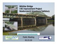
<strong>Whittier</strong> <strong>Bridge</strong>/I-<strong>95</strong> <strong>Improvement</strong> <strong>Project</strong> EA/DEIR<br />
9.0 <strong>Programmatic</strong> <strong>Section</strong> 4(f)<br />
Evaluation<br />
9.1 INTRODUCTION<br />
The Massachusetts Department of Transportation – Highway Division<br />
(MassDOT) proposes to use federal funds to replace the John Greenleaf<br />
<strong>Whittier</strong> Memorial <strong>Bridge</strong> (A-07-016=N-11-017) (<strong>Whittier</strong> <strong>Bridge</strong>), which<br />
carries Interstate <strong>95</strong> (I-<strong>95</strong>) over the Merrimack River between the Town of<br />
Amesbury and the City of Newburyport, Massachusetts (Figure 9-1). The<br />
<strong>Whittier</strong> <strong>Bridge</strong> is a historic property that is eligible for individual listing in<br />
the National Register of Historic Places (National Register) as one of three<br />
bridges in Massachusetts identified on the Federal Highway<br />
Administration’s (FHWA) “Final List of Nationally and Exceptionally<br />
Significant Features of the Federal Interstate Highway System,” published<br />
in the Federal Register on December 19, 2006.<br />
9.1.1 Regional Context<br />
I-<strong>95</strong> is the major north-south interstate highway on the U.S. eastern<br />
seaboard extending from Miami, Florida to the Canadian border at<br />
Houlton, Maine. It is the longest north-south highway in the interstate<br />
system (approximately 1,925 miles) and connects more states—15—than<br />
any other interstate highway. I-<strong>95</strong> passes through and links several major<br />
metropolitan areas, including Miami, Florida; Washington, DC; Baltimore,<br />
Maryland; Philadelphia, Pennsylvania; New York, New York; and Boston,<br />
Massachusetts.<br />
In New England, I-<strong>95</strong> serves as a principal route directly linking five of the<br />
six New England states, and provides a connection to the maritime<br />
provinces of Canada, and the Trans-Canada Highway.<br />
In Massachusetts, I-<strong>95</strong> serves as both a major commuter route to New<br />
Hampshire and Maine, and to Boston from the North Shore area of<br />
Massachusetts, and as a recreational gateway to New Hampshire and<br />
southern Maine. As such, traffic volumes reflect both weekday and<br />
weekend traffic patterns. Summer weekend volumes, northbound on<br />
Saturday mornings and southbound on Sunday evenings (or Monday<br />
evening on three-day holiday weekends), are higher than normal weekday<br />
commuting volumes. Weekday peak periods coincide with Boston<br />
commuter travel patterns – southbound in the morning and northbound in<br />
the afternoon.<br />
FIGURE 9-1:<br />
LOCUS MAP<br />
9.1.2 Regional Interstate Geometry<br />
The current six-lane cross section of I-<strong>95</strong> from immediately south of<br />
<strong>Whittier</strong> <strong>Bridge</strong> north to Exit 57 does not match the eight-lane cross<br />
section existing immediately south and north of the project limits and does<br />
not meet the current American Association of State and Highway<br />
Transportation Officials (AASHTO) standards for consistency of the number<br />
of travel lanes.<br />
According to AASHTO’s Geometric Design of Highways and Streets, an<br />
important highway design principle is that the number of travel lanes<br />
should be consistent along any major route “... irrespective of changes in<br />
traffic volumes” to provide for safe travel conditions. The intent is that the<br />
basic number of lanes (in this case, eight lanes) should be established for a<br />
substantial length of freeway and should not be changed through pairs of<br />
interchanges irrespective of traffic volumes entering or leaving the<br />
highway at any one interchange. The latter situation does not provide for a<br />
consistent driving experience and does not provide for safe operating<br />
conditions. Figure 9-2 illustrates the general location of the six-lane<br />
segment of 1-<strong>95</strong> in relation to the adjoining eight-lane sections.<br />
9.1.3 Congestion<br />
Existing (2007) weekend peak-hour traffic volumes show unacceptable<br />
operating conditions in segments of the project corridor, particularly at the<br />
<strong>Whittier</strong> <strong>Bridge</strong> and its approaches and in the segment in between I-4<strong>95</strong><br />
and Route 286 at the northern end of the corridor.<br />
By 2030, weekend peak-hour traffic volumes within the six-lane I-<strong>95</strong><br />
project corridor are projected to result in unacceptable operating<br />
conditions and substandard levels of service (LOS) without additional<br />
capacity (widening to a consistent eight-lane cross section). Table 9-1 lists<br />
the segments of the project corridor and the existing (2007) and projected<br />
(2030) LOS.<br />
TABLE 9-1:<br />
EXISTING (2007) AND PROJECTED NO BUILD (2030) LEVEL OF<br />
SERVICE – CURRENT LANE CONFIGURATION<br />
I-<strong>95</strong> (northbound)<br />
Saturday AM<br />
I-<strong>95</strong> (southbound)<br />
Sunday PM<br />
Segment<br />
Existing<br />
(2007)<br />
No Build<br />
(2030)<br />
Existing<br />
(2007)<br />
No Build<br />
(2030)<br />
North of Route 113 B D B E<br />
<strong>Whittier</strong> <strong>Bridge</strong> D D D E<br />
Route 110 to I-4<strong>95</strong> C F C C<br />
I-4<strong>95</strong> to Route 286 D F D F<br />
I-<strong>95</strong> in the project corridor is classified as a rural interstate highway, and<br />
LOS C is the minimum acceptable design standard for this classification.<br />
For segments of the project corridor north of Route 113, with the<br />
exception of the I-<strong>95</strong> southbound segment between the I-<strong>95</strong> off-ramp to<br />
I-4<strong>95</strong> southbound and the Route 110 interchange, LOS is projected to<br />
degrade to LOS D or LOS F by 2030 without capacity improvements such as<br />
an additional travel lane in each direction.<br />
Peak-hour traffic operations on the <strong>Whittier</strong> <strong>Bridge</strong> exhibit LOS D<br />
conditions and the existing highway geometry on the bridge fails to meet<br />
current FHWA Interstate Highway Standards. The existing shoulders on the<br />
<strong>Whittier</strong> <strong>Bridge</strong> and approaches are substandard (any shoulder less than 6<br />
feet wide degrades the performance of the roadway segment). The<br />
existing bridge shoulders are less than 2 feet wide and because of<br />
substandard outside shoulder widths, there is a high occurrence of<br />
vehicles losing control and striking bridge supports or guardrails in areas<br />
where there is no breakdown lane.<br />
9-1