Opening Access to Scenario Planning Tools - Knight Foundation ...
Opening Access to Scenario Planning Tools - Knight Foundation ...
Opening Access to Scenario Planning Tools - Knight Foundation ...

You also want an ePaper? Increase the reach of your titles
YUMPU automatically turns print PDFs into web optimized ePapers that Google loves.
Policy Focus Report • Lincoln Institute of Land Policy<br />
<strong>Opening</strong> <strong>Access</strong> <strong>to</strong><br />
<strong>Scenario</strong> <strong>Planning</strong> <strong>Tools</strong><br />
Jim Holway, C.J. Gabbe, Frank Hebbert,<br />
Jason Lally, Robert Matthews, and Ray Quay
<strong>Opening</strong> <strong>Access</strong> <strong>to</strong> <strong>Scenario</strong> <strong>Planning</strong> <strong>Tools</strong><br />
Jim Holway, C.J. Gabbe, Frank Hebbert, Jason Lally,<br />
Robert Matthews, and Ray Quay<br />
Policy Focus Report Series<br />
The policy focus report series is published by the Lincoln Institute of Land Policy <strong>to</strong> address<br />
timely public policy issues relating <strong>to</strong> land use, land markets, and property taxation. Each report<br />
is designed <strong>to</strong> bridge the gap between theory and practice by combining research findings, case<br />
studies, and contributions from scholars in a variety of academic disciplines, and from professional<br />
practitioners, local officials, and citizens in diverse communities.<br />
About This Report<br />
This report examines the current state of scenario planning, the promise of scenario planning<br />
<strong>to</strong>ols <strong>to</strong> help us prepare for the future, the challenges <strong>to</strong> expanding their use, and their potential<br />
<strong>to</strong> open access <strong>to</strong> the planning process. It makes specific recommendations <strong>to</strong> advance the use<br />
of scenarios and scenario planning <strong>to</strong>ols, including development of an online platform <strong>to</strong> facilitate<br />
collaboration, capacity building, and open source activities among scenario <strong>to</strong>ol developers,<br />
urban planners, and other <strong>to</strong>ols users.<br />
The authors review existing research and experience with scenario planning and document the<br />
results of a series of workshops and conversations convened by the Lincoln Institute of Land<br />
Policy and the Sonoran Institute in 2010 and 2011. Participants included professional and citizen<br />
planners who practice scenario planning, academics researching scenario planning, and experts<br />
who develop <strong>to</strong>ols <strong>to</strong> support scenario planning. The goals of this ongoing project are <strong>to</strong> synthesize<br />
what is known about how scenarios are being used for community and regional planning,<br />
collect data on the <strong>to</strong>ols being used <strong>to</strong> assist this planning, and identify the most important<br />
means <strong>to</strong> advance scenario planning <strong>to</strong> benefit future community needs. A new website,<br />
www.<strong>Scenario</strong><strong>Planning</strong><strong>Tools</strong>.org, will be the online host for this initiative.<br />
Copyright © 2012 by Lincoln Institute of Land Policy<br />
All rights reserved.<br />
113 Brattle Street<br />
Cambridge, MA 02138-3400 USA<br />
Phone: 617-661-3016 or 800-526-3873<br />
Fax: 617-661-7235 or 800-526-3944<br />
Email: help@lincolninst.edu<br />
Web: www.lincolninst.edu<br />
ISBN 978-1-55844-231-3<br />
Policy Focus Report/Code PF031<br />
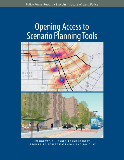
On the cover:<br />
Visualizations for Superstition Vistas<br />
in Arizona. See pages 5 and 15.
. . . . . . . . . . . . . . . . . . .<br />
Contents<br />
2 Executive Summary<br />
4 Chapter 1. <strong>Scenario</strong> <strong>Planning</strong>’s Potential<br />
5 The Goal of <strong>Scenario</strong> <strong>Planning</strong><br />
5 Key Concepts<br />
9 Chapter 2. <strong>Scenario</strong> <strong>Planning</strong> Practice: State of the Art<br />
10 The Uses and Users of <strong>Scenario</strong>s<br />
14 Emerging Practice<br />
17 Summary<br />
18 Chapter 3. <strong>Scenario</strong> <strong>Planning</strong> <strong>Tools</strong>: State of the Art<br />
20 Leading <strong>Scenario</strong> <strong>Planning</strong> <strong>Tools</strong><br />
26 The Future of <strong>Scenario</strong> <strong>Planning</strong> <strong>Tools</strong><br />
29 Summary<br />
30 Chapter 4. Challenges <strong>to</strong> Using <strong>Scenario</strong> <strong>Planning</strong> <strong>Tools</strong><br />
31 Skepticism and Lack of Awareness<br />
33 Complexity and High Cost<br />
34 Difficulties in Obtaining and Using Data<br />
35 Lack of Interoperability across <strong>Tools</strong><br />
36 Need for Foresight and Anticipation<br />
37 Summary<br />
38 Chapter 5. Opportunities <strong>to</strong> Expand the Use of <strong>Scenario</strong> <strong>Planning</strong> <strong>Tools</strong><br />
38 Encouraging Acceptance of <strong>Scenario</strong> <strong>Planning</strong> and <strong>Tools</strong><br />
39 Reducing Complexity and Cost<br />
40 <strong>Opening</strong> <strong>Access</strong> <strong>to</strong> Data<br />
41 Enhancing Interoperability across <strong>Tools</strong><br />
42 Advancing Foresight and Anticipation<br />
43 Creating an Open Environment for Collaborative Action<br />
45 Chapter 6. Recommendations for Action<br />
49 Glossary<br />
50 References<br />
51 Resources<br />
52 Appendix: <strong>Scenario</strong> <strong>Planning</strong> <strong>Tools</strong> Survey<br />
54 Acknowledgments and Workshop Participants<br />
56 About the Authors<br />
57 About the Lincoln Institute of Land Policy, the Sonoran Institute,<br />
and Western Lands and Communities<br />
opening access <strong>to</strong> <strong>Scenario</strong> <strong>Planning</strong> <strong>Tools</strong> 1
. . . . . . . . . . . . . . . . . . .<br />
Executive Summary<br />
© Ray Quay<br />
Participants in an Urban<br />
Land Institute Reality<br />
Check scenario planning<br />
exercise in Arizona<br />
use LEGO® bricks <strong>to</strong><br />
indicate locations for<br />
new development.<br />
In the face of increasing complexity and<br />
uncertainty, planners, public officials,<br />
and community residents need new <strong>to</strong>ols<br />
<strong>to</strong> anticipate and shape the future. This<br />
report examines the current state of scenario<br />
planning and scenario planning <strong>to</strong>ols that<br />
can help communities and regions prepare<br />
for that future through a variety of visioning,<br />
land use, transportation, and other planning<br />
efforts. It approaches this <strong>to</strong>pic as an opportunity<br />
for using open source software and<br />
processes <strong>to</strong> foster the development, better<br />
understanding, and use of these <strong>to</strong>ols.<br />
Decisions about the future are often controversial<br />
due <strong>to</strong> competing economic interests,<br />
different cultural values, and divergent<br />
views about property rights and the role<br />
of government. Broader and more effective<br />
civic engagement is needed <strong>to</strong> ensure community<br />
support for decisions about development<br />
and other land-related policies and<br />
public investments. The traditional predictand-plan<br />
paradigm is inadequate <strong>to</strong> address<br />
all of these challenges. We need <strong>to</strong> move<br />
<strong>to</strong>ward developing and implementing<br />
planning <strong>to</strong>ols and processes that foster<br />
anticipation and adaptation.<br />
<strong>Scenario</strong> planning is a promising method<br />
<strong>to</strong> help communities respond <strong>to</strong> these challenges.<br />
It deals with a range of potential<br />
futures, whether for regional visioning, comprehensive<br />
planning, or project site planning,<br />
2 policy focus report Lincoln Institute of Land Policy
. . . . . . . . . . . . . . . . . . .<br />
and provides decision makers, experts, and<br />
the public better and more comprehensible information<br />
on what these futures might mean<br />
for their communities. However, despite their<br />
potential, scenario planning <strong>to</strong>ols have not<br />
been employed widely for a number of reasons.<br />
Three concepts are considered <strong>to</strong> be critical<br />
<strong>to</strong> the scenario planning and <strong>to</strong>ol-building<br />
process: collaboration, capacity building, and<br />
creation of an open environment for engagement.<br />
Collaborative problem solving facilitates<br />
resolution of interrelated issues that cannot be<br />
resolved by one organization alone. Capacity<br />
building is needed <strong>to</strong> enable individuals and organizations<br />
<strong>to</strong> apply scenario planning methods<br />
and <strong>to</strong>ols effectively <strong>to</strong> their specific planning<br />
concerns. An open environment for information<br />
sharing and education will help accelerate the<br />
use and improvement of scenario planning<br />
<strong>to</strong>ols in multiple settings.<br />
The Lincoln Institute of Land Policy and<br />
Sonoran Institute, with other partners, have<br />
convened a community of software developers,<br />
planners, and other <strong>to</strong>ol users concerned with<br />
the advancement of scenario planning. Participants<br />
in our recent workshops concluded that<br />
future efforts should focus on five key opportunities:<br />
increasing understanding and acceptance<br />
of scenario planning; overcoming the complexity<br />
and cost of <strong>to</strong>ols; improving access <strong>to</strong> existing<br />
data; enhancing interoperability among different<br />
<strong>to</strong>ols; and creating mechanisms <strong>to</strong> integrate<br />
foresight and anticipation in<strong>to</strong> planning processes<br />
and implementation.<br />
The emergence of new and improved scenario<br />
planning <strong>to</strong>ols over the last 10 years offers<br />
promise that the use of scenario planning can<br />
increase and that the goal of providing open<br />
access <strong>to</strong> the full potential of scenario planning<br />
<strong>to</strong>ols is within reach. This report recommends<br />
seven immediate actions that are either in<br />
process or could be implemented quickly <strong>to</strong><br />
facilitate this goal. The community of <strong>to</strong>ol<br />
developers and users is already working on<br />
various related efforts, and a new website,<br />
www.<strong>Scenario</strong><strong>Planning</strong><strong>Tools</strong>.org, will be the<br />
online host for this initiative.<br />
• Create an online platform <strong>to</strong> foster<br />
collaboration in the development and<br />
application of scenario planning <strong>to</strong>ols.<br />
• Develop a curriculum on scenario<br />
planning for the next generation of<br />
professional and citizen planners.<br />
• Establish a model process for conducting<br />
scenario planning and show how it can be used<br />
with existing community planning processes.<br />
• Illustrate different uses of scenario<br />
planning <strong>to</strong>ols in various stages of the<br />
planning process <strong>to</strong> facilitate increased use<br />
of scenario planning.<br />
• Establish data standards <strong>to</strong> improve<br />
information sharing, starting with development<br />
and place types for land use patterns.<br />
• Initiate a model collaborative project<br />
<strong>to</strong> demonstrate the potential for integrated<br />
<strong>to</strong>ols, models, and modules.<br />
• Advance new concepts of anticipa<strong>to</strong>ry governance<br />
by using foresight and anticipation<br />
<strong>to</strong> address uncertainty and future challenges.<br />
opening access <strong>to</strong> <strong>Scenario</strong> <strong>Planning</strong> <strong>Tools</strong> 3
. . . . . . . . . . . . . . . . . . .<br />
Chapter 1<br />
<strong>Scenario</strong> <strong>Planning</strong>’s Potential<br />
© Design Centre for Sustainability, University of British Columbia, Vancouver.<br />
Residents<br />
participate in a<br />
design charrette<br />
in North<br />
Vancouver.<br />
<strong>Planning</strong> for the future of the places<br />
we inhabit has become increasingly<br />
challenging. The social, economic,<br />
environmental, and infrastructure<br />
systems that sustain us have become more<br />
complex and interdependent, and uncertainty<br />
about future changes remains high.<br />
A deeper understanding of sustainability has<br />
extended the planning horizon <strong>to</strong> 50 years<br />
and beyond, far longer than the terms of<br />
most politicians and the careers of <strong>to</strong>day’s<br />
planners and administra<strong>to</strong>rs.<br />
Communities, cities, and regions across<br />
the country face a wide range of concerns<br />
in making their places more sustainable,<br />
and responding <strong>to</strong> these challenges often<br />
requires anticipating future conditions and<br />
making decisions about a community’s<br />
policy options, community services, and<br />
infrastructure investments. Such decisions<br />
may be controversial because of competing<br />
economic interests, differing cultural values,<br />
and divergent political views on issues such<br />
as property rights and the role of government.<br />
In recent years these conflicts have become<br />
even more acute. Consequently, broader<br />
and more effective civic engagement is<br />
needed <strong>to</strong> ensure community support for<br />
decisions about development policies and<br />
investments in a community’s future.<br />
Decision makers generally seek simplicity<br />
in the process of public policy development,<br />
4 policy focus report Lincoln Institute of Land Policy
. . . . . . . . . . . . . . . . . . .<br />
but this is difficult <strong>to</strong> achieve in an environment<br />
of complexity, uncertainty, long-term<br />
planning horizons, and broad civic engagement.<br />
Over the last few decades scenario<br />
planning has emerged as a promising method<br />
<strong>to</strong> help decisions makers and the public respond<br />
<strong>to</strong> these challenges. <strong>Tools</strong> that facilitate<br />
the use and analysis of scenarios have not<br />
been widely employed, although they have<br />
the potential <strong>to</strong> inform a large number of<br />
planning activities. This report explores ways<br />
<strong>to</strong> expand the development and effective use<br />
of scenario planning by opening up access<br />
<strong>to</strong> the <strong>to</strong>ols for both users and <strong>to</strong>ol developers.<br />
The goal of<br />
<strong>Scenario</strong> <strong>Planning</strong><br />
Complexity and uncertainty need not be<br />
barriers <strong>to</strong> planning the long-term future.<br />
While it is impossible <strong>to</strong> optimize for every<br />
possible beneficial outcome or feasible<br />
future, scenario planning is designed <strong>to</strong><br />
put better information about alternative<br />
futures in the hands of decision makers,<br />
experts, and the public. Emerging methods<br />
and <strong>to</strong>ols can enable new approaches <strong>to</strong><br />
planning that were not even envisioned<br />
by the profession a decade ago (figure 1).<br />
The goal of scenario planning is <strong>to</strong><br />
provide a comprehensive view of the interrelated<br />
pros and cons of potential futures by<br />
breaking out of traditional decision-making<br />
silos. As uncertainty increases and available<br />
resources decrease, it becomes more important<br />
<strong>to</strong> consider the full range of emerging<br />
conditions and the community’s ability <strong>to</strong><br />
adopt policies and pursue investments that<br />
will be resilient across a variety of potential<br />
futures. <strong>Scenario</strong> planning is an effective way<br />
<strong>to</strong> specify and assess these futures, whether<br />
for regional visioning, comprehensive planning,<br />
or project site planning (Kwartler<br />
and Longo 2008).<br />
Key Concepts<br />
Three concepts are recognized as being<br />
critical <strong>to</strong> the scenario planning and <strong>to</strong>olbuilding<br />
process: collaboration, capacity<br />
building, and creation of an open environment<br />
for engagement.<br />
Figure 1<br />
A Possible <strong>Scenario</strong> for a Down<strong>to</strong>wn Transit S<strong>to</strong>p in Superstition Vistas in Arizona<br />
Source: Fregonese Associates, Inc.<br />
opening access <strong>to</strong> <strong>Scenario</strong> <strong>Planning</strong> <strong>Tools</strong> 5
. . . . . . . . . . . . . . . . . . .<br />
Collaboration<br />
Collaborative problem solving facilitates resolution<br />
of interrelated issues that previously<br />
seemed <strong>to</strong>o complex for one organization <strong>to</strong><br />
resolve alone. An important aspect of collaboration<br />
is inclusive and authentic dialogue<br />
that augments individual and organizational<br />
capacity <strong>to</strong> engage in collective problem<br />
solving (Innes and Booher 2010).<br />
Knowledge of the problem at hand and<br />
the shared values and ideas of other stakeholders<br />
increases the collective ability <strong>to</strong><br />
innovate and achieve solutions. Another<br />
element of effective collaboration is the<br />
provision of open access <strong>to</strong> information for<br />
all stakeholders and a forum where engagement<br />
and dialogue is open <strong>to</strong> all.<br />
The types of organizations and individuals<br />
that need <strong>to</strong> participate in this process<br />
can be grouped in<strong>to</strong> several categories, with<br />
the recognition that some individuals may<br />
identify with more than one group.<br />
• <strong>Scenario</strong> planning and <strong>to</strong>ol advocates:<br />
Organizations and individuals interested<br />
in furthering the use of scenario planning<br />
and scenario planning <strong>to</strong>ols through<br />
outreach, funding, and other activities;<br />
• Tool developers: <strong>Planning</strong> firms, universities,<br />
nonprofit organizations, or software<br />
developers who are writing, selling,<br />
and supporting software for scenario<br />
planning;<br />
• Professional and citizen planners:<br />
Government agencies, organizations,<br />
and individuals using scenario planning<br />
and scenario planning <strong>to</strong>ols within<br />
public planning processes; and<br />
• Academic educa<strong>to</strong>rs and researchers:<br />
Faculty and researchers working, studying,<br />
and conducting research <strong>to</strong> advance<br />
scenario planning <strong>to</strong>ols within a university,<br />
private consulting firm, or nonprofit<br />
organization.<br />
Capacity Building<br />
<strong>Scenario</strong> planning is a not an end in itself,<br />
but rather a general method used within a<br />
larger planning context <strong>to</strong> address community<br />
or regional issues. The current capacity<br />
of planning professionals <strong>to</strong> apply scenario<br />
planning is often limited by their lack of<br />
knowledge of the method and limited<br />
access <strong>to</strong> the available <strong>to</strong>ols. <strong>Scenario</strong> planning<br />
continues <strong>to</strong> evolve as new techniques<br />
are developed in public policy practice that<br />
draw on research in fields beyond regional<br />
and community planning, such as climate<br />
change adaptation and water resource<br />
management. A transfer of knowledge and<br />
expertise from these and related fields is<br />
needed <strong>to</strong> incorporate these new techniques<br />
in<strong>to</strong> community and regional planning and<br />
<strong>to</strong> adapt the current generation of scenario<br />
planning <strong>to</strong>ols for future situations.<br />
Significant resources, including time,<br />
data, expertise, and funds, are also required<br />
<strong>to</strong> use the scenario planning processes and<br />
<strong>to</strong>ols discussed in this report. The capacity<br />
of organizations and individuals <strong>to</strong> use<br />
scenario planning processes and <strong>to</strong>ols is a<br />
function of the knowledge of those involved<br />
and the ability of the organization <strong>to</strong> commit<br />
resources <strong>to</strong> the effort. Enhancing the<br />
capacity of users, organizations, and <strong>to</strong>ol<br />
developers through an open environment<br />
of information sharing and education<br />
will accelerate and improve their use<br />
over time.<br />
Open Source Environment<br />
The full potential for collaboration and<br />
capacity building is not likely <strong>to</strong> be realized<br />
in the same environment that gave rise <strong>to</strong><br />
existing scenario planning <strong>to</strong>ols. Their development<br />
over the last decade has been<br />
in a closed environment, with each <strong>to</strong>ol<br />
carving out its own, often proprietary,<br />
market. Interaction among users occurred<br />
6 policy focus report Lincoln Institute of Land Policy
. . . . . . . . . . . . . . . . . . .<br />
primarily among those using a particular<br />
scenario planning <strong>to</strong>ol or underlying geographic<br />
information system (GIS) platform.<br />
This approach is inadquate <strong>to</strong> address the<br />
challenges involved in expanding the use<br />
of scenario planning and scenario planning<br />
<strong>to</strong>ols. Collaboration is now being facilitated<br />
by Internet-enabled <strong>to</strong>ols that create open<br />
environments for authentic dialogue, changing<br />
the model for advancing science and<br />
policy (Nielsen 2012).<br />
One concept that has been demonstrated<br />
<strong>to</strong> create environments of open collaboration<br />
and capacity building is known as “open<br />
source.” In software development, where it<br />
originated, this concept means that a group<br />
openly collaborates <strong>to</strong> create a product or<br />
service, which is then made freely available<br />
<strong>to</strong> all. In the case of software, this also involves<br />
open access <strong>to</strong> the underlying source<br />
code of the program, hence the terms<br />
“open” and “source.”<br />
Many people who use “free” software<br />
such as Wikipedia and Mozilla Firefox are<br />
familiar with open source products. Yet,<br />
open source embodies more than specific<br />
products. It is a way of thinking and approaching<br />
complex problems, predicated<br />
on the idea that a better result can be forged<br />
through collaboration and exchange rather<br />
than through traditional production methods<br />
(box 1, p. 8). In simple terms, open source<br />
is about a share-and-share-alike philosophy<br />
that can be applied <strong>to</strong> both the development<br />
of scenario planning <strong>to</strong>ols and the approach<br />
taken <strong>to</strong> solve community and regional<br />
problems.<br />
Many in the planning field are familiar<br />
with case studies and best practices, and<br />
the concept of compiling them is, at its root,<br />
similar <strong>to</strong> open source collaboration and<br />
Figure 2<br />
Successful Communities Online Toolkit Information<br />
Exchange (SCOTie)<br />
Source: Sonoran Institute.<br />
standards. Communities, institutions, and<br />
firms disseminate successes and failures so<br />
that others can learn, modify, and adapt.<br />
The Successful Communities Online Toolkit<br />
(Sonoran Institute 2012) is such an example<br />
(figure 2). Ideally, these lessons would be<br />
shared through both physical and virtual<br />
networks. In addition, a <strong>to</strong>ol that allows<br />
others <strong>to</strong> comment and improve on planning<br />
problem statements, methods, data, and<br />
best practices, and then makes these refinements<br />
available <strong>to</strong> all users, is one of many<br />
potential outcomes in applying open source<br />
thinking <strong>to</strong> planning problems.<br />
opening access <strong>to</strong> <strong>Scenario</strong> <strong>Planning</strong> <strong>Tools</strong> 7
. . . . . . . . . . . . . . . . . . .<br />
Box 1<br />
Open Source Thinking<br />
The core concept of open source is the freedom <strong>to</strong> obtain and modify the source code<br />
of existing software and carry out the creation of new software and <strong>to</strong>ols through an<br />
open, collaborative process. Technology provides the functionality <strong>to</strong> facilitate collaboration<br />
over distance and time, while online bug tracking and au<strong>to</strong>mated testing and code conflict<br />
resolution make it easier <strong>to</strong> build open source <strong>to</strong>ols. An open source approach, however,<br />
does not mean the software is “free.” The costs of software maintenance and installation,<br />
data management, training, and staffing continue <strong>to</strong> fall primarily on the user. Related <strong>to</strong><br />
GIS applications, examples of such development environments are MapWindows, OsGeo,<br />
and Open Geospatial Consortium.<br />
People are the most important aspect of open source efforts because the intellectual capital<br />
of programmers, coders, tinkerers, designers, and users provides the resources required <strong>to</strong><br />
build software collaboratively. In addition, legal frameworks in the form of special open source<br />
licenses allow participants <strong>to</strong> clearly understand the use of intellectual contributions and<br />
provide rules that guard against unfair use or misuse. A technical background is not necessary<br />
<strong>to</strong> be an open source contribu<strong>to</strong>r. In fact, feedback and requests from nontechnical<br />
users provide important guidance <strong>to</strong> improve <strong>to</strong>ols and enhance the user experience.<br />
Open source thinking does not eliminate the need for proprietary systems, nor does it discourage<br />
innovation or devalue proprietary <strong>to</strong>ols; rather it helps <strong>to</strong> improve them. Proprietary<br />
systems can participate in and benefit from an environment of collaboration, particularly<br />
through the adoption of consistent data input and output standards and improved interoperability<br />
among different software <strong>to</strong>ols. Additionally, open source efforts can significantly increase<br />
the points of interaction with <strong>to</strong>ols for new users and developers, thus benefiting both<br />
open source and proprietary systems.<br />
Software provided at no cost under an open source license need not eliminate financial<br />
benefits from supporting, enhancing, and distributing such software. Open source approaches<br />
can actually generate economic value through service models that allow <strong>to</strong>ol developers and<br />
consultants <strong>to</strong> charge for value added around open source software, as well as increase<br />
returns <strong>to</strong> proprietary products through the secondary effects of increasing the number<br />
and diversity of users (Krishnamurthy 2005; Riehle 2007).<br />
More broadly, open source approaches and thinking help participants succeed in an environment<br />
that promotes further adoption of scenario planning practice and enlarges the role for<br />
open source and proprietary <strong>to</strong>ols. Experience indicates that an open source approach <strong>to</strong> <strong>to</strong>ol<br />
interoperability and access <strong>to</strong> data can increase the relevance, adoption, and usability of all<br />
scenario planning <strong>to</strong>ols, as well as knowledge about the strengths and appropriate market<br />
niches of the different <strong>to</strong>ols.<br />
8 policy focus report Lincoln Institute of Land Policy
chapter 2<br />
<strong>Scenario</strong> <strong>Planning</strong> Practice:<br />
State of the Art<br />
. . . . . . . . . . . . . . . . . . .<br />
Figure 3<br />
Estimates of Greenhouse Gas Reductions Based on Alternative Land Use Options in Seattle, Washing<strong>to</strong>n<br />
n Estimated GHG reductions<br />
n Employment<br />
n Housing<br />
Source: Urban Land Institute/Seattle.<br />
<strong>Scenario</strong> planning methods have<br />
been used in the business community<br />
since the 1960s, but their<br />
application for urban and regional<br />
planning has been inconsistent (Hopkins and<br />
Zapata 2007). Over the last decade, however,<br />
scenario planning has begun <strong>to</strong> flourish,<br />
fueled by widely recognized successes, such<br />
as Envision Utah and other regional initiatives;<br />
by increasing uncertainty in social,<br />
economic, and environmental systems; and<br />
by faster computing, advances in visualization<br />
software, and increased availability of<br />
GIS and other data necessary <strong>to</strong> model<br />
these systems (figure 3).<br />
<strong>Scenario</strong> planning <strong>to</strong>day is being used<br />
<strong>to</strong> address a variety of planning issues<br />
across a wide range of scales, from largescale<br />
natural resource management <strong>to</strong> the<br />
evaluation of project site designs. In fact,<br />
scenario planning is now a required part<br />
of some public planning processes, including<br />
legislatively mandated greenhouse gas<br />
(GHG) reduction planning in California<br />
and Oregon and U.S. Department of Housing<br />
and Urban Development (HUD) grants<br />
opening access <strong>to</strong> <strong>Scenario</strong> <strong>Planning</strong> <strong>Tools</strong> 9
. . . . . . . . . . . . . . . . . . .<br />
for community sustainability. <strong>Scenario</strong> planning<br />
processes can vary substantially based<br />
on the issue being addressed, the institutions<br />
conducting the planning, and the information<br />
and resources available.<br />
This report focuses on scenario planning<br />
used with community and regional<br />
visioning, land use, transportation, and other<br />
planning efforts. <strong>Scenario</strong> planning in this<br />
context is frequently facilitated with GIS<br />
sketch planning <strong>to</strong>ols that allow the development<br />
and analysis of land use and<br />
transportation scenarios.<br />
The Uses and Users<br />
of <strong>Scenario</strong>s<br />
Urban and regional scenario planning <strong>to</strong>day<br />
falls on a continuum between two types of<br />
scenario planning: normative and explora<strong>to</strong>ry.<br />
Normative scenario planning is used<br />
<strong>to</strong> articulate the values of a community or<br />
region by eliciting people’s opinions about<br />
different possible visions of the future<br />
(Hopkins and Zapata 2007).<br />
Comparing the pros and cons of several<br />
scenarios allows a variety of values <strong>to</strong> be identified,<br />
in order <strong>to</strong> derive a common set of<br />
values or goals for the future of the community<br />
or region. In this type of planning the<br />
scenarios are frequently applied <strong>to</strong> major<br />
policy decisions that could have a substantial<br />
impact on the future form of the community,<br />
such as funding and locating transportation<br />
infrastructure or changing land use<br />
regulations. Each scenario is based on how<br />
the future may play out under a different<br />
policy approach.<br />
Groups of scenarios are often bookended<br />
by scenarios that represent a range between<br />
least and most aggressive actions relative <strong>to</strong><br />
a baseline “business-as-usual” or “no action”<br />
alternative. Assessment of the impacts of<br />
each scenario on indica<strong>to</strong>rs such as traffic<br />
congestion, infrastructure costs, air quality,<br />
open space, or affordable housing can help<br />
people articulate the pros and cons of each<br />
impact, and thus begin <strong>to</strong> articulate values<br />
and goals for the future. This is the type of<br />
scenario planning that has been used most<br />
commonly by local and regional planners<br />
and was notably successful in the Envision<br />
Utah planning process.<br />
The second type, explora<strong>to</strong>ry scenario<br />
planning, is used <strong>to</strong> anticipate the impact<br />
that different future conditions may have<br />
on values, policies, or goals that have been<br />
established or are being considered (Weber<br />
2006). The desired end result of such a process<br />
is a set of robust or contingent strategies<br />
that policy makers can use <strong>to</strong> achieve agreedupon<br />
goals under a wide variety of possible<br />
but uncertain futures. These scenarios are<br />
typically based on changes in environmental,<br />
social, or economic fac<strong>to</strong>rs that could<br />
affect the future of the community, yet<br />
are beyond local control, such as aging of<br />
the population, the state of the economy,<br />
population growth rates, and climate<br />
change.<br />
Each scenario is based on a different<br />
possible end state of one or more of these<br />
fac<strong>to</strong>rs, which are often selected <strong>to</strong> represent<br />
the full range of possible future conditions.<br />
Assessment of how each scenario affects<br />
the community’s ability <strong>to</strong> achieve its goals<br />
can be used <strong>to</strong> identify how potential change<br />
can create opportunities or threats and<br />
determine what strategies can be used <strong>to</strong><br />
avoid undesired changes or promote<br />
desired outcomes.<br />
The scenario planning <strong>to</strong>ols described<br />
in this report are found within the full range<br />
of the continuum between normative and<br />
explora<strong>to</strong>ry. They are used <strong>to</strong> develop land<br />
use and transportation scenarios at a range<br />
of scales, engage the public in participa<strong>to</strong>ry<br />
planning processes, and create visualizations<br />
for values and goal setting. The scenarios<br />
may be related <strong>to</strong> a desired community<br />
form, such as maximizing growth around<br />
10 policy focus report Lincoln Institute of Land Policy
. . . . . . . . . . . . . . . . . . .<br />
Figure 4<br />
2030 GHG Emissions Goals for Baltimore, Maryland<br />
2030 GHG Emission Goals<br />
Sequestration Areas<br />
Sequestration & Renewable Power Generation Areas<br />
3 <strong>to</strong>ns/capita/yr – Environmental Buffers/Agriculture<br />
15 <strong>to</strong>ns/capita/yr – Managed Growth Areas<br />
12 <strong>to</strong>ns/capita/yr – Priority Growth Areas<br />
8 <strong>to</strong>ns/capita/yr – Infill & Redevelopment Areas<br />
Source: Criterion Planners for Urban Land Institute/Baltimore.<br />
transit, identifying development and redevelopment<br />
opportunities, testing and refining<br />
regional transportation plans, or developing<br />
strategies for climate change mitigation and<br />
adaptation (figure 4). Explora<strong>to</strong>ry scenario<br />
planning is expected <strong>to</strong> become more<br />
important for developing sustainable approaches<br />
<strong>to</strong> address increasing uncertainty.<br />
The following sections describe three<br />
types of scenario planning users. The associated<br />
case examples introduce four specific<br />
<strong>to</strong>ols that are described in more detail in<br />
chapter 3: CommunityViz, Envision Tomorrow,<br />
INDEX, and I-PLACE 3 S.<br />
City and County Users<br />
<strong>Scenario</strong> planning uses within city and<br />
county planning activities include:<br />
• comprehensive and area planning;<br />
• transit corridor and station planning;<br />
• neighborhood planning;<br />
• infrastructure (water, sewer, street,<br />
and s<strong>to</strong>rm) planning;<br />
• project impact assessment;<br />
• climate change mitigation and<br />
adaptation strategies development; and<br />
• regula<strong>to</strong>ry analysis.<br />
For comprehensive and regional plans,<br />
a variety of existing <strong>to</strong>ols are available <strong>to</strong><br />
engage the public in a workshop setting<br />
or <strong>to</strong> develop scenarios of different development<br />
alternatives. The scenarios help test<br />
policies and prioritize strategies. <strong>Scenario</strong>s<br />
can also be utilized <strong>to</strong> demonstrate <strong>to</strong> stakeholders<br />
how key future conditions could<br />
impact their community and <strong>to</strong> consider<br />
which approaches may be most robust<br />
across a variety of potential future conditions.<br />
After a plan is completed, scenario planning<br />
<strong>to</strong>ols can be used <strong>to</strong> moni<strong>to</strong>r the<br />
plan’s status during implementation.<br />
At a smaller scale, scenario planning<br />
<strong>to</strong>ols can be used <strong>to</strong> develop and analyze<br />
design alternatives at a site plan or building<br />
scale for neighborhoods or transit stations<br />
and corridors. They can also be used <strong>to</strong><br />
understand the infrastructure capacity and<br />
demand timing implications of different<br />
land uses in the future. In addition, these<br />
<strong>to</strong>ols can be used <strong>to</strong> explore the implications<br />
of various zoning assumptions or proposals<br />
when rezoning or optimizing a community’s<br />
zoning code is being considered.<br />
opening access <strong>to</strong> <strong>Scenario</strong> <strong>Planning</strong> <strong>Tools</strong> 11
. . . . . . . . . . . . . . . . . . .<br />
figure 5<br />
Land Use Palette for <strong>Scenario</strong> Sketching<br />
in Elburn, Illinois<br />
DU=Dwelling Units<br />
MW= Megawatts<br />
Source: Criterion Planners; Condon, Cavens,<br />
and Miller (2008, 22).<br />
Net Acres<br />
Single Family<br />
10 DU/acre<br />
Single Family<br />
16 DU/acre<br />
High Density<br />
Residential<br />
30 DU/acre<br />
Retail<br />
45 jobs/acre<br />
Office<br />
80 jobs/acre<br />
Mixed-Use<br />
45 jobs/acre<br />
20 DU/acre<br />
Institutional<br />
12 jobs/acre<br />
Park<br />
Wind Farm<br />
0.05 MW/acre<br />
Transit Station Area, Elburn, Illinois<br />
Elburn, Illinois, with a population of approximately<br />
4,000, is located about 50 miles west of down<strong>to</strong>wn<br />
Chicago. The Metra commuter rail system extended<br />
a rail line <strong>to</strong> the community in 2005, with a station<br />
about four or five blocks from Elburn’s down<strong>to</strong>wn.<br />
In 2004, in anticipation of the rail station, the<br />
Urban Land Institute and the Campaign for Sensible<br />
Growth organized a technical assistance panel<br />
that worked with the community <strong>to</strong> identify strategies<br />
<strong>to</strong> accommodate inevitable growth while protecting<br />
the community’s sense of place and lifestyle.<br />
One recommendation was <strong>to</strong> encourage transi<strong>to</strong>riented<br />
development (TOD) on a 300-acre site<br />
southeast of the station. This site is now one of the<br />
community’s focus areas for future growth. Elburn<br />
used INDEX in a full-day digital charrette in<br />
which 60 residents and officials sketched alternative<br />
plans for a TOD site. Each alternative was analyzed<br />
for its impact on the community. Important design<br />
goals in using the <strong>to</strong>ol in this context were <strong>to</strong><br />
maintain the small block street grid of the adjacent<br />
his<strong>to</strong>ric down<strong>to</strong>wn and <strong>to</strong> protect wetlands on the<br />
site as part of the community’s “emerald necklace”<br />
of parks and streams that ring the down<strong>to</strong>wn<br />
(figure 5).<br />
Comprehensive Plan,<br />
Grand Junction, Colorado<br />
In 2007, the City of Grand Junction initiated<br />
a process <strong>to</strong> update its comprehensive plan, using<br />
CommunityViz as part of the public engagement<br />
process. The city hosted 27 citizen planner “chip<br />
games” during which residents used “chips” <strong>to</strong><br />
indicate on a map where and at what density they<br />
would like <strong>to</strong> see growth occur. The need for compact<br />
development was a theme echoed in each game. The<br />
results were collected, digitized, and analyzed with<br />
CommunityViz, and then shared with the public in<br />
subsequent workshops. As alternative land use plans<br />
were developed during the process, CommunityViz<br />
could dynamically update information in<strong>to</strong> the<br />
regional database <strong>to</strong> allow the testing of impacts<br />
on the transportation system. This iterative process<br />
12 policy focus report Lincoln Institute of Land Policy
. . . . . . . . . . . . . . . . . . .<br />
eventually revealed a preferred alternative scenario,<br />
and Grand Junction’s comprehensive plan was<br />
adopted in 2010.<br />
Figure 6<br />
Preferred <strong>Scenario</strong> Map for the Blueprint Land Use and<br />
Transportation Plan for the Sacramen<strong>to</strong> Region<br />
Metropolitan <strong>Planning</strong><br />
Organization Users<br />
Many scenario planning <strong>to</strong>ols have been<br />
developed <strong>to</strong> respond <strong>to</strong> regional growth<br />
challenges, and thus are particularly wellsuited<br />
<strong>to</strong> planning on a large scale. Metropolitan<br />
planning organizations (MPOs)<br />
tend <strong>to</strong> use these <strong>to</strong>ols <strong>to</strong> encompass a<br />
geography beyond individual cities and<br />
counties. Examples include regional transportation<br />
plans (RTPs), integrated regional<br />
land use and transportation plans, regional<br />
visioning, and plans <strong>to</strong> reach GHG reduction<br />
targets. The <strong>to</strong>ols are frequently linked<br />
with other models operated by MPOs,<br />
such as economic models, transportation<br />
models, and infrastructure models.<br />
Blueprint, Sacramen<strong>to</strong> Area<br />
Council of Governments<br />
In 2003, the Sacramen<strong>to</strong> Area Council of Governments<br />
(SACOG) launched an award-winning regional<br />
growth analysis called Blueprint. The analysis of<br />
six counties is based on a broad partnership of regional<br />
stakeholders including employers, developers,<br />
inves<strong>to</strong>rs, the press, special interest groups, and citizens.<br />
I-PLACE 3 S, an Internet-based planning <strong>to</strong>ol, was<br />
used <strong>to</strong> help SACOG work with elected officials and<br />
the public in dozens of interactive planning workshops.<br />
I-PLACE 3 S was used during the workshops<br />
<strong>to</strong> provide real-time information about how different<br />
growth alternatives would affect the region’s transportation<br />
system, air quality, housing, and natural<br />
resource protection, among other issues. Output from<br />
I-PLACE 3 S was also used as input <strong>to</strong> the SACOG<br />
regional travel model <strong>to</strong> estimate the impact of land<br />
use alternatives on travel and the transportation network.<br />
The result was a preferred Blueprint <strong>Scenario</strong><br />
that is used by SACOG with I-PLACE 3 S as a<br />
comparative scenario <strong>to</strong> review development proposals<br />
for its member agencies (figure 6).<br />
Note: El Dorado County was not able <strong>to</strong> directly participate in the Blueprint<br />
project that led <strong>to</strong> the SACOG Board’s adoption of the 2050 Blueprint concept<br />
map and growth principles. The land use pattern shown on this map<br />
represents SACOG’s expected growth in El Dorado County through 2035,<br />
the planning horizon year of the next Metropolitan Transportation Plan. For<br />
the other five counties in the SACOG region this map represents Blueprint<br />
growth through 2050.<br />
Source: Sacramen<strong>to</strong> Area Council of Governments.<br />
opening access <strong>to</strong> <strong>Scenario</strong> <strong>Planning</strong> <strong>Tools</strong> 13
. . . . . . . . . . . . . . . . . . .<br />
Conceptual Land Use <strong>Scenario</strong>, Southern<br />
California Association of Governments<br />
The Conceptual Land Use <strong>Scenario</strong> (CLUS) was<br />
developed for Southern California Association of<br />
Governments (SCAG) in response <strong>to</strong> the passage of<br />
Assembly Bill 32 (AB 32), which requires California<br />
<strong>to</strong> reduce statewide carbon emissions <strong>to</strong> 1990<br />
levels by the year 2020, and Senate Bill 375<br />
(SB 375), which calls for coordinated, regional<br />
land use and transportation planning <strong>to</strong> help reduce<br />
the state’s <strong>to</strong>tal carbon emissions. Because the region<br />
had <strong>to</strong> go beyond existing policy <strong>to</strong> meet the anticipated<br />
carbon emissions reduction target, SCAG decided<br />
<strong>to</strong> explore how far land use planning could go <strong>to</strong>ward<br />
reducing regional vehicle miles traveled. SCAG used<br />
Envision Tomorrow <strong>to</strong> isolate specific land use<br />
planning principles known <strong>to</strong> reduce trips—such<br />
as increased density, mixed land uses, and focused<br />
growth around transit areas—<strong>to</strong> evaluate how such<br />
changes might impact transportation patterns and<br />
reduce regional emissions.<br />
Nonprofit, Business, and<br />
Community Users<br />
Nonprofit, business, and community organizations<br />
at local and regional levels are taking<br />
a larger role in planning as they represent<br />
interests as diverse as environmental protection,<br />
community health, and social equity.<br />
These organizations often use scenarios <strong>to</strong><br />
advocate for their interests and ensure that<br />
their values are represented in decisions that<br />
will guide local and regional growth. Many<br />
of them also use scenario planning <strong>to</strong>ols <strong>to</strong><br />
test alternatives and assert their positions<br />
within community planning processes.<br />
Some nonprofit organizations, such as the<br />
Sonoran Institute, work directly with local<br />
jurisdictions <strong>to</strong> build technical capacity <strong>to</strong><br />
encourage the use of these <strong>to</strong>ols.<br />
Supporting Youth in Designing Sustainable<br />
Neighborhoods, Bos<strong>to</strong>n, Massachusetts<br />
A group of university and educational partners used<br />
CommunityViz for a program in which 200 Bos<strong>to</strong>narea<br />
high school students worked on projects related <strong>to</strong><br />
urban planning and sustainability. Students engaged<br />
in field studies before they began building and comparing<br />
neighborhood-scale scenarios in their weekly<br />
courses and intensive one-<strong>to</strong>-two-week-long workshops.<br />
Superstition Vistas, Arizona<br />
Superstition Vistas, a 275-square-mile tract of<br />
undeveloped state trust land in Arizona, is one of<br />
the largest pieces of land under single ownership in<br />
any metropolitan area. Its sensitive location is in the<br />
path of the fast-developing Sun Corridor that encompasses<br />
the region between Phoenix and Tucson.<br />
Envision Tomorrow was used <strong>to</strong> create six largescale<br />
scenarios, ranging from a trend scenario <strong>to</strong><br />
a compact, transit-oriented form (figure 7). The<br />
scenarios are being used <strong>to</strong> help guide future decision<br />
making about sustainable development for the<br />
Superstition Vistas site (Holway 2011).<br />
Emerging Practice<br />
The scenario planning practices and cases<br />
described above attempt <strong>to</strong> forecast what<br />
may happen <strong>to</strong> regions and communities<br />
under different policies that influence urban<br />
form and transportation. The goals of these<br />
planning efforts are <strong>to</strong> help communities<br />
decide what they want for their future<br />
(normative) and how they will achieve these<br />
aspirations under different possible future<br />
conditions (explora<strong>to</strong>ry). Tool developers<br />
acknowledge that the models included in<br />
their <strong>to</strong>ols are not intended <strong>to</strong> create a static<br />
prediction of the future; rather they create<br />
a reasonable estimation of what might<br />
occur given a defined set of assumptions.<br />
Even with advances in the science of<br />
systems modeling, the ability <strong>to</strong> predict the<br />
future is tenuous at best (Flyvbjerg, Holm,<br />
and Buhl 2005; Lempert and Schlesinger<br />
2000). It is impossible <strong>to</strong> model all of the functions<br />
and details of complex and dynamic<br />
social and environmental systems (Cox<br />
and Stephenson 2007), and their future<br />
is plagued with uncertainty (Brewer 1983;<br />
14 policy focus report Lincoln Institute of Land Policy
. . . . . . . . . . . . . . . . . . .<br />
Figure 7<br />
Three Possible <strong>Scenario</strong>s for the Development of Superstition Vistas in Arizona<br />
<strong>Scenario</strong> X <strong>Scenario</strong> A <strong>Scenario</strong> D<br />
0 0.9 1.8 2.7 Miles<br />
0 5,000 10,000 15,000 Feet<br />
Study Area<br />
Existing Road<br />
Creeks and Washes<br />
Central Arizona Project<br />
100 Year Floodplain<br />
Proposed Network<br />
Rail S<strong>to</strong>p<br />
Regional Rail<br />
Freeway<br />
Arizona Parkway<br />
Major Road<br />
Density<br />
Low<br />
Medium<br />
High<br />
Three of the six scenarios produced by the Superstition<br />
Vistas consultants illustrate the range of development intensity<br />
and developed area. <strong>Scenario</strong> X is the base case with no<br />
comprehensive planning. <strong>Scenario</strong> A has a minor density<br />
increase over current trends in other parts of the region.<br />
<strong>Scenario</strong> D focuses on high-density urban centers.<br />
Source: Superstition Vistas Consulting Team (2011).<br />
Pielke, Sarewitz, and Byerly 2000; Stewart<br />
2000; Waddell 2011). This unpredictability<br />
is exacerbated by unanticipated “black<br />
swan” events in politics, economics, nature,<br />
and technology, such as war and natural<br />
disasters, that can radically change the<br />
course of human events (Taleb 2007).<br />
Although few urban modelers would claim<br />
that their work rises <strong>to</strong> a level of prediction,<br />
when citizens are asked <strong>to</strong> choose a future<br />
and a decision path <strong>to</strong> get there, they are<br />
effectively relying on a prediction that<br />
following that path will lead <strong>to</strong> the future<br />
of their choice.<br />
Most physical planning <strong>to</strong>day forecasts a<br />
future trend or chooses a desired future and<br />
then identifies the decisions needed <strong>to</strong> serve<br />
or create that future (Hopkins and Zapata<br />
2007). We are more likely <strong>to</strong> be able <strong>to</strong><br />
predict the impacts of policy interventions<br />
if social and environmental systems are<br />
stationary or change very slowly and the<br />
planning horizon is relatively short (20 or<br />
fewer years). In addition, the implications<br />
of being wrong are less if funding for services<br />
and infrastructure is abundant and<br />
stable and the consequences of failure are<br />
not disastrous. Unfortunately, <strong>to</strong>day we face<br />
a number of issues, such as an interdependent<br />
global economy, cultural and demographic<br />
shifts, climate change, and political<br />
schism, which challenge such comfortable<br />
assumptions.<br />
It is evident that the traditional planning<br />
paradigm of predict-and-plan will not prove<br />
adequate <strong>to</strong> address these and other planning<br />
opening access <strong>to</strong> <strong>Scenario</strong> <strong>Planning</strong> <strong>Tools</strong> 15
. . . . . . . . . . . . . . . . . . .<br />
issues that society will face over the next 50<br />
years (Milly et al. 2008; National Research<br />
Council 2010). In response, a new model<br />
of anticipa<strong>to</strong>ry governance in planning<br />
practice considers a range of possible futures,<br />
prepares strategies <strong>to</strong> respond <strong>to</strong> one or<br />
more of these futures, and then adapts <strong>to</strong><br />
those changes as the future unfolds over<br />
time (Quay 2010).<br />
The concept of anticipa<strong>to</strong>ry governance<br />
entails three basic steps:<br />
1. Use foresight and futures analysis:<br />
Foresight is the act of looking forward <strong>to</strong><br />
what is possible. Though we cannot predict<br />
the future, we can anticipate a wide<br />
range of potential future conditions. Different<br />
scenarios can be based on expert<br />
opinion or developed using models that<br />
estimate future conditions across a range<br />
of values for one or more fac<strong>to</strong>rs. These<br />
are not normative scenarios <strong>to</strong> be compared<br />
or valued individually; rather they<br />
are used in aggregate <strong>to</strong> explore the<br />
sensitivity or risk of various fac<strong>to</strong>rs (e. g.,<br />
population, economy, climate) and their<br />
range of impacts. Such analysis clarifies<br />
uncertainty by helping planners identify<br />
and focus on the most important aspects<br />
of future possibilities.<br />
2. Anticipate adaptation: Using the<br />
futures analysis, potential actions <strong>to</strong><br />
adapt <strong>to</strong> particular futures are identified.<br />
These actions may be important <strong>to</strong> preserve<br />
future options or respond <strong>to</strong> specific<br />
potential changes. Such actions may be<br />
flexible, allowing incremental implementation,<br />
or they may be robust, working<br />
well across a large number of possible<br />
futures.<br />
3. Moni<strong>to</strong>r and adapt: On a regular<br />
basis the fac<strong>to</strong>rs related <strong>to</strong> the anticipated<br />
futures are moni<strong>to</strong>red <strong>to</strong> identify changes<br />
and the need <strong>to</strong> respond. As different scenarios<br />
become more or less likely, actions<br />
anticipated for them can be implemented<br />
or abandoned as appropriate. Given the<br />
long time frame for issues such as regional<br />
growth and climate change, planning and<br />
moni<strong>to</strong>ring time frames can span many<br />
decades. Thus educating future decision<br />
makers and institutionalizing these<br />
concepts is critical.<br />
Most applications of anticipa<strong>to</strong>ry governance<br />
have occurred in fields tangential <strong>to</strong><br />
community and regional planning, such as<br />
water resource planning, open space conservation,<br />
and climate change adaptation.<br />
An exception is its use in Urban Land Institute<br />
(ULI) Reality Check regional visioning<br />
projects in Maryland, Arizona, North Texas,<br />
and the Puget Sound area. These tactile<br />
exercises use LEGO ® bricks <strong>to</strong> allocate future<br />
growth on a game board map. Increasingly,<br />
these activities are tied <strong>to</strong> GIS analysis<br />
capabilities <strong>to</strong> generate multiple stakeholder<br />
scenarios (foresight) and scenario analysis<br />
methods <strong>to</strong> create robust regional planning<br />
strategies (anticipation).<br />
Vision North Texas,<br />
Dallas–Fort Worth, Texas<br />
Vision North Texas (VNT) is a grassroots regional<br />
visioning effort organized in 2005 as a publicprivate-academic<br />
partnership among North Central<br />
Texas Council of Governments, the North Texas<br />
District Council of ULI, and the University of<br />
Texas at Arling<strong>to</strong>n. The intent of this effort is <strong>to</strong><br />
move the region away from a business-as-usual<br />
model and <strong>to</strong>ward a more sustainable future. VNT<br />
conducted dozens of development principle exercises<br />
using LEGO ® bricks in different parts of the<br />
region, resulting in an ensemble of future urban<br />
form scenarios. Analysis revealed a range of perspectives<br />
<strong>to</strong>ward the region’s future urban form, yet<br />
there was consensus about the need for alternatives<br />
<strong>to</strong> inefficient and unsustainable suburban sprawl.<br />
Rather than selecting a single regional vision,<br />
VNT crafted four mutually inclusive visions (connected<br />
centers, return on investment, diverse distinct<br />
16 policy focus report Lincoln Institute of Land Policy
. . . . . . . . . . . . . . . . . . .<br />
Figure 8<br />
Vision North Texas: Preferred Physical Development Pattern for the Year 2050<br />
Fort worth<br />
Dallas<br />
Source: Vision North Texas (2010, 20).<br />
Key<br />
Mixed Use Centers<br />
Regional Center<br />
Metropolitan Center<br />
Policy Areas<br />
Natural<br />
Separate Communities<br />
Inner Tier<br />
Outer Tier<br />
Rural<br />
communities, and green region) that described the<br />
range of opinions and options on future urban form.<br />
An illustrative diagram of a preferred physical<br />
development pattern that embraced these options<br />
(figure 8), a set of 12 Guiding Principles, and<br />
policy recommendations addressing eight <strong>to</strong>pical<br />
investment areas provide flexible guidance for the<br />
region’s communities <strong>to</strong> craft sustainable futures<br />
that are unique <strong>to</strong> their location and politics.<br />
Summary<br />
<strong>Scenario</strong> planning has proven <strong>to</strong> be an<br />
effective method <strong>to</strong> address complex issues,<br />
such as community and regional growth<br />
planning, and new approaches are now<br />
emerging <strong>to</strong> help address highly uncertain<br />
challenges such as climate change adaptation.<br />
A number of specific scenario planning<br />
<strong>to</strong>ols have proven effective for facilitating<br />
a broad range of planning processes.<br />
opening access <strong>to</strong> <strong>Scenario</strong> <strong>Planning</strong> <strong>Tools</strong> 17
. . . . . . . . . . . . . . . . . . .<br />
chapter 3<br />
<strong>Scenario</strong> <strong>Planning</strong> <strong>Tools</strong>:<br />
State of the Art<br />
© Fregonese Associates, Inc.<br />
An example of a<br />
main street place type<br />
in the West Village<br />
neighborhood of<br />
Dallas, Texas.<br />
The specific types of scenario planning<br />
<strong>to</strong>ols examined here are often<br />
referred <strong>to</strong> as sketch planning <strong>to</strong>ols.<br />
These computer-based land use<br />
evaluation <strong>to</strong>ols are usable at multiple scales,<br />
including the site, district, city, and region.<br />
They can be applied quickly <strong>to</strong> illustrate<br />
and analyze land use and transportation<br />
alternatives based on indica<strong>to</strong>rs related<br />
<strong>to</strong> a community’s goals and issues.<br />
Users of these <strong>to</strong>ols typically create<br />
scenarios of future conditions in their community<br />
or region, frequently based on the<br />
expected impacts of public policies that will<br />
define a future urban form and transportation<br />
network. They then use the <strong>to</strong>ol <strong>to</strong> assess<br />
how well each scenario aligns with the community’s<br />
goals for the future. These <strong>to</strong>ols are<br />
a subset of the more general category called<br />
planning support systems (PSS) that includes<br />
other methodologies such as econometric<br />
and agent-based behavioral modeling<br />
(Brail 2008).<br />
The scenario planning <strong>to</strong>ols described<br />
below are based on a GIS or database system<br />
that can use different units of analysis.<br />
Traditional <strong>to</strong>ols started at the development<br />
or place-type scale, but many of them are<br />
now able <strong>to</strong> support modeling of individual<br />
buildings. A development or place-type <strong>to</strong>ol<br />
might include a <strong>to</strong>wn center or residential<br />
neighborhood, while a building-type <strong>to</strong>ol<br />
could include a retail s<strong>to</strong>re or a single-family<br />
home. One potential benefit of starting at<br />
the building scale as a unit of analysis is that<br />
it can more closely reflect the realities of<br />
local urban development patterns. One of<br />
the disadvantages in that type of analysis is<br />
an increase in the data and setup requirements<br />
for the model.<br />
18 policy focus report Lincoln Institute of Land Policy
. . . . . . . . . . . . . . . . . . .<br />
Like all modeling <strong>to</strong>ols, scenario planning<br />
<strong>to</strong>ols have limitations. Since they are inherently<br />
design-based, users must specify a set<br />
of assumptions or parameters. As a result,<br />
the scenario outputs are only as sound as<br />
the data and assumptions that go in<strong>to</strong> them.<br />
Some of the <strong>to</strong>ols are described as “black<br />
boxes,” with internal calculations that may<br />
not be transparent <strong>to</strong> all users, while others<br />
expose these calculations, including both data<br />
and assumptions. Nevertheless, the complexity<br />
of the combined assumptions, design<br />
decisions, and black box calculations means<br />
that these <strong>to</strong>ols have the potential <strong>to</strong> be<br />
misunders<strong>to</strong>od or used incorrectly.<br />
There is no substitute for a thorough<br />
and transparent review and understanding<br />
of all of the scenario assumptions. Greater<br />
transparency of underlying methods can<br />
be provided within the software itself (e.g.,<br />
CommunityViz) or through external documentation<br />
(e.g., INDEX). Being able <strong>to</strong><br />
“show the work” is important for catching<br />
errors and increasing the level of trust in<br />
the outputs that ultimately will inform decision<br />
making. In fact, most of the default<br />
assumptions are based on industry expertise<br />
or best practices, and the ability <strong>to</strong> explore<br />
changes <strong>to</strong> the underlying assumptions is an<br />
explicit part of the scenario design process.<br />
<strong>Scenario</strong> planning <strong>to</strong>ols and the uses <strong>to</strong><br />
which they are being applied have improved<br />
considerably since the 1990s (Brail 2008;<br />
Condon, Cavens, and Miller 2009). These<br />
planning <strong>to</strong>ols have evolved <strong>to</strong> help professional<br />
and citizen planners analyze development<br />
options and scenarios, and they may<br />
include fiscal impact models; simple local<br />
area population allocation models; water<br />
and sewer capacity and design models; local<br />
s<strong>to</strong>rm water and watershed flood models;<br />
trip generation models; and general and<br />
detailed environmental impact models<br />
(figure 9). Some of these <strong>to</strong>ols have been<br />
available commercially, while others have<br />
been available as free public domain or open<br />
source software. Some are based on simple<br />
spreadsheets, while others are highly<br />
complex dynamic models.<br />
Specialized <strong>to</strong>ols, including UrbanSIM,<br />
SLUETH, and What If ?, attempt <strong>to</strong> forecast<br />
future patterns of urban growth. They utilize<br />
methods such as cellular au<strong>to</strong>mata, econometric,<br />
and agent-based models <strong>to</strong> simulate<br />
the complex dynamics of land use allocation<br />
and development. They share some<br />
Figure 9<br />
Connecting 2D and 3D Information <strong>to</strong> Analyze Urban Conditions in Seattle, Washing<strong>to</strong>n<br />
Source: Decision Commons, University of Washing<strong>to</strong>n.<br />
opening access <strong>to</strong> <strong>Scenario</strong> <strong>Planning</strong> <strong>Tools</strong> 19
. . . . . . . . . . . . . . . . . . .<br />
Table 1<br />
Summary of <strong>Scenario</strong> <strong>Planning</strong> <strong>Tools</strong><br />
Tool CommunityViz Envision Tomorrow INDEX I-PLACE 3 S<br />
Developer<br />
Or<strong>to</strong>n Family <strong>Foundation</strong>,<br />
Middlebury, VT; Placeways,<br />
Boulder, CO<br />
Fregonese Associates, Portland,<br />
OR (Envision Tomorrow+ <strong>to</strong> be<br />
developed with University of<br />
Utah)<br />
Criterion Planners,<br />
Portland, OR<br />
Year Developed 2001; 2004–2005 2004 1994 2002<br />
Sacramen<strong>to</strong> (CA) Area<br />
Council of Governments<br />
Summary of Approach Spatial, GIS-based Spatial, GIS- and Excel-based Spatial, GIS-based Spatial, web-based<br />
Scale Building <strong>to</strong> regional Building <strong>to</strong> regional Place type <strong>to</strong> regional Place type <strong>to</strong> regional<br />
Open Source Status<br />
Proprietary with open<br />
access models<br />
Open source, housed at<br />
University of Utah<br />
Proprietary, in transition<br />
<strong>to</strong> open source<br />
2D Map Visualizations Yes Yes Yes Yes<br />
Open source<br />
3D Visualizations Yes No No No<br />
Cost<br />
$500 (Self service<br />
support) and $850 per<br />
user (one year support<br />
and upgrades)<br />
There is no cost associated<br />
with downloading Envision<br />
Tomorrow+.<br />
A standard version of<br />
Index PlanBuilder costs<br />
$1900.<br />
Contact SACOG<br />
Requirements<br />
Version 4.12, is<br />
compatible with ArcGIS<br />
9.2 and up, including 10.<br />
Windows XP, Windows<br />
Vista, or Windows 7<br />
(with MS .Net Framework<br />
2.0 and DirectX 9.0)<br />
is required.<br />
A Windows operating<br />
system and at least the<br />
basic version of ArcGIS<br />
Desk<strong>to</strong>p are required.<br />
Requires Windows XP or Vista,<br />
MS Office 2000 Pro or greater,<br />
and Esri’s ArcGIS desk<strong>to</strong>p<br />
software 9.3 or greater.<br />
The <strong>to</strong>ol supports all ArcGIS<br />
license types (ArcView,<br />
ArcEdi<strong>to</strong>r, and ArcInfo).<br />
Desk<strong>to</strong>p <strong>to</strong>ol requires<br />
Windows, MS Office 2000<br />
Pro with <strong>Access</strong>, and<br />
ArcGIS 9.3.<br />
Web <strong>to</strong>ol operates on<br />
Windows or Linux servers<br />
using a PostgreSQL/<br />
PostGIS database and a<br />
Python-centric application<br />
featuring Django, Mapnik,<br />
GEO/OGR, ExtJS,<br />
OpenLayers, and GeoExt.<br />
Requires an Internet<br />
browser, centralized<br />
server, a JAVA virtual<br />
engine, and access <strong>to</strong> an<br />
Esri ArcGIS application<br />
and license, which<br />
EcoInteractive maintains.<br />
I-PLACE 3 S works with<br />
both the integrated<br />
4-step travel model<br />
that requires a current<br />
Citilabs license, as well<br />
as any external travel<br />
model.<br />
similarities with the <strong>to</strong>ols discussed in this<br />
report, though they are much more complex.<br />
One distinct difference is that these specialized<br />
<strong>to</strong>ols forecast future land use as an output<br />
of the model, while most sketch planning<br />
<strong>to</strong>ols use a future land use alternative as input.<br />
The high-end computational and data needs<br />
of some <strong>to</strong>ols can limit their usefulness for<br />
sketch planning, but they are frequently used<br />
as either a precursor <strong>to</strong> create alternatives<br />
for input in<strong>to</strong> sketch planning <strong>to</strong>ols or <strong>to</strong><br />
examine sketch <strong>to</strong>ol outputs in more detail.<br />
Leading <strong>Scenario</strong><br />
<strong>Planning</strong> <strong>Tools</strong><br />
Four scenario planning <strong>to</strong>ols are used widely<br />
<strong>to</strong>day: CommunityViz, Envision Tomorrow,<br />
I-PLACE 3 S, and INDEX. Each of them<br />
provides a variety of features and unique<br />
capabilities, yet there is substantial overlap<br />
among them (table 1).<br />
CommunityViz<br />
CommunityViz is a 3D analysis and planning<br />
extension for ArcGIS that provides scenario<br />
planning, analysis, and 3D visualization<br />
(Walker and Daniels 2011). It was created<br />
by the Or<strong>to</strong>n Family <strong>Foundation</strong> and released<br />
in 2001. In 2004–2005, development and<br />
operations were spun off in<strong>to</strong> a new company<br />
called Placeways, which now markets<br />
and develops CommunityViz in partnership<br />
with the foundation.<br />
The software helps communities and<br />
20 policy focus report Lincoln Institute of Land Policy
. . . . . . . . . . . . . . . . . . .<br />
regions understand the implications of<br />
planning decisions and scenarios. It offers<br />
a range of <strong>to</strong>ols for community design and<br />
planning, including development of realistic<br />
3D models, build-out analysis, suitability<br />
analysis, impact assessment, and growth<br />
modeling. Public participation is a key focus,<br />
and the software includes numerous features<br />
<strong>to</strong> support public workshops and interactive<br />
sessions with diverse audiences. It has been<br />
used in conjunction with chip games and<br />
electronic meeting <strong>to</strong>ols, and as a facilitation<br />
<strong>to</strong>ol <strong>to</strong> help groups understand and make<br />
better planning decisions (figure 10).<br />
<strong>Scenario</strong> 360, the scenario analysis component,<br />
has easy-<strong>to</strong>-use exploration <strong>to</strong>ols,<br />
setup wizards for particular planning applications,<br />
standard impact calculations, and a<br />
sophisticated geospatial formula engine for<br />
creating cus<strong>to</strong>m models and analyses. The<br />
Common Impacts Wizard can produce<br />
up <strong>to</strong> 16 cus<strong>to</strong>m indica<strong>to</strong>rs based on userentered<br />
formulas. The Land Use Designer<br />
allows land use scenarios <strong>to</strong> be sketched on<br />
a map using predefined or user-cus<strong>to</strong>mized<br />
land use types. Users create their own scenarios<br />
for a region or community starting with<br />
existing GIS data and then sketch on the<br />
map or specify land use policies. Using builtin<br />
standard formulas or their own cus<strong>to</strong>m<br />
models, users measure how scenarios perform<br />
relative <strong>to</strong> user-defined objectives.<br />
A typical <strong>Scenario</strong> 360 analysis compares<br />
the implications of three or four scenarios<br />
using dozens or hundreds of indica<strong>to</strong>rs<br />
displayed in charts, maps, and tables.<br />
Weighted fac<strong>to</strong>rs can be changed <strong>to</strong> show<br />
how different values and priorities impact<br />
the final analysis. A real-time update capability<br />
allows users <strong>to</strong> change input settings,<br />
assumptions, and weightings, or <strong>to</strong> edit<br />
features on the map and get immediate<br />
updates that result from these changes.<br />
Specialized map editing capabilities provide<br />
a wide range of sketch modes including<br />
place types, chip games, land use “painting”<br />
<strong>to</strong> create different options on a map, and<br />
tight integration with ArcGIS templates and<br />
sketch <strong>to</strong>ols. Assumptions and values can be<br />
changed “on the fly” <strong>to</strong> update the analysis.<br />
Figure 10<br />
CommunityViz Features and Analysis <strong>Tools</strong><br />
Source: Placeways.<br />
opening access <strong>to</strong> <strong>Scenario</strong> <strong>Planning</strong> <strong>Tools</strong> 21
. . . . . . . . . . . . . . . . . . .<br />
The Build-Out Wizard calculates the development<br />
capacity of a scenario. Additional<br />
<strong>to</strong>ols are available for growth allocation,<br />
suitability and risk analysis, fragmentation<br />
and optimization, and other planning functions.<br />
CommunityViz models and formulas<br />
are open, transparent, editable, and sharable.<br />
The <strong>to</strong>ol also has the ability <strong>to</strong> connect<br />
<strong>to</strong> other <strong>to</strong>ols such as Microsoft Excel or<br />
specialized impact models for real-time<br />
data sharing and updates.<br />
The <strong>Scenario</strong> 3D component allows<br />
users <strong>to</strong> build complex, interactive, pho<strong>to</strong>realistic<br />
3D scenes from two dimensional<br />
data, which can be explored with ArcGIS<br />
flythrough technology or GoogleEarth, or<br />
exported as 3D models in common CAD<br />
and SketchUp formats. A ModelBuilder3D<br />
component also allows users <strong>to</strong> generate<br />
realistic 3D models of objects such as<br />
buildings and trees, or other <strong>to</strong>ols such<br />
as SketchUp can be used.<br />
CommunityViz currently provides three<br />
different methods of creating realistic 3D<br />
models of proposed plans. The GoogleEarth<br />
exporter makes .kml files compatible with<br />
GoogleEarth, ArcGIS Explorer, and other<br />
viewers. <strong>Scenario</strong> 3D, which comes with<br />
CommunityViz, creates very realistic, smaller-scale<br />
scenes that use SketchUp building<br />
models and can be viewed with a free viewer.<br />
An ArcScene extension allows users <strong>to</strong> work<br />
in the ArcGIS 3D environment. Community<br />
Viz can be used with, but does not include,<br />
an external travel model.<br />
Envision Tomorrow<br />
Envision Tomorrow began as a proprietary<br />
<strong>to</strong>olkit used in the national planning practice<br />
of Fregonese Associates, Inc. Over time<br />
demand increased for an open source version<br />
usable by clients at different scales. At its core,<br />
Envision Tomorrow is a Microsoft Excel<br />
and ArcGIS-based modeling and evaluation<br />
<strong>to</strong>ol that analyses growth and development<br />
scenarios at a range of scales from neighborhood<br />
<strong>to</strong> regional.<br />
It utilizes several components <strong>to</strong> develop<br />
and evaluate land use scenarios. The Pro<strong>to</strong>type<br />
Builder is able <strong>to</strong> design buildings and<br />
site plans and test their physical and financial<br />
feasibility at a local level. It can be used <strong>to</strong><br />
estimate the physical and financial feasibility<br />
of development regulations based on a<br />
range of fac<strong>to</strong>rs including parking, height<br />
and use requirements, costs associated with<br />
construction, fees, rents, and subsidies.<br />
Although building pro<strong>to</strong>type analysis alone<br />
can be used for small-scale site scenarios,<br />
the pro<strong>to</strong>types can also be combined, along<br />
with open spaces, streets, and civic uses <strong>to</strong><br />
create a series of development types, such as<br />
main street, mixed-use neighborhood, and<br />
strip commercial. The development types<br />
then form the basis for land use scenarios at<br />
the district, city, county, and regional scale.<br />
With the <strong>Scenario</strong> Builder component,<br />
users can “paint the landscape” <strong>to</strong> allocate<br />
these development types across a study area.<br />
This component concurrently allows the<br />
creation and comparison of up <strong>to</strong> five land<br />
use scenarios. An Excel-based scenario spreadsheet<br />
is dynamically linked <strong>to</strong> the <strong>to</strong>ol and<br />
maintains the scenario outputs such as<br />
housing mix in a series of tabs for quick<br />
comparison. Changes made <strong>to</strong> a scenario<br />
are au<strong>to</strong>matically reported in the spreadsheet<br />
for instant moni<strong>to</strong>ring. Users can focus<br />
on small areas for detailed design control or<br />
zoom <strong>to</strong> a larger scenario with the small area<br />
changes intact. Detailed scenario results are<br />
exportable and reportable at any geography.<br />
Envision Tomorrow has been used <strong>to</strong><br />
design small single-parcel alternatives for<br />
cities such as Tulsa (figure 11), as well as<br />
regional scenarios for the Chicago and Southern<br />
California areas. It does not include<br />
an internal travel model, but is frequently<br />
used in conjunction with an external<br />
travel model.<br />
22 policy focus report Lincoln Institute of Land Policy
. . . . . . . . . . . . . . . . . . .<br />
Utah’s Wasatch Front Regional Council<br />
received a Sustainable Communities grant<br />
from HUD <strong>to</strong> fund Envision Tomorrow’s<br />
move <strong>to</strong> open source and establish a permanent<br />
home at the University of Utah. This<br />
grant is also funding the expansion of a set<br />
of <strong>to</strong>ols, known as Envision Tomorrow+,<br />
which includes 18 modules covering transportation,<br />
housing, economics, environment,<br />
and other planning elements. The modules<br />
are being released as they are completed,<br />
with anticipated release dates during 2012<br />
and 2013.<br />
INDEX<br />
INDEX is an integrated suite of desk<strong>to</strong>p<br />
and web-based scenario planning <strong>to</strong>ols for<br />
neighborhoods, communities, and regions.<br />
The <strong>to</strong>ols operate on the desk<strong>to</strong>p as an<br />
ArcGIS extension and on the web as an<br />
open source application. INDEX was introduced<br />
in 1994 by Criterion Planners for<br />
land use, transportation, and environmental<br />
planners in public agencies and design<br />
firms, and for university instruc<strong>to</strong>rs.<br />
INDEX applications usually begin with<br />
benchmark measurements of existing conditions<br />
<strong>to</strong> produce a strengths, weaknesses,<br />
opportunities, and threats (SWOT) analysis<br />
and create a frame of reference for evaluating<br />
alternative futures. The <strong>to</strong>ols are then<br />
used <strong>to</strong> design and visualize scenarios, score<br />
their performance, and compare and rank<br />
them in terms of goal achievement. Once<br />
Figure 11<br />
PLANiTULSA Comprehensive Plan, Tulsa, Oklahoma (prepared with Envision Tomorrow)<br />
Source: Fregonese Associates, Inc.<br />
opening access <strong>to</strong> <strong>Scenario</strong> <strong>Planning</strong> <strong>Tools</strong> 23
. . . . . . . . . . . . . . . . . . .<br />
Figure 12<br />
INDEX <strong>Scenario</strong> Evaluation Process<br />
Source: Criterion Planners.<br />
a preferred alternative is selected, its implementation<br />
can be evaluated incrementally<br />
for goal consistency, and cumulative changes<br />
can be measured with periodic progress<br />
reports (figure 12).<br />
INDEX uses a database of nested<br />
geographies that start at the building level<br />
and work up through parcels, census block<br />
groups, traffic analysis zones, local government<br />
jurisdictions, subregions, and regions.<br />
For integrated land use and transportation<br />
analyses, it also includes distinct travel networks<br />
for walking, biking, transit, and mo<strong>to</strong>r<br />
vehicles. INDEX scenario planning functions<br />
are organized in a series of modules<br />
that culminate in a library of 150 indica<strong>to</strong>rs<br />
that measure scenario performance. This<br />
library is organized in<strong>to</strong> measurements of<br />
demographics, land use, housing, employment,<br />
transportation, environment, energy,<br />
and climate protection.<br />
<strong>Scenario</strong>s can be visualized through use<br />
of multimedia presentations and 3D<br />
modeling. The modules include:<br />
• Case Designer for creating scenarios in<br />
real time with stakeholders participating<br />
in digital charrettes;<br />
• an ROI <strong>to</strong>ol for evaluating real estate<br />
development feasibility;<br />
• a fiscal impact <strong>to</strong>ol for assessing local<br />
government costs and benefits;<br />
• SGWater for water use and s<strong>to</strong>rm water<br />
modeling;<br />
• 7Ds for estimating changes in walk, bike,<br />
transit, and au<strong>to</strong> use as a result of land<br />
use and urban design actions;<br />
• LEED-ND Connections (Leadership in<br />
Energy and Environmental Design for<br />
Neighborhood Development) for connectivity<br />
analysis using LEED criteria;<br />
• Cool Spots for modeling building and<br />
transportation energy use and GHG<br />
emissions; and<br />
• a rating and weighting <strong>to</strong>ol for ranking<br />
scenarios by goal achievement.<br />
The INDEX open source web <strong>to</strong>ol is designed<br />
for practitioners and members of the<br />
public who have no special GIS or technical<br />
modeling skills. To facilitate rapid set-up<br />
and ease of use, it is preloaded with national<br />
data sets for the categories listed above.<br />
These provide contextual and benchmark<br />
information at the census block level. The<br />
database can be expanded locally with additional<br />
data sets that can reach down <strong>to</strong> the<br />
24 policy focus report Lincoln Institute of Land Policy
. . . . . . . . . . . . . . . . . . .<br />
parcel and building levels. Users are able<br />
<strong>to</strong> assemble scenarios by combining and<br />
editing features online or by importing them<br />
from the desk<strong>to</strong>p <strong>to</strong>ol. Multiple scenarios<br />
can be displayed for public evaluation and<br />
preference ranking.<br />
I-PLACE 3 S<br />
I-PLACE 3 S (<strong>Planning</strong> for Community Energy,<br />
Economic, and Environmental Sustainability)<br />
is a software <strong>to</strong>ol that facilitates integrated<br />
land use and transportation scenario planning.<br />
This web-based platform creates land<br />
use and transportation scenarios, conducts<br />
detailed scenario analysis, and engages the<br />
public in workshops using place types and<br />
other variables (figure 13).<br />
The original PLACE 3 S software application<br />
was a desk<strong>to</strong>p application developed<br />
in the late 1990s in the public domain by<br />
Parsons Brinckerhoff, Fregonese Associates,<br />
Calthorpe Associates, and Space Imaging<br />
and in collaboration with Esri. It was funded<br />
by the California Energy Commission,<br />
the U.S. Department of Energy, the Sacramen<strong>to</strong><br />
Area Council of Governments, the<br />
Association of Bay Area Governments,<br />
the City of San Diego, the San Diego<br />
Association of Governments, the City of<br />
Sacramen<strong>to</strong>, the Georgia Regional Transportation<br />
Authority, and the California<br />
Department of Transportation.<br />
In 2002, the California Energy Commission<br />
contracted with EcoInteractive, a software<br />
development company, <strong>to</strong> convert the<br />
desk<strong>to</strong>p version of PLACE 3 S <strong>to</strong> an Internet<br />
version of the land use model, now referred<br />
<strong>to</strong> as I-PLACE 3 S. The former PLACE 3 S<br />
Figure 13<br />
Sample Building and Place Types for Public Workshops Using I-PLACE 3 S<br />
Code and Name<br />
Examples<br />
DU/Acre<br />
Range<br />
Far<br />
Range<br />
Description<br />
Mixed Use Building Types<br />
RCO<br />
Regional/<br />
Commercial Office<br />
–– 0.3–0.4<br />
75% Retail<br />
25% Office<br />
CNCO<br />
Community/Neighborhood<br />
Commercial/Office<br />
–– 0.2–0.3<br />
75% Retail<br />
25% Office<br />
MU1<br />
Mixed Use<br />
Employment Focus<br />
15–25 0.75–1+<br />
45% Residential<br />
40% Retail<br />
15% Office<br />
MU2<br />
Mixed Use<br />
Residential Focus<br />
60–90 1.5–2.5<br />
70% Residential<br />
25% Retail<br />
5% Office<br />
Open Space Place Types<br />
AGR Agriculture N/A N/A<br />
F Forest N/A N/A<br />
OS Open Space N/A N/A<br />
P Parks N/A N/A<br />
Source: Sacramen<strong>to</strong> Area Council of Governments.<br />
opening access <strong>to</strong> <strong>Scenario</strong> <strong>Planning</strong> <strong>Tools</strong> 25
. . . . . . . . . . . . . . . . . . .<br />
desk<strong>to</strong>p version is no longer supported by<br />
the various developers, although it is still<br />
in use by some agencies.<br />
<strong>Scenario</strong>s are developed using place types<br />
based on user-generated assumptions. The<br />
<strong>to</strong>ol has around 100 evaluation indica<strong>to</strong>rs,<br />
including <strong>to</strong>tal jobs and dwelling units, density<br />
by land use type, a mix of uses (defined<br />
by land use type), economic feasibility, vehicle<br />
miles traveled and vehicle trips per household,<br />
and change in walk/bike and transit<br />
mode shares. This information can be examined<br />
for each scenario in a report or exported<br />
<strong>to</strong> regional travel models. The indica<strong>to</strong>rs<br />
for various scenarios or different subareas<br />
within a scenario can be compared in a<br />
report format.<br />
I-PLACE 3 S has a built-in ROI function<br />
and can estimate water and sewer flow<br />
rates. It also has 4D functionality, an energy<br />
module that estimates gas and electric energy<br />
consumption and emissions, and a health<br />
module that estimates health attributes based<br />
on urban form. A number of new modules,<br />
features, and <strong>to</strong>ol updates have been developed<br />
by users including the California<br />
Energy Commission and the Sacramen<strong>to</strong><br />
Area Council of Governments.<br />
The Future of <strong>Scenario</strong><br />
<strong>Planning</strong> <strong>Tools</strong><br />
In many ways this report is a harbinger<br />
of the future of scenario planning <strong>to</strong>ols.<br />
To date, the growth in their use has been<br />
primarily in a closed environment, with<br />
each <strong>to</strong>ol carving out its own, often proprietary,<br />
market silo. These <strong>to</strong>ols generally<br />
don’t “talk” <strong>to</strong> one another, so they cannot<br />
easily share data or functionality. But this<br />
incompatibility is changing as scenario <strong>to</strong>ol<br />
developers become more collaborative.<br />
Some of the research in this arena focuses<br />
on the creation of generalized modules<br />
that can be used by several <strong>to</strong>ols. A module<br />
is a self-contained set of analytical methods<br />
that addresses a specific set of indica<strong>to</strong>rs.<br />
For example, a real estate finance module<br />
might be developed <strong>to</strong> calculate a return<br />
on investment or residual land value. In<br />
the current programming environment it<br />
is possible <strong>to</strong> write such a module so it can<br />
be used easily by different software programs.<br />
Such a module could be developed once<br />
and then used by all the current scenario<br />
planning <strong>to</strong>ols (figure 14).<br />
The IPLACE 3 S infrastructure model<br />
and the Envision Tomorrow + 7D transportation<br />
modules being developed at the<br />
University of Utah are examples of portable<br />
methods (or modules) that can be used<br />
with other systems or <strong>to</strong>ols. This type of<br />
framework approach means that advances<br />
<strong>to</strong> the major scenario planning <strong>to</strong>ols, if they<br />
are amenable <strong>to</strong> open source approaches,<br />
could include connections <strong>to</strong> other applications<br />
(both modules and new <strong>to</strong>ols) from<br />
developers throughout the world. For example,<br />
multiple <strong>to</strong>ols might be connected <strong>to</strong><br />
advanced visualization engines, such as the<br />
Decision Commons at the University of<br />
Washing<strong>to</strong>n.<br />
Some <strong>to</strong>ols, such as CommunityViz,<br />
support limited interoperability by providing<br />
ways <strong>to</strong> import and link data <strong>to</strong> proprietary<br />
and nonproprietary databases and spreadsheets.<br />
While this process is currently considered<br />
best practice, data and model description<br />
standards will help advance a much<br />
more seamless level of interoperability. All<br />
of the platforms described here are linked<br />
with Esri’s ArcGIS, although the direction<br />
of new entrants in the field points <strong>to</strong>ward a<br />
reduced reliance on Esri products (box 2).<br />
Emerging Trends<br />
Four broad trends in information technology<br />
also have implications for future applications<br />
of scenario planning <strong>to</strong>ols.<br />
The first is crowdsourcing, a nontraditional<br />
way <strong>to</strong> collect data by asking people <strong>to</strong><br />
26 policy focus report Lincoln Institute of Land Policy
. . . . . . . . . . . . . . . . . . .<br />
Figure 14<br />
Information Exchanges among <strong>Planning</strong> <strong>Tools</strong>, Application Modules,<br />
and Database/GIS Platforms<br />
Module<br />
X<br />
Module<br />
Y<br />
Information<br />
Exchange Based<br />
on Data Standards<br />
<strong>Scenario</strong> <strong>Planning</strong><br />
Tool A<br />
<strong>Scenario</strong> <strong>Planning</strong><br />
Tool B<br />
<strong>Scenario</strong> <strong>Planning</strong><br />
Tool C<br />
Database/GIS Platforms<br />
contribute an item of data, often a personal<br />
observation made while going about their<br />
normal daily tasks. Online review sites such<br />
as Zagat and Yelp are familiar examples of<br />
crowdsourced data. Internet-enabled cell<br />
phones have greatly increased the opportunity<br />
for such data collection. As part of their<br />
311 information services, many cities now<br />
have cell phone apps that allow individuals<br />
<strong>to</strong> report graffiti, broken street lights, potholes,<br />
and other local concerns. When people<br />
encounter a problem, they can note it, take<br />
a picture, and, if their cell phone has GPS,<br />
record the location. OpenStreetMap.org is a<br />
website that allows people <strong>to</strong> contribute spatial<br />
information <strong>to</strong> a freely available map.<br />
Crowdsource data can come from voluntary<br />
contributions or be derived by moni<strong>to</strong>ring<br />
activity patterns in existing city services,<br />
such as 311 reports, 911 or complaint lines.<br />
Second, trends in Internet usage point<br />
<strong>to</strong> more people accessing online information<br />
by using mobile browsers on their cell phones<br />
or other devices rather than on traditional<br />
computers (Horrigan 2009; Wortham 2009).<br />
Mobile applications and websites that<br />
present planning and scenario issues and<br />
analysis will potentially reach many new<br />
and untapped audiences<br />
The third trend is the emergence of<br />
web-based GIS that can provide powerful<br />
mapping and analytical work entirely within<br />
a web browser on a computer. Web mapping<br />
<strong>to</strong>ols also require less up-front configuration<br />
for the end user, and can be easily replicated<br />
and updated in multiple locations. As online<br />
mapping providers add more functionality<br />
and <strong>to</strong>ols <strong>to</strong> their sites, users will become<br />
more familiar with web GIS, and more<br />
developers will use web maps as the basis<br />
for innovative <strong>to</strong>ols. Applications like Google<br />
Earth and MapQuest have already brought<br />
GIS <strong>to</strong>ols <strong>to</strong> the public, and many counties<br />
now provide access <strong>to</strong> county assessor data<br />
through such web applications. <strong>Planning</strong><br />
departments in cities are now beginning<br />
<strong>to</strong> experiment with such systems <strong>to</strong> deliver<br />
information and provide a way for people<br />
<strong>to</strong> contribute their ideas as part of a<br />
planning process.<br />
opening access <strong>to</strong> <strong>Scenario</strong> <strong>Planning</strong> <strong>Tools</strong> 27
. . . . . . . . . . . . . . . . . . .<br />
Box 2<br />
Emerging <strong>Tools</strong><br />
In addition <strong>to</strong> the four major commercially available<br />
<strong>to</strong>ols, several others have been released recently<br />
or are in development.<br />
Urban Vision<br />
This open source software system is used for visualizing<br />
alternative land use and transportation scenarios<br />
at scales ranging from individual neighborhoods <strong>to</strong><br />
large metropolitan areas. It is a server-client system<br />
that extends the UrbanSim model <strong>to</strong> provide an interactive<br />
land use and transportation simulation and<br />
visualization <strong>to</strong>ol. The simulation outputs include the<br />
prediction and analysis of alternative land use and<br />
transportation policies and plans, including real estate<br />
development and redevelopment at a parcel level.<br />
The visualization outputs include interactive views<br />
of 3D urban models created au<strong>to</strong>matically from the<br />
simulation outputs. The system supports fly-through<br />
and walk-through interfaces <strong>to</strong> allow nontechnical<br />
stakeholders <strong>to</strong> visualize and interpret the nature of<br />
the proposed land use and probable outcomes from<br />
those simulations.<br />
The project is a collaborative effort between the<br />
University of California, Berkeley and Purdue University.<br />
It is led by Professors Paul Waddell of Berkeley<br />
and Daniel Aliaga and Bedrich Benes of Purdue, and<br />
funded primarily by the Metropolitan Transportation<br />
Commission of the San Francisco Bay Area, with<br />
support from research grants sponsored by the<br />
National Science <strong>Foundation</strong> and Google, Inc.<br />
Decision Commons<br />
Decision Commons is a research initiative of the<br />
University of Washing<strong>to</strong>n’s Runstad Center for Real<br />
Estate Studies. The project was created from the<br />
desire <strong>to</strong> design a revolutionary way for urban governments<br />
<strong>to</strong> make decisions around difficult infrastructure<br />
and land use issues, with funding from HUD’s Sustainable<br />
Communities Regional <strong>Planning</strong> Grant program.<br />
Decision Commons provides cutting-edge, seamless<br />
3D visualization of our cities—from street level <strong>to</strong> the<br />
regional scale—connected <strong>to</strong> powerful analysis and<br />
design <strong>to</strong>ols. The result is the ability <strong>to</strong> sketch alternative<br />
futures quickly and compare them side-by-side.<br />
Stakeholders in the planning process will have easy<br />
access <strong>to</strong> relevant information on environmental,<br />
social, land use, transportation, real estate, and<br />
econ-omic development issues.<br />
This <strong>to</strong>ol can visualize plausible future conditions in<br />
3D and display high-level information through a graphic<br />
dashboard <strong>to</strong> facilitate conversation and understanding<br />
of complex problems. The system also supports<br />
decision making through an interactive user experience<br />
that allows participants <strong>to</strong> explore scenarios in real<br />
time by adjusting designs or assumptions.<br />
Rapid Fire<br />
Rapid Fire was developed by Calthorpe Associates<br />
for Vision California, a statewide planning effort funded<br />
by the California High Speed Rail Authority and the<br />
California Strategic Growth Council <strong>to</strong> explore the role<br />
of land use and transportation investments in meeting<br />
the state’s environmental, fiscal, and public health<br />
challenges. This comprehensive modeling <strong>to</strong>ol has the<br />
capability <strong>to</strong> inform state, regional, and local agencies<br />
and policy makers about climate, land use, and infrastructure<br />
investment policies. This nonspatial, spreadsheet-based<br />
sketch planning <strong>to</strong>ol produces and evaluates<br />
statewide, regional, county, and/or city scenarios<br />
across a range of metrics. It is based on empirical<br />
data and the latest research on the role of land use<br />
and transportation systems on au<strong>to</strong>mobile travel,<br />
emissions, and land, energy, and water consumption.<br />
The model produces results for a range of critical<br />
metrics, including vehicle miles traveled; GHG emissions<br />
from cars and buildings; air pollution; fuel use<br />
and cost; public health impacts; building energy use<br />
and cost; water use and cost; land consumption;<br />
28 policy focus report Lincoln Institute of Land Policy
. . . . . . . . . . . . . . . . . . .<br />
and fiscal impacts (revenue, infrastructure<br />
and operations and maintenance costs).<br />
It provides a single transparent framework<br />
within which these assumptions and research<br />
can be loaded <strong>to</strong> test the impacts of varying<br />
land use patterns on environmental and<br />
fiscal performance. The Rapid Fire model<br />
can be run as a stand-alone process or with<br />
other models such as Envision Tomorrow.<br />
Urban Footprint<br />
This open source map-based model is also<br />
being developed as part of the Vision California<br />
process. Built entirely with open source<br />
software, it is a scenario creation and modeling<br />
<strong>to</strong>ol with co-benefits analysis capacity.<br />
It includes a full set of 30+ detailed and researched<br />
place types built up from a set of<br />
50+ building types; a scenario translation<br />
engine that converts input scenarios in<strong>to</strong><br />
Urban Footprint place types; a scenario<br />
“painter” for cus<strong>to</strong>m-built scenarios and<br />
scenario editing; an 8D travel model; a public<br />
health analysis module; climate-sensitive<br />
building energy and water models; fiscal<br />
impact analysis; and a GHG and other<br />
emissions model.<br />
It also produces a wide range of scenario<br />
metric outputs: vehicle miles traveled; GHG<br />
emissions from cars and buildings; air pollution;<br />
fuel use and cost; public health impacts;<br />
building energy use and cost; water<br />
use and cost; and land consumption and<br />
fiscal impacts (revenue, infrastructure and<br />
operations, and maintenance costs). Initially,<br />
Urban Footprint will be used with the first<br />
round of California’s Central Valley-focused<br />
scenarios.<br />
Finally, as governments move more<br />
services and information <strong>to</strong> online systems,<br />
the underlying data should become more<br />
available <strong>to</strong> a variety of potential users.<br />
This accessibility <strong>to</strong> data could also lead<br />
<strong>to</strong> the development of many third-party<br />
applications and analyses, which will offer<br />
diverse ways <strong>to</strong> engage with local issues<br />
and services. These new applications of<br />
the data may extend benefits in previously<br />
unanticipated ways. For example, many<br />
transit providers publish data about their<br />
services in a structured, machine-readable<br />
format. Google and other services retrieve<br />
data from hundreds of cities <strong>to</strong> provide<br />
transit planning. The same data can also<br />
be used by entirely different developers <strong>to</strong><br />
calculate transit-sheds of service coverage<br />
for analytical purposes. As planning-related<br />
data such as land use, tax rolls, and other<br />
basic elements become available, scenario<br />
planning <strong>to</strong>ols will be able <strong>to</strong> take better<br />
advantage of them.<br />
All of these trends suggest that in the<br />
near future scenario planning <strong>to</strong>ols will<br />
connect more easily <strong>to</strong> a wider array of<br />
information sources and offer expanded<br />
opportunities for public engagement<br />
in scenario planning processes.<br />
Summary<br />
Over the last 10 years scenario planning<br />
<strong>to</strong>ols have advanced substantially and have<br />
emerged as a key fac<strong>to</strong>r in facilitating the<br />
integration of scenario planning within<br />
broader planning processes, ranging from<br />
site planning <strong>to</strong> regional visioning. Just as<br />
scenario planning is evolving <strong>to</strong> respond <strong>to</strong><br />
issues of high uncertainty such as climate<br />
change adaptation, scenario planning <strong>to</strong>ols<br />
also will evolve in a direction of more flexibility<br />
and utility. Yet, if these <strong>to</strong>ols are <strong>to</strong><br />
continue <strong>to</strong> expand the use of scenario planning,<br />
a number of challenges will need <strong>to</strong><br />
be addressed.<br />
opening access <strong>to</strong> <strong>Scenario</strong> <strong>Planning</strong> <strong>Tools</strong> 29
. . . . . . . . . . . . . . . . . . .<br />
chapter 4<br />
Challenges <strong>to</strong> Using <strong>Scenario</strong><br />
<strong>Planning</strong> <strong>Tools</strong><br />
Residents<br />
of Beaver<strong>to</strong>n,<br />
Oregon,<br />
participate<br />
in a scenario<br />
planning<br />
exercise.<br />
© Fregonese Associates, Inc.<br />
Tool developers and users agree<br />
that significant advances are being<br />
made in the use and functionality<br />
of scenario planning <strong>to</strong>ols, but<br />
obstacles <strong>to</strong> their widespread use remain.<br />
The biggest concerns identified by the<br />
Lincoln Institute and Sonoran Institute<br />
workshop participants are lack of trust in<br />
scenario planning and scenario planning<br />
<strong>to</strong>ols; complexity and high costs; finding,<br />
obtaining, and using relevant data; lack<br />
of interoperability across <strong>to</strong>ols; and integrating<br />
foresight and anticipation in<strong>to</strong><br />
planning processes.<br />
An informal web-based survey of planners<br />
and scenario <strong>to</strong>ol developers was conducted<br />
in November and December 2011 as part<br />
of the research for this report. Though it<br />
was not a scientific survey, 121 respondents<br />
shared their experiences and recommendations.<br />
The survey explored who was using<br />
scenario planning <strong>to</strong>ols, which <strong>to</strong>ols were<br />
being used, how they were being used, and<br />
what people thought were the barriers <strong>to</strong><br />
their use (see Appendix).<br />
About one-third of the respondents indicated<br />
their organization was using or had<br />
used one or more scenario planning <strong>to</strong>ols,<br />
and 80 percent of the users indicated their<br />
experience was positive or strongly positive.<br />
CommunityViz was the most widely used<br />
<strong>to</strong>ol among <strong>to</strong>ol users and the most recognized<br />
<strong>to</strong>ol among nonusers. City, county,<br />
metropolitan (MPO), nonprofit, university,<br />
consultant, and <strong>to</strong>ol developer organizations<br />
were all represented among the respondents.<br />
30 policy focus report Lincoln Institute of Land Policy
. . . . . . . . . . . . . . . . . . .<br />
MPOs were the most frequent <strong>to</strong>ol users<br />
and cities the most frequent nonusers.<br />
The respondents used the <strong>to</strong>ols for a<br />
broad range of planning activities, with<br />
regional planning, land use analysis, and<br />
public engagement being the three most<br />
common. Between 40 and 60 percent of<br />
<strong>to</strong>ol users and nonusers agreed that the<br />
three greatest impediments <strong>to</strong> using scenario<br />
planning <strong>to</strong>ols are high costs, complexity,<br />
and the availability of staff resources <strong>to</strong> support<br />
scenario planning. Approximately 20<br />
<strong>to</strong> 25 percent of both groups ranked availability<br />
of data, difficulty integrating different<br />
models, and trust in the <strong>to</strong>ols and results<br />
as significant barriers.<br />
Skepticism and Lack<br />
of AWAReness<br />
Public planning has always struggled <strong>to</strong><br />
achieve high levels of community participation,<br />
particularly for plans that look <strong>to</strong> the<br />
long term. Community residents struggling<br />
<strong>to</strong> keep their heads above water in the current<br />
economy are less likely <strong>to</strong> pay attention<br />
<strong>to</strong> planning issues that do not seem relevant<br />
<strong>to</strong> immediate concerns regarding their jobs<br />
or the loss of equity in their homes. Some<br />
people do not want any government involvement<br />
in planning their future. These skeptical<br />
attitudes can be further aggravated<br />
by scenario planning <strong>to</strong>ols that may be<br />
overwhelming for those not experienced<br />
in thinking about complex urban land use<br />
and transportation systems.<br />
Distrust and fear of government is an<br />
issue that transcends scenario planning, but<br />
distrust due <strong>to</strong> a lack of understanding of<br />
the planning process and <strong>to</strong>ols is a challenge<br />
that can be addressed. <strong>Scenario</strong> planning,<br />
when performed properly, can contribute <strong>to</strong><br />
rebuilding trust in government and increasing<br />
public engagement on long-term community<br />
needs.<br />
The key <strong>to</strong> improving public support is<br />
clear communication with participants in<br />
scenario planning activities. The planning<br />
profession has a rich his<strong>to</strong>ry of promoting<br />
concepts of cus<strong>to</strong>mer service and public education,<br />
and this experience can be applied<br />
<strong>to</strong> communicating information about scenarios<br />
and their implications for the needs<br />
of those affected by the planning process.<br />
Acceptance of scenario planning and<br />
<strong>to</strong>ols has also been slow among planning<br />
professionals themselves. <strong>Scenario</strong> planning<br />
is not typically included in a professional<br />
planner’s formal education for two reasons.<br />
First, its slow adoption by practitioners minimizes<br />
its importance for planning schools.<br />
Second, many universities are experiencing<br />
budget constraints; thus funding development<br />
of a scenario planning curriculum, systems,<br />
and the <strong>to</strong>ols required <strong>to</strong> provide hands-on<br />
experiences for students has not been a<br />
high priority.<br />
The current and potential uses of the<br />
<strong>to</strong>ols are focused primarily on regions and<br />
large communities that are, or will be, engaged<br />
in a long-term visioning or planning<br />
activities that seek <strong>to</strong> explore alternative<br />
futures. The number of potential users in<br />
the United States is quite large, including<br />
approximately 385 MPOs, over 3,000 counties,<br />
several hundred cities with populations<br />
over 100,000, and a number of place-based<br />
nongovernmental organizations. However,<br />
the actual number of current users is only<br />
a fraction of this potential audience.<br />
Current users of these <strong>to</strong>ols include many<br />
of the nation’s largest MPOs and planning<br />
agencies, yet even among these groups<br />
scenario planning <strong>to</strong>ols tend <strong>to</strong> be employed<br />
infrequently. Some agencies use the <strong>to</strong>ols as<br />
part of plan updates, while others use them<br />
as part of more detailed planning efforts,<br />
such as corridor plans and down<strong>to</strong>wn plans.<br />
Why is the actual user base so small when<br />
opening access <strong>to</strong> <strong>Scenario</strong> <strong>Planning</strong> <strong>Tools</strong> 31
. . . . . . . . . . . . . . . . . . .<br />
the potential is so large? One reason may<br />
be the manner in which scenario planning<br />
has been implemented.<br />
MPOs and COGs are regional bodies<br />
whose members are appointed by agencies<br />
and units of government, and they have<br />
been reluctant <strong>to</strong> use market, agent, or<br />
s<strong>to</strong>chastic models <strong>to</strong> predict the location<br />
or scale of regional growth and land uses,<br />
in part because that would single out particular<br />
member jurisdictions with different<br />
prospects for growth. Thus, most projections<br />
are simple and proportional allocations<br />
of estimated regional growth based on each<br />
community’s existing land use plan. The<br />
organizations also have been reluctant <strong>to</strong><br />
explore scenarios that may result in regional<br />
growth patterns that differ from those based<br />
on the existing land use policies of their<br />
member governments.<br />
Since 2007 the U.S. Department of<br />
Transportation has been promoting the use<br />
of scenarios in transportation planning at<br />
a community and regional scale, resulting<br />
in their inclusion in many planning initiatives<br />
(figure 15). Yet the use of scenarios remains<br />
unsophisticated. Most cases include<br />
basic transportation options such as high<br />
or low use of public transit, but only a few<br />
explore different forms and patterns of land<br />
use development beyond those created by<br />
the transportation options (Bartholomew<br />
2007; O’Toole 2008). HUD has recently<br />
included a scenario planning requirement<br />
as part of its Sustainable Communities<br />
grant program.<br />
Only in the last decade with the emergence<br />
of regional visioning projects has scenario<br />
planning become utilized as a normative<br />
planning <strong>to</strong>ol in grassroots efforts initiated<br />
outside the traditional planning processes of<br />
the MPOs and COGs and in partnerships<br />
of regional organizations, such as regional<br />
chapters of the Urban Land Institute. Even<br />
among these efforts, agreeing on a single<br />
vision of the region’s future has been difficult.<br />
Overcoming the lack of political will needs<br />
<strong>to</strong> be part of any effort <strong>to</strong> expand the use<br />
Figure 15<br />
Build-Out Alternatives for Commercial, Retail, and Housing Uses along a New Light Rail Line<br />
in Bellevue, Washing<strong>to</strong>n<br />
Source: Decision Commons, University of Washing<strong>to</strong>n.<br />
32 policy focus report Lincoln Institute of Land Policy
. . . . . . . . . . . . . . . . . . .<br />
Figure 16<br />
<strong>Scenario</strong> Visualizations for a Mixed-Use Transit-Oriented Strategy in Waco, Texas<br />
Source: Fregonese Associates, Inc.<br />
of scenario planning, particularly at a<br />
regional scale.<br />
Complexity and High Cost<br />
Creating alternative scenarios <strong>to</strong> represent<br />
the possible futures of complex urban systems<br />
like land use and transportation is not<br />
easy. <strong>Scenario</strong> <strong>to</strong>ols require a large amount<br />
of data <strong>to</strong> model population, transportation,<br />
and land use changes that may occur<br />
over time. Since every region is unique,<br />
these data must be collected and prepared<br />
before the <strong>to</strong>ol can be used for a particular<br />
place.<br />
Collecting data, calibrating the <strong>to</strong>ol’s<br />
models, and structuring the fac<strong>to</strong>rs that<br />
define a scenario are also complicated and<br />
require a high level of knowledge about the<br />
models themselves and the characteristics<br />
of the region or community that will influence<br />
its future. Finally, the validity of the<br />
scenarios and results are based on the<br />
validity of the underlying data and multiple<br />
assumptions on policy decisions and other<br />
fac<strong>to</strong>rs that are built in<strong>to</strong> the models.<br />
Using these <strong>to</strong>ols requires a financial<br />
commitment <strong>to</strong> either allocate internal<br />
staff resources or hire a consultant <strong>to</strong> lead<br />
a scenario planning process, including the<br />
technical work, such as 3D imaging (figure<br />
16). One reason for high costs is the level<br />
of experience required <strong>to</strong> make assumptions<br />
about the development or place types that<br />
form the basis of the scenarios. A second<br />
reason is that many planners find making<br />
these sorts of assumptions for future development<br />
types <strong>to</strong> be quite formidable. Planners,<br />
for practical and political reasons, often<br />
prefer <strong>to</strong> delegate responsibility <strong>to</strong> consultants<br />
<strong>to</strong> develop these assumptions.<br />
Most scenario planning <strong>to</strong>ols are built<br />
on <strong>to</strong>p of a GIS platform, usually Esri’s<br />
ArcGIS. For users with minimal GIS experience,<br />
running a scenario model can be an<br />
intimidating process. Even at the most basic<br />
level, these <strong>to</strong>ols require at least one user<br />
proficient in GIS. Many smaller municipalities<br />
do not have a planner, let alone a proficient<br />
GIS user, which is more than a trivial barrier<br />
for these communities.<br />
opening access <strong>to</strong> <strong>Scenario</strong> <strong>Planning</strong> <strong>Tools</strong> 33
. . . . . . . . . . . . . . . . . . .<br />
Whether consultant or staff resources are<br />
involved, the implementation of the scenario<br />
planning <strong>to</strong>ols requires a high level of collaboration.<br />
Organizations in which long-range<br />
planning, development review, and GIS<br />
support are managed in silos find use of<br />
scenario planning <strong>to</strong>ols particularly difficult.<br />
The design-based nature of regional<br />
and community scenario planning necessitates<br />
that those planners skilled in development<br />
and policy making help create the<br />
scenarios. However, a division frequently<br />
exists between the planning staff—who may<br />
be managing the development assumptions<br />
behind the scenarios, the policy decisions,<br />
and the GIS technical work, as well as<br />
implementing the scenarios—and those<br />
managing the public long-range planning<br />
or visioning processes.<br />
Other costs associated with these <strong>to</strong>ols,<br />
such as licensing, training, and ongoing<br />
maintenance and technical support, typically<br />
are not as extensive as staffing and consultant<br />
costs. Obtaining a license <strong>to</strong> use a scenario<br />
<strong>to</strong>ol can range from no cost for open source<br />
<strong>to</strong>ols such as Envision Tomorrow+ <strong>to</strong> $1,900<br />
for INDEX PlanBuilder.<br />
All <strong>to</strong>ols require at least some training,<br />
and that cost varies depending on existing<br />
and desired staff technical capacity. Ongoing<br />
technical support and maintenance<br />
also vary with each <strong>to</strong>ol and the existing<br />
resources of the agency using the <strong>to</strong>ol. For<br />
example, I-PLACE 3 S incurs ongoing data<br />
hosting costs since the data live on a remote<br />
server. Additionally, most of the current<br />
<strong>to</strong>ols require users <strong>to</strong> have an active license<br />
for Esri’s ArcGIS.<br />
Even the process of deciding <strong>to</strong> use a<br />
scenario <strong>to</strong>ol can be quite daunting, and<br />
opportunities are limited for sharing experiences<br />
among regions beyond the most<br />
basic process information. The only current<br />
forums for <strong>to</strong>ol users <strong>to</strong> engage in such<br />
exchanges are workshop sessions at state<br />
and national planning and GIS conferences.<br />
Given the absence of standard data sets and<br />
outputs and the differences in <strong>to</strong>ol functionality,<br />
planning processes, and applications,<br />
such sessions rarely go beyond simple comparisons<br />
and lessons learned. The absence<br />
of a forum where scenario <strong>to</strong>ol users can<br />
engage in a detailed exchange of technical<br />
information also inhibits widespread understanding<br />
and use of these <strong>to</strong>ols.<br />
Difficulties in Obtaining<br />
and Using DATA<br />
Reliable scenario results depend on good<br />
input data, so <strong>to</strong>ols need <strong>to</strong> be calibrated<br />
with local data. Ideally, baseline data include<br />
parcel-based assessor data and other inputs<br />
that contain elements such as housing units,<br />
employment types, square footage by use,<br />
market value of land, and market value<br />
of improvements (Treuhaft and Kingsley<br />
2008). However, the availability and quality<br />
of these kinds of data can vary greatly<br />
from place <strong>to</strong> place.<br />
Much of the data being used <strong>to</strong> create<br />
scenarios are free or low-cost and publicly<br />
available from government sources, although<br />
some agencies are reluctant <strong>to</strong> make this<br />
information available. They may want <strong>to</strong><br />
protect the privacy of an individual or company,<br />
but more frequently this reluctance is<br />
rooted in concern over how the data will be<br />
used and, for public agencies, what political<br />
backlash may occur as a result.<br />
Finding the specific data required for<br />
building models is often difficult because<br />
there are few common standards among<br />
different data locations and crea<strong>to</strong>rs, and<br />
few catalogs for reference. One drawback<br />
<strong>to</strong> the existing large open data catalogs<br />
is the difficulty in searching for the most<br />
appropriate data. For example, the data.gov<br />
website contains thousands of data sets on<br />
a diverse range of <strong>to</strong>pics and provides filters<br />
<strong>to</strong> narrow the search, but it is often difficult<br />
34 policy focus report Lincoln Institute of Land Policy
. . . . . . . . . . . . . . . . . . .<br />
<strong>to</strong> identify useful data from the vast amount<br />
of results available.<br />
Even free data can be challenging <strong>to</strong><br />
prepare for use in scenario planning <strong>to</strong>ols.<br />
Government data are often incomplete or<br />
flawed, so planners must spend time “cleaning<br />
it up” before use. For example, tabular<br />
data may be incomplete or inconsistent.<br />
Similar problems apply <strong>to</strong> geographic data,<br />
which have additional challenges if they are<br />
s<strong>to</strong>red in diverse map projections, contain<br />
duplicate or inaccurate geographic information,<br />
or are classified incorrectly. Paul Waddell<br />
(2011, 215) estimates “that 75 percent<br />
of the effort and an even higher percentage<br />
of the time involved in developing model<br />
applications is due <strong>to</strong> the difficulty of developing<br />
the data for the model system.”<br />
Proprietary data sources can be purchased<br />
from commercial firms, such as forecast data<br />
from Woods & Poole or consumer and business<br />
data from Esri or Claritas. Another<br />
emerging source is the delivery of data sets<br />
that are ready-<strong>to</strong>-use, such as a business model<br />
called “data as a service” (DaaS). Unfortunately,<br />
current scenario planning <strong>to</strong>ols rely<br />
heavily on governmental or official data<br />
sources and, depending on the <strong>to</strong>ol, it can<br />
be difficult <strong>to</strong> incorporate other, nongovernmental<br />
data. Mechanisms <strong>to</strong> use other forms<br />
of data may be particularly important in<br />
the future as user-generated data and private<br />
data aggregation become more common<br />
(figure 17).<br />
Another difficulty is that data publishing<br />
from either government or private sources<br />
is typically one-way. For example, when a<br />
data set of parcel data within a municipality<br />
is provided <strong>to</strong> a planner, he may discover<br />
problems in data classification and then<br />
clean up the file in preparation for a scenario<br />
modeling process. This improved version<br />
of the file rarely returns <strong>to</strong> the original data<br />
publisher, where it could benefit future<br />
users. Because creating a “round trip”<br />
for user-contributed data is complicated by<br />
issues of quality control and verification,<br />
few such systems exist.<br />
Lack of Interoperability<br />
across <strong>Tools</strong><br />
Each scenario <strong>to</strong>ol has different features<br />
that can provide advantages for particular<br />
aspects of planning processes. Consequently,<br />
users often wish <strong>to</strong> work with multiple <strong>to</strong>ols<br />
at different stages in a project. For example,<br />
Envision Tomorrow could be used <strong>to</strong> create<br />
scenarios and then CommunityViz may<br />
be preferred for the visualization process.<br />
Unfortunately, it is difficult for users <strong>to</strong><br />
change or work across <strong>to</strong>ols once they have<br />
Figure 17<br />
Mapping Logan Square (Chicago) Businesses and Vacant Sites<br />
<strong>to</strong> Identify Prime Locations for Grocery S<strong>to</strong>res<br />
Data Source: Chicago Metropolitan Agency for <strong>Planning</strong> (CMAP),<br />
Logan Square Chamber of Commerce. Source: Truehaft and Kingsley (2008, 13).<br />
opening access <strong>to</strong> <strong>Scenario</strong> <strong>Planning</strong> <strong>Tools</strong> 35
. . . . . . . . . . . . . . . . . . .<br />
Community members<br />
experiment with land<br />
use alternatives for the<br />
San Diego region, as<br />
part of Our Greater<br />
San Diego Vision, an<br />
initiative of The San<br />
Diego <strong>Foundation</strong>.<br />
© Fregonese Associates, Inc.<br />
created scenarios. There is no common<br />
“language” that allows a user <strong>to</strong> exchange<br />
the data created with one <strong>to</strong>ol in<strong>to</strong> another<br />
<strong>to</strong>ol. Each of the standards for development<br />
of place types used by the <strong>to</strong>ols is different,<br />
and each of the <strong>to</strong>ols generates discrete<br />
scenario outputs.<br />
Given that the existing <strong>to</strong>ols are mature<br />
software products, complete interoperability<br />
may not be feasible in the near future. And,<br />
while the general state of scenario planning<br />
<strong>to</strong>ols is advancing on many fronts, most<br />
of these innovations have occurred through<br />
competition among <strong>to</strong>ols, not collaboration<br />
in the form of modules that are usable<br />
across multiple <strong>to</strong>ols. Moving <strong>to</strong>ols <strong>to</strong>ward<br />
compatibility is likely <strong>to</strong> occur only through<br />
a more open collaborative development<br />
and user environment.<br />
In other software <strong>to</strong>ol areas, such as system<br />
utilities, graphics, and GIS, open source<br />
software environments have increased both<br />
innovation and interoperability. Such environments<br />
encourage collaboration and<br />
the development of common data and<br />
interoperability standards, but they do not<br />
currently exist for scenario planning <strong>to</strong>ols<br />
It is unlikely that a single entity would be<br />
able <strong>to</strong> establish a means <strong>to</strong> embrace the<br />
range of organizations involved with<br />
scenario planning <strong>to</strong>ols. The process of<br />
building a partnership <strong>to</strong> address these<br />
issues will require time, funding, and<br />
a commitment <strong>to</strong> work collaboratively.<br />
Need for Foresight<br />
and Anticipation<br />
The new concept of anticipa<strong>to</strong>ry governance<br />
suggests using foresight and anticipation <strong>to</strong><br />
enhance an organization’s ability <strong>to</strong> adapt<br />
<strong>to</strong> change. This new approach <strong>to</strong> planning<br />
has potential <strong>to</strong> help address issues of high<br />
uncertainty such as regional growth and<br />
climate change, though its use is just emerging<br />
in professional practice and planning<br />
discourse. Creating a large number of<br />
scenarios and analyzing them in aggregate<br />
requires different methods than those used<br />
36 policy focus report Lincoln Institute of Land Policy
. . . . . . . . . . . . . . . . . . .<br />
in traditional scenario planning. These<br />
methods of scenario generation and analysis<br />
are still in their initial stages, and <strong>to</strong> date<br />
have been designed primarily for specific<br />
planning projects. Similarly, the scenario<br />
analysis <strong>to</strong>ols used for these planning projects<br />
were cus<strong>to</strong>m built and are generally<br />
not applicable <strong>to</strong> other cases without<br />
substantial modification.<br />
<strong>Scenario</strong> generation and analysis <strong>to</strong>ols<br />
used with anticipa<strong>to</strong>ry governance are currently<br />
at the development stage where the<br />
community and regional scenario planning<br />
<strong>to</strong>ols were 10 <strong>to</strong> 15 years ago. Advancement<br />
of this concept will require more applied<br />
research and application, especially given<br />
how different this approach is from cus<strong>to</strong>mary<br />
scenario planning methods. New planning<br />
and implementation methods will also<br />
have <strong>to</strong> be developed in order <strong>to</strong> facilitate<br />
incremental applications and adaptation<br />
over a long time frame.<br />
Most of the prevalent planning instruments<br />
are based on the premise that users<br />
can know the future results of their actions.<br />
Both traditional and form-based zoning<br />
assume that if guidelines are set for how<br />
development is <strong>to</strong> occur, it will occur that<br />
way. General and comprehensive plans<br />
assume that if an area of the community<br />
is designated as parkland or low-density<br />
residential, then that use will develop eventually.<br />
These are safe assumptions when<br />
growth is fairly steady and regulations<br />
constrain the market, but in an era of<br />
uncertainty and market volatility such<br />
assumptions may not be valid.<br />
The economics and public policies associated<br />
with land use and development shift<br />
dynamically over time. Moving away from a<br />
predict-and-plan paradigm and embracing<br />
the concept of anticipa<strong>to</strong>ry governance will<br />
require new thinking with respect <strong>to</strong> implementation<br />
of land use and infrastructure<br />
policies. Implementation needs <strong>to</strong> be designed<br />
<strong>to</strong> facilitate incremental and flexible<br />
policy and infrastructure options. Such<br />
changes take time, education, and innovative<br />
thinking. As scenario planning <strong>to</strong>ols advance,<br />
these kinds of changes will support<br />
the necessary evolution of planning methods<br />
and <strong>to</strong>ols from static <strong>to</strong> dynamic guidance<br />
mechanisms.<br />
Summary<br />
<strong>Scenario</strong> planning and scenario planning<br />
<strong>to</strong>ols have great potential <strong>to</strong> help communities<br />
address issues of high complexity and<br />
uncertainty. Yet, the current use of these<br />
<strong>to</strong>ols is limited and a number of challenges<br />
must be resolved in order <strong>to</strong> expand their<br />
use. For example, the complex tasks of<br />
selecting a <strong>to</strong>ol, collecting data, calibrating<br />
the <strong>to</strong>ol, developing scenarios, and using<br />
the <strong>to</strong>ol <strong>to</strong> assess various scenarios present<br />
significant barriers <strong>to</strong> many potential users.<br />
These challenges do not represent fatal<br />
flaws with the concept of scenario planning,<br />
but they point <strong>to</strong> a road map for how the<br />
use of scenario planning <strong>to</strong>ols can be<br />
enhanced and expanded.<br />
opening access <strong>to</strong> <strong>Scenario</strong> <strong>Planning</strong> <strong>Tools</strong> 37
. . . . . . . . . . . . . . . . . . .<br />
chapter 5<br />
Opportunities <strong>to</strong> Expand the<br />
Use of <strong>Scenario</strong> <strong>Planning</strong> <strong>Tools</strong><br />
© Placeways<br />
Participants at a<br />
community workshop<br />
in Meridian, Idaho, use<br />
CommunityViz and<br />
ArcGIS with a low-cost<br />
interactive sketch<br />
table.<br />
Arobust array of computer-based<br />
scenario planning <strong>to</strong>ols is continuing<br />
<strong>to</strong> evolve <strong>to</strong> support the use of<br />
scenarios with land use, transportation,<br />
and other planning needs. However,<br />
<strong>to</strong> reach their full potential, the methods of<br />
scenario planning and the current uses of<br />
scenario planning <strong>to</strong>ols have <strong>to</strong> address the<br />
formidable challenges described in chapter<br />
4. At the same time, the promise of opening<br />
access <strong>to</strong> scenario planning and the <strong>to</strong>ols<br />
that support it through a collaborative<br />
open source environment is compelling.<br />
Encouraging Acceptance<br />
of <strong>Scenario</strong> <strong>Planning</strong><br />
and <strong>Tools</strong><br />
People are naturally wary of new ideas or<br />
concepts they do not understand, and there<br />
is a growing disenchantment with government<br />
involvement in problem solving. To<br />
overcome these tendencies, planning processes<br />
must be transparent and relevant <strong>to</strong><br />
both community stakeholders and professional<br />
planners. <strong>Scenario</strong> <strong>to</strong>ol developers<br />
need <strong>to</strong> make the inner workings of their<br />
<strong>to</strong>ols, including input data and outputs,<br />
38 policy focus report Lincoln Institute of Land Policy
. . . . . . . . . . . . . . . . . . .<br />
easy <strong>to</strong> understand and adaptable <strong>to</strong> a community’s<br />
needs and values. Better educational<br />
materials and more opportunities for learning<br />
about complex scenario concepts and<br />
applications need <strong>to</strong> be developed for both<br />
planners and stakeholders.<br />
Some scenario indica<strong>to</strong>rs will be universal<br />
<strong>to</strong> all communities, but accommodation<br />
must be made <strong>to</strong> incorporate particular outputs<br />
related <strong>to</strong> each community’s planning<br />
process. For example, the urban heat island<br />
effect is a growing concern for large southern<br />
and southwestern cities, but is not as<br />
relevant <strong>to</strong> smaller northern communities.<br />
Tool developers need <strong>to</strong> provide an easy<br />
way for users <strong>to</strong> cus<strong>to</strong>mize indica<strong>to</strong>r outputs<br />
<strong>to</strong> match the needs and perspectives of local<br />
residents, especially <strong>to</strong> address emerging<br />
and sometimes contentious issues related<br />
<strong>to</strong> community health, economic vitality<br />
and jobs, public finance, water supply and<br />
demand, social equity, and climate change<br />
mitigation and adaptation.<br />
<strong>Scenario</strong> planning will be viewed as relevant<br />
if both planners and the public believe<br />
it will make a difference in the community’s<br />
future. An inven<strong>to</strong>ry of case studies would<br />
be useful <strong>to</strong> demonstrate success s<strong>to</strong>ries and<br />
the various approaches used <strong>to</strong> conduct<br />
scenario planning, with direct links <strong>to</strong> examples<br />
of implementation. Promoting s<strong>to</strong>ries<br />
of successful projects in professional, trade,<br />
and place-specific publications will also<br />
help <strong>to</strong> build public and organizational<br />
knowledge of scenario planning.<br />
Explora<strong>to</strong>ry and normative scenario<br />
planning methods can help communities<br />
address thorny and potentially divisive issues.<br />
Thus, if scenario planning and scenario<br />
planning <strong>to</strong>ols were institutionalized within<br />
existing local and regional planning programs,<br />
a wider audience could access the<br />
<strong>to</strong>ols through regional joint ventures and<br />
other activities that provide services <strong>to</strong><br />
local communities.<br />
Reducing Complexity<br />
and Cost<br />
The complexity of scenario planning <strong>to</strong>ols<br />
is not likely <strong>to</strong> be reduced, but they can<br />
be made simpler <strong>to</strong> use through improved<br />
interface design, linking of specific <strong>to</strong>ols and<br />
models <strong>to</strong> particular planning processes,<br />
and greater sharing of the users’ collective<br />
understanding of models and successful<br />
approaches.<br />
Models require careful configuration <strong>to</strong><br />
produce useful outputs, but many users do<br />
not have the confidence or technical skills <strong>to</strong><br />
make these necessary assumptions. Guidance<br />
and training can reduce the initial “analysis<br />
paralysis” and help users get started more<br />
easily. A database of case studies that provide<br />
technical details on different types of input<br />
data, data configuration issues, and libraries<br />
of existing development types could be<br />
modified for new projects. Users can share<br />
this type of information among themselves<br />
via informal means such as mailing lists or<br />
blogs, or through more formal means such<br />
as professional articles and published research.<br />
Most scenario planning <strong>to</strong>ols are built<br />
on a GIS platform, usually Esri’s ArcGIS.<br />
For those with only minimal previous GIS<br />
experience, running a scenario model is a<br />
complex process. But the <strong>to</strong>ols can be made<br />
easier and more intuitive for planners if <strong>to</strong>ol<br />
developers could design a user experience<br />
that more closely matches the typical work<br />
flow of other planning processes. Similarly,<br />
the outputs of models could be structured<br />
<strong>to</strong> match the information needed at different<br />
stages of scenario planning.<br />
To increase flexibility, scenario planning<br />
<strong>to</strong>ols can be moved off a desk<strong>to</strong>p<br />
GIS platform and in<strong>to</strong> a dedicated webbased<br />
environment, as the Sacramen<strong>to</strong><br />
Area Council of Governments did when<br />
it moved PLACE 3 S <strong>to</strong> a web platform for<br />
I-PLACE 3 S. Web-based <strong>to</strong>ols may not be as<br />
complete as standalone models, but simpler<br />
opening access <strong>to</strong> <strong>Scenario</strong> <strong>Planning</strong> <strong>Tools</strong> 39
. . . . . . . . . . . . . . . . . . .<br />
© michael hinke<br />
A class at the Urban<br />
Futures Lab at the<br />
University of Colorado,<br />
Boulder, discusses<br />
the scenario planning<br />
process.<br />
<strong>to</strong>ols can create reasonably good alternatives<br />
with less effort.<br />
Increasing user knowledge of <strong>to</strong>ols will<br />
also help <strong>to</strong> reduce startup and staffing<br />
costs. Training for professional planners in<br />
the general use of scenario planning and<br />
scenario planning <strong>to</strong>ols is critical <strong>to</strong> getting<br />
them started. A focus on the concepts and<br />
methods of scenario planning, the features<br />
of specific <strong>to</strong>ols, and assistance in choosing<br />
among various options would be most<br />
helpful. Graduate school programs and<br />
professional development courses are ideal<br />
opportunities for laying the foundation for<br />
advanced <strong>to</strong>ol use in professional practice,<br />
but these programs need assistance from<br />
planning professionals familiar with scenario<br />
planning and from <strong>to</strong>ol developers <strong>to</strong> create<br />
a curriculum and class modules that are<br />
relevant <strong>to</strong> the current and future state<br />
of the art.<br />
Starting a scenario planning process<br />
is a challenge for many communities and<br />
agencies because it entails selecting a <strong>to</strong>ol<br />
and possibly a consultant <strong>to</strong> help set up the<br />
<strong>to</strong>ol. Choosing a consultant often involves<br />
deciding on a preferred modeling approach<br />
and <strong>to</strong>ol at the same time, so requests for<br />
proposals (RFPs) need <strong>to</strong> describe the model<br />
requirements adequately. An archive of RFPs<br />
could help users specify a scenario modeling<br />
approach for new projects.<br />
Agency adoption of scenario planning<br />
<strong>to</strong>ols could also be advanced through<br />
regional collaboration and the sharing of<br />
expertise, data, and <strong>to</strong>ols. MPOs and other<br />
regional organizations or state agencies<br />
could support a preferred scenario <strong>to</strong>ol and<br />
provide technical assistance <strong>to</strong> their member<br />
agencies. These organizations could also<br />
provide basic layers of more standardized<br />
types of regional data <strong>to</strong> help developers<br />
create “plug and play” <strong>to</strong>ols <strong>to</strong> run on this<br />
foundation.<br />
Regular user meetings are another way<br />
<strong>to</strong> share and discuss experiences on methods<br />
and approaches with different scenario<br />
planning <strong>to</strong>ols. Tool developers also have<br />
an important role in developing a standard<br />
set of simple descriptions of inputs, assumptions,<br />
and outputs for each model, thus<br />
allowing users <strong>to</strong> compare <strong>to</strong>ols more easily.<br />
In the long term, <strong>to</strong>ol developers could create<br />
a standardized report format for model<br />
specification and results, and also add functionality<br />
<strong>to</strong> their <strong>to</strong>ols <strong>to</strong> allow users <strong>to</strong><br />
create reports themselves. Sharing these<br />
reports would aid in comparing various<br />
<strong>to</strong>ols and would benefit transparency<br />
and portability among <strong>to</strong>ols.<br />
<strong>Opening</strong> <strong>Access</strong> <strong>to</strong> DATA<br />
Opportunities <strong>to</strong> address the lack of available<br />
data, quality issues with data, and<br />
the cost of data acquisition and setup for<br />
scenario planning <strong>to</strong>ols exist at all levels and<br />
among all scenario planning stakeholders.<br />
Many agencies, public and private, are<br />
reluctant <strong>to</strong> provide data or engage in the<br />
effort <strong>to</strong> organize their data for public planning<br />
uses, including scenario planning. Tool<br />
developers and users can make the case for<br />
40 policy focus report Lincoln Institute of Land Policy
. . . . . . . . . . . . . . . . . . .<br />
increased openness by including demonstrations<br />
of the value of data <strong>to</strong> planning<br />
and scenario processes. Moving <strong>to</strong>ward<br />
openness does not require intensive new resources.<br />
The process can happen gradually<br />
and with increasing complexity as organizations<br />
develop capacity, and as the demand<br />
and willingness <strong>to</strong> pay for particular data<br />
becomes apparent.<br />
As a starting point, public and private<br />
agencies can begin sharing their data by<br />
placing existing files online for free download<br />
and reuse. This will require planners<br />
and <strong>to</strong>ol developers <strong>to</strong> identify the most<br />
useful data sets and clearly show the benefits<br />
of their use in terms that data providers can<br />
appreciate. Data sharing requests will be<br />
more successful if they come from several<br />
groups, or as part of a collaborative effort<br />
including the organizations that control<br />
the data.<br />
Finding available information is often<br />
difficult because there are few catalogs of<br />
regional and community data. To begin<br />
developing such a catalog in collaboration<br />
with users, data providers, and <strong>to</strong>ol developers,<br />
agreement is needed on some basic<br />
common standards of metadata, geocoding,<br />
and file formats. The use of existing Application<br />
Program Interface (API) pro<strong>to</strong>cols<br />
would allow scenario planning <strong>to</strong>ols <strong>to</strong><br />
access the most up-<strong>to</strong>-date databases directly<br />
from data providers or through a catalog.<br />
Systems such as the Comprehensive Knowledge<br />
Archive Network (CKAN) open source<br />
data portal software are already being used<br />
as a catalog <strong>to</strong> provide access <strong>to</strong> data using<br />
such an API.<br />
Even after one finds the data sets needed<br />
for a particular <strong>to</strong>ol or planning project, the<br />
data are often inadequate and require additional<br />
effort before they can be used. A new<br />
generation of data exploration and cleaning<br />
<strong>to</strong>ols has emerged <strong>to</strong> deal with the growth<br />
of big data sets, and they can assist planners<br />
in the preparation of models. For example,<br />
Google Refine has made it possible <strong>to</strong> clean<br />
up and standardize complex nonspatial data<br />
sets, and DataCouch allows users <strong>to</strong> work<br />
on data and then easily share the results.<br />
Most of the data sets used by current<br />
scenario planning <strong>to</strong>ols are comparable<br />
in structure, so <strong>to</strong>ol developers can create<br />
a suite of similar <strong>to</strong>ols <strong>to</strong> help users clean<br />
their data, preferably based on existing<br />
open source <strong>to</strong>ols. Ideally, such <strong>to</strong>ols would<br />
be designed <strong>to</strong> interact with data providers<br />
<strong>to</strong> allow a round trip for this data, thereby<br />
updating the original data sets so that the<br />
next user will not have <strong>to</strong> repeat this cleaning.<br />
This is not a new concept. “Sneaker<br />
network” systems are used frequently by<br />
COGs and MPOs <strong>to</strong> allow stakeholder<br />
review of their data sets, and peer-reviewed<br />
databases are common in the field of<br />
bio-research.<br />
Enhancing Interoperability<br />
across <strong>Tools</strong><br />
Collaboration among <strong>to</strong>ol developers is<br />
needed at two levels <strong>to</strong> enhance the interoperability<br />
of scenario planning <strong>to</strong>ols—data<br />
exchange and software integration standards.<br />
Creating common data standards and file<br />
formats for <strong>to</strong>ol input and output data is the<br />
simplest way <strong>to</strong> foster interoperability among<br />
scenario planning <strong>to</strong>ols. This collaboration<br />
will not only facilitate the exchange of data<br />
among the <strong>to</strong>ols, but will also help new <strong>to</strong>ols<br />
emerge where a particular capability can<br />
be provided.<br />
Collaboration could also focus on developing<br />
a standard API for utilizing external<br />
applications with scenario planning <strong>to</strong>ols.<br />
Many current modeling <strong>to</strong>ols focus on<br />
specific aspects of community and regional<br />
planning at a place or building level, such<br />
as <strong>to</strong>ols for water resources, water and<br />
sewer capacity, flood and s<strong>to</strong>rm water, fiscal<br />
impact, shade, micro climate, viewsheds,<br />
opening access <strong>to</strong> <strong>Scenario</strong> <strong>Planning</strong> <strong>Tools</strong> 41
. . . . . . . . . . . . . . . . . . .<br />
and market analysis. Creating a standard API<br />
for integrating other applications would allow<br />
external applications <strong>to</strong> be linked in<strong>to</strong> the<br />
<strong>to</strong>ols, or at least facilitate the movement<br />
of data among the scenario <strong>to</strong>ols and these<br />
specific applications. Using these applications<br />
<strong>to</strong> extend the functionality of scenario<br />
planning <strong>to</strong>ols could avoid duplicating work<br />
that has already been completed and would<br />
build on the existing user base and experience<br />
of each <strong>to</strong>ol package and application.<br />
Establishing a standard API would also<br />
encourage third parties <strong>to</strong> be involved in<br />
the design and development of new <strong>to</strong>ol<br />
functionality.<br />
Interoperability is not a new idea. Most<br />
scenario planning <strong>to</strong>ols already include one<br />
or more pieces of software working <strong>to</strong>gether,<br />
including common components of GIS or<br />
spreadsheet functionality, with the scenario<br />
<strong>to</strong>ol as a layer on <strong>to</strong>p that provides scenariospecific<br />
options (figure 18). Increasing the<br />
diversity of layers within this interconnected<br />
set of <strong>to</strong>ols provides greater flexibility for<br />
users, because they can choose how <strong>to</strong><br />
purchase and use each layer individually.<br />
In the long-term, portable modules that are<br />
compatible with a wide range of scenario<br />
planning <strong>to</strong>ols will lead <strong>to</strong> a comprehensive<br />
scenario development <strong>to</strong>olset with interchangeable<br />
parts.<br />
Advancing foresight<br />
and anticipation<br />
To advance the concept of anticipa<strong>to</strong>ry<br />
governance, new analysis and regula<strong>to</strong>ry<br />
<strong>to</strong>ols will have <strong>to</strong> be developed by university<br />
planning programs, nonprofit policy research<br />
groups, and others <strong>to</strong> address uncertainty<br />
and educate future planners in their use.<br />
This report focuses on the existing major<br />
scenario planning <strong>to</strong>ols for community and<br />
regional planning, but advances in scenario<br />
planning in other fields may represent the<br />
next generation of approaches. Community<br />
and regional planners and scenario <strong>to</strong>ol<br />
developers need <strong>to</strong> engage people from<br />
these other fields <strong>to</strong> participate in a broader<br />
discussion about scenario planning and<br />
the <strong>to</strong>ols that can support it.<br />
Figure 18<br />
3D Visualization of a Transit Station Area Build-Out<br />
Source: Decision Commons, University of Washing<strong>to</strong>n.<br />
42 policy focus report Lincoln Institute of Land Policy
. . . . . . . . . . . . . . . . . . .<br />
These new methods of foresight and anticipation<br />
will not require the development<br />
of new modeling platforms in community<br />
and regional planning because existing<br />
scenario planning <strong>to</strong>ols can be used as a<br />
base for added functionality, and modules<br />
can be developed <strong>to</strong> implement new scenario<br />
analysis methods. One such method<br />
is fac<strong>to</strong>r sensitivity, and some <strong>to</strong>ols already<br />
have functionality <strong>to</strong> explore the sensitivity<br />
of indica<strong>to</strong>rs such as GHG <strong>to</strong> changes in<br />
policy or fac<strong>to</strong>rs such as density and walkability.<br />
How <strong>to</strong> use various new and evolving<br />
functions and analyze the results should<br />
be part of scenario planning education<br />
and scenario <strong>to</strong>ol training (figure 19).<br />
Creating an Open<br />
Environment for<br />
cOLLABORATIve Action<br />
A common theme in the challenges and<br />
opportunities of scenario planning is the<br />
need for an open environment for sharing<br />
information among various stakeholders,<br />
including <strong>to</strong>ol developers, planners, and<br />
community residents. Informally, through<br />
the Lincoln Institute and Sonoran Institute<br />
workshops, an interest group has begun<br />
<strong>to</strong> develop an online resource <strong>to</strong> help this<br />
collaborative effort further organize and<br />
expand its activities <strong>to</strong> create interoperability<br />
among existing <strong>to</strong>ols and promote<br />
the creation of new <strong>to</strong>ols.<br />
Online resources can help create the<br />
open environment for collaborative action.<br />
The Internet has proven <strong>to</strong> be a key facilita<strong>to</strong>r<br />
of open source approaches by providing<br />
an easily accessed location where people can<br />
engage in discussion, exchange ideas and<br />
files (data and code), archive information for<br />
public use, and otherwise support use of the<br />
<strong>to</strong>ols. Web-based platforms allow individuals<br />
<strong>to</strong> collaborate on developing standards in<br />
key areas such as data and functionality<br />
while adding their expertise and experience<br />
Figure 19<br />
Walkability Analysis of Potential Transit Station Sites<br />
Source: Decision Commons, University of Washing<strong>to</strong>n.<br />
<strong>to</strong> the collective project in a way that can<br />
be accessed and used by a wide audience.<br />
Establishing a platform for scenario planning<br />
<strong>to</strong>ols will provide a gathering point and<br />
information exchange for existing conversations<br />
and collaborations. As part of the collaborative<br />
environment, online forums and<br />
blogs can provide a resource where individual<br />
questions are answered in plain sight and<br />
past questions can be reviewed in archives.<br />
Lists of resources, particularly online resources,<br />
could be gathered by users and<br />
<strong>to</strong>ol developers <strong>to</strong> direct people <strong>to</strong> the<br />
information they seek.<br />
Collaboratively edited documents or<br />
websites (Wikis) can assemble similar knowledge<br />
in<strong>to</strong> online how-<strong>to</strong> guides, primers, and<br />
cookbooks. Efforts <strong>to</strong> develop and promote<br />
opening access <strong>to</strong> <strong>Scenario</strong> <strong>Planning</strong> <strong>Tools</strong> 43
. . . . . . . . . . . . . . . . . . .<br />
standards and interoperability also can be<br />
coordinated online. Existing open source<br />
scenario modeling projects can use the site<br />
<strong>to</strong> share their resources and coordinate<br />
work. The site could be used <strong>to</strong> organize<br />
“App Competition” events <strong>to</strong> convene planners,<br />
government administra<strong>to</strong>rs, elected<br />
officials, and <strong>to</strong>ol developers <strong>to</strong> build <strong>to</strong>ols<br />
around special issues, such as walkability,<br />
health impacts, and other indica<strong>to</strong>rs of<br />
community sustainability. New audiences<br />
will also benefit as the platform would<br />
increase the visibility of activities around<br />
scenario <strong>to</strong>ols and the potential of open<br />
approaches.<br />
Establishing an online resource is only a<br />
starting point in encouraging a collaborative<br />
environment. The site will require ongoing<br />
active participation. All of the information<br />
provided has <strong>to</strong> be contributed and kept<br />
up-<strong>to</strong>-date. Blog posts need <strong>to</strong> be written,<br />
and questions answered. Online <strong>to</strong>ols make<br />
these processes easier and bring in a wider<br />
audience, but the website alone will not<br />
foster participation. A successful site will<br />
require the support of the full range of<br />
organizations and people involved in<br />
scenario planning practice and scenario<br />
<strong>to</strong>ol development and use.<br />
Eventually, a formal consortium body<br />
may be required <strong>to</strong> lead and coordinate<br />
efforts. One model for such a body might<br />
be the Open Geospatial Consortium (OGC),<br />
which promotes standards for geographic<br />
data and formats. Another might be<br />
OSGeo, which supports open source GIS<br />
projects. The effort <strong>to</strong> create and maintain<br />
an online site <strong>to</strong> focus these activities and<br />
provide open access <strong>to</strong> information will<br />
require significant funding, and the organizations<br />
and individuals involved in developing,<br />
using, and promoting scenario planning<br />
<strong>to</strong>ols will need <strong>to</strong> contribute <strong>to</strong> developing<br />
and maintaining such a website, much like<br />
OpenPlans and the Mozilla <strong>Foundation</strong><br />
do for their efforts.<br />
Participants in the<br />
voting process during<br />
an App Competition<br />
at the San Francisco<br />
TransportationCamp<br />
event in March 2011.<br />
© openplans<br />
44 policy focus report Lincoln Institute of Land Policy
chapter 6<br />
Recommendations for Action<br />
. . . . . . . . . . . . . . . . . . .<br />
Expanding the use of scenario<br />
planning and scenario planning<br />
<strong>to</strong>ols is an important but complex<br />
goal that will likely take years <strong>to</strong><br />
accomplish. Recognizing that many of the<br />
issues addressed in this report are highly<br />
interdependent, the key is <strong>to</strong> begin with a<br />
manageable set of actions <strong>to</strong> jumpstart the<br />
process. The specific recommendations presented<br />
here are either already underway but<br />
need additional support, or could be implemented<br />
quickly <strong>to</strong> move scenario planning<br />
forward. A community of <strong>to</strong>ol developers,<br />
planners, and other users is already working<br />
<strong>to</strong> advance these efforts.<br />
Create an Online Platform<br />
<strong>to</strong> Foster Collaboration<br />
A website <strong>to</strong> host collaboration, capacity<br />
building, and open source activities is a first<br />
step <strong>to</strong> address many of the challenges and<br />
opportunities facing users of scenario planning<br />
and <strong>to</strong> expand the acceptance and use<br />
of scenario planning <strong>to</strong>ols. Such an environment<br />
does not exist currently, but through<br />
their joint venture the Lincoln Institute of<br />
Land Policy and Sonoran Institute are committed<br />
<strong>to</strong> catalyzing this effort by publishing<br />
this report and encouraging the establishment<br />
of a partnership <strong>to</strong> fund, design,<br />
promote, and maintain an online scenario<br />
planning platform for collaboration around<br />
both <strong>to</strong>ol building and scenario planning<br />
applications.<br />
It is anticipated that this online platform<br />
will consist of a catalog and reposi<strong>to</strong>ry<br />
for information including documents and<br />
code; a system for managing open source<br />
and collaborative projects; and a forum <strong>to</strong><br />
facilitate ongoing discussion including managed<br />
blogs, newsletters, and articles. Many<br />
of the necessary resources and <strong>to</strong>ols already<br />
exist, but the new online platform will<br />
provide a way <strong>to</strong> combine efforts and focus<br />
attention. The platform will not be developed<br />
from scratch, but will utilize one of<br />
the existing open source collaboration platforms.<br />
Additional partners and funders<br />
will be necessary <strong>to</strong> support the coordination<br />
and facilitation that will help <strong>to</strong> move this<br />
effort forward.<br />
Develop a Curriculum<br />
on <strong>Scenario</strong> <strong>Planning</strong><br />
To further encourage acceptance of these<br />
<strong>to</strong>ols, attention must be focused on educating<br />
the next generation of professional and<br />
citizen planners. They need <strong>to</strong> have the<br />
knowledge and desire <strong>to</strong> incorporate scenario<br />
planning as part of their community planning<br />
projects. A group of participants in<br />
the Open Source <strong>Planning</strong> <strong>Tools</strong> workshops<br />
drafted and submitted a proposal <strong>to</strong> the<br />
<strong>Planning</strong> Accreditation Board (PAB) <strong>to</strong> add<br />
Interactive decision<br />
making environments<br />
provide an ideal setting<br />
<strong>to</strong> train students in the<br />
concepts and use of<br />
scenario planning <strong>to</strong>ols.<br />
© Decision Commons, University of Washing<strong>to</strong>n<br />
opening access <strong>to</strong> <strong>Scenario</strong> <strong>Planning</strong> <strong>Tools</strong> 45
. . . . . . . . . . . . . . . . . . .<br />
Interactive sketch<br />
tables, such as this<br />
one used at a workshop<br />
in Falmouth,<br />
Massachusetts, can<br />
enhance community<br />
engagement in the<br />
scenario planning<br />
process.<br />
scenario planning <strong>to</strong> the set of core skills <strong>to</strong><br />
be included in the curriculum of accredited,<br />
degree-granting planning schools.<br />
However, this proposal will require a<br />
significant effort for some universities that<br />
do not have a formal GIS program, faculty<br />
with scenario planning experience, or the<br />
funds <strong>to</strong> develop such a curriculum or purchase<br />
and set up scenario planning <strong>to</strong>ols for<br />
student use. Thus it is proposed <strong>to</strong> develop<br />
a model curriculum and provide scenario<br />
<strong>to</strong>ol access <strong>to</strong> students at a reduced cost.<br />
This initiative must be a collaborative<br />
project among experienced professional<br />
planners, university professors who teach<br />
planning, and scenario <strong>to</strong>ol vendors. Such<br />
a curriculum would include a resource base<br />
of education materials and articles; materials<br />
covering existing and emerging concepts<br />
and application of scenario planning in a<br />
lecture format; and problem-solving exercises<br />
that use actual scenario planning <strong>to</strong>ols<br />
in a studio environment. It will require the<br />
creation of prepackaged scenario <strong>to</strong>ol projects<br />
that can be used as the basis for studio<br />
exercises, and it would be desirable <strong>to</strong> offer<br />
multiple <strong>to</strong>ols so students can gain experience<br />
with different <strong>to</strong>ols and their capabilities.<br />
eSTABLISh a Model Process<br />
for <strong>Scenario</strong> <strong>Planning</strong><br />
Acceptance of scenario planning can also<br />
be advanced through a collaborative effort<br />
© PlaceMatters<br />
among regional planning agencies, scenario<br />
planning professionals, and <strong>to</strong>ol developers<br />
<strong>to</strong> illustrate how it can be embedded within<br />
traditional and nontraditional regional and<br />
community planning processes. There are<br />
numerous examples of how scenario planning<br />
is being used by planning agencies, but<br />
most projects have had <strong>to</strong> start from scratch.<br />
A basic model of how scenario planning<br />
and existing <strong>to</strong>ols can be used as part of<br />
a planning effort would help <strong>to</strong> accelerate<br />
the startup process for regions and communities<br />
of various sizes and capabilities.<br />
Such a model will be particularly important<br />
as scenario planning becomes a requirement<br />
of federal and state planning programs,<br />
such as HUD’s Sustainable Communities<br />
program, or California’s Sustainable Communities<br />
and Climate Protection Act of<br />
2008, which requires exploring sustainable<br />
community strategies as part of regional<br />
transportation planning.<br />
Development of such a model for<br />
scenario planning use should be based on<br />
case studies of existing regional projects and<br />
should be a collaborative effort with projects<br />
initiated under HUD’s capacity-building<br />
grants. Such an effort should also include<br />
posting the model and related publications<br />
and resources on websites such as the<br />
Sonoran Institute’s SCOTie information<br />
exchange.<br />
explain the Relationships<br />
between Traditional<br />
<strong>Planning</strong> and <strong>Scenario</strong><br />
<strong>Planning</strong> <strong>Tools</strong><br />
Professional and citizen planners would<br />
benefit from a better understanding of the<br />
relationships among different planning processes<br />
and available scenario planning <strong>to</strong>ols.<br />
This information will reduce the challenges<br />
presented by the complexity and cost of the<br />
<strong>to</strong>ols and will explain how specific <strong>to</strong>ols and<br />
other support systems may be appropriate<br />
46 policy focus report Lincoln Institute of Land Policy
. . . . . . . . . . . . . . . . . . .<br />
<strong>to</strong> facilitate various stages of traditional<br />
planning processes.<br />
A relationship diagram in the form of<br />
a matrix could list the stages of planning<br />
processes, such as visioning, comprehensive<br />
planning, and site planning. On the adjacent<br />
side of the matrix would be the functions<br />
available within specific <strong>to</strong>ols. The matrix<br />
cells would identify how each <strong>to</strong>ol function<br />
is appropriate for various stages of planning.<br />
As part of the online platform, this matrix<br />
will be available for use as a standard guide<br />
for integrating scenario planning in<strong>to</strong><br />
various planning processes.<br />
establish DATA Standards<br />
for Development and<br />
Place Types<br />
Users of existing and future scenario planning<br />
<strong>to</strong>ols would benefit greatly from scenario<br />
<strong>to</strong>ol input and output standards that allow<br />
data sets <strong>to</strong> be exchanged across <strong>to</strong>ols and<br />
among regions, thereby improving access <strong>to</strong><br />
data needed for effective scenario planning.<br />
One such data standard could define a region’s<br />
urban form. Cities and metropolitan<br />
regions within the United States follow similar<br />
models of form and function. However,<br />
due <strong>to</strong> fac<strong>to</strong>rs such as geographic features,<br />
community age, climate, culture, economies,<br />
and politics, variations in development<br />
patterns can be quite distinct from one<br />
region <strong>to</strong> the next.<br />
The current lack of a national classification<br />
system for development types requires<br />
each community <strong>to</strong> identify and then define<br />
existing and possibly desired future land use<br />
patterns in terms of the data fac<strong>to</strong>rs used<br />
by a particular scenario <strong>to</strong>ol. The recommendation<br />
is <strong>to</strong> create a data standard for<br />
urban form based on a standard classification<br />
methodology and a taxonomy of<br />
development forms for various regions<br />
across the country. This data set could be<br />
used as a starting point for defining a community’s<br />
development types, significantly<br />
reducing the time and expense required<br />
<strong>to</strong> establish the information on a case<br />
by case basis.<br />
Initiate a Collaborative<br />
Project for Integrated<br />
<strong>Tools</strong>, Models, and<br />
Modules<br />
Many planners and scenario <strong>to</strong>ol users are<br />
interested in incorporating various secondary<br />
analysis models and indica<strong>to</strong>rs in<strong>to</strong><br />
existing and future scenario planning <strong>to</strong>ols.<br />
Much of this interest is related <strong>to</strong> social issues<br />
including spatial population shifts among<br />
demographic groups; equity issues in accessing<br />
transportation, housing, recreation, and<br />
other services (social, health, retail, education);<br />
jobs and housing mismatches; and community<br />
health issues such as obesity, asthma,<br />
and heat. Most of these fac<strong>to</strong>rs have wellestablished<br />
relationships and metrics that<br />
could be coded in<strong>to</strong> models for use with<br />
scenario planning <strong>to</strong>ols.<br />
Establishing one or more specific projects<br />
in this area will demonstrate ways <strong>to</strong> enhance<br />
© OpenPlans<br />
New open source<br />
applications could be<br />
developed <strong>to</strong> enable<br />
smart phone data entry<br />
(crowdsourcing) directly<br />
in<strong>to</strong> scenario planning<br />
<strong>to</strong>ols.<br />
opening access <strong>to</strong> <strong>Scenario</strong> <strong>Planning</strong> <strong>Tools</strong> 47
. . . . . . . . . . . . . . . . . . .<br />
interoperability by helping the <strong>to</strong>ols talk <strong>to</strong><br />
each other. Rather than relying on vendors<br />
<strong>to</strong> build their models and indica<strong>to</strong>rs independently,<br />
the recommendation is <strong>to</strong> develop<br />
modules that can be plugged in<strong>to</strong> different<br />
existing and future <strong>to</strong>ols.<br />
This project will require four steps: 1)<br />
development of a standard methodology <strong>to</strong><br />
plug models and/or indica<strong>to</strong>rs in<strong>to</strong> scenario<br />
planning <strong>to</strong>ols; 2) establishment of a list of<br />
plug-in models and indica<strong>to</strong>rs that are desired<br />
by <strong>to</strong>ol users; 3) development of specialized<br />
models and indica<strong>to</strong>rs by experts in these<br />
fields; and 4) documentation of how these<br />
new indica<strong>to</strong>rs will be used in scenario<br />
evaluation and linked <strong>to</strong> existing <strong>to</strong>ols.<br />
Advance New Concepts<br />
<strong>to</strong> Address Future<br />
Challenges<br />
Though the concepts of anticipa<strong>to</strong>ry<br />
governance, foresight, and anticipation are<br />
new <strong>to</strong> the field of community and regional<br />
planning, they have the potential <strong>to</strong> help<br />
address highly uncertain fac<strong>to</strong>rs, such as<br />
political will, growth and the economy, market<br />
dynamics, and climate change, which<br />
currently are not well served by traditional<br />
scenario planning methods. These concepts<br />
should be incorporated in<strong>to</strong> the ongoing<br />
development and use of scenario planning<br />
and <strong>to</strong>ols.<br />
Three promising areas are: 1) including<br />
the concepts of foresight and scenario<br />
analysis in scenario planning training workshops<br />
as a method of explora<strong>to</strong>ry scenario<br />
planning; 2) convening researchers and<br />
practitioners <strong>to</strong> discuss the concepts of<br />
anticipa<strong>to</strong>ry governance and how current<br />
implementation instruments (such as capital<br />
facility planning and programming, zoning,<br />
subdivision ordinance, travel demand<br />
management, budgeting, public finance,<br />
and building design) could be modified<br />
<strong>to</strong> accommodate long-term, flexible, and<br />
robust implementation strategies; and 3)<br />
convening <strong>to</strong>ol developers and researchers<br />
<strong>to</strong> discuss new methods and <strong>to</strong>ols that are<br />
needed <strong>to</strong> support anticipa<strong>to</strong>ry scenario<br />
analysis within existing community and<br />
regional scenario planning.<br />
Summary<br />
<strong>Scenario</strong> planning is a valuable method <strong>to</strong><br />
help regions and communities understand and<br />
plan for their futures under highly complex<br />
and uncertain conditions. Though scenarios<br />
have been used as a planning <strong>to</strong>ol for almost<br />
50 years, their adoption by community and<br />
regional planning agencies has been slow for<br />
a number of reasons. The emergence of<br />
new and improved scenario <strong>to</strong>ols over the<br />
last 10 years offers promise that the pace of<br />
scenario planning use can increase and that<br />
the goal of providing open access <strong>to</strong> the full<br />
potential of scenario planning capabilities<br />
is within reach.<br />
The kinds of uncertainties we face are<br />
not driven primarily by short-term phenomena<br />
and most likely will increase over<br />
time. We need <strong>to</strong> establish methods that<br />
will enhance our ability <strong>to</strong> adapt <strong>to</strong> change<br />
and build flexible management mechanisms<br />
in<strong>to</strong> our planning processes and <strong>to</strong>ols well<br />
before such change becomes critical. This<br />
report suggests that a number of challenges<br />
remain, but numerous opportunities also<br />
exist <strong>to</strong> address these challenges in the<br />
near and long term.<br />
48 policy focus report Lincoln Institute of Land Policy
. . . . . . . . . . . . . . . . . . .<br />
glossary<br />
3D<br />
A three-dimensional image, typically of a<br />
building, streetscape, or city.<br />
3D, 4D, 6D, 7D, 8D Travel Models<br />
Travel models that can estimate the trip reduction<br />
resulting from changes in the various Ds of a<br />
project or community: Diversity, Density, Design,<br />
Destination <strong>Access</strong>ibility, Distance <strong>to</strong> Transit,<br />
Development Scale, Demographics, and<br />
Demand Management.<br />
AB 32<br />
California Assembly Bill 32: Global Warming<br />
Solutions Act. Adopted in 2006, it sets goals for<br />
GHG emissions by 2020.<br />
Anticipa<strong>to</strong>ry Governance<br />
This new approach <strong>to</strong> planning suggests using<br />
foresight and anticipation <strong>to</strong> enhance an organization’s<br />
ability <strong>to</strong> adapt <strong>to</strong> change.<br />
API<br />
Application Program Interface is a definition<br />
that software programmers can use <strong>to</strong> design<br />
their software <strong>to</strong> interact with other software.<br />
ArcGIS<br />
This flagship GIS software product sold by<br />
Esri provides both spatial data management<br />
and analysis as well as map-making <strong>to</strong>ols.<br />
CAD<br />
Computer-aided design software is used<br />
primarily by engineers and architects.<br />
Co-benefits Analysis<br />
This type of analysis identifies unanticipated<br />
secondary benefits of a policy or action.<br />
COG<br />
Councils of Governments are regional quasigovernmental<br />
agencies located throughout the<br />
United States. Local governments join them as<br />
a way <strong>to</strong> coordinate their activities at a regional<br />
level.<br />
Crowdsourced Data<br />
Data is voluntarily collected by people as they<br />
go about their normal daily activities.<br />
Data as a Service (DaaS)<br />
This concept refers <strong>to</strong> the Internet-based delivery<br />
of data on demand by a data consumer, independent<br />
of when and where the data is requested.<br />
Esri<br />
Environmental Systems Research Institute, Inc.,<br />
a GIS software company.<br />
Explora<strong>to</strong>ry <strong>Scenario</strong><br />
A scenario that is used <strong>to</strong> explore the implications<br />
of a possible future on predetermined goals and<br />
values.<br />
Fly Through<br />
A computer software-based visualization that<br />
enables one in real time <strong>to</strong> rapidly move about a<br />
3D image, as if flying through the actual place.<br />
Geocoding<br />
The identification of the three-dimensional<br />
location of an object, frequently in terms of its<br />
longitude, latitude, and height, so that its location<br />
can be displayed on a map or globe.<br />
GHG<br />
Greenhouse gas emissions are gases released in<strong>to</strong><br />
the atmosphere that absorb and emit radiation<br />
within the thermal infrared range.<br />
GIS<br />
A geographic information system is computer<br />
software used <strong>to</strong> create and manage geocoded<br />
information, as well as analyze data spatially<br />
and create maps of such data.<br />
Main Street<br />
A software program used <strong>to</strong> indicate a streetscape<br />
that looks similar <strong>to</strong> a small city’s down<strong>to</strong>wn main<br />
street.<br />
Metadata<br />
A description of the information that is s<strong>to</strong>red<br />
in a database.<br />
MPO<br />
Metropolitan <strong>Planning</strong> Organizations are<br />
designated by the U.S. Department of Transportation<br />
<strong>to</strong> plan the transportation system of a<br />
metropolitan region.<br />
Nonspatial<br />
Information that is not associated with any<br />
specific geography.<br />
Normative <strong>Scenario</strong><br />
A scenario used <strong>to</strong> help identify a desired future.<br />
Open Source<br />
Software whose source code is available for free.<br />
<strong>Planning</strong> Accreditation Board<br />
An appointed board of the American Institute<br />
of Certified Planners that determines accreditation<br />
for university planning programs based on a set<br />
of standards. It is cosponsored by AICP, the<br />
American <strong>Planning</strong> Association, and the Association<br />
of Collegiate Schools of <strong>Planning</strong><br />
Platform<br />
A basic set of general purpose software functions<br />
that are used <strong>to</strong> build larger software applications.<br />
For example, operating systems such as Windows<br />
and Apple’s OS X Lion provide basic file support<br />
used by other applications <strong>to</strong> read and write files.<br />
ArcGIS and other open source GIS platforms<br />
provide basic GIS functions that can be used <strong>to</strong><br />
provide GIS capabilities in other applications.<br />
ROI<br />
Return on Investment is a <strong>to</strong>ol for financial<br />
analysis.<br />
SB 375<br />
California Senate Bill 375. The goal of this bill<br />
is <strong>to</strong> reduce GHG emissions from cars and light<br />
trucks. It requires development of a sustainable<br />
communities strategy for achieving emissions<br />
reduction targets.<br />
SketchUp<br />
A Google software <strong>to</strong>ol that can be used <strong>to</strong><br />
quickly sketch a 3D computer image.<br />
Spatial<br />
Information that describes a geographic location.<br />
Viewshed<br />
The geographic description of the span of<br />
landscape that can be viewed from a particular<br />
location.<br />
Walk Through<br />
A computer software-based visualization that<br />
enables one in real time <strong>to</strong> move slowly about<br />
a 3D image, as if walking through the actual<br />
place.<br />
opening access <strong>to</strong> <strong>Scenario</strong> <strong>Planning</strong> <strong>Tools</strong> 49
. . . . . . . . . . . . . . . . . . .<br />
references<br />
Bartholomew, K. 2007. Land use-transportation<br />
scenario planning: Promise and reality.<br />
Transportation 34(4).<br />
Brail, R. K. 2008. <strong>Planning</strong> support systems for cities<br />
and regions. Cambridge, MA: Lincoln Institute<br />
of Land Policy.<br />
Brewer, G. D. 1983. Some costs and consequences<br />
of large-scale social systems modeling. Behavioral<br />
Science 28(2): 166–185.<br />
Condon, P. M., D. Cavens, and N. Miller. 2009.<br />
Urban planning <strong>to</strong>ols for climate change mitigation.<br />
Cambridge, MA: Lincoln Land Institute of<br />
Land Policy.<br />
Cox, P., and D. Stephenson. 2007. A changing<br />
climate for prediction. Science 317(5835): 207–208.<br />
Flyvbjerg, B., M. K. S. Holm, and S. L. Buhl.<br />
2005. How (in)accurate are demand forecasts in<br />
public works projects?: The case of transportation.<br />
Journal of the American <strong>Planning</strong> Association 71(2):<br />
131–146.<br />
Holway, J. 2011. <strong>Scenario</strong> planning <strong>to</strong>ols for<br />
sustainable communities. Land Lines 23(4)<br />
Oc<strong>to</strong>ber: 7–13.<br />
Hopkins, L. D., and M.A. Zapata (Eds.). 2007.<br />
Engaging the future: Forecasts, scenarios, plans, and<br />
projects. Cambridge, MA: Lincoln Institute of<br />
Land Policy.<br />
Horrigan, J. 2009. Wireless internet use. Pew<br />
Internet & American Life Project, Washing<strong>to</strong>n,<br />
DC: Pew Research Center.<br />
Innes, J. E., and D. E. Booher. 2010. <strong>Planning</strong> with<br />
complexity: An introduction <strong>to</strong> collaborative rationality<br />
for public policy. New York, NY: Routledge.<br />
Krishnamurthy, S. 2005. An analysis of open<br />
source business models. In Perspectives on free and<br />
open source software, eds. J. Feller et al. Cambridge,<br />
MA: MIT Press.<br />
Kwartler, M., and G. Longo. Visioning and<br />
visualization: People, pixels, and plans. Cambridge,<br />
MA: Lincoln Institute of Land Policy.<br />
Lempert, R. J., and M. E. Schlesinger. 2000.<br />
Robust strategies for abating climate change.<br />
Climatic Change 45(3-4): 387–401.<br />
Milly, P. C. D., J. Betancourt, M. Falkenmark, R.<br />
M. Hirsch, Z. W. Kundzewicz, D. P. Lettenmaier,<br />
and R .J. S<strong>to</strong>uffer. 2008. Stationarity is dead:<br />
Whither water management? Science 319(5863):<br />
573–574.<br />
National Research Council of the National<br />
Academies. 2010. America’s climate choices: Panel on<br />
adapting <strong>to</strong> the impacts of climate change. Washing<strong>to</strong>n,<br />
DC: The National Academy Press.<br />
Nielsen, M. 2012. Reinventing discovery: The new<br />
era of networked science. Prince<strong>to</strong>n, NJ: Prince<strong>to</strong>n<br />
University Press.<br />
O’Toole, R. 2008. Roadmap <strong>to</strong> gridlock: The<br />
failure of long-range metropolitan transportation<br />
planning. Policy Analysis (617), 28.<br />
Pielke, R. A. Jr., D. Sarewitz, and R. Byerly Jr.<br />
2000. Decision making and the future of nature:<br />
Understanding and using predictions. In Prediction:<br />
Science, decision making, and the future of nature, eds.<br />
D. Sarewitz, R.A. Pielke Jr., and R. Byerly Jr.<br />
Washing<strong>to</strong>n, DC: Island Press.<br />
Quay, R. 2010. Anticipa<strong>to</strong>ry governance:<br />
A <strong>to</strong>ol for climate change adaptation. Journal of<br />
the American <strong>Planning</strong> Association 76(4):496–511.<br />
Riehle, D. 2007. The economic motivation of<br />
open source software: Stakeholder perspectives.<br />
IEEE Computer 40(4): 25–32.<br />
Sonoran Institute. 2012. Successful Communities<br />
Online Toolkit. http://scotie.sonoraninstitute.org<br />
Southern California Association of Governments.<br />
2009. White paper: Conceptual land use scenario<br />
methodology. CA Senate Bill 375. http://www.<br />
scag.ca.gov/sb375/pdfs/CLUS_WhitePaper063009.pdf<br />
Stewart, T. 2000. Uncertainty, judgment, and<br />
error in prediction. In Prediction: Science, decision<br />
making, and the future of nature, eds. D. Sarewitz,<br />
R.A. Pielke Jr., and R. Byerly Jr. Washing<strong>to</strong>n,<br />
DC: Island Press.<br />
Superstition Vistas Consulting Team. 2011.<br />
Superstition Vistas: Final report and strategic actions.<br />
www.superstition-vistas.org<br />
Taleb, N. N. 2007. The black swan: The impact of the<br />
highly improbable. New York, NY: Random House.<br />
Truehaft, Sarah, and G. Thomas Kingsley. 2008.<br />
Transforming community development with land<br />
information systems. Cambridge, MA: Lincoln<br />
Institute of Land Policy.<br />
Vision North Texas. 2010. North Texas 2050.<br />
Dallas, TX. http://www.visionnorthtexas.org/regional_<br />
summit/North_Texas_2050.pdf<br />
Waddell, P. 2011. Integrated land use and<br />
transportation planning and modeling: Addressing<br />
challenges in research and practice. Transport<br />
Reviews 31(2): 209–229.<br />
Walker, D., and Daniels, T. 2011. The planners guide<br />
<strong>to</strong> CommunityViz: The essential <strong>to</strong>ol for a new generation<br />
of planning. Chicago, IL: Planners Press.<br />
Weber, K. M. 2006. Foresight and adaptive<br />
planning as complementary elements in anticipa<strong>to</strong>ry<br />
policymaking: A conceptual and methodological<br />
approach. In Reflexive governance for sustainable<br />
development, eds. J. P. Voss, D. Bauknecht, and<br />
R. Kemp. Northhamp<strong>to</strong>n, MA: Edward Elgar<br />
Publishing.<br />
Wortham, J. 2009. Mobile internet use shrinks<br />
digital divide. Bits, July 22. http://bits.blogs.nytimes.<br />
com/2009/07/22/mobile-internet-use-shrinks-digitaldivide<br />
50 policy focus report Lincoln Institute of Land Policy
. . . . . . . . . . . . . . . . . . .<br />
resources<br />
For additional resources and updated information, visit the new website that supports<br />
and complements this report: www.<strong>Scenario</strong><strong>Planning</strong><strong>Tools</strong>.org.<br />
California High Speed Rail Authority<br />
www.cahighspeedrail.ca.gov<br />
California Strategic Growth Council<br />
www.sgc.ca.gov<br />
Carpe Diem West Academy<br />
http://carpediemwestacademy.org<br />
Claritas<br />
www.calritas.com<br />
CommunityViz (Placeways)<br />
http://placeways.com/communityviz<br />
http://placeways.com/communityviz/gallery/<br />
casestudies/pdf/GrandJunction.pdf<br />
http://placeways.com/communityviz/gallery/<br />
casestudies/pdf/Bos<strong>to</strong>nCollege.pdf<br />
Comprehensive Knowledge Archive<br />
Network (CKAN)<br />
http://ckan.org<br />
Consensus Building Institute<br />
www.cbuilding.org<br />
Criterion Planners<br />
www.crit.com<br />
Decision Commons<br />
University of Washing<strong>to</strong>n<br />
http://decisioncommons.org/Decision_Commons.html<br />
Envision Tomorrow +<br />
http://metroresearch.utah.edu/current-projects<br />
www.wasatchchoice2040.com/resources/<strong>to</strong>ols/<br />
envision-<strong>to</strong>morrow-plus<br />
Esri<br />
www.esri.com<br />
Fregonese Associates, Inc.<br />
www.frego.com<br />
INDEX<br />
www.crit.com<br />
I-PLACE 3 S<br />
www.sacog.org/services/I-PLACE3S/<br />
Lincoln Institute of Land Policy<br />
www.lincolninst.edu<br />
MapWindow<br />
www.mapwindow.org<br />
Metropolitan Research Center<br />
University of Utah<br />
http://metroresearch.utah.edu/current-projects<br />
OpenPlans<br />
http://openplans.org<br />
Open Source Initiative/Open Source Licenses<br />
www.opensource.org/licenses<br />
OpenStreetMap<br />
www.openstreetmap.org<br />
Or<strong>to</strong>n Family <strong>Foundation</strong><br />
www.or<strong>to</strong>n.org<br />
OsGeo<br />
www.osgeo.org<br />
PlaceMatters<br />
www.placematters.org<br />
www.smartgrowth<strong>to</strong>ols.org<br />
Placeways<br />
http://placeways.com<br />
PLANiTULSA<br />
www.planitulsa.org/whichwaytulsa/background/scendev<br />
Rapid Fire and Urban Footprint<br />
Calthorpe Associates<br />
www.calthorpe.com/scenario_modeling_<strong>to</strong>ols<br />
Sacramen<strong>to</strong> Area Council of Governments<br />
www.sacog.org<br />
SLEUTH<br />
www.ncgia.ucsb.edu/projects/gig<br />
Sonoran Institute<br />
www.sonoraninstitute.org<br />
Southern California Association<br />
of Governments<br />
www.scag.ca.gov<br />
Successful Communities Online Toolkit<br />
and Information Exchange (SCOTie)<br />
www.SCOTie.org<br />
Superstition Vistas<br />
http://www.sonoraninstitute.org/superstition-vistas.html<br />
TransportationCamp<br />
(a project of OpenPlans)<br />
http://transportationcamp.org<br />
Urban Footprint (see Rapid Fire)<br />
UrbanSIM–Urban Vision<br />
www.urbansim.org/Main/WebHome<br />
Vision North Texas<br />
www.visionnorthtexas.org<br />
Western Lands and Communities<br />
www.sonoraninstitute.org/where-we-work/westwideresearch-<strong>to</strong>ols/lincoln-sonoran-joint-venture.html<br />
www.sonoraninstitute.org/open-source-planning-andvisioning-<strong>to</strong>ols-development.html<br />
What If?<br />
www.whatifinc.biz/about.php<br />
Woods & Poole<br />
www.woodsandpoole.com<br />
opening access <strong>to</strong> <strong>Scenario</strong> <strong>Planning</strong> <strong>Tools</strong> 51
. . . . . . . . . . . . . . . . . . .<br />
appendix<br />
<strong>Scenario</strong> <strong>Planning</strong> <strong>Tools</strong> Survey<br />
Researchers at the Sonoran Institute conducted a survey <strong>to</strong> assess the opinion of planners<br />
who have and have not used scenario planning <strong>to</strong>ols. Ninety-six people responded <strong>to</strong><br />
an open invitation in the American <strong>Planning</strong> Association’s online Interact newsletter<br />
posted on December 20, 2011. Twenty-five people who participated in the November<br />
2011 Open Source <strong>Planning</strong> <strong>Tools</strong> workshop responded <strong>to</strong> an email request, for a <strong>to</strong>tal<br />
of 121 responses. This survey was intended <strong>to</strong> be a simple gauge of opinions, not an<br />
accurate estimate of planner attitudes in general.<br />
Survey Questions and Results<br />
Has your organization used<br />
(or is your organization<br />
currently using) a scenario<br />
planning <strong>to</strong>ol?<br />
# %<br />
Yes 51 42.1<br />
No 60 49.6<br />
Unsure 10 8.3<br />
Total 121 100.0<br />
How did you use the scenario planning<br />
<strong>to</strong>ols? (Users only)<br />
All Tool Users<br />
Tool # %<br />
Neighborhood <strong>Planning</strong> 17 33.3<br />
City <strong>Planning</strong> 18 35.3<br />
Regional <strong>Planning</strong> 31 60.8<br />
Land Use Analysis 27 52.9<br />
Transportation <strong>Planning</strong> 19 37.3<br />
Public Engagement 25 49.0<br />
Visualization 22 43.1<br />
Other 1 2.0<br />
N 51<br />
Which of the following scenario planning <strong>to</strong>ols have you used or are aware of?<br />
All Respondents Users Nonusers<br />
Used or Heard of Tool Used Tool Heard of Tool<br />
Tool # % # % # %<br />
CommunityViz 73 60.3 26 51.0 47 67.1<br />
Envision<br />
Tomorrow<br />
17 14.0 10 19.6 7 10.0<br />
Index 13 10.7 11 21.6 2 2.9<br />
IPLACE 3 S 12 9.9 7 13.7 5 7.1<br />
MetroQuest 10 8.3 3 5.9 7 10.0<br />
What If? 11 9.1 4 7.8 7 10.0<br />
None 15 12.4 0 0.0 12 17.1<br />
Other 1 0.8 3 5.9 1 1.4<br />
N 121 51 70<br />
52 policy focus report Lincoln Institute of Land Policy
. . . . . . . . . . . . . . . . . . .<br />
Please rank the importance of each barrier <strong>to</strong> using<br />
scenario planning <strong>to</strong>ols.<br />
Users<br />
Nonusers<br />
Barrier Ranked<br />
1st or 2nd Highest # % # %<br />
Cost of <strong>to</strong>ols 20 39.2 32 45.7<br />
Complexity of <strong>to</strong>ols 21 41.2 43 61.4<br />
Availability of staff<br />
resources<br />
22 43.1 25 35.7<br />
Availability of data 12 23.5 17 24.3<br />
Difficulty integrating<br />
different models or<br />
platforms<br />
People trusting the<br />
<strong>to</strong>ols and/or their<br />
results<br />
Communicating the<br />
results of the <strong>to</strong>ols<br />
Unnecessary for my<br />
organization’s work<br />
7 13.7 19 27.1<br />
10 19.6 14 20.0<br />
4 7.8 14 20.0<br />
0 0.0 3 4.3<br />
N 51 70<br />
How would you describe your overall<br />
experience with scenario planning <strong>to</strong>ols?<br />
(Users only)<br />
Rank # %<br />
Strongly Positive 16 38.1<br />
Positive 19 45.2<br />
Neutral 4 9.5<br />
Negative 3 7.1<br />
Strongly Negative 0 0.0<br />
Total 42<br />
What is your primary role in your organization?<br />
Users<br />
Nonusers<br />
# % # %<br />
Technical - GIS 5 14.3 1 2.1<br />
Technical <strong>Planning</strong> 15 42.9 21 43.8<br />
Management 13 37.1 18 37.5<br />
Faculty 1 2.9 1 2.1<br />
Other 1 2.9 7 14.6<br />
N 35 48<br />
What type of organization do you work for?<br />
Users<br />
Nonusers<br />
# % # %<br />
City 3 7.7 25 52.1<br />
County 3 7.7 8 16.7<br />
MPO 12 30.8 0 0.0<br />
NonProfit 4 10.3 1 2.1<br />
University 2 5.1 4 8.3<br />
Consultant 9 23.1 9 18.8<br />
Tool Developer 5 12.8 0 0.0<br />
Other 1 2.6 1 2.1<br />
N 39 48<br />
opening access <strong>to</strong> <strong>Scenario</strong> <strong>Planning</strong> <strong>Tools</strong> 53
. . . . . . . . . . . . . . . . . . .<br />
acknowledgments<br />
The co-authors particularly wish <strong>to</strong> acknowledge our fellow participants in two Open Source<br />
<strong>Planning</strong> <strong>Tools</strong> workshops on scenario planning <strong>to</strong>ols. This report and the larger effort <strong>to</strong> advance<br />
scenario planning exist because of the enthusiasm, creativity, experience, and commitment of<br />
the individuals listed below. We also appreciate the assistance provided by our workshop hosts:<br />
the University of Utah’s Metropolitan Research Center for the November 2011 workshop in<br />
Salt Lake City and the U.S. EPA Region 8 for the November 2010 workshop in Denver.<br />
In addition we are indebted <strong>to</strong> the following colleagues who assisted with multiple aspects<br />
of preparing this report.<br />
For reviewing the text:<br />
• Eliot Allen, Criterion Planners<br />
• Armando Carbonell, Lincoln Institute of Land Policy<br />
• Fernando Costa, City of Fort Worth<br />
• Peter Pollock, Lincoln Institute of Land Policy<br />
• Raef Porter, Sacramen<strong>to</strong> Area Council of Governments<br />
• Doug Walker, Placeways<br />
• Karen Walz, Plan for Action<br />
For editing and project management:<br />
• Ann LeRoyer, Lincoln Institute of Land Policy<br />
• Paula Randolph, Sonoran Institute<br />
• Mia Stier, Sonoran Institute<br />
For assisting with graphics and pho<strong>to</strong>s:<br />
• Sonya Bastendorff, Fregonese Associates<br />
• Mike Eastland, North Central Texas Council of Governments<br />
• Cameron Ellis, Sonoran Institute<br />
• David Thorn<strong>to</strong>n, City of Grand Junction<br />
54 policy focus report Lincoln Institute of Land Policy
. . . . . . . . . . . . . . . . . . .<br />
workshop participants<br />
Marina Alberti, University of Washing<strong>to</strong>n<br />
Eliot Allen, Criterion Planners<br />
Bruce Appleyard, University of Utah<br />
Anubhav Bagley, Maricopa Association of Governments<br />
Mark Butala, Southern California Association of Governments<br />
Elisa Campbell, University of British Columbia<br />
Armando Carbonell, Lincoln Institute of Land Policy<br />
Randy Carpenter, Sonoran Institute<br />
Chad Coburn, Capital Area Council of Governments<br />
Ted Cochin, U.S. EPA, Office of Sustainable Communities<br />
Joe Concannon, Sacramen<strong>to</strong> Area Council of Governments<br />
Pat Condon, University of British Columbia<br />
Sonny Condor, Portland Metro<br />
Alexander Dane, National Renewable Energy Lab<br />
Karen Danielson, University of Nevada, Las Vegas<br />
Chuck Doneley, Doneley Associates<br />
Cameron Ellis, Sonoran Institute<br />
Reid Ewing, University of Utah<br />
Brenda Faber, Fore Site Consulting/Trust for Public Land<br />
Fletcher Foti, University of California, Berkeley<br />
Larry Frank, University of British Columbia<br />
John Fregonese, Fregonese Associates<br />
C.J. Gabbe, Fregonese Associates<br />
Gordon Garry, Sacramen<strong>to</strong> Area Council of Governments<br />
J.P. Goates, University of Utah<br />
Frank Hebbert, Open Plans<br />
Andy Hill, Colorado Department of Local Affairs<br />
Jim Holway, Sonoran Institute<br />
Alex Joyce, Fregonese Associates<br />
Sarah Kavage, Urban Design 4 Health<br />
Dick Klosterman, What If?, Inc.<br />
Andrew Klotz, RPI Consulting<br />
Matthew Krusemark, Denver Regional Council of Governments<br />
Elaine Lai, U.S. EPA Region 8<br />
Jason Lally, PlaceMatters<br />
Jon Larsen, Wasatch Front Regional Council<br />
Frank Lenk, Mid-America Regional Council<br />
Andy Li, Wasatch Front Regional Council<br />
Nathan Lindquist, City of Rifle<br />
Jill Locan<strong>to</strong>re, Denver Regional Council of Governments<br />
Tracey MacDonald, Colorado Department of Transportation<br />
Debra March, City of Henderson, NV<br />
Robert Matthews, University of Washing<strong>to</strong>n<br />
Joe Marlow, Sonoran Institute<br />
Terry Moore, ECO Northwest<br />
Arthur C. Nelson, University of Utah<br />
Robert Paterson, University of Texas, Austin<br />
Peter Pollock, Lincoln Institute of Land Policy<br />
Raef Porter, Sacramen<strong>to</strong> Area Council of Governments<br />
Ray Quay, Arizona State University<br />
John Reinhardt, IBM<br />
Bill Roper, Or<strong>to</strong>n Family <strong>Foundation</strong><br />
Nathaniel Roth, University of California, Davis<br />
Randall Rutsch, City of Boulder<br />
Ken Snyder, PlaceMatters<br />
Witt Sparks, National Renewable Energy Lab<br />
Tim S<strong>to</strong>nor, Lincoln Institute of Land Policy<br />
Carlos Vanegas, Purdue University<br />
Doug Walker, Placeways<br />
Mike Walsh, MetroQuest<br />
Tim Welch, Ecotrust<br />
Garlynn Woodsong, Calthorpe Associates<br />
Li Yin, University of Utah<br />
Thomas York, Criterion Planners<br />
opening access <strong>to</strong> <strong>Scenario</strong> <strong>Planning</strong> <strong>Tools</strong> 55
. . . . . . . . . . . . . . . . . . .<br />
About the Authors<br />
C.J. Gabbe, an urban planner with Fregonese Associates in Portland, Oregon, has had<br />
a key role in a number of scenario planning projects using Envision Tomorrow, including<br />
Superstition Vistas in Arizona and PLANiTULSA in Tulsa, Oklahoma. Previously he worked<br />
for the Portland Development Commission and as a staffer <strong>to</strong> U.S. Sena<strong>to</strong>r Ron Wyden.<br />
He has a Master of Urban <strong>Planning</strong> degree from the University of Washing<strong>to</strong>n.<br />
Contact CJ@frego.com<br />
Frank Hebbert is the direc<strong>to</strong>r of civic works at OpenPlans in New York City, a nonprofit<br />
organizations using technology <strong>to</strong> change the way cities and citizens interact. He also<br />
co-organizes <strong>Planning</strong> Corps, a network of volunteer planners who provide assistance<br />
<strong>to</strong> nonprofits. He has a Master in City <strong>Planning</strong> degree from Massachusetts Institute<br />
of Technology. Contact: frank@openplans.org<br />
Jim Holway directs Western Lands and Communities, the Lincoln Institute’s joint venture<br />
with the Sonoran Institute, based in Phoenix, Arizona. He was previously assistant direc<strong>to</strong>r<br />
of the Arizona Department of Water Resources and a professor of practice at Arizona<br />
State University. He has a Ph.D. in regional planning from the University of North<br />
Carolina. Contact: JHolway@sonoraninstitute.org<br />
Jason Lally is the direc<strong>to</strong>r of the Decision Lab at PlaceMatters, a nonprofit organization<br />
based in Denver, Colorado, that works with communities and regions <strong>to</strong> bring more<br />
information <strong>to</strong> planning and sustainability decision making. He holds a Master in City<br />
<strong>Planning</strong> degree from the University of Pennsylvania. Contact: jason@placematters.org<br />
Robert Matthews is project direc<strong>to</strong>r for the Decision Commons initiative in Seattle, a<br />
joint project of the University of Washing<strong>to</strong>n’s Runstad Center for Real Estate Studies<br />
and the Quality Growth Alliance. His current research is focused on the integration of<br />
urban information systems, geospatial analysis, rapid urban modeling, real-time urban<br />
visualization, and geodesign. He holds a Master of Urban <strong>Planning</strong> degree from the<br />
University of Washing<strong>to</strong>n. Contact: robm@decisioncommons.org<br />
Ray Quay is a research professional at the Decision Center for a Desert City, a National<br />
Science <strong>Foundation</strong>–funded Decision Making Under Uncertainty Center within the Global<br />
Institute of Sustainability at Arizona State University. He was previously the assistant<br />
direc<strong>to</strong>r of planning for the cities of Phoenix, Arizona, and Arling<strong>to</strong>n, Texas. He has a<br />
Ph.D. in Environmental Design and <strong>Planning</strong> from Arizona State University. Contact:<br />
ray.quay@asu.edu<br />
56 policy focus report Lincoln Institute of Land Policy
about the Lincoln Institute of Land Policy<br />
www.lincolninst.edu<br />
The Lincoln Institute of Land Policy is a leading resource for key<br />
issues concerning the use, regulation, and taxation of land. Providing<br />
high-quality education and research, the Institute strives <strong>to</strong> improve<br />
public dialogue and decisions about land policy. As a private operating<br />
foundation whose origins date <strong>to</strong> 1946, the Institute seeks <strong>to</strong> inform<br />
decision making through education, research, policy evaluation,<br />
demonstration projects, and the dissemination of information, policy<br />
analysis, and data through our publications, website, and other media.<br />
By bringing <strong>to</strong>gether scholars, practitioners, public officials, policy<br />
makers, journalists, and citizens, the Lincoln Institute integrates theory<br />
and practice and provides a nonpartisan forum for multi-disciplinary<br />
perspectives on public policy concerning land, both in the United<br />
States and internationally.<br />
About the sonoran institute<br />
www.sonoraninstitute.org<br />
The Sonoran Institute inspires and enables community decisions<br />
and public policies that respect the land and people of western North<br />
America. Facing rapid change, communities in the West value their<br />
natural and cultural resources, which support resilient environmental<br />
and economic systems. Founded in 1990, the Sonoran Institute helps<br />
communities conserve and res<strong>to</strong>re those resources and manage growth<br />
and change through collaboration, civil dialogue, sound information,<br />
practical solutions and big-picture thinking. The Sonoran Institute is<br />
a nonprofit organization with offices in Tucson and Phoenix, Arizona;<br />
Bozeman and Helena, Montana; Glenwood Springs, Colorado;<br />
Sheridan, Wyoming and Mexicali, Baja California, Mexico.<br />
Ordering Information<br />
To download a free copy of this report or<br />
<strong>to</strong> order copies of the printed report, visit<br />
www.lincolninst.edu and search by author or title.<br />
For additional information on discounted<br />
prices for books<strong>to</strong>res, multiple-copy orders,<br />
and shipping and handling costs, send your<br />
inquiry <strong>to</strong> lincolnorders@pssc.com.<br />
Production Credits<br />
Project Manager & Edi<strong>to</strong>r<br />
Ann LeRoyer<br />
Design & Production<br />
DG Communications/NonprofitDesign.com<br />
Printing<br />
Recycled Paper Printing, Bos<strong>to</strong>n<br />
Cert no. SCS-COC-001366<br />
92%<br />
about western lands and communities<br />
Western Lands and Communities (WLC), a partnership of the Lincoln<br />
Institute and the Sonoran Institute, takes a long-term strategic perspective<br />
on shaping growth, sustaining cities, protecting resources,<br />
and empowering communities in the Intermountain West. Based at<br />
the Sonoran Institute office in Phoenix, WLC was established in 2003.<br />
The shared vision of the partnership is <strong>to</strong> shape the future of the<br />
Intermountain West by informing land use and related natural resources<br />
policy. We achieve this vision through regional land use planning that<br />
effectively improves the management of public and state lands, and<br />
integrates land use planning with conservation values, open space<br />
networks, transportation, water, and energy infrastructure.<br />
113 Brattle Street<br />
Cambridge, MA 02138-3400 USA<br />
Phone: 617-661-3016 or<br />
800-LAND-USE (800-526-3873)<br />
Fax: 617-661-7235 or<br />
800-LAND-944 (800-526-3944)<br />
Web: www.lincolninst.edu<br />
Email: help@lincolninst.edu
<strong>Opening</strong> <strong>Access</strong> <strong>to</strong> <strong>Scenario</strong> <strong>Planning</strong> <strong>Tools</strong><br />
In the face of increasing complexity and uncertainty, planners, public officials, and community residents<br />
need new <strong>to</strong>ols <strong>to</strong> anticipate and shape the future. This report examines the current state of scenario<br />
planning and scenario planning <strong>to</strong>ols that can help communities and regions prepare for that future<br />
through a variety of visioning, land use, transportation, and other planning efforts. It approaches this <strong>to</strong>pic<br />
as an opportunity <strong>to</strong> develop and implement planning <strong>to</strong>ols and processes that foster anticipation and<br />
adaptation and <strong>to</strong> use open source software <strong>to</strong> advance these <strong>to</strong>ols.<br />
Three concepts will be critical <strong>to</strong> the scenario planning and <strong>to</strong>ol-building process: collaboration, capacity<br />
building, and creation of an open environment for engagement. Collaborative problem solving facilitates<br />
resolution of interrelated issues that cannot be solved by one organization alone. Capacity building is<br />
needed <strong>to</strong> enable individuals and organizations <strong>to</strong> apply scenario planning methods and <strong>to</strong>ols effectively<br />
<strong>to</strong> their specific planning concerns. An open environment for information sharing and education will help<br />
accelerate the use and improvement of scenario planning <strong>to</strong>ols in multiple settings.<br />
The emergence of new and improved scenario planning <strong>to</strong>ols over the last 10 years offers promise that<br />
the use of scenario planning can increase and that the goal of providing open access <strong>to</strong> the full potential<br />
of scenario planning <strong>to</strong>ols is within reach. This report recommends seven immediate actions that are either<br />
in process or could be implemented quickly <strong>to</strong> facilitate this goal. A new website will be the online host for<br />
this initiative: www.<strong>Scenario</strong><strong>Planning</strong><strong>Tools</strong>.org.<br />
• Create an online platform <strong>to</strong> foster collaboration in the development and application of scenario<br />
planning <strong>to</strong>ols.<br />
• Develop a curriculum on scenario planning for the next generation of professional and citizen planners.<br />
• Establish a model process for conducting scenario planning and show how it can be used with<br />
existing community planning processes.<br />
• Illustrate different uses of scenario planning <strong>to</strong>ols in various stages of the planning process<br />
<strong>to</strong> facilitate increased use of scenario planning.<br />
• Establish data standards <strong>to</strong> improve information sharing, starting with development and place types<br />
for land use patterns.<br />
• Initiate a model collaborative project <strong>to</strong> demonstrate the potential for integrated <strong>to</strong>ols, models,<br />
and modules.<br />
• Advance new concepts of anticipa<strong>to</strong>ry governance by using foresight and anticipation <strong>to</strong> address<br />
uncertainty and future challenges.<br />
ISBN 978-1-55844-231-3<br />
ISBN 978-1-55844-231-3<br />
Policy Focus Report/Code PF031