Item 7.1 Att 4 (5) Ex A - Final_EACCS_Oct2010_Print - City of Dublin
Item 7.1 Att 4 (5) Ex A - Final_EACCS_Oct2010_Print - City of Dublin
Item 7.1 Att 4 (5) Ex A - Final_EACCS_Oct2010_Print - City of Dublin

Create successful ePaper yourself
Turn your PDF publications into a flip-book with our unique Google optimized e-Paper software.
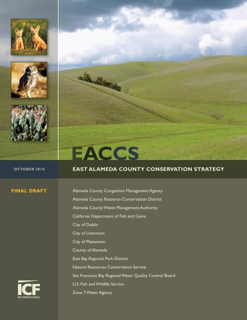
<strong>EACCS</strong><br />
OCTOBER 2010<br />
EAST ALAMEDA COUNTY CONSERVATION STRATEGY<br />
FINAL DRAFT<br />
Alameda County Congestion Management Agency<br />
Alameda County Resource Conservation District<br />
Alameda County Waste Management Authority<br />
California Department <strong>of</strong> Fish and Game<br />
<strong>City</strong> <strong>of</strong> <strong>Dublin</strong><br />
<strong>City</strong> <strong>of</strong> Livermore<br />
<strong>City</strong> <strong>of</strong> Pleasanton<br />
County <strong>of</strong> Alameda<br />
East Bay Regional Park District<br />
Natural Resources Conservation Service<br />
San Francisco Bay Regional Water Quality Control Board<br />
U.S. Fish and Wildlife Service<br />
Zone 7 Water Agency
FINAL DRAFT<br />
EAST ALAMEDA COUNTY CONSERVATION STRATEGY<br />
P REPARED FOR:<br />
East Alameda County Conservation Strategy Steering Committee<br />
100 North Canyons Parkway<br />
Livermore, CA 94551<br />
Contact: Mary Lim<br />
925.454.5036<br />
P REPARED BY:<br />
ICF International<br />
2841 Junction Avenue, Suite 114<br />
San Jose, CA 95134<br />
Contact: Troy Rahmig<br />
408.434.2244<br />
October 2010
ICF International. 2010. East Alameda County Conservation Strategy. <strong>Final</strong><br />
Draft. October. (ICF 00906.08.) San Jose, CA. Prepared for: East Alameda<br />
County Conservation Strategy Steering Committee, Livermore, CA.
Contents<br />
List <strong>of</strong> Tables .......................................................................................................................................... vi<br />
List <strong>of</strong> Figures ....................................................................................................................................... viii<br />
Chapter 1 Introduction ............................................................................................................. 1-1<br />
1.1 Introduction ..................................................................................................................... 1-1<br />
1.1.1 Overview .......................................................................................................................... 1-1<br />
1.1.2 Background ...................................................................................................................... 1-2<br />
1.1.3 Purpose ............................................................................................................................ 1-3<br />
1.2 Overview <strong>of</strong> the Planning Process ................................................................................... 1-4<br />
1.2.1 Steering Committee ......................................................................................................... 1-4<br />
1.2.2 Users Advisory Group ...................................................................................................... 1-5<br />
1.2.3 Public Outreach and Involvement ................................................................................... 1-6<br />
1.3 Scope <strong>of</strong> Conservation Strategy ....................................................................................... 1-7<br />
1.3.1 Study Area ........................................................................................................................ 1-7<br />
1.3.2 Regulatory Scope ............................................................................................................. 1-8<br />
1.3.3 Focal Species .................................................................................................................... 1-8<br />
1.4 Regulatory Setting ......................................................................................................... 1-11<br />
1.4.1 Federal and State Endangered Species Laws ................................................................. 1-11<br />
1.4.2 Other Federal and State Species Laws ........................................................................... 1-17<br />
1.4.3 National Environmental Policy Act ................................................................................ 1-19<br />
1.4.4 California Environmental Quality Act ............................................................................ 1-20<br />
1.4.5 Federal and State Wetland Laws and Regulations ........................................................ 1-20<br />
1.5 Document Organization ................................................................................................. 1-22<br />
Chapter 2 Environmental Setting .............................................................................................. 2-1<br />
2.1 Introduction ..................................................................................................................... 2-1<br />
2.2 Land Use ........................................................................................................................... 2-2<br />
2.2.1 <strong>Ex</strong>isting Conditions ........................................................................................................... 2-2<br />
2.2.2 Land Use Categories ........................................................................................................ 2-3<br />
2.2.3 Land Use Controls ............................................................................................................ 2-7<br />
2.2.4 Open Space (Public Lands and Private Easements) ......................................................... 2-9<br />
2.3 Physical Resources ......................................................................................................... 2-15<br />
2.3.1 Location.......................................................................................................................... 2-15<br />
2.3.2 Topography .................................................................................................................... 2-15<br />
2.3.3 Geology and Soils ........................................................................................................... 2-16<br />
2.3.4 Climate ........................................................................................................................... 2-19<br />
East Alameda County Conservation Strategy i October 2010<br />
ICF 00906.08
2.3.5 Hydrology ....................................................................................................................... 2-21<br />
2.4 Biological Resources ...................................................................................................... 2-23<br />
2.4.1 Methods ......................................................................................................................... 2-23<br />
2.4.2 Biological Diversity in the Study Area ............................................................................ 2-31<br />
2.4.3 Natural Communities and Land Cover Types ................................................................. 2-32<br />
2.4.4 Habitat Connectivity and Wildlife Linkages ................................................................... 2-76<br />
Chapter 3 Conservation Strategy .............................................................................................. 3-1<br />
3.1 Overview .......................................................................................................................... 3-1<br />
3.2 Project-Level Use <strong>of</strong> the Strategy .................................................................................... 3-3<br />
3.2.1 Standardized Mitigation .................................................................................................. 3-4<br />
3.2.2 Impact/Mitigation Scoring <strong>of</strong> Focal Species Habitat ........................................................ 3-5<br />
3.3 Independent Conservation Actions ................................................................................. 3-6<br />
3.4 Methods and Sources ...................................................................................................... 3-6<br />
3.4.1 Conservation Gap Analysis ............................................................................................... 3-7<br />
3.4.2 Geographic Units <strong>of</strong> Conservation ................................................................................... 3-8<br />
3.5 Conservation Goals and Objectives ................................................................................. 3-9<br />
3.5.1 Landscape-Level Goals and Objectives .......................................................................... 3-10<br />
3.5.2 Natural Community–Level Goals and Objectives .......................................................... 3-12<br />
3.5.3 Focal Species Goals and Objectives ............................................................................... 3-40<br />
Chapter 4 Conservation Zones .................................................................................................. 4-1<br />
4.1 Conservation Zone 1 ........................................................................................................ 4-3<br />
4.1.1 Background ...................................................................................................................... 4-3<br />
4.1.2 Conservation Priorities .................................................................................................... 4-4<br />
4.1.3 Summary .......................................................................................................................... 4-4<br />
4.2 Conservation Zone 2 ........................................................................................................ 4-4<br />
4.2.1 Background ...................................................................................................................... 4-4<br />
4.2.2 Conservation Priorities .................................................................................................... 4-5<br />
4.2.3 Summary .......................................................................................................................... 4-6<br />
4.3 Conservation Zone 3 ........................................................................................................ 4-6<br />
4.3.1 Background ...................................................................................................................... 4-6<br />
4.3.2 Conservation Priorities .................................................................................................... 4-6<br />
4.3.3 Summary .......................................................................................................................... 4-7<br />
4.4 Conservation Zone 4 ........................................................................................................ 4-8<br />
4.4.1 Background ...................................................................................................................... 4-8<br />
4.4.2 Conservation Priorities .................................................................................................... 4-8<br />
4.4.3 Summary .......................................................................................................................... 4-9<br />
East Alameda County Conservation Strategy ii October 2010<br />
ICF 00906.08
4.5 Conservation Zone 5 ...................................................................................................... 4-10<br />
4.5.1 Background .................................................................................................................... 4-10<br />
4.5.2 Conservation Priorities .................................................................................................. 4-11<br />
4.5.3 Summary ........................................................................................................................ 4-12<br />
4.6 Conservation Zone 6 ...................................................................................................... 4-13<br />
4.6.1 Background .................................................................................................................... 4-13<br />
4.6.2 Conservation Priorities .................................................................................................. 4-13<br />
4.6.3 Summary ........................................................................................................................ 4-15<br />
4.7 Conservation Zone 7 ...................................................................................................... 4-15<br />
4.<strong>7.1</strong> Background .................................................................................................................... 4-15<br />
4.7.2 Conservation Priorities .................................................................................................. 4-16<br />
4.7.3 Summary ........................................................................................................................ 4-17<br />
4.8 Conservation Zone 8 ...................................................................................................... 4-17<br />
4.8.1 Background .................................................................................................................... 4-17<br />
4.8.2 Conservation Priorities .................................................................................................. 4-17<br />
4.8.3 Summary ........................................................................................................................ 4-18<br />
4.9 Conservation Zone 9 ...................................................................................................... 4-19<br />
4.9.1 Background .................................................................................................................... 4-19<br />
4.9.2 Conservation Priorities .................................................................................................. 4-19<br />
4.9.3 Summary ........................................................................................................................ 4-21<br />
4.10 Conservation Zone 10 .................................................................................................... 4-21<br />
4.10.1 Background .............................................................................................................. 4-21<br />
4.10.2 Conservation Priorities ............................................................................................ 4-22<br />
4.10.3 Summary ................................................................................................................. 4-24<br />
4.11 Conservation Zone 11 .................................................................................................... 4-25<br />
4.11.1 Background .............................................................................................................. 4-25<br />
4.11.2 Conservation Priorities ............................................................................................ 4-25<br />
4.11.3 Summary ................................................................................................................. 4-26<br />
4.12 Conservation Zone 12 .................................................................................................... 4-26<br />
4.12.1 Background .............................................................................................................. 4-26<br />
4.12.2 Conservation Priorities ............................................................................................ 4-27<br />
4.12.3 Summary ................................................................................................................. 4-28<br />
4.13 Conservation Zone 13 .................................................................................................... 4-28<br />
4.13.1 Background .............................................................................................................. 4-28<br />
4.13.2 Conservation Priorities ............................................................................................ 4-29<br />
4.13.3 Summary ................................................................................................................. 4-30<br />
East Alameda County Conservation Strategy iii October 2010<br />
ICF 00906.08
4.14 Conservation Zone 14 .................................................................................................... 4-31<br />
4.14.1 Background .............................................................................................................. 4-31<br />
4.14.2 Conservation Priorities ............................................................................................ 4-31<br />
4.14.3 Summary ................................................................................................................. 4-32<br />
4.15 Conservation Zone 15 .................................................................................................... 4-33<br />
4.15.1 Background .............................................................................................................. 4-33<br />
4.15.2 Conservation Priorities ............................................................................................ 4-33<br />
4.15.3 Summary ................................................................................................................. 4-35<br />
4.16 Conservation Zone 16 .................................................................................................... 4-35<br />
4.16.1 Background .............................................................................................................. 4-35<br />
4.16.2 Conservation Priorities ............................................................................................ 4-35<br />
4.16.3 Summary ................................................................................................................. 4-37<br />
4.17 Conservation Zone 17 .................................................................................................... 4-38<br />
4.1<strong>7.1</strong> Background .............................................................................................................. 4-38<br />
4.17.2 Conservation Priorities ............................................................................................ 4-38<br />
4.17.3 Summary ................................................................................................................. 4-39<br />
4.18 Conservation Zone 18 .................................................................................................... 4-40<br />
4.18.1 Background .............................................................................................................. 4-40<br />
4.18.2 Conservation Priorities ............................................................................................ 4-40<br />
4.18.3 Summary ................................................................................................................. 4-41<br />
Chapter 5 Conservation Strategy Implementation .................................................................... 5-1<br />
5.1 Overview .......................................................................................................................... 5-2<br />
5.2 Implementation Structure ............................................................................................... 5-3<br />
5.2.1 Implementation Committee ............................................................................................ 5-3<br />
5.2.2 Public Advisory Committee .............................................................................................. 5-5<br />
5.2.3 Annual Meeting ............................................................................................................... 5-5<br />
5.2.4 Data Tracking and Reporting ........................................................................................... 5-6<br />
5.3 Funding ............................................................................................................................ 5-9<br />
5.4 Participating Entities ........................................................................................................ 5-9<br />
5.4.1 Local Governments .......................................................................................................... 5-9<br />
5.4.2 State and Federal Resource Agencies ............................................................................ 5-10<br />
5.4.3 Special Districts and Agencies ........................................................................................ 5-10<br />
5.5 Project-by-Project Regulatory Compliance .................................................................... 5-11<br />
5.5.1 National Environmental Policy Act ................................................................................ 5-11<br />
5.5.2 California Environmental Quality Act ............................................................................ 5-11<br />
5.5.3 Federal Endangered Species Permitting ........................................................................ 5-12<br />
5.5.4 State Endangered Species Permitting ............................................................................ 5-14<br />
East Alameda County Conservation Strategy iv October 2010<br />
ICF 00906.08
5.5.5 Federal Clean Water Act Permitting .............................................................................. 5-14<br />
5.5.6 Clean Water Act Section 401 and the Porter-Cologne Water Quality Control Act ........ 5-14<br />
5.5.7 State Streambed and Lake Alteration Agreement ......................................................... 5-15<br />
5.6 Conservation through Mitigation .................................................................................. 5-15<br />
5.6.1 Roles and Responsibilities <strong>of</strong> Project Applicants ........................................................... 5-16<br />
5.6.2 Land Acquisition for Mitigation ..................................................................................... 5-18<br />
5.6.3 Conservation Easements for Mitigation ........................................................................ 5-20<br />
5.6.4 Conservation or Mitigation Banks ................................................................................. 5-24<br />
5.6.5 New Concepts for Mitigation Planning .......................................................................... 5-25<br />
5.7 Conservation Actions Unrelated to Mitigation—Voluntary Conservation Actions ....... 5-26<br />
5.<strong>7.1</strong> <strong>Ex</strong>isting Stewardship Programs ...................................................................................... 5-27<br />
5.7.2 New Stewardship Programs and Tools .......................................................................... 5-29<br />
Chapter 6 Literature Cited ........................................................................................................ 6-1<br />
6.1 <strong>Print</strong>ed References ........................................................................................................... 6-1<br />
6.2 Personal Communications ............................................................................................. 6-21<br />
Appendix A<br />
Appendix B<br />
Appendix C<br />
Appendix D<br />
Appendix E<br />
Appendix F<br />
Appendix G<br />
Wildlife Species List<br />
Plant Species List<br />
Glossary<br />
Species Accounts<br />
Mitigation Score Sheets<br />
Conservation Easement Toolkit<br />
Water Quality Objectives for Use in Designing and Implementing Projects with Impacts<br />
to Creeks or Wetlands<br />
East Alameda County Conservation Strategy v October 2010<br />
ICF 00906.08
Tables<br />
Appear at the end <strong>of</strong> chapters in which they are named.<br />
1-1 Species Proposed for Inclusion as Focal Species for the East Alameda County Conservation<br />
Strategy<br />
2-1 Simplified Land Use Planning Designations from Local General Plans<br />
2-2 Summary <strong>of</strong> Open Space in the Conservation Strategy as <strong>of</strong> October 2010<br />
2-3 Comparison <strong>of</strong> East Alameda County Conservation Strategy Land Cover Classification to<br />
Other State and Local Classification Systems<br />
2-4 Land Cover Types and their <strong>Ex</strong>tent in the Study Area<br />
3-1 Conservation Goals for Land Cover within the East Alameda County Conservation Strategy<br />
Study Area<br />
3-2 General Avoidance and Minimization Measures to Reduce Effects on Focal Species<br />
3-3 Species-Specific AMMs<br />
3-4 Standardized Mitigation Ratios for Vernal Pool Fairy Shrimp in the <strong>EACCS</strong> Study Area<br />
3-5 Standardized Mitigation Ratios for Longhorn Fairy Shrimp in the <strong>EACCS</strong> Study Area<br />
3-6 Standardized Mitigation Ratios for Callippe Silverspot Butterfly in the <strong>EACCS</strong> Study Area<br />
3-7 Standardized Mitigation Ratios for California Red-Legged Frog in the <strong>EACCS</strong> Study Area<br />
3-8 Standardized Mitigation Ratios for California Tiger Salamander in the <strong>EACCS</strong> Study Area<br />
3-9 Standardized Mitigation Ratios for Alameda Whipsnake in the <strong>EACCS</strong> Study Area<br />
3-10 Standardized Mitigation Ratios for Non-Listed Species in the <strong>EACCS</strong> Study Area<br />
3-11 Standardized Mitigation Ratios for San Joaquin Kit Fox in the <strong>EACCS</strong> Study Area<br />
3-12 Standardized Mitigation Ratios for Focal Plant Species in the <strong>EACCS</strong> Study Area<br />
4-1 Natural Land Cover Protection Goals for Conservation Zone 1<br />
4-2 Natural Land Cover Protection Goals for Conservation Zone 2<br />
4-3 Natural Land Cover Protection Goals for Conservation Zone 3<br />
4-4 Natural Land Cover Protection Goals for Conservation Zone 4<br />
4-5 Natural Land Cover Protection Goals for Conservation Zone 5<br />
4-6 Natural Land Cover Protection Goals for Conservation Zone 6<br />
4-7 Natural Land Cover Protection Goals for Conservation Zone 7<br />
East Alameda County Conservation Strategy vi October 2010<br />
ICF 00906.08
4-8 Natural Land Cover Protection Goals for Conservation Zone 8<br />
4-9 Natural Land Cover Protection Goals for Conservation Zone 9<br />
4-10 Natural Land Cover Protection Goals for Conservation Zone 10<br />
4-11 Natural Land Cover Protection Goals for Conservation Zone 11<br />
4-12 Natural Land Cover Protection Goals for Conservation Zone 12<br />
4-13 Natural Land Cover Protection Goals for Conservation Zone 13<br />
4-14 Natural Land Cover Protection Goals for Conservation Zone 14<br />
4-15 Natural Land Cover Protection Goals for Conservation Zone 15<br />
4-16 Natural Land Cover Protection Goals for Conservation Zone 16<br />
4-17 Natural Land Cover Protection Goals for Conservation Zone 17<br />
4-18 Natural Land Cover Protection Goals for Conservation Zone 18<br />
4-19a Modeled Suitable Habitat (acres) for Focal Invertebrate Species<br />
4-19b Modeled Suitable Habitat (acres) for Reptile and Amphibian Species<br />
4-19c Modeled Suitable Habitat (acres) for Focal Bird Species<br />
4-19d Modeled Suitable Habitat (acres) for Focal Mammal Species<br />
4-19e Modeled Suitable Habitat (acres) for Focal Plant Species<br />
4-20 Critical Habitat (acres) for Federally Listed Focal Species<br />
East Alameda County Conservation Strategy vii October 2010<br />
ICF 00906.08
Figures<br />
Appear at the end <strong>of</strong> chapters in which they are named.<br />
1-1 Study Area<br />
1-2 How the East Alameda County Conservation Strategy Will Work<br />
2-1 East Alameda County Simplified Land Use Planning Designations from Local General Plans<br />
2-2 Criteria for Open Space Types<br />
2-3 East Alameda County Open Space (Public Lands and Private Easements)<br />
2-4 East Alameda County Topography<br />
2-5 East Alameda County Soils<br />
2-6 East Alameda County Unique Soil Resources<br />
2-7 Watersheds<br />
2-8 East Alameda County Land Cover<br />
2-9 Pond Density<br />
3-1 Conservation Zones<br />
3-2 Grassland Land Cover<br />
3-3 Chaparral and Coastal Scrub Land Cover<br />
3-4 Conifer Woodland and Oak Woodland<br />
3-5 Aquatic Land Cover<br />
3-6 Vernal Pool Fairy Shrimp Standardized Mitigation Reference Map<br />
3-7 Longhorn Fairy Shrimp Standardized Mitigation Reference Map<br />
3-8 Callippe Silverspot Butterfly Standardized Mitigation Reference Map<br />
3-9 California Red-Legged Frog Standardized Mitigation Reference Map<br />
3-10 California Tiger Salamander Standardized Mitigation Reference Map<br />
3-11 Plants and Non-Listed Wildlife Species Standardized Mitigation Reference Map<br />
3-12 Alameda Whipsnake Standardized Mitigation Reference Map<br />
3-13 San Joaquin Kit Fox Standardized Mitigation Reference Map<br />
East Alameda County Conservation Strategy viii October 2010<br />
ICF 00906.08
Chapter 1<br />
Introduction<br />
Table <strong>of</strong> Contents<br />
1.1 Introduction ........................................................................................... 1-1<br />
1.1.1 Overview ......................................................................................... 1-1<br />
1.1.2 Background...................................................................................... 1-2<br />
1.1.3 Purpose ........................................................................................... 1-3<br />
1.2 Overview <strong>of</strong> the Planning Process ......................................................... 1-4<br />
1.2.1 Steering Committee ........................................................................ 1-4<br />
1.2.2 Users Advisory Group ...................................................................... 1-5<br />
1.2.3 Public Outreach and Involvement ................................................... 1-6<br />
1.3 Scope <strong>of</strong> Conservation Strategy ............................................................. 1-7<br />
1.3.1 Study Area ....................................................................................... 1-7<br />
1.3.2 Regulatory Scope ............................................................................. 1-8<br />
1.3.3 Focal Species ................................................................................... 1-8<br />
1.4 Regulatory Setting ............................................................................... 1-11<br />
1.4.1 Federal and State Endangered Species Laws ................................ 1-11<br />
1.4.2 Other Federal and State Species Laws .......................................... 1-17<br />
1.4.3 National Environmental Policy Act ................................................ 1-19<br />
1.4.4 California Environmental Quality Act ............................................ 1-20<br />
1.4.5 Federal and State Wetland Laws and Regulations ........................ 1-20<br />
1.5 Document Organization ....................................................................... 1-22<br />
1.1 Introduction<br />
1.1.1 Overview<br />
The East Alameda County Conservation Strategy (hereafter, Conservation<br />
Strategy) is intended to provide an effective framework to protect, enhance,<br />
and restore natural resources in eastern Alameda County, while improving and<br />
streamlining the environmental permitting process for impacts resulting from<br />
infrastructure and development projects. The Conservation Strategy will focus<br />
on impacts on biological resources such as endangered and other special-status<br />
East Alameda County Conservation Strategy 1-1 October 2010<br />
ICF 00906.08
Chapter 1 Introduction<br />
species as well as sensitive habitat types (e.g., wetlands, riparian corridors, rare<br />
upland communities). The federal, state, and local entities listed below have<br />
prepared this Conservation Strategy in partnership:<br />
• Alameda County (County);<br />
• Alameda County Congestion Management Agency (ACCMA);<br />
• Alameda County Waste Management Authority;<br />
• Alameda County Resource Conservation District (ACRCD);<br />
• California Department <strong>of</strong> Fish and Game (CDFG);<br />
• <strong>City</strong> <strong>of</strong> <strong>Dublin</strong>;<br />
• <strong>City</strong> <strong>of</strong> Livermore;<br />
• <strong>City</strong> <strong>of</strong> Pleasanton;<br />
• East Bay Regional Parks District (EBRPD);<br />
• Natural Resource Conservation Service (NRCS);<br />
• San Francisco Bay Regional Water Quality Control Board (SFRWQCB);<br />
• Zone 7 Water Agency (Zone 7); and<br />
• U.S. Fish and Wildlife Service (USFWS).<br />
The Conservation Strategy will enable local projects to comply with state and<br />
federal regulatory requirements within a framework <strong>of</strong> comprehensive<br />
conservation goals and objectives, and be implemented using consistent and<br />
standardized mitigation requirements. Section 1.3.1 provides a detailed<br />
description <strong>of</strong> the Conservation Strategy study area.<br />
1.1.2 Background<br />
Local agencies in eastern Alameda County have until now primarily conducted<br />
threatened and endangered species permitting for urban growth, infrastructure<br />
development, and operations and maintenance activities with the Resource<br />
Agencies (USFWS, CDFG, SFRWQCB) on a project-by-project basis. This has<br />
<strong>of</strong>ten resulted in project delays, inconsistencies during the review process, and<br />
piecemeal mitigation for special-status species and natural communities.<br />
The <strong>City</strong> <strong>of</strong> Livermore and Zone 7 held early discussions with USFWS and CDFG<br />
to determine the best course <strong>of</strong> action for the region. USFWS and CDFG<br />
identified a need for a comprehensive regional conservation strategy. Initial<br />
discussions ruled out a habitat conservation plan (HCP) as a tool to provide this<br />
strategy because <strong>of</strong> the growth controls in place in the county and the three<br />
cities. Because <strong>of</strong> these growth controls, local agencies expect relatively low<br />
levels <strong>of</strong> future residential and commercial development on natural lands that<br />
East Alameda County Conservation Strategy 1-2 October 2010<br />
ICF 00906.08
Chapter 1 Introduction<br />
would typically fund a large part <strong>of</strong> HCP implementation. Instead, a regional<br />
conservation strategy that would not result in incidental take permits for<br />
threatened or endangered species, as is the case in an HCP, was recommended<br />
as the best tool to reach the common goals. Other local land use and resource<br />
agencies joined the process in order to address impacts from infrastructure and<br />
development projects in a comprehensive manner. Since it was anticipated that<br />
the majority <strong>of</strong> mitigation that resulted from the Conservation Strategy would<br />
occur on private lands, the NRCS and ACRCD joined the planning process as well.<br />
This was enabled in part through a CALFED Bay-Delta Program grant that the<br />
ACRCD received in 2007 to support the planning process and components <strong>of</strong><br />
Conservation Strategy implementation. A Steering Committee was then formed<br />
to guide the planning process.<br />
1.1.3 Purpose<br />
The primary purpose <strong>of</strong> this Conservation Strategy is to provide a baseline<br />
inventory <strong>of</strong> biological resources and conservation priorities that will be utilized<br />
by local agencies and resource agencies during project-level planning and<br />
environmental permitting. To this end, the Conservation Strategy describes<br />
how to avoid, minimize, and mitigate impacts on selected focal special-status<br />
species and sensitive habitats. By implementing the Conservation Strategy,<br />
local agencies can more easily address the legal requirements relevant to these<br />
species. Projects and activities that will benefit from this Conservation Strategy<br />
include urban and suburban growth and a variety <strong>of</strong> road, water, and other<br />
needed infrastructure construction and maintenance activities. Because this<br />
Conservation Strategy will not result in permits, but rather serve as guidance for<br />
project-level permits, individual projects may need to implement different or<br />
more avoidance, minimization, and mitigation measures than what is outlined<br />
here. To avoid this from happening, the Resource Agencies have participated in<br />
the development <strong>of</strong> this Conservation Strategy with the intent that it becomes<br />
the blueprint for all mitigation and conservation in the study area.<br />
This Conservation Strategy is designed to serve as a coordinated approach to<br />
conservation in the eastern portion <strong>of</strong> Alameda County. This Conservation<br />
Strategy not only addresses project-level mitigation for potential impacts to<br />
species and habitats throughout the eastern part <strong>of</strong> the county, but also<br />
provides a broader, coordinated approach for local conservation efforts beyond<br />
those required by mitigation. In turn the strategy will capitalize on existing<br />
stewardship practices that are a long tradition in the county and encourage new<br />
means for those practices to persist. This includes identification <strong>of</strong> important<br />
conservation priorities in the county that are supported by local stakeholders<br />
and resource agencies and the importance on not just protection <strong>of</strong> those<br />
resources, but management as well.<br />
This Conservation Strategy will achieve the specific goals listed below.<br />
East Alameda County Conservation Strategy 1-3 October 2010<br />
ICF 00906.08
Chapter 1 Introduction<br />
• Set priorities for mitigation and conservation to contribute to the protection<br />
<strong>of</strong> special-status species and sensitive habitats in eastern Alameda County.<br />
• Improve corridors and linkages between other conservation planning efforts<br />
(HCPs/NCCPs) inside and adjacent to the <strong>EACCS</strong> Study Area.<br />
• Set goals to document, protect, and enhance native biological and<br />
ecological diversity in the study area.<br />
• Establish a set <strong>of</strong> standards to preserve, enhance, restore, manage, and<br />
monitor native species and the habitats and ecosystems upon which they<br />
depend.<br />
• Streamline and simplify the issuance <strong>of</strong> permits for future project<br />
proponents in the study area by indicating clear standards for lawful<br />
incidental take 1 <strong>of</strong> species listed as threatened or endangered pursuant to<br />
the federal Endangered Species Act (ESA) and California Endangered Species<br />
Act (CESA) and by setting clear mitigation ratios for focal species and<br />
sensitive habitats.<br />
• Standardize avoidance, minimization, mitigation, and compensation<br />
requirements <strong>of</strong> the ESA, CESA, California Environmental Quality Act (CEQA),<br />
National Environmental Policy Act (NEPA), and other applicable laws and<br />
regulations relating to biological and natural resources within the study<br />
area, so that public and private actions will be governed equally and<br />
consistently, thus reducing delays, expenses, and regulatory duplication.<br />
• Provide a less costly, more efficient project review process that will result in<br />
more productive conservation than the current project-by-project, speciesby-species<br />
compliance process for special-status species and sensitive<br />
habitat.<br />
• Restore natural communities that have been degraded or lost over time<br />
where possible.<br />
• Introduce creative solutions to making land management activities which<br />
benefit focal species more feasible through incentives for and the education<br />
<strong>of</strong> the private lands community.<br />
1.2 Overview <strong>of</strong> the Planning Process<br />
1.2.1 Steering Committee<br />
The Steering Committee comprises the Resource Agencies and a representative<br />
from each local agency (funding partner) that is likely to have a need to mitigate<br />
1 Take as defined by the ESA means “to harass, harm, pursue, hunt, shoot, wound, kill, trap, capture, or collect, or to<br />
attempt to engage in any such conduct.” Incidental take is take that is incidental to, and not intended as part <strong>of</strong>, an<br />
otherwise lawful activity.<br />
East Alameda County Conservation Strategy 1-4 October 2010<br />
ICF 00906.08
Chapter 1 Introduction<br />
public projects within the study area in the foreseeable future or support<br />
implementation <strong>of</strong> the Conservation Strategy through on the ground<br />
conservation. A list <strong>of</strong> local agencies and Resource Agencies that were<br />
represented on the Steering Committee is shown in the opening paragraph <strong>of</strong><br />
this document. During the planning process, the Steering Committee made<br />
decisions regarding the budget, management, and administration <strong>of</strong> the<br />
consultant contract. The Steering Committee directed the Conservation<br />
Strategy project and made decisions regarding public outreach, including<br />
convening the Users Advisory Group (UAG) (see Section 1.2.2, below). Decisionmaking<br />
by the Steering Committee was by consensus. The Steering Committee<br />
met once a month with additional meetings as needed at their discretion.<br />
1.2.2 Users Advisory Group<br />
The UAG was convened to review and provide real-time feedback to the<br />
Steering Committee and consultants on work products. The UAG was<br />
comprised <strong>of</strong> technical and nontechnical representatives from those entities<br />
that intend to use the strategy, such as local public agencies, USFWS, CDFG,<br />
Corps, SFRWQCB, developers, landowners, and environmental and conservation<br />
groups. The Steering Committee solicited participation in the UAG through<br />
mailings to individuals and groups that live or operate in eastern Alameda<br />
County. One information meeting was held to discuss the scope <strong>of</strong> the<br />
Conservation Strategy and the purpose <strong>of</strong> the UAG. Those interested in joining<br />
the UAG then completed an application. Those applications were reviewed by<br />
the Steering Committee and all that applied were asked to join the UAG. The<br />
Steering Committee conducted additional outreach to groups that were<br />
underrepresented on the UAG to create a group that was balanced and<br />
representative <strong>of</strong> interests in eastern Alameda County.<br />
UAG members served as the point <strong>of</strong> contact for the group they were<br />
representing. The duties <strong>of</strong> the UAG included, but were not limited to, the<br />
following: reviewing, discussing, and providing comments on work products<br />
from the consultant; providing suggestions and advice <strong>of</strong> work products to the<br />
Steering Committee; and serving as a conduit between the Conservation<br />
Strategy planning process and their respective constituencies. The UAG met<br />
approximately every 6 weeks during the planning process.<br />
The UAG consists <strong>of</strong> 27 individuals (plus several alternates) representing various<br />
interests. Groups represented on the UAG include:<br />
• Alameda Creek Alliance;<br />
• Alameda Local Agency Formation Commission;<br />
• Audubon Society – Ohlone Chapter;<br />
• California Coastal Conservancy;<br />
East Alameda County Conservation Strategy 1-5 October 2010<br />
ICF 00906.08
Chapter 1 Introduction<br />
• California Native Plant Society-East Bay Chapter (EBCNPS);<br />
• Fletcher Conservation Properties;<br />
• Friends <strong>of</strong> Livermore;<br />
• Friends <strong>of</strong> Springtown Preserve;<br />
• Friends <strong>of</strong> the Vineyards;<br />
• Greenbelt Alliance;<br />
• Hacienda Business Park;<br />
• Home Builders Association <strong>of</strong> Northern California;<br />
• Individual Rural Landowners;<br />
• Lawrence Livermore Laboratories;<br />
• Livermore Area Recreation and Park District (LARPD);<br />
• Robert Harris & Associates;<br />
• Save Mount Diablo;<br />
• San Francisco Public Utilities Commission (SFPUC);<br />
• Sierra Club;<br />
• The Nature Conservancy; and<br />
• Tri-Valley Conservancy.<br />
1.2.3 Public Outreach and Involvement<br />
To address general public inquiries about the Conservation Strategy, the<br />
Steering Committee convened a public outreach subcommittee to coordinate<br />
outreach efforts and direct the work <strong>of</strong> the consultant. The most direct form <strong>of</strong><br />
public outreach that occurred during the planning process was through the<br />
UAG. The Steering Committee hosted three public meetings at key points<br />
during the planning process to better inform the public about the process and<br />
to identify opportunities for the public to become involved. In addition, two<br />
outreach events were sponsored by the ACRCD to provide a forum for rural<br />
landowners to ask questions about and provide feedback on the planning<br />
process.<br />
Public outreach and review was facilitated through a variety <strong>of</strong> channels,<br />
including:<br />
• Conservation Strategy factsheet;<br />
• list <strong>of</strong> frequently asked questions;<br />
• landowner workshops hosted by ACRCD;<br />
East Alameda County Conservation Strategy 1-6 October 2010<br />
ICF 00906.08
Chapter 1 Introduction<br />
• Conservation Strategy website with project updates, materials posted for<br />
review, and Steering Committee contacts;<br />
• noticed updates to boards and councils delivered by Steering Committee<br />
representatives from each local agency; and<br />
• public meetings at key project milestones occurred in:<br />
<br />
<br />
<br />
May 2009 to review data and conservation goals,<br />
September 2009 to review conservation priorities and draft strategy,<br />
and<br />
September 2010 to review Public Release Draft <strong>of</strong> strategy, including<br />
Standardized Mitigation Ratios and Focal Species Habitat Evaluation<br />
Tools.<br />
1.3 Scope <strong>of</strong> Conservation Strategy<br />
This section introduces key elements <strong>of</strong> the Conservation Strategy: geographic<br />
scope (study area), regulatory scope, and focal species.<br />
1.3.1 Study Area<br />
The study area lies within Alameda County (Figure 1-1). Alameda County has a<br />
land area <strong>of</strong> 525,540 acres; the study area encompasses 271,485 acres, or<br />
approximately 52% <strong>of</strong> the county. The study area completely includes the cities<br />
<strong>of</strong> <strong>Dublin</strong>, Livermore, and Pleasanton. The boundary <strong>of</strong> the study area was<br />
based on political, ecological, and hydrologic factors (Figure 1-1). The western<br />
boundary <strong>of</strong> the study area runs along the Alameda Creek watershed boundary.<br />
This watershed boundary encompasses small portions <strong>of</strong> the cities <strong>of</strong> Fremont,<br />
Union <strong>City</strong>, and Hayward, though those jurisdictions were not formally part <strong>of</strong><br />
the planning process. The northern, southern, and eastern boundaries <strong>of</strong> the<br />
study area follow the Alameda County line with Contra Costa County, Santa<br />
Clara County, and San Joaquin County, respectively. The study area includes a<br />
portion <strong>of</strong> the Central Valley and Sacramento-San Joaquin River Delta (Delta)<br />
watersheds in the northeastern corner <strong>of</strong> the study area. Outside <strong>of</strong> the urban<br />
areas the study area is largely a mix <strong>of</strong> grassland and woodland, with some<br />
intermittent scrub. Most <strong>of</strong> the study area is subject to some level <strong>of</strong> grazing as<br />
ranching is the bellwether if this part <strong>of</strong> the county.<br />
The study area includes two other areas where large scale conservation plans<br />
are being developed during the Conservation Strategy planning process. The<br />
SFPUC is preparing a habitat conservation plan (Alameda Watershed HCP) for its<br />
watershed lands in the Alameda Creek watershed. The Alameda Watershed<br />
HCP study area includes nearly 48,000 acres in southern Alameda and northern<br />
Santa Clara Counties. The portion <strong>of</strong> that study area in Alameda County is<br />
East Alameda County Conservation Strategy 1-7 October 2010<br />
ICF 00906.08
Chapter 1 Introduction<br />
entirely within the Conservation Strategy study area. In addition, the Altamont<br />
Pass Wind Resource Area Conservation Plan (an HCP and a natural community<br />
conservation plan [NCCP]) is under development in eastern Alameda County and<br />
southeastern Contra Costa County. The portion <strong>of</strong> that planning area that is in<br />
Alameda County is entirely within the Conservation Strategy study area.<br />
1.3.2 Regulatory Scope<br />
The Conservation Strategy does not directly result in permits for any<br />
participating local agency. Instead, the Conservation Strategy is a tool to inform<br />
decisions during standard environmental permitting processes for projects that<br />
occur in the study area (Figure 1-2). However, the USFWS anticipates the<br />
development <strong>of</strong> a programmatic biological opinion for their listed species. In<br />
the future the Conservation Strategy could be used for the basis <strong>of</strong> a HCP,<br />
should the need arise. The regional inventory <strong>of</strong> biological resources presented<br />
in the Conservation Strategy allows projects to be reviewed by local agencies<br />
and resource agencies with a standardized regional context and with<br />
consistency across multiple projects. The standardized avoidance, minimization,<br />
and mitigation measures for species and natural communities will give local<br />
agencies, project proponents, and regulators more certainty <strong>of</strong> regulatory<br />
expectations and costs. This approach is expected to streamline permitting,<br />
reducing the overall cost <strong>of</strong> the permitting process and allowing the focus to be<br />
on conservation within the study area rather than a prolonged negotiation<br />
process. Furthermore, the Conservation Strategy will allow mitigation to be<br />
consolidated, facilitating better conservation and improved management<br />
reducing overall costs. In addition, the conservation priorities outlined in the<br />
Conservation Strategy will allow conservation groups to focus their efforts in the<br />
study area and encourage collaboration on conservation initiatives.<br />
1.3.3 Focal Species<br />
The Conservation Strategy creates a framework to protect native biological<br />
diversity, habitat for native species, natural communities, and local ecosystems<br />
in eastern Alameda County. The Conservation Strategy will conserve a wide<br />
range <strong>of</strong> natural resources, including native species that are common and rare,<br />
while focusing conservation efforts on species that are the focus <strong>of</strong> standard<br />
regulatory processes.<br />
The Conservation Strategy addresses 19 listed and nonlisted species, called focal<br />
species (Table 1-1). These focal species comprise 13 wildlife species and 6 plant<br />
species. The Conservation Strategy provides a framework for long-term<br />
conservation and management <strong>of</strong> these species and the habitats that support<br />
them. The 19 focal species were identified using an initial assessment <strong>of</strong> the<br />
East Alameda County Conservation Strategy 1-8 October 2010<br />
ICF 00906.08
Chapter 1 Introduction<br />
occurrence, threat, and conservation opportunities <strong>of</strong> 132 special-status species<br />
(see “Species Evaluation,” below).<br />
The Conservation Strategy includes measures to protect all 19 focal species as if<br />
they are currently listed as endangered or threatened under ESA and/or CESA<br />
(see “Definition <strong>of</strong> Special-Status Species,” below). Therefore, if any nonlisted<br />
focal species becomes listed in the future, it is anticipated that additional<br />
conservation within the study area should not be required.<br />
1.3.3.1 Species Evaluation<br />
To determine which species would be focal species under the Conservation<br />
Strategy, a comprehensive list <strong>of</strong> 132 special-status species that occur or may<br />
occur in the study area was compiled (Appendices A and B). This list was<br />
developed by reviewing the following sources:<br />
• California Natural Diversity Database (CNDDB) (2009);<br />
• CNPS (2008) Inventory <strong>of</strong> Rare and Endangered Vascular Plants <strong>of</strong> California;<br />
• CDFG lists <strong>of</strong> special animals and special plants (California Department <strong>of</strong><br />
Fish and Game 2009a and 2009b);<br />
• an animal species list obtained from the USFWS website for Alameda<br />
County (U.S. Fish and Wildlife Service 2008); and<br />
• personal communication with local experts, including wildlife agency staff<br />
and representatives <strong>of</strong> local environmental groups including CNPS, Ohlone<br />
Chapter <strong>of</strong> the Audubon Society, EBRPD, and Alameda Creek Alliance.<br />
1.3.3.2 Definition <strong>of</strong> Special-Status Species<br />
Special-status species are defined as plants and animals that are legally<br />
protected under ESA, CESA, or other regulations, and species that are<br />
considered sufficiently rare by the scientific community to qualify for such<br />
listing.<br />
Special-status plants are species with one or more <strong>of</strong> the following<br />
characteristics:<br />
• listed or proposed for listing as threatened or endangered under ESA (50<br />
Code <strong>of</strong> Federal Regulations [CFR] 1<strong>7.1</strong>2 [listed plants] and various notices<br />
in the Federal Register [FR] [proposed species]);<br />
• candidate for possible future listing as threatened or endangered under the<br />
ESA (73 FR 7515–75244, December 10, 2008);<br />
• listed or candidate for listing by the State <strong>of</strong> California as threatened or<br />
endangered under CESA (14 California Code <strong>of</strong> Regulations [CCR] 670.5);<br />
East Alameda County Conservation Strategy 1-9 October 2010<br />
ICF 00906.08
Chapter 1 Introduction<br />
• listed as rare under the California Native Plant Protection Act (California Fish<br />
and Game Code Section 1900 et seq.);<br />
• determined to meet the definitions <strong>of</strong> rare or endangered under CEQA<br />
(State CEQA Guidelines, Section 15380);<br />
• considered by CNPS to be “rare, threatened or endangered in California”<br />
(Lists 1B and 2 in California Native Plant Society 2010) or vascular plants,<br />
bryophytes, and lichens listed as having special status by CDFG (California<br />
Department <strong>of</strong> Fish and Game 2009b); and/or<br />
• listed by CNPS as plants about which more information is needed to<br />
determine their status and plants <strong>of</strong> limited distribution (Lists 3 and 4 in<br />
California Native Plant Society 2008) that may be included on the basis <strong>of</strong><br />
local significance or recent biological information.<br />
Special-status animals are species with one or more <strong>of</strong> the following<br />
characteristics:<br />
• listed or proposed for listing as threatened or endangered under the ESA<br />
(50 CFR 1<strong>7.1</strong>1 [listed animals] and various notices in the Federal Register<br />
[proposed species]);<br />
• candidate for possible future listing as threatened or endangered under the<br />
ESA (73 FR 7515–75244, December 10, 2008);<br />
• determined to meet the definitions <strong>of</strong> rare or endangered under CEQA<br />
(State CEQA Guidelines, Section 15380);<br />
• listed or candidate for listing by the State <strong>of</strong> California as threatened or<br />
endangered under CESA (14 CCR 670.5);<br />
• wildlife species <strong>of</strong> special concern to CDFG (California Department <strong>of</strong> Fish<br />
and Game 2008);<br />
• fully protected species under the California Fish and Game Code Section<br />
3511 (birds), Section 4700 (mammals), Section 5515 (fish), and Section 5050<br />
(reptiles and amphibians); and/or<br />
• species with no formal special status but thought by experts to be rare or in<br />
serious decline and to warrant special status based on recent information.<br />
1.3.3.3 Focal Species Criteria<br />
For each special-status species with potential to occur in the study area<br />
(Appendices A and B), information was gathered on its status, population<br />
trends, distribution, threats, conservation potential, and management efforts.<br />
The following criteria were then applied to each species to determine whether it<br />
would be a focal species. To be a focal species, a species typically had to meet<br />
all four <strong>of</strong> the following criteria.<br />
East Alameda County Conservation Strategy 1-10 October 2010<br />
ICF 00906.08
Chapter 1 Introduction<br />
Range: The species is known to occur or is likely to occur within the<br />
Conservation Strategy study area, based on credible evidence, or the species is<br />
not currently known in the study area but is expected to occur in the study area<br />
in the foreseeable future (e.g., through range expansion or reintroduction to<br />
historic range).<br />
Status: The species meets at least one <strong>of</strong> the following statutory criteria:<br />
• listed under the ESA as threatened or endangered, or proposed for listing;<br />
• listed under CESA as threatened or endangered or a candidate for such<br />
listing;<br />
• listed under the Native Plant Protection Act as rare; or<br />
• expected to be listed under ESA or CESA in the foreseeable future. Potential<br />
for listing is based on current listing status, consultation with experts and<br />
wildlife agency staff, evaluation <strong>of</strong> species population trends and threats,<br />
and best pr<strong>of</strong>essional judgment <strong>of</strong> the biologists working on the<br />
Conservation Strategy.<br />
Impact: The species or its habitat would be adversely affected by activities or<br />
projects that may result in take <strong>of</strong> the species.<br />
Data: Sufficient data on the species’ life history, habitat requirements, and<br />
occurrence in the study area are available to adequately evaluate and develop<br />
conservation measures to mitigate impacts that result from future projects to<br />
levels specified by regulatory standards.<br />
1.4 Regulatory Setting<br />
1.4.1 Federal and State Endangered Species Laws<br />
1.4.1.1 Federal Endangered Species Act<br />
USFWS and National Marine Fisheries Service (NMFS) administer the ESA. ESA<br />
requires USFWS and NMFS to maintain lists <strong>of</strong> threatened and endangered<br />
species and affords substantial protection to listed species. NMFS’s jurisdiction<br />
under ESA is limited to the protection <strong>of</strong> marine plants and animals, and<br />
anadromous fishes; 2 all other species are subject to USFWS jurisdiction.<br />
2 Anadromous fishes are fish that spend part <strong>of</strong> their life cycle in the ocean and part in fresh water. NMFS has<br />
jurisdiction over anadromous fish that spend the majority <strong>of</strong> their life cycle in the ocean. Pacific Lamprey, although<br />
anadromous, would be under USFWS jurisdiction if it were listed in the future because, although anadromous, it<br />
spends the majority <strong>of</strong> its life cycle in freshwater.<br />
East Alameda County Conservation Strategy 1-11 October 2010<br />
ICF 00906.08
Chapter 1 Introduction<br />
USFWS and NMFS can list species as either endangered or threatened. An<br />
endangered species is at risk <strong>of</strong> extinction throughout all or a significant portion<br />
<strong>of</strong> its range (ESA Section 3[6]). A threatened species is likely to become<br />
endangered within the foreseeable future (ESA Section 3[19]). Section 9 <strong>of</strong> the<br />
ESA prohibits the take <strong>of</strong> any fish or wildlife species listed under ESA. Take, as<br />
defined by ESA, means “to harass, harm, pursue, hunt, shoot, wound, kill, trap,<br />
capture, or collect, or to attempt to engage in any such conduct.” Harm is<br />
defined as “any act that kills or injures the species, including significant habitat<br />
modification or degradation where it actually kills or injures wildlife by<br />
significantly impairing essential behavioral patterns, including breeding, feeding,<br />
or sheltering” (50 CFR 17.3). Section 9 prohibits removing or reducing to<br />
possession, or maliciously damaging or destroying listed plant species from<br />
areas under federal jurisdiction and includes prohibiting removal, cutting,<br />
digging up, damage, or destruction where the action takes place in violation <strong>of</strong><br />
any state law or regulation. ESA and its implementing regulations do not provide<br />
for exemption from these prohibitions; however, listed plants are subject to the<br />
regulatory obligations <strong>of</strong> section 7 <strong>of</strong> the ESA. Some plants are included in the<br />
Conservation Strategy in order to meet regulatory obligations under ESA Section<br />
7 and to comply with CESA.<br />
The ESA includes mechanisms that provide exceptions to the Section 9 take<br />
prohibitions. These are addressed in Section 7 for federal actions and Section<br />
10 for nonfederal actions.<br />
Section 7<br />
Section 7 <strong>of</strong> the ESA requires all federal agencies to ensure that any action they<br />
authorize, fund, or carry out is not likely to jeopardize the continued existence<br />
<strong>of</strong> any listed species or result in the destruction or adverse modification <strong>of</strong><br />
habitat critical to such species’ survival. To ensure that its actions do not result<br />
in jeopardy to listed species or in the adverse modification <strong>of</strong> critical habitat 3 ,<br />
each federal agency must consult with USFWS or NMFS, or both, regarding<br />
federal agency actions that may affect listed species. Consultation begins when<br />
the federal agency submits a written request for initiation to USFWS or NMFS,<br />
along with the agency’s biological assessment <strong>of</strong> its proposed action, and their<br />
determination that the proposed action “may affect but is not likely to<br />
adversely affect” or “may affect and is likely to adversely affect” listed species.<br />
If the initiation package is complete, USFWS or NMFS concurs or does not<br />
concur with the federal action agency’s determination. If USFWS or NMFS<br />
concurs that the action will not likely adversely affect the listed species, the<br />
action may be conducted without further review under ESA. Otherwise, USFWS<br />
or NMFS must prepare a written biological opinion describing how the agency’s<br />
3 Critical habitat is defined as specific geographic areas, whether occupied by listed species or not, that are<br />
determined to be essential for the conservation and management <strong>of</strong> listed species, and that have been formally<br />
described in the Federal Register.<br />
East Alameda County Conservation Strategy 1-12 October 2010<br />
ICF 00906.08
Chapter 1 Introduction<br />
action may or may not jeopardize the continued existence <strong>of</strong> a species or result<br />
in the adverse modification <strong>of</strong> critical habitat.<br />
If the biological opinion concludes that the proposed action would jeopardize<br />
the continued existence <strong>of</strong> a listed species or adversely modify its critical<br />
habitat, the opinion will suggest “reasonable and prudent alternatives” that<br />
would avoid that result. If the biological opinion concludes that the proposed<br />
action would take a listed species but would not jeopardize its continued<br />
existence, the biological opinion will include an incidental take statement.<br />
Incidental take is take that is “incidental to, and not intended as part <strong>of</strong>, an<br />
otherwise lawful activity” (64 CFR 60728). The incidental take statement<br />
specifies an amount <strong>of</strong> take that is allowed to occur as a result <strong>of</strong> the action and<br />
may require reasonable and prudent measures to minimize the effect <strong>of</strong> the<br />
take.<br />
Any project with a federal lead agency or federal involvement (e.g., a federal<br />
permit, federal funding, or a project on federal land) must obtain its take<br />
authorization through Section 7 rather than Section 10 and an HCP.<br />
Section 10<br />
Until 1982, state, local, and private entities had no means to acquire incidental<br />
take authorization as could federal agencies under Section 7. Private<br />
landowners and local and state agencies risked direct violation <strong>of</strong> the ESA no<br />
matter how carefully their projects were implemented. This statutory dilemma<br />
led Congress to amend Section 10 <strong>of</strong> the ESA in 1982 to authorize the issuance<br />
<strong>of</strong> an incidental take permit to nonfederal project proponents upon completion<br />
<strong>of</strong> an approved conservation plan. The term conservation plan has evolved into<br />
HCP.<br />
In cases where federal land, funding, or authorization is not required for an<br />
action by a nonfederal entity, the take <strong>of</strong> listed fish and wildlife species can be<br />
permitted by USFWS and/or NMFS through the Section 10 process. Private<br />
landowners, corporations, state agencies, local agencies, and other nonfederal<br />
entities must obtain a Section 10(a)(1)(B) incidental take permit for take <strong>of</strong><br />
federally listed fish and wildlife species “that is incidental to, but not the<br />
purpose <strong>of</strong>, otherwise lawful activities.”<br />
The take prohibition for listed plants is more limited than for listed fish and<br />
wildlife. Under Section 9(a)(2)(B) <strong>of</strong> the ESA, endangered plants are protected<br />
from “removal, reduction to possession, and malicious damage or destruction”<br />
in areas that are under federal jurisdiction. Section 9(a)(2)(B) <strong>of</strong> the ESA also<br />
provides protection to plants from removal, cutting, digging up, damage, or<br />
destruction where the action takes place in violation <strong>of</strong> any state law or<br />
regulation or in violation <strong>of</strong> a state criminal trespass law. Thus, the ESA does<br />
not prohibit the incidental take <strong>of</strong> federally listed plants on private or other<br />
East Alameda County Conservation Strategy 1-13 October 2010<br />
ICF 00906.08
Chapter 1 Introduction<br />
nonfederal lands unless the action requires federal authorization or is in<br />
violation <strong>of</strong> state law. Thus, Section 10 incidental take permits are only required<br />
for wildlife and fish species. However, the Section 7(a)(2) prohibition against<br />
jeopardy applies to plants, and issuance <strong>of</strong> a Section 10(a)(1)(B) incidental take<br />
permit cannot result in jeopardy to a listed plant species.<br />
The HCP must specify the following mandatory elements (U.S. Fish and Wildlife<br />
Service and National Marine Fisheries Service 1996):<br />
• impacts that will likely result from the taking <strong>of</strong> covered species;<br />
• steps the applicant will take to monitor, minimize, and mitigate such<br />
impacts to the maximum extent practicable;<br />
• funding that will be available to implement such steps;<br />
• procedures to be used to deal with unforeseen circumstances; 4<br />
• alternative actions to such taking the applicant considered and the reasons<br />
why such alternatives are not proposed to be utilized; and<br />
• such other measures that the Director [<strong>of</strong> the Department <strong>of</strong> Interior or<br />
Commerce] may require as being necessary or appropriate for purposes <strong>of</strong><br />
the Conservation Strategy (50 CFR 17.22(b)).<br />
The following criteria must be met in order for USFWS and/or NMFS to issue a<br />
section 10(a)(1)(B) incidental take permit:<br />
• taking will be incidental;<br />
• impacts <strong>of</strong> the taking will be minimized and mitigated to the maximum<br />
extent practicable;<br />
• adequate funding will be ensured;<br />
• taking will not appreciably reduce the likelihood <strong>of</strong> survival and recovery <strong>of</strong><br />
the species in the wild; or<br />
• other such measures that USFWS and/or NMFS may require as being<br />
necessary or appropriate for purposes <strong>of</strong> the HCP (50 CFR 17.22).<br />
An HCP is intended to satisfy these requirements.<br />
Prior to the approval <strong>of</strong> an HCP, USFWS and/or NMFS are required to undertake<br />
an internal Section 7 consultation, because issuance <strong>of</strong> an incidental take permit<br />
is a federal action (see discussion <strong>of</strong> ESA in “Section 7,” above.) Elements<br />
specific to the Section 7 process that are not required under the Section 10<br />
process (e.g., analysis <strong>of</strong> effects on designated critical habitat, analysis <strong>of</strong> effects<br />
4 Unforeseen circumstances are changes in circumstances affecting a covered species or geographic area covered by<br />
the HCP that could not reasonably have been anticipated by the plan developers, and that result in a substantial and<br />
adverse change in the status <strong>of</strong> a covered species.<br />
East Alameda County Conservation Strategy 1-14 October 2010<br />
ICF 00906.08
Chapter 1 Introduction<br />
on listed plant species, and analysis <strong>of</strong> indirect and cumulative effects on listed<br />
species) are included in an HCP to meet the requirements <strong>of</strong> Section 7.<br />
While the Conservation Strategy is not an HCP, the discussion <strong>of</strong> these<br />
regulatory documents are relevant since there are three HCP’s currently being<br />
developed within the Conservation Strategy study area. The Conservation<br />
Strategy does provide a regional approach to conservation which is a similar<br />
approach for an HCP. The Conservation Strategy does not provide an estimate<br />
<strong>of</strong> impacts to species or their habitats during a designated period <strong>of</strong> time as an<br />
HCP would, nor does it provide a specific mitigation program to <strong>of</strong>fset those<br />
estimated impacts. Those are required elements <strong>of</strong> an HCP that are not part <strong>of</strong><br />
the Conservation Strategy.<br />
1.4.1.2 California Endangered Species Act<br />
CESA prohibits take <strong>of</strong> wildlife and plants listed as threatened or endangered by<br />
the California Fish and Game Commission. Take is defined under the California<br />
Fish and Game Code (more narrowly than under ESA) as any action or attempt<br />
to “hunt, pursue, catch, capture, or kill.” Therefore, take under CESA does not<br />
include “the taking <strong>of</strong> habitat alone or the impacts <strong>of</strong> the taking.” 5 Rather, the<br />
courts have affirmed that under CESA, “taking involves mortality.”<br />
Like ESA, CESA allows exceptions to the prohibition for take that occurs during<br />
otherwise lawful activities. The requirements <strong>of</strong> an application for incidental<br />
take under CESA are described in Section 2081 <strong>of</strong> the California Fish and Game<br />
Code. Incidental take <strong>of</strong> state-listed species may be authorized if an applicant<br />
submits an approved plan that minimizes and “fully mitigates” the impacts <strong>of</strong><br />
this take.<br />
This Conservation Strategy provides information on state-listed species that<br />
would be used by project proponents and local jurisdictions to determine<br />
whether a proposed project could result in take <strong>of</strong> a state listed species. In<br />
addition, avoidance and minimization measures and mitigation practices<br />
outlined in the Conservation Strategy would be referenced by the project<br />
proponent when creating a plan that minimizes and fully mitigates the impacts<br />
<strong>of</strong> the project. By utilizing preapproved mitigation practices and focusing<br />
mitigation in conservation priority areas described in the Conservation Strategy,<br />
CESA permit compliance would be streamlined.<br />
1.4.1.3 Natural Community Conservation Planning Act<br />
California’s Natural Community Conservation Planning Act (NCCPA) (California<br />
Fish and Game Code, Section 2800 et seq.) was enacted to implement broad-<br />
5 Environmental Council <strong>of</strong> Sacramento v. <strong>City</strong> <strong>of</strong> Sacramento, 142 Cal. App. 4th 1018 (2006).<br />
East Alameda County Conservation Strategy 1-15 October 2010<br />
ICF 00906.08
Chapter 1 Introduction<br />
based planning that balances appropriate development and growth with<br />
conservation <strong>of</strong> wildlife and habitat. Pursuant to the NCCPA, local, state, and<br />
federal agencies are encouraged to prepare NCCPs to provide comprehensive<br />
management and conservation <strong>of</strong> multiple species and their habitats under a<br />
single plan, rather than through preparation <strong>of</strong> numerous individual plans on a<br />
project-by-project basis. The NCCPA is broader in its orientation and objectives<br />
than ESA and CESA, and preparation <strong>of</strong> an NCCP is voluntary. The primary<br />
objective <strong>of</strong> the NCCP program is to conserve natural communities at the<br />
ecosystem scale while accommodating compatible land use. To be approved by<br />
CDFG, an NCCP must provide for the conservation <strong>of</strong> species and protection and<br />
management <strong>of</strong> natural communities in perpetuity within the area covered by<br />
permits. Conservation is defined by the NCCPA and the California Fish and<br />
Game Code as actions that result in the delisting <strong>of</strong> state-listed species. Thus,<br />
NCCPs must contribute to the recovery <strong>of</strong> listed species or prevent the listing <strong>of</strong><br />
nonlisted species rather than just mitigate the effects <strong>of</strong> covered activities. This<br />
recovery standard is one <strong>of</strong> the major differences between an NCCP and an HCP<br />
prepared to satisfy ESA or CESA.<br />
To approve an NCCP under the NCCPA, CDFG must make the following series <strong>of</strong><br />
findings.<br />
• The NCCP must be consistent with the NCCPA.<br />
• The NCCP must provide for the conservation and management <strong>of</strong> the<br />
covered species (conservation here is defined to mean that the NCCP must<br />
contribute to species recovery).<br />
• The NCCP must protect habitat, natural communities, and species diversity<br />
on the landscape level (definitions <strong>of</strong> these and other NCCP terms are<br />
provided in Appendix C, “Glossary”).<br />
• The NCCP must conserve the ecological integrity <strong>of</strong> large habitat blocks,<br />
ecosystem function, and biodiversity.<br />
• The NCCP must support sustainable populations <strong>of</strong> covered species.<br />
• The NCCP must provide a range <strong>of</strong> environmental gradients and habitat<br />
diversity to support shifting species distributions.<br />
• The NCCP must sustain movement <strong>of</strong> species among reserves.<br />
• Mitigation and conservation must be roughly proportional to impacts in<br />
timing and extent.<br />
• Funding for conservation, monitoring, and adaptive management must be<br />
adequately assured.<br />
Although the Conservation Strategy is not an NCCP, the discussion <strong>of</strong> these<br />
regulatory documents are relevant since the proposed Altamont Wind<br />
Resources Conservation Plan, which is an NCCP, is currently in process in the<br />
Conservation Strategy study area. The Conservation Strategy does not provide<br />
an estimate <strong>of</strong> impacts to species or their habitats during a designated period <strong>of</strong><br />
East Alameda County Conservation Strategy 1-16 October 2010<br />
ICF 00906.08
Chapter 1 Introduction<br />
time as an NCCP would, nor does it provide a specific mitigation program to<br />
<strong>of</strong>fset those estimated impacts and contribute to the recovery <strong>of</strong> species.<br />
Further, the Conservation Strategy does not have a formal scientific advisory<br />
process, as is required for an NCCP. The Conservation Strategy does have a<br />
stakeholder process, through the UAG, which is something that is required to<br />
prepare an NCCP. The Conservation Strategy does provide a regional approach<br />
to conservation, as an NCCP would, and approaches conservation through focal<br />
species and their habitats at both a local and regional scale. This is similar to the<br />
approach required in NCCPs.<br />
1.4.2 Other Federal and State Species Laws<br />
1.4.2.1 Migratory Bird Treaty Act<br />
The Migratory Bird Treaty Act <strong>of</strong> 1918 as amended (MBTA), implements various<br />
treaties and conventions between the U.S., Canada, Japan, Mexico, and the<br />
former Soviet Union for the protection <strong>of</strong> migratory birds. Under the MBTA, it is<br />
illegal for anyone to take, possess, import, export, transport, sell, purchase,<br />
barter, or <strong>of</strong>fer for sale, purchase, or barter, any migratory bird, or the parts,<br />
nests, or eggs <strong>of</strong> such a bird except under the terms <strong>of</strong> a valid permit issued<br />
pursuant to federal regulations (16 United States Code [USC] 703). The<br />
regulatory definition <strong>of</strong> take, as defined by 50 CFR 10.12, means to pursue, hunt,<br />
shoot, wound, kill, trap, capture, or collect, or attempt hunt, shoot, wound, kill,<br />
trap, capture, or collect. As such, take under the MBTA does not include the<br />
concepts <strong>of</strong> harm and harassment as defined under ESA. The MBTA defines<br />
migratory birds broadly; all covered birds in this Conservation Strategy are<br />
considered migratory birds under the MBTA.<br />
USFWS provides guidance regarding take <strong>of</strong> federally listed migratory birds<br />
(Appendix 5 in the HCP Handbook [U.S. Fish and Wildlife Service and National<br />
Marine Fisheries Service 1996]). According to these guidelines, an incidental<br />
take permit can function as a Special Purpose Permit under the MBTA (50 CFR<br />
21.27) for the take <strong>of</strong> all ESA-listed covered species in the amount and/or<br />
number and subject to the terms and conditions specified in an HCP. Any such<br />
take will not be in violation <strong>of</strong> the MBTA (16 USC 703–12). The following focal<br />
species in the Conservation Strategy are protected by the MBTA:<br />
• golden eagle,<br />
• western burrowing owl, and<br />
• tricolored blackbird.<br />
None <strong>of</strong> these species are currently listed under ESA or CESA therefore, take<br />
cannot be authorized or permitted. Focal bird species, as well as other<br />
migratory birds not listed as focal species by the Conservation Strategy, will<br />
benefit from seasonal restrictions on construction, restrictions on removal <strong>of</strong><br />
East Alameda County Conservation Strategy 1-17 October 2010<br />
ICF 00906.08
Chapter 1 Introduction<br />
nesting habitat during the nesting period, and other conservation measures<br />
described in this Conservation Strategy. Individual project applicants will be<br />
responsible for compliance with the MBTA for migratory birds.<br />
1.4.2.2 Bald and Golden Eagle Protection Act<br />
The Bald and Golden Eagle Protection Act (Eagle Act) prohibits the taking or<br />
possession <strong>of</strong> and commerce in bald and golden eagles with limited exceptions.<br />
Under the Eagle Act, it is a violation to “take, possess, sell, purchase, barter,<br />
<strong>of</strong>fer to sell, transport, export or import, at any time or in any manner, any bald<br />
eagle commonly known as the American eagle, or golden eagle, alive or dead, or<br />
any part, nest, or egg, there<strong>of</strong>.” Take is defined to include pursue, shoot, shoot<br />
at, poison, wound, kill, capture, trap, collect, destroy, molest, and disturb.<br />
Disturb is further defined in 50 CFR Part 22.3 as “to agitate or bother a bald or<br />
golden eagle to a degree that causes, or is likely to cause, based on the best<br />
scientific information available (1) injury to an eagle, (2) a decrease in its<br />
productivity, by substantially interfering with normal breeding, feeding, or<br />
sheltering behavior, or (3) nest abandonment, by substantially interfering with<br />
normal breeding, feeding, or sheltering behavior.”<br />
Recent revisions to the Eagle Act authorizes take <strong>of</strong> bald eagles and golden<br />
eagles under the following conditions: (1) where the take is compatible with the<br />
preservation <strong>of</strong> the bald eagle and golden eagle; (2) take is necessary to protect<br />
an interest in a particular locality; (3) take is associated with but not the purpose<br />
<strong>of</strong> an otherwise lawful activity; and (4) for individual instances <strong>of</strong> take, the take<br />
cannot be avoided; or (5) for programmatic take, the take is unavoidable even<br />
though advanced conservation practices are being implemented (50 CFR 22.26).<br />
Permits issued under this regulation usually authorize disturbance only;<br />
however, in limited cases a permit may authorize lethal take that results from<br />
but is not the purpose <strong>of</strong> an otherwise lawful activity.<br />
1.4.2.3 California Fully Protected Species<br />
In the 1960s, before CESA was enacted, the California legislature identified<br />
specific species for protection under the California Fish and Game Code. These<br />
fully protected species may not be taken or possessed at any time, and no<br />
licenses or permits may be issued for their take except for collecting these<br />
species for necessary scientific research and relocation <strong>of</strong> bird species for the<br />
protection <strong>of</strong> livestock. Fully protected species are described in Sections 3511<br />
(birds), 4700 (mammals), 5050 (reptiles and amphibians), and 5515 (fish) <strong>of</strong> the<br />
California Fish and Game Code. These protections state that “no provision <strong>of</strong><br />
this code or any other law shall be construed to authorize the issuance <strong>of</strong><br />
permits or licenses to take any fully protected [bird], [mammal], [reptile or<br />
amphibian], [fish].” This Conservation Strategy includes conservation measures<br />
to avoid taking fully protected species as defined by the California Fish and<br />
East Alameda County Conservation Strategy 1-18 October 2010<br />
ICF 00906.08
Chapter 1 Introduction<br />
Game Code. The only fully protected species listed as focal species by the<br />
Conservation Strategy is golden eagle. Other fully protected species expected<br />
to occur in the study area include, but are not restricted to:<br />
• American peregrine falcon,<br />
• bald eagle,<br />
• white-tailed kite, and<br />
• ring-tailed cat (ringtail).<br />
1.4.2.4 California Fish and Game Code 3503 (Bird Nests)<br />
Section 3503 <strong>of</strong> the California Fish and Game Code makes it “unlawful to take,<br />
possess, or needlessly destroy the nests or eggs <strong>of</strong> any bird, except as otherwise<br />
provided by this code or any regulation made pursuant thereto.” The<br />
Conservation Strategy contains conservation measures to avoid and minimize<br />
such take to the maximum extent practicable in order to comply with Section<br />
3503. Individual project applicants will be responsible for compliance with<br />
Section 3503 <strong>of</strong> the California Fish and Game Code for bird nests.<br />
1.4.2.5 California Fish and Game Code 3503.5<br />
(Birds <strong>of</strong> Prey)<br />
Section 3503.5 <strong>of</strong> the California Fish and Game Code prohibits the take,<br />
possession, or destruction <strong>of</strong> any birds <strong>of</strong> prey or their nests or eggs “except as<br />
otherwise provided by this code or any regulation adopted pursuant thereto.”<br />
The only birds <strong>of</strong> prey covered by the Conservation Strategy are golden eagle<br />
and western burrowing owl (Table 1-1). Golden eagle is fully protected;<br />
therefore, no take <strong>of</strong> individuals is allowed. The Conservation Strategy contains<br />
conservation measures to avoid take <strong>of</strong> golden eagle and avoid and minimize<br />
take <strong>of</strong> western burrowing owl in order to comply with Section 3503.5.<br />
Individual project applicants will be responsible for compliance with Section<br />
3503.5 <strong>of</strong> the California Fish and Game Code for birds <strong>of</strong> prey.<br />
1.4.3 National Environmental Policy Act<br />
NEPA requires federal agencies to include in its decision-making process<br />
appropriate and careful consideration <strong>of</strong> all environmental effects <strong>of</strong> a proposed<br />
action and <strong>of</strong> possible alternatives. Documentation <strong>of</strong> the environmental<br />
impact analysis and efforts to avoid or minimize the adverse effects <strong>of</strong> proposed<br />
actions must be made available for public notice and review. This analysis is<br />
documented in either an environmental assessment or an environmental impact<br />
East Alameda County Conservation Strategy 1-19 October 2010<br />
ICF 00906.08
Chapter 1 Introduction<br />
statement. Project proponents must disclose in these documents whether their<br />
proposed action will adversely affect the human or natural environment.<br />
NEPA’s requirements are primarily procedural rather than substantive in that<br />
NEPA requires disclosure <strong>of</strong> environmental effects and mitigation possibilities<br />
but includes no requirement to mitigate.<br />
1.4.4 California Environmental Quality Act<br />
CEQA is similar to but more extensive than NEPA in that it requires that<br />
significant environmental impacts <strong>of</strong> proposed projects be reduced to a lessthan-significant<br />
level through adoption <strong>of</strong> feasible avoidance, minimization, or<br />
mitigation measures unless overriding considerations are identified and<br />
documented that make the mitigation measures or alternatives infeasible.<br />
CEQA applies to certain activities in California undertaken by either a public<br />
agency or a private entity that must receive some discretionary approval from a<br />
California government agency.<br />
Future projects that occur in the Conservation Strategy study area must also<br />
comply with CEQA at the project level through local jurisdictions. It is expected<br />
that the avoidance and minimization measures, mitigation standards, and<br />
conservation actions outlined in this Conservation Strategy will be sufficient to<br />
inform biological resource issues that arise during the project-level CEQA<br />
process in the future. Avoidance and minimization measures as well as<br />
standardized mitigation practices for focal species and sensitive habitats would<br />
be used to develop mitigation.<br />
Many <strong>of</strong> the conservation measures will also benefit other special-status species<br />
(i.e., species that are not focal species under the Conservation Strategy); such<br />
measures may be sufficient to meet CEQA standards for these other species as<br />
well.<br />
1.4.5 Federal and State Wetland Laws and Regulations<br />
1.4.5.1 Clean Water Act Section 404<br />
The Clean Water Act (CWA) is the primary federal law that protects the physical,<br />
chemical, and biological integrity <strong>of</strong> the nation’s waters, including lakes, rivers,<br />
wetlands, and coastal waters. Programs conducted under the CWA are directed<br />
at both point source pollution (e.g., waste discharged from outfalls and filling <strong>of</strong><br />
waters) and nonpoint source pollution (e.g., run<strong>of</strong>f from parking lots). Under<br />
Section 402 <strong>of</strong> the CWA, the U.S. Environmental Protection Agency (EPA) and<br />
state agencies set effluent limitations and issue permits governing point-source<br />
discharges <strong>of</strong> wastes to waters. The Corps, applying its regulations under<br />
guidelines issued by EPA, issues permits under CWA Section 404 governing<br />
East Alameda County Conservation Strategy 1-20 October 2010<br />
ICF 00906.08
Chapter 1 Introduction<br />
under what circumstances dredged or fill material may be discharged to waters.<br />
Section 402 and 404 permits are the primary regulatory tools <strong>of</strong> the CWA. EPA<br />
has oversight over all CWA permits issued by the Corps.<br />
The Corps issues two types <strong>of</strong> permits under Section 404: general permits<br />
(either nationwide permits or regional permits) and standard permits (either<br />
letters <strong>of</strong> permission or individual permits). General permits are issued by the<br />
Corps to streamline the Section 404 process for nationwide, statewide, or<br />
regional activities that have minimal direct or cumulative environmental<br />
impacts on the aquatic environment. Standard permits are issued for activities<br />
that do not qualify for a general permit (i.e., that may have more than a minimal<br />
adverse environmental impact).<br />
Although the Conservation Strategy will not provide permits under Section 404<br />
<strong>of</strong> the CWA for impacts on wetlands or other waters, Section 404 permitting is<br />
expected to be streamlined substantially as a result. Issuance <strong>of</strong> a Section 404<br />
permit <strong>of</strong>ten requires the Corps to consult with USFWS and/or NMFS to comply<br />
with Section 7 <strong>of</strong> the ESA. This consultation would address the federally listed<br />
species that could be impacted as the result <strong>of</strong> changes to or loss <strong>of</strong> wetland<br />
habitat. The USFWS will write a Programmatic Biological Opinion for activities<br />
that need Section 404 permit issuance and are within the Conservation Strategy<br />
study area.<br />
1.4.5.2 Clean Water Act Section 401 and the Porter-<br />
Cologne Water Quality Control Act<br />
Under CWA Section 401, states have the authority to certify federal permits for<br />
discharges to waters under state jurisdiction. States may review proposed<br />
federal permits (e.g., Section 404 permits) for compliance with state water<br />
quality standards. The permit cannot be issued if the state denies certification.<br />
In California, the State Water Resources Control Board (State Board) and the<br />
Regional Water Quality Control Boards (Regional Boards) are responsible for the<br />
issuance <strong>of</strong> Section 401 certifications.<br />
The Porter-Cologne Water Quality Control Act is the primary state law<br />
concerning water quality. It authorizes the State Board and Regional Boards to<br />
prepare management plans such as regional water quality plans to address the<br />
quality <strong>of</strong> groundwater and surface water. The Porter-Cologne Water Quality<br />
Control Act also authorizes the Regional Boards to issue waste discharge<br />
requirements defining limitations on allowable discharge to waters <strong>of</strong> the state.<br />
In addition to issuing Section 401 certifications on Section 404 applications to fill<br />
waters, the Regional Boards may also issue waste discharge requirements for<br />
such activities. Because the authority for waste discharge requirements is<br />
derived from the Porter-Cologne Water Quality Control Act and not the CWA,<br />
waste discharge requirements may apply to a somewhat different range <strong>of</strong><br />
aquatic resources than do Section 404 permits and Section 401 water quality<br />
East Alameda County Conservation Strategy 1-21 October 2010<br />
ICF 00906.08
Chapter 1 Introduction<br />
certifications. Applicants that obtain a permit from the Corps under Section 404<br />
must also obtain certification <strong>of</strong> that permit by the Regional Board. The<br />
Conservation Strategy does not include certifications under Section 401 or<br />
waste discharge permits under the Porter-Cologne Water Quality Control Act.<br />
These authorizations, if required, must be obtained separately.<br />
1.4.5.3 Lake or Streambed Alteration Agreement<br />
CDFG has jurisdictional authority over streams, lakes, and wetland resources<br />
associated with these aquatic systems under California Fish and Game Code<br />
Section 1600 et seq. CDFG has the authority to regulate work that will<br />
“substantially divert or obstruct the natural flow <strong>of</strong>, or substantially change or<br />
use any material from the bed, channel, or bank <strong>of</strong>, any river, stream, or lake, or<br />
deposit or dispose <strong>of</strong> debris, waste, or other material containing crumbled,<br />
flaked, or ground pavement where it may pass into any river, stream, or lake.”<br />
Activities <strong>of</strong> any person, state, or local governmental agency, or public utility are<br />
regulated by CDFG under Section 1602 <strong>of</strong> the code. CDFG enters into a<br />
streambed or lakebed alteration agreement with the project proponent and can<br />
impose conditions on the agreement to ensure no net loss <strong>of</strong> values or acreage<br />
<strong>of</strong> the stream, lake, associated wetlands, and associated riparian habitat.<br />
The lake or streambed alteration agreement is not a permit, but rather a mutual<br />
agreement between CDFG and the project proponent. Because CDFG includes<br />
under its jurisdiction streamside habitats that may not qualify as wetlands under<br />
the CWA definition, CDFG jurisdiction may be broader than Corps jurisdiction.<br />
A project proponent must submit a notification <strong>of</strong> streambed alteration to CDFG<br />
before construction. The notification requires an application fee for streambed<br />
alteration agreements, with a specific fee schedule to be determined by CDFG.<br />
Many <strong>of</strong> the concerns raised by CDFG during streambed alteration agreement<br />
negotiations are related to special-status species. Activities covered by this<br />
Conservation Strategy that need a streambed alteration agreement are<br />
expected to partially or fully meet the standards <strong>of</strong> the streambed alteration<br />
agreement through compliance with this Conservation Strategy.<br />
1.5 Document Organization<br />
This document is organized into the following six chapters:<br />
• Chapter 1, “Introduction,”<br />
• Chapter 2, “Environmental Setting,”<br />
• Chapter 3, “Conservation Strategy,”<br />
• Chapter 4, “Conservation Zones,”<br />
East Alameda County Conservation Strategy 1-22 October 2010<br />
ICF 00906.08
Chapter 1 Introduction<br />
• Chapter 5, “Conservation Strategy Implementation,” and<br />
• Chapter 6, “Literature Cited.”<br />
Chapter 2 provides information on existing natural resources within eastern<br />
Alameda County. Chapter 3 presents the conservation principles and<br />
approaches central to this Conservation Strategy and describes expected<br />
outcomes for focal species when the Conservation Strategy is implemented.<br />
Chapter 4 discusses the 18 conservations zones developed for this Conservation<br />
Strategy. Chapter 5 describes mitigation and land protection efforts integral to<br />
the success <strong>of</strong> the Conservation Strategy, as well as for the implementation<br />
oversight process. Chapter 6 provides a listing <strong>of</strong> the sources cited in the<br />
document or consulted in its preparation.<br />
The report also contains the following appendices:<br />
• Appendix A, “Wildlife Species Considered for Inclusion as Focal Species in<br />
the East Alameda Conservation Strategy,”<br />
• Appendix B, “Plant Species Considered for Inclusion as Focal Species in the<br />
East Alameda Conservation Strategy,”<br />
• Appendix C, “Glossary,”<br />
• Appendix D, “Species Accounts,”<br />
• Appendix E, “Focal Species Impact/Mitigation Scoring Sheets,”<br />
• Appendix F, “Conservation Easement Toolkit,”<br />
<br />
<br />
<br />
Conservation Easement Template<br />
Management Plan Guide and Annotated Outline<br />
Review Criteria for Section 7 Off-site Compensation<br />
• Appendix G, “Water Quality Objectives for Use in Designing and<br />
Implementing Projects with Impacts to Creeks or Wetlands.”<br />
East Alameda County Conservation Strategy 1-23 October 2010<br />
ICF 00906.08
Table11.SpeciesProposedforInclusionasFocalSpeciesfortheEastAlamedaCountyConservationStrategy Page1<strong>of</strong>3<br />
<br />
<br />
<br />
<br />
<br />
Invertebrates<br />
<br />
Branchinectalongiantenna<br />
<br />
<br />
<br />
<br />
Branchinectalynchi<br />
<br />
<br />
<br />
<br />
<br />
<br />
Speyeriacallippecallippe<br />
<br />
<br />
<br />
Amphibians<br />
<br />
<br />
Ambystomacaliforniense<br />
<br />
<br />
<br />
Ranaauroradraytonii<br />
<br />
<br />
<br />
Ranaboylii<br />
<br />
<br />
<br />
Reptiles<br />
<br />
Masticophislateralis<br />
euryxanthus<br />
<br />
<br />
Fish<br />
<br />
<br />
Oncorhynchusmykiss
Table11.Continued Page2<strong>of</strong>3<br />
<br />
<br />
<br />
<br />
<br />
Birds<br />
<br />
Aquilachrysaetos<br />
<br />
<br />
<br />
<br />
<br />
Agelaiustricolor<br />
<br />
<br />
<br />
<br />
<br />
<br />
Athenecunicularia<br />
hypugea<br />
<br />
<br />
Mammals<br />
<br />
Taxideataxus<br />
<br />
<br />
<br />
<br />
<br />
Vulpes macrotismutica<br />
<br />
<br />
Plants<br />
<br />
Atriplexjoaquiniana<br />
<br />
<br />
Blepharizoniaplumosa<br />
<br />
<br />
<br />
<br />
Centromadiaparryi<br />
congdonii<br />
<br />
<br />
<br />
<br />
<br />
Cordylanthuspalmatus
Table11.Continued Page3<strong>of</strong>3<br />
<br />
<br />
<br />
<br />
<br />
<br />
Deinandrabacigalupii<br />
<br />
<br />
<br />
Delphiniumrecurvatum<br />
<br />
<br />
<br />
<br />
Status<br />
Sta te Status<br />
<br />
<br />
<br />
<br />
<br />
<br />
FederalStatus<br />
<br />
<br />
<br />
<br />
CaliforniaNativePlantSocietyRanking<br />
<br />
Native PlantThreatRankings<br />
<br />
<br />
<br />
<br />
<br />
Criteria<br />
<br />
<br />
<br />
<br />
<br />
• <br />
• <br />
<br />
• <br />
<br />
<br />
<br />
<br />
<br />
<br />
<br />
<br />
<br />
<br />
<br />
<br />
R e commendedStatus
·|}þ 24 ·|}þ 238<br />
·|}þ 3 San<br />
Ramon<br />
·|}þ 185<br />
San<br />
Leandro<br />
Castro<br />
Valley<br />
San<br />
Lorenzo<br />
Hayward<br />
·|}þ 92<br />
Union<br />
<strong>City</strong><br />
§¨¦ 880 §¨¦ 680<br />
Newark<br />
Fremont<br />
·|}þ 84<br />
·|}þ 237<br />
·|}þ<br />
·|}þ 130<br />
·|}þ 4<br />
Lafayette<br />
Reservoir<br />
§¨¦ 0 §¨¦ 880 §¨¦ 680 §¨¦ 580<br />
Lake<br />
Chabot<br />
·|}þ84<br />
San<br />
Francisco<br />
Bay<br />
Upper<br />
San Leandro<br />
Reservoir<br />
£¤ 101<br />
San Antonio<br />
Reservoir<br />
Calaveras<br />
Reservoir<br />
Lake<br />
Del<br />
Valle<br />
Clifton<br />
Court<br />
Forebay<br />
<strong>Dublin</strong><br />
Pleasanton<br />
Sunol<br />
East Contra Costa County<br />
HCP/NCCP<br />
Livermore<br />
Bethany<br />
Reservoir<br />
Proposed Study<br />
Area Boundary<br />
Approved HCPs and<br />
NCCPs in and Adjacent<br />
to the Study Area<br />
In-Process HCPs and<br />
NCCPs in and Adjacent<br />
to the Study Area<br />
Parks and Protected<br />
Areas<br />
County Line<br />
Highways<br />
Streams<br />
Reservoirs<br />
ALAMEDA COUNTY<br />
CONTRA COSTA COUNTY<br />
SAN JOAQUIN COUNTY<br />
K:\Projects_2\Zone_7\00029_07\mapdoc\<strong>Final</strong>Figures_Sep2010\Fig 1-1 StudyArea.mxd MF (09-13-10)<br />
ALAMEDA COUNTY<br />
SANTA CLARA COUNTY<br />
Santa Clara Valley<br />
HCP/NCCP<br />
SFPUC Alameda<br />
Watershed HCP<br />
Altamont Pass<br />
Wind Resource<br />
Area HCP/NCCP<br />
San Joaquin<br />
County HCP<br />
Figure 1-1<br />
Study Area<br />
East Alameda County<br />
October 2010<br />
I<br />
0 1 2 4 6 8<br />
Miles
Proposed Project in<br />
<strong>EACCS</strong> study area<br />
<br />
<br />
Standard Projectby-Project<br />
Permitting<br />
<br />
<br />
East Alameda County Conservation Strategy<br />
<br />
<br />
<br />
<br />
CEQA<br />
Process<br />
NEPA<br />
Process<br />
State and Federal Permits 1<br />
<br />
<br />
<br />
<br />
<br />
<br />
<br />
<br />
Figure 1-2<br />
How the East Alameda County Conservation Strategy Will Work<br />
00906.08 Strategy (rev. 3-09)
Chapter 2<br />
Environmental Setting<br />
Table <strong>of</strong> Contents<br />
2.1 Introduction ........................................................................................... 2-1<br />
2.2 Land Use ................................................................................................ 2-2<br />
2.2.1 <strong>Ex</strong>isting Conditions .......................................................................... 2-2<br />
2.2.2 Land Use Categories ........................................................................ 2-3<br />
2.2.3 Land Use Controls ........................................................................... 2-7<br />
2.2.4 Open Space (Public Lands and Private Easements) ........................ 2-9<br />
2.3 Physical Resources ............................................................................... 2-15<br />
2.3.1 Location ......................................................................................... 2-15<br />
2.3.2 Topography ................................................................................... 2-15<br />
2.3.3 Geology and Soils .......................................................................... 2-16<br />
2.3.4 Climate .......................................................................................... 2-19<br />
2.3.5 Hydrology ...................................................................................... 2-21<br />
2.4 Biological Resources ............................................................................ 2-23<br />
2.4.1 Methods ........................................................................................ 2-23<br />
2.4.2 Biological Diversity in the Study Area ........................................... 2-31<br />
2.4.3 Natural Communities and Land Cover Types ................................ 2-32<br />
2.4.4 Habitat Connectivity and Wildlife Linkages ................................... 2-76<br />
2.1 Introduction<br />
This chapter describes the physical and biological resources within the study<br />
area that are relevant to the Conservation Strategy. This chapter includes a land<br />
use section that provides an overview <strong>of</strong> the major land use and open space<br />
management agencies operating within the study area. The physical resources<br />
section provides a characterization <strong>of</strong> the topography, geology and soils,<br />
climate, and hydrology <strong>of</strong> the study area. The biological resources section<br />
includes a discussion <strong>of</strong> biological diversity, natural communities, land cover<br />
types, and focal species in the study area. Together, the land use, physical<br />
resources, and biological resources sections provide the necessary context for<br />
the biological goals and objectives upon which Chapter 3, “Conservation<br />
Strategy,” is based.<br />
East Alameda County Conservation Strategy 2-1 October 2010<br />
ICF 00906.08
Chapter 2 Environmental Setting<br />
2.2 Land Use<br />
This section examines existing land use conditions and land use plans in east<br />
Alameda County. This section provides history and context for land use in the<br />
study area; reviews existing land use conditions and relevant land use plans;<br />
presents the criteria used to determine land use categories; and discusses<br />
significant existing open spaces in the study area and an open space type<br />
classification system.<br />
2.2.1 <strong>Ex</strong>isting Conditions<br />
East Alameda County encompasses 271,485 acres (approximately 424 square<br />
miles) and represents 52% <strong>of</strong> Alameda County, which has a land area <strong>of</strong> 525,540<br />
acres (approximately 821 square miles). Alameda County is located north <strong>of</strong><br />
Santa Clara County, west <strong>of</strong> San Joaquin County, and south <strong>of</strong> Contra Costa<br />
County (see Figure 1-1 for the regional location <strong>of</strong> the study area). East<br />
Alameda County is situated east <strong>of</strong> the San Leandro Hills and Walpert Ridge<br />
(Corbett 2005). The cities <strong>of</strong> <strong>Dublin</strong>, Livermore, Pleasanton, a portion <strong>of</strong> the city<br />
<strong>of</strong> Hayward, and surrounding unincorporated areas are the major developed<br />
areas <strong>of</strong> east Alameda County (Alameda County Community Development<br />
Agency 2002). The cities <strong>of</strong> <strong>Dublin</strong>, Livermore, and Pleasanton are completely<br />
included in the study area.<br />
According to the most recent Census data, the population <strong>of</strong> east Alameda<br />
County is approximately 171,652, about 12% <strong>of</strong> the population <strong>of</strong> the entire<br />
county, which is 1,443,741 (U.S. Census Bureau 2000). In east Alameda County,<br />
Livermore has the most residents, with a population <strong>of</strong> 80,723(<strong>City</strong> <strong>of</strong> Livermore<br />
2009); followed by Pleasanton, with a population <strong>of</strong> 68,755 (<strong>City</strong> <strong>of</strong> Pleasanton<br />
2009a); and <strong>Dublin</strong>, with a population <strong>of</strong> 46,934 (<strong>City</strong> <strong>of</strong> <strong>Dublin</strong> 2009a).<br />
Located between the urban areas surrounding the San Francisco Bay and the<br />
Central Valley, east Alameda County has had considerable growth pressure in<br />
the recent past. In 1990, the population was approximately 133,000 and will<br />
most likely exceed 250,000 by 2010, representing an 88% growth (Alameda<br />
County Community Development Agency 2002). The Association <strong>of</strong> Bay Area<br />
Governments (ABAG) has projected that the populations <strong>of</strong> Livermore,<br />
Pleasanton, and <strong>Dublin</strong> will grow to 89,600; 75,300; and 56,800 by the year<br />
2015, and 95,500; 79,100; and 62,700 by the year 2020, respectively<br />
(Association <strong>of</strong> Bay Area Governments 2006).<br />
<strong>Dublin</strong> was incorporated in 1982 (<strong>City</strong> <strong>of</strong> <strong>Dublin</strong> 2009b), Livermore was<br />
incorporated in 1876 (<strong>City</strong> <strong>of</strong> Livermore 2009), and Pleasanton was incorporated<br />
in 1894 (<strong>City</strong> <strong>of</strong> Pleasanton 2009a). <strong>Dublin</strong> was incorporated to accommodate<br />
the increasing demand for commercial and residential development in the area,<br />
and has experienced a more recent increase in growth compared to Livermore<br />
East Alameda County Conservation Strategy 2-2 October 2010<br />
ICF 00906.08
Chapter 2 Environmental Setting<br />
and Pleasanton, which have grown steadily since incorporation (<strong>City</strong> <strong>of</strong> <strong>Dublin</strong><br />
2009b). Recent growth in the region and the subsequent impacts on residents’<br />
quality <strong>of</strong> life are major concerns for the region (Alameda County Community<br />
Development Agency 2002).<br />
The County and Cities <strong>of</strong> Livermore, Pleasanton, and <strong>Dublin</strong> maintain a strong<br />
commitment to protecting the natural and agricultural resources within and<br />
surrounding their respective jurisdictions. Reflecting this vision, the County and<br />
Cities <strong>of</strong> Livermore and Pleasanton have each adopted an Urban Growth<br />
Boundary (UGB), while <strong>Dublin</strong> has adopted Planning Area Boundaries as an<br />
ultimate build-out line. More detail on the open space policies and UGBs is<br />
provided in Sections 2.2.4 and 2.2.3.1 below for each participating jurisdiction.<br />
2.2.2 Land Use Categories<br />
Understanding the current land use patterns and potential future land uses in<br />
the study area were an important step in developing the strategy discussed in<br />
Chapter 3. This understanding, in conjunction with an assessment <strong>of</strong> the<br />
biological resources in the study area allowed for the development <strong>of</strong> a<br />
conservation strategy that is informed by the current land use patterns in the<br />
county. Furthermore, land use designations aid the process by informing<br />
agencies as to the areas that are currently protected, areas that are likely to be<br />
affected, and areas where conservation will need to occur. The general plans<br />
for the cities <strong>of</strong> <strong>Dublin</strong>, Livermore, and Pleasanton and Alameda County were<br />
used to identify the future extent and location <strong>of</strong> urban and rural development<br />
in the study area.<br />
Land use designations vary across jurisdictions and are in many more categories<br />
than necessary for conservation planning purposes, so the designations were<br />
simplified and standardized. The process by which a land use map was<br />
developed and how land use categories for the Conservation Strategy were<br />
assigned is described below.<br />
2.2.2.1 Land Use Methodology<br />
Land use planning designations for Alameda County and the cities <strong>of</strong> <strong>Dublin</strong>,<br />
Livermore, and Pleasanton were used to develop a single land use map for the<br />
Conservation Strategy. Future land uses were assumed to be consistent with<br />
the County’s general and specific plans (East County Area Plan [2002]; South<br />
Livermore Valley Area Plan [adopted by Alameda County Board <strong>of</strong> Supervisors<br />
on February 3, 1993]); and the general plans for the <strong>City</strong> <strong>of</strong> <strong>Dublin</strong> [2008], <strong>City</strong> <strong>of</strong><br />
Livermore [2004], and the <strong>City</strong> <strong>of</strong> Pleasanton [2009b]). The County’s general<br />
and specific plans project future land use to 2010, and the <strong>Dublin</strong>, Livermore,<br />
and Pleasanton general plans project future land use to 2025. Using these<br />
East Alameda County Conservation Strategy 2-3 October 2010<br />
ICF 00906.08
Chapter 2 Environmental Setting<br />
projections for this strategy is appropriate given the strength <strong>of</strong> each<br />
jurisdiction’s commitment to constraining future growth within established<br />
UGBs (see Section 2.2.3 below for a discussion <strong>of</strong> local land use controls).<br />
One hundred five land use planning designations from the four land use<br />
authorities were aggregated into the following three simplified land use<br />
planning categories:<br />
• Urban/Developed;<br />
• Private agriculture, and/or Rangelands; and<br />
• Public Lands.<br />
Development <strong>of</strong> these categories was guided by the nature <strong>of</strong> the potential<br />
activities that will require a discretionary permit within each land use category<br />
and their relative impact on biological resources. For example, the many urban<br />
land use categories (e.g., commercial, industrial, mixed use) were combined into<br />
a single land use category, “Urban/Developed,” because all <strong>of</strong> the land uses<br />
result in similar effects on biological resources. Table 2-1 shows general plan<br />
land uses and the land use categories to which they were converted for this<br />
strategy. Some land use designations were split into two or more <strong>of</strong> the land<br />
use categories for this strategy.<br />
2.2.2.2 Generalized Land Use Categories<br />
Historically, agriculture has played a major role in the economy <strong>of</strong> Alameda<br />
County (Alameda County Community Development Department 2008).<br />
Agriculture continues to be an important part <strong>of</strong> modern east Alameda County,<br />
as the majority <strong>of</strong> land is used for agriculture, primarily ranching (Alameda<br />
County Community Development Agency 2007). Other land uses include<br />
residential, industrial, commercial, open space, parklands, public watersheds,<br />
and mixed use. Many <strong>of</strong> these land uses also incorporate grazing, which results<br />
in some overlap in land use designations. Generalized land use and planning<br />
designations are shown on Figure 2-1.This map depicts land use designations<br />
that include both developed and undeveloped areas (for actual land cover, see<br />
Section 2.4.1.1).<br />
The Urban/Developed land use planning category includes all industrial,<br />
commercial, mixed use, institutional, public facilities, public/quasi-public,<br />
circulation, and major educational facilities land use designations. The study<br />
area is 271,485 acres, <strong>of</strong> which 42,088 acres (approximately 15.5%) are<br />
categorized as Urban Development.<br />
The Agriculture and Rangelands land use planning category includes lands that<br />
are actively used for or have been used in the recent past (fallow) for<br />
agricultural production. In the study area, most <strong>of</strong> this land is either in<br />
East Alameda County Conservation Strategy 2-4 October 2010<br />
ICF 00906.08
Chapter 2 Environmental Setting<br />
vineyards, used for livestock production, or is in dry land farming. The<br />
Agriculture and Rangelands land use planning category comprises 167,449 acres<br />
(approximately 61.7%) <strong>of</strong> the study area.<br />
The Public Lands land use planning category includes lands that are used for<br />
park or recreation purposes. This category includes lands that are considered<br />
publicly owned open space or regional parks that may contain some trails but<br />
do not have extensive park facilities or amenities. This category comprises<br />
61,949 acres (approximately 23%) <strong>of</strong> the study area. It should be noted that<br />
many <strong>of</strong> these public lands are rangeland and are grazed by livestock. The<br />
Public Lands land use category does not encompass all open space lands in the<br />
study area. For example, many private conservation easements or small public<br />
open space areas are designated as different land use categories in planning<br />
documents. Others are currently used as rangelands, and thus appear under the<br />
Agriculture and Rangeland designation on Figure 2-1. Section 2.2.4 discusses<br />
existing open space in the study area.<br />
Special Land Use Designations<br />
There are other areas within the study area that have special designations by<br />
state (Williamson Act; see discussion below), or under county or city general<br />
plans. These are overlay designations that are additive to the underlying<br />
jurisdictional general plan designations. The areas are shown in Figure 2-1 and<br />
include County Resource Management, Livermore Resource Management,<br />
Pleasanton Wildlands, and Wind Resource Area. Williamson Act lands are<br />
described but not shown on Figure 2-1.<br />
County Resource Management<br />
This includes areas outside the County UGB, east <strong>of</strong> the city <strong>of</strong> <strong>Dublin</strong> and the<br />
area surrounding SFPUC watershed lands in the southwestern part <strong>of</strong> the study<br />
area (Figure 2-1). This designation is intended mainly for land designated for<br />
long-term preservation as open space but may include low intensity agriculture,<br />
grazing, and very low-density residential use. Allowable uses include agriculture,<br />
grazing, recreational, and open spaces (Alameda County Community<br />
Development Agency 2002).<br />
Livermore Resource Management<br />
This area is located north <strong>of</strong> Livermore and east <strong>of</strong> the city <strong>of</strong> <strong>Dublin</strong> (Figure 2-<br />
1). It overlaps with lands designated as County Resource Management (Alameda<br />
County Community Development Agency 2002). It is intended mainly for land<br />
designated for long-term preservation as open space, but may include lowintensity<br />
agricultural or residential uses. The Resource Management designation<br />
provides for agricultural uses, recreational uses, habitat protection, watershed<br />
management, public and quasi-public uses, secondary residential units, active<br />
East Alameda County Conservation Strategy 2-5 October 2010<br />
ICF 00906.08
Chapter 2 Environmental Setting<br />
sand and gravel and other quarries, reclaimed quarry lakes, and similar and<br />
compatible uses. This designation is also applied to areas unsuitable for<br />
development because <strong>of</strong> public health and safety hazards or environmentally<br />
sensitive features. One single-family home per parcel is allowed provided that<br />
all relevant development standards are met (<strong>City</strong> <strong>of</strong> Livermore 2004).<br />
Pleasanton Wildlands<br />
This area is located south <strong>of</strong> the city <strong>of</strong> Pleasanton, bordered by Interstate (I-)<br />
680 on the west and extending south to San Antonio Reservoir (Figure 2-1). This<br />
area is outside <strong>of</strong> the city <strong>of</strong> Pleasanton; it is within Alameda County and is<br />
under County jurisdiction. The area includes lands identified as wildlife<br />
corridors and valuable plant and wildlife habitats such as arroyos, the San<br />
Antonio Reservoir area, highly vegetated areas, and other natural areas<br />
necessary to maintain significant populations <strong>of</strong> plant and animal species.<br />
Wind Resource Area<br />
Alameda County, along with the Golden Gate Audubon Society and several<br />
private wind energy companies, are currently developing a regional<br />
conservation plan for the wind resource area. This area is located in the<br />
northeastern part <strong>of</strong> Alameda County, extending to the Contra Costa and San<br />
Joaquin County lines on the north and east, and through the Altamont Hills to<br />
the west (Figure 2-1). This area has special designation due to existing wind<br />
energy facilities and the intention to continue to develop and utilize wind<br />
resources in the future. This designation is primarily to facilitate real estate<br />
disclosures about existing wind energy facilities and the potential for future<br />
wind facility uses. The designation also restricts changes in land use that are<br />
incompatible with future wind energy generation (Alameda County Community<br />
Development Agency 2002).<br />
California Land Conservation Act <strong>of</strong> 1965 (Williamson Act)<br />
The purpose <strong>of</strong> the California Land Conservation Act <strong>of</strong> 1965 (California<br />
Government Code 51200–51295), commonly known as the Williamson Act, is to<br />
provide incentives, through reduced property taxes, to deter the early<br />
conversion <strong>of</strong> agricultural and open space lands. In return for the preferential<br />
tax rate, the landowner is required to sign a contract with the county or city<br />
agreeing not to develop the land for a minimum 10-year period. Contracts are<br />
automatically renewed annually unless a party to the contract files a notice <strong>of</strong><br />
nonrenewal or petitions for cancellation. All lands defined by the state as<br />
“prime farmland, other than prime farmland, and open space land” are eligible<br />
for coverage by a Williamson Act contract. Land classified as other than Prime<br />
Farmland or open space land can be placed under contract if it is located in an<br />
area designated by a county or city as an agricultural preserve. Approximately<br />
24% <strong>of</strong> Alameda County is under Williamson Act contract. Nearly all <strong>of</strong> that is in<br />
the study area and comprises nonprime agricultural land. There are several<br />
East Alameda County Conservation Strategy 2-6 October 2010<br />
ICF 00906.08
Chapter 2 Environmental Setting<br />
parcels <strong>of</strong> prime farmland south <strong>of</strong> Livermore. Nearly all <strong>of</strong> this is under<br />
permanent agricultural conservation easements held by the Tri-Valley<br />
Conservancy.<br />
However, on July 28, 2009, the Governor <strong>of</strong> California signed the austere 2009–<br />
2010 Budget Act (Assembly Bill 1, Fourth <strong>Ex</strong>traordinary Session and various<br />
associated bills), which drastically affected the Williamson Act. During this<br />
budget term, counties and cities will not be reimbursed by the state for<br />
property taxes not received as a result <strong>of</strong> land that is not developed. This<br />
enactment is a strong disincentive for counties and cities to continue their<br />
Williamson Act programs, and to enter into any additional contracts. The<br />
repercussions <strong>of</strong> the 2009–2010 Budget Act may impact Williamson Act lands in<br />
Alameda County.<br />
2.2.3 Land Use Controls<br />
The existing boundaries <strong>of</strong> urban growth are discussed below for the county and<br />
each participating city.<br />
2.2.3.1 Boundaries to Urban Growth<br />
The establishment <strong>of</strong> an UGB is an important mechanism utilized by cities and<br />
counties to encourage growth within a specified area to avoid urban sprawl.<br />
Development within an UGB reduces impacts on farmland, wildlife habitat,<br />
energy consumption, and pollution. The UGB also creates buffers between<br />
communities. Areas outside <strong>of</strong> the UGB may not be suitable for development<br />
due to significant natural resources, agricultural uses, or issues related to public<br />
health and safety. Conversely, some areas within the UGB may not be suitable<br />
for development for the same reasons. The following sections describe UGBs<br />
established in Alameda County and the cities <strong>of</strong> <strong>Dublin</strong>, Livermore, and<br />
Pleasanton.<br />
Alameda County<br />
Measure D was passed in November 2000 by the Alameda County electorate.<br />
The measure, called the Save Agriculture and Open Space Lands Initiative,<br />
amended segments <strong>of</strong> Alameda County’s general plan, which includes the East<br />
County Area Plan (ECAP) (Alameda County Community Development Agency<br />
2002). The Initiative had several purposes: to preserve and enhance agriculture<br />
and agricultural lands; to protect natural resources, wildlife habitats,<br />
watersheds, and open space lands <strong>of</strong> Alameda County; and to limit suburban<br />
sprawl.<br />
East Alameda County Conservation Strategy 2-7 October 2010<br />
ICF 00906.08
Chapter 2 Environmental Setting<br />
To accomplish these goals, Measure D amended the general plan to establish<br />
the County’s UGB. The County’s UGB focuses urban-type development in and<br />
near existing cities (Alameda County Community Development Agency 2002).<br />
Urban development within the UGB allows for efficient delivery <strong>of</strong> public<br />
services and utilities, avoiding increased costs to taxpayers and impacts to the<br />
environment (Alameda County Community Development Agency 2002).<br />
Measure D applies to all areas <strong>of</strong> Alameda County, providing the UGB was<br />
established after the adoption <strong>of</strong> this measure. General and specific plans for<br />
cities within Alameda County have been amended, or will be amended, to<br />
comply with Measure D. Since Pleasanton’s UGB was adopted in 1996, prior to<br />
the passage <strong>of</strong> Measure D, it is exempt from this requirement. The County UGB<br />
in the Conservation Strategy study area encompasses the cities <strong>of</strong> <strong>Dublin</strong>,<br />
Livermore, and Pleasanton (Figure 2-1).<br />
<strong>Dublin</strong><br />
The general plan for the city <strong>of</strong> <strong>Dublin</strong> designates Planning Area Boundaries to<br />
limit the development that occurs outside <strong>of</strong> the city limits (<strong>City</strong> <strong>of</strong> <strong>Dublin</strong> 2008).<br />
The planning area limits are defined by the Primary Planning Area Boundary, the<br />
Eastern <strong>Ex</strong>tended Planning Area Boundary, and the Western <strong>Ex</strong>tended Planning<br />
Area Boundary (<strong>City</strong> <strong>of</strong> <strong>Dublin</strong> 2008).<br />
The Primary Planning Area is entirely within the city limits <strong>of</strong> <strong>Dublin</strong>. The<br />
Eastern <strong>Ex</strong>tended Planning Area (approximately 4,200 acres) utilizes a<br />
Development Elevation Cap Policy, which does not allow development above<br />
770 feet without a new specific plan or an amendment to the current general<br />
plan (<strong>City</strong> <strong>of</strong> <strong>Dublin</strong> 2008). The Eastern <strong>Ex</strong>tended Planning Area is the largest<br />
remaining area in <strong>Dublin</strong> available for development. An Urban Limit Line for the<br />
Western <strong>Ex</strong>tended Planning Area (approximately 500 acres) was adopted in<br />
November 2007 and follows the existing city limit line. The Urban Limit Line was<br />
defined to protect natural resources in the hills west <strong>of</strong> <strong>Dublin</strong>. Development<br />
outside the Urban Limit Line is not permitted without an amendment to the<br />
land use designation in the city’s general plan (<strong>City</strong> <strong>of</strong> <strong>Dublin</strong> 2008).<br />
Livermore<br />
The city <strong>of</strong> Livermore is entirely within an UGB (<strong>City</strong> <strong>of</strong> Livermore 2004). The<br />
UGB was established in order to protect agricultural and natural resources and<br />
to prevent future urban development outside Livermore (<strong>City</strong> <strong>of</strong> Livermore<br />
2004). The UGB was finalized after two initiatives were passed. The first, passed<br />
by local voters in March <strong>of</strong> 2000, is the South Livermore Urban Growth Boundary<br />
Initiative, which defines the UGB around the southern portion <strong>of</strong> the city (<strong>City</strong> <strong>of</strong><br />
Livermore 2004). The second, passed by the Livermore <strong>City</strong> Council in<br />
December <strong>of</strong> 2002, is the North Livermore Urban Growth Boundary Initiative,<br />
East Alameda County Conservation Strategy 2-8 October 2010<br />
ICF 00906.08
Chapter 2 Environmental Setting<br />
and defines the UGB around the northern portion <strong>of</strong> Livermore (<strong>City</strong> <strong>of</strong><br />
Livermore 2004).<br />
Pleasanton<br />
The city <strong>of</strong> Pleasanton defines an UGB in the general plan, passed by voters in<br />
1996 (<strong>City</strong> <strong>of</strong> Pleasanton 2009b). Areas outside <strong>of</strong> the Pleasanton UGB are<br />
designated unsuitable for development due to important natural resources,<br />
agricultural resources, parks and recreation, regional significant wildlands, or<br />
scenic ridgelines (<strong>City</strong> <strong>of</strong> Pleasanton 2009b). The UGB is also used to protect<br />
public health and safety and to create a buffer between communities. Although<br />
the UGB is intended to permanently designate areas where development will<br />
not occur, there are provisions under the initiative that allow for adjustments<br />
(<strong>City</strong> <strong>of</strong> Pleasanton 2009b). If a proposed amendment is otherwise consistent<br />
with the general plan; would not have a significant adverse affect on agriculture,<br />
wildlands, or scenic ridgeline views; is contiguous with existing urban<br />
development; would not induce further adjustments to the UGB; and would<br />
provide for urban public facilities and services in an efficient and timely manner,<br />
the adjustment to the UGB may be granted (<strong>City</strong> <strong>of</strong> Pleasanton 2009b).<br />
2.2.4 Open Space (Public Lands and Private Easements)<br />
Alameda County and the cities <strong>of</strong> Livermore, Pleasanton, and <strong>Dublin</strong> are closely<br />
connected to the surrounding natural landscapes. As described above, the<br />
Public Lands land use planning category provides an incomplete picture <strong>of</strong> open<br />
space areas within the study area. Missing are private conservation easements<br />
and small public lands that may be important conservation areas. It is critical to<br />
understand the location and biological values <strong>of</strong> all open space in the study area<br />
so that the Conservation Strategy can identify gaps in local protection and help<br />
to fill those gaps.<br />
The following section provides an overview <strong>of</strong> existing open space within the<br />
study area.<br />
2.2.4.1 <strong>Ex</strong>isting Conditions<br />
For the purposes <strong>of</strong> this study, open space land in East Alameda County consists<br />
<strong>of</strong> public lands or private lands within existing protections through conservation<br />
easements or deed restrictions (see “Open Space Classification” section below<br />
for further explanation and examples). Public and private open space lands in<br />
the study area are subject to a variety <strong>of</strong> resource-management regimes. As a<br />
result, the level <strong>of</strong> habitat protection varies amongst the existing open space,<br />
providing different habitat for the focal species and natural communities.<br />
East Alameda County Conservation Strategy 2-9 October 2010<br />
ICF 00906.08
Chapter 2 Environmental Setting<br />
Management for natural resources on these lands helps support focal species<br />
and other native species and maintains the functions <strong>of</strong> natural communities.<br />
Because some <strong>of</strong> these existing open space lands will be relied upon to support<br />
the Conservation Strategy, existing open space need to be distinguished by their<br />
value to the strategy. To do this, open space areas have been categorized as<br />
described below.<br />
The value <strong>of</strong> protected open space areas for focal species and natural<br />
communities is greatest when land use protections and stewardship are in place<br />
in perpetuity. Type 1 open space lands (see “Open Space Classification” below<br />
for definition <strong>of</strong> land types) are considered lands protected in perpetuity. The<br />
value <strong>of</strong> open space for the strategy is similarly improved when a natural<br />
resource management plan is in place and adequate funding exists to maintain<br />
or enhance populations or natural communities. Open space areas that do not<br />
have land use protections in perpetuity but do have ecological protection as<br />
their primary management goal may still support the Conservation Strategy.<br />
However, because <strong>of</strong> the lack <strong>of</strong> permanent and irrevocable protections and<br />
adequate stewardship funding, there is a risk <strong>of</strong> changes in land use or resource<br />
management emphasis in the future. The categories that fall under this are<br />
Type 2 Open Space lands.<br />
The following classification <strong>of</strong> open space was developed to account for<br />
differences in land use protections and resource management emphasis and to<br />
assist in the development <strong>of</strong> the Conservation Strategy.<br />
2.2.4.2 Open Space Classification<br />
The protection and resource management status <strong>of</strong> open space lands has been<br />
evaluated and classified based on the level <strong>of</strong> land use protection and the<br />
general level <strong>of</strong> ecological management. Each open space unit within the study<br />
area was assigned to one <strong>of</strong> four resource management types (Type 1, 2, 3, or 4)<br />
using the decision-making process shown in Figure 2-2. The location <strong>of</strong> all open<br />
space categories is shown on Figure 2-3. The amount <strong>of</strong> land protected as open<br />
space is summarized in Table 2-2.<br />
Type 1 Open Space is permanently protected public or private land subject to<br />
conservation easement or deed restriction, where the primary purpose and<br />
management goal <strong>of</strong> the land is for ecological protection. This is considered the<br />
most protection. <strong>Ex</strong>amples <strong>of</strong> Type 1 Open Space include the areas under<br />
conservation easement at Brushy Peak Regional Preserve, the Ohlone<br />
Conservation Bank, or other private lands subject to a conservation easement.<br />
Many <strong>of</strong> these areas are managed using livestock grazing.<br />
Type 2 Open Space includes public lands where the primary intent <strong>of</strong> land<br />
management is for ecological protection but the land is not subject to<br />
irrevocable protection such as a conservation easement or deed restriction.<br />
East Alameda County Conservation Strategy 2-10 October 2010<br />
ICF 00906.08
Chapter 2 Environmental Setting<br />
Type 2 Open Space lands could become changed to Type 1 lands, or reduced in<br />
protection to become Type 3 or 4 lands. <strong>Ex</strong>amples <strong>of</strong> Type 2 Open Space include<br />
Ohlone and Sunol Wilderness, the portion <strong>of</strong> Brushy Peak Regional Preserve not<br />
under conservation easement, Sycamore Grove Park, and Springtown Alkali<br />
Sink. Many <strong>of</strong> these areas are managed using livestock grazing.<br />
Type 3 Open Space involves public lands that may contain some land uses other<br />
than ecological protection. These lands would include parklands classified as<br />
parks, open space, or special protection units where something other than<br />
ecological protection is designated as the primary use (e.g., recreation,<br />
watershed protection). Type 3 could also include private lands under<br />
agricultural easement to preserve livestock grazing or dry land farming. Also<br />
included would be the undeveloped portions <strong>of</strong> watersheds under ownership or<br />
management by a public agency, including SFPUC, California Department <strong>of</strong><br />
Water Resources (DWR), Zone 7, and Alameda County Water District (ACWD).<br />
Other large examples <strong>of</strong> Type 3 Open Space includes Site 300 (Lawrence<br />
Livermore National Laboratory), Carnegie State Vehicular Recreation Area, and<br />
Del Valle Regional Park. This area is considered least protected out <strong>of</strong> the other<br />
types. Public access is varied. It could potentially be more protected to become<br />
Type 2 lands or these lands could be sold for development. Recreation activities<br />
in these parks are <strong>of</strong>ten not conducive to management <strong>of</strong> natural resources.<br />
Type 4 Open Space consists <strong>of</strong> developed portions <strong>of</strong> public lands, such as Camp<br />
Parks Military Reservation, that retain some ecological value. It includes public<br />
golf courses, some landscaped areas, and developed neighborhood parks. Type<br />
4 would also include private lands under agricultural easements to preserve<br />
vineyards, orchards, or other cultivated agriculture.<br />
Of the 271,485-acre study area, 67,976 acres (25%) are currently protected as<br />
open space (Types 1 through 4) (Table 2-2). These areas range from urban parks<br />
to county and state parks <strong>of</strong> varying size. Protected open space also includes<br />
private or public lands protected by conservation easements or deed<br />
restrictions. It should be noted that while the open space designations were<br />
assigned based on the level <strong>of</strong> protection on each parcel, these designations are<br />
not representative <strong>of</strong> the type and quality <strong>of</strong> management that occurs there. In<br />
other words, a parcel that is designated as Type 4 Open Space could well be<br />
managed better and more consistently than a parcel that is designated as Type<br />
1 Open Space.<br />
2.2.4.3 Protection and Resource Management Status <strong>of</strong><br />
Open Space Lands<br />
Open space lands in the study area are managed by several different agencies<br />
for a variety <strong>of</strong> purposes. The following section provides an overview <strong>of</strong> local<br />
land management agencies with holdings in the study area and the major open<br />
space units that they manage and operate.<br />
East Alameda County Conservation Strategy 2-11 October 2010<br />
ICF 00906.08
Chapter 2 Environmental Setting<br />
California Department <strong>of</strong> Parks and Recreation<br />
In east Alameda County, California Department <strong>of</strong> Parks and Recreation owns<br />
Bethany Reservoir State Recreation Area (802 acres), Carnegie State Vehicular<br />
Recreation Area (3,850 acres), and Lake Del Valle State Recreation Area (5,005<br />
acres) (State <strong>of</strong> California 2008; Figure 2-3). Bethany Reservoir is the northern<br />
terminus <strong>of</strong> the California Aqueduct. The associated Bethany Reservoir State<br />
Recreation Area provides opportunities for water recreation, including fishing<br />
and windsurfing as well as biking along the California Aqueduct Bikeway.<br />
Carnegie State Vehicular Recreation Area is located on the eastern edge <strong>of</strong> the<br />
study area. The park straddles the Alameda/San Joaquin County line. The park<br />
provides active riding area on a diversity <strong>of</strong> terrain ranging from rolling hills to<br />
steep canyons. Lake Del Valle State Recreation Area surrounds Lake Del Valle<br />
and provides hiking, horseback riding, and water recreation. It is also the<br />
eastern gateway to the 28-mile Ohlone Trail. This park is operated by EBRPD.<br />
East Bay Regional Park District<br />
The EBRPD <strong>of</strong>fers and maintains 1,700 square miles (over 100,000 acres) <strong>of</strong><br />
regional parks in Alameda and Contra Costa Counties. EBRPD maintains 14<br />
regional parks, 19 regional preserves, nine regional recreation areas, 13 regional<br />
shorelines, and 15 regional trails (East Bay Regional Park District 1997). EBRPD<br />
is currently in the process <strong>of</strong> preparing an HCP for several <strong>of</strong> their park lands in<br />
Contra Costa County.<br />
EBRPD manages approximately 85,000 acres <strong>of</strong> regional parks, which are<br />
typically large parklands with high biological value that also have recreational<br />
opportunities. To be considered under this classification under EBRPD<br />
standards, a regional park must be at least 500 acres, including land and water,<br />
and must include scenic or natural resources in at least 70% <strong>of</strong> the park area<br />
(East Bay Regional Park District 1997). Regional parks also have the capacity to<br />
accommodate a range <strong>of</strong> recreational activities, as long as recreational areas are<br />
less than 30% <strong>of</strong> the overall park area (East Bay Regional Park District 1997).<br />
Regional parks in the study area are Del Valle Regional Park (5,005 acres),<br />
Pleasanton Ridge Regional Park (3,387 acres), and Vargas Plateau Regional Park<br />
(1,043 acres) (Figure 2-3).<br />
Regional preserves, including wilderness areas, are ecologically valuable areas<br />
with significant natural or cultural features (East Bay Regional Park District<br />
1997). A regional preserve may include such essential features as open space,<br />
wilderness, scenic beauty, flora, or fauna; or archeological, historic, or<br />
geological resources (East Bay Regional Park District 1997). Regional preserves<br />
have irrevocable protection within the EBRPD (some regional preserves also<br />
have irrevocable conservation easements associated with them). Regional<br />
preserves in the study area provide important protections for focal species and<br />
natural communities targeted by this Conservation Strategy. Regional preserves<br />
East Alameda County Conservation Strategy 2-12 October 2010<br />
ICF 00906.08
Chapter 2 Environmental Setting<br />
in the study area are Sunol Regional Wilderness (6,881 acres), Ohlone Regional<br />
Wilderness (8,714 acres), Brushy Peak Regional Preserve (406 acres), and<br />
Mission Peak Regional Preserve (470 acres) (Figure 2-3).<br />
Lawrence Livermore National Laboratory Site 300<br />
Site 300, located in eastern Alameda and western San Joaquin Counties north <strong>of</strong><br />
Corral Hollow Road (Figure 2-3), is owned and operated by Lawrence Livermore<br />
National Laboratory for the purpose <strong>of</strong> conducting unique scientific<br />
experiments. Research includes explosives tests and fabrication, reactions <strong>of</strong><br />
materials under high pressure and temperature (shock physics), and<br />
hydrodynamic tests, among others (Lawrence Livermore National Laboratory<br />
2008a). The site is approximately 7,000 acres in size, 803 acres <strong>of</strong> which is in the<br />
Conservation Strategy study area.<br />
Site 300 is inhabited by a diverse assemblage <strong>of</strong> flora and fauna. From its<br />
southern boundary within the Corral Hollow Creek floodplain, the property rises<br />
in a series <strong>of</strong> southeast-northwest trending ridges to nearly the northern<br />
perimeter. Several ephemeral streams flow through Site 300 during the wet<br />
winter months and discharge into Corral Hollow Creek at the southern boundary<br />
<strong>of</strong> the site. Most flow is direct run<strong>of</strong>f with a very small contribution from both<br />
intermittent and perennial springs (Lawrence Livermore National Laboratory<br />
2008b).<br />
Less than 5% <strong>of</strong> the property-area is developed. Developed areas with buildings<br />
are generally separated from wildland settings with high-security fences, and<br />
very few <strong>of</strong> these developed areas provide habitat for native flora and fauna.<br />
The most common vegetation types found at Site 300 are California annual<br />
grassland, native grassland, coastal sage scrub, and oak woodlands. California<br />
annual grassland covers about 5,647 acres <strong>of</strong> the property. The native perennial<br />
grassland community is dominated by pine (one-sided) bluegrass and purple<br />
needlegrass and covers about 723 acres <strong>of</strong> the property. Stands <strong>of</strong> native<br />
grasslands are confined mainly to the northern half <strong>of</strong> the facility. Occurrence <strong>of</strong><br />
native grass-dominated vegetation appears to be associated with annual<br />
controlled burning. Another major vegetation community, coastal sage scrub,<br />
occurs in the southwestern part <strong>of</strong> the site and covers approximately 108 acres<br />
(Lawrence Livermore National Laboratory 2008b).<br />
Livermore Area Parks and Recreation District<br />
Livermore Area Recreation and Park District (LARPD) defines open space parks<br />
and preserves as “larger land areas with outstanding natural or cultural features<br />
warranting conservation for their natural value, educational benefit and<br />
enjoyment by the public” (Livermore Area Recreation and Park District 2008).<br />
Within the study area, LARPD currently owns and operates two open space<br />
East Alameda County Conservation Strategy 2-13 October 2010<br />
ICF 00906.08
Chapter 2 Environmental Setting<br />
parks: Sycamore Grove Park/Veterans Park (774 acres) and Holdener Park (55<br />
acres); and one open space preserve, Garaventa Wetlands Preserve (24 acres).<br />
LARPD owns 507 acres <strong>of</strong> Brushy Peak Regional Preserve (the remainder is<br />
owned by EBRPD), but the entire Preserve is managed by East Bay Regional Park<br />
District (Livermore Area Recreation and Park District 2008). Overall, LARPD<br />
parks and preserves represent 1,360 acres <strong>of</strong> natural open space (Livermore<br />
Area Recreation and Park District 2008). LARPD also owns and manages several<br />
trail facilities.<br />
San Francisco Public Utilities Commission Watershed Lands<br />
The SFPUC owns, leases, and manages 63,000 acres <strong>of</strong> watershed lands across<br />
three counties in California (San Francisco Public Utilities Commission 2008).<br />
The Alameda Watershed, which is split between Santa Clara and Alameda<br />
Counties, includes 36,000 acres <strong>of</strong> SFPUC watershed lands, <strong>of</strong> which 23,000<br />
acres are located in Alameda County (Figure 2-3; San Francisco Public Utilities<br />
Commission 2008). The Alameda Watershed is used primarily for water storage<br />
and supply from two major reservoirs: San Antonio and Calaveras. Water<br />
supplies for Calaveras Reservoir originate from local run<strong>of</strong>f. San Antonio<br />
Reservoir is supplied by local sources as well as water from the Hetch Hetchy<br />
Aqueduct that transfers water from the Sierra Nevada. While the primary<br />
purpose <strong>of</strong> SFPUC watershed lands is for watershed protection, the agency also<br />
uses the watershed lands for several other purposes, including quarry<br />
operations, plant nurseries, utilities routing, and water conveyance. The entire<br />
areas is managed under a grazing management plan to enhance native flora and<br />
fauna. This watershed is valuable for wildlife and plant life, supporting more<br />
than 17 types <strong>of</strong> natural communities (San Francisco Public Utilities Commission<br />
2008). SFPUC is currently preparing an HCP for operations and maintenance<br />
within its Alameda Watershed lands.<br />
Tri-Valley Conservancy<br />
The Tri-Valley Conservancy oversees conservation easements and manages<br />
lands in eastern Alameda County, including north and south Livermore, south<br />
Pleasanton, west Altamont Hills area, and the future Chain <strong>of</strong> Lakes Recreation<br />
Area. The purpose <strong>of</strong> the Tri-Valley Conservancy is “to permanently protect the<br />
fertile soils, rangelands, open space, and biological resources and to support a<br />
viable agricultural economy in the Tri Valley Area” (Tri-Valley Conservancy<br />
2005). The Tri-Valley Conservancy protects lands through acquisitions,<br />
conservation easements, deed restrictions, conditional transfers, reverter<br />
clauses, management agreements, leases, mutual covenants, and donations.<br />
The Tri-Valley Conservancy also has ongoing stewardship programs for acquired<br />
lands. The Tri-Valley Conservancy got its start in 1994 in southern Livermore<br />
with the approval <strong>of</strong> the South Livermore Valley Area Plan (<strong>City</strong> <strong>of</strong> Livermore<br />
1993) and the dedication <strong>of</strong> numerous agricultural easements on vineyards to<br />
East Alameda County Conservation Strategy 2-14 October 2010<br />
ICF 00906.08
Chapter 2 Environmental Setting<br />
ensure this land use persisted in that area. The original purpose <strong>of</strong> the Tri-<br />
Valley Conservancy has expanded to other areas <strong>of</strong> the Tri-Valley region,<br />
including the north Livermore Valley (Tri-Valley Conservancy 2008). The Tri-<br />
Valley Conservancy now operates throughout most <strong>of</strong> the study area in<br />
Livermore, <strong>Dublin</strong>, Pleasanton, San Ramon, and Sunol.<br />
2.3 Physical Resources<br />
This section describes the physical setting <strong>of</strong> the study area, including location,<br />
topography, geology and soils, and hydrology. Sources used to map and<br />
describe the physical setting <strong>of</strong> the study area are listed below:<br />
• U.S. Geological Survey (USGS) data on topography and hydrology (U.S.<br />
Geological Survey 1999),<br />
• geologic maps <strong>of</strong> the area (California Department <strong>of</strong> Conservation 1990),<br />
• soil survey information (Welch 1981; Welch et al. 1966),<br />
• serpentine and alkaline soils derived from soil survey information (Welch<br />
1981; Welch et al. 1966),<br />
• aspect and slope derived from USGS data on topography and hydrology<br />
(U.S. Geological Survey 1999), and<br />
• watershed data from California Interagency Watershed Map (CalWater<br />
version 2.2.1) (California Interagency Watershed Mapping Committee<br />
1999).<br />
Topography, hydrology, and soil data were downloaded from agency websites<br />
and imported into ArcMap, where files were clipped and converted into the<br />
projection for the study area.<br />
2.3.1 Location<br />
The study area covers approximately 271,485 acres in the eastern portion <strong>of</strong><br />
Alameda County. The study area is bounded by the Contra Costa County line to<br />
the north, the San Joaquin County line to the east, the Santa Clara County line to<br />
the south, and the ridgeline <strong>of</strong> the East Bay Hills to the west. The western<br />
boundary <strong>of</strong> the study area is the western boundary <strong>of</strong> the Alameda Creek<br />
watershed.<br />
2.3.2 Topography<br />
The topography <strong>of</strong> the study area is extremely variable, ranging from steep<br />
ridges <strong>of</strong> the northern Diablo Range in the east to rolling hills <strong>of</strong> the East Bay<br />
East Alameda County Conservation Strategy 2-15 October 2010<br />
ICF 00906.08
Chapter 2 Environmental Setting<br />
Hills in the west to expansive valleys in the north-central and northeast portions<br />
<strong>of</strong> the study area. Elevations in the study area range from 3,840 feet along<br />
Valpe Ridge in the Diablo Range to 10 feet in the extreme northeast corner <strong>of</strong><br />
the study area, near the Delta-Mendota Canal. Other important low points in<br />
the study area include the Sunol Valley at approximately 125 feet above mean<br />
sea level and the extensive Livermore Valley, ranging from 400 to 500 feet and<br />
containing the cities <strong>of</strong> Livermore, Pleasanton, and <strong>Dublin</strong>. Notable peaks and<br />
other high points in the study area include Cedar Mountain at 3,675 feet, Man<br />
Ridge at 3,500 feet, and Wauhab Ridge at 3,200 feet, all <strong>of</strong> which are located<br />
within the northern Diablo Range in the southeast portion <strong>of</strong> the study area<br />
(Figure 2-4).<br />
2.3.3 Geology and Soils<br />
2.3.3.1 Regional Geologic Context<br />
The Conservation Strategy area is located within the central portion <strong>of</strong> the Coast<br />
Ranges Geomorphic Province. In the San Francisco Bay Area (Bay Area), the<br />
Coast Ranges Province is characterized by a series <strong>of</strong> northwest-trending enechelon<br />
ridges and valleys bounded by active faults <strong>of</strong> the San Andreas system,<br />
which forms the boundary between the Pacific and North American tectonic<br />
plates (Norris and Webb 1990). From west to east, these faults include the San<br />
Gregorio, the San Andreas, the Hayward-Rodgers Creek, Calaveras, Concord-<br />
Green Valley, Greenville, and Ortigalita, together with a number <strong>of</strong> smaller<br />
structures.<br />
2.3.3.2 Geology <strong>of</strong> the Study Area<br />
The study area can be divided into four distinctive geologic domains: the East<br />
Bay Hills, northern Diablo Range, Livermore Valley, and Mount Diablo uplift.<br />
The northwest-trending East Bay Hills are located on the western edge <strong>of</strong> the<br />
study area and are bounded on the west by the Hayward fault and on the east<br />
by the Calaveras fault. The Hayward fault zone is a complex deformational front<br />
that shows an overall right-lateral sense <strong>of</strong> separation but includes fault strands<br />
characterized as west-vergent thrusts, steeply dipping east-vergent thrusts, and<br />
vertical or near-vertical faults (Crane 1995). At the latitude <strong>of</strong> the study area,<br />
the central portion <strong>of</strong> the East Bay Hills uplift exposes deep marine sedimentary<br />
rocks <strong>of</strong> Cretaceous age, variously mapped as the Panoche Formation (Wagner<br />
et al. 1991) and as yet unnamed sandstone and shale (Graymer et al. 1996).<br />
Along the east flank <strong>of</strong> the uplift, the primarily right-slip Calaveras fault<br />
juxtaposes markedly different geologic formations. On both sides <strong>of</strong> this fault<br />
zone, the substrate is a complexly faulted and folded terrain. To the immediate<br />
west <strong>of</strong> the Calaveras fault zone along the plan area boundary, the substrate is<br />
largely composed <strong>of</strong> shallow marine sandstone, conglomerate, and shell breccia<br />
East Alameda County Conservation Strategy 2-16 October 2010<br />
ICF 00906.08
Chapter 2 Environmental Setting<br />
<strong>of</strong> the Miocene Briones Formation. East <strong>of</strong> the Calaveras fault, surface<br />
exposures consist <strong>of</strong> surficial alluvial and landslide deposits <strong>of</strong> Holocene age<br />
(Graymer et al. 1996).<br />
The southern and eastern portion <strong>of</strong> the plan area encompasses the northern<br />
Diablo Range, which is the easternmost principal uplift <strong>of</strong> the central Coast<br />
Ranges province. The structure <strong>of</strong> the Diablo Range is broadly antiformal, with a<br />
core <strong>of</strong> Franciscan rocks such as Eylar Mountain terrain (sandstone, siltstone,<br />
conglomerate and chert), Melange terrane, and Undivided Franciscan<br />
greenstone (Graymer at al. 1996), flanked by younger sedimentary strata (Norris<br />
and Webb 1990). The Altamont Hills, in the northeastern-most corner <strong>of</strong> the<br />
plan area, are characterized by the sands, pebbles, and white sandstone <strong>of</strong> the<br />
Miocene-Age Neroly Formation and Cierbo Formation, as well as interbedded<br />
deep marine sandstone and shale <strong>of</strong> Late Cretaceous age. South and west <strong>of</strong><br />
the Altamont Hills, the structure <strong>of</strong> the Diablo Range is largely influenced by the<br />
presence <strong>of</strong> the northwest-striking Ortigalita fault, just east <strong>of</strong> the range’s crest.<br />
The area directly on the fault juxtaposes conglomerate and sandstone <strong>of</strong> the<br />
Panoche Formation (Great Valley Group) against Franciscan bedrock (Wagner et<br />
al. 1991; Graymer et al. 1996). The Panoche Formation is overlain by an eastdipping<br />
sequence <strong>of</strong> clastic sedimentary strata ranging in age from Eocene<br />
through Quaternary <strong>of</strong> marine and shell marine origin (Sullivan and Waters<br />
1980).<br />
The Livermore Valley, containing the cities <strong>of</strong> Livermore and Pleasanton, lies<br />
south and west <strong>of</strong> the Diablo Range and east <strong>of</strong> the East Bay Hills. This valley, an<br />
east-west trending valley, unique to this area, is a deep alluviated depression<br />
(Ollenburger 1986) containing sediments deposited as part <strong>of</strong> the Livermore<br />
Gravels Formation. The Greenville fault forms the eastern border <strong>of</strong> this valley,<br />
separating it from the western foothills <strong>of</strong> the Diablo Range. It is postulated<br />
that the Greenville Fault is connected to the Concord Fault at depth by a buried<br />
“blind” thrust fault system (Wetlands Research Associates 2004). It is this<br />
interaction <strong>of</strong> the Greenville and Concord Faults that has created the Mount<br />
Diablo uplift, a presently active (Crane 1995), Late Quaternary tectonic feature<br />
located in the north-central portion <strong>of</strong> the study area. The bedrock structure <strong>of</strong><br />
the Mount Diablo uplift is composed <strong>of</strong> rocks <strong>of</strong> the Miocene Green Valley/<br />
Tassajara Formation and is postulated to contain deposits <strong>of</strong> the Livermore<br />
Gravels Formation (Graymer et al. 1996). The core <strong>of</strong> the Mount Diablo uplift,<br />
located just north <strong>of</strong> the plan area, contains older Franciscan rocks, flanked by<br />
east- and westward-younging sedimentary strata <strong>of</strong> Eocene through Pliocene<br />
age.<br />
2.3.3.3 Soils<br />
Because <strong>of</strong> the geologic, microclimatic, and topographic diversity <strong>of</strong> the study<br />
area, the soils are also very diverse, and a large number <strong>of</strong> individual soil units<br />
have been mapped. These have been organized into four soil associations<br />
East Alameda County Conservation Strategy 2-17 October 2010<br />
ICF 00906.08
Chapter 2 Environmental Setting<br />
consisting <strong>of</strong> soil units <strong>of</strong> similar texture and composition and related derivation.<br />
Following is a general overview <strong>of</strong> soil characteristics in the study area, by<br />
geographic position (Soil Conservation Service 1966) (Figure 2-5).<br />
• East Bay Hills. Soils in the moderately sloping to very steep areas <strong>of</strong> the<br />
East Bay Hills are mainly silt loam soils assigned to the Millsholm–Los Gatos–<br />
Los Osos association. Soils in the more gently sloping easternmost portion<br />
<strong>of</strong> these hills are clay loams and gravelly loams <strong>of</strong> the Positas-Perkins<br />
association.<br />
• Northern Diablo Range. The portion <strong>of</strong> the Diablo Range that falls within<br />
the study area is characterized by clay soils <strong>of</strong> the Altamont-Diablo<br />
association to the north and various rocky loams <strong>of</strong> the Vallecitos-Parrish<br />
association to the south.<br />
• Livermore Valley. The Livermore Valley floodplain supports very gravelly<br />
soils assigned to the Yolo-Pleasanton association, interspersed with loams<br />
and clays <strong>of</strong> the Rincon-San Ysidro association.<br />
• Mount Diablo Uplift. The soils <strong>of</strong> the Mount Diablo uplift are largely clays<br />
<strong>of</strong> the Altamont-Diablo association cut by creek beds containing clay and<br />
loam <strong>of</strong> the Clear Lake–Sunnyvale association.<br />
Of particular importance from a conservation perspective are the study area’s<br />
serpentine and alkali soils. Serpentine soils are typically very shallow, nutrientpoor<br />
(i.e., containing low levels <strong>of</strong> nitrogen, potassium, phosphorous, and<br />
molybdenum essential for normal plant growth), and high in magnesium, and<br />
may contain elevated levels <strong>of</strong> the heavy metals chromium and nickel that are<br />
toxic to many plant species (Kruckeberg 1954, 1984). Water availability in<br />
serpentine soils may also be limited (Davis et al. 1997). As a result, serpentine<br />
soils support limited and highly specialized floras and vegetation associations<br />
that <strong>of</strong>ten include a high number <strong>of</strong> endemic (i.e., largely or entirely restricted<br />
to serpentine soils) and special-status species (Kruckeberg 1984, Safford et al.<br />
2005). The only serpentine soil found in the study area is eroded Henneke rocky<br />
loam soil type. These soils are found only in the southern portion <strong>of</strong> the study<br />
area, with large deposits in the northern Diablo Range, in areas such as Cedar<br />
Mountain, and in smaller areas found in the East Bay Hills (Figure 2-6).<br />
Another soil type that can support rare and sometimes endemic flora is alkali<br />
soils. Alkali soils are created through the process <strong>of</strong> alkalization—the<br />
accumulation <strong>of</strong> exchangeable sodium in soils. This accumulation generally<br />
occurs when water evaporation or absorption pushes the soil solution to a point<br />
where calcium and magnesium are no longer soluble and the relative proportion<br />
<strong>of</strong> sodium increases as a result (Richards 1954). As a result <strong>of</strong> this relatively high<br />
level <strong>of</strong> sodium, alkali soils support a number <strong>of</strong> endemic and special-status<br />
species. Alkali grasslands and alkali wetlands occur only on alkali soils and<br />
contain a variety <strong>of</strong> halophytic plant species (species adapted to high salinity<br />
levels). Alkali soils <strong>of</strong> the plan area include the Pescadero clay and Solano fine<br />
sandy loam, which are found only in the northeastern portion <strong>of</strong> the study area<br />
East Alameda County Conservation Strategy 2-18 October 2010<br />
ICF 00906.08
Chapter 2 Environmental Setting<br />
(Figure 2-6). There are approximately 4,234 acres <strong>of</strong> alkali soils within the study<br />
area, most <strong>of</strong> which exist in small exposures scattered throughout the<br />
northeastern portion <strong>of</strong> the study zone, particularly in drainages or depressions.<br />
However, there are two large expanses <strong>of</strong> alkali soils that support unique<br />
wetland and grassland habitats in the study area: Springtown Alkali Sink, located<br />
just north and east <strong>of</strong> the city <strong>of</strong> Livermore, and the Mountain House Grasslands<br />
and Wetlands complex in the northeast corner <strong>of</strong> the study area. The<br />
characteristics <strong>of</strong> both <strong>of</strong> these unique areas are discussed later in this chapter<br />
in Section 2.4.3.6, “Wetlands.”<br />
2.3.4 Climate<br />
Climatically, the study area is intermediate between the moderate, marine<br />
Mediterranean conditions <strong>of</strong> the Bay Area and the more marked seasonality <strong>of</strong><br />
the interior Central Valley. The study area is characterized as a standard<br />
Mediterranean climate in that it has extended periods <strong>of</strong> precipitation during<br />
the winter months and virtually no precipitation from spring through autumn.<br />
For the period January 1903–December 2008, average annual maximum<br />
temperature in Livermore was 73.2° F; average minimum was 45.5° F. During<br />
that same period, the warmest month is July and the coolest is January<br />
(Western Regional Climate Center 2009).<br />
The wet season generally extends from November through April, while rainfall<br />
from May through October tends to be minimal. Annual average rainfall varies<br />
significantly due to topography and related orographic and rain shadow effects.<br />
The average annual rainfall varies in the study area and fluctuates depending on<br />
elevation and aspect. For example, at Calaveras Reservoir, in the southwest<br />
corner <strong>of</strong> the study area, average annual precipitation was 20.10 inches for the<br />
period August 1959–June 1977; in Livermore for the period <strong>of</strong> January 1903–<br />
December 31, 2008 average annual precipitation was 14.22 inches (Western<br />
Regional Climate Center 2009). Just outside <strong>of</strong> the study area to the east,<br />
average annual rainfall in Lone Creek Canyon was 7.65 inches for the period<br />
October 1943–June 1969 (Western Regional Climate Center 2009). However,<br />
average rainfall figures can be somewhat misleading because, in addition to<br />
seasonal variation, droughts in California are not uncommon. Snow may occur<br />
in the mountains in the southern half <strong>of</strong> the study area, where the headwaters<br />
for the watersheds are located, but it melts quickly and does not provide<br />
significant flow in the late spring to early summer.<br />
2.3.4.1 Global Climate Change<br />
Global climate change is the observed increase in mean global temperature due<br />
to an increase in greenhouse gas emissions, primarily carbon dioxide, as a result<br />
<strong>of</strong> human industrialization (Intergovernmental Panel on Climate Change 2007).<br />
East Alameda County Conservation Strategy 2-19 October 2010<br />
ICF 00906.08
Chapter 2 Environmental Setting<br />
Global climate change is also predicted to include secondary global effects such<br />
as sea-level rise and changing weather patterns.<br />
Current global and regional trends suggest that climate change is likely to have<br />
an effect on the study area. However, current or near-term forecasting<br />
technology for modeling changes in climate at the regional or county scale is not<br />
effective. Most global climate models predict temperature increases. The<br />
change in temperature over the past century is a global average <strong>of</strong> 0.6 o C (33°F).<br />
To make predictions <strong>of</strong> future climate change, the baseline is set using the<br />
historical average from 1961 to 1990. A temperature increase as high as 6 o C<br />
(42.8°F) is predicted under climate change scenarios (Intergovernmental Panel<br />
on Climate Change 2007). According to the Intergovernmental Panel on Climate<br />
Change (2007), temperatures during the twenty-first century are predicted to<br />
increase from 2 to 3°C (35.6–37.4°F) along the western, southern, and eastern<br />
continental edges to more than 5°C (41°F) in the northern region. Californiabased<br />
models project average annual temperatures to rise by 3 o C (37.4°F)<br />
during the next 50 years (Hayhoe et al. 2004, Cayan et al. 2008). There is<br />
considerable uncertainty on whether precipitation will increase or decrease<br />
over the next half century as a result <strong>of</strong> climate change. Model predictions for<br />
California range from a 6 millimeter (0.24 inch) decrease in precipitation to a<br />
70 millimeter (2.8 inch) increase (Hayhoe et al. 2004). Consequently, it is likely<br />
that the climate in the study area would shift to be either warmer and wetter or<br />
warmer and dryer.<br />
Second, range and distribution <strong>of</strong> species and natural communities may shift<br />
(Parmesan 1999; Pimm 2001; Walther et al. 2002; Easterling et al. 2000).<br />
(Range is the area over which a species occurs or potentially occurs, whereas<br />
distribution refers to where a species is located within its range.) This is <strong>of</strong><br />
particular concern for narrowly distributed species that already have restricted<br />
ranges due to urban growth or altitudinal gradients.<br />
Also, increases in disturbance events, such as fire or flooding, could increase the<br />
distribution <strong>of</strong> disturbance-dependent land cover types, such as annual<br />
grassland within the study area (Brown and Hebda 1998; Lenihan et al. 2003;<br />
Fried et al. 2004; California Climate Change Center 2006; Rogers and Westfall<br />
2007). An increase in the frequency and intensity <strong>of</strong> disturbance could increase<br />
the likelihood that these events will harm or kill individual covered species,<br />
many <strong>of</strong> which are already quite rare. Events that occur with unpredictable or<br />
random frequency (called stochastic events) such as those described above can<br />
have an inordinately negative effect on rare species.<br />
Third, the number or density <strong>of</strong> individuals found in a particular location may<br />
change. This may be triggered in large part by changes in resource availability<br />
associated with an increase or decrease in precipitation (Martin 1998; Dukes<br />
and Mooney 1999; Walther et al. 2002; Lenihan et al. 2003; Millar et al. 2006;<br />
Pounds et al. 2006). Changes such as these may benefit one species at the<br />
expense <strong>of</strong> another.<br />
East Alameda County Conservation Strategy 2-20 October 2010<br />
ICF 00906.08
Chapter 2 Environmental Setting<br />
Fourth, over a longer time period, species may change in outward appearance<br />
and behavior. Changes in climate may favor different adaptive strategies or<br />
appearances that may lead to genetic shifts (Davis and Shaw 2001).<br />
2.3.5 Hydrology<br />
The Alameda Creek watershed is by far the largest watershed in the county,<br />
covering more than 635 square miles (including 77% <strong>of</strong> the county), and<br />
stretching from Mount Diablo (Contra Costa County) in the north, to<br />
Mount Hamilton in the south (Santa Clara County), to Altamont Pass in the east.<br />
The general drainage pattern is east to west through three major arroyos:<br />
Arroyo las Positas, Arroyo Mocho, and Arroyo del Valle. These arroyos join<br />
Arroyo de la Laguna in Pleasanton, which drains the Livermore Valley in a<br />
southerly direction approximately 18 miles to San Francisco Bay via Niles<br />
Canyon and Alameda Creek outside <strong>of</strong> the study area (Zone 7 Water Agency<br />
2006) (Figure 2-7).<br />
Run<strong>of</strong>f from the northern region flows to tributaries <strong>of</strong> Alameda Creek. Run<strong>of</strong>f<br />
from much <strong>of</strong> the southern part <strong>of</strong> the watershed is either collected and stored<br />
in Calaveras and San Antonio Reservoirs, which are part <strong>of</strong> San Francisco’s water<br />
system (SFPUC owns 36,000 acres <strong>of</strong> the watershed), or is collected in Lake Del<br />
Valle. Most <strong>of</strong> the watershed is undeveloped, and is either in private rangelands<br />
or public lands. Only about 7% <strong>of</strong> the total acreage <strong>of</strong> the watershed is<br />
developed.<br />
For about 39 miles, Alameda Creek flows from its headwaters on the<br />
northwestern slopes <strong>of</strong> the Diablo Range in Santa Clara County to south San<br />
Francisco Bay. Headwater elevations are close to 4,000-feet, with stream<br />
gradients downstream through the upper reaches varying from between 1 and<br />
5%. Alameda Creek is an intermittently perennial stream in the upper<br />
watershed, but in the Sunol Valley, where principal stream channels are broad<br />
and the substrate is characterized by deep, coarse alluvium, a high rate <strong>of</strong><br />
infiltration results in dry reaches during the summer months. Many <strong>of</strong> the<br />
tributaries that supply flows to Alameda Creek are historically intermittent and<br />
can be isolated from the mainstem beginning in early to midsummer (Welch et<br />
al. 1961). This is especially true <strong>of</strong> streams, both natural and channelized, that<br />
drain the Livermore Valley. For example, the natural hydrology <strong>of</strong> the Alameda<br />
Creek watershed has been altered by water supply activities as well as by<br />
development and flood control.<br />
Discharges from quarries in the Pleasanton area contribute intermittent flow in<br />
Arroyo de la Laguna, which joins Alameda Creek just upstream <strong>of</strong> Niles Canyon<br />
(Gunther et al. 2000). Most <strong>of</strong> the flow for Arroyo de la Laguna comes from<br />
releases from Lake del Valle, as well as flow from Arroyo los Positas, San Ramon<br />
creek, and Alamo Creek. Arroyo de la Laguna is the main tributary that feeds<br />
into Alameda Creek from the northwest (Figure 2-7). Arroyo de la Laguna’s<br />
East Alameda County Conservation Strategy 2-21 October 2010<br />
ICF 00906.08
Chapter 2 Environmental Setting<br />
channel drains approximately 400 square miles <strong>of</strong> Alameda Creek watershed in<br />
the Tri-Valley region (Alameda County Resource Conservation District 2006).<br />
Arroyo Mocho is a tributary <strong>of</strong> Arroyo de la Laguna, and its headwaters are<br />
located southeast <strong>of</strong> Livermore (Alameda Creek Alliance 2009). Arroyo Mocho<br />
has intermittent perennial flow due to fault zone seepage (Smith 1998) and the<br />
Zone 7 Artificial Recharge program that releases water from the South Bay<br />
Aqueduct into Arroyo Mocho and recharges groundwater resources (RMC<br />
2006). This in turn has disrupted the natural hydrologic regime in Arroyo Mocho<br />
and permanently altered the ecology <strong>of</strong> the stream downstream <strong>of</strong> Livermore.<br />
The Upper watershed is unaffected by Zone 7’s artificial releases; and the<br />
“hydrologic regime” remains mostly “natural”.<br />
Arroyo Valle joins Arroyo de la Laguna from the north. Flows in Arroyo Valle<br />
below Lake Del Valle are regulated by DWR’s dam operations (i.e., “flood<br />
releases” and Zone 7’s and ACWD’s “water rights” releases; whereas above the<br />
Lake the flow regime is “natural”. Sinbad Creek drains the valley created by<br />
Sunol Ridge and Pleasanton Ridge (Leidy et al. 2003). It is 7.5 miles long and<br />
drains a 6.44-mile area, joining Arroyo de la Laguna 0.5 mile upstream <strong>of</strong><br />
Alameda Creek (Herron et al. 2004).<br />
Arroyo Las Positas is the major drainage feature through the Livermore Valley,<br />
draining approximately 7,000 acres. The creek originates in the Altamont Hills<br />
and continues in a westerly direction, following I-580 to the confluence with<br />
Arroyo Mocho, also a tributary to Alameda Creek. Arroyo Seco drains into<br />
Arroyo Las Positas from the north (Oakland Museum <strong>of</strong> California 2009). Arroyo<br />
Los Positas is a gaining stream in its upper reaches providing for perennial flows<br />
along its entire length.<br />
Stonybrook Creek is a tributary to Alameda Creek. The Stonybrook Creek<br />
watershed lies within Alameda County, about 7 miles east <strong>of</strong> Hayward. The<br />
watershed runs north to south and has a drainage area <strong>of</strong> 6.9 square miles.<br />
Elevations within the basin range from 160 feet at its mouth to 2,191 feet. Its<br />
mouth joins Alameda Creek in Niles Canyon, approximately 13 river miles<br />
upstream from San Francisco Bay (Love 2001).<br />
Upper Alameda, La Costa and Indian Creeks and Arroyo Hondo occur south <strong>of</strong><br />
San Antonio Reservoir. Indian and La Costa Creeks both flow northward and<br />
terminate at the San Antonio Reservoir (Leidy et al. 2003) (Figure 2-7). Calaveras<br />
Reservoir sits in the southwestern portion <strong>of</strong> the watershed, in both Alameda<br />
and Santa Clara Counties, while San Antonio Reservoir is to the north in<br />
Alameda County (SFPUC 2007).<br />
Three major reservoirs have a significant impact on present hydrologic<br />
conditions in Alameda Creek. Del Valle Reservoir was completed in 1968 and is<br />
operated as a component <strong>of</strong> DWR’s State Water Project (SWP). Del Valle<br />
Reservoir is managed as regulatory storage for the South Bay Aqueduct and for<br />
East Alameda County Conservation Strategy 2-22 October 2010<br />
ICF 00906.08
Chapter 2 Environmental Setting<br />
flood control and recreation. Del Valle Reservoir captures the entire flow <strong>of</strong> the<br />
Arroyo Valle watershed. ACWD and Zone 7 each have storage rights in Del Valle<br />
Reservoir <strong>of</strong> 7,500 acre-feet (af). The Del Valle watershed connects to Arroyo de<br />
la Laguna in the Livermore Plain. Part <strong>of</strong> the ACWD storage may be released to<br />
Arroyo Del Valle Creek, where it flows to Arroyo de la Laguna and Alameda<br />
Creek for recharge in the Niles Cone area.<br />
SFPUC completed San Antonio Reservoir in 1965 on San Antonio Creek, 1.5<br />
miles upstream <strong>of</strong> its confluence with Alameda Creek. San Antonio Reservoir<br />
stores water from the Hetch Hetchy Aqueduct and the SWP. It also captures all<br />
flows from the headwater streams <strong>of</strong> San Antonio Creek.<br />
SFPUC completed Calaveras Reservoir in 1925, but hydrologic conditions may<br />
have been altered as early as 1913 when construction <strong>of</strong> the dam began.<br />
Calaveras Dam is located about 0.8 mile upstream <strong>of</strong> the Alameda Creek<br />
confluence. Calaveras Reservoir captures the flow from Calaveras Creek and the<br />
large Arroyo Hondo tributary watershed. In addition, flows from upper<br />
Alameda Creek are diverted about 3 miles upstream <strong>of</strong> the Calaveras Creek<br />
confluence through the Alameda Creek Diversion Dam tunnel into Calaveras<br />
Reservoir. Calaveras Reservoir spills relatively infrequently, about once in 5<br />
years on average, and spills are relatively small, averaging 275 cubic feet per<br />
second (Hagar et al. 1993).<br />
2.4 Biological Resources<br />
2.4.1 Methods<br />
2.4.1.1 Land Cover Mapping<br />
One <strong>of</strong> the primary data sources for the Conservation Strategy is a detailed map<br />
<strong>of</strong> land cover types within the study area based on the geographic information<br />
system (GIS). A land cover type is defined as the dominant character <strong>of</strong> the land<br />
surface discernible from aerial photographs, as determined by vegetation,<br />
water, or human uses. Land cover types are the most widely used units in<br />
analyzing ecosystem function, habitat diversity, natural communities, wetlands<br />
and streams, and covered species habitat. Data sources, mapping standards,<br />
and the classification and interpretation <strong>of</strong> land cover types are discussed<br />
below.<br />
Data Sources<br />
The following are the primary sources <strong>of</strong> information for the land cover mapping<br />
in the study area:<br />
East Alameda County Conservation Strategy 2-23 October 2010<br />
ICF 00906.08
Chapter 2 Environmental Setting<br />
• true-color aerial photographs (1.5 foot-resolution) flown in November 2005<br />
(acquired from AirPhoto USA);<br />
• digital ortho photography (1-meter [3.3-foot] resolution) flown in January<br />
2005 (acquired from National Agriculture Imagery Program); and<br />
• digital ortho photography (4-inch resolution) flown in 2007 (acquired from<br />
Zone 7).<br />
The ancillary data sources listed below were used to obtain information not<br />
available in the primary sources and to check the mapped information for<br />
accuracy:<br />
• wetlands in north Livermore and Alameda County from the Vasco-Laughlin<br />
Resource Conservation Plan (Jones & Stokes 2001);<br />
• Alameda Rare Plants data provided by California Native Plant Society;<br />
• Review <strong>of</strong> the land cover data layer in the north Livermore area by CNPS,<br />
especially with regard to polygons characterized as alkali meadow and scald,<br />
alkali wetland, valley sink scrub, seasonal wetland, and California annual<br />
grassland;<br />
• rare species occurrence point data from CNDDB (2009) [some land covers<br />
could be verified by the presence <strong>of</strong> associated rare plants];<br />
• local roads provided by the Environmental Science Research Institute<br />
(2008);<br />
• serpentine and alkaline soils derived from soil survey information (Welch<br />
1981; Welch et al. 1966); and<br />
• land cover data from the SFPUC Alameda Creek watershed HCP, digitized in<br />
2003 and based on 2001 aerial photos.<br />
In addition to using existing data sets, ICF International staff conducted field<br />
visits in accessible portions <strong>of</strong> the study area to develop and verify land cover<br />
mapping. An initial field visit was conducted on January 25, 2008, to develop<br />
the land cover classification and to perform preliminary verification <strong>of</strong> aerial<br />
photograph signatures. Other field visits were conducted in August and<br />
September 2008 to verify land cover types and consistency <strong>of</strong> mapping and to<br />
collect additional data for land cover type descriptions. Initial mapping was<br />
verified by visual inspection from locations accessible by public roads and roads<br />
on state-owned and private lands. Areas were selected for field verification on<br />
the basis <strong>of</strong> the land cover types that were difficult to distinguish in aerial<br />
photos and accessibility. Once field visits were conducted, land cover mapping<br />
was revised on the basis <strong>of</strong> field findings.<br />
East Alameda County Conservation Strategy 2-24 October 2010<br />
ICF 00906.08
Chapter 2 Environmental Setting<br />
Land Cover Type Classification<br />
A classification system for land cover types was developed for the study area<br />
based primarily on CDFG’s widely used classification system (California<br />
Department <strong>of</strong> Fish and Game 2003a, 2007), which in turn is based on the<br />
vegetation classification system developed for the Manual <strong>of</strong> California<br />
Vegetation (Sawyer and Keeler-Wolf 1995). Additional input was obtained from<br />
field visits by ICF International staff and based on experience in mapping similar<br />
habitats in adjacent counties.<br />
The land cover classification system (Table 2-3) was developed with input from<br />
vegetation and wildlife specialists familiar with the study area. The land cover<br />
classification was developed with the criteria listed below.<br />
• Each land cover type must be distinguishable on the digital aerial<br />
photography based on a unique and consistent signature, or with the use <strong>of</strong><br />
ancillary data such as soil types or geologic substrate.<br />
• Each land cover type should be useful to the Conservation Strategy in terms<br />
<strong>of</strong> defining the location and extent <strong>of</strong> an important vegetation type, habitat<br />
for covered species, or unique natural community.<br />
• The land cover type classification should be compatible with existing local,<br />
regional, and national land cover classification schemes when possible while<br />
reflecting the unique nature <strong>of</strong> many vegetative communities in Alameda<br />
County.<br />
A list <strong>of</strong> land cover types is given in Table 2-3. A comparison <strong>of</strong> land cover types<br />
and common statewide and regional vegetation classification systems is<br />
presented in the same table (Table 2-3). An effort was also made to ensure that<br />
the land-cover classification <strong>of</strong> this Conservation Strategy was as consistent as<br />
possible with that <strong>of</strong> the other large conservation plans, including the East<br />
Contra Costa County HCP/NCCP and the Alameda Watershed HCP.<br />
Mapping Procedures<br />
ArcGIS 9.0 s<strong>of</strong>tware was used to create a GIS dataset <strong>of</strong> land cover types. The<br />
land cover classification also defined the minimum mapping unit that was used<br />
for each land cover type. Minimum mapping units are the smallest area<br />
mapped for each type. Minimum mapping units range from 0.25 acre for<br />
wetland and riparian land cover types to 10 acres for most other land cover<br />
types. This range <strong>of</strong> minimum mapping units is sufficient for regional<br />
conservation planning and balances the need for high resolution (smaller<br />
minimum mapping unit) with schedule and budget limitations (larger minimum<br />
mapping unit). Minimum mapping units are also limited by the resolution <strong>of</strong> the<br />
imagery and the distinctiveness <strong>of</strong> the land cover signature relative to adjacent<br />
land cover.<br />
East Alameda County Conservation Strategy 2-25 October 2010<br />
ICF 00906.08
Chapter 2 Environmental Setting<br />
A 10-acre minimum mapping unit was used for all land cover types, except for<br />
the land cover types noted below:<br />
• all wetland and aquatic types, which were mapped at a 0.25-acre minimum<br />
mapping unit;<br />
• rock outcrops, which had no minimum mapping unit (but due to aerial<br />
photo resolution had a likely minimum mapping unit <strong>of</strong> 0.1–0.25 acre); and<br />
• riparian woodlands, which were mapped at a 0.25-acre minimum mapping<br />
unit.<br />
The mapping process involved digitizing polygons on screen (a process known as<br />
heads-up digitizing) from the primary aerial photographs described above,<br />
followed by limited field verification.<br />
Polygons were digitized for areas with distinct image signatures that met<br />
minimum mapping unit requirements. Digitizing was completed on screen by<br />
ICF staff. Digitizing was conducted while viewing the aerial imagery at mapping<br />
scales <strong>of</strong> 1:4,800 or 1:6,000. Staff was provided with grids <strong>of</strong> 0.25 acre and 10<br />
acres to assist in maintaining the minimum mapping units during digitization.<br />
Once digitized, polygons were assigned to land cover types on the basis <strong>of</strong> the<br />
criteria in the land cover type definitions (described below under each land<br />
cover type).<br />
During the mapping process, polygons with uncertain land cover types were<br />
flagged for verification. First, polygons were reviewed in-house by a senior<br />
botanist. However, in some cases, heavy shadows on the aerials photograph<br />
made desktop verification difficult. In these cases, upon completion <strong>of</strong><br />
mapping, staff verified these ambiguous polygons in the field where access was<br />
available.<br />
Serpentine bunchgrass grassland and serpentine chaparral were mapped based<br />
on the intersection <strong>of</strong> annual grassland and chaparral, respectively, with the<br />
serpentine soils and geology layers that support those natural communities.<br />
Ancillary information was used to supplement the land cover information<br />
acquired by aerial photograph interpretation. Wetland data from the Vasco-<br />
Laughlin Resource Conservation Plan was used to verify and augment the<br />
wetlands mapping, especially for the alkali wetlands in the northern part <strong>of</strong> the<br />
study area. Data from Zone 7 was used as the stream layer for the study area.<br />
In addition, draft maps were presented to the Steering Committee and UAG.<br />
Within those groups, experts familiar with the vegetation in the study area<br />
provided feedback to increase the level <strong>of</strong> detail for certain land cover types in<br />
the study area, such as blue oak and valley oak woodlands, alkali grasslands,<br />
alkali wetlands, valley sink scrub, and sycamore alluvial woodlands.<br />
East Alameda County Conservation Strategy 2-26 October 2010<br />
ICF 00906.08
Chapter 2 Environmental Setting<br />
Accuracy Assessment<br />
A field accuracy assessment was performed to quantify the reliability <strong>of</strong> the oak<br />
woodlands (i.e., valley oak versus blue oak); coastal scrub, and chaparral land<br />
cover types. (A formal accuracy assessment could not be conducted for all land<br />
cover types due to the inaccessibility <strong>of</strong> large areas <strong>of</strong> the study area and<br />
limitations <strong>of</strong> project budget.) Field verification was conducted by two staff<br />
members, including one botanist. Field verification was performed by visual<br />
observation <strong>of</strong> land cover units from publicly accessible roads, sometimes using<br />
binoculars and views from vantage points where possible.<br />
A polygon was classified in one <strong>of</strong> three ways. The first classification was “no<br />
change,” meaning the polygon was mapped correctly. The second classification<br />
was “error,” indicating a misinterpretation from the aerial imagery. The third<br />
classification was “change,” indicating a land use change that occurred after the<br />
aerial photographs were taken.<br />
As a result <strong>of</strong> the accuracy assessment, it was determined that the vast majority<br />
<strong>of</strong> oak woodlands in the area are dominated by blue oak. Valley oak woodlands<br />
in this area are difficult to discern during desktop mapping, and at the minimum<br />
mapping unit. Therefore, all oak woodlands in the Conservation Strategy study<br />
area were mapped as blue oak woodland land cover category. However, during<br />
plan implementation, valley oak woodlands may be located and mapped on<br />
specific parcels; therefore, this land cover category was retained, and is<br />
described below.<br />
2.4.1.2 Focal Species<br />
Ecology and Distribution<br />
Species accounts <strong>of</strong> each <strong>of</strong> the 19 focal species (Table 1-1) are provided in<br />
Appendix D. These accounts summarize listing status, distribution in the study<br />
area, ecological information, and threats in the study area and the region. The<br />
accounts represent the best available scientific data for each species on which<br />
to base this Conservation Strategy. The species accounts are not intended to<br />
summarize all biological information known about a species. Rather, each<br />
account summarizes scientific information that is relevant to the species in the<br />
study area. The biological data in these accounts form the basis for the<br />
conservation strategy presented in Chapter 3.<br />
Land cover types are the basic unit <strong>of</strong> evaluation for habitat modeling, analyzing<br />
potential impacts, and developing conservation strategies for focal species.<br />
Most focal species are associated with one or more distinctive land cover types.<br />
These land cover type associations, plus other habitat features, were used to<br />
develop habitat distribution models for 13 <strong>of</strong> the 19 focal species. These habitat<br />
East Alameda County Conservation Strategy 2-27 October 2010<br />
ICF 00906.08
Chapter 2 Environmental Setting<br />
associations provide additional information on the potential for species<br />
distribution and conservation needs in the study area.<br />
2.4.1.3 Distribution <strong>of</strong> Potential Habitat<br />
Habitat distribution models were developed for select focal species to predict<br />
where in the study area species are more likely to occur based on known habitat<br />
requirements. These models have been used to assist in filling the gaps in<br />
survey information for focal species and to assist in developing the Conservation<br />
Strategy for each species by highlighting the areas that have habitat attributes<br />
that support the species needs. 1 Habitat distribution models for 13 <strong>of</strong> the focal<br />
species are described in detail in the respective species account (and shown in<br />
Appendix D). Methods used for all models are described below.<br />
Because <strong>of</strong> model limitations (see “Model Limitations” below), predictive<br />
models could not be developed for 6 <strong>of</strong> the 19 covered species. For longhorn<br />
fairy shrimp and vernal pool fairy shrimp, available location data and the<br />
resolution <strong>of</strong> the land cover mapping were insufficient to precisely identify<br />
potential habitat. For the callippe silverspot butterfly, the number <strong>of</strong> known<br />
occurrences within the study area was so low and the habitat requirements so<br />
general that habitat potential could not be modeled with confidence. For these<br />
species, range maps were produced based on expert knowledge <strong>of</strong> potential<br />
habitat rather than developing predictive habitat models using habitat<br />
associations. Livermore Valley tarplant and recurved larkspur did not require<br />
modeling due to the fact that suitable habitat within the study area is well<br />
known and highly restricted. Central California coastal steelhead does not<br />
currently occur in the study area due to barriers downstream <strong>of</strong> the study area<br />
in Alameda Creek. A potential habitat map was created to show habitat<br />
potential for this species should barriers be removed (rather than a suitable<br />
habitat map).<br />
Model Structure and Development Methodology<br />
The 13 habitat models described in the species accounts were designed to<br />
estimate the extent and location <strong>of</strong> key habitat characteristics <strong>of</strong> each species<br />
and to be repeatable and scientifically defensible, while remaining as simple as<br />
possible. The models are spatially explicit, GIS-based, “expert opinion models”<br />
based on identification <strong>of</strong> land cover types that provide important habitat for<br />
these species. Land cover types were identified as suitable habitat based on the<br />
known or presumed habitat requirements and use patterns <strong>of</strong> each species.<br />
1 Habitat distribution models have been developed on a regional scale using regional data. The models are<br />
intended for use in regional planning and do not provide accurate site-specific species information. For project<br />
planning, model results must always be field-verified.<br />
East Alameda County Conservation Strategy 2-28 October 2010<br />
ICF 00906.08
Chapter 2 Environmental Setting<br />
When supported by appropriate data, the models also incorporate physical<br />
parameters, including:<br />
• elevation limits, using an absolute limit when data supported a clear limit;<br />
• soil type ;<br />
• slope; and<br />
• distance to highways and other urban development.<br />
Further, in some cases, perimeter zones that were used to designate habitat are<br />
defined by a certain distance from a land cover type. For example, the<br />
California tiger salamander model identifies upland habitat for underground<br />
habitat and dispersal. Upland habitat was designated based on its distance<br />
from potential breeding sites (e.g., ponds, wetlands).<br />
Determinations <strong>of</strong> suitable land cover types and additional physical parameters<br />
were based on available data from peer-reviewed scientific literature; survey<br />
reports; environmental documents; and local knowledge <strong>of</strong> the species, if<br />
available. When data were inconclusive or contradictory, general values were<br />
assumed in estimating suitable habitat. See below for a discussion <strong>of</strong> the model<br />
limitations.<br />
Focal Species Locations<br />
Documented occurrences <strong>of</strong> focal species within the study area were used to<br />
validate and refine the models. Sources <strong>of</strong> occurrence data are listed below:<br />
• CNDDB (2009);<br />
Tricolored Blackbird Portal (Information Center for the Environment, University<br />
<strong>of</strong> California, Davis 2009).The majority <strong>of</strong> species occurrence records come from<br />
the CNDDB (CNDDB 2009). CNDDB records represent the best available<br />
statewide occurrence data but are limited in their use for conservation planning,<br />
as discussed below.<br />
California Natural Diversity Database Limitations<br />
CNDDB records rely on field biologists to voluntarily submit information on the<br />
results <strong>of</strong> surveys and monitoring. As a result, the database is biased<br />
geographically toward areas where surveys have been conducted or survey<br />
efforts are greater (many areas have not been surveyed at all and this is not<br />
reflected in the database). The database may also be biased toward species<br />
that receive more survey effort. For example, there have been more surveys for<br />
California red-legged frog than other special-status wildlife because it is a listed<br />
species. Conspicuous diurnal species such as raptors likely receive greater<br />
survey effort than nocturnal species such as American badger. Plants typically<br />
East Alameda County Conservation Strategy 2-29 October 2010<br />
ICF 00906.08
Chapter 2 Environmental Setting<br />
receive less survey effort than wildlife. Additionally, negative survey results are<br />
not reflected in the database.<br />
Data that are reported to the CNDDB are done so with varied precision. Some<br />
occurrences are very well documented with explicit locations (e.g., global<br />
positioning system [GPS] coordinates), while others are reported with more<br />
general location information. CNDDB staff qualitatively categorized each<br />
occurrence record into one <strong>of</strong> two categories: specific and nonspecific<br />
(California Natural Diversity Database 2009).<br />
A specific occurrence has sufficient information to be located on a standard<br />
USGS 7.5-minute quadrangle map. This information may be based on political<br />
or natural features but has been very well described by the observer. These<br />
occurrences are mapped by CNDDB as points with an 80-meter (262.5-foot)<br />
radius or as specific polygons when information allows.<br />
A nonspecific occurrence is a species occurrence that has been documented by<br />
the observer in very general terms. Sometimes the precise location is unclear or<br />
lacks critical information that does not allow it to be mapped accurately. These<br />
occurrences are mapped by CNDDB as circular features with a radius <strong>of</strong> 0.1, 0.2,<br />
0.4, 0.6, 0.8, or 1.0 mile. These occurrences can also be mapped with nonspecific<br />
polygons, such as the boundary <strong>of</strong> a park where an occurrence is known<br />
to occur.<br />
Model Limitations<br />
The precision <strong>of</strong> the habitat distribution models is limited by several factors,<br />
including the 10-acre/0.25-acre minimum mapping units used to map each land<br />
cover type. Areas <strong>of</strong> suitable habitat smaller than the mapping thresholds were<br />
not mapped and could therefore not be incorporated into the models. This<br />
constraint limited the degree <strong>of</strong> resolution <strong>of</strong> some habitat features potentially<br />
important to some species. For example, models developed for species which<br />
use wetland habitat likely underestimate the amount <strong>of</strong> habitat available on the<br />
landscape since small and seasonal wetland can <strong>of</strong>ten be overlooked during<br />
aerial photo interpretation. Plus, with a minimum mapping unit <strong>of</strong> 0.25 acre,<br />
many <strong>of</strong> those small patches <strong>of</strong> aquatic habitat would then be categorized as<br />
the surrounding habitat category (typically annual grassland or oak woodland),<br />
thus not adequately showing the maximum extent <strong>of</strong> aquatic habitat for that<br />
species.<br />
The habitat distribution models were limited to distinguishing habitat uses<br />
based on key life history requirements such as breeding, foraging, or dispersal<br />
that are tied to land cover types. The data do not allow for further distinctions<br />
<strong>of</strong> habitat quality on a regional scale. To account for these limitations,<br />
conservative estimates <strong>of</strong> habitat parameters were used. This approach tends<br />
to overestimate the actual extent <strong>of</strong> suitable or required habitat for this species,<br />
East Alameda County Conservation Strategy 2-30 October 2010<br />
ICF 00906.08
Chapter 2 Environmental Setting<br />
but is consistent with current conservation planning practices when data are<br />
limited (Noss et al. 1997). In general the habitat models simply show where a<br />
species is more likely to occur than not, based on the basic life history<br />
requirements that have been reported in the scientific literature.<br />
2.4.2 Biological Diversity in the Study Area<br />
2.4.2.1 General Overview<br />
Species richness, a measure <strong>of</strong> the number <strong>of</strong> species in a defined region, is the<br />
most readily available measure <strong>of</strong> diversity and is generally accepted as an index<br />
<strong>of</strong> biological wealth <strong>of</strong> a region. The number <strong>of</strong> species that are endemic or<br />
unique to a geographic region can provide a measure <strong>of</strong> biological<br />
distinctiveness that is recognized as another measure <strong>of</strong> biological wealth.<br />
When NatureServe, a nonpr<strong>of</strong>it organization that provides scientific data for<br />
conservation efforts, examined the diversity and endemism <strong>of</strong> species for all 50<br />
states in the United States, California ranked first in both categories (Stein<br />
2002). The Bay Area Open Space Council is currently in the process <strong>of</strong> carrying<br />
out the Uplands Goals Project, a science-based effort to identify upland<br />
habitats, linkages, compatible uses and ecological processes required to<br />
preserve natural resources in the Bay Area (Bay Area Open Space Council 2004).<br />
A unique combination <strong>of</strong> climate, geography, and topography make California<br />
one <strong>of</strong> the most biologically diverse areas in the world. California is home to<br />
several <strong>of</strong> the nation’s biological “hotspots” and has been identified as one <strong>of</strong> 25<br />
“hotspots” <strong>of</strong> biodiversity worldwide (Stein et al. 2000).<br />
With a geography that is bordered by the Pacific Ocean, includes San Francisco<br />
Bay, and expands eastward into the Sacramento and San Joaquin Valleys, the<br />
Bay Area is one <strong>of</strong> only six global hotspots <strong>of</strong> species rarity in the United States<br />
(California Department <strong>of</strong> Fish and Game 2003b). Nine counties comprise the<br />
Bay Area and account for just over 18,000 km 2 , (6,950 miles 2 ) or nearly 5%, <strong>of</strong><br />
the state. Within that 5%, 64 <strong>of</strong> the 194 natural communities occur (Wild 2002).<br />
This accounts for 33% <strong>of</strong> the natural communities in California. These natural<br />
communities were mapped by the California Gap Analysis project, a coordinated<br />
effort between the University <strong>of</strong> California, Santa Barbara and the USGS<br />
Biological Resources Division to assess the status <strong>of</strong> biodiversity in California.<br />
More than a dozen major rivers flow into the Central Valley (which comprises<br />
the Sacramento and San Joaquin Valleys) from the Sierra Nevada, southern<br />
Cascade, and Coast Ranges, and these rivers flow into the Sacramento and San<br />
Joaquin Rivers. The Sacramento and San Joaquin Rivers converge in the Delta, a<br />
vast network <strong>of</strong> wetlands that ultimately empties into the Pacific Ocean via the<br />
San Francisco Bay (California Department <strong>of</strong> Fish and Game 2003b). From the<br />
south, several more rivers and creeks flow directly into San Francisco Bay and<br />
the bay itself is lined with tidal wetlands and marshes. These aquatic resources<br />
East Alameda County Conservation Strategy 2-31 October 2010<br />
ICF 00906.08
Chapter 2 Environmental Setting<br />
alone support over 200 species <strong>of</strong> birds, mammals, reptiles, and amphibians<br />
(California Department <strong>of</strong> Fish and Game 2003b). This interface with the San<br />
Francisco Bay, coupled with an assortment <strong>of</strong> upland habitat types with<br />
exceptional soil diversity and topography, makes the Bay Area a critical element<br />
in the biodiversity <strong>of</strong> California and <strong>of</strong> the world.<br />
East Alameda County has important statewide examples <strong>of</strong> oak woodlands<br />
(California Department <strong>of</strong> Fish and Game 2003a) and vernal pool complexes<br />
(California Department <strong>of</strong> Fish and Game 1998). Although species counts and<br />
analyses specific to the study area have not been performed, these national and<br />
statewide studies strongly suggest that the biological diversity within the study<br />
area is high in most plant and animal groups relative to other parts <strong>of</strong> California<br />
and the United States. The highest density <strong>of</strong> nesting golden eagles in the world<br />
has been reported in the Diablo Range (Hunt and Hunt 2006). Grasslands are<br />
also dominant in east Alameda County, and they connect other ecological<br />
communities, such as oak woodlands and vernal pools. Serpentine habitats in<br />
the area support serpentine endemic plants (e.g. Cedar Mountain).<br />
The following sections further discuss biodiversity and describe the various<br />
natural communities and land cover types <strong>of</strong> the Conservation Strategy.<br />
2.4.3 Natural Communities and Land Cover Types<br />
Natural communities are defined by the vegetative communities within them.<br />
Accordingly, the vegetative communities, or land cover types, within each<br />
natural community are described below and shown in Figure 2-8.<br />
This Conservation Strategy includes seven natural communities, as defined by<br />
the groups <strong>of</strong> land cover types in Table 2-3:<br />
• grassland;<br />
• chaparral and coastal scrub;<br />
• oak woodland;<br />
• conifer woodland;<br />
• riparian forest and scrub;<br />
• wetlands; and<br />
• open water.<br />
In addition, two broad categories <strong>of</strong> nonnatural land cover types are defined<br />
and described below:<br />
• cultivated agriculture; and<br />
• developed.<br />
East Alameda County Conservation Strategy 2-32 October 2010<br />
ICF 00906.08
Chapter 2 Environmental Setting<br />
The description <strong>of</strong> each natural community provides information on historical<br />
land cover, associated wildlife, ecosystem function, and threats. Each <strong>of</strong> the 37<br />
land cover types used in this Conservation Strategy is discussed in one <strong>of</strong> the<br />
natural communities, as shown in Tables 2-3 and 2-4. When data are available,<br />
vegetation associations are also described for each land cover type. Vegetation<br />
associations are distinct units <strong>of</strong> plant communities defined by the dominant<br />
species <strong>of</strong> plants that are consistently found on the landscape. The results <strong>of</strong><br />
the land cover mapping are summarized in Table 2-4 and described below for<br />
each land cover type. See Figure 2-8 for the land cover map using all land cover<br />
types.<br />
2.4.3.1 Grassland<br />
Grassland consists <strong>of</strong> herbaceous vegetation dominated by grasses and forbs.<br />
Grassland in the study area is classified into the six land cover types below:<br />
• California annual grassland;<br />
• nonserpentine native bunchgrass grassland;<br />
• serpentine bunchgrass grassland;<br />
• alkali meadow (including alkali scalds);<br />
• valley sink scrub; and<br />
• rock outcrop.<br />
CDFG considers serpentine bunchgrass grassland, alkali meadow, and valley sink<br />
scrub as sensitive biotic communities (CNDDB 2009). Rock outcrops are most<br />
prominent in grassland communities in the northern portion <strong>of</strong> the study area,<br />
and serpentine seep is typically associated with grasslands; therefore, they are<br />
both discussed in this natural community.<br />
Grassland Land Cover Types<br />
Within the study area, California annual grassland was identified by its smooth,<br />
pale signature on aerial photograph, lacking the dark green signatures <strong>of</strong> woody<br />
plants taken during the summer months. Native grasslands could not be<br />
distinguished reliably from annual grasslands on the available imagery. Alkali<br />
meadows and scalds were mapped using a two-step process. First, heads up<br />
digitizing was used to determine where stands <strong>of</strong> annual grassland occur within<br />
the study area. Then, alkaline soils were overlayed with the stands <strong>of</strong> annual<br />
grassland in GIS to predict the presence <strong>of</strong> alkali meadows. Alkali meadows<br />
occur on alkaline soils <strong>of</strong> the Pescadero, Solano, Marvin, and Reyes soil series<br />
(Soil Conservation Service 1966). <strong>Final</strong>ly, botanists from East Bay CNPS review<br />
several land cover polygons in the north Livermore area for accuracy. The land<br />
East Alameda County Conservation Strategy 2-33 October 2010<br />
ICF 00906.08
Chapter 2 Environmental Setting<br />
cover type <strong>of</strong> several <strong>of</strong> these polygons were modified based on the field<br />
experience <strong>of</strong> those individuals.<br />
California Annual Grassland<br />
California annual grassland occupies an estimated 116,828 acres (43%) <strong>of</strong> the<br />
study area (Table 2-4). This land cover type is found throughout the study area<br />
but is concentrated in the areas south <strong>of</strong> Pleasanton, northeast <strong>of</strong> Livermore,<br />
and in the eastern third <strong>of</strong> the study area between Livermore and the<br />
Alameda/San Joaquin County line (Figure 2-8).<br />
California annual grassland is an herbaceous plant community dominated by<br />
nonnative annual grasses (Holland 1986, Sawyer and Keeler-Wolf 1995). In the<br />
study area, annual grassland was mapped where grasses and forbs dominate<br />
the land cover and where trees and shrubs comprise less than 10% canopy<br />
cover. The dominant species are mostly nonnative grasses from the<br />
Mediterranean basin, such as s<strong>of</strong>t chess, red brome, wild oats, ripgut brome,<br />
and rat-tail fescue). In the spring, many <strong>of</strong> the annual grasslands are<br />
interspersed with a variety <strong>of</strong> native wildflowers typical <strong>of</strong> the inner Coast<br />
Ranges. Commonly found species <strong>of</strong> wildflowers in these grasslands include<br />
lupine, fiddleneck, popcornflower, California poppy, owl’s clover, and clarkia<br />
(Jones & Stokes 2003). In some areas, nonnative weedy vegetation, such as<br />
thistles, mustards, and a variety <strong>of</strong> other weedy forbs, are also common.<br />
Focal plant species that may be found in this land cover type include big tarplant<br />
and Congdon’s tarplant. Focal wildlife species that could occur in California<br />
annual grasslands include San Joaquin kit fox, western burrowing owl, California<br />
red-legged frog, California tiger salamander, golden eagle, tricolored blackbird,<br />
and American badger. Alameda whipsnake may use grasslands adjacent to<br />
chaparral or scrub for movement. California red-legged frog and California tiger<br />
salamander breed in aquatic habitats (e.g., ponds) within grasslands, and use<br />
grasslands as movement and underground refugia habitat. Grassland provides<br />
potential habitat in the study area for all life stages <strong>of</strong> the federally endangered<br />
callippe silverspot butterfly (see the species account in Appendix D for more<br />
information). Several species <strong>of</strong> birds also use annual grasslands as important<br />
foraging habitat.<br />
Nonserpentine Native Bunchgrass Grassland<br />
Nonserpentine native bunchgrass grasslands are patchily distributed in the<br />
study area and generally occur as small patches within the larger annual<br />
grassland complex. Accordingly, nonserpentine native bunchgrass grasslands<br />
contain an abundance <strong>of</strong> nonnative annual grasses mixed with perennial grasses<br />
and forbs. Native grassland could not be distinguished from annual grassland<br />
on aerial photographs <strong>of</strong> the study area. Consequently, this land cover type was<br />
mapped as annual grassland.<br />
East Alameda County Conservation Strategy 2-34 October 2010<br />
ICF 00906.08
Chapter 2 Environmental Setting<br />
Nonserpentine native bunchgrass grasslands are considered a sensitive biotic<br />
community and are dominated by native perennial bunchgrasses, such as purple<br />
needlegrass and Sandberg bluegrass. This community type likely occurred<br />
throughout most <strong>of</strong> the county in areas now characterized by annual grassland,<br />
urban development, and cultivated agriculture.<br />
The extent <strong>of</strong> nonserpentine native bunchgrass grassland in the study area is<br />
unknown, though occurrences <strong>of</strong> this community have been reported near<br />
Bethany Reservoir and at the Lawrence Livermore National Laboratory Site 300<br />
(on the border with San Joaquin County) (Jones & Stokes 2003). Additional<br />
stands have been reported near Brushy Peak Regional Preserve, in Sunol-Ohlone<br />
Regional Wilderness, and on private ranchlands south <strong>of</strong> Pleasanton (East Bay<br />
California Native Plant Society file information).<br />
Serpentine Bunchgrass Grassland<br />
Serpentine bunchgrass grassland occupies approximately 241 acres (0.09%) <strong>of</strong><br />
the study area (Table 2-4). This land cover type is found strictly on serpentine<br />
soils or bedrock. In the study area, there are two primary stands <strong>of</strong> serpentine<br />
bunchgrass grassland: one just north <strong>of</strong> Calaveras Reservoir west <strong>of</strong> Alameda<br />
Creek, and another northeast <strong>of</strong> there on Apperson Ridge (Figure 2-8).<br />
Serpentine grassland is considered a sensitive biotic community by CDFG. This<br />
unique type <strong>of</strong> open grassland occurs on soils derived from serpentine parent<br />
materials. The ultramafic rocks from which serpentine soils are derived are rich<br />
in magnesium, nickel, and heavy metals that may be toxic to plants and poor in<br />
calcium, nitrogen, and other nutrients required for normal plant growth<br />
(Kruckeberg 1984). Serpentine grassland is found at scattered locations in the<br />
North and South Coast Ranges and in the Sierra Nevada (Holland 1986),<br />
although most <strong>of</strong> the documented occurrences <strong>of</strong> serpentine grassland are in<br />
the Bay Area (CNDDB 2009).<br />
The floristic composition <strong>of</strong> serpentine grassland is quite heterogeneous, both<br />
within and between sites, and dependent on both soil chemistry and the<br />
interaction <strong>of</strong> environmental factors such as slope exposure (McNaughton<br />
1968), disturbance (Hobbs 1985; Hobbs and Mooney 1985, 1991), and annual<br />
variation in rainfall (Dobkin et al. 1987; Hobbs & Mooney 1991). Serpentine<br />
grassland is generally a mosaic <strong>of</strong> perennial bunchgrass stands and mixed<br />
assemblages <strong>of</strong> perennial and annual grasses and herbaceous wildflower species<br />
(McCarten 1987). Characteristic grass species in serpentine grassland include<br />
purple needlegrass, one-sided bluegrass, California melic, squirreltail, big<br />
squirreltail, prairie junegrass, California oatgrass, and annual fescue (Hobbs and<br />
Mooney 1985; Holland 1986; McCarten 1987; Hooper and Vitousek 1998;<br />
California Natural Diversity Database 2009). Wildflowers, most commonly<br />
California goldfields, tidy-tips, owl’s-clover, California poppy, hayfield tarweed,<br />
and rosinweed, <strong>of</strong>ten form conspicuous patches <strong>of</strong> color within the grassland<br />
matrix. The flora is composed primarily <strong>of</strong> native species (although nonnative<br />
East Alameda County Conservation Strategy 2-35 October 2010<br />
ICF 00906.08
Chapter 2 Environmental Setting<br />
species such as s<strong>of</strong>t chess can also be common) and is generally more diverse<br />
than the flora <strong>of</strong> grasslands on nonserpentine substrates (McNaughton 1968).<br />
Serpentine grassland provides habitat for many plants that are endemic or nearendemic<br />
to serpentine soils, such as Sharsmith’s onion.<br />
Alkali Meadow and Scalds<br />
Alkali meadow and scald is relatively rare in the study area. It is found on 977<br />
acres (0.4%) in the northeast corner <strong>of</strong> the study area in scattered patches north<br />
<strong>of</strong> Livermore and in the Altamont Pass region (Table 2-4). The most notable<br />
areas where this land cover occurs include the Springtown Alkali Sink and the<br />
northeast corner <strong>of</strong> the study area between Bethany Reservoir and the<br />
Alameda/Contra Costa County line (Figure 2-8).<br />
Dominant species in alkali meadows include saltgrass, wild barley, and alkali<br />
ryegrass. The associated herb cover consists <strong>of</strong> halophytes, including saltbush,<br />
alkali heath, alkali weed, alkali mallow, and common spikeweed. Alkali meadow<br />
(alkali grassland) community type is considered a significant natural community<br />
by CNDDB because <strong>of</strong> its rarity and the pressing threats to the remnant<br />
communities from land use conversion, invasive species, and changes in<br />
hydrologic regime within the watershed. Focal plant species that may be found<br />
in this land cover type include San Joaquin spearscale, recurved larkspur,<br />
Congdon’s tarplant, palmate-bracted bird’s-beak, and Livermore Valley tarplant.<br />
Valley Sink Scrub<br />
Valley sink scrub, also known as alkali sink scrub, was mapped on 410 acres<br />
(0.15%) <strong>of</strong> the study area. It generally occurs in the northern half <strong>of</strong> the study<br />
area, most notably in the Springtown Alkali Sink and adjacent to Frick Lake just<br />
northeast <strong>of</strong> Livermore, and in the northeast corner <strong>of</strong> the study area between<br />
Bethany Reservoir and the Alameda/Contra Costa County line in the Mountain<br />
House Alkali Grasslands and Wetlands complex. Valley sink scrub could also<br />
occur in any <strong>of</strong> the locations mapped as alkali meadow and scald, and the land<br />
cover should be mapped at the parcel scale during project review.<br />
This community develops where clay-rich alkaline soils are seasonally saturated<br />
because <strong>of</strong> a shallow water table, low surface run<strong>of</strong>f, and slow infiltration<br />
(Bittman 1985). Valley sink scrub is rare compared with its historical extent, and<br />
most <strong>of</strong> the remaining occurrences are highly degraded (U.S. Fish and Wildlife<br />
Service 1998). This habitat is considered sensitive by CDFG (CNDDB 2009).<br />
Valley sink scrub is dominated by a discontinuous shrub layer <strong>of</strong> iodine bush and<br />
alkali seepweed. The herbaceous layer consists <strong>of</strong> a patchwork <strong>of</strong> barren, saltencrusted<br />
scalds and alkali grassland vegetation. Focal plant species that may<br />
occur in valley sink scrub include San Joaquin spearscale, palmate-bracted bird’s<br />
beak, and Livermore Valley tarplant. Focal wildlife species that may occur or are<br />
East Alameda County Conservation Strategy 2-36 October 2010<br />
ICF 00906.08
Chapter 2 Environmental Setting<br />
Rock Outcrop<br />
known to occur in valley sink scrub include San Joaquin kit fox and western<br />
burrowing owl. California red-legged frogs and California tiger salamanders may<br />
use valley sink scrub for upland habitat or as habitat or for movement corridors.<br />
Rock outcrops are a rare land cover type, totaling 99 acres (0.04%) <strong>of</strong> the study<br />
area) (Table 2-4). They are primarily found in annual grasslands although they<br />
also can be present in chaparral and oak woodlands. This land cover type is<br />
likely underrepresented in the land cover map because these features are<br />
difficult to see on aerial photographs, particularly if they occur underneath a<br />
chaparral or woodland canopy. Accordingly, many small areas <strong>of</strong> rock outcrops<br />
are likely included in the chaparral/scrub, grassland, and oak woodland land<br />
cover types.<br />
Rock outcrops are frequently encountered in grasslands. These outcrops are<br />
exposures <strong>of</strong> bedrock that typically lack soil and have sparse vegetation. Within<br />
the study area, several types <strong>of</strong> rock outcrops are present and are derived from<br />
sedimentary, volcanic, and metamorphic sources. Rock outcrops identifiable on<br />
aerial photographs were mapped based on their unique aerial photograph<br />
signatures. Rock outcrop signatures appear as textured areas with mottled<br />
coloring that contrasted in color and texture with the surrounding cover types<br />
on aerial photographs. There was no minimum mapping unit. The greatest<br />
concentrations <strong>of</strong> rock outcrops occurs in the north central part <strong>of</strong> the study<br />
area, just east <strong>of</strong> Brushy Peak Regional Preserve, in the Sunol-Ohlone Regional<br />
Preserve, and on private lands on Cedar Mountain.<br />
Rock outcrops host common wildlife species such as western fence lizard and<br />
western rattlesnake. These species may use outcrops for basking and as<br />
foraging areas. Common birds include rock wren, and several species <strong>of</strong> raptors<br />
(e.g., prairie falcon) use rock outcrops for nesting or perching. In addition, the<br />
rock outcrops in the study area support unique seasonal pools, one <strong>of</strong> the few<br />
places in California where the rare longhorn fairy shrimp occurs. The rock<br />
outcrops that are known to support this species are shown in Figure D-5 in<br />
Appendix D.<br />
Ecosystem Functions<br />
The grassland types within the study area function as a dominant natural<br />
community, linking small and large patches <strong>of</strong> all other natural communities in<br />
the landscape such as oak woodland, riparian and aquatic communities,<br />
northern mixed chaparral/chamise chaparral, and northern coastal<br />
scrub/Diablan sage scrub. Rock outcrops, vernal pools, and seeps are contained<br />
within the larger matrix <strong>of</strong> grasslands, and in some cases, the functions and<br />
threats to the integrity <strong>of</strong> these land cover types differs from the larger<br />
grassland matrix. This section primarily addresses the grassland types.<br />
East Alameda County Conservation Strategy 2-37 October 2010<br />
ICF 00906.08
Chapter 2 Environmental Setting<br />
Differences, where relevant, are noted for the land cover types contained within<br />
grasslands.<br />
Grasslands provide critical upland habitat for a variety <strong>of</strong> amphibians dependent<br />
on adjacent aquatic habitats such as ponds and seasonal wetlands. These<br />
amphibians move through grasslands during the rainy season to disperse to<br />
other aquatic sites, and may find refugia within grasslands during the dry<br />
season. Grasslands are important for burrowing rodents such as ground<br />
squirrels and gophers. Rodent burrows, in turn, provide habitat for a variety <strong>of</strong><br />
other species, including burrowing owls and amphibians seeking refugia. The<br />
diverse and abundant rodent community supports an assemblage <strong>of</strong> raptors<br />
that feed on them, including golden eagle, northern harrier, and white-tailed<br />
kite.<br />
Grasslands also help maintain water quality through soil retention and by<br />
filtering out sediment and nutrients from run<strong>of</strong>f. They provide surface run<strong>of</strong>f<br />
areas, wildlife habitat, and forage for grazing livestock. The key characteristics<br />
<strong>of</strong> grassland habitat that contribute to these functions are a high cover <strong>of</strong><br />
herbaceous vegetation and a low to absent cover <strong>of</strong> woody vegetation.<br />
The replacement <strong>of</strong> native grasses and herbs by fast-growing nonnative annual<br />
grasses and herbs has affected ecosystem function in grasslands. Unlike<br />
perennial grasses, annual grasses generally do not develop extensive, long-lived<br />
root networks. These long-lived root networks are important to the function <strong>of</strong><br />
the grassland ecosystem for a number <strong>of</strong> reasons, including protection <strong>of</strong> the<br />
topsoil from erosion and provision <strong>of</strong> habitat for a wide variety <strong>of</strong> soil<br />
microorganisms that create the base <strong>of</strong> the grassland food web. The production<br />
<strong>of</strong> plant biomass within grasslands has also shifted seasonally. In the past,<br />
native perennial grasses continued to grow actively into early summer and<br />
emerge from a period <strong>of</strong> dormancy early in fall. In contrast, nonnative annual<br />
grasses tend to dry out in late spring or early summer and germinate anew in<br />
fall. This shift has dramatic effects on the seasonal availability <strong>of</strong> forage for<br />
native herbivores such as insects and rabbits (and to a lesser extent, mule deer),<br />
as well as the type <strong>of</strong> seeds and cover available for smaller mammals.<br />
The key natural disturbances that have shaped and continue to influence<br />
grassland composition and extent are fire and grazing. It is important to note<br />
that these two management tools should be utilized together to be most<br />
effective. Without some grazing pressure grassland can build up heavy biomass<br />
loads which in turn create very hot fires. Those hot fires can be detrimental to<br />
the seed bank as well as above ground vegetation. Periodic fire is an important<br />
influence on the grassland community. Historically, fires from both lightning<br />
strikes and human ignition, as well as soil conditions, kept woody vegetation<br />
from invading grassland and converting it into chaparral or oak woodland in<br />
higher elevation sites. At lower elevations, grassland was likely always the<br />
dominant vegetation community, kept open by native grazers such as tule elk<br />
and pronghorn, as well as by drought and fire. Prescribed burning has become<br />
East Alameda County Conservation Strategy 2-38 October 2010<br />
ICF 00906.08
Chapter 2 Environmental Setting<br />
an important management tool in grasslands and other natural communities.<br />
However, this technique is becoming increasingly difficult to implement due to<br />
cost, safety concerns from expanding urban and rural development, and<br />
difficulty obtaining permits because <strong>of</strong> air quality requirements.<br />
Grassland is considered a fire-tolerant community. The direct effect <strong>of</strong> fire on<br />
grassland is to remove essentially all <strong>of</strong> the aboveground biomass. Fires in<br />
grasslands are therefore described as stand-replacing fires. The immediate<br />
effect <strong>of</strong> this biomass removal on annual grasses is negligible, as they have<br />
typically completed their growth cycle before fires occur (Howard 1998).<br />
Perennial bunchgrasses suffer a temporary loss <strong>of</strong> foliage, but regenerate<br />
immediately through tillering and regrowth <strong>of</strong> green foliage that typically<br />
remains in the center <strong>of</strong> grass tussocks (Steinberg 2002).<br />
The immediate effect <strong>of</strong> a fire in grasslands is typically an increase in annual forb<br />
germination and flowering and an increase in overall productivity in response to<br />
the light and nutrients made available by the removal <strong>of</strong> the thatch layer<br />
(Harrison et al. 2003). In the 2 to 3 years following a fire, the elimination <strong>of</strong> the<br />
thatch layer may shift the species composition <strong>of</strong> grasslands towards annual<br />
forbs and small-seeded species such as purple needlegrass and little quaking<br />
grass (Howard 1998, Steinberg 2002). In the absence <strong>of</strong> grazing, however, a<br />
thatch layer will reestablish in approximately 3 years, and this effect will<br />
disappear. Burning appears to have little long-term effect on annual grassland<br />
(Heady 1988, Paysen et al. 2000, Kyser and Di Tomaso 2002). In grasslands that<br />
are already dominated by nonnative annual grasses, nonnatives may increase<br />
their dominance following fire by outcompeting natives for the newly available<br />
space and light. In many parts <strong>of</strong> the study area fire suppression continues.<br />
Current methods to mimic the natural disturbance that would be caused by fire<br />
include grazing, mowing, and prescribed burns. Those management techniques<br />
are discussed briefly in Chapter 3.<br />
2.4.3.2 Chaparral and Coastal Scrub<br />
Chaparral shrub communities are found throughout California on rocky, porous,<br />
nutrient-deficient soils and on steep slopes up to 2,000 meters (6,561.7 feet) in<br />
elevation (Keeley 2000). These communities are dominated by densely packed<br />
and nearly impenetrable drought-adapted evergreen woody shrubs, 1.5–4<br />
meters (5–13 feet) tall, that possess small, thick, leathery sclerophyllous leaves<br />
(Hanes 1988, Keeley 2000). Herbaceous and arboreal growth forms are <strong>of</strong>ten<br />
lacking or play minor roles in this community (Keeley 2000). Chaparral species<br />
have both deep and shallow roots that allow them to tap water in several soil<br />
layers (Schoenherr 1992). The deep roots also allow chaparral to tolerate<br />
summer drought conditions and stay active during this period <strong>of</strong> water stress.<br />
Chaparral is divided into two land cover types in the study area:<br />
• northern mixed chaparral/chamise chaparral; and<br />
East Alameda County Conservation Strategy 2-39 October 2010<br />
ICF 00906.08
Chapter 2 Environmental Setting<br />
• mixed serpentine chaparral.<br />
Collectively chaparral and coastal scrub communities consist <strong>of</strong> approximately<br />
3.4% <strong>of</strong> the study area (Table 2-4). CDFG considers the latter a sensitive biotic<br />
community (CNDDB 2009).<br />
Northern coastal scrub, in comparison, to chaparral scrub is generally<br />
characterized by low shrubs, usually 0.5–2 meters (1.6–6.6 feet) tall with s<strong>of</strong>t<br />
non-sclerophyllous leaves, and interspersed with grassy openings (Holland<br />
1986). Although coastal scrub is found in both northern and southern<br />
California, the form and variety <strong>of</strong> species varies greatly between the two<br />
regions. Coastal sage scrub in southern California is characterized by droughtdeciduous<br />
shrubs that lose their leaves with the onset <strong>of</strong> arid summer<br />
conditions. In southern California, this community lacks a significant herb layer.<br />
Northern coastal scrub is characterized by the absence <strong>of</strong> drought-deciduous<br />
shrubs and the presence <strong>of</strong> an herb-rich community, which is likely a result <strong>of</strong><br />
plentiful annual rainfall and regular summer fog (Heady et al. 1988, California<br />
Partners in Flight 2004). Northern coastal scrub is also less diverse floristically<br />
than coastal sage scrub and shrubs are generally taller and more densely spaced<br />
(California Partners in Flight 2004). The range <strong>of</strong> this northern coastal scrub can<br />
be defined as a narrow coastal strip from southern Oregon to Point Sur in<br />
Monterey County (Holland 1986; Heady et al. 1988). Because the range <strong>of</strong><br />
northern coastal scrub is limited by climate, the Conservation Strategy study<br />
area supports some <strong>of</strong> the easternmost stands in the state.<br />
Chaparral and northern coastal scrub land cover types provide core habitat for<br />
Alameda whipsnake. Alameda whipsnakes use these land cover types for<br />
breeding, foraging, and thermoregulation. Contiguous stands are necessary to<br />
support viable populations <strong>of</strong> Alameda whipsnakes throughout its range.<br />
Chaparral and northern coastal scrub land cover types provide upland habitat<br />
for California red-legged frogs, and foraging habitat for golden eagles. San<br />
Joaquin kit fox and American badger will move through and forage in scrub land<br />
cover types with low densities <strong>of</strong> shrub canopy cover. Areas with higher<br />
densities <strong>of</strong> shrubs are less suitable for both <strong>of</strong> those species.<br />
Chaparral and Northern Coastal Scrub Land Cover Types<br />
Northern Mixed Chaparral/Chamise Chaparral<br />
Northern mixed chaparral/chamise chaparral occupies an estimated 2,684<br />
acres, or approximately 1%, <strong>of</strong> the total study area (Table 2-4). This land cover<br />
type is found in the southeastern part <strong>of</strong> the study area. The largest stands are<br />
along Cedar Mountain Ridge southeast <strong>of</strong> Lake Del Valle and then further<br />
southeast between Mines Road and the Alameda/San Joaquin County line<br />
(Figure 2-8).<br />
East Alameda County Conservation Strategy 2-40 October 2010<br />
ICF 00906.08
Chapter 2 Environmental Setting<br />
Northern mixed chaparral/chamise chaparral is classified by Holland (1986) as<br />
“broad-leaved sclerophyll shrubs, 2–4m tall, forming dense, <strong>of</strong>ten nearly<br />
impenetrable vegetation… [with] usually little or no understory vegetation [and]<br />
<strong>of</strong>ten considerable accumulation <strong>of</strong> leaf litter.” Northern mixed<br />
chaparral/chamise chaparral appeared darker green in color on aerial photos<br />
than other chaparral types in all seasons, and frequently occupied larger areas.<br />
Ideally, chamise chaparral could be split into a separate land cover type but it<br />
could not be distinguished on the aerial photograph from northern mixed<br />
chaparral.<br />
Dominant shrubs in this community in the study area are chamise, manzanita,<br />
scrub oak, and ceanothus. Other important species are toyon, c<strong>of</strong>feeberry,<br />
madrone, California bay, birchleaf mountain-mahogany, poison-oak, bush<br />
monkey flower, and California yerba santa. Some chaparral stands may be<br />
almost entirely composed <strong>of</strong> dense stands <strong>of</strong> chamise (Holland 1986).<br />
Northern mixed chaparral may intermingle with northern coastal scrub/Diablan<br />
sage scrub, foothill pine and oak woodlands, and mixed oak woodland and<br />
forest. There seems to be a close association between northern mixed<br />
chaparral/ chamise chaparral and foothill pine and oak woodland in the study<br />
area.<br />
Mixed Serpentine Chaparral<br />
Mixed serpentine chaparral occupies an estimated 3,788 acres (1.4%) <strong>of</strong> the<br />
study area in at least 54 distinct patches (Table 2-4). Nearly all <strong>of</strong> the mixed<br />
serpentine chaparral is found along Cedar Ridge, between Cedar Mountain and<br />
the Alameda/Santa Clara County line. These stands are large and seem<br />
relatively contiguous on aerial photos. The site specific condition <strong>of</strong> the habitat<br />
or continuity <strong>of</strong> the land cover has not been confirmed. A small patch <strong>of</strong> mixed<br />
serpentine chaparral is located just north <strong>of</strong> Calaveras Reservoir on the west<br />
side <strong>of</strong> Alameda Creek. This patch is small and isolated, though there are<br />
patches <strong>of</strong> northern coastal scrub/Diablan sage scrub in the area (Figure 2-8).<br />
Mixed serpentine chaparral consists <strong>of</strong> fire-adapted shrubs found on serpentine<br />
soils (California Partners in Flight 2004). Serpentine chaparral is generally more<br />
open than other chaparral types, and shrubs tend to be shorter and have leaves<br />
that are reduced, curled, or thickened (Hanes 1988, California Partners in Flight<br />
2004). Dominant shrubs in this community in the study area are very similar to<br />
those discussed for northern mixed chaparral/ chamise chaparral, above. A<br />
common indicator shrub on serpentine soils is leather oak.<br />
Northern Coastal Scrub/Diablan Sage Scrub<br />
Northern coastal scrub/Diablan coastal scrub occupies an estimated 2,700 acres<br />
(1%) <strong>of</strong> the study area (Table 2-4). Though this land cover type is spread<br />
throughout the southern part <strong>of</strong> the county, most <strong>of</strong> it is concentrated in the<br />
East Alameda County Conservation Strategy 2-41 October 2010<br />
ICF 00906.08
Chapter 2 Environmental Setting<br />
south central part. The larger stands are located on or near SFPUC Alameda<br />
watershed lands. There are a few patches spread through the Pleasanton Hills<br />
between Pleasanton and Union <strong>City</strong> (Figure 2-8).<br />
Northern coastal scrub/Diablan sage scrub is composed primarily <strong>of</strong> evergreen<br />
shrubs with an herbaceous understory in openings. This land cover type is<br />
usually found at elevations below 300 feet (California Partners in Flight 2004).<br />
On aerial photographs, northern coastal scrub/Diablan sage scrub appeared a<br />
distinctive shade <strong>of</strong> pale turquoise-green in summer images and pale tan in fall<br />
and winter images; this land cover type typically occurs on south facing slopes,<br />
<strong>of</strong>ten in relatively small stands interspersed with annual grassland and oak<br />
woodland.<br />
Northern coastal scrub/Diablan sage scrub communities are dominated by<br />
California sagebrush and black sage, with associated species including coyote<br />
brush, California buckwheat, poison-oak, and bush monkey flower (Holland<br />
1986). Northern coastal scrub/Diablan sage scrub occurs on both serpentine<br />
and nonserpentine substrate; however, northern coastal scrub that occurred on<br />
mapped serpentine soils was mapped as mixed serpentine chaparral. The<br />
dominant woody plants in this land cover type are nearly the same among<br />
different soil types.<br />
Ecosystem Functions<br />
Northern coastal scrub/Diablan sage scrub may intermingle with northern mixed<br />
chaparral/chamise chaparral, coastal prairie (grassland), and mixed evergreen<br />
forest (Heady et al. 1988) and serve as an important corridor for wildlife. In<br />
addition, small mammals tend to forage on grassland species that are close to<br />
shrub canopies because they afford greater protection (Keeley 2000). Because<br />
sage scrub species are less woody than chaparral species and tend to direct<br />
their energy to leaf growth, the structure <strong>of</strong> coastal scrub communities tends to<br />
be open with an herbaceous ground layer (California Partners in Flight 2004).<br />
This open structure is important to the white-crowned sparrow and the sage<br />
sparrow. Allen’s hummingbird and the orange-crowned warbler are also<br />
associated with this land cover type. The leaves <strong>of</strong> sage scrub contain important<br />
nutrients for herbivorous insects, more so than northern mixed<br />
chaparral/chamise chaparral. Peak leaf nutrient levels in scrub appear to<br />
coincide with the height <strong>of</strong> bird breeding season and may be an important food<br />
source (California Partners in Flight 2004). California sage and black sage,<br />
members <strong>of</strong> both northern coastal scrub/Diablan sage scrub and northern<br />
mixed chaparral/chamise chaparral communities, are important food resources<br />
for small mammals, reptiles, and bird species. In addition, both communities<br />
have a relatively low proportion <strong>of</strong> nonnative species due to dense shrub<br />
canopies, soil types, and dry conditions, and thus are important resources to<br />
wildlife.<br />
East Alameda County Conservation Strategy 2-42 October 2010<br />
ICF 00906.08
Chapter 2 Environmental Setting<br />
The fire-following forbs associated with northern mixed chaparral/chamise<br />
chaparral are abundant for 1 or more years after a fire and provide high-quality<br />
habitats for a diversity <strong>of</strong> insects and other wildlife. The unique flora <strong>of</strong> postfire<br />
chaparral contributes to its trait <strong>of</strong> supporting the highest concentration <strong>of</strong><br />
special-status plants <strong>of</strong> any community in California (California Native Plant<br />
Society 2001). Many species that inhabit chaparral also inhabit adjacent<br />
grassland and oak woodlands; however, some birds and mammals are found<br />
largely in the dense cover and shade <strong>of</strong> mature chaparral stands.<br />
Many <strong>of</strong> the plants in the chaparral and northern coastal scrub communities<br />
have evolved to be dependent on periodic fire for regeneration (Holland 1986,<br />
Hanes 1988, Schoenherr 1992). In fact, communities dominated entirely by<br />
chamise cannot sustain themselves in the absence <strong>of</strong> fire (U.S. Fish and Wildlife<br />
Service 2002). Some species <strong>of</strong> chaparral have peeling bark or volatile oils that<br />
promote fire (Schoenherr 1992). Many <strong>of</strong> the dominant shrubs, such as<br />
manzanita and ceanothus, have adapted to fire by resprouting from basal burls<br />
or woody root crowns following a fire event. Other species have seeds that<br />
require fire to initiate growth (U.S. Fish and Wildlife Service 2002, Rundel and<br />
Gustavson 2005). Regrowth is triggered by removal <strong>of</strong> the overstory, typically<br />
by fire. Chemicals in smoke and charred wood also stimulate germination in a<br />
wide variety <strong>of</strong> native forbs that lie dormant as seeds in the soil for decades<br />
before a fire. Fire occurrence that is too frequent, however, can lead to the<br />
elimination <strong>of</strong> these communities altogether and promote annual grassland<br />
succession.<br />
2.4.3.3 Oak Woodland<br />
One <strong>of</strong> the most common natural communities in the study area (22.1%), oak<br />
woodland is dominated by upland hardwood trees, usually various species <strong>of</strong><br />
oaks. The oak-dominated land cover types that occur in the study area are<br />
listed below:<br />
• blue oak woodland,<br />
• valley oak woodland,<br />
• coast live oak forest and woodland, and<br />
• mixed evergreen forest/oak woodland.<br />
These land cover types were defined as part <strong>of</strong> the oak woodland natural<br />
community, an upland tree-dominated community with at least 10% cover <strong>of</strong><br />
hardwood tree species. Oak savannah land cover was not mapped as a separate<br />
category. Oak savannah is a transition land cover between grassland and oak<br />
woodland where oak trees are widely spaced and canopy cover is less than 10%.<br />
This community is common in the study area but due to the subjective nature <strong>of</strong><br />
describing this land cover type when interpreting aerial photos, land covers<br />
were either categorized into grassland or oak woodland. Due to the density <strong>of</strong><br />
East Alameda County Conservation Strategy 2-43 October 2010<br />
ICF 00906.08
Chapter 2 Environmental Setting<br />
trees being less than 10% oak savannahs were categorized as grassland. CDFG<br />
considers blue oak woodland and valley oak woodland sensitive biotic<br />
communities (CNDDB 2009).<br />
Oak Woodland Land Cover Types<br />
With the exception <strong>of</strong> blue oak woodland and valley oak woodland, the<br />
different oak woodland land cover types showed quite different signatures on<br />
aerial photographs, in terms <strong>of</strong> color and texture, and each typically occupied<br />
different landscape positions. Blue oak woodland and valley oak woodland<br />
were initially mapped as separate land cover types; however, during field<br />
verification <strong>of</strong> mapping efforts it was determined that there were<br />
inconsistencies in how valley oak woodland was mapped. It should be noted<br />
that in most areas species <strong>of</strong> oak are mixed though one species can be<br />
dominant. Since stands <strong>of</strong> valley oak woodland and black oak woodland were<br />
not able to be mapped using aerial photos, it will be necessary to ground truth<br />
oak stands that will either be affected by activities in the future or will serve as<br />
mitigation <strong>of</strong>fsets.<br />
Oak woodland-associated wildlife species addressed by the Conservation<br />
Strategy include California tiger salamander, California red-legged frog, Alameda<br />
whipsnake, golden eagle, and western burrowing owl. Alameda whipsnake may<br />
use oak woodland for movement between chaparral or coastal scrub habitats.<br />
California tiger salamanders use the grassy understory <strong>of</strong> open woodlands for<br />
dispersal or refuge and aquatic sites for breeding. The California red-legged frog<br />
uses this habitat type for breeding, foraging, and refugia. Golden eagles use<br />
woodlands and forest edges, when associated with dependable food supply, for<br />
roosting, nesting, and foraging. San Joaquin kit foxes may use this community<br />
for movement through the study area, though areas <strong>of</strong> high oak density would<br />
be less suitable. The ecotone between oak woodlands and annual grassland<br />
does provide movement habitat for San Joaquin kit fox and American badger.<br />
The western burrowing owl uses open woodlands with low-stature vegetation<br />
for foraging and burrowing. Some <strong>of</strong> these grasslands sites could be adjacent to<br />
oak woodlands.<br />
Blue Oak Woodland<br />
Blue oak woodland and forest occupies approximately 26,321 acres, or 9.7%, <strong>of</strong><br />
the study area (Table 2-4). It is present in scattered locations in the southern<br />
half <strong>of</strong> the study area. This land cover typically occurs in the low to midelevation<br />
hills in slightly drier microclimates. Large stands <strong>of</strong> blue oak woodland<br />
occur on both west and east sides <strong>of</strong> Lake Del Valle, in the hills south <strong>of</strong><br />
Pleasanton, and along the ridges in the south-central and southeastern portions<br />
<strong>of</strong> the county (Figure 2-8). There is potential for valley oak woodlands to be<br />
intermixed with blue oak woodland in all <strong>of</strong> these places, depending on the local<br />
site conditions. Though it is not mapped as a separate land cover, valley oak<br />
East Alameda County Conservation Strategy 2-44 October 2010<br />
ICF 00906.08
Chapter 2 Environmental Setting<br />
woodland is discussed below to highlight its unique attributes and differences<br />
from blue oak woodland.<br />
Blue oak woodland was identified by the color <strong>of</strong> the canopy: pale to midgreen<br />
in summer imagery, in contrast to coast live oak, and leafless in winter. The<br />
canopy <strong>of</strong> blue oak woodland could be closed or relatively open. Aspect was<br />
important in distinguishing blue oaks from other deciduous oak species: blue<br />
oak woodland in the study area typically occurred on south-facing aspects;<br />
however, ridgetop stands <strong>of</strong> large, well-spaced blue oaks also occurred and<br />
could be difficult to distinguish from valley oaks.<br />
Blue oak woodland is dominated by blue oak, a highly drought-tolerant species<br />
adapted to growth on thin soils in the dry foothills. Blue oaks grow slowly in<br />
these soils and may take decades to reach maturity. They generally occur on<br />
sites that are drier and have lower levels <strong>of</strong> nitrogen, phosphorus, and organic<br />
matter than those where valley oak or coast live oak are found (Griffin 1973,<br />
Baker et al. 1981). Although blue oaks can become established on south-facing<br />
slopes during wetter years or where mesic conditions are present, they are<br />
generally found on north-facing slopes (Griffin 1971). However, in the central<br />
California Coast Ranges, blue oak woodland is more common on south-facing<br />
slopes (Miles and Goudey 1997). California buckeye and foothill pine are<br />
associate tree species in this community.<br />
The understory varies from shrubby to open, with a composition similar to that<br />
<strong>of</strong> the adjacent nonnative grassland. Understory species typically include<br />
annual grasses, hollyleaf cherry, poison-oak, and c<strong>of</strong>feeberry. Blue oak<br />
woodland is considered a sensitive community by CDFG when the following<br />
species are present: blue oak, valley oak, and coast live oak/grass (CNDDB<br />
2009).<br />
Valley Oak Woodland<br />
Valley oak woodland is mapped as blue oak woodland on Figure 2-8. Due to<br />
difficulty differentiating between blue oak woodland and valley oak woodland<br />
and other mixed oak woodland alliance, these land cover types were all<br />
classified as blue oak woodland. During field verification, there were no<br />
standard rules that could be applied to the data set or the heads up digitizing<br />
that would allow this valley oak woodland to be mapped accurately. It should<br />
be noted that valley oak woodland could occur anywhere that blue oak<br />
woodland is mapped. Field verification would be necessary to confirm which<br />
type <strong>of</strong> oak woodland was present and what percentage consisted <strong>of</strong> valley<br />
oaks. For potential locations <strong>of</strong> valley oak woodland in the study area, see “Blue<br />
Oak Woodland,” above.<br />
Although valley oak is typically found in alluvial soils in California, it also occurs<br />
in nonalluvial sites on broad ridgetops and midslope benches. Valley oak<br />
woodland is characterized by a fairly open canopy <strong>of</strong> mature valley oaks with a<br />
East Alameda County Conservation Strategy 2-45 October 2010<br />
ICF 00906.08
Chapter 2 Environmental Setting<br />
grassy understory, generally on valley bottoms and north-facing slopes (Griffin<br />
1971, Holland 1986, Sawyer and Keeler-Wolf 1995). Valley oak woodlands <strong>of</strong>ten<br />
form a mosaic with annual grasslands, and are also found adjacent to other land<br />
cover types, including mixed oak woodland, blue oak woodland, and riparian<br />
woodland types. Valley oak woodland is generally denser on valley bottoms<br />
where the tree roots can penetrate to the groundwater, and less dense on<br />
ridges where trees need wider spacing to develop larger root systems (Griffin<br />
1973).<br />
Trees in the valley oak community are typically mature and well spaced. They<br />
are usually the only trees present in this open-canopy woodland and have no<br />
shrub layer, and the understory is dominated by nonnative annual grasses. As<br />
with most oak communities, regeneration typically is episodic, occurring<br />
periodically in “mast years” when acorn production is high and some acorns<br />
germinate by avoiding acorn predators such as acorn woodpeckers and<br />
California ground squirrels. Creeping wild rye, poison-oak, mugwort, and<br />
California rose are common native species in riparian portions <strong>of</strong> valley oak<br />
woodland.<br />
Coast Live Oak Woodland and Forest<br />
Coast live oak woodland and forest occupies approximately 1,221 acres, or<br />
0.5%, <strong>of</strong> the study area (Table 2-4). The largest stands occur on the western<br />
side <strong>of</strong> the study area in the Pleasanton Hills just north <strong>of</strong> State Route 84 and<br />
south <strong>of</strong> Livermore between Arroyo Mocho and Lake Del Valle. There are also<br />
scattered patches on the ridges in the southwestern portion <strong>of</strong> the study area<br />
(Figure 2-8).<br />
The coast live oak woodland and forest land cover type mostly includes stands<br />
<strong>of</strong> coast live oak, although California bay is <strong>of</strong>ten a major component, and other<br />
live oaks and scattered deciduous trees are <strong>of</strong>ten present.<br />
Coast live oak woodland and forest was identified by its closed canopy and even<br />
dark green color that was the same in all seasons, and by its landscape position,<br />
occurring generally on north-facing valley slopes and valley bottoms. There was<br />
<strong>of</strong>ten an abrupt transition between annual grassland and coast live oak<br />
woodland, with coast live oak woodland occupying valley slopes and annual<br />
grassland occurring on the surrounding ridges. Coast live oak woodland also<br />
<strong>of</strong>ten occurred adjacent to other oak woodland types.<br />
Grasses and herbs are common in this land cover type. Other species found in<br />
this land cover type include c<strong>of</strong>feeberry, bush monkey flower, redberry<br />
buckthorn, and California sagebrush (Allen et al. 1989). In addition, California<br />
blackberry, bugle hedge nettle, wood fern, and poison-oak can be present.<br />
Across the Central Coast Ranges, stands occur at lower elevations (200–3,250<br />
feet, mean 1,205 feet) on north and northeast aspects. Slopes are generally<br />
East Alameda County Conservation Strategy 2-46 October 2010<br />
ICF 00906.08
Chapter 2 Environmental Setting<br />
steep (36% on average), and parent material is primarily sedimentary sandstone<br />
and shale, with loam soils (Allen et al. 1989).<br />
Mixed Evergreen Forest/Oak Woodland<br />
Mixed evergreen forest/oak woodland is one <strong>of</strong> the most common woodland<br />
communities in the study area, occupying 32,497 acres, or 12%, <strong>of</strong> the study<br />
area (Table 2-4). It is present throughout the southern half <strong>of</strong> the study area.<br />
The largest contiguous stands are in the Pleasanton Hills, between Pleasanton<br />
and Union <strong>City</strong>, and along north facing slopes on the ridges <strong>of</strong> the south-central<br />
part <strong>of</strong> the study area (Figure 2-8).<br />
Mixed evergreen forest/oak woodland is characterized by a diverse overstory<br />
<strong>of</strong>ten dominated by coast live oak. This land cover type contains a mix <strong>of</strong> codominant<br />
oaks such as coast live oak, blue oak, and valley oak. The canopy <strong>of</strong><br />
this land cover type is generally more open and includes some deciduous<br />
species. In addition to the array <strong>of</strong> dominant oaks in this land cover type, a<br />
number <strong>of</strong> both broad-leafed evergreen and deciduous trees are present,<br />
including California bay, madrone, California buckeye, and black oak (Holland<br />
1986; Sawyer and Keeler-Wolf 1995). Where shrubby, the understory consists<br />
<strong>of</strong> patches <strong>of</strong> toyon, poison-oak, and scrub oak. Where more open, the<br />
understory typically consists <strong>of</strong> annual grasses and shade-tolerant perennials,<br />
such as yerba santa and common snowberry.<br />
Ecosystem Functions<br />
Oak woodlands perform a variety <strong>of</strong> ecological functions, including nutrient<br />
cycling, water storage and transport, and wildlife habitat (Giusti et al. 2004).<br />
Oak woodlands share many <strong>of</strong> the same functions as the adjacent grassland and<br />
chaparral communities. However, the structure and food provided by the<br />
dominance <strong>of</strong> oak trees in this community distinguish it from the other natural<br />
community types. Oak woodland is one <strong>of</strong> the most biologically diverse<br />
communities in California, providing essential habitat for approximately 2,000<br />
plant; 5,000 insect; 80 amphibian and reptile; 160 bird; and 80 mammal species<br />
(Merelender and Crawford 1998). Large acorn crops and a diverse insect fauna<br />
provide high-quality food for a wide variety <strong>of</strong> amphibians, reptiles, birds, and<br />
mammals.<br />
Dense oak woodlands provide cool, shady refugia for wildlife during the hot, dry<br />
summer, and more sparse oak woodlands <strong>of</strong>fer raptors ideal hunting perches.<br />
Open-canopy oak woodlands provide upland habitat for California tiger<br />
salamander, which live in burrows in the grassland understory or beneath<br />
isolated oaks. These oak woodlands also provide nesting and foraging habitat<br />
for a variety <strong>of</strong> bird species. The grassland understory provides habitat for<br />
fossorial rodents such as ground squirrels and gophers, which are prey for red-<br />
East Alameda County Conservation Strategy 2-47 October 2010<br />
ICF 00906.08
Chapter 2 Environmental Setting<br />
tailed hawks, coyotes, and great horned owls. Rodent burrows, in turn, provide<br />
habitat for a variety <strong>of</strong> other species, including burrowing owls and amphibians.<br />
Oak woodland is a fire-adapted ecosystem, and fire has likely played a large role<br />
in maintaining this community type in the study area. Fire creates the<br />
vegetation structure and composition typical <strong>of</strong> oak woodlands, and this natural<br />
community has experienced frequent, low-severity fires that maintain woodland<br />
or savannah conditions. In the absence <strong>of</strong> fire, the low or open understory that<br />
characterizes the land cover type is lost. Ultimately, closed-canopy oak forests<br />
are replaced by shade-tolerant species because oaks cannot regenerate and<br />
compete in a shaded understory. Soil drought may also play a role in<br />
maintaining open-tree canopy in dry woodland habitat<br />
Recruitment <strong>of</strong> young oak trees into the population is an ongoing issue in much<br />
<strong>of</strong> California. Recruitment is <strong>of</strong>ten suppressed by livestock grazing and can also<br />
be influence by populations <strong>of</strong> non-native pigs. Acorns are an important food<br />
source for non-native pigs and grubbing in oak woodlands can uprooted<br />
seedlings and saplings.<br />
A recent influence on oak woodlands is sudden oak death. The disease, first<br />
identified in 1995, has since spread to 12 counties and killed tens <strong>of</strong> thousands<br />
<strong>of</strong> oaks. Research indicates that coast live oaks and black oaks appear to be the<br />
most susceptible to this disease (Rizzo et al. 2003). Sudden oak death, caused<br />
by the pathogen Phytophthora ramorum, is a serious threat to oak woodlands<br />
and mixed evergreen forests in northern California. The pathogen can kill adult<br />
oaks and madrone; California bay, buckeye, and maple host the pathogen<br />
without being killed by it. Blue oak and valley oak have not shown symptoms <strong>of</strong><br />
the pathogen. Sudden oak death has been confirmed in San Mateo, Santa Cruz,<br />
Alameda, Contra Costa, and Santa Clara Counties. As <strong>of</strong> April 2009 there are no<br />
confirmed locations <strong>of</strong> sudden oak death in the study area. However, there are<br />
confirmed locations just outside the study area near Castro Valley and<br />
surrounding Upper San Leandro Reservoir. It is unknown whether climatic or<br />
other factors will limit the spread <strong>of</strong> sudden oak death in the study area.<br />
2.4.3.4 Conifer Woodland<br />
In addition to hardwood-dominated upland land cover types, conifer-dominated<br />
land cover types also occur in the study area. The three conifer-dominated<br />
communities listed below occur in the study area:<br />
• foothill pine–oak woodland,<br />
• Coulter pine woodland, and<br />
• Sargent cypress woodland.<br />
East Alameda County Conservation Strategy 2-48 October 2010<br />
ICF 00906.08
Chapter 2 Environmental Setting<br />
Conifer Woodland Land Cover Types<br />
Foothill Pine–Oak Woodland<br />
Foothill pine–oak woodland occupies approximately 22,695 acres, or 8.4%, <strong>of</strong><br />
the study area (Table 2-4). This land cover type dominates the southeastern<br />
corner <strong>of</strong> the study area, from Crane Ridge, north <strong>of</strong> Cedar Mountain, east to<br />
the Alameda/San Joaquin County line and south to the Alameda/Santa Clara<br />
County line (Figure 2-8). In addition, there are patches <strong>of</strong> this land cover type<br />
throughout the southwestern part <strong>of</strong> the study area, including some sparse<br />
patches in the Pleasanton Hills and throughout the ridges on SFPUC Alameda<br />
watershed lands.<br />
Foothill pine–oak woodland was identified by the obvious signatures on aerial<br />
photographs <strong>of</strong> well-spaced emergent foothill pine crowns, which appear pale<br />
gray-green with clear shadows over the lower canopy <strong>of</strong> contrasting darker<br />
green evergreen oaks. Foothill pine–oak woodland <strong>of</strong>ten occurred along valley<br />
floors within chaparral communities in the eastern foothills, and also occurred<br />
adjacent to other oak woodland land cover types and on serpentine soils.<br />
Found at elevations ranging from 200–2,100 feet, foothill pine integrates with<br />
blue oak and mixed oak woodlands at higher elevations, forming the foothill<br />
pine–oak woodland land cover type. Here, the canopy is dominated by<br />
emergent foothill pine with a typically dense understory <strong>of</strong> scattered shrubs,<br />
<strong>of</strong>ten those found in adjacent chaparral and scrub communities, and nonnative<br />
annual grasses and forbs. Oaks become more prevalent at lower elevations,<br />
<strong>of</strong>ten forming a closed canopy layer below the emergent pines, and the<br />
understory lacks an appreciable shrub layer. In the foothills to the east,<br />
associated canopy species include blue oak, interior live oak, coast live oak, and<br />
California buckeye (Griffin 1977). Closer to the coast, coast live oak, valley oak,<br />
blue oak, and California buckeye are typically found.<br />
Associated shrub species include ceanothus species, bigberry manzanita,<br />
California c<strong>of</strong>feeberry, poison-oak, silver lupine, blue elderberry, California<br />
yerba santa, rock gooseberry, and California redbud.<br />
Coulter Pine Woodland<br />
Coulter pine woodland occupies approximately 74 acres, or 0.03%, <strong>of</strong> the study<br />
area (Table 2-4). Within the study area, Coulter pine woodlands occur on slopes<br />
at elevations ranging from 900–3,400 feet. These woodlands are bordered by<br />
mixed evergreen forest/oak woodland, blue oak woodland, and California<br />
annual grassland.<br />
Three small stands <strong>of</strong> Coulter pine woodland occur in the southern portion <strong>of</strong><br />
the study area. One stand is located in the Sunol Regional Wilderness, south <strong>of</strong><br />
Maguire Peaks between Gear Road and Welch Creek; another occurs along<br />
East Alameda County Conservation Strategy 2-49 October 2010<br />
ICF 00906.08
Chapter 2 Environmental Setting<br />
Indian Creek south <strong>of</strong> Wauhab Ridge. The third stand is on Rocky Ridge near the<br />
southern portion <strong>of</strong> Lake Del Valle (Figure 2-8). Coulter pine is common in the<br />
mountains <strong>of</strong> southern California and Baja California, Mexico. The study area<br />
represents the northern extent <strong>of</strong> the species’ range. Small stands <strong>of</strong> this<br />
species are also found in Contra Costa, Marin, and Sonoma Counties.<br />
Coulter pine is typically dominant in these closed canopy stands. Other tree<br />
species that are commonly associated with Coulter pine woodlands include<br />
bigcone Douglas-fir, black oak, canyon live oak, coast live oak, interior live oak,<br />
foothill pine, or ponderosa pine. The shrub layer can range from sparse to<br />
dense and the ground layer is typically sparse. Topographically, Coulter pine<br />
woodlands occur in uplands on all aspects. The soils tend to be shallow and well<br />
drained (Sawyer and Keeler-Wolf 1995).<br />
Sargent Cypress Woodland<br />
Sargent cypress woodland has been mapped from one location in the study area<br />
and occupies approximately 653 acres, or 0.2%, <strong>of</strong> the study area (Table 2-4).<br />
This large stand is located on the north side <strong>of</strong> Cedar Mountain and ranges from<br />
approximately 2,000–3,400 feet in elevation (Figure 2-8). This stand is bordered<br />
by mixed serpentine chaparral, foothill pine–oak woodland, blue oak woodland,<br />
and mixed evergreen forest/oak woodland. Sargent cypress woodland is likely<br />
overestimated on Cedar Mountain. In order to ensure that all <strong>of</strong> the land cover<br />
was captured, the area was mapped as one single polygon. Ground truthing<br />
was not possible, with except for viewing areas through binoculars from a<br />
distance. A more detailed map <strong>of</strong> the distribution <strong>of</strong> Sargent cypress woodland<br />
on Cedar Mountain would be beneficial to inform protection and management<br />
<strong>of</strong> this species and land cover type.<br />
Sargent cypress is found in disjunct stands throughout many <strong>of</strong> the coastal<br />
counties <strong>of</strong> California. The stand in the study area may be highly disjunct from<br />
other stands. The nearest similar large stands occur in Marin County on Mount<br />
Tamalpais and in the Santa Lucia Mountains <strong>of</strong> Monterey County.<br />
Sargent cypress is a common or dominant species in this stand. Other species<br />
that may be associated with Sargent cypress woodland include bigberry<br />
manzanita, valley oak, leather oak, silk tassel, California bay, foothill pine,<br />
interior live oak, and knobcone pine. Because <strong>of</strong> the inaccessibility <strong>of</strong> the<br />
Sargent cypress stand in the study area, exact species associates are uncertain.<br />
Sargent cypress woodland stands typically occur on ultramafic soil, and trees are<br />
generally less than 15 meters (49.2 feet) tall. The tree canopy <strong>of</strong> these stands is<br />
typically open and the shrub layer ranges from sparse to dense. The most<br />
common shrub in Sargent cypress woodlands is leather oak. The ground layer is<br />
typically sparse (Sawyer and Keeler-Wolf 1995, Barbour et al. 2007).<br />
East Alameda County Conservation Strategy 2-50 October 2010<br />
ICF 00906.08
Chapter 2 Environmental Setting<br />
Ecosystem Functions<br />
Similar to oak woodland, these forests and woodlands provide food, nesting,<br />
and cover to a variety <strong>of</strong> wildlife. However, the structure and food resources<br />
that conifer-dominated forests provide make them a valuable resource.<br />
Evergreen oaks such as coast live oak, as well as California bay, madrone, and<br />
foothill pine, provide year round shelter unlike the largely deciduous vegetation<br />
<strong>of</strong> riparian forest and scrub. A largely continuous, dense leaf canopy and<br />
abundant tree cavities act to shade wildlife, provide habitat for nesting and<br />
<strong>of</strong>fer protection from predators. In addition, thick layers <strong>of</strong> leaf litter,<br />
ephemeral ponds, and wetlands can provide secondary habitat for soil<br />
invertebrates and amphibians by <strong>of</strong>fering protection from desiccation and<br />
foraging habitat.<br />
Mixed evergreen forest/oak woodland lacks drought adaptations and generally<br />
grows in more mesic habitats, typically on north-facing slopes (Griffin 1971,<br />
1973). Survival <strong>of</strong> coast live oak appears to be higher for seedlings growing<br />
under a shrub canopy, apparently as a result <strong>of</strong> more mesic soil conditions<br />
under the shade <strong>of</strong> shrubs (Callaway and D’Antonio 1991; Muick 1991; Plumb<br />
and Hannah 1991; Parikh and Gale 1998). Coast live oak, the dominant species<br />
in this land cover type, has acorns that germinate relatively slowly and have a<br />
low rate <strong>of</strong> root elongation, which limits the ability <strong>of</strong> seedlings to survive under<br />
more xeric conditions (Matsuda and McBride 1986). The root system <strong>of</strong> coast<br />
live oaks consists mostly <strong>of</strong> lateral roots, a configuration that does not favor<br />
survival under xeric conditions (Callaway 1990).<br />
A major factor influencing the distribution <strong>of</strong> conifer woodland land cover types<br />
is fire intensity and frequency. Throughout California the combination <strong>of</strong><br />
logging and burning at the end <strong>of</strong> the nineteenth century resulted in the<br />
conversion <strong>of</strong> conifer-dominated forests to chaparral and oak-dominated<br />
woodlands. Periodic stand replacing fire is necessary to boost seed generation<br />
in many conifer species.<br />
2.4.3.5 Riparian Forest and Scrub<br />
Riparian vegetation in the study area was classified into four land cover types:<br />
• mixed willow riparian scrub,<br />
• sycamore alluvial woodland,<br />
• mixed riparian forest and woodland, and<br />
• desert olive scrub.<br />
At the state level, riparian plant communities are considered sensitive because<br />
<strong>of</strong> habitat loss and their value to a diverse community <strong>of</strong> plant and wildlife<br />
East Alameda County Conservation Strategy 2-51 October 2010<br />
ICF 00906.08
Chapter 2 Environmental Setting<br />
species. Additionally, CDFG has identified them as a sensitive natural<br />
community (California Department <strong>of</strong> Fish and Game 2003a).<br />
Riparian forest and scrub provide habitat for several focal wildlife species,<br />
including the California red-legged frog, foothill yellow-legged frog, and<br />
Alameda whipsnake. California red-legged frog uses riparian habitat type for<br />
breeding, foraging, and refugia. Foothill yellow-legged frog utilize aquatic<br />
habitat for thermoregulation, foraging, and avoidance <strong>of</strong> predators. Alameda<br />
whipsnake use riparian forest and scrub habitats for movement during<br />
dispersal. No focal plants are strictly associated with riparian forest and scrub<br />
land cover types.<br />
Riparian Forest and Scrub Land Cover Types<br />
Within the study area, riparian forest and scrub land cover types were identified<br />
primarily by their landscape position along creeks and around open water<br />
bodies. Several common riparian trees species—willows, cottonwood, and<br />
sycamore—appeared to hold their leaves after they turn color in fall, and early<br />
winter imagery clearly showed these distinctive yellow crowns, either in pure<br />
stands or mixed with the dark green canopies <strong>of</strong> coast live oak and bay in more<br />
mixed riparian woodland. The plant assemblage and width <strong>of</strong> riparian corridors<br />
found along the banks and floodplains <strong>of</strong> rivers and streams vary. Dominant<br />
influencing factors include the steepness <strong>of</strong> the channel, the frequency <strong>of</strong><br />
disturbance, and the hydrologic regime present.<br />
Sycamore Alluvial Woodland<br />
Sycamore alluvial woodland occupies 597 acres comprising 17 distinct polygons<br />
in the land cover data set, which is about 0.2% <strong>of</strong> the total study area (Table 2-<br />
4). Each polygon represents a separate stand <strong>of</strong> sycamore alluvial woodland.<br />
The primary stands are along Alameda Creek, just southeast <strong>of</strong> San Antonio<br />
Reservoir, and south <strong>of</strong> Livermore along Arroyo Valle in Sycamore Grove Park<br />
(Figure 2-8).<br />
Sycamore alluvial woodland was readily identified by the large, well-spaced<br />
sycamore crowns. In early winter aerial imagery, the large pale branches and<br />
halo <strong>of</strong> fallen golden-yellow leaves were visible. The landscape position, on<br />
broad alluvial valley floors, was also indicative <strong>of</strong> this land cover type.<br />
The sycamore alluvial woodland land cover type is generally present on broad<br />
floodplains and terraces along low gradient streams with deep alluvium. Areas<br />
mapped as sycamore alluvial woodland are generally open canopy woodlands<br />
dominated by California sycamore, <strong>of</strong>ten with white alder and willows (Salix<br />
spp.). Other associated species include bigleaf maple, valley oak, coast live oak,<br />
and California bay.<br />
East Alameda County Conservation Strategy 2-52 October 2010<br />
ICF 00906.08
Chapter 2 Environmental Setting<br />
The understory is disturbed by winter flows, and herbaceous vegetation is<br />
typically sparse or patchy. Typically, plants such as willows, coyote brush, mule<br />
fat, California buckeye, blackberry, Italian thistle, poison-oak, common<br />
chickweed and bedstraw populate the streambanks.<br />
Although it occurs along streams, sycamore alluvial woodland undergoes<br />
extreme variation in water availability. During the rainy season, the stream<br />
channel and adjacent terraces are subject to flooding. During the summer<br />
drought, the streams are generally dry, and little moisture is available in the<br />
stony substrate. The alluvial substrate contains little soil and is nutrient poor.<br />
Flooding also subjects sycamore alluvial forest to frequent disturbance.<br />
However, this disturbance appears to benefit regeneration <strong>of</strong> western<br />
sycamores. Regeneration from seed appears to occur in pulses correlated with<br />
large flood events (Shanfield 1984). Trees that are damaged by flooding can<br />
also resprout from the roots and trunk (Shanfield 1984). Anthracnose, a fungal<br />
disease, can defoliate the trees in springtime (Holstein 1984). Heavy cattle<br />
grazing may inhibit recruitment <strong>of</strong> sycamore seedlings, although recruitment<br />
may occur under light grazing in favorable (wet) years (Smith 1989).<br />
Mixed Riparian Forest and Woodland<br />
Mixed riparian forest and woodland occupies approximately 2,323 acres, which<br />
is about 0.9% <strong>of</strong> the total study area (Table 2-4). Mixed riparian forest and<br />
woodland is found in association with streams throughout the study area.<br />
Stands <strong>of</strong> this land cover include sections <strong>of</strong> Arroyo de la Laguna as it passes<br />
Pleasanton, Arroyo Los Positas and Arroyo Mocho as they pass through<br />
Livermore, the upper reaches <strong>of</strong> Tassajara Creek, and several other stream<br />
courses in the study area (Figure 2-8).<br />
Mixed riparian forest and woodland land cover types are similar to willow<br />
riparian forests and woodlands in species occurrences. They are found in and<br />
along the margins <strong>of</strong> the active channel on intermittent and perennial streams.<br />
Generally, no single species dominates the canopy, and composition varies with<br />
elevation, aspect, hydrology, and channel type. This land cover type captures<br />
much <strong>of</strong> the riparian woodland and forest in the study area and includes several<br />
associations that could not be distinguished on the aerial photographs. The<br />
major canopy species throughout the study area are California sycamore, valley<br />
oak, coast live oak, red willow, and California bay. Associated trees and shrubs<br />
include California black walnut, other species <strong>of</strong> willow, California buckeye,<br />
Fremont cottonwood, and bigleaf maple.<br />
Focal species associated with this land cover type are the same as sycamore<br />
alluvial woodland and mixed willow riparian scrub.<br />
East Alameda County Conservation Strategy 2-53 October 2010<br />
ICF 00906.08
Chapter 2 Environmental Setting<br />
Mixed Willow Riparian Scrub<br />
Mixed willow riparian scrub occupies an estimated 664 acres in 39 unique<br />
stands, which is about 0.24% <strong>of</strong> the total study area (Table 2-4). Mixed willow<br />
riparian scrub occurs in and along the margins <strong>of</strong> the active channel on<br />
intermittent and perennial streams. In the study area, the most contiguous<br />
reach <strong>of</strong> willow riparian forest and scrub occurs along Arroyo Mocho, just<br />
southeast <strong>of</strong> Livermore, and along Arroyo Valle as it passes through Livermore<br />
(Figure 2-8).<br />
In the east Bay Area, streamside habitat dominated by shrubby willows is<br />
classified as Central Coast Riparian Scrub (Holland 1986). Although red willow<br />
and arroyo willow remain the most common dominant canopy species in this<br />
habitat, the name <strong>of</strong> the land cover has been changed to mixed riparian forest<br />
and scrub to better reflect the conditions within the study area. Understory<br />
development in willow scrub or forest land cover types is dictated by canopy<br />
density. Where the canopy is more open and dominated by trees or scattered<br />
willow scrub, an understory <strong>of</strong> shrubs and herbs is present.<br />
A range <strong>of</strong> conditions exists among the mixed willow riparian scrub community.<br />
Yellow willow, red willow, arroyo willow, and narrowleaf willow are the<br />
dominant canopy species in this habitat. Scrub communities typically consist <strong>of</strong><br />
scattered willows and mule fat occurring in and along the margins <strong>of</strong> open<br />
sandy washes. Understory development in this land cover type is controlled by<br />
canopy density.<br />
California red-legged frog and foothill-yellow legged frog utilize this land cover<br />
year-round for breeding and movement, though some <strong>of</strong> the stream course that<br />
pass through urban areas are less suitable. Alameda whipsnake uses riparian<br />
forest and scrub habitats for movement during dispersal. No covered plants are<br />
strictly associated with riparian forest and scrub land cover types. Riparian<br />
corridors in general are important as movement habitat for nearly all terrestrial<br />
species. These communities serve to connect the landscape as they move<br />
through other land cover types.<br />
Ecosystem Function<br />
While riparian land cover types occupy a very small percentage <strong>of</strong> the total land<br />
cover in the study area, they are particularly important because they are among<br />
the most structurally complex and richly diverse habitat types in terms <strong>of</strong> plant<br />
and animal associations.<br />
Riparian communities support both terrestrial and aquatic species by providing<br />
movement corridors across the landscape and both nesting and foraging<br />
habitat. For example, California red-legged frog may be found in sycamore<br />
alluvial woodland year-round, while California tiger salamander and foothill<br />
East Alameda County Conservation Strategy 2-54 October 2010<br />
ICF 00906.08
Chapter 2 Environmental Setting<br />
yellow-legged frog may move through this land cover type. Riparian<br />
communities can also support high levels <strong>of</strong> invertebrate production; provide<br />
moist, cool refugia during the hot, dry summer; have moderate stream<br />
temperatures; help armor streambanks; and support the aquatic food chain by<br />
means <strong>of</strong> input <strong>of</strong> vegetative and other detritus. Denser canopies reduce direct<br />
solar radiation to streams and creeks, thereby lowering water temperatures and<br />
may increase habitat value for aquatic wildlife. However, algal growth, which<br />
increases aquatic insects, requires a partially open canopy for light. Increased<br />
light also improves feeding efficiency <strong>of</strong> steelhead in fast water. Differences in<br />
vegetative structure between riparian communities lead to varying effectiveness<br />
in providing these ecosystem functions. For example, mixed willow riparian<br />
scrub, with its lower vegetation structure, is <strong>of</strong>ten less effective in reducing<br />
stream temperatures than riparian woodland. On the other hand, it may<br />
provide better nesting and foraging habitat for migratory passerine birds that<br />
prefer the dense thicket habitat provided by scrub.<br />
Riparian communities are shaped by their proximity to water and by periodic<br />
flooding that maintains the structure and composition <strong>of</strong> this land cover type.<br />
Wet-season flooding replenishes alluvial soils that are deficient in minerals and<br />
organic matter. Flooding also subjects riparian forest to frequent disturbance<br />
that benefits regeneration <strong>of</strong> certain species, including California sycamore,<br />
white alder, and black willow. Regeneration from seed appears to occur in<br />
pulses correlated with large flood events (Shanfield 1984). Additionally, trees<br />
that are damaged by flooding can resprout from the roots and trunk (Shanfield<br />
1984). Flood and drought cycles <strong>of</strong> natural streams tend to result in a mosaic <strong>of</strong><br />
structure and composition in riparian plant communities. This mosaic may be<br />
lost in altered flow regimes downstream <strong>of</strong> reservoirs.<br />
2.4.3.6 Wetlands<br />
Wetland habitat includes areas subject to seasonal or perennial flooding or<br />
ponding, or that possess saturated soil conditions and that support<br />
predominantly hydrophytic or “water-loving” herbaceous plant species.<br />
Because wetlands are periodically waterlogged, the plants growing in them<br />
must be able to tolerate low levels <strong>of</strong> soil oxygen associated with waterlogged<br />
or hydric soils. The presence <strong>of</strong> flood-tolerant species is <strong>of</strong>ten a good indication<br />
that a site is a wetland even if the ground appears to be dry for most <strong>of</strong> the year<br />
(Barbour et al. 1993), or if hydrologic influences are less obvious.<br />
Wetland habitat in the study area is classified into three land cover types; vernal<br />
pools are described under seasonal wetlands:<br />
• perennial freshwater marsh,<br />
• seasonal wetland, and<br />
• alkali wetland.<br />
East Alameda County Conservation Strategy 2-55 October 2010<br />
ICF 00906.08
Chapter 2 Environmental Setting<br />
In general, wetlands represent a sensitive biotic community due to their limited<br />
distribution and importance to special-status plant and wildlife species<br />
statewide.<br />
Wetland Land Cover Types<br />
Within the study area, wetlands were identified and mapped on the basis <strong>of</strong><br />
their aerial photograph signatures and landscape positions that would support<br />
wetland hydrology. In late season (May – July) aerial imagery, wetlands appear<br />
greener than surrounding annual grassland. The minimum mapping unit for all<br />
wetland land cover types was 0.25 acre. Wetland subtypes were distinguished<br />
based on the color and texture <strong>of</strong> the signature on aerial photos. On early<br />
spring (February – May) aerial imagery, perennial freshwater marsh appeared<br />
pale brown and rough in texture because the emergent plants (cattails and<br />
bulrushes) have died back and not yet started to grow. In contrast, seasonal<br />
wetlands appeared dark green, but they are difficult to distinguish from the<br />
surrounding annual grassland, which also appears dark green at this time <strong>of</strong><br />
year. In early winter imagery, both types <strong>of</strong> wetlands appear dark green, the<br />
color <strong>of</strong> the seasonal wetlands contrasting with the adjacent annual grasslands,<br />
which at that time <strong>of</strong> year appeared brown.<br />
The U.S. Fish and Wildlife Service’s National Wetlands Inventory data layer was<br />
examined and compared with the aerial photographs to assist in the recognition<br />
<strong>of</strong> additional wetland areas, as was ICF International file data on wetlands that<br />
have been delineated north <strong>of</strong> Livermore.<br />
Perennial Freshwater Marsh<br />
Within the study area, perennial freshwater marsh occupies an estimated 62<br />
acres at only 12 sites, which is 0.02% <strong>of</strong> the total study area (Table 2-4). The<br />
perennial freshwater marsh occurs primarily in small patches along stream<br />
courses or drainages as they pass through the valley floor (Figure 2-8).<br />
Perennial freshwater marsh is likely to have been underestimated in the land<br />
cover mapping due to the small size <strong>of</strong> these features and the difficulty <strong>of</strong><br />
distinguishing marsh from the surrounding grassland on the spring aerial<br />
photos. Some perennial freshwater marsh is also difficult to distinguish from<br />
seasonal wetland during winter.<br />
Perennial freshwater marsh is dominated by emergent herbaceous plants<br />
(reeds, sedges, grasses) with either intermittent flooded or perennially<br />
saturated soils. Freshwater marshes are found throughout the coastal<br />
drainages <strong>of</strong> California wherever water slows down and accumulates, even on a<br />
temporary or seasonal basis. A freshwater marsh usually features shallow water<br />
that is <strong>of</strong>ten clogged with dense masses <strong>of</strong> vegetation, resulting in deep peaty<br />
soils. Plant species common to coastal and valley freshwater marsh<br />
predominantly consist <strong>of</strong> cattails, bulrushes, sedges, and rushes. Dominant<br />
East Alameda County Conservation Strategy 2-56 October 2010<br />
ICF 00906.08
Chapter 2 Environmental Setting<br />
species in perennial freshwater wetland in the study area include rabbitsfoot<br />
grass, nutsedge, willow weed, and watercress. Dominant species in nontidal<br />
freshwater marsh are narrow-leaved cattail, rice cutgrass, bur-reed, alkali<br />
bulrush, and perennial peppergrass.<br />
Focal species that may be found breeding in the perennial freshwater marsh<br />
land cover type include tricolored blackbird and California red-legged frog .<br />
Seasonal Wetlands<br />
Within the study area, seasonal wetlands occupy an estimated 547 acres in an<br />
estimated 80 distinct sites, which is 0.2% <strong>of</strong> the total study area (Table 2-4).<br />
These seasonal wetlands occur primarily in the northern half <strong>of</strong> the study area,<br />
particularly north <strong>of</strong> Livermore. Seasonal wetlands also occur in association<br />
with riparian land cover along Arroyo Las Positas and Altamont Creek. This land<br />
cover type <strong>of</strong>ten occurs adjacent to alkali wetland. These two land cover types<br />
were differentiated based on the underlying soils in the land cover mapping<br />
(Figure 2-8). Seasonal wetlands are likely underrepresented in the land cover<br />
map because <strong>of</strong> their typically small size and isolated locations, and difficulty in<br />
interpreting the photographic signature <strong>of</strong> individual features. However, large<br />
seasonal wetland complexes (i.e., groups <strong>of</strong> many small pools or wetlands) were<br />
easily visible on aerial photos.<br />
Seasonal wetlands are freshwater wetlands that support ponded or saturated<br />
soil conditions during winter and spring and are dry through the summer and<br />
fall until the first substantial rainfall. The vegetation is composed <strong>of</strong> wetland<br />
generalists, such as hyssop loosestrife, cocklebur, and Italian ryegrass that<br />
typically occur in frequently disturbed sites, such as along streams. Common<br />
species in seasonal wetlands within the study area include watercress, water<br />
speedwell , and smartweeds (Jones & Stokes 2001). See the sections below on<br />
the Springtown Alkali Sink and Mountain House Alkali Grasslands and Wetlands<br />
for more details on the largest seasonal and alkali wetland complexes in the<br />
study area.<br />
Vernal Pools<br />
Vernal pools are seasonal wetlands that pond water on the surface for extended<br />
durations during winter and spring and dry completely during late spring and<br />
summer due to an underlying hardpan. This hardpan restricts the percolation <strong>of</strong><br />
water and creates a “perched” seasonal water source. These ephemeral<br />
wetlands support rare and unique flora and fauna that are adapted to the<br />
drastic changes in hydrologic regime. They support specialized flora largely<br />
composed <strong>of</strong> native wetland plant species and fauna with life histories enabling<br />
them to tolerate the wide range <strong>of</strong> conditions in vernal pool communities.<br />
Vernal pools in eastern Alameda and Contra Costa Counties occur in distinctive<br />
topography with low depressions mixed with hummocks or mounds. These<br />
East Alameda County Conservation Strategy 2-57 October 2010<br />
ICF 00906.08
Chapter 2 Environmental Setting<br />
depressions fill with rainwater and run<strong>of</strong>f from adjacent areas during the winter<br />
and may remain inundated during the spring to early summer (Tri-Valley<br />
Conservancy 2008). Vernal pools are most prevalent in California annual<br />
grasslands east and north <strong>of</strong> Livermore and in the northeast corner <strong>of</strong> the study<br />
area, northeast <strong>of</strong> Bethany Reservoir. Vernal pools are located in the grassland<br />
immediately west and north <strong>of</strong> the Springtown alkali sink, and adjacent to<br />
Cayetano Creek near its confluence with Arroyo Las Positas (Tri-Valley<br />
Conservancy 2008).<br />
Alkali Wetlands<br />
Within the study area, alkali wetlands occupy an estimated 717 acres, which is<br />
0.4% <strong>of</strong> the total study area (Table 2-4). These wetlands occur primarily in the<br />
northern half <strong>of</strong> the study area, particularly along stream channels where alkali<br />
soils occur. Larger alkali wetland complexes occur in the Springtown Alkali Sink,<br />
north <strong>of</strong> Livermore, and just south <strong>of</strong> Bethany Reservoir near Mountain House<br />
(Figure 2-8). Alkali wetlands support ponded or saturated soil conditions and<br />
occur as perennial or seasonally wet features on alkali soils. Alkali wetlands<br />
were mapped where wetlands occurred in association with alkali soils<br />
(Figure 2-6).<br />
The vegetation <strong>of</strong> alkali wetlands is composed <strong>of</strong> halophytic plant species<br />
adapted to both wetland conditions and high salinity levels. Typical species<br />
include those common to both seasonal and alkali wetlands, such as salt grass,<br />
alkali heath, and common spikeweed.<br />
Alkali wetlands provide function and value for wildlife similar to those provided<br />
by seasonal wetlands. The array <strong>of</strong> wildlife species found in seasonal wetlands<br />
is also found in alkali wetlands. See the sections below on the Springtown Alkali<br />
Sink and Mountain House Alkali Grasslands and Wetlands for more details on<br />
the largest alkali wetland complexes in the study area.<br />
Springtown Alkali Sink<br />
The Springtown Alkali Sink is a biologically unique area that supports several<br />
state- and federally listed plant and wildlife species (Kohlmann et al. 2008). It<br />
encompasses approximately 1,150 acres at the northern edge <strong>of</strong> the city <strong>of</strong><br />
Livermore and adjacent Alameda County. The sink is a topographic depression<br />
in which salts have concentrated; these salts, and the unique and complex<br />
surface and groundwater hydrology <strong>of</strong> the region, support an unusually high<br />
diversity and density <strong>of</strong> sensitive biotic communities and special-status species.<br />
Boundary <strong>of</strong> the Sink<br />
Historically, Springtown Alkali Sink occupied an irregularly shaped area <strong>of</strong> more<br />
than 3,000 acres. The historical boundaries <strong>of</strong> the sink can be determined<br />
through historical aerial photos and the extent <strong>of</strong> the saline-alkaline soils (Soil<br />
East Alameda County Conservation Strategy 2-58 October 2010<br />
ICF 00906.08
Chapter 2 Environmental Setting<br />
Conservation Service 1966; Coats et al. 1988). The sink formerly extended west<br />
to the intersection <strong>of</strong> Hartford Avenue and North Livermore Avenue, east to<br />
Frick Lake, south almost to I-580, and north almost to the “May School Road”<br />
line (a line formed by extending May School Road to the east).<br />
The extent <strong>of</strong> the sink has been greatly reduced by residential development in<br />
the south and agricultural operations in the north. High-quality habitats are<br />
currently found in two disjunct areas on either side <strong>of</strong> Vasco Road. This<br />
boundary is based largely on the extent <strong>of</strong> saline-alkaline soils <strong>of</strong> the Pescadero<br />
and Solano soil series, which indicates the historical extent <strong>of</strong> the sink. The<br />
larger <strong>of</strong> the two areas <strong>of</strong> the sink stretches from Ames Road in the east to<br />
North Livermore Avenue in the west. This area also includes a small watershed<br />
upstream <strong>of</strong> the intersection <strong>of</strong> Raymond Road and Ames Street that contains<br />
saline-alkaline soils and special-status species, and supports the hydrology <strong>of</strong><br />
the sink. East <strong>of</strong> Vasco Road, the sink includes a high density <strong>of</strong> wetlands and<br />
special-status species, and the saline-alkaline soils along Brushy Peal Tributary.<br />
The most prominent feature in this area is Frick Lake, the only large saline vernal<br />
pool known to exist in the county.<br />
Hydrology <strong>of</strong> the Sink<br />
The sink is influenced by both surface and groundwater flows into the basin<br />
from fresh and saline sources. Surface flows to the sink come from seven southand<br />
southwest-draining subbasins (Jones & Stokes 2003). The largest subbasins<br />
are those containing Brushy Peak Tributary and Altamont Creek; these<br />
contribute saline-alkaline flows from the east and northeast. The remaining six<br />
subbasins are considerably smaller than the Brushy PeakAltamont Creek<br />
subbasin. In the past, the Brushy PeakAltamont Creek subbasin contributed by<br />
far the largest proportion <strong>of</strong> surface water and groundwater entering the sink’s<br />
wetland and saline-alkaline habitats (Coats et al. 1988; Phillip Williams &<br />
Associates 1988; Questa Engineering Corporation 1998). Because <strong>of</strong> significant<br />
modifications to Altamont Creek and grading related to residential<br />
development, a greater proportion <strong>of</strong> the surface water and groundwater<br />
entering the sink’s lowland habitats now comes from subbasins to the north and<br />
northwest, particularly the subbasin that contains North Livermore Avenue<br />
(Questa Engineering Corporation 1998).<br />
At present, the most prominent hydrologic feature in the sink is Frick Lake,<br />
located in the area’s northeastern corner. Frick Lake is a seasonally ponded<br />
basin that covers about 24 acres at high water. The lake is primarily fed by<br />
incidental precipitation and by run<strong>of</strong>f from rangelands to the east. Minor<br />
amounts <strong>of</strong> run<strong>of</strong>f also enter the lake from the north and south. Vegetation<br />
surrounding the lake suggests that its water is saline. Neither the chemistry nor<br />
the origin <strong>of</strong> the lake has been studied to date. Frick Lake may have formed as<br />
uplift along the Greenville Fault blocked westward-flowing drainages at the<br />
rangefront, pooling water behind a local topographic high; although Laughlin<br />
East Alameda County Conservation Strategy 2-59 October 2010<br />
ICF 00906.08
Chapter 2 Environmental Setting<br />
Road follows the west margin <strong>of</strong> the lake, it was likely built on an existing<br />
elevated surface and does not appear to confine the lake.<br />
The sink also contains a high density <strong>of</strong> seasonal wetlands and vernal pools.<br />
These pools fill with water in the winter and slowly dry during spring. The pools<br />
are formed in depressions within a mosaic <strong>of</strong> “hogwallow” or “mima mound”<br />
topography. The pools are fed by surface run<strong>of</strong>f in the complex<br />
microtopography and small channels that wind through the sink. These pools<br />
support a high diversity <strong>of</strong> aquatic and semiaquatic organisms, as described<br />
below.<br />
The sink also receives significant influx <strong>of</strong> salts and flows just below the surface<br />
in a shallow groundwater layer. This shallow layer occurs from the surface to<br />
between 6 and 10 feet deep, above a semiconfining claypan/hardpan (Phillip<br />
Williams & Associates 1988; Questa Engineering Corporation 1998). Near the<br />
surface, groundwater flows into the sink through buried channels that may have<br />
been historical stream channels. These subsurface channels enter the sink from<br />
the northwest, north, and northeast. Although not well studied, they appear to<br />
extend as far west as North Livermore Avenue, as far north as Manning Road,<br />
and as far east as Laughlin Road (Questa Engineering Corporation 1998). These<br />
subsurface channels appear to play a major role in water budget and salt<br />
balance <strong>of</strong> the sink (Lamphier & Associates and SWA Group 2000), and point to<br />
the importance <strong>of</strong> preserving the groundwater hydrology within the larger<br />
watersheds <strong>of</strong> the sink.<br />
Biotic Communities <strong>of</strong> the Sink<br />
Biotic communities within the sink consist <strong>of</strong> valley sink scrub, alkali grassland,<br />
and California annual grassland. All three <strong>of</strong> those land cover types are<br />
described above under “Grassland,” in Section 2.4.3.1.<br />
Special-Status Species <strong>of</strong> the Sink<br />
The sink is unique, in part, because <strong>of</strong> its concentration <strong>of</strong> special-status species.<br />
Probably the most unique <strong>of</strong> these species is palmate-bracted bird’s beak, listed<br />
as endangered under the ESA and CESA. Other special-status plant species that<br />
occur in the sink include brittlescale, San Joaquin spearscale, hispid bird’s-beak,<br />
and Livermore Valley tarplant. Special-status wildlife species known to occur in<br />
the sink include California red-legged frog, California tiger salamander, vernal<br />
pool fairy shrimp, and western burrowing owl. San Joaquin kit fox may<br />
occasionally use the eastern portion <strong>of</strong> the sink.<br />
Recent Changes and Continuing Threats<br />
Recent land use changes have significantly reduced the extent <strong>of</strong> the sink and<br />
reduced its quality and functioning. Some <strong>of</strong> these changes continue to pose<br />
East Alameda County Conservation Strategy 2-60 October 2010<br />
ICF 00906.08
Chapter 2 Environmental Setting<br />
threats to the continued existence <strong>of</strong> the habitats and special-status species in<br />
the sink.<br />
Land Use Changes to the Sink<br />
Land use changes to the sink probably began with agricultural operations in the<br />
area, mostly livestock grazing, around the time <strong>of</strong> the California Gold Rush (i.e.,<br />
circa 1850). By 1940, aerial photos show rural roads, including Raymond Road,<br />
Hartford Avenue, Vasco Road, and Laughlin Road, surrounding the sink (Jones &<br />
Stokes 2003). Vasco Road bisected the sink in 1940 as it does today, but all<br />
stream channels, including Altamont Creek and Brushy Peak Tributary, appear<br />
intact. Agricultural operations, including dryland farms, also surrounded the<br />
sink by 1940. No development occurred in the center <strong>of</strong> the sink until 1968,<br />
when the first <strong>of</strong> many residential subdivisions were built in and around the sink<br />
(Coats et al. 1988). With the increase in residents, the sink also experienced<br />
significant degradation from a variety <strong>of</strong> anthropogenic effects, including <strong>of</strong>fhighway<br />
vehicles (OHVs); brush clearing for fire breaks; noise and light pollution<br />
from adjacent neighborhoods; and predation from pets, particularly house cats.<br />
Activities such as OHV use and brush clearing have been discontinued, but<br />
others, such as mountain bicycles, pets, and light and noise pollution, continue<br />
to degrade the functions <strong>of</strong> the sink. In the recent past a proposal was put<br />
forward to locate several acres <strong>of</strong> irrigated agriculture upstream <strong>of</strong> the sink. A<br />
change in land use <strong>of</strong> this magnitude would likely alter the hydrology <strong>of</strong> the sink<br />
even further.<br />
Hydrologic Changes to the Sink<br />
Altamont Creek was historically a shallow, braided channel that likely flooded<br />
parts <strong>of</strong> the sink’s lowlands on an annual or biannual basis. This flooding<br />
provided important surface water and salt inputs to the sink. Altamont Creek<br />
was historically fed both by surface run<strong>of</strong>f and by outflow <strong>of</strong> shallow<br />
groundwater in the upland portions <strong>of</strong> the subbasin. In 1968 and again in 1985,<br />
Altamont Creek was widened, deepened, and channelized to increase its flood<br />
conveyance capacity (Coats et al. 1988). As a result, Altamont Creek no longer<br />
floods on an annual or biannual basis. Its current estimated flood cycle is 20<br />
years (Questa Engineering Corporation 1998). Consequently, it now delivers<br />
significantly less surface water and soluble salts to wetlands and saline-alkali<br />
habitats in the lowland portions <strong>of</strong> the sink than it did in the past.<br />
Beginning in 1968 and continuing through the 1980s, development has had<br />
significant impacts on drainage in the sink. For example, in the 1960s and<br />
1970s, a number <strong>of</strong> small surface drainages were diverted. This caused gullies<br />
to form locally, lowered local groundwater levels, and reduced surface water<br />
flow into the lowland sink. Historical patterns <strong>of</strong> groundwater flowing into the<br />
sink may have been altered by recent development. Grading associated with<br />
residential development between Broadmore Street and Vasco Road may have<br />
reduced or diverted shallow subsurface flow into the sink from the watershed to<br />
East Alameda County Conservation Strategy 2-61 October 2010<br />
ICF 00906.08
Chapter 2 Environmental Setting<br />
the east, although subsurface flow from the north remains largely intact.<br />
Development has also likely reduced groundwater recharge by increasing the<br />
paved area in the basin and decreasing infiltration. Moreover, when Altamont<br />
Creek was channelized for flood control purposes, it was also substantially<br />
deepened. As a result, Altamont Creek may now intercept the shallow<br />
unconfined aquifer and drain groundwater that would otherwise enter the<br />
southern portion <strong>of</strong> the sink.<br />
Mountain House Alkali Grasslands and Wetlands<br />
The only site in Alameda County (besides the Springtown Alkali Sink) that<br />
supports alkali soils and intact stands <strong>of</strong> valley sink scrub and alkali grassland is<br />
an area <strong>of</strong> approximately 267 acres in the northeastern corner <strong>of</strong> the county<br />
referred to as the Mountain House Alkali Grassland and Wetlands complex. The<br />
site occurs near the intersection <strong>of</strong> Kelso and Bruns Roads between the Delta-<br />
Mendota Canal and the California Aqueduct. A small portion <strong>of</strong> the site extends<br />
into adjacent Contra Costa County.<br />
In alkali grassland, dominant grasses include saltgrass and wild barley. The<br />
associated herb cover consists <strong>of</strong> halophytes, including saltbush, alkali heath,<br />
seepweed, alkali weed, saltmarsh sand spurry, and common spikeweed. Stands<br />
<strong>of</strong> iodine bush are also present, indicating valley sink scrub. Perennial wetlands<br />
at the site are abundant, dominated by stands <strong>of</strong> cattail, American bulrush, and<br />
rabbitsfoot grass. No formal biological surveys <strong>of</strong> this site have been conducted,<br />
so it is unknown whether special-status plants or wildlife are present. Specialstatus<br />
species that could occur on the site include San Joaquin spearscale,<br />
heartscale, California tiger salamander, California red-legged frog, and vernal<br />
pool tadpole shrimp. Cattle grazing occurs on the site but appears to be having<br />
only moderate impacts. Light to moderate livestock grazing may be beneficial<br />
to alkali grassland species because cattle reduce the cover <strong>of</strong> nonnative plants.<br />
Further study <strong>of</strong> this site is warranted to determine whether special-status<br />
species occur.<br />
Ecosystem Functions<br />
Wetland functional values are provided through several physical and biological<br />
processes (National Research Council 2001). Perennial and seasonal wetlands<br />
function as essential habitat for amphibians that depend on aquatic<br />
environments for reproduction and juvenile development. These wetlands also<br />
provide high levels <strong>of</strong> insect production, which in turn creates a major food<br />
source for amphibians, birds, and other insectivorous species. The cyclical<br />
nature <strong>of</strong> inundation and drought in seasonal wetlands allows these systems to<br />
support a unique suite <strong>of</strong> highly adapted biota. Perennial wetlands are<br />
permanent water sources during the dry season in an otherwise arid landscape<br />
and thus function as essential habitat for a wide variety <strong>of</strong> water-dependent<br />
wildlife.<br />
East Alameda County Conservation Strategy 2-62 October 2010<br />
ICF 00906.08
Chapter 2 Environmental Setting<br />
Wetlands also perform important functions with regard to physical processes.<br />
For example, wetlands play an important role in regulating biogeochemical<br />
cycles such as the nitrogen cycle. Wetlands also mediate flows in local streams<br />
and springs by providing temporary surface water storage and gradual recharge<br />
to local aquifers. On a small scale, wetlands in the study area also reduce<br />
erosion and sedimentation by reducing surface run<strong>of</strong>f.<br />
Marshes recharge groundwater supplies and moderate streamflow by providing<br />
water to streams. This is an especially important function during periods <strong>of</strong><br />
drought. The presence <strong>of</strong> marshes in a watershed helps to reduce damage<br />
caused by floods by slowing and storing floodwater. As water moves slowly<br />
through a marsh, sediment and other pollutants settle down to the bottom <strong>of</strong><br />
the marsh. Marsh vegetation and microorganisms also use excess nutrients for<br />
growth that can otherwise pollute surface water such as nitrogen and<br />
phosphorus from fertilizer.<br />
2.4.3.7 Open Water<br />
Open water land cover types consist <strong>of</strong> open water or aquatic habitats such as<br />
lakes, reservoirs, rivers, canals, and ponds (including quarry and stock ponds)<br />
that do not support emergent vegetation. Open water habitat in the study area<br />
is classified into five land cover types:<br />
• pond,<br />
• quarry pond,<br />
• reservoir,<br />
• stream, and<br />
• canal/aqueduct.<br />
Open water land cover types were historically less prevalent than they are<br />
currently. With the exception <strong>of</strong> stream land cover, lakes, reservoirs, and ponds<br />
did not exist in the study area until they were built to support livestock and<br />
provide a water supply for the human population.<br />
Open Water Land Cover Types<br />
Pond<br />
There are estimated to be 686 ponds that occupy approximately 413 acres<br />
(0.15%) <strong>of</strong> the study area (Table 2-4). Ponds are scattered evenly through the<br />
study area, particularly in areas surrounded by California annual grassland,<br />
where grazing is likely to occur (Figure 2-8). Ponds are important habitat<br />
networks that facilitate species movement and increase breeding diversity.<br />
East Alameda County Conservation Strategy 2-63 October 2010<br />
ICF 00906.08
Chapter 2 Environmental Setting<br />
Quarry Pond<br />
Ponds are small (less than 20 acres) perennial or seasonal water bodies with<br />
little or no vegetation. If vegetation is present, it is typically submerged or<br />
floating. Ponds may occur naturally or may be created or expanded for livestock<br />
use (stock ponds). All ponds discernible on aerial photographs were mapped.<br />
Ponds were easily discernible on the basis <strong>of</strong> two distinctive aerial photograph<br />
signatures. One signature— smooth, uniform, and dark black—indicates deeper<br />
and less turbid ponds. The other signature—light gray-brown—generally<br />
indicates a shallower or more turbid pond. The latter signature was more<br />
difficult to discern on the aerial photographs. Where discernible, this land cover<br />
type was mapped to the high water line. Some wetland land cover types were<br />
likely included as ponds if vegetation was sparse or not visible on photos. The<br />
minimum mapping unit was 0.25 acre. Additional ponds not discernible through<br />
the aerial photograph analysis are likely located through the study area.<br />
The majority <strong>of</strong> the ponds in the study area are most <strong>of</strong>ten stock ponds that<br />
provide water to grazing livestock. Lands historically used for grazing, but<br />
currently protected as open space, also contain historical stock ponds in<br />
disrepair that may be a result <strong>of</strong> not using grazing as a management tool. Plants<br />
<strong>of</strong>ten associated with ponds include floating plants such as duckweed (Lemna<br />
spp.) or rooted plants such as cattails, bulrushes, sedges, rushes, watercress,<br />
and water primrose. Stock ponds are <strong>of</strong>ten surrounded by pasture with grazing<br />
livestock. Immediately adjacent to the stock pond, soil may be exposed due to<br />
the continued presence <strong>of</strong> livestock. Stock ponds without grazing may be<br />
overgrown and surrounded by wetland vegetation including willows, cattails,<br />
reeds, bulrushes, sedges, and tules, thus reducing habitat value for wildlife.<br />
Focal species that use ponds during all or part <strong>of</strong> the year include California tiger<br />
salamander, California red-legged frog, and tricolored blackbird. These species<br />
rely on ponds and browsing animals for breeding sites. No focal plants are<br />
associated with ponds.<br />
Quarry ponds occupy approximately 1,246 acres (0.46%) <strong>of</strong> the study area<br />
(Table 2-4) in 53 sites. Quarry ponds were differentiated from nonquarry ponds<br />
in aerial photos due to their location within quarries and their lack <strong>of</strong><br />
vegetation. Quarry ponds are concentrated in eastern Pleasanton and western<br />
Livermore and along Alameda Creek, in the Sunol Valley (Figure 2-8).<br />
The majority <strong>of</strong> quarry ponds lack vegetation because <strong>of</strong> a number <strong>of</strong> factors,<br />
including frequent fluctuations in water level, high levels <strong>of</strong> turbidity, and steep<br />
slopes. Quarry ponds that maintain constant water levels or that have been<br />
removed from active use (i.e., are fallow) have vegetation associations similar to<br />
those <strong>of</strong> other ponds. They may have a dense cover <strong>of</strong> tules, cattails, or willows<br />
along the pond margins, with limited emergent vegetation in the deeper interior<br />
sections.<br />
East Alameda County Conservation Strategy 2-64 October 2010<br />
ICF 00906.08
Chapter 2 Environmental Setting<br />
Reservoir<br />
The age and size <strong>of</strong> a quarry pond influences its biological productivity and<br />
potential to support wildlife and plant species. Like other aquatic resources,<br />
reclaimed or late-stage quarry ponds may provide foraging and resting habitat<br />
for a variety <strong>of</strong> wildlife species. These late-stage quarry ponds can support fish,<br />
waterfowl, and invertebrates. However, because most <strong>of</strong> the quarry ponds in<br />
the study area are in use and subject to high levels <strong>of</strong> turbidity and extreme<br />
fluctuations in water level, they do not support habitat for wildlife or plants.<br />
However, quarries in general can support breeding amphibians.<br />
Quarrying operations for sand, aggregate, and gravel in the study area are<br />
located on wide alluvial floodplain terraces. Accordingly, development <strong>of</strong><br />
quarry ponds can have a pr<strong>of</strong>ound effect on the local hydrologic cycle and<br />
associated stream habitat and biota. The quarry ponds in the Sunol Valley tend<br />
to be deep and appear to be dug well below the depth <strong>of</strong> the local water table.<br />
Thus, these ponds may lower the local water table, reducing groundwater<br />
inputs into the stream and reducing available soil moisture for riparian plants.<br />
The effects <strong>of</strong> this hydrologic alteration may be compounded by groundwater<br />
intercepting and collecting in the quarry pond before it reaches the stream<br />
channel. Lowered local groundwater levels would also affect the stream by<br />
increasing surface water losses to groundwater during the dry season.<br />
No focal species use quarry ponds in the study area as habitat, though western<br />
burrowing owls could use berms and levees around the edge <strong>of</strong> quarry ponds if<br />
California ground squirrels were present. The ability <strong>of</strong> this land cover type to<br />
support focal species is subject to its primary purpose and management<br />
directives.<br />
Reservoirs cover 1,886 acres (0.69%) <strong>of</strong> the study area (Table 2-4). Reservoirs<br />
are open water bodies, larger than 20 acres, that are managed for water<br />
storage, water supply, flood protection, and/or recreational uses. These<br />
features were easily targeted on aerial photographs based on the smooth,<br />
uniform, dark signatures <strong>of</strong> open water. Where discernible, reservoirs were<br />
mapped to the high water line. The high water line was observed on the aerial<br />
photographs as either obvious rings <strong>of</strong> sparse vegetation or an open water<br />
signature.<br />
The major reservoirs in the study area are San Antonio, Calaveras (partially in<br />
the study area), Lake del Valle, Chain <strong>of</strong> Lakes, and Bethany. San Antonio<br />
Reservoir, impounded by the James H. Turner Dam, was constructed in 1964<br />
and is located 1.5 miles upstream <strong>of</strong> San Antonio Creek’s confluence with<br />
Alameda Creek. San Antonio Reservoir can store approximately 50,500 af <strong>of</strong><br />
water from a number <strong>of</strong> sources, including Alameda Creek, the Hetch Hetchy<br />
Aqueduct, and the SWP. Calaveras Reservoir was completed in 1925 and is<br />
located on Calaveras Creek, 0.8 mile upstream <strong>of</strong> its confluence with Alameda<br />
Creek. This reservoir is currently maintained at 30% <strong>of</strong> capacity because <strong>of</strong><br />
East Alameda County Conservation Strategy 2-65 October 2010<br />
ICF 00906.08
Chapter 2 Environmental Setting<br />
seismic concerns. At full capacity, this reservoir can store approximately 96,900<br />
af <strong>of</strong> water.<br />
Lake del Valle is located approximately 5 miles south <strong>of</strong> Livermore. The lake is<br />
created by Del Valle Dam, which was placed on Arroyo del Valle. This lake<br />
receives water from the local watershed and the SWP and provides water for<br />
the South Bay Aqueduct. At full capacity, this reservoir can store approximately<br />
77,100 af <strong>of</strong> water (DWR 2001).<br />
Bethany Reservoir is located about 10 miles northwest <strong>of</strong> Tracy in Alameda<br />
County. The reservoir serves as a forebay for the South Bay Pumping Plant and<br />
a conveyance facility in this reach <strong>of</strong> the California Aqueduct. At full capacity,<br />
this reservoir can store approximately 4,804 af <strong>of</strong> water (DWR 2001).<br />
Plants <strong>of</strong>ten associated with reservoirs include those plants common to deep<br />
water systems. Algae are the predominant plant life found in the open waters<br />
<strong>of</strong> reservoirs. Depending on reservoir temperature, water level, and other<br />
environmental conditions, algal blooms may occur, resulting in thick algal mats<br />
on the surface <strong>of</strong> the reservoir. If the reservoir edges are shallow, plant species<br />
similar to those found in ponds may be present. If the reservoir has steeper<br />
edges, water depth and fluctuations in reservoir height may prevent the<br />
establishment <strong>of</strong> vegetation. Upland and riparian trees that were not removed<br />
during the construction <strong>of</strong> the reservoir, or that were planted afterwards, may<br />
be present around the perimeter <strong>of</strong> the reservoir.<br />
Focal species that could use the margins <strong>of</strong> reservoirs, or the inlets where<br />
streams flow into reservoirs, include California red-legged frog and tricolored<br />
blackbird.<br />
Stream<br />
The stream land cover type covers 244 miles within the study area (Table 2-4).<br />
Major streams in the study area include Alameda Creek, San Antonio Creek,<br />
Arroyo Valle, Arroyo Mocho, Arroyo Las Positas, Altamont Creek, and Tassajara<br />
Creek (Figure 2-7). Streams can be unvegetated along their banks or support<br />
various types <strong>of</strong> riparian vegetation. Streams that support riparian vegetation<br />
were categorized into one <strong>of</strong> the three riparian land cover types. For a complete<br />
picture <strong>of</strong> the extent <strong>of</strong> streams in the study area the stream and riparian land<br />
covers should be considered together.<br />
The stream land cover type includes perennial, intermittent, and ephemeral<br />
watercourses characterized by a defined bed and bank. Perennial streams<br />
support flowing water year-round in normal rainfall years. These streams are<br />
<strong>of</strong>ten marked on USGS quadrangle maps with a blue line, and are known as<br />
blue-line streams. In the semiarid Mediterranean climate <strong>of</strong> the study area with<br />
its wet and dry seasons, perennial streamflows are enhanced in the dry season<br />
through groundwater aquifer contributions, flows from shallower springs/seeps,<br />
East Alameda County Conservation Strategy 2-66 October 2010<br />
ICF 00906.08
Chapter 2 Environmental Setting<br />
and reservoir releases. Intermittent (seasonal) streams carry water though<br />
most <strong>of</strong> the wet season (November–April) and are dry through most or all <strong>of</strong> the<br />
dry season (May–October) in a normal rainfall year. More specifically, in the<br />
wet season, intermittent streamflow occurs when the water table is raised, or<br />
rejuvenated, following early season rains that fill shallow subsurface aquifers.<br />
Intermittent flows can also be considered as the baseflows between storm<br />
events that continue on through much <strong>of</strong> the winter season. Ephemeral<br />
streams carry water only during or immediately following a rainfall event.<br />
The stream land cover type is most closely associated with riparian plants (see<br />
the “Riparian Forest and Scrub” section above for discussion <strong>of</strong> riparian land<br />
cover types). The riparian plant composition and width <strong>of</strong> the riparian corridor<br />
vary depending on channel slope, magnitude and frequency <strong>of</strong> channel and<br />
overbank flows, and the frequency/duration <strong>of</strong> flooding flows that inundate the<br />
broader floodplain. Willows may become established in-channel in areas <strong>of</strong><br />
sediment deposition, unless suppressed by intensive grazing. Woody debris,<br />
such as fallen trees that are submerged in streams, provides good habitat and<br />
shelter for fish and aquatic invertebrates.<br />
Stream systems provide habitat for aquatic macroinvertebrates, which are an<br />
important food source for local and downstream populations <strong>of</strong> fish, birds, and<br />
other animals. Alameda Creek in the study area is used by rainbow trout.<br />
Further downstream, below the flood control drop structure (Bay Area Rapid<br />
Transit weir) adjacent to the Quarry Lakes Regional Recreation Area and outside<br />
<strong>of</strong> the study area, central California coast steelhead and Central Valley fall-run<br />
Chinook salmon have been observed. Central California coast steelhead use<br />
streams with suitable depths, velocities, and temperatures for juvenile rearing<br />
and feeding. Juvenile Central Valley fall-run Chinook salmon use the margins <strong>of</strong><br />
rivers and streams after emerging from gravels to feed. They also use<br />
overhanging vegetation and substrate for cover. Focal species that rely on<br />
stream land cover include California red-legged frog, foothill yellow-legged frog,<br />
and tricolored blackbird. Alameda whipsnake and San Joaquin kit fox could use<br />
the riparian corridors adjacent to stream habitats for movement corridors.<br />
Canal/Aqueduct<br />
Canal/aqueduct land cover type covers 198 acres (0.07%) <strong>of</strong> the study area<br />
(Table 2-4). Both the California Aqueduct and the South Bay Aqueduct run<br />
through the northeast corner <strong>of</strong> the study area (Figure 2-8). Due to the nature<br />
<strong>of</strong> these human-made structures, canals and aqueducts are <strong>of</strong>ten managed for<br />
minimal vegetation to enhance the flow <strong>of</strong> water through the channels. They<br />
also convey a large amount <strong>of</strong> water and contain deep water with swift flow<br />
year-round. While these canals and aqueducts can serve as loafing habitat for<br />
some waterfowl species, they generally do not have much habitat value. In<br />
addition, because these waterways are so wide and deep, they create barriers<br />
to movement on the landscape for terrestrial species.<br />
East Alameda County Conservation Strategy 2-67 October 2010<br />
ICF 00906.08
Chapter 2 Environmental Setting<br />
No focal species use the canal/aqueduct land cover type as habitat.<br />
Ecosystem Functions<br />
Open water land cover types perform a variety <strong>of</strong> functions in both biological<br />
and physical terms. Biologically, water is the most critical component required<br />
to support the life cycle <strong>of</strong> all aquatic and terrestrial species. Open water land<br />
cover types support the species at the lowest level <strong>of</strong> the food chain—algae.<br />
Aquatic invertebrates feed on algae and other plant debris in streams, ponds,<br />
and reservoirs. In turn, these invertebrates become food for fish, birds, bats,<br />
and other insect-feeding species. The cycle continues up the food chain,<br />
supporting species <strong>of</strong> the highest trophic levels, including large carnivores and<br />
humans.<br />
Physically, stream systems, most notably natural stream systems, provide the<br />
essential conduits to convey flows, sediments, and nutrients across the<br />
watershed. Streams transport weathered minerals and eroded sediments from<br />
upper watershed source areas through intermediate watershed positions<br />
ultimately to lower watershed depositional areas or discharges beyond the<br />
watershed. While the general, and classical, characterization <strong>of</strong> watersheds into<br />
upper erosional, middle transitional, and lower depositional areas may <strong>of</strong>ten<br />
hold true, in greater detail, all areas <strong>of</strong> the watershed can witness erosion,<br />
transport, or storage functions. Nutrients from exposed soil and decomposed<br />
organic matter are also carried downstream with the sediment, across the valley<br />
floor, and finally into the estuary. Alluvial soils, high in organic content and<br />
nutrients, are excellent for agriculture. Sediment influx to estuaries helps<br />
maintain a marshland buffer along the shoreline that supports a myriad <strong>of</strong><br />
wildlife.<br />
Streams provide ecosystem functions and values much greater than the<br />
proportion <strong>of</strong> the landscape they occupy. Streams provide habitat for a wide<br />
array <strong>of</strong> aquatic insects that, in turn, function as food for amphibians, birds, and<br />
other insectivorous species. Perennial streams function as permanent water<br />
sources in an otherwise dry landscape. Streams also provide movement<br />
corridors between different terrestrial communities. In this way, networks <strong>of</strong><br />
ephemeral, seasonal, and perennial streams link chaparral/scrub, oak<br />
woodland, riparian woodland, and grassland habitats. These links are not only<br />
important for the movement <strong>of</strong> wildlife, but also represent the fastest means <strong>of</strong><br />
transporting energy and nutrients through a watershed. Thus, it is through<br />
stream networks that organic matter and minerals are transported from the<br />
highlands and deposited in the lowlands.<br />
Stock ponds enhance all other habitats in terms <strong>of</strong> value for wildlife. Ephemeral<br />
ponds in particular, typically provide adequate breeding conditions for California<br />
tiger salamander and California red-legged frogs. Since these ponds dry in the<br />
summer, they are not suitable for non-native amphibians such as bullfrogs or<br />
East Alameda County Conservation Strategy 2-68 October 2010<br />
ICF 00906.08
Chapter 2 Environmental Setting<br />
fish. However, if ponds dry too early (June) they will not be wet long enough for<br />
CTS or CRLF to complete their breeding cycle. Many upland species rely on<br />
streams and ponds as water sources, especially during the dry summer months.<br />
Quarry ponds have little ecological value and contribute few ecological services.<br />
Quarrying operations can be sources <strong>of</strong> sediment in a watershed, as well as<br />
raising water temperature in streams downstream <strong>of</strong> water release points. This<br />
in turn can have a negative effect on native stream species, including migratory<br />
fishes.<br />
Reservoirs are typically sediment sinks, obstructing the natural sediment<br />
transport <strong>of</strong> streams. Through natural processes, streams erode sediment from<br />
streambanks and move it downstream. In an unimpeded setting, sediment<br />
carried from the upper watershed is deposited along the length <strong>of</strong> the stream,<br />
thus creating an equilibrium <strong>of</strong> eroded and deposited sediment. When a dam is<br />
built across a stream, all but some <strong>of</strong> the finest sediment transported from the<br />
upper watershed drops out <strong>of</strong> suspension in the reservoir, where velocities are<br />
too low to maintain the sediment load. The resulting effect is that downstream<br />
reaches are sediment-starved, and no new sediment is available to replace<br />
eroded sediment downstream <strong>of</strong> the dam. This results in the stream<br />
downcutting and deepening and also results in a reduction in gravels suitable<br />
for steelhead and salmon spawning downstream <strong>of</strong> reservoirs.<br />
In addition, large reservoirs fill with and store large amounts <strong>of</strong> turbid storm<br />
run<strong>of</strong>f. Settling <strong>of</strong> the finer clay and silt particles may take months, resulting in<br />
persistent releases <strong>of</strong> turbid water in winter and early spring. The slowly<br />
settling materials may also result in much higher turbidities near the bottom<br />
outlet valve than in the surface waters. While the natural streams upstream <strong>of</strong><br />
reservoirs rapidly clear between storms, the streams downstream <strong>of</strong> reservoirs<br />
may be persistently turbid and interfere with steelhead and salmon feeding in<br />
winter and spring, reducing their growth and potential ocean survival. In<br />
addition, the slowly released fine sediments may result in silty substrate below<br />
the reservoirs, reducing survival <strong>of</strong> eggs in spawning gravels and abundance <strong>of</strong><br />
insects. In addition, because the reservoirs are deep and store cool winter<br />
run<strong>of</strong>f, the water released out <strong>of</strong> the bottom <strong>of</strong> the reservoir can be much<br />
cooler than the surface water and also cooler than the stream upstream <strong>of</strong> the<br />
reservoir in late spring and summer.<br />
The primary function <strong>of</strong> canals and aqueducts is to transport water for<br />
agricultural irrigation and for urban and suburban uses. The modification <strong>of</strong><br />
channels results in a more linear alignment and does not allow a channel to<br />
meander as it would in its natural state. This results in higher flows and<br />
potential scour <strong>of</strong> the stream channel (e.g. Arroyo Mocho). Engineered<br />
channels are <strong>of</strong>ten constructed with high levees or channel walls. High walls<br />
keep flows within the channel and protect property that has been built adjacent<br />
to the stream.<br />
East Alameda County Conservation Strategy 2-69 October 2010<br />
ICF 00906.08
Chapter 2 Environmental Setting<br />
2.4.3.8 Cultivated Agriculture<br />
Cultivated agriculture encompasses all areas where the native vegetation has<br />
been cleared for irrigated agricultural use or dryland farming. This natural<br />
community does not include rangeland, which is characterized as an agricultural<br />
land use (most rangeland in the study area is classified as annual grassland and<br />
considered above in Section 2.4.3.1, “Grassland”). The irrigated agriculture<br />
community is classified into four land cover types:<br />
• orchard,<br />
• vineyard,<br />
• developed agriculture, and<br />
• cropland.<br />
In all <strong>of</strong> these cases, the land may have been in production in the past but<br />
showed little or no sign <strong>of</strong> crop production currently (e.g., fallow fields). In<br />
some instances, these land cover types were indistinguishable on aerial<br />
photographs (e.g., newly planted orchards strongly resemble row crops). In<br />
such cases, the area in question was mapped as cropland.<br />
Cultivated Agriculture Land Cover Types<br />
Orchard<br />
Vineyard<br />
Orchards are those areas planted in fruit-bearing trees. Orchards were<br />
distinguished on the basis <strong>of</strong> tree cover, canopy characteristics, and distinctive<br />
production rows. Most orchards in Alameda County are olive orchards.<br />
Orchards comprise an estimated 203 acres <strong>of</strong> the study area (0.1%) at 11<br />
distinct sites (Table 2-4). There are two fallow orchards in western Pleasanton<br />
(Figure 2-8). The remaining orchards in the study area are located south <strong>of</strong><br />
Livermore, intermixed with vineyards.<br />
Some focal species may be found in orchards. For example, where natural open<br />
spaces abut, some individual San Joaquin kit foxes or American badgers may<br />
move through orchards. Orchards are less suitable as denning habitat for these<br />
species. Several species <strong>of</strong> birds, including western burrowing owl, tricolored<br />
blackbird, and golden eagle may forage around the edges <strong>of</strong> orchards.<br />
California red-legged frog and California tiger salamander may disperse through<br />
orchards between areas <strong>of</strong> more suitable habitat.<br />
Vineyards are identified on the basis <strong>of</strong> a row production pattern and canopy<br />
characteristics. Vineyards appeared similar to orchards on the aerial<br />
East Alameda County Conservation Strategy 2-70 October 2010<br />
ICF 00906.08
Chapter 2 Environmental Setting<br />
photographs but were characterized by more closely spaced rows with a<br />
smaller, less dense vegetation canopy.<br />
Vineyards occupy 2,684 acres <strong>of</strong> the study area (1.0%) (Table 2-4). Vineyards<br />
are mostly located south <strong>of</strong> Livermore, though some vineyard development is<br />
also starting north <strong>of</strong> Livermore (Figure 2-8). Vineyard development in natural<br />
habitats substantially degrades wildlife habitat. Some focal species are<br />
sometimes observed in vineyards (e.g., foraging and movement). In some areas,<br />
nonnative weedy vegetation, such as thistles, mustards, and a variety <strong>of</strong> other<br />
weedy forbs, may be found.<br />
Developed Agriculture<br />
Cropland<br />
Developed agriculture was identified by the presence <strong>of</strong> large agricultural<br />
buildings, such as greenhouses and shadehouses (associated with nurseries),<br />
corrals, wineries, barns/sheds, or housing. Aerial photographic signatures were<br />
generally distinctive because <strong>of</strong> their large agricultural structures or high<br />
densities <strong>of</strong> livestock.<br />
This land cover type occupies 526 acres (0.2%) <strong>of</strong> the study area in small patches<br />
scattered throughout the study area (Table 2-4). Focal species that may be<br />
found in this land cover type include western burrowing owl (e.g., in some <strong>of</strong><br />
the larger corrals that may be less intensively used), golden eagle, tricolored<br />
blackbird (foraging), San Joaquin kit fox, and American badger. This land cover<br />
can similarly be used by California red-legged frog and California tiger<br />
salamander as upland or movement habitat.<br />
Tilled land not appearing in the aerial photographs to support orchard or<br />
vineyard was mapped as cropland. Cropland is the most common <strong>of</strong> the<br />
farmland land cover types in the low-lying areas <strong>of</strong> the study area, occupying<br />
7,923 acres (2.9%) (Table 2-4). Croplands are abundant throughout the<br />
Livermore Valley north and south <strong>of</strong> the city <strong>of</strong> Livermore (Figure 2-8).<br />
Row-crops are those areas tilled and cultivated for agricultural crops such as<br />
corn, grain, strawberries, peppers, and pumpkins. These row-crops can also be<br />
converted to other agricultural uses. Fallow fields include fields that were not in<br />
production at the time <strong>of</strong> aerial photos, but may be utilized for grain, row-crops,<br />
and hay and pasture in subsequent years.<br />
Hay and pasture include both dryland settings and irrigated areas. The key<br />
difference between hay production and pasture is that crops are harvested<br />
onsite and consumed <strong>of</strong>fsite (hay is also cut, bailed, and trucked <strong>of</strong>fsite),<br />
whereas pasture is consumed by livestock onsite. Common vegetation includes<br />
fast-growing forage grasses, such as wild oats and Italian ryegrass, as well as<br />
irrigated legumes such as alfalfa, sweet clover, and true clover. In some areas,<br />
East Alameda County Conservation Strategy 2-71 October 2010<br />
ICF 00906.08
Chapter 2 Environmental Setting<br />
nonnative weedy vegetation, such as thistles, mustards, and a variety <strong>of</strong> other<br />
weedy forbs, are also common.<br />
Focal species expected to be found in this land cover type are tricolored<br />
blackbird, western burrowing owl, callippe silverspot butterfly, and golden<br />
eagle, all <strong>of</strong> which forage in grain crops and pastures. Western burrowing owls<br />
may also breed in agricultural settings if ground squirrel burrows are present.<br />
San Joaquin kit fox may move through this land cover type if it occurs near<br />
suitable grassland areas. California tiger salamander and California red-legged<br />
frog disperse through croplands to reach suitable breeding and upland habitat.<br />
Ecosystem Functions<br />
This land cover type has relatively low value for native plants and wildlife in<br />
terms <strong>of</strong> habitat that supports full life cycle needs <strong>of</strong> focal species. Nonetheless,<br />
cultivated agriculture does provide some benefit, although species composition<br />
and habitat value depends heavily on the planting cycle. For example, cropland<br />
has a higher value for terrestrial mammals (e.g., black-tailed jackrabbit) and<br />
herbivorous birds (e.g., red-winged blackbird) near harvest time, when the<br />
standing crop is mature and produces a quantity <strong>of</strong> food (e.g., fruit, seeds), than<br />
it does after the harvest when the cropland is fallow. Agricultural production<br />
methods can also have an impact on wildlife use. For example, production<br />
practices such as clean farming, where farm edges are maintained as<br />
vegetation-free areas, reduce cover and movement opportunities for wildlife;<br />
on the other hand, wildlife friendly farming, where native cover crops and<br />
hedgerows are used between crops and on farm edges, can increase<br />
opportunities for wildlife use in croplands.<br />
In addition, cultivated agricultural lands <strong>of</strong>ten play a key role in providing<br />
connectivity between larger open space areas, especially in urbanized areas<br />
such as the Livermore Valley. Maintaining connectivity between patches <strong>of</strong><br />
natural land cover that provide habitat supports a diversified genetic pool due<br />
to the ability <strong>of</strong> populations to disperse, comingle, and interbreed. Cultivated<br />
agriculture also <strong>of</strong>ten is associated with streams used for irrigation that may<br />
support riparian vegetation, trees (planted as windbreaks), and shrubs. These<br />
areas may provide habitat to songbirds, raptors, amphibians, and reptiles, as<br />
well as provide a movement corridor for other species.<br />
2.4.3.9 Developed<br />
Developed land cover types were mapped and described for the study area in<br />
order to describe the extent and distribution <strong>of</strong> modified lands. Developed<br />
areas were classified into the land cover types listed below:<br />
• urban-suburban,<br />
East Alameda County Conservation Strategy 2-72 October 2010<br />
ICF 00906.08
Chapter 2 Environmental Setting<br />
• rural-residential,<br />
• landfill/solid waste,<br />
• golf courses/urban parks,<br />
• ornamental woodland; and<br />
• ruderal.<br />
Developed land cover types were mapped on the basis <strong>of</strong> their distinct<br />
signatures on aerial photographs and are readily distinguishable from naturally<br />
occurring signatures in any terrain. The minimum mapping unit for all<br />
developed land cover types was 10 acres.<br />
Developed Land Cover Types<br />
Developed land cover types cover 35,469 acres (13.1%) <strong>of</strong> the study area<br />
(Table 2-4). Developed areas comprise all types <strong>of</strong> development for residential,<br />
commercial, industrial, transportation, landfill, landscaping, and recreational<br />
uses (e.g., sites with structures, paved surfaces, horticultural plantings, golf<br />
courses, and irrigated lawns). Developed sites were mapped on the basis <strong>of</strong><br />
their distinct signatures on aerial photographs. Developed areas are <strong>of</strong>ten<br />
characterized by geometric or regular shapes and are readily distinguished from<br />
naturally occurring signatures in any terrain.<br />
Urban-Suburban<br />
Urban-suburban areas comprise 28,973 acres (10.7%) <strong>of</strong> the study area<br />
(Table 2-4). The major urban-suburban area in the study area includes the cities<br />
<strong>of</strong> Livermore, Pleasanton, and <strong>Dublin</strong>. The urban-suburban land cover<br />
comprises areas where the native vegetation has been cleared for residential,<br />
commercial, industrial, transportation, or recreational structures, and is defined<br />
as one or more structures per 2.5 acres. These include areas that have<br />
structures, paved and impermeable surfaces, horticultural plantings, and lawns<br />
smaller than 10 acres (irrigated lawns larger than 10 acres were mapped as<br />
urban parks). Many small, rural residential areas were observed in the study<br />
area. Such areas were mapped as urban if they exhibited at least 10 acres <strong>of</strong><br />
buildings, turf, and pavement. Rural residential areas <strong>of</strong> less than 10 acres that<br />
were adjacent to or surrounded by agriculture and/or natural land cover types<br />
were mapped as the adjacent land cover type.<br />
Vegetation found in the urban-suburban land cover type is usually in the form <strong>of</strong><br />
landscaped residences, planted street trees (i.e., elm, ash, liquidambar, pine,<br />
palm), and parklands. Most <strong>of</strong> the vegetation is composed <strong>of</strong> nonnative or<br />
cultivated plant species.<br />
East Alameda County Conservation Strategy 2-73 October 2010<br />
ICF 00906.08
Chapter 2 Environmental Setting<br />
It is less likely that focal species would be found in urban-suburban areas. The<br />
exception would be western burrowing owl, which sometimes thrives in<br />
suburban areas that have been cleared for development (prior to development<br />
occurring). In addition, the alkali wetlands that occur in north Livermore<br />
(adjacent to urban development) support may alkali wetland species, including<br />
the palmate-bracted bird’s beak.<br />
Rural Residential<br />
Landfill<br />
Rural residential areas comprise 3,198 acres (1.2%) <strong>of</strong> the study area (Table 2-4).<br />
Rural residential areas are mainly located in the foothills that surround the cities<br />
<strong>of</strong> Livermore, Pleasanton, and <strong>Dublin</strong> (Figure 2-8).<br />
The rural residential land cover type is similar to the urban-suburban type<br />
except that it is typically much less dense (defined as less than one structure per<br />
2.5 acres) and usually contains extensive landscaping and/or irrigated lands<br />
(including small areas <strong>of</strong> pasture).<br />
Several covered species may be found in urban-suburban areas. Mobile species<br />
such as golden eagle, western burrowing owl, tricolored blackbird, San Joaquin<br />
kit fox, or American badger may move through rural residential land cover if it<br />
occurs adjacent to or near natural habitat. Similarly, California tiger salamander<br />
may utilize areas that have open grasslands and are near suitable breeding sites.<br />
Callippe silverspot butterfly will move through rural residential areas to disperse<br />
between patches <strong>of</strong> grassland.<br />
The landfill land cover type comprises 536 acres (0.2%) <strong>of</strong> the study area (Table<br />
2-4). There are 14 landfills within the study area, only five <strong>of</strong> which are<br />
currently active (Figure 2-1). The two largest active landfills are the Altamont<br />
Landfill and Resource Recovery Facility and the Vasco Road Sanitary Landfill.<br />
The Altamont Landfill and Resource Recovery Facility has a 2,130-acre permitted<br />
facility boundary and a 472-acre permitted disposal area. The Vasco Road<br />
Sanitary Landfill has a 326-acre facility boundary and a 222-acre permitted<br />
disposal area (California Integrated Waste Management Board 2009).<br />
Landfills are those areas where vegetation has been cleared and large amounts<br />
<strong>of</strong> soil have been moved for solid waste disposal. Typically, these areas are<br />
excavated pits into which refuse is placed and compacted. After a landfill is<br />
closed and capped, it may be returned to natural habitats through planting and<br />
management. Only active landfills were mapped in this category. Although<br />
inactive landfills were mapped as either ruderal or the natural land cover type in<br />
the surrounding area, <strong>of</strong>ten annual grassland, much <strong>of</strong> their area may be capped<br />
and not support ground-burrowing mammals.<br />
East Alameda County Conservation Strategy 2-74 October 2010<br />
ICF 00906.08
Chapter 2 Environmental Setting<br />
Landfills are highly disturbed areas while in use. They <strong>of</strong>ten attract some<br />
wildlife, such as gulls, crows, pigeons, and rats.<br />
Golf Courses/Urban Parks<br />
Urban parks and golf courses comprise 2,759 acres (1.0%) <strong>of</strong> the study area<br />
Table 2-4). Urban parks are located within cities in the study area and tend to<br />
be smaller in scale than a county or regional park. Many serve as neighborhood<br />
or community parks. Urban parks and golf courses are located throughout the<br />
urbanized areas <strong>of</strong> the study area (Figure 2-8).<br />
Golf courses and urban parks are composed predominantly <strong>of</strong> nonnative<br />
vegetation and provide limited habitat for native wildlife. Urban parks are<br />
unlikely to support any focal species. Golf courses on the fringe <strong>of</strong> urban areas<br />
are known to support California tiger salamander, California red-legged frog,<br />
western burrowing owl, or tricolored blackbird, particularly if ponds are present<br />
on or near the golf course. Habitat quality in and around golf courses is typically<br />
<strong>of</strong> lower quality because golf course apply fertilizers and other chemical<br />
treatments that may run <strong>of</strong>f into waterways and onto adjacent lands during rain<br />
events.<br />
Ornamental Woodland<br />
Ruderal<br />
The ornamental woodlands land cover type comprises only 40 acres (0.01%) <strong>of</strong><br />
the study area (Table 2-4). Ornamental woodland was mapped primarily in<br />
areas surrounded by development, where the signatures on aerial photographs<br />
and locations did not meet the characteristics <strong>of</strong> oak or riparian woodlands.<br />
Ornamental woodland was included as a separate land cover type because<br />
some stands could provide habitat for raptors or other migratory birds.<br />
Ornamental woodlands are those areas where ornamental and other introduced<br />
species <strong>of</strong> trees, including eucalyptus, have been planted or naturalized and<br />
dominate, forming an open to dense canopy.<br />
While ornamental woodland land cover does not provide appropriate habitat<br />
for most focal species, this land cover type may support breeding raptors,<br />
including the golden eagle.<br />
This land cover type is relatively common in the study area (4,798 acres; 1.8%)<br />
and generally occurs on the edges <strong>of</strong> or within developed areas (Table 2-4).<br />
Areas mapped as ruderal are disturbed areas characterized by sparse nonnative,<br />
typically weedy vegetation. Most ruderal areas are vacant parcels surrounded<br />
by developed areas (Figure 2-8). Additional areas mapped as ruderal include<br />
most <strong>of</strong> the lands around gravel quarry ponds between Pleasanton and<br />
Livermore. Some areas mapped as ruderal may actually be cropland that has<br />
been left fallow for a year or more. Ruderal areas that have not experienced<br />
East Alameda County Conservation Strategy 2-75 October 2010<br />
ICF 00906.08
Chapter 2 Environmental Setting<br />
substantial disturbance (e.g., disking) for a number <strong>of</strong> years may develop into<br />
annual grasslands. The minimum mapping unit for the ruderal land cover type<br />
was 10 acres.<br />
Where vegetation is present, ruderal land cover is dominated by a mixture <strong>of</strong><br />
nonnative annual grasses and weedy species, such as black mustard, thistles,<br />
and wild radish, that tend to colonize quickly after disturbance. Wildlife<br />
common to ruderal habitats can include species closely associated with urban<br />
development, such as house sparrow, European starling, rock dove, western<br />
scrub-jay, black-tailed jackrabbit, raccoon, opossum, striped skunk, and house<br />
mouse. Focal species such as the western burrowing owl <strong>of</strong>ten use ruderal<br />
habitats in the Bay Area for both nesting and overwintering habitat. However,<br />
ruderal habitats frequently become overgrown with vegetation, which becomes<br />
fire-prone, dense, matted, and uninhabitable for wildlife species.<br />
2.4.4 Habitat Connectivity and Wildlife Linkages<br />
This section explains the importance <strong>of</strong> habitat connectivity and wildlife linkages<br />
(also known as wildlife corridors), summarizes potential wildlife linkages that<br />
may exist in the study area, and discusses focal and other species that might use<br />
and be affected by the fragmentation <strong>of</strong> these corridors.<br />
Urban sprawl, roads, conversion <strong>of</strong> wildlands, and other anthropogenic<br />
influences are fragmenting habitat throughout California. Habitat<br />
fragmentation is one <strong>of</strong> the greatest threats to biodiversity because it impedes<br />
or prevents the exchange <strong>of</strong> individuals and genetic material among populations<br />
<strong>of</strong> wildlife and plants, thereby reducing genetic diversity. Genetic diversity is<br />
important in a population because it increases the chances that individuals can<br />
survive catastrophic events such as fire, disease, drought, or invasion by<br />
nonnative species. Moreover, entire populations may disappear by chance or<br />
from a catastrophic event. Habitat fragmentation may prevent suitable habitat<br />
from being recolonized from healthy populations after such an event. For larger<br />
species <strong>of</strong> mammals, long-distance movement and dispersal is an important<br />
aspect <strong>of</strong> their basic biology and is critical for their long-term survival. Habitat<br />
connectivity and wildlife linkages are particularly important in the current<br />
setting <strong>of</strong> climate change; species need to disperse to find suitable habitat they<br />
can tolerate, which is fluctuating due to shifting climate patterns. Maintaining<br />
and preserving wildlife corridors is critical to the persistence and survival <strong>of</strong><br />
many species (California Wilderness Coalition 2001).<br />
For the purposes <strong>of</strong> this strategy, wildlife linkages are defined as habitat areas<br />
that may allow for the long-distance movement <strong>of</strong> wildlife from one area to<br />
another. Linkages can be anything from a narrow strip <strong>of</strong> habitat that functions<br />
as a tunnel or conduit (i.e., only permit movement but not breeding or foraging)<br />
to a large area <strong>of</strong> intact habitat that is used for movement or dispersal and<br />
other life functions. There are two main reasons a species may need to use<br />
East Alameda County Conservation Strategy 2-76 October 2010<br />
ICF 00906.08
Chapter 2 Environmental Setting<br />
wildlife linkages. Some species require linkages for periodic migrations among<br />
different habitat types used for breeding, birthing, feeding, or roosting. Wildlife<br />
movement from one important habitat area to another may vary from daily to<br />
seasonal migration depending on the species. The second need for a linkage is<br />
the permanent immigration or emigration <strong>of</strong> individuals among habitat patches,<br />
allowing for gene flow and recolonization after local extinction (Beier and Noss<br />
2000; Hilty et al. 2006; Groom et al. 2006).<br />
Linkage requirements differ greatly from species to species. Specific<br />
characteristics <strong>of</strong> linkages, such as dimensions, location, and quality <strong>of</strong> habitat,<br />
can influence wildlife use. Wider linkages are more effective than narrower<br />
linkages (Merenlender and Crawford 1998, Hilty and Merelender 2004; Hilty et<br />
al. 2006; Groom et al. 2006). In addition, linkages that do not include adequate<br />
buffers from the urban interface or disturbed areas are not used as <strong>of</strong>ten. A<br />
linkage that does not function properly can become a “death trap” either by<br />
isolating individuals from a core population or by not delivering them to habitat<br />
that meets basic requirements for survival and reproduction (Groom et al.<br />
2006).<br />
All <strong>of</strong> the focal species, to some degree, rely on habitat linkages to maintain<br />
populations and their genetic integrity. However, some <strong>of</strong> the more mobile<br />
focal species rely on habitat linkages extensively for movement. For example,<br />
San Joaquin kit fox moves through the Altamont Hills between populations in<br />
the southern portion <strong>of</strong> its range and Contra Costa County. Golden eagle also<br />
moves extensively through the study area during migration and for local<br />
foraging while resident in the area. The Pacific Flyway, which diverges into east<br />
Alameda County, is an important migration movement corridor for raptors and<br />
other bird species. Bobcat and cougar also commonly traverse this area in<br />
search <strong>of</strong> food. These species are examples <strong>of</strong> relatively long-distance<br />
movement that requires consideration <strong>of</strong> habitat linkages at a larger scale. In<br />
contrast, California tiger salamander and California red-legged frog move over<br />
smaller distances, <strong>of</strong>ten from pond to pond or wetland to stream. Their<br />
movement needs must therefore be considered at a more local scale, within the<br />
study area.<br />
Based on an assessment <strong>of</strong> the movement needs <strong>of</strong> the focal species and in<br />
order to assess and ultimately conserve connections at the scales discussed<br />
above, three categories <strong>of</strong> linkages are discussed below:<br />
• grassland corridors in east Alameda County,<br />
• aquatic-upland connectivity throughout the study area, and<br />
• riparian/stream connectivity throughout study area.<br />
East Alameda County Conservation Strategy 2-77 October 2010<br />
ICF 00906.08
Chapter 2 Environmental Setting<br />
2.4.4.1 Grassland Corridors<br />
Historically, the grasslands in eastern Alameda County were all connected<br />
through the lowland valleys and stream systems through the Livermore Valley.<br />
The majority <strong>of</strong> this area has been converted to urban and agricultural uses,<br />
fragmenting and separating grassland habitat. The undeveloped northeastern<br />
portion <strong>of</strong> the study area is also bisected by I-580. This regional freeway creates<br />
a fairly impenetrable barrier between the northern and southern parts <strong>of</strong> the<br />
study area, with only a few linkages (undercrossings) under the freeway<br />
between Livermore and the Alameda/San Joaquin County line. Maintaining<br />
contiguity <strong>of</strong> this eastern part <strong>of</strong> the study area is important to the integrity <strong>of</strong><br />
the grassland habitat complex and the wildlife populations that depend on it.<br />
San Joaquin kit fox provides the best opportunity to discuss and perhaps study<br />
the connectivity <strong>of</strong> the grassland complex in the eastern part <strong>of</strong> the study area.<br />
The grassland complex in northeastern Alameda County contains a portion <strong>of</strong><br />
the northernmost extent <strong>of</strong> the range for San Joaquin kit fox. Northern Contra<br />
Costa County is the northern extent <strong>of</strong> the taxon’s range (USFWS 1998). The<br />
Altamont Hills in Alameda County are believed to provide an essential link to<br />
suitable kit fox habitat in the northern extreme <strong>of</strong> the species’ range (H. T.<br />
Harvey & Associates 1997), allowing for genetic exchange between kit fox in<br />
Contra Costa and Alameda Counties and those further south in San Joaquin,<br />
Stanislaus, and Merced Counties.<br />
The primary kit fox range in Alameda and Contra Costa Counties is in the Diablo<br />
Range along the eastern portion <strong>of</strong> the two counties. This area is characterized<br />
by annual grasslands with pockets <strong>of</strong> oak woodland and chaparral habitats.<br />
There appear to be three primary kit fox linkages that cross I-580 between the<br />
east edge <strong>of</strong> Livermore and the Alameda/San Joaquin County line. The main<br />
“corridor” is the wide grasslands flanking I-580 between Vasco Road and Grant<br />
Line Road. This area could also be breeding and foraging habitat for the kit fox<br />
(i.e., not just used for movement). In order for this corridor to remain functional<br />
over time, some area would need to be protected on either side <strong>of</strong> I-580 to<br />
ensure that the linkage remains open enough to facilitate kit fox movement.<br />
For the most part kit foxes moving through the Altamont Hills between northern<br />
and southern Alameda County are impeded by I-580. There are two sizeable<br />
underpasses along the stretch <strong>of</strong> freeway between Livermore and the county<br />
line: near Greenville Road in Livermore, and near the San Joaquin County line at<br />
the Grant Line Road exit and North Midway Road (Jones & Stokes 2003). There<br />
are likely additional crossing opportunities under I-580, through culverts (both<br />
water conveyance culverts and farm implement undercrossings) and along the<br />
edges <strong>of</strong> water transport canals (service roads). The importance <strong>of</strong> these small<br />
corridors to the connectivity <strong>of</strong> kit fox populations in Alameda County is<br />
unknown, but because they are so few in number and provide the only<br />
connections along a very large and generally impassable freeway, they merit<br />
further study and may warrant protection.<br />
East Alameda County Conservation Strategy 2-78 October 2010<br />
ICF 00906.08
Chapter 2 Environmental Setting<br />
In addition to San Joaquin kit fox, these linkages likely provide passage for<br />
American badger; mule deer; California ground squirrel; and perhaps, in some<br />
instances, California red-legged frog; along with several other generalist wildlife<br />
species. In addition, Alameda County supports a relatively large population <strong>of</strong><br />
nesting golden eagles (Hunt et al. 1998). Golden eagles use annual grasslands as<br />
their primary foraging habitat. They are sensitive to fragmentation <strong>of</strong> this<br />
habitat, and smaller patch sizes may lead to declines in prey populations.<br />
2.4.4.2 Aquatic-Upland Corridors<br />
Several special-status reptiles and amphibians rely on both aquatic and upland<br />
habitats to complete their life cycle. These species use ponds, streams, and<br />
other aquatic habitats that are interspersed within the annual grassland/oak<br />
woodland/chaparral complex in eastern Alameda County. Details about how<br />
this applies to particular focal species are discussed in the “Species Accounts”<br />
(Appendix D). Generally, aquatic habitats such as streams and ponds provide<br />
important breeding habitat, while the matrix <strong>of</strong> upland habitats between those<br />
aquatic habitats and riparian corridors that are <strong>of</strong>ten found along streams<br />
provide movement habitat. This movement habitat, or corridor, allows<br />
individuals from the same species but different populations to interact and<br />
ultimately breed. This allows genetic flow between and within populations and<br />
protects the species from genetic homogeneity, which over time could result in<br />
reduced numbers <strong>of</strong> individuals. To better understand the relationship between<br />
aquatic breeding resources within the study area, the spatial relationship<br />
between ponds and streams was examined through GIS analysis.<br />
Using the pond data layer that was digitized during the land cover mapping<br />
process, a moving window analysis was used to highlight the relationship<br />
between ponds in the study area. The moving window had a radius <strong>of</strong> 1-mile<br />
(3.14 square miles). This distance was chosen as a conservative compromise<br />
between typical movement distances <strong>of</strong> California tiger salamander and<br />
California red-legged frog. Each time the moving window was moved to a new<br />
location the density <strong>of</strong> ponds in the 3.14 mile 2 areas was calculated. By<br />
repeating that process multiple times throughout the study area, a picture <strong>of</strong><br />
the density <strong>of</strong> ponds and their relative distance to other ponds begins to<br />
emerge.<br />
Figure 2-9 shows aquatic features in the study area in relationship to one<br />
another to estimate the degree <strong>of</strong> connectedness for species such as California<br />
tiger salamander and California red-legged frog that can move between aquatic<br />
features inter- or intraseasonally. Parts <strong>of</strong> the study area, with a higher density<br />
<strong>of</strong> aquatic features, that are “connected” have a higher probability that<br />
individual red-legged frogs or tiger salamanders could interact with other<br />
members <strong>of</strong> the local populations. The exception to that rule occurs along the I-<br />
580 corridor where the distance between aquatic resources is enough to<br />
provide reasonable connectivity to species, but the barrier that I-580 creates<br />
East Alameda County Conservation Strategy 2-79 October 2010<br />
ICF 00906.08
Chapter 2 Environmental Setting<br />
precludes that connectivity in most cases. Arroyo Las Positas provides a<br />
movement corridor under I-580 in several places (Jones & Stokes 2003).<br />
Figure 2-9 also shows where there are longer distances between aquatic<br />
features. Some <strong>of</strong> these “gaps” in connectivity are the result <strong>of</strong> steeper<br />
topography, and thus a lack <strong>of</strong> stock ponds, but others are related to unnatural<br />
features on the landscape such as highways or reservoirs. Some <strong>of</strong> the areas<br />
where gaps in aquatic features emerge include:<br />
• area between Livermore and <strong>Dublin</strong> across Cayetano Creek —low pond<br />
density in this area seems to leave populations between Cottonwood Creek<br />
and Cayetano Creek isolated from those in the eastern part <strong>of</strong> the study<br />
area;<br />
• east <strong>of</strong> Livermore and south <strong>of</strong> I-580—this area has a low pond density<br />
relative to the rest <strong>of</strong> the study area;<br />
• north <strong>of</strong> <strong>Dublin</strong>, between Alamo Creek and Cottonwood Creek—this is a<br />
connection which would allow species to move from Alameda County<br />
northwest into Contra Coast County;<br />
• East Bay Hills north <strong>of</strong> Alameda Creek—there is relatively low pond density<br />
in the part <strong>of</strong> the study area. Sinbad Creek provides an aquatic connection<br />
through this part <strong>of</strong> the study area.<br />
In Chapter 3, conservation opportunities are discussed with respect to how to<br />
create or restore habitats in these gaps that will increase regional connectivity<br />
for species dependent on aquatic features for at least part <strong>of</strong> their life cycle.<br />
2.4.4.3 Stream-Riparian Corridors<br />
The importance <strong>of</strong> streams and associated riparian areas for the connectivity <strong>of</strong><br />
the study area is discussed in both the stream and riparian woodland land cover<br />
sections, above. At a landscape level, stream and riparian habitats connect the<br />
study area and serve and the primary source <strong>of</strong> nutrient movement through<br />
natural systems. At the species level, the primary functions <strong>of</strong> stream and<br />
riparian habitats are for movement and cover. Within the study area, these<br />
habitats provide movement and foraging habitat for several focal species,<br />
including Alameda whipsnake, San Joaquin kit fox, and California tiger<br />
salamander. These habitats also provide breeding habitat for California redlegged<br />
frog, foothill yellow-legged frog, and Central California coast steelhead.<br />
East Alameda County Conservation Strategy 2-80 October 2010<br />
ICF 00906.08
Table21.SimplifiedLandUsePlanningDesignationsfromLocalGeneralPlans Page1<strong>of</strong>4<br />
LandUseCategory<br />
AlamedaCountyEastCounty<br />
AreaPlan<br />
(1994,amended2000)<br />
<strong>Dublin</strong>GeneralPlan<br />
(updated2007)<br />
LivermoreGeneralPlan<br />
(2003) i,ii <br />
PleasantonGeneralPlan<br />
(1996,currentlybeing<br />
revised)<br />
<br />
Urban/Developed<br />
<br />
<br />
<br />
<br />
<br />
<br />
<br />
<br />
<br />
<br />
<br />
<br />
<br />
<br />
<br />
<br />
<br />
<br />
<br />
<br />
<br />
<br />
<br />
<br />
<br />
<br />
<br />
<br />
<br />
<br />
<br />
<br />
<br />
<br />
<br />
<br />
<br />
<br />
<br />
<br />
<br />
<br />
<br />
<br />
<br />
<br />
<br />
<br />
<br />
<br />
<br />
<br />
<br />
<br />
<br />
<br />
<br />
<br />
<br />
<br />
<br />
<br />
<br />
<br />
<br />
<br />
<br />
<br />
DowntownArea(general<br />
designation)
Table21.SimplifiedLandUsePlanningDesignationsfromLocalGeneralPlans Page2<strong>of</strong>4<br />
LandUseCategory<br />
AlamedaCountyEastCounty<br />
AreaPlan<br />
(1994,amended2000)<br />
<strong>Dublin</strong>GeneralPlan<br />
(updated2007)<br />
LivermoreGeneralPlan<br />
(2003) i,ii <br />
PleasantonGeneralPlan<br />
(1996,currentlybeing<br />
revised)<br />
<br />
<br />
<br />
<br />
<br />
<br />
<br />
<br />
<br />
<br />
<br />
<br />
<br />
<br />
<br />
<br />
<br />
<br />
<br />
<br />
<br />
<br />
<br />
<br />
<br />
<br />
<br />
<br />
<br />
<br />
<br />
<br />
<br />
<br />
Agriculture
Table21.SimplifiedLandUsePlanningDesignationsfromLocalGeneralPlans Page3<strong>of</strong>4<br />
LandUseCategory<br />
AlamedaCountyEastCounty<br />
AreaPlan<br />
(1994,amended2000)<br />
<strong>Dublin</strong>GeneralPlan<br />
(updated2007)<br />
LivermoreGeneralPlan<br />
(2003) i,ii <br />
PleasantonGeneralPlan<br />
(1996,currentlybeing<br />
revised)<br />
<br />
<br />
<br />
<br />
<br />
<br />
<br />
<br />
PublicLands
Tb a le21.SimplifiedLandUsePlanningDesignationsfromLocalGeneralPlans Page4<strong>of</strong>4
Table 2-2. Summary <strong>of</strong> Open Space in the Conservation Strategy as <strong>of</strong> October 2010<br />
Open Space<br />
Classification<br />
Acres in the<br />
Study Area<br />
Percentage <strong>of</strong> Open<br />
Space in Study Area<br />
Type 1 4,238 6.2 1.6<br />
Type 2 24,106 36.5 8.9<br />
Type 3 31,322 46.1 11.5<br />
Type 4 8,310 12.2 3.1<br />
Total 67,976 100 25.0<br />
Percentage <strong>of</strong><br />
Total Study Area
Table23.Comparison<strong>of</strong>EastAlamedaCountyConservationStrategyLandCoverClassificationtoOtherStateandLocalClassificationSystems Page1<strong>of</strong>4<br />
<br />
<br />
<br />
<br />
<br />
<br />
<br />
<br />
<br />
<br />
<br />
<br />
<br />
<br />
<br />
<br />
<br />
<br />
Grassland<br />
<br />
<br />
<br />
<br />
<br />
<br />
<br />
<br />
<br />
<br />
<br />
<br />
<br />
<br />
<br />
<br />
<br />
<br />
<br />
<br />
<br />
<br />
<br />
<br />
<br />
<br />
<br />
<br />
<br />
ChaparralandCoastalScrub<br />
<br />
<br />
<br />
<br />
<br />
<br />
<br />
<br />
<br />
<br />
<br />
<br />
<br />
<br />
<br />
<br />
<br />
<br />
<br />
<br />
<br />
<br />
<br />
<br />
OakWoodland
Table23.Continued Page2<strong>of</strong>4<br />
<br />
<br />
<br />
<br />
<br />
<br />
<br />
<br />
<br />
<br />
<br />
<br />
<br />
<br />
<br />
<br />
<br />
<br />
<br />
<br />
<br />
<br />
<br />
<br />
<br />
<br />
<br />
ConiferWoodland<br />
<br />
<br />
<br />
<br />
<br />
<br />
<br />
<br />
<br />
<br />
<br />
<br />
<br />
RiparianForestandScrub<br />
<br />
<br />
<br />
<br />
<br />
<br />
<br />
<br />
<br />
<br />
<br />
<br />
<br />
<br />
<br />
<br />
<br />
<br />
<br />
<br />
<br />
<br />
<br />
<br />
<br />
<br />
<br />
<br />
<br />
<br />
<br />
Wetlands<br />
<br />
<br />
<br />
<br />
<br />
<br />
<br />
<br />
<br />
<br />
<br />
<br />
<br />
<br />
<br />
OpenWater
Table23.Continued Page3<strong>of</strong>4<br />
<br />
<br />
<br />
<br />
<br />
<br />
<br />
<br />
<br />
<br />
<br />
<br />
<br />
<br />
<br />
<br />
<br />
<br />
<br />
<br />
<br />
<br />
<br />
<br />
<br />
<br />
<br />
CultivatedAgriculture<br />
<br />
<br />
<br />
<br />
<br />
<br />
<br />
<br />
<br />
<br />
<br />
Developed
Table23.Continued Page4<strong>of</strong>4
Table24.LandCoverTypesandtheir<strong>Ex</strong>tentintheStudyArea<br />
Page1<strong>of</strong>2<br />
<br />
<br />
<br />
<br />
Grasslands <br />
<br />
<br />
<br />
<br />
<br />
<br />
<br />
<br />
<br />
<br />
<br />
<br />
<br />
<br />
<br />
ChaparralandCoastalScrub<br />
<br />
<br />
<br />
<br />
<br />
<br />
<br />
<br />
<br />
OakWoodland<br />
<br />
<br />
<br />
<br />
<br />
<br />
<br />
<br />
<br />
<br />
<br />
<br />
<br />
<br />
ConiferWoodland<br />
<br />
<br />
<br />
<br />
<br />
<br />
<br />
<br />
<br />
<br />
RiparianForestandScrub <br />
<br />
<br />
<br />
<br />
<br />
<br />
<br />
<br />
<br />
<br />
Wetland 2 <br />
<br />
<br />
<br />
<br />
<br />
<br />
<br />
<br />
OpenWater(Aquatic) 2
Table24.Continued<br />
Page2<strong>of</strong>2<br />
<br />
<br />
<br />
<br />
<br />
CultivatedAgriculture <br />
<br />
<br />
<br />
<br />
<br />
<br />
<br />
<br />
<br />
<br />
<br />
<br />
<br />
<br />
Developed <br />
<br />
<br />
<br />
<br />
<br />
<br />
<br />
<br />
<br />
<br />
<br />
<br />
<br />
<br />
<br />
<br />
<br />
<br />
Total 5,109 271,485 100
Bethany<br />
Reservoir<br />
P<br />
Patterson Run<br />
Arroyo Mocho<br />
Brushy Creek<br />
Arroyo Las Positas<br />
Gold Creek<br />
Arroyo de la Laguna<br />
Arroyo Seco<br />
Arroyo Mocho<br />
Hayward<br />
Pleasanton<br />
!. !.<br />
!.<br />
!.<br />
Livermore<br />
!.<br />
!.<br />
!. !.<br />
!. !.<br />
!.<br />
Arroyo Valle<br />
Dry Creek<br />
!.<br />
!.<br />
§¨¦ 680 §¨¦ 580<br />
Sinbad Creek<br />
Alameda Creek<br />
Williams Gulch<br />
§¨¦ 680<br />
·|}þ84<br />
San Antonio<br />
Reservoir<br />
Lake<br />
Del<br />
Valle<br />
La Costa Creek<br />
Shafer Creek<br />
Indian Creek<br />
Leyden Creek<br />
Arroyo Valle<br />
Valpe Creek<br />
Alameda Creek<br />
Alameda County<br />
Santa Clara County<br />
R<br />
\\Ca49srv1\epi-k\Projects_2\Zone_7\00029_07\mapdoc\<strong>Final</strong>Figures_Sep2010\Fig 2-1 StudyArea.mxd MF (09-13-10)<br />
San Joaquin County<br />
Altamont Landfill &<br />
Resource Recovery<br />
Vasco Road<br />
Sanitary Landfill<br />
Contra Costa County<br />
Alameda County<br />
<strong>Dublin</strong><br />
Union<br />
<strong>City</strong><br />
Sunol<br />
Figure 2-1<br />
East Alameda County<br />
Simplified Land Use<br />
Planning Designations<br />
from Local General Plans<br />
October 2010<br />
Urban Growth<br />
Boundary<br />
County Line<br />
Highways<br />
Streams<br />
Lakes<br />
Land Use Planning<br />
Designations<br />
Public Land<br />
Agriculture<br />
Urban<br />
Land Use Designations<br />
County Resource<br />
Management<br />
Livermore Resource<br />
Management<br />
Pleasanton Wildland<br />
Wind Resource Area<br />
Solid Waste Facilities<br />
!. Active<br />
!. Closed<br />
Future Solid Waste<br />
Permit Area<br />
Miles<br />
I 0 1 2 4<br />
Sources:<br />
<strong>City</strong> <strong>of</strong> Livermore General Plan, 2003<br />
<strong>City</strong> <strong>of</strong> <strong>Dublin</strong> Land Use, 2007<br />
<strong>City</strong> <strong>of</strong> Pleasanton General Plan, 1996<br />
Alameda County East County Area Plan, 2000<br />
East Bay Regional Park District<br />
Alameda County Community<br />
Development Agency, 2002<br />
*The "Public Lands" classification is based on<br />
local government land use designations. Public<br />
open space is represented on a separate,<br />
open space map (Figure 3).
Is the primary<br />
management goal<br />
related to ecological<br />
protection?<br />
YES<br />
NO<br />
Is the land subject to<br />
irrevocable protection<br />
against a change in<br />
primary land use through<br />
local, state or federal<br />
authority?<br />
Is the land managed as<br />
open space and does it<br />
provide some ecological<br />
value?<br />
YES<br />
NO<br />
YES<br />
NO<br />
Type 1 Open Space<br />
Type 2 Open Space<br />
Type 3 Open Space<br />
Type 4 Open Space<br />
Criteria<br />
Type 1: Permanently protected public or private lands subject to conservation easement or<br />
deed restriction, where the primary purpose and management goal <strong>of</strong> the land is for<br />
ecological protection For example, Type 1 Open Space includes conservation<br />
easements at Brushy Peak Preserve and Byron Airport.<br />
Type 2: Public lands where the primary purpose <strong>of</strong> the land is for ecological protection but<br />
the land is not subject to irrevocable protection such as a conservation easement or<br />
deed restriction. <strong>Ex</strong>amples include Brushy Peak Preserve not under conservation<br />
easement and Morgan Territory Regional Preserve.<br />
Type 3: Public lands that may contain some land uses other than ecological protection.<br />
These lands would include parklands classified as parks, open space or special<br />
protection units where something other than ecological protection is designated as<br />
the primary use (e.g., recreation, watershed protection). Type 3 could also include<br />
private lands under agricultural easement to preserve livestock grazing or dry land<br />
farming. Also included would be the undeveloped portions <strong>of</strong> drinking watersheds<br />
under ownership or management by a public agency. <strong>Ex</strong>amples include Los Vaqueros<br />
Watershed and Carnegie State Recreational Vehicle Area.<br />
Type 4: This would consist <strong>of</strong> developed portions <strong>of</strong> public lands that retain some ecological<br />
value. It would also include public golf courses, some landscaped areas, and developed<br />
neighborhood parks. Type 4 would also include private lands under agricultural<br />
easements to preserve vineyards, orchards, or other cultivated agriculture. <strong>Ex</strong>amples<br />
include the South Bay Aqueduct and small lands around Clifton Court Forebay.<br />
00906.08 Strategy (8-09)<br />
Note:<br />
1<br />
Private Easements include private lands that are protect through permanent<br />
easement or deed restriction for conservation or agricultural purposes.<br />
Figure 2-2<br />
Criteria for Open Space Types
San Joaquin County<br />
Bethany<br />
Reservoir<br />
Contra Costa County<br />
§¨¦ 680 <strong>Dublin</strong><br />
§¨¦ 580<br />
Alameda County<br />
Camp Parks<br />
Military<br />
Reservation<br />
Springtown Alkali Sink<br />
Ecological Preserve<br />
Brushy Peak<br />
Regional Preserve<br />
Hayward<br />
Pleasanton<br />
Livermore<br />
Sycamore Grove<br />
Park<br />
Carnegie State<br />
Vehicular Recreation<br />
Area<br />
§¨¦ 680<br />
·|}þ84<br />
Union<br />
<strong>City</strong><br />
Sunol<br />
San Antonio<br />
Reservoir<br />
Lake<br />
Del<br />
Valle<br />
Del Valle<br />
Regional Park<br />
Ohlone Conservation<br />
Bank<br />
Sunol Regional<br />
Wilderness<br />
Ohlone Regional<br />
Wilderness<br />
San Francisco Public<br />
Utilities Commission<br />
Alameda Watershed<br />
Alameda County<br />
Santa Clara County<br />
Figure 2-3<br />
East Alameda County<br />
Open Space<br />
(Public Lands and<br />
Private Easements)<br />
October 2010<br />
County Line<br />
<strong>City</strong> Limits<br />
Highways<br />
Streams<br />
Lakes<br />
Open Space Category<br />
(See Fig. 2-4<br />
for category explanation)<br />
Type 1<br />
Type 2<br />
Type 3<br />
Type 4<br />
Proposed as Type 1-<br />
Pending Mitigation<br />
Banks<br />
Sources:<br />
Bay Area Open Space Council<br />
California Legacy Project -<br />
California Resources Agency<br />
San Joaquin County<br />
Council <strong>of</strong> Governemnts -<br />
HCP Report<br />
East Bay Regional Park District<br />
I<br />
0 1 2 4<br />
Miles<br />
K:\Projects_2\Zone_7\00029_07\mapdoc\<strong>Final</strong>Figures_Sep2010\Fig 2-3 OpenSpace.mxd MF (09-10-10)
Bethany<br />
Reservoir<br />
Brushy Creek<br />
§¨¦ 680 §¨¦ 580<br />
Contra Costa County<br />
Alameda County<br />
Arroyo Las Positas<br />
Patterson Run<br />
Arroyo Mocho<br />
§¨¦ 680<br />
·|}þ84<br />
San Antonio<br />
Reservoir<br />
Lake<br />
Del<br />
Valle<br />
Altamont<br />
Hills<br />
Livermore<br />
Uplift<br />
Gold Creek<br />
Arroyo de la Laguna<br />
Arroyo Seco<br />
Arroyo Valle<br />
Dry Creek<br />
Sinbad Creek<br />
Alameda Creek<br />
Arroyo Mocho<br />
Williams Gulch<br />
La Costa Creek<br />
Wauhab Ridge<br />
Man Ridge<br />
Shafer Creek<br />
Valpe Ridge<br />
Leyden Creek<br />
Valpe Creek<br />
K:\Projects_2\Zone_7\00029_07\mapdoc\<strong>Final</strong>Figures_Sep2010\Fig 2-4 Topography.mxd MF (09-13-10)<br />
San Joaquin County<br />
Hayward<br />
Union<br />
<strong>City</strong><br />
<strong>Dublin</strong><br />
Pleasanton<br />
Sunol<br />
Livermore<br />
Livermore Valley<br />
Sunol Valley<br />
Cedar<br />
Mountain<br />
East Bay Hills<br />
Cedar Ridge<br />
Indian Creek<br />
Arroyo Valle<br />
Alameda Creek<br />
Alameda County<br />
Figure 2-4<br />
East Alameda County<br />
Topography<br />
October 2010<br />
Study Area<br />
Boundary<br />
<strong>City</strong> Limits<br />
Highways<br />
Streams<br />
Reservoirs<br />
Elevation (ft)<br />
High : 3842.7<br />
Low : 4.68213<br />
Source:<br />
United States Geological<br />
Survey (USGS)<br />
National Elevation Dataset<br />
Downloaded October 2008<br />
I<br />
0 1 2 4<br />
Miles<br />
Santa Clara County<br />
Northern Diablo Range
Bethany<br />
Reservoir<br />
Alameda County<br />
Santa Clara County<br />
Lake<br />
Del<br />
Valle<br />
§¨¦ 680 §¨¦ 580<br />
·|}þ84<br />
San Antonio<br />
Reservoir<br />
§¨¦ 680<br />
K:\Projects_2\Zone_7\00029_07\mapdoc\<strong>Final</strong>Figures_Sep2010\Fig 2-5 Soils_All.mxd MF (09-13-10)<br />
San Joaquin County<br />
Contra Costa County<br />
Alameda County<br />
<strong>Dublin</strong><br />
Livermore<br />
Hayward<br />
Pleasanton<br />
Union<br />
<strong>City</strong><br />
Sunol<br />
Figure 2-5<br />
East Alameda County<br />
Soils<br />
October 2010<br />
Study Area Boundary<br />
Highways<br />
Streams<br />
Reservoirs<br />
Soil Type<br />
Clay<br />
Clay Loam<br />
Gravelly Loam<br />
Gravelly Sandy Loam<br />
Loam<br />
Riverwash<br />
Rock Land<br />
Rocky Clay<br />
Rocky Loam<br />
Rocky Sandy Loam<br />
Sandy Loam<br />
Shaly Loam<br />
Silt Loam<br />
Silty Clay<br />
Silty Clay Loam<br />
Water and other<br />
non-soil material<br />
Source:<br />
United States Department <strong>of</strong><br />
Agriculture (USDA)<br />
Natural Resources Conservation<br />
Service (NRCS) 2006.<br />
I<br />
0 1 2 4<br />
Miles
Bethany<br />
Reservoir<br />
Brushy Creek<br />
§¨¦ 680 §¨¦ 580<br />
Contra Costa County<br />
Alameda County<br />
Arroyo Las Positas<br />
Patterson Run<br />
Gold Creek<br />
Arroyo de la Laguna<br />
Arroyo Seco<br />
Arroyo Mocho<br />
Arroyo Valle<br />
Dry Creek<br />
§¨¦ 680<br />
·|}þ84<br />
Sinbad Creek<br />
Alameda Creek<br />
Arroyo Mocho<br />
San Antonio<br />
Reservoir<br />
Lake<br />
Del<br />
Valle<br />
Altamont<br />
Hills<br />
Livermore<br />
Uplift<br />
Williams Gulch<br />
La Costa Creek<br />
Wauhab Ridge<br />
Valpe Ridge<br />
K:\Projects_2\Zone_7\00029_07\mapdoc\<strong>Final</strong>Figures_Sep2010\Fig 2-6 Soils_Unique.mxd MF (09-13-10)<br />
San Joaquin County<br />
<strong>Dublin</strong><br />
Pleasanton<br />
Livermore<br />
Livermore Valley<br />
Hayward<br />
Union<br />
<strong>City</strong><br />
Sunol<br />
Sunol Valley<br />
Cedar<br />
Mountain<br />
East Bay Hills<br />
Cedar Ridge<br />
Man Ridge<br />
Shafer Creek<br />
Indian Creek<br />
Leyden Creek<br />
Arroyo Valle<br />
Valpe Creek<br />
Alameda Creek<br />
Alameda County<br />
Figure 2-6<br />
East Alameda County<br />
Unique Soil Resources<br />
October 2010<br />
Study Area<br />
Boundary<br />
<strong>City</strong> Limits<br />
Highways<br />
Streams<br />
Reservoirs<br />
Alkali Soils<br />
Serpentine Soils<br />
Source:<br />
United States Department<br />
<strong>of</strong> Agriculture (USDA)<br />
Natural Resources<br />
Conservation Service<br />
(NRCS). Soil Survey<br />
Geographic (SSURGO)<br />
Database. Published 2006.<br />
I<br />
0 1 2 4<br />
Miles<br />
Santa Clara County<br />
Northern Diablo Range
Upper<br />
Kellogg<br />
Creek<br />
Brushy<br />
Creek<br />
San<br />
Joaquin<br />
Delta<br />
Contra Costa County<br />
Alameda County<br />
Big<br />
Canyon<br />
§¨¦ 680 Daugherty<br />
Hills<br />
Cottonwood<br />
Creek<br />
<strong>City</strong> <strong>of</strong><br />
<strong>Dublin</strong><br />
§¨¦ 580<br />
§¨¦ 680<br />
·|}þ84<br />
Alameda County<br />
Santa Clara County<br />
K:\Projects_2\Zone_7\00029_07\mapdoc\<strong>Final</strong>Figures_Sep2010\Fig 2-7 Watersheds.mxd MF (09-10-10)<br />
San Joaquin County<br />
Polomares<br />
Creek<br />
Oakland<br />
Gold<br />
Creek<br />
Sinbad<br />
Creek<br />
Stoneybrook<br />
Canyon<br />
Mission<br />
Creek<br />
<strong>City</strong> <strong>of</strong><br />
Pleasanton<br />
Sunol<br />
Lower<br />
Tassajara<br />
Creek<br />
Sheridan<br />
Creek<br />
Vern<br />
Vallecitos<br />
Creek<br />
San Antonio<br />
Reservoir<br />
Cayetano<br />
Creek<br />
<strong>City</strong> <strong>of</strong><br />
Livermore<br />
San Antonio<br />
Reservoir<br />
Livermore<br />
Dry<br />
Creek<br />
La Costa<br />
Creek<br />
Lake<br />
Del<br />
Valle<br />
Brushy<br />
Peak<br />
Lake Del<br />
Valle<br />
Altamont<br />
Creek<br />
Patterson<br />
Pass<br />
Lower<br />
Arroyo<br />
Mocho<br />
Arroyo<br />
Seco<br />
Bethany<br />
Reservoir<br />
Mountain<br />
House<br />
Creek<br />
Lang<br />
Canyon<br />
Tunnel<br />
Creek<br />
Mountain<br />
House<br />
Patterson<br />
Run<br />
Carnegie<br />
Mitchell<br />
Ravine<br />
Carbona<br />
SE <strong>of</strong><br />
Midway<br />
Upper Elk<br />
Ravine<br />
Upper Corral<br />
Hollow Creek<br />
Toroges<br />
Creek<br />
Berryessa<br />
Creek<br />
Leyden<br />
Creek<br />
Calaveras<br />
Reservoir<br />
Whitlock<br />
Creek<br />
Indian<br />
Creek<br />
Baby<br />
Peak<br />
Valpe<br />
Creek<br />
Trout<br />
Creek<br />
C<strong>of</strong>fee<br />
Mill<br />
Creek<br />
Upper<br />
Arroyo<br />
Mocho<br />
Figure 2-7<br />
Watersheds<br />
October 2010<br />
Study Area Boundary<br />
Watershed Boundary<br />
Highway<br />
Stream<br />
Reservoirs<br />
Source: California Department <strong>of</strong><br />
Forestry and Fire Protection (1999)<br />
I<br />
0 1 2 4<br />
Miles
§¨¦ 205<br />
§¨¦ 680 §¨¦ 580<br />
<strong>Dublin</strong><br />
Livermore<br />
Pleasanton<br />
·|}þ84<br />
Sunol<br />
§¨¦ 680<br />
Union <strong>City</strong><br />
Fremont<br />
Figure 2-8<br />
East Alameda County Land Cover<br />
October 2010<br />
Land Cover<br />
Grasslands<br />
California Annual Grassland<br />
Wetland<br />
Perennial Freshwater Marsh<br />
Serpentine Bunchgrass Grassland<br />
Seasonal Wetland<br />
Alkali Meadow and Scalds<br />
Rock Outcrop<br />
Valley Sink Scrub<br />
Chaparral & Coastal Scrub<br />
Northern Mixed Chaparral / Chamise Chaparral<br />
Open Water<br />
Pond<br />
Alkalli Wetland<br />
Quarry Pond<br />
Reservoir<br />
Mixed Serpentine Chaparral<br />
Riverine (unvegetated)<br />
Northern Coastal Scrub / Diablan Sage Scrub<br />
Oak Woodland<br />
Mixed Evergreen Forest / Oak Woodland<br />
Canal / Aqueduct<br />
Agricultural<br />
Developed Agriculture<br />
Blue Oak Woodland<br />
Cropland<br />
Coast Live Oak Forest and Woodland<br />
Riparian Forest & Scrub<br />
Mixed Willow Riparian Scrub<br />
Sycamore Alluvial Woodland<br />
Mixed Riparian Forest and Woodland<br />
Conifer Woodland<br />
Foothill Pine-Oak Woodland<br />
Coulter Pine Woodland<br />
Sargent Cypress Woodland<br />
Developed<br />
Ruderal<br />
Vineyard<br />
Orchard<br />
Ornamental Woodland<br />
Urban - Suburban<br />
Rural - Residential (
Corral Hollow Creek<br />
Old River<br />
§¨¦ 680 <strong>Dublin</strong><br />
§¨¦ 580<br />
Alameda County<br />
Santa Clara County<br />
§¨¦ 680<br />
·|}þ84<br />
K:\Projects_2\Zone_7\00029_07\mapdoc\<strong>Final</strong>Figures_Sep2010\Fig 2-9 PondDensity.mxd MF (09-10-10)<br />
San Joaquin County<br />
Arroyo Mocho<br />
Brushy Creek<br />
Patterson Run<br />
Contra Costa County<br />
Alameda County<br />
Sycamore Creek<br />
Alamo Creek<br />
Cayetano Creek<br />
Cottonwood Creek<br />
Arroyo Seco<br />
Tassajara Creek<br />
Pleasanton<br />
Livermore<br />
Arroyo Mocho<br />
Arroyo Mocho<br />
Arroyo Valle<br />
Sinbad Creek<br />
Dry Creek<br />
Vallecitos Creek<br />
Sunol<br />
Alameda Creek<br />
San Antonio<br />
Reservoir<br />
Lake<br />
Del<br />
Valle<br />
Bethany<br />
Reservoir<br />
Arroyo Las Positas<br />
Figure 2-9<br />
Pond Density<br />
October 2010<br />
Study Area Boundary<br />
<strong>City</strong> Limit<br />
Pond<br />
Stream<br />
Wetlands<br />
Seasonal Wetland<br />
Value<br />
Perennial Freshwater<br />
Marsh<br />
Alkalli Wetland<br />
High : 9.85961<br />
Low : 0<br />
Note: Pond density =<br />
Number <strong>of</strong> Ponds/Acre as calculated using<br />
a moving circular window. In this analysis,<br />
the moving circular window has a radius <strong>of</strong><br />
1 mile and an area <strong>of</strong> 3.14 square miles.<br />
The radius <strong>of</strong> 1 mile was determined based on<br />
the natural histories <strong>of</strong> California Tiger<br />
Salamander and California Red-legged Frog.<br />
Sources: ESRI 2008<br />
I<br />
0 1 2 4<br />
Miles<br />
Arroyo Valle<br />
Arroyo de la<br />
Laguna<br />
Williams Gulch<br />
San Antonio Creek<br />
Sheridan Creek<br />
La Costa Creek<br />
Indian Creek<br />
Alameda Creek<br />
COYOTE CR
Chapter 3<br />
Conservation Strategy<br />
Table <strong>of</strong> Contents<br />
3.1 Overview ................................................................................................ 3-1<br />
3.2 Project-Level Use <strong>of</strong> the Strategy .......................................................... 3-3<br />
3.2.1 Standardized Mitigation .................................................................. 3-4<br />
3.2.2 Impact/Mitigation Scoring <strong>of</strong> Focal Species Habitat ....................... 3-5<br />
3.3 Independent Conservation Actions ....................................................... 3-6<br />
3.4 Methods and Sources ............................................................................ 3-6<br />
3.4.1 Conservation Gap Analysis .............................................................. 3-7<br />
3.4.2 Geographic Units <strong>of</strong> Conservation .................................................. 3-8<br />
3.5 Conservation Goals and Objectives ....................................................... 3-9<br />
3.5.1 Landscape-Level Goals and Objectives ......................................... 3-10<br />
3.5.2 Natural Community–Level Goals and Objectives .......................... 3-12<br />
3.5.3 Focal Species Goals and Objectives ............................................... 3-40<br />
3.1 Overview<br />
This Conservation Strategy has two purposes. First, it is designed to convey the<br />
project-level permitting and environmental compliance requirements <strong>of</strong> ESA,<br />
CESA, CEQA, NEPA, and other applicable laws (see discussion in Chapter 1) for<br />
all projects within the study area with impacts on biological resources. Second,<br />
it is intended to create a vision for how biological resources in the study area<br />
should be conserved through the project permitting process and through nonregulatory<br />
conservation actions.<br />
To support the project permitting process, the Conservation Strategy identifies a<br />
set <strong>of</strong> mitigation standards. These standards include avoidance and<br />
minimization measures and a compensation program to <strong>of</strong>fset impacts expected<br />
from projects in the study area. They also include a set <strong>of</strong> specific management<br />
prescriptions to benefit natural communities and focal species. To address the<br />
needs <strong>of</strong> conservation actions that occur independently <strong>of</strong> project mitigation<br />
(e.g., by nonpr<strong>of</strong>it organizations, land trusts, local agencies, or voluntary actions<br />
by private landowners), the Conservation Strategy sets long-range conservation<br />
East Alameda County Conservation Strategy 3-1 October 2010<br />
ICF 00906.08
Chapter 3 Conservation Strategy<br />
goals for preservation <strong>of</strong> all natural communities in the study area. The<br />
Conservation Strategy is designed to contribute to species recovery to help to<br />
delist the listed focal species and prevent the listing <strong>of</strong> non-listed focal species<br />
through the protection, restoration, and enhancement <strong>of</strong> natural communities<br />
and species habitat. By focusing on conservation at the natural community level<br />
as well as at the focal species level, the Conservation Strategy will also ensure<br />
that common habitats and common species continue to be common in the<br />
study area.<br />
The Conservation Strategy is based on the best scientific data available at the<br />
time <strong>of</strong> its preparation and takes into account the limitations <strong>of</strong> the baseline<br />
data available for the study area (see Chapter 2). The strategy was developed to<br />
be flexible, with the assumption that it would be consistently updated as lessons<br />
are learned through implementation.<br />
The Conservation Strategy is based on the conservation goals and objectives<br />
described below. To achieve these goals and objectives, a series <strong>of</strong> conservation<br />
actions have been developed that <strong>of</strong>ten meet multiple objectives or goals. The<br />
chapter is focused on conservation actions that will accomplish the conservation<br />
goals and objectives through the following general concepts.<br />
• Coordinate the protection <strong>of</strong> remaining natural communities where they<br />
occur to allow them and the species that depend on them to persist in the<br />
study area (Table 3-1).<br />
• Avoid and minimize project-level impacts on species and their habitats<br />
through avoidance and minimization measures that are consistently applied<br />
throughout the study area (Tables 3-2 and 3-3).<br />
• Preserve major local and regional connections between key habitat areas<br />
and among existing protected areas.<br />
• Restore natural communities that have been degraded or lost over time<br />
where possible.<br />
The Conservation Strategy was designed using a multi-scale approach in<br />
accordance with principles <strong>of</strong> conservation biology. At the largest scale,<br />
conservation goals and objectives were developed to encompass ecological<br />
processes, environmental gradients, biological diversity, and regional wildlife<br />
linkages. Conservation actions were developed to implement these goals and<br />
objectives. These conservation actions occur at the landscape scale or<br />
landscape level—generally at the scale <strong>of</strong> miles or tens <strong>of</strong> miles. At the middle<br />
scale, conservation actions were developed to address natural communities<br />
primarily through the enhancement, restoration, and management <strong>of</strong><br />
vegetation types (i.e., land cover types). This medium scale is called the natural<br />
community level. The final scale addresses the specific needs <strong>of</strong> focal species for<br />
protection and enhancement <strong>of</strong> individuals, populations, and groups <strong>of</strong><br />
populations. Species-level conservation actions were developed to supplement<br />
East Alameda County Conservation Strategy 3-2 October 2010<br />
ICF 00906.08
Chapter 3 Conservation Strategy<br />
and focus actions developed at the broader scales and to ensure that all the<br />
needs <strong>of</strong> particular species are addressed.<br />
The conservation actions are described below at the landscape, natural<br />
community, and species levels. All conservation actions are designed to have<br />
enough detail and specificity to allow implementation. Because <strong>of</strong> the regional<br />
scale <strong>of</strong> this Conservation Strategy, actions are also designed to be flexible. For<br />
example, natural community–level actions provide broad management<br />
guidelines and principles such that future land managers can implement specific<br />
techniques on the ground that are best suited to site conditions.<br />
Implementation <strong>of</strong> many actions will require the preparation <strong>of</strong> site-specific<br />
implementation documents (e.g., reserve management plans, restoration<br />
plans), particularly if a site is intended to serve as mitigation for impacts from a<br />
project. These documents will be prepared during planning at the project level<br />
after land is acquired and specific restoration and management needs are<br />
determined. Management plans are intended to guide activities on<br />
conservation or mitigation parcels. In some cases, management documents will<br />
rely on existing agreements or regional initiatives provided by existing land<br />
management organizations (e.g., EBRPD, Tri-Valley Conservancy). Management<br />
plans for individual parcels or groups <strong>of</strong> parcels intended to provide mitigation<br />
for individual projects will be completed prior to project implementation and<br />
within 1 year <strong>of</strong> the first acquisition <strong>of</strong> the land, unless otherwise specified by<br />
federal and state resource agencies.<br />
3.2 Project-Level Use <strong>of</strong> the Strategy<br />
At the project level, information contained in this Conservation Strategy is<br />
meant to provide context and guidance to project applicants, local jurisdictions<br />
with permit authority, and resource agencies in determining the potential<br />
impacts <strong>of</strong> a project and the level and type <strong>of</strong> mitigation necessary to <strong>of</strong>fset<br />
those impacts. The conservation gap analysis, described in detail in Section<br />
3.4.1, provides information on where natural communities occur in the study<br />
area, how many acres are currently protected, and how many should be<br />
protected for the natural community to persist. This information is presented in<br />
a spatially explicit (i.e., conservation zones, Section 3.4.2) manner to inform<br />
project-level decisions at a manageable, regional scale.<br />
The conservation goals and objectives provide a long-term vision <strong>of</strong> how<br />
conservation <strong>of</strong> resources should be implemented in the study area. Focal<br />
species habitat assessment scoresheets provide project applicants, local<br />
jurisdictions, and resource agencies with a consistent method to evaluate<br />
potential impacts and sources <strong>of</strong> mitigation. The quality <strong>of</strong> the habitat on a<br />
project site should be assessed, excluding the influence <strong>of</strong> current land<br />
management practices or other anthropogenic sources <strong>of</strong> disturbance<br />
(discussed in greater detail in Section 3.2.2). Once the quality <strong>of</strong> habitat is<br />
East Alameda County Conservation Strategy 3-3 October 2010<br />
ICF 00906.08
Chapter 3 Conservation Strategy<br />
determined for the focal species, standardized mitigation ratios can be applied,<br />
and in some cases adjusted, to determine the level <strong>of</strong> mitigation necessary for<br />
the project.<br />
Once in place, all these components <strong>of</strong> the Conservation Strategy will streamline<br />
and increase the predictability <strong>of</strong> the permit process for both the project<br />
applicant and the local and resource agencies. Because the Conservation<br />
Strategy focuses on project-level conservation <strong>of</strong> natural communities and<br />
species, there may be areas within the Conservation Strategy project area that,<br />
due to the regional significance and presence <strong>of</strong> rare and unique natural<br />
communities and species, will require additional considerations that are beyond<br />
the scope <strong>of</strong> this Conservation Strategy.<br />
This Conservation Strategy should be used during the entire project-level<br />
analysis, starting at project inception and ending at regulatory permits. In short,<br />
when project applicants and resource agencies are reviewing project impacts<br />
and making decisions about mitigation, they should apply the mitigation<br />
standards <strong>of</strong> the Conservation Strategy and determine if the mitigation supports<br />
its conservation goals and objectives. Further, they should determine whether<br />
the mitigation contributes to closing one or more conservation gaps for the<br />
focal species or natural communities in question within a given conservation<br />
zone, and ultimately within the study area. Additionally, the mitigation<br />
standards and analysis should not apply to projects that do not incorporate the<br />
conservation goals, objectives, and priorities <strong>of</strong> the strategy. Those projects will<br />
require additional analysis and most likely increased mitigation.<br />
3.2.1 Standardized Mitigation<br />
Mitigation requirements are typically outlined at the species level when it is<br />
determined that focal species utilize affected land cover types for all or part <strong>of</strong><br />
their life cycle. In cases where no focal or other native species are present but<br />
natural communities would be affected by a project, mitigation should be<br />
outlined for each land cover type in the CEQA document. As a general guideline,<br />
mitigation should include a provision for the protection <strong>of</strong> the same land cover<br />
type at a 3:1 ratio. The mitigation ratio may vary depending on the quality <strong>of</strong><br />
habitat being lost. This ratio could vary further depending on the total acreage<br />
and quality <strong>of</strong> the natural community in that particular Conservation Zone. In<br />
other words, if the project will affect a rare natural community in the<br />
Conservation Zone, the ratio could be higher. If the community is fairly<br />
common, the ratio could be lower. Changes in the ratio would need to be<br />
justified through the CEQA process and in coordination with the Resource<br />
Agencies.<br />
As mentioned above, most mitigation is assigned at the species level for impacts<br />
on species’ habitat. Under this Conservation Strategy, standardized mitigation<br />
ratios have been determined for each focal species. Standardized mitigation<br />
East Alameda County Conservation Strategy 3-4 October 2010<br />
ICF 00906.08
Chapter 3 Conservation Strategy<br />
ratios were developed for each federally listed wildlife species; more general<br />
ratios were developed for plant species and non-listed wildlife species. The<br />
variations in how mitigation ratios are applied under this strategy depend on<br />
the amount <strong>of</strong> information available for the species in the study area and the<br />
degree to which that information can be systematically applied. The<br />
standardized mitigation ratios are shown in Tables 3-4 through 3-12. Figures 3-6<br />
through 3-14 show spatially explicit information about how the ratios are<br />
applied. It is imperative that when determining the mitigation ratio for a focal<br />
species both the species’ standardized mitigation ratio table and figure are<br />
consulted. Like mitigation ratios for natural communities, these species ratios<br />
provide guidance for project applicants and agency personnel. If the project<br />
area is more sensitive or if proposed mitigation sites have a higher habitat<br />
value, then ratios should be adjusted accordingly. In order to meet CDFG’s<br />
standard <strong>of</strong> full mitigation for state listed species under CESA, project applicants<br />
will have to demonstrate habitat enhancement, not just permanent protection,<br />
on properties used for mitigation.<br />
Mitigation is assigned through the permitting process and either written into a<br />
permit as a permit condition or included in a CEQA document as a mitigation<br />
measure. The standardized mitigation ratios presented in the Conservation<br />
Strategy are only valid if a project application is in compliance with all other<br />
parts <strong>of</strong> the Conservation Strategy (i.e., avoidance and minimization measures).<br />
3.2.2 Impact/Mitigation Scoring <strong>of</strong> Focal Species Habitat<br />
In addition to mitigating the loss <strong>of</strong> focal species habitat on the basis <strong>of</strong> acreage,<br />
it is the intent <strong>of</strong> the Conservation Strategy to ensure that species’ habitat<br />
quality is preserved. The Conservation Strategy includes some general<br />
guidelines on how to quantify the quality <strong>of</strong> species habitat both on project sites<br />
where impacts might occur and on proposed mitigation sites, where those<br />
impacts are supposed to be <strong>of</strong>fset. A scoresheet has been developed for each<br />
focal species using the key life history characteristics that make habitat suitable<br />
for that species (Appendix E). The intent <strong>of</strong> the scoresheets is to allow for a<br />
project site to be assessed by a qualified biologist/botanist, determining if it is<br />
habitat for a focal species, and then to use the same criteria to assess any<br />
proposed mitigation sites. It is important that project sites and mitigation<br />
locations are assessed on the basis <strong>of</strong> their basic habitat values, disregarding<br />
current land uses and management activities. For example, if a parcel supports<br />
upland habitat for California tiger salamander because it is within the typical<br />
dispersal distance from a known breeding site, it would be scored as such even<br />
if it was currently disked by the landowner. In other words, the maximum<br />
potential habitat quality <strong>of</strong> a site will be used when judging habitat quality.<br />
By using this approach, project applicants, local jurisdictions, and resource<br />
agencies can make consistent determinations about habitat quality for species<br />
and can more easily achieve consensus on whether a mitigation site<br />
East Alameda County Conservation Strategy 3-5 October 2010<br />
ICF 00906.08
Chapter 3 Conservation Strategy<br />
appropriately compensates for the impacts that will occur on the project site.<br />
Using the outcomes <strong>of</strong> the scoring effort, project applicants and resource<br />
agencies can determine if the standardized mitigation ratios presented for focal<br />
species in Tables 3-4 through 3-12 are appropriate or if adjustments need to be<br />
made.<br />
3.3 Independent Conservation Actions<br />
While much <strong>of</strong> this Conservation Strategy is focused on how mitigation should<br />
be implemented for development or infrastructure projects, an additional<br />
benefit <strong>of</strong> a long-range Conservation Strategy is to bring focus and purpose to<br />
independent conservation actions inside the study area. By outlining<br />
conservation goals and objectives for the study area and completing a<br />
conservation gap analysis, this Conservation Strategy creates a framework for<br />
future conservation efforts in the study area. For example, as new land<br />
acquisitions occur, the level <strong>of</strong> protection <strong>of</strong> various natural communities can be<br />
tracked against the current gaps in protection. This Conservation Strategy<br />
provides a “roadmap” for land acquisition organizations and informs future land<br />
acquisition decisions. This strategy also allows private landowners to better<br />
understand the conservation value <strong>of</strong> their lands in a regional context. The<br />
strategy could be used to justify financial assistance to landowners for voluntary<br />
conservation projects on land with high conservation values.<br />
3.4 Methods and Sources<br />
The primary data sources for the Conservation Strategy were scientific<br />
literature, recovery plans, species accounts from adjacent conservation plans,<br />
and occurrences documented in the California Natural Diversity Database. That<br />
information is summarized in the ecological accounts <strong>of</strong> focal species (Appendix<br />
D), the species distribution models (Appendix D), and the inventory <strong>of</strong> existing<br />
conditions summarized in Chapter 2. Other sources consulted to develop the<br />
Conservation Strategy are cited throughout the chapters. Additional general<br />
sources are listed below.<br />
• Various accounts <strong>of</strong> focal species biology and natural community function in<br />
the scientific literature (cited as referenced).<br />
• Species recovery plans, if available:<br />
<br />
<br />
<br />
California Red-Legged Frog (U.S. Fish and Wildlife Service 2002a).<br />
Upland Species <strong>of</strong> the San Joaquin Valley (U.S. Fish and Wildlife Service<br />
1998a).<br />
Draft Recovery Plan for Chaparral and Scrub Communities Species East<br />
<strong>of</strong> San Francisco Bay, California (U.S. Fish and Wildlife Service 2002b).<br />
East Alameda County Conservation Strategy 3-6 October 2010<br />
ICF 00906.08
Chapter 3 Conservation Strategy<br />
<br />
Vernal Pool Ecosystems <strong>of</strong> California and Southern Oregon (U.S. Fish<br />
and Wildlife Service 2005).<br />
• Species and natural community experts, including USFWS and CDFG agency<br />
personnel.<br />
• Approved or in-process conservation plans for adjacent or nearby areas with<br />
similar natural communities and focal species:<br />
<br />
<br />
<br />
<br />
<br />
<br />
<br />
San Francisco Public Utilities Commission Alameda Watershed HCP (in<br />
process).<br />
Altamont Pass Wind Resources Area NCCP/HCP (in process).<br />
Pacific Gas & Electric Company Bay Area Operations and Maintenance<br />
HCP (in process).<br />
East Contra Costa County HCP/NCCP (approved).<br />
Santa Clara Valley HCP/NCCP (in process).<br />
San Joaquin County HCP (approved).<br />
East Bay Regional Park District HCP (in process)<br />
3.4.1 Conservation Gap Analysis<br />
A key step in the development <strong>of</strong> a regional Conservation Strategy is to<br />
determine the existing level <strong>of</strong> protection for natural communities and focal<br />
species. Species or natural communities with low levels <strong>of</strong> existing protection<br />
may require greater emphasis in the strategy to ensure that their conservation<br />
in the study area is assured. In contrast, species or natural communities that are<br />
well protected may need little or no additional focus from the strategy. For<br />
these species, the conservation goals and objectives may instead focus on<br />
habitat restoration or improved habitat management in existing protected<br />
areas.<br />
The analysis conducted to determine the levels <strong>of</strong> existing protection <strong>of</strong> species<br />
and natural communities is called a conservation gap analysis. The methods<br />
used were based on similar approaches applied at the national, state, and local<br />
levels (Scott et al. 1993, 2001; Wild 2002).<br />
Conservation biology theory holds that by protecting a wide variety <strong>of</strong><br />
ecosystems and natural communities or land cover types at a broad scale, the<br />
majority <strong>of</strong> the biological diversity contained within these natural communities<br />
will also be protected (Noss 1987; Hunter 2005). This approach is<br />
complemented by then focusing on finer scale resources such as species<br />
occurrences, species habitat, or unique physical features to conserve biological<br />
diversity not protected by the broader scale approaches. That additional focus is<br />
incorporated through species-level conservation goals and objectives.<br />
East Alameda County Conservation Strategy 3-7 October 2010<br />
ICF 00906.08
Chapter 3 Conservation Strategy<br />
3.4.1.1 Conservation Gaps in the Study Area<br />
To determine the gaps in protection in the study area, the following GIS data<br />
layers were overlaid with the open space Types 1, 2, and 3 layer (Figure 2-3).<br />
• Land cover (see Chapter 2 and Figure 2-8).<br />
• Species habitat distribution models (see Chapter 2 for a general description<br />
<strong>of</strong> these models and Appendix D for the model parameters for each<br />
species).<br />
The results <strong>of</strong> the conservation gap analyses are presented in Table 3-1 for land<br />
cover types. Data are presented by open space Types 1 and 2 (see Chapter 2 for<br />
a definition <strong>of</strong> open space types). Together, these results lay the groundwork for<br />
land preservation goals in the study area. Understanding the quantity and<br />
location <strong>of</strong> resources in the study area will inform regulatory decisions and<br />
mitigation concepts at the project level under the guidance <strong>of</strong> the Conservation<br />
Strategy.<br />
Many natural land cover types have greater than 25% <strong>of</strong> their extent in open<br />
space Types 1 or 2 (Table 3-1). Types 1 and 2 have sufficient protections and<br />
management strategies in place for this strategy to consider them “protected.”<br />
These protected areas can be leveraged when protecting new areas to gain a<br />
larger conservation benefit for natural communities and species. Natural land<br />
cover types that have a high percentage protected relative to the total acres <strong>of</strong><br />
the land cover that occur in the study area (>40%) are coulter pine woodland<br />
(81%), serpentine bunchgrass grassland (65%), sycamore alluvial woodland<br />
(50%), and rock outcrop (46%). While these natural communities are<br />
considered protected under this strategy, they are considered rare and will be<br />
conserved to the maximum extent possible. Natural land cover types with the<br />
lowest proportion in open space overall and where the conservation gaps are<br />
greatest are northern mixed chaparral–chamise chaparral (0%), Sargent cypress<br />
woodland (0%), perennial freshwater marsh (0%), and mixed willow riparian<br />
forest and woodland (
Chapter 3 Conservation Strategy<br />
the conservation objectives. The arrangement <strong>of</strong> the zones also provides a<br />
mechanism to apply conservation actions at several spatial scales using<br />
consistent units (e.g., within a watershed, within a combination <strong>of</strong> zones, or<br />
within a single zone).<br />
The conservation zones were developed using subwatershed boundaries from<br />
the California Department <strong>of</strong> Water Resources (Figure 2-7). Other adjustments<br />
were made to the zone boundaries to facilitate the Conservation Strategy; for<br />
example, the large Livermore subwatershed that crosses I-580 was split into two<br />
subwatersheds for planning purposes 1 , and subwatersheds that were partially<br />
outside the study area were combined with others that were completely inside.<br />
To ensure that habitat protection occurs in locations that will maximize the<br />
benefits to natural communities and focal species, protection recommendations<br />
are defined by conservation zone. A discussion <strong>of</strong> the conservation value and<br />
conservation acreage goals for each CZ is outlined in Chapter 4.<br />
Recommendations by CZ were calculated by applying the percentage <strong>of</strong> a land<br />
cover type that needs to be protected throughout the study area to the fraction<br />
<strong>of</strong> each land cover type in each zone. This approach will allow for a more<br />
relevant assessment <strong>of</strong> the importance <strong>of</strong> resources in each zone during project<br />
review and determine where the conservation focus should be for each part <strong>of</strong><br />
the study area.<br />
Land cover types are grouped by natural community and shown in Figures 3-2<br />
through 3-5. The conservation priorities in each CZ were determined by (1) the<br />
rarity <strong>of</strong> the resource in the zone and in the study area, (2) the current and<br />
future threats on the persistence <strong>of</strong> the resource in the zone and in the study<br />
area, and (3) the acreage <strong>of</strong> the land cover type under protection in each zone<br />
relative to its distribution in the study area.<br />
3.5 Conservation Goals and Objectives<br />
Most <strong>of</strong> the conservation goals and objectives are designed at least to maintain<br />
current populations <strong>of</strong> focal and other native species in the study area. In some<br />
cases, populations <strong>of</strong> focal species are expected to increase as a result <strong>of</strong> land<br />
preservation, management, habitat enhancement, habitat restoration, and<br />
habitat creation. Each conservation goal is supported by several conservation<br />
objectives, presented below. All conservation goals and objectives will be<br />
achieved through the implementation <strong>of</strong> conservation actions at the project<br />
level.<br />
1 In addition, major roadways such as I-580 create barriers for many <strong>of</strong> the focal species (e.g., California red-legged<br />
frog) making it more realistic to split such subwatersheds into separate conservation zones.<br />
East Alameda County Conservation Strategy 3-9 October 2010<br />
ICF 00906.08
Chapter 3 Conservation Strategy<br />
3.5.1 Landscape-Level Goals and Objectives<br />
3.5.1.1 Landscape Goals and Objectives<br />
Goal 1<br />
Goal 2<br />
Protect and enhance natural and semi-natural landscapes that are large enough<br />
to accommodate natural processes beneficial to populations <strong>of</strong> native species.<br />
Objective 1.1. Protect a range <strong>of</strong> environmental gradients (such as slope,<br />
elevation, aspect) across a diversity <strong>of</strong> natural communities within the<br />
conservation zones.<br />
Objective 1.2. Protect riverine systems and hydrologic function within the study<br />
area through protection and management <strong>of</strong> terrestrial land covers, streams,<br />
ponds, and wetlands across all watersheds <strong>of</strong> the study area.<br />
Objective 1.3. Allow natural disturbance regimes required for natural<br />
community regeneration and structural diversity and native species germination<br />
and recruitment to occur on protected lands within the study area or implement<br />
management actions that mimic those natural disturbances.<br />
Objective 1.4. Eradicate or reduce the cover, biomass, and distribution <strong>of</strong><br />
targeted nonnative invasive plants and reduce the number and distribution <strong>of</strong><br />
nonnative invasive animals using IPM principles to enhance natural<br />
communities and native species habitat on protected lands within the study<br />
area.<br />
Objective 1.5. Reduce edge effects <strong>of</strong> development on natural and semi-natural<br />
landscapes.<br />
Maintain and enhance the effective movement and genetic exchange <strong>of</strong> native<br />
organisms within and between natural communities inside and outside the<br />
study area.<br />
Objective 2.1. Maintain connectivity for wildlife populations inside the study<br />
area through protection and enhancement <strong>of</strong> functional linkages across I-580<br />
and I-680 to allow for movement <strong>of</strong> focal and other native species.<br />
• Conservation Action LAN-1. Identify important linkages and pinch-points for<br />
wildlife connectivity along major roadways and prioritize them for<br />
protection and/or enhancement.<br />
• Conservation Action LAN-2. Protect and enhance important linkages and<br />
pinch-points to encourage wildlife passage through the use <strong>of</strong> strategically<br />
East Alameda County Conservation Strategy 3-10 October 2010<br />
ICF 00906.08
Chapter 3 Conservation Strategy<br />
placed fencing and vegetation, especially along riparian corridors and at<br />
roadway underpasses.<br />
• Conservation Action LAN-3. Where biologically appropriate, resize or<br />
redesign culverts to better accommodate wildlife passage under major<br />
roadway barriers.<br />
• Conservation Action LAN-4. Fund and implement a monitoring program both<br />
to identify important linkages along major barriers and to determine the<br />
effectiveness <strong>of</strong> enhancement actions at protected undercrossing points<br />
Objective 2.2. Protect and enhance habitat linkages between the study area and<br />
lands outside <strong>of</strong> the study area to enhance regional connectivity.<br />
• Conservation Action LAN-5. Coordinate acquisitions related to mitigation or<br />
other conservation in eastern Alameda County with conservation programs<br />
in adjacent counties.<br />
Objective 2.3. Retain, and if possible, increase the functionality <strong>of</strong> movement<br />
corridors across Vasco Road, the South Bay Aqueduct, SR 84, I-580, and I-680 for<br />
a range <strong>of</strong> species to move safely within and through the study area.<br />
• Conservation Action LAN-6. Identify known crossings and potential<br />
crossings for San Joaquin kit fox, American badger, and other highly mobile<br />
mammalian species.<br />
• Conservation Action LAN-7. Identify existing crossings with suitable habitat<br />
for focal species on both sides <strong>of</strong> the roadway (e.g., crossings with California<br />
tiger salamander breeding habitat on both sides <strong>of</strong> the underpass).<br />
Goal 3<br />
Maintain a coordinated “Protected Lands” database that tracks the total<br />
acreage <strong>of</strong> each natural community as well as documented occurrences <strong>of</strong> focal<br />
species on current and newly acquired parcels in the study area.<br />
Objective 3.1. Develop, maintain, and administer a protected lands database.<br />
3.5.1.2 Regional Connectivity and Habitat Linkages<br />
Landscape-level goals are intended to maintain and enhance the effective<br />
movement and genetic exchange <strong>of</strong> native organisms within and between<br />
natural communities inside and outside the study area (Goal 2). In order to<br />
maintain connectivity for wildlife populations within the study area, projectdriven<br />
mitigation and independent conservation actions would need to protect<br />
and enhance functional linkages across major highways (e.g., I-580 and I-680) to<br />
allow for movement <strong>of</strong> species (Objective 2.1). Initially, the Implementation<br />
Committee could identify important linkages and “pinch-points” (migration<br />
areas with restricted or disturbed corridors) to prioritize for protection or<br />
East Alameda County Conservation Strategy 3-11 October 2010<br />
ICF 00906.08
Chapter 3 Conservation Strategy<br />
enhancement (LAN-1). The functionality <strong>of</strong> movement corridors across Vasco<br />
Road, SR 84, I-580, and I-680 have already been identified as important<br />
movement corridors within the study area that should be enhanced (Objective<br />
2.3). Wildlife passage through important corridors could be encouraged by<br />
using strategically placed fencing and vegetation, especially along riparian<br />
corridors and at roadway underpasses (LAN-2), and by resizing or redesigning<br />
culverts (LAN-3). A monitoring program could help identify linkages and<br />
determine the effectiveness <strong>of</strong> enhancement actions (LAN-4). This could be a<br />
grant-funded initiative that is conducted across the study area. Known and<br />
potential crossings should be identified for San Joaquin kit fox, American<br />
badger, and other highly mobile mammalian species (LAN-6). Crossings on<br />
either side <strong>of</strong> roadways should also be identified for focal species, such as<br />
California tiger salamander, which may have breeding habitat on both sides <strong>of</strong><br />
an underpass (LAN-7).<br />
To enhance regional connectivity, the coordinated mitigation and independent<br />
conservation actions would also need to protect and enhance habitat linkages<br />
between the study area and lands outside the study area (Objective 2.2). Land<br />
acquisitions related to mitigation or other conservation in eastern Alameda<br />
County could be coordinated with conservation programs in neighboring<br />
counties (LAN-5). A “Protected Lands” database should be developed to track<br />
the total acreage <strong>of</strong> each natural community and to document occurrences <strong>of</strong><br />
focal species on current parcels in the study area as well as on newly acquired<br />
parcels (Goal 3). The Implementation Committee would identify the entity that<br />
would develop, maintain, and administer this database (LAN-8).<br />
3.5.2 Natural Community–Level Goals and Objectives<br />
Conservation goals developed at the community level aim to protect and<br />
enhance the functionality and ecological value <strong>of</strong> each natural community.<br />
Goals and objectives were developed for four terrestrial communities in the<br />
study area: grassland, chaparral and scrub, oak woodland, and conifer<br />
woodland. For aquatic communities, the conservation goals mainly strive to<br />
improve the overall quality <strong>of</strong> aquatic and riparian communities as well as the<br />
hydrologic and geomorphic processes that support them to maintain functional<br />
aquatic communities. Conservation goals and objectives were developed for<br />
three aquatic communities: riparian forest and scrub, wetland and pond, and<br />
streams. By focusing protection goals and management objectives at the natural<br />
community level, the strategy would benefit focal species and native<br />
biodiversity would not decrease. Goals and objectives for each natural<br />
community are described below.<br />
To determine the best use <strong>of</strong> a conservation site, Conservation Strategy users<br />
will have to determine the most immediate conservation need on that site and<br />
manage it accordingly. Where conflicts arise between common communities,<br />
such as oak woodland and annual grassland, this management decision could<br />
East Alameda County Conservation Strategy 3-12 October 2010<br />
ICF 00906.08
Chapter 3 Conservation Strategy<br />
favor either type; for instance, restoration <strong>of</strong> oak woodland would necessarily<br />
supplant annual grassland. However, for rare natural communities, where<br />
protection opportunities are more limited, achieving the goals and objectives<br />
for those communities would likely supersede goals and objectives for common<br />
natural communities.<br />
To ensure the effective management <strong>of</strong> natural communities and the<br />
management rights <strong>of</strong> parcels that support them, parcels need to be acquired,<br />
either through fee title purchase or by placement <strong>of</strong> conservation easements. In<br />
most cases, protection <strong>of</strong> additional land will result from mitigation<br />
requirements related to project-level impacts. In some cases, land acquisition<br />
could be achieved through conservation efforts by local conservation groups or<br />
local agencies, or through expansion <strong>of</strong> the ownership <strong>of</strong> East Bay Regional Park<br />
District or other land managing organizations. In cases where the parcel is not<br />
sought for mitigation credit, management could be guaranteed through other<br />
written assurances (e.g., management plans with long-term endowments, deed<br />
restrictions) with private landowners.<br />
3.5.2.1 Grassland<br />
Conservation Goals and Objectives<br />
Goal 4<br />
Protect and enhance functional grassland communities (alkali meadow and<br />
scald, California annual grassland, non-serpentine native bunchgrass grassland,<br />
serpentine bunchgrass grassland, rock outcrop, valley sink scrub) that benefit<br />
focal species and promote native biodiversity.<br />
Objective 4.1. Field verify the Conservation Strategy land cover map <strong>of</strong> native<br />
grasslands and create a refined map that better accounts for mapped stands.<br />
• Conservation Action GRA-1. During project-level analysis <strong>of</strong> parcels with<br />
proposed impacts, applicants will provide information on grassland stand<br />
size and species composition to the authorizing land use jurisdiction as part<br />
<strong>of</strong> the permit process for inclusion into the Conservation Strategy database.<br />
• Conservation Action GRA-2. During assessment <strong>of</strong> lands for mitigation, the<br />
entity fulfilling mitigation requirements will provide information on<br />
grassland stand size and species composition to the authorizing land use<br />
jurisdiction for inclusion into the Conservation Strategy database. All stands<br />
<strong>of</strong> grassland composed <strong>of</strong> >10% native species will be spatially mapped to<br />
the extent possible.<br />
Objective 4.2. Avoid or minimize direct impacts on grassland communities<br />
during project construction and indirect impacts that result from postproject<br />
activities by implementing avoidance measures outlined in Tables 3-2 and 3-3.<br />
East Alameda County Conservation Strategy 3-13 October 2010<br />
ICF 00906.08
Chapter 3 Conservation Strategy<br />
Objective 4.3. To ensure that the full range <strong>of</strong> grassland community<br />
associations persist in the study area at a level that will sustain the natural<br />
processes and native species diversity typically found in this natural community,<br />
guarantee the management (through permanent protection or written<br />
assurances) on 75% (~75,542 acres) <strong>of</strong> California annual grassland, 90% (~60<br />
acres) <strong>of</strong> serpentine bunchgrass grasslands, 90% (~43 acres) <strong>of</strong> rock outcrops,<br />
90% (773 acres) <strong>of</strong> alkali meadow and scald, and 90% (114 acres) <strong>of</strong> valley sink<br />
scrub for ecosystem function expected within the study area.<br />
• Conservation Action GRA-3. Mitigate the loss <strong>of</strong> grassland natural<br />
communities. For impacts on grassland communities that do not provide<br />
habitat for focal species, impacts will be mitigated at a ratio <strong>of</strong> 3:1 through<br />
the appropriate CEQA process. Mitigation for the loss <strong>of</strong> annual grasslands<br />
that provide focal species habitat will be consistent with focal species<br />
standardized mitigation tables.<br />
• Conservation Action GRA-4. Acquire and manage, through fee title purchase<br />
or conservation easement, parcels with grassland communities that benefit<br />
focal species or otherwise meet the conservation goals and objectives <strong>of</strong><br />
this strategy.<br />
• Conservation Action GRA-5. Establish an incentive program for private<br />
landowners for the management <strong>of</strong> grassland communities on private lands<br />
that will support native vegetation by promoting regeneration and<br />
recruitment <strong>of</strong> native species while supporting the natural processes that<br />
are typically found in grassland communities.<br />
Objective 4.4. Enhance appropriate grasslands in the study area (i.e., grasslands<br />
that retain native seed stock) by promoting regeneration and recruitment <strong>of</strong><br />
native species and, when necessary, mimicking natural processes that typically<br />
characterize these natural communities in eastern Alameda County.<br />
• Conservation Action GRA-6. Continue or introduce livestock grazing in a<br />
variety <strong>of</strong> grazing regimes by enhancing the ability <strong>of</strong> rancher stewardship<br />
and managed livestock grazing to occur consistent with Objectives 1.2, 1.3<br />
and 1.4.<br />
• Conservation Action GRA-7. Conduct prescribed burns. Use targeted studies<br />
to inform location and frequency.<br />
• Conservation Action GRA-8. Conduct mowing in small-scale, select areas to<br />
reduce plant height and biomass cover where use <strong>of</strong> livestock is impractical.<br />
• Conservation Action GRA-9. Identify areas in the study area where shrub- or<br />
tree-dominated plant communities are encroaching on native grasslands<br />
due to lack <strong>of</strong> natural disturbance regimes (e.g., fire) and, if appropriate,<br />
work to reduce the encroachment in order to restore the function <strong>of</strong> native<br />
grasslands.<br />
Conservation Action GRA-10. When rodent management is needed to protect<br />
the integrity <strong>of</strong> structures such as levees or stock pond dams or to prevent<br />
East Alameda County Conservation Strategy 3-14 October 2010<br />
ICF 00906.08
Chapter 3 Conservation Strategy<br />
nuisance populations on adjacent private lands, encourage land managers to<br />
use Integrated Pest Management (IPM) principles. Cease using rodenticides in<br />
protected areas; if they are necessary, use rodenticides consistent with IPM<br />
principles.<br />
Objective 4.5. Work with private landowners to develop an incentive program<br />
that would enable conservation to occur on private lands that would meet the<br />
conservation goals and objectives <strong>of</strong> this strategy.<br />
Avoidance, Minimization, and Mitigation<br />
Direct impacts on grasslands resulting from project construction and indirect<br />
impacts resulting from postproject activities should be avoided or minimized<br />
(Objective 4.2). Avoidance measures outlined in Table 3-2 and 3-3 should be<br />
implemented to avoid these direct and indirect impacts. Any impacts that<br />
cannot be avoided will be mitigated. Most mitigation in grassland communities<br />
will be determined at the focal species level. Impacts on grassland communities<br />
that do not provide habitat for focal species will be mitigated at a ratio <strong>of</strong> 3:1<br />
through the appropriate CEQA process. When focal species or their habitat are<br />
present, measures would be outlined in the Section 7 consultation (federal<br />
projects), consistent with USFWS’s programmatic biological opinion or an<br />
individual section 7 biological opinion. If state-listed species are present, then a<br />
permit under CESA is required if there will be take. Provisions in that permit<br />
would call for the avoidance, minimization, and mitigation <strong>of</strong> grassland<br />
communities.<br />
Management<br />
Management could enhance grassland communities in several ways. Effective<br />
grassland management should support native vegetation by promoting<br />
regeneration and recruitment <strong>of</strong> native species and fostering the natural<br />
processes <strong>of</strong> grassland communities (GRA-5). When necessary, this could<br />
include mimicking natural processes that typically occur in these communities in<br />
eastern Alameda County (Objective 4.4). Most grasslands in the study area<br />
occur on private lands, many <strong>of</strong> which are actively grazed rangelands. In order<br />
to manage this natural community at a regional scale, an incentive program for<br />
private landowners should be established to guide and support private<br />
stewardship <strong>of</strong> these lands (GRA-5). Other management tools that could be<br />
continued or established include livestock grazing, using a variety <strong>of</strong> grazing<br />
regimes (GRA-6), mowing techniques to reduce plant height and biomass cover<br />
where use <strong>of</strong> livestock is impractical (GRA-8), and prescribed burns in targeted<br />
areas (GRA-7). This would require a grazing management plan and should be<br />
standardized on the basis <strong>of</strong> scientific evidence and onsite conditions.<br />
Incentives could include enhanced water stations for cattle to evenly distribute<br />
animals, compensation for loss <strong>of</strong> grazing time when seasonal grazing is<br />
East Alameda County Conservation Strategy 3-15 October 2010<br />
ICF 00906.08
Chapter 3 Conservation Strategy<br />
required, and funding for infrastructure (cross fences) to better manage animal<br />
movement and distribution. Species experts, vegetation ecologists, and<br />
rangeland managers would need to provide advice on the location and<br />
frequency <strong>of</strong> these management techniques because site-specific conditions<br />
typically determine the best regime. Many other grassland-specific conservation<br />
actions are discussed below for individual focal species.<br />
Protection<br />
In addition to enhancing grasslands, it is important that a full range <strong>of</strong> grassland<br />
associations persist in the study area to sustain natural processes and native<br />
species diversity. The best way to ensure the continued persistence <strong>of</strong><br />
grassland communities in the study area is to increase the extent <strong>of</strong> protected<br />
grassland communities. To accomplish this, parcels with grassland land cover<br />
types that would benefit focal species or otherwise meet the conservation goals<br />
and objectives for this strategy should be acquired through fee title purchase or<br />
conservation easement (GRA-4). Permanent protection or written assurances<br />
with private landowners should be placed on at least 75% (approximately<br />
75,542 acres) <strong>of</strong> California annual grassland, 90% (approximately 60 acres) <strong>of</strong><br />
serpentine bunchgrass grasslands, 90% (approximately 43 acres) <strong>of</strong> rock<br />
outcrops, 90% (approximately 773 acres) <strong>of</strong> alkali meadow and scald, and 90%<br />
(114 acres) <strong>of</strong> valley sink scrub within the study area (Objective 4.3).<br />
Specific Conservation Opportunities<br />
In all Conservation Zones, protection <strong>of</strong> annual grassland should be prioritized<br />
to favor areas surrounding ponds that support breeding California red-legged<br />
frog, California tiger salamander, or tricolored blackbird, particularly those areas<br />
within 1 mile <strong>of</strong> known breeding sites for these species; or areas that provide<br />
denning, foraging, and dispersal habitat for San Joaquin kit fox.<br />
• CZ-4. This CZ contains 742 acres <strong>of</strong> alkali meadow and scald. Protection and<br />
management <strong>of</strong> at least 388 acres <strong>of</strong> this land cover is a high priority,<br />
particularly in areas <strong>of</strong> designated critical habitat for vernal pool fairy<br />
shrimp (Table 4-4 and Table 4-19a).<br />
• CZ-6. This CZ contains 71 acres <strong>of</strong> rock outcrop (72% <strong>of</strong> the study area’s total<br />
unprotected acreage). Protection <strong>of</strong> at least 24 acres <strong>of</strong> this land cover is a<br />
high priority; particularly in areas <strong>of</strong> designated critical habitat for longhorn<br />
fairy shrimp (see Chapter 4 and Table 4-4 for more details).<br />
East Alameda County Conservation Strategy 3-16 October 2010<br />
ICF 00906.08
Chapter 3 Conservation Strategy<br />
3.5.2.2 Chaparral and Coastal Scrub<br />
Conservation Goals and Objectives<br />
Goal 5<br />
Protect and enhance functional chaparral and coastal scrub communities<br />
(northern mixed chaparral/chamise chaparral, mixed serpentine chaparral,<br />
northern coastal scrub/Diablan sage scrub) that benefit focal species and<br />
promote native biodiversity.<br />
Objective 5.1. Avoid or minimize direct impacts on chaparral and scrub<br />
communities during project construction and indirect impacts that result from<br />
postproject activities by implementing avoidance measures outlined in Tables<br />
3-2 and 3-3.<br />
Objective 5.2. To ensure that the full range <strong>of</strong> chaparral and coastal scrub<br />
community associations persist in the study area at a level that will sustain the<br />
natural processes and native species diversity typically found in this natural<br />
community, guarantee the management (through permanent protection) on<br />
75% (~2,013 acres) <strong>of</strong> northern mixed chaparral/chamise chaparral stands, 75%<br />
(~1,251 acres) <strong>of</strong> northern coastal scrub/Diablan sage scrub stands, 90% (~3,361<br />
acres) <strong>of</strong> mixed serpentine chaparral stands for ecosystem function expected<br />
within the study area.<br />
• Conservation Action CCS-1. Mitigate the loss <strong>of</strong> chaparral and coastal scrub<br />
natural communities by protecting existing stands through fee title<br />
purchase or conservation easement. Impacts on chaparral and coastal scrub<br />
communities that do not provide habitat for focal species will be mitigated<br />
at a ratio <strong>of</strong> 3:1 through the appropriate CEQA process. The loss <strong>of</strong> chaparral<br />
and coastal scrub that provide focal species habitat will be mitigated<br />
consistent with focal species standardized mitigation tables.<br />
• Conservation Action CCS-2. Acquire parcels, with stands <strong>of</strong> chaparral and<br />
coastal scrub, through fee title purchase or conservation easement<br />
• Conservation Action CCS-3. Establish an incentive program for private<br />
landowners to guarantee the management <strong>of</strong> chaparral and coastal scrub<br />
land cover types on private lands which will promote regeneration and<br />
recruitment <strong>of</strong> native species and support the natural processes which are<br />
typically found in this natural community.<br />
Objective 5.3. Enhance all stands <strong>of</strong> chaparral and coastal scrub in the study<br />
area that are being managed for ecosystem function by promoting regeneration<br />
and recruitment <strong>of</strong> native species and, when necessary, mimicking natural<br />
processes (e.g., fire) that are typically found in these natural communities in<br />
eastern Alameda County but are currently being suppressed.<br />
East Alameda County Conservation Strategy 3-17 October 2010<br />
ICF 00906.08
Chapter 3 Conservation Strategy<br />
• Conservation Action CCS-4. Conduct prescribed burns in chaparral and<br />
coastal scrub communities to maintain canopy gaps and promote<br />
regeneration. This would require active participation and permitting from<br />
Cal Fire and the Air Quality Control District. Use targeted studies to choose<br />
locations and frequency [Targeted studies would require grant funding].<br />
• Conservation Action CCS-5. Mechanically thin chaparral and coastal scrub to<br />
promote structural diversity. Use targeted studies to inform location and<br />
frequency and compare results between mechanically thinned only stands,<br />
burned only stands, and mechanically thinned and burned stands to. Over<br />
the long-term utilize management practice that demonstrates best results.<br />
• Conservation Action CCS-6. Identify areas in the study area where treedominated<br />
plant communities (e.g. foothill pine-oak woodland) are<br />
encroaching on chaparral and scrub communities due to the suppression <strong>of</strong><br />
natural disturbance (e.g., fire). In areas where this encroachment is affecting<br />
rare plant communities, work to reduce the encroachment through<br />
mechanical means if natural disturbance is being suppressed.<br />
Avoidance, Minimization, and Mitigation<br />
The location <strong>of</strong> these land cover types and opportunities for conservation are<br />
discussed in Chapter 4 for each Conservation Zone and below under Specific<br />
Conservation Opportunities in this section.<br />
Since this land cover type is slow growing and difficult to restore, chaparral and<br />
coast scrub communities would benefit most from avoidance at the project<br />
level. This approach would be most successful if measures were incorporated<br />
into project design to address effects that could occur both during and after<br />
construction. In addition, the amount <strong>of</strong> chaparral and coastal scrub that is<br />
protected and managed for ecosystem function should be increased. To ensure<br />
that conservation goals are met for the entire study area and not just on<br />
protected lands, an incentive program could be established for private<br />
landowners to facilitate and guide the management <strong>of</strong> chaparral and coastal<br />
scrub communities on their lands (CCS-3). See Chapter 5, Section 5.7,<br />
Conservation Actions Unrelated to Mitigation – Voluntary Conservation Actions,<br />
for suggested incentive programs.<br />
Chaparral and coastal scrub communities should be avoided during project<br />
construction and during postproject activities, if possible (Objective 5.1). If<br />
impacts do occur, the project proponent would mitigate any loss <strong>of</strong> chaparral<br />
and coastal scrub natural communities (CCS-1). If no state or federally listed<br />
species occur on the project site then the avoidance, minimization, and<br />
mitigation requirements would need to be outlined in the CEQA document.<br />
Most mitigation in chaparral and scrub communities will be determined at the<br />
focal species level. Impacts on chaparral and scrub communities that do not<br />
provide habitat for focal species will be mitigated at a ratio <strong>of</strong> 3:1. When focal<br />
East Alameda County Conservation Strategy 3-18 October 2010<br />
ICF 00906.08
Chapter 3 Conservation Strategy<br />
species or their habitat are present, measures would be outlined in the Section<br />
7 consultation, consistent with USFWS’s programmatic biological opinion or an<br />
individual section 7 biological opinion. If state-listed species are present, a<br />
permit under CESA should be obtained if there will be take. Provisions in that<br />
permit would call for the avoidance, minimization, and mitigation <strong>of</strong> impacts on<br />
chaparral and scrub communities.<br />
Management<br />
All chaparral and coastal scrub stands in the study area that are currently being<br />
managed for ecosystem function should be enhanced where needed and where<br />
possible (Objective 5.3). Current management practices are restricted to grazing<br />
pressure. While grazing helps new chaparral and coastal scrub communities<br />
form establishing it does little to promote structural diversity and habitat<br />
enhancement for the ecosystem. Most enhancements could be accomplished<br />
through promoting regeneration or recruitment <strong>of</strong> chaparral and scrub stands<br />
and, when necessary, by mimicking natural processes (e.g., fire) typically found<br />
in these natural communities but that are currently being suppressed. To meet<br />
these conservation goals, local agencies or project proponents could coordinate<br />
or conduct prescribed burns in chaparral and coastal scrub communities to<br />
maintain canopy gaps and promote regeneration, using targeted studies to<br />
inform locations and frequency (CCS-4). Any implementation <strong>of</strong> prescribed<br />
burning would be carried out through coordination with Cal Fire and other local<br />
jurisdictions, and would adhere to regional air quality constraints.<br />
Where fire is not feasible, chaparral and coastal scrub communities could also<br />
be mechanically thinned to promote structural diversity (CCS-5). In areas where<br />
tree-dominated plant communities (e.g., foothill pine-oak woodland) are<br />
encroaching on chaparral and scrub land cover due to suppression <strong>of</strong> natural<br />
disturbance (e.g., fire), the land managers should work to reduce the<br />
encroachment if it is determined that this encroachment is affecting rare plant<br />
communities, degrading habitat quality for wildlife, or otherwise compromising<br />
the functions <strong>of</strong> the natural community. If natural disturbance is being<br />
suppressed and it is not feasible to reintroduce that disturbance onto the<br />
landscape, mechanical means may be necessary to reduce the encroachment<br />
(CCS-6).<br />
Protection<br />
In addition to enhancing chaparral and scrub habitats that are currently<br />
protected, it is also important that a full range <strong>of</strong> chaparral and scrub habitat<br />
associations persist in the study area to sustain natural processes and native<br />
species diversity. The best way to ensure the continued persistence <strong>of</strong><br />
chaparral and scrub communities in the study area is to increase the amount<br />
that is protected. To accomplish this, parcels with chaparral and scrub<br />
East Alameda County Conservation Strategy 3-19 October 2010<br />
ICF 00906.08
Chapter 3 Conservation Strategy<br />
communities that would benefit focal species or otherwise meet the<br />
conservation goals and objectives <strong>of</strong> this strategy should be acquired through<br />
fee title purchase or conservation easement (CCS-2). Permanent protection<br />
with private landowners should be placed on at least 75% (~2,013 acres) <strong>of</strong><br />
northern mixed chaparral/chamise chaparral stands, 75% (~1,251 acres) <strong>of</strong><br />
northern coastal scrub/Diablan sage scrub stands, 90% (~3,361 acres) <strong>of</strong> mixed<br />
serpentine chaparral stands within the study area.<br />
Specific Conservation Opportunities<br />
• In all Conservation Zones, protection and management <strong>of</strong> chaparral and<br />
scrub stands should be prioritized in favor <strong>of</strong> stands that support known<br />
occurrences <strong>of</strong>, suitable habitat for, or critical habitat for Alameda<br />
whipsnake.<br />
• In many Conservation Zones there are stands <strong>of</strong> chaparral/scrub that are<br />
only partially protected. Protecting the full extent <strong>of</strong> those stands should be<br />
the priority in all cases.<br />
• CZ-17. There is currently only 1 acre <strong>of</strong> mixed serpentine chaparral habitat<br />
in this CZ. Verification <strong>of</strong> that stand and its protection should be a priority.<br />
• CZ-18. This CZ supports the largest stand <strong>of</strong> mixed serpentine chaparral<br />
habitat in the study area. Protection and management <strong>of</strong> at least 559 acres<br />
<strong>of</strong> northern mixed chaparral/chamise chaparral and 2,588 acres <strong>of</strong> mixed<br />
serpentine chaparral should be a priority. Though there is little threat to loss<br />
<strong>of</strong> these stands, the most diverse stand(s) could be located in this CZ.<br />
3.5.2.3 Oak Woodland<br />
Conservation Goals and Objectives<br />
Goal 6<br />
Protect and enhance functional oak woodland communities (blue oak<br />
woodland, valley oak woodland, coast live oak forest and woodland, mixed<br />
evergreen forest/oak woodland) to benefit focal species and promote the level<br />
<strong>of</strong> native biodiversity expected to occur within this natural community in the<br />
study area.<br />
Objective 6.1. Field verify the Conservation Strategy land cover map <strong>of</strong> oak<br />
woodland stands and create a refined map that reflects oak species<br />
composition.<br />
• Conservation Action OAK-1. During project-level analysis <strong>of</strong> parcels with<br />
proposed impacts, applicants will provide information on oak woodland<br />
stand size and species composition to the authorizing land use jurisdiction<br />
East Alameda County Conservation Strategy 3-20 October 2010<br />
ICF 00906.08
Chapter 3 Conservation Strategy<br />
as part <strong>of</strong> the permit process for inclusion in the Conservation Strategy<br />
database.<br />
• Conservation Action OAK-2. During assessment <strong>of</strong> lands for mitigation the<br />
entity fulfilling mitigation requirements will provide information on oak<br />
woodland stand size and species composition to the authorizing land use<br />
jurisdiction for inclusion in the Conservation Strategy database.<br />
Objective 6.2. Avoid or minimize direct impacts on oak woodland communities<br />
during project construction and indirect impacts that result from postproject<br />
activities by implementing avoidance measures outlined in Tables 3-2 and 3-3.<br />
Objective 6.3. To ensure that the full range <strong>of</strong> oak woodland associations<br />
persist in the study area at levels that will sustain the natural processes and<br />
native species diversity typically found in this natural community, guarantee the<br />
management (through permanent protection or written assurances) on 75%<br />
(~15,614 acres) <strong>of</strong> blue oak woodland stands, 75% (~694 acres) <strong>of</strong> coast live oak<br />
forest and woodland stands, 75% (~16,633 acres) <strong>of</strong> mixed evergreen forest/oak<br />
woodland stands, 90% (total acreage unknown) <strong>of</strong> valley oak woodland, and<br />
90% (total acreage unknown) <strong>of</strong> black oak woodland stands for ecosystem<br />
function expected within the study area.<br />
• Conservation Action OAK-3. Mitigate loss <strong>of</strong> oak woodland habitats. Impacts<br />
on oak woodland communities that do not provide habitat for focal species<br />
will be mitigated at a ratio <strong>of</strong> 3:1 through the appropriate CEQA process.<br />
The loss <strong>of</strong> oak woodlands that provide focal species habitat will be<br />
mitigated consistent with focal species standardized mitigation tables.<br />
• Conservation Action OAK-4. Acquire parcels with stands <strong>of</strong> oak woodland<br />
that meet the conservation goals and objectives <strong>of</strong> this strategy through fee<br />
title purchase or conservation easement.<br />
• Conservation Action OAK-5. Establish an incentive program for private<br />
landowners to guarantee the management <strong>of</strong> oak woodland communities<br />
on private lands that will promote regeneration and recruitment <strong>of</strong> native<br />
species and support the natural processes typically found in this natural<br />
community.<br />
Objective 6.4. Enhance all stands <strong>of</strong> oak woodland in the study area that are<br />
being managed for ecosystem function by promoting regeneration and<br />
recruitment <strong>of</strong> oak trees and, when necessary, by mimicking natural processes<br />
typically found in oak woodlands in eastern Alameda County.<br />
• Conservation Action OAK-6. Increase natural community function in oak<br />
woodland communities, including the likelihood that they will support focal<br />
species, by reducing percent cover and total biomass <strong>of</strong> nonnative invasive<br />
plants listed by Cal-IPC in protected oak woodland stands in the study area.<br />
• Conservation Action OAK-7. Identify areas <strong>of</strong> oak woodlands where<br />
recruitment has been suppressed or is not occurring. Assess why<br />
East Alameda County Conservation Strategy 3-21 October 2010<br />
ICF 00906.08
Chapter 3 Conservation Strategy<br />
recruitment <strong>of</strong> oaks is not occurring and where supplemental plantings<br />
could be used to increase the recruitment <strong>of</strong> oak species.<br />
• Conservation Action OAK-8. Reduce the feral pig population in protected<br />
areas to reduce impacts on oak woodland communities through targeted<br />
hunting programs or incentivized hunting on private lands in coordination<br />
with CDFG.<br />
Avoidance, Minimization, and Mitigation<br />
Initially, the oak woodland communities in the study area should be field<br />
verified by comparing field analysis to the Conservation Strategy land cover map<br />
<strong>of</strong> oak woodland stands. Any updates to the existing data should result in the<br />
creation <strong>of</strong> a refined map that reflects oak species composition (Objective 6.1).<br />
This would occur during project-level analysis <strong>of</strong> parcels with proposed impacts<br />
or during assessment <strong>of</strong> lands proposed for mitigation. The entity fulfilling<br />
mitigation requirements (or the landowner attempting to gain mitigation credit)<br />
should provide additional information on the size and species composition <strong>of</strong><br />
oak woodland stands on the subject parcel for inclusion into the Conservation<br />
Strategy database (OAK-1, OAK-2). This information would be provided to the<br />
authorizing land use jurisdiction(s) as part <strong>of</strong> the permit process.<br />
Since restoring oak woodland habitats is difficult, avoiding impacts on existing<br />
stands is the best form <strong>of</strong> mitigation in all cases. Direct and indirect impacts on<br />
oak woodland communities should be avoided or minimized during project<br />
construction and postproject activities to ensure the continued protection <strong>of</strong><br />
oak woodland communities in the study area through the implementation <strong>of</strong><br />
avoidance and minimization measures outlined in Table 3-2 and 3-3. Additional<br />
site-specific measures should be considered for all projects with potential<br />
impacts on oak woodlands. Impacts on oak woodland communities that cannot<br />
be avoided would be mitigated by project applicants. In some cases, the level <strong>of</strong><br />
mitigation would be related to impacts on focal species; all mitigation would<br />
defer to focal species habitat requirements if focal species habitat were<br />
documented on the site.<br />
If no state- or federally listed species occur on the project site, then the<br />
avoidance, minimization, and mitigation requirements would need to be<br />
outlined in the CEQA document. Most mitigation in oak woodland communities<br />
will be determined at the focal species level. Impacts on oak woodland<br />
communities that do not provide habitat for focal species will be mitigated at a<br />
ratio <strong>of</strong> 3:1. When federally listed species or their habitat are present, measures<br />
would be outlined in a Section 7 consultation (federal projects), consistent with<br />
USFWS’s programmatic biological opinion or an individual section 7 biological<br />
opinion. If state-listed species are present, a permit under CESA should be<br />
obtained if there will be take. Provisions in that permit would call for the<br />
avoidance, minimization, and mitigation <strong>of</strong> impacts on oak woodland<br />
communities.<br />
East Alameda County Conservation Strategy 3-22 October 2010<br />
ICF 00906.08
Chapter 3 Conservation Strategy<br />
Management<br />
Oak woodland stands could be enhanced by promoting oak recruitment<br />
(mimicking natural processes if necessary), reducing percent cover and biomass<br />
<strong>of</strong> nonnative plants, and promoting natural community function (OAK-6). If<br />
recruitment is not occurring or is suppressed, the cause should be determined.<br />
If appropriate, supplemental plantings should be used to increase the<br />
recruitment <strong>of</strong> oak species in oak woodland stands (OAK-7). These plantings<br />
would need to be protected against herbivory. If there is a larger-scale issue<br />
suppressing regeneration then plantings will likely not be a successful approach<br />
to correcting the problem. An incentive program for private landowners could<br />
be established to guarantee the management <strong>of</strong> oak woodland communities on<br />
private lands. <strong>Final</strong>ly, the feral pig population in protected areas should be<br />
reduced to lessen impacts on oak woodland communities. Targeted hunting<br />
programs or incentivized hunting on private lands are possible methods that<br />
could be used to effectively manage the feral pig population in these areas<br />
(OAK-8).<br />
Protection<br />
In addition to enhancing oak woodland communities, it is important that a full<br />
range <strong>of</strong> oak woodland associations persist in the study area to sustain natural<br />
processes and native species diversity (Objective 6.3). The best way to ensure<br />
the continued persistence <strong>of</strong> oak woodland communities in the study area is to<br />
increase the amount <strong>of</strong> protected oak woodland communities. To accomplish<br />
this, parcels with stands <strong>of</strong> oak woodland would need to be acquired through<br />
fee title purchase or conservation easement (OAK-4). Some <strong>of</strong> this would occur<br />
as the result <strong>of</strong> mitigation for impacts on oak woodland stands or through<br />
purchase for open space or other conservation purpose. Similar management<br />
assurances could occur through guaranteed management plans. For example,<br />
private landowners could enter into contracts with the Implementation<br />
Committee with a commitment to manage their oak woodlands according to an<br />
approved management plan. Through permanent protection, the<br />
Implementation Committee could strive for the guarantee <strong>of</strong> effectively<br />
managing ecosystem function on 75% (approximately 15,614 acres) <strong>of</strong> blue oak<br />
woodland stands, 75% (approximately 694 acres) <strong>of</strong> coast live oak forest and<br />
woodland stands, 75% (approximately 16,633 acres) <strong>of</strong> mixed evergreen<br />
forest/oak woodland stands, 90% (total acreage unknown) <strong>of</strong> valley oak<br />
woodland stands, and 90% (total acreage unknown) <strong>of</strong> black oak woodland<br />
stands (Objective 6.3).<br />
East Alameda County Conservation Strategy 3-23 October 2010<br />
ICF 00906.08
Chapter 3 Conservation Strategy<br />
Specific Conservation Opportunities<br />
• The protection goals for oak woodland communities in each conservation<br />
zone are shown in Chapter 4. Below is a list <strong>of</strong> specific opportunities for this<br />
natural community.<br />
• CZ-2, CZ-3, CZ-5, and CZ-6. There is minimal oak woodland acreage in these<br />
Conservation Zones. Avoiding impacts on all stands <strong>of</strong> oak woodland is<br />
preferred.<br />
• The greatest opportunities to protect large extents <strong>of</strong> oak woodland are in<br />
CZ-8, CZ-13, CZ-16, and CZ-18. However, with the exception <strong>of</strong> CZ-8, most <strong>of</strong><br />
these areas are under little threat. Smaller stands <strong>of</strong> oak woodland in CZ-9,<br />
CZ-11, CZ-12, CZ-13, CZ-14, and CZ-15 are a higher conservation priority<br />
because they are more likely threatened by land use changes and because<br />
they represent the edges, or ecotones, <strong>of</strong> this community in the study area.<br />
3.5.2.4 Conifer Woodland<br />
Conservation Goals and Objectives<br />
Goal 7<br />
Protect and enhance functional conifer woodland communities (foothill pineoak<br />
woodland, Sargent cypress woodland) that benefit focal species and<br />
promote native biodiversity.<br />
Objective <strong>7.1</strong>. Avoid or minimize direct impacts on conifer woodland<br />
communities during project construction and indirect impacts that result from<br />
postproject activities by implementing avoidance measures outlined in Tables<br />
3-2 and 3-3.<br />
Objective 7.2. To ensure the full range <strong>of</strong> conifer woodland associations persist<br />
in the study area at levels that will sustain the natural processes and native<br />
species diversity typically found in this natural community, guarantee the<br />
management (through permanent protection or written assurances) <strong>of</strong> 75%<br />
(~15,077 acres) <strong>of</strong> foothill pine-oak woodland stands and 90% (~588 acres) <strong>of</strong><br />
Sargent cypress woodland stands for ecosystem function expected within the<br />
study area.<br />
• Conservation Action CON-1. Mitigate loss <strong>of</strong> conifer woodland habitats.<br />
Impacts on conifer woodland communities that do not provide habitat for<br />
focal species will be mitigated at a ratio <strong>of</strong> 3:1. The loss <strong>of</strong> conifer<br />
woodlands that provide focal species habitat will be mitigated consistent<br />
with focal species standardized mitigation tables.<br />
East Alameda County Conservation Strategy 3-24 October 2010<br />
ICF 00906.08
Chapter 3 Conservation Strategy<br />
• Conservation Action CON-2. Acquire parcels with stands <strong>of</strong> conifer woodland<br />
that meet the conservation goals and objectives <strong>of</strong> this strategy through fee<br />
title purchase or conservation easement.<br />
• Conservation Action CON-3. Establish an incentive program for private<br />
landowners to guarantee the management <strong>of</strong> conifer woodland land cover<br />
types on their properties that will promote regeneration and recruitment <strong>of</strong><br />
native species and support the natural processes typically found in this<br />
natural community.<br />
Objective 7.3. Enhance stands <strong>of</strong> conifer woodland in the study area that are<br />
being managed for ecosystem function to maintain a mosaic <strong>of</strong> stands in<br />
numerous successional stages that ensure sustainability and maximize native<br />
species diversity a by allowing for succession and regeneration <strong>of</strong> native species<br />
and, when necessary, by mimicking natural processes typically found in conifer<br />
woodlands in eastern Alameda County.<br />
• Conservation Action CON-4. To increase natural community function in<br />
conifer woodland communities, including the likelihood that they will<br />
support focal species, reduce the percent cover and total biomass <strong>of</strong><br />
nonnative invasive plants in protected conifer woodland stands in the study<br />
area.<br />
• Conservation Action CON-5. Diagnose loss <strong>of</strong> recruitment and if appropriate<br />
use supplemental plantings to increase the recruitment <strong>of</strong> conifer species in<br />
stands <strong>of</strong> conifer woodland where recruitment has been suppressed or is<br />
not occurring.<br />
• Conservation Action CON-6. <strong>Ex</strong>perimentally introduce management<br />
practices (e.g., selective thinning, prescribed burning) to help identify<br />
significant factors in conifer woodland functionality [this would likely be a<br />
grant-funded initiative and not mitigation related].<br />
• Conservation Action CON-7. In coordination with Cal Fire and Alameda<br />
County, establish “let-burn” zones in portions <strong>of</strong> Alameda County where<br />
fires would be allowed to burn to encourage the role that fire plays in<br />
management <strong>of</strong> this natural community.<br />
Avoidance, Minimization, Mitigation<br />
Direct and indirect impacts on conifer woodland communities should be<br />
avoided or minimized during project construction and postproject activities<br />
(Objective <strong>7.1</strong>). Avoidance measures outlined in Tables 3-2 and 3-3 should be<br />
implemented to decrease the likelihood that impacts will occur. Impacts on<br />
conifer woodland communities that cannot be avoided would be mitigated by<br />
project applicants. In some cases the level <strong>of</strong> mitigation would be related to<br />
focal species impacts; all mitigation would defer to focal species habitat<br />
requirements if focal species habitat were documented on the site.<br />
East Alameda County Conservation Strategy 3-25 October 2010<br />
ICF 00906.08
Chapter 3 Conservation Strategy<br />
If no state- or federally listed species occur within the project site, the<br />
avoidance, minimization, and mitigation requirements would need to be<br />
outlined in the CEQA document. Most mitigation in conifer woodland<br />
communities will be determined at the focal species level. When federally listed<br />
species or their habitat are present, measures would be outlined in a Section 7<br />
consultation (federal projects), consistent with USFWS’s programmatic<br />
biological opinion or an individual section 7 biological opinion. In either case, if<br />
state-listed species are present, a permit under CESA should be obtained if<br />
there will be take. Provisions in that permit would call for the avoidance,<br />
minimization, and mitigation <strong>of</strong> impacts on conifer woodland communities.<br />
Management<br />
Conifer woodlands and conifer woodland associations should be enhanced in<br />
the study area through management that promotes ecosystem function, natural<br />
processes, and native species diversity typically found in this community<br />
(Objective 7.2, Objective 7.3). Stands could be enhanced by promoting<br />
ecologically appropriate structure, function, and species composition,<br />
facilitating succession and regeneration <strong>of</strong> native species. If necessary, stands<br />
could be improved by mimicking natural processes that are typically found in<br />
conifer woodlands in eastern Alameda County (Objective 7.3). Several<br />
management procedures could be used to increase natural community function<br />
in conifer woodland communities. Supplemental plantings could increase the<br />
recruitment <strong>of</strong> conifer species in areas where recruitment is suppressed or is<br />
not occurring (CON-5), and introducing experimental management practices,<br />
such as selective thinning, prescribed burning, or “let-burn” zones, could help<br />
identify significant factors in conifer woodland functionality (CON-6, CON-7).<br />
The Implementation Committee would coordinate with Cal Fire and Alameda<br />
County to establish “let-burn” zones in portions <strong>of</strong> Alameda County where fires<br />
would be allowed to burn if minimal structural damage would be incurred,<br />
damage could be <strong>of</strong>fset through compensation, and no homes or life would be<br />
endangered (CON-7). The “let-burn” zones would encourage the role that fire<br />
plays in management <strong>of</strong> this natural community (CON-7). In turn, these<br />
management practices would support focal species while reducing the percent<br />
cover and biomass <strong>of</strong> nonnative invasive plants in protected conifer woodland<br />
stands in the study area (CON-4).<br />
Protection<br />
In order to increase the number <strong>of</strong> protected conifer woodland communities in<br />
the study area, the Implementation Committee should acquire parcels with<br />
stands <strong>of</strong> conifer woodland that meet the conservation goals and objectives <strong>of</strong><br />
this strategy through fee title purchase or conservation easement (CON-2). The<br />
Implementation Committee could also promote the establishment <strong>of</strong> an<br />
incentive program for private landowners that guarantees the management <strong>of</strong><br />
East Alameda County Conservation Strategy 3-26 October 2010<br />
ICF 00906.08
Chapter 3 Conservation Strategy<br />
conifer woodland communities on their properties. The management program<br />
would promote regeneration and recruitment <strong>of</strong> native species and support the<br />
natural processes typically found in this natural community (CON-3). Through<br />
permanent protection or written assurances, the Implementation Committee<br />
should guarantee the management <strong>of</strong> 75% (approximately 15,077 acres) <strong>of</strong><br />
foothill pine-oak woodland stands and 90% (approximately 588 acres) <strong>of</strong><br />
Sargent cypress woodland stands for ecosystem function (Objective 7.2).<br />
Specific Conservation Opportunities<br />
• CZ-13. This CZ contains the largest expanse <strong>of</strong> Sargent cypress woodland in<br />
the study area, estimated at 636 acres. Protection <strong>of</strong> at least 573 acres <strong>of</strong><br />
this community should be a priority.<br />
• CZ-12. This CZ contains 90% (13 acres) <strong>of</strong> the study area’s unprotected<br />
Coulter pine woodland. Avoidance and protection <strong>of</strong> all <strong>of</strong> this land cover<br />
type is recommended.<br />
• The greatest opportunities to protect large extents <strong>of</strong> conifer woodland are<br />
in CZ-8, CZ-12, CZ-14, CZ-15, CZ-16, and CZ-17. However, with the exception<br />
<strong>of</strong> CZ-8 and CZ-12, most <strong>of</strong> these areas are under little threat. Smaller stands<br />
<strong>of</strong> conifer woodland in CZ-9, CZ-10, and CZ-11 are a higher conservation<br />
priority because they are more likely threatened by land use changes in the<br />
study area.<br />
3.5.2.5 Riparian Forest and Scrub<br />
Conservation Goals and Objectives<br />
Goal 8<br />
Improve the overall quality <strong>of</strong> riparian communities and the hydrologic and<br />
geomorphic processes that support them to increase the amount <strong>of</strong> riparian<br />
habitat for focal species and promote native biodiversity.<br />
Objective 8.1. Field verify the Conservation Strategy land cover map <strong>of</strong> riparian<br />
forest and scrub stands and create a refined map that reflects species<br />
composition, key riparian community attributes, and conservation opportunities<br />
at the stream reach level.<br />
• Conservation Action RIP-1. During project-level analysis <strong>of</strong> parcels with<br />
riparian vegetation, applicants will provide information on riparian forest<br />
and scrub stand size and species composition to the local authorizing land<br />
use jurisdiction as part <strong>of</strong> the permit process for inclusion in the<br />
Conservation Strategy database.<br />
East Alameda County Conservation Strategy 3-27 October 2010<br />
ICF 00906.08
Chapter 3 Conservation Strategy<br />
• Conservation Action RIP-2. During assessment <strong>of</strong> lands for mitigation the<br />
entity fulfilling mitigation requirements or the landowner seeking mitigation<br />
credit will provide information on riparian forest and scrub stand size and<br />
species composition to the authorizing land use jurisdiction for inclusion in<br />
the Conservation Strategy database.<br />
Objective 8.2. Avoid or minimize direct impacts on riparian forest and scrub<br />
communities during project construction and indirect impacts that result from<br />
postproject activities by implementing avoidance measures outlined in Table 3-2<br />
and 3-3.<br />
Objective 8.3. To ensure that the full range <strong>of</strong> riparian forest and scrub<br />
associations persist in the study area at levels that will sustain the natural<br />
processes and native species diversity typically found in this natural community,<br />
guarantee the management (through permanent protection) <strong>of</strong> 90% (~238<br />
acres) <strong>of</strong> sycamore alluvial woodland stands, 75% (~1,529 acres) <strong>of</strong> mixed<br />
riparian forest and woodland stands, and 75% (~498 acres) <strong>of</strong> mixed willow<br />
riparian scrub stands that benefit focal species and promote native biodiversity.<br />
• Conservation Action RIP-3. Mitigate the loss <strong>of</strong> riparian forest and scrub<br />
communities. For impacts on riparian communities that do not provide<br />
habitat for focal species, mitigation will be determined based on the<br />
functions and values <strong>of</strong> the watercourse on that particular project site as<br />
well as the project’s impacts on channel form and geomorphic stability<br />
within and downstream <strong>of</strong> the project footprint. Mitigation for the loss <strong>of</strong><br />
riparian forest and scrub that provides focal species habitat will be<br />
mitigated consistent with focal species standardized mitigation tables.<br />
• Conservation Action RIP-4. Acquire parcels with stands <strong>of</strong> riparian forest and<br />
scrub communities that meet the conservation goals and objectives <strong>of</strong> this<br />
strategy through fee title purchase or conservation easement.<br />
• Conservation Action RIP-5. Establish an incentive program (e.g., a riparian<br />
corridor easement program) for private landowners to guarantee the<br />
management and restoration <strong>of</strong> riparian forest and scrub communities on<br />
their lands to promote regeneration and recruitment <strong>of</strong> native species and<br />
support the natural processes typically found in this natural community and<br />
that ultimately contribute to the conservation objectives for this<br />
community.<br />
Objective 8.4. Increase riparian forest and scrub communities in the study area<br />
through restoration projects that will promote natural function, including the<br />
regeneration and recruitment <strong>of</strong> native species and, when necessary and<br />
approved, that mimic natural processes typically found in riparian communities<br />
in the study area.<br />
• Conservation Action RIP-6. Create an incentive program (e.g., ecosystem<br />
services marketplace) that would encourage private and public landowners<br />
East Alameda County Conservation Strategy 3-28 October 2010<br />
ICF 00906.08
Chapter 3 Conservation Strategy<br />
to implement appropriate riparian forest and scrub restoration projects on<br />
their property.<br />
Objective 8.5. Enhance riparian forest and scrub stands that are protected and<br />
are being managed for ecosystem function by promoting natural function,<br />
including the regeneration and recruitment <strong>of</strong> native species, and when<br />
necessary, by mimicking natural processes (e.g., vegetation succession) typically<br />
found in riparian communities in the study area.<br />
• Conservation Action RIP-7. Where geomorphically feasible without causing<br />
damage to channel stability and habitat values, increase natural community<br />
function in riparian forest and scrub communities, including the likelihood<br />
that they will support focal species, by reducing the total percent cover and<br />
total biomass <strong>of</strong> nonnative riparian plants in protected riparian areas in the<br />
study area.<br />
• Conservation Action RIP-8. Where appropriate to the naturally occurring<br />
riparian vegetation community that would be present without<br />
anthropogenic stressors, and under the natural flow regime <strong>of</strong> the creek,<br />
plant and/or seed native understory and overstory riparian vegetation<br />
within an appropriate buffer (30–100 feet) <strong>of</strong> the edge <strong>of</strong> the low-flow<br />
channel to create structural diversity, provide overhead cover, and<br />
moderate water temperature.<br />
• Conservation Action RIP-9. Where appropriate to the naturally occurring<br />
riparian vegetation community that would be present without<br />
anthropogenic stressors, and under the natural flow regime <strong>of</strong> the creek,<br />
plant and/or seed native riparian vegetation in gaps in existing riparian<br />
corridors to promote continuity and enhance connectivity.<br />
• Conservation Action RIP-10. Mimic natural disturbance in riparian habitats in<br />
the absence <strong>of</strong> scouring flood flows using techniques such as altering the<br />
channel, when alterations are geomorphically appropriate to prevent or<br />
correct channel degradation, or removing vegetation to ensure a variety <strong>of</strong><br />
successional stages <strong>of</strong> riparian forest and scrub communities, when<br />
vegetation management is coordinated with and permitted by the resource<br />
agencies.<br />
Avoidance, Minimization, and Mitigation<br />
Direct and indirect impacts on riparian forest and scrub communities should be<br />
avoided during construction and during postproject activities, respectively<br />
(Objective 8.2). Project applicants should implement avoidance measures<br />
outlined in Table 3-2 and 3-3 to help avoid any impacts on these communities<br />
(Objective 8.2). Development in these areas could reduce stream function and<br />
sometimes create perennial watercourses downstream where seasonal water<br />
courses previously occurred. This type <strong>of</strong> development can also limit<br />
opportunities for future stream restoration activities. If impacts do occur, the<br />
East Alameda County Conservation Strategy 3-29 October 2010<br />
ICF 00906.08
Chapter 3 Conservation Strategy<br />
project applicant will mitigate the loss <strong>of</strong> riparian forest and scrub communities.<br />
Typically, the mitigation in these communities will be determined based on<br />
standards set for focal species (Tables 3-4 through 3-12). In situations where no<br />
focal species or their habitat are present, mitigation will be determined on the<br />
basis <strong>of</strong> the functions and values <strong>of</strong> the watercourse on the project site. In these<br />
cases, mitigation ratios will be determined by CDFG through the Lake and<br />
Streambed Alteration Agreement.<br />
Management<br />
Restoration projects could be developed to encourage natural function and<br />
increase riparian forest and scrub communities in the study area. Restoration<br />
projects should promote the establishment and recruitment <strong>of</strong> native species<br />
and, if necessary, mimic natural processes to accomplish native species<br />
regeneration (Objective 8.4). Several types <strong>of</strong> restoration projects could be<br />
implemented in these communities. Native riparian plantings would create<br />
structural diversity, provide overhead cover, and moderate water temperature.<br />
Additionally, an incentive program could be created that could include<br />
streamlined permitting, funding, and a corridor easement program to<br />
encourage private and public landowners to conduct riparian forest and scrub<br />
restoration projects on their property (RIP-6).<br />
Effective management that promotes natural ecosystem function <strong>of</strong> protected<br />
riparian forest and scrub stands could also enhance these communities<br />
(Objective 8.5). Cover and biomass <strong>of</strong> nonnative riparian plants in protected<br />
riparian areas in the study area should be decreased. Reduction <strong>of</strong> nonnative<br />
species would increase natural community function and support focal species in<br />
these communities (RIP-7). Native riparian vegetation could also be planted or<br />
seeded in gaps in existing riparian corridors to promote continuity and enhance<br />
connectivity where appropriate (RIP-9). In the absence <strong>of</strong> scouring flood flows,<br />
techniques such as altering stream geometry or removing vegetation could be<br />
used to manage physical process and vegetation, but would require appropriate<br />
studies before implementation. These types <strong>of</strong> active management could<br />
ensure that a variety <strong>of</strong> successional stages <strong>of</strong> riparian forest and scrub<br />
communities would be present in the study area (RIP-10). The design and<br />
success criteria <strong>of</strong> each restoration project would be determined in<br />
consideration <strong>of</strong> site-specific conditions in coordination with the Resource<br />
Agencies.<br />
Protection<br />
The number <strong>of</strong> protected communities <strong>of</strong> riparian forest and scrub stands could<br />
be increased through acquiring parcels through fee title purchase or<br />
conservation easement. Project applicants could acquire parcels through fee<br />
title purchase or conservation easements to mitigate project impacts (RIP-3). To<br />
East Alameda County Conservation Strategy 3-30 October 2010<br />
ICF 00906.08
Chapter 3 Conservation Strategy<br />
accomplish conservation goals for this natural community several things will<br />
have to occur in addition to the mitigation <strong>of</strong> project impacts. The<br />
Implementation Committee could establish an incentive program for private<br />
landowners (RIP-5) to guarantee the management <strong>of</strong> riparian forest and scrub<br />
communities on private lands. Management plans for private lands would be<br />
developed to promote regeneration and recruitment <strong>of</strong> native species, support<br />
natural processes, and ultimately contribute to the conservation objectives for<br />
this natural community (RIP-5).<br />
The full range <strong>of</strong> riparian forest and scrub associations should persist in the<br />
study area at levels that will sustain the natural processes and native species<br />
diversity typically found in this natural community (Objective 8.3). To this end,<br />
the Implementation Committee should guarantee the management (through<br />
permanent protection or written assurances) <strong>of</strong> functional riparian forest and<br />
scrub communities in 90% (~238 acres) <strong>of</strong> sycamore alluvial woodland stands,<br />
75% (~1,529 acres) <strong>of</strong> mixed riparian forest and woodland stands, and 75%<br />
(~498 acres) <strong>of</strong> mixed willow riparian scrub stands (Objective 8.3). Effective<br />
management would improve sycamore alluvial woodland, mixed riparian forest<br />
and woodland, and mixed willow riparian scrub communities, benefitting focal<br />
species and promoting native biodiversity.<br />
Specific Conservation Opportunities<br />
• The extent <strong>of</strong> riparian forest and scrub communities is limited within the<br />
study area, and their conservation should be a priority for all conservation<br />
zones.<br />
• Identify and rank restoration opportunities for each conservation zone.<br />
• CZ-2, CZ-12, CZ-14, and CZ-15. Protect the remaining acreage <strong>of</strong> sycamore<br />
alluvial woodland.<br />
• Protect all remaining mixed riparian forest/woodland and mixed willow<br />
riparian scrub habitat in the study area.<br />
• CZ-8, CZ-11, CZ-14, CZ-15. Priority should be given to riparian forest and<br />
scrub in areas <strong>of</strong> dispersal habitat and designated critical habitat for<br />
Alameda whipsnake and California red-legged frog.<br />
• When restoration or management decision are made for focal fish or<br />
amphibian species, consideration <strong>of</strong> the long-term viability <strong>of</strong> those<br />
management actions should be considered relative to upstream water<br />
releases from dams.<br />
• CZ-10, CZ-13, CZ-17. Priority should be given to riparian forest and scrub<br />
communities in areas <strong>of</strong> potential foothill yellow-legged frog and California<br />
red-legged frog habitat and areas where the CNDDB lists occurrences.<br />
• CZ-13, CZ-15, CZ-17. Priority should be given to riparian forest and scrub<br />
communities in areas <strong>of</strong> future spawning and rearing habitat for central<br />
East Alameda County Conservation Strategy 3-31 October 2010<br />
ICF 00906.08
Chapter 3 Conservation Strategy<br />
coast steelhead, provided downstream barriers to movement are removed<br />
or passage opportunities are enhanced.<br />
3.5.2.6 Wetlands and Ponds<br />
Conservation Goals and Objectives<br />
Goal 9<br />
Improve the overall quality <strong>of</strong> wetlands (perennial freshwater marsh, seasonal<br />
wetland, alkali wetland); ponds; and their upland watersheds to maintain<br />
functional aquatic communities that benefit focal species and promote native<br />
biodiversity.<br />
Objective 9.1. Field verify the Conservation Strategy land cover map <strong>of</strong> seasonal<br />
and perennial wetlands and create a refined map that reflects habitat quality<br />
and restoration opportunities.<br />
• Conservation Action WP-1. During project-level analysis <strong>of</strong> parcels with<br />
wetlands or ponds, project applicants will provide information on the size <strong>of</strong><br />
the aquatic feature and a characterization <strong>of</strong> habitat quality to the local<br />
authorizing land use jurisdiction as part <strong>of</strong> the permit process, regardless <strong>of</strong><br />
whether that feature will be affected by the project, for inclusion in the<br />
Conservation Strategy database.<br />
• Conservation Action WP-2. During assessment <strong>of</strong> lands for mitigation the<br />
project applicant fulfilling mitigation requirements or the landowner seeking<br />
mitigation credit will provide information on wetland or pond size and a<br />
characterization <strong>of</strong> habitat quality to the authorizing land use jurisdiction for<br />
inclusion in the Conservation Strategy database.<br />
Objective 9.2. Avoid or minimize direct impacts on wetland or pond<br />
communities during project construction and indirect impacts that result from<br />
postproject activities by implementing avoidance measures outlined in Table 3-2<br />
and 3-3.<br />
Objective 9.3. To ensure the full range <strong>of</strong> wetland and pond communities<br />
persist in the study area at levels that will sustain the natural processes and<br />
native species diversity supported by these natural communities, guarantee the<br />
management (through permanent protection, term protection or other types <strong>of</strong><br />
written assurances) <strong>of</strong> 90% (~477 acres) <strong>of</strong> seasonal wetland, 90% (~56 acres) <strong>of</strong><br />
perennial freshwater marsh, 90% (~549 acres) <strong>of</strong> alkali wetland, and 75% (~256<br />
acres) <strong>of</strong> ponds.<br />
• Conservation Action WP-3. Mitigate the loss <strong>of</strong> wetland and pond<br />
communities. Impacts on wetland and pond communities that do not<br />
provide habitat for focal species will be mitigated at a ratio <strong>of</strong> 3:1 through<br />
East Alameda County Conservation Strategy 3-32 October 2010<br />
ICF 00906.08
Chapter 3 Conservation Strategy<br />
the appropriate CEQA process. The loss <strong>of</strong> wetlands and ponds that provide<br />
focal species habitat will be mitigated consistent with focal species<br />
standardized mitigation tables.<br />
• Conservation Action WP-4. Acquire parcels with wetland and pond<br />
communities or wetland restoration potential that meet the conservation<br />
goals and objectives <strong>of</strong> this strategy through fee title purchase or<br />
conservation easement.<br />
• Conservation Action WP-5. Support new incentive programs for private<br />
landowners to guarantee the management <strong>of</strong> wetland and pond<br />
communities on their lands. This could be completed through the<br />
implementation <strong>of</strong> management plans that will promote regeneration and<br />
recruitment <strong>of</strong> native species and that support the natural processes<br />
typically found in these natural communities and ultimately contribute to<br />
the conservation objectives.<br />
• Conservation Action WP-6. Facilitate a program to streamline permitting<br />
and registration <strong>of</strong> ponds in the study area to enable management activities<br />
that are necessary to maintaining ponds. Key maintenance activities could<br />
include periodic dredging; seasonal draining; and repair <strong>of</strong> dams, inlets, and<br />
spillways.<br />
Objective 9.4. Increase wetland and pond communities in the study area where<br />
possible through wetland restoration or pond creation projects.<br />
• Conservation Action WP-7. Restore wetlands in areas with proper hydrology,<br />
soils, and topography to support naturally occurring features without longterm<br />
human intervention.<br />
• Conservation Action WP-8. Plant and/or seed native wetland vegetation to<br />
create structural diversity, provide overhead cover, and moderate water<br />
temperature.<br />
• Conservation Action WP-9. Create new ponds in areas where there are gaps<br />
in connectivity between breeding sites for aquatic amphibians without<br />
adversely affecting downstream drainage patterns.<br />
Objective 9.5. Enhance wetlands and ponds that are protected and that are<br />
managed for ecosystem function by promoting natural function. Pond<br />
enhancements should be designed so that enhanced ponds dry in August or<br />
September during dry years to reduce bullfrog, fish, and hybrid California tiger<br />
salamanders.<br />
• Conservation Action WP-10. Control livestock grazing pressure in wetlands<br />
by maximizing animal distribution over the landscape through creation <strong>of</strong><br />
alternative water sources and various types <strong>of</strong> fencing and seasonal grazing.<br />
• Conservation Action WP-11. To increase natural community function in<br />
wetland and pond communities, including the likelihood that they will<br />
support focal species, reduce the total percent cover and total biomass <strong>of</strong><br />
East Alameda County Conservation Strategy 3-33 October 2010<br />
ICF 00906.08
Chapter 3 Conservation Strategy<br />
nonnative or invasive plants listed by California Invasive Plant Council in<br />
protected wetlands and ponds in the study area.<br />
• Conservation Action WP-12. Implement a systematic bullfrog and nonnative<br />
predatory fish removal project in all ponds and wetlands on protected lands<br />
inside the study area.<br />
• Conservation Action WP-13. Ensure that all wetland and pond mitigation<br />
lands include provisions in their management and monitoring programs to<br />
fund bullfrog and nonnative predatory fish removal and control.<br />
• Conservation Action WP-14. Create an incentive program that would<br />
encourage private landowners to maintain their properties free <strong>of</strong> bullfrogs<br />
and nonnative predatory fish.<br />
• Conservation Action WP-15. Remove California tiger salamander hybrid<br />
paedomorphs when found by a qualified biologist.<br />
Avoidance, Minimization, Mitigation<br />
The full range <strong>of</strong> wetland and pond communities should persist in the study area<br />
at levels that will sustain the natural processes and native species diversity<br />
supported by them (Objective 9.3). In order to ensure the persistence <strong>of</strong> these<br />
communities, impacts should be avoided or minimized during construction<br />
(direct) and postconstruction activities (indirect). Project applicants should<br />
implement avoidance measures outlined in Table 3-2 and 3-3 to reduce the<br />
likelihood that impacts may occur (Objective 9.2). If impacts do occur, the<br />
project applicants will mitigate the loss <strong>of</strong> wetland and pond communities (WP-<br />
3). In almost every case, the mitigation in these communities will be determined<br />
in accordance with standards set for focal species aquatic habitat. Mitigation for<br />
the loss <strong>of</strong> ponds should be developed in a manner that best represents the lost<br />
habitat and should not be based solely on net acres. For example, if two ponds<br />
<strong>of</strong> 0.5 acre each are destroyed at a construction site, then two or more ponds<br />
should be developed or protected at an <strong>of</strong>fsite location, rather than a single<br />
large (1-acre) pond.<br />
If no focal species or their habitat are present, mitigation will be determined<br />
based on the functions and values <strong>of</strong> the specific wetland or pond on the project<br />
site. In such cases, mitigation ratios will be determined by the Corps, the<br />
RWQCB, or CDFG, depending upon jurisdiction.<br />
Management<br />
Wetland restoration or pond creation projects would increase wetland and<br />
pond communities in the study area (Objective 9.4). Projects could include<br />
restoring wetlands with proper hydrology, soils, and topography to support<br />
naturally occurring features without long-term human intervention (WP-7).<br />
East Alameda County Conservation Strategy 3-34 October 2010<br />
ICF 00906.08
Chapter 3 Conservation Strategy<br />
Native wetland vegetation could be planted or seeded to create structural<br />
diversity, provide overhead cover, and moderate water temperature (WP-8).<br />
New ponds could be created without affecting downstream drainage patterns in<br />
areas where there are gaps in connectivity between breeding sites for aquatic<br />
amphibians (WP-9). Any new pond construction that is intended as mitigation<br />
would need to be registered with the State Water Resources Control Board<br />
Division <strong>of</strong> Water Rights. An incentive program, including streamlined<br />
permitting, could be created that would encourage private and public<br />
landowners to implement wetland restoration projects on their property (WP-<br />
10).<br />
Protected wetlands and ponds could be effectively managed by promoting<br />
ecosystem function (Objective 9.4). Livestock grazing pressure should be<br />
controlled in wetlands where necessary to benefit focal species. If such control<br />
entails reducing grazing pressure around wetlands or ponds, alternative water<br />
sources should be provided in a manner that ensures habitat function <strong>of</strong><br />
surrounding ponds and wetlands (WP-10). The percent cover and biomass <strong>of</strong><br />
nonnative plants in protected wetlands and ponds in the study area should be<br />
reduced to help increase natural community function and support focal species<br />
in wetland communities (WP-11). In addition, a systematic bullfrog removal<br />
project in all ponds and wetlands on protected lands in the study area should be<br />
implemented (WP-12). This could include the partial filling <strong>of</strong> ponds (using a<br />
dozer) to capture bullfrogs in the pond after draining, and thereby reducing<br />
capacity (at least temporarily) or creating a more seasonal pond to benefit<br />
native amphibians. This approach would reduce the likelihood <strong>of</strong> bullfrogs<br />
dispersing to other nearby aquatic habitats. This could be partially funded using<br />
mitigation funds generated by projects that have impacts on pond or wetland<br />
habitats. Similar provisions in management and monitoring programs on<br />
mitigation lands should be included to fund bullfrog removal and control (WP-<br />
13, WP-14). <strong>Final</strong>ly, an incentive program, including streamlined permitting,<br />
could be created to encourage private landowners to maintain a bullfrog-free<br />
property (WP-15).<br />
Protection<br />
The amount <strong>of</strong> protected land in the study area with these communities could<br />
be increased. Parcels with wetland and pond communities or wetland<br />
restoration potential could be acquired through fee title purchase or<br />
conservation easement (WP-4). In addition, the Implementation Committee<br />
could establish an incentive program for private landowners to guarantee the<br />
management <strong>of</strong> wetland and pond communities on their lands. Management<br />
plans that promote regeneration and recruitment <strong>of</strong> native species and support<br />
natural processes could be implemented throughout private lands in the study<br />
area. Guaranteed management <strong>of</strong> these natural communities on private lands<br />
would ultimately contribute to the conservation objectives (WP-5).<br />
East Alameda County Conservation Strategy 3-35 October 2010<br />
ICF 00906.08
Chapter 3 Conservation Strategy<br />
Through permanent protection or written assurances, the Implementation<br />
Committee should have as a goal the management <strong>of</strong> 90% (approximately 477<br />
acres) <strong>of</strong> seasonal wetland, 90% (approximately 56 acres) <strong>of</strong> perennial<br />
freshwater marsh, 90% (approximately 549 acres) <strong>of</strong> alkali wetland, and 75%<br />
(approximately 256 acres) <strong>of</strong> ponds (Objective 9.3).<br />
[Note: Due to the scale <strong>of</strong> air photo interpretation that was used to create the<br />
land cover map for this Conservation Strategy, many small wetlands and ponds<br />
may not be represented in land cover calculations. Field verifying this aquatic<br />
dataset at the parcel level would allow the Implementation Committee to<br />
greatly refine the long-term protection goals for this natural community.]<br />
Specific Conservation Opportunities<br />
• Prioritize the protection <strong>of</strong> ponds or wetlands that either support breeding<br />
California red-legged frog, California tiger salamander, or tricolored<br />
blackbird or have the potential to be enhanced to support species in all CZs.<br />
Ponds within 1.3 miles <strong>of</strong> other known red-legged frog or tiger salamander<br />
breeding sites are the highest priority to retain key linkages for these<br />
species.<br />
• CZ-5, CZ-6, CZ-9, CZ-10. These areas support alkali wetland, a relatively rare<br />
community in the study area, which supports a high diversity <strong>of</strong> habitatdependent<br />
species. Protection <strong>of</strong> this community should be a priority.<br />
• CZ-4. This conservation zone contains a high percentage <strong>of</strong> the study area’s<br />
seasonal wetlands. Protection <strong>of</strong> at least 44 acres <strong>of</strong> seasonal wetland<br />
should be a priority in this conservation zone.<br />
3.5.2.7 Streams<br />
Conservation Goals and Objectives<br />
Goal 10<br />
Improve the overall quality <strong>of</strong> streams and the hydrologic and geomorphic<br />
processes that support them to maintain functional aquatic communities,<br />
benefitting focal species and promoting native biodiversity.<br />
Objective 10.1. Field verify the Conservation Strategy land cover map <strong>of</strong> streams<br />
and create a refined map that reflects hydroperiod, riparian species<br />
composition, and restoration or enhancement opportunities at the stream reach<br />
level.<br />
• Conservation Action STM-1. During project-level analysis <strong>of</strong> parcels with<br />
streams, applicants will provide information on the size <strong>of</strong> the aquatic<br />
feature and a characterization <strong>of</strong> habitat quality to the local authorizing land<br />
East Alameda County Conservation Strategy 3-36 October 2010<br />
ICF 00906.08
Chapter 3 Conservation Strategy<br />
use jurisdiction as part <strong>of</strong> the permit process, regardless <strong>of</strong> whether that<br />
feature will be affected by the project, for inclusion in the Conservation<br />
Strategy database. The assessment will include an assessment <strong>of</strong> channel<br />
form (e.g., bank-full depth and width, channel slope, channel sinuosity);<br />
watershed size; watershed land uses (focusing on subwatersheds that may<br />
impact channel stability at the project site, including the hydroperiod at the<br />
project site, and the watershed immediately downstream <strong>of</strong> the project<br />
site); sediment balance (for larger projects with impacts to the stream<br />
corridor); stream condition (e.g., stability <strong>of</strong> banks, presence <strong>of</strong> bank<br />
armoring, presence <strong>of</strong> structures within the stream channel, extent and<br />
health <strong>of</strong> vegetation in the stream channel); and surrounding land uses.<br />
Objective 10.2. Avoid or minimize direct impacts on streams during project<br />
construction and indirect impacts that result from postproject activities by<br />
implementing avoidance measures outlined in Table 3-2 and 3-3.<br />
• Conservation Action STM-2. To avoid additional impacts from development,<br />
the Steering Committee should encourage jurisdictions with planning<br />
authority to restrict changes in land use designation within the 100-year<br />
floodplain that would enable urban development within the floodplain and<br />
reduce stream function, limit natural migration <strong>of</strong> the stream over time, or<br />
limit opportunities for future stream restoration activities. In addition,<br />
development in the FEMA 100-year floodplain increases the risk <strong>of</strong> flooding<br />
downstream communities. Municipalities should also continue to enforce<br />
creek set-backs as defined by their respective ordinances. The set-back<br />
distance should be established by the natural channel’s sinuosity plus an<br />
agreed distance to allow for channel migration.<br />
Objective 10.3. To ensure that the full range <strong>of</strong> stream habitats persist in the<br />
study area at an extent that will sustain the natural processes and native species<br />
diversity typically found in this natural community, guarantee the management<br />
(through permanent protection or written assurances) <strong>of</strong> 90% (~191 miles) <strong>of</strong><br />
stream habitat to benefit focal species and promote native biodiversity .<br />
• Conservation Action STM-3. Acquire parcels with stream restoration<br />
potential that meet the conservation goals and objectives <strong>of</strong> this strategy<br />
through fee title purchase or conservation easement.<br />
• Conservation Action STM-4. Establish new incentive programs for public<br />
and private landowners to guarantee the management <strong>of</strong> streams on their<br />
lands. This could be achieved through implementation <strong>of</strong> management<br />
plans that will promote regeneration and recruitment <strong>of</strong> native species and<br />
support the natural processes typically found in these natural communities.<br />
Objective 10.4. Increase natural stream habitat in the study area where<br />
possible through restoration projects.<br />
• Conservation Action STM-5. Restore streams in areas with proper hydrology,<br />
soils, and topography to support naturally occurring features that reduce<br />
East Alameda County Conservation Strategy 3-37 October 2010<br />
ICF 00906.08
Chapter 3 Conservation Strategy<br />
the need for long-term human intervention to maintain stream channel<br />
stability.<br />
• Conservation Action STM-6. Reconfigure or enhance stream channels to<br />
mimic natural stream channel systems by supporting the balanced transport<br />
<strong>of</strong> sediment and water (e.g. reconnecting the floodplain to the stream<br />
channel, establishing a low flow channel to efficiently transport sediment,<br />
and, where geomorphically appropriate, increasing channel complexity<br />
while increasing floodwater retention and detention capabilities. See<br />
Appendix G (Proposed new appendix with hydrology/habitat goals) for<br />
additional information on maintaining stable creek systems.<br />
• Conservation Action STM-7. Plant and/or seed native understory and<br />
overstory riparian vegetation within an appropriate buffer along the edge <strong>of</strong><br />
the low-flow channel to create structural diversity, provide overhead cover,<br />
and moderate water temperature, creating a plant density that is<br />
appropriate to the naturally occurring vegetation community and stream<br />
type. Appropriate buffers should be based on the natural channel’s<br />
sinuosity plus an appropriate distance to allow for channel migration and to<br />
support viable, site-appropriate riparian plant communities.<br />
• Conservation Action STM-8. Identify highly erosive stream bank conditions<br />
and evaluate underlying causes <strong>of</strong> instability (e.g., roads, culverts, increased<br />
amounts <strong>of</strong> impervious surfaces in the watershed, decreased sediment<br />
load). <strong>Att</strong>empts should be made to restore an appropriate level <strong>of</strong> stability<br />
using biotechnical bank stabilization techniques.<br />
• Conservation Action STM-9. Where stream bank instability threatens the<br />
integrity <strong>of</strong> structures or infrastructure, restore an appropriate level <strong>of</strong> bank<br />
stability using biotechnical bank stabilization techniques to the maximum<br />
extent practicable. The use <strong>of</strong> hardscape to stabilize creek banks is not<br />
preferred in this Conservation Action, because hardscape does not provide<br />
habitat value to the channel and hardscape is not capable <strong>of</strong> adapting to<br />
minor changes in channel configuration.<br />
• Conservation Action STM-10. In areas where it has been determined that<br />
livestock grazing has decreased stream habitat quality, seasonally control<br />
livestock grazing pressure on near-stream and in-stream resources using<br />
exclusion fencing and addition <strong>of</strong> <strong>of</strong>f-channel water sources. Sufficient<br />
access points and width <strong>of</strong> fenced areas should be maintained to allow for<br />
spot grazing when necessary.<br />
Avoidance, Minimization, Mitigation<br />
Direct and indirect impacts on streams should be avoided during construction<br />
and postproject activities, respectively (Objective 10.2). Project applicants<br />
should implement avoidance measures outlined in Table 3-2 and 3-3 to help<br />
avoid any impacts on these communities (Objective 10.2). To avoid additional<br />
impacts <strong>of</strong> development, the Implementation Committee could also restrict<br />
East Alameda County Conservation Strategy 3-38 October 2010<br />
ICF 00906.08
Chapter 3 Conservation Strategy<br />
changes in the land use designation that would allow urban development within<br />
the FEMA 100-year floodplain (STM-2). Development in these areas could<br />
reduce stream function or limit opportunities for future stream restoration<br />
activities. If impacts do occur, the project applicant will mitigate the loss <strong>of</strong><br />
stream habitat. Typically, the mitigation in these communities will be based on<br />
standards set for focal species. In situations where no focal species or their<br />
habitat are present, mitigation will be determined on the basis <strong>of</strong> the functions<br />
and values <strong>of</strong> the watercourse on the individual project site. In such cases,<br />
mitigation ratios will be determined by the Corps (if impacts are below the<br />
ordinary high water mark), the RWQCB, CDFG, or all three.<br />
Management<br />
Stream restoration would increase aquatic habitat in the study area (Objective<br />
10.4). Projects could include restoring streams by fixing hardscaped and incised<br />
channels and removing riprap and barriers to fish and other aquatic species.<br />
These activities could result in proper hydrology, soils, and topography to<br />
support naturally occurring features that reduce the need for long-term human<br />
intervention (STM-5). Stream channels that have not experienced significant<br />
incision could be reconfigured to mimic natural channel systems by transporting<br />
both water and sediment in a proper balance, while supporting natural habitats<br />
(STM-6). For example, reconnecting streams to floodplains could increase<br />
channel complexity and return the system to a more natural state, while<br />
retaining flood retention capabilities. See Appendix G (New Appendix proposed<br />
by Water Board for hydrology goals) for additional guidance on maintaining<br />
stable and healthy creek systems. Native understory and overstory riparian<br />
vegetation could be planted and/or seeded (STM-7). Highly erosive stream<br />
banks could be identified and restored, ideally using biotechnical approaches<br />
(STM-8 and STM-9). Livestock grazing pressure near or in streams or stream<br />
resources could be lessened by using exclusion fencing or seasonal grazing. Offchannel<br />
water sources could be used to reduce grazing pressure on aquatic<br />
resources if needed (STM-10). If this method <strong>of</strong> grazing management is used,<br />
sufficient access points and width <strong>of</strong> fenced areas should be maintained to allow<br />
for spot grazing when necessary.<br />
Protection<br />
The amount <strong>of</strong> protected stream habitat in the study area could be increased.<br />
Parcels with stream restoration potential could be acquired through fee title<br />
purchase or conservation easement (STM-3). In addition, the Implementation<br />
Committee could establish an incentive program for private landowners to<br />
guarantee the management <strong>of</strong> stream habitat on their lands. Management<br />
plans that promote regeneration and recruitment <strong>of</strong> native species and support<br />
natural processes could be implemented throughout private lands in the study<br />
East Alameda County Conservation Strategy 3-39 October 2010<br />
ICF 00906.08
Chapter 3 Conservation Strategy<br />
area. Guaranteed management <strong>of</strong> streams on private lands would ultimately<br />
contribute to the conservation objectives (STM-4).<br />
Specific Conservation Opportunities<br />
• Prioritize the protection <strong>of</strong> streams that support focal species or have the<br />
potential to be enhanced to support focal species in all CZs.<br />
• Identify and rank stream restoration opportunities for each conservation<br />
zone.<br />
• CZ-10, CZ-13, CZ-17. Priority should be given to streams in areas <strong>of</strong> potential<br />
foothill yellow-legged frog habitat and CNDDB occurrences.<br />
• CZ-13, CZ-15, CZ-17. Priority should be given to streams in areas <strong>of</strong> future<br />
spawning and rearing habitat for central coast steelhead, provided<br />
downstream barriers to movement are removed or enhanced.<br />
3.5.3 Focal Species Goals and Objectives<br />
Conservation goals developed at the focal species level aim to protect and<br />
enhance the habitats <strong>of</strong> focal species that are protected under federal and state<br />
laws. The focal species evaluated for goals and objectives are listed below.<br />
• Vernal pool and longhorn fairy shrimp<br />
• Callippe silverspot butterfly<br />
• California red-legged frog<br />
• California tiger salamander<br />
• Foothill yellow-legged frog<br />
• Alameda whipsnake<br />
• Golden eagle<br />
• Tricolored blackbird<br />
• Western burrowing owl<br />
• American badger<br />
• San Joaquin kit fox<br />
• Central California coast steelhead<br />
For focal plant species, the conservation goals mainly strive to protect existing<br />
populations and maintain habitat. The focal plant species are listed below.<br />
• San Joaquin spearscale<br />
• Big tarplant<br />
East Alameda County Conservation Strategy 3-40 October 2010<br />
ICF 00906.08
Chapter 3 Conservation Strategy<br />
• Congdon’s tarplant<br />
• Palmate-bracted bird’s-beak<br />
• Livermore Valley tarplant<br />
• Recurved larkspur<br />
Focal species would benefit and native biodiversity would increase as a result <strong>of</strong><br />
conservation actions supporting these conservation goals. Goals and objectives<br />
for each focal species are described below.<br />
3.5.3.1 Standardized Mitigation Ratios<br />
The core <strong>of</strong> the Conservation Strategy for the focal species is the application <strong>of</strong><br />
standardized mitigation ratios for each species (Tables 3-4 through 3-12). These<br />
ratios would be utilized by local jurisdictions and the Resource Agencies to<br />
determine the level <strong>of</strong> mitigation necessary to <strong>of</strong>fset project impacts. The ratios<br />
were developed in collaboration with the Resource Agencies and based on<br />
consideration <strong>of</strong> sites with habitat quality and species occurrence typical <strong>of</strong> the<br />
study area.<br />
Mitigation ratios are applied to the project site based on actual site conditions<br />
and habitat quality. Project applicants evaluate habitat quality based on a<br />
scoring system that qualitatively assigns habitat units for each focal species that<br />
occurs or may occur on the project site. A scoring system was created for all<br />
focal species except steelhead based on each species’ life history (see Appendix<br />
E for the scoresheets). Each applicable scoresheet will be completed to reflect<br />
project site conditions that are directly related to the habitat quality for each<br />
focal species. As discussed above, the assessment <strong>of</strong> habitat potential on a site<br />
will disregard the current land use and management activities that might be<br />
compromising the maximum potential habitat quality <strong>of</strong> the site. Sites with<br />
higher quality habitat will score higher for that particular focal species.<br />
The habitat unit scores for project impacts reflect the habitat quality on the site<br />
where impacts will occur. While final determinations are subject to site-specific<br />
conditions, it is recommended that mitigation generally not be allowed at sites<br />
supporting lower quality habitat than the site being affected. However,<br />
exceptions can be made where potential mitigation sites with lower quality<br />
habitat have the potential to be enhanced or restored to a level <strong>of</strong> equal or<br />
higher habitat value. If such a decision is made, it is further recommended that<br />
the enhancements or restoration actions be completed prior to initiation <strong>of</strong><br />
project impacts to ensure that the mitigation adequately <strong>of</strong>fsets the impacts.<br />
East Alameda County Conservation Strategy 3-41 October 2010<br />
ICF 00906.08
Chapter 3 Conservation Strategy<br />
3.5.3.2 Calculating Mitigation Ratios<br />
The mitigation need for each species is determined by multiplying the total<br />
acres <strong>of</strong> focal species habitat that are affected by the mitigation ratios,<br />
according to the location <strong>of</strong> the mitigation site and the mix <strong>of</strong> mitigation<br />
provided. Mitigation ratios are determined by using the mitigation reference<br />
map for the appropriate species and applying the mitigation ratio from the<br />
mitigation ratio table depending on the location <strong>of</strong> project impact and the<br />
location <strong>of</strong> proposed mitigation.<br />
Less mitigation may also be required if mitigation habitat is <strong>of</strong> higher quality<br />
than affected habitat. For a given species the species score sheets provided in<br />
Appendix E allow a project applicant and the USFWS and CDFG to calculate a<br />
habitat score for the area that will be impacted by the proposed project.<br />
Similarly the species score sheets in Appendix E would be used to calculate a<br />
habitat score for that species on the proposed mitigation site. For the species in<br />
question the mitigation site must score equally or higher than the impact site in<br />
order for it to be considered for mitigation purposes. If the score <strong>of</strong> the<br />
mitigation site is higher than the score <strong>of</strong> the impact site the total mitigation<br />
required ( as calculated using the Standardized Mitigation Table for that species<br />
and Mitigation Reference Map) would be reduced using a Mitigation Correction<br />
Factor. The Mitigation Correction Factor for the species in question is the<br />
species habitat score for the mitigation site divided by the species habitat score<br />
for the impact site. The Mitigation Correction Factor is then multiplied times the<br />
total mitigation acreage required when the Standardized Mitigation Ratios for<br />
that species are applied. This approach provides incentives for applicants to<br />
mitigate close to the impact sites.<br />
For some species, habitat restoration can be used in lieu <strong>of</strong> some habitat<br />
preservation. If habitat restoration can be provided, less habitat preservation<br />
may be required. In all cases, more species habitat will be preserved or restored<br />
at a mitigation site than will be lost at the impact site.<br />
3.5.3.3 Vernal Pool and Longhorn Fairy Shrimp<br />
Species Goals and Objectives<br />
Goal 11<br />
Protect and maintain habitat for longhorn fairy shrimp and vernal pool fairy<br />
shrimp.<br />
Objective 11.1. Avoid all direct impacts on sandstone rock outcrop vernal pools.<br />
East Alameda County Conservation Strategy 3-42 October 2010<br />
ICF 00906.08
Chapter 3 Conservation Strategy<br />
Objective 11.2. Avoid and minimize direct impacts on longhorn fairy shrimp and<br />
vernal pool fairy shrimp (mortality <strong>of</strong> individuals and loss <strong>of</strong> occupied habitat)<br />
during project construction and indirect impacts that result from postproject<br />
activities by implementing avoidance measures outlined in Table 3-2 and 3-3.<br />
Objective 11.3. Protect 90% <strong>of</strong> all existing longhorn fairy shrimp and vernal pool<br />
fairy shrimp populations and suitable habitat that has the potential to be<br />
occupied in the future.<br />
• Conservation Action FS-1. Mitigate the loss <strong>of</strong> suitable longhorn fairy shrimp<br />
and vernal pool fairy shrimp habitat, including upland habitat within 250-<br />
feet <strong>of</strong> known vernal pools, by protecting occupied habitat, or restoring<br />
suitable habitat, in accordance with the mitigation guidelines outlined in<br />
Table 3-4, Mitigation Guidelines for Vernal Pool Fairy Shrimp in Eastern<br />
Alameda County and Table 3-5, Mitigation Guidelines for Longhorn Fairy<br />
Shrimp in Eastern Alameda County. The scoring sheets are shown in<br />
Appendix E.<br />
• Conservation Action FS-2. Acquire parcels in the Altamont Hills Core Areas<br />
(Livermore) identified in the Vernal Pool Recovery Plan that support<br />
documented longhorn fairy shrimp or vernal pool fairy shrimp habitat and<br />
meet the conservation goals and objectives through fee title purchase or<br />
conservation easement.<br />
• Conservation Action FS-3. Offer financial or regulatory incentives to public<br />
and private landowners to guarantee the management and potential<br />
expansion <strong>of</strong> vernal pool habitats and vernal pool crustaceans on private<br />
lands.<br />
Objective 11.4. Enhance existing habitat and restore additional habitat for<br />
longhorn fairy shrimp and vernal pool fairy shrimp that has the potential to be<br />
occupied in the future.<br />
• Conservation Action FS-4. Identify sites that have either supported vernal<br />
pool crustaceans in the past or have the potential, based on habitat<br />
conditions, to support these species in the future; determine the underlying<br />
reasons that the habitat is not functional and complete a management plan<br />
to address those issues.<br />
• Conservation Action FS-5. Following restoration <strong>of</strong> a site and a<br />
determination that the site has all the features necessary to support vernal<br />
pool crustaceans set a time frame for when species occupancy could be<br />
expected (e.g., 3 years).<br />
• Conservation Action FS-6. If suitable habitat is not occupied by vernal pool<br />
crustaceans within the time frame proposed in the management plan,<br />
initiate a study in coordination with USFWS to determine the feasibility <strong>of</strong><br />
translocating individuals from nearby stable populations into the newly<br />
restored suitable habitat to increase the population in the study area.<br />
East Alameda County Conservation Strategy 3-43 October 2010<br />
ICF 00906.08
Chapter 3 Conservation Strategy<br />
Mitigation Guidance<br />
Direct and indirect (temporary and permanent) impacts on sandstone rock<br />
outcrop vernal pools should be avoided during construction and postproject<br />
activities (Objective 11.1 and 11.2). Avoidance <strong>of</strong> both direct and indirect<br />
(temporary and permanent) impacts on vernal pool habitats is the most<br />
important form <strong>of</strong> conservation that can occur for this species. Project<br />
applicants should implement avoidance measures outlined in Tables 3-2 and 3-3<br />
(Objective 11.2). Additional measures could be prescribed if site-specific<br />
conditions warrant.<br />
When avoidance and minimization are not possible and loss <strong>of</strong> habitat occurs,<br />
the project proponent will mitigate the loss <strong>of</strong> suitable vernal pool fairy shrimp<br />
and longhorn fairy shrimp habitat in accordance with the mitigation guidelines<br />
outlined in Table 3-4 or Table 3-5 depending on the species present (FS-1).<br />
Mitigation will occur at the level specified in the tables, but a determination <strong>of</strong><br />
the quality <strong>of</strong> habitat that is being affected would be made using the<br />
appropriate scoresheet (Appendix E). Mitigation could entail a combination <strong>of</strong><br />
on- and <strong>of</strong>fsite protection and enhancement <strong>of</strong> occupied habitats depending on<br />
project impacts.<br />
The most effective conservation tool for these species is the protection <strong>of</strong><br />
existing vernal pool and longhorn fairy shrimp populations and protection <strong>of</strong><br />
additional suitable habitat near known populations. Development in vernal<br />
pools areas would destroy populations and habitat. Protection and<br />
management <strong>of</strong> habitat should be achieved through fee title purchase or<br />
conservation easement in the portion <strong>of</strong> the study area that is located in the<br />
Altamont Hills Core Area (Livermore) (FS-2).<br />
Some protection will occur through mitigation for project-level impacts. The<br />
project applicant could acquire parcels, through fee title purchase or<br />
conservation easements, where populations have been documented. Such<br />
acquisition would necessitate a survey to document longhorn fairy shrimp and<br />
vernal pool fairy shrimp occurrences. Restoration projects in conjunction with<br />
preservation could be developed as mitigation to restore additional habitat for<br />
vernal pool fairy shrimp and longhorn fairy shrimp to ensure sustainability <strong>of</strong><br />
future populations. Potential restoration sites would include sites previously<br />
inhabited and sites with appropriate habitat conditions (FS-4). To ensure that<br />
these sites are being occupied by fairy shrimp, monitoring would occur after<br />
restoration at the expense <strong>of</strong> the project applicant as part <strong>of</strong> the long-term<br />
management plan (FS-5). If suitable habitat is not occupied within a predetermined<br />
time period (e.g., 3 years), the project applicant should coordinate<br />
with USFWS and CDFG to determine the feasibility <strong>of</strong> translocating individuals<br />
from nearby stable populations into the newly restored suitable habitat to<br />
increase the distribution <strong>of</strong> the species in the study area (FS-6). If translocation<br />
is not feasible or if vernal pool crustaceans cannot be established on the site, a<br />
East Alameda County Conservation Strategy 3-44 October 2010<br />
ICF 00906.08
Chapter 3 Conservation Strategy<br />
new mitigation alternative developed in the management plan will need to be<br />
implemented.<br />
Aside from protection <strong>of</strong> new lands and management <strong>of</strong> public lands, financial<br />
or regulatory incentives should be extended to landowners to facilitate<br />
management <strong>of</strong> vernal pool habitats and vernal pool crustaceans on private<br />
lands that are not being used as project mitigation (FS-3). Management plans<br />
could be written for private parcels that contain vernal pool habitats. These<br />
plans would include provisions for managing nonnative invasive vegetation.<br />
When grazing is used as a management tool, the management plans would<br />
outline a monitoring program to determine how vernal pool vegetation<br />
responds to the grazing regime, and how to adjust the grazing regime if<br />
necessary. Also, accounting for the water economy on the parcel and both<br />
upstream and downstream <strong>of</strong> the parcel is very important.<br />
Conservation Priorities<br />
• Nearly all existing vernal pool habitat is restricted to CZ-4 through CZ-7.<br />
Designing projects to avoid impacts on vernal pool habitat and protecting a<br />
high percentage <strong>of</strong> remaining habitats is one <strong>of</strong> the greatest conservation<br />
priorities for these Zones.<br />
• Most vernal pool data are not shown on the Conservation Strategy land<br />
cover map because the habitat occurs at a finer scale than the mapping<br />
allowed. Identifying these areas and including them in the Conservation<br />
Strategy land cover dataset would be an invaluable step toward ensuring<br />
their preservation.<br />
• Critical habitat for longhorn fairy shrimp occurs in CZ-5 (133 acres) and CZ-6<br />
(354 acres). None <strong>of</strong> the critical habitat in CZ-5 is currently protected, and<br />
only 219 acres <strong>of</strong> critical habitat in CZ-6 is protected. Protecting the rest <strong>of</strong><br />
the critical habitat in both CZs is a high priority.<br />
• Critical habitat for vernal pool fairy shrimp occurs in CZ-4 (1,378 acres) and<br />
CZ-5 (77 acres). In CZ-4, 486 acres are currently protected and in CZ-5, 17<br />
acres are currently protected. This leaves 892 acres and 60 acres <strong>of</strong> vernal<br />
pool fairy shrimp critical habitat unprotected in these CZs, respectively.<br />
Protecting the rest <strong>of</strong> the critical habitat in both CZs is a high priority.<br />
East Alameda County Conservation Strategy 3-45 October 2010<br />
ICF 00906.08
Chapter 3 Conservation Strategy<br />
3.5.3.4 Callippe Silverspot Butterfly<br />
Species Goals and Objectives<br />
Goal 12<br />
Protect any remaining populations <strong>of</strong> callippe silverspot butterfly in the study<br />
area and increase the understanding <strong>of</strong> the distribution and ecology <strong>of</strong> the<br />
species.<br />
Objective 12.1. Avoid and minimize direct impacts on callippe silverspot<br />
butterfly (mortality <strong>of</strong> individuals and loss <strong>of</strong> habitat) during project<br />
construction and indirect impacts that result from postproject activities by<br />
implementing avoidance measures outlined in Table 3-2 and 3-3.<br />
Objective 12.2. Protect existing callippe silverspot butterfly populations and<br />
additional suitable habitat that has the potential to be occupied in the future.<br />
• Conservation Action CSB-1. Mitigate the loss <strong>of</strong> suitable callippe silverspot<br />
butterfly habitat in CZ-8, CZ-11, CZ-12, CZ-14, CZ-15, and CZ-16 by<br />
protecting habitat in accordance with the mitigation guidelines outlined in<br />
Table 3-6 and the mitigation scoring parameters shown in Appendix E.<br />
• Conservation Action CSB-2. Acquire, through fee title purchase or<br />
conservation easement, parcels with documented callippe silverspot<br />
butterfly populations or suitable habitat in CZ-8, CZ-11, CZ-12, CZ-14, CZ-15,<br />
and CZ-16 that also meet the conservation goals and objectives <strong>of</strong> this<br />
strategy.<br />
• Conservation Action CSB-3. Offer financial or regulatory incentives to public<br />
and private landowners to guarantee the management <strong>of</strong> grasslands,<br />
especially native grasslands, to support callippe silverspot butterfly.<br />
Objective 12.3. Determine the distribution <strong>of</strong> the callippe silverspot butterfly<br />
and intergrades in the study area and identify core areas that could contribute<br />
to the species’ recovery.<br />
• Conservation Action CSB-4. Fund systematic, multi-year surveys for callippe<br />
silverspot butterfly occupancy on suitable habitat on public and private<br />
lands in CZ-8, CZ-11, CZ-12, CZ-14, CZ-15, and CZ-16<br />
Mitigation Guidance<br />
The primary goal for this species is to protect any remaining populations <strong>of</strong><br />
callippe silverspot butterfly in the study area and increase knowledge <strong>of</strong> its<br />
distribution and ecology (Goal 12). To better account for the distribution <strong>of</strong> this<br />
species and its habitat, an important conservation action under this strategy is<br />
to coordinate multi-year surveys to identify occupancy <strong>of</strong> callippe silverspot<br />
East Alameda County Conservation Strategy 3-46 October 2010<br />
ICF 00906.08
Chapter 3 Conservation Strategy<br />
butterfly and intergrades on public and private lands (CSB-4). A better<br />
understanding <strong>of</strong> the distribution <strong>of</strong> this species in the study area will allow for<br />
more effective avoidance, minimization, and mitigation for this species.<br />
Project applicants must determine if host plants occur within their project area.<br />
This can be determined by a qualified biologist. If the plants are not present, no<br />
mitigation would be necessary for this species. If the plants are present, the<br />
project applicant has two options: (1) assume presence and mitigate in<br />
accordance with Table 3-6 (the selection <strong>of</strong> a mitigation site would be informed<br />
by the mitigation scoresheet shown in Appendix E), or (2) have a qualified<br />
biologist conduct a species survey, using methodology approved by the USFWS,<br />
to determine if the species habitat and/or species is present. If it is, the project<br />
applicant would proceed with avoidance, minimization, and mitigation<br />
measures.<br />
Direct and indirect impacts on grasslands that support johnny jump-ups should<br />
be avoided during construction and postproject activities within the species’<br />
range (CZ-8, CZ-11, CZ-12, CZ-14, CZ-15, and CZ-16) (Objectives 12.1 and 12.2).<br />
Project applicants should implement avoidance measures outlined in Tables 3-2<br />
and 3-3 to avoid any impacts on occupied habitat (Objective 12.1). Protection<br />
<strong>of</strong> existing callippe silverspot butterfly populations and suitable habitat will be<br />
necessary to contribute to the recovery <strong>of</strong> this species. The loss <strong>of</strong> suitable<br />
callippe silverspot butterfly habitat in CZ-8, CZ-11, CZ-12, CZ-14, CZ-15, and CZ-<br />
16 should be mitigated as outlined in Table 3-6, (CSB-1).<br />
Lands should be acquired through fee title purchase or conservation easement<br />
within the CZs shown above and managed for this species (CSB-2). Preservation<br />
<strong>of</strong> habitat in the CZs would allow for the management <strong>of</strong> callippe silverspot<br />
butterfly habitat and potentially allow for colonization. Some <strong>of</strong> this land<br />
protection will occur as mitigation for projects that affect callippe silverspot<br />
butterfly habitat. Other suitable habitat might be protected as conservation<br />
initiatives by local land management entities. To facilitate management <strong>of</strong><br />
callippe silverspot butterfly habitat on private lands, financial or regulatory<br />
incentives could be <strong>of</strong>fered to landowners to manage their grasslands in a way<br />
that is beneficial to the host plant (CSB-3).<br />
Conservation Priorities<br />
• Continue survey efforts in CZ-8, CZ-11, CZ-12, CZ-14, CZ-15, and CZ-16 to<br />
document observations <strong>of</strong> callippe silverspot butterflies and map suitable<br />
habitat.<br />
• Track both positive and negative survey data in a spatial database that can<br />
be accessed during the project approval process. Since protocol surveys<br />
have not been established, all surveys will need to be verified and approved<br />
by USFWS. [Note: negative survey data would only be useful if the survey<br />
East Alameda County Conservation Strategy 3-47 October 2010<br />
ICF 00906.08
Chapter 3 Conservation Strategy<br />
were conducted during the same growing year due to temporal variability in<br />
habitat occupancy.]<br />
3.5.3.5 California Red-Legged Frog<br />
Species Goals and Objectives<br />
Goal 13<br />
Increase the California red-legged frog population in the study area to a level<br />
that allows for long-term viability without human intervention and is consistent<br />
with the USFWS Recovery Plan. The USFWS Recovery Plan for California redlegged<br />
frog is available for review at<br />
http://ecos.fws.gov/docs/recovery_plan/020528.pdf.<br />
Objective 13.1. Avoid and minimize direct impacts on California red-legged frog<br />
(mortality <strong>of</strong> individuals and loss <strong>of</strong> occupied aquatic habitat) during<br />
construction activities associated with projects implemented under the<br />
Conservation Strategy through implementation <strong>of</strong> avoidance measures outlined<br />
in Tables 3-2 and 3-3.<br />
Objective 13.2. Protect existing California red-legged frog populations and<br />
allow for expansion <strong>of</strong> metapopulations.<br />
• Conservation Action CRLF-1. Mitigate the loss <strong>of</strong> suitable California redlegged<br />
frog habitat by protecting occupied habitat, by restoring degraded<br />
aquatic and upland habitat to increase breeding success and survivorship<br />
and, where appropriate, by creating suitable aquatic habitat, in accordance<br />
with the mitigation guidelines outlined in Table 3-7 and the mitigation<br />
scoring parameters shown in Appendix E.<br />
• Conservation Action CRLF-2. Acquire parcels that support documented<br />
California red-legged frog aquatic and/or upland habitat inside the East San<br />
Francisco Bay core recovery area (U.S. Fish and Wildlife Service 2002) and<br />
that meet the conservation goals and objectives <strong>of</strong> this strategy through fee<br />
title purchase or conservation easement<br />
• Conservation Action CRLF-3. Acquire, through fee title purchase or<br />
conservation easement, parcels with California red-legged frog upland<br />
habitat within 2 miles <strong>of</strong> a documented California red-legged frog breeding<br />
location (within the previous 3 years).<br />
• Conservation Action CRLF-4. Establish an incentive program for public and<br />
private landowners to facilitate restoration <strong>of</strong> key breeding ponds on<br />
private lands and guide management <strong>of</strong> these resources for California redlegged<br />
frog.<br />
East Alameda County Conservation Strategy 3-48 October 2010<br />
ICF 00906.08
Chapter 3 Conservation Strategy<br />
Objective 13.3. Enhance suitable California red-legged frog habitat on public<br />
and private lands in the study area through implementation <strong>of</strong> management<br />
plans.<br />
• Conservation Action CRLF-5. Include the removal <strong>of</strong> exotic species such as<br />
bullfrogs, mosquit<strong>of</strong>ish, nonnative predatory fish, and nonnative turtles by<br />
periodically draining ponds as a measure in all management plans that are<br />
prepared for mitigation or conservation lands in the study area.<br />
• Conservation Action CRLF-6. Implement grazing management plans to<br />
increase the suitability for California red-legged frog <strong>of</strong> both aquatic habitat<br />
and the upland habitat surrounding it.<br />
• Conservation Action CRLF-7. Create an incentive program that will<br />
encourage private landowners to manage ground squirrels on their property<br />
using IPM principles and work toward a balance between species needs and<br />
the requirements <strong>of</strong> a working landscape.<br />
• Conservation Action CRLF-8. Create an incentive program, including<br />
streamlined permitting, to encourage public and private landowners to<br />
maintain their properties free <strong>of</strong> bullfrogs and nonnative predatory fish.<br />
• Conservation Action CRLF-9. Offer financial or regulatory incentives to<br />
private landowners to enhance wetland and stream habitat to suit California<br />
red-legged frog, and to ensure that activities in upland habitat (e.g., dryland<br />
farming and ranching activities) support California red-legged frog<br />
movement and refuge needs.<br />
• Conservation Action CRLF-10. Provide <strong>of</strong>f-stream water sources for livestock<br />
to control grazing pressure in and around streams.<br />
• Conservation Action CRLF-11. Increase the amount <strong>of</strong> California red-legged<br />
frog breeding habitat in existing creeks through the creation <strong>of</strong> more plunge<br />
pools and slow water habitats through geomorphically appropriate creek<br />
restoration projects.<br />
Mitigation Guidance<br />
The primary goal for California red-legged frog in the study area is to increase<br />
the population and enhance suitable habitat on public and private lands (Goal<br />
13 and Objective 13.3). First and foremost, project applicants must protect<br />
suitable habitat that currently exists. Avoiding direct and indirect impacts on<br />
California red-legged frogs and loss <strong>of</strong> occupied aquatic habitat during<br />
construction and postproject activities can be accomplished at the project level<br />
(Objective 13.1 and 13.2). The assessment <strong>of</strong> impacts on California red-legged<br />
frogs should include the direct mortality <strong>of</strong> individuals by construction vehicles<br />
when the project is in or near occupied breeding habitat. Tables 3-2 and 3-3<br />
<strong>of</strong>fer initial guidance on avoiding impacts at the project level, though sitespecific<br />
measures should be considered (Objective 13.1).<br />
East Alameda County Conservation Strategy 3-49 October 2010<br />
ICF 00906.08
Chapter 3 Conservation Strategy<br />
Project applicants must first determine if California red-legged frog or its habitat<br />
occurs within their project area. This can be determined by a qualified biologist.<br />
Project applicants are encouraged to use the mitigation scoresheets (Appendix<br />
E) to determine the quality <strong>of</strong> habitat for California red-legged frog. If the<br />
USFWS determines that no habitat is present, then mitigation would not be<br />
necessary for the project. If habitat is present, the project applicant has two<br />
options: (1) assume presence and mitigate in accordance with Table 3-7, or (2)<br />
have a USFWS-approved biologist conduct protocol-level surveys to determine if<br />
California red-legged frogs are present. If they are present, the project applicant<br />
would proceed with avoidance, minimization, and mitigation measures. If there<br />
are no California red-legged frogs present then no mitigation would be<br />
necessary. However, if there is suitable habitat on the project site and there is<br />
occupied habitat in adjacent areas (within the typical dispersal distance <strong>of</strong><br />
California red-legged frogs) then the project applicant would need to obtain<br />
federal and state incidental take permits, implement avoidance and<br />
minimization measures (Table 3-3), and mitigate accordingly.<br />
Protection <strong>of</strong> existing populations <strong>of</strong> California red-legged frogs would be the<br />
most affective form <strong>of</strong> mitigation. Project applicants should mitigate the loss <strong>of</strong><br />
suitable California red-legged frog habitat by protecting and enhancing occupied<br />
habitat in accordance with the mitigation guidelines outlined in Table 3-7 (CRLF-<br />
1). A mitigation site must have documented species presence and contain both<br />
an aquatic (breeding) and upland component. If impacts would only affect<br />
upland habitat (i.e., suitable upland habitat within the typical dispersal distance<br />
<strong>of</strong> a known breeding location), the mitigation site must still either contain<br />
occupied breeding habitat or be within the typical dispersal distance <strong>of</strong><br />
protected occupied breeding habitat. Consideration should be given to the<br />
potential for the mitigation site to become isolated in the future and the<br />
potential for the upland mitigation site to become isolated from the breeding<br />
habitat. Mitigation sites on contiguous protected lands are more likely to<br />
remain viable over the long term.<br />
In order to contribute to the recovery goals for California red-legged frog,<br />
additional conservation including land acquisition (beyond that required for<br />
project impact mitigation) will have to occur in the study area. The<br />
Implementation Committee could establish an incentive program for public and<br />
private landowners (CRLF-4, CRLF-9). The incentive program would guarantee<br />
the management <strong>of</strong> California red-legged frog habitat and populations on those<br />
lands through the implementation <strong>of</strong> key restoration actions and management<br />
plans. Guidance could be written for private landowners to inform the<br />
management <strong>of</strong> stock ponds to benefit native amphibians. This guidance would<br />
be included in grazing management plans. This guidance could include<br />
provisions to enhance suitable California red-legged frog habitat on public and<br />
private lands, and would include removal and management to prevent<br />
recurrence <strong>of</strong> nonnative species such as bullfrogs (CRLF-8), mosquit<strong>of</strong>ish, and<br />
nonnative turtles (CRLF-5); implement grazing management plans to decrease<br />
impacts on California red-legged frog habitat (CRLF-6 and CRLF-10); and create<br />
East Alameda County Conservation Strategy 3-50 October 2010<br />
ICF 00906.08
Chapter 3 Conservation Strategy<br />
incentive programs to enhance wetland and stream habitat (CRLF-9) and create<br />
additional breeding habitat (CRLF-11). Removal <strong>of</strong> nonnative fish and<br />
amphibians from pond habitats could include the partial filling <strong>of</strong> ponds (using a<br />
dozer) to capture bullfrogs in the pond after draining, and thereby reducing<br />
capacity (at least temporarily) or creating more <strong>of</strong> a seasonal pond to benefit<br />
native amphibians . This will reduce the likelihood that bullfrogs can disperse to<br />
other nearby aquatic habitats. If management initiatives require manipulating<br />
habitat that is already occupied by California red-legged frog or any other stateor<br />
federally listed species, permits would be needed to complete the work.<br />
Conservation Priorities<br />
• Protecting aquatic and adjacent upland habitat with documented<br />
populations <strong>of</strong> California red-legged frog is imperative.<br />
• Conservation initiatives for this species should focus on enhancement <strong>of</strong><br />
breeding habitat that is currently protected. Mitigation actions (e.g.,<br />
enhancement <strong>of</strong> existing habitat, restoration <strong>of</strong> habitat) should be<br />
implemented on lands that are already protected.<br />
• Financial incentive programs should be created to facilitate the removal <strong>of</strong><br />
bullfrogs and nonnative fish from ponds on public and private lands. This<br />
funding could be collected from project applicants as part <strong>of</strong> their mitigation<br />
package and used to enhance ponds with documented California red-legged<br />
frog and bullfrog populations.<br />
3.5.3.6 California Tiger Salamander<br />
Species Goals and Objectives<br />
Goal 14<br />
Increase the California tiger salamander population in the study area to a level<br />
that allows for long-term viability <strong>of</strong> the population without human<br />
intervention.<br />
Objective 14.1. Avoid and minimize direct impacts on California tiger<br />
salamander (mortality <strong>of</strong> individuals and loss <strong>of</strong> occupied aquatic or upland<br />
habitat) during project construction and indirect impacts that result from<br />
postproject activities by implementing avoidance and minimization measures<br />
outlined in Table 3-2 and 3-3.<br />
Objective 14.2. Protect existing California tiger salamander populations and<br />
allow for expansion <strong>of</strong> metapopulations.<br />
• Conservation Action CTS-1. Mitigate the loss <strong>of</strong> suitable California tiger<br />
salamander habitat by protecting occupied aquatic or upland habitat,<br />
East Alameda County Conservation Strategy 3-51 October 2010<br />
ICF 00906.08
Chapter 3 Conservation Strategy<br />
restoring breeding and upland habitat, and/or creating new suitable aquatic<br />
habitat, in accordance with the mitigation guidelines outlined in Table 3-8<br />
and the mitigation scoring parameters shown in Appendix E.<br />
• Conservation Action CTS-2. Acquire parcels with documented California tiger<br />
salamander habitat inside the study area that meet the conservation goals<br />
and objectives <strong>of</strong> this strategy through fee title purchase or conservation<br />
easement.<br />
• Conservation Action CTS-3. Acquire parcels supporting California tiger<br />
salamander upland habitat within 1.3 miles <strong>of</strong> a documented California tiger<br />
salamander breeding location (within the previous 3 years) through fee title<br />
purchase or conservation easement. Habitat should be contiguous (no<br />
obstructions such as roads or gradient) and accessible from occupied<br />
breeding habitat.<br />
• Conservation Action CTS-4. Establish an incentive program for private<br />
landowners to guarantee management for California tiger salamanders on<br />
private lands, including incentivizing pond/wetland enhancement and<br />
allowing burrowing mammals to persist in uplands habitats.<br />
Objective 14.3. Enhance suitable California tiger salamander habitat on public<br />
and private lands in the study area through implementation <strong>of</strong> management<br />
plans.<br />
• Conservation Action CTS-5. Remove exotic species such as bullfrogs,<br />
nonnative crayfish, mosquit<strong>of</strong>ish, nonnative predatory fish, and non-native<br />
turtles by including periodic draining <strong>of</strong> ponds or enhancing ponds to<br />
become seasonal as a measure in all management plans prepared for<br />
mitigation or conservation lands in the study area.<br />
• Conservation Action CTS-6. Implement grazing management plans to<br />
increase the suitability <strong>of</strong> upland habitat surrounding aquatic California tiger<br />
salamander habitat.<br />
• Conservation Action CTS-7. Manage ground squirrels using IPM principles<br />
and work toward a balance between species needs and the requirements <strong>of</strong><br />
a working landscape.<br />
• Conservation Action CTS-8. Maintain public and private properties free <strong>of</strong><br />
bullfrogs and nonnative predatory fish.<br />
• Conservation Action CTS-9. Offer financial or regulatory incentives (e.g.,<br />
pond registration) to private landowners to enhance pond and wetland<br />
habitat to suit California tiger salamander, and to ensure that activities in<br />
upland habitat (e.g., dryland farming, ranching activities) support California<br />
tiger salamander movement and refuge needs.<br />
• Conservation Action CTS-10. In areas where grazing pressure has reduced<br />
the quality <strong>of</strong> pond habitat for tiger salamanders due to reduced water<br />
quality in breeding habitat, provide alternate water sources that do not<br />
East Alameda County Conservation Strategy 3-52 October 2010<br />
ICF 00906.08
Chapter 3 Conservation Strategy<br />
impact the hydrology or habitat function <strong>of</strong> the water source to manage<br />
grazing pressure and increase habitat quality.<br />
• Conservation Action CTS-11. Remove California tiger salamander hybrid<br />
paedomorphs from ponds when found by a qualified biologist.<br />
Mitigation Guidance<br />
The primary goal for this species is to increase the population <strong>of</strong> California tiger<br />
salamander in the study area and maintain the population without human<br />
intervention (Goal 14). Project applicants must determine if California tiger<br />
salamander or its habitat occurs within the project area. This can be determined<br />
by a qualified biologist, USFWS, and CDFG. Project applicants are encouraged to<br />
use the mitigation scoresheets (Appendix E) to determine the quality <strong>of</strong> habitat<br />
for California tiger salamander in their project area. If USFWS and CDFG<br />
determine habitat is not present, mitigation would not be necessary. If habitat<br />
is present, the project applicant has two options: (1) assume presence and<br />
mitigate in accordance with Table 3-8, or (2) have a USFWS and CDFG-approved<br />
biologist conduct species surveys using the 2003 Interim Guidance (until an<br />
update guidance is provided)to determine if California tiger salamanders are<br />
present. If tiger salamanders are present, the project applicant would proceed<br />
with avoidance, minimization, and mitigation measures. If no California tiger<br />
salamanders are present, then no mitigation is necessary; however, if there is<br />
suitable habitat on the project site and there is occupied habitat in adjacent<br />
areas (within the typical dispersal distance <strong>of</strong> California tiger salamander) then<br />
the project applicant would need to implement avoidance and minimization<br />
measures (Table 3-2 and 3-3) and mitigate accordingly.<br />
Direct and indirect impacts on California tiger salamander and loss <strong>of</strong> occupied<br />
aquatic and upland habitat should be avoided during construction and<br />
postproject activities (Objective 14.1). Project applicants should implement<br />
avoidance measures outlined in Table 3-2 and 3-3 (Objective 14.1). The most<br />
effective form <strong>of</strong> mitigation is the protection and enhancement <strong>of</strong> existing<br />
populations <strong>of</strong> California tiger salamander. The project applicant would<br />
mitigate the loss <strong>of</strong> suitable California tiger salamander habitat by protecting<br />
occupied aquatic and upland habitat or by restoring occupied aquatic habitat in<br />
accordance with the mitigation guidelines outlined in Table 3-8. The selection <strong>of</strong><br />
mitigation sites will be informed by the mitigation scoresheets in Appendix E<br />
(CTS-1). To complete mitigation requirements, the project applicant could<br />
acquire parcels, through fee title purchase or conservation easements, to<br />
increase the amount <strong>of</strong> California tiger salamander habitat that is protected in<br />
the study area (CTS-2 and CTS-3). Consideration should be given to the potential<br />
for the mitigation site to become isolated in the future. Mitigation sites on<br />
contiguous protected lands are more likely to remain viable over the long term.<br />
Not all conservation for this species can be accomplished through mitigation<br />
efforts; land acquisition will also be necessary to conserve habitat for California<br />
East Alameda County Conservation Strategy 3-53 October 2010<br />
ICF 00906.08
Chapter 3 Conservation Strategy<br />
tiger salamander. The Implementation Committee could also establish an<br />
incentive program for public and private landowners (CTS-4) that preserves<br />
aquatic and upland habitat for California tiger salamander. The incentive<br />
program would guarantee the management <strong>of</strong> California tiger salamander<br />
habitat and populations on private lands. Restoration and management plans<br />
for public and private lands would be developed to enhance suitable California<br />
tiger salamander habitat (Objective 14.3). Management plans would include<br />
removal <strong>of</strong> nonnative species such as bullfrogs, mosquit<strong>of</strong>ish, crayfish, and<br />
nonnative turtles (CTS-5); implementation <strong>of</strong> grazing management plans to<br />
manage impacts on California tiger salamander habitat (CTS-6 and CTS-10); and<br />
creation <strong>of</strong> incentive programs to enhance upland (CTS-7), pond, wetland, and<br />
stream habitats (CTS-9). Removal <strong>of</strong> nonnative fish and amphibians from pond<br />
habitats could include the partial filling <strong>of</strong> ponds (using a dozer) to capture<br />
bullfrogs in the pond after draining, and thereby reducing capacity (at least<br />
temporarily) or creating more <strong>of</strong> a seasonal pond to benefit native amphibians<br />
and reduce habitat suitability for hybrid tiger salamanders. This will reduce the<br />
likelihood that bullfrogs can disperse to other nearby aquatic habitats. In all<br />
cases, the response <strong>of</strong> the California tiger salamander population would need to<br />
be monitored to determine best management practices for the species in<br />
various habitat types.<br />
Conservation Priorities<br />
• A total <strong>of</strong> 1,177 acres <strong>of</strong> designated critical habitat for California tiger<br />
salamander critical habitat are in CZ-3, none <strong>of</strong> which are currently<br />
protected. Protection <strong>of</strong> critical habitat is a high priority for this species.<br />
• California tiger salamander modeled habitat (aquatic and upland) occurs in<br />
every conservation zone in the study area. The most acreage is in CZ-2, CZ-4,<br />
and CZ-6. Most <strong>of</strong> this habitat is on private land with no existing protections.<br />
The exception is zone CZ-4, where more than half the modeled habitat is<br />
currently protected. <strong>Ex</strong>panding protected lands in this zone would greatly<br />
benefit this species.<br />
• The focus in the study area should remain on protecting and managing<br />
breeding habitat and adjacent uplands.<br />
• Continued monitoring <strong>of</strong> hybridization with barred tiger salamander should<br />
be a priority. The prevalence <strong>of</strong> hybrid tiger salamanders has become more<br />
apparent in recent years, and research has shown that these hybrids may<br />
outcompete native California tiger salamanders over time.<br />
East Alameda County Conservation Strategy 3-54 October 2010<br />
ICF 00906.08
Chapter 3 Conservation Strategy<br />
3.5.3.7 Foothill Yellow-Legged Frog<br />
Species Goals and Objectives<br />
Goal 15<br />
Increase the foothill yellow-legged frog population in each watershed where it<br />
currently occurs to a level that allows for long-term viability in the watershed<br />
without human intervention.<br />
Objective 15.1. Avoid and minimize direct impacts on foothill yellow-legged frog<br />
(mortality <strong>of</strong> individuals and loss <strong>of</strong> habitat) during project construction and<br />
indirect impacts that result from postproject activities by implementing<br />
avoidance measures outlined in Table 3-2 and 3-3.<br />
Objective 15.2. Protect existing foothill yellow-legged frog populations and<br />
allow for expansion <strong>of</strong> metapopulations by protecting lands in the surrounding<br />
watershed, especially riverine habitat upstream and downstream <strong>of</strong><br />
documented occurrences.<br />
• Conservation Action FYF-1. Mitigate the loss <strong>of</strong> suitable foothill yellowlegged<br />
frog habitat by protecting occupied habitat in accordance with the<br />
mitigation guidelines outlined in Table 3-9 and the mitigation scoring<br />
parameters in Appendix E.<br />
• Conservation Action FYF-2. Acquire parcels in the study area with<br />
documented foothill yellow-legged frog breeding habitat through fee title<br />
purchase or conservation easement<br />
• Conservation Action FYF-3. Time releases from reservoirs to occur before or<br />
after the peak foothill yellow-legged frog egg-laying period to avoid<br />
dislodging egg masses downstream.<br />
Objective 15.3. Enhance suitable foothill yellow-legged frog habitat on public<br />
and private lands in the study area through implementation <strong>of</strong> management<br />
plans.<br />
• Conservation Action FYF-4. Reduce the number <strong>of</strong> exotic species such as<br />
bullfrogs, nonnative crayfish, nonnative predatory fish, and nonnative<br />
turtles to a level that would increase the overall survivorship <strong>of</strong> foothill<br />
yellow-legged frogs in stream habitat south <strong>of</strong> I-580.<br />
• Conservation Action FYF-5. Consistent with Conservation Action STM-9,<br />
provide <strong>of</strong>f-stream water sources to control grazing pressure in streams and<br />
associated riparian habitats.<br />
• Conservation Action FYF-6. To increase the distribution <strong>of</strong> foothill yellowlegged<br />
frog in the study area, initiate a study in coordination with CDFG to<br />
determine the feasibility <strong>of</strong> translocating individuals from nearby stable<br />
populations into unoccupied suitable habitat in the study area.<br />
East Alameda County Conservation Strategy 3-55 October 2010<br />
ICF 00906.08
Chapter 3 Conservation Strategy<br />
Mitigation Guidance<br />
The primary goal for this species is to increase the population <strong>of</strong> foothill yellowlegged<br />
frogs within the study area and maintain the population without human<br />
intervention (Goal 15). The most effective way to accomplish this is to protect<br />
extant populations <strong>of</strong> the species. Of the six CNDDB occurrences in the study<br />
area, four were in Alameda Creek, one was in the headwaters <strong>of</strong> Corral Hollow<br />
Creek, and one was at Arroyo Mocho (California Natural Diversity Database<br />
2009). Foothill yellow-legged frogs are also found in Sunol Regional Wilderness<br />
and Ohlone Regional Wilderness (Bobzien and DiDonato 2007). Protecting all<br />
documented populations <strong>of</strong> this species should be a priority in the study area.<br />
Most extant populations occur in remote areas where typical project impacts<br />
(e.g., development) will not occur. In-stream maintenance activities and water<br />
conveyance (for water supply) through natural stream channels have the<br />
highest potential to affect this species. While changes in the timing <strong>of</strong> releases<br />
from reservoirs are dependent on many factors, the habitat needs <strong>of</strong> this<br />
species and the timing <strong>of</strong> releases relative to the egg-laying period should be<br />
considered. Direct and indirect impacts on foothill yellow-legged frogs and loss<br />
<strong>of</strong> individuals must be avoided at the project level (Objective 15.1). This is the<br />
primary conservation action for this species.<br />
When in-stream projects are planned in watersheds where this species has been<br />
documented, species surveys to determine presence should be conducted prior<br />
to initiation <strong>of</strong> any activities. Gaining a better understanding <strong>of</strong> the population<br />
levels and total distribution <strong>of</strong> this species in the study area will allow for better<br />
protection <strong>of</strong> habitat and avoidance <strong>of</strong> direct and indirect impacts. When<br />
projects are conducted where habitat for this species occurs avoidance<br />
measures outlined in Tables 3-2 and 3-3 should be implemented (Objective<br />
15.1).<br />
When avoidance is not possible, project applicants will have to mitigate the loss<br />
<strong>of</strong> habitat. Such mitigation is typically quantified in linear feet <strong>of</strong> stream<br />
affected. <strong>Ex</strong>isting populations <strong>of</strong> foothill yellow-legged frogs and riverine habitat<br />
upstream and downstream <strong>of</strong> those occurrences could be protected as<br />
mitigation (Objective 15.2). All mitigation will be implemented in accordance<br />
with the mitigation guidelines outlined in Table 3-9. The selection <strong>of</strong> a<br />
mitigation site should be informed by assessing the impact site and mitigation<br />
site using the scoresheet in Appendix E (FYF-1).<br />
Management plans for public and private lands could be developed to enhance<br />
suitable foothill yellow-legged frog habitat and contribute to the overall<br />
understanding <strong>of</strong> this species in the study area (Objective 15.3). Management<br />
plans would include removal <strong>of</strong> nonnative species such as bullfrogs,<br />
mosquit<strong>of</strong>ish, crayfish, and nonnative turtles (FYF-4) and grazing management<br />
plans to decrease impacts on yellow-legged frog habitat (FYF-5). If it is<br />
determined over time that the foothill yellow-legged frog populations are not<br />
East Alameda County Conservation Strategy 3-56 October 2010<br />
ICF 00906.08
Chapter 3 Conservation Strategy<br />
expanding and face possible extirpation, the Implementation Committee should<br />
coordinate with CDFG to study the feasibility <strong>of</strong> translocating individuals from<br />
stable populations to suitable unoccupied habitat (FYF-6).<br />
Specific Conservation Opportunities<br />
• Protect stream and upland habitats in areas where foothill yellow-legged<br />
frog are known to currently persist (Alameda Creek, the headwaters <strong>of</strong><br />
Corral Hollow Creek, and Arroyo Mocho).<br />
• Fund research <strong>of</strong> the species to better determine habitat use and limiting<br />
factors for each extant population in the study area.<br />
3.5.3.8 Alameda Whipsnake<br />
Species Goals and Objectives<br />
Goal 16<br />
Increase the Alameda whipsnake population in the designated recovery units in<br />
the study area to a level that allows for long-term viability without human<br />
intervention.<br />
Objective 16.1. Avoid and minimize direct impacts on Alameda whipsnake<br />
(mortality <strong>of</strong> individuals and loss <strong>of</strong> habitat) during project construction and<br />
indirect impacts that result from postproject activities by implementing<br />
avoidance measures outlined in Table 3-2 and 3-3.<br />
Objective 16.2. Protect existing Alameda whipsnake populations and allow for<br />
expansion <strong>of</strong> metapopulations.<br />
• Conservation Action AWS-1. Mitigate the loss <strong>of</strong> suitable Alameda<br />
whipsnake habitat by protecting occupied habitat in accordance with the<br />
mitigation guidelines outlined in Table 3-9.<br />
• Conservation Action AWS-2. Acquire parcels with documented Alameda<br />
whipsnake populations that meet the conservation goals and objectives <strong>of</strong><br />
this strategy through fee title purchase or conservation easement.<br />
• Conservation Action AWS-3. Conduct targeted presence/absence surveys on<br />
the approval <strong>of</strong> CDFG and USFWS on private and public lands on both sides<br />
<strong>of</strong> I-580, I-680, and SR 84 to identify linkages between Recovery Unit 3<br />
(identified in the USFWS Draft Recovery Plan for Chaparral and Scrub<br />
Species East <strong>of</strong> San Francisco Bay, California [U.S. Fish and Wildlife Service<br />
2002]) and units to the north and south.<br />
East Alameda County Conservation Strategy 3-57 October 2010<br />
ICF 00906.08
Chapter 3 Conservation Strategy<br />
• Conservation Action AWS-4. Acquire, through fee title purchase or<br />
conservation easement, parcels that provide linkages between Recovery<br />
Units 3, 2, 5 and 7.<br />
Objective 16.3. Enhance suitable Alameda whipsnake habitat on public and<br />
private lands that are within Alameda Whipsnake recovery units (identified in<br />
the USFWS Draft Recovery Plan for Chaparral and Scrub Species East <strong>of</strong> San<br />
Francisco Bay, California [U.S. Fish and Wildlife Service 2002]).<br />
• Conservation Action AWS-5. Conduct research in known Alameda whipsnake<br />
population centers that investigates population response to various grazing<br />
regimes.<br />
• Conservation Action AWS-6. Implement grazing management plans on all<br />
protected lands in Alameda whipsnake Recovery Units that are based on the<br />
most up-to-date research findings on grazing levels and whipsnake<br />
population response.<br />
• Conservation Action AWS-7. Using information gathered through targeted<br />
studies on fire intensity, location, and frequency conduct prescribed burns<br />
consistent with Conservation Action CCS-4 in documented population<br />
centers in Recovery Units 3 and 5 to prevent the overgrowth <strong>of</strong> shrubs and<br />
woodland to a closed canopy condition.<br />
• Conservation Action AWS-8. Mechanically thin chaparral and coastal scrub<br />
consistent with Conservation Action CCS-4 to prevent the overgrowth <strong>of</strong><br />
shrubs and woodland to a closed canopy condition. See Section 3.5.2.2m<br />
above for guidance on studies that will inform this process.<br />
Mitigation Guidance<br />
The primary goal for this species is to protect a large proportion <strong>of</strong> remaining<br />
habitat and increase the overall number <strong>of</strong> individuals within the study area to<br />
maintain the population without human intervention (Goal 16)—moving toward<br />
recovery <strong>of</strong> this species in the study area. The amount <strong>of</strong> protected habitat<br />
could be increased through the acquisition parcels for mitigation purposes or<br />
through expansion <strong>of</strong> conservation lands managed in the public interest.<br />
Alameda whipsnake populations would benefit from avoiding impacts on<br />
individuals and habitat during and after construction. Use <strong>of</strong> the mitigation<br />
scoresheet in Appendix E will inform project proponents <strong>of</strong> the quality <strong>of</strong> habitat<br />
in project areas and the quality <strong>of</strong> mitigation land needed to <strong>of</strong>fset impacts on<br />
those sites. Known populations <strong>of</strong> Alameda whipsnake and areas <strong>of</strong> suitable<br />
habitat should be considered during the project design process if the project is<br />
occurring inside a conservation zone known to support the species (CZ-8<br />
through CZ-18). If impacts cannot be avoided they will be fully mitigated. The<br />
project proponent will mitigate the loss <strong>of</strong> suitable whipsnake habitat in<br />
accordance with the mitigation guidelines outlined in Table 3-9 (AWS-1).<br />
East Alameda County Conservation Strategy 3-58 October 2010<br />
ICF 00906.08
Chapter 3 Conservation Strategy<br />
Mitigation will occur at the level specified in Table 3-9, but a determination <strong>of</strong><br />
the quality <strong>of</strong> habitat that is affected and thus requires mitigation would be<br />
determined using the scoresheet in Appendix E. The project proponent could<br />
acquire parcels, through fee title purchase and/or conservation easements,<br />
where known populations occur (AWS-2). This would require a survey approved<br />
by CDFG and USFWS <strong>of</strong> the property to document species presence. Similarly,<br />
protection <strong>of</strong> parcels that include parts <strong>of</strong> important linkages as described in the<br />
Draft Recovery Plan for Chaparral and Scrub Community Species East <strong>of</strong> San<br />
Francisco Bay, California, may qualify as mitigation locations for this species<br />
(AWS-3 and AWS-4).<br />
Recovery goals for this species cannot be achieved through mitigation alone.<br />
Land acquisition and protection will be needed to conserve Alameda whipsnake<br />
habitat. Management plans for public and private lands within Alameda<br />
whipsnake Recovery Units could be developed to enhance existing habitat to<br />
contribute to an increase in the total population (Objective 16.3). Management<br />
plans could include research components to determine current habitat used by<br />
Alameda whipsnake, particularly in grazed areas (AWS-5). Grazing plans could<br />
then be tailored toward practices deemed most beneficial to the species in<br />
protected lands that fall inside Alameda whipsnake Recovery Units (AWS-6).<br />
Management plans should include provisions that prevent the overgrowth <strong>of</strong><br />
chaparral and scrub habitats to a closed canopy condition—a condition that<br />
reduces overall habitat quality for Alameda whipsnake. Thinning <strong>of</strong> chaparral<br />
and scrub communities to benefit the species would be overseen by species and<br />
vegetation experts. Thinning would likely be accomplished by conducting<br />
prescribed burns where feasible (AWS-7) or by mechanically thinning chaparral<br />
and coastal scrub to mimic those natural processes that are no longer occurring<br />
(e.g., fire) (AWS-8). If any <strong>of</strong> these activities are conducted in suitable Alameda<br />
whipsnake habitat, consultation and an incidental take permit would have to be<br />
obtained from USFWS and CDFG if effects or take <strong>of</strong> Alameda Whipsnake is<br />
possible.<br />
Specific Conservation Opportunities<br />
• Protect all areas where Alameda whipsnake has been documented and<br />
suitable habitat persists.<br />
• Conduct Alameda whipsnake surveys on private and public lands on both<br />
sides <strong>of</strong> I-580, I-680, and SR 84 to identify linkages between Recovery Unit 3<br />
and units to the north and south. Linkages are important for breeding and<br />
genetic diversity among whipsnake populations.<br />
• Protect suitable habitat, which includes a matrix <strong>of</strong> chaparral and scrub<br />
communities, rock outcrops, annual grasslands, and riparian corridors inside<br />
Recovery Units for Alameda whipsnake. If possible, priority for protection<br />
should be given to areas that are also designated critical habitat. This will<br />
help reach the USFWS draft recovery goals for this species.<br />
East Alameda County Conservation Strategy 3-59 October 2010<br />
ICF 00906.08
Chapter 3 Conservation Strategy<br />
• CZ-8, CZ-10, CZ-12, CZ-13, CZ-15, CZ-16, and CZ-17 present the greatest<br />
opportunities for increased habitat protection. Additional opportunities<br />
exist in nearly all the CZs south <strong>of</strong> I-580.<br />
3.5.3.9 Golden Eagle<br />
Species Goals and Objectives<br />
Goal 17<br />
Maintain the nesting golden eagle population in the study area at a level that<br />
allows for long-term viability without human intervention.<br />
Objective 1<strong>7.1</strong>. Avoid direct impacts on golden eagle (mortality <strong>of</strong> individuals<br />
and loss <strong>of</strong> nests) during project construction or postproject activities by<br />
implementing avoidance measures outlined in Table 3-2 and 3-3.<br />
Objective 17.2. Avoid and minimize direct impacts on golden eagle (loss <strong>of</strong><br />
foraging habitat) during project construction and indirect impacts that result<br />
from postproject activities by implementing avoidance measures outlined in<br />
Table 3-2 and 3-3.<br />
Objective 17.3. Protect and monitor all golden eagle nest sites and surrounding<br />
foraging habitat in the study area.<br />
• Conservation Action GOEA-1. Acquire, through fee title purchase or<br />
conservation easement, parcels with documented golden eagle nest sites in<br />
the study area.<br />
• Conservation Action GOEA-2. Mitigate the loss <strong>of</strong> golden eagle foraging<br />
habitat by protecting and managing habitat in accordance with the<br />
mitigation guidelines outlined in Table 3-10.<br />
• Conservation Action GOEA-3. Implement an annual monitoring program for<br />
all golden eagle nests on protected lands documenting the<br />
presence/absence <strong>of</strong> nesting pairs and nest productivity in number <strong>of</strong> young<br />
fledged; submit data to the CNDDB and Conservation Strategy database<br />
based on earlier work done by W. Grainger Hunt.<br />
Objective 17.4. Enhance suitable golden eagle habitat on public and private<br />
lands in the study area through implementation <strong>of</strong> species-specific measures in<br />
management plans.<br />
• Conservation Action GOEA-4. Consistent with Conservation Action GRA-10,<br />
cease using rodenticides in protected areas and, when possible, outside<br />
protected areas. When rodent management is needed to protect the<br />
integrity <strong>of</strong> structures such as levees or stock pond dams or to prevent<br />
East Alameda County Conservation Strategy 3-60 October 2010<br />
ICF 00906.08
Chapter 3 Conservation Strategy<br />
nuisance populations on adjacent private lands, encourage land managers<br />
to use IPM principles.<br />
Mitigation Guidance<br />
Golden eagles use nearly all terrestrial habitats <strong>of</strong> the western states except<br />
densely forested areas. The primary goal for this species is to increase the<br />
population <strong>of</strong> golden eagles in the study area and maintain the population<br />
without human intervention (Goal 17). Most mitigation for this species is<br />
centered on avoiding impacts at the nest site. Loss <strong>of</strong> foraging habitat is<br />
important, but determining the foraging range <strong>of</strong> specific pairs <strong>of</strong> golden eagles<br />
and relating that range to project impacts is problematic. If a golden eagle nest<br />
site occurs on or near (within 0.5 mile) <strong>of</strong> a project site, project applicants will<br />
need to determine if the nest is active. Direct impacts on golden eagles, their<br />
nests, and foraging habitat must be avoided during construction and postproject<br />
activities (Objective 1<strong>7.1</strong> and 17.2). Removal <strong>of</strong> golden eagle nests would<br />
require the project applicant to contact CDFG and USFWS’s Migratory Bird<br />
Program. To ensure that project activities do not disrupt nesting behavior,<br />
project applicants should implement avoidance measures outlined in Tables 3-2<br />
and 3-3 (Objective 1<strong>7.1</strong> and 17.2). Project applicants would be expected to<br />
mitigate the loss <strong>of</strong> golden eagle foraging habitat by protecting foraging habitat<br />
in accordance with the mitigation guidelines outlined in Table 3-10 (GOEA-2).<br />
The quality <strong>of</strong> foraging habitat on the project site and the selection <strong>of</strong> an<br />
adequate mitigation site would be informed by the mitigation scoresheet in<br />
Appendix E.<br />
The project applicant could fulfill mitigation obligations by acquiring parcels<br />
through fee title purchase or conservation easements (GOEA-2). Mitigation<br />
should focus on protecting land adjacent to other protected lands to protect<br />
large landscapes that can in turn support nesting and foraging eagles.<br />
Mitigation should be focused outside the Altamont Pass Wind Resource Area<br />
and would be most effective in CZ-12, CZ-13, CZ-15, CZ-16, CZ-17, and CZ-18).<br />
Management plans for public and private lands within golden eagle foraging<br />
habitat could be developed to enhance suitable habitat and contribute to the<br />
persistence <strong>of</strong> this species in the study area (Objective 17.3). The<br />
Implementation Committee could create an incentive program to encourage<br />
private landowners to retain ground squirrels on their properties and work<br />
toward a balance between species needs and the requirements <strong>of</strong> a working<br />
landscape. This program would preclude using rodenticides in protected areas<br />
and, when possible, outside protected areas. When rodent management is<br />
needed to protect the integrity <strong>of</strong> structures such as levees or stock pond dams<br />
or to prevent nuisance populations on adjacent private lands, encourage land<br />
managers to use IPM principles.<br />
East Alameda County Conservation Strategy 3-61 October 2010<br />
ICF 00906.08
Chapter 3 Conservation Strategy<br />
Conservation Priorities<br />
• Implement annual surveys that document presence/absence <strong>of</strong> nesting<br />
pairs and nest productivity in number <strong>of</strong> young fledged and submit findings<br />
to the CNDDB and Conservation Strategy database.<br />
• Fund outreach programs for public and private landowners about IPM<br />
programs.<br />
• Coordinate conservation efforts with the Altamont Pass Wind Resource<br />
Area NCCP/HCP.<br />
3.5.3.10 Tricolored Blackbird<br />
Species Goals and Objectives<br />
Goal 18<br />
Increase the number <strong>of</strong> tricolored blackbird nest colonies in the study area.<br />
Objective 18.1. Avoid direct impacts on tricolored blackbirds (mortality <strong>of</strong><br />
individuals and loss <strong>of</strong> nests) during project construction or postproject<br />
activities by implementing avoidance measures outlined in Tables 3-2 and 3-3.<br />
Objective 18.2. Avoid and minimize direct loss <strong>of</strong> tricolored blackbird foraging<br />
habitat during project construction and indirect impacts that result from<br />
postproject activities by implementing avoidance measures outlined in Tables 3-<br />
2 and 3-3.<br />
Objective 18.3. Protect and monitor all tricolored blackbird nest colonies and<br />
surrounding foraging habitat in the study area.<br />
• Conservation Action TRBL-1. Acquire, through fee title purchase or<br />
conservation easement, parcels with documented nest colonies in the study<br />
area.<br />
• Conservation Action TRBL-2. Mitigate the loss <strong>of</strong> tricolored blackbird<br />
foraging habitat within 2 miles <strong>of</strong> known nest colonies by protecting habitat<br />
in accordance with the mitigation guidelines outlined in Table 3-10.<br />
• Conservation Action TRBL-3. Implement an annual monitoring program in<br />
coordination with local conservation groups, andCalifornia Audubon to<br />
implement an annual monitoring program on all tricolored blackbird nest<br />
colonies on protected lands using monitoring protocols established by<br />
California Audubon; submit results to the Tricolored Blackbird Portal (U.C.<br />
Davis), CNDDB, and the Conservation Strategy database.<br />
• Conservation Action TRBL-4. To supplement surveys <strong>of</strong> known nest colony<br />
locations, implement a systematic survey effort on a 3-year rotation,<br />
East Alameda County Conservation Strategy 3-62 October 2010<br />
ICF 00906.08
Chapter 3 Conservation Strategy<br />
coordinated with California Audubon, to survey potential nest colony<br />
locations on public and private lands in the study area.<br />
Objective 18.4. Enhance suitable tricolored blackbird habitat on public and<br />
private lands in the study area through implementation <strong>of</strong> species-specific<br />
measures in management plans.<br />
• Conservation Action TRBL-5. Purchase agricultural easements on land<br />
surrounding tricolored blackbird nest colonies or potential nest sites to<br />
ensure that the parcel will remain in types <strong>of</strong> irrigated pasture or dryland<br />
agriculture that provide foraging habitat for nesting tricolored blackbirds.<br />
• Conservation Action TRBL-6. Provide alternate water sources to control<br />
grazing pressure in streams, wetlands, and ponds and during key times <strong>of</strong><br />
the year (e.g., breeding season).<br />
• Conservation Action TRBL-7. Offer financial or regulatory incentivesto<br />
private landowners to enhance pond and marsh habitat to suit breeding<br />
tricolored blackbirds and to ensure that dryland farming and ranching<br />
activities support breeding tricolored blackbirds.<br />
Protection<br />
Tricolored blackbirds have three basic requirements for selecting their breeding<br />
colony sites: open, accessible water; a protected nesting substrate, including<br />
either flooded, thorny, or spiny vegetation; or a suitable foraging space<br />
providing adequate insect prey within a few miles <strong>of</strong> the nesting colony<br />
(Hamilton et al. 1995; Beedy and Hamilton 1997, 1999). The primary goal for<br />
this species is to increase the number <strong>of</strong> tricolored blackbird nest colonies in the<br />
study area (Goal 18). Accomplishing this goal is uncertain due to the ephemeral<br />
behavior <strong>of</strong> this species and its selection <strong>of</strong> nest sites.<br />
Avoiding direct or indirect impacts on nest colonies, if they occur in the study<br />
area, is imperative (Objective 18.1 and 18.2). Due to the low number <strong>of</strong> nest<br />
colonies present each year and the low number <strong>of</strong> individual birds at each<br />
colony, conservation <strong>of</strong> this species cannot occur in the study area if impacts<br />
occur on recently occupied nest habitat. An annual accounting <strong>of</strong> where nest<br />
colonies occur is the best way to ensure avoidance <strong>of</strong> impacts. To determine if a<br />
project area has habitat for tricolored blackbirds, project applicants should use<br />
the mitigation scoresheet (Appendix E). If habitat is present, the project<br />
applicant should implement avoidance measures as outlined in Table 3-2 and<br />
Table 3-3 (Objective 18.1 and 18.2). Most impacts will affect foraging habitat.<br />
Studies have shown that tricolored blackbirds typically forage within 2 miles <strong>of</strong><br />
nest colonies. Mitigation would be required for projects that remove foraging<br />
habitat (suitable land cover within 2 miles <strong>of</strong> a recently active nest site).<br />
Mitigation could be accomplished through acquisition <strong>of</strong> habitat through fee<br />
title purchase or conservation easement (TRBL-1). The selection <strong>of</strong> a mitigation<br />
East Alameda County Conservation Strategy 3-63 October 2010<br />
ICF 00906.08
Chapter 3 Conservation Strategy<br />
site that will adequately <strong>of</strong>fset project impacts should be informed by the<br />
mitigation scoresheet for this species (Appendix E).<br />
Additionally, project applicants could work with the Implementation Committee<br />
to fund an entity to perform annual surveys to document tricolored blackbird<br />
nest colonies on protected lands using monitoring protocols established by<br />
California Audubon. Results should be submitted to the Tricolored Blackbird<br />
Portal (U.C. Davis), CNDDB, and the Conservation Strategy database (TRBL-3).<br />
Additional nest colony surveys <strong>of</strong> known locations, coordinated with California<br />
Audubon on a 3-year rotation, would inform the Implementation Committee <strong>of</strong><br />
additional colonies in the study area (TRBL-4).<br />
In addition to protecting new lands, many improvements can be made on public<br />
and private lands that would benefit this species. Specific measures for<br />
tricolored blackbird in management plans would include purchasing agricultural<br />
easements on land surrounding tricolored blackbird nest colonies or potential<br />
nest sites as foraging habitat (TRBL-5). Another beneficial measure would be to<br />
provide alternate water sources to control grazing pressure in streams,<br />
wetlands, and ponds during key times <strong>of</strong> the year (e.g., breeding season) (TRBL-<br />
6). Private landowners could be <strong>of</strong>fered financial or regulatory incentives to<br />
enhance pond and marsh habitat to suit breeding tricolored blackbirds<br />
(including planting vegetation that could support nest colonies), and to ensure<br />
that dryland farming and ranching activities support foraging tricolored<br />
blackbirds (TRBL-7).<br />
Conservation Priorities<br />
• Protect all consistently occupied nest colonies and surrounding foraging<br />
habitat in the study area.<br />
• Fund surveys <strong>of</strong> all historically documented tricolored blackbird colonies to<br />
gain an understanding <strong>of</strong> the annual presence <strong>of</strong> this species in the study<br />
area.<br />
[Note: A 2008 census documented only one active colony in Alameda County, at<br />
Ames and Doolan roads near Livermore (April 27, 2008, 27 nesting pairs) (Kelsey<br />
2008). In 2009, a colony was observed <strong>of</strong>f Andrade Road in the Sunol Area in<br />
quarry ponds near Alameda Creek (T. Rahmig and H. Peeters pers. obs.). In early<br />
2010 a colony was observed north <strong>of</strong> Bethany Reservoir in C-Z7 (DiDonato pers.<br />
obs.). Other historic colony sites have been documented at Altamont Creek,<br />
Broadmoor Pond, Dagnino Road, Dyer Road, Laughlin Road, North Flynn Road,<br />
and Vallecitos Lane (Kelsey 2008).]<br />
East Alameda County Conservation Strategy 3-64 October 2010<br />
ICF 00906.08
Chapter 3 Conservation Strategy<br />
3.5.3.11 Burrowing Owl<br />
Species Goals and Objectives<br />
Goal 19<br />
Increase the burrowing owl nesting population (number <strong>of</strong> nesting pairs) and<br />
number <strong>of</strong> nesting locations in the study area.<br />
Objective 19.1. Avoid direct impacts on burrowing owls (mortality <strong>of</strong> individuals<br />
and loss <strong>of</strong> nests) during project construction or postproject activities by<br />
implementing avoidance measures outlined in Table 3-2 and 3-3.<br />
Objective 19.2. Avoid and minimize direct loss <strong>of</strong> burrowing owl habitat (loss <strong>of</strong><br />
breeding and non-breeding habitat) during project construction and indirect<br />
impacts that result from postproject activities by implementing avoidance<br />
measures outlined in Table 3-2 and 3-3.<br />
Objective 19.3. Protect and monitor all burrowing owl nest sites, including<br />
surrounding foraging habitat, in the study area.<br />
• Conservation Action BUOW-1. Acquire, through fee title purchase or<br />
conservation easement, parcels with documented burrowing owl nests in<br />
the study area.<br />
• Conservation Action BUOW-2. Acquire, through fee title purchase or<br />
conservation easement, parcels inside the study area with a history <strong>of</strong><br />
burrowing owl occupation and/or nesting activity during the previous three<br />
breeding seasons.<br />
• Conservation Action BUOW-3. Mitigate the loss <strong>of</strong> burrowing owl nesting<br />
habitat (suitable habitat within 0.5 mile <strong>of</strong> documented nest occurrence<br />
during previous 3 years), by protecting habitat in accordance with the<br />
mitigation guidelines outlined in Table 3-10.<br />
• Conservation Action BUOW-4. Implement an annual monitoring program in<br />
coordination with local conservation groups, Institute for Bird Populations,<br />
and California Audubon <strong>of</strong> all burrowing owl nest colonies on protected<br />
lands using monitoring protocols established by the California Burrowing<br />
Owl Consortium; submit results to the CNDDB and the Conservation<br />
Strategy database.<br />
• Conservation Action BUOW-5. To supplement surveys <strong>of</strong> known nest<br />
colonies, implement a systematic survey effort consistent with<br />
methodologies used by the Institute for Bird Populations to survey potential<br />
nest colony locations on public and private lands in the study area.<br />
East Alameda County Conservation Strategy 3-65 October 2010<br />
ICF 00906.08
Chapter 3 Conservation Strategy<br />
Objective 19.4. Enhance suitable burrowing owl habitat on public and private<br />
lands in the study area through implementation <strong>of</strong> species-specific measures in<br />
management plans.<br />
• Conservation Action BUOW-6. Purchase easements on land surrounding<br />
burrowing owl nest colonies or potential nest sites to ensure that the parcel<br />
will remain in types <strong>of</strong> grazing land, irrigated pasture, or dryland agriculture<br />
that provide foraging habitat for nesting burrowing owls.<br />
• Conservation Action BUOW-7. Create an incentive program that will<br />
encourage private landowners to manage ground squirrels on their property<br />
using IPM principles and work toward a balance between species needs and<br />
the requirements <strong>of</strong> a working landscape.<br />
• Conservation Action BUOW-8. Consistent with GRA-10, cease using<br />
rodenticides in protected areas and, when possible, outside protected<br />
areas. When rodent management is needed to protect the integrity <strong>of</strong><br />
structures such as levees and stock pond dams or to prevent nuisance<br />
populations on adjacent private lands, encourage land managers to use IPM<br />
principles.<br />
Mitigation Guidance<br />
Throughout their range, burrowing owls require habitats with three basic<br />
attributes: open, well-drained terrain; short, sparse vegetation; and<br />
underground burrows or burrow facsimiles (Klute et al. 2003). There are 52<br />
known occurrences <strong>of</strong> burrowing owls in the study area (California Natural<br />
Diversity Database 2009). Of those, 36 are occurrence records from the<br />
breeding season (February 1–August 30). All occurrences are in the northern<br />
portion <strong>of</strong> the study area in open fields, annual grassland, alkali sinks, and near<br />
business developments (California Natural Diversity Database 2009). The<br />
primary goal for this species is to increase the number <strong>of</strong> nesting pairs <strong>of</strong><br />
burrowing owls and the number <strong>of</strong> nest locations in the study area (Goal 19).<br />
Two factors that affect burrowing owls are direct effects on nesting habitat and<br />
loss <strong>of</strong> foraging habitat around nest sites. Project applicants should use the<br />
mitigation scoresheet (Appendix E) to determine if the project site supports<br />
habitat for burrowing owl. In general, if the project site is supports grassland or<br />
ruderal vegetation and has ground squirrel burrows it has the potential to<br />
support burrowing owls. If habitat is present, the project applicant should have<br />
a qualified burrowing owl biologist conduct protocol-level surveys (California<br />
Burrowing Owl Consortium 1993). If the species is present, direct impacts on<br />
burrowing owls, their nests, and foraging habitat should be avoided during<br />
construction and postproject activities (Objectives 19.1 and 19.2). The project<br />
applicant should implement avoidance measures as outlined in Table 3-2 and 3-<br />
3 (Objective 19.1 and 19.2). <strong>Ex</strong>isting burrowing owl nest sites and foraging<br />
habitat should be protected and monitored (Objective 19.3).<br />
East Alameda County Conservation Strategy 3-66 October 2010<br />
ICF 00906.08
Chapter 3 Conservation Strategy<br />
If avoidance <strong>of</strong> burrowing owl habitat is not possible, the project applicant<br />
should mitigate the loss <strong>of</strong> habitat by protecting habitat in accordance with the<br />
mitigation guidelines outlined in Table 3-10 (BUOW-3). The project applicant<br />
could acquire parcels, through fee title purchase or conservation easement,<br />
where known nesting sites occur or where nesting sites have occurred in the<br />
previous three nesting seasons (BUOW-1 and BUOW-2). Additionally, the<br />
project applicant could work with the Implementation Committee to fund the<br />
implementation <strong>of</strong> an annual monitoring program in coordination with local<br />
conservation groups on all burrowing owl nest colonies on protected lands using<br />
monitoring protocols established by the California Burrowing Owl Consortium<br />
(1993). The results <strong>of</strong> these surveys would be submitted to the CNDDB and the<br />
Conservation Strategy database (BUOW-4 and BUOW-5). This would allow for<br />
informed avoidance <strong>of</strong> impacts in the future.<br />
To adequately conserve this species, management <strong>of</strong> burrowing owl habitat on<br />
public and private land also needs to occur (Objective 19.4). Specific measures<br />
for burrowing owls in management plans would include purchasing agricultural<br />
easements on land surrounding burrowing owl nest colonies or potential nest<br />
sites (BUOW-6). The Implementation Committee could create an incentive<br />
program to encourage private landowners to manage ground squirrels on their<br />
property using IPM principles and work toward a balance between species<br />
needs and the requirements <strong>of</strong> a working landscape. This would preclude using<br />
rodenticides in protected areas and, when possible, outside protected areas.<br />
When rodent management is needed to protect the integrity <strong>of</strong> structures such<br />
as levees and stock pond dams or to prevent nuisance populations on adjacent<br />
private lands, encourage land managers to use IPM principles.<br />
Conservation Priorities<br />
• Protect all known nest locations with priority given to those that are at risk<br />
<strong>of</strong> being lost to development.<br />
• Fund an annual monitoring program to track occupied burrowing owl nest<br />
sites and to estimate the number <strong>of</strong> nesting pairs.<br />
• Coordinate conservation actions with the Altamont Pass Wind Resource<br />
Area NCCP/HCP.<br />
• Fund outreach programs for public and private landowners about IPM<br />
programs.<br />
East Alameda County Conservation Strategy 3-67 October 2010<br />
ICF 00906.08
Chapter 3 Conservation Strategy<br />
3.5.3.12 American Badger<br />
Species Goals and Objectives<br />
Goal 20<br />
Maintain the American badger population while protecting and enhancing<br />
important regional linkages for the species in the study area.<br />
Objective 20.1. Avoid and minimize direct impacts on American badger<br />
(mortality <strong>of</strong> individuals and loss <strong>of</strong> den sites) during project construction and<br />
indirect impacts that result from postproject activities by implementing<br />
avoidance measures outlined in Tables 3-2 and 3-3.<br />
Objective 20.2. Maintain the American badger population in the study area at a<br />
level that allows for long-term viability <strong>of</strong> the population.<br />
• Conservation Action AMB-1. Mitigate the loss <strong>of</strong> suitable American badger<br />
habitat by protecting habitat in accordance with the mitigation guidelines<br />
outlined in Table 3-10.<br />
• Conservation Action AMB-2. Acquire parcels in the study area with<br />
documented American badger populations through fee title purchase or<br />
conservation easement.<br />
• Conservation Action AMB-3. Conduct targeted presence/absence surveys on<br />
private and public lands on both sides <strong>of</strong> I-580 and I-680 to identify linkages<br />
across these barriers.<br />
• Conservation Action AMB-4. Acquire parcels that protect linkages across I-<br />
580 and I-680 through fee title purchase, conservation easement, or<br />
agricultural easement.<br />
Objective 20.3. Enhance suitable American badger habitat on public and private<br />
lands in the study area through implementation <strong>of</strong> species-specific measures in<br />
management plans.<br />
• Conservation Action AMB-5. Create an incentive program that will<br />
encourage private landowners to manage ground squirrels on their property<br />
using IPM principles and work toward a balance between species needs and<br />
the requirements <strong>of</strong> a working landscape.<br />
• Conservation Action AMB-6. Allow the expansion <strong>of</strong> California ground<br />
squirrel colonies on all protected lands except when needed to protect the<br />
integrity <strong>of</strong> structures such as levees or stock pond dams or to prevent<br />
nuisance populations on adjacent private lands<br />
• Conservation Action AMB-7. Consistent with GRA-10 and BUOW-8, cease<br />
using rodenticides in protected areas and, when possible, outside protected<br />
areas. When rodent management is needed to protect the integrity <strong>of</strong><br />
East Alameda County Conservation Strategy 3-68 October 2010<br />
ICF 00906.08
Chapter 3 Conservation Strategy<br />
structures such as levees or stock pond dams or to prevent nuisance<br />
populations on adjacent private lands, encourage land managers to use IPM<br />
principles.<br />
Mitigation Guidance<br />
The primary goal for this species is to maintain the population level and protect<br />
and enhance linkages in the study area (Goal 20). Mitigation is not generally<br />
required for this species. Under this Conservation Strategy, the species was used<br />
as an umbrella species to better understand habitat linkages, particularly in<br />
grassland habitats in the eastern part <strong>of</strong> the study area. To determine if<br />
mitigation would be required for this species, project applicants should assess<br />
their project area using the mitigation scoresheet (Appendix E).<br />
Mitigation would only be required if an American badger den were documented<br />
on the project site. If a den is documented on a project site, direct and indirect<br />
impacts on the den should be avoided during construction and postproject<br />
activities (Objective 20.1). Project applicants would implement avoidance<br />
measures outlined in Table 3-2 and 3-3 to help avoid any impacts on potential<br />
den sites (Objective 20.1 and AMB-1). Removal <strong>of</strong> the den would only occur<br />
following coordination with CDFG.<br />
If the den site cannot be avoided, the project applicant will be required to<br />
mitigate the habitat loss. Habitat mitigation would be consistent with mitigation<br />
ratios in Table 3-10. The selection <strong>of</strong> an adequate mitigation site would be<br />
informed by the mitigation scoresheet (Appendix E). <strong>Ex</strong>isting habitat in the study<br />
area could be protected by acquiring parcels that support it. The project<br />
applicant could acquire parcels, through fee title purchase or conservation<br />
easements, where known badger dens occur or where habitat linkages have<br />
been identified across I-580 and I-680 (AMB-2 and AMB-4). Alternatively, the<br />
project applicant could work with the Implementation Committee to fund<br />
presence/absence surveys in the study area to identify existing linkages on both<br />
sides <strong>of</strong> I-580 and I-680 and between other protected areas (AMB-3).<br />
Most conservation for this species will not result from mitigation. The most<br />
effective conservation will occur on public or private lands. Management plans<br />
on public and private lands in American badger habitat could be developed to<br />
enhance suitable habitat and ultimately prevent decline <strong>of</strong> the population<br />
(Objective 20.3). Specific measures for American badger in management plans<br />
would create incentive plans for private landowners that include allowing<br />
expansion <strong>of</strong> ground squirrel populations and managing populations <strong>of</strong><br />
California ground squirrels using IPM practices rather than rodenticides, which<br />
are harmful to badgers (AMB-5, AMB-6 and AMB-7). Ground squirrels provide<br />
prey for American badgers and are important for their survival.<br />
East Alameda County Conservation Strategy 3-69 October 2010<br />
ICF 00906.08
Chapter 3 Conservation Strategy<br />
Conservation Priorities<br />
• Fund surveys in public lands to document occupied badger burrows.<br />
• Fund surveys that will document American badger movement through the<br />
study area to help identify important habitat linkages and potential<br />
passages across key barriers (e.g., freeways, aqueducts).<br />
• Fund outreach programs for public and private landowners about IPM<br />
programs.<br />
3.5.3.13 San Joaquin Kit Fox<br />
Species Goals and Objectives<br />
Goal 21<br />
Increase the San Joaquin kit fox population while protecting and enhancing<br />
suitable habitat and important regional linkages for the species in the study<br />
area.<br />
Objective 21.1. Avoid and minimize direct impacts on San Joaquin kit fox<br />
(mortality <strong>of</strong> individuals and loss <strong>of</strong> den sites) during project construction and<br />
indirect impacts that result from postproject activities by implementing<br />
avoidance measures outlined in Tables 3-2 and 3-3.<br />
Objective 21.2. Increase the San Joaquin kit fox breeding population in the<br />
study area.<br />
• Conservation Action SJKF-1. Mitigate the loss <strong>of</strong> suitable San Joaquin kit fox<br />
habitat by protecting habitat in accordance with the mitigation guidelines<br />
outlined in Table 3-11.<br />
• Conservation Action SJKF-2. Acquire parcels with documented San Joaquin<br />
kit fox den sites in the study area that meet the conservation goals and<br />
objectives <strong>of</strong> this strategy through fee title purchase and/ or conservation<br />
easement and using funding that comes from non-mitigation sources (e.g.,<br />
grant funding, local fundraising efforts).<br />
Objective 21.3. Increase connectivity <strong>of</strong> suitable habitat across major<br />
infrastructure barriers in the study area.<br />
• Conservation Action SJKF-3. Conduct targeted presence/absence surveys,<br />
including scat scent surveys with dogs, on private and public lands on both<br />
sides <strong>of</strong> I-580 and along the California Aqueduct to identify linkages<br />
between and across these barriers.<br />
• Conservation Action SJKF-4. Acquire parcels and manage vegetation in aras<br />
that protect linkages across infrastructure barriers and that meet the<br />
East Alameda County Conservation Strategy 3-70 October 2010<br />
ICF 00906.08
Chapter 3 Conservation Strategy<br />
conservation goals and objectives <strong>of</strong> this strategy through fee title purchase<br />
or conservation easement.<br />
• Conservation Action SJKF-5. Create new passages (undercrossings or<br />
overcrossings) across I-580 between Livermore and the Alameda/San<br />
Joaquin County Line and overcrossings at key locations along the California<br />
Aqueduct that are large enough to accommodate movement <strong>of</strong> terrestrial<br />
mammals, including San Joaquin kit fox.<br />
Objective 21.3. Enhance suitable San Joaquin kit fox habitat on public and<br />
private lands in the study area through implementation <strong>of</strong> species-specific<br />
measures in management plans.<br />
• Conservation Action SJKF-5. Create an incentive program that will encourage<br />
private landowners to manage ground squirrels on their property using IPM<br />
principles and work toward a balance between species needs and the<br />
requirements <strong>of</strong> a working landscape.<br />
• Conservation Action SFJK-6. Allow the expansion <strong>of</strong> California ground<br />
squirrel colonies on all protected lands except when needed to protect the<br />
integrity <strong>of</strong> structures such as levees or stock pond dams or to prevent<br />
nuisance populations on adjacent private lands.<br />
• Conservation Action SFJK-7. Consistent with GRA-10, cease using<br />
rodenticides in protected areas and, when possible, outside protected<br />
areas. When rodent management is needed to protect the integrity <strong>of</strong><br />
structures such as levees or stock pond dams or to prevent nuisance<br />
populations on adjacent private lands, encourage land managers to use IPM<br />
principles.<br />
Mitigation Guidance<br />
The primary goal for this species is to maintain the population and protect and<br />
enhance linkages in the study area (Goal 21). To determine if a project area<br />
supports San Joaquin kit fox habitat, project applicants should assess the area<br />
using the mitigation scoresheet (Appendix E). If foraging or dispersal habitat or a<br />
potential den site is located, the project applicant would have two options: (1)<br />
assume presence, avoid impacts on the den site through coordination with<br />
CDFG and USFWS, and mitigate the loss <strong>of</strong> any habitat that cannot be avoided;<br />
or (2) conduct approved protocol-level surveys for kit fox. Those surveys would<br />
have to be conducted by a USFWS- and CDFG-approved biologist. [Note: it is<br />
difficult to prove absence <strong>of</strong> San Joaquin kit fox on a parcel in this part <strong>of</strong> its<br />
range because population densities are so low].<br />
If a potential den site is identified on the project site, direct and indirect impacts<br />
should be avoided during construction and postproject activities (Objective<br />
21.1). The project applicant can accomplish this by implementing avoidance<br />
measures outlined in Tables 3-2 and 3-3 (Objective 21.1 and SJKF-1). If suitable<br />
East Alameda County Conservation Strategy 3-71 October 2010<br />
ICF 00906.08
Chapter 3 Conservation Strategy<br />
habitat is present, then the project site should be scored using the mitigation<br />
scoresheet (Appendix E). Mitigation for the loss <strong>of</strong> habitat would be consistent<br />
with the mitigation ratios for this species in Table 3-11. The selection <strong>of</strong> an<br />
adequate mitigation site would be informed by using the mitigation scoresheet<br />
in Appendix E.<br />
In addition to standard project-level mitigation, additional study <strong>of</strong> kit fox in the<br />
study area would allow for more effective conservation. Project applicants in<br />
need <strong>of</strong> mitigation could work with the Implementation Committee to identify<br />
key linkages for kit fox in the study area (Objective 21.3). Surveys could be<br />
conducted in the study area to identify existing linkages on both sides <strong>of</strong> I-580, I-<br />
680, and the California Aqueduct (SJFK-3). Parcels in the linkage areas could be<br />
acquired through fee title purchase and/or conservation easement. Those<br />
acquisitions could be brokered with mitigation funds if the timing is appropriate,<br />
but they would more likely be acquired with kit fox recovery funds or funding<br />
from other conservation groups in Alameda County. If it is determined that<br />
linkages are compromised or if evidence suggests that new crossings would be<br />
beneficial to the species, additional overcrossings or undercrossings could be<br />
constructed to allow passage over I-580 and the California Aqueduct. These<br />
crossings would allow for safe passage between habitats.<br />
In addition to new land acquisition, management <strong>of</strong> lands that are already<br />
protected would also benefit this species. Management plans for public and<br />
private lands in San Joaquin kit fox habitat could be developed to enhance<br />
suitable habitat and contribute to the recovery <strong>of</strong> this species (Objective 21.3).<br />
Specific measures for kit fox in management plans would create incentive plans<br />
for private landowners that include allowing expansion <strong>of</strong> ground squirrel<br />
populations and managing populations <strong>of</strong> California ground squirrels using IPM<br />
practices rather than rodenticides, which are harmful to San Joaquin kit fox, and<br />
to reduce their control <strong>of</strong> coyotes on their lands. Coyote control can easily lead<br />
to non-targeted take <strong>of</strong> San Joaquin kit fox (SJKF-5, SJKF -6 and SJKF -7). Ground<br />
squirrels provide prey and burrowing sites for San Joaquin kit foxes and are<br />
important for their continued survival.<br />
Conservation Priorities<br />
• Preserve suitable habitat within the range <strong>of</strong> San Joaquin kit fox.<br />
• Identify key linkages (corridors) for San Joaquin kit fox in the study area.<br />
• Protect land on both sides <strong>of</strong> infrastructure barriers (i.e., roadways, canals)<br />
where passage currently occurs. Enhance those passages to facilitate kit fox<br />
movement.<br />
• Fund outreach programs for public and private landowners about IPM<br />
programs.<br />
East Alameda County Conservation Strategy 3-72 October 2010<br />
ICF 00906.08
Chapter 3 Conservation Strategy<br />
3.5.3.14 Central California Coast Steelhead<br />
Species Goals and Objectives<br />
Goal 22<br />
Increase the central California coast (CCC) steelhead distinct population<br />
segment by enhancing and providing access to habitat in the study area.<br />
Objective 22.1. Avoid and minimize direct impacts on potential CCC steelhead<br />
habitat during project construction and indirect impacts that result from<br />
postproject activities by implementing avoidance measures in Tables 3-2 and<br />
3-3.<br />
Objective 22.2. Increase the CCC steelhead population in the study area.<br />
Objective 22.3. Support existing efforts to remove/modify fish barriers in the<br />
Alameda Creek watershed to enable access to a wide variety <strong>of</strong> streams and<br />
habitats in the study area.<br />
Objective 22.4. Ensure that all new road crossings and crossing upgrades in<br />
areas <strong>of</strong> potential CCC steelhead habitat are designed to facilitate passage <strong>of</strong><br />
adult and juvenile steelhead.<br />
Objective 22.5. Work with local flood control agencies to develop and<br />
implement fish-friendly flood control practices (e.g., Zone 7’s Stream<br />
Maintenance Program).<br />
Objective 22.6. Increase complexity <strong>of</strong> stream resources (e.g., woody debris)<br />
within the Conservation Strategy study area.<br />
• Conservation Action CCCS-1. Provide education for local jurisdictions with<br />
stream maintenance initiatives and landowners regarding removal <strong>of</strong> large<br />
woody material from streams.<br />
• Conservation Action CCCS-2. Use biotechnical techniques and applications<br />
for bank stabilization.<br />
• Conservation Action CCCS-3. Purchase floodplain properties that will allow<br />
stream channels to meander.<br />
• Conservation Action CCCS-4. Consistent with Conservation Actions RIP-1 to<br />
RIP-10 and STM-1 to STM-9, protect, restore, and enhance riparian<br />
vegetation in the study area.<br />
Objective 22.3. Increase access to CCC steelhead spawning and rearing habitat<br />
in the study area.<br />
East Alameda County Conservation Strategy 3-73 October 2010<br />
ICF 00906.08
Chapter 3 Conservation Strategy<br />
• Conservation Action CCCS-6. Where possible, remove or modify existing<br />
barriers in the Alameda Creek watershed to allow passage to spawning and<br />
rearing habitat in the upper watershed.<br />
• Conservation Action CCCS-7. Increase instream flows by releasing water<br />
from existing reservoirs in the Alameda Creek watershed to allow adult<br />
steelhead passage to spawning and rearing habitat in the upper watershed.<br />
• Conservation Action CCCS-8. Increase stream flows to provide better<br />
juvenile rearing conditions by decreasing water temperatures, providing<br />
ample food, providing more habitat, and facilitating downstream juvenile<br />
migration.<br />
Mitigation Guidance<br />
Currently, CCC steelhead is not present in the study area. Should the species<br />
return to the study area through the removal <strong>of</strong> barriers or by other means,<br />
mitigation guidance will be created for the species and included in this<br />
Conservation Strategy. In the interim, project applicants should rely on the<br />
mitigation guidance <strong>of</strong>fered above for riparian forest and scrub habitat while<br />
considering the conservation goals and objectives outlined for this species.<br />
3.5.3.15 Focal Plant Species<br />
Species Goals and Objectives<br />
Goal 23<br />
Protect existing populations and maintain habitat for focal plant species (San<br />
Joaquin spearscale, big tarplant, Congdon’s tarplant, palmate-bracted bird’sbeak,<br />
Livermore Valley tarplant, and recurved larkspur).<br />
Objective 23.1. Avoid and minimize direct impacts on focal plant populations<br />
during project construction and indirect impacts that result from postproject<br />
activities by implementing avoidance measures outlined in Tables 3-2 and 3-3.<br />
Objective 23.2. Protect existing focal plant populations.<br />
• Conservation Action PLA-1. Mitigate the loss <strong>of</strong> focal plant populations and<br />
suitable habitat for those species by protecting occupied habitat or by<br />
creating or restoring suitable habitat in accordance with the mitigation<br />
guidelines outlined in Table 3-12.<br />
• Conservation Action PLA-2. Acquire parcels with known occurrences <strong>of</strong> focal<br />
plant populations and suitable habitat in areas near known populations<br />
through fee title purchase or conservation easement.<br />
East Alameda County Conservation Strategy 3-74 October 2010<br />
ICF 00906.08
Chapter 3 Conservation Strategy<br />
• Conservation Action PLA-3. Establish an incentive program for private<br />
landowners to allow for botanical surveys on their property and to<br />
guarantee the management <strong>of</strong> habitats with focal plant populations to<br />
suppress nonnative invasive vegetation and promote regeneration and<br />
recruitment <strong>of</strong> native species while supporting the natural processes<br />
typically found in the communities that support the focal plant species.<br />
• Conservation Action PLA-4. Identify source populations for potential banking<br />
<strong>of</strong> seeds for use in future reintroduction <strong>of</strong> focal plant species into suitable<br />
habitat.<br />
Objective 23.3. Enhance suitable habitat for focal plant species on public and<br />
private lands in the study area through implementation <strong>of</strong> management plans<br />
that include beneficial management actions, seed banking, and reintroduction<br />
to suitable habitat.<br />
• Conservation Action PLA-5. Continue or introduce livestock grazing in a<br />
variety <strong>of</strong> grazing regimes with the appropriate timing and intensity for<br />
native plant species in grassland and scrub habitats.<br />
• Conservation Action PLA-6. Conduct prescribed burns. Use targeted studies<br />
to inform location and frequency.<br />
• Conservation Action PLA-7. Conduct mowing in selected areas to reduce<br />
plant height and biomass cover where use <strong>of</strong> livestock is impractical.<br />
• Conservation Action PLA-8. Identify locations in the study area where shrubor<br />
tree-dominated plant communities are encroaching on grassland<br />
communities (including alkali meadow and scald, California annual<br />
grassland, and non-serpentine bunchgrass grassland) and, if appropriate,<br />
work to reduce the encroachment through mechanical removal.<br />
Mitigation Standards<br />
The focal plant species in the study area are San Joaquin spearscale, big<br />
tarplant, Congdon’s tarplant, palmate-bracted bird’s-beak, Livermore Valley<br />
tarplant, and recurved larkspur (Goal 23). The primary goal for focal plant<br />
species is to protect existing populations and maintain their habitats. Though<br />
protecting extant populations should be a priority, there is also conservation<br />
value in conducting additional surveys for new occurrences in suitable habitat.<br />
The conservation zones where those surveys would be most beneficial are<br />
discussed below in Specific Conservation Priorities.<br />
• San Joaquin spearscale typically occurs in alkali grassland and alkali meadow<br />
or on the margins <strong>of</strong> alkali scrub.<br />
• Big tarplant occurs in annual grassland on clay to clay-loam soils, usually on<br />
slopes and <strong>of</strong>ten in burned areas, below 1,500 feet (California Natural<br />
Diversity Database 2009).<br />
East Alameda County Conservation Strategy 3-75 October 2010<br />
ICF 00906.08
Chapter 3 Conservation Strategy<br />
• Congdon’s tarplant occurs in annual grassland on lower slopes, flats, and<br />
swales below 800 feet. This species can be associated with alkaline or saline<br />
soils. A new population was discovered on private lands in CZ-6 in 2010<br />
(Didonato pers. obs.).<br />
• Palmate-bracted bird’s-beak is associated with alkaline sites in grassland<br />
and chenopod scrub at elevations <strong>of</strong> 10–500 feet. Seeds are dispersed by<br />
water, making the local hydrology very important to the extent <strong>of</strong> a<br />
population.<br />
• Livermore Valley tarplant occurs in seeps and meadows, <strong>of</strong>ten associated<br />
with alkali meadows at elevations <strong>of</strong> 500–600 feet.<br />
• Recurved larkspur occurs on sandy or clay alkaline soils, generally in annual<br />
grasslands or in association with saltbush scrub or valley sink scrub habitats,<br />
format elevations <strong>of</strong> 100–2,000 feet (California Natural Diversity Database<br />
2009).<br />
Direct and indirect impacts on focal plant species should be avoided during<br />
construction and postproject activities (Objective 23.1). Project applicants<br />
should implement avoidance measures outlined in Tables 3-2 and 3-3 to avoid<br />
any impacts and should mitigate any loss <strong>of</strong> habitat (Objective 23.1 and PLA-1).<br />
Mitigation will be required for impacts that cannot be avoided. An assessment<br />
<strong>of</strong> how the project and construction activities will affect the focal plant<br />
population must be completed. The methodology for this will vary by species<br />
and site-specific conditions. Impact assessment methodologies will need to be<br />
approved by USFWS (federally listed species) and CDFG. In all cases, an<br />
adequate floristic survey <strong>of</strong> the site must have been completed within the<br />
preceding 3 years (under normal rainfall conditions), and spatially explicit data<br />
on the extent <strong>of</strong> the focal plant population must be available. To mitigate<br />
impacts on a plant population, a parcel where the focal plant species occurs<br />
could be acquired through fee title purchase or conservation easement (PLA-2).<br />
An assessment <strong>of</strong> the plant population on both the impact site and the<br />
proposed mitigation site must be conducted by a qualified botanist. The<br />
mitigation population must be the same or better in terms <strong>of</strong> population size<br />
and vigor than the population affected at the project site.<br />
Enhancement plans for public and private lands that provide suitable habitat for<br />
focal plant species could be developed to enhance suitable habitat and<br />
contribute to meeting the conservation objectives (Objective 23.3). Specific<br />
measures for focal plant species in management plans would promote livestock<br />
grazing in grassland and scrub habitat (PLA-5), conducting prescribed burns<br />
(PLA-6), conducting mowing (PLA-7), and identifying locations in the study area<br />
where shrub- or tree-dominated plant communities are encroaching on<br />
grasslands communities (alkali meadow and scald, California annual grassland,<br />
and non-serpentine bunchgrass grassland) (PLA-8).<br />
East Alameda County Conservation Strategy 3-76 October 2010<br />
ICF 00906.08
Chapter 3 Conservation Strategy<br />
Specific Conservation Opportunities<br />
Big Tarplant<br />
• CZ-5, CZ-6. Survey for new occurrences in suitable habitat.<br />
• CZ-9. Protect extant populations (one CNDDB record) and survey for new<br />
occurrences.<br />
• CZ-10. This CZ contains five <strong>of</strong> six documented CNDDB occurrences in the<br />
study area. Protection <strong>of</strong> those occurrences and surveys for additional<br />
occurrences in suitable habitat are the conservation priority.<br />
Congdon’s Tarplant<br />
• CZ-2. Protect existing populations (three CNDDB records) and survey for<br />
new occurrences.<br />
• CZ-3. Protect existing populations (three CNDDB records) and survey for<br />
new occurrences. This CZ contains nearly half <strong>of</strong> all modeled suitable habitat<br />
for this species in the study area.<br />
• CZ-4. Protect existing populations (one CNDDB record) and survey for new<br />
occurrences.<br />
• CZ-6. Protect newly discovered population on private lands and survey for<br />
new occurrences.<br />
• CZ-5, CZ-11, and CZ-16. Conduct surveys for new occurrences in suitable<br />
habitat.<br />
Livermore Valley Tarplant<br />
• CZ-7. Protect existing populations and survey for new occurrences.<br />
Palmate-Bracted Bird’s Beak<br />
• CZ-4. Protect only known extant population <strong>of</strong> this species and conduct<br />
annual surveys to better document contraction and expansion <strong>of</strong> the<br />
population.<br />
Recurved Larkspur<br />
• CZ-7. Protect the only known occurrences <strong>of</strong> this species in the study area<br />
and survey for new occurrences.<br />
San Joaquin Spearscale<br />
• CZ-2. Protect existing populations (two CNDDB records) and survey for new<br />
occurrences.<br />
• CZ-3. Protect existing populations (five CNDDB records) and survey for new<br />
occurrences.<br />
East Alameda County Conservation Strategy 3-77 October 2010<br />
ICF 00906.08
Chapter 3 Conservation Strategy<br />
• CZ-4. Protect existing populations (two CNDDB records) and survey for new<br />
occurrences.<br />
• CZ-5. Protect existing populations (two CNDDB records) and survey for new<br />
occurrences.<br />
• CZ-6. Protect existing populations (one CNDDB record) and survey for new<br />
occurrences.<br />
• CZ-7. Protect existing populations (one CNDDB record) and survey for new<br />
occurrences.<br />
• CZ-10. Survey for new occurrences in suitable habitat.<br />
East Alameda County Conservation Strategy 3-78 October 2010<br />
ICF 00906.08
Table 3-1. Conservation Goals for Land Cover within the East Alameda County Conservation Strategy Study Area.<br />
Land Cover<br />
Tota<br />
Are<br />
l in Study<br />
a (acres)<br />
Open<br />
Typ<br />
Space<br />
e 1<br />
Open Spac<br />
Type 2<br />
e Open Space<br />
Type 3<br />
Open Space<br />
Type 4<br />
Not in Open<br />
Space (acres)<br />
Protection Goal:<br />
percent <strong>of</strong> total in<br />
study area<br />
Acres Already<br />
Protected: Type 1<br />
or 2 Open Space<br />
Acres Not Protected<br />
(Not in Type 1 or 2<br />
Open Space)<br />
Northern Coastal Scrub / Diablan Sage Scrub 2 , 700<br />
280 494 752 130 1044 , 75% 774 1926 , 1251 ,<br />
Northern Mixed Chaparral / Chamise Chaparral 2,684 0 0 129 233 2,322 75% 0 2,684 2,013<br />
Oak Woodland<br />
Blue Oak Woodland 26,321 273 3,854 3,656 206 18,332 75% 4,127 22,194 15,614<br />
Coast Live Oak Forest and Woodland 1,221 38 184 209 1 788 75% 222 999 694<br />
Mixed Evergreen Forest / Oak Woodland 32,497 635 7,105 5,217 1,022 18,518 75% 7,740 24,757 16,633<br />
Conifer Woodland<br />
Coulter Pine Woodland 74 0 60 13 0 0 75% 60 14 0<br />
Foothill Pine-Oak Woodland 22,695 0 1,944 260 128 20,363 75% 1,944 20,751 15,077<br />
Sargent Cypress Woodland 653 0 0 0 0 653 90% 0 653 588<br />
Riparian Forest and Scrub<br />
Mixed Riparian Forest and Woodland 2,323 37 176 412 220 1,477 75% 214 2,110 1,529<br />
Mixed Willow Riparian Scrub 664 0 0 11 120 533 75% 0 664 498<br />
Sycamore Alluvial Woodland 597 0 299 239 26 33 90% 299 298 238<br />
Wetlands<br />
Alkali Wetland 717 16 80 7 1 613 90% 96 621 549<br />
Perennial Freshwater Marsh 62 0 0 31 22 9 90% 0 62 56<br />
Seasonal Wetland 547 3 12 4 27 501 90% 15 532 477<br />
Open Water<br />
Pond 413 30 24 51 23 285 75% 54 359 256<br />
Ornamental Woodland 40 0 10 14 4 11 0%<br />
10 30<br />
Subtotal All Agricultural Land Cover Types 11,376 7 44 1,389 2,691 7,245<br />
Urban - Suburban 28,973 11 33 977 668 27,283 0% 44 28,929<br />
Rural Residential (
Table32.G<br />
<br />
e<br />
MeasurestoReduceEffectsonFocalSpecies<br />
neralAvoidanceandMinimization
Table33.SpeciesSpecificAMMs Page1<strong>of</strong>5<br />
<br />
<br />
<br />
<br />
<br />
<br />
• <br />
<br />
• <br />
<br />
<br />
<br />
<br />
<br />
• <br />
<br />
• <br />
<br />
<br />
• <br />
<br />
<br />
<br />
• <br />
<br />
<br />
• <br />
<br />
• Violapedunculata<br />
• <br />
<br />
<br />
<br />
<br />
<br />
<br />
<br />
• <br />
<br />
<br />
<br />
<br />
<br />
<br />
<br />
<br />
<br />
<br />
<br />
• <br />
<br />
<br />
<br />
• <br />
<br />
<br />
•
Table33.Continued Page2<strong>of</strong>5<br />
<br />
<br />
<br />
<br />
<br />
• <br />
• <br />
<br />
• <br />
<br />
<br />
• <br />
<br />
<br />
<br />
• <br />
• <br />
<br />
• <br />
<br />
• <br />
• <br />
<br />
• <br />
<br />
<br />
<br />
<br />
<br />
<br />
• <br />
<br />
• <br />
<br />
<br />
<br />
•
Table33.Continued Page3<strong>of</strong>5<br />
<br />
<br />
<br />
• <br />
<br />
• <br />
<br />
<br />
<br />
• <br />
<br />
• <br />
<br />
<br />
<br />
<br />
<br />
<br />
<br />
• <br />
<br />
<br />
<br />
<br />
<br />
• <br />
• <br />
<br />
<br />
<br />
<br />
• <br />
<br />
<br />
<br />
<br />
• <br />
<br />
<br />
<br />
<br />
• <br />
<br />
<br />
<br />
•
Table33.Continued Page4<strong>of</strong>5<br />
<br />
• <br />
<br />
<br />
<br />
• <br />
<br />
<br />
<br />
• <br />
<br />
<br />
• <br />
<br />
• <br />
<br />
<br />
• <br />
<br />
• <br />
<br />
<br />
<br />
• <br />
<br />
<br />
• <br />
<br />
• <br />
<br />
<br />
<br />
• <br />
<br />
• <br />
• <br />
<br />
<br />
•
Table33.Continued Page5<strong>of</strong>5<br />
<br />
<br />
<br />
<br />
<br />
<br />
• <br />
<br />
<br />
<br />
<br />
•
Table 3-4. Standardized Mitigation Ratios for Vernal Pool Fairy Shrimp in the <strong>EACCS</strong> Study Area<br />
Location <strong>of</strong> Mitigation 1,2<br />
Location <strong>of</strong> Impact 1<br />
Inside Critical Habitat in<br />
<strong>EACCS</strong> study area<br />
Outside Critical Habitat<br />
and Inside Vernal Pool<br />
Recovery Unit<br />
Outside Critical Habitat<br />
and Outside Vernal Pool<br />
Recovery Unit<br />
Outside <strong>EACCS</strong> Study<br />
Area<br />
Notes<br />
Inside Critical Habitat<br />
in <strong>EACCS</strong> study area<br />
9:1—(6 acres<br />
preservation; 3 acres<br />
restoration)<br />
*requires site-specific<br />
USFWS approval<br />
10:1—(6.5 acres<br />
preservation; 3.5 acres<br />
restoration)<br />
*requires site-specific<br />
USFWS approval<br />
11:1—(7 acres<br />
preservation; 4 acres<br />
restoration)<br />
*requires site-specific<br />
USFWS approval<br />
Requires site-specific<br />
agency approval<br />
In order to preserve<br />
90% <strong>of</strong> vernal pool fairy<br />
shrimp habitat,<br />
consistent with the goals<br />
and objectives <strong>of</strong> the<br />
<strong>EACCS</strong>, a high ratio is<br />
required due to the<br />
rarity <strong>of</strong> this habitat<br />
type.<br />
Outside Critical Habitat<br />
and Inside Vernal Pool<br />
Recovery Unit<br />
9:1—(6 acres<br />
preservation; 3 acres<br />
restoration)<br />
9:1—(6 acres<br />
preservation; 3 acres<br />
restoration)<br />
10:1—(6.5 acres<br />
preservation; 3.5 acres<br />
restoration)<br />
Requires site-specific<br />
agency approval<br />
Outside Critical Habitat<br />
and Outside Vernal<br />
Pool Recovery Unit<br />
9:1—(6 acres<br />
preservation; 3 acres<br />
restoration)<br />
10:1—(6.5 acres<br />
preservation; 3.5 acres<br />
restoration)<br />
11:1—(7 acres<br />
preservation; 4 acres<br />
restoration)<br />
Requires site-specific<br />
agency approval<br />
1 Reference Figure 3-6 for the location <strong>of</strong> key mitigation features for vernal pool fairy shrimp.<br />
2 In order to meet CDFG’s standard <strong>of</strong> full mitigation for state listed species under CESA, project applicants will have to demonstrate habitat enhancement, not just<br />
permanent protection, on properties used for mitigation. If credits are purchased at a CDFG approved mitigation bank, this enhancement is assumed, therefore the full<br />
mitigation standard would be met upon purchase <strong>of</strong> the credits.
Table 3-5. Standardized Mitigation Ratios for Longhorn Fairy Shrimp in the <strong>EACCS</strong> Study Area<br />
Location <strong>of</strong> Mitigation 1, 2<br />
Location <strong>of</strong> Impact 1<br />
Inside Critical Habitat in<br />
<strong>EACCS</strong> study area<br />
Outside Critical Habitat<br />
and Inside Vernal Pool<br />
Recovery Unit<br />
Outside Critical Habitat<br />
and Outside Vernal Pool<br />
Recovery Unit<br />
Outside <strong>EACCS</strong> Study<br />
Area<br />
Notes<br />
Inside Critical Habitat<br />
in <strong>EACCS</strong> study area<br />
9:1—(6 acres<br />
preservation; 3 acres<br />
restoration)<br />
*requires site-specific<br />
USFWS approval<br />
10:1—(6.5 acres<br />
preservation; 3.5 acres<br />
restoration)<br />
*requires site-specific<br />
USFWS approval<br />
11:1—(7 acres<br />
preservation; 4 acres<br />
restoration)<br />
*requires site-specific<br />
USFWS approval<br />
Requires site-specific<br />
agency approval<br />
In order to preserve<br />
90% <strong>of</strong> longhorn fairy<br />
shrimp habitat,<br />
consistent with the goals<br />
and objectives <strong>of</strong> the<br />
<strong>EACCS</strong>, a high ratio is<br />
required due to the<br />
rarity <strong>of</strong> this habitat<br />
type.<br />
Outside Critical Habitat<br />
and Inside Vernal Pool<br />
Recovery Unit<br />
9:1—(6 acres<br />
preservation; 3 acres<br />
restoration)<br />
9:1—(6 acres<br />
preservation; 3 acres<br />
restoration)<br />
10:1—(6.5 acres<br />
preservation; 3.5 acres<br />
restoration)<br />
Requires site-specific<br />
agency approval<br />
Outside Critical Habitat<br />
and Outside Vernal<br />
Pool Recovery Unit<br />
9:1—(6 acres<br />
preservation; 3 acres<br />
restoration)<br />
10:1—(6.5 acres<br />
preservation; 3.5 acres<br />
restoration)<br />
11:1—(7 acres<br />
preservation; 4 acres<br />
restoration)<br />
Requires site-specific<br />
agency approval<br />
1 Reference Figure 3-7 for the location <strong>of</strong> key mitigation features for longhorn fairy shrimp.<br />
2 In order to meet CDFG’s standard <strong>of</strong> full mitigation for state listed species under CESA, project applicants will have to demonstrate habitat enhancement, not just<br />
permanent protection, on properties used for mitigation. If credits are purchased at a CDFG approved mitigation bank, this enhancement is assumed, therefore the full<br />
mitigation standard would be met upon purchase <strong>of</strong> the credits.
Table 3-6. Standardized Mitigation Ratios for Callippe Silverspot Butterfly in the <strong>EACCS</strong> Study Area<br />
Location <strong>of</strong> Mitigation 1, 2<br />
Location <strong>of</strong> Impact<br />
Within CZ where impact<br />
occurred<br />
Adjacent to CZ where<br />
impact occurred and<br />
inside mitigation area<br />
shown in Figure 3-8<br />
In CZ Not Adjacent to CZ<br />
where impact occurred<br />
but inside mitigation area<br />
shown in Figure 3-8<br />
Outside mitigation area<br />
shown in Figure 3-8<br />
including an area outside<br />
<strong>EACCS</strong> Study Area<br />
Notes<br />
Inside Conservation<br />
Zones CZ1, CZ8, CZ11,<br />
CZ12, CZ14, CZ15,<br />
CZ16<br />
3:1 3.5:1 4:1 Requires site-specific<br />
agency approval<br />
1 Reference Figure 3-8 for the location <strong>of</strong> key mitigation features for callippe silverspot butterfly.<br />
2 In order to meet CDFG’s standard <strong>of</strong> full mitigation for state listed species under CESA, project applicants will have to demonstrate habitat enhancement, not just<br />
permanent protection, on properties used for mitigation. If credits are purchased at a CDFG approved mitigation bank, this enhancement is assumed, therefore the full<br />
mitigation standard would be met upon purchase <strong>of</strong> the credits.
Table 3-7. Standardized Mitigation Ratios for California Red-Legged Frog in the <strong>EACCS</strong> Study Area<br />
Location <strong>of</strong> Mitigation 1, 2<br />
Location <strong>of</strong> Impact 1<br />
Inside Critical Habitat<br />
in <strong>EACCS</strong> study area in<br />
same CRLF Mitigation<br />
Area based on Figure<br />
3-9<br />
Inside Critical Habitat<br />
in <strong>EACCS</strong> study area in<br />
different CRLF<br />
Mitigation Area based<br />
on Figure 3-9<br />
Outside Critical<br />
Habitat but inside<br />
same CRLF Mitigation<br />
Area based on Figure<br />
3-9<br />
Outside Critical<br />
Habitat in <strong>EACCS</strong><br />
study area in different<br />
CRLF Mitigation Area<br />
based on Figure 3-9<br />
Outside <strong>EACCS</strong> Study<br />
Area<br />
Notes<br />
Inside Critical Habitat<br />
in <strong>EACCS</strong> study area<br />
3:1 Requires site specific<br />
agency approval<br />
Requires site-specific<br />
agency approval<br />
Requires site-specific<br />
agency approval<br />
Requires site-specific<br />
agency approval<br />
Outside Critical Habitat<br />
in <strong>EACCS</strong> study area<br />
2.5:1 3:1 3:1 3.5:1 Requires site-specific<br />
agency approval<br />
1 Reference Figure 3-9 for the location <strong>of</strong> key mitigation features for California red-legged frog.<br />
2 In order to meet CDFG’s standard <strong>of</strong> full mitigation for state listed species under CESA, project applicants will have to demonstrate habitat enhancement, not just<br />
permanent protection, on properties used for mitigation. If credits are purchased at a CDFG approved mitigation bank, this enhancement is assumed, therefore the<br />
full mitigation standard would be met upon purchase <strong>of</strong> the credits.
Table 3-8. Standardized Mitigation Ratios for California Tiger Salamander in the <strong>EACCS</strong> Study Area<br />
Location <strong>of</strong> Mitigation 1, 2<br />
Location <strong>of</strong> Impact 1<br />
Inside Critical<br />
Habitat in<br />
<strong>EACCS</strong> study<br />
area<br />
Outside Critical<br />
Habitat but<br />
inside CTS North<br />
Mitigation Area,<br />
north <strong>of</strong> I-580<br />
Outside Critical<br />
Habitat but<br />
inside CTS North<br />
Mitigation Area,<br />
south <strong>of</strong> I-580<br />
Outside Critical<br />
Habitat but<br />
inside CTS South<br />
Mitigation Area,<br />
west <strong>of</strong> I-680<br />
Outside Critical<br />
Habitat but<br />
inside CTS South<br />
Mitigation Area,<br />
east <strong>of</strong> I-680<br />
Outside <strong>of</strong> <strong>EACCS</strong><br />
Study Area<br />
Notes<br />
Inside Critical<br />
Habitat in <strong>EACCS</strong><br />
study area<br />
3:1 Requires site<br />
specific agency<br />
approval<br />
Requires sitespecific<br />
agency<br />
approval<br />
Requires sitespecific<br />
agency<br />
approval<br />
Requires sitespecific<br />
agency<br />
approval<br />
Requires sitespecific<br />
agency<br />
approval<br />
Outside Critical<br />
Habitat but inside<br />
CTS North Mitigation<br />
Area, north <strong>of</strong> I-580<br />
2.5:1 3:1 3.5:1 4:1 4:1 Requires sitespecific<br />
agency<br />
approval<br />
Shaffer et al. 2004 found<br />
that there is some genetic<br />
distinction between CTS<br />
in the Central Valley<br />
Ecological Zone and the<br />
Western California<br />
Ecological Zone. Those<br />
zones were used to create<br />
CTS North and South<br />
Mitigation Areas.<br />
Outside Critical<br />
Habitat but inside<br />
CTS North Mitigation<br />
Area, south <strong>of</strong> I-580<br />
3:1 3.5:1 3:1 4:1 4:1 Requires sitespecific<br />
agency<br />
approval<br />
Outside Critical<br />
Habitat but inside<br />
CTS South Mitigation<br />
Area, west <strong>of</strong> I-680<br />
3:1 4:1 4:1 3:1 3.5:1 Requires sitespecific<br />
agency<br />
approval<br />
Outside Critical<br />
Habitat but inside<br />
CTS South Mitigation<br />
Zone, east <strong>of</strong> I-680<br />
3:1 4:1 4:1 3.5:1 3:1 Requires sitespecific<br />
agency<br />
approval<br />
1 Reference Figure 3-10 for the location <strong>of</strong> key mitigation features for California tiger salamander.<br />
2 In order to meet CDFG’s standard <strong>of</strong> full mitigation for state listed species under CESA, project applicants will have to demonstrate habitat enhancement, not<br />
just permanent protection, on properties used for mitigation. If credits are purchased at a CDFG approved mitigation bank, this enhancement is assumed,<br />
therefore the full mitigation standard would be met upon purchase <strong>of</strong> the credits.
Table 3-9. Standardized Mitigation Ratios for Alameda Whipsnake in the <strong>EACCS</strong> Study Area<br />
Location <strong>of</strong> Mitigation 1<br />
Location <strong>of</strong> Impact 1<br />
Inside Critical<br />
Habitat Unit in same<br />
recovery unit 2<br />
Inside Critical<br />
Habitat Unit in<br />
different recovery<br />
unit<br />
Outside Critical<br />
Habitat but Inside<br />
Same Recovery Unit<br />
Outside Critical<br />
Habitat and Inside<br />
Different Recovery<br />
Unit<br />
Outside Critical<br />
Habitat and Outside<br />
Recovery Unit<br />
Outside <strong>EACCS</strong> Study<br />
Area<br />
Inside Critical Habitat 3:1 Requires sitespecific<br />
agency<br />
approval<br />
Requires sitespecific<br />
agency<br />
approval<br />
Requires sitespecific<br />
agency<br />
approval<br />
Requires sitespecific<br />
agency<br />
approval<br />
Requires site-specific<br />
agency approval<br />
Outside Critical Habitat<br />
but Inside Recovery<br />
Unit<br />
2.5:1 3:1 3:1 3.5:1 4:1 Requires site-specific<br />
agency approval<br />
Outside Critical Habitat<br />
and Outside Recovery<br />
Unit<br />
2.5:1 2.5:1 3:1 3:1 3:1 Requires site-specific<br />
agency approval<br />
1 Reference Figure 3-12 for the location <strong>of</strong> key mitigation features for Alameda whipsnake.<br />
2 Agency approval will be required to mitigate impacts that occur inside Critical Habitat Unit 5a in Critical Habitat Unit 5b and vice versa, even though they are inside<br />
the same recovery unit.
Table 3-10. Standardized Mitigation Ratios for Non-Listed Species in the <strong>EACCS</strong> Study Area<br />
Location <strong>of</strong> Mitigation 1, 2<br />
Location <strong>of</strong> Impact 1<br />
Within East Bay Hills<br />
Mitigation Area<br />
Within Livermore<br />
Valley Mitigation Area<br />
Within Altamont Hills<br />
Mitigation Area<br />
Within Northern<br />
Diablo Range<br />
Mitigation Area<br />
Outside <strong>EACCS</strong> Study<br />
Area<br />
Notes<br />
Within East Bay Hills<br />
Mitigation Area<br />
3:1 3.5:1 4:1 3.5:1 Requires site-specific<br />
agency approval<br />
Within Livermore<br />
Valley Mitigation Area<br />
3.5:1 3:1 3.5:1 3.5:1 Requires site-specific<br />
agency approval<br />
Within Altamont Hills<br />
Mitigation Area<br />
4:1 3.5:1 3:1 3.5:1 Requires site-specific<br />
agency approval<br />
Within Northern<br />
Diablo Range<br />
Mitigation Area<br />
3.5:1 3.5:1 3.5:1 3:1 Requires site-specific<br />
agency approval<br />
1 Reference Figure 3-11 for the location <strong>of</strong> key mitigation features for non-listed species in the <strong>EACCS</strong> study area.<br />
2 In order to meet CDFG’s standard <strong>of</strong> full mitigation for state listed species under CESA, project applicants will have to demonstrate habitat enhancement, not just<br />
permanent protection, on properties used for mitigation. If credits are purchased at a CDFG approved mitigation bank, this enhancement is assumed, therefore the full<br />
mitigation standard would be met upon purchase <strong>of</strong> the credits.
Table 3-11. Standardized Mitigation Ratios for San Joaquin Kit Fox in the <strong>EACCS</strong> Study Area<br />
Location <strong>of</strong> Mitigation 1, 2<br />
Location <strong>of</strong> Impact 1<br />
Inside SJKF North<br />
Mitigation Area as<br />
shown in Figure 3-13<br />
Inside SJKF East<br />
Mitigation Area as<br />
shown in Figure 3-13<br />
Inside SJKF South<br />
Mitigation Area as<br />
shown in Figure 3-13<br />
Inside SJKF Central-<br />
West Mitigation Area as<br />
shown in Figure 3-13<br />
Outside <strong>of</strong> <strong>EACCS</strong><br />
Study Area<br />
Notes<br />
Inside SJKF North<br />
Mitigation Area as<br />
shown in Figure 3-13<br />
3:1 3:1 3:1 N/A Requires sitespecific<br />
agency<br />
approval<br />
Inside SJKF East<br />
Mitigation Area as<br />
shown in Figure 3-13<br />
3.5:1 3:1 3.5:1 N/A Requires sitespecific<br />
agency<br />
approval<br />
Ratios may<br />
rise in areas <strong>of</strong><br />
documented<br />
high<br />
occurrence or<br />
movement<br />
corridors.<br />
Inside SJKF South<br />
Mitigation Area as<br />
shown in Figure 3-13<br />
3.5:1 3:1 3:1 N/A Requires sitespecific<br />
agency<br />
approval<br />
Inside SJKF Central-<br />
West Mitigation Area<br />
as shown in Figure 3-<br />
13<br />
N/A N/A N/A N/A Requires sitespecific<br />
agency<br />
approval<br />
1 Reference Figure 3-13 for the location <strong>of</strong> mitigation areas for San Joaquin kit fox.<br />
2 In order to meet CDFG’s standard <strong>of</strong> full mitigation for state listed species under CESA, project applicants will have to demonstrate habitat enhancement, not just<br />
permanent protection, on properties used for mitigation. If credits are purchased at a CDFG approved mitigation bank, this enhancement is assumed, therefore the full<br />
mitigation standard would be met upon purchase <strong>of</strong> the credits.
Table 3-12. Standardized Mitigation Ratios for Focal Plant Species in the <strong>EACCS</strong> Study Area 1<br />
Location <strong>of</strong> Mitigation 2, 3<br />
Location <strong>of</strong> Impact 2<br />
Within East Bay Hills<br />
Mitigation Area<br />
Within Livermore<br />
Valley Mitigation Area<br />
Within Altamont Hills<br />
Mitigation Area<br />
Within Northern<br />
Diablo Range<br />
Mitigation Area<br />
Outside <strong>EACCS</strong> Study<br />
Area<br />
Notes<br />
Within East Bay Hills<br />
Mitigation Area<br />
5:1 With agency approval With agency approval With agency approval With agency approval<br />
Within Livermore<br />
Valley Mitigation Area<br />
With agency approval 5:1 With agency approval With agency approval With agency approval<br />
Within Altamont Hills<br />
Mitigation Area<br />
With agency approval With agency approval 5:1 With agency approval With agency approval<br />
Within Northern<br />
Diablo Range<br />
Mitigation Area<br />
With agency approval With agency approval With agency approval 5:1 With agency approval<br />
1 Mitigation ratios for focal plant species refer to the size <strong>of</strong> the population that is effected or protected. Restoration ratio refers to reestablishing or increasing the size<br />
<strong>of</strong> an existing population. The quality/vigor <strong>of</strong> a population would need to be considered when making final determinations.<br />
2 Reference Figure 3-11 for the location <strong>of</strong> key mitigation features for plants and non-listed species in the <strong>EACCS</strong> study area.<br />
3 In order to meet CDFG’s standard <strong>of</strong> full mitigation for state listed species under CESA, project applicants will have to demonstrate habitat enhancement, not just<br />
permanent protection, on properties used for mitigation. If credits are purchased at a CDFG approved mitigation bank, this enhancement is assumed, therefore the full<br />
mitigation standard would be met upon purchase <strong>of</strong> the credits.
Gold Creek<br />
Alameda Creek<br />
Pe<br />
Bethany<br />
Reservoir<br />
Brushy Creek<br />
Contra Costa County<br />
Alameda County<br />
Arroyo Las Positas<br />
Patterson Run<br />
§¨¦ 680 15<br />
<strong>Dublin</strong><br />
§¨¦ 580<br />
Arroyo de la Laguna<br />
Arroyo Seco<br />
Arroyo Mocho<br />
Arroyo Valle<br />
Dry Creek<br />
San Antonio<br />
Reservoir<br />
Lake<br />
Del<br />
Valle<br />
Sinbad Creek<br />
Arroyo Mocho<br />
Williams Gulch<br />
§¨¦ 680<br />
·|}þ84<br />
La Costa Creek<br />
Shafer Creek<br />
Indian Creek<br />
Arroyo Valle<br />
Leyden Creek<br />
Valpe Creek<br />
Alameda Creek<br />
Alameda County<br />
Santa Clara County<br />
K:\Projects_2\Zone_7\00029_07\mapdoc\<strong>Final</strong>Figures_Sep2010\Fig 3-1 ConservationZones.mxd MF (09-13-10)<br />
San Joaquin County<br />
33<br />
23<br />
Pleasanton<br />
25<br />
6 14<br />
CZ1<br />
17<br />
CZ8<br />
38<br />
49<br />
12<br />
CZ3 CZ4<br />
CZ11<br />
CZ2<br />
Livermore<br />
46<br />
16<br />
8<br />
CZ5<br />
7<br />
1<br />
31<br />
2<br />
5<br />
CZ9<br />
29<br />
CZ6<br />
CZ7<br />
32<br />
28<br />
CZ10<br />
11<br />
30<br />
39<br />
CZ14<br />
26<br />
Sunol<br />
37<br />
40<br />
47<br />
CZ15<br />
4<br />
22<br />
9<br />
50<br />
34<br />
CZ16<br />
CZ17<br />
CZ12<br />
18<br />
19<br />
3<br />
20<br />
24<br />
48<br />
41<br />
21<br />
CZ18<br />
CZ13<br />
42<br />
13<br />
27<br />
35<br />
36<br />
45<br />
44<br />
10<br />
43<br />
Figure 3-1<br />
Conservation Zones<br />
October 2010<br />
Study Area Boundary<br />
Watershed Boundary<br />
Streams<br />
Highways<br />
Reservoirs<br />
Conservation<br />
Zones (CZ)<br />
Watershed Key<br />
1. Altamont Creek<br />
2. Arroyo Seco<br />
3. Baby Peak<br />
4. Berryessa Creek<br />
5. Bethany Reservoir<br />
6. Big Canyon<br />
7. Brushy Creek<br />
8. Brushy Peak<br />
9. Calaveras Reservoir<br />
10. Carbona<br />
11. Carnegie<br />
12. Cayetano Creek<br />
13. C<strong>of</strong>fee Mill Creek<br />
14. Cottonwood Creek<br />
15. Daugherty Hills<br />
16. Dry Creek<br />
17. Gold Creek<br />
18. Indian Creek<br />
19. La Costa Creek<br />
20. Lake Del Valle<br />
21. Lang Canyon<br />
22. Leyden Creek<br />
23. Livermore<br />
24. Lower Arroyo Mocho<br />
25. Lower Tassajara Ck.<br />
26. Mission Creek<br />
27. Mitchell Ravine<br />
28. Mountain House<br />
29. Mtn. House Ck.<br />
30. Oakland<br />
31. Patterson Pass<br />
32. Patterson Run<br />
33. Polomares Creek<br />
34. San Antonio Res.<br />
35. San Joaquin Delta<br />
36. SE <strong>of</strong> Midway<br />
37. Sheridan Creek<br />
38. Sinbad Creek<br />
39. Stoneybrook Canyon<br />
40. Toroges Creek<br />
41. Trout Creek<br />
42. Tunnel Creek<br />
43. Upper Arroyo Mocho<br />
44. Upr. Corral Hollow Ck.<br />
45. Upper Elk Ravine<br />
46. Upper Kellogg Creek<br />
47. Vallecitos Creek<br />
48. Valpe Creek<br />
49. Vern<br />
50. Whitlock Creek<br />
I<br />
0 1 2 4<br />
Miles
Gold Creek<br />
Alameda Creek<br />
Pe<br />
Patterson Run<br />
Arroyo Mocho<br />
Bethany<br />
Reservoir<br />
Brushy Creek<br />
Arroyo Las Positas<br />
§¨¦ 680 <strong>Dublin</strong><br />
§¨¦ 580<br />
Arroyo de la Laguna<br />
Arroyo Seco<br />
Arroyo Mocho<br />
Arroyo Valle<br />
Dry Creek<br />
San Antonio<br />
Reservoir<br />
Lake<br />
Del<br />
Valle<br />
Sinbad Creek<br />
Williams Gulch<br />
§¨¦ 680<br />
·|}þ84<br />
La Costa Creek<br />
Shafer Creek<br />
Indian Creek<br />
Arroyo Valle<br />
Leyden Creek<br />
Valpe Creek<br />
Alameda Creek<br />
Alameda County<br />
Santa Clara County<br />
CR<br />
K:\Projects_2\Zone_7\00029_07\mapdoc\<strong>Final</strong>Figures_Sep2010\Fig 3-2 Grassland.mxd MF (09-13-10)<br />
San Joaquin County<br />
Contra Costa County<br />
Alameda County<br />
CZ-1<br />
Pleasanton<br />
CZ-2<br />
CZ-3 CZ-4<br />
Livermore<br />
CZ-5<br />
CZ-9<br />
CZ-6<br />
CZ-8<br />
CZ-11<br />
CZ-14<br />
Sunol<br />
CZ-15<br />
CZ-16<br />
CZ-12<br />
CZ-13<br />
CZ-17<br />
CZ-18<br />
CZ-7<br />
CZ-10<br />
Figure 3-2<br />
Grassland Land Cover<br />
October 2010<br />
Study Area Boundary<br />
<strong>City</strong> Limits<br />
Conservation Zones<br />
Highways<br />
Streams<br />
Reservoirs<br />
Grassland Landcover<br />
Alkali Meadow<br />
and Scalds<br />
Valley Sink Scrub<br />
California Annual<br />
Grassland<br />
Rock Outcrop<br />
Serpentine Bunchgrass<br />
Grassland<br />
Open Space<br />
Type 1<br />
Type 2<br />
Type 3<br />
Type 4<br />
I<br />
0 1 2 4<br />
Miles
Gold Creek<br />
Alameda Creek<br />
Pe<br />
Patterson Run<br />
Arroyo Mocho<br />
Bethany<br />
Reservoir<br />
Brushy Creek<br />
Arroyo Las Positas<br />
§¨¦ 680 CZ3<br />
<strong>Dublin</strong><br />
§¨¦ 580<br />
Arroyo de la Laguna<br />
Arroyo Seco<br />
Arroyo Mocho<br />
Arroyo Valle<br />
Dry Creek<br />
San Antonio<br />
Reservoir<br />
Lake<br />
Del<br />
Valle<br />
Sinbad Creek<br />
Williams Gulch<br />
§¨¦ 680<br />
·|}þ84<br />
La Costa Creek<br />
Shafer Creek<br />
Indian Creek<br />
Arroyo Valle<br />
Leyden Creek<br />
Valpe Creek<br />
Alameda Creek<br />
Alameda County<br />
Santa Clara County<br />
R<br />
K:\Projects_2\Zone_7\00029_07\mapdoc\<strong>Final</strong>Figures_Sep2010\Fig 3-3 ChaparralCoastalScrub.mxd MF (09-14-10)<br />
San Joaquin County<br />
Contra Costa County<br />
Alameda County<br />
CZ1<br />
CZ2<br />
Pleasanton<br />
CZ4<br />
Livermore<br />
CZ5<br />
CZ6<br />
CZ9<br />
CZ8<br />
CZ11<br />
CZ14<br />
Sunol<br />
CZ15<br />
CZ16<br />
CZ12<br />
CZ13<br />
CZ17<br />
CZ18<br />
CZ7<br />
CZ10<br />
Figure 3-3<br />
Chaparral and Coastal<br />
Scrub Land Cover<br />
October 2010<br />
Study Area Boundary<br />
<strong>City</strong> Limits<br />
Conservation Zones<br />
Highways<br />
Streams<br />
Reservoirs<br />
Chaparral Coastal Scrub Landcover<br />
Mixed Serpentine Chaparral<br />
Northern Coastal Scrub /<br />
Diablan Sage Scrub<br />
Northern Mixed Chaparral /<br />
Chamise Chaparral<br />
Open Space<br />
Type 1<br />
Type 2<br />
Type 3<br />
Type 4<br />
I<br />
0 1 2 4<br />
Miles
Gold Creek<br />
Alameda Creek<br />
Patterson Run<br />
Arroyo Mocho<br />
Bethany<br />
Reservoir<br />
Brushy Creek<br />
Arroyo Las Positas<br />
§¨¦ 680 <strong>Dublin</strong><br />
§¨¦ 580<br />
Arroyo de la Laguna<br />
Arroyo Seco<br />
Arroyo Mocho<br />
Arroyo Valle<br />
Dry Creek<br />
San Antonio<br />
Reservoir<br />
Lake<br />
Del<br />
Valle<br />
Sinbad Creek<br />
Williams Gulch<br />
La Costa Creek<br />
§¨¦ 680<br />
·|}þ84<br />
Shafer Creek<br />
Indian Creek<br />
Arroyo Valle<br />
Leyden Creek<br />
Valpe Creek<br />
Alameda Creek<br />
Alameda County<br />
Santa Clara County<br />
K:\Projects_2\Zone_7\00029_07\mapdoc\<strong>Final</strong>Figures_Sep2010\Fig 3-4 ConiferWoodld_OakWoodld.mxd MF (09-13-10)<br />
San Joaquin County<br />
Contra Costa County<br />
Alameda County<br />
CZ-1<br />
Pleasanton<br />
CZ-2<br />
CZ-3 CZ-4<br />
Livermore<br />
CZ-5<br />
CZ-9<br />
CZ-6<br />
CZ-8<br />
CZ-11<br />
CZ-14<br />
Sunol<br />
CZ-15<br />
CZ-16<br />
CZ-12<br />
CZ-13<br />
CZ-17<br />
CZ-18<br />
CZ-7<br />
CZ-10<br />
Figure 3-4<br />
Conifer Woodland and<br />
Oak Woodland<br />
October 2010<br />
Study Area Boundary<br />
Conservation Zones<br />
Streams<br />
Highways<br />
Reservoirs<br />
Conifer Woodland<br />
Coulter Pine Woodland<br />
Sargent Cypress<br />
Woodland<br />
Open Space<br />
Mixed Evergreen<br />
Forest / Oak Woodland<br />
Type 1<br />
Type 2<br />
Type 3<br />
Type 4<br />
Oak Woodland<br />
Blue Oak Woodland<br />
Foothill Pine-<br />
Oak Woodland<br />
Coast Live Oak Forest and<br />
Woodland<br />
I<br />
0 1 2 4<br />
Miles
Gold Creek<br />
Alameda Creek<br />
P<br />
Patterson Run<br />
Arroyo Mocho<br />
Bethany<br />
Reservoir<br />
Brushy Creek<br />
Arroyo Las Positas<br />
§¨¦ 680 <strong>Dublin</strong><br />
§¨¦ 580<br />
Arroyo de la Laguna<br />
Arroyo Seco<br />
Arroyo Mocho<br />
Arroyo Valle<br />
Dry Creek<br />
San Antonio<br />
Reservoir<br />
Lake<br />
Del<br />
Valle<br />
Sinbad Creek<br />
Williams Gulch<br />
§¨¦ 680<br />
·|}þ84<br />
La Costa Creek<br />
Shafer Creek<br />
Indian Creek<br />
Arroyo Valle<br />
Leyden Creek<br />
Valpe Creek<br />
Alameda Creek<br />
Alameda County<br />
Santa Clara County<br />
R<br />
K:\Projects_2\Zone_7\00029_07\mapdoc\<strong>Final</strong>Figures_Sep2010\Fig 3-5 AquaticLandcover.mxd MF (09-13-10)<br />
San Joaquin County<br />
Contra Costa County<br />
Alameda County<br />
CZ-1<br />
Pleasanton<br />
CZ-2<br />
CZ-3 CZ-4<br />
Livermore<br />
CZ-5<br />
CZ-9<br />
CZ-6<br />
CZ-8<br />
CZ-11<br />
CZ-14<br />
Sunol<br />
CZ-15<br />
CZ-16<br />
CZ-12<br />
CZ-13<br />
CZ-17<br />
CZ-18<br />
CZ-7<br />
CZ-10<br />
Figure 3-5<br />
Aquatic Landcover<br />
October 2010<br />
Study Area Boundary<br />
Conservation Zones<br />
Highways<br />
Streams<br />
Reservoirs<br />
Ponds<br />
Riparian Forest and Scrub<br />
Open Space<br />
Type 1<br />
Type 2<br />
Mixed Riparian<br />
Forest/Woodland<br />
Mixed Willow<br />
Riparian Scrub<br />
Sycamore Alluvial<br />
Woodland<br />
Type 3<br />
Type 4<br />
Wetland Landcover<br />
Alkali Wetland<br />
Seasonal Wetland<br />
Perennial Freshwater<br />
Marsh<br />
I<br />
0 1 2 4<br />
Miles
i<br />
OLD RIVER<br />
§¨¦ 680 CZ3<br />
<strong>Dublin</strong><br />
CZ1<br />
§¨¦ 580<br />
§¨¦ 680<br />
·|}þ 84 Santa Clara County<br />
Alameda County<br />
K:\Projects_2\Zone_7\00029_07\mapdoc\<strong>Final</strong>Figures_Sep2010\Fig 3-6 VPFSMitigation.mxd MF (09-13-10)<br />
San Joaquin County<br />
Arroyo Mocho<br />
CH Unit<br />
CH Unit<br />
CZ6<br />
Contra Costa County<br />
Alameda County<br />
CZ4<br />
VERFS<br />
19C<br />
VERFS<br />
19B<br />
CZ5<br />
CZ10<br />
CZ2<br />
Pleasanton<br />
Livermore<br />
CZ9<br />
CZ8<br />
CZ11<br />
CZ14<br />
Sunol<br />
CZ15<br />
CZ17<br />
CZ12<br />
CZ16<br />
CZ18<br />
CZ13<br />
CZ7<br />
C re ek<br />
Br ushy<br />
Syc amore<br />
Alamo Cr eek<br />
C ree k<br />
Cay etano<br />
Creek<br />
Arroyo<br />
tas<br />
LasP os<br />
Arroyo<br />
Se co<br />
Mocho<br />
Arroyo<br />
Arroyo<br />
de<br />
la<br />
L aguna<br />
Dry<br />
Creek<br />
Sin bad<br />
Cre ek<br />
San<br />
San Antonio<br />
Reservoir<br />
Lake<br />
Del<br />
Valle<br />
Figure 3-6<br />
Vernal Pool Fairy Shrimp<br />
Standardized Mitigation<br />
Reference Map<br />
Study Area Boundary<br />
Conservation Zones<br />
Critical Habitat<br />
Highways<br />
Streams<br />
Reservoirs<br />
Vernal Pool Recovery<br />
Unit: Altamont Hills<br />
I<br />
0 1 2 4<br />
Miles<br />
Williams Gulch<br />
Anto nio Cre ek<br />
La<br />
C osta Creek<br />
Creek<br />
Indian<br />
Alamed a<br />
Cr eek<br />
Calaveras<br />
Reservoir<br />
October 2010<br />
Source: California Spatial Information Library;<br />
FR listing and critical habitat documents.
i<br />
OLD RIVER<br />
§¨¦ 680 CZ3<br />
<strong>Dublin</strong><br />
CZ1<br />
§¨¦ 580<br />
§¨¦ 680<br />
·|}þ 84 Santa Clara County<br />
Alameda County<br />
K:\Projects_2\Zone_7\00029_07\mapdoc\<strong>Final</strong>Figures_Sep2010\Fig 3-7 LFSMitigation.mxd MF (09-13-10)<br />
San Joaquin County<br />
Arroyo Mocho<br />
CH Unit<br />
LONFS 1A<br />
CZ6<br />
CH Unit<br />
LONFS 1B<br />
CZ5<br />
CZ4<br />
Contra Costa County<br />
Alameda County<br />
CZ10<br />
CZ2<br />
Pleasanton<br />
Livermore<br />
CZ9<br />
CZ8<br />
CZ11<br />
CZ14<br />
Sunol<br />
CZ15<br />
CZ17<br />
CZ12<br />
CZ16<br />
CZ18<br />
CZ13<br />
CZ7<br />
C re ek<br />
ushy<br />
Br<br />
Syc amore<br />
Alamo Cr eek<br />
C ree k<br />
Cay etano<br />
Creek<br />
Arroyo<br />
tas<br />
LasP os<br />
Arroyo<br />
Se co<br />
Mocho<br />
Arroyo<br />
Arroyo<br />
de<br />
la<br />
L aguna<br />
Dry<br />
Creek<br />
Sin bad<br />
e<br />
k<br />
Cre ek<br />
Cre<br />
Vallecito s<br />
San<br />
San Antonio<br />
Reservoir<br />
Lake<br />
Del<br />
Valle<br />
Figure 3-7<br />
Longhorn Fairy Shrimp<br />
Standardized Mitigation<br />
Reference Map<br />
Study Area Boundary<br />
Conservation Zones<br />
Critical Habitat<br />
Highways<br />
Streams<br />
Vernal Pool Recovery<br />
Unit: Altamont Hills<br />
I<br />
0 1 2 4<br />
Miles<br />
Williams Gulch<br />
Anto nio Cre ek<br />
La<br />
C osta Creek<br />
Indian Creek<br />
Alamed a<br />
Cr eek<br />
Calaveras<br />
Reservoir<br />
October 2010<br />
Source: California Spatial Information Library;<br />
FR listing and critical habitat documents.
R<br />
i<br />
OLD<br />
Alameda County<br />
Santa Clara County<br />
§¨¦ 680<br />
·|}þ84<br />
K:\Projects_2\Zone_7\00029_07\mapdoc\<strong>Final</strong>Figures_Sep2010\Fig 3-8 CSSBMitigation.mxd MF (09-13-10)<br />
San Joaquin County<br />
Arroyo Mocho<br />
C re ek<br />
Br ushy<br />
SycamoreC<br />
Ala mo Cr eek<br />
ree k<br />
Cayetano<br />
Creek<br />
Contra Costa County<br />
Alameda County<br />
Arroyo<br />
Cot<br />
tas<br />
LasP os<br />
§¨¦ 680 CZ3<br />
<strong>Dublin</strong><br />
CZ1<br />
§¨¦ 580<br />
CZ4<br />
CZ5<br />
tonwood<br />
Creek<br />
Arroyo<br />
Seco<br />
Pleasanton<br />
CZ11<br />
Livermore<br />
CZ2<br />
Mocho<br />
Arroyo<br />
Arroyo<br />
de<br />
la<br />
Laguna<br />
Dry<br />
CZ8<br />
Creek<br />
Sin bad<br />
Cre ek<br />
CZ14<br />
Sunol<br />
CZ12<br />
CZ6<br />
CZ10<br />
CZ9<br />
CZ18<br />
San<br />
Williams Gulch<br />
CZ16<br />
Anto nio Creek<br />
CZ15<br />
San Antonio<br />
Reservoir<br />
Lake<br />
Del<br />
Valle<br />
CZ13<br />
CZ7<br />
La<br />
C osta Creek<br />
Creek<br />
Indian<br />
Alameda<br />
CZ17<br />
Figure 3-8<br />
Callippe Silverspot<br />
Butterfly Standardized<br />
Mitigation Reference Map<br />
October 2010<br />
Study Area Boundary<br />
Conservation Zones<br />
Highways<br />
Streams<br />
Reservoirs<br />
Callippe Silverspot<br />
Butterfly Mitigation<br />
Zones<br />
I<br />
0 1 2 4<br />
Miles<br />
Creek
R<br />
OLD<br />
d River<br />
Ol<br />
§¨¦ 680 CZ3<br />
<strong>Dublin</strong><br />
§¨¦ 580<br />
Alameda County<br />
Santa Clara County<br />
§¨¦ 680<br />
·|}þ84<br />
K:\Projects_2\Zone_7\00029_07\mapdoc\<strong>Final</strong>Figures_Sep2010\Fig 3-9 CRLFMitigation.mxd MF (09-13-10)<br />
San Joaquin County<br />
Arroyo Mocho<br />
Creek<br />
Br ushy<br />
CH Unit<br />
CCS-2B<br />
Contra Costa County<br />
Alameda County<br />
CH Unit<br />
ALA-1A<br />
CH Unit<br />
ALA-1B<br />
Pleasanton<br />
Livermore<br />
Sunol<br />
CH Unit<br />
ALA-2<br />
itas<br />
Sycamore Cree k<br />
Alamo Cr eek<br />
LasPos<br />
Arroyo<br />
C a yetano Cre ek<br />
CZ1<br />
Arroyo<br />
Seco<br />
Mocho<br />
Arroyo<br />
Arroyo<br />
de<br />
la<br />
Laguna<br />
Dry<br />
CZ8<br />
Creek<br />
CZ2<br />
CZ11<br />
CZ5<br />
CZ4<br />
CZ6<br />
CZ10<br />
CZ9<br />
CZ18<br />
Si nbad<br />
Cr eek<br />
CZ12<br />
San<br />
CZ14<br />
Williams Gulc h<br />
Antonio<br />
Creek<br />
CZ16<br />
Costa<br />
L a<br />
CZ15<br />
San Antonio<br />
Reservoir<br />
Lake<br />
Del<br />
Valle<br />
CZ7<br />
CZ13<br />
Creek<br />
Creek<br />
Indian<br />
Alameda<br />
CZ17<br />
Figure 3-9<br />
California Red-Legged<br />
Frog Standardized<br />
Mitigation Reference Map<br />
October 2010<br />
Study Area Boundary<br />
Conservation Zones<br />
Critical Habitat<br />
Highways<br />
Streams<br />
Reservoirs<br />
Mitigation Areas<br />
CRLF Northwest<br />
CRLF North<br />
CRLF West<br />
CRLF South<br />
Source: U.S. Fish and Wildlife Service 2010<br />
I<br />
0 1 2 4<br />
Miles<br />
Creek<br />
CR<br />
SA N<br />
RA MON CR<br />
COYOTE
i<br />
OLD RIVER<br />
§¨¦ 680 CZ3<br />
CH Unit CV-18<br />
<strong>Dublin</strong><br />
CZ1<br />
§¨¦ 580<br />
Alameda County<br />
Santa Clara County<br />
·|}þ84<br />
§¨¦ 680<br />
K:\Projects_2\Zone_7\00029_07\mapdoc\<strong>Final</strong>Figures_Sep2010\Fig 3-10 CTSMitigation.mxd MF (09-13-10)<br />
San Joaquin County<br />
Arroyo<br />
Mocho<br />
CZ5<br />
Contra Costa County<br />
Alameda County<br />
CZ4<br />
CZ2<br />
Pleasanton<br />
Livermore<br />
CZ8<br />
CZ11<br />
Sunol<br />
CZ12<br />
CZ14<br />
CZ15<br />
CZ16<br />
CZ17<br />
CZ6<br />
CZ10<br />
CZ9<br />
CZ13<br />
CZ18<br />
CZ7<br />
C re ek<br />
Br ushy<br />
tas<br />
ree k<br />
SycamoreC<br />
Alamo Cr eek<br />
Cayetano<br />
Creek<br />
LasP os<br />
Arroyo<br />
Arroyo<br />
Se co<br />
Mocho<br />
Arroyo<br />
Arroyo<br />
de<br />
la<br />
L aguna<br />
Dry<br />
Creek<br />
Sin bad<br />
Creek<br />
Lake<br />
Del<br />
Valle<br />
San<br />
Williams Gulc h<br />
San Antonio<br />
Reservoir<br />
Figure 3-10<br />
California Tiger<br />
Salamander Standardized<br />
Mitigation Reference Map<br />
October 2010<br />
Study Area Boundary<br />
Conservation Zones<br />
Critical Habitat<br />
Highways<br />
Streams<br />
Reservoirs<br />
Mitigation Areas<br />
CTS South<br />
CTS North<br />
Source: California Spatial Information Library;<br />
FR listing and critical habitat documents;<br />
California Gap Analysis, University <strong>of</strong> California<br />
Santa Barbara 1998.<br />
Note: See Chapter 3 for explanation <strong>of</strong><br />
Mitigation Areas.<br />
I<br />
0 1 2 4<br />
Miles<br />
Anto nio Cre ek<br />
La<br />
C osta Creek<br />
Indian Creek<br />
Alameda Creek
R<br />
i<br />
OLD<br />
ldRiver<br />
O<br />
Alameda County<br />
Santa Clara County<br />
§¨¦ 680<br />
·|}þ84<br />
K:\Projects_2\Zone_7\00029_07\mapdoc\<strong>Final</strong>Figures_Sep2010\Fig 3-11 NonListedMitigation.mxd MF (09-13-10)<br />
San Joaquin County<br />
Arroyo M ocho<br />
C re ek<br />
Br ushy<br />
k<br />
SycamoreC<br />
Alamo Cr eek<br />
ree<br />
Cayetano<br />
Creek<br />
Contra Costa County<br />
Alameda County<br />
Arroyo<br />
Cot<br />
tas<br />
LasP os<br />
§¨¦ 680 CZ3<br />
<strong>Dublin</strong><br />
CZ1<br />
§¨¦ 580<br />
CZ4<br />
CZ5<br />
tonwood<br />
Creek<br />
Arroyo<br />
Se co<br />
Mocho<br />
Arroyo<br />
Pleasanton<br />
Livermore<br />
CZ2<br />
Arroyo<br />
de<br />
la<br />
L aguna<br />
Dry<br />
CZ8<br />
Creek<br />
CZ11<br />
Sin bad<br />
e<br />
k<br />
Creek<br />
Cre<br />
Vallecito s<br />
CZ14<br />
Sunol<br />
CZ12<br />
CZ6<br />
CZ10<br />
CZ9<br />
CZ18<br />
Williams Gulch<br />
San<br />
Anto<br />
nio Cre ek<br />
CZ15<br />
San Antonio<br />
Reservoir<br />
CZ16<br />
Lake<br />
Del<br />
Valle<br />
CZ13<br />
CZ7<br />
La<br />
C osta Creek<br />
Indian Creek<br />
Alameda<br />
CZ17<br />
Figure 3-11<br />
Plants and Non-listed<br />
Wildlife Species<br />
Standardized Mitigation<br />
Reference Map<br />
Study Area Boundary<br />
Highways<br />
Streams<br />
Reservoirs<br />
Conservation Zones<br />
Non-listed Species<br />
Mitigation Areas<br />
East Bay Hills<br />
Livermore Valley<br />
Altamont Hills<br />
Northern Diablo<br />
Range<br />
I<br />
0 1 2 4<br />
Miles<br />
Cre ek<br />
Calaveras<br />
Reservoir<br />
October 2010
R<br />
i<br />
OLD<br />
Alameda County<br />
Santa Clara County<br />
§¨¦ 680<br />
·|}þ84<br />
K:\Projects_2\Zone_7\00029_07\mapdoc\<strong>Final</strong>Figures_Sep2010\Fig 3-12 AlamedaWhipsnakeMitigation.mxd MF (09-13-10)<br />
San Joaquin County<br />
Arroyo Mocho<br />
C re ek<br />
Br ushy<br />
Contra Costa County<br />
Alameda County<br />
CH<br />
Unit 3<br />
Pleasanton<br />
Livermore<br />
Sunol<br />
CH Unit 5B<br />
CH<br />
Unit 5A<br />
k<br />
Syc amore<br />
Ala mo Cr eek<br />
C ree<br />
Cayetano<br />
Creek<br />
Arroyo<br />
Cot<br />
tas<br />
LasP os<br />
§¨¦ 680 CZ3<br />
<strong>Dublin</strong><br />
CZ1<br />
§¨¦ 580<br />
CZ4<br />
CZ5<br />
tonwood<br />
Creek<br />
Arroyo<br />
Seco<br />
Mocho<br />
Arroyo<br />
Arroyo<br />
de<br />
la<br />
Laguna<br />
Dry<br />
CZ8<br />
CZ6<br />
CZ10<br />
CZ18<br />
Creek<br />
CZ11<br />
CZ2<br />
CZ9<br />
Sin bad<br />
Creek<br />
CZ14<br />
CZ12<br />
San<br />
Williams Gulch<br />
CZ16<br />
Anto nio Creek<br />
CZ15<br />
San Antonio<br />
Reservoir<br />
Lake<br />
Del<br />
Valle<br />
CZ7<br />
CZ13<br />
La<br />
C osta Creek<br />
Creek<br />
Indian<br />
Alameda<br />
CZ17<br />
Figure 3-12<br />
Alameda Whipsnake<br />
Standardized Mitigation<br />
Reference Map<br />
Study Area Boundary<br />
Conservation Zones<br />
Critical Habitat<br />
Highways<br />
Streams<br />
USFWS Recovery Units<br />
Unit 2<br />
Unit 3<br />
Unit 4<br />
Unit 5<br />
Unit 7<br />
I<br />
0 1 2 4<br />
Miles<br />
Cre ek<br />
Calaveras<br />
Reservoir<br />
October 2010<br />
Source:<br />
California Spatial Information Library.<br />
U.S. Fish and Wildlife Service, 2002.<br />
USFWS Recovery Plan
R<br />
i<br />
OLD<br />
Alameda County<br />
Santa Clara County<br />
§¨¦ 680<br />
·|}þ84<br />
K:\Projects_2\Zone_7\00029_07\mapdoc\<strong>Final</strong>Figures_Sep2010\Fig 3-13 SJKitFoxMitigation.mxd MF (09-13-10)<br />
San Joaquin County<br />
Arroyo Mocho<br />
CZ5<br />
Contra Costa County<br />
§¨¦ 680 CZ3<br />
<strong>Dublin</strong><br />
CZ1<br />
§¨¦ 580<br />
Alameda County<br />
CZ4<br />
CZ8<br />
Pleasanton<br />
CZ11<br />
Livermore<br />
CZ2<br />
CZ14<br />
Sunol<br />
CZ15<br />
CZ16<br />
CZ12<br />
CZ17<br />
CZ6<br />
CZ10<br />
CZ9<br />
CZ13<br />
CZ18<br />
CZ7<br />
C re ek<br />
Br ushy<br />
k<br />
C ree<br />
Syc amore<br />
Alamo Cr eek<br />
Cayetano<br />
Creek<br />
Arroyo<br />
Cot<br />
tas<br />
LasP os<br />
tonwood<br />
Creek<br />
Arroyo<br />
Seco<br />
Mocho<br />
Arroyo<br />
Arroyo<br />
de<br />
la<br />
Laguna<br />
Dry<br />
Creek<br />
Sin bad<br />
Creek<br />
San<br />
San Antonio<br />
Reservoir<br />
Lake<br />
Del<br />
Valle<br />
Figure 3-13<br />
San Joaquin Kit Fox<br />
Standardized Mitigation<br />
Reference Map<br />
Study Area Boundary<br />
Highways<br />
Streams<br />
Conservation Zones<br />
Mitigation Areas<br />
SJKF North<br />
SJKF East<br />
SJKF South<br />
SJKF Central-West<br />
I<br />
0 1 2 4<br />
Miles<br />
Williams Gulch<br />
Anto nio Creek<br />
La<br />
C osta Creek<br />
Creek<br />
Indian<br />
Alameda<br />
Cre ek<br />
Calaveras<br />
Reservoir<br />
October 2010
R<br />
OLD<br />
Ri ver<br />
ld<br />
O<br />
Arroyo Mocho<br />
Cree k<br />
Br ushy<br />
§¨¦ 680 East <strong>Dublin</strong> - Lower<br />
Tassajara Valley<br />
§¨¦ 580<br />
East <strong>Dublin</strong> -<br />
Lower Tassajara<br />
Valley Core<br />
Springtown<br />
Core<br />
Springtown<br />
Ohlone/Del Valle<br />
Core<br />
Altamont Pass<br />
Corral<br />
Hollow<br />
Cedar Mountain<br />
·|}þ84<br />
Ohlone/Del Valle<br />
Altamont<br />
Core<br />
Corral Hollow<br />
Core - North<br />
Corral Hollow<br />
Core - South<br />
itas<br />
k<br />
ree<br />
SycamoreC<br />
Alamo Cr eek<br />
Cayetano<br />
CR<br />
Creek<br />
TASSAJARA<br />
LasPos<br />
Arroyo<br />
Arroyo<br />
Seco<br />
Mocho<br />
Arroyo<br />
Arroyo de<br />
la<br />
L aguna<br />
Dry<br />
Creek<br />
Sin bad<br />
VALLE<br />
ROYO<br />
Creek<br />
Lake<br />
Del<br />
Valle<br />
AR<br />
Williams Gulc h<br />
San<br />
Anto<br />
San Antonio<br />
Reservoir<br />
Figure 3-14<br />
Eastern Alameda County<br />
Conservation Strategy<br />
East Bay California<br />
Native Plant Society<br />
Core Botanical Protection<br />
Areas<br />
Study Area Boundary<br />
Highway<br />
Stream<br />
Lake<br />
I<br />
0 1 2 4<br />
Miles<br />
nio Cre ek<br />
§¨¦ 680<br />
Costa<br />
La<br />
Creek<br />
Indian<br />
Alameda<br />
Creek<br />
Cre ek<br />
Calaveras<br />
Reservoir<br />
October 2010<br />
\\icf-hq\epi-k\Projects_2\Zone_7\00029_07\mapdoc\BotanicalProtectionAreas.mxd HW (10-07-10)
Chapter 4<br />
Conservation Zones<br />
Table <strong>of</strong> Contents<br />
4.1 Conservation Zone 1 .............................................................................. 4-3<br />
4.1.1 Background...................................................................................... 4-3<br />
4.1.2 Conservation Priorities .................................................................... 4-4<br />
4.1.3 Summary ......................................................................................... 4-4<br />
4.2 Conservation Zone 2 .............................................................................. 4-4<br />
4.2.1 Background...................................................................................... 4-4<br />
4.2.2 Conservation Priorities .................................................................... 4-5<br />
4.2.3 Summary ......................................................................................... 4-6<br />
4.3 Conservation Zone 3 .............................................................................. 4-6<br />
4.3.1 Background...................................................................................... 4-6<br />
4.3.2 Conservation Priorities .................................................................... 4-6<br />
4.3.3 Summary ......................................................................................... 4-7<br />
4.4 Conservation Zone 4 .............................................................................. 4-8<br />
4.4.1 Background...................................................................................... 4-8<br />
4.4.2 Conservation Priorities .................................................................... 4-8<br />
4.4.3 Summary ......................................................................................... 4-9<br />
4.5 Conservation Zone 5 ............................................................................ 4-10<br />
4.5.1 Background.................................................................................... 4-10<br />
4.5.2 Conservation Priorities .................................................................. 4-11<br />
4.5.3 Summary ....................................................................................... 4-12<br />
4.6 Conservation Zone 6 ............................................................................ 4-13<br />
4.6.1 Background.................................................................................... 4-13<br />
4.6.2 Conservation Priorities .................................................................. 4-13<br />
4.6.3 Summary ....................................................................................... 4-15<br />
4.7 Conservation Zone 7 ............................................................................ 4-15<br />
4.<strong>7.1</strong> Background.................................................................................... 4-15<br />
4.7.2 Conservation Priorities .................................................................. 4-16<br />
4.7.3 Summary ....................................................................................... 4-17<br />
4.8 Conservation Zone 8 ............................................................................ 4-17<br />
4.8.1 Background.................................................................................... 4-17<br />
4.8.2 Conservation Priorities .................................................................. 4-17<br />
4.8.3 Summary ....................................................................................... 4-18<br />
East Alameda County Conservation Strategy 4-1 October 2010<br />
ICF 00906.08
Chapter 4 Conservation Zones<br />
4.9 Conservation Zone 9 ............................................................................ 4-19<br />
4.9.1 Background.................................................................................... 4-19<br />
4.9.2 Conservation Priorities .................................................................. 4-19<br />
4.9.3 Summary ....................................................................................... 4-21<br />
4.10 Conservation Zone 10 .......................................................................... 4-21<br />
4.10.1 Background ............................................................................. 4-21<br />
4.10.2 Conservation Priorities ........................................................... 4-22<br />
4.10.3 Summary ................................................................................. 4-24<br />
4.11 Conservation Zone 11 .......................................................................... 4-25<br />
4.11.1 Background ............................................................................. 4-25<br />
4.11.2 Conservation Priorities ........................................................... 4-25<br />
4.11.3 Summary ................................................................................. 4-26<br />
4.12 Conservation Zone 12 .......................................................................... 4-26<br />
4.12.1 Background ............................................................................. 4-26<br />
4.12.2 Conservation Priorities ........................................................... 4-27<br />
4.12.3 Summary ................................................................................. 4-28<br />
4.13 Conservation Zone 13 .......................................................................... 4-28<br />
4.13.1 Background ............................................................................. 4-28<br />
4.13.2 Conservation Priorities ........................................................... 4-29<br />
4.13.3 Summary ................................................................................. 4-30<br />
4.14 Conservation Zone 14 .......................................................................... 4-31<br />
4.14.1 Background ............................................................................. 4-31<br />
4.14.2 Conservation Priorities ........................................................... 4-31<br />
4.14.3 Summary ................................................................................. 4-32<br />
4.15 Conservation Zone 15 .......................................................................... 4-33<br />
4.15.1 Background ............................................................................. 4-33<br />
4.15.2 Conservation Priorities ........................................................... 4-33<br />
4.15.3 Summary ................................................................................. 4-35<br />
4.16 Conservation Zone 16 .......................................................................... 4-35<br />
4.16.1 Background ............................................................................. 4-35<br />
4.16.2 Conservation Priorities ........................................................... 4-35<br />
4.16.3 Summary ................................................................................. 4-37<br />
4.17 Conservation Zone 17 .......................................................................... 4-38<br />
4.1<strong>7.1</strong> Background ............................................................................. 4-38<br />
4.17.2 Conservation Priorities ........................................................... 4-38<br />
4.17.3 Summary ................................................................................. 4-39<br />
4.18 Conservation Zone 18 .......................................................................... 4-40<br />
4.18.1 Background ............................................................................. 4-40<br />
4.18.2 Conservation Priorities ........................................................... 4-40<br />
4.18.3 Summary ................................................................................. 4-41<br />
East Alameda County Conservation Strategy 4-2 October 2010<br />
ICF 00906.08
Chapter 4 Conservation Zones<br />
Eighteen discrete units, or conservation zones (CZs), were developed for this<br />
Conservation Strategy to identify locations for conservation actions in areas<br />
with the same relative ecological function as those areas where impacts occur.<br />
Designating CZs provides a description <strong>of</strong> specific areas where conservation<br />
actions, such as land acquisition, will occur without identifying individual<br />
parcels. Tables 4-1 through 4-18 illustrate the acreage <strong>of</strong> each land cover type<br />
present in each conservation zone. This chapter discusses the conservation<br />
value and conservation acreage goals for each CZ as described in Section 3.4.2,<br />
Geographic Units <strong>of</strong> Conservation, in Chapter 3. In addition, conservation<br />
priorities were assessed for focal species on the basis <strong>of</strong> suitable habitat and<br />
designated critical habitat (when applicable) in each CZ. Tables 4-19a-e show<br />
the modeled suitable habitat for focal species in each CZ based on Conservation<br />
Strategy habitat models; Table 4-20 shows the critical habitat designated by<br />
USFWS in each zone for those federally listed focal species for which such<br />
habitat has been designated.<br />
The discussion <strong>of</strong> each CZ should be reviewed during project development to<br />
give regional context to the effects <strong>of</strong> anticipated project-level impacts or the<br />
benefits <strong>of</strong> proposed mitigation. Conservation priorities are highlighted for each<br />
CZ to ensure that the relative importance <strong>of</strong> each feature is not lost during<br />
project-level discussion. However, the list <strong>of</strong> conservation priorities is not<br />
exhaustive. The conservation value <strong>of</strong> resources that will be lost to project<br />
development or gained through mitigation should be considered on a case-bycase<br />
basis. The conservation zone discussions below merely provide context<br />
within which those more specific analyses can occur.<br />
4.1 Conservation Zone 1<br />
4.1.1 Background<br />
CZ-1 is located in the northwestern corner <strong>of</strong> the Conservation Strategy study<br />
area along Pleasanton Ridge. This 1,672-acre CZ is largely comprised <strong>of</strong> the<br />
southern portion <strong>of</strong> Big Canyon watershed and is bordered on the south by I-<br />
580 and on the north by the Alameda–Contra Costa County line. I-680 is to the<br />
east and nearly touches the northeast corner <strong>of</strong> CZ-1. Table 4-1 shows the<br />
acreage <strong>of</strong> land cover types in CZ-1, based on Figure 2-8, as well as the<br />
proportion <strong>of</strong> each type that is currently under some form <strong>of</strong> protection. The<br />
most prevalent natural land cover types found in this CZ are annual grassland<br />
(780 acres), mixed evergreen forest/oak woodland (204 acres), and mixed<br />
riparian forest and woodland (140 acres) (Table 4-1).<br />
East Alameda County Conservation Strategy 4-3 October 2010<br />
ICF 00906.08
Chapter 4 Conservation Zones<br />
4.1.2 Conservation Priorities<br />
CZ-1 contains 5% (112 acres) <strong>of</strong> the study area’s unprotected mixed riparian<br />
forest and woodland (Table 4-1). Mixed riparian forest and woodland occurs in<br />
three distinct areas in the CZ—along <strong>Dublin</strong> Creek and two smaller creeks to the<br />
north, all <strong>of</strong> which have their headwaters in the East Bay Hills and flow into the<br />
city <strong>of</strong> <strong>Dublin</strong>. This is a relatively rare land cover in the region, with only 2,110<br />
acres [this is not what Table 4-1 says] total in the study area.<br />
CZ-1 contains 543 acres <strong>of</strong> unprotected critical habitat for California red-legged<br />
frog, or 0.4% <strong>of</strong> the total unprotected critical habitat for this species in the study<br />
area (Table 4-20). The CNDDB lists six occurrences for this species in CZ-1 that<br />
should be investigated as potential breeding locations (California Natural<br />
Diversity Database 2009). CZ-1 also contains 885 unprotected acres and 278<br />
protected acres <strong>of</strong> Alameda whipsnake Recovery Unit 2 (Table 4-19b).<br />
4.1.3 Summary<br />
Conservation priorities are based on the rarity <strong>of</strong> the feature in the CZ or the<br />
Conservation Strategy study area, or the risk <strong>of</strong> losing conservation<br />
opportunities in the future. Conservation priorities for CZ-1 are listed below.<br />
• Protection <strong>of</strong> and restoration opportunities within mixed riparian forest<br />
along <strong>Dublin</strong> Creek and other small creeks.<br />
• Protection <strong>of</strong> California red-legged frog critical habitat, especially occupied<br />
breeding locations.<br />
• Protection <strong>of</strong> habitat within Alameda whipsnake Recovery Unit 2.<br />
• Surveys for Alameda whipsnake throughout CZ and protection <strong>of</strong> habitat,<br />
including stands <strong>of</strong> mixed evergreen forest/oak woodland and grassland<br />
between stands that could be used as movement habitat.<br />
• Protection <strong>of</strong> annual grassland in this CZ should be focused in areas that<br />
support focal plant populations and provide non-breeding habitat for focal<br />
amphibians (uplands around aquatic breeding sites).<br />
4.2 Conservation Zone 2<br />
4.2.1 Background<br />
CZ-2 encompasses 37,066 acres <strong>of</strong> the largely urbanized Livermore Valley in the<br />
northern portion <strong>of</strong> the study area. This CZ includes the intersection <strong>of</strong> I-680 and<br />
I-580 and the intersection <strong>of</strong> SR 84 and I-580. The southern and western<br />
boundaries <strong>of</strong> this CZ follow the Livermore watershed boundary; the northeast<br />
East Alameda County Conservation Strategy 4-4 October 2010<br />
ICF 00906.08
Chapter 4 Conservation Zones<br />
boundary is formed by I-580. Table 4-2 shows the acreage <strong>of</strong> each land cover<br />
present in CZ-2, based on Figure 2-8, as well as the proportion <strong>of</strong> each that is<br />
currently under some form <strong>of</strong> protection. Though this area is largely urbanized,<br />
the dominant natural land cover types in this conservation zone are annual<br />
grassland (3,409 acres) and mixed riparian forest and woodland (410 acres), as<br />
shown in Table 4-2.<br />
4.2.2 Conservation Priorities<br />
CZ-2 contains 20% <strong>of</strong> the study area’s unprotected stream mileage (Table 4-2),<br />
although most <strong>of</strong> those pass through urban areas. CZ-2 contains a portion <strong>of</strong> the<br />
study area’s streams: Arroyo Seco, Arroyo Las Positas, Arroyo Mocho, Arroyo<br />
Valle, and Arroyo de la Laguna. Riverine habitat supports California red-legged<br />
frog and in the future could support central California coast steelhead. This CZ<br />
contains 11% (323 acres) <strong>of</strong> the study area’s unprotected modeled California<br />
red-legged frog breeding habitat (Table 4-19b). Much <strong>of</strong> this habitat is found in<br />
the CZ’s ponds, most <strong>of</strong> which are in urban areas. Assuming downstream<br />
barriers are removed or modified, Arroyo Mocho could be a migratory stream<br />
for central California Coast steelhead, according to Gunther et al. (2000).<br />
CZ-2 contains 51% (341 acres) <strong>of</strong> the study area’s unprotected mixed willow<br />
riparian scrub (Table 4-2). Mixed willow riparian scrub in this CZ occurs primarily<br />
along the Arroyo Valle and Arroyo Mocho streams and provides habitat for<br />
California red-legged frog, tricolored blackbird, and in some cases foothill<br />
yellow-legged frog, depending on the stream condition. CZ-2 also contains 23%<br />
(83 acres) <strong>of</strong> the study area’s unprotected pond acreage (Table 4-2); however,<br />
many <strong>of</strong> these ponds are industrial in nature (e.g., golf course) and provide<br />
limited habitat value for focal species depending on the adjacent habitat.<br />
In addition, CZ-2 contains 11% (7,991 acres) <strong>of</strong> the study area’s unprotected<br />
potential habitat for burrowing owl (Table 4-19c). The bulk <strong>of</strong> the potential<br />
habitat for this species is northeast <strong>of</strong> the intersection <strong>of</strong> I-580 and I-680 and<br />
north <strong>of</strong> I-580 just west <strong>of</strong> SR 84 in ruderal and rural residential land covers in<br />
<strong>Dublin</strong>. There are additional habitat and known occurrences in eastern<br />
Livermore. Though most <strong>of</strong> this CZ is urbanized, small pockets <strong>of</strong> burrowing owl<br />
habitat occur throughout. CZ-2 also contains 15% (1,007 acres) <strong>of</strong> the<br />
unprotected CZ-2 contain 2% (4,215 acres) <strong>of</strong> modeled San Joaquin kit fox<br />
habitat. The highest quality habitat for kit fox is on the eastern edge <strong>of</strong> this CZ<br />
on the east side <strong>of</strong> Livermore, both north and south <strong>of</strong> I-580. Congdon’s tarplant<br />
habitat in the study area (Table 4-19e). This habitat is in the far eastern part <strong>of</strong><br />
the CZ in annual grassland just outside the Livermore city limits, and contains<br />
four CNDDB occurrences for this species. In addition, CZ-2 contains 17% (638<br />
acres) <strong>of</strong> the study area’s unprotected modeled San Joaquin spearscale modeled<br />
habitat (Table 4-19e) in the northwest corner <strong>of</strong> the CZ near the intersection <strong>of</strong><br />
I-680 and I-580, and in the northeast corner <strong>of</strong> the CZ just south <strong>of</strong> I-580. Small,<br />
East Alameda County Conservation Strategy 4-5 October 2010<br />
ICF 00906.08
Chapter 4 Conservation Zones<br />
disjunct patches <strong>of</strong> potentially suitable habitat occur along I-580, one <strong>of</strong> which<br />
contains two CNDDB records for this species.<br />
4.2.3 Summary<br />
Conservation priorities are based on the rarity <strong>of</strong> the feature in the CZ or the<br />
Conservation Strategy study area, or the risk <strong>of</strong> losing conservation<br />
opportunities in the future. Conservation priorities for CZ-2 are listed below.<br />
• Protection <strong>of</strong> burrowing owl nesting and foraging habitat.<br />
• Protection <strong>of</strong> and restoration opportunities in mixed willow riparian scrub<br />
along Arroyo Valle and Arroyo Mocho.<br />
• Protection <strong>of</strong> and restoration opportunities along Arroyo Seco and Arroyo<br />
Mocho to support California red-legged frog and future central California<br />
coast steelhead habitat.<br />
• Surveys for San Joaquin spearscale and protection <strong>of</strong> extant populations.<br />
• Surveys for Congdon’s tarplant and protection <strong>of</strong> extant populations.<br />
• Protection <strong>of</strong> vernal pool habitat.<br />
4.3 Conservation Zone 3<br />
4.3.1 Background<br />
CZ-3 is located in the northwestern part <strong>of</strong> the Conservation Strategy study area<br />
on the Livermore Uplift. This 9,768-acre CZ is bordered on the south by CZ-2 and<br />
on the east by CZ-4 and encompasses portions <strong>of</strong> the Daugherty Hills, Lower<br />
Tassajara Creek, Cottonwood Creek, and Cayetano Creek watersheds. The most<br />
prevalent natural land cover types are annual grassland (8,226 acres) and mixed<br />
riparian forest and woodland (91 acres) (Table 4-3). Other notable land cover<br />
types that persist in small quantities (less than 20 acres) in CZ-3 are mixed<br />
willow riparian scrub, pond, and seasonal wetland. Table 4-3 shows the acreage<br />
<strong>of</strong> each land cover present in CZ-3, based on Figure 2-8, as well as the<br />
proportion <strong>of</strong> each that is currently under some form <strong>of</strong> protection.<br />
4.3.2 Conservation Priorities<br />
CZ-3 contains 8% (8,226 acres) <strong>of</strong> the study area’s unprotected annual<br />
grassland, 2% (11 acres) <strong>of</strong> the study area’s unprotected seasonal wetland, and<br />
5% (19 acres) <strong>of</strong> the study area’s unprotected pond acreage (Table 4-3).<br />
Seasonal wetlands are found in the northwest corner <strong>of</strong> CZ-3 in Tassajara Creek<br />
East Alameda County Conservation Strategy 4-6 October 2010<br />
ICF 00906.08
Chapter 4 Conservation Zones<br />
Regional Park (designated Type 3/Type 4 open space). There were 38 ponds<br />
(totaling 19 acres) identified during land cover mapping for this Conservation<br />
Strategy, mainly east <strong>of</strong> Cottonwood Creek. Of the 38 ponds, all but two are<br />
currently unprotected. The relationship between these land cover types and the<br />
surrounding annual grasslands provide breeding and upland habitat for<br />
California red-legged frog and California tiger salamander. This is one <strong>of</strong> the<br />
most noteworthy features <strong>of</strong> this CZ. The protection <strong>of</strong> contiguous annual<br />
grasslands with known California red-legged frog and California tiger<br />
salamander breeding sites should be a priority for protection and management<br />
in this CZ. Protection <strong>of</strong> annual grasslands around breeding sites for California<br />
red-legged frog and California tiger salamander would have additional benefits<br />
for other focal wildlife species such as tricolored blackbird, burrowing owl, San<br />
Joaquin kit fox, and American badger.<br />
CZ-3 contains 45% (3,055 acres) <strong>of</strong> the study area’s unprotected Congdon’s<br />
tarplant habitat (Table 4-19e), as defined by Conservation Strategy habitat<br />
models, and three <strong>of</strong> the study area’s seven CNDDB occurrences for this species<br />
(California Natural Diversity Database 2009). Protection <strong>of</strong> these three<br />
occurrences should be a priority, along with survey efforts in other like habitats.<br />
In addition, CZ-3 contains 9% (360 acres) <strong>of</strong> the study area’s total unprotected<br />
suitable habitat for San Joaquin spearscale (Table 4-19e), as defined by<br />
Conservation Strategy habitat models. In fact, five <strong>of</strong> the twelve San Joaquin<br />
spearscale occurrences in the study area are in CZ-3. Protection <strong>of</strong> these<br />
occurrences should be a priority.<br />
<strong>Final</strong>ly, CZ-3 contains 7,426 acres <strong>of</strong> unprotected critical habitat for California<br />
red-legged frog and 1,178 acres <strong>of</strong> unprotected critical habitat for California<br />
tiger salamander—the entirety <strong>of</strong> critical habitat for the latter species in the<br />
study area (Table 4-20). Protection <strong>of</strong> California tiger salamander critical habitat<br />
should be a priority in CZ-3.<br />
4.3.3 Summary<br />
Conservation priorities are based on the rarity <strong>of</strong> the feature in the CZ or the<br />
Conservation Strategy study area, or the risk <strong>of</strong> losing conservation<br />
opportunities in the future. Conservation priorities for CZ-3 are listed below.<br />
• Protection <strong>of</strong> California tiger salamander critical habitat.<br />
• Protection <strong>of</strong> known occurrences <strong>of</strong> San Joaquin spearscale and surveys <strong>of</strong><br />
other potential habitat.<br />
• Protection <strong>of</strong> known occurrences <strong>of</strong> Congdon’s tarplant and surveys <strong>of</strong> other<br />
potential habitat.<br />
• Protection <strong>of</strong> known California tiger salamander and California red-legged<br />
frog breeding habitat, sufficient upland habitat surrounding those sites, and<br />
East Alameda County Conservation Strategy 4-7 October 2010<br />
ICF 00906.08
Chapter 4 Conservation Zones<br />
connections between breeding and upland habitat Typically this is annual<br />
grassland.<br />
• Protection <strong>of</strong> California red-legged frog critical habitat.<br />
• Protection and restoration <strong>of</strong> mixed riparian forest and scrub and mixed<br />
willow riparian scrub along Tassajara, Cottonwood, and Cayetano Creeks.<br />
4.4 Conservation Zone 4<br />
4.4.1 Background<br />
Encompassing 9,409 acres conservation zone, CZ-4 is located in the north<br />
central part <strong>of</strong> the Conservation Strategy study area in the Livermore Valley. CZ-<br />
4 is defined largely by the northeastern portion <strong>of</strong> the Livermore watershed,<br />
with the southern boundary <strong>of</strong> the CZ defined by I-580. Table 4-4 shows the<br />
acreage <strong>of</strong> each land cover present in CZ-4, based on Figure 2-8, as well as the<br />
proportion <strong>of</strong> each that is currently under some form <strong>of</strong> protection. As shown in<br />
Table 4-4, dominant natural land cover types found in this conservation zone<br />
are annual grassland (4,253 acres), alkali meadow and scald (258 acres), valley<br />
sink scrub (410 acres), alkali wetland (106 acres), and seasonal wetland (347<br />
acres).<br />
4.4.2 Conservation Priorities<br />
CZ-4 contains 22% (189 acres) <strong>of</strong> the study area’s unprotected acres <strong>of</strong> alkali<br />
meadow and scald, 64% (343 acres) <strong>of</strong> the study area’s unprotected seasonal<br />
wetland, and 99% (410 acres) <strong>of</strong> the study area’s valley sink scrub (Table 4-4).<br />
Alkali meadow and scald is found in the center <strong>of</strong> this CZ, just north <strong>of</strong><br />
Livermore at the Springtown Alkali Sink. Some, but not all, <strong>of</strong> this alkali meadow<br />
and scald is protected in the Springtown Preserve. The Springtown Alkali Sink<br />
provides potential habitat for a number <strong>of</strong> Conservation Strategy focal species:<br />
Palmate-bracted bird’s-beak, San Joaquin spearscale, Congdon’s tarplant,<br />
longhorn fairy shrimp, and vernal pool fairy shrimp. Protection <strong>of</strong> the sink as<br />
well as the watersheds that feed the sink should be a conservation priority in<br />
this CZ.<br />
Seasonal wetland is also found in the Springtown Alkali Sink, interspersed with<br />
the alkali meadow and scalds, extending along the northern edge <strong>of</strong> Arroyo Las<br />
Positas to the CZ’s eastern border. The protection <strong>of</strong> this area <strong>of</strong> wetland<br />
provides a unique conservation opportunity because it would provide a linkage<br />
between Springtown Preserve and its upper watershed, including Brushy Peak<br />
Regional Preserve in CZ-5. This region also contains 19% (12 acres) <strong>of</strong> the study<br />
area’s unprotected perennial freshwater marsh (Table 4-4), extending east<br />
along Altamont Creek from Springtown Golf Course. Throughout the eastern<br />
East Alameda County Conservation Strategy 4-8 October 2010<br />
ICF 00906.08
Chapter 4 Conservation Zones<br />
half <strong>of</strong> this CZ, there are 31 ponds encompassing 11 acres. These ponds provide<br />
breeding habitat for California tiger salamander and potentially for California<br />
red-legged frog. Nearly all these ponds are currently protected in a private<br />
mitigation bank.<br />
Thirty-eight percent (1,452 acres) <strong>of</strong> the study area’s unprotected San Joaquin<br />
spearscale habitat is in this CZ (Table 4-19e), with the vast majority occurring in<br />
the vicinity <strong>of</strong> the Springtown Alkali Sink, including two <strong>of</strong> the 12 CNDDB<br />
occurrences in the study area (California Natural Diversity Database 2009). In<br />
addition, CZ-4 contains 15% (1,001 acres) <strong>of</strong> the study area’s unprotected<br />
Congdon’s tarplant habitat (Table 4-19e), some <strong>of</strong> which is in the Springtown<br />
Alkali Sink. One <strong>of</strong> the seven CNDDB occurrences is found in this area.<br />
Protection <strong>of</strong> that occurrence and surveys for additional occurrences within<br />
modeled habitat should be a priority in this CZ. Additional Congdon’s tarplant<br />
modeled habitat occurs southwest <strong>of</strong> the Springtown Alkali Sink in annual<br />
grassland along North Livermore Avenue. The only known occurrence <strong>of</strong><br />
palmate-bracted bird’s-beak is located in the Springtown Alkali Sink. This<br />
population has been surveyed extensively and portions <strong>of</strong> it are under some<br />
level <strong>of</strong> protection. Complete protection <strong>of</strong> this population and enhancement in<br />
the Springtown Alkali Sink through management is a high priority in this CZ.<br />
CZ-4 contains 45% (900 acres) <strong>of</strong> the study area’s unprotected longhorn fairy<br />
shrimp habitat and 37% (921 acres) <strong>of</strong> the study area’s unprotected vernal pool<br />
fairy shrimp habitat (Table 4-19a). More importantly, this CZ contains 94% (892<br />
acres) <strong>of</strong> the study area’s designated critical habitat for vernal pool fairy shrimp<br />
(Table 4-20). The most prominent feature for California tiger salamander in this<br />
CZ is Frick Lake, located on its eastern edge. This is a regionally important<br />
breeding site for California tiger salamander and is likely a source population for<br />
this part <strong>of</strong> Alameda County. Additionally, the portion <strong>of</strong> Arroyo Las Positas that<br />
flows through Springtown Alkali Sink provides potential non-breeding habitat<br />
for California red-legged frog. <strong>Final</strong>ly, the northern region <strong>of</strong> the CZ contains a<br />
small portion (605 acres) <strong>of</strong> Recovery Unit 4 for Alameda whipsnake (Table 4-<br />
19b); the preservation <strong>of</strong> this habitat should be a conservation priority for the<br />
CZ.<br />
4.4.3 Summary<br />
Conservation priorities are based on the rarity <strong>of</strong> the feature in the CZ or the<br />
Conservation Strategy study area, or the risk <strong>of</strong> losing conservation<br />
opportunities in the future. Conservation priorities for CZ-4 are listed below.<br />
• Protection and management <strong>of</strong> alkali meadow and scald, valley sink scrub,<br />
seasonal wetland, and perennial freshwater marsh in the Springtown Alkali<br />
Sink and surrounding watershed.<br />
• Protection <strong>of</strong> the palmate-bracted bird’s beak population.<br />
East Alameda County Conservation Strategy 4-9 October 2010<br />
ICF 00906.08
Chapter 4 Conservation Zones<br />
• Protection <strong>of</strong> Frick Lake and surrounding uplands for California tiger<br />
salamander.<br />
• Protection within vernal pool species recovery units.<br />
• Protection <strong>of</strong> vernal pool and longhorn fairy shrimp habitat.<br />
• Protection <strong>of</strong> designated critical habitat for vernal pool and longhorn fairy<br />
shrimp.<br />
• Surveys for vernal pool and longhorn fairy shrimp and protection <strong>of</strong><br />
documented occurrences.<br />
• Protection <strong>of</strong> known occurrences <strong>of</strong> San Joaquin spearscale and surveys <strong>of</strong><br />
other potential habitat.<br />
• Protection <strong>of</strong> known occurrences <strong>of</strong> Congdon’s tarplant and surveys <strong>of</strong> other<br />
potential habitat.<br />
• Protection <strong>of</strong> designated critical habitat for California red-legged frog.<br />
• Protection and restoration <strong>of</strong> Cayetano Creek, Arroyo Los Positas, and<br />
Altamont Creek.<br />
• Protection <strong>of</strong> suitable habitat for Alameda whipsnake.<br />
• Protection and enhancement <strong>of</strong> linkages across I-580 and Vasco Road for<br />
San Joaquin kit fox and American badger, including protection <strong>of</strong> lands on<br />
both sides <strong>of</strong> the roadways.<br />
4.5 Conservation Zone 5<br />
4.5.1 Background<br />
CZ-5 is located in the northeastern section <strong>of</strong> the Conservation Strategy study<br />
area in the Altamont Hills. This 8,702-acre CZ is made up <strong>of</strong> a majority <strong>of</strong> the<br />
Altamont Creek and Brushy Peak watersheds, with its southern boundary<br />
formed by I-580. Table 4-5 shows the acreage <strong>of</strong> each land cover present in CZ-<br />
5, based on Figure 2-8, as well as the proportion <strong>of</strong> each that is currently under<br />
some form <strong>of</strong> protection. As shown in Table 4-5, natural land cover types found<br />
in this conservation zone include annual grassland (7,528 acres), alkali meadow<br />
and scald (230 acres), coast live oak forest and woodland (146 acres), and alkali<br />
wetland (127 acres) (Table 4-5). An additional notable land cover in this CZ is<br />
blue oak woodland, at 42 acres (Table 4-5). This is the only stand <strong>of</strong> blue oak<br />
woodland mapped north <strong>of</strong> I-580 in the study area.<br />
East Alameda County Conservation Strategy 4-10 October 2010<br />
ICF 00906.08
Chapter 4 Conservation Zones<br />
4.5.2 Conservation Priorities<br />
CZ-5 contains 26% (230 acres) <strong>of</strong> the study area’s unprotected alkali meadow<br />
and scalds (Table 4-5); these occur in the eastern portion <strong>of</strong> the CZ in valleys and<br />
swales and along creeks, such as Arroyo Las Positas. This CZ also has 15% (127<br />
acres) <strong>of</strong> the study area’s unprotected alkali wetland (Table 4-5), also along<br />
Arroyo Las Positas in the southern part <strong>of</strong> the CZ. These areas along Arroyo Las<br />
Positas also support seasonal wetland, which also occurs near the western<br />
border <strong>of</strong> the CZ just north <strong>of</strong> Springtown Alkali Sink. CZ-5 contains 2% (8 acres)<br />
<strong>of</strong> the study area’s unprotected seasonal wetlands (Table 4-5). Protection <strong>of</strong><br />
Arroyo Las Positas should be a priority for this CZ, as should identification <strong>of</strong><br />
potential restoration opportunities that will enhance this stream. This CZ<br />
contains 25 ponds (9 acres), five <strong>of</strong> which are already protected. Of these 25<br />
ponds, those that support breeding habitat for California red-legged frog,<br />
California tiger salamander, or tricolored blackbird should be a high<br />
conservation priority, as should ponds with the potential to be enhanced to<br />
support species. Ponds within 1.3 miles <strong>of</strong> other known California red-legged<br />
frog or California tiger salamander breeding sites are the highest priority.<br />
Protection <strong>of</strong> annual grassland in this CZ should be focused in areas where it<br />
supports focal plant populations, provides non-breeding habitat for focal<br />
amphibians (uplands around aquatic breeding sites), and movement and<br />
foraging habitat for San Joaquin kit fox.<br />
CZ-5 also supports a small island <strong>of</strong> oak woodland (identified as blue oak<br />
woodland during land cover mapping for this strategy) in the western part <strong>of</strong><br />
the CZ north <strong>of</strong> Livermore (Figures 3-2 through 3-5). While these 42 acres are a<br />
small portion (0.2%) <strong>of</strong> the unprotected blue oak woodland in the study area<br />
(Table 4-5), the stand is significantly isolated from other blue oak woodland<br />
communities and may, therefore, support a high level <strong>of</strong> genetic uniqueness.<br />
This area should be protected and surveyed to more accurately identify the type<br />
<strong>of</strong> oak woodland that is there.<br />
This CZ contains 9% (357 acres) <strong>of</strong> the study area’s unprotected San Joaquin<br />
spearscale modeled habitat (Table 4-19e), including two <strong>of</strong> the 12 CNDDB<br />
occurrences for this species in the study area (California Natural Diversity<br />
Database 2009). CZ-5 also contains 14% (3,363 acres) <strong>of</strong> the study area’s<br />
unprotected big tarplant modeled habitat in annual grassland in the higher<br />
elevations <strong>of</strong> the CZ (Table 4-19e), and 8% (505 acres) <strong>of</strong> the study area’s<br />
unprotected Congdon’s tarplant modeled habitat (Table 4-19e) in annual<br />
grassland along the western border <strong>of</strong> the CZ. Surveys in these habitats for<br />
undiscovered focal plant occurrences should be a priority in this CZ, along with<br />
protection <strong>of</strong> any identified focal plant populations.<br />
In addition, CZ-5 supports 7% (180 acres) <strong>of</strong> the study area’s unprotected vernal<br />
pool fairy shrimp habitat (Table 4-19a) in the northern part <strong>of</strong> the CZ, near<br />
Brushy Peak. This CZ also supports 133 acres <strong>of</strong> unprotected longhorn fairy<br />
shrimp critical habitat (Table 4-20). This constitutes 50% <strong>of</strong> all unprotected<br />
East Alameda County Conservation Strategy 4-11 October 2010<br />
ICF 00906.08
Chapter 4 Conservation Zones<br />
critical habitat for this species found in the study area and includes the single<br />
CNDDB occurrence (California Natural Diversity Database 2009).<br />
<strong>Final</strong>ly, much <strong>of</strong> CZ-5 provides suitable habitat for San Joaquin kit fox and golden<br />
eagle. This area likely supports connectivity through the Altamont Hills for San<br />
Joaquin kit fox. Connectivity across I-580 has been compromised by<br />
construction <strong>of</strong> infrastructure. Further degradation <strong>of</strong> this westernmost linkage<br />
for kit fox should be disallowed, and opportunities to enhance that linkage (i.e.,<br />
removal <strong>of</strong> movement barriers) should be explored as conservation/mitigation<br />
actions in this CZ. This area has also been identified as an important foraging<br />
area for golden eagles and nesting area for burrowing owls. Unfortunately, due<br />
to the presence <strong>of</strong> wind power facilities, there are limited mitigation<br />
opportunities for golden eagle in this CZ.<br />
4.5.3 Summary<br />
Conservation priorities are based on the rarity <strong>of</strong> the feature in the CZ or the<br />
Conservation Strategy study area, or the risk <strong>of</strong> losing conservation<br />
opportunities in the future. Conservation priorities for CZ-5 are listed below.<br />
• Protection <strong>of</strong> designated critical habitat for longhorn fairy shrimp, which will<br />
also provide protection to vernal pool fairy shrimp.<br />
• Protection <strong>of</strong> the isolated blue oak woodland community.<br />
• Enhancement <strong>of</strong> linkages across I-580 for San Joaquin kit fox and protection<br />
<strong>of</strong> lands on the north side <strong>of</strong> the roadway.<br />
• Protection <strong>of</strong> alkali meadow and scalds, which will also provide protection<br />
for San Joaquin spearscale habitat.<br />
• Protection <strong>of</strong> known occurrences <strong>of</strong> San Joaquin spearscale and surveys <strong>of</strong><br />
other potential habitat.<br />
• Protection <strong>of</strong> known occurrences <strong>of</strong> Congdon’s tarplant and surveys <strong>of</strong> other<br />
potential habitat.<br />
• Protection <strong>of</strong> seasonal wetlands along Arroyo Las Positas.<br />
• Protection <strong>of</strong> annual grassland in this CZ should be focused in areas where it<br />
supports focal plant populations, provides upland and refugia habitat for<br />
focal amphibians, and movement and foraging habitat for San Joaquin kit<br />
fox.<br />
• Protection <strong>of</strong> foraging habitat for golden eagle and nesting habitat for<br />
burrowing owl.<br />
East Alameda County Conservation Strategy 4-12 October 2010<br />
ICF 00906.08
Chapter 4 Conservation Zones<br />
4.6 Conservation Zone 6<br />
4.6.1 Background<br />
CZ-6 is located near the northeast corner <strong>of</strong> the Conservation Strategy study<br />
area in the Altamont Hills. This 14,475-acre CZ contains Bethany Reservoir and is<br />
made up <strong>of</strong> portions <strong>of</strong> the Upper Kellogg Creek, Brushy Creek, Bethany<br />
Reservoir, Mountain House, and Mountain House Creek watersheds. The<br />
southern boundary <strong>of</strong> CZ-6 is formed by I-580. Table 4-6 shows the acreage <strong>of</strong><br />
each land cover present in CZ-6, based on Figure 2-8, as well as the proportion<br />
<strong>of</strong> each that is currently under some form <strong>of</strong> protection. As shown in Table 4-6,<br />
the dominant natural land cover types in this CZ are annual grassland (12,888<br />
acres), alkali wetland (380 acres), and reservoir (177 acres).<br />
4.6.2 Conservation Priorities<br />
CZ-6 contains 61% (380 acres) <strong>of</strong> the study area’s unprotected alkali wetland,<br />
scattered throughout the conservation zone (Table 4-6). Protection <strong>of</strong> this land<br />
cover should be pursued in the CZ. Protection <strong>of</strong> areas that support focal species<br />
should be given priority. CZ-6 also contains 50% (27 acres) <strong>of</strong> the study area’s<br />
unprotected rock outcrop (Table 4-6), located in the northwest portion <strong>of</strong> the CZ<br />
near Brushy Peak. This area provides habitat for longhorn fairy shrimp.<br />
Protection <strong>of</strong> these rock outcrop features should be a priority for this CZ.<br />
Additionally, CZ-6 contains 9% (57 acres) <strong>of</strong> the unprotected seasonal wetland in<br />
the study area (Table 4-6). Seasonal wetland is scattered throughout the<br />
western side <strong>of</strong> the CZ, interspersed with alkali wetland. While a small portion<br />
<strong>of</strong> it is protected in Type 2 open space (9 acres), the majority <strong>of</strong> the seasonal<br />
wetland in this CZ is unprotected (Table 4-6). Seasonal wetland provides<br />
breeding habitat for California tiger salamander and California red-legged frog<br />
and potentially for vernal pool fairy shrimp and longhorn fairy shrimp.<br />
Additional habitat for these species occurs in the CZ’s 53 ponds, <strong>of</strong> which only<br />
two are currently protected. The existence <strong>of</strong> these seasonal wetlands and<br />
ponds in a matrix <strong>of</strong> annual grassland provides a valuable conservation<br />
opportunity for California tiger salamander and California red-legged frog, as<br />
this type <strong>of</strong> habitat composition provides upland habitat and breeding habitat in<br />
close proximity to one another. With proper management, some <strong>of</strong> these ponds<br />
can also provide habitat for tricolored blackbird.<br />
CZ-6 contains 12% (12,345 acres) <strong>of</strong> the unprotected annual grassland in the<br />
study area (Table 4-6). Annual grassland provides habitat for big tarplant,<br />
burrowing owl, American badger, and San Joaquin kit fox, as well as nonbreeding<br />
upland habitat for California red-legged frog and California tiger<br />
salamander. Annual grassland in this CZ also supports 12% (8,642 acres) <strong>of</strong> the<br />
study area’s unprotected modeled burrowing owl habitat (Table 4-19c) as well<br />
East Alameda County Conservation Strategy 4-13 October 2010<br />
ICF 00906.08
Chapter 4 Conservation Zones<br />
as 9% (12,517 acres) <strong>of</strong> the study area’s unprotected modeled American badger<br />
habitat (Table 4-19d). Additionally, much <strong>of</strong> the annual grassland in CZ-6<br />
provides suitable habitat for San Joaquin kit fox; this area potentially supports<br />
connectivity across the Altamont Hills. Connectivity across I-580 has been<br />
compromised by construction <strong>of</strong> infrastructure; further degradation <strong>of</strong> this<br />
linkage for kit fox should be disallowed, and opportunities to enhance that<br />
linkage (i.e., removal <strong>of</strong> movement barriers) should be explored as high priority<br />
conservation/mitigation actions in this CZ.<br />
<strong>Final</strong>ly, CZ-6 supports a few scattered patches <strong>of</strong> mixed evergreen forest/oak<br />
woodland along Brushy Creek in the northwest corner <strong>of</strong> the CZ. While it is only<br />
a small portion (0.8 acre) <strong>of</strong> the unprotected mixed evergreen forest/oak<br />
woodland in the study area, it is isolated from other mixed evergreen forest/oak<br />
woodland communities and may, therefore, support a high level <strong>of</strong> genetic<br />
uniqueness. If it is determine that retaining the stand <strong>of</strong> mixed evergreen<br />
forest/oak woodland is important then protection <strong>of</strong> this 0.8 acre should be a<br />
priority in this CZ.<br />
Eleven percent (417 acres) <strong>of</strong> the study area’s unprotected San Joaquin<br />
spearscale habitat (Table 4-19e), along with 1 CNDDB occurrence, is found in<br />
scattered pockets <strong>of</strong> alkali wetland across the CZ (California Natural Diversity<br />
Database 2009). Protection <strong>of</strong> that occurrence and surveys for undocumented<br />
occurrences in modeled habitat should be a priority for this CZ. Twenty-six<br />
percent (6,078 acres) <strong>of</strong> the study area’s unprotected big tarplant habitat is<br />
scattered across this CZ (Table 4-19e) in the higher elevations. Surveys for<br />
undocumented occurrences <strong>of</strong> big tarplant should also be a priority in modeled<br />
habitat in this CZ.<br />
The part <strong>of</strong> the CZ near Brushy Peak supports 50% (134 acres) <strong>of</strong> the study<br />
area’s unprotected longhorn fairy shrimp critical habitat (Table 4-20),<br />
encompassing much <strong>of</strong> the aforementioned rock outcrop habitat. Protection <strong>of</strong><br />
all critical habitat for longhorn fairy shrimp should be a priority in this CZ. CZ-6<br />
also contains 9% (223 acres) <strong>of</strong> the study area’s unprotected vernal pool fairy<br />
shrimp habitat (Table 4-19a). CZ-6 contains 15% (99 acres) <strong>of</strong> the study area’s<br />
unprotected modeled breeding habitat for California tiger salamander and 11%<br />
(330 acres) <strong>of</strong> the study area’s unprotected modeled breeding habitat for<br />
California red-legged frog (Table 4-19b). Much <strong>of</strong> the pond and seasonal<br />
wetland habitats as well as the surrounding annual grassland are designated as<br />
critical habitat for California red-legged frog. This CZ contains 10% (12,489<br />
acres) <strong>of</strong> all critical habitat for California red-legged frog in the study area (Table<br />
4-20). Protection <strong>of</strong> this critical habitat should be a priority in this CZ.<br />
The eastern edge <strong>of</strong> this CZ contains the “shoulder” <strong>of</strong> the Altamont Hills as they<br />
give way to the Central Valley. This area is an important movement corridor for<br />
San Joaquin kit fox, including a potentially important linkage to the<br />
northernmost portion <strong>of</strong> the species’ range. Connectivity through the area is<br />
compromised by roadways and water conveyance infrastructure (Bethany<br />
East Alameda County Conservation Strategy 4-14 October 2010<br />
ICF 00906.08
Chapter 4 Conservation Zones<br />
Reservoir, canals, and aqueducts), though movement through the area is still<br />
possible. Retaining as much connectivity through this part <strong>of</strong> the study area as<br />
possible should be a high priority for this CZ. Additional degradation <strong>of</strong> the<br />
linkage as it exists should be disallowed. Improving movement corridors across<br />
existing infrastructure (e.g., passage under roadways, bridges over canals)<br />
should be pursued as mitigation/conservation actions in this CZ.<br />
4.6.3 Summary<br />
Conservation priorities are based on the rarity <strong>of</strong> the feature in the CZ or the<br />
Conservation Strategy study area, or the risk <strong>of</strong> losing conservation<br />
opportunities in the future. Conservation priorities for CZ-6 are listed below.<br />
• Protection <strong>of</strong> rock outcrops, including all critical habitat for longhorn fairy<br />
shrimp.<br />
• Protection <strong>of</strong> 0.8 acre <strong>of</strong> mixed evergreen forest/oak woodland.<br />
• Enhancement <strong>of</strong> linkages across I-580 and existing water conveyance<br />
infrastructure for San Joaquin kit fox and protection <strong>of</strong> lands on the north<br />
side <strong>of</strong> I-580.<br />
• Protection <strong>of</strong> alkali wetland, which will also provide protection for San<br />
Joaquin spearscale habitat.<br />
• Protection <strong>of</strong> known occurrences <strong>of</strong> San Joaquin spearscale and surveys <strong>of</strong><br />
other potential habitat.<br />
• Surveys for undocumented big tarplant occurrences in modeled habitat and<br />
protection <strong>of</strong> all new occurrences.<br />
• Protection and restoration <strong>of</strong> seasonal wetland and ponds to provide<br />
protected dispersal corridors between ponds and to increase habitat for<br />
California red-legged frog and California tiger salamander.<br />
• Protection <strong>of</strong> annual grassland in this CZ should be focused in areas where it<br />
supports focal plant populations, provides non-breeding habitat for focal<br />
amphibians (uplands around aquatic breeding sites), and movement and<br />
foraging habitat for San Joaquin kit fox.<br />
• Protection <strong>of</strong> nesting and foraging habitat for burrowing owl.<br />
4.7 Conservation Zone 7<br />
4.<strong>7.1</strong> Background<br />
CZ-7 is located in the extreme northeast corner <strong>of</strong> the Conservation Strategy<br />
study area and extends slightly into the Central Valley. This 5,568-acre CZ is<br />
East Alameda County Conservation Strategy 4-15 October 2010<br />
ICF 00906.08
Chapter 4 Conservation Zones<br />
made up <strong>of</strong> small portions <strong>of</strong> the San Joaquin Delta and Carbona watersheds,<br />
with I-580 forming its southern boundary. This is the only CZ in the study area<br />
that drains east toward the Central Valley. Table 4-7 shows the acreage <strong>of</strong> each<br />
land cover present in CZ-7, based on Figure 2-8, as well as the proportion <strong>of</strong><br />
each that is currently under some form <strong>of</strong> protection. As shown in Table 4-7,<br />
dominant natural land cover types in this conservation zone are annual<br />
grassland (1,515 acres), alkali meadow and scald (182 acres), and pond (17<br />
acres). Tables 4-19a-e show the modeled suitable habitat for focal species and<br />
Table 4-20 shows the critical habitat designated in each conservation zone.<br />
4.7.2 Conservation Priorities<br />
CZ-7 contains 19% (165 acres) <strong>of</strong> the study area’s unprotected alkali meadow<br />
and scalds (Table 4-7), all <strong>of</strong> which are in the northern part <strong>of</strong> this CZ near Byron<br />
Conservation Bank, a Type 1 open space. There may be the opportunity for<br />
expansion <strong>of</strong> Byron Conservation Bank to encompass this area <strong>of</strong> alkali meadow<br />
and scalds. These land covers provide habitat for San Joaquin spearscale,<br />
recurved larkspur, longhorn fairy shrimp, and vernal pool fairy shrimp.<br />
CZ-7 encompasses 8% (293 acres) <strong>of</strong> the study area’s unprotected San Joaquin<br />
spearscale habitat (Table 4-19e), focused mainly in the northern portion <strong>of</strong> the<br />
CZ and including one CNDDB occurrence (California Natural Diversity Database<br />
2009). Protection <strong>of</strong> that occurrence should be a priority in this CZ. Additionally,<br />
CZ-7 contains 16% (312 acres) <strong>of</strong> the study area’s unprotected modeled<br />
longhorn fairy shrimp habitat and 13% (319 acres) <strong>of</strong> the unprotected modeled<br />
vernal pool fairy shrimp habitat (Table 4-19a), all <strong>of</strong> which are in the alkali<br />
meadow and scald land cover discussed above. This alkali meadow and scald<br />
supports the only CNDDB occurrence <strong>of</strong> recurved larkspur in the study area<br />
(California Natural Diversity Database 2009). Protection <strong>of</strong> this occurrence<br />
should be the highest priority in this CZ. The northwestern corner <strong>of</strong> CZ-7<br />
contains 701 acres <strong>of</strong> unprotected critical habitat for California red-legged frog,<br />
or 1% <strong>of</strong> all unprotected critical habitat in the study area for this species (Table<br />
4-20). Because this corner <strong>of</strong> the study area drains toward the Central Valley,<br />
there should be an emphasis on protecting this critical habitat.<br />
The western edge <strong>of</strong> this CZ contains the “shoulder” <strong>of</strong> the Altamont Hills as<br />
they give way to the Central Valley. This area is an important movement<br />
corridor for San Joaquin kit fox, including a potentially important linkage to the<br />
northernmost portion <strong>of</strong> the species’ range. Connectivity through the area is<br />
compromised by roadways and water conveyance infrastructure (canals and<br />
aqueducts), though movement through the area is still possible. Retaining as<br />
much connectivity through this part <strong>of</strong> the study area should be a high priority<br />
for conservation in this CZ. Additional degradation <strong>of</strong> the linkage as it exists<br />
should be disallowed. Improving movement corridors across existing<br />
infrastructure (e.g., passage under roadways, bridges over canals) should be<br />
pursued as mitigation/conservation actions in this CZ.<br />
East Alameda County Conservation Strategy 4-16 October 2010<br />
ICF 00906.08
Chapter 4 Conservation Zones<br />
4.7.3 Summary<br />
Conservation priorities are based on the rarity <strong>of</strong> the feature in the CZ or the<br />
Conservation Strategy study area, or the risk <strong>of</strong> losing conservation<br />
opportunities in the future. Conservation priorities for CZ-7 are listed below.<br />
• Protection <strong>of</strong> known occurrences <strong>of</strong> recurved larkspur and surveys <strong>of</strong> other<br />
potential habitat.<br />
• Enhancement <strong>of</strong> and creation <strong>of</strong> additional linkages across existing water<br />
conveyance infrastructure for San Joaquin kit fox.<br />
• Protection <strong>of</strong> alkali meadow and scalds, which will provide protection <strong>of</strong><br />
habitat for San Joaquin spearscale, recurved larkspur, longhorn fairy shrimp,<br />
and vernal pool fairy shrimp.<br />
• Protection <strong>of</strong> known occurrences <strong>of</strong> San Joaquin spearscale and surveys <strong>of</strong><br />
other potential habitat.<br />
• Protection <strong>of</strong> critical habitat for California red-legged frog.<br />
4.8 Conservation Zone 8<br />
4.8.1 Background<br />
CZ-8 is located in the western portion <strong>of</strong> the Conservation Strategy study area in<br />
the East Bay Hills. This 18,016-acre CZ contains all <strong>of</strong> Sinbad Creek watershed<br />
along with large portions <strong>of</strong> the Indian Creek, Stonybrook Canyon, and Vallecitos<br />
Creek watersheds. The southern boundary <strong>of</strong> CZ-8 is formed by SR 84, and a<br />
segment <strong>of</strong> its eastern border is formed by I-680. Table 4-8 shows the acreage <strong>of</strong><br />
each land cover present in CZ-8, based on Figure 2-8, as well as the proportion<br />
<strong>of</strong> each that is currently under some form <strong>of</strong> protection. As shown in Table 4-8,<br />
dominant natural land cover types in this CA are mixed evergreen forest/oak<br />
woodland (9,617 acres), annual grassland (4,778 acres), blue oak woodland (365<br />
acres), and northern coastal scrub/Diablan sage scrub (363 acres).<br />
4.8.2 Conservation Priorities<br />
CZ-8 contains 35% (297 acres) <strong>of</strong> the unprotected coast live oak forest and<br />
woodland in the study area (Table 4-8), a relatively rare land cover in the study<br />
area, in the southern portion <strong>of</strong> CZ-8 north <strong>of</strong> Alameda Creek. CZ-8 also contains<br />
26% (6,482 acres) <strong>of</strong> the study area’s unprotected mixed evergreen forest/oak<br />
woodland (Table 4-8), which is scattered relatively evenly throughout the CZ.<br />
Northern coastal scrub/Diablan sage scrub occurs in scattered patches<br />
throughout the southwest region <strong>of</strong> the CZ west <strong>of</strong> Sunol. CZ-8 contains 17%<br />
(324 acres) <strong>of</strong> the study area’s unprotected acreage <strong>of</strong> this land cover (Table 4-<br />
East Alameda County Conservation Strategy 4-17 October 2010<br />
ICF 00906.08
Chapter 4 Conservation Zones<br />
8). CZ-8 also contains 11% (223 acres) <strong>of</strong> the study area’s unprotected mixed<br />
riparian forest and woodland (Table 4-8), mainly along Alameda Creek, Sinbad<br />
Creek, and Arroyo de la Laguna, as well as a number <strong>of</strong> smaller creeks and<br />
swales.<br />
CZ-8’s creeks are a conservation priority because they provide potential habitat<br />
for foothill yellow-legged frog, among other species. Modeled breeding and<br />
movement habitat for foothill yellow-legged frog occurs along most <strong>of</strong> Sinbad<br />
Creek within this CZ, as well as along Gold Creek in the northern part <strong>of</strong> the CZ.<br />
In the future, assuming that downstream barriers are removed, these creeks will<br />
also provide habitat for central California coast steelhead. Suitable spawning<br />
and rearing habitat for central California coast steelhead is present in CZ-8 along<br />
the southern reaches <strong>of</strong> Sinbad Creek and Arroyo de la Laguna and along the<br />
entire section <strong>of</strong> Stoneybrook Canyon Creek that flows through this CZ (Figure<br />
D-12).<br />
Annual grasslands in CZ-8 could provide habitat for Callippe silverspot butterfly,<br />
provided larval host and adult food plants are present. Surveying for stands <strong>of</strong><br />
larval host/food plants is an important first step toward determining where<br />
potential habitat could exist. CZ-8 contains 10% (7,192 acres) <strong>of</strong> unprotected<br />
modeled golden eagle nesting habitat in the study area (Table 4-19c), located in<br />
mixed evergreen forest/oak woodland distributed across the CZ.<br />
This CZ contains 26% (10,134 acres) <strong>of</strong> the study area’s unprotected critical<br />
habitat for Alameda whipsnake (Table 4-20) (U.S. Fish and Wildlife Service<br />
2006), and the area along Alameda Creek in the south <strong>of</strong> the CZ supports<br />
dispersal (U.S. Fish and Wildlife Service 2003). CZ 8 also contains 9% (11,490<br />
acres) <strong>of</strong> modeled suitable habitat in Recovery Unit 3 for Alameda whipsnake<br />
(Table 4-19b). Additionally, this CZ contains 0.7% (834 acres) <strong>of</strong> the study area’s<br />
unprotected critical habitat for California red-legged frog (Table 4-20).<br />
Protection <strong>of</strong> documented Alameda whipsnake and California red-legged frog<br />
breeding sites and important dispersal corridors for Alameda whipsnake should<br />
be a high priority for protection in this CZ.<br />
4.8.3 Summary<br />
Conservation priorities are based on the rarity <strong>of</strong> the feature in the CZ or the<br />
Conservation Strategy study area, or the risk <strong>of</strong> losing conservation<br />
opportunities in the future. Conservation priorities for CZ-8 are listed below.<br />
• Protection <strong>of</strong> known and potential Alameda whipsnake breeding habitat.<br />
• Protection and management <strong>of</strong> northern coastal scrub/Diablan sage scrub,<br />
coast live oak forest and woodland, and annual grassland habitat matrix that<br />
could support all life history requirements <strong>of</strong> Alameda whipsnake.<br />
East Alameda County Conservation Strategy 4-18 October 2010<br />
ICF 00906.08
Chapter 4 Conservation Zones<br />
• Protection and restoration <strong>of</strong> Alameda Creek to improve Alameda<br />
whipsnake dispersal habitat.<br />
• Protection <strong>of</strong> critical habitat for Alameda whipsnake and Recovery Unit 3.<br />
• Protection <strong>of</strong> critical habitat for California red-legged frog.<br />
• Protection <strong>of</strong> and restoration opportunities in mixed riparian forest and<br />
woodland along Sinbad Creek, Stoneybrook Canyon, Arroyo de la Laguna,<br />
and Gold Creek.<br />
• Conduct surveys in annual grassland habitat for Callippe silverspot butterfly<br />
larval host/food plants and map occurrences <strong>of</strong> plant populations.<br />
4.9 Conservation Zone 9<br />
4.9.1 Background<br />
CZ-9 is located in the eastern region <strong>of</strong> the Conservation Strategy study area.<br />
This 16,135-acre CZ contains Arroyo Seco and Patterson Pass watersheds in<br />
their entirety and is bounded to the north by I-580. Table 4-9 shows the acreage<br />
<strong>of</strong> each land cover present in CZ-9, based on Figure 2-8, as well as the<br />
proportion <strong>of</strong> each that is currently under some form <strong>of</strong> protection. As shown in<br />
Table 4-9, dominant natural land covers found in this conservation zone are<br />
annual grassland (11,704 acres), blue oak woodland (1,159 acres), and mixed<br />
evergreen forest/oak woodland (862 acres).<br />
4.9.2 Conservation Priorities<br />
CZ-9 contains 7% (40 acres) <strong>of</strong> the study area’s unprotected seasonal wetland<br />
(Table 4-9) along Mountain House Creek on the southern edge <strong>of</strong> I-580. While<br />
the protection <strong>of</strong> seasonal wetland is a conservation priority for this<br />
Conservation Strategy, this wetland area’s proximity to I-580 renders it lowquality<br />
habitat for California tiger salamander and California red-legged frog<br />
because I-580 prevents movement <strong>of</strong> those species north. This CZ also contains<br />
11% (11,704 acres) <strong>of</strong> the study area’s unprotected annual grassland (Table 4-9).<br />
Annual grassland covers most <strong>of</strong> this CZ, except for small urban patches along<br />
the western edge <strong>of</strong> the CZ and areas <strong>of</strong> higher elevation in its southeast corner.<br />
This matrix <strong>of</strong> annual grassland includes a number <strong>of</strong> ponds. CZ-9 contains<br />
approximately 39 ponds (two <strong>of</strong> which are currently protected) totaling 28<br />
acres, and making up 8% (28 acres) <strong>of</strong> the unprotected pond land cover in the<br />
entire study area (Table 4-9). Of these 39 ponds, those that support breeding<br />
California red-legged frog, California tiger salamander, or tricolored blackbird<br />
should be a high conservation priority, as should ponds with the potential to be<br />
enhanced to support focal species. Ponds within 1.3 miles <strong>of</strong> other known redlegged<br />
frog or tiger salamander breeding sites are the highest priority.<br />
East Alameda County Conservation Strategy 4-19 October 2010<br />
ICF 00906.08
Chapter 4 Conservation Zones<br />
Protection <strong>of</strong> annual grassland in this CZ should be focused in areas where it<br />
supports focal plant populations, provides non-breeding habitat for focal<br />
amphibians (uplands around aquatic breeding sites), and movement and<br />
foraging habitat for San Joaquin kit fox. Additionally, CZ-9 contains 3% (6 linear<br />
miles) <strong>of</strong> the study area’s unprotected stream habitat (Table 4-9) in the<br />
southern reaches <strong>of</strong> Arroyo Seco, whose headwaters are in the CZ’s southeast<br />
corner. Preservation and restoration <strong>of</strong> the upper reaches <strong>of</strong> Arroyo Seco should<br />
be a conservation priority, as this creek has the potential to support breeding<br />
and movement <strong>of</strong> foothill yellow-legged frog, according to species modeling.<br />
The annual grassland in CZ-9 supports a number <strong>of</strong> this strategy’s focal species,<br />
including big tarplant, burrowing owl, American badger, and San Joaquin kit fox.<br />
CZ-9 contains 19% (4,435 acres) <strong>of</strong> the study area’s unprotected modeled big<br />
tarplant habitat (as well as one CNDDB occurrence for this species), 11% (7,588<br />
acres) <strong>of</strong> the study area’s unprotected modeled burrowing owl habitat, 9%<br />
(12,365 acres) <strong>of</strong> the study area’s unprotected modeled American badger<br />
habitat, and 9% (14,050 acres) <strong>of</strong> the study area’s unprotected modeled San<br />
Joaquin kit fox habitat (Tables 4-19c, 4-19d, 4-19e). Potential big tarplant<br />
habitat, a high conservation priority for this CZ, is found in the eastern part <strong>of</strong><br />
the CZ, at elevations above 1,827 feet. This area likely supports connectivity<br />
through the Altamont Hills for San Joaquin kit fox and American badger.<br />
Connectivity across I-580 has been compromised by infrastructure<br />
development. Further degradation <strong>of</strong> this westernmost linkage for kit fox should<br />
be disallowed, and opportunities to enhance this linkage (i.e., removal <strong>of</strong><br />
movement barriers) should be explored as conservation/mitigation actions in<br />
this CZ. This area has also been identified as an important foraging and nesting<br />
area for burrowing owls.<br />
Ponds in CZ-9 provide potential breeding habitat for focal species such as<br />
California tiger salamander, California red-legged frog, and tricolored blackbird.<br />
CZ-9 contains 10% (68 acres) <strong>of</strong> the study area’s unprotected modeled California<br />
tiger salamander habitat (Table 4-19b), 9% (268 acres) <strong>of</strong> the study area’s<br />
unprotected modeled California red-legged frog breeding habitat (Table 4-19b),<br />
and 8% (28 acres) <strong>of</strong> the study area’s unprotected modeled tricolored blackbird<br />
breeding habitat (Table 4-19c). Additionally, CZ-9 contains 11,966 acres <strong>of</strong><br />
critical habitat for California red-legged frog, or 9% <strong>of</strong> the study area’s<br />
unprotected critical habitat for this species (Table 4-20). The protection <strong>of</strong><br />
breeding habitat for California tiger salamander, California red-legged frog, and<br />
tricolored blackbird is a conservation priority in this CZ. Much <strong>of</strong> the breeding<br />
habitat for these species is in clustered ponds in the southwestern corner <strong>of</strong> the<br />
CZ. Additional modeled potential breeding habitat occurs in seasonal wetlands<br />
along the I-580 corridor; however, due to the seasonal wetlands’ proximity to a<br />
major interstate, the quality <strong>of</strong> this habitat is considered low. Consequently,<br />
conservation actions addressing breeding habitat for these species should be<br />
focused on pond habitat. The existence <strong>of</strong> these ponds in a matrix <strong>of</strong> annual<br />
grassland provides a notable conservation opportunity for California tiger<br />
salamander, California red-legged frog, and tricolored blackbird, as this type <strong>of</strong><br />
East Alameda County Conservation Strategy 4-20 October 2010<br />
ICF 00906.08
Chapter 4 Conservation Zones<br />
habitat composition provides upland habitat and breeding habitat in close<br />
association.<br />
4.9.3 Summary<br />
Conservation priorities are based on the rarity <strong>of</strong> the feature in the CZ or the<br />
Conservation Strategy study area, or the risk <strong>of</strong> losing conservation<br />
opportunities in the future. Conservation priorities for CZ-9 are listed below.<br />
• Protection <strong>of</strong> known occurrences <strong>of</strong> big tarplant and surveys <strong>of</strong> other<br />
potential habitat.<br />
• Protection <strong>of</strong> critical habitat for California red-legged frog, especially<br />
occupied breeding locations.<br />
• Protection <strong>of</strong> annual grassland in this CZ should be focused in areas where it<br />
contains focal plant populations and provides non-breeding habitat for focal<br />
amphibians (uplands around aquatic breeding sites).<br />
• Protection and restoration <strong>of</strong> Arroyo Seco to improve dispersal habitat for<br />
foothill yellow-legged frog.<br />
• Protection <strong>of</strong> ponds and other known California tiger salamander, California<br />
red-legged frog, and tricolored blackbird breeding habitat and sufficient<br />
upland habitat surrounding those sites.<br />
• Protection and enhancement <strong>of</strong> linkages across I-580 for San Joaquin kit fox<br />
and protection <strong>of</strong> lands on the south side <strong>of</strong> I-580.<br />
4.10 Conservation Zone 10<br />
4.10.1 Background<br />
CZ-10 is located along the eastern boundary <strong>of</strong> the Conservation Strategy study<br />
area. This 26,144-acre CZ is made up <strong>of</strong> portions <strong>of</strong> the Mountain House,<br />
Mountain House Creek, Patterson Run, Carnegie, Mitchell Ravine, Upper Corral<br />
Hollow Creek, and Carbona watersheds. The northern boundary <strong>of</strong> CZ-10 is<br />
formed by I-580. Table 4-10 shows the acreage <strong>of</strong> each land cover present in CZ-<br />
10, based on Figure 2-8, as well as the proportion <strong>of</strong> each that is currently under<br />
some form <strong>of</strong> protection. As shown in Table 4-10, dominant natural land covers<br />
found in CZ-10 include annual grassland (18,571 acres), blue oak woodland<br />
(2,685 acres), foothill pine/oak woodland (2,024 acres), and mixed evergreen<br />
forest/oak woodland (1,575 acres).<br />
East Alameda County Conservation Strategy 4-21 October 2010<br />
ICF 00906.08
Chapter 4 Conservation Zones<br />
4.10.2 Conservation Priorities<br />
CZ-10 is a very diverse CZ that provides a distinct opportunity to conserve a<br />
large number <strong>of</strong> land cover types in close proximity to one another, as well as<br />
the potentially valuable transition zones between them. Overall, the northern<br />
portion <strong>of</strong> the CZ is characterized by grassland, whereas the southern portion <strong>of</strong><br />
the CZ is characterized by a variety <strong>of</strong> woodland and scrub types. Corral Hollow,<br />
which bisects the CZ just south <strong>of</strong> its midway point, seems to delineate the<br />
general boundary between these diverse land cover types.<br />
Corral Hollow supports 21% (11 acres) <strong>of</strong> the study area’s unprotected rock<br />
outcrop (Table 4-10) near the CZ’s western boundary in the Carnegie State<br />
Vehicular Recreation Area, a Type 3 open space area. Changing protections on<br />
this open space—converting it to Type 1 or Type 2 protection—would ensure<br />
that management goals were in line with the conservation goals <strong>of</strong> this strategy.<br />
Covering most <strong>of</strong> CZ-10 north <strong>of</strong> Corral Hollow is 17% (18,207 acres) <strong>of</strong> the study<br />
area’s unprotected annual grassland (Table 4-10). This northern region <strong>of</strong> the CZ<br />
also contains 18% (156 acres) <strong>of</strong> the study area’s unprotected alkali meadow<br />
and scalds (Table 4-10) in two main areas north <strong>of</strong> Patterson Run. A small<br />
portion <strong>of</strong> alkali meadow and scald is protected in a private Type 1 open space<br />
area. The addition to this open space area would provide an opportunity to<br />
conserve additional acreage <strong>of</strong> alkali meadow and scald, a relatively rare land<br />
cover in the study area and a conservation priority for this Conservation<br />
Strategy. Additionally, the northern area <strong>of</strong> the CZ supports 12% (72 acres) <strong>of</strong><br />
the study area’s unprotected alkali wetland (Table 4-10) just south <strong>of</strong> I-580<br />
along Mountain House Creek. The protection <strong>of</strong> alkali wetland is a conservation<br />
priority for this strategy, and protections along this creek would contribute to<br />
the conservation goals. Two isolated areas <strong>of</strong> mixed willow riparian scrub occur<br />
in the northern portion <strong>of</strong> the CZ near Patterson Run. The isolated character <strong>of</strong><br />
these woodland patches increases the likelihood that they support genetic<br />
uniqueness; therefore, they should be a conservation priority.<br />
South <strong>of</strong> Corral Hollow, this CZ supports 14% (377 acres) <strong>of</strong> the study area’s<br />
unprotected northern mixed chaparral/chamise chaparral, interspersed with<br />
10% (187 acres) <strong>of</strong> the study area’s unprotected northern coastal scrub/Diablan<br />
sage scrub (Table 4-10). The majority <strong>of</strong> these land cover areas are near the CZ’s<br />
eastern border in the Carnegie State Vehicular Recreation Area. Since protection<br />
varies with open space type, ensuring long-term protection and management <strong>of</strong><br />
those resources is a conservation priority given their relative scarcity in the<br />
study area. The majority <strong>of</strong> the land cover south <strong>of</strong> Corral Hollow is a mix <strong>of</strong> oak<br />
and evergreen woodland areas, containing 12% (2,685 acres) <strong>of</strong> the study area’s<br />
unprotected blue oak woodland and 10% (2,024 acres) <strong>of</strong> the study area’s<br />
foothill pine/oak woodland (Table 4-10). Additionally, the far southern corner <strong>of</strong><br />
the CZ supports an isolated patch <strong>of</strong> mixed serpentine chaparral, which, due to<br />
its isolation, may support genetic uniqueness and should be considered a<br />
conservation priority. This site presents the only opportunity to protect that<br />
land cover type in this CZ.<br />
East Alameda County Conservation Strategy 4-22 October 2010<br />
ICF 00906.08
Chapter 4 Conservation Zones<br />
CZ-10 contains 40% (9,375 acres) <strong>of</strong> the study area’s unprotected modeled<br />
habitat for big tarplant (Table 4-19e), as well as five <strong>of</strong> six total CNDDB<br />
occurrences in the study area (California Natural Diversity Database 2009).<br />
Survey work to detect unknown populations would be beneficial for this species,<br />
as would permanently protecting currently known occurrences. CZ-10 also<br />
contains 20% (24,659 acres) <strong>of</strong> the study area’s unprotected critical habitat for<br />
California red-legged frog (Table 4-20) and 7% (213 acres) <strong>of</strong> the study area’s<br />
unprotected modeled breeding habitat for this species (Table 4-19b).<br />
Approximately 58 ponds that are potential breeding habitat for this species are<br />
scattered across this CZ, with only one currently protected. Of these 58 ponds,<br />
determining which <strong>of</strong> those support breeding California red-legged frog,<br />
California tiger salamander, or tricolored blackbird is a high priority for the<br />
strategy, and protecting a substantial portion <strong>of</strong> those breeding ponds would be<br />
imperative to the long-term persistence <strong>of</strong> these species in the eastern part <strong>of</strong><br />
the study area. Additionally, enhancing and protecting ponds that do not<br />
currently support these species would increase the likelihood <strong>of</strong> long-term<br />
persistence <strong>of</strong> these species. Ponds within 1.3 miles <strong>of</strong> other known red-legged<br />
frog or tiger salamander breeding sites are the highest priority. The situation <strong>of</strong><br />
the northern ponds in a matrix <strong>of</strong> annual grassland provides an important<br />
conservation opportunity for California red-legged frog and tricolored blackbird,<br />
as this type <strong>of</strong> habitat composition provides upland habitat and breeding habitat<br />
in close association. The annual grassland in the northern half <strong>of</strong> the CZ supports<br />
a number <strong>of</strong> additional focal species’ modeled habitats, including 15% (24,121<br />
acres) <strong>of</strong> the study area’s unprotected modeled habitat for San Joaquin kit fox<br />
and 15% (20,405 acres) <strong>of</strong> the study area’s unprotected modeled habitat for<br />
American badger (Table 4-19d). This CZ also accounts for 14% (9,654 acres) <strong>of</strong><br />
the study area’s unprotected modeled habitat for burrowing owl (Table 4-19c),<br />
along with six breeding CNDDB occurrences for burrowing owl.<br />
This area likely supports connectivity through the Altamont Hills for San Joaquin<br />
kit fox. Connectivity across I-580 has been compromised by infrastructure<br />
development. Further degradation <strong>of</strong> this westernmost linkage for kit fox should<br />
be disallowed, and opportunities to enhance that linkage (i.e., removal <strong>of</strong><br />
movement barriers) should be explored as conservation/mitigation actions in<br />
this CZ. This area has also been identified as an important foraging area for<br />
golden eagles and nesting area for burrowing owls. Unfortunately, due to the<br />
presence <strong>of</strong> wind power facilities, there are limited mitigation opportunities for<br />
these species in this CZ.<br />
CZ-10 supports 28% (11,046 acres) <strong>of</strong> the study area’s unprotected critical<br />
habitat for Alameda whipsnake (Table 4-20) and 9% (10,971 acres) <strong>of</strong> the<br />
southern portion <strong>of</strong> the CZ is in Recovery Unit 5 for this species (Table 4-20).<br />
This species is a significant conservation priority for CZ-10, since this area<br />
represents the easternmost extent <strong>of</strong> this species’ occurrence in the study area.<br />
Additionally, CZ-10 contains 9% (405 acres) <strong>of</strong> the modeled unprotected<br />
breeding and dispersal habitat for foothill yellow-legged frog (Table 4-19b); in<br />
Patterson Run in the northern part <strong>of</strong> the CZ and along Corral Hollow Creek in<br />
East Alameda County Conservation Strategy 4-23 October 2010<br />
ICF 00906.08
Chapter 4 Conservation Zones<br />
the southern part <strong>of</strong> the CZ. Corral Hollow Creek also contains a CNDDB<br />
occurrence for this species (California Natural Diversity Database 2009). A<br />
determination <strong>of</strong> the viability <strong>of</strong> habitat in that area for foothill yellow-legged<br />
frog should be completed and protection <strong>of</strong> known breeding locations<br />
considered.<br />
The alkali meadow and scalds and alkali wetland land cover types in the<br />
northern part <strong>of</strong> this CZ provide 7% (249 acres) <strong>of</strong> the study area’s unprotected<br />
modeled habitat for San Joaquin spearscale (Table 4-19e). No CNDDB<br />
occurrences for this species occur here; however, surveys should be conducted<br />
to determine presence or absence <strong>of</strong> this plant in these areas. All newly<br />
discovered occurrences should be protected.<br />
4.10.3 Summary<br />
Conservation priorities are based on the rarity <strong>of</strong> the feature in the CZ or the<br />
Conservation Strategy study area, or the risk <strong>of</strong> losing conservation<br />
opportunities in the future. Conservation priorities for CZ-10 are listed below.<br />
• Protection <strong>of</strong> all big tarplant occurrences and surveys for new occurrences.<br />
• Protection <strong>of</strong> critical habitat for Alameda whipsnake.<br />
• Protection <strong>of</strong> critical habitat for California red-legged frog and all areas that<br />
support this species in various life stages, including ponds and annual<br />
grassland near ponds. This will also provide habitat protection for California<br />
tiger salamander and tricolored blackbird habitat.<br />
• Protection and restoration <strong>of</strong> Patterson Run and Corral Hollow Creek to<br />
protect and manage foothill yellow-legged frog habitat.<br />
• Protection <strong>of</strong> alkali meadow and scalds, which will also provide protection<br />
<strong>of</strong> San Joaquin spearscale habitat, along with surveys for occurrences <strong>of</strong> this<br />
species.<br />
• Protection <strong>of</strong> isolated mixed willow riparian scrub and mixed serpentine<br />
chaparral communities.<br />
• Protection <strong>of</strong> rock outcrop, mixed chaparral/chamise chaparral, and<br />
northern coastal scrub/Diablan sage scrub communities and any unique<br />
transition zones between these and other natural communities.<br />
• Upgrade Open Space status on Carnegie State Vehicular Recreation Area<br />
form Type 3 to Type 1 or 2.<br />
East Alameda County Conservation Strategy 4-24 October 2010<br />
ICF 00906.08
Chapter 4 Conservation Zones<br />
4.11 Conservation Zone 11<br />
4.11.1 Background<br />
CZ-11 is located in the west-central portion <strong>of</strong> the Conservation Strategy study<br />
area. This 7,976-acre CZ contains portions <strong>of</strong> the Vallecitos Creek and Vern<br />
watersheds and is bounded on the west by I-680 and on the southeast by SR 84.<br />
Table 4-11 shows the acreage <strong>of</strong> each land cover present in CZ-11, based on<br />
Figure 2-8, as well as the proportion <strong>of</strong> each that is currently under some form<br />
<strong>of</strong> protection. As shown in Table 4-11, dominant natural land covers in this CZ<br />
are annual grassland (4,680 acres), blue oak woodland (1,392 acres), mixed<br />
riparian forest and woodland (295 acres), and mixed evergreen forest/oak<br />
woodland (255 acres).<br />
4.11.2 Conservation Priorities<br />
CZ-11 contains 14% (295 acres) <strong>of</strong> the study area’s unprotected mixed riparian<br />
forest and woodland (Table 4-11) scattered throughout the CZ, with larger<br />
patches in the eastern part <strong>of</strong> the CZ just outside the city <strong>of</strong> Pleasanton near the<br />
CZ’s northeast border. The protection <strong>of</strong> this land cover type should be a<br />
conservation priority in this CZ. This region <strong>of</strong> the CZ also supports a patch <strong>of</strong><br />
mixed willow riparian scrub that constitutes 7% (47 acres) <strong>of</strong> the unprotected<br />
acreage <strong>of</strong> that land cover in the study area (Table 4-11). CZ-11 also contains 6%<br />
(1,371 acres) <strong>of</strong> the study area’s unprotected blue oak woodland (Table 4-11)<br />
scattered throughout the CZ, but concentrated mostly in the northern portion<br />
<strong>of</strong> the CZ near the city <strong>of</strong> Pleasanton. Additionally, CZ-11 supports 4% (13 acres)<br />
<strong>of</strong> the study area’s unprotected pond acreage (Table 4-11), comprising 29<br />
ponds, two <strong>of</strong> which are currently protected in open space.<br />
CZ-11 contains 5% (305 acres) <strong>of</strong> the unprotected modeled habitat for<br />
Congdon’s tarplant (Table 4-19e), mainly in the eastern part <strong>of</strong> the CZ. No<br />
CNDDB occurrences for this species occur here; however, surveys should be<br />
conducted to determine presence or absence <strong>of</strong> this plant in these areas.<br />
Additionally, CZ-11 contains a portion (7,371 acres) <strong>of</strong> Recovery Unit 5 for<br />
Alameda Whipsnake (Table 4-19b), along with a small area <strong>of</strong> dispersal habitat<br />
for this species along Vallecitos Creek near SR 84 at the CZ’s southern boundary.<br />
According to Conservation Strategy habitat modeling, the large majority <strong>of</strong> the<br />
annual grassland in CZ-11 is potentially suitable for Callippe silverspot butterfly.<br />
It is unknown whether necessary larval host and adult food plants are present in<br />
this area. Surveying for stands <strong>of</strong> larval host/food plants is an important first<br />
step toward determining where potential habitat could exist.<br />
This CZ’s ponds support breeding habitat for California red-legged frog,<br />
California tiger salamander, and tricolored blackbird. CZ-11 provides 114 acres<br />
East Alameda County Conservation Strategy 4-25 October 2010<br />
ICF 00906.08
Chapter 4 Conservation Zones<br />
<strong>of</strong> breeding habitat for California red-legged frog (4% <strong>of</strong> the unprotected<br />
modeled habitat within the study area), 20 acres <strong>of</strong> California tiger salamander<br />
habitat (3% <strong>of</strong> the unprotected modeled habitat within the study area), and 12<br />
acres <strong>of</strong> tricolored blackbird habitat (3% <strong>of</strong> the unprotected modeled habitat<br />
within the study area) (Tables 4-19a, 4-19c). Of the CZ’s ponds, those that<br />
support breeding California red-legged frog, California tiger salamander, or<br />
tricolored blackbird should be a high conservation priority, as should ponds with<br />
the potential to be enhanced to support these species. Ponds within 1.3 miles <strong>of</strong><br />
other known red-legged frog or tiger salamander breeding sites are the highest<br />
priority. The existence <strong>of</strong> many <strong>of</strong> these ponds in a matrix <strong>of</strong> annual grassland<br />
provides an important conservation opportunity for California red-legged frog,<br />
California tiger salamander, and tricolored blackbird, as this type <strong>of</strong> habitat<br />
composition provides upland habitat and breeding habitat in close association.<br />
4.11.3 Summary<br />
Conservation priorities are based on the rarity <strong>of</strong> the feature in the CZ or the<br />
Conservation Strategy study area, or the risk <strong>of</strong> losing conservation<br />
opportunities in the future. Conservation priorities for CZ-11 are listed below.<br />
• Protection <strong>of</strong> mixed riparian forest and woodland land cover type.<br />
• Protection <strong>of</strong> ponds and sufficient upland habitat to support native<br />
amphibians.<br />
• Complete surveys in Congdon’s tarplant habitat and protect any<br />
occurrences found.<br />
• Complete surveys in annual grassland habitat for Callippe silverspot<br />
butterfly larval host/food plants and map occurrences <strong>of</strong> plant populations.<br />
• Protection <strong>of</strong> annual grassland in this CZ should be focused in areas where it<br />
supports focal plant populations and provides non-breeding habitat for focal<br />
amphibians (uplands around aquatic breeding sites).<br />
• Protection and restoration along small segment <strong>of</strong> Vallecitos Creek within<br />
this CZ that provides potential dispersal habitat for Alameda whipsnake.<br />
4.12 Conservation Zone 12<br />
4.12.1 Background<br />
CZ-12, located in the central portion <strong>of</strong> the Conservation Strategy study area,<br />
contains Lake Del Valle. This 16,438-acre CZ includes the Dry Creek and Lake Del<br />
Valle watersheds in their entirety, as well as the southeastern section <strong>of</strong> the<br />
Vern watershed. The northwest boundary <strong>of</strong> CZ-12 is formed by SR 84. Table 4-<br />
12 shows the acreage <strong>of</strong> each land cover present in CZ-12, based on Figure 2-8,<br />
East Alameda County Conservation Strategy 4-26 October 2010<br />
ICF 00906.08
Chapter 4 Conservation Zones<br />
as well as the proportion <strong>of</strong> each that is currently under some form <strong>of</strong><br />
protection. As shown in Figure 4-12, dominant natural land cover types in this<br />
CZ are annual grassland (6,728 acres), blue oak woodland (3,176 acres), mixed<br />
evergreen forest/oak woodland (2,530 acres), and foothill pine/oak woodland<br />
(995 acres).<br />
4.12.2 Conservation Priorities<br />
CZ-12 contains 90% (13 acres) <strong>of</strong> the study area’s unprotected acreage <strong>of</strong><br />
Coulter pine woodland (Table 4-12), located west <strong>of</strong> Lake Del Valle in Del Valle<br />
Regional Park, a Type 3 open space. This small area <strong>of</strong> Coulter pine woodland<br />
constitutes the vast majority <strong>of</strong> this land cover’s acreage in the study area. For<br />
this reason, this area is a high conservation priority for CZ-12. CZ-12 also<br />
contains 36% (22 acres) <strong>of</strong> the study area’s unprotected perennial freshwater<br />
marsh (Table 4-12) near the southern tip <strong>of</strong> Lake Del Valle and in Del Valle<br />
Regional Park. As a relatively rare land cover in the study area, this patch <strong>of</strong><br />
perennial freshwater marsh is another conservation priority for this CZ. CZ-12<br />
contains 19% (160 acres) <strong>of</strong> the study area’s unprotected acreage <strong>of</strong> coast live<br />
oak forest and woodland (Table 4-12) along Dry Creek in the northern part <strong>of</strong><br />
the CZ. Given its relative rarity, this land cover is a conservation priority for CZ-<br />
12. The area near Dry Creek also supports a portion (3,152 acres) <strong>of</strong> the CZ’s<br />
blue oak woodland (Table 4-12), most <strong>of</strong> which is found in the southern part <strong>of</strong><br />
the CZ. Along with 14% <strong>of</strong> the study area’s unprotected blue oak woodland, CZ-<br />
12 supports 14% (295 acres) <strong>of</strong> the study area’s unprotected mixed riparian<br />
forest and woodland (Table 4-12), primarily along Arroyo Valle north and south<br />
<strong>of</strong> Lake Del Valle but also in the western portion <strong>of</strong> the CZ near the border with<br />
CZ-16. CZ-12 contains 11% (215 acres) <strong>of</strong> the study area’s unprotected acreage<br />
<strong>of</strong> northern coastal scrub/Diablan sage scrub (Table 4-12), primarily in the<br />
southern region <strong>of</strong> the CZ.<br />
CZ-12 supports 15% (54 acres) <strong>of</strong> the modeled unprotected breeding habitat for<br />
tricolored blackbird (Table 4-19c) in 57 ponds scattered throughout the CZ, <strong>of</strong><br />
which two are protected in open space. The southeastern portion <strong>of</strong> the CZ is<br />
particularly well suited for potential tricolored blackbird breeding habitat as it<br />
contains a number <strong>of</strong> ponds clustered near one another. These ponds also<br />
provide suitable potential habitat for California tiger salamander (56 acres) and<br />
California red-legged frog (253 acres). This CZ contains 9% <strong>of</strong> the study area’s<br />
unprotected modeled habitat for both <strong>of</strong> these species (Table 4-19b) as well as<br />
7% (8,427 acres) <strong>of</strong> the study area’s unprotected critical habitat for California<br />
red-legged frog (Table 4-20). Of the 57 ponds, those that support breeding<br />
habitat for California red-legged frog, California tiger salamander, or tricolored<br />
blackbird should be a high conservation priority, as should ponds with the<br />
potential to be enhanced to support these species. Ponds within 1.3 miles <strong>of</strong><br />
other known red-legged frog or tiger salamander breeding sites are the highest<br />
priority. CZ-12 also supports 10% (7,071 acres) <strong>of</strong> the study area’s unprotected<br />
modeled nesting habitat for golden eagle (Table 4-19c), located mostly<br />
East Alameda County Conservation Strategy 4-27 October 2010<br />
ICF 00906.08
Chapter 4 Conservation Zones<br />
southwest <strong>of</strong> Lake Del Valle. This area is in close proximity to modeled suitable<br />
foraging habitat, which may increase the value <strong>of</strong> this habitat to this species.<br />
The areas to the northeast and southwest <strong>of</strong> Lake Del Valle support potential<br />
Callippe Silverspot butterfly habitat. It is unknown whether necessary larval<br />
host/food plants are present in this area. Surveying for stands <strong>of</strong> larval<br />
host/food plants is an important first step toward determining where potential<br />
habitat could exist. The area around Lake Del Valle also supports large<br />
continuous areas <strong>of</strong> modeled suitable habitat for San Joaquin kit fox. CZ-12<br />
contains 8% (13,202 acres) <strong>of</strong> the study area’s unprotected modeled suitable<br />
acreage for this species (Table 4-19d). <strong>Final</strong>ly, CZ-12 contains 5% (2,191 acres) <strong>of</strong><br />
the study area’s unprotected critical habitat for Alameda whipsnake (Table 4-<br />
20), just east <strong>of</strong> the southern half <strong>of</strong> Lake Del Valle. Protection <strong>of</strong> critical habitat<br />
for this species is a conservation priority for this conservation zone.<br />
4.12.3 Summary<br />
Conservation priorities are based on the rarity <strong>of</strong> the feature in the CZ or the<br />
Conservation Strategy study area, or the risk <strong>of</strong> losing conservation<br />
opportunities in the future. Conservation priorities for CZ-12 are listed below.<br />
• Protection <strong>of</strong> Coulter pine woodland land cover type.<br />
• Protection <strong>of</strong> perennial freshwater marsh and coast live oak forest and<br />
woodland land cover types.<br />
• Protection and enhancement <strong>of</strong> ponds to protect breeding habitat for<br />
tricolored blackbird, California tiger salamander, and California red-legged<br />
frog, with primary focus on currently occupied habitat and secondary focus<br />
on habitat that can be enhanced to encourage occupation.<br />
• Protection <strong>of</strong> critical habitat for Alameda whipsnake.<br />
• Complete surveys in annual grassland habitat for Callippe silverspot<br />
butterfly larval host/food plants and map occurrences <strong>of</strong> plant populations.<br />
4.13 Conservation Zone 13<br />
4.13.1 Background<br />
CZ-13 extends from near the center <strong>of</strong> the Conservation Strategy study area to<br />
its extreme southeast corner in the northern Diablo Range. This 21,159-acre CZ<br />
is comprised <strong>of</strong> the Lower Arroyo Mocho and Tunnel Creek watersheds, as well<br />
as the northern half <strong>of</strong> the Upper Arroyo Mocho watershed. Table 4-13 shows<br />
the acreage <strong>of</strong> each land cover present in CZ-13, based on Figure 2-8, as well as<br />
the proportion <strong>of</strong> each that is currently under some form <strong>of</strong> protection. As<br />
East Alameda County Conservation Strategy 4-28 October 2010<br />
ICF 00906.08
Chapter 4 Conservation Zones<br />
shown in Table 4-13, dominant natural land cover types in this conservation<br />
zone are foothill pine/oak woodland (6,339 acres), blue oak woodland (4,982<br />
acres), annual grassland (4,358 acres), mixed evergreen forest/oak woodland<br />
(2,139 acres), and northern mixed chaparral/chamise chaparral (1,380 acres).<br />
4.13.2 Conservation Priorities<br />
CZ-13 contains 97% <strong>of</strong> the study area’s unprotected Sargent cypress woodland<br />
in a 636-acre contiguous patch on Cedar Mountain in the middle section <strong>of</strong> the<br />
CZ (Table 4-13). Since this land cover is rare in the study area and is almost<br />
completely contained within this CZ, protection <strong>of</strong> this land cover area is the<br />
highest conservation priority for CZ-13. CZ-13 contains 51% (1,380 acres) <strong>of</strong> the<br />
study area’s unprotected northern mixed chaparral/chamise chaparral (Table 4-<br />
13) in a rugged area <strong>of</strong> the Northern Diablo Range, in the extreme southeast<br />
corner <strong>of</strong> the study area. Due to this land cover’s relative rarity in the study<br />
area, it is also a conservation priority for this CZ. CZ-13 contains 31% (6,339<br />
acres) <strong>of</strong> the study area’s unprotected foothill pine/oak woodland land cover<br />
and 22% (4,982 acres) <strong>of</strong> the study area’s unprotected blue oak woodland land<br />
cover (Table 4-13). These two land covers are interspersed throughout the CZ,<br />
with foothill pine/oak woodland dominant in the south and blue oak woodland<br />
dominant in the north. Each <strong>of</strong> these land covers is a conservation priority for<br />
CZ-13, with foothill pine/oak woodland a higher priority due to its more limited<br />
distribution in other CZs. Additionally, CZ-13 contains 21% <strong>of</strong> the study area’s<br />
unprotected mixed serpentine chaparral (Table 4-13), located in the southern<br />
portion <strong>of</strong> the CZ, west <strong>of</strong> Arroyo Mocho. These 793 acres <strong>of</strong> mixed serpentine<br />
chaparral are part <strong>of</strong> a larger complex <strong>of</strong> this land cover that extends into CZ-18.<br />
The mixed serpentine chaparral community located in these two CZs makes up<br />
98% <strong>of</strong> the study area’s total for this land cover type. Accordingly, the<br />
protection <strong>of</strong> this land cover is a conservation priority for CZ-13, to ensure<br />
protection <strong>of</strong> this rare land cover type in the study area. <strong>Final</strong>ly, CZ-13 contains<br />
19% (127 acres) <strong>of</strong> the study area’s unprotected mixed willow riparian scrub<br />
(Table 4-13), located exclusively in the northern region <strong>of</strong> the CZ along Arroyo<br />
Mocho. The protection <strong>of</strong> this land cover type is a priority due to this stream’s<br />
potential habitat value for foothill yellow-legged frog and California coast<br />
steelhead.<br />
CZ-13 contains 23% (8,913 acres) <strong>of</strong> the study area’s unprotected critical habitat<br />
for Alameda whipsnake (Table 4-20) in the middle third <strong>of</strong> the CZ along Arroyo<br />
Mocho, and includes one CNDDB occurrence (<strong>of</strong> a total <strong>of</strong> three occurrences in<br />
the study area) for this species. Due to the high percentage <strong>of</strong> critical habitat<br />
found in this CZ, its protection is a high conservation priority. CZ-13 contains<br />
20% (14,104 acres) <strong>of</strong> the study area’s unprotected modeled nesting habitat for<br />
golden eagle (Table 4-19c). The largest contiguous patches <strong>of</strong> nesting habitat for<br />
this species are found in the southern part <strong>of</strong> the CZ near Arroyo Mocho.<br />
According to species modeling, the areas near potential nesting habitat also<br />
contain suitable foraging habitat, indicating that this might be high-value habitat<br />
East Alameda County Conservation Strategy 4-29 October 2010<br />
ICF 00906.08
Chapter 4 Conservation Zones<br />
for this species; therefore, protection <strong>of</strong> golden eagle habitat is a conservation<br />
priority for this CZ. Additionally, CZ-13 contains 16% (726 acres) <strong>of</strong> the study<br />
area’s unprotected modeled habitat for foothill yellow-legged frog (Table 4-19b)<br />
and one <strong>of</strong> the study area’s five CNDDB occurrences for this species. Potential<br />
breeding and movement habitat for this species is found along the entire<br />
stretch <strong>of</strong> Arroyo Mocho that occurs within this CZ and should be a conservation<br />
priority. Protection <strong>of</strong> Arroyo Mocho would also provide potential habitat<br />
conservation for central California coast steelhead. The northern reach <strong>of</strong><br />
Arroyo Mocho in CZ-13 has been identified as potential migratory habitat for<br />
this species, while the southern reach provides potentially suitable spawning<br />
and rearing habitat if downstream barriers are removed or modified (Gunther et<br />
al. 2000).<br />
CZ-13 also supports 12% (351 acres) <strong>of</strong> the study area’s unprotected modeled<br />
breeding habitat for California red-legged frog (Table 4-19b) and 9% (11,670<br />
acres) <strong>of</strong> the study area’s unprotected critical habitat for this species (Table 4-<br />
20). Breeding habitat is found mainly in ponds and some scattered seasonal<br />
wetlands along the southern reach <strong>of</strong> Arroyo Mocho. The CZ contains 39 acres<br />
in 64 ponds, or 11% <strong>of</strong> the study area’s unprotected pond habitat (Table 4-13).<br />
Of these 64 ponds, those that support breeding California red-legged frog<br />
should be a high conservation priority, as should ponds with the potential to be<br />
enhanced to support this species. Ponds within 1.3 miles <strong>of</strong> other known redlegged<br />
frog breeding sites are the highest priority. <strong>Final</strong>ly, CZ-13 supports 11%<br />
(17,709 acres) <strong>of</strong> the study area’s unprotected modeled San Joaquin kit fox<br />
habitat (Table 4-19d). This species’ potentially suitable habitat occurs across<br />
most <strong>of</strong> this CZ, with the exception <strong>of</strong> chaparral and cypress communities in the<br />
south. Additionally, the Arroyo Mocho corridor could provide suitable<br />
movement habitat for this species.<br />
4.13.3 Summary<br />
Conservation priorities are based on the rarity <strong>of</strong> the feature in the CZ or the<br />
Conservation Strategy study area, or the risk <strong>of</strong> losing conservation<br />
opportunities in the future. Conservation priorities for CZ-13 are listed below.<br />
• Protection <strong>of</strong> Sargent cypress woodland land cover type.<br />
• Protection <strong>of</strong> critical habitat for Alameda whipsnake.<br />
• Protection <strong>of</strong> northern mixed chaparral/chamise chaparral and mixed<br />
serpentine chaparral land cover types.<br />
• Protection <strong>of</strong> and restoration opportunities along Arroyo Mocho, including<br />
mixed willow riparian scrub, to protect potential foothill yellow-legged frog<br />
and central California coast steelhead habitat.<br />
• Protection <strong>of</strong> critical habitat for California red-legged frog.<br />
• Protection <strong>of</strong> golden eagle nesting habitat.<br />
East Alameda County Conservation Strategy 4-30 October 2010<br />
ICF 00906.08
Chapter 4 Conservation Zones<br />
• Protection <strong>of</strong> foothill pine/oak woodland and blue oak woodland land cover<br />
types.<br />
4.14 Conservation Zone 14<br />
4.14.1 Background<br />
CZ-14 is a small CZ located midway down the western boundary <strong>of</strong> the<br />
Conservation Strategy study area in the East Bay Hills. This 4,326-acre CZ<br />
contains portions <strong>of</strong> the Sheridan Creek, Sinbad Creek, and Stonybrook Canyon<br />
watersheds. The CZ’s northern border is formed by SR 84 and its southeastern<br />
border is formed by I-680. Table 4-14 shows the acreage <strong>of</strong> each land cover<br />
present in CZ-14, based on Figure 2-8, as well as the proportion <strong>of</strong> each that is<br />
currently under some form <strong>of</strong> protection. As shown in Table 4-14, dominant<br />
natural land cover types in this conservation zone are annual grassland (1,931<br />
acres), mixed evergreen forest/oak woodland (1,198 acres), and mixed riparian<br />
forest and woodland (164 acres).<br />
4.14.2 Conservation Priorities<br />
CZ-14 contains 14% <strong>of</strong> the study area’s unprotected acreage <strong>of</strong> perennial<br />
freshwater marsh (Table 4-14) near Alameda Creek in the southeast part <strong>of</strong> the<br />
CZ. This land cover type provides habitat for a number <strong>of</strong> focal species;<br />
however, this 9-acre patch <strong>of</strong> marsh is very near I-680 and Sunol Valley Golf<br />
Course, exposing it to a number <strong>of</strong> human disturbance mechanisms and likely<br />
reducing the quality <strong>of</strong> the habitat it provides. The segment <strong>of</strong> Alameda Creek<br />
that forms the northern boundary <strong>of</strong> this CZ supports a mix <strong>of</strong> sycamore alluvial<br />
woodland and mixed riparian forest and woodland. Fourteen percent (42 acres)<br />
<strong>of</strong> the study area’s unprotected sycamore alluvial and 8% (164 acres) <strong>of</strong> the<br />
study area’s unprotected mixed riparian forest and woodland occur in the<br />
southern part <strong>of</strong> the CZ (Table 4-14) along two small spring-fed creeks. The area<br />
along Alameda Creek in this CZ also supports 43 acres (5% <strong>of</strong> the study area’s<br />
unprotected acreage) <strong>of</strong> coast live oak forest and woodland (Table 4-14). The<br />
fact that this stretch <strong>of</strong> Alameda Creek supports such a diverse mix <strong>of</strong> woodland<br />
suggests that its preservation and restoration should be a conservation priority<br />
for this CZ.<br />
Preservation and restoration along Alameda Creek would also result in<br />
protection <strong>of</strong> potentially suitable habitat for central coast steelhead and<br />
Alameda whipsnake. In the future, assuming that downstream barriers are<br />
removed, Alameda Creek will provide migratory habitat for central California<br />
coast steelhead along its entire reach in this CZ, as well as a section <strong>of</strong> suitable<br />
spawning and rearing habitat at the confluence <strong>of</strong> Alameda Creek and Arroyo de<br />
la Laguna. Suitable dispersal habitat for Alameda whipsnake is found along the<br />
East Alameda County Conservation Strategy 4-31 October 2010<br />
ICF 00906.08
Chapter 4 Conservation Zones<br />
entire reach <strong>of</strong> Alameda Creek in this CZ; in addition, this CZ contains 2,527<br />
acres <strong>of</strong> Recovery Unit 7 for this species (U.S. Fish and Wildlife Service 2002).<br />
This is one <strong>of</strong> the only places where Alameda whipsnake Recovery Unit 7 is<br />
connected (free <strong>of</strong> development) to the central and northern portion <strong>of</strong> the<br />
species range CZ-14 contains 4% (15 acres) <strong>of</strong> the study area’s unprotected<br />
modeled breeding habitat for tricolored blackbird (Table 4-19c) and 3% <strong>of</strong> the<br />
study area’s unprotected modeled breeding habitat for both California redlegged<br />
frog (96 acres) and California tiger salamander (17 acres) (Table 4-19b).<br />
Potential breeding habitat for all three species occurs in the CZ’s 29 ponds and<br />
in the 9-acre patch <strong>of</strong> perennial freshwater marsh near I-680; however, because<br />
the marsh’s proximity to human development compromises its habitat value to<br />
these species, habitat conservation should be focused on the CZ’s ponds,<br />
scattered throughout the CZ but concentrated in the eastern part. Of these 29<br />
ponds, those that support breeding California red-legged frog, California tiger<br />
salamander, or tricolored blackbird should be a high conservation priority, as<br />
should ponds with the potential to be enhanced to support these species. Ponds<br />
within 1.3 miles <strong>of</strong> other known red-legged frog or tiger salamander breeding<br />
sites are the highest priority.<br />
In addition, modeling shows that areas in the western portion <strong>of</strong> the CZ support<br />
potential Callippe silverspot butterfly habitat. It is unknown whether necessary<br />
larval host/food plants are present in this area to support Callippe silverspot<br />
butterfly. Surveying for stands <strong>of</strong> larval host/food plants is an important first<br />
step toward determining where potential habitat could exist.<br />
4.14.3 Summary<br />
Conservation priorities are based on the rarity <strong>of</strong> the feature in the CZ or the<br />
Conservation Strategy study area, or the risk <strong>of</strong> losing conservation<br />
opportunities in the future. Conservation priorities for CZ-14 are listed below.<br />
• Protection and restoration along Alameda Creek to conserve sycamore<br />
alluvial woodland, mixed riparian forest and woodland, and coast live oak<br />
forest and woodland and to improve habitat value for central coast<br />
steelhead and Alameda whipsnake.<br />
• Protect suitable dispersal habitat for Alameda whipsnake along the entire<br />
reach <strong>of</strong> Alameda Creek in this CZ. This is one <strong>of</strong> the only places where<br />
Alameda whipsnake Recovery Unit 7 is connected (free <strong>of</strong> development) to<br />
the central and northern portion <strong>of</strong> the species range<br />
• Protection and enhancement opportunities for ponds to increase potential<br />
breeding habitat for California red-legged frog, California tiger salamander,<br />
and tricolored blackbird.<br />
• Complete surveys in annual grassland habitat for Callippe silverspot<br />
butterfly larval host/food plants and map occurrences <strong>of</strong> plant populations.<br />
East Alameda County Conservation Strategy 4-32 October 2010<br />
ICF 00906.08
Chapter 4 Conservation Zones<br />
4.15 Conservation Zone 15<br />
4.15.1 Background<br />
CZ-15 is in the East Bay Hills in the southwestern corner <strong>of</strong> the Conservation<br />
Strategy study area. This 14,594-acre CZ is made up <strong>of</strong> the Leyden Creek<br />
watershed along with portions <strong>of</strong> the Sheridan Creek and Vallecitos Creek<br />
watersheds. I-680 and SR 84 form the northwestern boundary <strong>of</strong> this CZ. Table<br />
4-15 shows the acreage <strong>of</strong> each land cover present in CZ-15, based on Figure 2-<br />
8, as well as the proportion <strong>of</strong> each that is currently under some form <strong>of</strong><br />
protection. As shown in Table 4-15, dominant natural land cover types in this<br />
conservation zone are annual grassland (8,527 acres), mixed evergreen<br />
forest/oak woodland (2,750 acres), and blue oak woodland (1,078 acres).<br />
4.15.2 Conservation Priorities<br />
CZ-15 contains 47% (141 acres) <strong>of</strong> the study area’s unprotected sycamore<br />
alluvial woodland (Table 4-15) along the stretch <strong>of</strong> Alameda Creek in this CZ, and<br />
a large patch just south <strong>of</strong> the confluence <strong>of</strong> Alameda Creek with Pirate Creek.<br />
Because such a large percentage <strong>of</strong> the study area’s unprotected acreage <strong>of</strong> this<br />
land cover type occurs in CZ-15, its protection is a conservation priority for this<br />
CZ. CZ-15 contains 26% (22 acres) <strong>of</strong> the study area’s unprotected serpentine<br />
bunchgrass grassland (Table 4-15) in the far southern part <strong>of</strong> the CZ near Sunol<br />
Regional Wilderness, a Type 2 open space preserve that occupies much <strong>of</strong> the<br />
southern portion <strong>of</strong> CZ-15. The CZ contains a total <strong>of</strong> 40 acres <strong>of</strong> serpentine<br />
bunchgrass grassland, half <strong>of</strong> which is protected within the Sunol Regional<br />
Wilderness, with the rest located just south <strong>of</strong> this preserve’s southern<br />
boundary. Given this land cover’s relative rarity within the study area, its<br />
conservation within this CZ is a priority. CZ-15 contains 9% (5 acres) <strong>of</strong> the study<br />
area’s unprotected rock outcrop (Table 4-15) in small patches just west and<br />
southwest <strong>of</strong> San Antonio Reservoir. In addition, CZ-15 contains 6% (120 acres)<br />
<strong>of</strong> the study area’s unprotected acreage <strong>of</strong> northern coastal scrub/Diablan sage<br />
scrub (Table 4-15) just west <strong>of</strong> Alameda Creek on San Francisco Public Utilities<br />
Commission lands. While the majority <strong>of</strong> this CZ’s northern coastal<br />
scrub/Diablan sage scrub land cover is protected in the Sunol Regional<br />
Wilderness, the protection <strong>of</strong> the remainder <strong>of</strong> this land cover remains a<br />
conservation priority due to its relative rarity within the study area. Additionally,<br />
CZ-15 contains 6% (5,790 acres) <strong>of</strong> the study area’s unprotected acreage <strong>of</strong><br />
California annual grassland (Table 4-15). While the majority <strong>of</strong> the study area’s<br />
unprotected acreage <strong>of</strong> this land cover is in other CZs, its protection in this CZ<br />
remains a priority because it is one <strong>of</strong> the few sources <strong>of</strong> potential habitat in this<br />
region <strong>of</strong> the study area for Callippe silverspot butterfly, burrowing owl, and<br />
American badger. The area <strong>of</strong> grassland north <strong>of</strong> San Antonio Reservoir is<br />
East Alameda County Conservation Strategy 4-33 October 2010<br />
ICF 00906.08
Chapter 4 Conservation Zones<br />
particularly important because it represents a relatively contiguous patch <strong>of</strong><br />
potential habitat for these species.<br />
CZ-15 contains 6% (4,090 acres) <strong>of</strong> the study area’s unprotected modeled<br />
habitat for burrowing owl (Table 4-19c). Much <strong>of</strong> this species’ modeled habitat<br />
in this CZ occurs in small patches surrounded by unsuitable habitat. The area<br />
north <strong>of</strong> San Antonio Reservoir and south <strong>of</strong> SR 84 provides a patch <strong>of</strong><br />
contiguous potential habitat for this species, as well as for American badger and<br />
Callippe silverspot butterfly. CZ-15 contains 4% (5,728 acres) <strong>of</strong> the study area’s<br />
unprotected modeled habitat for American badger (Table 4-19d). It is unknown<br />
whether necessary larval host/food plants are present in this area to support<br />
Callippe silverspot butterfly. Surveying for stands <strong>of</strong> larval host/food plants is an<br />
important first step toward determining where potential habitat could exist.<br />
CZ-15 contains 5% (213 acres) <strong>of</strong> the unprotected modeled breeding and<br />
movement habitat for foothill yellow-legged frog (Table 4-19b) along four<br />
tributaries <strong>of</strong> Alameda Creek in the southern part <strong>of</strong> the CZ—Leyden Creek,<br />
Pirate Creek, Sheridan Creek, and Indian Joe Creek. One CNDDB record for this<br />
species is located in the southern region <strong>of</strong> the CZ along Alameda Creek, north<br />
<strong>of</strong> Calaveras Reservoir. CZ-15 also contains 4% (1,388 acres) <strong>of</strong> the study area’s<br />
unprotected critical habitat for Alameda whipsnake (Table 4-20). This CZ<br />
contains 6,457 total acres <strong>of</strong> critical habitat for this species, but most (78%) is<br />
protected in Sunol Regional Wilderness and Mission Peak Regional Preserve. CZ-<br />
15 also contains 7% <strong>of</strong> the unprotected habitat (8,806 acres) in portions <strong>of</strong><br />
Recovery Units 3, 5, and 7 for Alameda whipsnake (Table 4-19b). Protection <strong>of</strong><br />
this species’ critical habitat and recovery unit habitat is a conservation priority<br />
for this CZ, as is protection <strong>of</strong> dispersal habitat along Alameda Creek. Protection<br />
<strong>of</strong> habitat along Alameda Creek will also provide enhancement <strong>of</strong> potential<br />
migratory habitat for central California coast steelhead along most <strong>of</strong> the reach<br />
<strong>of</strong> Alameda Creek in the CZ, as well as potential spawning and rearing habitat<br />
along Alameda Creek in the southern part <strong>of</strong> CZ-15 (Gunther et al. 2000).<br />
Downstream barriers would need to be removed or modified before Alameda<br />
Creek could provide these types <strong>of</strong> habitat for steelhead.<br />
<strong>Final</strong>ly, CZ-15 provides 4% (111 acres) <strong>of</strong> the study area’s unprotected modeled<br />
breeding habitat for California red-legged frog (Table 4-19b) and 1% (1,535<br />
acres) <strong>of</strong> its unprotected critical habitat (Table 4-20). This potential breeding<br />
habitat is scattered throughout the CZ in ponds and localized areas <strong>of</strong><br />
freshwater marsh and seasonal wetland in the northern portion <strong>of</strong> the CZ. Much<br />
<strong>of</strong> the California red-legged frog habitat in CZ-15 is currently protected in Sunol<br />
Regional Wilderness and other open space areas. Therefore, protection for this<br />
species should be focused on the 10 acres <strong>of</strong> CZ’s ponds, 37 <strong>of</strong> which are within<br />
the CZ and seven (2 acres) <strong>of</strong> which are currently protected (Table 4-15). Of<br />
these ponds, those that support breeding California red-legged frog should be a<br />
high conservation priority, as should ponds with the potential to be enhanced to<br />
support this species. Ponds within 1.3 miles <strong>of</strong> other known red-legged frog<br />
breeding sites are the highest priority.<br />
East Alameda County Conservation Strategy 4-34 October 2010<br />
ICF 00906.08
Chapter 4 Conservation Zones<br />
4.15.3 Summary<br />
Conservation priorities are based on the rarity <strong>of</strong> the feature in the CZ or the<br />
Conservation Strategy study area, or the risk <strong>of</strong> losing conservation<br />
opportunities in the future. Conservation priorities for CZ-15 are listed below.<br />
• Protection and restoration along Alameda Creek to conserve sycamore<br />
alluvial woodland and improve habitat value for central California coast<br />
steelhead and Alameda whipsnake.<br />
• Protection <strong>of</strong> critical habitat and recovery unit habitat for Alameda<br />
whipsnake.<br />
• Protection <strong>of</strong> potential breeding and movement habitat for foothill yellowlegged<br />
frog.<br />
• Protection <strong>of</strong> serpentine bunchgrass grassland and northern coastal<br />
scrub/Diablan sage scrub land cover.<br />
• Protection and enhancement opportunities for ponds to increase potential<br />
breeding habitat for California red-legged frog.<br />
• Complete surveys in annual grassland habitat for callippe silverspot<br />
butterfly larval host /food plants and map occurrences <strong>of</strong> plant populations.<br />
• Protection <strong>of</strong> annual grassland in area between SR 84 and San Antonio<br />
Reservoir to support potential habitat for callippe silverspot butterfly,<br />
western burrowing owl, and American badger.<br />
4.16 Conservation Zone 16<br />
4.16.1 Background<br />
CZ-16, in the southeast section <strong>of</strong> the Conservation Strategy study area,<br />
contains San Antonio Reservoir and Wauhab Ridge. This 24,468-acre CZ is<br />
composed <strong>of</strong> the La Costa Creek, Indian Creek, and San Antonio Reservoir<br />
watersheds in their entirety. Table 4-16 shows the acreage <strong>of</strong> each land cover<br />
type present in CZ-16, based on Figure 2-8, as well as the proportion <strong>of</strong> each<br />
that is currently under some form <strong>of</strong> protection. As shown in Table 4-16,<br />
dominant natural land covers in this conservation zone are annual grassland<br />
(10,725 acres), mixed evergreen forest/oak woodland (4,849 acres), blue oak<br />
woodland (4,695 acres), and foothill pine/oak woodland (1,631 acres).<br />
4.16.2 Conservation Priorities<br />
CZ-16 contains 38% (1,926 acres) <strong>of</strong> the study area’s unprotected acreage <strong>of</strong><br />
northern coastal scrub/Diablan sage scrub (Table 4-16), largely along San<br />
East Alameda County Conservation Strategy 4-35 October 2010<br />
ICF 00906.08
Chapter 4 Conservation Zones<br />
Antonio Creek in the eastern part <strong>of</strong> the CZ. This CZ contains a higher proportion<br />
<strong>of</strong> northern coastal scrub/Diablan sage scrub than any other CZ. Even though a<br />
large portion <strong>of</strong> this land cover is preserved within the Ohlone Preserve<br />
Conservation Bank, the conservation <strong>of</strong> the remainder will support habitat<br />
connectivity within this CZ and should be a conservation priority. CZ-16 contains<br />
28% (235 acres) <strong>of</strong> the study area’s unprotected acreage <strong>of</strong> coast live oak and<br />
woodland (Table 4-16), mainly near San Antonio Reservoir and along Williams<br />
Gulch, with some preserved in Ohlone Regional Wilderness and Sunol Regional<br />
Wilderness. Because this land cover is relatively rare in the study area and CZ-16<br />
contains almost 30% <strong>of</strong> the study area total, its preservation is a conservation<br />
priority for this CZ. CZ-16 contains 17% (11 acres) <strong>of</strong> the study area’s<br />
unprotected perennial freshwater marsh (Table 4-16) near the northeastern<br />
shore <strong>of</strong> San Antonio Reservoir. Marsh land cover such as this provides potential<br />
habitat for California tiger salamander, California red-legged frog, and tricolored<br />
blackbird and should be a conservation priority for this CZ. CZ-16 contains 14%<br />
(41 acres) <strong>of</strong> the study area’s unprotected sycamore alluvial woodland and 12%<br />
(3,028 acres) <strong>of</strong> the study area’s unprotected mixed evergreen forest/oak<br />
woodland (Table 4-16), both <strong>of</strong> which occur along the CZ’s creeks, including<br />
Indian Creek and La Costa Creek, with mixed evergreen forest extending outside<br />
the riparian zone. These land covers are a conservation priority because they<br />
provide a mix <strong>of</strong> habitats that support the CZ’s focal species and, along with<br />
mixed riparian forest and woodland, support a diverse and healthy riparian zone<br />
along the CZ’s creeks.<br />
Preservation <strong>of</strong> habitat along the CZ’s creeks will support conservation <strong>of</strong> a<br />
number <strong>of</strong> the strategy’s focal species, including foothill yellow-legged frog. CZ-<br />
16 contains 15% (687 acres) <strong>of</strong> the study area’s unprotected modeled foothill<br />
yellow-legged frog breeding and movement habitat (Table 4-19b) along all the<br />
streams in CZ-16. Potential habitat for central California coast steelhead can<br />
also be found in this CZ. If barriers to movement are removed or enhanced, the<br />
lower reaches <strong>of</strong> Indian Creek, La Costa Creek, and San Antonio Creek are<br />
expected to provide suitable spawning and rearing habitat (Gunther et al. 2000).<br />
In addition, the CZ’s streams provide potential habitat for nesting golden eagles,<br />
according to species modeling. CZ-16 also contains 9% (6,303 acres) <strong>of</strong> the study<br />
area’s unprotected modeled golden eagle nesting habitat (Table 4-19c), and the<br />
CNDDB lists two nesting records north and east <strong>of</strong> San Antonio Reservoir<br />
(California Natural Diversity Database 2009). According to occurrence records,<br />
one nest was active from 1991 to 1993, with two <strong>of</strong>fspring fledged each <strong>of</strong> those<br />
years; the other nest was active from 1992 to 1993, with one <strong>of</strong>fspring fledged<br />
in 1992 and two in 1993.<br />
CZ-16 contains 10% (298 acres) <strong>of</strong> the study area’s unprotected modeled<br />
breeding habitat for California red-legged frog (Table 4-19b) and 12% (14,958<br />
acres) <strong>of</strong> this species’ unprotected critical habitat (Table 4-20). Critical habitat<br />
occurs throughout most <strong>of</strong> the CZ, while modeled breeding habitat occurs in the<br />
CZ’s 112 ponds, 12 (5 acres) <strong>of</strong> which are protected in open space (Table 4-16).<br />
The CZ’s ponds, along with seasonal wetlands near San Antonio Reservoir, also<br />
East Alameda County Conservation Strategy 4-36 October 2010<br />
ICF 00906.08
Chapter 4 Conservation Zones<br />
provide 30 acres <strong>of</strong> suitable modeled habitat for California tiger salamander (5%<br />
<strong>of</strong> the study area’s unprotected habitat) (Table 4-19b) and 31 acres <strong>of</strong> suitable<br />
modeled habitat for tricolored blackbird (8% <strong>of</strong> the study area’s unprotected<br />
habitat) (Table 4-19c). Of these ponds, those that support breeding California<br />
red-legged frog, California tiger salamander, or tricolored blackbird should be a<br />
high conservation priority, as should ponds with the potential to be enhanced to<br />
support these species. Ponds within 1.3 miles <strong>of</strong> other known red-legged frog or<br />
tiger salamander breeding sites are the highest priority.<br />
CZ-16 contains 6% (394 acres) <strong>of</strong> the study area’s unprotected modeled<br />
Congdon’s tarplant habitat (Table 4-19e) in the northern area <strong>of</strong> the CZ near San<br />
Antonio Reservoir and in the northeastern corner <strong>of</strong> the CZ. These rather<br />
isolated islands <strong>of</strong> potential Congdon’s tarplant habitat should be surveyed for<br />
occurrences <strong>of</strong> this species. Any occurrences found could possess a high degree<br />
<strong>of</strong> genetic uniqueness due to the area’s isolation from other Congdon’s tarplant<br />
habitat and, for this reason, should be a high conservation priority for this CZ.<br />
Alameda whipsnake dispersal habitat occurs along the shores <strong>of</strong> San Antonio<br />
Reservoir, according to this species’ draft recovery plan (U.S. Fish and Wildlife<br />
Service 2002), and the CNDDB lists occurrence just south <strong>of</strong> San Antonio<br />
Reservoir (California Natural Diversity Database 2009). Additionally, 13%<br />
(16,132 acres) <strong>of</strong> the unprotected acreage in Recovery Unit 5 for this species is<br />
in CZ-16 (Table 4-19b). Potential callippe silverspot butterfly habitat occurs in<br />
patches scattered throughout this CZ, with the most contiguous patches just<br />
south <strong>of</strong> San Antonio Reservoir and along La Costa Creek. It is unknown whether<br />
necessary larval host/food plants are present in this area to support Callippe<br />
silverspot butterfly. Surveying for stands <strong>of</strong> larval host/food plants is an<br />
important first step toward determining where potential habitat could exist.<br />
4.16.3 Summary<br />
Conservation priorities are based on the rarity <strong>of</strong> the feature in the CZ or the<br />
Conservation Strategy study area, or the risk <strong>of</strong> losing conservation<br />
opportunities in the future. Conservation priorities for CZ-16 are listed below.<br />
• Protection <strong>of</strong> northern coastal scrub/Diablan sage scrub and coast live oak<br />
and woodland land covers.<br />
• Protection <strong>of</strong> sycamore alluvial woodland, mixed evergreen forest/oak<br />
woodland, and mixed riparian forest and woodland land covers along the<br />
CZ’s streams to support riparian and riverine species, including foothill<br />
yellow-legged frog and coast steelhead.<br />
• Protection <strong>of</strong> critical habitat for California red-legged frog.<br />
• Protection <strong>of</strong> perennial freshwater marsh and seasonal wetland, as well as<br />
protection and enhancement opportunities for ponds to increase potential<br />
breeding habitat for California red-legged frog, California tiger salamander,<br />
and tricolored blackbird.<br />
East Alameda County Conservation Strategy 4-37 October 2010<br />
ICF 00906.08
Chapter 4 Conservation Zones<br />
• Protection <strong>of</strong> dispersal habitat for Alameda whipsnake.<br />
• Complete surveys for Congdon’s tarplant and map occurrences <strong>of</strong> plant<br />
populations.<br />
• Complete surveys in annual grassland habitat for Callippe silverspot<br />
butterfly larval host/food plants and map occurrences <strong>of</strong> plant populations.<br />
4.17 Conservation Zone 17<br />
4.1<strong>7.1</strong> Background<br />
CZ-17 is in the southwestern corner <strong>of</strong> the Conservation Strategy study area;<br />
Valpe Ridge forms its northeastern boundary. This 12,118-acre CZ is made up <strong>of</strong><br />
portions <strong>of</strong> the Calaveras Reservoir, Whitlock Creek, and Baby Peak watersheds.<br />
Table 4-17 shows the acreage <strong>of</strong> each land cover present in CZ-17, based on<br />
Figure 2-8, as well as the proportion <strong>of</strong> each that is currently under some form<br />
<strong>of</strong> protection. As shown in Table 4-17, dominant natural land covers in this CZ<br />
are annual grassland (4,428 acres), mixed evergreen forest/oak woodland<br />
(4,161 acres), and blue oak woodland (1,380 acres).<br />
4.17.2 Conservation Priorities<br />
CZ-17 contains 40% (33 acres) <strong>of</strong> the study area’s unprotected serpentine<br />
bunchgrass grassland (Table 4-17) very near Calaveras Reservoir on the<br />
southern boundary <strong>of</strong> the CZ. Given this land cover’s relative rarity in the study<br />
area and the large proportion found in CZ-17, its preservation is a high<br />
conservation priority for this CZ. CZ-17 contains 13% (3,318 acres) <strong>of</strong> the study<br />
area’s unprotected mixed evergreen forest/oak woodland (Table 4-17)<br />
scattered across the southern region <strong>of</strong> the CZ, with large contiguous patches<br />
that should be conservation priorities. CZ-17 contains 11% (208 acres) <strong>of</strong> the<br />
study area’s unprotected northern coastal scrub/Diablan sage scrub along<br />
Alameda Creek in the south <strong>of</strong> the CZ and near Calaveras Reservoir in the west.<br />
CZ-17 contains 8% (68 acres) <strong>of</strong> the study area’s unprotected coast live oak<br />
forest and woodland land cover near Alameda Creek and Calaveras Reservoir in<br />
the southern area <strong>of</strong> the CZ and 6% (18 acres) <strong>of</strong> the study area’s unprotected<br />
sycamore alluvial woodland, mostly along Alameda Creek (Table 4-17). While<br />
much <strong>of</strong> the CZ’s sycamore alluvial woodland is currently protected in Sunol<br />
Regional Wilderness, protection <strong>of</strong> the adjoining unprotected areas would<br />
enhance continuity <strong>of</strong> this land cover and should be a conservation priority.<br />
CZ-17 contains 7% (5,232 acres) <strong>of</strong> the study area’s unprotected modeled<br />
nesting habitat for golden eagle (Table 4-19c), most <strong>of</strong> which occurs on either<br />
side <strong>of</strong> Alameda Creek in the southern region <strong>of</strong> the CZ. The CNDDB lists a nest<br />
occurrence north <strong>of</strong> Alameda Creek in Ohlone Regional Wilderness. An active<br />
East Alameda County Conservation Strategy 4-38 October 2010<br />
ICF 00906.08
Chapter 4 Conservation Zones<br />
nest was identified here in 1993, with two adults and one juvenile (California<br />
Natural Diversity Database 2009). The existence <strong>of</strong> potential nesting habitat and<br />
a historic nest suggests that this should be a conservation priority for CZ-17. CZ-<br />
17 contains 6% (295 acres) <strong>of</strong> the study area’s unprotected modeled foothill<br />
yellow-legged frog breeding and movement habitat (Table 4-19b) along the CZ’s<br />
reach <strong>of</strong> Alameda Creek and Whitlock Creek, with two CNDDB occurrences<br />
along Alameda Creek (California Natural Diversity Database 2009). Conservation<br />
<strong>of</strong> riparian habitat along Alameda Creek should be a priority not only because it<br />
will provide protection for potential foothill yellow-legged frog habitat but also<br />
because it will provide protection for potential habitat central California coast<br />
steelhead and Alameda whipsnake dispersal habitat. If barriers to movement<br />
are removed or enhanced, the reach <strong>of</strong> Alameda Creek in CZ-17 could provide<br />
suitable spawning and rearing habitat (Gunther et al. 2000). Thirteen percent<br />
(5,286 acres) <strong>of</strong> the study area’s unprotected critical habitat for Alameda<br />
whipsnake occurs in CZ-17 (Table 4-20), along with 6% (8,055 acres) <strong>of</strong> Recovery<br />
Unit 5 for this species (Table 4-19b). Protection <strong>of</strong> critical habitat should be a<br />
conservation priority. Additionally, potential Callippe silverspot butterfly habitat<br />
occurs in this CZ, with the largest contiguous patches found just north and east<br />
<strong>of</strong> Calaveras Reservoir. It is unknown whether necessary larval host/food plants<br />
are present in this area to support Callippe silverspot butterfly. Surveying for<br />
stands <strong>of</strong> larval host/food plants is an important first step toward determining<br />
where potential habitat could exist. <strong>Final</strong>ly, CZ-17 contains 4% (4,878 acres) <strong>of</strong><br />
the study area’s unprotected critical habitat for California red-legged frog (Table<br />
4-20). Critical habitat for this species can be found across most <strong>of</strong> the CZ with a<br />
large portion protected in Ohlone and Sunol Regional Wildernesses. The<br />
protection <strong>of</strong> the remaining critical habitat should be a conservation priority for<br />
CZ-17.<br />
4.17.3 Summary<br />
Conservation priorities are based on the rarity <strong>of</strong> the feature in the CZ or the<br />
Conservation Strategy study area, or the risk <strong>of</strong> losing conservation<br />
opportunities in the future. Conservation priorities for CZ-17 are listed below.<br />
• Protection <strong>of</strong> serpentine bunchgrass grassland land cover.<br />
• Protection <strong>of</strong> critical habitat and recovery unit habitat for Alameda<br />
whipsnake.<br />
• Protection <strong>of</strong> riparian habitat along Alameda Creek to support foothill<br />
yellow-legged frog, Alameda whipsnake, and central California coast<br />
steelhead.<br />
• Protection <strong>of</strong> golden eagle nesting habitat, with surveys to determine if<br />
previously identified nests are still active.<br />
• Protection <strong>of</strong> critical habitat for California red-legged frog.<br />
East Alameda County Conservation Strategy 4-39 October 2010<br />
ICF 00906.08
Chapter 4 Conservation Zones<br />
• Protection <strong>of</strong> contiguous patches <strong>of</strong> mixed evergreen forest/oak woodland<br />
and sycamore alluvial woodland land covers.<br />
• Complete surveys in annual grassland habitat for Callippe silverspot<br />
butterfly larval host/food plants and map occurrences <strong>of</strong> plant populations.<br />
4.18 Conservation Zone 18<br />
4.18.1 Background<br />
CZ-18 is in the Northern Diablo Range near the southeast corner <strong>of</strong> the<br />
Conservation Strategy study area. This 23,369-acre CZ is in rugged terrain and<br />
contains Cedar Mountain and Man Ridge, with Cedar Ridge forming the CZ’s<br />
eastern boundary. Portions <strong>of</strong> Valpe Creek, Trout Creek, Lang Canyon, and<br />
C<strong>of</strong>fee Mill Creek watersheds make up this CZ. Table 4-18 shows the acreage <strong>of</strong><br />
each land cover present in CZ-18, based on Figure 2-8, as well as the proportion<br />
<strong>of</strong> each that is currently under some form <strong>of</strong> protection. As shown in Table 4-18,<br />
dominant natural land covers in this CZ are foothill pine/oak woodland (10,400<br />
acres), blue oak woodland (5,318 acres), mixed serpentine chaparral (2,875<br />
acres), and mixed evergreen forest/oak woodland (2,338 acres).<br />
4.18.2 Conservation Priorities<br />
CZ-18 contains 77% (2,875 acres) <strong>of</strong> the study area’s unprotected acreage <strong>of</strong><br />
mixed serpentine chaparral (Table 4-18) in a relatively large, connected patch in<br />
the center <strong>of</strong> the CZ east <strong>of</strong> Arroyo Valle. Due to this land cover’s relative rarity<br />
within the study area and the large percentage present in this CZ, it is the<br />
highest conservation priority for CZ-18. CZ-18 contains 49% (10,245 acres) <strong>of</strong> the<br />
study area’s unprotected foothill pine/oak woodland (Table 4-18) throughout<br />
the CZ, and largely interspersed with blue oak woodland in the southwest part<br />
<strong>of</strong> the CZ. Because this CZ contains almost half <strong>of</strong> the study area’s unprotected<br />
acreage <strong>of</strong> this land cover type, it is a high conservation priority, as is the<br />
protection <strong>of</strong> serpentine bunchgrass grassland. CZ-18 contains 35% (29 acres) <strong>of</strong><br />
the study area’s unprotected serpentine bunchgrass grassland (Table 4-18) in<br />
the area <strong>of</strong> Sugarloaf Butte near the eastern boundary <strong>of</strong> the CZ. CZ-18 contains<br />
28% (745 acres) <strong>of</strong> the study area’s unprotected northern mixed chaparral<br />
/chamise chaparral (Table 4-18) in widely scattered patches throughout the CZ,<br />
with the largest patches located along Arroyo Valle in the north <strong>of</strong> the CZ. CZ-18<br />
contains 23% (5,109 acres) <strong>of</strong> the study area’s blue oak woodland (Table 4-18),<br />
found in large patches across the northern and southern regions <strong>of</strong> the CZ.<br />
CZ-18 contains 25% (17,860 acres) <strong>of</strong> the study area’s unprotected modeled<br />
golden eagle nesting habitat (Table 4-19c). There is a large continuous area <strong>of</strong><br />
potentially suitable nesting habitat with relatively few edges in the western<br />
East Alameda County Conservation Strategy 4-40 October 2010<br />
ICF 00906.08
Chapter 4 Conservation Zones<br />
portion <strong>of</strong> the CZ; conservation activities for this species should be focused in<br />
this area <strong>of</strong> potential habitat. Sixteen percent (708 acres) <strong>of</strong> the study area’s<br />
unprotected modeled foothill yellow-legged frog is in CZ-18 (Table 4-19b) along<br />
the CZ’s major streams—Arroyo Valle, Valpe Creek, and Trout Creek. In addition,<br />
CZ-18 contains a portion <strong>of</strong> the study area’s unprotected modeled habitat for<br />
San Joaquin kit fox and American badger. CZ-18 contains 12% (18,929 acres) <strong>of</strong><br />
the study area’s unprotected potential San Joaquin kit fox habitat (Table 4-19d)<br />
across most <strong>of</strong> the CZ except its center, with the largest patches located west <strong>of</strong><br />
Arroyo Valle. The western portion <strong>of</strong> the CZ contains what are likely the CZ’s<br />
most suitable patches <strong>of</strong> potential American badger habitat. Aside from these<br />
large patches, modeled American badger habitat occurs in many small patches<br />
scattered across the landscape, comprising 8% (11,698 acres) <strong>of</strong> the study area’s<br />
unprotected potential badger habitat (Table 4-19d). <strong>Final</strong>ly, CZ-18 contains 15%<br />
(18,363 acres) <strong>of</strong> the study area’s unprotected critical habitat for California redlegged<br />
frog (Table 4-20), a conservation priority for this CZ, and 17% (22,378<br />
acres) <strong>of</strong> unprotected Alameda whipsnake habitat within Recovery Unit 5 (Table<br />
4-19b).<br />
4.18.3 Summary<br />
Conservation priorities are based on the rarity <strong>of</strong> the feature in the CZ or the<br />
Conservation Strategy study area, or the risk <strong>of</strong> losing conservation<br />
opportunities in the future. Conservation priorities for CZ-18 are listed below.<br />
• Protection <strong>of</strong> mixed serpentine chaparral and foothill pine/oak woodland<br />
land covers.<br />
• Protection <strong>of</strong> serpentine bunchgrass grassland, northern mixed<br />
chaparral/chamise chaparral, and blue oak woodland land covers.<br />
• Protection <strong>of</strong> contiguous patches <strong>of</strong> golden eagle nesting habitat.<br />
• Protection and restoration <strong>of</strong> Arroyo Valle, Valpe Creek, and Trout Creek to<br />
support foothill yellow-legged frog.<br />
• Protection <strong>of</strong> contiguous patches <strong>of</strong> San Joaquin kit fox and American<br />
badger modeled habitat.<br />
• Protection <strong>of</strong> critical habitat for California red-legged frog.<br />
• Protection <strong>of</strong> recovery unit habitat for Alameda whipsnake.<br />
East Alameda County Conservation Strategy 4-41 October 2010<br />
ICF 00906.08
Table 4-1. Natural land cover protection goals for Conservation Zone 1.<br />
Natural Landcover Type Protection Goal<br />
Tot<br />
(CZ<br />
al Acreage<br />
-1)<br />
Pro<br />
in T<br />
tected Acreage<br />
ype 1&2 (CZ-1)<br />
Unprotected<br />
Acreage (CZ-1)<br />
Unprotected Acrea<br />
(Study Area)<br />
ge<br />
Study Area's<br />
Unprotected Acreage<br />
in CZ-1 (%)<br />
Conservation Goal<br />
(= acres unprotected x<br />
protection goal)<br />
Grassland<br />
California Annual Grassland 75% 780 176 605 104,749 1% 454<br />
Oak Woodland<br />
Mixed Evergreen Forest / Oak Woodland 75% 204 77 127 24,757 1% 95<br />
Riparian Forest and Scrub<br />
Mixed Riparian Forest and Woodland 75% 140 28 112 2,110 5% 84<br />
Natural Land Cover Type Total 1,124 280 844 131,616 1% 633
Table 4-2. Natural land cover protection goals for Conservation Zone 2.<br />
Natural Landcover Type Protection Goal<br />
To<br />
(CZ<br />
tal Acreage<br />
-2)<br />
Pro<br />
in<br />
tected Acreag<br />
Type 1&2 (CZ-2<br />
e<br />
)<br />
Unprotected<br />
Acreage (CZ-2)<br />
Unprotected<br />
Acreage (Study<br />
Area)<br />
Study Area's<br />
Unprotected<br />
Acreage in CZ-2 (%)<br />
Conservation Goal<br />
(= acres unprotected x<br />
protection goal)<br />
Grassland<br />
California Annual Grassland 75% 3,409 95 3,314 104,749 3% 2,485<br />
Oak Woodland<br />
Blue Oak Woodland 75% 11 1 10 22,193 0.05% 8<br />
Coast Live Oak Forest and Woodland 75% 2 0 2 844 0.26% 2<br />
Mixed Evergreen Forest / Oak Woodland 75% 1 0 1 24,757 0.003% 0<br />
Riparian Forest and Scrub<br />
Mixed Riparian Forest and Woodland 75% 410 29 380 2,110 18% 285<br />
Mixed Willow Riparian Scrub 75% 341 0 341 664 51% 256<br />
Sycamore Alluvial Woodland 90% 188 152 36 298 12% 32<br />
Wetlands<br />
Perennial Freshwater Marsh 90% 7 0 7 62 12% 7<br />
Seasonal Wetland 90% 43 0 43 532 8% 39<br />
Open Water<br />
Pond 75% 84 0 84 362 23% 63<br />
Quarry Pond 75% 1,079 0 1,079 1,246 87% 810<br />
Reservoir (defined by management) 75% 32 0 32 1,886 2% 24<br />
Streams 1 90% 46 2 44 215 20% 40<br />
Natural Land Cover Type Acreage Total 2 5,607 277 5,330 159,703 3% 4,010<br />
1 All numbers in table for streams are represented as miles.<br />
2 Natural land cover type total does not include streams, which are represented as miles.
Table 4-3. Natural land cover protection goals for Conservation Zone 3.<br />
Natural Landcover Type Protection Goal<br />
T<br />
(<br />
otal Acreage<br />
CZ-3)<br />
P<br />
in<br />
rotected Acrea<br />
Type 1&2 (CZ<br />
ge<br />
-3)<br />
Unprotect ed<br />
Acreage (C Z-3)<br />
Unprotect<br />
Acreage (<br />
Area)<br />
ed<br />
Study<br />
Study Area's<br />
Unprotected<br />
Acreage in CZ-3 (%)<br />
Conservation Goal<br />
(= acres unprotected x<br />
protection goal)<br />
Grassland<br />
California Annual Grassland 75% 8,226 0 8,226 104,749 8% 6,170<br />
Oak Woodland<br />
Blue Oak Woodland 75% 2 0 2 22,193 0% 2<br />
Riparian Forest and Scrub<br />
Mixed Riparian Forest and Woodland 75% 91 0 91 2,110 4% 68<br />
Mixed Willow Riparian Scrub 75% 11 0 11 664 2% 8<br />
Wetlands<br />
Alkali wetland 90% 8 0 8 621 1% 7<br />
Seasonal Wetland 90% 11 0 11 532 2% 10<br />
Open Water<br />
Pond 75% 19 0 19 362 5% 14<br />
Streams 1 90% 6 0 6 215 3% 5<br />
Natural Land Cover Type Acreage Total 2 8,368 0 8,368 131,231 6% 6,279<br />
1 All numbers in table for streams are represented as miles.<br />
2 Natural land cover type total does not include streams, which are represented as miles.
Table 4-4. Natural land cover protection goals for Conservation Zone 4.<br />
Natural Landcover Type Protection Goal<br />
To<br />
(CZ<br />
tal Acreage<br />
-4)<br />
Pro<br />
in T<br />
tected Acreag<br />
ype 1&2 (CZ-4<br />
e<br />
)<br />
Unprotected<br />
Acreage (CZ-4)<br />
Unprotected Acre<br />
(Study Area)<br />
age<br />
Study Area's<br />
Unprotected Acreage<br />
in CZ-4 (%)<br />
Conservation Goal<br />
(= acres unprotected x<br />
protection goal)<br />
Grassland<br />
Alkali Meadow and Scalds 90% 258 69 189 871 22% 170<br />
California Annual Grassland 75% 4,253 388 3,865 104,749 4% 2,899<br />
Valley sink scrub 90% 410 256 154 155 99% 139<br />
Riparian Forest and Scrub<br />
Mixed Riparian Forest and Woodland 75% 11 0 11 2,110 1% 8<br />
Wetlands<br />
Alkali wetland 90% 106 64 42 621 7% 38<br />
Perennial Freshwater Marsh 90% 12 0 12 62 19% 10<br />
Seasonal Wetland 90% 347 4 343 532 64% 309<br />
Open Water<br />
Pond 75% 29 24 5 362 1% 4<br />
Natural Land Cover Type Total 5,426 805 4,621 109,462 4% 3,576
Table 4-5. Natural land cover protection goals for Conservation Zone 5.<br />
Natural Landcover Type Protection Goal<br />
Tot<br />
(CZ<br />
al Acreage<br />
-5)<br />
Pro<br />
in T<br />
tected Acreag<br />
ype 1&2 (CZ-5<br />
e<br />
)<br />
Unprotected<br />
Acreage (CZ-5)<br />
Unprotected Acrea<br />
(Study Area)<br />
ge<br />
Study Area's<br />
Unprotected Acreage<br />
in CZ-5 (%)<br />
Conservation Goal<br />
(= acres unprotected x<br />
protection goal)<br />
Grassland<br />
Alkali Meadow and Scalds 90% 230 0 230 871 26% 207<br />
California Annual Grassland 75% 7,528 1,520 6,008 104,749 6% 4,506<br />
Valley sink scrub 90% 0.2 0 0 155 0% 0<br />
Rock Outcrop 90% 4 0 4 53 8% 4<br />
Oak Woodland<br />
Blue Oak Woodland 75% 42 0 42 22,193 0.2% 32<br />
Coast Live Oak Forest and Woodland 75% 146 146 0 844 0% 0<br />
Wetlands<br />
Alkali Wetland 90% 127 31 96 621 15% 86<br />
Seasonal Wetland 90% 8 0 8 532 2% 7<br />
Open Water<br />
Pond 75% 9 2 7 362 2% 6<br />
Streams 1 90% 3 0 3 215 1% 3<br />
Natural Land Cover Type Acreage Total 2 8,094 1,698 6,397 130,380 5% 4,848<br />
1 All numbers in table for streams are represented as miles.<br />
2 Natural land cover type total does not include streams, which are represented as miles.
Table 4-6. Natural land cover protection goals for Conservation Zone 6.<br />
Natural Landcover Type Protection Goal<br />
To<br />
(CZ<br />
tal Acreage<br />
-6)<br />
Pro<br />
in T<br />
tected Acreag<br />
ype 1&2 (CZ-6<br />
e<br />
)<br />
Unprotected<br />
Acreage (CZ-6)<br />
Unprotected Acre<br />
(Study Area)<br />
age<br />
Study Area's<br />
Unprotected Acreage<br />
in CZ-6 (%)<br />
Conservation Goal<br />
(= acres unprotected x<br />
protection goal)<br />
Grassland<br />
Alkali Meadow and Scalds 90% 4 0 4 871 0% 4<br />
California Annual Grassland 75% 12,888 543 12,345 104,749 12% 9,258<br />
Rock Outcrop 90% 71 44 27 53 50% 24<br />
Oak Woodland<br />
Blue Oak Woodland 75% 4 0 4 22,193 0% 3<br />
Coast Live Oak Forest and Woodland 75% 9 9 0 844 0% 0<br />
Mixed Evergreen Forest / Oak Woodland 75% 1 0 1 24,757 0% 1<br />
Conifer Woodland<br />
Coulter Pine Woodland 75% 1 0 1 14 6% 1<br />
Wetlands<br />
Alkali Wetland 90% 380 0 380 621 61% 342<br />
Seasonal Wetland 90% 57 10 47 532 9% 42<br />
Open Water<br />
Canal / Aqueduct 0% 81 0 81 198 41% 0<br />
Pond 75% 30 1 29 362 8% 22<br />
Reservoir (defined by management) 0% 177 0 177 1,886 9% 0<br />
Streams 1 90% 3 0 3 215 1% 3<br />
Natural Land Cover Type Total 2 13,702 607 13,095 157,080 8% 9,697<br />
1 All numbers in table for streams are represented as miles.<br />
2 Natural land cover type total does not include streams, which are represented as miles.
Table 4-7. Natural land cover protection goals for Conservation Zone 7.<br />
Natural Landcover Type Protection Goal<br />
To<br />
(CZ<br />
tal Acreage<br />
-7)<br />
Pro<br />
in T<br />
tected Acreag<br />
ype 1&2 (CZ-7<br />
e<br />
)<br />
Unprotected<br />
Acreage (CZ-7)<br />
Unprotected Acre<br />
(Study Area)<br />
age<br />
Study Area's<br />
Unprotected Acreage<br />
in CZ-7 (%)<br />
Conservation Goal<br />
(= acres unprotected x<br />
protection goal)<br />
Grassland<br />
Alkali Meadow and Scalds 90% 182 16 165 871 19% 149<br />
California Annual Grassland 75% 1,515 124 1,391 104,749 1% 1,043<br />
Wetlands<br />
Alkali Wetland 90% 4 0 4 621 1% 3<br />
Seasonal Wetland 90% 7 0 7 532 1% 6<br />
Open Water<br />
Canal / Aqueduct 0% 114 0 114 198 58% 0<br />
Pond 75% 17 2 15 362 4% 11<br />
Natural Land Cover Type Total 1,838 142 1,695 107,333 2% 1,212
Table 4-8. Natural land cover protection goals for Conservation Zone 8.<br />
Natural Landcover Type Protection Goal<br />
To<br />
(C<br />
tal Acreage<br />
Z-8)<br />
Pro<br />
in<br />
tected Acreag<br />
Type 1&2 (CZe<br />
8)<br />
Unprotected<br />
Acreage (CZ-8)<br />
Unprotected Acre<br />
(Study Area)<br />
age<br />
Study Area's<br />
Unprotected Acreage<br />
in CZ-8 (%)<br />
Conservation Goal<br />
(= acres unprotected x<br />
protection goal)<br />
Grassland<br />
California Annual Grassland 75% 4,778 1,542 3,236 104,749 3% 2,427<br />
Chaparral and Coastal Scrub<br />
Northern Coastal Scrub / Diablan Sage Scrub 75% 363 38 324 1,926 17% 243<br />
Oak Woodland<br />
Blue Oak Woodland 75% 365 180 186 22,193 1% 139<br />
Coast Live Oak Forest and Woodland 75% 297 0 297 844 35% 223<br />
Mixed Evergreen Forest / Oak Woodland 75% 9,617 3,135 6,482 24,757 26% 4,862<br />
Riparian Forest and Scrub<br />
Mixed Riparian Forest and Woodland 75% 223 0 223 2,110 11% 167<br />
Mixed Willow Riparian Scrub 75% 13 0 13 664 2% 10<br />
Sycamore Alluvial Woodland 90% 3 0 3 298 1% 3<br />
Wetlands<br />
Seasonal Wetland 90% 2 1 1 532 0% 1<br />
Open Water<br />
Pond 75% 8 4 4 362 1% 3<br />
Natural Land Cover Type Total 15,670 4,900 10,769 158,435 7% 8,078
Table 4-9. Natural land cover protection goals for Conservation Zone 9.<br />
Natural Landcover Type Protection Goal<br />
To<br />
(CZ<br />
tal Acreage<br />
-9)<br />
Pro<br />
in T<br />
tected Acreag<br />
ype 1&2 (CZ-9<br />
e<br />
)<br />
Unprotected<br />
Acreage (CZ-9)<br />
Unprotected Acre<br />
(Study Area)<br />
age<br />
Study Area's<br />
Unprotected Acreage<br />
in CZ-9 (%)<br />
Conservation Goal<br />
(= acres unprotected x<br />
protection goal)<br />
Grassland<br />
California Annual Grassland 75% 11,704 0 11,704 104,749 11% 8,778<br />
Chaparral and Coastal Scrub<br />
Northern Coastal Scrub / Diablan Sage Scrub 75% 10 0 10 1,926 1% 8<br />
Oak Woodland<br />
Blue Oak Woodland 75% 1,159 0 1,159 22,193 5% 869<br />
Mixed Evergreen Forest / Oak Woodland 75% 862 0 862 24,757 3% 646<br />
Conifer Woodland<br />
Foothill Pine-Oak Woodland 75% 88 0 88 20,751 0% 66<br />
Riparian Forest and Scrub<br />
Mixed Riparian Forest and Woodland 75% 43 0 43 2,110 2% 32<br />
Mixed Willow Riparian Scrub 75% 11 0 11 664 2% 8<br />
Wetlands<br />
Alkali Wetland 90% 20 0 20 621 3% 18<br />
Seasonal Wetland 90% 40 0 40 532 7% 36<br />
Open Water<br />
Pond 75% 28 0 28 362 8% 21<br />
Streams 1 90% 6 0 6 215 3% 5<br />
Natural Land Cover Type Acreage Total 2 13,965 0 13,965 178,665 8% 10,483<br />
1 All numbers in table for streams are represented as miles.<br />
2 Natural land cover type total does not include streams, which are represented as miles.
Table 4-10. Natural land cover protection goals for Conservation Zone 10.<br />
Natural Landcover Type Protection Goal<br />
T<br />
(C<br />
otal Acreage<br />
Z-10)<br />
P<br />
in<br />
1<br />
rotected Acreag<br />
Type 1&2 (CZ-<br />
0)<br />
e<br />
Unprotected<br />
Acreage (CZ-10)<br />
Unprotected Ac<br />
(Study Area)<br />
reage<br />
Study Area's<br />
Unprotected Acreage<br />
in CZ-10 (%)<br />
Conservation Goal<br />
(= acres unprotected x<br />
protection goal)<br />
Grassland<br />
Alkali Meadow and Scalds 90% 180 24 156 871 18% 141<br />
California Annual Grassland 75% 18,571 364 18,207 104,749 17% 13,655<br />
Rock Outcrop 90% 11 0 11 53 21% 10<br />
Chaparral and Coastal Scrub<br />
Mixed Serpentine Chaparral 90% 48 0 48 3,740 1% 43<br />
Northern Coastal Scrub / Diablan Sage Scrub 75% 187 0 187 1,926 10% 141<br />
Northern Mixed Chaparral / Chamise Chaparral 75% 377 0 377 2,684 14% 283<br />
Oak Woodland<br />
Blue Oak Woodland 75% 2,685 0 2,685 22,193 12% 2,013<br />
Mixed Evergreen Forest / Oak Woodland 75% 1,575 0 1,575 24,757 6% 1,181<br />
Conifer Woodland<br />
Foothill Pine-Oak Woodland 75% 2,024 0 2,024 20,751 10% 1,518<br />
Riparian Forest and Scrub<br />
Mixed Riparian Forest and Woodland 75% 11 0 11 2,110 1% 8<br />
Mixed Willow Riparian Scrub 75% 32 0 32 664 5% 24<br />
Wetlands<br />
Alkali Wetland 90% 72 0 72 621 12% 65<br />
Seasonal Wetland 90% 6 0 6 532 1% 6<br />
Open Water<br />
Canal / Aqueduct 0% 3 0 3 198 2% 0<br />
Pond 75% 21 0 21 362 6% 15<br />
1<br />
Streams 90% 4 0 4 215 2% 4<br />
Natural Land Cover Type Acreage Total 2 25,804 388 25,415 186,211 14% 19,103<br />
1 All numbers in table for streams are represented as miles.<br />
2 Natural land cover type total does not include streams, which are represented as miles.<br />
1
Table 4-11. Natural land cover protection goals for Conservation Zone 11.<br />
Natural Landcover Type Protection Goal<br />
To<br />
(C<br />
tal Acreage<br />
Z-11)<br />
Pr<br />
in<br />
otected Acreag<br />
Type 1&2 (CZ-1<br />
e<br />
1)<br />
Unprotected<br />
Acreage (CZ-11)<br />
Unprotected Acr<br />
(Study Area)<br />
eage<br />
Study Area's<br />
Unprotected Acreage<br />
in CZ-11 (%)<br />
Conservation Goal<br />
(= acres unprotected x<br />
protection goal)<br />
Grassland<br />
California Annual Grassland 75% 4,680 87 4,593 104,749 4% 3,445<br />
Oak Woodland<br />
Blue Oak Woodland 75% 1,392 21 1,371 22,193 6% 1,028<br />
Mixed Evergreen Forest / Oak Woodland 75% 255 0 255 24,757 1% 191<br />
Riparian Forest and Scrub<br />
Mixed Riparian Forest and Woodland 75% 295 0 295 2,110 14% 221<br />
Mixed Willow Riparian Scrub 75% 47 0 47 664 7% 35<br />
Wetlands<br />
Perennial Freshwater Marsh 90% 0 0 0 62 0% 0<br />
Seasonal Wetland 90% 7 1 7 532 1% 6<br />
Open Water<br />
Pond 75% 15 2 13 362 4% 10<br />
Natural Land Cover Type Total 6,692 111 6,581 155,429 4% 4,937
Table 4-12. Natural land cover protection goals for Conservation Zone 12.<br />
Natural Landcover Type Protection Goal<br />
T<br />
(C<br />
otal Acreage<br />
Z-12)<br />
P<br />
in<br />
1<br />
rotected Acreag<br />
Type 1&2 (CZ-<br />
2)<br />
e<br />
Unprotected<br />
Acreage (CZ-12)<br />
Unprotected Ac<br />
(Study Area)<br />
reage<br />
Study Area's<br />
Unprotected Acreage<br />
in CZ-12 (%)<br />
Conservation Goal<br />
(= acres unprotected x<br />
protection goal)<br />
Grassland<br />
California Annual Grassland 75% 6,728 310 6,418 104,749 6% 4,814<br />
Chaparral and Coastal Scrub<br />
Northern Coastal Scrub / Diablan Sage Scrub 75% 215 0 215 1,926 11% 161<br />
Northern Mixed Chaparral / Chamise Chaparral 75% 181 0 181 2,684 7% 136<br />
Oak Woodland<br />
Blue Oak Woodland 75% 3,176 24 3,152 22,193 14% 2,364<br />
Coast Live Oak Forest and Woodland 75% 160 0 160 844 19% 120<br />
Mixed Evergreen Forest / Oak Woodland 75% 2,530 90 2,440 24,757 10% 1,830<br />
Conifer Woodland<br />
Coulter Pine Woodland 75% 13 0 13 14 90% 9<br />
Foothill Pine-Oak Woodland 75% 995 19 976 20,751 5% 732<br />
Riparian Forest and Scrub<br />
Mixed Riparian Forest and Woodland 75% 337 42 295 2,110 14% 221<br />
Mixed Willow Riparian Scrub 75% 39 0 39 664 6% 29<br />
Sycamore Alluvial Woodland 90% 79 62 16 298 6% 15<br />
Wetlands<br />
Perennial Freshwater Marsh 90% 22 0 22 62 36% 20<br />
Open Water<br />
Pond 75% 34 1 34 362 9% 25<br />
Reservoir (defined by management) 75% 698 0 698 1,886 37% 523<br />
Streams 1 90% 24 1 23 215 11% 21<br />
Natural Land Cover Type Acreage Total 2 15,206 547 14,659 183,300 8% 11,000<br />
1 All numbers in table for streams are represented as miles.<br />
2 Natural land cover type total does not include streams, which are represented as miles.
Table 4-13. Natural land cover protection goals for Conservation Zone 13.<br />
Natural Landcover Type Protection Goal<br />
T<br />
(C<br />
otal Acreage<br />
Z-13)<br />
P<br />
in<br />
1<br />
rotected Acrea<br />
Type 1&2 (CZ<br />
3)<br />
ge<br />
- Unprotected<br />
Acreage (CZ-13)<br />
Unprotected A<br />
(Study Area)<br />
creage<br />
Study Area's<br />
Unprotected Acreage<br />
in CZ-13 (%)<br />
Conservation Goal<br />
(= acres unprotected x<br />
protection goal)<br />
Grassland<br />
California Annual Grassland 75% 4,358 0 4,358 104,749 4% 3,269<br />
Chaparral and Coastal Scrub<br />
Mixed Serpentine Chaparral 90% 793 0 793 3,740 21% 714<br />
Northern Coastal Scrub / Diablan Sage Scrub 75% 84 0 84 1,926 4% 63<br />
Northern Mixed Chaparral / Chamise Chaparral 75% 1,380 0 1,380 2,684 51% 1,035<br />
Oak Woodland<br />
Blue Oak Woodland 75% 4,982 0 4,982 22,193 22% 3,737<br />
Mixed Evergreen Forest / Oak Woodland 75% 2,139 0 2,139 24,757 9% 1,605<br />
Conifer Woodland<br />
Foothill Pine-Oak Woodland 75% 6,339 0 6,339 20,751 31% 4,754<br />
Sargent Cypress Woodland 90% 636 0 636 653 97% 573<br />
Riparian Forest and Scrub<br />
Mixed Riparian Forest and Woodland 75% 8 0 8 2,110 0% 6<br />
Mixed Willow Riparian Scrub 75% 127 0 127 664 19% 95<br />
Wetland<br />
Seasonal Wetland 90% 15 0 15 532 3% 13<br />
Open Water<br />
Pond 75% 39 0 39 362 11% 29<br />
Streams 1 90% 18 0 18 215 8% 16<br />
Natural Land Cover Type Acreage Total 2 20,900 0 20,900 185,121 11% 15,892<br />
1 All numbers in table for streams are represented as miles.<br />
2 Natural land cover type total does not include streams, which are represented as miles.
Table 4-14. Natural land cover protection goals for Conservation Zone 14.<br />
Natural Landcover Type Protection Goal<br />
To<br />
(C<br />
tal Acreage<br />
Z-14)<br />
Pr<br />
in<br />
14<br />
otected Acreag<br />
Type 1&2 (CZ-<br />
)<br />
e<br />
Unprotected<br />
Acreage (CZ-14)<br />
Unprotected Ac<br />
(Study Area)<br />
reage<br />
Study Area's<br />
Unprotected Acreage<br />
in CZ-14 (%)<br />
Conservation Goal<br />
(= acres unprotected x<br />
protection goal)<br />
Grassland<br />
California Annual Grassland 75% 1,931 274 1,658 104,749 2% 1,243<br />
Chaparral and Coastal Scrub<br />
Northern Coastal Scrub / Diablan Sage Scrub 75% 77 26 51 1,926 3% 38<br />
Oak Woodland<br />
Blue Oak Woodland 75% 30 0 30 22,193 0% 22<br />
Coast Live Oak Forest and Woodland 75% 43 0 43 844 5% 32<br />
Mixed Evergreen Forest / Oak Woodland 75% 1,198 236 962 24,757 4% 721<br />
Riparian Forest and Scrub<br />
Mixed Riparian Forest and Woodland 75% 164 0 164 2,110 8% 123<br />
Mixed Willow Riparian Scrub 75% 13 0 13 664 2% 10<br />
Sycamore Alluvial Woodland 90% 42 0 42 298 14% 38<br />
Wetland<br />
Perennial Freshwater Marsh 90% 9 0 9 62 14% 8<br />
Open Water<br />
Pond 75% 8 0 8 362 2% 6<br />
Natural Land Cover Type Total 3,515 536 2,979 157,965 2% 2,242
Table 4-15. Natural land cover protection goals for Conservation Zone 15.<br />
Natural Landcover Type Protection Goal<br />
T<br />
(C<br />
otal Acreage<br />
Z-15)<br />
P<br />
in<br />
15<br />
rotected Acreag<br />
Type 1&2 (CZ-<br />
)<br />
e<br />
Unprotected<br />
Acreage (CZ-15)<br />
Unprotected Ac<br />
(Study Area)<br />
reage<br />
Study Area's<br />
Unprotected Acreage<br />
in CZ-15 (%)<br />
Conservation Goal<br />
(= acres unprotected x<br />
protection goal)<br />
Grassland<br />
California Annual Grassland 75% 8,527 2,737 5,790 104,749 6% 4,342<br />
Rock Outcrop 90% 5 0 5 53 9% 5<br />
Serpentine Bunchgrass Grassland 90% 40 19 22 84 26% 19<br />
Chaparral and Coastal Scrub<br />
Mixed Serpentine Chaparral 90% 71 48 23 3,740 1% 20<br />
Northern Coastal Scrub / Diablan Sage Scrub 75% 378 258 120 1,926 6% 90<br />
Oak Woodland<br />
Blue Oak Woodland 75% 1,078 594 484 22,193 2% 363<br />
Coast Live Oak Forest and Woodland 75% 90 52 38 844 4% 28<br />
Mixed Evergreen Forest / Oak Woodland 75% 2,750 1,531 1,219 24,757 5% 914<br />
Conifer Woodland<br />
Coulter Pine Woodland 75% 6 6 0 14 0% 0<br />
Foothill Pine-Oak Woodland 75% 47 47 0 20,751 0% 0<br />
Riparian Forest and Scrub<br />
Mixed Riparian Forest and Woodland 75% 134 30 104 2,110 5% 78<br />
Mixed Willow Riparian Scrub 75% 31 0 31 664 5% 23<br />
Sycamore Alluvial Woodland 90% 192 51 141 298 47% 127<br />
Wetland<br />
Perennial Freshwater Marsh 90% 1 0 1 62 2% 1<br />
Open Water<br />
Pond 75% 10 2 8 362 2% 6<br />
Quarry Pond 75% 167 0 167 1,246 13% 125<br />
Reservoir (defined by management) 75% 7 0 7 1,886 0% 5<br />
Streams 1 90% 25 7 18 215 8% 16<br />
Natural Land Cover Type Acreage Total 2 13,535 5,375 8,159 185,739 4% 6,148<br />
1 All numbers in table for streams are represented as miles.<br />
2 Natural land cover type total does not include streams, which are represented as miles.
Table 4-16. Natural land cover protection goals for Conservation Zone 16.<br />
Natural Landcover Type Protection Goal<br />
T<br />
(C<br />
otal Acreage<br />
Z-16)<br />
P<br />
in<br />
16<br />
rotected Acreag<br />
Type 1&2 (CZ-<br />
)<br />
e<br />
Unprotected<br />
Acreage (CZ-16)<br />
Unprotected Ac<br />
(Study Area)<br />
reage<br />
Study Area's<br />
Unprotected Acreage<br />
in CZ-16 (%)<br />
Conservation Goal<br />
(= acres unprotected x<br />
protection goal)<br />
Grassland<br />
California Annual Grassland 75% 10,725 1,835 8,890 104,749 8% 6,668<br />
Rock Outcrop 90% 8 2 6 53 12% 6<br />
Chaparral and Coastal Scrub<br />
Northern Coastal Scrub / Diablan Sage Scrub 75% 1,044 318 726 1,926 38% 544<br />
Oak Woodland<br />
Blue Oak Woodland 75% 4,695 2,580 2,115 22,193 10% 1,586<br />
Coast Live Oak Forest and Woodland 75% 339 104 235 844 28% 176<br />
Mixed Evergreen Forest / Oak Woodland 75% 4,849 1,821 3,028 24,757 12% 2,271<br />
Conifer Woodland<br />
Coulter Pine Woodland 75% 55 54 0 14 3% 0<br />
Foothill Pine-Oak Woodland 75% 1,631 1,475 156 20,751 1% 117<br />
Riparian Forest and Scrub<br />
Mixed Riparian Forest and Woodland 75% 230 109 121 2,110 6% 91<br />
Sycamore Alluvial Woodland 90% 41 0 41 298 14% 37<br />
Wetlands<br />
Perennial Freshwater Marsh 90% 11 0 11 62 17% 10<br />
Open Water<br />
Pond 75% 24 5 19 362 5% 14<br />
Reservoir (defined by management) 75% 779 0 779 1,886 41% 584<br />
Natural Land Cover Type Total 24,433 8,304 16,129 180,005 9% 12,105
Table 4-17. Natural land cover protection goals for Conservation Zone 17.<br />
Natural Landcover Type Protection Goal<br />
To<br />
(C<br />
tal Acreage<br />
Z-17)<br />
Pr<br />
in<br />
17<br />
otected Acreag<br />
Type 1&2 (CZ-<br />
)<br />
e<br />
Unprotected<br />
Acreage (CZ-17)<br />
Unprotected Ac<br />
(Study Area)<br />
reage<br />
Study Area's<br />
Unprotected Acreage<br />
in CZ-17 (%)<br />
Conservation Goal<br />
(= acres unprotected x<br />
protection goal)<br />
Grassland<br />
California Annual Grassland 75% 4,428 2,059 2,369 104,749 2% 1,777<br />
Serpentine Bunchgrass Grassland 90% 172 138 33 84 40% 30<br />
Chaparral and Coastal Scrub<br />
Mixed Serpentine Chaparral 90% 1 0 1 3,740 0% 1<br />
Northern Coastal Scrub / Diablan Sage Scrub 75% 341 134 208 1,926 11% 156<br />
Oak Woodland<br />
Blue Oak Woodland 75% 1,380 519 861 22,193 4% 646<br />
Coast Live Oak Forest and Woodland 75% 134 66 68 844 8% 51<br />
Mixed Evergreen Forest / Oak Woodland 75% 4,161 843 3,318 24,757 13% 2,489<br />
Conifer Woodland<br />
Foothill Pine-Oak Woodland 75% 1,171 248 923 20,751 4% 692<br />
Riparian Forest and Scrub<br />
Mixed Riparian Forest and Woodland 75% 70 26 44 2,110 2% 33<br />
Sycamore Alluvial Woodland 90% 51 34 18 298 6% 16<br />
Open Water<br />
Pond 75% 18 9 9 362 3% 7<br />
Reservoir (defined by management) 75% 194 0 194 1,886 10% 146<br />
Natural Land Cover Type Total 12,122 4,075 8,047 183,700 4% 6,043
Table 4-18. Natural land cover protection goals for Conservation Zone 18.<br />
Natural Landcover Type Protection Goal<br />
To<br />
(C<br />
tal Acreage<br />
Z-18)<br />
Pr<br />
in<br />
18<br />
otected Acrea<br />
Type 1&2 (CZ<br />
)<br />
ge<br />
- Unprotected<br />
Acreage (CZ-18)<br />
Unprotected Acr<br />
(Study Area)<br />
eage<br />
Study Area's<br />
Unprotected Acreage<br />
in CZ-18 (%)<br />
Conservation Goal<br />
(= acres unprotected x<br />
protection goal)<br />
Grassland<br />
California Annual Grassland 75% 1,381 27 1,354 104,749 1% 1,015<br />
Serpentine Bunchgrass Grassland 90% 29 0 29 84 35% 26<br />
Chaparral and Coastal Scrub<br />
Mixed Serpentine Chaparral 90% 2,875 0 2,875 3,740 77% 2,588<br />
Northern Mixed Chaparral / Chamise Chaparral 75% 745 0 745 2,684 28% 559<br />
Oak Woodland<br />
Blue Oak Woodland 75% 5,318 209 5,109 22,193 23% 3,832<br />
Mixed Evergreen Forest / Oak Woodland 75% 2,338 7 2,331 24,757 9% 1,748<br />
Conifer Woodland<br />
Foothill Pine-Oak Woodland 75% 10,400 155 10,245 20,751 49% 7,684<br />
Sargent Cypress Woodland 90% 17 0 17 653 3% 15<br />
Riparian Forest and Scrub<br />
Mixed Riparian Forest and Woodland 75% 157 0 157 2,110 7% 118<br />
Open Water<br />
Pond 75% 24 2 22 362 6% 16<br />
Natural Land Cover Type Total 23,285 400 22,885 182,083 13% 17,602
Table419a.Modeledsuitablehabitat(acres)forfocalinvertebratespecies 1<br />
LonghornFairyShrimp VernalPoolFairyShrimp<br />
Conservation<br />
Zone Total Protected Unprotected Total Protected Unprotected<br />
CZ1 <br />
CZ2 644 644 680 680<br />
CZ3 14 14<br />
CZ4 1,446 546 900 1,438 516 921<br />
CZ5 1,597 1,577 19 186 6 180<br />
CZ6 413 397 16 443 220 223<br />
CZ7 312 312 319 319<br />
CZ8 2 1 1<br />
CZ9 90 90 130 130<br />
CZ10 6 6<br />
CZ11 7 1 7<br />
CZ12 <br />
CZ13 15 15<br />
CZ14 <br />
CZ15 3 3<br />
CZ16 <br />
CZ17 <br />
CZ18 <br />
Total 4,501 2,520 1,981 3,243 744 2,499<br />
1 Habitatforcallippeesilverspotbutterflywasnotmodeled.
Table419b.Modeledsuitablehabitat(acres)forfocalreptileandamphibianspecies<br />
CaliforniaTigerSalamander CaliforniaRedleggedFrog 1 Foothillyellowleggedfrog<br />
Alamedawhipsnake 2<br />
Conservation<br />
Zone Total Protected Unprotected Total Protected Unprotected Total Protected Unprotected Total Protected Unprotected<br />
CZ1 0.2 0.1 0.1 5 2 2 1,164 278 885<br />
CZ2 133 133 323 0.1 323 261 7 254 1,842 268 1,575<br />
CZ3 30 30 150 150 106 106 20 0 20<br />
CZ4 91 52 39 267 166 101 304 15 289 605 0 605<br />
CZ5 34 7 27 148 36 111 139 139 456 14 442<br />
CZ6 109 9 99 366 35 330 105 14 91 156 132 24<br />
CZ7 24 2 22 91 16 75 <br />
CZ8 10 5 5 76 34 42 316 177 139 16,435 4,945 11,490<br />
CZ9 68 68 268 268 222 222 4,763 0 4,763<br />
CZ10 27 0.5 26 216 4 213 405 405 10,971 0 10,971<br />
CZ11 23 3 20 138 23 114 43 43 7,482 112 7,371<br />
CZ12 56 1 56 258 4 253 271 26 245 16,424 563 15,861<br />
CZ13 53 53 351 351 726 726 16,420 0 16,420<br />
CZ14 17 0.4 17 99 3 96 3,059 532 2,527<br />
CZ15 15 2 13 134 22 111 352 139 213 14,214 5,408 8,806<br />
CZ16 34 4 30 337 39 298 1,141 454 687 24,439 8,307 16,132<br />
CZ17 15 9 6 102 61 40 383 88 295 12,130 4,075 8,055<br />
CZ18 12 2 10 81 10 71 745 37 708 22,778 400 22,378<br />
Total 749 96 653 3,408 457 2,951 5,520 957 4,563 153,357 25,034 128,324<br />
Notes:<br />
1 ModeledhabitatforCaliforniaredleggedfrogonlyincludesbreedinghabitat.<br />
2 HabitatforAlamedawhipsnakewasnotmodeled,butratherisbasedonUSFWSrecoveryunits.
Table419c.Modeledsuitablehabitat(acres)forfocalbirdspecies<br />
Goldeneagle 1 Tricoloredblackbird 2 Burrowing owl<br />
Conservation <br />
Zone Total Protected Unprotected Total Protected Unprotected Total Protected Unprotected<br />
CZ1 344 105 239 0.1 0.1 257 56 201<br />
CZ2 612 182 429 81 81 8,094 103 7,991<br />
CZ3 93 93 16 16 4,676 4,676<br />
CZ4 11 11 36 24 12 4,718 407 4,310<br />
CZ5 188 146 42 9 2 7 4,784 908 3,875<br />
CZ6 33 9 24 28 1 27 8,978 336 8,642<br />
CZ7 13 0.3 13 1,784 123 1,661<br />
CZ8 10,506 3,314 7,192 8 4 4 2,387 871 1,516<br />
CZ9 2,152 2,152 28 28 7,588 7,588<br />
CZ10 6,294 6,294 19 19 9,990 336 9,654<br />
CZ11 1,942 21 1,921 14 2 12 2,832 42 2,791<br />
CZ12 7,318 246 7,071 55 1 54 3,454 201 3,254<br />
CZ13 14,104 14,104 26 26 3,045 3,045<br />
CZ14 1,476 236 1,240 15 0.4 15 1,294 169 1,125<br />
CZ15 4,309 2,311 1,997 11 2 9 5,161 1,072 4,090<br />
CZ16 11, 842<br />
5 , 539<br />
6 , 303<br />
34 3 31 5 , 567 689 4 ,<br />
878<br />
CZ17 6,967 1,735 5,232 14 9 4 1,573 764 809<br />
CZ18 18,230 370 17,860 13 2 11 914 58 856<br />
Total 86,421 14,216 72,205 419 50 369 77,095 6,135 70,960<br />
Notes:<br />
1 Modeledhabitatforgoldeneagleonlyincludesnestinghabitat.<br />
2 Modeledhabitatfortricoloredblackbirdonlyincludesnestinghabitat.
Table419d.Modeledsuitablehabitat(acres)forfocalmammalspecies<br />
Americanbadger SanJoaquinkitfox<br />
Conservation<br />
Zone Total Protected Unprotected Total Protected Unprotected<br />
CZ1 759 176 584 <br />
CZ2 7,978 105 7,873 4,215 12 4,204<br />
CZ3 8,433 8,433 8,481 8,481<br />
CZ4 7,071 699 6,372 6,070 412 5,658<br />
CZ5 7,759 1,521 6,237 7,626 1,666 5,959<br />
CZ6 13,060 543 12,517 12,547 552 11,995<br />
CZ7 5,098 140 4,957 4,801 124 4,677<br />
CZ8 4,481 1,434 3,047 <br />
CZ9 12,365 12,365 14,050 14,050<br />
CZ10 20,793 388 20,405 24,485 364 24,121<br />
CZ11 4,615 87 4,528 <br />
CZ12 8,034 328 7,706 13,625 423 13,202<br />
CZ13 10,570 10,570 17,709 17,709<br />
CZ14 2,443 274 2,169 <br />
CZ15 8,523 2,795 5,728 12,165 4,881 7,284<br />
CZ16 12 , 357<br />
2 , 794<br />
9 , 563<br />
21 , 988<br />
6 , 635<br />
15 ,<br />
352<br />
CZ17 5,747 2,445 3,302 11,183 3,823 7,360<br />
CZ18 11,880 182 11,698 19,327 398 18,929<br />
Total 151,964 13,909 138,054 178,269 19,289 158,980
Table419e.Modeledsuitablehabitat(acres)forfocalplantspecies 1<br />
SanJoaquinspearscale Bigtarplant Congdon's<br />
tarplant<br />
Conservation <br />
Zone Total Protected Unprotected Total Protected Unprotected Total Protected Unprotected<br />
CZ1 44 1 42<br />
CZ2 638 638 6 6 1,035 27 1,007<br />
CZ3 360 360 3,055 3,055<br />
CZ4 1,846 394 1,452 1,213 212 1,001<br />
CZ5 396 40 357 4,124 761 3,363 747 242 505<br />
CZ6 417 417 6,319 241 6,078 <br />
CZ7 311 18 293 88 10 78 <br />
CZ8 122 122<br />
CZ9 43 43 4,435 4,435 105 105<br />
CZ10 274 25 249 9,450 75 9,375 <br />
CZ11 310 4 305<br />
CZ12 64 48 15<br />
CZ13 <br />
CZ14 22 22<br />
CZ15 167 13 154<br />
CZ16 394 394<br />
CZ17 <br />
CZ18 <br />
Total 4,286 477 3,809 24,422 1,087 23,335 7,278 549 6,729<br />
1 Habitatforrecurvedlarkspur,Livermorevalleytarplant,andpalmatebractedbird'sbeakwasnotmodeled.
Table420.Criticalhabitat(acres)forfederallylistedfocalspecies<br />
AlamedaWhipsnake CaliforniaTigerSalamander LonghornFairyShrimp California<br />
RedleggedFrog VernalPoolFairyShrimp<br />
Conservatio n<br />
Zone<br />
Total Protected Unprotected Total Protected Unprotected Total Protected Unprotected Total Protected Unprotected Total Protected Unprotected<br />
CZ1 814 271 543 <br />
CZ2 81 81 <br />
CZ3 1,178 1,178 7,426 7,426 <br />
CZ4 857 83 774 1,378 486 892<br />
CZ5 133 0.1 133 8,343 1,705 6,637 77 17 60<br />
CZ6 354 220 134 13,095 606 12,489 <br />
CZ7 842 141 701 <br />
CZ8 14,916 4,782 10,134 1,829 995 834 <br />
CZ9 185 184 11,966 11,966 <br />
CZ10 11,046 11,046 24,937 277 24,659 <br />
CZ11 92 92 <br />
CZ12 2,191 2,191 8,567 140 8,427 <br />
CZ13 8,913 8,913 11,670 11,670 <br />
CZ14 12 12 <br />
CZ15 6,457 5,069 1,388 6,631 5,096 1,535 <br />
CZ16 35 17 18 23,265 8,307 14,958 <br />
CZ17 9,141 3,854 5,286 8,838 3,960 4,878 <br />
CZ18 366 366 18,763 400 18,363 <br />
Total 53,261 13,722 39,544 1,178 1,178 487 220 267 148,105 21,981 126,034 1,455 503 952
Chapter 5<br />
Conservation Strategy Implementation<br />
Table <strong>of</strong> Contents<br />
5.1 Overview ................................................................................................ 5-2<br />
5.2 Implementation Structure ..................................................................... 5-3<br />
5.2.1 Implementation Committee ............................................................ 5-3<br />
5.2.2 Public Advisory Committee ............................................................. 5-5<br />
5.2.3 Annual Meeting ............................................................................... 5-5<br />
5.2.4 Data Tracking and Reporting ........................................................... 5-6<br />
5.3 Funding .................................................................................................. 5-9<br />
5.4 Participating Entities .............................................................................. 5-9<br />
5.4.1 Local Governments.......................................................................... 5-9<br />
5.4.2 State and Federal Resource Agencies ........................................... 5-10<br />
5.4.3 Special Districts and Agencies ....................................................... 5-10<br />
5.5 Project-by-Project Regulatory Compliance .......................................... 5-11<br />
5.5.1 National Environmental Policy Act ................................................ 5-11<br />
5.5.2 California Environmental Quality Act ............................................ 5-11<br />
5.5.3 Federal Endangered Species Permitting ....................................... 5-12<br />
5.5.4 State Endangered Species Permitting ........................................... 5-14<br />
5.5.5 Federal Clean Water Act Permitting ............................................. 5-14<br />
5.5.6 Clean Water Act Section 401 and the Porter-Cologne<br />
Water Quality Control Act ............................................................. 5-14<br />
5.5.7 State Streambed and Lake Alteration Agreement ........................ 5-15<br />
5.6 Conservation through Mitigation ........................................................ 5-15<br />
5.6.1 Roles and Responsibilities <strong>of</strong> Project Applicants ........................... 5-16<br />
5.6.2 Land Acquisition for Mitigation ..................................................... 5-18<br />
5.6.3 Conservation Easements for Mitigation ........................................ 5-20<br />
5.6.4 Conservation or Mitigation Banks ................................................. 5-24<br />
5.6.5 New Concepts for Mitigation Planning ......................................... 5-25<br />
5.7 Conservation Actions Unrelated to Mitigation—<br />
Voluntary Conservation Actions .......................................................... 5-26<br />
5.<strong>7.1</strong> <strong>Ex</strong>isting Stewardship Programs ..................................................... 5-27<br />
5.7.2 New Stewardship Programs and Tools ......................................... 5-29<br />
East Alameda County Conservation Strategy 5-1 October 2010<br />
ICF 00906.08
Chapter 5 Conservation Strategy Implementation<br />
5.1 Overview<br />
Implementation will be a challenging part <strong>of</strong> the Conservation Strategy, and the<br />
most critical. Effective implementation will require creativity, commitment, and<br />
flexibility. A variety <strong>of</strong> implementation methods will be needed to make this<br />
Conservation Strategy more than just a “shelf document.” This chapter<br />
describes the methods for implementing the Conservation Strategy. The<br />
Conservation Strategy distinguishes between stewardship-driven conservation<br />
(described in Chapter 3 as “Independent Conservation Actions”) and mitigationdriven<br />
conservation (described in Chapter 3 as “Using this Strategy for<br />
Projects”). The Conservation Strategy creates a structure where both types <strong>of</strong><br />
conservation can collectively contribute to the regional goals set by the strategy.<br />
From a regulatory perspective, this Conservation Strategy may streamline and<br />
simplify the issuance <strong>of</strong> permits for future project proponents, establish<br />
priorities for mitigation and conservation, and help maintain native biological<br />
and ecological diversity in eastern Alameda County. This Conservation Strategy<br />
also aims to standardize avoidance, minimization, mitigation, and compensation<br />
requirements to comply with federal, state, and local laws and regulations<br />
relating to biological and natural resources <strong>of</strong> the study area. Although<br />
acquiring adequate mitigation would still be the responsibility <strong>of</strong> the project<br />
applicant, the process would be streamlined and therefore more efficient,<br />
ultimately resulting in more effective conservation.<br />
The Conservation Strategy also provides a framework for future conservation<br />
efforts unrelated to mitigation. The Conservation Strategy establishes a<br />
baseline condition for acres <strong>of</strong> protected land in the study area and establishes<br />
which land cover types and focal species should be the focus <strong>of</strong> project planning<br />
and conservation efforts. The Conservation Strategy will be used to guide<br />
conservation projects, assist in obtaining grants for conservation efforts,<br />
contribute to the implementation <strong>of</strong> the San Francisco Bay Area Upland Goals<br />
projects, and promote the protection <strong>of</strong> wildlife corridors. It is intended to be<br />
utilized by various entities including but not limited to landowners, land trusts,<br />
non-pr<strong>of</strong>it organizations, and municipalities developing their regional planning<br />
documents.<br />
However, the Conservation Strategy is not creating any new regulations in<br />
Alameda County, nor is it changing the process by which a project applicant<br />
would obtain permits for impacts to biological resources. This Conservation<br />
Strategy simply provides information that can be utilized by project applicants,<br />
local jurisdictions, and state and federal regulators to increase certainty about<br />
project impacts and appropriate mitigation.<br />
East Alameda County Conservation Strategy 5-2 October 2010<br />
ICF 00906.08
Chapter 5 Conservation Strategy Implementation<br />
5.2 Implementation Structure<br />
The Conservation Strategy can be used immediately. Guidance in the strategy<br />
can be utilized for the various permitting vehicles described in Chapter 1. The<br />
Conservation Strategy is meant to be a “living document” that will be updated<br />
as new information becomes available to the Implementation Committee and<br />
Public Advisory Committee.<br />
As described in Chapter 1, several federal, state, and local entities have<br />
prepared this Conservation Strategy through a Steering Committee that directed<br />
its preparation. Many members <strong>of</strong> that Steering Committee will remain<br />
involved during implementation <strong>of</strong> the Conservation Strategy. Any jurisdiction<br />
that opts to utilize the guidance in the Conservation Strategy for projects or for<br />
projects under their permit authority has a role in implementing the strategy.<br />
Additionally, implementation will rely on the technical expertise and working<br />
landscape knowledge <strong>of</strong> landowners (both public and private), development<br />
community, non-pr<strong>of</strong>it organizations, land trusts, etc. A committee <strong>of</strong> these<br />
agencies and organization is proposed to provide technical expertise and<br />
knowledge <strong>of</strong> the East County’s working landscape necessary for effective<br />
implementation. This section describes the roles <strong>of</strong> the agencies and<br />
organizations that are anticipated to help implement the strategy.<br />
5.2.1 Implementation Committee<br />
In order to track how the strategy is working and update the strategy over time,<br />
an Implementation Committee will be formed. This committee will consist <strong>of</strong><br />
one representative from each local agency that was a member <strong>of</strong> the Steering<br />
Committee during the planning process. Input from other local stakeholders<br />
will come from the public advisory committee described in the next section.<br />
It is important to note that the Implementation Committee will not arbitrate or<br />
negotiate mitigation on behalf <strong>of</strong> project proponents. It is not the role <strong>of</strong> the<br />
Implementation Committee to become involved in decisions regarding project<br />
mitigation. Such responsibility will remain with the project applicant and<br />
resource agencies. However, it is the role <strong>of</strong> the committee to assess how well<br />
the strategy worked to provide guidance to project proponents and the<br />
resource agencies regarding mitigation needs.<br />
The Implementation Committee will operate under the following mission<br />
statement:<br />
“The Implementation Committee will ensure that the East Alameda County<br />
Conservation Strategy is readily accessible as well as current, relevant, and<br />
practical for facilitating regional conservation and providing greater permitting<br />
certainty to local jurisdictions, project applicants, and the resource agencies.”<br />
East Alameda County Conservation Strategy 5-3 October 2010<br />
ICF 00906.08
Chapter 5 Conservation Strategy Implementation<br />
The Committee will rely on input from the general public and the public advisory<br />
committee. All Implementation Committee meetings will be open to the public.<br />
The following are the roles <strong>of</strong> the Implementation Committee.<br />
• Publicize the strategy within participating agencies and to other entities that<br />
may use the strategy through a project web site and outreach (e.g.,<br />
presentations, training sessions, and other communications).<br />
• Answer questions from users <strong>of</strong> the strategy.<br />
• Develop guidance as needed to clarify and refine components <strong>of</strong> the<br />
strategy.<br />
• Track loss <strong>of</strong> natural lands and protection <strong>of</strong> natural lands in Alameda<br />
County (see Section 5.6 for details).<br />
• Prepare annual reports for CDFG and USFWS documenting the<br />
implementation <strong>of</strong> the strategy (see Section 5.6.3 for details).<br />
• Undertake periodic updates <strong>of</strong> the strategy based on significant new<br />
information on the focal species and their conservation.<br />
• Maintain the Conservation Strategy web site with the most up to date<br />
biological resource information (updated annually).<br />
• Ensure that the database is updated with new information on focal species.<br />
• Seek federal and state grants to assist in funding implementation.<br />
• Facilitate or participate in <strong>EACCS</strong> focused discussions and planning with the<br />
Public Advisory Committee and stakeholders to explore new concepts for<br />
mitigation and voluntary conservation.<br />
Initially the Implementation Committee will meet monthly but eventually the<br />
committee will meet less frequently. The committee will check in with the<br />
resource agencies on the effectiveness <strong>of</strong> the strategy for their respective<br />
permitting processes and receive continual feedback from local agencies and<br />
permitting participants on implementation.<br />
A chair <strong>of</strong> the Implementation Committee will be designated. The<br />
responsibilities <strong>of</strong> the chair will include the following.<br />
• Organizing and preparing meeting agendas.<br />
• Preparing meeting minutes and posting them to the Conservation Strategy<br />
web site.<br />
• Maintaining a record <strong>of</strong> conservation or mitigation acquisitions including<br />
conservation easements that are recorded in the study area during their<br />
tenure as chair.<br />
• Other duties determined by the Implementation Committee during<br />
implementation.<br />
East Alameda County Conservation Strategy 5-4 October 2010<br />
ICF 00906.08
Chapter 5 Conservation Strategy Implementation<br />
The Implementation Committee will be advised by a public advisory committee,<br />
as described below. The Implementation Committee should consider having<br />
periodic joint meetings with the public advisory committee.<br />
5.2.2 Public Advisory Committee<br />
The Implementation Committee will form a Public Advisory Committee to<br />
discuss technical issues, any lessons learned, and recommendations to the<br />
Implementation Committee. The Public advisory Committee should include<br />
species experts with knowledge <strong>of</strong> the study area, representatives from the<br />
environmental community, development community, private landowner<br />
community, and mitigation banking community. There will also be a<br />
representative from the NRCS and ACRCD as well as a representative from the<br />
County’s Partnership for Land Conservation and Stewardship (PLCS). Resource<br />
agencies and local jurisdictions may send representatives to the Public Advisory<br />
Committee who have appropriate technical expertise.<br />
At a minimum the Public Advisory Committee will meet once a year, preferably<br />
in advance <strong>of</strong> the annual meeting. Additional meetings will be scheduled if<br />
needed. The responsibilities <strong>of</strong> the Public Advisory Committee would include<br />
the following:<br />
• Evaluate and make recommendations to the Implementation Committee<br />
concerning the effectiveness <strong>of</strong> the Conservation Strategy and its<br />
implementation.<br />
• Review any new information and progress in implementation.<br />
• Monitor progress toward achieving the conservation goals and objectives<br />
for each focal species in each Conservation Zone.<br />
• Recommend key issues to discuss during the annual meeting.<br />
5.2.3 Annual Meeting<br />
The Implementation Committee will host an annual meeting to update the<br />
general public on the progress and challenges with implementation during the<br />
previous year. It will be an opportunity to update the public on any changes that<br />
have been made to the Conservation Strategy and any new information that has<br />
been added. This meeting will be organized to coincide with the release <strong>of</strong> the<br />
annual report (discussed below). The agenda for the meeting will be determined<br />
by the Implementation Committee in cooperation with the Public Advisory<br />
Committee to ensure that key issues related to implementation are discussed.<br />
East Alameda County Conservation Strategy 5-5 October 2010<br />
ICF 00906.08
Chapter 5 Conservation Strategy Implementation<br />
5.2.4 Data Tracking and Reporting<br />
To track the relative level <strong>of</strong> impacts within each natural community and focal<br />
species modeled habitat in the study area, a database will be established. The<br />
Implementation Committee will update the land cover map (Figure 2-8)<br />
annually to account for the loss <strong>of</strong> land covers from project activities. Similarly<br />
they will update the Protected Open Space data (Figure 2-3) to determine how<br />
many additional acres <strong>of</strong> each land cover type have been protected in the<br />
previous year. Outputs from those two data sets will be tracked in a database<br />
which will allow for easy reporting on the loss <strong>of</strong> habitat and the gain in habitat<br />
protection in a given year.<br />
5.2.4.1 Database Development and Maintenance<br />
The Implementation Committee will develop and maintain a comprehensive<br />
data repository to track implementation <strong>of</strong> all aspects <strong>of</strong> the Conservation<br />
Strategy. The data repository and any associated databases should be<br />
structured such that a trained staff person (as opposed to a technician or<br />
programmer) can enter data (e.g., data base used by the East Contra Costa<br />
Conservancy to track impacts and mitigation). Additionally, the data base will<br />
allow for future expansion and integration with external databases (e.g., linkage<br />
to agency or other GIS map libraries). <strong>Final</strong>ly, the database will allow for easy<br />
tabulation and reporting for the annual report. This information will be critical<br />
to assessing the efficacy <strong>of</strong> Conservation Strategy and will help identify<br />
conservation gaps in the future.<br />
The data repository should be structured to facilitate the following<br />
requirements.<br />
• Data documentation such that future users can determine why, how, and<br />
where data were collected (documentation standards [i.e., data about the<br />
data] should be consistent for all types <strong>of</strong> monitoring and over time;<br />
adequate documentation will facilitate the future use <strong>of</strong> monitoring data).<br />
• Quality assurance and quality control <strong>of</strong> the data.<br />
• Access and use <strong>of</strong> the most current information in assessment and decision<br />
making (the database should allow repeated access to current and past<br />
information over time).<br />
• Storage <strong>of</strong> spatial information in a GIS-linked database (a geodatabase).<br />
The primary types <strong>of</strong> information for which the data repository will be<br />
developed and maintained are listed below.<br />
• Monitoring and survey results.<br />
East Alameda County Conservation Strategy 5-6 October 2010<br />
ICF 00906.08
Chapter 5 Conservation Strategy Implementation<br />
• General tracking <strong>of</strong> activities for each <strong>of</strong> the local jurisdiction, including<br />
tracking <strong>of</strong> impacts based on an overlay <strong>of</strong> project footprints and<br />
Conservation Strategy land cover data.<br />
• Annually update status <strong>of</strong> Conservation Strategy land cover<br />
preservation/creation/restoration acreage.<br />
• Adopted changes to the Conservation Strategy focal species occurrence<br />
data and changes to Conservation Strategy land cover data.<br />
• Tracking <strong>of</strong> parcels with documented conservation activities or recorded<br />
conservation easements.<br />
• Track voluntary conservation efforts, both specific on-the-ground projects<br />
as well as non-mitigation based conservation easements in the study area.<br />
This would be best done on a regional level either for the entire study area<br />
or for each conservation zone (this many acres <strong>of</strong> grassland were managed<br />
for burrowing owl or this many ponds were restored and managed for focal<br />
species this year, etc.).<br />
5.2.4.2 Conservation Tracking<br />
The primary purpose <strong>of</strong> maintaining a database is to track the progress that the<br />
Implementation Committee is making towards conservation goals and<br />
objectives set in the Conservation Strategy. The Implementation Committee will<br />
be responsible to track the following items.<br />
• The location, extent, and timing <strong>of</strong> recorded conservation easements and<br />
land acquisitions within each Conservation Zone and through the entire<br />
study area.<br />
• Descriptions <strong>of</strong> conservation agreements; lands acquired in fee title;<br />
interagency memorandums <strong>of</strong> agreement; management plans for private<br />
lands (developed in cooperation with the landowner); or any other<br />
agreements entered into for the purposes <strong>of</strong> protecting, enhancing, or<br />
restoring focal species habitat.<br />
• An estimate <strong>of</strong> the location, extent, and timing <strong>of</strong> impacts on land cover<br />
types (based on reports submitted by project applicants).<br />
• The location, extent, and timing <strong>of</strong> protection, enhancement, restoration, or<br />
creation <strong>of</strong> land cover types.<br />
The purpose <strong>of</strong> monitoring this basic information will be to track the<br />
Implementation Committee’s progress toward achieving the conservation goals<br />
and objectives for focal species and natural communities. This tracking will help<br />
ensure that habitats for focal species and natural communities are conserved<br />
within the study area and allow for more accurate assessment <strong>of</strong> impacts on<br />
those resources at the project level as time goes on. Tracking this information in<br />
East Alameda County Conservation Strategy 5-7 October 2010<br />
ICF 00906.08
Chapter 5 Conservation Strategy Implementation<br />
a database will also allow for easier and consistent generation <strong>of</strong> graphics and<br />
tables for production in the annual report.<br />
5.2.4.3 Annual Reporting<br />
The Implementation Committee will prepare an annual report at the end <strong>of</strong><br />
each calendar year. Each annual report will summarize the previous calendar<br />
year’s implementation-related activities. Annual reports will require synthesis<br />
<strong>of</strong> data and reporting on important trends such as general functionality <strong>of</strong> the<br />
Conservation Strategy, large projects that were permitted, land acquisition, and<br />
habitat restoration projects.<br />
Annual reports will be submitted to the designated representatives <strong>of</strong> the<br />
resource agencies and discussed at the Implementation Committee meeting(s).<br />
The reports will be posted on the Conservation Strategy public web site.<br />
The goals <strong>of</strong> the annual report are listed below.<br />
• Providing the information and data necessary for the Implementation<br />
Committee to demonstrate to the resource agencies and the public that the<br />
Conservation Strategy is being implemented properly and functioning as<br />
anticipated.<br />
• Disclosing any problems with Conservation Strategy implementation so they<br />
can be corrected.<br />
• Documenting issues with Conservation Strategy implementation that may<br />
require additional coordination between the Implementation Committee<br />
and the USFWS and CDFG and/or effect changes in the Programmatic<br />
Biological Opinion and Consistency Determination.<br />
• Document issues with the templates, management plans, etc. and their<br />
implementation that may require coordination with technical specialists and<br />
with the project partners for correction or adaptation. Document changes<br />
in technical information that should inform this topic and implementation.<br />
Document new tools that could be utilized.<br />
• Identifying administrative or minor changes to the Conservation Strategy<br />
components required to increase the success <strong>of</strong> the strategy.<br />
At a minimum, annual reports will include the following information.<br />
• A year-to-date and cumulative summary (i.e., from the start <strong>of</strong> Conservation<br />
Strategy implementation) <strong>of</strong> impacts on land cover types associated with<br />
implementation <strong>of</strong> project activities that have utilized the Conservation<br />
Strategy.<br />
• A year-to-date and cumulative summary <strong>of</strong> the extent <strong>of</strong> land cover types<br />
protected, enhanced, restored, or created.<br />
East Alameda County Conservation Strategy 5-8 October 2010<br />
ICF 00906.08
Chapter 5 Conservation Strategy Implementation<br />
• A map containing this information will also be generated. This will include<br />
an assessment <strong>of</strong> the progress toward all land cover acquisition goals<br />
reported by conservation zone and for the entire study area.<br />
5.3 Funding<br />
It is assumed that the administrative costs associated with the Implementation<br />
Committee will be shared between all members <strong>of</strong> the Implementation<br />
Committee. This will mostly be contributions in staff time from each entity.<br />
<strong>Ex</strong>ternal funding will likely be needed for the implementation database, web<br />
site maintenance, and annual report preparation.<br />
The Implementation Committee will also seek grants to assist in implementation<br />
cost sharing. A small fee could be imposed by local land use agencies on project<br />
utilizing the strategy to help pay for the administrative costs <strong>of</strong> implementing<br />
the strategy. The need for the fee and the amount <strong>of</strong> the fee will be determined<br />
by a separate cost analysis conducted by the Committee.<br />
5.4 Participating Entities<br />
5.4.1 Local Governments<br />
The local governments participating in the Conservation Strategy (Cities <strong>of</strong><br />
<strong>Dublin</strong>, Livermore, and Pleasanton; Alameda County) have an important<br />
responsibility to assist with implementation <strong>of</strong> the strategy because <strong>of</strong> their<br />
authorities over land use in the study area. Each jurisdiction and/or<br />
organization will present the Conservation Strategy to their respective Boards<br />
and Councils for acceptance within six months <strong>of</strong> completion. Upon acceptance,<br />
members <strong>of</strong> the Implementation Committee and participating agencies and<br />
organizations will direct project applicants operating within their jurisdiction to<br />
the Conservation Strategy for guidance on how projects should avoid, minimize,<br />
and mitigate for impacts on biological resources in the study area.<br />
The participating local governments also have an important role in promoting<br />
the use <strong>of</strong> the strategy to their own staff for public infrastructure projects. Local<br />
governments may individually or collectively hold training sessions periodically<br />
on the background and mechanics <strong>of</strong> the Conservation Strategy so that their<br />
staff understands when and how to use it for planning and permitting purposes.<br />
Further, each agency has an obligation to implement long range plans and/or<br />
general plans that include Open Space Elements. Open Space Elements establish<br />
goals, objectives, and policies for the preservation and conservation <strong>of</strong> open<br />
space lands, including open space for the preservation <strong>of</strong> natural resources, the<br />
East Alameda County Conservation Strategy 5-9 October 2010<br />
ICF 00906.08
Chapter 5 Conservation Strategy Implementation<br />
managed production <strong>of</strong> resources (including agricultural lands), outdoor<br />
recreation, and public health and safety.<br />
5.4.2 State and Federal Resource Agencies<br />
Representatives from the state and federal resource agencies may serve on the<br />
Implementation Committee. Resource agencies may, in part, be responsible for<br />
providing guidance to the Implementation Committee on how to fulfill the<br />
requirements <strong>of</strong> programmatic permits.<br />
USFWS and CDFG are the resource agencies that issue the federal and state<br />
authorizations and permits for incidental take <strong>of</strong> the focal species listed under<br />
the federal and/or state Endangered Species Acts. Thus, they may continue<br />
providing feedback on updates to the Conservation Strategy as it relates to the<br />
permitting process, critical habitat, and recovery <strong>of</strong> listed species. USFWS and<br />
CDFG will also receive and may assess the annual reports from the<br />
Implementation Committee.<br />
Other resource agencies may rely on information in the Conservation Strategy<br />
when issuing permits for impacts on resources within their jurisdiction. These<br />
other agencies may include the SFRWQCB, the Corps, Environmental Protection<br />
Agency, etc. These agencies will also participate on the Implementation<br />
Committee.<br />
5.4.3 Special Districts and Agencies<br />
Special districts and agencies participating in the Conservation Strategy<br />
(Alameda County Congestion Management Authority, Alameda County Waste<br />
Management Authority, Alameda County Resource Conservation District, East<br />
Bay Regional Park District, Livermore Area Recreation and Park District, Natural<br />
Resources Conservation Service, East Bay Municipal Utility District, Zone 7<br />
Water Agency, the U.S. Federal Highway Administration, and Caltrans) have an<br />
important responsibility to assist with the implementation <strong>of</strong> the strategy<br />
because <strong>of</strong> their authorities, resources, and programs. These special districts<br />
additionally have an important role in promoting the use <strong>of</strong> the strategy for<br />
their own projects, land management, and outreach to public and private<br />
landowners.<br />
Conservation Strategy mitigation lands and conservation areas will <strong>of</strong>ten border<br />
lands owned and operated by regional public agencies such as EBRPD, DWR, and<br />
SFPUC. These agencies will be invited to help guide implementation <strong>of</strong> the<br />
strategy by participating as a member <strong>of</strong> the Implementation Committee. In<br />
addition, representatives with species or land management expertise may also<br />
participate on the Public Advisory Committee.<br />
East Alameda County Conservation Strategy 5-10 October 2010<br />
ICF 00906.08
Chapter 5 Conservation Strategy Implementation<br />
5.5 Project-by-Project Regulatory Compliance<br />
Approval <strong>of</strong> the Conservation Strategy will not change any existing regulations<br />
that govern development or infrastructure projects in the study area. Instead,<br />
the strategy will provide a regional framework for more effective and efficient<br />
permitting decisions. The following section provides a guide to how project<br />
applicants should utilize information in the Conservation Strategy when meeting<br />
existing regulatory requirements. Additional details on federal, state, and local<br />
laws and regulation are found in Section 1.4, “Regulatory Setting,” in Chapter 1.<br />
The intent <strong>of</strong> the Conservation Strategy is to ensure that all the jurisdictions and<br />
agencies coordinate their permitting responsibilities to implement the<br />
Conservation Strategy. Participating agencies may modify specific action and<br />
agreements to reflect their regulatory authority. Lands that are protected to<br />
meet the conservation objectives <strong>of</strong> the Conservation Strategy would be<br />
tracked, provided the information is made available to the Implementation<br />
Committee.<br />
5.5.1 National Environmental Policy Act<br />
When federal agencies are completing the NEPA review process for projects<br />
inside <strong>of</strong> the study area they should rely on the Conservation Strategy for the<br />
natural environment section <strong>of</strong> their document. The Conservation Strategy<br />
provides extensive information for federal agencies to consider in their analysis<br />
<strong>of</strong> the effects <strong>of</strong> their proposed action and alternatives on biological resources<br />
<strong>of</strong> the study area at the species, natural community, and regional (landscape)<br />
levels.<br />
5.5.2 California Environmental Quality Act<br />
The information provided in the Conservation Strategy may contribute to<br />
baseline information for the analysis <strong>of</strong> biological resources under CEQA. Once<br />
project impacts are assessed, the Conservation Strategy’s avoidance and<br />
minimization measures, mitigation standards, and conservation actions may be<br />
used to develop mitigation measures.<br />
Many <strong>of</strong> the conservation measures will also benefit other special-status species<br />
(i.e., species that are not focal species under the Conservation Strategy) and<br />
may be sufficient to meet CEQA standards for these species as well.<br />
East Alameda County Conservation Strategy 5-11 October 2010<br />
ICF 00906.08
Chapter 5 Conservation Strategy Implementation<br />
5.5.3 Federal Endangered Species Permitting<br />
This section includes a description <strong>of</strong> how permitting under Section 7 and 10 <strong>of</strong><br />
the federal ESA would interface with the Conservation Strategy. Any project<br />
with a federal lead agency or federal involvement (e.g., a federal permit, federal<br />
funding, or a project on federal land) must obtain its take authorization through<br />
Section 7. All nonfederal projects obtain take authorization through Section 10<br />
and an HCP, as described in Chapter 1.<br />
The Conservation Strategy will also enable endangered species permitting to be<br />
coordinated with other regional permitting efforts in and adjacent to Alameda<br />
County. Those efforts include:<br />
• East Contra Costa County HCP/NCCP<br />
• Santa Clara County HCP/NCCP<br />
• San Joaquin County MSHOSP<br />
• Altamont Pass Wind Resources Area HCP/NCCP<br />
• East Bay Regional Park District HCP/NCCP<br />
• San Francisco Public Utilities Commission HCP<br />
The baseline information available in each <strong>of</strong> these planning areas is similar as is<br />
level <strong>of</strong> detail expected in the permitting process. For project applicants<br />
operating in more than one <strong>of</strong> these regional planning jurisdictions consistency<br />
permit requirements will streamline the permit process. The conservation goals<br />
in this Conservation Strategy are consistent with these other plans. If conflicts<br />
between plans arise, then the USFWS and CDFG will be involved in reconciling<br />
those differences.<br />
5.5.3.1 Endangered Species Act Section 7<br />
The information provided in the Conservation Strategy for federally listed focal<br />
species would provide baseline information for an analysis <strong>of</strong> how the proposed<br />
project could affect the species in question. This information would be utilized<br />
by the project applicant during preparation <strong>of</strong> the biological assessment that<br />
would support their consultation application. It would also be utilized by the<br />
USFWS or NMFS when making their finding on how the project would affect the<br />
species. The strategy also provides guidance on avoidance, minimization, and<br />
mitigation/compensation measures that can be used to meet regulatory<br />
standards.<br />
East Alameda County Conservation Strategy 5-12 October 2010<br />
ICF 00906.08
Chapter 5 Conservation Strategy Implementation<br />
Programmatic Biological Opinion<br />
At the conclusion <strong>of</strong> the planning process for the Conservation Strategy, the<br />
USFWS will prepare a Programmatic Biological Opinion for federally listed<br />
species within the study area. The Programmatic Biological Opinion will be<br />
completed by the USFWS through a consultation with the Corps. That opinion<br />
will assess the effect that various activities or projects could have on federally<br />
listed focal species, the effectiveness <strong>of</strong> avoidance and minimization outlined in<br />
the Conservation Strategy for each species, and conservation actions that<br />
should be incorporated into project design in order for a project to “qualify” for<br />
permit inclusion under the Programmatic Biological Opinion. Future projects<br />
with the need for permits from the Corps would then “tier” <strong>of</strong>f <strong>of</strong> that initial<br />
analysis with future project specific biological opinions appended to the<br />
Programmatic Biological Opinion. This would greatly streamline the ESA Section<br />
7 process for a large subset <strong>of</strong> future projects in the study area and facilitate<br />
implementation <strong>of</strong> the strategy. An additional programmatic opinion may be<br />
developed with the Federal Highway Administration for transportation projects.<br />
Individual Biological Opinion<br />
Individual biological opinions will prepared for projects that initiate consultation<br />
prior to the completion <strong>of</strong> the programmatic opinion(s) or have a different<br />
action agency than the Corps or Federal Highway Administration.<br />
These projects will incorporate the Conservation Strategy and will require the<br />
same individual review but instead <strong>of</strong> “tiering” <strong>of</strong>f <strong>of</strong> a programmatic opinion, a<br />
full project specific biological opinion will be prepared. Because the project will<br />
have incorporated the goals, objectives, avoidance, minimization, and<br />
mitigation/compensation measures <strong>of</strong> the Conservation Strategy the<br />
consultation and preparation <strong>of</strong> the biological opinion will be streamlined.<br />
Projects that do not incorporate the Conservation Strategy or only parts <strong>of</strong> the<br />
Conservation Strategy will not benefit from a streamlined process.<br />
5.5.3.2 Endangered Species Act Section 10<br />
As is described above for Section 7, the information provided in the<br />
Conservation Strategy for federally listed focal species would provide baseline<br />
information for an analysis <strong>of</strong> how the proposed covered activities could affect<br />
the species in question. This information would be utilized by the project<br />
applicant during preparation <strong>of</strong> the HCP that would support their Section 10<br />
permit application. It would also be utilized by the USFWS or NMFS when<br />
making their finding on the adequacy <strong>of</strong> the HCP at addressing and <strong>of</strong>fsetting<br />
project-level impacts in the HCP.<br />
East Alameda County Conservation Strategy 5-13 October 2010<br />
ICF 00906.08
Chapter 5 Conservation Strategy Implementation<br />
5.5.4 State Endangered Species Permitting<br />
The Conservation Strategy provides information on state-listed species that<br />
would be used by project proponents and local jurisdictions to determine<br />
whether a proposed project could result in take <strong>of</strong> a state-listed species. In<br />
addition, avoidance and minimization measures and mitigation practices<br />
outlined in the Conservation Strategy would be referenced by the project<br />
applicant when creating a plan that minimizes and fully mitigates the impacts <strong>of</strong><br />
the project. By utilizing mitigation practices in this Conservation Strategy and<br />
linking mitigation to the conservation goals and objectives <strong>of</strong> the Conservation<br />
Strategy, CESA take authorization could be streamlined through a programmatic<br />
consistency determination coordinate with the USFWS programmatic biological<br />
opinion.<br />
5.5.5 Federal Clean Water Act Permitting<br />
5.5.5.1 Clean Water Act Section 404<br />
Although the Conservation Strategy will not provide permits under Section 404<br />
<strong>of</strong> the CWA for impacts on wetlands or other waters, Section 404 permitting is<br />
expected to be streamlined substantially as a result due to the amount <strong>of</strong><br />
background material included in the Strategy and conservation action aimed at<br />
aquatic resources. Issuance <strong>of</strong> a Section 404 permit <strong>of</strong>ten requires the Corps to<br />
consult with USFWS and/or NMFS to comply with Section 7 <strong>of</strong> the ESA. This<br />
consultation would address the federally listed species that could be affected as<br />
the result <strong>of</strong> changes to or loss <strong>of</strong> wetland habitat. As discussed above, the<br />
USFWS plans to write a Programmatic Biological Opinion for activities that need<br />
Section 404 permit issuance and are within the study area.<br />
5.5.6 Clean Water Act Section 401 and the Porter-<br />
Cologne Water Quality Control Act<br />
The Conservation Strategy does not include certifications under Clean Water Act<br />
Section 401 or waste discharge requirements under the Porter-Cologne Water<br />
Quality Control Act. These authorizations, if required, must be obtained<br />
separately from the Regional Water Quality Control Board (Water Board). The<br />
Water Board is charged with maintaining the beneficial uses <strong>of</strong> waters <strong>of</strong> the<br />
state in the San Francisco Bay Region, as presented in the San Francisco Bay<br />
Basin Water Quality Control Plan (Basin Plan), which is the Board's master water<br />
quality control planning document<br />
(http://www.waterboards.ca.gov/sanfranciscobay/basin_planning.shtml#2004b<br />
asinplan). Project proponents implementing activities that comply with the<br />
terms <strong>of</strong> the Conservation Strategy should find their permit process streamlined<br />
East Alameda County Conservation Strategy 5-14 October 2010<br />
ICF 00906.08
Chapter 5 Conservation Strategy Implementation<br />
with the Water Board for projects that may impact waters <strong>of</strong> the State with the<br />
assigned Beneficial Use <strong>of</strong> preservation <strong>of</strong> rare and endangered species, because<br />
this Conservation Strategy provides a comprehensive means to address the<br />
needs <strong>of</strong> threatened and endangered species in the study area.<br />
Project proponents should also consult Appendix G (Water Quality Objectives<br />
for Use in Designing and Implementing Projects with Impacts to Creeks or<br />
Wetlands) for guidance in designing projects in a manner that minimizes<br />
impacts to waters <strong>of</strong> the State.<br />
Project proponents are encouraged to contact the SFRWQCB early in the<br />
development <strong>of</strong> mitigation proposals. Guidance on developing mitigation for<br />
impacts on waters <strong>of</strong> the State is provided on the SFRWQCB’s web site, at<br />
http://www.waterboards.ca.gov/sanfranciscobay/water_issues/programs/401_<br />
certs/fact_sheet_wetland_projects_12-1-06.doc. In general, mitigation for<br />
impacts on waters <strong>of</strong> the state will focus on creating, restoring, enhancing,<br />
and/or preserving waters <strong>of</strong> the state, with less emphasis on the upland<br />
components <strong>of</strong> habitat that are addressed in mitigation measures developed for<br />
compliance with CDFG and USFWS oversight <strong>of</strong> impacts on special-status<br />
species. It is <strong>of</strong>ten possible to provide mitigation for impacts on waters <strong>of</strong> the<br />
state within mitigation lands that also satisfy the habitat requirements <strong>of</strong> the<br />
CDFG and USFWS. Early consultation with the SFRWQCB may assist project<br />
proponents in identifying parcels that satisfy SFRWQCB mitigation<br />
requirements, in addition to the mitigation requirements <strong>of</strong> CDFG and USFWS.<br />
5.5.7 State Streambed and Lake Alteration Agreement<br />
A project proponent must submit a notification <strong>of</strong> streambed or lake alteration<br />
to CDFG before construction <strong>of</strong> projects with impacts to biological resources<br />
associated with rivers, streams and lakes. The notification requires an<br />
application and fee for a streambed alteration agreement. Many <strong>of</strong> the<br />
concerns raised by CDFG during streambed alteration agreement negotiations<br />
are related to special-status species. Activities that need a streambed alteration<br />
agreement are expected to partially or fully meet the standards <strong>of</strong> the<br />
streambed alteration agreement through the inclusion <strong>of</strong> avoidance and<br />
minimization measures and mitigation standards outlined in the Conservation<br />
Strategy.<br />
5.6 Conservation through Mitigation<br />
The Conservation Strategy provides information necessary to inform permitting<br />
decisions at a regional scale. In addition, the Conservation Strategy provides<br />
information at many spatial scales that will enable project applicants and<br />
regulatory personnel to make consistent determinations about how a project<br />
East Alameda County Conservation Strategy 5-15 October 2010<br />
ICF 00906.08
Chapter 5 Conservation Strategy Implementation<br />
might affect focal species or their habitats. Project applicants and permitting<br />
agencies will have to engage at a smaller scale and more detailed analyses in<br />
order to directly link project impacts and the terms and location <strong>of</strong> the<br />
mitigation. This section describes the expected process to use the Conservation<br />
Strategy.<br />
5.6.1 Roles and Responsibilities <strong>of</strong> Project Applicants<br />
The ability <strong>of</strong> the Conservation Strategy to streamline project permitting<br />
depends upon the applicant’s use <strong>of</strong> the document. The Conservation Strategy<br />
provides the background information, avoidance and minimization measures,<br />
and mitigation guidelines necessary for applicants to assess the sensitivity <strong>of</strong><br />
their project location with respect to biological resources. Based on that<br />
information, applicants should use the Conservation Strategy by incorporating<br />
avoidance, minimization, and mitigation into their project design, before they<br />
approach local jurisdiction or resource agencies with a plan proposal.<br />
5.6.1.1 Use <strong>of</strong> the Conservation Strategy for Project<br />
Planning and Mitigation<br />
Typical steps in the development review process are outlined below as they<br />
relate to Conservation Strategy. Note that variations are likely between local<br />
jurisdiction and state and federal resource agencies. Management plans for<br />
individual parcels or groups <strong>of</strong> parcels intended to provide mitigation for<br />
individual projects should be completed prior to project implementation and<br />
concurrent with the acquisition <strong>of</strong> the land, unless otherwise specified by<br />
federal and state resource agencies. Additionally, the mitigation standards and<br />
analysis presented in the Conservation Strategy should not apply to projects<br />
that do not incorporate the conservation goals, objectives, and priorities <strong>of</strong> the<br />
strategy. Those projects will require additional analysis and most likely<br />
increased mitigation.<br />
Suggested steps are:<br />
1. Determine location <strong>of</strong> project site within study area. Submit a request to<br />
local jurisdiction with permit authority (city or county) for land cover and<br />
focal species information for that parcel from the GIS information generated<br />
for the Conservation Strategy.<br />
2. Quantify the total acres <strong>of</strong> habitat on the parcel that will be lost as the<br />
result <strong>of</strong> the project. This should be quantified by Conservation Strategy<br />
land cover type (Table 2-1). If desired, verify regional data with site-specific<br />
survey data on land cover type.<br />
3. Conduct site assessment by a qualified biologist <strong>of</strong> focal species occurrence<br />
using accepted survey protocols for listed and special-status species, if<br />
East Alameda County Conservation Strategy 5-16 October 2010<br />
ICF 00906.08
Chapter 5 Conservation Strategy Implementation<br />
available. An applicant may also assume presence <strong>of</strong> focal species with<br />
suitable habitat that are difficult to detect.<br />
4. Using the Focal Species Impact/Mitigation Score Sheets (Appendix E), a<br />
qualified biologist will determine the habitat quality score <strong>of</strong> the parcel for<br />
each applicable focal species.<br />
5. Discuss site assessment and Focal Species Impact/Mitigation Score Sheets<br />
with local jurisdiction and USFWS and CDFG to verify approach (optional).<br />
6. Based on the land cover impact acres quantified in Step 2, seek mitigation<br />
for all <strong>of</strong> the focal species that could occur on the parcel based on<br />
Conservation Strategy data and Species Score Sheets. Assess mitigation<br />
parcel(s) using the Focal Species Impact/Mitigation Score Sheets to ensure<br />
that the score for each species in question is equal to or higher than the<br />
score that was calculated for the project site.<br />
7. Ensure that acreage <strong>of</strong> potential mitigation parcel(s) is enough to satisfy the<br />
Standardize Mitigation Ratio for each focal species found or assumed to be<br />
present on the project site. Derive ratios using Tables 3-4 through 3-12 and<br />
Figures 3-6 through 3-14.<br />
8. Procure initial agreements with owner <strong>of</strong> potential mitigation parcel (this<br />
step could occur earlier if the project proponent wishes to secure a<br />
mitigation option).<br />
9. Include all appropriate avoidance and minimization measures in the design<br />
and description <strong>of</strong> the project that will be presented to the local permitting<br />
jurisdiction and resource agencies (see Tables 3-2 and 3-3).<br />
10. Present a completed project application package that includes the project<br />
description (including avoidance and minimization measures) and proposed<br />
mitigation with appropriate land protection (conservation easement,<br />
endowment and management plan) to the local permitting agency and to<br />
the state and federal resource agencies that have jurisdiction <strong>of</strong> the<br />
resources that could be affected.<br />
11. Continue through standard permitting channels (i.e., CEQA, ESA, CESA)<br />
depending on the resources in question including specific information about<br />
avoidance and mitigation. If the avoidance and mitigation package is<br />
rejected by the resource agencies, then work with the agencies to identify<br />
the deficiencies in that proposal and if needed procure agreements on<br />
another property that meets their needs starting with Step 5 in this list.<br />
12. Upon completion <strong>of</strong> permitting process and final approvals, implement<br />
mitigation prior to or concurrent with project construction or<br />
commencement.<br />
13. Once final project design is approved and mitigation agreements are made,<br />
report the final acres lost on the parcel and the final acres protected<br />
through mitigation, by location and land cover type, to the local permitting<br />
East Alameda County Conservation Strategy 5-17 October 2010<br />
ICF 00906.08
Chapter 5 Conservation Strategy Implementation<br />
jurisdiction, which will in turn be responsible for reporting it to the<br />
Implementation Committee.<br />
14. The local jurisdiction will report the project information to the<br />
Implementation Committee. This information will be entered and stored in<br />
the Conservation Strategy Tracking Database.<br />
5.6.2 Land Acquisition for Mitigation<br />
A central component <strong>of</strong> mitigation is the requirement that resources be<br />
protected in perpetuity. Protection in perpetuity generally requires the<br />
property have a conservation easement conveyed to a third party that is<br />
approved by the resource agencies to hold conservation easements. CDFG and<br />
USFWS are typically third-party beneficiaries depending upon their jurisdiction<br />
over the focal species requiring mitigation. Public agencies, such as cities or<br />
park districts, may acquire lands suitable for mitigation upon approvals from<br />
federal and state resource agencies. In addition public agencies may act in favor<br />
for the project applicant (e.g, agreement between applicant and special district<br />
where special district acquires land and applicant conveys a conservation<br />
easement on land for mitigation purposes). Mitigation for listed species or<br />
natural resources under CDFG or USFWS jurisdiction <strong>of</strong>ten includes<br />
compensation lands with a conservation easement, management plan, and<br />
funded endowment to ensure management in perpetuity. In addition to having<br />
a permanent conservation easement placed on the mitigation lands, a resource<br />
management plan and long-term maintenance and monitoring endowment<br />
must also be established and all documents approved by the resource<br />
agency(ies) requiring the mitigation.<br />
East Alameda County is largely undeveloped, with the exception <strong>of</strong> the Cities <strong>of</strong><br />
<strong>Dublin</strong>, Pleasanton, and Livermore. Because the majority <strong>of</strong> species’ habitat<br />
occurs on lands under private or public ownership outside <strong>of</strong> the three cities,<br />
the bulk <strong>of</strong> conservation opportunities that will support the goals and objectives<br />
<strong>of</strong> the Conservation Strategy will need to occur on those lands. The land<br />
acquisition process should generally follow the steps listed below for land<br />
acquired in fee title or through conservation easements. The steps to procuring<br />
a conservation easement on a property are discussed later in this document.<br />
A project applicant (i.e., the entity in need <strong>of</strong> mitigation) could perform these<br />
steps on their own or in conjunction with a variety <strong>of</strong> partners including, but not<br />
limited to the resource agencies, local jurisdiction(s), the RCD, the Alameda<br />
County PLCS, special districts (LARPD, EPRPD, etc.), and land trusts.<br />
• Identify sites that have the potential to meet conservation goals within a<br />
given Conservation Zone.<br />
East Alameda County Conservation Strategy 5-18 October 2010<br />
ICF 00906.08
Chapter 5 Conservation Strategy Implementation<br />
• Approach property owners and or local entities such as the RCD or PLCS<br />
who have active lists <strong>of</strong> landowners interested in mitigation with a proposal<br />
to acquire land through conservation easement or fee title.<br />
• If the property owner is willing, enter into an agreement with them to<br />
conduct pre-acquisition surveys <strong>of</strong> property for land cover types (including<br />
jurisdictional wetlands and waters) addressed in the Conservation Strategy<br />
and habitat for focal species. These surveys are typically conducted at the<br />
project applicant’s (i.e., entity in need <strong>of</strong> mitigation) expense. If landowner<br />
has been working with RCD or PLCS, much <strong>of</strong> this information may already<br />
exist.<br />
• For conservation acquisitions in fee or as conservation easements, develop<br />
Baseline Conditions Report to document existing conditions on the site prior<br />
to conveyance <strong>of</strong> the conservation easement.<br />
• Determine if site meets Conservation Strategy conservation goals and<br />
objectives and ensure that property encumbrances (e.g., existing<br />
conservation easements, property title, resource extraction rights, presence<br />
<strong>of</strong> hazardous materials [Phase I environmental assessment]) do not conflict<br />
with Conservation Strategy goals and objectives. For conservation<br />
easements, use the agency template to determine conservation easement<br />
terms and management prior to purchase.<br />
• Acquisition may require an appraisal <strong>of</strong> property rights (conservation<br />
easement or fee) subject to negotiation between the property owner and<br />
project applicant.<br />
• If the project applicant evaluates multiple mitigation sites, then rank<br />
available sites on the basis <strong>of</strong> cost versus ability to meet Conservation<br />
Strategy conservation goals and objectives.<br />
• Make <strong>of</strong>fer to property owner and develop acquisition terms, purchase and<br />
conservation easement conditions, if appropriate. If the site will be<br />
proposed as mitigation for listed species impacts, recommend consultation<br />
with USFWS and CDFG prior to commitment <strong>of</strong> financial resources and<br />
document language to the property owner.<br />
• Prepare a draft a conservation easement if the project affects federally or<br />
state listed species and prepare a management plan for the site based on<br />
site conditions. Management plans will be consistent with the Conservation<br />
Strategy and will need to be approved by the resource agencies.<br />
Conservation easements will be consistent with the resource agencies’<br />
templates and are subject to review and approval by resource agencies.<br />
• <strong>Ex</strong>amine all leases that apply to the property for consistency with<br />
Conservation Strategy conservation goals and objectives. Inconsistent<br />
leases will be terminated, subordinated, or modified to conform.<br />
• <strong>Ex</strong>ecute sale <strong>of</strong> fee-title or conservation easement and complete all related<br />
documents and processes, including funding the endowment for the longterm<br />
management plan.<br />
East Alameda County Conservation Strategy 5-19 October 2010<br />
ICF 00906.08
Chapter 5 Conservation Strategy Implementation<br />
• Initiate management plan and monitoring, and conduct habitat restoration<br />
(if applicable).<br />
5.6.2.1 Willing Sellers<br />
A key principle <strong>of</strong> the Conservation Strategy is that mitigation land will only be<br />
acquired by the project applicants from willing sellers. However, the<br />
implementation <strong>of</strong> the Conservation Strategy does not change the terms under<br />
which private lands can be condemned for the public good. The acquisition <strong>of</strong><br />
sensitive resources and habitat, regardless <strong>of</strong> the method, may contribute to<br />
regional conservation and the implementation <strong>of</strong> the Conservation Strategy.<br />
However, utilizing eminent domain to acquire lands for mitigation is contrary to<br />
the intent <strong>of</strong> the Conservation Strategy to facilitate mitigation only through<br />
willing sellers.<br />
5.6.3 Conservation Easements for Mitigation<br />
A conservation easement is a legal agreement a property owner makes with<br />
another entity, in this case an entity needing mitigation (mitigator), to<br />
voluntarily sell certain property rights and protect the specific resources in<br />
question to meet the mitigation need. To understand the conservation<br />
easement concept, think <strong>of</strong> owning land as holding a bundle <strong>of</strong> rights (i.e.,<br />
development rights, water rights, timber harvest rights, mineral rights, etc).<br />
Through a conservation easement, a landowner may sell the whole bundle <strong>of</strong><br />
rights, or just the particular rights necessary to protect the resources in question<br />
in perpetuity. These rights may include, for example, land management<br />
techniques, the right to construct buildings, to subdivide the land, or to restrict<br />
access. In the study area, conservation easement restrictions typically permit<br />
landowners to continue traditional uses <strong>of</strong> their land such as livestock grazing,<br />
subject to management plan vegetation performance standards.<br />
For a mitigation transaction, the Deed <strong>of</strong> Conservation Easement, which clearly<br />
spells out the goals, restrictions, obligations, rights maintained, monitoring<br />
requirements, and enforcement procedures, will be based on existing legal<br />
templates developed by the resource agencies. These templates (attached in<br />
the Conservation Easement Toolkit, Appendix F) provide both the resource<br />
agencies, mitigators, landowners, and conservation easement holders with a<br />
clear understanding <strong>of</strong> the basic expectations involved in a conservation<br />
easement. The templates can be tailored, to a limited extent, to the particular<br />
property and/or the particular needs <strong>of</strong> the conservation easement<br />
purchaser/mitigator as well as the habitat goals for and other conservation<br />
values on that property. Conservation easements not following the agency<br />
templates, or that have been modified, will require significant review by agency<br />
attorneys and may not be appropriate for certain mitigation purposes.<br />
East Alameda County Conservation Strategy 5-20 October 2010<br />
ICF 00906.08
Chapter 5 Conservation Strategy Implementation<br />
For USFWS, conservation easement holders must have third party oversight by a<br />
qualified non-pr<strong>of</strong>it or government agency. Qualifications include:<br />
• Organized under Internal Revenue Code 501(c)(3);<br />
• Qualified under California Civil Code § 815;<br />
• Bylaws, Articles <strong>of</strong> Incorporation, and biographies <strong>of</strong> Board <strong>of</strong> Directors on<br />
file at, and approved by USFWS. Must meet requirements <strong>of</strong> USFWS,<br />
including 51% disinterested parties on the Board <strong>of</strong> Directors; or<br />
• Additionally conservation easement holders must have satisfactorily<br />
completed CDFG due diligence process for conservation easement holders<br />
and/or be accredited by the Land Trust Accreditation Commission.<br />
• The conservation easement holder cannot be the same as the fee title<br />
holder<br />
The specific terms <strong>of</strong> the conservation easement will be developed and<br />
negotiated using the templates provided by each resource agency. Each<br />
conservation easement will be drafted to protect the existing conservation<br />
values <strong>of</strong> the property forever, and to confine the allowable uses <strong>of</strong> the<br />
property to those activities that ensure or promote the preservation or<br />
enhancement <strong>of</strong> those conservation values consistent with the Management<br />
Plan. The terms <strong>of</strong> the conservation easement also prevent any use <strong>of</strong> the<br />
property that would impair or interfere with the conservation values <strong>of</strong> the<br />
property. The conservation values will be specifically described in terms <strong>of</strong> both<br />
the native species and their habitat, and other natural communities on the<br />
property. Conservation easements are typically recorded prior to project<br />
commencement.<br />
<strong>Ex</strong>cept as necessary to maintain or enhance conservation values, each<br />
conservation easement will be consistent with the template shown in Appendix<br />
F.<br />
Any owner <strong>of</strong> property with conservation values may sell a conservation<br />
easement. If the property belongs to more than one person, all owners must<br />
consent to selling a conservation easement. If the property is mortgaged, the<br />
owner must obtain an agreement from the lender to subordinate its interests to<br />
those <strong>of</strong> the conservation easement holder so that the conservation easement<br />
cannot be extinguished in the event <strong>of</strong> foreclosure. Once executed, the<br />
landowner conveys the right to enforce the negotiated stewardship plan,<br />
including land use restrictions to a qualified conservation recipient, such as a<br />
public agency, a land trust, RCD, or approved conservation organization. <strong>Final</strong>ly,<br />
a conservation easement remains tied to the land—that is, the original owner<br />
and all subsequent owners are bound by the restrictions <strong>of</strong> the conservation<br />
easement. The conservation easement is recorded at the county or city records<br />
<strong>of</strong>fice so that all future owners and lenders will learn about the restrictions<br />
when they obtain title reports.<br />
East Alameda County Conservation Strategy 5-21 October 2010<br />
ICF 00906.08
Chapter 5 Conservation Strategy Implementation<br />
5.6.3.1 Conservation Endowment<br />
Another key component <strong>of</strong> the conservation easement process is development<br />
<strong>of</strong> the conservation endowment. This nonwasting endowment is designed to<br />
provide funding in perpetuity to implement management recommendations,<br />
adaptively manage the conservation easement area to meet management plan<br />
goals, to cover monitoring expenses. When determining the appropriate<br />
amount <strong>of</strong> funds necessary to manage the conservation easement land in<br />
perpetuity, the land manager must analyze the characteristics and needs <strong>of</strong> the<br />
specific property from which management requirements are derived. The<br />
endowment should include management tasks and their costs as well as the<br />
necessary administrative costs to provide the full cost <strong>of</strong> managing the property.<br />
Funding for the management is derived from the interest <strong>of</strong> the endowment<br />
only. Therefore, the principal needs to be sufficient to generate adequate<br />
interest for the management and monitoring activities and to account for<br />
inflation. The endowment will be fully funded prior to project commencement.<br />
CDFG has a specific process for approving endowment holders. That process is<br />
currently undergoing revision. This section will be updated once a final process<br />
is agreed upon. For now, project proponents and landowners should contact<br />
their local CDFG representative if they have questions.<br />
5.6.3.2 Long-Term Management Plans<br />
Any property that is purchased and/or placed under conservation easement for<br />
the purpose <strong>of</strong> providing mitigation will need to have a long-term management<br />
plan. The purpose <strong>of</strong> this long-term management plan is to ensure the<br />
mitigation parcel(s) or bank is managed, monitored, and maintained in<br />
perpetuity as required by the conservation documents. This management plan<br />
establishes objectives, priorities, and tasks to monitor, manage, maintain, and<br />
report on the waters <strong>of</strong> California and the United States, focal species, and<br />
natural communities or other resources that are being provided as mitigation on<br />
the site. One <strong>of</strong> the intended outcomes <strong>of</strong> this Strategy is to have consistent<br />
management across the study area for similar land cover types and species to<br />
the degree possible. Ultimately this responsibility falls to the resource agencies.<br />
The management plan is a binding and enforceable instrument, implemented by<br />
the conservation easement covering the property. It is to ensure management<br />
<strong>of</strong> the site in perpetuity and becomes a binding “contract” between the land<br />
owner and the resource agencies that give the agencies the assurances that<br />
they need to allow a parcel to be used as mitigation. A template <strong>of</strong> a typical<br />
management plan is included in Appendix F. The landowner is responsible for<br />
implementing the management plan in perpetuity, and may contract this work if<br />
desired. If changes to the program are needed based on monitoring data the<br />
long-term management plan can be updated through an adaptive management<br />
process.<br />
East Alameda County Conservation Strategy 5-22 October 2010<br />
ICF 00906.08
Chapter 5 Conservation Strategy Implementation<br />
5.6.3.3 Monitoring<br />
The third-party organization or agency that holds the conservation easement is<br />
responsible for enforcing the restrictions contained in the conservation<br />
easement document. To do this, the conservation easement holder monitors<br />
the property on a regular basis, and typically prepares a report once a year.<br />
Representatives <strong>of</strong> the holder visit the property, usually accompanied by the<br />
owner, to determine whether the property remains in the condition prescribed<br />
or enhanced by the conservation easement and documented at the time <strong>of</strong> the<br />
conservation easement is recorded. The holder maintains written records <strong>of</strong><br />
the monitoring visits. The visits also serve to keep the holder and the property<br />
owner in regular communication. If a monitoring visit reveals that the<br />
conservation easement has been violated, the conservation easement holder<br />
has the legal right to require the owner to correct the violation and restore the<br />
property to its condition prior to the violation as prescribed in the negotiated<br />
easement and/or management plan.<br />
5.6.3.4 Partnership for Land Conservation and<br />
Stewardship: Conservation Easement Facilitation<br />
The PLCS was developed under Alameda County’s Measure D that required the<br />
County to develop a “Land Trust” to support conservation <strong>of</strong> open spaces in<br />
eastern Alameda County. The Alameda County Board <strong>of</strong> Supervisors, acting<br />
upon recommendations from the County Agricultural Advisory Committee,<br />
created PLCS as a program intended to facilitate bringing together landowners<br />
interested in selling conservation easements and <strong>of</strong>fering resource<br />
enhancement projects on their property with funding sources interested in<br />
buying those conservation easements or in constructing the enhancements.<br />
Rather than develop a new land trust, the Board <strong>of</strong> Supervisors elected to<br />
develop a facilitating entity that would work cooperatively with landowners,<br />
conservation organizations, and others to coordinate protection <strong>of</strong> the county's<br />
natural resources. The Alameda County RCD is the fiscal agent for PLCS and also<br />
provides technical and educational support for PLCS related to natural resource<br />
conservation and agriculture enhancement.<br />
PLCS will develop a table to provide a list <strong>of</strong> the key steps and documents to<br />
complete a conservation easement transaction. When complete, this table will<br />
be included in the Conservation Toolkit (Appendix F). This table also provides<br />
guidance <strong>of</strong> responsible parties for each step and puts these steps in sequential<br />
order for ease <strong>of</strong> use. PLCS educates landowners about conservation<br />
easements, while connecting the landowners, mitigating entities, and<br />
conservation easement holding entities to complete a mitigation transaction on<br />
private lands. The agreements between the parties involved are reached<br />
voluntarily.<br />
East Alameda County Conservation Strategy 5-23 October 2010<br />
ICF 00906.08
Chapter 5 Conservation Strategy Implementation<br />
5.6.4 Conservation or Mitigation Banks<br />
A conservation or mitigation bank is privately or publicly owned land managed<br />
for its natural resource values. In exchange for permanently protecting and<br />
managing the land, the bank operator is allowed to sell habitat credits to project<br />
proponents who need to satisfy legal requirements for compensating<br />
environmental impacts <strong>of</strong> development projects. 1 A conservation or mitigation<br />
bank is a free-market enterprise that performs the following functions.<br />
• Offers landowners economic incentives to protect natural resources.<br />
• Provides permanent protection <strong>of</strong> resources prior to impacts (i.e., a<br />
conservation easement is executed for the bank prior to any credits being<br />
sold on the market).<br />
• Saves project applicant’s time and money by providing them with the<br />
certainty <strong>of</strong> preapproved compensation lands that have existing<br />
management plans and funding.<br />
• Provides protection and management <strong>of</strong> habitat in perpetuity.<br />
The goals <strong>of</strong> private mitigation banks are generally compatible and supportive <strong>of</strong><br />
regional conservation plans such as the Conservation Strategy. Mitigation banks<br />
provide entities in need <strong>of</strong> mitigation with a simple solution to meeting some or<br />
all <strong>of</strong> their mitigation needs, which in turn helps the Implementation Committee<br />
achieve the goals and objectives in the strategy. Each bank holds “credits,”<br />
typically by species, that are based on the resources protected within the bank<br />
and that the resource agencies that have granted to the bank. Because <strong>of</strong> the<br />
limitations on available credits, it is not always possible for a mitigator to have<br />
all <strong>of</strong> their projects mitigation needs met through one bank or even multiple<br />
banks. For example, a given bank may have California tiger salamander credits<br />
but not burrowing owl credits, or it may have California red-legged frog credits<br />
but not riparian habitat credits. There are a few approved banks operating in<br />
the study area.<br />
Because land and resources are protected up-front for mitigation banks, these<br />
areas within the study area will be counted toward the conservation goals and<br />
objectives in Conservation Strategy as they are approved. Banks that have<br />
already been approved have already been accounted for in Table 3-1 and are<br />
considered Type 1 Open Space. Credits sold by banks outside the study area<br />
cannot count towards meeting the Conservation Strategy’s goals even if the<br />
bank’s service area is within the Conservation Strategy planning area.<br />
Private parties wishing to develop and establish a new mitigation bank in the<br />
study area should consult guidance and instructions provided by CDFG<br />
1 For additional information on banking see the following web sites:<br />
and .<br />
East Alameda County Conservation Strategy 5-24 October 2010<br />
ICF 00906.08
Chapter 5 Conservation Strategy Implementation<br />
(http://www.dfg.ca.gov/habcon/conplan/mitbank/) and USFWS<br />
(http://www.fws.gov/sacramento/es/cons_bank.htm).<br />
5.6.5 New Concepts for Mitigation Planning<br />
Listed below are additional mechanisms or agreements that could be entered<br />
into with federal, state, or local jurisdictions that would guarantee conservation<br />
on lands within the study area. While mitigation typically occurs between one<br />
project applicant and one landowner there are additional ways to accomplish<br />
the same goal. For example, the development <strong>of</strong> a mitigation bank can be done<br />
on a different scale and with potentially better results than the project-byproject<br />
mitigation alternative. Below is a list <strong>of</strong> additional ideas that the<br />
Implementation Committee will continue to explore. This is intended to be a<br />
running list <strong>of</strong> ways to increase the efficiency and effectiveness <strong>of</strong> mitigation in<br />
the study area and to continue to engage private landowners in the act <strong>of</strong><br />
conserving natural resources on their lands.<br />
1. Early Coordination. Work with resource agencies and local and state<br />
infrastructural/utility agencies (i.e., Zone 7, California Department <strong>of</strong><br />
Transportation (Caltrans), SFPUC, etc.) to develop early-mitigation planning<br />
efforts that would facilitate implementation <strong>of</strong> mitigation prior to<br />
anticipated impacts. This type <strong>of</strong> effort would facilitate pre-mitigation and<br />
allow utilities or other infrastructure agencies with large capital<br />
improvement plan portfolios to address permitting requirements well in<br />
advance <strong>of</strong> project implementation. By enabling this type <strong>of</strong> conservation,<br />
mitigation monies can be figured into annual budgets, monies can be<br />
pooled, and larger tracts <strong>of</strong> land can be protected. Advanced mitigation also<br />
ensures that mitigation will <strong>of</strong>fset the temporal loss <strong>of</strong> habitat that occurs<br />
between the time that the impacts occur and the time when mitigation<br />
reaches full maturity.<br />
2. Facilitate Mitigation Banks. Establish framework that enables the<br />
establishment <strong>of</strong> one or more co-operatives between two or more private<br />
landowners to establish a mitigation bank on multiple parcels <strong>of</strong> land at one<br />
time. In theory this would allow private landowners to lower the start up<br />
cost <strong>of</strong> a mitigation banking effort by pooling their resources and<br />
consolidating interactions with the resource agencies.<br />
3. Revolving Funds. Utilize local open space funds (Altamont Landfill Open<br />
Space Fund, Vasco Road Landfill Open Space fund etc.) as revolving fund to<br />
acquire high-priority land from willing sellers with an immediate deadline.<br />
Local agency could hold the land with an option to reimburse the originating<br />
open space fund with future mitigation funds. (Once a permanent<br />
conservation easement is established to mitigate a specific project, the<br />
originating open space fund is no longer eligible for reimbursement unless<br />
surplus mitigation is available on the site.)<br />
East Alameda County Conservation Strategy 5-25 October 2010<br />
ICF 00906.08
Chapter 5 Conservation Strategy Implementation<br />
4. Fund Coordination. To increase efficiency <strong>of</strong> funds and to contain project<br />
and acquisition costs, Strategy encourages cooperative projects from<br />
multiple funders.<br />
5. Reduce Mitigation Cost. Work with stakeholders to develop new tools and<br />
processes that will reduce the cost <strong>of</strong> mitigation (e.g., pre-certifying<br />
mitigation lands to reduce costs <strong>of</strong> surveys). Any investigations necessary to<br />
pre-certify lands for mitigation will remain the responsibility <strong>of</strong> a the land<br />
owner and will not be subsidized by the <strong>EACCS</strong> Implementation Committee.<br />
5.7 Conservation Actions Unrelated to Mitigation—<br />
Voluntary Conservation Actions<br />
East Alameda County is largely undeveloped, with the exception <strong>of</strong> the Cities <strong>of</strong><br />
<strong>Dublin</strong>, Pleasanton, and Livermore. With growth controls in place in this part <strong>of</strong><br />
the county (city UGBs and Measure D), it is expected that the portion <strong>of</strong><br />
conservation that would occur as the result <strong>of</strong> mitigation for project impacts is<br />
less than other conservation opportunities. Because the majority <strong>of</strong> species’<br />
habitat occurs on lands under private or public ownership outside <strong>of</strong> the three<br />
cities, the bulk <strong>of</strong> conservation opportunities that will support the goals and<br />
objectives <strong>of</strong> the Conservation Strategy will need to occur on those lands. Some<br />
<strong>of</strong> these conservation efforts will be funded by mitigation money, but most will<br />
not.<br />
To maximize the use <strong>of</strong> public and private lands for focal species habitat, this<br />
strategy includes a focus on use <strong>of</strong> existing, incentive-based stewardship<br />
programs, and suggests developing new stewardship programs to increase the<br />
number <strong>of</strong> ways that conservation actions can occur on private or public lands.<br />
The Implementation Committee is committed to supporting voluntary actions<br />
that further conservation in the study area. The Implementation Committee,<br />
when and where appropriate, will look for innovative ways to support others<br />
taking the lead in implementing voluntary conservation actions provided that it<br />
is consistent with the goals/objectives outlined in the strategy.<br />
This section specifically addresses conservation actions that are not funded or<br />
driven specifically by mitigation, but instead are conducted by landowners<br />
(public or private), land trusts, non-pr<strong>of</strong>its conservation groups, etc. These<br />
efforts are voluntary and are conducted in an effort to increase the resource<br />
values in the study area. It should be noted that although the bulk <strong>of</strong> this<br />
section is focused on supporting private landowners, many <strong>of</strong> the programs and<br />
concepts for non-mitigation based conservation are applicable to any individual<br />
or organization interested in conducting or funding conservation actions in the<br />
study area. Whether or not private landowners are interested in participation in<br />
conservation through mitigation opportunities, the Strategy provides useful<br />
information that the private ranchers can use to better understand the land<br />
East Alameda County Conservation Strategy 5-26 October 2010<br />
ICF 00906.08
Chapter 5 Conservation Strategy Implementation<br />
type, habitat, species and management needs <strong>of</strong> their own lands that will<br />
enhance their stewardship decisions. The Strategy will provide such reference<br />
material and access to knowledgeable stakeholders. The landowners’<br />
easements when completed will be recorded and their stewardship efforts, if<br />
made public, would be recognized by the Strategy’s databank and outreach<br />
activities. As new conservation tools and educational activities are developed,<br />
landowners will have the opportunity to participate.<br />
There are several local land trusts and state-wide land trusts. Land trusts have a<br />
special opportunity to utilize and obligation to implement the Strategy as it<br />
pertains to their respective missions. They will participate in easement<br />
negotiations (both voluntary conservation and mitigation) as easement holders,<br />
report voluntary conservation transactions to the databank, and hold and<br />
monitor both types <strong>of</strong> easements in perpetuity. The land trusts, much like the<br />
landowners may utilize the reference material and other stakeholders in<br />
planning their own conservation goals and in performing their stewardship<br />
responsibilities. They will participate in landowner and community education<br />
and outreach. The existence <strong>of</strong> the Strategy may help facilitate the award <strong>of</strong><br />
grants for voluntary conservation efforts.<br />
5.<strong>7.1</strong> <strong>Ex</strong>isting Stewardship Programs<br />
There are a wide variety <strong>of</strong> existing conservation programs in the study area<br />
that are currently being utilized to further stewardship and conservation on<br />
private and public lands. Not all <strong>of</strong> these efforts specifically target the<br />
conservation <strong>of</strong> focal species; however, most are concerned with retaining<br />
natural landscapes and intact habitats. Most <strong>of</strong> these efforts fall into one <strong>of</strong> the<br />
following three categories: conservation planning for ranches and/or farms;<br />
technical assistance and/or cost-share for implementing conservation actions;<br />
or education. These programs range from the suite <strong>of</strong> Federal Farm Bill–related<br />
programs overseen by the NRCS and local conservation programs implemented<br />
through the RCD to USFWS Partners Program projects to large-scale<br />
conservation easement efforts funded by private conservation organizations like<br />
The Nature Conservancy, the California Rangeland Trust, and local land trusts<br />
such as the Tri-Valley Conservancy as well as agencies like the Department <strong>of</strong><br />
Conservation and Wildlife Conservation Board. A full listing <strong>of</strong> currently<br />
available stewardship programs can be obtained in Appendix F. These existing<br />
programs can provide anything from technical assistance and cost-share support<br />
for implementing conservation projects to restoration <strong>of</strong> wildlife friendly stock<br />
ponds. Of particular note is pest and weed management programs provided by<br />
the Alameda County Agriculture Department and forestry expertise provided by<br />
the County Forester. Although many <strong>of</strong> these programs are not specifically<br />
designed to conserve a piece <strong>of</strong> land in perpetuity (i.e., through fee-title<br />
purchase or purchase <strong>of</strong> a conservation easement), they nonetheless provide<br />
both incremental and cumulative benefits for conservation <strong>of</strong> various land cover<br />
types, habitats, and native species throughout the study area.<br />
East Alameda County Conservation Strategy 5-27 October 2010<br />
ICF 00906.08
Chapter 5 Conservation Strategy Implementation<br />
5.<strong>7.1</strong>.1 Endangered Species Act Safe Harbor Agreement<br />
Landowners participating in the Conservation Strategy also have the<br />
opportunity to voluntarily enter into a Safe Harbor Agreement (SHA) with<br />
USFWS. The USFWS must ensure the SHA results in a “net conservation benefit”<br />
for the listed species on the enrolled property. The baseline conditions must be<br />
determined, as well as the beneficial activities, routine and on-going activities<br />
proposed for incidental take coverage, and potential impacts from returning the<br />
property to baseline after the end <strong>of</strong> the agreement.<br />
When the landowner meets all the terms <strong>of</strong> the SHA, they will receive written,<br />
formal assurances from USFWS that additional or different management<br />
activities would not be required without the participant’s consent during the<br />
period <strong>of</strong> time for which the SHA is valid. Under Section 10 <strong>of</strong> the ESA, the<br />
landowner would receive an Enhancement <strong>of</strong> Survival Permit authorizing<br />
incidental take <strong>of</strong> species that may result from actions undertaken by the<br />
landowner under the SHA. In exchange, the landowner would participate in<br />
actions that would contribute to the recovery <strong>of</strong> federally listed species. At the<br />
end <strong>of</strong> the SHA period, the participant also has the option <strong>of</strong> returning the<br />
enrolled property to the baseline conditions that existed before entering into<br />
the SHA. For more information on Safe Harbor Agreements visit the USFWS<br />
website, http://www.fws.gov/sacramento/Partnerships/safe_harbor.htm.<br />
Currently there is a safe harbor program that is administered by the ACRCD for<br />
rehabilitation <strong>of</strong> stock ponds. This allows for the rehabilitation <strong>of</strong> stock ponds<br />
provided that they enhance habitat for California red-legged frog and California<br />
tiger salamander. Establishing the baseline under the safe harbor agreement<br />
give private land owners some assurance that they can conduct the work on<br />
their ponds without permitting delays or costs and that they can operate their<br />
pond within certain parameters provided that the quality <strong>of</strong> habitat does not<br />
become less than what it was when the program was initiated. Details on this<br />
program can be found at:<br />
http://www.fws.gov/ecos/ajax/docs/plan_documents/tsha/tsha_572.pdf<br />
5.<strong>7.1</strong>.2 California Department <strong>of</strong> Fish and Game Voluntary<br />
Local Program<br />
Agricultural landowners (farmers and ranchers) who want to enhance habitat on<br />
their property can be protected from endangered species regulations. The<br />
California Endangered Species Act <strong>of</strong>fers such protection (Fish and Game Code<br />
Section 2086). Landowners can sign up for a Voluntary Local Program to restore<br />
or enhance habitat and receive permission to incidentally take (injure or kill)<br />
threatened or endangered species in the course <strong>of</strong> their routine and ongoing<br />
farming or ranching activities.<br />
East Alameda County Conservation Strategy 5-28 October 2010<br />
ICF 00906.08
Chapter 5 Conservation Strategy Implementation<br />
The Voluntary Local Program is DFG’s compliment to the federal Safe Harbor<br />
Agreement Program sponsored under the federal Endangered Species Act. The<br />
two programs have the same goals <strong>of</strong> trying to encourage landowners to<br />
enhance habitat for threatened and endangered wildlife, while maintaining<br />
viable agricultural operations.<br />
5.7.2 New Stewardship Programs and Tools<br />
As the Conservation Strategy was developed, various landowners,<br />
representatives from conservation organizations and local agency staff, and<br />
state and federal resource agency personnel have discussed concepts to help<br />
foster conservation on private lands in east Alameda County. New ideas are<br />
constantly being developed, and the Implementation Committee will continue<br />
to solicit information on new ideas for furthering the goals <strong>of</strong> the Conservation<br />
Strategy through voluntary stewardship and hold discussions on how to best<br />
implement them. In many cases there are examples <strong>of</strong> existing programs that<br />
fit into these categories. They are listed when appropriate. Below is a list <strong>of</strong><br />
ideas generated by the Implementation Committee, the UAG, and various other<br />
stakeholders. This list is in no particular order and does not suggest available<br />
staffing or funding or represent a hierarchy or prioritization <strong>of</strong> the listed ideas,<br />
issues, and concepts.<br />
1. ECOSYSTEMS SERVICE CONTRACTS AND TAX INCENTIVES. Consider<br />
development <strong>of</strong> a habitat based program similar to the Williamson Act that<br />
would provide tax breaks for landowners willing to develop and implement<br />
long-term, but not perpetual, conservation plans and actions. This would<br />
require the development, implementation, and monitoring <strong>of</strong> a<br />
management plan and would be a commitment for a predetermined period<br />
<strong>of</strong> time.<br />
2. STOCK POND AMNESTY PROGRAM. Work with the State Board, Regional<br />
Water Quality Control Board, CDFG, and the California Rangeland<br />
Conservation Coalition to develop a new pond registration amnesty<br />
program or something with similar intent to simplify and incentivize<br />
landowners to register their stock ponds with the State Board. In the<br />
current regulatory climate, it is very difficult to obtain permits from both the<br />
Regional Water Quality Control Board (401 Certification) and the CDFG<br />
(1600 Agreement) for conservation projects on unregistered ponds, even if<br />
those projects would benefit listed species. Registering ponds can be costly,<br />
time-consuming, and confusing, thus creating a disincentive to landowners<br />
to register them. This may create significant issues with using existing ponds<br />
as mitigation for impacts on resources under state jurisdiction.<br />
3. FACILTATE BASELINE DATA ASSESSMENTS ON PRIVATE LANDS. Develop and<br />
expand landowner training/education opportunities to provide landowners<br />
with the tools and procedures to collect baseline data on species<br />
occurrences and conservation opportunities on their properties. Baseline<br />
East Alameda County Conservation Strategy 5-29 October 2010<br />
ICF 00906.08
Chapter 5 Conservation Strategy Implementation<br />
data collection would also support voluntary long-term management and<br />
monitoring. This could provide the biological resources information<br />
necessary for mitigation.<br />
4. EXPAND LANDOWNER EDUCATION ABOUT CONSERVATION EASEMENTS.<br />
Work with PLCS and land trusts to develop and expand landowner<br />
training/education on the implications and nuances <strong>of</strong> executing a<br />
conservation easement on private property. In conjunction with this effort,<br />
landowners have suggested developing online resources, to serve as a<br />
clearinghouse for information on conservation easements, lessons learned,<br />
and a library <strong>of</strong> on-line resources and provide referrals for local<br />
pr<strong>of</strong>essionals that specialize in conservation transactions (appraisers, tax<br />
pr<strong>of</strong>essionals, real-estate brokers, biologists, etc).<br />
5. CONTINUE LANDOWNER AND OPERATOR EDUCATION ABOUT HABITAT AND<br />
SPECIES STEWARDHSIP. Renew the RCD’s Partners in Restoration Permit<br />
Coordination Program to coordinate permitting for a suite <strong>of</strong> voluntary<br />
NRCS/RCD sponsored conservation actions on private lands. The future<br />
efficacy <strong>of</strong> this program is tied to Step 3 above. Changes that are instituted<br />
upon program renewal would be consistent with the conservation goals and<br />
objectives <strong>of</strong> the Conservation Strategy. This effort would be coordinated<br />
with the California Rangeland Conservation Coalition.<br />
6. UTILIZATION FEE. Work with local jurisdictions to consider creating a<br />
Conservation Strategy Utilization Fee that would be tied to development<br />
applications and could be used as cost-share grants for implementing<br />
various types <strong>of</strong> conservation projects in the study area (e.g., . cost-share<br />
grants for conservation actions funding for programs that perform outreach<br />
and education to landowner education).<br />
7. In coordination with a Conservation Strategy Utilization Fee (#6), or another<br />
existing local conservation funding mechanism, develop a program modeled<br />
after other local programs for fund dispersal, such as the County Fish and<br />
Game Commission.<br />
8. TRACKING VOLUNTARY EFFORTS. In concert with the mitigation tracking<br />
database to be developed for Conservation Strategy, find a way to track<br />
voluntary conservation efforts, both specific on-the-ground projects as well<br />
as non-mitigation based conservation easements in the study area. This<br />
would be best done on a regional level either for the entire study area or for<br />
each conservation zone (i.e., this many acres <strong>of</strong> grassland were managed for<br />
burrowing owl and this many ponds were restored this year). This<br />
information will be critical to assessing the efficacy <strong>of</strong> Conservation Strategy<br />
and will help identify conservation gaps in the future.<br />
9. DEVELOP ECOSYSTEM SERVICES VALUATION PROCESS. Work with California<br />
Rangeland Conservation Coalition, NRCS, and ACRCD to develop a local<br />
mitigation marketing system that recognizes the monetary benefits <strong>of</strong> land<br />
stewardship provided voluntarily by private and public landowners.<br />
East Alameda County Conservation Strategy 5-30 October 2010<br />
ICF 00906.08
Chapter 6<br />
Literature Cited<br />
Table <strong>of</strong> Contents<br />
6.1 <strong>Print</strong>ed References ................................................................................ 6-1<br />
6.2 Personal Communications ................................................................... 6-21<br />
6.1 <strong>Print</strong>ed References<br />
Alameda County Community Development Agency. 2002. East County Area Plan<br />
(Revised by Initiative Nov. 2000). Planning Department. Hayward, CA.<br />
Available:<br />
http://www.acgov.org/cda/planning/plans/EastCountyAreaPlancombined.p<br />
df. Accessed: February 19, 2009.<br />
Alameda County Community Development Department. 2008. Alameda County<br />
General Plan – Agriculture Element. Draft Version. Hayward, CA. Prepared<br />
for: Alameda County Community Development Department.<br />
Alameda County Community Development Agency. 2007. East County Area Plan<br />
Land Use Diagram. Draft Version. Hayward, CA. Prepared for: Alameda<br />
County.<br />
Alameda County Resource Conservation District. 2006. Arroyo de la Laguna<br />
streambank restoration project. Project fact sheet. Available:<br />
http://www.acrcd.org/Portals/0/Arroyo/ArroyoFactSheet.pdf. Accessed:<br />
April 27, 2009.<br />
Alameda Creek Alliance. 2009. Recent fish documentation. Available:<br />
http://www.alamedacreek.org/Historical%20photos/recent%20fish%20doc<br />
umentation/Recent%20fish%20documentation.htm. Accessed: February 23,<br />
2009. Updated March 12, 2008.<br />
East Alameda County Conservation Strategy 6-1 October 2010<br />
ICF 00906.08
Alameda Creek Alliance. 2009. Arroyo Mocho. Available:<br />
http://www.alamedacreek.org/Fish_Passage/Arroyo%20Mocho/Arroyo%20<br />
Mocho.htm. Accessed: April 27, 2009. Updated April 24, 2009.<br />
Alvarez, J. A. 2004. Rana aurora draytonii (California Red-legged frog)<br />
Microhabitat. Herpetological Review 35:162-163.<br />
Arnold, R.A. 1981. Distribution, life history, and status <strong>of</strong> three California<br />
lepidoptera proposed as endangered or threatened species. California<br />
Department <strong>of</strong> Fish & Game, Inland Fisheries Branch. <strong>Final</strong> report for<br />
contract #S-1620. 39 pp.<br />
Arnold, R. A. 2008. Draft Survey Report for Four Endangered Butterflies at the<br />
San Francisco Peninsula Watershed for the Crystal Springs/San Andreas<br />
Transmission System Upgrade Project. Prepared for SFPUC. 21 pp.<br />
Association <strong>of</strong> Bay Area Governments. 2006. Projections 2007: Forecasts for the<br />
San Francisco Bay Area to the Year 2035. ABAG Catalog Number<br />
P07001PRO. Oakland, CA.<br />
Baker, G. A., P. W. Rundel, and D. J. Parsons. 1981. Ecological relationships <strong>of</strong><br />
Quercus douglasii (Fagaceae) in the foothill zone <strong>of</strong> Sequoia National Park,<br />
California. Madroño 28:1–12.<br />
Barbour, M., J. Burk, and W. Pitts. 1993. California’s Changing Landscapes:<br />
Diversity and Conservation <strong>of</strong> California Vegetation. Sacramento, CA:<br />
California Native Plant Society.<br />
Barbour, Michael G.; Keeler-Wolf, Todd; and Schoenherr, Allen A. 2007.<br />
Terrestrial vegetation <strong>of</strong> California. Third Edition. Berkeley and Los Angeles,<br />
CA.: University <strong>of</strong> California Press.<br />
Barry, S. J. and H. B. Shaffer. 1994. The Status <strong>of</strong> the California Tiger Salamander<br />
(Ambystoma californiense) at Lagunita: A 50-Year Update. Journal <strong>of</strong><br />
Herpetology 28:159–164.<br />
Bartolome, J. W., and B. Gemmill. 1981. The ecological status <strong>of</strong> Stipa pulchra<br />
(Poaceae) in California. Madroño 28:172184.<br />
Bay Area Open Space Council. 2004. San Francisco Bay Area Uplands Goals<br />
Project. Phase One: Reconnaissance, <strong>Final</strong> Report. September. Available:<br />
http://www.openspacecouncil.org/upload/files/20090513155457_baosc_u<br />
pland_2004.09.28_phase_one_final_report.pdf. Accessed August 2009.<br />
East Alameda County Conservation Strategy 6-2 October 2010<br />
ICF 00906.08
Beedy, E. C. and W. J. Hamilton III. 1997. Tricolored Blackbird Status Update and<br />
Management Guidelines. Jones & Stokes Associates, Inc. (JSA 97-099.)<br />
Sacramento, CA. Prepared for U.S. Fish and Wildlife Service, Portland, OR;<br />
and California Department <strong>of</strong> Fish and Game, Sacramento, CA.<br />
———. 1999. Tricolored Blackbird (Agelaius tricolor). In A. Poole and F. Gill<br />
(eds.), The Birds <strong>of</strong> North America, No. 423. Philadelphia, PA: The Birds <strong>of</strong><br />
North America, Inc.<br />
Beir, P., and R. F. Noss. 2000. Documenting the conservation value <strong>of</strong> corridors.<br />
In Missing linkages: restoring connectivity to the California landscape.<br />
Conference Proceedings and report prepared by the California Wilderness<br />
Coalition, The Nature Conservancy, the Biological Resources Division <strong>of</strong> the<br />
U.S. Geological Survey, the Center for Reproduction <strong>of</strong> Endangered Species,<br />
and California State Parks. Available:<br />
http://www.calwild.org/resources/publications.<br />
Bell, H. 1994. Analysis <strong>of</strong> Habitat Characteristics <strong>of</strong> San Joaquin Kit Fox in Its<br />
Northern Range. Master’s Thesis, California State University, Hayward.<br />
Bobzien, S. and DiDonato, J. E. 2007. The Status <strong>of</strong> the California Tiger<br />
Salamander (Ambystoma californiense), California Red-Legged Frog (Rana<br />
draytonii), Foothill Yellow-Legged Frog (Rana boylii) and other Aquatic<br />
Herpet<strong>of</strong>auna in the East Bay Regional Park District, California. East Bay<br />
Regional Park District, Oakland, CA. 87 pp.<br />
California Department <strong>of</strong> Fish and Game. 1998. California Vernal Pool<br />
Assessment Preliminary Report. Sacramento, CA: Wildlife and Habitat Data<br />
Analysis Branch.<br />
———. 2003a. List <strong>of</strong> California Terrestrial Natural Communities Recognized by<br />
the California Natural Diversity Database. September 6 edition.<br />
———. 2003b. Atlas <strong>of</strong> the Biodiversity <strong>of</strong> California. Sacramento, CA.<br />
———. 2007. Vegetation Classification and Mapping Program List <strong>of</strong> California<br />
Vegetation Alliances. October 22 edition.<br />
———. 2009a. Special Animals list. February. Available online at:<br />
http://www.dfg.ca.gov/biogeodata/cnddb/pdfs/spanimals.pdf<br />
———. 2009b. Special Vascular Plants, Bryophytes, and Lichens list. January.<br />
Available online at:<br />
http://www.dfg.ca.gov/biogeodata/cnddb/pdfs/spplants.pdf<br />
East Alameda County Conservation Strategy 6-3 October 2010<br />
ICF 00906.08
Califorina Integrated Waste Management Board. 2009. List <strong>of</strong> Disposal Facilities<br />
Used in Alameda County, 2007. Available:<br />
http://www.ciwmb.ca.gov/pr<strong>of</strong>iles/County/CoPr<strong>of</strong>ile4.asp?COID=01.<br />
Accessed March 2009.<br />
California Native Plant Society. 2001. Inventory <strong>of</strong> Rare and Endangered Plants<br />
<strong>of</strong> California (6 th edition). David Tibor, Ed. Sacramento, CA: California Native<br />
Plant Society.<br />
———. 2007. Inventory <strong>of</strong> Rare and Endangered Plants <strong>of</strong> California (7 th edition).<br />
Sacramento, CA. On-line database Available: www.cnps.org.<br />
———. 2008. Inventory <strong>of</strong> Rare and Endangered Vascular Plants <strong>of</strong> California.<br />
California Natural Diversity Database. 2009. RareFind, Version 3.1.0 (February<br />
2010 update). Sacramento, CA: California Department <strong>of</strong> Fish and Game.<br />
California Partners in Flight. 2004. Version 2.0. The Coastal Scrub and Chaparral<br />
Bird Conservation Plan: A Strategy for Protecting and Managing Coastal<br />
Scrub and Chaparral Habitats and Associated Birds in California. (J. Lovio,<br />
lead author). Stinson Beach, CA: Point Reyes Bird Observatory (PRBO)<br />
Conservation Science. Available: http://www.prbo.org/calpif/plans.html.<br />
California Wilderness Coalition. 2001. Missing linkages: restoring connectivity to<br />
the California landscape. Conference proceedings and report prepared by<br />
the California Wilderness Coalition, The Nature Conservancy, the Biological<br />
Resources Division <strong>of</strong> the U.S. Geological Survey, the Center for<br />
Reproduction <strong>of</strong> Endangered Species, and California State Parks. Available:<br />
http://www.calwild.org/resources/publications.<br />
<strong>City</strong> <strong>of</strong> <strong>Dublin</strong>. 2009a. Demographic Pr<strong>of</strong>ile. <strong>Dublin</strong>, CA. Available:<br />
http://www.ci.dublin.ca.us/DepartmentSubLevel2.cfm?PL=econ&SL=demog<br />
&dsplyID=862. Accessed: May 26, 2009.<br />
<strong>City</strong> <strong>of</strong> <strong>Dublin</strong>. 2009b. New Development. <strong>Dublin</strong>, CA. Available:<br />
http://www.ci.dublin.ca.us/DepartmentSub.cfm?PL=econ&SL=newdev.<br />
Accessed: March 27, 2009.<br />
<strong>City</strong> <strong>of</strong> <strong>Dublin</strong>. 2008. General Plan. Community Development Department.<br />
<strong>Dublin</strong>, CA. Available:<br />
http://www.ci.dublin.ca.us/pdf/General%20Plan%20November%202008.pd<br />
f. Accessed: February 20, 2009.<br />
<strong>City</strong> <strong>of</strong> Livermore. 2009. About Livermore. Livermore, CA. Available:<br />
http://www.ci.livermore.ca.us/pr<strong>of</strong>ile.html. Accessed: March 27, 2009.<br />
East Alameda County Conservation Strategy 6-4 October 2010<br />
ICF 00906.08
<strong>City</strong> <strong>of</strong> Livermore. 2004. General Plan 2003 – 2025. Livermore, CA. Available:<br />
http://www.ci.livermore.ca.us/general_plan/general_plan.html. Accessed:<br />
February 20, 2009.<br />
<strong>City</strong> <strong>of</strong> Pleasanton. 2009a. The Pleasanton Community. Pleasanton, CA.<br />
Available: http://www.ci.pleasanton.ca.us/community/pleasanton.<br />
Accessed: March 27, 2009.<br />
<strong>City</strong> <strong>of</strong> Pleasanton. 2009b. Pleasanton General Plan 2005 – 2025: Land Use<br />
Element. Draft Version. Pleasanton, CA. Available:<br />
http://www.ci.pleasanton.ca.us/pdf/genplan-080918-landuse.pdf.<br />
Accessed: February 20, 2009.<br />
Coats, R., M. A. Showers, and B. Pavlik. 1988. A management plan for the<br />
Springtown alkali sink wetlands and the endangered plant Cordylanthus<br />
palmatus. San Francisco, CA: Phillip Williams and Associates.<br />
Collier, G. 1968. Annual Cycle and Behavioral Relationships in the Red-Winged<br />
and Tricolored Blackbirds <strong>of</strong> Southern California. Ph.D. dissertation.<br />
University <strong>of</strong> California. Los Angeles, CA.<br />
Cook, L. 1996. Nesting Adaptations <strong>of</strong> Tricolored Blackbirds (Agelaius tricolor).<br />
Master’s thesis. University <strong>of</strong> California. Davis, CA.<br />
Corbett, Michael. 2005. Historical and Cultural Resource Survey, East Alameda<br />
County. Hayward, CA. Prepared for: Alameda County Community<br />
Development Agency.<br />
Crane, R. C. 1995. Geology <strong>of</strong> the Mt. Diablo Region and East Bay Hills. In:<br />
Recent Geologic Studies in the San Francisco Bay Area. Sangines, Andersen,<br />
and Buising (Eds). Fullerton, CA: The Pacific Section <strong>of</strong> the Society <strong>of</strong><br />
Economic Paleontologists and Mineralogists. Pp. 87-114.<br />
Davidson, C., H. B. Shaffer, and M. R. Jennings. 2001. Declines <strong>of</strong> the California<br />
Red-Legged Frog: Climate, UV-B, Habitat, and Pesticides Hypotheses.<br />
Ecological Applications 11(2):464–479.<br />
Davidson, C., H.B. Shaffer, and M. R. Jennings. 2002. Spatial test <strong>of</strong> pesticide<br />
drift, habitat destruction, UV-B, and climate-change hypotheses for<br />
California amphibian declines. Conservation Biology 16: 1588-1601.<br />
Davis, S. D., V. H. Heywood, O. Herrera-MacBryde, J. Villa-Lobos, A. C. Hamilton<br />
(eds.). 1997. Centres <strong>of</strong> plant diversity: a guide and strategy for their<br />
conservation. Volume 3: The Americas. Cambridge, United Kingdom: The<br />
World Wildlife Fund for Nature and the World Conservation Union (IUCN).<br />
East Alameda County Conservation Strategy 6-5 October 2010<br />
ICF 00906.08
DeHaven R. W., F. T. Crase, and P. P. Woronecki. 1975a. Breeding Status <strong>of</strong> the<br />
Tricolored Blackbird, 1969–1972. California Department <strong>of</strong> Fish and Game.<br />
DeSante, D. F., E. D. Ruhlen, and D. K. Rosenberg. 1997. The Distribution and<br />
Relative Abundance <strong>of</strong> Burrowing Owls in California: Evidence for a<br />
Declining Population. Unpublished manuscript. Point Reyes Station, CA: The<br />
Institute for Bird Populations.<br />
Dobkin, D. S., I. Olivieri, and P. R. Ehrlich. 1987. Rainfall and the interaction <strong>of</strong><br />
microclimate with larval resources in the population dynamics <strong>of</strong><br />
checkerspot butterflies (Euphydryas editha) inhabiting serpentine grassland.<br />
Oecologia 71:161166.<br />
DWR (Department <strong>of</strong> Water Resources). 2001. South Bay Aqueduct.<br />
(BethanyReservoir and Lake Del Valle). April. Available:<br />
http://www.water.ca.gov/recreation/brochures/pdf/South-Bay-Aque.pdf.<br />
Accessed: May 26, 2009.<br />
East Bay Regional Park District. 1997. East Bay Regional Park District Master<br />
Plan. Oakland, CA. Available:<br />
http://www.ebparks.org/files/RPM_Plan97.pdf. Accessed: February 20,<br />
2009.<br />
Edwards, S. W. 1992. Observations on the prehistory and ecology <strong>of</strong> grazing in<br />
California. Fremontia 20(1):3–11.<br />
Egoscue, H. J. 1962. Ecology and Life History <strong>of</strong> the Kit Fox in Tooele County,<br />
Utah. Ecology 43:481–497.<br />
Eng, L., D. Belk, and C. Eriksen. 1990. Californian Anostraca: Distribution,<br />
Habitat, and Status. Journal <strong>of</strong> Crustacean Biology 10(2):247-277.<br />
Environmental Science Research Institute. 2008. ESRI Data & Maps: Streetmap.<br />
ESRI Redlands, California.<br />
Eriksen, C. and D. Belk. 1999. Fairy shrimps <strong>of</strong> California’s pools, puddles, and<br />
playas. Mad River Press, Eureka, California.<br />
Fellers, G. M., editor. 1994. California/Nevada declining apmphibian working<br />
group. Newsletter 1, 1 May 1994. 10 pp.<br />
Fellers, G. M., A E. Launer, G. Rathbun, S. Bobzien, J. Alvarez, D. Sterner, R. B.<br />
Seymour, and M. Westphal. 2001. Overwintering tadpoles in the California<br />
red-legged frog (Rana aurora draytonii). Herpetological Review 32: 156-157.<br />
East Alameda County Conservation Strategy 6-6 October 2010<br />
ICF 00906.08
Fellers, G. and P. Kleeman. 2007. California red-legged frog (Rana draytonii)<br />
movement and habitat use: Implications for conservation. Journal <strong>of</strong><br />
Herpetology 41:271-281.<br />
Fisher, R. N. and H. B. Shaffer. 1996. The Decline <strong>of</strong> Amphibians in California’s<br />
Great Central Valley. Conservation Biology 10:1387-1397.<br />
Fitch, H .S. 1938. Rana boylii in Oregon. Copeia 1938(3):148.<br />
Girard, I. 2001. Field Cost <strong>of</strong> Activity in the Kit Fox, Vulpes macrotis.<br />
Physiological and Biochemical Zoology 74(2):191–202.<br />
Giusti, G. A., R. B. Standiford, D.D. McCreary, A. Merenlender, and T. Scott.<br />
2004. Oak Woodland Conservation in California’s Changing Landscape.<br />
University <strong>of</strong> California, Integrated Hardwood Range Management Program,<br />
Division <strong>of</strong> Agriculture and Natural Resources and University <strong>of</strong> California,<br />
Berkeley.<br />
Goodman, D. 1987. How do species persist? Lessons for conservation.<br />
Conservation Biology 1:59–62.<br />
Graymer, R.W., D.L. Jones, and E.E. Brabb. 1996. Preliminary Geologic Map<br />
Emphasizing Bedrock Formations in Alameda County, California: Derived<br />
from the Digital Database Open-File Report 96-252. Reston, VA: United<br />
States Geological Survey.<br />
Grinnell, J., and A. H. Miller. 1944. The Distribution <strong>of</strong> the Birds <strong>of</strong> California.<br />
Pacific Coast Avifauna No. 27.<br />
Griffin, J. R. 1971. Oak regeneration in the upper Carmel Valley, California.<br />
Ecology 52:862–868.<br />
———. 1973. Xylem Sap Tension in Three Woodland Oaks <strong>of</strong> Central California.<br />
Ecology 54:152–159.<br />
———. 1977. Oak Woodland. Pages 383–415 in M. G. Barbour and J. Major<br />
(eds.), Terrestrial Vegetation <strong>of</strong> California. New York: Wiley and Sons.<br />
Groom, M. J., G. K. Meffe, and C. R. Carroll. 2006. Principles <strong>of</strong> Conservation<br />
Biology. Third edition. Sinauer Associates, Inc. Sunderland, MA.<br />
Gunther, A. J., J. Hagar, and P. Salop. 2000. An assessment <strong>of</strong> the potential for<br />
restoring a viable steelhead trout population in the Alameda Creek<br />
watershed. Richmond, CA. Prepared for: Alameda Creek Fisheries<br />
Restoration workgroup.<br />
East Alameda County Conservation Strategy 6-7 October 2010<br />
ICF 00906.08
H. T. Harvey & Associates. 1997. Distribution <strong>of</strong> the San Joaquin kit fox in the<br />
north part <strong>of</strong> its range. Pleasanton, CA. Prepared for Ted Fairfield.<br />
H.T. Harvey and Associates. 1999. Santa Clara Valley Water District Foothill<br />
Yellow-Legged Frog Distribution and Status-1999. Prepared for Santa Clara<br />
Valley Water District, San Jose, CA.<br />
Hanes, T. L. 1988. California chaparral. Pages 417–469 in M. G. Barbour and J.<br />
Major (eds.), Terrestrial Vegetation <strong>of</strong> California. Sacramento, CA: California<br />
Native Plant Society.<br />
Hamilton, W. J., III. 1998. Tricolored Blackbird Itinerant Breeding in California.<br />
Condor 100:218B226.<br />
Hamilton, W. J., III. 2000. Tricolored Blackbird 2000 Survey and Population<br />
Analysis. Unpublished report. Prepared for U.S. Fish and Wildlife Service,<br />
Portland, OR.<br />
Hamilton, W. J. III. 2004. Management Implications <strong>of</strong> the 2004 Tricolored<br />
Blackbird Survey. Central Valley Bird Club Bulletin. Volume 7, Numbers 2-3.<br />
Hamilton, W. J. and Meese, R. J. 2006. Habitat and Population Characteristics <strong>of</strong><br />
Tricolored Blackbird Colonies in California: 2005 <strong>Final</strong> Report. Prepared for<br />
the California Department <strong>of</strong> Fish and Game, Sacramento, CA.<br />
Hanes, T. L. 1988. California chaparral. Pages 417–469 in M. G. Barbour and J.<br />
Major (Eds.), Terrestrial Vegetation <strong>of</strong> California. Sacramento, CA: California<br />
Native Plant Society.<br />
Harrison, S. 1999. Local and regional diversity in a patchy landscape: native,<br />
alien and endemic herbs on serpentine soils. Ecology 80:70–80.<br />
Harrison, S., B. D. Inouye, and H. D. Safford. 2003. Ecological heterogeneity in<br />
the effects <strong>of</strong> grazing and fire on grassland diversity. Conservation Biology<br />
17(3):837–845.<br />
Haug, E. A., B. A. Millsap, and M. S. Martell. 1993. The Burrowing Owl (Speotyto<br />
cunicularia). In A. Poole and F. Gill (Eds.), The Birds <strong>of</strong> North America, No.<br />
61. Philadelphia, PA: The Academy <strong>of</strong> Natural Sciences; Washington, D. C:<br />
The American Ornithologists’ Union.<br />
Hayes, M. P. and M. R. Jennings. 1986. Decline <strong>of</strong> Ranid Frog Species in Western<br />
North America: Are Bullfrogs (Rana catesbeiana) Responsible? Journal <strong>of</strong><br />
Herpteology 20(4):490–509.<br />
East Alameda County Conservation Strategy 6-8 October 2010<br />
ICF 00906.08
Heady, H. F. 1988. Valley grassland. Pages 491–514 in M.G. Barbour and J. Major<br />
(eds.), Terrestrial Vegetation <strong>of</strong> California. Sacramento, CA: California Native<br />
Plant Society.<br />
Heady, H. F., T. C. Foin, M. M. Hektner, D. W. Taylor, M. G. Barbour, and W. J.<br />
Barry. 1988. Coastal prairie and northern coastal scrub. Pages 733–760 in<br />
M.G. Barbour and J. Major (eds.), Terrestrial Vegetation <strong>of</strong> California.<br />
Sacramento, CA: California Native Plant Society.<br />
Herron, C., M. A. King, and K. MacDonald. 2004. A preliminary assessment <strong>of</strong><br />
potential steelhead habitat in Sinbad Creek, Alameda County. University <strong>of</strong><br />
California at Berkeley. Available:<br />
http://www.alamedacreek.org/Fish_Passage/Sunol%20Valley/Sinbad%20Cr<br />
eek%20Assessment.pdf. Accessed: April 27, 2009.<br />
Hilty, J., and A. M. Merelender. 2004. Use <strong>of</strong> riparian corridors and vineyards by<br />
mammalian predators in Northern California. Conservation Biology 18:126–<br />
135.<br />
Hilty, J. A., W. Z. Lidicker Jr., and A. M. Merenlender. 2006. Corridor Ecology.<br />
Washington, DC: Island Press.<br />
Hobbs, R. J. 1985. Harvester ant foraging and plant species distribution in annual<br />
grassland. Oecologia 67:519523.<br />
Hobbs, R. J., and H. A. Mooney. 1985. Community and population dynamics <strong>of</strong><br />
serpentine grassland annuals in relation to gopher disturbance. Oecologia<br />
67:343351.<br />
———. 1991. Effects <strong>of</strong> rainfall variability and gopher disturbance on<br />
serpentine annual grassland dynamics. Ecology 72:5968.<br />
Holland, D. C., M. P. Hayes, and E. McMillan. 1990. Late Summer Movement and<br />
Mass Mortality in the California Tiger Salamander (Ambystoma<br />
californiense). Southwestern Naturalist 35:217–220.<br />
Holland, R. F. 1986. Preliminary descriptions <strong>of</strong> the terrestrial natural<br />
communities <strong>of</strong> California. Sacramento, CA: Department <strong>of</strong> Fish and Game.<br />
Hooper, D. U., and P. M. Vitousek. 1998. Effects <strong>of</strong> plant composition and<br />
diversity on nutrient cycling. Ecological Monographs 68:121149.<br />
Howard, J. L. 1998. Bromus hordeaceus. Fire Effects Information System; U.S.<br />
Department <strong>of</strong> Agriculture, Forest Service, Rocky Mountain Research<br />
Station, Fire Sciences Laboratory (Producer). Available:<br />
http://www.fs.fed.us/database/feis/plants/graminoid/brohor/all.html#FIRE<br />
%20EFFECTS (2005).<br />
East Alameda County Conservation Strategy 6-9 October 2010<br />
ICF 00906.08
Hunt, G. and T. Hunt. 2006. The Trend <strong>of</strong> Golden Eagle Territory Occupancy in<br />
the Vicinity <strong>of</strong> the Altamont Pass Wind Resource Area: 2005 Survey.<br />
Prepared for the California Energy Commission, contract 500-01-032, to the<br />
Predatory Bird Research Group, University <strong>of</strong> California, Santa Cruz.<br />
Hunt, W. G., R. E. Jackman, T. L. Brown, D. E. Driscoll, and L. Culp. 1998. A<br />
Population Study <strong>of</strong> Golden Eagles in the Altamont Pass Wind Resource<br />
Area: Population Trend Analysis 1997. Prepared for the National Renewable<br />
Energy laboratory, subcontract XAT-6-16459-01 to the Predatory Bird<br />
Research Group, University <strong>of</strong> California, Santa Cruz.<br />
Hunt, W. G., R. E. Jackman, T. L. Brown, J. G. Gilardi, D. E. Driscoll, and L. Culp.<br />
1995. A Population Study <strong>of</strong> Golden Eagles in the Altamont Pass Wind<br />
Resource Area, California. Prepared for the National Renewable Energy<br />
laboratory, subcontract XCG-4-14200 to the Predatory Bird Research Group,<br />
University <strong>of</strong> California, Santa Cruz.<br />
Jennings, M. R. 1988. Natural History and Decline <strong>of</strong> Native Ranids in California.<br />
Pages 61–72 in H. F. DeLisle, P. R. Brown, B. Kaufman, and B. M. McGurty<br />
(editors), Proceedings <strong>of</strong> the Conference on California Herpetology.<br />
Southwestern Herpetologists Society, Special Publication (4).<br />
Jennings, M. R., and M. P. Hayes. 1990. Report on the Status <strong>of</strong> the California<br />
Red-Legged Frog (Rana aurora draytonii) in the Pescadero Marsh Natural<br />
Preserve. (<strong>Final</strong>.) Prepared for the California Department <strong>of</strong> Parks and<br />
Recreation under contract No. 4-823-9018 with the California Academy <strong>of</strong><br />
Sciences.<br />
Jennings, M. R., and M. P. Hayes. 1994. Amphibian and Reptile Species <strong>of</strong> Special<br />
Concern in California. Prepared for the California Department <strong>of</strong> Fish and<br />
Game, Inland Fisheries Division, Rancho Cordova, CA.<br />
Johnsgard, P. A. 1990. Hawks, Eagles and Falcons <strong>of</strong> North America: Biology and<br />
Natural History. Page 403. Washington and London: Smithsonian Institution<br />
Press.<br />
Jones & Stokes. 2001. Vasco-Laughlin resource conservation plan. Working<br />
draft, March. Prepared for the <strong>City</strong> <strong>of</strong> Livermore, Livermore, CA.<br />
Jones & Stokes. 2002. Alameda County ROSAProject: Biologicla Rsources Report,<br />
<strong>Final</strong> Draft. Prepared for: Alameda County. December.<br />
Kelsey, R. 2008. Results <strong>of</strong> the Tricolored Blackbird Census. 2008. Audubon<br />
California, Winters, CA.<br />
East Alameda County Conservation Strategy 6-10 October 2010<br />
ICF 00906.08
Keeler-Wolf, T., K. Lewis, and C. Roye. 1997. The definition and location <strong>of</strong><br />
central California sycamore alluvial woodland; unpublished report. State <strong>of</strong><br />
California, The Resources Agency, Department <strong>of</strong> Fish and Game,<br />
Sacramento, CA.<br />
Keeley, J. E. 2000. Chaparral. Pages 203–253 in M. G. Barbour and W. D. Billings<br />
(eds.), North American Terrestrial Vegetation (2 nd ed.). Cambridge, England:<br />
Cambridge University Press.<br />
King, R. A. and J. R. Belth<strong>of</strong>f. 2001. Post-Fledging Dispersal <strong>of</strong> Burrowing Owls in<br />
Southwestern Idaho: Characterization <strong>of</strong> Movements and Use <strong>of</strong> Satellite<br />
Burrows. Condor 103:118-126.<br />
Klute, D. S., L. W. Ayers, M. T. Green, W. H. Howe, S. L. Jones, J. A. Shaffer, S. R.<br />
Sheffield, and T. S. Zimmerman. 2003. Status Assessment and Conservation<br />
Plan for the Western Burrowing Owl in the United States. (Biological<br />
Technical Publication FWS/BTP-R6001-2003.) Washington, D.C: U.S.<br />
Department <strong>of</strong> Interior, Fish and Wildlife Service. 108 pp.<br />
Kochert, M.N., K. Steenh<strong>of</strong>, C.L. McIntyre, and E. H. Craig. 2002. Golden Eagle<br />
(Aquila chrysaetos). In A.Poole and F. Gill (eds.), The Birds <strong>of</strong> North America,<br />
No. 684. Philadelphia, PA: The Birds <strong>of</strong> North America, Inc.<br />
Kohlmann, S., J. Alvarez, C. Clark, and R. Nuzum. 2008. A Baseline Assessment <strong>of</strong><br />
Environmental and Biologicl Conditions at Five Pillars Farms, Alameda<br />
County, California. Unpublished Report. Tierra Resource Management,<br />
Catro Valley, CA. 89pp.<br />
Kruckeberg, A. R. 1954. The ecology <strong>of</strong> serpentine soils: a symposium. III. Plant<br />
species in relation to serpentine soils. Ecology 35:267–274.<br />
———. 1984. California Serpentines: Flora, Vegetation, Geology, Soils, and<br />
Management Problems. Berkeley, CA: University <strong>of</strong> California Press.<br />
Kupferberg, S. J. 1994. <strong>Ex</strong>otic Larval Bullfrogs (Rana catesbeiana) as Prey for<br />
Native Garter Snakes: Functional and Conservation Implications.<br />
Herpetological Review 25(3):95–97.<br />
Kupferberg, S. J. 1996. Hydrologic and geomorphic factors affecting<br />
conservation <strong>of</strong> a river-breeding frog (Rana boylii). Ecological Applications<br />
6:1332-1344.<br />
Kyser G. B. and J. M. DiTomaso. 2002. Instability in a grassland community after<br />
the control <strong>of</strong> yellow starthistle (Centaurea solstitialis) with prescribed<br />
burning. Weed Science 50(5):648–657.<br />
East Alameda County Conservation Strategy 6-11 October 2010<br />
ICF 00906.08
Lamphier & Associates and SWA Group. 2000. North Livermore specific plan.<br />
Draft environmental impact report. April. Prepared for County <strong>of</strong> Alameda<br />
and <strong>City</strong> <strong>of</strong> Livermore. Oakland, CA.<br />
Larson, C. J. 1987. Badger distribution study. California Department <strong>of</strong> Fish and<br />
Game. Non-game wildlife investigations report. Project W-65-R-4. 8pp.<br />
Available:<br />
http://www.dfg.ca.gov/hcpb/info/bm_research/bm_pdfrpts/87_14.pdf.<br />
Lawrence Livermore National Laboratory. 2008a. Weapons and Complex<br />
Integration Cutting-Edge Facilities, Site 300. Last revised: July 31, 2008.<br />
Available: https://wci.llnl.gov/fac/site300/. Accessed: February 20, 2009.<br />
Lawrence Livermore National Laboratory. 2008b. Site 300 <strong>Ex</strong>plosives Test Facility<br />
– Prescribed Burn/Smoke Management Plan. UCRL-AR-154174-REV-5.<br />
Revised: March 2008.<br />
Leidy, R.A., G.S. Becker, and B.N. Harvey. 2003. Historical distribution and<br />
current status <strong>of</strong> steelhead (Oncorhynchus mykiss), coho salmon (O.<br />
kiustch),and Chinook salmon (O. tschawtyscha) in streams <strong>of</strong> the San<br />
Francisco Estuary, California. Center for Ecosystem Management and<br />
Restoration, Oakland, CA.<br />
Lind, A. J. 1990. Ontogenetic Changes in the Foraging Behavior, Habitat Use and<br />
Food Habits <strong>of</strong> the Western Aquatic Garter Snakes, Thamnophis couchii, at<br />
Hurdygurdy Creek, Del Norte County, California. MA thesis. Humboldt State<br />
University. Arcata, CA.<br />
Lindzey, F. G. 1978. Movement patterns <strong>of</strong> badgers in northwestern Utah.<br />
Journal <strong>of</strong> Wildlife Management. 42:418-422.<br />
Livermore Area Recreation and Park District. 2008. Parks, Recreation and Trails<br />
Master Plan. Community Development Department. Draft Version.<br />
Livermore, CA. Available:<br />
http://www.larpd.dst.ca.us/board/LARPD_Master_Plan/LARPDMasterPlanP<br />
ublicReviewDraft.pdf. Accessed: February 20, 2009.<br />
Long, C. A. 1972. Taxonomic revision <strong>of</strong> the North American badger, Taxidea<br />
taxus. Journal <strong>of</strong> Mammalogy. 53:725-729.<br />
Long, C. 1999. American badger: Taxidea taxus. Pp. 177-179 in D.E. Wilson, S.<br />
Ruff, Eds. The Smithsonian Book <strong>of</strong> North American Mammals. Washington,<br />
D.C.: Smithsonian Institution Press.<br />
Loredo, I., D. Van Vuren, and M. L. Morrison. 1996. Habitat Use and Migration<br />
Behavior <strong>of</strong> the California Tiger Salamander. Journal <strong>of</strong> Herpetology 30:282–<br />
285.<br />
East Alameda County Conservation Strategy 6-12 October 2010<br />
ICF 00906.08
Love, M. 2001. Stonybrook Creek fish passage assessment. Prepared for:<br />
Alameda County Public Works Agency. April 6. Michael Love & Associates.<br />
Arcata, CA. Available:<br />
http://www.alamedacreek.org/Reports_Data/Stonybrook%20Fish%20Passa<br />
ge%20Report.pdf. Accessed: April 27, 2009.<br />
McCarten, N. F. 1987. Ecology <strong>of</strong> the serpentine vegetation in the San Francisco<br />
Bay region. Pages 335-339 in T. S. Elias (ed.), Conservation and management<br />
<strong>of</strong> rare and endangered plants. Proceedings from a conference <strong>of</strong> the<br />
California Native Plant Society. Sacramento, CA: California Native Plant<br />
Society.<br />
McNaughton, S. J. 1968. Structure and function in California grasslands. Ecology<br />
49:962972.<br />
Merenlender, A., and J. Crawford. 1998. Vineyards in an oak landscape:<br />
exploring the physical, biological and social benefits <strong>of</strong> maintaining and<br />
restoring native vegetation in and around the vineyard. Davis, CA: University<br />
<strong>of</strong> California Integrated Hardwood Range Management Program.<br />
Messick, J. P. and M. G. Hornocker. 1981. Ecology <strong>of</strong> the badger in southwestern<br />
Idaho. Wildlife Monographs. 76:1-53.<br />
Miles, S. R., and C. B. Goudey. 1997. Ecological Subregions <strong>of</strong> California. USDA<br />
Forest Service, Pacific Southwest Region, R5-EM-JP-005.<br />
Morey, S. 2005. Foothill Yellow-Legged Frog (Rana boylii). California Wildlife<br />
Habitat Relationships System, California Department <strong>of</strong> Fish and Game,<br />
California Interagency Wildlife Task Group. Available:<br />
www.dfg.ca.gov/whdab/html/A043.html. Accessed: January 5, 2005.<br />
Murphy, D.D. and S.B. Weiss. 1990. Report on surveys for the Callippe Silverspot<br />
butterfly, Speyeria callippe callippe, at the proposed Sky Valley<br />
development site. 9 pp.<br />
National Research Council. 2001. Compensating for Wetland Losses under the<br />
Clean Water Act. Washington, DC: Committee on Mitigating Wetland<br />
Losses, Board on Environmental Studies and Toxicology.<br />
NatureServe. 2009. NatureServe <strong>Ex</strong>plorer: An Online Encyclopedia <strong>of</strong> Life [web<br />
application]. Version 4.7. NatureServe, Arlington, Virginia. Available:<br />
http://www.natureserve.org/explorer. Accessed: February 20, 2009.<br />
Neff, J. A. 1937. Nesting Distribution <strong>of</strong> the Tricolored Red-Wing. Condor 39:61–<br />
81.<br />
East Alameda County Conservation Strategy 6-13 October 2010<br />
ICF 00906.08
Norris, R. M. and R. W. Webb. 1990. Geology <strong>of</strong> California. Second Edition. New<br />
York, NY: John Wiley & Sons. Pp. 359-411.<br />
Noss, R. F., M. A. O’Connell, and D. D. Murphy. 1997. The Science <strong>of</strong><br />
Conservation Planning: Habitat Conservation Planning under the<br />
Endangered Species Act. Covelo, CA: Island Press.<br />
Nussbaum, R. A., E.D. Brodie, Jr, and R. M. Storm. 1983. Amphibians and<br />
Reptiles <strong>of</strong> the Pacific Northwest. University Press <strong>of</strong> Idaho.<br />
Oakland Museum <strong>of</strong> California. 2009. Arroyo las Positas watershed map.<br />
Available: http://www.museumca.org/creeks/133B06-OMAPositas.html.<br />
Accessed: April 27, 2009.<br />
Ollenburger, R.D. 1986. Source and Stratigraphy <strong>of</strong> the Livermore Gravels,<br />
Alameda County, California. Master’s thesis, California State University,<br />
Hayward.<br />
Orians, G. H. 1961a. The Ecology <strong>of</strong> Blackbird (Agelaius) Social Systems.<br />
Ecological Monographs 31:285–312.<br />
Orians, G. H. 1961b. Social Stimulation within Blackbird Colonies. Condor 63:<br />
330–337.<br />
Orians, G. H. and G. Collier. 1963. Competition and Blackbird Social Systems.<br />
Evolution 17:449–459.<br />
Orl<strong>of</strong>f, S., F. Hall, and L. Spiegel. 1986. Distribution and Habitat Requirements <strong>of</strong><br />
the San Joaquin Kit Fox in the Northern <strong>Ex</strong>treme <strong>of</strong> Their Range. Trans.<br />
West. Sect. Wildl. Soc. 22: 60–70.<br />
Payne, R. 1969. Breeding Seasons and Reproductive Physiology <strong>of</strong> Tricolored<br />
Blackbirds and Red-Winged Blackbirds. Univ. Calif. Publ. Zool. 90:1–137.<br />
Paysen, T. E., R. J. Ansley, J. K Brown, G. J. Gottfried, S. M. Haase, M. G.<br />
Harrington, M. G. Narog, S. S. Sackett, and R. C Wilson. 2000. Fire in western<br />
shrubland, woodland, and grassland ecosystems. Pages 121–159 in J. K.<br />
Brown and J. K. Smith (eds.), Wildland Fire and Ecosystems: Effects <strong>of</strong> Fire on<br />
Flora. (General Technical Report RMRS-GTR-412-Vol. 2.) Ogden, UT: U.S.<br />
Department <strong>of</strong> Agriculture Forest Service, Rocky Mountain Research Station.<br />
Phillip Williams & Associates. 1988. A management plan for the Springtown<br />
alkali sink wetlands and the endangered plant, Cordylanthus palmatus.<br />
Prepared for the U.S. Fish and Wildlife Service and the California<br />
Department <strong>of</strong> Fish and Game. Sacramento, CA.<br />
East Alameda County Conservation Strategy 6-14 October 2010<br />
ICF 00906.08
Questa Engineering Corporation. 1998. Hydrologic analysis <strong>of</strong> the Springtown<br />
alkali sink, Livermore, California. Prepared for the <strong>City</strong> <strong>of</strong> Livermore, the<br />
County <strong>of</strong> Alameda, and the U.S. Bureau <strong>of</strong> Reclamation.<br />
Reichle, M.S. 2004. Seismic Hazard Zones Niles Quadrangle. Sacramento, CA:<br />
California Geological Survey. Available:<br />
http://www.conservation.ca.gov/cgs/shzp. Accessed: February 20, 2009.<br />
Remsen, J.V., Jr. 1978. California Department <strong>of</strong> Fish and Game: Bird Species <strong>of</strong><br />
Special Concern in California: Golden Eagle. Available:<br />
http://www.dfg.ca.gov/hcpb/species/jsp/more_info/jsp?specy=birds&idNu<br />
m=35. Accessed: March 7, 2006.<br />
Richards, L.A. 1954. Origin and Nature <strong>of</strong> Saline and Alkali Soils. In: Diagnosis<br />
and Improvement <strong>of</strong> Saline and Alkali Soils (Agriculture Handbook #60).<br />
Washington, D.C.: United States Department <strong>of</strong> Agriculture.<br />
Riley, S. P. D., H. B. Shaffer, R. Voss, and B. M. Fitzpatrick. 2003. Hybridization<br />
between a Rare, Native Tiger Salamander (Ambystoma californiense) and Its<br />
Introduced Congener. Ecological Applications 13:1263-1275.<br />
RMC. 2006. Zone 7 stream management master plan. Section 1. August.<br />
Available: http://www.zone7water.com/images/SMMP_sec.1.bckd.pdf.<br />
Accessed: May 26, 2009.<br />
Roderick, P. J. and N. E. Mathews. 1999. Characteristics <strong>of</strong> Natal and Non-Natal<br />
Kit Fox Dens in the Northern Chihuahuan Desert. Great Basin Naturalist<br />
59(3):252–258.<br />
Rosenberg, D. K., J. Gervaia, H. Ober, and D. DeSante. 1998. An Adaptive<br />
Management Plan for the Burrowing Owl Population at Naval Air Station<br />
Lemoore, California.<br />
Rundel, P. W. and R. Gustafson. 2005. Introduction to the Plant Life <strong>of</strong> Southern<br />
California. (California Natural History Guide Series No. 85.) Berkeley and Los<br />
Angeles, CA: University <strong>of</strong> California Press.<br />
Safford, H. D., J. H. Viers, and S. P. Harrison. 2005. Serpentine endemism in the<br />
California flora: a database <strong>of</strong> serpentine affinity. Madroño 52:222–257.<br />
San Francisco Public Utilities Commission. 2008. San Francisco Public Utilities<br />
Commission: Alameda Watershed. Last Revised: February 12, 2008.<br />
Available: http://www.sfwater.org/detail.cfm/C_ID/92. Accessed: February<br />
23, 2009.<br />
East Alameda County Conservation Strategy 6-15 October 2010<br />
ICF 00906.08
SFPUC. 2007. Alameda Creek Aquatic Resource Monitoring Report 2005. San<br />
Francisco Public Utilities Commission, Water Enterprise, Natural Resources<br />
and Lands Management Division, Fisheries and Wildlife Section. Sunol, CA.<br />
94 pp.<br />
Sargeant, A. B. and D. W. Warner. 1972. Movement and denning habits <strong>of</strong> a<br />
badger. Journal <strong>of</strong> Mammalogy. 61:375-376.<br />
Sawyer, J.O. and T. Keeler-Wolf. 1995. A Manual <strong>of</strong> California Vegetation.<br />
California Native Plant Society, Sacramento. 471 pp.<br />
Schoenherr, A. A. 1992. A Natural History <strong>of</strong> California. (California Natural<br />
History Guide 56.) Berkeley, CA: University <strong>of</strong> California Press.<br />
Shaffer, H. B., and R. Fisher. 1991. California Tiger Salamander Surveys, 1990.<br />
(<strong>Final</strong> Report.) (Contract FG 9422). Prepared for California Department <strong>of</strong><br />
Fish and Game, Inland Fisheries Division, Rancho Cordova, CA.<br />
Shaffer, H. B., and S. Stanley. 1992. California Tiger Salamander Surveys, 1991.<br />
(Contract FG 9422). Prepared for California Department <strong>of</strong> Fish and Game,<br />
Inland Fisheries Division, Rancho Cordova, CA.<br />
Shaffer, H. B. and P. C. Trenham. 2005. Ambystoma californiense. Pages 1093–<br />
1102 in M.J. Lannoo (Ed.), Status and Conservation <strong>of</strong> U.S. Amphibians.<br />
Volume 2: Species Accounts. Berkeley, CA: University <strong>of</strong> California Press.<br />
Shaffer, H. B., R. N. Fisher, and S. E. Stanley. 1993. Status Report: the California<br />
Tiger Salamander (Ambystoma californiense). <strong>Final</strong> report for the California<br />
Department <strong>of</strong> Fish and Game.<br />
Shaffer, H. B., R. N. Fisher, and S. E. Stanley. 1994. Status Report: The California<br />
Tiger Salamander (Ambystoma californiense). (<strong>Final</strong>) (Contracts FG 9422 and<br />
FG 1383.) Prepared for California Department <strong>of</strong> Fish and Game, Inland<br />
Fisheries Division, Rancho Cordova, CA.<br />
Shanfield, A. N. 1984. Alder, cottonwood and sycamore distribution and<br />
regeneration along the Nacimiento River. In R. E. Warner and K. M. Hendrix,<br />
California Riparian Systems: Ecology, Conservation and Productive<br />
Management. Berkeley: University <strong>of</strong> California Press.<br />
Shefferly, N. 1999. "Taxidea taxus" (On-line), Animal Diversity Web. Accessed<br />
January 06, 2009. Available:<br />
http://animaldiversity.ummz.umich.edu/site/accounts/information/Taxidea<br />
_taxus.html.<br />
Shuford, W.D. and T. Gardali, Eds. 2008. California Bird Species <strong>of</strong> Special<br />
Concern. Studies <strong>of</strong> Western Birds No. 1. February 4, 2008. Sacramento.<br />
East Alameda County Conservation Strategy 6-16 October 2010<br />
ICF 00906.08
Smith, J. J. 1998. Steelhead and other fish resources <strong>of</strong> western Mt. Hamilton<br />
streams. December. San Jose State University. San Jose, CA.<br />
Soil Conservation Service. 1966. Soil survey, Alameda area, California. Davis, CA:<br />
United States Department <strong>of</strong> Agriculture.<br />
Spiegel, L. K. and M. Bradbury. 1992. Home Range Characteristics <strong>of</strong> the San<br />
Joaquin Kit Fox in Western Kern County, California. Transactions <strong>of</strong> the<br />
Western Section Wildlife Society 28:83–92.<br />
State <strong>of</strong> California. 2008. California State Parks. Available:<br />
http://www.parks.ca.gov. Accessed: February 20, 2009.<br />
Stebbins, R C. 2003. A Field Guide to Western Reptiles and Amphibians. New<br />
York, NY: Houghton Mifflin Company.<br />
Stebbins, R.C. and N.W. Cohen. 1995. A Natural History <strong>of</strong> Amphibians.<br />
Princeton University Press, Princeton, New Jersey.<br />
Stein, B. A. 2002. States <strong>of</strong> the Union: Ranking America's Biodiversity.<br />
NatureServe: Arlington, VA. Available:<br />
http://www.natureserve.org/Reports/state<strong>of</strong>unions.pdf.<br />
Stein, B. A., L. S. Kutner, and J. S. Adams. 2000. Precious heritage: The status <strong>of</strong><br />
biodiversity in the United States. Oxford University Press, New York, NY.<br />
Steinberg, P. D. 2002. Nassella pulchra. In U.S. Department <strong>of</strong> Agriculture Forest<br />
Service, Fire Effects Information System. Available:<br />
http://www.fs.fed.us/database/feis/plants/graminoid/naspul/all.html.<br />
Sullivan, R. and J. Waters. 1980. History <strong>of</strong> Mount Diablo Coalfield Contra Costa<br />
County. California Geology. March 1980: Pp.51-59.<br />
Swaim, K. E. 1994. Aspects <strong>of</strong> the ecology <strong>of</strong> the Alameda whipsnake<br />
(Masticophis lateralis euryxanthus). Masters Thesis, California State<br />
University, Hayward, CA. 140 pp.<br />
Swick, C. D. 1973. Determination <strong>of</strong> San Joaquin Kit Fox in Contra Costa,<br />
Alameda, San Joaquin, and Tulare Counties. Special Wildlife Investigations<br />
Program Report W-54-R4, California Department <strong>of</strong> Fish and Game,<br />
Sacramento, California. 14 pp.<br />
Thomas Reid Associates. 1981. Endangered species survey, San Bruno<br />
Mountain. Biological Study -- 1981. Palo Alto, CA.<br />
Thomsen, L. 1971. Behavior and Ecology <strong>of</strong> Burrowing Owls on the Oakland<br />
Municipal Airport. Condor 73:177–192.<br />
East Alameda County Conservation Strategy 6-17 October 2010<br />
ICF 00906.08
Trenham, P. C. 2001. Terrestrial Habitat Use by Adult California Tiger<br />
Salamanders. Journal <strong>of</strong> Herpetology 35:343–346.<br />
Trenham, P. C., and H. B. Shaffer. 2005. Amphibian upland habitat use and its<br />
consequences for population viability. Ecological Applications 15:1158–<br />
1168.<br />
Trenham, P. C., W. D. Koenig, and H. B. Shaffer. 2001. Spatially Autocorrelated<br />
Demography and Interpond Dispersal in the Salamander Ambystoma<br />
californiense. Ecology 82:3519–3530.<br />
Tricolored Blackbird Working Group. 2007. Conservation Plan for the Tricolored<br />
Blackbird (Agelaius tricolor). Susan Kester (ed.). Sustainable Conservation.<br />
San Francisco, CA.<br />
Tri-Valley Conservancy. 2005. Tri-Valley Conservancy: Preserving Land for Future<br />
Generations. Last Revised: February, 2009. Available:<br />
http://www.trivalleyconservancy.org/history.html. Accessed February 20,<br />
2009.<br />
Tri-Valley Conservancy. 2008. North Livermore Priority Landscape Area<br />
Resource Conservation Plan Public Review Draft. Prepared for Tri-Valley<br />
Conservancy by Nomad Ecology, Martinez, CA. December 2008.<br />
Trulio, L. 1997. Burrowing Owl Demography and Habitat Use at Two Urban Sites<br />
in Santa Clara County, California. Journal <strong>of</strong> Raptor Research 9:84–89.<br />
U.S. Census Bureau. 2000. American Fact Finder: Detailed Tables, Total<br />
Population. Last Revised: January 26, 2009. Census 2000 Summary File 1<br />
(SF1) 100-Percent Data.<br />
U. S. Fish and Wildlife Service. September 19, 1994. Federal Register <strong>Final</strong> Rule;<br />
determination <strong>of</strong> endangered status for the conservancy fairy shrimp,<br />
longhorn fairy shrimp, and the vernal pool tadpole shrimp; and threatened<br />
status for the vernal pool fairy shrimp.<br />
———. April 19, 1996. Interim survey guidelines to permittees for recovery<br />
permits under Section 10(a) (1)(A) <strong>of</strong> the Endangered Species Act for the<br />
listed vernal pool brachiopods.<br />
———. 1996. Endangered and Threatened Wildlife and Plants: Determination <strong>of</strong><br />
Threatened Status for the California Red-Legged Frog. 61(110) FR 25813-<br />
25833 (May 23).<br />
East Alameda County Conservation Strategy 6-18 October 2010<br />
ICF 00906.08
———. 1997. Endangered and threatened wildlife and plants; determination <strong>of</strong><br />
endangered status for the Callippe Silverspot butterfly and the Behren’s<br />
Silverspot butterfly and threatened status for the Alameda Whipsnake.<br />
Federal Register 62:64306-64320.<br />
———. 1998. Recovery Plan for Upland Species <strong>of</strong> the San Joaquin Valley,<br />
California. U. S. Fish and Wildlife Service. Region 1, Portland, OR. 319 pp.<br />
———. 2000a. Endangered and Threatened Wildlife and Plants; <strong>Final</strong><br />
Determination <strong>of</strong> Endangered Status for the Santa Barbara County Distinct<br />
Vertebrate Population Segment <strong>of</strong> the California Tiger Salamander<br />
(Ambystoma californiense).<br />
———. 2000b. Endangered and threatened wildlife and plants; final<br />
determination <strong>of</strong> critical habitat for the Alameda Whipsnake (Masticophis<br />
lateralis euryxanthus). (65:192 FR October 3, 2000).<br />
———. 2002. Draft Recovery Plan for Chaparral and Scrub Community Species<br />
East <strong>of</strong> San Francisco Bay, California. Region 1, Portland, OR. xvi + 306 pp.<br />
———. 2002. Recovery Plan for the California Red-Legged Frog (Rana aurora<br />
draytonii). Pages viii and 173. Portland, OR: U.S. Fish and Wildlife Service.<br />
———. August 6, 2003. Federal Register <strong>Final</strong> Rule; designation <strong>of</strong> critical<br />
habitat for four vernal pool crustaceans and eleven vernal pool plants in<br />
California and southern Oregon.<br />
———. 2003. Endangered and Threatened Wildlife and Plants; Determination <strong>of</strong><br />
Endangered Status for the Sonoma County Distinct Population Segment <strong>of</strong><br />
the California Tiger Salamander. (<strong>Final</strong> Rule) 68 FR 53:13497-13520 (March<br />
19).<br />
———. February 10, 2006. Federal Register <strong>Final</strong> Rule; Endangered and<br />
Threatened Wildlife and Plants: Designation <strong>of</strong> Critical Habitat for Four<br />
Vernal Pool Crustaceans and Eleven Vernal Pool Plants, <strong>Final</strong> Rule. Federal<br />
Register 71(28): 7118–7316.<br />
———. 2004. Endangered and Threatened Wildlife and Plants; Determination <strong>of</strong><br />
Threatened Status for the California Tiger Salamander; and Special Rule<br />
<strong>Ex</strong>emptions for <strong>Ex</strong>isting Routine Ranching Activities. (<strong>Final</strong> Rule.) 69 FR<br />
149:47212-47248 (August 4).<br />
———. 2005a. Endangered and Threatened Wildlife and Plants: Designation <strong>of</strong><br />
Critical Habitat for the California Tiger Salamander, Central Population, <strong>Final</strong><br />
Rule. Federal Register 70(162):49380–49458. August 23.<br />
East Alameda County Conservation Strategy 6-19 October 2010<br />
ICF 00906.08
———. 2005b. Endangered and threatened wildlife and plants; proposed<br />
determination <strong>of</strong> critical habitat for the Alameda Whipsnake (Masticophis<br />
lateralis euryxanthus). (70:200 FR October 18, 2005).<br />
———. 2005. Recovery Plan for Vernal Pool Ecosystems <strong>of</strong> California and<br />
Oregon.<br />
———. 2006. Endangered and Threatened Wildlife and Plants: Designation <strong>of</strong><br />
Critical Habitat for the California Red-Legged Frog and and Special Rule<br />
<strong>Ex</strong>emption Associated With <strong>Final</strong> Listing for <strong>Ex</strong>isting Routine Ranching<br />
Activities, <strong>Final</strong> Rule. Federal Register 71(71):19244–19346. April 13.<br />
———. February 10, 2006. Federal Register <strong>Final</strong> Rule; Endangered and<br />
Threatened Wildlife and Plants: Designation <strong>of</strong> Critical Habitat for Four<br />
Vernal Pool Crustaceans and Eleven Vernal Pool Plants, <strong>Final</strong> Rule. Federal<br />
Register 71(28):7118–7316.<br />
———. 2008. Threatened and Endangered Species list for Alameda County.<br />
October. Available online at: http://www.fws.gov/cno/<br />
———. 2009. Online species account. Accessed February 9, 2009. Available:<br />
http://www.fws.gov/sacramento/es/animal_spp_acct/callippe_silverspot_b<br />
utterfly.pdf.<br />
U.S. Fish and Wildlife Service (USFWS) and National Marine Fisheries Service<br />
(NMFS). 1996. Habitat Conservation Planning Handbook. November.<br />
Wagner, D.L., E.J. Bortugno, and R.D. McJunkin. 1990. Geologic Map <strong>of</strong> the San<br />
Francisco-San Jose Quadrangle, California, Scale 1:250,000. (Regional<br />
Geologic Map Series, Map No. 5A) Sacramento, CA: California Division <strong>of</strong><br />
Mines and Geology.<br />
Weiss, S. B. 1999. Cars, cows, and checkerspot butterflies: nitrogen deposition<br />
and management <strong>of</strong> nutrient-poor grasslands for a threatened species.<br />
Conservation Biology 13:1476–1486.<br />
Weiss, S. B., and D. H. Wright. 2005. Serpentine Vegetation Management Project<br />
2005 Report. (FWS Grant Agreement No 814205G240.) Menlo Park, CA.<br />
Wellicome, T. I. 1997. Reproductive Performance <strong>of</strong> Burrowing Owls (Speotyto<br />
cunicularia): Effects <strong>of</strong> Supplemental Food. Pages 68-73 in J. L. Lincer and K.<br />
Steenh<strong>of</strong>, (Eds.), The Burrowing Owl, its Biology and Management: Including<br />
the Proceedings <strong>of</strong> the First International Symposium. (Raptor Research<br />
Report Number 9.).<br />
East Alameda County Conservation Strategy 6-20 October 2010<br />
ICF 00906.08
Wentworth, C.M., S.E. Graham, R.J. Pike, G.S. Beukelman, D.W. Ramsey, and<br />
A.D. Barron. 1997. Summary Distribution <strong>of</strong> Slides and Earth Flows in<br />
Alameda County, California. Reston, VA: United States Geological Survey.<br />
Western Regional Climate Center. 2009. Livermore, California: Period <strong>of</strong> Record<br />
Monthly Climate Summary. Available: http://www.wrcc.dri.edu/cgibin/cliMAIN.pl?casjos+sfo.<br />
Accessed: April 2009.<br />
Wetlands Research Associates, Inc. and Zander Associates. 2004. Resource<br />
Management Plan for the East <strong>Dublin</strong> Properties. Draft. San Rafael, CA.<br />
Prepared for: <strong>City</strong> <strong>of</strong> <strong>Dublin</strong>, CA.<br />
White, P. J. and K. Ralls. 1993. Reproduction and Spacing Patterns <strong>of</strong> Kit Foxes<br />
Relative to Changing Prey Availability. Journal <strong>of</strong> Wildlife Management.<br />
57(4):861–867.<br />
Wild, C. 2002. San Francisco Bay Area Gap Analysis: A Preliminary Assessment <strong>of</strong><br />
Priorities for Protecting Natural Communities. Oakland, CA. Prepared for the<br />
California State Coastal Conservancy.<br />
Wilen, B. O., and W. E. Frayer. 1990. Status and Trends <strong>of</strong> United States<br />
Wetlands and Deepwater Habitats. Forest Ecology Management 33:181–<br />
192.<br />
Williams, D.F. 1986. Mammalian Species <strong>of</strong> Concern in California. California<br />
Department <strong>of</strong> Fish and Game Report 86-1. 112pp. California Department <strong>of</strong><br />
Fish and Game, Sacramento, CA.<br />
Zeiner, D. C., W. F. Laudenslayer, Jr., and K. E. Meyer. 1988. California’s Wildlife.<br />
Volume I: Amphibians and Reptiles. Sacramento, CA: California Department<br />
<strong>of</strong> Fish and Game.<br />
Zeiner, D. C., K. E. Meyer and M. White. 1990. California’s Wildlife. Volume II:<br />
Birds. Sacramento, CA: California Department <strong>of</strong> Fish and Game.<br />
Zone 7 Water Agency. 2006. Zone 7 Stream Management Master Plan. Prepared<br />
by RMC Water and Environment. August.<br />
6.2 Personal Communications<br />
Diamond, Tanya. Pr<strong>of</strong>essor, De Anza College. Cupertino, CA. Various<br />
communications (email, phone, and in person interviews) with Troy Rahmig,<br />
ICF Jones & Stokes about the movement <strong>of</strong> American badgers in the south<br />
Santa Clara Valley.<br />
East Alameda County Conservation Strategy 6-21 October 2010<br />
ICF 00906.08
Appendix A<br />
Wildlife Species Considered for Inclusion as Focal<br />
Species in the East Alameda Conservation Strategy
Appendix A. Wildlife Species Considered for Inclusion as Focal Species in the East Alameda Conservation Strategy<br />
Species<br />
Status a Criteria b Recommended<br />
State Federal Range Status Threat Data Focal Species c Notes<br />
Invertebrates<br />
Mimic tryonia (=California brackishwater<br />
snail)<br />
Tryonia imitator<br />
— — N N N N N Study area outside <strong>of</strong> range or current distribution; not<br />
expected to become listed during permit term<br />
Bay checkerspot butterfly<br />
Euphydryas editha bayensis<br />
— FT N Y N Y N Study area outside <strong>of</strong> range or current distribution<br />
Longhorn fairy shrimp<br />
Branchinecta longiantenna<br />
— FE Y Y Y? Y? Y Population in Brushy Peak Preserve in Livermore and<br />
adjacent private land<br />
Vernal pool fairy shrimp<br />
Branchinecta lynchi<br />
— FT Y Y Y Y Y Occurrence information not well documented for study area.<br />
Three CNDDB (2008) records in study area, presumed<br />
extant. Vernal pools in Springtown Alkali Sink support the<br />
species.<br />
Vernal pool tadpole shrimp<br />
Lepidurus packardi<br />
— FE N Y N Y N Isolated occurrences in Alameda County; No CNDDB<br />
(2007) records listed in study area<br />
Callippe silverspot butterfly<br />
Speyeria callippe callippe<br />
— FE ? Y ? N Y Limited knowledge about species in the study area; species<br />
is covered by the SFPUC Alameda Watershed HCP;<br />
recommend a limited conservation strategy<br />
Fairmont (=Lum’s) micro-blind harvestman<br />
Microcina lumi<br />
— — N N N N N Study area outside <strong>of</strong> range or current distribution; not<br />
expected to become listed during permit term<br />
Lee’s micro-blind harvestman<br />
Microcina leei<br />
— — N N N N N Study area outside <strong>of</strong> range or current distribution; not<br />
expected to become listed during permit term<br />
Bridges (= Coast Range) shoulderband<br />
Helminthoglypta nickliniana bridgesi<br />
— — N N N N N Study area outside <strong>of</strong> range or current distribution; not<br />
expected to become listed during permit term<br />
California linderiella fairy shrimp<br />
Linderiella occidentalis<br />
— — Y N Y Y N Not expected to become listed during permit term; study area<br />
is within known range or current distribution<br />
Curved-foot hygrotus diving beetle<br />
Hygrotus curvipes<br />
— — Y N N Y N Not expected to become listed during permit term<br />
Monarch butterfly<br />
Danaus plexippus<br />
— — N N N Y N Roost sites not known to occur in the study area; not<br />
expected to become listed during permit term<br />
Fish<br />
Green sturgeon<br />
Acipenser medirostris<br />
CSC FT N Y N Y N Out <strong>of</strong> species range<br />
Central California coast coho salmon<br />
Oncorhynchus kisutch<br />
SE FE N Y N Y N Out <strong>of</strong> species range
Appendix A. Continued Page 2 <strong>of</strong> 7<br />
Species<br />
Status a Criteria b Recommended<br />
State Federal Range Status Threat Data Focal Species c Notes<br />
Central CA coastal steelhead<br />
Oncorhynchus mykiss<br />
— FT N Y N Y Y Steelhead run could return to Alameda Creek if barriers near<br />
SF Bay are removed (BART weir). Barriers at Sunol and<br />
Niles dams recently removed.<br />
Central Valley spring-run chinook salmon<br />
Oncorhynchus tshawytscha<br />
— FT N Y N Y N Out <strong>of</strong> species range<br />
Winter-run Chinook salmon, Sacramento<br />
River<br />
Oncorhynchus tshawytscha<br />
— FE N Y N Y N Out <strong>of</strong> species range<br />
River lamprey<br />
Lampetra ayresi<br />
CSC — Y N N? Y? N Unsure <strong>of</strong> threats currently posed to the species and level <strong>of</strong><br />
understanding <strong>of</strong> species conservation needs.<br />
Delta smelt<br />
Hypomesus transpacificus<br />
ST FT N Y N Y N Out <strong>of</strong> species range<br />
Tidewater goby<br />
Eucyclogobius newberryi<br />
CSC FE N Y N Y N Out <strong>of</strong> species range<br />
Amphibians<br />
California tiger salamander<br />
Ambystoma californiense<br />
CSC FT Y Y Y Y Y Occurrences <strong>of</strong> species in study area; mitigation typically<br />
required under CEQA and ESA<br />
Western spadefoot<br />
Spea hammondii<br />
CSC — Y Y N N N Species may be listed in near future but it is not well<br />
documented in study area. Conservation opportunities may<br />
be limited.<br />
California red-legged frog<br />
Rana aurora draytonii<br />
CSC FT Y Y Y Y Y Occurrences <strong>of</strong> species in study area; mitigation typically<br />
required under CEQA and ESA<br />
Foothill yellow-legged frog<br />
Rana boylii<br />
CSC — Y N Y Y Y Species occurs in several fast moving streams in the study<br />
area. Conservation opportunities may be limited outside <strong>of</strong><br />
additional protection <strong>of</strong> key reaches.<br />
Reptiles<br />
Western pond turtle<br />
Clemmys marmorata<br />
CSC — Y N Y Y N Not expected to become listed in near future.<br />
Alameda whipsnake<br />
Masticophis lateralis euryxanthus<br />
ST FT Y Y Y Y Y Occurrences <strong>of</strong> species in study area; mitigation typically<br />
required under CESA and ESA<br />
San Joaquin coachwhip<br />
Masticophis flagellum ruddocki<br />
CSC — Y N Y Y N Not expected to become listed in near future
Appendix A. Continued Page 3 <strong>of</strong> 7<br />
Species<br />
Status a Criteria b Recommended<br />
State Federal Range Status Threat Data Focal Species c Notes<br />
California horned lizard<br />
Phrynosoma coronatum frontale<br />
CSC — Y N Y N N Not expected to become listed in near future; USFWS and<br />
CDFG has not covered this species in other regional<br />
planning efforts due to limited data; taxonomy uncertain:<br />
recent study combined P. c. frontale and P. c. schmidti into<br />
new species P. blainvilii<br />
Birds<br />
Great blue heron (rookery)<br />
Ardea herodias<br />
— MBTA Y N N Y N Not expected to become listed in near future<br />
Black-crowned night heron (rookery)<br />
Nycticorax nycticorax<br />
— MBTA Y N N Y N Not expected to become listed in near future<br />
Wood duck<br />
Aix sponsa<br />
— MBTA Y N N N N Not expected to become listed in near future; not likely to be<br />
assessed in CEQA documents<br />
Prairie falcon<br />
Falco mexicanus<br />
CSC MBTA Y N Y Y N Not expected to become listed in near future; ongoing<br />
monitoring program by EBRPD. This species will receive<br />
incidental conservation benefits through conservation actions<br />
for golden eagle and protection <strong>of</strong> rock outcrops.<br />
American peregrine falcon<br />
Falco peregrinus anatum<br />
SE, FP FD, MBTA Y Y N Y N Species is fully protected by the state; take <strong>of</strong> individuals not<br />
allowed; not likely to be listed under the federal ESA<br />
because it was recently removed from the list; removal <strong>of</strong><br />
limited habitat not expected to affect population stability in<br />
the county;<br />
California clapper rail<br />
Rallus longirostris obsoletus<br />
SE, FP FE, MBTA N Y N Y N Study area outside <strong>of</strong> range or current distribution; Species is<br />
fully protected; take <strong>of</strong> individuals not allowed<br />
Bald eagle<br />
Haliaeetus leucocephalus<br />
SE/ FP FD, BGPA,<br />
MBTA<br />
Y Y N Y N Some breeding pairs occur near reservoirs in the study area<br />
and breeding range may expand; individuals occasionally<br />
winter at reservoirs in study area; Species is fully protected;<br />
take <strong>of</strong> individuals not allowed<br />
Sharp-shinned hawk<br />
Accipiter striatus<br />
CSC MBTA Y N Y Y N Not expected to become listed in near future<br />
Cooper’s hawk<br />
Accipiter cooperii<br />
CSC MBTA Y N Y Y N Not expected to become listed in near future<br />
Red shouldered hawk<br />
Buteo lineatus<br />
— MBTA Y N N N N Not expected to become listed in the future; not likely to be<br />
assessed in CEQA documents<br />
Golden eagle<br />
Aquila chrysaetos<br />
CSC/FP BGPA,<br />
MBTA<br />
Y Y Y Y Y Eastern Alameda county is important source population for<br />
region<br />
Northern harrier<br />
Circus cyaneus<br />
CSC MBTA Y N Y Y N Not expected to become listed in near future
Appendix A. Continued Page 4 <strong>of</strong> 7<br />
Species<br />
Status a Criteria b Recommended<br />
State Federal Range Status Threat Data Focal Species c Notes<br />
Ferruginous hawk<br />
Buteo regalis<br />
CSC MBTA Y N N Y N Not expected to become listed in near future<br />
California black rail<br />
Laterallus jamaicensis coturniculus<br />
ST/ FP MBTA N Y N Y N Study area outside <strong>of</strong> range or current known distribution;<br />
little information on use <strong>of</strong> inland freshwater wetlands;<br />
Species is fully protected; take <strong>of</strong> individuals not allowed<br />
Western snowy plover<br />
Charadrius alexandrinus nivosus<br />
CSC FT, MBTA N Y N Y N Study area outside <strong>of</strong> range or current breeding distribution<br />
Black skimmer<br />
Rynchops niger (nesting colony)<br />
CSC MBTA N N N Y N Study area outside <strong>of</strong> range or current known breeding<br />
distribution<br />
California least tern<br />
Sterna antillarum (albifrons)browni (nesting<br />
colony)<br />
SE/ FP FE, MBTA N Y N Y N Study area outside <strong>of</strong> range or current known distribution;<br />
No suitable habitat in study area; Species is fully protected;<br />
take <strong>of</strong> individuals not allowed<br />
California brown pelican (nesting colony)<br />
Pelecanus occidentalis californicus<br />
SE/ FP FPD,<br />
MBTA<br />
N Y N Y N Study area outside <strong>of</strong> range or current known distribution;<br />
Species is fully protected; take <strong>of</strong> individuals not allowed<br />
Double-crested cormorant<br />
Phalacrocorax auritus (rookery site)<br />
CSC MBTA N N N Y N Study area outside <strong>of</strong> range or current known distribution<br />
California horned lark<br />
Eremophila alperstris actia<br />
CSC MBTA Y N Y Y N Not expected to become listed in near future<br />
Loggerhead shrike<br />
Lanius ludovicianus<br />
CSC MBTA Y N Y Y N Not expected to become listed in near future<br />
White-tailed kite<br />
Elanus leucurus<br />
FP MBTA Y N N Y N Species is fully protected; take <strong>of</strong> individuals not allowed;<br />
species relatively common in study area so not likely to be<br />
state or federally listed if fully protected designation is<br />
withdrawn<br />
Western burrowing owl<br />
Athene cunicularia hypugea<br />
CSC MBTA Y Y Y Y Y Species is in decline throughout Bay Area; may become state<br />
listed; mitigation typically required under CEQA<br />
Lewis’s woodpecker<br />
Melanerpes lewis<br />
— MBTA Y N N N N Nest sites are in decline but species is not likely to become<br />
listed in near future; not typically assessed in CEQA<br />
documents<br />
Say’s phoebe<br />
Sayornis saya<br />
— MBTA Y N N N N Species is not likely to be listed in near future; not typically<br />
assessed in CEQA documents; will benefit from protection<br />
<strong>of</strong> rocky outcrops and grassland as the result <strong>of</strong> conservation<br />
under this strategy<br />
Yellow-billed magpie<br />
Pica nuttalli<br />
— MBTA Y N Y? N N Nest sites are in decline but species is not likely to become<br />
listed in near future; not typically assessed in CEQA<br />
documents
Appendix A. Continued Page 5 <strong>of</strong> 7<br />
Species<br />
Status a Criteria b Recommended<br />
State Federal Range Status Threat Data Focal Species c Notes<br />
Bank swallow<br />
Riparia riparia<br />
ST MBTA Y Y N N N No CNDDB records in study area but species has been<br />
recorded in the county. Threats are bank erosion degradation<br />
<strong>of</strong> stream corridors through water development<br />
Western bluebird<br />
Sialia Mexicana<br />
— MBTA Y N N N N Species not likely to be listed in near future; not typically<br />
assessed in CEQA documents<br />
Willow flycatcher<br />
Empidonax traillii<br />
— MBTA Y N N ? N N Not likely to become listed in near future; not typically<br />
assessed in CEQA documents<br />
Black-throated gray warbler<br />
Dendroica nigrescens<br />
— MBTA Y N N ? N N Not likely to become listed in near future; not typically<br />
assessed in CEQA documents<br />
Salt marsh common yellowthroat (= San<br />
Francisco yellowthroat)<br />
Geothlypis trichas sinuosa<br />
CSC MBTA N N N N N Study area outside <strong>of</strong> range or current known distribution<br />
Tricolored blackbird<br />
Agelaius tricolor<br />
CSC MBTA Y Y Y Y Y Number <strong>of</strong> breeding colonies is in decline; could become<br />
federally or state listed; developing conservation for the<br />
species is difficult due to the ephemeral nature <strong>of</strong> breeding<br />
colonies. Species would benefit from wetland restoration in<br />
the study area<br />
Yellow warbler<br />
Dendroica petechia brewsteri (nesting)<br />
CSC MBTA Y N N Y N Not expected to become listed in near future<br />
Blue grosbeak<br />
Guiraca caerulea<br />
— MBTA Y N N N N Not expected to become listed in near future’ not likely to be<br />
assessed in CEQA documents<br />
Song Sparrow<br />
Melospiza melodia<br />
— MBTA Y N N Y N Not expected to become listed in near future; not typically a<br />
species that is assessed in CEQA documents<br />
Alameda (South Bay) song sparrow<br />
Melospiza melodia pusillula<br />
CSC MBTA N N N Y N Study area outside <strong>of</strong> range<br />
Mammals<br />
Alameda Island mole<br />
Scapanus latimanus parvus<br />
CSC — N N N N N Study area outside <strong>of</strong> range<br />
Salt marsh vagrant (wandering) shrew<br />
Sorex vagrans halicoetes<br />
CSC — N N N Y? N Study area outside <strong>of</strong> range<br />
Pacific Townsend’s (=western) big-eared bat<br />
Corynorhinus townsendii townsendii<br />
CSC — Y Y N N N Species thought to be declining in the Bay Area; data is<br />
somewhat limited<br />
Yuma myotis<br />
Myotis yumanensis<br />
— — Y N N Y N Not expected to become listed in near future
Appendix A. Continued Page 6 <strong>of</strong> 7<br />
Species<br />
Status a Criteria b Recommended<br />
State Federal Range Status Threat Data Focal Species c Notes<br />
Greater western mastiff bat<br />
Eumops perotis californicus<br />
CSC — Y N N Y N Not expected to become listed in near future<br />
Pallid bat<br />
Antrozous pallidus<br />
CSC — Y N N Y N Not expected to become listed in near future<br />
Big free-tailed bat<br />
Nyctinomops macrotis (=Tadarida m., T.<br />
molossa)<br />
CSC — N N N N N Study area outside <strong>of</strong> range or current known distribution<br />
Hoary bat<br />
Lasiurus cinereus<br />
CSC — Y N N Y N Not expected to become listed in near future<br />
Silver-haired bat<br />
Lasionycteris noctivagans<br />
CSC — N N N Y N Study area outside <strong>of</strong> range or current known distribution<br />
San Joaquin pocket mouse<br />
Perognathus inornatus inornatus<br />
— — Y N N N N Not expected to become listed in near future<br />
Berkeley kangaroo rat<br />
Dipodomys heermanni berkeleyensis<br />
— — Y N N N N Subspecies possibly extinct; historic distribution in Contra<br />
Costa and Alameda Counties with southernmost record at<br />
Calaveras Reservoir (1940). Several unconfirmed sightings,<br />
one in Alameda Cty in 2000<br />
San Francisco dusky-footed woodrat<br />
Neotoma fuscipes annectens<br />
CSC — Y N Y? Y N Not expected to become listed in near future<br />
Ringtail<br />
Bassariscus astutus<br />
FP — Y N N N N Species is fully protected; take <strong>of</strong> individuals not allowed;<br />
species relatively common so not likely to be state or<br />
federally listed if fully protected designation is withdrawn<br />
Salt marsh harvest mouse<br />
Reithrodontomys raviventris<br />
E,FP E N Y N Y N Study area outside <strong>of</strong> range; Species is fully protected; take<br />
<strong>of</strong> individuals not allowed<br />
San Joaquin kit fox<br />
Vulpes macrotis mutica<br />
ST FE Y Y Y Y Y The Altamont Hills provide extensive breeding habitat and a<br />
critical linkage in the northern part <strong>of</strong> species’ range<br />
American badger<br />
Taxidea taxus<br />
CSC — Y Y Y Y? Y Species could become state listed. Could be a candidate for<br />
guiding conservation <strong>of</strong> movement corridors in grassland<br />
ecosystems.
Appendix A. Continued Page 7 <strong>of</strong> 7<br />
Species<br />
Status a Criteria b Recommended<br />
State Federal Range Status Threat Data Focal Species c Notes<br />
Notes<br />
a. Status<br />
State Status<br />
FP Fully Protected<br />
SE State listed as endangered<br />
ST State listed as threatened<br />
CSC California special concern species<br />
Federal Status<br />
BGPA Bald Eagle and Golden Eagle Protection Act<br />
MBTA Migratory Bird Treaty Act<br />
FE Federally endangered<br />
FT Federally threatened<br />
FC Candidate for federal listing<br />
FPT Federally proposed for threatened listing<br />
FPD Federally proposed for delisting<br />
FD Federally delisted<br />
SOC Species <strong>of</strong> Concern (National Marine Fisheries Service designation)<br />
b. Criteria<br />
Range: The species is known to occur or is likely to occur within the Conservation Strategy study<br />
area, based on credible evidence, or the species is not currently known in the study area but is<br />
expected in the study area in the foreseeable future (e.g., through range expansion or reintroduction<br />
to historic range).<br />
Status: The species is either:<br />
• listed under the federal ESA as threatened or endangered, or proposed for listing;<br />
• listed under CESA as threatened or endangered or a candidate for such listing, or listed under<br />
the Native Plant Protection Act as rare; or<br />
• expected to be listed under ESA or CESA within the permit term. Potential for listing during<br />
the permit term is based on current listing status, consultation with experts and Wildlife Agency<br />
staff, evaluation <strong>of</strong> species population trends and threats, and best pr<strong>of</strong>essional judgment.<br />
Impact: The species or its habitat would be adversely affected by project related activities in<br />
Alameda County.<br />
Data: Sufficient data exist on the species’ life history, habitat requirements, and occurrence in the<br />
study area to adequately evaluate impacts on the species and to develop conservation measures to<br />
mitigate these impacts to levels specified by regulatory standards.<br />
Species proposed as focal species were limited to those species for which impacts from project in the<br />
county were likely, or for which mitigation is <strong>of</strong>ten required under CEQA or ESA. However, many<br />
other special-status species are expected to benefit from the Conservation Strategy.<br />
c. Recommended Status<br />
Y recommended as a focal species for East Alameda County Conservation Strategy<br />
N not recommended as focal species for East Alameda County Conservation<br />
Strategy
Appendix B<br />
Plant Species Considered for Inclusion as Focal<br />
Species for the East Alameda Conservation Strategy
Appendix B. Plant Species Considered for Inclusion as Focal Species for the East Alameda Conservation Strategy<br />
Species<br />
Allium sharsmithiae<br />
Sharsmith's onion<br />
Amsinckia grandiflora<br />
large-flowered fiddleneck<br />
Amsinckia lunaris<br />
bent-flowered fiddleneck<br />
Arctostaphylos pallida<br />
pallid manzanita<br />
Astragalus tener var. tener<br />
alkali milk-vetch<br />
Atriplex cordulata<br />
Heartscale<br />
Atriplex depressa<br />
Brittlescale<br />
Atriplex joaquiniana<br />
San Joaquin spearscale<br />
Balsamorhiza macrolepis var. macrolepis<br />
big-scale balsamroot<br />
Blepharizonia plumosa<br />
big tarplant<br />
California macrophylla<br />
round-leaved filaree<br />
Calochortus pulchellus<br />
Mt. Diablo fairy-lantern<br />
Campanula exigua<br />
chaparral harebell<br />
Status a Criteria b Recommended<br />
Federal State CNPS Range Status Threat Data Focal Species c Notes<br />
— — 1B.3 Y N N Y N Occurs in remote part <strong>of</strong> study area and is likely<br />
under little or no threat. Mixed serpentine<br />
chaparral will be addressed at the natural<br />
community level which will benefit species.<br />
FE SE 1B.1 Y Y N Y N One occurrence on Lawrence Livermore Lab<br />
property appears to be extirpated; no take<br />
designation requested by CNPS; this is a no take<br />
plant in the ECCC HCP/NCCP<br />
— — 1B.2 Y N N N N Species not expected to become listed in near<br />
future; no local threats known; occurrence<br />
location not specific<br />
FT SE 1B.1 N Y N N N Does not occur in study area<br />
— — 1B.2 Y N N N N Species not expected to become listed in near<br />
future; only known occurrence in study area is<br />
extirpated<br />
— — 1B.2 Y N Y N N Not expected to become listed in near future;<br />
taxonomic identity <strong>of</strong> study area populations in<br />
question<br />
— — 1B.2 Y N Y N N Not expected to become listed in near future;<br />
taxonomic identity <strong>of</strong> study area populations in<br />
question<br />
— — 1B.2 Y Y Y Y Y Covered in the East Contra Costa County<br />
HCP/NCCP<br />
— — 1B.2 Y N N Y N Only occurrence in study area appears to be<br />
extirpated<br />
— — 1B.1 Y Y Y Y Y Not expected to become listed in near future;<br />
road maintenance threatens some occurrences;<br />
covered in the East Contra Costa County<br />
HCP/NCCP<br />
— — 1B.1 Y Y N N N No local threats; occurrence locations not<br />
specific; covered in the East Contra Costa<br />
County HCP/NCCP<br />
— — 1B.2 N Y N N N No occurrences in study area; covered in the East<br />
Contra Costa County HCP/NCCP<br />
— — 1B.2 Y Y N N N Not expected to be listed in near future; no local<br />
threats; occurrence locations not specific;<br />
covered in the Santa Clara Valley HCP/NCCP
Appendix B. Continued Page 2 <strong>of</strong> 5<br />
Species<br />
Caulanthus coulteri var. lemmonii<br />
Lemmon's jewelflower<br />
Centromadia parryi ssp. congdonii<br />
Congdon's tarplan<br />
Chorizanthe cuspidata var. cuspidata<br />
San Francisco Bay spineflower<br />
Chorizanthe robusta var. robusta<br />
robust spineflower<br />
Cirsium fontinale var. campylon<br />
Mt. Hamilton fountain thistle<br />
Clarkia concinna ssp. automixa<br />
Santa Clara red ribbons<br />
Clarkia franciscana<br />
Presidio clarkia<br />
Cordylanthus maritimus ssp. palustris<br />
Point Reyes bird's-beak<br />
Cordylanthus mollis ssp. hispidus<br />
hispid bird's-beak<br />
Cordylanthus palmatus<br />
Palmate-bracted bird's-beak<br />
Coreopsis hamiltonii<br />
Mt. Hamilton coreopsis<br />
Deinandra bacigalupii<br />
Livermore Valley tarplant<br />
Delphinium californicum ssp. interius<br />
Hospital Canyon larkspur<br />
Delphinium recurvatum<br />
recurved larkspur<br />
Dirca occidentalis<br />
western leatherwood<br />
Status a Criteria b Recommended<br />
Federal State CNPS Range Status Threat Data Focal Species c Notes<br />
— — 1B.2 Y N N N N Not expected to be listed in near future; no local<br />
threats; occurrence locations not specific<br />
— — 1B.2 Y Y Y Y Y Populations concentrated in areas subject to<br />
possible future development<br />
— — 1B.2 N N N N N No occurrences in study area<br />
FE — 1B.1 N Y N N N No occurrences in study area<br />
— — 1B.2 Y N N Y N Occurs in remote part <strong>of</strong> study area and is likely<br />
under little or no threat. Serpentine communities,<br />
including seeps will be conserved at the<br />
community level.<br />
— — 4.3 Y? N N N N One non-specific occurrence in the Cedar<br />
Mountain region from 1903.<br />
FE SE 1B N Y N N N No occurrences in study area<br />
— — 1B.2 Y N N N N No occurrences in study area<br />
— — 1B.1 Y Y N Y N Only occurrence in study area in Springtown<br />
Wetlands Preserve, threats from potential<br />
changes in local hydrology and from recreational<br />
uses<br />
FE SE 1B.1 Y Y Y Y Y Occurrences in study area in Springtown<br />
Wetlands Preserve and on adjacent private lands;<br />
threats from potential changes in local hydrology<br />
and from recreational uses<br />
— — 1B.2 Y N N Y N Two recorded occurrences in the study area; not<br />
expected to become listed in near future<br />
FE — 1B.1 Y Y Y Y Y Very rare within study area; high potential for<br />
impacts on populations<br />
— — 1B.2 Y N N N N Occurs in remote part <strong>of</strong> study area; not expected<br />
to become listed in near future<br />
— — 1B.2 Y Y Y Y Y One occurrence in study area; covered in the<br />
East Contra Costa County HCP/NCCP<br />
— — 1B.2 N N N N N No occurrences in study area
Appendix B. Continued Page 3 <strong>of</strong> 5<br />
Species<br />
Eriogonum luteolum var. caninum<br />
Tiburon buckwheat<br />
Eryngium aristulatum var. hooveri<br />
Hoover's button-celery<br />
Eschscholzia rhombipetala<br />
diamond-petaled California poppy<br />
Fritillaria falcata<br />
talus fritillary<br />
Fritillaria liliacea<br />
fragrant fritillary<br />
Helianthella castanea<br />
Diablo helianthella<br />
Hesperolinon sp. nov. "serpentinum"<br />
Napa western flax<br />
Hoita strobilina<br />
Loma Prieta hoita<br />
Holocarpha macradenia<br />
Santa Cruz tarplant<br />
Horkelia cuneata ssp. sericea<br />
Kellogg's horkelia<br />
Lasthenia conjugens<br />
Contra Costa goldfields<br />
Legenere limosa<br />
Legenere<br />
Lilaeopsis masonii<br />
Mason's lilaeopsis<br />
Monardella villosa ssp. globosa<br />
robust monardella<br />
Navarretia prostrata<br />
prostrate navarretia<br />
Status a Criteria b Recommended<br />
Federal State CNPS Range Status Threat Data Focal Species c Notes<br />
— — 1B.2 N N N N N No occurrences in study area<br />
— — 1B.1 N N N N N No occurrences in study area; taxonomic<br />
problems<br />
— — 1B.1 Y Y N Y N Known occurrences at Lawrence Livermore<br />
National Lab; no local threats (other than small<br />
population size)<br />
— — 1B.2 Y N N N N Occurs in remote part <strong>of</strong> study area and is likely<br />
under little or no threat. Mixed serpentine<br />
chaparral will be addressed at the natural<br />
community level which will benefit species.<br />
— — 1B.2 N N N N N No occurrences in study area<br />
— — 1B.2 Y Y N Y N Occurs in remote part <strong>of</strong> study area; no known<br />
threats; covered in the East Contra Costa County<br />
HCP/NCCP<br />
— — 1B.1 Y N N Y N Not a published species; not expected to become<br />
listed in near future<br />
— — 1B.1 N Y N N N No occurrences in study area; covered in the<br />
Santa Clara Valley HCP/NCCP<br />
FT SE 1B.1 N Y N N N No occurrences in study area<br />
— — 1B.1 N N N N N No occurrences in study area<br />
FE — 1B.1 N Y N N N No occurrences in study area<br />
— — 1B.1 Y N N Y N Occurs in remote part <strong>of</strong> study area; not expected<br />
to become listed in near future<br />
— SR 1B.1 Y Y N Y N One population at edge <strong>of</strong> study area; no known<br />
threats<br />
— — 1B.2 N N N N N No occurrences in study area<br />
— — 1B.1 N Y N N N No occurrences in study area
Appendix B. Continued Page 4 <strong>of</strong> 5<br />
Species<br />
Plagiobothrys chorisianus var.<br />
chorisianus<br />
Choris' popcorn-flower<br />
Plagiobothrys diffusus<br />
San Francisco popcorn-flower<br />
Status a Criteria b Recommended<br />
Federal State CNPS Range Status Threat Data Focal Species c Notes<br />
— — 1B.2 N N N N N No occurrences in study area<br />
— SE 1B.1 N Y N N N No occurrences in study area<br />
Plagiobothrys glaber<br />
hairless popcorn-flower<br />
Sanicula maritima<br />
adobe sanicle<br />
Senecio aphanactis<br />
Chaparral ragwort<br />
Streptanthus albidus ssp. peramoenus<br />
most beautiful jewel-flower<br />
Suaeda californica<br />
California seablite<br />
Trifolium depauperatum var.<br />
hydrophilum<br />
saline clover<br />
Tropidocarpum capparideum<br />
caper-fruited tropidocarpum<br />
— — 1A Y N Y N N Vernal pool species that will receive some<br />
protection by seasonal wetlands being called out<br />
at the natural community level. One possible<br />
occurrence in study area; may face threats and<br />
may expect to be listed in near future<br />
— SR 1B.1 N Y N N N Species not expected to be impacted<br />
consistently; avoidance is possible<br />
— — 2.2 Y Y N Y N One occurrence in study area at Carnegie ORV<br />
SP; no threats evident; populations small, mostly<br />
historic, more rare than CNPS status indicates<br />
— — 1B.2 Y Y N Y N In SFPUC lands, no reported threats; covered in<br />
the Santa Clara Valley HCP/NCCP<br />
FE — 1B.1 N Y N N N No occurrences in study area<br />
— — 1B.2 Y N Y N N Vernal pool species. Not expected to be listed in<br />
near future; one occurrence in East <strong>Dublin</strong> from<br />
2002, possibly extirpated by development in<br />
2005<br />
— — 1B.1 Y Y N N N Occurrences in study area are extirpated; no take<br />
scenario requested by CNPS; this is a no take<br />
plant in the ECCC HCP/NCCP
Appendix B. Continued Page 5 <strong>of</strong> 5<br />
Species<br />
Notes<br />
a. Status<br />
State Status<br />
SE State listed as endangered<br />
ST State listed as threatened<br />
SR State listed as rare<br />
Federal Status<br />
FE Federally endangered<br />
FT Federally threatened<br />
California Native Plant Society Ranking<br />
1A Presumed extinct in California<br />
1B Rare or endangered in California and elsewhere<br />
2 Rare or endangered in California but more common elsewhere<br />
Status a Criteria b Recommended<br />
Federal State CNPS Range Status Threat Data Focal Species c Notes<br />
Native Plant Threat Rankings<br />
.1 Seriously threatened in California (high degree/immediacy <strong>of</strong> threat)<br />
.2 Fairly threatened in California (moderate degree/immediacy <strong>of</strong> threat)<br />
.3 Not very threatened in California (low degree/immediacy <strong>of</strong> threats or no current<br />
threats known)<br />
b. Criteria<br />
Range: The species is known to occur or is likely to occur within the Conservation Strategy<br />
study area, based on credible evidence, or the species is not currently known in the study<br />
area but is expected in the study area in the foreseeable future (e.g., through range expansion<br />
or reintroduction to historic range).<br />
Status: The species is either:<br />
• listed under the federal ESA as threatened or endangered, or proposed for listing;<br />
• listed under CESA as threatened or endangered or a candidate for such listing, or listed<br />
under the Native Plant Protection Act as rare; or<br />
• expected to be listed under ESA or CESA within the permit term. Potential for listing<br />
during the permit term is based on current listing status, consultation with experts and<br />
Wildlife Agency staff, evaluation <strong>of</strong> species population trends and threats, and best<br />
pr<strong>of</strong>essional judgment.<br />
Impact: The species or its habitat would be adversely affected by project related activities<br />
in Alameda County.<br />
Data: Sufficient data exist on the species’ life history, habitat requirements, and occurrence<br />
in the study area to adequately evaluate impacts on the species and to develop conservation<br />
measures to mitigate these impacts to levels specified by regulatory standards.<br />
Species proposed as focal species were limited to those species for which impacts from<br />
project in the county were likely, or for which mitigation is <strong>of</strong>ten required under CEQA or<br />
ESA. However, many other special-status species are expected to benefit from the<br />
Conservation Strategy.<br />
c. Recommended Status<br />
Y recommended as a focal species for the <strong>EACCS</strong><br />
N not recommended as focal species for the <strong>EACCS</strong>
Appendix C<br />
Glossary
Appendix C<br />
Glossary<br />
Definitions <strong>of</strong> Key Terms And Concepts<br />
Adaptive management. A method for examining alternative strategies for<br />
meeting measurable biological goals and objectives, and then if necessary,<br />
adjusting future conservation management actions according to what is learned<br />
(65 FR 106 35242–35257, June 1, 2000).<br />
Aerial Signature. Characteristic value, color, or texture on an aerial photograph<br />
that correlates to a particular land-cover type.<br />
Agriculture. Broad use term used to describe ranching and/or farming<br />
activities.<br />
Anthropogenic. Caused or produced through human activity or influence.<br />
Baseline. The existing environmental state, which includes past and present<br />
impacts as well as the anticipated impacts <strong>of</strong> all permitted projects in the<br />
inventory area.<br />
Benchmark. A performance monitoring standard that allows a community to<br />
periodically measure the extent to which the goals and policies <strong>of</strong> its General<br />
Plan are met. Benchmarking: The process by which a community evaluates<br />
indicators, data and performance against established benchmarks to identify its<br />
progress toward its planning goals.<br />
Biodiversity. The variety <strong>of</strong> native organisms considered at all levels, from<br />
genetic variants <strong>of</strong> a single species through arrays <strong>of</strong> species to arrays <strong>of</strong> genera,<br />
families, and higher taxonomic levels; includes the variety <strong>of</strong> natural<br />
communities and ecosystems.<br />
Biological Assessment (BA): Under section 7 <strong>of</strong> the ESA. A document prepared<br />
to determine whether a proposed action is likely to affect listed species or<br />
designated critical habitat. BA’s must be prepared for "major construction<br />
activities." The outcome <strong>of</strong> the BA determines whether formal consultation with<br />
the USFWS is necessary.<br />
East Alameda County Conservation Strategy C-1 October 2010<br />
ICF 00906.08
Appendix C<br />
Glossary<br />
Biological opinion (BO). The document stating the opinion <strong>of</strong> the U.S. Fish and<br />
Wildlife Service and/or the National Oceanic and Atmospheric Administration’s<br />
National Marine Fisheries Service as to whether or not a federal action is likely<br />
to jeopardize the continued existence <strong>of</strong> listed species or result in the<br />
destruction or adverse modification <strong>of</strong> critical habitat (50 CFR 402.02). A<br />
biological opinion is one <strong>of</strong> the decision documents <strong>of</strong> a consultation under<br />
Section 7 <strong>of</strong> the federal Endangered Species Act.<br />
Biological goals. Guiding principles for conservation within the study area<br />
based on the conservation needs <strong>of</strong> the focal species and natural communities.<br />
The goals describe the vision for the focal species and natural communities to<br />
be achieved through implementation <strong>of</strong> a successful conservation program.<br />
Biological goals are typically qualitative rather than quantitative (65 FR 106<br />
35242–35257, June 1, 2000).<br />
Biological objectives. Measurable targets that will be sought to achieve the<br />
biological goal. Biological objectives are typically quantitative or at least<br />
measurable (65 FR 106 35242–35257, June 1, 2000).<br />
Broad goals (or program goals). Broad guiding principles for the entire<br />
Strategy. These goals represent a summary <strong>of</strong> the “project purpose and need”<br />
for the Strategy and may be incorporated as a mission statement for the process<br />
and the plan. These are a different set <strong>of</strong> goals than the biological goals and<br />
objectives.<br />
Buffer Zone. A strip <strong>of</strong> land created to separate and protect one type <strong>of</strong> land use<br />
from another; for example, as a screen <strong>of</strong> planting or fencing to insulate the<br />
surroundings from the noise, smoke, or visual aspects <strong>of</strong> an industrial zone or<br />
junkyard.<br />
California Endangered Species Act (CESA). Section 2080 <strong>of</strong> the Fish and Game<br />
Code prohibits “take” <strong>of</strong> any species that the commission determines to be an<br />
endangered species or a threatened species. CESA allows for take incidental to<br />
otherwise lawful development projects. CESA emphasizes early consultation to<br />
avoid potential impacts to rare, endangered, and threatened species and to<br />
develop appropriate mitigation planning to <strong>of</strong>fset project-caused losses <strong>of</strong> listed<br />
species populations and their essential habitats.<br />
California Environmental Quality Act (CEQA). Created in 1970, shortly after the<br />
Federal Government created the National Environmental Policy Act (NEPA),<br />
CEQA is the basis for environmental law and policy to protect environmental<br />
quality in the State <strong>of</strong> California. CEQA does not directly regulate land uses but<br />
describes how project information and impacts are analyzed. CEQA requires<br />
state and local agencies to make decisions with environmental consequences in<br />
mind by mandating that they: Disclose the potential environmental effects <strong>of</strong> a<br />
proposed project to decision makers and the public (in Environmental Impact<br />
Reports (EIR) for example, etc.); Identify methods to minimize those effects to<br />
East Alameda County Conservation Strategy C-2 October 2010<br />
ICF 00906.08
Appendix C<br />
Glossary<br />
the environment; Identify feasible mitigation measures and/or alternatives to<br />
the project; and Solicit and respond to comments from the public and from<br />
other agencies concerned with the project.<br />
CEQA species. Plant and animal species that are considered endangered,<br />
threatened, or rare under the California Environmental Quality Act (CEQA) and<br />
thus must be considered in CEQA documents, but are not focal species in the<br />
Strategy (670.2 or 670.5, Title 14, CCR). See also endangered species and<br />
threatened species.<br />
<strong>City</strong> limits. Official jurisdictional boundary <strong>of</strong> a city.<br />
Compensation, U.S. Fish and Wildlife Service: Compensation measures are<br />
actions that minimize or <strong>of</strong>fset potential adverse effects <strong>of</strong> a proposed activity<br />
on species covered by the §7 consultation.<br />
Condition <strong>of</strong> Approval. A condition placed on a development entitlement<br />
without which final approval may be withheld, <strong>of</strong>ten required to be satisfied<br />
prior to recording a <strong>Final</strong> Map, or receiving a grading or building permit. Similar<br />
to mitigation, although mitigations are <strong>of</strong>ten monitored over longer periods.<br />
For example, ‘prior to receiving a building permit, the Dept. <strong>of</strong> Fish & Game<br />
must be consulted.” Or, “prior to receiving a Building Permit, the applicant<br />
must dedicate 10 acres to East Bay Regional Park District.”<br />
Conservation. According to the federal Endangered Species Act, conserve,<br />
conserving, and conservation are the methods and procedures necessary to<br />
bring any endangered or threatened species to the point at which the measures<br />
provided under the Act are no longer necessary. Such methods and procedures<br />
include, but are not limited to, activities associated with resource management<br />
such as research, census, law enforcement, habitat acquisition and<br />
maintenance, propagation, live trapping, and transportation (16 USC 1532 [3]).<br />
According to the Natural Community Conservation Planning Act, conserve,<br />
conserving, and conservation are the use <strong>of</strong> methods and procedures within the<br />
Plan area that are necessary “to bring any covered species to the point at which<br />
the measures provided pursuant to [the California Endangered Species Act] …<br />
are not necessary, and for covered species that are not listed pursuant to [the<br />
California Endangered Species Act] …, to maintain or enhance the condition <strong>of</strong> a<br />
species so that listing pursuant to [the California Endangered Species Act] …will<br />
not become necessary.” In other words, the Natural Community Conservation<br />
Planning Act defines conservation as the steps necessary to remove a species<br />
from the California threatened or endangered species list (Cal. Fish & Game<br />
Code 2085[d]).<br />
Conservation actions –Specific activities that will be carried out to meet the<br />
conservation needs <strong>of</strong> the focal species and natural communities in order to<br />
achieve the biological goals and objectives.<br />
East Alameda County Conservation Strategy C-3 October 2010<br />
ICF 00906.08
Appendix C<br />
Glossary<br />
Conservation Bank. A parcel <strong>of</strong> land containing natural resource values that are<br />
conserved and managed in perpetuity for specified listed species and used to<br />
<strong>of</strong>fset impacts occurring elsewhere to the same resource values on non-bank<br />
lands.<br />
Conservation Easement. A tool for acquiring open space with less than full-fee<br />
purchase; the public agency or not-for-pr<strong>of</strong>it corporation buys only certain<br />
specific rights from the landowner in order to restrict the development,<br />
management or use <strong>of</strong> the land. A landowner (grantor) voluntarily sells and/or<br />
donates permanent legal restrictions on a property, to a qualified third party<br />
(grantee), to limit or prohibit development in order to protect conservation<br />
values such as cultural or historic structures, biodiversity, water quality, wildlife<br />
habitat, agricultural uses, etc. The restriction is recorded and ‘runs with the<br />
land’ through successive owners. The restriction reduces the "highest and best"<br />
economic use <strong>of</strong> the property so that the property’s value reflects only the<br />
allowed uses; property taxes may be reduced as a result. If the landowner<br />
donates the easement as a gift, this reduction in value may become a charitable<br />
tax deduction. An easement also can be sold to non-pr<strong>of</strong>it or government<br />
agencies to provide revenue. Sometimes referred to as a ‘negative’ easement<br />
since a conservation easement doesn’t allow the grantee to do anything other<br />
than monitor and enforce the restrictions.<br />
Conservation Values. Wildlife habitat, open space, historic, or recreational<br />
resources. For example, land may have a high conservation value if it contains<br />
habitat for endangered species or if it has open space in a highly developed<br />
area. Conservation values are usually assessed and included in the purposes<br />
section <strong>of</strong> a conservation easement.<br />
Conservation strategy. The Strategy’s overall and unified approach for<br />
achieving the biological goals and objectives. The conservation strategy is the<br />
collection <strong>of</strong> all conservation actions that will be implemented.<br />
Construction monitoring. Monitoring by biologists <strong>of</strong> construction activities to<br />
ensure that conservation actions are implemented and impacts to biological<br />
resources are avoided or minimized in accordance with Strategy requirements.<br />
Contribute to recovery. Actions that measurably increase the baseline<br />
conditions necessary to support focal species and that contribute to the<br />
eventual delisting <strong>of</strong> a listed species or prevention <strong>of</strong> listing <strong>of</strong> a nonlisted<br />
species. A contribution to recovery does not include actions necessary to avoid,<br />
minimize, or mitigate impacts <strong>of</strong> covered activities.<br />
Cover (also canopy cover, areal cover). The area <strong>of</strong> ground covered by<br />
vegetation <strong>of</strong> particular species or vegetation type, generally expressed as a<br />
percentage.<br />
East Alameda County Conservation Strategy C-4 October 2010<br />
ICF 00906.08
Appendix C<br />
Glossary<br />
Critical habitat. An area designated as critical habitat by the U.S. Fish and<br />
Wildlife Service or by the National Marine Fisheries Service pursuant to the<br />
federal Endangered Species Act. Critical habitat areas are specific geographic<br />
areas that may or may not be occupied by listed species, that are determined to<br />
be essential for the conservation and management <strong>of</strong> listed species, and that<br />
have been formally described and designated in the Federal Register<br />
(16 USC 1532 [5]).<br />
Cumulative Impacts. The incremental environmental impacts <strong>of</strong> an individual<br />
project reviewed in connection with the effects <strong>of</strong> past projects, the effects <strong>of</strong><br />
other current projects, and the effects <strong>of</strong> probable future projects considered<br />
together in order to ascertain the overall effect on the environment <strong>of</strong> a<br />
particular project. Also two or more environmental effects which, when<br />
considered together, are considerable or which compound or increase other<br />
environmental impacts. An assessment <strong>of</strong> cumulative impacts is a requirement<br />
<strong>of</strong> CEQA.<br />
Deed Restrictions. Terms are placed in the deed to the property that restrict<br />
certain uses <strong>of</strong> the real estate by future owners. No income tax benefits;<br />
possible estate tax benefits.<br />
Discretionary Project. A project which requires the exercise <strong>of</strong> judgment or<br />
deliberation when the public agency or body decides to approve or disapprove a<br />
particular activity, as distinguished from situations where the public agency or<br />
body merely has to determine whether there has been conformity with<br />
applicable statutes, ordinances, or regulations. Discretionary projects and<br />
approvals trigger CEQA review.<br />
Easement. A grant by a property owner <strong>of</strong> a positive right for a specific use <strong>of</strong><br />
the property or a defined part to a second party. It may be temporary or<br />
permanent, is legally recorded and ‘runs with the land’. It can be donated or<br />
purchased. <strong>Ex</strong>ample: a landowner may grant an access easement, an easement<br />
to allow hunting, wood cutting, mining, etc. Some easements can be<br />
temporary.<br />
Easement Value. The difference between a property's value before an<br />
easement is placed on it and the value after the easement is placed on it.<br />
Ecological integrity. Ecosystems have ecological integrity when their native<br />
components are intact, including abiotic components, biodiversity, and<br />
ecosystem processes.<br />
Ecosystem. A community <strong>of</strong> organisms and their physical environment<br />
interacting as an ecological unit.<br />
Ecosystem function. The sum total <strong>of</strong> processes operating at the ecosystem<br />
level, such as the cycling <strong>of</strong> matter, energy, and nutrients.<br />
East Alameda County Conservation Strategy C-5 October 2010<br />
ICF 00906.08
Appendix C<br />
Glossary<br />
Ecosystem restoration. The reestablishment <strong>of</strong> ecological functions within an<br />
area that historically supported those functions.<br />
Endangered species. A native species, subspecies, variety <strong>of</strong> organism, or<br />
distinct population segment (DPS) which is in serious danger <strong>of</strong> becoming<br />
extinct throughout all or a significant portion <strong>of</strong> its range due to one or more<br />
causes, including loss <strong>of</strong> habitat, change in habitat, overexploitation, predation,<br />
competition, or disease (16 USC 1532[6], Cal. Fish & Game Code Section 2062).<br />
Endangered Species Act (ESA). Created in 1973, the ESA provides a program for<br />
the conservation <strong>of</strong> federally threatened and endangered plants and animals<br />
and the habitats in which they are found. The U.S. Fish and Wildlife Service <strong>of</strong><br />
the Department <strong>of</strong> the Interior maintains a worldwide list which, as <strong>of</strong> February<br />
20, 2008, included 1574 endangered species (599 are plants) and 351<br />
threatened species (148 are plants). Species include grasses, flowers, trees,<br />
insects, crustaceans, fish, amphibians, reptiles, birds, and mammals. Anyone<br />
can petition USFWS to include a species on this list (7 USC §136; 16 USC §460 et<br />
seq).<br />
Endemic. A species, subspecies, or variety found only in the region defined.<br />
Environmental gradient. A shift in physical and ecological parameters across a<br />
landscape, such as changes in topography, climate, land cover types, or natural<br />
communities.<br />
Environmental Impact Report (EIR). In CEQA, a document used to evaluate the<br />
potential environmental impacts <strong>of</strong> a project, evaluate reasonable alternatives<br />
to the project, and identify mitigation measures necessary to minimize the<br />
impacts. The California Environmental Quality Act (CEQA) requires that the<br />
agency with primary responsibility over the approval <strong>of</strong> a project (the lead<br />
agency) evaluate the project's potential impacts in an Environmental Impact<br />
Report (EIR). EIRs typically have a draft (DEIR) and a <strong>Final</strong> (FEIR) stage.<br />
EIS: Environmental Impact Statement – Environmental impact document<br />
prepared pursuant to NEPA, in place <strong>of</strong> the term EIR which is used in CEQA.<br />
Environmental Assessment: Under NEPA - A document that briefly discusses<br />
the environmental consequences <strong>of</strong> a proposed action and alternatives.<br />
Ephemeral stream. Stream that flows only in response to rain events and<br />
receives no groundwater input.<br />
<strong>Ex</strong>tinct species. A species no longer in existence.<br />
<strong>Ex</strong>tirpated species. A species no longer surviving in regions that were once part<br />
<strong>of</strong> its range.<br />
East Alameda County Conservation Strategy C-6 October 2010<br />
ICF 00906.08
Appendix C<br />
Glossary<br />
Farming. Narrow use term used to describe cultivation activities, including<br />
orchards, vineyards, hay, or grain farming, truck farming, and activities on<br />
irrigated and/or drylands.<br />
Federal Action: Discretionary actions authorized, funded, or carried out by<br />
federal agency.<br />
Federal Nexus. Occurring at the discretion <strong>of</strong> a federal agency, whether it be<br />
through permitting, funding, or direct implementation <strong>of</strong> a project.<br />
Focal species. Those species addressed in the Strategy for which mitigation<br />
actions will be described.<br />
Gap Analysis. A comparison <strong>of</strong> the distribution <strong>of</strong> elements <strong>of</strong> biodiversity with<br />
that <strong>of</strong> areas managed for their long-term viability to identify elements with<br />
inadequate representation.<br />
Geographic Information System (GIS). Computer-based mapping technology<br />
that manipulates geographic data in digital layers and facilitates a wide array <strong>of</strong><br />
environmental analyses.<br />
Genetic Diversity. Variety among individuals within a species -- or, more<br />
specifically, the variety in the DNA <strong>of</strong> a species. See also "alleles."<br />
Habitat. The environmental conditions that support occupancy <strong>of</strong> a given<br />
organism in a specified area (Hall et al. 1997). In scientific and lay publications,<br />
habitat is defined in many different ways and for many different purposes. For<br />
the purposes <strong>of</strong> the Conservation Strategy, habitat is defined as the specific<br />
places where the environmental conditions (i.e., physical and biological<br />
conditions) are present that are required to support occupancy by individuals or<br />
populations <strong>of</strong> a given species. Habitat may be occupied (i.e., individuals or a<br />
population <strong>of</strong> the species are or have recently been present) or unoccupied.<br />
See also unoccupied habitat.<br />
Habitat Conservation Plan (HCP): Under section 10 <strong>of</strong> the ESA. A plan that<br />
outlines ways <strong>of</strong> maintaining, enhancing, and protecting a given habitat type<br />
needed to protect species; usually includes measures to minimize impacts, and<br />
may include provisions for permanently protecting land, restoring habitat, and<br />
relocating plants or animals to another area. Required before an incidental take<br />
permit may be issued.<br />
Habitat creation. The establishment <strong>of</strong> a natural community in an area that did<br />
not previously support it. For example, stock ponds can be created in areas that<br />
previously did not support them by grading and installing a check dam.<br />
East Alameda County Conservation Strategy C-7 October 2010<br />
ICF 00906.08
Appendix C<br />
Glossary<br />
Habitat enhancement. The improvement <strong>of</strong> an existing degraded natural<br />
community. Habitat enhancement involves improving one or more ecological<br />
factors, such as species richness, species diversity, overall vegetative cover, or<br />
wildlife value. Enhancement activities typically occur on substrates that are<br />
largely intact.<br />
Habitat quality. The ability <strong>of</strong> the environment to provide conditions that<br />
support the persistence <strong>of</strong> individuals and populations (Hall et al. 1997). The<br />
precise meaning <strong>of</strong> habitat quality varies by species and depends on the subject<br />
species’ specific needs in the context <strong>of</strong> a particular area. High-quality habitat<br />
for some species comprises only foraging and resting elements; for others it<br />
comprises foraging, resting, and nesting elements; for still others it may<br />
encompass all elements needed for the species to complete its lifecycle. Lowquality<br />
habitat would include only the minimal elements that support<br />
occurrence <strong>of</strong> the species. High-quality habitat tends to support larger numbers<br />
<strong>of</strong> species than low-quality habitat.<br />
Habitat restoration. See Restoration.<br />
Harass. An intentional or negligent act or omission that creates the likelihood <strong>of</strong><br />
injury to wildlife by annoying it to such an extent as to significantly disrupt<br />
normal behavioral patterns which include, but are not limited to, breeding,<br />
feeding, or sheltering (50 CFR 17.3). One component <strong>of</strong> the legal definition <strong>of</strong><br />
“take” under the federal Endangered Species Act.<br />
Harm. An act that kills or injures wildlife. Such an act may include significant<br />
habitat modification or degradation which results in injury <strong>of</strong> or death to wildlife<br />
by significantly impairing essential behavioral patterns, including breeding,<br />
feeding, or sheltering (50 CFR 17.3). Harm is one component <strong>of</strong> the legal<br />
definition <strong>of</strong> “take” under the federal Endangered Species Act.<br />
Highest And Best Use. The most pr<strong>of</strong>itable likely and legal use to which a parcel<br />
<strong>of</strong> land is likely to be put (a determination made in calculating value).<br />
Hydrology. The movement <strong>of</strong> surface and subsurface water flows in a given<br />
area. The hydrology <strong>of</strong> an area is intimately connected with its precipitation,<br />
soils, and topography.<br />
In perpetuity. Always; forever.<br />
Incidental take. Any take otherwise prohibited, if such take is incidental to and<br />
not the purpose <strong>of</strong> the carrying out <strong>of</strong> an otherwise lawful activity (50 CFR 17.3).<br />
Incidental Take Permit: A permit issued under section 10(a)(1)(B) <strong>of</strong> the ESA to<br />
a non-Federal party undertaking an otherwise lawful project that might result in<br />
take <strong>of</strong> an endangered or threatened species. Application for an incidental take<br />
permit is subject to certain requirements, including preparation by the permit<br />
East Alameda County Conservation Strategy C-8 October 2010<br />
ICF 00906.08
Appendix C<br />
Glossary<br />
applicant <strong>of</strong> a conservation plan, generally known as a "Habitat Conservation<br />
Plan" or "HCP."<br />
Indicator species. A species, the presence or absence <strong>of</strong> which is indicative <strong>of</strong> a<br />
particular habitat, community, or set <strong>of</strong> environmental conditions (Lincoln et al.<br />
1998).<br />
Infrastructure. A general term describing public and quasi-public utilities and<br />
facilities such as roads, bridges, sewers and sewer plants, water lines, parks and<br />
other public spaces, power lines, schools, police and fire protection, and health<br />
and welfare services, etc. necessary for the functioning <strong>of</strong> an urban area.<br />
Initial Study. In CEQA, a preliminary analysis prepared by the Lead Agency to<br />
determine whether an EIR or a Negative Declaration must be prepared or to<br />
identify the significant environmental effects to be analyzed in an EIR.<br />
In-kind/on-site mitigation. Establishing a vegetative community or habitat that<br />
would provide the same ecological values over time as the habitat affected. This<br />
created habitat must be within, or in proximity to, the site where habitat will be<br />
lost. Proximity requirements vary by resource. For focal species, those<br />
requirements would depend on the natural history traits and home range <strong>of</strong> the<br />
species and specific requirements would be determined on a case-by-case basis.<br />
Since habitat created with this type <strong>of</strong> mitigation is essentially equal and near to<br />
the affected habitat, it would directly benefit those populations impacted by<br />
development and is a preferred means <strong>of</strong> mitigation.<br />
In-kind/<strong>of</strong>f-site mitigation. Establishing a vegetative community or habitat that<br />
would provide the same ecological values over time as the habitat affected. This<br />
created habitat may be distant from the site experiencing habitat loss and does<br />
not fall under the proximity requirements <strong>of</strong> on-site creation for that resource.<br />
This form <strong>of</strong> mitigation would only be appropriate in cases where in-kind habitat<br />
would be inferior if created on-site. Since habitat created with this type <strong>of</strong><br />
mitigation is <strong>of</strong>f-site, it does not necessarily benefit those populations impacted<br />
by development.<br />
Intermittent stream. A stream that is supplied by both rainfall run<strong>of</strong>f and<br />
groundwater; intermittent streams tend to be seasonal, flowing during the rainy<br />
season and into the late spring or early summer.<br />
Invasive species. A species that is non-native to the ecosystem and whose<br />
introduction causes or is likely to cause economic or environmental harm or<br />
harm to human health (Atkinson et al. 2004; EO 13112).<br />
Jeopardy: Under the ESA, jeopardy occurs when an action is reasonably<br />
expected, directly or indirectly, to diminish a species’ numbers, reproduction, or<br />
distribution so that the likelihood <strong>of</strong> survival and recovery in the wild is<br />
appreciably reduced.<br />
East Alameda County Conservation Strategy C-9 October 2010<br />
ICF 00906.08
Appendix C<br />
Glossary<br />
Keystone predator. The dominant predator, <strong>of</strong>ten the top predator in a given<br />
food web; a predator having a major influence on community structure, <strong>of</strong>ten in<br />
excess <strong>of</strong> that expected from its relative abundance (Lincoln et al. 1998).<br />
Keystone species. A species whose impacts on its community or ecosystem are<br />
large, and much larger than would be expected from its abundance (Meffe and<br />
Carroll 2005).<br />
Land-cover type. The dominant feature <strong>of</strong> the land surface discernible from<br />
aerial photographs and defined by vegetation, water, or human uses.<br />
Land-use designation. The designation, by parcel, in an adopted city or county<br />
General Plan <strong>of</strong> the allowable uses.<br />
Less than Significant Impact. In CEQA, an impact that would not result in a<br />
substantial and adverse change in the environment and would not require<br />
mitigation.<br />
Linkage/Corridor. A linkage is an area <strong>of</strong> land that supports or contributes to<br />
the long-term movement <strong>of</strong> wildlife and genetic material. A corridor is a specific<br />
route that is used for movement and migration <strong>of</strong> species. A corridor may be<br />
different from a linkage because it represents a smaller or narrower avenue for<br />
movement.<br />
Listed Species. These are plant and animal species that are federally listed as<br />
endangered or threatened. The Secretary <strong>of</strong> the Interior publishes these lists in<br />
the Federal Register.<br />
Management Agreement. A landowner and a governmental agency or land<br />
trust enter into a generally informal contract concerning how the property's<br />
natural resources are to be managed. More formal management agreements<br />
are <strong>of</strong>ten associated with mitigation properties.<br />
Mesic. Intermediate in moisture, without extremes; neither wet (hydric) nor<br />
dry (xeric).<br />
Metapopulation. A group <strong>of</strong> partially isolated populations belonging to the<br />
same species that are connected by pathways <strong>of</strong> immigration and emigration.<br />
<strong>Ex</strong>change <strong>of</strong> individuals occurs between such populations, enabling<br />
recolonization <strong>of</strong> sites from which the species has recently become extirpated<br />
(Lincoln et al. 1998).<br />
Mitigation. Actions or project design features that reduce environmental<br />
impacts by avoiding, minimizing, or compensating for adverse effects (Fulton<br />
1999).<br />
East Alameda County Conservation Strategy C-10 October 2010<br />
ICF 00906.08
Appendix C<br />
Glossary<br />
Mitigation, U.S. Fish and Wildlife Service: Mitigation measures are actions that<br />
reduce or address potential adverse effects <strong>of</strong> a proposed activity on species<br />
covered by a HCP, under §10 ESA.<br />
Mitigation, U.S. Army Corps <strong>of</strong> Engineers: actions taken to <strong>of</strong>fset the adverse<br />
effects <strong>of</strong> the loss <strong>of</strong> wetlands.<br />
Mitigation Bank. Large blocks <strong>of</strong> land preserved, restored, and enhanced for<br />
purposes <strong>of</strong> consolidating mitigation for and mitigating in advance for projects<br />
that take listed species or affect protected natural resources.<br />
Mitigated Negative Declaration. In CEQA, a Negative Declaration that<br />
incorporates mitigation measures into the design <strong>of</strong> the project or establishes<br />
measures as conditions <strong>of</strong> project approval to avoid significant effects.<br />
Mitigation Monitoring Program. In CEQA, when a lead agency adopts a<br />
mitigated negative declaration or an EIR, it must adopt a program <strong>of</strong> monitoring<br />
or reporting which will ensure that mitigation measures are implemented.<br />
Natural community. A collection <strong>of</strong> species that co-occur in the same habitat or<br />
area and interact through trophic and spatial relationships. Communities are<br />
typically characterized by reference to one or more dominant species.<br />
Negative Declaration. In CEQA, a written statement prepared by the Lead<br />
Agency that briefly describes the reasons that a project, not exempt from CEQA,<br />
will not have a significant effect on the environment and therefore does not<br />
require the preparation <strong>of</strong> an EIR.<br />
Non-native species. A species that is not native to the ecosystem under<br />
consideration.<br />
Out-<strong>of</strong>-kind/on-site mitigation. Establishing a similar vegetative community<br />
that will, over time, develop some <strong>of</strong> the same ecological functions and values<br />
as the affected habitat. This created habitat must be within, or in proximity to,<br />
the site where habitat will be lost. Proximity requirements vary by resource.<br />
For focal species, those requirements would depend on the natural history traits<br />
and home range <strong>of</strong> the species and specific requirements would be determined<br />
on a case-by-case basis. Since the habitat created by this type <strong>of</strong> mitigation is<br />
unequal to the affected habitat, it should only be used in instances where there<br />
is a compelling biologically-based rationale.<br />
Out-<strong>of</strong>-kind/<strong>of</strong>f-site mitigation. Establishing a similar vegetative community<br />
that will, over time, develop some <strong>of</strong> the same ecological functions and values<br />
as the affected habitat. This created habitat may be distant from the site<br />
experiencing habitat loss and does not fall under the proximity requirements <strong>of</strong><br />
on-site creation for that resource. Since the habitat created by this type <strong>of</strong><br />
East Alameda County Conservation Strategy C-11 October 2010<br />
ICF 00906.08
Appendix C<br />
Glossary<br />
mitigation is unequal to, and distant from, the affected habitat, it is a less<br />
acceptable means <strong>of</strong> mitigation.<br />
Perennial stream. Year-round stream that is supplied by both rainfall run<strong>of</strong>f<br />
and groundwater, as well as by substantial dry-season inputs.<br />
Performance indicator. An environmental variable that is quantitatively<br />
measured over time to determine whether enhanced, created, or restored<br />
natural communities have successfully met the Strategy’s biological goals and<br />
objectives.<br />
Performance objective. In monitoring, the optimal desired value for each<br />
performance indicator. Performance objectives establish a higher threshold for<br />
each indicator than that established for performance standards. Funding,<br />
design, and management objectives for enhanced, created, or restored natural<br />
communities are established at levels that are designed to ensure that the<br />
performance objectives are achieved. Failure to meet a performance objective<br />
would not constitute a changed circumstance or require remedial measures.<br />
Performance period. In monitoring, the time over which performance<br />
standards must be met.<br />
Performance standard. In monitoring, a minimum requirement necessary to<br />
achieve biological goals and objectives. Failure to achieve a performance<br />
standard could constitute a changed circumstance and require that remedial<br />
measures be implemented.<br />
Population. A group <strong>of</strong> individuals <strong>of</strong> the same species inhabiting a given<br />
geographic area, among which mature individuals reproduce or are likely to<br />
reproduce. Ecological interactions and genetic exchange are more likely among<br />
individuals within a population than among individuals <strong>of</strong> separate populations<br />
<strong>of</strong> the same species.<br />
Practicable. Referring to an action, available and capable <strong>of</strong> being done after<br />
taking into consideration cost, existing technology, and logistics in light <strong>of</strong><br />
overall project purpose (45 FR 85344, December 24, 1980: U.S. Environmental<br />
Protection Agency, Part 40 CFR 230.3, Definitions).<br />
Preconstruction surveys. Surveys conducted for certain biological resources<br />
immediately prior to construction, as directed by the permitting process under<br />
the CEQA, ESA, or CESA, to ensure that species are adequately protected and<br />
that habitat avoidance and minimization measures can be effectively<br />
implemented during construction or implementation <strong>of</strong> project activities.<br />
Preservation. Preventing changes in land use from a natural state by, for<br />
example, acquiring land or a conservation easement.<br />
East Alameda County Conservation Strategy C-12 October 2010<br />
ICF 00906.08
Appendix C<br />
Glossary<br />
Project description. In CEQA, describes the basic characteristics <strong>of</strong> the project<br />
including location, need for the project, project objectives, technical and<br />
environmental characteristics, project size and design, project phasing and<br />
required permits. The level <strong>of</strong> detail provided in the project description varies<br />
according to the type <strong>of</strong> environmental document prepared.<br />
Recovery goal. An established goal, usually quantitative, in a U.S. Fish and<br />
Wildlife Service or by the National Marine Fisheries Service recovery plan that<br />
identifies when a listed species is restored to a point at which the protections <strong>of</strong><br />
the federal Endangered Species Act are no longer required.<br />
Range. The geographic area a species is known or believed to occupy.<br />
Recovery plan. A document published by U.S. Fish and Wildlife Service or by<br />
the National Marine Fisheries Service that lists the status <strong>of</strong> a listed species and<br />
the actions necessary to remove the species from the endangered species list.<br />
Recovery. The process by which the decline <strong>of</strong> an endangered or threatened<br />
species is arrested or reversed or threats to its survival neutralized so that its<br />
long-term survival in nature can be ensured. Recovery entails actions to achieve<br />
the conservation and survival <strong>of</strong> a species (U.S. Fish and Wildlife Service and<br />
National Marine Fisheries Service 1998), including actions to prevent any further<br />
erosion <strong>of</strong> a population’s viability and genetic integrity, as well as actions to<br />
restore or establish environmental conditions that enable a species to persist<br />
(i.e., the long-term occurrence <strong>of</strong> a species through the full range <strong>of</strong><br />
environmental variation).<br />
Regulatory Agencies. U.S. Fish and Wildlife Service, National Marine Fisheries<br />
Service, California Department <strong>of</strong> Fish and Game, U.S. Army Corps <strong>of</strong> Engineers,<br />
San Francisco Bay Regional Water Quality Control Board.<br />
Restoration. Establishment <strong>of</strong> a natural community or habitat in an area that<br />
historically supported it, but no longer supports it because <strong>of</strong> the loss <strong>of</strong> one or<br />
more required ecological factors. Restoration typically involves altering the<br />
substrate or physical features to improve a site’s ability to support the historic<br />
natural community or habitat.<br />
Riparian habitat or vegetation. Vegetation associated with river, stream, or<br />
lake banks and floodplains. Also defined by USFWS (1998) as: Plant<br />
communities contiguous to and affected by surface and subsurface hydrologic<br />
features <strong>of</strong> perennial or intermittent lotic and lentic water bodies (i.e., rivers,<br />
streams, lakes, or drainage ways). Riparian areas have one or both <strong>of</strong> the<br />
following characteristics: 1) distinctively different vegetation than adjacent<br />
areas, 2) species similar to adjacent areas but exhibiting more vigorous or<br />
robust growth forms due to the greater availability <strong>of</strong> surface and subsurface<br />
water.<br />
East Alameda County Conservation Strategy C-13 October 2010<br />
ICF 00906.08
Appendix C<br />
Glossary<br />
Ruderal. A species or plant community that occurs on a highly disturbed site.<br />
Setback. A minimum distance required by zoning to be maintained between two<br />
structures or between a structure and property lines.<br />
Significant effect on the environment. Under CEQA, a significant effect on the<br />
environment means a substantial, or potentially substantial, adverse change in<br />
any <strong>of</strong> the physical conditions within the area affected by the project including<br />
land, air, water, minerals, flora, fauna, ambient noise, and objects <strong>of</strong> historic or<br />
aesthetic significance. Mitigation measures are proposed, where feasible, to<br />
reduce the magnitude <strong>of</strong> significant impacts.<br />
Significant and Unavoidable Impact. Under CEQA, an impact that would result<br />
in a substantial adverse effect on the environment which would not be<br />
mitigable to a less-than-significant level. A project with such an impact could still<br />
proceed, provided the Lead Agency prepares a Statement <strong>of</strong> Overriding<br />
Considerations, pursuant to Section 15093 <strong>of</strong> the CEQA Guidelines, explaining<br />
why the Agency would proceed with the project despite the occurrence <strong>of</strong> such<br />
an impact.<br />
Special-status species. Plants and animals that are legally protected under ESA,<br />
CESA, or other regulations, and species that are considered sufficiently rare by<br />
the scientific community to qualify for such listing.<br />
Species. A taxonomic level; a group <strong>of</strong> organisms that resemble one another in<br />
appearance, general behavior, ecological niche, chemical makeup and<br />
processes, and genetic structure. Organisms that reproduce sexually are<br />
classified as members <strong>of</strong> the same species only if they can actually or potentially<br />
interbreed with one another and produce fertile <strong>of</strong>fspring.<br />
Study area. Geographic area studied by the Strategy.<br />
Succession. The change in the composition and structure <strong>of</strong> a biological<br />
community over time. Successional patterns <strong>of</strong>ten shift dramatically following a<br />
major disturbance (e.g., fire, flood, anthropogenic clearing <strong>of</strong> land).<br />
Suitable habitat. Habitat that exhibits the characteristics necessary to support a<br />
given species.<br />
Take. According to the federal Endangered Species Act (16 USC 1532 [19]), take<br />
means to harass, harm, pursue, hunt, shoot, wound, kill, trap, capture, or<br />
collect, or to attempt to engage in any such conduct. According to California<br />
Fish and Game Code (Cal. Fish & Game Code Section 86), take means to hunt,<br />
pursue, catch, capture, or kill, or to attempt to hunt, pursue, catch, capture, or<br />
kill.<br />
East Alameda County Conservation Strategy C-14 October 2010<br />
ICF 00906.08
Appendix C<br />
Glossary<br />
Threatened species. A native species, subspecies, variety, or distinct population<br />
segment (DPS) <strong>of</strong> an organism that, although not presently threatened with<br />
extinction, is likely to become an endangered species in the foreseeable future<br />
throughout all <strong>of</strong> a significant portion <strong>of</strong> its range (16 USC 1532 [5], Cal. Fish &<br />
Game Code Section 2067).<br />
Unoccupied habitat. Habitat that exhibits all the constituent elements<br />
necessary for a species, but which surveys have determined is not currently<br />
occupied by that species. The lack <strong>of</strong> individuals or populations in the habitat is<br />
assumed to be the result <strong>of</strong> reduced numbers or distribution <strong>of</strong> the species such<br />
that some habitat areas are unused. It is expected that these areas would be<br />
used if species numbers or distribution were greater. See also suitable habitat.<br />
Urban growth boundary (UGB). An <strong>of</strong>ficially adopted and mapped line dividing<br />
land to be developed from land to be protected for natural or rural uses,<br />
including agriculture. UGBs are regulatory tools, <strong>of</strong>ten designated for 20 or<br />
more years to provide greater certainty for both development and conservation<br />
goals.<br />
Urban service area. The area within a city’s sphere <strong>of</strong> influence where utilities<br />
such as gas, water, sewer, and electricity, and public services such as police, fire,<br />
schools, and parks and recreation are and will be provided.<br />
Vernal Pools. Vernal pools are land depressions that are covered by shallow<br />
water for variable periods from winter to spring, but may be completely dry for<br />
most <strong>of</strong> the summer and fall. These wetlands range in size from small puddles to<br />
shallow lakes and are usually found in a gently sloping plain <strong>of</strong> grassland.<br />
Although generally isolated, they are sometimes connected to each other by<br />
small drainages known as vernal swales. Beneath vernal pools lies either<br />
bedrock or a hard clay layer in the soil that helps keep water in the pool.<br />
Wetland. An area inundated or saturated by surface or ground water at a<br />
frequency sufficient to support vegetation types adapted to wet soil conditions.<br />
Note that within the study area, presence <strong>of</strong> wetland soils, vegetation, or<br />
wetted area is generally sufficient to characterize an area as a wetland.<br />
Wetlands in the study area include vernal pools, ponds, streams and marshes.<br />
Wildland-urban interface. The area where structures and other human<br />
development meet or intermingle with undeveloped wildland (University <strong>of</strong><br />
Wisconsin n.d.).<br />
Wildlife Corridor. A natural corridor, such as an undeveloped ravine, a creek or<br />
a habitat area, that is frequently used by wildlife to travel from one area to<br />
another.<br />
Xeric. Dry or desert-like.<br />
East Alameda County Conservation Strategy C-15 October 2010<br />
ICF 00906.08
Appendix D<br />
Species Accounts
Appendix D<br />
Species Accounts<br />
Table <strong>of</strong> Contents<br />
San Joaquin Spearscale (Atriplex joaquiniana) ...................................................... 1<br />
Recurved Larkspur (Delphinium recurvatum) ........................................................ 4<br />
Big Tarplant (Blepharizonia plumosa) .................................................................... 6<br />
Congdon’s Tarplant (Centromadia parryi ssp. congdonii) ..................................... 8<br />
Palmate-bracted bird’s-beak (Cordylanthus palmatus) ....................................... 10<br />
Livermore tarplant (Deinandra bacigalupii) ........................................................ 11<br />
Longhorn Fairy Shrimp ......................................................................................... 12<br />
Vernal Pool Fairy Shrimp ..................................................................................... 15<br />
Callippe Silverspot Butterfly ................................................................................ 18<br />
California Tiger Salamander ................................................................................. 21<br />
California Red-Legged Frog .................................................................................. 25<br />
Foothill yellow-legged frog .................................................................................. 28<br />
Alameda Whipsnake ............................................................................................ 31<br />
Central California Coast Steelhead ...................................................................... 34<br />
Golden Eagle ........................................................................................................ 37<br />
Tricolored Blackbird ............................................................................................. 40<br />
Burrowing Owl ..................................................................................................... 44<br />
American Badger.................................................................................................. 47<br />
San Joaquin Kit Fox .............................................................................................. 50<br />
San Joaquin Spearscale (Atriplex joaquiniana)<br />
Distribution<br />
San Joaquin spearscale occurs along the western side <strong>of</strong> the Great Valley from<br />
Glenn County to Merced County and in the small valleys <strong>of</strong> the inner Coast<br />
Ranges, including the Livermore Valley. It occurs in the broad flood basins <strong>of</strong><br />
the valley floor and on alluvial fans associated with the major streams draining<br />
from the inner Coast Ranges foothills. It is generally found at low elevations,<br />
but has been collected up to 1,055 feet above sea level.<br />
East Alameda County Conservation Strategy D-1 October 2010<br />
ICF 00906.08
Appendix D<br />
Species Accounts<br />
Occurrences within the Study Area<br />
There are 12 documented occurrences <strong>of</strong> San Joaquin spearscale in the study<br />
area. All are presumed extant and occur north <strong>of</strong> I-580. These documented<br />
populations range in size from several hundred individual plants to several<br />
thousand. Concentrations occur in alkaline drainages <strong>of</strong>f <strong>of</strong> Dolan Road north <strong>of</strong><br />
Livermore and in Springtown Preserve. There are two populations near the<br />
junction <strong>of</strong> Dyer Road and Altamont Pass Road and one occurrence in the<br />
northeastern corner <strong>of</strong> the study area, east <strong>of</strong> Mountain House Road near the<br />
Delta Mendota Canal (CNDDB 2009).<br />
Ecology<br />
San Joaquin spearscale typically occurs in alkali grassland and alkali meadow, or<br />
on the margins <strong>of</strong> alkali scrub. It blooms from April through October and occurs<br />
on clay soils, <strong>of</strong>ten in areas <strong>of</strong> high alkalinity.<br />
Species Associated with San Joaquin Spearscale<br />
Allenrolfea occidentalis<br />
Atriplex coronata<br />
Atriplex depressa<br />
Centromadia pungens<br />
Cordylanthus palmatus<br />
Distichlis spicata<br />
Frankenia salina<br />
Hordeum depressum<br />
Hordeum marinum ssp. gussoneanum<br />
Lolium multiflorum<br />
Nitrophila occidentalis<br />
Salicornia subterminalis<br />
Spergularia macrotheca<br />
Suaeda moquinii<br />
iodine bush<br />
crownscale<br />
brittlescale<br />
common spikeweed<br />
palmate bird’s-beak<br />
saltgrass<br />
alkali heath<br />
low barley<br />
Mediterranean barley<br />
Italian ryegrass<br />
western niterwort<br />
Parish’s pickleweed<br />
large-flowered sand-spurry<br />
bush seepweed<br />
Threats<br />
San Joaquin spearscale is a CNPS List 1B.2 species, considered fairly endangered<br />
in California (CNPS 2009). The principal threat to San Joaquin spearscale has<br />
been the historic conversion <strong>of</strong> much <strong>of</strong> the alkali grassland to agriculture.<br />
Present threats include habitat conversion to urban use, overgrazing, invasive<br />
East Alameda County Conservation Strategy D-2 October 2010<br />
ICF 00906.08
Appendix D<br />
Species Accounts<br />
annual species,and impacts associated with road and utility line construction<br />
and maintenance (CNDDB 2009).<br />
Modeled Habitat Distribution in Study Area<br />
Model Assumptions<br />
Model Results<br />
The San Joaquin spearscale habitat model includes the following land covers<br />
types: alkali meadow and scald and alkali wetland. The model also includes<br />
other areas with alkaline soils and is restricted to elevations below 1,055 feet.<br />
Figure D-1 in Appendix D shows the modeled potential habitat for San Joaquin<br />
spearscale within the study area. The number <strong>of</strong> known occurrences is sufficient<br />
to verify model results and the modeled habitat predicts 9 <strong>of</strong> the 12 known<br />
populations. The model’s extent is restricted to the northern portion <strong>of</strong> the<br />
study area where alkaline soils are present.<br />
East Alameda County Conservation Strategy D-3 October 2010<br />
ICF 00906.08
Appendix D<br />
Species Accounts<br />
Recurved Larkspur (Delphinium recurvatum)<br />
Distribution<br />
Historically, recurved larkspur was widely distributed in California’s Great Valley,<br />
ranging from Butte County to Kern County. Most <strong>of</strong> the remaining occurrences<br />
are in Kern, Tulare, and San Luis Obispo Counties. The species now appears to<br />
be very rare outside the southern San Joaquin Valley (CNDDB 2009).<br />
Occurrences within the Study Area<br />
One occurrence <strong>of</strong> recurved larkspur has been documented in the north east<br />
corner <strong>of</strong> the study area. It is located on the west side <strong>of</strong> Burns Road about 0.6<br />
miles north <strong>of</strong> Kelso Road, just south <strong>of</strong> the Contra Costa/Alameda County line.<br />
Ecology<br />
Recurved larkspur occurs on sandy or clay alkaline soils, generally in annual<br />
grasslands or in association with saltbush scrub or valley sink scrub habitats,<br />
ranging in elevation from 100 to 2,000 feet above sea level (CNDDB 2009). It<br />
blooms from March through May (CNPS 2009).<br />
Species Associated with Recurved Larkspur<br />
Atriplex polycarpa<br />
Atriplex spinifera<br />
Bromus madritensis ssp. rubens<br />
Centromadia pungens<br />
Distichlis spicata<br />
Erodium cicutarium<br />
Frankenia salina<br />
Isocoma acradenia var. bracteosa<br />
Lasthenia californica<br />
Sporobolus airoides<br />
Suaeda moquinii<br />
allscale<br />
spinescale<br />
red brome<br />
common spikeweed<br />
saltgrass<br />
red filaree<br />
alkali heath<br />
alkali goldenbush<br />
California goldfields<br />
alkali sacaton<br />
bush seepweed<br />
East Alameda County Conservation Strategy D-4 October 2010<br />
ICF 00906.08
Appendix D<br />
Species Accounts<br />
Threats<br />
Recurved larkspur is a CNPS List 1B.2 species, considered fairly endangered in<br />
California (CNPS 2009). The principal threat to this species has been the historic<br />
conversion <strong>of</strong> much <strong>of</strong> the alkali habitat <strong>of</strong> the Great Valley to agriculture. At<br />
present, the primary threat to recurved larkspur is overgrazing. Other threats<br />
include road and utility line construction, which in turn increase competition<br />
from invasive plants (CNDDB 2009).<br />
Modeled Habitat Distribution in Study Area<br />
Model Assumptions<br />
Model Results<br />
The recurved larkspur habitat model contains the following parameters: annual<br />
grassland land cover, elevation from 100-2,000 feet, sandy or clay alkaline soils.<br />
Additionally, potential habitat was restricted to areas east <strong>of</strong> the Diablo Range<br />
crest.<br />
Figure D-2 in Appendix D shows the modeled potential habitat for recurved<br />
larkspur as being very restricted within the study area. The model predicted<br />
several very small areas <strong>of</strong> potential habitat in the northeast corner <strong>of</strong> the study<br />
area. The predicted habitat does not include the one occurrence <strong>of</strong> recurved<br />
larkspur just south <strong>of</strong> the Alameda/Contra Costa County line.<br />
East Alameda County Conservation Strategy D-5 October 2010<br />
ICF 00906.08
Appendix D<br />
Species Accounts<br />
Big Tarplant (Blepharizonia plumosa)<br />
Distribution<br />
Big tarplant is endemic to California and is found primarily in eastern Contra<br />
Costa, eastern Alameda, and western San Joaquin Counties; with smaller<br />
populations in Stanislaus and Solano Counties (Hoover 1937, CNDDB 2009).<br />
Occurrences within the Study Area<br />
Six occurrence <strong>of</strong> big tarplant are known within the study area (CNDDB 2009).<br />
One occurrence is located along the eastern edge <strong>of</strong> the study area between<br />
Midway Road and a power substation. The other five occurrences are clustered<br />
along Tesla Rd between Livermore and Tracy in the Carnegie State Vehicular<br />
Recreation Area.<br />
Ecology<br />
Big tarplant occurs in annual grassland on clay to clay-loam soils, usually on<br />
slopes and <strong>of</strong>ten in burned areas, below 1,500 feet (CNDDB 2009). Seedlings<br />
appear in early spring, but the plants do not begin to bloom until mid-summer.<br />
The blooming period, during which the plants produce many heads with white<br />
flowers, generally occurs between July-October.<br />
Two species <strong>of</strong> big tarplant are present in the study area: big tarplant and viscid<br />
big tarplant (Blepharizonia laxa). Viscid big tarplant is the more widely<br />
distributed species, ranging throughout most <strong>of</strong> the south Coast Ranges and<br />
reaching its northern limit in Contra Costa County, just north <strong>of</strong> the study area.<br />
The two species, which <strong>of</strong>ten occur in adjacent populations, can be<br />
differentiated by their branching patterns, the amount and color <strong>of</strong> the simple<br />
and glandular hairs on the stems and leaves, the chemical compounds produced<br />
by the glands, and by genetic markers (Hickman 1993, Baldwin et al. 2001,<br />
Preston pers. comm.). The two species can hybridize, but the hybrids are<br />
infertile (Baldwin et al. 2001).<br />
Species Associated with Big Tarplant<br />
Avena species<br />
Bromus species<br />
Epilobium brachycarpum<br />
Eriogonum angulosum<br />
Eriogonum gracile<br />
wild oats<br />
brome grasses<br />
panicled willow-herb<br />
angle-stemmed wild buckwheat<br />
slender woolly wild buckwheat<br />
East Alameda County Conservation Strategy D-6 October 2010<br />
ICF 00906.08
Appendix D<br />
Species Accounts<br />
Species Associated with Big Tarplant<br />
Grindelia camporum<br />
Holocarpha obconica<br />
Holocarpha virgata<br />
Lagophylla ramosissima<br />
Lolium multiflorum<br />
Nassella pulchra<br />
Great Valley gumplant<br />
San Joaquin tarplant<br />
virgate tarplant<br />
common hareleaf<br />
Italian ryegrass<br />
purple needlegrass<br />
Threats<br />
Big tarplant occurs in only a few highly restricted populations and is considered<br />
seriously endangered in California (CNPS List 1B.1) (CNPS 2009). The primary<br />
threat to big tarplant has been habitat loss from conversion to urban<br />
development and lack <strong>of</strong> disturbance in areas where natural processes are<br />
restricted. Ground disturbance and erosion caused by cattle grazing and<br />
competition from invasive exotics such as yellow star-thistle (Centaurea<br />
solstitialis) may also pose a threat to populations (CNDDB 2009).<br />
Modeled Habitat Distribution in Study Area<br />
Model Assumptions<br />
Model Results<br />
The big tarplant habitat model includes the following parameters: annual<br />
grassland land cover, soils consisting <strong>of</strong> clay and clay loam, elevations up to<br />
1,827 feet, and on slopes <strong>of</strong> 10-31 degrees. The model restricts habitat to those<br />
areas within the Diablo Range that are underlain by Great Valley Sequence<br />
geologic landforms.<br />
Figure D-3 in Appendix D shows the modeled potential habitat for big tarplant<br />
within the study area. Potential habitat is restricted to areas in the Diablo Range<br />
with parent material from the Great Valley Sequence (Bartosh pers. comm.).<br />
Known occurrences are generally within the vicinity <strong>of</strong> predicted habitat. The<br />
exception is the population along Midway Road near the Alameda/San Joaquin<br />
County line, which does not fall within the modeled habitat. The small number<br />
<strong>of</strong> clustered occurrence in the study area is not sufficient to provide a high level<br />
<strong>of</strong> confidence in the model results.<br />
East Alameda County Conservation Strategy D-7 October 2010<br />
ICF 00906.08
Appendix D<br />
Species Accounts<br />
Congdon’s Tarplant (Centromadia parryi ssp.<br />
congdonii)<br />
Distribution<br />
Congdon’s tarplant is known from East San Francisco Bay Area, Salinas Valley,<br />
and Los Osos Valley.<br />
Occurrences within the Study Area<br />
Seven occurrences have been documented in the northern portion <strong>of</strong> the study<br />
area (CNDDB 2009). These include populations that have been recorded at:<br />
Camp Parks Reserve Forces Training Area (10,000 indivuals reported in 2003)<br />
along Tassajara Road north <strong>of</strong> Livermore (4000+ plants and 9600 plants<br />
observed at two locations in 1998), east <strong>of</strong> Livermore along North Livermore<br />
Road (370,000 plants observed in 1998), and along the Contra Costa/Alameda<br />
County line along Collier Canyon Road (321,000 plants observed in 1998)<br />
(CNDDB 2009).<br />
Ecology<br />
Congdon’s tarplant blooms from May through October and occurs in annual<br />
grassland on lower slopes, flats, and swales below 800 feet. This species can be<br />
associated with alkaline or saline soils. Hybridization with the subspecies<br />
Centromadia parryi ssp.rudis was reported on 1998 survey forms for the North<br />
Livermore Road population (CNDDB 2009).<br />
Threats<br />
Congdon’s tarplant is a CNPS List 1B.2 species that is considered fairly<br />
endangered in California. The species is severely threatened by development in<br />
most areas, including road widening that accompany development (CNDDB<br />
2009). In other more natural settings mowing or heavy grazing can impact this<br />
species, though it has been documented in areas where both mowing and<br />
grazing occur. The biggest threat is the loss <strong>of</strong> natural disturbance in areas<br />
where natural processes are restricted. The allows annual invasive species to<br />
outcompete this species.<br />
East Alameda County Conservation Strategy D-8 October 2010<br />
ICF 00906.08
Appendix D<br />
Species Accounts<br />
Modeled Habitat Distribution in Study Area<br />
Model Assumptions<br />
Model Results<br />
The Congdon’s tarplant habitat model parameters include the annual grassland<br />
land cover and clay, clay loam, and silty clay loam soils. Additionally, model<br />
habitat was restricted to areas west <strong>of</strong> the Diablo Range crest to better fit the<br />
known extent <strong>of</strong> occurrence data from Alameda County.<br />
Figure D-4 in Appendix D shows the modeled potential habitat for Congdon’s<br />
tarplant within the study area. Predicted habitat is scattered in the Livermore<br />
and Amador Valley areas. The number <strong>of</strong> known occurrences is sufficient to<br />
verify model results. Five <strong>of</strong> the seven occurrences fall within modeled habitat<br />
for this species.<br />
East Alameda County Conservation Strategy D-9 October 2010<br />
ICF 00906.08
Appendix D<br />
Species Accounts<br />
Palmate-bracted bird’s-beak (Cordylanthus palmatus)<br />
Distribution<br />
The Palmate-bracted bird’s-beak is state and federally endangered. Palmatebracted<br />
bird’s-beak is known from scattered locations in the Central Valley from<br />
Colusa County to Fresno County. There is a lone population in the Springtown<br />
Preserve north <strong>of</strong> Livermore.<br />
Occurrences within the Study Area<br />
One occurrence <strong>of</strong> Palmate-bracted bird’s-beak has been reported in the study<br />
area, located northeast <strong>of</strong> Livermore in the Springtown Preserve. This<br />
population has been surveyed repeatedly over the last 20 years. The population<br />
has varied in size from 9,000 plants in 1990 to nearly 53,000 in 1997 (CNDDB<br />
2009).<br />
Ecology<br />
Palmate-bracted bird’s-beak is associated with alkaline sites in grassland and<br />
chenopod scrub from 10-500 feet elevation. This species blooms from May<br />
through October. Seeds are dispersed by water, making the local hydrology very<br />
important to the extent <strong>of</strong> a population.<br />
Threats<br />
Palmate-bracted bird’s-beak is listed as endangered both at the federal and<br />
state level. It is a CNPS List 1B.1 species and is seriously endangered in<br />
California. This species is threatened by agriculture, grazing, urbanization and<br />
development, unauthorized <strong>of</strong>f-road vehicle use, and altered hydrology. Nonnative<br />
annual grasses are becoming a threat to this species. Targeted grazing<br />
programs or other forms <strong>of</strong> non-native grass control may be beneficial at<br />
abating this threat.<br />
Modeled Habitat Distribution in Study Area<br />
This species not modeled due to low number <strong>of</strong> occurrences in the study area<br />
and the known occurrences being well documented in Springtown Alkali<br />
Preserve.<br />
East Alameda County Conservation Strategy D-10 October 2010<br />
ICF 00906.08
Appendix D<br />
Species Accounts<br />
Livermore tarplant (Deinandra bacigalupii)<br />
Distribution<br />
Livermore tarplant is endemic to California and know from three occurrences,<br />
all near Livermore, Alameda County.<br />
Occurrences within the Study Area<br />
All three occurrences <strong>of</strong> Livermore tarplant are known within the study area,<br />
located northeast <strong>of</strong> Livermore in the foothills <strong>of</strong> the Diablo Range. Two <strong>of</strong> those<br />
populations are located just south <strong>of</strong> I-580 between the junction <strong>of</strong> Greenville<br />
Road and Las Positas Road and Hawthorne Road. These two populations are just<br />
east <strong>of</strong> Greenville Road. The third population is located near the intersection <strong>of</strong><br />
Ames Street and Raymond Road north <strong>of</strong> Livermore.<br />
Ecology<br />
Livermore tarplant blooms from June through October and occurs in seeps and<br />
meadows, <strong>of</strong>ten associated with alkali meadows at 500-600 feet in elevation.<br />
Threats<br />
This species is a CNPS List 1B.2 species and is considered fairly endangered in<br />
California. This species is threatened by development including road widening<br />
that could occur as the result <strong>of</strong> development pressure.<br />
Modeled Habitat Distribution in Study Area<br />
This species not modeled due to low number <strong>of</strong> occurrences throughout the<br />
species range and the known extent <strong>of</strong> populations within the study area.<br />
East Alameda County Conservation Strategy D-11 October 2010<br />
ICF 00906.08
Appendix D<br />
Species Accounts<br />
Longhorn Fairy Shrimp<br />
Distribution<br />
The longhorn fairy shrimp is federally listed as endangered and is extremely<br />
rare. It is known to occur in alkali sink and scrub plant communities. The four<br />
known populations <strong>of</strong> longhorn fairy shrimp include areas within the Carrizo<br />
Plain National Monument, San Luis Obispo County; areas within San Luis<br />
National Wildlife Refuge Complex; areas within the Brushy Peak Regional<br />
Preserve, Alameda County, and areas within the Vasco Caves Preserve, near the<br />
town <strong>of</strong> Byron in Contra Costa County (USFWS 2007a). Three <strong>of</strong> the four<br />
populations are found within public lands that are protected and managed for<br />
vernal pool species (USFWS 2007a). The Livermore Vernal Pool Region is listed<br />
as a core recovery area (USFWS 2007a).<br />
Occurrences within the Study Area<br />
The species is known to occur at one location within the Conservation Strategy<br />
study area (Brushy Peak Regional Preserve) (USFWS 2007a). Critical habitat has<br />
been designated for the species within the study area (U.S. Fish and Wildlife<br />
Service 2006). Brushy Peak Regional Preserve is owned by the Livermore Area<br />
Recreation and Park District and managed by EBRPD. All <strong>of</strong> the known localities<br />
<strong>of</strong> this species in the study area are within this preserve, which is currently<br />
protected (USFWS 2007a).<br />
Ecology<br />
Longhorn fairy shrimp occurrences are rare and highly disjunct with specific pool<br />
characteristics largely unknown (USFWS 2003). Typical habitat for listed fairy<br />
shrimp in California include vernal pools, seasonally ponded areas within vernal<br />
swales, ephemeral freshwater habitats and artificial habitats (railroad toedrains,<br />
roadside ditches, abandoned agricultural drains, ruts left by heavy<br />
construction vehicles, and depressions in firebreaks) (Eng et al. 1990, USFWS<br />
2003).<br />
Habitat for longhorn fairy shrimp in Alameda County is primarily in water pooled<br />
in sandstone depressions. Vernal pools in other parts <strong>of</strong> California that support<br />
these fairy shrimp are either loam and sandy loam or shallow, alkaline pools<br />
(USFWS 1994). The seasonal pool habitat is subject to seasonal variations, and<br />
it is thought that longhorn fairy shrimp are dependent on the ecological<br />
characteristics <strong>of</strong> those variations. These characteristics include duration <strong>of</strong><br />
inundation and presence or absence <strong>of</strong> water at specific times <strong>of</strong> the year (U.S.<br />
Fish and Wildlife Service 1994). The longhorn fairy shrimp is capable <strong>of</strong> living in<br />
East Alameda County Conservation Strategy D-12 October 2010<br />
ICF 00906.08
Appendix D<br />
Species Accounts<br />
vernal pools <strong>of</strong> relatively short duration (pond 6 to 7 weeks in winter and 3<br />
weeks in spring) (Eriksen and Belk 1999).<br />
Longhorn fairy shrimp are omnivorous filter-feeders (Eriksen and Belk 1999).<br />
They are a component <strong>of</strong> the planktonic crustacea within seasonal temporary<br />
pools and can occur in densities as high as 200 per liter <strong>of</strong> water (Eriksen and<br />
Belk 1990).<br />
Predator consumption <strong>of</strong> fairy shrimp cysts (resting eggs) aids in distributing<br />
populations. Predators expel viable cysts in their excrement, <strong>of</strong>ten at locations<br />
other than where they were consumed (Wissinger et al. 1999). If conditions are<br />
suitable, these transported cysts may hatch at the new location and potentially<br />
establish a new population. Cysts can also be transported in mud carried on the<br />
feet <strong>of</strong> animals, including livestock that may wade through their habitat (Eriksen<br />
and Belk 1999). Beyond inundation <strong>of</strong> the habitat, the specific cues for hatching<br />
are largely unknown (Eriksen and Belk 1999), although temperature is believed<br />
to play a role. Longhorn fairy shrimp have been reported to co-occur with the<br />
vernal pool fairy shrimp (Branchinecta lynchi), throughout its range.<br />
Threats<br />
Longhorn fairy shrimp are threatened by the same activities as other vernal pool<br />
invertebrates. These threats include the conversion <strong>of</strong> vernal pool habitat to<br />
agricultural lands and urban development, and extinction due to the small and<br />
isolated nature <strong>of</strong> remaining populations (U.S. Fish and Wildlife Service 1994).<br />
The limited and disjunct distribution <strong>of</strong> vernal pools, coupled with the even<br />
more limited distribution <strong>of</strong> the longhorn fairy shrimp, means that any<br />
reduction in vernal pool habitat could adversely affect this species.<br />
Recolonization opportunities are diminished when physical barriers, such as<br />
development or lack <strong>of</strong> vernal pool habitat, isolate populations from one<br />
another or inhibit transport <strong>of</strong> cysts. Isolated populations could be more<br />
susceptible to inbreeding depression, which can result in local extinction or<br />
reduced fitness (Gilpin and Soule 1986, Goodman 1987). However, this has<br />
never been demonstrated for branchiopod crustaceans.<br />
Activities that alter the suitability <strong>of</strong> vernal pool habitat could impact the<br />
special-status crustaceans that depend on them. These activities include<br />
damaging the impermeable clay and /or hardpan layers <strong>of</strong> the habitat bottom,<br />
filling in the habitat, altering (e.g. through contaminants) or destroying the<br />
watershed that conveys overland flow into the habitat. Additionally,<br />
introduction <strong>of</strong> non-native plants, destruction or degradation <strong>of</strong> the surrounding<br />
upland habitat, introduction <strong>of</strong> fish (such as Gambusia spp.) into special-status<br />
shrimp habitats, and activities that would discourage or prevent waterfowl and<br />
waders from feeding at occupied habitats and thereby restrict gene-flow<br />
East Alameda County Conservation Strategy D-13 October 2010<br />
ICF 00906.08
Appendix D<br />
Species Accounts<br />
between populations would also significantly affect longhorn fairy shrimp<br />
populations.<br />
Modeled Habitat Distribution in Study Area<br />
Model Assumptions<br />
Model Results<br />
The longhorn fairy shrimp habitat model includes all seasonal wetlands and rock<br />
outcrops that were identified within the study area. Data from vernal pool<br />
surveys (Holland 1996), and critical habitat were also include in the map to<br />
capture the likely extent <strong>of</strong> the species distribution in east Alameda County.<br />
Figure D-5 in Appendix D shows the modeled potential habitat for the longhorn<br />
fairy shrimp within the study area. In addition to its presence at Brushy Peak<br />
Regional Preserve, there is one CNDDB occurrence for the species. The number<br />
<strong>of</strong> known occurrences is not sufficient to verify model results. The model’s<br />
extent is restricted to the northern, central portion <strong>of</strong> the study area where rock<br />
outcrop formations are prevalent. Due to the ephemeral nature <strong>of</strong> vernal pool<br />
habitats it is likely that the model underestimates potential habitat in the study<br />
area. During wet years habitat for vernal pool species would be more extensive<br />
than in dry years.<br />
East Alameda County Conservation Strategy D-14 October 2010<br />
ICF 00906.08
Appendix D<br />
Species Accounts<br />
Vernal Pool Fairy Shrimp<br />
Distribution<br />
The vernal pool fairy shrimp is federally listed as threatened. The vernal pool<br />
fairy shrimp is found from southern Oregon to southern California, throughout<br />
the Central Valley, and west to the central Coast Ranges. Disjunct populations<br />
occur in San Luis Obispo County, Santa Barbara County, and Riverside County.<br />
This species has been observed in the eastern portions <strong>of</strong> Alameda County<br />
(Eriksen and Belk 1999). In 1996, the U.S. Fish and Wildlife Service reported that<br />
there were 32 known populations <strong>of</strong> the vernal pool fairy shrimp.<br />
The Livermore Vernal Pool Region straddles Alameda, Contra Costa, and Santa<br />
Clara Counties, extending into southwestern San Joaquin County (USFWS<br />
2007b). There are 12 occurrences <strong>of</strong> vernal pool fairy shrimp in the Livermore<br />
Vernal Pool Region: eight in the Altamont Hills core area, four <strong>of</strong> which are in<br />
areas planned for development (USFWS 2007b). The core recovery area includes<br />
portions <strong>of</strong> Brushy Peak Regional Preserve, which is inside <strong>of</strong> the <strong>EACCS</strong> study<br />
area (USFWS 2007b).<br />
Occurrences within the Study Area<br />
There are three CNDDB occurrence records for this species in the study area: at<br />
the Springtown Natural Communities Reserve near Livermore, in an alkali sink<br />
containing vernal pools; in a seasonal wetland with an annual grassland upland,<br />
north <strong>of</strong> interstate 580 near Livermore; and south <strong>of</strong> Frick Lake, in a heavily<br />
grazed pasture (CNDDB 2009). Vernal pool fairy shrimp may also be found<br />
elsewhere throughout the study area in vernal pool habitats. The lack <strong>of</strong> data<br />
points could be due to a lack <strong>of</strong> survey effort.<br />
Ecology<br />
This species is usually associated with vernal pools, but can also be found in<br />
association with other ephemeral habitats including alkali pools, seasonal<br />
drainages, stock ponds, vernal swales, rock outcrops and artificially created<br />
ephemeral habitats (railroad toe-drains, roadside ditches, abandoned<br />
agricultural drains, ruts left by heavy construction vehicles, and depressions in<br />
firebreaks) (Eng et al. 1990, Vollmar 2002).<br />
Vernal pools are subject to seasonal variations, and vernal pool fairy shrimp are<br />
dependent on the ecological characteristics <strong>of</strong> those variations. These<br />
characteristics include duration <strong>of</strong> inundation and presence or absence <strong>of</strong> water<br />
at specific times <strong>of</strong> the year (U.S. Fish and Wildlife Service 1994). The vernal<br />
pool fairy shrimp is capable <strong>of</strong> living in Central Valley vernal pools <strong>of</strong> relatively<br />
East Alameda County Conservation Strategy D-15 October 2010<br />
ICF 00906.08
Appendix D<br />
Species Accounts<br />
short duration (pond 6 to 7 weeks in winter and 3 weeks in spring) (Eriksen and<br />
Belk 1999). Other factors contributing to the suitability <strong>of</strong> pools for vernal pool<br />
fairy shrimp include alkalinity 22 to 274 ppm (parts per million), total dissolved<br />
solids (TDS) (48 to 481 ppm), and pH (6.3 to 8.5) (U.S. Fish and Wildlife Service<br />
1994; Eriksen and Belk 1999). Water in pools occupied by vernal pool fairy<br />
shrimp typically has low conductivity and chloride (USFWS 1994). Vernal pool<br />
fairy shrimp have been found in pools ranging from 0.05 acre to 0.1 acre but<br />
occur more frequently in small, deep pools (Eriksen and Belk 1999). Vernal pool<br />
fairy shrimp are omnivorous filter-feeders. Fairy shrimp indiscriminately filter<br />
particles from the surrounding water, including bacteria, unicellular algae, and<br />
micrometazoa (Eriksen and Belk 1999).<br />
Like the longhorn fairy shrimp, vernal pool fairy shrimp are a component <strong>of</strong> the<br />
planktonic crustacea within seasonal temporary pools and can occur in densities<br />
as high as 200 per liter <strong>of</strong> water. Predator consumption <strong>of</strong> fairy shrimp cysts<br />
(resting eggs) aids in distributing populations <strong>of</strong> fairy shrimp. Predators expel<br />
viable cysts in their excrement, <strong>of</strong>ten at locations other than where they were<br />
consumed (e.g. Wissinger et al. 1999). If conditions are suitable, these<br />
transported cysts may hatch at the new location and potentially establish a new<br />
population. Cysts can also be transported in mud carried on the feet <strong>of</strong> animals,<br />
including livestock, that may wade through the habitat (USFWS 2007b).<br />
Beyond inundation <strong>of</strong> the habitat, the specific cues for hatching are unknown<br />
(Eriksen and Belk 1999), although temperature is believed to play a large role.<br />
Typically, midvalley fairy shrimp mature in about 16 days when water<br />
temperatures reach at least 20 degrees Celsius (Eriksen and Belk 1999).<br />
Vernal pool fairy shrimp commonly co-occur with the California linderiella<br />
(Linderiella occidentalis) and has also been reported co-occurring with the<br />
midvalley pool fairy shrimp (Branchinecta mesovallensis) (Eriksen and Belk<br />
1999). In most cases, the vernal pool fairy shrimp does not co-occur with other<br />
fairy shrimp species and is not numerically dominant when other fairy shrimp<br />
species are present (Eng et al. 1990).<br />
Threats<br />
Vernal pool fairy shrimp are threatened by the same activities as other vernal<br />
pool invertebrates. These threats include the conversion <strong>of</strong> vernal pool habitat<br />
to agricultural lands and urban development, and stochastic extinction because<br />
<strong>of</strong> the small and isolated nature <strong>of</strong> remaining populations (U.S. Fish and Wildlife<br />
Service 1994). The limited and disjunct distribution <strong>of</strong> vernal pools, coupled<br />
with the even more limited distribution <strong>of</strong> the vernal pool fairy shrimp, means<br />
that any reduction in vernal pool habitat quantity could adversely affect this<br />
species.<br />
East Alameda County Conservation Strategy D-16 October 2010<br />
ICF 00906.08
Appendix D<br />
Species Accounts<br />
Recolonization opportunities are diminished when physical barriers, such as<br />
development or lack <strong>of</strong> vernal pool habitat, isolate populations from one<br />
another or inhibit transport <strong>of</strong> cysts. Isolated populations could be more<br />
susceptible to inbreeding depression, which can result in local extinction or<br />
reduced fitness (Gilpin and Soule 1986, Goodman 1987). However, this has<br />
never been demonstrated for branchiopod crustaceans.<br />
Activities that alter the suitability <strong>of</strong> vernal pool habitat may impact the specialstatus<br />
crustaceans dependent on those habitats. These activities include<br />
damaging the impermeable clay and /or hardpan layers <strong>of</strong> the habitat bottom,<br />
filling in the habitat, and altering (e.g. through contaminants) or destroying the<br />
watershed that conveys overland flow into the habitat. Additionally,<br />
introduction <strong>of</strong> non-native plants, destruction or degradation <strong>of</strong> the surrounding<br />
upland habitat, introduction <strong>of</strong> fish (such as Gambusia spp.) into special-status<br />
shrimp habitats, and activities that would discourage or prevent waterfowl and<br />
waders from feeding at occupied habitats and thereby restrict gene flow<br />
between populations would also significantly affect mid-valley fairy shrimp<br />
populations.<br />
Modeled Habitat Distribution in Study Area<br />
Model Assumptions<br />
Model Results<br />
The vernal pool fairy shrimp habitat model includes all seasonal wetlands that<br />
were identified within the study area. Vernal pools and other suitable<br />
microhabitats occur at too small a scale to be mapped in the area (e.g., vernal<br />
pools are subsumed within “seasonal wetlands”). However, data from vernal<br />
pool surveys (Holland 1996), critical habitat and core recovery areas listed in the<br />
USFWS recovery plan were added to the potential habitat figure (Figure D-6) for<br />
vernal pool fairy shrimp.<br />
Figure D-6 in Appendix D shows the modeled potential habitat for the vernal<br />
pool fairy shrimp within the study area. The modeled potential habitat for the<br />
vernal pool fairy shrimp can be found in Appendix D. The model fits the known<br />
occurrences from the CNDDB well, in Alameda County. Due to the ephemeral<br />
nature <strong>of</strong> vernal pool habitats it is likely that the model underestimates<br />
potential habitat in the study area. During wet years habitat for vernal pool<br />
species would be more extensive than in dry years.<br />
East Alameda County Conservation Strategy D-17 October 2010<br />
ICF 00906.08
Appendix D<br />
Species Accounts<br />
Callippe Silverspot Butterfly<br />
Distribution<br />
The Callippe silverspot is federally listed as endangered. The Callippe silverspot<br />
(Speyeria callippe callippe) is endemic to the San Francisco Bay area and is best<br />
known from San Bruno Mountain in San Mateo County. Historically,<br />
populations occurred on the west side <strong>of</strong> San Francisco Bay from Twin Peaks in<br />
San Francisco to the vicinity <strong>of</strong> La Honda in San Mateo County (Arnold 2008). In<br />
the East Bay, populations were known from northwestern Contra Costa County<br />
southward to the Castro Valley area <strong>of</strong> Alameda County (Arnold 2008).<br />
Additional populations <strong>of</strong> the species S. callippe occur in the Sky Valley-Lake<br />
Herman area <strong>of</strong> southern Solano County and in the north central and<br />
northeastern portions <strong>of</strong> Alameda County (Arnold 1981; Murphy and Weiss<br />
1990). Since 1988, callippe silverspot butterflies have been recorded at San<br />
Bruno Mountain and Sign Hill near South San Francisco (San Mateo County), in<br />
the hills near Pleasanton (Alameda County), at Sears Point (Sonoma County),<br />
and in the hills between Vallejo and Cordelia (USFWS online 02/09/09).<br />
Currently the only population known on the San Francisco Peninsula is at San<br />
Bruno Mountain, while populations in the East Bay are limited to southern<br />
Solano County and the Pleasanton-Sunol areas (Arnold 1981). A closely related<br />
subspecies, S. callippe comstocki, is difficult to distinguish from S. callippe<br />
callippe and is known to occur in the San Francisco Bay area. Critical habitat for<br />
the Callippe silverspot, designated July, 1978. There is no designated critical<br />
habitat in the study area (78 CFR 28938-28945).<br />
There are no CNDDB occurrences in the study area (CNDDB 2009), but there<br />
have been records in the hills near Pleasanton (USFWS online 02/09/09)<br />
Ecology<br />
The callippe silverspot butterfly occurs in grasslands where its sole larval food<br />
plant, johnny jump-up (Viola pedunculata), grows. It has been observed in both<br />
grazed and ungrazed grasslands. The callippe silverspot butterfly occurs in hilly<br />
terrain with a mixture <strong>of</strong> topographic relief. Adults will visit the margins <strong>of</strong> oak<br />
woodlands and riparian areas in search <strong>of</strong> nectar, as well as disturbed areas if<br />
favored nectar plants grow there (Arnold 1981). The three primary habitat<br />
requirements <strong>of</strong> the callippe silverspot butterfly are:<br />
• grasslands supporting its larval food plants;<br />
• hilltops near suitable habitat for mate location; and<br />
• nectar plants, which can occur in grasslands or nearby oak woodlands,<br />
riparian areas, or disturbed areas.<br />
East Alameda County Conservation Strategy D-18 October 2010<br />
ICF 00906.08
Appendix D<br />
Species Accounts<br />
Because the butterfly has been observed flying distances <strong>of</strong> approximately 1<br />
mile (Thomas Reid Associates 1981), these three habitat features do not<br />
necessarily have to be adjacent to each other.<br />
The adult flight season is about 6 to 8 weeks in length, starting in mid-May and<br />
terminating in mid-July. When available, the adult silverspot feed on nectar<br />
plants including mints, especially Monardella, and thistles, such as Silybum,<br />
Carduus, and Cirsium, and buckeyes (Aesculus) (Arnold 1981). Adults tend to<br />
congregate on hilltops, a behavior known as hilltopping, where they search for<br />
potential mates.<br />
Because the leaves <strong>of</strong> Viola pedunculata are typically dry by the start <strong>of</strong> the<br />
adult flight season, females frequently lay their eggs in or near areas where<br />
Viola grows. For this reason, newly hatched larvae do not feed before they find<br />
a suitable diapause location. When Viola sprouts during the following winter,<br />
the larvae have to search for the food plant. Also, developing larvae usually<br />
feed at night, but crawl <strong>of</strong>f <strong>of</strong> the food plant and hide nearby during the<br />
daytime. Thus, short distance dispersal, probably on the order <strong>of</strong> tens <strong>of</strong> feet,<br />
occurs routinely during the larval stage.<br />
Threats<br />
Loss and alteration <strong>of</strong> habitat, primarily through urbanization and habitat<br />
degradation by non-native plants, are some <strong>of</strong> the factors contributing to the<br />
decline <strong>of</strong> the callippe silverspot butterfly in the study area. Overgrazing can be<br />
detrimental, but properly managed grazing can enhance grassland habitat by<br />
preventing other species from outcompeting host plants (USFWS 1997).<br />
Increased frequency <strong>of</strong> fire may also be detrimental, but this impact would<br />
require further study. Other threats include trampling by hikers, bikers and<br />
equestrians (Arnold 1981). Dust from quarrying operations has been reported as<br />
a threat to the species, because abundant dust could clog the spiracles <strong>of</strong> larvae<br />
and adults, interfering with their respiration (USFWS 1997). Callippe silverspot<br />
butterflies are also very sensitive to pesticide use.<br />
Modeled Habitat Distribution in Study Area<br />
Model Assumptions<br />
The potential habitat model shown in Figure D-7 includes all native and annual<br />
grassland habitats within its historic range, which includes the Pleasanton-<br />
Sunol-Castro Valley areas <strong>of</strong> Alameda County (Arnold 2004). The range was<br />
extended to the edge <strong>of</strong> eastern Livermore to account for potential habitat that<br />
has been previously unsurveyed.<br />
East Alameda County Conservation Strategy D-19 October 2010<br />
ICF 00906.08
Appendix D<br />
Species Accounts<br />
Model Results<br />
Figure D-7 in Appendix D shows the modeled potential habitat for the Callippe<br />
silverspot butterfly based on suitable grassland habitat and previously published<br />
ranges. Since there are no occurrence data to corroborate this model, any<br />
potential habitat shown would need to be surveyed for the presence <strong>of</strong> host<br />
plants, first, and then for the presence <strong>of</strong> the butterfly to determine whether an<br />
area provides habitat for the species.<br />
East Alameda County Conservation Strategy D-20 October 2010<br />
ICF 00906.08
Appendix D<br />
Species Accounts<br />
California Tiger Salamander<br />
Distribution<br />
The California tiger salamander is divided into three distinct population<br />
segments (DPS) and each has a separate designation under the federal ESA. The<br />
Sonoma DPS and Santa Barbara DPS are listed as federally endangered. The<br />
Central California DPS (which overlaps with the study area) is federally<br />
threatened. The California tiger salamander is also state listed as threatened (50<br />
CFR 47212-47248, August 4, 2004) (California Department <strong>of</strong> Fish and Game,<br />
February 5, 2009).<br />
The California tiger salamander is endemic to California. Historically, the<br />
California tiger salamander probably occurred in grassland habitats throughout<br />
much <strong>of</strong> the state. Although this species still occurs within much <strong>of</strong> its historic<br />
range, it has been extirpated from many areas it once occupied (Fisher and<br />
Shaffer 1996, Stebbins 1995). The loss <strong>of</strong> California tiger salamander<br />
populations has been primarily due to habitat loss within their historic range<br />
(Fisher and Shaffer 1996).<br />
Based on genetic analysis, there are six populations <strong>of</strong> California tiger<br />
salamanders, distributed as follows: (1) Santa Rosa area <strong>of</strong> Sonoma County,<br />
(2) Bay Area (central and southern Alameda, Santa Clara, western Stanislaus,<br />
western Merced, and the majority <strong>of</strong> San Benito counties), (3) Central Valley<br />
(Yolo, Sacramento, Solano, eastern Contra Costa, northeast Alameda, San<br />
Joaquin, Stanislaus, Merced, and northwestern Madera counties), (4) southern<br />
San Joaquin Valley (portions <strong>of</strong> Madera, central Fresno, and northern Tulare and<br />
Kings counties), (5) Central Coast range (southern Santa Cruz, Monterey,<br />
northern San Luis Obispo, and portions <strong>of</strong> western San Benito, Fresno, and Kern<br />
counties), and (6) Santa Barbara County (Shaffer and Trenham 2005).<br />
Most populations occur at elevations below 1,500 feet, but California tiger<br />
salamanders have been recorded at elevations up to 3,660 feet (Trenham pers.<br />
comm.). Although populations have declined, the species continues to breed at<br />
a large number <strong>of</strong> locations within its current range (59 FR § 18353–18354, April<br />
18, 1994). At most historic breeding sites below 200 feet elevation, ponds<br />
remain present but are typically occupied by non-native species and no longer<br />
support California tiger salamanders (Fisher and Shaffer 1996).<br />
Occurrence in Study Area<br />
There are 136 occurrences within the study area on both private and public<br />
lands (EBRPD, Carnegie SVRA, SFPUC watershed lands, Lawrence Livermore<br />
Laboratories) (CNDDB 2009). Occurrences on EBRPD land include Frick Lake, Del<br />
Valle Reservoir, Sunol Regional Wilderness, Pleasanton Ridge Regional Park<br />
East Alameda County Conservation Strategy D-21 October 2010<br />
ICF 00906.08
Appendix D<br />
Species Accounts<br />
(Bobzien and DiDonato 2007). Critical habitat (CV-18) has been designated<br />
within the study area, north <strong>of</strong> Livermore (70 FR 49379-49458; August 23, 2005).<br />
Ecology<br />
California tiger salamanders require two major habitat components: aquatic<br />
breeding sites and terrestrial upland sites. California tiger salamanders inhabit<br />
valley and foothill grasslands and the grassy understory <strong>of</strong> open woodlands,<br />
usually within one mile <strong>of</strong> water (Jennings and Hayes 1994). Following<br />
metamorphosis California tiger salamanders are terrestrial animals that spend<br />
most <strong>of</strong> their time underground in subterranean refuge sites. Underground<br />
retreats are usually California ground squirrel (Spermophilus beechyii) or pocket<br />
gopher (Thomomys bottae) burrows and, occasionally, human-made structures.<br />
Adults emerge from underground to breed, but only for brief periods during the<br />
year. California tiger salamanders breed and lay their eggs primarily in vernal<br />
pools and other ephemeral ponds that fill in winter and <strong>of</strong>ten dry out by<br />
summer (Loredo et al. 1996); they sometimes use permanent human-made<br />
ponds (e.g., stock ponds), reservoirs, and small lakes that do not support<br />
predatory fish or bullfrogs (Stebbins 1995, Zeiner et al. 1988). Streams are<br />
rarely used for reproduction.<br />
Adult salamanders migrate from upland habitats to aquatic breeding sites<br />
during the first major rainfall events <strong>of</strong> early winter and return to upland<br />
habitats after breeding. This species requires small-mammal burrows for cover<br />
during the non-breeding season and during migration to and from aquatic<br />
breeding sites (Zeiner et al. 1988). California tiger salamanders also use logs,<br />
piles <strong>of</strong> lumber, and shrink-swell cracks in the ground for cover (Holland et al.<br />
1990). California tiger salamanders have been documented up to 1.3 miles from<br />
their breeding sites (Jennings and Hayes 1994; USFWS 2004, Trenham and<br />
Shaffer 2005).<br />
The California tiger salamander is particularly sensitive to the duration <strong>of</strong><br />
ponding in aquatic breeding sites. Because at least 10 weeks are required to<br />
complete metamorphosis, aquatic sites that are considered suitable for<br />
breeding should retain water for a minimum <strong>of</strong> 10 weeks; these tend to be<br />
larger pools. Large vernal pool complexes, rather than isolated pools, probably<br />
<strong>of</strong>fer the best quality habitat; these areas can support a mixture <strong>of</strong> aquatice<br />
breeding sites and nearby upland refuge sites (Shaffer et al. 1994, Jennings and<br />
Hayes 1994).<br />
Aquatic larvae feed on algae, small crustaceans, and small mosquito larvae for<br />
about six weeks after hatching (U.S. Fish and Wildlife Service 2000a). Larger<br />
larvae feed on zooplankton, amphipods, mollusks, and smaller tadpoles <strong>of</strong><br />
Pacific treefrogs (Pseudacris regilla), California red-legged frogs (Rana aurora<br />
draytoni), western toads (Bufo boreas) and spadefoot toads (Spea spp.) (Zeiner<br />
East Alameda County Conservation Strategy D-22 October 2010<br />
ICF 00906.08
Appendix D<br />
Species Accounts<br />
et al. 1988, U.S. Fish and Wildlife Service 2000a). Adults eat earthworms, snails,<br />
insects, fish, and small mammals (Stebbins 1972).<br />
Dispersal <strong>of</strong> juveniles from natal ponds to underground refuge sites could occur<br />
throughout the year. While juveniles will move short distances from breeding<br />
ponds once they start to dry up in the late spring and summer, longer distances<br />
from breeding ponds are attained during rainy periods.<br />
California tiger salamander larvae and embryos are susceptible to predation by<br />
fish, herons and egrets, bullfrogs, and possibly garter snakes (Shaffer and Fisher<br />
1991, Shaffer and Stanley 1992, Shaffer et al. 1993, Shaffer et al. 1994). Because<br />
<strong>of</strong> their secretive behavior and limited periods above ground, adult California<br />
tiger salamanders have few predators (U.S. Fish and Wildlife Service 2000a).<br />
Threats<br />
California tiger salamander populations have declined as a result <strong>of</strong> two primary<br />
factors: widespread habitat loss and habitat fragmentation. Residential<br />
development and land use changes in the California tiger salamander’s range<br />
have removed or fragmented vernal pool complexes, eliminated refuge sites<br />
adjacent to breeding areas, and reduced habitat suitability for the species over<br />
much <strong>of</strong> the Central Valley (Barry and Shaffer 1994, Jennings and Hayes 1994).<br />
Grading activities have probably also eliminated large numbers <strong>of</strong> salamanders<br />
directly (Barry and Shaffer 1994).<br />
Non-native species (bullfrogs, Louisiana red swamp crayfish, and non-native<br />
fishes (mosquit<strong>of</strong>ish, bass, and sunfish)) prey on tiger salamander larvae and<br />
may eliminate larval populations from breeding sites (Jennings and Hayes 1994,<br />
USFWS 2000). Rodent control through destruction <strong>of</strong> burrows and release <strong>of</strong><br />
toxic chemicals into burrows can cause direct mortality to individual<br />
salamanders and may result in a decrease <strong>of</strong> available habitat (USFWS 2000a).<br />
Vehicular-related mortality is an important threat to California tiger salamander<br />
populations (Barry and Shaffer 1994, Jennings and Hayes 1994). California tiger<br />
salamanders readily attempt to cross roads during migration, and roads that<br />
sustain heavy vehicle traffic or barriers that impede seasonal migrations may<br />
have impacted tiger salamander populations in some areas (Shaffer and Fisher<br />
1991, Shaffer and Stanley 1992, Barry and Shaffer 1994). Hybridization between<br />
California tiger salamander and an introduced congener, A. tigrinum, has been<br />
documented and may be extensive (Riley et al. 2003).<br />
East Alameda County Conservation Strategy D-23 October 2010<br />
ICF 00906.08
Appendix D<br />
Species Accounts<br />
Modeled Habitat Distribution in Study Area<br />
Model Assumptions<br />
California tiger salamanders require two major habitat components: aquatic<br />
breeding sites and upland or refuge sites.<br />
1.<br />
Breeding and Foraging<br />
Potential breeding habitat within the study area is assumed to be all ponds,<br />
perennial freshwater marshes, alkali wetlands and seasonal wetlands within<br />
riparian, grassland, oak woodland, and conifer woodland land cover types,<br />
up to 3,660 feet in elevation. This species sometimes use permanent<br />
human-made ponds (e.g., stock ponds), reservoirs, and small lakes that do<br />
not support predatory fish or bullfrogs (Zeiner et al. 1988). Streams are<br />
rarely used for reproduction.<br />
Model Results<br />
2. Upland Refuge Sites and Dispersal Habitat<br />
Upland habitats that provide subterranean refuge sites for this species are<br />
assumed to be within 1.3 miles <strong>of</strong> primary habitat (USFWS 2004) in<br />
grassland, chaparral and coastal scrub, oak woodland, riparian forest/scrub,<br />
riparian forest/woodland wetlands, conifer woodlands, and agricultural<br />
areas, except for urban, rural, residential, landfill and canal/aqueduct cover<br />
types.<br />
Figure D-8 in Appendix D shows the modeled potential habitat for the California<br />
tiger salamander within the plan area. The model output designates breeding<br />
habitat and bases upland and dispersal habitat on known movement distances<br />
from that habitat. Suitable habitat for this species is spread evenly throughout<br />
the undeveloped portions <strong>of</strong> the study area, primarily due to the even<br />
distribution <strong>of</strong> stock ponds and other aquatic habitat. Upland and dispersal<br />
habitat covers most <strong>of</strong> the non-urbanized plan area. The known occurrences <strong>of</strong><br />
this species fall within the modeled habitat. Due to the seasonal nature <strong>of</strong> most<br />
aquatic breeding habitat (e.g. vernal pools), breeding habitat may be under<br />
mapped. Site specific conditions should be surveyed to determine whether<br />
habitats on the site would support California tiger salamander.<br />
East Alameda County Conservation Strategy D-24 October 2010<br />
ICF 00906.08
Appendix D<br />
Species Accounts<br />
California Red-Legged Frog<br />
Distribution<br />
The California red-legged frog is federally listed as threatened and is a California<br />
species <strong>of</strong> special concern. The taxon is known from isolated locations in the<br />
Sierra Nevada, North Coast, and northern Transverse Ranges. It is relatively<br />
common in the San Francisco Bay area and along the central coast. The<br />
California red-legged frog is believed to be extirpated from the floor <strong>of</strong> the<br />
Central Valley (USFWS 2002). California red-legged frogs occupy many areas <strong>of</strong><br />
suitable habitat throughout Alameda County (USFWS 2002; CNDDB 2009).<br />
Occurrence in Study Area<br />
There are 124 occurrences within the study area, many within small farm and<br />
stock ponds, as well as creeks and drainages (CNDDB 2009). California redlegged<br />
frogs occur at Brushy Peak Regional Preserve, Del Valle Reservoir, Ohlone<br />
Regional Wilderness, Pleasanton Ridge Regional Park and Sunol Regional<br />
Wilderness (Bobzien and DiDonato 2007). The study area is within the East San<br />
Francisco Bay core area (USFWS 2002). Over two thirds <strong>of</strong> the study area has<br />
been designated as critical habitat (75 FR 12815 to 12959; March 17, 2010). The<br />
study area contains the following critical habitat units: CCS-2, ALA-2, and the<br />
eastern portions <strong>of</strong> ALA-1A and ALA-1B.<br />
Ecology<br />
California red-legged frogs use a variety <strong>of</strong> habitat types; these include various<br />
aquatic systems as well as riparian and upland habitats (USFWS 2002).<br />
However, they may complete their entire life cycle in a pond or other aquatic<br />
site that is suitable for all life stages (66 Federal Register [FR] 14626). California<br />
red-legged frogs inhabit marshes; streams; lakes; ponds; and other, usually<br />
permanent, sources <strong>of</strong> water that have dense riparian vegetation (Stebbins<br />
2003). The highest densities <strong>of</strong> frogs are found in habitats with deepwater pools<br />
(at least 2.5 feet deep) with dense stands <strong>of</strong> overhanging willows (Salix sp.) and<br />
a fringe <strong>of</strong> tules (Scirpus sp.) or cattails (Typha sp.) (Jennings 1988; Jennings and<br />
Hayes 1994). Juvenile frogs seem to favor open, shallow aquatic habitats with<br />
dense submergent vegetation. Although red-legged frogs can inhabit either<br />
ephemeral or permanent streams or ponds, populations probably cannot be<br />
maintained in ephemeral streams in which all surface water disappears<br />
(Jennings and Hayes 1994).<br />
As adults, California red-legged frogs are highly aquatic when active but depend<br />
less on permanent water bodies than do other frog species (USFWS 2002).<br />
Adults may take refuge during dry periods in rodent holes or leaf litter in<br />
East Alameda County Conservation Strategy D-25 October 2010<br />
ICF 00906.08
Appendix D<br />
Species Accounts<br />
riparian habitats (USFWS 2002). Adult California red-legged frogs have been<br />
observed using large cracks in the bottom <strong>of</strong> dried ponds as refugia (Alvarez<br />
2004). Although red-legged frogs typically remain near streams or ponds,<br />
marked and radio-tagged frogs have been observed to move more than two<br />
miles through upland habitat. These movements are typically made during wet<br />
weather and at night (USFWS 2002).<br />
California red-legged frogs typically lay their eggs in clusters around aquatic<br />
vegetation from December to early April (Jennings 1988). Larvae undergo<br />
metamorphosis 3.5–7 months after hatching (Jennings and Hayes 1990).<br />
However, larvae have been observed to take more than a year to complete<br />
metamorphosis in four counties in the central coast <strong>of</strong> California (Fellers et al.<br />
2001).<br />
Threats<br />
The decline <strong>of</strong> the California red-legged frog is attributable to a variety <strong>of</strong><br />
factors. Large-scale commercial harvesting <strong>of</strong> red-legged frogs led to severe<br />
depletions <strong>of</strong> populations at the turn <strong>of</strong> the century (Jennings and Hayes 1985).<br />
Subsequently, exotic aquatic predators such as bullfrogs, crayfish, and various<br />
species <strong>of</strong> predatory fish became established and contributed to the continued<br />
decline <strong>of</strong> the species (Hayes and Jennings 1986). Habitat alterations such as<br />
conversion <strong>of</strong> land to agricultural and commercial uses, reservoir construction<br />
which effects downstream riparian environments, and in some places<br />
unauthorized <strong>of</strong>f-highway vehicle use threaten remaining populations (Zeiner et<br />
al. 1988, Jennings and Hayes 1994).<br />
Modeled Species Distribution in Study Area<br />
Model Assumptions<br />
Breeding and Foraging Habitat<br />
All perennial freshwater marsh, seasonal wetland, ponds (natural and manmade),<br />
rivers and habitat within 150 feet <strong>of</strong> these, up to an elevation <strong>of</strong> 3500<br />
feet, were considered potential breeding and foraging habitat for California redlegged<br />
frog. Within the study area, stock ponds may be used as breeding sites<br />
by this species. All existing ponds and streams within the area were, therefore,<br />
considered potential suitable breeding habitats for California red-legged frogs.<br />
Movement and Refuge Sites<br />
All grassland, chaparral and coastal scrub, oak woodland, riparian forest/scrub,<br />
conifer woodland, and agriculture land cover types beyond 150 feet but within 2<br />
East Alameda County Conservation Strategy D-26 October 2010<br />
ICF 00906.08
Appendix D<br />
Species Accounts<br />
Model Results<br />
miles <strong>of</strong> breeding and foraging habitat are characterized as movement and<br />
refuge habitat. This is habitat that might be used by individuals during seasonal<br />
movements between breeding and summer habitat.<br />
During dry weather, California red-legged frogs likely remain in or near water.<br />
However, as ponds dry out, these frogs disperse from their breeding sites to<br />
other areas with water or to temporary shelter or aestivation sites. This latter<br />
habitat may include small mammal burrows, incised stream channels, shelter<br />
under boulders, rocks, logs, leaf litter, agricultural drains, watering troughs,<br />
abandoned sheds, or unused farm equipment (Jennings and Hayes 1994).<br />
Dispersal distances are believed to depend on the availability <strong>of</strong> suitable habitat<br />
and prevailing environmental conditions, and may be up to 1.7 miles (2.8 km)<br />
(Fellers and Kleeman 2007). Because the actual movement patterns <strong>of</strong> California<br />
red-legged frogs in these habitats is generally not known, for this model it was<br />
conservatively estimated that all non-urban land cover areas within a radius <strong>of</strong><br />
two miles from all potential breeding sites were potential migration and/or<br />
aestivation habitats for California red-legged frogs.<br />
Figure D-9 in Appendix D shows the modeled potential habitat for the California<br />
red-legged frog within the study area. Due to the abundance <strong>of</strong> aquatic habitat<br />
in the moderate to high elevations <strong>of</strong> the study area the associated upland<br />
refuge sites and dispersal habitat covers most <strong>of</strong> the study area. The known<br />
occurrences <strong>of</strong> this species fall within the modeled habitat.<br />
East Alameda County Conservation Strategy D-27 October 2010<br />
ICF 00906.08
Appendix D<br />
Species Accounts<br />
Foothill yellow-legged frog<br />
Distribution<br />
Historically, foothill yellow-legged frogs occurred from west <strong>of</strong> the crest <strong>of</strong> the<br />
Cascade mountains in Oregon south to the Transverse ranges in Los Angeles<br />
County, and in the Sierra Nevada foothills south to Kern County (Stebbins 2003).<br />
The known elevation range <strong>of</strong> the species extends from near sea level to<br />
approximately 2,040 meters (6,700 feet) above sea level (Stebbins 2003). The<br />
current range excludes coastal areas south <strong>of</strong> northern San Luis Obispo County<br />
and foothill areas south <strong>of</strong> Fresno County, where the species is apparently<br />
extirpated (Jennings and Hayes 1994). The foothill yellow-legged frog is still<br />
common along the north coast <strong>of</strong> California (G. Fellers cited by Stebbins and<br />
Cohen 1995). Fellers (1994) reported healthy, reproducing populations<br />
throughout suitable habitat in the Diablo Range in Alameda, western Stanislaus,<br />
Santa Clara, San Benito, and western Fresno counties.<br />
Occurrences in Conservation Strategy Area<br />
Of the six CNDDB occurrences within the Conservation Strategy Area, four were<br />
within Alameda Creek; one was located in the headwaters <strong>of</strong> Corral Hollow<br />
Creek; and one at Arroyo Mocho, upstream <strong>of</strong> the Hetch-Hetchy pumping<br />
station bridge (CNDDB 2009). Foothill yellow-legged frogs are also found in<br />
Sunol Regional Wilderness and Ohlone Regional Wilderness (Bobzien and<br />
DiDonato 2007).<br />
Ecology<br />
Foothill yellow-legged frogs are a highly aquatic amphibian, spending most or all<br />
<strong>of</strong> their life in or near streams, though frogs have been documented<br />
underground and beneath surface objects more than 50 meters (165 feet) from<br />
water (Nussbaum et al. 1983). Foothill yellow-legged frogs require shallow,<br />
flowing water in small to moderate-sized streams with at least some cobblesized<br />
substrate (Hayes and Jennings 1988, Jennings 1988). This species has been<br />
found in streams without cobble (Fitch 1938), but it is not clear whether these<br />
habitats are regularly used (Hayes and Jennings 1988, Jennings and Hayes 1994).<br />
Foothill yellow-legged frogs are usually absent from habitats where introduced<br />
aquatic predators, such as various fishes and bullfrogs, are present (Hayes and<br />
Jennings 1986, Kupferberg 1994). The species deposits its egg masses on the<br />
downstream side <strong>of</strong> cobbles and boulders over which a relatively thin, gentle<br />
flow <strong>of</strong> water exists (Fitch 1936, Kupferberg 1996).<br />
East Alameda County Conservation Strategy D-28 October 2010<br />
ICF 00906.08
Appendix D<br />
Species Accounts<br />
Garter snakes are predators on foothill yellow-legged frog tadpoles (Jennings<br />
and Hayes 1994). Salamanders, including the rough-skinned newt (Taricha<br />
tarosa), are believed to prey on the species’ eggs.<br />
Threats<br />
Threats include stream scouring (which may negatively impact frogs in<br />
streambed hibernation sites), introduced incompatible aquatic animals, riverine<br />
and riparian impacts <strong>of</strong> nonselective logging practices, and stabilization <strong>of</strong><br />
historically fluctuating stream flows. Poorly timed water releases from upstream<br />
reservoirs can scour egg masses <strong>of</strong> this species from their oviposition substrates<br />
(Jennings and Hayes 1994), and decreased flows can force adult frogs to move<br />
into permanent pools, where they may be more susceptible to predation (Hayes<br />
and Jennings 1988). Introduced predators include bullfrog larvae (Kupferberg<br />
1997) and centrachid fishes (e.g., bass) (Morey 2005). Other threats include<br />
airborne agrochemicals (Davidson et al. 2002), habitat destruction, climate<br />
change, and UV-B radiation.<br />
Modeled Species Distribution in Study Area<br />
Model Description<br />
Model Assumptions<br />
Breeding and Foraging Habitat<br />
All perennial rivers and streams in all land cover types except as they pass<br />
through urban, rural residential and landfill land covers were determined to be<br />
potential habitat. Foothill yellow-legged frogs are stream-dwelling amphibians<br />
that require shallow, flowing water in small to moderate-sized perennial<br />
streams with at least some cobble-sized substrate, but occasionally found in<br />
perennial streams without cobble (Hayes and Jennings 1988, Jennings 1988, H.T.<br />
Harvey and Associates 1999).<br />
Upland/Movement Habitat<br />
The species has been documented up to 165 feet from water (Zeiner et al.<br />
1988). A buffer <strong>of</strong> 165-feet around all breeding and foraging habitat was<br />
considered upland habitat.<br />
East Alameda County Conservation Strategy D-29 October 2010<br />
ICF 00906.08
Appendix D<br />
Species Accounts<br />
Model Results<br />
Figure D-10 in Appendix D shows the modeled potential habitat for the foothill<br />
yellow-legged frog within the study area. Suitable habitat appears to be present<br />
in all areas that maintain some perennial stream flow at moderate elevations.<br />
This includes nearly all streams in the study area with the exception <strong>of</strong> the very<br />
small tributaries and some heavily modified stream channels on the valley floor.<br />
The known occurrences in the study area fall within the modeled habitat. Since<br />
it is unknown which streams are perennial during most years and which <strong>of</strong> those<br />
have cobblestone substrate, the model likely overestimates foothill yellowlegged<br />
frog habitat substantially. Site surveys would need to verify whether<br />
each stream was suitable for the species.<br />
East Alameda County Conservation Strategy D-30 October 2010<br />
ICF 00906.08
Appendix D<br />
Species Accounts<br />
Alameda Whipsnake<br />
Distribution<br />
The Alameda whipsnake is a federally and state listed as threatened. The<br />
Alameda whipsnake’s range is restricted to the inner Coast Range in western<br />
and central Contra Costa and Alameda Counties (U.S. Fish and Wildlife Service<br />
2000). The historical range <strong>of</strong> the Alameda whipsnake has been fragmented<br />
into five disjunct populations (U.S. Fish and Wildlife Service 1997): Tilden–<br />
Briones, Oakland–Las Trampas, Hayward–Pleasanton Ridge, Sunol–Cedar<br />
Mountain, and the Mount Diablo–Black Hills (U.S. Fish and Wildlife Service<br />
1997).<br />
Occurrences within the Conservation Strategy Area<br />
Of the four CNDDB occurrences (CNDDB 2009), one is located in the northern<br />
portion <strong>of</strong> the study area, southwest <strong>of</strong> <strong>Dublin</strong> (CNDDB 2009). Three CNDDB<br />
occurrences are located in the southern portion <strong>of</strong> the study area (CNDDB<br />
2009). In addition to the CNDDB occurrences, in the northern portion <strong>of</strong> the<br />
study area, two documented occurrences occur in the vicinity <strong>of</strong> the Alameda<br />
county –Contra Costa County border (Tri-Valley Conservancy 2009). The Brushy<br />
Peak Regional Preserve contains several unconfirmed observations <strong>of</strong> Alameda<br />
whipsnake and the habitat in this area is considered suitable (Tri-Valley<br />
Conservancy 2008, Swaim pers. comm.). Areas adjacent to Brushy Peak<br />
(especially north and south <strong>of</strong> Frick Lake) have been identified as high priority<br />
areas (Tri-Valley Conservancy 2008).<br />
Four recovery units are located within the study area: Hayward-Pleasanton<br />
Ridge, Sunol-Cedar Mountain, Mount Diablo/Black Hills and Niles Canyon-Sunol<br />
Corridor (U.S. Fish and Wildlife Service 1997).<br />
Designated critical habitat occurs in three parts <strong>of</strong> the study area, south <strong>of</strong><br />
Highway 580: East <strong>of</strong> highway 680 on the north <strong>of</strong> 580 (AWS-3); south <strong>of</strong> 580 on<br />
the east side <strong>of</strong> the county (AWS-5A) and south <strong>of</strong> 580 on the west side <strong>of</strong> the<br />
county (AWS-5B) (USFWS 71 FR 58175 to 58231; October 2, 2006).<br />
Ecology<br />
The Alameda whipsnake occurs primarily in coastal scrub and chaparral<br />
communities, but also forages in a variety <strong>of</strong> other communities in the inner<br />
Coast Range, including grasslands and open woodlands (Swaim 1994). Rock<br />
outcrops with deep crevices or abundant rodent burrows are important habitat<br />
components for overnight dens, refuges from predators and excessive heat,<br />
foraging, egg laying and winter hibernacula (winter residence where snakes<br />
East Alameda County Conservation Strategy D-31 October 2010<br />
ICF 00906.08
Appendix D<br />
Species Accounts<br />
hibernate) (Swaim 1994, USFWS 2000b). Suitable habitat for this species<br />
includes communities that support mixed chaparral, coastal scrub, and annual<br />
grassland and oak woodlands that are adjacent to scrub habitats (USFWS<br />
2000b). Grassland areas that are linked to scrub by rock outcrops or river<br />
corridors are also considered primary constituent elements for the species<br />
(USFWS 2000b).<br />
Whipsnake habitat must consist <strong>of</strong> a mix <strong>of</strong> sunny and shady sites in order to<br />
provide a range <strong>of</strong> temperatures for the snake’s activities (Swaim 1994, U.S. Fish<br />
and Wildlife Service 2000b). A sparse shrub canopy is ideal because it also<br />
provides a visual barrier from avian predators (Swaim 1994). The Alameda<br />
whipsnake is non-migratory. Alameda whipsnakes spend November through<br />
March in a winter hibernaculum (U.S. Fish and Wildlife Service 2000b).<br />
Mating occurs from late March through mid-June (U.S. Fish and Wildlife Service<br />
2000b). Whipsnakes lay a clutch <strong>of</strong> 6 to 11 eggs (Stebbins 1985), probably in<br />
loose soil or under logs or rocks (Zeiner et al. 1988). According to Swaim (1994),<br />
female Alameda whipsnakes will use grassland habitat for egg laying.<br />
Whipsnakes prey on a variety <strong>of</strong> vertebrate species, including frogs, lizards,<br />
nestling birds, and rodents (Zeiner et al. 1988). Studies indicate that the<br />
Alameda whipsnake prefers lizard prey and may be an example <strong>of</strong> a feeding<br />
specialist. Rock outcrops are particularly important foraging habitat for the<br />
Alameda whipsnake because they support many <strong>of</strong> the species’ prey (U.S. Fish<br />
and Wildlife Service 2000b). Additionally, the Alameda whipsnake has been<br />
observed foraging in grassland habitats adjacent to native Diablan sage scrub<br />
habitats (Swaim 1994).<br />
Diurnal predators, especially raptors, prey on adult Alameda whipsnakes.<br />
Nocturnal mammals likely prey on Alameda whipsnake eggs (Zeiner et al. 1988).<br />
Basking in open terrain may expose snakes to predators such as red-tailed<br />
hawks (Fitch 1949 in Swaim 1994).<br />
Threats<br />
Alameda whipsnake populations have declined from loss <strong>of</strong> habitat resulting<br />
from urban expansion (U.S. Fish and Wildlife Service 2000b). Urban<br />
development, particularly road and highway construction, has also fragmented<br />
Alameda whipsnake populations and made them more vulnerable to extinction<br />
(U.S. Fish and Wildlife Service 1997). Urban development adjacent to<br />
whipsnake habitat increases the likelihood <strong>of</strong> predation from feral cats and<br />
injury or death from public recreational use. Other significant threats to this<br />
species’ recovery include inappropriate grazing practices which remove shrub<br />
cover and reduce grass cover, and alteration <strong>of</strong> habitat through fire suppression<br />
(U.S. Fish and Wildlife Service 1997).<br />
East Alameda County Conservation Strategy D-32 October 2010<br />
ICF 00906.08
Appendix D<br />
Species Accounts<br />
Fire suppression alters suitable Alameda whipsnake habitat by increasing the<br />
likelihood <strong>of</strong> large catastrophic fires occurring in areas where vegetation has<br />
become overgrown or by creating a closed scrub canopy which tends to reduce<br />
the diversity <strong>of</strong> microhabitats that whipsnakes require (Swaim 1994).<br />
Incompatible land uses include fire suppression, <strong>of</strong>f-road vehicle use, some<br />
grazing practices, unauthorized collecting and mining.<br />
Species Distribution in Study Area<br />
Due to the nuances <strong>of</strong> Alameda whipsnake habitat in the study area, specific<br />
model parameters were not able to be distinguished. Recovery units described<br />
above and shown in Figure D-11 were used to delineate potential Alameda<br />
whipsnake habitat within the study area. Mitigation guidance and conservation<br />
planning for the Alameda whipsnake will be determined based on these<br />
Recovery Units. The presence or absence <strong>of</strong> Alameda whipsnakes or suitable<br />
habitat for Alameda whipsnake will ultimately need to be determined through<br />
an on-the-ground habitat assessment.<br />
East Alameda County Conservation Strategy D-33 October 2010<br />
ICF 00906.08
Appendix D<br />
Species Accounts<br />
Central California Coast Steelhead<br />
Distribution<br />
The historical range <strong>of</strong> central California coast steelhead includes coastal<br />
streams from the Russian River south to and including Soquel Creek in Santa<br />
Cruz County. This includes the stream tributaries <strong>of</strong> the San Francisco Bay and<br />
San Pablo Bay basins. Central California coast steelhead is still present in most<br />
<strong>of</strong> the coastal streams in their historic range, though abundance may be<br />
reduced and/or distribution within individual basins may be restricted. See<br />
Figure 2-10 for the range map <strong>of</strong> the central California coast steelhead distinct<br />
population segment (DPS).<br />
Occurrences within the Study Area<br />
Current distribution <strong>of</strong> central California coast steelhead is up to the Bay Area<br />
Rapid Transit (BART) weir, located in the Lower Alameda Creek flood control<br />
channel, which is the lowermost barrier in Alameda Creek. However, rainbow<br />
trout occur throughout the Alameda watershed including the upper watershed,<br />
which is in the study area. The occurrence <strong>of</strong> all life stages (juveniles and adults)<br />
in the upper watershed suggests suitable rearing and spawning habitat is<br />
available in the study area. Trout were found in: Niles Canyon, Upper Alameda<br />
Creek and Little Yosemite Creek, Upper Alameda Creek above Alameda<br />
Diversion, Indian Joe Creek, La Costa Creek, San Antonio Creek, and Arroyo<br />
Hondo Creek (Gunther et al 2000).<br />
Ecology<br />
Smith (1999) describes two different habitat types used by central California<br />
coast steelhead and resident trout. The primary habitat consists <strong>of</strong> shaded<br />
pools <strong>of</strong> small, cool, low-flow upstream reaches typical <strong>of</strong> the original steelhead<br />
habitat in the region. In addition, they use warm water habitats below some<br />
dams or pipeline outfalls, where summer releases provide high summer flows<br />
and fast-water feeding habitat. Trout metabolic rate and thus food demand<br />
increases with temperature. Trout rely heavily on insect drift for food, and drift<br />
increases with flow velocity. Under conditions <strong>of</strong> low flow and high<br />
temperatures, trout have increasing difficulty obtaining sufficient food to meet<br />
metabolic costs.<br />
Steelhead select spawning sites with gravel substrate and sufficient flow velocity<br />
to maintain circulation through the gravel, providing a clean, well-oxygenated<br />
environment for incubating eggs. Preferred flow velocity is in the range <strong>of</strong> 1 to<br />
3 feet per second (Raleigh et al 1986). Preferred gravel substrate is in the range<br />
East Alameda County Conservation Strategy D-34 October 2010<br />
ICF 00906.08
Appendix D<br />
Species Accounts<br />
<strong>of</strong> 0.25 to 4 inches in diameter for steelhead, and 0.25 to 2.5 inches in diameter<br />
for resident rainbow trout (Bjornn and Reiser 1991).<br />
After emergence from the gravel, fry inhabit low velocity areas along the stream<br />
margins. As they feed and grow, they gradually move to deeper and faster<br />
water. In central California streams, steelhead typically rear for one or two<br />
years. Cover is provided by boulders, undercut banks, logs, or other objects.<br />
Heads <strong>of</strong> pools generally provide classic conditions for older trout. Trout can<br />
inhabit very small streams, particularly in coastal areas.<br />
Steelhead along the central California coast enter freshwater to spawn from late<br />
October through the end <strong>of</strong> May, with peaks between mid-December and mid-<br />
April (Shapovalov and Taft 1954).<br />
In the Bay Area, trout are typically found in clear, cool, shaded portions <strong>of</strong> the<br />
middle or upper reaches <strong>of</strong> perennial streams in relatively undisturbed<br />
watersheds. In headwater streams, the gradient is relatively high, water is<br />
usually clear, and streams are well shaded, have relatively cold temperatures,<br />
(seldom exceeding 21° C), and are saturated with oxygen. The lower extent <strong>of</strong><br />
trout distribution is regulated largely by temperature. In freshwater habitats,<br />
steelhead parr and rainbow trout feed primarily on small invertebrates.<br />
Juveniles, particularly fry, are vulnerable to predation by birds including<br />
kingfishers, mergansers, green herons, great blue herons, and night herons.<br />
Garter snakes also prey on juveniles, as do raccoons, particularly in situations<br />
where fish are trapped in isolated pools during the dry season.<br />
Abundance estimates for the central California coast steelhead are poor.<br />
Juveniles in this DPS have been observed in 82 percent <strong>of</strong> streams in which it<br />
was historically found, but their abundance has decreased. Due to impassable<br />
dams in some basins, which have limited access to historical spawning areas,<br />
National Marine Fisheries Service predicts that this DPS will become<br />
“endangered within the foreseeable future” (71 FR 852 January 5, 2006).<br />
Threats<br />
Urbanization, particularly in lower watershed areas, has resulted in habitat<br />
degradation and has created migration barriers where streams have been<br />
modified for flood control, placed in long underground culverts, bridged,<br />
culverted, and channelized. Urbanization has also altered patterns <strong>of</strong> stream<br />
flow due to decreased drainage efficiency, increases in impervious areas, and in<br />
some cases, increased summer irrigation. Water supply projects have also<br />
altered stream flow through water diversion, storage, and water delivery<br />
projects. Dams for water supply or recreational use have eliminated access to<br />
many headwater areas important to steelhead and rainbow trout. Watershed<br />
activities, especially urbanization, have increased delivery <strong>of</strong> fine sediments to<br />
East Alameda County Conservation Strategy D-35 October 2010<br />
ICF 00906.08
Appendix D<br />
Species Accounts<br />
streams and have lead to the deterioration <strong>of</strong> substrate conditions for spawning<br />
and food availability. Increased water diversions by landowners have reduced<br />
summer baseflows in some areas. <strong>Ex</strong>panded human populations have resulted<br />
in increased frequency <strong>of</strong> contact and higher levels <strong>of</strong> exploitation through<br />
poaching and even legal fishing activities. Climate change and particularly<br />
variation in ocean conditions may result in periods <strong>of</strong> lower productivity and<br />
reduced survival in the ocean environment for steelhead, particularly in<br />
California where they are near the southern edge <strong>of</strong> their range. Global<br />
increase in temperature threatens to alter both stream temperature and rainfall<br />
patterns with uncertain consequences.<br />
Modeled Species Distribution in Study Area<br />
Model Assumptions<br />
Steelhead distribution in the study area was based on existing information on<br />
the potential for the species within the streams <strong>of</strong> eastern Alameda County.<br />
Model Results<br />
Figure D-12 shows the potential habitat for steelhead in the study area and<br />
areas <strong>of</strong> current use by rainbow trout. These areas will not be connected to<br />
ocean environments until downstream barriers are removed.<br />
East Alameda County Conservation Strategy D-36 October 2010<br />
ICF 00906.08
Appendix D<br />
Species Accounts<br />
Golden Eagle<br />
The golden eagle is considered a special-status species in California. It is<br />
protected by the federal Migratory Bird Treaty Act and the Bald and Golden<br />
Eagle protection Act. This species is also protected by California Fish and Game<br />
Code and is a Fully Protected Species by the State <strong>of</strong> California. It is considered a<br />
species <strong>of</strong> special concern by the California Department <strong>of</strong> Fish and Game.<br />
Distribution<br />
The golden eagle is predominately a western North American species ranging<br />
from northern Alaska through the western states and Great Plains to Mexico<br />
with some breeding and wintering locations in eastern North America (Kochert<br />
et al. 2002). Within California, the golden eagle is a year-round resident<br />
generally inhabiting mountainous and hilly terrain throughout the open areas <strong>of</strong><br />
the state.<br />
Occurrences Within the Study Area<br />
Four golden eagle nest occurrences are reported in the CNDDB, at Del Valle<br />
Reservoir, San Antonio Reservoir and Mission Peak Park and Lover’s Peak in<br />
Sunol Regional Park (CNDDB 2009). The four sites had nesting adults with<br />
fledglings (CNDDB 2009). In addition, a pair nests along a tributary to Tassajara<br />
Creek, on the northwest side <strong>of</strong> the <strong>Dublin</strong> Ranch Development.<br />
Ecology<br />
Golden eagles use nearly all terrestrial habitats <strong>of</strong> the western states except<br />
densely forested areas. In the interior central Coast Ranges <strong>of</strong> California, golden<br />
eagles favor open grasslands and oak savanna, with lesser numbers in oak<br />
woodland and open shrublands (Hunt et al. 1998). Secluded cliffs with<br />
overhanging ledges and large trees are used for nesting and cover. Preferred<br />
territory sites include those that have a favorable nest site, a dependable food<br />
supply (medium to large mammals and birds), and broad expanses <strong>of</strong> open<br />
country for foraging. Hilly or mountainous country where take<strong>of</strong>f and soaring<br />
are supported by updrafts is generally preferred to flat habitats (Johnsgard<br />
1990). Deeply cut canyons rising to open mountain slopes and crags are ideal<br />
habitat (Kochert et al. 2002).<br />
Breeding densities are directly related to territorial spacing and foraging<br />
requirements for the species. Territory size has been estimated to average 124<br />
square kilometers (sq km) in northern California (Smith and Murphy 1973) but<br />
can vary largely with habitat conditions. Mating occurs from late January<br />
through August, with peak activity in March through July. Eggs are laid from<br />
East Alameda County Conservation Strategy D-37 October 2010<br />
ICF 00906.08
Appendix D<br />
Species Accounts<br />
early February to mid-May. Clutch size varies from one to four eggs, but two is<br />
the most common size (Johnsgard 1990, Hunt et al. 1995). Incubation lasts 43–<br />
45 days (Kochert et al. 2002), and the fledging period is about 72–84 days<br />
(Johnsgard 1990). The young usually remain dependent on their parents for as<br />
long as eleven weeks afterward. Golden eagles are the top avian predator in the<br />
grassland/savanna ecosystem <strong>of</strong> the central Coast Range in California. They<br />
may directly compete with ferruginous hawks (Buteo regalis) and other smaller<br />
hawks for small mammals, and with California condors (Gymnogyps<br />
californianus) for carrion.<br />
The species is relatively common in some areas <strong>of</strong> its range. Local threats or<br />
declines do not pose a major conservation problem from a population<br />
perspective (NatureServe 2006), though local populations could be effected by<br />
high mortality rates. This species was once a common resident throughout the<br />
open areas <strong>of</strong> California; numbers are now reduced near human population<br />
centers, but in general, populations seem stable (Remsen 1978). Within West<br />
Central California, including Alameda County, the golden eagle population is<br />
apparently stable (Hunt and Hunt 2006).<br />
Threats<br />
The primary existing threats to golden eagle survival throughout its range<br />
include loss or alteration <strong>of</strong> both foraging and nesting habitat. In California, this<br />
is due to reclamation <strong>of</strong> grasslands for agriculture, urbanization, and the<br />
elimination <strong>of</strong> annual grassland habitat. Human disturbance <strong>of</strong> nesting birds<br />
and fatalities caused by contact with infrastructure (e.g., power facilities,<br />
buildings, fences, wind turbines) also pose threats to this species. An analysis <strong>of</strong><br />
the causes <strong>of</strong> fatalities in 61 golden eagles radio-tagged and recovered in the<br />
Diablo Range from January 1994 to December 1997 found that 37% were killed<br />
by wind turbine strikes, 16% by electrocution, and 5% by lead poisoning (Hunt<br />
et al. 1998). The remaining birds were lost due to shootings (2%), car strikes<br />
(5%), botulism (2%), territorial fights with other eagles (5%), collision with<br />
fences (3%), fledging mishaps (10%), and other unknown factors (15%) (Hunt et<br />
al. 1998). A portion <strong>of</strong> the Altamont Pass Wind Resources Area is within the<br />
study area. As noted above wind turbines could be effected the local population<br />
<strong>of</strong> golden eagles due to high mortality rates.<br />
East Alameda County Conservation Strategy D-38 October 2010<br />
ICF 00906.08
Appendix D<br />
Species Accounts<br />
Modeled Species Distribution in the Study Area<br />
Model Assumptions<br />
Model Results<br />
Nesting habitat<br />
Traditional nesting sites as identified by researchers include secluded cliffs with<br />
overhanging ledges and large trees adjacent to suitable foraging habitat.<br />
Therefore, nesting habitat includes cliffs and large trees in oak woodland,<br />
riparian forest, and conifer woodland.<br />
Foraging habitat<br />
All land cover types (grassland, chaparral and coastal scrub, agriculture,<br />
cropland, ruderal) excluding those that have been designated as nesting habitat<br />
and any urban areas, orchards and vineyards.<br />
The suitable nesting habitat that is mapped for this species likely overestimates<br />
the potential for eagles to nest within the study area. All land cover types that<br />
could contain large trees have been included as nesting habitat but more sitespecific<br />
information will be necessary to deduce whether a particular project<br />
might impact nesting golden eagles. The same is true for secluded cliffs that<br />
could provide nest sites. Foraging habitat is widespread in the study area and is<br />
depicted on Figure D-13. In general, golden eagles favor open grasslands and<br />
oak savanna, with fewer numbers in oak woodland and open shrublands (Hunt<br />
et al. 1998).<br />
Figure D-13 in Appendix D shows the modeled potential habitat for the golden<br />
eagle within the study area. Potential nesting habitat is found throughout most<br />
<strong>of</strong> the southern and western portion <strong>of</strong> the study area. Most <strong>of</strong> the study area<br />
contains potential foraging habitat. The four golden eagle occurrences reported<br />
in the CNDDB were included in the modeled potential habitat.<br />
East Alameda County Conservation Strategy D-39 October 2010<br />
ICF 00906.08
Appendix D<br />
Species Accounts<br />
Tricolored Blackbird<br />
The tricolored blackbird is considered a special-status species in California. It is<br />
protected by the federal Migratory Bird Treaty Act and by California Fish and<br />
Game Code. It is considered a species <strong>of</strong> special concern by the California<br />
Department <strong>of</strong> Fish and Game.<br />
Distribution<br />
Tricolored blackbirds are endemic to the west coast <strong>of</strong> North America and<br />
primarily to California. The species’ historical breeding range in California<br />
included the Sacramento and San Joaquin Valleys, lowlands <strong>of</strong> the Sierra Nevada<br />
south to Kern County, the coast region from Sonoma County to the Mexican<br />
border, and sporadically on the Modoc Plateau (Neff 1937; Grinnell and Miller<br />
1944). Though individuals move and utilize different habitats within the region,<br />
depending on time <strong>of</strong> year, long distance migration has not been verified in this<br />
species.<br />
Tricolored blackbirds are largely endemic to California, and more than 99<br />
percent <strong>of</strong> the global population occurs in the state (Beedy and Hamilton 1999).<br />
In any given year, more than 75 percent <strong>of</strong> the breeding population can be<br />
found in the Central Valley (Hamilton 2000). Small breeding populations also<br />
exist at scattered sites in Oregon, Washington, Nevada, and the western coast<br />
<strong>of</strong> Baja California (Beedy and Hamilton 1999).<br />
Tricolored blackbirds are considered “itinerant breeders” (i.e., nomadic<br />
breeders) where individuals or colonies can breed in different regions within the<br />
same year (Hamilton 1998, Hamilton 2004). Breeding colonies <strong>of</strong> tricolored<br />
blackbirds <strong>of</strong>ten go unreported because <strong>of</strong> their similar appearance to the<br />
common red-winged blackbird (Agelaius phoeniceus).<br />
Occurrences in the Study Area<br />
Six tri-colored blackbird occurrences are listed in the CNDDB, at the following<br />
locations: Sunol Valley (approximately 1200 in 1971, 150 in 1994); along<br />
Altamont Pass Road, east <strong>of</strong> Dyer Road 45 adults observed nesting in 1992); east<br />
<strong>of</strong> Pleasanton (16 pair in 1980; Kaiser gravel pit); Arroyo del Valle, south west <strong>of</strong><br />
Livermore (1974; possibly extirpated); Isabel gravel pits (1994); and a colony<br />
adjacent to California aqueduct, south end <strong>of</strong> Bethany Reservoir in 2003<br />
(CNDDB 2009).<br />
In 2005 there were three nesting colonies within the study area: Broadmoor<br />
pond (200 birds); northwest <strong>of</strong> Altamont Pass and Dyer Road (30 birds); and<br />
southwest <strong>of</strong> Altamont Pass and Dyer roads (25 birds) (Hamilton and Meese<br />
2006).<br />
East Alameda County Conservation Strategy D-40 October 2010<br />
ICF 00906.08
Appendix D<br />
Species Accounts<br />
Results <strong>of</strong> a 2008 census reported only one active colony in Alameda county, at<br />
Ames and Dolan roads near Livermore (April 27 2008, 27 nesting pairs) (Kelsey<br />
2008). There were no nesting tricolored blackbirds at the following historic<br />
colony sites: Altamont Creek, Broadmoor Pond, Dagnino Road, Dyer Road,<br />
Laughlin Road, North Flynn Road, Vallecitos Lane (Kelsey 2008).<br />
Ecology<br />
Tricolored blackbirds have three basic requirements for selecting their breeding<br />
colony sites: open, accessible water; a protected nesting substrate, including<br />
either flooded, thorny, or spiny vegetation; and a suitable foraging space<br />
providing adequate insect prey within a few miles <strong>of</strong> the nesting colony<br />
(Hamilton et al. 1995; Beedy and Hamilton 1997, 1999). Almost 93 percent <strong>of</strong><br />
the 252 breeding colonies reported by Neff (1937) were in freshwater marshes<br />
dominated by cattails and bulrushes (Schoenoplectus spp.). The remaining<br />
colonies in Neff's study were in willows (Salix spp.), blackberries (Rubus spp.),<br />
thistles (Cirsium and Centaurea spp.), or nettles (Urtica spp.).<br />
An increasing percentage <strong>of</strong> tricolored blackbird colonies in the 1980s and 1990s<br />
were reported in Himalayan blackberries (Rubus discolor) (Cook 1996), and<br />
some <strong>of</strong> the largest recent colonies have been in silage and grain fields<br />
(Hamilton et al. 1995, Beedy and Hamilton 1997, Hamilton 2000). Other<br />
substrates where tricolored blackbirds have been observed nesting include giant<br />
cane (Arundo donax), safflower (Carthamus tinctorius) (DeHaven et al. 1975),<br />
tamarisk trees (Tamarix spp.), elderberry/poison oak (Sambucus spp. and<br />
Toxicodendron diversilobum), and riparian scrublands and forests (e.g., Salix,<br />
Populus, Fraxinus) (Beedy and Hamilton 1999). Ideal foraging conditions for<br />
tricolored blackbirds are created when shallow flood-irrigation, mowing, or<br />
grazing keeps the vegetation at an optimal height (
Appendix D<br />
Species Accounts<br />
northern Central Valley and northeastern California, individuals move after their<br />
first nesting attempts, whether successful or unsuccessful (Beedy and Hamilton<br />
1997). Banding studies indicate that significant movement into the Sacramento<br />
Valley occurs during the post-breeding period (DeHaven et al. 1975).<br />
Wintering populations shift extensively within their breeding range in California<br />
(Beedy and Hamilton 1999). Concentrations <strong>of</strong> more than 15,000 wintering<br />
tricolored blackbirds may gather at one location and disperse up to 32<br />
kilometers (20 miles) to forage (Neff 1937; Beedy and Hamilton 1999). Local,<br />
regional, and statewide tricolored blackbird populations have experienced<br />
major declines since 1994.<br />
Threats<br />
The greatest threats to this species are the direct loss and alteration <strong>of</strong> habitat;<br />
however, other human activities, as well as predation, also threaten tricolored<br />
blackbird populations in the Central Valley (Beedy and Hamilton 1999). Most<br />
native habitats that once supported nesting and foraging tricolored blackbirds<br />
have been altered by urbanization and unsuitable agricultural uses, including<br />
vineyards, orchards, and row crops (Hamilton et al. 1995; Beedy and Hamilton<br />
1997). Many former agricultural areas within the historical range <strong>of</strong> tricolored<br />
blackbirds are now being urbanized. Nests and nest contents in cereal crops<br />
and silage are <strong>of</strong>ten destroyed by agricultural operations (Hamilton et al. 1995;<br />
Beedy and Hamilton 1997). Harvesting <strong>of</strong> silage and plowing <strong>of</strong> weedy fields are<br />
currently the most common reasons that tricolored blackbird nesting colonies<br />
are destroyed in agricultural areas. Typically tricolored blackbirds have not<br />
completed their nesting cycle when fields are plowed, creating a situations<br />
where birds are attracted to an area to breeding, because there is ample<br />
foraging opportunities, but then nests are destroyed as a result <strong>of</strong> the<br />
agricultural operations. California Audubon Society has worked with local land<br />
owners to delay plowing until tricolored blackbirds have completed their nesting<br />
cycle and moved out <strong>of</strong> the area. Financial incentives have been <strong>of</strong>fered to land<br />
owners to <strong>of</strong>fset the cost <strong>of</strong> a delayed harvest. Other factors that may affect the<br />
nesting success <strong>of</strong> colonies in agricultural areas include herbicide and pesticide<br />
applications, and spraying ponds for mosquito abatement (Beedy and Hamilton<br />
1999). A primary reason for limited nesting success in agricultural areas<br />
(particularly in rice fields) is predation <strong>of</strong> fledgling by black-crowned night<br />
herons (Nycticorax nycticorax) (Hamilton 2004).<br />
East Alameda County Conservation Strategy D-42 October 2010<br />
ICF 00906.08
Appendix D<br />
Species Accounts<br />
Modeled Species Distribution in the Study Area<br />
Model Assumptions<br />
Model Results<br />
More recent colonies have been observed in a diversity <strong>of</strong> upland and<br />
agricultural areas (Collier 1968, Cook 1996, Hamilton 2004), riparian scrublands<br />
and woodlands (Orians 1961, Hamilton et al. 1995, Beedy and Hamilton 1999).<br />
Small breeding colonies have been documented at public and private lakes,<br />
reservoirs, and parks surrounded by shopping centers, subdivisions, and other<br />
urban development. Adults from these colonies generally forage in nearby<br />
undeveloped upland areas. Beedy and Hamilton (1999) predict that these small,<br />
urban wetlands and upland foraging habitats may continue to accommodate<br />
tricolored blackbirds in the future unless they are eliminated entirely by<br />
development. High-quality foraging areas include irrigated pastures, lightly<br />
grazed grasslands, dry seasonal pools, mowed alfalfa fields feedlots, and dairies<br />
(Beedy and Hamilton 1999). Lower quality foraging habitats include cultivated<br />
row crops, orchards, vineyards, and heavily grazed rangelands.<br />
Breeding habitat<br />
Habitats suitable for breeding and foraging during the breeding season were<br />
modeled using freshwater marsh and ponds within grassland, oak woodland,<br />
riparian, agriculture, and golf course land cover types. In addition to CNDDB<br />
occurrences, historic colony locations were added to the figure (Online<br />
wesbsite: tricolor.ice.ucdavis.edu/node/2520, Accessed 03/25/09 (Appendix D)).<br />
Year-round foraging habitat<br />
Areas that provide suitable foraging and wintering habitats include seasonal<br />
wetlands, all grasslands, riparian, agricultural, golf courses, and rural-residential<br />
land cover types (Appendix D).<br />
Figure D-14 in Appendix D shows the modeled potential habitat for the<br />
tricolored blackbird within the study area. Breeding habitat is limited within the<br />
study area and it should be noted that by including all riparian areas the<br />
available breeding habitat is likely overestimated. Site specific conditions need<br />
to be verified to determine if these riparian areas currently provide breeding<br />
habitat. Breeding habitat will actually be limited to small ponds/wetlands that<br />
occur in slow water portions <strong>of</strong> these riparian corridors. Foraging habitat is<br />
prevalent throughout the area. Many historic colony sites and CNDDB<br />
occurrences are included within the modeled habitat.<br />
East Alameda County Conservation Strategy D-43 October 2010<br />
ICF 00906.08
Appendix D<br />
Species Accounts<br />
Burrowing Owl<br />
The burrowing owl is considered a special-status species in California. It is<br />
protected by the federal Migratory Bird Treaty Act and the California Fish and<br />
Game Code. It is considered a species <strong>of</strong> special concern by the California<br />
Department <strong>of</strong> Fish and Game.<br />
Distribution<br />
The burrowing owl is found throughout western North America, west <strong>of</strong> the<br />
Mississippi River and south into Mexico. In California, the range <strong>of</strong> burrowing<br />
owl extends through the lowlands south and west from north central California<br />
to Mexico, with small, scattered populations occurring in the Great Basin and<br />
the desert regions <strong>of</strong> the northeastern and southwestern part <strong>of</strong> the state,<br />
respectively (DeSante et al. 1997). They are absent from the coast north <strong>of</strong><br />
Sonoma County and from high mountain areas such as the Sierra Nevada and<br />
the Transverse Ranges extending east from Santa Barbara County to San<br />
Bernardino County. Burrowing owls once occurred in suitable lowland habitats<br />
throughout the Bay Area (Grinnell and Miller 1944). This species utilized what<br />
was once vast open valley floors and low sloping foothills year round. Burrowing<br />
owl populations have been greatly reduced or extirpated from most <strong>of</strong> the San<br />
Francisco Bay Area (Trulio 1997) and along the California coast to Los Angeles.<br />
Occurrences in the Study Area<br />
There are 52 known occurrences <strong>of</strong> burrowing owls in the study area (CNDDB<br />
2009). Of those, 36 are occurrence records from within the breeding season<br />
(February 1 to August 30). All occurrences are in the northern portion <strong>of</strong> the<br />
Strategy area, in open fields, annual grassland, grazed grassland, alkali sinks and<br />
in the vicinity <strong>of</strong> business developments (CNDDB 2009) (Appendix D).<br />
Ecology<br />
Throughout their range, burrowing owls require habitats with three basic<br />
attributes: open, well-drained terrain; short, sparse vegetation; and<br />
underground burrows or burrow facsimiles (Klute et al. 2003). During the<br />
breeding season, they may also need enough permanent cover and taller<br />
vegetation within their foraging range to provide them with sufficient prey,<br />
which includes large insects and small mammals (Wellicome 1997). Burrowing<br />
owls occupy grasslands, deserts, sagebrush scrub, agricultural areas (including<br />
pastures and untilled margins <strong>of</strong> cropland), earthen levees and berms, coastal<br />
uplands, and urban vacant lots, as well as the margins <strong>of</strong> airports, golf courses,<br />
and roads.<br />
East Alameda County Conservation Strategy D-44 October 2010<br />
ICF 00906.08
Appendix D<br />
Species Accounts<br />
Burrowing owls typically select sites that support short vegetation, even bare<br />
soil, presumably because they can easily see over it. However, they will tolerate<br />
tall vegetation if it is sparse. Owls will perch on raised burrow mounds or other<br />
topographic relief such as rocks, tall plants, fence posts, and debris piles to<br />
attain good visibility (Haug et al. 1993).<br />
This opportunistic feeder will consume arthropods, small mammals, birds,<br />
amphibians, and reptiles (Haug et al. 1993). Insects are <strong>of</strong>ten taken during the<br />
day, while small mammals are taken at night. In California, crickets and meadow<br />
voles were found to be the most common food items (Thomsen 1971).<br />
Nocturnal foraging can occur up to several kilometers away from the burrow<br />
(Haug et al. 1993). In urban areas, burrowing owls are <strong>of</strong>ten attracted to<br />
streetlights, where insect prey congregates. Western burrowing owls most<br />
commonly live in burrows created by California ground squirrels (Spermophilis<br />
beecheyi). Burrowing owls may compete incidentally with other predators such<br />
as coyotes, other owls and hawks, skunks, weasels, and badgers for rodents and<br />
a variety <strong>of</strong> insects (Rosenberg et al. 1998).<br />
Little information exists on the migration routes, timing <strong>of</strong> migration, and<br />
wintering areas, especially for the California population (DeSante et al. 1997).<br />
Threats<br />
The most immediate threats to the burrowing owl are the conversion <strong>of</strong><br />
grassland habitat to urban and some agricultural uses (vineyards, orchards, and<br />
some row crops) and the loss <strong>of</strong> more suitable agricultural lands to<br />
development. Equally important is the loss <strong>of</strong> fossorial rodents, such as ground<br />
squirrels across much <strong>of</strong> the owl’s historical habitat. Eradication programs have<br />
decimated populations <strong>of</strong> these rodents over time and have in turn disrupted<br />
the ecological relationships on which owls depend; because western burrowing<br />
owls typically need other animals to dig their burrows, the loss <strong>of</strong> fossorial<br />
rodents limits the extent <strong>of</strong> year-round owl habitat throughout their range<br />
(Haug et al. 1993).<br />
Modeled Species Distribution in Study Area<br />
Model Assumptions<br />
Breeding and Overwintering Habitat<br />
All annual grassland, serpentine bunchgrass grassland, and ruderal land cover<br />
types; and valley oak woodland, and blue oak woodland land cover types within<br />
300 m <strong>of</strong> grassland were considered potential overwintering habitat, in areas<br />
where the slope was 0 to 25%.<br />
East Alameda County Conservation Strategy D-45 October 2010<br />
ICF 00906.08
Appendix D<br />
Species Accounts<br />
Model Results<br />
Figure D-15 in Appendix D shows the modeled potential habitat for the western<br />
burrowing owl within the study area. Suitable habitat is spread widely<br />
throughout the northern portion <strong>of</strong> the area. Some suitable habitat in<br />
developed areas may not show up in the output because it cannot be<br />
distinguished at this mapping resolution. These are typically small vacant lots or<br />
the margins <strong>of</strong> other land cover types. Most known occurrences fall within<br />
modeled habitat, but the range <strong>of</strong> the suitable habitat is large, and many areas<br />
that the model indicates as suitable have no owl occurrences. In all cases site<br />
specific conditions will dictate whether burrowing owls could be present.<br />
Protocol level nesting surveys are recommended to determine if burrowing owls<br />
are breeding on a site and how many owls the site supports. Other parameters<br />
that the model was not able to capture may be driving burrowing owl<br />
occurrence such as prey abundance.<br />
East Alameda County Conservation Strategy D-46 October 2010<br />
ICF 00906.08
Appendix D<br />
Species Accounts<br />
American Badger<br />
The American badger is considered a special-status species in California. It is<br />
considered a species <strong>of</strong> special concern by the California Department <strong>of</strong> Fish and<br />
Game.<br />
Distribution<br />
In North America, American badgers occur as far north as Alberta, Canada and<br />
as far south as central Mexico. Their distribution through the United States is<br />
expanding and presently extends from the Pacific Coast eastward to Texas,<br />
Oklahoma, Missouri, Illinois, Indiana, and Ohio (Long 1972, Williams 1986). The<br />
American badger has a broad altitudinal range, from below sea level at Death<br />
Valley up to 12,000 feet (3,660 meters) at the Arctic-Alpine Life Zone (Long<br />
1972). In California, American badgers occur throughout the state except in<br />
humid coastal forests <strong>of</strong> northwestern California in Del Norte and Humboldt<br />
Counties (Williams 1986).<br />
The American badger has been decreasing in numbers throughout California<br />
over the last century (Williams 1986). A distribution study for American badgers<br />
in California conducted through the 1970’s and 1980’s determined that there<br />
was no change in the overall range <strong>of</strong> this species since early in the century<br />
(Larson 1987). However, changes in the abundance <strong>of</strong> badgers in California<br />
could not be accurately determined by this study (Larson 1987).<br />
Occurrences Within the Study Area<br />
The eleven American badger occurrences listed in the CNDDB, were in the<br />
northern half <strong>of</strong> the study area (CNDDB 2009). Badgers occurred on short grass<br />
and dry pasture and some scrub habitat near Del Valle Reservoir and on<br />
Lawrence Livermore Laboratories and Department <strong>of</strong> Defense property (CNDDB<br />
2009). One adult near a burrow and a female with two juveniles were observed<br />
at the DOD site (CNDDB 2009). One vehicle mortality was located on Kelso Road<br />
(CNDDB 2009).<br />
Ecology<br />
American badgers occur in a wide variety <strong>of</strong> open, arid habitats but are most<br />
commonly associated with grasslands, savannas, mountain meadows, and open<br />
areas <strong>of</strong> desert scrub (Stephenson and Calcarone 1999). The principal habitat<br />
requirements for this species appear to be sufficient food (burrowing rodents),<br />
friable soils, and relatively open, uncultivated ground (Williams 1986). American<br />
badgers are primarily found in areas <strong>of</strong> low to moderate slope (Stephenson and<br />
Calcarone 1999). Burrows are used for denning, escape, and predation on<br />
East Alameda County Conservation Strategy D-47 October 2010<br />
ICF 00906.08
Appendix D<br />
Species Accounts<br />
burrowing rodents (Long 1973). A recent study in the Bay Area documented the<br />
use suburban areas as movement corridors between larger patches <strong>of</strong> grassland<br />
(T. Diamond, pers. comm.).<br />
Young are born in burrows dug in relatively dry, <strong>of</strong>ten sandy, soil, usually in<br />
areas with sparse overstory. American badgers mate in summer and early<br />
autumn and young are born in March and early April (Long 1973). Juveniles may<br />
leave their natal grounds at 3 – 4 months <strong>of</strong> age, disperse up to 110 km, and use<br />
disturbed habitats and agricultural areas (Messick and Hornocker 1981).<br />
Badgers are solitary animals, but they are not known to defend an exclusive<br />
territory (Long 1999). Typical population density is about 5 animals per square<br />
kilometer (Shefferly 1999). Although home range size varies according to<br />
geographic area, distribution <strong>of</strong> food resources, and season, the general range<br />
<strong>of</strong> this species is 395 acres – 2,100 acres (137 –850 hectares) (Lindzay 1978,<br />
Messick and Hornocker 1981, Sargeant and Warner 1972). Males occupy larger<br />
home ranges than females (2.4 versus 1.6 square kilometers).<br />
American badgers are mostly nocturnal but also forage and disperse during the<br />
daytime (Lindzay 1978, Messick and Hornocker 1981). This species is active year<br />
round, except at high elevations and latitudes, where they become torpid<br />
during the winter. At lower elevations, the American badger in the winter<br />
exhibits reduced surface activity (Long 1973).<br />
American badgers are carnivorous and are relatively opportunistic predators,<br />
feeding on a number <strong>of</strong> rodent species such as mice, chipmunks, ground<br />
squirrels, gophers, rabbits, and kangaroo rats (Zeiner et al. 1990). They will also<br />
eat reptiles, insects, birds and their eggs, and carrion (Williams 1986, Zeiner et<br />
al. 1990). The American badger is a ferocious fighter (Long 1973) and has very<br />
few predators. Predators include coyotes, golden eagles, mountain lions, bears<br />
and gray wolves throughout its range (Long 1973; Shefferly 1999).<br />
Threats<br />
Common threats to the American badger include habitat conversion to urban<br />
and agricultural uses, shooting and trapping, poisoning, automobile fatalities,<br />
and reduction <strong>of</strong> prey base from rodent control activities (Williams 1986). In the<br />
west, infill <strong>of</strong> formerly open woodlands and encroachment <strong>of</strong> forests into<br />
grassland as a result <strong>of</strong> effective fire suppression has eliminated or degraded<br />
much badger habitat (Natureserve 2009). Some populations are estimated to be<br />
up to 80% yearlings or young <strong>of</strong> the year, suggesting high mortality rates (Long<br />
1999). Badgers may be attracted to roads, both because ground squirrels <strong>of</strong>ten<br />
burrow alongside them, and because they are good travel routes (T. Diamond,<br />
pers. comm.).<br />
East Alameda County Conservation Strategy D-48 October 2010<br />
ICF 00906.08
Appendix D<br />
Species Accounts<br />
Modeled Species Distribution in Study Area<br />
Model Assumptions<br />
Model Results<br />
Denning and Movement<br />
All grassland, alkali meadows/scalds, valley oak woodland, developed<br />
agriculture, cropland, ruderal and rural residential land cover types were<br />
considered suitable denning and foraging habitat for this species. Habitat<br />
patches smaller than 85 acres were not considered suitable habitat.<br />
Figure D-16 in Appendix D shows the modeled potential habitat <strong>of</strong> the American<br />
badger within the Conservation Strategy area. Potential habitat encompasses a<br />
large portion <strong>of</strong> the area. All occurrences, except one at Del Valle Reservoir, are<br />
in the northern portion <strong>of</strong> the study area. The least fragmented modeled habitat<br />
is in the northern portion <strong>of</strong> the study area. Since there are so few documented<br />
occurrences <strong>of</strong> the kit fox from within the study area it is difficult to state what<br />
the accuracy <strong>of</strong> the model is relative to actual presence <strong>of</strong> the species.<br />
East Alameda County Conservation Strategy D-49 October 2010<br />
ICF 00906.08
Appendix D<br />
Species Accounts<br />
San Joaquin Kit Fox<br />
Distribution<br />
The San Joaquin kit fox is federally and state listed as endangered. San Joaquin<br />
foxes occur in some areas <strong>of</strong> suitable habitat on the floor <strong>of</strong> the San Joaquin<br />
Valley and in the surrounding foothills <strong>of</strong> the Coast Ranges, Sierra Nevada, and<br />
Tehachapi Mountains from Kern County north to Contra Costa, Alameda, and<br />
San Joaquin Counties (U.S. Fish and Wildlife Service 1998). There are known<br />
occurrences in Alameda, Contra Costa, Fresno, Kern, Kings, Madera, Merced,<br />
Monterey, San Benito, San Joaquin, San Luis Obispo, Santa Barbara, Santa Clara,<br />
Stanislaus, and Tulare Counties (California Natural Diversity Database 2008).<br />
The largest extant populations <strong>of</strong> kit fox are in Kern County (Elk Hills and Buena<br />
Vista Valley) and San Luis Obispo County in the Carrizo Plain Natural Area (U.S.<br />
Fish and Wildlife Service 1998).<br />
Although the precise historical range <strong>of</strong> San Joaquin kit fox is unknown, it is<br />
believed to have extended from Contra Costa and San Joaquin Counties in the<br />
north to Kern County in the south. Surveys conducted between 1969 and 1975<br />
extended the known range <strong>of</strong> the kit fox back into portions <strong>of</strong> its historical range<br />
in the northern San Joaquin Valley, including Contra Costa, Alameda, and San<br />
Joaquin Counties (Orl<strong>of</strong>f et al. 1986). At this time, kit foxes were also found in<br />
three counties outside the originally defined historical range: Monterey, Santa<br />
Clara, and Santa Barbara counties (Orl<strong>of</strong>f et al. 1986).<br />
Occurrence in the Conservation Strategy Area<br />
The 15 San Joaquin kit fox occurrences were in the northern half <strong>of</strong> the study<br />
area, in grazed grassland, pasture, annual grassland and alkali sink scrub<br />
(California Natural Diversity Database 2009). They were located at Bethany<br />
Reservoir, Livermore Area RPD, on private lands and SFPUC land (CNDDB 2009).<br />
Ecology<br />
San Joaquin kit foxes occur in a variety <strong>of</strong> habitats, including grasslands,<br />
scrublands, vernal pool areas, alkali meadows and playas, and an agricultural<br />
matrix <strong>of</strong> row crops, irrigated pastures, orchards, vineyards, and grazed annual<br />
grasslands (U.S. Fish and Wildlife Service 1998). They prefer habitats with loosetextured<br />
soils (Egoscue 1962) that are suitable for digging, but they occur on<br />
virtually every soil type. Dens are generally located in open areas with grass or<br />
grass and scattered brush, and seldom occur in areas with thick brush.<br />
Preferred sites are relatively flat, well-drained terrain (U.S. Fish and Wildlife<br />
Service 1998, Roderick and Mathews 1999). They are seldom found in areas<br />
with shallow soils due to high water tables or impenetrable bedrock or hardpan<br />
East Alameda County Conservation Strategy D-50 October 2010<br />
ICF 00906.08
Appendix D<br />
Species Accounts<br />
layers (U.S. Fish and Wildlife Service 1998). However, kit foxes may occupy soils<br />
with a high clay content where they can modify burrow dug by other animals,<br />
such as California ground squirrels (Spermophilus beecheyi) (Orl<strong>of</strong>f et al. 1986).<br />
In the northern part <strong>of</strong> its range (including San Joaquin, Alameda, and Contra<br />
Costa Counties) where most habitat on the valley floor has been eliminated, kit<br />
foxes now occur primarily in foothill grasslands (Swick 173, U.S. Fish and Wildlife<br />
Service 1998), valley oak savanna, and alkali grasslands (Bell 1994). Retaining a<br />
linkage between San Joaquin kit fox populations in western Merced County<br />
north into San Joaquin, Alameda, and Contra Costa Counties is an important<br />
recovery goal for this species (U.S. Fish and Wildlife Service 1998). Less<br />
frequently, foxes will den within small parcels <strong>of</strong> native habitat that are<br />
surrounded by intensively maintained agricultural lands and adjacent to dryland<br />
farms (Orl<strong>of</strong>f et al. 1986, U.S. Fish and Wildlife Service 1998), and forage in tilled<br />
and fallow fields and irrigated row crops (Bell 1994).<br />
Kit foxes may range up to 20 miles at night during the breeding season and<br />
somewhat less (6 miles) during the pup-rearing season (Girard 2001). The<br />
species can readily navigate a matrix <strong>of</strong> land use types. Home ranges vary from<br />
less than one square mile up to approximately 12 square miles (Spiegel and<br />
Bradbury 1992, White and Ralls 1993). The home ranges <strong>of</strong> pairs or family<br />
groups <strong>of</strong> kit foxes generally do not overlap (White and Ralls 1993).<br />
San Joaquin kit foxes prey upon a variety <strong>of</strong> small mammals, ground-nesting<br />
birds, and insects. They are in turn subject to predation by such species as<br />
coyote, non-native red foxes, domestic dog, eagles, and large hawks (Ralls and<br />
White 1995, U.S. Fish and Wildlife Service 1998).<br />
Threats<br />
Continued fragmentation <strong>of</strong> habitat is a serious threat to this species.<br />
Increasing isolation <strong>of</strong> populations through habitat degradation and barriers to<br />
movement, such as aqueducts and busy highways, can limit dispersal to and<br />
occupancy <strong>of</strong> existing and former lands. The threat <strong>of</strong> being struck by vehicles is<br />
high, particularly for dispersing individuals, crossing roadways with median<br />
barriers. Livestock grazing is not thought to be necessarily detrimental to the kit<br />
fox (Morrell 1975, Orl<strong>of</strong>f et al. 1986), but it may affect the number <strong>of</strong> prey<br />
species available, depending on the intensity <strong>of</strong> grazing (U.S. Fish and Wildlife<br />
Service 1998). Moderate grazing is thought to benefit the species because it can<br />
potentially enhance the prey base and reduce vegetation to allow kit fox to<br />
more easily detect and avoid predators. The use <strong>of</strong> pesticides to control rodents<br />
and other pests also threatens kit fox in some areas, either directly through<br />
poisoning or indirectly through reduction <strong>of</strong> prey abundance.<br />
East Alameda County Conservation Strategy D-51 October 2010<br />
ICF 00906.08
Appendix D<br />
Species Accounts<br />
Modeled Species Distribution in Study Area<br />
Model Assumptions<br />
Model Results<br />
Core Habitat—Denning and Movement<br />
All grassland land cover types and all oak woodlands within 500 feet from<br />
grasslands were considered suitable denning and foraging habitat for this<br />
species. Urban and suburban land cover types, and the area within the<br />
boundary created by Highways 580, 680 and 84 were excluded, as well as any<br />
areas within 200 m <strong>of</strong> highways (Gerrard et al. 2001). Small fragments <strong>of</strong><br />
habitat that were disconnected from contiguous habitat blocks were removed<br />
from the results to better represent actual movement potential for the species<br />
in a connected landscape.<br />
Additional modeling was conducted to determine the most likely routes that<br />
could be used by San Joaquin kit fox in the northeastern corner <strong>of</strong> the study<br />
area. This analysis took into account the importance <strong>of</strong> land cover, topography,<br />
and barriers created by roadways and canals on the movement tendencies <strong>of</strong><br />
the species. The intent was to determine how individuals could move through<br />
the study area between the northernmost extent <strong>of</strong> their range in Contra Costa<br />
County to areas in southern San Joaquin County, on the eastern side <strong>of</strong> the<br />
study area. The methodology is discussed below under wildlife linkages and the<br />
results are shown if Figure D-17.<br />
Low Quality Movement Habitat<br />
Areas that the San Joaquin kit fox may use occasionally for movement include<br />
developed agriculture, cropland, ruderal, and ruderal-residential land cover<br />
types within one mile <strong>of</strong> core habitat. These were intended to represent areas<br />
that individuals might pass through while moving between other more suitable<br />
habitat types.<br />
Figure D-17 in Appendix D shows the modeled potential habitat <strong>of</strong> the San<br />
Joaquin kit fox within the study area. Potential core habitat encompasses a large<br />
portion <strong>of</strong> the area, but all occurrences are in the northern portion. Very little<br />
habitat is within the low quality movement habitat. Since there are so few<br />
documented occurrences <strong>of</strong> the kit fox from within the study area it is difficult<br />
to state what the accuracy <strong>of</strong> the model is relative to actual presence <strong>of</strong> the<br />
species.<br />
East Alameda County Conservation Strategy D-52 October 2010<br />
ICF 00906.08
§¨¦ 680 <strong>Dublin</strong><br />
§¨¦ 580<br />
Alameda County<br />
Santa Clara County<br />
·|}þ84<br />
§¨¦ 680<br />
K:\Projects_2\Zone_7\00029_07\mapdoc\<strong>Final</strong>Figures_Sep2010\Fig D-1 Spearscale.mxd MF (09-13-10)<br />
San Joaquin County<br />
Model Parameters<br />
Land Cover:<br />
Alkali meadow and scalds<br />
Alkali wetland<br />
Elevation:<br />
Up to 1055 feet<br />
Soil:<br />
Alkaline soil<br />
Contra Costa County<br />
Alameda County<br />
CZ1<br />
CZ3 CZ4<br />
Pleasanton<br />
CZ2<br />
Livermore<br />
CZ8<br />
CZ11<br />
Sunol<br />
CZ14<br />
San Antonio<br />
Reservoir<br />
CZ16<br />
CZ15<br />
CZ17<br />
Calaveras<br />
Reservoir<br />
CZ12<br />
Lake<br />
Del<br />
Valle<br />
CZ5<br />
CZ6<br />
CZ9<br />
CZ18<br />
CZ13<br />
CZ7<br />
CZ10<br />
Figure D-1<br />
Potential San Joaquin<br />
Spearscale (Atriplex<br />
joaquiniana) Habitat<br />
October 2010<br />
Study Area Boundary<br />
Conservation Zones<br />
<strong>City</strong> Limits<br />
Open Space<br />
Potential Habitat<br />
San Joaquin<br />
Spearscale<br />
CNDDB Occurrences<br />
Note: Mapping procedure and<br />
habitat are described in the text.<br />
The purpose <strong>of</strong> the model is to identify areas<br />
within the study area where the species occurs<br />
or could occur based on known habitat<br />
requirements. The data on which this map is<br />
based are regional in scale. This map should not<br />
be used for site planning and should be<br />
verified in the field. Occurrence data are limited<br />
by where field surveys have been conducted;<br />
some occurrence points may be geographically<br />
inaccurate. Occurrence records from<br />
the California Natural Diversity Database, 2008.<br />
Source: California Natural Diversity Database,<br />
California Dept. <strong>of</strong> Fish & Game, Nov. 2008.<br />
California Spatial Information Library;<br />
I<br />
0 1 2 4<br />
Miles
§¨¦ 680 <strong>Dublin</strong><br />
§¨¦ 580<br />
Alameda County<br />
Santa Clara County<br />
·|}þ84<br />
§¨¦ 680<br />
K:\Projects_2\Zone_7\00029_07\mapdoc\<strong>Final</strong>Figures_Sep2010\Fig D-2 RecurvedLarkspur.mxd MF (09-13-10)<br />
San Joaquin County<br />
Model Parameters<br />
Landcover:<br />
Annual grassland<br />
Elevation:<br />
100 – 2000 feet<br />
Soils:<br />
Sandy or clay alkaline soils<br />
East <strong>of</strong> Diablo Range<br />
Contra Costa County<br />
Alameda County<br />
CZ1<br />
CZ3 CZ4<br />
Pleasanton<br />
CZ2<br />
Livermore<br />
CZ8<br />
CZ11<br />
Sunol<br />
CZ14<br />
San Antonio<br />
Reservoir<br />
CZ16<br />
CZ15<br />
CZ17<br />
Calaveras<br />
Reservoir<br />
CZ12<br />
CZ5<br />
Lake<br />
Del<br />
Valle<br />
CZ6<br />
CZ9<br />
CZ18<br />
CZ13<br />
CZ7<br />
CZ10<br />
Figure D-2<br />
Potential Recurved<br />
Larkspur (Delphinium<br />
recurvatum) Habitat<br />
October 2010<br />
Study Area Boundary<br />
Conservation Zones<br />
<strong>City</strong> Limits<br />
Open Space<br />
Potential Habitat<br />
Recurved Larkspur<br />
CNDDB Occurrences<br />
Note: Mapping procedure and<br />
habitat are described in the text.<br />
The purpose <strong>of</strong> the model is to identify areas<br />
within the study area where the species occurs<br />
or could occur based on known habitat<br />
requirements. The data on which this map is<br />
based are regional in scale. This map should not<br />
be used for site planning and should be<br />
verified in the field. Occurrence data are limited<br />
by where field surveys have been conducted;<br />
some occurrence points may be geographically<br />
inaccurate. Occurrence records from<br />
the California Natural Diversity Database, 2008.<br />
Source: California Natural Diversity Database,<br />
California Dept. <strong>of</strong> Fish & Game, May 2008.<br />
California Spatial Information Library<br />
I<br />
0 1 2 4<br />
Miles
§¨¦ 680 CZ3<br />
<strong>Dublin</strong><br />
§¨¦ 580<br />
§¨¦ 680<br />
·|}þ 84 Santa Clara County<br />
Alameda County<br />
K:\Projects_2\Zone_7\00029_07\mapdoc\<strong>Final</strong>Figures_Sep2010\Fig D-3 BigTarplant.mxd MF (09-13-10)<br />
San Joaquin County<br />
Model Parameters<br />
Land Cover:<br />
Annual Grassland<br />
Elevation:<br />
1827 feet<br />
Slope:<br />
10 - 31 degrees<br />
CZ6<br />
Contra Costa County<br />
Alameda County<br />
Soils:<br />
Clay or Clay loam<br />
East <strong>of</strong> Diablo Range<br />
CZ1<br />
CZ4<br />
CZ5<br />
CZ2<br />
Livermore<br />
Pleasanton<br />
CZ9<br />
CZ8<br />
CZ11<br />
CZ14<br />
Sunol<br />
CZ15<br />
San Antonio<br />
Reservoir<br />
CZ16<br />
CZ17<br />
Calaveras<br />
Reservoir<br />
CZ12<br />
Lake<br />
Del<br />
Valle<br />
CZ18<br />
CZ10<br />
CZ13<br />
CZ7<br />
Figure D-3<br />
Potential Big Tarplant<br />
(Blepharizonia plumosa<br />
ssp. plumosa) Habitat<br />
October 2010<br />
Study Area Boundary<br />
Conservation Zones<br />
<strong>City</strong> Limits<br />
Open Space<br />
Potential Habitat<br />
Big Tarplant<br />
CNDDB Occurrences<br />
Note: Mapping procedure and<br />
habitat are described in the text.<br />
The purpose <strong>of</strong> the model is to identify areas<br />
within the study area where the species occurs<br />
or could occur based on known habitat<br />
requirements. The data on which this map is<br />
based are regional in scale. This map should not<br />
be used for site planning and should be<br />
verified in the field. Occurrence data are limited<br />
by where field surveys have been conducted;<br />
some occurrence points may be geographically<br />
inaccurate. Occurrence records from<br />
the California Natural Diversity Database, 2008.<br />
Source: California Natural Diversity Database,<br />
California Dept. <strong>of</strong> Fish & Game, Nov. 2008.<br />
California Spatial Information Library;<br />
I<br />
0 1 2 4<br />
Miles
§¨¦ 680 <strong>Dublin</strong><br />
§¨¦ 580<br />
Alameda County<br />
Santa Clara County<br />
·|}þ84<br />
§¨¦ 680<br />
K:\Projects_2\Zone_7\00029_07\mapdoc\<strong>Final</strong>Figures_Sep2010\Fig D-4 CongonsTarplant.mxd MF (09-13-10)<br />
San Joaquin County<br />
Model Parameters<br />
Land Cover:<br />
Annual grassland<br />
Contra Costa County<br />
Alameda County<br />
Soil Types:<br />
Danville silty clay loam<br />
Clear Lake clay<br />
Diablo clay<br />
Cropley clay<br />
Pescadero clay<br />
Rincon clay loam<br />
Capay clay<br />
Altamont clay<br />
West <strong>of</strong> Diablo Range<br />
CZ1<br />
CZ3 CZ4<br />
Pleasanton<br />
CZ2<br />
Livermore<br />
CZ8<br />
CZ11<br />
Sunol<br />
CZ14<br />
San Antonio<br />
Reservoir<br />
CZ16<br />
CZ15<br />
CZ17<br />
Calaveras<br />
Reservoir<br />
CZ12<br />
CZ5<br />
Lake<br />
Del<br />
Valle<br />
CZ6<br />
CZ9<br />
CZ18<br />
CZ13<br />
CZ7<br />
CZ10<br />
Figure D-4<br />
Potential Congdon's<br />
Tarplant (Centromadia<br />
parryi ssp. congdonii)<br />
Habitat<br />
October 2010<br />
Study Area Boundary<br />
Conservation Zones<br />
<strong>City</strong> Limits<br />
Open Space<br />
Potential Habitat<br />
Congdon's Tarplant<br />
CNDDB Occurrences<br />
Note: Mapping procedure and<br />
habitat are described in the text.<br />
The purpose <strong>of</strong> the model is to identify areas<br />
within the study area where the species occurs<br />
or could occur based on known habitat<br />
requirements. The data on which this map is<br />
based are regional in scale. This map should not<br />
be used for site planning and should be<br />
verified in the field. Occurrence data are limited<br />
by where field surveys have been conducted;<br />
some occurrence points may be geographically<br />
inaccurate. Occurrence records from<br />
the California Natural Diversity Database, 2008.<br />
Source: California Natural Diversity Database,<br />
California Dept. <strong>of</strong> Fish & Game, Nov. 2008.<br />
California Spatial Information Library;<br />
I<br />
0 1 2 4<br />
Miles
§¨¦ 680 <strong>Dublin</strong><br />
§¨¦ 580<br />
Alameda County<br />
Santa Clara County<br />
·|}þ84<br />
§¨¦ 680<br />
K:\Projects_2\Zone_7\00029_07\mapdoc\<strong>Final</strong>Figures_Sep2010\Fig D-5 LonghornFairyShrimp.mxd MF (09-13-10)<br />
San Joaquin County<br />
Model Parmeters<br />
Vernal Pool Holland Data<br />
Vasco Caves and Brushy Peak<br />
Contra Costa County<br />
Alameda County<br />
CZ1<br />
CZ3 CZ4<br />
Pleasanton<br />
CZ2<br />
Livermore<br />
CZ8<br />
CZ11<br />
Sunol<br />
CZ14<br />
San Antonio<br />
Reservoir<br />
CZ16<br />
CZ15<br />
CZ17<br />
Calaveras<br />
Reservoir<br />
CZ12<br />
Lake<br />
Del<br />
Valle<br />
CZ5<br />
CZ6<br />
CZ9<br />
CZ18<br />
CZ13<br />
CZ7<br />
CZ10<br />
Figure D-5<br />
Potential Longhorn Fairy<br />
Shrimp (Branchinecta<br />
longiantenna) Habitat<br />
October 2010<br />
Study Area Boundary<br />
Conservation Zones<br />
<strong>City</strong> Limits<br />
Open Space<br />
Critical Habitat<br />
Potential Habitat<br />
Longhorn<br />
Fairy Shrimp<br />
CNDDB Occurrences<br />
Note: Mapping procedure and<br />
habitat are described in the text.<br />
The purpose <strong>of</strong> the model is to identify areas<br />
within the study area where the species occurs<br />
or could occur based on known habitat<br />
requirements. The data on which this map is<br />
based are regional in scale. This map should not<br />
be used for site planning and should be<br />
verified in the field. Occurrence data are limited<br />
by where field surveys have been conducted;<br />
some occurrence points may be geographically<br />
inaccurate. Occurrence records from<br />
the California Natural Diversity Database, 2008.<br />
Source: California Natural Diversity Database,<br />
California Dept. <strong>of</strong> Fish & Game 2008;<br />
Critical habitat for vernal pool crustaceans 2006;<br />
Holland 1996; Helm 1998; Eriksen and Belk<br />
1999.<br />
I<br />
0 1 2 4<br />
Miles
§¨¦ 680 <strong>Dublin</strong><br />
§¨¦ 580<br />
Alameda County<br />
Santa Clara County<br />
·|}þ84<br />
§¨¦ 680<br />
K:\Projects_2\Zone_7\00029_07\mapdoc\<strong>Final</strong>Figures_Sep2010\Fig D-6 VernalPoolFairyShrimp.mxd MF (09-13-10)<br />
San Joaquin County<br />
Model Parameters<br />
Seasonal Wetlands &<br />
Vernal Pools from<br />
Holland Data<br />
Land Cover:<br />
Seasonal Wetlands<br />
Contra Costa County<br />
Alameda County<br />
CZ1<br />
CZ3 CZ4<br />
Pleasanton<br />
CZ2<br />
Livermore<br />
CZ8<br />
CZ11<br />
Sunol<br />
CZ14<br />
San Antonio<br />
Reservoir<br />
CZ16<br />
CZ15<br />
CZ17<br />
Calaveras<br />
Reservoir<br />
CZ12<br />
Lake<br />
Del<br />
Valle<br />
CZ5<br />
CZ6<br />
CZ9<br />
CZ18<br />
CZ13<br />
CZ7<br />
CZ10<br />
Figure D-6<br />
Potential Vernal<br />
Pool Fairy Shrimp<br />
(Branchinecta lynchi)<br />
Habitat<br />
October 2010<br />
Study Area Boundary<br />
Conservation Zones<br />
<strong>City</strong> Limits<br />
Open Space<br />
Critical Habitat<br />
Potential Vernal Pool<br />
Fairy Shrimp Habitat<br />
Vernal Pool<br />
Fairy Shrimp CNDDB<br />
Occurrences<br />
Note: Mapping procedure and<br />
habitat are described in the text.<br />
The purpose <strong>of</strong> the model is to identify areas<br />
within the study area where the species occurs<br />
or could occur based on known habitat<br />
requirements. The data on which this map is<br />
based are regional in scale. This map should not<br />
be used for site planning and should be<br />
verified in the field. Occurrence data are limited<br />
by where field surveys have been conducted;<br />
some occurrence points may be geographically<br />
inaccurate. Occurrence records from<br />
the California Natural Diversity Database, 2008.<br />
Source: California Natural Diversity Database,<br />
California Dept. <strong>of</strong> Fish & Game, Nov. 2008.<br />
California Spatial Information Library;<br />
Holland 1998<br />
I<br />
0 1 2 4<br />
Miles
§¨¦ 680 <strong>Dublin</strong><br />
§¨¦ 580<br />
Alameda County<br />
Santa Clara County<br />
·|}þ84<br />
§¨¦ 680<br />
K:\Projects_2\Zone_7\00029_07\mapdoc\<strong>Final</strong>Figures_Sep2010\Fig D-7 CallippeSilverspot.mxd MF (09-13-10)<br />
San Joaquin County<br />
Model Parameters<br />
Native and<br />
Annual Grasslands<br />
Contra Costa County<br />
Alameda County<br />
CZ1<br />
CZ3 CZ4<br />
Pleasanton<br />
CZ2<br />
Livermore<br />
CZ8<br />
CZ11<br />
Sunol<br />
CZ14<br />
San Antonio<br />
Reservoir<br />
CZ16<br />
CZ15<br />
CZ17<br />
Calaveras<br />
Reservoir<br />
CZ12<br />
CZ5<br />
Lake<br />
Del<br />
Valle<br />
CZ6<br />
CZ9<br />
CZ18<br />
CZ13<br />
CZ7<br />
CZ10<br />
Figure D-7<br />
Potential Callippe<br />
Silverspot Butterfly<br />
(Speyeria callippe<br />
callippe) Habitat<br />
October 2010<br />
Study Area Boundary<br />
Conservation Zones<br />
<strong>City</strong> Limits<br />
Open Space<br />
Potential Habitat<br />
Callippe silverspot<br />
butterfly<br />
Note: Mapping procedure and<br />
habitat are described in the text.<br />
The purpose <strong>of</strong> the model is to identify areas<br />
within the study area where the species occurs<br />
or could occur based on known habitat<br />
requirements. The data on which this map is<br />
based are regional in scale. This map should not<br />
be used for site planning and should be<br />
verified in the field. Occurrence data are limited<br />
by where field surveys have been conducted;<br />
some occurrence points may be geographically<br />
inaccurate. Occurrence records from<br />
the California Natural Diversity Database, 2008.<br />
Source: Recovery Plan; Personal communication<br />
from species experts<br />
I<br />
0 1 2 4<br />
Miles
§¨¦ 680 <strong>Dublin</strong><br />
§¨¦ 580<br />
Alameda County<br />
Santa Clara County<br />
·|}þ84<br />
§¨¦ 680<br />
K:\Projects_2\Zone_7\00029_07\mapdoc\<strong>Final</strong>Figures_Sep2010\Fig D-8 TigerSalamader.mxd MF (09-13-10)<br />
San Joaquin County<br />
Model Parameters<br />
Land Cover:<br />
Perennial Freshwater Marsh<br />
Seasonal Wetland<br />
Alkali Wetland<br />
Pond<br />
Contra Costa County<br />
Elevation:<br />
§¨¦ 680 <strong>Dublin</strong><br />
§¨¦ 580<br />
Alameda County<br />
Santa Clara County<br />
·|}þ84<br />
§¨¦ 680<br />
K:\Projects_2\Zone_7\00029_07\mapdoc\<strong>Final</strong>Figures_Sep2010\Fig D-9 RedLegged.mxd MF (09-13-10)<br />
San Joaquin County<br />
Contra Costa County<br />
Model Parameters<br />
Breeding Habitat:<br />
Landcover:<br />
Perennial Freshwater Marsh<br />
Seasonal Wetland<br />
Alkali Wetland<br />
Pond<br />
300ft Buffer around all land covers<br />
Elevations < 3500 feet<br />
Upland/Movement Habitat:<br />
Landcover:<br />
All landcovers except urban,<br />
rural residential, landfill, and<br />
aquaduct, within 2miles<br />
<strong>of</strong> breeding habitat<br />
CZ1<br />
CZ3 CZ4<br />
Pleasanton<br />
CZ2<br />
Livermore<br />
CZ8<br />
CZ11<br />
Sunol<br />
CZ14<br />
San Antonio<br />
Reservoir<br />
CZ16<br />
CZ15<br />
CZ17<br />
Calaveras<br />
Reservoir<br />
Lake<br />
CZ12 Del<br />
Valle<br />
CZ5<br />
CZ6<br />
CZ9<br />
CZ18<br />
CZ13<br />
CZ7<br />
CZ10<br />
Figure D-9<br />
Potential California<br />
Red-Legged Frog (Rana<br />
draytonii) Habitat<br />
October 2010<br />
Study Area Boundary<br />
Conservation Zones<br />
<strong>City</strong> Limits<br />
Open Space<br />
Critical Habitat<br />
Potential Breeding<br />
Habitat<br />
Potential Upland/<br />
Movement Habitat<br />
California<br />
red-legged frog<br />
CNDDB Occurrences<br />
Note: Mapping procedure and<br />
habitat are described in the text.<br />
The purpose <strong>of</strong> the model is to identify areas<br />
within the study area where the species occurs<br />
or could occur based on known habitat<br />
requirements. The data on which this map is<br />
based are regional in scale. This map should not<br />
be used for site planning and should be<br />
verified in the field. Occurrence data are limited<br />
by where field surveys have been conducted;<br />
some occurrence points may be geographically<br />
inaccurate. Occurrence records from<br />
the California Natural Diversity Database, 2008.<br />
Source: California Natural Diversity Database,<br />
California Dept. <strong>of</strong> Fish & Game, Nov. 2008.<br />
California Spatial Information Library;<br />
Recovery Plan; FR listing and critical habitat<br />
documents; Fellers and Kleeman 2007; Marsh<br />
and Trenham 2000; Bulger 1998<br />
I<br />
0 1 2 4<br />
Miles
Figure D-10<br />
Potential Foothill<br />
Land Cover:<br />
Up to 165ft around<br />
Yellow-legged Frog<br />
all perennial rivers<br />
(Rana boylii) Habitat<br />
outside <strong>of</strong> urban,<br />
rural residential,<br />
landfill landcovers October 2010<br />
Model Parameters<br />
CZ7<br />
Contra Costa County<br />
Alameda County<br />
§¨¦ 680 <strong>Dublin</strong><br />
§¨¦ 580<br />
§¨¦ 680<br />
·|}þ84<br />
Alameda County<br />
Santa Clara County<br />
K:\Projects_2\Zone_7\00029_07\mapdoc\<strong>Final</strong>Figures_Sep2010\Fig D-10 YellowLegged.mxd MF (09-13-10)<br />
San Joaquin County<br />
CZ1<br />
CZ8<br />
CZ14<br />
Pleasanton<br />
Sunol<br />
CZ15<br />
CZ2<br />
CZ3 CZ4<br />
CZ11<br />
San Antonio<br />
Reservoir<br />
Livermore<br />
CZ16<br />
CZ12 Lake<br />
Del<br />
Valle<br />
CZ5<br />
CZ9<br />
CZ18<br />
CZ6<br />
CZ13<br />
CZ10<br />
Study Area Boundary<br />
Conservation Zones<br />
<strong>City</strong> Limits<br />
Open Space<br />
Potential Breeding<br />
and Movement<br />
Habitat<br />
Foothill yellow-legged<br />
Frog CNDDB<br />
Occurrences<br />
Note: Mapping procedure and<br />
habitat are described in the text.<br />
The purpose <strong>of</strong> the model is to identify areas<br />
within the study area where the species occurs<br />
or could occur based on known habitat<br />
requirements. The data on which this map is<br />
based are regional in scale. This map should not<br />
be used for site planning and should be<br />
verified in the field. Occurrence data are limited<br />
by where field surveys have been conducted;<br />
some occurrence points may be geographically<br />
inaccurate. Occurrence records from<br />
the California Natural Diversity Database, 2008.<br />
Source: California Natural Diversity Database,<br />
California Dept. <strong>of</strong> Fish & Game, Nov. 2008.<br />
California Spatial Information Library;<br />
Recovery Plan; FR listing and critical habitat<br />
documents; Fellers and Kleeman 2007; Marsh<br />
and Trenham 2000; Bulger 1998<br />
I<br />
0 1 2 4<br />
CZ17<br />
Miles<br />
Calaveras<br />
Reservoir
R<br />
i<br />
OLD<br />
Alameda County<br />
Santa Clara County<br />
§¨¦ 680<br />
·|}þ84<br />
K:\Projects_2\Zone_7\00029_07\mapdoc\<strong>Final</strong>Figures_Sep2010\Fig D-11 WhipsnakeRecoveryAreas.mxd MF (09-13-10)<br />
San Joaquin County<br />
Arroyo Mocho<br />
CZ5<br />
Contra Costa County<br />
§¨¦ 680 CZ3<br />
<strong>Dublin</strong><br />
CZ1<br />
§¨¦ 580<br />
Alameda County<br />
CZ4<br />
CZ8<br />
Pleasanton<br />
Livermore<br />
CZ2<br />
CZ11<br />
CZ14<br />
Sunol<br />
CZ15<br />
CZ16<br />
Lake<br />
Del<br />
CZ12 Valle<br />
CZ17<br />
CZ6<br />
CZ10<br />
CZ9<br />
CZ13<br />
CZ18<br />
CZ7<br />
C re ek<br />
Br ushy<br />
Syc amore<br />
Alamo Cr eek<br />
C ree k<br />
Cay etano<br />
Creek<br />
Arroyo<br />
Cot<br />
tas<br />
LasP os<br />
tonwood<br />
Creek<br />
Arroyo<br />
Mocho<br />
Se co<br />
Arroyo<br />
Arroyo<br />
de<br />
l a<br />
Laguna<br />
Dry<br />
Creek<br />
Sin bad<br />
e<br />
k<br />
Cre ek<br />
Cre<br />
San Antonio<br />
Reservoir<br />
Figure D-11<br />
Potential Alameda<br />
Whipsnake (Masticophis<br />
lateralis euryxanthus)<br />
Habitat<br />
Study Area Boundary<br />
Conservation Zones<br />
<strong>City</strong> Limits<br />
Open Space<br />
Critical Habitat<br />
Recovery Units<br />
Area <strong>of</strong> Potential<br />
Occurence<br />
Dispersal<br />
(Recovery Plan)<br />
Alameda Whipsnake<br />
CNDDB Occurrences<br />
I<br />
0 1 2 4<br />
Miles<br />
itos<br />
Vallec<br />
San<br />
Williams Gulch<br />
Anto nio Creek<br />
La<br />
C osta Creek<br />
Indian Creek<br />
Alameda<br />
Cre ek<br />
Calaveras<br />
Reservoir<br />
October 2010<br />
Note: Mapping procedure and<br />
habitat are described in the text.<br />
The purpose <strong>of</strong> the map is to identify areas<br />
within the study area where the species occurs<br />
or could occur based on known habitat<br />
requirements. The data on which this map is<br />
based are regional in scale. This map should not<br />
be used for site planning and should be<br />
verified in the field. Occurrence data are limited<br />
by where field surveys have been conducted;<br />
some occurrence points may be geographically<br />
inaccurate. Occurrence records from<br />
the California Natural Diversity Database, 2008.<br />
Additional occurrences have been recorded in<br />
the study area but they are not publicly available<br />
and therefore are not displayed on this figure<br />
Source: California Natural Diversity Database,<br />
California Dept. <strong>of</strong> Fish & Game, Aug. 2008.<br />
California Spatial Information Library.<br />
U.S. Fish and Wildlife Service, 2002.<br />
USFWS Recovery Plan
Bethany<br />
Reservoir<br />
Brushy Creek<br />
§¨¦ 680 §¨¦ 580<br />
Contra Costa County<br />
Alameda County<br />
Arroyo Las Positas<br />
Patterson Run<br />
Gold Creek<br />
Arroyo de la Laguna<br />
Arroyo Seco<br />
Arroyo Mocho<br />
Dry Creek<br />
§¨¦ 680<br />
·|}þ84<br />
San Antonio<br />
Reservoir<br />
Lake<br />
Del<br />
Valle<br />
Altamont<br />
Hills<br />
Livermore<br />
Uplift<br />
Arroyo Valle<br />
Sinbad Creek<br />
Alameda Creek<br />
Arroyo Mocho<br />
Williams Gulch<br />
La Costa Creek<br />
Shafer Creek<br />
Leyden Creek<br />
Valpe Creek<br />
K:\Projects_2\Zone_7\00029_07\mapdoc\<strong>Final</strong>Figures_Sep2010\Fig D-12 CoastSteelhead.mxd MF (9/13/10)<br />
San Joaquin County<br />
Hayward<br />
Union<br />
<strong>City</strong><br />
<strong>Dublin</strong><br />
Pleasanton<br />
Sunol<br />
Livermore<br />
Livermore Valley<br />
Sunol Valley<br />
Stoneybrook Canyon Ck<br />
CZ8<br />
CZ1<br />
Cedar<br />
Mountain<br />
East Bay Hills<br />
CZ14<br />
CZ2<br />
Cedar Ridge<br />
Indian Creek<br />
Arroyo Valle<br />
Northern Diablo Range<br />
CZ15<br />
CZ3<br />
CZ11<br />
CZ16<br />
CZ4<br />
CZ12<br />
CZ18<br />
CZ9<br />
CZ6<br />
Alameda Creek<br />
CZ17<br />
CZ5<br />
Alameda County<br />
CZ13<br />
CZ7<br />
CZ10<br />
Figure D-12<br />
Potential Central<br />
California Coast<br />
Steelhead<br />
(Oncorhynchus<br />
mykiss) Habitat<br />
October 2010<br />
Study Area Boundary<br />
Conservation Zones<br />
<strong>City</strong> Limits<br />
Open Space<br />
Steelhead Habitat<br />
Inaccessible<br />
Spawn / Rear<br />
Migratory<br />
Non-Viable<br />
Habitat<br />
Suitable<br />
Spawn / Rear<br />
Source:<br />
Gunther, Hagar, and Salop<br />
(2000). Ralph Kanz pers.<br />
comm. (2009). San Francisco<br />
Public Utilities Commission<br />
(2007).<br />
I<br />
0 1 2 4<br />
Miles<br />
Santa Clara County
§¨¦ 680 <strong>Dublin</strong><br />
§¨¦ 580<br />
Alameda County<br />
Santa Clara County<br />
·|}þ84<br />
§¨¦ 680<br />
K:\Projects_2\Zone_7\00029_07\mapdoc\<strong>Final</strong>Figures_Sep2010\Fig D-13 GoldenEagle.mxd MF (09-13-10)<br />
San Joaquin County<br />
Model Parameters<br />
Land Cover (Nesting)<br />
Mixed Riparian Forest<br />
Coulter Pine Woodland<br />
Foothill Pine Woodland<br />
Blue/Valley Oak Woodland<br />
Sargent Cypress Woodland<br />
Coast Live Oak Forest/Woodland<br />
Ornamental Woodland<br />
Sycamore Alluvial Woodland<br />
Mixed Evergreen Forest<br />
Northern Mixed Chamise Chaparral<br />
Contra Costa County<br />
Alameda County<br />
CZ1<br />
Land Cover (Foraging)<br />
Annual Grassland<br />
Serpentine Bunchgrass<br />
Ruderal<br />
Developed Ag<br />
Mixed Serpentine Chaparral<br />
Northern Coastal and Diablan Sage Scrub<br />
Northern Mixed Chamise Chaparral<br />
CZ3 CZ4<br />
Pleasanton<br />
CZ2<br />
Livermore<br />
CZ8<br />
CZ11<br />
Sunol<br />
CZ14<br />
San Antonio<br />
Reservoir<br />
CZ16<br />
CZ15<br />
CZ17<br />
Calaveras<br />
Reservoir<br />
CZ12<br />
CZ5<br />
Lake<br />
Del<br />
Valle<br />
CZ6<br />
CZ9<br />
CZ18<br />
CZ13<br />
CZ7<br />
CZ10<br />
Figure D-13<br />
Potential Golden Eagle<br />
(Aquila chrysaetos)<br />
Habitat<br />
October 2010<br />
Study Area Boundary<br />
Conservation Zones<br />
<strong>City</strong> Limits<br />
Open Space<br />
Potential Habitat<br />
Nesting<br />
Foraging<br />
Golden Eagle<br />
CNDDB Occurrences<br />
Note: Mapping procedure and<br />
habitat are described in the text.<br />
The purpose <strong>of</strong> the model is to identify areas<br />
within the study area where the species occurs<br />
or could occur based on known habitat<br />
requirements. The data on which this map is<br />
based are regional in scale. This map should not<br />
be used for site planning and should be<br />
verified in the field. Occurrence data are limited<br />
by where field surveys have been conducted;<br />
some occurrence points may be geographically<br />
inaccurate. Occurrence records from<br />
the California Natural Diversity Database, 2008.<br />
Source: California Natural Diversity Database,<br />
California Dept. <strong>of</strong> Fish & Game, Nov. 2008.<br />
California Spatial Information Library;<br />
WHR range; BNA species account<br />
I<br />
0 1 2 4<br />
Miles
§¨¦ 680 <strong>Dublin</strong><br />
§¨¦ 580<br />
Alameda County<br />
Santa Clara County<br />
·|}þ84<br />
§¨¦ 680<br />
K:\Projects_2\Zone_7\00029_07\mapdoc\<strong>Final</strong>Figures_Sep2010\Fig D-14 TriColoredBlackBird.mxd MF (09-13-10)<br />
San Joaquin County<br />
Alameda County<br />
Model Parameters<br />
Contra Costa County<br />
Landcover (Breeding):<br />
Freshwater marsh &<br />
Ponds adjacent to<br />
Grassland<br />
Oak Woodland<br />
Riparian<br />
Agriculture<br />
Golf Course<br />
Landcover (Foraging):<br />
Freshwater marsh &<br />
Grassland<br />
Riparian<br />
Agriculture<br />
Golf Course<br />
Rural Residential<br />
CZ1<br />
CZ3 CZ4<br />
Pleasanton<br />
CZ2<br />
Livermore<br />
CZ8<br />
CZ11<br />
Sunol<br />
CZ14<br />
San Antonio<br />
Reservoir<br />
CZ16<br />
CZ15<br />
CZ17<br />
Calaveras<br />
Reservoir<br />
CZ12<br />
Lake<br />
Del<br />
Valle<br />
CZ5<br />
CZ6<br />
CZ9<br />
CZ18<br />
CZ13<br />
CZ7<br />
CZ10<br />
Figure D-14<br />
Potential Tricolored<br />
Blackbird (Agelaius<br />
tricolor) Habitat<br />
October 2010<br />
Study Area Boundary<br />
Conservation Zones<br />
<strong>City</strong> Limits<br />
Open Space<br />
Breeding Habitat<br />
Foraging Habitat<br />
Tricolored Blackbird<br />
Historic Colonies<br />
Tricolored Blackbird<br />
CNDDB Occurrences<br />
Note: Mapping procedure and<br />
habitat are described in the text.<br />
The purpose <strong>of</strong> the model is to identify areas<br />
within the study area where the species occurs<br />
or could occur based on known habitat<br />
requirements. The data on which this map is<br />
based are regional in scale. This map should not<br />
be used for site planning and should be<br />
verified in the field. Occurrence data are limited<br />
by where field surveys have been conducted;<br />
some occurrence points may be geographically<br />
inaccurate. Occurrence records from<br />
the California Natural Diversity Database, 2008.<br />
Source: California Natural Diversity Database,<br />
California Dept. <strong>of</strong> Fish & Game, Nov. 2008.<br />
California Spatial Information Library;<br />
Tricolored Blackbird Portal 2009<br />
Churchwell et al. 2005;<br />
BNA species account; Hamilton 2004;<br />
90 finding 2006; TRBL Conservation Plan 2007;<br />
Hamilton 1998; Orians and Collier 1963;<br />
Payne 1969<br />
I<br />
0 1 2 4<br />
Miles
§¨¦ 680 <strong>Dublin</strong><br />
§¨¦ 580<br />
Alameda County<br />
Santa Clara County<br />
·|}þ84<br />
§¨¦ 680<br />
K:\Projects_2\Zone_7\00029_07\mapdoc\<strong>Final</strong>Figures_Sep2010\Fig D-15 BurrowingOwl.mxd MF (09-13-10)<br />
San Joaquin County<br />
Model Parameters<br />
Contra Costa County<br />
Land Cover:<br />
Annual Grassland<br />
Serpentine Bunchgrass<br />
rural residential<br />
ruderal<br />
Blue and Valley Oak Woodland<br />
within 300m if grassland<br />
Slope:<br />
§¨¦ 680 <strong>Dublin</strong><br />
§¨¦ 580<br />
§¨¦ 680<br />
·|}þ 84 Santa Clara County<br />
Alameda County<br />
K:\Projects_2\Zone_7\00029_07\mapdoc\<strong>Final</strong>Figures_Sep2010\Fig D-16 AmericanBadger.mxd MF (09-14-10)<br />
San Joaquin County<br />
Model Parameters<br />
Land Cover:<br />
Annual Grassland<br />
Serpentine Bunchgrass<br />
Alkali meadow/scalds<br />
Valley Oak Woodland<br />
Developed Ag<br />
Cropland<br />
Ruderal<br />
Rural Residential<br />
Contra Costa County<br />
Alameda County<br />
Habitat patches
§¨¦ 680 <strong>Dublin</strong><br />
§¨¦ 580<br />
Alameda County<br />
Santa Clara County<br />
·|}þ84<br />
§¨¦ 680<br />
K:\Projects_2\Zone_7\00029_07\mapdoc\<strong>Final</strong>Figures_Sep2010\Fig D-17 KitFox.mxd MF (09-13-10)<br />
San Joaquin County<br />
Model Parameters<br />
All grassland<br />
Oak Woodland<br />
within 500ft <strong>of</strong> Grassland<br />
200m from highway = unsuitable<br />
Inside Hwy 580,680,84 polygon<br />
= unsuitable<br />
Small habitat fragments unsuitable<br />
Contra Costa County<br />
Alameda County<br />
CZ1<br />
CZ3 CZ4<br />
Pleasanton<br />
CZ2<br />
Livermore<br />
CZ8<br />
CZ11<br />
Sunol<br />
CZ14<br />
San Antonio<br />
Reservoir<br />
CZ16<br />
CZ15<br />
CZ17<br />
Calaveras<br />
Reservoir<br />
CZ12 Lake<br />
Del<br />
Valle<br />
CZ5<br />
CZ6<br />
CZ9<br />
CZ18<br />
CZ13<br />
CZ7<br />
CZ10<br />
Figure D-17<br />
Potential San Joaquin<br />
Kit Fox (Vulpes macrotis<br />
mutica) Habitat<br />
October 2010<br />
Study Area Boundary<br />
Conservation Zones<br />
<strong>City</strong> Limits<br />
Open Space<br />
Core Habitat<br />
Low Quality Habitat<br />
San Joaquin kit fox<br />
CNDDB Occurrences<br />
Note: Mapping procedure and<br />
habitat are described in the text.<br />
The purpose <strong>of</strong> the model is to identify areas<br />
within the study area where the species occurs<br />
or could occur based on known habitat<br />
requirements. The data on which this map is<br />
based are regional in scale. This map should not<br />
be used for site planning and should be<br />
verified in the field. Occurrence data are limited<br />
by where field surveys have been conducted;<br />
some occurrence points may be geographically<br />
inaccurate. Occurrence records from<br />
the California Natural Diversity Database, 2008.<br />
Source: California Natural Diversity Database,<br />
California Dept. <strong>of</strong> Fish & Game, Nov 2008.<br />
California Spatial Information Library;<br />
USFWS 1998; ESRP range and species<br />
account; Patrick Kelley-personal communication;<br />
SFWSO 2007<br />
I<br />
0 1 2 4<br />
Miles
Appendix E<br />
Focal Species Impact/Mitigation Scoring Sheets
Appendix E. Focal Species Impact/Mitigation Scoring Sheets<br />
Table E-1. Impact/Mitigation Scoring for vernal pool fairy shrimp in the <strong>EACCS</strong> study area.<br />
Vernal pool fairy shrimp 5 4 3 2 1 0 Score<br />
Closest suitable vernal pool<br />
habitat to impact/mitigation area<br />
On-site<br />
-- --<br />
Aquatic land covers impacted/<br />
mitigated<br />
Upland land covers impacted/<br />
mitigated<br />
Does project effect/protect<br />
hydrology in the watershed in a<br />
way that would degrade/improve<br />
Vernal pools<br />
Grassland<br />
Within 250<br />
feet<br />
Other aquatic<br />
features that<br />
can support<br />
species<br />
Oak woodland,<br />
Rural<br />
residential,<br />
ruderal<br />
Greater than<br />
250 feet but<br />
hydrologically<br />
connected<br />
-- -- --<br />
-- --<br />
Yes No<br />
vernal pool habitats downstream<br />
Inside Altamont Hills Core Area<br />
identified in Vernal Pool<br />
Yes No<br />
Recovery Plan<br />
Inside designated Critical Habitat Yes -- -- -- -- No<br />
On parcels with an approved<br />
management plan for this species.<br />
Yes -- -- -- No --<br />
Total Score<br />
Greater than<br />
250-feet and<br />
not<br />
hydrologically<br />
connected<br />
All others;<br />
none<br />
All others;<br />
none<br />
Note: The ratio <strong>of</strong> mitigation to impact depends on the location <strong>of</strong> the mitigation. The acres <strong>of</strong> mitigation for a given project would be determined using the ratios<br />
shown in Table 3-4. Habitat quality <strong>of</strong> the impact site would be scored using this table and the habitat quality <strong>of</strong> a mitigation site would need to meet or exceed<br />
that value.<br />
East Alameda County Conservation Strategy E-1 October 2010<br />
ICF 00906.08
Appendix E. Continued<br />
Table E-2. Impact/Mitigation Scoring for longhorn fairy shrimp in the <strong>EACCS</strong> study area.<br />
Longhorn fairy shrimp 5 4 3 2 1 0 Score<br />
Closest suitable vernal<br />
pool/sandstone pool habitat to<br />
impact/ mitigation area On-site<br />
-- --<br />
Aquatic land covers impacted/<br />
mitigated Sandstone<br />
pools<br />
Upland land covers impacted/<br />
mitigated<br />
Grassland<br />
Within 250<br />
feet<br />
Vernal pools<br />
Oak woodland,<br />
Rural<br />
residential,<br />
ruderal<br />
-- Greater than<br />
250 feet but<br />
hydrologically<br />
connected<br />
Other aquatic<br />
features that<br />
can support<br />
species<br />
-- --<br />
-- --<br />
Greater than<br />
250-feet and<br />
not<br />
hydrologically<br />
connected<br />
All others;<br />
none<br />
All others;<br />
none<br />
Does project effect/protect<br />
hydrology in the watershed in a<br />
way that would degrade/improve<br />
Yes No<br />
vernal pool habitats downstream<br />
Inside Altamont Hills Core Area<br />
identified in Vernal Pool<br />
Yes No<br />
Recovery Plan<br />
Inside designated Critical Habitat Yes -- -- -- -- No<br />
On parcels with an approved<br />
management plan for this species.<br />
Yes -- -- -- No --<br />
Total Score<br />
Note: The ratio <strong>of</strong> mitigation to impact depends on the location <strong>of</strong> the mitigation. The acres <strong>of</strong> mitigation for a given project would be determined using the ratios<br />
shown in Table 3-5. Habitat quality <strong>of</strong> the impact site would be scored using this table and the habitat quality <strong>of</strong> a mitigation site would need to meet or exceed<br />
that value.<br />
East Alameda County Conservation Strategy E-2 October 2010<br />
ICF 00906.08
Appendix E. Continued<br />
Table E-3. Impact/Mitigation Scoring for Callippe silverspot butterfly in the <strong>EACCS</strong> study area.<br />
Callippe silverspot butterfly 5 4 3 2 1 0 Score<br />
Impact/<br />
Mitigation occurs in:<br />
-- -- -- -- All others<br />
Presence <strong>of</strong> host/nectar plants<br />
Land covers impacted/<br />
mitigated<br />
On parcels with an approved<br />
management plan for this species.<br />
Total Score<br />
CZ1/CZ8/CZ11/<br />
CZ12/CZ14/CZ<br />
15/CZ16<br />
On-site<br />
Within 0.25-<br />
mile <strong>of</strong> site<br />
>0.25-mile but<br />
0.5-mile<br />
Oak woodland<br />
-- All others<br />
Yes -- -- -- No --<br />
Note: The ratio <strong>of</strong> mitigation to impact depends on the location <strong>of</strong> the mitigation. The acres <strong>of</strong> mitigation for a given project would be determined using the ratios<br />
shown in Table 3-6. Habitat quality <strong>of</strong> the impact site and the mitigation site would be scored using this table.<br />
East Alameda County Conservation Strategy E-3 October 2010<br />
ICF 00906.08
Appendix E. Continued<br />
Table E-4. Impact/Mitigation Scoring for California tiger salamander in the <strong>EACCS</strong> study area.<br />
California tiger salamander 5 4 3 2 1 0 Score<br />
Closest suitable breeding habitat to<br />
site On-site<br />
Within 500<br />
feet<br />
Between 501 –<br />
1,600 feet<br />
Between 1,601<br />
–2,050 feet<br />
Between<br />
2051–6,900<br />
feet<br />
Is there occupied habitat within<br />
6,900 feet <strong>of</strong> site? Yes -- -- No -- --<br />
Greater than<br />
6,900 feet<br />
Aquatic land covers impacted/<br />
mitigated<br />
Wetland,<br />
Ponds<br />
-- Stream/River -- --<br />
All others;<br />
none<br />
Upland land covers impacted/<br />
mitigated<br />
Grassland, Oak<br />
woodland,<br />
Rural<br />
residential<br />
Elevation Below 3,700<br />
feet<br />
Presence <strong>of</strong> ground squirrels/pocket<br />
gophers On site<br />
Presence <strong>of</strong> bullfrogs or non-native<br />
fish in aquatic resources on site<br />
Create a new barrier between<br />
breeding and upland habitat<br />
Protect linkage between breeding<br />
and upland habitat<br />
No --<br />
Documented<br />
breeding<br />
location<br />
Documented<br />
breeding<br />
location<br />
Chaparral/<br />
Scrub<br />
Riparian<br />
Conifer<br />
woodland<br />
-- -- -- --<br />
Within 1,350<br />
feet <strong>of</strong> site<br />
--<br />
--<br />
Between<br />
>1,351 but<br />
2,651 bu<br />
5,301 but<br />
7,901 feet<br />
from site<br />
Note: The ratio <strong>of</strong> mitigation to impact depends on the location <strong>of</strong> the mitigation. The acres <strong>of</strong> mitigation for a given project would be determined using the ratios<br />
shown in Table 3-8. Habitat quality <strong>of</strong> the impact site and the mitigation site would be scored using this table.<br />
--<br />
East Alameda County Conservation Strategy E-4 October 2010<br />
ICF 00906.08
Appendix E. Continued<br />
Table E-5. Impact/Mitigation Scoring for California red-legged frog in the <strong>EACCS</strong> study area.<br />
California red-legged frog 5 4 3 2 1 0 Score<br />
Closest suitable breeding habitat to<br />
>1-mile but <<br />
Greater than 2-<br />
On-site < 1-mile<br />
-- --<br />
site<br />
2-miles<br />
miles<br />
Is there occupied habitat within 2-<br />
miles <strong>of</strong> site?<br />
Yes -- -- No -- --<br />
Aquatic land covers impacted/ Wetland,<br />
mitigated<br />
All others;<br />
Ponds, -- -- -- --<br />
none<br />
Stream/River<br />
Upland land covers impacted/ Riparian,<br />
mitigated<br />
Grassland,<br />
Chaparral/ Conifer Cultivated ag,<br />
All others;<br />
Oak woodland,<br />
--<br />
Scrub woodland ruderal<br />
none<br />
Rural<br />
residential<br />
Elevation Below 3,500<br />
Above 3,500<br />
-- -- -- --<br />
feet<br />
feet<br />
Presence <strong>of</strong> ground squirrels or<br />
< 0.25-mile <strong>of</strong> > 0.25 but > 0. 5 but > 1.0 but <br />
On site<br />
other burrowing mammals<br />
site<br />
0.5 miles 1.0 miles miles<br />
> 1.5 miles<br />
Presence <strong>of</strong> bullfrogs or non-native<br />
fish in aquatic resources on site<br />
Low numbers<br />
and not all<br />
Yes, occurring<br />
No --<br />
aquatic --<br />
in high --<br />
habitats are<br />
occupied<br />
numbers<br />
Create a new barrier between breeding and upland habitat Documented<br />
breeding --<br />
Potential<br />
breeding -- -- No<br />
location<br />
location<br />
Protect linkage between breeding and upland habitat<br />
Documented<br />
breeding --<br />
Potential<br />
breeding -- -- No<br />
location<br />
location<br />
Inside East San Francisco Bay core<br />
recovery area<br />
Yes No<br />
Inside designated Critical Habitat Yes -- -- -- -- No<br />
On parcels with an approved<br />
management plan for this species.<br />
Yes -- -- -- No --<br />
Total Score<br />
Note: The ratio <strong>of</strong> mitigation to impact depends on the location <strong>of</strong> the mitigation. The acres <strong>of</strong> mitigation for a given project would be determined using the ratios<br />
shown in Table 3-7. Habitat quality <strong>of</strong> the impact site and the mitigation site would be scored using this table.<br />
East Alameda County Conservation Strategy E-5 October 2010<br />
ICF 00906.08
Appendix E. Continued<br />
Table E-6. Impact/Mitigation Scoring for foothill yellow-legged frog in the <strong>EACCS</strong> study area.<br />
Foothill yellow-legged frog 5 4 3 2 1 0 Score<br />
Last documented occurrence within<br />
the Conservation Zone<br />
Land covers impacted/<br />
mitigated<br />
Within one<br />
year<br />
Perennial<br />
stream with<br />
riparian<br />
corridor<br />
1-3 yrs 4-5 yrs 6-10 yrs 11-25 yrs<br />
Perennial<br />
stream with<br />
limited<br />
riparian<br />
corridor<br />
Ephemeral<br />
stream<br />
Greater than<br />
25 yrs, never<br />
-- -- All others<br />
Substrate <strong>of</strong> stream bottom Rocky, cobble -- -- Clay, muddy Sandy Other<br />
Presence <strong>of</strong> reservoir upstream <strong>of</strong><br />
site<br />
On parcels with an approved<br />
management plan for this species.<br />
Total Score<br />
No -- Yes -- -- --<br />
Yes -- -- -- No --<br />
Note: The ratio <strong>of</strong> mitigation to impact depends on the location <strong>of</strong> the mitigation. The acres <strong>of</strong> mitigation for a given project would be determined using the ratios<br />
shown in Table 3-10. Habitat quality <strong>of</strong> the impact site and the mitigation site would be scored using this table.<br />
East Alameda County Conservation Strategy E-6 October 2010<br />
ICF 00906.08
Appendix E. Continued<br />
Table E-7. Impact/Mitigation Scoring for Alameda whipsnake in the <strong>EACCS</strong> study area.<br />
Alameda whipsnake 5 4 3 2 1 0 Score<br />
Inside Core Recovery Unit<br />
Yes -- -- -- -- No<br />
reported in draft Recovery Plan<br />
Inside designated Critical Habitat Yes -- -- -- -- No<br />
High quality shrub habitat<br />
(scrub/chaparral especially; on<br />
northeast, east, south east, south<br />
and southwest<br />
Aspects) within one mile <strong>of</strong> subject<br />
site<br />
Land covers impacted/<br />
mitigated<br />
Yes -- -- -- No --<br />
Chaparral/<br />
Scrub<br />
Grassland,<br />
Oak Woodland<br />
Riparian<br />
Conifer<br />
Woodland<br />
-- All others<br />
Presence <strong>of</strong> rock outcrops<br />
Presence <strong>of</strong> important movement<br />
corridor reported in draft Recovery<br />
Plan<br />
On parcels with an approved<br />
management plan for this species.<br />
Total Score<br />
On-site -mile<br />
On-site -mile<br />
1-<br />
mile<br />
1-<br />
mile<br />
-- -- > 1 mile<br />
-- -- > 1 mile<br />
Yes -- -- -- No --<br />
Note: The ratio <strong>of</strong> mitigation to impact depends on the location <strong>of</strong> the mitigation. The acres <strong>of</strong> mitigation for a given project would be determined using the ratios<br />
shown in Table 3-9. Habitat quality <strong>of</strong> the impact site and the mitigation site would be scored using this table.<br />
East Alameda County Conservation Strategy E-7 October 2010<br />
ICF 00906.08
Appendix E. Continued<br />
Table E-8. Impact/Mitigation Scoring for golden eagle in the <strong>EACCS</strong> study area.<br />
Golden eagle 5 4 3 2 1 0 Score<br />
Presence <strong>of</strong> golden eagle nest<br />
Yes -- -- -- -- No<br />
within 1.0-mile <strong>of</strong> site<br />
Land covers impacted/<br />
Mitigated<br />
Grassland, Oak<br />
woodland<br />
Chaparral and<br />
scrub, ruderal<br />
Cultivated ag<br />
Rural<br />
residential,<br />
Conifer<br />
woodland<br />
-- All others<br />
Presence <strong>of</strong> ground squirrels<br />
Wind turbines within 0.5-mile <strong>of</strong><br />
site<br />
On parcels with an approved<br />
management plan for this species.<br />
Total Score<br />
On site<br />
Within 0.25-<br />
mile <strong>of</strong> site<br />
> 0.25 but <br />
1.0 mile<br />
-- --<br />
No -- -- -- Yes On-site<br />
Yes -- -- -- No --<br />
Note: The ratio <strong>of</strong> mitigation to impact depends on the location <strong>of</strong> the mitigation. The acres <strong>of</strong> mitigation for a given project would be determined using the ratios<br />
shown in Table 3-10. Habitat quality <strong>of</strong> the impact site and the mitigation site would be scored using this table.<br />
East Alameda County Conservation Strategy E-8 October 2010<br />
ICF 00906.08
Appendix E. Continued<br />
Table E-9. Impact/Mitigation Scoring for burrowing owl in the <strong>EACCS</strong> study area.<br />
Burrowing owl 5 4 3 2 1 0 Score<br />
Nearest known burrowing owl nest<br />
location to the impact site (within<br />
last 3 years)<br />
Wind turbines within 0.5-mile <strong>of</strong><br />
site<br />
Land covers impacted/<br />
mitigated<br />
Presence <strong>of</strong> ground squirrels<br />
On-site<br />
Within 0.5-<br />
mile <strong>of</strong> site<br />
> 0.5 but < 2.0<br />
miles<br />
--<br />
> 2.0but <br />
miles<br />
> 7.5 miles<br />
No -- -- -- Yes On-site<br />
Grassland,<br />
ruderal<br />
On-site<br />
Cultivated ag Oak woodland<br />
Within 0.25-<br />
mile <strong>of</strong> site<br />
> 0.25 but <br />
1.0 mile<br />
Rural<br />
residential<br />
-- All others<br />
-- --<br />
Average height <strong>of</strong> grass on Less than 8-<br />
Greater than<br />
9-24 inches -- 25-36 inches --<br />
impacted area<br />
inches<br />
36 inches<br />
On parcels with an approved<br />
management plan for this species.<br />
Yes -- -- -- No --<br />
Total Score<br />
Note: The ratio <strong>of</strong> mitigation to impact depends on the location <strong>of</strong> the mitigation. The acres <strong>of</strong> mitigation for a given project would be determined using the ratios<br />
shown in Table 3-10. Habitat quality <strong>of</strong> the impact site and the mitigation site would be scored using this table.<br />
East Alameda County Conservation Strategy E-9 October 2010<br />
ICF 00906.08
Appendix E. Continued<br />
Table E-10. Impact/Mitigation Scoring for tricolored blackbird in the <strong>EACCS</strong> study area.<br />
Tricolored blackbird 5 4 3 2 1 0 Score<br />
Documented tricolored blackbird<br />
nest colony within 0.5-mile <strong>of</strong> site Yes -- -- -- -- No<br />
during previous 3-years.<br />
Acres <strong>of</strong> emergent vegetation that<br />
could support nesting TRBL<br />
>5 3-5 1-3 0.25 – 1 1000 501-1000 251-500 100-250
Appendix E. Continued<br />
Table E-11. Impact/Mitigation Scoring for San Joaquin kit fox and America badger in the <strong>EACCS</strong> study area.<br />
San Joaquin kit fox/American<br />
badger<br />
Impact/<br />
Mitigation occurs in:<br />
Land covers impacted/<br />
mitigated<br />
Average Slope<br />
5 4 3 2 1 0 Score<br />
CZ5CZ6/CZ7/<br />
CZ9/CZ10<br />
Grassland,<br />
Rural<br />
residential<br />
--<br />
Chaparral/<br />
Scrub<br />
—CZ4 or<br />
CZ13<br />
Oak woodland,<br />
Cultivated Ag<br />
0-5% > 5 but < 10% <br />
25%<br />
--<br />
Seasonal<br />
wetlands,<br />
Orchard<br />
—CZ2, CZ3,<br />
CZ11, CZ12<br />
--<br />
, ruderal All others<br />
-- All others<br />
Presence <strong>of</strong> ground squirrels<br />
On site<br />
Within 0.25-<br />
mile <strong>of</strong> site<br />
Within 0.5-<br />
mile <strong>of</strong> site<br />
-- -- Further away<br />
Linkages and movement Creation or<br />
removal <strong>of</strong><br />
potential<br />
linkage across<br />
barrier (e.g.<br />
culvert under<br />
freeway)<br />
On parcels with an approved<br />
management plan for this species.<br />
Total Score<br />
Land adjacent<br />
to potential<br />
linkage on<br />
both sides <strong>of</strong><br />
barrier (e.g.,<br />
culvert under<br />
freeway)<br />
Land adjacent<br />
to potential<br />
linkage on one<br />
side <strong>of</strong> barrier<br />
(e.g., culvert<br />
under freeway)<br />
Land not<br />
adjacent to key<br />
linkage for<br />
species.<br />
-- --<br />
Yes -- -- -- No --<br />
Note: The ratio <strong>of</strong> mitigation to impact depends on the location <strong>of</strong> the mitigation. The acres <strong>of</strong> mitigation for a given project would be determined using the ratios<br />
shown in Table 3-11. Habitat quality <strong>of</strong> the impact site and the mitigation site would be scored using this table.<br />
East Alameda County Conservation Strategy E-11 October 2010<br />
ICF 00906.08
Appendix E. Continued<br />
Table E-12. Impact/Mitigation Scoring for San Joaquin spearscale in the <strong>EACCS</strong> study area.<br />
San Joaquin spearscale 5 4 3 2 1 0 Score<br />
Elevation Below 1,050<br />
feet<br />
Land covers impacted/<br />
Mitigated Valley Sink<br />
Scrub<br />
Within EBCNPS Priority Plant<br />
Protection Area<br />
On parcels with an approved<br />
management plan for this species.<br />
Total Score<br />
-- -- --<br />
Alkali<br />
meadow and<br />
scald/alkali<br />
wetland<br />
Annual<br />
grassland,<br />
Rural<br />
residential,<br />
ruderal<br />
Above 1,050<br />
feet<br />
-- All others<br />
Yes -- No -- -- --<br />
Yes -- -- -- No --<br />
Note: The ratio <strong>of</strong> mitigation to impact depends on the location <strong>of</strong> the mitigation. The acres <strong>of</strong> mitigation for a given project would be determined using the ratios<br />
shown in Table 3-12. Habitat quality <strong>of</strong> the impact site and the mitigation site would be scored using this table.<br />
East Alameda County Conservation Strategy E-12 October 2010<br />
ICF 00906.08
Appendix E. Continued<br />
Table E-13. Impact/Mitigation Scoring for recurved larkspur in the <strong>EACCS</strong> study area.<br />
Recurved larkspur 5 4 3 2 1 0 Score<br />
Conservation Zones Inside CZ6 or<br />
-- -- -- -- Other CZ<br />
CZ7<br />
Elevation 100 – 2,000<br />
feet<br />
Land covers impacted/<br />
mitigated<br />
Within EBCNPS Priority Plant<br />
Protection Area<br />
On parcels with an approved<br />
management plan for this species.<br />
Total Score<br />
Valley sink<br />
scrub<br />
-- -- --<br />
Alkali<br />
meadow and<br />
scald<br />
--<br />
Annual<br />
grassland,<br />
Above 2,000<br />
feet<br />
-- All others<br />
Yes -- No -- -- --<br />
Yes -- -- -- No --<br />
Note: The ratio <strong>of</strong> mitigation to impact depends on the location <strong>of</strong> the mitigation. The acres <strong>of</strong> mitigation for a given project would be determined using the ratios<br />
shown in Table 3-12. Habitat quality <strong>of</strong> the impact site and the mitigation site would be scored using this table.<br />
East Alameda County Conservation Strategy E-13 October 2010<br />
ICF 00906.08
Appendix E. Continued<br />
Table E-14. Impact/Mitigation Scoring for big tarplant in the <strong>EACCS</strong> study area.<br />
Big tarplant 5 4 3 2 1 0 Score<br />
Conservation Zones Inside CZ6 or<br />
CZ10<br />
Inside CZ5 or<br />
CZ9<br />
-- -- -- Other CZ<br />
Above 2,000<br />
feet<br />
Elevation Below 2,000<br />
feet<br />
-- -- --<br />
Land covers impacted/<br />
Annual<br />
mitigated<br />
grassland,<br />
native<br />
-- -- -- -- All others<br />
grassland<br />
Soils present in impact area Clay, Clayloam<br />
-- -- -- -- others<br />
Within EBCNPS Priority Plant<br />
Protection Area<br />
Yes -- No -- -- --<br />
On parcels with an approved<br />
management plan for this species.<br />
Yes -- -- -- No --<br />
Total Score<br />
Note: The ratio <strong>of</strong> mitigation to impact depends on the location <strong>of</strong> the mitigation. The acres <strong>of</strong> mitigation for a given project would be determined using the ratios<br />
shown in Table 3-12. Habitat quality <strong>of</strong> the impact site and the mitigation site would be scored using this table.<br />
East Alameda County Conservation Strategy E-14 October 2010<br />
ICF 00906.08
Appendix E. Continued<br />
Table E-15. Impact/Mitigation Scoring for Congdon’s tarplant in the <strong>EACCS</strong> study area.<br />
Congdon’s tarplant 5 4 3 2 1 0 Score<br />
Conservation Zones Inside CZ2/<br />
Elevation<br />
Land covers impacted/<br />
mitigated<br />
CZ3/CZ4/CZ5<br />
/CZ6/CZ7<br />
-- -- -- -- Other CZ<br />
Below 800 feet -- -- --<br />
native<br />
grassland,<br />
Soils present in impact area Clay, Clayloam,<br />
silty<br />
clay loam<br />
Within EBCNPS Priority Plant<br />
Protection Area<br />
On parcels with an approved<br />
management plan for this species.<br />
Total Score<br />
Annual<br />
grassland,<br />
--<br />
--<br />
Alkali or<br />
Saline soils<br />
Rural<br />
residential,<br />
Ruderal<br />
Above 800<br />
feet<br />
-- All others<br />
-- -- others<br />
Yes -- No -- -- --<br />
Yes -- -- -- No --<br />
Note: The ratio <strong>of</strong> mitigation to impact depends on the location <strong>of</strong> the mitigation. The acres <strong>of</strong> mitigation for a given project would be determined using the ratios<br />
shown in Table 3-12. Habitat quality <strong>of</strong> the impact site and the mitigation site would be scored using this table.<br />
East Alameda County Conservation Strategy E-15 October 2010<br />
ICF 00906.08
Appendix E. Continued<br />
Table E-16. Impact/Mitigation Scoring for Palmate-bracted bird’s beak in the <strong>EACCS</strong> study area.<br />
Palmate-bracted bird’s beak 5 4 3 2 1 0 Score<br />
Conservation Zones Inside CZ4 -- -- -- -- Other CZ<br />
Elevation<br />
Land covers impacted/<br />
mitigated<br />
Does project effect/protect<br />
hydrology in the watershed in a<br />
way that would degrade/improve<br />
Below 500 feet -- -- --<br />
chenopod<br />
scrub<br />
Annual<br />
grassland,<br />
--<br />
Rural<br />
residential,<br />
ruderal<br />
Above 500<br />
feet<br />
-- All others<br />
Yes No<br />
vernal pool habitats downstream<br />
Soils present in impact area Alkali soils -- -- -- -- others<br />
Within EBCNPS Priority Plant<br />
Protection Area<br />
Yes -- No -- -- --<br />
On parcels with an approved<br />
management plan for this species.<br />
Yes -- -- -- No --<br />
Total Score<br />
Note: The ratio <strong>of</strong> mitigation to impact depends on the location <strong>of</strong> the mitigation. The acres <strong>of</strong> mitigation for a given project would be determined using the ratios<br />
shown in Table 3-12. Habitat quality <strong>of</strong> the impact site and the mitigation site would be scored using this table.<br />
East Alameda County Conservation Strategy E-16 October 2010<br />
ICF 00906.08
Appendix E. Continued<br />
Table E-17. Impact/Mitigation Scoring for Livermore tarplant in the <strong>EACCS</strong> study area.<br />
Livermore tarplant 5 4 3 2 1 0 Score<br />
Conservation Zones Inside CZ2 or<br />
-- -- -- -- Other CZ<br />
CZ4<br />
Elevation<br />
Land covers impacted/<br />
mitigated<br />
Within EBCNPS Priority Plant<br />
Protection Area<br />
On parcels with an approved<br />
management plan for this species.<br />
Total Score<br />
500-600 feet -- -- --<br />
Alkali<br />
meadow and<br />
scald<br />
- --<br />
Annual<br />
grassland<br />
Above 600<br />
feet<br />
-- All others<br />
Yes -- No -- -- --<br />
Yes -- -- -- No --<br />
Note: The ratio <strong>of</strong> mitigation to impact depends on the location <strong>of</strong> the mitigation. The acres <strong>of</strong> mitigation for a given project would be determined using the ratios<br />
shown in Table 3-12. Habitat quality <strong>of</strong> the impact site and the mitigation site would be scored using this table.<br />
East Alameda County Conservation Strategy E-17 October 2010<br />
ICF 00906.08
Appendix F<br />
Conservation Easement Toolkit
PLEASE NOTE:<br />
The following Conservation Easement Deed is provided by the multi-agency Project<br />
Delivery Team as a standardized template document for Mitigation and Conservation<br />
Banks in California. Any modifications to this template shall be identified using tracked<br />
changes or other electronic comparison and explained in a memorandum.<br />
(Template Version Date: July 2009)<br />
RECORDING REQUESTED BY AND<br />
WHEN RECORDED MAIL TO:<br />
[Fill in Grantee Name/Address]<br />
Grantee Name<br />
Grantee Address<br />
<strong>City</strong>, State ZIP<br />
<strong>Att</strong>n:______________________<br />
______________________________________________________________________________<br />
Space Above Line for Recorder's Use Only<br />
CONSERVATION EASEMENT DEED<br />
[Insert Bank Name]<br />
THIS CONSERVATION EASEMENT DEED ("Conservation Easement") is made as <strong>of</strong><br />
the ______ day <strong>of</strong> _________________, 20____, by [insert full legal name(s) <strong>of</strong> Grantor:<br />
_________________________] ("Grantor"), in favor <strong>of</strong> [insert Grantee’s full legal name:<br />
_______________________________] [if CDFG is Grantee insert: the State <strong>of</strong> California]<br />
("Grantee"), with reference to the following facts:<br />
RECITALS<br />
A. Grantor is the sole owner in fee simple <strong>of</strong> certain real property containing<br />
approximately ______ acres, located in the <strong>City</strong> <strong>of</strong> [insert <strong>City</strong> name], County <strong>of</strong> [insert County<br />
name], State <strong>of</strong> California, and designated Assessor’s Parcel Number(s) [insert Assessor’s<br />
Parcel Number(s)] (the "Bank Property"). The Bank Property is legally described and depicted<br />
in <strong>Ex</strong>hibit A attached to this Conservation Easement and incorporated in it by this reference.<br />
B. The Bank Property possesses wildlife and habitat values <strong>of</strong> great importance to<br />
Grantee, the people <strong>of</strong> the State <strong>of</strong> California and the people <strong>of</strong> the United States. The Bank<br />
Property will provide high quality natural, restored and/or enhanced habitat for [specify listed<br />
and sensitive plant and/or animal species] and contain [list habitats; native and/or non-native],<br />
[include the following phrase only if there are jurisdictional wetlands: and restored, created,<br />
enhanced and/or preserved jurisdictional waters <strong>of</strong> the United States]. Individually and<br />
collectively, these wildlife and habitat values comprise the “Conservation Values” <strong>of</strong> the Bank<br />
Property.<br />
1<br />
CA CE Template Version July 18, 2009
C. The California Department <strong>of</strong> Fish and Game ("CDFG") has jurisdiction over the<br />
conservation, protection, and management <strong>of</strong> fish, wildlife, native plants and the habitat<br />
necessary for biologically sustainable populations <strong>of</strong> these species pursuant to California Fish<br />
and Game Code Section 1802. CDFG is authorized to hold easements for these purposes<br />
pursuant to California Civil Code Section 815.3, Fish and Game Code Section 1348, and other<br />
provisions <strong>of</strong> California law.<br />
D. The United States Fish and Wildlife Service (the "USFWS"), an agency within<br />
the United States Department <strong>of</strong> the Interior, has jurisdiction over the conservation, protection,<br />
restoration and management <strong>of</strong> fish, wildlife, native plants, and the habitat necessary for<br />
biologically sustainable populations <strong>of</strong> these species within the United States pursuant to the<br />
federal Endangered Species Act, 16 U.S.C. Section 1531, et seq., the Fish and Wildlife<br />
Coordination Act, 16 U.S.C. Sections 661-666c, the Fish and Wildlife Act <strong>of</strong> 1956, 16 U.S.C.<br />
Section 742(f), et seq., and other provisions <strong>of</strong> federal law.<br />
E. [Remove/modify this recital as appropriate when USEPA or USACE is not a<br />
signatory to the BEI or CBEI]. The U.S. Environmental Protection Agency ("USEPA") and<br />
U.S. Army Corps <strong>of</strong> Engineers ("USACE") have jurisdiction over waters <strong>of</strong> the United States<br />
pursuant to the federal Clean Water Act, 33 U.S.C. Section 1251, et seq.<br />
F. [Use this version <strong>of</strong> Recital F when qualified nonpr<strong>of</strong>it organization is<br />
Grantee]. Grantee is authorized to hold this conservation easement pursuant to California Civil<br />
Code Section 815.3 and Government Code Section 65965. Specifically, Grantee is (i) a taxexempt<br />
nonpr<strong>of</strong>it organization qualified under section 501(c) (3) <strong>of</strong> the Internal Revenue Code <strong>of</strong><br />
1986, as amended, and qualified to do business in California; (ii) a “qualified organization” as<br />
defined in section 170(h) (3) <strong>of</strong> the Internal Revenue Code; and (iii) an organization which has as<br />
its primary and principal purpose and activity the protection and preservation <strong>of</strong> natural lands or<br />
resources in its natural, scenic, agricultural, forested, or open space condition or use.<br />
[Use this version <strong>of</strong> Recital F when governmental entity is Grantee]. Grantee is<br />
authorized to hold this conservation easement pursuant to California Civil Code Section 815.3.<br />
Specifically, Grantee is a governmental entity identified in Civil Code Section 815.3 (b) and<br />
otherwise authorized to acquire and hold title to real property.<br />
G. [Modify this recital as appropriate when CDFG, USFWS, USEPA or USACE is<br />
not a signatory to the BEI or CBEI.] This Conservation Easement is granted pursuant to the<br />
[insert the appropriate term: Mitigation Bank Enabling Instrument (the "BEI") or Conservation<br />
Bank Enabling Instrument (the “CBEI”)], by and between [insert Bank Sponsor name(s)],<br />
[insert Bank Property Owner name(s)], and [insert Region name] CDFG, CDFG Tracking No.<br />
[insert number], the [insert Field Office name] <strong>of</strong> the USFWS, USFWS File No. [insert<br />
number], the [insert District name] District <strong>of</strong> USACE, USACE File No. [insert number], and<br />
Region IX <strong>of</strong> the USEPA, entered into concurrently with this Conservation Easement, and the<br />
Bank Development Plan (the "Development Plan"), and the Interim Management Plan and Long-<br />
Term Management Plan (as applicable, the "Management Plan") created under the [insert: BEI<br />
or CBEI]. [Remove reference to any agency that is not a party to the BEI or CBEI] CDFG,<br />
USFWS, USACE, and USEPA are together referred to in this Conservation Easement as the<br />
"Signatory Agencies".<br />
2<br />
CA CE Template Version July 18, 2009
A final, approved copy <strong>of</strong> the [insert: BEI or CBEI], the Development Plan and the<br />
Management Plan, and any amendments thereto approved by the Signatory Agencies, shall be<br />
kept on file at the respective <strong>of</strong>fices <strong>of</strong> the Signatory Agencies. If Grantor, or any successor or<br />
assign, requires an <strong>of</strong>ficial copy <strong>of</strong> the [insert: BEI or CBEI], the Development Plan or the<br />
Management Plan, it should request a copy from one <strong>of</strong> the Signatory Agencies at its address for<br />
notices listed in Section 12 <strong>of</strong> this Conservation Easement.<br />
The [insert: BEI or CBEI], the Development Plan and the Management Plan are<br />
incorporated by this reference into this Conservation Easement as if fully set forth herein.<br />
H. All section numbers referred to in this Conservation Easement are references to<br />
sections within this Conservation Easement, unless otherwise indicated.<br />
COVENANTS, TERMS, CONDITIONS AND RESTRICTIONS<br />
For good and valuable consideration, the receipt and sufficiency <strong>of</strong> which is hereby<br />
acknowledged, and pursuant to the laws <strong>of</strong> the United States and the State <strong>of</strong> California,<br />
including California Civil Code Section 815, et seq., Grantor hereby voluntarily grants and<br />
conveys to Grantee a conservation easement in perpetuity over the Bank Property.<br />
1. Purposes.<br />
The purposes <strong>of</strong> this Conservation Easement are to ensure that the Bank Property<br />
will be retained forever in its natural, restored, or enhanced condition as contemplated by the<br />
[insert: BEI or CBEI], the Development Plan, and the Management Plan, and to prevent any use<br />
<strong>of</strong> the Bank Property that will impair or interfere with the Conservation Values <strong>of</strong> the Bank<br />
Property. Grantor intends that this Conservation Easement will confine the use <strong>of</strong> the Bank<br />
Property to activities that are consistent with such purposes, including, without limitation, those<br />
involving the preservation, restoration and enhancement <strong>of</strong> native species and their habitats<br />
implemented in accordance with the [insert: BEI or CBEI], the Development Plan and the<br />
Management Plan.<br />
2. Grantee's Rights.<br />
To accomplish the purposes <strong>of</strong> this Conservation Easement, Grantor hereby grants<br />
and conveys the following rights to Grantee:<br />
(a)<br />
To preserve and protect the Conservation Values <strong>of</strong> the Bank Property.<br />
(b) To enter the Bank Property at reasonable times, in order to monitor<br />
compliance with and otherwise enforce the terms <strong>of</strong> this Conservation Easement, the [insert: BEI<br />
or CBEI], the Development Plan and the Management Plan and to implement at Grantee's sole<br />
discretion Development Plan and Management Plan activities that have not been implemented,<br />
provided that Grantee shall not unreasonably interfere with Grantor's authorized use and quiet<br />
enjoyment <strong>of</strong> the Bank Property.<br />
(c) To prevent any activity on or use <strong>of</strong> the Bank Property that is inconsistent<br />
with the purposes <strong>of</strong> this Conservation Easement and to require the restoration <strong>of</strong> such areas or<br />
features <strong>of</strong> the Bank Property that may be damaged by any act, failure to act, or any use or<br />
activity that is inconsistent with the purposes <strong>of</strong> this Conservation Easement.<br />
3<br />
CA CE Template Version July 18, 2009
(d) To require that all mineral, air and water rights as Grantee deems<br />
necessary to preserve and protect the biological resources and Conservation Values <strong>of</strong> the Bank<br />
Property shall remain a part <strong>of</strong> and be put to beneficial use upon the Bank Property, consistent<br />
with the purposes <strong>of</strong> this Conservation Easement.<br />
(e) All present and future development rights appurtenant to, allocated,<br />
implied, reserved or inherent in the Bank Property; such rights are hereby terminated and<br />
extinguished, and may not be used on or transferred to any portion <strong>of</strong> the Bank Property, nor any<br />
other property adjacent or otherwise.<br />
3. Prohibited Uses.<br />
Any activity on or use <strong>of</strong> the Bank Property that is inconsistent with the purposes<br />
<strong>of</strong> this Conservation Easement is prohibited. Without limiting the generality <strong>of</strong> the foregoing, the<br />
following uses and activities by Grantor, Grantor's agents, and third parties are expressly<br />
prohibited:<br />
(a) Unseasonable watering; use <strong>of</strong> fertilizers, pesticides, biocides, herbicides<br />
or other agricultural chemicals; weed abatement activities; incompatible fire protection activities;<br />
and any and all other activities and uses which may impair or interfere with the purposes <strong>of</strong> this<br />
Conservation Easement [include the following language only if the Development Plan or<br />
Management Plan, including any adaptive management measures, specifies such an<br />
exception:], except for [insert specific exception(s)] as specifically provided in the [specify:<br />
Development Plan or Management Plan].<br />
(b) Use <strong>of</strong> <strong>of</strong>f-road vehicles and use <strong>of</strong> any other motorized vehicles except on<br />
existing roadways [include the following language only if the Development Plan or<br />
Management Plan, including any adaptive management measures, specifies such an<br />
exception:], except for [insert specific exception(s)] as specifically provided in the [specify:<br />
Development Plan or Management Plan].<br />
(c) Agricultural activity <strong>of</strong> any kind [include the following language only if<br />
the Development Plan or Management Plan, including any adaptive management measures,<br />
specifies such an exception:] except grazing for vegetation management as specifically provided<br />
in the [specify: Development Plan or Management Plan].<br />
(d) Recreational activities, including, but not limited to, horseback riding,<br />
biking, hunting or fishing except for personal, non-commercial, recreational activities <strong>of</strong> the<br />
Grantor, so long as such activities are consistent with the purposes <strong>of</strong> this Conservation<br />
Easement and specifically provided for in the Management Plan.<br />
Property.<br />
(e)<br />
(f)<br />
Commercial, industrial, residential, or institutional uses.<br />
Any legal or de facto division, subdivision or partitioning <strong>of</strong> the Bank<br />
(g) Construction, reconstruction, erecting or placement <strong>of</strong> any building,<br />
billboard or sign, or any other structure or improvement <strong>of</strong> any kind [include the following<br />
language only if the Development Plan or Management Plan specifies such an exception:],<br />
4<br />
CA CE Template Version July 18, 2009
except for [insert specific exception(s)] as specifically provided in the [specify: Development<br />
Plan or Management Plan].<br />
(h) Depositing or accumulation <strong>of</strong> soil, trash, ashes, refuse, waste, bio-solids<br />
or any other materials.<br />
species.<br />
(i)<br />
Planting, introduction or dispersal <strong>of</strong> non-native or exotic plant or animal<br />
(j) Filling, dumping, excavating, draining, dredging, mining, drilling,<br />
removing or exploring for or extracting minerals, loam, soil, sand, gravel, rock or other material<br />
on or below the surface <strong>of</strong> the Bank Property, or granting or authorizing surface entry for any <strong>of</strong><br />
these purposes.<br />
(k) Altering the surface or general topography <strong>of</strong> the Bank Property, including<br />
but not limited to any alterations to habitat, building roads or trails, paving or otherwise covering<br />
the Bank Property with concrete, asphalt or any other impervious material except for those<br />
habitat management activities specified in the Development Plan or Management Plan.<br />
(l) Removing, destroying, or cutting <strong>of</strong> trees, shrubs or other vegetation,<br />
except as required by law for (i) fire breaks, (ii) maintenance <strong>of</strong> existing foot trails or roads, or<br />
(iii) prevention or treatment <strong>of</strong> disease [include the following language only if the Development<br />
Plan or Management Plan specifies such an exception:]; and except for [insert specific<br />
exception(s)] as specifically provided in the [specify: Development Plan or Management Plan].<br />
(m) Manipulating, impounding or altering any natural water course, body <strong>of</strong><br />
water or water circulation on the Bank Property, and any activities or uses detrimental to water<br />
quality, including but not limited to degradation or pollution <strong>of</strong> any surface or sub-surface waters<br />
[include the following language only if the Development Plan or Management Plan specifies<br />
such an exception:], except for [insert specific exception(s)] as specifically provided in the<br />
[specify: Development Plan or Management Plan].<br />
(n) Without the prior written consent <strong>of</strong> Grantee, which Grantee may<br />
withhold, transferring, encumbering, selling, leasing, or otherwise separating the mineral, air or<br />
water rights for the Bank Property; changing the place or purpose <strong>of</strong> use <strong>of</strong> the water rights;<br />
abandoning or allowing the abandonment <strong>of</strong>, by action or inaction, any water or water rights,<br />
ditch or ditch rights, spring rights, reservoir or storage rights, wells, ground water rights, or other<br />
rights in and to the use <strong>of</strong> water historically used on or otherwise appurtenant to the Bank<br />
Property, including but not limited to: (i) riparian water rights; (ii) appropriative water rights;<br />
(iii) rights to waters which are secured under contract with any irrigation or water district, to the<br />
extent such waters are customarily applied to the Bank Property; and (iv) any water from wells<br />
that are in existence or may be constructed in the future on the Bank Property.<br />
(o) Engaging in any use or activity that may violate, or may fail to comply<br />
with, relevant federal, state, or local laws, regulations, or policies applicable to Grantor, the Bank<br />
Property, or the use or activity in question.<br />
4. Grantee’s Duties.<br />
5<br />
CA CE Template Version July 18, 2009
(a) To ensure that the purposes <strong>of</strong> this Conservation Easement as described in<br />
Section 1 are being accomplished, Grantee and its successors and assigns shall:<br />
(1) Perform, at a minimum on an annual basis, compliance monitoring<br />
inspections <strong>of</strong> the Bank Property; and<br />
(2) Prepare reports on the results <strong>of</strong> the compliance monitoring<br />
inspections, and provide these reports to the Signatory Agencies on an annual basis.<br />
(b) In the event that the Grantee’s interest in this easement is held by, reverts<br />
to, or is transferred to the State <strong>of</strong> California, Section 4(a) shall not apply.<br />
5. Grantor's Duties.<br />
Grantor shall undertake all reasonable actions to prevent the unlawful entry and<br />
trespass by persons whose activities may degrade or harm the Conservation Values <strong>of</strong> the Bank<br />
Property or that are otherwise inconsistent with this Conservation Easement. In addition, Grantor<br />
shall undertake all necessary actions to perfect and defend Grantee’s rights under Section 2 <strong>of</strong><br />
this Conservation Easement, and to observe and carry out the obligations <strong>of</strong> Grantor under the<br />
[insert: BEI or CBEI], the Development Plan and the Management Plan.<br />
6. Reserved Rights.<br />
Grantor reserves to itself, and to its personal representatives, heirs, successors,<br />
and assigns, all rights accruing from Grantor's ownership <strong>of</strong> the Bank Property, including the<br />
right to engage in or permit or invite others to engage in all uses <strong>of</strong> the Bank Property that are not<br />
prohibited or limited by, and are consistent with the purposes <strong>of</strong>, this Conservation Easement.<br />
7. Grantee's Remedies.<br />
If Grantee determines that a violation <strong>of</strong> this Conservation Easement has occurred<br />
or is threatened, Grantee shall give written notice to Grantor <strong>of</strong> such violation and demand in<br />
writing the cure <strong>of</strong> such violation (“Notice <strong>of</strong> Violation”). If Grantor fails to cure the violation<br />
within thirty (30) days after receipt <strong>of</strong> a Notice <strong>of</strong> Violation, or if the cure reasonably requires<br />
more than thirty (30) days to complete and Grantor fails to begin the cure within the thirty (30)-<br />
day period or fails to continue diligently to complete the cure, Grantee may bring an action at<br />
law or in equity in a court <strong>of</strong> competent jurisdiction for any or all <strong>of</strong> the following: to recover<br />
any damages to which Grantee may be entitled for violation <strong>of</strong> the terms <strong>of</strong> this Conservation<br />
Easement or for any injury to the Conservation Values <strong>of</strong> the Bank Property; to enjoin the<br />
violation, ex parte as necessary, by temporary or permanent injunction without the necessity <strong>of</strong><br />
proving either actual damages or the inadequacy <strong>of</strong> otherwise available legal remedies; to pursue<br />
any other legal or equitable relief, including but not limited to, the restoration <strong>of</strong> the Bank<br />
Property to the condition in which it existed prior to any violation or injury; or to otherwise<br />
enforce this Conservation Easement. Without limiting the liability <strong>of</strong> Grantor, Grantee may apply<br />
any damages recovered to the cost <strong>of</strong> undertaking any corrective action on the Bank Property.<br />
If Grantee, in its sole discretion, determines that circumstances require immediate<br />
action to prevent or mitigate injury to the Conservation Values <strong>of</strong> the Bank Property, Grantee<br />
may pursue its remedies under this Conservation Easement without prior notice to Grantor or<br />
6<br />
CA CE Template Version July 18, 2009
without waiting for the period provided for cure to expire. Grantee’s rights under this section<br />
apply equally to actual or threatened violations <strong>of</strong> this Conservation Easement.<br />
Grantor agrees that Grantee’s remedies at law for any violation <strong>of</strong> this<br />
Conservation Easement are inadequate and that Grantee shall be entitled to the injunctive relief<br />
described in this section, both prohibitive and mandatory, in addition to such other relief to<br />
which Grantee may be entitled, including specific performance <strong>of</strong> this Conservation Easement,<br />
without the necessity <strong>of</strong> proving either actual damages or the inadequacy <strong>of</strong> otherwise available<br />
legal remedies. Grantee’s remedies described in this section shall be cumulative and shall be in<br />
addition to all remedies now or hereafter existing at law or in equity, including but not limited to<br />
the remedies set forth in California Civil Code Section 815, et seq. The failure <strong>of</strong> Grantee to<br />
discover a violation or to take immediate legal action shall not bar Grantee from taking such<br />
action at a later time.<br />
(a) Costs <strong>of</strong> Enforcement.<br />
All costs incurred by Grantee, where Grantee is the prevailing party, in<br />
enforcing the terms <strong>of</strong> this Conservation Easement against Grantor, including, but not limited to,<br />
costs <strong>of</strong> suit and attorneys' and experts' fees, and any costs <strong>of</strong> restoration necessitated by<br />
negligence or breach <strong>of</strong> this Conservation Easement, shall be borne by Grantor.<br />
(b) Grantee's Discretion.<br />
Enforcement <strong>of</strong> the terms <strong>of</strong> this Conservation Easement by Grantee shall<br />
be at the discretion <strong>of</strong> Grantee, and any forbearance by Grantee to exercise its rights under this<br />
Conservation Easement in the event <strong>of</strong> any breach <strong>of</strong> any term <strong>of</strong> this Conservation Easement<br />
shall not be deemed or construed to be a waiver <strong>of</strong> such term or <strong>of</strong> any subsequent breach <strong>of</strong> the<br />
same or any other term <strong>of</strong> this Conservation Easement or <strong>of</strong> any rights <strong>of</strong> Grantee under this<br />
Conservation Easement. No delay or omission by Grantee in the exercise <strong>of</strong> any right or remedy<br />
shall impair such right or remedy or be construed as a waiver.<br />
(c) Acts Beyond Grantor's Control.<br />
Nothing contained in this Conservation Easement shall be construed to<br />
entitle Grantee to bring any action against Grantor for any injury to or change in the Bank<br />
Property resulting from (i) any natural cause beyond Grantor's control, including, without<br />
limitation, fire not caused by Grantor, flood, storm, and earth movement, or any prudent action<br />
taken by Grantor under emergency conditions to prevent, abate, or mitigate significant injury to<br />
the Bank Property resulting from such causes; or (ii) acts by Grantee or its employees.<br />
(d) Enforcement; Standing.<br />
All rights and remedies conveyed to Grantee under this Conservation<br />
Easement shall extend to and are enforceable by [insert if State <strong>of</strong> California is Grantee: CDFG<br />
and] the Third-Party Beneficiaries (as defined in Section 14(m)). These enforcement rights are in<br />
addition to, and do not limit, the rights <strong>of</strong> enforcement under the [insert: BEI or CBEI], the<br />
Development Plan or the Management Plan. If at any time in the future Grantor uses, allows the<br />
use, or threatens to use or allow use <strong>of</strong>, the Bank Property for any purpose that is inconsistent<br />
with or in violation <strong>of</strong> this Conservation Easement then, despite the provisions <strong>of</strong> California<br />
Civil Code Section 815.7, the California <strong>Att</strong>orney General and the Third-Party Beneficiaries<br />
each has standing as an interested party in any proceeding affecting this Conservation Easement.<br />
7<br />
CA CE Template Version July 18, 2009
(e) Notice <strong>of</strong> Conflict.<br />
If Grantor receives a Notice <strong>of</strong> Violation from Grantee or a Third-Party<br />
Beneficiary with which it is impossible for Grantor to comply consistent with any prior uncured<br />
Notice(s) <strong>of</strong> Violation, Grantor shall give written notice <strong>of</strong> the conflict (hereinafter "Notice <strong>of</strong><br />
Conflict") to the Grantee and Third-Party Beneficiaries. In order to be a valid, a Notice <strong>of</strong><br />
Conflict shall be given within fifteen (15) days <strong>of</strong> the date Grantor receives a conflicting Notice<br />
<strong>of</strong> Violation, shall include copies <strong>of</strong> the conflicting Notices <strong>of</strong> Violation, and shall describe the<br />
conflict with specificity, including how the conflict makes compliance with the uncured<br />
Notice(s) <strong>of</strong> Violation impossible. Upon issuing a valid Notice <strong>of</strong> Conflict, Grantor shall not be<br />
required to comply with the conflicting Notices <strong>of</strong> Violation until such time as the entity or<br />
entities issuing said conflicting Notices <strong>of</strong> Violation issue(s) revised Notice(s) <strong>of</strong> Violation that<br />
resolve the conflict. Upon receipt <strong>of</strong> a revised Notice <strong>of</strong> Violation, Grantor shall comply with<br />
such notice within the time period(s) described in the first grammatical paragraph <strong>of</strong> this Section.<br />
The failure <strong>of</strong> Grantor to issue a valid Notice <strong>of</strong> Conflict within fifteen (15) days <strong>of</strong> receipt <strong>of</strong> a<br />
conflicting Notice <strong>of</strong> Violation shall constitute a waiver <strong>of</strong> Grantor's ability to claim a conflict.<br />
(f) [Add if nonpr<strong>of</strong>it organization is Grantee] Reversion.<br />
If the Signatory Agencies determine that Grantee is not holding,<br />
monitoring or managing this Conservation Easement for conservation purposes in the manner<br />
specified in this Conservation Easement or in the [insert: BEI or CBEI], the Development Plan<br />
or the Management Plan then, pursuant to California Government Code Section 65965(c), this<br />
Conservation Easement shall revert to the State <strong>of</strong> California, or to another public agency or<br />
nonpr<strong>of</strong>it organization qualified pursuant to Civil Code Section 815.3 and Government Code<br />
Section 65965 (and any successor or other provision(s) then applicable) and approved by the<br />
Signatory Agencies.<br />
public.<br />
8. Access.<br />
This Conservation Easement does not convey a general right <strong>of</strong> access to the<br />
9. Costs and Liabilities.<br />
Grantor retains all responsibilities and shall bear all costs and liabilities <strong>of</strong> any<br />
kind related to the ownership, operation, upkeep, and maintenance <strong>of</strong> the Bank Property. Grantor<br />
agrees that neither Grantee nor Third-Party Beneficiaries shall have any duty or responsibility for<br />
the operation, upkeep or maintenance <strong>of</strong> the Bank Property, the monitoring <strong>of</strong> hazardous<br />
conditions on it, or the protection <strong>of</strong> Grantor, the public or any third parties from risks relating to<br />
conditions on the Bank Property. Grantor remains solely responsible for obtaining any applicable<br />
governmental permits and approvals required for any activity or use permitted by this<br />
Conservation Easement [insert if CDFG or another government entity is Grantee: , including<br />
permits and approvals required from Grantee acting in its regulatory capacity], and any activity<br />
or use shall be undertaken in accordance with all applicable federal, state, local and<br />
administrative agency laws, statutes, ordinances, rules, regulations, orders and requirements.<br />
(a) Taxes; No Liens.<br />
Grantor shall pay before delinquency all taxes, assessments (general and<br />
special), fees, and charges <strong>of</strong> whatever description levied on or assessed against the Bank<br />
Property by competent authority (collectively "Taxes"), including any Taxes imposed upon, or<br />
8<br />
CA CE Template Version July 18, 2009
incurred as a result <strong>of</strong>, this Conservation Easement, and shall furnish Grantee with satisfactory<br />
evidence <strong>of</strong> payment upon request. Grantor shall keep the Bank Property free from any liens<br />
(other than a security interest that is expressly subordinated to this Conservation Easement, as<br />
provided in Section 14(k)), including those arising out <strong>of</strong> any obligations incurred by Grantor for<br />
any labor or materials furnished or alleged to have been furnished to or for Grantor at or for use<br />
on the Bank Property.<br />
(b) Hold Harmless.<br />
(1) Grantor shall hold harmless, protect and indemnify Grantee and its<br />
directors, <strong>of</strong>ficers, employees, agents, contractors, and representatives and the heirs, personal<br />
representatives, successors and assigns <strong>of</strong> each <strong>of</strong> them (each a "Grantee Indemnified Party" and<br />
collectively, "Grantee's Indemnified Parties") from and against any and all liabilities, penalties,<br />
costs, losses, damages, expenses (including, without limitation reasonable attorneys' fees and<br />
experts' fees), causes <strong>of</strong> action, claims, demands, orders, liens or judgments (each a "Claim" and,<br />
collectively, "Claims"), arising from or in any way connected with: (i) injury to or the death <strong>of</strong><br />
any person, or physical damage to any property, resulting from any act, omission, condition, or<br />
other matter related to or occurring on or about the Bank Property, regardless <strong>of</strong> cause, except<br />
that this indemnification shall be inapplicable to any Claim due solely to the negligence <strong>of</strong><br />
Grantee or any <strong>of</strong> its employees; (ii) the obligations specified in Sections 5, 9 and 9(a); and (iii)<br />
the existence or administration <strong>of</strong> this Conservation Easement. If any action or proceeding is<br />
brought against any <strong>of</strong> the Grantee's Indemnified Parties by reason <strong>of</strong> any such Claim, Grantor<br />
shall, at the election <strong>of</strong> and upon written notice from Grantee, defend such action or proceeding<br />
by counsel reasonably acceptable to the Grantee's Indemnified Party [insert if CDFG is grantee:<br />
or reimburse Grantee for all charges incurred for services <strong>of</strong> the California <strong>Att</strong>orney General in<br />
defending the action or proceeding].<br />
(2) Grantor shall hold harmless, protect and indemnify Third-Party<br />
Beneficiaries and their respective directors, <strong>of</strong>ficers, employees, agents, contractors, and<br />
representatives and the heirs, personal representatives, successors and assigns <strong>of</strong> each <strong>of</strong> them<br />
(each a "Third-Party Beneficiary Indemnified Party" and collectively, "Third-Party Beneficiary<br />
Indemnified Parties") from and against any and all Claims arising from or in any way connected<br />
with: (i) injury to or the death <strong>of</strong> any person, or physical damage to any property, resulting from<br />
any act, omission, condition, or other matter related to or occurring on or about the Bank<br />
Property, regardless <strong>of</strong> cause and (ii) the existence or administration <strong>of</strong> this Conservation<br />
Easement. Provided, however, that the indemnification in this Section 9 (b) (2) shall be<br />
inapplicable to a Third-Party Beneficiary Indemnified Party with respect to any Claim due solely<br />
to the negligence <strong>of</strong> that Third-Party Beneficiary Indemnified Party or any <strong>of</strong> its employees. If<br />
any action or proceeding is brought against any <strong>of</strong> the Third-Party Beneficiary Indemnified<br />
Parties by reason <strong>of</strong> any Claim to which the indemnification in this Section 9 (b) (2) applies, then<br />
at the election <strong>of</strong> and upon written notice from the Third-Party Beneficiary Indemnified Party,<br />
Grantor shall defend such action or proceeding by counsel reasonably acceptable to the<br />
applicable Third-Party Beneficiary Indemnified Party or reimburse the Third-Party Beneficiary<br />
Indemnified Party for all charges incurred for services <strong>of</strong> the California <strong>Att</strong>orney General or the<br />
U.S. Department <strong>of</strong> Justice in defending the action or proceeding.<br />
(c)<br />
<strong>Ex</strong>tinguishment.<br />
If circumstances arise in the future that render the preservation <strong>of</strong><br />
9<br />
CA CE Template Version July 18, 2009
Conservation Values, [include this phrase only if there are jurisdictional wetlands: including<br />
wetland functions and values,] or other purposes <strong>of</strong> this Conservation Easement impossible to<br />
accomplish, this Conservation Easement can only be terminated or extinguished, in whole or in<br />
part, by judicial proceedings in a court <strong>of</strong> competent jurisdiction.<br />
(d) Condemnation.<br />
[Use the appropriate paragraph:]<br />
[If CDFG or other state agency is Grantee:] Condemnation. This<br />
Conservation Easement is a "wildlife conservation easement" acquired by a State agency, the<br />
condemnation <strong>of</strong> which is prohibited except as provided in California Fish and Game Code<br />
Section 1348.3.<br />
[All other Grantees:] Condemnation. The purposes <strong>of</strong> this Conservation<br />
Easement are presumed to be the best and most necessary public use as defined at California<br />
Code <strong>of</strong> Civil Procedure Section 1240.680 notwithstanding Code <strong>of</strong> Civil Procedure Sections<br />
1240.690 and 1240.700.<br />
10. Transfer <strong>of</strong> Conservation Easement or Bank Property.<br />
(a) Conservation Easement.<br />
This Conservation Easement may be assigned or transferred by Grantee upon written approval <strong>of</strong><br />
the Signatory Agencies, which approval shall not be unreasonably withheld or delayed, but<br />
Grantee shall give Grantor and the Signatory Agencies at least sixty (60) days prior written<br />
notice <strong>of</strong> the proposed assignment or transfer. Grantee may assign or transfer its rights under this<br />
Conservation Easement only to an entity or organization: (i) authorized to acquire and hold<br />
conservation easements pursuant to California Civil Code Section 815.3 and Government Code<br />
Section 65965 (and any successor or other provision(s) then applicable), or the laws <strong>of</strong> the<br />
United States; and (ii) otherwise reasonably acceptable to the Signatory Agencies. Grantee shall<br />
require the assignee to record the assignment in the county where the Bank Property is located.<br />
The failure <strong>of</strong> Grantee to perform any act provided in this section shall not impair the validity <strong>of</strong><br />
this Conservation Easement or limit its enforcement in any way. Any transfer under this section<br />
is subject to the requirements <strong>of</strong> Section 11.<br />
(b) Bank Property.<br />
Grantor agrees to incorporate the terms <strong>of</strong> this Conservation Easement by<br />
reference in any deed or other legal instrument by which Grantor divests itself <strong>of</strong> any interest in<br />
all or any portion <strong>of</strong> the Bank Property, including, without limitation, a leasehold interest.<br />
Grantor agrees that the deed or other legal instrument shall also incorporate by reference the<br />
[insert: BEI or CBEI], the Development Plan, the Management Plan, and any amendment(s) to<br />
those documents. Grantor further agrees to give written notice to Grantee and the Signatory<br />
Agencies <strong>of</strong> the intent to transfer any interest at least sixty (60) days prior to the date <strong>of</strong> such<br />
transfer. Grantee or the Signatory Agencies shall have the right to prevent any transfers in which<br />
prospective subsequent claimants or transferees are not given notice <strong>of</strong> the terms, covenants,<br />
conditions and restrictions <strong>of</strong> this Conservation Easement (including the exhibits and documents<br />
incorporated by reference in it). The failure <strong>of</strong> Grantor to perform any act provided in this<br />
section shall not impair the validity <strong>of</strong> this Conservation Easement or limit its enforceability in<br />
any way. Any transfer under this section is subject to the requirements <strong>of</strong> Section 11.<br />
10<br />
CA CE Template Version July 18, 2009
11. Merger.<br />
The doctrine <strong>of</strong> merger shall not operate to extinguish this Conservation Easement<br />
if the Conservation Easement and the Bank Property become vested in the same party. If, despite<br />
this intent, the doctrine <strong>of</strong> merger applies to extinguish the Conservation Easement then, unless<br />
Grantor, Grantee, and the Signatory Agencies otherwise agree in writing, a replacement<br />
conservation easement or restrictive covenant containing the same protections embodied in this<br />
Conservation Easement shall be recorded against the Bank Property.<br />
12. Notices.<br />
Any notice, demand, request, consent, approval, or other communication that<br />
Grantor or Grantee desires or is required to give to the other shall be in writing, with a copy to<br />
each <strong>of</strong> the Signatory Agencies, and served personally or sent by recognized overnight courier<br />
that guarantees next-day delivery or by first class United States mail, postage fully prepaid,<br />
addressed as follows:<br />
To Grantor:<br />
[Grantee name]<br />
[Grantee address]<br />
<strong>Att</strong>n:______________________<br />
To Grantee:<br />
[insert the appropriate Grantee information:]<br />
[Department <strong>of</strong> Fish and Game]<br />
[Region name] Region<br />
[REGION ADDRESS]<br />
[<strong>Att</strong>n: Regional Manager]<br />
OR<br />
[Grantee name]<br />
[Grantee address]<br />
[Remove/modify the following blocks as appropriate when CDFG or the USFWS are not<br />
signatories to the BEI or CBEI or third-party beneficiaries to the CE.]<br />
To CDFG:<br />
With a copy to:<br />
To USFWS:<br />
[Department <strong>of</strong> Fish and Game]<br />
[Region name] Region<br />
[REGION ADDRESS]<br />
[<strong>Att</strong>n: Regional Manager]<br />
Department <strong>of</strong> Fish and Game<br />
Office <strong>of</strong> General Counsel<br />
1416 Ninth Street, 12th Floor<br />
Sacramento, CA 95814-2090<br />
<strong>Att</strong>n: General Counsel<br />
United States Fish and Wildlife Service<br />
[Field Office name] Field Office<br />
[FIELD OFFICE ADDRESS]<br />
11<br />
CA CE Template Version July 18, 2009
<strong>Att</strong>n: Field Supervisor<br />
[Remove/modify these blocks as appropriate when USEPA or USACE are not signatories to<br />
the BEI or CBEI or third-party beneficiaries to the CE.]<br />
To USACE:<br />
To USEPA:<br />
U.S. Army Corps <strong>of</strong> Engineers<br />
[District name] District<br />
[DISTRICT ADDRESS]<br />
<strong>Att</strong>n: Chief, Regulatory Branch<br />
U.S. Environmental Protection Agency, Region IX<br />
75 Hawthorne Street<br />
San Francisco, CA 94105<br />
<strong>Att</strong>n: Director, Water Division<br />
or to such other address a party or a Signatory Agency shall designate by written notice to<br />
Grantor, Grantee and the Signatory Agencies. Notice shall be deemed effective upon delivery in<br />
the case <strong>of</strong> personal delivery or delivery by overnight courier or, in the case <strong>of</strong> delivery by first<br />
class mail, three (3) days after deposit into the United States mail.<br />
13. Amendment.<br />
This Conservation Easement may be amended only by mutual written agreement<br />
<strong>of</strong> Grantor and Grantee and written approval <strong>of</strong> the Signatory Agencies, which approval shall not<br />
be unreasonably withheld or delayed. Any such amendment shall be consistent with the<br />
purposes <strong>of</strong> this Conservation Easement and California law governing conservation easements,<br />
and shall not affect its perpetual duration. Any such amendment shall be recorded in the <strong>of</strong>ficial<br />
records <strong>of</strong> the county in which the Bank Property is located, and Grantee shall promptly provide<br />
a conformed copy <strong>of</strong> the recorded amendment to the Grantor and the Signatory Agencies.<br />
14. Additional Provisions.<br />
(a) Controlling Law.<br />
The interpretation and performance <strong>of</strong> this Conservation Easement shall<br />
be governed by the laws <strong>of</strong> the United States and the State <strong>of</strong> California, disregarding the<br />
conflicts <strong>of</strong> law principles <strong>of</strong> such state.<br />
(b) Liberal Construction.<br />
Despite any general rule <strong>of</strong> construction to the contrary, this Conservation<br />
Easement shall be liberally construed to effect the purposes <strong>of</strong> this Conservation Easement and<br />
the policy and purpose <strong>of</strong> California Civil Code Section 815, et seq. [add if Grantee is nonpr<strong>of</strong>it<br />
organization: and Government Code Section 65965]. If any provision in this instrument is found<br />
to be ambiguous, an interpretation consistent with the purposes <strong>of</strong> this Conservation Easement<br />
that would render the provision valid shall be favored over any interpretation that would render it<br />
invalid.<br />
(c) Severability.<br />
If a court <strong>of</strong> competent jurisdiction voids or invalidates on its face any<br />
provision <strong>of</strong> this Conservation Easement, such action shall not affect the remainder <strong>of</strong> this<br />
12<br />
CA CE Template Version July 18, 2009
Conservation Easement. If a court <strong>of</strong> competent jurisdiction voids or invalidates the application<br />
<strong>of</strong> any provision <strong>of</strong> this Conservation Easement to a person or circumstance, such action shall not<br />
affect the application <strong>of</strong> the provision to any other persons or circumstances.<br />
(d) Entire Agreement.<br />
This document (including its exhibits and the [insert: BEI or CBEI], the<br />
Development Plan, and the Management Plan incorporated by reference in this document) sets<br />
forth the entire agreement <strong>of</strong> the parties and the Signatory Agencies with respect to the<br />
Conservation Easement and supersedes all prior discussions, negotiations, understandings, or<br />
agreements <strong>of</strong> the parties relating to the Conservation Easement. No alteration or variation <strong>of</strong><br />
this Conservation Easement shall be valid or binding unless contained in an amendment in<br />
accordance with Section 13.<br />
(e) No Forfeiture.<br />
Nothing contained in this Conservation Easement will result in a forfeiture<br />
or reversion <strong>of</strong> Grantor's title in any respect.<br />
(f) Successors.<br />
The covenants, terms, conditions, and restrictions <strong>of</strong> this Conservation<br />
Easement shall be binding upon, and inure to the benefit <strong>of</strong>, the parties and their respective<br />
personal representatives, heirs, successors, and assigns, and shall constitute a servitude running<br />
in perpetuity with the Bank Property.<br />
(g) Termination <strong>of</strong> Rights and Obligations.<br />
A party's rights and obligations under this Conservation Easement<br />
terminate upon transfer <strong>of</strong> the party's interest in the Conservation Easement or Bank Property,<br />
except that liability for acts, omissions or breaches occurring prior to transfer shall survive<br />
transfer.<br />
(h) Captions.<br />
The captions in this instrument have been inserted solely for convenience<br />
<strong>of</strong> reference and are not a part <strong>of</strong> this instrument and shall have no effect upon its construction or<br />
interpretation.<br />
(i)<br />
No Hazardous Materials Liability.<br />
(1) Grantor represents and warrants that it has no knowledge or notice<br />
<strong>of</strong> any Hazardous Materials (defined below) or underground storage tanks existing, generated,<br />
treated, stored, used, released, disposed <strong>of</strong>, deposited or abandoned in, on, under, or from the<br />
Bank Property, or transported to or from or affecting the Bank Property.<br />
(2) Without limiting the obligations <strong>of</strong> Grantor under Section 9 (b),<br />
Grantor hereby releases and agrees to indemnify, protect and hold harmless the Grantee’s<br />
Indemnified Parties (defined in Section 9 (b) (1)) from and against any and all Claims (defined in<br />
Section 9 (b)(1)) arising from or connected with any Hazardous Materials or underground<br />
storage tanks present, alleged to be present, released in, from or about, or otherwise associated<br />
with the Bank Property at any time, except any Hazardous Materials placed, disposed or released<br />
by Grantee or any <strong>of</strong> its employees. This release and indemnification includes, without<br />
13<br />
CA CE Template Version July 18, 2009
limitation, Claims for (A) injury to or death <strong>of</strong> any person or physical damage to any property;<br />
and (B) the violation or alleged violation <strong>of</strong>, or other failure to comply with, any Environmental<br />
Laws (defined below). If any action or proceeding is brought against any <strong>of</strong> the Grantee’s<br />
Indemnified Parties by reason <strong>of</strong> any such Claim, Grantor shall, at the election <strong>of</strong> and upon<br />
written notice from the applicable Grantee Indemnified Party, defend such action or proceeding<br />
by counsel reasonably acceptable to the Grantee Indemnified Party [add if CDFG is Grantee: or<br />
reimburse Grantee for all charges incurred for services <strong>of</strong> the California <strong>Att</strong>orney General in<br />
defending the action or proceeding].<br />
(3) Without limiting the obligations <strong>of</strong> Grantor under Section 9 (b),<br />
Grantor hereby releases and agrees to indemnify, protect and hold harmless the Third-Party<br />
Beneficiary Indemnified Parties (defined in Section 9 (b)(2)) from and against any and all Claims<br />
arising from or connected with any Hazardous Materials or underground storage tanks present,<br />
alleged to be present, released in, from or about, or otherwise associated with the Bank Property<br />
at any time, except that this release and indemnification shall be inapplicable to a Third-Party<br />
Beneficiary Indemnified Party with respect to any Hazardous Materials placed, disposed or<br />
released by that Third-Party Beneficiary Indemnified Party or any <strong>of</strong> its employees. This release<br />
and indemnification includes, without limitation, Claims for (A) injury to or death <strong>of</strong> any person<br />
or physical damage to any property; and (B) the violation <strong>of</strong> alleged violation <strong>of</strong>, or other failure<br />
to comply with, any Environmental Laws. If any action or proceeding is brought against any <strong>of</strong><br />
the Third-Party Beneficiary Indemnified Parties by reason <strong>of</strong> any such Claim, Grantor shall, at<br />
the election or and upon written notice from the applicable Third-Party Beneficiary Indemnified<br />
Party, defend such action or proceeding by counsel reasonably acceptable to the Third-Party<br />
Beneficiary Indemnified Party for all charges incurred for services <strong>of</strong> the California <strong>Att</strong>orney<br />
General or the U.S. Department <strong>of</strong> Justice in defending the action or proceeding.<br />
(4) Despite any contrary provision <strong>of</strong> this Conservation Easement, the<br />
parties do not intend this Conservation Easement to be, and this Conservation Easement shall not<br />
be, construed such that it creates in or gives to Grantee or any Third-Party Beneficiaries any <strong>of</strong><br />
the following:<br />
(A) The obligations or liability <strong>of</strong> an "owner" or "operator," as<br />
those terms are defined and used in Environmental Laws (defined below), including, without<br />
limitation, the Comprehensive Environmental Response, Compensation and Liability Act <strong>of</strong><br />
1980, as amended (42 U.S.C. § 9601, et seq.; hereinafter, "CERCLA"); or<br />
(B) The obligations or liabilities <strong>of</strong> a person described in 42<br />
U.S.C. § 9607(a)(3) or (4); or<br />
(C)<br />
applicable Environmental Laws; or<br />
The obligations <strong>of</strong> a responsible person under any<br />
(D) The right to investigate and remediate any Hazardous<br />
Materials associated with the Bank Property; or<br />
(E) Any control over Grantor's ability to investigate, remove,<br />
remediate or otherwise clean up any Hazardous Materials associated with the Bank Property.<br />
14<br />
CA CE Template Version July 18, 2009
(5) The term "Hazardous Materials" includes, without limitation, (a)<br />
material that is flammable, explosive or radioactive; (b) petroleum products, including byproducts<br />
and fractions there<strong>of</strong>; and (c) hazardous materials, hazardous wastes, hazardous or toxic<br />
substances, or related materials defined in CERCLA, the Resource Conservation and Recovery<br />
Act <strong>of</strong> 1976 (42 U.S.C. § 6901, et seq.; hereinafter, "RCRA"); the Hazardous Materials<br />
Transportation Act (49 U.S.C. §5101, et seq.; hereinafter, "HTA"); the Hazardous Waste Control<br />
Law (California Health & Safety Code § 25100, et seq.; hereinafter, "HCL"); the Carpenter-<br />
Presley-Tanner Hazardous Substance Account Act (California Health & Safety Code § 25300, et<br />
seq.; hereinafter "HSA"), and in the regulations adopted and publications promulgated pursuant<br />
to them, or any other applicable Environmental Laws now in effect or enacted after the date <strong>of</strong><br />
this Conservation Easement.<br />
(6) The term "Environmental Laws" includes, without limitation,<br />
CERCLA, RCRA, HTA, HCL, HSA, and any other federal, state, local or administrative agency<br />
statute, ordinance, rule, regulation, order or requirement relating to pollution, protection <strong>of</strong><br />
human health or safety, the environment or Hazardous Materials. Grantor represents, warrants<br />
and covenants to Grantee and Third-Party Beneficiaries that activities upon and use <strong>of</strong> the Bank<br />
Property by Grantor, its agents, employees, invitees and contractors will comply with all<br />
Environmental Laws.<br />
(j) Warranty.<br />
Grantor represents and warrants that Grantor is the sole owner <strong>of</strong> the Bank<br />
Property. Grantor also represents and warrants that, except as specifically disclosed to and<br />
approved by the Signatory Agencies pursuant to the Bank Property Assessment and Warranty<br />
signed by Grantor and attached as an exhibit to the [insert: BEI or CBEI], [choose applicable<br />
statement: there are no outstanding mortgages, liens, encumbrances or other interests in the<br />
Bank Property (including, without limitation, mineral interests) which may conflict or are<br />
inconsistent with this Conservation Easement or the holder <strong>of</strong> any outstanding mortgage, lien,<br />
encumbrance or other interest in the Bank Property (including, without limitation, mineral<br />
interest) which conflicts or is inconsistent with this Conservation Easement has expressly<br />
subordinated such interest to this Conservation Easement by a recorded Subordination<br />
Agreement approved by Grantee and the Signatory Agencies].<br />
(k) Additional Interests.<br />
Grantor shall not grant any additional easements, rights <strong>of</strong> way or other<br />
interests in the Bank Property (other than a security interest that is expressly subordinated to this<br />
Conservation Easement), nor shall Grantor grant, transfer, abandon or relinquish (each a<br />
“Transfer”) any mineral, air, or water right or any water associated with the Bank Property,<br />
without first obtaining the written consent <strong>of</strong> Grantee and the Signatory Agencies. Such consent<br />
may be withheld if Grantee or the Signatory Agencies determine(s) that the proposed interest or<br />
Transfer is inconsistent with the purposes <strong>of</strong> this Conservation Easement or will impair or<br />
interfere with the Conservation Values <strong>of</strong> the Bank Property. This Section 14(k) shall not limit<br />
the provisions <strong>of</strong> Section 2(d) or 3(n), nor prohibit transfer <strong>of</strong> a fee or leasehold interest in the<br />
Bank Property that is subject to this Conservation Easement and complies with Section 10.<br />
Grantor shall provide a copy <strong>of</strong> any recorded or unrecorded grant or Transfer document to the<br />
Grantee and Signatory Agencies.<br />
15<br />
CA CE Template Version July 18, 2009
(l) Recording.<br />
Grantee shall record this Conservation Easement in the Official Records <strong>of</strong><br />
the County in which the Bank Property is located, and may re-record it at any time as Grantee<br />
deems necessary to preserve its rights in this Conservation Easement.<br />
(m) Third-Party Beneficiary.<br />
Grantor and Grantee acknowledge that the [include the agencies that will<br />
be third-party beneficiaries: CDFG, USFWS, USACE, and USEPA] (the “Third-Party<br />
Beneficiaries”) are third party beneficiaries <strong>of</strong> this Conservation Easement with the right <strong>of</strong><br />
access to the Bank Property and the right to enforce all <strong>of</strong> the obligations <strong>of</strong> Grantor including,<br />
but not limited to, Grantor’s obligations under Section 14, and all other rights and remedies <strong>of</strong><br />
the Grantee under this Conservation Easement.<br />
(n) Funding.<br />
Endowment funding for the perpetual management, maintenance and<br />
monitoring <strong>of</strong> the Bank Property is specified in and governed by the [insert: BEI or CBEI] and<br />
the Management Plan.<br />
IN WITNESS WHEREOF Grantor has executed this Conservation Easement Deed the<br />
day and year first above written.<br />
GRANTOR:<br />
Approved as to form:<br />
[Remove or modify the approval block as<br />
appropriate, i.e., Grantee’s legal counsel if<br />
CDFG is not Grantee.]<br />
BY:_______________________________<br />
NAME:____________________________<br />
TITLE:____________________________<br />
DATE: _____________________________<br />
General Counsel<br />
State <strong>of</strong> California<br />
Department <strong>of</strong> Fish and Game<br />
BY:_________________________<br />
Ann S. Malcolm<br />
General Counsel<br />
16<br />
CA CE Template Version July 18, 2009
[Delete this page if CDFG will not be Grantee. If the Grantee will be a government agency,<br />
that agency must include its own Certificate <strong>of</strong> Acceptance.]<br />
CERTIFICATE OF ACCEPTANCE<br />
This is to certify that the interest in real property conveyed by the Conservation Easement Deed<br />
by______________, dated________, 20____, to the State <strong>of</strong> California, Grantee, acting by and<br />
through its Department <strong>of</strong> Fish and Game, a governmental agency (under Government Code §<br />
27281), is hereby accepted by the undersigned <strong>of</strong>ficer on behalf <strong>of</strong> the Grantee pursuant to the<br />
Fish and Game Code.<br />
GRANTEE:<br />
[Remove or modify the approval block as<br />
appropriate if CDFG is not Grantee.]<br />
STATE OF CALIFORNIA, by and through its<br />
DEPARTMENT OF FISH AND GAME<br />
By: ____________________________<br />
Title: ___________________________<br />
Authorized Representative<br />
Date: ___________________________<br />
CA CE Template Version July 18, 2009
State <strong>of</strong> California<br />
The Resources Agency<br />
DEPARTMENT OF FISH AND GAME<br />
A GUIDE AND ANNOTATED OUTLINE<br />
FOR WRITING<br />
LAND MANAGEMENT PLANS<br />
December 2007<br />
(Supercedes all previous documents)<br />
Lands Program<br />
Wildlife Branch<br />
Resources Management and Policy Division<br />
1812 Ninth Street<br />
Sacramento, CA 95814
USING THIS OUTLINE<br />
This outline has been prepared to help you write a management plan that is useful and easily<br />
read by those who want information about Department-administered lands. It provides<br />
instructions and examples for writing each chapter. It also serves as an example for the<br />
required format. Each chapter heading (identified by a Roman numeral) should be<br />
addressed within the plan. The amount <strong>of</strong> information provided within each chapter will be<br />
determined by the intensity <strong>of</strong> management necessary to maintain the property as viable<br />
wildlife habitat. In some cases, it may not be necessary to use certain subheadings;<br />
these are listed as optional in the outline.<br />
Periodically, this outline will be revised to reflect additional information, style improvements,<br />
and streamlining efforts. Any questions and comments regarding this outline or the writing <strong>of</strong><br />
management plans may be directed to the Lands and Facilities Branch, Teresa Le Blanc, (916)<br />
445-3499 or tleblanc@dfg.ca.gov.<br />
SOME TIPS AND NECESSARY FORMAT INFORMATION:<br />
A Table <strong>of</strong> Contents containing page numbers for chapters and sections must be provided.<br />
Page numbers should appear on every page <strong>of</strong> your plan, including all maps, tables, and<br />
figures. Chapter I, Introduction, is page one and is always unnumbered. All pages preceding<br />
page one should be numbered with lower case Roman numerals, starting with -i- on the Table<br />
<strong>of</strong> Contents page.<br />
Tables and figures should be placed immediately following the page where they are first<br />
mentioned in the text (for example, if Figure 1 is mentioned on page 3 for the first time, it<br />
appears as page 4).<br />
All figures should be prepared on 8-1/2 x 11-inch paper so that reproduction remains a simple<br />
task. To prepare pr<strong>of</strong>essional-looking figures, maintain a minimum ½-inch border. Each<br />
figure and table should be numbered and titled. The title should reflect what the figure depicts,<br />
such as a location map or habitat types on the property. The numbers and titles <strong>of</strong> figures and<br />
tables may be listed under a separate List <strong>of</strong> Figures (or Tables); see Table <strong>of</strong> Contents for<br />
example. Compass direction and mileage scale should be included on all figures which<br />
illustrate geographical features.<br />
TITLE AND SIGNATURE PAGES<br />
The following two pages are examples <strong>of</strong> the Title Page and Signature Page which are<br />
required for each plan.
E X A M P L E (Title Page)<br />
State <strong>of</strong> California<br />
The Resources Agency<br />
DEPARTMENT OF FISH AND GAME<br />
DRAFT LAND MANAGEMENT PLAN<br />
for<br />
(NAME OF AREA)<br />
Month, Year<br />
E X A M P L E (Signature Page)<br />
(NAME OF AREA) FINAL DRAFT MANAGEMENT PLAN
Prepared by:<br />
Name<br />
Address<br />
Phone<br />
Approved by:<br />
_______________________________________________<br />
Regional Manager<br />
Date<br />
_______________________________________________<br />
Deputy Director for Regional Operations<br />
Date
TABLE OF CONTENTS<br />
The Table <strong>of</strong> Contents <strong>of</strong> each land management plan should follow the same format as shown<br />
on page i <strong>of</strong> this document. All pages, starting with Chapter I, Introduction, are numbered<br />
consecutively, including figures, tables, and maps. Appendices have their own separate page<br />
numbers such as A-1, A-2,., B-1, B-2,....
TABLE OF CONTENTS<br />
TABLE OF CONTENTS<br />
Page No.<br />
x<br />
ACKNOWLEDGEMENTS (Optional)<br />
LIST OF FIGURES (Optional)<br />
x<br />
x<br />
LIST OF TABLES (Optional)<br />
x<br />
I. INTRODUCTION x<br />
A. Purpose <strong>of</strong> Acquisition x<br />
B. Acquisition History x<br />
C. Purpose <strong>of</strong> This Management Plan x<br />
II. PROPERTY DESCRIPTION x<br />
A. Geographical Setting x<br />
B. Property Boundaries and Adjacent Lands x<br />
C. Geology, Soils, Climate, Hydrology x<br />
D. Cultural Features x<br />
1. Archaeology x<br />
2. Historic Land Use x<br />
3. <strong>Ex</strong>isting Structures x<br />
III. HABITAT AND SPECIES DESCRIPTION x<br />
A. Vegetation Communities, Habitats and Plant Species x<br />
B. Animal Species x<br />
C. Threatened, Rare or Endangered Species x<br />
IV. MANAGEMENT GOALS AND ENVIRONMENTAL IMPACTS x<br />
A. Definition <strong>of</strong> Terms Used in This Plan x<br />
B. Biological Elements: Goals & Environmental Impacts x<br />
1. Operations and Maintenance Tasks (Optional) x<br />
C. Public Use Elements: Goals & Environmental Impacts x<br />
1. Operations and Maintenance Tasks (Optional) x<br />
D. Facility Maintenance Elements: Goals & Environmental Impacts x<br />
-i-<br />
1. Operations and Maintenance Tasks (Optional) x
E. Biological Monitoring Element<br />
1. Species and Habitat Monitoring<br />
2. Consistency with any regional planning effort<br />
V. OPERATIONS AND MAINTENANCE SUMMARY<br />
A. Operations and Maintenance Tasks to Implement Plan<br />
(if not provided under IV.B.1, C.1, or D.1 above)<br />
x<br />
B. <strong>Ex</strong>isting Staff and Additional Personnel Needs Summary x<br />
C. Operations and Maintenance Summary (Optional) x<br />
VI. REFERENCES (For all citations within plan) x<br />
APPENDICES: As necessary to list:<br />
Legal description <strong>of</strong> property,<br />
Animal and plant species,<br />
Soil types/surveys,<br />
Climatic information<br />
Environmental Checklist and Discussion <strong>of</strong> potential impacts (CEQA)<br />
Additional Consultation Documents<br />
Public comments and our responses to them<br />
MOU/MA<br />
Site interpretive plan<br />
Fire plan<br />
Monitoring plan<br />
Grazing plan<br />
-ii-
ACKNOWLEDGEMENTS<br />
(Optional)<br />
The author(s) may wish to thank groups or individuals who helped prepare the plan or<br />
provided necessary information or guidance.<br />
LIST OF FIGURES<br />
(Optional)<br />
If appropriate, a list <strong>of</strong> figures (which includes all maps, drawings, or charts) may be<br />
provided here along with their page numbers.<br />
LIST OF TABLES<br />
(Optional)<br />
If appropriate, a list <strong>of</strong> any tables provided in the management plan may be provided<br />
here along with their page numbers.<br />
I. INTRODUCTION<br />
-iii-
A. Purpose <strong>of</strong> Acquisition<br />
Describe the primary purpose for which this property was acquired by the Department,<br />
using the Land Acquisition Evaluation (LAE) or Conceptual Area Protection Plan (CAPP)<br />
and Wildlife Conservation Board minutes for consistency. Additional purposes should also<br />
be stated. Be brief, but provide summary information about the management objectives<br />
presented later within the plan. Describe the resources protected by this acquisition in<br />
very general terms.<br />
B. Acquisition History (This section may be combined with Section A if the description is<br />
straightforward)<br />
Describe the circumstances leading to acquisition which might include local or regional<br />
development pressure, environmental concerns, inholding consolidation, or other issues,<br />
and list any local or regional groups which had influence in promoting this acquisition. If<br />
this acquisition is part <strong>of</strong> a CAPP or an addition to an existing DFG property, it should be<br />
mentioned here. If it is an addition, then this plan would be an “addendum to the existing<br />
plan.”<br />
Give the acquisition transaction date(s) and the total number <strong>of</strong> acres acquired. This<br />
information is available from the Regional Lands Coordinator who should have a file for<br />
each property in the region. The Regional Lands Coordinator also maintains an updated<br />
lands inventory containing this information. If special or dedicated funds were used to<br />
acquire this property and, therefore, may possibly influence management objectives, name<br />
the source <strong>of</strong> funding here.<br />
C. Purpose <strong>of</strong> This Management Plan<br />
The following language is required to be stated in the plan to clearly delineate the<br />
department's purposes in preparing such plans:<br />
1) The plan guides the adaptive management <strong>of</strong> habitats, species, and programs<br />
described herein to achieve the department's mission to protect and enhance wildlife<br />
values.<br />
2) The plan serves as a guide for appropriate public uses <strong>of</strong> the property.<br />
3) The plan serves as a descriptive inventory <strong>of</strong> fish, wildlife and native plant habitats<br />
which occur on or use this property.<br />
-2-
4) The plan provides an overview <strong>of</strong> the property's operation and maintenance, and<br />
personnel requirements to implement management goals. It serves as a budget<br />
planning aid for annual regional budget preparation.<br />
5) The plan provides a description <strong>of</strong> potential and actual environmental impacts and<br />
subsequent mitigation which may occur during management, and contains<br />
environmental documentation to comply with state and federal statutes and<br />
regulations.<br />
-3-
II. PROPERTY DESCRIPTION<br />
This chapter should provide the most current information available to describe the<br />
geographical, physical, and cultural site characteristics and features to promote good<br />
management <strong>of</strong> the area. Some <strong>of</strong> the following subsections may be combined if the subjects<br />
below are addressed and information is presented in a logical sequence.<br />
A. Geographical Setting<br />
Describe property location clearly, giving written instructions on how it can be reached by<br />
land transportation, and provide a regional map (Map 1) which identifies county and major<br />
state or federal highway access to the property. Local towns and crossroads should be<br />
shown, as well as compass direction (north), and mileage scale. This is an overview map<br />
which gives the unfamiliar reader a regional perspective for locating the property. The<br />
map may be a computer-generated schematic or high quality hand-prepared technical<br />
illustration; it can also be prepared using a highway map, as long as the reproduction is<br />
clear and understandable. The map size should be 8-1/2 x 11 inches.<br />
B. Property Boundaries and Adjacent Land Use<br />
Provide a property map (Map 2) with boundaries distinctly outlined to place it in<br />
perspective with adjacent lands. Boundaries should be understandable so that map-users<br />
can identify DFG lands. The map should contain sufficient detail to provide information on<br />
entrances to and any open roads within the site. Compass direction and mileage scale<br />
should be given on the map. Size should be 8-1/2 x 11 inches.<br />
Give a brief description <strong>of</strong> adjacent land use and prior land use on the property, if known,<br />
and provide the names <strong>of</strong> the USGS topographic map quadrangles in which the property is<br />
located. Provide legal property descriptions (Township/Range/Section or metes and<br />
bounds) in an appendix (this information is contained in the quarterly lands inventory held<br />
by the Regional Lands Coordinator).<br />
[It is strongly suggested that each region maintain a photo file <strong>of</strong> any existing indicators <strong>of</strong><br />
boundaries <strong>of</strong> properties owned by DFG within that region. Old fences, rock walls,<br />
monuments, or other physical structures should be photographed as soon as escrow<br />
closes. These photographs should be kept on file with the other land inventory documents<br />
in each regional <strong>of</strong>fice.]<br />
C. Geology, Soils, Climate and Hydrology<br />
-4-
These subjects may be combined into one subheading or separated for individual<br />
discussion, depending upon how much information is provided. You should give the<br />
reader an overall assessment <strong>of</strong> geological, edaphic, climatic and hydrologic factors which<br />
will influence management objectives. You only need to provide information which is<br />
pertinent to management <strong>of</strong> the area.<br />
Geological information which describes how the area evolved or how it relates to the<br />
surrounding geological formations can be useful in describing the overall area (eg., alluvial<br />
valleys, volcanic outcrops, floodplains).<br />
Soil survey information, obtained from National Resource Conservation Service for most<br />
counties, may influence species distributions, water regimes and agricultural activities.<br />
Soil types which have significant impacts on management should be discussed here. A<br />
soils map may be helpful in making management decisions if soil types are important or<br />
complex. A detailed description is not necessary unless it relates to management.<br />
A discussion <strong>of</strong> local climate should include useful information such as seasonal norms for<br />
high and low temperatures, seasonal average precipitation, growing season, and any<br />
other climatic factors which influence the area, or should be considered in managing the<br />
property.<br />
On some properties, hydrological and water right information will be extremely important.<br />
Describe all known surface and subsurface water sources and their seasonal influences<br />
on management <strong>of</strong> the area. If there are wells on the area, the depth to groundwater and<br />
pumping rate should be provided, if known. Provide information regarding any surface<br />
water rights, (i.e. riparian, pre-1914, adjudicated, appropriative) and current points <strong>of</strong><br />
diversion. For appropriative rights, include State Water Resources Control Board<br />
application permit and license numbers and identify whether use is for direct diversion,<br />
storage or both. Also, identify any contracts, MOU’s or other agreements related to water<br />
use. Please contact the Water Coordinator at (916) 323-7215 if you have further<br />
questions about water appropriation, contracts or water rights issues for wildlife areas or<br />
ecological reserves.<br />
D. Cultural Features<br />
Describe any known archeological sites without providing their specific locations on the<br />
property, and include a summary <strong>of</strong> the results <strong>of</strong> any site surveys/inventories, including<br />
who conducted them. An assessment <strong>of</strong> the impacts <strong>of</strong> management should be given for<br />
such sites. Check within the CEQA Guidelines for appropriate action in dealing with<br />
suspected or existing archeological sites. All database searches and actual field survey<br />
data are confidential. Check with the Lands Program on appropriate archival storage.<br />
At the minimum, state that an archeological survey will be initiated where appropriate, prior<br />
to any management activity.<br />
-5-
Describe all existing structures including roads, levees, fencing, and buildings, and their<br />
intended future use on the area. If such structures are likely to be considered "historical<br />
resources" <strong>of</strong> the state pursuant to <strong>Ex</strong>ecutive Order W-26-92 and historic resources<br />
preservation laws, all state agencies must preserve and maintain these resources to the<br />
extent prudent and feasible within existing budget and personnel resources. Information<br />
may also be obtained from the State Historical Preservation Office and the California<br />
Native American Heritage Commission.<br />
[The region should maintain a photographic inventory <strong>of</strong> all structures present on the<br />
property at the time <strong>of</strong> close <strong>of</strong> escrow.]<br />
-6-
III. HABITAT AND SPECIES DESCRIPTION<br />
This chapter provides a descriptive inventory <strong>of</strong> habitats and species which are located<br />
on or use the property. General ecological information necessary for proper<br />
management <strong>of</strong> habitats should be presented in this section. Ensure that the<br />
distinction between “potential” and “known to occur” (with reference) is documented for<br />
all species. This information will be included in a database developed by the Lands<br />
Program to catalog the biological resources occurring on the Department’s lands. This<br />
database is known as the Biological Resources Inventory (BRI).<br />
A. Vegetation Communities, Habitats and Plant Species<br />
Describe each major native plant community or habitat which occurs on the<br />
property. If helpful, a vegetation or habitat map can be included here. Be sure to<br />
name any special natural communities which are listed in the Natural Diversity<br />
Database (NDDB) which can be accessed through the "Rarefind 3" program,<br />
available from the Biogeographic Data Branch at (916) 324-3812 or at their<br />
website. General habitat descriptions should follow the “List <strong>of</strong> California<br />
Terrestrial Natural Communities” based on the classification described in A Manual<br />
<strong>of</strong> California Vegetation (Sawyer-Keeler Wolf 1995). You may also use the<br />
classification system employed by the Department’s Wildlife Area Habitat<br />
Committee for more intensively managed wetland units.<br />
Provide an inventory (list), if available, <strong>of</strong> native plant species which are known or<br />
likely to occur on the property. Include non-native vegetation as well. Generally,<br />
the list can be placed in an appendix, but major species affected by or targeted for<br />
management should be mentioned within the text. An overview <strong>of</strong> their habitat and<br />
management requirements should be presented here. Use proper nomenclature<br />
for preparing the list <strong>of</strong> species which generally includes scientific name (the<br />
common name should also be included). The regional plant ecologist can provide<br />
assistance in how to prepare these lists. If an inventory has not yet been<br />
completed for the property, the Department’s Habitat Conservation Branch (HCB)<br />
has requested that the plan adopt their recommended language for plant surveys.<br />
For example, make a statement to the effect that at the earliest feasible<br />
opportunity, and before natural habitats are manipulated, inventories will be<br />
conducted to determine that no rare, threatened or endangered plant or special<br />
plant species or communities will be negatively impacted by management activities.<br />
This language can be acquired by contacting HCB at (916) 653-4875 or by visiting<br />
their website.<br />
-7-
B. Animal Species<br />
Provide an inventory (list), if available, <strong>of</strong> animals (including fish, reptiles,<br />
amphibians, birds, and mammals) which are known to inhabit or seasonally use<br />
this property. Lists can be placed in an appendix, but species affected by or<br />
designated for particular management objectives should be mentioned here. An<br />
overview <strong>of</strong> their habitat and management requirements should be presented here.<br />
If inventories have not yet been completed, provide a list <strong>of</strong> species which could<br />
potentially inhabit or use the area based on personal field experience and the<br />
Department’s California Wildlife Habitat Relationships (CWHR) model. Further<br />
information may be found by contacting the CWHR Program at (916) 327-8822.<br />
Make a statement to the effect that at the earliest feasible opportunity, and before<br />
natural habitats are manipulated, inventories will be conducted to determine that no<br />
animal T&E species or special species will be negatively impacted by management<br />
activities.<br />
C. Endangered, Threatened and Rare Species<br />
List all T&E and rare plants and animals which use the property and briefly<br />
describe their ecological requirements. This includes all federal or state listed<br />
species as well as those <strong>of</strong> special concern to the department. Mammals, birds,<br />
plants, invertebrates, fish, reptiles, and amphibians require separate headings if<br />
combined into one list. State that internal coordination has been accomplished with<br />
Department experts to address any management concerns for state-listed species.<br />
Document the internal coordination in writing and referenced in an addendum. The<br />
documentation may be entitled “Information on the Effects <strong>of</strong> the Implementation <strong>of</strong><br />
the Management Plan on Special Status Species.” If a species is federally-listed,<br />
but not state-listed, at a minimum there should be consultation with the USFWS<br />
(pursuant to our Section 6(c) Cooperative Agreement, dated 8/26/91). This<br />
consultation will result in a decision on whether a Federal Biological Opinion is<br />
necessary. Consultation should also occur with other federal agencies where<br />
appropriate.<br />
-8-
IV. MANAGEMENT GOALS AND ENVIRONMENTAL IMPACTS<br />
Chapter IV defines the terms used and provides management direction and CEQA<br />
documentation for management actions on this property. The goals and tasks stated<br />
here should guide all management decisions until such time as the plan is revised and<br />
updated. This chapter provides documentation required by federal and state laws<br />
pertinent to environmental impacts and endangered species protection.<br />
The following terms and definitions (in boldface) should be presented at the beginning<br />
<strong>of</strong> this chapter to familiarize the reader with terminology used in the plan. Include<br />
definitions for only those terms you use in the plan.<br />
A. Definitions <strong>of</strong> Terms Used in This Plan<br />
1. Element: An element refers to any biological unit, public use activity, or<br />
facility maintenance program as defined below for which goals have<br />
been prepared and presented within this plan.<br />
Since the “elements” are the basis <strong>of</strong> the plan, be sure to discuss what types <strong>of</strong><br />
elements are necessary with other regional staff that is familiar with the area and/or<br />
resources. We don't want to have so many elements, that goals become<br />
redundant, but we do want to discuss all elements to be affected by management<br />
on the property.<br />
2. Biological Element: These elements consist <strong>of</strong> species, habitats, or<br />
communities for which specific management goals have been<br />
developed within the plan.<br />
With the exception <strong>of</strong> state- or federally-listed species, biological elements should<br />
always be defined in terms <strong>of</strong> habitat management programs, since the<br />
Department's current management objectives are ecosystem or multi-species<br />
oriented. When appropriate, state- or federally-listed species management goals<br />
should also be contained within the context <strong>of</strong> a habitat management program. In<br />
some cases, this may not be possible and single species management programs<br />
should then be considered as separate biological elements.<br />
-9-
Within each defined biological element using the NDDB classification based on<br />
Sawyer-Keeler Wolf habitats, biological and public use management goals should<br />
be specified and described. Criteria used to identify biological elements have been<br />
determined by the Department and include but are not limited to the following:<br />
a) Protection <strong>of</strong> the element is authorized or mandated by legislation or <strong>of</strong>ficial<br />
policy (e.g., furthering the goals <strong>of</strong> the North American Waterfowl Plan, Wetlands<br />
Policy, or Proposition 70). An example: Coastal and Valley Freshwater Marsh<br />
(NDDB type).<br />
b) Any listed, candidate, or sensitive species, or species <strong>of</strong> special concern<br />
known or suspected to occur on or to use the property must be specified within<br />
another element or as a separate biological element.<br />
c) Essential habitat for one or more listed species must be specified as a<br />
biological element. An example is vernal pool habitat upon which numerous<br />
state-listed plant species depend.<br />
d) Manipulated habitats which are intensively managed for fish and wildlife<br />
values must be specified as biological elements. An example is Coastal and<br />
Valley Freshwater Marsh which is created and/or enhanced on certain DFG<br />
lands for migratory waterfowl and other associated wetland species.<br />
e) Restoration efforts which may restore an extirpated species or habitat, or<br />
maintenance efforts which may avoid the threat <strong>of</strong> extirpation. An example is<br />
Great Valley Cottonwood Riparian (NDDB type).<br />
3. Public Use Elements: Public use elements are any recreational,<br />
scientific, or other use activity appropriate to and compatible with the<br />
purposes for which this property was acquired.<br />
When drafting appropriate public use activities, think about potential impacts to the<br />
area’s resources. The proposed public use should be related to wildlife or wild<br />
lands. In addition, a reasonable and defensible correlation between the proposed<br />
public use and how it relates to the primary mission <strong>of</strong> the Department’s land<br />
management policies should be articulated. If reasonable public use is justified, it<br />
may also be tempered with limits on actual number <strong>of</strong> public involved, lottery<br />
scenarios and other methods to avoid resource impacts. Be sure to coordinate<br />
with any existing CCR Title 14, Sections 550-552 or Section 630 regulations.<br />
-10-
Additionally, the USFWS may have future draft polices regarding other activities on<br />
federally-aided Department properties. Please contact the Federal Aid<br />
Coordinator, at (916) 445-3472 for further information.<br />
Criteria used to characterize such public use elements include but are not limited<br />
to:<br />
a) Use is authorized or mandated by legislation or <strong>of</strong>ficial policy (e.g., uses such<br />
as hunting, fishing, and interpretive programs).<br />
b) Use is compatible with fish and wildlife requirements in the area if properly<br />
conducted (e.g., hunting or scientific research programs).<br />
c) Historical uses which may be restricted seasonally or year-round under this<br />
plan due to incompatibility with biological element needs (e.g., fishing or<br />
interpretive programs).<br />
4. Facility Maintenance Element: This is a general purpose element<br />
describing the maintenance and administrative program which helps<br />
maintain orderly and beneficial management <strong>of</strong> the area.<br />
This might also include canned language regarding the Fish and Game<br />
Commission’s “Interim Joint Policy on Pre, During and Post Fire Activities and<br />
Wildlife Habitat” with the California State Board <strong>of</strong> Forestry which may be applied to<br />
Department lands. In brief, the policy calls for coordination with local regional CDF<br />
units on wildfire suppression, staging fire fighting equipment, access points,<br />
identifying safety hazard areas to fire fighting personnel, post fire activities (eg.<br />
restoration ) and preventive fuel or fire breaks, specifically in sensitive habitat<br />
areas. A statement may be needed to address local vegetation clearance<br />
ordinances and various appropriate clearing methods (eg. mowing, discing,<br />
blading, etc.). In some cases, a separate prescription burn plan may be<br />
appropriate, described briefly under a “Biological Element” and the plan attached<br />
as an addendum.<br />
An example <strong>of</strong> a facility maintenance element is provided later in this chapter.<br />
5. Biological Goal: A biological goal is the statement <strong>of</strong> intended longrange<br />
results <strong>of</strong> management based upon the feasibility <strong>of</strong> maintaining,<br />
enhancing or restoring species populations and/or habitat.<br />
-11-
Biological goals may be, for example, restoration <strong>of</strong> riparian habitat to its predisturbed<br />
state or maintaining a particular habitat for optimal deer herd size.<br />
6. Public Use Goal: A public use goal is the statement <strong>of</strong> the desired type<br />
and level <strong>of</strong> public use compatible with the biological element goals<br />
previously specified within the plan.<br />
Public use goals could be to educate the public about rare species or special<br />
habitats on the property, or to promote hunting or fishing programs on the property.<br />
<strong>Ex</strong>amples <strong>of</strong> goals are:<br />
1) to provide nesting habitat for a certain species over a given period <strong>of</strong> time;<br />
2) to revegetate a former riparian community;<br />
3) to build ponds and/or levees to provide wintering waterfowl areas;<br />
4) to maintain roads for public access.<br />
7. Tasks: Tasks are the individual projects or work elements which<br />
implement the goal and are useful in planning operation and<br />
maintenance budgets.<br />
<strong>Ex</strong>amples <strong>of</strong> tasks are:<br />
1) grading and graveling roads;<br />
2) specific maintenance on existing levees;<br />
3) description <strong>of</strong> types <strong>of</strong> revegetation efforts;<br />
4) specific maintenance tasks on buildings.<br />
Chapter IV, Part B is the most important section, so read thoroughly:<br />
B. Biological Elements: Goals & Environmental Impacts<br />
Section B should have a subsection for every biological element described. Within<br />
each subsection, provide:<br />
1) the name and general description <strong>of</strong> biological element;<br />
2) general long-range goals;<br />
-12-
3) operations and maintenance tasks required to complete each goal (this<br />
information is optional).<br />
A description should accompany each goal which provides management<br />
information and direction on how to meet or exceed the goal. Tasks should be<br />
described sufficiently to provide information on how restoration, maintenance, or<br />
enhancement <strong>of</strong> this particular element will be accomplished. If O&M tasks are<br />
listed in a summary table, these should provide specific detail on how goals will be<br />
met by task performance.<br />
After the goals are characterized, briefly describe any internal or external<br />
management constraints which may affect meeting those goals. Some examples<br />
are:<br />
1) environmental factors such as the influence <strong>of</strong> local water availability (either<br />
surface or subsurface waters); the introduction or spread <strong>of</strong> non-native<br />
species; presence <strong>of</strong> T&E species; flood; drought; erosion; air pollution;<br />
hazardous waste materials;<br />
2) legal, political or social factors such as federal, legislative, or Fish and Game<br />
Commission policies or regulations which influence or mandate certain types<br />
<strong>of</strong> management; special permitting requirements (eg., COE 404, T&E<br />
species, archeological sites); city and/or county ordinances (eg., nuisance<br />
abatement); MOUs or other special agreements with private or public entities;<br />
water, timber, or mineral rights for the area;<br />
3) financial factors such as the source <strong>of</strong> funding to be used for operation and<br />
maintenance, personnel requirements, and overall management <strong>of</strong> the area<br />
(fund source may dictate management direction).<br />
Discuss potential environmental impacts from management decisions and<br />
mitigation measures which will be employed, if necessary, to avoid or significantly<br />
reduce such impacts. If the plan doesn't describe proposed management actions<br />
and consider their impacts in sufficient detail, CEQA requirements will not be<br />
adequately fulfilled by this plan. Any new activities will have to be addressed in<br />
future, stand alone CEQA documents on a project-by-project basis. The<br />
Department’s land management planning process is subject to CEQA based on the<br />
interpretation that the planning <strong>of</strong> certain management tasks with the intent <strong>of</strong><br />
implementing those tasks falls under the definition <strong>of</strong> a “project”. CEQA defines<br />
projects as any activities which may cause a direct physical change or a<br />
-13-
easonably foreseeable physical change in the environment. Depending on the<br />
specificity <strong>of</strong> goals and /or tasks described in the plan, the Region determines whether<br />
or not the plan will be considered a “project” under CEQA definition. However, an<br />
environmental checklist shall be prepared to show that appropriate consideration<br />
was given to potential environmental impacts with the accompanying Negative<br />
Declaration. In rare cases, there may be circumstances when a proposed<br />
management activity(ies) may result in significant adverse impacts. That<br />
determination may trigger an Environmental Impact Report (EIR). Regional<br />
personnel should consult with the Lands Program and Habitat Conservation<br />
Planning staff in the Region and at headquarters for further direction.<br />
When describing goals for T&E species elements, follow federal and state<br />
guidelines which include consultation with the U.S. Fish & Wildlife Service<br />
(USFWS) or NOAA Fisheries Service for federally-listed species which use the<br />
property. It is the intent <strong>of</strong> the Department and Fish and Game Commission policy<br />
not to undertake projects that adversely impact a rare, threatened or endangered<br />
species or their habitats (paraphrased from DFG’s operations manual and Fish and<br />
Game Code, Section 2053). Internal discussion for state listed species shall be<br />
coordinated with the Department’s own experts either in the Region or at<br />
Headquarters. Although formal “Biological Opinions” are not prepared, document<br />
the coordination in writing that addresses any potential management actions that<br />
may impact state listed plants, animals or their habitats. The documentation may<br />
be an Addendum to the plan and may be entitled “Information on the Effects <strong>of</strong><br />
Implementation <strong>of</strong> the Management Plan on Special Status Species”. If a species<br />
is federally-listed, but not state-listed, at a minimum there should be consultation<br />
with the USFWS (pursuant to our Section 6(c) Cooperative Agreement, dated<br />
8/26/91) or NOAA depending upon which agency has jurisdiction for the species.<br />
This consultation will result in a decision on whether a Federal Biological Opinion is<br />
necessary.<br />
Some examples <strong>of</strong> biological elements (using NDDB habitat types) are:<br />
1) Rare, threatened or endangered plant or animal species<br />
2) coastal brackish marsh<br />
3) California annual grassland<br />
4) coastal and valley freshwater marsh<br />
5) Great Valley cottonwood riparian<br />
6) Non-native, pasture, ag types (DFG internal descriptions)<br />
The following is a biological element example with goals and tasks:<br />
-14-
Biological Element: Coastal and Valley Freshwater Marsh<br />
Maintain optimum winter habitat for migratory waterfowl by on-going marsh<br />
management techniques to optimize winter food availability for migratory species.<br />
Goal: Continue with established flooding and drawdown timetable; maintain<br />
mode <strong>of</strong> dynamic experimental vernal/summer seasonal wetland<br />
management.<br />
Goal: Continue mechanical manipulation <strong>of</strong> wetland vegetation during<br />
summer dry period (when T&E species will not be impacted) to maintain<br />
adequate open water during flooded period.<br />
Task: Disc 100 acres <strong>of</strong> tules annually to maintain marsh in optimal<br />
successional stage.<br />
Task: Repair leaking levees to prevent premature drawdowns.<br />
Task: Build 4 additional nesting islands in specified units.<br />
Task: Clean specified water supply ditches.<br />
You may have several goals for each biological element. Listing individual tasks is<br />
optional, but increasing the amount <strong>of</strong> specific information within the plan will<br />
greatly increase the value <strong>of</strong> CEQA documentation. Also, if tasks are not itemized<br />
here, there must be a workplan/task summary in the final chapter, Operations and<br />
Maintenance Summary.<br />
If you wish to discuss the goals for each element in a narrative format, in order to<br />
provide more detail or to clarify certain management issues, be as succinct as<br />
possible while providing sufficient information to meet CEQA requirements. Don't<br />
forget to discuss management constraints, environmental impacts, and mitigation<br />
measures (if applicable).<br />
C. Public Use Elements: Goals & Environmental Impacts<br />
This Section is prepared in the same manner as Section B. It includes a narrative<br />
describing the program for each public use element, its goals and tasks (optional),<br />
management constraints, and environmental impacts and potential mitigation<br />
measures. In describing public use, you are asked to not use the terms,<br />
"consumptive" or "nonconsumptive," because <strong>of</strong> the inaccurate perception they<br />
-15-
promote. You may want to use terms like hunting, angling, birdwatching, nature<br />
observation, etc.<br />
If hunting programs will be managed on the property, describe each program and<br />
the goals and potential impacts associated with them. If an interpretive services<br />
program is to be conducted on the property (such as providing hiking trails, or bird<br />
tours, describe in sufficient detail the type <strong>of</strong> program(s) to be implemented along<br />
with any associated goals and potential impacts associated with them.<br />
As in previous sections, environmental impacts must be discussed for each public<br />
use program, and, if appropriate, mitigation measures to <strong>of</strong>fset such impacts should<br />
be described in detail. If T&E species may be impacted by any public use program,<br />
those impacts should be discussed briefly within the public use element and<br />
reference made to the DFG documentation or federal consultation prepared for that<br />
species.<br />
Ask regional interpretive and other staff for their input, depending upon what type <strong>of</strong><br />
public use is being considered for the area. In 1989, the Department adopted<br />
guidelines for interpretive plans or prospectuses and if drafted could be referenced<br />
as an appendix item. Conservation Planning staff should be consulted on listed<br />
species and potential public use conflicts.<br />
Some examples <strong>of</strong> public use elements are:<br />
1) Pheasant hunting program<br />
2) General public recreation (including bird watching, plant identification, other<br />
self-guided activities)<br />
3) Watchable Wildlife program (on certain wildlife areas and ecological reserves)<br />
4) Fishing program<br />
5) Scientific research, surveys or monitoring (by outside groups)<br />
6) Trails, blinds, boardwalks or viewing platforms<br />
7) Interpretive centers, educational kiosks<br />
D. Facility Maintenance Element: Goals & Environmental Impacts<br />
This Section describes the physical facility and grounds maintenance program<br />
which includes the administration necessary to maintain orderly and beneficial<br />
management <strong>of</strong> the area. (Not all properties will require this section. If access and<br />
boundary identification features such as roads and fences are present, this section<br />
is required.)<br />
-16-
The following examples <strong>of</strong> goals and tasks are paraphrased and excerpted from<br />
the Mendota plan; you may quote them if you like:<br />
Properly administer overall management <strong>of</strong> the property by:<br />
Goal: Maintain accurate business records on expenditures, staff, maintenance,<br />
and other administrative duties.<br />
Goal: Maintain regular <strong>of</strong>fice hours in order to respond to public requests for<br />
information in a timely manner and otherwise conduct the state's business in a<br />
normal manner.<br />
Goal: Maintain all equipment, vehicles, facilities, residences, <strong>of</strong>fice structures,<br />
shop and associated buildings, fuel tanks, and any related items in optimum<br />
working condition to maximize efficient use <strong>of</strong> operating expenses allocated to<br />
this area.<br />
Task: Regular inspection and servicing <strong>of</strong> all heavy equipment and vehicles.<br />
Task: Regular inspection and repair <strong>of</strong> all buildings, residences and<br />
structures. This may include items such as plumbing, electrical, painting,<br />
fixtures, and any other features necessary to protect health and safety <strong>of</strong> staff<br />
and visitors to the property.<br />
Task: Regular inspection and maintenance <strong>of</strong> fuel tanks to comply with<br />
federal and state laws.<br />
As with the other elements, you may list tasks here or in the next chapter. Don't<br />
forget to outline potential environmental impacts and mitigation, if appropriate,<br />
associated with facility maintenance goals and objectives. Briefly describe T&E<br />
species concerns, if appropriate, and refer reader to the specific internal CESA<br />
coordination document or federal consultation for further information.<br />
F. Biological Monitoring Element<br />
This Section is prepared in the same manner as Section B. It includes a narrative<br />
describing the program for each monitoring element, its goals and tasks (optional), the<br />
optimal monitoring season for special or targeted species/habitats and any known<br />
constraints, limitations or methodologies. In this section, you should include any standard<br />
-17-
or required protocols and discuss the relevance and consistency <strong>of</strong> any regional planning<br />
efforts (NCCPs, HCPs, watershed plans) with this area management plan. Sections within<br />
the regional plans relating to monitoring should be reiterated here. Regional partnerships<br />
or any state obligations for monitoring <strong>of</strong> “preserve design” or plan compliance should<br />
also be discussed.<br />
V. OPERATIONS AND MAINTENANCE SUMMARY<br />
This chapter contains information in a summary format which will guide budget<br />
preparation and work plans for the property. Section A, Operations and Maintenance<br />
Tasks, is not necessary if the information has already been presented in Chapter IV.<br />
Section C is also optional.<br />
A. Operations and Maintenance Tasks to Implement Plan<br />
If you have not already listed them in the previous section, use this section to<br />
itemize O&M tasks required to fulfill goals for previously described biological, public<br />
use, and facilities maintenance elements. You should give brief descriptions <strong>of</strong><br />
specific operations and maintenance tasks which are necessary to implement the<br />
goals <strong>of</strong> this plan. This will help provide information necessary for annual budget<br />
preparation for management <strong>of</strong> the property.<br />
B. <strong>Ex</strong>isting Staff and Additional Personnel Needs Summary<br />
Summarize the number <strong>of</strong> existing staff employed at or who spend a percentage <strong>of</strong><br />
their work schedule performing tasks on the property, and any additional<br />
requirements for personnel, both full time and temporary. Briefly outline the<br />
justifications for personnel requested without going into specific task descriptions.<br />
Provide the position classifications required to fully implement the plan as written.<br />
This may be in narrative or table format.<br />
C. Operations and Maintenance Summary (Optional)<br />
This section is optional and is provided for those who desire to summarize all<br />
estimated operations and maintenance costs associated with management <strong>of</strong> the<br />
property. This summary would provide more specific information required for<br />
annual budget preparation.<br />
-18-
The following table is provided as the preferred format for such a summary:<br />
TABLE . OPERATIONS AND MAINTENANCE SUMMARY OPTIONS<br />
Option 1:<br />
Summary Table: Costs summarized by goal.<br />
Goals Prior- Labor Personnel On-Going One-Time<br />
ity* (in PYs) Class Cost $ Cost $<br />
_________________________________________________________________<br />
1. Preserve T&E species 1 0.17 WHS I $10,000 $5,000<br />
A. Conduct Surveys<br />
B. Avoid Impacts<br />
Continue until all goals are summarized.<br />
TOTAL: Total No. $ Total $ Total<br />
*Define meaning <strong>of</strong> priorities.<br />
Option 2:<br />
Summary Table: Costs summarized by goals and tasks:<br />
Goals and tasks Prior- Labor Personnel On-Going One-Time<br />
ity* (in PYs) Class Cost $ Cost $<br />
_________________________________________________________________<br />
1. Preserve T&E species 1 0.17 WHS I<br />
A. Conduct Surveys $1,000 $ 5,000<br />
B. Avoid Impacts 9,000<br />
(Continue until all goals and tasks are summarized.)<br />
TOTAL: Total No. $ Total $ Total<br />
VI. REFERENCES<br />
Use standard scientific reference nomenclature to cite authors and their published research.<br />
Be sure to add references when using information from other sources; for example, you<br />
should reference the WHR or Sawyer-Keeler-Wolf habitat designations.<br />
-19-
<strong>Ex</strong>ample:<br />
Department <strong>of</strong> Fish and Game. 1999. List <strong>of</strong> California Terrestrial Natural Communities<br />
Recognized by the California Natural Diversity Database. Sacramento.<br />
Meyers, K.E. and W.F. Laudenslayer, Jr., Eds. 1988. A Guide to Wildlife Habitats <strong>of</strong><br />
California. California Department <strong>of</strong> Forestry and Fire Protection. Sacramento.<br />
APPENDICES<br />
All appendices should be preceded by a title page which uniquely identifies it (e.g.,<br />
Appendix A - Legal Description <strong>of</strong> Property). All pages within this appendix should be<br />
numbered consecutively: A-1, A-2, A-3, ....<br />
Use Appendices as necessary to list such items as:<br />
1) Property descriptions<br />
2) Animal and plant species inventories<br />
3) Soil surveys<br />
4) Climatic information<br />
5) Other useful but secondary information.<br />
6) Environmental checklist and discussion <strong>of</strong> potential impacts (CEQA)<br />
7) CESA internal coordination<br />
8) Additional consultation documents<br />
9) Public Comments<br />
10) Our response to public comments<br />
11) MOU/MA<br />
12) Site interpretive plan<br />
13) fire plan<br />
-20-
Sacramento Fish and Wildlife Office<br />
Selected Review Criteria for Section 7 Off-Site Compensation<br />
Revised Oct. 2009<br />
Property Assurances and Conservation Easement<br />
Title Report (preliminary at proposal, and <strong>Final</strong> Title Insurance at<br />
recordation), shall be no older than six months;<br />
Property Assessment and Warranty;<br />
Subordination Agreement [if there is any outstanding debt on the<br />
property];<br />
Legal Description and Parcel Map;<br />
Conservation Easement (should use the current multi-agency standardized CE<br />
template document); or<br />
Non-Template Conservation Easement;<br />
Site Assessment and Development<br />
Phase I Environmental Site Assessment;<br />
Restoration or Development Plan;<br />
Construction Security [if applicable];<br />
Performance Security;<br />
Site Management<br />
Interim Management Plan;<br />
Interim Management Security Analysis and Schedule;<br />
Long-Term Management Plan;<br />
Endowment Fund Analysis and Schedule;<br />
**Guidelines to assist in understanding what is required are detailed on pages 2–7.
Guidelines<br />
Property Assurances and Conservation Easement (CE)<br />
Title Report<br />
1. Who holds fee title to property? Should be the Project Applicant. If not, there<br />
may be liability and contracting issues.<br />
2. Are there any liens or encumbrances (existing debts or easements) on the<br />
property?<br />
a. Review necessary supporting instruments to evaluate liens and<br />
encumbrances. Property owner should submit a “Property Assessment<br />
and Warranty,” which discusses each and every exception listed on the<br />
Preliminary and <strong>Final</strong> Title Insurance Policies, evaluating any<br />
potential impacts to the conservation value that could result from the<br />
exceptions (see below).<br />
b. The Property Assessment and Warranty template is available at<br />
http://www.fws.gov/sacramento/es/cons_bank.htm, and should include<br />
a summary and full explanation <strong>of</strong> all exceptions remaining on the<br />
title, with a statement that the owner/Grantor accepts responsibility for<br />
all lands being placed under the CE as available for the primary<br />
purposes <strong>of</strong> the easement, as stated in the easement, and assures that<br />
these lands have a free and clear title and are available to be placed<br />
under the CE.<br />
3. Could any <strong>of</strong> these liens or encumbrances potentially interfere with either<br />
biological habitat values or ownership? If existing easements can potentially<br />
interfere with the conservation values/habitat <strong>of</strong> the property, those portions <strong>of</strong><br />
the land should be deducted from the total compensation acreage (or number<br />
<strong>of</strong> credits) available on the site.<br />
4. A Subordination Agreement is necessary if there is any outstanding debt on<br />
the property. Review Subordination Agreement for adequacythe lending<br />
bank or other lien holder must agree to fully subordinate each lien or<br />
encumbrance.<br />
Legal Description and Parcel Map<br />
1. Ensure accuracy <strong>of</strong> map, and location and acreage protected under the CE.<br />
2. Both the map and the legal description should explain the boundaries <strong>of</strong> the<br />
individual project compensation site. The site should not have ‘leftover’ areas<br />
for later use.<br />
Conservation Easement from Template<br />
1. The current CE template can be found at<br />
http://www.fws.gov/sacramento/es/cons_bank.htm.<br />
2. Who will hold the easement?<br />
a. Must have third-party oversight by a qualified non-pr<strong>of</strong>it or government<br />
agency. Qualifications include:<br />
i. Organized under IRC 501(c)(3);<br />
SFWO, Selected Review Criteria for Section 7 Off-site Compensation Rev. Oct. 2009<br />
2
ii. Qualified under CA Civil Code § 815;<br />
iii. Bylaws, Articles <strong>of</strong> Incorporation, and biographies <strong>of</strong> Board <strong>of</strong><br />
Directors on file at, and approved, by USFWS.<br />
1. Must meet requirements <strong>of</strong> USFWS, including 51%<br />
disinterested parties on the Board <strong>of</strong> Directors;<br />
b. Must have satisfactorily completed the CDFG due diligence process for<br />
easement/endowment holders and/or be accredited by the Land Trust<br />
Accreditation Commission http://www.landtrustaccreditation.org/home.<br />
3. If not using the multi-agency template, applicant should specify objections<br />
they have to the template as provided, and may substantially delay processing<br />
as they will require Solicitor review. Alternate CEs must be approved by the<br />
USFWS prior to recording.<br />
Non-Template Conservation Easements<br />
1. You must either 1) add USFWS as a third-party beneficiary, or 2) add<br />
language throughout the document, in all appropriate places, that will assure<br />
USFWS the right to enforce, inspect, and approve any and all uses and/or<br />
changes under the CE prior to occurrence (including land use, biological<br />
management or ownership).<br />
2. Include, at a minimum, language to:<br />
a. Reserve all mineral, air, and water rights under the CE as necessary to<br />
maintain and operate the site in perpetuity;<br />
b. Ensure all future development rights are forfeited;<br />
c. Ensure all prohibited uses contained in the multi-agency conservation<br />
agreement template are addressed; and<br />
d. Link the CE, Management Plan, and the Endowment Trust Fund within<br />
the document (e.g., note that each exists to support the others, and where<br />
each <strong>of</strong> the documents can be located if a copy is required).<br />
3. Insert necessary language, particularly, but not exclusively, per: (can compare<br />
to multi-agency CE template)<br />
a. Rights <strong>of</strong> Grantee<br />
b. Grantee’s Duties<br />
c. Reserved Rights<br />
d. Enforcement<br />
e. Remedies<br />
f. Access<br />
g. Costs and Liabilities<br />
h. Assignment and Transfer<br />
i. Merger<br />
j. Notices<br />
SFWO, Selected Review Criteria for Section 7 Off-site Compensation Rev. Oct. 2009<br />
3
Site Assessment and Development<br />
Phase I Environmental Site Assessment<br />
1. The Assessment must show that the compensation site is not subject to any<br />
recognized environmental conditions as defined by the American Society for<br />
Testing and Materials (ASTM) Standard E1527-05 “Standard Practice for<br />
Environmental Site Assessments: Phase I Environmental Site Assessment<br />
Process, available at http://www.astm.org/Standards/E1527.htm, (i.e., the<br />
presence or likely presence <strong>of</strong> any Hazardous Substances or petroleum<br />
products).<br />
2. If the Phase I Environmental Site Assessment identifies any recognized<br />
environmental conditions, the Project Applicant must represent and warrant to<br />
the USFWS that all appropriate assessment, clean-up, remedial, or removal<br />
action has been completed.<br />
Development Plan [not required if doing preservation only]<br />
1. The overall plan governing construction and habitat establishment activities<br />
required to be conducted on the Property, including, without limitation,<br />
creation, restoration, and enhancement <strong>of</strong> habitat.<br />
a. This plan should include the baseline conditions <strong>of</strong> the Property including<br />
biological resources, geographic location and features, topography,<br />
hydrology, vegetation, past, present, and adjacent land uses, verified<br />
Waters <strong>of</strong> the U.S. Jurisdictional Determination, if applicable, species and<br />
habitats occurring on the property, a description <strong>of</strong> the activities and<br />
methodologies for creating, restoring, or enhancing habitat types, a map <strong>of</strong><br />
the approved modifications, overall habitat establishment goals, objectives<br />
and Performance Standards, monitoring methodologies required to<br />
evaluate and meet the Performance Standards, an approved schedule for<br />
reporting monitoring results, a discussion <strong>of</strong> possible remedial actions, and<br />
any other information deemed necessary by the USFWS.<br />
2. Any permits and other authorizations needed to construct and maintain the site<br />
shall be included and in place prior to the start <strong>of</strong> construction <strong>of</strong> the habitat.<br />
3. Full construction plans for any habitat construction must be USFWS-approved<br />
prior to the start <strong>of</strong> construction <strong>of</strong> the habitat.<br />
Construction Security<br />
a. The Project Applicant shall furnish a Construction Security in the amount<br />
<strong>of</strong> 100% <strong>of</strong> a reasonable third party estimate or contract to create, restore,<br />
or enhance habitats on the property in accordance with the Development<br />
Plan.<br />
b. The Construction Security shall be in the form <strong>of</strong> an irrevocable standby<br />
letter <strong>of</strong> credit, or a cashier’s check.<br />
i. The letter <strong>of</strong> credit, if chosen, shall be issued for a period <strong>of</strong> at least<br />
one year, and shall provide that the expiration date will be<br />
SFWO, Selected Review Criteria for Section 7 Off-site Compensation Rev. Oct. 2009<br />
4
automatically extended for at least one year on each successive<br />
expiration date unless, until extension is no longer necessary.<br />
Performance Security<br />
c. The Project Applicant shall furnish a Performance Security in the amount<br />
<strong>of</strong> 20% <strong>of</strong> the Construction Security.<br />
d. The Performance Security shall be in the form <strong>of</strong> an irrevocable standby<br />
letter <strong>of</strong> credit, or a cashier’s check.<br />
i. The letter <strong>of</strong> credit, if chosen, shall be issued for a period <strong>of</strong> at least<br />
one year, and shall provide that the expiration date will be<br />
automatically extended for at least one year on each successive<br />
expiration date unless, until extension is no longer necessary.<br />
4. The Construction and Performance Securities must:<br />
a. Be held by a qualified, Service-approved, non-pr<strong>of</strong>it organization or<br />
government agency [see requirements under CE above], and<br />
b. Be held according to minimum standards for assuring maximum success<br />
in earning potential, and will include assurances for no loss <strong>of</strong> principle,<br />
and<br />
c. Disbursements or releases from each <strong>of</strong> the funds must be for documented<br />
expenditures, as they occur.<br />
Site Management<br />
Interim Management Plan<br />
1. The Interim Management Plan should identify the short-term management,<br />
monitoring, and reporting activities to be conducted from the time<br />
construction ends until the Endowment Fund has been fully funded for one<br />
year and all the Performance Standards in the Development Plan have been<br />
met.<br />
Interim Management Security Analysis and Schedule<br />
a. The Project Applicant shall furnish an Interim Management Security (in<br />
the form <strong>of</strong> a standby letter <strong>of</strong> credit) in the amount equal to the estimated<br />
cost to implement the Interim Management Plan during the first year <strong>of</strong><br />
the Interim Management Period, as set for in the Interim Management<br />
Security Analysis and Schedule<br />
b. The Interim Management Security Analysis and Schedule shall consist <strong>of</strong><br />
a table and/or spreadsheet that shows all <strong>of</strong> the tasks (management,<br />
monitoring, reporting), task descriptions, labor (hours), cost per unit, cost<br />
frequency, timing or scheduling <strong>of</strong> the tasks, the total annual funding<br />
necessary for each task, and any associated assumptions for each task<br />
required by the Interim Management Plan. The total annual expenses<br />
should include administration and contingency costs.<br />
c. The Interim Management Security must:<br />
SFWO, Selected Review Criteria for Section 7 Off-site Compensation Rev. Oct. 2009<br />
5
i. Be held by a qualified, Service-approved, non-pr<strong>of</strong>it organization<br />
or government agency [see requirements under CE above], and<br />
ii. Be held according to minimum standards for assuring maximum<br />
success in earning potential, and will assurances for no loss <strong>of</strong><br />
principle.<br />
iii. Disbursements or releases from the fund must be for documented<br />
expenditures, as they occur.<br />
Long-Term Management Plan (LTMP)<br />
1. The LTMP template can be found at<br />
http://www.fws.gov/sacramento/es/cons_bank.htm and identifies the longterm<br />
management, monitoring and reporting activities to be conducted after<br />
the interim Management Period.<br />
2. The LTMP should include at minimum:<br />
a. Purpose <strong>of</strong> the Project and purpose <strong>of</strong> the LTMP;<br />
b. A baseline description <strong>of</strong> the setting, location, history, and types <strong>of</strong> land<br />
use activities, geology, soils, climate, hydrology, habitats present (once<br />
project meets Performance Standards), and species descriptions;<br />
c. Overall management, maintenance and monitoring goals; specific tasks<br />
and timing <strong>of</strong> implementation; and discussion <strong>of</strong> any constraints, which<br />
may affect goals;<br />
d. The Endowment Fund Analysis and Schedule (see below),<br />
e. Discussion <strong>of</strong> Adaptive Management actions for reasonably foreseeable<br />
events and possible thresholds for evaluating and implementing Adaptive<br />
Management;<br />
f. Rights <strong>of</strong> access to the Property and prohibited uses <strong>of</strong> the Property as<br />
provided in the CE; and<br />
g. Procedures for Property transfer, land manager replacement, amendments,<br />
and notices.<br />
3. A copy <strong>of</strong> the LTMP must be either recorded with the CE, or the CE must<br />
state in its body that the current management plan can be obtained upon<br />
request from the USFWS, if not using the CE template.<br />
Endowment Fund Analysis and Schedule<br />
a. Can use a PAR or PAR-like analysis that must be based upon the final,<br />
approved LTMP.<br />
b. The analysis and schedule shall consist <strong>of</strong> a table and/or spreadsheet that<br />
shows all <strong>of</strong> the tasks (management, monitoring, reporting), task<br />
descriptions, labor (hours), cost per unit, cost frequency, timing or<br />
scheduling <strong>of</strong> the tasks, the total annual funding necessary for each task,<br />
and any associated assumptions for each task required by the Interim<br />
Management Plan. The total annual expenses should include<br />
administration and contingency costs.<br />
c. The Endowment Fund must:<br />
SFWO, Selected Review Criteria for Section 7 Off-site Compensation Rev. Oct. 2009<br />
6
i. Be held by a qualified, Service-approved, non-pr<strong>of</strong>it organization<br />
or government agency [see requirements under CE above], and<br />
ii. Be held according to minimum standards for assuring maximum<br />
success in earning potential, and will include assurances for no loss<br />
<strong>of</strong> principle.<br />
iii. Disbursements or releases from the fund must be for documented<br />
expenditures, as they occur.<br />
SFWO, Selected Review Criteria for Section 7 Off-site Compensation Rev. Oct. 2009<br />
7
Appendix G<br />
Water Quality Objectives for Use in<br />
Designing and Implementing Projects<br />
with Impacts to Creeks or Wetlands
Water Quality Objectives for Use in Designing and Implementing Projects<br />
with Impacts to Creeks or Wetlands<br />
The San Francisco Bay Regional Water Quality Control Board (Water Board) is charged<br />
with maintaining the beneficial uses <strong>of</strong> waters <strong>of</strong> the state in the San Francisco Bay<br />
Region, as presented in the San Francisco Bay Basin Water Quality Control Plan (Basin<br />
Plan), which is the Board's master water quality control planning document<br />
(http://www.waterboards.ca.gov/sanfranciscobay/basin_planning.shtml#2004basinplan).<br />
If a project will impact waters <strong>of</strong> the State, project proponents are required to apply to<br />
the Water Board for Waste Discharge Requirements (WDRs), before implementing the<br />
project. If the project will also impact waters <strong>of</strong> the U.S., project proponents are also<br />
required to apply to the Water Board for Clean Water Act Section 401 certification. The<br />
Water Board reviews applications for WDRs and/or certifications to ensure that<br />
potential impacts to waters <strong>of</strong> the state have been avoided and minimized to the<br />
maximum extent practicable.<br />
To assist project proponents in designing projects in a manner that avoids and/or<br />
minimizes impacts to waters <strong>of</strong> the State, the Water Board has developed a technical<br />
reference circular (Circular) that provides guidance for applicants on how to design<br />
projects that protect and restore stream and wetland system functions. Project<br />
proponents are encouraged to consult this Circular when developing projects with<br />
potential impacts to creeks or wetlands.<br />
(http://www.waterboards.ca.gov/sanfranciscobay/water_issues/programs/stream_wetl<br />
and/streamprotectioncircular.pdf). The Water Board intends to periodically revise and<br />
update this Circular to take advantage <strong>of</strong> emerging science and management practices.<br />
Projects that impact creeks or wetlands should strive to achieve three water quality<br />
objectives—Watershed Hydrology, Stream Dynamic Equilibrium, and Stream and<br />
Wetland System Habitat Integrity.<br />
Watershed Hydrology: The hydrologic connectivity between headwaters and estuary,<br />
surface water and ground water, and landscape, floodplain, and stream channel should<br />
be protected to produce the pattern and range <strong>of</strong> flows necessary to support beneficial<br />
uses identified in the Basin Plan and a functional ecosystem.<br />
Stream Dynamic Equilibrium: Stream attributes, including hydrologic and sediment<br />
regimes, vegetation communities, channel forms, slopes, and floodplain areas, should<br />
be protected in a manner so as not to arrest natural hydrogeomorphic processes nor<br />
accelerate an imbalance resulting in excessive erosion or deposition <strong>of</strong> sediment, cause<br />
nuisance, or otherwise adversely affect beneficial uses. Watershed processes contribute<br />
to a dynamic balance over time between sediment loads and surface water flows which<br />
produce complex, fluctuating, and resilient systems.<br />
Stream and Wetland System Habitat Integrity: Stream and wetland system habitats<br />
should be maintained by protecting the type, amount, and complexity <strong>of</strong> wetland and<br />
1
iparian vegetation, the extent <strong>of</strong> riparian areas, and the substrate characteristics<br />
necessary to support aquatic life.<br />
Achievement <strong>of</strong> these water quality objectives protects and restores the physical<br />
integrity and associated functionality <strong>of</strong> stream and wetland systems, which include<br />
perennial, intermittent, and ephemeral streams and wetlands and their associated<br />
riparian areas. The following four principles should be used in developing projects, in<br />
order to achieve the water quality objectives:<br />
1) Water Quality Functions and Land Use: Functioning stream and wetland systems<br />
provide a wide range <strong>of</strong> water quality benefits that support the beneficial uses<br />
identified in the Basin Plan. Many land use activities have the potential to<br />
substantially degrade water quality functions <strong>of</strong> stream and wetland systems.<br />
Therefore, project proponents should recognize the intrinsic connections between<br />
land use activities and the structures, processes, and functions <strong>of</strong> stream and<br />
wetland systems.<br />
2) No Net Loss: Stream and wetland system areas, functions, and beneficial uses in the<br />
Region have been substantially degraded from historic levels as a result <strong>of</strong> human<br />
activities. Therefore, the remaining resources are especially valuable. Projects and<br />
associated mitigation measures should be consistent with the California Wetlands<br />
Conservation Policy (No Net Loss Policy, <strong>Ex</strong>ecutive Order W-59-93) to ensure no net<br />
loss and achieve a long-term net gain in the quantity, quality, and permanence <strong>of</strong><br />
stream and wetland system areas, functions, and beneficial uses.<br />
3) Climate Change Adaptation: Stream and wetland system protection and restoration<br />
are a critical element <strong>of</strong> a strategy for reducing adverse impacts <strong>of</strong> greenhouse gas<br />
emissions and adapting the region’s water resource management to account for the<br />
adverse effects <strong>of</strong> climate change and sea level rise. Protecting and restoring stream<br />
and wetland system functions, including floodwater storage, groundwater recharge,<br />
carbon sequestration (e.g., in riparian vegetation and wetland soils that are rich in<br />
organic matter), and maintaining aquatic life and wildlife habitat connectivity are<br />
important to mitigate for the adverse effects <strong>of</strong> climate change.<br />
4) Watershed Approach: Many water quality and ecosystem problems are best<br />
identified, prioritized, addressed, and solved using a watershed approach. A<br />
watershed approach helps to address cumulative impacts on water quality, and<br />
encourages the development <strong>of</strong> watershed plans and partnerships that coordinate<br />
the planning, use, and protection <strong>of</strong> stream and wetland system resources. Project<br />
proponents should consider their project’s affects when multiple individual effects<br />
are added or interact with other effects in a watershed to create cumulative adverse<br />
impacts to water quality. Project proponents should include all appropriate and<br />
practicable measures to avoid and minimize potential direct, secondary, and<br />
cumulative temporary and permanent impacts to water quality and beneficial uses<br />
2
The following tables summarize goals for achieving the Water Quality Objectives.<br />
Watershed Hydrology Goals for Stream and Wetland System Functions<br />
Run<strong>of</strong>f flow and volume<br />
Maintain site run<strong>of</strong>f and transport characteristics (i.e., timing, magnitude, duration, time<br />
<strong>of</strong> concentration, and discharge pathways <strong>of</strong> run<strong>of</strong>f flow) such that post-project flow<br />
rates and durations mimic pre-project levels. Where practicable, incorporate measures<br />
to restore natural run<strong>of</strong>f patterns (e.g., enhance soil infiltration capacity and increase<br />
the storage <strong>of</strong> run<strong>of</strong>f) in watersheds that have been substantially altered from their predevelopment<br />
conditions.<br />
Hydrologic connectivity<br />
Maintain lateral, vertical, and longitudinal flow pathways, including connectivity<br />
between: stream channels, riparian areas, floodplains, and wetlands; surface water and<br />
groundwater; and ocean or estuary-to-headwaters at adequate levels to protect stream<br />
and wetland system functions and beneficial uses including the maintenance <strong>of</strong>, and<br />
access to, a diverse range <strong>of</strong> habitats for aquatic life and wildlife.<br />
Natural flow regime<br />
Maintain the natural variation <strong>of</strong> flows and hydrograph characteristics (i.e., timing,<br />
magnitude, duration, and time <strong>of</strong> concentration) such that the range <strong>of</strong> flows including<br />
low, channel forming, and flood flows are <strong>of</strong> a magnitude and duration to: 1) sustain<br />
channel morphology and balance sediment transport; 2) support riparian vegetation<br />
community maintenance; 3) provide adequate flows and velocities during low flow<br />
months to satisfy aquatic life and wildlife habitat requirements; and 4) maintain<br />
seasonal flows that permit the migration or free movement <strong>of</strong> migratory fish and access<br />
to floodplain and <strong>of</strong>f-channel habitat (e.g., sloughs and permanently or seasonally<br />
flooded wetlands) for aquatic life.<br />
Stream Dynamic Equilibrium Goals for Stream and Wetland System Functions<br />
Channel Form and Processes<br />
Where channels are modified, design projects with proper channel form (e.g., channel<br />
shape, width/depth ratio, etc.), sinuosity, slope, and floodplain areas such that the<br />
balance between sediment loads and surface flows is attained for a range <strong>of</strong> low to high<br />
discharges. This goal promotes natural bank erosion as a desirable attribute <strong>of</strong> stream<br />
and wetland systems while requiring that projects avoid: causing excessive erosion or<br />
deposition <strong>of</strong> sediment in and around the project area; creating hydraulic constrictions<br />
(e.g., undersized culverts); or require ongoing channel maintenance (e.g., dredging to<br />
maintain channel capacity, ongoing bed and bank repair, etc.). Where practicable,<br />
restore channel dimensions and slopes, riparian vegetation communities, floodplain,<br />
meander belt, and geomorphic adjustment zone widths, and adequate side slopes from<br />
the top <strong>of</strong> the banks to the top <strong>of</strong> the floodplain terraces in areas where geomorphic<br />
dynamic equilibrium has been impacted.<br />
3
Drainage network<br />
Maintain the naturally occurring pattern and density <strong>of</strong> perennial, intermittent, and<br />
ephemeral streams, as well as associated aquatic habitats (e.g., wetlands) which<br />
transport water, materials, energy, and organisms through the watershed (i.e., the<br />
drainage network). Avoid changing the natural run<strong>of</strong>f pathways by filling, piping,<br />
ditching, or culverting.<br />
Gullies and headcuts<br />
Avoid formation or expansion <strong>of</strong> headcuts and gullies. Design projects with proper<br />
channel slope and avoid reducing the landscape infiltration capacity and increasing<br />
run<strong>of</strong>f which may lead to soil erosion and gully formation/expansion.<br />
Stream and Wetland System Habitat Integrity Goals for Stream and Wetland System<br />
Functions<br />
Floodplain and riparian areas<br />
Maintain floodplains and/or riparian areas <strong>of</strong> adequate width to provide water quality<br />
functions such as flood water and sediment storage, water quality enhancement, and<br />
maintenance <strong>of</strong> aquatic life and wildlife habitat. Establishment and protection <strong>of</strong><br />
functioning riparian areas is one <strong>of</strong> the most straightforward and effective strategies to<br />
protect water quality and is a critical element in adapting to the effects <strong>of</strong> climate<br />
change including changes in rainfall and run<strong>of</strong>f patterns.<br />
Wetland hydrology<br />
Maintain the natural hydrologic regimes <strong>of</strong> wetlands, including their hydroperiods and<br />
levels <strong>of</strong> hydrologic connectivity to other aquatic habitats, at levels sufficient to support<br />
hydrophytic vegetation (where naturally present), aquatic life and wildlife habitat, and<br />
other associated beneficial uses.<br />
Wetland and riparian vegetation<br />
Maintain wetland and riparian vegetation (both woody and herbaceous) such that the<br />
type, amount, and complexity are adequate to: maintain water temperatures<br />
appropriate to the needs <strong>of</strong> aquatic life; withstand site-specific erosive forces; and<br />
supply large woody debris <strong>of</strong> sufficient quantities to maintain aquatic habitat.<br />
Habitat connectivity<br />
Avoid creating unnatural barriers between or among stream and wetland system and<br />
upland habitats (e.g., in-stream structures that restrict fish migration or encroachment<br />
on floodplains that restricts wildlife movement along a riparian corridor) that impact<br />
migration corridors and dispersal systems which connect aquatic life and wildlife with<br />
resources and refuges. Protecting stream and wetland system corridors can increase the<br />
resiliency <strong>of</strong> biodiversity by providing migration corridors as aquatic life and wildlife<br />
adapt to the effects <strong>of</strong> climate change on habitat conditions and distribution.<br />
4