Image Access Solutions - Exelis Visual Information Solutions
Image Access Solutions - Exelis Visual Information Solutions
Image Access Solutions - Exelis Visual Information Solutions

Create successful ePaper yourself
Turn your PDF publications into a flip-book with our unique Google optimized e-Paper software.
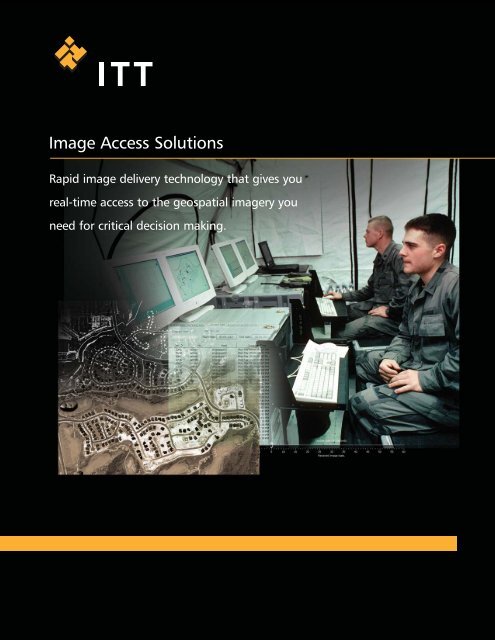
<strong>Image</strong> <strong>Access</strong> <strong>Solutions</strong><br />
Rapid image delivery technology that gives you<br />
real-time access to the geospatial imagery you<br />
need for critical decision making.
Get Geospatial <strong>Image</strong>ry Where and When You Need It<br />
As the demand for delivering geospatial information grows, it becomes more challenging for you to get<br />
imagery to the field in a timely and accurate manner. Often, processed or unexploited imagery is not<br />
readily available to your tactical users, who frequently wait hours for entire images to download before<br />
information can be accessed. For time-sensitive operations, the risk is that imagery can often be left out<br />
of critical, decision-making communications.<br />
Now, <strong>Image</strong> <strong>Access</strong> <strong>Solutions</strong> allows you to deliver and explore geospatial imagery data<br />
where and when you need it – quickly and easily. <strong>Image</strong> <strong>Access</strong> <strong>Solutions</strong> combines advanced<br />
image compression and delivery technologies to deliver multi-gigabyte images to the field in seconds,<br />
not hours – even over limited bandwidths. And, you can begin exploring your images almost immediately,<br />
quickly focusing in on areas of interest for even your most time-sensitive operations.<br />
<strong>Image</strong><br />
Collection<br />
JPEG 2000/NITF<br />
<strong>Image</strong> Compression<br />
Delivery to<br />
Tactical Clients<br />
<strong>Image</strong> <strong>Access</strong> <strong>Solutions</strong> offers advanced compression<br />
and delivery of geospatial imagery to the tactical field user.<br />
<strong>Image</strong> <strong>Access</strong> <strong>Solutions</strong> uses the intelligent streaming technology and compression capabilities of<br />
the JPEG 2000 standard to provide high performance delivery and management of geospatial<br />
imagery and data. The <strong>Image</strong> <strong>Access</strong> <strong>Solutions</strong> Server/Converter converts and compresses images<br />
and streams them to remote users with the <strong>Image</strong> <strong>Access</strong> <strong>Solutions</strong> Viewer. The <strong>Image</strong> <strong>Access</strong><br />
<strong>Solutions</strong> platform can also be customized to integrate with your unique environment.
Rapid <strong>Image</strong> Delivery to the Field<br />
<strong>Image</strong> <strong>Access</strong> <strong>Solutions</strong> is the ideal solution for today's intelligence community and<br />
deployed field users who need to quickly access large, high-resolution imagery:<br />
• Faster <strong>Image</strong> Delivery: <strong>Image</strong> <strong>Access</strong> <strong>Solutions</strong> delivers imagery from a<br />
central server to field computers exponentially faster than conventional methods.<br />
Streaming imagery technology allows field users to display multi-gigabyte sized<br />
images on demand, regardless of bandwidth constraints.<br />
• Immediate <strong>Image</strong> <strong>Access</strong>: The enhanced streaming capability of IAS lets<br />
you begin viewing an image almost immediately and focus on an area of<br />
interest, while the remainder of the image continues to load in the background.<br />
• Standards-Based Technology: <strong>Image</strong> <strong>Access</strong> <strong>Solutions</strong> provides an optimized<br />
implementation of the JPEG 2000 standard, combined with NITF support,<br />
allowing you to take advantage of the leading compression and file standards<br />
used in the intelligence and remote sensing communities.<br />
• Extensive File Format Support: <strong>Image</strong> <strong>Access</strong> <strong>Solutions</strong> provides conversion<br />
and compression of images from a wide range of formats, including NITF, into<br />
JPEG 2000 formats.<br />
• Scalable, Concurrent Processing: <strong>Image</strong> <strong>Access</strong> <strong>Solutions</strong> provides a scalable<br />
technology that can be integrated into existing workflows, helping you to overcome<br />
the limitations of conventional, single-process network architectures. Now you can<br />
grow your JPEG 2000 capabilities to meet your imagery demands.<br />
<strong>Image</strong> <strong>Access</strong> <strong>Solutions</strong> Components<br />
<strong>Image</strong> <strong>Access</strong> <strong>Solutions</strong> is a commercially available software product that is fully<br />
documented and supported by a team of technical sales and support professionals.<br />
Server/Converter<br />
• Server and compression software for high-performance, JPEG 2000 image<br />
libraries and archives<br />
• Provides image delivery and management capabilities<br />
• Converts images from multiple file formats for archive and/or delivery<br />
• Supports Windows and Solaris operating systems<br />
Viewer<br />
• Client software that lets you receive & view compressed images<br />
• Supports Windows ® operating system<br />
<strong>Image</strong> <strong>Access</strong> <strong>Solutions</strong> – Rapid <strong>Image</strong> Delivery
Get Geospatial <strong>Image</strong>ry Where and When You Need It<br />
To learn more about <strong>Image</strong> <strong>Access</strong> <strong>Solutions</strong><br />
resources, or our custom implementation services,<br />
visit www.ittvis.com/IAS.<br />
www.ittvis.com<br />
Copyright © 2007 ITT Corporation. ENVI and IDL are trademarks of ITT Corporation. All other marks are the property of their respective owners. All rights reserved.