The evolution of Jumpinpin Inlet - OzCoasts
The evolution of Jumpinpin Inlet - OzCoasts
The evolution of Jumpinpin Inlet - OzCoasts

Create successful ePaper yourself
Turn your PDF publications into a flip-book with our unique Google optimized e-Paper software.
<strong>The</strong> <strong>evolution</strong> <strong>of</strong> <strong>Jumpinpin</strong> <strong>Inlet</strong><br />
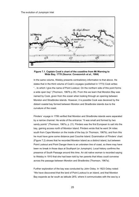
Figure 7.1. Captain Cook’s chart <strong>of</strong> the coastline from Mt Warning to<br />
Wide Bay, 1770 (Source: Covacevich et al., 1984)<br />
In the same volume, Welsby presents contradictory information to that above. He<br />
states that in the third volume <strong>of</strong> Cook’s voyages (published in 1773) Cook writes:<br />
“…to which I give the name <strong>of</strong> Point Lookout. On the northern side <strong>of</strong> this point forms<br />
a wide open bay” (Thomson, 1967b p.35). From this we learn that Moreton Bay was<br />
named by Cook, given from the ocean when looking through an opening between<br />
Moreton and Stradbroke islands. However, it is possible Cook was deceived by the<br />
distant coastal bay formed between Moreton and Stradbroke islands due to the<br />
curvature <strong>of</strong> the coast.<br />
Flinders’ voyage in 1799 verified that Moreton and Stradbroke islands were separated<br />
by a narrow channel. He wrote <strong>of</strong> the entrance: “It was small and formed by two<br />
sandy points” (Thomson, 1967a, p. 21). Flinders was the first European to sail into the<br />
bay, gaining access north <strong>of</strong> Moreton Island. Flinders wrote that he went 34 miles<br />
south from Cape Moreton on the inside <strong>of</strong> the bay (in Thomson, 1967b), and from this<br />
he must have gone some distance past Coochie Island. Examination <strong>of</strong> Flinders’ chart<br />
(Figure 7.2) shows that he recorded Moreton Island as a distinct island, but between<br />
Point Lookout and Point Danger there is an unbroken line <strong>of</strong> coast, so there may have<br />
been no break in those days at Southport (or <strong>Jumpinpin</strong>). Local history confirms the<br />
presence <strong>of</strong> South Passage around this time. An old native woman is recorded saying<br />
to Welsby in 1910 that she had been told by her parents that tribes could converse<br />
across the passage between Moreton and Stradbroke (Thomson, 1967a).<br />
Further exploration <strong>of</strong> the bay was conducted by John Oxley. In 1823 Oxley noted:<br />
“We have discovered that the land <strong>of</strong> Point Lookout is an Island, and that Moreton<br />
Bay expands as far south as latitude 28'S, where it communicates with the sea by a<br />
25