Tron 60S Tron 60GPS
Tron 60S Tron 60GPS
Tron 60S Tron 60GPS

Create successful ePaper yourself
Turn your PDF publications into a flip-book with our unique Google optimized e-Paper software.
www.jotron.com<br />
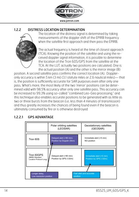
1.2.2 DISTRESS LOCATION DETERMINATION<br />
The location of the distress signal is determined by taking<br />
measurements of the doppler shift of the EPIRB frequency<br />
when the satellite first approach and then pass the EPIRB.<br />
The actual frequency is heard at the time of closest approach<br />
(TCA). Knowing the position of the satellite and using the received<br />
doppler signal information, it is possible to determine<br />
the location of the <strong>Tron</strong> <strong>60S</strong>/GPS from the satellite at the<br />
TCA. At the LUT, actually two positions are calculated. One is<br />
the actual position (A) and the other is the mirror image (B)<br />
position. A second satellite pass confirms the correct location (A). Doppleronly<br />
accuracy is within 5 km (3 mi) (3.1 statute miles or 2.6 nautical miles)— that<br />
is, the position is sufficiently accurate for SAR purposes even after only one<br />
pass. What’s more, the most likely of the two ’mirror’ positions can be determined<br />
valid with 98.5% accuracy after only one satellite pass. This accuracy can<br />
be increased to 99.3% using so-called ”combined Leo-Geo processing,” and<br />
this technique also enables accurate positions to be generated with as little as<br />
two or three bursts from the beacon (i.e. less than 4 minutes of transmission)<br />
and thus greatly increases the chances of being found even if the beacon is<br />
ultimately consumed by fire or is otherwise destroyed<br />
1.2.2.1 GPS ADVANTAGE<br />
Polar orbiting satellites<br />
(LEOSAR)<br />
Geostationary satellites<br />
(GEOSAR)<br />
<strong>Tron</strong> <strong>60S</strong><br />
Delayed alert (


![Brochure [PDF/4.68 MB] - Furuno](https://img.yumpu.com/44137332/1/190x135/brochure-pdf-468-mb-furuno.jpg?quality=85)