

Landscape and Amenities.pdf - Offaly County Council
Landscape and Amenities.pdf - Offaly County Council
Landscape and Amenities.pdf - Offaly County Council

You also want an ePaper? Increase the reach of your titles
YUMPU automatically turns print PDFs into web optimized ePapers that Google loves.
OFFALY COUNTY<br />
OFFALY COUNTY COUNCIL<br />
DEVELOPMENT PLAN<br />
DEVELOPMENT PLAN 2009-2015<br />
2009 - 2015<br />
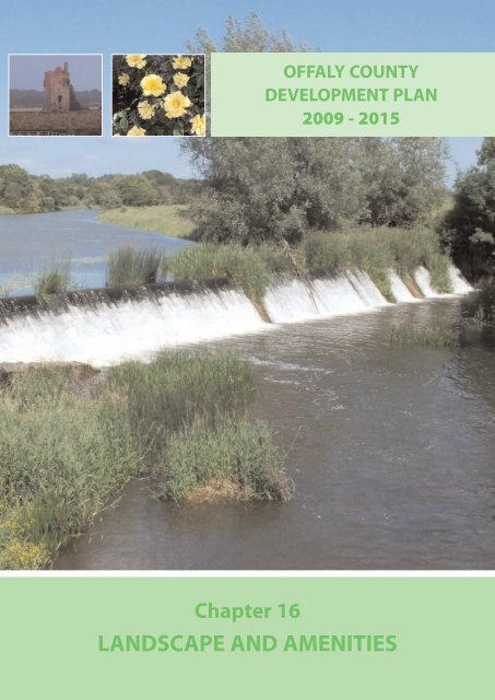
Chapter 16<br />
LANDSCAPE AND AMENITIES
OFFALY COUNTY DEVELOPMENT PLAN 2009 - 2015<br />
Volume 1 - Written Statement<br />
CHAPTER 16:<br />
LANDSCAPE AND AMENITIES<br />
AIM<br />
To identify <strong>County</strong> <strong>Offaly</strong>’s l<strong>and</strong>scape in general terms<br />
based on its inherent <strong>and</strong> unique character <strong>and</strong> to<br />
provide for the preservation <strong>and</strong> protection of this<br />
l<strong>and</strong>scape, amenities of places <strong>and</strong> features of natural<br />
beauty, whilst identifying l<strong>and</strong>scapes which are more<br />
robust in accommodating development. This will assist<br />
in ensuring that the county remains a pleasant place to<br />
live <strong>and</strong> an attractive place to visit.<br />
CONTEXT<br />
Legislative Context<br />
The Planning <strong>and</strong> Development Acts 2000-2006 require<br />
that development plans contain objectives for the<br />
preservation of the character of the l<strong>and</strong>scape where<br />
<strong>and</strong> to the extent that, in the opinion of the Planning<br />
Authority, the proper planning <strong>and</strong> sustainable<br />
development of the area requires it, including the<br />
preservation of views <strong>and</strong> prospects <strong>and</strong> the amenities<br />
of places <strong>and</strong> features of natural beauty or interest.<br />
<strong>L<strong>and</strong>scape</strong> Character - Overview<br />
<strong>L<strong>and</strong>scape</strong> character assessment examines the<br />
over-arching qualities of the l<strong>and</strong> as a whole as<br />
opposed to by individual sites. It is recognised that the<br />
county’s l<strong>and</strong>scape <strong>and</strong> associated amenity value<br />
comprises of areas which are nationally unique <strong>and</strong><br />
areas which are locally special.<br />
<strong>County</strong> <strong>Offaly</strong> largely comprises a flat l<strong>and</strong>scape which<br />
is particularly typified by its extent of bogl<strong>and</strong>s. It also<br />
contains an esker l<strong>and</strong>scape which encapsulates the<br />
geographical change that emerged following the ice<br />
age <strong>and</strong> merits protection given its unique importance<br />
in providing scientific, recreational <strong>and</strong> amenity value.<br />
The Slieve Bloom Mountains upl<strong>and</strong> area, located in the<br />
southwest of the county, is the only substantial upl<strong>and</strong><br />
area within the county. <strong>Offaly</strong>’s l<strong>and</strong>scape is further<br />
typified by its ancient religious traditions <strong>and</strong> its<br />
monastic settlements. The River Shannon flows along<br />
the western boundary of the county <strong>and</strong> coupled with<br />
its callows area, its l<strong>and</strong>scape is unique <strong>and</strong> of<br />
importance locally, nationally <strong>and</strong> internationally. Table<br />
16.1 lists the Areas of High Amenity as designated under<br />
this plan, refer also to Map 15.2 in Chapter 15, Natural<br />
Heritage).<br />
<strong>L<strong>and</strong>scape</strong> should not be regarded as a separate<br />
element of the natural heritage but linkages should be<br />
made to allow an integrated approach to be developed.<br />
This chapter should therefore be considered alongside<br />
Chapter 15, Natural Heritage of this plan in particular.<br />
Table 16.1: Areas of High Amenity<br />
The following l<strong>and</strong>scape areas are classified as areas of high sensitivity within the county’s l<strong>and</strong>scape characterisation<br />
<strong>and</strong> are also designated as Areas of High Amenity within <strong>County</strong> <strong>Offaly</strong> [Refer to Chapter 15, Natural Heritage].<br />
Areas of High Sensitivity <strong>and</strong> Areas of High Amenity<br />
Waterways, Wetl<strong>and</strong>s<br />
Upl<strong>and</strong> Areas<br />
Peatl<strong>and</strong>s<br />
Eskers<br />
Archaeological <strong>and</strong><br />
Historical<br />
River Shannon, Gr<strong>and</strong> Canal<br />
Lough Boora Parkl<strong>and</strong>s 1 , Pallas Lake<br />
Slieve Bloom Mountains, Croghan Hill 2<br />
Clara Bog, Raheenmore Bog<br />
Eiscir Riada, Clara Eskers<br />
Other Eskers<br />
Clonmacnoise<br />
Durrow Monastic Site <strong>and</strong> Demesne<br />
1 Lough Boora Parkl<strong>and</strong>s designation also includes bogl<strong>and</strong>s, agricultural l<strong>and</strong>s, ecological, biodiversity, historical site.<br />
2 Croghan Hill designation also includes archaeological <strong>and</strong> historic interest.<br />
Chapter 16 | <strong>L<strong>and</strong>scape</strong> & <strong>Amenities</strong> | page 165
OFFALY COUNTY DEVELOPMENT PLAN 2009 - 2015<br />
Volume 1 - Written Statement<br />
STRATEGY<br />
The Planning Authority has a role in the preservation of<br />
the l<strong>and</strong>scape, views <strong>and</strong> the amenities of places <strong>and</strong><br />
features of natural beauty within the county. <strong>Offaly</strong><br />
<strong>County</strong> <strong>Council</strong> continues to seek the protection <strong>and</strong><br />
enhancement of the county’s l<strong>and</strong>scape <strong>and</strong> to ensure<br />
that development respects <strong>and</strong>, where necessary,<br />
enhances the appearance <strong>and</strong> character of the existing<br />
local l<strong>and</strong>scape. This can be achieved through the<br />
adoption of policies <strong>and</strong> objectives <strong>and</strong> their<br />
implementation within the development management<br />
process.<br />
16.1 <strong>L<strong>and</strong>scape</strong> Classification<br />
For the purposes of this plan, the different l<strong>and</strong>scape<br />
areas of <strong>County</strong> <strong>Offaly</strong> have been characterised in<br />
relation to their degree of sensitivity to various kinds<br />
of development. These classifications are developed<br />
following the 2003-2009 <strong>Offaly</strong> <strong>County</strong> Development<br />
Plan, having regard to the Department of the<br />
Environment, Heritage <strong>and</strong> Local Government<br />
(DoEHLG), <strong>L<strong>and</strong>scape</strong> <strong>and</strong> <strong>L<strong>and</strong>scape</strong> Assessment<br />
Guidelines.<br />
16.1.1 <strong>L<strong>and</strong>scape</strong> Sensitivity in <strong>County</strong> <strong>Offaly</strong><br />
The sensitivity of a l<strong>and</strong>scape is the measure of its<br />
ability to accommodate change or intervention<br />
without suffering unacceptable effects to its character<br />
<strong>and</strong> values. The sensitivity of the l<strong>and</strong>scapes of <strong>County</strong><br />
<strong>Offaly</strong> varies <strong>and</strong> is thereby classified within the<br />
following sensitivity classes: Low, Moderate <strong>and</strong> High<br />
Sensitivity.<br />
<strong>L<strong>and</strong>scape</strong> considerations are an important factor in all<br />
l<strong>and</strong> use policy for the county. This ensures that a<br />
positive view of development is undertaken whilst<br />
maintaining respect for the environment <strong>and</strong> the<br />
county’s l<strong>and</strong>scape, having regard to the principles of<br />
sustainability.<br />
In general terms, the planning, design <strong>and</strong><br />
management implications for development in<br />
accordance with the sensitivity class of its location is<br />
outlined in Tables 16.2 to 16.5. Map 16.1 illustrates the<br />
l<strong>and</strong>scape classification areas for the county in broad<br />
terms. Map 16.2 gives a representation of the<br />
topography of the county.<br />
Table 16.2 Summary of the <strong>County</strong>’s <strong>L<strong>and</strong>scape</strong>, in general terms, as per the following classes: Low Sensitivity,<br />
Moderate Sensitivity And High Sensitivity.<br />
<strong>L<strong>and</strong>scape</strong><br />
Sensitivity<br />
Description<br />
Acceptability of<br />
Development for<br />
consideration<br />
Need for<br />
L<strong>and</strong>scaping <strong>and</strong><br />
Appropriate Design<br />
LOW<br />
This class largely encompasses the county’s<br />
main urban <strong>and</strong> farming areas. These areas<br />
comprise natural enclosing features (e.g.<br />
topography, vegetation) which have the<br />
capacity to absorb a range of new<br />
development.<br />
A wide range of<br />
Development subject to<br />
appropriateness /<br />
conditions.<br />
High<br />
MODERATE<br />
Areas which are generally ‘open’ in character<br />
with intrinsic quality <strong>and</strong> moderate capacity<br />
to absorb new development.<br />
Some form of development<br />
subject to appropriateness /<br />
conditions.<br />
Very High<br />
HIGH<br />
• Identified features or areas of natural<br />
beauty or interest which have extremely low<br />
capacity to absorb new development.<br />
• Areas included within this class are<br />
designated Areas of High Amenity.<br />
Very limited development<br />
subject to appropriateness /<br />
conditions.<br />
Essential<br />
Chapter 16 | <strong>L<strong>and</strong>scape</strong> & <strong>Amenities</strong> | page 166
Chapter 16 | <strong>L<strong>and</strong>scape</strong> & <strong>Amenities</strong>
Chapter 16 | <strong>L<strong>and</strong>scape</strong> & <strong>Amenities</strong>
OFFALY COUNTY DEVELOPMENT PLAN 2009 - 2015<br />
Volume 1 - Written Statement<br />
Table 16.3 Summary of <strong>L<strong>and</strong>scape</strong> Characteristics <strong>and</strong> Sensitivities as applicable to Low Sensitivity Areas.<br />
Low Sensitivity Areas Characteristics Sensitivities<br />
Rural <strong>and</strong> Agricultural<br />
Areas<br />
<strong>County</strong> <strong>Offaly</strong> is largely a rural county<br />
which comprises of a predominantly<br />
flat <strong>and</strong> undulating agricultural<br />
l<strong>and</strong>scape coupled with a peatl<strong>and</strong><br />
l<strong>and</strong>scape. Field boundaries, particularly<br />
along roadside verges which are<br />
primarily composed of mature<br />
hedgerows typify the county’s rural<br />
l<strong>and</strong>scape.<br />
• These areas in general can absorb quite<br />
effectively, appropriately designed <strong>and</strong><br />
located development in all categories<br />
(including: telecommunication masts <strong>and</strong><br />
wind energy installations, afforestation<br />
<strong>and</strong> agricultural structures).<br />
• Due to the rural nature of the area,<br />
development shall be screened by<br />
appropriate natural boundaries that are<br />
sympathetic to the l<strong>and</strong>scape generally,<br />
where possible.<br />
• New housing proposed should respect<br />
the <strong>Council</strong>s rural housing design<br />
guidelines, coupled with conformity<br />
with development st<strong>and</strong>ards.<br />
Table 16.4 Summary of <strong>L<strong>and</strong>scape</strong> Characteristics <strong>and</strong> Sensitivities as applicable to Moderate Sensitivity Areas.<br />
Moderate Sensitivity<br />
Areas<br />
Cutaway Bog<br />
Characteristics<br />
Cutaway bogs cover a large part of the<br />
l<strong>and</strong>scape of <strong>Offaly</strong> <strong>and</strong> in their<br />
entirety, are approximately 42,000<br />
hectares. There are a number of<br />
l<strong>and</strong>uses for cutaway bog, which<br />
include wilderness, grassl<strong>and</strong>, forestry<br />
<strong>and</strong> recreation. Some cutaway bog<br />
l<strong>and</strong>scapes are more robust <strong>and</strong> may<br />
be considered for other uses.<br />
Sensitivities<br />
• The development of Lough Boora<br />
(designated as high sensitivity) acts as a<br />
prototype in the creation of parkl<strong>and</strong><br />
character.<br />
• However, some of these cutaway bogs<br />
may be appropriate for other sensitively<br />
designed <strong>and</strong> located developments<br />
including renewable energy (wind farms,<br />
biomass crops) <strong>and</strong>/or industrial use.<br />
The <strong>Council</strong> recognises the need for a l<strong>and</strong> use<br />
plan for the future development <strong>and</strong><br />
utilisation of large areas of cutaway bog<br />
within <strong>Offaly</strong>.<br />
Chapter 16 | <strong>L<strong>and</strong>scape</strong> & <strong>Amenities</strong> | page 167
OFFALY COUNTY DEVELOPMENT PLAN 2009 - 2015<br />
Volume 1 - Written Statement<br />
Table 16.5 Summary of <strong>L<strong>and</strong>scape</strong> Characteristics <strong>and</strong> Sensitivities as applicable to High Sensitivity Areas.<br />
High Sensitivity Areas Characteristics Sensitivities<br />
a) The River Shannon &<br />
Callows<br />
•<br />
•<br />
•<br />
•<br />
•<br />
The <strong>Offaly</strong> section of the River<br />
Shannon flows along the western<br />
boundary of the county <strong>and</strong> passes<br />
through Banagher, Shannonharbour<br />
<strong>and</strong> Shannonbridge.<br />
These l<strong>and</strong>s are extremely liable to<br />
flood.<br />
There are local scenic views along<br />
the river <strong>and</strong> to the local heritage<br />
sites such as Clonmacnoise <strong>and</strong> the<br />
Callows.<br />
The Shannon Callows are water<br />
meadows that are the breeding<br />
grounds for thous<strong>and</strong>s of migrant<br />
wild birds. It is an important habitat<br />
within this river l<strong>and</strong>scape.<br />
The <strong>Council</strong> recognises the<br />
immense value of the River<br />
Shannon as a major tourist resource<br />
<strong>and</strong> recreational asset.<br />
•<br />
•<br />
•<br />
•<br />
This area is extremely sensitive to all categories<br />
of development, given its scientific,<br />
ecological, recreational <strong>and</strong> scenic value.<br />
The protection of views of special interest<br />
<strong>and</strong> the l<strong>and</strong>scape of this area is<br />
paramount.<br />
Development should not be of a nature<br />
which could damage the sensitive<br />
ecological habitats <strong>and</strong> the archaeological<br />
aspects of the river corridor. Moreover, the<br />
attractive waterside edge is open <strong>and</strong> flat<br />
<strong>and</strong> is therefore highly sensitive to<br />
development. Further, development at<br />
the waters edge is often inappropriate, as<br />
it would be exposed to view <strong>and</strong> is<br />
generally prohibited in that part of the<br />
Shannon River Valley that carries a nature<br />
designation.<br />
New Development which is considered as<br />
being of necessity should be located<br />
within towns, villages <strong>and</strong> pockets of<br />
existing vegetation to assist screening <strong>and</strong><br />
should also be clustered together to avoid<br />
ribbon development. This will maintain<br />
long distant views out into the open<br />
countryside.<br />
b) The Gr<strong>and</strong> Canal<br />
Corridor<br />
The Gr<strong>and</strong> Canal traverses the county<br />
from Edenderry to Shannon Harbour, a<br />
distance of approximately 64 kilometres.<br />
It passes through the towns of<br />
Daingean, Edenderry (spur line) <strong>and</strong><br />
Tullamore <strong>and</strong> the villages of Belmont,<br />
Rahan, Pollagh <strong>and</strong> Shannonharbour.<br />
There is a disused Kilbeggan branch<br />
line, which is now used as a walking<br />
route. The canal traverses large tracts of<br />
bogl<strong>and</strong>s <strong>and</strong> is bordered by<br />
hedgerows dating back 200 years <strong>and</strong><br />
small fringes of wild vegetation along<br />
the canal bank.<br />
• The Gr<strong>and</strong> Canal is a focus for a wide<br />
range of uses, in particular, for recreation<br />
<strong>and</strong> tourism purposes.<br />
• The visual quality of the surrounding areas<br />
is intrinsic to maintaining the attractiveness<br />
of the Gr<strong>and</strong> Canal corridor.<br />
• Hence, the corridor particularly outside of<br />
settlements, is especially sensitive to large<br />
development structures, insensitively<br />
designed sporadic housing <strong>and</strong><br />
large-scale l<strong>and</strong> uses such as extractive<br />
industries.<br />
• <strong>Offaly</strong> <strong>County</strong> <strong>Council</strong> will have regard to<br />
the Waterway Corridor Study 2002 (<strong>and</strong><br />
any relevant successive studies) in the<br />
development management process.<br />
Chapter 16 | <strong>L<strong>and</strong>scape</strong> & <strong>Amenities</strong> | page 168
OFFALY COUNTY DEVELOPMENT PLAN 2009 - 2015<br />
Volume 1 - Written Statement<br />
High Sensitivity Areas Characteristics Sensitivities<br />
c) Wetl<strong>and</strong>s<br />
•<br />
•<br />
•<br />
The Lough Boora Parkl<strong>and</strong>s include<br />
Turraun Wetl<strong>and</strong>s, Finnamore Lakes<br />
Area <strong>and</strong> Loch Clochán Wetl<strong>and</strong>s.<br />
The areas which were previously<br />
cutaway bogs are now a nature<br />
reserve colonised by fen type vegetation,<br />
which boasts a rich diversity<br />
of flora <strong>and</strong> fauna. The Parkl<strong>and</strong>s are<br />
an open, expansive vista that is currently<br />
largely free of buildings <strong>and</strong><br />
associated installations such as<br />
overhead wires.<br />
Pallas Lake. The scenic <strong>and</strong><br />
recreational value of Pallas Lake is<br />
recognised, as is the value of the<br />
unspoilt rural setting of this area.<br />
Fin Lough. This fen which comprises<br />
approximately 100 hectares is a<br />
National Nature Reserve <strong>and</strong> is<br />
located within proximity to<br />
Clonmacnoise.<br />
•<br />
•<br />
•<br />
•<br />
“Wetl<strong>and</strong>s” is the term used to describe<br />
l<strong>and</strong>s covered with water <strong>and</strong> includes:<br />
lakes, rivers, marshes, fens, bogs <strong>and</strong> other<br />
waterbodies, whether natural or artificial,<br />
permanent or temporary, still or flowing<br />
water 3 .<br />
Wetl<strong>and</strong>s are of importance for their<br />
habitat value <strong>and</strong> they provide a wildlife<br />
shelter.<br />
Recreation is also important. There is a<br />
sense of place <strong>and</strong> peacefulness in the<br />
newly created wetl<strong>and</strong> area at Lough<br />
Boora Parkl<strong>and</strong>s <strong>and</strong> also at Fin Lough <strong>and</strong><br />
Pallas Lake.<br />
Any development proposed which occurs<br />
within these areas, should demonstrate a<br />
necessity to be developed in this location,<br />
be very small scale <strong>and</strong> have minimum<br />
visual impacts. Hence, development in the<br />
surrounding areas should be controlled<br />
including insensitively designed<br />
agricultural buildings.<br />
d) Slieve Bloom Upl<strong>and</strong><br />
Area<br />
•<br />
•<br />
•<br />
•<br />
The Slieve Bloom Mountains area is<br />
the only substantial upl<strong>and</strong> area in<br />
<strong>County</strong> <strong>Offaly</strong>, with approximately<br />
12,000 hectares (i.e. one-third of the<br />
mountains) within <strong>County</strong> <strong>Offaly</strong>,<br />
the remainder being in <strong>County</strong><br />
Laois.<br />
Their value is derived from the<br />
contrast they offer to the county’s<br />
otherwise flat l<strong>and</strong>scape. The<br />
mountains afford a range of<br />
spectacular views, forest <strong>and</strong><br />
riverside walks, picnic sites, historic<br />
<strong>and</strong> archaeological sites <strong>and</strong> areas<br />
subject to environment / conservation<br />
designations.<br />
The entire mountain area is identified<br />
as being an environment park<br />
<strong>and</strong> has the largest unbroken area<br />
of upl<strong>and</strong> blanket peat in Irel<strong>and</strong>.<br />
Housing should be very low impact<br />
in design, scale, mass <strong>and</strong> site<br />
selection. Robust, well screened<br />
sites should be chosen over<br />
unscreened elevated sites in order<br />
to restrict the visual impact to as<br />
small an area as possible.<br />
• This area is extremely sensitive to all<br />
categories of development, <strong>and</strong> the<br />
upl<strong>and</strong> area itself is visible from extensive<br />
surrounding areas. It is particularly<br />
sensitive to large agricultural structures,<br />
sporadic housing, major afforestation<br />
proposals <strong>and</strong> masts.<br />
• Softening of the coniferous edge with<br />
native deciduous planting is recommended<br />
<strong>and</strong> new recreational facilities associated<br />
with forestry should be developed<br />
using natural materials, while not more<br />
than 32% of the mountain area should be<br />
subject to tree planting.<br />
• Car parking should be set within existing<br />
tree canopies where it will not cause<br />
visual intrusion from / to viewpoints.<br />
3 ENFO FS7 Wetl<strong>and</strong>s in Irel<strong>and</strong><br />
Chapter 16 | <strong>L<strong>and</strong>scape</strong> & <strong>Amenities</strong> | page 169
OFFALY COUNTY DEVELOPMENT PLAN 2009 - 2015<br />
Volume 1 - Written Statement<br />
High Sensitivity Areas Characteristics Sensitivities<br />
e) Croghan Hill <strong>and</strong> its<br />
Environs<br />
•<br />
•<br />
Croghan Hill <strong>and</strong> its environs including<br />
Raheenmore Bog (which was<br />
designated a nature reserve under<br />
the Wildlife Act 1976) <strong>and</strong> Cannakill<br />
Deserted Medieval Village, are the<br />
main elements of this high amenity<br />
area.<br />
Croghan Hill is an extinct volcano<br />
which lies 234 metres above sea<br />
level <strong>and</strong> comm<strong>and</strong>s views over<br />
north <strong>and</strong> east <strong>Offaly</strong> <strong>and</strong> the<br />
surrounding counties.<br />
•<br />
•<br />
•<br />
This is an area of archaeological <strong>and</strong> high<br />
amenity value <strong>and</strong> is highly sensitive to<br />
new developments.<br />
Croghan Hill, due to its elevated nature in<br />
comparison to its surrounding flat<br />
l<strong>and</strong>scape, impacts on the visual quality of<br />
the surrounding area <strong>and</strong> is highly<br />
sensitive to developments of any nature,<br />
in particular s<strong>and</strong> <strong>and</strong> gravel extraction.<br />
The <strong>Council</strong> recognises the scenic quality<br />
<strong>and</strong> recreational value of the Croghan Hill<br />
area including Croghan Hill, Raheenmore<br />
Bog <strong>and</strong> Cannakill Deserted Medieval<br />
Village.<br />
f) Bogl<strong>and</strong> Areas •<br />
•<br />
<strong>County</strong> <strong>Offaly</strong> contains a number of<br />
raised <strong>and</strong> blanket bogl<strong>and</strong>s.<br />
Clara bog, an important Natural<br />
Heritage Area (NHA), is also<br />
important for its visual amenities<br />
<strong>and</strong> scenic qualities.<br />
• Other important bogl<strong>and</strong> areas<br />
include the All Saints Bog,<br />
Sharavogue Bog, Slieve Bloom<br />
Blanket Bog <strong>and</strong> Raheenmore Bog.<br />
• <strong>Offaly</strong> <strong>County</strong> <strong>Council</strong> has a strong policy<br />
of conservation of a representative sample<br />
of peatl<strong>and</strong>s <strong>and</strong> the protection of<br />
peatl<strong>and</strong> habitats.<br />
g) The Esker <strong>L<strong>and</strong>scape</strong> •<br />
•<br />
•<br />
Eskers were built up under the ice<br />
cap about ten thous<strong>and</strong> years ago<br />
<strong>and</strong> also have archaeological significance,<br />
as they formed the early<br />
highways in Irel<strong>and</strong>.<br />
In old Irish, ‘eiscir’ means divide<br />
while ‘riada’ means road.<br />
The Eiscir Riada traverses the<br />
northwestern corner of <strong>County</strong><br />
<strong>Offaly</strong> in a more or less continuous<br />
line from Shannonbridge to<br />
Clonmacnoise <strong>and</strong> eastwards onto<br />
Clara, Tullamore, Durrow <strong>and</strong><br />
Rahugh, in Co. Westmeath. [Note:<br />
The Slí Mor (ancient road) followed<br />
the Eiscir Riada].<br />
• The eskers have geomorphologic,<br />
scientific, historical, cultural, recreational<br />
<strong>and</strong> amenity value <strong>and</strong> uniqueness.<br />
• In particular, the esker system north of<br />
Clara bog is critically important, as it is<br />
most likely the source of nutrient rich<br />
water, which feeds the bogs soak systems.<br />
Eskers are also of economic importance <strong>and</strong><br />
there is a need to balance the conservation of<br />
the important l<strong>and</strong>scape features associated<br />
with eskers providing educational / tourism<br />
<strong>and</strong> recreational potential with the requirements<br />
of aggregate extraction <strong>and</strong> economic<br />
development. Hence, the esker l<strong>and</strong>scape is<br />
highly sensitive to any future development<br />
<strong>and</strong> the opening up of new pits for s<strong>and</strong> <strong>and</strong><br />
gravel extraction will be strongly resisted<br />
(Refer to Chapter 10, Rural Development).<br />
Chapter 16 | <strong>L<strong>and</strong>scape</strong> & <strong>Amenities</strong> | page 170
OFFALY COUNTY DEVELOPMENT PLAN 2009 - 2015<br />
Volume 1 - Written Statement<br />
High Sensitivity Areas Characteristics Sensitivities<br />
h) Archaeological <strong>and</strong><br />
Historical <strong>L<strong>and</strong>scape</strong>s<br />
<strong>County</strong> <strong>Offaly</strong> is rich in l<strong>and</strong>scapes of<br />
archaeological <strong>and</strong> historic interests as<br />
is shown in Map 16.3. This ranges from<br />
large ecclesiastical sites such as<br />
Clonmacnoise <strong>and</strong> Durrow Abbey to<br />
archaeological features such as the<br />
Durrow High Cross.<br />
Chapter 14, Built Heritage of this plan<br />
provides further policies <strong>and</strong> objectives<br />
concerning the county’s archaeological<br />
<strong>and</strong> historical l<strong>and</strong>scapes. These<br />
primarily include Clonmacnoise,<br />
Durrow, Killeigh, Leamonaghan <strong>and</strong><br />
Rahan.<br />
• These l<strong>and</strong>scapes are highly sensitive to<br />
new developments, which could<br />
potentially damage the historical<br />
character <strong>and</strong> the cultural <strong>and</strong> social<br />
importance of the area.<br />
• The <strong>Council</strong> shall endeavour to ensure<br />
that planning applications for<br />
development, refurbishment <strong>and</strong><br />
restoration works etc. within close<br />
proximity to these areas are sympathetic<br />
to the sensitive nature of the l<strong>and</strong>scape<br />
Map 16.3 – Archaeological <strong>and</strong> Historical <strong>L<strong>and</strong>scape</strong>s of <strong>Offaly</strong>.<br />
Chapter 16 | <strong>L<strong>and</strong>scape</strong> & <strong>Amenities</strong> | page 171
OFFALY COUNTY DEVELOPMENT PLAN 2009 - 2015<br />
Volume 1 - Written Statement<br />
16.2 <strong>Amenities</strong><br />
16.2.1 Woodl<strong>and</strong>s<br />
Woodl<strong>and</strong> areas (both public <strong>and</strong> private) comprise<br />
circa 7% of the l<strong>and</strong> area nationally. It is acknowledged<br />
that woodl<strong>and</strong>s contribute to the l<strong>and</strong>scape <strong>and</strong> scenic<br />
amenity of the county. <strong>Offaly</strong> contains approximately<br />
9,000 4 hectares of forests <strong>and</strong> woodl<strong>and</strong>s. (Refer to Map<br />
16.4). These include woodl<strong>and</strong> areas within the Slieve<br />
Blooms, Lough Boora Parkl<strong>and</strong>s <strong>and</strong> within demesnes<br />
such as Charleville Demesne, Tullamore. Most<br />
l<strong>and</strong>scapes within <strong>Offaly</strong>, most notably peatl<strong>and</strong>s,<br />
agricultural l<strong>and</strong>s <strong>and</strong> the county’s main upl<strong>and</strong> area –<br />
the Slieve Bloom Mountains, can absorb some<br />
afforestation provided it is sympathetically planned.<br />
Map 16.4 – Forests / Woodl<strong>and</strong>s in <strong>Offaly</strong><br />
16.2.2 Peatl<strong>and</strong>s (bogl<strong>and</strong>s)<br />
Peatl<strong>and</strong>s cover over 1.34 million hectares of the<br />
country’s total l<strong>and</strong> area. 5 In the case of <strong>County</strong> <strong>Offaly</strong><br />
approximately 42,000 hectares of its l<strong>and</strong>scape is<br />
comprised of Peatl<strong>and</strong>s (see Map 16.5), with<br />
approximately 6,000 hectares classified as being<br />
highly sensitive areas <strong>and</strong> approximately 36,000<br />
hectares classified as being of moderately sensitive<br />
areas. (Refer to map. 16.1, <strong>L<strong>and</strong>scape</strong> Classification).<br />
There is a fundamental need for the preparation of<br />
management strategies for peatl<strong>and</strong>s as a whole. These<br />
should aim for a combination of l<strong>and</strong> uses which are<br />
sympathetic to the l<strong>and</strong>scape <strong>and</strong> compatible with the<br />
ecology of the bogs.<br />
Map 16.5 – Bogl<strong>and</strong> / Peatl<strong>and</strong> in <strong>Offaly</strong>.<br />
16.2.3 Eskers<br />
Eskers (see Map 16.6) are glacial features which are<br />
composed of narrow ridges of s<strong>and</strong> <strong>and</strong> gravel <strong>and</strong> are<br />
located throughout the county. <strong>County</strong> <strong>Offaly</strong>’s<br />
l<strong>and</strong>scape contains a number of eskers, the most<br />
prominent being the Eiscir Riada. A balanced approach<br />
between the identification <strong>and</strong> protection of eskers<br />
within the l<strong>and</strong>scape <strong>and</strong> their development (in<br />
particular s<strong>and</strong> <strong>and</strong> gravel extraction) must be achieved.<br />
Map 16.6 – Eskers of <strong>Offaly</strong><br />
4 Source: Environmental Protection Agency, Corine Data 2000<br />
5 Source: Aalen, Whelan & Stout. ‘Atlas of the Irish Rural <strong>L<strong>and</strong>scape</strong>’.<br />
Chapter 16 | <strong>L<strong>and</strong>scape</strong> & <strong>Amenities</strong> | page 172
OFFALY COUNTY DEVELOPMENT PLAN 2009 - 2015<br />
Volume 1 - Written Statement<br />
Map 16.7 Upl<strong>and</strong>s in <strong>Offaly</strong><br />
16.2.4 Upl<strong>and</strong>s<br />
<strong>County</strong> <strong>Offaly</strong> comprises a predominantly flat <strong>and</strong><br />
undulating l<strong>and</strong>scape. Map 16.2 illustrates the topography<br />
of the county <strong>and</strong> Map 16.7 highlights the county’s<br />
two upl<strong>and</strong> areas, namely Slieve Bloom Mountains,<br />
located in south west <strong>Offaly</strong> (area shown is above the<br />
130m contour) <strong>and</strong> Croghan Hill located in northeast of<br />
the county (area shown is above the 100m contour).<br />
These upl<strong>and</strong> areas are identified as such relative to the<br />
surrounding local l<strong>and</strong>scape.<br />
16.2.5 Waterways, Lakes <strong>and</strong> Wetl<strong>and</strong>s<br />
The county contains a number of important waterways,<br />
namely; River Shannon (& Callows), River Barrow, River<br />
Brosna, Little Brosna River, River Silver, River Figile, River<br />
Gageborough. The Gr<strong>and</strong> Canal also traverses the<br />
county from Edenderry to Shannonharbour. A small<br />
number of lakes <strong>and</strong> wetl<strong>and</strong> areas are located within<br />
the county, for example; Lough Boora Parkl<strong>and</strong>s<br />
(including Turraun Wetl<strong>and</strong>s), Pallas Lake <strong>and</strong> Fin<br />
Lough. Map 16.8 highlights the principal waterways in<br />
<strong>Offaly</strong>.<br />
Map 16.8 Waterways, Lakes <strong>and</strong> Wetl<strong>and</strong>s in <strong>Offaly</strong><br />
16.2.6 Views <strong>and</strong> Prospects<br />
The designation of areas of high amenity <strong>and</strong> scenic<br />
amenity routes within <strong>County</strong> <strong>Offaly</strong> provide a basis for<br />
the protection of views <strong>and</strong> prospects of certain<br />
visually vulnerable features. However, there may be a<br />
number of individual views <strong>and</strong> prospects which<br />
warrant protection within the county. The protection of<br />
these views will be implemented on a case-by-case<br />
basis through the development management process,<br />
as appropriate. In particular, Table 16.6 lists the<br />
protected views within the county. This table <strong>and</strong><br />
accompanying map (Map 16.10) lists the views ‘from’<br />
i.e. the specific road <strong>and</strong> / or townl<strong>and</strong>s from which the<br />
view is experienced <strong>and</strong> ‘to’ the particular amenity or<br />
area which is visible from that view. Site visits for each<br />
particular planning application will finally determine if<br />
the view will be affected by a proposed development,<br />
as an arrow on a map cannot be specific enough to<br />
cover all impacts or lack of on a view. The protection of<br />
a view, <strong>and</strong> its application through the Development<br />
Management process (Objective O16-02) is simply to<br />
protect that view <strong>and</strong> not to cross over with other<br />
controlling policies, for example the single rural house<br />
policy.<br />
Chapter 16 | <strong>L<strong>and</strong>scape</strong> & <strong>Amenities</strong> | page 173
OFFALY COUNTY DEVELOPMENT PLAN 2009 - 2015<br />
Volume 1 - Written Statement<br />
Table 16.6 <strong>County</strong> <strong>Offaly</strong> - Views <strong>and</strong> Prospects of Special Amenity Value or Special Interest<br />
(continued on the following page)<br />
Map Ref View From View To<br />
V1<br />
V2<br />
V3<br />
V4<br />
V5<br />
V6<br />
V7<br />
V8<br />
V9<br />
V10<br />
V11<br />
V12<br />
V13<br />
V14<br />
V15<br />
V16<br />
N80 in the townl<strong>and</strong> of Ballynasragh,<br />
Pigeonhouse, Killeigh, Derryclure, Derrybeg<br />
<strong>and</strong> Cloncon.<br />
Road No. L-08003 in the Slieve Bloom Mountains,<br />
townl<strong>and</strong>s of Clough, Ballykelly, Coolcreen,<br />
Glenletter, Glenregan, Castletown, Forelacka <strong>and</strong><br />
Glinsk.<br />
Pilgrims Road (Road No. L-07013) in the townl<strong>and</strong>s<br />
of Clonmacnoise, Clonascra, Ballyduff <strong>and</strong> Bloomhill.<br />
Road No. R444 in the townl<strong>and</strong>s of Clonmacnoise,<br />
Creevagh.<br />
N52 in the townl<strong>and</strong> of Heath, Bunaterin,<br />
Derrydolney, Ballywilliam, Curraghmore,<br />
Ballynacard, Bally na Curra.<br />
R356 <strong>and</strong> Road No. L-07014 in the townl<strong>and</strong>s of<br />
Cushcallow, Park, Mullaghakeeraun <strong>and</strong> Curralahan.<br />
Road No. L-01018 in the townl<strong>and</strong>s of Cannakill <strong>and</strong><br />
Croghan Demesne.<br />
Townl<strong>and</strong>s of Barnan, Kilduff, Old Croghan, Croghan<br />
Demesne, Down.<br />
Townl<strong>and</strong>s of Grovesend <strong>and</strong> Coole.<br />
Road No. L-03004 in the townl<strong>and</strong>s of Skehannagh,<br />
Killagally Glebe, Ballyclare.<br />
Regional Road R357 in the townl<strong>and</strong>s of Lumcloon,<br />
Bun, Rin, Leabeg <strong>and</strong> Leamore.<br />
Road No. L-07009 in the townl<strong>and</strong> of Stonestown.<br />
Road No. L-03012 in the townl<strong>and</strong>s of Glaster,<br />
Ballynasrah, Newtown, Kilmochonna.<br />
R440 in the townl<strong>and</strong>s of Kyle, Cloghanmore,<br />
Streamstown, Ballinree, Killaun.<br />
Road No. L-04006 in the townl<strong>and</strong> of Knock.<br />
Road No. L-04025 in the townl<strong>and</strong>s of Clonee,<br />
Cumber Lower.<br />
South-West Slieve Bloom Mountains <strong>and</strong><br />
Killeigh Village.<br />
Slieve Bloom Mountains, River Shannon<br />
northwards over lowl<strong>and</strong>s.<br />
Clonmacnoise <strong>and</strong> River Shannon, Eskers,<br />
Mongan Bog <strong>and</strong> Finlough.<br />
River Shannon <strong>and</strong> bogl<strong>and</strong>s.<br />
Slieve Bloom Mountains.<br />
River Shannon <strong>and</strong> Bogl<strong>and</strong>s.<br />
Slieve Bloom Mountains.<br />
Views towards Croghan Hill <strong>and</strong> Bogl<strong>and</strong>s.<br />
South to bogl<strong>and</strong>s.<br />
Southwards towards Slieve Bloom<br />
Mountains.<br />
Southwards towards Slieve Bloom Mountains.<br />
Over bogl<strong>and</strong>s <strong>and</strong> Slieve Bloom Mountains.<br />
Over Little Brosna <strong>and</strong> Callows.<br />
Towards Slieve Bloom Mountains.<br />
Slieve Bloom Mountains, Leap Castle.<br />
Westward over farml<strong>and</strong>.<br />
Chapter 16 | <strong>L<strong>and</strong>scape</strong> & <strong>Amenities</strong> | page 174
OFFALY COUNTY DEVELOPMENT PLAN 2009 - 2015<br />
Volume 1 - Written Statement<br />
Table 16.6 <strong>County</strong> <strong>Offaly</strong> - Views <strong>and</strong> Prospects of Special Amenity Value or Special Interest<br />
(continued from previous page)<br />
Map Ref View From View To<br />
V17<br />
V18<br />
V19<br />
Road No. L-06034 in the townl<strong>and</strong>s of Knockhill<br />
<strong>and</strong> Drinagh.<br />
Road No. L-08008 in the townl<strong>and</strong>s of Grange,<br />
Belhill, Longford Big <strong>and</strong> Church L<strong>and</strong>.<br />
Road No. L-02011 in the townl<strong>and</strong>s of<br />
Rahan Demesne, Newtown.<br />
Towards North East <strong>and</strong> North West over<br />
lowl<strong>and</strong>s.<br />
Views towards Seir Keiran Monastic Site.<br />
Churches <strong>and</strong> Earthworks.<br />
16.2.7 Protection of Key Scenic Amenity Routes<br />
<strong>County</strong> <strong>Offaly</strong> contains a number of valuable scenic<br />
amenity routes which offer a very attractive<br />
cross-sectional view <strong>and</strong> overall impression of differing<br />
l<strong>and</strong>scapes within <strong>Offaly</strong> as one traverses the county.<br />
The enjoyment of such varying l<strong>and</strong>scapes for the<br />
visitor who regularly traverses the county <strong>and</strong>/or the<br />
local person can be lessened by both insensitive <strong>and</strong>/or<br />
excessive levels of roadside development. However, the<br />
<strong>Council</strong> acknowledges that in certain circumstances,<br />
some development may be necessary. In this regard,<br />
appropriate location, siting <strong>and</strong> design criteria should<br />
strictly apply in accordance with policies as contained<br />
in Chapter 4, Settlement Strategy. (Refer also to<br />
Chapter 13, Transport <strong>and</strong> Accessibility, section 13.2.6<br />
<strong>and</strong> policy P13-05. Also refer to Chapter 19, Built Form<br />
<strong>and</strong> Urban <strong>and</strong> Rural Development St<strong>and</strong>ards).<br />
The following routes are designated as scenic amenity<br />
routes within <strong>Offaly</strong>. (See Map 16.9).<br />
Map 16.9 – Restricted Regional Routes<br />
Chapter 16 | <strong>L<strong>and</strong>scape</strong> & <strong>Amenities</strong> | page 175
OFFALY COUNTY DEVELOPMENT PLAN 2009 - 2015<br />
Volume 1 - Written Statement<br />
a) R357 Blueball to Shannonbridge<br />
This route links the N52 at Blueball to Shannonbridge. It<br />
passes through esker l<strong>and</strong>scape, peatl<strong>and</strong>s, undulating<br />
agricultural l<strong>and</strong>s, Lough Boora Parkl<strong>and</strong>s <strong>and</strong> the<br />
callows area of the River Shannon in particular.<br />
b) R440 <strong>and</strong> R421 Birr to Kinnitty <strong>and</strong> Ballard to<br />
Kinnitty.<br />
This route provides an attractive drive within the open<br />
countryside to the attractions of the Slieve Bloom<br />
Mountains <strong>and</strong> around the foothills of the mountains<br />
themselves.<br />
16.2.8 Field Boundaries<br />
Field boundaries, particularly along roadside verges<br />
contribute to the overall natural qualities <strong>and</strong> amenities<br />
of an area. Where a roadside boundary is required to be<br />
set back to provide a visibility splay, the field boundary<br />
should be retained <strong>and</strong> relocated along the new<br />
boundary line to ensure its continuity <strong>and</strong><br />
enhancement, where feasible (Refer to Chapter 19, Built<br />
Form <strong>and</strong> Urban <strong>and</strong> Rural Development St<strong>and</strong>ards).<br />
Where trees can be safely retained within the visibility<br />
splay, the lower branches should be lopped to raise the<br />
crown to a height of three metres from ground level.<br />
16.2.10 Railways<br />
It is acknowledged that <strong>Offaly</strong>’s strong tradition<br />
associated with the peatl<strong>and</strong>s has resulted in some<br />
attractive industrial rail lines which cross some of the<br />
county’s local roads <strong>and</strong> afford scenic qualities <strong>and</strong><br />
remnants of our past. Some continue to be utilised by<br />
Bord na Mona. Consideration should be given to<br />
reserving the line of such railways / rights of way for<br />
possible future re-use.<br />
The national rail network which traverses the county<br />
also provides an opportunity for individuals to attain an<br />
overall perspective of the quality of the l<strong>and</strong>scape of<br />
<strong>Offaly</strong>. Any development proposed adjacent to or<br />
within such a location where it may be visible from the<br />
rail lines in the county must address this feature as part<br />
of its design proposal.<br />
16.2.11 Cycleways<br />
The <strong>Council</strong> recognises the resurgence in the growth of<br />
cycling as a means of recreational activity. <strong>County</strong> <strong>Offaly</strong><br />
provides ideal terrain for cycling. The <strong>Council</strong><br />
acknowledges that provisions for cyclists including<br />
where appropriate, dedicated cycleways, should be<br />
provided as resources permit.<br />
16.2.9 Trees, Hedgerows, Traditional Stonewalls<br />
A hedgerow survey for <strong>County</strong> <strong>Offaly</strong> was undertaken in<br />
2005. Hedgerows <strong>and</strong> stone walls should be retained or<br />
translocated within a development proposal where this<br />
protects or conserves the value or functions for which<br />
they are being retained, for example, a) field pattern<br />
they reflect, b) continuity of habitat as a wildlife corridor<br />
or c) the function is as a l<strong>and</strong>mark or a habitat. Should<br />
this be unfeasible (in terms of public safety) proposals<br />
to replace with native species of local provenance is<br />
required.<br />
The conservation of mature trees is also necessary <strong>and</strong><br />
their presence enhances the overall aesthetic quality of<br />
an area. Where sites contain trees, a tree survey may be<br />
required that identifies all trees on the subject site <strong>and</strong><br />
reports on their condition. This report should indicate<br />
whether such trees are proposed for retention <strong>and</strong> any<br />
works which may be necessary to the trees to allow<br />
them to grow without conflicting with the use of the<br />
l<strong>and</strong> (for example, over shadow windows, have their<br />
root growth impeded to the extent that the tree may<br />
die <strong>and</strong>/or pose risk to human safety).<br />
Chapter 16 | <strong>L<strong>and</strong>scape</strong> & <strong>Amenities</strong> | page 176
OFFALY COUNTY DEVELOPMENT PLAN 2009 - 2015<br />
Volume 1 - Written Statement<br />
16.3 POLICY<br />
P16-01 It is <strong>Council</strong> policy that l<strong>and</strong>scape considerations will be an important factor in all l<strong>and</strong> use policy <strong>and</strong><br />
decision making for the county, ensuring that a pro-active view of development is undertaken whilst<br />
maintaining respect for the environment <strong>and</strong> heritage, as per the general principles of sustainable development.<br />
Further it is policy to conserve, protect <strong>and</strong> enhance the l<strong>and</strong>scape of <strong>Offaly</strong> at a number of levels:<br />
• The value of the l<strong>and</strong>scape itself, as open countryside <strong>and</strong> the associated form <strong>and</strong> character of<br />
settlements.<br />
• The value of the l<strong>and</strong>scape as a resource for economic growth in accordance with its physical <strong>and</strong> visual<br />
attributes.<br />
• The value of the l<strong>and</strong>scape <strong>and</strong> its role with habitats <strong>and</strong> species whose diversity enriches the<br />
environment.<br />
P16-02 It is <strong>Council</strong> policy to control development as per the county’s l<strong>and</strong>scape classification listed in Tables<br />
16.2-16.5.<br />
P16-03 It is <strong>Council</strong> policy to protect <strong>and</strong> preserve the county’s Areas of High Amenity, including the Slieve<br />
Bloom Mountains, Clonmacnoise Heritage Zone, River Shannon, Lough Boora Parkl<strong>and</strong>s, Gr<strong>and</strong> Canal, Croghan<br />
Hill, Raheenmore Bog, Pallas Lake, Clara Bog <strong>and</strong> eskers, Eiscir Riada, other eskers <strong>and</strong> Durrow High Cross, Abbey<br />
& surrounding area from development(s) which would be visually obtrusive or which would detract from the<br />
intrinsic character <strong>and</strong> environmental quality of the l<strong>and</strong>scape.<br />
P16-04 It is <strong>Council</strong> policy to protect the county’s attractive scenic amenity routes from insensitive levels of<br />
roadside development <strong>and</strong> excessive levels of development. For development directly accessing onto restricted<br />
regional routes (key amenity routes) as shown on map 13.3 (Chapter 13, Transport <strong>and</strong> Accessibility) <strong>and</strong> on map<br />
16.9, restrictions as per policy P13-05 will apply.<br />
P16-05 It is <strong>Council</strong> policy that existing local l<strong>and</strong>scape features, including hedgerows, shelter belts <strong>and</strong> stone<br />
walls are retained, protected <strong>and</strong> enhanced where appropriate, so as to preserve the local l<strong>and</strong>scape <strong>and</strong><br />
character of an area, whilst providing for future development.<br />
P16-06 It is <strong>Council</strong> policy to protect the l<strong>and</strong>scape comprising the River Shannon <strong>and</strong> flood plain including the<br />
callows <strong>and</strong> views of special interest from inappropriate development. However, appropriate development<br />
within settlements adjacent to the Shannon <strong>and</strong> its callows <strong>and</strong> which act as focal points for both residential <strong>and</strong><br />
commercial / business, industry <strong>and</strong> recreation will be positively considered.<br />
P16-07 It is <strong>Council</strong> policy that new development should ensure the protection of mature trees, hedgerows<br />
<strong>and</strong> the conservation of existing stone walls, <strong>and</strong> their integration into new development. Where the provision<br />
of new boundaries is required, these should comprise native hedgerow planting, or stone walls which consist of<br />
stone found in the locality. Where comprehensive new development occurs, it should take into account the<br />
pattern of existing hedgerows <strong>and</strong> incorporate same into layouts or plant connecting hedgerows where<br />
hedgerow removal to facilitate development works is necessary. The <strong>Council</strong> will require that all new<br />
development will respect the existing character of the settlement, in particular through the provision of<br />
sensitive l<strong>and</strong>scaping schemes. In the event that the removal of tree(s) is deemed to be necessary, it will be<br />
generally conditional on replacement with appropriate species.<br />
Chapter 16 | <strong>L<strong>and</strong>scape</strong> & <strong>Amenities</strong> | page 177
OFFALY COUNTY DEVELOPMENT PLAN 2009 - 2015<br />
Volume 1 - Written Statement<br />
P16-08 It is <strong>Council</strong> policy to protect formal <strong>and</strong> informal open spaces which contribute to the l<strong>and</strong>scape <strong>and</strong><br />
scenic amenity of the county <strong>and</strong>/or act as a ‘green buffer’ within settlements in particular.<br />
P16-09 It is <strong>Council</strong> policy to make provisions for the reservation of l<strong>and</strong> which will allow for the development<br />
of public open space, where appropriate.<br />
16.4 OBJECTIVES 6<br />
O16-01 It is an objective of the <strong>Council</strong> to preserve <strong>and</strong> enhance the character of the county’s l<strong>and</strong>scape where,<br />
<strong>and</strong> to the extent that in the opinion of <strong>Offaly</strong> <strong>County</strong> <strong>Council</strong>, the proper planning <strong>and</strong> sustainable of the area<br />
requires it.<br />
O16-02 It is an objective of the <strong>Council</strong> to preserve scenic views <strong>and</strong> prospects throughout the county which<br />
will be assessed on a case-by-case basis, as part of the development management process. (Views are listed in<br />
Table 16.6 <strong>and</strong> shown on Map 16.10.<br />
O16-03 It is an objective to the <strong>Council</strong> to make provisions for cyclists including where appropriate, dedicated<br />
cycleways, subject to availability of finance.<br />
O16-04 It is an objective of the <strong>Council</strong> to evaluate the need for <strong>L<strong>and</strong>scape</strong> Character Analysis in the county.<br />
O16-05 It is an objective of the <strong>Council</strong> to investigate the feasibility of preparing a <strong>L<strong>and</strong>scape</strong> Conservation Area<br />
Assessment within the county.<br />
6 The order of listing of objectives is not intended to indicate priorities. Subject to the availability of resources, it is the <strong>Council</strong>ís aim to monitor <strong>and</strong> accomplish<br />
the objectives listed in this section within the period of the plan.<br />
Chapter 16 | <strong>L<strong>and</strong>scape</strong> & <strong>Amenities</strong> | page 178
Chapter 16 | <strong>L<strong>and</strong>scape</strong> & <strong>Amenities</strong>


