North to Alaska - for Petroleum News
North to Alaska - for Petroleum News
North to Alaska - for Petroleum News

Create successful ePaper yourself
Turn your PDF publications into a flip-book with our unique Google optimized e-Paper software.
Page 2<br />
<strong>North</strong> <strong>to</strong> <strong>Alaska</strong>: Geoscience, Technology and Natural Resources
<strong>North</strong> <strong>to</strong> <strong>Alaska</strong>: Geoscience, Technology and Natural Resources Page 3<br />
Welcome: A message from our co-chairs<br />
It is with great pleasure that we announce the joint meeting of<br />
the Cordilleran Section – GSA, the Pacific Section – AAPG, and the<br />
Western Region – SPE.<br />
The theme of the meeting “<strong>North</strong> <strong>to</strong> <strong>Alaska</strong>: Geoscience,<br />
Technology, and Natural Resources”highlights the challenges, high<br />
stakes, and excitement offered through technology <strong>to</strong> deliver our<br />
energy and natural resources in the future.<br />
The broad <strong>for</strong>mat of this joint conference promotes emphasis<br />
on innovation and cross-discipline approaches in energy and natural<br />
resource development.With a wide span of technical presentations,<br />
<strong>for</strong>um <strong>to</strong>pics, short courses, field trips, poster sessions, and<br />
exhibits, this meeting is sure <strong>to</strong> offer something <strong>for</strong> all professionals<br />
involved in the petroleum and natural resource industries, as<br />
well as those involved in Cordilleran and Arctic geoscience studies.<br />
A meeting with an ambitious schedule such as assembled <strong>for</strong><br />
this joint conference, including all the logistical as well as technical<br />
contributions, would be little short of a disaster without an army of<br />
volunteers and generous sponsors.<br />
The contributions of our Sponsors have allowed us <strong>to</strong> plan a<br />
meeting of professional caliber and offer a program unique <strong>to</strong><br />
<strong>Alaska</strong>.<br />
Last, with great pleasure and gratitude<br />
we acknowledge the volunteers from the<br />
local geoscience and engineering community,<br />
from the state of <strong>Alaska</strong>, and all those<br />
from the organizations outside of <strong>Alaska</strong> <strong>for</strong><br />
all the hard work and cooperation <strong>to</strong> see<br />
that this meeting is a success.<br />
Welcome all!<br />
Pacific Section AAPG Co-Chair<br />
Greg Wilson<br />
ConocoPhillips <strong>Alaska</strong><br />
Cordilleran Section GSA Co-Chair<br />
Jeanine M. Schmidt<br />
U.S. Geological Survey<br />
Western Region SPE Co-Chair<br />
Bill Van Dyke<br />
AK Dept. of Natural Resources<br />
Keynote address<br />
3D Seismic Expression of Deep Water Depositional Elements: Reducing the Risk of Lithology Prediction<br />
A<br />
By HENRY POSAMENTIER<br />
Chief Geologist and Distinguished Advisor<br />
<strong>for</strong> Anadarko <strong>Petroleum</strong><br />
nalyses of 3-D seismic data can yield<br />
significant insights with regard <strong>to</strong><br />
spatial and temporal relationships of<br />
near-seafloor depositional elements<br />
in deep-water settings. These analyses can<br />
be based on a broad range of horizon<br />
attributes, such as amplitude, time/depth<br />
structure, dip azimuth, dip magnitude, curvature,<br />
and roughness, as well as interval<br />
attributes such as frequency and amplitude<br />
distribution, and seismic facies based on<br />
wave<strong>for</strong>m.<br />
The great complexity of deep-water<br />
depositional environments can be simplified<br />
by grouping depositional elements in<strong>to</strong><br />
five major categories: 1) turbidity-flow leveed<br />
channels, 2) channel-overbank sediment<br />
waves and levees, 3) frontal<br />
splays/distributary channel complexes, 4)<br />
crevasse splay complexes, and 5) debrisflow<br />
channels, lobes and sheets. Each depositional<br />
element type displays a unique<br />
morphology and seismic-stratigraphic<br />
expression.Their reservoir architecture is a<br />
function of the interaction between sedimentary<br />
process, sea-floor morphology, and<br />
sediment grain size distribution. Each<br />
depositional element is associated with a<br />
characteristic suite of lithofacies that can<br />
be predictable. Principal sand habitats in<br />
deep-water settings include channels, fontal<br />
splays, and crevasse splays.<br />
Turbidity-flow leveed channels can<br />
range from nearly straight <strong>to</strong> highly sinuous;<br />
channel meanders in most instances<br />
migrate down-system. In some instances,<br />
high-sinuosity channels are associated with<br />
channel-overbank sediment wave development,<br />
especially in association with outer<br />
channel bends.Where levees are low, <strong>to</strong> the<br />
point where they can no longer be<br />
resolved seismically, high-sinuosity channels<br />
feed frontal splays/low-sinuosity distributary<br />
channel complexes. Low-sinuosity distributary<br />
channel complexes commonly are<br />
expressed as lobate sheets.A variation on<br />
frontal splays, but located on overbank settings<br />
associated with leveed channels, are<br />
crevasse splay deposits, which comprise<br />
smaller lobe<strong>for</strong>ms associated with levee<br />
crevasses commonly located at outer channel<br />
bends.<br />
Debris-flow deposits, commonly characterized<br />
by poor reservoir quality, can <strong>for</strong>m<br />
low-sinuosity channel fills, elongate lobes,<br />
and sheets and are characterized seismically<br />
by con<strong>to</strong>rted, chaotic, low-amplitude<br />
reflection patterns that commonly overlie<br />
striated/grooved pavements.<br />
Henry W. Posamentier<br />
is the Chief Geologist<br />
and Distinguished<br />
Advisor <strong>for</strong> Anadarko<br />
<strong>Petroleum</strong> Corporation.<br />
Prior <strong>to</strong> joining Anadarko<br />
in 2001, he was with<br />
Veritas Exploration<br />
Services (2000-2001), the<br />
Atlantic Richfield Co.<br />
(1991-2000), Exxon Production Research Co. and<br />
Esso Resources Canada, Ltd. (1979-1991), and at<br />
Rider University, Assistant Professor of Geology<br />
(1974-1979).<br />
Dr. Posamentier’s research interests have<br />
been in the fields of sequence stratigraphy and<br />
depositional systems analysis, where he has published<br />
widely. Most recently, he has employed an<br />
interdisciplinary approach <strong>to</strong> geologic prediction<br />
using 3D seismic visualization integrated with<br />
borehole data <strong>to</strong> interpret depositional systems<br />
and develop basin fill his<strong>to</strong>ries, in particular with<br />
reference <strong>to</strong> deep-water depositional settings.<br />
His current responsibilities involve ensuring integration<br />
of appropriate technologies in<strong>to</strong> the<br />
exploration process. In 1971-1972, Dr.<br />
Posamentier was a Fulbright Fellow <strong>to</strong> Austria.<br />
He has served as an AAPG Distinguished<br />
Lecturer <strong>to</strong> the United States (1991-1992), an<br />
AAPG Distinguished Lecturer <strong>to</strong> the <strong>for</strong>mer<br />
Soviet Union (1996-1997), and an AAPG<br />
Distinguished Lecturer <strong>to</strong> the Middle East (1998-<br />
1999).
NORTH TO ALASKA<br />
Released May 3, 2006<br />
Special publication <strong>for</strong> a joint<br />
meeting of the Cordilleran<br />
Section, GSA, the<br />
Pacific Section, AAPG; and the<br />
Western Region, SPE. The<br />
theme of the meeting<br />
is "<strong>North</strong> <strong>to</strong> <strong>Alaska</strong>:<br />
Geoscience, Technology, and<br />
Natural Resources."<br />
<strong>North</strong> <strong>to</strong> <strong>Alaska</strong> was produced by<br />
<strong>Petroleum</strong> <strong>News</strong><br />
MAILING ADDRESS:<br />
PO Box 231651<br />
Anchorage, AK 99523-1651<br />
Phone: (907) 522-9469<br />
Fax: (907) 522-9583<br />
Email:<br />
circulation@<strong>Petroleum</strong><strong>News</strong>.com<br />
Web page:<br />
www.<strong>Petroleum</strong><strong>News</strong>.com<br />
DAN WILCOX<br />
CEO<br />
MARY LASLEY<br />
CFO<br />
KAY CASHMAN<br />
Publisher<br />
KRISTEN NELSON<br />
EDITOR-IN-CHIEF<br />
AMY SPITTLER<br />
EDITOR<br />
SUSAN CRANE<br />
ADVERTISING DIRECTOR<br />
STEVEN MERRITT<br />
PRODUCTION DIRECTOR<br />
TOM KEARNEY<br />
AD & COVER PRODUCTION<br />
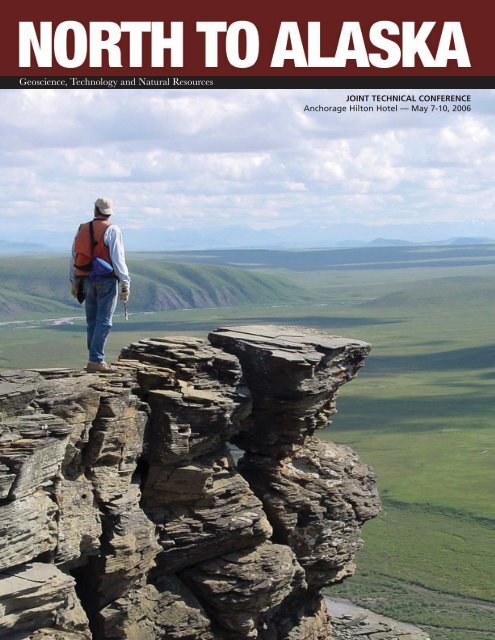
Cover Pho<strong>to</strong>: David Lepain standing on an<br />
outcrop of Lower Cretaceous Nanushuk<br />
Formation sands<strong>to</strong>ne at Tuktu Bluff in the<br />
Brooks Range Foothills. Pho<strong>to</strong> courtesy<br />
David Houseknecht<br />
23<br />
3<br />
3<br />
6<br />
6<br />
6<br />
7<br />
Welcome: A message from our<br />
co-chairs<br />
Keynote address<br />
Schedule of events<br />
Technical program<br />
The Brooks Range Orogen: A<br />
Symposium in Honor of Gil Mull<br />
Theme sessions<br />
9<br />
10<br />
12<br />
13<br />
13<br />
14<br />
About Anchorage, including<br />
spouse and guest activities<br />
Field trips<br />
Short courses<br />
Student men<strong>to</strong>r program<br />
Student awards<br />
Exhibit map
<strong>North</strong> <strong>to</strong> <strong>Alaska</strong>: Geoscience, Technology and Natural Resources Page 5<br />
AROUND ALASKA<br />
16 Opportunities abound at upcoming lease sales<br />
State tracts available in the May <strong>North</strong> Slope<br />
foothills and Cook Inlet basin areawide lease<br />
sales include underexplored areas<br />
20 Undiscovered riches in Beau<strong>for</strong>t, Chukchi seas<br />
Structures larger than Prudhoe Bay exist in<br />
regions that extend the prolific onshore<br />
petroleum systems of northern <strong>Alaska</strong><br />
23 Gil Mull: A modern-day rock sleuth<br />
<strong>Petroleum</strong> geologist recounts 40 years working<br />
in the field in northern <strong>Alaska</strong><br />
29 New assessment released <strong>for</strong> <strong>Alaska</strong> OCS<br />
Results from new model are similar in overall<br />
estimated resources<br />
29 <strong>Alaska</strong> sales set May 24<br />
32 Burger delivers<br />
MMS reappraises Chukchi well; may be largest<br />
hydrocarbon find on <strong>Alaska</strong> OCS
Page 6<br />
<strong>North</strong> <strong>to</strong> <strong>Alaska</strong>: Geoscience, Technology and Natural Resources<br />
Joint Technical Conference<br />
Pacific Section – AAPG<br />
Cordilleran Section – GSA<br />
Western Region – SPE<br />
May 7-10, 2006 • Anchorage Hil<strong>to</strong>n Hotel<br />
<strong>North</strong> <strong>to</strong> <strong>Alaska</strong>: Geoscience,<br />
Technology and Natural Resources<br />
Technical program<br />
There are 31 oral sessions and 14<br />
poster sessions during this meeting. Oral<br />
sessions take place in the Aleutian and<br />
<strong>Alaska</strong> Rooms (2nd floor) and in the<br />
Aspen, Spruce, Birch-Willow, Fireweed,<br />
and Lupine rooms (1st floor) in the West<br />
Tower of the Anchorage Hil<strong>to</strong>n Hotel.<br />
Poster sessions are located in the Denali<br />
Room (2nd floor), across from the<br />
exhibits area (Bris<strong>to</strong>l Bay Ballroom), and<br />
are a half-day in duration. Poster presenters<br />
are expected <strong>to</strong> be present <strong>for</strong> two<br />
hours (9-11 a.m. or 2-4 p.m.).<br />
Oral presentations in most sessions<br />
will be 20 minutes in length, including 3<br />
<strong>to</strong> 5 minutes <strong>for</strong> discussion and change<br />
of speakers. Some SPE sessions will have<br />
30-minute presentations.<br />
Symposium<br />
The Brooks Range Orogen: A Symposium<br />
in Honor of Gil Mull<br />
The Brooks Range, one of the outstanding<br />
fold-thrust belts of <strong>North</strong><br />
America, was caused by thrusting of<br />
oceanic rocks northward on<strong>to</strong> the Arctic<br />
<strong>Alaska</strong> continental margin in the Jurassic<br />
and Early<br />
Cretaceous. Gil Mull<br />
spent more than<br />
four decades mapping<br />
the complexities<br />
of this fascinating<br />
fold-thrust belt<br />
and made many significant,<br />
fundamental<br />
contributions <strong>to</strong> its<br />
Gil Mull<br />
stratigraphy, structural<br />
geology, tec<strong>to</strong>nics,<br />
and petroleum geology.<br />
Over the course of his career, Gil has<br />
been a tireless advocate of field-based<br />
research focused on subjects of shared<br />
interest <strong>to</strong> academia and industry and has<br />
ALAN BAILEY<br />
Schedule continues on page 8
<strong>North</strong> <strong>to</strong> <strong>Alaska</strong>: Geoscience, Technology and Natural Resources Page 7<br />
inspired and sponsored multiple generations<br />
of students <strong>to</strong> undertake field-based<br />
research projects in northern <strong>Alaska</strong>.<br />
For more in<strong>for</strong>mation:Tom Moore, U.S.<br />
Geological Survey, tmoore@usgs.gov, 650-<br />
329-5713; Marwan Wartes,<strong>Alaska</strong> Division<br />
of Geological and Geophysical Surveys,<br />
marwan_wartes@dnr.state.ak.us, 907-451-<br />
5056.<br />
Theme sessions<br />
Joint: Pacific Section, AAPG and<br />
Cordilleran Section, GSA<br />
Foreland Basin Systems:Archives of<br />
Coupled Structural and Sedimentary<br />
Processes. Marwan Wartes,<strong>Alaska</strong><br />
Division of Geological and Geophysical<br />
Surveys, marwan_wartes@dnr.state.ak.us,<br />
907-451-5056.<br />
Forearc Basins:Tec<strong>to</strong>nostratigraphy<br />
and Resource Potential. Bob Swenson,<br />
<strong>Alaska</strong> Division of Oil and Gas,<br />
robert_swenson@dnr.state.ak.us, 907-451-<br />
5001.<br />
Geology of the Circum-Arctic.Tom<br />
Homza, Shell E&P Co.,<br />
thomas.homza@shell.com, 907-770-3701;<br />
Jim Clough,<strong>Alaska</strong> Division of Geological<br />
and Geophysical Surveys,<br />
jim_clough@dnr.state.ak.us, 907-451-<br />
5030.<br />
Active Tec<strong>to</strong>nics of the <strong>North</strong>ern<br />
Cordillera. Peter Haeussler, U.S.<br />
Geological Survey, pheuslr@usgs.gov, 907-<br />
786-7447. Coordinates with Chapman<br />
conference on Southern <strong>Alaska</strong> active tec<strong>to</strong>nics<br />
<strong>to</strong> follow this meeting.<br />
Late Paleozoic–Early Mesozoic<br />
Paleogeography of <strong>North</strong>ern <strong>Alaska</strong>. Julie<br />
Dumoulin, U.S. Geological Survey,<br />
dumoulin@usgs.gov, 907-786-7439; Mike<br />
Whalen, University of <strong>Alaska</strong>–Fairbanks,<br />
mtwhalen@gi.alaska.edu, 907-474-5302.<br />
Cordilleran Section, GSA<br />
New Insights in<strong>to</strong> the Origin and<br />
Evolution of the <strong>North</strong>ern Cordilleran<br />
Pericra<strong>to</strong>nic Terranes. Cynthia Dusel-<br />
Bacon, U.S. Geological Survey,<br />
cdusel@usgs. gov, 650-329-5719; JoAnne<br />
Nelson, British Columbia Geological<br />
Survey, joanne.nelson@gems1.gov.bc.ca,<br />
250-952-0438.<br />
Wrangellia—Tec<strong>to</strong>nics and<br />
Metallogeny, 30 Years of Progress. Jeanine<br />
Schmidt, U.S. Geological Survey,<br />
jschmidt@usgs.gov, 907-786-7494; Murray<br />
Hitzman, Colorado School of Mines,<br />
mhitzman@mines.edu, 303-384-2127;<br />
Jason Price, Colorado School of Mines.<br />
Accreted Terranes of Western <strong>North</strong><br />
America:An Update on Current Research<br />
on the Construction of the Cordillera.<br />
Robert B. Blodgett, U.S. Geological<br />
Survey, rblodgett@usgs.gov, 907-786-7416;<br />
Erik C. Katvala, University of Calgary, eckatval@ucalgary.ca.<br />
Environmental Issues Associated with<br />
Mineralized Regions. LeeAnn Munk,<br />
University of <strong>Alaska</strong>–Anchorage,<br />
aflm@uaa.alaska.edu, 907-786-6895;<br />
Bronwen Wang,<br />
U.S. Geological Survey, bwang@usgs.gov,<br />
907-786-7110.<br />
High Latitude-Altitude Hydrogeology<br />
and Weathering. Bronwen Wang, U.S.<br />
Geological Survey, bwang@usgs.gov, 907-<br />
786-7110.<br />
Tec<strong>to</strong>nic Setting of Mineral<br />
Occurrences in the <strong>North</strong>ern American<br />
see next page
Page 8<br />
Cordillera. Bill McClelland, University of<br />
Idaho, mcclell@uidaho.edu, 208-885-4704;<br />
Richard Goldfarb, U.S. Geological Survey,<br />
gold-farb@usgs.gov, 303-236-2441.<br />
<strong>North</strong> <strong>to</strong> <strong>Alaska</strong>: Geoscience, Technology and Natural Resources<br />
Schedule continues<br />
Geoscience Education and Public<br />
Outreach in <strong>Alaska</strong>—Unique Problems,<br />
Unique Solutions. Catherine L. Hanks,<br />
University of <strong>Alaska</strong>–Fairbanks,<br />
chanks@gi.alaska.edu, 907-474-5562.<br />
Volcano Hazards and Moni<strong>to</strong>ring. Steve<br />
McNutt, University of <strong>Alaska</strong>–<strong>Alaska</strong><br />
Volcano Observa<strong>to</strong>ry,<br />
steve@giseis.alaska.edu, 907-474-7131;<br />
Chris Nye,<strong>Alaska</strong> Division of Geological<br />
and Geophysical Surveys–<strong>Alaska</strong> Volcano<br />
Observa<strong>to</strong>ry, cnye@kiska.giseis.alaska.edu,<br />
907-474-7430.<br />
GSA Undergraduate Research Posters.<br />
Jeff Marshall, Cal Poly–Pomona University,<br />
marshall@csupomona.edu, 909-869-3461.<br />
Bering Glacier Symposium - Tec<strong>to</strong>nics,<br />
Glaciology, Hydrology, Hazards, and<br />
Biology. Kristine Crossen, University of<br />
<strong>Alaska</strong>,Anchorage, afkjc@uaa.alaska.edu,<br />
907-786-6838.<br />
Joint: Pacific Section, AAPG, and<br />
Western Region, SPE<br />
Arctic Gas Resources. Dave<br />
Houseknecht, U.S. Geological Survey,<br />
dhouse@usgs.gov, 703-648-6466; Shirish L.<br />
Patil, University of <strong>Alaska</strong>-Fairbanks,<br />
ffslp@uaf.edu, 907-474-5127<br />
Viscous Oil: Reservoir Characterization<br />
and New Technologies. Sandy Phillips, BP<br />
Expl.<strong>Alaska</strong>, phillis2@bp.com, 907-564-<br />
4587; Jeff E. Farr, ExxonMobil Prod. Co.,<br />
jeff.e.farr@exxonmobil.com, 907-564-<br />
3688; Chris West, BP Expl.<strong>Alaska</strong>,<br />
chris.west@bp.com, 907-564-4626<br />
New Development and Field Case<br />
His<strong>to</strong>ries. Greg Sanders, Pioneer<br />
Resources, sandersg@pioneerrc.com,<br />
Kip Cerveny, BP Expl.<strong>Alaska</strong>, philip.cerveny@bp.com,<br />
907-564-5306<br />
Pacific Section, AAPG<br />
<strong>Petroleum</strong> Geology of <strong>North</strong>ern <strong>Alaska</strong>.<br />
Ken Bird, U.S. Geological Survey,<br />
kbird@usgs.gov, 650-329-4907.<br />
Rural Energy in <strong>Alaska</strong>.Travis Hudson,<br />
ageology@olypen.com, 360-582-1844;<br />
Charles Barker,U.S. Geological Survey,<br />
barker@usgs.gov, 303-236-5797<br />
Schedule continues on page 10
<strong>North</strong> <strong>to</strong> <strong>Alaska</strong>: Geoscience, Technology and Natural Resources Page 9<br />
Brookian Reservoirs of the <strong>North</strong><br />
Slope. Ken Helmold,<strong>Alaska</strong> Division of<br />
Geological and Geophysical Surveys,<br />
kph@dnr.state.ak.us, 907-269-8673; Bill<br />
Morris, ConocoPhillips, william.r.morris@conocophillips.com,<br />
281-293-4463.<br />
Reservoir Characterization: Recent<br />
Advances in Appraisal and Development.<br />
Steve Jones, BP Expl.<strong>Alaska</strong>,<br />
steve.jones@bp.com, 907-564-5831;<br />
Micaela Weeks, BP Expl.<strong>Alaska</strong>,<br />
laryn.smith@bp.com, 907-564-5635<br />
<strong>Alaska</strong> Section, SPE<br />
Western Region, SPE<br />
For all of these sessions, contact<br />
Gordon Posposil, BP, pospisg@bp.com,<br />
907-564-5769<br />
Rotary and Coiled Tubing Drilling<br />
Applications<br />
Well Integrity Management<br />
Completion Innovations<br />
Reservoir Characterization and Formation<br />
Evaluation<br />
Surface Facility Applications<br />
Improved Oil Recovery and Reservoir<br />
Management<br />
Production Optimization and Artificial<br />
Lift<br />
GEMS Sessions (Short Topics)<br />
Student Papers<br />
Coffee breaks<br />
Coffee will be served on the<br />
Promenade on the second floor between<br />
the Bris<strong>to</strong>l Bay Ballroom and the <strong>Alaska</strong>,<br />
Aleutian, and Denali Rooms during all<br />
morning and afternoon sessions Monday,<br />
Tuesday, and Wednesday.<br />
Anchorage, <strong>Alaska</strong><br />
The Joint Technical Conference is<br />
being held in Anchorage,<strong>Alaska</strong>, at the<br />
Anchorage Hil<strong>to</strong>n Hotel.The city of<br />
Anchorage is located in a natural setting<br />
of unparalleled beauty, nestled between<br />
the wilderness of the Chugach<br />
Mountains and the two arms of upper<br />
Cook Inlet. Five mountain ranges and a<br />
number of active volcanoes can be seen<br />
from the city.The second highest bore<br />
tides in <strong>North</strong> America, numerous glaciers,<br />
and land submerged by the largest<br />
earthquake in <strong>North</strong> America are within<br />
easy driving distance.Temperatures are<br />
mild in early May (50°–60° F), with long<br />
hours of daylight.<br />
Anchorage is served by several major<br />
airlines through Ted Stevens International<br />
Airport, ~5 miles from down<strong>to</strong>wn.The<br />
meeting site is the Anchorage Hil<strong>to</strong>n<br />
Hotel in the heart of down<strong>to</strong>wn<br />
Anchorage.The Hil<strong>to</strong>n is located three<br />
blocks from the <strong>Alaska</strong> Railroad station<br />
and several citywide bus routes. It is<br />
within easy walking distance of numerous<br />
restaurants and clubs, down<strong>to</strong>wn<br />
shops, museums, books<strong>to</strong>res, and Cook<br />
Inlet.<br />
Please make plans <strong>to</strong> join us and your<br />
fellow geoscientists, engineers, and other<br />
professionals in a truly amazing state that<br />
boasts the nation’s largest national parks,<br />
largest oil fields, and glaciers the size of<br />
other states!<br />
Spouse and guest activities<br />
The municipality of Anchorage is<br />
located as far north as Helsinki, Finland,<br />
as far west as Honolulu, Hawaii, and covers<br />
an area nearly the size of the state of<br />
Delaware. It is the hub of south-central<br />
<strong>Alaska</strong>, which offers a wide variety of<br />
see next page
Page 10<br />
recreational opportunities from fishing,<br />
cruising, and bird watching <strong>to</strong> rock<br />
climbing, rafting, hiking, and sight seeing.<br />
Cultural attractions include the <strong>Alaska</strong><br />
Museum of His<strong>to</strong>ry and Art,<strong>Alaska</strong> Native<br />
Heritage Center, Z.J. Loussac Library,<br />
<strong>Alaska</strong> Museum of Natural His<strong>to</strong>ry, the<br />
Imaginarium science center, and the<br />
<strong>Alaska</strong> Aviation Heritage Museum. Most<br />
attractions are accessible by regularly<br />
scheduled bus routes as well as taxi.<br />
Anchorage has over 650 miles of hiking,<br />
biking, and multi-use trails, many of<br />
which wind along the city’s greenbelts<br />
and creeks.<br />
The <strong>Alaska</strong> Railroad provides access <strong>to</strong><br />
Prince William Sound at Seward and<br />
Whittier on the Kenai Peninsula, as well<br />
as <strong>to</strong> Denali National Park (home of<br />
Mount McKinley, the highest point in<br />
<strong>North</strong> America),Talkeetna, Fairbanks, and<br />
other northern destinations.<br />
<strong>North</strong> <strong>to</strong> <strong>Alaska</strong>: Geoscience, Technology and Natural Resources<br />
Schedule continues<br />
Field trips<br />
Field trips have been planned <strong>to</strong> visit<br />
a wide variety of <strong>Alaska</strong>’s spectacular<br />
geology. Several of these trips are very<br />
suitable <strong>for</strong> guests who may not be professional<br />
geoscientists.<br />
Linked field trips<br />
Three of these trips have been scheduled<br />
such that it is possible <strong>to</strong> take them<br />
consecutively, thus linking them <strong>to</strong>gether<br />
<strong>to</strong> make a traverse from south <strong>to</strong> north.<br />
Thus one may travel from the Chugach<br />
accretionary complex <strong>to</strong> the Matanuska<br />
<strong>for</strong>earc basin, and thence north across<br />
the Denali fault and the <strong>Alaska</strong> Range, and<br />
finish on the Yukon-Tanana basement<br />
rocks of the interior of <strong>Alaska</strong>.This is a<br />
unique opportunity <strong>to</strong> sample the range<br />
of fantastic <strong>Alaska</strong>n geology.A “Surf <strong>to</strong><br />
Turf” <strong>to</strong>ur!<br />
Kuparuk oil field,<br />
<strong>North</strong> Slope <strong>Alaska</strong><br />
Saturday, May 6, no charge <strong>to</strong> participants,<br />
compliments of BP <strong>Alaska</strong> and<br />
ConocoPhillips<br />
By drawing <strong>for</strong> registrants be<strong>for</strong>e Feb.<br />
1 (if interest exceeds plane capacity) or<br />
until plane capacity is reached after Feb.<br />
1.<br />
Plane capacity is 111. Priority in the<br />
lottery will be given <strong>to</strong> attendees who<br />
are registered guests of the Anchorage<br />
Hil<strong>to</strong>n, since registration at the Hil<strong>to</strong>n<br />
benefits the Joint Conference.<br />
The <strong>to</strong>ur will depart Anchorage<br />
International Airport on Shared Services<br />
Aviation at 9 a.m.The flight will cross<br />
both the <strong>Alaska</strong> Range and the Brooks<br />
Range be<strong>for</strong>e descending on the <strong>North</strong><br />
Slope <strong>to</strong> the ConocoPhillips-operated<br />
Kuparuk field. Participants will be given<br />
an overview of the field geology and<br />
engineering, a bus <strong>to</strong>ur of the field, a <strong>to</strong>ur<br />
of the central processing facility, and a<br />
s<strong>to</strong>p at the Arctic Ocean at Olik<strong>to</strong>k Point.<br />
The return flight will depart Kuparuk at<br />
5 p.m. and arrive Anchorage at 6:40 p.m.<br />
Lunch will be provided in the Kuparuk<br />
dining facilities. Participants should<br />
expect cool <strong>to</strong> cold weather.Attendees<br />
will be provided a “<strong>North</strong> of the Arctic<br />
Circle” certificate.<br />
For further in<strong>for</strong>mation contact<br />
gregory.c.wilson@conocophillips.com<br />
Chugach Terrane and Resurrection<br />
Bay Ophiolite (Linked Trip #1)<br />
Saturday and Sunday, May 6-7, $245,<br />
includes van, boat ride, lodging (double<br />
occupancy), 2 lunches<br />
Led by Dwight Bradley and Marti Miller<br />
(USGS).The first day of this two-day trip<br />
will include a highway traverse across<br />
the Mesozoic Chugach accretionary complex<br />
where we will see classic exposures<br />
of melange, trench turbidites, and small<br />
near-trench intrusives thought <strong>to</strong> be related<br />
<strong>to</strong> ridge subduction.<br />
We will spend the first night in<br />
Seward.The second day will feature a<br />
boat <strong>to</strong>ur of the scenic Resurrection<br />
Peninsula ophiolite, an obducted piece of<br />
Paleocene ocean floor thought <strong>to</strong> have<br />
<strong>for</strong>med along a spreading axis near its<br />
intersection with the Chugach trench.<br />
(See “Linked Field Trips”)<br />
For further in<strong>for</strong>mation contact<br />
dbradley@usgs.gov<br />
Anchorage walking <strong>to</strong>ur<br />
Tuesday, May 9 (evening) $15 (van)<br />
Led by Peter Haeussler (USGS). See the<br />
effects of the 1964 <strong>Alaska</strong>n earthquake,<br />
and other aspects of Anchorage’s unique<br />
geology.<br />
For further in<strong>for</strong>mation contact<br />
pheuslr@usgs.gov<br />
Matanuska Valley - Convergent<br />
Margin Traverse and Forearc Basin<br />
Stratigraphy (Linked Trip #2)<br />
Thursday, May 11, $70 includes van,<br />
lunch, dinner<br />
Led by Jeff Trop (Bucknell University)<br />
and Tom Plawman (Anchorage consultant).This<br />
one-day traverse through the<br />
Matanuska Valley will emphasize the<br />
Mesozoic-Cenozoic stratigraphic record<br />
of synorogenic sedimentation, terrane<br />
see page 12
<strong>North</strong> <strong>to</strong> <strong>Alaska</strong>: Geoscience, Technology and Natural Resources Page 11
Page 12<br />
<strong>North</strong> <strong>to</strong> <strong>Alaska</strong>: Geoscience, Technology and Natural Resources<br />
accretion, near-trench magmatism, and<br />
strike-slip tec<strong>to</strong>nics in a <strong>for</strong>earc setting.<br />
A review of recent sedimen<strong>to</strong>logic,<br />
geochronologic, and geochemical data<br />
from these outcrops will permit discussion<br />
of regional linkages with the accretionary<br />
prism and <strong>for</strong>eland basin<br />
deposits.<br />
For further in<strong>for</strong>mation contact tplawman@gci.net<br />
Prince William Sound tidewater<br />
glacier <strong>to</strong>ur<br />
Friday, May 12 $155 (bus, boat, lunch)<br />
Led by Kristine Crossen (University of<br />
<strong>Alaska</strong> Anchorage).<br />
Travel by com<strong>for</strong>table bus <strong>to</strong> see the<br />
spectacular beauty of Prince William<br />
Sound’s tidewater glaciers.<br />
Full-day field excursion from<br />
Anchorage <strong>to</strong> Prince William Sound.<br />
Bus <strong>to</strong>ur down scenic Turnagain Arm<br />
<strong>to</strong> Portage Glacier, tunnel passage <strong>to</strong><br />
Whittier, and four hour boat <strong>to</strong>ur in<br />
Prince William sound <strong>to</strong> view calving<br />
tidewater glaciers, seals, and sea otters.<br />
Travel by com<strong>for</strong>table catamaran <strong>to</strong>ur<br />
boat <strong>for</strong> a calm ride in sheltered waters.<br />
This scenic trip is highly recommended<br />
<strong>for</strong> both participants and guests.Warm<br />
clothes recommended.<br />
For further in<strong>for</strong>mation contact Kristine<br />
Crossen afkjc@uaa.alaska.edu<br />
Denali National Park and Usibelli<br />
Coal Mine (Linked Trip #3)<br />
Friday and Saturday May 12-13 $255,<br />
bus, hotel (double occupancy), two<br />
lunches<br />
Led by Phil Brease (National Park<br />
Service).<br />
Take a trip along the (antecedent)<br />
Nenana River where it cuts through the<br />
mighty <strong>Alaska</strong> Range near the eastern<br />
boundary of Denali National Park and<br />
Preserve, and visit the largest open pit<br />
coal mine in <strong>Alaska</strong>. On day one, s<strong>to</strong>ps<br />
along highway 2 will include a major<br />
Cretaceous suture zone (accretionary closure)<br />
of south-central <strong>Alaska</strong>, the Denali<br />
Fault (not far from the 7.9 epicenter of<br />
the 2002 earthquake), the K-T Cantwell<br />
Formation, (within which a dinosaur footprint<br />
was just found), and the Paleozoic<br />
Yukon-Tanana basement rocks of the<br />
interior.<br />
We will travel within Denali National<br />
Park along the park road as far as allowable,<br />
and hopefully capture glimpses of<br />
caribou, moose and grizzly bear, as well<br />
as Mt. McKinley itself, weather permitting.<br />
Overlying it all, of course, are many<br />
glacial and recent features. On the morning<br />
of day two, we will <strong>to</strong>ur Usibelli<br />
Mine, the largest <strong>Alaska</strong> coal producer,<br />
and get up close and personal <strong>to</strong> the late<br />
Tertiary Usibelli Group, and the always<br />
exciting, Nenana Gravel<br />
For further in<strong>for</strong>mation contact<br />
Phil_Brease@nps.gov<br />
Short courses<br />
<strong>Alaska</strong>’s Volcanoes, Earthquakes,<br />
and Subduction Zone— Real-Time<br />
Earthly Data <strong>for</strong> Classroom Uses<br />
Sponsored by the National Association<br />
of Geology Teachers (NAGT). Saturday,<br />
May 6, 9 a.m. <strong>to</strong> 4 p.m., Computer<br />
Labora<strong>to</strong>ry, Carr-Gottstein Academic<br />
Center, 4104 University Drive,<strong>Alaska</strong><br />
Pacific University.<br />
Jennifer Adleman, U.S. Geological<br />
Survey–<strong>Alaska</strong> Volcano Observa<strong>to</strong>ry, jadleman@usgs.gov,<br />
907-786-7019; Cathy<br />
Connor, University of <strong>Alaska</strong>– Southeast,<br />
cathy.connor@uas.alaska.edu, 907-465-<br />
6293. Limit: 15. Cost: $75 (includes manual<br />
and K–12 activi¬ties); an additional<br />
charge of $75 is required <strong>for</strong> 1 university<br />
credit.<br />
This course will provide participants<br />
with experience in using web-accessible<br />
<strong>Alaska</strong> volcano and earthquake data <strong>to</strong><br />
better understand the subduction-zone<br />
environment under¬lying south-central<br />
<strong>Alaska</strong>. Recent eruptions of Augustine<br />
Volcano will be of special interest.<br />
Participants will visit the <strong>Alaska</strong> Volcano<br />
Observa<strong>to</strong>ry <strong>to</strong> witness how data is being<br />
collected by <strong>Alaska</strong>’s volcanology community.<br />
Upper elementary, middle school, or<br />
high school math and science teachers<br />
who are interested in augmenting their<br />
earth science knowledge <strong>to</strong> deliver curricula<br />
that will meet the new <strong>Alaska</strong><br />
Standards <strong>for</strong> earth science at the 4th,<br />
8th, and 10th grade levels should attend.<br />
In-service teachers can receive university<br />
credit by enrolling in ED-593 through the<br />
University <strong>Alaska</strong> Southeast.<br />
For further in<strong>for</strong>mation contact Kathy<br />
Fagerstrom,Administrative Assistant <strong>for</strong><br />
the UAS Professional Education Center, at<br />
907-796-6050 or jnkef@uas.alaska.edu.<br />
For university credit, participants must<br />
also attend one day of the GSA meetings<br />
or a GSA field trip and complete a writing<br />
assignment.<br />
Application of Ichnology <strong>to</strong><br />
<strong>Petroleum</strong> Exploration<br />
and Production<br />
Sponsored by Pacific Section,AAPG.<br />
Sunday, May 7, 8:30 a.m. <strong>to</strong> 4:30 p.m.<br />
ConocoPhillips Bayview Core Facility,<br />
619 East Ship Creek Drive,Anchorage (a<br />
short walk from the Hil<strong>to</strong>n Hotel). James<br />
MacEachern, Simon Fraser University,<br />
jmaceach@sfu.ca, +1-604-291-5388;<br />
Beverly Burns, ConocoPhillips,<br />
b.burns@conocophillips.com, 907-263-<br />
4978. Limit: 25. Cost: $150 (includes<br />
lunch and course manual).<br />
Ichnology is the study of trace fossils<br />
(sedimentary structures that directly<br />
reflect organism activity such as burrows,<br />
borings, trails, tracks, and fecal pellets),<br />
bioturbation (sediment mixing and<br />
disruption of original stratification by<br />
burrowers), and bioerosion (excavation<br />
and breakdown of hard substrates by<br />
boring animals and plants).<br />
This short course focuses on the sedimen<strong>to</strong>logic<br />
implications of ichnology,<br />
especially as they apply <strong>to</strong> paleoenvironmental<br />
analysis, emphasizing practical<br />
applications and conceptual models.The<br />
course will include an introduction <strong>to</strong><br />
fundamentals (recognition, identification,<br />
and behavioral interpretation of biogenic<br />
structures), but will concentrate on application<br />
of basic principles and new<br />
advances in ichnology <strong>to</strong> solving geologic<br />
problems in shallow marine deposits.<br />
Ichnological models <strong>for</strong> the recognition<br />
and environmental subdivision of strandplain<br />
shorefaces, deltaic successions, and<br />
brackish-water environments will be<br />
included.<br />
Special attention will be focused on<br />
the recognition of trace fossils in core,<br />
with a core workshop component highlighting<br />
the application of ichnology <strong>to</strong><br />
shallow marine deposits.<br />
AK Geology Info: Discovering <strong>Alaska</strong><br />
Geologic Data and In<strong>for</strong>mation<br />
Sunday, May 7, 1:30–4:30 p.m., or<br />
Thursday, May 11, 8:30–11:30 a.m.,<strong>Alaska</strong><br />
Department of Natural Resources<br />
Computer Training Center, 9th floor,<br />
Atwood Building, 550 W 7th Avenue,<br />
Anchorage (four blocks south of Hil<strong>to</strong>n<br />
Hotel). Larry Freeman,<strong>Alaska</strong> Division of<br />
Geological and Geophysical Surveys,<br />
Larry_Freeman@dnr. state.ak.us, 907-451-<br />
5027. Limit: 10 each session. No cost <strong>to</strong><br />
participants.<br />
A hands-on introduction <strong>to</strong> geologic<br />
see page 14
<strong>North</strong> <strong>to</strong> <strong>Alaska</strong>: Geoscience, Technology and Natural Resources Page 13
Page 14<br />
<strong>North</strong> <strong>to</strong> <strong>Alaska</strong>: Geoscience, Technology and Natural Resources<br />
data and search engines available<br />
from the AKGeology.Info<br />
web site (a product of the federally<br />
funded Minerals Data<br />
and In<strong>for</strong>mation Rescue in<br />
<strong>Alaska</strong> [MDIRA] Program).<br />
Each session of the course<br />
will include instruc<strong>to</strong>r-led<br />
tu<strong>to</strong>rials <strong>for</strong> finding data and<br />
in<strong>for</strong>mation ranging from fossil<br />
localities and geochemical<br />
data <strong>to</strong> geological survey<br />
reports and student theses<br />
that are specific <strong>to</strong> <strong>Alaska</strong>.<br />
The focus of each session<br />
will be tailored <strong>to</strong> the desires<br />
of the participants.Any geologist<br />
who regularly uses public<br />
domain geologic data would<br />
benefit from attending.<br />
Well Log Interpretation:<br />
Principles and<br />
Applications<br />
Thursday, May 11, 8:30 a.m.<br />
<strong>to</strong> 4:30 p.m., Fireweed Room,<br />
Anchorage Hil<strong>to</strong>n Hotel. Doug<br />
Hupp, DHupp@anchorage.oilfield.slb.com<br />
Schlumberger<br />
Data and Consulting Services.<br />
Limit: 40. Cost: US$100<br />
(includes lunch).<br />
This course will cover the<br />
fundamentals of wireline log<br />
interpretation, including evaluation<br />
of water, oil, and gas<br />
saturation, porosity, lithology,<br />
and estimates of clay volume.<br />
The course will focus on<br />
basic measurements such as<br />
resistivity, gamma ray, neutron<br />
porosity, <strong>for</strong>mation density,<br />
and sonic velocity.<br />
It will finish with a brief<br />
overview of more advanced<br />
logging measurements and<br />
their applications, such as<br />
nuclear magnetic resonance,<br />
<strong>for</strong>mation imaging, shear<br />
sonic measurements, and<br />
wireline pressure measurements<br />
and sampling.<br />
Emphasis will be on the<br />
basics and will be appropriate<br />
<strong>for</strong> a petroleum engineer or<br />
geoscientist seeking <strong>to</strong> develop<br />
basic skills in quantitative<br />
analysis of logs.<br />
Logging While Drilling<br />
(LWD) Interpretation and<br />
Well Placement<br />
Friday, May 12, 8:30 a.m. <strong>to</strong><br />
4:30 p.m., Fireweed Room,<br />
Anchorage Hil<strong>to</strong>n Hotel.Aron<br />
Kramer, Schlumberger,<br />
DHupp@anchorage.oilfield.slb.<br />
com, 907-273-1771. Limit: 40.<br />
Cost: US$100 (includes lunch).<br />
This course will cover<br />
aspects of interpretation of<br />
measurements using modern<br />
logging-while-drilling measurements<br />
in horizontal and highly<br />
deviated wells.<br />
The course will assume<br />
basic knowledge of petrophysics<br />
and focus on the differences<br />
between modern LWD<br />
sensors in horizontal wells and<br />
more traditional wireline-type<br />
measurements in vertical wells.<br />
The course will be particularly<br />
relevant <strong>to</strong> geologists and<br />
geoscientists involved in horizontal<br />
well drilling.<br />
Emphasis will be placed on<br />
techniques, technology, and<br />
decision making in real time<br />
that can be used <strong>to</strong> better<br />
place horizontal wells <strong>for</strong> maximum<br />
productivity.<br />
Student men<strong>to</strong>r programs<br />
Roy J. Shlemon Men<strong>to</strong>r<br />
Program in Applied<br />
Geoscience. Sponsored by GSA<br />
Foundation.<br />
Mon.-Tues., May 8-9, 11:30<br />
a.m. <strong>to</strong> 1 p.m. Lunch provided;<br />
location in<strong>for</strong>mation<br />
will be available at the meeting<br />
registration desk. Karlon<br />
Blythe, GSA,<br />
kblythe@geosociety.org.<br />
This is a chance <strong>for</strong> students<br />
<strong>to</strong> discuss career opportunities<br />
and challenges with professional<br />
geoscientists from multiple<br />
disciplines. Plan <strong>to</strong> attend both<br />
free luncheons <strong>to</strong> hear different<br />
presenters. Students will<br />
receive FREE LUNCH tickets in<br />
their registration packet <strong>to</strong><br />
attend the Shlemon Programs.<br />
However, space is limited:<br />
first come, first served.<br />
Student awards<br />
Awards will be given <strong>for</strong><br />
best student oral (undergraduate<br />
or graduate) and poster<br />
(undergraduate only) presentations.To<br />
be eligible, students<br />
must be lead authors and presenters,<br />
and they should clearly<br />
identify their abstracts as student<br />
work. For further in<strong>for</strong>mation,<br />
contact Dwight<br />
Bradley, 907-786-7434,<br />
dbradley@usgs.gov.
<strong>North</strong> <strong>to</strong> <strong>Alaska</strong>: Geoscience, Technology and Natural Resources Page 15<br />
Corporate<br />
Sponsors<br />
JUDY PATRICK<br />
ConocoPhillips <strong>Alaska</strong><br />
BP Exploration (<strong>Alaska</strong>)<br />
Schlumberger<br />
WesternGeco<br />
Shell<br />
ExxonMobil<br />
Anadarko <strong>Petroleum</strong> Corporation<br />
Chevron Corporation<br />
Eni <strong>Petroleum</strong><br />
Marathon Oil Company<br />
Pioneer Natural Resources<br />
Hallibur<strong>to</strong>n<br />
PGS<br />
Udelhoven Oilfield Systems Services<br />
WhiteStar Corporation<br />
The Joint Technical Conference is being held in Anchorage, <strong>Alaska</strong>, at the Anchorage Hil<strong>to</strong>n Hotel. The<br />
city of Anchorage is located in a natural setting of unparalleled beauty, nestled between the wilderness<br />
of the Chugach Mountains and the two arms of upper Cook Inlet.<br />
Exhibi<strong>to</strong>r Booths
Page 16<br />
<strong>North</strong> <strong>to</strong> <strong>Alaska</strong>: Geoscience, Technology and Natural Resources<br />
Opportunities abound<br />
at upcoming lease sales<br />
State tracts available in the May <strong>North</strong> Slope foothills and Cook Inlet basin areawide<br />
lease sales include underexplored areas<br />
T<br />
By ALAN BAILEY<br />
<strong>Petroleum</strong> <strong>News</strong><br />
he state of <strong>Alaska</strong>’s annual areawide<br />
lease sales <strong>for</strong> the <strong>North</strong> Slope<br />
foothills and the Cook Inlet basin will<br />
be held on May 24.And, with both<br />
regions still substantially underexplored,<br />
the sales offer tracts with significant petroleum<br />
potential. Geologist Paul Decker and<br />
Commercial Analyst Timothy Ryherd of<br />
<strong>Alaska</strong> Division of Oil and Gas talked <strong>to</strong><br />
<strong>Petroleum</strong> <strong>News</strong> about the petroleum<br />
geology of the regions.<br />
The <strong>North</strong> Slope foothills consist of a<br />
series of rolling hills, mesas and east-west<br />
trending ridges that extends north from<br />
the Brooks Range and merges in<strong>to</strong> the<br />
southern side of the <strong>North</strong> Slope of Arctic<br />
<strong>Alaska</strong>.The state’s lease sale area lies within<br />
a 7 million-acre swath of land between<br />
the southeastern corner of the National<br />
<strong>Petroleum</strong> Reserve-<strong>Alaska</strong> and the western<br />
side of the <strong>Alaska</strong> National Wildlife Refuge.<br />
Within that area, state tracts intermingle<br />
with inholdings owned by Arctic Slope<br />
Regional Corp.<br />
The trans-<strong>Alaska</strong> pipeline passes north<br />
<strong>to</strong> south through the eastern part of the<br />
region and a future gas pipeline from the<br />
Prudhoe Bay area is likely <strong>to</strong> pass along<br />
that same pipeline corridor.<br />
Geologically the foothills region straddles<br />
the fold and thrust belt immediately<br />
north of the Brooks Range front.The<br />
region also straddles the axis of the<br />
Colville Basin, a major <strong>for</strong>earc basin of<br />
Tertiary and Quaternary age.<br />
“You’re right in that transition zone<br />
from the leading edge of the thrusting,<br />
overriding the deepest part of the …<br />
(Colville) basin,” Decker explained.<br />
The Colville Basin <strong>for</strong>ms a major component<br />
of the world-class petroleum system<br />
of northern <strong>Alaska</strong>.<br />
Substantial research<br />
Of five wells drilled in the area only<br />
one well, the Lisburne Test No.1 drilled by<br />
USGS in the western part of the area, has<br />
publicly available data.The data from<br />
remainder of the wells remain confidential.<br />
However, geologists have done substantial<br />
research in the foothills in recent years<br />
and the results of much of this research<br />
are available <strong>to</strong> the public. In particular, a<br />
team of geologists led by <strong>Alaska</strong>’s Division<br />
of Geological and Geophysical Surveys has<br />
been conducting fieldwork across the<br />
region.The U.S. Geological Survey has also<br />
been studying the area.<br />
Many publications by researchers can<br />
be found in the DGGS web site at<br />
http://www.dggs.dnr.state.ak.us/pubs/pub<br />
s.jsp. Other publications are available in<br />
professional journals, especially the<br />
Geological Society of America Abstracts<br />
with Programs.<br />
It is well known that most of the major<br />
source rocks of northern <strong>Alaska</strong> exist in<br />
the area. Source rocks include the Triassic<br />
and Jurassic Otuk <strong>for</strong>mation (in part, equivalent<br />
<strong>to</strong> the prolific Shublik <strong>for</strong>mation of<br />
the central <strong>North</strong> Slope) and the HRZ/Hue<br />
shale. In addition, Julie Dumoulin and others<br />
from USGS have reported a potential<br />
oolitic and phosphatic source zone with<br />
<strong>to</strong>tal hydrocarbon content of 7 <strong>to</strong> 8 percent<br />
within the upper part of the<br />
Mississippian/Pennsylvanian Lisburne<br />
group.<br />
Gas prone<br />
But, because of the high thermal maturity<br />
of deeply buried source rocks, geologists<br />
have long believed the foothills area<br />
<strong>to</strong> be gas prone rather than oil prone.<br />
“I think that most people believe that<br />
the most likely product that they’d find<br />
out here would be gas,” Decker said.<br />
On the other hand source rocks within<br />
the thermal maturity window <strong>for</strong> oil are<br />
found at the surface in some locations,<br />
especially in the southern part of the area<br />
near the Brooks Range front.Tec<strong>to</strong>nic<br />
activity associated with the <strong>for</strong>mation of<br />
the Brooks Range appears <strong>to</strong> have pushed<br />
these source rocks <strong>to</strong> the surface.And<br />
dead oil fields are also found in the region.<br />
“There are a lot of solid hydrocarbon<br />
occurrences out there … so you know<br />
there has been oil charge through the<br />
area,” Decker said.“It’s not out of the question<br />
that somebody at some point is going<br />
<strong>to</strong> find a preserved oil trap.”<br />
And there is a known oil field at Umiat,<br />
at the northwestern corner of the lease<br />
sale area.<br />
“That’s an obvious positive <strong>for</strong> oil<br />
prospectivity,” Ryherd said.<br />
But the fact that the lower maturity<br />
source rocks outcrop at the surface raises<br />
questions about how any generated oil<br />
would have reached the reservoir rocks at<br />
depth, Decker thinks.<br />
Lisburne play<br />
Much recent exploration interest in the<br />
foothills has focused on thick limes<strong>to</strong>nes<br />
and dolomites of the Lisburne group.
<strong>North</strong> <strong>to</strong> <strong>Alaska</strong>: Geoscience, Technology and Natural Resources Page 17<br />
ALASKA DNR<br />
South <strong>to</strong> north section through the <strong>North</strong> Slope foothills area, showing Paleozoic Lisburne strata thrust over and against Cretaceous rocks of the Colville Basin<br />
Allochthons of these Paleozoic rocks have<br />
been thrust faulted north over younger<br />
strata of the Colville Basin, in the zone of<br />
compression north of Brooks Range front,<br />
in the southern sec<strong>to</strong>r of the lease sale<br />
area. In places, the Lisburne has been<br />
thrust over itself several times.<br />
Vugs within the dolomites of the<br />
Lisburne often contain dark asphalt<br />
residue, indicating the existence of a petroleum<br />
system.The production of natural gas<br />
from petroleum in the cavities has probably<br />
caused asphalt <strong>to</strong> precipitate at some<br />
time in the past, Decker explained.And the<br />
vugs give the dolomite the porosity needed<br />
<strong>to</strong> act as a petroleum reservoir.<br />
“The greatest play interest, explorationwise,<br />
is <strong>for</strong> the dolomites,” Decker said.<br />
The section containing the Lisburne<br />
dolomites includes shales that could act as<br />
seal rocks <strong>for</strong> an oil gas reservoir.And, in<br />
some places, the Cretaceous shales have<br />
also been thrust faulted over the <strong>to</strong>p of the<br />
Lisburne strata.<br />
“Also there is so little porosity and permeability<br />
in the non-reservoir parts of the<br />
Lisburne that it can itself act as a partial<br />
seal,” Decker said.<br />
Cretaceous sands<strong>to</strong>nes<br />
<strong>North</strong> of the area of intense thrust faulting<br />
comes an area dominated by<br />
Cretaceous sands<strong>to</strong>nes and shales of what<br />
are known as the Fortress Mountain and<br />
Nanushuk <strong>for</strong>mations, deposited in the<br />
Colville Basin.<br />
“As you work your way north the world<br />
begins change dramatically.You get out of<br />
the outcrop of Paleozoic rock and in<strong>to</strong><br />
Cretaceous rocks,” Decker said.<br />
The structural style of the area transitions<br />
north from a thrust zone in<strong>to</strong> a triangle<br />
zone.<br />
Explorers in the region tend <strong>to</strong> focus<br />
on <strong>to</strong>pset sands<strong>to</strong>nes and turbidites that<br />
mark deposition across the shelf and in<strong>to</strong><br />
the deeper water of the Colville Basin.<br />
Potential Cretaceous oil or gas reservoirs<br />
in the rock sequence include coarse sands<strong>to</strong>ne<br />
and conglomerate eroded from the<br />
emerging Brooks Range.<br />
Although the Cretaceous strata have the<br />
potential <strong>to</strong> <strong>for</strong>m stratigraphic traps, geologist<br />
view the majority of the oil and gas<br />
plays as being structural, associated with<br />
the extensive faulting and folding in the<br />
area.The Umiat oil field, <strong>for</strong> example,<br />
involves a structural trap in Nanushuk<br />
see next page
Page 18<br />
<strong>North</strong> <strong>to</strong> <strong>Alaska</strong>: Geoscience, Technology and Natural Resources<br />
U.S. DEPARTMENT OF ENERGY<br />
Con<strong>to</strong>ur map of the Cook Inlet Basin<br />
<strong>to</strong>psets.<br />
The existence of potential reservoirs<br />
and source rocks close <strong>to</strong> the axis of the<br />
Colville basin has led some geologists <strong>to</strong><br />
postulate the presence of overpressured<br />
gas deep in the basin. USGS has examined<br />
evidence of overpressure, using logs from<br />
wells in the southern part of the <strong>North</strong><br />
Slope, adjacent <strong>to</strong> the foothills sale area.<br />
Cook Inlet<br />
In contrast with the <strong>North</strong> Slope<br />
foothills, the Cook Inlet basin has long<br />
been a producing oil and gas province, but<br />
lacks the major quantities of publicly available<br />
geological in<strong>for</strong>mation that exists <strong>for</strong><br />
northern <strong>Alaska</strong>.<br />
“The issue with Cook Inlet in my mind<br />
is that the exploration that has been done<br />
has been done by the oil companies is proprietary,”<br />
Ryherd said.<br />
In fact DNR is in the process of starting<br />
a new energy-related research program <strong>for</strong><br />
the Cook Inlet, using a similar approach <strong>to</strong><br />
what the department has been doing in<br />
northern <strong>Alaska</strong> <strong>for</strong> more than a decade,<br />
Decker said. DGGS has recently hired a<br />
non-marine sedimen<strong>to</strong>logist <strong>to</strong> research<br />
the basin, he said.<br />
“The basin is in need of some new<br />
ideas,” Decker said.<br />
Forearc basin<br />
However, the general geology of the<br />
basin is well known.A thick sequence of<br />
Tertiary non-marine sediments, deposited<br />
primarily by rivers, has <strong>for</strong>med in an elongated<br />
northeast <strong>to</strong> southwest-aligned <strong>for</strong>earc<br />
basin, sandwiched between a subduction<br />
complex <strong>to</strong> the southeast and an<br />
active volcanic arc <strong>to</strong> the northwest.<br />
The Tertiary strata of the basin lie over<br />
an older, predominantly marine sequence<br />
of Mesozoic rocks that were laid down<br />
across a wide area of southern <strong>Alaska</strong>.<br />
All of the existing oil and gas fields of<br />
the Cook Inlet occur in Tertiary sands<strong>to</strong>ne<br />
reservoirs. However, the oil is known <strong>to</strong><br />
have originated from a Jurassic source rock<br />
in the underlying Mesozoic sequence.<br />
Almost all of the natural gas is biogenic in<br />
origin, derived from organic material in the<br />
Tertiary sediments.<br />
Most of the existing Cook Inlet oil and<br />
gas fields were found during exploration<br />
<strong>for</strong> oil back in the 1950s and 1960s.And<br />
although at that time there was little interest<br />
in finding gas, the discovery of substantial<br />
volumes of gas in the basin led <strong>to</strong> the<br />
development of a Cook Inlet-based gas<br />
industry.<br />
However, with gas supplies in the<br />
region starting <strong>to</strong> run short and gas prices<br />
rising, there has been an ever-increasing<br />
interest in gas exploration around the<br />
Cook Inlet. Some of the more active plays<br />
that companies are pursuing now are<br />
bypass plays, developing gas that was discovered<br />
but ignored in wells drilled <strong>to</strong><br />
explore <strong>for</strong> oil, Decker said.<br />
And a 2004 U.S. Department of Energy<br />
report suggesting that substantial volumes<br />
of natural gas remain <strong>to</strong> be discovered in<br />
the basin has also encouraged exploration.<br />
Difficult exploration<br />
However, exploring the Cook Inlet<br />
basin can be quite challenging. Fields typically<br />
contain multiple small reservoirs that<br />
may be difficult <strong>to</strong> find.And the alluvial<br />
deposits and river fans <strong>for</strong>med in the intermontane<br />
Tertiary basin are often discontinuous.<br />
River channels and river fans can be<br />
difficult <strong>to</strong> differentiate using single rock<br />
samples from wells, thus giving rise <strong>to</strong><br />
issues such as knowing how far a particular<br />
reservoir may extend, Decker said<br />
“There’s been a lot work over the years<br />
by the industry <strong>to</strong> try <strong>to</strong> predict reservoir<br />
continuity,” Decker said.
<strong>North</strong> <strong>to</strong> <strong>Alaska</strong>: Geoscience, Technology and Natural Resources Page 19<br />
Also, perhaps because of clay content<br />
of the sediments, it is often difficult <strong>to</strong> recognize<br />
pay zones using well logs, Ryherd<br />
said. It is not always obvious where the gas<br />
sands are, even if you drill right through<br />
the middle of a gas reservoir, he said.<br />
And acquiring high quality seismic in<br />
the basin is no<strong>to</strong>riously difficult, in part<br />
because of the complex structures in the<br />
basin.The coal seams in the Tertiary<br />
sequence also tend <strong>to</strong> absorb seismic energy,<br />
Decker said.<br />
Two trends<br />
Despite the difficulties, oil companies<br />
have had considerable success over the<br />
years in located oil and gas fields in the<br />
basin. But a quick inspection of a map of<br />
these fields shows that they follow two<br />
main trends on either side of the basin axis<br />
— one trend passes up the west side of<br />
the Kenai Peninsula and the other trend<br />
passes up the west side of the Cook Inlet.<br />
Oil and gas leases have also tended <strong>to</strong> follow<br />
these trends.<br />
The trends lie on either side of the central<br />
axis of the basin.<br />
“If you look at a map of the well plots<br />
there’s very few in the core, along the axis<br />
(of the basin),” Ryherd said.<br />
Interestingly, the Kitchen oil prospect,<br />
where Escopeta plans <strong>to</strong> drill soon from a<br />
jack-up plat<strong>for</strong>m, is on the axis of the<br />
basin, east of the Middle Ground Shoal and<br />
Trading Bay fields.<br />
Decker also commented that much of<br />
the drilling in the Cook Inlet basin has<br />
focused on the crests of the major structures<br />
in the basin. Decker thinks that there<br />
is scope <strong>for</strong> exploring the flanks of the<br />
structures, where fluids will likely have<br />
migrated up the structures.There is also<br />
scope <strong>to</strong> explore <strong>for</strong> stratigraphic traps.<br />
“So far the basin has only really been<br />
explored <strong>for</strong> structure, not <strong>for</strong> stratigraphic<br />
traps,” Decker said.<br />
Another possible play involves tight gas,<br />
especially in the southern part of the<br />
Susitna Valley, at the northeastern end of<br />
the state’s sale area.<br />
“Some people talk about tight gas up in<br />
that area — that is a possibility,” Ryherd<br />
said.<br />
Mesozoic possibilities<br />
The possibility of finding oil and gas in<br />
the Mesozoic, beneath the Tertiary basin,<br />
has also intrigued geologists, especially<br />
since the Cook Inlet oil originated from<br />
the Mesozoic.And Cretaceous rocks in the<br />
Mesozoic sequence exposed at either end<br />
of the Cook Inlet basin show evidence of<br />
oil <strong>for</strong>mation, Ryherd said.<br />
However, geologists have also been concerned<br />
about zeolites clogging the pores<br />
of potential reservoir rocks — the chemistry<br />
of the Mesozoic rocks tends <strong>to</strong> be<br />
conducive <strong>to</strong> zeolite <strong>for</strong>mation.<br />
But Decker thinks that the nature of the<br />
Mesozoic under the basin is not well<br />
unders<strong>to</strong>od. In fact he hopes that the<br />
Mesozoic oil and gas potential will become<br />
one focus of the new DNR Cook Inlet<br />
research program.The program might<br />
establish better knowledge of how and<br />
when the zeolites might have <strong>for</strong>med,<br />
compared with the timing of oil and gas<br />
generation and migration, he said.<br />
“Those are just some of the ideas we’ve<br />
talked about internally here … between<br />
ourselves and DGGS,” Decker said.<br />
And high oil and gas prices are creating<br />
considerable interest in the Cook Inlet.<br />
Participation in the past few sales has been<br />
very high, some new companies have<br />
recently bought in<strong>to</strong> the area and there is<br />
talk of more companies coming <strong>to</strong><br />
explore, Decker said.<br />
High oil and gas prices have also been<br />
encouraging a surge of drilling in the Cook<br />
Inlet basin, Ryherd said.<br />
“If you’re looking at it from the explorer’s<br />
perspective it’s good times, I think,” he<br />
said.
Page 20<br />
<strong>North</strong> <strong>to</strong> <strong>Alaska</strong>: Geoscience, Technology and Natural Resources<br />
Undiscovered riches in Beau<strong>for</strong>t,<br />
Chukchi seas<br />
Structures larger than Prudhoe Bay exist in regions that extend the prolific onshore petroleum<br />
systems of northern <strong>Alaska</strong><br />
W<br />
By ALAN BAILEY<br />
<strong>Petroleum</strong> <strong>News</strong><br />
ith Shell planning <strong>to</strong> restart drilling<br />
in the Beau<strong>for</strong>t Sea and seismic<br />
surveys planned <strong>for</strong> both the<br />
Beau<strong>for</strong>t Sea and the Chukchi Sea,<br />
this may be a good time <strong>to</strong> review the<br />
petroleum resource potential of the outer<br />
continental shelf of northern <strong>Alaska</strong>.And at<br />
the April 6 meeting of the Geophysical<br />
Society of <strong>Alaska</strong> U.S. Minerals Management<br />
Service geologist Kirk Sherwood spoke<br />
about the new MMS assessment of <strong>Alaska</strong>’s<br />
Arctic offshore region.<br />
Sherwood said that MMS divides most of<br />
that region in<strong>to</strong> two large areas, the<br />
Beau<strong>for</strong>t Sea and Chukchi Sea planning<br />
areas.The new MMS assessment has estimated<br />
a <strong>to</strong>tal of 104 trillion cubic feet of undiscovered<br />
technically recoverable natural gas<br />
and 23.6 billion barrels of undiscovered<br />
technically recoverable oil in these two<br />
areas combined.That represents about 79<br />
percent of the gas and 89 percent of the oil<br />
in all of the outer continental shelf of<br />
<strong>Alaska</strong>, Sherwood said.<br />
“We consider the Arctic offshore a pretty<br />
rich province,”he said.<br />
But why does the MMS consider the<br />
region <strong>to</strong> be so well endowed with petroleum<br />
resources<br />
A prime reason, Sherwood said, is that<br />
the geology of both the Chukchi and the<br />
Beau<strong>for</strong>t outer continental shelves shares<br />
much in common with that of the highly<br />
successful onshore petroleum province of<br />
northern <strong>Alaska</strong>.<br />
Three stratigraphic sequences<br />
Sherwood described the three major<br />
stratigraphic sequences that characterize<br />
the onshore geology of northern <strong>Alaska</strong> and<br />
which underpin the world-class petroleum<br />
system there.<br />
“All of these (sequences) extend in some<br />
<strong>for</strong>m directly offshore in<strong>to</strong> the Beau<strong>for</strong>t and<br />
Chukchi Sea planning areas,”Sherwood<br />
said.<br />
The first of the sequences, known as the<br />
Ellesmerian, involves rocks deposited southwards<br />
from an ancient landmass <strong>to</strong> the<br />
north of what is now the Beau<strong>for</strong>t Sea<br />
A plot of Arctic <strong>Alaska</strong> offshore prospect sizes, showing the existence of some very large prospects<br />
coast, from late Devonian through Triassic<br />
times.The Ellesmerian sequence includes<br />
the reservoirs <strong>for</strong> the Prudhoe Bay, Lisburne<br />
and Endicott fields. Sediments of the<br />
Ellesmerian sequence accumulated in a<br />
basin termed the Arctic <strong>Alaska</strong> basin that<br />
extends east <strong>to</strong> west under what is now the<br />
southern <strong>North</strong> Slope and Brooks Range<br />
Foothills. But the Arctic <strong>Alaska</strong> basin also<br />
extends west under the Chukchi Sea, where<br />
it veers northwest in<strong>to</strong> what is known as<br />
the Hanna Trough.<br />
The next sequence, known as the<br />
Beau<strong>for</strong>tian or rift sequence, resulted from<br />
the breaking apart or rifting of the Canada<br />
basin of the Arctic Ocean in Jurassic and<br />
early Cretaceous times.The rifting resulted<br />
in the <strong>for</strong>mation of fault blocks, with sagging<br />
blocks between higher blocks.<br />
Deposition of sand in<strong>to</strong> the sags gave rise <strong>to</strong><br />
reservoir quality sands<strong>to</strong>nes.The Kuparuk<br />
River,Alpine, and Milne Point fields, among<br />
others, involve Beau<strong>for</strong>tian reservoirs.<br />
Beau<strong>for</strong>tian sags, potentially containing<br />
petroleum reservoirs, extend along the<br />
Beau<strong>for</strong>t Sea shelf north of the shoreline<br />
and across a wide area of the northern<br />
Chukchi Sea. For example, the huge Burger<br />
gas reservoir, discovered in the Chukchi<br />
Sea, is in a Beau<strong>for</strong>tian rift shoulder sag,<br />
Sherwood thinks (see “Burger delivers”in<br />
the Feb. 13 2005 edition of <strong>Petroleum</strong><br />
<strong>News</strong>).<br />
The rift sequence is also associated with<br />
the <strong>for</strong>mation of the Barrow Arch, a major<br />
structural high that extends along the<br />
Beau<strong>for</strong>t Sea coast and that guided the<br />
migration of petroleum <strong>to</strong> major oil fields<br />
such as Prudhoe Bay. Sherwood said that<br />
the Barrow Arch extends west under the<br />
Chukchi Sea, where it bifurcates in<strong>to</strong> two<br />
arches. One of these arches extends northwest,<br />
be<strong>for</strong>e veering <strong>to</strong> the southwest.The<br />
other arch veers southwest immediately, <strong>to</strong><br />
pass near the center of the U.S. sec<strong>to</strong>r of<br />
the Chukchi.<br />
The third major sequence, known as the<br />
Brookian sequence, <strong>for</strong>med in Cretaceous<br />
and Tertiary times as a result of the emergence<br />
of the Brooks Range.The emerging<br />
mountain range caused sediments <strong>to</strong> flow<br />
in<strong>to</strong> a huge basin, known as the Colville<br />
basin, under what is now the <strong>North</strong> Slope.<br />
That basin extends west under the
<strong>North</strong> <strong>to</strong> <strong>Alaska</strong>: Geoscience, Technology and Natural Resources Page 21<br />
Chukchi. Brookian sediments also spilled<br />
out over the Beau<strong>for</strong>t Sea continental shelf<br />
in<strong>to</strong> what are known as the Nuwuk and<br />
Kak<strong>to</strong>vik basins, and in<strong>to</strong> the <strong>North</strong><br />
Chukchi basin in the northern part of the<br />
Chukchi Sea.<br />
Fields such as Meltwater,Tarn and West<br />
Sak are associated with the Brookian<br />
sequence.<br />
Many structures<br />
A second reason <strong>to</strong> view the Arctic offshore<br />
region as well endowed with petroleum<br />
resources is the abundance of fold and<br />
fault structures that could trap oil and gas.<br />
“The offshore area is full of very complex<br />
structures that create numerous potential<br />
traps,”Sherwood said.<br />
Sherwood showed examples of subsurface<br />
folds and faults depicted in seismic<br />
lines that have been shot offshore.<br />
“Any seismic line you pick out there is<br />
full of all kinds of structures and, there<strong>for</strong>e,<br />
we have a lot of prospects,”he said.“… Our<br />
current inven<strong>to</strong>ry of mapped prospects <strong>for</strong><br />
the Beau<strong>for</strong>t and Chukchi Sea planning<br />
areas is about 1,100.”<br />
For example, a series of major faults slice<br />
through the thick Brookian sequence along<br />
the “hinge line”that marks the zone where<br />
the Beau<strong>for</strong>t Sea continental shelf slopes<br />
north in<strong>to</strong> the Arctic Ocean.<br />
These are “Gulf Coast-style structures,<br />
very few of which have ever been tested,”<br />
Sherwood said.<br />
And what makes the region particularly<br />
intriguing is the size of some of the structures<br />
— more than 12 of the identified<br />
structures exceed 150,000 acres in extent,<br />
thus exceeding the size of either the<br />
Prudhoe Bay or Kuparuk River fields.There<br />
A map of the Brookian basins of northern <strong>Alaska</strong>, showing the geological continuity between onshore<br />
and offshore regions<br />
are 24 identified prospects more than<br />
100,000 acres in size and 95 more than<br />
40,000 acres, the approximate size of the<br />
Alpine field.<br />
“There ought <strong>to</strong> be a fair number of<br />
large opportunities out there and we think<br />
some may be big enough that they could be<br />
economic,”Sherwood said.<br />
Estimating the resources<br />
Sherwood went on <strong>to</strong> overview how the<br />
MMS scientists use the geological in<strong>for</strong>mation<br />
from offshore wells and seismic data <strong>to</strong><br />
estimate volumes of technically recoverable<br />
resources, and then estimate how much of<br />
these resources might be economically<br />
recoverable.<br />
The first step of the process, Sherwood<br />
explained, is <strong>to</strong> establish families of oil and<br />
gas prospects that are called plays.<br />
Prospects grouped within plays share characteristic<br />
features such as the reservoir<br />
stratigraphic sequence, petroleum charge<br />
and structural setting.<br />
The thermal maturity of the reservoir<br />
rocks in an area can also be used <strong>to</strong> distinguish<br />
plays. For example, Ellesmerian reservoir<br />
rocks tend <strong>to</strong> transition from thermal<br />
maturities permissive <strong>for</strong> survival of oil in<br />
the northern part of the Chukchi <strong>to</strong> areas in<br />
the south where the high thermal maturity<br />
of reservoirs precludes survival of liquid<br />
petroleum — Ellesmerian reservoirs in the<br />
latter area were assessed as charged only by<br />
gas.<br />
MMS has identified a <strong>to</strong>tal of 39 plays,<br />
see next page
Page 22<br />
<strong>North</strong> <strong>to</strong> <strong>Alaska</strong>: Geoscience, Technology and Natural Resources<br />
including 24 Brookian plays, in the Beau<strong>for</strong>t<br />
and Chukchi seas planning areas, Sherwood<br />
said.Then, within each play, geologists use<br />
seismic sections <strong>to</strong> develop an inven<strong>to</strong>ry of<br />
identified, mapped and sized prospects. It is<br />
then necessary <strong>to</strong> estimate the number and<br />
sizes of prospects that have not been identified,<br />
perhaps through lack of seismic coverage.<br />
“We can never say that we know where<br />
all the prospects are,”Sherwood said.<br />
One technique <strong>for</strong> doing this estimation<br />
in a region of sparse seismic data is <strong>to</strong> calculate<br />
the density of mapped prospects in<br />
areas that do have seismic coverage and<br />
apply that density across the entire region.<br />
The <strong>to</strong>tal of mapped prospects and the<br />
<strong>to</strong>tal of mapped plus estimated prospects<br />
then become two ends of a statistical distribution<br />
that describes the possible numbers<br />
of prospects within a particular play. But<br />
then it is necessary <strong>to</strong> allow <strong>for</strong> the fact that<br />
not all prospects will contain hydrocarbon<br />
pools (i.e. hydrocarbons in sufficient quantity<br />
<strong>to</strong> flow <strong>to</strong> a well bore).That is done by<br />
estimating the probability of exploration<br />
success both <strong>for</strong> each individual prospect<br />
and <strong>for</strong> a play as a whole — each prospect<br />
can be modeled using whatever in<strong>for</strong>mation<br />
about the geology is available.<br />
Then a statistical model runs through<br />
10,000 different combinations of estimated<br />
pool parameters <strong>to</strong> crank out tens of thousands<br />
<strong>to</strong> hundreds of thousands of possible<br />
petroleum pools.These potential or “simulation”pools<br />
can then be used <strong>to</strong> calculate<br />
statistics <strong>for</strong> probable pools within each<br />
play.This statistical analysis typically results<br />
in an average of about a couple of dozen<br />
predicted pools <strong>for</strong> each play, Sherwood<br />
said.<br />
Economic assessment<br />
But, although this type of analysis predicts<br />
large volumes of technically recoverable<br />
resources in the Beau<strong>for</strong>t and Chukchi<br />
seas planning areas, how much of this<br />
resource might viably be recovered The<br />
remoteness, sea ice and harsh climate of the<br />
Beau<strong>for</strong>t and Chukchi have tended <strong>to</strong> limit<br />
interest in oil and gas exploration in these<br />
regions.<br />
For an economic assessment the MMS<br />
commercial analysts modeled the type of<br />
infrastructure needed <strong>to</strong> develop the offshore<br />
resources.The assumed infrastructure<br />
included offshore plat<strong>for</strong>ms, subsea<br />
pipelines and onshore pipelines connecting<br />
<strong>to</strong> the existing pipeline infrastructure.The<br />
assessment also assumed the existence of a<br />
gas export pipeline from the <strong>North</strong> Slope.<br />
For each of the simulation hydrocarbon<br />
pools developed by the geologists the analysts<br />
applied an engineering simulation and,<br />
thus, estimated a cost and revenue scheme<br />
that was processed through a discounted<br />
cash flow model. Further statistical analysis<br />
of all the simulation pools then produced<br />
plots of economically recoverable resources<br />
across ranges of potential oil and gas prices.<br />
The result: resources in the Beau<strong>for</strong>t Sea<br />
planning area start <strong>to</strong> become economically<br />
recoverable at about $22 per barrel <strong>for</strong> oil<br />
and $3.33 per thousand cubic feet <strong>for</strong> natural<br />
gas, Sherwood said. But significant economically<br />
recoverable volumes of oil do not<br />
start <strong>to</strong> appear until price levels of between<br />
$40 and $50 per barrel are attained.A pricesupply<br />
curve <strong>for</strong> gas appeared <strong>to</strong> indicate<br />
the need <strong>for</strong> prices in the range of $6 <strong>to</strong> $8<br />
per thousand cubic feet <strong>for</strong> significant<br />
recoverable volumes of gas. Price thresholds<br />
<strong>for</strong> the Chukchi are about one-third higher,<br />
Sherwood said.<br />
So, what does all that mean in terms of<br />
the potential future development of these<br />
remote regions <strong>Alaska</strong> <strong>North</strong> Slope crude<br />
has been trading at between $55 and $65<br />
<strong>for</strong> the last six months, Sherwood said.<br />
“If you think that’s the way it’s going <strong>to</strong><br />
continue in<strong>to</strong> the future, you can see that<br />
there are substantial quantities of oil and<br />
gas that could be economically recoverable<br />
from the Beau<strong>for</strong>t Sea,”he said.And at current<br />
prices there are also substantial recoverable<br />
volumes under the Chukchi.
<strong>North</strong> <strong>to</strong> <strong>Alaska</strong>: Geoscience, Technology and Natural Resources Page 23<br />
Gil Mull: A modern-day rock sleuth<br />
<strong>Petroleum</strong> geologist recounts 40 years working in the field in northern <strong>Alaska</strong><br />
T<br />
By ROSE RAGSDALE<br />
For <strong>Petroleum</strong> <strong>News</strong><br />
he first thing that Charles G.“Gil”<br />
Mull will tell you about his many<br />
contributions <strong>to</strong> solving the subterranean<br />
mysteries of <strong>Alaska</strong>’s oil<br />
patch is that he is one of a long line of<br />
geologists who <strong>to</strong>gether made <strong>to</strong>day’s<br />
body of knowledge possible.<br />
Yet Mull’s accomplishments are legend<br />
in the 49th state’s petroleum his<strong>to</strong>ry.<br />
Why Like the fictional Forrest Gump,<br />
Mull witnessed or played a role in many<br />
of the most exciting oil-related events in<br />
<strong>Alaska</strong> in modern times. He was one of a<br />
handful of well geologists on the scene<br />
when Prudhoe Bay, the largest oil field in<br />
<strong>North</strong> America, was discovered in the<br />
late 1960s. He also tramped across the<br />
<strong>North</strong> Slope, from the Canadian border<br />
<strong>to</strong> Point Hope, gleaning an intimate<br />
understanding of the geology of the<br />
region and the oil prospectivity of the<br />
Arctic National Wildlife Refuge and the<br />
National <strong>Petroleum</strong> Reserve-<strong>Alaska</strong>.<br />
Mull’s acquisition of in<strong>for</strong>mation<br />
about <strong>Alaska</strong> rocks didn’t s<strong>to</strong>p there. He<br />
also clambered over the slopes of the<br />
Brooks Mountain Range as far west as<br />
the Chukchi Sea and traversed the<br />
inclines of the Wrangell-St. Elias<br />
Mountains in search of clues <strong>to</strong> the geology<br />
of the Gulf of <strong>Alaska</strong>.<br />
The American Association of<br />
<strong>Petroleum</strong> Geologists is also honoring<br />
Mull at its annual western conference in<br />
Anchorage in May 2006.<br />
Now living in Santa Fe, N.M., the 70-<br />
year-old Mull retired in 2003 after working<br />
41 years in <strong>Alaska</strong>.Along the way, he<br />
distinguished himself in the oil industry<br />
in a way that few petroleum geologists<br />
have in modern times. His uncommon<br />
commitment <strong>to</strong> geology field work sets<br />
him apart in an era when computers,<br />
remote sensing and increasingly sophisticated<br />
labora<strong>to</strong>ry <strong>to</strong>ols dominate the profession.<br />
The Making of a <strong>Petroleum</strong><br />
Geologist<br />
How did Mull, an unassuming guy<br />
with a broad handsome face and quirky<br />
sense of humor come <strong>to</strong> explore the geological<br />
wilderness of <strong>Alaska</strong> and be<strong>for</strong>e<br />
that, develop a fascination <strong>for</strong> petroleum<br />
geology<br />
It all began in childhood, says Mull,<br />
who was born in Illinois and grew up in<br />
West Texas and oil shale country in western<br />
Colorado. Mull’s father worked as a<br />
chemical engineer in the oil industry.<br />
“My family spent a lot of time in old<br />
mining camps and ghost <strong>to</strong>wns, playing<br />
<strong>to</strong>urist, picking up crystals, rocks and lots<br />
of sparkly things,” Mull recalls.<br />
In junior high and during his early<br />
high school years, Mull’s lifelong love<br />
affair with rocks began <strong>to</strong> gel.<br />
“Dad made a little cabinet with drawers<br />
and partitions, and I started a mineral<br />
collection,” he said.“I became sort of a<br />
mountain person, and spent a lot of time<br />
in the wilderness, climbing and skiing in<br />
winter. Geology was sort of natural. I also<br />
spent time in the canyons of eastern<br />
Utah and there, the geology is really<br />
exposed. It’s all out there.<br />
“Be<strong>for</strong>e that we lived in West Texas<br />
downwind of a refinery, and <strong>to</strong> this day,<br />
hydrogen sulfide doesn’t smell <strong>to</strong>o bad,”<br />
he added, with a chuckle.<br />
After high school, Mull said he “spent<br />
eight happy years being a ski bum” in<br />
western Colorado while he attended college<br />
and graduate school at the<br />
University of Colorado Boulder.<br />
Mull initially pursued mining geology,<br />
but discovered that petroleum geology<br />
was more interesting, though “it didn’t<br />
have the bright sparklies.”<br />
With only a thesis left <strong>to</strong> complete,<br />
Mull left school in 1960 <strong>to</strong> take a job,<br />
working in what is now Canyonlands<br />
National Park in southern Utah <strong>for</strong><br />
Richfield Oil Co.<br />
Be<strong>for</strong>e that, Mull had per<strong>for</strong>med field<br />
work <strong>for</strong> Richfield during several summers<br />
in Utah, Colorado and western<br />
see next page<br />
ALAN BAILEY
Page 24<br />
Wyoming. His first year with Richfield, in<br />
fact, was 1957, the year of the Swanson<br />
River oil field discovery near Cook Inlet,<br />
<strong>Alaska</strong>.<br />
Intrigued by the his<strong>to</strong>ric oil find, Mull<br />
became interested in someday exploring<br />
<strong>Alaska</strong>.<br />
For the next two summers, the young<br />
geologist asked <strong>to</strong> work in <strong>Alaska</strong> but was<br />
<strong>to</strong>ld by Richfield that he was needed in<br />
the same tri-state region.<br />
“Life was good,” he recalled, referring<br />
not only <strong>to</strong> the job but also his bachelor<br />
status and the abundant outdoor recreation<br />
opportunities in the Salt Lake City<br />
area.<br />
In March 1961, Mull got a call from<br />
<strong>for</strong>mer boss, Harry Jamison, offering him<br />
a job in <strong>Alaska</strong>. Mull immediately committed<br />
<strong>to</strong> two years of field work in <strong>Alaska</strong>.<br />
“I had known Gil since he got out of<br />
school. I was in charge of a field party in<br />
southwest Utah in 1960. I was the senior<br />
member and he was the junior member<br />
of the team, so I picked him <strong>to</strong> be my<br />
field partner <strong>for</strong> the summer. I got <strong>to</strong><br />
know Gil very well,” Jamison recalled.<br />
“Then I was put in charge of<br />
Richfield’s program in <strong>Alaska</strong>.The first<br />
opening I had, I called Gil and asked him<br />
<strong>to</strong> join me. I knew he was a solid geologist<br />
and an excellent field geologist. I also<br />
knew he was young and single,” said<br />
Jamison, who also is retired and living in<br />
Tucson,Ariz.<br />
“That was the beginning of his long<br />
and very successful career in <strong>Alaska</strong>. He’s<br />
often <strong>to</strong>ld me, it was my fault he ended<br />
up in <strong>Alaska</strong>,” Jamison chuckled.<br />
Mull and Jamison are still good<br />
friends. Nowadays, the two geologists get<br />
<strong>to</strong>gether <strong>to</strong> seek new adventures <strong>for</strong> two<br />
weeks of camping and field exploration<br />
every summer in the Southwest.<br />
Helicopter Rock Hound<br />
When Mull got <strong>to</strong> <strong>Alaska</strong>, his first<br />
assignment was <strong>to</strong> explore Cape<br />
Yakataga,“sitting on oil wells in the Gulf<br />
of <strong>Alaska</strong>.” In 1962, he joined a team<br />
exploring the region bordering the<br />
<strong>North</strong> <strong>to</strong> <strong>Alaska</strong>: Geoscience, Technology and Natural Resources<br />
Mull was one of a handful of well geologists on the scene when Prudhoe Bay, the largest oil field in<br />
<strong>North</strong> America, was discovered in the late 1960s.<br />
Yukon River from Circle <strong>to</strong> Eagle with<br />
another geologist.After hauling in fuel by<br />
riverboat, they worked their way through<br />
the Interior, camping along the Yukon at<br />
night and exploring valleys on both sides<br />
of the river by day.<br />
“We were doing basic mapping in<br />
areas thought <strong>to</strong> have potential,” Mull<br />
said.“We would look <strong>for</strong> signs of oil,<br />
source rocks, seeps, porous rocks and<br />
organic shales, paying attention <strong>to</strong> the<br />
potential of the geologic <strong>for</strong>mations.We<br />
would keep these things in the back of<br />
our minds, while mapping what’s there.<br />
For a field geologist, this was paradise.”<br />
Soon afterward, Mull was assigned <strong>to</strong><br />
explore the <strong>North</strong> Slope, starting at<br />
Umiat and working northward <strong>to</strong> what is<br />
now the Prudhoe Bay area. Far from<br />
COURTESY GIL MULL
<strong>North</strong> <strong>to</strong> <strong>Alaska</strong>: Geoscience, Technology and Natural Resources Page 25<br />
being alone in a vast wilderness, Mull<br />
worked with partners and he often<br />
encountered geology teams working <strong>for</strong><br />
competing companies.At Richfield, Mull<br />
initially partnered with Gar Pessel, later<br />
with Howard Sonneman at Exxon Oil Co.<br />
and then Ellie Harris at the State of<br />
<strong>Alaska</strong>.<br />
It was a busy time. Some 10-12 oil<br />
companies sent field parties all over the<br />
Slope <strong>for</strong> three or four years in the mid-<br />
1960s in a highly secretive and competitive<br />
process, Mull said.<br />
“It was a hell of deal! We got our own<br />
float/ski plane and helicopter and were<br />
given a mandate <strong>to</strong> go mapping,” he said.<br />
“You could work several careers as a<br />
geologist and never get that kind of<br />
opportunity.”<br />
A few years later, when the Prudhoe<br />
Bay giant was discovered Dec. 26, 1967,<br />
Mull was one of several well geologists<br />
on the project.This time, he represented<br />
Humble Oil, which had partnered with<br />
Richfield <strong>to</strong> explore the area.<br />
Soon afterward, Humble merged with<br />
Exxon Oil Co., while Richfield joined<br />
with Atlantic Oil Co. <strong>to</strong> become ARCO.<br />
“There is no question that I was lucky<br />
<strong>to</strong> be in the right place at the right time,”<br />
opined Mull.“It was no genius on my<br />
part <strong>to</strong> be one of the well geologists on<br />
the Prudhoe Bay discovery. It was pretty<br />
exciting, and not a bad Christmas present.”<br />
Mull recalled that day in the oil his<strong>to</strong>ry,<br />
Crude Dreams:“The gas readings on<br />
the mudlogger had gone off the scale. It<br />
was pretty obvious that we probably had<br />
COURTESY GIL MULL<br />
a gas well.”<br />
Today, he recalls the sound of the gas<br />
coming out of the well as being like a<br />
737 jet roaring overhead.<br />
“A lot of petroleum geologists spend a<br />
whole career and never see anything like<br />
that,” he said.<br />
The gas flare on Prudhoe Bay State<br />
No. 1 burned <strong>for</strong> more than 24 hours<br />
be<strong>for</strong>e the rig crew could resume<br />
drilling.<br />
Drillers encountered the Prudhoe Bay<br />
<strong>for</strong>mation at 8,200 feet, dipping slightly<br />
<strong>to</strong> the south, and the partners chose <strong>to</strong><br />
drill a confirmation well seven miles<br />
away where they encountered the<br />
Prudhoe Bay reservoir at 8,600 feet, Mull<br />
said.<br />
“With a 400-foot interval, we suspected<br />
we had something big,” he said.“But<br />
none of us in our wildest imaginations<br />
dreamed of finding something as big as<br />
the oil accumulations up there.The<br />
<strong>North</strong> Slope has the largest oil field in<br />
<strong>North</strong> America, and it supplied 25 percent<br />
of oil production in the United<br />
States.”<br />
Technical advances made by the oil<br />
industry during the past 30 years also<br />
were beyond the imaginings of early<br />
see next page
Page 26<br />
<strong>North</strong> <strong>to</strong> <strong>Alaska</strong>: Geoscience, Technology and Natural Resources<br />
explorers, Mull said.“One well can be<br />
drilled six-seven miles in a circle.You can<br />
find a billion barrels of oil in an area that<br />
size and produce all of it with that one<br />
well.”<br />
When Mull’s wife,Yvonne, heard that<br />
the 550-million-barrel Alpine oil field was<br />
being developed on 100 acres, Mull said<br />
she observed that the oil field would be<br />
smaller than the family farm where she<br />
grew up.“I don’t think we realize how<br />
small 100 acres really is,” he added.<br />
Helicopter mapping thrilled Mull.“We<br />
started off doing some of the same things<br />
that were done in the Lower 48 100<br />
years ago,” he said.“It was challenging <strong>to</strong><br />
try <strong>to</strong> dope out the geology, <strong>to</strong> put it<br />
<strong>to</strong>gether in a coherent picture.”<br />
Most of the projects were done by<br />
teams, which he says explains much of<br />
his success.“You have somebody else <strong>to</strong><br />
bounce ideas back and <strong>for</strong>th. It’s sort of<br />
confidence building when you have<br />
somebody <strong>to</strong> agree or disagree,” he said.<br />
“It would be pretty <strong>to</strong>ugh <strong>to</strong> do the work<br />
alone in vacuum.There’s an expression:<br />
‘You can see what you believe.’You need<br />
somebody else <strong>to</strong> keep you on an even<br />
keel.”<br />
The Call of the Wild<br />
The discovery of Prudhoe Bay became<br />
an important professional crossroads <strong>for</strong><br />
Mull.<br />
“I’m sort of an explorationist at heart,”<br />
says the geologist, who whimsically closes<br />
all of his emails with a John McPhee<br />
quote.<br />
“Geologists inhabit scenes that no one<br />
ever saw, scenes of global sweep, gone<br />
and gone again, including seas, mountains,<br />
rivers, <strong>for</strong>ests, and archipelagos of<br />
aching beauty, rising in volcanic violence<br />
<strong>to</strong> settle down quietly and <strong>for</strong>ever disappear<br />
— almost disappear,” McPhee wrote<br />
in “Annals of the Former World.”<br />
This poetic observation sums up<br />
Mull’s view of being a field geologist.<br />
“I could have gone on with Prudhoe<br />
Bay as a production geologist, and it<br />
would have been much more financially<br />
rewarding.<br />
Instead, Mull chose <strong>to</strong> return <strong>to</strong> the<br />
field, mapping the vast reaches of <strong>Alaska</strong><br />
by helicopter during summer and analyzing<br />
data collected over the long <strong>Alaska</strong><br />
winters.<br />
Did discovery of Prudhoe Bay influence<br />
the path of Mull’s career Yes, definitely.<br />
“After that, anything we wanted <strong>to</strong> do,<br />
there was no problem,” he recalled.<br />
“Prudhoe Bay made it a lot easier <strong>to</strong> do<br />
things. No way could we get the money<br />
<strong>to</strong>day <strong>to</strong> do the things we did back then.”<br />
Still, trouble was brewing in paradise<br />
<strong>for</strong> Mull.<br />
“I began <strong>to</strong> see the handwriting on<br />
the wall by 1975,” Mull said.“At Exxon, a<br />
number of field projects were proposed<br />
<strong>for</strong> all of <strong>Alaska</strong>. One that I proposed was<br />
<strong>to</strong> explore the Chugach/Wrangell-St. Elias<br />
mountain ranges.”<br />
Specifically, Mull suggested exploring<br />
the high slopes of Bagley Ice Field on the<br />
premise that more mapping was needed<br />
<strong>to</strong> understand the geology of the Gulf of<br />
<strong>Alaska</strong>.<br />
In a department planning meeting at<br />
Exxon, the proposed field trip came up<br />
<strong>for</strong> discussion and Mull’s bosses asked<br />
the geology team <strong>for</strong> volunteers <strong>to</strong> take<br />
the assignment.<br />
Only Mull raised his hand.<br />
One his managers laughed, Mull<br />
recalled.“Damn Mull!” he said.“You’re<br />
going <strong>to</strong> have <strong>to</strong> settle down <strong>to</strong> a desk<br />
job one of these days and learn how <strong>to</strong><br />
be an oil geologist.”<br />
“At that point I knew it was just a matter<br />
of time,” Mull said.“I was willing <strong>to</strong> do<br />
many things <strong>for</strong> Exxon. But flying a desk<br />
full time out of Hous<strong>to</strong>n,Texas, was not<br />
one of them.”<br />
When the opportunity arose shortly<br />
afterward <strong>to</strong> do pure field work <strong>for</strong> the
<strong>North</strong> <strong>to</strong> <strong>Alaska</strong>: Geoscience, Technology and Natural Resources Page 27<br />
U.S. Geological Survey, Mull<br />
changed jobs. In 1981, he<br />
moved again <strong>to</strong> the <strong>Alaska</strong><br />
Division of Geological and<br />
Geophysical Surveys, Division<br />
of Oil & Gas where he served<br />
as senior petroleum geologist<br />
until he retired in 2003.<br />
Ups and Downs<br />
of Field Work<br />
Mull’s projects at USGS<br />
included geological mapping<br />
of the 19 million acre Arctic<br />
National Wildlife Refuge at the<br />
behest of the U.S. Fish &<br />
Wildlife Service some 20<br />
years ago.<br />
“We were asked <strong>to</strong> outline<br />
interest in ANWR geology and<br />
the oil and gas potential of<br />
the coastal plain,” Mull said.<br />
“We found there is absolutely<br />
no oil potential in the mountains<br />
of ANWR, but there is<br />
significant potential along the<br />
coastline.”<br />
After the oil embargo of<br />
the 1970s, another project<br />
arose when Congress transferred<br />
oversight of the Naval<br />
<strong>Petroleum</strong> Reserve 4 (PET-4)<br />
<strong>to</strong> the U.S. Department of<br />
Interior. USGS, a part of<br />
Interior, renamed the 23 million<br />
acre expanse the National<br />
<strong>Petroleum</strong> Reserve-<strong>Alaska</strong>.<br />
Mull recalled the frustrations<br />
of his early work in the<br />
NPR-A.<br />
“The contrac<strong>to</strong>rs (out of<br />
Texas) who were mapping<br />
the NPR-A didn’t know beans<br />
about the <strong>North</strong> Slope.We<br />
were <strong>to</strong> advise them,” he said.<br />
“They <strong>to</strong>ok our advice sometimes<br />
and sometimes not.”<br />
Common misunderstandings<br />
also cloud the layman’s<br />
view of geological work.<br />
“The number one misconception<br />
people have is that<br />
you can get it all out of<br />
books,” Mull said.<br />
“Number two is if geologists<br />
look in a certain area,<br />
they must be looking <strong>for</strong><br />
something.”<br />
On the contrary, geologists<br />
typically look <strong>for</strong> signs or<br />
clues, he said.They try <strong>to</strong> pick<br />
up a variety of clues over a<br />
The Umiat well<br />
vast area <strong>to</strong> solve a mystery<br />
about a region. In other<br />
words, geologists collect a lot<br />
of little things <strong>to</strong> grasp the<br />
key <strong>to</strong> unlocking a puzzle in<br />
the big picture, Mull<br />
explained.<br />
“When dealing with the<br />
geological world, it is part art<br />
and part science, putting<br />
things <strong>to</strong>gether with different<br />
mental extrapolations, correlations<br />
and interpretations,” he<br />
said.<br />
Another point of confusion<br />
<strong>for</strong> many people is that a 5<br />
percent chance of finding<br />
something in mineral or oil<br />
exploration sounds like really<br />
poor odds, but is actually a<br />
phenomenally high chance of<br />
success, Mull said.<br />
“What drives oil and gas<br />
drilling is the low probability<br />
end of the curve where you<br />
can make a significant discovery,”<br />
he said.<br />
Oftentimes, geological findings<br />
become entangled in<br />
political interests.<br />
“Science would say one<br />
thing, and politics will say<br />
another,” Mull said.<br />
For example, one politician,<br />
Cecil D.Andrus, set out<br />
<strong>to</strong> obscure the facts about<br />
USGS’ economic and geological<br />
assessment of the respective<br />
oil and gas potential of<br />
ANWR in comparison <strong>to</strong> NPR-<br />
A in 1980.Andrus, who served<br />
as Secretary of the Interior<br />
under President Carter, wanted<br />
<strong>to</strong> restrict oil and gas<br />
exploration in all of ANWR,<br />
COURTESY GIL MULL<br />
Mull said.<br />
USGS concluded that the<br />
NPR-A had roughly the same<br />
oil and gas potential as<br />
ANWR, but sharply different<br />
economic potential.The difference,<br />
said Mull, is that NPR-<br />
A is 10 times bigger that the<br />
area of ANWR where oil is<br />
believed <strong>to</strong> be pooled in significant<br />
quantities.<br />
“He tried <strong>to</strong> squash that<br />
in<strong>for</strong>mation,” he said.“We said<br />
if you’ve got 5 billion barrels<br />
of oil in teacup-size accumulations,<br />
that area will be far less<br />
economical <strong>to</strong> develop than<br />
an area where the same 5 billion<br />
barrels has collected in<br />
several large pools. (Andrus)<br />
obscured and twisted the<br />
thing. But that’s just politics.”<br />
Another source of frustration<br />
emerged later when he<br />
worked <strong>for</strong> the State of <strong>Alaska</strong><br />
during the oil crunch years of<br />
the late 1980s and more<br />
recently during the Tony<br />
Knowles administration, Mull<br />
said.<br />
“My biggest disappointment<br />
was dealing with state<br />
administra<strong>to</strong>rs who couldn’t<br />
care less what we were doing<br />
northern <strong>Alaska</strong>,” he said.“We<br />
could have accomplished a lot<br />
more with some institutional<br />
support from them.We had<br />
myopic managers and we<br />
wasted a lot of time fighting<br />
battles that didn’t need <strong>to</strong> be<br />
fought.”<br />
Fortunately, the oil industry<br />
recognized the importance of<br />
the work being done by the<br />
state’s geologists in northern<br />
see next page
Page 28<br />
<strong>Alaska</strong> and offered its support, Mull said.<br />
“It was a world of change when Ken<br />
Boyd and Mark Myers came in as direc<strong>to</strong>rs<br />
of the Division of Oil & Gas and<br />
when Tom Irwin became Commissioner<br />
of Natural Resources,” Mull said.<br />
<strong>North</strong> <strong>to</strong> <strong>Alaska</strong>: Geoscience, Technology and Natural Resources<br />
COURTESY GIL MULL<br />
Making a Difference<br />
Of the considerable accomplishments<br />
of his career, Mull said he is most proud<br />
of the discovery that the entire northern<br />
central part of the Brooks Mountain is at<br />
least 100 miles out of place. Geologically<br />
speaking, this area should be further<br />
south near Wiseman.<br />
It was Mull who put <strong>to</strong>gether geological<br />
clues <strong>to</strong> prove that shifting of continental<br />
plates pushed chunks of the<br />
upper crust of the earth northward.Thus,<br />
the sequence of rocks far south of the<br />
<strong>North</strong> Slope around Mount Doonerak in<br />
the Gates of the Arctic National Park is<br />
identical <strong>to</strong> the subsurface of ANWR and<br />
Prudhoe Bay.<br />
“It proved this whole mountain range<br />
has been pushed northward in a thrust<br />
fault,” Mull said.“It showed tremendous<br />
geological insight. It was an exciting<br />
technical discovery, but there are still<br />
people who don’t believe it. But I call it<br />
elegant proof.”<br />
The intrepid Mull’s wanderings also<br />
enabled him <strong>to</strong> identify several important<br />
archeological sites in the Brooks Range at<br />
Tuku<strong>to</strong> Lake and Anaktuvuk Pass, locations<br />
that have enabled scientists <strong>to</strong> identify<br />
new types of chert and <strong>to</strong> plot trade<br />
routes and solve other mysteries of the<br />
prehis<strong>to</strong>ric residents of the region.<br />
Mull, of course, is quick <strong>to</strong> point out<br />
that the breakups he made in conquering<br />
the geological frontier of northern <strong>Alaska</strong><br />
probably would not have happened without<br />
his <strong>for</strong>tui<strong>to</strong>us and frequent interaction<br />
with many knowledgeable colleagues.<br />
“I worked with a lot of other people<br />
who know as much about the geology of<br />
northern <strong>Alaska</strong> as I do,” he said.“The difference<br />
is I survived,” Mull said.“And a lot<br />
of people have more detailed knowledge,<br />
but I was able <strong>to</strong> cover more area, from<br />
the Canadian border <strong>to</strong> Point Hope.”<br />
Among other talented geologists who<br />
worked in <strong>Alaska</strong>, Mull specifically cites<br />
USGS’ Ken Bird,Tom Moore, Dave<br />
Houseknecht as well as an earlier generation<br />
of explorers, including Dietrick<br />
Roeder, Irv Collier and Bill Brosge.<br />
“I met Dietrich Roeder in 1968 not<br />
long after I started with Exxon. He was<br />
very influential in my understanding of<br />
The Prudhoe Bay State No. 1 well.<br />
the Brooks Range. He essentially brought<br />
me up <strong>to</strong> date with plate tec<strong>to</strong>nic concepts<br />
(continental drift), which were<br />
being developed in the geosciences<br />
world in the 1960s. But being in remote<br />
<strong>Alaska</strong> during that time, I had little familiarity<br />
with this major revolution in geologic<br />
concepts until I met Dietrich. Some<br />
of the new concepts immediately<br />
explained some of the enigmatic geologic<br />
relationships we had been seeing in<br />
the Brooks Range, and certainly influenced<br />
how I interpreted things we were<br />
seeing after that time,” Mull said.<br />
The superb work of helicopter pilots<br />
and support crews, including camp<br />
cooks, also played a critical role in Mull’s<br />
success.<br />
“Without their outstanding contributions,<br />
I would not be here <strong>to</strong>day,” he said.<br />
“You remember those old helicopters. It<br />
was like flying in a glass fish bowl held<br />
<strong>to</strong>gether with baling wire,” he quipped.<br />
The veteran geologist points with<br />
pride <strong>to</strong> the many young geologists he<br />
has enticed in<strong>to</strong> the field in <strong>Alaska</strong>.<br />
“Grad students <strong>to</strong>day are getting just a<br />
tiny piece and never get <strong>to</strong> look at the<br />
broad picture. It’s not like being on that<br />
cliff face and looking at the sands<strong>to</strong>ne or<br />
limes<strong>to</strong>ne.That’s why geologists take<br />
field trips,” he said.“It is sometimes <strong>to</strong>ugh<br />
<strong>to</strong> do when you are being assigned <strong>to</strong><br />
specific projects.”<br />
There was a period, however, when<br />
such geology field trips were restricted<br />
by federal officials, said Mull.<br />
“I believe that is contrary <strong>to</strong> why<br />
national parks were established,” he said,<br />
noting that recently, the restrictions<br />
appeared <strong>to</strong> be easing.<br />
Mull’s one piece of advice <strong>for</strong> young<br />
geologists:“See absolutely as many rocks<br />
as you can. Don’t get bogged down in<br />
one place. Keep it regional if you can.”<br />
Why Geological concepts are constantly<br />
evolving, he said.<br />
Plate tec<strong>to</strong>nics, <strong>for</strong> example, has<br />
changed how geologists look at mountains.<br />
“New concepts are coming along on<br />
meteor impacts and catastrophic extinction,”<br />
Mull explained.“There are locations<br />
in the western Brooks Range and the<br />
DeLong Mountains where I would love<br />
<strong>to</strong> go back <strong>to</strong> and think about those concepts.<br />
“That’s part of the reason geologists<br />
keep going back <strong>to</strong> the same localities<br />
over and over again, <strong>to</strong> look at things<br />
with a new eye,” he added.<br />
An interview of Gil Mull conducted<br />
Karen Brewster <strong>for</strong> Project Jukebox, an<br />
oral his<strong>to</strong>ry compiled by the University<br />
of <strong>Alaska</strong> Fairbanks, contributed <strong>to</strong> this<br />
article.
<strong>North</strong> <strong>to</strong> <strong>Alaska</strong>: Geoscience, Technology and Natural Resources Page 29<br />
New assessment<br />
released <strong>for</strong><br />
<strong>Alaska</strong> OCS<br />
Results from new model are similar<br />
in overall estimated resources<br />
I<br />
By ALAN BAILEY<br />
<strong>Petroleum</strong> <strong>News</strong><br />
n support of planning <strong>for</strong><br />
its 2007 <strong>to</strong> 2012 leasing<br />
program, the Minerals<br />
Management Service has<br />
reassessed the petroleum<br />
resources in all 15 planning<br />
areas in the <strong>Alaska</strong> outer continental<br />
shelf.The agency last<br />
assessed all of the planning<br />
areas in 1995, although it did<br />
reassess the higher potential<br />
areas in 2000.<br />
In most instances the oil<br />
and gas plays that MMS uses<br />
<strong>for</strong> its assessments have not<br />
<strong>Alaska</strong> sales set May 24<br />
T<br />
By KRISTEN NELSON<br />
<strong>Petroleum</strong> <strong>News</strong><br />
he State of <strong>Alaska</strong>’s 2006<br />
Cook Inlet and <strong>North</strong><br />
Slope Foothills areawide<br />
oil and gas lease sales will<br />
be held May 24 in Anchorage.<br />
The <strong>Alaska</strong> Department of<br />
Natural Resources’ Division of<br />
Oil and Gas said bid opening<br />
will begin at 8:30 a.m. at the<br />
Wilda Mars<strong>to</strong>n Theater in the<br />
Loussac Public Library.<br />
The 815 Cook Inlet tracts<br />
range in size from 640 <strong>to</strong> 5,760<br />
acres and will be offered <strong>for</strong> a<br />
minimum bid of $10 per acre<br />
and a fixed royalty rate of 12.5<br />
percent.<br />
This year the tracts have two<br />
different lease terms, with one<br />
group of tracts being offered <strong>for</strong><br />
seven years and the other group<br />
<strong>for</strong> five years, a change from<br />
previous Cook Inlet areawide<br />
lease sale terms, Division of Oil<br />
and Gas Deputy Direc<strong>to</strong>r Pirtle<br />
changed significantly, MMS<br />
supervisory geologist Larry<br />
Cooke and MMS geologist<br />
Kirk Sherwood <strong>to</strong>ld<br />
<strong>Petroleum</strong> <strong>News</strong>. So, although<br />
MMS has refined its assessment<br />
models, the estimates of<br />
technically recoverable<br />
resources — resources that<br />
could be extracted, regardless<br />
of cost, using known technologies<br />
— remain broadly<br />
similar <strong>to</strong> those in previous<br />
assessments.<br />
“Just looking at the overall<br />
bot<strong>to</strong>m line, it didn’t change<br />
that much <strong>for</strong> the conventionsee<br />
next page<br />
Bates <strong>to</strong>ld <strong>Petroleum</strong> <strong>News</strong>.<br />
The shorter term leases will<br />
be <strong>for</strong> tracts that are generally<br />
within three miles of existing<br />
infrastructure and/or the shoreline.<br />
There are 1,347 tracts in<br />
the <strong>North</strong> Slope Foothills sale,<br />
ranging in size from 1,280 <strong>to</strong><br />
5,760 acres.All tracts in the<br />
Foothills sale have a minimum<br />
bid of $5 per acre, a fixed royalty<br />
rate of 12.5 percent and a<br />
term of 10 years.This sale has<br />
no new terms.<br />
In 2004 and 2005 Cook Inlet<br />
areawide sales the state leased<br />
225,000 <strong>to</strong> 250,000 acres and<br />
drew <strong>to</strong>tal bids in the range of<br />
$1.5 million <strong>to</strong> $1.7 million.<br />
In 2004 and 2005 Foothills<br />
sales the state leased from<br />
20,000 <strong>to</strong> 55,000 acres and<br />
drew <strong>to</strong>tal bids of some<br />
$106,000 <strong>to</strong> $320,000.<br />
More in<strong>for</strong>mation is available<br />
on the division’s Web site at<br />
www.dog.dnr.state.ak.us/oil/.
Page 30<br />
<strong>North</strong> <strong>to</strong> <strong>Alaska</strong>: Geoscience, Technology and Natural Resources<br />
COURTESY MMS<br />
2006 <strong>Alaska</strong> OCS planning areas and assessment provinces<br />
ally recoverable (resources) in <strong>Alaska</strong>,”<br />
Cooke said.“We were up, on average,<br />
about 7 percent.”<br />
For example, since the 2000 assessment<br />
the mean estimate <strong>for</strong> technically<br />
recoverable oil from the Beau<strong>for</strong>t Sea has<br />
increased from 6.94 billion barrels <strong>to</strong><br />
8.22 billion barrels, while the corresponding<br />
mean estimates <strong>for</strong> natural gas<br />
have dropped from 32.07 trillion cubic<br />
feet <strong>to</strong> 27.65 tcf. For the Chukchi Sea, the<br />
mean estimate <strong>for</strong> oil has changed from<br />
15.46 billion barrels <strong>to</strong> 15.38 billion barrels.The<br />
mean estimate <strong>for</strong> Chukchi natural<br />
gas has gone from 60.11 tcf <strong>to</strong> 76.77<br />
tcf.<br />
As well as calculating estimated mean<br />
volumes, MMS estimates possible ranges<br />
in resource volume.These ranges have<br />
increased significantly in the latest assessment,<br />
suggesting a higher level of uncertainty<br />
in the estimates than previously<br />
calculated.<br />
The potential range in estimated technically<br />
recoverable oil <strong>for</strong> the Beau<strong>for</strong>t<br />
Sea has gone from between 3.56 billion<br />
barrels and 11.84 billion barrels <strong>to</strong> a<br />
range of between 0.41 billion barrels and<br />
23.24 billion barrels. For natural gas, the<br />
range has gone from between 12.86 tcf<br />
and 63.27 tcf <strong>to</strong> between 0.65 tcf and<br />
72.18 tcf.The range <strong>for</strong> technically recoverable<br />
oil <strong>for</strong> the Chukchi Sea has gone<br />
from between 8.6 billion barrels and 25.0<br />
billion barrels <strong>to</strong> between 2.32 billion<br />
barrels and 40.08 billion barrels.The estimated<br />
range <strong>for</strong> natural gas <strong>for</strong> the<br />
Chukchi Sea has gone from between<br />
13.56 tcf and 60.11 tcf <strong>to</strong> between 10.32<br />
tcf and 209.53 tcf.<br />
All of the estimates are <strong>for</strong> conventional<br />
resources and do not, <strong>for</strong> example,<br />
include gas hydrates, Cooke said.<br />
Cooke attributes the changes in the<br />
assessments <strong>to</strong> changes in the model that<br />
MMS uses <strong>for</strong> its assessments and <strong>to</strong> the<br />
fact that some new people assessed the<br />
plays.<br />
Essentially, geologists evaluate ranges<br />
of resources that might be associated<br />
with possible oil and gas pools in each<br />
oil and gas play in a planning area —<br />
possible pools are identified from seismic<br />
data.Then the assessment model combines<br />
statistically the estimates <strong>for</strong> individual<br />
pools in<strong>to</strong> an overall estimate <strong>for</strong><br />
the planning area. Changes in both the<br />
evaluations of the plays and the method<br />
of statistically aggregating the pool estimates<br />
can impact the results of the<br />
assessment.<br />
“We count those (pools) up and we<br />
account <strong>for</strong> their ranges in sizes … possible<br />
ranges in thickness of the pay column,”<br />
Sherwood said, adding that fac<strong>to</strong>rs<br />
such as estimated reservoir porosities<br />
also fac<strong>to</strong>r in<strong>to</strong> hydrocarbon volume calculations.<br />
Sherwood said that the statistical<br />
method used in the aggregation probably<br />
played a role in increasing the range of<br />
uncertainty in many of the <strong>to</strong>tal resource<br />
estimates.<br />
“I think that’s partly a model effect,<br />
depending on how you aggregate things,”<br />
Sherwood said.“The aggregation method<br />
that is used here would tend <strong>to</strong> allow the<br />
extremes <strong>to</strong> all add up.”<br />
Cooke also pointed out that the latest<br />
MMS assessment model allows geologists<br />
see next page
<strong>North</strong> <strong>to</strong> <strong>Alaska</strong>: Geoscience, Technology and Natural Resources Page 31<br />
<strong>to</strong> use different statistical distributions <strong>to</strong><br />
describe the uncertainties associated<br />
with resource estimates <strong>for</strong> individual<br />
hydrocarbon pools — the previous<br />
model only allowed a single type of distribution.<br />
Sherwood said that MMS has made<br />
some significant changes <strong>to</strong> its assessment<br />
of the <strong>North</strong> Aleutian basin, also known as<br />
the Bris<strong>to</strong>l Bay basin, that lies on the north<br />
side of the <strong>Alaska</strong> Peninsula. In the 1995<br />
assessment the agency only calculated<br />
resources <strong>for</strong> one key play.<br />
“This time we have six plays, five of<br />
which we quantified,” Sherwood said,<br />
commenting that that basin contains<br />
tremendous potential petroleum reservoirs.<br />
The 1995 assessment estimated a mean<br />
of 0.23 billion barrels of conventionally<br />
recoverable oil and 6.79 tcf of conventionally<br />
recoverable natural gas <strong>for</strong> the <strong>North</strong><br />
Aleutian basin.The new assessment has<br />
increased the mean <strong>for</strong> oil <strong>to</strong> 0.75 billion<br />
barrels and the mean <strong>for</strong> natural gas is<br />
now 8.62 tcf.<br />
The main differences between the new<br />
MMS assessment and earlier assessments<br />
come <strong>to</strong> light in the estimates of economically<br />
recoverable oil and gas. Calculating<br />
economically recoverable volumes<br />
involves postulating different development<br />
and production scenarios <strong>for</strong> possible<br />
oil and gas fields.Then, by estimating<br />
development costs <strong>for</strong> the scenarios it is<br />
possible <strong>to</strong> estimate how much of the<br />
technically recoverable resources could be<br />
viably extracted at various resource price<br />
levels.<br />
Although MMS analysts have taken in<strong>to</strong><br />
account modern offshore development<br />
methods such as subsea completions, an<br />
overall increase of development costs over<br />
the years has significantly raised the bar<br />
on the oil and gas price levels at which<br />
offshore developments become viable.<br />
MMS economic models hadn’t been<br />
updated <strong>to</strong> include cost increases <strong>for</strong> a<br />
number of years, Sherwood said.<br />
For this new assessment the analysts<br />
used a new, improved economic model <strong>to</strong><br />
incorporate costs consistent with known<br />
recent costs in the Gulf of Mexico, Cooke<br />
said.The analysts also had <strong>to</strong> allow <strong>for</strong> specific<br />
<strong>Alaska</strong> cost issues — the oil and gas<br />
transportation infrastructure required in<br />
<strong>Alaska</strong> is unique <strong>to</strong> the state, <strong>for</strong> example.<br />
Using this approach, MMS analysts<br />
determined that there would be no economically<br />
recoverable volumes of oil from<br />
anywhere on the <strong>Alaska</strong> outer continental<br />
shelf at oil prices of $18 per barrel, the<br />
lowest price level in earlier assessments.<br />
Even at $30 per barrel, economically<br />
viable volumes are small — $30 was the<br />
higher price level in the earlier assessments.<br />
MMS is now publishing detailed estimated<br />
economically recoverable volumes<br />
of oil at $46 per barrel.And, <strong>to</strong> test the<br />
potential impact of future high prices, the<br />
agency has also published estimates at $80<br />
per barrel.<br />
For the Beau<strong>for</strong>t Sea the estimated<br />
mean volume of economically recoverable<br />
oil at $46 per barrel is 4.12 billion barrels.<br />
At $80 per barrel that estimated volume<br />
increases <strong>to</strong> 6.92 billion barrels.The corresponding<br />
volumes <strong>for</strong> the Chukchi Sea are<br />
2.37 billion barrels at $46 and 12.0 billion<br />
barrels at $80.<br />
For natural gas, economically recoverable<br />
volumes start <strong>to</strong> appear at a price<br />
level of about $4.50 per thousand cubic<br />
feet. For the Beau<strong>for</strong>t Sea the estimated<br />
mean volume of economically recoverable<br />
gas at $6.96 per thousand cubic feet is<br />
8.79 tcf.That volume increases <strong>to</strong> 19.97<br />
tcf at $12.10 per thousand cubic feet.The<br />
corresponding volumes <strong>for</strong> the Chukchi<br />
Sea are 7.91 tcf at $6.96 per thousand<br />
cubic feet and 54.44 tcf at $12.10 per<br />
thousand cubic feet.<br />
The natural gas estimates assumed the<br />
existence of a gas export pipeline from<br />
the <strong>North</strong> Slope and used estimated tariffs<br />
<strong>for</strong> that pipeline <strong>to</strong> calculate the economics,<br />
Cooke said.<br />
For the <strong>North</strong> Aleutian basin, the estimated<br />
mean economically recoverable oil<br />
volumes are 0.63 billion barrels at $46 per<br />
barrel and 0.74 billion barrels at $80 per<br />
barrel. Estimated mean economically<br />
recoverable gas volumes are 5.85 tcf at<br />
$6.96 per thousand cubic feet and 8.40 tcf<br />
at $12.10 per thousand cubic feet.<br />
The analysts assumed that <strong>North</strong><br />
Aleutian gas would ship as LNG <strong>to</strong> Los<br />
Angeles or the Cook Inlet.<br />
MMS has not yet published details of the<br />
potential hydrocarbon accumulation sizes<br />
that it estimated <strong>for</strong> the new assessment.<br />
However, Sherwood said that these sizes<br />
are broadly similar <strong>to</strong> those in the previous<br />
assessments. In the 2000 assessment MMS<br />
found the possibility of a giant oil accumulation<br />
under the Chukchi Sea and estimated<br />
pool sizes ranging from less than 1 million<br />
barrels <strong>to</strong> a little more than 1 billion barrels<br />
under the Beau<strong>for</strong>t Sea.<br />
Sherwood said that the new assessment<br />
had estimated a maximum gas pool size of<br />
about 4.5 tcf in the <strong>North</strong> Aleutian basin.<br />
“It’s that tremendous reservoir sequence<br />
out there allowing these big volumes.And<br />
there are some big structures <strong>to</strong>o,”<br />
Sherwood said.There is a structure of<br />
around 100,000 acres <strong>for</strong> the key play in<br />
the Aleutian basin, he said.<br />
And with the preponderance of <strong>Alaska</strong><br />
outer continental shelf petroleum<br />
resources probably lying under the<br />
Chukchi and Beau<strong>for</strong>t seas, those two areas<br />
<strong>to</strong>gether with the <strong>North</strong> Aleutian basin<br />
have become the focus of MMS lease planning.<br />
“Those are all heavily represented in the<br />
proposed (lease sale) program,” Cooke<br />
said.<br />
The new MMS assessment can be<br />
found at www.mms.gov/alaska/.
Page 32<br />
<strong>North</strong> <strong>to</strong> <strong>Alaska</strong>: Geoscience, Technology and Natural Resources<br />
Burger delivers<br />
MMS reappraises Chukchi well; may be largest hydrocarbon find on <strong>Alaska</strong> OCS<br />
W<br />
By ALAN BAILEY<br />
<strong>Petroleum</strong> <strong>News</strong><br />
ith gas prices at major U.S. hubs<br />
above $5 per thousand cubic feet<br />
and the prospect of a <strong>North</strong> Slope<br />
gas line, MMS is encouraging people<br />
<strong>to</strong> look again at a major gas discovery<br />
in the Burger structure in the Chukchi Sea.<br />
The Burger well encountered the gas during<br />
a Chukchi exploration program headed<br />
by Shell between 1989 and 1991.At the<br />
time of the discovery people were searching<br />
<strong>for</strong> oil rather than gas and paid little<br />
attention <strong>to</strong> the gas find.<br />
A newly released MMS re-appraisal of<br />
the Burger prospect has lifted the mostlikely<br />
recoverable reserves from an original<br />
estimate of 5 trillion cubic feet of conventionally<br />
recoverable gas <strong>to</strong> a new estimate<br />
of 14 tcf.The estimate indicates a possible<br />
range from 8 tcf <strong>to</strong> 27 tcf.The corresponding<br />
estimates <strong>for</strong> condensate are a mostlikely<br />
volume of 724 million barrels and a<br />
range from 371 million <strong>to</strong> 1.404 billion barrels.<br />
“We did (the assessment) pretty much<br />
over from scratch,”Kirk Sherwood, an MMS<br />
geologist, <strong>to</strong>ld <strong>Petroleum</strong> <strong>News</strong> Feb. 3.“We<br />
went ahead and allowed <strong>for</strong> a more robust<br />
or complete filling in the prospect … and<br />
that generated a lot of additional<br />
resources.”<br />
MMS actually prepared this new<br />
appraisal of Burger in 2001 but the agency<br />
has only just released its report on the<br />
results <strong>to</strong> the public.<br />
In 2001 companies were making development<br />
decisions based on $12 <strong>to</strong> $18 oil<br />
prices, said Larry Cooke, a supervisory geologist<br />
with MMS.We’re putting the report<br />
out now because people are looking at<br />
higher sustained oil and gas prices and<br />
we’re seeing a situation where this type of<br />
prospect can become economic, Cooke<br />
said.<br />
“We have started getting … enquiries<br />
about Chukchi from industry,”Cooke<br />
added.<br />
And with a known hydrocarbon accumulation<br />
that is probably very large, Burger<br />
provides a unique opportunity <strong>to</strong> assess a<br />
major prospect in the Chukchi Sea.<br />
“We selected this as a test object<br />
because we knew something about it —<br />
we could estimate some kind of discovered<br />
resource figure,”Sherwood said.<br />
The Burger structure consists of a dome<br />
25 miles in diameter, sitting on a structural<br />
ridge that branches southwest across the<br />
center of the Chukchi shelf, from a point<br />
on the Barrow Arch about 50 miles northwest<br />
of Barrow.The Jurassic sands<strong>to</strong>ne<br />
reservoir at Chukchi is part of what geologists<br />
call the rift or Beau<strong>for</strong>tian sequence<br />
— this sequence is associated with the<br />
pulling apart of the Earth’s crust that<br />
occurred when the Canada Basin of the<br />
Arctic Ocean <strong>for</strong>med.<br />
The Chukchi sands<strong>to</strong>ne <strong>for</strong>ms an exact<br />
analogy <strong>to</strong> similar rift sequence sands<strong>to</strong>nes<br />
that <strong>for</strong>m the reservoirs at the Kuparuk<br />
River field in the central <strong>North</strong> Slope,<br />
Sherwood said.And the prolific Pebble<br />
Shale hydrocarbon source rock that also<br />
occurs on the <strong>North</strong> Slope caps the Burger<br />
reservoir.<br />
At the Burger well the sands<strong>to</strong>ne reservoir<br />
is just over 100 feet thick and seismic<br />
data indicates that the reservoir may<br />
extend at a similar thickness through much<br />
of the dome. However, seismic interpretations<br />
of the Burger structure show a threefold<br />
increase in thickness of the rift<br />
COURTESY MMS
<strong>North</strong> <strong>to</strong> <strong>Alaska</strong>: Geoscience, Technology and Natural Resources Page 33<br />
sequence on the west side of<br />
the structure, where geologists<br />
believe that faulting during sedimentation<br />
has caused thickening<br />
of the sedimentary<br />
sequence. If the reservoir sands<strong>to</strong>ne<br />
has increased in thickness<br />
in proportion <strong>to</strong> the rest<br />
of the sequence, you could find<br />
300 feet <strong>to</strong> 400 feet of reservoir<br />
rock on the west side of the<br />
structure, Sherwood said.<br />
Sherwood compared this<br />
possibility <strong>to</strong> the thickening of<br />
the Kuparuk sands in sunken<br />
fault blocks at Point McIntyre.<br />
“So we draw upon that analogue<br />
<strong>to</strong> infer the potential <strong>for</strong><br />
thick sands on the west side of<br />
the (Burger) structure,”<br />
Sherwood said.<br />
Estimating the amount of<br />
gas in a prospect such as<br />
Burger critically depends on<br />
assessing the <strong>to</strong>tal depth of the<br />
gas column in the reservoir.The<br />
original 1993 MMS assessment<br />
of the Burger prospect estimated<br />
the gas depth by using well<br />
log data <strong>to</strong> identify the<br />
gas/water contact at the base of<br />
the gas. In particular, geologists<br />
assumed that the crossover<br />
point of the pressure gradients<br />
from the upper and lower parts<br />
of the reservoir marked the<br />
gas/water contact — sands<strong>to</strong>ne<br />
saturated with gas exhibits a<br />
markedly different pressure gradient<br />
from sands<strong>to</strong>ne saturated<br />
with water.<br />
The geologists then assumed<br />
that a gas fill down <strong>to</strong> the<br />
depth of this inferred gas/water<br />
interface would represent a<br />
maximum fill model <strong>for</strong> the<br />
prospect.<br />
The Burger well actually<br />
drilled through a flank of the<br />
Burger structure. So, with<br />
known gas from the Burger<br />
sands<strong>to</strong>ne, the geologists<br />
assumed a medium fill model in<br />
which gas fills the reservoir<br />
from the crest of the structure<br />
down <strong>to</strong> the depth at which<br />
the well first entered the reservoir<br />
— a point some 60 feet<br />
above the gas/water contact<br />
inferred from the well log data.<br />
For a minimum fill model<br />
the geologists assumed the<br />
same base <strong>for</strong> the gas as in the<br />
medium fill model but they<br />
subtracted a volume associated<br />
with a seismic “dim spot”at the<br />
crest of the Burger structure.<br />
The “dim spot”resulted from<br />
relatively weak seismic reflections<br />
and might indicate some<br />
change in the sands<strong>to</strong>ne or the<br />
presence of an uncon<strong>for</strong>mity.<br />
“Back in ’93 we said ‘we’re<br />
worried about that — let’s take<br />
that out — let’s say that area<br />
will not have productive reservoir<br />
in it,’”Sherwood said.<br />
In its 2001 re-assessment the<br />
MMS geologists realized that<br />
large quantities of mud in the<br />
lower part of the Burger sands<strong>to</strong>ne<br />
render the interpretation<br />
of the pressure gradients in the<br />
well unreliable. In fact, there is<br />
a distinct boundary between<br />
clean sands in the upper 60<br />
feet of the drilled Burger sands<strong>to</strong>ne<br />
section and the muddy<br />
sands of the lower 40 feet of<br />
the sands<strong>to</strong>ne.A divergence<br />
between the neutron porosity<br />
and density log porosity curves<br />
from the well logs marks this<br />
boundary; the boundary also<br />
coincides with the crossover<br />
point of the pressure gradient<br />
curves. It’s likely that below the<br />
boundary the mud masks the<br />
effect of any gas on the pressure<br />
gradient, Sherwood said.<br />
“The upper part of the sands<strong>to</strong>ne<br />
… is clean, it’s a nice high<br />
permeability sand — the lower<br />
part’s muddy and has less permeability,”Sherwood<br />
said.“Also<br />
the mud acts <strong>to</strong> cancel those<br />
gas effects (on the pressure gradient).”<br />
So the geologists now think<br />
that gas may fill the whole of<br />
the sands<strong>to</strong>ne unit around the<br />
well.And the reported recovery<br />
of some gas and condensate<br />
from within the muddy layer<br />
below the pressure gradient<br />
crossover point supports this<br />
view.<br />
But where is the base of the<br />
gas column in the Burger reservoir<br />
In the absence of delineation<br />
wells no-one knows.<br />
However, it’s reasonable <strong>to</strong> conclude<br />
that gas can’t have accumulated<br />
below a spill point at<br />
the lowest point in the trap<br />
that seals the reservoir. So, the<br />
2001 reassessment used an estimate<br />
of this spill point <strong>to</strong> determine<br />
the maximum fill model<br />
<strong>for</strong> the reservoir.This approach<br />
resulted in a much larger potensee<br />
next page<br />
COURTESY MMS
Page 34<br />
<strong>North</strong> <strong>to</strong> <strong>Alaska</strong>: Geoscience, Technology and Natural Resources<br />
tial volume of gas than in the<br />
1993 assessment.<br />
For the medium fill model,<br />
the 2001 reassessment used the<br />
exact same model as the maximum<br />
fill model of the 1993<br />
assessment, with the gas fill<br />
extending down just <strong>to</strong> the<br />
pressure curve crossover point.<br />
The 2001 minimum fill corresponds<br />
<strong>to</strong> the 1993 medium fill<br />
model and assumes a base <strong>for</strong><br />
the gas fill at the point where<br />
the well first entered the reservoir.The<br />
2001 re-assessment<br />
did not consider the seismic<br />
“dim spot”as a significant fac<strong>to</strong>r.<br />
In calculating conventionally<br />
recoverable reserves, the MMS<br />
assessment team applied some<br />
statistical analysis <strong>to</strong> the uncertainties<br />
associated with the<br />
maximum, medium and minimum<br />
fill models.This analysis<br />
resulted in a mean volume and<br />
possible range of volumes <strong>for</strong><br />
each of the models.<br />
The team’s estimate of 14<br />
tcf as the most likely volume of<br />
gas in the Burger reservoir corresponds<br />
<strong>to</strong> the mean value <strong>for</strong><br />
the medium fill model.The likely<br />
range of 8 tcf <strong>to</strong> 27 tcf corresponds<br />
<strong>to</strong> the range from most<br />
likely <strong>to</strong> mean <strong>for</strong> the maximum<br />
fill model.The team<br />
derived the estimated condensate<br />
volumes in the same way.<br />
The upper end of the statistical<br />
range <strong>for</strong> gas in the maximum<br />
fill model gives a volume<br />
of 63 tcf but this volume of gas<br />
would require a combination of<br />
circumstances that seems very<br />
improbable.<br />
To assess the economics of<br />
developing the Burger prospect<br />
MMS had <strong>to</strong> consider how best<br />
<strong>to</strong> extract gas from a wide area<br />
in a remote offshore location.<br />
“What we have here is basically<br />
… a thin reservoir spread<br />
over a large area and what ultimately<br />
controls your economic<br />
success is concentration of<br />
resources per well site,”<br />
Sherwood said.<br />
So MMS petroleum geologist<br />
Jim Craig proposed the use of<br />
subsea well completions<br />
hooked in<strong>to</strong> a single concrete<br />
plat<strong>for</strong>m.<br />
“In the past we’ve modeled<br />
a fairly large number of plat<strong>for</strong>ms<br />
and one of the big<br />
changes that Jim had this time<br />
is that he had a single plat<strong>for</strong>m<br />
and had subsea completions <strong>to</strong><br />
lower the cost,”Cooke said.<br />
The MMS development scenario<br />
also assumes an 80-mile<br />
subsea gas pipeline from the<br />
plat<strong>for</strong>m <strong>to</strong> land and a 300-mile<br />
overland pipeline direct <strong>to</strong> a<br />
compressor station at the<br />
northern end of a gas line from<br />
the <strong>North</strong> Slope.<br />
Craig compared Burger with<br />
several offshore gas fields in<br />
various parts of the world by<br />
plotting a graph of the development<br />
cost per thousand cubic<br />
feet of gas vs. field size. It turns<br />
out that Burger is probably bigger<br />
than any of these fields and<br />
could cost less per thousand<br />
cubic feet of gas than several<br />
fields in the <strong>North</strong> Sea.<br />
“Burger amongst these<br />
(fields) would be a relatively<br />
high-cost project but also offers<br />
at the mean case a pretty good<br />
resource base,”Sherwood said.<br />
The Norwegian Asgard field<br />
provides a good analogue <strong>for</strong><br />
Burger, Cooke said.The Asgard<br />
field uses subsea completions<br />
in similar water depths.<br />
Plugging the estimated<br />
development costs and gas<br />
reserves in<strong>to</strong> a standard economic<br />
model resulted in a<br />
breakeven point <strong>for</strong> the development<br />
at a natural gas price<br />
of about $5 per 1,000 cubic<br />
feet.<br />
“The standard NPV (net present<br />
value) model … that<br />
allows costs and gas prices <strong>to</strong><br />
inflate at the same rate yielded a<br />
$5 (per thousand cubic feet)<br />
year 2000 price paid in Chicago<br />
<strong>to</strong> basically break even,”<br />
Sherwood said.<br />
And the economic model<br />
predicted an economic field life<br />
of about 22 years, with 11 tcf of<br />
economically recoverable gas<br />
and 600 million barrels of economically<br />
recoverable condensate.<br />
The MMS economic model<br />
also shows how different economic<br />
assumptions such as gas<br />
price inflation, general price<br />
inflation and discount rates<br />
affect the threshold gas price<br />
<strong>for</strong> a viable development project.Assuming<br />
a growth in gas<br />
prices 1 percent above general<br />
price inflation results in a<br />
threshold gas price of just<br />
$4.63 per thousand cubic feet.<br />
The standard model, but with<br />
no condensate sales, gives a<br />
threshold price of $6.71.The<br />
highest threshold price, $8 per<br />
mcf, results from an assumption<br />
that gas prices will remain flat.<br />
Although the results of the<br />
resource assessment and economic<br />
analysis show a prospect<br />
that is on the verge of being<br />
economically attractive,<br />
Sherwood emphasized the<br />
many uncertainties that the<br />
MMS report addresses. For<br />
example, huge unknowns<br />
remain concerning the exact<br />
nature of the Burger prospect.<br />
“It’s a single well test of a<br />
structure that’s 25 miles in<br />
diameter and a sand that’s<br />
about 100 feet thick,”Sherwood<br />
said.The discovery of a thicker<br />
area of reservoir on the faulted<br />
western side of the structure<br />
could, <strong>for</strong> example, make a big<br />
impact on the economics of<br />
the prospect.<br />
But even with the volumes<br />
that MMS has now assessed,<br />
Burger may be the largest discovery<br />
on the outer continental<br />
shelf and could rank alongside<br />
some of the larger hydrocarbon<br />
accumulations on the <strong>North</strong><br />
Slope.<br />
“Even in our minimum case<br />
now — 7 tcf — that would be<br />
up there with Point<br />
Thompson,”Sherwood said.“At<br />
the mid case on a barrels-of-oil<br />
equivalent it’s about 3 billion<br />
barrels … that’s a Kuparuk<br />
size.”<br />
The MMS report and a<br />
spreadsheet with the Burger<br />
economic model are available<br />
online at<br />
http://www.mms.gov/alaska/re<br />
/BurgerReserves/Burger Fact<br />
Sheet.pdf.
<strong>North</strong> <strong>to</strong> <strong>Alaska</strong>: Geoscience, Technology and Natural Resources Page 35
Page 36<br />
<strong>North</strong> <strong>to</strong> <strong>Alaska</strong>: Geoscience, Technology and Natural Resources