Palgrave - Mid Suffolk District Council
Palgrave - Mid Suffolk District Council
Palgrave - Mid Suffolk District Council
- No tags were found...

You also want an ePaper? Increase the reach of your titles
YUMPU automatically turns print PDFs into web optimized ePapers that Google loves.
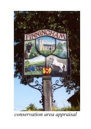
conservation area appraisal
© Crown copyright All rights reserved <strong>Mid</strong> <strong>Suffolk</strong> D C Licence no 100017810 2006
Introduction<br />
The conservation area in <strong>Palgrave</strong> was<br />
designated by <strong>Mid</strong> <strong>Suffolk</strong> <strong>District</strong><br />
<strong>Council</strong> in 1975.<br />
The <strong>Council</strong> has a duty to review its<br />
conservation area designations from time<br />
to time, and this appraisal examines<br />
<strong>Palgrave</strong> under a number of different<br />
headings as set out in English Heritage’s<br />
new ‘Guidance on Conservation Area<br />
Appraisals’ (2006).<br />
As such it is a straightforward appraisal<br />
of <strong>Palgrave</strong>’s built environment in<br />
conservation terms.<br />
This document is neither prescriptive nor<br />
overly descriptive, but more a<br />
demonstration of ‘quality of place’,<br />
sufficient for the briefing of the Planning<br />
Officer when assessing proposed works<br />
in the area. The photographs and maps<br />
are thus intended to contribute as much<br />
as the text itself.<br />
As the English Heritage guidelines point<br />
out, the appraisal is to be read as a<br />
general overview, rather than as a<br />
comprehensive listing, and the omission<br />
of any particular building, feature or<br />
space does not imply that it is of no<br />
interest in conservation terms.<br />
Text, photographs and map overlays by<br />
Patrick Taylor, Conservation Architect,<br />
<strong>Mid</strong> <strong>Suffolk</strong> <strong>District</strong> <strong>Council</strong> 2007.
© Crown copyright All rights reserved <strong>Mid</strong> <strong>Suffolk</strong> D C Licence no 100017810 2006
Topographical Framework<br />
The village of <strong>Palgrave</strong> is situated about<br />
one mile south of the Norfolk market<br />
town of Diss, in the far northern part of<br />
<strong>Mid</strong> <strong>Suffolk</strong> <strong>District</strong>.<br />
It sits on a spur of slightly higher ground<br />
between the southern bank of the river<br />
Waveney that here forms the county<br />
boundary, and a tributary joining the<br />
river from a south-westerly direction.<br />
Since 1849 the Ipswich to Norwich<br />
railway line has passed to the south-east<br />
of the village going over a level crossing<br />
at the village’s Crossing Road on its<br />
approach to the station at Diss.<br />
The modern A143 road from Bury St<br />
Edmunds to join the A140, for some time<br />
cut through the southern end of the<br />
village, but this has now been relieved.<br />
The current by-pass route further south<br />
was formerly the Bury St Edmunds to<br />
Scole Turnpike Trust’s road of 1762,<br />
which continued from Scole on towards<br />
Norwich.<br />
The village is situated on the ‘High<br />
<strong>Suffolk</strong>’ claylands, deposited in the Ice<br />
Ages over the chalk that underlies most<br />
of <strong>Suffolk</strong>. The area is thus good for<br />
arable farming.
© Crown copyright All rights reserved <strong>Mid</strong> <strong>Suffolk</strong> D C Licence no 100017810 2006
Archaeological Significance<br />
The <strong>Suffolk</strong> County Sites and Monuments<br />
Record lists over 20 sites of archaeological<br />
interest from all periods in the<br />
parish of <strong>Palgrave</strong>. These include some<br />
cropmarks, ring ditches and a skull of<br />
unknown date.<br />
The earlier of the dated finds include<br />
three Neolithic flint axes. The Iron Age<br />
has left us some scatter finds of pottery.<br />
Roman remains include potsherds, bone<br />
and some coins, one of them from the<br />
reign of Claudius, relatively early in the<br />
Roman occupation.<br />
Medieval sites listed include the parish<br />
churchyard and the site of the former St.<br />
John’s Chapel, south-west of the main<br />
village towards Wortham.<br />
There is also some Post Medieval<br />
interest, represented by the sites of a<br />
windmill and two bridges over the<br />
Waveney. Overall we see a rich tapestry<br />
of remains, indicating that <strong>Palgrave</strong> has<br />
long been a centre of human activity.<br />
<strong>Palgrave</strong> has only one mention in the<br />
Domesday survey of 1086. It was held by<br />
St Edmund’s with two churches and 30<br />
acres of land.
© Crown copyright All rights reserved <strong>Mid</strong> <strong>Suffolk</strong> D C Licence no 100017810 2006
Intrinsic Quality of Buildings<br />
There are 42 listings covering the parish<br />
of <strong>Palgrave</strong>, half of which are within the<br />
conservation area.<br />
The older buildings are predominantly<br />
domestic in scale, a few having former<br />
commercial uses, and mostly timberframed<br />
and plastered with pantile roofs.<br />
The grade I listed Church of St Peter<br />
provides the usual village exception to<br />
this pattern of building with its flint<br />
rubble walls and plaintile roof. It has a<br />
fine hammerbeam roof structure with in<br />
Pevsner’s words ‘rafters prettily painted<br />
with tracery patterns’. It is mostly 15 th<br />
Century and Perpendicular in style<br />
although the chancel arch is early 14 th<br />
Century.<br />
The other top quality building within the<br />
central area is the grade II* listed former<br />
gild-hall opposite the church, south of<br />
the main road, now called Brackendale.<br />
This is timber-framed and plastered with<br />
some exposed timbers and a jettied first<br />
floor with some carved enrichment.<br />
Outside Brackendale there stands a<br />
grade II listed K6 telephone box, whilst<br />
in the churchyard a chest tomb and<br />
headstone, both from around 1790, are<br />
also listed.
© Crown copyright All rights reserved <strong>Mid</strong> <strong>Suffolk</strong> D C Licence no 100017810 2006
Traditional Building Materials<br />
Many of the unlisted buildings in<br />
<strong>Palgrave</strong> are of traditional form and<br />
grouping, and although not up to<br />
"listing" quality as individual buildings,<br />
still have interest for their visual impact.<br />
A first glance would seem to indicate an<br />
abundance of rendered and brick<br />
buildings either painted or left natural as<br />
soft ‘<strong>Suffolk</strong> Reds’.<br />
This local red brick features throughout<br />
the village, principally on some cottages<br />
dating from Victorian times and on the<br />
School at the south end of the Green.<br />
There are also examples of ‘<strong>Suffolk</strong><br />
White’ brick, notably on the large<br />
unlisted house called ‘Sunnyside’ at the<br />
north end of the Green.<br />
A small amount of flintwork is also<br />
evident around the village, most notably<br />
on the church and both its boundary wall<br />
and that of ‘Sunnyside’, plus a pair of<br />
cottages east of the Green.<br />
‘Sunnyside Cottage’ the only listed<br />
building within the conservation area to<br />
retain its thatched roof, is partly built of<br />
clay lump. Several others outside the<br />
boundary, especially along Crossing<br />
Road, are also thatched, and more would<br />
have been so in days gone by, the steep<br />
roof pitches now the only clue remaining.<br />
The prevalent roofing materials now are<br />
pantile, mostly the black glazed variety<br />
so common in the Waveney valley, or<br />
plaintile on the older timber-framed<br />
buildings. There are also a few instances<br />
of slate and modern concrete pantile<br />
around the village.
© Crown copyright All rights reserved <strong>Mid</strong> <strong>Suffolk</strong> D C Licence no 100017810 2006
Hierarchy of Spaces<br />
The conservation area in <strong>Palgrave</strong> is<br />
very much centred on the village Green.<br />
This is aligned north-south with the<br />
Victorian School at its southern end,<br />
although at one time the green would<br />
doubtless have stretched unhindered as<br />
far as the Church.<br />
There is a central north-south running<br />
road, with wide grassed areas either<br />
side. A fork in the road at either end<br />
contains ‘Sunnyside’ in the northern and<br />
the School in the southern fork. Overall<br />
the scene is one of a green oasis<br />
surrounded by buildings in the near<br />
distance.<br />
With its mature tree cover, the space is<br />
now somewhat broken up, but probably<br />
comes more into its own as a single<br />
space without the leaves in winter.<br />
The Green is very much terminated to the<br />
south by the Church surrounded by its<br />
solid flint wall containing a graveyard<br />
kept as meadow, a space in marked<br />
contrast to the short turf of the Green<br />
itself. Immediately adjoining this wall,<br />
an area that was probably formerly<br />
grassed has been fenced off for a school<br />
play area and is now losing its grass to<br />
excessive wear and tear.<br />
Beyond here a further space more akin to<br />
the Green borders the old road south of<br />
the Church. Whilst wide grass verges<br />
and mature trees are again to the fore,<br />
here the width and straightness of the old<br />
main road itself sets a slightly more<br />
suburban character.
© Crown copyright All rights reserved <strong>Mid</strong> <strong>Suffolk</strong> D C Licence no 100017810 2006
Trees & Planting<br />
The most prominent trees within<br />
<strong>Palgrave</strong> are those on the Green. Here<br />
can be found good specimens of Lime,<br />
Ash and Oriental Plane. There are also<br />
smaller examples of Oak, Silver Birch,<br />
Sycamore, Sweet Chestnut and Field and<br />
Norway Maples.<br />
The area adjoining the main road south<br />
of the Church also has mature Limes and<br />
Horse Chestnut, whilst the grounds of<br />
The Priory adjoining has many varieties<br />
including a large Swamp Cypress.<br />
All of these are protected by Tree<br />
Preservation Order (TPO 6), which also<br />
includes a single Oak near Crossing<br />
Road.<br />
Further afield in the parish there are<br />
other trees, which have also been felt at<br />
risk and thus been made the subject of<br />
tree preservation orders. These include<br />
more Oaks in Crossing road (TPO 170)<br />
and groups of Ash, Yew, Lime, Field<br />
Maple and a Copper Beech at Burlington<br />
Lodge (TPO 302).<br />
The sylvan setting of the village is spoilt<br />
by one slightly incongruous group of<br />
trees: the oversized ‘leylandii’ hedge at<br />
The Paddocks, adjoining the north-west<br />
side of the Green, illustrated later.
© Crown copyright All rights reserved <strong>Mid</strong> <strong>Suffolk</strong> D C Licence no 100017810 2006
Relationship to Open Countryside<br />
The settlement pattern in <strong>Palgrave</strong>, with<br />
houses clustered around the green and<br />
along the approach roads is mostly one<br />
plot deep. This means that, although not<br />
often visible, the countryside is never far<br />
away. Indeed, immediately north of the<br />
village, the Waveney valley is designated<br />
as a Special Landscape Area.<br />
Beyond the initial bifurcation of the<br />
roads at the north and south ends of the<br />
green, there is a further fork a short<br />
distance along each branch, with roads<br />
effectively fanning out in all directions<br />
from the village centre.<br />
In the immediate vicinity of the village<br />
there are thus no footpaths, the roads<br />
taking all traffic, vehicular or otherwise.<br />
Further out some footpaths remain, not<br />
having been upgraded to roads.<br />
Branching off the lane to the north-east<br />
of the village footpath 8 crosses the<br />
Waveney on its way into Diss.<br />
Crossing Road, heading south-eastwards<br />
towards Brome, has footpath 10<br />
branching off it beyond the level<br />
crossing.<br />
To the south footpaths 11 and 12 branch<br />
off the road to Thrandeston, to the southeast<br />
and south-west (Job’s Lane)<br />
respectively.<br />
Whilst on the western side, Lion Road<br />
(the former A143) and Millway Lane are<br />
linked by footpath 4.
© Crown copyright All rights reserved <strong>Mid</strong> <strong>Suffolk</strong> D C Licence no 100017810 2006
Prevailing & Former Usage<br />
<strong>Palgrave</strong> has its origins as an<br />
agricultural community mainly involved<br />
in the growing of hemp. Its proximity to<br />
the large linen market in Diss made this<br />
the primary local industry. Five linen<br />
weavers and a malster were recorded in<br />
the village in the late 17 th Century.<br />
There are a number of ponds remaining<br />
scattered around the periphery of the<br />
village and one large one at the northern<br />
end of the Green.<br />
This general agricultural picture is borne<br />
out by field names in the Tithe Map<br />
Apportionment of 1838. Here along with<br />
many fields called ‘Hempland’, can be<br />
found field names such as ‘Malthouse<br />
Pightle’ and ‘Malting Field’. There are<br />
also two ‘Gravel Pit’ entries plus a Mill<br />
Piece, a Mill Yard and a Mill Way.<br />
Two windmills are recorded for<br />
<strong>Palgrave</strong>, both of the smock type,<br />
although nothing now remains. One was<br />
shown on the tithe map of 1837 south of<br />
the village centre and later moved to<br />
nearby Botesdale, the other was further<br />
out off the Brome road and demolished<br />
around 1937.<br />
In the mid 19 th Century, directories for<br />
the village list two millers, a carpenter<br />
and 15 farmers.<br />
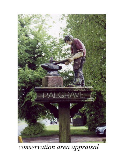
There was a forge in the village, as<br />
remembered on the village sign and in<br />
Forge Cottage and Forge Close. Here<br />
on the east side of the Green, historic<br />
development is denser than elsewhere,<br />
with ranges of outbuildings off alleyways<br />
to the rear.
Losses & Possible Gains<br />
Overall <strong>Palgrave</strong> seems to have resisted<br />
too much modern intrusion. There are a<br />
few infill houses at Forge Close and<br />
Spring Cottage east of the Green, where<br />
asymmetric modern windows and<br />
inappropriate concrete roof tiles have<br />
been used and the bricks are perhaps a<br />
little too brown to fit with the local<br />
vernacular.<br />
These could be improved by overpainting<br />
the brickwork in a traditional colour,<br />
whilst elsewhere the original mix of<br />
render and brick has been obscured by<br />
the similar overpainting of buildings that<br />
would not be out of place stripped back<br />
to their original local brick finish.<br />
Church Farm is the one historic building<br />
that would benefit from some sympathetic<br />
repair to its rendered walls.<br />
Like many small villages, <strong>Palgrave</strong><br />
suffers from a surfeit of overhead wiring<br />
that is quite overpowering in places, a<br />
tangled web preferably not seen<br />
silhouetted against the sky. The undergrounding<br />
of the village’s telephone and<br />
electricity supply lines would greatly<br />
improve its appearance.<br />
With the A143 now by-passing the<br />
village, traffic is no longer a major<br />
problem in <strong>Palgrave</strong>. The motor car can<br />
still have a detrimental effect if parking<br />
is allowed to overrun the green leading<br />
to erosion of the grassed areas. Any<br />
control of this needs to be carried out in<br />
a restrained and low key manner.<br />
The ‘leylandii’ hedge fronting the Green<br />
could be less imposing if reduced in<br />
height or replanted in native species.
References & Further Reading<br />
Chatwin, C P 1961 East Anglia and Adjoining Areas British Regional Geology<br />
HMSO<br />
D.o.E. & D.o.N.H. 1994 Planning Policy Guidance: Planning & the Historic<br />
Environment (PPG 15) HMSO<br />
D.o.E. 1988 List of Buildings of Special Architectural or Historical Interest: <strong>District</strong><br />
of <strong>Mid</strong> <strong>Suffolk</strong>: Parish of <strong>Palgrave</strong><br />
Domesday Book 1986 <strong>Suffolk</strong> Phillimore<br />
Dymond, D & Martin, E (eds.) 1988 An Historical Atlas of <strong>Suffolk</strong> <strong>Suffolk</strong> County<br />
<strong>Council</strong><br />
English Heritage 1995 Conservation Area Practice HMSO<br />
English Heritage 2006 Guidance on Conservation Area Appraisals HMSO<br />
Flint, B 1979 <strong>Suffolk</strong> Windmills Boydell<br />
Goult, W 1990 A Survey of <strong>Suffolk</strong> Parish History <strong>Suffolk</strong> County <strong>Council</strong><br />
Pevsner, N 1976 The Buildings of England: <strong>Suffolk</strong> Penguin<br />
<strong>Suffolk</strong> County <strong>Council</strong> 1997 Sites and Monuments Record<br />
Tithe Map & Apportionment 1838 <strong>Palgrave</strong> <strong>Suffolk</strong> Records Office<br />
The maps in this document are based upon Ordnance Survey material with the<br />
permission of Ordnance Survey on behalf of the Controller of Her Majesty’s<br />
Stationery Office. Unauthorised reproduction infringes Crown copyright and may<br />
lead to prosecution or civil proceedings. M S D C Licence no 100017810 2006<br />
This Appraisal adopted as<br />
Supplementary Planning Guidance<br />
by <strong>Mid</strong> <strong>Suffolk</strong> <strong>District</strong> <strong>Council</strong><br />
Environmental Policy Panel<br />
22 July 2008