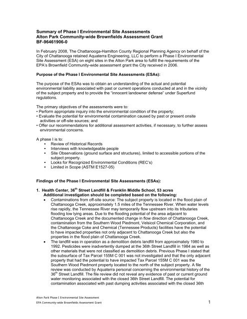
Summary of Phase I Environment Site Assessment Reports
Summary of Phase I Environment Site Assessment Reports
Summary of Phase I Environment Site Assessment Reports

Create successful ePaper yourself
Turn your PDF publications into a flip-book with our unique Google optimized e-Paper software.
<strong>Summary</strong> <strong>of</strong> <strong>Phase</strong> I <strong>Environment</strong>al <strong>Site</strong> <strong>Assessment</strong>s<br />
Alton Park Community-wide Brownfields <strong>Assessment</strong> Grant<br />
BF-96461906-0<br />
In February 2008, The Chattanooga-Hamilton County Regional Planning Agency on behalf <strong>of</strong> the<br />
City <strong>of</strong> Chattanooga retained Aquaterra Engineering, LLC to perform a <strong>Phase</strong> I <strong>Environment</strong>al<br />
<strong>Site</strong> <strong>Assessment</strong> (ESA) on eight sites in the Alton Park area to fulfill the requirements <strong>of</strong> the<br />
EPA’s Brownfield Community-wide assessment grant the City received in 2006.<br />
Purpose <strong>of</strong> the <strong>Phase</strong> I <strong>Environment</strong>al <strong>Site</strong> <strong>Assessment</strong>s (ESAs):<br />
The purpose <strong>of</strong> the ESAs was to obtain an understanding <strong>of</strong> the actual and potential<br />
environmental liability associated with past or current operations conducted at and in the vicinity<br />
<strong>of</strong> the subject property and to provide the “innocent landowner defense” under Superfund<br />
regulations.<br />
The primary objectives <strong>of</strong> the assessments were to:<br />
• Perform appropriate inquiry into the environmental condition <strong>of</strong> the property;<br />
• Evaluate the potential for environmental contamination caused by past or present onsite<br />
activities or <strong>of</strong>f-site sources; and<br />
• Offer our recommendations for additional assessment activities, if necessary, to further assess<br />
environmental concerns.<br />
A phase I is to:<br />
• Review <strong>of</strong> Historical Records<br />
• Interviews with knowledgeable people<br />
• <strong>Site</strong> Observations (ground surface and structures), limited to accessible portions <strong>of</strong> the<br />
subject property.<br />
• Looks for Recognized <strong>Environment</strong>al Conditions (REC’s)<br />
• Limited in Scope (ASTM E1527-05)<br />
Findings <strong>of</strong> the <strong>Phase</strong> I <strong>Environment</strong>al <strong>Site</strong> <strong>Assessment</strong>s (ESAs):<br />
1. Health Center, 36 th Street Landfill & Franklin Middle School, 53 acres<br />
Additional investigation should be completed based on the following:<br />
• Contaminations from <strong>of</strong>f-site source: The subject property is located in the flood plain <strong>of</strong><br />
Chattanooga Creek, approximately 1.5 miles <strong>of</strong> the Tennessee River. When water levels<br />
rise rapidly, the Tennessee River may temporarily flow upstream into its tributaries<br />
flooding low lying areas. Due to the flooding potential <strong>of</strong> the area adjacent to<br />
Chattanooga Creek and the documented change in flow direction <strong>of</strong> Chattanooga Creek,<br />
contamination from the Southern Wood Piedmont, Velsicol Chemical Corporation, and<br />
the Chattanooga Coke and Chemical (Tennessee Products) facilities have the potential<br />
to have impacted properties not only adjacent to Chattanooga Creek but also the<br />
properties in the flood plain <strong>of</strong> Chattanooga Creek.<br />
• The landfill was in operation as a demolition debris landfill from approximately 1980 to<br />
1992. Pesticides were inadvertently dumped at the 36th Street Landfill in 1984 as well as<br />
other materials that were not classified as demolition debris. Previous <strong>Phase</strong> I stated that<br />
the subsurface <strong>of</strong> Tax Parcel 155M C 001 was not investigated and that the only adjacent<br />
property that had the potential to have impacted Tax Parcel 155M C 001 was the<br />
Southern Wood Piedmont property located to the north <strong>of</strong> the subject property. A file<br />
review was conducted by Aquaterra personal concerning the environmental history <strong>of</strong> the<br />
36 th Street Landfill. The file review did not reveal any evidence <strong>of</strong> past or current ground<br />
water monitoring associated with the closed 36th Street Landfill. The potential for<br />
contamination associated with past dumping activities associated with the closed 36th<br />
Alton Park <strong>Phase</strong> I <strong>Environment</strong>al <strong>Site</strong> <strong>Assessment</strong><br />
EPA Community-wide Brownfields <strong>Assessment</strong> Grant 1
Street Landfill and contamination originating from <strong>of</strong>f site to have impacted the subject<br />
property exists and would be considered an REC.<br />
2. Tennessee Avenue and Railroad Overpass, 9.45 acres<br />
Additional investigation should be completed based on the following:<br />
• Various piles <strong>of</strong> refuse, asphalt, concrete, and scattered debris were observed on the<br />
subject property. Observations made during the site reconnaissance suggest that the<br />
subject property has a history <strong>of</strong> being utilized as a dump. The various areas <strong>of</strong> refuse,<br />
asphalt, concrete, and scattered debris located throughout the subject property support<br />
this hypothesis.<br />
• Potential wetlands, storm water appears to collect in depressed areas <strong>of</strong> the subject<br />
property.<br />
3. Oakland Avenue and 45 th Street, 2.34 acres<br />
Additional investigation should be completed based on the following:<br />
• Previous dry cleaning facility: samples should be collected for volatile organic compounds<br />
(VOC’s)<br />
• Oil spills and numerous overturned 55 gallon drums labeled as to contain hydraulic oil,<br />
banana puree, and ammonia nitrate were found in the condemned vacant Anchor Glass<br />
<strong>of</strong>fice building.<br />
• Scattered debris and mounds <strong>of</strong> concrete, soil, and wood were observed on the<br />
abandoned Anchor Glass <strong>of</strong>fice building.<br />
Note: Although a previous sample didn’t detect any concentration <strong>of</strong> polycyclic aromatic<br />
hydrocarbons (PAH’s) from the previous auto repair shop, the laboratory detection limits appear<br />
to be above some <strong>of</strong> the current EPA Primary Remediation Goals (PRG’s).<br />
4. Alton Park Recreation Center, 2.8 acres<br />
The assessment identified no current REC’s. Further assessment is not warranted.<br />
5. Former Trotter School, 14.73 acres<br />
The assessment identified no current REC’s. Further assessment is not warranted.<br />
6. Piney Woods Park, 3.97 acres<br />
Additional investigation should be completed based on the following:<br />
• A groundwater monitoring well is located on the subject property to monitor groundwater<br />
contamination associated with the Residue Hill Landfill. A 2002 <strong>Phase</strong> I Remedial<br />
Investigation Report indicated ground water contamination from the Residue Hill Landfill<br />
has traveled away from the site and surfaced at several <strong>of</strong>f site seeps. The most<br />
significant continuous <strong>of</strong>f site seep is the Piney Woods Spring which is located on the<br />
subject property. The Piney Woods Spring is actively collected beneath the soil surface<br />
by an interceptor trench and it is discharged to the municipal sewer. The interceptor<br />
trench eliminates exposure to the contaminated ground water coming from the Piney<br />
Woods Spring and that surface soils at the subject property are not likely to be affected.<br />
The <strong>Phase</strong> I Remedial Investigation Report presents ground water analytical data<br />
collected from on site up to the fourth quarter <strong>of</strong> 2001. Previous ground water analytical<br />
data from the monitoring well has been below applicable action levels, however there is<br />
no current ground water sampling data available for review as part <strong>of</strong> this phase I ESA.<br />
The potential presence <strong>of</strong> the ground water contamination in Piney Woods Spring and the<br />
ground water well located on the subject property would be considered as REC’s.<br />
• Contaminations from <strong>of</strong>f-site source: The subject property is located in the flood plain <strong>of</strong><br />
Chattanooga Creek, approximately 1.5 miles <strong>of</strong> the Tennessee River. When water levels<br />
rise rapidly, the Tennessee River may temporarily flow upstream into its tributaries<br />
flooding low lying areas. Due to the flooding potential <strong>of</strong> the area adjacent to<br />
Chattanooga Creek and the documented change in flow direction <strong>of</strong> Chattanooga Creek,<br />
contamination from the Southern Wood Piedmont, Velsicol Chemical Corporation, and<br />
Alton Park <strong>Phase</strong> I <strong>Environment</strong>al <strong>Site</strong> <strong>Assessment</strong><br />
EPA Community-wide Brownfields <strong>Assessment</strong> Grant 2
the Chattanooga Coke and Chemical (Tennessee Products) facilities have the potential<br />
to have impacted properties not only adjacent to Chattanooga Creek but also the<br />
properties in the flood plain <strong>of</strong> Chattanooga Creek.<br />
7. Piney Woods Elementary School, 8.10 acres<br />
Additional investigation should be completed based on the following:<br />
• Contaminations from <strong>of</strong>f-site source: The subject property is located in the flood plain <strong>of</strong><br />
Chattanooga Creek, approximately 1.5 miles <strong>of</strong> the Tennessee River. When water levels<br />
rise rapidly, the Tennessee River may temporarily flow upstream into its tributaries<br />
flooding low lying areas. Due to the flooding potential <strong>of</strong> the area adjacent to<br />
Chattanooga Creek and the documented change in flow direction <strong>of</strong> Chattanooga Creek,<br />
down gradient locality <strong>of</strong> the subject property, contamination from the Southern Wood<br />
Piedmont, Velsicol Chemical Corporation, Morningside Chemicals and the Chattanooga<br />
Coke and Chemical (Tennessee Products) facilities have the potential to have impacted<br />
properties not only adjacent to Chattanooga Creek but also the properties in the flood<br />
plain <strong>of</strong> Chattanooga Creek.<br />
• An investigation was conducted for <strong>of</strong>f-site source contamination in 2003. No further<br />
investigation <strong>of</strong> the subject property was recommended by TDEC. However the subject<br />
property has been flooded by Chattanooga Creek since the previous investigation was<br />
conducted and is located down gradient <strong>of</strong> Residue Hill Landfill, Velsicol Chemical<br />
Corporation, Morningside Chemicals, and the Chattanooga Coke and Chemical<br />
(Tennessee Products).<br />
• Evidence <strong>of</strong> dumping and flood washed debris was observed on the eastern portion <strong>of</strong><br />
the property.<br />
• Building on the subject property was constructed in or before 1960’s, asbestos-containing<br />
materials (ACM’s) may be present.<br />
8. C<strong>of</strong>er <strong>Site</strong>, 0.77 acres<br />
Additional investigation should be completed based on the following:<br />
• There once was a building located on the subject property. During the time the building<br />
was constructed, foundry sand would most likely have been used as fill material during its<br />
construction. Known metal contaminants associated with foundry sand are arsenic and<br />
lead. The site reconnaissance revealed what appeared to be black sand and metal slag<br />
located across various parts <strong>of</strong> the subject property.<br />
• The subject property was once used as an automobile repair shop and salvage parts<br />
yard. The potential for petroleum products to have leaked out <strong>of</strong> the many cars once<br />
located on the subject property or from containers once used as part <strong>of</strong> the auto repair<br />
and salvage parts business exists and are considered as an REC.<br />
Alton Park <strong>Phase</strong> I <strong>Environment</strong>al <strong>Site</strong> <strong>Assessment</strong><br />
EPA Community-wide Brownfields <strong>Assessment</strong> Grant 3
Alton Park <strong>Phase</strong> I <strong>Environment</strong>al <strong>Site</strong> <strong>Assessment</strong><br />
EPA Community-wide Brownfields <strong>Assessment</strong> Grant 4