teaching - Earth Science Teachers' Association
teaching - Earth Science Teachers' Association
teaching - Earth Science Teachers' Association

Create successful ePaper yourself
Turn your PDF publications into a flip-book with our unique Google optimized e-Paper software.
<strong>teaching</strong><br />
EARTH<br />
SCIENCES<br />
Dear Editor<br />
From Primary Committee<br />
From the Chair<br />
Teaching Palaeontology<br />
Using Raw Data from the<br />
Internet: The Example of<br />
www.asoldasthehills.org<br />
Katla-Clysmic! –<br />
Managing a Hazardous<br />
Environment<br />
Should <strong>Earth</strong> <strong>Science</strong><br />
Teachers Worry About<br />
Creationists’ Ideas<br />
Durham <strong>Earth</strong> Scientists<br />
go Back to School!<br />
Derby Conference Post-<br />
16 ‘Bring and Share’,<br />
September 2005<br />
A-Level Study Day at<br />
Dudley Museum and<br />
Art Gallery and the<br />
Educator Placement<br />
Programme<br />
More Recent<br />
Geological Howlers<br />
Take a Nappe<br />
Tales from Iceland<br />
The Life and Work of<br />
Alfred Wegener<br />
1880-1930<br />
News and Views<br />
Diary<br />
Reviews<br />
PEST Issue 55<br />
Magazine of the EARTH SCIENCE TEACHERS’ ASSOCIATION<br />
Volume 31 ● Number 3, 2006 ● ISSN 0957-8005<br />
www.esta-uk.org
Teaching <strong>Earth</strong> <strong>Science</strong>s: Guide for Authors<br />
The Editor welcomes articles of any length and nature and on any topic related to<br />
<strong>Earth</strong> science education from cradle to grave. Please inspect back copies of TES,<br />
from Issue 26(3) onwards, to become familiar with the magazine house-style.<br />
Text<br />
Please supply the full text on disk or as an email attachment: Microsoft Word is<br />
the most convenient, but any widely-used wordprocessor is acceptable. Figures,<br />
tables and photographs must be referenced in the text, but sent as separate jpeg<br />
or tiff files (see below).<br />
Please use SI units throughout, except where this is inappropriate (in which case<br />
please include a conversion table). The first paragraph of each major article should<br />
not have a subheading but should either introduce the reader to the context of the<br />
article or should provide an overview to stimulate interest. This is not an abstract in<br />
the formal sense. Subsequent paragraphs should be grouped under sub-headings.<br />
To Advertise in<br />
<strong>teaching</strong><br />
EARTH<br />
SCIENCES<br />
<strong>teaching</strong><br />
EARTH<br />
SCIENCES<br />
References<br />
Please use the following examples as models<br />
(1) Articles<br />
Mayer, V. (1995) Using the <strong>Earth</strong> system for integrating the science curriculum.<br />
<strong>Science</strong> Education, 79(4), pp. 375-391.<br />
(2) Books<br />
McPhee, J. (1986 ) Rising from the Plains. New York: Fraux, Giroux & Strauss.<br />
(3) Chapters in books<br />
Duschl, R.A. & Smith, M.J. (2001) <strong>Earth</strong> <strong>Science</strong>. In Jere Brophy (ed), Subject-<br />
Specific Instructional Methods and Activities, Advances in Research on Teaching. Volume 8,<br />
pp. 269-290. Amsterdam: Elsevier <strong>Science</strong>.<br />
Figures<br />
Prepared artwork must be of high quality and submitted on paper or disk. Handdrawn<br />
and hand-labelled diagrams are not normally acceptable, although in some<br />
circumstances this is appropriate. Each figure must be submitted as a separate file.<br />
(not embedded in a Word file) Each figure must have a caption.<br />
Photographs<br />
Please submit colour or black-and-white photographs as originals. They are also<br />
welcomed in digital form on disk or as email attachments: .jpeg format is to be preferred.<br />
Please use one file for each photograph, to be at 300dpi. Each photograph<br />
must have a caption.<br />
Copyright<br />
There are no copyright restrictions on original material published in Teaching <strong>Earth</strong><br />
<strong>Science</strong>s if it is required for use in the classroom or lecture room. Copyright material<br />
reproduced in TES by permission of other publications rests with the original<br />
publisher. Permission must be sought from the Editor to reproduce original material<br />
from Teaching <strong>Earth</strong> <strong>Science</strong>s in other publications and appropriate acknowledgement<br />
must be given.<br />
All articles submitted should be original unless indicted otherwise and should<br />
contain the author’s full name, title and address (and email address where relevant).<br />
They should be sent to the Editor,<br />
Cally Oldershaw<br />
Email: cally.oldershaw@btopenworld.com<br />
Tel: 07796 942361<br />
Magazine of the EARTH SCIENCE TEACHERS’ ASSOCIATION<br />
Volume 30 ● Number 3, 2005 ● ISSN 0957-8005<br />
Telephone<br />
Ian Ray<br />
0161 486 0326<br />
www.esta-uk.org<br />
COPY DEADLINES<br />
TES 31.4 (PEST 56) 25 September 2006 for<br />
publication November/December 2006<br />
TES 32.1 (PEST 57) 13 December 2006 for<br />
publication January/February 2007<br />
TES 32.2 (PEST 58) 20 February 2007 for<br />
publication April/May 2007<br />
WHERE IS PEST<br />
PEST is printed as the<br />
centre 4 pages in<br />
Teaching <strong>Earth</strong> <strong>Science</strong>s.
Magazine of the EARTH SCIENCE TEACHERS’ ASSOCIATION<br />
Dear Editor<br />
From Primary Committee<br />
From the Chair<br />
Teaching Palaeontology<br />
Using Raw Data from the<br />
Internet: The Example of<br />
www.asoldasthehills.org<br />
Katla-Clysmic! –<br />
Managing a Hazardous<br />
Environment<br />
Should <strong>Earth</strong> <strong>Science</strong><br />
Teachers Worry About<br />
Creationists’ Ideas<br />
Durham <strong>Earth</strong> Scientists<br />
go Back to School!<br />
Derby Conference Post-<br />
16 ‘Bring and Share’,<br />
September 2005<br />
A Level Study Day at<br />
Dudley Museum and<br />
Art Gallery and the<br />
Educator Placement<br />
Programme<br />
More Recent<br />
Geological Howlers<br />
Take a Nappe<br />
Tales from Iceland<br />
The Life and Work of<br />
Alfred Wegener<br />
1880-1930<br />
News and Views<br />
Diary<br />
Reviews<br />
PEST Issue 55<br />
Volume 31 ● Number 3, 2006 ● ISSN 0957-8005<br />
www.esta-uk.org<br />
TEACHING EARTH SCIENCES ● Volume 31 ● Number 3, 2006<br />
<strong>teaching</strong><br />
EARTH<br />
SCIENCES<br />
Teaching <strong>Earth</strong> <strong>Science</strong>s is published quarterly by<br />
the <strong>Earth</strong> <strong>Science</strong> Teachers’ <strong>Association</strong>. ESTA<br />
aims to encourage and support the <strong>teaching</strong> of<br />
<strong>Earth</strong> sciences, whether as a single subject or as<br />
part of science or geography courses.<br />
Full membership is £25.00; student and retired<br />
membership £12.50.<br />
Registered Charity No. 1005331<br />
Editor<br />
Cally Oldershaw<br />
Tel: 07796 942361<br />
Email: cally.oldershaw@btopenworld.com<br />
Advertising<br />
Ian Ray<br />
Tel: 0161 486 0326<br />
Email: ianray@ray2003.fsworld.co.uk<br />
Reviews Editor<br />
Dr. Denis Bates<br />
Tel: 01970 617667<br />
Email: deb@aber.ac.uk<br />
Council Officers<br />
Chairman<br />
Martin Whiteley<br />
Tel: 01234 354859<br />
Email: mjwhiteley@yahoo.co.uk<br />
Secretary<br />
Susan Beale<br />
Email: beales.lowrow@virgin.net<br />
Membership Secretary<br />
Hamish Ross<br />
PO BOX 23672<br />
Edinburgh EH3 9XQ<br />
Tel: 0131 651 6410<br />
Email: hamish.ross@education.ed.ac.uk<br />
Treasurer<br />
Maggie Williams<br />
Email: maggiee.williams@tiscali.co.uk<br />
Primary Co-ordinator<br />
Niki Whitburn<br />
Email: farfalle@btinternet.com<br />
Secondary Co-ordinator<br />
Chris King<br />
Email: c.j.h.king@educ.keele.ac.uk<br />
Higher Education Co-ordinator<br />
Mike Tuke<br />
Email: miketuke@btinternet.com<br />
CONTENTS<br />
4 From the Editor<br />
5 Dear Editor<br />
6 From the Primary Committee<br />
7 From the Chair<br />
8 Teaching Palaeontology Using Raw Data from the<br />
Internet: The Example of www.asoldasthehills.org<br />
Lucy A. Muir, Joseph P. Botting and Roy Barlow<br />
11 Katla-Clysmic! – Managing<br />
a Hazardous Environment<br />
Ian K Hardie<br />
14 Should <strong>Earth</strong> <strong>Science</strong> Teachers Worry About<br />
Creationists’ Ideas<br />
Dr Antony Wyatt<br />
17 Durham <strong>Earth</strong> Scientists go Back to School!<br />
Stuart Jones<br />
20 Derby Conference Post-16 ‘Bring and Share’,<br />
September 2005<br />
Chris King<br />
22 A-Level Study Day at Dudley Museum and<br />
Art Gallery and the Educator Placement<br />
Programme<br />
Kate Figgitt and Bill Groves<br />
24 More Recent Geological Howlers<br />
Jo Conway<br />
25 Take a Nappe<br />
Jack Treagus<br />
28 Tales from Iceland<br />
Dawn Windley<br />
29 The Life and Work of Alfred Wegener 1880-1930<br />
Clare Dudman<br />
32 News and Views<br />
37 ESTA Diary<br />
38 Reviews<br />
PEST – Issue 55 – At School with <strong>Earth</strong> <strong>Science</strong><br />
Visit our website at www.esta-uk.org<br />
Contributions to future issues of Teaching <strong>Earth</strong><br />
<strong>Science</strong>s will be welcomed and should be<br />
addressed to the Editor.<br />
Opinions and comments in this issue are the<br />
personal views of the authors and do not<br />
necessarily represent the views of the <strong>Association</strong>.<br />
Designed by Character Design<br />
Highridge, Wrigglebrook Lane, Kingsthorne<br />
Hereford HR2 8AW<br />
<strong>teaching</strong><br />
EARTH<br />
SCIENCES<br />
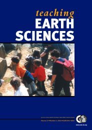
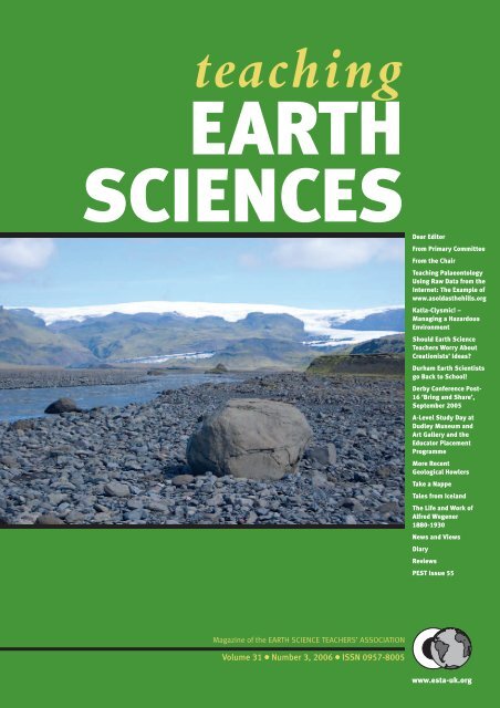
Front cover<br />
Glacial meltwater river from the snout<br />
of the Solheimajökull glacier<br />
3 www.esta-uk.org
TEACHING EARTH SCIENCES ● Volume 31 ● Number 3, 2006<br />
Helping Raise Achievement<br />
As I write this, the sun is shining and the students<br />
are sitting exams. It always seems rather unfair<br />
to wait the whole year for a bit of sunshine and<br />
then spend it indoors! Following the exams, of course is<br />
the marking of exam papers. My first batch for marking<br />
arrived today, looking pretty with pink covers.<br />
For those of you who are not marking, you may well<br />
be involved in setting examinations, discussing assessment<br />
methods and debating the curriculum. Whatever<br />
your involvement or interest, have you thought of the<br />
decision makers and how you might help by including<br />
your ideas, experience and expertise There are a number<br />
of consultations to which your comments could be<br />
help. Don’t be put off writing as an individual – your<br />
views are important. If you would prefer to get together<br />
with a group of colleagues, or write a piece for your<br />
school, association or society to submit on your behalf,<br />
then do it. And next time you are having a chat and<br />
‘putting the world to rights’ in the staff room or elsewhere,<br />
check out where your ideas might be useful and<br />
maybe even make a difference.<br />
Draft criteria for AS and A level <strong>Science</strong><br />
The draft GCE criteria consultation is now over and<br />
QCA has drawn together all of the responses into a set<br />
of recommendations. Several ESTA members including<br />
Chris King, Pete Loader and myself were involved<br />
in the production of the draft criteria for Geology. See<br />
www.qca.org.uk/downloads/QCA-06-2404_GCE_<strong>Science</strong>.pdf<br />
(geology is on page 17).<br />
Sustainable Schools<br />
Issues like climate change, water scarcity and energy efficiency<br />
have come to the fore with the launch by the<br />
Department for Education and Skills (DfES) of a major<br />
consultation with schools on sustainable development.<br />
The consultation aims to get schools, pupils and their<br />
communities thinking about how they can fulfil the Government’s<br />
vision for schools to be models of sustainable<br />
development, and what support they need to do so.<br />
The framework contains ideas for encouraging<br />
pupils to walk or ride to school, interesting ways of<br />
exploring sustainable development issues in the curriculum<br />
and incorporating environmental projects in<br />
their buildings and grounds. It gives schools an opportunity<br />
to talk about their approach with all those who<br />
work with them, like local authorities, voluntary organisations<br />
and businesses.<br />
The Secretary Alan Johnson and Junior Education<br />
Minister Parmjit Dhanda marked the launch with a<br />
visit to Argyle Primary School in Camden, London.<br />
The school has developed several sustainable development<br />
projects, including a watering system powered by<br />
renewable energy. Alan Johnson said:<br />
“We know that our young people are keenly aware of environmental<br />
issues – in fact in many ways they are driving the<br />
change in attitudes to recycling and conservation”.<br />
“I would urge schools to tap into this interest to really engage<br />
young people through the curriculum, the school’s environment<br />
and awareness of the community around them. Schools can<br />
really help young people be part of the solution to the world’s big<br />
challenges”.<br />
“We know that many schools are leading the way, either by<br />
working to improve the goods they offer, encouraging healthy<br />
ways to travel to schools and looking at how they can use energy<br />
and water more efficiently. I want to see this action replicated in<br />
all schools. The long-term benefits are huge – it can contribute<br />
to raising achievement, improving behaviour and cost savings”.<br />
“Schools are at the heart of their communities and many are<br />
already leading the way by encouraging sustainability in different<br />
areas of school life by looking at things like efficient use of<br />
energy and water. I would like to see this replicated in all<br />
schools.”<br />
“Young people are keenly aware of, and highly motivated by,<br />
environmental issues. In many ways they are ahead of adults in<br />
their attitudes to recycling and conservation. Channelling this<br />
enthusiasm helps raise achievement and improve behaviour and<br />
could save money as well as addressing big issues such as climate<br />
change – it really is a win-win solution.”<br />
This is believed to be the first government consultation<br />
to be carbon neutral and covers the following areas:<br />
● food and drink – considering how food for school<br />
meals can be ethically sourced<br />
● energy and water – reducing the demand for energy<br />
and water through energy and water conservation<br />
● travel and traffic – encouraging and supporting more<br />
eco-friendly journeys to schools, for example walking<br />
and cycling<br />
● purchasing and waste – reducing costs and support<br />
markets for ethical goods and services at the same<br />
time<br />
● buildings and grounds – good design can translate<br />
into improved staff morale, pupil behaviour and<br />
achievement as well as nature conservation<br />
● inclusion and participation – providing an inclusive,<br />
welcoming atmosphere that values everyone’s participation<br />
and contribution<br />
● local well-being – acting as a hub of learning and<br />
change in the local community<br />
● global dimension – helping pupils to appreciate the<br />
impact of their personal values, choices and behaviours<br />
on the wider world.<br />
Working with Climate Care, the DfES has offset the<br />
CO 2 emissions arising from all printing and distribution,<br />
consultation events, and response routes in what is<br />
believed to be the first climate neutral government con-<br />
www.esta-uk.org<br />
4
TEACHING EARTH SCIENCES ● Volume 31 ● Number 3, 2006<br />
sultation. The money used to offset these will go<br />
towards sustainable energy projects, like the production<br />
of energy efficient cooking stoves for schools in India.<br />
Schools have a special role to play in securing the<br />
future for young people; they can help young people be<br />
part of the solution to the world’s big challenges, rather<br />
than part of the problem.<br />
Would you like to respond, or can you help a school<br />
to start thinking about these issues The next step is to<br />
read the consultation document: Sustainable Schools –<br />
Consultation Document (PDF). If you’d rather get free<br />
printed copies of the documents sent to you, telephone<br />
DfES Publications on 0845 6022260 quoting ref 0470-<br />
2006DOC-EN (consultation paper) and 0481-<br />
2006DOC-EN (summary). www.dfes.gov.uk/<br />
consultations/conDetails.cfmconsultationId=1398<br />
Making the most of rainy days – <strong>Science</strong> and the<br />
social and political impact of water shortage<br />
In May, the All-Party Parliamentary Group for <strong>Earth</strong><br />
<strong>Science</strong>s met in the House of Commons for a meeting<br />
on water shortage. Presentations were given by Trevor<br />
Bishop (Head of Water Resource Management, Environment<br />
Agency), Andrew McKenzie (Groundwater<br />
Information Manager, British Geological Survey) and<br />
Mike Pocock (Head of Strategic Planning, Veolia<br />
Water UK – including Three Valleys Water, Folkestone<br />
and Dover Water and Tendring Hundred Water).<br />
We are currently experiencing the worst drought<br />
since 1932. The drought, housing growth and environmental<br />
pressures require us to urgently appraise the<br />
future and how we can maintain security of supply<br />
whilst balancing risks, costs and environmental concerns<br />
and ensuring sustainability. The presentations<br />
looked at possible strategies for ensuring that water is<br />
available where it is needed, including techniques such<br />
as the underground storage of water and its recovery,<br />
and bulk transfer of water resources from areas of surplus<br />
to areas of deficit.<br />
Editor<br />
Dear Editor<br />
Mnemonics – Are you ready for a possible avalanche of<br />
mnemonics Have you been inundated by a flood of<br />
them<br />
I have attached some, they are mostly restricted to<br />
my student days – I haven’t needed to teach the subdivisions<br />
of the Ordovician, the families of the Graptoloidea<br />
or the zones of the Namurian!<br />
Others have been quoted in my <strong>teaching</strong> as examples<br />
(e.g. plagioclases, hardness scale), but I have then set<br />
students to work ones out for themselves. Do get back<br />
to me on any of these if you care to. Peter Perkins<br />
A few of these are ready to mind and others I had forgotten<br />
and have had to ‘dig out’ from a small card-index<br />
box I still have from student days.<br />
Mohs’ scale: The Governor (of) Cyprus Found A<br />
Fellow Quarrelling, The Cad Died.<br />
This was devised when I was doing National Service<br />
in Cyprus in 1957 – between A-level Geology at school<br />
and going on to Reading University.<br />
Phanerozoic: Cards Of Silk Don’t Cause Permanent<br />
Traces; Judges Create Even Over Messy Plates.<br />
This illustrates that a mnemonic doesn’t need to be<br />
‘intelligent’, just so long as it isn’t gobbledegook. This<br />
is, of course, incomplete – firstly, it predates the appearance<br />
of Palaeocene in the list that was widely used in<br />
textbooks; and secondly, I never needed to complete the<br />
mnemonic in order to complete the list – Pleistocene<br />
and Recent always got added correctly.<br />
Ordovician: Always Commiserate Loves Last<br />
‘Appiness<br />
I am (now) ashamed that this goes down the succession<br />
– I have always taught my students to start at the<br />
bottom and work up. However this, I suppose, illustrates<br />
that with a mnemonic the important thing is getting<br />
the facts correct, irrespective of how it is done. This<br />
also dates back to when the Tremadoc was placed in the<br />
top of the Cambrian – so it wouldn’t do for nowadays.<br />
Plagioclases: Apples And Oranges Always Look<br />
Bloody Awful.<br />
Nothing much to add to this!<br />
This is one you ought to be able to work out! It was for<br />
remembering the contents of a list and not any special<br />
order: Put All Spitfires Under Giant ‘angers.<br />
Graptolites: these are the families of the Graptoloidea<br />
– or they were in the late 50’s!<br />
I had to check up on this and found it in A, Morley<br />
Davies ‘An Intro to Palaeo’, page 206: [does anybody<br />
else have this book on their shelf!] Dogs Love Digging<br />
Deep (in) Lots Of Dirty Mud. One problem with this<br />
(but it wasn’t a problem) is that I had to remember<br />
‘Lots’ referred to Glossograptidae.<br />
Namurian: Goniatites Run Riot (having) Hodson<br />
Exploring Eire Pleasurably.<br />
These are the zones and, as with the Ordovician,<br />
they run downwards, against the sequence. Also it<br />
includes the P1-P2 Lower Bowland Shales; all of this as<br />
on page 202 of ‘The Stratigraphy of the British Isles’ by<br />
Rayner. As you probably realise it dates from a time<br />
when Frank Hodson was Head of Palaeo at Reading –<br />
so is, in a sense, ‘of the moment’ and not applicable to<br />
the present.<br />
Answer to number five: Garnets (Did you get it)<br />
Peter Perkins<br />
Email: peterandvalerie@perkins29.freeserve.co.uk<br />
5 www.esta-uk.org
TEACHING EARTH SCIENCES ● Volume 31 ● Number 3, 2006<br />
Dear Editor<br />
To keep you up to date with the changes taking place<br />
as English Nature is replaced by Natural England you<br />
may be interested to see the press release at<br />
www.defra.gov.uk/news/2006/060426c.htm which<br />
announces the appointment of Board members to<br />
Natural England (the body that will replace English<br />
Nature, the Countryside Agency and the Rural<br />
Development Service in October 2006). Natural<br />
England’s Board is the equivalent of English Nature’s<br />
Council which some of you may be familiar with and<br />
on which Professor Chris Wilson and most recently<br />
Professor Malcolm Hart have sat and which has<br />
played a key role development of high level strategy<br />
and priority setting.<br />
Dr Colin Prosser<br />
Head of Geology<br />
English Nature<br />
01733 455213<br />
Sir Martin Doughty, the Chair Designate of Natural<br />
England said: “I am delighted that we have a Board with<br />
such a wealth of expertise, experience and knowledge. Among<br />
its members are leading ecologists, lawyers, upland and<br />
lowland farmers, recreation and access experts and academics.<br />
I believe that we have an excellent team to drive forward<br />
Natural England’s purpose, ensuring that the natural<br />
environment is conserved, enhanced and managed for the<br />
benefit of people now and in the future.”<br />
Dear Editor<br />
Whilst I don’t intend to add to the “howler” debate<br />
again, I offer this as an indication of the need for<br />
better geoscience education in the media.<br />
Holy misunderstood!<br />
“... As far as we know, this is the only planet that sustains life<br />
and yet we’re beginning to understand that we live on a<br />
dangerous planet. We build homes and cities on rock plates<br />
that shift and collide as they float on molten magma...”<br />
(Quote from The Rt. Rev. Tom Butler. Radio 4<br />
“Thought for the Day”, 11th October 2005)<br />
Pete Loader<br />
Email: peteloader@yahoo.co.uk<br />
From the Primary Committee<br />
Geographical <strong>Association</strong> Conference<br />
Primary Committee Report<br />
For many years the Primary team have delivered workshops at the ASE<br />
annual conferences, relating to minerals, rocks, soils etc. Although part<br />
of the <strong>Earth</strong> science content of the primary National Curriculum is<br />
found within <strong>Science</strong> there is also much within Geography.<br />
Over recent years the Primary team have been fostering their relationship<br />
with the Geographical <strong>Association</strong> and this resulted in the<br />
team facilitating a very successful Rivers workshop at the Geographical<br />
<strong>Association</strong> conference last year. This year we were invited to repeat a<br />
similar workshop at their conference in Manchester in April. Three<br />
members of the Primary team facilitated, offering a practical and very<br />
“hands on” session. Participants were given an initial example of how<br />
the evolution of a river might be demonstrated in a classroom, using<br />
everyday equipment (rather than specialist resources). They then<br />
worked in groups, each aided by one of the team. They were provided<br />
with a variety of equipment and asked to work together to investigate<br />
how they might do this within their own school environments –<br />
depending on the facilities they might have. Finally, the groups demonstrated<br />
their own ideas to each other, and discussed the different methods<br />
that had been devised.<br />
The workshop usually uses running water to provide the “river”,<br />
however none was available. We were able to overcome the potential<br />
difficulties of this thanks to the ingenuity of the facilitators, together<br />
with other colleagues present, and indeed also to the participants. We<br />
incorporated the lack of running water into the activities, giving them<br />
an extra dimension and the participants a further task to solve. We feel<br />
it was so successful that in future this will be incorporated into the<br />
Rivers workshop, and not all groups will use running water.<br />
The workshop was fully booked and was very well received by the<br />
participants, who expressed the feeling that it was much better to actually<br />
do something rather than sit and listen. We were aided in the facilitation<br />
of the workshop within a different situation from normal, by<br />
the fact that we have built up a good relationship with the Geographical<br />
<strong>Association</strong> and its staff, who went out of their way to enable its<br />
smooth running.<br />
In order to continue and to build on this successful liaison, we have<br />
one team member who is now on the Geographical <strong>Association</strong> Early<br />
Years and Primary Phase Committee, and involved in the Geographical<br />
<strong>Association</strong> branch in their region.<br />
Two photographs of the workshop have been included in the latest GA<br />
Magazine, and can be seen on their website under Conference 2006<br />
www.geography.org.uk/download/GA_Conf06PhotoSupplement.pdf page 17.<br />
Niki Whitburn<br />
ESTA Primary Co-ordinator<br />
Senior Lecturer, Bishop Grosseteste College.<br />
Email: farfalle@btinternet.com<br />
www.esta-uk.org<br />
6
TEACHING EARTH SCIENCES ● Volume 31 ● Number 3, 2006<br />
From the Chair – Steady Progression<br />
Council meetings were held in April and July and I’m<br />
pleased to report that, by and large, we’re continuing to<br />
make steady progress. I’ll mention some of the highlights<br />
here and gloss over the tedious bits.<br />
Some great news to start with. We’ve secured funding<br />
from the Petroleum Exploration Society of Great<br />
Britain (PESGB) over the next 3 years which will help<br />
to reduce your costs when attending the annual Course<br />
and Conference. There is also provision to develop further<br />
our web-based <strong>teaching</strong> and learning resources<br />
such as GEOTREX. By sharing the funding between<br />
Conference, which is our flagship event, and resource<br />
development, every one of you should benefit from<br />
PESGB’s generosity.<br />
Membership numbers are remaining fairly static at<br />
around 530, with only a small annual turnover of members.<br />
It is particularly encouraging to see that several<br />
newly-qualified teachers are joining ESTA for the first<br />
time and we are also pleased to report that the publicity<br />
campaign we mounted last year has attracted some<br />
additional corporate members. Whilst on the subject of<br />
membership, we discussed the pros and cons of providing<br />
an automated system such as PayPal, but concluded<br />
that it was not appropriate at the present time.<br />
In response to suggestions made by those who<br />
attended the A-Level Workshop last year, Council has<br />
agreed to make the GEOTREX database and past issues<br />
of Teaching <strong>Earth</strong> <strong>Science</strong>s available only to members. We<br />
have tried to strike a balance between ease of access and<br />
providing value for members, by placing these<br />
resources under password-protection on the website. If<br />
the thought of having to remember yet another<br />
wretched password fills you with dread – fear not. All<br />
you have to type in when the dialogue box requests<br />
your User name and Password is “esta” on both occasions.<br />
We’ll try it for a trial period of 6 months and then<br />
review the situation.<br />
Past issues of Teaching <strong>Earth</strong> <strong>Science</strong>s (as far back as<br />
v.26.3, 2001) can now be found in the ‘Magazine’ section<br />
of the website, along with a list of contents to<br />
enable you to locate particular articles. Whilst generating<br />
this list I was struck by just how much good stuff is<br />
tucked away in those 16 issues and has probably been<br />
forgotten. It may well be worthwhile taking a quick<br />
look to see what is available and now downloadable.<br />
The annual Course and Conference is never far<br />
from our minds as we’re either recovering from the latest<br />
or preparing for the next. I was disappointed to learn<br />
from the authorities at Bristol University that the Wills<br />
Memorial Building, location for our gathering in September,<br />
will be shrouded in scaffolding and plastic<br />
sheeting for most of 2006. This magnificent Gothic<br />
building is undergoing a major external restoration, but<br />
we have been assured that it is ‘business as usual’ on the<br />
inside. Arrangements for the Conference are now virtually<br />
complete, so send in your application form and<br />
keep an eye on the ‘Bristol 2006’ section of the website<br />
for those inevitable last minute changes.<br />
This is my last contribution as Chairman because I<br />
complete my 3-year stint in September and hand over<br />
to Dawn Windley at the Bristol Conference. It’s been<br />
an interesting journey into the world of geoscience<br />
education which I’ve thoroughly enjoyed and I’d simply<br />
like to thank you all for your support and encouragement<br />
along the way.<br />
Martin Whiteley<br />
For a trial period, we are putting GEOTREX and<br />
past issues of Teaching <strong>Earth</strong> <strong>Science</strong>s under<br />
password protection on the ESTA website.<br />
Pssst… don’t forget…<br />
the word is… esta<br />
These resources have cost thousands of pounds<br />
to develop and we want to capture their value<br />
for ESTA members.<br />
7 www.esta-uk.org
TEACHING EARTH SCIENCES ● Volume 31 ● Number 3, 2006<br />
Teaching Palaeontology Using Raw Data<br />
from the Internet: The Example of<br />
www.asoldasthehills.org<br />
LUCY A MUIR, JOSEPH P. BOTTING AND ROY BARLOW<br />
The Internet is an enormous source of information, but distinguishing the reliable from the<br />
unreliable can be very difficult. Using it as a vast textbook is therefore problematic, but the<br />
Internet can be an extremely worthwhile tool for more focused activities. In particular, we want to<br />
demonstrate its use as a source of raw scientific data, which can form the basis of exercises and<br />
projects at a variety of levels.<br />
This article is focused on our website about the<br />
palaeontology of the Builth-Llandrindod Inlier of<br />
Powys, central Wales. Although <strong>teaching</strong> was not<br />
initially a priority, we have come to appreciate the possibilities<br />
and are interested in developing them. The site is,<br />
we believe, unusual in that it explicitly aims at an audience<br />
ranging from those with an interest in palaeontology<br />
but little knowledge to established academics and<br />
researchers. We provide raw data and interpretations<br />
based upon them, allowing readers to draw their own<br />
conclusions. The data can also be used as material for a<br />
variety of <strong>teaching</strong> exercises. Below, we give some practical<br />
suggestions for how this could be done.<br />
The ‘Old as the Hills’ website<br />
The Builth Inlier, which forms the area around the<br />
towns of Builth Wells and Llandrindod Wells, contains<br />
a succession of Ordovician rocks amidst the Silurian of<br />
mid-Wales. The area is famous for its trilobites (around<br />
60 species), and was the location for Peter Sheldon’s<br />
classic study of gradual evolution (Sheldon, 1987). It is<br />
also the home of the earliest published trilobites, Trinucleus<br />
fimbriatus (then called ‘Trinucleum fimbriatum’)<br />
and Ogygiocarella debuchii (then thought to be a flatfish),<br />
described by Edward Lhwyd in 1698. The inlier also<br />
Figure 1 www.asoldasthehills.org<br />
contains at least forty sponge species; only three are<br />
known from the rest of the Welsh Ordovician. (This is<br />
probably because it is almost the only place in Wales<br />
studied by a sponge expert during the last hundred<br />
years – there are many more sponges waiting to be discovered.)<br />
In addition, there are substantial graptolite,<br />
brachiopod, ostracod, echinoderm, bryozoan and mollusc<br />
faunas, with occasional worms, cnidarians and<br />
problematica. The ‘Old as the Hills’ website is an<br />
attempt to bring this treasure-trove to the attention of<br />
the wider world.<br />
The site was created in early 2005 by Roy Barlow, Joe<br />
Botting and Lucy Muir, as an extension of their collaboration<br />
on an exhibition of fossils from one site in the<br />
inlier. The initial idea to set up a website was Roy’s,<br />
who is responsible for the design and overall ‘look’ of<br />
the site. The content was primarily written and drawn<br />
by Joe, with some input from Lucy. Joe and Lucy are<br />
both palaeontologists, currently at The Natural History<br />
Museum, London, and Roy is a graphic designer currently<br />
at the University of Cambridge. Roy possesses<br />
the artistic and IT skills to create an attractive and functional<br />
site, while Joe and Lucy have sufficient palaeontological<br />
knowledge and experience to be authoritative.<br />
All three maintain the website entirely as a hobby.<br />
The site is not aimed at any particular group, but we<br />
hope that anyone, whether complete beginner or professional<br />
palaeontologist, will find something useful. In<br />
some ways, this is difficult – how do we explain things<br />
in such a way that beginners aren’t put off, and professionals<br />
don’t feel patronised In other ways, it’s easy –<br />
whatever we put on the site will be useful and at the<br />
right level for someone. Part of the way we have dealt<br />
with the issue is to have separate divisions of the site for<br />
different audiences, although in reality, the divisions are<br />
soon blurred. For example, there are a number of essays<br />
dealing with topics such as how fossils are preserved and<br />
how to identify various types of fossil. No professional<br />
palaeontologist needs to read a basic essay on these matters...<br />
unless, that is, they have a purely biological background<br />
and perhaps study large vertebrates. Conversely,<br />
the taxonomic database containing the publication his-<br />
www.esta-uk.org<br />
8
TEACHING EARTH SCIENCES ● Volume 31 ● Number 3, 2006<br />
tory of every named species described from the Builth<br />
Inlier is unlikely to be useful to someone without much<br />
knowledge of palaeontology – unless, through curiosity,<br />
a student explores the way it is arranged, and inexplicably<br />
gains a deeper understanding of how taxonomy<br />
functions in the real world. Much of the learning experience,<br />
after all, comes from exploring the unintuitive<br />
and difficult, and becoming familiar with it. In our opinion,<br />
what a student may gain from even the most esoteric<br />
parts of the site may not be easily definable, but can<br />
be a vital part of their development.<br />
The site consists of four parts: Introduction,<br />
Research, Image Gallery and Forum. The Image<br />
Gallery contains pictures from the exhibition that preceded<br />
the website, as well as other photographs and<br />
reconstructions. In due course we hope this will contain<br />
photographs and drawings sent in by readers, and<br />
pictures of scenery. On the Forum, anyone can make<br />
comments, ask for help with identifying fossils or discuss<br />
any aspect of palaeontology. We also use this space<br />
to announce updates to the website.<br />
The Introduction is the section of the site that will be<br />
most attractive for the inexperienced, including basic<br />
information about the Builth Inlier, links to essays on<br />
various palaeontological topics and information about<br />
the people involved. It also contains what is, for beginners,<br />
possibly the most useful article on the site – the<br />
Beginners’ Guide to Fossilologizing. This gives details of<br />
basic geological equipment, collecting etiquette and<br />
care of collections. The emphasis is on responsible collecting,<br />
having an understanding of what one is doing<br />
beyond the act of collecting itself, and of course having<br />
fun in the process.<br />
The Research section is primarily for the more experienced<br />
palaeontologist, and contains the bulk of the<br />
information on the site. It contains a brief history of<br />
work in the area and a bibliography of scientific publications,<br />
a detailed stratigraphy (including range charts<br />
for graptolites and other groups), suggestions for possible<br />
student projects, a database of all the species<br />
described from the inlier, with references, and an illustrated<br />
faunal list extending to well over three hundred<br />
species at the time of writing.<br />
The continually updated faunal list contains every<br />
species from the inlier in the scientific literature, and<br />
every species that we ourselves have found – in other<br />
words, the nearest we can get to the total fossil assemblage.<br />
Most species are illustrated by idealised drawings.<br />
The list is a useful tool on several levels. Firstly, it could<br />
be printed and used for identifications in the field or laboratory.<br />
Although many of the species illustrated are so<br />
far known only from the Builth Inlier, some (especially<br />
the graptolites, brachiopods and trilobites) are known<br />
more widely. Secondly, the drawings show the range of<br />
form in the groups that are represented in the area – for<br />
example, there are representatives of at least five orders of<br />
trilobites. This aspect is not particularly important scientifically,<br />
but potentially very useful in <strong>teaching</strong>. Thirdly,<br />
and most soberingly, it is interesting to compare the<br />
number of species described in the scientific literature<br />
with the total number that have been found. For the<br />
sponges and echinoderms, all the species either have<br />
been described (mostly by a certain J. Botting) or are in<br />
the process of being prepared for publication. The trilobites,<br />
planktonic graptolites and brachiopods are fairly<br />
well known, with about eighty to ninety percent of the<br />
known fauna having been described from the inlier. For<br />
the other groups the picture is slightly less rosy. None of<br />
the six species of gastropod or fifteen species of dendroid<br />
graptolite have been described, and perhaps one species<br />
of bryozoan out of over twenty. Only eight of the thirtyone<br />
(and rising) species of ostracod have appeared in scientific<br />
publications.<br />
In total, less than forty percent of the fossil species in<br />
the inlier have been described. Given that the Builth<br />
Inlier is a classic and intensely studied area, this is really<br />
rather worrying. If our state of knowledge for the<br />
Builth Inlier is typical for that of the fossil record as a<br />
whole, we literally don’t know the half of what’s out<br />
there. There are also statistical reasons, based on comparisons<br />
of the Builth Inlier faunas with those in nearby<br />
areas and on the distribution patterns of species within<br />
the area, to believe that the list is not remotely<br />
approaching completion for many groups. Every field<br />
trip yields several new species, and there is no sign that<br />
we are running out of things to find.<br />
Teaching possibilities<br />
The main aspects of the site we want to emphasize are<br />
as follows:<br />
● the completeness and accuracy of the raw data is<br />
unusual, to say the least, among similar public access<br />
sites, with much of the information unpublished;<br />
● the presentation and approach used in the site is<br />
accessible to any interested parties;<br />
● elements such as the reconstructions are imaginative<br />
Figure 2<br />
Trinucleus<br />
fimbriatus:<br />
drawing from the<br />
faunal list.<br />
© JOE BOTTING<br />
9 www.esta-uk.org
TEACHING EARTH SCIENCES ● Volume 31 ● Number 3, 2006<br />
Figure 3<br />
A typical<br />
ecosystem<br />
reconstruction, of<br />
a shallow-water<br />
habitat.<br />
© JOE BOTTING<br />
to problems with preservation, or are there clear differences<br />
that must reflect the original communities<br />
This one’s for more advanced students.<br />
● Stratigraphy: the range charts, combined with the<br />
geological history, present a detailed case study in<br />
which there are many potential exercises. For example,<br />
the students could be asked to use the faunas<br />
presented to divide the sequence into three or four<br />
biozones, with a detailed discussion of their reasoning.<br />
This requires them to consider elements from<br />
the basic distribution patterns of the groups, to the<br />
reliability of the record (are sponges a good group to<br />
use), environmental preferences for any given<br />
group, and so on.<br />
extrapolations to some extent, but also based as<br />
firmly as possible in the reality of the fossil faunas;<br />
● in the open presentation of data and interpretations,<br />
we actively invite the reader to be critical, and to<br />
hypothesize;<br />
● it gives students direct access to palaeontological<br />
research data, and introduces them to the ways<br />
of analysing and interpreting it, without oversimplification.<br />
These lead to several possibilities for the <strong>teaching</strong> of<br />
palaeontology, and related elements in geology and<br />
biology. The following are suggestions for specific<br />
activities that use the information in the site for inspiration,<br />
or as a detailed basis, but they are by no means<br />
exhaustive. We encourage you to be creative in designing<br />
exercises, and are happy to help if you have ideas<br />
that you wish to develop.<br />
● Taxonomy: use the faunal list directly to attempt to<br />
divide a group or groups (e.g. trilobites, graptolites)<br />
into taxonomic groupings at various levels.<br />
● Preservation: use the images, and the essay on fossil<br />
preservation (ideally as well as specimens), to investigate<br />
the changes that take place during fossilisation.<br />
How does the preservation of a trilobite differ from<br />
that of a graptolite, or a sponge This is potentially<br />
open-ended, going into ever-greater detail. Ultimately,<br />
it can lead to an understanding of how representative a<br />
fossil fauna may be of the original community.<br />
● The ecological/environmental reconstructions offer<br />
the opportunity for a great deal of debate over their<br />
accuracy. Which aspects do the students find convincing<br />
Which are speculative, or likely to be incorrect,<br />
and why How does an understanding of fossil<br />
preservation affect the reconstructions<br />
● Ecology: how does the fauna being revealed compare<br />
with modern ecosystems in similar environments<br />
Are the differences between them potentially all due<br />
Perhaps most importantly of all, using the site in any<br />
meaningful way introduces the students to information<br />
that is real scientific data, rather than a textbook presented<br />
for them to learn from. It is not an exercise in<br />
learning facts so much as a prompt for expanding their<br />
awareness and comprehension of the meaning of data<br />
and information, and how it can lead to a better overall<br />
understanding of the subject. In our opinion, recent<br />
<strong>teaching</strong> policy has often suffered from an emphasis on<br />
examinations, and simply learning enough to pass them.<br />
We are more interested in helping students to develop<br />
independent and analytical thought. While sites such as<br />
ours cannot provide the information needed to fulfil curriculum<br />
requirements, they can help to encourage and<br />
inspire students at all levels, by deepening their understanding<br />
of how the science really works. Ultimately, it<br />
both helps the student to understand difficult concepts,<br />
and shows them why they are learning them.<br />
We invite suggestions and discussion regarding ways<br />
to improve the <strong>teaching</strong> potential of the site.<br />
Lucy A Muir, Department of Palaeontology,<br />
Natural History Museum,<br />
Cromwell Road, London, SW7 5BD<br />
Email: l.muir@nhm.ac.uk<br />
Joseph P Botting, Department of Learning,<br />
Natural History Museum,<br />
Cromwell Road, London, SW7 5BD<br />
Email: joe@asoldasthehills.org<br />
Roy Barlow, Photographic and Illustration Service,<br />
Old Examination Hall, New Museums Site,<br />
Free School Lane, Cambridge, CB2 3RS<br />
Email: roy@asoldasthehills.org<br />
References<br />
Lhwyd, E. (1698) Part of a Letter from Mr. Edw. Lhwyd<br />
to Dr. Martin Lister, Fell. of the Coll. of Phys. and R.S.<br />
concerning several regularly Figured Stones lately<br />
found by him. Philosophical Transactions of the Royal Society,<br />
20(243), pp. 279-280.<br />
Sheldon, P.R. (1987) Parallel gradualistic evolution of<br />
Ordovician trilobites. Nature 330, pp. 561-563.<br />
www.esta-uk.org<br />
10
TEACHING EARTH SCIENCES ● Volume 31 ● Number 3, 2006<br />
Katla-Clysmic! – Managing<br />
a Hazardous Environment<br />
IAN K HARDIE<br />
Iceland is a raw and spectacular country that contains an extraordinary variety of geology and<br />
geography. Iceland inspires all who visit this beautiful island that sits astride the northern end of<br />
the Mid Atlantic Ridge.<br />
Iceland, however, has more than its fair share of natural<br />
hazards as a consequence of its rich set of physical<br />
processes and forms. Volcanic eruptions (of<br />
many types), winter storms (with the ferocity to tear off<br />
the tarmac from roads and throw it aside like an old carpet)<br />
and river floods (where the discharges are measured<br />
in 000’s of cumecs) are only some of the natural<br />
events that regularly occur; Iceland certainly is rugged<br />
and, most definitely, “in the making”; a physical geographer’s<br />
and geologist’s paradise. Further, in April, 2006,<br />
a fairly new natural hazard for the country engulfed<br />
areas of Western Iceland; grassland fires. After an<br />
unusually dry winter, the vegetation was tinder dry and<br />
for days the fires burned (until the more typical rains<br />
returned to dowse the flames!).<br />
For resident Icelanders (and the growing number of<br />
seasonal visitors) the combination of natural forces,<br />
their processes and forms creates an environment that<br />
must be understood and managed if the security of people<br />
is to be attempted. Fortunately, Iceland has the<br />
organisation AVRIK, The Civil Defence of Iceland.<br />
AVRIK has divided Iceland into 27 “Police Areas”.<br />
Each of these Police Areas has a Civil Defence Committee.<br />
It is their job to carry out all procedures as<br />
developed by AVRIK. This organisation is the government<br />
agency responsible for,<br />
“ ...disaster preparedness and response.”<br />
There are 3 particular aspects of the work of AVRIK<br />
that are most important:<br />
● RISK ANALYSIS: To identify areas where particular<br />
types of natural disasters are potential hazards to<br />
humans/human activities;<br />
● MITIGATION: To take action to decrease and<br />
minimise the impact of an identified natural disaster.<br />
● COORDINATION: To develop plans and then<br />
organise, train and manage all persons with responsibility<br />
in the Civil Defence of Iceland.<br />
In each of Iceland’s 27 Police Areas, all potential natural<br />
disasters have undergone risk analysis, mitigation and<br />
co-ordination. Every activity and aspect of each community<br />
is evaluated; what could happen; what could be<br />
done to minimise the impact of this event (on people,<br />
property and infrastructure) and is there a well co-ordinated<br />
plan to deal with all eventualities<br />
Fortunately, Icelanders have a very strong and deep<br />
sense of community and local people work very willingly<br />
with the earth scientists in order that everyone’s<br />
knowledge can be shared, theoretical and practical.<br />
As a result of all this advance analysis and “disaster<br />
preparedness”, each of Iceland’s 27 Police Areas now<br />
has an all important Orange Folder. This orange folder<br />
contains all the documentation needed instantly when<br />
a red alert situation develops and action has to be taken.<br />
JÖKULHLAUPS<br />
One particular type of natural hazard experienced in<br />
Iceland is the jökulhlaup. A jökulhlaup is a glacial flood<br />
resulting from sub-glacial volcanic activity. As volcanic<br />
activity increases beneath an icecap, a vast quantity of<br />
meltwater begins to accumulate, trapped between the<br />
volcanic crater and the underside of the icecap. With<br />
further melting of the ice, the icecap is slowly lifted up<br />
until such time as the trapped water finds an escape<br />
route; with great fury, a jökulhlaup then begins. Such<br />
floods carry enormous quantities of both grey/black<br />
meltwater (choked with glacial silts and moraine) and<br />
blocks of ice the size of vehicles and small houses.<br />
There have been at least 20 jökulhlaups (glacial<br />
floods) since the Settlement of Iceland in 974 A.D. The<br />
most recent major Icelandic jökulhlaups occurred in<br />
1996 and 1998 (with a minor one in 2004). They all<br />
occurred in south east Iceland, under the Vatnajökull<br />
icecap close to the Skaftafell National Park. The volcano<br />
Grímsvötn was the underlying cause. At its height,<br />
50,000m 3 of water was discharged every second<br />
(although only for a short time). The outlet route of<br />
this water from the Vatnajökull icecap was the<br />
Skeioarárjökull glacier, a piedmont glacier with a snout<br />
edge of around 18kms wide. A wave of water between 3<br />
to 4 metres high and over half a kilometre wide<br />
advanced, thick with silt, moraine and ice. Awesome in<br />
its power as it was, as a result of monitoring and management,<br />
the Skaftafell National Park Rangers were<br />
able to gain a high vantage point, pull up a seat... and<br />
enjoy the show! However, despite there being no<br />
human casualties, bridges and the road system was<br />
severely damaged along with the fibre optic communication<br />
link.<br />
But without the monitoring and the establishment<br />
of systems to mitigate the effects of a jökulhlaup, the<br />
11 www.esta-uk.org
TEACHING EARTH SCIENCES ● Volume 31 ● Number 3, 2006<br />
consequences for lives, property and livelihoods could<br />
be totally devastating. With this in mind, the potential<br />
jökulhlaup from Katla volcano beneath Mýrdalsjökull<br />
icecap is being very impressively managed.<br />
MÝRDALSJÖKULL AND KALTA VOLCANO<br />
JÖKULHLAUP<br />
For students of geography and geology, a visit to Iceland<br />
on a Study Tour provides the opportunity to understand<br />
fully natural forces and to appreciate the power of<br />
nature and the need to work with it. There are many<br />
examples of this to be appreciated in Iceland, each fascinating<br />
to see, interesting to appreciate and so important<br />
to understand. Iceland is the ideal destination for<br />
students of geography and geology in order that they<br />
gain an understanding of just how important their<br />
knowledge and understanding is in being able, through<br />
its application, to allow people to live “safely” in areas of<br />
natural hazard.<br />
The predicted jökulhlaup from the Mýrdalsjökull<br />
icecap is an excellent case study with which students<br />
can engage. This is an easily accessed area out along the<br />
south coast of Iceland, about a 2 hour drive east of<br />
Reykjavík. This jökulhlaup is imminent!<br />
Figure 1 shows the Mýrdalsjökull icecap with Katla<br />
volcano sitting east of centre of it. This icecap has many<br />
glaciers descending from it e.g. Solheimajökull. It is<br />
beneath this massive icecap that sub-glacial volcanic<br />
activity is presently taking place. Katla volcano is said to<br />
be “well overdue” (based on its past pattern of eruptions)<br />
and it is expected that in the next 3 - 4 years a<br />
jökulhlaup will occur.<br />
There are three possible routes that the waters of the<br />
jökulhlaup could take (shown by arrows 1, 2 and 3 on<br />
Fig 1). Routes 1 and 2 are the most likely. In these cases<br />
the waters of the jökulhlaup would invade the Mýrdalsandur<br />
and the Sólheimasandur/Skógarsandur respectively<br />
on the south coast of Iceland. There is a small<br />
percentage chance that the jökulhlaup would take<br />
Route 3. Such knowledge and predictions are only possible<br />
as a result of geologists, glaciologists, seismologists,<br />
hydrologists and geographers using their unique<br />
skills and understanding; it’s a most impressive demonstration<br />
of the application of <strong>Earth</strong> <strong>Science</strong>s at the physical/human<br />
interface.<br />
This aerial picture looks northwards over the<br />
Mýrdalsjökull icecap. The “bent arm” shape of the<br />
magnificent Solheimajökull glacier can be clearly seen.<br />
At the head of this glacier, as it spills off the Mýrdalsjökull<br />
icecap, the ice is estimated to be approaching<br />
700m thick. The potential for damage from a jökulhlaup<br />
is obvious. Lives, property and livestock are all at<br />
risk. Another major impact could be on the water supplies<br />
to these communities. The economic consequences<br />
for the country are huge. Running east/west<br />
across the immediate foreground of the above picture is<br />
the “1” road, the main “ring road” around Iceland. This<br />
road is the main transport link for many eastern and<br />
north eastern Icelandic communities, bringing in food,<br />
supplies and fuel.<br />
Figure 1<br />
The above picture shows the glacial meltwater river<br />
from the snout of the Solheimajökull glacier. The glacier<br />
can be seen in the far distance with the Mýrdalsjökull<br />
icecap behind, on the horizon. Route 2 of the<br />
potential jökulhlaup (see map above) would come<br />
down this valley, completely destroying the glacier and<br />
reshaping the landscape significantly, washing out<br />
moraines and fluvio-glacial features (including the<br />
moraine ridge from the Little Ice Age of the 1600’s).<br />
The massive boulder in the foreground (about 1m<br />
www.esta-uk.org<br />
12
TEACHING EARTH SCIENCES ● Volume 31 ● Number 3, 2006<br />
high) would be like a piece of gravel to the advancing<br />
wall of glacial floodwater in a jökulhlaup.<br />
If Route 3 was to be taken by the jökulhlaup (see Fig<br />
1) then it would be down this valley of the Markarfljót<br />
River that its water would travel. This view taken from<br />
the top of Stóra Dímon, shows the Mýrdalsjökull icecap<br />
in the far distance (the icecap beneath which Katla<br />
volcano sits). The present scene, with its magnificent<br />
braided river channels with its eyots (or aits), temporary<br />
islands, would be just a little disturbed for quite a while!<br />
The volume of water that can be expected in a “worst<br />
scene scenario” for the predicted Katla jökulhlaup is an<br />
amount of meltwater of between 200,000 and 300,000<br />
cubic metres of water being discharged per second and<br />
for a period of several hours. It is estimated that the<br />
glacial floodwaters could reach the low-lying/coastal<br />
areas in between 1 to 4 hours (with the possibility of<br />
this also causing a tidal wave that would come back<br />
ashore). The potential damage that this wave of glacial<br />
meltwater could cause, rushing down from the mountains,<br />
along the valleys and to the sea, is immense.<br />
MONITORING SYSTEMS<br />
The evidence for a likely eruption of the Katla volcano<br />
and a resultant jökulhlaup is:-<br />
● The Katla volcano is warming up;<br />
● Mýrdalsjökull has many glacial meltwater cauldrons<br />
forming within it;<br />
● Mýrdalsjökull icecap is lifting up (suggesting magma<br />
is rising beneath the glacier);<br />
● <strong>Earth</strong>quakes and earth tremors are much more frequent,<br />
often continuous.<br />
Recently it has been quite “whiffy” beside the outlet<br />
meltwater river from Solheimajökull due to the<br />
increased amount of volcanic activity from Katla. As<br />
this volcano awakens beneath the icecap, escaping volcanic<br />
gases from its vents are carried away in solution in<br />
glacial meltwater. Some of this meltwater travels underneath<br />
Solheimajökull glacier to its snout – hence the<br />
whiff!<br />
The photograph shows a measuring station on the<br />
outlet river from Solheimajökull (with the “1” road<br />
seen to the left). Conductivity measurements of the<br />
glacial meltwater are helping to gauge the changes in<br />
dissolved gases that in turn indicate changes in the volcanic<br />
activity of Katla. The measurements are remotely<br />
sensed and monitored. It is measures such as this that<br />
indicate the concern of the Icelandic Authorities to take<br />
fully on board their responsibilities for:<br />
“ ... disaster preparedness and response.”<br />
In the case of Katla, the dormant/active volcano that<br />
sits beneath the Mýrdalsjökull icecap, the natural events<br />
that could result from Katla erupting include:-<br />
● Ash clouds and ash fall;<br />
● Gas emissions; sulphur and fluoride;<br />
● <strong>Earth</strong>quakes (initially and afterwards);<br />
● Floods (rapid then subsiding);<br />
● Lightning (from within the ash cloud).<br />
The impacts of these natural events could cause trouble<br />
for many aspects of life and living in the valley.<br />
MITIGATING MEASURES<br />
In August 2004 a series of major community meetings<br />
were held where the causes of the potential jökulhlaup<br />
were described and the probable consequences were<br />
graphically shown. Computer simulations were used to<br />
indicate the three possible routes that the floodwaters<br />
from the jökulhlaup could take; the simulations also<br />
indicated the likely volumes, flow rates and depths of<br />
floodwater along each of the likely “corridors”; this was<br />
an impressive example of risk assessment using many<br />
techniques to simulate the likely event(s).<br />
In March 2006, in the Fljótshlío Valley (Route 3 –<br />
Fig 1), a practise evacuation was held in order to evaluate<br />
emergency procedures and to fine tune them if necessary;<br />
they were! One small community was not<br />
telephoned to request that the residents beat a hasty<br />
Continued on page 14<br />
13 www.esta-uk.org
TEACHING EARTH SCIENCES ● Volume 31 ● Number 3, 2006<br />
Should <strong>Earth</strong> <strong>Science</strong> Teachers Worry<br />
About Creationists’ Ideas<br />
DR ANTONY WYATT<br />
In the United States there have long been campaigns to promote the <strong>teaching</strong> of creationism or<br />
intelligent design in science classes, despite court decisions that have ruled such actions<br />
unconstitutional. Similar trends in Britain, and a growing number of evangelical Christian and<br />
Muslim science students arguing that statements from the Bible or Koran should be taken as<br />
scientific fact, are prompting concern.<br />
What have creationism, scientific creationism,<br />
or intelligent design (ID) to do with How can such pressure be countered To begin with I<br />
Terminology<br />
<strong>teaching</strong> <strong>Earth</strong> <strong>Science</strong> At first sight it may think that we need to consider our use of language.<br />
just seem like a bit of fuss and bother when discussing There are many words that we bandy about rather<br />
evolution, which can only account for a small fraction loosely, and this is seized upon, and the meanings perverted<br />
by the creationists (used as a broad term to<br />
of course content; something that causes big problems<br />
for biology teachers, but which can otherwise be include scientific creationists and ID supporters).<br />
ignored. But do not be fooled. In some schools and An obvious word that is often misused is theory. We<br />
colleges the vast majority of students taking science all know that scientific ideas start off as hypotheses, and<br />
courses believe in creationism. Pressure is growing that for a hypothesis to be considered a theory it has to<br />
for theology to take precedence over science.<br />
have been tested, and there has to be no evidence to<br />
Does it matter I certainly think so. I was recently show that it is false. But it is clear that this is not comprehended<br />
by many students. How often do you read<br />
<strong>teaching</strong> a course for an oil company about the origin of<br />
oil and gas. All of the trainees had good science degrees or hear students claim something like “there is no scientific<br />
evidence for evolution, it’s only a theory” Not<br />
from Nigerian universities and all were hoping to work<br />
in the industry. I was shocked when they told me why only does this show ignorance about the scientific evidence<br />
for evolution, it also shows ignorance about the<br />
they did not believe the scientific case that I was setting<br />
out for them. They knew that the oil and gas had been nature of theories. We could start by redoubling our<br />
placed there by God, because they had been told this by efforts to ensure that all students understand the meaning<br />
and use of the term.<br />
their pastor. The word of an unscientific clergyman was<br />
more important to them than decades of scientific There is also a problem with the use of believe and<br />
endeavour. Eventually I managed to get most of them to belief. If I say that I believe in some aspect of science, for<br />
see that the distribution of oil and gas fields is scientifically<br />
predictable, making exploration more than a hit picked up by creationists and used to claim that science<br />
example the end Cretaceous mass extinction, this is<br />
and miss affair, but I don’t know how long it will take is just another belief system, like religion, and that religious<br />
beliefs should be given equal weighting to for their pastor to win them back.<br />
scien-<br />
Continued from page 13<br />
retreat to their designated evacuation centre; this has<br />
now been rectified! Further, each household has now<br />
been issued with a vivid orange Information and<br />
Instruction Sheet (A3 size and double sided!) for reference<br />
in the event of the predicted jökulhlaup.<br />
Other examples of mitigation and to minimise disruption<br />
if Katla does “blow” include:<br />
● Ensuring that the sewerage systems of surrounding<br />
settlements are robust (a health consideration);<br />
● Ensuring that contingency plans have been established<br />
to deal with the many rats that emerge during<br />
and after a volcanic eruption (as a result of the heavy,<br />
sinking volcanic gases into their “dens”!).<br />
Disaster management, therefore, is a major issue in Iceland.<br />
Much of what could happen can be predicted but by<br />
no means it all. Iceland has to be on prepared alert at all<br />
times for all eventualities. Iceland and Icelanders really<br />
do live... “on the edge”; how exhilarating!<br />
Ian K Hardie<br />
Email: ian.hardie@rayburntours.co.uk<br />
www.rayburntours.com<br />
tel: 01569 760854.<br />
Ian is the Geography and Educational Tour Development<br />
Manager for Rayburn Tours. Ian is also a self proclaimed<br />
Icelandophile! For 30 years Ian was a full time<br />
teacher of geography in a large secondary school and he<br />
thoroughly enjoyed planning and leading his own educational<br />
study tours for his pupils. Rayburn Tours now<br />
operates educational tours to many destinations as a<br />
result of Ian’s work for the company; these destinations<br />
include the ever popular Iceland.<br />
www.esta-uk.org<br />
14
TEACHING EARTH SCIENCES ● Volume 31 ● Number 3, 2006<br />
tific theories in science classes. I can distinguish in my<br />
mind between scientific belief (a theory is based on<br />
observation and experiment and only accepted as long<br />
as there is no negative evidence) and religious belief (an<br />
idea is accepted based on authority, and there may be<br />
evidence to show that it cannot be true), but it is clear<br />
that creationists either cannot distinguish, or deliberately<br />
confuse the two meanings. It would help if there<br />
were two words to differentiate these concepts. I suggest<br />
that unless, and until, agreement is reached on separate<br />
terms, we all do our best not to use belief/believe<br />
in a scientific context.<br />
We should also make clear to our students that it is<br />
not a case of either science or whatever religious text<br />
they follow. Even if, for example, the Darwinian theory<br />
of evolution were to be disproved, it would not prove<br />
the religious creation myths. Both could be wrong.<br />
Creationist viewpoints<br />
Below I consider the attack on science from creationists<br />
who claim to be Christians. This is not to say that we<br />
should ignore other faith positions, but simply to try to<br />
keep the argument within bounds. Creationists are<br />
often subdivided into short-day creationists, who say<br />
we must take the Genesis story literally, and the world<br />
was created in six days, and long-day creationists, who<br />
believe that the order in Genesis is correct, but that the<br />
days are not our normal days, but much longer periods<br />
of time. Of course there are many Christians who think<br />
that the Genesis timetable is just a myth which should<br />
not be taken literally.<br />
There is more to the creationists’ stance than just<br />
anti-evolution. They are anti-science. If you believe<br />
the Genesis story to be true, then science has to be<br />
wrong. How this can be squared with the existence<br />
and use of technology, which depends upon the veracity<br />
of science, I don’t know. Without technology, modern<br />
civilisation could not exist, and most humans<br />
could not survive. I find this a powerful argument for<br />
the truth of science, even if I do think that the world<br />
is far too overpopulated.<br />
How can I make such bold claims, and, if they are<br />
true, why aren’t they more commonly publicised As<br />
shown below, I make them on the basis of my understanding<br />
of <strong>Earth</strong> <strong>Science</strong>. The general lack of understanding<br />
of the subject is one reason why the arguments<br />
are not more commonly made, but it is also because<br />
most people think that the problem is simply one about<br />
evolution, and leave the arguments to a few biologists.<br />
Arguments against the creationist position<br />
My first argument comes from geochronology. We have<br />
a variety of dating techniques, some radiometric, others<br />
depending upon other properties. No serious worker in<br />
the field accepts the creationists’ arguments that all<br />
these methods are flawed, and all flawed in such a way<br />
that different techniques give consistent, but wrong<br />
answers. We may argue about whether the date of the<br />
start of the Cambrian is 542 Ma, or some other figure,<br />
but it is certainly not something less than 4004 BC.<br />
Geochronology shows that short-day creationism is<br />
incompatible with science. Proponents of short-day<br />
creationism must therefore be anti-science.<br />
My second argument comes from geochemistry,<br />
though I suspect that many physicists and chemists<br />
would also claim the rights to the argument. We have<br />
decades of measurements that have produced a clear<br />
picture of the relative distribution of the elements. This<br />
distribution pattern matches that which is predicted by<br />
theories of how stars work. The standard theory is that<br />
all elements that we see today, apart from hydrogen and<br />
helium, were produced within pre-existing stars,<br />
mostly by nuclear fusion reactions. The stars then<br />
exploded, with some of the fragments eventually being<br />
swept up by the developing solar system. Without such<br />
pre-existing stars there could be no elements heavier<br />
than helium in our solar system, except in the sun,<br />
where temperatures and pressures are high enough for<br />
nuclear fusion to occur naturally.<br />
The Genesis story has the sun and stars created on<br />
day four. Apart from the problem of how you have day<br />
and night without the sun, it means that prior to day<br />
four, everything had to be made of hydrogen or helium.<br />
According to the Bible, prior to day four we not only<br />
have water and the solid <strong>Earth</strong>, but also, on day three, a<br />
variety of flowering plants. No doubt petrologists<br />
would be as bemused as botanists to find that their<br />
objects of study were made up only of hydrogen and<br />
helium, but the botanists would also need to explain<br />
how, in the absence of the sun, plants could survive at<br />
temperatures close to absolute zero.<br />
My third argument comes from stratigraphy and<br />
sedimentology. If the sun and moon were not present<br />
until after the first flowering plants, then prior to the<br />
flowering plants there could have been no tidal influences.<br />
The stratigraphic record does not show a major<br />
change in depositional systems some time after the first<br />
appearance of flowering plants. Older rocks show water<br />
transport, and, in relevant places, tidal influences. If we<br />
were to accept the Genesis story then to explain the<br />
rocks we would have to postulate not only some<br />
unknown source of elements, and unknown source of<br />
heat, with the unknown heat source vanishing at exactly<br />
the time that the sun’s radiation first reached the <strong>Earth</strong>,<br />
but also a non-tidal mechanism that gives rise to sedimentary<br />
structures that are identical to tidal deposits.<br />
As an aside, it is worth thinking about the problem of<br />
going from the <strong>Earth</strong> alone in space, to the <strong>Earth</strong> with<br />
orbiting moon, both in orbit around the sun. If this<br />
were a scientific theory, then it would predict major<br />
perturbations at the time of change, which should be<br />
recorded in the stratigraphic record. I can think of no<br />
evidence supporting this, and consider that searching<br />
for such deposits would be similar to the early nineteenth<br />
century geologists search for deposits left by<br />
Noah’s Flood.<br />
15 www.esta-uk.org
TEACHING EARTH SCIENCES ● Volume 31 ● Number 3, 2006<br />
My fourth argument is based on the fossil record.<br />
We should remember that the fossil record is simply a<br />
record of what has been found in rocks of different<br />
ages. It is entirely neutral as to causes. Yes, the fossil<br />
record is best explained by evolution, but it would be<br />
the same if evolution were found to be false. The<br />
order of creation in Genesis (flowering plants, followed<br />
by great sea creatures and birds, followed by<br />
land animals and man) is not compatible with the fossil<br />
record. Arguing against evolution cannot change<br />
this fact. Creationists often claim that because we use<br />
fossils for correlation the fossil record is a chimera,<br />
based on circular arguments. This ignores the fact that<br />
correlation is only possible once the outlines of the<br />
record are clear. As in many other cases, their argument<br />
is based either on ignorance, or deliberate misreading<br />
of the scientific method.<br />
A lot more could be said, but if we were to postulate<br />
long-day creationism as a scientific theory, and test it<br />
against the evidence, it is clear that it would fail on<br />
many counts. It only takes one failure to show that a<br />
theory is no longer tenable. We have more than enough<br />
evidence to show that long-day creationism cannot be<br />
considered as science. To follow long-day creationists,<br />
and argue that the days of Genesis are not normal days,<br />
but that the order as written down is correct, is clearly<br />
anti-science.<br />
What can we do<br />
It is a difficult problem, as people get very sensitive<br />
about their religious beliefs. But it is clear that we cannot<br />
go on as we have in the past century or so, and<br />
ignore the creationists. We owe it to our students to see<br />
that they consider all the evidence. As it is, many of<br />
them are reading distorted ideas about science from<br />
creationist booklets and ending up with a confused and<br />
erroneous understanding. Of course some of the arguments<br />
for science involve more complex thinking than<br />
others, but that is what education (and life) is all about.<br />
There are some obvious questions that can be posed<br />
to students who argue for the creationist viewpoint:<br />
● How can you have day and night (day 1) without the<br />
sun (day 4)<br />
● How can we have the chemicals to make up water<br />
(day 1), minerals and rocks (day 2) before there were<br />
stars (day 4) to produce the elements<br />
● How can plants (day 3) live without the sun (day 4)<br />
for warmth or photosynthesis<br />
If you believe in short-day creationism:<br />
● How do you explain the fact that we find bones and<br />
shells that contain no trace of carbon 14<br />
● How do you explain sequences of up to 13,500<br />
varves in postglacial lakes<br />
If you believe in long-day creationism:<br />
● How could flowering plants (day 3) reproduce<br />
before there were birds (day 5) or insects (not mentioned,<br />
but as land animals presumably day 6) to act<br />
as pollinators<br />
● How can we see galaxies that are billions of light<br />
years away when they were only created after the<br />
flowering plants (which are less than 145 Myr (million<br />
years) old)<br />
I suspect that you would be surprised by some of the<br />
answers you might get to some of these questions. It is<br />
clear to me that many of the creationists that I have spoken<br />
to have a very odd picture of the universe and how<br />
it works. It will be a sad day for education if, by our lack<br />
of action now, we find ourselves having to teach that<br />
odd picture.<br />
Antony Wyatt<br />
Email: antony_wyatt@hotmail.com<br />
www.esta-uk.org<br />
16
TEACHING EARTH SCIENCES ● Volume 31 ● Number 3, 2006<br />
Durham <strong>Earth</strong> Scientists go Back to School!<br />
STUART JONES<br />
A newly developed module at Durham University gives final year undergraduate students the<br />
chance to see what <strong>teaching</strong> is really like. More importantly, it provides valuable key skills for<br />
undergraduates and a <strong>teaching</strong> assistant for teachers who often do not have a degree in geology<br />
but are expected to teach aspects of the <strong>Earth</strong> sciences in the national curriculum. Maybe this is<br />
a route to create greater interest in the <strong>Earth</strong> sciences<br />
Hollywood film makers have long realized that<br />
geology attracts large audiences of all ages with<br />
examples including films like Jurassic Park, Volcano,<br />
Dante’s Peak, The Day After Tomorrow and Apocalypse<br />
Now. Even if the films are permeated with exaggeration,<br />
denial and misplaced alarm, learning more about the<br />
<strong>Earth</strong> is delivering real knowledge and promoting <strong>Earth</strong><br />
sciences.<br />
It is not just film makers that love using geology, the<br />
BBC has long supported the <strong>Earth</strong> sciences and last year<br />
the factual drama Supervolcano examined what would<br />
happen if the Yellowstone supervolcano were to erupt<br />
and the resulting catastrophic event. This was followed<br />
in the same year by the popular science programme<br />
Journeys from the Centre of the <strong>Earth</strong>, which introduced<br />
many more to geology.<br />
The surge in fictional and popular <strong>Earth</strong> sciences<br />
may make you think that the <strong>Earth</strong> sciences are more<br />
popular than ever, but unfortunately the situation<br />
seems to have changed very little. Perhaps the other<br />
sciences have also been suffering more in recent<br />
years, with fewer students studying the pure sciences<br />
as each year passes, which means there are fewer people<br />
who can teach, so fewer will be able to study science<br />
and so on.<br />
In 2002 Simon Singh, popular science writer and<br />
broadcaster, helped to develop the Undergraduate<br />
Ambassadors Scheme (UAS) to help turn about the<br />
declining numbers of university applicants to <strong>Science</strong>,<br />
Technology, Engineering and Mathematics (STEM)<br />
and the corresponding teacher shortages in these subjects.<br />
UAS was designed to introduce science undergraduates<br />
to the world of <strong>teaching</strong> especially in physics<br />
and maths.<br />
As a result, the tried and tested UAS concept has<br />
been adapted and developed for <strong>Earth</strong> sciences. At the<br />
Department of <strong>Earth</strong> <strong>Science</strong>s, Durham University, a<br />
new level three module called <strong>Earth</strong> <strong>Science</strong> into schools<br />
has been developed to encourage <strong>Earth</strong> science and natural<br />
science undergraduates to consider <strong>teaching</strong> as a<br />
career, whilst providing valuable transferable skills<br />
developed in a classroom that would be of use in whatever<br />
career path is followed after leaving university. At<br />
the same time, the module provides teachers with a<br />
knowledgeable and enthusiastic assistant who is able to<br />
offer practical help and engage pupils in <strong>Earth</strong> sciences.<br />
This is the first year of the module at Durham and the<br />
only <strong>Earth</strong> science department nationally that offers<br />
such an option.<br />
The module follows a fairly varied format where the<br />
first term consists of in-house training, tutorials and<br />
classroom preparation. PGCE trainee teachers in science<br />
at Durham assist with tutorials, lesson planning<br />
and role plays, prior to a full day of workshops for a<br />
class of year 8 or year 9 pupils that is led by the undergraduates.<br />
In term two, each undergraduate is paired<br />
with a science teacher in a local school and works<br />
closely with them one half day every week (or equivalent)<br />
for approximately 10 weeks leading up to the<br />
delivery of a special project in school. The module is<br />
designed to operate across all age ranges of school<br />
pupils, from primary to sixth form. The module is<br />
completed by the submission of a portfolio and a presentation<br />
given to invited teachers, based upon the<br />
development of the special project and the underlying<br />
<strong>Earth</strong> science.<br />
There has been no shortage of enthusiasm for the<br />
module amongst the students currently enrolled. The<br />
benefits of the module are becoming widely recognised<br />
in being able to offer key skills that are not attainable<br />
from other modules and also to be better equipped for<br />
future employment through consolidation of learning.<br />
Certainly several of the students have applied for<br />
teacher-training courses as a direct result of this module<br />
and it is a move in the right direction towards<br />
inspiring the next generation about <strong>Earth</strong> sciences.<br />
Student experience<br />
All of the students enrolled on the module realise the<br />
need for lots of bright young science teachers who can<br />
inspire the next generation of students. However, the<br />
module lets students teach without any long-term<br />
commitment on their part. Here three <strong>Earth</strong> science<br />
students, who are enrolled on the module this year,<br />
describe what it is really like.<br />
1. Gareth Roberts<br />
Gareth Roberts is currently in the third year of a fouryear<br />
MSci Geological <strong>Science</strong>s degree at Durham.<br />
What made you choose the module<br />
My initial attraction to the module was to the transfer-<br />
17 www.esta-uk.org
TEACHING EARTH SCIENCES ● Volume 31 ● Number 3, 2006<br />
Figure 1:<br />
Year 8 pupils<br />
from a County<br />
Durham school<br />
participating in a<br />
one-day series of<br />
<strong>Earth</strong> science<br />
workshops at the<br />
Department of<br />
<strong>Earth</strong> <strong>Science</strong>s,<br />
Durham University,<br />
delivered by the<br />
undergraduates<br />
registered on the<br />
module.<br />
able skills that could be gained from being in a classroom<br />
and the ability to apply some of my geological<br />
knowledge.<br />
What did you do on the module<br />
I was placed in Sedgefield Community College,<br />
County Durham, where I taught year 8 and year 11<br />
pupils. The teachers were a great help in offering advice<br />
and guidelines to work within, especially for the year 11<br />
pupils. Initially I was just observing classes, but I soon<br />
became involved in classroom activities and practicals,<br />
helping to explain concepts and ideas on an individual<br />
basis. Towards the end of my placement I delivered several<br />
PowerPoint presentations with active demonstrations<br />
about plate tectonics to two differing ability year<br />
11 classes.<br />
Did you enjoy taking part<br />
It is difficult <strong>teaching</strong> a class of 35 13 year-olds and hard<br />
to gain and maintain their attention. You really have to<br />
understand your geology and apply difficult scientific<br />
principles in new and exciting ways. However, the challenge<br />
is most rewarding and the plethora of skills that<br />
you acquire such as interpersonal skills, organisation,<br />
time-management, quick thinking and leadership are<br />
all vital for what ever career pathway I take after completion<br />
of my degree.<br />
Did the module match your expectations<br />
Teaching is exceptionally hard work in constantly having<br />
to stand in front of a class of pupils who really<br />
would rather be elsewhere and perhaps find geology<br />
and rocks boring. My target was to at least to try to purvey<br />
some basic principles and spark some scientific<br />
interest. Mostly I found the pupils to be enthusiastic<br />
and responded much more positively than I thought<br />
they would. The main difficulty was rephrasing a sentence<br />
because the pupils did not understand even<br />
though you have already said it four times. Most pupils<br />
responded better to practical work, but for any lesson to<br />
work, a considerable amount of planning was required,<br />
far more than I expected.<br />
Are you considering a career in <strong>teaching</strong><br />
I have decided not to apply for teacher training after finishing<br />
my four-year degree, although I am really<br />
pleased that I took part in the module. I have seriously<br />
considered <strong>teaching</strong> in secondary school, but now<br />
realise I wish to continue with research.<br />
Would you recommend the module to other<br />
geology students<br />
Definitely – the module is fantastic for all involved. I<br />
have learnt so much from this module and it challenges<br />
you in different ways from a standard lecture course.<br />
Even if you are not necessarily interested in becoming a<br />
teacher as a career pathway it gives you massive<br />
amounts of confidence in public speaking and enables<br />
you to communicate with people from all walks of life.<br />
2. Helen Bonello<br />
Helen Bonnello is in her final year of a four-year MSci<br />
geological sciences degree at Durham and has been<br />
accepted for a PGCE course.<br />
What made you choose the module<br />
I wanted to apply some of the skills I have learnt while<br />
at Durham and have a taster of <strong>teaching</strong>.<br />
What did you do on the module<br />
I was assigned to Hardwick Primary School, County<br />
Durham, where I began by observing year 4 pupils in<br />
their general science classes. After the first week I<br />
started assisting the teacher with general running of<br />
the lessons and helping to explain ideas and concepts<br />
about rocks, minerals and fossils. The teacher soon<br />
realised the benefits of my presence, in having access<br />
to the university facilities and departmental collections<br />
and I was asked to provide demonstrations and<br />
practical materials each week. This proved incredibly<br />
popular with the pupils.<br />
Did you enjoy taking part<br />
I loved it and definitely performed better than I would<br />
have done in a conventional module. However, it was<br />
not an easy choice and <strong>teaching</strong> in a Primary school was<br />
more challenging than I expected. The whole module<br />
has been most rewarding and especially good to see<br />
how well the pupils had taken into account what I said.<br />
My special project involved using rocks, minerals and<br />
fossils to identify key elements of the rock cycle and<br />
<strong>teaching</strong> to the whole class. The pupils were always<br />
responsive, if at times liable to go off on a tangent and it<br />
has certainly increased my levels of confidence in<br />
standing up in front of an audience, even if these were<br />
only 7 year olds!<br />
Did the module match your expectations<br />
I expected far many more difficulties in maintaining the<br />
attention of a class than actually it turned out. The<br />
pupils were always enthusiastic and responded posi-<br />
www.esta-uk.org<br />
18
TEACHING EARTH SCIENCES ● Volume 31 ● Number 3, 2006<br />
tively to all the activities. The teacher informed me that<br />
the pupils looked forward to my lesson each week and<br />
were often excited to know what fossil would appear<br />
from one week to the next. No one can understand how<br />
difficult and tiring <strong>teaching</strong> is until you have taught a<br />
lesson, and perhaps taking undergraduate level geology<br />
and having to dilute many advanced principles and<br />
using the correct terminology really does determine if<br />
you understand the subject in the first place.<br />
Are you considering a career in <strong>teaching</strong><br />
This module has allowed me to attain a more comprehensive<br />
view of <strong>teaching</strong> and promted me to apply for a<br />
middle school PGCE teacher training programme. I am<br />
really looking forward to getting started.<br />
Would you recommend the module to other<br />
geology students<br />
This module certainly helped me to attain a place on a<br />
PGCE teacher training course and offers a valuable<br />
insight into what it would be like to become a teacher.<br />
The toughest component of the course is taking<br />
advanced scientific principles, many of them at a research<br />
level, and having to deliver these in a coherent and<br />
understandable way for the pupils. The 20 questions that<br />
were asked by the pupils about all and everything, but<br />
geology, was more than compensated by the one relevant<br />
question and the sheer satisfaction it offers.<br />
3. Natasha Wallis<br />
Natasha Wallis is in her final year of a Natural <strong>Science</strong>s<br />
degree at Durham and considering <strong>teaching</strong> as a career.<br />
What made you choose the module<br />
It was a spur of the moment decision but was a module<br />
that offered the opportunity to apply your scientific<br />
knowledge and enthusiasm for science generally into a<br />
school classroom – just something that appealed.<br />
What did you do on the module<br />
My school placement was St Bedes Catholic Comprehensive<br />
School, Peterlee, County Durham where I<br />
taught year 10 and year 11 pupils, particularly the<br />
<strong>Earth</strong> Materials component of the chemistry AQA<br />
GCSE syllabus. I was guided by a teacher, but frequently<br />
responsible for planning, <strong>teaching</strong> and implementing<br />
a lesson. Through discussions with the<br />
science teachers my special project was based on revision<br />
aides for year 11 pupils and involved creating<br />
posters on <strong>Earth</strong> material topics that were to be displayed<br />
in the school. Many of the pupils were all too<br />
easily distracted by peer pressure and the posters<br />
seemed to offer a different way of learning. We will<br />
not know if it was successful until August!<br />
Did you enjoy taking part<br />
It was the most demanding module of my time in<br />
Durham, but also the most rewarding.<br />
Did the module match your expectations<br />
All of my expectations have been exceeded with the<br />
pupils’ response over the 10 week period to my <strong>teaching</strong><br />
and their improved learning. Many of the pupils thought<br />
geology was boring – ‘Just looking at rocks Miss, that’s<br />
boring’, and perhaps I have enlightened many to the<br />
wider application of the subject. Although it is tough to<br />
convince all the pupils that science is important and<br />
interesting; the use of exciting practical materials,<br />
demonstrations and appropriate analogies (e.g. geology<br />
and the iPod) has hopefully enticed a few more.<br />
Are you considering a career in <strong>teaching</strong><br />
If I had not considered it before, it certainly is a serious<br />
consideration now. As a Natural science student I perhaps<br />
have a wider background across many of the sciences<br />
and would suit secondary science <strong>teaching</strong>.<br />
Would you recommend the module to other<br />
geology students<br />
Yes, without any reservations. There are no other modules<br />
that provide you with better time management<br />
skills, improved communication, leadership and<br />
improved understanding of science. Beyond all else,<br />
when a pupil tells you ‘Thank you Miss, I really enjoyed<br />
today’s lesson’ you achieve immense satisfaction and<br />
know all the effort was worthwhile.<br />
Early signs are indicating that the module is having the<br />
desired effect of providing broader career options and<br />
improving key skills for the current undergraduates.<br />
Equally, school pupils are becoming more inspired<br />
about <strong>Earth</strong> sciences and may become the next science<br />
ambassadors. Perhaps the latest Hollywood film Ice Age<br />
2: the meltdown, may warm several more students to the<br />
idea of <strong>Earth</strong> sciences.<br />
Dr Stuart J Jones<br />
Lecturer in Sedimentology<br />
Department of <strong>Earth</strong> <strong>Science</strong><br />
South Road<br />
Durham University<br />
Durham DH1 3LE, UK<br />
Email: stuart.jones@durham.ac.uk<br />
19 www.esta-uk.org
TEACHING EARTH SCIENCES ● Volume 31 ● Number 3, 2006<br />
Derby Conference Post-16<br />
‘Bring and Share’, September 2005<br />
CHRIS KING<br />
The ESTA conference Post-16 ‘Bring and Share’ session<br />
was abuzz with new ideas and approaches with<br />
inputs from:<br />
● Chris Bedford – Radley College: Visualisation of<br />
geology structures in 3D<br />
● Mandy Winstanley – Luton Sixth Form College:<br />
Revision guides<br />
● Jane Ladson – Highfields School: ‘So you’re starting an<br />
A-level Geology course’ booklet<br />
● Pete Loader – St. Bedes College: Columnar jointing<br />
● Derek Briggs – Educational Consultant: Mix-nmatch<br />
● Ian Kenyon – Truro School: IT quickfire quizzer<br />
demo<br />
● Alan Richardson – Halesowen College: Exercises in<br />
‘Training scientists’<br />
● Jo Conway – Yale College: Swiss roll - edible geology<br />
continues!<br />
● Alison Quarterman – Greenhead College: Bedding<br />
in a box<br />
● Maggie Williams – University of Liverpool: Field<br />
sketch update<br />
● Chris King – Keele University: Plate tectonic animation<br />
● Ben Church – Monmouth School: Introducing<br />
GEOTREX<br />
Many thanks to all those who were able to contribute to<br />
this session – which seems to get better and better year<br />
by year. Unfortunately, many of the inputs this year<br />
didn’t lend themselves to being written up at all (such<br />
as the IT item) or are/will be written up elsewhere in<br />
the pages of ‘Teaching <strong>Earth</strong> <strong>Science</strong>s’. Here, we are very<br />
grateful to Chris Bedford, Derek Briggs and Jo Conway<br />
for their efforts below. The ESTA Conference is in<br />
Bristol this year, (15th - 17th September 2006) – is it<br />
possible that the Post-16 ‘Bring and Share’ could be<br />
even better With your contribution, it can.<br />
Chris King<br />
Email: c.j.h.king@educ.keele.ac.uk<br />
Idea title:<br />
Presenter:<br />
Visualising geological structures in 3-dimensions: hands-on block diagrams<br />
Chris Bedford, Radley College, Abingdon OX14 2HR cmb@radley.org.uk<br />
Brief description: Basic version – write once only:<br />
● Gather empty catering boxes, e.g. of Mars Bars TM , Turkey Twizzlers TM , etc.<br />
● Draw on two sides of a geological structure (e.g. anticline) with marker pen<br />
● Ask students to draw on the third/fourth/fifth side to show outcrop patterns<br />
● This works particularly well when done in parallel with paper exercises on block diagrams<br />
Advanced version – re-writeable:<br />
● Cut HIPS* to fit top and sides of empty catering box (or two photocopier paper box lids<br />
taped together to form a cuboid shape)<br />
● Stick on the HIPS sheets using double-sided sticky-tape<br />
● As for basic version, draw on two sides of a geological structure, then ask students to<br />
draw on the third/fourth/fifth side to show outcrop patterns – but use a whiteboard pen<br />
● Can be rubbed out and re-used as a mini 3-D whiteboard<br />
● This has recently worked exceptionally well in assisting with the visualisation of block<br />
diagram problems<br />
Age range:<br />
Post-16<br />
Apparatus:<br />
Catering boxes of various sizes; photocopier paper box-lids; double-sided sticky-tape;<br />
whiteboard pens; *High Impact Polystyrene sheets (known in the trade as ‘HIPS’ – available<br />
through educational suppliers or friendly CDT departments)<br />
www.esta-uk.org<br />
20
TEACHING EARTH SCIENCES ● Volume 31 ● Number 3, 2006<br />
Idea title:<br />
Presenter:<br />
Mix-n-match (‘The present is the key to the past’)<br />
Derek Briggs, 36 Old Road, North Petherton, Bridgwater, Somerset, TA6 6TG.<br />
Brief description: Bring fossils to life and provoke thought.<br />
Aims: to bring fossils to life by observation and comparison with modern equivalents and<br />
to provoke thought and discussion about their needs, environment(s) and preservation.<br />
Objectives (in order):<br />
● to match fossils and modern equivalents into pairs, recording the number and matching<br />
letter of the specimens<br />
● to give reasons for the pairing (the number of reasons depending on the age/ability –<br />
example reasons could include: general shape; one, two or three matching features per<br />
pair)<br />
● extend to consider ‘life’ requirements and so environment(s) of each fossil on the basis<br />
of the modern equivalent<br />
● go on to build up the ‘big picture’ (e.g. an ancient sea- or landscape)<br />
● suggest explanations for particular feature(s), e.g. occurrence of a plant in a selection of<br />
Jurassic marine organisms; preservation/non-preservation of various parts of the life<br />
forms; etc.<br />
Age range:<br />
Junior – adult<br />
Apparatus:<br />
A numbered collection of fossil items (preferably local and discoverable on field trips) and<br />
matching modern equivalents, identified by letter. Examples could include:<br />
Calamites – horsetail<br />
fossil gastropod – snail/ whelk shell<br />
fossil bivalve(s) – modern bivalve(s) fossil echinoid – modern echinoid<br />
ammonite – Nautilus<br />
fossil seed fern – modern fern<br />
ichthyosaur/ plesiosaur vertebra – modern mammal vertebra<br />
These are initially arranged in two columns, not in matching pairs<br />
Idea title:<br />
Presenter:<br />
Swiss roll – edible geology continues!<br />
Jo Conway, Yale College of Wrexham, Grove Park Road, Wrexham LL12 7AB.<br />
jlc@yale-wrexham.ac.uk<br />
Brief description: Gather a few swiss rolls, cheap ones from the supermarket are fine! It doesn’t matter if they<br />
are chocolate sponge or plain with jam, but avoid the chocolate covered ones!<br />
● Use a knife to mark on the fold axis<br />
● Students can then see the three dimensional aspect<br />
● Use string to measure around the outside of the fold (long distance), and a ruler to measure<br />
the short distance between the same two points, students can then calculate the<br />
percentage shortening.<br />
● Cut the swiss roll at an angle to the vertical, and re-measure long and short distances. If<br />
this is done with many swiss rolls all cut at slightly different angles, then students can<br />
examine the different percentage measurements they get.<br />
● This has provided a very good start to consider EVALUATION of the data they collected<br />
whilst in the field (where they have usually completely disregarded the importance<br />
of making measurements perpendicular to the fold axis!).<br />
● Eat the evidence!<br />
Age range: 14 - 18<br />
Apparatus:<br />
A selection of swiss rolls; a knife; a cutting board.<br />
21 www.esta-uk.org
TEACHING EARTH SCIENCES ● Volume 31 ● Number 3, 2006<br />
A level Study Day at Dudley Museum and<br />
Art Gallery and the Educator Placement<br />
Programme; museum/school links in Dudley<br />
Obviously such a valuable resource has a part to<br />
play in <strong>Earth</strong> <strong>Science</strong> Education in the locality,<br />
and this is mainly done by ‘Outreach’. Take the<br />
specimens into the schools for the students to see,<br />
preferably with a ‘geologist’ who can interest and<br />
inspire. Local Primary schools were already inviting the<br />
Keeper of Geology, Graham Worton to give short interactive<br />
sessions on fossils, rocks and soils covering both<br />
<strong>Science</strong> and Geography elements of the curriculum.<br />
This hopefully will develop into a formal programme.<br />
But soon the question was<br />
asked – what about A level students<br />
Whereas in the primary<br />
sector we found that we were<br />
working with dynamic and<br />
enthusiastic teachers who<br />
wanted information about <strong>Earth</strong><br />
science, at A level the equally<br />
dynamic and enthusiastic teachers<br />
were also specialist <strong>Earth</strong> scientists.<br />
Their needs were rather<br />
different. So we tried to set up a<br />
small network where information and expertise could<br />
be exchanged. After an initial teacher placement day we<br />
started to organise some events in the Museum. Our<br />
aim was to raise the profile of geology with young people<br />
in the local area, and we proposed to do this by<br />
engaging with the students themselves, as well as their<br />
teachers.<br />
A level study day<br />
In February we held a Study Day / Conference for year<br />
12 students, focussing on an applied geology theme. As<br />
the centres who showed an interest were all working for<br />
the WJEC GCE AS geology examination, it became a<br />
day focussed on the unit GL3, Geology and the Human<br />
Environment.<br />
Over eighty students with their teachers attended.<br />
The day kicked off with Pete Loader, the Chief Examiner<br />
for this examination, giving tips on examination<br />
KATE FIGGITT AND BILL GROVES<br />
Dudley Museum and Art Gallery in the Black Country is a hidden gem of geology. It has a<br />
collection of around 20,000 rocks, minerals and fossils, but heavily biased towards<br />
palaeontology. Positioned in the centre of Dudley, within a mile of the world famous Wren’s Nest<br />
Nature Reserve, and also on the South Staffordshire Coalfield, it has one of the finest collections<br />
of Much Wenlock Limestone fossils from the Silurian, together with a superb collection of Coal<br />
Measure plants. There are two small geological galleries, stuffed full of specimens in addition to<br />
larger <strong>teaching</strong> spaces.<br />
Our aim was to raise the<br />
profile of geology with young<br />
people in the local area, and we<br />
proposed to do this by engaging<br />
with the students themselves, as<br />
well as their teachers.<br />
technique. Pete was the only A level geology teacher<br />
who took part in the day; we wanted the students and<br />
teachers to hear from practising professionals, in a mixture<br />
of presentations and interactive sessions.<br />
Potential case study material was abundant; a chartered<br />
geologist described a complex waste disposal project<br />
in the Black Country, a hydrogeologist from the<br />
Environment Agency described the problems involved<br />
in water supply and pollution and an engineering geologist<br />
dealt with rock failure and tunnelling based on<br />
work in the caves and canal tunnels<br />
of Dudley. These professionals also<br />
brought with them equipment such<br />
as rock bolts, water pumps and<br />
drilling bits and cores.<br />
We had close cooperation with the<br />
<strong>Earth</strong> <strong>Science</strong>s Department at the<br />
University of Birmingham, and in<br />
the middle of the day, Andy Chambers,<br />
the Admissions Tutor spoke<br />
about Geology degrees generally,<br />
and there were representatives from<br />
the departments at Leeds and Manchester to answer<br />
individual questions. The day ended with a highly<br />
interactive problem-solving exercise based on British<br />
<strong>Earth</strong>quakes (Figure 1).<br />
The most encouraging part of the day was to see the<br />
interaction at the lunch break, between the wide variety<br />
of professionals, academics, A level teachers, and of<br />
course students from a number of different centres.<br />
This was the first time that Dudley Museum has tried<br />
to use its geological expertise to support A level <strong>teaching</strong>,<br />
but we suspect that it will not be the last.<br />
Educator Placement Programme; museum/school<br />
links<br />
The West Midlands regional council for museums,<br />
libraries and archives (MLA) as part of their ‘Cultural<br />
Entitlement Programme’ have an exciting scheme<br />
called the Educator Placement Programme. In this<br />
www.esta-uk.org<br />
22
TEACHING EARTH SCIENCES ● Volume 31 ● Number 3, 2006<br />
Figure 1 (left)<br />
AS geology<br />
students work<br />
with earthquake<br />
data as part of the<br />
Study Day<br />
Figure 2 (right)<br />
Year 13 students<br />
work with fossils<br />
from the Museum<br />
as part of the<br />
Educator<br />
placement day<br />
Museum/Archive professionals are required to spend 5<br />
days with a school in which time they shadow a teacher,<br />
consult with the children to explore their wants and<br />
develop two lessons relevant to their learning and the<br />
museum or archive collection. The aim is to get<br />
museum educators into schools and to get school children<br />
into museums.<br />
This is normally the territory of infants and primary<br />
schools but at Dudley Museum and Art Gallery it was<br />
thought, why not A level students We had a fine fossil<br />
collection and a local sixth form college, King Edward<br />
VI College, Stourbridge, keen to set up links with the<br />
Museum. We attended the first meeting and met an<br />
enthusiastic group of museum professionals and teachers,<br />
from a wide range of centres, not just traditional<br />
museums; Worcestershire Record Office; RAF<br />
Museum, Cosford and Acton Scott Historic Working<br />
Farm are just three of a varied bunch. We were the only<br />
Museum dealing with children older than 12.<br />
The initial consultation work with the students<br />
revealed one need, as one year 13 student said, “When<br />
are we going to get our hands on some of these wonder<br />
fossils” Palaeontology was to be a theme of the two<br />
lessons and the educator/teacher team devised two presentations.<br />
The first, for year 12 students, featured 30<br />
trilobites and an exercise in which students had to<br />
describe them using the morphological terms they had<br />
previously learnt in the classroom, and debate a possible<br />
mode of life.<br />
The second lesson for year 13 students involved<br />
looking at the Silurian Reef environment of the Much<br />
Wenlock Limestone. forty fossils of various types were<br />
looked at and the students had to decide where in that<br />
environment they were most likely to be found, talus<br />
slope, in the reef, back reef etc. (Figure 2). This was<br />
supported by a PowerPoint presentation of the<br />
museum’s fossils. They were finally introduced to the<br />
concept of palaeoecology and fossil communities.<br />
As every experienced teacher knows, even the most<br />
carefully laid plan is subject to change ‘on the hoof ’,<br />
and we were fortunate in having three AS and two A2<br />
sets to take part in these presentations. Honest student<br />
evaluation was also a must and helped to end up with an<br />
interesting and valuable couple of lessons.<br />
The Museum also supported the college when they<br />
made their annual visit to look at the reef environment<br />
at the Wren’s Nest National Nature Reserve, a facility<br />
they give to many schools and colleges.<br />
The aim of the student who wanted to get his hands<br />
on the ‘wonder fossils’ was fulfilled, but more significantly,<br />
links with the Museum are stronger and visits<br />
from Post-16 students, more common. This in turn<br />
satisfies the aim of the MLA in getting more young people<br />
into museums.<br />
If any geology teacher or school/college would like to<br />
be kept in touch with developments at Dudley<br />
Museum, please contact the authors.<br />
Kate Figgitt (Education Officer)<br />
Email: kate.figgitt@dudley.gov.uk<br />
Bill Groves (Geology Outreach Officer)<br />
Email: bill.groves@dudley,gov.uk<br />
Dudley Museum and Art Gallery<br />
St. James’s Road<br />
Dudley<br />
West Midlands<br />
DY1 1HU<br />
23 www.esta-uk.org
TEACHING EARTH SCIENCES ● Volume 31 ● Number 3, 2006<br />
More Recent Geological Howlers<br />
JO CONWAY<br />
Below are a few of the writings that have made the exam marking team giggle over the last couple of exam<br />
seasons. Once again, my thanks go to fellow examiners for forwarding them on to me and also to the students!<br />
Fossil faux pas:<br />
● In labelling a dinosaur vertebrae the<br />
following were seen:<br />
● invertebrate<br />
● coxix<br />
● pygidium tail.<br />
● Use a type of foraminifera called:<br />
pachydermanegloboquadrina.<br />
● Trilobites are only found off the coast<br />
of Morrocco.<br />
● What were Stegosaurus plates used for<br />
● were used like solar panels turning<br />
heat from the sun into energy<br />
● to prevent other dinosaurs from<br />
jumping onto the creatures backs<br />
● to make them look nasty and find a<br />
mate<br />
● to find a mate for visual and noise<br />
● to shade it from the sun<br />
● to act as wind supports and stops the<br />
Steg from being moved by a strong<br />
wind.<br />
● Whilst the tail horns were used for hitting<br />
against a tree to enable the Steg to<br />
collect fallen leaves.<br />
● Fossils such as wildcats indicate Tertiary<br />
climates.<br />
Deformation:<br />
● Fault Y is a reverse fault due to the<br />
downthrown side being forced up.<br />
● This is a normal reverse fault and the<br />
ground has been thrust 25m – well that<br />
covers many of the fault types so one of<br />
them must be right!<br />
● The downthrow points to the upthrow.<br />
● The fold symmetry was described as:<br />
● Equilateral<br />
● Yes<br />
● Good.<br />
● <strong>Earth</strong>quakes sometimes cause buildings<br />
to liquifact.<br />
● <strong>Earth</strong>quakes can be stopped by bombing<br />
the faults.<br />
Rock wrongs:<br />
● Basaltic magma is more explosive and<br />
dangerous than granitic magma.<br />
● Volcanic BALLS are a significant geological<br />
hazard.<br />
● Andalusitic lava.<br />
● Volcanic deposits such as alluvium and<br />
peat are present.<br />
● In trying to explain how flood basalts<br />
could cause a mass extinction:<br />
● It is possible that the magma floods<br />
occurred on the continents because<br />
the creatures (that became fossils)<br />
didn’t have legs-they couldn’t run<br />
away and were killed<br />
● because they were so unexpected<br />
they would be unpredictable and<br />
there would be nothing the species<br />
could do about it because they are in<br />
the middle of tectonic plates<br />
● Flood basalts destroy bedding<br />
planes, beds which contain the fossil<br />
record, the beds become metamorphosed,<br />
recrystallisation occurs and<br />
an entirely new rock can be formed,<br />
therefore loss of the fossil.<br />
● the dinosaurs would have seen it<br />
coming.<br />
● The BLL limestone subducts under the<br />
shales.<br />
● Because hornfels contains a lot of schist<br />
and is quite fine grained so it must be<br />
near the marble.<br />
● It is more likely the schist metamorphosed<br />
the marble.<br />
● It’s too hot for partial melting to take<br />
place.<br />
● The Apron REEF is in the middle of<br />
the limestone, suggesting it is an intrusion.<br />
● The outcrop of SG on the hill is just<br />
like the cherry on the cake.<br />
● The rocks are near horizontal because<br />
it’s got trees on it.<br />
● How does peat change to anthracite –<br />
it changes from a liquid to a solid.<br />
Miscellaneous:<br />
● For stabilisation of a landslide on Mam<br />
Tor, one candidate suggested “spraycrete<br />
the face of Mam Tor” whilst<br />
another “build a large granite wall to<br />
prevent it slipping into water which<br />
could potentially cause a tidal wave”.<br />
● Other candidates would use: Graben<br />
baskets or large wire MESS netting.<br />
● Whilst others would monitor the landslide<br />
with a “Seismometer which doesn’t<br />
only record earthquakes but all<br />
seismic activity”.<br />
● Geologists wouldn’t be able to get<br />
access to the mineral veins because<br />
there’s a farm on top of the veins.<br />
● The major plate tectonic event to<br />
which the subsidence of the North Sea<br />
Basin is related is the creation of the<br />
Andes.<br />
● Why would geologists study the tide<br />
before excavating They will have to<br />
predict when it is best to excavate so<br />
parts of the tunnel are not above water<br />
(e.g. between low tide and high tide).<br />
● Circular drainage patterns.<br />
● For example, the Peak District, this<br />
area, to the north of Manchester has<br />
some of the most incredible rock formations<br />
ever seen.<br />
● Before open cast mining you must clear<br />
the rock of foliation.<br />
● Milancovich invented the 40,000 year<br />
tilt.<br />
● Unconformities can also form aqueducts.<br />
Spellings!:<br />
● Heryican orogeny<br />
● Laminated crass bedding<br />
● Open caste mining<br />
● River capture mistakenly called pirate<br />
capture!<br />
● A notable landform formed in<br />
periglacial areas is a nun-attack.<br />
● Euniformitarianism (uniformitarianism<br />
in Europe)<br />
● Wolly mammoth<br />
Jo Conway<br />
jlc@yale-wrexham.ac.uk<br />
www.esta-uk.org<br />
24
TEACHING EARTH SCIENCES ● Volume 31 ● Number 3, 2006<br />
Take a Nappe<br />
JACK TREAGUS<br />
The geological term nappe comes from the French word for a tablecloth and has come to refer to<br />
a large-scale sheet of rock pushed over another; in Britain, it often refers to a recumbent fold,<br />
with or without a thrust at its base.<br />
Three geologists in Britain were responsible here<br />
for the discovery and description of nappes –<br />
major recumbent (flat-lying) folds, with nearparallel<br />
limbs. The first was Charles Clough (1852-<br />
1916), a Yorkshireman, who joined the Geological<br />
Survey of Scotland in 1875 after rejecting the priesthood.<br />
He was the first to identify such a nappe in<br />
Britain, in the metamorphic rocks of the Dalradian of<br />
the SW Highlands of Scotland. Clough died, tragically,<br />
when he was hit by a railway wagon while working in a<br />
narrow cutting in the Scottish coalfield area. The second<br />
was Edward Greenly (1852-1949) who, on his<br />
marriage to a well-off lady, left the Geological Survey of<br />
Scotland, where he was a colleague of Clough, to single-handedly<br />
map the Isle of Anglesey; part of his<br />
superb mapping led him to propose major nappe structures.<br />
His map was of such quality that it and an accompanying<br />
Memoir were published by the Geological<br />
Survey. The third was Robert Shackleton (1909-<br />
2001), who led largely an academic life, partly at the<br />
University of Liverpool (1947-1963) and later at the<br />
Open University. Although he demolished Greenly’s<br />
nappe hypothesis in Anglesey, he was a great admirer of<br />
the latter’s work; from his meticulous detailed mapping,<br />
he developed the work of Clough into our present<br />
understanding of the nappe structure of the Dalradian<br />
of the Central Highlands of Scotland.<br />
Clough’s work in the Dalradian<br />
Clough’s first major assignment at the Scottish Geological<br />
Survey in 1884 was to the Cowal area to the west of<br />
Loch Lomond, between Lochs Long and Fyne (Figure<br />
1), an area of gentle topography, poorly exposed except<br />
on the loch shores. This work was published as the<br />
Memoir to the Cowal district (Clough in Gunn et al<br />
1897). Nothing of the stratigraphy or structure was<br />
known of these rocks, that are mostly schists (muds and<br />
silts, now muscovite-chlorite-biotite schists) and<br />
greywackes (pebbly feldspathic sandstones), with minor<br />
limestone and volcanics, all of low metamorphic grade.<br />
The structure of this complex area is shown in very simplified<br />
form in Figure 2a, as section W-X of Figure 1.<br />
Clough showed that the rocks were arched over a fold,<br />
that had an upright axial plane, trended towards the ENE<br />
and was some 30kms across within this area; he called<br />
this the Cowal Anticline (now called an Antiform, as it is<br />
not a first generation fold). He stated that this was a comparative<br />
late structure, as it had folded cleavage planes<br />
related to sets of minor folds of an earlier age than those<br />
related to the major antiform. He saw that these early<br />
minor folds consistently overfold towards the NW and<br />
he deduced they must be on a limb of a major early fold<br />
that, when the effect of the later antiform was removed,<br />
would have been originally recumbent (Figure 2b or c).<br />
It is important to emphasise that Clough honestly<br />
said that he did not know whether this early major fold<br />
was, before its refolding, an anticline or a syncline, since<br />
he did not know whether the rocks of this limb were<br />
upside down, which they would be if the fold were an<br />
anticline, as illustrated in Figure 2b, or ‘right-way-up’,<br />
if it were a syncline, as illustrated in Figure 2c. Sedimentary<br />
structures, such as cross-bedding and graded<br />
bedding, that would indicate the ‘way-up’ of the limb<br />
were not recognised in metamorphic rocks at that time,<br />
but on balance Clough favoured the original recumbent<br />
fold being an anticline (Figure 2b), with its hinge<br />
closing towards the SE. The age of the Dalradian rocks<br />
(as they came to be known) was unknown.<br />
About this time, geologists in the Alps, with the benefit<br />
of exposures on mountain-sides hundreds of<br />
metres high, were discovering similar such major<br />
recumbent folds that they called nappes, often similarly<br />
refolded. There is no evidence that Clough was<br />
aware of such work. Subsequent to his work at Cowal,<br />
Clough was a key figure in the elucidation of the nappe<br />
Figure 1<br />
The Dalradian of<br />
the Central<br />
Highlands north of<br />
the Highland<br />
Boundary Fault.<br />
Clough’s Cowal<br />
area around Lochs<br />
Fyne and Long is<br />
outlined to its NE<br />
by dots; W-X is the<br />
line of crosssection<br />
of Figure<br />
2a and Y-Z the<br />
cross-section of<br />
Figure 5.<br />
25 www.esta-uk.org
TEACHING EARTH SCIENCES ● Volume 31 ● Number 3, 2006<br />
Figure 2<br />
a. One formation<br />
boundary is shown<br />
to simply<br />
illustrate Clough’s<br />
view of the late<br />
Cowal Antiform,<br />
folding earlier<br />
minor folds. b. and<br />
c. The early major<br />
fold is shown as<br />
the two<br />
alternatives, an<br />
anticline closing<br />
to the SE or a<br />
syncline opening<br />
to the NW; the<br />
effect of the late<br />
antiform is<br />
removed. The tail<br />
of the Y symbols<br />
points towards the<br />
younger rocks.<br />
Figure 3<br />
Map of Holy<br />
Island, off the<br />
west coast of<br />
Anglesey. Shaded<br />
ornament is<br />
schist, white is<br />
greywacke and<br />
dotted is<br />
quartzite;<br />
R indicates<br />
Rhoscolyn area,<br />
see Figure 4.<br />
Figure 4<br />
Diagrammatic<br />
cross-section of<br />
the Rhoscolyn<br />
Anticline. A line is<br />
shown parallel to<br />
the axial-plane of<br />
the fold and to the<br />
cleavage in the<br />
greywackes. The<br />
dotted closure<br />
beneath sea-level<br />
is the nose of<br />
Greenly’s<br />
proposed nappe<br />
structure.<br />
and thrust structures that were to revolutionise the<br />
understanding of the Moine Thrust and the NW Highlands.<br />
There is not space here to expand on Clough’s<br />
genius, but remarkably there are books on the geology<br />
of the Scottish Highlands, and indeed on the principles<br />
of structural and metamorphic relationships, that make<br />
no mention of his fundamental contributions. Apart<br />
from being the originator of the idea of refolded recumbent<br />
nappes, he recognised that metamorphism was a<br />
product of temperature and depth of burial, and not<br />
only separated stages of metamorphism but dated them<br />
in relation to structural events. This is not to mention<br />
his enormous contribution to the geology of the NW<br />
Highlands, Mull, Skye and Glencoe.<br />
Greenly’s work on Anglesey<br />
In 1907 Greenly was working on the metamorphic<br />
rocks of Anglesey (Figure 3), particularly on Holy<br />
Island, south of Holyhead, when he was visited by his<br />
friend, Clough. He writes (Greenly, 1938 p290) that he<br />
showed Clough the magnificent cliff-section at<br />
Rhoscolyn, where two beds of greywacke sandwich a<br />
bed of quartzite (Figure 4), all folded around an anticline.<br />
But he confessed that he was unable to understand<br />
the structure. Clough suggested that that they<br />
might be looking at a fold that had been originally flatlying<br />
and recumbent (i.e. a nappe) such as the Scottish<br />
Survey were now finding in the Highlands, that had<br />
been subsequently refolded. Greenly leapt at the idea<br />
and in the Memoir related to his superb map of Anglesey,<br />
Greenly (1919, 1920) proposed that the structure of<br />
the lower part of the complex succession in these Precambrian<br />
rocks, was a pile of such nappes, trending<br />
NE-SW. In particular, at Rhoscolyn he connected the<br />
two greywackes beneath the sea to form an early nappe<br />
nose that had been affected by a late major fold, the<br />
Rhoscolyn Anticline; this late fold was associated with<br />
smaller-scale minor folding, as shown in Figure 4.<br />
However, it should be said that although Greenly was,<br />
like Clough, ahead of his time in recognising sequences<br />
of minor fold episodes on Anglesey, he did not produce<br />
evidence that any one particular set was related to his<br />
early nappes and another to their refolding.<br />
Greenly, like Clough, was unable to positively decide<br />
whether his nappe at Rhoscolyn, that would have been<br />
recumbent before refolding, was an anticline or syncline,<br />
in the absence of knowledge of ‘way-up’ of the<br />
sequence. However, since he considered that rock fragments<br />
in the greywackes were probably derived from<br />
older rocks in the succession he proposed that the<br />
nappe was a syncline opening to the NW, the quartzite<br />
thus being the youngest rock in the sequence.<br />
Shackleton’s re-interpretations<br />
This brings us to the work in the 1950s of the third of<br />
our geologists, Robert Shackleton. In the mid-1950s, he<br />
became interested in nappe structures and re-investigated<br />
the area of Greenly’s nappe at Rhoscolyn in<br />
Anglesey. He showed (Shackleton, 1969), from sedimentary<br />
structures, graded bedding and cross-lamination,<br />
that the two greywackes on either side of the<br />
central quartzite, were not the same formation repeated<br />
by a nappe, but represented a continuous upward succession<br />
of greywacke-quartzite-greywacke (Figure 4).<br />
This sequence had been simply folded by the<br />
Rhoscolyn Anticline, with only minor modification by<br />
later structures. He also produced sedimentary and<br />
structural evidence that disproved Greenly’s other proposed<br />
nappes on Holy Island. Although there has been<br />
no dispute about the continuous upward succession at<br />
Rhoscolyn, there have been other interpretations concerning<br />
the relative age of the anticline, some revising<br />
www.esta-uk.org<br />
26
TEACHING EARTH SCIENCES ● Volume 31 ● Number 3, 2006<br />
the concept that the rocks lie on the limb of a nappe.<br />
This author and colleagues (Treagus et al 2003) have<br />
maintained that, with modification, Shackleton’s structural<br />
interpretation was correct.<br />
Shackleton also turned his attention to the Dalradian<br />
in the 1950s. The overall flat limb of the recumbent fold<br />
that Clough had identified in the SW of the Central<br />
Highlands of Scotland, had by then been recognised to<br />
extend another 15kms to the NW, as far as Ben Lui and<br />
across to Glen Lyon, between Loch Tay and Schiehallion<br />
(see Figure 1). Sedimentary structures had been identified,<br />
showing that the rocks on this flat limb were essentially<br />
up-side-down. Thus, together with Clough’s<br />
evidence, the nappe was certainly an anticline, with its<br />
nose closing somewhere towards the SE (Figure 2b).<br />
Shackleton (1958), as a result of using sedimentary structures<br />
and detailed structural mapping along the SE margin<br />
of the Dalradian (Figure 1), was able to identify the<br />
position of the anticlinal nose of the nappe (now named<br />
the Tay Nappe) in a zone just to the NW of the Highland<br />
Boundary Fault (Figure 5). He showed that the nose of<br />
the anticline had been bent down by a late fold, and thus<br />
has the shape of a synform; he coined the now universally-employed<br />
term downward-facing for such an early<br />
fold that had later been inverted. Shackleton used the<br />
relations between the bedding (having determined its<br />
‘way-up’) and the first cleavage (and the overfolding of<br />
the minor folds, as Clough had done) to make this<br />
deduction (Figure 6). Essentially, the late fold is the continuation<br />
of the SE limb of the Cowal Antiform.<br />
The inverted limb of the Tay Nappe has now been<br />
recognised to extend even further northwards, as far as<br />
the southern edge of the Etive and Cruachan Granite<br />
body, and to the north of Schiehallion; laterally it dominates<br />
the structure of the Central Highlands (Figures 1<br />
and 5). It is important to emphasise that the 60km NW-<br />
SE extent of the Tay Nappe is now seen as a result of the<br />
development of the structure by two distinct early<br />
deformation episodes, as anticipated by Clough.<br />
Amongst others’ work, papers by this author (Treagus,<br />
1987; 1999) have proposed that the nappe was initially a<br />
relatively small anticline leaning towards the SE, that<br />
has subsequently become stretched out in that direction<br />
by a strong second episode of deformation (Figure 7).<br />
Postscript<br />
I hope you haven’t confused the above with the English<br />
word nap – something woolly or sleep-inducing!<br />
Although the rocks at Cowal are probably inaccessible<br />
to most readers, those at Rhoscolyn are well-worth a<br />
visit. The anticline is easily demonstrated on reasonably<br />
safe, accessible cliffs and the sedimentary structures are<br />
not difficult to find. Details can be found in Treagus et<br />
al (2003), but the author (e-mail address below) would<br />
be pleased to supply a photocopied map showing key<br />
localities for minor folds and sedimentary structures. A<br />
24-page pamphlet describing localities in the area, with<br />
superb colour photographs, is published by the Countryside<br />
Council of Wales and costs £5; it can be obtained<br />
from Dr.M.Wood, by phoning her at 01248 810287 or<br />
e-mailing margaret@coleg10freeserve.co.uk.<br />
This article is essentially the content of a talk given<br />
to the Manchester Geological <strong>Association</strong> at their<br />
annual dinner in 2005; it has also been published in the<br />
North West Geologist (number 12, 2005) and is reproduced<br />
here with permission of its editors.<br />
Jack Treagus<br />
School of <strong>Earth</strong>, Atmospheric and Environmental <strong>Science</strong>,<br />
University of Manchester, M13 9PL.<br />
Email: jack.treagus@btinternet.com<br />
References<br />
Figure 7<br />
Figure 5<br />
Cross-section Y-Z<br />
of Figure 1. The<br />
two folded lines<br />
represent<br />
formations that<br />
schematically<br />
illustrate the<br />
geometry of the<br />
Tay Nappe and of<br />
its nose, the<br />
downward-facing<br />
Aberfoyle<br />
Anticline.<br />
Figure 6<br />
Detailed view of<br />
closure of<br />
Aberfoyle<br />
Anticline of Figure<br />
5; early minor<br />
folds and axialplanar<br />
cleavage<br />
(double lines) are<br />
shown<br />
diagrammatically.<br />
Figure 7<br />
Above: a simplified<br />
sketch of the<br />
earliest<br />
development of<br />
the Tay Nappe as<br />
an asymmetric<br />
anticline leaning<br />
to the SE.<br />
Below: the<br />
subsequent<br />
stretching of that<br />
fold to the SE.<br />
Gunn, W. Clough C.T., Hill J.B. (1897). The Geology of Cowal. Memoir of<br />
the Geological Survey, Scotland, Sheet 29.<br />
Greenly, E. (1919). The Geology of Anglesey. Memoir of the Geological Survey<br />
of Great Britain. 2 volumes, London.<br />
Greenly, E. (1920). 1:50,000 and 1 inch to 1 mile Geological Map of Anglesey.<br />
Geological Survey of Great Britain, Special Sheet No. 92 and 93 with<br />
parts of Sheets 94,105 and 106.<br />
Greenly, E. (1938). A Hand through Time. (London: Murby).<br />
Shackleton R.M. (1958). Downward-facing structures of the Highland<br />
Border. Journal of the Geological Society London 113, 361-92.<br />
Shackleton R.M. (1975). Precambrian rocks of North Wales. In Wood, A, (ed)<br />
The Pre-Cambrian and Lower Palaeozoic rocks of Wales. University of Wales Press,<br />
Cardiff, 1-22.<br />
Treagus J.E. (1987). The structural evolution of the Dalradian of the Central<br />
Highlands. Transactions of the Royal Society of Edinburgh 78, 1-15.<br />
Treagus J.E. (1999). A structural reinterpretation of the Tummel Belt and a<br />
transpressional model for evolution of the Tay Nappe in the Central Highlands<br />
of Scotland. Geological Magazine 100, 643-660.<br />
Treagus S.H., Treagus J.E. & Droop G.T.R. (2003). Superposed deformations<br />
and their hybrid effects: the Rhoscolyn Anticline unravelled. Journal of<br />
the Geological Society London 160, 117-136.<br />
27 www.esta-uk.org
TEACHING EARTH SCIENCES ● Volume 31 ● Number 3, 2006<br />
Tales from Iceland<br />
DAWN WINDLEY<br />
After many years of “just thinking about it” I finally got away to Iceland over the Easter break last<br />
year – and what a fantastic geological place to visit! Four days was long enough though, as you<br />
can rapidly run out of money there. You need a small bank loan to enjoy a meal out – wine/beer<br />
is around £7.50 a glass and a plate of fish and chips can set you back £18.00!<br />
But the scenery is fantastic – we flew with Icelandair<br />
over the craggy, desolate basaltic shore<br />
line and landed almost in the middle of the<br />
Reykjanes Peninsular – home to the Mid Atlantic Rift -<br />
where there is actually a bridge crossing from one continent<br />
to the other !!<br />
Travelling with the company Discover the World<br />
(who also do fabulous trips to Ice Hotels) – we hired a car<br />
and drove along the main road in the southern part of the<br />
island – visiting such places as Pingvellir - the site of the<br />
ancient Icelandic Parliament (The Althing) and the 2km<br />
long Almannagja rift wall, part of the Mid Atlantic Rift<br />
System. In the visitors centre at the rift wall there was a<br />
really good audio/visual interactive display showing the<br />
formation of the landscape (numerous lava flows) in the<br />
area. We visited Geysir – home of the now extinct Gesyir<br />
and very active Strokkur geyser which produces<br />
impressive 30m high eruptions every 10 minutes like<br />
clockwork! We also visited the awesome Gulfoss waterfalls<br />
cascading down over huge lava flows.<br />
Towards the east on the southern ring road are some<br />
amazing columnar basalts (apparently home to the<br />
many elves that live in Iceland) and the small town of<br />
Kirkjubaejarklaustur flanked by immense lava fields.<br />
The most famous of these lava flows was stopped by the<br />
historical ‘Fire Sermon’. It is reported that in June 1783,<br />
the earth split into twenty, five-kilometre long fissures<br />
and, over the next seven months poured out a continuous<br />
thick blanket of poisonous ash and smoke, and<br />
enough lava to cover 600 square kilometres. The ash<br />
clouds were so thick they reached Europe where they<br />
caused poor harvests. In Iceland, there were no harvests<br />
at all and livestock dropped dead, poisoned by eating<br />
fluorine-tainted grass. As the lava flows from the Lakagigar<br />
(the Laki craters) eruptions encircled the town of<br />
Kirkjubaejarklaustur the pastor Jon Steingrimsson,<br />
delivered his sermon and the lava miraculously halted.<br />
Unfortunately, the damage was done and over the next<br />
three years Iceland’s population plummeted by a quarter<br />
– through starvation, earthquakes and outbreaks of<br />
smallpox – to just 38,000 people. The Danish government<br />
at the time even considered evacuating the entire<br />
population to Jutland. More recently some of the<br />
human remains have been excavated and examined.<br />
Many show curious growths/nodules on the bones that<br />
are due to fluorine build up. An excellent case study for<br />
WJEC GL3 Geology and the Human Environment!<br />
Amazing glaciers were seen at Skaftafell National<br />
Park another 2 hours drive along the southern ring road,<br />
a carriageway with many bridges crossing the meltwaters<br />
on the glacial outwash plains. The road itself was<br />
only finished in 1984 completing the circular route<br />
around the island and was unfortunately washed away in<br />
1996, after an eruption beneath the Vatnajokull ice-cap.<br />
The eruption started in September 1996 north of<br />
Grimsvotn and produced meltwaters on the 5th<br />
November 1996 much bigger in volume than ever<br />
expected – 50,000 cubic meters of water per second<br />
rushed down the valleys carrying collosal amounts of<br />
debris, silt, gravels and boulders. Huge icebergs were also<br />
transported and it completely destroyed the area, sweeping<br />
away the entire road and a whole series of bridges that<br />
lay in its path. The iron girders and concrete bases to the<br />
bridges can be seen carelessly scattered across the landscape<br />
where the meltwaters deposited them. Another<br />
excellent case study for WJEC GL3!<br />
From our hotel near Seljalandfoss we could almost<br />
see Heimay and the Westman Islands (Vestmannaeyjar)<br />
through the mist. We didn’t visit (the boat<br />
runs once a day and takes two and a half hours), but<br />
later found out that a plane flight across only takes 6<br />
minutes (around £39 single) – so well worth it if you get<br />
the chance. According to the guide book, minature<br />
houses now mark the locations of the original houses<br />
lost in the famous 1973 Kirkjubaejarhraun eruption<br />
(GL3 Case study three).<br />
A trip to Iceland wouldn’t be complete without the<br />
visit to the famous Blue Lagoon – Iceland’s most<br />
trumpeted bathing spot. Thick fog swirls over the<br />
warm milky-blue waters surrounded by lava flows,<br />
making this a great hot-pot experience. The lake is actually<br />
artificial, set in the middle of a flat expanse of black<br />
lava blocks and filled by the outflow from the nearby<br />
Svartsengi Thermal Power Station which taps into<br />
the steam vents fed by sea water seeping down into the<br />
subterranean hot pots. By the time the water emerges it<br />
is at a comfortable 38 degrees – very pleasant and the<br />
white silty mud has healing properties too. For a picture<br />
of Blue Lagoon, see www.delderfield.nl/travel/pages/<br />
Blue%20Lagoon%2C%20Iceland.htm<br />
Close by, at Seltun are some hot springs and mud<br />
pools – the site of a moderately impressive geyser that<br />
exploded in 1999, leaving a large steaming grey and very<br />
smelly pond. The pale-green crater lake at Graenavtn<br />
is also well worth a look.<br />
Iceland is an amazing dynamic country, with spec- <br />
www.esta-uk.org<br />
28
TEACHING EARTH SCIENCES ● Volume 31 ● Number 3, 2006<br />
The Life and Work of Alfred Wegener<br />
1880-1930<br />
CLARE DUDMAN<br />
In 1968 J Tuzo Wilson declared that the recent revolution in geology should be called the<br />
Wegenerian revolution in honour of its chief proponent, Alfred Wegener. Yet Alfred Wegener<br />
remains little known today by the general public in spite of having a surprisingly full life of<br />
geological and scientific discovery. His inclusion in the National Curriculum at GCSE might change<br />
this and a study of his life is useful to students in two respects: his role in the formulation of the<br />
hypothesis of Continental Drift and how new ideas are accepted in science. Since he also led the<br />
dramatic life of an adventurer and explorer he is a glamorous example of science in action.<br />
Figure 1<br />
Wegener<br />
Alfred Wegener was born in 1880 in Berlin. He<br />
was the youngest of five children, two of whom<br />
died before adulthood. At eighteen he entered<br />
the Friedrichs-Wilhelms university in Berlin to study<br />
science, graduating with highest honours. He then<br />
joined his older brother Kurt as an assistant at the<br />
Prussian Aeronautical Laboratory. The purpose of his<br />
work was to examine the nature of the atmosphere and<br />
this led to the brothers staying aloft for 52.5 hours in a<br />
hydrogen balloon which was a world record.<br />
As a result Alfred was asked to go on a Danish expedition<br />
to Greenland as meteorologist in 1906. The<br />
expedition lasted two years and Wegener helped map<br />
the north-east coast, took the first colour photographs<br />
on an expedition and various innovative photographs of<br />
arctic mirages and ice. Significant was his expedition to<br />
Sabine island, an island off the coast of East Greenland<br />
where he measured the longitude and found that it<br />
appeared to be rather more west than it had been about<br />
40 years previously.<br />
On his return to Germany he became a private lecturer<br />
in Marburg on astronomy, meteorology and cosmic<br />
physics. In 1908 he gave a lecture at Hamburg and met<br />
his future wife Else Köppen in the audience. He then<br />
wrote the thermodynamics of the atmosphere (published 1912)<br />
and in which he explained the now accepted theory of<br />
rain drop formation in temperate latitudes.<br />
At Christmas 1910 he noticed that the coastlines of<br />
Africa and South America interlocked, an idea which he<br />
at first he dismissed, but a few months later was forced<br />
to reconsider when he came across a compendium of<br />
fossils which listed the similarity of fossils of the carboniferous<br />
in South Africa and Brazil. Rejecting the<br />
established theory of the time of land bridges Alfred<br />
realised that a far better explanation was that the continents<br />
had once been joined and then had drifted apart.<br />
He was immediately convinced he was correct and a<br />
few months later presented his ideas to the newly<br />
formed Frankfurt geological society. There was an<br />
immediate outcry, but by this time Wegener was in<br />
Greenland again.<br />
In Wegener’s 1912-13 expedition to Greenland he<br />
became one of the first people to overwinter on the ice<br />
sheet and the first to cross it from east to west with<br />
ponies. After almost losing their lives several times they<br />
were rescued when almost starving to death.<br />
He returned to marry Else in 1913 and as soon as the<br />
Great War was declared immediately sent out to the<br />
Figure 2<br />
Wegener<br />
overwintering<br />
1912<br />
<br />
tacular scenery. The inhabitants make very good use of<br />
the geothermal resources – they even pipe the hot water<br />
under the pavements to prevent ice forming on them in<br />
the winter time. If you’re lucky and go at the right time<br />
of the year, you may see the Northern Lights. For us,<br />
there were magnetic storms – but it was far too cloudy<br />
to see the lights. At least this meant it wasn’t particularly<br />
cold (averaged around 6 degrees), about the same as the<br />
UK at the time.<br />
Iceland is great – a hard rock Geologist’s idea of<br />
heaven and a spectacular place to take students for some<br />
memorable <strong>teaching</strong> (ask Alison Quaterman at Greenhead<br />
College about this), although I’m not entirely sure<br />
what you would do for soft rock Geology and fossils.<br />
Dawn Windley<br />
Thomas Rotherham College<br />
29 www.esta-uk.org
TEACHING EARTH SCIENCES ● Volume 31 ● Number 3, 2006<br />
Figure 3<br />
Crossing ice<br />
sheet 1913<br />
Figure 5<br />
The Kamarujuk<br />
glacier where<br />
Wegener lost<br />
his life<br />
trenches in northern France. He was wounded twice,<br />
the last wound ensuring he was unfit for active service.<br />
He was also shell-shocked. He used his recuperation to<br />
revisit his idea of continental drift and wrote the first<br />
edition of the Origins of the Continents and Oceans. The<br />
rest of the war he spent as an itinerant meteorologist<br />
doing revolutionary work on meteorite impact craters<br />
on the earth and on the moon in his vacations. There<br />
are meteorite impact craters named after him on the<br />
moon and on Mars.<br />
Shortly after the end of the war he obtained his first<br />
permanent academic post by replacing his father-inlaw,<br />
Vladimir Köppen, as a professor of meteorology at<br />
Hamburg. During his time there he wrote two further<br />
editions of the Origins of the Continents and Oceans incorporating<br />
new evidence, and also, with Köppen, wrote<br />
the Climates of the Geological Past which showed how the<br />
map of the world looked in past geological ages. His<br />
books were translated and so his ideas came to the<br />
attention of a wider audience and caused more controversy<br />
and ridicule.<br />
In 1924 the family (he now had three daughters)<br />
moved to Graz and he became professor of meteorology<br />
and geophysics. Since he had now accumulated<br />
more evidence he wrote the fourth and last edition of<br />
the Origins of the Continents and Oceans and in 1926 his<br />
ideas were ridiculed in New York meeting of the American<br />
<strong>Association</strong> of Petroleum Geologists. After this,<br />
interest in the theory died down and his work disregarded.<br />
Further meteorological work was followed by<br />
two expeditions to Greenland (a preliminary one in<br />
1929 and the main one in 1930) to establish three scientific<br />
stations across the widest part of the ice sheet.<br />
The last expedition was beset by delays. At the end of<br />
September Wegener decided to lead a final sledge party<br />
to supply the central station. He arrived at the end of<br />
October in atrocious conditions. A couple of days later<br />
he set off back to the coast with an Inuit companion<br />
called Rasmus. It was the last time anyone ever saw<br />
them alive.<br />
The following summer Wegener’s body was found<br />
sewn into his caribou sleeping bag by his Inuit companion<br />
and buried in the ice. It was supposed that he<br />
had died of heart failure. His Inuit companion was<br />
never found.<br />
Following magnetic exploration of the oceanic floor,<br />
Wegener’s idea was revived in the 1950s and 1960s. But<br />
instead of the continents behaving like icebergs pushing<br />
through a sea of sima, as Wegener had proposed, it was<br />
now suggested that the <strong>Earth</strong>s’ crust consists of a small<br />
www.esta-uk.org<br />
30
TEACHING EARTH SCIENCES ● Volume 31 ● Number 3, 2006<br />
the islands in the Baltic Sea, established the method for<br />
locating the site of a meteorite impact from witness<br />
observations which is used today and did important<br />
work on water spouts and typhoons,. He was the first<br />
person to take a type of colour photograph on expeditions,<br />
took the first photographs of Arctic mirages,<br />
developed theories on other visual effects including<br />
Arctic halos and sun dogs.<br />
His work and the philosophy of his work is carried<br />
on today at the Alfred Wegener Institute in Bremerhaven<br />
which is the German equivalent of the Scott<br />
Polar Research Institute at Cambridge.<br />
Clare Dudman<br />
Email: clare@claredudman.clara.co.uk<br />
Figure 4<br />
Else, Hilde and<br />
Alfred Wegener<br />
1916<br />
number of plates which constantly move against each<br />
other. In this way Wegener’s hypothesis of Continental<br />
Drift evolved into the theory of Plate Tectonics.<br />
Wegener’s work can be mimicked in the classroom<br />
using models. For instance:<br />
● Students could manipulate their own paper continental<br />
jigsaw to make the one large proto-continent<br />
Wegener called ‘Pangaea’.<br />
● Students could then go on to match the various ‘evidences’<br />
(as shown in Wegener’s ‘The origin of the<br />
Continents and Oceans’ (Dover Press) including:<br />
● Mountain chains that stop on one side of the<br />
ocean to continue on the other.<br />
● American coal seams matching coal seams of the<br />
same age found in Britain.<br />
● The fossils of the small dinosaur ‘Mesosaurus’<br />
and the plant ‘Glosopteris’ found in Africa and<br />
South America<br />
● Rocks of the same type and age on opposite coasts<br />
thousands of miles apart.<br />
● Identical worms and snails found each side of the<br />
Atlantic, while different ones are found elsewhere.<br />
More advanced students could consider why Wegener<br />
thought that the theory of isostacy meant that the concept<br />
of land bridges was unlikely; why the discovery of<br />
radioactivity had a role in Wegener’s rejection of the<br />
cooling earth theory and why the apparent uplift of the<br />
Scandinavian land mass also supported his theory.<br />
Wegener was a scientific revolutionary in many ways<br />
and had interests in many fields of science. He established<br />
that there was a meteorite impact crater on one of<br />
References<br />
Dudman, C., 2003 Wegener’s Jigsaw. Hodder and<br />
Stoughton. (also available from Amazon as One Day the<br />
Ice will Reveal All its Dead, Penguin 2004)<br />
Marvin, U. B., 1973 Continental Drift. The Evolution<br />
of a Concept. Smithsonian Institution Press. Washington.<br />
Miller, R. 1983 Continents in Collision. Time-Life<br />
Books. Alexandria. Virginia<br />
Oreskes, N., 1999 The Rejection of Continental Drift:<br />
Theory and Method in American <strong>Earth</strong> <strong>Science</strong>. Oxford<br />
University Press.<br />
Reinke-Kunze, C. 1994 Alfred Wegener. Polarforscher<br />
und Entdecker der Kontinentaldrft. Birkhäuser Verlag.<br />
Schwarzbach, M 1986. Alfred Wegener. The Father of<br />
Continental Drift. Transl. Love, Carla. Madison Wisconsin:<br />
<strong>Science</strong> Tech. XX .<br />
Wegener, A. 1911 Thermodynamik der Atmosphäre JA<br />
Barth Leipzig<br />
Wegener, A 1966 The Origins of Continents and<br />
Oceans. Tranls. from the fourth edition. New York:<br />
Dover Publications.<br />
Wegener, E. 1960 Alfred Wegener. Tagebuucher, Briefe,<br />
Erinnerungen etc. Wiesbaden.<br />
Wegener, E. 1933 Greenland Journey. The Story of<br />
Wegener’s German Expediton to Greenland in 1930-<br />
31. Blackie<br />
Wutzke, U. 1997 Durch die Weisse Wüste. Gotha Justus<br />
Perthes.<br />
Images used with permission of the Alfred Wegener Institute for Polar and Marine Research, Bremerhaven, Germany.<br />
31 www.esta-uk.org
TEACHING EARTH SCIENCES ● Volume 31 ● Number 3, 2006<br />
News and Views<br />
Scibermonkey<br />
The Biochemical Society recently<br />
launched scibermonkey, a new free<br />
online resource for Key Stage 3 science.<br />
Mapped onto the QCA scheme of work<br />
for KS3, scibermonkey easily searches all<br />
units and lesson objectives, directly<br />
linking you to the best science resources<br />
on the web. Quick links and features<br />
include:<br />
● Pupils pages – years 7, 8 and 9<br />
● Teachers page, spreadsheets and print<br />
outs<br />
● Revision<br />
● Background reading<br />
● Fun<br />
● Lesson planning<br />
● Site maps<br />
● Add extra resources<br />
● Leave feedback<br />
● All resources vetted by professionals<br />
See www.scibermonkey.org,<br />
www.biochemistry.org and<br />
www.biochem4schools.org (an online<br />
biochemical resource for teachers and<br />
students). Please contact Hannah Baker,<br />
with any feedback and/or links. She<br />
would like to hear from individuals,<br />
scientific societies or other organisations.<br />
Hannah Baker<br />
Email: hannah.baker@biochemistry.org<br />
Tel: 020 7280 4152<br />
QPA Celebrates “Web Oscar” for Virtual Quarry<br />
Both ESTA and ESEU contributed<br />
significantly to the educational aspects of<br />
the Quarry Products <strong>Association</strong>’s flagship<br />
educational website, the Virtual Quarry<br />
(www.virtualquarry.co.uk). The site,<br />
which was only launched in January this<br />
year, picked up the “Most Imaginative<br />
Design” award in the 2006<br />
Communicators in Business Awards,<br />
beating off stiff competition from leading<br />
players such as BT and international law<br />
firm Allen & Overy.<br />
Following securing Aggregates Levy<br />
Sustainability Funding (ALSF) through<br />
MIST in autumn 2004, the QPA brought<br />
together a steering group from across the<br />
industry and education to try and raise<br />
Congratulations<br />
the profile of the quarrying industry<br />
through helping young people to make<br />
the link between their local quarry and<br />
the built environment. The resulting<br />
Virtual Quarry site features a fully<br />
interactive 3D tour of a hard rock quarry,<br />
with specially created animated<br />
characters to explain the processes<br />
involved in extracting rock from the<br />
ground, crushing and screening to<br />
produce aggregates and transporting the<br />
products to where they are needed. The<br />
virtual tour also includes background on<br />
the planning process, on archaeology and<br />
a look at how quarries are restored when<br />
extraction is finished.<br />
From QPA press release<br />
We were pleased to spot an entry entitled Outstanding pupils and teachers in the<br />
Geological Society Annual Report 2005. The Society awarded a copy of The Geology<br />
of Scotland to the highest scoring candidate in each exam board offering geology<br />
A-Level, and for OCR the winner was Orlando Browne from Radley College,<br />
Abingdon. His teacher, Dr Chris Bedford, also received a copy of the same volume.<br />
Chris is an ESTA activist and a regular supporter of the annual Conference where<br />
his contributions to the A-Level Bring and Share session are always well received. He<br />
clearly practises what he preaches!<br />
Chairman<br />
THEMATIC<br />
TRAILS<br />
There are now more than 100 guides<br />
published or marketed by the educational<br />
charity Thematic Trails. They are full of<br />
serious explanation, yet challenge the<br />
reader to question and interpret what they<br />
see in the field. Each guide is an<br />
information resource suitable for teachers<br />
to translate into field tasks appropriate to<br />
a wide range of ages.<br />
For a free catalogue, Email<br />
keene@thematic-trails.org or phone<br />
01865 820 522. Alternatively, visit the<br />
website www.thematic-trails.org and<br />
download an order form. Quote your ESTA<br />
membership number and you’ll qualify for<br />
a 15% educational discount.<br />
Email: keene@thematic-trails.org,<br />
phone 01865 820 522 or visit the<br />
website www.thematic-trails.org<br />
‘Cooked alive’ in<br />
shelter from<br />
volcano<br />
Two men were ‘cooked alive’ after<br />
taking shelter in a concrete bunker to<br />
escape the lava and heat of an<br />
erupting volcano in Central Java,<br />
Indonesia. The purpose-built bunker,<br />
with heavy steel doors and walls more<br />
than two feet thick with no apparent<br />
air leaks, was no protection from Mt<br />
Merapi, the most dangerous volcano<br />
in Indonesia. The villager and the<br />
volunteer, who was helping to move<br />
people away from the area, could not<br />
be rescued until the temperature of<br />
the ash and lava had cooled<br />
sufficiently. The debris had been so<br />
hot that it melted shovels and<br />
exploded truck tyres.<br />
From an article in the Daily Mail,<br />
17 June 2006<br />
www.esta-uk.org<br />
32
TEACHING EARTH SCIENCES ● Volume 31 ● Number 3, 2006<br />
Harcourt Education Backs National<br />
<strong>Science</strong> Learning Centre<br />
International educational publisher<br />
Harcourt is supporting the National<br />
<strong>Science</strong> Learning Centre in York with<br />
development funds for its Resource<br />
Centre and to provide educational<br />
bursaries for secondary science teachers.<br />
The National <strong>Science</strong> Learning<br />
Centre provides innovative and<br />
inspirational professional development<br />
for science teachers and technicians from<br />
across the UK.<br />
Harcourt, best known in UK schools<br />
and colleges for its Heinemann, Ginn<br />
and Rigby books and other educational<br />
resources, will support the Centre in<br />
York from spring 2006 until July 2007.<br />
Harcourt’s funding will also make<br />
bursaries available for the forthcoming<br />
Contemporary <strong>Science</strong> course: How<br />
<strong>Science</strong> Works, Controversial and<br />
Contemporary <strong>Science</strong>. This course ran<br />
from 12-14 June with its second part<br />
being completed in February 2007.<br />
The sponsorship from Harcourt will be<br />
used to fund places for secondary<br />
science teachers from across the<br />
country. Although it is too late for this<br />
course, they are planning another, so do<br />
get in touch.<br />
The National <strong>Science</strong> Learning<br />
Centre is part of a network of 10 <strong>Science</strong><br />
Learning Centres, which is a joint<br />
initiative by the Department for<br />
Education and Skills and the Wellcome<br />
Trust. The leading aim of the National<br />
<strong>Science</strong> Learning Centre is to upgrade<br />
the quality of professional development<br />
on offer to science teachers, technicians<br />
and support staff. Teachers and<br />
technicians are able to explore the<br />
advanced resources on offer at the<br />
National <strong>Science</strong> Learning Centre<br />
through residential courses, informal<br />
visits or online. The Centre’s Resource<br />
Centre is open to all teachers who visit<br />
on courses and is also available to anyone<br />
in the world of education who wishes to<br />
make a special visit. It is the intention of<br />
the National <strong>Science</strong> Learning Centre<br />
that its Resource Centre will eventually<br />
house the definitive collection of <strong>Science</strong><br />
<strong>teaching</strong> and learning resources.<br />
Anyone involved in education who<br />
wishes to visit it only has to call the<br />
Centre in advance to let them know they<br />
are coming.<br />
For further information visit<br />
www.sciencelearningcentres.org.uk or<br />
contact Anna Gawthorp<br />
Communications & Business Director<br />
National <strong>Science</strong> Learning Centre<br />
University of York, York YO10 5DD,<br />
tel 01904 328303.<br />
Anna Gawthorp<br />
Email: a.gawthorp@slcs.ac.uk<br />
Wales’ Resource<br />
Centre for Women<br />
in SET<br />
Wales’ Resource Centre for<br />
Women in SET was launched in<br />
South Wales in November 2005 and<br />
in North Wales in February 2006. It is<br />
part of the JIVE Wales project and is<br />
based at The Women’s Workshop,<br />
Cardiff. There will also be space<br />
available at Coleg Menai, Bangor to<br />
hold meetings, seminars, store<br />
literature, etc.<br />
As well as being where the JIVE<br />
team are based, the actual Resource<br />
Centre will also offer:<br />
● Information and advice on current<br />
positive action and funding<br />
opportunities for Women wishing<br />
to follow a SET career.<br />
● Advisory services and best practice<br />
solutions to employers and women.<br />
● A mapping of the current gender<br />
SET specific initiatives operating in<br />
Wales.<br />
● A mapping of SET training<br />
provision for women in Wales<br />
● A database of Welsh women experts<br />
in SET, to act as role models,<br />
mentors, media contact, etc.<br />
The Centre will explore the barriers<br />
preventing women from progressing<br />
in SECT from school through to<br />
employment in industry. Recruitment,<br />
retention and progression initiatives<br />
will also be promoted.<br />
To make an appointment to visit<br />
Wales’ Resource Centre for Women in<br />
SET, please contact:<br />
Bex Gingell<br />
Research & Information Officer<br />
The Women’s Workshop<br />
Clarence House, Clarence Road<br />
Cardiff CF10 5FB<br />
bex.gingell@womensworkshop.org.uk<br />
Tel:029 2049 3351<br />
33 www.esta-uk.org
TEACHING EARTH SCIENCES ● Volume 31 ● Number 3, 2006<br />
News and Views<br />
Geological conservation<br />
English Nature has published a guide to<br />
good practice for geological<br />
conservation. It covers aspects such as:<br />
Why conserve geology including<br />
definitions of geology and<br />
geomorphology) why geology is<br />
important and the benefits of geological<br />
conservation Geological site<br />
conservation; Management guidance by<br />
site type, including active quarries and<br />
The outdoor classroom<br />
pits, disused quarries, coastal cliffs and<br />
foreshore, rivers and streams,<br />
underground mines and tunnels, road,<br />
rails and canal cuttings, mine dumps etc;<br />
numerous case studies including Wren’s<br />
Nest and Dryhill, Clee Hill,<br />
Hengistbury Head, Mam Tor, Birling<br />
Gap, Blakeney Esker, Hope’s Nose<br />
accompanied by superb photographs.<br />
See www.english-nature.org.uk<br />
As <strong>Earth</strong> scientists we are aware how important it is to get pupils outside the<br />
classroom in order to enhance their learning and also to show them the ‘real thing’<br />
and let them experience the outdoors first hand. How what happens in the ‘outdoor<br />
classroom’ can best be integrated with the ‘in-door’ curriculum is one of the topics<br />
researched in a study funded by the Department for Education and Skills (DfES),<br />
the Countryside Agency, and Farming and Countryside in Education (FACE).<br />
See the Growing Schools website www.teachernet.gov.uk/growing<br />
schools/support/detail.cfmid=25 for the full report.<br />
UK Groundwater Forum<br />
UK Groundwater Forum, a group representing the groundwater community in the<br />
UK which aims to raise the awareness of groundwater and issues relating to its<br />
management (see www.groundwateruk.org). The review showed that groundwater is<br />
missing from relevant areas of the curricula (e.g. where the water cycle is referred to)<br />
and that in general the requirement to teach about water as a natural resource is not<br />
sufficiently great.<br />
David Macdonald – Email: dmjm@bgs.ac.uk<br />
Groundwater Museum<br />
The National Ground Water Research and Educational Foundation have developed a<br />
virtual museum. The Virtual Museum of Ground Water History Website has 7<br />
sections called ‘wings’ including:<br />
● Notable groundwater scientists<br />
● Drilling devices of yesteryear<br />
● Pumping equipment through the ages<br />
● Focus on the science<br />
● Tools of the trade<br />
● Aquifer maps – with cross-sections<br />
The site suggests that Alexander the Great may have been the first person to trace the<br />
path of groundwater – by using horse carcasses. Many of the photographs on the site are<br />
of specimens that are on display in the National Ground Water <strong>Association</strong> (NGWA)<br />
Headquarters in Westerville, Ohio, US. See www.ngwa.org/museum/museum.cfm<br />
The melting icet<br />
In March, Geotimes asked its online<br />
readers the question: Do you think<br />
the current melting in the Arctic and<br />
Antarctic poses future problems for<br />
<strong>Earth</strong><br />
Yes, but people can adapt 48%<br />
Yes, it will be catastrophic 36%<br />
No 10%<br />
Don’t know 6%<br />
From Geotimes online polls see<br />
www.geotimes.org<br />
Crater in the<br />
Sahara Desert<br />
Images from space have revealed the<br />
largest known crater visible in the<br />
Sahara. The structure spans 31 km –<br />
large enough to contain about 70,000<br />
football fields. Researchers at Boston<br />
University’s Center for Remote<br />
Sensing in Massachusetts, made the<br />
discovery in February, while looking at<br />
satellite images of Egypt’s Western<br />
Desert. The research team speculate<br />
that the crater formed when a<br />
meteorite hit the earth 100 million<br />
years ago.<br />
From an article by Kathryn Hansen<br />
in Geotimes, May 2006<br />
Glacial<br />
earthquakes<br />
The number of so-called glacial<br />
earthquakes, caused by the movement<br />
of glaciers, has doubled in recent<br />
years, coincident with the acceleration<br />
of many of Greenland’s major outlet<br />
glaciers. A group of researchers<br />
suggests that these observations<br />
indicate a rapid global response to<br />
changing climatic conditions.<br />
From an article by Ekstrom et al<br />
in <strong>Science</strong>, 24 March 2006<br />
www.esta-uk.org<br />
34
TEACHING EARTH SCIENCES ● Volume 31 ● Number 3, 2006<br />
Deep drilling<br />
For the first time, scientists have drilled<br />
through the <strong>Earth</strong>’s oceanic crust to<br />
collect intrusive igneous rock called<br />
gabbro. Supported by the Integrated<br />
Ocean Drilling Program (IODP), the<br />
scientists drilled through the volcanic<br />
rock that forms the <strong>Earth</strong>’s crust to reach<br />
a fossil magma chamber lying 1.4<br />
kilometres beneath the seafloor.<br />
The drilling was carried out in the<br />
Pacific Ocean, approximately 800 km<br />
west of Costa Rica by an international<br />
team of scientists aboard the research<br />
drilling ship JOIDES Resolution.<br />
“By sampling a complete section of<br />
the upper oceanic crust, we’ve achieved a<br />
goal scientists have pursued for over 40<br />
years, since the days of Project<br />
MoHole,” says Damon Teagle, National<br />
Oceanography Centre, University of<br />
Southampton, UK, and co-chief scientist<br />
of the drilling expedition. “Our<br />
accomplishment will ultimately help<br />
science answer the important question,<br />
‘how is new ocean crust formed’”<br />
Formation of ocean crust is a key<br />
process in the cycle of plate tectonics; it<br />
constantly ‘repaves’ the <strong>Earth</strong>’s surface,<br />
builds mountains, and leads to<br />
earthquakes and volcanoes. Project<br />
MoHole, begun in the 1950s, aimed to<br />
drill all the way through the ocean crust,<br />
into the <strong>Earth</strong>’s mantle.<br />
Jeffrey Alt of the University of<br />
Michigan, Expedition and co-chief<br />
scientist of an earlier leg of this mission<br />
explains that “having this sample from<br />
the deep fossil magma chamber allows<br />
us to compare its composition to the<br />
overlying lavas. It will help explain,” he<br />
says, “whether ocean crust, which is<br />
about six- to seven- kilometres thick, is<br />
formed from one high-level magma<br />
chamber, or from a series of stacked<br />
magma lenses.” He emphasizes that “the<br />
size and geometry of the melt lens<br />
affects not only the composition and<br />
thermal structure of the ocean crust, but<br />
also the vigour of hydrothermal<br />
circulation of seawater through the<br />
crust.” Alt states that such systems lead<br />
to spectacular black-smoker vents,<br />
modern analogues of ancient copper<br />
deposits and deep-ocean oases that<br />
support exotic life.<br />
IODP Program Director James Allan<br />
at the U.S. National <strong>Science</strong> Foundation,<br />
which co-funds IODP research with<br />
Japan, further clarifies what the<br />
expedition’s discovery represents. “These<br />
results,” he says, “coming from the<br />
structural heart of Pacific crust, confirm<br />
ideas from seismologic interpretation<br />
about how fast-spreading oceanic crust is<br />
built. They refine our understanding of<br />
the relationship between seismic velocity<br />
and crustal rock composition, and open<br />
new vistas for investigating the origin of<br />
lower oceanic crust, best addressed by<br />
deeper drilling.” NSF and Japan each<br />
provide a scientific drilling vessel to<br />
IODP for research teams.<br />
Geophysical theories have long<br />
projected that oceanic magma chambers<br />
freeze to form coarse-grained, black<br />
rocks known as gabbros, commonly used<br />
for facing stones on buildings and<br />
kitchen countertops. Although gabbros<br />
have been sampled elsewhere in the<br />
oceans, where faulting and tectonic<br />
movement have brought them closer to<br />
the seafloor, this is the first time that<br />
gabbros have been recovered from intact<br />
ocean crust.<br />
“Drilling this deep hole in the eastern<br />
Pacific is a rare opportunity to calibrate<br />
remote geophysical measurements such<br />
as seismic travel time or magnetic field<br />
with direct observations of real rocks,”<br />
says geophysicist Doug Wilson,<br />
University of California, Santa Barbara.<br />
Co-chief scientist on an earlier<br />
expedition to the same drilling site,<br />
Wilson was instrumental in helping to<br />
select the site drilled. His contribution to<br />
the research mission was through study<br />
of the ocean crust’s magnetic properties.<br />
“Finding the right place to drill was<br />
probably key to our success,” Wilson<br />
asserts. The research team identified a<br />
15-million-year-old region of the Pacific<br />
Ocean that formed when the East<br />
Pacific Rise was spreading at a<br />
“superfast” rate (more than 200<br />
millimetres per year), faster than any<br />
mid-ocean ridge on <strong>Earth</strong> today. “We<br />
planned to exploit a partially tested<br />
geophysical observation that magma<br />
chambers should be closest to the<br />
<strong>Earth</strong>’s surface, in crust formed at the<br />
fastest spreading rate. If that theory were<br />
to be correct,” reasoned Wilson, “then<br />
we should only need to drill a relatively<br />
shallow hole (compared to anywhere<br />
else) to reach gabbros.” Wilson and his<br />
colleagues proved the theory correct.<br />
Following three years of research and<br />
multiple trips to the site in question,<br />
the borehole that rendered the magma<br />
chamber is now more than 1,500 meters<br />
deep; it took nearly five months at sea<br />
to drill. Twenty-five hardened steel and<br />
tungsten carbide drill bits were used<br />
before the scientists’ work was<br />
complete. The rocks directly above the<br />
frozen magma chamber were extremely<br />
hard because they had been baked by<br />
the underlying magmas, much like<br />
tempered steel.<br />
IODP scientists want to return to the<br />
site of the unearthed magma chamber to<br />
explore deeper, in hopes of finding more<br />
secrets hidden deep within the ocean’s<br />
crust.Photos online at www.nsf.gov/<br />
news/news_summ.jspcntn_id=106899<br />
From Integrated Ocean Drilling Program<br />
(IODP) press release, 20 April, 2006.<br />
See http://www.iodp.org/<br />
News-Releases/superfast-spreadingcrust-3-news-release/www.iodp.org<br />
35 www.esta-uk.org
TEACHING EARTH SCIENCES ● Volume 31 ● Number 3, 2006<br />
News and Views<br />
Mars.google.com<br />
Following on from Google <strong>Earth</strong>, which<br />
combines satellite images with other data<br />
into extensive 3D presentations and<br />
allows you to navigate the <strong>Earth</strong> and<br />
view the details of landscapes and<br />
features from the Grand Canyon to<br />
tsunami damage, there was the<br />
interactive google for the Moon. Now,<br />
you can also get a closer look at Mars.<br />
The homepage has elevations of Mars<br />
which range from 9 km below the<br />
planet’s average surface level to 21 km<br />
above the surface, and every crater and<br />
trench between. You can scroll across the<br />
surface, which is made up of more than<br />
17,000 photos seamlessly joined together<br />
and home in on areas that interest you.<br />
The photos were obtained by NASA’s<br />
Mars Odyssey spacecraft which has been<br />
orbiting the planet for about 5 years.<br />
You can also click on a list of features to<br />
explore, including: canyons, mountains,<br />
dunes, plains, ridges etc; on a particular<br />
mountain, for example Olympus Mons<br />
(which is 3 times as high as Mt Everest),<br />
watch videos or learn about the size and<br />
history of specific areas or features.<br />
See mars.google.com<br />
Deepest<br />
dinosaur<br />
The first dinosaur to be found in<br />
Norway is also the deepest discovered<br />
dinosaur in the world. It was<br />
recovered from 2,256 meters below<br />
the seafloor during drilling offshore in<br />
the North Sea.<br />
From The Research Council of<br />
Norway press release, 24 April, 2006<br />
Scientists ‘too busy’ for pupils<br />
A study suggests that the pressure to<br />
publish research means many scientists<br />
do not have time to go into schools to<br />
encourage pupils to take up sciences. A<br />
survey of 1,485 scientists found 64% said<br />
they needed to spend their time<br />
generating funds for their departments.<br />
The Royal Society survey also found 52%<br />
of respondents did not regard outreach<br />
work in schools, public debates or media<br />
interviews as important. The society said<br />
scientists needed more encouragement to<br />
share their knowledge.<br />
The survey of research scientists<br />
highlighted that taking part in public<br />
engagements was sometimes regarded as<br />
“fluffy” and “not good for their careers”.<br />
73% had received no training in talking<br />
about science to a non-specialist audience.<br />
However, the study also found that<br />
45% would like to spend more time<br />
engaging with the “non-specialist<br />
audience” about science and 74% of<br />
those surveyed had taken part in at least<br />
one public science event in the past 12<br />
months. Respondents said they would be<br />
motivated to undertake more public<br />
commitments if, by doing so, they<br />
generated rewards for their departments<br />
– 81% said this would be a key incentive.<br />
A spokesperson for the Royal Society<br />
said contact with practising scientists was<br />
one way to encourage young people to<br />
consider further study and careers in<br />
science.<br />
“Teachers can also gain a huge<br />
amount from meeting and talking to<br />
practising scientists as a way of updating<br />
their knowledge and refreshing their<br />
passion for modern science.<br />
“It is heartening that 50% of scientists<br />
surveyed identified schools and school<br />
teachers as being among the most<br />
important audiences to engage with.”<br />
Sir David Wallace, vice president of<br />
the Royal Society, said: “While the report<br />
identified that research pressures are a<br />
factor in discouraging involvement with<br />
science communication activities we<br />
should be careful not to paint an overly<br />
simplistic picture of ‘cause and effect’.<br />
“We need to see the profile of this kind<br />
of work being raised within departments<br />
so that it is seen as a more integral part<br />
of a well rounded career.”<br />
The aim of the study is to help<br />
funding organisations, universities and<br />
other research institutions devise a<br />
reward system for those scientists who<br />
get involved with public engagement<br />
activities. The survey was conducted<br />
with the support of Research Councils<br />
UK and the Wellcome Trust. The<br />
findings come as the number of students<br />
in Scotland taking most science subjects<br />
has fallen markedly.<br />
Statistics from the Scottish Executive<br />
have shown a fall of about 20% in<br />
students of physics and electronic<br />
engineering at Scottish universities in a<br />
decade. In England, though, the number<br />
of candidates taking sciences at A-level<br />
has risen slightly in the past two years. In<br />
2005, 33,164 students sat A-level<br />
chemistry, compared with 32,130 in 2004<br />
and entries for biological sciences rose<br />
from 44,235 to 45,664. But entries for<br />
A-level physics fell from 24,606 in 2004<br />
to 24,094 in 2005.<br />
Story from BBC NEWS:<br />
http://news.bbc.co.uk/go/pr/fr/-/<br />
1/hi/education/5124950.stm<br />
www.esta-uk.org<br />
36
TEACHING EARTH SCIENCES ● Volume 31 ● Number 3, 2006<br />
A Curriculum for Excellence<br />
‘A Curriculum for Excellence’ (ACE) is the Scottish Curriculum which is being<br />
debated in the Scottish Parliament. The document ‘<strong>Science</strong> Rationale’ is available on<br />
the Scottish Executive website www.scotland.gov.uk. The Curriculum Review ACE<br />
aims to enable all young people to become:<br />
● Successful learners<br />
● Confident individuals<br />
● Responsible citizens<br />
● Effective contributors<br />
These 4 capacities underpin the curriculum for which there are 7 principles including:<br />
challenge and enjoyment, breadth, progression etc. The <strong>Earth</strong> <strong>Science</strong> Education Unit<br />
(ESEU) Scottish facilitators and the Scottish <strong>Earth</strong> <strong>Science</strong> Education Forum (SESEF)<br />
discussed the curriculum and the ‘big ideas of <strong>Earth</strong> science’ at the ESEU Scottish<br />
facilitators’ weekend in Stirling recently.<br />
See www.acurriculumforexcellencescotland.gov.uk.<br />
Natural History Museums supporting education<br />
A report ‘How can natural history museums support science education’ had been<br />
published by the Department for Education and Skills (DfES) in conjunction with the<br />
Natural History Museum, Manchester University and others. It shows a continuing<br />
need for <strong>Earth</strong> science input into museum educational programmes. The research had<br />
been carried out by a team at King’s College, London. See www.nhm.ac.uk<br />
Geophysics<br />
Education<br />
in the UK<br />
The British Geophysical<br />
<strong>Association</strong> (a joint association of<br />
the Royal Astronomical Society and<br />
the Geological Society of London)<br />
have undertaken a review of<br />
Geophysics education in the UK<br />
(see TES 31.1 page 38-39),<br />
producing recommendations to<br />
increase the number of graduates<br />
needed in the coming decades to<br />
address the major environmental<br />
and energy problems confronting<br />
society. The launch of the report<br />
was held on Monday 24th July at<br />
the Institute of Physics, London.<br />
ESTA Diary<br />
AUGUST<br />
5th - 6th August<br />
Rock’n’Gem Show<br />
Kempton Park Racecourse,<br />
Staines Road East (A308),<br />
Sunbury on Thames,<br />
West London<br />
Contact: www.rockngem.co.uk<br />
12th - 13th August<br />
Rock’n’Gem Show<br />
Royal Welsh Showground,<br />
Builth Wells, Mid Wales.<br />
Contact: www.rockngem.co.uk<br />
15th August<br />
4th Annual Rockwatch field trip to the<br />
Mendips<br />
Contact: www.rockwatch.org.uk<br />
Tel: 0207 734 5398<br />
SEPTEMBER<br />
2nd - 3rd September<br />
Rock’n’Gem Show<br />
Newton Abbot Racecourse,<br />
Newton Abbot, Devon<br />
Contact: www.rockngem.co.uk<br />
9th - 10th September<br />
Rock’n’Gem Show<br />
Newark Showground,<br />
Winthorpe,<br />
Newark,<br />
Notts<br />
Contact: www.rockngem.co.uk<br />
15th - 17th September<br />
ESTA Course and Conference<br />
Bristol University<br />
Contact: Martin Whiteley<br />
Email: mjwhiteley@yahoo.co.uk<br />
Tel: 07732 913812<br />
30th September<br />
Murchison House Open Day<br />
www.bgs.ac.uk<br />
Contact: David Bailey<br />
Email: deba@bgs.ac.uk<br />
Tel: 0115 936 3395<br />
OCTOBER<br />
2nd - 5th October 2006<br />
BGS Schools week<br />
Contact: David Bailey<br />
Email: deba@bgs.ac.uk<br />
Tel: 0115 936 3395<br />
21st - 22nd October<br />
Rock’n’Gem Show<br />
Kempton Park Racecourse,<br />
Staines Road East (A308),<br />
Sunbury on Thames,<br />
West London<br />
Contact: www.rockngem.co.uk<br />
28th - 29th October 2006<br />
Rock’n’Gem Show<br />
Margam Park,<br />
Margam Country Park,<br />
Neath, Port Talbot.<br />
Contact: www.rockngem.co.uk<br />
NOVEMBER<br />
4th - 5th November<br />
Geologists’ <strong>Association</strong> Festival of Geology<br />
University College London<br />
Contact: www.geologist.demon.co.uk<br />
37 www.esta-uk.org
TEACHING EARTH SCIENCES ● Volume 31 ● Number 3, 2006<br />
Reviews<br />
Sedimentary rocks in the field: a colour guide<br />
Dorrik A.V. Stow, 2005, London: Manson Publishing, 320 pp., paperback, £19.95, hardback, £39.95.<br />
ISBN 1-874545-69-3 (paperback), 1-874545-68-5 (hardback)<br />
The aim of Sedimentary rocks in the field is<br />
to prepare university and senior school<br />
students and professional and amateur<br />
geologists to collect and record<br />
information about sedimentary rocks<br />
from field exposures and to begin to<br />
interpret and understand them. Fifteen<br />
chapters cover the principles and<br />
techniques of description, classification,<br />
analysis and interpretation, and the<br />
characteristics of different groups of<br />
sedimentary rocks. Most comprise an<br />
initial section of text, diagrams and tables,<br />
followed by superbly reproduced field<br />
photographs, mostly taken by the author,<br />
each accompanied by concise but<br />
comprehensive information. There are<br />
over 400 of these and they are the most<br />
attractive and distinctive feature of this<br />
book. It is pocket-sized (just) and the<br />
paperback version has a sturdy textured<br />
card cover; this book is certainly intended<br />
to accompany its owner into the field!<br />
A Foreword by Arnold Bouma leads to<br />
an introductory overview of the book’s<br />
scope that explains the main subdivisions<br />
of sedimentary rocks and outlines their<br />
economic significance. Chapter 2<br />
introduces field techniques, covering<br />
safety, equipment, data recording<br />
techniques and initial analysis. Chapter 3,<br />
‘Principal characteristics of sedimentary<br />
rocks’, is the core of the book, containing<br />
about one-third of its pages and<br />
photographs. There follow 11 chapters<br />
dealing with conglomerates, sandstones,<br />
mudrocks, carbonates, siliceous sediments,<br />
phosphorites, coal and oil, evaporites,<br />
ironstones, soils and volcaniclastic<br />
sediments. Each chapter considers<br />
definitions and rock types, principal<br />
characteristics, and occurrence, and useful<br />
boxed sections explain field techniques<br />
specific to each lithology. A final chapter<br />
introduces the interpretation of<br />
sedimentary rocks and rock successions,<br />
covering facies, architectural elements,<br />
sequence stratigraphy, core analysis and<br />
depositional environments; most of these<br />
sections are again accompanied by carefully<br />
chosen photographs. The book concludes<br />
with a list of references and key texts, a<br />
comprehensive index, a detailed geological<br />
timescale, symbols for sedimentary logs,<br />
diagrams for grain size, sorting and<br />
roundness, stereonets and a sediment<br />
description checklist. Several of the most<br />
useful diagrams are reproduced on flaps to<br />
the front and back covers, although the<br />
insides of the covers are blank.<br />
Conventional textbooks can often be<br />
criticised for explaining everything but<br />
describing little, so that after studying<br />
the book you might know how, say,<br />
microbial lamination forms, but you<br />
couldn’t identify it in the field. Users of<br />
this book will certainly be able to<br />
identify most of the features they<br />
encounter in sediments and sedimentary<br />
rocks by comparing them to its<br />
photographs and tables. But a criticism<br />
often directed at image-based guides like<br />
this is that users may identify features<br />
and attempt to interpret them by<br />
matching them to their closest likeness,<br />
rather than by applying knowledge and<br />
understanding. Could this book do both<br />
jobs and act as a basic sedimentology<br />
textbook, providing the user with both<br />
descriptive knowledge and interpretive<br />
understanding<br />
Some aspects of the structure and<br />
order of the book seem to me to work<br />
against this aim. Dealing with field<br />
techniques before rock types and<br />
structures seems like putting the cart<br />
before the horse. The measurement and<br />
analysis of cross-bedding orientation, for<br />
example, come before the definition and<br />
description of cross-bedding. The<br />
principle of using grain size to draw a<br />
graphic log is introduced before the<br />
subdivisions of grain size. Similar<br />
problems arise within Chapter 3, where<br />
sedimentary structures are covered<br />
before sediment texture and<br />
composition; structures are described as<br />
occurring in certain sediment types<br />
before those sediment types have been<br />
described and defined. If the book is<br />
used as an identification key, these issues<br />
probably don’t matter, but they do limit<br />
its value as a basic sedimentology<br />
textbook. I feel that the initial chapters<br />
on field techniques and sedimentary<br />
rock characteristics would have been<br />
better grouped together with the final<br />
chapter on interpretations in a separate<br />
section from the lithology-based<br />
chapters. This could perhaps be<br />
considered for a second edition.<br />
Another concern is a degree of conflict<br />
between description and interpretation.<br />
The image-based approach is most<br />
appropriate to a descriptive handbook but,<br />
to his credit, Stow tries to help readers<br />
understand what they have identified. But<br />
this doesn’t always work. As just one<br />
illustration, Table 3.3 describes the<br />
‘properties’ of sedimentary components<br />
in order to help with identifying<br />
sedimentary rocks, but knowing that<br />
brachiopods ‘are common in Paleozoic<br />
and Mesozoic deposits’ will not help in<br />
recognising them. The problem is partly<br />
due to space limitations, but I fear that<br />
those studying a geology course – as<br />
opposed to those with a casual interest –<br />
will not find sufficient depth of treatment<br />
here and, useful as this book would<br />
undoubtedly be to them, it will take a<br />
secondary role to a conventional textbook.<br />
I was particularly disappointed that<br />
terminology and definitions are not used<br />
consistently and precisely throughout.<br />
For example, despite a clear definition on<br />
page 150, there is inconsistency in the<br />
use of the terms mudstone, mudrock<br />
and shale. Photograph 6.12 contrasts<br />
‘silt-rich’ with ‘mud-rich’, but Table 3.27<br />
clearly defines ‘mud’ as a term that<br />
encompasses silt. ‘Arenite’ is defined in<br />
Table 5.1 as equivalent to ‘siliciclastic<br />
sandstone’ and including matrix-rich<br />
wackes, whereas in Figure 5.1 lowmatrix<br />
‘arenites’ are contrasted with<br />
Cont. on page 40<br />
www.esta-uk.org<br />
38
TEACHING EARTH SCIENCES ● Volume 31 ● Number 3, 2006<br />
Introduction to Organic Geochemistry. Stephen Killops & Vanessa Killops.<br />
Blackwell Publishing. 2nd Edition, 2005. ISBN 0-632-06504-4 paperback. £29.99. 393pp.<br />
As an inorganic geochemist, with only<br />
distant school day memories of organic<br />
chemistry, I was interested in the offer to<br />
review this book, as much as anything to<br />
see what I was missing in this other,<br />
mysterious area of geochemistry.<br />
“Introduction to organic<br />
geochemistry” is an updated and<br />
expanded version of the Killops’ earlier<br />
volume, expanded to consider the fate of<br />
all organic matter, rather than<br />
concentrating on material of more<br />
interest to oil geologists. The inclusion<br />
of more environmental geochemistry is<br />
an expansion of the First Edition, which<br />
was published in 1993, and consideration<br />
of aspects of environmental change<br />
through geological time helps explain<br />
present day changes and how carbon<br />
cycling can be understood. With ever<br />
increasing interest in global carbon<br />
emissions, this is an important addition<br />
to the book.<br />
The book comes in 7 chapters<br />
covering about 320 pages – Carbon, the<br />
<strong>Earth</strong> and Life; Chemical composition of<br />
organic mater; Production, preservation<br />
and degradation of organic matter; Long<br />
term fate of organic matter in the<br />
geosphere; Chemical stratigraphic<br />
concepts and tools; The carbon cycle and<br />
climate; and Anthropogenic carbon and<br />
the environment. There are three brief<br />
Appendices, followed by an extensive<br />
Reference section, which contains in<br />
excess of a thousand references dating up<br />
to 2004, providing an excellent source of<br />
information for anyone who wants to<br />
follow up some aspect of the text. The<br />
book ends with an equally impressive<br />
Index with three columns of terms per<br />
page across 30 pages. Each chapter is well<br />
illustrated with clear greyscale diagrams<br />
and sketches of, at first glance, an<br />
alarming range or organic molecules.<br />
Alarming, that is, to the uninitiated, but<br />
by the time you have worked through<br />
Chapter 2 on the composition of organic<br />
matter, it all starts to make much more<br />
sense. The subsequent chapters then<br />
explain what happens to these organic<br />
molecules, how they react, change and<br />
interact in the geological environments.<br />
The coverage of this book addresses a<br />
range of disciplines – geology,<br />
sedimentology, archaeology, biology etc.<br />
and this make it a useful text across a<br />
broad spectrum of readers. The use of<br />
numerous text boxes skilfully introduces<br />
the background to a range of areas of<br />
<strong>Earth</strong> science, and thus makes the text<br />
much more accessible to the nonspecialist.<br />
This is very useful for novices<br />
in the field of organic geochemistry, and<br />
the definition of technical terms,<br />
highlighted in bold, where they first<br />
appear, make it much easier to keep up<br />
with the text. The Index is a great help<br />
here, with the location of the definition<br />
of these terms highlighted in bold.<br />
As someone who teaches inorganic<br />
geochemistry at BSc and MSc levels, it<br />
would have been useful to me if this<br />
book could have included some examples<br />
and case studies which could be used as<br />
part of lecture courses, presented in a<br />
form which could easily be slotted in to<br />
an undergraduate course. There is so<br />
much information here though, that it<br />
would be hard to know exactly what to<br />
pull out to add a couple of lectures into<br />
2nd year geochemistry course. The<br />
coverage is excellent, and as a text for an<br />
advanced undergraduate or Masters<br />
course in Organic Geochemistry it<br />
would be an excellent choice. If a future<br />
edition is planned, it would be useful to<br />
have a few key case studies, some data on<br />
which practical exercises could be<br />
structured, which could be used in lower<br />
level, general geochemistry courses, and<br />
this may help increase the appreciation of<br />
organic geochemistry amongst the<br />
student population – this is an area not<br />
widely taught in UK universities, and<br />
perhaps should appear more prominently<br />
in undergraduate <strong>Earth</strong> science courses.<br />
On the whole, however I was very<br />
impressed with this book. Obviously, in a<br />
book of this size, the coverage of<br />
different subjects varies, and you may not<br />
find your favourite bit of organic<br />
geochemistry represented as well as you<br />
would like, but there is no doubt that the<br />
breadth is extensive, and the depth is<br />
impressive. This really is more than an<br />
introduction to the subject, and will be a<br />
great source of information to both<br />
students and professionals alike, and at<br />
£29.99 it represents very good value for<br />
money as a reference or text book. As a<br />
final word, I have to admit that organic<br />
geochemistry is now somewhat less of a<br />
mystery than it was a few months ago,<br />
and if I need to know more, I know<br />
exactly where to start looking.<br />
Dr Nick Pearce<br />
Institute of Geography and earth <strong>Science</strong><br />
University of Wales<br />
Aberystwyth<br />
SY23 3DB<br />
Wales UK<br />
39 www.esta-uk.org
TEACHING EARTH SCIENCES ● Volume 31 ● Number 3, 2006<br />
Reviews<br />
Discoverers of <strong>Earth</strong>’s History.<br />
Paul Mohr. Millbrook Nova Press, Tonagharraun, Corrandulla, Co. Galway, Ireland, 2005.<br />
ISBN 0-9543177-2-6. 65pp. price 10 euros incl postage.<br />
First impressions can be misleading.<br />
This book is a good example. The cover<br />
has the title Discoverers of <strong>Earth</strong>’s History<br />
(from Greece to Darwin). The title page has<br />
Discoverers of <strong>Earth</strong>’s History, Ideas on the<br />
rocks: Snapshots through the centuries from the<br />
earliest times up till Darwin. The text begins<br />
with Discoverers of <strong>Earth</strong>’s History:<br />
Brushstrokes through Human History. It all<br />
made me worry about the accuracy of<br />
the contents, particularly when I found<br />
that the first discoverer mentioned was<br />
Egyptian rather than Greek.<br />
The book itself consists of two and a<br />
quarter pages of introduction, a short list<br />
of recommended reading, a semichronological<br />
listing of authors<br />
considered to be important in the<br />
development of geology (with brief<br />
notes on their contributions), an index<br />
to authors names, and a couple of<br />
quotations from Aristotle. Despite my<br />
initial misgivings I enjoyed reading the<br />
book and I think that this could make a<br />
good start for anyone wanting a brief<br />
introduction to what some individuals<br />
may have contributed to the science.<br />
I was particularly pleased to see that the<br />
author had included writers from many<br />
parts of the globe, though I am sure that<br />
the coverage of non-European writers<br />
could have been expanded.<br />
Cont. from page 38<br />
matrix-rich wackes. Page 219 refers to<br />
‘lamination’ occurring ‘at the microscale<br />
(0.2-2 mm) and mesoscale (10-50 mm)’<br />
although Figure 3.1 clearly defines strata<br />
10-50 mm thick as ‘beds’ not laminae. A<br />
fieldwork manual must encourage care<br />
and precision in all aspects of<br />
observation and description, and I worry<br />
that such inconsistencies might, by<br />
example, allow sloppy, imprecise and<br />
ambiguous description and terminology<br />
to persist. These inconsistencies could be<br />
remedied in a second edition.<br />
Other niggles include the use of ‘paleo-’<br />
rather than ‘palaeo-’ and the parallel<br />
The problem is how can you follow up<br />
any individual There are no specific<br />
references to help you. For anyone with<br />
access to a good geological library the<br />
answer would be to consult Serjeant’s<br />
Geologists and the history of geology. He lists all<br />
the biographical works that he has found<br />
for each author (so, in the case of people<br />
like Darwin, lists can go on for several<br />
pages), and, if you have both supplements,<br />
he covers the period up to the early 1990’s.<br />
The difficulty is that you need several feet<br />
of shelf space for Serjeant. Mohr’s book is<br />
a much less daunting prospect.<br />
Information on an individual author<br />
ranges from a few lines, to just over a<br />
page. One problem that I found was that<br />
joint work is usually only included in the<br />
entry for one author. For example if you<br />
look up Sedgwick there is no reference<br />
to the naming of the Devonian System,<br />
nor is there a cross-reference to<br />
Murchison, where the joint work is<br />
mentioned. In the Lyell entry, Buckland<br />
is mentioned as influencing Lyell, but<br />
there is no individual entry for<br />
Buckland. In some cases information<br />
that I would have expected to see is not<br />
included under either author. For<br />
example, there is no mention of<br />
Sedgwick training Darwin in field<br />
geology prior to the voyage of the<br />
numbering of illustrations; 6.3, for<br />
example refers to a figure, a table and a<br />
photograph. There are a few errors in the<br />
plate numbers, and some of the hand-lens<br />
photographs of sediment composition<br />
don’t really work – but full marks for<br />
trying to show them. Some features<br />
highlighted in photographs do not seem to<br />
be defined in the text or tables, including<br />
loess, thrombolite and reef knoll.<br />
In summary, Sedimentary rocks in the<br />
field is comprehensive, superbly<br />
produced, attractive and ‘fit-forpurpose’.<br />
It will help you to recognise a<br />
vast range of features of sedimentary<br />
rocks and get you started on<br />
Beagle. I also felt it somewhat<br />
anachronistic that in the entry for<br />
Pythagoras (died 500 BC) it mentions<br />
that the <strong>Earth</strong> “is not itself at the centre<br />
of the universe (contra Aristotle)”, when<br />
in the Aristotle entry (died 322 BC)<br />
there is no mention of the problem.<br />
One or two entries brought me up<br />
with a jolt. Did Darwin really introduce<br />
the terms acid and basic to igneous<br />
rocks I had always understood that they<br />
were first used in the German literature.<br />
But I was amused by the start of the<br />
entry for Rudolph Erich Raspe (1737 –<br />
1794). The author of The adventures of<br />
Baron von Münchausen was a geologist!<br />
There is a lot more to this book than<br />
you might expect from its length, and<br />
the comments above are really nothing<br />
but minor quibbles. Although there is no<br />
attempt by the author to follow themes<br />
through time, it is possible to get some<br />
idea of how ideas developed and crossed<br />
national and linguistic boundaries. It<br />
certainly shows that many well-known<br />
stories about the origin of geological<br />
ideas ignore the real history and<br />
originators. I can see myself dipping in<br />
to my copy for many years to come.<br />
Antony Wyatt<br />
c/o 35 Livonia Road<br />
Sidmouth, Devon EX10 9JB<br />
understanding and interpreting them.<br />
As a check-list and aide-memoire to be<br />
taken into and used in the field, it is<br />
superb. For amateurs and those with a<br />
passing interest in sedimentary rocks,<br />
this book will probably suffice for the<br />
description and basic explanation of<br />
sedimentary rocks. Those with a greater<br />
interest in sedimentary rocks, who need<br />
a thorough understanding of what they<br />
see in the field, will probably now need<br />
two books; one chosen from a selection<br />
of existing textbooks, plus Dorrik Stow’s<br />
Sedimentary rocks in the field.<br />
Geraint Owen<br />
University of Wales Swansea<br />
www.esta-uk.org<br />
40
TEACHING EARTH SCIENCES ● Volume 31 ● Number 3, 2006<br />
21st Century <strong>Science</strong> GCSE – various GCSE <strong>Science</strong> texts published by Oxford University Press in 2006.<br />
Reviewed for their <strong>Earth</strong> <strong>Science</strong> content only.<br />
GCSE <strong>Science</strong> Higher. Editors: J.Burden,<br />
P. Campbell, A. Hunt, R Millar.<br />
ISBN 0-19-915024-9, paperback,<br />
£16.00. 272 pp.<br />
GCSE <strong>Science</strong> Foundation. Editors:<br />
J.Burden, P. Campbell, A. Hunt, R<br />
Millar. ISBN 0-19-915022-2,<br />
paperback, £15.00. 240pp.<br />
GCSE Chemistry. Authors/Editors: A.<br />
Hunt, A Grayson. ISBN 0-19-915050-8,<br />
paperback, £17.00. 269pp.<br />
GCSE Additional <strong>Science</strong>. Editors:<br />
J.Burden, A. Hunt, R Millar.<br />
ISBN 0-19-915044-3, paperback,<br />
£17.00. 271pp.<br />
GCSE <strong>Science</strong> Higher;<br />
GCSE <strong>Science</strong> Foundation<br />
I was really looking forward to<br />
undertaking this review, having been<br />
involved myself with a minor part of the<br />
development of the Pilot Resources for<br />
this exciting new course. The Pilot<br />
Resources text for Modules 1 to 3 of the<br />
Core course was extremely well written<br />
by Peter Campbell and Anna Grayson,<br />
and consistently illustrated with clear,<br />
accurate diagrams.<br />
My first reaction on opening the<br />
newly published GCSE <strong>Science</strong><br />
textbooks for the course was one of<br />
despondency – I happened to spot that<br />
“plate” had been replaced by “crust” on<br />
two diagrams, and that the clear flowing<br />
English had been replaced by sentences<br />
only one sixth of the length of this one!<br />
If this wasn’t “dumbing down” I<br />
wondered what was.<br />
I now realise what has happened and<br />
am less inclined to write in the tones of<br />
the apoplectic colonel from Tunbridge<br />
Wells. I am told that the pilot scheme,<br />
with over 70 schools taking part, was<br />
very successful, but that the Pilot<br />
Resources had been found “too<br />
difficult”. The authors have therefore<br />
been obliged to redraft their texts, whilst<br />
keeping most of the same graphics. The<br />
book I had started to read was for<br />
Foundation level GCSE students, so I<br />
simply express my alarm at the literacy<br />
levels expected of some students of this<br />
age group. The level of writing in the<br />
Higher book is rather more mature.<br />
The main topics covered in both<br />
GCSE <strong>Science</strong> Foundation and GCSE<br />
<strong>Science</strong> Higher in Section P1 are: Time<br />
and Space; Deep Time; Continental<br />
Drift and Plate Tectonics. Both books<br />
mention earthquake and volcano<br />
hazards, but only the Higher book<br />
relates plate tectonics to the Rock Cycle.<br />
Both books have a section on the<br />
extinction of the dinosaurs.<br />
As befits the ethos of the 21st<br />
Century <strong>Science</strong> project, students are<br />
encouraged to think about how the<br />
scientists involved reached their<br />
conclusions and disseminated them. In<br />
the dinosaur section, the asteroid theory<br />
is set alongside the eruption of the<br />
Deccan Traps, but the awkward fact that<br />
other flood basalt eruptions did not<br />
cause mass extinctions is commendably<br />
highlighted.<br />
On their own, the books would not<br />
enable students to answer all the<br />
questions set, but schools using the<br />
course are supplied with sets of<br />
worksheets, practical activities, audio and<br />
video clips etc. ESTA members who<br />
attended the Manchester Conference<br />
may recall Anna Grayson playing the<br />
audio tape of an interview with Fred<br />
Vine and a dramatisation of James<br />
Hutton and friends in a rowing boat at<br />
Siccar Point. I am familiar with the Pilot<br />
versions of the worksheets, but was not<br />
sent the current versions, although these<br />
were requested.<br />
So, on balance, I like the new books.<br />
They present a largely accurate picture,<br />
albeit in simple terms. So how did<br />
“crust” slip in to replace “plate” I<br />
suspect that the publishers had a hand in<br />
this, rather than the authors!<br />
GCSE Chemistry;<br />
GCSE Additional <strong>Science</strong><br />
Of course, the proper word is lithosphere,<br />
and this term features quite<br />
unashamedly in these other two books.<br />
In the chapter headed Chemicals of the<br />
natural environment, the four spheres –<br />
atmosphere, hydrosphere, lithosphere<br />
and biosphere are all named as sources<br />
of all the chemicals we need. “Metals<br />
from the lithosphere” have a section to<br />
themselves, as do “Human impacts on<br />
the environment”.<br />
The lithosphere is correctly described<br />
as comprising the crust and upper<br />
mantle acting together, and interactions<br />
between the spheres are outlined, in<br />
good <strong>Earth</strong> Systems style. A very brief<br />
account of a range of useful minerals and<br />
rocks is given, including reference to<br />
their atomic structure and how this<br />
influences their properties. Extraction<br />
techniques are outlined, linked to the<br />
chemistry of the processes. “The life<br />
cycle of metals” includes recycling and<br />
gives a thoughtful summary of<br />
environmental considerations.<br />
The first module in GCSE Chemistry<br />
is about Air Quality. The worksheets<br />
which accompanied the Pilot Resources<br />
described an investigation into the<br />
emissions from the Headteacher’s<br />
Mercedes, and I am assuming that this is<br />
still included! However, another feature<br />
of the Pilot which has been dropped<br />
from the text was a discussion of the<br />
evolution of the atmosphere over<br />
geological time. This is a pity, since the<br />
topic is included in many specifications,<br />
and is not easy to teach.<br />
GSCE Additional <strong>Science</strong> is a<br />
compilation of topics across Physics,<br />
Chemistry and Biology, and the chapter<br />
on Chemicals of the natural environment is<br />
identical to that described above.<br />
All the books are very well designed<br />
and carry helpful guidance to aid the<br />
student’s navigation around the text.<br />
Pictures and diagrams are mostly well<br />
chosen and clearly drawn, which must<br />
encourage anyone to want to use the<br />
book. The 21st Century <strong>Science</strong> course<br />
itself is highly structured and takes a<br />
while for the teacher to comprehend,<br />
but following it carefully should result in<br />
a positive experience for students, even if<br />
the <strong>Earth</strong> science forms only a small part<br />
of the whole.<br />
Peter Kennett<br />
142, Knowle Lane,<br />
Sheffield<br />
S11 9SJ<br />
41 www.esta-uk.org
A Level Study Day at<br />
Dudley Museum and<br />
Art Gallery and the<br />
Educator Placement<br />
ADVERTISING IN “TEACHING EARTH SCIENCES”<br />
THE MAGAZINE OF THE EARTH SCIENCE TEACHERS’ ASSOCIATION<br />
The readership consists of dedicated <strong>Earth</strong> science<br />
teachers in:-<br />
● Primary schools<br />
● Secondary schools<br />
● Departments of <strong>Earth</strong> sciences, geography and<br />
geology in colleges and universities.<br />
<strong>teaching</strong><br />
EARTH<br />
SCIENCES<br />
Dear Editor<br />
From Primary Committee<br />
From the Chair<br />
Teaching Palaeontology<br />
Using Raw Data from the<br />
Internet: The Example of<br />
www.asoldasthehills.org<br />
Katla-Clysmic! –<br />
Managing a Hazardous<br />
Environment<br />
Should <strong>Earth</strong> <strong>Science</strong><br />
Teachers Worry About<br />
Creationists’ Ideas<br />
Durham <strong>Earth</strong> Scientists<br />
go Back to School!<br />
Derby Conference Post-<br />
16 ‘Bring and Share’,<br />
September 2005<br />
Programme<br />
Teaching <strong>Earth</strong> <strong>Science</strong>s is the only UK magazine that<br />
specialises in the <strong>teaching</strong> of <strong>Earth</strong> <strong>Science</strong>s.<br />
It is published quarterly. Advertising in the magazine<br />
is offered at competitive rates as follows:<br />
Magazine of the EARTH SCIENCE TEACHERS’ ASSOCIATION<br />
Volume 31 ● Number 3, 2006 ● ISSN 0957-8005<br />
More Recent<br />
Geological Howlers<br />
Take a Nappe<br />
Tales from Iceland<br />
The Life and Work of<br />
Alfred Wegener<br />
1880-1930<br />
News and Views<br />
Diary<br />
Reviews<br />
PEST Issue 55<br />
www.esta-uk.org<br />
1. PAGE ADVERTISING<br />
1 ISSUE 2 ISSUES 3 ISSUES 4 ISSUES<br />
Full A4 Page £120 £200 £275 £340<br />
Half page £75 £140 £180 £210<br />
The price to include type setting if necessary<br />
2. INSERTS<br />
These are charged at £100 per issue for sheets up to A4 size. For inserts larger than<br />
A4 please contact the Advertising Officer (see p3 for details). Upon confirmation,<br />
please send inserts to:<br />
FAO: Mike Greene, ABC Printers, Lugg View Industrial Estate,<br />
Moreton-on-Lugg, Herefordshire HR4 8DP<br />
REQUESTS TO ADVERTISE<br />
Your request for advertising space should be sent to the Advertising Officer at<br />
the address on p3. Your request should indicate the volume(s) and issues in which<br />
you wish to advertise. (The next available issue is volume TES 31.4 copy deadline 25<br />
September for publication November/December 2006)<br />
You should include your advertisement copy (or copy of insert) and state any<br />
additional requirements.<br />
An invoice and voucher copy will be sent to you upon publication.<br />
www.esta-uk.org<br />
42
● <strong>Science</strong> Activities and Work Sheets .pages 7 - 16<br />
● Literacy Activities and Work Sheets . . . . . . . . .pages 17 - 26<br />
Teaching Resources<br />
There are a number of web-based resources for the <strong>teaching</strong> and learning of Geology aimed at<br />
all levels of the National Curriculum. The major sources are listed below and they can all be<br />
accessed from the ESTA website www.esta-uk.org<br />
Resource Level/Age Link Description<br />
GEOTREX<br />
ESEU<br />
JESEI<br />
NATURE FOR<br />
SCHOOLS<br />
AS & A2<br />
(16+ yrs)<br />
KS3 & KS4<br />
(11-16 yrs)<br />
KS3 & KS4<br />
(11-16 yrs)<br />
KS2 & KS3<br />
(7 -14 yrs)<br />
Geology Teacher’s Resource Exchange (GEOTREX) aims to facilitate<br />
networking and the sharing of resources and ideas, making <strong>teaching</strong> and<br />
learning more effective for everyone.<br />
The <strong>Earth</strong> <strong>Science</strong> Education Unit (ESEU), based at Keele University, provides a<br />
programme of in-service training for KS3 and KS4 in England and Wales that is<br />
designed to raise staff confidence and enthusiasm in <strong>teaching</strong> about the <strong>Earth</strong>.<br />
KS3 topics focus on the QCA Scheme of work, whilst the KS4 topics focus on<br />
the GCSE <strong>Science</strong> syllabus. In Scotland, the programme focuses on primary<br />
and lower secondary teachers via the 5-14 Guidelines for <strong>Science</strong> and Materials.<br />
The Joint <strong>Earth</strong> <strong>Science</strong> Education Initiative (JESEI) was developed specifically<br />
to help chemistry, biology and physics specialists with their <strong>teaching</strong> of <strong>Earth</strong><br />
science. It includes more than 40 activity-based topics that highlight the<br />
relevance and interest of <strong>Earth</strong> science to KS3 and KS4 pupils. Some of the<br />
resources are also useful for both younger and older audiences.<br />
English Nature has developed more than 100 lesson plans that provide activities<br />
and information to help pupils better understand nature and the natural<br />
environment. There are also suggestions for outdoor activities appropriate for<br />
almost all schools to use in their own locality. The resource pages support the<br />
National Curriculum at KS2 and KS3, with some material for KS1 (5-7yrs).<br />
Primary Level<br />
Working with Soils: This pack includes a booklet, Waldorf the Worm, relating the story<br />
of a family of worms, together with supporting activities and worksheets £6.00 + p&p<br />
Working<br />
With<br />
Soil<br />
Working with Rocks: This pack contains Christina’s Story, which tells the tale<br />
of a marble gravestone, together with supporting activities and worksheets.<br />
Sixteen full colour postcards depicting common building and ornamental<br />
stones are also included £6.00 + p&p<br />
Contents<br />
● The Map . .inside cover<br />
● Information . . . . . . . . . . . . .pages 1 - 3<br />
● How to Use the Work Sheets . . . . . . . . . . . . . .page 4 - 6<br />
● Numeracy Activities and Work Sheets . . . . . . .pages 27 - 30<br />
Authors<br />
This pack was wri ten and developed by members of the ESTA Primary Commi tee.<br />
Wall Maps<br />
United Kingdom Geology Wall Map (1:1 million, flat or folded) £4.00 + p&p<br />
Geological Map of the World (1:30 million, flat or folded) £6.50 + p&p<br />
Waldorf the Worm<br />
Practical Kits<br />
Fossils: Twelve<br />
representative<br />
replica fossils<br />
and data sheet<br />
in a boxed set<br />
£17.00 + p&p<br />
Rocks: Reference set<br />
comprising 15 large samples,<br />
with worksheets and notes<br />
£15.00 + p&p<br />
Rocks: Class Kit with 6 sets of<br />
15 medium-size samples,<br />
worksheets and notes<br />
£45.00 + p&p<br />
Enquiries and orders to earthscience@macunlimited.net