Chapter 4 - Las Vegas Wash Coordination Committee
Chapter 4 - Las Vegas Wash Coordination Committee
Chapter 4 - Las Vegas Wash Coordination Committee

You also want an ePaper? Increase the reach of your titles
YUMPU automatically turns print PDFs into web optimized ePapers that Google loves.
<strong>Chapter</strong> 4<br />
Water Quality<br />
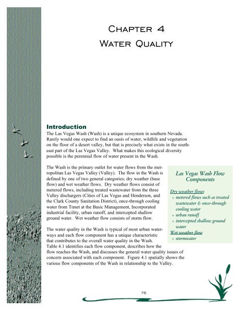
Introduction<br />
The <strong>Las</strong> <strong>Vegas</strong> <strong>Wash</strong> (<strong>Wash</strong>) is a unique ecosystem in southern Nevada.<br />
Rarely would one expect to find an oasis of water, wildlife and vegetation<br />
on the floor of a desert valley, but that is precisely what exists in the southeast<br />
part of the <strong>Las</strong> <strong>Vegas</strong> Valley. What makes this ecological diversity<br />
possible is the perennial flow of water present in the <strong>Wash</strong>.<br />
The <strong>Wash</strong> is the primary outlet for water flows from the metropolitan<br />
<strong>Las</strong> <strong>Vegas</strong> Valley (Valley). The flow in the <strong>Wash</strong> is<br />
defined by one of two general categories; dry weather (base<br />
flow) and wet weather flows. Dry weather flows consist of<br />
metered flows, including treated wastewater from the three<br />
Valley dischargers (Cities of <strong>Las</strong> <strong>Vegas</strong> and Henderson, and<br />
the Clark County Sanitation District), once-through cooling<br />
water from Timet at the Basic Management, Incorporated<br />
industrial facility, urban runoff, and intercepted shallow<br />
ground water. Wet weather flow consists of storm flow.<br />
The water quality in the <strong>Wash</strong> is typical of most urban waterways<br />
and each flow component has a unique characteristic<br />
that contributes to the overall water quality in the <strong>Wash</strong>.<br />
Table 4.1 identifies each flow component, describes how the<br />
flow reaches the <strong>Wash</strong>, and discusses the general water quality issues of<br />
concern associated with each component. Figure 4.1 spatially shows the<br />
various flow components of the <strong>Wash</strong> in relationship to the Valley.<br />
<strong>Las</strong> <strong>Vegas</strong> <strong>Wash</strong> Flow<br />
Components<br />
Dry weather flows<br />
4 metered flows such as treated<br />
wastewater & once-through<br />
cooling water<br />
4 urban runoff<br />
4 intercepted shallow ground<br />
water<br />
Wet weather flow<br />
4 stormwater<br />
75
<strong>Chapter</strong> 4: Water Quality<br />
Table 4.1 - <strong>Las</strong> <strong>Vegas</strong> <strong>Wash</strong> flow components and general effect on water quality.<br />
The water quality issues presented by the <strong>Wash</strong> have the potential to effect<br />
the <strong>Las</strong> <strong>Vegas</strong> Bay and generate public concern regarding Lake Mead,<br />
which is the largest reservoir on the Colorado River system. Southern<br />
Nevada relies on the Colorado River as the primary source for drinking<br />
water. Others in the lower Colorado River Basin including Arizona,<br />
California, and several Native American Tribes rely on Colorado River<br />
water primarily for agriculture uses as well as drinking water. Lake Mead<br />
plays an integral role in regulating and protecting the delivery of water to<br />
those entities, and southern Nevada has a vested interest in protecting the<br />
lake’s water quality as much as possible. In addition, flows in the <strong>Wash</strong><br />
are instrumental in sustaining wetlands and the associated ecosystems that<br />
have developed as a result of the perennial flow. Therefore, the water<br />
quality issues associated with the <strong>Wash</strong> require attention.<br />
76
<strong>Chapter</strong> 4: Water Quality<br />
Figure 4.1 - Map showing the spatial influence of various flow components in the <strong>Las</strong><br />
<strong>Vegas</strong> <strong>Wash</strong>.<br />
Water Quality Compliance<br />
Safe Drinking Water Act<br />
The Safe Drinking Water Act (SDWA) was passed by Congress in 1974<br />
and has been amended several times since, most recently in 1996. The U.S.<br />
Environmental Protection Agency is the lead federal agency that determines<br />
the regulations and provides guidance to the administering agency,<br />
the Nevada Bureau of Health Protection. The SDWA sets national drinking<br />
water standards that must be met by all public water systems.<br />
While the <strong>Wash</strong> is not a drinking water source and therefore not required to<br />
meet SDWA standards, any impact, or potential impact of the <strong>Wash</strong> on<br />
Lake Mead must be evaluated.<br />
77
<strong>Chapter</strong> 4: Water Quality<br />
Clean Water Act<br />
The Clean Water Act (CWA) mandates that all discharges to surface waters<br />
be permitted and meet certain requirements as to quality. The U.S.<br />
Environmental Protection Agency (EPA) is the lead federal agency that<br />
determines the regulations and provides guidance to the administering<br />
agency, the Nevada Division of Environmental Protection (NDEP). The<br />
CWA sets national standards for surface water bodies based on uses other<br />
than drinking water (i.e., recreation) that must be met by all entities that<br />
discharge to a public waterway.<br />
The <strong>Wash</strong> serves as the receiving waters for three types of flows which fall<br />
under the jurisdiction of the CWA:<br />
• Wastewater discharges – National Pollutant Discharge Elimination<br />
System (NPDES) permits are required for all of the treated wastewater<br />
that is discharged into the <strong>Wash</strong>. Each permit specifies the maximum<br />
amount of discharge allowed and sets limits for various constituents that<br />
may be in the discharge. The permit’s limitations are established to<br />
insure that water quality standards for the <strong>Wash</strong> and Lake Mead are met.<br />
These standards are set by NDEP, according to CWA requirements,<br />
based on the intended use of the water and to prevent degradation of<br />
water quality.<br />
• Stormwater flows – The Clark County Regional Flood Control District,<br />
as lead agency, along with Clark County, the City of Henderson, the<br />
City of <strong>Las</strong> <strong>Vegas</strong>, the City of North <strong>Las</strong> <strong>Vegas</strong>, and the Nevada<br />
Department of Transportation are co-permittees for the Municipal<br />
Stormwater Management NPDES permit currently in place for the urban<br />
Valley. The permit allows for discharge of stormwater from Valley<br />
washes to the <strong>Wash</strong>. Although stormwater is not treated prior to entering<br />
the <strong>Wash</strong>, sampling and reporting requirements are set under the<br />
Municipal Stormwater Management NPDES permit.<br />
• Urban runoff – The Valley’s urban runoff is monitored through the<br />
Municipal Stormwater Management NPDES permit. Under this permit,<br />
dry weather and wet weather sampling and reporting are conducted at<br />
each of the wet weather monitoring sites. In addition, the 1998/99 program<br />
includes a pilot project conducted by the Conservation District of<br />
Southern Nevada to perform a site characterization of a four-square mile<br />
area along Flamingo <strong>Wash</strong> to determine the sources of urban runoff pollutants.<br />
Triennial Review of Water Quality Standards<br />
Section 303 of the CWA requires that states periodically review and, as<br />
appropriate, modify water quality standards. The standards are published<br />
78
under the Nevada Water Pollution Control Regulations (NAC 445A.194 –<br />
445A.201). The Nevada Division of Environmental Protection, Bureau of<br />
Water Quality Planning is the lead state agency. One important consideration<br />
is that beneficial uses and associated water quality standards on the<br />
<strong>Wash</strong> may need to be revisited as the management plan is implemented and<br />
as the <strong>Wash</strong> changes from a fast-moving erosive stream to a controlled<br />
wetland environment.<br />
The Nevada State Environmental Commission, which is responsible for the<br />
final approval, first enacted water quality standards for the <strong>Wash</strong> and Lake<br />
Mead in the 1970’s. The standards have been amended several times,<br />
including most recently in June, 1998.<br />
208 Water Quality Management Plan<br />
The Clark County 208 Water Quality Management Plan for the Valley was<br />
amended by County Commissioners in 1997. The document outlines water<br />
quality strategies for compliance under the CWA for a twenty year period.<br />
Elements considered in the plan include population projections, water<br />
resources, air quality relating to assessment of wastewater conditions, nonpoint<br />
source conditions, <strong>Wash</strong> wetlands, and reuse and reclamation opportunities.<br />
The document is subject to approval by NDEP and EPA.<br />
Water Quality Issues of Concern<br />
The fact that the <strong>Wash</strong> is the outlet for all urban flow in the Valley inherently<br />
means that there will be water quality issues associated with the flow.<br />
The primary issues of concern, including sediment, selenium, perchlorate,<br />
and urban chemicals are discussed in more detail below.<br />
Sediment<br />
Sediment transport in the <strong>Wash</strong> ranges from 50 to 1,600 tons per day, as<br />
measured by total suspended solids (TSS). As expected, the variation in<br />
sediment load depends upon the time the samples were collected (i.e.,<br />
higher TSS values when sampled during or immediately after a storm<br />
event). Another component of the sediment equation, which cannot be<br />
directly measured, is sediment that drops out at Lake <strong>Las</strong> <strong>Vegas</strong>. Lake <strong>Las</strong><br />
<strong>Vegas</strong> is a constructed lake that allows the <strong>Wash</strong> to flow underneath in two<br />
84-inch pipes. Sediment drops out in the settling basin before the flow<br />
enters the pipe intake structure.<br />
The transport of sediment is especially evident in <strong>Las</strong> <strong>Vegas</strong> Bay, the<br />
receiving water body of the <strong>Wash</strong>. Some researchers have noted several<br />
additional feet of sedimentation in the Bay after major storm events.<br />
On June 17, 1998, the Nevada State Environmental Commission adopted<br />
Water Quality Standards (NAC 445A.195) which included a beneficial use<br />
79<br />
<strong>Chapter</strong> 4: Water Quality
<strong>Chapter</strong> 4: Water Quality<br />
TMDL (total maximum<br />
daily load)<br />
establishes limits<br />
on the total mass of<br />
a water quality<br />
parameter that is<br />
allowed to be<br />
discharged into a<br />
water body.<br />
standard for suspended solids of 135 milligrams per liter (mg/l). The standard<br />
is defined as the twelve month rolling average of the monthly values<br />
and does not apply when flow in the <strong>Wash</strong> is greater than 110% of average<br />
flow as measured at the nearest flow gage. Based on data collected by the<br />
Lake Mead Water Quality Forum Sedimentation Subcommittee and by the<br />
Dischargers for their discharge permits, the <strong>Wash</strong> has occasionally exceeded<br />
the 135 mg/l total suspended solids standard.<br />
TMDLs<br />
NPDES permits issued in the Valley include regional total maximum daily<br />
load (TMDLs) and wasteload allocations for phosphorus and ammonia<br />
nitrogen. TMDL is an estimate of the assimilation capacity of a body of<br />
water for a particular contaminant. Wasteload allocations are the mass limits<br />
of a contaminant allocated to individual treatment plants such that the<br />
total mass for all plants does not exceed the established TMDL. The<br />
objective of TMDLs is to establish limits on total mass of these nutrients<br />
entering Lake Mead via the <strong>Wash</strong> from all sources rather than establishing<br />
concentration limits for individual treatment plants.<br />
In 1989, the NDEP established TMDLs for phosphorus (434 pounds per<br />
day) and ammonia (970 pounds per day). These TMDLs are divided into<br />
wasteload allocations among the Dischargers with a portion of the phosphorus<br />
TMDL (100 pounds per day) allocated to non-point sources. The<br />
phosphorus TMDL is in effect from March 1st through October 31st of<br />
each year. The ammonia TMDL is in effect from April 1st through<br />
September 30th of each year.<br />
The established TMDLs do not change as a result of increasing wastewater<br />
flow. Therefore, treatment technology must be improved to meet the<br />
TMDLs. The challenge faced by the Dischargers is developing and implementing<br />
the technology necessary to meet the TMDL standards as the<br />
amount of wastewater inflow continues to increase.<br />
In 1997, the Dischargers commissioned the Wastewater Needs Assessment<br />
Study (NAS) (Appendix 8.1). The goal of the NAS was to develop a thirty-year<br />
plan that addresses the long-term needs of the Dischargers and to<br />
identify alternative methods to accommodate the existing and projected<br />
wastewater flows of the Valley. Recently, the Dischargers governing bodies<br />
approved the implementation of the Alternative Discharge Study<br />
(Project). The current Project is a recommendation of the NAS effort by<br />
the Dischargers and is intended to expand the findings of the NAS with the<br />
intent to provide guidance on the engineering, scientific, and environmental<br />
solutions for disposal of treated wastewater in a manner that will be<br />
acceptable to the Dischargers and the other stakeholders.<br />
80
<strong>Chapter</strong> 4: Water Quality<br />
Selenium<br />
While background selenium concentrations throughout the Colorado River<br />
System and <strong>Wash</strong> are one to three parts per billion (ppb), concentrations<br />
from one urban tributary (Monson Channel) to the <strong>Wash</strong> have been most<br />
recently sampled at 15 ppb. A concentration at this level raises concerns<br />
regarding the potential for bioaccumulation within the food chain and may<br />
be related to adverse effects on some species of fish and wildlife found in<br />
areas with elevated selenium concentrations (e.g., Kesterson).<br />
These elevated selenium concentrations occur in the area of the future<br />
entrance to the Clark County Wetlands Park. In order to assess, and eventually<br />
mitigate this concern, Clark County is working with the Bureau of<br />
Reclamation and Ducks Unlimited to design the constructed wetlands in<br />
this area with the idea of blending the Monson Channel water with other<br />
sources including effluent and <strong>Wash</strong> flows.<br />
While it is not anticipated that concerns regarding selenium will delay the<br />
enhancement activities planned for the <strong>Wash</strong>, it is important to better<br />
understand the effects of selenium within the ecosystem. One way to do<br />
this is by developing a demonstration project that will effectively assess the<br />
selenium cycle.<br />
Perchlorate<br />
Perchlorate, detected in the <strong>Wash</strong> and Lake Mead in 1997, was manufactured<br />
by two Valley companies from the 1950’s until 1997. Advancement<br />
in technology has lowered the detection limit for perchlorate from 400 ppb<br />
to four ppb and has resulted in perchlorate being detected at low levels<br />
(less than 18 ppb) in the raw and finished drinking water supply from Lake<br />
Mead. NDEP has determined that the source of perchlorate in Lake Mead<br />
is intercepted shallow ground water in the <strong>Wash</strong>. High levels of perchlorate<br />
have been discovered in shallow ground water surrounding and down<br />
gradient from the two companies that manufactured perchlorate in the<br />
Valley. High levels have also been detected along the stretch of the <strong>Wash</strong><br />
where intercepted shallow ground water enters the <strong>Wash</strong>. Figure 4.2 shows<br />
the location of the perchlorate plume extending from the source of contamination<br />
at the industrial facilities to the <strong>Wash</strong>.<br />
For the data that has been collected in the <strong>Wash</strong> and Lake Mead, the values<br />
of perchlorate vary from about 10-20 ppb to about 1,000 ppb depending<br />
upon where the samples were collected. For example, the values above the<br />
point where the perchlorate plume enters the <strong>Wash</strong> range from 10-20 ppb.<br />
In the area the perchlorate plume intercepts the <strong>Wash</strong>, the perchlorate value<br />
increases to about 1,000 ppb. The values decrease dramatically once the<br />
<strong>Wash</strong> enters <strong>Las</strong> <strong>Vegas</strong> Bay due to dilution from the large volume of water<br />
in the Bay. Figure 4.2 shows the perchlorate values throughout the <strong>Wash</strong>,<br />
<strong>Las</strong> <strong>Vegas</strong> Bay, and the Boulder Basin of Lake Mead.<br />
81
<strong>Chapter</strong> 4: Water Quality<br />
Figure 4.2 - Perchlorate values in <strong>Las</strong> <strong>Vegas</strong> <strong>Wash</strong>, <strong>Las</strong> <strong>Vegas</strong> Bay and the Boulder Basin of Lake Mead.<br />
The NDEP has been actively working with the responsible parties to facilitate<br />
the removal of perchlorate from the shallow ground water system,<br />
which will result in a decrease of values seen in the <strong>Wash</strong> and Lake Mead.<br />
One recent discovery was the presence of a shallow ground water seep of<br />
about 350 gallons per minute that, based on mass balance calculations, is<br />
estimated to contribute about fifty percent of the total perchlorate load into<br />
the <strong>Wash</strong>. The NDEP has required the responsible parties to focus on this<br />
site by intercepting the flow and removing the perchlorate before it reaches<br />
the <strong>Wash</strong>.<br />
The Southern Nevada Water Authority, the NDEP, and the U.S. Bureau of<br />
Reclamation (USBR) have conducted water quality sampling on a monthly<br />
basis at over twenty locations in the <strong>Wash</strong> and Lake Mead. The fact that<br />
perchlorate is a conservative compound has allowed researchers to use the<br />
concentrations detected to better understand the limnological aspects of the<br />
lake, and make predictions in order to anticipate the concentrations seen in<br />
the raw and finished water supply. In addition, these entities promote the<br />
further understanding of the potential health effects of perchlorate, and will<br />
continue to sample, characterize, and stay informed as to the most recent<br />
research regarding perchlorate.<br />
Urban Chemicals<br />
The category of water quality concerns known as “urban chemicals” is a<br />
broad topic that covers any type of chemical that is used in the home or<br />
business. This category includes not only those chemicals that have been<br />
82
disposed of improperly (i.e., on the ground, in the storm drain system), but<br />
also includes the chemicals prevalent in every day life. For example, pesticides,<br />
solvents, herbicides, gas products, oil, and grease all fall within this<br />
category. These chemicals have the potential to reach the <strong>Wash</strong> as intercepted<br />
shallow ground water or as surface flow resulting from overirrigation<br />
and storm events.<br />
The U.S. Geological Survey, as part of the National Water-Quality<br />
Assessment (NAWQA) Program, has collected and analyzed water quality<br />
samples from various shallow ground water (not used for drinking water)<br />
monitoring wells in the Valley. The report states that at least one pesticide<br />
was detected at low levels (below the maximum contaminant level established<br />
for drinking water) in 28 percent of the shallow monitoring wells<br />
sampled. The report concludes that urban activities in the Valley have<br />
been a primary source of these organic compounds found in the shallow<br />
aquifer (Bevans, et al, 1998).<br />
Public education and the development of Best Management Practices can<br />
be a successful means of reducing urban pollutants from reaching water<br />
ways.<br />
Other Potential Concerns<br />
The lowering of analytical detection limits, combined with a better understanding<br />
of flow contribution to the <strong>Wash</strong>, has led researchers to realize<br />
that additional water quality concerns have the potential to materialize in<br />
the future. Two general concerns include past industrial practices and current<br />
land use practices. Each of these is discussed in more detail below:<br />
• Past industrial practices – Prior to environmental law in the 1970’s, it<br />
was standard practice to dispose of manufacturing byproducts in unlined<br />
landfills and lagoons. Many of these past industrial practices took place<br />
in the southeast part of the Valley, and as a result, many of these<br />
byproducts have reached the shallow ground water aquifer, which then<br />
can reach the <strong>Wash</strong> as intercepted ground water. As discussed in more<br />
detail in <strong>Chapter</strong> 7, and in previous discussions in this chapter, perchlorate<br />
and various organic compounds are examples of past land use practices<br />
effecting water quality in the <strong>Wash</strong>.<br />
• Current land use practices - Current land use practices contribute to<br />
water quality in the <strong>Wash</strong> primarily as a result of dewatering and nonpoint<br />
sources resulting from an increasing amount of imprevious surface<br />
in the Valley and the associated increased runoff associated with it.<br />
<strong>Chapter</strong> 11 provides specific land use recommendations.<br />
<strong>Chapter</strong> 4: Water Quality<br />
83
<strong>Chapter</strong> 4: Water Quality<br />
Understanding the Influence of <strong>Las</strong> <strong>Vegas</strong><br />
<strong>Wash</strong> on Lake Mead<br />
Gaining the knowledge to develop and implement the management options<br />
that are presented in this document begins with fully understanding the<br />
water quality of the <strong>Wash</strong> and it’s influence on the water quality of <strong>Las</strong><br />
<strong>Vegas</strong> Bay and Lake Mead.<br />
Water Quality Monitoring<br />
There are currently several monitoring programs in place that have provided<br />
a significant understanding of the water quality concerns faced by<br />
southern Nevada. The following describes some of these efforts:<br />
• <strong>Las</strong> <strong>Vegas</strong> Valley Dischargers – Through a program that includes water<br />
quality sampling for compliance and research purposes, the Dischargers<br />
have provided a comprehensive set of data on a wide variety of water<br />
quality parameters. This data is available for the <strong>Wash</strong>, <strong>Las</strong> <strong>Vegas</strong> Bay,<br />
and Lake Mead.<br />
• U.S. Bureau of Reclamation – Work by USBR researchers throughout<br />
the 1990’s has helped us understand the limnology of Lake Mead and<br />
the seasonal effects of the <strong>Wash</strong> on the ecology of Boulder Basin.<br />
Figure 4.3 indicates the location of the Boulder Basin in Lake Mead.<br />
Their work has four objectives:<br />
1. To collect trend data on the influence of the <strong>Wash</strong> on <strong>Las</strong><br />
<strong>Vegas</strong> Bay and Lake Mead.<br />
2. To investigate the status of the limnological conditions of<br />
Boulder Basin as a source of drinking water supply.<br />
3. To perform research into new technology of evaluating limnological<br />
features, in particular those related to water quality conditions<br />
of reservoirs.<br />
4. To contribute to the understanding the ecology of Lake Mead as<br />
it relates to the operational scheme of the Colorado River system.<br />
A variety of water quality parameters are collected, including temperature,<br />
dissolved oxygen, conductivity, pH, turbidity, transparency, plant nutrients,<br />
some specific inorganic chemicals, bacteria, as well as parameters that estimate<br />
the algal and microscopic animal biomass of Boulder Basin. The<br />
results of nearly a decade of sampling has lead to increased understanding<br />
of the interaction of the <strong>Wash</strong> and Lake Mead. Parameters such as conductivity<br />
(high <strong>Wash</strong> values compared with lower Colorado River values) provide<br />
a signature of the <strong>Wash</strong> that can be traced from the <strong>Wash</strong> and followed<br />
as it mixes within the lake. The research has shown that how the<br />
<strong>Wash</strong> behaves once it reaches the lake is dependent on several factors<br />
84
<strong>Chapter</strong> 4: Water Quality<br />
including time of<br />
year, water temperature,<br />
and wind.<br />
As <strong>Wash</strong> water enters<br />
the lake and forms an<br />
intrusion (or plume)<br />
there is significant<br />
mixing in the inner<br />
bay as indicated by its<br />
higher overall conductivity<br />
versus that<br />
of the outer bay.<br />
However, the intrusion<br />
retains its identity<br />
and exists as an<br />
underflow for about 4<br />
kilometers (km) into<br />
Boulder Basin. This<br />
underflow follows the<br />
thalweg of the historical<br />
stream channel of <strong>Las</strong> <strong>Vegas</strong> Creek (now referred to as <strong>Las</strong> <strong>Vegas</strong><br />
<strong>Wash</strong>) until an equilibrium depth is reached below which lake water, due to<br />
cooler temperatures, is denser than intrusion water. This occurs at a depth<br />
of 40 to 60 meters (m) in late winter. At this depth, the intrusion extends<br />
into the basin as an interflow, being supported by the denser water of the<br />
hypolimnion, until it has dispersed and mixed to the point it can no longer<br />
be detected using standard measurements.<br />
Figure 4.3 – Map of Lake Mead highlighting the location of the Boulder Basin.<br />
In early spring, the intrusion begins to elevate into the water column, existing<br />
as an underflow for a shorter and shorter distance before becoming an<br />
interflow. This change is a function of both stratification developing in the<br />
reservoir and the warming of inflowing water from the <strong>Wash</strong>. The <strong>Wash</strong><br />
conductivity remains relatively stable throughout the year, but the temperature<br />
increases from 20° C to nearly 28° C by mid-summer. Although the<br />
<strong>Las</strong> <strong>Vegas</strong> <strong>Wash</strong> water is warmer than lake water, it remains underflow due<br />
to higher density resulting from salinity. This density gradient is strong<br />
enough in both late spring and early fall that water temperature of the<br />
intrusion may be 1-2°C higher than that of surface waters for a distance of<br />
2-3 km.<br />
By early summer, the intrusion is located at its shallowest depth of the<br />
year as a result of increasing temperature of the inflow and the relatively<br />
shallow thermocline in <strong>Las</strong> <strong>Vegas</strong> Bay. As the thermocline strengthens,<br />
the intrusion is constrained from below by denser cold water, and upward<br />
movement is limited by the less dense, warm surface waters which inhibit<br />
mixing. Conductivity gradients identifying the intrusion are sharpest at<br />
Thalweg refers to the<br />
location of any cross<br />
section of a reservoir<br />
where the old river,<br />
creek or wash<br />
channel was located<br />
before the reservoir<br />
was filled. It is then<br />
the deepest spot of<br />
any particular<br />
cross section.<br />
85
<strong>Chapter</strong> 4: Water Quality<br />
this time. Depending on conditions, remnants of the intrusion can be<br />
measured for at least 8 km from the inflow of the <strong>Wash</strong>, and on occasion<br />
data indicate a band of higher conductivity extending to Hoover Dam.<br />
During most of the summer months the peak of the intrusion remains at<br />
about 9 meters in depth.<br />
At the end of summer (usually September) the intrusion sinks as the thermocline<br />
is depressed due to epilimnetic cooling. As stratification breaks<br />
down in the fall and the inflowing waters begin to cool, the intrusion<br />
moves deeper into the former hypolimnetic waters, and the seasonal cycle<br />
begins to repeat.<br />
Related and very recent investigations by USBR scientists indicate that the<br />
<strong>Wash</strong> enters and flows as a plume at an estimated average rate of 5 to 8<br />
centimeters per second, and that the average time it takes water flowing in<br />
the “plume” to travel from the <strong>Wash</strong> inflow to a point near Saddle Islands<br />
is 48.5 hours.<br />
USBR scientists, for more than 12 years, have continuously monitored<br />
water quality of the <strong>Wash</strong> from just above the City of <strong>Las</strong> <strong>Vegas</strong> treatment<br />
facility to a point below the North Shore Road bridge. Prior to the ongoing<br />
program, monitoring was done on a frequent basis for more than 10 years.<br />
These data, which continue to be collected on a quarterly basis, are done<br />
under the authority of the Colorado River Basin Salinity Control Act of<br />
1974. Data clearly depict the dramatic change in the patterns of water<br />
quality based upon, 1) the erosion of the <strong>Wash</strong> and resulting significant<br />
reduction in time of travel in the <strong>Wash</strong>, 2) the effects of increasing population,<br />
3) changes installed in treatment of effluent by the dischargers (i.e.<br />
removal of phosphorus, conversion of nitrogen from ammonia to nitrate)<br />
and 4) the influence of periodic flooding.<br />
• Southern Nevada Water Authority (SNWA) – The SNWA conducts<br />
water quality monitoring for compliance and research purposes. Longterm<br />
sampling has resulted in water quality data that dates back to the<br />
1970’s. Since 1997, a comprehensive sampling program has been<br />
underway throughout the Boulder Basin that collects water samples<br />
from the lake surface to lake bottom. This data will be used in a threedimensional<br />
model to help researchers better understand the limnology<br />
of the Boulder Basin and the influence of the <strong>Wash</strong> on the entire basin.<br />
The SNWA has also coordinated and developed a water quality database<br />
that provides for the centralization of data from several entities into an<br />
internet-based application that contains more than 500,000 cells of data.<br />
• Municipal Stormwater Quality Management Program - The <strong>Las</strong><br />
<strong>Vegas</strong> Valley Stormwater Quality Management <strong>Committee</strong>, of which the<br />
Clark County Regional Flood Control District is the lead agency, pro-<br />
86
vides a report each year detailing the findings of monitoring and sampling<br />
efforts required under the <strong>Las</strong> <strong>Vegas</strong> Valley NPDES Municipal<br />
Stormwater Discharge Permit. The current Annual Report (1997-1998)<br />
outlines program requirements, recommended changes for the following<br />
permit year, and water quality data collected for the year. The monitoring<br />
under this program began in 1991.<br />
Interagency <strong>Coordination</strong><br />
Over the past several years, entities involved in water quality issues for<br />
southern Nevada realized that a coordinated effort was the preferred<br />
method to share information and identify needs for the future. In addition<br />
to the <strong>Coordination</strong> <strong>Committee</strong>, other efforts are underway to ensure that<br />
the water quality issues facing the Valley are identified and addressed.<br />
• Water Quality Database – The <strong>Las</strong> <strong>Vegas</strong> Water Quality Interagency<br />
Database (www.lvwaterquality.org) is an example of using state-of-the<br />
art technology to manage and access large data sets. This internet-based<br />
application has helped to centralize water quality data from federal,<br />
state, and local entities, while at the same time, providing the public<br />
with an easy-to-use tool to understand water quality data in our community.<br />
The site consists of two sections, one for water quality professionals<br />
who can query large datasets and obtain results in an easy to read,<br />
downloadable fashion within a few seconds. The second section is<br />
designed with the general public in mind and focuses on education<br />
while enabling the public to query the water quality database and graph<br />
the results. The database is intended to be used as a research tool and<br />
an educational outreach mechanism for the local community. The database<br />
was developed, and is currently maintained by the <strong>Las</strong> <strong>Vegas</strong> <strong>Wash</strong><br />
Project <strong>Coordination</strong> Team. The site currently includes data from the<br />
Bureau of Reclamation, City of Henderson, City of <strong>Las</strong> <strong>Vegas</strong>, Clark<br />
County Regional Flood Control District, Clark County Sanitation<br />
District, and the Southern Nevada Water Authority.<br />
• Lake Mead Water Quality Forum (Forum) – The Forum was established<br />
in 1997 and is facilitated by the Nevada Division of<br />
Environmental Protection. The Forum is comprised of local, state, and<br />
federal agencies with an interest in Lake Mead environmental issues and<br />
water quality. The purpose of this group is to provide a mechanism to<br />
keep the stakeholders of the <strong>Wash</strong> and Lake Mead informed as to the<br />
water quality issues and ongoing studies. The Forum has also initiated<br />
several technical studies that investigated topics such as, sediment volume<br />
from the <strong>Wash</strong>, whether there was a need for a fish consumption<br />
advisory, and the potential for bacteria after a storm event to impact designated<br />
water uses on Lake Mead.<br />
<strong>Chapter</strong> 4: Water Quality<br />
87
<strong>Chapter</strong> 4: Water Quality<br />
• Interagency Technical <strong>Committee</strong> – This group meets monthly on<br />
issues related to Lake Mead and the <strong>Wash</strong> monitoring activities. Studies<br />
are conducted to improve and standardize sampling and analytical procedures<br />
and to insure reliability of data generated by all participants.<br />
This group has taken on the formidable task of developing a common<br />
nomenclature for the 100+ sampling locations throughout the Lake<br />
Mead system. The participants of this group include representatives<br />
from the Bureau of Reclamation, City of Henderson, City of <strong>Las</strong> <strong>Vegas</strong>,<br />
Clark County Sanitation, and the Southern Nevada Water Authority.<br />
Characterization of <strong>Las</strong> <strong>Vegas</strong> <strong>Wash</strong><br />
Water Quality<br />
The overall water quality in the <strong>Wash</strong> is clearly dependent upon the quality<br />
of the individual flow components. For example, the quality of <strong>Wash</strong><br />
water, when looked at without the contribution of the treated wastewater<br />
(effluent), is typical of an urban area; high in total dissolved solids and<br />
containing low levels of oil, grease, pesticides, and herbicides (Clark<br />
County Regional Flood Control Stormwater Monitoring Program). Once<br />
the effluent component is added, the values decrease due to the dilution<br />
effect of the large volumes of effluent, and more closely resemble<br />
Colorado River water.<br />
The water quality parameter that best demonstrates the dilution effect that<br />
occurs once the treated wastewater flow enters the <strong>Wash</strong> is total dissolved<br />
solids (TDS). Table 4.2 shows the TDS values of four sample locations;<br />
two sites without the influence of effluent and two sites downstream from<br />
the treated wastewater entering the <strong>Wash</strong>. Figure 4.4 locates the samples<br />
sites presented in Table 4.2.<br />
Table 4.2 - Total dissolved solids values with and without influence of effluent contribution (from<br />
www.lvwaterquality.org/agency).<br />
Understanding the individual flow components and their effect on the overall<br />
water quality in the <strong>Wash</strong> will aid researchers in developing and implementing<br />
the various elements of the <strong>Las</strong> <strong>Vegas</strong> <strong>Wash</strong> Comprehensive<br />
Adaptive Management Plan.<br />
88
<strong>Chapter</strong> 4: Water Quality<br />
Figure 4.4 – Sample sites indicating influence of urban run-off, shallow ground<br />
water, and treated wastewater.<br />
Summary<br />
The work being done through the interagency coordination efforts in the<br />
Valley, including the Lake Mead Water Quality Forum, the Interagency<br />
Technical <strong>Committee</strong>, and the <strong>Las</strong> <strong>Vegas</strong> <strong>Wash</strong> <strong>Coordination</strong> <strong>Committee</strong>,<br />
have provided us with an opportunity to better understand the effects of<br />
urban flows on the <strong>Wash</strong> and Lake Mead. Through this understanding has<br />
come the realization that the <strong>Wash</strong> water quality concerns we face as a<br />
community effect not only southern Nevada, but also the downstream users<br />
of the Colorado River, and that a comprehensive approach to mitigating the<br />
concerns and managing the resource is necessary.<br />
89
<strong>Chapter</strong> 4: Water Quality<br />
90