

Caribbean Compass Yachting Magazine February 2015
Welcome to Caribbean Compass, the most widely-read boating publication in the Caribbean! THE MOST NEWS YOU CAN USE - feature articles on cruising destinations, regattas, environment, events...
Welcome to Caribbean Compass, the most widely-read boating publication in the Caribbean! THE MOST NEWS YOU CAN USE - feature articles on cruising destinations, regattas, environment, events...

Create successful ePaper yourself
Turn your PDF publications into a flip-book with our unique Google optimized e-Paper software.
— Continued from previous page<br />
SPECIAL MENTIONS<br />
The judges made special mention of the efforts of the following groups:<br />
Hope Town Primary School, The Bahamas, whose description of their efforts to<br />
rehabilitate eroded sand dunes was highly commended.<br />
Escuela Primaria Giraldo Aponte Fonseca, Cuba, whose description of the changes<br />
at Sierra Mar beach was outstanding.<br />
Brooks Hill Bilingual School, San Andres, Colombia, whose photos and description<br />
clearly illustrated the serious issues at Sound Bay.<br />
Nguyen Thi Minh Khai GHS, (Class 12A9) Vietnam, whose interview with residents<br />
at Mo O beach highlighted the human aspects of the changes.<br />
And finally a special mention and “thank-you” to one individual, Delia Vera<br />
Medina, Coordinator of the UNESCO Associated Schools Project network in Cuba.<br />
Her outstanding efforts resulted in Cuba submitting the highest number of entries<br />
to the competition.<br />
Visit www.sandwatch.org<br />
for more information.<br />
FEBRUARY <strong>2015</strong> CARIBBEAN COMPASS PAGE 12<br />
MERIDIAN PASSAGE<br />
OF THE MOON<br />
FEBRUARY & MARCH <strong>2015</strong><br />
Crossing the channels between <strong>Caribbean</strong> islands with a favorable tide will<br />
make your passage faster and more comfortable. The table below, courtesy Don<br />
Street, author of Street’s Guides and compiler of Imray-Iolaire charts, which<br />
shows the time of the meridian passage (or zenith) of the moon for this AND next<br />
month, will help you calculate the tides.<br />
Water, Don explains, generally tries to run toward the moon. The tide starts<br />
running to the east soon after moonrise, continues to run east until about an<br />
hour after the moon reaches its zenith (see TIME below) and then runs westward.<br />
From just after the moon’s setting to just after its nadir, the tide runs eastward;<br />
and from just after its nadir to soon after its rising, the tide runs westward; i.e.<br />
the tide floods from west to east. Times given are local.<br />
Note: the maximum tide is 3 or 4 days after the new and full moons.<br />
For more information, see “Tides and Currents” on the back of all Imray Iolaire<br />
charts. Fair tides!<br />
DATE TIME<br />
<strong>February</strong> <strong>2015</strong><br />
DATE TIME<br />
1 2238<br />
2 2325<br />
3 0000 (full moon)<br />
4 0011<br />
5 0055<br />
6 0138<br />
7 0220<br />
8 0302<br />
9 0345<br />
10 0429<br />
11 0515<br />
12 0603<br />
13 0655<br />
14 0749<br />
15 0845<br />
16 0944<br />
17 1043<br />
18 1141<br />
19 1239<br />
20 1335<br />
21 1430<br />
22 1524<br />
23 1618<br />
24 1711<br />
25 1804<br />
26 1855<br />
27 1946<br />
28 2035<br />
March <strong>2015</strong><br />
1 2112<br />
2 2208<br />
3 2253<br />
4 2326<br />
5 0000 (full moon)<br />
6 0019<br />
7 0101<br />
8 0144<br />
9 0227<br />
10 0312<br />
11 0359<br />
12 0448<br />
13 0540<br />
14 0633<br />
15 0729<br />
16 0826<br />
17 0921<br />
18 1019<br />
19 1116<br />
20 1212<br />
21 1308<br />
22 1403<br />
23 1459<br />
24 1554<br />
25 1647<br />
26 1740<br />
27 1831<br />
28 1919<br />
29 2009<br />
30 2051<br />
31 2134<br />
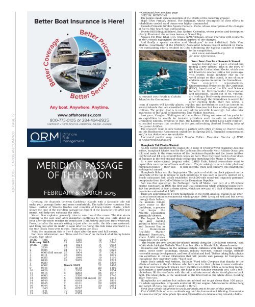
A research crew heads to Catholic<br />
Island in the Grenadines<br />
V. WELLINGTON<br />
Your Boat Can Be a Research Vessel<br />
Imagine turning over a piece of wood and<br />
finding a new species. That is the story of<br />
the humble Union Island Gecko, which was<br />
not known to science until a few years ago.<br />
This reptile, found nowhere else in the<br />
world except on this island, is one of many<br />
endemic species found in the Grenadines.<br />
Two non-profit organizations,<br />
Environmental Protection in the <strong>Caribbean</strong><br />
(EPIC), based out of the US, and Science<br />
Initiative for Environmental Conservation<br />
and Education, based out of St. Vincent,<br />
are leading a Biodiversity Assessment expedition<br />
through the Grenadines to search for<br />
other exciting finds. Over two weeks, a<br />
team of experts will identify plants, reptiles and invertebrates such as insects on<br />
several islands that are classified as Wildlife Reserves but lack on-the-ground protections.<br />
The project goal is to not only add to scientific knowledge, but also raise<br />
awareness of the value of biodiversity and Wildlife Reserves.<br />
Last year, Vaughan Wellington of the sailboat Viking volunteered his yacht for<br />
an expedition to search for invasive predators such as rats on uninhabited<br />
Grenadine islands. Previous to that, the Lowries of the ketch Lista Light conducted<br />
seabird surveys that resulted in the groundbreaking Seabird Breeding Atlas of<br />
the Lesser Antilles.<br />
The research team is now looking to partner with other cruising or charter boats<br />
on this Biodiversity Assessment expedition in Spring <strong>2015</strong>. Financial compensation<br />
and/or tax deductions are available.<br />
Interested parties may contact Natalia Collier, Executive Director of EPIC,<br />
at ncollier@epicislands.org<br />
Humpback Tail Photos Wanted<br />
As Jim Carrier reported in the August 2014 issue of Cruising World magazine: Just like<br />
sailors, humpback whales head for the <strong>Caribbean</strong> Sea when the North Atlantic Ocean gets<br />
cold and nasty. In the warm waters off the Dominican Republic and the Lesser Antilles,<br />
they breed and loll around until their calves are born. Then they head back to chow down<br />
all summer in the well-stocked whale refrigerator stretching from Maine to Norway.<br />
In a new sailor-science program called CARIB Tails, federal researchers want to<br />
exploit this convergence of boats and baleen. They’re asking cruisers to take photos of<br />
humpback flukes — their tails — to help identify, track and conserve this magnificent<br />
endangered animal.<br />
Humpback flukes are like fingerprints. The pattern of white on black pigment on the<br />
underside of the tail is unique to each individual. It was such a pattern, spotted on a<br />
female nicknamed Salt, which established the 3,000-mile round-trip migratory pattern of<br />
humpbacks from the Gulf of Maine to the Dominican Republic.<br />
Salt was first spotted on the Stellwagen Bank off Maine, now part of a US federal<br />
marine sanctuary, in 1976, the first year that commercial whale watching began there.<br />
Salt has produced at least a dozen calves, which are now part of a Gulf of Maine summer<br />
population estimated at 1,000.<br />
There are approximately 14,000 humpbacks in the North Atlantic, thanks to an international<br />
moratorium on commercial whaling since 1986. Living off krill and fish sieved<br />
through their baleen,<br />
the animals mingle<br />
every winter in the<br />
<strong>Caribbean</strong>, a process<br />
that keeps the<br />
Atlantic population<br />
genetically diverse.<br />
The largest breeding<br />
and calving<br />
ground is Silver Bank<br />
and Samaná Bay in<br />
the Dominican<br />
Republic Marine<br />
Mammal Sanctuary,<br />
where 3,000 whales<br />
congregate every winter.<br />
“The whales are seen around the islands, mostly along the 100-fathom contour,” said<br />
NOAA whale biologist Nathalie Ward from her office in Woods Hole, Massachusetts.<br />
Pressures and threats on the animals include collisions with ships, illegal hunting,<br />
toxins, motor noise, strandings, disease, military exercises, climate change, offshore<br />
renewable energy developments, and loss of habitat and food. “Sailors taking fluke photos<br />
can contribute to critical information that will provide safe passage for humpbacks<br />
throughout their migratory path,” Ward said.<br />
Since Jim’s article was written, Nathalie Ward tells <strong>Compass</strong> that thanks to the<br />
efforts of sailors in the <strong>Caribbean</strong> who have sent in their photos to www.caribtails.<br />
org, four new humpback whales were identified on 2014. While a breaching humpback<br />
makes a spectacular photo, the fluke is the valuable research tool. Use a telephoto<br />
lens, fill the viewfinder with the tail, and take several shots. Avoid glare or back<br />
light. The ideal photo is the underside of the lifted tail as the whale dives, heading<br />
away from you.<br />
Humpbacks are curious but sailors are advised not to get closer than 100 yards.<br />
If a whale approaches, drop sails and shut off your engine. Adults can be 40 feet long<br />
and weigh 45 tons, but aren’t usually a threat.<br />
Send your whale tail photos to www.caribtails.org to be part of this project.<br />
Visit CARIB Tails at www.caribtails.org and the International Whaling Commission<br />
at www.iwc.int for more photo tips and information on maneuvering around whales.


