Duval County - Northeast Florida Regional Council
Duval County - Northeast Florida Regional Council
Duval County - Northeast Florida Regional Council

Create successful ePaper yourself
Turn your PDF publications into a flip-book with our unique Google optimized e-Paper software.
Volume VII-4 <strong>Northeast</strong> <strong>Florida</strong><br />
INTRODUCTION<br />
Statewide <strong>Regional</strong> Evacuation Studies Program<br />
A comprehensive emergency management program requires attention to four (4) key inter-related<br />
components: preparedness, response, recovery and mitigation. Preparing and avoiding or reducing<br />
potential loss of life and property damage - preparedness and mitigation - requires accurate<br />
and precise hazard and vulnerability analyses. These analyses are the foundation for evacuation and<br />
disaster response planning, as well as the development of local mitigation strategies designed to<br />
reduce the community’s overall risk to disasters. This Atlas series provides information to state,<br />
county and local emergency management officials and planners for use in hurricane preparedness<br />
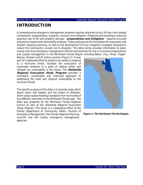
and coastal management in the <strong>Northeast</strong> <strong>Florida</strong> Region including Baker, Clay, <strong>Duval</strong>, Flagler,<br />
Nassau, Putnam and St. Johns counties (Figure 1). It was<br />
part of a statewide effort to enhance our ability to respond<br />
to a hurricane threat, facilitate the evacuation of<br />
vulnerable residents to a point of relative safety and<br />
mitigate our vulnerability in the future. The Statewide<br />
<strong>Regional</strong> Evacuation Study Program provides a<br />
consistent, coordinated and improved approach to<br />
addressing the state and regional vulnerability to the<br />
hurricane threat.<br />
The specific purpose of this Atlas is to provide maps which<br />
depict storm tide heights and the extent of stillwater,<br />
storm surge coastal flooding inundation from hurricanes of<br />
five different intensities in the <strong>Northeast</strong> <strong>Florida</strong> area. The<br />
Atlas was prepared by the <strong>Northeast</strong> <strong>Florida</strong> <strong>Regional</strong><br />
<strong>Council</strong> as part of the Statewide <strong>Regional</strong> Evacuation<br />
Study Program. The Study is a cooperative effort of the<br />
<strong>Florida</strong> Department of Community Affairs, Division of<br />
Emergency Management, the <strong>Florida</strong> <strong>Regional</strong> Planning<br />
<strong>Council</strong>s and the county emergency management<br />
agencies.<br />
Figure 1: The <strong>Northeast</strong> <strong>Florida</strong> Region<br />
Page 6<br />
Volume VII: Storm Tide Atlas