

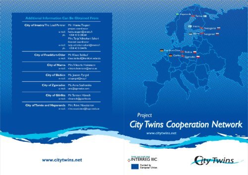
Info-brochure - City Twins Association
Info-brochure - City Twins Association
Info-brochure - City Twins Association

Create successful ePaper yourself
Turn your PDF publications into a flip-book with our unique Google optimized e-Paper software.
Project<br />
<strong>City</strong> <strong>Twins</strong> Cooperation Network<br />
<strong>City</strong> <strong>Twins</strong> Network is a project, which aims at developing cooperation between<br />
twin-cities at outer borders of different countries. Five twin-city pairs joined their<br />
forces into an EU financed project through the programme Interreg IIIC to develop<br />
and establish the best practices of how to run a twin-city that is divided by a border.<br />
The project started in Year 2004 and lasts three years.<br />
The Components/Fields<br />
of activities<br />
� management and coordination<br />
� general administration,<br />
city planning and technical issues<br />
� education, culture, social issues<br />
� industrial policy, labour and border crossing<br />
� promotion and dissemination<br />
The Overall Budget<br />
The overall budget is 1 510 000 euro s.<br />
The funding from the Interreg<br />
IIIC programme is 810 000 euros and national co-financing of the<br />
partner countries is 450 000 euro s.<br />
The Russian partners receive<br />
funding 200 000 euros through EU: Tacis programme with a cofinancing<br />
of 50 000 euro s.<br />
The Partner Cities<br />
Imatra (FIN, Lead Partner) - Svetogorsk (RUS)<br />
Haparanda (SWE) - Tornio (FIN)<br />
Görlitz<br />
(D) - Zgorzelec (PL)<br />
Frankfurt-Oder (D) - Slubice (PL)<br />
Narva (EST) - Ivangorod (RUS)<br />
The Expected Outputs<br />
� new model of co-operation between administrations<br />
� development of new initiatives and best practices<br />
� increasing the role of voluntary organizations in different kinds of<br />
municipal fields<br />
� development of common ways to attract more investments<br />
� development to ease the mobility of labour across the border<br />
and border crossing in general<br />
� effective communiacation between partners, dissemination of the<br />
achieved results<br />
� building relationships with other city twins<br />
Mr. Hannu Tsupari<br />
Project coordinator<br />
<strong>City</strong> of Imatra<br />
Some of us are more like real twin cities than the<br />
others. For example, Tornio and Haparanda are<br />
officially two separate towns, Finnish and<br />
Swedish. When visiting these towns you can hardly<br />
notice any difference. When I was there for the<br />
first time, I really did not know whether I was in<br />
Tornio or in Haparanda. The border crossing went<br />
so smoothly that I did not notice it at all. These<br />
towns<br />
have a common town plan and they are<br />
going to build a joint center. Little by little the<br />
physical border loses its significance.<br />
In Imatra-Svetogorsk or Narva-Ivangorod many<br />
things are different. The border crossing<br />
procedure is quite formal and it takes quite a long<br />
time. You cannot help noticing that when you<br />
cross the border you leave one country and enter<br />
the other. Of course, formalities are necessary,<br />
because they ensure security. We cannot even<br />
dream about building a joint centre in near<br />
future. The differences in financial and other<br />
resources have hindered it so far.<br />
We can and must cooperate despite physical<br />
borders. One of the aims of this project is to<br />
enhance cooperation by lowering any kinds of<br />
borders. Borders can be physical or mental. As<br />
regards physical borders, the task is to show<br />
initiative towards state officials. I think that, for<br />
example, the visa regulations should treat people<br />
who cooperate in projects, take part in pupil<br />
exchange, work in companies, etc. differently<br />
than, for example, tourists. At present they are<br />
treated in the same way. A simpler system would<br />
make cooperation easier and cheaper. Of course,<br />
1 2<br />
www.citytwins.net<br />
Border - a common denominator in<br />
this project. All city twins are located<br />
in the border area. A border divides<br />
us. As a result, we represent different<br />
nationalities, although we live next to<br />
each other: Imatra is in Finland,<br />
Svetogorsk in Russia, Görlitz in<br />
Germany, Zgorzelec in Poland, etc.<br />
this affects first of all the Finnish-Russian partners<br />
in this project.<br />
As far as mental borders are concerned, we can do<br />
a lot ourselves. We can change our attitudes<br />
towards foreigners or things we don't know<br />
anything about. Parents and schools play an<br />
important role here, too. In Imatra and<br />
Svetogorsk we have decided to include a separate<br />
item in the schools' teaching programme, which<br />
deals with the cooperation of our towns as city<br />
twins.<br />
I hope that in the course of this project we could<br />
found an association of European bi-national<br />
cities. The vision and mission of the association<br />
could be in the following way:<br />
�<br />
�<br />
�<br />
�<br />
�<br />
�<br />
" The <strong>Association</strong> of Bi-National Cities in Europe"<br />
is a strong lobbyist in Brussels and in other<br />
capitals.<br />
ABNCE is recognised as an early bird to show the<br />
opportunities and threats in all areas of human<br />
life and culture that may arise between<br />
different nationalities.<br />
Europe is a family of many nationalities.<br />
Different cultures and life-styles that exist<br />
together is one of the EU`s cornerstones.<br />
Friction between cultures is a cradle of<br />
innovations and creativeness.<br />
Bi-national cities live in the front line and will<br />
create good paradigms for all members of the<br />
EU and it's neighbours.
Imatra<br />
Main Facts<br />
First written record:<br />
1948<br />
<strong>City</strong> status granted:<br />
1971<br />
Population:<br />
29 700<br />
<strong>City</strong> area: 191.6 m²<br />
Symbols<br />
Useful information<br />
www.imatra.fi<br />
www.ekarjala.fi<br />
www.ekarjala.fi/ekliitto<br />
http://travel.imatra.fi<br />
http://keyeast.imatra.fi<br />
Historical Facts<br />
The history of Imatra is closely linked with the River Vuoksi.<br />
The River Vuoksi was formed some 5000 years ago when water from Lake Saimaa broke<br />
through the Salpausselkä Ridge. This historical event created the famous Imatrankoski<br />
Rapids, which are<br />
Finland's oldest tourist attraction. Through both written word and<br />
visual art they have contributed hugely to the international recognition of Imatra and,<br />
indeed, Finland.<br />
As early as 1772 Catherine the Great, Empress of Russia, came to Imatra to admire the<br />
Rapids. From this on many Russian aristocratics began to visit Imatra.<br />
Tourism in Imatra received a further boost in 1903 with the completion by the Rapids of<br />
Hotel Imatran Valtionhotelli. At its height fourteen trains a day at this time were<br />
bringing visitors from St.Petersburg to marvel the fury of the Rapids. Dammed in 1929<br />
when the new hydroelectric power station was built, the rapids can be admired<br />
throughout the daily summer shows. In addition to the traditional shows, magnificent<br />
sound and light effects enhance the evening and night shows.<br />
At the end of 19th century industrial plants began to spring up in the Imatra region. The<br />
most significant of these were Oy Tornator that was later merged with Enso Gutzeit -<br />
nowadays Stora Enso Group - and mill of Imatra Steel.<br />
After the Second World War Imatra became an independent municipality in 1948.<br />
Imatra was formed partly from Jääski parish, which was divided between Finland and<br />
Soviet Union. In 1971 Imatra became a town.<br />
In Imatra there has been an international border crossing point since 2002.<br />
Nowadays Imatra is a lively industrial border town. Imatra belongs to Southeast<br />
Finland, which is the biggest forest industry production center in Europe and one of the<br />
leading centers globally. The significance of tourism, especially from Russia, becomes<br />
more important all the time. Imatra is very proud of Imatra<br />
Spa, which is very well known among tourists and visitors.<br />
Church and religions<br />
Imatra parish consists of three regions: Tainionkoski,<br />
Imatrankoski and Vuoksenniska. The parish was established<br />
in 1949. At present, 27263 people live in Imatra parish.<br />
Major part of the population in Imatra belongs to the<br />
Evangelical Lutheran Church.<br />
Business activities<br />
Imatra has always been an industrial town. Finnish-Swedish<br />
Stora Enso is the biggest employer in Imatra (2800 employees) and it is one of the largest pulp and paper mill<br />
companies in the world.<br />
The Business Development company "Imatran Seudun<br />
Kehitysyhtiö" provides the town of<br />
Imatra and the<br />
surrounding municipalities with services for entrepreneurs.<br />
One of its activities is to grant risk loans for start-ups. It<br />
cooperates with the Business Center in Svetogorsk, which<br />
was established in spring 2005.<br />
Imatra shares a common border with Russia and there is an<br />
international border crossing station in Imatra, too. Goods<br />
and rawmaterials, especially birch, are imported from Russia<br />
by railroad as well as by trucks through this border station.<br />
http://keyeast.imatra.fi<br />
3 4<br />
Culture and Tourism<br />
www.citytwins.net<br />
Tourism in Finland has its roots in Imatra. Imatra is still a very<br />
popular place to visit,<br />
especially for the Russian tourists.<br />
They love to visit Imatra Spa, which is one of the most well<br />
known places for them in whole Finland. Thanks to the Spa,<br />
the number of Russian tourists who stay overnight in Finland<br />
is the second largest.<br />
In Imatra tourists are enchanted with the nature and quiet.<br />
Here you can fish salmons in the River Vuoksi or boat on Lake<br />
Saimaa. You can also admire the rapids' shows and listen to<br />
the melodies of Jean Sibelius, the great Finnish composer.<br />
Imatra Big Band festival is the biggest music festival not only<br />
in Imatra but also in South Carelia. The festival offers the<br />
listeners the performance of jazz music artists from all over<br />
the world.<br />
http://travel.imatra.fi
Svetogorsk<br />
Main Facts<br />
Founded:<br />
1887<br />
The city of Enso was renamed<br />
the city of Svetogorsk - 1/13/1949<br />
The city of Svetogorsk was<br />
given the status of municipal<br />
formation - 1995<br />
Population:<br />
(1/1/2005)<br />
Total number - 15 500<br />
Working aged -8400<br />
Pensioners -3900<br />
Children and youth -3200<br />
<strong>City</strong> area: 13 km² (city),<br />
36.54 km² (adjoining<br />
territories<br />
in city feature)<br />
Symbols<br />
Useful information<br />
www.svetogorsk.ru<br />
Historical Facts<br />
Until the 16th century, the territory of Svetogorsk was called Pelkola. The name came<br />
from the manor, the owner of which practiced agriculture. At the end of the 19th<br />
century the company Enso-Gutzeit bought a territory on the bank of the River Vuoksi,<br />
including the falls of Raikkola, and started paper and pulp industry. The name Pelkola<br />
turned into Enso.<br />
An architect Birger Brunila prepared the first town plan, which featured typical twostoried<br />
wooden houses for employees and some private residences and cottages for<br />
engineers on the picturesque bank of the River Vuoksi.<br />
After the Second World War, Enso became part of the Soviet Union according to the<br />
peace treaty. In January 1949, the settlement Enso received city status and it was<br />
renamed Svetogorsk. Svetogorsk became an administrative part of the Vyborg district.<br />
The reconstruction works of the pulp and paper mill began in 1972 with active<br />
participation of some Finnish companies, especially "Finn-stroi". The President of<br />
Finland, Mr Urho Kekkonen, and the Prime Minister of the Soviet Union, Mr Aleksei<br />
Kosygin put in place the construction's foundation stone.<br />
Svetogorsk became an independent municipality in 1995. Since then, it has been<br />
cooperating actively with the town of Imatra.<br />
Administrative location<br />
Svetogorsk is a small town, which belongs to the Leningrad oblast. It is located in the<br />
border zone and shares a common border with Finland. The distance between the<br />
centre of Svetogorsk and the centre of Imatra is only 7 kilometres. It is only 200<br />
kilometres from Svetogorsk to Helsinki, the capital of Finland. As Svetogorsk has a<br />
favourable geographical position, it is an attractive settlement where tourism can be<br />
developed. An international entry point " Svetogorsk" was opened on the border on<br />
5.7.2002. It is the only one in Leningrad region, having not only automobile but also a<br />
railway communication across the border. At present time there is more than 700000<br />
border crossings in a year.<br />
Infrastructure<br />
A cooperation agreement between Imatra and Svetogorsk is<br />
effective since 1992. The areas for cooperation are:<br />
development of business activities, cooperation between<br />
city administrations, improvement of the cooperation<br />
between voluntary organisations and promotion of research<br />
activities. The border between Imatra and Svetogorsk is also<br />
a border between Russia and the European Union.<br />
Social welfare in Svetogorsk is ensured with the following<br />
establishments of education and social protection:<br />
� 3 kindergartens;<br />
� 3 comprehensive schools (including evening classes) ;<br />
� music and art schools;<br />
� the<br />
centre for additional education of children and young<br />
people " Djuts";<br />
� the<br />
rehabilitation centre for children and young people<br />
with limited opportunities " Radost";<br />
� the<br />
centre of social and labour rehabilitation for invalids<br />
and elderly citizens " Raduga";<br />
� t he social-rehabilitation centre for young mothers " Moya<br />
Semjya";<br />
� the<br />
city hospital.<br />
In addition, there are the following culture and sports<br />
establishments:<br />
� 1 cinema;<br />
� 2 libraries;<br />
5 6<br />
�<br />
�<br />
�<br />
the house of culture (supporting 13 collectives of amateur<br />
performances);<br />
the house of sports (educational work and trainings in<br />
football, volleyball, table tennis, track and field athletics,<br />
chess and checkers);<br />
a swimming pool "Delphin" (a big and a small pool).<br />
Industrial structure<br />
Pulp-and-paper mill owned by International Paper (2650<br />
work places 1/1/2005)<br />
Ltd . "SCA Hugiene Prodakts Russia"<br />
Svetogorsk bakery<br />
Svetogorsk dairy factory<br />
Churches and religion<br />
Orthodox Church<br />
Other religious faiths: Baptist, Gospel<br />
Tourism<br />
www.citytwins.net<br />
Svetogorsk with its developing infrastructure for tourist<br />
business has become more interesting also for tourists and<br />
travellers.<br />
The town has a well-established network of cafes, where<br />
visitors can have cheap meals:<br />
A wide assortment at cafe "Omega" and affable, qualified<br />
personnel attract plenty of visitors. Cafe "Omega" is located<br />
at 2A Sportivnaya Street (ph. 40 996).<br />
Cafe " Svetogorsk" offers an excellent menu. The cafe is<br />
situated on the first floor of the Hotel Svetogors, built by the<br />
Finns. The address of cafe "Svetogorsk"<br />
is 1 Sportivnaya<br />
Street (ph. 43 878).<br />
Cafe "Belie Nochi" is always ready to serve permanent and<br />
new clients. The address of the cafe "White night":<br />
Svetogorsk, 13A Kirova Street (ph. 43 236).<br />
Cafe "Novator" attracts visitors with its cosy atmosphere and<br />
house kitchen. Cafe "Novator" is at 26 Pobeda Street (ph. 45<br />
378).<br />
Travel Agency "Falcon". A qualified, client-orientated staff<br />
serves you always in the best possible way. They help you to<br />
arrange tourist trips everywhere in the world, book hotel<br />
rooms, organise trips to every resort in Russia and Leningrad<br />
region and visits to St.Petersburg, and they offer insurance<br />
for cars, medical insurance and many other services. " Falcon"<br />
prepares invitations and visa documents for the Russian and<br />
foreign citizens. " Falcon" has also a licence to transport<br />
passengers by bus across the Russian-Finnish border.<br />
The address of the tourist agency "Falcon": Svetogorsk,<br />
Garkavogo Street, 2 (2nd floor) ;e-mail:<br />
falcon@vyborg.ru,<br />
ph./fax 40 909, 40 302<br />
Besides traditional tourism, the nostalgic trips to Russian<br />
Carelia are very popular among the elderly Finnish tourists.<br />
Since April 2004, it is allowed to cross the border on a bicycle.<br />
In wintertime, you are allowed to cross the border on<br />
snowmobiles, too.<br />
Welcome to Svetogorsk!
Haparanda<br />
Main Facts<br />
First written record:<br />
1645<br />
<strong>City</strong> status granted:<br />
1842<br />
Population:<br />
(31.12.2004)<br />
Total number 10 346<br />
of which<br />
Swedish citizens 7 569<br />
Finnish citizens 2 721<br />
Other nationalities 56<br />
<strong>City</strong> area: 1 320 km²<br />
of which land 918 km²<br />
Population density:<br />
11. 6 prs/ km²<br />
Symbols<br />
Useful information<br />
www.haparanda.se<br />
www.tornio.fi<br />
www.haparandatornio.com<br />
On the Border project<br />
www.pagransen.com<br />
Picture gallery<br />
http://infokiosk.haparanda.se<br />
Haparanda - the gateway to the east and a node in the Barents Region<br />
Historical Facts<br />
Haparanda lies at the apex of the Gulf of Bothnia, at the mouth of River Tornio on the<br />
Finnish-Swedish border. With its position as a border town and Sweden's easternmost<br />
community, Haparanda attracts many visitors. It is a modern town with a population of<br />
just over 10,300. Its location very close to Finland means that a large proportion of the<br />
population is more or less Finnish-speaking. The average age is lower than Swedish<br />
national average. Service-based companies dominate the business sector. Until the<br />
Treaty of Fredrikshamn in 1809, neighbouring Tornio was a Swedish town, and around<br />
the village of Haparanda across the river lay the pastures for the livestock of Tornio<br />
farmers. Tornio was a lively northern trading centre and meeting place. When Sweden<br />
ceded Finland to Russia, the Swedish state decided to build a town on its side of the<br />
border. That was how the town of Haparanda came into being. Haparanda was granted<br />
its town charter in 1842.The sense of community between Haparanda and Tornio has<br />
lasted over the centuries, owing to their common history and culture, and because of<br />
the cross-border trade. When both Sweden and Finland joined the EU, the last<br />
obstacles to their union disappeared and the towns could be reunited. Today, they are<br />
together building an Eurocity, a town segment in the middle of the border between the<br />
two countries. The construction project has already started, and two local streets are<br />
being connected. The construction of workplaces in the area is also under planning, for<br />
example a joint police station, joint commercial centre, housing and park areas.<br />
Haparanda and Tornio are already cooperating in all the municipal fields of action,<br />
such as education, technical sector, rescue services, refuse disposal, social services<br />
and health care, culture, leisure and sports, with several joint teams in various sports.<br />
Administrative location<br />
Haparanda lies in the County of Norrbotten. The distance to the administrative centre<br />
of Luleå is 125 kilometres and to the nation's capital,<br />
Stockholm, 1,100 kilometres.<br />
Infrastructure<br />
Haparanda is a communications node in the Barents Region,<br />
and a steady flow of people and goods cross the border.<br />
Haparanda-Tornio is in fact the busiest border crossing in<br />
Scandinavia. About 16,000 vehicles a day (12 million people a<br />
year) cross on the E4 highway between Haparanda and<br />
Tornio. Haparanda also has Sweden's only permanent railway<br />
connection with Finland and further eastwards into Russia. A<br />
large quantity of goods is trans-shipped in Haparanda, since<br />
the West European rail gauge differs from the East<br />
European/Finnish gauge.<br />
Together with Tornio, Haparanda is building a joint town<br />
centre right on the border. It will have shopping centres,<br />
workplaces, public amenities, housing and recreation areas.<br />
The world famous Furniture Store, IKEA will open in<br />
Haparanda in the autumn of 2006. (www.pagransen.com)<br />
Haparanda-Tornio have daily coach connections with major<br />
towns in northern Sweden and Finland. Twice a week an<br />
express coach departs for Stockholm. Travelling time is about<br />
15 hours.<br />
The nearest airport is Tornio-Kemi Airport, 25 kilometres<br />
from Haparanda. The nearest Swedish airport is Kallax<br />
outside Luleå, 130 kilometres to the west.<br />
There are several<br />
marinas for smaller boats, the nearest<br />
deepwater harbour, Röyttä, is in Tornio on the Finnish side<br />
and its seaways are kept open all year round.<br />
Haparanda has a good broadband network and good data<br />
communications.<br />
7 8<br />
Industrial structure<br />
Agriculture and forestry 3.0%<br />
Manufacturing 13.0%<br />
Construction 6.0%<br />
Retail, restaurant, hotel 13.0%<br />
Transport, post, telephony 7.0%<br />
Private services, public sector 57.0%<br />
Other 1.0%<br />
Church and religions<br />
Lutheran-Evangelical Church.<br />
Tourism<br />
Haparanda is a border town which is a major reason for so<br />
many tourists visiting the town. Here one can experience two<br />
cultures and three languages. There is no lack of sightseeing<br />
or activities.<br />
Haparanda Tourist <strong>Info</strong>rmation Office:<br />
GreenLine Welcome Centre<br />
FIN-95400 Tornio, Finland<br />
+ 46 (9) 22 120 10<br />
e-mail:<br />
info.turism@haparanda.se<br />
http://infokiosk.haparanda.se<br />
www.citytwins.net
Tornio<br />
Main Facts<br />
First written record:<br />
1314<br />
<strong>City</strong> status granted:<br />
12.05.1621<br />
Population:<br />
22 300<br />
<strong>City</strong> area:<br />
total 1 227 km ² ,<br />
of which land 1 183 km²<br />
Population density:<br />
19.2 prs/ km²<br />
Symbols<br />
Useful information<br />
www.tornio.fi<br />
www.haparanda.se<br />
www.haparandatornio.com<br />
On the Borderproject<br />
www.pagransen.com<br />
Historical facts<br />
The Tornio of today calls herself " Bridge to the West and a Gate to the north" because of<br />
its location on the border between Finland and Sweden. The Twin cities of Tornio and<br />
Haparanda are easily accessible at the gates of Lapland where the mighty and free<br />
flowing River Tornio meets the northernmost part of the Gulf of Bothnia.<br />
Tornio is the oldest city in the county of Lapland. King Gustav II Adolf, the Snow-king of<br />
Sweden-Finland, founded the town in 1621 at a well-established meeting point of<br />
th<br />
trade routes. In the 1500 century Tornio was known as the most important trading<br />
centre in northern Sweden. Salmon and furs from Lapland and other valued goods from<br />
far north left from the town to world markets. Many well known explorers from<br />
Europe, such<br />
as French P-L de Maupertuis, Italian Giuseppe Acerbi, Swedish Anders<br />
th th<br />
Skjöldebrandt and British Edward Clark, visited the region in the 15 and 16 century<br />
on their way to 'Ultima Thule'. Tornio and Haparanda have a shared history that reaches<br />
far into the past. Until 1809 Tornio was the most important city in the north of Sweden.<br />
In 1808-1809 there was a war between Sweden and Russia, and Sweden lost the war.<br />
The border between Russia and Sweden that was set in the Treaty of Hamina in 1809<br />
split the area into two. Despite the national border, peaceful relations between<br />
people continued as always, but in many contexts the border was seen as a hindrance<br />
and a disadvantage. Co-operation between the towns started in the beginning of the<br />
1970s, and individual projects proved that co-operation was useful for both parties,<br />
and the troublesome border could offer resources and opportunities. In 1987 the<br />
cooperation between Tornio and Haparanda was formalized and organized under the<br />
name 'Provincia Bothniensis Haparanda-Tornio'. It was the start to a new era, and today<br />
the cross border cooperation between the cities is one of the best examples for all the<br />
European border regions. The most concrete example of the cooperation is 'On the<br />
Border' project, which started in 1995 with an architect competition. Today the<br />
project has resulted a master plan on the border area, and a new common city centre<br />
for Haparanda-Tornio is under construction.<br />
Industrial structure<br />
Agriculture and forestry 3. 5%<br />
Trade 8.4%<br />
Transport, post, telephony 6. 4%<br />
Public services 2 25 . %<br />
Manufacturing 43. 7%<br />
Retail, restaurant, hotel 23 . %<br />
Private services 77 . %<br />
Others or unknown 55 . %<br />
Church and religions<br />
Lutheran-Evangelical Church.<br />
History, culture and tourism<br />
of Haparanda-Tornio<br />
Church of Tornio<br />
One of the most beautiful wooden churches still in use in<br />
Finland. The church was completed in 1686 under the<br />
leadership of Matti Härmä and dedicated to the Swedish<br />
Queen Eleonora.<br />
Church of Alatornio<br />
Completed in 1797. A wooden church was standing on this site<br />
at a very early date, perhaps as early as 1208 but certainly<br />
from the early fourteenth century. The present chancel area,<br />
facing the main entrance, has remained from the fifteenthcentury<br />
medieval stone church. In bygone centuries this<br />
church acted as the mother church for a very extensive area.<br />
Orthodox Church of Tornio<br />
In 1825 Czar Alexander I made the decision to found and<br />
construct a military church in Tornio. The present church<br />
building is from 1884 and it is dedicated to the apostles Peter<br />
and Paul. It is part of the orthodox parish of Oulu. The church<br />
is situated in the centre of Tornio near the Finnish customs.<br />
Church of Haparanda<br />
'The Pure House' with external covering of copper sheet has<br />
caused both dissatisfaction and delight. The church was<br />
constructed in 1963 to replace the burnt down wooden<br />
church.<br />
Aine Art Museum<br />
The collection is from the Aine Visual Arts Foundation, which<br />
is a collection of Finnish art from the beginning of the 19th<br />
century up until the present. In addition to its basic<br />
collection, the museum<br />
international displays.<br />
http://www.tornio.fi/aine<br />
arranges various national and<br />
Historical Museum of the Tornio River Valley<br />
Represents the whole area of Tornio River Valley. A visit to the<br />
museum gives a good overall impression of the history of the<br />
entire western part of Lapland. Naval cannons found in Tornio<br />
and an old river boat can be seen in the grounds of the<br />
museum.<br />
http://www.tornio.fi/museo<br />
9 10<br />
Kukkolaforsen Fishing Museum, mills and bakery<br />
In the museum you can study how the salmon rises, the<br />
whitefish spawns, and how the river boats travelled up and<br />
down the river.<br />
Kukkolankoski rapids<br />
The most important natural beauty spot to Tornio and<br />
Haparanda is situated in Kukkola rapids 15 km north of Tornio<br />
on the main road 21 and on the main road 99 from Haparanda.<br />
The free-flowing rapids are an unforgettable experience for<br />
the visitors. Kukkola rapids are the longest free-flowing<br />
rapids in Finland with a lenght of 3 500 m and a fall height of<br />
13,8 meters. As early as the Middle Ages Kukkolankoski was<br />
famous as a fishing place and even to this day whitefish is<br />
caught by using the ancient method of long-handle net<br />
fishing.<br />
Matkakoski rapids<br />
Another beautiful site of the river Tornio about 36 km north ot<br />
the centre of Tornio is Matkakoski rapids. The Matkakoski<br />
rapids offer excellent fishing opportunities.<br />
Perämeri National Park<br />
A group of islands lying far apart from each other are<br />
characteristic of the Perämeri National Park. The total area<br />
of the park is 15 700 hectares, of which only 250 hectares is<br />
land. The waterfront meadows lining the islands are a<br />
beautiful sight in the middle of the summer. About 60 bird<br />
species have been found nesting in the park. Both ringed seal<br />
and grey seal occur in the waters of thePerämeri National<br />
Park. The Perämeri National Park in Finland and the<br />
Haparanda Archipelago National Park in Sweden form<br />
together a recreational site for boating trips, fishermen and<br />
those who enjoy<br />
swimming and the sun.<br />
Arboretum Park<br />
The botanical observation park is about 3 hectares in size and<br />
it has over 2 500 different plants and species. An excellent<br />
teaching and observation area.<br />
Annual cultural events<br />
�<br />
�<br />
�<br />
�<br />
�<br />
www.citytwins.net<br />
Pictorial Arts Festival of Tornio Valley<br />
Kalott Jazz & Blues Festival<br />
Folk music Festival<br />
Midnight Sun Golf 90 Holes Marathon Tournament<br />
Historical fair
Görlitz<br />
Main Facts<br />
First written record:<br />
1071<br />
<strong>City</strong> status granted:<br />
by Magdeburger Stadtrecht<br />
since 1303<br />
Population:<br />
60 698<br />
Area:<br />
67. 22 km²<br />
Population density:<br />
904 prs/km²<br />
Symbols<br />
Useful information<br />
www.goerlitz.de<br />
Görlitz - a town acquainting itself.<br />
Historical facts<br />
The Saxon town of Görlitz the easternmost town in Germany, situated in the<br />
geographical centre of Europe at the 15 degrees of longitude. Görlitz was first<br />
mentioned in 1071.<br />
In about 1220 Görlitz developed into<br />
a town. At the cross-roads of prominent routes<br />
from west to east and north to south, the city was renowned as a centre of commerce.<br />
The city has a special flair.<br />
Buildings and historic monuments - e.g. Schönhof, the oldest Renaissance patrician<br />
house in<br />
Germany, and an Art-Deco department store are much admired by guests and<br />
tourists. The townscape with numerous towers as well as defence edifices is a<br />
combination of mainly Gothic, Renaissance, Baroque buildings and buildings in the<br />
architectural styles of art-nouveau and the period of German industrial expansion<br />
from 1871 onwards..<br />
There are more than 3,500 national heritage buildings in Görlitz. Görlitz is becoming<br />
an epitome of historical city restoration.<br />
In 1996, Görlitz celebrated its 925th<br />
anniversary, and in 1997 it was awarded the<br />
European Medal for promoting the European spirit.<br />
By joint chamber of municipal councils of Görlitz and Zgorzelec on May 5th 1998, the<br />
European city Görlitz/Zgorzelec was proclaimed.<br />
Main cultural events:<br />
� "Görlitzer Jazztage" - Days of Jazz<br />
� "Schlesisches Musikfest" - Silesian Music Festival<br />
� "Tag der offenen Sanierungstür" - Day of Open Doors for<br />
Redevelopement<br />
� "Via Thea-Internationales Straßentheaterfestival" - Via<br />
Thea International Street Theatre Festival<br />
� "Schlesischer Tippelmarkt" - Silesian " Tippel" market<br />
� "Tag des offenen Denkmals" - Day of Open Monuments<br />
� "Görlitzer Christkindelmarkt" - Görlitz Christ the Child's<br />
Market<br />
� "Fête de la Musique"<br />
Business Activities<br />
Total number of businesses 3,364<br />
among them: industry 49<br />
trade 668<br />
commerce/ restaurants 1,289<br />
the rest of business 1,558<br />
Business/industrial areas<br />
Business area "North/West"<br />
hectares<br />
5.65<br />
Business area "Klingewalde"<br />
hectares<br />
7.48<br />
Business area "Ebersbach"<br />
hectares<br />
20.70<br />
11 12<br />
www.citytwins.net<br />
Community of premises "Business area<br />
Görlitz- Markersdorf on Hoterberg" 21.70 hectares<br />
Community of premises "Industrial<br />
and business area Hagenwerder" 30.00 hectares<br />
Commercial transport terminal<br />
Görlitz- Schlauroth 30.00 hectares<br />
Industrial and business area<br />
Görlitz- Ludwigsdorf 40.00 hectares<br />
Business area<br />
"On the Motorway" 66.90 hectares<br />
Churches and religions<br />
FRAUENKIRCHE (Prot.)<br />
Roman Catholic HEILIG-KREUZ-KIRCHE<br />
DREIFALTIGKEITSKIRCHE (Prot.)<br />
PARISH CHURCH ST. PETER AND PAUL (Prot.)<br />
NIKOLAICHURCH (Prot.)<br />
Holy sepulchre HEILIGE GRAB
Zgorzelec<br />
Main Facts<br />
First written record:<br />
1071 year - as Villa Gorelitz<br />
<strong>City</strong> status granted:<br />
approximately 1220 year<br />
Population:<br />
34 818<br />
<strong>City</strong> area:<br />
16 km²<br />
Population density:<br />
2 176 prs/km²<br />
Symbols<br />
Useful information<br />
www.zgorzelec.com<br />
www.zgorzelec.info<br />
www.zgorzelec.com.pl<br />
www.zgorzelec.info-pl<br />
www.bip.zgorzelec.iap.pl<br />
Historical facts<br />
Zgorzelec lies in the south-west part of Poland at Nysa Łużycka in Lower Silesia. It is<br />
situated in the middle of Europe because through the town runs the 15 th<br />
Meridian.<br />
Being situated next to the international road A — 4 and in the neighbourhood of<br />
Germany and Czech Republic contribute to the characteristic traits of the town and its<br />
economic attraction.<br />
Zgorzelec was first mentioned in the written sources in 1071 and it was granted city<br />
rights in 1303. Zgorzelec was essentially magnificent prospering trade city already in<br />
the Middle Ages. It interrelated two most important trade routes: The Royal Way " Via<br />
Regia" going from Santiago de Compostela (Spain) to Kiev and the " Amber Route"<br />
connecting The Adriatic Sea with the Baltic Sea.<br />
The history of Zgorzelec is connected inseparably with the history of Görlitz, because<br />
both towns were one town until 1945. In May, 1945 town was relieved by Soviet troops.<br />
In summer of the same year in Potsdam was decided to annex the eastern right — bank<br />
part of town to Poland.<br />
Zgorzelec was awarded " Lower Silesian Success Key" and " Lower Silesian Griffon " .<br />
These kind of achievements mobilise the local community to take up new tasks and<br />
even bigger challenges. One of them is to achieve the title and name of European<br />
Capital of Culture 2010 together with Görlitz.<br />
International Co-operation<br />
Owing to its location Zgorzelec has hosted many international meetings and<br />
initiatives. Results of these meeting and actions are: partnerships agreements and<br />
participation in an international project (<strong>City</strong> <strong>Twins</strong> Project).<br />
Zgorzelec signed friendship agreement with Naoussa (Greece) in 1998. Thanks to this<br />
fact the cultural co-operation developed. In 2000 the agreement was signed with Avion<br />
(France).<br />
The result of long-term contacts between Zgorzelec and<br />
Görlitz was a signature of " The Proclamation of Establishing<br />
the European <strong>City</strong> of Zgorzelec/ Görlitz" by the town councils<br />
th<br />
of the two towns on 5 May, 1998.<br />
As a result of co-operation, Zgorzelec was awarded the<br />
European Flag of Honour by the Parliamentary Assembly of<br />
the Council of Europe and the European Medal of Marit by the<br />
European Merit Foundation in Luxenbourg in 2004.<br />
Cultural events<br />
�<br />
� Jacob Böhme Days<br />
�<br />
�<br />
�<br />
�<br />
The international Greek songs Festival<br />
The International Meeting of Musical Families<br />
Nysa Literature Meeting<br />
The international Meeting of One-Actor- Theatre " OSTAJA"<br />
Day of Open Monuments<br />
Tourism<br />
The House of Culture — it established in 1898-1902, it was<br />
built in memory of two emperors: Wilhelm I and Fredric III.<br />
Nowadays the House of Culture is the cultural centre of<br />
Zgorzelec. In this monumental building many various<br />
exhibitions are presented, as well as plays and concert.<br />
There are also cinema and debating film club " POZA" in the<br />
House of Culture. Next to the building the amphitheatre is<br />
situated in a large park complex.<br />
13 14<br />
Jacob Böhme House — in this house Jacob Böhme lived and<br />
created. He became one of outstanding philosophers and<br />
mystics of the renaissance times. Out his writings drew<br />
Schelling, Hegel and Nitsche. At present in renovated<br />
building is situated Museum with display units connected<br />
with philosopher.<br />
nd<br />
The Cemetery of the Soldiers of 2 Army of Polish Armed<br />
Forces — it is the biggest war cemetery in Poland. There are<br />
graves of 3423 soldiers. Next to the cemetery is situated 10<br />
meters high Piast Eagle.<br />
Stallag VIIIA — it is the camp for prisoners. It established<br />
nd<br />
during 2 World War.<br />
Church and religions<br />
Roman — Catholic Church<br />
Greek — Catholic Church<br />
www.citytwins.net
Frankfurt (Oder)<br />
Main Facts<br />
First written record:<br />
12 July 1235<br />
<strong>City</strong> status granted: 1253<br />
Population: 64 656 (31.12.2004)<br />
<strong>City</strong> area: 147.61 km²<br />
Population density: 438 p rs /km²<br />
Symbols<br />
Frankfurt's Coat of Arms is a red<br />
rooster with golden crest and feet.<br />
It can be derived from the Latin<br />
word galli, the name for the<br />
Franks, which is similar to Gallus,<br />
the Latin word for a cockerel.<br />
Useful information<br />
www.frankfurt-oder.de<br />
www.frankfurt-oder-tourist.de<br />
www.euv-frankfurt-o.de<br />
www.euroregion-viadrina.de<br />
www.icob.de<br />
www.kleistforum.de<br />
www.museum-viadrina.de<br />
www.sport-in-frankfurt.de<br />
www.messe-frankfurt-o.de<br />
Historical Facts<br />
Since receiving the Town Charter in 1253 Frankfurt (Oder) has had a varied but always<br />
interesting history. Owing to its favourable site the city has always been a centre for<br />
trade and development between eastern and western Europe.<br />
Frankfurt (Oder) is lying amidst a charming landscape at Oder River at the main<br />
junction of Paris-Berlin-Warsaw-Moscow.<br />
In the Middle Ages, Frankfurt was the largest and richest town in the Brandenburg<br />
region. From 1430 to 1525 the town was a member of the Hanseatic League. Even<br />
today the splendid Town Hall and the St. Marienkirche (St. Mary's Church) - the largest<br />
brick gothic hall church in northern Germany - are bearing witness to this period of the<br />
city's history.<br />
In 1506 the first state university in Brandenburg was founded in Frankfurt (Oder), it<br />
was one of the largest in Germany. Such famous names as the brothers Humboldt,<br />
Ulrich von Hutten, Carl Phillipp Emanuel Bach and Thomas Müntzer can be found in the<br />
early registers. The University "Viadri na" was moved to Breslau in 1811. " The European<br />
University Viadrina" since 1991 continues the tradition, being the most eastern of the<br />
universities in Germany.<br />
Frankfurt has lived through proud times as a hanseatic town, a university town and a<br />
town where many fairs were held. It survived the 30-Year War just about with only<br />
2,366 inhabitants.<br />
The town has witnessed economic ups and downs and nearly did not survive the Second<br />
World War, because almost the entire center of the town was burned down in spring<br />
1945. The River Oder was included in the border between Germany and Poland, Slubice<br />
was founded and a bridge town became a border town. As a result of the enlargement<br />
of the EU eastwards in May 2004, the small Frankfurt was given its greatest chance: the<br />
return to its origins. It is becoming a bridge between West and East.<br />
Frankfurt's most famous poet, Heinrich von Kleist, was born in 1777 near the Oder -<br />
since 1998 the city bears his name. The Kleist city is home to the world's only Kleist<br />
Museum and plays host each year to the Kleist Festival Days which successfully<br />
combine serious and popular cultural events.<br />
Business activities and opportunities<br />
of the border region Frankfurt (Oder)<br />
Frankfurt (Oder) has business activities in a variety of<br />
Industry Sectors such as:<br />
�<br />
�<br />
�<br />
�<br />
�<br />
�<br />
Frankfurt (Oder) offers interesting business Advantages<br />
such as:<br />
�<br />
�<br />
�<br />
�<br />
�<br />
�<br />
�<br />
Logistics/Distribution<br />
Microelektronics/Elektronic Assembling<br />
<strong>Info</strong>rmation Technology<br />
Service providers/Call Centres<br />
Food Processing<br />
Trade (Export/Import), Cross Border Activities<br />
Strategic border location with the access to two markets<br />
(Germany and Poland)<br />
Excellent infrastructure with close proximity to the high<br />
tech centres of Berlin and Dresden<br />
High telecommunication standards<br />
Highly educated, qualified and often multilingual<br />
workforce also sourced from the European University<br />
Viadrina<br />
Very competitive utility cost (among the lowest in Europe)<br />
Fully developed, high standard and inexpensive real estate<br />
for business activities<br />
Interesting financial support opportunities through<br />
European and regional grant programs<br />
15 16<br />
�<br />
Top-level commitment and support from different<br />
organizations and administrations<br />
� World wide recognized technological know-how of the<br />
" Institute for High Performance Microelectronics"<br />
The Investor Centre East Brandenburg is a competent partner<br />
for proposed investments. www.icob.de. The advantages of<br />
the border region and Twin location are used in cooperation<br />
with the "Special Economic Zone Küstrin-S lubice " , aiming to<br />
create attractive, long-term employment in the region.<br />
Church and religions<br />
Evangelist Church; Catholic Church; Baptist community;<br />
Adventist church; Russian Orthodox religious community;<br />
Jewish religious community.<br />
Culture<br />
The Kleist Museum in a fabulous baroque building; the<br />
Museum of Young Art; the <strong>City</strong> Museum " Viadrina" in the<br />
former Squires House; a center for congresses and cultural<br />
events; a cabaret theatre; a puppet theatre; a concert<br />
church; the largest basilica in North Germany " St. Mary's<br />
Church" with their magnificent " picture bible" - colourful<br />
glass paintings; the Brandenburg State Orchestra, the Choral<br />
Society with its various choirs, the Orchestra of Frankfurt's<br />
Friends of Music.<br />
Main cultural events<br />
�<br />
�<br />
�<br />
�<br />
�<br />
�<br />
German-Polish festival days of music at the Oder in March<br />
Theatre Festival UNITHEA in June, organised by the<br />
cultural science students of the Viadrina University<br />
Hanseatic town festivities " Bunter Hering" in July<br />
Isle theatre Ziegenwerder in July/August<br />
Kleist festival in October at the theatre of Frankfurt (the<br />
Kleist Forum)<br />
European festival for songs and world music " transVOCALE"<br />
in Frankfurt (Oder)/Slubice in November<br />
Tourism<br />
www.citytwins.net<br />
Frankfurt is located along one of Germany's most beautiful<br />
rivers. One of the largest campsites in Europe is lying on the<br />
shores of the crystal clear Lake Helene.<br />
Frankfurt is situated in the middle of exceptional and largely<br />
unspoilt nature. The city is an ideal spot from where to set off<br />
on wonderful day trips. One popular destination for a trip is<br />
the game park on the outskirts in Rosengarten. This terrain of<br />
approximately 16 hectares is a home for several animal<br />
species (e.g. fallow deer, llamas, prairie dogs).<br />
The tourism association organises trips, and cultural and<br />
group travels.<br />
A bicycle station and storage for luggage facilitate the stay in<br />
Frankfurt (Oder).
Słubice<br />
Main Facts<br />
First written record:<br />
1250<br />
<strong>City</strong> status granted:<br />
1945<br />
Population:<br />
city - 16 650, district - 19 050<br />
<strong>City</strong> area 185. 42 km²<br />
Population density 90 p rs /km²<br />
Symbols<br />
Useful information<br />
<strong>City</strong> web portal:<br />
www.slubice.pl<br />
contact:<br />
slubice@slubice.pl<br />
Special Economic Zone:<br />
www.kssse.pl<br />
Collegium Polonicum (university):<br />
www.cp.edu.pl<br />
Euroregion Pro Europa Viadrina:<br />
www.viadrina.org.pl<br />
<strong>City</strong> Sport Centre:<br />
www.osirslubice.pnet.pl<br />
Border Towns Portal:<br />
www.forum-miastgranicznych.net<br />
<strong>City</strong> <strong>Twins</strong> project:<br />
www.citytwins.net<br />
Historical Facts<br />
Słubice is a new town. It has been independent since 1945, when Oder River flowing<br />
through Frankfurt became a border river, and the eastern parts of the German suburb<br />
called Dammvorstadt was annexed to Poland. Various historical sources say that in the<br />
area of the present Słubice a Slavic settlement developed in the early Middle Ages. It<br />
constituted a part of the historical Lubuska Land, which the Piast country lost in 1250<br />
to Brandenburg. This way the area in question returned to Poland after<br />
seven centuries<br />
of existing within the borders of German country.<br />
Following the changes in the political system in 1990, Słubice started to prosper<br />
vigorously. After 1 January 1999, when the administrative and economic map of the<br />
country was changed, Słubice found itself within Lubuskie Province. It is one of 11<br />
poviat cities and one of its 83 communities.<br />
The crest of Słubice reminds the Polish-German history of this land. After long<br />
discussions and examination, it was approved only at the end of 1975.<br />
Next to an eagle,<br />
which symbolises Piast roots, there is a Frankfurt rooster.<br />
Geographical location<br />
Słubice is a medium town located in the Central Oder River valley, in the Lubuska Land,<br />
on the border between Poland and Germany. There are three border crossings in the<br />
whole community.<br />
Thanks to railway stations the residents have convenient connections not only with the<br />
centers of Poland, but also with European metropolises: Berlin, Saint Petersburg,<br />
Moscow. Situation at the international motorway A2, which connect the capital of<br />
Germany with Moscow, as well as the neighborhood with Germany contributes to the<br />
economical attractiveness of the city. Here intersect routes Hamburg-Wrocław-Prague and Berlin-Poznań-Warsaw. The Oder River, which in the area of Słubice is navigable, becomes more and more<br />
important as regards transportation aspect. Slubice has river harbour. The following<br />
airports service community area: Zielona Góra-Babimost<br />
(90km) and Berlin Schonefeld in Germany (75km).<br />
Business activities<br />
The community of Słubice has The Special Economic Zone,<br />
which provides an exceptional chance for businesses<br />
established in the area of the Zone to develop. In the Zone<br />
operates 22 companies. Moreover in Slubice are located<br />
companies, which are engaged in international transport and<br />
logistic. The others domains of local economy are: services,<br />
building industry, trade, hotels and restaurants. There are<br />
about 3000 enterprises registered in Słubice<br />
Most local enterprises cooperate with partners from<br />
Germany. In Słubice operates incubator of enterprises - WTC<br />
(World Trade Center) Frankfurt/O-Słubice, first Polish-<br />
German joint-venture. WTC has objectives: help in Polish-<br />
German cooperation in the field of economy and support<br />
Polish-German companies.<br />
Church and religions<br />
Religions - Christianity<br />
Church - Roman Catholic<br />
Culture<br />
The chief propagator of the cultural life in the city is the<br />
Community Centre of Słubice, colloquially called SMOK<br />
(dragon). SMOK organises (in many occasions in cooperation<br />
with Frankfurt/O) events such as music concerts, local and<br />
international festivities. SMOK is also the place where many<br />
17 18<br />
www.citytwins.net<br />
cultural organisations, foundations and hobby clubs operate.<br />
Here is the “Window Art Gallery”, which initiates many<br />
famous international projects.<br />
Every year a famous common border party held on the border<br />
bridge takes place. The plan-air event lasting several days<br />
includes concerts, air shows, fairs and night campfires.<br />
Furthermore, in Słubice are: Public <strong>City</strong> Library, University<br />
Library, Public Music School, and Catholic Students Centre.<br />
Very important is Collegium Polonicum, a joint Polish-<br />
German university, where many famous concerts and shows<br />
are held.<br />
Moreover the Collegium Polonicum accepted the role of a<br />
meetings center, where conferences, seminars, exhibitions<br />
and popular science events in order to improve and<br />
strengthen Polish-German relations are organized.<br />
Main cultural events<br />
� Oder River Holidays - July<br />
� New-Year Symphonic Concert - January<br />
� European Days - May<br />
� Oder River Rafting - July<br />
� European Music Festival “transVOCALE” - November<br />
Tourism<br />
Location on the border decides the city's image. In only some<br />
years the town has been transformed from a centre of little<br />
significance into a town, which main income comes from<br />
servicing tourists and guests from all over Europe.<br />
Słubice is located in a region offering great natural features.<br />
It is also a centre from where you can organise trips to the<br />
town's surroundings - for hunters, anglers, amateur bicyclists<br />
or amateurs in water sports. The city is surrounded by vast<br />
woods, which<br />
local people as well as foreigners, who come<br />
here to collect mushrooms or organise hunting events and<br />
festivities, visit. The lakes and rivers offer great possibilities<br />
for anglers and amateurs of water sports.<br />
A very important spot is the historic Olympic Stadium, built<br />
before II World War. Now, after thorough modernisation, it is<br />
one of the most modern sporting venues in Poland.
Narva<br />
Main Facts<br />
First written record:<br />
1240<br />
<strong>City</strong> status granted:<br />
1345<br />
Population:<br />
69 314<br />
Area:<br />
84.5 km²<br />
Population density:<br />
820 prs/km²<br />
Symbols<br />
Useful information<br />
www.narva.ee<br />
http://tourism.narva.ee<br />
www.narvamuuseum.ee<br />
www.investinnarva.ee<br />
The border town Narva is situated on the border between Estonia and Russia, thus also<br />
on the border between European Union and Russia. Narva is the third largest town in<br />
Estonia and its human, industrial and tourist potential makes it attractive for tourists<br />
and investors.<br />
Historical Facts<br />
Narva is one of the oldest towns in Estonia. More than once has Narva found itself in the<br />
centre of the events that became crucial in the history of Estonia. The events that take<br />
place in Narva always trigger a response in Russia and in the Baltic states. In the<br />
medieval times Narva denoted the historic borderline dividing the two civilizations<br />
the Catholic European West and the Orthodox Slavic East. The waterway along the<br />
Narva River was made use of as early as in the times of the Vikings. Later on the surface<br />
road running through the town en route from Tallinn to Novgorod was used intensively.<br />
A trade settlement was founded on the road near the river crossing point in the 13<br />
century, and in 1345 it was granted the status of a town by the Danish King Voldemar IV<br />
Atterdag. This is how the town of Narva was established.<br />
Narva has been known as a conventional cosmopolitan trading centre throughout the<br />
European history. Medieval Narva played an important role in the Baltic trade system<br />
and was an intermediary in the Russian-European trade relations. Narva has always<br />
been not only a trading town, but also a military forepost on the border, an urban<br />
fortress. Throughout its history, Narva has been under the Danish, Swedish, German<br />
and Russian rule.<br />
th<br />
In the 18-19 centuries Narva turned into a powerful industrial centre of Estonia. Built<br />
near the well-known Narva waterfalls, the Krenholm Manufacture became the largest<br />
th<br />
textile mill in Europe at the beginning of the 20 century. During WWII Narva was<br />
almost completely destroyed, and the town was eventually rebuilt anew after the War.<br />
Today Narva is one of the most important industrial centres of Estonia. By tradition<br />
basics of Narva's economics are textile industry, electric power generation and metalworking<br />
industry.<br />
th<br />
May 1, 2004 witnessed a new reference point in the history of<br />
the town - Narva became a bordertown between the<br />
European Union and Russia.<br />
Infrastructure<br />
Narva is an important transit point between Russia, Estonia<br />
and the EU states. The European motorway E20 as well as the<br />
railway Tallinn - St. Petersburg run through Narva. Both<br />
routes are used for transportation of the majority of<br />
imported and exported goods.<br />
Narva has a railway station, a bus station, open and closed<br />
bonded warehouses, and a customs terminal for cargo<br />
vehicles. The closest international airports are located in<br />
Tallinn (Estonia) and St. Petersburg (Russia).<br />
Narva has all modern means of communication and a welldeveloped<br />
banking system.<br />
Church and religion<br />
Various religions coexist in modern Narva: Orthodox,<br />
Lutheran and Catholic. In addition, there are Baptist,<br />
Adventist, Methodist, Pentecostal confessions as well as<br />
Jewish Religious Community functioning in the town.<br />
Culture and leisure<br />
The advantage of housing a large number of creative and arts<br />
organizations positions Narva at the centre of the cultural<br />
life in Ida-Virumaa county. To mention just a few, there is an<br />
19 20<br />
Art School, a Music School, a Choir School and Ilmarine<br />
Theatre that stages plays both for children and adults by<br />
Russian and Estonian playwrights.<br />
Main cultural events in Narva<br />
�<br />
�<br />
�<br />
�<br />
�<br />
�<br />
�<br />
International competition of young pianists from the Baltic<br />
Sea countries dedicated to the work of F. Chopin<br />
International Festival of Children's Choirs " Crystal Bell"<br />
International Bikers' Festival " Bike Fest"<br />
International Jazz Festival " Jazz karr"<br />
Jevgeni Mravinski International Music Festival<br />
Theatrical holiday " Narva Days"<br />
Celebrations of Old Narva Days<br />
Tourism<br />
www.citytwins.net<br />
As in the past , Narva remains a melting pot for nations,<br />
periods and cultures, old and new. This is what makes the<br />
town so special. The 13th century castle, a beautiful baroque<br />
Town Hall, the best preserved system of historic defence<br />
building (bastions) in Europe, Krenholm Manufacture (once<br />
Europe's largest, and an excellent example of British<br />
industrial architecture), waterfalls, and much, much more.<br />
Narva is the easternmost point of the European Union and the<br />
only location in Estonia that offers an unobstructed view of<br />
Estonia's neighbour Russia. Narva Castle on one shore of the<br />
river, and Ivangorod fortress on the other, form a unique<br />
architectural ensemble. Visitor canchoose from a variety of<br />
concerts, festivals and open-air shows that take place both in<br />
the newly-built ice skating stadium and sports centre.<br />
The most frequently visited touristic places in Narva are<br />
th<br />
Narva Castle and Narva Art Gallery, situated in a 13 century<br />
building.<br />
Narva Museum, accommodated in the precincts of Narva<br />
Castle with its expositions and exhibitions, plays a significant<br />
role in the cultural life of the town. There are some 75<br />
thousand items stored in the reserves of the Museum.<br />
Narva Art Gallery is an integral part of the Museum. The<br />
works of both local artists and painters from Estonia, Russia<br />
and Western Europe are exhibited there. The Gallery owns a<br />
real treasure of Narva - a collection of paintings and artefacts<br />
of the Lavretsovs, a former family of wealthy merchants and<br />
patrons of art in Narva.
Ivangorod<br />
Main facts<br />
First mentioned:<br />
in 1492,<br />
at the beginning of<br />
the fortress construction<br />
<strong>City</strong> status granted:<br />
1964<br />
Population:<br />
11 200<br />
Landscape:<br />
the town is located<br />
along the river Narova in<br />
immediate proximity to the<br />
frontier between Russia and<br />
Estonia<br />
Population density:<br />
14. 5 prs/ km²<br />
Symbols<br />
Useful information<br />
www.ivangorod.ru<br />
Historical Facts<br />
Ivangorod's history starts in 1492 when Tsar Ivan III decided to strengthen and build up<br />
the western boundary of the Russian state. Thus, a most powerful at that time 11turret<br />
fortress, covering the area of 45 000 sq. m. was erected on the right bank of the<br />
river Narova, on Devitchia Gora (Virgin Hill), opposite to Hermeysky (Herman) Castle.<br />
Under protection of the impressive walls there lived not only soldiers of the garrison,<br />
but also townspeople: smiths and tanners, potters and founders, merchants,<br />
fishermen and seamen.<br />
Military opposition and wars thread their way through the history of the town - the<br />
Livonian war and the Northern war began at the walls of Ivangorod, the Crimean war<br />
and the Civil war left their traces, and the Great Patriotic war did not pass by either.<br />
The boundary position of the town is marked not only by military opposition. At the<br />
beginning of the XVI century, long before the foundation of Saint-Petersburg,<br />
Ivangorod became the first Russian port on the Baltic Sea. The so-called " Hanseatic<br />
Line" - a trading route that connected Russia with Western European countries passed<br />
through Ivangorod and Narva. Going up by the Narova river it was possible to get to<br />
Lake Tchoudskoye, and further by the river to the ancient Russian cities of Gdov and<br />
Pskov; going down the waterway - to the Gulf of Finland, and further along Lake<br />
Ladoga and by river Volkhov - to Novgorod.<br />
Rapid industrial development of the town began in the middle of the XIX century -<br />
construction of water turbines on the Narova rapids and of a flax mill and a cloth<br />
factory with a dwelling complex for workers called "Parousinka", today a vivid example<br />
of the industrial and civil architecture of those times. The reason for setting up the<br />
factories was the energy of the European largest waterfalls on the Narova river that<br />
with the capacity of 1200 m³ of water from the height of 10 metres every second.<br />
The factory buildings of brick were erected on the northern outskirts of the town. A<br />
large park was also founded there by the proprietor of "Parousinka" Baron A. L.<br />
Shtiglits, the founder of the Russian State Bank and the Arts-<br />
Production Vocational School (today the school named after<br />
V.I. Moukhina), the builder of railways in the Russian Empire,<br />
and into the park he had built Sviato-Troitskaya (Holy Trinity)<br />
church that houses his family tomb.<br />
At the end of the XIX century and at the beginning of the XX<br />
century Ivangorod evolved mainly as an industrial and trading<br />
town.<br />
In connection with declaration of independence of Estonia<br />
and other Baltic states in 1991, Ivangorod became a border<br />
town again.<br />
One of the main sights of the historic-architectural complex,<br />
the heart of the town, is the Ivangorod fortress that<br />
represents a unique monument of the Russian strategic<br />
defence architecture in the XV - XVIII centuries. No complex<br />
similar to the Ivangorod complex (in terms of uniform plan,<br />
volume of construction, preservation degree) exists in<br />
Russia.<br />
Business activities<br />
There are about 400 registered enterprises in Ivangorod,<br />
about 100 of them active. There are about 700 self-employed<br />
businessmen and women.<br />
Main areas of activity are trade, industry, construction,<br />
transport, foreign trade.<br />
21 22<br />
www.citytwins.net