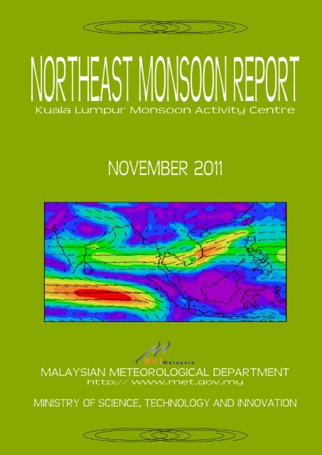
Kuala Lumpur Monsoon Activity Centre November 2011
Kuala Lumpur Monsoon Activity Centre November 2011
Kuala Lumpur Monsoon Activity Centre November 2011

You also want an ePaper? Increase the reach of your titles
YUMPU automatically turns print PDFs into web optimized ePapers that Google loves.
Introduction<br />
Since early August <strong>2011</strong>, negative sea surface temperature anomalies have gradually<br />
strengthened across much of the equatorial Pacific. Enhanced convection and precipitation were<br />
weakly evident over the Maritime Continent and Australia while suppressed convections were<br />
located over the western tropical Pacific and the dateline during October <strong>2011</strong>. Currently, La Niña is<br />
not as strong as it was in September 2010 and majority of ENSO models predict the continuation of<br />
La Niña through the Northern Hemisphere winter <strong>2011</strong>/2012. August to October <strong>2011</strong>, witnessed 12<br />
tropical cyclones in the Western North Pacific and South China Sea, of which three passed through<br />
South China Sea and made landfall over Vietnam which significantly affected the regional synoptic<br />
and weather pattern during this period.<br />
1. Weather Conditions from July to October <strong>2011</strong><br />
The Asian summer monsoon is normally associated with the rainy season over the<br />
Southeast Asia region, particularly north of 10°N that lasts from May to October. Since mid-May,<br />
flash flood have occasionally affected many areas in the northern part of Indochina due to active<br />
southwest monsoon, which also caused floods over a wide area in the basins of Chao Phraya and<br />
Mekong River. Thailand experienced the worst of the flooding, in which three months of heavy<br />
monsoon rain have flooded a third of the country since late July.<br />
The 925-hPa mean wind analysis (Figure 1) from July to October <strong>2011</strong> shows strong<br />
southwesterly to westerly flow over Andaman Sea and South China Sea during July to September.<br />
In July, active convection over northern part of Vietnam, Laos and Thailand was also greatly<br />
enhanced by the influence of Tropical Depression Nock-Ten that made landfall over Vietnam on 30<br />
July and moved into northern Thailand on 31 July before weakening as a low pressure cell. During<br />
August to September, wet conditions continued over the Indochina Peninsula and northern Thailand<br />
caused by the rather active monsoon trough that cut across northern Indochina between 15°N and<br />
20°N. During the last decade of September, three tropical cyclones namely Nesat, Haitang and<br />
Nalge made landfall over Vietnam which contributed to the unusual wet weather conditions over<br />
these areas. In October, drastic changes in wind pattern as northeasterly to easterly winds over<br />
Southeast Asia replaced the westerly winds signaling the withdrawal of the southwest monsoon in<br />
the region.
JUL<br />
AUG<br />
SEP<br />
OCT<br />
Figure 1: 925-hPa Mean Wind Analysis (ms -1 ) from July to October <strong>2011</strong><br />
The time series of the 850-hPa mean zonal wind averaged between 10°N – 30°N from 1<br />
September to 31 October <strong>2011</strong> (Figure 2) shows a gradual change in the wind pattern throughout<br />
the region. Generally westerly winds were dominant over Indian sub-continent throughout<br />
September. From early October, it is very noticeable that the easterly trade winds in the western<br />
Pacific Ocean continued to strengthen and progress westwards. During the last decade of October,<br />
the easterly winds were dominant from western Pacific Ocean to Bay of Bengal, signifying the<br />
withdrawal of southwest monsoon and the transition to the northeast monsoon is underway.
Figure 2: Time Series of Mean Zonal Wind (ms -1 ) Averaged between<br />
10°N – 30°N at 850-hPa for Sep – Oct <strong>2011</strong><br />
2. Outgoing Long Wave Radiation (OLR)<br />
The time series of OLR anomalies averaged between Equator and 10°N from 1 September<br />
to 31 October <strong>2011</strong> as shown in Figure 3a indicates that negative OLR anomalies, signifying<br />
enhanced convection are observed between 90°E and 120°E from the second pentad of September<br />
to the end of October. During this period, the convective activity had an aperiodic oscillation of 5 to<br />
10 days cycle, meanwhile suppressed convections are dominant from mid-October over the western<br />
and central Pacific Ocean.<br />
(a)<br />
(b)<br />
Figure 3: Time Series of OLR Anomalies (Wm -2 ) Averaged between 0° – 10°N (left panel) and 10°N – 20°N (right<br />
panel) for September – October <strong>2011</strong>
Wetter than normal condition over northern Thailand and Indochina region in September and<br />
early October (Figure 3b) was mainly contributed by the westward propagation of convective<br />
systems associated with tropical cyclones that tracked westward from the western Pacific Ocean<br />
and made landfall over Vietnam.<br />
The monthly distribution of OLR anomalies as shown in Figure 4, clearly shows that the<br />
convection over Southeast Asian region was greatly enhanced during July to September, resulting<br />
in many areas over northern, central and northeastern parts of Thailand experiencing massive<br />
floods. Tropical cyclone activities also contributed to the wet weather conditions over this region. As<br />
the wind pattern changed in October coupled with the southward movement of the trough, active<br />
convection shifted closer to the Equator mainly over the Indian Ocean, Malaysian region and<br />
Borneo Island including South China Sea. Meanwhile, suppressed convection was most prominent<br />
over the Indian sub-continent, parts of Indochina, the Philippines and western Pacific Ocean.<br />
JUL<br />
AUG<br />
SEP<br />
OCT<br />
Figure 4: Distribution of OLR Anomalies (Wm -2 ) from July to October <strong>2011</strong>
3. Weather Outlook for December <strong>2011</strong> to February 2012<br />
The seasonal rainfall forecast (Figure 5) for the period of December <strong>2011</strong> to February 2012<br />
generated from ECMWF and CFS seasonal forecast products depicts that Myanmar, northern<br />
Thailand, northern Vietnam, and Laos are expected to experience normal weather conditions.<br />
Southern Thailand, Cambodia and southern Vietnam are expected to experience above normal<br />
rainfall. In the Philippines, central parts and Mindanao Island are expected to receive above normal<br />
amounts of rainfall while normal weather condition is expected over Luzon Island. In Indonesia,<br />
generally most of the provinces are expected to experience normal weather condition except for<br />
northern Sumatra where above average rainfall amount is expected.<br />
Over Malaysia, entire Peninsular Malaysia and Sabah are expected to be wetter than normal<br />
while Sarawak is expected to receive normal amounts of rainfall.<br />
Figure 5: December <strong>2011</strong> – February 2012 Rainfall Anomaly (%) Forecast