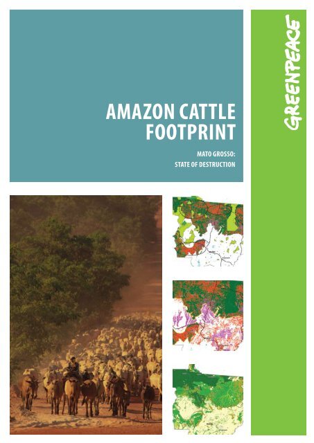
AmAzon CAttle footprint - Greenpeace
AmAzon CAttle footprint - Greenpeace
AmAzon CAttle footprint - Greenpeace

You also want an ePaper? Increase the reach of your titles
YUMPU automatically turns print PDFs into web optimized ePapers that Google loves.
Amazon Cattle<br />
<strong>footprint</strong><br />
Mato Grosso:<br />
State of Destruction
Table of Contents<br />
Introduction . . . . . . . . . . . . . . . . . . . . . . . . . . . . 3<br />
HOW IS AMAZON DEFORESTATION MEASURED?. . . . . . . . . 4<br />
EXPANSION OF CATTLE RANCHING IN THE LEGAL AMAZON . . . 5<br />
DISTRIBUTION OF INFRASTRUCTURE . . . . . . . . . . . . . . . . 6<br />
The Impact of THE INDUSTRY . . . . . . . . . . . . . . . . . . . 7<br />
Cattle Footprint in Mato Grosso. . . . . . . . . . . . . . . 8<br />
Cattle ranching expansion areas in the<br />
Amazon biome, Mato Grosso state . . . . . . . . . . . . . . . . 8<br />
The Far North (Nortão) . . . . . . . . . . . . . . . . . . . . . . . . 8<br />
Amazon Biome Strip . . . . . . . . . . . . . . . . . . . . . . . . . . 8<br />
The BR-163 – Alta Floresta road axis . . . . . . . . . . . . . . . 9<br />
The springs of the Xingu River . . . . . . . . . . . . . . . . . . . 9<br />
MODIS IMAGE AND LAND USE . . . . . . . . . . . . . . . . . . . . 10<br />
Threatened Heritage. . . . . . . . . . . . . . . . . . . . . . . . 11<br />
Current Land use in the State of Mato Grosso. . . . . . 12<br />
SMOKING KILLS. . . . . . . . . . . . . . . . . . . . . . . . . . . . 13<br />
Land use map methodology . . . . . . . . . . . . . . . . . . . 13<br />
reasons to stop destruction of the<br />
Amazon RAINFOREST . . . . . . . . . . . . . . . . . . . . . . . . 14<br />
What must be done . . . . . . . . . . . . . . . . . . . . . . . . . 14<br />
The Brazilian Government must. . . . . . . . . . . . . . . . . . 14<br />
INDUSTRIALIsED Countries must . . . . . . . . . . . . . . . . . . 14<br />
INDUSTRY must. . . . . . . . . . . . . . . . . . . . . . . . . . . . . . 15<br />
BANK AND INVESTORS . . . . . . . . . . . . . . . . . . . . . . . . . . 15<br />
Citizens CAN . . . . . . . . . . . . . . . . . . . . . . . . . . . . . . . . 15<br />
REFERENCES. . . . . . . . . . . . . . . . . . . . . . . . . . . . . . 15<br />
Location of Mato Grosso in the Amazon Region<br />
Brazilian Legal Amazon<br />
Mato Grosso state boundary<br />
Amazon Biome boundary<br />
Areas under threat<br />
The Amazon Basin covers an area of approximately 6.5 million<br />
km 2 across nine South American countries, five percent of<br />
the Earth’s surface. It holds the largest river system on the<br />
planet, about one-fifth of the total volume of fresh water of<br />
the world. Some 60% of the Amazon basin (4.1 million km²)<br />
is inside Brazil’s borders. 1<br />
Brazil’s Legal Amazon is an administrative designation<br />
and includes the whole Amazon forest 2 in Brazil, plus some<br />
areas of savannah in the states of Mato Grosso and Tocantins.<br />
So far, 700 thousand km 2 of the original Amazon forest cover<br />
of Brazil has been destroyed - this is equivalent to an area<br />
more than twice the size of Poland 3 .<br />
2
Introduction<br />
Between 2000 and 2007, the Brazilian Amazon was deforested at<br />
an average rate of 19,368 km² per year. Over this time, 154,312<br />
km² of forest, an area larger than Greece 4 , was destroyed.<br />
Brazil is the world’s the fourth biggest climate polluter 5 . Deforestation<br />
and land-use change make up 75% of all Brazilian greenhouse<br />
gas emissions. From this, 59% comes from loss of forest cover and<br />
burning in the Amazon region 6 .<br />
Cattle ranching which has been expanding continuously since the<br />
early 1970s, is responsible for the majority of Amazon deforestation.<br />
This is the result of more than 30 years of government policies<br />
that have encouraged investments in infrastructure (roads, dams),<br />
occupation of the territory (induced migration) and public funding<br />
of such activities.<br />
Illegally occupied forest land is currently very cheap; making<br />
cattle ranching both profitable and expanding. In 2003, a study<br />
funded by the World Bank 7 showed the direct relationship between<br />
deforestation and cattle ranching, the report detailed how ranching<br />
is a strong driver for occupation, conversion and trade of illegallyused<br />
land.<br />
Mato Grosso extends over 903,358 km² and comprises the Amazon<br />
forest plus large areas of Cerrado (savannahs) and the Pantanal<br />
(flooded plains) 13 . In absolute terms, the state has the highest<br />
cumulative Amazon deforestation rates, so far some 185,587 km²<br />
has been destroyed, that’s an area twice the area of Hungary 14 .<br />
The eight maps in this report show the land use, comparing it<br />
with data on infrastructure, recent deforestation and regional<br />
dynamics.<br />
Brazil has a very important role to play in mitigating the effects of<br />
climate change. The country must see deforestation ended by 2015, a<br />
“zero-deforestation” target, this can be achieved through progressive<br />
deforestation reduction goals that combine development, sensible<br />
use of natural resources and biodiversity conservation.<br />
Understanding land use change is a critical starting point for<br />
the Brazilian Government to make decisions about effective<br />
governance, control of cattle ranching and other agricultural<br />
sectors and how best to reduce and eliminate deforestation in the<br />
Amazon region.<br />
Brazil has the largest commercial cattle herd in the world and has<br />
been the world’s largest beef exporter since 2003. A <strong>Greenpeace</strong><br />
survey based on Brazilian government data shows that in 2006<br />
cattle occupied 79.5% of the land already in use in the Brazilian<br />
Legal Amazon (excluding the state of Maranhão) 8 .<br />
According to the data, in 2006 there were three head of cattle per<br />
inhabitant in the Legal Amazon 9, 10 .<br />
WORLD BEEF EXPORTS<br />
1000 t<br />
3.000<br />
2.500<br />
2.000<br />
1.500<br />
1.000<br />
500<br />
Around 40% of Brazil’s cows are currently located inside the Amazon,<br />
and this is where most of growth of cattle ranching occurs. From<br />
2002 to 2006, 14.5 million of the total 20.5 million head of cattle<br />
added to Brazil herd were located in the Amazon 11 . The expansion<br />
of cattle ranching in the Amazon Region has intensified in line with<br />
increasing international exports of Brazilian cattle and beef.<br />
This study charts the location of pasture areas in the Brazilian<br />
Amazon, in the state of Mato Grosso. Using a new method, it<br />
analyses images released from the Moderate-resolution Imaging<br />
Spectroradiometer (Modis) satellite to identify which deforested<br />
areas are currently used for cattle ranching compared to those used<br />
for crops. <strong>Greenpeace</strong> studied the Amazon area in the state of Mato<br />
Grosso, which holds the largest bovine herd in the country, and has<br />
the largest average deforestation rates since 1988 12 .<br />
1999 2000 2001 2002 2003 2004 2005 2006 2007<br />
Brazil<br />
USA<br />
source Abiec (Brazilian Association of Meat Exporters), with data from<br />
MDIC (Ministry of Development, Industry and Trade) and USDA (United States<br />
Department of Agriculture)<br />
India<br />
Australia<br />
AMAZON CATTLE FOOTPRINT<br />
3
2<br />
HOW IS AMAZON DEFORESTATION MEASURED?<br />
Deforestation shown by PRODES<br />
Deforested area<br />
Amazon Biome<br />
Brazil<br />
South America<br />
Since 1988, the Brazilian National Institute for Space Research<br />
(INPE) has released annual estimates of deforestation rates<br />
in the Legal Amazon. Since 2002, these estimates have been<br />
prepared through digital tracking of images, following the Amazon<br />
Deforestation Estimate Program (PRODES) methodology, and using<br />
images generated by the Landsat satellite.<br />
In 2004, annual deforestation rates in the Amazon reached their<br />
second highest level ever, then dropped dramatically until 2007 15 .<br />
PRODES preliminary data show that 11,968 km 2 of Amazon forest<br />
were destroyed between August 2007 and July 2008 – a rise of<br />
3,8% compared to the previous year 16 .<br />
Rates of deforestation in the Amazon are affected by international<br />
commodity price fluctuations, particularly of meat and soya 17 .<br />
When the price of both products drops, deforestation rates reduce<br />
significantly in the following year.<br />
It remains to be seen what implications of the 2008 global financial<br />
crisis will have be the region.<br />
ANNUAL DEFORESTATION RATES COMPARED TO MEAT AND<br />
SOYA PRICES<br />
cattle (R$)<br />
60<br />
50<br />
40<br />
30<br />
20<br />
10<br />
july/1994 1995 1996 1997 1998 1999 2000 2001 2002 2003 2004 2005 2006<br />
cattle<br />
soya<br />
deforestation<br />
source Imazon<br />
35,000<br />
30,000<br />
25,000<br />
20,000<br />
15,000<br />
10,000<br />
5,000<br />
deforestation area (km)<br />
4
Expansion of Cattle Ranching in the LEGAL AMAZON<br />
Expansion of Cattle Ranching in the LEGAL AmazoN between 1996 and 2006<br />
1996 2006<br />
Legal Amazon boudary<br />
HEADS OF CATTLE PER MUNICIPALITY<br />
0 - 50,000<br />
50,001 - 200,000<br />
200,001 - 400,000<br />
400,001 - 1,000,000<br />
1,000,001 - 2,000,000<br />
The number of cattle bred in the Legal Amazon is growing fast:<br />
between 1990 and 2003, the bovine herd more than doubled,<br />
from 26.6 million to 64 million head of cattle – 60% of the herd are<br />
in the states of Mato Grosso and Pará 18 .<br />
This growth intensifies Amazon forest destruction, as complex<br />
ecosystems are gradually being replaced by new pasture areas.<br />
According to Brazilian Institute of Geography and Statistics<br />
(IBGE), between 1996 and 2006 the area of pastures in the<br />
Amazon region grew by approximately 10 million hectares – an<br />
area about the size of Iceland.<br />
deforestation (x 1.000 km2)<br />
total herd and total deforestation<br />
700<br />
650<br />
600<br />
550<br />
500<br />
450<br />
400<br />
350<br />
10<br />
1988 89 90 91 92 93 94 95 96 97 98 99 2000 01 02 03 04<br />
source Imazon<br />
cattle<br />
deforestation<br />
64,1<br />
665<br />
65<br />
60<br />
55<br />
50<br />
45<br />
40<br />
35<br />
30<br />
25<br />
20<br />
15<br />
cattle (x 1.000.000)<br />
area occupied by cattle ranching in the Legal<br />
Amazon (HECTARES)<br />
55,439,553<br />
50,000,000<br />
40,000,000<br />
30,000,000<br />
23,424,117<br />
20,000,000<br />
10,000,000<br />
0<br />
source IBGE: MARANHão excluded<br />
1996 2006<br />
AMAZON CATTLE FOOTPRINT<br />
5
DISTRIBUTION OF INFRASTRUCTURE<br />
SLAUGHTERHOUSES and Roads in Mato Grosso<br />
Slaughterhouses<br />
Municipality capitals<br />
Non official roads<br />
Official roads<br />
Water bodies<br />
Amazon Biome<br />
The building of new roads allows human occupation and further<br />
destruction of the Amazon rainforest. An INPE survey shows<br />
that up to 87% of deforestation in the region occurred less than 25<br />
km from the first settled areas, where occupation started around<br />
1978 as a result of roads opening up 19 . These roads, which link<br />
the Northern region to the rest of Brazil, were heavily funded by<br />
the federal government in the 1970s. Unofficial roads connect<br />
local sites and are not shown on the official charts prepared by<br />
the Brazilian government Infrastructure and Transportation Agency<br />
(DNIT) and by the IBGE 20 . The number of roads allows cattle<br />
ranching to occur even in remote areas - hundreds of kilometres<br />
away from slaughter facilities.<br />
6
The Impact of THE INDUSTRY<br />
Land use and slaughterhouses in Mato Grosso<br />
Slaughterhouses<br />
Principal roads<br />
Sugar cane<br />
Agriculture<br />
Pasture<br />
Degraded forest<br />
This map shows how there is a marked concentration of deforested<br />
areas and pastures in the areas around cattle slaughterhouses.<br />
These extend, via a network of roads, for hundreds of kilometres.<br />
Even those units located on the Cerrado Biome (savannahs) have<br />
an impact on large areas of the Amazon forest.<br />
What does SIF mean?<br />
Slaughterhouses must be registered at the Federal<br />
Inspection Service (SIF) to gain permission to export their<br />
products to other states or abroad. SIF-registered facilities<br />
are just a fraction of all existing slaughterhouses, but<br />
they usually belong to the group of companies with the<br />
biggest production capacity. Of the 71 slaughter facilities<br />
registered at the SIF and located in the Amazon region,<br />
45 are in Mato Grosso 21 . In addition, there are local and<br />
state facilities, plus an unknown number of clandestine<br />
cattle slaughterhouses supplying local markets.<br />
AMAZON CATTLE FOOTPRINT<br />
7
Cattle Footprint in Mato Grosso<br />
This analysis of land use identifies four main areas of expansion and consolidation<br />
of cattle production in the Amazon forest of the state of Mato Grosso.<br />
Cattle ranching expansion areas in the Amazon biome, Mato<br />
The Far North (Nortão)<br />
This area encircled by the municipalities of Juína, Juara,<br />
Apiacás and Colniza in the Northwest of Mato Grosso is<br />
one of the newest parts of the Amazon to be deforested for<br />
cattle ranching. The area is linked by road to the West, East<br />
and South where cattle ranching is already established.<br />
Over the past three years occupation of the far North has<br />
accelerated, mainly around Colniza, a town already linked<br />
to the Southern region of the Amazonas state. In these<br />
border regions the growth of cattle ranching is strongly<br />
connected to destructive logging.<br />
Amazon Biome Strip<br />
8<br />
This area extends towards the savannah and forms a strip in the<br />
Southernmost part of the biome. These areas were deforested before<br />
2000 and have massive infrastructure, including roads and cattle<br />
slaughter and storage facilities.<br />
There is no remaining intact rainforest in this area, instead it is<br />
characterised by extensive and continuous pastures with low density<br />
of cattle per hectare. It is hard to believe that this area was, not so<br />
long ago, rainforest.
Grosso state<br />
The Alta Floresta – BR-163 road<br />
intersection<br />
The area along the BR-163 road is one of the best<br />
known sites for soya farming expansion in Mato Grosso.<br />
The areas close to the road, opened in 1970, are<br />
already completely occupied, and until you reach the<br />
municipality of Sinop to the North, soya plantations are<br />
the main cause of deforestation. At Sinop, and particularly<br />
at the intersection of the BR-163 with Alta Floresta,<br />
cattle ranching is dominant. Recent deforestation for<br />
cattle ranching expands to the North up to the Pará state<br />
border, and to the West.<br />
Expansion areas<br />
State capital<br />
Municipality capitals<br />
Principal roads<br />
Indigenous lands<br />
Conservation areas<br />
Degraded forest<br />
Agriculture<br />
Pasture<br />
Sugar cane<br />
Water bodies<br />
Amazon Biome<br />
The springs of the Xingu River<br />
Most of the course of the Xingu River in Mato Grosso<br />
is protected by the Xingu Indigenous National Park,<br />
which covers 2,642,003 hectares 22 . Outside of the park,<br />
however, forest destruction threatens the springs of the<br />
river and therefore the course of water to it. This disrupts<br />
its delicate ecosystems needed to maintain biodiversity<br />
and support the almost 6,000 indigenous people from<br />
14 different ethnic groups. In these areas it is possible<br />
to see recently deforested areas occupied by both cattle<br />
ranching and soya crops.<br />
AMAZON CATTLE FOOTPRINT<br />
9
MODIS IMAGE AND Land use<br />
LAND USE ON SATELLITE IMAGE<br />
Principal roads<br />
Pasture<br />
Agriculture<br />
Degraded forest<br />
Amazon Biome boundary<br />
55,439,553<br />
50,000,000<br />
40,000,000<br />
LAND USE IN LEGAL AMAZON IN 2006 LAND USE IN LEGAL AMAZON AND in BRAZIL IN 2006<br />
30,000,000<br />
AGRICULTURE<br />
20,5%<br />
PASTURE<br />
LEGAL AMAZON<br />
55,439,553 HA<br />
55,439,553<br />
50,000,000<br />
TOTAL OF PASTURE IN BRAZIL<br />
172,333,073 HA<br />
23,424,117<br />
20,000,000<br />
10,000,000<br />
40,000,000<br />
2006<br />
PASTURE<br />
79,5%<br />
30,000,000<br />
0<br />
AGRICULTURE<br />
LEGAL AMAZON<br />
14,272,549 HA<br />
23,424,117<br />
20,000,000<br />
TOTAL OF AGRICULTURE IN BRAZIL<br />
76,697,324 HA<br />
10,000,000<br />
source IBGE<br />
0<br />
1996 20<br />
10
Threatened Heritage<br />
Original Vegetation in the State of Mato Grosso<br />
The Amazon basin holds the largest tropical forest in the world<br />
and it is the most diverse ecosystem on Earth 23,24 . It plays a vital<br />
role in ensuring the region’s water supplies, regulating rainfall, and<br />
it is crucial to keeping the world’s climate in balance. Two of the<br />
main tributaries of the Amazon River have their origins in Mato<br />
Grosso: Xingu and Tapajós.<br />
Amazon Biome boundary<br />
Lowland evergreen broadleaf rainforest<br />
Semi-desciduous seasonal forests<br />
Deciduous seasonal forests<br />
Ecotone evergreen & semi-evergreen forests<br />
Pioneer formations<br />
Savannah vegetation & Ecotones<br />
Mountain grass-woody<br />
Amazon Biome boundary<br />
Lowland evergreen broadleaf rainforest<br />
Semi-desciduous seasonal forests<br />
Deciduous<br />
Amazon Biome<br />
seasonal<br />
boundary<br />
forests<br />
Ecotone Lowland evergreen & broadleaf semi-evergreen rainforest forests<br />
Pioneer Semi-desciduous formations seasonal forests<br />
Savannah Deciduous vegetation seasonal forests & Ecotones<br />
Mountain Ecotone evergreen grass-woody & semi-evergreen forests<br />
Pioneer formations<br />
Savannah vegetation & Ecotones<br />
Mountain grass-woody<br />
AMAZON CATTLE FOOTPRINT<br />
11
Current Land use in the State of Mato Grosso<br />
Land use in the State of Mato Grosso<br />
Xingu’s indigenous park<br />
Lucas do Rio Verde<br />
Chapada dos Parecis<br />
State capital<br />
Municipality capitals<br />
Agriculture<br />
Sugar cane<br />
Pasture<br />
Degraded forest<br />
Cattle ranching has been expanding and fuelling deforestation<br />
in the Amazon Biome of Mato Grosso state, but land use<br />
distribution in Mato Grosso also includes vast areas of savannah,<br />
where industrial farming of monocultures, particularly soya crops,<br />
impact four prominent areas.<br />
• The Lucas do Rio Verde region is the biggest agriculture area in<br />
Mato Grosso and it extends beyond the savannah, occupying<br />
large areas of the Amazon forest.<br />
• The Chapada dos Parecis region, between the land strip and the<br />
remaining Amazon Biome, has expanded along the Porto Velho<br />
– Santarém export axis, which follows the Amazon River.<br />
• Soya crops (which require intensive use of agrochemicals),<br />
as well as cattle, also threaten the Xingu River springs and<br />
occupy mainly the neighbouring area on the Southeast of the<br />
indigenous park.<br />
• Large areas of Cerrado (savannah) in Southeast of Mato Grosso<br />
given place to extensive soya plantations in the last 20 years.<br />
12
SMOKING KILLS<br />
August 2008<br />
Cattle and pastures are rapidly replacing the<br />
Amazon rainforest. When the forest is converted<br />
to pasture, biodiversity goes up in smoke, and<br />
masses of CO 2<br />
is released into the atmosphere.<br />
Land use map methodology<br />
This study used images from the sensor Modis (Moderate Resolution Imaging Spectroradiometer) covering a whole year period, selected every 16<br />
days (a total of 23 for each area, for the whole year). With this, it was possible to create an overview of vegetation in the whole state of Mato Grosso,<br />
over a whole year.<br />
The identification of the land activity in each image was done using two methods. First, images were separated according to their EVI (Enhanced<br />
Vegetation Index), which compares different levels of photosynthetic activity and concentration of vegetation. This method identifies agricultural<br />
activity as well as regenerated forest in areas where deforestation has been previously detected (by PRODES).<br />
To identify pastures, altered forest landscapes (victim of predatory logging) and degraded or secondary forest (capoeira) it was necessary to analyse<br />
each of the series of images visually. In the end, to evaluate the method, flights were carried out at the Eastern side of the Xingu Indigenous Park, in<br />
Sinop region around the BR-163, and North of Alta Floresta.<br />
The Modis images are generated every day, so it is possible to follow changes to the vegetation throughout the year. However, the resolution of<br />
the images is very low - only accurate to 250m, or approximately an area of 6,25 ha. The constant presence of clouds in certain areas can make<br />
monitoring impossible in some regions.
What must be done<br />
The Brazilian Government must<br />
• Adopt ambitious deforestation reduction<br />
targets in order to achieve zero deforestation<br />
in the Brazilian Amazon by 2015. Adopt<br />
a five-year moratorium immediately on<br />
deforestation as an intermediate step towards<br />
zero deforestation.<br />
14<br />
Reasons to stop destruction of<br />
the Amazon rainforest<br />
• Forests are a crucial carbon stock: forest ecosystems globally store about one-anda-half<br />
times as much carbon as is present in the atmosphere. 25 Deforestation of<br />
tropical forests is responsible for up to approximately 20% of the global emissions<br />
of greenhouse gas, more than the world’s entire transport sector. 26<br />
27,28<br />
• The Amazon is estimated to store between 80-120 billion tonnes of carbon. If<br />
this is destroyed, roughly 50 times the annual greenhouse gas emissions from the<br />
US will be emitted 29 .<br />
• Cattle ranching in the Amazon has horrific social impacts, including the highest<br />
rates of slave labour in Brazil. 3005 rural workers, kept in slavery, were freed from<br />
cattle ranches in 2008. 99% of them had been held in the Legal Amazon 30 .<br />
• The region is home to more than 20 million people – including over 200,000<br />
indigenous people, belonging to 180 different ethnic groups 31 . The rainforest is<br />
their home, providing them food and shelter to tools and medicines - it is also<br />
central to their spiritual life.<br />
• Studies estimate that the Amazon supports 40,000 plant species; 427 mammals;<br />
1,294 birds; 378 reptiles; 427 amphibians and 3,000 species of fish 32 . Many other<br />
species are still unknown.<br />
33<br />
• The Amazon produces 20% of river water in the world . The forest influences the<br />
hydrologic cycle at local and regional scales, as humidity retained by the Amazon<br />
is carried by the wind to other parts of Brazil and South America. The reduction of<br />
the forest cover diminishes the amount of rainfall on the Southeast and Center of<br />
Brazil, affecting agriculture productivity 34 .<br />
• Belched methane from livestock constitutes one of the largest sources (roughly<br />
30%) of greenhouse gas emissions from agriculture. Agriculture as a whole<br />
contributes between 10-12% of global greenhouse gas emissions 35 .<br />
• The greenhouse gas emissions from beef are13 kilograms CO -eq per 2 kg36 . This<br />
means eating a kilogram of beef represents roughly the same greenhouse emissions<br />
as flying 100 kilometers of a flight, per passenger. This is twice the carbon <strong>footprint</strong><br />
of eating pigs or poultry 37 .<br />
• Support a strong climate protocol to be<br />
tabled in Copenhagen, December 2009, that<br />
includes an international fund to Reduce<br />
Emissions from Deforestation and Degradation<br />
(REDD) that adheres to key principles integral<br />
for a credible financial mechanism to protect<br />
forests (such as those detailed in <strong>Greenpeace</strong>’s<br />
Forest for Climate proposal):<br />
• Provide sufficient annual funding to<br />
tackle tropical deforestation and make it<br />
available immediately;<br />
• Is accessible to all countries with tropical<br />
forests, including countries with low<br />
deforestation rates;<br />
• Protect biodiversity values and the rights<br />
and livelihoods of indigenous peoples;<br />
• Protect against ‘leakage’ via nationallevel<br />
accounting and reduction<br />
approaches in deforestation;<br />
• Does not directly include forest offset<br />
credits in carbon markets;<br />
• Does not support the replacement of<br />
natural forests with plantations and must<br />
not subsidise the expansion of industrial<br />
logging, agri-business and other<br />
destructive practices into forests.<br />
• Enact and enforce the currently provisional act<br />
in the Forest Code, which stipulates that no<br />
more than 20% of any private land holding in<br />
the Amazon can be legally cleared. This would<br />
avoid additional legal deforestation permits.<br />
• Redirect investments that drive deforestation<br />
into diversified economies including investing<br />
in people that support the sustainable use of<br />
forest products.<br />
• Increase investments to strengthen the<br />
monitoring and control systems to fight<br />
forest crimes in the Amazon to ensure<br />
effective governance and law enforcement<br />
in the region.
REFERENCES<br />
INDUSTRIALISED Countries must<br />
• Agree a strong climate protocol in Copenhagen that<br />
includes an international fund to stop deforestation governed<br />
by the key principles detailed above.<br />
• Ensure that reducing emissions from deforestation and<br />
degradation is additional to industrialised nations’ actions to<br />
reduce their own emissions.<br />
INDUSTRY must<br />
• Support the call for Zero Deforestation in the Brazilian<br />
Amazon.<br />
• Stop the trade in products from deforestation and communicate<br />
to suppliers that they will no longer buy from companies<br />
engaged in deforestation.<br />
• Provide reliable guarantees of the origin of cattle products such<br />
as meat and leather to customers.<br />
• Reduce their own greenhouse gas emissions by adopting<br />
environmentally-friendly methods of production, absolute<br />
emissions reductions in line with the scale of global cuts needed<br />
and establish renewable energy targets.<br />
• Publically call on governments and international community to<br />
support a strong climate protocol in 2009, including a credible<br />
REDD funding mechanism based on the principles outlined<br />
above.<br />
BANK AND INVESTORS<br />
• Stop financing companies involved in deforestation in the<br />
Amazon Biome.<br />
CITIZENS CAN<br />
• Join <strong>Greenpeace</strong> in the call for zero deforestation in the Amazon<br />
rainforest by 2015, by supporting appeals to the Brazilian<br />
government, their national government and international<br />
community to support this demand.<br />
• Join <strong>Greenpeace</strong>’s call to governments and companies take real<br />
action to halt deforestation and save the climate. In particular<br />
to pressure governments to agree a strong climate deal in<br />
Copenhagen in December 2009.<br />
• Take individual action to reduce their carbon <strong>footprint</strong>. Some<br />
ways of doing so include reducing the quantity of meat<br />
consumed, and checking the origin of the meat or soya products<br />
they buy.<br />
1 IBGE (2004). IBGE lança o Mapa de Biomas do Brasil e o Mapa de Vegetação do Brasil, em<br />
comemoração ao Dia Mundial da Biodiversidade. Available at: www.ibge.gov.br/home/presidencia/<br />
noticias/noticia_visualiza.php?id_noticia=169. Accessed on: Nov 26th 2008.<br />
2 In this report, the Amazon ‘forest’ refers to the entire biome – the plants and animals that make<br />
up this ancient ecosystem.<br />
3 <strong>Greenpeace</strong> (2008) Analysis on INPE (Brazilian National Institute of Space Research) Yearly<br />
estimative from 1988 until 2007, Annual deforestation rate (km 2 /year) Available at: http://www.obt.<br />
inpe.br/prodes/prodes_1988_2007.htm. Accessed on: Nov 26th 2008.<br />
4 Ibid 3.<br />
5 World Resources Institute (2007) Climate Analysis Indicators Tool (CAIT) Version 4.0.<br />
6 Brazilian Ministry of Science and Technology – MCT (2006) Primeiro Inventário Brasileiro de<br />
Emissões Antrópicas de Gases de Efeito Estufa.<br />
7 Margulis, S. Causas do Desmatamento da Amazônia Brasileira. 1st Editon. Brasília: Banco Mundial,<br />
2003. 100p.<br />
8 <strong>Greenpeace</strong> analysis based on IBGE data. Available at: http://www.ibge.gov.br/home/estatistica/<br />
economia/agropecuaria/censoagro/2006/default.shtm. Accessed on: Oct 29th 2008.<br />
9 IBGE (2006). Censo Agropecuário 2006. Available at: http://www.ibge.gov.br/home/estatistica/<br />
economia/agropecuaria/censoagro/2006/default.shtm. Accessed on: Oct 29th 2008.<br />
10 IBGE (2007). Contagem da População 2007. Available at: http://www.ibge.gov.br/home/<br />
estatistica/populacao/contagem2007/default.shtm. Accessed on: Oct 29th 2008.<br />
11 Ibid 9.<br />
12 Ibid 6.<br />
13 IBGE. Estados. Available at: http://www.ibge.gov.br/estadosat/perfil.php?sigla=mt. Accessed<br />
on:Oct 29th 2008.<br />
14 Ibid 3.<br />
15 Brazilian National Institute of Space Research (INPE). Available at: http://www.obt.inpe.br/deter.<br />
Accessed on: Nov 4th 2008.<br />
16 Brazilian National Institute of Space Research (INPE). Available at: http://www.obt.inpe.br/<br />
prodes/prodes_1988_2008.htm. Accessed on: Dec 16th 2008.<br />
17 Barreto, P. (2007). Porque o desmatamento cai e desce? In: 5º Seminário Técnico-Científico de<br />
Análise de Dados Referentes ao Desmatamento. MMA/INPE. IMAZON, Anápolis. 38p.<br />
18 Barreto, P.; et al. Pecuária e Desafios para a Conservação Ambiental na Amazônia. O Estado da<br />
Amazônia, n.5, p. 1-4,2005.<br />
19 Alves, D. O. Processo de desmatamento na Amazônia. Parcerias Estratégicas, n.12, p.259-275, 2001.<br />
20 Brandão Jr., A. O. et al. Desmatamento e estradas não-oficiais da Amazônia, In: SIMPÓSIO<br />
BRASILEIRO DE SENSORIAMENTO REMOTO, 13, 2007, Florianópolis. Anais... INPE, p.2357-2364, 2007.<br />
21 Ministério da Agricultura, Pecuária e Abastecimento – MAPA (2008). Available at: www.<br />
agricultura.gov.br. Accessed on: Oct 29th 2008.<br />
22 Secretaria de Estado de Planejamento e Coordenação Geral. Anuário Estatístico de Mato Grosso<br />
(2004). Cuiabá: SEPLAN-MT . Central de Texto, 2005. Vol.26. 718p.<br />
23 Ibid 1.<br />
24 Brazilian Ministry of Environment (MMA). Brazilian Biodiversity. In: MMA, First national report for<br />
the convention on biological diversity – BRAZIL, 1998, 10p. Available at: www.cbd.int/doc/world/br/<br />
br-nr-01-p1-en.pdf. Acessed on: 26th Nov. 2008.<br />
25 Watson, R. T. , et al. Land use, land-use change, and forestry: Special report of the<br />
Intergovernmental Panel on Climate Change. Cambridge, UK: Cambridge University Press, 2000. 375p.<br />
26 IPCC, Working Group III: Climate Change 2007: Mitigation. Contribution of Working Group III to<br />
the Fourth Assessment Report of the Intergovernmental Panel on Climate Change (2007) B. Metz, O.R.<br />
Davidson, P.R. Bosch, R. Dave, L.A. Meyer (eds), Cambridge University Press, Cambridge, United<br />
Kingdom and New York, NY, USA.<br />
27 Saatchi, S.S., et al. Distribution of aboveground live biomass in the Amazon Basin. Global Change<br />
Biology, 13: 816-837.<br />
28 Malhi, Y., et al. 2008. Climate Change, Deforestation, and the Fate of the Amazon. Science, 319:<br />
169-172.<br />
29 World Resources Institute (2008) Climate Analysis Indicators Tool (CAIT) Version 6.0.<br />
30 Repórter Brasil (2008). Lista suja do trabalho escravo. Available at: http://www.reporterbrasil.org.<br />
br/listasuja/index.php?lingua=en. Acessed on: Nov 03rd 2008.<br />
31 Coordenação das Organizações Indígenas da Amazônia Brasileira – COIAB (2006), História.<br />
32 Rylands, A. B., et al. Amazonia. In: Mittermeier;, R. A., et al. (Eds.) Wilderness: Earth’s last wild<br />
places. Mexico City: CEMEX, 2002. p. 57-107.<br />
33 Mittermeier, R.A., et al. Wilderness: Earth’s Last Wild Places. 1st Edition. Washington D.C., USA:<br />
Conservation International, 2002. 576p.<br />
34 Brazilian National Institute of Space Research (INPE), Monitoramento da Cobertura Florestal da<br />
Amazônia por Satélites, São José dos Campos: INPE, 2008. 148p.<br />
35 Bellarby, J., et al. Cool Farming: climate impacts of agriculture and mitigation potential. 2008. 44p.<br />
Available at: http://www.greenpeace.org/raw/content/international/press/reports/cool-farmingfull-report.pdf.<br />
Acessed on: 26th Nov. 2008.<br />
36 WRI (World Resources Institute) & WBCSD (World Business Council for Sustainable Development).<br />
Greenhouse Gas Protocol Initiative (GHG Protocol). Available at: www.ghgprotocol.org. Accessed on:<br />
Nov 26th 2008.<br />
37 Ibid 35.<br />
AMAZON CATTLE FOOTPRINT<br />
15
<strong>Greenpeace</strong> is an independent global<br />
campaigning organisation that acts<br />
to change attitudes and behaviour, to<br />
protect and conserve the environment<br />
and to promote peace.<br />
© <strong>Greenpeace</strong>/Alberto César Araújo<br />
Published by <strong>Greenpeace</strong> Brazil<br />
Photos <strong>Greenpeace</strong>/Daniel Beltrá<br />
Maps Amazon <strong>Greenpeace</strong> Maps<br />
Design Gabi Juns (gabrielajuns.com.br)<br />
<strong>Greenpeace</strong> Brazil<br />
Sã o Pa u l o<br />
Rua Alvarenga, 2.331<br />
Butantã - 05509-006<br />
São Paulo - SP - Brazil<br />
Tel +55 11 3035-1155<br />
Fax +55 11 3817-4600<br />
Ma n a u s<br />
Av. Joaquim Nabuco, 2367<br />
Centro - 69020-031<br />
Manaus - AM - Brazil<br />
Tel +55 92 4009-8000<br />
Fax +55 92 4009-8004<br />
Printed on 100% recycled post-consumer<br />
waste with vegetable based inks.