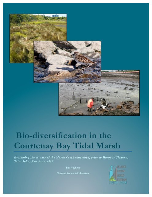
Bio-Diversification in the Courtenay Bay Tidal Marsh
“The objectives of this study were to expand our understanding of the environmental attributes of Courtenay Bay, the tidal marsh and estuary of the Marsh Creek watershed. Field studies were conducted to ascertain the occurrence of diadromous fishes and migratory birds within the watershed...”
“The objectives of this study were to expand our understanding of the environmental attributes of Courtenay Bay, the tidal marsh and estuary of the Marsh Creek watershed. Field studies were conducted to ascertain the occurrence of diadromous fishes and migratory birds within the watershed...”

Create successful ePaper yourself
Turn your PDF publications into a flip-book with our unique Google optimized e-Paper software.
<strong>Bio</strong>-diversification <strong>in</strong> <strong>the</strong><br />
<strong>Courtenay</strong> <strong>Bay</strong> <strong>Tidal</strong> <strong>Marsh</strong><br />
Evaluat<strong>in</strong>g <strong>the</strong> estuary of <strong>the</strong> <strong>Marsh</strong> Creek watershed, prior to Harbour Cleanup,<br />
Sa<strong>in</strong>t John, New Brunswick.<br />
Tim Vickers<br />
Graeme Stewart-Robertson
This project was made possible through grants provided by <strong>the</strong> New Brunswick Environmental<br />
Trust Fund, Environment Canada’s Atlantic Ecosystem Initiative, <strong>the</strong> New Brunswick Wildlife<br />
Trust Fund, and <strong>the</strong> New Brunswick Internal Services Agency Employment Development<br />
[S.E.E.D. Program]. Special mention must also be given to <strong>the</strong> Chemical technology program of <strong>the</strong><br />
New Brunswick Community College (Sa<strong>in</strong>t John) for <strong>the</strong>ir generous use of laboratory space and<br />
apparatus, and <strong>the</strong>ir technical guidance.
Executive Summary<br />
The Atlantic Coastal Action program (ACAP) Sa<strong>in</strong>t John envisions <strong>the</strong> urban <strong>Marsh</strong> Creek watershed <strong>in</strong><br />
Sa<strong>in</strong>t John, New Brunswick as <strong>the</strong> foundation of a world-class example of susta<strong>in</strong>able development.<br />
Specifically, <strong>the</strong> <strong>Marsh</strong> Creek Restoration Initiative (MCRI) proposes that with <strong>the</strong> pend<strong>in</strong>g (2013) cessation<br />
of untreated wastewater deposition <strong>in</strong> <strong>Marsh</strong> Creek, that three enhancements could be <strong>in</strong>corporated to<br />
provide social, economic and environmental benefits to future generations.<br />
The objectives of this study were to expand our understand<strong>in</strong>g of <strong>the</strong> environmental attributes of <strong>Courtenay</strong><br />
<strong>Bay</strong>, <strong>the</strong> tidal marsh and estuary of <strong>the</strong> <strong>Marsh</strong> Creek watershed. Field studies were conducted to ascerta<strong>in</strong> <strong>the</strong><br />
occurrence of diadromous fishes and migratory birds with<strong>in</strong> <strong>the</strong> watershed.<br />
This project found that despite a diversity and abundance of aquatic and brackish habitats, <strong>the</strong>re were no<br />
anadromous fishes <strong>in</strong> <strong>Marsh</strong> Creek upstream of <strong>the</strong> tide gates on <strong>the</strong> <strong>Courtenay</strong> causeway, whereas American<br />
eels were found to be ubiquitous throughout all sub-dra<strong>in</strong>ages of <strong>the</strong> watershed. The report did not ascerta<strong>in</strong><br />
<strong>the</strong> reason for <strong>the</strong> lack of anadromous fishes; however, <strong>the</strong> occurrence of five flapper-style tide gates is<br />
considered a likely contribut<strong>in</strong>g factor.<br />
The watershed was found to have lower than expected numbers of migratory shorebirds, however <strong>the</strong><br />
diversity of bird species (thirty-five) observed was worthy of note. There were no Species At Risk shorebirds<br />
observed, but Bald eagles (a confirmed Species At Risk) were observed. The <strong>Courtenay</strong> <strong>Bay</strong> forebay’s<br />
Prov<strong>in</strong>cially Significant Wetland was confirmed as breed<strong>in</strong>g habitat for ducks and geese. Black and Mallard<br />
ducks were widespread throughout all areas with many overw<strong>in</strong>ter<strong>in</strong>g <strong>in</strong> open water areas. While this project<br />
found that <strong>the</strong> area is currently not a likely significant contributor to <strong>the</strong> stocks migratory birds, <strong>the</strong> urban<br />
centric location coupled with <strong>the</strong> diversity <strong>in</strong> species composition could support eco-tourism <strong>in</strong> conjunction<br />
with <strong>the</strong> grow<strong>in</strong>g <strong>in</strong>ternationally-orig<strong>in</strong>at<strong>in</strong>g cruise ship <strong>in</strong>dustry.
Background<br />
The <strong>Marsh</strong> Creek watershed is a 4,000+ hectare feature located <strong>in</strong> <strong>the</strong> eastern quadrant of Sa<strong>in</strong>t John, New<br />
Brunswick, Canada that dra<strong>in</strong>s directly <strong>in</strong>to <strong>the</strong> <strong>Bay</strong> of Fundy. The watershed, which served as a valuable<br />
natural asset for early settlers, became an <strong>in</strong>ternationally recognized environmental concern due <strong>in</strong> large part<br />
to its receipt of untreated municipal wastewater and <strong>the</strong> existence of heavy creosote contam<strong>in</strong>ation <strong>in</strong> <strong>the</strong><br />
sediments of its lower reaches. Locally, <strong>the</strong> creek is also subject to extreme flood<strong>in</strong>g which is related to<br />
commercial and residential developments <strong>in</strong> its floodpla<strong>in</strong> (located below extreme high tide) and crustal<br />
subsidence.<br />
Sa<strong>in</strong>t John, New Brunswick, as one of <strong>the</strong> most rapidly chang<strong>in</strong>g urban environments <strong>in</strong> Atlantic Canada, is<br />
currently undertak<strong>in</strong>g several once-<strong>in</strong>-a-lifetime alterations that have <strong>the</strong> potential to significantly improve<br />
<strong>the</strong> water quality of <strong>in</strong>land and nearshore environments. The most noteworthy of <strong>the</strong>se alterations is <strong>the</strong><br />
pend<strong>in</strong>g completion (~ December 2012) of <strong>the</strong> Sa<strong>in</strong>t John Harbour Cleanup project, which will see a<br />
cessation of centuries of raw sewage discharges <strong>in</strong>to <strong>Marsh</strong> Creek, <strong>Courtenay</strong> <strong>Bay</strong>, <strong>the</strong> Sa<strong>in</strong>t John Harbour,<br />
and subsequently <strong>the</strong> <strong>Bay</strong> of Fundy.<br />
Harbour Cleanup, which has resulted from two decades of dedicated community engagement by ACAP<br />
Sa<strong>in</strong>t John, represents <strong>the</strong> s<strong>in</strong>gle greatest opportunity <strong>in</strong> recent history to restore <strong>the</strong> recipient nearshore<br />
water quality, <strong>the</strong>reby improv<strong>in</strong>g <strong>the</strong> habitat needed to <strong>in</strong>crease (and potentially even restore) <strong>the</strong> diversity of<br />
both flora and resident and transient fauna. As such, this project represents one of <strong>the</strong> last opportunities <strong>in</strong><br />
Canadian history to measure and document changes <strong>in</strong> biodiversity follow<strong>in</strong>g <strong>the</strong> cessation of <strong>the</strong> discharge<br />
of untreated municipal wastewater <strong>in</strong>to nearshore environments. Specifically, <strong>the</strong> objectives of this project<br />
are to;<br />
1) Acquire basel<strong>in</strong>e (pre-wastewater treatment) water quality measurements with<strong>in</strong> <strong>the</strong> estuar<strong>in</strong>e and<br />
aquatic habitats of <strong>Marsh</strong> Creek and <strong>the</strong> <strong>Courtenay</strong> <strong>Bay</strong> Forebay, hereafter referred to as <strong>the</strong> “<strong>Courtenay</strong> <strong>Bay</strong><br />
tidal marsh”. These data <strong>in</strong>clude <strong>the</strong> recipient waters as well as those immediately above <strong>the</strong> zone of <strong>in</strong>fluence.<br />
2) Acquire basel<strong>in</strong>e floral biodiversity measures for <strong>the</strong> estuar<strong>in</strong>e and aquatic habitats of <strong>the</strong><br />
<strong>Courtenay</strong> <strong>Bay</strong> tidal marsh. These data <strong>in</strong>clude <strong>the</strong> recipient waters as well as those immediately above <strong>the</strong><br />
zone of <strong>in</strong>fluence.<br />
3) Acquire basel<strong>in</strong>e faunal biodiversity measures for <strong>the</strong> estuar<strong>in</strong>e, aquatic and riparian habitats of <strong>the</strong><br />
<strong>Courtenay</strong> <strong>Bay</strong> tidal marsh. These data <strong>in</strong>clude <strong>the</strong> recipient waters and those immediately above <strong>the</strong> zone of<br />
<strong>in</strong>fluence as well as <strong>the</strong> adjacent land areas.<br />
4) Analyse, summarise and present <strong>the</strong> data <strong>in</strong> a format that will enable comparable data to be<br />
collected <strong>in</strong> subsequent years. Specifically, <strong>the</strong> changes to biodiversity will be most closely monitored <strong>in</strong> <strong>the</strong><br />
two years follow<strong>in</strong>g Harbour Cleanup (2013 and 2014) by compar<strong>in</strong>g to basel<strong>in</strong>e values obta<strong>in</strong>ed this year<br />
(2102).
Figure 1. Harbour Cleanup construction activity looms over <strong>the</strong> Forebay portion of <strong>Courtenay</strong> <strong>Bay</strong> dur<strong>in</strong>g<br />
ACAP’s flora survey operations.<br />
Methodology<br />
The ambitious scope of <strong>the</strong> <strong>Bio</strong>-diversification <strong>in</strong> <strong>the</strong> <strong>Courtenay</strong> <strong>Bay</strong> <strong>Tidal</strong> <strong>Marsh</strong> project required a<br />
meticulously managed and systematic allocation of project resources to effectively meet its objectives.<br />
Specifically, <strong>the</strong> project was divided <strong>in</strong>to broad categories, of which <strong>the</strong> first (Knowledge Acquisition) were<br />
‘stand-alone’ activities designed to bridge gaps <strong>in</strong> exist<strong>in</strong>g <strong>in</strong>formation and meet def<strong>in</strong>itive engagement<br />
targets, respectively; while <strong>the</strong> third (Promotion and Awareness) provided broad reach<strong>in</strong>g <strong>in</strong>teraction with<br />
extra-regional urban watershed-oriented stakeholders.<br />
A. Knowledge Acquisition<br />
The project management team determ<strong>in</strong>ed that def<strong>in</strong>itive gaps existed <strong>in</strong> knowledge categories considered to<br />
be critical success factors for <strong>the</strong> evaluation of <strong>Courtenay</strong> <strong>Bay</strong>’s bio-diversity. These factors <strong>in</strong>cluded <strong>the</strong><br />
occurrence of diadromous fishes (Fish Communities), plants (Flora Communities) and, migratory birds (Bird<br />
Communities). The methodologies used to measure <strong>the</strong>se parameters follows.<br />
1. Fish Communities<br />
Three different techniques were used to ascerta<strong>in</strong> <strong>the</strong> occurrence of diadromous fishes with<strong>in</strong> <strong>the</strong> <strong>Marsh</strong><br />
Creek watershed.<br />
a. Fyke Nett<strong>in</strong>g<br />
Two Fyke nets were deployed between April 20 and June 14, 2102 near <strong>the</strong> term<strong>in</strong>us of <strong>Marsh</strong> Creek. One<br />
net was placed <strong>in</strong> <strong>the</strong> ma<strong>in</strong> creek channel upstream of <strong>the</strong> tide gates on <strong>the</strong> <strong>Courtenay</strong> Causeway, with a<br />
correspond<strong>in</strong>g net be<strong>in</strong>g placed <strong>in</strong> <strong>the</strong> channel on <strong>the</strong> mar<strong>in</strong>e side of <strong>the</strong> tide gates <strong>in</strong> <strong>Courtenay</strong> <strong>Bay</strong> (Figure<br />
2). The nets were fished with<strong>in</strong> a 24 hour soak to reduce <strong>the</strong> risk of mortalities. Fish were identified,<br />
measured for total length, with representative specimens photographed for confirmation of field
identification. Nets were thoroughly cleaned <strong>in</strong> an iod<strong>in</strong>e based liquid dis<strong>in</strong>fectant (Premise Dis<strong>in</strong>fectant)<br />
after each use to prevent <strong>the</strong> transfer of water-borne diseases with<strong>in</strong> or between watersheds (Figure 3).<br />
b. Electrose<strong>in</strong><strong>in</strong>g<br />
Electrofish<strong>in</strong>g activities were conducted us<strong>in</strong>g a battery-powered Smith-Root LR-24 electrofisher. The<br />
certified operators were Tim Vickers, Graeme Stewart-Robertson and Crystal Colpitts, all of ACAP Sa<strong>in</strong>t<br />
John. The sett<strong>in</strong>gs used were varied depend<strong>in</strong>g on <strong>the</strong> substrate, water conductivity and <strong>the</strong> effect <strong>the</strong>y were<br />
hav<strong>in</strong>g on fish. In most cases, <strong>the</strong> built-<strong>in</strong> quick setup option was used and m<strong>in</strong>or adjustments (typically to<br />
<strong>the</strong> voltage) were made as necessary. The 'on time' and sett<strong>in</strong>gs were noted upon completion of each site.<br />
Dip nets were used to capture fish which were <strong>the</strong>n transferred to a 5 gallon bucket of water until <strong>the</strong>y could<br />
be measured and released back to <strong>the</strong>ir orig<strong>in</strong>al environment as quickly as possible. Electrofish<strong>in</strong>g was<br />
conducted <strong>in</strong> <strong>Marsh</strong> Creek on September 20, 2012 <strong>in</strong> three sites located between <strong>the</strong> Marco Polo Bridge and<br />
<strong>the</strong> 1 Mile tra<strong>in</strong> bridge.<br />
Figure 2. ACAP Sa<strong>in</strong>t John staff deploy Fyke nets <strong>in</strong> <strong>Marsh</strong> Creek downstream (left) and upstream (right) of<br />
<strong>the</strong> tide gates located <strong>in</strong> <strong>the</strong> <strong>Courtenay</strong> Causeway <strong>in</strong> Sa<strong>in</strong>t John, NB.
Figure 3. ACAP Sa<strong>in</strong>t John staff use pressure washers to remove physical debris, dirt and <strong>the</strong> iod<strong>in</strong>e based<br />
dis<strong>in</strong>fectant from Fyke nets used <strong>in</strong> <strong>Marsh</strong> Creek, June 2012. Latex gloves, rubber gloves, chest waders and<br />
full ra<strong>in</strong> were required equipment dur<strong>in</strong>g field sampl<strong>in</strong>g and <strong>the</strong> subsequent dis<strong>in</strong>fection due to <strong>the</strong> high risk<br />
of disease related to <strong>the</strong> deposition of untreated municipal wastewater (raw sewage) <strong>in</strong>to <strong>Marsh</strong> Creek.<br />
c. Beach Se<strong>in</strong><strong>in</strong>g<br />
Beach se<strong>in</strong>es were used <strong>in</strong> two locations with<strong>in</strong> <strong>the</strong> <strong>Marsh</strong> Creek watershed. Ashburn Lake was sampled on<br />
July 4 & 31, and on August 22, 2012 us<strong>in</strong>g a 10m x 1.5m se<strong>in</strong>e (Figure 3). Three substrate types were<br />
sampled (sandy, mixed organic & rock, and organic) and were <strong>in</strong> keep<strong>in</strong>g with historical sample locations<br />
conducted <strong>in</strong> each of <strong>the</strong> past five years. Sampl<strong>in</strong>g was<br />
conducted as part of an ongo<strong>in</strong>g youth education program,<br />
and as a presence/absence study conducted by ACAP Sa<strong>in</strong>t<br />
John. Fish parameters (i.e. length, abundance, etc.) were not<br />
collected so as to ma<strong>in</strong>ta<strong>in</strong> <strong>the</strong> health of <strong>the</strong> fish; however,<br />
presence / absence data was recorded with respect to any<br />
previously undocumented species <strong>in</strong> this lake.<br />
Fish were also sampled <strong>in</strong> <strong>the</strong> lower reaches of <strong>Marsh</strong> Creek<br />
<strong>in</strong> a brackish area referred to as <strong>the</strong> <strong>Courtenay</strong> Forebay. A 6m<br />
x 1m se<strong>in</strong>e was used to determ<strong>in</strong>e fish community<br />
composition. The sampl<strong>in</strong>g took place on September 13,<br />
2012 adjacent to <strong>the</strong> causeway and <strong>in</strong>cluded six hauls. Total<br />
counts were taken along with sub-samples of total lengths.<br />
Figure 3. Beach se<strong>in</strong><strong>in</strong>g Ashburn Lake.
2. Bird Communities<br />
Two sources of <strong>in</strong>formation were used to assess <strong>the</strong> usage of <strong>the</strong> <strong>Marsh</strong> Creek watershed by migratory bird<br />
species. First, <strong>the</strong> most up-to-date (2012) surveys on bird life <strong>in</strong> <strong>the</strong> lower reaches of <strong>Marsh</strong> Creek were<br />
provided from long-time <strong>Marsh</strong> Creek stakeholder CBCL Ltd., which had commissioned expert birder Jim<br />
Wilson to conduct <strong>the</strong> surveys. The reports <strong>the</strong>mselves are confidential, and as such, only <strong>the</strong> most relevant<br />
highlights are provided here<strong>in</strong>. The surveys were conducted dur<strong>in</strong>g two dist<strong>in</strong>ct seasons <strong>in</strong> 2012. The first<br />
survey period <strong>in</strong>corporated both a high water sample period on <strong>the</strong> morn<strong>in</strong>g of June 25, and a low water<br />
period (to expose potential feed<strong>in</strong>g on <strong>the</strong> mud flats) on <strong>the</strong> morn<strong>in</strong>g of July 5, 2012. The second survey<br />
<strong>in</strong>corporated <strong>the</strong> shorebird migration tim<strong>in</strong>g period between early August and early October, 2012.<br />
The second source of <strong>in</strong>formation <strong>in</strong>volved ACAP staff conducted research and field observations for<br />
species not identified <strong>in</strong> <strong>the</strong> aforementioned CBCL survey. Digital imagery was taken whenever possible to<br />
confirm sight<strong>in</strong>gs.<br />
3. Flora Communities<br />
The Study Area is located with<strong>in</strong> <strong>the</strong> Fundy Coast Ecodistrict, where vegetation communities are strongly<br />
<strong>in</strong>fluenced by <strong>the</strong> unique coastal climate. Milder temperatures both <strong>in</strong> Summer and W<strong>in</strong>ter, and frequent fog<br />
and overcast conditions br<strong>in</strong>g about reduced grow<strong>in</strong>g season, soil temperature, and fire frequency, while<br />
promot<strong>in</strong>g vegetation communities that are more boreal <strong>in</strong> nature. Floral surveys were conducted at predeterm<strong>in</strong>ed<br />
sites with<strong>in</strong> <strong>the</strong> Forebay of <strong>Courtenay</strong> <strong>Bay</strong>. These sites were chosen for <strong>the</strong>ir diversity of dra<strong>in</strong>age<br />
patterns and proximity to ei<strong>the</strong>r <strong>the</strong> Causeway [<strong>the</strong>refore <strong>the</strong> bay itself] or <strong>in</strong>let streams. Plots were measured<br />
to a 2 m diameter (identified dur<strong>in</strong>g pre-sampl<strong>in</strong>g consultation as more reliable to conduct than <strong>the</strong> orig<strong>in</strong>ally<br />
planned plot siz<strong>in</strong>g), at which po<strong>in</strong>t identification of all constituent species was conducted. Photos of all<br />
species, along with samples of those species of <strong>in</strong>determ<strong>in</strong>ate orig<strong>in</strong> were taken from each plot.<br />
4. Reptilian and Amphibian Communities<br />
Visual surveys for reptiles and amphibians were be conducted bi-weekly throughout <strong>the</strong> sampl<strong>in</strong>g period.<br />
The location and species for each sit<strong>in</strong>g was to be reported, and GPS tagged digital images taken (where<br />
possible) of each specimen.<br />
B. Water Quality Monitor<strong>in</strong>g<br />
Field pH:<br />
To test <strong>the</strong> pH <strong>in</strong> <strong>the</strong> field a field pH meter (Fisher Scientific, Accumet AP Series, Handheld pH/mV/Ion<br />
Meter) was used. The meter was standardized, prior to test<strong>in</strong>g, us<strong>in</strong>g pH buffers 4 and 7. The probe of <strong>the</strong><br />
meter was <strong>the</strong>n immersed <strong>in</strong> <strong>the</strong> creek and moved <strong>in</strong> a small circular motion. This was cont<strong>in</strong>ued until <strong>the</strong><br />
value stabilized on <strong>the</strong> pH meter and that value was <strong>the</strong>n recorded. This same procedure was repeated at<br />
each sampl<strong>in</strong>g site.<br />
Dissolved Oxygen:<br />
Test<strong>in</strong>g <strong>the</strong> Dissolved Oxygen (D.O.) was also done <strong>in</strong> <strong>the</strong> field us<strong>in</strong>g a field meter (EcoSense DO200,<br />
Field/Lab, Dissolved Oxygen and Temperature Instrument). To standardize this meter it was necessary to<br />
know <strong>the</strong> atmospheric pressure <strong>in</strong> mBars and <strong>the</strong> sal<strong>in</strong>ity concentration <strong>in</strong> ppt. The atmospheric pressure
could be retrieved from an <strong>in</strong>ternet website, such as <strong>the</strong>wea<strong>the</strong>rnetwork.com. It was necessary to measure<br />
<strong>the</strong> sal<strong>in</strong>ity at every sampl<strong>in</strong>g site with a sal<strong>in</strong>ity meter and <strong>the</strong>n <strong>the</strong> D.O. meter was re-standardized at every<br />
site as well. The probe of <strong>the</strong> meter was <strong>the</strong>n immersed <strong>in</strong> <strong>the</strong> creek and moved <strong>in</strong> a small circular motion<br />
until <strong>the</strong> read<strong>in</strong>g stabilized. This read<strong>in</strong>g was <strong>the</strong>n recorded and <strong>the</strong> method was repeated at every site.<br />
Total Suspended Solids:<br />
A total suspended solid (TSS) refers to <strong>the</strong> measurement of <strong>the</strong> dry-weight of <strong>the</strong> particles trapped by a filter<br />
through <strong>the</strong> filtration process. The solids are a mixture of organic (algae or bacteria) and <strong>in</strong>organic (clay or<br />
silt) components. These suspended solids affect <strong>the</strong> turbidity or cloud<strong>in</strong>ess of a water source and <strong>the</strong><br />
suspended particles will scatter light as it tries to pass through <strong>the</strong> water. Some sources of organic and<br />
<strong>in</strong>organic components, which contribute to TSS and turbidity are erod<strong>in</strong>g soil, microscopic organisms,<br />
<strong>in</strong>dustrial and municipal effluent, and suspended bottom sediment. From early spr<strong>in</strong>g to early fall <strong>the</strong>re is an<br />
<strong>in</strong>crease <strong>in</strong> turbidity and TSS due to spr<strong>in</strong>g runoff and <strong>the</strong>n microscopic organisms and algae blooms. Due to<br />
<strong>the</strong> <strong>in</strong>crease <strong>in</strong> turbidity and TSS, through <strong>the</strong> seasons <strong>the</strong> amount of sunlight that algae and o<strong>the</strong>r aquatic life<br />
can absorb will decrease significantly and particles will settle out. The settl<strong>in</strong>g particles may <strong>the</strong>n damage <strong>the</strong><br />
habitat of small animals liv<strong>in</strong>g <strong>in</strong> <strong>the</strong> sediment as it blankets <strong>the</strong> bottom.<br />
Total suspended solids (TSS) were measured us<strong>in</strong>g <strong>the</strong> vacuum filtration method. A Glass Fibre Filter Disk<br />
(Whatman Grade 934-AH Circles 55mm) filter was weighed and <strong>the</strong>n placed <strong>in</strong> <strong>the</strong> filter apparatus. A<br />
predeterm<strong>in</strong>ed sample size was slowly poured <strong>in</strong>to <strong>the</strong> filter, and <strong>the</strong>n <strong>the</strong> apparatus was r<strong>in</strong>sed three times<br />
with distilled water to ensure that all of <strong>the</strong> sample was filtered and none was left on <strong>the</strong> walls of <strong>the</strong><br />
apparatus. Once <strong>the</strong> filtration was complete <strong>the</strong> solids and <strong>the</strong> filter paper were allowed to dry until a<br />
constant mass was reached, which <strong>in</strong>dicated all moisture was removed from <strong>the</strong> sample and filter. The weight<br />
difference was <strong>the</strong>n calculated and <strong>the</strong> determ<strong>in</strong>ation of TSS, <strong>in</strong> milligrams per litre, was calculated and<br />
recorded.<br />
Orthophosphates:<br />
Phosphorus and nitrogen are essential plant and animal nutrients; phosphate is <strong>the</strong> form of phosphorus used<br />
by aquatic plants. In aquatic ecosystems nitrogen is generally readily available; however, phosphate is most<br />
often <strong>the</strong> limit<strong>in</strong>g reagent for growth. Therefore when abnormal amounts of phosphates are <strong>in</strong>troduced to<br />
aquatic ecosystems, it can rapidly cause <strong>in</strong>creases <strong>in</strong> <strong>the</strong> biological activity of certa<strong>in</strong> organisms and disrupt<br />
<strong>the</strong> ecological balance of <strong>the</strong> waterway. Some sources of phosphates are agricultural runoff (fertilizer),<br />
biological waste (sewage, manure), and <strong>in</strong>dustrial waste.<br />
The phosphate concentration was determ<strong>in</strong>ed us<strong>in</strong>g <strong>the</strong> ascorbic acid method. The process <strong>in</strong>volved mix<strong>in</strong>g<br />
25ml of each sample and one drop of phenolphthale<strong>in</strong> <strong>in</strong>dicator with 4ml of a previously mixed comb<strong>in</strong>ed<br />
reagent. The comb<strong>in</strong>ed reagent was composed of 50ml of 5N Sulphuric acid, 5ml of potassium Antimonyl<br />
Tartrate solution, 15ml Ammonium Molybdate solution, and 30ml of Abscorbic acid solution. After <strong>the</strong><br />
mix<strong>in</strong>g was completed <strong>the</strong> samples were left to sit for at least 10 m<strong>in</strong>utes but no more than 30 and <strong>the</strong>n<br />
placed <strong>in</strong> <strong>the</strong> spectrophotometer. The transmittance and absorbance was <strong>the</strong>n measured us<strong>in</strong>g <strong>the</strong><br />
spectrophotometer and was recorded.<br />
Fecal Coliform:
Fecal coliform orig<strong>in</strong>ates from vegetation but largely <strong>in</strong> <strong>the</strong> <strong>in</strong>test<strong>in</strong>al tract of warm-blooded animals and<br />
humans. Increased levels of fecal coliform could <strong>in</strong>dicate failure <strong>in</strong> water treatment, a break <strong>in</strong> <strong>the</strong> <strong>in</strong>tegrity of<br />
<strong>the</strong> distribution system, or possible contam<strong>in</strong>ation with pathogens. Tests for coliform are <strong>in</strong>expensive,<br />
reliable and fast (1-day <strong>in</strong>cubation). Observ<strong>in</strong>g <strong>the</strong> fecal coliform levels and fluctuations can provide an<br />
estimation of <strong>the</strong> relative amounts of contam<strong>in</strong>ation of pathogens with<strong>in</strong> <strong>the</strong> water supply.<br />
Fecal coliform can enter water sources through direct waste from mammals and birds, from agricultural and<br />
storm runoff, and from human sewage. However, <strong>the</strong>ir presence may also be <strong>the</strong> result of plant material or<br />
pulp or paper mill effluent. Fecal coliform bacteria thrive <strong>in</strong> polluted deep water areas with low dissolved<br />
oxygen counts and with slow mov<strong>in</strong>g current. S<strong>in</strong>ce, fecal coliform is an <strong>in</strong>dication of <strong>the</strong> presence of<br />
pathogens, any water source that conta<strong>in</strong>s fecal coliform has <strong>the</strong> potential for transmission of diseases. The<br />
standard for recreational water quality is 200 fecal coliform per 100mL of water (10% not >400) (Halifax<br />
Task Force, 1990).<br />
The membrane filter technique was used for <strong>the</strong> test<strong>in</strong>g for fecal coliform bacteria. Agar (m-FC conta<strong>in</strong><strong>in</strong>g<br />
1% Rosolic Acid) was prepared and placed <strong>in</strong>to sterile Petri dishes. A Millipore (EZ Pak membrane; white,<br />
gridded, 0.45µm pore size, 47mm) filter was added to a Microanalysis Filter Holder and centered accurately<br />
on <strong>the</strong> support screen. A predeterm<strong>in</strong>ed sample amount was slowly added to <strong>the</strong> apparatus and vacuum was<br />
applied. Once <strong>the</strong> filtration process was completed <strong>the</strong> membrane filter was removed from <strong>the</strong> apparatus and<br />
placed <strong>in</strong>to a previously created sterile petri dish conta<strong>in</strong><strong>in</strong>g a medium of m-FC agar prepared with 1%<br />
solution of Rosolic acid. The petri dishes were <strong>the</strong>n <strong>in</strong>cubated, upside down, at 44.5°C (±0.2°C) for 24<br />
hours.<br />
After 24 hours <strong>the</strong> petri dishes were removed from <strong>the</strong> <strong>in</strong>cubator. Only <strong>the</strong> blue colonies on <strong>the</strong> petri dishes<br />
were counted. Us<strong>in</strong>g <strong>the</strong> dilution ratio of <strong>the</strong> sample used for <strong>the</strong> specific petri dishes, <strong>the</strong> colony form<strong>in</strong>g<br />
units (CFU) per 100mL, of water, were calculated and recorded. The accepted way of express<strong>in</strong>g fecal<br />
coliform level <strong>in</strong> water is <strong>in</strong> terms of <strong>the</strong> number of colony form<strong>in</strong>g units per 100 millilitres of water<br />
(CFU/100ml).<br />
Lab pH:<br />
The pH level was also tested <strong>in</strong> <strong>the</strong> lab. This was done by standardiz<strong>in</strong>g <strong>the</strong> pH meter, with <strong>the</strong> 4 and 7<br />
buffers, and <strong>the</strong>n immers<strong>in</strong>g <strong>the</strong> probe <strong>in</strong>to a beaker of <strong>the</strong> sample. When a pH measurement stabilized it<br />
was recorded and <strong>the</strong> probe was <strong>the</strong>n r<strong>in</strong>sed thoroughly with distilled water, before repeat<strong>in</strong>g <strong>the</strong> procedure<br />
for <strong>the</strong> follow<strong>in</strong>g samples.
Sites<br />
Five sampl<strong>in</strong>g stations, approximately 500m apart, were selected with<strong>in</strong> <strong>the</strong> last 2km of <strong>Marsh</strong> Creek,<br />
<strong>in</strong>clud<strong>in</strong>g two <strong>in</strong> <strong>the</strong> on <strong>the</strong> <strong>Courtenay</strong> Fore bay (Figure 5). These sites were separated as equally as possible<br />
and were <strong>the</strong> locations that all samples and field test<strong>in</strong>g took place.<br />
Figure 5: Map of Sampl<strong>in</strong>g Sites<br />
Site 1: (GPS Co-ord<strong>in</strong>ates: 45.277506, -66.047122)<br />
Site one was located by <strong>the</strong> flood gates that separate <strong>Marsh</strong> Creek from <strong>the</strong> <strong>Courtenay</strong> <strong>Bay</strong>. By walk<strong>in</strong>g down<br />
to site two and <strong>the</strong>n walk<strong>in</strong>g along <strong>the</strong> creek's edge it was possible to reach site one and atta<strong>in</strong> <strong>the</strong> samples.<br />
Site 2: (GPS Co-ord<strong>in</strong>ates: 45.281560, -66.048694)<br />
Site two was located approximately 500m upstream from <strong>the</strong> first site. It was possible to atta<strong>in</strong> samples from<br />
this site by driv<strong>in</strong>g down to <strong>the</strong> very end of Hanover Street and <strong>the</strong> walk<strong>in</strong>g to <strong>the</strong> side of <strong>the</strong> creek. This site<br />
was located just prior to where Duchman’s Creek enters <strong>Marsh</strong> Creek, Duchman’s Creek had a much higher<br />
concentration of raw sewage than <strong>Marsh</strong> Creek.
Site 3: (GPS Co-ord<strong>in</strong>ates: 45.284844, -66.052393)<br />
Site three (Figure 6) was aga<strong>in</strong> about ano<strong>the</strong>r 500m upstream from its preced<strong>in</strong>g site. To get to this area it is<br />
necessary to drive to <strong>the</strong> Sunbury park<strong>in</strong>g lot and <strong>the</strong>n walk to <strong>the</strong> side of <strong>Marsh</strong> Creek from <strong>the</strong>re. This<br />
location was approximately two meters upstream of a raw sewage dump (<strong>in</strong>clud<strong>in</strong>g <strong>the</strong> St. Joseph’s hospital,<br />
anytime a toilet is flushed it is released directly to this location).<br />
Figure 6: Sampl<strong>in</strong>g Site 3<br />
Site 4: (GPS Co-ord<strong>in</strong>ates: 45.288143, -66.048764)<br />
Site four, located ano<strong>the</strong>r 500m up <strong>Marsh</strong> Creek was just past yet ano<strong>the</strong>r raw sewage dump. To get to this<br />
area it was necessary to drive up <strong>the</strong> road that went past <strong>the</strong> Sunbury park<strong>in</strong>g lot and out towards <strong>the</strong> tra<strong>in</strong>s,<br />
where you could park on <strong>the</strong> shoulder of <strong>the</strong> road and <strong>the</strong>n walk to <strong>the</strong> side of <strong>the</strong> creek.
Site 5: (GPS Co-ord<strong>in</strong>ates: 45.290998, -66.043606)<br />
Site five (Figure 7), <strong>the</strong> f<strong>in</strong>al sampl<strong>in</strong>g site, was located at <strong>the</strong> end of <strong>the</strong> portion of <strong>Marsh</strong> Creek that was<br />
be<strong>in</strong>g monitored and upstream of <strong>the</strong> raw sewage dumps. It was approximately 1.98 Km from <strong>the</strong> <strong>in</strong>itial<br />
sampl<strong>in</strong>g site and located underneath <strong>the</strong> tra<strong>in</strong> bridge by Ro<strong>the</strong>say Avenue. To get to this location ACAP<br />
staff drove up Ro<strong>the</strong>say Avenue until <strong>the</strong> tra<strong>in</strong> bridge was met and <strong>the</strong>n walked down off <strong>the</strong> shoulder of <strong>the</strong><br />
road, underneath <strong>the</strong> bridge, to <strong>the</strong> side of <strong>the</strong> creek.<br />
Figure 7: Sampl<strong>in</strong>g Site 5
C. Promotion & Awareness<br />
ACAP leveraged its diverse contact base and strong social market<strong>in</strong>g regiment to engage stakeholders and<br />
similar susta<strong>in</strong>ability advocates outside of <strong>the</strong> geographic region of Sa<strong>in</strong>t John. Outreach <strong>in</strong>cluded<br />
participation <strong>in</strong> <strong>in</strong>ternational watershed forums, on-l<strong>in</strong>e discussions with extra-regional entities, social<br />
market<strong>in</strong>g (Facebook, L<strong>in</strong>kedIn, GooglePlus, Twitter and our website) and directed organisational<br />
engagement.<br />
Results<br />
Faunal Survey<br />
1. Fish Communities<br />
a. Fyke Nets<br />
A total of 300 fish comprised of 12 different species were collected from 10 separate hauls between April 20<br />
and June 14, 2012 (Table 2). The fyke net catch <strong>in</strong> <strong>the</strong> upstream (above tide gate) site conta<strong>in</strong>ed eight species<br />
and was dom<strong>in</strong>ated by Mummichog (71.4%) followed by American eel (11.4%) (Table 2; Figure 8). The<br />
o<strong>the</strong>r six species comprised less than 5% of <strong>the</strong> total catch, with White suckers, Yellow perch and Threesp<strong>in</strong>e<br />
sticklebacks each at 4.3%, and Ra<strong>in</strong>bow smelt, Pumpk<strong>in</strong>seed sunfish and Tomcod each at 1.4%.<br />
The downstream (below gates) site conta<strong>in</strong>ed seven fish species, and <strong>the</strong> catch was dom<strong>in</strong>ated by Tomcod at<br />
93.0%. Ra<strong>in</strong>bow smelt comprised <strong>the</strong> second most-frequently captured fish (5%), with American eel, Brown<br />
trout, W<strong>in</strong>ter flounder, White Perch and Atlantic herr<strong>in</strong>g each represent<strong>in</strong>g less than 1% of <strong>the</strong> rema<strong>in</strong><strong>in</strong>g<br />
total catch (Table 2; Figure 9).<br />
White suckers were <strong>the</strong> largest bodied fish captured <strong>in</strong> ei<strong>the</strong>r location. The one ra<strong>in</strong>bow smelt captured<br />
above <strong>the</strong> tide gates had a substantially smaller body size (approximately one-half has long) than those<br />
captured <strong>in</strong> <strong>the</strong> mar<strong>in</strong>e environment (Figure 10).<br />
Table 2. Summary of species, counts and total lengths (mm) of fish captured <strong>in</strong> Fyke nets from two sample<br />
stations located with<strong>in</strong> <strong>the</strong> lower brackish region of <strong>Marsh</strong> Creek between April 20 and June 14, 2012.<br />
Above Tide Gates<br />
Ave M<strong>in</strong><br />
Length Length<br />
Species N % (mm) (mm)<br />
Below Tide Gates<br />
Max<br />
Ave M<strong>in</strong><br />
Length<br />
Length Length<br />
(mm) N % (mm) (mm)<br />
Max<br />
Length<br />
(mm)<br />
Tom Cod 1 1.4 112 - - 214 93.0 160.6 107 280<br />
Mummichog 50 79.9 79.9 1 70 96 - - - - -<br />
American Eel 2 8 11.4 338 290 440 1 < 1 450 - -<br />
Ra<strong>in</strong>bow Smelt 1 1.4 73 - - 11 5.0 181.2 140 208
White Sucker 3 4.3 293.3 218 382 - - - - -<br />
Three-sp<strong>in</strong>e<br />
3 4.3 57 47 67 - - - - -<br />
stickleback 3<br />
Yellow Perch 3 4.3 121 107 141 - - - - -<br />
Pumpk<strong>in</strong>seed 1 1.4 101 - - - - - - -<br />
Sunfish<br />
Brown Trout - - - - - 1
Figure 8. Photos of Mummichog and Yellow perch (top), White sucker (middle) and American eel (bottom)<br />
captured by Fyke nets <strong>in</strong> <strong>the</strong> <strong>Courtenay</strong> Forebay of <strong>Marsh</strong> Creek, 2012. Ruler demarcations are <strong>in</strong><br />
centimetres (cm).
Figure 9. Photos of Tomcod (top), Ra<strong>in</strong>bow smelt (middle) and Brown trout (bottom) captured by Fyke nets<br />
<strong>in</strong> <strong>Courtenay</strong> <strong>Bay</strong>, 2012. Ruler demarcations are <strong>in</strong> centimetres (cm).
Figure 10. A photo of a 73mm (TL) Ra<strong>in</strong>bow smelt captured by Fyke nett<strong>in</strong>g <strong>in</strong> <strong>the</strong> <strong>Courtenay</strong> Forebay of<br />
<strong>Marsh</strong> Creek on April 20, 2012.<br />
b. Electrose<strong>in</strong><strong>in</strong>g<br />
A total of 144 fish comprised of six different species were collected from <strong>Marsh</strong> Creek us<strong>in</strong>g electrofish<strong>in</strong>g<br />
on September 20, 2012 (Table 3). Electrofishers opted to only sample Sites 3, 4 & 5 (Figure 11) as Sites 1 &<br />
2 had sal<strong>in</strong>ity levels (a.k.a. high conductivity) that made electrofish<strong>in</strong>g unfeasible. Mummichogs were<br />
abundant <strong>in</strong> all three sites, compris<strong>in</strong>g 30.7%, 35.1% and 72.0% of <strong>the</strong> total catch for Sites 3, 4 & 5,<br />
respectively (Table 3). Four-sp<strong>in</strong>e sticklebacks were <strong>the</strong> only o<strong>the</strong>r species found at each of <strong>the</strong> three<br />
locations, although <strong>the</strong>ir relative abundance was substantially lower at Site 5 (4.0%), versus 46.8% and 54.4%<br />
for Sites 3 and 4, respectively.<br />
One o<strong>the</strong>r species of note, <strong>the</strong> American Eel, was found <strong>in</strong> abundance at Site 3 (22.6%), with a considerable<br />
number be<strong>in</strong>g observed dur<strong>in</strong>g electrofish<strong>in</strong>g but unable to be captured. White suckers, N<strong>in</strong>e-sp<strong>in</strong>e<br />
sticklebacks and Pumpk<strong>in</strong>seed sunfish comprised less than 10% of <strong>the</strong> total catch <strong>in</strong> any s<strong>in</strong>gle sample site.
Table 3. Summary of species, counts and total lengths (mm) of fish captured by electrofish<strong>in</strong>g three sites <strong>in</strong><br />
<strong>Marsh</strong> Creek, September 20, 2012.<br />
Range<br />
(mm)<br />
2 8.0 54.5 54-55<br />
Site 3 Site 4 Site 5<br />
Species n %<br />
Ave<br />
length<br />
(mm)<br />
Range<br />
(mm) n %<br />
Ave<br />
length<br />
(mm)<br />
Range<br />
(mm) n %<br />
Ave<br />
length<br />
(mm)<br />
White Sucker<br />
62-<br />
- - - - 4 7.0 76.5<br />
100<br />
Mummichog 19 30.7 40.5 32-50 20 35.1 40.5 27-84 18 72.0 39.8 22-49<br />
American Eel<br />
120-<br />
103-<br />
14 22.6 146.6<br />
- - - - 3 12.0 241<br />
260<br />
340<br />
Four-sp<strong>in</strong>e<br />
Stickleback<br />
29 46.8 27 1 22-35 31 54.4 24.6 12-36 1 4.0 32 -<br />
N<strong>in</strong>e-sp<strong>in</strong>e<br />
Stickleback<br />
- - - - 1 1.8 30 - 1 4.0 27 -<br />
Pumpk<strong>in</strong>seed<br />
Sunfish<br />
- - - - 1 1.8 27 - - - - -<br />
Total 62 57 25<br />
1. Only twenty fish were sampled for lengths<br />
Figure 11. Permanent sample sites used <strong>in</strong> <strong>Marsh</strong> Creek for fish collection and water quality analyses.<br />
c. Beach Se<strong>in</strong>e<br />
Beach se<strong>in</strong><strong>in</strong>g was used to collect fish from Ashburn Lake, on three different occasions (July 4 & 31, and<br />
August 22, 2012). Fish were nei<strong>the</strong>r measured nor counted due to warmer water temperatures, and <strong>the</strong> <strong>in</strong>tent<br />
of this sampl<strong>in</strong>g was to serve as an educational medium for youth and as an annual presence / absence<br />
monitor<strong>in</strong>g protocol for ACAP. Fish collected <strong>in</strong> 2012 <strong>in</strong>cluded American eel, White sucker, Brown trout,
Pearl dace, Nor<strong>the</strong>rn Redbelly dace, Blacknose dace, and Creek chub and for <strong>the</strong> first time <strong>in</strong> our records<br />
Mummichog.<br />
Six se<strong>in</strong>e hauls were conducted <strong>in</strong> <strong>the</strong> <strong>Courtenay</strong> Forebay on September 13, 2012. The hauls netted a total of<br />
658 fish, of which 656 (99.7%) were Mummichog, and <strong>the</strong> rema<strong>in</strong><strong>in</strong>g two (0.03%) were Four-sp<strong>in</strong>e<br />
sticklebacks. Sixty-seven of Mummichog were measured and found to range from 20 to 81mm <strong>in</strong> total<br />
length, with an average length of 36.9 mm. The Four-sp<strong>in</strong>e stickleback ranged from 29 to 34 mm total<br />
length, with an average length of 31.5mm.<br />
2. Bird Communities<br />
Twenty-five species were observed dur<strong>in</strong>g <strong>the</strong> early summer survey, none of which were considered to be<br />
extraord<strong>in</strong>ary <strong>in</strong> terms of <strong>the</strong>ir status or prior records. Five species of migratory shorebirds were identified<br />
dur<strong>in</strong>g <strong>the</strong> autumn migration period, none of which were Species At Risk. In order of greatest to least<br />
relative abundance <strong>the</strong>se were Semipalmated Sandpiper, Black-bellied Plover, Semipalmated Plover,<br />
Whimbrel and Greater Yellowlegs. Bald eagles (a Species At Risk) were also identified, and had been<br />
previously recorded by ACAP Sa<strong>in</strong>t John staff. A total of thirty-three different species of birds were<br />
observed dur<strong>in</strong>g <strong>the</strong>se two survey periods.<br />
The CBCL commissioned study noted that <strong>the</strong> mud flats and o<strong>the</strong>r habitats of <strong>Marsh</strong> Creek were not be<strong>in</strong>g<br />
frequented by numbers of migratory shorebirds to <strong>the</strong> extent that o<strong>the</strong>r areas <strong>in</strong> New Brunswick were. It is<br />
possible that <strong>in</strong>vertebrate food sources <strong>in</strong> <strong>the</strong> <strong>Marsh</strong> Creek habitats are less than <strong>in</strong> o<strong>the</strong>r areas; however, this<br />
is speculative.<br />
ACAP staff also determ<strong>in</strong>ed <strong>the</strong> use of lake habitat (especially Ashburn Lake) for nest<strong>in</strong>g by loons, and <strong>the</strong><br />
use of <strong>the</strong> Forebay for feed<strong>in</strong>g by a White egret, as well as Blue heron (Figure 12). Wetland habitats <strong>in</strong> both<br />
<strong>the</strong> headwaters (Renforth Bog) and <strong>the</strong> tidal marsh <strong>in</strong> <strong>the</strong> <strong>Courtenay</strong> Forebay at <strong>the</strong> outlet of <strong>Marsh</strong> Creek<br />
were also used by Canada geese for nest<strong>in</strong>g. O<strong>the</strong>r migratory waterfowl, especially Black and Mallard ducks<br />
were widespread throughput all sub dra<strong>in</strong>ages of <strong>Marsh</strong> Creek, with many overw<strong>in</strong>ter<strong>in</strong>g <strong>in</strong> <strong>the</strong> watershed.<br />
Figure 12. Photo show<strong>in</strong>g White egret (center) and Blue heron (lower right) feed<strong>in</strong>g <strong>in</strong> <strong>the</strong> <strong>Courtenay</strong><br />
Forebay of <strong>Marsh</strong> Creek. Photo courtesy of Graeme Stewart-Robertson.
3. Flora Survey<br />
Figure 9: Flora Survey Plots<br />
Table 4: Flora Survey Results<br />
Pl<br />
ot Genus species Common Name O<strong>the</strong>r<br />
1<br />
Alnus <strong>in</strong>cana Speckled Alder<br />
Tussilago farfara Coltsfoot<br />
Vicia spp.<br />
Solidago spp. [multiple] Goldenrod<br />
Fragaria virg<strong>in</strong>iana Strawberry<br />
Poa spp. [multiple] Grasses<br />
Juncus spp. [multiple] Rushes<br />
Trifolium spp. [multiple] Clover<br />
Symphyotric<br />
hum novi-belgii Aster/New York Aster<br />
Cicuta maculata<br />
Spotted water hemlock, spotted parsley,<br />
spotted cowbane, suicide root<br />
Equisetum palustre Horsetail or Humpback<br />
Sonchus spp. Sow thistle<br />
Potentilla spp. Potentilla or c<strong>in</strong>quefoil
2<br />
3<br />
4<br />
Hieracium spp. Hawkweed<br />
Glebionis segetum Corn Marigold<br />
Chrysan<strong>the</strong>m<br />
um spp. Chrysan<strong>the</strong>mum<br />
Ranunculus spp. Buttercup<br />
Sorbus<br />
spp. [sub-genus<br />
Sorbus] Mounta<strong>in</strong> Ash or rowan<br />
Epilobium angustifolium Fireweed<br />
Rhamnus spp. Buckthorn/Alderleaf Buckthorn<br />
Fallopia japonica Japanese knotweed<br />
Epilobium palustre marsh willowherb<br />
Atropa belladonna Deadly Nightshade<br />
Leontodon spp. Hawkbit<br />
Senecio spp. Ragworts or groundsels<br />
Cirsium spp. Thistle<br />
Rosa spp. Wild Rose<br />
Sorbus americana Mounta<strong>in</strong> Ash<br />
Taraxacum offic<strong>in</strong>ale Common dandelion<br />
Cladonia spp. [multiple]<br />
Cup Lichen, British/Red Soldier Lichen,<br />
Re<strong>in</strong>deer Lichen<br />
Plantago spp. Planta<strong>in</strong><br />
Par<strong>the</strong>nociss<br />
us qu<strong>in</strong>quefolia Virg<strong>in</strong>ia creeper<br />
Onopordum acanthium Cotton thistle, scotch thistle<br />
Arctium m<strong>in</strong>us Lesser Burdock<br />
Carex spp. [multiple] Sedges<br />
Rubus idaeus Raspberry<br />
Lamiaceae spp.<br />
Past<strong>in</strong>aca spp. Parsnip<br />
Daucus carota Wild carrot<br />
Angelica spp. Angelica<br />
Cornus spp. Dogwood<br />
Ulmus americana American Elm<br />
Artemisia spp.<br />
Spiraea spp. Spirea, sometimes Meadowsweet<br />
Anthriscus spp. Chervil, Parsley<br />
Vacc<strong>in</strong>ium<br />
spp. [sub-genus<br />
Oxycoccus] Cranberry<br />
Sambucus spp. elderberry<br />
Frax<strong>in</strong>us americana White Ash<br />
formerly<br />
Chrysan<strong>the</strong>mum<br />
segetum
5<br />
6<br />
Viola spp. pansy or violet<br />
Valeriana offic<strong>in</strong>alis Valerian<br />
Primula spp.<br />
Malus domestica Apple tree<br />
Alnus serrulata Hazel Alder<br />
Centaurea spp. Thistle<br />
Lactuca spp. Lettuce<br />
Populus tremuloides Poplar, aspen<br />
Salix spp. [multiple] Willow<br />
Salix nigra Black Willow<br />
Viburnum trilobum Highbush Cranberry<br />
Mimulus spp. Monkey-flowers, Musk-flowers<br />
Rubus hispidus Swamp Dewberry, Swamp blackberry<br />
Typha latifolia Cattail<br />
Prunus spp. Cherry<br />
Ribes spp. Gooseberry<br />
Malus spp. Crabapple<br />
Verbena spp. Verva<strong>in</strong><br />
Alchemilla filicaulis Lady's mantle/Th<strong>in</strong>stem Lady's mantle<br />
Sedum spp. Sedum, stonecrop<br />
Chaenorrh<strong>in</strong><br />
um m<strong>in</strong>us Dwarf Snapdragon<br />
Aster spp. Aster<br />
Prunus nigra Canada Plum, Black Plum<br />
Oeno<strong>the</strong>ra spp. Even<strong>in</strong>g primrose<br />
Betula papyrifera White birch<br />
Betula alleghaniensis Yellow birch<br />
Onoclea sensibilis Sensitive fern, Bead fern<br />
Thalictrum spp. meadow-rue<br />
Polygonaceae<br />
[family] spp. knotweed<br />
4. Reptilian and Amphibian Communities<br />
Purely visual reptile and amphibian surveys revealed no results of significance dur<strong>in</strong>g sampl<strong>in</strong>g. The<br />
documentation of reptiles, but even more so amphibians would have been especially important as <strong>the</strong>se<br />
animals have not been witnessed <strong>in</strong> great numbers <strong>in</strong> this degraded ecosystem dur<strong>in</strong>g previous field<br />
excursions, <strong>the</strong>se results are however consistent with past field seasons.
B. Water Quality<br />
Because <strong>Marsh</strong> Creek is brackish water and <strong>the</strong> area tested is so close to <strong>the</strong> bay, almost every test done<br />
could have been <strong>in</strong>fluenced by <strong>the</strong> direction of tide. Therefore, it was attempted to keep track of <strong>the</strong> tide<br />
while sampl<strong>in</strong>g and do<strong>in</strong>g <strong>the</strong> field test<strong>in</strong>g. However, because <strong>the</strong> samples are taken from an uncontrolled<br />
environment <strong>the</strong>re are many o<strong>the</strong>r factors, aside from <strong>the</strong> tide, that may have had an effect on <strong>the</strong> results<br />
also. An example is amount of sewage be<strong>in</strong>g dumped <strong>in</strong>to <strong>the</strong> water at <strong>the</strong> time of sampl<strong>in</strong>g; <strong>the</strong> amount<br />
could vary depend<strong>in</strong>g on <strong>the</strong> time of day. This variance was avoided as much as possible by collect<strong>in</strong>g<br />
samples around <strong>the</strong> same time each day samples were taken. All data was recorded throughout <strong>the</strong> test<strong>in</strong>g<br />
period and <strong>the</strong>n reproduced <strong>in</strong> an electronic version afterwards, mak<strong>in</strong>g any relations or trends easier to see.<br />
(Table 5)<br />
Table 5: Example of electronic Data Table (pH)<br />
Date: Aug. 1st<br />
Temp. When Tested pH<br />
Sample 1 18.8 6.83<br />
Site 1 Sample 2 18.8 6.84<br />
Sample 3 18.8 6.90<br />
Site 2 Sample 1 18.8 6.87<br />
Site 3 Sample 1 18.8 6.94<br />
*** F<br />
Table<br />
nega<br />
a f<strong>in</strong>a<br />
are n<br />
pesu<br />
resul<br />
mois<br />
pape<br />
origio<br />
weig<br />
Site 4 Sample 1<br />
18.8 7.13<br />
Site 5 Sample 1 18.8 7.10
Results Cont<strong>in</strong>ued:<br />
Week 1:<br />
The data for every test was recorded on separate data tables and saved electronically. After that, all of <strong>the</strong><br />
results were put <strong>in</strong>to a summery table <strong>in</strong>clud<strong>in</strong>g <strong>the</strong> results for every test completed that week (Table 6). The<br />
pH measured <strong>in</strong> <strong>the</strong> field was slightly lower than when it was measured <strong>in</strong> <strong>the</strong> lab. This was most likely due<br />
to temperature change as <strong>the</strong> samples were stored <strong>in</strong> <strong>the</strong> refrigerator so <strong>the</strong>y would have been cooler when<br />
measured <strong>in</strong> <strong>the</strong> lab than when <strong>the</strong>y were <strong>in</strong> <strong>the</strong> field. As a rule pH goes up as <strong>the</strong> temperature goes down.<br />
The pH, for <strong>the</strong> most part, was an acceptable level, as most aquatic life prefer <strong>the</strong> pH to be between 6.5-8.0.<br />
The amount of total fecal coliforms, however, was not at an acceptable level. There were more fecal<br />
coliforms <strong>in</strong> <strong>the</strong>se samples than <strong>the</strong>re ever should be <strong>in</strong> water that is accessible by <strong>the</strong> public. While test<strong>in</strong>g<br />
dur<strong>in</strong>g week 1 <strong>the</strong> sample was not diluted at all and <strong>the</strong>refore <strong>the</strong> only site that had few enough colonies to<br />
count was Site 5. Zero fecal coliforms is <strong>the</strong> goal to have <strong>in</strong> any water that can be reached or used by<br />
humans. Of course, <strong>the</strong>re will always be some because <strong>the</strong> creek is not <strong>in</strong> a controlled environment so <strong>the</strong>re<br />
will always be wildlife that live near <strong>the</strong> creek, and agriculture runoff, and o<strong>the</strong>r natural th<strong>in</strong>gs that can be<br />
handled. However, hav<strong>in</strong>g greater than 1320 CFU/mL above stream of any raw sewage dumps <strong>in</strong>dicates that<br />
<strong>the</strong> amount of fecal coliforms <strong>in</strong> <strong>Marsh</strong> Creek is unacceptable and unhealthy. The total suspended solids test<br />
had some errors, after calculat<strong>in</strong>g f<strong>in</strong>al masses some turned out to be negative or zero. This <strong>in</strong>dicates that <strong>the</strong><br />
filter paper might have had some moisture <strong>in</strong> it dur<strong>in</strong>g its <strong>in</strong>itial weigh<strong>in</strong>g. Although this error took place<br />
some data was still able to be retrieved. This test is a fair representation of <strong>the</strong> solids that float through<br />
<strong>Marsh</strong> Creek, however, it should be kept <strong>in</strong> m<strong>in</strong>d that larger solids cannot be <strong>in</strong>cluded <strong>in</strong> this test, and <strong>the</strong>re<br />
were a large amount of large solids <strong>in</strong> <strong>Marsh</strong> Creek.<br />
Table 6: Summary Table for Week 1
Results Cont<strong>in</strong>ued:<br />
Week 2:<br />
Dur<strong>in</strong>g this week of sampl<strong>in</strong>g construction began at Site 4 which prohibited sampl<strong>in</strong>g and field test<strong>in</strong>g for<br />
<strong>the</strong> rest of <strong>the</strong> test<strong>in</strong>g period. The pH was <strong>in</strong>side <strong>the</strong> preferred range (Table 7) of most aquatic life, which is a<br />
great result. Aga<strong>in</strong>, <strong>the</strong> pH fluctuated a bit between <strong>the</strong> field and <strong>the</strong> lab which demonstrates <strong>the</strong> pH ris<strong>in</strong>g as<br />
<strong>the</strong> temperature of <strong>the</strong> sample lowers. The D.O at 20 ºC <strong>in</strong> saltwater should be approximately 7.0 ppm and<br />
<strong>in</strong> fresh water approximately 9.1 ppm. This means that because <strong>Marsh</strong> Creek is brackish water <strong>the</strong> D.O is<br />
considerably low. Fish survive on dissolved oxygen, it is how <strong>the</strong>y brea<strong>the</strong>, this means if <strong>the</strong> Dissolved<br />
Oxygen does not rise or cont<strong>in</strong>ues to lower, <strong>Marsh</strong> Creek may <strong>in</strong>habit fewer and fewer fish. Organic waste<br />
which can <strong>in</strong>volve many th<strong>in</strong>gs, sewage be<strong>in</strong>g one of <strong>the</strong> worst, is decomposed by bacteria. These bacteria<br />
<strong>the</strong>n remove D.O from <strong>the</strong> water as <strong>the</strong>y brea<strong>the</strong>. This is why it can be assumed that <strong>the</strong> raw sewage be<strong>in</strong>g<br />
dumped <strong>in</strong>to <strong>Marsh</strong> Creek is a factor <strong>in</strong> <strong>the</strong> low D.O. levels recorded. Aga<strong>in</strong> <strong>in</strong> week 2 <strong>the</strong> total fecal<br />
coliform count was too high, <strong>the</strong> samples were diluted to 2ml of sample diluted to 20 ml with distilled water<br />
before filter<strong>in</strong>g, this made it possible to get a count for Site 3 as well as Site 5. There were some large clusters<br />
of colonies, which made it impossible to count every s<strong>in</strong>gle one, <strong>the</strong>refore <strong>the</strong> count recorded has ">" <strong>in</strong><br />
front of it. This represents that <strong>the</strong>re were "at least" <strong>the</strong> amount of coliforms recorded. The TSS were able to<br />
be recorded for at least one sample from every site this week, Site 2 show<strong>in</strong>g that it had <strong>the</strong> most. This is<br />
most likely due to <strong>the</strong> tide as it was just beg<strong>in</strong>n<strong>in</strong>g to go out, <strong>the</strong>refore all <strong>the</strong> sewage from upstream was just<br />
runn<strong>in</strong>g <strong>in</strong>to Site 2 on its way to <strong>the</strong> bay, but had not yet made it to Site 1.<br />
Table 7: Summary Table for Week 2
Results Cont<strong>in</strong>ued:<br />
Week 3:<br />
This week <strong>in</strong>volved <strong>the</strong> pH and D.O demonstrat<strong>in</strong>g <strong>the</strong> same results as <strong>the</strong> previous weeks (Table 8). When<br />
test<strong>in</strong>g <strong>the</strong> fecal coliforms this week only 0.2ml of <strong>the</strong> sample was diluted to 20 ml before filter<strong>in</strong>g. Even<br />
though <strong>the</strong>se samples were diluted more than <strong>the</strong> previous weeks, it was only possible to count <strong>the</strong> colonies<br />
from Site 5. This is most likely due to <strong>the</strong> fact that <strong>the</strong> samples were taken just after high tide which would<br />
have allowed <strong>the</strong> water to come through <strong>the</strong> flood gates and fill <strong>the</strong> creek. As a result, all of <strong>the</strong> sewage<br />
would have been pushed upstream caus<strong>in</strong>g Sites 1 to 4 to be too populated to count and caus<strong>in</strong>g Site 5 to<br />
have <strong>the</strong> highest count it had dur<strong>in</strong>g <strong>the</strong> entire test<strong>in</strong>g period. It is assumed that <strong>the</strong> filter papers used <strong>in</strong> <strong>the</strong><br />
TSS test<strong>in</strong>g this week all held moisture as all that had a f<strong>in</strong>al weight above zero still resulted <strong>in</strong> very small<br />
masses.<br />
Table 8: Summary Table for Week 3
Results Cont<strong>in</strong>ued:<br />
Week 4:<br />
The pH meter malfunctioned dur<strong>in</strong>g <strong>the</strong> f<strong>in</strong>al week of test<strong>in</strong>g, leav<strong>in</strong>g it impossible to measure <strong>the</strong> pH <strong>in</strong> <strong>the</strong><br />
field. However, because <strong>the</strong> pH measured <strong>in</strong> <strong>the</strong> lab this week, is similar to <strong>the</strong> results from previous weeks,<br />
it would be acceptable to assume that <strong>the</strong> field pH would also be show<strong>in</strong>g a similar trend. The TSS results for<br />
this week were about an average fore <strong>the</strong> entire test<strong>in</strong>g period. An <strong>in</strong>terest<strong>in</strong>g result was found, however,<br />
while test<strong>in</strong>g for fecal coliforms (Table 5). This time <strong>the</strong> samples were diluted to 10 -3 which meant <strong>the</strong>re was<br />
very little sample filtered. This resulted <strong>in</strong> it be<strong>in</strong>g possible to count, fairly accurately, every site's colonies.<br />
Site 1 and all of Site 5's agar plates did not grow any colonies, however, Site 2 and 3's did (aga<strong>in</strong> <strong>the</strong>re were a<br />
few large clusters of colonies present). The trend of fecal coliforms is assumed to be due to <strong>the</strong> tide. While<br />
sampl<strong>in</strong>g it was about mid tide, but on its way back <strong>in</strong>. This would cause a lot of water from <strong>the</strong> bay to be<br />
enter<strong>in</strong>g site one, which pushed all of <strong>the</strong> sewage enter<strong>in</strong>g <strong>Marsh</strong> Creek from Dutchmen’s Creek, which has a<br />
very high concentration of sewage, and from all of <strong>the</strong> raw sewage outfalls up <strong>in</strong>to Site 2 and 3 but not yet<br />
reach<strong>in</strong>g Site 5.<br />
Table 5: Summary Table for Week 4<br />
Sal<strong>in</strong>ity:<br />
The sal<strong>in</strong>ity was tested at all five sites on five separate days. The tide greatly affected <strong>the</strong>se results, <strong>the</strong>refore it<br />
was arranged that <strong>the</strong> sal<strong>in</strong>ity was tested at all five sites, four separate times per day between low and high<br />
tide. This meant that <strong>in</strong> one day <strong>the</strong> sites would be tested from site one to site five every two hours. It was<br />
discovered after a couple days of test<strong>in</strong>g that it took approximately an hour after high tide, <strong>in</strong> <strong>the</strong> bay, for <strong>the</strong><br />
water to come through <strong>the</strong> flood gates and <strong>the</strong> creek to reach its "high tide". This also took place when <strong>the</strong><br />
bay reached low tide. It took about an hour for <strong>the</strong> creek to dra<strong>in</strong> out of <strong>the</strong> flood gates so that <strong>the</strong> creek<br />
could reach "low tide". The test<strong>in</strong>g was <strong>the</strong>n conducted to match <strong>the</strong> creek’s "high and low tide". The data<br />
was recorded <strong>in</strong> <strong>the</strong> field and <strong>the</strong>n copied to an electronic form and put <strong>in</strong>to tables. This made it very easy to<br />
calculate averages and also made <strong>the</strong> relations to <strong>the</strong> tide more noticeable. The average sal<strong>in</strong>ity for each site<br />
was <strong>the</strong>n plotted on <strong>the</strong> follow<strong>in</strong>g chart to demonstrate <strong>the</strong> relation with <strong>the</strong> tide (Graph 1).
Graph 1: Sal<strong>in</strong>ity measured at each site at different times where <strong>the</strong> creek’s "high tide" is at <strong>the</strong> earliest po<strong>in</strong>t<br />
on <strong>the</strong> graph and <strong>the</strong> creeks "low tide" is at <strong>the</strong> latest po<strong>in</strong>t <strong>in</strong> <strong>the</strong> graph.<br />
25<br />
Sal<strong>in</strong>ity<br />
20<br />
Sal<strong>in</strong>ity (ppt)<br />
15<br />
10<br />
5<br />
Site 1<br />
Site 2<br />
Site 3<br />
Site 4<br />
Site 5<br />
0<br />
7:12 9:36 12:00 14:24 16:48<br />
Time<br />
C .Promotion & Awareness<br />
Internet based <strong>in</strong>terest <strong>in</strong> <strong>the</strong> <strong>Marsh</strong> Creek Restoration Initiative [MCRI] cont<strong>in</strong>ued to grow through 2012,<br />
highlight<strong>in</strong>g <strong>the</strong> value of this contemporary medium for knowledge dissem<strong>in</strong>ation. ACAP expanded <strong>the</strong><br />
sphere of stakeholder engagement <strong>in</strong> <strong>the</strong> MCRI to <strong>in</strong>clude <strong>the</strong> Gulf of Ma<strong>in</strong>e Council on <strong>the</strong> Mar<strong>in</strong>e<br />
Environment, as well as <strong>the</strong> RBC Bluewater program. The MCRI was also promoted to a number of new<br />
stakeholders at <strong>the</strong> 2012 Liv<strong>in</strong>g Waters Rally <strong>in</strong> Ottawa Canada. Two noteworthy participants <strong>in</strong>cluded <strong>the</strong><br />
New Brunswick Law Society who researched and presented a legal op<strong>in</strong>ion on <strong>the</strong> liability associated with<br />
<strong>the</strong> creosote contam<strong>in</strong>ation <strong>in</strong> <strong>Marsh</strong> Creek at <strong>the</strong>ir 2012 Annual General Meet<strong>in</strong>g, and he appo<strong>in</strong>tment of<br />
long-time ACAP advocate Larry Hildebrandt to <strong>the</strong> position of Professor and Chair <strong>in</strong> Mar<strong>in</strong>e Environment<br />
Protection at <strong>the</strong> World Maritime University <strong>in</strong> Malmo, Sweden.
Discussion<br />
A. Knowledge Acquisition<br />
1. Fish Communities<br />
Fish collection activities <strong>in</strong> 2012 provided a wealth of new <strong>in</strong>formation and bridged many of <strong>the</strong> pre-exist<strong>in</strong>g<br />
gaps <strong>in</strong> our knowledge on <strong>the</strong> current use of this watershed by fish. The most valuable new <strong>in</strong>formation was<br />
acquired from <strong>the</strong> first Fyke nett<strong>in</strong>g procedures conducted above and below <strong>the</strong> <strong>Courtenay</strong> tide gates. This<br />
sampl<strong>in</strong>g was <strong>in</strong>tended to not only provide <strong>in</strong>formation on species composition <strong>in</strong> <strong>the</strong>se two locations, but<br />
also to determ<strong>in</strong>e if anadromous fishes were reach<strong>in</strong>g <strong>the</strong> tide gates (assumed to be attempt<strong>in</strong>g to access<br />
<strong>Marsh</strong> Creek) and if anadromous fishes had successfully navigated <strong>the</strong> tide gates to enter <strong>Marsh</strong> Creek.<br />
The Fyke net results demonstrated def<strong>in</strong>itive differences <strong>in</strong> fish species composition between <strong>the</strong><br />
immediately above and immediately below tide gate locations, with <strong>the</strong> above gate population be<strong>in</strong>g<br />
representative of a more aquatic (freshwater) community, and <strong>the</strong> below gate community be<strong>in</strong>g comprised<br />
more of brackish and mar<strong>in</strong>e species. The results also demonstrated that species composition <strong>in</strong> <strong>the</strong> Forebay<br />
(upstream site) became less diverse as <strong>the</strong> water temperatures <strong>in</strong>creased and water levels decl<strong>in</strong>ed. The<br />
higher diversity may have been related to <strong>the</strong> downstream movement of fish associated with <strong>the</strong> spr<strong>in</strong>g<br />
freshet which would have also created a less brackish environment suitable for <strong>the</strong> white suckers, yellow<br />
perch and pumpk<strong>in</strong>seed sunfish captured earlier <strong>in</strong> <strong>the</strong> sampl<strong>in</strong>g period.<br />
Most notable was <strong>the</strong> lack anadromous fishes captured <strong>in</strong> <strong>the</strong> above tide gate location. The eleven large<br />
bodied Ra<strong>in</strong>bow smelt captured on <strong>the</strong> mar<strong>in</strong>e side of <strong>the</strong> tide <strong>in</strong> <strong>the</strong> spr<strong>in</strong>g sampl<strong>in</strong>g suggests that this<br />
species may be attracted to <strong>Marsh</strong> Creek for spawn<strong>in</strong>g purposes. The lack of similar large bodied smelt<br />
captured <strong>in</strong> <strong>the</strong> upstream sampl<strong>in</strong>g location may be <strong>in</strong>dicative of <strong>the</strong> barrier-effect be<strong>in</strong>g imposed by <strong>the</strong><br />
flapper-style tide gates located on <strong>the</strong> <strong>Courtenay</strong> causeway (Figure 13). While <strong>the</strong>re was one Ra<strong>in</strong>bow smelt<br />
captured <strong>in</strong> <strong>the</strong> upstream sampl<strong>in</strong>g location, <strong>the</strong> relatively small size of this s<strong>in</strong>gle specimen (half <strong>the</strong> length<br />
of those caught <strong>in</strong> <strong>the</strong> mar<strong>in</strong>e environment) suggests it may have orig<strong>in</strong>ated from one of <strong>the</strong> lakes with<strong>in</strong> <strong>the</strong><br />
watershed and moved downstream dur<strong>in</strong>g <strong>the</strong> spr<strong>in</strong>g freshet.<br />
It is also worth not<strong>in</strong>g that historical records <strong>in</strong>dicate alewives did frequent <strong>the</strong> <strong>Courtenay</strong> Forebay; however,<br />
no alewives were captured at ei<strong>the</strong>r Fyke net sampl<strong>in</strong>g location despite <strong>the</strong> fact that hundreds of thousands<br />
of Alewives do pass by <strong>the</strong> mouth of <strong>Courtenay</strong> <strong>Bay</strong> via <strong>the</strong> St. John Harbour <strong>in</strong> <strong>the</strong>ir migration up <strong>the</strong> St.<br />
John River. As such, <strong>the</strong> lack of Alewives <strong>in</strong> <strong>the</strong> 2012 sampl<strong>in</strong>g provides no def<strong>in</strong>itive answers to <strong>the</strong><br />
question on <strong>the</strong> potential value of <strong>Marsh</strong> Creek as Alewife habitat as <strong>the</strong>re may have been no historical use of<br />
this watershed by this species, or <strong>the</strong> construction of <strong>the</strong> causeway and tide gates (~ 1969) may have resulted<br />
<strong>in</strong> <strong>the</strong> extirpation of this species form <strong>the</strong> watershed. Additionally, any lack of subsequent spawn<strong>in</strong>g , and<br />
juvenile impr<strong>in</strong>t<strong>in</strong>g that may have occurred as a result of <strong>the</strong> tide gates pos<strong>in</strong>g a barrier to <strong>the</strong> upstream<br />
passage of anadromous fish, may have (over a period of <strong>the</strong> ~ 15 year maximal lifespan of Alewives)<br />
eradicated any liv<strong>in</strong>g <strong>in</strong>dividuals with <strong>the</strong> impr<strong>in</strong>ted migratory tendency to return to <strong>Marsh</strong> Creek. That is,<br />
without any liv<strong>in</strong>g adult alewives that would have impr<strong>in</strong>ted on <strong>Marsh</strong> Creek as juveniles, coupled with <strong>the</strong><br />
gregarious school<strong>in</strong>g nature of this species, <strong>the</strong>re may be few (no) rema<strong>in</strong><strong>in</strong>g alewives that would be <strong>in</strong>cl<strong>in</strong>ed<br />
travel near <strong>the</strong> tide gates due to <strong>the</strong> chemical attraction from <strong>the</strong> <strong>Marsh</strong> Creek watershed.
Figure 13. Photo show<strong>in</strong>g <strong>the</strong> five flapper-style tide gates located at <strong>the</strong> outlet of <strong>Marsh</strong> Creek dur<strong>in</strong>g low<br />
tide conditions. The gate <strong>in</strong>frastructure is show<strong>in</strong>g <strong>in</strong>creas<strong>in</strong>g signs of wear and erosion as <strong>in</strong>dicated by <strong>the</strong><br />
loss of concrete and <strong>the</strong> exposed rebar <strong>in</strong> <strong>the</strong> forefront of this image.<br />
The second most tell<strong>in</strong>g data acquired from fish collection activities related to <strong>the</strong> numbers of juvenile<br />
American eels collected <strong>in</strong> Site 3, just above <strong>the</strong> Marco Polo Bridge. The soft organic and f<strong>in</strong>e sediments <strong>in</strong><br />
this portion of <strong>the</strong> creek supported various patches of submerged aquatic plants, with <strong>the</strong> majority of <strong>the</strong>se<br />
sparse patches host<strong>in</strong>g juvenile eels. ACAP Sa<strong>in</strong>t John has captured eels <strong>in</strong> all of <strong>the</strong> sub-dra<strong>in</strong>ages of <strong>Marsh</strong><br />
Creek except <strong>the</strong> Fisher Lake dra<strong>in</strong>age, although <strong>the</strong>re are numerous anecdotal reports by anglers and<br />
swimmers that eels also occur <strong>the</strong>re. These data suggest that <strong>the</strong> vast number of tributaries, lakes and<br />
<strong>in</strong>terconnected wetlands with<strong>in</strong> <strong>the</strong> <strong>Marsh</strong> Creek watershed have value as American eel habitat. The brackish<br />
<strong>Courtenay</strong> Forebay itself may also be provid<strong>in</strong>g substantial eel habitat; however, <strong>the</strong> higher sal<strong>in</strong>ity (and<br />
associated conductivity) thwarted any electrofish<strong>in</strong>g determ<strong>in</strong>ations.<br />
It should be noted that <strong>the</strong> potential barrier to anadromous fishes posed by <strong>the</strong> <strong>Courtenay</strong> tide gates does<br />
not apply to <strong>the</strong> catadromous American eels. Juvenile American eels are notorious for <strong>the</strong>ir ability to navigate<br />
barriers (<strong>in</strong>clud<strong>in</strong>g waterfalls) and <strong>the</strong> numerous gaps and holes <strong>in</strong> <strong>the</strong> <strong>in</strong>creas<strong>in</strong>gly decrepit (Figure 10) tide<br />
gates would offer little resistance to <strong>the</strong> upstream migration of glass or pigmented elver eels.<br />
Beach se<strong>in</strong><strong>in</strong>g was conducted to acquire additional data on fish community assemblages, especially on smaller<br />
bodied species or juveniles of anadromous fishes. There were no anadromous fish captured by beach<br />
se<strong>in</strong><strong>in</strong>g, add<strong>in</strong>g fur<strong>the</strong>r credence to <strong>the</strong> suggestion that <strong>Marsh</strong> Creek is currently not provid<strong>in</strong>g spawn<strong>in</strong>g or<br />
rear<strong>in</strong>g habitat for anadromous fish despite its scale and diversity of suitable habitats.<br />
The se<strong>in</strong><strong>in</strong>g did <strong>in</strong>dicate that <strong>the</strong> brackish waters of <strong>the</strong> Forebay were dom<strong>in</strong>ated (dur<strong>in</strong>g <strong>the</strong> warmer and<br />
lower water periods of <strong>the</strong> late summer) by <strong>the</strong> hardy Mummichogs, with a smaller proportion of four-sp<strong>in</strong>e<br />
sticklebacks. The lack of o<strong>the</strong>r fish species <strong>in</strong> <strong>the</strong> pooled sections of <strong>the</strong> Forebay may reflect <strong>the</strong> brackish
conditions, or <strong>the</strong> poor water quality associated with <strong>the</strong> high concentration of untreated municipal<br />
wastewater, or a comb<strong>in</strong>ation of both.<br />
This year’s beach se<strong>in</strong><strong>in</strong>g resulted <strong>in</strong> <strong>the</strong> first records of Mummichog occurr<strong>in</strong>g <strong>in</strong> Ashburn Lake. Given <strong>the</strong><br />
distance of Ashburn Lake from brackish water, and <strong>the</strong> substantial vertical drops and fast flow<strong>in</strong>g sections<br />
with<strong>in</strong> its outlet (Ashburn Creek), suspicions are raised concern<strong>in</strong>g how <strong>the</strong>se fish have come to <strong>in</strong>habit <strong>the</strong><br />
lake. It is possible that beach se<strong>in</strong><strong>in</strong>g <strong>in</strong> <strong>the</strong> previous five years failed to capture or recognise <strong>the</strong> species, or<br />
that <strong>the</strong>y were <strong>in</strong>troduced deliberately or <strong>in</strong>advertently through anglers bait buckets. Regardless, <strong>the</strong>ir<br />
occurrence will be closely monitored <strong>in</strong> years to come.<br />
2. Bird Communities<br />
<strong>Marsh</strong> Creek possesses a diverse array of avian habitats rang<strong>in</strong>g from coastal mud flats, to remote lakes, to<br />
tidal pools to slow mov<strong>in</strong>g river<strong>in</strong>e sections. The transition from a slow mov<strong>in</strong>g shallow creek to brackish<br />
tidal marsh to coastal mud flats <strong>in</strong> <strong>the</strong> latter 2 km of <strong>the</strong> watershed is a likely factor <strong>in</strong> <strong>the</strong> diverse array of<br />
bird species identified <strong>in</strong> this section. While <strong>the</strong> numbers of migratory shorebirds witnessed appears less<br />
than o<strong>the</strong>r locales, <strong>the</strong> diversity of species has been reported as a contribut<strong>in</strong>g factor <strong>in</strong> <strong>the</strong> Forebay be<strong>in</strong>g<br />
considered one of <strong>the</strong> top bird watch<strong>in</strong>g locations <strong>in</strong> <strong>the</strong> prov<strong>in</strong>ce. While <strong>the</strong> total comb<strong>in</strong>ed usage of<br />
habitats may not amount to <strong>Marsh</strong> Creek be<strong>in</strong>g considered a significant contributor to <strong>the</strong> numbers of<br />
<strong>in</strong>ternationally migratory bird species, <strong>the</strong> close proximity of this section to <strong>the</strong> urban core, its relative ease of<br />
access and diversity of species present suggest that it possesses good potential to support eco-tourism based<br />
activities such as bird-watch<strong>in</strong>g. This type of economic expansion <strong>in</strong> Sa<strong>in</strong>t John could be conducted <strong>in</strong><br />
concert with <strong>the</strong> exist<strong>in</strong>g and grow<strong>in</strong>g cruise ship <strong>in</strong>dustry which currently br<strong>in</strong>gs tens of thousands of<br />
<strong>in</strong>ternational visitors to <strong>the</strong> city each year.<br />
B. Water Quality<br />
The objective of this project was to retrieve and record as much data as possible prior to <strong>the</strong> ceas<strong>in</strong>g of <strong>the</strong><br />
raw sewage outfalls. This was done by collect<strong>in</strong>g samples and test<strong>in</strong>g <strong>the</strong> water <strong>in</strong> six different tests for four<br />
weeks.<br />
The six different tests <strong>in</strong>cluded test<strong>in</strong>g pH and Dissolved Oxygen <strong>in</strong> <strong>the</strong> field as well as test<strong>in</strong>g for total fecal<br />
coliform count, pH, Orthophosphates and Total Suspended Solids <strong>in</strong> <strong>the</strong> lab. The pH results appear to be at<br />
an acceptable level every week. There is an extremely unhealthy amount of fecal coliforms <strong>in</strong> <strong>Marsh</strong> Creek as<br />
well as a lot of Total Suspended Solids. The dissolved oxygen levels are low which is not good. Dissolved<br />
oxygen levels are depleted by <strong>the</strong> bacteria that form from <strong>the</strong> fecal matter be<strong>in</strong>g dumped <strong>in</strong>to <strong>the</strong> creek. Fish<br />
survive by breath<strong>in</strong>g dissolved oxygen which means, if <strong>the</strong> dissolved oxygen levels cont<strong>in</strong>ue to lower fish will<br />
no longer be able to survive <strong>in</strong> <strong>Marsh</strong> Creek.<br />
C. Promotion & Awareness<br />
The broad reach<strong>in</strong>g <strong>in</strong>terest <strong>in</strong> <strong>the</strong> <strong>Marsh</strong> Creek Restoration Initiative appears to be founded on its diverse<br />
array of social, economic and environmental community benefits. This susta<strong>in</strong>ability <strong>the</strong>me has now become<br />
more than just ano<strong>the</strong>r buzzword, and appears to have rooted itself <strong>in</strong> contemporary culture. Of particular<br />
<strong>in</strong>terest to those <strong>in</strong>teract<strong>in</strong>g with ACAP staff is <strong>the</strong> merits of us<strong>in</strong>g <strong>the</strong> urban <strong>Marsh</strong> Creek watershed as ‘soft<br />
<strong>in</strong>frastructure’ which can be managed and expanded to provide resilience <strong>in</strong> <strong>the</strong> face of <strong>in</strong>creas<strong>in</strong>gly severe<br />
precipitation events. The knowledge exchange that has occurred on this topic re-affirms that <strong>the</strong> City of<br />
Sa<strong>in</strong>t John is not unique <strong>in</strong> <strong>the</strong> challenges it faces with respect to historical development pressures and
morphological changes compet<strong>in</strong>g aga<strong>in</strong>st new viewpo<strong>in</strong>ts and perspectives on <strong>the</strong> value of embrac<strong>in</strong>g and<br />
enhanc<strong>in</strong>g urban natural capital.<br />
Clos<strong>in</strong>g<br />
The <strong>Marsh</strong> Creek watershed possesses <strong>the</strong> natural attributes capable of provid<strong>in</strong>g spawn<strong>in</strong>g, nursery and<br />
rear<strong>in</strong>g habitats for anadromous fishes; however no such fish were found to be utilis<strong>in</strong>g <strong>the</strong>se resources.<br />
While <strong>the</strong> reason for <strong>the</strong> lack of anadromous fish <strong>in</strong> <strong>Marsh</strong> Creek has not been substantiated, it is reasonable<br />
to suspect that <strong>the</strong> tide gates located at its term<strong>in</strong>us on <strong>Courtenay</strong> <strong>Bay</strong> are pos<strong>in</strong>g a barrier to <strong>the</strong>ir entry <strong>in</strong>to<br />
<strong>the</strong> watershed. Increas<strong>in</strong>g fish passage <strong>in</strong>to <strong>Marsh</strong> Creek could add considerable value to <strong>the</strong> overall<br />
environmental <strong>in</strong>tegrity of his ecosystem, and provide <strong>in</strong>creased environmental and social (recreational<br />
angl<strong>in</strong>g) benefits to <strong>the</strong> community. The exist<strong>in</strong>g bird life already provides ample natural capital from which<br />
to build an eco-tourism <strong>in</strong>dustry to complement <strong>the</strong> exist<strong>in</strong>g and grow<strong>in</strong>g cruise ship <strong>in</strong>dustry <strong>in</strong> Sa<strong>in</strong>t John.<br />
References<br />
CBCL Ltd. 2012 Shorebirds Surveys – <strong>Courtenay</strong> <strong>Bay</strong>, Sa<strong>in</strong>t John, NB. 2012. Unpublished.<br />
CBCL Ltd. Bird Survey – <strong>Courtenay</strong> <strong>Bay</strong>, Sa<strong>in</strong>t John, NB. 2012. Unpublished.