East Midlands Regional Spatial Strategy 2005/06
East Midlands Regional Spatial Strategy 2005/06
East Midlands Regional Spatial Strategy 2005/06

You also want an ePaper? Increase the reach of your titles
YUMPU automatically turns print PDFs into web optimized ePapers that Google loves.
<strong>East</strong> <strong>Midlands</strong> <strong>Regional</strong> <strong>Spatial</strong> <strong>Strategy</strong> Annual Monitoring Report <strong>2005</strong>/<strong>06</strong><br />
140<br />
Data Issues<br />
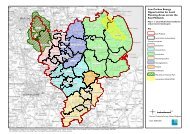
8.2 In some cases the precise geographic sub<br />
regional area to be covered has not been defined;<br />
indicators also need to be refined and there are some<br />
indicators where recent data is sparse.<br />
Policy 5: Concentrating Development in<br />
Urban Areas<br />
This policy requires Development Plans, LDFs,<br />
LTPs and economic development strategies to:<br />
• Locate significant levels of new development in<br />
PUAs<br />
• Locate significant levels of new development in<br />
Corby, Kettering and Wellingborough<br />
• Locate appropriate development of a lesser scale<br />
in Sub-<strong>Regional</strong> Centres<br />
Targets: To be developed<br />
Indicators:<br />
• % of region’s new development in Principal Urban<br />
Areas (PUAs)<br />
• Number of new houses, land and floorspace<br />
developed within and outside PUAs<br />
• % of new development in Northants growth towns<br />
Results and Data Analysis:<br />
8.3 Since work commenced on this current Annual<br />
Monitoring Report work has taken place to provide<br />
clarification of the area covered by the Region’s three<br />
largest PUAs.<br />
Banks &<br />
Building<br />
Societies<br />
(4km)<br />
Cash<br />
Points<br />
(4km)<br />
Hamlet and Isolated<br />
dwellings - Sparse<br />
Hamlet and isolated<br />
Dwellings - Less sparse<br />
Village - Sparse<br />
Village - Less sparse<br />
Town and fringe -<br />
Sparse<br />
Town and fringe -<br />
Less sparse<br />
Urban >10K - Sparse<br />
Urban >10K -<br />
Less sparse<br />
36.1<br />
60.9<br />
16.5<br />
40.5<br />
92.2<br />
72.4<br />
100.0<br />
99.6<br />
55.2<br />
87.7<br />
55.9<br />
81.2<br />
100.0<br />
98.6<br />
100.0<br />
100.0<br />
Source: SERRL, <strong>2005</strong>. Rural Services Series<br />
GP<br />
Surgeries<br />
(4km)<br />
57.4<br />
78.2<br />
38.7<br />
65.8<br />
92.0<br />
91.6<br />
94.3<br />
99.9<br />
Primary<br />
School<br />
(3km)<br />
44.3<br />
73.9<br />
59.4<br />
76.9<br />
98.8<br />
98.9<br />
99.2<br />
100.0<br />
Policy Commentary<br />
8.4 Further work is needed to develop meaningful<br />
targets as well as to define the remaining key urban<br />
areas covered by this Policy before the next (20<strong>06</strong>/07)<br />
round of annual monitoring.<br />
Policy 6: <strong>Regional</strong> Priorities in Rural Areas<br />
This policy requires development plans, LDFs, LTPs<br />
and economic development strategies to ensure<br />
that new development maintains the distinctive<br />
character and vitality of rural communities,<br />
strengthens rural enterprise and linkages between<br />
settlements and their hinterlands<br />
Targets:<br />
• Increase in numbers of bus passenger journeys<br />
from 2001 levels<br />
• Increase in numbers in employment<br />
• Improvement in accessibility to services<br />
Indicators:<br />
• Number of bus passenger journeys per year in rural<br />
areas<br />
• Numbers in employment in rural areas<br />
• Accessibility to essential services in rural areas<br />
Results:<br />
8.5 Numbers in employment in rural areas is covered<br />
in the economy chapter.<br />
8.6 There is no data for the number of bus passenger<br />
journeys in rural areas.<br />
Table 8.1- % of residential delivery points within specified distance of service in the <strong>East</strong> <strong>Midlands</strong><br />
Supermarkets<br />
(4km)<br />
36.7<br />
71.5<br />
20.2<br />
52.0<br />
99.4<br />
88.9<br />
95.6<br />
99.9<br />
Job<br />
Centre<br />
(8km)<br />
23.7<br />
61.3<br />
25.3<br />
53.6<br />
27.8<br />
63.1<br />
99.9<br />
98.1<br />
Libraries<br />
(4km)<br />
34.5<br />
69.7<br />
5.5?<br />
47.1<br />
63.3<br />
88.1<br />
100.0<br />
99.8<br />
Petrol<br />
Station<br />
(4km)<br />
65.2<br />
86.7<br />
83.0<br />
78.9<br />
86.7<br />
95.7<br />
100.0<br />
100.0<br />
Post<br />
Office<br />
(2km)<br />
41.2<br />
70.4<br />
59.2<br />
70.5<br />
99.4<br />
98.4<br />
99.8<br />
99.8<br />
Secondary<br />
School<br />
(4km)<br />
37.5<br />
62.0<br />
30.3<br />
44.8<br />
79.5<br />
77.0<br />
97.7<br />
99.6