East Midlands Regional Spatial Strategy 2005/06
East Midlands Regional Spatial Strategy 2005/06
East Midlands Regional Spatial Strategy 2005/06

You also want an ePaper? Increase the reach of your titles
YUMPU automatically turns print PDFs into web optimized ePapers that Google loves.
Table 4.10 - Completed <strong>2005</strong>/<strong>06</strong> Employment Land Floorspace (sqm)<br />
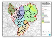
Derby<br />
Derbyshire<br />
Leicester<br />
Leicestershire<br />
Lincolnshire<br />
Northamptonshire<br />
Nottingham<br />
Nottinghamshire<br />
Peak District<br />
Rutland<br />
B1 unsp. * B1a B1bc B1 Total B2 B8 Mixed Total<br />
N/K<br />
946<br />
2,366<br />
4,453<br />
10,447<br />
3,464<br />
16,722<br />
6,400<br />
0<br />
0<br />
N/K<br />
17,735<br />
0<br />
0<br />
256<br />
4,935<br />
0<br />
4,805<br />
0<br />
0<br />
N/K<br />
0<br />
0<br />
0<br />
0<br />
1,147<br />
0<br />
0<br />
0<br />
0<br />
N/K<br />
18,681<br />
2,366<br />
4,453<br />
10,703<br />
9,546<br />
16,722<br />
11,205<br />
0<br />
0<br />
N/K<br />
99,472<br />
4,826<br />
7,6<strong>06</strong><br />
0<br />
39,508<br />
0<br />
3,5<strong>06</strong><br />
6,802<br />
0<br />
N/K<br />
50,432<br />
2,970<br />
57,181<br />
3,236<br />
50,086<br />
0<br />
3,4<strong>06</strong><br />
1,212<br />
0<br />
N/K<br />
56,951<br />
3,364<br />
87,136<br />
11,702<br />
173,572<br />
0<br />
80,775<br />
0<br />
0<br />
N/K<br />
225,536<br />
13,525<br />
156,376<br />
25,641<br />
272,712<br />
16,722<br />
98,892<br />
8,014<br />
0<br />
Source: Local Authorities<br />
No data from: <strong>East</strong> Lindsey, Chesterfield, High Peak, Lincoln, Melton, Newark & Sherwood, North <strong>East</strong> Derbyshire,<br />
Oadby and Wigston, Rushcliffe, Derby. Figures include all site areas given<br />
*Either mixed B1 use or sub category not specified (this may include B1a, B1bc and mixed use B1)<br />
Zeros indicate no land of that type above threshold. N/K is not known as this part of the questionnaire was not<br />
completed<br />
<strong>East</strong> <strong>Midlands</strong> <strong>Regional</strong> <strong>Spatial</strong> <strong>Strategy</strong> Annual Monitoring Report <strong>2005</strong>/<strong>06</strong><br />
Table 4.11 - Under Construction <strong>2005</strong>/<strong>06</strong> Employment Land (ha)<br />
Derby<br />
Derbyshire<br />
Leicester<br />
Leicestershire<br />
Lincolnshire<br />
Northamptonshire<br />
Nottingham<br />
Nottinghamshire<br />
Peak District<br />
Rutland<br />
B1 unsp. * B1a B1bc B1 Total B2 B8 Mixed Total<br />
2.7<br />
0.8<br />
0.1<br />
1.3<br />
1.7<br />
1.5<br />
N/K<br />
2.0<br />
0.0<br />
0.0<br />
0.0<br />
2.3<br />
0.0<br />
2.1<br />
3.1<br />
1.1<br />
N/K<br />
0.8<br />
0.0<br />
0.2<br />
0.0<br />
0.0<br />
0.0<br />
0.0<br />
0.0<br />
2.0<br />
N/K<br />
0.0<br />
0.0<br />
0.0<br />
Source: Local Authorities<br />
*Either mixed B1 use or sub category not specified (this may include B1a, B1bc and mixed use B1)<br />
Zeros indicate no land of that type above threshold. N/K is not known as this part of the questionnaire was not<br />
completed<br />
2.7<br />
3.1<br />
0.1<br />
3.4<br />
4.8<br />
4.6<br />
N/K<br />
2.8<br />
0.0<br />
0.2<br />
1.6<br />
5.6<br />
0.1<br />
1.7<br />
2.0<br />
0.6<br />
N/K<br />
2.4<br />
0.0<br />
2.7<br />
0.3<br />
9.4<br />
0.1<br />
20.2<br />
1.6<br />
15.0<br />
N/K<br />
0.0<br />
0.0<br />
0.4<br />
20.9<br />
23.0<br />
2.5<br />
21.3<br />
13.9<br />
22.7<br />
N/K<br />
8.9<br />
0.0<br />
1.3<br />
25.5<br />
41.1<br />
2.7<br />
46.6<br />
22.4<br />
42.8<br />
N/K<br />
14.2<br />
0.0<br />
4.6<br />
52