Allegheny River Headwaters Watershed Conservation Plan
Allegheny River Headwaters Watershed Conservation Plan
Allegheny River Headwaters Watershed Conservation Plan

Create successful ePaper yourself
Turn your PDF publications into a flip-book with our unique Google optimized e-Paper software.
<strong>Allegheny</strong> Regional Office<br />
159 Main Street<br />
Ridgway, PA 15853<br />
(814) 776-1114<br />
www.waterlandlife.org<br />
This project financed in part by a grant from the Community <strong>Conservation</strong> Partnerships Program<br />
Environmental Stewardship Fund, under the administration of the Department of <strong>Conservation</strong> and<br />
Natural Resources, Bureau of Recreation and <strong>Conservation</strong>.
<strong>Allegheny</strong> <strong>River</strong> <strong>Headwaters</strong> <strong>Conservation</strong> <strong>Plan</strong><br />
The Pennsylvania <strong>River</strong>s <strong>Conservation</strong> Program<br />
<strong>Allegheny</strong> <strong>River</strong> <strong>Headwaters</strong><br />
<strong>Conservation</strong> <strong>Plan</strong><br />
June 2011<br />
Prepared for:<br />
Upper <strong>Allegheny</strong> <strong>Watershed</strong> Association<br />
Prepared by:<br />
<strong>Allegheny</strong> Regional Office<br />
159 Main Street<br />
Ridgway, PA 15853<br />
This project was financed in part by a grant from the Community <strong>Conservation</strong> Partnerships<br />
Program, Environmental Stewardship Fund, under the administration of the Department of<br />
<strong>Conservation</strong> and Natural Resources, Bureau of Recreation and <strong>Conservation</strong>.<br />
i
<strong>Allegheny</strong> <strong>River</strong> <strong>Headwaters</strong> <strong>Conservation</strong> <strong>Plan</strong><br />
TABLE OF CONTENTS<br />
Page<br />
Title Page<br />
i<br />
Introduction Materials<br />
iii<br />
Table of Contents<br />
iii<br />
Lit of Tables<br />
vi<br />
List of Figures<br />
viii<br />
Acknowledgements<br />
x<br />
Acronyms<br />
xi<br />
<strong>Watershed</strong> Definition<br />
xiii<br />
Executive Summary<br />
ES-1<br />
Project Background<br />
ES-1<br />
Report Summary<br />
ES-2<br />
Project Area Characteristics<br />
ES-2<br />
Land Resources<br />
ES-3<br />
Water Resources<br />
ES-3<br />
Biological Resources<br />
ES-4<br />
Cultural Resources<br />
ES-4<br />
Issues and Concerns<br />
ES-5<br />
Management Recommendations<br />
ES-5<br />
Project Area Characteristics 1-1<br />
Project Area 1-1<br />
Location and Size 1-1<br />
Major Tributaries 1-1<br />
Climate 1-2<br />
Topography 1-3<br />
Air Quality 1-3<br />
Atmospheric Deposition 1-4<br />
Critical Pollutants 1-4<br />
Mercury 1-6<br />
Impacts of Air Pollution 1-7<br />
Socioeconomic Profile 1-7<br />
Land-Use <strong>Plan</strong>ning and Regulation 1-7<br />
Demographics and Population Patterns 1-10<br />
Infrastructure 1-12<br />
Transportation and Safety 1-14<br />
Economy and Employment 1-17<br />
Education 1-21<br />
Land Resources 2-1<br />
Geology 2-1<br />
Physiographic Provinces 2-1<br />
ii
<strong>Allegheny</strong> <strong>River</strong> <strong>Headwaters</strong> <strong>Conservation</strong> <strong>Plan</strong><br />
Ecoregions 2-2<br />
Rock Types 2-3<br />
Stratification 2-3<br />
Soil Characteristics 2-3<br />
Soil Associations 2-3<br />
Prime Agricultural Soils 2-5<br />
Farmland of Statewide Importance 2-5<br />
Agricultural Land Preservation 2-6<br />
Agricultural Security Areas 2-6<br />
Clean and Green Program 2-7<br />
Land Use 2-7<br />
Forestry 2-8<br />
Agriculture 2-8<br />
Development 2-10<br />
Mining 2-10<br />
Oil and Gas Exploration 2-11<br />
Land Ownership 2-13<br />
Oil and Gas Well Drilling 2-14<br />
Critical Areas 2-14<br />
Landslides 2-14<br />
Subsidence Areas 2-15<br />
Erosion and Sedimentation 2-15<br />
Groundwater Recharge 2-16<br />
Fish and Wildlife Habitat 2-16<br />
Wind Energy 2-17<br />
Hazardous Areas 2-18<br />
Comprehensive Environmental Response Compensation and Liability Act 2-18<br />
Resource <strong>Conservation</strong> and Recovery Act 2-18<br />
Waste Removal 2-19<br />
Salvage Yards 2-20<br />
Brownfields 2-21<br />
Water Resources 3-1<br />
Location 3-1<br />
<strong>Allegheny</strong> Portage Creek 3-1<br />
Potato Creek 3-2<br />
Oswayo Creek 3-2<br />
Tunungwant Creek 3-2<br />
Water Attributes 3-2<br />
Groundwater and Surface Water 3-3<br />
Wetlands 3-6<br />
Floodplains 3-8<br />
Riparian Zones 3-9<br />
Stormwater 3-10<br />
iii
<strong>Allegheny</strong> <strong>River</strong> <strong>Headwaters</strong> <strong>Conservation</strong> <strong>Plan</strong><br />
Dams 3-11<br />
<strong>Watershed</strong> Protection Laws 3-12<br />
Clean Water Act 3-12<br />
Pennsylvania Clean Streams Law 3-13<br />
Pennsylvania Floodplain Management Act 166 3-13<br />
Surface Mining Control and Reclamation Act 3-14<br />
Water Quality 3-14<br />
Classification of Water Pollution 3-14<br />
Sources of Impairment 3-14<br />
An Ohio <strong>River</strong> Basin Commission 3-22<br />
Water Quality Trading 3-22<br />
Water Quantity 3-23<br />
Pennsylvania State Water <strong>Plan</strong> 3-24<br />
Water use 3-24<br />
Biological Resources 4-1<br />
Natural Settings 4-1<br />
Ecosystem and Biodiversity 4-1<br />
Ecoregion Characteristics 4-1<br />
Natural Habitats 4-1<br />
Wildlife 4-6<br />
Mammals 4-6<br />
Reptiles and Amphibians 4-7<br />
Birds 4-8<br />
Fish and Aquatic Invertebrates 4-9<br />
Species of Special Concern 4-12<br />
<strong>Conservation</strong> Areas 4-13<br />
Natural Heritage Inventories 4-13<br />
Important Bird Areas 4-26<br />
Important Mammal Areas 4-26<br />
Invasive Species 4-27<br />
<strong>Plan</strong>ts 4-28<br />
Animals 4-35<br />
Cultural Resources 5-1<br />
Recreation 5-1<br />
Parks 5-1<br />
Trails 5-2<br />
Golfing 5-4<br />
Camping 5-5<br />
Fishing 5-5<br />
Boating 5-7<br />
Hunting 5-8<br />
Geocaching 5-9<br />
Recreation Vehicles 5-9<br />
iv
<strong>Allegheny</strong> <strong>River</strong> <strong>Headwaters</strong> <strong>Conservation</strong> <strong>Plan</strong><br />
Sky Diving 5-10<br />
Environmental Education 5-10<br />
Environmental Education Facilities 5-11<br />
Historical Resources 5-11<br />
Historical Overview 5-11<br />
Historical Sites, Structures, and Districts 5-17<br />
Local Attractions and Events 5-19<br />
Issues and Concerns 6-1<br />
Meeting Summaries 6-1<br />
Initial Meetings 6-1<br />
School Visits 6-1<br />
Surveys and Interviews 6-1<br />
Issues and Concerns 6-1<br />
Water Resources 6-2<br />
Infrastructure 6-2<br />
Employment 6-3<br />
Legal and Political 6-3<br />
Recreation 6-4<br />
Biological 6-4<br />
Cultural 6-4<br />
Public Meeting Results 6-5<br />
Positive Assets of the <strong>Watershed</strong> 6-5<br />
Lacking Amenities, Needs, and Limitations within the <strong>Watershed</strong> 6-6<br />
Survey Results 6-8<br />
Public Survey Results 6-8<br />
Municipal Phone Survey Results 6-14<br />
High School Visits 6-17<br />
Interview Results 6-22<br />
Management Recommendations 7-1<br />
Project Area Characteristics 7-2<br />
Land Resources 7-8<br />
Water Resources 7-17<br />
Biological Resources 7-26<br />
Cultural Resources 7-33<br />
Education and Funding 7-42<br />
References 8-1<br />
Appendices<br />
A. Glossary<br />
B. <strong>Plan</strong>ning Committees<br />
C. Emergency Services<br />
D. Agricultural Soils<br />
E. Active Industrial Mining Permits<br />
F. Resource <strong>Conservation</strong> and Recovery Act<br />
v
<strong>Allegheny</strong> <strong>River</strong> <strong>Headwaters</strong> <strong>Conservation</strong> <strong>Plan</strong><br />
G. Illegal Dumpsites<br />
H. Waterway Designations<br />
I. Impaired Waterways<br />
J. National Pollution Discharge Elimination System Permitted Sites<br />
K. Wildlife Listing<br />
L. Aquatic Community Classification<br />
M. Species of Concern<br />
N. Recreational Opportunities<br />
O. Potential Funding Sources<br />
P. Useful Websites<br />
Q. Resource Guide<br />
R. Native <strong>Plan</strong>t Guide<br />
S. Enhancing Fish Habitat<br />
T. Summary of Hydraulic Fracture Solutions<br />
U. Survey and Interview Questions<br />
V. Public Comment<br />
W. <strong>Conservation</strong> Guidance for Landowners<br />
vi
<strong>Allegheny</strong> <strong>River</strong> <strong>Headwaters</strong> <strong>Conservation</strong> <strong>Plan</strong><br />
LIST OF TABLES<br />
Chapter 1 Project Area Characteristics Page<br />
Table 1-1 <strong>Watershed</strong> Municipalities 1-1<br />
Table 1-2 Land-Use Regulations 1-8<br />
Table 1-3 <strong>Watershed</strong> Population 1-10<br />
Table 1-4 Population by Sex and Age 1-10<br />
Table 1-5 Municipal Population 1-11<br />
Table 1-6 Public Sewage Systems 1-13<br />
Table 1-7 Public Water System 1-14<br />
Table 1-8 Economic Comparison 1-18<br />
Table 1-9 Breakdown of Employment by Industry 1-19<br />
Table 1-10 Major Employers 1-20<br />
Table 1-11 School Districts and School Enrollment 1-21<br />
Chapter 2 Land Resources Page<br />
Table 2-1 Land Use 2-8<br />
Table 2-2 Agricultural and Forestry Statistics for McKean and Potter Counties 2-9<br />
Table 2-3 Agricultural Lands and Values by County 2-9<br />
Table 2-4 Oil and Gas Well Permits by County 2-11<br />
Table 2-5 Brownfield Sites 2-21<br />
Chapter 3 Water Resources Page<br />
Table 3-1 Tributaries 3-2<br />
Table 3-2 Water use 3-24<br />
Chapter 4 Biological Resources Page<br />
Table 4-1 <strong>Conservation</strong> Areas 4-14<br />
Table 4-2 Noxious Weeds of Pennsylvania 4-28<br />
Chapter 5 Cultural Resources Page<br />
Table 5-3 Hunting Licenses Sold 5-8<br />
Chapter 6 Issues and Concerns Page<br />
Table 6-1 Locations of Residents Completing Surveys 6-8<br />
Table 6-2 Importance of <strong>Watershed</strong> Values 6-10<br />
Table 6-3 Importance Values of Recreational Activities 6-11<br />
Table 6-4 Importance of <strong>Watershed</strong> Issues 6-12<br />
Table 6-5 Emergency Service Providers 6-16<br />
vii
<strong>Allegheny</strong> <strong>River</strong> <strong>Headwaters</strong> <strong>Conservation</strong> <strong>Plan</strong><br />
LIST OF FIGURES<br />
Chapter 1<br />
Project Area Characteristics<br />
Figure 1-1 <strong>Headwaters</strong> of the <strong>Allegheny</strong> <strong>River</strong><br />
Figure 1-2 Topography<br />
Figure 1-3 Land Use Regulations<br />
Figure 1-4 <strong>Watershed</strong> Population by Census Block Groups 2000<br />
Figure 1-5 Population Change by Census Block Groups 1990-2000<br />
Figure 1-6 Public Sewage Systems<br />
Figure 1-7 Public Water System<br />
Figure 1-8 Transportation<br />
Figure 1-9 Methods of Transportation<br />
Figure 1-10 Safety Features<br />
Figure 1-11 Time Travel to Work<br />
Figure 1-12 Work Locations<br />
Chapter 2<br />
Figure 2-1<br />
Figure 2-2<br />
Figure 2-3<br />
Figure 2-4<br />
Figure 2-5<br />
Figure 2-6<br />
Chapter 3<br />
Figure 3-1<br />
Figure 3-2<br />
Figure 3-3<br />
Figure 3-4<br />
Figure 3-5<br />
Figure 3-6<br />
Figure 3-7<br />
Figure 3-8<br />
Figure 3-9<br />
Figure 3-10<br />
Figure 3-11<br />
Land Resources<br />
Geology<br />
Agricultural Soils and Preservation Areas<br />
Land Use<br />
Resource Extraction<br />
Public Lands<br />
Environmentally Sensitive Areas<br />
Water Resources<br />
Major Tributaries<br />
<strong>Allegheny</strong> Portage Creek<br />
Potato Creek<br />
Oswayo Creek<br />
Tunungwant Creek<br />
Water Cycle<br />
Lakes, Ponds, Wetlands, and Hydric Soils<br />
Recommended Riparian Buffer Widths<br />
Impairments and Obstructions<br />
National Pollution Discharge Elimination System Permitted Sites<br />
Uses of Water Withdrawn by Region<br />
Chapter 4<br />
Figure 4-1<br />
Biological Diversity Areas<br />
Biological Resources<br />
viii
<strong>Allegheny</strong> <strong>River</strong> <strong>Headwaters</strong> <strong>Conservation</strong> <strong>Plan</strong><br />
Chapter 5<br />
Figure 5-1<br />
Figure 5-2<br />
Figure 5-3<br />
Chapter 6<br />
Figure 6-1<br />
Figure 6-2<br />
Figure 6-3<br />
Figure 6-4<br />
Figure 6-5<br />
Cultural Resources<br />
Recreational Facilities: Parks, Trails, and Camping<br />
Fishing Opportunities<br />
Local attractions and Historical Sites<br />
Issues and Concerns<br />
Age of Survey Participants<br />
Most Important Land Uses<br />
Importance of <strong>Watershed</strong> Values<br />
Importance Values of Recreational Activities<br />
Importance of <strong>Watershed</strong> Issues<br />
ix
<strong>Allegheny</strong> <strong>River</strong> <strong>Headwaters</strong> <strong>Conservation</strong> <strong>Plan</strong><br />
ACKNOWLEDGEMENTS<br />
A sincere acknowledgement and thank-you goes out to all the organizations, agencies, and individuals<br />
who dedicated their time and resources to make this project a success. Our apologies to anyone<br />
inadvertently omitted.<br />
<strong>Allegheny</strong> <strong>River</strong> <strong>Headwaters</strong> <strong>Watershed</strong> <strong>Conservation</strong> <strong>Plan</strong> Steering Committee<br />
• Jim Clark<br />
• William Daisley<br />
• Charlotte Dietrich<br />
• John Dzemyan<br />
• Jack Fleckenstein<br />
• Stan Hess<br />
• Debbie Lunden<br />
• Heather McKean<br />
• Denise Mitcheltree<br />
• Chris Nicholas<br />
• Jennifer Stambaugh<br />
• Bob Volkmar<br />
• Frank Weeks<br />
• Chuck Williams<br />
<strong>Allegheny</strong> <strong>River</strong> <strong>Headwaters</strong> <strong>Watershed</strong> <strong>Conservation</strong> <strong>Plan</strong> Advisory Committee<br />
• Marlene Eaton<br />
• Gary Fleeger<br />
• Howard Gustafson<br />
• Roger Klenovich<br />
• Dr. Pete Ryan<br />
• Byron Salsman<br />
• Jennifer Smith<br />
• John Snyder<br />
• Sue Swanson<br />
<strong>Allegheny</strong> <strong>River</strong> <strong>Headwaters</strong> <strong>Watershed</strong> <strong>Conservation</strong> <strong>Plan</strong> Key Individual Interviews<br />
• Linda Devlin<br />
• Marlene Eaton<br />
• Howard Gustafson<br />
• Pete Mader<br />
• Matt Marusiak<br />
• Sally Newton<br />
• Ross Porter<br />
• Jennifer Smith<br />
• Sandy Thompson<br />
Other Organizations and Individuals<br />
• Bradford Public Library<br />
• Coudersport School District<br />
• God’s Country Chapter Trout Unlimited<br />
McKean County <strong>Conservation</strong> District<br />
• McKean County <strong>Plan</strong>ning Commission<br />
• Northcentral Regional <strong>Plan</strong>ning and<br />
Development Commission<br />
• Penn State Cooperative Extension<br />
• Pennsylvania Fish and Boat Commission<br />
• Pennsylvania Game Commission<br />
• Pennsylvania Department of <strong>Conservation</strong><br />
and Natural Resources<br />
• Port Allegany School District<br />
• Port <strong>Allegheny</strong> Veterans Memorial,<br />
Incorporated<br />
• Potter County <strong>Conservation</strong> District<br />
• Potter County <strong>Plan</strong>ning Commission<br />
• Seneca Chapter Trout Unlimited<br />
• Smethport School District<br />
• Upper <strong>Allegheny</strong> <strong>Watershed</strong> Association<br />
x
<strong>Allegheny</strong> <strong>River</strong> <strong>Headwaters</strong> <strong>Conservation</strong> <strong>Plan</strong><br />
ACRONYMS<br />
ACB Alliance for the Chesapeake Bay<br />
AFO Animal Feeding Operation<br />
AMD Abandoned Mine Drainage<br />
APHIS Animal and <strong>Plan</strong>t Health Inspection Service<br />
ASA Agricultural Security Areas<br />
ATA Area Transit Authority<br />
ATV All Terrain Vehicles<br />
BAMR Bureau of Abandoned Mine Reclamation<br />
BAT Brownfield Action Team<br />
BDA Biological Diversity Area<br />
BMP Best Management Practices<br />
CAFO Concentrated Animal Feeding Operation<br />
CCC Civilian <strong>Conservation</strong> Corp<br />
CERCLA Comprehensive Environmental Response Compensation and Liability Act<br />
CNHI County Natural Heritage Inventory<br />
CREP <strong>Conservation</strong> Reserve Enhancement Program<br />
CSO Combined Sewage Overflow<br />
CWA Clean Water Act<br />
CWF Cold Water Fishery<br />
DA<br />
Dedicated Areas<br />
DCNR Department of <strong>Conservation</strong> and Natural Resources<br />
DEP Department of Environmental Protection<br />
DMAP Deer Management Assistance Program<br />
DSA Driving Surface Aggregate<br />
EAB Emerald Ash Borer<br />
EPA Environmental Protection Agency<br />
ESM Environmentally Sensitive Maintenance<br />
EV<br />
Exceptional Value<br />
FEMA Federal Emergency Management Agency<br />
GPS Global Positioning System<br />
H+ Hydrogen Ion<br />
HQ<br />
High Quality<br />
HU<br />
Hydrologic Unit<br />
IBA Important Bird Area<br />
IMA Important Mammal Area<br />
IMAP Important Mammal Area<br />
IPM Integrated Pest Management<br />
LCA Landscape <strong>Conservation</strong> Area<br />
LHP Landslide Hazard Program<br />
LHR Lumber Heritage Region<br />
xi
<strong>Allegheny</strong> <strong>River</strong> <strong>Headwaters</strong> <strong>Conservation</strong> <strong>Plan</strong><br />
MSWLF<br />
NASS<br />
NFIP<br />
NISIC<br />
NOMA<br />
NOx<br />
NPDES<br />
NPL<br />
NRCS<br />
OH-<br />
PASDA<br />
PDA<br />
PDE<br />
PFBC<br />
PGC<br />
PM<br />
PNHP<br />
PNMP<br />
POWR<br />
QDM<br />
RCRA<br />
SARA<br />
SFHA<br />
SGL<br />
SMCRA<br />
SRBC<br />
SSO<br />
TMDL<br />
TSF<br />
USDA<br />
USGS<br />
WNS<br />
WPC<br />
WWF<br />
Municipal Solid Waste Landfills<br />
National Agricultural Statistic Service<br />
National Flood Insurance Program<br />
National Invasive Species Information Center<br />
Nutrient and Odor Management Act<br />
Nitrogen Oxides<br />
National Pollutant Discharge Elimination System<br />
National Pollutant List<br />
Natural Resource <strong>Conservation</strong> Service<br />
Hydroxide Ions<br />
Pennsylvania Spatial Data Access<br />
Pennsylvania Department of Agriculture<br />
Pennsylvania Department of Education<br />
Pennsylvania Fish and Boat Commission<br />
Pennsylvania Game Commission<br />
Particulate Matter<br />
Pennsylvania Natural Heritage Program<br />
Pennsylvania Nutrient Management Program<br />
Pennsylvania Organization for <strong>Watershed</strong>s and <strong>River</strong>s<br />
Quality Deer Management<br />
Resource <strong>Conservation</strong> Recovery Act<br />
Superfund Amendments and Reauthorization Act<br />
Special Flood Hazard Areas<br />
State Game Lands<br />
Surface Mine <strong>Conservation</strong> Recovery Act<br />
Susquehanna <strong>River</strong> Basin Commission<br />
Sanitary Sewer Overview<br />
Total Maximum Daily Loads<br />
Trout Stocked Fishery<br />
United States Department of Agriculture<br />
United States Geological Survey<br />
White Nose Syndrome<br />
Western Pennsylvania Conservancy<br />
Warm Water Fishery<br />
xii
<strong>Allegheny</strong> <strong>River</strong> <strong>Headwaters</strong> <strong>Conservation</strong> <strong>Plan</strong><br />
WATERSHED DEFINITION<br />
A watershed is an area of land that drains to a common waterway, such as a stream, lake, wetland,<br />
aquifer, or ocean. Each waterbody has its own watershed; some are small, such as Brokenstraw Creek,<br />
and others are larger, such as <strong>Allegheny</strong> <strong>River</strong>. The highest elevation surrounding a waterbody defines its<br />
watershed boundary. A drop of water falling outside the boundary will drain to another watershed.<br />
Land uses and human influences can impact the quality of the watershed. Everyone lives in a<br />
watershed and “we all live downstream.” Local impacts on the waterbody affect the quality of the<br />
watershed downstream, just as impacts upstream affect the local quality of the watershed.<br />
xiii
<strong>Allegheny</strong> <strong>River</strong> <strong>Headwaters</strong> <strong>Conservation</strong> <strong>Plan</strong><br />
Executive Summary<br />
EXECUTIVE SUMMARY<br />
The <strong>Allegheny</strong> <strong>River</strong> <strong>Headwaters</strong> <strong>Conservation</strong> <strong>Plan</strong> is a<br />
comprehensive study that compiles broad-based data about<br />
recreational, historical, socio-economic, and natural resources<br />
throughout the region. The plan involves a strong community<br />
participation element through the identification of local needs<br />
and concerns.<br />
This document is non-regulatory, and serves as a reference<br />
and educational tool promoting the conservation of natural<br />
resources, monitoring and improvement of water quality, and<br />
advocating sound community-planning practices.<br />
Recommendations identified in this plan are not enforceable by<br />
any agency. Implementation of this plan is the responsibility of<br />
the entire watershed community, and depends upon cooperation<br />
and collaboration among many different organizations.<br />
Pennsylvania <strong>River</strong>s <strong>Conservation</strong> Program aids groups in accomplishing local initiatives through<br />
planning, implementation, acquisition, and development activities. As part of the program, Pennsylvania<br />
Department of <strong>Conservation</strong> and Natural resources (DCNR) established the Pennsylvania <strong>River</strong>s Registry<br />
to validate the completion of approved watershed conservation plans. The registry serves to promote<br />
public awareness of completed plans, while fostering support for future projects that will enhance the<br />
overall quality of the watershed.<br />
The <strong>Allegheny</strong> <strong>River</strong> <strong>Headwaters</strong> <strong>Watershed</strong> <strong>Conservation</strong> <strong>Plan</strong> was conducted to document current<br />
conditions that identify initiatives to improve the livability and attractiveness of the region. Through<br />
public perception of current conditions and future expectations, the plan engages community involvement<br />
into the development of a future vision for the watershed and creates a prioritized list of recommendations<br />
to achieve this vision.<br />
Project Background<br />
In 2008, Western Pennsylvania Conservancy received funding from Pennsylvania Department of<br />
<strong>Conservation</strong> and Natural Resources (DCNR), Bureau of Recreation and <strong>Conservation</strong> to prepare a<br />
watershed conservation plan for the <strong>Allegheny</strong> <strong>River</strong> headwaters watershed.<br />
In 2009, public outreach was initiated through kickoff public meeting workshops, public surveys,<br />
municipal interviews, focus group meeting, and school workshops. Development of resource chapters<br />
began to take shape. <strong>Plan</strong>ning efforts continued into 2010 when key individual interviews were conducted<br />
and public surveys were finalized. The final touches of the <strong>Allegheny</strong> <strong>River</strong> <strong>Watershed</strong> <strong>Conservation</strong> <strong>Plan</strong><br />
were conducted throughout the summer into the fall that including the prioritization of management<br />
recommendations, public review of the draft plan, and completion of the final <strong>Allegheny</strong> <strong>River</strong><br />
<strong>Headwaters</strong> <strong>Conservation</strong> <strong>Plan</strong> in 2011.<br />
ES-1
<strong>Allegheny</strong> <strong>River</strong> <strong>Headwaters</strong> <strong>Conservation</strong> <strong>Plan</strong><br />
Executive Summary<br />
Chapter Summaries<br />
Project Area Characteristics<br />
• The <strong>Allegheny</strong> <strong>River</strong> headwaters watershed is located within the Pennsylvania Wilds region.<br />
• Population within the watershed is declining. Since 1980, the population has decreased by 6.9<br />
percent to 47,119 residents in 2000. The declining population trend is also prevalent within the<br />
nine population centers.<br />
• Land-use regulations, such as zoning and subdivision ordinances are not highly utilized within the<br />
project area. Only 38 percent of municipalities address and regulate land-use via comprehensive<br />
plans and/or zoning. The remaining municipalities rely their county’s comprehensive plan to<br />
address and regulate land-use.<br />
• The headwaters of the <strong>Allegheny</strong> <strong>River</strong> occupy 893 square miles within 37 municipalities in<br />
McKean, Potter, and Cameron counties. The watershed includes all the tributaries that enter the<br />
<strong>Allegheny</strong> <strong>River</strong> prior to its entrance into New York.<br />
• Wastewater authorities and 15 drinking water authorities provide services within the project area.<br />
The majority of authorities obtain water from groundwater sources. Bradford City Water<br />
Authority is the only authority that obtains water from source waters.<br />
• Vehicle transportation is the most popular form of transportation throughout the region. The<br />
Bradford Regional Airport provides<br />
commuter services to Cleveland<br />
Hopkins International Airport.<br />
Eldred, Pa.<br />
• Ecological conditions within the<br />
watershed are taut. The average<br />
household income within the project<br />
area is lower than average household<br />
income in Pennsylvania, New York, and<br />
U.S.<br />
Land Resources<br />
• The region has a rich history in oil and gas well drilling, especially in the area surrounding<br />
Bradford. In 2009, within the municipalities that comprise the <strong>Allegheny</strong> <strong>River</strong> <strong>Headwaters</strong><br />
watershed 370 permits were issued for well development, of which 94% were located within<br />
McKean County. There were 137 wells drilled in the <strong>Allegheny</strong> <strong>River</strong> <strong>Headwaters</strong> region with 12<br />
being Marcellus shale wells.<br />
• Other areas of concern within the project area include two superfund sites, 130 Resource<br />
<strong>Conservation</strong> Recovery Act sites, 55 illegal dumpsites, with an estimated 139.5 tons of trash, and<br />
three brownfield sites.<br />
• Agriculture has a significant role within McKean and Potter counties. Between 2005 and 2007,<br />
the number of farms increased by 13.7% to 691 farms. However, the average size decreased.<br />
ES-2
<strong>Allegheny</strong> <strong>River</strong> <strong>Headwaters</strong> <strong>Conservation</strong> <strong>Plan</strong><br />
Executive Summary<br />
• Located within the<br />
project are 38,289<br />
acres are enrolled in<br />
Agricultural Security<br />
Areas Program and<br />
another 485,724 acres<br />
are enrolled in Clean<br />
and Green Program.<br />
• Forestland dominates<br />
the watershed<br />
accounting for 76% of<br />
the land-use.<br />
Agricultural pursuits<br />
are the second-leading<br />
land-use at 12%.<br />
9%<br />
3%<br />
64%<br />
11%<br />
Land-Use in Project Area<br />
1%<br />
7%<br />
3%<br />
2%<br />
0%<br />
Deciduous Forest<br />
Evergreen Forest<br />
Mixed Forest<br />
Pasture/Hay<br />
Cultivated Crops<br />
Open Land<br />
Developed<br />
Wetlands/Water<br />
Barren Lands<br />
• The <strong>Allegheny</strong> <strong>River</strong> <strong>Headwaters</strong> are located within the Deep Valley and Glaciated High Plateau<br />
sections of the Appalachian Plateau Province. It is also located within the <strong>Allegheny</strong> Glaciated<br />
High Plateau and Unglaciated <strong>Allegheny</strong> High Plateau ecoregions<br />
Water Resources<br />
• The <strong>Allegheny</strong> <strong>River</strong> is a Cold Water Fishery that begins in central Potter County west of the<br />
village of Gold in Allegany Township.<br />
• It originates at the triple dived—the location where three major river basins are divided—with the<br />
water flowing west entering into the <strong>Allegheny</strong> <strong>River</strong> Basin.<br />
• The Headwater region incorporates all the tributaries within Pennsylvania that enter the<br />
<strong>Allegheny</strong> <strong>River</strong> from its origin to Tunungwant Creek encompassing approximately 889 square<br />
miles.<br />
• Four major tributaries feed the <strong>Allegheny</strong> <strong>River</strong>. They include: <strong>Allegheny</strong> Portage Creek, Potato<br />
Creek, Oswayo Creek, and Tunungwant Creek<br />
• Approximately 127 miles of stream within the<br />
<strong>Allegheny</strong> <strong>Headwaters</strong> region were impaired by<br />
siltation, nutrients, pH, organic enrichment and<br />
low dissolved oxygen, mercury, metals, and/or<br />
pathogens.<br />
Potato Creek below the dam in<br />
Smethport<br />
• Most of the impairments are from road runoff<br />
and agriculture although some impairments are<br />
caused by abandoned mine drainage, petroleum<br />
activities, removal of vegetation, point source<br />
discharges, channelization, or impoundments<br />
ES-3
<strong>Allegheny</strong> <strong>River</strong> <strong>Headwaters</strong> <strong>Conservation</strong> <strong>Plan</strong><br />
Executive Summary<br />
Biological Resources<br />
• The region contains a variety of natural habitats, which are highlighted in the 27 biologically<br />
diverse areas and four landscape conservation areas that have been identified within the project<br />
area.<br />
• Invasive species pose a threat to the natural biodiversity. Within the headwaters region there are<br />
22 invasive plant species and six invasive animal species.<br />
• A diversity of plants and animals reside within the mostly rural and rugged <strong>Allegheny</strong> <strong>River</strong><br />
headwaters, including 80 Species of Concerns, one geologic feature, and four natural<br />
communities.<br />
Species of Concern include:<br />
o 23 plants o seven birds<br />
o 18 dragonflies or damselflies o five mammals<br />
o nine butterflies o five reptiles<br />
o eight fish o five mussels<br />
Cultural Resources<br />
• The region has a variety of local attractions and annual events<br />
that attract visitors to the region. The Penn-Brad Museum,<br />
Zippo/Case Visitor Center, McKean County Historical Society<br />
Old Jail Museum, and Eldred World War II Museum are among<br />
some of the well-known attractions. Also included in these<br />
attractions are six sites and three districts that have been<br />
identified on the National Register of Historic Places.<br />
• European settlement into the region was slowed by the<br />
resistance of Native Americans and contradicting land titles.<br />
The first settler within the region was Francis King who arrived<br />
in Ceres Township in 1798.<br />
• The region’s citizens played a significant role in the<br />
Underground Railroad by harboring or guiding escaped slaves<br />
through the rugged terrain onto safe passage into New York and<br />
Canada.<br />
Marilla Springs Trail is one of<br />
the many local trails<br />
throughout the project area<br />
• A variety of recreational opportunities exist throughout the <strong>Allegheny</strong> <strong>River</strong> headwaters region<br />
including some unique opportunities, such as sky diving and model airplane flying. In addition to<br />
specific recreational facilities there is an abundance of natural resources for activities, such as<br />
hunting, fishing, and geocaching.<br />
Recreational facilities include:<br />
o Four golf courses o Three regional trail networks—Tuna Valley<br />
o Four private campgrounds<br />
Trail, Potato Creek Trail, and Kinzua Trail<br />
o 44 local, state, or regional parks o Over 41 miles of trails for all terrain vehicle<br />
o Three environmental educational facilities and snowmobile use.<br />
ES-4
<strong>Allegheny</strong> <strong>River</strong> <strong>Headwaters</strong> <strong>Conservation</strong> <strong>Plan</strong><br />
Executive Summary<br />
Issues and Concerns<br />
• Identifying visions and goals is a fundamental element of watershed conservation planning. In<br />
order to obtain these visions and goals, local stakeholders were contacted using a variety of<br />
methods, including portable displays, public meeting workshops, student workshops, a focus<br />
group meeting, municipal surveys, individual interviews, personal communication, community<br />
events, and a project website.<br />
• Stakeholder identified the following issues:<br />
o Project Area Characteristics—infrastructure, employment, legal and political, dirt and gravel<br />
roadways<br />
o Land Resources—stone quarries and natural gas drilling<br />
o Water Resources—brine usage and stormwater management<br />
o Biological Resources—habitat destruction and decreased wildlife populations<br />
o Cultural Resources—respecting private lands, seasonal recreational opportunities, and<br />
environmental education<br />
Management Recommendations<br />
• Management recommendations are non-regulatory suggestions to maintain or improve the<br />
conditions that affect many aspects of life within the region. These recommendations are best<br />
used as a guide to conserving, restoring, or improving important watershed characteristics. They<br />
were compiled from municipal and public surveys, public meeting workshops, and key individual<br />
interview comments.<br />
• No limitation to the number or types of issues, actions, approaches, partners or funding<br />
opportunities should be assumed, due to ever changing circumstances. Creativity in implementing<br />
the identified recommendations or developing additional suggestions is highly encouraged.<br />
Table ES-1. Management Recommendation Goals<br />
Project Area Characteristics<br />
• Proactively plan for future development.<br />
• Carefully plan development to ensure economic enhancement while preserving community character without<br />
adversely affecting quality of life.<br />
• Enhance marketability to prospective business and establish economic stability to maintain a balanced workforce.<br />
• Encourage economic growth with minimal impacts to the environment.<br />
• Increase communications and cooperation among municipalities and counties within the region to promote sharing<br />
of services and improve conditions collectively affecting the watersheds.<br />
• Identify impacts of acid precipitation to minimize and remediate these impacts.<br />
• Enhance transportation infrastructure.<br />
• Enhance financial support and services to prepare emergency response providers.<br />
• Educate stakeholders how land use planning can be affective.<br />
• Educate stakeholders about benefits of watershed protection and the use of best management practices.<br />
• Support community libraries and expand service opportunities.<br />
ES-5
<strong>Allegheny</strong> <strong>River</strong> <strong>Headwaters</strong> <strong>Conservation</strong> <strong>Plan</strong><br />
Executive Summary<br />
Table ES-1. Management Recommendation Goals (continued)<br />
Land Resources<br />
• Explore opportunities to generate alternative energy.<br />
• Reduce impacts caused by dirt and gravel roadways.<br />
• Establish cooperation between surface and subsurface rights landowners and develop protection rights for surface<br />
landowners in order to protect their property.<br />
• Preserve agricultural lands and culture for future generations<br />
• Establish or enhance incentives for land protection and conservation practice implementation.<br />
• Identify, inventory, cleanup illegal dumpsites, and prosecute violators using illegal dumpsites.<br />
• Work with agriculturalist to install best management practices at their farms to reduce impacts on herds and area<br />
waterways.<br />
• Minimize impacts caused by exploration, production, retirement, and abandonment of wells.<br />
• Reclaim abandoned wells, mines, and quarries.<br />
• Protect ecologically significant lands.<br />
• Increase awareness about practices to assist agricultural and forest landowner in managing their lands effectively.<br />
• Increase awareness about the impacts from litter, illegal dumps, and abandoned vehicles.<br />
Water Resources<br />
• Protect area waterways while increasing wildlife habitat opportunities.<br />
• Increase awareness about the benefits of riparian corridors.<br />
• Further investigate wetlands and their functions and protect their resources.<br />
• Educate stakeholders about the value and importance of wetlands.<br />
• Reduce the amount of erosion and sedimentation entering waterways.<br />
• Monitor water quantity to ensure demand does not exceed water supply.<br />
• Monitor the use of brine water as a treatment on dirt and gravel roads.<br />
• Minimize potential flooding damages by taking a proactive approach to managing floodplains.<br />
• Encourage non-structural approaches to floodplain management.<br />
• Minimize impacts from stormwater through planning.<br />
• Establish, maintain, or upgrade sewage treatment facilities.<br />
• Establish, maintain, or upgrade water treatment facilities.<br />
• Investigate the need and effectiveness of establishing a water quality trading program within the <strong>Allegheny</strong> <strong>River</strong><br />
<strong>Headwaters</strong> <strong>Watershed</strong>.<br />
• Develop a monitoring plan for the watershed or completed project areas, integrating quality assurance/quality<br />
control standards into the plan.<br />
• Establish and implement after conservation practices to reduce water consumption.<br />
• Conduct an assessment of natural and man-made impoundments, and implement recommendations to enhance their<br />
ecosystems.<br />
• Protect and evaluate waterways that are designated or eligible for classification as High Quality or Exceptional<br />
Value<br />
• Reduce water quality impacts by properly disposing of un-needed medication.<br />
• Provide educational programs educating residents about impacts and pollution sources.<br />
ES-6
<strong>Allegheny</strong> <strong>River</strong> <strong>Headwaters</strong> <strong>Conservation</strong> <strong>Plan</strong><br />
Executive Summary<br />
Table ES-1. Management Recommendation Goals (continued)<br />
Biological Resources<br />
• Reduce impacts caused by invasive and nuisance species.<br />
• Develop, adopt, and implement management plans to protect forest and wildlife resources.<br />
• Implement best management practices to protect forest resources.<br />
• Identify Important Bird and Mammal Areas<br />
• Identify and protect biologically diverse areas.<br />
• Enhance aquatic habitats.<br />
• Protect rare, threatened, and endangered species and their habitats.<br />
• Identify and protect important habitats for plant and animal species.<br />
• Implement strategies to conserve rare and unique plant and animal communities.<br />
• Increase the use of native plants in landscaping and remediation projects.<br />
• Implement wildlife management practices to protect biodiversity.<br />
Cultural Resources<br />
• Increase awareness of recreational resources through marketing and outreach.<br />
• Enhance recreational opportunities for sportsmen and outdoor enthusiasts.<br />
• Increase recreational opportunities for area youth by establishing programs, encouraging outdoor recreational<br />
activities and opportunities.<br />
• Improve recreational facilities and ensure availability and access.<br />
• Establish, expand, and improve area trails.<br />
• Link recreational facilities to each other.<br />
• Encourage environmentally sound practices when operating recreational vehicles, and enforce existing laws to<br />
minimize intrusion on private lands.<br />
• Expand awareness, appreciation, and support for the arts.<br />
• Highlight and preserve local history within the region.<br />
• Promote appreciation for the local history.<br />
• Promote community involvement in conservation and educational initiatives.<br />
• Establish ongoing environmental education programs and displays.<br />
• Educate recreation users about proper and safe practices.<br />
ES-7
<strong>Allegheny</strong> <strong>River</strong> <strong>Headwaters</strong> <strong>Conservation</strong> <strong>Plan</strong><br />
Chapter 1. Project Area Characteristics<br />
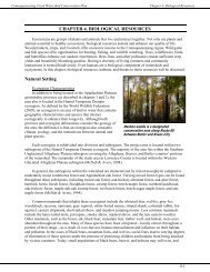
CHAPTER 1. PROJECT AREA CHARACTERISTICS<br />
This section provides an overview of the project area, its<br />
location, watershed sub-basins, topography, municipalities, air<br />
quality, land-use regulations, and socio-economic factors.<br />
Project Area<br />
Location and Size<br />
Situated within the Pennsylvania Wilds region, the<br />
headwaters of the <strong>Allegheny</strong> <strong>River</strong> occupy 893 square miles<br />
within 37 municipalities in McKean, Potter, and Cameron<br />
counties. The watershed includes all the tributaries that enter the <strong>Allegheny</strong> <strong>River</strong> prior to its entrance into<br />
New York. Figure 1-1 and Table 1-1 identify the municipalities within the <strong>Allegheny</strong> <strong>River</strong> headwaters.<br />
Table 1-1. <strong>Watershed</strong> Municipalities<br />
Municipality<br />
Square<br />
Miles<br />
Percent of<br />
<strong>Watershed</strong><br />
Municipality<br />
Square<br />
Miles<br />
Percent of<br />
<strong>Watershed</strong><br />
McKean County<br />
Potter County<br />
Annin Township 33.83 3.79% Allegany Township 27.80 3.11%<br />
Bradford, City of 3.40 0.38% Clara Township 19.66 2.20%<br />
Bradford Township 52.42 5.87% Coudersport Borough 5.63 0.63%<br />
Ceres Township 40.54 4.54% Eulalia Township 29.17 3.27%<br />
Corydon Township 0.12 0.01% Genesee Township 6.27 0.70%<br />
Eldred Borough 0.94 0.11% Hebron Township 43.75 4.90%<br />
Eldred Township 39.04 4.37% Homer Township 1.90 0.21%<br />
Foster Township 44.05 4.93% Keating Township 16.83 1.89%<br />
Hamlin Township 24.69 2.76% Oswayo Borough 1.38 0.15%<br />
Keating Township 86.05 9.64% Oswayo Township 35.09 3.93%<br />
Lafayette Township 33.54 3.76% Pleasant Valley Township 19.70 2.21%<br />
Lewis Run Borough 1.84 0.21% Roulette Township 32.64 3.66%<br />
Liberty Township 82.45 9.23% Sharon Township 33.98 3.81%<br />
Mount Jewett Borough 0.72 0.08% Shinglehouse Borough 2.09 0.23%<br />
Norwich Township 73.63 8.25% Summit Township 5.70 0.64%<br />
Otto Township 34.89 3.91% Sweden Township 24.93 2.79%<br />
Port Allegany Borough 1.78 0.20% Cameron County<br />
Sergeant Township 27.74 3.11% Shippen Township 2.85 0.32%<br />
Smethport Borough 1.75 0.20%<br />
Major Tributaries<br />
The <strong>Allegheny</strong> <strong>River</strong> begins in Potter County in Allegany Township near Colesburg, and it flows in<br />
a west-northwest direction through Coudersport, Port Allegany, and Eldred before flowing into New<br />
1-1
<strong>Allegheny</strong> <strong>River</strong> <strong>Headwaters</strong> <strong>Conservation</strong> <strong>Plan</strong><br />
Chapter 1. Project Area Characteristics<br />
York. There are four major tributaries that join the <strong>Allegheny</strong> <strong>River</strong> to form its headwaters. <strong>Allegheny</strong><br />
Portage Creek is the first major tributary; it joins in Port Allegany, Pa. after flowing through Keating<br />
Township in Potter County and Liberty Township in McKean County. Potato Creek is the second major<br />
tributary to enter the <strong>Allegheny</strong> <strong>River</strong>, joining near Coryville, Pa. Potato Creek begins in Norwich<br />
Township, and flows north through Smethport Borough and<br />
Keating and Eldred townships in McKean County. Oswayo<br />
Creek is the next major tributary to join, entering the<br />
<strong>Allegheny</strong> <strong>River</strong> southwest of Portville, New York. Oswayo<br />
Creek begins in northern Potter County, east of Oswayo<br />
Borough, where it flows in a northwest direction through<br />
Shinglehouse and into New York. The final major tributary of<br />
the <strong>Allegheny</strong> <strong>River</strong> headwaters is Tunungwant Creek—<br />
sometimes spelled Tunungant—which is locally referred to as<br />
“Tuna” Creek, for short. Beginning in Lafayette Township, it<br />
flows north through Lewis Run Borough, Bradford Township,<br />
City of Bradford, and Foster Township before joining the<br />
Tunungwant Creek in Lewis Run, PA <strong>Allegheny</strong> <strong>River</strong> near <strong>River</strong>side Junction, New York.<br />
Climate<br />
The region experiences a humid continental climatic regime with cold, snowy winters and warm<br />
summers with an occasional hot day. Westerly winds cross the region with an average wind speed of nine<br />
miles per hour occurring in the spring. During the winter months, the temperature averages 21 degrees<br />
Fahrenheit, with the record low temperature reaching -42 degrees Fahrenheit on January 5, 1904 in<br />
Smethport, Pa. The summer season brings warmer temperatures averaging 74 degrees Fahrenheit, with a<br />
record high of 98 degrees Fahrenheit in 1986 and 1988. Throughout the summer months, sunshine occurs<br />
60 percent of the time [National Climatic Data Center (NCDC); The Weather Channel, 2009].<br />
The growing season—the period between the last 32-degree temperature day of spring and the first<br />
32-degree temperature day of fall—is between 100 and 165 days long. However, the region is better<br />
suited for the growing of trees, primarily hardwood species, as opposed to agricultural crops (Woods,<br />
Omernik, & Brown, 1999).<br />
Precipitation occurs throughout the year, but more frequently during the spring and summer months,<br />
and is heavier on the windward or west-facing slopes. Approximately 43 inches of precipitation<br />
accumulates annually. The region experiences approximately 30-35 days of thunderstorms a year, mostly<br />
within the summer months. Smethport, in McKean County, holds a world record for rainfall—30.8 inches<br />
of rain fell over 4.5 hours on July 18, 1942. The national rainfall record of 34.5 inches over a 24-hour<br />
timeframe is also held by Smethport, occurring July 17–18, 1942. This region accumulates an average of<br />
84 inches of snowfall during the winter months. On average, 82 days per year have one inch or more of<br />
snow covering the ground. The greatest snow depth at one time within the region was 44 inches (NCDC;<br />
Churchill, 1987).<br />
The region is not immune to severe weather. Blizzards, severe thunderstorms, tropical storms, and<br />
tornados periodically threaten the region. Severe thunderstorms are the most common serious weather<br />
concern. As previously mentioned the region experiences 30–35 days of thunderstorms each year.<br />
However, not every storm is severe enough to cause flooding. Localized flooding can occur from heavy<br />
storm events, spring thaws, or a combination of the two weather conditions. A flood of notable severity<br />
occurs approximately once every eight years. Often times, storm events that threaten the region are the<br />
tail end of a tropical depression, as in the case of the 1972 flood that impacted Eldred, Pa.<br />
1-2
<strong>Allegheny</strong> <strong>River</strong> <strong>Headwaters</strong> <strong>Conservation</strong> <strong>Plan</strong><br />
Chapter 1. Project Area Characteristics<br />
One of the worst floods to occur in the region was the result of Tropical Storm Agnes in June, 1972.<br />
The region received 12.05 inches of rain increasing the depth of area streams to 28 feet above their<br />
normal levels. Flooding within the Borough of Eldred was so severe that the water level reached the<br />
second level of many homes and the only viable form of transportation was that by boat.<br />
Each year nearly ten tornados form within Pennsylvania, ranking it 25 th nationally for tornadic<br />
activities. Within Pennsylvania, tornados occur primarily in the extreme northwestern, southwestern<br />
plateau, and southeast piedmont regions. According to the National Weather Service in Buffalo, New<br />
York, the Pennsylvania-New York border is considered a hot spot for tornado activity, averaging two<br />
tornadoes per year. On July 21, 2003, an F1 tornado destroyed the Kinzua Bridge just north of Mount<br />
Jewett, Pa. On July 27, 2009, a tornado touched down in the eastern portion of Cattaraugus County, New<br />
York, in the Allegany State Park just a few miles north of the Bradford region (Pennsylvania Department<br />
of <strong>Conservation</strong> and Natural Resources (DCNR 2 ); NCDC; Connolly, 2009; Pennsylvania tornadoes).<br />
Topography<br />
An area's land surface contains features, such as mountains and glacial outwash that define its<br />
topography. These natural land features influence the establishment of communities and their facilities.<br />
This region’s landscape of rolling hills and meandering waterways spurred development in valley areas,<br />
such as Bradford, Smethport, Lewis Run, Port Allegany, Eldred, Shinglehouse, and Coudersport. The<br />
valley areas were selected for development because it was easier to clear the valley land opposed to<br />
mountainous terrain. Even the arrangement of roads, utilities, and water lines are impacted by topography.<br />
Typically, areas that contain a slope less than 15 percent are suitable for most development; areas with a<br />
slope between 15–30 percent require caution, and areas with a slope of 30 percent or more should remain<br />
undeveloped (Potter County <strong>Plan</strong>ning Commission, 2005). Figure 1-2 displays the topography of the<br />
region.<br />
Coudersport Ice Mine<br />
The Coudersport Ice Mine is a unique natural feature within the <strong>Allegheny</strong> <strong>River</strong> watershed, located<br />
approximately four miles east of Coudersport. Although called a mine it is actually a cave or pit that<br />
demonstrates a coldness trap or Glaciere. A coldness trap occurs when the cold, dense winter air becomes<br />
trapped in the cave and unable to leave.<br />
In 1897, the Coudersport Ice Mine shaft was built to search for a strange ore, believed to be silver<br />
ore. The ore turned out to be worthless and mining was ceased. When the mine shaft was built ice had<br />
already filled the cracks in the rocks giving the mine its name as “ice mine” (Duckeck, 2008).<br />
In this cavern, icicles form during the summer months and melt by winter. This is because the cave<br />
maintains a temperature cold enough to freeze water. During the winter months, no icicles form because<br />
the cracks in the rocks are completely frozen not allowing additional water into the cave. During the<br />
spring and summer, the cracks thaw and allow water to flow into the cavern, where it freezes and creates<br />
icicles. Once a popular tourist destination, the site was destroyed when the nearby landscape was altered<br />
(Duckeck, 2008).<br />
More information about physiographic resources is included in the Land Resources chapter.<br />
Air Quality<br />
Each year, nearly 200 million tons of toxic emissions pollute the air in the U.S., making air pollution<br />
the nation’s largest environmental risk (Pennsylvania Department of Environmental Protection [DEP],<br />
2003). Any substance in the air that causes damage to life, ecosystems, or property is an air pollutant.<br />
1-3
<strong>Allegheny</strong> <strong>River</strong> <strong>Headwaters</strong> <strong>Conservation</strong> <strong>Plan</strong><br />
Chapter 1. Project Area Characteristics<br />
Both natural and synthetic processes can lead to air pollution. Over 90 percent of the pollutants originate<br />
from industry, power plants, vehicles, and other human influences. In 1970, the Clean Air Act was<br />
passed. Amended in 1977 and again in 1990, the act set a national goal to have clean and healthy air for<br />
everyone.<br />
Airborne pollutants can travel very long distances. They fall to the ground in raindrops, fog, dew,<br />
dust, or simply due to gravity in a process called atmospheric deposition. It is difficult to identify the<br />
source of airborne pollutants found in a body of water. Pollutants enter waterways through direct and<br />
indirect deposition. Direct deposition occurs when the pollutants enter directly into the waterways.<br />
Through indirect deposition, pollutants are washed into waterbodies with runoff. Researchers have<br />
developed the concept of airsheds to assist in the study of atmospheric deposition (U.S. Environmental<br />
Protection Agency [EPA], 2003).<br />
Airsheds are geographic areas responsible for emitting 75 percent of the air pollution that reaches a<br />
body of water. Different pollutants have different airsheds because of the varied behaviors they exhibit in<br />
the atmosphere. Airsheds are determined using mathematical models of atmospheric deposition; as<br />
opposed to watersheds, which utilize physical features of the landscape (EPA, 2003).<br />
Atmospheric Deposition<br />
There are two types of atmospheric deposition: dry and wet. Dry deposition refers to gases and<br />
particles that fall to the earth. They deposit on buildings, cars, homes, and trees; the particles are then<br />
washed away in runoff during storm events.<br />
Rain, fog, and snow are examples of wet deposition. One type of wet deposition is acid precipitation,<br />
which occurs when nitrogen oxides and sulfur dioxide react in the atmosphere with water, oxygen, and<br />
other chemicals to form various acidic compounds.<br />
Atmospheric deposition can negatively affect the water quality in lakes and streams, terrestrial and<br />
aquatic wildlife, forests, human health, visibility, and the materials used to make automobiles, statues, and<br />
buildings. More information about the effects of acid precipitation is located within the Water Resources<br />
chapter.<br />
Critical Pollutants<br />
Six critical pollutants that affect air quality have been identified nationally. They include carbon<br />
monoxide, lead, nitrogen oxides, ozone, particulate matter, and sulfur dioxide. Overall, McKean and<br />
Potter counties are ranked among the cleanest counties in the U.S. and in Pennsylvania.<br />
Carbon Monoxide<br />
Carbon monoxide is a poisonous compound that is produced as a result of the incomplete<br />
consumption of fuels, such as in motor vehicle exhaust, industrial processes, and wood stoves. It can<br />
impair vision, alertness, and other mental and physical function when inhaled. Individuals with<br />
cardiovascular disease are at the highest risk, but carbon monoxide can also affect healthy individuals.<br />
Carbon monoxide poisoning can be fatal when high levels are present, because it replaces the oxygen in<br />
blood and inhibits the delivery of oxygen to body tissues (DEP 9 ).<br />
Potter and McKean counties are among the cleanest counties within Pennsylvania, ranking in the 0 th<br />
and 10 th percentiles. They are also among the cleaner counties when compared to other counties within<br />
the U.S., ranking in the 30 th and 50 th percentiles. A percentile is a descriptive statistic that indicates the<br />
percent of a distribution; i.e. a rank in the 50 th percentile means McKean County’s carbon monoxide<br />
contamination is greater than or equal to 50 percent of the counties nationwide. Lower percentile rankings<br />
indicate cleaner conditions, whereas higher percentiles indicate dirtier or worse conditions. In 1999,<br />
1-4
<strong>Allegheny</strong> <strong>River</strong> <strong>Headwaters</strong> <strong>Conservation</strong> <strong>Plan</strong><br />
Chapter 1. Project Area Characteristics<br />
21,952 tons of carbon monoxide was emitted into the air from mobile, area, and point sources within<br />
McKean and Potter counties (Green Media Toolshed, 2005).<br />
Mobile sources are emissions from vehicles or off-road equipment—such as airplanes, trains,<br />
and construction equipment. Approximately 83 percent of carbon monoxide emissions in<br />
McKean and Potter counties come from mobile sources.<br />
Area sources are sources that emit less than 10 tons from a single pollutant or less than 25 tons<br />
from of a combination of pollutants each year. They contribute up to 14 percent of the carbon<br />
monoxide emissions within McKean and Potter counties. Dry cleaners, gas stations, auto body<br />
shops, residential and commercial buildings, lawnmowers, grills, wastewater treatment,<br />
landfills, and backyard burning all classify as area sources.<br />
Point sources are emitted from chemical plants, refineries, and power plants and emit<br />
pollutants greater than 10 tons for a single pollutant or more than 25 tons for a combination of<br />
pollutants per year. They account for only three percent of the carbon monoxide being emitted<br />
in McKean and Potter counties.<br />
Lead<br />
The use of leaded fuel and industrial processes, such as battery manufacturing and lead smelters,<br />
emits lead particles into the atmosphere. The metal development process is a major source of lead<br />
emissions. Ingested or inhaled, lead causes poisoning, which reduces mental abilities; damages blood,<br />
nerves, and organs; and raises blood pressure. Lead is highly toxic and accumulates in the body; even<br />
small doses are harmful (DEP 9 ).<br />
Nitrogen Oxides<br />
Fossil fuels burned at temperatures that exceed 1,200 degrees Fahrenheit produce nitrogen oxides<br />
(NO x ). Automobiles, trucks, buses, airplanes, industries, and power plants emit NO x into the atmosphere.<br />
They contribute to the deposition of nitrogen in soil and water through acid precipitation and play a major<br />
role in the formation of ground-level ozone. Human health is impacted when NO x enter the lungs, making<br />
it more difficult to breathe (DEP 9 ).<br />
Compared to other counties within the U.S., Potter and McKean counties are ranked in the 50 th and<br />
60 th percentiles, respectively. However, within Pennsylvania they are ranked in the 20 th and 30 th<br />
percentiles. Within McKean and Potter counties in 1999, 8,304 tons of nitrogen oxides were emitted into<br />
the atmosphere with 64 percent coming from point sources and 34 percent from mobile sources (Green<br />
Media Toolshed, 2005).<br />
Ozone<br />
Ozone is a colorless, odorless gas that forms in the atmosphere. Dependant upon its location in the<br />
atmosphere, ozone can be beneficial or harmful. When located in the upper atmospheric layer, it makes<br />
up the ozone layer, filtering the sun’s harmful ultraviolet rays. When located in the lowest atmosphere, it<br />
is ground-level ozone. Ground-level ozone is a secondary pollutant—a pollutant formed in the<br />
atmosphere instead of emitted from a specific source. It forms when NO x combines and reacts with<br />
volatile organic compounds in the presence of sunlight and warm temperatures (DEP 9 ). Ozone, and<br />
pollutants that cause it, can travel hundreds of miles away from their source.<br />
When inhaled, ozone reacts with tissues in our lungs, making it difficult to breathe. People with<br />
asthma and lung disease are most seriously impacted, but even healthy individuals are at risk with<br />
prolonged exposure.<br />
1-5
<strong>Allegheny</strong> <strong>River</strong> <strong>Headwaters</strong> <strong>Conservation</strong> <strong>Plan</strong><br />
Chapter 1. Project Area Characteristics<br />
Particulate Matter<br />
Particulates are tiny drops of liquid or small particles of dust, metal, or other materials that float in<br />
the air. Particulate matter is a mixture of these particles. Four different types and sizes exist. Particulates<br />
travel into the lungs and become trapped; they cause respiratory ailments, and can carry chemicals that<br />
can cause cancer and produce greater health problems (DEP 9 ).<br />
Total suspended particulates vary in size up to 45 micrometers in diameter. They can remain<br />
suspended in the air for anywhere from several seconds to several months (DEP 9 ). Neither<br />
federal nor state air quality standards exist for total suspended particulates.<br />
Particulate matter 10 (PM 10 ) is solid matter or liquid droplets from smoke, dust, fly ash, or<br />
condensed vapors that are suspended in air for long periods. They are less than 10 micrometers<br />
in diameter. Potter County is ranked in the 0 th percentile, meaning that Potter County’s PM 10<br />
pollution is greater than or equal to zero percent of the counties in the U.S. for PM 10 . McKean<br />
County is ranked in the 20 th percentile in the U.S. and Pennsylvania. Within McKean and Potter<br />
counties, 4,598 tons of PM 10 were emitted in 1999, with 50 percent coming from mobile sources<br />
and 46 percent from area sources (Green Media Toolshed, 2005).<br />
Particulate matter 2.5 (PM 2.5 ) is fine particulates with diameters less than 2.5 micrometers.<br />
They can accumulate in the respiratory system and are associated with numerous adverse health<br />
effects, especially among children, the elderly, and individuals with asthma or cardiopulmonary<br />
disease (DEP 9 ). When compared to other counties in the U.S., Potter County ranked in the 20 th<br />
percentile, while McKean County ranked in the 30 th percentile. Among Pennsylvania counties,<br />
Potter County ranked in the 0 th percentile and McKean in the 30 th percentile. In McKean<br />
County, 1,055 tons of PM 2.5 was emitted in 1999 with 45 percent coming from area sources.<br />
Exact information about the emissions in Potter County was not available (Green Media<br />
Toolshed, 2005).<br />
Sulfates and Nitrates<br />
Classified together as a critical pollutant are sulfates and nitrates. Sulfates are one of the key<br />
components in the formation of acid precipitation. Studies to determine the impacts nitrates have in the<br />
formation of acid precipitation are ongoing. Both sulfates and nitrates have a role in reduced visibility.<br />
Sulfur Dioxide<br />
Emitted into the atmosphere from burnt coal or oils that contain sulfur, sulfur dioxide damages trees,<br />
plants, and agricultural crops. In addition, it can accelerate the corrosion of monuments, buildings, and<br />
iron-containing metals (DEP 9 ). Sulfur dioxide is the main component of acid precipitation; it joins with<br />
water vapor in the atmosphere to form sulfuric acid. Children, the elderly, and individuals with asthma,<br />
chronic lung disease, and cardiovascular disease are most susceptible to the negative health effects of this<br />
pollutant.<br />
Potter County is among the cleanest counties in regards to sulfur dioxide pollution in the U.S., being<br />
ranked in the 10 th percentile. McKean County, on the other hand, is among the more polluted counties,<br />
being ranked in the 70 th percentile. In Pennsylvania they rank in the 0 th percentile and 40 th percentile,<br />
respectively. In McKean and Potter counties, 2,471 tons of sulfur dioxide was emitted with 96 percent of<br />
it coming from McKean County. Point sources accounted for 86 percent of the total sulfur dioxide<br />
emitted from the counties (Green Media Toolshed, 2005).<br />
Mercury<br />
Although not identified nationally as a critical pollutant, mercury is important. Mercury occurs<br />
naturally in air, water, and soil. Many rocks, including coal, release mercury into the atmosphere when<br />
1-6
<strong>Allegheny</strong> <strong>River</strong> <strong>Headwaters</strong> <strong>Conservation</strong> <strong>Plan</strong><br />
Chapter 1. Project Area Characteristics<br />
burned. An estimated half of all mercury deposited within the U.S. comes from sources within the U.S.<br />
(EPA, 2005). Approximately 40 percent of the domestic mercury released is from power plants that burn<br />
coal. Of the mercury emissions from these plants, only one-third is deposited in the U.S.<br />
Mercury emitted into the atmosphere eventually settles into water or onto land, where it is carried to<br />
water by runoff. Once deposited, certain microorganisms can change it into methylmercury, a highly toxic<br />
form of mercury that accumulates in fish, shellfish, and animals that eat fish (EPA, 2005). Some species<br />
of fish and shellfish amass more methylmercury than others; levels of methylmercury vary dependant<br />
upon what they eat, how long they live, and their trophic level—where they are located on the food chain.<br />
People are exposed to methylmercury primarily through the consumption of fish and shellfish. At<br />
high levels, this exposure can harm the brain, heart, kidneys, lungs, and immune system. In unborn<br />
babies, newborns, and young children, high levels of methylmercury can affect the development of the<br />
nervous system and impair their ability to learn (EPA, 2005).<br />
The EPA, U.S. Food and Drug Administration, and individual states work together to establish local<br />
fish advisories. These advisories suggest how often women who may become pregnant, pregnant women,<br />
nursing mothers, and young children should eat certain types of fish. Advisories for men, women, and<br />
children of all ages are issued when appropriate. Pennsylvania advisories are updated annually on DEP’s<br />
website (keyword: fish advisories).<br />
The Commonwealth of Pennsylvania advises citizens to limit their consumption of recreationallycaught<br />
sport fish from Pennsylvania waterways to no more than one half-pound meal per week. More<br />
proactive advice is available for fish caught in the <strong>Allegheny</strong> <strong>River</strong> from the confluence of Potato Creek<br />
to the Pennsylvania-New York border. It is recommended to limit consumption of recreationally-caught<br />
smallmouth bass to one eight-ounce meal per month because of mercury accumulation. In addition, it is<br />
recommended to limit consumption of carp caught from Tunungwant Creek between the confluence of<br />
the East and West Branches of Tunungwant Creek and the Pennsylvania-New York border to two eightounce<br />
meals per month (DEP, 2009b).<br />
Impacts of Air Pollution<br />
Air pollution negatively affects not only the air quality, but the economy, health, and the<br />
environment as well. It contributes to land and water pollution, and alters the chemical makeup of streams<br />
and soils. It can lead to impairment or destruction of habitats (through the loss of trees, plants, and<br />
animals), decreased property values and incomes, and increased medical expenses and employee<br />
absenteeism (Kling & Wuebbles, 2003).<br />
Socioeconomic Profile<br />
Land-Use <strong>Plan</strong>ning and Regulation<br />
Land-use plans and regulations protect communities from unwanted land uses. The Pennsylvania<br />
Municipalities <strong>Plan</strong>ning Code grants municipalities land-use regulation capabilities, such as<br />
comprehensive planning, zoning, subdivision regulation, and land-use ordinances. Unwanted or<br />
uncontrolled land uses may result when these protective measures are not utilized. Land-use controls<br />
utilized by municipalities are identified in Table 1-2 and Figure 1-3.<br />
Comprehensive <strong>Plan</strong>s<br />
Comprehensive plans serve as a guide for public and private decisions to ensure appropriate<br />
development activities. Many municipalities and counties recognize that without formal plans they may<br />
be vulnerable to undesirable land uses through uncontrolled industrial, commercial, or residential<br />
1-7
<strong>Allegheny</strong> <strong>River</strong> <strong>Headwaters</strong> <strong>Conservation</strong> <strong>Plan</strong><br />
Chapter 1. Project Area Characteristics<br />
Table 1-2. Land-Use Ordinances<br />
Municipality<br />
Comprehensive<br />
<strong>Plan</strong><br />
Zoning<br />
Ordinance<br />
Subdivision<br />
Ordinance<br />
Floodplain<br />
Ordinance<br />
Potter County Yes No Yes<br />
Allegany Township No No County <strong>Plan</strong> Yes<br />
Clara Township No No Yes Yes<br />
Coudersport Borough Yes Yes Yes Yes<br />
Eulalia Township No No County <strong>Plan</strong> Yes<br />
Genesee Township No No County <strong>Plan</strong> No<br />
Hebron Township No No County <strong>Plan</strong> Yes<br />
Homer Township No No County <strong>Plan</strong> No<br />
Keating Township No No County <strong>Plan</strong> No<br />
Oswayo Borough No No County <strong>Plan</strong> Yes<br />
Oswayo Township No No County <strong>Plan</strong> No<br />
Pleasant Valley Township No No County <strong>Plan</strong> Yes<br />
Roulette Township No No County <strong>Plan</strong> Yes<br />
Sharon Township No No County <strong>Plan</strong> Yes<br />
Shinglehouse Borough No No County <strong>Plan</strong> Yes<br />
Summit Township No No County <strong>Plan</strong> Yes<br />
Sweden Township No No County <strong>Plan</strong> Yes<br />
McKean County Yes No Yes Yes<br />
Annin Township No No County <strong>Plan</strong> Yes<br />
Bradford City Yes Yes Yes Yes<br />
Bradford Township Yes Yes Yes Yes<br />
Ceres Township No No County <strong>Plan</strong> Yes<br />
Eldred Borough Yes Yes County <strong>Plan</strong> Yes<br />
Eldred Township No No County <strong>Plan</strong> Yes<br />
Foster Township Yes Yes Yes Yes<br />
Hamlin Township Yes No County <strong>Plan</strong> Yes<br />
Keating Township Yes No County <strong>Plan</strong> Yes<br />
Lafayette Township Yes Yes Yes Yes<br />
Lewis Run Borough Yes Yes County <strong>Plan</strong> Yes<br />
Liberty Township No No County <strong>Plan</strong> Yes<br />
Mount Jewett Borough Yes Yes County <strong>Plan</strong> Yes<br />
Norwich Township No No County <strong>Plan</strong> Yes<br />
Otto Township No No County <strong>Plan</strong> Yes<br />
Port Allegany Borough Yes Yes County <strong>Plan</strong> Yes<br />
Sergeant Township Yes No County <strong>Plan</strong> Yes<br />
Smethport Borough Yes Yes County <strong>Plan</strong> Yes<br />
n/a indicated information not available<br />
(Source: Center for Local Government Services; Municipal Surveys; McKean County <strong>Plan</strong>ning<br />
Commission, 2007; Potter County <strong>Plan</strong>ning Commission, 2005; Dietrich, personal communication,<br />
2009)<br />
1-8
<strong>Allegheny</strong> <strong>River</strong> <strong>Headwaters</strong> <strong>Conservation</strong> <strong>Plan</strong><br />
Chapter 1. Project Area Characteristics<br />
development. Although often used to guide municipal actions, comprehensive plans have no regulatory<br />
authority unless implemented through the development of ordinances and other municipal regulations.<br />
Within the headwaters of the <strong>Allegheny</strong> <strong>River</strong>, 38 percent of the municipalities have a municipal<br />
comprehensive plan. Only one municipality within Potter County—Coudersport Borough—has a<br />
municipal comprehensive plan. Municipalities that do not have an individual comprehensive plan utilize<br />
their county’s comprehensive plan.<br />
Subdivision Regulations<br />
Subdivision regulations limit the number of times that a parcel can be divided into two or more<br />
smaller parcels. These regulations serve as an important tool in controlling sprawl. Subdivision<br />
regulations can ensure that new developments integrate infrastructure with present and planned facilities;<br />
provide adequate provisions for stormwater management, erosion control, water supply, wastewater, and<br />
traffic access; and do not overburden local roads, facilities, and services. Municipalities and counties<br />
without subdivision regulations should establish them to assist in growth management.<br />
Within the <strong>Allegheny</strong> <strong>River</strong> headwaters watershed, 49 percent of the municipalities do not utilize<br />
subdivision regulations. Six municipalities have their own subdivision ordinance, while another 12 utilize<br />
their county’s ordinance.<br />
Zoning and Land-Use Ordinances<br />
Zoning is a legal mechanism by which government bodies, in order to protect public health, safety,<br />
morals, and general welfare, can limit the use of the land and/or designate development restrictions<br />
through land-use ordinances. Ordinances divide all land within a municipality into districts and create<br />
regulations that apply to the municipality as a whole, as well as to the individual districts. Twenty-eight<br />
percent of the municipalities in the <strong>Allegheny</strong> <strong>River</strong> headwaters utilize zoning regulations.<br />
One approach, <strong>Conservation</strong> by Design, utilizes local zoning and subdivision ordinances to<br />
conserve open spaces, greenways, and natural resources while establishing new developments. When<br />
<strong>Conservation</strong> by Design strategies are used, development is designed to decrease the amount of buildable<br />
space on each individual parcel, but increase the amount of open community space. It provides an<br />
alternative to the typical residential development of cul-de-sacs, manicured lawns, and boxy communities.<br />
It provides shared community space and vistas for all residents to enjoy. More information about<br />
<strong>Conservation</strong> by Design is available on the Natural Lands Trust website: www.natlands.org.<br />
Another option is utilizing Smart Growth practices when new developments are being proposed.<br />
Smart Growth practices are cooperative land-use strategies aimed at addressing development issues and<br />
improving quality of life for area residents. Smart Growth invests time, attention, and resources in order<br />
to restore a sense of community and vitality to central cities and older suburbs. Smart Growth is towncentered,<br />
transit and pedestrian oriented, and has a greater mix of housing, commercial, and retail uses. It<br />
also preserves open space and many other environmental<br />
amenities. Implementing Smart Growth practices provides a<br />
balanced, well-rounded community (Sustainable Community<br />
Network).<br />
Pennsylvania Wilds Design Guide<br />
Introduced in 2007, the Pennsylvania Wilds Design Guide<br />
is a non-regulatory tool to help municipalities guide<br />
development patterns to fit their community’s aesthetics. The<br />
guide provides recommendations for specific design, placement,<br />
and signage. Public agencies, property owners, investors,<br />
1-9
<strong>Allegheny</strong> <strong>River</strong> <strong>Headwaters</strong> <strong>Conservation</strong> <strong>Plan</strong><br />
Chapter 1. Project Area Characteristics<br />
developers, design professionals, community organizations, and others are encouraged to use the design<br />
guide when designing or modifying local businesses. The guide is beneficial in strengthening the<br />
community and regional identity, increasing public awareness about design issues and options, avoiding<br />
development patterns that look foreign to the region, enhancing property values, and protecting the<br />
region’s tourism industry.<br />
Demographics and Population Patterns<br />
Since 1980, the<br />
population within the<br />
watershed has declined,<br />
most notably between 1980<br />
and 1990 (See Figures 1-4<br />
and 1-5). The watershed’s<br />
population was calculated<br />
using census block group<br />
data from 1980, 1990, and<br />
2000. Table 1-3 compares<br />
the population changes<br />
between males and females<br />
from 1980 to 2000.<br />
Population 1980 1990 2000<br />
Table 1-3. <strong>Watershed</strong> Population<br />
Percent<br />
Change<br />
1980-1990<br />
Percent<br />
Change<br />
1990-2000<br />
Percent<br />
Change<br />
1980-2000<br />
Female 26,138 23,992 23,465 -8.9% -2.2% -11.4%<br />
Male 24,224 23,329 23,654 -3.8% 1.4% -2.4%<br />
Total 50,362 47,321 47,119 -6.0% -0.4% -6.9%<br />
(Sources: Free Demographics, 2009; U.S. Census Bureau, 1990; U.S. Census<br />
Bureau, 2000)<br />
The ratio of males to females is approximately one to one, with males holding a slight edge—0.3<br />
percent. Table 1-4 displays the comparison of population by sex and age. Six categories are identified—<br />
preschool-aged, school-aged, college-aged, post collegiate-aged, midlife-aged, and retirement-aged.<br />
Table 1-4. Population by Sex<br />
and Age<br />
Years Male Female Total<br />
62 3,825 5,171 8,996<br />
Total 23,639 23,480 47,119<br />
(Sources: Free Demographics,<br />
2009; U.S. Bureau of Census, 2000)<br />
Within the headwaters of the <strong>Allegheny</strong> <strong>River</strong> there are nine<br />
population centers. Overall, the population within these centers has<br />
decreased; nearly 24,700 residents have moved away from the<br />
population centers based on 2007 population estimates (U.S.<br />
Census Bureau, 2007). Table 1-5 lists the population of each<br />
municipality, percent of each municipality in the project area, and<br />
population per square mile.<br />
The City of Bradford—named after a town in New England<br />
where many of its earliest settlers originated—is located in the<br />
northwestern corner of the watershed along Tunungwant Creek.<br />
Originally established as a borough in 1872, the town was<br />
incorporated into a city in 1879. The City occupies 3.15 square<br />
miles and is well-known for the invention and manufacturing of the<br />
Zippo ® lighter. Between 2000 and 2007, it is estimated that the<br />
population within the city decreased by 8.3 percent to a population<br />
of 8,429 residents (U.S. Census Bureau, 2000; U.S. Census Bureau, 2007).<br />
Incorporated in 1848, the Borough of Coudersport is the county seat for Potter County, Pa. It was<br />
named for banker Jean Samuel Couder. Between 2000 and 2007, it is estimated that the population within<br />
the borough decreased by 9.7 percent to 2,416 residents (U.S. Census Bureau, 2000; U.S. Census Bureau,<br />
2007).<br />
1-10
<strong>Allegheny</strong> <strong>River</strong> <strong>Headwaters</strong> <strong>Conservation</strong> <strong>Plan</strong><br />
Chapter 1. Project Area Characteristics<br />
Table 1-5. <strong>Watershed</strong> Municipalities<br />
Size<br />
(miles 2 )<br />
Population<br />
per mile 2<br />
Percent of Municipality<br />
in Project Area<br />
Municipality Population<br />
Cameron County<br />
Shippen Township 2,495 157.15 16 2%<br />
McKean County<br />
Annin Township 835 33.55 25 100%<br />
Bradford Borough 9175 3.45 2,660 100%<br />
Bradford Township 4816 55.56 87 94%<br />
Ceres Township 1003 40.7 25 100%<br />
Corydon Township 301 73.2 411
<strong>Allegheny</strong> <strong>River</strong> <strong>Headwaters</strong> <strong>Conservation</strong> <strong>Plan</strong><br />
Chapter 1. Project Area Characteristics<br />
Eldred Borough is located within northern McKean<br />
County and occupies less than one square mile. Between<br />
2000 and 2007, it is estimated that the population decreased<br />
by 7.3 percent to 800 residents (U.S. Census Bureau, 2000;<br />
U.S. Census Bureau, 2007).Eldred Borough is the home of<br />
Kendall Bridge, one of only a few bridges in the world with a<br />
road turning from the suspended section of the bridge,<br />
creating a suspended intersection<br />
Lewis Run is a small borough in McKean County that<br />
occupies 1.9 square miles. In 2007, the estimated population Eldred Borough, PA<br />
within the borough was 568 residents, a decrease of 9<br />
residents since the 2000 Census (U.S. Census Bureau, 2000; U.S. Census Bureau, 2007).<br />
Mount Jewett Borough is located in the southwest portion of the <strong>Allegheny</strong> <strong>River</strong> headwaters<br />
watershed in McKean County and named for Hugh Judge Jewett, a politician and railroader from Ohio.<br />
Mount Jewett is tied for fifth highest elevation of a Pennsylvania town at 2,240 feet. Between 2000 and<br />
2007, it is estimated that population within the borough decreased by 6.9 percent to 1,001 residents (U.S.<br />
Census Bureau, 2000; U.S. Census Bureau, 2007).<br />
Oswayo Borough is a small borough within the northeast portion of the watershed. The name is<br />
derived from the Native American term “place of flies.” Between 2000 and 2007, it is estimated that the<br />
population within Oswayo Borough decreased 12 percent to 142 residents (U.S. Census Bureau, 2000;<br />
U.S. Census Bureau, 2007).<br />
Port Allegany is a borough occupying 1.8 square miles in the center of the watershed in McKean<br />
County. Between 2000 and 2007, it is estimated that the population within Port Allegany decreased by 6.9<br />
percent to 2,203 residents (U.S. Census Bureau, 2000; U.S. Census Bureau, 2007).<br />
Shinglehouse Borough is located in northwest Potter County. It is named after a house built by a<br />
French immigrant named Jaudrie. Between 2000 and 2007, it is estimated that the population within the<br />
borough decreased by 11.2 percent to 874 residents (U.S. Census Bureau, 2000; U.S. Census Bureau,<br />
2007).<br />
Smethport is the county seat of McKean County, occupying 1.7 square miles. The borough was<br />
named for Raymond and Theodore de Smeth, Dutch bankers and business agents. Between 2000 and<br />
2007, it is estimated that the population within the borough decreased by 7.1 percent to 1,573 residents<br />
(U.S. Census Bureau, 2000; U.S. Census Bureau, 2007).<br />
Infrastructure<br />
Infrastructure is a set of interconnected structural elements that provide the framework for an entire<br />
system. Although the term has diverse meanings, it typically refers to municipal infrastructure, such as<br />
roadways, public transportation, airports, sewage, and public water supply. The existence of infrastructure<br />
is important to the development and redevelopment of communities. Sanitary sewer systems and public<br />
water supplies usually determine how much development a given area can support and where it can be<br />
located. A lack of clean water and proper sewage treatment and disposal facilities can hinder development<br />
and economic conditions. Preparation for infrastructure development and redevelopment is crucial to the<br />
future of the area.<br />
1-12
<strong>Allegheny</strong> <strong>River</strong> <strong>Headwaters</strong> <strong>Conservation</strong> <strong>Plan</strong><br />
Chapter 1. Project Area Characteristics<br />
Wastewater Treatment<br />
Wastewater is treated via septic or wastewater treatment systems. Septic systems are individual<br />
sewage systems that treat waste on-site; they are often referred to as on-lot systems. In North America,<br />
approximately 25 percent of the population relies on septic tanks to treat waste water, typically in small<br />
towns and rural areas.<br />
Given the general characteristics of the region’s soils, there are severe limitations for establishing onlot<br />
sewage systems. These systems cannot support intense development. Therefore, sewage collection<br />
systems are situated around population centers. Areas not serviced by public sewage collection and<br />
unable to support on-lot systems remain undeveloped.<br />
Sewage systems collect wastewater and transport it for treatment at off-site locations. There are three<br />
types of sewer systems: storm, sanitary, and combined. Stormwater systems carry water runoff from<br />
storm events through pipes and ditches to streams. Sanitary systems carry raw sewage from homes and<br />
businesses to wastewater treatment facilities. Combined systems carry a combination of raw sewage and<br />
stormwater runoff to wastewater treatment facilities. Combined systems often cannot effectively treat all<br />
of the water that reaches the sanitation plant during storm events.<br />
When sanitation systems malfunction and cause raw sewage to enter streams, it is called a sanitary<br />
sewage overflow (SSO). When the flow exceeds the capacity of the sanitary system, and allows untreated<br />
wastewater to enter area streams, it is a combined sewer overflow (CSO). CSOs occur during heavy<br />
storm events. The overflow from the SSOs and CSOs flush human and industrial waste, oil, toxic<br />
materials, pesticides, and litter into streams.<br />
There are six sanitary sewage authorities within the project area. Table 1-6 and Figure 1-6 identifiy<br />
the public sewage systems, their capacity, and receiving waters. The Bradford City Sanitary Authority<br />
operates the Bradford Wastewater Treatment <strong>Plan</strong>t, the largest wastewater treatment facility in the project<br />
area. In addition to treating sewage from Bradford Township and the City of Bradford, the Bradford <strong>Plan</strong>t<br />
treats wastewater from Foster Township Municipal Authority, Lafayette Township Sewer Authority, and<br />
Authority<br />
Bradford City Sanitary<br />
Authority<br />
Table 1-6. Sewage Systems<br />
Service Area<br />
Capacity<br />
(millions of<br />
gallons per day)<br />
Service<br />
(number of<br />
facilities)<br />
Receiving<br />
Waters<br />
Bradford City, Lewis Run Borough, 6.300 Tunungwant<br />
and Bradford, Foster, and Lafayette<br />
Creek<br />
Townships<br />
Lafayette Township 0.012 UNT Three Mile<br />
Run<br />
Coudersport Borough 0.950 1,200 <strong>Allegheny</strong> <strong>River</strong><br />
Bradford Regional Airport<br />
Authority<br />
Coudersport Borough<br />
Sewage Authority<br />
Mt Jewett Regional Sewer Hamlin Township, Mt. Jewett<br />
0.210 460 Kinzua Creek<br />
Authority<br />
Borough<br />
Port Allegany Water & Port Allegany Borough 1.800<br />
Sewer Authority<br />
Shinglehouse Borough Shinglehouse Borough 0.160 481 Honeoye Creek<br />
(Sources: McKean County <strong>Plan</strong>ning Commission, 2007, Potter County <strong>Plan</strong>ning Commission, 2005; Tuna Valley Council<br />
of Governments & McKean County <strong>Plan</strong>ning Commission, 2001; Port Allegany Comprehensive <strong>Plan</strong>, 1978; & Mt. Jewett<br />
Borough & McKean County <strong>Plan</strong>ning Commission, 1990)<br />
1-13
<strong>Allegheny</strong> <strong>River</strong> <strong>Headwaters</strong> <strong>Conservation</strong> <strong>Plan</strong><br />
Chapter 1. Project Area Characteristics<br />
Lewis Run Borough Sanitary Authority. However, each municipal authority is responsible for the<br />
maintenance and conveyance of waste to the Bradford Treatment <strong>Plan</strong>t.<br />
Public Water Supply<br />
Access to clean water is essential. In Pennsylvania, 89 percent of the population obtains their<br />
drinking water from a public water supplier (DEP 8 ). However, residents who reside outside of population<br />
centers typically rely on springs and wells for their daily needs. Installation and maintenance of public<br />
water and sewage service for residents outside of population centers is usually not cost effective.<br />
There are 15 authorities that provide public drinking water within the project area (see Table 1-7 and<br />
Figure 1-7). The majority of the authorities’ water is supplied by groundwater. The Bradford City Water<br />
Authority is an exception, obtaining its water from surface waters entering into area reservoirs, which are<br />
owned and operated by the Bradford City Water Authority.<br />
Table 1-7. Public Water Systems<br />
Capacity<br />
(gallons per<br />
day)<br />
Service<br />
(number of<br />
facilities)<br />
Authority<br />
Service Area<br />
Source<br />
Bradford City Water Authority City of Bradford, portions of 4.1 million 15,700 Surface<br />
Bradford, Foster, and<br />
Lafayette townships<br />
Rew Water Association Foster Township 21,500 300 Ground<br />
Hazel Hurst Water Company Hamlin township 2,000 Ground<br />
Gifford/Aiken Water Company Keating Township 850 Ground<br />
Bradford Regional Airport Authority Lafayette Township 800 Airport Ground<br />
Facilities<br />
Lewis Run Borough Water Authority Lewis Run Borough, portion 43,700 578 Ground<br />
of Bradford Township<br />
Mt. Jewett Borough Water Authority Mt. Jewett Borough 1,450 Ground<br />
Crosby Water Association Norwich Township 58 Ground<br />
Rixford Waterworks Association Otto Township 490 Ground<br />
Port Allegany Borough Municipal Port Allegany Borough 2,575 Ground<br />
Authority<br />
Clermont Water Association Sergeant Township 53<br />
Smethport Borough Authority Smethport Borough 2,000 Ground<br />
Shinglehouse Borough Shinglehouse Borough 0.25 million 493 Ground<br />
Coudersport Borough Water Coudersport Borough 2.80 million 1,300 Ground<br />
Authority<br />
Roulette Township Roulette Township 0.75 million 431 Ground<br />
(Sources: McKean County <strong>Plan</strong>ning Commission, 2007, Potter County <strong>Plan</strong>ning Commission, 2005; Tuna<br />
Valley Council of Governments & McKean County <strong>Plan</strong>ning Commission, 2001; Port Allegany<br />
Comprehensive <strong>Plan</strong>, 1978; & Mt. Jewett Borough & McKean County <strong>Plan</strong>ning Commission, 1990)<br />
Transportation and Safety<br />
Transportation and safety throughout the region are extremely important. Vehicle transportation is<br />
the most popular form of transportation. Figure 1-8 Emergency services are essential to the area, its<br />
residents, and visitors.<br />
1-14
<strong>Allegheny</strong> <strong>River</strong> <strong>Headwaters</strong> <strong>Conservation</strong> <strong>Plan</strong><br />
Chapter 1. Project Area Characteristics<br />
Figure 1-9. Methods of Transportation<br />
1990<br />
2000<br />
15%<br />
12%<br />
73%<br />
0%<br />
8%<br />
3%<br />
1%<br />
78%<br />
0%<br />
6%<br />
3%<br />
1%<br />
Drove<br />
Walked/Bicycled<br />
Other<br />
Carpooled<br />
Worked at Home<br />
Public Transportation<br />
Drove<br />
Walked/Bicycled<br />
Other<br />
Carpooled<br />
Worked at Home<br />
Public Transportation<br />
Methods of Transportation<br />
The most popular method of transportation among residents is the automobile. Within the project<br />
area, 78 percent of the employed population drives to work. Approximately 12 percent carpool, six<br />
percent walk or bicycle to work, and three percent work from home, leaving less than one percent that<br />
utilize public transportation. Figure 1-9 compares transportation methods used in 1990 to those used in<br />
2000.<br />
Public transportation services are provided throughout the area by the Area Transportation Authority<br />
of North Central Pennsylvania (ATA), which provides limited fixed routes and/or call-a-bus service.<br />
More information on ATA routes and services can be found on their website: www.rideata.net. Fullington<br />
Trailways (FT) also offers one daily round-trip service between Pittsburgh, PA and Buffalo, NY via<br />
Route 219. More information on FT can be found at: www.fullingtontours.com.<br />
Roadways that crisscross the region are categorized as principal arterial, minor arterial, collector, or<br />
local roads. There are no interstates or freeways located within the project area.<br />
Principal arterial roadways retain a high degree of thru-traffic mobility and serve major centers of<br />
urban facilitation and traffic generation. They provide high speed, high volume networks between major<br />
urban centers. U.S. Route 219 and U.S. Route 6 are the only principal arteries traversing the region.<br />
U.S. Route 219 is a spur of Route 19 traversing south from West Seneca, New York to Rich<br />
Creek, Virginia crossing through Pennsylvania, Maryland, and West Virginia. Within the project<br />
area, U.S. Route 219 skirts the western portion of the watershed following Tunungwant Creek from<br />
the New York State line through Bradford and Lewis Run.<br />
U.S. Route 6 was designated as a Pennsylvania Heritage Corridor in January 2005 by DCNR<br />
under the Heritage Areas Program. Route 6 crosses through 11 counties in northern Pennsylvania. It<br />
begins in Pike County, and travels west to the project area. It passes through the project area<br />
boroughs of Coudersport, Roulette, Port Allegany, Smethport, and Mount Jewett within McKean and<br />
1-15
<strong>Allegheny</strong> <strong>River</strong> <strong>Headwaters</strong> <strong>Conservation</strong> <strong>Plan</strong><br />
Chapter 1. Project Area Characteristics<br />
Potter counties. Route 6 continues west to Warren and Crawford counties before ending in Erie<br />
County.<br />
Minor arterial roadways provide land access at a lower thru traffic mobility than principal arteries.<br />
These roads serve industries, larger schools, and small commercial areas. Routes 44, 46, 59, 155, and 446<br />
are designated as minor arterial roadways. For example, Route 46 is a vital artery that connects Smethport<br />
to Emporium, while Route 59 connects Smethport to Warren.<br />
Collector roads collect the traffic between local roads and arterial streets and provide access to<br />
elementary schools, industrial plants, office buildings, and commercial facilities that are not served by<br />
principal or minor arterials. They are often the most common designation of state roadways. Some of the<br />
collector roadways in the project area include Routes 146,<br />
244, 321, 346, and 770.<br />
Local roadways are neighborhood streets that are local in<br />
character and serve farms, residences, and local businesses.<br />
These roads are primarily maintained by local municipalities<br />
and are not under the jurisdiction of the Pennsylvania<br />
Department of Transportation; many are composed of dirt and<br />
gravel.<br />
Airports play a vital role in the transportation needs of<br />
today’s society, sending passengers and goods around the<br />
world. Bradford Regional Airport is the only airport within the<br />
project area that provides commercial services. Passengers can<br />
Rail line passing under Route 6 in Port<br />
Allegany<br />
travel from Bradford Regional Airport to Cleveland Hopkins International Airport. There are several<br />
airports within 80 miles that provide commercial services, including Buffalo Niagara International<br />
Airport, Chautauqua County Jamestown Airport, DuBois Regional Airport, and Franklin Chess<br />
Lamberton Airport.<br />
In addition, there are a few private airports throughout the region, such as Ceres Airport, Greeley<br />
Airport, Pecora Field Airport, Sam’s Field Ultralight, and Johnsons Private Airport. Ceres Airport—<br />
located in Ceres Township near the state line—is the home of Freefall Oz Skydiving Center. Oz’s offers<br />
sport parachuting and a sky diving school.<br />
Railroads transport freight through the region utilizing two rail lines—Norfolk Southern Buffalo<br />
Line and the Buffalo & Pittsburgh mainline subdivision. However, no passenger rail service is available<br />
through the region; Erie is the closest hub providing passenger service.<br />
Norfolk Southern Buffalo Line connects the Pittsburgh Line through Pennsylvania to the Southern<br />
Tier Line in New York. It is a secondary line that has been downgraded to a tactical line, as opposed to a<br />
strategic line. Beginning in Harrisburg, the line travels 227 miles through Lock Haven, Port Allegany, and<br />
Eldred, Pennsylvania to the New York border. Approximately 10 million gross tons are hauled on the line<br />
annually; however, the volume transported throughout the project area is decreased to 2 million tons from<br />
Driftwood to Port Allegany, and 1 million tons from Port Allegany to the Southern Tier Line annually<br />
(Pennsylvania Department of Transportation, 2003).<br />
The Buffalo & Pittsburgh mainline subdivision follows Route 219 from the Pennsylvania-New York<br />
border to DuBois, and then to Butler, for a total distance of 184 miles. This line is a retailer of long haul<br />
services to area shippers providing connections with other rail lines, such as Norfolk Southern in Buffalo,<br />
1-16
<strong>Allegheny</strong> <strong>River</strong> <strong>Headwaters</strong> <strong>Conservation</strong> <strong>Plan</strong><br />
Chapter 1. Project Area Characteristics<br />
Driftwood, and Freeport; CSX in Erie, New Castel, and Buffalo; as well<br />
as CP Rail and Transcontinental Canadian Railroads via Buffalo. It<br />
currently carries eight million gross tons annually.<br />
Emergency Services<br />
Access to emergency services is essential. Typically, these<br />
facilities are found in centralized population areas where responders can<br />
react quickly to emergencies. Ambulance services, police departments,<br />
fire departments, and hospitals are examples of emergency services and<br />
facilities. Services to communities outside the population center also are<br />
available, with possible delays.<br />
Within the headwaters of the <strong>Allegheny</strong> <strong>River</strong> region there are two<br />
hospitals, 10 municipal police departments, 13 ambulance service<br />
centers, and 25 fire departments servicing the area. The Austin<br />
Dry hydrant located along an<br />
area waterway<br />
Volunteer Fire Department is the largest fire district in Pennsylvania, servicing 222 acres. In<br />
municipalities where there are no police departments, the Pennsylvania State Police provide services. A<br />
listing of all emergency service providers is located in Appendix C.<br />
Dry Hydrants<br />
As the region is primarily rural, infrastructure capabilities are limited. The establishment of dry<br />
hydrants throughout the region is an important safety feature. Dry hydrants are non-pressurized pipe<br />
systems installed on ponds, lakes, or streams. They provide rural fire companies with access to water in<br />
order to respond to fires, increasing their life-saving capabilities and decreasing property damages<br />
resulting from fires. The hydrants save money, reduce operating cost, utilize freshwater as opposed to<br />
treated water, and may decrease insurance premiums (Northeast Missouri Resource <strong>Conservation</strong> and<br />
Development).<br />
Economy and Employment<br />
Economic conditions are constantly changing; employment circumstances contribute to those<br />
changes. When monitoring economic conditions, average household income and unemployment rates are<br />
examined. Table 1-8 compares the average household income and the unemployment rate within the<br />
watershed to that of Pennsylvania and the U.S.<br />
In 1980, the average household income was $16,668; in 2000, it jumped to $42,560—an increase of<br />
155 percent. The inflated cost of living and decreased population have had an impact on household<br />
income.<br />
1-17
<strong>Allegheny</strong> <strong>River</strong> <strong>Headwaters</strong> <strong>Conservation</strong> <strong>Plan</strong><br />
Chapter 1. Project Area Characteristics<br />
The seasonally adjusted unemployment rate is a statistical technique used to determine whether<br />
monthly employment changes are due to normal seasonal patterns or changing economic conditions.<br />
Table 1-8. Economic Comparison<br />
Year<br />
<strong>Allegheny</strong><br />
<strong>Headwaters</strong><br />
<strong>Watershed</strong> Pennsylvania New York U.S.<br />
Average Household Income<br />
1980 $16,668 $19,744 $20,552 $20,382<br />
1990 $27,817 $36,675 $44,225 $38,464<br />
2000 $42,560 $52,682 $64,856 $56,643<br />
Unemployment Rate (Not Seasonally Adjusted)<br />
1990 8.3% 5.4% 5.3% 5.6%<br />
2000 7.2% 4.2% 4.4% 4.0%<br />
2008 Data not available 5.4% 5.4% 7.6%<br />
2009 Data not available 8.3% 8.7% 9.5%<br />
(Sources: Bureau of Labor Statistics, 2009; Free Demographics,<br />
2009; U.S. Census Bureau, 1990, U.S. Census Bureau, 2000)<br />
Historically, the unemployment rate<br />
within the watershed had been above<br />
the state and national unemployment<br />
rates.<br />
As of September 2008, the<br />
national unemployment rate was 7.6<br />
percent, while unemployment rates<br />
in Pennsylvania and New York were<br />
5.4 percent.<br />
The manufacturing industry<br />
contributes significantly to the<br />
economy within the <strong>Allegheny</strong><br />
headwaters region by employing 27<br />
percent of the region’s workforce.<br />
The healthcare industry comes in<br />
second, employing 10 percent of the<br />
region; followed by retail trade, employing 9.9 percent. These leading industry statistics are consistent<br />
with those in Pennsylvania and throughout the U.S. Table 1-9 compares the manufacturing industries<br />
among the project area, Pennsylvania, New York, and the U.S.<br />
Within the project area, 15 area businesses have been identified as major employers. Major<br />
employers are companies or organizations that employ 200 or more people. Zippo Manufacturing is the<br />
largest employer in the watershed, employing 750 people.<br />
Adelphia Communications was a major employer in Coudersport, Pa. prior to filing for bankruptcy<br />
in 2003. Founded in 1952 by John Rigas, Adelphia Communications became the fifth largest cable<br />
company in the U.S. However, due to securities violations and the indictment of John and Timothy Rigas<br />
in 2003, the company filed for bankruptcy and was moved to Colorado. This left a brand new office<br />
building unoccupied and more than 200 Coudersport residents out of work.<br />
1-18
<strong>Allegheny</strong> <strong>River</strong> <strong>Headwaters</strong> <strong>Conservation</strong> <strong>Plan</strong><br />
Chapter 1. Project Area Characteristics<br />
Industry<br />
Table 1-9. Breakdown of Employment by Industry<br />
<strong>Allegheny</strong><br />
<strong>Headwaters</strong><br />
Absolute<br />
%<br />
Employment<br />
Pennsylvania<br />
Absolute<br />
Employment<br />
%<br />
U.S.<br />
Absolute<br />
Employment<br />
Manufacturing 5,302 27.30% 906,905 16.04% 18,295,669 14.10%<br />
Health care and social assistance 2,014 10.37% 739,805 13.08% 14,459,058 11.15%<br />
Retail trade 1,915 9.86% 684,299 12.10% 15,222,240 11.73%<br />
Educational services 1,688 8.69% 497,027 8.79% 11,364,630 8.76%<br />
Accommodation and food services 1,153 5.94% 324,036 5.73% 7,902,849 6.09%<br />
Construction 1,068 5.50% 339,682 6.01% 8,811,981 6.79%<br />
Information 995 5.12% 148,846 2.63% 3,996,594 3.08%<br />
Public administration 930 4.79% 235,867 4.17% 6,212,425 4.79%<br />
Other services (except public administration) 865 4.45% 274,059 4.85% 6,320,480 4.87%<br />
Transportation and warehousing 748 3.85% 248,939 4.40% 5,569,629 4.29%<br />
Wholesale trade 508 2.62% 201,137 3.56% 4,669,192 3.60%<br />
Professional scientific and technical services 440 2.27% 307,537 5.44% 7,597,636 5.86%<br />
Agriculture forestry fishing and hunting 385 1.98% 56,904 1.01% 1,931,064 1.49%<br />
Administrative and support and waste<br />
management services<br />
372 1.92% 167,338 2.96% 4,395,117 3.39%<br />
Finance and insurance 338 1.74% 293,969 5.20% 6,483,758 5.00%<br />
Utilities 212 1.09% 55,529 0.98% 1,174,876 0.91%<br />
Mining 209 1.08% 16,566 0.29% 496,771 0.38%<br />
Arts entertainment and recreation 169 0.87% 73,855 1.31% 2,306,263 1.78%<br />
Real estate and rental and leasing 103 0.53% 78,124 1.38% 2,448,199 1.89%<br />
Management of companies and enterprises 9 0.05% 4,140 0.07% 70,434 0.05%<br />
TOTAL 19,423 5,654,564 129,728,865<br />
(Source: Free Demographics, 2009; U.S. Census Bureau, 2000)<br />
%<br />
1-19
<strong>Allegheny</strong> <strong>River</strong> <strong>Headwaters</strong> <strong>Conservation</strong> <strong>Plan</strong><br />
Chapter 1. Project Area Characteristics<br />
Table 1-10. Major Employers<br />
Facility<br />
Number of<br />
Employees Location Facility<br />
Number of<br />
Employees Location<br />
Zippo Manufacturing<br />
W R Case & Sons<br />
750 Bradford, Pa.<br />
Co., Inc.<br />
Cutlery Co.<br />
365 Bradford, Pa.<br />
Bradford Hospital 580 Bradford, Pa. Sunoco, Inc. 350 Bradford, Pa.<br />
Olympus<br />
Wal-Mart Stores, Inc. 350 Bradford, Pa.<br />
539 Coudersport, Pa.<br />
Communications, LP<br />
Bureau of Prisons 316 Bradford, Pa.<br />
Zipcorp, Inc. 494 Bradford, Pa. American Refining<br />
300 Bradford, Pa.<br />
Charles Cole<br />
Group, Inc.<br />
468 Coudersport, Pa.<br />
Memorial Hospital<br />
Children's Center For<br />
300 Custer City, Pa.<br />
Saint Gobain<br />
Treatment & Education<br />
440 Port Allegany, Pa.<br />
Container, LLC<br />
Bradford Forest<br />
210 Bradford, Pa.<br />
Pittsburgh Corning<br />
Products Inc.<br />
375 Port Allegany, Pa.<br />
Corp<br />
University of Pittsburgh 200 Bradford, Pa.<br />
Work Location and Time Travel to Work<br />
In 2000, the majority of the regions workforce—74 percent—was employed within 30 minutes of<br />
their homes, while 21 percent traveled more than 30 minutes to work, and 3 percent worked from home.<br />
These numbers shifted slightly between 1990 and 2000 with people’s increased willingness to travel<br />
further to work. In 2000, an additional five percent of the workforce drove 30 minutes or more to work.<br />
This trend is also visible in location of employment; between 1990 and 2000, there has been a five<br />
percent decrease in the number of people who work within the municipalities in which they reside, and a<br />
four percent decrease among those working within the county in which they reside. Figure 1-11 compares<br />
time traveled to work between 1990 and 2000 while Figure 1-12 compares work locations between 1990<br />
and 2000.<br />
Figure 1-11. Time Travel to Work Comparison (1990-2000)<br />
Travel Time to Work (1990)<br />
Time Travel to Work (2000)<br />
11%<br />
3% 2%<br />
3% 9%<br />
14%<br />
4% 5%<br />
3% 8%<br />
30%<br />
42%<br />
28%<br />
38%<br />
Worked at home Less than 5 minutes<br />
5-14 minutes 15-29 minutes<br />
30-44 minutes 45-59 minutes<br />
60+ minutes<br />
Worked at home Less than 5 minutes<br />
5-14 minutes 15-29 minutes<br />
30-44 minutes 45-59 minutes<br />
60+ minutes<br />
1-20
<strong>Allegheny</strong> <strong>River</strong> <strong>Headwaters</strong> <strong>Conservation</strong> <strong>Plan</strong><br />
Chapter 1. Project Area Characteristics<br />
Education<br />
Area youth are enrolled at one of the nine<br />
public, one vocational, and five private<br />
schools throughout the region. At each of<br />
these schools, not every student enrolled<br />
resides within the project area. In most cases,<br />
school facilities and residences of the majority<br />
of students that attend them are located within<br />
neighboring watersheds. Table 1-8 identifies<br />
each school district, the municipalities within<br />
the watershed that they serve, and schools that<br />
obtain a portion of their enrollment from the<br />
watershed area.<br />
In addition, there is one university<br />
located within the project area, the University<br />
of Pittsburgh at Bradford. Pitt-Bradford is a<br />
public, four-year college that offers<br />
undergraduate degrees. Located in Bradford,<br />
Pennsylvania, the university enrolls roughly 1,400 students annually.<br />
2000<br />
1990<br />
1990<br />
2000<br />
21.3%<br />
26.3%<br />
Worked in<br />
Municipality of<br />
Residence<br />
Figure 1-12. Work Locations<br />
78.5%<br />
82.6%<br />
Worked in County of<br />
Residence<br />
90.3%<br />
89.5%<br />
Worked in<br />
Pennsylvania<br />
100.0%<br />
90.0%<br />
80.0%<br />
70.0%<br />
60.0%<br />
50.0%<br />
40.0%<br />
30.0%<br />
20.0%<br />
10.0%<br />
0.0%<br />
Table 1-10. School Districts and School Enrollment<br />
School Grades Enrollment <strong>Watershed</strong> Municipalities in District<br />
Austin Area School District # 246<br />
Austin Elementary School PK–6 123<br />
Austin Area Junior-Senior High School 7–12 123<br />
Keating Township<br />
Bradford Area School District 2,835<br />
George Blaisdell Elementary School K–5 569<br />
School Street Elementary School K–5 531<br />
Floyd C. Fretz Middle School 6–8 682<br />
Bradford Area High School 9–12 1,053<br />
Coudersport Area School District 936<br />
Coudersport Area Elementary School K–6 477<br />
Coudersport Junior-Senior High School 7–12 459<br />
Kane Area School District # 1,294*<br />
Mt. Jewett Elementary School K–5 51<br />
Kane Area Middle School 6–8 296<br />
Kane Area High School 9–12 440<br />
Northern Potter School District # 649<br />
Northern Potter Children’s School K–6 331<br />
Northern Potter Junior/Senior High School 7–12 318<br />
City of Bradford, Lewis Run Borough, &<br />
Bradford, Corydon, & Foster townships<br />
Coudersport Borough & Homer, Summit,<br />
Eulalia, Sweden, Hebron, & Allegany townships<br />
Mt. Jewett Borough<br />
Genesee, Ulysses, & Allegany townships<br />
1-21
<strong>Allegheny</strong> <strong>River</strong> <strong>Headwaters</strong> <strong>Conservation</strong> <strong>Plan</strong><br />
Chapter 1. Project Area Characteristics<br />
Table 1-10. School Districts and School Enrollment (continued)<br />
School Grade Enrollment <strong>Watershed</strong> Municipalities in District<br />
Port Allegany School District 1,051<br />
Port Allegany Elementary School K–6 500<br />
Port Allegany Junior-Senior High School 7–12 551<br />
Port Allegany Borough & Annin, & Liberty<br />
townships<br />
Oswayo Valley School District 533<br />
Oswayo Valley Elementary School K–5 239<br />
Oswayo Valley Middle School 6–8 128<br />
Oswayo Valley High School 9–12 166<br />
Otto-Eldred Area School District 787<br />
Otto Eldred Elementary School K–6 396<br />
Otto Eldred Junior-Senior High School 7–12 391<br />
Sharon, Clara, Oswayo & Ceres townships &<br />
Shinglehouse & Oswayo boroughs<br />
Eldred Borough & Eldred, Otto, & Ceres<br />
townships<br />
Smethport Area School District 972<br />
Smethport Area Elementary School K–6 496<br />
Smethport Area Junior-Senior High School 7–12 476<br />
Vocational Schools 325<br />
Seneca Highlands Area Vocational and<br />
Technical School<br />
9–12 325<br />
Smethport Borough & Hamlin, Keating,<br />
Norwich, & Sergeant townships<br />
Austin Area, Bradford Area, Coudersport Area,<br />
Northern Potter, Oswayo Valley, Otto-Eldred<br />
Area, Port Allegany, and Smethport Area School<br />
Districts<br />
Private Schools<br />
Location<br />
Bradford Area Christian Academy 2–10 31 Bradford, Pa.<br />
St. Bernard's School PK–8 200 Bradford, Pa.<br />
The Learning Center 2–11 106 Bradford, Pa.<br />
Hebron Center Christian School PK–12 33 Coudersport, Pa.<br />
Children's Center for Treatment &<br />
Education<br />
2–12 98 Custer City, Pa.<br />
*Please note this district has another educational facility outside of the project area that is included in this total<br />
# Please note that additional municipalities outside of the project area are also serviced by this school district<br />
(Source: National Center for Education Statistics, 2007)<br />
1-22
<strong>Allegheny</strong> <strong>River</strong> <strong>Headwaters</strong> <strong>Conservation</strong> <strong>Plan</strong><br />
Chapter 2. Land Resources<br />
CHAPTER 2. LAND RESOURCES<br />
Geology<br />
Geology is the science that deals with the study of the earth, its history, its natural processes and<br />
products. Geologic investigations of an area yield insight into the land’s history, composition, structure,<br />
and natural resources. The landscape reflects millions of years of natural events. Forces acting on the land<br />
surface have had varying effects, resulting in a vast array of landscapes.<br />
Geology influences various attributes of watersheds. For example, the presence or absence of a<br />
species in a region relies on geology, climate, and soil type. Even the path and flow of waterways have<br />
been determined by geology. Physiographic provinces and ecological sub-regions have related geology<br />
and frequently overlap.<br />
More than 300 million years ago, the entire <strong>Allegheny</strong> headwaters region was covered with sandy,<br />
silty, clayey, limy sediment and organic material. The elevation of the region was raised, causing extreme<br />
pressure and weight on the sediments. Over a long period of time, the sediments consolidated into layers<br />
of sandstone, siltstone, shale, limestone, and coal. The subsequent years of uplifting, subsiding, erosion,<br />
and stream cutting has changed the surface of this plateau into highly dissected, rolling, hilly terrain.<br />
Approximately 23,000 years ago, a major glacier covered the Oswayo valley and blocked the flow of<br />
the <strong>Allegheny</strong> <strong>River</strong> north of the project area, causing many valleys to partially fill with gravel, sand, and<br />
silt that washed from the surrounding hills. Therefore, the bedrock formations were nearly level with<br />
gently sloping synclines and anticlines that trend southwest and northeast (Churchill, 1987).<br />
Physiographic Provinces<br />
Geologists have divided the earth into physiographic provinces, which categorize landscapes and<br />
landforms with similar features. A physiographic province is a region containing similar terrain shaped<br />
by geologic history.<br />
The entire project area is located within the Appalachian Plateau physiographic province. The<br />
Appalachian Plateau Province is subdivided into 10 sections, two of which are located within the<br />
headwaters region of the <strong>Allegheny</strong> <strong>River</strong>. The majority of the area is<br />
located within the Deep Valleys Section, while a small portion in the<br />
northwestern corner of Potter County is located within the Glaciated<br />
High Plateau Section.<br />
The Deep Valley Section is characterized by very deep, angular<br />
valleys and some broad to narrow uplands. Drainage is angulated or<br />
rectangular, resulting in tributaries having sharp bends and entering<br />
the mainstem at abrupt angles. Local relief—difference in elevation<br />
between two points—varies from 301 feet to more than 1,000 feet.<br />
Elevations range from 560–2,560 feet (Sevon, 2000).<br />
Angular drainage pattern<br />
The Glaciated High Plateau Section is located in a small portion<br />
of the watershed, in the northwestern corner of Potter County near the<br />
Borough of Shinglehouse. This section contains broad to narrow, rounded to flat, elongated uplands and<br />
shallow valleys. Drainage within this section varies from angulated to dendritic—branching—patterns.<br />
The local relief varies from 101–1,000 feet.<br />
2-1
<strong>Allegheny</strong> <strong>River</strong> <strong>Headwaters</strong> <strong>Conservation</strong> <strong>Plan</strong><br />
Chapter 2. Land Resources<br />
Ecoregions<br />
The project area is located within the North Central<br />
Appalachians ecological region as designated by U.S.<br />
Environmental Protection Agency (U.S. EPA). This<br />
ecoregion is characterized by vast, elevated plateaus that are<br />
composed of horizontally bedded sandstone, shale, siltstone,<br />
conglomerate, and coal. The region contains plateau surfaces,<br />
high hills, and low mountains primarily unaffected by<br />
continental glaciations. The area is predominately used for<br />
forestry and recreation; however, some mineral extraction<br />
activities occur, particularly the removal of gas and oil.<br />
U.S. EPA Ecological Regions in the<br />
<strong>Allegheny</strong> <strong>River</strong> <strong>Headwaters</strong> Region<br />
Level I<br />
Northern Forests<br />
Level II<br />
Atlantic Highlands<br />
Level III<br />
North Central Appalachians<br />
The majority of the <strong>Allegheny</strong> <strong>River</strong> headwaters region<br />
Level IV<br />
is contained within the Unglaciated <strong>Allegheny</strong> High Plateau<br />
Glaciated <strong>Allegheny</strong> High Plateau<br />
subregion, while a small portion is located within the<br />
Unglaciated <strong>Allegheny</strong> High Plateau<br />
Glaciated <strong>Allegheny</strong> High Plateau subregion. Both<br />
subregions are deeply dissected highlands composed of<br />
plateau remnants, rounded hills, low mountains, and narrow valleys.<br />
Unglaciated <strong>Allegheny</strong> High Plateau<br />
The Unglaciated <strong>Allegheny</strong> High Plateau ecoregion is very rugged with steep valley sides,<br />
entrenched streams, high-gradient channels, and many waterfalls. It is characterized by extensive forests,<br />
nutrient-poor residual soils, high local relief typically 550–700 feet above sea level, nearly horizontal<br />
strata, and resistant rock. Oil wells are common throughout this ecoregion, accounting for more than half<br />
of Pennsylvania’s total oil production (Woods, Omernik, & Brown, 1999).<br />
Hilltop elevations commonly range from 1,700–2,000 feet above sea level, and ensure a cool, humid<br />
climate with long winters and a relatively short growing season of 100–160 days. The mean annual<br />
precipitation ranges from 34–44 inches, and increases westward (Woods et al., 1999).<br />
Extensive woodland vegetation exists throughout the region, dominated by northern hardwood tree<br />
species, such as sugar maple, yellow birch, beech, and eastern hemlock with some intermixed bogs and a<br />
perimeter of Appalachian Oak Forest. Extensive logging and burning throughout the 19 th century removed<br />
most of the natural vegetation. Soils in the region, derived from noncarbonated sedimentary rock, are low<br />
in fertility, often steep, stony, acidic, and classified as rigid Ultisols and Inceptisols (Woods et al., 1999).<br />
Glaciated <strong>Allegheny</strong> High Plateau<br />
The Glaciated <strong>Allegheny</strong> High Plateau ecoregion is a deeply dissected and forested highland that is<br />
composed of plateau remnants, rounded hills, low mountains, and narrow valleys. The Glaciated and<br />
Unglaciated <strong>Allegheny</strong> High plateaus are similar in rock types, elevation, relief, natural vegetation and<br />
prevailing land-use. However, the Glaciated <strong>Allegheny</strong> High Plateau was covered with ice, and has soils<br />
that were derived from acidic glacial drift. It also contains lakes and marshes formed by blocked valleys<br />
and closed depressions and thereby hosts flora and fauna associated with lake and marsh habitats (Woods<br />
et al., 1999).<br />
Hilltop elevations commonly range between 1,900–2,300 feet above sea level, ensuring a short<br />
growing season of 100–165 days. The mean annual precipitation ranges from 33–39 inches. The local<br />
relief is between 300–700 feet (Woods et al., 1999).<br />
From the Mississippian and Devonian ages, the nearly horizontal and resistant strata underlie<br />
Wisconsinan drift and are responsible for the highland formation, with Burgoon Sandstone being a<br />
2-2
<strong>Allegheny</strong> <strong>River</strong> <strong>Headwaters</strong> <strong>Conservation</strong> <strong>Plan</strong><br />
Chapter 2. Land Resources<br />
prominent ridge former. Most of the soils are frigid Inceptisols, derived from acidic glacial drift that are<br />
stony, acidic, low in fertility, and often steep (Woods et al., 1999).<br />
The natural vegetation throughout the ecoregion is primarily northern hardwood tree species, such as<br />
sugar maple, yellow birch, beech and hemlock with some intermixed bogs, swamps, and marshes.<br />
Appalachian Oak Forests, primarily containing white and red oaks, also occur. The soils, climate, and<br />
ruggedness make the area well suited to trees and poorly suited for agriculture (Woods et al., 1999).<br />
Rock Types<br />
Within the <strong>Allegheny</strong> <strong>River</strong> headwaters region, there are five formations of rocks—Rock Units 7, 13,<br />
14, 15, and 17. Unit 13 comprises shale and siltstone along major waterways, such as the <strong>Allegheny</strong><br />
<strong>River</strong>, Oswayo Creek, and Tunungwant Creek. Adjacent to it is Unit 7, which contains red sedimentary<br />
rocks, such as sandstone, siltstone, shale, and conglomerate. The only exception is along Tunungwant<br />
Creek, where Unit 15—comprised of shale or siltstone with minor amounts of sandstone—splits Unit 7<br />
and Unit 13. Unit 14—comprised of sandstone with minor amounts of shale and siltstone—is adjacent to<br />
Unit 7. Within the watershed, Unit 17 is the least common rock formation, and occurs furthest away from<br />
the tributaries. It occurs in patches that are surrounded by Rock Unit 14. Rock Unit 17 is composed of<br />
mixed sandstone and conglomerate with coal, shale, and siltstone (Berg, Sevon, & Abel, 1984).<br />
Stratification<br />
Sedimentary rocks cover 75 percent of the earth’s surface. They form from weathered, eroded rocks<br />
or dissolved materials that precipitate out of solution. The sequence, or layering, of sedimentary rocks is<br />
known as stratification. The changes in the sequence reflect changing conditions during deposition.<br />
Pennsylvanian-aged rocks are the youngest in the project area, and they underlie the highest<br />
elevations in the southern and western portions of McKean County. Belonging to the <strong>Allegheny</strong> and<br />
Pottsville groups, they contain a primarily cyclic sequence of shale, siltstone, and sandstone, forming<br />
soils within the Cookport-Hazleton association. Some coal is also found within the <strong>Allegheny</strong> formation<br />
(Churchill, 1987).<br />
Within the project area, the second-oldest rock is from the Mississippian age. Belonging to the<br />
Shenango and Oswayo formations, these rocks are cyclic sequences of shale, siltstone, and sandstone<br />
located primarily on valley sides (Churchill, 1987).<br />
The oldest rocks within the project area are from the Devonian age and include the Catskill,<br />
Venango, and Chadakoin formations. Rocks in the Catskill formation consist of red siltstone, shale, and<br />
sandstone found in the Buchanan-Hartleton-Leck Kill soil association. The Venango formation is<br />
comprised of gray siltstone, shale, and sandstone with some red shale from the Catskill formation. The<br />
Chadakoin formation consists of gray siltstone, sandstone, and shale. Soils in the Buchanan-Albrights soil<br />
association contain rocks from the Venango and Chadakoin formations.<br />
Soil Characteristics<br />
Soil Associations<br />
Soil associations are landscapes with a distinctive pattern of soils. Typically, they contain one or two<br />
major soil types and a few minor types. They are named for the major soil types in the association.<br />
Different associations may have the same soils, but they appear in different patterns or percentages. The<br />
most dominant soil in each association is identified first. Figure 2-3 displays the 13 soil associations<br />
located within the project area.<br />
2-3
<strong>Allegheny</strong> <strong>River</strong> <strong>Headwaters</strong> <strong>Conservation</strong> <strong>Plan</strong><br />
Chapter 2. Land Resources<br />
1. The Albrights-Buchanan association consists of toe slopes along secondary and headwater<br />
streams. Soils of this association are formed on uplands from materials weathered from sandstone<br />
and shale. The terrain is strongly and gently sloping, with areas that are nearly level and<br />
moderately steep. Farming is the primary use within this association; however, it is limited by slow<br />
permeability and a seasonally high water table (Churchill, 1987).<br />
2. The Bath-Mardin association contains soils that are yellow and brown, very acidic, and deep.<br />
Soils are well to moderately well drained. Potatoes, strawberries, small fruits, and small grains<br />
grow well in these soils; therefore, the association is well-suited for potato and berry farms (Soil<br />
Survey of Potter County, Pennsylvania, 1958).<br />
3. The Buchanan-Hartleton-Hazleton association contains deep and very deep soils that are<br />
somewhat poorly drained to well drained. The terrain may be nearly level to very steep. The soils<br />
were formed on uplands from materials weathered from sandstone and shale. The slope and<br />
seasonally high water table in the winter and spring limit uses in this association. This association<br />
is too stony or steep for cultivated crops, and the majority of it is forestland or previously cleared<br />
land reverting to brushland and woodland (Churchill, 1987).<br />
4. The Buchanan-Hartleton-Leck Kill association contains deep and very deep soils that range<br />
from somewhat poorly drained to well drained. The association is located on valley sides<br />
containing moderately steep, steep, and very steep topography, but includes some areas with gently<br />
and strong sloping narrow hilltops. Soils were formed on uplands in materials weathered from<br />
sandstone and shale. The slope and moderately slow permeability limit its use for urban uses. This<br />
association is mostly forested, due to the steep slopes (Churchill, 1987).<br />
5. The Cattaraugus-Culvers-Morris association is developed from deep, reddish-brown glacial till<br />
and frost-worked materials. Soils in this association are well-suited for crop production and general<br />
farming (Soil Survey of Potter County, Pennsylvania, 1958).<br />
6. The Clymer-Cookport-Dekalb association is suited for potatoes, small fruits, small grains, and<br />
pasture, but is best used as forestland. Soils in this association occur on deep to shallow, yellow to<br />
yellowish-brown residual accumulations derived from fine to coarse-textured sandstone. The<br />
Clymer and Dekalb soils are acidic and somewhat droughty, while the Cookport soils are<br />
moderately to somewhat poorly drained (Soil Survey of Potter County, Pennsylvania, 1958).<br />
7. The Cookport-Hazleton association consists of broad plateaus dissected by waterways. Soils are<br />
formed on uplands in materials weathered from sandstone and shale. The terrain is mostly nearly<br />
level to moderately steep, but contains some areas that are steep and very steep. Limitations of this<br />
association include the high water table during the winter and spring and the depth to bedrock. The<br />
majority of this association is forested, yet some areas contain homes, secondary residences, and<br />
cleared areas for farming (Churchill, 1987).<br />
8. The Germania-Sweden association contains soils that are well drained and strongly acidic. Soils<br />
occur on colluvium and terrace deposits along valley walls and near ridgetops in sequestered<br />
nooks. The soils are well suited to general crops and some fruits. Areas of this association are small<br />
and scattered, and they are often used the same as surrounding associations (Soil Survey of Potter<br />
County, Pennsylvania, 1958).<br />
9. Soils of the Lackawanna-Wellsboro-Cattaraugus-Culvers association are located on deep,<br />
reddish glacial till and frost-worked materials. Widely distributed throughout Potter County, the<br />
association occurs primarily in the valleys and low uplands. Grasses, small grains, and small fruits<br />
2-4
<strong>Allegheny</strong> <strong>River</strong> <strong>Headwaters</strong> <strong>Conservation</strong> <strong>Plan</strong><br />
Chapter 2. Land Resources<br />
grow well in these areas making the association well suited for general and specialized farming.<br />
However, there are some wet areas that require drainage for row crops (Soil Survey of Potter<br />
County, Pennsylvania, 1958).<br />
10. The Leetonia-Dekalb association contains the coarsest and most droughty soils in Potter County.<br />
Soils in this association are extremely acidic and sandy. Large stones and boulders of quartz<br />
conglomerate are located in these areas, so they are only suited for forests. There are a few small<br />
areas that contain medium-textured and less stony Dekalb soils that, if cultivated, will grow<br />
potatoes and small fruits well (Soil Survey of Potter County, Pennsylvania, 1958).<br />
11. The Lordstown-Oquaga association is located in highland areas and areas with exposed bedrock.<br />
Most of the soils are used for forests, but some are used for potatoes and oats. Subsistence farming<br />
prevails in these regions, and wood cutting is important (Soil Survey of Potter County,<br />
Pennsylvania, 1958).<br />
12. The Philo-Atkins-Basher association is primarily located in valleys adjacent to major streams in<br />
floodplains. Soils are derived from sandstone and shale on floodplains. The soils are very deep,<br />
poorly to well drained, and nearly level. The association<br />
is used for farming, urban, and industrial uses. Major<br />
limitations in this association include flooding,<br />
seasonally high water table during winter and spring, and<br />
slow permeability (Churchill, 1987).<br />
13. Soils in the Volusia-Mardin association are developed<br />
from glacial till. Mottled gray, yellow, and brown in<br />
color, these soils are plastic, sticky, and slightly limy in<br />
the subsoil. Since these soils grow clover, grasses, and<br />
small grains easily, they are better suited for dairy<br />
farming and raising livestock (Soil Survey of Potter<br />
County, Pennsylvania, 1958).<br />
Soils within the Volusia-Mardin<br />
association are well suited for livestock<br />
and dairy farming<br />
Prime Agricultural Soils<br />
Certain soils are important for short-term and long-term food production. Prime agricultural soils<br />
meet physical, chemical, and slope characteristics to produce the highest yields with a minimal input of<br />
energy and economic resources. They are designated by U.S. Department of Agriculture (USDA) Natural<br />
Resources <strong>Conservation</strong> Service (NRCS) in each county based upon predetermined criteria. Typically, the<br />
criteria include level to nearly level slopes, a well drained structure, deep horizons, an acceptable level of<br />
alkaline or acid components, and the capacity for producing food and crops. Figure 2-2 depicts the areas<br />
that have prime agricultural soils. There are 51 prime agricultural soils in the counties of the project area,<br />
and a listing of these soils is located in Appendix D.<br />
Farmland of Statewide Importance<br />
Soils that do not meet the criteria for prime agricultural soil designation, but produce high yields of<br />
crops when managed properly, are identified as farmland of statewide importance. Farmland of statewide<br />
importance is designated by the State Rural Development Committee and may include soils selected for<br />
agriculture by state law. Thirty-nine soils in the counties of the project area have been designated as<br />
farmland of statewide importance; they are identified in Appendix D.<br />
2-5
<strong>Allegheny</strong> <strong>River</strong> <strong>Headwaters</strong> <strong>Conservation</strong> <strong>Plan</strong><br />
Chapter 2. Land Resources<br />
Agricultural Land Preservation<br />
Agricultural lands are often sought for commercial and residential development. These large areas of<br />
open space require less preparation prior to development and are less expensive to develop. According to<br />
the USDA’s Natural Resources Inventory conducted between 1992 and 1997, more than 11 million rural<br />
areas in the country were converted to a developed use, and over half of that acreage was agricultural<br />
land. That conversion translates into a loss of over one million acres of agricultural lands each year, more<br />
than 3,250 acres every day (USDA, 2000).<br />
Pennsylvania’s farmland, in quantity and land cover, reached its pinnacle in 1900, when two-thirds<br />
of the state’s land use was devoted to farming. Since that time, farmland and the number of farms has<br />
been steadily declining. As the percentage of farmland declines, the average farm size has increased,<br />
which is inline with national trends of fewer, larger farms and an overall reduction in farmland.<br />
According to the Brookings Institute, between 1982 and 1997, approximately 1.14 million acres in<br />
Pennsylvania were converted from fields, natural lands, and open spaces to other land uses (Pennsylvania<br />
Department of Agriculture (PDA), 2007b).<br />
Within McKean and Potter counties, there were 691<br />
farms in 2007, an increase of 13.7 percent from 608 farms in<br />
2002. However, there was a loss of 6,107 acres of agricultural<br />
lands, and a 1.8 percent decrease in average farm size.<br />
Preserving agricultural lands, such as<br />
this corn field, not only protects the<br />
land, it preserves the farming culture<br />
Pennsylvania has been actively pursuing farmland<br />
preservation since 1988, when the Farmland Protection<br />
Program was formed by the state legislature. Since its<br />
inception, the program has preserved 411,892 acres on 3,745<br />
farms (PDA, 2009). With these impressive numbers,<br />
Pennsylvania leads the nation in both acres of farmland and<br />
number of farms preserved. To qualify for the Farmland<br />
Protection Program, farms must be designated in agricultural<br />
security areas (ASA).<br />
Agriculture Security Areas<br />
The ASA program is administered at the township level. ASAs are rural, agricultural areas targeted<br />
for protection from urban development. They receive special consideration regarding local ordinances<br />
affecting normal farming practices, state agency rules and regulations, and in eminent domain<br />
condemnation proceedings. To be eligible for an ASA designation, at least 250 acres must be nominated.<br />
The 250 acres do not have to be contiguous, but individual parcels must be no less than 10 acres. Lands<br />
eligible for the program include pasture, hayland, woodland, or cropland (PDA, 2007a).<br />
There are approximately 38,289 acres within the project area enrolled in the ASA program. Two<br />
ASAs are located within the McKean County portion of the watershed, preserving 6,237 acres. The oldest<br />
ASA was established in Liberty Township in 1989 on 3,548 acres. Then in 1995, an additional 2,689<br />
acres were enrolled into the program in Keating Township. Potter County has approximately 32,052 acres<br />
enrolled in the program within seven municipalities. Allegany Township has the largest area enrolled in<br />
ASA, with 10,380 acres (McKean, personal communication, 2009; Dietrich, personal communication,<br />
2009).<br />
Landowners benefit by enrolling their land into an ASA. Benefits include limited government ability<br />
to condemn land for roads, parks, and other infrastructure projects; a municipal agreement not to create<br />
2-6
<strong>Allegheny</strong> <strong>River</strong> <strong>Headwaters</strong> <strong>Conservation</strong> <strong>Plan</strong><br />
Chapter 2. Land Resources<br />
nuisance laws, including odor and noise ordinances that would limit agricultural practices; and eligibility<br />
of landowners to sell the development rights of their farm as a conservation easement to the<br />
Commonwealth of Pennsylvania (Bureau of Farmland Preservation).<br />
A conservation easement is a deed restriction that landowners may voluntarily place on their<br />
property with another entity, thus establishing a material interest in the property to protect its natural<br />
resources (American Farmland Trust, 1998). With an easement agreement, the owner agrees to authorize<br />
the easement holder to monitor and enforce restrictions set forth in the agreement, and it ensures that the<br />
property will be protected indefinitely.<br />
Clean and Green Program<br />
Established by Act 319 in 1974 by the Pennsylvania legislature, the Clean and Green Program<br />
preserves agricultural and forestry lands by providing tax benefits through assessing property based on its<br />
“use value” as opposed to the normal “market value.” The program is voluntary and administered by<br />
individual county assessment offices. Owners who enroll must agree to maintain the land solely for<br />
agricultural use, agricultural reserve, or forest reserve use. Agricultural reserve areas are non-commercial,<br />
public open space used for outdoor recreation or scenic enjoyment.<br />
In order for a property to be eligible for the Clean and Green Program, it must be 10 contiguous<br />
acres of farm, forest, or open land. One exception to this requirement is agricultural lands that are less<br />
than 10 acres and earn a minimum of $2,000 gross income from farming activities. Agriculture or forest<br />
land uses must occur on the land for three years prior to applying for the Clean and Green Program. All<br />
land and structures, including residences and agricultural buildings, are considered part of the farmstead,<br />
and are eligible for enrollment. Interested landowners should contact their local agricultural preservation<br />
board, township office, or county assessment office for an application (Kanagy, 2001; PDA, 2007b).<br />
Owners who wish to withdrawal from the program face a rollback penalty for up to seven years—the<br />
current year and previous six years. The rollback penalty is the difference between taxes paid and what<br />
taxes would have been paid if land was not enrolled in the program. Each year’s rollback is subject to<br />
interest at a rate of six percent. Enrollment in the program transfers with ownership of the property, if<br />
sold, the new owners could be subject to the rollback penalty if they change the land use (Kanagy, 2001).<br />
Approximately 485,724 acres within the project area are enrolled in the Clean and Green Program.<br />
There are 124,370 acres enrolled in Potter County, while McKean County enrolls approximately 361,354<br />
acres located on 3,191 parcels (McKean, personal<br />
communication, 2009; Dietrich, personal communication,<br />
2009).<br />
Land Use<br />
The way that land is used within a region reveals a<br />
significant amount of information about the region. Land uses<br />
provide clues about major economic catalysts in a region, and<br />
offer a glimpse into the area’s past. Looking at a region’s land<br />
use can even identify trends not seen during everyday<br />
observation, such as insights into possible sources of<br />
environmental degradation. It is important to continually<br />
monitor land-use changes in a region in order to inform<br />
decision makers regarding planning and natural resources<br />
protection.<br />
Coudersport students visiting the<br />
Hoffman farm located within the<br />
Oswayo Creek subwatershed (Source:<br />
Potter County <strong>Conservation</strong> District)<br />
2-7
<strong>Allegheny</strong> <strong>River</strong> <strong>Headwaters</strong> <strong>Conservation</strong> <strong>Plan</strong><br />
Chapter 2. Land Resources<br />
Within the <strong>Allegheny</strong> headwaters watershed, forests dominate the landscape, accounting for 76<br />
percent of the total land area. Agriculture is the second-leading land use, utilizing 12 percent, while open<br />
spaces, such as shrub and grasslands, account for seven percent. Development accounts for three percent,<br />
wetlands two percent, and barren lands and water account for less than one percent each.<br />
Forestry<br />
Forests provide a variety of<br />
resources and services, including timber,<br />
wildlife, water filtration, aesthetics,<br />
recreation, and employment. Over 90<br />
percent of the nations’ threatened and<br />
endangered species depend on<br />
forestlands.<br />
In 1603, an estimated 95 percent of<br />
Pennsylvania was forested. However,<br />
harvesting timber to support a growing<br />
nation reduced the forest cover to<br />
approximately 30 percent by 1907. Over<br />
the past century, forestlands have been<br />
able to rebound, and Pennsylvania<br />
Department of <strong>Conservation</strong> and Natural<br />
Resources (DCNR) estimates that 58<br />
percent of Pennsylvania’s landscape is<br />
currently covered in forestland (2004).<br />
Forestry is a key component to both<br />
the history and future of many<br />
communities, including the communities<br />
within the <strong>Allegheny</strong> <strong>River</strong> headwaters.<br />
Prior to settlement, this region contained<br />
vast forestlands that were home to<br />
Table 2-1. Current Land Use<br />
Percent<br />
Land Use Type<br />
Square<br />
Miles<br />
of Land<br />
Area<br />
Forest 675.68 76<br />
Deciduous Forest 570.27 64<br />
Evergreen Forest 27.80 3.<br />
Mixed Forest 77.61 9<br />
Agriculture 108.85 12<br />
Pasture/Hay 99.61 11<br />
Cultivated Crops 9.24 1<br />
Open Land 58.69 7<br />
Shrub/Scrub 47.88 5<br />
Grassland/Herbaceous 10.81 6<br />
Developed 26.64 3<br />
Open Space 20.46 2<br />
Low Intensity Development 4.25
<strong>Allegheny</strong> <strong>River</strong> <strong>Headwaters</strong> <strong>Conservation</strong> <strong>Plan</strong><br />
Chapter 2. Land Resources<br />
Table 2-2. Agricultural and Forestry Statistics for<br />
McKean and Potter Counties<br />
McKean Potter<br />
General Statistics<br />
Acres in County 628,229 691,987<br />
Acres of Forestland in County 518,251 593,362<br />
Acres of Agriculture in County 31,411 62,279<br />
% Area Forested 78% 78%<br />
% Area Agriculture 5% 9%<br />
% Forestland Privately Owned 68.3% 47.5%<br />
Estimated # Forestland Owners 16,380 12,012<br />
Economic Contributions<br />
# Forestry and Wood Product<br />
Industries<br />
# Employees in Forestry and Wood<br />
Product Industries<br />
Annual Economic Contribution<br />
from Forestry and Wood Product<br />
Industries (in millions)<br />
Annual Economic Contribution<br />
from Agricultural Industries<br />
(in millions)<br />
(Jacobson & Kovach, 2009)<br />
39 18<br />
1,106 295<br />
93.43 38.91<br />
5.23 7.49<br />
industry, ranking fourth nationally<br />
for the production of milk and ice<br />
cream. Many livelihoods are based<br />
on the agricultural industry.<br />
The number of farms and the<br />
amount of farmland has been<br />
steadily declining. In some areas,<br />
development pressures are to<br />
blame. It is more profitable for<br />
landowners to sell their properties,<br />
as opposed to farming them. In<br />
1959, Pennsylvania had 100,051<br />
farms covering 11.9 million acres,<br />
and by 2001, there were 59,000<br />
farms covering 7.7 million acres.<br />
Within the <strong>Allegheny</strong><br />
headwaters region, agricultural<br />
production—although ranked the<br />
second major land use—is limited<br />
by the availability of land for<br />
agricultural uses. The<br />
mountainous terrain dominant<br />
throughout the region is not<br />
suitable for agricultural endeavors.<br />
Among the 13 soil associations in<br />
the watershed, four are ideal for<br />
farming, while another six can accommodate agricultural activities with limitations, such as seasonally<br />
high water tables, slow permeability, and flooding. Pasture and hay—accounting for 91.5 percent—<br />
dominate the watershed’s agricultural lands.<br />
Only seven percent of the landscape within McKean and Potter counties is used for agricultural<br />
endeavors. Among Pennsylvania’s 67 counties, Potter County ranked 41 st and McKean County ranked<br />
62 nd in total value of agricultural products sold. Potter County also ranked first in acres of sweet corn,<br />
third in vegetables harvested, and eighth in value of sales of vegetables, melons, potatoes, and sweet<br />
potatoes (National Agricultural Statistics Services [NASS], 2009).<br />
The total market value of agriculture in McKean and Potter counties increased eight percent between<br />
2002 and 2007 (NASS, 2009). McKean County’s market value of production for 2002 was $5,185,000.<br />
Potter County’s market value of production for 2002 was $31,377,000.<br />
Table 2-3. Agricultural Lands and Value by County<br />
McKean<br />
Potter<br />
2007 2002<br />
Percent<br />
Change 2007 2002<br />
Percent<br />
Change<br />
Number of Farms 313 265 18% 378 343 10%<br />
Land in Farms (acres) 41,466 41,634 0% 88,457 94,396 -6%<br />
Market Value of Production (thousands) $5,185 $4,792 8% $31,377 $26,442 19%<br />
Crop Sales (thousands) $867 $1,046 -17% $6,353 $9,371 -32%<br />
Livestock Sales (thousands) $4,318 $3,746 15% $25,024 $17,071 47%<br />
(Source: NASS, 2004; NASS, 2009)<br />
2-9
<strong>Allegheny</strong> <strong>River</strong> <strong>Headwaters</strong> <strong>Conservation</strong> <strong>Plan</strong><br />
Chapter 2. Land Resources<br />
Development<br />
Development occurs, and is needed to some extent, to enhance the quality of life within the<br />
watershed. The key is effectively managing development activities as identified in county, municipal, and<br />
multi-municipal planning documents. As discussed in the Project Area Characteristics chapter, land-use<br />
plans and regulation ordinances protect communities from unwanted development and land uses.<br />
Existing development is located around the population centers, such as Bradford and Coudersport.<br />
However, the majority of existing development—77 percent—is rural residential development, also<br />
termed open-space development. Low intensity development consists of small towns and villages, such as<br />
Turtlepoint and Oswayo; they make up 16 percent of the project area’s development. Medium intensity<br />
development would be a mid-sized borough, such as Port Allegany and Smethport. These mid-sized,<br />
medium-intensity development areas account for six percent of the developed area of the watershed,<br />
leaving one percent of high-intensity residential population centers.<br />
Mining<br />
Mining is the extraction of minerals, such as coal, limestone, sand, and gravel from underground.<br />
These materials are then brought to the surface. There are two methods of recovering the minerals—<br />
surface mining and subsurface mining. Strip mining, quarrying, open-pit mining, and mountain top<br />
removal are examples of surface mining techniques used to reach mineral resources underground. In these<br />
methods, the land surface and bedrock above the minerals is stripped off to provide access to the<br />
minerals. Subsurface or underground mining requires the digging of tunnels or shafts into the earth’s<br />
surface to remove minerals. Longwall mining, room and pillar, drift mining, slope mining, and shaft<br />
mining are examples of underground mining techniques.<br />
Within the <strong>Allegheny</strong> headwaters, mining is not a major land use. In fact, mineral extraction and<br />
barren areas account for less than one-half percent of land use within the project area. The removal of<br />
minerals is classified into two categories for management and oversight—coal and non-coal mining.<br />
Non-Coal Mining<br />
Non-coal mining is the extraction of non-fuel or industrial minerals, such as aggregate, shale, and<br />
crushed stone. It is estimated that industrial mineral production generates $1.25 billion annually and<br />
provides jobs, taxes to local municipalities, and supports local business. Pennsylvania is among the top 10<br />
states for producing aggregate and crushed stone (DEP 6 ).<br />
Home and roadway construction, agriculture, landscaping, and industrial processes utilize a variety<br />
of mineral resources. Concrete—made from aggregates, such as sand, gravel, or limestone—is used for<br />
constructing building foundations and bridges. Lime is added to agricultural fields to raise the pH of<br />
acidic soils. Crushed stones and minerals, such as bluestone, flagstone, and shale, are used in landscaping.<br />
Non-fuel minerals are used as abrasives, binders, or additives in industrial processes or in the treatment of<br />
air or water as a part of the manufacturing process. There are 57 active industrial mining permits within<br />
the municipalities that comprise the <strong>Allegheny</strong> headwaters watershed. See Appendix E for a listing of<br />
these quarries.<br />
Coal Mining<br />
Coal is found in flat layers between veins of non-fuel minerals, such as sandstone, shale, and<br />
limestone, which are referred to as overburden in the coal mining process. Within Pennsylvania there are<br />
40 layers of coal, varying in thickness from inches to over eight feet. The majority of it is located within<br />
the Pittsburgh, Upper Freeport, Lower Freeport, Upper Kittanning, and Lower Kittanning coal seams<br />
(DEP, 2005; DEP 7 ).<br />
2-10
<strong>Allegheny</strong> <strong>River</strong> <strong>Headwaters</strong> <strong>Conservation</strong> <strong>Plan</strong><br />
Chapter 2. Land Resources<br />
There are currently no active coal mining operations within the project area. However, the<br />
southwestern portion of the watershed in McKean County has seen mining activities in the past, as<br />
evident by the old strip mine located at the headwaters of Hamlin, Railroad, and Scaffold Lick runs.<br />
Oil and Gas Exploration<br />
For over a century, oil and gas exploration has been a<br />
common fixture. Pennsylvania’s history of oil and gas<br />
exploration dates back to 1859, when the world’s first<br />
intentional and successful oil well was drilled in Venango<br />
County, near Titusville. Until oil fields were discovered in<br />
Texas during the 1900s, western Pennsylvania generated<br />
over half of the world’s petroleum supply. Pennsylvania’s<br />
annual contribution to the national petroleum supply since<br />
2000 is less than one percent, but still notable due to the<br />
distinguishing lubrication properties of Pennsylvania crude<br />
oil (Shultz, 1999).<br />
One of many active gas wells located<br />
within the project area<br />
As the demand for oil and natural gas grows around the world, exploration for these resources<br />
expands as well. Due to increased demand, and therefore increased prices, oil and gas exploration in<br />
Pennsylvania has been expanding since the 1970s, and even more so in recent years. In 2007, DEP issued<br />
1,151 oil and gas well drilling permits, which represents a 21.8 percent increase in permits issued from<br />
2006 (DEP, 2009a).<br />
Table 2-4. Oil and Gas Well Permits by County<br />
County &<br />
Year Gas Oil Combined Other Total<br />
2009 55 291 2 1 unknown 348<br />
2008 62 959 54 1 test well 1,076<br />
2007 108 952 91 ---- 1,151<br />
2006 71 766 108 ---- 945<br />
2005 72 743 140 ---- 955<br />
2009 19 3 0 ---- 22<br />
2008 83 73 15<br />
1 storage<br />
well<br />
172<br />
2007 58 44 5<br />
2 storage<br />
wells<br />
109<br />
2006 54 35 31 ---- 120<br />
2005 40 8 13<br />
1 injection<br />
well<br />
62<br />
Note: All sites in each county may not be located within the<br />
project area; however all sites are located within one of the<br />
watershed’s municipalities.<br />
(Source: DEP 1 ; DEP 2 ; DEP 3 ; DEP, 2008; DEP, 2009a; DEP, 2010a)<br />
McKean County<br />
Potter County<br />
The <strong>Allegheny</strong> <strong>River</strong><br />
headwaters watershed is located<br />
within a region of Pennsylvania<br />
that is already producing, or is<br />
likely to produce natural gas. For<br />
example, areas within the McKean<br />
County portion and northwestern<br />
corner of Potter County have<br />
already been drilled, while the<br />
majority of the area in Potter<br />
County has not yet been explored.<br />
However, with increased interest in<br />
the Marcellus Shale formation, the<br />
entire region is likely to see<br />
increased natural gas drilling.<br />
Within the project area, 265<br />
wells were drilled in 2008, 128 of<br />
which were located in Foster<br />
Township. In 2009, within the<br />
municipalities included in the<br />
<strong>Allegheny</strong> <strong>Headwaters</strong> watershed<br />
137 wells were drilled, of which 12<br />
were Marcellus shale Gas wells.<br />
Erosion and sedimentation, forest fragmentation, and water pollution from abandoned wells are<br />
impacts associated with oil and gas drilling. The construction of wells and access roads can increase<br />
erosion and sedimentation. Forest fragmentation occurs as additional wells are developed, dissecting<br />
2-11
<strong>Allegheny</strong> <strong>River</strong> <strong>Headwaters</strong> <strong>Conservation</strong> <strong>Plan</strong><br />
Chapter 2. Land Resources<br />
important forests serving as critical habitats. Forest fragmentation affects wildlife through habitat loss and<br />
increasing susceptibility to predators. Contaminated groundwater from insufficient case piping, leaking or<br />
flooded waste fluid holding pits, or drilling site spills can penetrate into private water well aquifers.<br />
Another potential contaminate of private water wells from gas wells is the migration of methane gas,<br />
which in hard to detect and poses an explosive hazard.<br />
Marcellus Shale<br />
The Marcellus shale is the second largest shale formation in the U.S. and is among the top natural<br />
gas shales in the world. Found in the Appalachian Region it extends 575 miles through West Virginia,<br />
Ohio, Pennsylvania, and New York. It received its name from the discovery of the first outcrop in<br />
Marcellus, New York in 1839. Formed during the Devonian period, the black shale is slightly radioactive<br />
with a low density and is organically rich. These naturally occurring organic carbons may include<br />
methane, ethane, propane butane, and other hydrocarbons (petroleum). Naturally occurring radioactive<br />
materials, or NORM, found in Marcellus shales may include elements, such as uranium, radium, thorium,<br />
and radon (Bishop, 2009).<br />
In 2002, it was believed that 1.9 trillion cubic feet of natural gas was available for development<br />
within the Marcellus Shale formation in Pennsylvania (National Park Service, 2009). Since then,<br />
additional studies have been conducted, and now the Marcellus Shale formation is believed to have the<br />
potential to produce nearly 500 trillion cubic feet of natural gas. It is believed that the amount of natural<br />
gas produced from the Marcellus Shale formation could support the entire U.S. for more than 20 years<br />
(Engelder, 2009).<br />
Natural gas recovery within the Marcellus shale formation is a relatively new industry in<br />
Pennsylvania. The number of permits issued within Pennsylvania for Marcellus shale gas wells increased<br />
from 475 permits in 2008 to 3,314 permits issued in 2010 (DEP, 2011).<br />
Natural gas within the Marcellus shale formation occurs within pore spaces, fractures, or breaks in<br />
the shale. It can also be absorbed in mineral grains and<br />
organic material. The Marcellus gas is an unconventional<br />
gas, meaning that it requires stimulation and work in order<br />
to recover it. The majority of the gas is located within<br />
pore spaces, which are fine and poorly connected, making<br />
it difficult for the gas to escape. Gas that is naturally<br />
discharged escapes very slowly. Utilizing hydrofracturing<br />
techniques—blasting large amounts of water, sand, and<br />
other chemicals at the shale causing it to fracture—can<br />
establish a network for the natural gas to easily flow<br />
through the created cracks and into wells (DEP, 2010c).<br />
When drilling for natural gas, a vertical well is bored<br />
into the ground. In order to increase permeability and<br />
recover the gas from the Marcellus formation, horizontal<br />
drilling and hydrofracturing are used. When horizontal<br />
What’s in the Slick Water?<br />
Friction Reducer:<br />
An organic polymer or potassium chloride<br />
Wetting agent:<br />
A non-ionic surfactant or soap<br />
Biocide:<br />
Toxic compound to control micro-organism<br />
growth<br />
Scale inhibitor:<br />
An organic polymer or phosphonate<br />
drilling techniques are used, the cost can more than double, but productivity can increase by 15–20 times.<br />
Hydrofracturing techniques work well in recovering the gas; however, it requires a large volume of water,<br />
up to 300,000 gallons per day per well, which becomes contaminated during the process. Initially<br />
hydrofracturing one horizontal Marcellus well may use from two to nine million gallons of water, and<br />
additional hydrofracturing may occur over the productive life of the well (five to 25 years or more) (The<br />
Pennsylvania State University, 2009b).<br />
2-12
<strong>Allegheny</strong> <strong>River</strong> <strong>Headwaters</strong> <strong>Conservation</strong> <strong>Plan</strong><br />
Chapter 2. Land Resources<br />
In addition to the millions of gallons of water, chemicals—including a friction reducer, wetting<br />
agent, biocide, and scale inhibitor—are added to create slick water. The slick water mixes with water<br />
naturally found in the formation to create the fracturing solution, termed “frac” water. Each drilling<br />
company is required by law to provide the DEP with the material safety data sheet for the slick water.<br />
Appendix T provides a summary of hydraulic fracture solutions used within the Marcellus shale<br />
formation.<br />
The necessary use of this volume of water and the resulting contamination has caused drilling for gas<br />
in the Marcellus Shale to be met with resistance. One of the main concerns is that only 5–10 percent of<br />
the injected water is recovered, leaving the majority of water and chemicals underground where they have<br />
the potential to cause additional problems. The development of a method for fracturing the formation<br />
without contaminating millions of gallons of water and efforts to increase recovery rate are imperative.<br />
Even before the addition of injected water, Marcellus shale has been shown to contain radioactive<br />
materials. The evidence of high radionuclide content in the shale is present in geochemical studies and in<br />
gamma-ray logs from wells drilled into the Marcellus formation. In a study of trace elements and uranium<br />
in the Devonian shale of the Appalachian Basin, 17 cores were analyzed from wells in Pennsylvania, New<br />
York, Ohio, West Virginia, Kentucky, Tennessee, and Illinois (Leventhal, 1981). The radioactivity in the<br />
Marcellus was found to be more than 20 times higher than background. Gamma ray detectors have also<br />
been used historically to detect Marcellus formations by producing a chart of radioactivity versus depth.<br />
This was portrayed when radioactivity of rock cuttings from two wells in Lebanon and Bath, NY were<br />
found to be far higher than background concentrations in New York State (NYSDEC, 2009).<br />
Wastewater production from Marcellus shale gas extraction efforts in Pennsylvania is estimated to be<br />
well above current treatment capacity. Currently three types of treatments are being used—pretreatment<br />
and discharged at publicly owned treatment works, evaporation with and without pretreatment, and<br />
chemical precipitation followed by discharge, recycle, or evaporation.<br />
Efforts to recycle frac water are currently being explored and implemented. Before the frac water can be<br />
reused it needs to be filtered and treated. The reuse of the recycled water can decrease cost to the drilling<br />
companies and reduce the amount of water being withdrawn from area streams. Further studies are<br />
needed to increase frac water recovery, recycling opportunities, and wastewater treatment to ensure that<br />
the discharged water meets the standards of the receiving waters where it will be discharged (Abdalla et<br />
al., 2011b).<br />
In 2009, 14 Marcellus shale wells were drilled within the municipalities of the <strong>Allegheny</strong> <strong>River</strong><br />
<strong>Headwaters</strong> watershed. Of these 14 Marcellus shale wells 71 percent utilized horizontal drilling<br />
techniques. Withdrawals for hydraulic fracturing for the year utilize the same amount of water that is<br />
withdrawn for power production in three days. However, less than 50-70 percent of the water used is<br />
recovered and what is recovered is categorized as a waste product. For more information about potential<br />
impairments to water resulting from Marcellus shale gas extraction, see the Chapter 3. Water Resources<br />
Impairments section. For more information about Marcellus shale and gas well drilling, visit Penn State<br />
Cooperative Extension’s website at http://naturalgas.extension.psu.edu/publications.htm.<br />
Land Ownership<br />
Within Pennsylvania, surface land can be owned by one person or entity, while the sub-surface rights<br />
or mineral rights can be owned by different entities based on the mineral. For example, natural gas, oil,<br />
and coal for a property can each have a different sub-surface owner. A property purchased in “fee simple”<br />
means the surface and subsurface rights of a property are owned by one owner (DEP, 2007a).<br />
2-13
<strong>Allegheny</strong> <strong>River</strong> <strong>Headwaters</strong> <strong>Conservation</strong> <strong>Plan</strong><br />
Chapter 2. Land Resources<br />
Surface landowners who do not own the subsurface rights to their property cannot prevent<br />
reasonable access to subsurface owners for development and production, but surface landowners are<br />
afforded rights for the protection of their resources, such as water quality. If presented with the situation,<br />
surface landowners should contact an attorney knowledgeable in oil and gas or mining laws.<br />
Oil and Gas Well Drilling<br />
In the case of oil or gas wells, landowners should work with well operators to ease tensions and<br />
develop a strategy that will compliment both parties’ interests. The selection of well sites, access roads,<br />
gathering pipelines, etc., should be discussed between the surface and subsurface owners to minimize<br />
damage to the surface property and provide reasonable access for development and production of<br />
subsurface minerals and gas. Landowners should request that the well operator hire a certified lab to<br />
analyze sources of water used for consumption or irrigation prior to drilling to document baseline<br />
conditions, incase adverse impacts on the quality of water from the extraction activities occur (DEP,<br />
2007a).<br />
The Western Pennsylvania Conservancy developed a conservation guidance document to assist in<br />
decision-making around natural gas exploration and extraction for landowners, partners and others. The<br />
guidance document is titled “<strong>Conservation</strong> Guidance for Landowners on Natural Gas Development” and<br />
can be found on the www.WaterLandLife.org website, as well as Appendix W.<br />
Critical Areas<br />
Critical areas have constraints that limit development and other activities. Critical natural areas<br />
contain rare, threatened, or endangered species, natural communities of concern, or significant ecological<br />
and geological landscapes worthy of protection. Steep slopes, ridgetops, floodplains, streambanks, and<br />
wetlands are examples of critical natural areas. Figure 2-6 depicts the environmentally sensitive areas<br />
within the project area.<br />
Landslides<br />
Ground movements, such as rock falls, slope failures, and shallow debris flows that negatively<br />
impact the stability of slope are considered landslides. Most landslides occur on steep slopes where loose<br />
colluvial soils exist. Gravity forces rock and debris down the slope in a gradual or sudden, flashy manner.<br />
Typically, landslides occur along road cuts that have unstable bank conditions (Delano & Wilshusen,<br />
2001).<br />
Landslides can be caused by natural or human events and actions. Groundwater pressure can<br />
destabilize the slope, making it susceptible to landslides. A lack of vegetation, soil nutrients, and soil<br />
structures increase the vulnerability of a slope. Erosion, permeability after precipitation, and earthquakes<br />
can also trigger landslides. Vibrations from machinery or traffic, blasting, earth moving activities,<br />
vegetation removal, and construction activities are examples of human influences. Any activity that<br />
changes the amount of water that infiltrates the soil, natural or man-made, can increase the likelihood of<br />
landslides.<br />
Landslide Hazards Program (LHP) was established as part of the U.S. Geological Survey (USGS) in<br />
the mid 1970s. Their role is to reduce long-term losses from landslide hazards by improving the<br />
understanding of the causes of ground failure and suggesting strategies to mitigate these causes. Through<br />
information gathering, research, and emergency and disasters response, LHP is able to produce scientific<br />
reports to a variety of audiences.<br />
2-14
<strong>Allegheny</strong> <strong>River</strong> <strong>Headwaters</strong> <strong>Conservation</strong> <strong>Plan</strong><br />
Chapter 2. Land Resources<br />
Landslides occur throughout Pennsylvania and are heavily concentrated in southwestern<br />
Pennsylvania. Within Landslide Hazards: A National Threat, the <strong>Allegheny</strong> <strong>River</strong> headwaters were<br />
identified as being located with a region of the U.S. that has a moderate to high potential for the<br />
occurrence of landslides (USGS, 2005). Landslides cause damage to transportation routes, utilities, and<br />
buildings. They can create travel delays and other side effects. The threat of landslides should always be<br />
assessed when planning any development project. Proactively avoiding a landslide is cheaper than the<br />
clean-up, repair, and time that is required after a landslide. If development within a landslide-prone area is<br />
ultimately chosen, additional precautionary measures should be taken during development, such as<br />
additional drainage features and proper site planning, which are essential to minimize the risk of a<br />
landslide (Delano & Wilshusen, 2001).<br />
Subsidence<br />
Subsidence is the downward movement of surface material involving little or no horizontal<br />
movement. Occurring naturally due to physical and chemical weathering of certain types of bedrock,<br />
subsidence usually takes place locally as a result of underground mining, excessive pumping of<br />
groundwater, or subsurface erosion due to the failure of existing utility lines. Subsidence usually occurs<br />
slowly over long periods, but also can happen rapidly. The development of a sinkhole occurs when the<br />
support of the land is gradually removed, causing the land surface to sag and finally collapse, leaving a<br />
hole or cavity. Although subsidence is not common in the watershed, the potential exists; especially in<br />
areas that were previously mined (Kochanov, 1999).<br />
Erosion and Sedimentation<br />
Erosion is the transfer of soil particles through air or water. The relocation of these particles is<br />
sedimentation. Erosion and sedimentation are natural earthmoving processes, but the extent of this<br />
movement can be greater than normal due to poor land-use practices. Erosion and sedimentation are very<br />
serious issues with the potential to cause significant degradation to an area’s waterbodies.<br />
Erosion is common along streambanks, steep slopes, and ridgetops. Streambank erosion occurs when<br />
the banks of a creek or river erode and deposit sediment into a waterway. Typically, erosion is caused by<br />
improper land uses and a lack of vegetation along the streambank. Vegetation anchors soils in place,<br />
preventing it from washing away during high stream levels or heavy rains. However, if the vegetation is<br />
removed or inadequate, the soil is easily washed into the waterbody. A lack of vegetation also leaves soils<br />
vulnerable to high winds, which can induce erosion.<br />
An increase in sediment in a waterbody is itself a cause for<br />
concern, as it alters native aquatic habitats. Excessive<br />
sedimentation clouds the water, which reduces the amount of<br />
sunlight reaching aquatic plants. It covers fish spawning areas and<br />
food supplies and may clog their gills. Other pollutants attached to<br />
soil particles are deposited in waterbodies with the sediment.<br />
Sediment deposits can significantly alter the channel and flow of<br />
the stream.<br />
Improperly built and managed dirt<br />
and gravel roadways increase the<br />
amount of sediment entering streams<br />
via runoff following a precipitation<br />
event (Source: Upper <strong>Allegheny</strong><br />
<strong>Watershed</strong> Association)<br />
Erosion can negatively impact a stream’s water quality. Soil<br />
eroded from construction sites, timber operations, or agricultural<br />
operations exacerbates sedimentation problems in streams. Dirt<br />
particles from poorly designed and managed dirt and gravel<br />
roadways enter waterways by direct runoff or are deposited in<br />
waterways as dry deposition being transported in a cloud of dust.<br />
In an effort to reduce erosion and sedimentation, the<br />
2-15
<strong>Allegheny</strong> <strong>River</strong> <strong>Headwaters</strong> <strong>Conservation</strong> <strong>Plan</strong><br />
Chapter 2. Land Resources<br />
disturbance of earth materials is regulated by DEP through the Erosion and Sediment Pollution Control<br />
Program, administered by county conservation districts. Any earth moving activities, such as timber<br />
harvesting, construction activities, agricultural plowing and tilling, etc., over 5,000 square feet must have<br />
an erosion and sedimentation (E&S) control plan on site. Disturbances of less than 5,000 square feet are<br />
required to minimize the potential for accelerated erosion and sedimentation through the implementation<br />
and maintenance of best management practices (BMPs). Contact your county conservation district for<br />
more information regarding E&S concerns (Pennsylvania Code, 2000).<br />
Groundwater Recharge Areas<br />
Recharge areas occur where precipitation is capable of infiltrating the ground to the saturated zone—<br />
an area where all pore spaces and fractures are filled with water. Parking lots, sidewalks, roofs, and streets<br />
are examples of impervious surfaces that block water infiltration and suppress groundwater recharge.<br />
When a watershed is covered by 10–25 percent impervious cover, it is deemed impacted. <strong>Watershed</strong>s are<br />
considered damaged if 25 percent or more consists of impervious surfaces (Center for <strong>Watershed</strong><br />
Protection, 1999).<br />
Impervious surfaces increase the volume of stormwater by 16 percent when compared to natural<br />
forest habitats, impacting dry and wet weather stream flows, the shape and size of a stream channel, water<br />
quality, and habitats for plants and animals. The increased volume of stormwater leads to frequent<br />
flooding and increased severity of flood events. Due to the higher volume of stormwater, the velocity of<br />
the flow increases and leads to eroded streambanks, which deepens, widens, and straightens the stream’s<br />
channel. Sediment that is washed into the stream is carried and deposited downstream, smothering<br />
habitat, decreasing the depth of the stream, and ultimately changing the path of the waterway (Center for<br />
<strong>Watershed</strong> Protection, 1999).<br />
As the amount of impervious surface of a watershed increases, the quantity and diversity of aquatic<br />
life decreases. Limiting the amount of impervious surfaces and installing best management practices, such<br />
as porous pavement, rain barrels, and swales, can increase groundwater recharge. It is important to protect<br />
open spaces and limit the amount of impervious surfaces to allow water to infiltrate the ground to<br />
recharge groundwater. During dry conditions and droughts, the amount of water in streams, lakes, and<br />
ponds is supplied by groundwater. If groundwater supplies are insufficient due to impervious surfaces, the<br />
impacts of dry conditions will be intensified (Center for <strong>Watershed</strong> Protection, 1999).<br />
Fish and Wildlife Habitat<br />
Habitats are the natural environments upon which animals and plants depend. Healthy habitats are<br />
important to maintaining a diversity of biological resources. Interferences and changes to habitats affect<br />
the plants and animals that depend on them. Habitats where rare, threatened, and endangered species<br />
reside are critical. Important habitats in the watershed include forested and riparian areas, floodplains, and<br />
wetlands.<br />
Riparian Corridors<br />
Riparian corridors are lands located next to a body of water. When densely vegetated, they serve as a<br />
buffer against polluted runoff and provide habitat corridors for many species of wildlife. The Water and<br />
Biological Resources chapters of this plan provide specific information about riparian corridors and their<br />
benefits.<br />
Floodplains<br />
Floodplains are land areas that lie adjacent to waterbodies, such as the <strong>Allegheny</strong> <strong>River</strong> and its<br />
tributaries, which absorb the occasional overflow of water beyond the banks of the stream. Floodplains<br />
are delineated by the frequency of flooding events that cover them with water. Floodplains often contain<br />
rich sediments, as occasional flooding deposits nutrient rich soils from floodwaters. Floodplains are also<br />
2-16
<strong>Allegheny</strong> <strong>River</strong> <strong>Headwaters</strong> <strong>Conservation</strong> <strong>Plan</strong><br />
Chapter 2. Land Resources<br />
inhabited by unique plants and wildlife accustomed to the periodic inundation of water. Many species<br />
found in floodplains are seldom seen in other areas.<br />
Wetlands<br />
Wetlands are areas that are inundated or saturated by surface or groundwater during a portion of the<br />
year and contain plant species that tolerate or thrive in wet conditions. They are delineated according to<br />
hydrology, soil type, and vegetation. Whether naturally occurring or constructed, wetland areas have a<br />
variety of appearances. They might appear as standing water, inundated soils, or apparently dry fields.<br />
Wetlands are a vital component to a healthy watershed, as they provide many unique and critical<br />
functions. More information regarding wetlands is discussed in the Water Resources chapter.<br />
Wind Energy<br />
In the search for alternative energy, wind energy is one of the front-runners in Pennsylvania and<br />
throughout the U.S. It is a sustainable, renewable, economical, and fast growing alternative energy source.<br />
Although not located within the top 25 sites for wind energy potential, Pennsylvania has moderate<br />
potential. Eight percent of Pennsylvania lands have the potential for commercial wind energy<br />
development. DEP estimates there is potential to generate 45 billion kilowatt-hours annually (DEP,<br />
2002).<br />
Wind speed and turbine height are key variables in determining how much electricity a turbine can<br />
produce. Wind speed increases as the height of the turbine increases. Energy generated from wind is<br />
calculated as a cube of its speed; a wind speed of 11 mph generates 30 percent more energy than a wind<br />
speed of 10 mph (DEP 10 ).<br />
In order to establish a wind farm, six components are needed—open space, wind turbines,<br />
transmission lines, substations, weather stations, and access roads. Open space is required, as each turbine<br />
unit requires a 15-foot non-vegetative diameter base. Turbines are typically distributed one unit per eight<br />
acres of land. Wind turbines are supported by towers that reach over 200 feet above the ground. They are<br />
needed to provide the turbines access to wind speeds between 7 and 35 miles per hour (mph).<br />
Transmission lines must be located within close proximity of the wind turbines so that electricity<br />
generated can be sold to a utility. Substations change the voltage of generated electricity to match the<br />
voltage in the transmission lines. Weather stations collect wind data in order to adjust turbines for<br />
maximum efficiency. Access roads for construction and maintenance activities are needed for each<br />
turbine (DEP, 2002).<br />
Areas desired for wind energy often coincide with areas of ecological significance. Forest ridges and<br />
other landscapes, where high wind speeds are generated, often contain the most biologically rich forests<br />
and streams in the Commonwealth. For this reason, site selection for establishing wind farms can be very<br />
controversial.<br />
Issues with wind farms vary among nuisance, safety, and ecological concerns. Nuisance issues<br />
include noise, spoiling views, excessive lighting, and interference with communication signals, such as<br />
television. Impacts to wildlife include bird and bat mortality, habitat loss and fragmentation, and<br />
interference with migration patterns (American Wind Energy Association).<br />
In an attempt to deter controversy, protect ecological resources, and generate energy, representatives<br />
from environmental agencies, conservation organizations, and the wind industry formed the Pennsylvania<br />
Wind and Wildlife Collaborative. The group pools resources in collecting, sharing, and reviewing<br />
scientific data to address how to enhance development of wind energy in Pennsylvania in an<br />
environmentally responsible manner. Together, they developed policies, best management practices,<br />
2-17
<strong>Allegheny</strong> <strong>River</strong> <strong>Headwaters</strong> <strong>Conservation</strong> <strong>Plan</strong><br />
Chapter 2. Land Resources<br />
guidelines, and tools to assess risks to habitat and wildlife, and mitigate impacts from the development of<br />
wind farms in Pennsylvania.<br />
Potter County established an ordinance regulating the construction, location, operation and<br />
decommissioning of wind turbine generators/energy facilities within the county. The ordinance<br />
establishes setback standards and safety requirements to protect the health, welfare and safety of its<br />
citizens. Currently McKean County does not have an ordinance regulating the development of wind<br />
energy.<br />
Hazardous Areas<br />
Hazardous areas include Superfund sites, hazardous waste haulers and storage facilities, illegal<br />
dumpsites, auto salvage yards, landfills, brownfield sites, and abandoned mines. These areas could<br />
contain potentially hazardous materials or conditions.<br />
Comprehensive Environmental Response Compensation and Liability Act<br />
The Comprehensive Environmental Response Compensation and Liability Act (CERCLA),<br />
commonly known as Superfund, was enacted in 1980 to provide broad federal authority to respond<br />
directly to releases of hazardous substances that may endanger public health or the environment (U.S.<br />
EPA, 2004). By creating a tax on chemical and petroleum industries, a trust fund was established to<br />
provide for cleanup when no responsible party can be identified. In 1986, the Superfund Amendment and<br />
Reauthorization Act (SARA) amended CERCLA.<br />
Short-and long-term action responses were identified in the law. Short-term actions require prompt<br />
response for releases or threatened releases. Long-term responses permanently and significantly reduce<br />
the dangers associated with releases or threats of releases of hazardous substances that are serious, but not<br />
immediately life threatening. Two Superfund sites are located within the project area—DuPont<br />
Explosives and Joyce National Powder.<br />
Prior to 1953, DuPont operated an explosive manufacturing plant in Custer City, Pa., where<br />
nitroglycerin was manufactured. After the plant closed, DuPont maintained the 20-acre site that contained<br />
two lagoons that may have contained nitroglycerin from a spill. The lagoons were purposely made to<br />
collect the spilled nitroglycerin. After a consent order was issued by U.S. EPA in 1988, the lagoons were<br />
enclosed with a six foot fence that was inspected monthly for five years. In addition, water samples were<br />
taken annually to ensure that hazardous materials were not escaping from the lagoon.<br />
Joyce National Powder, originally National Powder Corporation, a former explosives manufacturing<br />
plant was located near Eldred, Pa. Nitroglycerin was manufactured at the site from 1940 through the early<br />
1970s. In 1977, Joyce Powder purchased the property to produce Judymite, which it manufactured<br />
through the mid 1980s. Beginning in 1997, the buildings were sold off in parcels and the new owners<br />
found deteriorating containers of waste that primarily contained nitroglycerin and dinitrotoluene, along<br />
with picric acid, ethyl ether, nitric acid, and sodium hydroxide. Between September 1997 and September<br />
1998, cleanup activities occurred at the site, removing 100 drums and several roll-off containers of waste<br />
materials for proper disposal.<br />
Resource <strong>Conservation</strong> and Recovery Act<br />
The Resource <strong>Conservation</strong> and Recovery Act (RCRA) is a federal statute that regulates the<br />
transportation, handling, storage, and disposal of solid and hazardous materials. Federal facilities may<br />
control regulatory responsibilities, including obtaining permits, identifying and listing hazardous waste,<br />
adhering to procedures when transporting or disposing of waste, developing risk management plans, and<br />
2-18
<strong>Allegheny</strong> <strong>River</strong> <strong>Headwaters</strong> <strong>Conservation</strong> <strong>Plan</strong><br />
Chapter 2. Land Resources<br />
managing records (U.S. EPA, 2002). Requirements for underground storage tanks, including cover tank<br />
design, operation, cleanup and closures, are also contained in RCRA. There are 130 active RCRA sites in<br />
the area; they are listed in Appendix F.<br />
Waste Removal<br />
Landfills<br />
A landfill is a disposal site for various types of waste, which are discarded into or onto the land.<br />
Landfills are the chief method for the disposal of solid waste in Pennsylvania. In fact, Pennsylvania has<br />
been the nation’s leading importer of waste since 1992. In 2005, Pennsylvania imported 7.9 million tons<br />
of municipal solid waste and 1.7 million tons of other non-hazardous waste, accounting for 19 percent of<br />
all imported waste in the U.S. However, this is a decrease of 2.7 million tons when compared to waste<br />
imported in 2001, largely impart to increases in the tipping fee and lack of railroad service to landfills.<br />
Pennsylvania is a major importer of trash due to its geographic proximity to major urbanized areas, such<br />
as New York and Washington, D.C. The majority—96 percent—of trash imported to Pennsylvania is<br />
from New York and New Jersey (McCarthy, 2007).<br />
In the past, landfills were situated for convenience, and did not utilize any measures to control<br />
leachate, which is the liquid formed when water infiltrates the waste and draws out chemicals, metals, and<br />
other materials. Without proper (and now federally mandated) measures, leachate can easily infiltrate and<br />
contaminate groundwater resources. Federal regulations for municipal solid waste landfills (MSWLF)<br />
mandated by U.S. EPA fall under Subtitle D (Part 258) of RCRA, which was last revised in 1991. The<br />
eight main components of the regulations are listed below (U.S. EPA, 2008b).<br />
• Location restrictions ensure that landfills are built in suitable geological areas away from faults,<br />
wetlands, floodplains, or other restricted areas.<br />
• Composite liner requirements include a flexible membrane (geomembrane) overlying two feet<br />
of compacted clay soil lining the bottom and sides of the landfill; the liners protect groundwater<br />
and the underlying soil from leachate releases.<br />
• Leachate collection and removal systems sit on top of the composite liner and remove leachate<br />
from the landfill for treatment and disposal.<br />
• Operating practices include frequently compacting and covering waste with several inches of<br />
soil to reduce odor; control litter, insects, and rodents; and protect public health.<br />
• Groundwater monitoring requires testing groundwater wells to determine whether waste<br />
materials have escaped from the landfill.<br />
• Closure and post-closure care requirements include covering landfills and providing long-term<br />
care of closed landfills.<br />
• Corrective action provisions control and clean up landfill releases to achieve groundwater<br />
protection standards.<br />
• Financial assurance provides funding for environmental protection during and after landfill<br />
closure (i.e. closure and post-closure care).<br />
There are no active municipal waste landfills within the project area. The nearest landfill to the<br />
region is the Kness Landfill located in Kane, Pa.<br />
Illegal Dumping<br />
In remote areas, streambeds, hillsides, back roads, and old coal mines are often littered with old tires,<br />
appliances, and other items that people no longer want. These unauthorized and illegal dumpsites grow<br />
with continued use over time, and can cause a variety of environmental and health problems. Currently, it<br />
is the responsibility of each municipality to identify and clean up illegal dumpsites.<br />
2-19
<strong>Allegheny</strong> <strong>River</strong> <strong>Headwaters</strong> <strong>Conservation</strong> <strong>Plan</strong><br />
Chapter 2. Land Resources<br />
In an effort to assist municipalities, PA CleanWays chapters and affiliates have been established<br />
throughout Pennsylvania to clean up and prevent illegal dumping through action and education. Local<br />
businesses, organizations, or clubs often “adopt” rural roadways, trails, and/or waterways to help curtail<br />
illegal dumping. These volunteers pick up trash in their adopted areas two to three times per year, similar<br />
to the Adopt-a-Highway program run by Pennsylvania Department of Transportation. County<br />
governments or volunteer groups organize chapters and affiliates of PA CleanWays.<br />
McKean County is the only PA CleanWays chapter that is active within the project area. In 2008, PA<br />
CleanWays conducted an illegal dump survey throughout McKean County, identifying and documenting<br />
illegal dumpsites. Within the project area, 55 dumpsites were discovered with an estimated 139.5 tons of<br />
trash among them. Appendix G provides more information about the individual dumpsites.<br />
Recycling<br />
Recycling starts with community collection of approved materials, which generally include glass,<br />
plastic, paper, and metal materials. Community collection may be done through curbside collection, dropoff<br />
centers, buy-back centers, and/or deposit/refund programs. After sorting, recyclable materials are sold<br />
and purchased in the same manner as any other commodity. Material recovery facilities buy the materials<br />
and remanufacture the recyclables into new products.<br />
The benefits of recycling are numerous and can have<br />
positive impacts on a community. Recycling material keeps<br />
them out of municipal landfills, and therefore, reduces the need<br />
for such facilities. Recycling also limits the amount of raw<br />
materials required to produce products, which reduces the need<br />
for resource extraction, reduces emissions, and saves a<br />
significant amount of energy in the process. Recycling<br />
programs also create numerous jobs. In Pennsylvania alone,<br />
81,322 jobs have resulted from recycling programs (DEP,<br />
2006).<br />
Pennsylvania Act 101—the Municipal Waste <strong>Plan</strong>ning,<br />
Recycling, and Waste Reduction Act of 1988—mandates<br />
curbside recycling for municipalities with populations of at least<br />
Drop off recycling next to old county<br />
home in Smethport<br />
5,000 or a population density of at least 300 persons per square mile. Additionally, each county is<br />
responsible for developing its own municipal waste management plan (DEP, 2006). The City of Bradford<br />
is the only municipality within the project area that qualifies for Act 101 curbside recycling.<br />
Drop-off recycling is available in both McKean and Potter County. Within McKean County there are<br />
a variety of drop-off centers that have been established throughout the communities including several<br />
businesses that accept recyclable materials and the County’s recycling center at the landfill. In Potter<br />
County, the county recycling center and Lions Club recycling program provide opportunities for<br />
individuals who choose to recycle.<br />
Salvage Yards<br />
Salvage yards, commonly referred to as junkyards or wrecking yards, serve as locations for<br />
decommissioned and wrecked vehicles that are useable for parts and materials. Environmental impacts are<br />
related to fluids from operations at the salvage yard, including crank case oil, hydraulic oil, brake fluid,<br />
gasoline, antifreeze, transmission fluid, window cleaner, and oil and wastewater recovered from stream<br />
cleaning. In addition, tires and lead acid batteries must be properly stored or disposed of. All generated<br />
wastes and associated procedures must be managed in compliance with municipal ordinances, DEP, and<br />
U.S. EPA regulations. There are no salvage yards identified within the project area.<br />
2-20
<strong>Allegheny</strong> <strong>River</strong> <strong>Headwaters</strong> <strong>Conservation</strong> <strong>Plan</strong><br />
Chapter 2. Land Resources<br />
Brownfields<br />
According to U.S. EPA, “brownfields are real estate property, the expansion, redevelopment, or<br />
reuse of which may be complicated by the presence or potential presence of a hazardous substance,<br />
pollutant, or contaminant.” Cleaning up and reinvesting in these properties takes development pressure<br />
off undeveloped, open land, while improving and protecting the environment (U.S. EPA, 2006).<br />
To address brownfields issues in Pennsylvania, DEP has created a Brownfields Action Team (BAT).<br />
BAT was formed to streamline the revitalization of brownfield sites and enhance the interaction between<br />
the local community and DEP. Responsibilities of the team include expediting permits, coordinating<br />
funding, and obtaining liability protection for sites. There are currently no BAT project sites located<br />
within the <strong>Allegheny</strong> <strong>River</strong> headwaters watershed.<br />
DEP also developed a joint program in 2004 with U.S. EPA called the “One Cleanup Program.” The<br />
purpose of the program is to ensure that brownfields recovered under Pennsylvania Brownfields Program<br />
also satisfy requirements under federal regulations. Listed in Table 2-5 are the brownfield sites located<br />
within the project area (DEP 4 ).<br />
Table 2-5. Brownfield Sites<br />
Brownfield Site Address Zoning Type<br />
Holley Avenue Multi-tenant Center 57 Holley Avenue, Bradford Light Industrial<br />
BEDC Hilton Avenue Lot Hilton Avenue, Bradford Industrial/Commercial<br />
Pure Sil Building 1 Silicon Way, Bradford Commercial/Industrial<br />
(Source: DEP 5 )<br />
2-21
<strong>Allegheny</strong> <strong>River</strong> <strong>Headwaters</strong> <strong>Conservation</strong> <strong>Plan</strong><br />
Chapter 3. Water Resources<br />
CHAPTER 3. WATER RESOURCES<br />
The manner in which the headwaters of the <strong>Allegheny</strong><br />
<strong>River</strong> are managed influences the condition of the watershed<br />
downstream. This section provides an overview of resources<br />
available and current conditions of the watershed. The<br />
following documentation will discuss measures that can be<br />
taken to protect water quality and quantity.<br />
Location<br />
The project area is located at the start of the 11,600<br />
square-mile <strong>Allegheny</strong> <strong>River</strong> watershed; more specifically, the<br />
upper <strong>Allegheny</strong> <strong>River</strong> watershed Hydrologic Unit (HU)<br />
05010001. The watershed encompasses approximately 889<br />
square miles of headwater tributaries in McKean and Potter<br />
counties in Pennsylvania before the <strong>Allegheny</strong> <strong>River</strong> flows<br />
into New York.<br />
Marilla Brook as it enters into the<br />
Marilla Brook Reservoir outside of<br />
Bradford, PA<br />
The HU is a cataloging system that describes the location of water resources in the U.S. The system<br />
divides and subdivides water resources into smaller drainage units. Waterways are divided into regions,<br />
sub-regions, basins, sub-basins, watersheds and sub-watersheds. The HU for the general area can be<br />
describes as:<br />
Region 05: Ohio <strong>River</strong> basin, excluding the Tennessee <strong>River</strong> basin<br />
Sub-region 01: <strong>Allegheny</strong> <strong>River</strong> basin, Pennsylvania and New York<br />
Basin 00: <strong>Allegheny</strong> <strong>River</strong> basin, Pennsylvania and New York<br />
Sub-basin 01: upper <strong>Allegheny</strong> <strong>River</strong>, Pennsylvania and New York<br />
The <strong>Allegheny</strong> <strong>River</strong> is a Cold Water Fishery (CWF) that begins in central Potter County,<br />
Pennsylvania west of the village of Gold in Allegany Township. It originates at the triple divide—the<br />
location where three major river basins are divided, where west flowing water runs into the <strong>Allegheny</strong><br />
<strong>River</strong> basin, east flowing waters enter the Susquehanna <strong>River</strong> basin, and northern flowing waters run into<br />
the Genesee <strong>River</strong> basin.<br />
Four major tributaries—<strong>Allegheny</strong> Portage Creek, Potato<br />
Creek, Oswayo Creek, and Tunungwant Creek—feed the<br />
<strong>Allegheny</strong> <strong>River</strong> in the headwaters region. Appendix H<br />
identifies the named tributaries and their water quality<br />
designations.<br />
<strong>Allegheny</strong> Portage Creek near the<br />
Johnson Airport<br />
<strong>Allegheny</strong> Portage Creek<br />
<strong>Allegheny</strong> Portage Creek is the first major tributary to<br />
join the <strong>Allegheny</strong> <strong>River</strong>. It starts near the village of Keating<br />
Summit in Potter County, and flows in a northwestern<br />
direction to Port Allegany, where it joins the <strong>Allegheny</strong> <strong>River</strong>.<br />
The <strong>Allegheny</strong> Portage Creek mainstem is a Trout Stocked<br />
Fishery (TSF), except for the section between Brown Hollow<br />
to Scaffold Lick Run which is designated as a High Quality<br />
3-1
<strong>Allegheny</strong> <strong>River</strong> <strong>Headwaters</strong> <strong>Conservation</strong> <strong>Plan</strong><br />
Chapter 3. Water Resources<br />
Cold Water Fishery (HQ-CWF). The tributaries that join <strong>Allegheny</strong> Portage Creek are CWF, except for<br />
Brown Hollow and Fair Run, which are HQ-CWF.<br />
Potato Creek<br />
Potato Creek starts in southern McKean County in<br />
Norwich Township, and flows in a northern direction<br />
through Smethport to Coryville, where it joins the<br />
<strong>Allegheny</strong> <strong>River</strong>. The mainstem of Potato Creek is a TSF<br />
from its source to Cole Creek. From Cole Creek to the<br />
mouth, it is designated as a Warm Water Fishery (WWF).<br />
The tributaries that join Potato Creek vary between CWF<br />
and HQ-CWF except for the South Branch of Cole Creek,<br />
which is designated as an Exceptional Value (EV)<br />
waterway. Table 3-1 identifies the HQ-CWF streams within<br />
the Potato Creek subwatershed.<br />
Oswayo Creek<br />
Oswayo Creek starts in Genesee Township, and flows<br />
in a western direction through Oswayo Borough and<br />
Shinglehouse Borough, and joins the <strong>Allegheny</strong> <strong>River</strong> south<br />
of Portville, New York. Oswayo Creek is designated as a<br />
CWF, except for the segment from Brizzee Hollow to Clara<br />
Creek, which is designated as a HQ-CWF. The tributaries that join Oswayo Creek vary between CWF and<br />
HQ-CWF, except for South Branch Oswayo Creek, which is designated as an EV waterway. There are<br />
seven waterways within the Oswayo Creek subwatershed that have been designated as HQ-CWF; they<br />
include Brizzee Hollow, Bradley Run, Elevenmile Creek, Cow Run, Butter Creek, Janders Run, and<br />
Taylor Brook.<br />
Tunungwant Creek<br />
Tunungwant Creek begins in Bradford, where the east and west branches join to form the mainstem,<br />
which flows in a northern direction and joins the <strong>Allegheny</strong> <strong>River</strong> near <strong>River</strong>side Junction, New York.<br />
The mainstem is designated as a WWF, as is the Kendall Creek tributary. The tributaries that join<br />
Tunungwant Creek vary between CWF and HQ-CWF, except for Railroad Run and Minard Run, which<br />
are designated as EV waterways. The HQ-CWF waterways that flow into Tunungwant Creek include East<br />
Branch Tunungwant Creek—from source to<br />
State Route 4002 bridge, West Branch<br />
Figure 3-6. The Water Cycle<br />
Tunungwant Creek—from source to Marilla<br />
Brook, and Gilbert Brook.<br />
Water Attributes<br />
Water—in the form of precipitation,<br />
groundwater, and surface water—moves<br />
freely between the atmosphere, land, and<br />
underground by changing states of matter;<br />
from liquid to solid or gas. This movement<br />
is described as the hydrologic cycle.<br />
In the hydrologic cycle, energy from<br />
the sun evaporates water from plants, soils,<br />
Table 3-1. Designated High Quality<br />
Waterways in the Potato Creek<br />
Subwatershed<br />
East Branch Potato Creek<br />
West Branch Potato Creek<br />
Brewer Run<br />
Wernwag Hollow<br />
Colegrove Brook<br />
Robbins Brook<br />
Bayer Brook<br />
Daly Brook<br />
Sherman Run<br />
Santeen Run<br />
Warner Brook<br />
Stanton Brook<br />
Blacksmith Run -Source to Smethport Water Intake<br />
3-2
<strong>Allegheny</strong> <strong>River</strong> <strong>Headwaters</strong> <strong>Conservation</strong> <strong>Plan</strong><br />
Chapter 3. Water Resources<br />
and surfaces, transforming it into water vapor in the atmosphere. When water vapor cools, it condenses to<br />
form clouds, and precipitation falls to the earth’s surface once enough vapors condense. Some water seeps<br />
into the ground, becoming groundwater. The remaining water runs off the land contributing to stream<br />
flow. It is used by vegetation, or evaporates back into the atmosphere, continuing the cycle.<br />
Groundwater and Surface Water<br />
When water is stored below the surface it is called groundwater. Water that is stored on the surface<br />
in ponds, lakes, or wetlands is surface water. Groundwater and surface water are often considered<br />
separate resources, but they are the same; water is constantly moving back and forth from surface level to<br />
below ground.<br />
Base flow is the flow of a waterway supplied solely by groundwater, with no surface water or runoff<br />
joining it. When a waterway is dry, the water table has dropped below the land surface. During dry<br />
seasons, the entire flow of many waterways is provided explicitly by groundwater. This causes the water<br />
table to drop slowly due to diminished recharge of the groundwater supply as a result of a lack of<br />
precipitation and the use of precipitation by growing plants.<br />
Groundwater<br />
Groundwater is stored in empty spaces and cracks between soil, sand particles, gravel and rock. As<br />
previously mentioned, rain causes some water to permeate the ground and replenish the supply. When all<br />
the empty spaces and cracks have been filled, the water table has reached the upper surface of the zone of<br />
saturation.<br />
The depth of the water table is influenced by topography. In valleys, it is closer to the surface than in<br />
hilly and mountainous regions. Where the water table intersects the surfaces, it forms streams, lakes, and<br />
wetlands; the water is then classified as surface water.<br />
In Pennsylvania, 100 inches of water—equivalent to 80 trillion gallons—is stored underground.<br />
While underground, water flows through the cracks and layers of rock. Gravity supplies the pressure<br />
needed to force the water’s flow from higher elevations—such as the hills and mountains—to the valleys<br />
and lower elevations where the water table is exposed. However, unlike surface water, groundwater<br />
receives additional pressure from the weight of the water above it. This can cause water in the discharge<br />
area to flow upward; if enough pressure is achieved, gravity can be overcome. Slope and permeability<br />
impact the rate at which groundwater flows. Groundwater moves slowly at an average rate of 35–1,100<br />
feet per year (Fleeger, 1999; A brief explanation on groundwater flow systems and groundwater<br />
hydrogeology in Pennsylvania).<br />
In Pennsylvania, 37 percent of the population obtains<br />
water from wells and springs for drinking and domestic<br />
uses, while in rural areas the dependency of groundwater is<br />
higher (League of Women Voters). Springs are formed<br />
when groundwater flow is blocked by non-permeable rocks<br />
and is forced to flow laterally in permeable layers until it is<br />
discharged at the surface. Therefore, it is important that the<br />
quality of groundwater is protected. It is a well owner’s<br />
responsibility to ensure their drinking water is safe for<br />
consumption by conducting frequent water quality analysis.<br />
Groundwater, if not protected, can become<br />
contaminated. The methods in which we utilize land<br />
resources may impact the quality of our water. Waste<br />
Agricultural practices, such as allowing<br />
livestock access to waterways, increases<br />
erosion, sedimentation, and nutrient<br />
pollution; streambank fencing and<br />
alternative watering systems are<br />
examples of best management practices<br />
to decrease impacts to water quality and<br />
improve livestock health<br />
3-3
<strong>Allegheny</strong> <strong>River</strong> <strong>Headwaters</strong> <strong>Conservation</strong> <strong>Plan</strong><br />
Chapter 3. Water Resources<br />
disposal, resource extraction, agriculture, and urbanization can affect water quality.<br />
Waste disposal is the primary source of groundwater contamination. In 1990, Pennsylvania had<br />
more rural residents than any other state, and one-quarter of homes utilized on-lot septic<br />
systems. Improperly installed or maintained systems can inadvertently introduce bacteria,<br />
viruses, nitrates, phosphorous, chlorides, and organic solvents into groundwater. Activities, such<br />
as draining household chemicals and using a garbage disposal, can impede the effectiveness of<br />
treatment within septic systems. Unlike public wastewater systems that discharge waters to the<br />
surface, individual septic system discharges are released into the groundwater system. However,<br />
septic systems are not the only method of waste disposal that impacts groundwater quality.<br />
Leachate from the 55 illegal dumpsites throughout the watershed and discarding household<br />
chemicals and motor oil into storm drains also impact the quality of water (Fleeger, 1999;<br />
League of Women Voters; Raymond, 1988).<br />
Resource extraction activities, such as mining, oil and gas drilling, and abandoned, unsealed<br />
oil and gas wells are other potential sources of groundwater contamination. Within the project<br />
area, there are 51 active industrial mining permits. Surface and deep mining can alter both the<br />
quality and quantity of groundwater. Quality can be altered through the formation of abandoned<br />
mine drainage and the introduction of iron, manganese, sulfate, and dissolved solids. Oil well<br />
drilling produces brine, which can leak into groundwater if storage lagoons are not properly<br />
lined. In 2009, there were 194 wells drilled within the watershed municipalities, 12 of which<br />
were drilled within the Marcellus Shale formation. Private water wells can be contaminated<br />
from methane gas from nearby gas wells that are under pressure. Abandoned oil and gas wells<br />
that are not sealed leave the potential for groundwater contamination through illegal disposal<br />
into the well; improper or deteriorated casings can allow contaminants to spread between<br />
aquifers (Fleeger, 1999; League of Women Voters; Raymond, 1988).<br />
Some agricultural practices impact the quality of ground and surface waters. The improper<br />
or ill-timed application and over-use of fertilizers increase nitrate and bacteria levels in<br />
nearby waterways. The excessive, ill-timed use and improper storage and handling of pesticides<br />
cause them to leach into the soil or run off into nearby waterways. The contamination affects<br />
humans, land animals that drink the water, plant growth, and aquatic life (Fleeger, 1999; League<br />
of Women Voters; Raymond, 1988).<br />
Human activities, such as construction and highway maintenance, have an impact on water<br />
quality. In urbanized areas, asphalt and concrete pavement impede water infiltration and<br />
groundwater recharge. Instead, water runs off the land, having the potential to pick up<br />
additional contaminants before entering a nearby waterway or eventually penetrating the<br />
ground. Water quantity is another major issue within urbanized areas. Often with large demand,<br />
there is an over withdrawal of water within the aquifer that leads to a drawdown, reducing the<br />
water table and the amount of base flow in local streams. Other urbanized activities that can<br />
affect the quality of groundwater include the use of road salt, storage tanks, chemical spills, and<br />
landfills (Fleeger, 1999; League of Women Voters; Raymond, 1988).<br />
Surface Water<br />
Streams, rivers, wetlands, springs, lakes, and ponds form when the water table intersects with the<br />
land surface, and groundwater reaches the surface to establish the base flow. Once the water reaches the<br />
surface, it becomes surface water. Surface water encompasses all the water on the surface of the earth,<br />
including runoff.<br />
3-4
<strong>Allegheny</strong> <strong>River</strong> <strong>Headwaters</strong> <strong>Conservation</strong> <strong>Plan</strong><br />
Chapter 3. Water Resources<br />
Tributaries form in higher elevations, where groundwater is discharged to the surface. They grow in<br />
size and volume as the water flows to lower elevations, collecting surface runoff and groundwater<br />
discharges, joining other tributaries to form runs, creeks, streams, and rivers.<br />
According to the Pennsylvania Code (1997), streams<br />
are classified as intermittent, ephemeral, or perennial. This<br />
is based on relative position of stream bottom with respect<br />
to the water table. When detailed water table fluctuation<br />
data is unavailable, benthic macroinvertebrate<br />
communities are a good indicator of stream class.<br />
An intermittent stream is a “body of water flowing<br />
in a channel or bed composed of substrates primarily<br />
associated with flowing water, which during periods<br />
of the year is below the water table and obtains its<br />
flow from both surface runoff and groundwater<br />
discharges.”<br />
The <strong>Allegheny</strong> <strong>River</strong> in Coudersport,<br />
PA, is a perennial stream that retains its<br />
flow year-round<br />
In an ephemeral stream, “water conveyance lacks<br />
substrates associated with flowing waters and flows<br />
only in direct response to precipitation in the immediate watershed or in response to melting<br />
snowpack and is always above the water table.”<br />
A perennial stream is a “body of water flowing in a channel or bed composed primarily of<br />
substrates associated with flowing water and is capable, in the absence of pollution or other<br />
manmade stream disturbances, of supporting a benthic macroinvertebrate community composed<br />
of two or more recognizable taxonomic groups of organisms upon available substrates in a body<br />
of water or water transport system.” Perennial streams flow year-round because they are always<br />
below the water table.<br />
Larger waterways are impacted by the quality of water in the tributaries and the quality of<br />
groundwater that discharges into them. Alterations to the quality of water, whether natural or man-made,<br />
have an impact on the quality of the stream and anyone who uses it.<br />
Lakes, Ponds, and Reservoirs<br />
Lakes, ponds, and reservoirs are inland bodies of water. Lakes and ponds are very similar, and<br />
classifying them can be challenging because there is no single set of criteria to distinguish them.<br />
Typically, features, such as water clarity, plant growth, and temperature changes between top and bottom<br />
layers, are used to classify these inland bodies of water as lakes or ponds. Lakes are deeper, have more<br />
visible waves, rooted plant growth near the shoreline, and water temperatures that vary with depth. Ponds<br />
are shallow, have rooted plant growth within the water body, and temperatures that do not vary with<br />
depth. Reservoirs are man-made structures, such as dams, that are built across waterways for the purpose<br />
of storing water for public water supply, safety, or recreation. Lakes and ponds tend to form more<br />
naturally and are usually the result of geological events (US EPA, 2007; Spring Creek Aquatic Concepts).<br />
While lakes and ponds do form naturally, some are man-made. Natural lakes are uncommon in<br />
Pennsylvania, except in northwestern and northeastern Pennsylvania where glaciers once covered the<br />
region, leading to the development of glacial lakes. There are no glacial lakes located within the project<br />
area.<br />
3-5
<strong>Allegheny</strong> <strong>River</strong> <strong>Headwaters</strong> <strong>Conservation</strong> <strong>Plan</strong><br />
Chapter 3. Water Resources<br />
There are no natural lakes in Pennsylvania other than glacial lakes; however, lakes have the potential<br />
to be formed by natural events, but these lakes do not typically get termed as natural lakes. Oxbow lakes<br />
form when the river channel is changed isolating a portion of the river from its former channel. Beavers<br />
build dams across small waterways backing up the flow of water creating a pond. Earthquakes and<br />
landslides can also create lakes and ponds, but these events are<br />
unlikely within the <strong>Allegheny</strong> <strong>River</strong> headwaters region (U.S.<br />
EPA 1 , 2007; Spring Creek Aquatic Concepts).<br />
Marilla Spring Reservoir near Bradford,<br />
PA<br />
Upstream impacts can threaten the health of lakes. An<br />
overabundance of nutrients and sediment; the addition of<br />
organic waste, metals, and other organic chemicals; and rapid<br />
fluctuations in water levels are major threats to the water quality<br />
of lakes. A variety of sources, such as malfunctioning sewage<br />
treatment systems and septic tanks, runoff from pavements like<br />
parking lots, roads, and rooftops; urbanized areas, lawns,<br />
agricultural practices, and the destruction of shoreline<br />
vegetation can increase the amount of erosion and<br />
sedimentation.<br />
The region has four significant impoundments—Hamlin Lake, the center point of Hamlin Park, and<br />
three water supply reservoirs used by the Bradford Water Authority to provide drinking water to the<br />
Bradford region (See Figure 3-7).<br />
Hamlin Lake is the centerpiece of Smethport, being a cultural and recreational center. Originally<br />
built in 1822, John Applebee used the lake to support a gristmill for grinding grain. Shortly after, a saw<br />
mill was built, which used water power from the lake to operate the mill. During the lumbering era,<br />
during the 1800s and 1900s, the old mill pond was used for storage as it was filled with floating logs<br />
waiting to be milled. In 1929, the lake and surrounding lands were donated to Smethport Borough for the<br />
creation of a park (Porter, 2008).<br />
Bradford Water Authority has constructed three reservoirs to provide drinking water to over 5,000<br />
residents within the Greater Bradford area. Gilbert Reservoir was first to be constructed in 1888; it is<br />
located along Gilberts Run in Bradford Township. It has the capacity to hold 206 million gallons. In<br />
1898, Marilla Reservoir was constructed along Marilla Brook to increase the volume of water needed by<br />
the water authority to adequately service the region. In 1920, the Marilla Reservoir was enhanced, and<br />
now can hold a capacity of 120 million gallons. The third reservoir, the primary source of water to the<br />
Bradford water system, is the Heffner Reservoir, located on the West Branch on Tunungwant Creek. Built<br />
in 1956, the Heffner Reservoir can hold 760 million gallons of water (Bradford City Water Authority).<br />
Wetlands<br />
Areas that contain water-loving plants and have undrained wet soils that are saturated or covered by<br />
shallow water at some point during the year are wetlands. Water storage, water filtration, and biological<br />
productivity are the primary functions of a wetland.<br />
Wetlands act like a sponge, absorbing water, then slowly releasing it. A one-acre wetland can store<br />
one to one and a half million gallons of floodwater. This process allows groundwater to recharge,<br />
maintains a base flow during dry periods, and slows the flow of water, reducing the potential for erosion<br />
and flooding. The longer the water remains in the wetland, the more suspended materials are filtered out<br />
of the water.<br />
3-6
<strong>Allegheny</strong> <strong>River</strong> <strong>Headwaters</strong> <strong>Conservation</strong> <strong>Plan</strong><br />
Chapter 3. Water Resources<br />
Wetlands are one of the most biologically productive and diverse natural systems in the world. They<br />
provide unique habitat and are ecologically valuable to plant and animal species.<br />
Approximately two percent of the land cover within the project area is wetlands, although this only<br />
accounts for 18.15 square miles within the <strong>Allegheny</strong> <strong>River</strong> headwaters region. The majority of the<br />
wetlands in this area—97 percent—are woody wetlands. Woody wetlands are also sometimes referred to<br />
as forested wetlands containing trees and shrubs as the major component. The remaining three percent of<br />
wetland is herbaceous wetlands, wetland areas that contain vegetation that lack a wooded stem. Figure 3-<br />
7 depicts wetlands within the project area.<br />
Within the project area, there is a 6,132-acre continuous wetland located along the mainstem of the<br />
<strong>Allegheny</strong> <strong>River</strong> from Turtlepoint, Pennsylvania to the New York border and along Potato Creek starting<br />
near Farmers Valley to the confluence with the <strong>Allegheny</strong> <strong>River</strong>. This wetland complex may be the<br />
largest wetland area within the Unglaciated <strong>Allegheny</strong> Plateau (Western Pennsylvania Conservancy,<br />
2008).<br />
Wetland Loss<br />
Since the settlement of Pennsylvania and the U. S., wetlands were drained and filled in for<br />
agricultural, development, and transportation purposes. It is estimated that in the 1600s, within the<br />
continental U.S., there were 221 million acres of wetlands. By 2004, approximately 108 million acres<br />
remained. Historically, agriculture was the dominant cause of wetland loss nationally; since 1882, the<br />
dominant source of wetland loss has been through development (Dahl and Allord, 1994; Dahl, 2006).<br />
Historical events, technological advances, and the values of society all played a role in the decline of<br />
wetlands. In the 1700s, wetlands were viewed as swampy lands that bred disease, restricted travel,<br />
impeded farming, and were not useful for survival. Technological advances in the development of<br />
equipment made it easier to access and drain wetlands. The federal government supported the drainage<br />
and reclamation of wetlands for settlement and development purposes. In 1849, congress passed the<br />
Swamp Lands Act, and in the 1930s, the government provided funding to assist farmers in draining<br />
wetlands and opening additional acres of land for agriculture (Dahl and Allord, 1994).<br />
Starting in 1987, wetland conversion rates slowed when the government started increasing efforts to<br />
restore wetlands. As the value of wetlands increases, the interest in their preservation grows. Between<br />
1998 and 2004, there was a net gain of wetlands. These gains came from the conversion of agricultural<br />
lands and acres in transition—areas in the natural process of changing land cover—back into wetlands<br />
(Dahl and Allord, 1994; Dahl, 2006).<br />
Types of Wetlands<br />
There are four types of wetlands—marshes, bogs, fens,<br />
and swamps. In the western Pennsylvania region the term<br />
wetland most often refers to a marsh wetland; however,<br />
within the project area, swamp wetlands are more prevalent<br />
due to past glaciations throughout the region. The<br />
<strong>Allegheny</strong> <strong>River</strong> Wetlands Complex contains the majority<br />
of the wetlands throughout the watershed.<br />
Marsh wetlands are frequently or continually<br />
inundated with water. They are characterized by softstemmed<br />
vegetation that adapts to saturated soil conditions.<br />
Marshes receive water and nutrients from surface and<br />
groundwater sources. They recharge groundwater supplies,<br />
Wetland area within the <strong>Allegheny</strong> Portage<br />
Creek headwaters<br />
3-7
<strong>Allegheny</strong> <strong>River</strong> <strong>Headwaters</strong> <strong>Conservation</strong> <strong>Plan</strong><br />
Chapter 3. Water Resources<br />
moderate stream flow, reduce flooding, and filter pollution. Vernal pools—seasonal depressions covered<br />
by shallow water for variable periods of the year and sometimes completely dry during others—are a type<br />
of marsh wetland (U.S. EPA 2 ).<br />
Bogs are wetlands with spongy peat deposits and acidic waters. A thick layer of sphagnum moss<br />
blankets the bog wetland. Precipitation is the only source of water and nutrients. Bogs are beneficial,<br />
because they absorb precipitation and prevent or reduce flooding (U.S. EPA 2 ).<br />
Peat-forming wetlands that receive nutrients from runoff and groundwater are fens. Although similar<br />
to bogs, fens are less acidic and can have higher nutrient values. Functionally, fens help improve water<br />
quality, reduce the risk of flooding, and provide habitats for unique plant and animal communities (U.S.<br />
EPA 2 ).<br />
Swamps are wetlands dominated by woody plants and characterized by saturated soils during the<br />
growing season and standing water during certain times of the year. There are two types of swamps—<br />
forested and shrub swamps. Swamps are beneficial in removing nutrients and preventing flooding (U.S.<br />
EPA 2 ).<br />
Floodplains<br />
Lands adjacent to a waterway that allow floodwaters to dissipate are termed floodplains. These<br />
scenic and valuable habitats are extremely beneficial in reducing streambank erosion, sedimentation,<br />
flooding, loss of property, and degradation of water quality. Some even consider floodplains to be natural<br />
sponges due to their ability to absorb and slowly release floodwaters, decreasing velocity and volume, and<br />
recharging groundwater. Floodplains also improve water quality by trapping sediment and capturing<br />
pollutants, similar to wetlands.<br />
Floods and floodplains are typically defined by the likeliness of a flood event. A 100-year flood is a<br />
flood that has a one percent chance of occurring in a given year.<br />
Beginning in 1968, Federal Emergency Management Agency (FEMA), through the National Flood<br />
Insurance Act, administered the National Flood Insurance Program (NFIP). This program was established<br />
to allow property owners to purchase flood insurance protection at a reduced rate in communities where<br />
floodplain ordinances were adopted. The floodplain ordinances must meet regulatory standards of the<br />
NFIP and Pennsylvania Floodplain Management Act. All communities within the project area have<br />
ordinances and are eligible to purchase flood insurance protection (FEMA, 2008; FEMA, 2010).<br />
The threat of flooding and the degree of damage fluctuates depending upon the impacts of human<br />
activity. Activities, such as development in the floodplain, dredging, and channelization, alter and deepen<br />
the stream channel to accommodate and increase volume of water. When the channel is straightened, the<br />
water has fewer obstacles to maneuver around and quickly gains speed. With a deeper, straighter channel,<br />
the velocity of flow increases. When the force of water hits the streambank, the soil erodes, adding<br />
sedimentation to the waterway and decreasing the size of the floodplain. With less area available to<br />
absorb the water in the floodplain, flooding occurs when streams breach their banks.<br />
Floodplains provide critical habitat for common, rare, threatened, and endangered species that<br />
flourish in floodplains and have adapted to these unique conditions. <strong>Plan</strong>t species are limited based on soil<br />
types and water tables, while animal species are limited based upon the habitat provided by the plant<br />
species. Floodplain flora and fauna are discussed in more detail in the Biological Resources chapter.<br />
3-8
<strong>Allegheny</strong> <strong>River</strong> <strong>Headwaters</strong> <strong>Conservation</strong> <strong>Plan</strong><br />
Chapter 3. Water Resources<br />
Riparian Zones<br />
The land area bordering the waterfront of the stream is its riparian zone. These areas, which are often<br />
floodplains, filter pollutants and sediments from runoff and provide an area of transition between water<br />
and land. A highly functional riparian zone acts as a floodplain by reducing flooding and erosion by<br />
decreasing the velocity of the flow, retaining water, and stabilizing the surrounding soil. Riparian zones or<br />
corridors, as they are sometimes called, regulate water temperature, create fish habitat, provide important<br />
corridors for wildlife, and enhance recreational activities.<br />
Vegetative buffers prevent erosion and the undercutting of banks. The roots of plants and trees hold<br />
the soil in place, as opposed to non-vegetative buffers, where the destabilized soil erodes into the<br />
waterway. The above-ground portion of the plants slows down runoff, allowing more water to be<br />
absorbed and recharge groundwater supplies. In addition to ecological benefits, vegetative riparian buffers<br />
can increase property values, decrease property loss due to erosion, and provide privacy and scenic<br />
beauty. Native plants and warm season grasses are most effective, because they tolerate the surrounding<br />
environment and weather conditions, and are naturally resistant to pests and disease.<br />
The wider the riparian zone, the more effectively it functions. Many agricultural and developed areas<br />
along waterways do not have a substantial riparian zone. This leads to bank erosion and the establishment<br />
of invasive species. Figure 3-8 displays the recommended riparian buffer width for each beneficial use.<br />
Figure 3-8. Recommended Riparian Buffer Widths<br />
Riparian Buffer Width<br />
0’ 50’ 100’ 150’ 200’ 250’<br />
300’<br />
Bank Stabilization<br />
Fisheries Habitat<br />
Wildlife Habitat<br />
Nutrient Removal<br />
Sediment Control<br />
Flood Control<br />
A variety of programs and tools are available to assist landowners in protecting these areas.<br />
Programs may have a minimum buffer requirement for cost share funding. Individual landowners should<br />
contact their local Farm Service Agency to determine which program would work best for them.<br />
Land Purchase<br />
A conservation organization or municipality may purchase land or have property donated to them in<br />
order to protect, restore, conserve, or provide public access to that property. The organization or<br />
municipality becomes the owner of the property and is responsible for maintenance and financial<br />
obligations.<br />
<strong>Conservation</strong> Easements<br />
<strong>Conservation</strong> easements are legal agreements between a landowner and a land trust or governmental<br />
agency. These agreements restrict the land use of the property and preserve it for future generations.<br />
These restrictions become part of the deed for the property and are transferred to new property owners<br />
3-9
<strong>Allegheny</strong> <strong>River</strong> <strong>Headwaters</strong> <strong>Conservation</strong> <strong>Plan</strong><br />
Chapter 3. Water Resources<br />
when the property is sold. The landowner maintains ownership of the land, but gives up some of the<br />
development rights, while being compensated for the economic loss from the restrictions.<br />
Municipal <strong>Plan</strong>ning<br />
Through the Municipalities <strong>Plan</strong>ning Code, there are a variety of options for municipal planning.<br />
Comprehensive plans—county, individual, or joint—address development issues. Although these plans<br />
are non-regulatory, they influence municipal ordinances because all zoning ordinances must be consistent<br />
with a municipality’s comprehensive plan. The plan contains an official municipality map, which<br />
designates existing and proposed areas of open space, growth areas, and areas that restrict certain<br />
activities. Ordinances restrict activities within a certain distance of a stream, based on size, slope, content,<br />
and location. This includes limiting the building of new structures in areas prone to flooding, removing<br />
riparian zones, and earth disturbances.<br />
Transferable Development Rights<br />
Discussed further in the Biological Resources chapter, transferable development rights are used to<br />
compensate landowners in areas where development is restricted by allowing them to sell development<br />
rights to increase development densities in other areas.<br />
Density Bonuses<br />
Developments that utilize <strong>Conservation</strong> by Design strategies often utilize density bonuses to award<br />
developers by allowing them to increase development density in exchange for conserving natural areas or<br />
contributing to an open space fund.<br />
Stormwater Credits<br />
A stream riparian buffer reduces stormwater runoff. Developers can receive stormwater credits,<br />
which result in construction of less costly stormwater management facilities, in exchange for maintaining<br />
or restoring riparian buffers (Alliance for the Chesapeake Bay, 2004).<br />
Stormwater discharge following a<br />
significant rainstorm near Foster<br />
Township Park<br />
Stormwater<br />
Stormwater is precipitation that falls during storm events<br />
that is used by vegetation or becomes surface water. When<br />
rapid or extended storm events occur, more precipitation falls<br />
than the natural processes can manage. Depending on existing<br />
conditions, accelerated stormwater can produce different<br />
results. When the water cannot permeate the ground, it is shed<br />
off the land, becoming runoff. Soil particles and pollutants can<br />
adhere to the runoff as it meanders across the land before<br />
pervading the ground or entering surface waters. When runoff<br />
enters surface water, it causes increased volumes and rates for<br />
area streams. This sometimes leads to the scouring of<br />
streambanks as increased water volume and velocity erodes<br />
the streambank. Scouring alters the stream channel, increasing<br />
sedimentation and the risk of flooding.<br />
In areas, such as Bradford, Smethport, and Port Allegany, impervious surfaces are often linked to<br />
stream impacts. Impervious surfaces are areas where water cannot be absorbed into the ground. These<br />
include concrete, pavement, rooftops, and areas with highly compacted soils. Even when only 10 percent<br />
of the land cover is comprised of impervious surfaces, significant impacts occur (Schueler, 2003).<br />
Minimizing the amount of impervious surface can protect water resources. Zoning, residential design,<br />
open spaces, and new technologies are available to help with planning minimal impervious surfaces.<br />
3-10
<strong>Allegheny</strong> <strong>River</strong> <strong>Headwaters</strong> <strong>Conservation</strong> <strong>Plan</strong><br />
Chapter 3. Water Resources<br />
Reducing impervious surfaces not only has environmental benefits, but reduces social, economic, and<br />
development costs as well.<br />
Act 167 (Stormwater Management Act) was established in 1978 in an effort to respond to impacts of<br />
accelerated stormwater runoff resulting from land developments. Each county is required to prepare and<br />
adopt a watershed-based stormwater management plan. In addition, municipalities are required to adopt<br />
and implement ordinances consistent with these plans to regulate development (Pennsylvania Department<br />
of Environmental Protection (PA DEP), 2010b).<br />
In 1993, Potter County enacted a stormwater management plan for the <strong>Allegheny</strong> <strong>River</strong> watershed.<br />
From 1993–2001, six townships—Homer, Keating, Pleasant Valley, Roulette, Summit, and Sweden—<br />
have implemented municipal ordinances.<br />
Dams<br />
Historically, dams were often installed along streams and rivers to harness the natural power of water<br />
for operating mills of varying sorts, storing water reserves, or<br />
for flood control. Dams are also utilized in the middle and<br />
lower sections of the <strong>Allegheny</strong> <strong>River</strong> for navigational and<br />
transportation purposes. Within the project area, four major<br />
impoundments exist with dam structures—Hamlin Lake,<br />
Marilla Reservoir, Gilbert Reservoir, and Heffner Reservoir.<br />
In 1822, in order to power a gristmill on Marvin Creek,<br />
John Applebee constructed a dam creating an impoundment<br />
that was also used to operate a sawmill and store logs waiting<br />
to be milled. In 1929, the lake and adjacent land—owned by<br />
the Hamlin Family at the time—was donated to Smethport<br />
Borough for the creation of a recreational park that featured<br />
swimming, fishing, and boating (Porter, 2008).<br />
The Hamlin Lake Park dam in<br />
Smethport, PA<br />
Gilbert, Heffner, and Marilla Brook reservoirs were constructed in order to store source water as part<br />
of the Bradford Water Authority’s public water service. Gilbert Reservoir was created in 1888, when a<br />
dam was constructed to impound Gilberts Run in Bradford Township. Then in 1898, due to rising demand<br />
for public water service another dam was constructed on Marilla Brook. The Heffner Reservoir was<br />
created in 1956 when a dam was built on the West Branch of Tunungwant Creek (Bradford City Water<br />
Authority)<br />
The potential for smaller splash dams and old mill dams may exist within the watershed, although<br />
their locations are currently unknown. Often times, these dams no longer serve a purpose and are<br />
abandoned. If not maintained, they may fall into a state of disrepair and pose a safety risk. Dam failures<br />
may cause flooding, resulting in injury or death, property damage, and interruption of transportation and<br />
emergency services. Dams obstruct migration paths of fish, and may inhibit the movement and dispersal<br />
of other aquatic life. Abandoned dams also hinder paddlers’ ease of transportation down a stream.<br />
Some of these dams are located on private property. Efforts to reach out to individual landowners<br />
and educate them about the liability and risks of abandoned dams would benefit the watershed and the<br />
landowner. However, if a landowner decides to remove a dam, the decision must be qualified based on<br />
maintenance costs, safety, and potential uses of the dam; and a plan must be developed for the removal<br />
process and to restore the stream and its natural habitat afterwards.<br />
3-11
<strong>Allegheny</strong> <strong>River</strong> <strong>Headwaters</strong> <strong>Conservation</strong> <strong>Plan</strong><br />
Chapter 3. Water Resources<br />
There are a few organizations responsible for the oversight of dam maintenance, regulations, and<br />
removal in Pennsylvania, including U.S. Army Corps of Engineers, Pennsylvania Department of<br />
Environmental Protection, Pennsylvania Fish and Boat Commission, and American <strong>River</strong>s. Necessary<br />
permits must be obtained prior to removing a dam, and assistance is available to support the planning and<br />
restoration process. A useful resource for additional information about the benefits of dam removal,<br />
volunteer monitoring, and references for assistance in the Citizen’s Guide to Dam Removal and<br />
Restoration, which can be obtained from the Pennsylvania Organization of <strong>Watershed</strong> and <strong>River</strong>s<br />
website: www.pawatersheds.org.<br />
<strong>Watershed</strong> Protection Laws<br />
Clean Water Act<br />
In 1977, the federal Water Pollution Control Act was amended and became known as the Clean<br />
Water Act (CWA). The basic structure for managing and regulating pollution discharges and water<br />
quality standards for surface waters was established with this Act. Its purpose is to reduce direct pollution<br />
discharges, finance wastewater treatment facilities, and manage polluted runoff. U.S. Environmental<br />
Protection Agency (U.S. EPA) is responsible for implementing the act and working with individual states<br />
to restore and maintain the chemical, physical, and biological integrity of the nation’s waters so they can<br />
support “the protection and propagation of fish, shellfish, wildlife, and recreation in and on the water”<br />
(Elder, Killam, & Koberstein, 1999).<br />
National Pollutant Discharge Elimination System<br />
It is unlawful to discharge any pollutant from a specific source into navigable waters, unless a permit<br />
is obtained. In the permit, legal limits are established for the types and amounts of pollution that may be<br />
discharged into public waters. Under section 304 of the CWA, the National Pollutant Discharge<br />
Elimination System (NPDES) lists all permitted discharges, key permits, and summaries of discharge<br />
monitoring reports. Each state is responsible for managing the NPDES permits and obtaining discharge<br />
monitoring reports from permit holders on a regular basis (Elder, Killam, & Koberstein, 1999). NPDES<br />
permits will be discussed further in the water quality section of this chapter.<br />
Integrated Water Quality Monitoring and Assessment Report<br />
Section 305(b) of the CWA requires states to report on the overall health of their surface waters<br />
every two years. These reports compare stream conditions to established clean water goals. Within the<br />
report, impaired waterways are identified along with known or suspected causes of contamination, and<br />
proposed corrective actions. In 2010, the results of the assessment indicated that approximately 127 miles<br />
of stream within the <strong>Allegheny</strong> <strong>River</strong> headwaters region were impaired (PA DEP, 2010d).<br />
Scaffold Lick Run was identified as<br />
being impaired by abandoned mine<br />
drainage in the 2010 Integrated Water<br />
Quality Monitoring and Assessment<br />
Report<br />
Waterways that are not expected to meet water quality<br />
goals—even after current regulatory requirements are met—<br />
are considered impaired waters. Section 303(d) of the CWA<br />
requires states to identify impaired waters and create a<br />
timetable to develop action plans. Impaired waters, source of<br />
impairments, and a plan of action to remediate these<br />
impairments are identified in watershed specific cleanup and<br />
restoration plans, also known as Total Maximum Daily Load<br />
(TMDL) reports. More information about TMDL reports can<br />
be found in the water quality section of this chapter.<br />
Beginning in 2006, the 305(b) report was combined with<br />
the 303(d) list in the DEP Integrated Water Quality<br />
3-12
<strong>Allegheny</strong> <strong>River</strong> <strong>Headwaters</strong> <strong>Conservation</strong> <strong>Plan</strong><br />
Chapter 3. Water Resources<br />
Monitoring and Assessment Report that is submitted by DEP to U.S. EPA every two years. This report<br />
summarizes the water quality management program, water quality standards, point and non-point source<br />
pollution control, and includes descriptions of programs aimed at protecting lakes, wetlands, and<br />
groundwater quality. Waterways not meeting their expected water quality goals are identified in Figure 3-<br />
9 and Appendix I.<br />
Pennsylvania Clean Streams Law<br />
In 1931, Pennsylvania passed the Clean Streams Law granting the commonwealth the power to enact<br />
legislation and regulation pertaining to stream protection. It was established to preserve and improve the<br />
purity of Pennsylvania waterways for the protection of public health, animal and aquatic life, industrial<br />
consumption, and recreational purposes. It is also responsible for the creation of the Clean Water Fund<br />
that is used to eliminate pollution.<br />
Prior to the passing of this law, intermittent and ephemeral streams were not awarded the same<br />
protection as perennial streams. Mining companies were able to reclassify perennial streams as ephemeral<br />
and intermittent, because they did not require special protection under the existing mining regulations. As<br />
a result of this legislation, intermittent and ephemeral streams received protection similar to perennial<br />
streams before mining, logging, or other earth-moving activities are approved.<br />
The Clean Water Fund was established to eliminate pollution. Monetary support behind the Clean<br />
Water Fund is provided by the fines collected under penal provisions; civil penalties under section 605;<br />
permit fees excluding sections 202, 203, and 207; bond forfeitures; and costs recovered under Act 315.<br />
Pennsylvania Sewage Facilities Act<br />
In 1960, Act 537—known as the Pennsylvania Sewage Facilities Act—was passed to correct existing<br />
sewage disposal problems and to prevent future problems. The act is part of Article II of the Pennsylvania<br />
Clean Streams Law, and it requires every municipality to develop and implement an official sewage plan<br />
addressing present and future sewage disposal needs. If new development projects or sewage disposal<br />
needs not originally identified in the plan arise, then an update of the plan will be required.<br />
Among the 36 watershed municipalities, the majority—47 percent—have plans that are older than 20<br />
years, being completed from 1970 to 1972. Another 22 percent of the municipalities’ plans are between<br />
10 and 20 years old, and 31 percent of the plans are less than 10 years old.<br />
Pennsylvania Floodplain Management Act 166<br />
Floodplain management regulation is specified in the Pennsylvania Floodplain Management Act and<br />
Chapter 106 of the Pennsylvania Code. The purpose of this regulation is to (Pennsylvania Code, 1983):<br />
• Encourage planning and development in floodplains consistent with sound land-use practices<br />
• Protect people and property in floodplains from danger and damages of floodwater and from<br />
materials carried by such events<br />
• Prevent and eliminate urban and rural blight resulting from flood damage<br />
• Authorize a comprehensive and coordinated program of floodplain management based upon the<br />
NFIP designed to preserve and restore the efficiency and carrying capacity of the streams and<br />
floodplains of the Commonwealth of Pennsylvania<br />
• Assist municipalities in qualifying for NFIP<br />
• Provide for and encourage local administration and management of floodplains<br />
• Minimize expenditure of public and private funds for flood control projects and for relief, rescue,<br />
and recovery efforts<br />
3-13
<strong>Allegheny</strong> <strong>River</strong> <strong>Headwaters</strong> <strong>Conservation</strong> <strong>Plan</strong><br />
Chapter 3. Water Resources<br />
Surface Mining Control and Reclamation Act<br />
Surface Mining Control and Reclamation Act (SMCRA) is a federal act that established uniform<br />
standards for coal mining activities on state and federal lands. The standards include environmental<br />
performance protection standards to reduce adverse effects on aquatic and terrestrial wildlife and other<br />
environmental values. Under this regulation, mining companies are required to conduct remediation<br />
efforts for environmental degradation cause after the establishment of this act in 1977. It gives companies<br />
an incentive to reduce environmental impacts in order to avoid the high costs of remediation. Through<br />
this program the Abandoned Mine Reclamation (AMR) fund was created to provide financial assistance<br />
to clean up mine lands abandoned prior to the passing of the act, which are not covered by the new<br />
standards and regulations (Environmental Literacy Council, 2008).<br />
SMCRA and CWA have important implication for mining activities throughout Pennsylvania. Future<br />
mining activities must comply with SMCRA and the anti-degradation component of the CWA<br />
(Environmental Literacy Council, 2008).<br />
Water Quality<br />
Classification of Water Pollution<br />
Water pollution is divided into two categories—point and<br />
non-point sources. Point sources are pollution discharges from<br />
an identifiable source, such as discharge pipes from a factory<br />
or wastewater treatment plant. Non-point source enters a<br />
waterbody through unidentifiable sources, such as agricultural<br />
or stormwater runoff.<br />
Regulated under the CWA through the NPDES program,<br />
point source pollutants—because they come from an<br />
identifiable location—are easier to manage. In Pennsylvania,<br />
an earth disturbance from one to five acres in size requires a<br />
NPDES permit if there is a point source discharge at the site.<br />
Agricultural uses, other than Confined Animal Feeding<br />
Operations (CAFOs) and timber operations that are fewer than<br />
Point source discharges require a<br />
NPDES permit to discharge waste into a<br />
waterway<br />
25 acres, are not required to obtain a NPDES permit. There are 31 NPDES permitted discharge sites<br />
within the <strong>Allegheny</strong> <strong>River</strong> headwaters. They are identified in Appendix J.<br />
Erosion and sedimentation, stormwater, and agricultural sources and culprits of non-point source<br />
pollution. Non-point source pollutants are not visible without detailed analysis and research to identify<br />
their origins.<br />
Sources of Impairment<br />
Erosion and Sedimentation<br />
Human influences, such as agricultural and forestry practices, commercial and residential<br />
development, and dirt and gravel roadways, accelerate erosion and sedimentation rates within the<br />
<strong>Allegheny</strong> <strong>Headwaters</strong> watershed.<br />
Erosion is a natural process that involves the displacement of soils, sediment, or rocks by wind or<br />
water. However, it is the accelerated movement of theses materials—usually following human<br />
influences—that cause the greatest ecological concern. Increased rates of erosion and sedimentation<br />
3-14
<strong>Allegheny</strong> <strong>River</strong> <strong>Headwaters</strong> <strong>Conservation</strong> <strong>Plan</strong><br />
Chapter 3. Water Resources<br />
impact aquatic habitats, aquatic vegetation, and other aquatic species and their food supply, creates<br />
unstable streambanks, and increases drinking water treatment costs. Pollutants, such as heavy metals,<br />
pesticides, and excess nutrients, are carried with the sediment by runoff and with the stream flow, which<br />
affects conditions downstream, as well as the source.<br />
In order to minimize impacts caused by accelerated soil erosion, Chapter 102 of the Pennsylvania<br />
Code, under the authority of the Pennsylvania Clean Streams Law, was established in 1972 and later<br />
amended in 2000. According to the law in the Pennsylvania Code, “anyone conducting earth disturbance<br />
activities must use best management practices (BMPs) to minimize the amount of sediment leaving the<br />
site of the earth disturbance activity.” PA DEP is responsible for overseeing Chapter 102 requirements ,<br />
and has given conservation districts with trained staff the responsibility to review erosion and<br />
sedimentation control (E&S) plans, conduct trainings, perform site inspections, and –in some counties—<br />
the authority to conduct compliance and enforcement actions (PA DEP, 2007b).<br />
Erosion and sediment control plans must meet Chapter 102 requirement by being properly designed<br />
and implemented and available on site for all earth disturbance activities. These plans must document<br />
how land and water resources are being protected against accelerated erosion through the implementation<br />
of BMPs. The timing and sequencing of the BMP installation must be accounted for in the plan.<br />
Minimizing disturbances, utilizing silt fence, mulch, diversion ditches, sediment traps, and sediment<br />
basins are examples of erosion control BMPs.<br />
Excluding agricultural plowing and tilling, timber harvesting, and road maintenance activities, all<br />
other earth disturbances greater than five acres of disturbances between one and five acres with a point<br />
source discharge must obtain a NPDES stormwater permit. As previously mentioned, farms that are not<br />
CAFOs and timber operations that are fewer than 25 acres are not required to obtain a NPDES permit, but<br />
are required to have a conservation plan or an E&S plan for their activities. Timber harvesting activities<br />
that disturb 25 acres or more for haul roads, skid trails, and landing areas, as well as road maintenance<br />
activities disturbing 25 acres or more, is required to obtain a NPDES permit. Agricultural activities do not<br />
require a permit, but do require an E&S plan (PA DEP, 2007b).<br />
The Dirt and Gravel Road Maintenance Program,<br />
enacted in April 1997 through section 9106 of the<br />
Pennsylvania Vehicle Code, provides dedicated funding to<br />
eliminate stream pollution caused by dust sediment from<br />
unpaved roads. The notion for this program was initiated in<br />
Potter County, Pa, in April 1990, when members from<br />
Pennsylvania Council of Trout, U.S. Fish and Wildlife<br />
Service, and God’s Country Chapter of Trout Unlimited met<br />
for a fishing trip, which was impractical due to a severe rain<br />
storm. Instead, the groups observed the local waterways and<br />
were shocked when they witnessed the amount of sediment<br />
being washed into area waterways.<br />
The program receives four million dollars annually from<br />
the State <strong>Conservation</strong> Commission (SCC) through dedicated<br />
and earmarked funding that is given to county conservation<br />
districts based on need. <strong>Conservation</strong> districts, in turn,<br />
Improperly designed dirt and gravel<br />
roadways can increase the amount of<br />
sediment washed into nearby waterways<br />
(Source: Potter County <strong>Conservation</strong><br />
District)<br />
disseminate funds to municipalities and other road-owning entities. Funding is provided to address<br />
pollution on problems previously identified in county-wide dirt and gravel road assessments. The<br />
assessment, conducted in 2000, provided information from field investigations where dirt and gravel<br />
roads were identified and evaluated using 12 criteria. The criteria included: amount of road sediment in<br />
3-15
<strong>Allegheny</strong> <strong>River</strong> <strong>Headwaters</strong> <strong>Conservation</strong> <strong>Plan</strong><br />
Chapter 3. Water Resources<br />
stream, wet site conditions, road surface material, road slope/grade, road shape, distance from stream,<br />
slope to stream, outlet to stream, outlet bleeder stability, road ditch stability, road bank stability, and<br />
average canopy cover. From the evaluation worksites—locations where unpaved road runoff affects<br />
stream quality—were identified, establishing the basis of the Dirt and Gravel Roads Program in each<br />
county.<br />
In order to be eligible for funding, the applicant must attend a two-day environmentally sensitive<br />
maintenance of dirt and gravel roads training workshop. Projects must be site-specific, and require longterm<br />
solutions to prevent erosion and pollution. Activities, such as chip-sealing and paving, are not<br />
eligible expenses. Eligibility is based upon road ownership, not political boundaries. Federal roads are not<br />
eligible for funding; while roads owned by a municipality or county, roads within state parks, state<br />
forests, state game lands, public boat launches and PFBC access roads are eligible. Within McKean and<br />
Potter counties, more than 2.8 million dollars had been spent on dirt and gravel road projects between<br />
1997 and 2009; however, all of these sites are not located within the project area (Center for Dirt and<br />
Gravel Road Studies, 2009). For more information about dirt and gravel roads, visit the Penn State Center<br />
for Dirt and Gravel Road Studies website at http://www.dirtandgravelroads.org.<br />
Agricultural Practices<br />
Agricultural practices are responsible for 39 percent of the non-point source pollution in<br />
Pennsylvania (U.S. EPA, 2008a). Improper fertilizer and manure management, including improper<br />
manure storage, unintended effects of pesticides, along with erosion and sedimentation alter the quality of<br />
area waterways. The installation and use of BMPs can minimize the impacts to the land and water, and<br />
can improve heard health and crop yields.<br />
1. High residue management leaves at least 30 percent of the ground covered with crop residue,<br />
such as leaves and stalks, after crops are planted. This limits erosion by protecting and binding<br />
the soil.<br />
2. Cropland protection cover, or cover crop, is a crop of close-growing grasses, legumes, or<br />
small grains usually grown for a year or less. It is not grown for harvest, but for many different<br />
functions in crop rotations, such as preventing erosion and improving soil fertility.<br />
3. Nutrient management is the management and crediting of nutrients from all sources,<br />
including legumes, manure, and soil reserves, for the application of manure and commercial<br />
fertilizers. Management includes the rate, method, and timing of the application for all sources of<br />
nutrients to minimize the amount of nutrients entering surface or groundwater. This practice<br />
includes manure nutrient testing, routine soil testing, and residual nitrogen soil testing.<br />
4. Pesticide management is the management, handling, disposal, and application of pesticides,<br />
including the rate, method, and timing of application to minimize the amount of pesticide<br />
pollution entering surface and groundwater. This practice includes integrated pest management<br />
(IPM), which is the practice of using economical and efficient means of pest control that will<br />
have the least detrimental impact to people, property, and the environment (U.S. EPA 1 ).<br />
5. Rotational grazing is a practice that divides pastures into multiple cells that receive a short,<br />
intensive grazing period followed by a period of recovery of the vegetative cover. Rotational<br />
grazing can correct existing pasturing practices that result in degradation. When summer dry-lots<br />
result in water quality degradation, they should be replaced with this practice.<br />
6. Livestock fencing encloses or divides an area of land with a permanent structure that acts as a<br />
barrier to livestock or big game. The fencing excludes livestock from areas that should not be<br />
3-16
<strong>Allegheny</strong> <strong>River</strong> <strong>Headwaters</strong> <strong>Conservation</strong> <strong>Plan</strong><br />
Chapter 3. Water Resources<br />
grazed, subdivides land to permit use of grazing systems, and protects new seeding and plantings<br />
from grazing.<br />
7. Streambank fencing excludes livestock from the near-shore area to prevent trampling and<br />
grazing to protect the riparian habitat.<br />
8. Channel crossings are stable surfaces installed on the bottom of streams to provide a crossing<br />
for equipment or livestock. They typically coincide with streambank fencing.<br />
9. Manure storage facilities are structures used to store manure until it can be applied to the<br />
land as fertilizer. The facility is needed to properly store manure so that it does not leach into the<br />
soil and become a non-point source of pollution.<br />
10. Field diversions are shallow channels constructed across the slope of the land to divert water<br />
from areas where it may cause flooding or erosion. The water is diverted to where it can be<br />
stored or safely transported.<br />
11. Terraces are a system of ridges and channels with appropriate spacing constructed on the<br />
contour with a suitable grade to prevent erosion in the channel.<br />
12. Grassed waterways are natural or constructed channels that are shaped, graded, and<br />
established with suitable cover to prevent erosion by runoff water.<br />
13. Agricultural sediment basins are structures designed to reduce the transport of sediment,<br />
agricultural waste, and other pollutants from agricultural fields and barnyards to surface waters,<br />
closed depressions, and wetlands.<br />
14. Shoreline and streambank protection is the stabilization and erosion protection of stream<br />
and lake banks and the protection of fish habitat and water quality from impacts caused by<br />
livestock. Methods include fencing, shaping, and seeding the banks with vegetation; as well as<br />
using rock, riprap, bioengineered materials, or structures to stabilize shorelines and/or provide<br />
fish habitat.<br />
15. Shaping and seeding is the planting of vegetation, such as trees, shrubs, vines, grasses, or<br />
legumes, on highly erodible or critically eroding areas. This vegetation stabilizes the soil, reduces<br />
damage from sediment and runoff, and improves wildlife habitat and visual resources.<br />
16. Remote watering systems are a combination of portable tanks, pumps, and pipes designed<br />
to bring water to livestock in all grazing cells rather than allowing the animals to have direct<br />
access to the stream, where erosion and sedimentation can occur.<br />
17. Shoreline buffers are permanently vegetated areas immediately adjacent to lakes, streams,<br />
channels, and wetlands designed and constructed to manage critical non-point pollutant sources<br />
or to filter pollutants from runoff.<br />
18. Wetland restoration is the construction of berms or the removal of tile lines or drainage<br />
ditches to create conditions suitable for wetland vegetation.<br />
19. Barnyard runoff management includes structural measures to redirect barnyard runoff and<br />
collect, convey, or temporarily store it. Management includes the use of sediment basins, roof<br />
gutters, and clean water diversions.<br />
3-17
<strong>Allegheny</strong> <strong>River</strong> <strong>Headwaters</strong> <strong>Conservation</strong> <strong>Plan</strong><br />
Chapter 3. Water Resources<br />
20. Animal lot relocation involves moving an animal lot from a critical site, such as a floodway,<br />
to a more suitable site to minimize the amount of pollutants entering surface or groundwater.<br />
Channelization<br />
The intentional straightening, diversion, widening, and deepening of a stream channel to drain<br />
wetlands, improve navigation, control flooding, or divert water for agricultural or construction purposes is<br />
channelization. These activities alter aquatic and terrestrial habitats, increase wetland loss, and destabilize<br />
streambanks, leading to increased erosion and sedimentation problems. Through the channelization of the<br />
stream, the velocity and flow of the waterway is increased, which may also cause increased flooding.<br />
Acid Precipitation<br />
Rainwater is naturally acidic, generally having a pH of around 5.6, due to the atmospheric reaction of<br />
carbon dioxide and oxygen to form carbonic acid. However, acidity from unnatural sources has caused<br />
rainwater in some areas to have an acidic pH of 4.9 or lower.<br />
Acidity in precipitation (rain, snow, fog, dew, etc.) that forms from the reaction of air pollutants with<br />
water in the air is called acid precipitation. These<br />
pollutants mainly include sulfur and nitrogen oxides,<br />
which turn into sulfuric and nitric acids. Other times,<br />
pollutants fall as dry deposition, or acidic gases and<br />
particles that deposit onto buildings, cars, etc. When it<br />
rains, the particles are washed from objects and<br />
increase the pH of the runoff. Sources of this pollution<br />
include vehicles, industrial sources and power<br />
generating plants. The effects of acid precipitation are<br />
usually felt many miles away from the source. Most<br />
pollutants in the project area come from emissions from<br />
more populated areas in the east and Midwest and from<br />
coal-burning power plants to the west.<br />
The best way to document the pH of rain is to<br />
collect rainwater by setting out containers or installing<br />
rain gauges. Rain that is not affected by pollutants will<br />
naturally be acidic, with a pH of 5.0 to 6.0. A pH below<br />
5.0, however, may indicate acid precipitation.<br />
Acidic, Basic, and Neutral<br />
The term pH is used to quantify<br />
whether a solution is an acid or a base. It<br />
is measured on a scale of 1–14, with a<br />
pH of 7.0 being neutral.<br />
Acidity is created by the<br />
concentration of hydrogen (H+) ions in<br />
solution, while basicity is created by the<br />
concentration of hydroxide (OH-) ions. A<br />
solution with an equal number of<br />
hydroxide and hydrogen ions is<br />
considered neutral. The lower the pH, the<br />
more acidic a solution is, while higher<br />
pHs are more basic.<br />
The 1990 CWA amendments include the most significant legislation that has been enacted to lessen<br />
emissions contributing to acid precipitation. The amendments promote the use of market-based<br />
approaches to reduce emissions, including pollution trading, encouraging innovative technologies to<br />
reduce sulfur and other emissions, and promoting the use of low sulfur coal. Through the use of stricter<br />
standards for the emission of sulfur and the use of innovative sulfur scrubbers, sulfur emissions are now<br />
20 percent lower than when the legislation was enacted. This has translated to a significantly lower<br />
concentration of sulfuric acid in precipitation. Unfortunately, affordable technologies have not been<br />
developed to remove the nitrogen component. As a result, nitrogen emissions have not decreased, and<br />
nitric acid precipitation is still a serious problem. In fact, precipitation within western and central<br />
Pennsylvania is located within the portion of the U.S that contains the highest levels of nitrogencontaining<br />
compounds (Driscoll et. al., 2001).<br />
Acid precipitation can have additional effects on water quality, besides the impacts of low pH. Toxic<br />
metals previously deposited in soils can be leached into streams and groundwater when they react with<br />
3-18
<strong>Allegheny</strong> <strong>River</strong> <strong>Headwaters</strong> <strong>Conservation</strong> <strong>Plan</strong><br />
Chapter 3. Water Resources<br />
the anions found in acid precipitation. In some cases, the concentrations are high enough to negatively<br />
impact aquatic life. Aluminum is another common metal that is amplified in waterways that receive acid<br />
precipitation. Both aluminum and acidity disrupt the water-salt balance in fish, causing red blood cells to<br />
rupture and contributing to heart attacks. Acid precipitation can also leach important nutrients from forest<br />
soils and decrease the growth of a forest.<br />
Fortunately, ecosystems impacted by acid precipitation can recover. Research shows that<br />
macroinvertebrate life in a stream re-establishes itself within three years of decreased acidity, whereas<br />
fish populations may take up to 10 years to recuperate (Driscoll et. al., 2001). A visible lowering of<br />
sulfuric acid in streams has occurred as a result of the 1990 legislation. However, 1990 reductions were<br />
not adequate to allow for the full, or even partial, recovery of aquatic ecosystems. Further and stricter<br />
regulatory controls are needed to reduce emissions from industrial and power plants, as well as vehicles.<br />
The acid precipitation issue is particularly difficult because there is little that can be done locally to<br />
solve the problem. Alkalinity-producing chemicals can be added to streams, but this is a temporary<br />
solution that may cause more problems for aquatic systems. Individuals interested in reducing the impacts<br />
of acid precipitation can make changes to reduce their personal contribution to emissions through<br />
activities, such as driving fuel-efficient cars and using less energy. Additionally, constituents should<br />
encourage their legislators to support stricter regulations that would further reduce the pollution released<br />
by smokestacks and cars.<br />
Although evidence points to a significant decrease in the quality of water due to acid precipitation,<br />
more research is needed to determine normal pH reference conditions for the project area and the extent<br />
of the impact caused by low pH precipitation.<br />
Total Maximum Daily Load<br />
All waterways are classified with an expected use based on water quality and waterways that do not<br />
attain this use are considered impaired and must have a Total Maximum Daily Load (TMDL) study<br />
conducted. The study is performed to determine the maximum amount of pollution that a waterbody can<br />
handle, while meeting certain safe water quality standards. The subsequent report on the study identifies<br />
objectives and methods to restore and maintain good water quality. The targeted pollutant load reduction<br />
is the difference between the maximum pollution load a waterway can tolerate and its existing amount of<br />
pollution.<br />
More than 125 miles of waterways within the project area have been identified as Category 5<br />
impaired waterways on the 2010 Pennsylvania Impaired Waterbody List. A listing of these 72 waterways<br />
and anticipated TMDL dates are available in Appendix I. To date, no TMDL studies have been<br />
completed; however, 28 TMDL studies are scheduled to be completed in 2011 (PA DEP, 2010d).<br />
Abandoned Mine Drainage<br />
Past coal mining activities have altered the landscape and through abandoned mine drainage (AMD)<br />
impacted water quality. Unlike many other sources of pollution, AMD is formed when mining activities<br />
fracture bedrock over coal seams, allowing rain, groundwater, and oxygen to come into contact with the<br />
seam and surrounding bedrock. This contact causes chemical and biological reactions to occur, resulting<br />
in water contaminated with dissolved metal byproducts of those reactions, including iron, manganese, and<br />
aluminum.<br />
AMD can be either acidic or alkaline. When sulfur-oxidizing bacteria in the rock convert inorganic<br />
sulfur to sulfate and sulfuric acid, and there are insufficient neutralizing compounds, the water will<br />
become acidic. When the rock material contains calcite and/or dolomite the discharge tends to be alkaline.<br />
3-19
<strong>Allegheny</strong> <strong>River</strong> <strong>Headwaters</strong> <strong>Conservation</strong> <strong>Plan</strong><br />
Chapter 3. Water Resources<br />
Polluted water discharges into streams and groundwater through mine openings, springs, and seeps.<br />
When the water is exposed to oxygen in the air, the metals precipitate, or drop out of the solution as siltlike<br />
solids, and coat stream bottoms. High levels of iron and aluminum can poison fish and threaten<br />
drinking water supplies (Fripp, Ziemkiqeicx, & Charkavorki, 2000). Siltation from the metals and the<br />
altered pH can affect the survivability of aquatic macroinvertebrates, which form the base of the food<br />
chain, and thus, the basis of a healthy, functioning stream ecosystem.<br />
AMD discharges vary due to geology, hydrology, and flow; therefore, a treatment that works at one<br />
site may not be suitable at another. The goal of an AMD treatment system is to neutralize, isolate,<br />
stabilize, and remove pollutants from the water. This is done by adding alkalinity to increase the pH—<br />
except in discharges that are already alkaline—and then focusing on the capture and removal of metals.<br />
Two treatment methods are used to remediate AMD—active and passive. More detailed information<br />
about mine drainage treatment is available at http://amrclearinghouse.org.<br />
Active treatment of mine drainage uses alkaline chemicals, such as lime, soda, ash, or ammonia, to<br />
decrease acidity and speed up the removal of metals. This method of treatment can be very<br />
expensive, but can work in areas where there is limited land availability for a passive treatment<br />
system.<br />
Passive treatment utilizes a series of ponds or wetlands to collect and treat AMD discharges. Several<br />
sources of AMD can be collected and diverted to the treatment system. Polluted discharge water<br />
slowly flows by the force of gravity through the series of ponds or wetlands, where sediment<br />
particles settle out, metals are oxidized. Organic materials used to line the bottom of the ponds and<br />
limestone that lines the channels connecting the ponds reduce acidity. Because the chemical make-up<br />
and flow of discharges differ, each treatment system requires a specialized strategy to effectively<br />
clean up and improve the water quality. Passive treatment systems are typically limited to areas<br />
where land is available.<br />
Within the headwaters region, AMD impacts are limited to the southern McKean County portion and<br />
primarily within two tributary streams—Scaffold Lick Run and Railroad Run. The entire Scaffold Lick<br />
Run subwatershed—a headwater tributary to <strong>Allegheny</strong> Portage Creek—is identified as impacting aquatic<br />
life caused by AMD in the 2010 Integrated Water Quality Monitoring and Assessment Report originally<br />
identified in 1998. Railroad Run—a headwater tributary to Potato Creek—was also identified in the 2010<br />
Integrated Water Quality Monitoring and Assessment Report as impacting aquatic life stemming from<br />
AMD. It was initially listed in 2006.<br />
Marcellus Shale Gas Extraction<br />
In order to recover the gas in the Marcellus shale formation, a large volume of water is required,<br />
which becomes contaminated during the extraction through a process called hydrofracking. As a part of<br />
the permitting process for Marcellus shale operations, drilling companies are required to complete a water<br />
management plan for each site. The management plan identifies where the operator intends to obtain and<br />
store the water needed for the drilling process and to ensure it coincides with Act 220—Water Resources<br />
<strong>Plan</strong>ning Act (PA DEP, 2010c).<br />
In addition, drilling companies must account for the wastewater that is generated, including how it<br />
will be stored, treated, and/or disposed. Under the Pennsylvania Clean Streams Law, DEP finalized new<br />
regulations to protect Pennsylvania’s water bodies and public drinking water in 2010, by limiting the<br />
amount of total dissolved solids (TDS) that could be discharged into waterways from wastewater of the<br />
natural gas industry (Abdalla, Drohan, Saacke Blunk, & Edson, 2011b). Wastewater fluids that are<br />
recovered must be reused, recycled, or collected and treated at an authorized treatment facility.<br />
3-20
<strong>Allegheny</strong> <strong>River</strong> <strong>Headwaters</strong> <strong>Conservation</strong> <strong>Plan</strong><br />
Chapter 3. Water Resources<br />
Several steps exist in the Marcellus shale drilling process that allow radionuclides, particularly<br />
Radium-226 (please see Chapter 2 for more details), to concentrate in liquid wastewater. Drilling fluids<br />
that include various chemical additives are artificially introduced into the borehole by high pressure<br />
injection to cool and lubricate the drill bit, to prevent the well hole from caving in, and to circulate drill<br />
cuttings to the well surface. Formation water, or natural brine, contained within the pore spaces and<br />
fractures of the rock can mix with the drilling fluid and be circulated to the well surface. The formation<br />
water can be contained in the rock formations for centuries and can contain extremely high levels of<br />
water-soluble radionuclides. In addition to mixing with brine, the drilling fluid may also become<br />
contaminated when it comes in contact with the NORM in Marcellus shales discussed prior (Resnikoff,<br />
Alexandrova, & Travers, 2010).<br />
As mentioned prior in Chapter 2, the reuse of recycled water can decrease costs to the drilling<br />
companies and reduce the amount of water being withdrawn from area streams. Although drilling fluid<br />
has potential to be reused many times, so does radium have the potential to progressively concentrate in it<br />
after each reuse. Publicly-owned water treatment works have been identified as not being currently<br />
capable to properly treat industry wastewater (Resnikoff, et al, 2010). New technologies for treating<br />
Marcellus wastewater are currently an area of intense research. Most involve evaporation and<br />
crystallization of salts and mobile evaporator units. Advantages of this kind of advanced treatment option<br />
include the effluent meeting new state standards and direct reusability of the treated water in fracking<br />
other wells. However, disadvantages include production of a large solid waste residue (salts) and high<br />
costs. In Lycoming County, one of the first facilities for treating flowback and produced water in the<br />
Marcellus shale area became operational in April 2010. As of September 2010, the facility had treated and<br />
returned 12 million gallons of water to clients for reuse in fracking. An additional facility is planned for<br />
Tioga County and two for Bradford County. If expanded, this process should reduce the need for future<br />
water withdrawal permits (Abdalla et al., 2011b).<br />
The major water resource concerns surrounding the Marcellus shale gas extraction include the<br />
volume of water required to extract the gas and the impacts the irretrievable wastewater might cause to<br />
nearby aquifers. Drilling and fracking water and wastewater is also increasingly being transferred<br />
between river basins, further complicating permitting and big-picture water management (Abdalla,<br />
Drohan, & Becker, 2010).<br />
Precedent among concerns for pollution of nearby aquifers is its potential effect on human drinking<br />
water. The Pennsylvania Oil and Gas Act includes language to protect drinking water supplies near gas<br />
wells, including a requirement that gas well drilling operators restore or replace any water supply<br />
determined by DEP to be polluted as a result of nearby gas well drilling, defined as being within 1,000<br />
feet. The gas well operator is presumed responsible for pollution of any public or private drinking water<br />
supply only if it occurs within six months after completion of drilling or alteration of the gas well. During<br />
the six-month period, the gas well operators can use any one of five defenses to prove they are not<br />
responsible for water contamination: the pollution existed prior to the drilling; the landowner or water<br />
supplier refused to allow the operator access to conduct a pre-drilling water test; the water supply is not<br />
within 1,000 feet of the gas well; the pollution occurred more than six months after completion of gas<br />
well drilling; or the pollution occurred as the result of some cause other than gas well drilling (Abdalla,<br />
Drohan, Swistock, & Boser, 2011a).<br />
New regulations, including many oil and gas well construction standards that the industry must<br />
follow to prevent methane gas migration, became effective on February 5, 2011 in response to recent<br />
incidents in some parts of Pennsylvania where gas had migrated into drinking water supplies or homes,<br />
posing health and safety threats. The regulations also require drillers to detail the chemicals found in<br />
flowback water, and to electronically report production and waste volume data (Abdalla et al., 2011b).<br />
3-21
<strong>Allegheny</strong> <strong>River</strong> <strong>Headwaters</strong> <strong>Conservation</strong> <strong>Plan</strong><br />
Chapter 3. Water Resources<br />
An Ohio <strong>River</strong> Basin Commission<br />
Some regions of the state are protected by quantitative threats to water by the presence of river basin<br />
commissions. Commissions such as the Susquehanna <strong>River</strong> Basin Commission (SRBC) and Delaware<br />
<strong>River</strong> Basin Commission (DRBC) are granted extensive authority over allocation of basin water. They<br />
review both surface and groundwater withdrawals that may have a “substantial effect” on basin waters.<br />
Commissions are also concerned with the lowering of groundwater levels, water quality degradation, and<br />
any loss of aquifer storage capacity or major impact of flow and play a vital role in regulating such<br />
parameters (The Pennsylvania State University, 2009b).<br />
With the exception of state laws regulating the withdrawal of surface water by public water supply<br />
agencies, Pennsylvania has no statewide regulatory program mandating the acquisition of permits for<br />
withdrawing surface or ground waters. Basin level regulatory programs of the SRBC and DRBC have<br />
largely displaced the courts as the authority of water rights issues in the eastern two-thirds of the<br />
Commonwealth. Due to the water consumption requirements where commissions are present, gas<br />
companies may not begin gas well construction, drilling, or fracking without commission approval. This<br />
requirement has allowed the commission to regulate individual and cumulative impacts of the gas<br />
industry on water resources, playing an important role in the development of the industry in Pennsylvania<br />
(Abdalla et al., 2011a).<br />
The Ohio <strong>River</strong> basin is currently without a basin commission, raising a number of issues about<br />
justice and consistent permit requirements in this gap of authority coverage. Many stakeholders have<br />
suggested that the Ohio <strong>River</strong> basin would benefit from creation of a water quantity–focused river basin<br />
commission with powers similar to those of the SRBC and DRBC.<br />
Benefits of river basin commission established in the Ohio river basin would be countless. <strong>River</strong><br />
basin commissions take a regional view and can work across state jurisdictional boundaries to settle<br />
disputes before they escalate. The interstate compact process gives states the ability to address mutual<br />
problems through consensus building rather than legal action. An important strength of the river basin<br />
approach stems from their flexibility to deal with changing situations, such as those presented by shale<br />
gas extraction.<br />
The Army Corps of Engineers in Pittsburgh, along with three other Corps districts and the 15 Ohio<br />
river basin states, is participating in the Ohio <strong>River</strong> Basin Comprehensive Reconnaissance Study. Among<br />
other objectives, an official water quantity–focused commission for the basin is one ultimate goal of the<br />
study (Abdalla et al., 2010).<br />
Water Quality Trading<br />
Water quality trading is an innovative approach to reduce the overall impact of a particular pollutant.<br />
It is achieved when one entity purchases the right to pollute from another entity in the form of credits, or<br />
units of pollution reduction beyond federal or state required levels (PSU, 2006). This method is only<br />
effective when there is reason to decrease the amount of pollution being generated through a TMDL or<br />
NPDES permit, and if there is a difference in treatment cost and opportunities.<br />
In order for water quality trading to be effective, there must be consensus among stakeholders and<br />
regulatory agencies to try innovative approaches and to engage in trading design and implementation. All<br />
trading should be conducted with legal, regulatory framework, such as the NPDES Program, which<br />
requires point source polluters to obtain permits to discharge pollution in waterways of the U.S. and<br />
comply with the requirements of the CWA.<br />
3-22
<strong>Allegheny</strong> <strong>River</strong> <strong>Headwaters</strong> <strong>Conservation</strong> <strong>Plan</strong><br />
Chapter 3. Water Resources<br />
Within Pennsylvania, water quality trading is a voluntary program aimed at reducing nutrients from<br />
point and non-point pollution sources. Only comparable nutrients credits expressed as a mass per unit<br />
time, for example pounds per year, can be exchanged between eligible parties. Trading may only occur<br />
within the bounds of the same watershed as defined by PA DEP, but may vary from stream segments to<br />
the entire watershed basin. Currently, water quality trading is limited to the Susquehanna and Potomac<br />
watersheds. The potential for developing a trading program within the <strong>Allegheny</strong> <strong>River</strong> watershed and the<br />
framework needed to support it is currently being explored, referencing the trading programs in the<br />
Susquehanna and Potomac watersheds (PA DEP, 2008c).<br />
Water Quantity<br />
The amount of water available for use is dependent upon the amount of groundwater recharge.<br />
Groundwater recharge is the amount of water that has permeated the ground during periods of<br />
precipitation. During periods of drought, more water is being withdrawn and used than can be recharged<br />
into the ground. Some areas in Pennsylvania and across the U.S. withdraw more water than can be<br />
recharged on a regular basis. In these areas, water quantity, in addition to water quality, becomes an<br />
extremely important issue.<br />
Water is withdrawn from both surface and groundwater sources. Many public water suppliers utilize<br />
groundwater or surface water from local waterways, and treat it to ensure that it meets safety standards for<br />
drinking water. In many rural and suburban areas, public water systems are not available, and residents<br />
depend upon private wells and springs.<br />
When groundwater is utilized, a well is drilled into the aquifer—an underground area containing<br />
sufficient porosity and permeability to transmit an adequate<br />
supply of groundwater. Water is pumped out of the well,<br />
causing the aquifer to draw down. When this occurs water<br />
from adjacent aquifers flows toward the well to refill it.<br />
There are two kinds of aquifers—confined and<br />
unconfined. In a confined aquifer, groundwater is under<br />
pressure because there is typically a layer of impermeable<br />
or nearly impermeable rock above it to confine the<br />
groundwater. When a well is drilled into the aquifer,<br />
pressure forces the water up the borehole. These are called<br />
artesian wells, and some artesian wells receive so much<br />
pressure that they flow without being pumped. Unconfined<br />
Water being withdrawn from Marvin<br />
Creek in Hamlin Township, McKean<br />
County<br />
aquifers contain a water table or do not have a layer of low permeability above to restrict flow through<br />
the aquifer. Wells established in unconfined aquifers must be pumped (Fleeger, 1999; Reese, personal<br />
communication, 2009).<br />
Source Water<br />
Source water is simply water that is obtained from a location by a water provider prior to treatment.<br />
Among the 15 water authorities providing water service to the region, the majority obtain their water by<br />
pumping groundwater to the surface. Bradford Water Authority is the only supplier that utilizes surface<br />
water and needed a Source Water Protection Assessment. The Source Water Protection Assessment was<br />
conducted in 2003 and identifies potential threats to the raw water supply.<br />
3-23
<strong>Allegheny</strong> <strong>River</strong> <strong>Headwaters</strong> <strong>Conservation</strong> <strong>Plan</strong><br />
Chapter 3. Water Resources<br />
Pennsylvania State Water <strong>Plan</strong><br />
In 2008, an updated draft of the Pennsylvania State Water <strong>Plan</strong> was unveiled, providing a vision to<br />
sustain water supply with goals and recommendations. The plan includes an inventory of water<br />
availability, an assessment of current and future water use demands and trends, and an assessment of<br />
resource management alternatives and proposed methods of implementation. It also provides an analysis<br />
of problems and needs associated with specific water resource uses, such as navigation, stormwater<br />
management, and flood control (PA DEP, 2008c).<br />
In the updated Pennsylvania State Water <strong>Plan</strong>, information is broken down into six watershed<br />
regions—Ohio <strong>River</strong>, Great Lakes, Potomac <strong>River</strong>, Delaware <strong>River</strong>, upper/middle and lower<br />
Susquehanna <strong>River</strong>. The <strong>Allegheny</strong> <strong>River</strong> is located within the Ohio region, which is subdivided into<br />
smaller regions; the headwater region is located within the upper <strong>Allegheny</strong> <strong>River</strong> region.<br />
Water Use<br />
In 2000, it was estimated that Pennsylvania withdrew 9,950 million gallons of water per day. Of the<br />
water withdrawn, 93 percent came from surface water. Table 3-2 shows water withdrawal trends in<br />
Pennsylvania from 1990 to 2000 (Hutson, et al., 2004).<br />
Table 3-2. Water Use<br />
Groundwater Surface Total<br />
Year Fresh Saline Total Fresh Saline Total Fresh Saline Total<br />
1990 1,020 0 1,020 8,810 0 8,810 9,830 0 9,830<br />
1995 860 0 860 8,820 0 8,820 9,680 0 9,680<br />
2000 666 0 666 9,290 0 9,290 9,950 0 9,950<br />
All values are in millions of gallons per day<br />
(Sources: Solley, Pierce, & Perlman, 1993 & 1998; Hutson, et al., 2004)<br />
It was estimated that the largest water withdrawals in the U.S. in 2000 were used for thermoelectric<br />
power—48 percent—and irrigation—34 percent. Public water supply utilized 11 percent, while the<br />
remaining seven percent was utilized for industrial, mining, livestock, and aquaculture purposes (Hutson,<br />
et al., 2004).<br />
The majority of the water withdrawn from the Ohio <strong>River</strong> region, Pennsylvania, and the U.S. was<br />
utilized for thermoelectric production. The majority of water withdrawn within the upper <strong>Allegheny</strong> <strong>River</strong><br />
region—46 percent—was used to supply water. Another major difference in water use was for<br />
agricultural purposes. The upper <strong>Allegheny</strong> <strong>River</strong> region utilized 25 percent of the water withdrawn for<br />
agricultural uses while the Ohio region, Pennsylvania, and U.S. agricultural withdrawals only accounted<br />
for one percent. Figure 3-11 illustrates the withdrawn water uses in the U.S., Ohio <strong>River</strong> region, and<br />
upper <strong>Allegheny</strong> <strong>River</strong> region (PA DEP, 2008c).<br />
3-24
<strong>Allegheny</strong> <strong>River</strong> <strong>Headwaters</strong> <strong>Conservation</strong> <strong>Plan</strong><br />
Chapter 3. Water Resources<br />
Figure 3-11. Water Use Comparison<br />
Upper <strong>Allegheny</strong> <strong>River</strong> Region<br />
46%<br />
60%<br />
Ohio <strong>River</strong> Region<br />
5%<br />
22%<br />
20%<br />
2%<br />
Thermoelectric<br />
Water Supply<br />
Agriculture<br />
Irrigation<br />
2%<br />
25%<br />
Industry<br />
Mining<br />
Commercial<br />
1%<br />
1%<br />
1%<br />
Thermoelectric<br />
Water Supply<br />
Agriculture<br />
Irrigation<br />
15%<br />
Industry<br />
Mining<br />
Commercial<br />
70%<br />
Pennsylvania<br />
United States<br />
48%<br />
12%<br />
1% 2%<br />
15%<br />
34%<br />
1% 1%<br />
11%<br />
5%<br />
Thermoelectric<br />
Water Supply<br />
Agriculture<br />
Irrigation<br />
Industry<br />
Mining<br />
Commercial<br />
Thermoelectric<br />
Water Supply<br />
Agriculture<br />
Irrigation<br />
Industry<br />
Mining<br />
Commercial<br />
3-25
<strong>Allegheny</strong> <strong>River</strong> <strong>Headwaters</strong> <strong>Conservation</strong> <strong>Plan</strong><br />
Chapter 4. Biological Resources<br />
CHAPTER 4. BIOLOGICAL RESOURCES<br />
Natural Setting<br />
Ecosystem and Biodiversity<br />
A group of plants and animals—including humans—living and interacting together within a specific<br />
physical environment is an ecosystem. An ecosystem that is biologically diverse incorporates a wide<br />
variety of species and community interactions. The more biologically diverse a community is, the greater<br />
the likelihood of a healthier and high functioning ecosystem.<br />
Each native species and wildlife community helps to maintain the ecosystem’s integrity. Each<br />
species has a specific role to perform; whether a plant or animal provides food for wildlife or humans,<br />
pollinates, cleans water, decomposes, cycles nutrients, cleans air, or improves soils; they are fulfilling<br />
their individual role in maintaining the ecosystem’s health and functionality. Losing just one species can<br />
have a profound effect on the entire ecosystem.<br />
Ecoregion Characteristics<br />
An ecoregion is a geographic locality containing a compilation of distinct natural communities that<br />
interact and thrive in a particular area in ways that sustain their collective existence over a period of time<br />
(World Wildlife Fund, 2010). As mentioned in the Land Resources chapter, the project area is located<br />
within two EPA designated subregions—Glaciated <strong>Allegheny</strong> High Plateau and the Unglaciated<br />
<strong>Allegheny</strong> High Plateau within the North Central Appalachians ecoregion. The majority of the project<br />
area is located within the Unglaciated <strong>Allegheny</strong> High Plateau, but both subregions are deeply dissected<br />
highlands composed of plateau remnants, rounded hills, low mountains, and narrow valleys. These<br />
ecoregions are discussed in more detail within the Land Resources chapter.<br />
In addition to EPA-designated ecoregions, U.S. Forest Service (USFS) has delineated domains,<br />
divisions, provinces, and ecoregions. Through this classification, the <strong>Allegheny</strong> <strong>River</strong> <strong>Headwaters</strong><br />
watershed is located within the Northern Unglaciated <strong>Allegheny</strong> Plateau and Northern Glaciated<br />
<strong>Allegheny</strong> Plateau ecoregions within the Laurentian Mixed Forest Province of the Warm Continental<br />
Division in the Humid Temperate Domain.<br />
Natural Habitats<br />
A habitat is a specific area where particular species of plants and animals naturally live or thrive. A<br />
variety of natural habitats occur within the headwaters of the <strong>Allegheny</strong> <strong>River</strong>, ranging from unique<br />
wetland plant to animal species, some of which cannot live elsewhere.<br />
Wetlands<br />
Wetlands are defined as areas having anaerobic or hydric soils, wetland vegetation, and evidence of<br />
the area being either permanently or seasonally inundated with water. They are functional, ecological<br />
components of a watershed. Many feeder streams originate from wetlands in headwater areas, which aid<br />
in groundwater recharge. Wetlands in riparian areas and on the margins of farmlands are vital in filtering<br />
excess nutrients, chemical pollutants, and sediment from water before it enters streams. Also wetlands<br />
harbor a multitude of plants and animals, making them biodiversity hot spots of the watershed. Several<br />
plant species grow exclusively in wetlands. Wetland vegetation plays an important role in filtering water,<br />
slowing its flow to allow sediments to drop out, and allowing groundwater to recharge. Wetland<br />
vegetation also provides a variety of food sources, cover, and nesting material for insects, birds,<br />
mammals, and other wildlife.<br />
4-1
<strong>Allegheny</strong> <strong>River</strong> <strong>Headwaters</strong> <strong>Conservation</strong> <strong>Plan</strong><br />
Chapter 4. Biological Resources<br />
Within the <strong>Allegheny</strong> <strong>River</strong> headwaters region there are 18.15 square miles of wetlands, of which 94<br />
percent are woody wetlands and the remaining six percent are herbaceous wetlands. Forested wetland<br />
areas provide critical habitat for species of waterfowl, turtles, and an assortment of other wildlife. They<br />
also play an important role in filtering water, controlling flood waters, groundwater recharge, and offering<br />
recreational potential. Forested wetlands are threatened by deforestation, hydrology alternation, draining,<br />
and the damming of associated streams.<br />
<strong>River</strong>s and Streams<br />
Many of the biological organisms that live in rivers and streams are indicators of water quality.<br />
These creatures are referred to as bioindicators. Freshwater mussels, aquatic macroinvertebrates, and<br />
lungless salamanders are all natural indicators of water quality and ecosystem health.<br />
Characteristics of streams and rivers can vary greatly. Headwater streams are typically smaller and<br />
shallower than the larger order streams, which they flow into. With theses variations come an assortment<br />
of plants and animals that inhabit different sections of a waterway. Small, headwater streams are home to<br />
small fry (young fish) and aquatic macroinvertebrates. Small and fast flowing streams, especially those<br />
with an intact vegetative riparian buffer, tend to have cold water and host fish species, such as trout and<br />
dace. Streams that may be slightly warmer, but are still considered cool-water streams, are host to chubs,<br />
shiners, suckers, and other similar fish species. These fish serve as food for larger fish, birds, and<br />
mammals.<br />
In larger, slower flossing streams and rivers, adult fish and larger organisms can be found. In pool<br />
areas along streams and in streams with little or no vegetative riparian buffer to shade and cool the water,<br />
warm-water fish species, such as bass, bluegill and sunfish, tend to thrive.<br />
Forest Habitats<br />
Forestlands provide habitat for plant and animal species, timber for fuel and wood products, income<br />
possibilities from other forest products for private forest owners, and recreational opportunities. Extensive<br />
woodlands cover northcentral Pennsylvania, including the <strong>Allegheny</strong> National Forest to the west and<br />
Susquehannock State Forest to the east of the project area. Hardwood species, such as oak and maple, are<br />
dominating, but hemlock, pitch pine, and white pine are also found here. The soils, climate, and<br />
ruggedness of the region provide the necessary habitat for forest species; therefore, the area is better<br />
suited for trees and forestland rather than opening the land for agricultural endeavors.<br />
The natural vegetation was primarily northern hardwood species with sugar maple, yellow birch,<br />
beech and hemlock being intermixed with bogs and a perimeter of Appalachian oak forest. During the<br />
19 th century, extensive logging and burning removed the majority of the natural vegetation.<br />
Presently the vegetation throughout the region is still dominated by northern hardwood forest and<br />
Appalachian oak forest. Eastern hemlock and American beech-hemlock forests are abundant on most<br />
sites. American beech-sugar maple forests that included red maple, sweet birch, black cherry, white ash,<br />
eastern white pine, yellow poplar, and cucumbertree are located within drained sites.<br />
Forests also play an important role in the regulation of global climate change and air quality. Carbon<br />
dioxide, one of the most abundant greenhouse gases, is naturally present in the atmosphere. During<br />
photosynthesis, plants convert water and carbon dioxide from the atmosphere into sugar—for the plants’<br />
growth—and oxygen, which is released back into the air. The carbon removed from the atmosphere is<br />
stored in the plant’s leaves, stems, branches, roots, and other components, a process called carbon<br />
sequestration. When leaves or trees are downed, the carbon is contributed to the soil matter. Carbon<br />
dioxide is also released back into the atmosphere through respiration and the decomposition of organic<br />
4-2
<strong>Allegheny</strong> <strong>River</strong> <strong>Headwaters</strong> <strong>Conservation</strong> <strong>Plan</strong><br />
Chapter 4. Biological Resources<br />
matter. This natural exchange of carbon, along with other greenhouse gases, including those released<br />
from the burning of fossil fuels and gas combustion, contribute to the “greenhouse effect.”<br />
In the absence of greenhouse gases, the earth would be a cold planet, void of life. Yet, excess<br />
greenhouse gases contribute to global warming. Human activities, such as deforestation, poor agricultural<br />
practices, vehicle exhaust and the burning of fossil fuel, have greatly increased the contribution of carbon<br />
dioxide to the atmosphere. The preservation of forests, maintenance of vegetative riparian buffers, and<br />
sustainable forestry management practices aid in carbon storage within plants and soil materials, rather<br />
than contributing it to the atmosphere.<br />
Sustainable forestry and the use of best management practices (BMPs) when utilizing forest<br />
resources will ensure the future health of forest ecosystems throughout the watershed. Service foresters<br />
are available to assist private and public landowners with technical advice on sustainable forest<br />
management. Certified foresters provide cost-share assistance, Forest Stewardship <strong>Plan</strong>s, regional<br />
planning, education, and assistance with tree planting and riparian buffer restoration (Pennsylvania<br />
Department of <strong>Conservation</strong> and Natural Resources [PA DCNR], 2009).<br />
By selectively planning a harvest with a certified forester, one can ensure the continual return for<br />
their investment. Trees can be harvested on a staggered schedule to provide recurring income. The best<br />
quality trees can be left to reseed the area. Nearby, competing trees of less value can be removed to allow<br />
remaining trees a greater allocation of resources and nutrients, ensuring a faster growth rate and high<br />
quality of wood. As tree leaves continue to fall to the ground each autumn, the soil is supplemented with<br />
organic matter and nutrients, which also contribute to better growth rates. Erosion and sedimentation are<br />
reduced by leaving some trees to stabilize the soil.<br />
Maintaining a diversity of tree species is important to protect forests from the devastating effects of<br />
insect and disease outbreaks. <strong>Plan</strong>tation-style monocultures—areas consisting primarily of one species—<br />
are particularly vulnerable to invasive pest species that attack one species or family of trees. The emerald<br />
ash borer, an invasive beetle which has devastating effects on ash tree populations, is one such insect.<br />
Invasive species will be further discussed later in this chapter.<br />
Pruning and other maintenance activities will enhance the quality of timber in a forest lot.<br />
Selectively eliminating diseased and infested trees will improve the overall health of the forest. Wildlife<br />
should also be considered when harvesting a forested area. Brush piles made of cut limbs and saplings<br />
may provide cover for small game, birds, reptiles, and amphibians. Dead, standing trees, called snags, are<br />
utilized by cavity nesting birds and other wildlife for shelter. Insects that eat the decaying wood material<br />
provide food for many forest birds as well. While snags that are particularly large or hazardous should be<br />
downed to eliminate the safety risk, some snags should remain to provide habitat. Downed woody debris<br />
should also be left as habitat for creatures of the forest floor, such as amphibians, spiders, and insects.<br />
Forestlands also offer products other than timber, which can be utilized for income by landowners.<br />
Herbs and mushrooms harvested in a sustainable manner may provide ample educational, recreational,<br />
and economic benefits. Botanicals and medicines may be derived from some forest species. Wreaths and<br />
other crafts can be made from limbs, vines, and other forest vegetation. Additional forest products include<br />
maple syrup, fence posts, wood fuel, fruits and nuts.<br />
Successional Forest Habitat<br />
Succession is the natural process of forest regeneration over time. Succession occurs after a forest<br />
habitat is disturbed by either a natural event, such as a tornado, or as a result of human actions, like<br />
logging. It can also occur as the edge of a forested area transitions gradually. For example, if an area once<br />
occupied by croplands lays fallow, eventually shrubs, small woody vegetation, tree seedlings and saplings<br />
4-3
<strong>Allegheny</strong> <strong>River</strong> <strong>Headwaters</strong> <strong>Conservation</strong> <strong>Plan</strong><br />
Chapter 4. Biological Resources<br />
will grow. As time goes on, trees establish into a mature forest covering the land. The entire process may<br />
take an extensive period of time and can occur on varying scales, from areas encompassing several<br />
hundred acres to small areas created when an old tree falls in a forest and opens a gap in the canopy.<br />
The period of succession referred to as the early-successional stage occurs when the land is<br />
primarily occupied by grasses, herbaceous vegetation, small shrubs, and tree saplings. During this critical<br />
phase, grasses, seeds, berries, and twigs provide abundant nutrition for forest animals, and shrubs and<br />
dense vegetation offer cover and safety for birds and small mammals. Early-successional habitats are<br />
preferred by a variety of wildlife species, such as rabbits, certain warbler species, and the American<br />
woodcock (Rodewald, 2004).<br />
During the middle-successional stage of forest regeneration, otherwise known as the pole timber<br />
stage, trees grow and dominate the landscape. The understory is still relatively dense, harboring seedlings<br />
and some shrubby species that are more tolerant of shade. Salamanders and interior-forest birds prefer this<br />
type of transitional habitat (Pennsylvania Envirothon).<br />
Once trees are established, the habitat is referred to as a mature forest. During this stage, trees that<br />
have been overtopped by competing, faster-growing, or longer-lived trees tend to die and form snags.<br />
These snags provide food, perches, and opportunities for cavity nesters, such as owls, woodpeckers,<br />
raccoons, and bats. Retaining downed wood on the forest floor also serves to provide habitat. In a mature<br />
forest, there is a greater abundance of mast-producing trees that offer acorns, nuts, and soft or fleshy fruits<br />
and seeds. Wild turkey, black bear, and pileated woodpeckers prefer mature forest habitats (Pennsylvania<br />
Envirothon).<br />
Landowners and forest land managers should promote differing stages of successional forest habitats<br />
for wildlife species. Also, when timbering an area, foresters should stagger and soften the edges of cuts by<br />
leaving some older trees and shrubs on the perimeter, cutting in a meandering fashion to avoid abrupt<br />
transitions between habitats, which can lead to increased predation.<br />
Urban and Backyard Natural Areas<br />
Not only are rural forest blocks important for the sustainability of healthy ecosystems and water<br />
quality, but urban forestry also is an important aspect of watershed conservation. Trees planted in urban<br />
settings and along roadways perform a number of functions, ultimately improving the livability and<br />
attractiveness of communities. Trees in urban settings help to regulate heat radiation and ambient air<br />
temperature by shading sidewalks, parking lots, and roads. They can control erosion and help manage<br />
stormwater. Trees can also be utilized to reduce energy costs and improve property values. Trees in urban<br />
settings also improve the air quality of the city, boost a community’s sense of pride, and enhance business<br />
and economic development.<br />
Shinglehouse Borough and Smethport Borough participate in Tree City, USA—an Arbor Day<br />
Foundation program that is co-sponsored by U.S. Department of Agriculture (USDA) Forest Service and<br />
the National Association of State Foresters. The program provides direction, technical assistance, public<br />
attention, and national recognition for urban and community forestry programs. Four standards were<br />
established to ensure that every qualifying community would have a viable tree management program.<br />
The qualifications include having a tree board or department, a tree care ordinance, community forestry<br />
program with an annual budget of at least two dollars per capita, and an Arbor Day observance and<br />
proclamation. Other municipalities should consider becoming Tree Cities; and the University of<br />
Pittsburgh in Bradford should consider becoming a Tree Campus, USA.<br />
Becoming a Tree City or Tree Campus (Arbor Day Foundation):<br />
• Encourages better care of community forests<br />
4-4
<strong>Allegheny</strong> <strong>River</strong> <strong>Headwaters</strong> <strong>Conservation</strong> <strong>Plan</strong><br />
Chapter 4. Biological Resources<br />
• Touches the lives of people within the community who benefit daily from cleaner air, shadier<br />
streets, and aesthetic beauty that healthy, well-managed urban forests provide<br />
• Recognizes and rewards communities for annual advancements in urban forestry practices<br />
• Increases public awareness of the many social, economical and environmental benefits of urban<br />
forestry practices<br />
• Provides education to improve current urban forestry practices<br />
• Builds cooperation between public and private sectors to effectively manage urban forests<br />
• Encourages, supports, and strengthens effective urban forestry programs in diverse communities<br />
nationwide<br />
• Can make a strong contribution to a community’s pride<br />
• Serves as a blueprint for planting and maintaining a community’s trees<br />
• Puts people in touch with other communities and resources that can help them improve their<br />
program<br />
• Brings solid benefits to a community, such as helping to gain financial support for tree projects and<br />
contributing to safe and healthier urban forests<br />
• Helps present the kind of image that most citizens want to have for the place they live or conduct<br />
business<br />
• Tells visitors, through signage, “here is a community that cares about its environment”<br />
• Sometimes gives preference over other communities when allocations of grant money are made for<br />
trees or forestry programs<br />
• Provides a way to reach a large number of people with information about tree care<br />
Pennsylvania Community Forests and PA DCNR Bureau of Forestry are able to assist municipalities<br />
and commissions in organizing and implementing urban and community forestry management programs.<br />
Natural Resources <strong>Conservation</strong> Services (NRCS) offers the Environmental Quality Incentive Program<br />
(EQIP) to private forest owners in Pennsylvania and New York. The New York State Urban and<br />
Community Forestry Council promotes comprehensive planning and urban forestry (PA DCNR, 2009;<br />
NY DEC 4 ).<br />
Developing or maintaining woodlot natural habitats in backyards attracts a variety of wildlife, such<br />
as songbirds, butterflies, and toads, which may help reduce stress and anxiety. These species also help rid<br />
yards of harmful pests, which may reduce or eliminate the need for chemical pesticides.<br />
Backyard natural areas offer opportunities for families to bond and learn about ecosystems together.<br />
Natural areas encourage outdoor recreation, which can help combat the obesity epidemic. Even small<br />
backyard habitats or nearby woodlots offer opportunities for the exploration of nature close to home.<br />
Private property owners are encouraged to consider natural landscaping with native wildflowers,<br />
trees, and shrubs versus mowing their entire lawn, particularly in areas adjacent to water sources. Native<br />
plant species that are adapted to the local weather conditions are best for landscaping, as they require<br />
minimal watering and maintenance. Native plant species are often preferred by native wildlife for food<br />
and cover, as well. Reducing the amount of mowed lawn on a property will save time, money—in<br />
maintenance costs for gasoline powered equipment—and energy used for powering the electrical<br />
equipment, thereby reducing air pollution.<br />
Grasslands Habitat<br />
Native wildflowers, grasses, forbs, and prairie-type habitats can be used to beautify property,<br />
enhance ecological interactions, and reduce lawn maintenance. Native grassland habitats, small or large,<br />
provide food, cover, and nesting material for a diversity of wildlife. Many native species attracted to<br />
4-5
<strong>Allegheny</strong> <strong>River</strong> <strong>Headwaters</strong> <strong>Conservation</strong> <strong>Plan</strong><br />
Chapter 4. Biological Resources<br />
grasslands offer natural pest control and pollination services. This reduces pesticide costs, and is also<br />
more environmentally friendly than using harsh chemical pesticides.<br />
NRCS suggests planting drought tolerant warm-season grasses suitable to the region, such as big<br />
bluestem, little bluestem, buffalo grass, and beardgrass. These adapted grasses provide shelter and<br />
nutrition for wildlife, help improve soils, and require little upkeep. When maintaining a warm-season<br />
grassland, it is important to schedule hay harvest around the nesting season of ground-nesting birds,<br />
generally before May 1 st and after August 15 th , which will allow enough time for grass regrowth to<br />
provide cover throughout the winter months (NRCS, 2006). Snake mortality associated with mowing is<br />
another aspect to consider, especially with species of concern. If possible, mowing should take place in<br />
the colder months of December through March, when snakes and other reptiles and amphibians are overwintering.<br />
Another harvest practice that may reduce wildlife mortality is to begin mowing in the center of<br />
the field, working you way out. This will give animals the opportunity to take cover elsewhere.<br />
Wildlife<br />
As critical components of an ecosystem, the diversity of wildlife and their habitats needs to be<br />
preserved. Wildlife depends on the availability of food in all seasons, clean water, cover to protect them<br />
from predators and the elements, and space in which to forage, raise young, and expand their territory.<br />
Both year-round residents and migratory species rely on the resources within the <strong>Allegheny</strong> <strong>River</strong><br />
headwaters region. Conserving natural areas, improving soil and water quality, and restoring degraded<br />
habitats will benefit wildlife populations.<br />
Wildlife and fisheries diversity benefits recreation potential, which in turn improves the local<br />
economy and quality of life of watershed residents. According to Pennsylvania’s Recreation <strong>Plan</strong> (PA<br />
DCNR, 2009), walking, wildlife watching, fishing, and birding were among the top 10 favorite<br />
recreational activities among Pennsylvanians. These activities are enhanced by the presence of<br />
biodiversity, high quality habitats, and clean air and water. Therefore, these activities inherently include<br />
the preservation and conservation of wildlife, fisheries, and their associated habitats.<br />
Native wildlife species are typically classified into two categories—generalist and habitat species.<br />
The classifications are based upon the habitat needed for each species to thrive.<br />
Generalist species are those that possess the ability to ensure their survival in a wide range of habitat<br />
types and are well represented throughout Pennsylvania. Species, such as the northern short-tailed shrew,<br />
white-footed mouse, striped skunks, Virginia opossum, coyote, eastern chipmunk and other rodent, shrew<br />
and mole species, are generalist species. Another generalist species, the raccoon, is increasing in<br />
population due to its ability to adapt to human settings surrounding suburban development.<br />
Habitat specialist species have fairly restrictive habitat needs and may be limited to specific<br />
habitats, such as grasslands, the forest interior, upper elevation ridgelines, wetlands, streams, caves or<br />
mines, during a portion of their life cycle. The meadow vole, fisher, <strong>Allegheny</strong> woodrat, muskrat, beaver,<br />
and most bat species are examples of habitat specialist species located within the project area.<br />
A sampling of some of the wildlife within the headwaters of the <strong>Allegheny</strong> <strong>River</strong> is highlighted in<br />
this section.<br />
Mammals<br />
Mammal diversity is typically associated with large, intact tracks of forest, which are common in the<br />
rugged landscape of the <strong>Allegheny</strong> <strong>River</strong> headwaters. Predominant mammal species of the region include<br />
4-6
<strong>Allegheny</strong> <strong>River</strong> <strong>Headwaters</strong> <strong>Conservation</strong> <strong>Plan</strong><br />
Chapter 4. Biological Resources<br />
the whitetail deer, black bear, bobcat, beaver, red fox, gray fox, raccoon, striped skunk, coyote, gray<br />
squirrel, mink, muskrat, and river otter (McNab & Avers, 1994).<br />
Whitetail Deer Management<br />
Proper management of whitetail deer populations may help to keep the negative impacts associated<br />
with this species to a minimum. In areas that are overpopulated with deer, forest regeneration may be<br />
hindered, crops may be damaged, and resources may be scarce for other wildlife. Habitat destruction by<br />
overabundant deer populations has had a serious impact on songbird populations, especially woodland<br />
warblers. Many of the bird species affected are in decline. In addition, overabundant deer populations<br />
pose a significant risk to the safety of motorists and damage to vehicles when roadway collisions occur.<br />
Whitetail deer management at the state level is regulated in Pennsylvania through hunting permits<br />
allocated by the Pennsylvania Game Commission (PGC), and in New York through hunting permits<br />
issued by the New York State Department of Environmental <strong>Conservation</strong> (NY DEC).<br />
Public land managers experiencing high density deer populations should incorporate considerations<br />
into land and habitat management techniques. Food plots may be established to improve herd health and<br />
decrease the animals’ dependency on natural areas. Public and private landowners may enroll in a<br />
program through PGC or NY DEC called the Deer Management Assistance Program (DMAP), which<br />
provides additional permits to hunt antlerless deer on registered properties to help reduce deer populations<br />
(PA DCNR 1 ; NY DEC 2 ).<br />
Beaver<br />
Beavers are North America’s largest rodent and the state animal of New York. Once trapped to<br />
extirpation throughout the region for their prized furs, reintroductions to the area occurred in the early<br />
1900s. Those parent populations reproduced and expanded their territory, which now includes the<br />
headwaters of the <strong>Allegheny</strong> <strong>River</strong>.<br />
These small mammals are capable of extraordinary feats, like downing trees several feet in diameter,<br />
though they more commonly use smaller trees and saplings for food and the construction of their lodges<br />
and dams. By damming small streams, beavers create wetlands, thus providing habitat for a variety of<br />
other species. Sometimes their incessant behavior of damming to hush the sound of running water may<br />
lead to problems, especially when they clog drainage pipes used to regulate water levels in reservoirs and<br />
lakes or impact roadways. Beaver-proof cages can be<br />
constructed around drainage pipes to deter this behavior.<br />
Reptiles and Amphibians<br />
While amphibian and reptile populations are most diverse<br />
in warmer climates, the wetlands habitats within the<br />
<strong>Allegheny</strong> <strong>River</strong> headwaters region attribute to a high level of<br />
herpetological diversity, despite harsher winters, during which<br />
these cold-blooded animals hibernate in order to survive.<br />
Amphibians depend on moisture to stay alive, while some<br />
reptiles are able to tolerate dryer conditions.<br />
Beaver lodge<br />
Amphibian and reptile species within the region include<br />
the red-backed salamander, spotted salamander, marbled salamander, northern dusky salamander, redspotted<br />
newt, mudpuppy, northern green frog, northern leopard frog, timber rattlesnake, eastern smooth<br />
green snake, wood turtle, and northern coal skink (McNab & Avers, 1994). Many amphibians can be<br />
studied as indicators of water quality. Additionally, many terrestrial salamanders depend on the vernal<br />
4-7
<strong>Allegheny</strong> <strong>River</strong> <strong>Headwaters</strong> <strong>Conservation</strong> <strong>Plan</strong><br />
Chapter 4. Biological Resources<br />
pools present in forestlands to lay eggs and reproduce. Reptiles, especially snakes, keep pest populations<br />
under control by consuming a variety of insects, mice, and voles.<br />
Timber Rattlesnake<br />
This venomous pit viper has developed a bad reputation without much just cause. The secretive and<br />
docile timber rattlesnake, although quite poisonous, does not readily attack humans and is a rather<br />
important species of the forest, especially for pest control. Timber rattlesnakes will hide, move away, or<br />
warn humans with their signature rattle to avoid confrontation. They will only strike if surprised,<br />
cornered, or touched. Maintaining a buffer of three feet around even the largest adults should prevent any<br />
bites from occurring (PSU, 2003).<br />
Timber rattlesnakes can be found in both black and yellow color phases throughout the Pennsylvania<br />
and New York portions of the watershed. They have a large, flat, triangular head; it is shaped in such a<br />
way due to the facial heat-sensing pits used for detecting prey. Rare specimens may grow up to 70 inches,<br />
while the average snake is between 35 and 50 inches in length. They have a rattle at the end of their tail<br />
that is used to warn intruders before defending themselves. Segments are added to the rattle each time the<br />
snake sheds its skin, once or twice a year. However, the rattle is fragile and often breaks. Therefore,<br />
counting a snake’s rattle segments is not an accurate measure of age (PA DCNR 3 ).<br />
In both New York and Pennsylvania, timber rattlesnake populations are declining. They are<br />
threatened within New York State and are a candidate species in Pennsylvania. Their decline is due<br />
mostly to habitat loss and fragmentation, but their negative reputation with humans has also affected their<br />
numbers. Snakes are often killed by those who encounter<br />
them, simply because they feel that the snake poses a threat.<br />
However, timber rattlesnakes are very beneficial species, and<br />
their populations within the region and throughout their range<br />
are necessary in maintaining healthy ecosystems. If a timber<br />
rattlesnake becomes a nuisance or is taking up temporary<br />
residence near buildings or homes, contact a local<br />
conservation officer to have the snake removed (PA Fish and<br />
Boat Commission [PFBC], 2004).<br />
A timber rattlesnake (Source PNHP) Birds<br />
Birds vary from small, pollinator hummingbirds to forest<br />
dwelling warblers and robins. Larger birds of prey, such as eagles, hawks, and owls, hunt small rodents<br />
and fish. Birds provide hours of enjoyment for birdwatchers, they control insect and rodent pests, and<br />
pollinate wildflowers and trees.<br />
Some birds common to the project area are wild turkey, ruffed grouse, woodcock, wood duck<br />
cerulean warbler, mourning warblers, black-throated green warbler, saw-wheat owl, great horned owl,<br />
barred owl, screech owl, red-tailed hawk, red-shouldered hawk, broad-winged hawk, Cooper’s hawk,<br />
northern goshawk, pileated woodpecker, yellow-bellied sapsucker, and American bald eagle. Wood duck<br />
populations, once nearly extirpated, made a recovery in the 20 th century, and are once again fairly<br />
common (McNab & Avers, 1994).<br />
Bald Eagle<br />
Bald eagle populations were once ravaged by the secondary effects of excessive hunting and<br />
pesticide pollution; but bald eagles are now on the rebound. In the 1980s, only three breeding pairs<br />
remained in Pennsylvania; while as early as 1960, only one pair remained in New York. Reintroductions<br />
of juveniles in both Pennsylvania and New York and protection through the Endangered Species Act led<br />
to a steady increase in populations. As a result, the bald eagle’s status was downgraded from endangered<br />
4-8
<strong>Allegheny</strong> <strong>River</strong> <strong>Headwaters</strong> <strong>Conservation</strong> <strong>Plan</strong><br />
Chapter 4. Biological Resources<br />
to threatened in Pennsylvania, New York, and on the federal level. PGC and NY DEC manage this<br />
important bird species in their respective states.<br />
As a symbol of our nation, this regal creature is a top predator on its food chain. It is one of the<br />
largest birds of prey, weighing up to 17 pounds, with a wingspan of seven feet. Bald eagles primarily feed<br />
upon fish, other birds, and small mammals, but they have often been observed stealing prey from other<br />
birds.<br />
The greatest threat to the continued recovery of bald eagle populations is human disturbance. Overuse<br />
of recreational waters, which bald eagles heavily rely on for food sources, hinders their ability to<br />
thrive. In addition, too much human disturbance may lead to nest abandonment and decreased<br />
reproductive success (PGC, 2009b).<br />
Northern Goshawk<br />
The goshawk is a ferocious, yet secretive bird that requires large tracts of forest for nesting, unlike<br />
most hawk species. As expanses of mature, old-growth forests decline, so do goshawks. They are listed as<br />
a species of concern in New York, and are considered imperiled in Pennsylvania. Goshawks build<br />
numerous large nests within their territory, but they only use and defend one nest each year, if any. The<br />
unused sites provide essential nesting opportunities for birds that do not build their own nests, such as<br />
spotted owls and great gray owls, as well as Cooper's hawks, red-tailed hawks, and great-horned owls,<br />
among other species. Conserving large tracts of mature forests within the watershed will help ensure the<br />
survival of this great bird and many other forest species within the region (Center for Biological<br />
Diversity).<br />
Fish and Aquatic Invertebrates<br />
Within Pennsylvania waterways, the Aquatic Community Classification system recognizes patterns<br />
in aquatic biodiversity and systematically identifies stream communities and habitat types for freshwater<br />
mussels, macroinvertebrates, and fish. Communities are groups of organisms that occur together in a<br />
particular habitat that require similar habitat features and may or may not directly depend on each other<br />
for survival. The community types provide a general account of what organisms are likely to occur, not<br />
every organism within the designated community will exist. The aquatic communities for each type of<br />
organism can be used to describe the aquatic resources, habitat, type, and stream quality. Appendix L<br />
identifies the macroinvertebrate, freshwater mussel, and fish communities within the project area.<br />
Macroinvertebrate Communities<br />
Three macroinvertebrate communities have been identified within the <strong>Allegheny</strong> <strong>River</strong> headwaters<br />
region—High Quality Small Stream, High Quality Large Stream, and Common Large Stream.<br />
High Quality Small Stream Macroinvertebrate Community is found in smaller streams that flow<br />
through high elevations with heavily forested catchments with little urbanization. Agricultural<br />
development is sparse, water temperatures are typically cool, and water chemistry values reflect little<br />
impairment. This community contains a rich assemblage of organisms including a large number of<br />
species that are sensitive to pollution. Most common community members, such as iron dun mayfly, riffle<br />
beetle, stripetail stonefly, salmonfly, stonefly, and free-living caddisfly, indicate the presence of quality<br />
riffle habitat (Walsh, Deeds, & Nightingale, 2007).<br />
This community faces fewer threats than communities in valley streams or those in urbanized areas.<br />
Threatening the quality of the High Quality Small Stream Macroinvertebrate Community are unhealthy<br />
levels of sediment and nutrients in area waterways via non-point source runoff from poorly maintained<br />
and poorly buffered agricultural lands. However, installation of vegetated riparian buffers along pastures,<br />
4-9
<strong>Allegheny</strong> <strong>River</strong> <strong>Headwaters</strong> <strong>Conservation</strong> <strong>Plan</strong><br />
Chapter 4. Biological Resources<br />
crop fields, and unpaved roadways will reduce the amount of sediments and contaminants introduced to<br />
the streams (Walsh, Deeds, & Nightingale, 2007).<br />
High Quality Large Stream Macroinvertebrate Community represents high-quality mid-reached<br />
streams found in higher elevations with moderate gradients (Walsh, Deeds, & Nightingale, 2007). This<br />
community type is typically located in high quality habitats and in highly forested catchments, while<br />
urbanized development and agricultural operations are typically minimal. Water temperatures are cool,<br />
and water chemistry values suggest some disturbances exist in the watershed, but do not indicate elevated<br />
pollution levels.<br />
Blue-winged olive dun mayfly, acentrellan mayfly, dark leadwinged olive mayfly, ephemerellid<br />
mayfly, pale evening dun mayfly, fingernet caddisfly, netspinner caddisfly, and small minnow mayfly are<br />
typical species found within this community. This community contains a biologically diverse assemblage<br />
of organisms, of which many are intolerant of organic pollution (Walsh, Deeds, & Nightingale, 2007).<br />
Threats to the High Quality Large Stream Macroinvertebrate Community increase as streams reach<br />
valleys and urbanized areas. Pollution, habitat alteration, acidic precipitation, and increased levels of<br />
sediment and nutrients from poorly managed buffers and agricultural areas can affect this community.<br />
Streambank fencing and vegetated riparian buffer plantings can mitigate sedimentation and agricultural<br />
runoff. Retention and treatment of any municipal discharges can help improve water quality and habitat<br />
conditions (Walsh, Deeds, & Nightingale, 2007).<br />
The Common Large Stream Community occurs in medium sized to large streams that maintain<br />
fairly good water quality. These streams typically occur in high elevations with high gradients and high<br />
quality in-stream habitats. Sections of stream within this community are often affected by disturbances,<br />
such as non-point source pollution, that can cause excess sedimentation and could decrease water quality.<br />
This community contains a diverse assemblage of organisms that has a relatively high richness.<br />
Nemourid broadback stonefly, ameletid mayfly, taeniopterygid broadback stonefly are indicator species<br />
for this community (Walsh, Deeds, & Nightingale, 2007).<br />
Threats to this community come from agricultural operations, municipal point source pollution, and<br />
urban stormwater effluents. Agricultural runoff and animal feed lots increase sedimentation; however,<br />
implementing vegetative streambank buffers and livestock crossings can reduce sedimentation and<br />
improve conditions. Mitigating stream discharges, such as stormwater runoff and point source sewage<br />
effluents, through treatment and upgraded systems reduces pollution impacts on the streams habitat<br />
(Walsh, Deeds, & Nightingale, 2007).<br />
Mussel Communities<br />
The Spike Mussel Community inhabits medium sized streams to large rivers that contain sand and<br />
gravel substrate within riffle areas of fast moving and low gradient waterways. It is commonly found in<br />
the larger tributaries to the <strong>Allegheny</strong> <strong>River</strong>, such as Potato Creek. Species that typify this community<br />
include spike mussel and black sandshell. Other mussels, such as mucket, fatmucket, fluted-shell, and<br />
pocket-book are also commonly found within this community, but are common in other communities, as<br />
well (Walsh, Deeds, & Nightingale, 2007).<br />
Habitats that support this community are often located in areas that have substantial agricultural<br />
operations that likely impact the water quality. Managing agricultural runoff through the installation of<br />
vegetative riparian buffers and riparian fencing should improve conditions. Strategies for retention of<br />
stormwater and encouraging groundwater recharge could be applied where impervious surfaces create<br />
runoff. Implementing additional proactive approaches to reducing sediment and nutrient loading that is<br />
4-10
<strong>Allegheny</strong> <strong>River</strong> <strong>Headwaters</strong> <strong>Conservation</strong> <strong>Plan</strong><br />
Chapter 4. Biological Resources<br />
caused by agriculture operations, such as the management of livestock, crops, and soils can minimize<br />
degradation (Walsh, Deeds, & Nightingale, 2007).<br />
Fish Communities<br />
Three fish communities have been identified within the <strong>Allegheny</strong> <strong>River</strong> headwaters region—<br />
coldwater, coolwater, and warmwater.<br />
Coldwater Fish Community occurs in small, swift headwater streams that contain cold water<br />
temperatures. Undisturbed forested landscapes often surround coldwater community streams. The<br />
forested buffers preserve the cold and well-oxygenated high quality waterways. Natural cover, such as<br />
logs, woody debris, and loose gravel, are abundant to support spawning and healthy fish populations.<br />
Brook trout, mottled sculpin, brown trout, and rainbow trout are prevalent species within this<br />
classification. Streams in these watersheds may have wild-reproducing populations of brook and/or brown<br />
trout.<br />
Streams within this community can be threatened by acid deposition, agricultural runoff, and<br />
increased sedimentation from suburban development and road runoff. Riparian buffers, rotational grazing,<br />
and other erosion control practices can minimize agricultural impacts, but runoff from roadways and<br />
suburban development need to be addressed, especially while new home and commercial development is<br />
occurring.<br />
Coolwater Fish Community typically occurs in small to medium sized waterways that are fairly<br />
fast flowing and have intermediate temperatures often designated as Cold Water Fisheries (CWF) by PA<br />
DEP. Coolwater habitats are valley streams with cobble and gravel substrates with available cover for fish<br />
species. Blacknose dace, creek chub, stocked brown trout, white sucker, redside dace, longnose dace,<br />
fathead minnow, pearl dace, and slimy sculpin are typical species found within this community; although<br />
fish tolerant of cool and warm temperatures are also present. This community often represents a transition<br />
between coldwater and warmwater communities.<br />
Often located in waterways with low to moderate water quality, coolwater fish communities face a<br />
variety of pollution sources that impact conditions—agricultural operations, urban runoff, wastewater<br />
outfalls, and a lack of vegetative riparian buffers. Restoration of stream temperature, habitat, and water<br />
quality are needed. Managing stormwater runoff, restoring vegetative riparian buffers, and reducing<br />
erosion and sedimentation would improve conditions.<br />
Warmwater Fish Community is found in larger streams that are characterized by a diverse fish<br />
community. Species, such as greenside darter, central stoneroller, rainbow darter, johnny darter, fantail<br />
darter, logperch, stonecat, silver shiner, golden redhorse, mimic shiner, pumpkinseed, yellow bullhead,<br />
largemouth bass, green sunfish, tonguetied minnow, and Ohio lamprey, are typically found within this<br />
community. Warm water temperatures are common, and there are more thermal tolerant fish species in<br />
this community group than coldwater or coolwater communities. Streams within this community<br />
represent small to medium-sized warmwater systems with little silt and turbidity. Impaired waterways<br />
within this community have poor water quality, increased turbidity and low dissolved oxygen levels.<br />
Non-point source pollution from agricultural runoff, impervious surfaces, and poorly managed<br />
agricultural areas are threats within warmwater communities. Supporting streams may be impaired by<br />
siltation, low dissolved oxygen, organic enrichment and hydro modifications from agricultural operations.<br />
Point sources, such as sewage treatment plants, may damage stream habitats increasing the nutrient load.<br />
Warmwater streams typically occur in valleys downstream from human influences and are subject to<br />
pollution. Stormwater management, riparian buffer restoration, erosion control, and streambank fencing<br />
are needed to improve conditions.<br />
4-11
<strong>Allegheny</strong> <strong>River</strong> <strong>Headwaters</strong> <strong>Conservation</strong> <strong>Plan</strong><br />
Chapter 4. Biological Resources<br />
Large <strong>River</strong> Community is found in larger streams, such as the <strong>Allegheny</strong> <strong>River</strong>, that are located in<br />
moderate elevations with relatively low gradients. Water temperatures are the warmest of all the fish<br />
communities. A variety of habitats exist within this community including shallow shorelines, deep<br />
channels, and slow or non-flowing impoundments. Species, such as channel catfish, sauger, common<br />
carp, gizzard shad, freshwater drum, walleye, white bass, shorthead redhorse, spotted bass, silver<br />
redhorse, quillback carpsucker, emerald shiner, flatheaed catfish, black crappie, smallmouth buffalo, river<br />
redhorse, and mooneye, are indicator species for this community.<br />
Conditions within this community are improving, although detriments to habitat conditions remain.<br />
Non-point source pollution contributes excess nutrients, sediment, and pesticides into the waterways from<br />
agricultural sources. Stormwater runoff and municipal point source discharges are concentrated within<br />
urbanized areas. Reducing point source pollution and stormwater runoff would improve water and habitat<br />
quality. Sand and gravel dredging also threaten habitat within the large river community. Dams within the<br />
community interrupt and alter flows and restrict movement of fish, segregating populations.<br />
Species of Concern<br />
<strong>Plan</strong>ts and animals are ranked on state and global scales based on the number of times the species<br />
has been documented in a geographic area. Most species have a rank assigned to them, even if they are<br />
not threatened or endangered. In Pennsylvania, a species is commonly considered to be of concern if it<br />
has a ranking of vulnerable or lower. Global ranks are assigned based on data collected at similar state<br />
offices worldwide as a part of a network called NatureServe.<br />
The Endangered Species Act of 1973 (and its amendments) provides broad protection for aquatic and<br />
terrestrial species of wildlife and plants that are listed as threatened or endangered in the U.S. or<br />
elsewhere. An endangered species is one that is considered to be in danger of becoming extinct<br />
throughout its range. A threatened species is a species at risk of becoming endangered unless special<br />
action is taken. A candidate species is one that is proposed by a state or federal agency for listing as<br />
threatened or endangered at the state or local level.<br />
In Pennsylvania, threatened or endangered status is determined by the appropriate state agency. For<br />
instance, PGC is responsible for assigning state statuses to bird and mammal species, while PFBC is<br />
responsible for fish, amphibians, and reptiles. Since there is no state agency that oversees invertebrates,<br />
such as moths and butterflies, these species can only receive threatened or endangered status if they are<br />
federally listed. Therefore, there may be some species that technically meet the state threatened or<br />
endangered requirements, but have not officially been given this designation. These species are typically<br />
monitored by Pennsylvania Natural Heritage Program (PNHP).<br />
Provisions are made for listing species, as well as for the development of recovery plans and the<br />
designation of critical habitat for listed species. As part of both federal and state acts, an environmental<br />
assessment of properties for species of concern is required before development projects can be permitted.<br />
However, rather than stopping development altogether, changes in design or timing of construction can<br />
often be made to protect the habitat for these resources.<br />
Within the <strong>Allegheny</strong> <strong>River</strong> headwaters, 32 invertebrates, 25 vertebrates, and 23 plant species have<br />
been identified as species of concern. In addition, four natural communities and one geological feature<br />
have been listed among the species of concern as important natural features and habitats of conservation<br />
significance. To protect these important species and landowners, the location of individual species cannot<br />
4-12
<strong>Allegheny</strong> <strong>River</strong> <strong>Headwaters</strong> <strong>Conservation</strong> <strong>Plan</strong><br />
Chapter 4. Biological Resources<br />
be provided. Appendix M lists state and global rankings for species of concern identified within the<br />
project area.<br />
<strong>Conservation</strong> Areas<br />
Natural Heritage Inventories<br />
County Natural Heritage Inventories (CNHIs) identify and map areas that sustain species of concern,<br />
exemplary natural communities, and broad expanses of intact natural ecosystems that support important<br />
components of Pennsylvania’s native species biodiversity. Through the completion of a CNHI,<br />
conservation areas (also known as biological diversity areas) and landscape conservation areas are<br />
identified.<br />
Landscape <strong>Conservation</strong> Area<br />
A Landscape <strong>Conservation</strong> Area (LCA) is a large contiguous area that is important because of its<br />
size, open space, habitats, and/or inclusion of one or more conservation areas. They include large forest<br />
blocks of contiguous forest, extensive wetland complexes, and/or areas linking rare element occurrences,<br />
such as those recognized in Biological Diversity Areas. There are four LCAs located within the project<br />
area.<br />
<strong>Allegheny</strong> Wetland Complex LCA is a highly significant landscape that contains a 6,132-acre<br />
wetland complex along the <strong>Allegheny</strong> <strong>River</strong> between Turtlepoint and the New York border; it also<br />
includes the wetlands along Potato Creek, from Farmers Valley to its confluence with the <strong>Allegheny</strong><br />
<strong>River</strong>. Wetland complexes, such as this one, are rare in the Unglaciated <strong>Allegheny</strong> Plateau; and this one<br />
may very well be the largest wetland complex in the physiographical region.<br />
Draining, dredging, stream channelization, ditching, ground water withdrawal, stream diversion,<br />
deposition of fill materials, and impoundments can lead to significant alterations to the hydrologic regime<br />
that could result in changes in water temperature and chemistry, soil chemistry, nutrient cycling, and<br />
increased sedimentation. Sedimentation reduces wetland water storage capacities, smothers vegetation,<br />
reduces light penetration and oxygen content, and affects the entire ecosystem richness, diversity, and<br />
productivity. Toxic substances adhere to sediment and may accumulate in impoundments as a result of<br />
decreased water circulation and bioaccumulation of contaminants in wetland biota may occur.<br />
Lookout Mountain LCA is a 13,667-acre forestland located between the <strong>Allegheny</strong> <strong>River</strong> and<br />
<strong>Allegheny</strong> Portage Creek in McKean and Potter counties in Pennsylvania that has a notable significance.<br />
Approximately 29 percent of the LCA is located within Susquehannock State Forest; and therefore, is<br />
publicly owned. Development, road building, large scale timber harvesting, extension of utility right-ofways,<br />
and wind farms impact or could impact the contiguous forest that make this LCA ecologically<br />
significant. Fragmented landscapes within the LCA, such as ATV trails and state highways, receive a<br />
varied effect depending on the composition of wildlife and plants located at the site and their threshold for<br />
disturbance. In order to reduce impacts, utilize previously disturbed areas for new projects, consolidate<br />
roads and right-of-ways where multiple routes exists, and restore unused cleared areas, such as abandoned<br />
roads or railroad tracks, to forestland.<br />
Potato Creek LCA is an exceptionally significant landscape within Foster, Keating, Liberty,<br />
Norwich, Otto, and Sergeant townships in McKean County. This area contains a section of the Potato<br />
Creek watershed and its supporting riparian corridor that encompasses a number of smaller-scale aquatic<br />
conservation areas.<br />
4-13
<strong>Allegheny</strong> <strong>River</strong> <strong>Headwaters</strong> <strong>Conservation</strong> <strong>Plan</strong><br />
Chapter 4. Biological Resources<br />
Upper <strong>Allegheny</strong> <strong>River</strong> LCA is an exceptionally significant landscape within sections of <strong>Allegheny</strong><br />
Portage Creek and the <strong>Allegheny</strong> <strong>River</strong> and their tributaries, including riparian corridors that encompass a<br />
number of smaller-scale aquatic conservation areas.<br />
Biological Diversity Areas<br />
Biological Diversity Areas (BDAs) or <strong>Conservation</strong> Areas (CAs) are natural areas identified in<br />
CNHIs that support species or natural communities of concern, high-quality natural communities or<br />
ecosystems, or exceptional natural diversity. The core of these areas is typically small and is surrounded<br />
by a larger area of supporting habitat. Table 4-1 identifies the CAs within the <strong>Allegheny</strong> <strong>River</strong> headwaters<br />
region.<br />
Table 4-1. <strong>Conservation</strong> Areas<br />
ALLEGHENY RIVER AT REED RUN BIOLOGICAL DIVERSITY AREA<br />
Description: Cores of the Biological Diversity Area are delineated around a section of the <strong>Allegheny</strong><br />
<strong>River</strong> that provides habitat for the American brook lamprey and two animal species of<br />
concern not identified at the jurisdictional agency's request. The area also contains a<br />
hemlock palustrine forest community that is dominated by eastern hemlock. Speckled alder<br />
and black holly are dominant shrub species, where the canopy is open. The forest floor<br />
contains pits holding standing water and is dominated by sphagnum moss. The brown water<br />
stream flowing from the wetlands are high in tannic acid and naturally low in pH with the<br />
potential of supporting unique aquatic fauna, particularly insects.<br />
Significance: Exceptional<br />
Location: Eulalia and Roulette townships, Potter County<br />
Rare Occurrences: American brook lamprey, species of concern not identified at request of jurisdictional<br />
agency, palustrine hemlock forest<br />
Threats: 1. Hemlock woolly adelgid poses potential threats to hemlock trees, resulting in high levels<br />
of hemlock mortality, which opens the forest canopy, illuminating the forest floor to full<br />
sunlight. In addition, loss of the adjacent hemlocks could impact the hydrologic regime of<br />
the watershed.<br />
2. Maintaining suitable aquatic habitats is key to continued success of these species of<br />
concern.<br />
3. Runoff from dirt and gravel roads in close proximity to rivers can contribute to physical<br />
degradation of river channel, erosion, and sediment pollutants in the river.<br />
4. Canopy removal, whether biological or human influenced, may increase temperatures<br />
within the wetland, potentially altering its habitat quality and species composition.<br />
Increased temperatures could negatively affect populations of snowberry that are more<br />
adapt to cooler, northern climates.<br />
Recommendations: 1. Land management decisions should account for potential impacts, such as alterations to<br />
light, temperature, and hydrologic regimes.<br />
2. Periodic monitoring for invasive species, particularly the hemlock woolly adelgid.<br />
3. Periodic surveys or monitoring to document amphibian and insect species located within<br />
this wetland habitat.<br />
4. Timbering, road development, and other construction activities should avoid riparian<br />
buffers in order to avoid degrading important aquatic and riverside habitats.<br />
4-14
<strong>Allegheny</strong> <strong>River</strong> <strong>Headwaters</strong> <strong>Conservation</strong> <strong>Plan</strong><br />
Chapter 4. Biological Resources<br />
ALLEGHENY RIVER AT TURTLEPOINT CONSERVATION AREA<br />
Description: A section of <strong>Allegheny</strong> <strong>River</strong> that encompasses habitat for six species of concern, of which<br />
three are not identified at the request of the jurisdictional agencies.<br />
Significance: Exceptional<br />
Location: Annin Township, McKean County<br />
Rare Occurrences: American brook lamprey, elktoe mussel, round pigtoe mussel, sensitive species 2, sensitive<br />
species 3, sensitive species 5<br />
Threats: 1. Siltation within the riffle and run habitats.<br />
2. Runoff from dirt and gravel roads in close proximity to streams can contribute physical<br />
degradation of stream channels, erosion, and sediment pollution in the stream.<br />
3. Loss of forest cover in riparian zones may increase water temperatures and distribution<br />
of natural nutrient cycling linked to streams.<br />
4. Removal of forest cover on steep slopes is especially problematic because of the<br />
potential for increased runoff and erosion following storm events.<br />
Recommendations: 1. Timbering, road construction, oil and gas development, or other construction activities<br />
should be kept well away from riparian corridors in order to avoid degrading important<br />
aquatic and streamside habitat.<br />
2. A high degree of forest cover should be maintained for additional protection of water<br />
quality and ecological integrity.<br />
3. Landowners engaged in timber harvesting should implement best management practices.<br />
INDIAN CROSSING SWAMP CONSERVATION AREA<br />
Description: Adjacent to the Lower Knapp Biological Diversity Areas, this area contains 71 acres and is<br />
part of an extensive wetland complex that is fed by springs and seeps that drain to Knapp<br />
Creek. A portion of the wetlands is a black ash-balsam fir swamp with scattered shrub and<br />
graminoid-dominated openings and ponded water.<br />
Significance: Exceptional<br />
Location: Eldred Township, McKean County<br />
Rare Occurrences: Black ash, downey willo-herb, stalked bulrush, Wilson's snipe, sensitive species #8<br />
Threats: 1. Hemlock woolly adelgid poses a potential threat to hemlock trees in the region.<br />
2. Canopy removal in the vicinity of the wetland may increase temperatures in the wetland<br />
potentially altering its habitat quality and species composition.<br />
3. Over-browsing deer eliminate tree seedling, sapling, shrub layers, and greatly reduce<br />
herbaceous species diversity in large areas.<br />
Recommendations: 1. Road development and timber harvesting should be avoided in the vicinity of the<br />
wetland; however, if it cannot be avoided, implementation of best management practices is<br />
recommended.<br />
2. Periodic monitoring for invasive species, including the hemlock woolly adelgid.<br />
3. Surveys of monitoring to document amphibian and insect species within the wetland<br />
should be conducted.<br />
4-15
<strong>Allegheny</strong> <strong>River</strong> <strong>Headwaters</strong> <strong>Conservation</strong> <strong>Plan</strong><br />
Chapter 4. Biological Resources<br />
OSWAYO CREEK AT SHINGLEHOUSE BIOLOGICAL DIVERSITY AREA<br />
Description: The main channel of Oswayo Creek is approximately 50–65 feet wide and seven feet deep.<br />
Along the edge, some places have exposed soils or gravel with little herbaceous cover due<br />
to steep banks. Other areas are herb-dominated marshes, shrub thickets, and floodplain<br />
forest. Within the area, the aquatic habitat supports two mussel species of concern (round<br />
pigtoe and long-solid). They are known to inhabit medium to large rivers with sand and<br />
gravel substrate.<br />
Significance: Exceptional<br />
Location: Sharon Township, Potter County<br />
Rare Occurrences: round pigtoe, long-solid<br />
Threats: 1. Pollution that lowers dissolved oxygen and increases ammonia levels and siltation, as<br />
well as dredging threaten native freshwater mussels.<br />
2. Removal of forest cover on steep slopes may be problematic, increasing the potential for<br />
runoff and erosion following storm events.<br />
3. Runoff from dirt and gravel roads in close proximity to the stream can contribute to<br />
physical degradation of the site.<br />
Recommendations: 1. Implement best management practices to minimize and prevent water pollution.<br />
2. Support and engage in research of degraded surface and groundwater resources.<br />
3. Preserve riparian corridors along waterways to maintain high water quality. Timbering,<br />
road development, and other construction activities should be kept away from riparian<br />
corridors to avoid degrading important aquatic and streamside habitat.<br />
OSWAYO CREEK CONSERVATION AREA<br />
Description: The main channel of Oswayo Creek is 50–65 feet wide and seven feet deep. In places along<br />
the stream, the edge has some exposed soil or gravel with little herbaceous cover because<br />
of the stream's steep banks. Other areas adjacent to the stream are herb-dominated marshes,<br />
shrub thickets, and floodplain forest. The stream provides habitat for round pigtoe mussel,<br />
wavy-rayed lampmussel, elktoe mussel, and Ohio lamprey. It is a warm-water community,<br />
characteristic in medium to large waterways found in relatively high elevations, with<br />
intermediate alkalinity and conductivity values and slightly basic pH values. Warm water<br />
temperatures are also characteristic in this community.<br />
Significance: Exceptional<br />
Location: Ceres Township, McKean County<br />
Rare Occurrences: Elktoe mussel, Ohio lamprey, round pigtoe mussel, wavy-rayed lampmussel<br />
Threats: 1. Runoff from dirt and gravel roads in close proximity to streams can contribute physical<br />
degradation of stream channels, erosion, and pollution in the stream.<br />
2. Loss of forest cover in riparian zones may increase water temperatures and disruption of<br />
natural nutrient cycling linked to streams.<br />
3. Removal of forest cover on steep slopes is especially problematic because of the<br />
potential for increased runoff and erosion following storm events.<br />
Recommendations: 1. Preserve forested stream corridors to maintain high water quality. Timbering, road<br />
construction, oil and gas development, or other construction activities should be kept well<br />
away from riparian corridors to avoid degrading important aquatic and streamside habitats.<br />
2. A high degree of forest cover should be maintained for additional protection of water<br />
quality and ecological integrity.<br />
3. Implement agricultural best management practices that are suitable for reducing or<br />
minimizing water quality impacts, as part of a watershed approach to management.<br />
4-16
<strong>Allegheny</strong> <strong>River</strong> <strong>Headwaters</strong> <strong>Conservation</strong> <strong>Plan</strong><br />
Chapter 4. Biological Resources<br />
OSWAYO CREEK BIOLOGICAL DIVERSITY AREA<br />
Description: This area provides habitat for the American brook lamprey, an aquatic animal species of<br />
concern that requires cool, clear water and inhibits large creeks and small to medium sized<br />
rivers.<br />
Significance: Exceptional<br />
Location: Clara, Hebron, and Sweden townships, Potter County<br />
Rare Occurrences: American brook lamprey, harpoon clubtail, northern bluet, Ohio lamprey, sable clubtail,<br />
stalked bulrush, and a species of concern not identified at the request of the jurisdictional<br />
agency.<br />
Threats: 1. Runoff from dirt and gravel roadways in close proximity to waterways can contribute to<br />
degradation of stream channels and increase erosion and sedimentation pollution.<br />
2. The loss of forest cover could increase water temperatures and disrupt the natural<br />
nutrient cycling linked to the river. If substantially reduced, water quality is likely to<br />
decline, due to increased sediment load. The removal of forest cover along steep slopes<br />
would increase runoff and erosion following storm events.<br />
Recommendations: 1. Preserve forested river and stream corridors to maintain high water quality.<br />
2. Timbering, road development, and other construction activities should avoid riparian<br />
buffers in order to avoid degrading important aquatic and riverside habitats.<br />
3. Forest cover should be maintained to protect water quality and ecological integrity of the<br />
aquatic ecosystem.<br />
4. Landowners conducting timbering activities should implement best management<br />
practices to minimize impacts.<br />
POTATO CREEK CONSERVATIONAREA<br />
Description: Aquatic habitat within Potato Creek and several of its tributaries. Because the site is linked<br />
by flowing water, each rare species within the site may well be a member of a single<br />
population extending throughout the Potato Creek system.<br />
Significance: Exceptional<br />
Location: Keating and Norwich townships, McKean County<br />
Rare Occurrences: American brook lamprey, Ohio lamprey, sensitive species #2, sensitive species #3<br />
Threats: 1. Runoff from dirt and gravel roads in close proximity to streams can contribute to<br />
physical degradation of stream channels and erosion and pollution of/in streams.<br />
2. Loss of forest cover within riparian zones may also result in increased water<br />
temperatures and disruption of natural nutrient cycling linked to streams.<br />
3. Removal of forest cover on steep slopes is especially problematic because of the<br />
potential for increased runoff and erosion following storm events.<br />
Recommendations: 1. Preserve forested stream corridors to maintain high water quality.<br />
2. Timbering, road construction, oil and gas development, or other construction activities<br />
should be kept well away from riparian corridors in order to avoid degrading important<br />
aquatic and streamside habitats.<br />
3. A high degree of forest cover should be maintained for additional protection of the water<br />
quality and ecological integrity of the aquatic ecosystem.<br />
4. Landowners engaged in timbering operations should implement best management<br />
practices.<br />
4-17
<strong>Allegheny</strong> <strong>River</strong> <strong>Headwaters</strong> <strong>Conservation</strong> <strong>Plan</strong><br />
Chapter 4. Biological Resources<br />
POTATO CREEK-COLE CREEK CONSERVATION AREA<br />
Description: Encompasses a section of Potato Creek and two of its largest tributaries—Cole Creek and<br />
Marvin Creek.<br />
Significance: Exceptional<br />
Location: Keating and Norwich townships, McKean County<br />
Rare Occurrences: American brook lamprey, creek heelsplitter mussel, elktoe mussel, round pigtoe mussel,<br />
sensitive species 2, sensitive species 3, sensitive species 5<br />
Threats: 1. Runoff from dirt and gravel roads in close proximity to streams can contribute to<br />
physical degradation of stream channels and erosion and pollution in streams.<br />
2. Loss of forest cover within riparian zones may also result in increased water<br />
temperatures and disruption of natural nutrient cycling linked to streams.<br />
3. Removal of forest cover on steep slopes is especially problematic because of the<br />
potential for increased runoff and erosion following storm events.<br />
Recommendations: 1. Preserve forested stream corridors to maintain high water quality.<br />
2. Timbering, road construction, oil and gas development, or other construction activities<br />
should be kept well away from riparian corridors in order to avoid degrading important<br />
aquatic and streamside habitats.<br />
3. A high degree of forest cover should be maintained for additional protection of the water<br />
quality and ecological integrity of the aquatic ecosystem.<br />
4. Landowners engaged in timbering operations should implement best management<br />
practices.<br />
ALLEGHENY RIVER AT EULALIA BIOLOGICAL DIVERSITY AREA<br />
Description: The region possesses cool, clear water and inhabits large creeks and small to medium<br />
rivers. The American brook lamprey and other aquatic animal species of concern not<br />
identified at the jurisdictional agency's request.<br />
Significance: High<br />
Location: Eulalia Township, Potter County<br />
Rare Occurrences: American brook lamprey, species of concern not identified at the request of the<br />
jurisdictional agency<br />
Threats: 1. Maintaining suitable aquatic habitats is key to continued success of these species of<br />
concern.<br />
2. Runoff from dirt and gravel roads in close proximity to rivers can contribute to physical<br />
degradation of river channel and erosion and sediment pollutants in the river.<br />
3. Loss of forest cover within core areas resulting in increased water temperatures and<br />
disruption of natural nutrient cycling. Water quality decline from increased sediment loads.<br />
4. Removal of forest cover on steep slopes due to increased potential for increased runoff<br />
and erosion following storm events.<br />
Recommendations: 1. Preserve forested river corridors maintaining high water quality.<br />
2. Keep timbering road development and other construction activities away from riparian<br />
corridors in order to avoid degrading important aquatic and river ecosystems.<br />
3. Maintain a high degree of forest cover throughout the watershed to protect water quality<br />
and ecological integrity of aquatic ecosystems.<br />
4. Minimize impacts from timber harvesting through the implementation of best<br />
management practices.<br />
4-18
<strong>Allegheny</strong> <strong>River</strong> <strong>Headwaters</strong> <strong>Conservation</strong> <strong>Plan</strong><br />
Chapter 4. Biological Resources<br />
Description:<br />
ALLEGHENY RIVER AT LARABEE CONSERVATION AREA<br />
Aquatic habitat along the <strong>Allegheny</strong> <strong>River</strong> that supports a mussel, damselfly, and bufferfly<br />
species.<br />
Significance: High<br />
Location: Eldred Township, McKean County<br />
Rare Occurrences: Blue-tipped dancer damselfly, Elktoe mussel, Long dash butterfly<br />
Threats: 1. Runoff from dirt and gravel roads in close proximity to streams can contribute to<br />
physical degradation of stream channels, erosion, and pollution in the streams.<br />
2. Loss forest cover within riparian zones may result in increased water temperature and<br />
disruption of natural nutrient cycling linked to streams.<br />
3. Removal of forest cover on steep slopes is especially problematic because of the<br />
potential for increased runoff and erosion following storm events.<br />
Recommendations: 1. Preserving forested stream corridors. Timbering, road construction, oil and gas<br />
development and other construction activities should be kept well away from riparian<br />
corridors in order to avoid degrading important aquatic and streamside habitat.<br />
2. A high degree of forest cover should be maintained for additional protection of the water<br />
quality and ecological integrity of the aquatic ecosystems.<br />
3. Landowners active in timbering operations should implement best management<br />
practices.<br />
BROWN VALLEY CONSERVATION AREA<br />
Description: Encompasses a mixed hemlock-hardwood riparian forest along an unnamed tributary of<br />
Marilla Brook, supporting a breeding pair of Swainson's thrush (a neo-tropical migratory<br />
bird associated with deciduous forest).<br />
Significance: High<br />
Location: Bradford Township, McKean County<br />
Rare Occurrences: Swainson's thrush<br />
Threats: 1. Hemlock woolly adelgid infestation resulting in high levels of mortality in hemlock trees<br />
and habitat for the Swainson's thrush and other species.<br />
2. Loss of canopy cover and shrub understory from timbering may negatively affect the<br />
thrush’s habitat until dense regrowth appears.<br />
Recommendations: 1. Preserve forest within riparian zones.<br />
2. Periodic monitoring for invasive species, including the hemlock woolly adelgid.<br />
3. Proposed treatments for insect outbreaks should consider impacts to aquatic and forest<br />
animals.<br />
4. Timbering within the core area should be restricted to non-breeding season of the<br />
Swainson's thrush. Only silviculture treatments that maintain at least a partial canopy and<br />
enhance structure in the understory should be utilized.<br />
BULLIS MILLS CONSERVATION AREA<br />
Description: Forest, scrub-shrub, and graminoid-dominated marsh within a large wetland complex<br />
adjacent to the <strong>Allegheny</strong> <strong>River</strong> that provides habitat for Wilson's snipe and a species of<br />
concern not identified at the jurisdictional agency's request.<br />
Significance: High<br />
Location: Eldred Township, McKean County<br />
Rare Occurrences: Wilson's snipe, sensitive species #7<br />
4-19
<strong>Allegheny</strong> <strong>River</strong> <strong>Headwaters</strong> <strong>Conservation</strong> <strong>Plan</strong><br />
Chapter 4. Biological Resources<br />
BULLIS MILLS CONSERVATION AREA (continued)<br />
Threats: 1. Toxic chemical concentrations with lower trophic levels and accumulated toxins.<br />
2. Human intrusion, particularly during the breeding season and maturing of young.<br />
Recommendations: 1. Human intrusions and disturbances should be avoided between January 1 and August 31<br />
within core and supporting habitats.<br />
2. Timber harvesting, road building, and other habitat-altering activities should not occur in<br />
the core habitat.<br />
CORYVILLE RAILROAD GRADE CONSERVATION AREA<br />
Description: Located along a section of railroad right-of-way within the large wetland complex along<br />
the <strong>Allegheny</strong> <strong>River</strong> that provides habitat for stalked bulrush.<br />
Significance: High<br />
Location: Eldred and Keating townships, McKean County<br />
Rare Occurrences: Stalked bulrush<br />
Threats: No imminent threats.<br />
Recommendations: Any activities that might alter the hydrology, such as ditching or deposition of fill materials<br />
should be avoided.<br />
DUTCHMAN HILL BIOLOGICAL DIVERSITY AREA<br />
Description: A rich, mesic forested slope that is occupied by the West Virginia white (butterfly species<br />
of concern within Pennsylvania). The forest community is a northern hardwood forest that<br />
is dominated by sugar maple and eastern hemlock.<br />
Significance: High<br />
Location: Eulalia Township, Potter County<br />
Rare Occurrences: West Virginia white<br />
Threats: 1. Forest fragmentation due to the West Virginia white's reluctance to traverse large forest<br />
openings to colonize new areas.<br />
2. The invasive species garlic mustard causes direct mortality when caterpillars feed upon<br />
it.<br />
3. Gypsy moth spraying and deer over-browsing of host plants.<br />
Recommendations: 1. Monitoring and removing garlic mustard in known West Virginia white habitats and in<br />
stands of toothwarts.<br />
2. Avoid or minimize gypsy moth spraying.<br />
3. Minimize activities on timbering operations in early spring months to maintain habitat<br />
when the West Virginia white host plants could be destroyed.<br />
4. Selective harvesting that maintains canopy cover conditions is preferable to other<br />
harvesting practices.<br />
Description:<br />
FISHING CREEK BIOLOGICAL DIVERSITY AREA<br />
Fishing and East Branch Fishing creeks provide habitat for the American brook lamprey<br />
and an aquatic animal species of concern not identified at jurisdictional agency's request.<br />
Significance: High<br />
Location: Clara and Roulette townships, Potter County<br />
Rare Occurrences: American brook lamprey, species of concern not identified at jurisdictional agency's<br />
request.<br />
4-20
<strong>Allegheny</strong> <strong>River</strong> <strong>Headwaters</strong> <strong>Conservation</strong> <strong>Plan</strong><br />
Chapter 4. Biological Resources<br />
FISHING CREEK BIOLOGICAL DIVERSITY AREA (continued)<br />
Threats: 1. Runoff from dirt and gravel roads in close proximity to rivers can contribute to physical<br />
degradation of river channel, erosion, and sediment pollutants in the river.<br />
2. Canopy removal, whether biological or human influenced, may increase temperatures<br />
within the wetland, potentially altering its habitat quality and species composition.<br />
3. Removal of forest cover on steep slopes increases the potential for increased runoff and<br />
erosion following storm events.<br />
Recommendations: 1. Preserve forested river and stream corridors to maintain high water quality.<br />
2. Timbering, road development, and other construction activities should avoid riparian<br />
buffers in order to avoid degrading important aquatic and riverside habitats.<br />
3. Landowners conducting timbering activities should implement best management<br />
practices to minimize impacts.<br />
FRINKS BIOLOGICAL DIVERSITY AREA<br />
Description: A hemlock palustrine forest community that supports a small population of a Pennsylvania<br />
rare plant species, creeping snowberry. Creeping snowberry grows in bogs and wet woods<br />
often on decaying logs in northern Pennsylvania. Eastern hemlock, yellow birch and<br />
eastern white pine dominate the forest canopy with some striped maple. The region also has<br />
a diverse population of herbs.<br />
Significance: High<br />
Location: Eulalia, Hebron, and Sweden townships, Potter County<br />
Rare Occurrences: creeping snowberry, palustrine hemlock forest<br />
Threats: 1. Hemlock woolly adelgid poses potential threats to hemlock trees that result in high levels<br />
of hemlock mortality, which as a result, opens the forest canopy illuminating the forest<br />
floor to full sunlight. In addition, loss of the adjacent hemlocks could impact the hydrologic<br />
regime of the watershed.<br />
2. Canopy removal, whether biological or human influence may increase temperatures<br />
within the wetland potentially altering its habitat quality and species composition.<br />
Increased temperatures could negatively affect populations of snowberry that are more<br />
adapt to cooler, northern climates.<br />
Recommendations: 1. Activities greater than foot traffic should be avoided due to sensitivity of the habitat.<br />
2. Forest canopy within a 1,350-foot buffer zone surrounding the wetland should not be<br />
removed in order to avoid detrimentally impacting snowberry and to help maintain water<br />
quality and the natural microclimate conditions in the wetland.<br />
3. Periodic monitoring for the invasive species, including the hemlock woolly adelgid.<br />
4. Any proposed treatment for insect outbreaks should consider impacts to aquatic and<br />
forest organisms.<br />
HAVENS RUN CONSERVATION AREA<br />
Description: A headwater stream above Potato Creek that supports the American brook lamprey.<br />
Significance: High<br />
Location: Norwich Township, McKean County<br />
Rare Occurrences: American brook lamprey<br />
Threats: 1. Runoff from roads in close proximity can contribute to physical degradation of stream<br />
channels, erosion, and sediment pollution.<br />
4-21
<strong>Allegheny</strong> <strong>River</strong> <strong>Headwaters</strong> <strong>Conservation</strong> <strong>Plan</strong><br />
Chapter 4. Biological Resources<br />
HAVENS RUN CONSERVATION AREA (continued)<br />
Threats: 2. Loss of forest cover within the riparian zone may result in physical degradation of the<br />
stream channels, erosion, and sediment pollution in the streams, higher water temperatures,<br />
and disruption of natural nutrient cycling linked to the stream.<br />
3. Removal for forest cover on steep slopes is especially problematic because of the<br />
potential for increased runoff and erosion following storm events.<br />
Recommendations: 1. Timbering, road construction, and oil and gas development or other construction<br />
activities should be kept well away from riparian corridors in order to avoid degrading<br />
important aquatic and streamside habitat.<br />
2. A high degree of forest cover should be maintained for additional protection of the water<br />
quality and ecological integrity of the aquatic ecosystem.<br />
3. Landowners engaged in timbering operations should implement best management<br />
practices.<br />
LOWER KNAPP CREEK CONSERVATION AREA<br />
Description: The area encompasses a section of Knapp Creek and its associated riparian forest, which<br />
provides habitat for the American brook lamprey and Leonard's skipper butterfly.<br />
Significance: High<br />
Location: Eldred Township, McKean County<br />
Rare Occurrences: American brook lamprey, Leonard's skipper butterfly<br />
Threats: 1. Alterations to water quality or sediment load impacts habitat for the American brook<br />
lamprey.<br />
2. Runoff from dirt and gravel roads in close proximity to streams can contribute to<br />
physical degradation of stream channels, erosion, and pollution of the streams.<br />
3. Loss of forest cover within riparian zones may result in increased water temperature and<br />
distribution of natural nutrient cycling linked to streams.<br />
Recommendations: Implement best management practices for stormwater management, agriculture, forestry,<br />
and small urban sites when planning or conducting projects in Knapp Creek.<br />
SMETHPORT UPLAND CONSERVATION AREA<br />
Description: Upland forest that supports a species of concern that is not identified at the request of the<br />
jurisdictional agency.<br />
Significance: High<br />
Location: Keating Township, McKean County<br />
Rare Occurrences: Sensitive species #4<br />
Threats: 1. Timber harvesting is a serous potential threat to nesting colonies of sensitive species #4.<br />
2. Human disturbances, including casual visitation within approximately 330 feet.<br />
3. Removal of trees (living or dead) may eliminate valuable habitat.<br />
Recommendations: 1. Core habitat should be protected from disturbances by respecting an undisturbed forested<br />
buffer of approximately 1,600 feet around the site.<br />
2. Any logging operations in the vicinity of the site should be scheduled to occur in the fall<br />
and early winter and strictly avoid early spring and summer.<br />
4-22
<strong>Allegheny</strong> <strong>River</strong> <strong>Headwaters</strong> <strong>Conservation</strong> <strong>Plan</strong><br />
Chapter 4. Biological Resources<br />
UPPER KNAPP CREEK CONSERVATION AREA<br />
Description: A section of Knapp Creek that supports a sensitive species that is not identified at the<br />
request of the jurisdictional agency.<br />
Significance: High<br />
Location: Otto Township, McKean County<br />
Rare Occurrences: Sensitive species #2<br />
Threats: 1. Runoff from roads in close proximity can contribute to physical degradation of stream<br />
channels, erosion, and sediment pollution.<br />
2. Loss of forest cover with the riparian zone will likely result in physical degradation of<br />
the stream channels, erosion, and sediment pollution in the streams, higher water<br />
temperatures, and disruption of natural nutrient cycling linked to the stream.<br />
3. Removal of forest cover on steep slopes is especially problematic because of the<br />
potential for increased runoff and erosion following storm events.<br />
Recommendations: 1. Timbering, road construction, and oil and gas development or other construction<br />
activities should be kept well away from riparian corridors in order to avoid degrading<br />
important aquatic and streamside habitat.<br />
2. A high degree of forest cover should be maintained for additional protection of the water<br />
quality and ecological integrity of the aquatic ecosystem.<br />
3. Landowners engaged in agricultural operations should implement best management<br />
practices.<br />
WEST BRANCH TUNUNGWANT CREEK CONSERVATION AREA<br />
Description: The area supports aquatic habitat for the American brook lamprey. It is a cool-water stream<br />
habitat, characteristic of small to medium sized streams at moderate to high elevations,<br />
with typically neutral pH. Fish occurring within this community are habitat generalists and<br />
somewhat pollution tolerant.<br />
Significance: High<br />
Location: Bradford Township, McKean County<br />
Rare Occurrences: American brook lamprey<br />
Threats: 1. Runoff from roads in close proximity can contribute to physical degradation of stream<br />
channels, erosion, and sediment pollution.<br />
2. Loss of forest cover with the riparian zone will likely result in physical degradation of<br />
the stream channels, erosion, and sediment pollution in the streams, higher water<br />
temperatures, and disruption of natural nutrient cycling linked to the stream.<br />
3. Removal for forest cover on steep slopes is especially problematic because of the<br />
potential for increased runoff and erosion following storm events.<br />
Recommendations: 1. Timbering, road construction, and oil and gas development or other construction<br />
activities should be kept well away from riparian corridors in order to avoid degrading<br />
important aquatic and streamside habitat.<br />
2. A high degree of forest cover should be maintained for additional protection of the water<br />
quality and ecological integrity of the aquatic ecosystem.<br />
3. Landowners engaged in timbering operations should implement best management<br />
practices.<br />
4-23
<strong>Allegheny</strong> <strong>River</strong> <strong>Headwaters</strong> <strong>Conservation</strong> <strong>Plan</strong><br />
Chapter 4. Biological Resources<br />
ALLEGHENY PORTAGE CREEK BIOLOGICAL DIVERSITY AREA<br />
Description: Aquatic habitat within <strong>Allegheny</strong> Portage Creek, the upper <strong>Allegheny</strong> <strong>River</strong>, and several of<br />
their tributaries. There are numerous individual collection locations for each rare species<br />
within the site, but they form a single population.<br />
Significance: Notable<br />
Location: Liberty Township, McKean County and Keating Township, Potter County<br />
Rare Occurrences: American brook lamprey<br />
Threats: 1. Runoff from roads in close proximity can contribute to physical degradation of stream<br />
channels, erosion, and sediment pollution.<br />
2. Loss of forest cover within the riparian zone will likely result in physical degradation of<br />
the stream channels, erosion, and sediment pollution in the streams, higher water<br />
temperatures, and disruption of natural nutrient cycling linked to the stream.<br />
3. Removal of forest cover on steep slopes is especially problematic because of the<br />
potential for increased runoff and erosion following storm events.<br />
Recommendations: 1. Preserve forested river corridors maintaining high water quality.<br />
2. Keep timbering, road development and other construction activities away from riparian<br />
corridors in order to avoid degrading important aquatic and river ecosystems.<br />
3. Maintain a high degree of forest cover throughout the watershed to protect water quality<br />
and ecological integrity of aquatic ecosystems.<br />
4. Minimize impacts from timber harvesting through the implementation of best<br />
management practices.<br />
ALLEGHENY RIVER AT COUDERSPORT BIOLOGICAL DIVERSITY AREA<br />
Description: The region possesses cool, clear water and inhabits large creeks and small to medium<br />
rivers. The American brook lamprey and other aquatic animal species of concern not<br />
identified at the jurisdictional agency's request.<br />
Significance: Notable<br />
Location: Eulalia Township, Potter County<br />
Rare Occurrences: American brook lamprey, species of concern not identified at the request of the<br />
jurisdictional agency<br />
Threats: 1. Maintaining suitable aquatic habitats is key for continued success of these species of<br />
concern.<br />
2. Runoff from dirt and gravel roads in close proximity to rivers can contribute to physical<br />
degradation of river channel and erosion and sediment pollutants in the river.<br />
3. Loss of forest cover within core areas resulting in increased water temperatures and<br />
disruption of natural nutrient cycling. Water quality decline from increased sediment loads.<br />
4. Removal of forest cover on steep slopes increases the potential for increased runoff and<br />
erosion following storm events.<br />
Recommendations: 1. Preserve forested river corridors maintaining high water quality.<br />
2. Keep timbering road development and other construction activities away from riparian<br />
corridors in order to avoid degrading important aquatic and river ecosystems.<br />
3. Maintain a high degree of forest cover throughout the watershed to protect water quality<br />
and ecological integrity of aquatic ecosystems.<br />
4. Minimize impacts from timber harvesting through the implementation of best<br />
management practices.<br />
4-24
<strong>Allegheny</strong> <strong>River</strong> <strong>Headwaters</strong> <strong>Conservation</strong> <strong>Plan</strong><br />
Chapter 4. Biological Resources<br />
CARMEN HILL BIOLOGICAL DIVERSITY AREA<br />
Description: Upland and roadside habitat that supports three small populations of cranesbill. Small tracts<br />
of forest found between open habitats. The 57-acre Salter Preserve that is managed for<br />
environmental education by Potter County is contained within this Biological Diversity<br />
Area.<br />
Significance: Notable<br />
Location: <strong>Allegheny</strong> and Hebron townships, Potter County<br />
Rare Occurrences: Cranesbill<br />
Threats: Threats to this species are minimal, since the plant appears to occur in disturbed habitats<br />
and may naturally have a low number of occurrences.<br />
1. Destruction of the plant with the use of herbicides and de-icing chemicals along area<br />
roadways.<br />
2. Displacement by invasive, exotic plant species.<br />
Recommendations: 1. Remove non-native invasive plants.<br />
2. Inform roadside maintenance crews about the presences of the rare species and manage<br />
application of chemical controls to avoid the rare species habitat.<br />
3. Roadside mowing should be postponed until plants have flowered and seeds matured,<br />
typically mid June, to ensure a viable seed bank for the next generation.<br />
ELLISBURG COMPLEX BIOLOGICAL DIVERSITY AREA<br />
Description: Ephemeral/fluctuating natural pool (also known as seasonal pool complex) located on a<br />
relatively high elevation saddle and an area approximately 1,000 feet that is intended to<br />
capture additional critical habitat for wetlands species. The area is located along the divide<br />
of Oswayo Creek, which flows to the <strong>Allegheny</strong> <strong>River</strong>, and the West Branch Genesee<br />
<strong>River</strong>. It is a northern hardwood forest community with some black cherry and eastern<br />
hemlock. The understory is dominated by striped maple and American beech. The largely<br />
continuous forest found within the site is important in maintaining water quality of these<br />
wetlands and the health of adjacent habitats.<br />
Significance: Notable<br />
Location: Genesee Township, Potter County<br />
Rare Occurrences: Ephemeral/fluctuating natural pond<br />
Threats: 1. Changes in hydrologic patterns, light levels, or the contiguity of surrounding habitat may<br />
negatively affect species and communities within the Biological Diversity Area. The<br />
seasonal pools are fed by surface runoff; therefore, any earth disturbance could potentially<br />
alter the hydrological pattern and conditions within the seasonal pool.<br />
2. Disruptions to surrounding habitat may impact populations associated with the seasonal<br />
pool. Conditions of the forest floor, including the presences of woody debris and leaf litter,<br />
moisture levels, and temperature are important to the ability of amphibians to use this<br />
habitat.<br />
Recommendations: 1. Avoid activities that remove the forest canopy or result in earth disturbances within 650<br />
feet of seasonal ponds in order to avoid disrupting natural hydrological patterns in the<br />
ponds and to avoid impacts to potential amphibian populations.<br />
2. Where road clearing or staging areas have already been constructed within the Biological<br />
Diversity Area, ditching and other drainage solutions should be directed toward preserving<br />
the natural drainage of the site and should provide effective erosion control.<br />
3. Periodic inventories for invertebrates and amphibians should be conducted.<br />
4-25
<strong>Allegheny</strong> <strong>River</strong> <strong>Headwaters</strong> <strong>Conservation</strong> <strong>Plan</strong><br />
Chapter 4. Biological Resources<br />
PEET BROOK BIOLOGICAL DIVERSITY AREA<br />
Description: Hemlock palustrine forest community along Peet Brook with a 300-foot buffer intended to<br />
capture additional potential habitat for amphibians that the wetland may support. The<br />
canopy is dominated by eastern hemlock with red maple, yellow birch and eastern white<br />
pine comprising smaller portions. Species, such as American beech, eastern white pine,<br />
eastern hemlock, striped maple, blueberry and blackberry, comprise the understory. The<br />
forest floor maintains several pits holding standing water, and is dominated by sphagnum<br />
moss.<br />
Significance: Notable<br />
Location: <strong>Allegheny</strong> Township, Potter County<br />
Rare Occurrences: Hemlock palustrine forest<br />
Threats: 1. Invasion of hemlock woolly adelgid can result in high levels of hemlock mortality,<br />
which can open the forest canopy and alter the light, evaporation and transpiration within<br />
the wetland habitat.<br />
2. Gas pipeline right-of-ways alter the local hydrology.<br />
Recommendations: 1. Land management decisions should account for potential impacts, such as alterations to<br />
light, temperature, and hydrologic regimes.<br />
2. Periodic monitoring for the invasive species, particularly the hemlock woolly adelgid.<br />
3. Periodic surveys or monitoring to document amphibian and insect species located within<br />
this wetland habitat.<br />
EAST BRANCH FISHING CREEK SLOPES BIOLOGICAL DIVERSITY AREA<br />
Description: A mesic, southwest-facing super slope that contains approximately 20 eastern white pine<br />
trees that are uncommonly mature, at approximately 300 years in age. Other canopy species<br />
include sugar maple, striped maple, eastern hemlock, black cherry, and red maple. The<br />
understory is dominated with American beech. Herb cover is sparse and includes violets,<br />
blackberry and raspberry. Past logging is evident by presence of stumps in a state of<br />
advanced decay. The younger forest that surrounds the area is in second-and-third growth<br />
forest and contains some clear-cut areas.<br />
Significance: Local<br />
Location: Hebron Township, Potter County<br />
Rare Occurrences: Eastern white pine forest<br />
Threats: Threats to this area are minimal. The land is privately owned and the landowner is aware of<br />
the unique habitat and intends to continue preservation of the site. However, the invasive<br />
hemlock woolly adelgid poses a risk to hemlock trees.<br />
Recommendations: Periodic monitoring for the invasive species, particularly the hemlock woolly adelgid.<br />
Important Bird Areas<br />
Areas that are part of a global network of places recognized for their outstanding value to bird<br />
conservation are Important Bird Areas (IBAs). These areas are nominated based upon the types of species<br />
that are present at the site, such as species of conservation concern, range restricted species, species<br />
vulnerable because they occur in one general habitat type, and species vulnerable due to tendency to<br />
occur in large numbers. Currently, no IBAs occur within the project area.<br />
Important Mammal Areas<br />
Important Mammal Areas (IMAs) are nominated based on the site’s ability to support diverse or<br />
unique communities of mammals, high density populations, species or subspecies listed as endangered or<br />
4-26
<strong>Allegheny</strong> <strong>River</strong> <strong>Headwaters</strong> <strong>Conservation</strong> <strong>Plan</strong><br />
Chapter 4. Biological Resources<br />
threatened, species or subspecies that are declining or vulnerable nationally or listed as candidate species<br />
by Pennsylvania Biological Survey, including sites that are important for public education.<br />
The Northern <strong>Allegheny</strong> Plateau IMA, which spans 4,000,000 acres across nine counties in<br />
northcentral Pennsylvania, is the only IMA located within the project area. It represents the largest block<br />
of relatively unfragmented forest habitat remaining, and is the largest IMA in Pennsylvania. The IMA<br />
provides a variety of habitats and types of human disturbances.<br />
Invasive Species<br />
<strong>Plan</strong>t and animal species that do not naturally occur in the area and are likely to cause harm to the<br />
natural environment, the economy, or human health are termed invasive species. Not all non-native<br />
species are harmful to other species or to wildlife, but some exotic species may have severe impacts. They<br />
impose enormous economic costs to agriculture, forestry, fisheries, and other enterprises, as well as<br />
human health. They are a major threat to biodiversity, because they out-compete native species, due to<br />
their fast spreading tendencies. Once these species overtake an area, they degrade the habitat value for<br />
other plants and wildlife.<br />
These non-native, invasive species have been introduced to Pennsylvania, whether purposely or<br />
accidentally, since the 17 th century (Thompson, 2002). Some of the non-natives that have been identified<br />
in the project area were originally introduced for wildlife cover, to reduce erosion, or for food cultivation.<br />
Other species have accidently been introduced unknowingly as contaminants in seed, through ship ballast,<br />
or in wooden pallets used in packing materials that are transported between countries. When an invasive<br />
species dominates an area, it often decreases land value, increases maintenance and control costs,<br />
degrades soil or water quality, causes direct human health concerns, or reduces yields and health of<br />
agricultural operations.<br />
Integrated Pest Management (IPM) techniques incorporate science and information about the target<br />
pest, varying economic approaches, and utilization of ecologically sensitive control tactics to deal with<br />
infestations. In order to be effective at managing<br />
invasive species, the first step is prevention. Most<br />
invasive species are opportunistic, and take advantage<br />
of disturbed areas and weakened species. By managing<br />
landscapes and protecting pristine natural areas,<br />
invasive species are less likely to overtake an area. By<br />
preventing an invasive species from establishing or<br />
spreading to an area, little or no money and/or<br />
chemicals will be necessary to control it.<br />
The second step is to detect early, and begin<br />
control as soon as possible. Early detection and rapid<br />
response will result in less money and effort required to<br />
control the species. Numerous tools and publications<br />
are available to help one properly identify invasive<br />
species. Two starting points to access the information<br />
are USDA National Invasive Species Information<br />
Center (NISIC) at http://www.invasivespeciesinfo.gov<br />
and the Global Invasive Species Database at<br />
http://www.issg.org/ database.<br />
Eight Ways to Combat Invasive Species<br />
1. Only purchase non-invasive species and<br />
request that plant suppliers only sell native<br />
species.<br />
2. Seek information about invasive species.<br />
3. Scout your property for invasive species and<br />
remove invasive species before they become<br />
problematic. If you can not remove them, at<br />
least prevent them from going to seed.<br />
4. Clean your boots before and after visiting<br />
natural areas to prevent the spread of<br />
invasive species.<br />
5. Do not release aquarium plants or animals<br />
into the wild.<br />
6. Volunteer at local parks and natural areas to<br />
assist efforts to control invasive species.<br />
7. Help educate your community about invasive<br />
species.<br />
8. Support public policies and programs to<br />
control invasive species.<br />
4-27
<strong>Allegheny</strong> <strong>River</strong> <strong>Headwaters</strong> <strong>Conservation</strong> <strong>Plan</strong><br />
Chapter 4. Biological Resources<br />
Small, isolated populations should be contained to control spreading. Once established, invasive<br />
pests may be controlled by manual (physically pulling, cutting, or mowing weeds), chemical application<br />
of herbicides and pesticides, or biologically (utilizing another living species to control the invasive target)<br />
methods. Often, for well-established invasive species, a combination of control methods is necessary to<br />
effectively and efficiently control the invasives. When chemical means are necessary to control an<br />
infestation, the person(s) applying the pesticide must be certified by the Commonwealth of Pennsylvania.<br />
Landowners, and land managers should contact their county cooperative extension office or a private,<br />
certified applicator to seek assistance.<br />
Education is a critical component in the management of invasive species. Volunteers, land managers,<br />
and citizens in general should be taught the correct identification of invasive species that threaten the<br />
watershed, so they can be detected and reported to the proper agency at the first sign of encroachment.<br />
Addressing the problem early also helps to minimize the negative impacts on native species and natural<br />
resources. Once well established, many of these species are difficult and costly to control<br />
<strong>Plan</strong>ts<br />
Invasive plant species post the most significant threat in areas that have been altered by disturbances,<br />
such as impoundments, development, oil and gas extraction, poor forestry and agricultural management<br />
practices, or those that border invasive plants in the landscape. In disturbed areas, invasive species can<br />
displace native plants intolerant to the changing conditions; and native wildlife that prefer native plant<br />
species will tend to avoid feeding on invasive plants, which allow the invasives to proliferate.<br />
Invasive plants that pose a threat to<br />
health and human safety are categorized<br />
as noxious weeds. This federal<br />
designation, set forth by USDA Animal<br />
and <strong>Plan</strong>t Health Inspection Service<br />
(APHIS), adds additional penalties and<br />
controls on those species. According to<br />
the Pennsylvania Department of<br />
Agriculture (PDA), it is illegal in<br />
Pennsylvania to propagate, sell, or<br />
transfer any of the state designated<br />
noxious weeds (PDA, 2007c). Noxious<br />
weeds within the project area are<br />
identified in Table 4-2.<br />
The sections below identify current<br />
invasive plant species, which have been<br />
identified within the project area.<br />
Table 4-2. Noxious Weeds of Pennsylvania<br />
Noxious Weed<br />
bull or spear thistle (Cirsium vulgare)<br />
Canada thistle (Cirsium arvense)<br />
giant hogweed (Heracleum mantegazzianum)<br />
goatsrue (Galega officinalis)<br />
jimsonweed (Datura stramonium)<br />
Johnson grass (Sorghum halepenses)<br />
kudzu (Pueraria Montana v. lobata)<br />
marijuana (Cannabis sativa)<br />
mile-a-minute (Polygonum perfoliatium)<br />
multiflora rose (Rosa Multiflora)<br />
musk or nodding thistle (Carduus nutans)<br />
purple loosestrife (Lythrum salicaria)<br />
shattercane (Sorghum bicolor)<br />
Located in<br />
Project Area<br />
<br />
<br />
<br />
<br />
<br />
<br />
Autumn and Russian Olives<br />
Autumn olive and Russian olive species are deciduous shrubs or small trees that can grow up to 20<br />
feet tall. The woody stems contain silvery scales that are predominant in younger plants. Each plant is<br />
capable of producing up to 80 pounds of fruit per growing season<br />
Native to Asia, autumn olive can thrive in poor soils. It was introduced in the U.S. in 1830 as an<br />
ornamental plant. Autumn olive was cultivated for use in wildlife habitat and erosion control because of<br />
its fast growth rate and ability to grow into deep thickets. It is widely dispersed by birds.<br />
4-28
<strong>Allegheny</strong> <strong>River</strong> <strong>Headwaters</strong> <strong>Conservation</strong> <strong>Plan</strong><br />
Chapter 4. Biological Resources<br />
Russian olive, native to Eurasia, was introduced into the U.S. during the late 1800s, and is used as an<br />
ornamental plant and in erosion control, wildlife cover, landscaping, and mining reclamation.<br />
Both species aggressively overtake native species. Their nitrogen fixing capabilities adversely affects<br />
the nitrogen cycle of the native communities. It creates heavy shade, suppressing plants that require direct<br />
sunlight for growth.<br />
Due to its rapid growth rate, controlling populations of autumn olive and Russian olive can be<br />
challenging. Avoid cutting and mowing areas that contain populations of autumn olive and Russian olive;<br />
these activities cause vigorous resprouting, even when frequently cut, increasing the species’ ability to<br />
spread. It can be hand pulled, and the use of herbicides following cutting during the growing season<br />
seems to be effective. It may take multiple treatments before eradication of the species is successful<br />
(Invasive <strong>Plan</strong>t Species Assessment Working Group (IPSAWG), 2006).<br />
Autumn olive and Russian olive are established in Potter County. Although not detected in McKean<br />
County as of 2010, the area is at risk with the potential for establishment. Extra caution and surveillance<br />
are needed in order to stop the spread of these species and eradicate them before a prolific population is<br />
established.<br />
Exotic Bush Honeysuckles<br />
Amur, Standish, Tartarian, and Morrow honeysuckles are often grouped together and termed exotic<br />
bush honeysuckles. Native to eastern Asia, they were introduced into the U.S. as early as 1752 for<br />
wildlife cover, erosion control, and as ornamental plants.<br />
These species of honeysuckle are approximately 6–15 feet high, and grow as a deciduous shrub. The<br />
flower color varies from cream to pink or crimson. They are shade intolerant and mostly located along<br />
forest edges, abandoned fields, pastures, roadsides, and other open upland areas.<br />
Amur and Standish honeysuckles have established in Potter County, while Morrow and Tartarian<br />
honeysuckles have established in McKean and Potter counties. Morrow honeysuckle is capable of<br />
invading bogs, fens, lakeshores, sand plains, and other uncommon habitats.<br />
Honeysuckles rapidly invade areas, overtaking a site by forming a dense shrub layer that crowds and<br />
shades-out native plant species. It alters habitats by decreasing light availability, depleting soil moisture<br />
and nutrients, and possibly releasing toxic chemicals that prevent other plant species from growing in the<br />
vicinity. They compete for pollinators, reducing seed sets for native species.<br />
Prevention is the easiest control method available. Once the species are established, a variety of<br />
removal methods could be implemented; however, any control method should be initiated prior to seed<br />
dispersal. Manually pulling the plants can be effective but is very labor intensive especially on large<br />
infestations and requires several years to exhaust the seed bank. Chemical treatment using herbicides is<br />
also effective, and becomes even more effective when combined with manual removal techniques. Large<br />
infestations in open fields can be controlled with prescribed burning.<br />
Japanese honeysuckle<br />
Native to Japan and Korea, Japanese honeysuckle was introduced in the U.S. during the mid 1800s<br />
for erosion control, wildlife habitat, and as an ornamental plant. Its highly fragrant flowers provide a tiny<br />
drop of honey-flavored nectar. Japanese honeysuckle is a perennial vine that climbs and twists over<br />
obstacles, competing for light. Flowers are white to pink, turn yellow with age, and bloom from late April<br />
through July. Small black fruits containing two to three oval to oblong dark brown seeds are produced in<br />
autumn.<br />
4-29
<strong>Allegheny</strong> <strong>River</strong> <strong>Headwaters</strong> <strong>Conservation</strong> <strong>Plan</strong><br />
Chapter 4. Biological Resources<br />
With few natural enemies, Japanese honeysuckle is able to flourish, rapidly out-competing native<br />
plants by vigorous root competition and blocking sunlight. It also has the capability to kill young trees<br />
and shrubs when its vines tightly twist around the stems and trunks, cutting off the flow of water and<br />
nutrients.<br />
In order to control the spread of Japanese honeysuckle, manual and chemical treatments can be<br />
effective. The methods used will depend on the location and size of the infestation. For small infestations,<br />
repeated pulling of the entire vine and root system is effective, although frequent monitoring and<br />
maintenance are needed to prevent reestablishment. Large infestations can be removed by holding the<br />
vine mass off the ground, while cutting the stems as close to the ground as possible. Mowing is also an<br />
effective control practice; however, it requires at least two cuttings per year. Chemical treatment is also an<br />
effective management technique, especially because Japanese honeysuckle continues to photosynthesize<br />
after most native plants are dormant. The herbicide must be used on green, growing plants. It is more<br />
effective when combined with mowing techniques.<br />
Canada Thistle and Bull Thistle<br />
Two non-native species of thistle have established throughout McKean and Potter counties. Thistles<br />
are problematic in crowding native species and reducing crop and forage areas. The plants typically start<br />
growing in disturbed areas, such as ditches and abandoned lands, then spread into open fields and<br />
farmland. Thistles reduce pasture lands, because cattle typically will not graze near an infestation of the<br />
species.<br />
Accidentally introduced through shipments of farm seed in the 1600s, Canada thistle is a creeping,<br />
perennial weed that is difficult to control. It reproduces via seeds and vegetative buds in its root system;<br />
and within two years, one plant can colonize an area three to six feet in diameter and can produce 1,000–<br />
1,500 seeds per flowering shoot. Canada thistle seeds remain viable in soil up to 22 years. Seeds are<br />
dispersed via wind, water, animals, farm equipment, and vehicles. The very extensive root system is able<br />
to grow six to 15 feet deep and spread over 15 feet horizontally. New plants can sprout from vegetative<br />
buds on the roots at anytime.<br />
In order to control the species, the plant needs to be stressed so it is forced to use stored root<br />
nutrients. Control methods need to be repeated, and it takes several years before there are any signs of<br />
success. Mechanical control is ineffective, unless it is conducted at one-month intervals for several<br />
growing seasons and/or it is combined with chemical, biological, or cultural treatment (Beck, 2010).<br />
Bull thistle is a biennial plant—plant with a two-year life cycle—that infests grassy areas, excluding<br />
other herbaceous plants from growing there. Each flower head produces up to 250 seeds, with each plant<br />
producing approximately 4,000 seeds. The seeds are dispersed by wind, and rapidly colonize in disturbed<br />
areas, with flowers typically present from June to October.<br />
Similar to Canada thistle, controlling the spread of bull thistle requires the combined use of<br />
biological, chemical, and manual techniques. During manual treatment, flower heads are removed. If<br />
flower heads are removed before seeds are produced, then the dead plants can be left on site. However, if<br />
the flower heads are removed once seed production has begun, then they should be placed in bags,<br />
removed from the site, and burned.<br />
Cheatgrass<br />
Native to Europe, Asia, and Africa, cheatgrass—an annual winter grass—was accidentally<br />
introduced into the U.S. in 1861 through seed contamination and ship ballast. It bears many finely-haired,<br />
drooping, yellowish-green, bristly spikelets in a loose, much-branched, terminal cluster. Cheatgrass<br />
4-30
<strong>Allegheny</strong> <strong>River</strong> <strong>Headwaters</strong> <strong>Conservation</strong> <strong>Plan</strong><br />
Chapter 4. Biological Resources<br />
germinates from seed in the fall, then grows into a seedling over winter, and primarily flowers in the<br />
spring. Seeds remain viable for two to five years in the seed bank.<br />
Cheatgrass typically invades pasture lands and other open areas, as it has done in McKean County. It<br />
crowds native species as it competes for resources, such as space, sunlight, and nutrients.<br />
Manual, chemical, and biological control methods are effective in reducing populations of<br />
cheatgrass. Control methods, such as fire, mowing, grazing, tillage, interseeding, and competitive native<br />
species, are examples of manual techniques that have been used to effectively reduce populations of<br />
cheatgrass. The use of herbicide, in addition to other control methods, increases the efficiency (USDA<br />
Forest Service, 2005a).<br />
Crownvetch<br />
Introduced into the U.S. in 1950 for erosion control purposes, the Europe, Asia, and African native is<br />
an herbaceous legume with creeping stems that can grow two to six feet long. It is used as a ground cover<br />
in areas susceptible to erosion, such as road banks and right-of-ways, because of its rapid growth. It<br />
spreads via seed dispersal and creeping root system. It has been known to invade woodland edges,<br />
agricultural fields, pastures, hayfields, streambanks, and gravel bars. Populations of crown vetch have<br />
been established in Potter County.<br />
Manual and chemical control options are available. Prescribed burning that is conducted in late<br />
spring and needs repeated annually for several years to effectively exhaust the seed bank. Mowing<br />
conducted in late spring or multiple mowing sessions in June and late August—to correspond with<br />
successive leaf-out periods—will reduce populations. Chemical control with herbicides can be applied in<br />
early spring following instructions on the selected herbicide.<br />
Garlic mustard<br />
Native to Europe, garlic mustard was introduced to the U.S. in 1868, when it was cultivated for food<br />
and medical use. It has been identified within Potter County, while no infestations within McKean County<br />
have been detected.<br />
This cool season biennial herb has stalked, triangular to heart-shaped, coarsely toothed leaves that,<br />
when crushed, give off an odor of garlic. Garlic mustard can reach two to three and a half feet in height,<br />
and produces button-like clusters of small white flowers, each with four petals in the shape of a cross. A<br />
single plant can produce 1,000 seeds. The seeds are produced in erect, slender pods that, when mature,<br />
become shiny black, beginning in May. By late June, the plants die, holding their seeds throughout the<br />
summer. The seeds remain viable for five or more years. Identification is critical, because it resembles<br />
several native species that grow alongside it, such as toothwarts, sweetcicely, and early saxifrage.<br />
Garlic mustard crowds out native species by aggressively utilizing needed resources, such as light,<br />
moisture, nutrients, soil, and space. This, in turn, affects wildlife, depriving them of the essential food<br />
source the displaced native species provided.<br />
For example, one rare insect species West Virginia white butterfly is suppressed by garlic mustard’s<br />
dominating presence and destruction of toothwarts, native plants that serve as the primary food source and<br />
habitat for West Virginia white caterpillars. Due to the lack of toothwarts, the West Virginia white lays its<br />
eggs on the garlic mustard, which produces a chemical toxin that affects the eggs’ ability to hatch.<br />
To effectively manage garlic mustard involves a long-term commitment. Management options<br />
involve a combined effort of mechanical and chemical treatments, and vary depending on size of the<br />
infestation. In small infestations and where desirable native species occur, manual removal is possible;<br />
4-31
<strong>Allegheny</strong> <strong>River</strong> <strong>Headwaters</strong> <strong>Conservation</strong> <strong>Plan</strong><br />
Chapter 4. Biological Resources<br />
although, removal of the entire plant, including the root system, is necessary to prevent regrowth. Larger<br />
infestations require clipping the plant’s stem at ground level once seedpods are present, but before the<br />
seeds mature and scatter to prevent seed production. In both instances, the clippings and plant materials<br />
should be carefully removed from the site, so seeds are not dispersed, starting a new infestation. Where<br />
heavy infestations exist and where risk to desirable species is minimal, chemical treatment using an<br />
herbicide can be affective. However, chemical treatment kills any plant it contacts, so care should be<br />
taken to avoid non-target species. One advantage of this method is it can be used anytime of the year.<br />
Burning can also be used to control large natural areas infested with garlic mustard. Burning opens<br />
the understory and can encourage germination of stored seeds and promote growth of emerging garlic<br />
mustard. In order to combat regrowth, burning must be conducted for three to five consecutive years,<br />
regardless of other control methods employed to ensure seed stores have been exhausted (<strong>Plan</strong>t<br />
<strong>Conservation</strong> Alliance, 2009).<br />
Giant hogweed<br />
Native to Europe, giant hogweed was introduced into the U.S. in 1917 as an ornamental plant,<br />
possibly for its fruit, which is used as a spice in Iranian cooking. It has been identified as a federal<br />
noxious weed, making it illegal to bring to the U.S. or to move it across state lines. Populations of giant<br />
hogweed have established in McKean County.<br />
This biennial or perennial herb grows 15 to 20 feet in height, with stout, dark, reddish-purple stems<br />
and spotted leaf stalks. Its compound leaves can grow up to five feet in width. It flowers from mid June to<br />
mid July, and produces approximately 1,500 seeds per flower head. It can grow and thrive in a variety of<br />
habitats but prefers moist soil conditions and partly shaded areas. It is likely to occur in disturbed areas,<br />
such as wastelands, riverbanks, and railroad right-of-ways (USDA Forest Service, 2005b).<br />
Due to its size and rapid growth, giant hogweed is an aggressive competitor reducing wildlife habitat<br />
and increasing erosion on steep slopes and river banks. Contact with its sap can cause a skin reaction<br />
(photodermattis) in animals and people, which causes the skin to become sensitive to ultraviolet light—<br />
including sunlight—resulting in swelling and blistering. Contact with the eyes can cause temporary or<br />
permanent blindness.<br />
Prevention is the most efficient control available; however, manual, chemical, and biological control<br />
methods are available to reduce and eradicate populations of giant hogweed. When implementing control<br />
practices, protective clothing, including gloves and a face shield are needed to reduce the risk of obtaining<br />
photodermattis. Giant hogweed can manually be removed, making sure to get the entire plant and root<br />
structure. Herbicides can be applied early in the growing season,<br />
before the plant reaches two feet in height and before the plant<br />
flowers and sets seeds. Cattle and pigs can be used as biological<br />
control agents, since they are not affected by the sap and will eat<br />
hogweed. In addition, trampling damages the plant.<br />
Japanese knotweed<br />
Commonly found near waterways, in low-lying areas, waste<br />
places, utility rights-of-ways, and old home sites, Japanese<br />
knotweed was introduced in the U.S. during the late 1800s. It is an<br />
ornamental plant that was used for soil and erosion control because<br />
of its ability to spread quickly, forming dense thickets. However, the<br />
dense thickets of Japanese knotweed exclude native vegetation,<br />
altering the natural ecosystem.<br />
Japanese knotweed in flower<br />
4-32
<strong>Allegheny</strong> <strong>River</strong> <strong>Headwaters</strong> <strong>Conservation</strong> <strong>Plan</strong><br />
Chapter 4. Biological Resources<br />
Japanese knotweed grows from seeds and is able to regenerate from vegetative pieces. It can grow to<br />
over 10 feet in height. The very small, shiny, triangular shaped seeds can be dispersed via wind, water,<br />
fill-dirt, and on the soles of shoes. It is a very durable plant, capable of surviving high temperatures,<br />
droughts, and flooding.<br />
In order to control populations of Japanese knotweed, a combination of mechanical and chemical<br />
treatment techniques must be employed. Single young plants may be pulled by hand if soil conditions and<br />
root development is right. However, to prevent resprouting, all roots and runners need to be removed<br />
from the site. Chemical treatment using glyphosate and tricolopyr herbicides can be applied to freshly cut<br />
stems or foliage (Swearingen, Reshefiloff, Slattery, & Zwicker, 2002).<br />
Japanese honeysuckle<br />
Japanese honeysuckle is a perennial vine that escaped cultivation and invaded natural areas.<br />
Introduced to the U.S. from eastern Asia during the 1800s, it was used to control erosion and as cover and<br />
food for wildlife. Populations of Japanese honeysuckle have been established in Potter County, while no<br />
populations have been reported in McKean County.<br />
It is capable of spreading rapidly due to its vigorous root competition and its ability to twine itself up<br />
trees and shrubs in order to dominate the light source. These activities destroy nearby vegetation and<br />
girdle trees and shrubs. Like evergreens, Japanese honeysuckle is able to continue growing while most<br />
native species are dormant, providing additional opportunities to overtake the native vegetation.<br />
Manual and chemical control methods can be utilized to reduce Japanese honeysuckle populations.<br />
Manual removal of small infestations can be effective when the whole plant, including the root, is<br />
removed. Sites undergoing manual treatment need frequent monitoring and removal of new outcrops.<br />
Creeping vines need to be cut and removed in order to protect trees and shrubs from being girdled. In<br />
order to remove larger patches of honeysuckle, hold the vine mass above the ground with a rake while<br />
cutting the stem as close to the ground as possible. Mowing is also applicable, but requires two<br />
treatments—mid July and mid September. Combining mowing with chemical treatment increases the<br />
effectiveness of treatment. Chemical treatment is most effective when desirable native species are<br />
dormant and Japanese honeysuckle continues growing. Apply the herbicide to healthy, green leaves<br />
during temperatures in which the honeysuckle continues to grow. This will control the honeysuckle<br />
population with reduced risk to native species.<br />
Mile-A-Minute<br />
Initially introduced to the U.S. in the late 1800s, mile-a-minute is native to eastern Asia and the<br />
Philippines. It is an herbaceous, annual, trailing vine that contains recurved barbs on the stems and leaf<br />
blades that can self pollinate. The leaves, light green in color, are shaped like triangles. Ocreae—cup<br />
shaped leaf structures that surround the stem and nodes—are where the flowers and fruits emerge. The<br />
deep blue fruits are located in terminal clusters, with each berry-like fruit containing a single glossy black<br />
or reddish-black seed known as an achene. Mile-a-minute is a prolific seeder, producing many seeds from<br />
a single plant. The seeds are durable, remaining viable in soil up to six years, with staggered germination<br />
and buoyancy in water for seven to nine days (Okay, Goldstein, & Swearingen, 2010).<br />
Mile-a-minute invades open fields, forest edges, roadsides, ditches, streambanks, and uncultivated<br />
fields. Its rapid growth allows it to cover existing vegetation and restricts light availability, potentially<br />
killing plants below. Dense mats of mile-a-minute can restrict the establishment of new vegetation. It is<br />
often found in extremely wet soils with poor soil structure and prefers sunlight, but can tolerate shade.<br />
Populations of mile-a-minute have established in Potter County. A variety of control methods, such<br />
as biological, chemical, and mechanical practices, can be implemented to reduce or eradicate mile-a-<br />
4-33
<strong>Allegheny</strong> <strong>River</strong> <strong>Headwaters</strong> <strong>Conservation</strong> <strong>Plan</strong><br />
Chapter 4. Biological Resources<br />
minute populations. Containing and eradicating existing populations is the most effective and economical<br />
control in preventing the spread of the species. Previously infested sites should be monitored several<br />
times a year, and new plants should be removed until the seed bank is exhausted.<br />
Multiflora rose<br />
Multiflora rose is a thorny, perennial shrub that was introduced in the U.S. in 1866 from Japan as a<br />
rootstock for ornamental roses. In the 1930s, this plant was also used for erosion control and living fences<br />
to contain livestock. Over the years, multiflora rose was also used for wildlife habitat and as crash barriers<br />
on some roadways (Bergmann & Swearingen, 2009).<br />
Multiflora rose is a productive plant that can grow rapidly into impenetrable thickets that exclude<br />
native plants. It can be found in woodland, forest edges and successional fields, and can tolerate various<br />
soils, moisture, and light conditions. On average, each plant can produce up to a million seeds per year,<br />
and those seeds remain viable in soil up to 20 years. Seeds can be dispersed via wind, wildlife, and water.<br />
Germination of the seeds enhances as it progresses through the digestive system of birds.<br />
To control populations of multiflora rose, chemical and manual techniques are currently being<br />
utilized, while biological controls are still being developed. Repetitive cutting and mowing of three to six<br />
times per growing season over two to four years has been effective in stressing the plant and reducing the<br />
seed reserve. Herbicides can be used, but require regular application. Combining the two methods<br />
increases the efficiency of control methods. Currently populations of multiflora rose have been<br />
established in Potter County.<br />
Oriental bittersweet<br />
Oriental bittersweet is a deciduous, woody perennial plant that grows as a climbing vine and trailing<br />
shrub. Introduced in the U.S. in the 1860s as an ornamental plant, it is native to Eurasia and is often<br />
associated with abandoned home sites from which it escaped into natural areas. It is commonly found in<br />
forest edges, woodlands, fields, and hedgerows within Potter County. Although it prefers open, sunny<br />
sites, it can tolerate shade.<br />
Oriental bittersweet has vigorous growing capabilities and smothers nearby vegetation with<br />
excessive shading or breakage. When it climbs high onto trees to reach sunlight it increases the weight on<br />
the tree which can lead to uprooting and make it easier for trees to blow over during high winds and<br />
heavy snow storms.<br />
Purple loosestrife<br />
Native to Eurasia, purple loosestrife was introduced in the U.S. as an ornamental plant and for<br />
medicinal uses. The plant grows 4–10 feet in height and produces a showy display of magenta-colored<br />
flower spikes. Mature plants are capable of producing 30–50 stems from a single rootstock. Flowers are<br />
produced from June to September and can produce two to three million seeds per year. The flowers are<br />
pollinated by insects. In addition to seed dispersal, purple loosestrife can vegetatively reproduce at a rate<br />
of one foot per year.<br />
Purple loosestrife adapts to natural and disturbed wetlands. It outcompetes with native grasses,<br />
sedges, and other flowering plants. Purple loosestrife forms dense homogeneous stands that restrict native<br />
wetland plants and reduce habitat for wildlife.<br />
Established in McKean and Potter counties, management opportunities are limited. Manual and<br />
chemical treatments are effective for small infestations, while biological controls are more effective on<br />
larger infestations. Infestation of young plants can be manually removed, and should occur prior to seeds<br />
being set. In older, more-established populations, the use of herbicides is recommended. Herbicides are<br />
4-34
<strong>Allegheny</strong> <strong>River</strong> <strong>Headwaters</strong> <strong>Conservation</strong> <strong>Plan</strong><br />
Chapter 4. Biological Resources<br />
most effective when applied late in the season, while the plants are preparing for dormancy. However, an<br />
initial treatment mid-summer along with the late treatment would be effective to reduce the amount of<br />
seeds being produced.<br />
Spotted Knapweed<br />
Accidentally introduced to the U.S. in the late 1800s as a contaminant in seeds and discarded soil<br />
from ship ballasts, spotted knapweed has been established in McKean and Potter counties. This shortlived,<br />
perennial, herbaceous plant derived its name from spots that are formed by black margin on the<br />
flower’s bract tips.<br />
Spotted knapweed forms a basal rosette of leaves during its first year, and then blooms in subsequent<br />
years, typically for three to seven years. It has a deep and stout taproot that allows it to draw in water<br />
from deep in the soil during dry conditions. The flowering stems reach eight to 50 inches tall and contain<br />
25–35 purple-to-pink flowers per head. Each year—between June and October—the plant produces 500–<br />
4,000 seeds per square foot and the seeds remain viable in soil for five to eight years. Seeds are dispersed<br />
via humans, wildlife, livestock, vehicles, fill dirt, crop seed, and contaminated hay.<br />
Spotted knapweed infests natural and semi-natural habitats, including barrens, fields, forest, prairies,<br />
meadows, pastures, and rangeland. In addition to outcompeting native species, it reduces native plant and<br />
animal biodiversity, decreases foliage production, and increases erosion, surface runoff, and stream<br />
sedimentation. It prefers to establish in well-drained, light-textured soils that received summer rainfall.<br />
However, it does not compete well with vigorously growing grasses in moist areas.<br />
Manual, biological, and chemical treatments can be used to combat spotted knapweed populations;<br />
combining these efforts increases the effectiveness of their use. Persistent hand pulling of the species<br />
prior to seed set is effective when the entire crown and taproot is removed. Two larvae, three moth<br />
species, and a weevil are natural predators of spotted knapweed, and when introduced into large<br />
infestations, they can reduce seed production by half. A variety of herbicides are also available treatment<br />
options; however, each one has advantages and disadvantages. Before using any treatment method,<br />
determine which method is the best for the infested site and consider a combination of treatment methods.<br />
Animals<br />
Invasive animal species include forest pests, such as gypsy moth, Sirex woodwasp, and common<br />
pine shoot beetle, as well as the aquatic spiny water flea. Information regarding invasive animal species is<br />
not as readily available and numerous as that for invasive plant species. The section below details the<br />
known invasive animal species.<br />
Common pine shoot beetle<br />
Native to Europe, the common pine shoot beetle was accidentally introduced into the U.S. from<br />
infested packaging materials in 1992. This invasive beetle impacts pine trees by breeding under the bark<br />
at the base of the trees. The entire State of Pennsylvania remains in a quarantined area, restricting the<br />
movement of pine materials in order to prevent further infestation of the species.<br />
The adult beetles range in size from three to five millimeters long, are brown or black and<br />
cylindrical. The larva is approximately five millimeters long, with a white, legless body and brown head.<br />
In March and April, the adult beetles become active, leaving their over-wintering sites in order to<br />
mate and lay eggs in dying or stressed pine trees, freshly cut trees, stumps, logs, and bark mulch. The<br />
adult females deposit their eggs into gallery systems bored approximately 10–25 centimeters long<br />
between the inner bark and outer sapwood of the host. From April to June, the larvae feed and mature<br />
under the pine bark in separate feeding galleries. When matured, they stop feeding, pupate, and tunnel<br />
4-35
<strong>Allegheny</strong> <strong>River</strong> <strong>Headwaters</strong> <strong>Conservation</strong> <strong>Plan</strong><br />
Chapter 4. Biological Resources<br />
through the bark to emerge as adults from July to October. Once they emerge, they fly to new or oneyear-old<br />
pine shoots to begin maturation feeding. The beetles enter the shoot approximately 15<br />
centimeters or less from the tip and move up the shoot hollowing out the center of the shoot for 2.5 to 10<br />
centimeters, causing the infected shoot to droop, turn yellow, and eventually fall off. When shoot feeding<br />
is severe, diameter and height growth are reduced, weakening the tree to the point where the beetles begin<br />
using the tree as a host for laying its eggs (U.S. Department of Agriculture, 2002).<br />
Emerald Ash Borer<br />
Introduced into the U.S. accidentally through wood packaging materials, the emerald ash borer<br />
(EAB) is an invasive beetle from eastern Asia and China. It was first discovered in the U.S. in 2002 and<br />
in Pennsylvania in 2007. Although not identified within the project area, McKean County has been added<br />
to the list of counties that are under a firewood quarantine to reduce the spread of EAB. The EAB has<br />
been positively identified in nearby Cameron County.<br />
This invasive, metallic-green beetle is approximately 13 millimeters long, and impacts the health of<br />
ash trees. Infestations of EAB are fatal within one to three years, with no available cure. From May to<br />
August, the adults emerge from over-wintering sites under the bark to mate. The females lay their eggs in<br />
bark crevices, and within 10 days, larvae hatch. The larvae tunnel under the bark to feed and grow<br />
through the fall. They remain dormant during winter, when they pupate and emerge as adults in the<br />
spring, exiting the tree is a unique D-shaped exit hole.<br />
The most effective management method is to prevent further infestation. Infected counties are placed<br />
in a quarantine, which does not permit the transportation of ash products, such as lumber or firewood.<br />
Since most of the general public cannot identify the species of tree from which wood came, the ban<br />
effectively limits the transport of all firewood. The use of pesticides can be effective in controlling EAB<br />
populations, but once a tree is infested, it will die. Wood peckers and two parasitic insect species are<br />
natural enemies of EAB and can reduce their populations.<br />
European starling<br />
The European starling is a hole-nesting bird species that was introduced to the U.S. in 1890 as part of<br />
a plan to introduce all the birds mentioned in the works of Shakespeare. Native to Europe, the starling<br />
competes with native species for habitat and destroys crops.<br />
The European staling is a shinny black, glossed-purple or green bird that is speckled with white<br />
spots. It is approximately 19–22 centimeters long and weighs 60–90 grams. It prefers urban and suburban<br />
habitats, but is also common in grassy areas, such as agricultural fields, pastures, ball fields, and golf<br />
courses. Occasionally the European starling will inhabit open forest and woodland areas, but rarely<br />
inhabits dense or wet forest habitats.<br />
Sirex woodwasp<br />
The Sirex woodwasp, a native to Europe, Asia, and North Africa, has the potential to cause mortality<br />
to pine trees. The adult is a large, robust insect, approximately one to 1.5 inches long with a spear-shape<br />
plate (cornus) at the tail end. Its body is dark, metallic-blue or black with reddish-yellow legs. It was<br />
introduced into the U.S. in 2004 accidently through wood packaging materials. It was first detected in<br />
McKean County in 2007 and Potter County in 2008.<br />
From July to September, the adults emerge from the host tree, and after initial flight, the females are<br />
attracted to stressed pine species. They drill their ovipositors into the outer sapwood and inject a<br />
symbiotic fungus, toxic mucus, and eggs. The mucus and fungus work together to kill the tree, creating a<br />
viable habitat for the eggs. Females lay anywhere from 25–350 eggs. The fertilized eggs become females,<br />
while the unfertilized eggs become males. The larvae feed on the fungus as they tunnel through the wood<br />
4-36
<strong>Allegheny</strong> <strong>River</strong> <strong>Headwaters</strong> <strong>Conservation</strong> <strong>Plan</strong><br />
Chapter 4. Biological Resources<br />
for 10–11 months. Once mature, the larvae pupate close to the bark surface, and then chew threw the bark<br />
to emerge within approximately three weeks (Haugen & Hoebeke, 2005).<br />
While native woodwasps only attack dead or dying trees, the invasive Sirex woodwasp will also<br />
attack living pine trees. Infected trees show signs of infection; within three to six months following the<br />
infestation, the tree’s foliage initially wilts, then changes from dark green to light green, then to yellow,<br />
and finally red. As the adults emerge, they chew round exit holes 1 / 8 to 3 / 8 of an inch in diameter (Haugen<br />
& Hoebeke, 2005).<br />
European gypsy moth<br />
The European gypsy moth was introduced to the U.S. in 1869 for the production of silk, and it<br />
escaped confinement. The entire Commonwealth of Pennsylvania is infested by European gypsy moths.<br />
Female moths lay their egg mass—cluster of eggs—from which approximately 1,000 hungry caterpillars<br />
hatch and feed upon the leaves of 300 species of trees and shrubs.<br />
Infestations of the European gypsy moth are being reduced and controlled by fungal and viral<br />
pathogens. Entomophaga maimaigo is a fungus that attacks the gypsy moth caterpillars and was first<br />
reported in 1989. Nuclopolyhedrovirus was accidentally introduced in Boston in 1906. The virus infects<br />
gypsy moth caterpillars and is used by the U.S. Forest Service to control European gypsy moth<br />
populations.<br />
Spiny water flea<br />
The spiny water flea is a tiny crustacean with a long, sharp barbed tail spine that was accidentally<br />
introduced in the U.S. in 1984 when it was discovered in Lake Huron. Most likely, its introduction was<br />
from contaminated ballast water from a trans-oceanic freighter.<br />
When in warm water conditions, the female spiny water flea reproduces rapidly, producing 10<br />
offspring every two weeks. During winter months, the produced eggs lie dormant. The water flea<br />
competes with small native species that feed on plankton. They are prey for larger fish species, smaller<br />
fish species cannot feed on them, due to their long tail spine.<br />
Most often, they are accidentally dispersed when they or their eggs, although unseen, end up in bilge<br />
water, bait buckets, and livewells—aerated bait storage containers for live bait. It is even possible that<br />
fishing lines and downriggers could be coated with eggs and adults; and therefore, should be thoroughly<br />
washed, along with any watercraft equipment, after each use, especially after being in different<br />
waterbodies.<br />
4-37
<strong>Allegheny</strong> <strong>River</strong> <strong>Headwaters</strong> <strong>Conservation</strong> <strong>Plan</strong><br />
Chapter 5. Cultural Resources<br />
CHAPTER 5. CULTURAL RESOURCES<br />
This section provides an overview of the culture of the <strong>Allegheny</strong> <strong>River</strong> headwaters region by<br />
examining the historical and recreational resources available within the area. Included in this section is a<br />
summary of recreational opportunities, environmental education efforts, an historical overview, and an<br />
inventory of historical sites located throughout the region.<br />
Located within the Pennsylvania Wilds, the headwaters of the <strong>Allegheny</strong> <strong>River</strong> region boasts of<br />
numerous recreational activities that may charm people of all ages and backgrounds. The region is an<br />
asset; with a well-managed and balanced tourism industry, it appeals to visitors and local citizens, while<br />
protecting the original character of the region.<br />
Recreation<br />
Any activity conducted for amusement during leisure<br />
time is considered recreation. In Pennsylvania, recreation<br />
and tourism are big business, ranked as the second leading<br />
industry. For some areas in Pennsylvania, it is the only<br />
industry. Recreation brings in revenue from tourists seeking<br />
food, accommodations, and mementos of their visit to the<br />
area.<br />
Recreation is not only beneficial to the economy, but to<br />
the health of citizens and visitors of the region. Recreation<br />
is essential to improving quality of life, building strong<br />
Children on the playground at Roulette<br />
Township Park<br />
families and communities, and reducing health care, social services, police, and justice costs. Individuals<br />
who partake in recreational endeavors have more active lifestyles and have a reduced potential for selfdestruction<br />
and anti-social behaviors (Panorma Recreation, 2004).<br />
There are a variety of recreational facilities throughout the project area. Figure 5-1 displays the<br />
location of these facilities, which include a fitness trail, ball fields, and playgrounds.<br />
Parks<br />
Among the 44 parks within the project area, there is a great diversity of resources. Some parks are<br />
passive, not offering any facilities other than untouched open space, while others have picnic pavilions<br />
and playgrounds to entertain visitors. The region includes a variety of unique parks including a model<br />
airplane flying field and a sky diving center.<br />
Parks within the region are classified into four categories based upon size, service population, and<br />
intended use. In addition to being identified on Figure 5-1, park sites and their amenities are identified in<br />
Appendix N.<br />
Regional parks<br />
Regional parks are located within 30–60 minutes of the population they serve, and they typically<br />
offer a variety of amenities Hamlin Lake Park, Callahan Park, and Coudersport Area Recreation Park<br />
(CARP Park) are regional parks. The Potter and McKean County Fairgrounds are also deemed regional<br />
parks, although their use is limited to organized events, such as county fairs.<br />
5-1
<strong>Allegheny</strong> <strong>River</strong> <strong>Headwaters</strong> <strong>Conservation</strong> <strong>Plan</strong><br />
Chapter 5. Cultural Resources<br />
Hamlin Lake Park is nestled among the fingers of Hamlin Lake in Smethport. The park offers a<br />
variety of recreational facilities for basketball, volleyball, baseball, soccer, non-motorized boating,<br />
walking, skating, and passive recreation. In addition, the park has restrooms, a swimming pool,<br />
playground equipment, and picnic pavilions.<br />
Callahan Park located behind the Bradford Area High School attracts visitors from all over the<br />
region. Amenities at the park include a playground, pavilion,<br />
basketball court, ball fields, and a swimming pool.<br />
CARP Park is located north of downtown Coudersport,<br />
off East Seventh Street. The park features a lighted softball<br />
field, baseball field, football field, track facilities, tennis and<br />
basketball courts, sand pit volleyball, picnic facilities,<br />
playground, hiking trails, and restrooms.<br />
Community Parks<br />
Community Parks are primarily located within 30 miles<br />
Hamlin Township Community Park of their users. These facilities provide recreational resources<br />
close to home, while still offering a variety of opportunities.<br />
Sites within this classification include parks with multiple uses and swimming pools that attract a variety<br />
of users.<br />
Thirteen community parks are located within the project area: Assembly Park, Foster Brook<br />
Community Park, Hamlin Township Community Park, Hanley Park, Lafayette Township Community<br />
Park, Mitchell Park, Mount Jewett Community Park, Otto Township Community Park, Port Allegany<br />
Community Pool, Roulette Township Park, Shinglehouse Memorial Park and Nature Trail, and West<br />
Branch Community Park.<br />
Neighborhood Parks<br />
Neighborhood Parks are local parks servicing the needs of the immediate local community.<br />
Elementary school playgrounds, baseball fields, hiking trails, a skate park and smaller parks, including a<br />
model airplane flying field, and a fitness trail are among the neighborhood parks.<br />
There are 18 neighborhood parks in the project area; Charles Center Health Park, Congress Street<br />
Park, Cunningham Field, Dana Field, Eldred Memorial Park-Sullivan Armstrong Memorial Park,<br />
Heritage Park, Jim Gleason Ball Field, Lewis Run Borough Playground and Andy Pantuso Memorial Ball<br />
Field, Moose 460 Family Park, Ray Batt Memorial Flying Field, Rew Ball Park, Rochester Street Park,<br />
Ron Hooben Memorial Park, Roulette Skate Park, Scott Ball Fields, Town Square, and Welch Avenue<br />
Park.<br />
Other Parks<br />
Other is a classification given for nature preserves and facilities that charge a fee for service.<br />
Campgrounds and golf courses fall into this category, in addition to the Freefall Oz Skydiving Center and<br />
the Rainbow Paradise Trout Farm. Each of these facilities will be discussed in later sections of this<br />
chapter.<br />
Trails<br />
As links among communities, trails provide alternative transportation, recreation, and educational<br />
opportunities. Trail activities include walking, jogging, hiking, bicycling, horseback riding, ATV riding,<br />
snowmobiling, cultural and historic cultivation, and environmental education.<br />
5-2
<strong>Allegheny</strong> <strong>River</strong> <strong>Headwaters</strong> <strong>Conservation</strong> <strong>Plan</strong><br />
Chapter 5. Cultural Resources<br />
This region is fortunate to have numerous trails and<br />
trail organizations, such as Tuna Valley Trail Association<br />
(TVTA), Potato Creek Trail Association (PCTA), and<br />
Kinzua Valley Trail Club (KVTC). These groups are<br />
working to provide a network of trails throughout the<br />
region. In addition to the TVTA, PCTA, and KVTC<br />
systems, the Saulter <strong>Watershed</strong> Preserve Trail is a onemile<br />
interpretive nature trail through the 57-acre Saulter<br />
<strong>Watershed</strong> Preserve.<br />
Tuna Valley Trail System<br />
Within the TVTA system there are nine trails<br />
throughout the Tunungwant valley. Located in the Bradford area, the system provides approximately 28<br />
miles of hiking trails for residents and visitors of the region. There is interest in expanding the system<br />
through the development of two additional trails that would link to the existing trails—Kendall Creek<br />
<strong>Watershed</strong> Trail and Kinzua Valley Rail Trail.<br />
The Kendall Creek <strong>Watershed</strong> Trail is a proposed multi-use trail that would follow Kendall Creek<br />
from the Lafferty Hollow Industrial Park to TVTA at North Kendall Avenue near Holley Avenue. This<br />
trail was initially identified in the 2007-2035 North Central Pennsylvania Long Range Transportation<br />
<strong>Plan</strong> as a part of the Bradford, Port Allegany, and Kane streetscape projects.<br />
KVTC is interested in establishing a link from the Kinzua Valley Rail Trail to the TVTA trail<br />
system. Currently, the Kinzua Valley Trail starts in Westline, offering four miles of trail for use.<br />
Eventually, a 20-mile extension will be added to the trail, beginning at the Red Bridge area of the<br />
<strong>Allegheny</strong> <strong>River</strong> Reservoir, and connecting to the TVTA Trail at Kinzua Bridge State Park near Mt.<br />
Jewett.<br />
Existing trails within the TVTA system include:<br />
Hikers enjoying the scenery along the<br />
Marilla Bridges Trail<br />
Richard E. McDowell Trail is a 1.3-mile, gentle path along the west branch of Tunungwant<br />
Creek that provides access for fishing and wildlife watching. It also provides a glimpse of the<br />
area’s oil history, while crossing through the University of Pittsburgh at Bradford (UPB)<br />
campus. There is an interpretive tree identification guide that corresponds with the trail<br />
available on TVTA’s website: http://www.tunavalleytrail.com.<br />
Expanding from the Campus Drive trailhead of the McDowell Trail, Community Park Trail is<br />
in the design stage of development. The trail will progress from UPB to Hanley Park on Davis<br />
Street in Bradford. A conceptual design, including right-of-ways, and surveying are being<br />
conducted to design the trail.<br />
Crook Farm Trail is a 1.4-mile trail that follows the left bank of Tunungwant Creek from<br />
Bolivar Drive north of Bradford, through Crook Farmstead, to the Tuna Crossroads Bridge.<br />
Efforts are underway to convert the trail into a loop trail crossing the stream and retreating back<br />
along the right bank of Tunungwant Creek. An additional parking area is being added near Tuna<br />
Crossroads Bridge.<br />
South Trail is a six-mile trail along an unimproved railroad grade south of Bradford. Beginning<br />
at Owens Way, it follows Tunungwant Creek into Lewis Run.<br />
5-3
<strong>Allegheny</strong> <strong>River</strong> <strong>Headwaters</strong> <strong>Conservation</strong> <strong>Plan</strong><br />
Chapter 5. Cultural Resources<br />
Marilla Bridges Trail is a one-mile loop trail around<br />
the 20-acre Marilla Reservoir, west of Bradford.<br />
From the Marilla Bridge Trail, users can access the<br />
Marilla Springs and White Pine trails along the<br />
southern and eastern ends of the loop, respectively.<br />
Madeline’s Birders’ Rest Gazebo, a wildlife<br />
observation gazebo, is located at the trailhead of the<br />
Marilla Springs Trail.<br />
The covered bridge over the dam of the<br />
Marilla Reservoir allows hikers to<br />
continue along the Marilla Bridges Trail<br />
The Marilla Springs Trail travels 3.5 miles along<br />
Marilla Brook from the Marilla Bridge Trail to<br />
Stickney in the <strong>Allegheny</strong> National Forest. The<br />
Marilla Springs trailhead is located at the Madeline’s<br />
Birders’ Rest Gazebo. Parking areas are available in<br />
Stickney and at the Marilla Bridges Trailhead.<br />
The White Pine Trail also spurs from the Marilla Bridge Trail. It forms a loop by connecting<br />
back to the Marilla Springs Trail. Less than 3 miles in length, the trail provides access to a small<br />
stand of old growth white pines.<br />
Indian Pipe Trail is a multiple-use trail designed for hiking, biking, and jogging across a<br />
4,000-acre tract of Allegany Northern Hardwood Forest. The trail extends 7.4 miles from the<br />
Marilla Reservoir to the Pennsylvania-New York state line on the Interstate Parkway.<br />
Hidden Valley Trail also originates near the Marilla Reservoir and at the trailhead of the<br />
Indian Pipe Trail. The south branch of the trails parallels West Washington Avenue for 1.5<br />
miles. The north branch leads to a grassy road, and after approximately two-tenths of a mile,<br />
connects to Hidden Valley Passage—a one-mile segment that links to the Indian Pipe Trail—<br />
creating a 3.6-mile loop.<br />
Potato Creek Trail System<br />
The goal of the PCTA is to create a network of trails surrounding the community of Smethport to<br />
include opportunities for hiking, mountain biking, canoeing, horseback riding, and cross-country skiing.<br />
Routes follow abandoned railroad grades, logging roads, park paths, and scenic waterways. Within the<br />
PCTA system, there are 15 trails or spurs.<br />
Sandy Lane— the main trail—is the hub of the trail system’s activity. It supports recreational uses,<br />
including hiking, mountain biking, cross-country skiing, and horseback riding. There are six spurs from<br />
the main trail that provide loops, short cuts, wildlife watching opportunities, scenic overviews, and links<br />
to other trails.<br />
Golfing<br />
Within the project area there are four active golf courses.<br />
There are two courses near Bradford, one in Smethport, and<br />
one in Coudersport.<br />
Coudersport Golf Club is a semi-private establishment<br />
with an 18-hole course that was built in 1935. Other<br />
facilities at the site include a lounge, locker room and<br />
banquet facilities. The course is located off of Route 44 in<br />
Coudersport.<br />
Clubhouse at the Penn Hills Golf Club<br />
near Bradford, PA<br />
5-4
<strong>Allegheny</strong> <strong>River</strong> <strong>Headwaters</strong> <strong>Conservation</strong> <strong>Plan</strong><br />
Chapter 5. Cultural Resources<br />
Penn Hills Golf Club is an 18-hole private course adjacent to Route 770, two miles south of<br />
Bradford. Built in 1937, the course is open only to members from April 1 through November 1.<br />
Pine Acres Country Club, built in 1970, is an 18-hole semi-private golf course and banquet<br />
facility near Bradford, Pa.<br />
Smethport County Club is a semi-private nine-hole course that was built in 1922. Located just<br />
west of Smethport, the club is open April 1 through October 31.<br />
Camping<br />
Camping is a popular recreational activity within the region due to the extensive opportunities<br />
available to visitors within the Pennsylvania Wilds region. There are three campgrounds located within<br />
the project area that offer an array of services and amenities to visitors; however, all of the camping<br />
facilities are private businesses.<br />
<strong>Allegheny</strong> <strong>River</strong> Campground is located along Route 6 in Potter County between Roulette and<br />
Coudersport. The 28-acre facility offers a variety of sites from primitive camping to full-hookup<br />
camper and RV sites. Cabins also are available to rent, and provide air conditioning, heat,<br />
refrigerators, and microwaves. Other amenities at the campground include a dump station, onsite<br />
pump out, shower houses, a camp store, playground, game room, Frisbee golf, and river<br />
fishing. Kayak and tube rentals are also available through the campground.<br />
Black Bear Campground is located along Route 59, east of Marshburg, Pa. on the western<br />
border of the watershed. The campground features a fishing pond, playground, and camp store.<br />
Sites are available to accommodate RVs, trailers, and tent campers.<br />
Bettum’s Idlewood Family Campground is located near<br />
Lewis Run, Pa. The campground is operated year-round on<br />
46 acres with amenities, such as public water, sewage,<br />
electricity, nightly trash pick up, and a laundry mat, shower<br />
house, dump station, general store, and propane filling<br />
station. Recreational facilities include a swimming pool,<br />
playground, enclosed pavilion, covered grilling area, game<br />
room, horseshoe pits, a volleyball court, hayrides, fire<br />
truck rides, ATV and snowmobile trails, cross-country<br />
skiing, snowshoeing, and hunting.<br />
Potter County Family Campground is located along Route 6 in Sweden Township near the<br />
eastern border of the watershed. The campground features 48 sites with RV hookups and 4<br />
isolated, primitive tent-camping sites. Amenities include a camp store, heated shower house,<br />
pavilion, playground, free train rides for children on the “Potter County Express,” a dump<br />
station, campground patrol, and access to ATV and snowmobile trails in the Susquehannock<br />
State Forest.<br />
Fishing<br />
Since 1866, the responsibility to protect and manage Pennsylvania’s fishery resources and regulate<br />
recreational fishing and boating has been that of the Pennsylvania Fish and Boat Commission (PFBC).<br />
Nearly two million people fish in Pennsylvania each year, with an estimated economic impact of $1.35<br />
billion (PFBC 1 ). Fishing license sales in Pennsylvania reached a five-year high in 2009 with 871,499<br />
licenses sold by September 13 (PFBC, 2009a).<br />
5-5
<strong>Allegheny</strong> <strong>River</strong> <strong>Headwaters</strong> <strong>Conservation</strong> <strong>Plan</strong><br />
Chapter 5. Cultural Resources<br />
Located within the project area is the Oswayo State Fish<br />
Hatchery. This facility was originally built in 1968, and is located on<br />
1,250 acres near the village of Oswayo in Potter County. It contains<br />
raceways, an earthen pond, and a hatchery building with indoor<br />
rearing, egg incubation, and a visitors’ center. The hatchery is<br />
supplied by two non-limestone aquifer springs. The facility produces<br />
an average of 181,261 pounds of brook, brown, rainbow, and golden<br />
trout each year at a cost of approximately $3.20 per pound.<br />
The Pennsylvania Wilds region, which encompasses the<br />
<strong>Allegheny</strong> <strong>River</strong> headwaters watershed, provides ample opportunities<br />
for anglers. The opportunities are compiled in the Pennsylvania<br />
Wilds Fishing Guide, available on the Pennsylvania Wilds website:<br />
http://www.pawilds.com. Areas within the watershed are summarized<br />
below. However, these designations change frequently, so please<br />
consult the annual fishing summary guidelines for any changes and<br />
additions to these regulations.<br />
Trophy trout section of<br />
Tunungwant Creek in Lewis<br />
Run, PA<br />
Class A Wild Trout<br />
Class A Wild Trout streams support a population of naturally reproducing trout of sufficient size and<br />
abundance, which will support long-term, rewarding fisheries. Waterways under this designation do not<br />
participate in stocking programs. Within the project area, nine tributaries have received the designation of<br />
Class A Wild Trout streams and are identified in Appendix N.<br />
Approved Trout Waters<br />
Approved Trout Waters are waterways—lakes, ponds, and reservoirs—that meet criteria qualifying<br />
them to be stocked with trout by PFBC. The 20 waterways designated as Approved Trout Waters within<br />
the project area are identified in Appendix N.<br />
Special Regulation Areas<br />
Special regulation areas are waterways that fall into various regulations of PFBC, such as catch and<br />
release, fly-fishing only, and delayed harvest. As of 2009, there were five special regulation areas in the<br />
<strong>Allegheny</strong> <strong>River</strong> headwaters watershed.<br />
Two Delayed Harvest Artificial Lures Only areas are located along the <strong>Allegheny</strong> <strong>River</strong> and<br />
West Branch Tunungwant Creek. These 3.9 miles are restricted for angling—fly-fishing or spin<br />
casting—using artificial lures made of metal, plastic, rubber, or wood; and/or flies and<br />
streamers constructed of natural or synthetic materials. Up to three fish per day may be kept, if<br />
they are at least nine inches in length and caught between June 15 and Labor Day. The<br />
<strong>Allegheny</strong> <strong>River</strong> section provides 2.7 miles from Pond Road to a ford—an area where the river<br />
is shallow enough to cross by wading—approximately three tenths of a mile below the Prosser<br />
Hollow Bridge. A stretch of 1.2 miles of the West Branch Tunungwant Creek, from the Route<br />
499 Bridge to a pipeline near the confluence of Gates Hollow, is also designated as a Delayed<br />
Harvest Artificial Lures Only waterway (PFBC, 2009b).<br />
The Trophy Trout Program opens streams to fishing year-round; however, a limit of only two<br />
fish over 14 inches in length per day may be kept between opening day through Labor Day. All<br />
fish caught that are shorter than 14 inches, and fish caught between Labor Day and opening day,<br />
must be released. Anglers must use artificial lures constructed of metal, plastic, rubber, or wood<br />
and/or flies and streamers created from natural or synthetic materials. Fly-fishing or spinning<br />
gear may be used, and anglers must possess a trout stamp. Three miles of East Branch<br />
5-6
<strong>Allegheny</strong> <strong>River</strong> <strong>Headwaters</strong> <strong>Conservation</strong> <strong>Plan</strong><br />
Chapter 5. Cultural Resources<br />
Tunungwant Creek from Pigeon Run to the Main Street Bridge in Lewis Run are designated as<br />
Trophy Trout waters (PFBC, 2009b).<br />
Catch and Release Fly-Fishing Only areas restrict anglers to fly-fishing gear with a maximum<br />
of 18 feet of leader line. Anglers must release all fish caught. These waterways are open to<br />
fishing year-round and require the angler to have a trout stamp. Marvin Creek, starting three<br />
miles south of the high voltage lines in Smethport, for a distance of nine-tenths of a mile<br />
downstream, is the only waterway designated as catch and release fly-fishing only within the<br />
project area (PFBC, 2009b).<br />
The Early Season Trout-Stocked Lake Program is active within the Marilla Reservoir west<br />
of the City of Bradford. This designation permits anglers to fish for trout from March 1 to<br />
March 31. Only three trout, seven inches in length or longer, may be kept per day. Anglers are<br />
required to possess a trout stamp (PFBC, 2009b).<br />
Rainbow Paradise Trout Farm is a private business that offers interested anglers an opportunity to<br />
catch a trophy trout. The fees for fishing in the nine-acre facility vary depending on whether the angler is<br />
participating in catch and release, catch and keep, fly-fishing, or bait and lure programs.<br />
Paradise Pond is a trophy trout pond<br />
located at Rainbow Paradise Trout Farm<br />
There are three main angling locations within the<br />
Rainbow Paradise Trout Farm. Paradise pond is a two-acre<br />
trophy trout pond that contains tiger, rainbow, brown, brook,<br />
and golden trout between 14–30 inches in length. Sunset Lake<br />
contains bass and trout; Rainbow Run contains trout, bass and<br />
bluegill.<br />
Fly-fishing classes can be scheduled for a half day to two<br />
days in length, with class sizes varying from individual<br />
instruction to small groups. More information about angling<br />
opportunities and fly-fishing classes is available on the<br />
Rainbow Paradise Trout Farm website:<br />
http://rainbowparadisetroutfarm.com.<br />
Boating<br />
Boating regulations are under the jurisdiction of the PFBC. An estimated 2.5 million people boat on<br />
the 83,000 miles of Pennsylvania waterways each year. In 2005, approximately 350,600 boats were<br />
registered. Recreational boating generates an estimated $1.7 billion for the economy annually (PFBC,<br />
2008).<br />
PFBC manages 250 public access areas to Pennsylvania waterways; in addition, organizations and<br />
municipalities manage many other access points. In 2005, in an effort to increase public access to<br />
waterways, PFBC initiated the Boating Facility Grant Program. This program provides grant money to<br />
public entities to assist with establishing stream access points that are open to the public. Grants are<br />
awarded for land acquisition, project design, engineering, development, expansion, and rehabilitation of<br />
public recreational boat access facilities. The grants require a 25 percent match.<br />
Within the project area, there are no official boat launch sites on any streams. In fact, the only boat<br />
launch in the project area is located at the 32-acre Hamlin Lake Park. Boating in the lake is restricted to<br />
non-motorized watercraft, such as row boats, canoes, and kayaks. Boats utilizing electric motors are<br />
permitted on the Marilla Reservoir; however, there is no boat launch.<br />
5-7
<strong>Allegheny</strong> <strong>River</strong> <strong>Headwaters</strong> <strong>Conservation</strong> <strong>Plan</strong><br />
Chapter 5. Cultural Resources<br />
Establishing official boat launch sites and developing a water trail for the headwaters of the<br />
<strong>Allegheny</strong> <strong>River</strong> will increase usage of the river for recreational purposes. The establishment of<br />
formalized access sites guides users to designated locations to access the streams, thereby limiting<br />
trespassing on private land.<br />
Water trails are a series of public access points along a waterbody where paddlers can access the<br />
waterway. Development of the water trails on area streams, including Tunungwant Creek, <strong>Allegheny</strong><br />
Portage Creek, Marvin Creek, Potato Creek, Oswayo Creek, and the <strong>Allegheny</strong> <strong>River</strong> is needed. Along<br />
with developing the needed access sites, signage and printed maps identifying access sites, safety<br />
features, and services available should be developed. For more information on boating visit PFBC<br />
website: www.fish.state.pa.us.<br />
Hunting<br />
Hunting is a popular form of recreation throughout Pennsylvania; there are over 33,000 acres of<br />
public lands open for hunting within the <strong>Allegheny</strong> <strong>River</strong> headwaters. Pennsylvania Game Commission<br />
(PGC) manages and regulates hunting in Pennsylvania. An individual can begin to hunt at 12 years of age<br />
after passing a hunter safety course.<br />
The number of hunters in many states is rapidly declining, as it is in<br />
Pennsylvania. It is essential for future wildlife management and preservation of<br />
the hunting and trapping heritage of Pennsylvania that the recruitment of new<br />
hunters and trappers is successful. Since 1998, the sale of licenses has decreased.<br />
Table 5-1 list the number of hunting licenses sold from 1998-2008 (PGC,<br />
2009a).<br />
In an effort to increase hunting, youth have been targeted in two new<br />
programs being offered by the PGC—Junior License and Mentored Youth<br />
Programs.<br />
Junior Hunting License Program<br />
The Junior Hunting License Program allows youth between the ages of 12<br />
and16 to hunt. The program provides special hunting days where only youth<br />
hunters can hunt pheasant, wild turkey, and waterfowl. Junior hunters who have<br />
the proper tags may harvest an antlerless deer during the permitted season.<br />
Table 5-1. Hunting<br />
Licenses Sold<br />
Year Licenses<br />
1998 1,071,205<br />
1999 1,033,315<br />
2000 1,038,846<br />
2001 1,047,820<br />
2002 1,017,154<br />
2003 1,018,248<br />
2004 1,013,866<br />
2005 964,158<br />
2006 945,842<br />
2007 924,448<br />
2008 926,892<br />
(Source: PGC, 2009a)<br />
Mentored Youth Hunting Program<br />
Mentored Youth Hunting Program allows unlicensed youth younger than 12 years of age to hunt<br />
with a licensed, adult mentor. Mentors must be 21 years of age and are held liable and responsible for the<br />
youth they are mentoring. The program is designed to give youth the opportunity to gain experience and<br />
to learn first-hand about Pennsylvania’s hunting heritage. Through the guidance of a mentor, youth learn<br />
ethics, safety, responsibility, and the enjoyment of hunting. Mentored youth can hunt groundhogs,<br />
squirrels, and antlered deer. During the spring gobbler season, mentored youth may also hunt turkey.<br />
More information about the Mentored Youth Hunting Program is available on the PGC website.<br />
Area sportsmen’s groups organize hunts and youth programs in an effort to increase participation.<br />
Local sportsmen’s clubs, in cooperation with PGC, host hunter safety courses that educated new hunters<br />
about laws and safety.<br />
Pennsylvania state game lands are public lands dedicated to wildlife habitat enhancement, but are<br />
managed with an emphasis on game species. There are portions of six state game lands within the project<br />
area that provide 33,832 acres of public land for hunting. In addition, many private landowners permit<br />
5-8
<strong>Allegheny</strong> <strong>River</strong> <strong>Headwaters</strong> <strong>Conservation</strong> <strong>Plan</strong><br />
Chapter 5. Cultural Resources<br />
hunting on their property. However, before hunting on private property you should obtain written or<br />
verbal permission from the landowner. For more information about public lands open for hunting visit<br />
PGC and DCNR websites: http://www.pgc.state.pa.us and http://www.dcnr.state.pa.us.<br />
Geocaching<br />
Initiated in Portland, Oregon in 2000, geocaching is on the rise as a recreational activity. This<br />
adventurous treasure hunt game uses global positioning system (GPS) units to find hidden caches.<br />
Geocaching encourages technologically savvy individuals who might not otherwise venture to the<br />
outdoors an opportunity to enjoy their natural surroundings.<br />
Originally called GPS Stash Hunt, the name was changed to geocaching because of the negative<br />
connotation of the word “stash.” The name geocache comes from “geo,” referring to geography, and<br />
“cache,” a French word referring to a place to store or hide an item. Caches are hidden all over the world.<br />
The number of caches in an area varies depending on the interest of participants. For example, within 10<br />
miles of Bradford, Pennsylvania, there are more than 300 caches to be found; while within 10 miles of<br />
Coudersport, only 19 caches were hidden as of October 2009.<br />
This simple game can be played anywhere. Players obtain latitude and longitude coordinates to a<br />
cache site via the Internet. They then travel to the coordinate and search for the hidden treasure. When a<br />
participant finds a cache, they may take an item from the cache if they can replace it with an item of equal<br />
value. Each visitor, whether exchanging something from the cache or not, should sign the logbook<br />
providing information to the cache hider about who visited and when the cache was found. More<br />
information about geocaching is available on the geocaching.com website.<br />
The <strong>Allegheny</strong> Geo Trail is a series of geocaches throughout 10 counties in northwestern and north<br />
central Pennsylvania. Each county, including McKean and Potter counties, have 10–20 designated caches,<br />
of which each seeker must find six or more to earn that county’s coin. Seekers collecting six caches in<br />
each of the 10 counties are eligible for the <strong>Allegheny</strong> Geo Trail coin. For more information about the<br />
<strong>Allegheny</strong> Geo Trail visit the trails website: http://alleghenygeotrail.com.<br />
Recreational Vehicles<br />
All-Terrain Vehicle (ATV) and snowmobile use are popular recreational activities. An off-road<br />
vehicle, off-highway vehicle, or ATV is any motorized vehicle capable of cross-country travel on land,<br />
water, snow, ice, marsh, swampland, or other natural terrain. A snowmobile is an engine-driven vehicle<br />
designed to travel over snow or ice with an endless belt track or tracks, steered by a ski or skis, and has an<br />
overall width of 48 inches or less. The use of ATVs and snowmobiles is on the rise, and the improper or<br />
illegal use by some has given these activities a bad reputation.<br />
DCNR, along with the Commonwealth of Pennsylvania, regulates the use of ATVs and snowmobiles<br />
as defined in Chapter 77 of the Pennsylvania Vehicle Law. In 2001, Act 68 modified the law requiring<br />
ATV owners and operators to register their vehicles. Snowmobile registration is required with DCNR. In<br />
addition, snowmobiles in Pennsylvania purchased after October 23, 2001 must have a title issued by<br />
DCNR. Older snowmobiles do not require a title until transferred to a new owner. ATV and snowmobile<br />
registration fees are used to finance efforts to develop and maintain trails on public lands, encourage trail<br />
development on private lands, to teach safety and trail etiquette, and for law enforcement.<br />
Enhanced efforts are needed to educate riders to recreate in a sound manner. Youth snowmobile<br />
operators between the ages of 10 and 16 must complete a snowmobile safety course to ride on public<br />
trails. Youth under the age of 10 cannot operate a snowmobile on any public land. Youth ATV operators<br />
between eight and 16 years of age must complete an ATV safety course to permit them to ride on public<br />
5-9
<strong>Allegheny</strong> <strong>River</strong> <strong>Headwaters</strong> <strong>Conservation</strong> <strong>Plan</strong><br />
Chapter 5. Cultural Resources<br />
lands. Youth under the age of eight cannot operate an ATV on any public land. Youth operators under the<br />
age of 16 cannot ride on or across highways and roads.<br />
Majestic Kamp and Lost Trails is a privately owned and operated campground with a network of<br />
legal ATV trails near Smethport, Pa. Established in 2001 as a result of landowners closing their lands to<br />
ATV use due to liability lawsuits and damages caused by irresponsible riders. It offers over 41 miles of<br />
maintained trails and features challenging mountain terrain along two, one-way loop trails. Additionally, a<br />
single-track for dirt bikes, a motocross area open to dirt bikes and ATVs, and a pee wee motocross track<br />
are available. Grooming is conducted regularly to control erosion and to maintain trail quality. Annual<br />
memberships, or daily usage fees are charged for the use of the facility. Majestic Kamp is open yearround,<br />
except during the two-week rifle hunting season following Thanksgiving. For more information<br />
visit the Majestic Kamp and Lost Trails website: http://www.majestictrails.com.<br />
Other riding opportunities are nearby in the Alleghany National Forest (ANF) and Susquehannock<br />
State Forest. The ANF offers 70 miles of trails that restrict use to the Friday before Memorial Day<br />
through the last Sunday of September. The Willow Creek trailhead, located 11 miles west of Bradford, is<br />
the closest trailhead to the project area. Within the Susquehannock State Forest, 43 miles of trail are<br />
available for ATV use from the Friday before Memorial Day through the last Sunday of September.<br />
Access to the Township Road Connector is available at the Potter County Family Campground.<br />
Snowmobile use within the ANF is restricted based on the depth of snow. Trails need to be covered<br />
with at least four inches of packed snow for optimal snowmobiling conditions. Trails are open from the<br />
day after the end of antlerless deer season—established by PGC—through April 1. For more information<br />
visit the ANF website: http://www.fs.fed.us/r9/forests/allegheny.<br />
Sky Diving<br />
Located on 122 acres at the Ceres Airport on the border of McKean County, PA and Allegany<br />
County, NY, is Freefall Oz Skydiving Center. The center provides skydiving opportunities for everyone<br />
from neophytes to experienced skydivers. Stressing safety, the center works with students on a one-to-one<br />
ratio making sure they are extremely comfortable before their jump. For more information visit the<br />
website: http://freefallozskydiving.com.<br />
Environmental Education<br />
Environmental education is “a learning process dealing<br />
with the interrelationships among components of the natural<br />
and human-made world, producing growth in the<br />
individual, and leading to responsible stewardship of the<br />
earth” (Pennsylvania Center for Environmental Education).<br />
As an ongoing venture with roots in the agricultural<br />
community, environmental education changes and advances<br />
as new techniques and technologies emerge.<br />
Many organizations and agencies provide<br />
environmental education to people of all ages. <strong>Conservation</strong><br />
districts, Pennsylvania Department of Environmental<br />
Saulter <strong>Watershed</strong> Preserve is a 57-acre<br />
mixed pine and hardwood forest near<br />
Colesburg, PA<br />
Protection (DEP), PFBC, PGC, and the U.S. Army Corps of Engineers (USACE) partner with local<br />
organizations, such as Upper <strong>Allegheny</strong> <strong>Watershed</strong> Association (UAWA) and Western Pennsylvania<br />
Conservancy (WPC) to host environmental education workshops, educate individuals and landowners,<br />
and provide environmental education programs to schools.<br />
5-10
<strong>Allegheny</strong> <strong>River</strong> <strong>Headwaters</strong> <strong>Conservation</strong> <strong>Plan</strong><br />
Chapter 5. Cultural Resources<br />
The Students Testing Aquatic Resources Together (START) Program is an environmental education<br />
program in which UAWA works with local school districts to get students out of the regular classroom<br />
and into streams to collect biological and chemical information.<br />
Environmental Education Facilities<br />
There are three facilities within the watershed that provide environmental education opportunities.<br />
Oswayo Fish Hatchery, located near Oswayo in northwestern Potter County, features a raceway,<br />
earthen pond, and hatchery building with indoor early rearing, egg incubator units, and visitor’s center.<br />
Displays within the visitor’s center are non-interactive and static; however, potential to expand the<br />
visitor’s center into an education center with interactive displays and educational interpretation does exist.<br />
Old Red Schoolhouse and Wildlife<br />
Center owned and operated by world<br />
renowned Bwana Jim from the Bwana<br />
Jim Wildlife Show<br />
The Saulter <strong>Watershed</strong> Preserve is a 57-acre mixed<br />
pine and hardwood forest with an educational center, one-mile<br />
interpretive nature trail, pavilion, and restrooms. It is located<br />
near Colesburg in Potter County.<br />
`<br />
Old Red Schoolhouse and Wildlife Center is located<br />
near Shinglehouse, within the old Sharon Center School.<br />
Numerous exotic animals find refuge at the center after their<br />
previous owners could no longer care for them. The center is<br />
open for scout groups, schools, summer recreation groups, and<br />
safari themed birthday parties.<br />
The center is owned and operated by Jim and Linda<br />
Moulton as an educational center and wildlife sanctuary. Jim<br />
Moulton is also known as Bwana Jim as the Moulton’s<br />
perform the Bwana Jim Wildlife Show around the world<br />
educating people about animals.<br />
Historical Resources<br />
Historical Overview<br />
Settlement<br />
Prior to 1784, the vast wilderness of the project area was occupied by Native Americans. Members<br />
of the Mohawk, Oneida, Onondaga, Cayuga, and Seneca nations joined forces during the 16 th century.<br />
The Tuscarora nation joined them in the 18 th century, forming the Iroquois League known as the Six<br />
Nations.<br />
In 1784, a famous Seneca war chief called Cornplanter and Captain Aaron Hill, a subordinate chief<br />
of the Mohawk nation, signed the Treaty of Fort Stanwix as representatives of the Six Nations,<br />
transferring ownership of the Ohio lands to Commonwealth of Pennsylvania. The Ohio lands include the<br />
area north of the former purchase line in Indiana County, Pa (granted in the 1768 Treaty of Fort Stanwix)<br />
to the northern Pennsylvania border. However, many tribes, including a tribe of Seneca living along the<br />
<strong>Allegheny</strong> <strong>River</strong> valley, did not honor this treaty believing that Cornplanter and Hill did not have<br />
authorization to concede land. Members became hostile to any European settlers who tried to take up<br />
residence.<br />
5-11
<strong>Allegheny</strong> <strong>River</strong> <strong>Headwaters</strong> <strong>Conservation</strong> <strong>Plan</strong><br />
Chapter 5. Cultural Resources<br />
In 1794, the Six Nations gave up their claim to the Ohio region when they signed the Treaty of<br />
Canandaigua. This treaty provided the Seneca nation aboriginal lands in Cattaraugus County in<br />
southwestern New York, where they established the “Allegany Indian Reservation” along the <strong>Allegheny</strong><br />
<strong>River</strong> north of Bradford, Pa.<br />
European settlement in the region was slowed, not only by the resistance among Native Americans,<br />
but also by contradicting land titles. Early land titles in some areas were issued for the same property to<br />
different owners causing confusion and frustration among settlers, ultimately deterring settlement in the<br />
project area.<br />
In 1798, Francis King came to Ceres Township—which at one time covered the entire McKean<br />
County territory—to survey the Keating Lands, ultimately<br />
becoming the first settler to reside within the project area.<br />
Along his journey, he and his men camped at the confluence<br />
of <strong>Allegheny</strong> Portage Creek and the <strong>Allegheny</strong> <strong>River</strong>, where<br />
they made dugout canoes to continue down the <strong>Allegheny</strong><br />
<strong>River</strong>. The location of their camp was given the name, “Canoe<br />
Place,” which eventually became Port Allegany.<br />
Historical marker in Port Allegany, PA<br />
Settlement in Port Allegany began in 1815, when Samuel<br />
Stanton purchased a track of land from the Keating Lands,<br />
which he visited the next year. During his visit to his new<br />
property, Mr. Stanton erected a cabin before returning to<br />
Williamsport for his family.<br />
Unfortunately, Mr. Stanton died on the return trip to his new homestead. As a result, Mr. Stanton’s<br />
son-in-laws, Lordwick Lillibridge and Stanton Steele, and their families became Port Allegany’s first<br />
settlers. They established the village, which they called Keating, in 1826. In 1838, the name was changed<br />
to Port <strong>Allegheny</strong>. The spelling of the town’s name was changed to Port Allegany in 1840.<br />
During its early days, Port Allegany prospered as a small lumbering town, containing several<br />
businesses that supported the lumber industry, such as toothpick and butter dish manufacturing. The<br />
town’s location at the confluence of <strong>Allegheny</strong> Portage Creek and the <strong>Allegheny</strong> <strong>River</strong> made it a<br />
significant center of activity, especially during the railroad era.<br />
Up the <strong>Allegheny</strong> <strong>River</strong> from Port Allegany, located in Potter County, is the small village of<br />
Roulette. In 1831, a colony of Germans settled in the region, calling it Streetertown, named for the<br />
number of streets in the village. The name Dutchtown was later adapted, honoring the German settlers<br />
who lived there. Finally, it was renamed Roulette after John Roulette, who was a partner of John Keating.<br />
The area remained fairly undeveloped until the railroad came in 1883. With access to the railroad,<br />
numerous houses and businesses were established in the region, including a large sash and blind factory<br />
and a steam mill. However, the village never formally organized as a borough, and it remains an<br />
unincorporated village in Roulette Township.<br />
Further upstream, the town of Coudersport formed where Obadiah Sartwell, Potter County’s first<br />
settler and blacksmith, settled. He later moved to the mouth of Sartwell Creek—named after him—near<br />
Burtville, west of Roulette Township. Growth within Coudersport was slow until the 1880s and the<br />
establishment of the railroad. The railroad brought about a population boom and attracted manufacturing<br />
jobs, such as the glass plant, hub factory, condensed milk company, and clothespin factory. The<br />
population grew from 677 residents in 1880 to 3,200 residents in 1900.<br />
5-12
<strong>Allegheny</strong> <strong>River</strong> <strong>Headwaters</strong> <strong>Conservation</strong> <strong>Plan</strong><br />
Chapter 5. Cultural Resources<br />
The earliest settler in the Oswayo valley is believed to have been Jaundrie, a Frenchman who<br />
established residence along Oswayo Creek near Shinglehouse in 1806. He built a log cabin covered in<br />
hand-made, wooden shingles, for which the town was named. Lumbering was the early occupation among<br />
settlers in Shinglehouse, mostly due to the vast amount of white pine forests in the area. Prior to 1830,<br />
three saw mills were established. Lumber remained the major industry until mid-century, when<br />
agricultural practices were engaged. The growth of the town was slow until the New York Pennsylvania<br />
Railroad extended into town. This brought manufacturing into the valley, including the establishment of<br />
the Palmer Window Glass <strong>Plan</strong>t in the 1900s and Shinglehouse Bottle <strong>Plan</strong>t in 1904.<br />
Smethport, located at the confluence of Marvin and Potato Creek, was first surveyed by Dutch<br />
surveyors in 1807. The vast resources of the timber, oil, and railroad industries throughout McKean<br />
County increased monetary flow into Smethport, the governmental headquarters and financial center of<br />
the county. In 1811, William A. Williams built one of the earliest homes in Smethport along what is now<br />
East Main Street. The current structure replaced the original structure in 1828. Many of the early<br />
structures within Smethport remain today as part of the Historic Smethport Mansion District.<br />
A well-known resource, Hamlin Lake, was originally created in 1823 by John Applebee to power an<br />
up and down saw. Once a mill pond, it stored logs waiting to be cut at the Gifford Sawmill. Currently, the<br />
lake is the centerpiece of the recreational complex at Hamlin Lake Park.<br />
The Underground Railroad—a series of routes and safe houses that helped escaped slaves in route to<br />
freedom in Canada—was active throughout this portion of Pennsylvania. Many citizens harbored or<br />
guided escaped slaves through the rugged terrain of north central Pennsylvania into New York. The<br />
Medbury House, built in 1828 near McCoy’s corners in Smethport, was just one of many stations along<br />
the Underground Railroad.<br />
Attracted to the region for the vast forestlands, pioneer settlers first arrived in Bradford between<br />
1823 and1827 to engage in lumbering and agriculture activities. John Melvin, who established here in<br />
1826, and the Hart family in 1827, were among those early settlers. In 1837, Col. Levitt Little, an agent<br />
for the U.S. Land Company, purchased 250,000 acres in and around Bradford, where he established a<br />
residence in what was then called Littleton. Littleton remained a rural village, with the larger villages of<br />
Tarport establishing to the north, and DeGolier to the south. In 1858, the name Littleton was changed to<br />
Bradford. Growth within Bradford was slow until 1871, but the village developed rapidly after successful<br />
oil drilling. Bradford was incorporated as a borough in 1873, and within three years, the once quiet forest<br />
village was transformed into a bustling city full of people, houses, and oil wells.<br />
Industrialization<br />
The region’s early industries were typical of early settlements within vast wilderness. Scattered over<br />
the landscape were several mills, tanneries, blacksmiths, cabinet makers, and wagon shops. Logging and<br />
agriculture were the primary occupations of early settlers, and these were daunting jobs.<br />
The Oswayo valley was fortunate to have one of the<br />
best and most extensive stands of white pine in<br />
Pennsylvania. The trees grew so close together that<br />
underbrush was rarely seen. These massive trees grew<br />
100–150 feet high, with the lowest branches<br />
approximately 50 feet from the forest floor. The lumber<br />
and logs were rafted down the <strong>Allegheny</strong> <strong>River</strong> to<br />
Pittsburgh or banked and rolled into the water during<br />
spring floods, then transported to the mills downstream.<br />
Hamlin Lake Park in 2009<br />
5-13
<strong>Allegheny</strong> <strong>River</strong> <strong>Headwaters</strong> <strong>Conservation</strong> <strong>Plan</strong><br />
Chapter 5. Cultural Resources<br />
Early mills, particularly before the 1830s, were small, family operations and integral components of<br />
functional farms. Lumber was harvested during the winter months, as farming was not viable during<br />
winter weather, and it was easier to transport logs across frozen ground to nearby waterways. This let<br />
farmers concentrate on their fields in the summer when water levels were too low to transport logs or<br />
operate mills.<br />
In 1798, Francis King built the first sawmill in Ceres. According to Lumber Heritage Region of<br />
Pennsylvania (LHR), eight more mills were built throughout the project area to process logs into lumber.<br />
In 1815, a joint saw and grist mill was built along the <strong>Allegheny</strong> <strong>River</strong> in Burtville, Potter County.<br />
Lumbering maintained its small, family-operated roots until 1837, when industrial lumbering began with<br />
the formation of the Oswayo Lumber Company.<br />
Prior to the 1870s, hemlock was not a desirable lumber; in fact, the value of hemlock was half that of<br />
the value of pine. Hemlock did not become commercially viable until the 1870s, as the remaining virgin<br />
pine forests were dwindling; only 1,000 acres remained by 1879. The first sawmill to cut hemlock<br />
commercially was built in Keating Township in 1874. Additionally, the use of leather was on the rise, as<br />
it was being used for machinery belts in industrial plants. The increased need for leather opened the door<br />
for a new major industry in the region—bark peeling.<br />
In 1877, the first large tannery was established in Oswayo. Tanneries used tannic acid extracted from<br />
the bark of hemlock trees, which was needed for the leather tanning process. Tanning is a complex and<br />
labor intensive process involving procurement and processing of hemlock bark, as well as cleaning,<br />
scraping, tanning, coloring, and drying of hides. Additional town tanneries—Coudersport Tannery and AJ<br />
Tucker Tannery—were established within the project area (LHR, 2001).<br />
Another industry that led to the rise of communities within the project area was the gas and oil<br />
industry. Oil was known to be present throughout northwestern Pennsylvania and southwestern New<br />
York for sometime. Many of the oil reservoirs were located near the surface. Fractures within the<br />
underlying rocks caused oil seeps. Native Americans harvested the oil for medicinal purposes, and used it<br />
as a waterproofing sealant. Even early settlers skimmed oil from seeps for lamp fuel and machinery<br />
lubrication.<br />
When oil was first retrieved, it was viewed as a byproduct of drilling salt and drinking-water wells.<br />
Wells containing oil were often abandoned. The first successful, intentionally-drilled oil well in the U.S.<br />
was located in Titusville, Pennsylvania in 1854.<br />
In 1871, the first successful well in the Bradford Oil Field was exposed, spurring the oil boom. Once<br />
oil was discovered, numerous derricks were established. Towns appeared soon after, attracting scores of<br />
people to the region. Early wells were drilled haphazardly with no knowledge of geological structures.<br />
In 1880, natural gas was discovered in the region by two boys in Sharon Township. When the boys<br />
moved a flat piece of sandstone (on what was then the Graham Farm) they noticed the gas escaping from<br />
the ground. That evening with their father they constructed a barrel suit using gas pipe and clay to<br />
collect the gas. By June, 1884, the first gas producing well was struck north of Shinglehouse, yielding 18<br />
barrels a day.<br />
Postal Delivery<br />
The current postal system used in the U.S. was developed from the messenger and horseback<br />
delivery system utilized in the 1800s. Prior to the development of a postal system, communication<br />
depended on friends, merchants, and Native Americans carrying messages back-and-forth.<br />
5-14
<strong>Allegheny</strong> <strong>River</strong> <strong>Headwaters</strong> <strong>Conservation</strong> <strong>Plan</strong><br />
Chapter 5. Cultural Resources<br />
Originally started by private services, mail delivery occurred every two weeks. Depending upon<br />
weather conditions, trips took three to five days for carriers. By 1802, the U.S. Postal Service took over,<br />
and delivered mail once a week to the nearest tavern or store.<br />
In 1816, the first mail route was established through the <strong>Allegheny</strong> <strong>River</strong> headwaters region, from<br />
Olean to Jersey Shore. The first post office was established in Ceres, and mail was carried by horseback.<br />
In 1825, mail was brought into Coudersport by horseback once every other week from Jersey Shore on its<br />
way to Olean (Beers, 1890).<br />
Many families waited days, weeks, or months, coordinating trips for supplies, in order to pick up<br />
their mail. In 1893, the introduction of rural delivery no longer required residents to wait or schedule trips<br />
to get their mail. Proponents’ against rural delivery claimed that safety and cost were not worth the<br />
convenience. Originally, the cost of sending a letter varied based upon its intended destination. Letters<br />
that traveled less than 40 miles cost 8 cents, 40–90 miles cost 10 cents, 90–500 cost between 12.5–20<br />
cents, and anything over 500 miles cost 25 cents. Beginning in 1863, postage was charged by the weight<br />
of the letter or package (U.S. Postal Service).<br />
As mail delivery grew, so did the need for infrastructure. The development of many roadways was a<br />
byproduct of postal delivery; local government began to extend and improve highways after the postal<br />
service refused rural delivery on routes that were in poor condition.<br />
As routes extended, stage coaches were used to transport mail. As time went on, the introduction of<br />
the railroad further advanced postal delivery. Trains were able to transport mass volumes of mail more<br />
rapidly.<br />
Transportation<br />
The initial transportation in the region was via the waterways for settlers arriving from Philadelphia<br />
and New England. Other settlers entered the region using old Native American paths. These early paths<br />
were mere foot or walking paths used for trading, hunting, and during times of war. The paths extended<br />
long distances and often intersected, creating a system of trails.<br />
The Native American paths were too narrow for European settlers entering the region with their<br />
horses and other pack animals. In order to get through, they widened the foot paths into pack trails. As the<br />
region was enhanced, pack animals were no longer adequate for carrying the needed supplies and were<br />
replaced with larger, heavy wagons. Once again, the paths were deemed insufficient and were widened,<br />
making way for the establishment of early roads.<br />
In 1807, the State Commission authorized the construction of an east-west roadway across the<br />
northern tier of Pennsylvania, creating a pathway for development. Charming villages, communities, and<br />
towns matured along the route. In 1925, this tranquil roadway through the pristine forestland of McKean<br />
and Potter counties was incorporated as part of U.S. Route 6, linking the region to Cape Cod,<br />
Massachusetts and Long Beach, California, becoming one of America’s first transcontinental highways.<br />
There wasn’t a dire need for the railroad industry throughout Pennsylvania until the establishment of<br />
the Erie Canal. With the establishment of the canal, possibilities grew for shipment of goods and products<br />
into and out of the region; the railroad industry could transport goods and products to and from the canal.<br />
The introduction of railroads to the region played an important role in the lumber history. Once<br />
railroads were established throughout the region, it was more economical and beneficial to transport<br />
timber via the railroad. This ended log drives, booms, and rafting of timber. Utilizing railroads, the<br />
logging industry could continue throughout the year, no longer needing to rely on spring floods to<br />
5-15
<strong>Allegheny</strong> <strong>River</strong> <strong>Headwaters</strong> <strong>Conservation</strong> <strong>Plan</strong><br />
Chapter 5. Cultural Resources<br />
transport timber to mills or markets. The Coudersport and Port Allegany Railroad was used to haul timber<br />
from Ulysses to Coudersport before it was abandoned in 1970.<br />
Railroads assisted in the delivery of mail and passengers, reducing travel time and resulting in<br />
quicker services. The majority of the railroads throughout the region were used for hauling of goods, such<br />
as the Smethport Line from the Larabee “Y,” which primarily hauled coal. The majority of rail lines<br />
within the project area are located within the McKean County portion of the watershed. Most of the<br />
railroad lines that existed throughout the area in 1895 have become part of the Western New York and<br />
Pennsylvania Railroad, including McKean and Buffalo Railroad; Kendall and Eldred Railroad; and Olean,<br />
Bradford, and Warren Railroad (Pennsylvania railroad stations past and present).<br />
There were at least 13 train stations located within the <strong>Allegheny</strong> headwaters during the height of the<br />
railroad industry. Stations were located in Bradford, Coryville, Coudersport, East Bradford, East<br />
Smethport, Eldred, Keating Summit, Lewis Run, Mount Jewett, Ormsby, Port Allegany, Roulette, and<br />
Smethport (Pennsylvania railroad stations past and present).<br />
Education<br />
Early in the settlement of the region, educating youth became an important task. The earliest known<br />
school within the region was located in Ayers Hill. It was conducted as a subscription school during the<br />
winter of 1816–1817, where a dozen students attended classes. Early students were primarily males who<br />
attended during winter months when not needed in agricultural fields. Young females stayed at home to<br />
help their mothers with housework, such as cooking, cleaning, and sewing.<br />
As the population of the region increased, so did the need for additional schools to educate students.<br />
Schools were established throughout different portions of the region, many being temporary and only<br />
teaching the basics of reading, writing, spelling, and mathematics. The majority of the schools were<br />
established during the 1830s and 1840s. This was due to the passing of the Common School Law in 1834.<br />
The Law made it possible for anyone to attend classes at no cost regardless of age, sex, class, or race. By<br />
1887, within the City of Bradford there were 31 schools educating 1,880 youth costing the City an<br />
average of $1.03 per student.<br />
Many of the first schools were one-room schoolhouses where students of all levels were educated in<br />
one classroom. The first graded school in Potter County was established in Oswayo in 1866. However, by<br />
1953 the majority of schools throughout Oswayo Township were closing and merging students into one<br />
large school system—the Oswayo Valley School in Shinglehouse.<br />
Origin of Names<br />
The name “<strong>Allegheny</strong>” has several possible origins; most believe it came from the Lenape tribe of<br />
Native Americans, and that it is translated as “fine river.” Others suggest that the name came from an old<br />
Lenape legend about another nearby tribe known as “Allegewi,” who once resided along the river.<br />
According to David Zeisberger, a Moravian missionary who lived among Native Americans, the entire<br />
watershed is called the “Alligewinenk,” meaning “land into which they came from distant parts.”<br />
However, the Moravian called the river “Alligewi Sipo,” from which European settlers made<br />
“Alleghene.” The Six Nations called the river “O Hi Yo,” or Ohio most likely believing that the Ohio<br />
<strong>River</strong> began in Potter County as opposed to where it begins today in Pittsburgh when the <strong>Allegheny</strong> and<br />
Monongahela <strong>River</strong>s meet.<br />
The name Oswayo could have come from two different Native American words; either “Os-wa-so”<br />
meaning “many waters” or “O-sa-ayeah,” which means “pine forest.”<br />
5-16
<strong>Allegheny</strong> <strong>River</strong> <strong>Headwaters</strong> <strong>Conservation</strong> <strong>Plan</strong><br />
Chapter 5. Cultural Resources<br />
Significant People<br />
Charles Cole, a Coudersport native, was a talented salesman. Though he held many salesmen<br />
positions, his most notable was with the Rochester Times Recording Company, which became<br />
International Business Machines or IBM. Before his death in 1961, Mr. Cole sought the establishment of<br />
a hospital within the community of Coudersport. In 1967, with the generosity of his widow Edith Pinney,<br />
the Charles Cole Memorial Hospital opened.<br />
Walter Hall, an eccentric stone worker from Port Allegany, Pa. built several structures in the region,<br />
including the stone gateway to Port Allegany Community Park (Port Allegany High School), Lynn Hall,<br />
and the entrance to McKean County Memorial Park. However, he is most well-known for his role in<br />
constructing Fallingwater, the famous Frank Lloyd Wright-designed house constructed over a waterfall in<br />
Mill Run, Pa. for the Kaufmann family.<br />
James Herzog developed the Wooly Willy—a magnetic art toy—in Smethport in 1955. Herzog,<br />
while working for Smethport Specialty Company, gathered magnetic shavings—a waste product from<br />
magnets that were rounded off using a grinding wheel—placed them on a piece of paper, and began<br />
moving them around in patterns using a magnet. His curiosity led him to envision the simple Wooly<br />
Willy toy.<br />
Joshua Kinney, from Coudersport, was a relief pitcher for the St. Louis Cardinals. Called up to the<br />
major leagues in 2006, his first major league pitch was hit for a home run by Ryan Langerhans of the<br />
Atlanta Braves. He pitched in two games of the 2006 World Series, and obtained a championship ring<br />
when the Cardinals beat the Detroit Tigers.<br />
Lynn Hall was built by Walter Hall<br />
along Route 6 near Port Allegany, PA<br />
Historical Sites, Structures, and Districts<br />
In 1966, the National Historic Preservation Act<br />
established the National Register of Historic Places. Listed<br />
properties include districts, sites, buildings, structures, and<br />
other objects significant to American history, architecture,<br />
archeology, engineering, and culture. Although maintenance to<br />
preserve the historic integrity of sites and structures is<br />
encouraged, private property owners can maintain or manage<br />
their property as they see fit.<br />
Pennsylvania Historical and Museum Commission<br />
manages the register for Pennsylvania. The State Historic<br />
Preservation Officer submits nominated properties to the State<br />
Review Board. If the property owners, or the majority of the<br />
owners (if the property is owned by more than one person),<br />
object to the nomination, it is sent to the National Parks Service for a determination of eligibility without<br />
the property being listed in the National Register (National Parks Service, 2001).<br />
Within the project area, six sites and three districts have been listed on the National Historic<br />
Registry. There are several other historic sites within the project area that could be eligible for submission<br />
to the registry, such as the McKean County Home in Smethport.<br />
The Bradford Armory was built for Company C, 16 th infantry, of the Pennsylvania National Guard.<br />
The Pennsylvania National Guard organized in Bradford in September of 1880. The Guard used the<br />
Producer’s Petroleum Exchange building to store weapons, ammunition, and uniforms. In 1905, when the<br />
State Armory Board was created, it initiated the construction of an Armory in Bradford. The Armory was<br />
completed with an official dedication ceremony held on November 26, 1912. The Bradford Armory was<br />
5-17
<strong>Allegheny</strong> <strong>River</strong> <strong>Headwaters</strong> <strong>Conservation</strong> <strong>Plan</strong><br />
Chapter 5. Cultural Resources<br />
placed on the registry in 1999 for its unique architectural style. The layout of the building is a classical<br />
“T” design consisting of a drill hall, rifle range, kitchen, locker room, class rooms, and offices.<br />
Bradford Downtown Historic District encompasses the traditional core of downtown Bradford.<br />
Within the district there are 166 buildings (of which three are individually listed on the National<br />
Registry), 136 significant structures, and 27 non-contributing structures.<br />
Crook Farm Homestead is a historic homestead located on 80 acres northeast of Bradford in Foster<br />
Township—along what is now Seaward Avenue Extension. It consists of the farmhouse, carpenter shop,<br />
barn, bank building, and school house. The site is currently owned and operated by Bradford Landmark<br />
Society as a tourism and education center. Tours of the farmstead are available on weekdays during the<br />
summer.<br />
The farmhouse was the original building, erected in<br />
1847 is believed to be one of the oldest buildings in the area.<br />
The house remained in the Crook family throughout four<br />
generations and 125 years before the historical society<br />
purchased it in 1974. The house was renovated to reflect the<br />
1870s era.<br />
In 1875, the Olmstead oil well was drilled on the<br />
homestead. It was the first producing well in the Bradford Oil<br />
Field. The Crook family used the proceeds from the well to<br />
pay off their debt and repair the farm house.<br />
Crook Farm Homestead in Bradford, PA<br />
School house No. 8, which was built in 1850 or 1889 on West Corydon Extension, was moved to the<br />
farmstead in 1975. The school—originally established for children of wood chemical work employees—<br />
functioned until 1929, when students merged into the West Branch School. Every spring, Bradford<br />
Landmark Society conducts living history school programs for Pennsylvania and New York students in<br />
grades 4–6. Students spend a day at the farm experiencing what life was like in the 1870s with activities,<br />
such as washing clothes in wash tubs, pressing fabric using irons heated on a wood burning stove, dipping<br />
candles, using hand tools, and weaving on a loom.<br />
Each August, the Society holds its annual Crook Farm Country Fair, providing demonstrations, live<br />
music, tours of the homestead, story tellers, children’s activities, and food. Demonstrations represent<br />
trades during the early settlement of the region, such as broom making, candle making, weaving, basket<br />
weaving, quilting, and wood carving. For more information about the festival or Crook Farm visit<br />
Bradford Landmarks Society’s website at http://www.bradfordlandmark.org.<br />
Coudersport Courthouse stirred up quite a controversy during its construction between 1951 and<br />
1953. The majority of the controversy was related to the use of tax monies to pay for a structure at a time<br />
when residents felt it was to extravagant and unneeded. It was listed on the registry in 1975 for its Greek<br />
revival style blended with Victorian elements.<br />
Coudersport Historic District is a unique location within Potter County. For the most part, the<br />
district has remained frozen in time with the Victorian streetscape being largely untouched. The district<br />
covers 306 acres with 73 buildings.<br />
The Coudersport and Port Allegany Railroad Station was added to the National Historic Registry<br />
in 1976. Originally built in 1900, the railroad station was located along the 17-mile Narrow Gauge<br />
Coudersport and Port Allegany Railroad. The station, along with the railroad, was sold in 1964 to the<br />
5-18
<strong>Allegheny</strong> <strong>River</strong> <strong>Headwaters</strong> <strong>Conservation</strong> <strong>Plan</strong><br />
Chapter 5. Cultural Resources<br />
Rufus Barrett Stone house is uniquely<br />
positioned between Tunungwant Creek,<br />
Boylston Street, and East Washington<br />
Street<br />
Wellsville, Addison, and Galeton Railroad, and then<br />
abandoned in 1970. The Borough of Coudersport purchased<br />
the station in 1975 and renovated it for office space.<br />
Lynn Hall is located approximately 6.5 miles west of<br />
Port Allegany in Liberty Township. Built by Walter Hall and<br />
his son Raymond Viner in 1935 as a restaurant and residence,<br />
the building was inspired by Frank Lloyd Wright’s organic<br />
movement. Impressed by the stone work within Lynn Hall, the<br />
Kaufmann family hired Walter Hall to construct Frank Lloyd<br />
Wright’s design of Fallingwater.<br />
Old Bradford City Hall was built in 1897 with an<br />
elegant Victorian motif, similar to most rural communities. It<br />
was designed as a large municipal building that balances<br />
function with art. It replaced Bradford’s first city hall that was<br />
destroyed by fire. The building functioned as the city hall from 1897 to 1961, when it was deemed too<br />
small and a new city hall was constructed. Old Bradford City Hall was listed on the registry in 1976 over<br />
concerns for its possible destruction. The hall was renovated in 2006 at a cost of five million dollars and<br />
the building contains a variety of offices and the VA Clinic.<br />
Rufus Barrett Stone House was built in 1903 by Rufus Barrett Stone. The triangular shaped, flat<br />
iron building was a law office and residence for Mr. Stone until his death in 1929. The site was listed on<br />
the registry not only for its unique shape, but because of its creator; Mr. Stone was a very influential<br />
business man serving on various committees and boards during his lifetime.<br />
Local Attractions and Annual Events<br />
<strong>Allegheny</strong> Arms and Armor Museum, located in Smethport, is open daily from 10:00 a.m. to 6:00<br />
p.m. The museum protects and preserves military vehicles, armor, and weapons so future generations can<br />
observe and study them. The museum is dedicated to all the men and women who have served in the<br />
armed forces. Displays at the museum include water craft, air craft, assault vehicles, tanks, weapons,<br />
uniforms, and other military relics. For more information visit the website<br />
http://www.armormuseum.com.<br />
Bradford Landmark Society—an organization founded in 1969 that is dedicated to the<br />
preservation and dissemination of the Bradford and Tuna Valley area’s history —maintains two historical<br />
exhibitions. The Herbig Bakery, the organization’s headquarters, contains an extensive collection of<br />
historical and genealogical materials while the Crook Farm Homestead exhibits the old day life in<br />
Bradford.<br />
The Coudersport Consistory is unique because of its location in one of the smallest towns to ever<br />
have a consistory. The consistory’s membership is larger than the town’s population. The consistory<br />
house is located at the site of the first brick store in Potter County and the former home of Isaac Benton.<br />
In 1887, Mr. Benson began construction of a new three story brick house, one of the most elaborate<br />
dwellings in the northern tier. Located on 27 acres along the banks of the <strong>Allegheny</strong> <strong>River</strong>, the new home<br />
was quite elegant featuring different polished wood trims in each room. The third floor featured a 30 by<br />
30 foot open room for use as a billiard room for the Masons.<br />
5-19
<strong>Allegheny</strong> <strong>River</strong> <strong>Headwaters</strong> <strong>Conservation</strong> <strong>Plan</strong><br />
Chapter 5. Cultural Resources<br />
Following Isaac Benson’s death in 1894, his widow remained in the home until the mansion and<br />
surround property was transferred to the Lodge of Perfection on March 6, 1912. Since that time a<br />
cathedral building, large auditorium, and adjoining rooms have been added. For more information visit<br />
their website: http://www.coudersportconsistory.com.<br />
The Coudersport Theatre has been in operation in Coudersport, Pa. since it was built for $25,000 in<br />
1922. Over the years, the theatre was renovated numerous times from a hall where silent pictures were<br />
once shown to the movie theatre it is today. The theatre can<br />
seat 276 people and is open evenings Thursday to Monday. It<br />
is among the last small town movie theatres still in operation<br />
in the U.S. For more information about the theatre, its<br />
history, and what movies are playing, visit their website<br />
http://www.coudersporttheatre.com/index.html.<br />
Eldred World War II Memorial Museum opened on<br />
Memorial Day in 1996. The museum is dedicated to the<br />
memory of U.S. fighting forces and citizens on the home<br />
front who supported the war efforts, such as those who McKean County Historical Society is<br />
worked in the British and American munitions plant in located in the “Old Jail,” which is<br />
Eldred to produce bombs, mortar shells, and fuses. The believed to be haunted by a convicted<br />
museum features a large research library and exhibits that are murder who threatened to haunt the jail<br />
dedicated to preserving the history of World War II. More after his execution<br />
information about the museum, including hours of operation<br />
and cost, can be found on their website at http://www.eldredwwiimuseum.org.<br />
McKean County Historical Society Old Jail Museum’s “Windows of Time” is a historical<br />
display about the life, times, style, and towns within McKean County. Additionally, the museum features<br />
exhibits about the Bucktail Regiment and the oil boom. The museum also houses the Society’s library,<br />
which contains historic newspapers, cemetery listings, and genealogical information.<br />
Olga’s Living with Art and Yarn is a local store in Coudersport, Pa. that sells a wide selection of<br />
hand-made fine arts and crafts; hand-knit, wearable art created by Olga Snyder; and an extensive selection<br />
of luxury yarns and natural fibers. Her art is inspired by the natural resources and landscapes within the<br />
Pennsylvania Wilds region. In addition knitting and arts and craft workshops are offered. For more<br />
information visit the website: http://www.eggdecorator.com/default.aspx?pageId=1<br />
Penn-Brad Oil Museum is located along Route 219 south of Bradford. The museum features<br />
artifacts associated with the oil boom in northcentral Pennsylvania in the late 1800s, including old<br />
equipment and memorabilia, as well as a 72-foot drilling rig. The museum is open from Memorial Day<br />
through Labor Day. For more information visit the planet ware website: http://www.planetware.com/<br />
bradford/penn-brad-oil-museum-us-pa-pb.htm.<br />
Potter County Historical Society maintains a reference library at its headquarters in Coudersport,<br />
Pa. The library contains over 3,000 archives of reference and genealogical materials. The Society is open<br />
on Mondays and Fridays from 1:00 p.m. to 4:00 p.m. or by appointment. A catalog of the library’s<br />
resources can be reviewed on the Historical Society’s website at: http://history.pottercountypa.net.<br />
Potter County Marathon, also known as God’s Country Marathon, is a 26.2-mile race starting in<br />
Galeton and finishing in Coudersport. According to Runners’ World magazine, the race is classified as<br />
one of the “Top Ten Toughest” marathons. During the course of the race, runners transcend 1,124 feet to<br />
5-20
<strong>Allegheny</strong> <strong>River</strong> <strong>Headwaters</strong> <strong>Conservation</strong> <strong>Plan</strong><br />
Chapter 5. Cultural Resources<br />
the top of Denton Hill, and then make their way down 684 feet to the other side of the large hill. More<br />
information about the race is available online at http://www.pottercountypa.org/.<br />
Smethport’s Mansion District is a compilation of houses built within the Smethport area during the<br />
mid-to-late 1800s when lumbering, oil drilling, and railroading were the primary industries and the<br />
economy in Smethport flourished. A self-guided walking tour highlights the town’s history and elegant<br />
architecture. Identified in the district are 32 mansions tucked away among a variety of charming shops<br />
and locally owned restaurants. For more information visit http://smethportpa.org/heritage/mansiondistrict-walking-tour-brochure.<br />
The Annual Tioga-Potter Counties Maple Festival is held the first weekend in May in<br />
Coudersport, Pa. Festivities include a carnival, games, maple products and demonstrations, live music,<br />
star gazing, food, crafts, and vendors. For more information visit Coudersport Chamber of Commerce<br />
website: http://www.coudersport.org/events.php<br />
Zippo/Case Museum and Visitors Center opened on July 18, 1997 in Bradford, Pa. The facility<br />
traces the history of the Zippo lighter and the Case knife in Bradford. Exhibits include hands-on displays,<br />
interactive activities, and the inside story on how Zippo and Case products are made. A museum store is<br />
on hand. The museum is open Monday through Saturdays from 9:00 a.m. to 5:00 p.m. For more<br />
information visit the Zippo/Case Museum website: http://www.studioshowroom.com/zippo/<br />
museum.html.<br />
5-21
<strong>Allegheny</strong> <strong>River</strong> <strong>Headwaters</strong> <strong>Conservation</strong> <strong>Plan</strong><br />
Chapter 6. Issues and Concerns<br />
CHAPTER 6. ISSUES AND CONCERNS<br />
One of the most important steps in the development of a watershed conservation plan is providing<br />
opportunities for local residents to express their concerns and address issues within the watershed area.<br />
Local stakeholders were given the unique opportunity to give their perspective on topics affecting<br />
everyday life in the region. Initial meetings, school visits, public and municipality surveys, and key<br />
individual interviews were conducted in an effort to gather this public perspective. Expressed views and<br />
opinions represent those of the stakeholders, and do not necessarily reflect the views and opinions of the<br />
Western Pennsylvania Conservancy (WPC) or representatives of the project steering committee.<br />
Meeting Summaries<br />
Initial Meetings<br />
In March 2009, a series of three meetings were held for<br />
the McKean and Potter County communities, as well as<br />
surrounding communities, in an effort to develop a plan for the<br />
future of the region, in regards to the <strong>Allegheny</strong> <strong>River</strong> and its<br />
tributaries. These meetings were hosted by WPC, as well as<br />
Pennsylvania Department of <strong>Conservation</strong> and Natural<br />
Resources (DCNR), Bureau of Recreation and <strong>Conservation</strong>,<br />
and local partners. Those who attended were given an<br />
opportunity to offer their input concerning the natural and<br />
community resources in the region.<br />
Initial public meeting held in Bradford<br />
March 2009<br />
School Visits<br />
From December 2008 to May 2009, three high schools—Coudersport High School, Port Allegany<br />
High School, and Smethport High School—in the area were visited to gain input from the students of the<br />
region. Students discussed a wide variety of topics in regards to the region, such as likes, recreation,<br />
needed improvements, and potential projects. The results of the school visits will be identified later in this<br />
chapter.<br />
Surveys and Interviews<br />
Surveys and interviews of key individuals were performed to get a better understanding of the<br />
thoughts, feelings, and ideas of the local residents in this region. Surveys were distributed in an effort to<br />
obtain information pertaining to the importance of certain aspects in the area. It asked questions that<br />
covered watershed values, the importance of recreation, key issues to address in the plan, and lastly, what<br />
amenities are lacking in the area.<br />
Interviews of key individuals in the area were also performed in an effort to gain information with<br />
regards to the region. The interviews consisted of questions about how the area has changed over the<br />
years, the needs of the community, recreational opportunities, positive and negative features of the<br />
watershed, and potential projects. The results of both the surveys and interviews will be identified later in<br />
this chapter.<br />
Issues and Concerns<br />
Issues and concerns of the community members in the watershed region will be identified and<br />
summarized in the following sections. The issues and concerns about to be discussed have been<br />
6-1
<strong>Allegheny</strong> <strong>River</strong> <strong>Headwaters</strong> <strong>Conservation</strong> <strong>Plan</strong><br />
Chapter 6.Issues and Concerns<br />
developed from the information gathered through the initial meetings, school visits, surveys, and<br />
individual interviews.<br />
Water Resources<br />
The importance of the water resources in this area cannot be stressed enough. The area contributes to<br />
the beginning of three major rivers in Pennsylvania: the Genesee, <strong>Allegheny</strong>, and Susquehanna rivers. It<br />
also offers recreational activities, such as fishing and boating, that are of major importance to the<br />
surrounding community members. Overall, the local community suggests that water quality is the most<br />
important issue in relation to the project.<br />
Brine Usage<br />
One concern of citizens in the region is the usage of brine as a means of dust control on local dirt and<br />
gravel roads. Brine is water that is saturated with sodium chloride and is commonly used for this purpose.<br />
The local community residents would like to see that the use of brine be stopped in an effort to help<br />
preserve the natural water resources in the area.<br />
Stormwater Management<br />
The community residents suggested that they have a<br />
concern over the management of stormwater and its possible<br />
effects on the local water resources in the watershed area.<br />
They felt that something must be done to improve the<br />
management of stormwater to preserve the overall water<br />
quality in the area.<br />
Downtown Bradford during a storm<br />
event<br />
Stone Quarries<br />
Another area of concern of the local communities is the<br />
large amount of stone quarries throughout the watershed. The<br />
stone quarries are a source of erosion and can lead to reduced<br />
water quality.<br />
Sedimentation to Local Streams<br />
Another concern of the local community is the issue of sedimentation to local streams. They want to<br />
see more projects start in an effort to reduce the amount of sedimentation and preserve the quality of the<br />
local water resources.<br />
Infrastructure<br />
There are many issues relating to the infrastructure of the watershed area. One of the first issues is<br />
the lack of roads in and out of the region, making it difficult for both the local population and tourists to<br />
travel. Some local residents suggest that the area needs an interconnected trail network that connects<br />
existing trails and leads to local businesses. This suggestion included the utilization of township roads,<br />
old railroad corridors, and state game lands in order to create this network. Overall, the ability to travel in<br />
and out of the region, as well as throughout the region, is an area of major concern to the local population.<br />
Cell phone connectivity and high speed internet connection are both poor in the area, which is<br />
another concern. The surrounding community members feel that the lack of these two amenities deters<br />
tourists from visiting and inhibits business success. They also feel that there is a definite lack of shopping<br />
opportunities, as well as gas stations, to serve both tourists and the local citizens. In the hopes of<br />
increasing tourism to the watershed area, some suggest the construction of more public restrooms,<br />
visitors’ centers, and better community maintenance of houses, buildings, and trash collection.<br />
6-2
<strong>Allegheny</strong> <strong>River</strong> <strong>Headwaters</strong> <strong>Conservation</strong> <strong>Plan</strong><br />
Chapter 6. Issues and Concerns<br />
Another main point that was brought up in one of the initial local meetings is the unfinished 600+<br />
acre golf course in Potter County. The local community wants the golf course to be put to better use, with<br />
some suggesting that it be restored to a more environment-friendly state.<br />
Garbage and recycling methods and systems used in the area need significant improvement as well.<br />
The local residents feel that this would be a good first step in an effort to minimize litter in the area. As of<br />
April 2009, recycling within the project area had ceased.<br />
Employment<br />
Employment opportunities are lacking in the region. Many local residents feel that the area needs<br />
more diversified opportunities for employment. They are also burdened with high unemployment and<br />
healthcare difficulties. Some suggestions include better job training and volunteering. The overall<br />
perception by the local residents is that more volunteering can lead to effective projects that will help the<br />
watershed area, such as trash clean up, recycling, and removing invasive species.. The major employment<br />
industries in this region are hospitals, farms, forestry, oil/gas maintenance, manufacturing, education, and<br />
technology.<br />
During the visits to local high schools, one of the questions posed was whether the students would<br />
return at an older age to seek employment in the area. Those that said no suggest that there are better<br />
opportunities elsewhere, the job market is better in other areas, the local communities are too small, and<br />
that there is a lack of businesses to create more jobs for the region. It is important that the youth of the<br />
area maintain a positive outlook for the region’s future in both economical and environmental aspects.<br />
This issue of employment opportunities is important to the students of the three local high schools.<br />
Another major issue in the area is the return of the gas and oil drilling industry. It has helped to<br />
revitalize the area in terms of unemployment, but some local residents suggest that this type of industry<br />
can be detrimental to the health of the environment. Overall, they feel that it is a good thing in the sense<br />
that it is bringing in more jobs, but it must be properly regulated in order to preserve and protect the area.<br />
Another industry that has similar issues is logging. It provides local jobs, but at the same time, the local<br />
population feels that it must be properly regulated to preserve the area’s forests and natural habitats for<br />
wildlife and clean water.<br />
Legal and Political<br />
From a legal standpoint, the local communities feel that something must be done with the regulation<br />
of several activities, such as developing farmland, mineral extraction, timbering, ATV use, and land-use.<br />
Overall, there should be better regulation for developing farmland and the mineral extraction industries.<br />
In 2009 alone, there were 500 applications for gas and oil wells in Potter County, which illustrates the<br />
importance of proper regulation. The local citizens also want to see improved timbering management, as<br />
well as education of timber harvesters, to encourage the use of sustainable methods and techniques.<br />
Unrestricted ATV use is also an issue in the area that must be addressed. Suggestions included the<br />
establishment of designated trails, as well as the creation of an ATV recreation park. Lastly, there are<br />
some concerns and issues with land-use regulation in the area. Because land-use regulations change with<br />
ownership of public lands, there needs to be more consistency among different public land agencies to<br />
avoid any confusion.<br />
There is a concern that there is not enough political involvement in conservation practices in the<br />
watershed area. The perception from the neighboring population is that the local government needs<br />
significant improvements in its infrastructure. This way, the local government will have the ability to<br />
become more involved in conservation activities, specifically with raising money for said activities. The<br />
lack of funding is a concern of the local residents, and they feel that something needs to be done with the<br />
6-3
<strong>Allegheny</strong> <strong>River</strong> <strong>Headwaters</strong> <strong>Conservation</strong> <strong>Plan</strong><br />
Chapter 6.Issues and Concerns<br />
local government to raise more money. Other issues that they want to have addressed by the local<br />
government are the increasing crime rate and illegal dumping within the watershed area.<br />
Recreation<br />
The headwaters of the <strong>Allegheny</strong> <strong>River</strong> watershed lends itself to numerous recreational activities due<br />
to its many high quality trout streams, beautiful national forest access, and several trail associations.<br />
Several of the recreational opportunities that exist in the area include, but are not limited to, fishing,<br />
hunting, ATV riding, biking, skiing, hiking, wildlife viewing,<br />
and boating. The major issue in the area is the preservation of<br />
these wonderful recreational opportunities.<br />
McDowell Trail access from University<br />
of Pittsburgh-Bradford Campus<br />
One concern is that the local residents will lose the<br />
outdoor recreational areas due to landowner postings. A<br />
suggestion that would ensure that hunting will remain<br />
available is a program proposed by the PA Game Commission.<br />
The goal of the program is to keep private land open for public<br />
access in order to maximize the available hunting land in the<br />
watershed area. As part of the program, private landowners are<br />
offered an incentive, such as a tax break, to keep their land<br />
open for public use, and the PA Game Commission would<br />
then patrol and enforce regulations on the land.<br />
Biological<br />
The main concern here is the destruction of habitats for certain species. The local residents presented<br />
their concern for certain species, such as the woodcock, warblers, and rattlesnakes. Protected areas<br />
already exist for these three, but more management needs to take place in order to sustain these protected<br />
environments. There is also a call for early successional stage forest, in terms of small shrub and brush<br />
trees, in order to maintain a habitat for these species. There are also issues with a wide variety of invasive<br />
plants and insects in the area.<br />
Other concerns are related to the decreased population of certain animals, such as deer and rabbits,<br />
and the issue of poaching. One resident stated that it seems the population of these two animals has<br />
decreased dramatically over the past ten years, and suggested that poaching may be a cause. She said that<br />
she hears gunshots in the early morning hours, such as 1:00 a.m. and 3:00 a.m., and feels that something<br />
must be done to better police poaching in the area.<br />
A number of people throughout the local communities feel that the local wildlife is exceptional and<br />
would like to see projects developed to preserve their existence and natural habitats. The overall feeling is<br />
that the wildlife in the area provides an excellent draw for tourists who are looking for a good area for<br />
outdoor recreational activities, such as bird watching, hunting, fishing, and wildlife photography.<br />
Cultural<br />
There are some concerns with cultural resources in this watershed area. First, the local community<br />
feels that there is a need for conservation programs to be offered to both school-age children and adults.<br />
One suggestion is the creation of adult environmental education programs with the focus being on<br />
balancing economic growth with environmental issues. Similar programs should be offered to the area’s<br />
youth, as well, in order to promote conservation and outdoor recreation.<br />
Another major cultural issue is tourism. Seasonal recreational opportunities limit the ability for yearround<br />
tourism. Along with this, access to recreational lands and streams is limited in some areas. The<br />
6-4
<strong>Allegheny</strong> <strong>River</strong> <strong>Headwaters</strong> <strong>Conservation</strong> <strong>Plan</strong><br />
Chapter 6. Issues and Concerns<br />
local residents feel that tourism is, for the majority, a good thing, but it has its downsides. Even though it<br />
brings in money to the local economy, poor behavior of tourists can lead to landowners increasing<br />
postings. An influx of tourists during peak times in the year stresses the local infrastructure and<br />
personnel, such as local fire departments, businesses, and police. Some suggestions included the creation<br />
of good, useable maps for various activities, including tourism and travel. There also is a need for a<br />
tourism coordinator position and funding for such a position in the area.<br />
Public Meetings Results<br />
The participants at the initial public meetings were asked to list the positive assets of the watershed,<br />
as well as identify lacking amenities, needs, and limitations with the watershed. Below is a<br />
comprehensive list of all the recorded input from these meetings.<br />
The first section lists the positive assets of the watershed as described by the participants, and the<br />
second section displays the lacking amenities, needs, and limitations within the watershed. These<br />
comments do not necessarily reflect the views of WPC. All comments and suggestions from the public<br />
were recorded and taken into consideration while developing the conservation plan.<br />
Positive Assets of the <strong>Watershed</strong><br />
Project Area<br />
• Low population density<br />
• Clean air<br />
• No major through-ways/little traffic<br />
• Undisturbed views of large areas<br />
• Existing dirt and gravel roads fairly well<br />
maintained<br />
• Four seasons<br />
• Skilled work force<br />
• Pitt-Bradford location<br />
• Medical center<br />
• Safe community<br />
Land Resources<br />
• Abundance of public land<br />
• Lots of forested land<br />
• Large areas of open farmland<br />
Water Resources<br />
• Natural growth along streams<br />
• Exceptional value streams<br />
• High quality aquatic resources<br />
Biological Resources<br />
• Abundant flowers/plant life<br />
• Abundant wildlife<br />
• Peaceful<br />
• Beautiful scenery<br />
• Low crime<br />
• Locally owned businesses<br />
• Reasonably close to metropolitan areas<br />
• Good public school systems<br />
• Sewer systems in region are improving<br />
• “Living in paradise in the eyes of the<br />
world, and need to keep it that way.”<br />
• Sustainable agriculture and forestry<br />
• High number of dairy and grazing farms<br />
• Mineral assets<br />
• Many high quality trout streams<br />
• High quality water<br />
• Clean environment<br />
• Unique biological diversity<br />
6-5
<strong>Allegheny</strong> <strong>River</strong> <strong>Headwaters</strong> <strong>Conservation</strong> <strong>Plan</strong><br />
Chapter 6.Issues and Concerns<br />
Positive Assets of the <strong>Watershed</strong> (continued)<br />
Cultural Resources<br />
• Good county conservation departments<br />
o High amount of conservation resources in terms of access, awareness, and visibility<br />
• National forest access and overall awareness<br />
• Many high quality trout streams<br />
• Access to outdoor recreation opportunities<br />
• Trail Associations:<br />
o Tuna Valley<br />
o Potato Creek<br />
o Kinzu Trail Club<br />
• Available recreation opportunities that currently exist and are adequate in or near the watershed<br />
include, but are not limited to:<br />
o Fishing<br />
o Hiking<br />
o Hunting<br />
o Bird watching/wildlife viewing<br />
o ATV riding<br />
o Geocaching<br />
o Biking<br />
o Canoeing/kayaking<br />
o Skiing<br />
o Boating<br />
o Snowmobile riding<br />
• Tourism is both a good and a bad thing within the watershed<br />
o Tourism brings money into the local economy<br />
o Poor behavior of tourists can lead to landowners increasing posting<br />
o Influx of tourists during peak times stresses infrastructure and personnel, such as local<br />
Fire departments, businesses, police, etc.<br />
Lacking Amenities, Needs, and Limitations within the <strong>Watershed</strong><br />
Project Area<br />
• Lack of funding for environmental projects<br />
• Need for stronger political involvement in conservation practices<br />
• Need to protect watershed, as it is the start of three major rivers in the region – Genesee,<br />
Susquehanna, and <strong>Allegheny</strong><br />
• Brine water is still being spread on dirt and gravel roads for dust control<br />
• Employment opportunities are lacking, as well as diversified opportunities<br />
• Road access into and out of the watershed area is limited<br />
• Crime rate increasing in certain parts of the watershed<br />
• Cell phone connectivity is an issue in much of the watershed<br />
• Unemployment issues<br />
• Health care needs<br />
• High speed internet unavailable in much of the watershed<br />
• Shopping opportunities<br />
• More volunteering needs to exist for projects like trash clean up, recycling, removing invasive<br />
species, etc.<br />
• Improved government infrastructure on a local level<br />
Land Resources<br />
• Better regulation of the oil and natural gas industries<br />
• Regulations for developing farmland<br />
6-6
<strong>Allegheny</strong> <strong>River</strong> <strong>Headwaters</strong> <strong>Conservation</strong> <strong>Plan</strong><br />
Chapter 6. Issues and Concerns<br />
Lacking Amenities, Needs, and Limitations within the <strong>Watershed</strong> (continued)<br />
Land Resources (continued)<br />
• Many stone quarries in watershed causing erosion issues<br />
• Improve timbering management and education of timber harvesters to use sustainable methods<br />
and techniques<br />
• The PA Game Commission offers a program to open up private land for public access<br />
o Game Commission then patrols/enforces regulations on land<br />
o There needs to be a tax break or incentive for joining the program<br />
• A golf course was started and never completed in Potter County<br />
o <strong>Conservation</strong> efforts need to be made to improve this 600+ acres<br />
• Mineral extraction/timbering needs more responsible management<br />
o<br />
o<br />
500 applications for gas and oil wells in Potter County last year<br />
DEP taking control of application and permit issues – also taking money paid for those<br />
permits from local infrastructure<br />
• Illegal dumps are an issue within the watershed<br />
• Land-use regulations change with ownership (public lands)<br />
o Increase awareness of the different regulations<br />
• Garbage/recycling disposal centers<br />
Water Resources<br />
• Storm water management issues in certain areas<br />
• Many stone quarries in watershed causing erosion issues<br />
• Brine water is still being spread on dirt and gravel roads for dust control<br />
• Sedimentation to local streams<br />
Biological Resources<br />
• Protected areas exist for woodcock, warbler, and rattlesnake habitat, but little management is<br />
taking place<br />
• Habitat destruction<br />
Cultural Resources<br />
• School outdoor conservation programs<br />
• Adult environmental education programs<br />
• Need for youth programs promoting conservation/outdoor recreation<br />
• Public participation needs to increase in terms of conservation<br />
• Unrestricted ATV use must be curtailed<br />
o Designated trails<br />
o Establish an ATV recreation park<br />
• Seasonal recreation opportunities limit year-round tourism<br />
• Access to recreational lands/streams is limited in some areas<br />
• Tourism is both a good and a bad thing within the watershed<br />
• Create good, useable maps for various activities/tourism/travel<br />
• More community events & better promotion of them to tourists<br />
• Need a tourism coordinator position and funding for such a position<br />
• Need interconnected trail network to connect existing trails, as well as connect trails to local<br />
businesses<br />
• For tourism, need more public restrooms, visitor centers, and community upkeep/maintenance of<br />
houses, buildings, trash on properties, etc.<br />
6-7
<strong>Allegheny</strong> <strong>River</strong> <strong>Headwaters</strong> <strong>Conservation</strong> <strong>Plan</strong><br />
Chapter 6.Issues and Concerns<br />
Survey Results<br />
Two types of public surveys were conducted to gather information on the issues and concerns of the<br />
watershed residents—a general public survey and a municipality survey.<br />
The results listed below do not necessarily reflect the views of the WPC or the steering committee.<br />
All comments and suggestions from the public were recorded and taken into consideration while<br />
developing the conservation plan.<br />
Public Survey<br />
Below are the results from the 99 public surveys that were completed by local residents and visitors<br />
to the watershed area. The goal of the survey was to get a feel for what the surrounding community<br />
valued, as well as how they felt about recreational activities, issues, and needs in the watershed area.<br />
General Demographics<br />
The majority of survey<br />
participants—97 percent—were<br />
local residents of the areas. A total<br />
of 47 men, 42 women, and 10<br />
people who opted not to disclose<br />
their gender completed surveys.<br />
As indicated in Figure 6-1, the<br />
majority of participants were<br />
among the 46 to 65 age group.<br />
There were no participants within<br />
the 18 to 25 age group.<br />
51%<br />
Figure 6-1. Age of Survey Participants<br />
8%<br />
7%<br />
0% Age Group<br />
17 & under<br />
18-25<br />
26-45<br />
34%<br />
46-65<br />
66 & up<br />
Residents<br />
1. In what county and municipality do you reside?<br />
Table 6-1. Location of Residents Completing Surveys<br />
County<br />
Municipality<br />
% of<br />
Participants County Municipality<br />
% of<br />
Participants<br />
McKean Aiken 1% McKean Norwich Township 2%<br />
McKean Bradford 11% McKean Otto 1%<br />
McKean Corydon Township 1% McKean Port Allegany 10%<br />
McKean Ceres 1% McKean Smethport 23%<br />
McKean Eldred 3% McKean Other 17%<br />
McKean Hamlin 2% Potter Olean 1%<br />
McKean Hazlehurst 1% Potter Ulysses Township 1%<br />
McKean Keating Township 17% Potter Other 6%<br />
McKean Mt Jewett 2%<br />
6-8
<strong>Allegheny</strong> <strong>River</strong> <strong>Headwaters</strong> <strong>Conservation</strong> <strong>Plan</strong><br />
Chapter 6. Issues and Concerns<br />
2. In what part of the <strong>Allegheny</strong> <strong>River</strong> headwaters do you reside?<br />
43 Potato Creek 14 Tunungwant Creek 4 Other<br />
31 <strong>Allegheny</strong> <strong>River</strong> 1 Oswayo Creek<br />
2 Don’t Know<br />
3. How long have you lived in the area?<br />
3 Less than one year<br />
16 1–10 years<br />
17 11–20 years<br />
4. How far do you travel to work?<br />
10 21–30 years<br />
16 31–40 years<br />
19 41–50 years<br />
9 51–60 years<br />
9 60+ years<br />
18 Less than one mile 16 31–45 miles 2 60+ miles<br />
43 1–30 miles 2 46–60 miles 15 Not Applicable<br />
Visitors<br />
1. How far did you travel to visit?<br />
Two of the participants traveled over 90 miles to visit the region, while another traveled less than 30<br />
miles to visit.<br />
2. How long did you stay on this trip?<br />
One visitor stayed one to two days, while the other two visitors stayed less than one day in the<br />
region.<br />
3. Approximately how much did you spend? What were your two biggest expenses?<br />
All the participants spent less than $500 each during their visit. Their biggest expenses were gas,<br />
food, and lodging.<br />
4. What was your reason for visiting?<br />
The visitors that participated came for business, vacation, and to visit family and friends.<br />
5. How often do you visit and do you plan to visit again?<br />
The participants visit this region seasonally and plan to visit again.<br />
General Questionnaire<br />
1. What do you think are the<br />
two most important land<br />
uses in the <strong>Allegheny</strong><br />
headwaters watershed area?<br />
Figure 6-2. Most Important Land Uses<br />
6% 1%<br />
19%<br />
65 Recreation<br />
57 Forested<br />
36 Agricultural<br />
12 Residential<br />
11 Industrial<br />
4 Commercial<br />
2 Other<br />
36%<br />
2%<br />
30%<br />
Agricultural<br />
Commercial<br />
Forest<br />
Industrial<br />
Recreation<br />
Residential<br />
Other<br />
6%<br />
6-9
<strong>Allegheny</strong> <strong>River</strong> <strong>Headwaters</strong> <strong>Conservation</strong> <strong>Plan</strong><br />
Chapter 6.Issues and Concerns<br />
2. Where did you obtain this survey?<br />
50 Schools<br />
18 Other<br />
11 Kinzua Outdoor Show<br />
11 <strong>Watershed</strong> Group<br />
4 Business/Restaurant<br />
2 Events<br />
2 Rec. programs by Rotary<br />
1 <strong>Headwaters</strong> RC&D<br />
1 State Park/state forest<br />
1 WCP Public Meeting<br />
1 Website<br />
3. Please indicate the importance of the following watershed values.<br />
Figure 6-3. Importance of <strong>Watershed</strong> Values<br />
Water Quality<br />
Residential Development<br />
Recreation Opportunities<br />
Preserving History/Culture<br />
New Business/Jobs<br />
Educational Opportunities<br />
Community Activities<br />
0 50 100 150 200<br />
Attractive Natural Settings<br />
Table 6-2. Importance of <strong>Watershed</strong> Values<br />
Very<br />
Important<br />
Somewhat<br />
Important Neutral<br />
Not<br />
Likely<br />
Important<br />
Not<br />
Important<br />
2 points 1 point 0 points (-1 point) (-2 points) Score<br />
Water Quality 79*2=158 11*1=11 1*0=0 0*-1=-0 0*-2=0 169<br />
Attractive Natural Settings 62*2=124 23*1=23 4*0=0 1*-1=-1 1*-2=-2 144<br />
Recreation Opportunities 56*2=112 24*1=24 10*0=0 3*-1=-3 0*-2=0 133<br />
Educational Opportunities 43*2=86 31*1=31 13*0=0 2*-1=-2 2*-2=-4 111<br />
Preserving History/Culture 39*2=78 35*1=35 15*0=0 1*-1=-1 1*-2=-2 110<br />
New Business/Jobs 40*2=80 21*1=21 17*0=0 1*-1=-1 2*-2=-4 96<br />
Community Activities 29*2=58 36*1=36 24*0=0 2*-1=-2 1*-2=-2 90<br />
Residential Development 19*2=38 20*1=20 21*0=0 17*-1=-17 13*-2=-26 15<br />
Other<br />
Wildlife and Fish<br />
6-10
<strong>Allegheny</strong> <strong>River</strong> <strong>Headwaters</strong> <strong>Conservation</strong> <strong>Plan</strong><br />
Chapter 6. Issues and Concerns<br />
4. Please indicate the importance of the following recreational activities in the watershed.<br />
Figure 6-4. Importance Values of Recreational Activities<br />
ATV Riding<br />
Horseback Riding<br />
Snowmobiles<br />
Organized Sports<br />
Boating<br />
Biking<br />
Photography<br />
Canoeing/Kayaking<br />
Swimming<br />
Picnicking<br />
Bird/Wildlife Observation<br />
Visiting Public Vistas<br />
Visiting Public Parks<br />
Hiking<br />
Hunting<br />
Fishing<br />
Neutral<br />
Important<br />
0 20 40 60 80 100 120 140 160<br />
Table 6-3. Importance Values of Recreation Activities<br />
Very<br />
Important<br />
Somewhat<br />
Important Neutral<br />
Not Likely<br />
Important<br />
Not<br />
Important<br />
(2 points) (1 point) (0 points) (-1 point) (-2 points) Totals<br />
Fishing 66*2=132 25*1=25 3*0=0 0*-1=0 1*-2=-2 155<br />
Hunting 69*2=138 18*1=18 4*0=0 1*-1=-1 2*-2=-4 151<br />
Hiking 46*2=92 39*1=39 8*0=0 1*-1=-1 2*-2=-4 126<br />
Visiting Public Parks 47*2=94 34*1=34 10*0=0 0*-1=0 1*-2=-2 126<br />
Visiting Public Vistas 41*2=82 30*1=30 16*0=0 2*-1=-2 2*-2=-4 106<br />
Bird/Wildlife Watching 37*2=74 33*1=33 22*0=0 2*-1=-2 0*-2=0 105<br />
Picnicking 37*2=74 34*1=34 18*0=0 3*-1=-3 3*-2=-6 99<br />
Swimming 34*2=68 33*1=33 21*0=0 3*-1=-3 2*-2=-4 94<br />
Canoeing/Kayaking 34*2=68 34*1=34 19*0=0 3*-1=-3 3*-2=-6 93<br />
Photography 29*2=58 36*1=36 24*0=0 1*-1=-1 4*-2=-8 85<br />
Biking 27*2=54 40*1=40 22*0=0 3*-1=-3 4*-2=-8 83<br />
Boating 33*2=66 26*1=26 26*0=0 4*-1=-4 4*-2=-8 80<br />
6-11
<strong>Allegheny</strong> <strong>River</strong> <strong>Headwaters</strong> <strong>Conservation</strong> <strong>Plan</strong><br />
Chapter 6.Issues and Concerns<br />
Table 6-3. Importance Values of Recreation Activities (continued)<br />
Very<br />
Important<br />
Somewhat<br />
Important Neutral<br />
Not Likely<br />
Important<br />
Not<br />
Important<br />
(2 points) (1 point) (0 points) (-1 point) (-2 points) Totals<br />
Organized Sports 25*2=50 23*1=23 30*0=0 13*-1=-13 4*-2=-8 52<br />
Snowmobiles 27*2=54 30*1=30 16*0=0 6*-1=-6 14*-2=-28 50<br />
Horseback Riding 16*2=32 31*1=31 34*0=0 9*-1=-9 5*-2=-10 44<br />
ATV Riding 27*2=54 21*1=21 20*0=0 8*-1=-8 17*-2=-34 33<br />
5. Please indicate the importance of addressing the following watershed issues.<br />
Figure 6-5. Importance of <strong>Watershed</strong> issues<br />
Neutral<br />
Important<br />
ATV/Snowmobile Conflicts<br />
Mine Drainage/Mine Lands<br />
Storm Water Runoff<br />
Historical & Cultural Heritage<br />
Economic Development<br />
Tourism Impacts<br />
Flooding<br />
Erosion & Sedimentation<br />
Invasive Species<br />
Infrastructure (roads, water/sewage, etc.)<br />
Environmental Education<br />
Forestry Techniques<br />
Waste Sites/Hazardous Spills<br />
Preserving Agricultural Lands<br />
Illegal Dumping & Litter<br />
Wildlife/Fisheries Habitats<br />
Water Quality/Quantity<br />
Table 6-4. Importance of <strong>Watershed</strong> Issues<br />
Very Somewhat<br />
Not Likely Not<br />
Important Important Neutral Important Important<br />
(2 points) (1 point) (0 points) (-1 point) (-2 points) Totals<br />
Water Quality/Quantity 75*2=150 12*1=12 2*0=0 0*-1=0 1*-2=-2 160<br />
Wildlife/Fisheries Habitats 72*2=144 15*1=15 3*0=0 0*-1=0 1*-2=-2 157<br />
Illegal Dumping & Litter 65*2=130 17*1=17 8*0=0 1*-1=-1 0*-2=0 146<br />
Preserving Agricultural Lands 51*2=102 25*1=25 12*0=0 3*-1=-3 1*-2=-2 122<br />
Waste Sites/Hazardous Spills 53*2=106 21*1=21 12*0=0 3*-1=-3 1*-2=-2 122<br />
Forestry Techniques 48*2=96 27*1=27 9*0=0 3*-1=-3 1*-2=-2 118<br />
Environmental Education 43*2=86 33*1=33 14*0=0 1*-1=-1 1*-2=-2 116<br />
Infrastructure (roads, water/sewage, etc.) 42*2=84 30*1=30 17*0=0 3*-1=-3 0*-2=0 111<br />
Invasive Species 40*2=80 26*1=26 22*0=0 1*-1=-1 0*-2=0 105<br />
Erosion & Sedimentation 39*2=78 29*1=29 22*0=0 1*-1=-1 1*-2=-2 104<br />
6-12
<strong>Allegheny</strong> <strong>River</strong> <strong>Headwaters</strong> <strong>Conservation</strong> <strong>Plan</strong><br />
Chapter 6. Issues and Concerns<br />
Table 6-4. Importance of <strong>Watershed</strong> Issues (continued)<br />
Very Somewhat<br />
Not Likely Not<br />
Important Important Neutral Important Important<br />
(2 points) (1 point) (0 points) (-1 point) (-2 points) Totals<br />
Flooding 41*2=82 28*1=28 16*0=0 5*-1=-5 1*-2=-2 103<br />
Tourism Impacts 35*2=70 38*1=38 14*0=0 1*-1=-1 2*-2=-4 103<br />
Economic Development 42*2=84 28*1=28 14*0=0 3*-1=-3 4*-2=-8 101<br />
Historical & Cultural Heritage 31*2=62 37*1=37 19*0=0 1*-1=-1 1*-2=-2 96<br />
Storm Water Runoff 26*2=52 40*1=40 19*0=0 3*-1=-3 1*-2=-2 87<br />
Mine Drainage/Mine Lands 37*2=74 24*1=24 20*0=0 5*-1=-5 4*-2=-8 85<br />
ATV/Snowmobile Conflicts 31*2=62 20*1=20 26*0=0 2*-1=-2 12*-2=-24 56<br />
Other<br />
Continued, well regulated access for oil and gas development<br />
Preserving scenic views<br />
6. What are the top three service/amenities that are lacking within the watershed?<br />
35 Public Restrooms<br />
22 Restaurants<br />
13 Gas Stations<br />
10 Emergency Services<br />
10 Erosion and sediment control<br />
10 Events and activities for tourists<br />
10 Fast food restaurants<br />
10 Feed mills<br />
10 Food markets<br />
10 Garbage bins<br />
7 Cell phone services<br />
4 Picnic areas<br />
4 Rest areas<br />
4 Programs for kids<br />
4 Parking<br />
4 Parks<br />
4 Paved trails<br />
3 ATV and snowmobile trails<br />
3 Good paying jobs<br />
3 Greenway identification<br />
3 High speed internet<br />
3 Highway access<br />
3 Hotels and motels<br />
3 Hunting access<br />
2 <strong>Allegheny</strong> <strong>River</strong> access<br />
2 Boat launches<br />
2 Book stores<br />
2 Bus tours<br />
2 Camping areas<br />
2 Camping with electricity and sewer<br />
2 Clothing store<br />
2 Costas<br />
2 Industries<br />
2 Information<br />
2 Natural springs for public use<br />
2 New roads, completion of 219<br />
2 Outdoor stores<br />
2 Public rest stops<br />
2 Shopping<br />
2 Speed limit enforcement<br />
2 Trails for biking and walking<br />
2 Veterinarians<br />
1 Jobs<br />
1 Lodging<br />
1 Machinery dealers<br />
1 Road maintenance<br />
1 Rustic campgrounds<br />
1 Scenic vistas<br />
1 Wilderness areas<br />
1 Wal-Mart<br />
6-13
<strong>Allegheny</strong> <strong>River</strong> <strong>Headwaters</strong> <strong>Conservation</strong> <strong>Plan</strong><br />
Chapter 6.Issues and Concerns<br />
7. Other comments or concerns<br />
• Do everything possible to keep it the way God gave it to us. Then we can enjoy it.<br />
• Maintain a balance between the environment and human activities. Repair existing infrastructure.<br />
Building large highways and developments may create more jobs but at the expense of the<br />
environment. At the same time people must be able to make a living where they reside.<br />
• More legal recreation opportunities such as ATV and snowmobile trails.<br />
• More docks are necessary and they need to be more accessible.<br />
• Concerned about more restrictions and laws enforced by government and escalating property<br />
taxes.<br />
• More biking, walking, and horseback riding trails and more biking events.<br />
• This is one of the few areas that you can enjoy nature without seeing human development. That is<br />
good, I don't want a resort.<br />
• There needs to be a stronger promotion and dedicated effort to establish more wilderness areas to<br />
preserve more natural heritage. Greater cell phone coverage will aid in emergency<br />
communications while in wilderness areas.<br />
• Too much rural and forestry road development.<br />
• Preserve natural settings and establish more wild undeveloped areas.<br />
• Make the area more inviting to visitors.<br />
• The Potter Leader Enterprise has occasionally run a feature called "50 Things to Do in Potter<br />
County". This will include things like "read a book". In other words, some people find it hard to<br />
find stuff to do here. Personally, I love books and hiking, but when friends visit from out of the<br />
area, especially teens and young adults, there isn't much to do. Just relax.<br />
• I would like to see more natural beauty and less commercialization.<br />
• Beavers destroying trees at Hamlin Lake<br />
• Deer numbers down needs better management and less doe killed, more coyote control, number<br />
of hunters coming in form other areas is way down<br />
• Marcellus drilling, damage to roads and water quality<br />
• Need to create jobs, but protect environment at the same time<br />
• Natural gas development and preservation of high water quality<br />
• Love the route 6 mileage signs<br />
Municipal Survey<br />
Thirty-four municipalities within the <strong>Headwaters</strong> of the <strong>Allegheny</strong> <strong>River</strong> <strong>Watershed</strong> were contacted<br />
to complete an information gathering survey. These municipalities were located in McKean and Potter<br />
counties. Of the 34 contacted, 29 responded through telephone interview. The surveys gathered valuable<br />
information about the issues and concerns of the municipal leaders of the watershed to be utilized during<br />
the development of the plan.<br />
1. Does your municipality have a comprehensive plan?<br />
• 22 of the 29 responded yes<br />
• 6 of the 29 responded no<br />
• 1 did not know<br />
2. a) Does your municipality currently utilize zoning?<br />
• 9 of the 29 responded yes • 20 of the 29 responded no<br />
6-14
<strong>Allegheny</strong> <strong>River</strong> <strong>Headwaters</strong> <strong>Conservation</strong> <strong>Plan</strong><br />
Chapter 6. Issues and Concerns<br />
b) Does your municipality currently utilize subdivision ordinances?<br />
• 10 of the 29 responded yes • 19 of the 29 responded no<br />
c) Does your municipality have floodplain ordinances?<br />
• 20 of the 29 responded yes<br />
• 7 of the 29 responded no<br />
• 2 did not know<br />
3. Are there any municipal parks in your municipality? If yes, please list them?<br />
• 14 of the 29 responded yes • 15 of the 29 responded no<br />
Callahan Park, City of Bradford, McKean County<br />
Burns Memorial Park, City of Bradford, McKean County<br />
Hanley Park, City of Bradford, McKean County<br />
Mitchell Park, Coudersport Borough, Potter County<br />
Coudersport Area Recreation Park, Coudersport Borough, Potter County<br />
Ron Hooben Memorial Park, Eldred Borough, McKean County<br />
Sullivan Armstrong Recreation Park, Eldred Borough, McKean County<br />
Foster Brook Community Park, Foster Township, McKean County<br />
Genesee Park, Genesee Township, Potter County<br />
Hamlin Township Community Park, Hamlin Township, McKean County<br />
Hilltop Community Park, Keating Township, McKean County<br />
East Smethport Park, Keating Township, McKean County<br />
Austin Dam, Keating Township, Potter County<br />
Lafayette Township Community Park, Lafayette Township, McKean County<br />
Andy Pantuso Memorial Ball Field, Lewis Run Borough, McKean County<br />
Lewis Run Borough Park, Lewis Run Borough, McKean County<br />
Heritage Park, Mount Jewett Borough, McKean County<br />
Mt. Jewett Park, Mount Jewett Borough, McKean County<br />
Norwich Township Park, Norwich Township, McKean County<br />
Otto Township Park, Otto Township, McKean County<br />
Assembly Park, Shinglehouse Borough, Potter County<br />
Hamlin Lake Park, Smethport Borough, McKean County<br />
4. a) Does your municipality have any public water services in the project area?<br />
• 16 of the 29 responded yes • 13 of the 29 responded no<br />
b) Do you foresee the need to upgrade or establish a public water supply in your municipality in<br />
the project within the next ten years?<br />
• 16 of the 29 responded no<br />
5. a) Does your municipality have any public sewage systems in the project area?<br />
• 17 of the 29 responded yes • 12 of the 29 responded no<br />
6-15
<strong>Allegheny</strong> <strong>River</strong> <strong>Headwaters</strong> <strong>Conservation</strong> <strong>Plan</strong><br />
Chapter 6.Issues and Concerns<br />
b) Do you foresee the need to upgrade or establish a public sewage system in your municipality<br />
in the project area within the next ten years?<br />
• 17 of the 29 responded no<br />
6. Who provides emergency services, such as Police, Fire, and EMS?<br />
Table 6-5. Emergency Service Providers<br />
Potter County<br />
McKean County<br />
Provider of Emergency Services<br />
Municipality Police Fire EMS<br />
Allegany Township State police Ulysses Triton Vol. Fire,<br />
Genesee Vol. Fire,<br />
Coudersport Vol. Fire<br />
Coudersport Ambulance<br />
Clara Township State police Shinglehouse/Roulette Vol.<br />
Fire Dept.<br />
Shinglehouse/Roulette Vol.<br />
Fire Dept.<br />
Coudersport Township Borough Police Vol. Fire Dept. Coudersport Vol. Ambulance<br />
Assoc.<br />
Eulalia Township State police Coudersport Vol. Fire Coudersport Vol. Ambulance<br />
Assoc.<br />
Genesee Township State police Genesee Volunteer Fire Dept. Genesee Vol. Fire Dept.<br />
Hebron Township State police Coudersport Vol. Fire and<br />
Shinglehouse Vol.<br />
Coudersport Vol. and<br />
Shinglehouse Vol.<br />
Keating Township State police Austin Vol. Fire Austin Vol. Fire<br />
Oswayo Borough<br />
Oswayo Township State police Shinglehouse Vol. Fire Shinglehouse Vol. Fire<br />
Pleasant Valley Township<br />
Roulette Township<br />
Sharon Township State police Shinglehouse Vol. Fire Shinglehouse Vol. Fire<br />
Shinglehouse Borough Shinglehouse Borough Shinglehouse Vol. Fire Shinglehouse Vol. Fire<br />
Summit Township State police Austin Vol. Fire and<br />
Coudersport Vol. Fire<br />
Austin Vol. Fire<br />
Sweden Township Township Police Coudersport Vol. Fire Coudersport Vol. Fire<br />
Annin Township State police Port Allegany Vol. Port Allegany Vol.<br />
Bradford, city of Bradford Police Bradford City Fire Dept., Bradford City Fire Dept.<br />
Bradford Township Bradford Township Police Bradford Vol. Fire Dept. Bradford Vol. Fire Dept.<br />
Ceres Township State police Shinglehouse Eldred Shinglehouse Eldred<br />
Eldred Borough Regional Police Eldred Vol. Fire Eldred Vol. Fire<br />
Eldred Township State police Eldred Vol. Fire Eldred Borough Ambulance<br />
Foster Township Foster Township Police Foster Township. Vol. Fire Bradford City Ambulance<br />
Hamlin Township State police Hazelhurst Vol. Fire Mt. Jewett Ambulance<br />
Keating Township State police Smethport Borough Vol. Fire Priority Care Ambulance<br />
Dept. or Hilltop Vol. Fire<br />
Lafayette Township State police Lafayette Township. Vol. Bradford city or Priority Care<br />
Lewis Run Borough State police Lewis Run Vol. Fire Dept. Bradford City Ambulance<br />
Liberty Township State police Port Allegany Vol. Port Allegany Vol.<br />
Mount Jewett Borough Part time Borough Police Mt. Jewett Vol. Fire Mt. Jewett Ambulance<br />
Norwich Township State police Crosby Norwich Township. Priority Care Ambulance<br />
Vol. Fire<br />
6-16
<strong>Allegheny</strong> <strong>River</strong> <strong>Headwaters</strong> <strong>Conservation</strong> <strong>Plan</strong><br />
Chapter 6. Issues and Concerns<br />
McKean<br />
County<br />
Table 6-5. Emergency Service Providers (continued)<br />
Provider of Emergency Services<br />
Municipality Police Fire EMS<br />
Otto Township State police Otto Vol. Fire Otto Vol. Fire<br />
Port Allegany Borough Port Allegany Police Dept. Port Allegany Vol. Port Allegany Vol.<br />
Sergeant Township<br />
Smethport Borough Borough Police Smethport Vol. Fire Priority Care<br />
7. Is there anything unique, or well known about your municipality that you would like to have<br />
highlighted in the plan?<br />
• Carlson store, Annin Township<br />
• Kendall Refinery, Case, Zippo, city of Bradford<br />
• Early oil wells and oil well museum, Case, Zippo, Pitt-Bradford, Bradford Township<br />
• WWII Museum, Eldred Borough<br />
• WWII powder plant, Eldred Township<br />
• Genesee Fire and ambulance dept. was a hotel – 1 st twp. Building, Genesee Township<br />
• Kinzua Bridge – tornado damage, Hamlin Township<br />
• McKean County fairgrounds, Keating Township (McKean)<br />
• Austin Dam broke in 1911, large scale damage, Keating Township (Potter)<br />
• Lynn Hall Hill, Raymond Hall, predecessor to Fallingwater, Port Allegany Borough<br />
• Old Schoolhouse, twp. Building, Summit Township<br />
8. Comments<br />
• Rt. 44 north of Coudersport – large farm with storm water runoff down major hill into Oswayo<br />
Creek, has attached stream bed, Hebron Township<br />
High School Visits<br />
In an effort to ensure that the younger generations in the area were given a chance to provide their<br />
input into the plan, school programs were conducted at three different high schools in the watershed area.<br />
Students from Coudersport High School, Port Allegany High School, and Smethport High School were<br />
all engaged in open discussion that provided insight into the future of the watershed and also shed some<br />
light on what their concerns are for the watershed area. The results of the student surveys are listed below.<br />
* Indicates that the response was identified by more than one of the schools<br />
What do you like about the area?<br />
• Wildlife*<br />
• ATV trails<br />
• Small town atmosphere*<br />
• Quiet<br />
• Fishing*<br />
• State Game Lands*<br />
• Good overall appearance<br />
6-17
<strong>Allegheny</strong> <strong>River</strong> <strong>Headwaters</strong> <strong>Conservation</strong> <strong>Plan</strong><br />
Chapter 6.Issues and Concerns<br />
What could be improved?<br />
• More businesses*<br />
• Road quality<br />
• High fuel costs<br />
• Low deer population*<br />
• Cell phone service<br />
• High speed internet access*<br />
• Local industrial pollution<br />
• Negative impacts from tourists<br />
• Littering along roads/streams*<br />
• Deforestation<br />
• Runoff pollution from roads*<br />
• Less posted properties<br />
• ATV limitations*<br />
• Faster pickup of road-killed animals<br />
• Cleaner, higher quality streams*<br />
• Fish stocking*<br />
• Air quality<br />
• Better road maintenance*<br />
• Bridges<br />
• Building maintenance<br />
• Clean up Hamlin Lake<br />
• Dump site by Mt. Jewett<br />
• Economy<br />
• More culture (theatre, art)<br />
• Parking<br />
• <strong>Plan</strong>t more trees<br />
• Public water quality<br />
• Recreation fields<br />
• Storm water spillways<br />
• Trail maps<br />
What type of recreational activities do you enjoy?<br />
• Hunting*<br />
• Fishing*<br />
• Jogging<br />
• Skiing*<br />
• Snowboarding*<br />
• ATV riding*<br />
• School sports*<br />
• Paintball<br />
• Shopping<br />
• Swimming*<br />
• Canoe/Kayak*<br />
• Hiking*<br />
• Camping*<br />
• Video games<br />
• Trapping*<br />
• Bicycling (trail and road)<br />
• Boating*<br />
• Sled riding<br />
• Organized sports*<br />
• Trap shooting<br />
• Music<br />
• Shooting<br />
• Skate park<br />
• Winter sports<br />
Do you visit state parks and state forests in your area? Why?<br />
• Star gazing<br />
• Hiking*<br />
• Lumberjack competition<br />
• Archery competition<br />
• Swimming*<br />
• Picnicking*<br />
• Camping*<br />
• Hunting<br />
• Family reunion<br />
• Outdoor education<br />
• Skiing<br />
• Photography<br />
• Fishing<br />
• Backpacking<br />
• Air balloon ride<br />
• Boating*<br />
• Canoeing<br />
• Rock climbing<br />
• Sled dog racing<br />
• Wildlife observation<br />
6-18
<strong>Allegheny</strong> <strong>River</strong> <strong>Headwaters</strong> <strong>Conservation</strong> <strong>Plan</strong><br />
Chapter 6. Issues and Concerns<br />
What are some positive and negative impacts currently affecting land, water, and biological<br />
resources within the <strong>Headwaters</strong> of the <strong>Allegheny</strong> <strong>River</strong> <strong>Watershed</strong>?<br />
Positive Impacts<br />
• Community parks<br />
• Recycling programs<br />
• <strong>Watershed</strong> conservation groups<br />
Negative Impacts<br />
• Litter*<br />
• Agriculture runoff<br />
• Logging*<br />
• Air pollution<br />
• Natural gas industry<br />
• Glass factory<br />
• Carbon plants<br />
• Water pollution<br />
• Erosion (stream bank and farming)*<br />
• Burning garbage<br />
• Stream bank constructions<br />
• Highway clean ups<br />
• School recycling program<br />
• Car exhaust<br />
• Farm runoff<br />
• High coyote population<br />
• Honeywell International Wax refinery<br />
• Magnet toy factory<br />
• Mosquitoes spreading disease<br />
• Oil drilling<br />
• Paper mill in Johnsonburg<br />
• Poaching<br />
• Smoking<br />
Can you suggest any projects that students could be involved in or would be interested in being<br />
involved in to help improve the area?<br />
• Expand/improve recycling programs*<br />
• Community service<br />
• Endangered species awareness<br />
• Clean up highway litter*<br />
• Improve farming practices<br />
• Create habitat along streams, both for<br />
fish and other wildlife<br />
• <strong>Plan</strong>t trees*<br />
• Help stock fish*<br />
• Community gardens<br />
• Landscaping<br />
• Help little kids fish<br />
• Shovel snow<br />
• Hellbender survey<br />
• Public compost area<br />
• Clean Hamlin Lake<br />
• Clean illegal dump sites – abandoned oil<br />
industry sites<br />
• Clean up trash in the forest<br />
• Create new nature trails<br />
• Fix up softball field<br />
• Monitor animal behavior<br />
• Protect existing trees<br />
• Raise money to plant trees<br />
• Reduce exhaust pollution<br />
• Alternative transportation<br />
• Solar energy uses<br />
• Study wax refinery pollution impacts<br />
• Volunteer for environmental group<br />
• Wildlife feeding<br />
Could you see yourself returning to the area as an adult to live and work? What reasons make you<br />
want to stay, and what reasons make you want to leave?<br />
Why stay?<br />
• Small population*<br />
• Quiet place to live<br />
• Good hunting and fishing opportunities<br />
• Enjoy the climate*<br />
• Good ATV opportunities*<br />
• Low traffic*<br />
• Good public school system<br />
• Low crime*<br />
• Familiarity*<br />
• Family*<br />
6-19
<strong>Allegheny</strong> <strong>River</strong> <strong>Headwaters</strong> <strong>Conservation</strong> <strong>Plan</strong><br />
Chapter 6.Issues and Concerns<br />
• Friends<br />
• Outdoor recreation opportunities*<br />
• Family-owned business<br />
• Good place to raise a family<br />
• Friendly community<br />
Why leave?<br />
• Want to experience new places<br />
• Want to see different wildlife<br />
• Fewer taxes elsewhere*<br />
• Too small of a community*<br />
• Want more snow during winter months<br />
• Better shopping elsewhere<br />
• More fun to be had in more urban areas<br />
• Lack of jobs*<br />
• Climate*<br />
• Lack of recreation opportunities*<br />
• Job (Veterinarian)<br />
• Like the summer<br />
• Limited natural disasters<br />
• Peaceful<br />
• Stay to help the community<br />
• Want different experiences*<br />
• Family lives elsewhere<br />
• Better jobs<br />
• Bigger area<br />
• Gas prices<br />
• Meet new people<br />
• More businesses<br />
• Racism<br />
• Want to live in an urban area<br />
• Weather<br />
Interview Results<br />
Phone interviews with key individuals that have intimate knowledge of the watershed values and<br />
concerns were conducted to gain information for the conservation plan of the <strong>Headwaters</strong> of the<br />
<strong>Allegheny</strong> <strong>River</strong> <strong>Watershed</strong>. The questions were designed to allow the respondents to express their<br />
insight into the strengths and weaknesses of certain aspects of the watershed, address areas that need<br />
improvement, and provide suggestions to make the plan as successful as possible. The results of the<br />
interviews are summarized in the following section.<br />
1. How has the area changed in the past 10 years in terms of:<br />
Water Quality and Natural Resources<br />
In general, the interviewees suggest that the water quality in the area is pretty good. There are<br />
concerns relating to the <strong>Allegheny</strong> <strong>River</strong>. Some suggest that it needs to be drudged and cleaned up, as<br />
local industries have had a negative impact on its water quality. The two biggest negative impacts are<br />
erosion and the local logging industry.<br />
One interviewee suggests that over the past ten years the deer and rabbit population has decreased<br />
considerably in the Eldred Borough area. Another resident suggests that for the most part, the animal<br />
population has remained relatively consistent. A concern here is that poaching may be leading to<br />
decreased populations for certain animals.<br />
Another major concern is the maintenance of the logging industry in the area. One interviewee<br />
suggests that Adelphia had taken a lot of timber off in the area, and that this had a negative impact on the<br />
forest area and all animals that inhabit it. They want to see better logging regulation to maintain the<br />
natural resources in the area, such as the forested areas.<br />
Landscape<br />
Overall, the perception here is that the local landscape needs to be protected from over-development,<br />
logging, and the flourishing gas industry. However, the consensus is that the landscape has remained<br />
relatively consistent over the past ten years.<br />
6-20
<strong>Allegheny</strong> <strong>River</strong> <strong>Headwaters</strong> <strong>Conservation</strong> <strong>Plan</strong><br />
Chapter 6. Issues and Concerns<br />
Communities and Culture<br />
The communities in the area are small and the culture is bad. The culture has decreased over the past<br />
ten years in relation to the lack of recreational and culture-related activities as well as the issue of<br />
unemployment. The communities haven’t changed much in terms of size, but the population has<br />
decreased due to the poor local job market.<br />
Presiding Industry and Local Economy<br />
The return of the gas and oil industries in the area has helped to alleviate the problem of<br />
unemployment in the recent years, but overall the condition of the presiding industry and local economy<br />
is poor. Many businesses have closed and there have been numerous layoffs – with local hospitals and the<br />
bankruptcy of Adelphia. This has led to an outflow of the local population in search of jobs elsewhere.<br />
2. How do the following meet the needs of the community?<br />
Transportation<br />
There is no mass transit available in the area. For the most part, transportation is lacking in general.<br />
The only source of transportation that is a positive aspect is a senior citizen bus service for older residents<br />
which can transport them to grocery stores, local businesses, and churches. The highways are in decent<br />
condition, but there is concern that heavy truck traffic relating to the gas and oil drilling industries will<br />
cause problems with the health of local roads and highways. Other comments relate to the needed<br />
improvement of mass transit availability, such as regular bussing, as well as the improvement of Route 6.<br />
Infrastructure<br />
The infrastructure of the area is improving in certain areas. There have been improvements made to<br />
cell phone service, although there are still some remaining “dead” areas. Currently, there are projects<br />
being undertaken to increase the availability of broadband internet to the local communities as well.<br />
Water and sewer lines are also being improved, although there are still a high number of residents that<br />
rely on well water as their source. Even though a large number of the residents use well water, many of<br />
those living in the larger communities have access to water lines.<br />
Employment Opportunities<br />
Almost all of the respondents mentioned high unemployment rates and the lack of a solid local job<br />
market. Some of the interviewees mentioned several layoffs and business closings in relation to the<br />
problem of unemployment. Many people in the area have left in search of better job opportunities. Some<br />
suggest that the local work force needs improved training that relates to available jobs in the area. Along<br />
with this, there is a need for better job training in general; not just for local jobs.<br />
Educational Opportunities<br />
The major problem addressed by those interviewed is the lack of trade schools and colleges in the<br />
area. The only college in the area is University of Pittsburgh – Bradford. There is also a lack of specific<br />
job training from trade schools in this area. There is a feeling that there are jobs available in the region,<br />
but there is insufficient training to help fill these jobs.<br />
The respondents pointed to the lack of state funding leading to teacher layoffs at local high schools<br />
as well. One bright spot is the presence of the Challenger Learning Center, which offers different<br />
programs to aid with the education in the area. The education council was pointed to as bright spot<br />
because it brings in education and programs to meet the area’s needs. Overall, the respondents feel that<br />
there is a definite lack of secondary education and that local high schools are suffering due to teacher<br />
layoffs.<br />
6-21
<strong>Allegheny</strong> <strong>River</strong> <strong>Headwaters</strong> <strong>Conservation</strong> <strong>Plan</strong><br />
Chapter 6.Issues and Concerns<br />
Land-use Ordinances and Zoning<br />
The concern from respondents here is that there needs to be better regulation of land-use ordinances<br />
and zoning. Ordinances and zoning plans need to be developed with the entire community in mind –<br />
better plans for the area as a whole – not just for individuals or individual properties. The respondents<br />
want the plans to be more proactive and have better regulation over this aspect as a whole.<br />
3. Do the recreational opportunities currently meet the needs of the community and<br />
visitors?<br />
Parks/Picnic Sites<br />
The overall feeling from the respondents is that the parks and picnic sites in the watershed area are<br />
adequate and abundant. However, some state that a few of the parks are old and require improvements<br />
and better maintenance. The consensus is that there are a sufficient amount of parks to serve the local<br />
population, but some of them require needed upgrades.<br />
Hiking/Biking Trails<br />
Those interviewed agree that there are plenty of hiking and biking trails in the area. However, there<br />
are some issues associated with the trails. First, many of them are not well maintained and are in need of<br />
improvements and better maintenance. They are also poorly marked, which causes problems with tourists<br />
that are unfamiliar with the area. For the most part, only the local residents know the trails and agree that<br />
there need to be more signs and maps to help with navigation for tourists.<br />
Off-Road Vehicle Riding<br />
The respondents were in agreement that there are an abundance of trails for off-road vehicle riding.<br />
There are trails that range from 35-49 miles in length and provide an excellent area for these activities.<br />
The interviewees did say that some riding occurs on private land, and this causes a problem. They want to<br />
see better policing of this activity in the area.<br />
Scenic Vistas/Photography<br />
As one respondent put it, the scenic areas and photography opportunities in the area are “the best.”<br />
The natural and beautiful environment and wildlife lend to the opportunities available for these<br />
recreational activities. The respondents’ consensus is that the plan should make sure that the natural<br />
beauty of the area is maintained to ensure that these recreational activities can continue.<br />
Wildlife/Bird Watching<br />
For the most part, the respondents feel that the wildlife and bird watching is great in the region. The<br />
area provides sufficiently for both of these recreational activities due to the large amount of wildlife and<br />
vast forest areas. One respondent did mention that she has seen fewer birds over the past few years and<br />
suggested that this may be due to the logging in the area.<br />
Hunting/Fishing<br />
Most of the respondents agree that hunting and fishing are both plentiful in the watershed region.<br />
State lands provide for excellent opportunities for both of these activities. There are some concerns here,<br />
however, as a few respondents point to the issue of poaching. Some complained of hearing late night<br />
gunshots after dark and a decrease in the population of certain animals, such as rabbits and deer. Overall,<br />
the respondents feel that these recreational activities are excellent, but must be regulated more effectively.<br />
Boating/Swimming<br />
The respondents agree that neither of these two activities is as popular as hunting/fishing or<br />
wildlife/bird watching, but they state that kayaking is available in some areas. The water quality of the<br />
6-22
<strong>Allegheny</strong> <strong>River</strong> <strong>Headwaters</strong> <strong>Conservation</strong> <strong>Plan</strong><br />
Chapter 6. Issues and Concerns<br />
<strong>Allegheny</strong> <strong>River</strong> was pointed to as a concern due to erosion and logging, which decreases the frequency<br />
of these two activities. For the most part, the respondents’ consensus is that these two activities are not<br />
that common.<br />
Historical Sites/Structures<br />
The majority of respondents agree that historical sites and structures in the area are pretty good,<br />
specifically in Coudersport, where there is a major tourist draw for the starting site of the <strong>Allegheny</strong><br />
<strong>River</strong>. Other sites include a WWII museum and lumber museum, and respondents point out the numerous<br />
historical placards throughout the region. Several of the respondents also mention that the area has a solid<br />
historical society that maintains these sites and structures. Overall, they would like to see better<br />
advertising for these different sites and structures.<br />
Winter Recreation<br />
According to the interviewees, the biggest winter recreational activity in the watershed area is<br />
snowmobiling. The vast forest areas and trails lend to the popularity of this activity and give both local<br />
residents as well as tourists the opportunity to engage in snowmobiling. Other responses include both<br />
skiing and snowboarding.<br />
4. What are some of the positive features of the watershed area? What is one of the<br />
strongest or most attractive features/characteristics of the watershed area?<br />
Most of the respondents feel that the natural beauty of the area is the strongest positive feature of the<br />
watershed. The natural environment of the watershed offers a beautiful place to live and lends itself to<br />
numerous outdoor activities. The respondents agree that the rural area is a nice aspect, as long as you’re<br />
the type of person that enjoys small communities, the outdoors, and wildlife. Another comment addressed<br />
that good forest management in the region has led to the preservation of beautiful forested areas, which<br />
enhances the overall quality of the natural environment. Other respondents agree that summertime is the<br />
best season in the area because of the beautiful blue skies and calm and quiet atmosphere. Overall, the<br />
consensus is that the natural area and all of its aspects are the watershed’s most positive qualities.<br />
5. What impacts are currently affecting the land, water, and biological resources?<br />
What positive/negative impacts are affecting the community character of the<br />
region? What impacts are affecting the local economy?<br />
One of the most commonly addressed issues by the respondents is the issue of transportation.<br />
Overall, the availability of public transportation is poor, if not completely unavailable, in most of the<br />
areas. The respondents agree that it is difficult to get around and feel that this makes it difficult for people<br />
to get in and out of the region. The condition of local roads is also poor and makes getting around<br />
difficult, for both local residents and tourists.<br />
Another issue that could possibly lead to negative impacts in the area is the revival of the gas and oil<br />
drilling industry in the area. A few of the respondents mention that this industry has led to more heavy<br />
truck traffic on local roads, which is leading to worsened road conditions. The majority, though, agree<br />
that it is a concern because of the environmental effects on the local wildlife and natural resources. The<br />
main issue that they pointed out is the proper regulation of this industry, as they want to make sure that<br />
the area’s wildlife and forests are preserved and protected.<br />
Other miscellaneous issues that the respondents feel have an impact in the area are logging,<br />
snowmobiling, healthcare, and poaching. A few of the respondents express their concerns over logging in<br />
the area and want to see more done to make sure that it is being done in an environmentally safe manner.<br />
6-23
<strong>Allegheny</strong> <strong>River</strong> <strong>Headwaters</strong> <strong>Conservation</strong> <strong>Plan</strong><br />
Chapter 6.Issues and Concerns<br />
There are also issues over snowmobiling, and the respondents agree that they want to see steps taken to<br />
ensure that it is done safely and in proper locations – not on private property. Many of the respondents<br />
brought up the issue of healthcare and its impact on the local economy. Healthcare is a nationwide issue,<br />
as one respondent states, but it is something that is definitely taking its toll on the local economy. The last<br />
miscellaneous issue is poaching. A few of the respondents claim that they hear gunshots late at night, and<br />
feel that certain animal populations are decreasing. They want to see something done to protect the<br />
wildlife population and protect them from poachers.<br />
6. Do you have any specific projects or type of projects you would like to see identified<br />
in the plan?<br />
The major project that respondents want to see as part of the conservation plan for this area is the<br />
preservation and reorganization of the trails in the area. They want to see the trails connect the small<br />
communities of the region in order to make travel more efficient. The respondents also want to see hiking<br />
promoted more effectively, as there are hundreds of miles of trails available in the area – and this can be a<br />
good tourist draw to help the regional economy. Along with this, they want to have more maps and<br />
markings available to help tourists find their way through the trails. Most of the respondents agree that for<br />
the most part, only the local residents know their way through the trails, so some navigation tools would<br />
be a nice upgrade.<br />
7. What must the watershed conservation plan include to be successful?<br />
Many of the respondents agree that any conservation work be done in collaboration with the PA<br />
Route 6 Heritage Communities Program, whose goal is to promote community development as well as<br />
tourism development for a large section of the watershed area. The respondents suggest that<br />
environmental work can be done in line with the PA Route 6 Heritage Communities Program in order to<br />
effectively address all of the issues in the area. The respondents feel that by getting a local group<br />
involved, all of the environmental issues can be addressed – from the most significant issues to small<br />
issues that may have otherwise been missed.<br />
Gathering input and information from local stakeholders is a necessary and crucial step in the<br />
conservation plan development. Gaining local knowledge is important in order to understand the strengths<br />
and weaknesses of the watershed values. The best sources of information come from those who live in the<br />
area and understand the issues firsthand. The information gathered here determines what<br />
recommendations will be made to preserve the strengths and remediate the weaknesses affecting the<br />
<strong>Headwaters</strong> of the <strong>Allegheny</strong> <strong>River</strong> watershed.<br />
6-24
<strong>Allegheny</strong> <strong>River</strong> <strong>Headwaters</strong> <strong>Conservation</strong> <strong>Plan</strong><br />
Chapter 7. Management Recommendations<br />
CHAPTER 7. MANAGEMENT RECOMMENDATIONS<br />
This section highlights recommendations to improve the quality of life. These management<br />
recommendations are non-regulatory and available for use by any citizen, group, or agency. Potential<br />
partners are groups with the resources best suited to assist in meeting these objectives. Potential funding<br />
avenues are included in the matrix. Groups listed as possible partners or funding sources are suggestion<br />
and should not be limited to those provided due to ever-changing circumstances. Identified in the general<br />
classification of conservation organizations are groups such as Black Forest <strong>Conservation</strong> Association,<br />
Eldred <strong>Conservation</strong> Club, Upper <strong>Allegheny</strong> <strong>Watershed</strong> Association, and Western Pennsylvania<br />
Conservancy, etc.<br />
Derived from correspondences, comments, issues, and concerns the recommendations reflect the<br />
views expressed by local citizens. Discussed in further detail in the Issues and Concerns chapter are the<br />
issues, topics, and concerns identified throughout the planning process. The watershed community<br />
developed the management recommendations through comments, interview, public meeting workshops,<br />
and the completion of surveys. The prioritization of the recommendations was determined by the local<br />
steering and advisory committees and by the public during the draft review phase. Committee members<br />
prioritized the recommendations based upon impacts to the watershed, feasibility, and probability of<br />
funding.<br />
This matrix of recommendations includes goals, methods to achieve the goals, potential partners, and<br />
potential funding sources. They are listed by priority, with the higher priorities for each goal listed first.<br />
An additional listing of potential funding sources and the types of projects funded by each source is<br />
included in Appendix O. Listed in Table 7-1 are acronyms used in the management recommendations.<br />
Table 7-1. Acronyms used in Management Recommendations Matrix<br />
BAMR Pennsylvania Department of Environmental<br />
Protection Bureau of Abandoned Mine<br />
Reclamation<br />
PASA<br />
PDA<br />
Pennsylvania Association for Sustainable<br />
Agriculture<br />
Pennsylvania Department of Agriculture<br />
DCED Pennsylvania Department of Community and PEMA Pennsylvania Emergency Management Agency<br />
Economic Development<br />
DCNR Pennsylvania Department of <strong>Conservation</strong> and PennDOT Pennsylvania Department of Transportation<br />
Natural Resources PENNVEST Pennsylvania Infrastructure Investment<br />
DEP Pennsylvania Department of Environmental<br />
Authority<br />
Protection PGC Pennsylvania Game Commission<br />
EPA United States Environmental Protection Agency PNHP Pennsylvania Natural Heritage Program<br />
PSAB Pennsylvania State Association of Boroughs<br />
FEMA Federal Emergency Management Agency PSATS Pennsylvania State Association of Townships<br />
HUD Housing and Urban Development RWA Rural Water Authority<br />
LWV League of Women Voters SEO Sewage Enforcement Officer<br />
NRCS United States Department of Agriculture USACE United States Army Corps of Engineers<br />
Natural Resources <strong>Conservation</strong> Service USDA United State Department of Agriculture<br />
OSM United States Department of Interior Office of USFS United States Forest Service<br />
Surface Mining USFWS United States Fish and Wildlife Service<br />
PABS Pennsylvania Biological Survey USGS United States Geological Survey<br />
PACD Pennsylvania Association of <strong>Conservation</strong><br />
Districts<br />
WPCAMR Western Pennsylvania Coalition for Abandoned<br />
Mine Reclamation<br />
PALMS Pennsylvania Lake Management Society WREN Water Resources Education Network<br />
7-1
<strong>Allegheny</strong> <strong>River</strong> <strong>Headwaters</strong> <strong>Conservation</strong> <strong>Plan</strong><br />
Chapter 7. Management Recommendations<br />
Project Area Characteristics<br />
GOAL 1-1: UTILIZE PLANNING TO PROACTIVELY PLAN FOR THE FUTURE WHILE<br />
IMPROVING QUALITY OF LIFE.<br />
Objective 1: Carefully plan development to ensure economic enhancement while preserving community<br />
character without adversely affecting quality of life.<br />
Method to achieve objective: Potential Partners Potential Funding Priority<br />
1. Revitalize downtown areas to encourage the<br />
establishment of new businesses that preserve historic<br />
architecture and compliment community character.<br />
<strong>Plan</strong>ning Departments,<br />
<strong>Conservation</strong> Groups,<br />
Historical Societies,<br />
Municipalities, DEP,<br />
HUD<br />
Foundations, Private<br />
Sources, DCED<br />
High<br />
2. <strong>Plan</strong> for commercial or residential development, based<br />
upon limitations of the physical characteristics of the<br />
region, including the consideration of water-use<br />
limitation in permitting decision, water quantity, soil<br />
type, etc.<br />
<strong>Plan</strong>ning Departments,<br />
<strong>Conservation</strong> Groups,<br />
Municipalities, NRCS,<br />
DEP, USGS, HUD<br />
Foundations, Private<br />
Sources, DCED<br />
High<br />
3. Implement the use of smart growth principles or<br />
<strong>Conservation</strong> by Design practices when development<br />
opportunities arise to maintain the natural setting<br />
valued by residents and tourists.<br />
<strong>Conservation</strong> Groups,<br />
<strong>Plan</strong>ning Departments,<br />
Municipalities, NRCS,<br />
DEP, HUD<br />
Foundations, Private<br />
Sources, DCED<br />
Medium<br />
4. Conduct a demonstration project utilizing low-impact,<br />
Smart Growth principals, and <strong>Conservation</strong> by Design<br />
practices at a local site. Utilize the Pennsylvania Wilds<br />
Design Guide in planning.<br />
<strong>Conservation</strong> Groups,<br />
<strong>Plan</strong>ning Departments,<br />
Municipalities, NRCS,<br />
DEP, HUD<br />
Foundations, Private<br />
Sources, DCED, HUD<br />
Medium<br />
Objective 2: Proactively plan for the future.<br />
Method to achieve objective: Potential Partners Potential Funding Priority<br />
1. Establish individual or joint municipal comprehensive<br />
plans for municipalities that currently do not have<br />
plans and update plans that are 10 years or older.<br />
<strong>Plan</strong>ning<br />
Commissions,<br />
Municipalities,<br />
Counties<br />
Foundations, Private<br />
Sources, DCED<br />
High<br />
2. Re-evaluate the need for establishing zoning or<br />
subdivision ordinances in accordance with municipal<br />
and county comprehensive plans to protect the<br />
character of communities and valuable resources from<br />
undesirable land uses.<br />
<strong>Plan</strong>ning<br />
Commissions,<br />
Municipalities,<br />
Counties<br />
Foundations, private<br />
Sources, DCED<br />
High<br />
3. Build partnerships with municipal officials,<br />
businesses, developers, and other stakeholders to alter<br />
negative perceptions of zoning through education and<br />
awareness programs.<br />
<strong>Plan</strong>ning<br />
Commissions,<br />
Municipalities,<br />
Counties<br />
Foundations, Private<br />
Sources, DCED<br />
Medium<br />
7-2
<strong>Allegheny</strong> <strong>River</strong> <strong>Headwaters</strong> <strong>Conservation</strong> <strong>Plan</strong><br />
Chapter 7. Management Recommendations<br />
GOAL 1-1: UTILIZE PLANNING TO PROACTIVELY PLAN FOR THE FUTURE WHILE<br />
IMPROVING QUALITY OF LIFE (CONTINUED).<br />
Objective 3: Provide educational programs about land-use planning and other tools that incorporate<br />
conservation goals into making communities more attractive and protecting biodiversity.<br />
Method to achieve objective: Potential Partners Potential Funding Priority<br />
1. Provide education sessions about integrated land-use<br />
planning, ordinance development, habitat<br />
conservation, and protecting and enhancing<br />
biodiversity. Include a session about the economic<br />
benefits and importance of watershed protection.<br />
<strong>Conservation</strong> Groups,<br />
<strong>Conservation</strong><br />
Districts,<br />
Municipalities,<br />
DCED, PSATS,<br />
PSAB<br />
Foundations, private<br />
Sources, DCED,<br />
PSATS, PSAB<br />
Medium<br />
2. Host workshops to educate and encourage municipal<br />
officials to create ordinances that support watershedwide<br />
planning.<br />
Municipalities,<br />
DCED, PSATS,<br />
PSAB<br />
Foundations, Private<br />
Sources, DCED,<br />
PSATS, PSAB<br />
Medium<br />
3. Conduct workshops, training seminars, and<br />
demonstration projects emphasizing the use of best<br />
management and sustainable maintenance practices.<br />
<strong>Conservation</strong> Groups,<br />
Municipalities, DEP,<br />
Developers, DCNR<br />
Foundations<br />
Medium<br />
4. Increase municipal awareness of the values of<br />
preserving, protecting, and restoring the natural<br />
resources within the watershed, and promote intermunicipal<br />
cooperation.<br />
<strong>Conservation</strong> Groups,<br />
<strong>Conservation</strong><br />
Districts, Citizens<br />
Foundations, Private<br />
Sources, DEP, DCNR<br />
Medium<br />
GOAL 1-2: INCREASE ECONOMIC STABILITY AND ATTRACTIVENESS TO POTENTIAL<br />
BUSINESSES.<br />
Objective 1: Encourage economic growth with minimal impacts to the environment.<br />
Method to achieve objective: Potential Partners Potential Funding Priority<br />
1. Study impacts of new businesses on local<br />
communities, streams, groundwater, and their effects<br />
downstream.<br />
<strong>Plan</strong>ning<br />
Commissions,<br />
<strong>Conservation</strong> Groups<br />
Foundations, Private<br />
Sources, DCED, DEP,<br />
DCNR<br />
High<br />
2. Study the impacts of salt and ashes, utilized to remove<br />
snow and ice on roadways, have on the water quality,<br />
and investigate alternative practices.<br />
<strong>Conservation</strong> Groups,<br />
Universities, DEP,<br />
PennDOT, EPA<br />
Foundations, Private<br />
Sources,<br />
High<br />
3. Conduct feasibility studies and demonstration projects<br />
to integrate biological by-products of agriculture and<br />
forestry with energy production in ways that make<br />
these industries more self-sufficient, economically<br />
sustainable, and less of an environmental impact.<br />
<strong>Conservation</strong> Groups,<br />
<strong>Conservation</strong><br />
Districts, DEP<br />
Foundations, Private<br />
Sources, DEP, EPA<br />
High<br />
4. Incorporate Natural Heritage Inventories into county<br />
and municipal comprehensive plans.<br />
<strong>Conservation</strong> Groups,<br />
Municipalities,<br />
Counties, PNHP<br />
Foundations, Private<br />
Sources, DCED<br />
High<br />
7-3
<strong>Allegheny</strong> <strong>River</strong> <strong>Headwaters</strong> <strong>Conservation</strong> <strong>Plan</strong><br />
Chapter 7. Management Recommendations<br />
GOAL 1-2: INCREASE ECONOMIC STABILITY AND ATTRACTIVENESS TO POTENTIAL<br />
BUSINESSES (CONTINUED).<br />
Objective 2: Establish economic stability and enhance marketability of the region to prospective businesses.<br />
Method to achieve objective: Potential Partners Potential Funding Priority<br />
1. Capitalize on the nature-based tourism opportunities<br />
by conducting an economic impact study to determine<br />
the impacts tourism has on the local economy and how<br />
additional revenue could be generated.<br />
<strong>Conservation</strong> Groups,<br />
Businesses, Business<br />
Associations,<br />
Chambers of<br />
Commerce, <strong>Plan</strong>ning<br />
Commissions, TPA<br />
Foundations, Private<br />
Sources, DCNR<br />
High<br />
2. Promote sustainable natural resource use, such as local<br />
resource-oriented sustainable industries like valueadded<br />
products and farmers' markets.<br />
<strong>Plan</strong>ning<br />
Commissions, PDA,<br />
Businesses, Chambers<br />
of Commerce, DCNR<br />
Foundations, Private<br />
Sources, DCNR<br />
High<br />
3. Diversify the job market by developing and offering<br />
incentives and tax breaks to attract new businesses.<br />
<strong>Plan</strong>ning<br />
Commissions,<br />
Municipalities,<br />
Counties<br />
Counties, Private<br />
Sources,<br />
Municipalities<br />
Medium<br />
4. Establish a coalition among area business associations<br />
and chambers of commerce to promote and support<br />
local businesses in the region, such as creating a web<br />
site and/or business guide for areas residents.<br />
Businesses, Business<br />
Associations,<br />
Chambers of<br />
Commerce, <strong>Plan</strong>ning<br />
Commissions, TPA<br />
Private Sources<br />
Medium<br />
GOAL 1-3: ENHANCE INFRASTRUCTURE TO ENABLE THE REGION TO BE A<br />
COMPETITIVE MARKET TO ATTRACT NEW BUSINESSES.<br />
Objective 1: Enhance the technology to aide in communication and entertainment.<br />
Method to achieve objective: Potential Partners Potential Funding Priority<br />
1. Increase cell phone services without obstructing the<br />
view through the installation of stealth cell phone<br />
towers.<br />
Municipalities, Cell<br />
Phone Service<br />
Providers<br />
Cell Phone Service<br />
Providers<br />
Medium<br />
2. Upgrade and maintain technology, such as high-speed<br />
internet and cable, to enable the region to be<br />
competitive and attract new businesses.<br />
Telephone, Cable, and<br />
Satellite Companies,<br />
Municipalities<br />
Telephone, Cable, and<br />
Satellite Companies<br />
Medium<br />
Objective 2: Enhance transportation infrastructure.<br />
Method to achieve objective: Potential Partners Potential Funding Priority<br />
1. Implement best management practices that protect<br />
water resources when improving and upgrading dirt<br />
and gravel, secondary, or rural roadways.<br />
<strong>Conservation</strong> Groups,<br />
Municipalities, Road<br />
Masters, DEP<br />
Foundations, Private<br />
Sources, PennDOT,<br />
DCED<br />
High<br />
7-4
<strong>Allegheny</strong> <strong>River</strong> <strong>Headwaters</strong> <strong>Conservation</strong> <strong>Plan</strong><br />
Chapter 7. Management Recommendations<br />
GOAL 1-3:<br />
ENHANCE INFRASTRUCTURE TO ENABLE THE REGION TO BE A<br />
COMPETITIVE MARKET TO ATTRACT NEW BUSINESSES (CONTINUED).<br />
Objective 2: Enhance transportation infrastructure (continued).<br />
Method to achieve objective: Potential Partners Potential Funding Priority<br />
2. Include sound geologic investigation and best<br />
management practices during maintenance and<br />
construction of roadways to minimize impacts.<br />
<strong>Conservation</strong> Groups,<br />
Road Masters,<br />
PennDOT<br />
Foundations, Private<br />
Sources, PennDOT,<br />
DCED<br />
Medium<br />
3. Conduct impact studies on highway and industrial<br />
development to minimize threats to the resources of<br />
the watershed.<br />
<strong>Conservation</strong> Groups,<br />
Municipalities,<br />
PennDOT, DEP<br />
Foundations, Private<br />
Sources, PennDOT,<br />
DCED<br />
Medium<br />
4. Increase funding and maintenance using sustainable<br />
practices on area roadways, including the dirt and<br />
gravel roads program.<br />
<strong>Conservation</strong> Groups,<br />
<strong>Conservation</strong><br />
Districts,<br />
Municipalities, Penn<br />
State, PennDOT, DEP<br />
Foundations, Private<br />
Sources, PennDOT,<br />
DEP<br />
Medium<br />
5. Investigate the alternatives to applying brine water on<br />
dirt roads to reduce dust and stop the application of<br />
brine water on these roadways.<br />
<strong>Conservation</strong> Groups,<br />
Muncipalities<br />
Foundations, Private<br />
Sources, PennDOT,<br />
DEP, EPA<br />
Medium<br />
Objective 3. Enhance public and private sewage treatment facilities.<br />
Method to achieve objective: Potential Partners Potential Funding Priority<br />
1. Install proper septic tanks, wastewater treatment<br />
facilities, or other alternatives to reduce the amount of<br />
untreated sewage entering the stream.<br />
Municipal Authorities,<br />
<strong>Conservation</strong> Groups,<br />
Municipalities, SEO,<br />
DEP, PENNVEST<br />
Foundations, Private<br />
Sources, DEP, DCED,<br />
PENNVEST<br />
High<br />
2. Design wastewater treatment systems to adequately<br />
serve communities, by separating stormwater from<br />
wastewater systems, in order to ease the occurrence of<br />
combined sewage overflows.<br />
Municipal Authorities,<br />
Municipalities, DEP,<br />
PENNVEST<br />
Foundations, Private<br />
Sources, DEP, DCED,<br />
PENNVEST<br />
High<br />
3. Upgrade failing and antiquated sewage lines and add<br />
new infrastructure in growth areas as identified in<br />
county and municipal comprehensive plans.<br />
Municipal Authorities,<br />
Municipalities, DEP,<br />
PENNVEST<br />
Foundations, Private<br />
Sources, DEP, DCED,<br />
PENNVEST<br />
High<br />
4. Review Act 537 plans that are over 20 years old to<br />
ensure they are adequately addressing the current<br />
wastewater needs within the jurisdiction, if not update<br />
the plans.<br />
Municipal Authorities,<br />
<strong>Conservation</strong> Groups,<br />
Municipalities, SEO,<br />
DEP, DCED<br />
Foundations, Private<br />
Sources, DEP, DCED<br />
Medium<br />
7-5
<strong>Allegheny</strong> <strong>River</strong> <strong>Headwaters</strong> <strong>Conservation</strong> <strong>Plan</strong><br />
Chapter 7. Management Recommendations<br />
GOAL 1-3:<br />
ENHANCE INFRASTRUCTURE TO ENABLE THE REGION TO BE A<br />
COMPETITIVE MARKET TO ATTRACT NEW BUSINESSES (CONTINUED).<br />
Objective 3. Enhance public and private sewage treatment facilities (Continued).<br />
Method to achieve objective: Potential Partners Potential Funding Priority<br />
5. Educate homeowners about alternative sewage<br />
treatment systems, proper testing and maintenance of<br />
existing on-lot sewage systems and establish or<br />
continue cost-share programs and grants to assist<br />
homeowners in septic repair, maintenance, and<br />
replacement.<br />
<strong>Conservation</strong> Groups,<br />
Municipalities, DEP,<br />
PENNVEST<br />
Foundations, Private<br />
Sources, DEP,<br />
PENNVEST<br />
Medium<br />
Objective 4: Enhance public and private water services.<br />
Method to achieve objective: Potential Partners Potential Funding Priority<br />
1. Upgrade failing and antiquated water lines and add<br />
new infrastructure in growth areas as identified in<br />
county and municipal comprehensive plans.<br />
Municipal Authorities,<br />
Municipalities, DEP,<br />
PENNVEST<br />
Foundations, Private<br />
Sources, DEP, DCED,<br />
PENNVEST<br />
High<br />
2. Identify if additional public water supplies are<br />
necessary.<br />
Municipal Authorities,<br />
Municipalities<br />
Foundations, Private<br />
Sources, DEP<br />
Low<br />
GOAL 1-4: EXPAND COMMUNITY SERVICES, SUCH AS PUBLIC LIBRARIES AND<br />
EMERGENCY SERVICES.<br />
Objective 1. Enhance access to literature for area residents<br />
Method to achieve objective: Potential Partners Potential Funding Priority<br />
1. Increase funding for libraries so that services can be<br />
expanded.<br />
Municipalities,<br />
Citizens<br />
Foundations, Private<br />
Sources<br />
Medium<br />
2. Open school library collections to area residents in<br />
locations where no public library is available.<br />
School Districts,<br />
Citizens<br />
Foundations, Private<br />
Sources<br />
Low<br />
3. Establish bookmobile routes in rural areas. Municipalities,<br />
Citizens<br />
Foundations, Private<br />
Sources<br />
Low<br />
Objective 2.<br />
Enhance financial support and services to prepare emergency response providers.<br />
Method to achieve objective: Potential Partners Potential Funding Priority<br />
1. Improve emergency services through additional<br />
funding, upgraded equipment, and training for<br />
volunteer or professional responders.<br />
Police Departments,<br />
Fire Departments,<br />
Paramedics, Hospitals,<br />
Emergency Call<br />
Operators<br />
Foundations, Private<br />
Sources, DCED<br />
Medium<br />
7-6
<strong>Allegheny</strong> <strong>River</strong> <strong>Headwaters</strong> <strong>Conservation</strong> <strong>Plan</strong><br />
Chapter 7. Management Recommendations<br />
GOAL 1-4: EXPAND COMMUNITY SERVICES, SUCH AS PUBLIC LIBRARIES AND<br />
EMERGENCY SERVICES (CONTINUED).<br />
Objective 2.<br />
Enhance financial support and services to prepare emergency response providers (Continued).<br />
Method to achieve objective: Potential Partners Potential Funding Priority<br />
2. Install dry hydrants in rural areas where public water<br />
supply is limited.<br />
<strong>Plan</strong>ning<br />
Commissions, Fire<br />
Departments,<br />
Municipalities,<br />
Counties<br />
Foundations, Private<br />
Sources, DCED<br />
Medium<br />
3. Develop a map detailing the locations of fire hydrants<br />
and dry hydrants that could be used by fire fighters in<br />
cases of emergency.<br />
Fire Departments,<br />
<strong>Plan</strong>ning<br />
Commissions,<br />
Emergency Call<br />
Operators<br />
Foundations, Private<br />
Sources, DCED<br />
Low<br />
4. Develop a maintenance program for dry hydrants. Fire Departments,<br />
Municipalities,<br />
Counties<br />
Foundations, Private<br />
Sources, DCED<br />
Low<br />
GOAL 1-5: IDENTIFY AND REDUCE IMPACTS CAUSED BY ACIDIC PRECIPITATION.<br />
Objective 1. Identify impacts of acidic precipitation.<br />
Method to achieve objective: Potential Partners Potential Funding Priority<br />
1. Establish a program to monitor groundwater and wells<br />
to determine if acidic precipitation is impacting water<br />
quality.<br />
<strong>Conservation</strong><br />
Districts,<br />
<strong>Conservation</strong> Groups,<br />
DEP, EPA<br />
Foundations, Private<br />
Sources, DEP, EPA<br />
High<br />
2. Map and identify acid precipitation patterns to<br />
determine impacts to aquatic life.<br />
<strong>Conservation</strong><br />
Districts,<br />
<strong>Conservation</strong> Groups,<br />
DEP, EPA<br />
Foundations, Private<br />
Sources, DEP, EPA<br />
Medium<br />
3. Develop a network of volunteers to identify acid<br />
precipitation by collecting rainwater and measuring its<br />
pH.<br />
<strong>Conservation</strong><br />
Districts,<br />
<strong>Conservation</strong> Groups,<br />
DEP, EPA<br />
Foundations, Private<br />
Sources, DEP, EPA<br />
Medium<br />
4. Educate residents about the impacts acid precipitation<br />
and mercury have on the environment impacting air<br />
quality.<br />
<strong>Conservation</strong><br />
Districts,<br />
<strong>Conservation</strong> Groups,<br />
DEP, EPA<br />
Foundations, Private<br />
Sources, DEP, EPA<br />
Medium<br />
7-7
<strong>Allegheny</strong> <strong>River</strong> <strong>Headwaters</strong> <strong>Conservation</strong> <strong>Plan</strong><br />
Chapter 7. Management Recommendations<br />
GOAL 1-5: IDENTIFY AND REDUCE IMPACTS CAUSED BY ACIDIC PRECIPITATION<br />
(CONTINUED).<br />
Objective 2. Identify practices to reduce impacts of acidic precipitation.<br />
Method to achieve objective: Potential Partners Potential Funding Priority<br />
1. Conduct an acid neutralization project to determine if<br />
such treatment could decrease acidity to the land and<br />
water.<br />
<strong>Conservation</strong><br />
Districts,<br />
<strong>Conservation</strong> Groups,<br />
DEP, EPA<br />
Foundations, Private<br />
Sources, DEP, EPA<br />
High<br />
Land Resources<br />
GOAL 2-1: DEVELOP A STRATEGIC PLAN TO PRIORITIZE AND PROTECT AGRICULTURAL<br />
AND ECOLOGICALLY SIGNIFICANT AREAS.<br />
Objective 1: Establish incentives for land protection and conservation practice implementation.<br />
Method to achieve objective: Potential Partners Potential Funding Priority<br />
1. Create tax incentives or tax reform to assist landowner<br />
in being able to maintain their property for conservation<br />
purposes.<br />
<strong>Conservation</strong><br />
Groups, Legislators,<br />
NRCS, DCNR, DEP<br />
Foundations, Private<br />
Sources,<br />
Legislature, DEP,<br />
DCNR, EPA<br />
High<br />
2. Establish tax incentives to maintain large tracts of land<br />
unfragmented.<br />
<strong>Conservation</strong><br />
Groups, Legislators,<br />
NRCS, DCNR, DEP<br />
Foundations, Private<br />
Sources,<br />
Legislature, DEP,<br />
EPA, DCNR<br />
High<br />
3. Ensure tax advantages and other incentives for enrolling<br />
in conservation programs remain as an encouragement<br />
to landowners.<br />
<strong>Conservation</strong><br />
Groups, Legislators,<br />
DEP, NRCS, PDA,<br />
EPA, USDA<br />
Foundations, Private<br />
Sources, Legislature<br />
High<br />
Objective 2: Protect agricultural and ecologically significant lands through acquisitions, conservation<br />
easements, or enrollment into conservation programs.<br />
Method to achieve objective: Potential Partners Potential Funding Priority<br />
1. Increase the acreage of land enrolled in cost-incentive<br />
programs, such as the Environmental Incentive<br />
Program, <strong>Conservation</strong> Reserve Enhancement Program,<br />
<strong>Conservation</strong> Reserve Program<br />
<strong>Conservation</strong><br />
Groups,<br />
<strong>Conservation</strong><br />
Districts,<br />
Cooperative<br />
Extensions, PDA,<br />
NRCS, USDA<br />
Foundations, Private<br />
Sources, DEP,<br />
NRCS, PGC<br />
High<br />
7-8
<strong>Allegheny</strong> <strong>River</strong> <strong>Headwaters</strong> <strong>Conservation</strong> <strong>Plan</strong><br />
Chapter 7. Management Recommendations<br />
GOAL 2-1: DEVELOP A STRATEGIC PLAN TO PRIORITIZE AND PROTECT AGRICULTURAL<br />
AND ECOLOGICALLY SIGNIFICANT AREAS (CONTINUED).<br />
Objective 2: Protect agricultural and ecologically significant lands through acquisitions, conservation<br />
easements, or enrollment into conservation programs (continued).<br />
Method to achieve objective: Potential Partners Potential Funding Priority<br />
2. Increase the acreage of land enrolled in the Agricultural<br />
Security Area Programs, conservation easements, or<br />
other conservation programs in order to maintain active<br />
agricultural production.<br />
<strong>Plan</strong>ning<br />
Commissions,<br />
<strong>Conservation</strong><br />
Groups,<br />
Municipalities<br />
Foundations, Private<br />
Sources, NRCS,<br />
PDA<br />
High<br />
3. Establish incentives to reward landowners who purchase<br />
conservation easements or participate in conservation<br />
programs.<br />
<strong>Conservation</strong><br />
Groups, Legislators,<br />
DEP, NRCS, PDA,<br />
EPA, USDA<br />
Foundations, Private<br />
Sources, Legislature<br />
High<br />
4. Protect large forest tracts and key riparian areas by<br />
working with landowners to keep these tracts intact<br />
through enrollment in forestland stewardship programs,<br />
purchase of conservation easements, land acquisition, or<br />
establish zoning ordinances.<br />
<strong>Conservation</strong><br />
Groups, <strong>Plan</strong>ning<br />
Commissions,<br />
Municipalities,<br />
Landowners, DCNR<br />
Foundations, Private<br />
Sources, DCNR<br />
High<br />
5. Ensure tax advantages of granting conservation<br />
easements and enrollment in conservation programs<br />
remain as an encouragement to landowners.<br />
<strong>Conservation</strong><br />
Groups, Legislators,<br />
DEP, NRCS, PDA,<br />
EPA, USDA<br />
Foundations, Private<br />
Sources, Legislature<br />
High<br />
6. Protect prime farmland from conversion to non<br />
agricultural uses by purchasing conservation easements,<br />
assisting in multi-generation transfer of ownership, or<br />
utilize farmland preservation programs.<br />
<strong>Conservation</strong><br />
Groups, <strong>Plan</strong>ning<br />
Commissions,<br />
Municipalities,<br />
Landowners,<br />
Foundations, Private<br />
Sources, NRCS,<br />
PDA<br />
High<br />
Objective 3: Preserve natural resources and agricultural lands through efficient land-use by redeveloping<br />
existing commercial and industrial properties.<br />
Method to achieve objective: Potential Partners Potential Funding Priority<br />
1. Conduct a study to inventory brownfield and grayfield<br />
sites and evaluate the feasibility of their reuse for<br />
economic development purposes.<br />
<strong>Conservation</strong><br />
Groups, <strong>Plan</strong>ning<br />
Commissions,<br />
DCED, DEP<br />
Foundations, Private<br />
Sources, DCED,<br />
DEP<br />
Medium<br />
2. Conduct a study to inventory abandoned, under utilized,<br />
and vacant buildings and lands; and determine the<br />
feasibility of their reuse for economic development<br />
purposes.<br />
<strong>Conservation</strong><br />
Groups, <strong>Plan</strong>ning<br />
Commissions,<br />
DCED, DEP<br />
Foundations, Private<br />
Sources, DCED,<br />
DEP<br />
Low<br />
7-9
<strong>Allegheny</strong> <strong>River</strong> <strong>Headwaters</strong> <strong>Conservation</strong> <strong>Plan</strong><br />
Chapter 7. Management Recommendations<br />
GOAL 2-1: DEVELOP A STRATEGIC PLAN TO PRIORITIZE AND PROTECT AGRICULTURAL<br />
AND ECOLOGICALLY SIGNIFICANT AREAS (CONTINUED).<br />
Objective 4: Increase awareness about practices to assist agricultural and forest landowners in managing<br />
their land effectively.<br />
Method to achieve objective: Potential Partners Potential Funding Priority<br />
1. Educate agricultural landowners through workshops and<br />
other programs available to increase sustainability and<br />
assist them financially; such as best management<br />
practices and new technology.<br />
<strong>Conservation</strong><br />
Groups,<br />
<strong>Conservation</strong><br />
Districts,<br />
Landowners, NRCS,<br />
PDA, USDA<br />
Foundations, Private<br />
Sources, DCNR<br />
Medium<br />
2. Educate forestland owners, by providing them with<br />
accurate information regarding sound silviculture<br />
practices, forest management plan development, and<br />
insect and disease problems that can affect forest health.<br />
<strong>Conservation</strong><br />
Groups,<br />
Landowners,<br />
Foresters, DCNR<br />
Foundations, Private<br />
Sources, DCNR<br />
Medium<br />
3. Educate loggers, landowners, and municipal officials<br />
about forestry best management practices, sustainable<br />
forestry management, and sustainable forestry<br />
certification through workshops and other programs.<br />
<strong>Conservation</strong><br />
Groups,<br />
Landowners,<br />
Foresters, DCNR,<br />
USFS<br />
Foundations, Private<br />
Sources, DCNR<br />
Medium<br />
GOAL 2-2: PROMOTE LOCAL AGRICULTURAL PRODUCTS, PRODUCERS, MARKETS AND<br />
RELATED PROGRAMS.<br />
Objective 1: Purchase agricultural products from local producers.<br />
Method to achieve objective: Potential Partners Potential Funding Priority<br />
1. Establish and support locally produced farmers markets. Cooperative<br />
Extension,<br />
<strong>Conservation</strong><br />
Districts,<br />
<strong>Conservation</strong><br />
Groups<br />
Foundations, Private<br />
Sources<br />
High<br />
2. Establish "Buy Local" campaigns to support the family<br />
farms located within the region.<br />
Cooperative<br />
Extension,<br />
<strong>Conservation</strong><br />
Districts,<br />
<strong>Conservation</strong><br />
Groups<br />
Foundations, Private<br />
Sources<br />
High<br />
7-10
<strong>Allegheny</strong> <strong>River</strong> <strong>Headwaters</strong> <strong>Conservation</strong> <strong>Plan</strong><br />
Chapter 7. Management Recommendations<br />
GOAL 2-2: PROMOTE LOCAL AGRICULTURAL PRODUCTS, PRODUCERS, MARKETS AND<br />
RELATED PROGRAMS (CONTINUED).<br />
Objective 2: Promote businesses that utilize agricultural products from local producers.<br />
Method to achieve objective: Potential Partners Potential Funding Priority<br />
1. Promote importance and economic viability of small<br />
farms through marketing and education.<br />
Cooperative<br />
Extension,<br />
<strong>Conservation</strong><br />
Districts,<br />
<strong>Conservation</strong><br />
Groups<br />
Foundations, Private<br />
Sources<br />
High<br />
2. Establish or highlight businesses that through valueadded<br />
processes support local farmers.<br />
Cooperative<br />
Extension,<br />
<strong>Conservation</strong><br />
Districts,<br />
<strong>Conservation</strong><br />
Groups<br />
Foundations, Private<br />
Sources<br />
High<br />
GOAL 2-3: ADDRESS LAND OWNERSHIP ISSUES.<br />
Objective 1: Clarifying land-use regulations on public lands among the various agencies and organizations.<br />
Method to achieve objective: Potential Partners Potential Funding Priority<br />
1. Develop a recreational brochure describing all the<br />
public lands throughout the region including a listing of<br />
acceptable recreational activities.<br />
<strong>Conservation</strong><br />
Groups,<br />
Municipalities,<br />
DCNR, USFS, PGC,<br />
PFBC, TPA<br />
Foundations, Private<br />
Sources, USFS,<br />
PGC, PFBC,<br />
DCNR, TPA<br />
High<br />
2. Develop a website describing land-use regulations for<br />
each entity owning public land.<br />
<strong>Conservation</strong><br />
Groups,<br />
Municipalities,<br />
DCNR, USFS, PGC,<br />
PFBC, TPA<br />
Foundations, Private<br />
Sources, USFS,<br />
PGC, PFBC,<br />
DCNR, TPA<br />
Medium<br />
3. Host an annual or semiannual land manager meetings to<br />
ensure open communication, coordinate activities, and<br />
discuss land use regulation changes among the various<br />
land managers.<br />
<strong>Conservation</strong><br />
Groups,<br />
Municipalities,<br />
DCNR, USFS, PGC,<br />
PFBC, TPA<br />
Foundations, Private<br />
Sources, USFS,<br />
PGC, PFBC,<br />
DCNR, TPA<br />
Medium<br />
4. Establish consistent regulations among public land<br />
agencies where feasible without infringing on<br />
specification of funding sources to obtain these lands.<br />
<strong>Conservation</strong><br />
Groups,<br />
Municipalities,<br />
DCNR, USFS, PGC,<br />
PFBC<br />
Foundations, Private<br />
Sources, USFS,<br />
PGC, PFBC, DCNR<br />
Low<br />
7-11
<strong>Allegheny</strong> <strong>River</strong> <strong>Headwaters</strong> <strong>Conservation</strong> <strong>Plan</strong><br />
Chapter 7. Management Recommendations<br />
GOAL 2-3: ADDRESS LAND OWNERSHIP ISSUES (CONTINUED).<br />
Objective 2: Establish cooperation among surface and subsurface owners without significantly impeding<br />
each others' rights.<br />
Method to achieve objective: Potential Partners Potential Funding Priority<br />
1. Establish laws to protect surface owner's rights and<br />
property from damage caused by subsurface mineral<br />
rights owners’ access and resource extraction<br />
operations.<br />
<strong>Conservation</strong><br />
Districts,<br />
<strong>Conservation</strong><br />
Groups, Legislators,<br />
DCNR, DEP<br />
Foundations, Private<br />
Sources, Legislature<br />
High<br />
2. Determine sub-surface ownership for private properties<br />
and encourage the landowners to purchase those rights if<br />
capable.<br />
Landowners,<br />
Counties, DEP<br />
Foundations, Private<br />
Sources, DEP<br />
Medium<br />
3. Organize third-party moderated discussions between<br />
surface and subsurface rights owners prior to beginning<br />
exploration, construction, and production activities to<br />
address and resolve issues and minimize impact to the<br />
natural resources.<br />
<strong>Conservation</strong><br />
Groups,<br />
<strong>Conservation</strong><br />
Districts,<br />
Landowners<br />
Foundations, Private<br />
Sources, DEP<br />
Medium<br />
GOAL 2-4: PROMOTE SOUND MINERAL EXTRACTION PRACTICES AND REDUCE<br />
ASSOCIATED IMPACTS.<br />
Objective 1: Reclaim abandoned wells and quarries.<br />
Method to achieve objective: Potential Partners Potential Funding Priority<br />
1. Inventory abandoned wells and develop a remediation <strong>Conservation</strong><br />
Foundations, Private High<br />
plan to plug the wells and reclaim the sites.<br />
Groups, DEP<br />
Sources, DEP, EPA<br />
2. Inventory abandoned quarry sites and work with the<br />
landowner to establish a remediation plan that<br />
incorporates hazard reduction.<br />
<strong>Conservation</strong><br />
Groups, Concerned<br />
Citizens<br />
Foundations, Private<br />
Sources<br />
High<br />
3. Reduce hazards on active and abandoned industrial<br />
mining sites.<br />
<strong>Conservation</strong><br />
Districts,<br />
<strong>Conservation</strong><br />
Groups, DEP<br />
Foundations, Private<br />
Sources, DEP, EPA<br />
High<br />
Objective 2: Promote management practices on active mining sites to minimize and prevent impacts and to<br />
improve conditions where possible.<br />
Method to achieve objective: Potential Partners Potential Funding Priority<br />
1. Promote strict enforcement of erosion and<br />
sedimentation regulations and dust control plans on<br />
active mining sites.<br />
<strong>Conservation</strong><br />
Districts, DEP, EPA<br />
DEP, EPA<br />
High<br />
7-12
<strong>Allegheny</strong> <strong>River</strong> <strong>Headwaters</strong> <strong>Conservation</strong> <strong>Plan</strong><br />
Chapter 7. Management Recommendations<br />
GOAL 2-4: PROMOTE SOUND MINERAL EXTRACTION PRACTICES AND REDUCE<br />
ASSOCIATED IMPACTS (CONTINUED).<br />
Objective 2: Promote management practices on active mining sites to minimize and prevent impacts and to<br />
improve conditions where possible (continued).<br />
Method to achieve objective: Potential Partners Potential Funding Priority<br />
2. Establish and enforce requirements for sealing coredrillings,<br />
preventing the contamination of water sources.<br />
<strong>Conservation</strong><br />
Groups,<br />
<strong>Conservation</strong><br />
Districts, DEP<br />
Foundations, Private<br />
Sources, DEP, EPA<br />
High<br />
3. Utilize high-value hardwood tree plantings as one<br />
method to reclaim abandoned mine lands, and support<br />
the Pennsylvania Department of Environmental<br />
Protection and United States Department of Interior's<br />
Office of Surface Mining Reforestation Initiative on<br />
active mine sites.<br />
<strong>Conservation</strong><br />
Groups,<br />
<strong>Conservation</strong><br />
Districts, DEP<br />
Foundations, Private<br />
Sources, DEP, EPA<br />
High<br />
Objective 3: Minimize impacts caused by exploration, production, retirement, and abandonment of oil and<br />
gas wells.<br />
Method to achieve objective: Potential Partners Potential Funding Priority<br />
1. Institute closer government oversight on gas-well<br />
exploration and production, including impacts to the<br />
natural resources.<br />
<strong>Conservation</strong><br />
Groups,<br />
Landowners, DEP<br />
Foundations, Private<br />
Sources, DEP<br />
High<br />
2. Establish water quality monitoring program for water<br />
wells located near proposed, existing, and abandoned oil<br />
and gas well sites.<br />
<strong>Conservation</strong><br />
Groups,<br />
Landowners,<br />
Drilling Companies<br />
Foundations, Private<br />
Sources, DEP<br />
High<br />
3. Plug abandoned gas wells to prevent brine water from<br />
entering streams and aquifers.<br />
<strong>Conservation</strong><br />
Groups, Landowners<br />
Foundations, Private<br />
Sources, DEP<br />
High<br />
4. Monitor cumulative impacts of oil and gas wells and<br />
implement best management practices to reduce impacts<br />
protecting watershed resources.<br />
<strong>Conservation</strong><br />
Groups,<br />
<strong>Conservation</strong><br />
Districts, DEP<br />
Foundations, Private<br />
Sources, DEP<br />
High<br />
7-13
<strong>Allegheny</strong> <strong>River</strong> <strong>Headwaters</strong> <strong>Conservation</strong> <strong>Plan</strong><br />
Chapter 7. Management Recommendations<br />
GOAL 2-5: ADDRESS MARCELLUS SHALE CONCERNS.<br />
Objective 1: Identify and alleviate impacts and concerns cause by the exploration of natural gas within the<br />
Marcellus shale formation.<br />
Method to achieve objective: Potential Partners Potential Funding Priority<br />
1. Develop a method for fracturing the Marcellus shale<br />
formations without contaminating millions of gallons of<br />
water, such as reusing fracturing water and/or utilizing<br />
reverse osmosis units to remove salts and heavy metals<br />
from production water.<br />
Gas Companies,<br />
DEP, EPA<br />
Foundations, Private<br />
Sources, Gasl<br />
Companies, DEP,<br />
EPA<br />
High<br />
2. Avoid potentially toxic substances in fracturing fluids<br />
and inform landowners about what substances are being<br />
used if and when they request the information.<br />
<strong>Conservation</strong><br />
Groups, Concerned<br />
Citizens, Gas<br />
Companies,<br />
Landowners, DEP,<br />
EPA<br />
Gas Companies<br />
High<br />
3. Conduct an environmental impact assessment of<br />
potential Marcellus shale drilling sites in order to<br />
alleviate impacts before development activities occur.<br />
<strong>Conservation</strong><br />
Groups, Gas<br />
Companies DEP,<br />
EPA<br />
Foundations, Private<br />
Sources, DEP, EPA<br />
Medium<br />
4. Treat fracking water at permitted facilities capable of<br />
treating the chlorides and toxins.<br />
<strong>Conservation</strong><br />
Groups, Gas<br />
Companies, DEP,<br />
EPA<br />
Gas Companies<br />
High<br />
5. Adopt the precautionary principle when fracturing<br />
formations and conduct no fracturing above the base of<br />
groundwater until a guarantee that there will not be any<br />
harmful impacts to groundwater supplies.<br />
<strong>Conservation</strong><br />
Groups, PAGS,<br />
USGS, DEP, EPA<br />
Gas Companies,<br />
Foundations, Private<br />
Sources, DEP, EPA<br />
High<br />
Objective 2: Coordinate efforts among agencies, conservation groups, and industries in order to protect<br />
infrastructure and natural resources, while recovering natural gas within the Marcellus shale<br />
formation.<br />
Method to achieve objective: Potential Partners Potential Funding Priority<br />
1. Require companies to host public meeting workshops<br />
prior to development activities to inform and educate<br />
areas residents about the process to alleviate their<br />
concerns.<br />
<strong>Conservation</strong><br />
Groups, Gas<br />
Companies, DEP<br />
Private Sources, Gas<br />
Companies, DEP,<br />
EPA<br />
Medium<br />
7-14
<strong>Allegheny</strong> <strong>River</strong> <strong>Headwaters</strong> <strong>Conservation</strong> <strong>Plan</strong><br />
Chapter 7. Management Recommendations<br />
GOAL 2-5: ADDRESS MARCELLUS SHALE CONCERNS (CONTINUED).<br />
Objective 2: Coordinate efforts among agencies, conservation groups, and industries in order to protect<br />
infrastructure and natural resources, while recovering natural gas within the Marcellus shale<br />
formation (continued).<br />
Method to achieve objective: Potential Partners Potential Funding Priority<br />
2. Change bonding requirements for existing vertical wells<br />
to cover the likely higher plugging cost required for<br />
Marcellus wells by working with neighboring states to<br />
establish sufficient bonding rates to cover the plugging<br />
costs if wells are abandoned.<br />
<strong>Conservation</strong><br />
Groups, Legislators,<br />
DEP, EPA<br />
Foundations, Private<br />
Sources, DEP, EPA<br />
Medium<br />
3. Work with Department of Environmental Protection to<br />
establish protection for Exceptional Value, High<br />
Quality, and Wilderness Trout streams requiring<br />
individual permits for gas development providing the<br />
public an opportunity to review, comment, or request a<br />
public meeting about the proposed drilling activities or<br />
not permits the sites at all.<br />
<strong>Conservation</strong><br />
Groups, DEP, PFBC<br />
Foundations, Private<br />
Sources, DEP,<br />
PFBC<br />
High<br />
4. Evaluate the overall impacts to groundwater and surface<br />
water flows and place a cap on permits to prevent total<br />
Maximum Daily Loads from being reached.<br />
<strong>Conservation</strong><br />
Groups,<br />
<strong>Conservation</strong><br />
Districts, Gas<br />
Companies, DEP<br />
Foundations, Private<br />
Sources, DEP,<br />
USGS<br />
High<br />
5. Establish a tax or fee on natural gas extraction to<br />
develop a fund to reimburse impacted municipalities for<br />
road infrastructures, remediate impacts cause by the<br />
recovery of natural gas, and cover Pennsylvania<br />
Department of Environmental Protection's<br />
administrative costs, such as permitting, inspections,<br />
and enforcement.<br />
<strong>Conservation</strong><br />
Groups, Legislators,<br />
Municipalities, DEP,<br />
EPA<br />
Foundations, Private<br />
Sources, DEP, EPA<br />
High<br />
GOAL 2-6: INCREASE AWARENESS TO REDUCE ILLEGAL DUMPING ACTIVITY.<br />
Objective 1: Increase awareness about the impacts from litter, illegal dumps and abandoned vehicles.<br />
Method to achieve objective: Potential Partners Potential Funding Priority<br />
1. Educate citizens about the impacts illegal dumping has<br />
on water quality and the environment, aesthetics, health<br />
and human safety, and the economy.<br />
<strong>Conservation</strong><br />
Groups,<br />
Municipalities, PA<br />
CleanWays, DCNR,<br />
DEP<br />
Foundations, Private<br />
Sources, DEP<br />
Medium<br />
2. Develop public service announcements about proper<br />
waste disposal and recycling opportunities.<br />
<strong>Conservation</strong><br />
Groups,<br />
Municipalities,<br />
Media, PA<br />
CleanWays, DEP<br />
Foundations, Private<br />
Sources, DEP<br />
Low<br />
7-15
<strong>Allegheny</strong> <strong>River</strong> <strong>Headwaters</strong> <strong>Conservation</strong> <strong>Plan</strong><br />
Chapter 7. Management Recommendations<br />
GOAL 2-6: INCREASE AWARENESS TO REDUCE ILLEGAL DUMPING ACTIVITY (CONTINUED).<br />
Objective 1: Increase awareness about the impacts from litter, illegal dumps and abandoned vehicles<br />
(continued).<br />
Method to achieve objective: Potential Partners Potential Funding Priority<br />
3. Educate citizens about traditional and innovative ways<br />
to reduce, reuse, and recycle and how to properly<br />
dispose of household hazardous waste by providing<br />
workshops and other outreach campaigns.<br />
<strong>Conservation</strong><br />
Groups,<br />
Municipalities, PA<br />
CleanWays, DEP<br />
Foundations, Private<br />
Sources, DEP<br />
Medium<br />
4. Increase the number of people practicing "leave no<br />
trace" or pack it in pack it out practices through<br />
outreach campaign and demonstrations at community<br />
events.<br />
<strong>Conservation</strong><br />
Groups,<br />
Municipalities,<br />
Media, PA<br />
CleanWays, DEP<br />
Foundations, Private<br />
Sources, DEP<br />
Low<br />
5. Educate residents about safety, human health, and the<br />
environmental impacts cause by unlicensed or<br />
abandoned vehicles, and encourage proper disposal.<br />
<strong>Conservation</strong><br />
Groups, PA<br />
CleanWays, DEP<br />
Foundations, Private<br />
Sources<br />
Low<br />
6. Establish a PA CleanWays chapter in Potter County or<br />
expand the McKean County chapter into a multiple<br />
county chapter.<br />
<strong>Conservation</strong><br />
Groups, Concerned<br />
Citizens, PA<br />
CleanWays<br />
Foundations, Private<br />
Sources<br />
Medium<br />
Objective 2: Reduce illegal dumping activities.<br />
Method to achieve objective: Potential Partners Potential Funding Priority<br />
1. Monitor dumpsites for recent activity and increase<br />
enforcement and penalties for violators<br />
Medium<br />
Municipalities, Solid<br />
Waste Authorities,<br />
PA CleanWays,<br />
DEP<br />
Foundations, Private<br />
Sources,<br />
Municipalities, DEP<br />
2. Increase access for recycling through expanded hours<br />
and/or drop-off locations.<br />
Municipalities, Solid<br />
Waste Authorities,<br />
PA CleanWays,<br />
DEP<br />
Foundations, Private<br />
Sources,<br />
Municipalities, DEP<br />
High<br />
3. Increase participation in recycling programs through<br />
education and incentives for citizens, and regular<br />
receptacle maintenance and collection by service<br />
providers.<br />
Municipalities, Solid<br />
Waste Authorities,<br />
PA CleanWays,<br />
DEP<br />
Foundations, Private<br />
Sources,<br />
Municipalities, DEP<br />
Medium<br />
4. Host cleanup events to eliminate illegal dumpsites and<br />
establish surveillance, monitoring to decrease the<br />
reoccurrence of dumping.<br />
<strong>Conservation</strong><br />
Districts,<br />
<strong>Conservation</strong><br />
Groups,<br />
Municipalities, Solid<br />
Waste Authorities,<br />
PA CleanWays<br />
Foundations, Private<br />
Sources, DEP<br />
High<br />
7-16
<strong>Allegheny</strong> <strong>River</strong> <strong>Headwaters</strong> <strong>Conservation</strong> <strong>Plan</strong><br />
Chapter 7. Management Recommendations<br />
GOAL 2-6: INCREASE AWARENESS TO REDUCE ILLEGAL DUMPING ACTIVITY (CONTINUED).<br />
Objective 2: Reduce illegal dumping activities (continued).<br />
Method to achieve objective: Potential Partners Potential Funding Priority<br />
5. Identify and secure local, state, and federal funding to<br />
adequately fund efforts to identify and remove illegal<br />
dumpsites, address waste disposal needs of the areas,<br />
and assist in establishing curbside recycling programs.<br />
<strong>Conservation</strong><br />
Groups,<br />
Municipalities, Civic<br />
Groups, PA<br />
CleanWays<br />
Foundations, Private<br />
Sources, DEP<br />
Medium<br />
6. Enhance the existing trash collection and recycling<br />
systems to expand services reducing the need for illegal<br />
dumping.<br />
<strong>Conservation</strong><br />
Groups,<br />
Municipalities, Civic<br />
Groups, PA<br />
CleanWays<br />
Foundations, Private<br />
Sources, DEP<br />
Medium<br />
GOAL 2-7: ENHANCE WATERSHED COMMUNITIES<br />
Objective 1: Revitalize communities.<br />
Method to achieve objective: Potential Partners Potential Funding Priority<br />
1. Restore the former golf course in Coudersport in an<br />
environmentally sound manner to establish natural open<br />
space.<br />
<strong>Conservation</strong><br />
Groups, Civic<br />
Groups,<br />
Coudersport,<br />
Landowner<br />
Foundations, Private<br />
Sources<br />
Medium<br />
2. Reuse old commercials sites, including brownfield sites,<br />
when establishing new businesses instead of developing<br />
greenspaces, such as open fields or farmland.<br />
<strong>Conservation</strong><br />
Groups, Civic<br />
Groups,<br />
Coudersport,<br />
Landowner<br />
Foundations, Private<br />
Sources<br />
Medium<br />
3. Increase maintenance of houses and buildings in<br />
downtown areas to enhance the aesthetics of the<br />
community.<br />
Municipalities, Civic<br />
Groups, Landowners<br />
Foundations, Private<br />
Sources<br />
Medium<br />
Water Resources<br />
GOAL 3-1: REDUCE THE RISK OF FLOODING.<br />
Objective 1: Minimize potential flooding damages by taking a proactive approach to managing floodplains.<br />
Method to achieve objective: Potential Partners Potential Funding Priority<br />
1. Conduct a detailed flood-prone area assessment that<br />
includes mapping to determine risk levels of flooding<br />
and establish a dedicated flood-control program and<br />
discourage development in floodplain areas.<br />
<strong>Conservation</strong> Groups,<br />
Municipalities,<br />
PEMA<br />
Foundations, Private<br />
Sources, FEMA,<br />
PEMA, DCED, DEP<br />
Medium<br />
7-17
<strong>Allegheny</strong> <strong>River</strong> <strong>Headwaters</strong> <strong>Conservation</strong> <strong>Plan</strong><br />
Chapter 7. Management Recommendations<br />
GOAL 3-1: REDUCE THE RISK OF FLOODING (CONTINUED).<br />
Objective 1: Minimize potential flooding damages by taking a proactive approach to managing floodplains<br />
(continued).<br />
Method to achieve objective: Potential Partners Potential Funding Priority<br />
2. Acquire properties that are frequently impacted by<br />
serious flooding or at risk for serious flooding and<br />
convert them to public open spaces, such as parks,<br />
trails, or natural areas.<br />
<strong>Conservation</strong> Groups,<br />
Municipalities,<br />
Counties, PEMA<br />
Foundations, Private<br />
Sources, FEMA,<br />
PEMA, DCED,<br />
DCNR<br />
Medium<br />
3. Consult a hydrologist and discuss the potential use of<br />
natural stream channel design techniques to decrease<br />
the risk of flooding.<br />
<strong>Conservation</strong> Groups,<br />
Municipalities,<br />
PEMA<br />
Foundations, Private<br />
Sources, FEMA,<br />
PEMA, DCED, DEP<br />
Medium<br />
4. Take proactive steps, such as maintaining culverts free<br />
of debris or establishing zoning ordinances in<br />
floodplains to alleviate the risk of flooding.<br />
<strong>Conservation</strong> Groups,<br />
Municipalities,<br />
Counties, Civic<br />
Groups<br />
Foundations, Private<br />
Sources, FEMA,<br />
PEMA, DCED, DEP<br />
Medium<br />
5. Develop and education program addressing flood<br />
issues, flood prevention, flood recovery, and<br />
floodplain management.<br />
<strong>Conservation</strong> Groups,<br />
Municipalities,<br />
PEMA<br />
Foundations, Private<br />
Sources, DEP, EPA,<br />
PEMA, FEMA<br />
Low<br />
Objective 2: Encourage non-structural approaches to floodplain management.<br />
Method to achieve objective: Potential Partners Potential Funding Priority<br />
1. Identify areas where adequate riparian area vegetation<br />
and floodplain integrity can be re-established for flood<br />
control purposes and to limit degradation of water<br />
quality and biological resources.<br />
<strong>Conservation</strong> Groups,<br />
Municipalities,<br />
Landowners, DEP<br />
Foundations, Private<br />
Sources, FEMA,<br />
PEMA, DCED, DEP<br />
High<br />
2. Implement channel improvement projects that use<br />
bioremediation techniques to limit flooding.<br />
<strong>Conservation</strong><br />
Districts,<br />
<strong>Conservation</strong> Groups,<br />
DEP<br />
Foundations, Private<br />
Sources, FEMA,<br />
PEMA, DCED, DEP<br />
High<br />
3. Create and maintain projects that promote alternative<br />
methods of flood control, reserving dredging as a last<br />
resort.<br />
<strong>Conservation</strong><br />
Districts,<br />
<strong>Conservation</strong> Groups,<br />
DEP<br />
Foundations, Private<br />
Sources, FEMA,<br />
PEMA, DCED, DEP<br />
Medium<br />
7-18
<strong>Allegheny</strong> <strong>River</strong> <strong>Headwaters</strong> <strong>Conservation</strong> <strong>Plan</strong><br />
Chapter 7. Management Recommendations<br />
GOAL 3-2: MANAGE STORMWATER<br />
Objective 1: Utilize planning to minimize impacts from stormwater.<br />
Method to achieve objective: Potential Partners Potential Funding Priority<br />
1. Educate municipal and county officials about planning<br />
for stormwater best management practice<br />
implementation and increase local, state, and federal<br />
funding for installation of best management practices.<br />
<strong>Conservation</strong><br />
Districts,<br />
<strong>Conservation</strong> Groups,<br />
Municipalities,<br />
Counties, DEP, EPA<br />
Foundations, Private<br />
Sources, DEP, EPA<br />
High<br />
2. Develop and implement stormwater management<br />
plans that incorporate water quality design and<br />
pollution reduction in stormwater management.<br />
<strong>Conservation</strong><br />
Districts,<br />
<strong>Conservation</strong> Groups,<br />
<strong>Plan</strong>ning<br />
Commissions,<br />
Municipalities,<br />
Counties<br />
Foundations, Private<br />
Sources, DEP,<br />
DCED<br />
High<br />
3. Develop a demonstration area of stormwater best<br />
management practices that incorporate water quality<br />
improvement techniques.<br />
<strong>Conservation</strong><br />
Districts,<br />
<strong>Conservation</strong> Groups,<br />
<strong>Plan</strong>ning<br />
Commissions,<br />
Counties<br />
Foundations, Private<br />
Sources, DEP,<br />
DCED<br />
Medium<br />
Objective 2: Decrease the amount of impervious cover by 10 percent.<br />
Method to achieve objective: Potential Partners Potential Funding Priority<br />
1. Inventory individual subwatersheds to determine<br />
percent impervious cover to use as a reference when<br />
managing and stormwater impacts and planning future<br />
land use changes.<br />
<strong>Conservation</strong><br />
Districts,<br />
<strong>Conservation</strong> Groups<br />
Foundations, Private<br />
Sources, DEP<br />
Medium<br />
2. Minimize the amount of impervious cover by<br />
implementing stormwater management practices, such<br />
as installing pervious pavement and green roofs.<br />
<strong>Conservation</strong><br />
Districts,<br />
<strong>Conservation</strong> Groups,<br />
Municipalities<br />
Foundations, Private<br />
Sources, DEP<br />
Medium<br />
3. Promote watersheds with 10 percent or less<br />
impervious cover.<br />
<strong>Conservation</strong><br />
Districts,<br />
<strong>Conservation</strong> Groups<br />
Foundations, Private<br />
Sources, DEP<br />
Medium<br />
7-19
<strong>Allegheny</strong> <strong>River</strong> <strong>Headwaters</strong> <strong>Conservation</strong> <strong>Plan</strong><br />
Chapter 7. Management Recommendations<br />
GOAL 3-3: REDUCE EROSION AND SEDIMENTATION IMPACTS.<br />
Objective 1: Increase the miles of streams with riparian buffers to achieve maximum protection of water<br />
resources.<br />
Method to achieve objective: Potential Partners Potential Funding Priority<br />
1. Conduct an assessment of streambanks and riparian<br />
areas, and prioritize areas in need of restoration.<br />
<strong>Conservation</strong><br />
Districts,<br />
<strong>Conservation</strong> Groups,<br />
Landowners, DEP<br />
Foundations, Private<br />
Sources<br />
High<br />
2. Establish and maintain vegetated riparian corridors<br />
and implement best management practices using smart<br />
growth practices as a cost-effective means of nonpoint<br />
source pollution reduction.<br />
<strong>Conservation</strong> Groups,<br />
<strong>Conservation</strong><br />
Districts,<br />
Landowners, PFBC,<br />
DEP<br />
Foundations, Private<br />
Sources, Cost-Share<br />
Programs, DEP,<br />
EPA<br />
High<br />
3. Increase wildlife habitat by planting diverse natural<br />
plant communities along riparian buffers.<br />
<strong>Conservation</strong> Groups,<br />
<strong>Conservation</strong><br />
Districts,<br />
Landowners, PFBC,<br />
DEP<br />
Foundations, Private<br />
Sources, Cost-Share<br />
Programs, DEP,<br />
EPA<br />
Medium<br />
4. Promote the preservation and enhancement of<br />
vegetated streamside buffers through education about<br />
their benefits for wildlife, water quality, and flood<br />
prevention.<br />
<strong>Conservation</strong> Groups,<br />
DEP, NRCS, PFBC,<br />
PGC, USDA, EPA<br />
Foundations, Private<br />
Sources, DEP,<br />
NRCS, USDA, PDA,<br />
EPA, PFBC<br />
Medium<br />
Objective 2: Determine sources of erosion and sedimentation.<br />
Method to achieve objective: Potential Partners Potential Funding Priority<br />
1. Conduct a watershed study to determine source of<br />
sedimentation and develop strategies to reduce<br />
impacts by implementing best management practices.<br />
<strong>Conservation</strong> Groups,<br />
<strong>Conservation</strong><br />
Districts, DEP<br />
Foundations, Private<br />
Sources, DEP, EPA<br />
Medium<br />
2. Support updates to the Pennsylvania Non-Point<br />
Source Management <strong>Plan</strong> and implement practices to<br />
reduce erosion.<br />
<strong>Conservation</strong> Groups,<br />
DEP, NRCS, PDA<br />
Foundations, Private<br />
Sources, DEP, EPA<br />
Medium<br />
Objective 3: Implement practices to reduce erosion and sedimentation impacts.<br />
Method to achieve objective: Potential Partners Potential Funding Priority<br />
1. Incorporate environmentally sensitive construction<br />
and maintenance techniques on dirt and gravel<br />
roadways and install best management practices to<br />
minimize erosion and sedimentation form entering<br />
area waterways.<br />
<strong>Conservation</strong><br />
Districts,<br />
conservation Groups,<br />
Center for Dirt &<br />
Gravel Roads,<br />
Municipalities, DEP<br />
Foundations, Private<br />
Sources, DEP, EPA<br />
High<br />
7-20
<strong>Allegheny</strong> <strong>River</strong> <strong>Headwaters</strong> <strong>Conservation</strong> <strong>Plan</strong><br />
Chapter 7. Management Recommendations<br />
GOAL 3-3: REDUCE EROSION AND SEDIMENTATION IMPACTS (CONTINUED).<br />
Objective 3: Implement practices to reduce erosion and sedimentation impacts (continued).<br />
Method to achieve objective: Potential Partners Potential Funding Priority<br />
2. Use best management practices to control erosion and<br />
sedimentation in farming, forestry, development,<br />
mining, and oil and gas industries; and conduct more<br />
site inspections.<br />
<strong>Conservation</strong><br />
Districts,<br />
<strong>Conservation</strong> Groups,<br />
DEP, DCNR<br />
Foundations, Private<br />
Sources, DEP, EPA<br />
High<br />
3. Reduce impacts of erosion from stone quarries<br />
through the utilization of best management practices.<br />
<strong>Conservation</strong><br />
Districts, DEP,<br />
Quarries<br />
DEP, Quarries<br />
Medium<br />
Objective 4: Establish controls to reduce erosion.<br />
Method to achieve objective: Potential Partners Potential Funding Priority<br />
1. Establish a permit process that requires all earth<br />
moving industries to abide by the same erosion and<br />
sedimentation control standards.<br />
<strong>Conservation</strong> Groups,<br />
<strong>Conservation</strong><br />
Districts, DEP<br />
Foundations, Private<br />
Sources, DEP, EPA<br />
Medium<br />
2. Establish steep slope ordinances for earth moving<br />
industries.<br />
<strong>Conservation</strong> Groups,<br />
<strong>Conservation</strong><br />
Districts,<br />
Municipalities, DEP<br />
Foundations, Private<br />
Sources, DEP, EPA<br />
Medium<br />
3. Transfer permit violation fees to a local organization<br />
for water quality improvements within the watershed.<br />
<strong>Conservation</strong><br />
Districts, DEP<br />
<strong>Conservation</strong> Groups,<br />
Private Sources<br />
Medium<br />
GOAL 3-4: EXPAND THE PROTECTION, STUDY, AND UNDERSTANDING OF WETLANDS.<br />
Objective 1: Protect wetlands.<br />
Method to achieve objective: Potential Partners Potential Funding Priority<br />
1. Acquire important wetland areas. <strong>Plan</strong>ning<br />
Commissions,<br />
<strong>Conservation</strong> Groups,<br />
DCNR, PGC, DEP<br />
Foundations, Private<br />
Sources, DEP,<br />
DCNR<br />
High<br />
2. Protect wetland habitats and surrounding buffers for<br />
birds and wildlife by limiting development, storm<br />
runoff, and other disturbances.<br />
<strong>Plan</strong>ning<br />
Commissions,<br />
<strong>Conservation</strong> Groups,<br />
DCNR, PGC, DEP<br />
Foundations, Private<br />
Sources, DEP,<br />
DCNR<br />
High<br />
3. Enhance and promote programs that restore wetlands<br />
from agricultural and streamside areas of limited use.<br />
<strong>Plan</strong>ning<br />
Commissions,<br />
<strong>Conservation</strong> Groups,<br />
DCNR, PGC, DEP,<br />
USDA<br />
Foundations, Private<br />
Sources, DEP,<br />
USDA<br />
High<br />
7-21
<strong>Allegheny</strong> <strong>River</strong> <strong>Headwaters</strong> <strong>Conservation</strong> <strong>Plan</strong><br />
Chapter 7. Management Recommendations<br />
GOAL 3-4: EXPAND THE PROTECTION, STUDY, AND UNDERSTANDING OF WETLANDS<br />
(CONTINUED).<br />
Objective 1: Protect wetlands (continued).<br />
Method to achieve objective: Potential Partners Potential Funding Priority<br />
4. Modify or establish municipal ordinances to protect<br />
wetland areas of biological importance.<br />
<strong>Conservation</strong> Groups,<br />
<strong>Plan</strong>ning<br />
Commissions,<br />
Municipalities, DEP<br />
Private Sources,<br />
DEP, DCED<br />
Medium<br />
Objective 2: Investigate wetlands and their functions.<br />
Method to achieve objective: Potential Partners Potential Funding Priority<br />
1. Inventory and assess the functionality of wetlands,<br />
and develop restoration strategies based upon the<br />
assessment.<br />
<strong>Plan</strong>ning<br />
Commissions,<br />
<strong>Conservation</strong> Groups,<br />
DCNR, PGC, DEP<br />
Foundations, Private<br />
Sources, DEP, EPA<br />
Medium<br />
2. Update wetland maps and develop a digital coverage<br />
database.<br />
<strong>Plan</strong>ning<br />
Commissions,<br />
<strong>Conservation</strong> Groups,<br />
DCNR, PGC, DEP<br />
Foundations, Private<br />
Sources, DEP, EPA<br />
Medium<br />
3. Study the impacts that economic development has had<br />
on historical wetland loss.<br />
<strong>Plan</strong>ning<br />
Commissions,<br />
<strong>Conservation</strong> Groups,<br />
DCNR, PGC, DEP<br />
Foundations, Private<br />
Sources, DEP,<br />
DCNR, EPA<br />
Low<br />
Objective 3: Conduct activities to educate the public about the benefits of wetlands.<br />
Method to achieve objective: Potential Partners Potential Funding Priority<br />
1. Develop or expand outreach programs on the function<br />
and value of wetlands.<br />
<strong>Conservation</strong> Groups,<br />
<strong>Conservation</strong><br />
Districts, DEP<br />
Foundations, Private<br />
Sources, DEP, EPA<br />
Medium<br />
2. Educate municipal, county, state, and federal officials<br />
about planning and implementation of wetland<br />
mitigation and the establishment of replacement<br />
wetlands.<br />
<strong>Conservation</strong> Groups,<br />
Elected Officials,<br />
DEP, EPA<br />
Foundations, Private<br />
Sources, DEP, EPA<br />
Medium<br />
3. Educate stakeholder about reducing erosion and<br />
sedimentation impacts through wetland development.<br />
<strong>Conservation</strong> Groups,<br />
<strong>Conservation</strong><br />
districts, Citizens,<br />
DEP, NRCS<br />
Foundations, Private<br />
Sources, DEP, EPA,<br />
NRCS<br />
Medium<br />
7-22
<strong>Allegheny</strong> <strong>River</strong> <strong>Headwaters</strong> <strong>Conservation</strong> <strong>Plan</strong><br />
Chapter 7. Management Recommendations<br />
GOAL 3-5: MONITOR WATER QUANTITY TO ENSURE DEMAND DOES NOT EXCEED<br />
WATER SUPPLY.<br />
Objective 1: Protect the quality of drinking water.<br />
Method to achieve objective: Potential Partners Potential Funding Priority<br />
1. Conduct source water assessments and well-head<br />
protection plans in order to identify and protect public<br />
drinking water sources.<br />
<strong>Conservation</strong><br />
Districts,<br />
<strong>Conservation</strong> Groups,<br />
Municipalities, Water<br />
Authorities, DEP,<br />
LWV, RWA<br />
Foundations, Private<br />
Sources, DEP,<br />
WREN\<br />
High<br />
2. Develop a locally based program for disseminating<br />
information about protecting private well supplies to<br />
homeowners.<br />
<strong>Conservation</strong><br />
Districts,<br />
<strong>Conservation</strong> Groups,<br />
DEP, LWV, RWA<br />
Foundations, Private<br />
Sources, DEP,<br />
WREN<br />
High<br />
3. Study and monitor the effects of well drilling on<br />
surface water and groundwater to determine impacts<br />
on water quality, and work to minimize those impacts.<br />
<strong>Conservation</strong><br />
Districts, DEP,<br />
<strong>Conservation</strong> Groups,<br />
Foundations, Private<br />
Sources, DEP, EPA<br />
High<br />
Objective 2: Monitor levels of water available and implement practices to increase the flow of groundwater.<br />
Method to achieve objective: Potential Partners Potential Funding Priority<br />
1. Work with U.S. Geological Survey on updating<br />
stream gauging station database to include current<br />
groundwater flow, depths, and quality information.<br />
<strong>Conservation</strong><br />
Districts,<br />
<strong>Conservation</strong> Groups,<br />
PFBC, USGS, DEP<br />
Foundations, Private<br />
Sources, DEP, EPA,<br />
USGS<br />
High<br />
2. Monitor groundwater levels in critical areas that can<br />
be used as baseline data to determine loss of<br />
groundwater.<br />
<strong>Conservation</strong><br />
Districts,<br />
<strong>Conservation</strong> Groups,<br />
School Districts,<br />
Citizens<br />
Foundations, Private<br />
Sources, DEP, EPA<br />
High<br />
3. Conserve groundwater through the installation of<br />
riparian buffers, porous pavement, rain barrels,<br />
swales, and other best management practices.<br />
<strong>Conservation</strong><br />
Districts,<br />
<strong>Conservation</strong> Groups,<br />
Landowners<br />
Foundations, Private<br />
Sources, Cost-share<br />
Programs, DEP<br />
High<br />
4. Develop a water budget in order to better understand<br />
the sources and amounts of water available and the<br />
types of development activities that can be supported<br />
with the available resources.<br />
<strong>Conservation</strong><br />
Districts,<br />
<strong>Conservation</strong> Groups,<br />
PFBC, DEP, USGS<br />
Foundations, Private<br />
Sources, DEP, EPA,<br />
USGS<br />
Medium<br />
5. Install best management practices to increase the<br />
infiltration rate of stormwater to recharge groundwater<br />
supplies.<br />
<strong>Conservation</strong><br />
Districts, DEP,<br />
<strong>Conservation</strong> Groups,<br />
Water Authorities<br />
Foundations, Private<br />
Sources, DEP, EPA<br />
Medium<br />
7-23
<strong>Allegheny</strong> <strong>River</strong> <strong>Headwaters</strong> <strong>Conservation</strong> <strong>Plan</strong><br />
Chapter 7. Management Recommendations<br />
GOAL 3-5: MONITOR WATER QUANTITY TO ENSURE DEMAND DOES NOT EXCEED<br />
WATER SUPPLY (CONTINUED).<br />
Objective 3: Reduce water consumption through implementation of water conservation practices.<br />
Method to achieve objective: Potential Partners Potential Funding Priority<br />
1. Launch a watershed-wide water conservation program<br />
to educate the public about the benefits of reducing<br />
water consumption, utilizing water conservation<br />
products and techniques, and incorporating<br />
environmentally friendly water conservation practices<br />
into homes and businesses.<br />
<strong>Conservation</strong><br />
Districts,<br />
<strong>Conservation</strong> Groups,<br />
Citizens, Businesses,<br />
School Districts,<br />
Developers,<br />
Legislators<br />
Foundations, Private<br />
Sources, DEP,<br />
WREN<br />
Medium<br />
2. Establish a program to promote and retrofit homes and<br />
businesses for water conservation practices and<br />
establish guidelines that require installation of lowflow<br />
devices for all new construction.<br />
<strong>Conservation</strong> Groups,<br />
Developers,<br />
Legislators,<br />
Landowners, DEP<br />
Foundations, Private<br />
Sources, DEP,<br />
WREN<br />
Medium<br />
3. Establish an ongoing program for school districts to<br />
promote and practice water conservation practices.<br />
<strong>Conservation</strong> Groups,<br />
<strong>Conservation</strong><br />
Districts, School<br />
Districts<br />
Foundations, Private<br />
Sources, DEP,<br />
WREN<br />
Medium<br />
GOAL 3-6: PROTECT AND IMPROVE AREA WATERWAYS.<br />
Objective 1: Monitor conditions of area waterways.<br />
Method to achieve objective: Potential Partners Potential Funding Priority<br />
1. Develop a monitoring plan that integrates quality<br />
assurance and quality control standards.<br />
<strong>Conservation</strong><br />
Districts,<br />
<strong>Conservation</strong> Groups,<br />
Community Groups,<br />
School Districts<br />
Foundations, Private<br />
Sources, DEP, EPA<br />
High<br />
2. Conduct seasonal chemical, biological, and visual<br />
assessments to initial provide background data and to<br />
prioritize future project, and then to monitor changes<br />
in conditions.<br />
<strong>Conservation</strong><br />
Districts,<br />
<strong>Conservation</strong> Groups,<br />
Community Groups,<br />
School Districts<br />
Foundations, Private<br />
Sources, DEP, EPA<br />
High<br />
3. Incorporate schools and community groups into water<br />
quality monitoring programs and compile a database<br />
to record and compare monitoring data.<br />
<strong>Conservation</strong><br />
Districts,<br />
<strong>Conservation</strong> Groups,<br />
Community Groups,<br />
School Districts<br />
Foundations, Private<br />
Sources, DEP, EPA<br />
High<br />
7-24
<strong>Allegheny</strong> <strong>River</strong> <strong>Headwaters</strong> <strong>Conservation</strong> <strong>Plan</strong><br />
Chapter 7. Management Recommendations<br />
GOAL 3-6: PROTECT AND IMPROVE AREA WATERWAYS (CONTINUED).<br />
Objective 1: Monitor conditions of area waterways (continued).<br />
Method to achieve objective: Potential Partners Potential Funding Priority<br />
4. Establish monitoring sites near withdrawal and<br />
discharge sites and analyze water samples for bacteria<br />
and biochemical oxygen demand.<br />
<strong>Conservation</strong><br />
Districts,<br />
<strong>Conservation</strong> Groups,<br />
Community Groups,<br />
School Districts,<br />
Water Authorities,<br />
Wastewater <strong>Plan</strong>ts<br />
Foundations, Private<br />
Sources, DEP, EPA<br />
High<br />
Objective 2: Access conditions at lakes and ponds.<br />
Method to achieve objective: Potential Partners Potential Funding Priority<br />
1. Conduct an assessment of natural and man-made<br />
impoundments for size, use, water quality, and aquatic<br />
life, and implement recommendations to enhance their<br />
ecosystems.<br />
<strong>Conservation</strong> Groups,<br />
<strong>Conservation</strong><br />
Districts, DEP,<br />
PALMS<br />
Foundations, Private<br />
Sources, DEP, EPA<br />
Medium<br />
2. Assess, control, monitor, and mitigate exotic species<br />
that directly affect lake uses.<br />
<strong>Conservation</strong> Groups,<br />
<strong>Conservation</strong><br />
Districts, DEP,<br />
PALMS<br />
Foundations, Private<br />
Sources, DEP, EPA<br />
Medium<br />
3. Inventory dams for their uses, and evaluate<br />
maintenance versus removal, while considering public<br />
safety, recreation, and present use.<br />
<strong>Conservation</strong> Groups,<br />
American <strong>River</strong>s,<br />
PFBC, DCNR, DEP<br />
Foundations, Private<br />
Sources, American<br />
<strong>River</strong>s, DEP, PFBC<br />
Medium<br />
4. Protect aquatic life and stream habitats by gradually<br />
discharging overflows from flood control structures.<br />
<strong>Conservation</strong> Groups,<br />
PFBC, DCNR, DEP<br />
Private Sources<br />
Medium<br />
Objective 3: Develop water quality standards and enforce regulations to protect and restore water quality.<br />
Method to achieve objective: Potential Partners Potential Funding Priority<br />
1. Enforce regulations protecting water quality,<br />
particularly for High Quality and Exceptional Value<br />
designated streams.<br />
<strong>Conservation</strong> Groups,<br />
<strong>Conservation</strong><br />
Districts, DEP, PFBC<br />
Foundations, Private<br />
Sources, DEP<br />
High<br />
2. Develop total maximum daily load studies for the<br />
impaired waterways that are identified in category<br />
five.<br />
<strong>Conservation</strong> Groups,<br />
DEP, EPA<br />
DEP, EPA<br />
Medium<br />
7-25
<strong>Allegheny</strong> <strong>River</strong> <strong>Headwaters</strong> <strong>Conservation</strong> <strong>Plan</strong><br />
Chapter 7. Management Recommendations<br />
GOAL 3-6: PROTECT AND IMPROVE AREA WATERWAYS (CONTINUED).<br />
Objective 4: Increase awareness about conservation practices to protect water quality and quantity.<br />
Method to achieve objective: Potential Partners Potential Funding Priority<br />
1. Promote groundwater quality awareness when<br />
conducting education and outreach programs, and<br />
provide educational information about potential<br />
threats to water supply.<br />
<strong>Conservation</strong> Groups,<br />
<strong>Conservation</strong><br />
Districts,<br />
Municipalities, Water<br />
Suppliers<br />
Foundations, Private<br />
Sources, DEP,<br />
DCED, EPA<br />
Medium<br />
2. Educate homeowners about the effects of the overuse<br />
of fertilizers, pesticides, and herbicides on<br />
groundwater.<br />
<strong>Conservation</strong> Groups,<br />
<strong>Conservation</strong><br />
Districts,<br />
Landowners<br />
Foundations, Private<br />
Sources, DEP<br />
Low<br />
3. Educate homeowners about the significance of wateruse<br />
designations and ways to minimize non-point<br />
source pollution.<br />
<strong>Conservation</strong> Groups,<br />
<strong>Conservation</strong><br />
Districts, Citizens<br />
Foundations, Private<br />
Sources, DEP<br />
Low<br />
4. Develop or implement educational outreach programs<br />
for private well owners, specifically concerning sole<br />
source aquifer protection programs and protecting<br />
groundwater supplies.<br />
<strong>Conservation</strong> Groups,<br />
<strong>Conservation</strong><br />
Districts,<br />
Landowners, DEP,<br />
RWA<br />
Foundations, Private<br />
Sources, DEP<br />
Medium<br />
Biological Resources<br />
GOAL 4-1: PROTECT FOREST AND WILDLIFE RESOURCES.<br />
Objective 1: Develop, adopt, and implement plans.<br />
Method to achieve objective: Potential Partners Potential Funding Priority<br />
1. Develop and implement forest stewardship, forest<br />
management, or wildlife management plans on<br />
privately owned property.<br />
<strong>Conservation</strong> Groups,<br />
<strong>Plan</strong>ning<br />
Departments,<br />
Landowners, DCNR,<br />
PGC<br />
Foundations,<br />
Private Sources,<br />
DCNR, PGC<br />
High<br />
2. Increase the number of participants in Pennsylvania<br />
Forest Stewardship and Tree Farm programs.<br />
<strong>Conservation</strong> Groups,<br />
<strong>Plan</strong>ning<br />
Departments,<br />
Landowners, DCNR<br />
Foundations,<br />
Private Sources,<br />
DCNR<br />
Medium<br />
3. Develop detailed management plans for landowners<br />
of biologically diverse areas, including inventories of<br />
natural features and monitoring plans for invasive or<br />
exotic species.<br />
<strong>Conservation</strong> Groups,<br />
Landowners, PGC,<br />
DCNR<br />
Foundations,<br />
Private Sources,<br />
DCNR, PGC<br />
Medium<br />
7-26
<strong>Allegheny</strong> <strong>River</strong> <strong>Headwaters</strong> <strong>Conservation</strong> <strong>Plan</strong><br />
Chapter 7. Management Recommendations<br />
GOAL 4-1: PROTECT FOREST AND WILDLIFE RESOURCES (CONTINUED).<br />
Objective 1: Develop, adopt, and implement plans (continued).<br />
Method to achieve objective: Potential Partners Potential Funding Priority<br />
4. Conduct studies in conjunction with Pennsylvania<br />
Natural Heritage Program to monitor biodiversity,<br />
including surveys for historical species of concern.<br />
<strong>Conservation</strong> Groups,<br />
Sportsmen Groups,<br />
DCNR, PGC, PNHP<br />
Foundations,<br />
Private Sources,<br />
DCNR<br />
Medium<br />
Objective 2: Implement best management practices.<br />
Method to achieve objective: Potential Partners Potential Funding Priority<br />
1. Conduct a demonstration project utilizing best<br />
management practices to restore degraded areas.<br />
<strong>Conservation</strong> Groups,<br />
Landowners, DCNR<br />
Foundations,<br />
Private Sources,<br />
DCNR<br />
Medium<br />
2. Utilize sustainable management practices based upon<br />
forest type, management type, and size under the<br />
direction of a professional forester.<br />
<strong>Conservation</strong> Groups,<br />
Landowners, DCNR<br />
Foundations,<br />
Private Sources,<br />
DCNR<br />
Medium<br />
3. Decrease forest fragmentation by maintaining<br />
contiguous forest tracts and/or travel corridors<br />
between existing non-contiguous forest tracts.<br />
<strong>Conservation</strong> Groups,<br />
Sportsmen Groups,<br />
Landowners, DCNR,<br />
PGC<br />
Foundations,<br />
Private Sources,<br />
DCNR, PGC<br />
Medium<br />
4. Develop incentives to encourage the forest and<br />
logging industries to utilize sustainable management<br />
practices and promote tree plantings, sustainable<br />
harvesting, and other best management practices.<br />
<strong>Conservation</strong> Groups,<br />
Landowners, Civic<br />
Groups, DCNR, USFS<br />
Foundations,<br />
Private Sources,<br />
USFS, DCNR<br />
Medium<br />
Objective 3: Identify and protect biologically diverse areas and important habitats.<br />
Method to achieve objective: Potential Partners Potential Funding Priority<br />
1. Partner with local Audubon chapters and birding<br />
clubs to identify, characterize, and recommend<br />
Important Bird Areas.<br />
<strong>Conservation</strong> Groups,<br />
Landowners, DCNR<br />
Foundation, Private<br />
Sources,<br />
<strong>Conservation</strong><br />
Groups, DCNR<br />
Medium<br />
2. Develop biological study areas and encourage local<br />
school districts to utilize these resources, thereby<br />
fulfilling state education curriculum of broadening<br />
the understanding of ecological resources.<br />
<strong>Conservation</strong> Groups,<br />
Universities, School<br />
Districts, Landowners,<br />
DCNR, PGC<br />
Foundations,<br />
private Sources,<br />
Universities,<br />
DCNR<br />
Medium<br />
3. Develop a land steward program through which<br />
volunteers would be responsible for regular<br />
monitoring of important habitats and working with<br />
the landowners.<br />
<strong>Conservation</strong> Groups,<br />
Landowners, DCNR,<br />
PGC<br />
Foundations,<br />
Private Sources,<br />
DCNR<br />
Medium<br />
7-27
<strong>Allegheny</strong> <strong>River</strong> <strong>Headwaters</strong> <strong>Conservation</strong> <strong>Plan</strong><br />
Chapter 7. Management Recommendations<br />
GOAL 4-1: PROTECT FOREST AND WILDLIFE RESOURCES (CONTINUED).<br />
Objective 3: Identify and protect biologically diverse areas and important habitats (continued).<br />
Method to achieve objective: Potential Partners Potential Funding Priority<br />
4. Partner with local Audubon chapters and birding<br />
clubs to identify, characterize, and recommend<br />
Important Bird Areas.<br />
<strong>Conservation</strong> Groups,<br />
Landowners, DCNR<br />
Foundation, Private<br />
Sources,<br />
<strong>Conservation</strong><br />
Groups, DCNR<br />
Medium<br />
5. Develop biodiversity indices for selected stream<br />
segments to document the current biodiversity status<br />
and to track changes over time as projects are<br />
implemented.<br />
<strong>Conservation</strong> Groups,<br />
Sportsmen Groups,<br />
DCNR, DEP, PFBC,<br />
USFWS<br />
Foundations,<br />
Private Sources,<br />
DEP, DCNR,<br />
PFBC, PGC,<br />
USFWS<br />
Medium<br />
Objective 4: Identify and protect important habitats for plant and animal species.<br />
Method to achieve objective: Potential Partners Potential Funding Priority<br />
1. Identify and protect additional environmentally<br />
sensitive areas and areas of high biodiversity.<br />
<strong>Conservation</strong> Groups,<br />
Landowners, PNHP,<br />
PFBC, DCNR<br />
Foundations,<br />
Private Sources,<br />
DCNR, PFBC<br />
High<br />
2. Identify high quality wetlands and work with<br />
landowners to protect these sites through acquisition<br />
or conservation easement purchases.<br />
<strong>Conservation</strong> Groups,<br />
DCNR<br />
Foundations,<br />
Private Sources,<br />
DCNR<br />
High<br />
Objective 5: Increase awareness about the importance of biodiversity and protecting wildlife and natural<br />
resources.<br />
Method to achieve objective: Potential Partners Potential Funding Priority<br />
1. Sponsor outreach programs to educate landowners<br />
about wildlife management practices.<br />
Sportsmen Groups,<br />
PGC<br />
Foundations,<br />
Private Sources,<br />
PGC<br />
Medium<br />
2. Educate citizens about the use and purpose of Natural<br />
heritage Inventories in planning, with an additional<br />
focus on understanding the importance of the natural<br />
resources that exist.<br />
<strong>Conservation</strong> Groups,<br />
Municipalities,<br />
Counties, PNHP<br />
Foundations,<br />
Private Sources,<br />
DCNR<br />
Medium<br />
3. Educate citizens about biological diversity and the<br />
vital importance of conserving habitats and<br />
protecting species.<br />
<strong>Conservation</strong> Groups,<br />
DCNR, PGC, USFWS<br />
Foundations,<br />
Private Sources,<br />
DCNR<br />
Medium<br />
4. Provide educational field trips to elected officials<br />
emphasizing natural resources and the value of those<br />
resources to the region.<br />
<strong>Conservation</strong> Groups,<br />
Elected Officials,<br />
DCNR, PGC, USFWS<br />
Foundations,<br />
Private Sources,<br />
DCNR<br />
Medium<br />
7-28
<strong>Allegheny</strong> <strong>River</strong> <strong>Headwaters</strong> <strong>Conservation</strong> <strong>Plan</strong><br />
Chapter 7. Management Recommendations<br />
GOAL 4-2: IMPROVE HABITATS.<br />
Objective 1: Implement strategies to improve conditions for biologically diverse and important habitats.<br />
Method to achieve objective: Potential Partners Potential Funding Priority<br />
1. Restrict activities, such as grazing and off-road<br />
vehicles, within biological diversity areas to<br />
minimize erosion and sedimentation impacts to<br />
control the spread of invasive species.<br />
<strong>Conservation</strong> Groups,<br />
Landowners, DCNR,<br />
PGC<br />
Foundations,<br />
Private Sources,<br />
DCNR<br />
High<br />
2. Decrease the use of herbicide along highway right-ofways<br />
and develop an alternative management<br />
technique that can be implemented.<br />
<strong>Conservation</strong> Groups,<br />
Adjacent Landowners,<br />
Utility Companies,<br />
PennDOT<br />
Foundations,<br />
Private Sources,<br />
DCNR<br />
High<br />
3. Develop and incentive program to encourage and<br />
reward landowners who develop management plans,<br />
decrease development, and employ other<br />
conservation practices in and around riparian<br />
corridors and biologically divers areas.<br />
<strong>Conservation</strong> Groups,<br />
Sportsmen Groups,<br />
Landowners, DCNR,<br />
PGC, DEP<br />
Foundations,<br />
Private Sources,<br />
Cost-Share<br />
Programs, DCNR,<br />
DEP, PGC<br />
Medium<br />
Objective 2: Implement strategies to improve aquatic habitats for fish, mussels, and other organisms.<br />
Method to achieve objective: Potential Partners Potential Funding Priority<br />
1. Incorporate aquatic habitat improvements into<br />
streambank stabilization and water quality<br />
remediation projects.<br />
<strong>Conservation</strong> Groups,<br />
Landowners, PFBC,<br />
DEP<br />
Foundations,<br />
Private Sources,<br />
PFBC, DEP<br />
High<br />
2. Increase habitat and passage for fish, mussels, and<br />
other aquatic organisms by removing non-functional<br />
dams and establishing fish ladders at functioning<br />
dams.<br />
<strong>Conservation</strong> Groups,<br />
Sportsmen Groups,<br />
Landowners, PNHP,<br />
PFBC, DCNR,<br />
USACE<br />
Foundations,<br />
Private Sources,<br />
DCNR, PFBC<br />
High<br />
3. Utilize volunteers to quantify the amount of large<br />
woody debris in key stream reaches and headwater<br />
areas.<br />
<strong>Conservation</strong> Groups,<br />
<strong>Conservation</strong><br />
Districts, Sportsmen<br />
Groups, PFBC, DEP<br />
Foundation, Private<br />
Sources, PFBC,<br />
DEP<br />
Low<br />
Objective 3: Implement strategies to enhance habitats for wildlife.<br />
Method to achieve objective: Potential Partners Potential Funding Priority<br />
1. Increase the number of private backyard conservation<br />
areas to serve as wildlife habitat and travel corridors<br />
by providing activities and programs for landowners.<br />
<strong>Conservation</strong> Groups,<br />
Landowners, PNHP,<br />
PFBC, DCNR, PGC<br />
Foundations,<br />
Private Sources,<br />
DCNR, PFBC<br />
Medium<br />
7-29
<strong>Allegheny</strong> <strong>River</strong> <strong>Headwaters</strong> <strong>Conservation</strong> <strong>Plan</strong><br />
Chapter 7. Management Recommendations<br />
GOAL 4-2: IMPROVE HABITATS (CONTINUED).<br />
Objective 3: Implement strategies to enhance habitats for wildlife (continued).<br />
Method to achieve objective: Potential Partners Potential Funding Priority<br />
2. Refrain from using manicuring techniques on some<br />
fields in public ownership allowing them to revert to<br />
a more natural state providing habitat for wildlife.<br />
<strong>Conservation</strong> Groups,<br />
Landowners, PNHP,<br />
PFBC, DCNR, PGC<br />
NA<br />
Medium<br />
3. Maintain grassland species habitats on public lands<br />
through practices, such as controlled burns and<br />
limited mowing.<br />
<strong>Conservation</strong> Groups,<br />
Landowners, PNHP,<br />
PFBC, DCNR, PGC<br />
Foundations,<br />
Private Sources,<br />
DCNR, PFBC<br />
Medium<br />
4. Delay hay harvesting and mowing of fallow fields<br />
until July protecting bird nesting sites and young<br />
wildlife, if economic situation permits.<br />
<strong>Conservation</strong> Groups,<br />
Landowners, PNHP,<br />
PFBC, DCNR, PGC<br />
Foundations,<br />
Private Sources,<br />
DCNR, PFBC<br />
Medium<br />
Objective 4: Protect rare, threatened, and endangered species and their habitats.<br />
Method to achieve objective: Potential Partners Potential Funding Priority<br />
1. Develop monitoring strategies and management plans<br />
for species of concern that are particularly vulnerable<br />
to habitat destruction by working with the<br />
Pennsylvania Natural Heritage Program.<br />
<strong>Conservation</strong> Groups,<br />
Landowners, PNHP,<br />
PFBC, DCNR<br />
Foundations,<br />
Private Sources,<br />
DCNR, PFBC<br />
Medium<br />
2. Protect or improve habitats that support threatened<br />
and endangered species and species of concern<br />
through acquisition, easements, and/or landowner<br />
education.<br />
<strong>Conservation</strong> Groups,<br />
Landowners, PNHP,<br />
PFBC, DCNR<br />
Foundations,<br />
Private Sources,<br />
DCNR, PFBC<br />
Medium<br />
3. Submit recent identification of rare, threatened, or<br />
endangered species and their habitats to Pennsylvania<br />
Biological Survey.<br />
<strong>Conservation</strong> Groups,<br />
Landowners, PNHP,<br />
PFBC, DCNR<br />
Foundations,<br />
Private Sources,<br />
DCNR, PFBC<br />
Medium<br />
GOAL 4-3: REDUCE INVASIVE SPECIES POPULATIONS WHILE INCREASING THE USE<br />
OF NATIVE SPECIES.<br />
Objective 1: Monitor and control invasive species.<br />
Method to achieve objective: Potential Partners Potential Funding Priority<br />
1. Compile a publicly assessable Internet database of<br />
exotic and invasive species that allows moderated<br />
submissions from the public.<br />
<strong>Conservation</strong> Groups,<br />
<strong>Conservation</strong><br />
Districts, DCNR<br />
Foundations,<br />
Private Sources,<br />
DCNR<br />
Medium<br />
7-30
<strong>Allegheny</strong> <strong>River</strong> <strong>Headwaters</strong> <strong>Conservation</strong> <strong>Plan</strong><br />
Chapter 7. Management Recommendations<br />
GOAL 4-3: REDUCE INVASIVE SPECIES POPULATIONS WHILE INCREASING THE USE<br />
OF NATIVE SPECIES (CONTINUED).<br />
Objective 1: Monitor and control invasive species (continued).<br />
Method to achieve objective: Potential Partners Potential Funding Priority<br />
2. Develop a prioritized early detection and rapid<br />
response control strategy for removing invasive<br />
species by partnering with public and private<br />
landowners.<br />
<strong>Conservation</strong> Groups,<br />
<strong>Conservation</strong><br />
Districts, DCNR<br />
Foundations,<br />
private Sources,<br />
DCNR<br />
High<br />
3. Conduct a watershed-wide invasive species plant<br />
survey to identify areas where invasive species pose<br />
the greatest threats to biodiversity and develop<br />
prioritization and remediation plans.<br />
<strong>Conservation</strong> Groups,<br />
<strong>Conservation</strong><br />
Districts, DCNR<br />
Foundations,<br />
Private Sources,<br />
DCNR<br />
High<br />
4. Monitor riparian buffers for invasive species and<br />
implement control practices to deter the spread of<br />
invasive species downstream.<br />
<strong>Conservation</strong> Groups,<br />
<strong>Conservation</strong><br />
Districts, Landowners,<br />
DCNR<br />
Foundations,<br />
Private Sources,<br />
DCNR<br />
Medium<br />
Objective 2: Increase the use of native plants.<br />
Method to achieve objective: Potential Partners Potential Funding Priority<br />
1. Use native plants in landscaping, wildlife habitat<br />
plantings, and educational activities.<br />
<strong>Conservation</strong> Groups,<br />
<strong>Conservation</strong><br />
Districts, DCNR<br />
Foundations,<br />
Private Sources,<br />
DCNR<br />
High<br />
2. Promote native tree plantings in remediation projects,<br />
such as streambank fencing, streambank stabilization,<br />
or surface mine reclamation.<br />
<strong>Conservation</strong> Groups,<br />
<strong>Conservation</strong><br />
Districts, DCNR<br />
Foundations,<br />
Private Sources,<br />
DCNR<br />
High<br />
3. Conduct an assessment and develop a management<br />
plan for native species.<br />
<strong>Conservation</strong> Groups,<br />
<strong>Conservation</strong><br />
Districts, DCNR<br />
Foundations,<br />
Private Sources,<br />
DCNR<br />
Medium<br />
4. Establish a reserve seed bank of native species that<br />
can be used in remediation efforts.<br />
<strong>Conservation</strong> Groups,<br />
<strong>Conservation</strong><br />
Districts, DCNR,<br />
USFS<br />
Foundations,<br />
Private Sources,<br />
DCNR, USFS<br />
Low<br />
7-31
<strong>Allegheny</strong> <strong>River</strong> <strong>Headwaters</strong> <strong>Conservation</strong> <strong>Plan</strong><br />
Chapter 7. Management Recommendations<br />
GOAL 4-4: CONTROL WILDLIFE POPULATIONS.<br />
Objective 1: Increase opportunities for hunting.<br />
Method to achieve objective: Potential Partners Potential Funding Priority<br />
1. Register additional acres into the Deer Management<br />
Assistance Program to keep deer herds at<br />
ecologically healthy levels.<br />
<strong>Conservation</strong> Groups,<br />
Sportsmen Groups,<br />
DCNR, PGC<br />
Foundations,<br />
Private Sources,<br />
PGC<br />
Medium<br />
2. Establish incentives to landowners who permit the<br />
public to hunt on their property.<br />
<strong>Conservation</strong> Groups,<br />
Sportsmen Groups,<br />
PGC<br />
Foundations,<br />
Private Sources,<br />
PGC<br />
Medium<br />
4.. Promote deer management strategies, such as special<br />
hunting tags and deer exclorsures in natural areas.<br />
<strong>Conservation</strong> Groups,<br />
Sportsmen Groups,<br />
DCNR, PGC<br />
Foundations,<br />
Private Sources,<br />
PGC<br />
Medium<br />
5. Increase the number of hunters participating in the<br />
Deer Management Assistance Program.<br />
<strong>Conservation</strong> Groups,<br />
Sportsmen Groups,<br />
DCNR, PGC<br />
Foundations,<br />
Private Sources,<br />
PGC<br />
Medium<br />
Objective 2: Increase participation and interest in wildlife management.<br />
Method to achieve objective: Potential Partners Potential Funding Priority<br />
1. Foster continued involvement in hunting and trapping<br />
activities among all age groups and educate hunters,<br />
trappers, and citizens on the importance of population<br />
control.<br />
<strong>Conservation</strong> Groups,<br />
Sportsmen Groups,<br />
DCNR, PGC<br />
Foundations,<br />
Private Sources,<br />
PGC<br />
High<br />
2. Develop area for wildlife viewing and educational<br />
programs to raise awareness about biodiversity.<br />
<strong>Conservation</strong> Groups,<br />
Sportsmen Groups,<br />
DCNR, PGC<br />
Foundations,<br />
Private Sources,<br />
DCNR, PGC<br />
High<br />
3. Support laws and regulations to maintain whitetail<br />
deer populations at levels that will ensure healthy<br />
forests, productive agricultural lands, and healthy<br />
deer populations.<br />
<strong>Conservation</strong> Groups,<br />
Sportsmen Groups,<br />
DCNR, PGC<br />
Foundations,<br />
Private Sources,<br />
PGC<br />
Medium<br />
7-32
<strong>Allegheny</strong> <strong>River</strong> <strong>Headwaters</strong> <strong>Conservation</strong> <strong>Plan</strong><br />
Chapter 7. Management Recommendations<br />
Cultural Resources<br />
GOAL 5-1: ENHANCE RECREATIONAL OPPORTUNITIES FOR SPORTSMEN AND<br />
OUTDOOR ENTHUSIASTS.<br />
Objective 1. Increase the acreage of private land open to public hunting.<br />
Method to achieve objective: Potential Partners Potential Funding Priority<br />
1. Enroll private lands into Cooperative Farmland,<br />
Cooperative Forestland, and Deer Management<br />
Assistance Program.<br />
<strong>Conservation</strong><br />
Groups, Sportsmen<br />
Groups,<br />
Landowners, PGC<br />
Foundations, Private<br />
Sources, PGC,<br />
DCNR<br />
Medium<br />
2. Establish an incentive to encourage private landowners<br />
to permit public hunting on their property.<br />
<strong>Conservation</strong><br />
Groups, Sportsmen<br />
Groups,<br />
Landowners, PGC<br />
Foundations, Private<br />
Sources,<br />
<strong>Conservation</strong><br />
Groups, PGC<br />
Medium<br />
3. Establish new or expand existing state game lands<br />
increasing the acreage of public land open to hunting.<br />
<strong>Conservation</strong><br />
Groups, Sportsmen<br />
Groups, Landowner,<br />
PGC<br />
Foundations, Private<br />
Sources,<br />
<strong>Conservation</strong><br />
Groups, PGC<br />
Low<br />
Objective 2. Enhance fishing and boating access and opportunities.<br />
Method to achieve objective: Potential Partners Potential Funding Priority<br />
1. Formalize unofficial access sites and develop an Upper<br />
<strong>Allegheny</strong> <strong>River</strong> water trail guide.<br />
High<br />
<strong>Conservation</strong><br />
Groups, Citizens,<br />
Businesses,<br />
Municipalities,<br />
PFBC, DCNR, TPA<br />
Foundations, Private<br />
Sources, PFBC,<br />
DCNR, TPA<br />
2. Develop public access to area waterways for anglers<br />
and small non-powered watercraft.<br />
<strong>Conservation</strong><br />
Groups,<br />
Landowners, PFBC,<br />
DCNR, USACE<br />
Foundations, Private<br />
Sources, PFBC, DEP<br />
Medium<br />
3. Remove non-functional dams to improve canoeing,<br />
kayaking, and natural fish passage.<br />
<strong>Conservation</strong><br />
Groups, American<br />
<strong>River</strong>s, PFBC<br />
Foundations, Private<br />
Sources, PFBC, DEP<br />
Medium<br />
Objective 3. Enhance the opportunities for camping.<br />
Method to achieve objective: Potential Partners Potential Funding Priority<br />
1. Acquire and develop areas along the stream for<br />
primitive camping.<br />
Medium<br />
<strong>Conservation</strong><br />
Groups, Businesses,<br />
USACE, DCNR<br />
Foundations, Private<br />
Sources, PFBC,<br />
DCNR<br />
7-33
<strong>Allegheny</strong> <strong>River</strong> <strong>Headwaters</strong> <strong>Conservation</strong> <strong>Plan</strong><br />
Chapter 7. Management Recommendations<br />
GOAL 5-1: ENHANCE RECREATIONAL OPPORTUNITIES FOR SPORTSMEN AND<br />
OUTDOOR ENTHUSIASTS (CONTINUED).<br />
Objective 3. Enhance the opportunities for camping (continued).<br />
Method to achieve objective: Potential Partners Potential Funding Priority<br />
2. Enhance camping experience through facility and<br />
program updates.<br />
Businesses, USACE,<br />
DCNR<br />
Foundations, Private<br />
Sources, PFBC,<br />
DCNR<br />
Low<br />
GOAL 5-2: HIGHLIGHT AND PROMOTE NATURAL, CULTURAL, HISTORICAL, AND<br />
RECREATIONAL OPPORTUNITIES.<br />
Objective 1. Develop a campaign to market the recreational and historical resources throughout the area.<br />
Method to achieve objective: Potential Partners Potential Funding Priority<br />
1. Develop outreach programs to educate visitors about<br />
recreation resources available to the public and to<br />
respect private property owner rights.<br />
<strong>Conservation</strong><br />
Groups, Historical<br />
Societies, TPA<br />
Foundations, Private<br />
Sources, TPA<br />
High<br />
2. Develop a local recreation guide advertising the<br />
historical, cultural, and recreational resources in the<br />
region including public lands and fishing<br />
opportunities.<br />
<strong>Conservation</strong><br />
Groups, Historical<br />
Societies,<br />
Municipalities,<br />
Businesses, TPA<br />
Foundations, Private<br />
Sources, TPA<br />
High<br />
3. Establish signage for historical and recreational sites<br />
based upon guidelines established in the Pennsylvania<br />
Wilds Design Guide.<br />
<strong>Conservation</strong><br />
Groups, Historical<br />
Societies, TPA<br />
Foundations, Private<br />
Sources, TPA<br />
High<br />
4. Utilize local media and social media to advertise<br />
recreational and historical sites throughout the region.<br />
<strong>Conservation</strong><br />
Groups, Historical<br />
Societies, TPA<br />
Foundations, Private<br />
Sources, TPA<br />
Medium<br />
5. Establish local tourism coordinators position to<br />
promote historical and recreational features and to<br />
promote local community events.<br />
TPA, Pennsylvania<br />
Wilds, Businesses<br />
TPA<br />
Low<br />
Objective 2. Develop an educational campaigns encouraging good sportsmanship while protecting private<br />
property owner's rights.<br />
Method to achieve objective: Potential Partners Potential Funding Priority<br />
1. Educate hunters, fishermen, and other outdoor<br />
recreation enthusiasts on the importance of land<br />
etiquette.<br />
<strong>Conservation</strong><br />
Groups, Sportsmen<br />
Groups,<br />
Landowners, PFBC,<br />
PGC, DCNR<br />
Foundations, Private<br />
Sources, PGC,<br />
PFBC, DCNR<br />
Medium<br />
7-34
<strong>Allegheny</strong> <strong>River</strong> <strong>Headwaters</strong> <strong>Conservation</strong> <strong>Plan</strong><br />
Chapter 7. Management Recommendations<br />
GOAL 5-2: HIGHLIGHT AND PROMOTE NATURAL, CULTURAL, HISTORICAL, AND<br />
RECREATIONAL OPPORTUNITIES (CONTINUED).<br />
Objective 2. Develop an educational campaigns encouraging good sportsmanship while protecting private<br />
property owner's rights (continued).<br />
Method to achieve objective: Potential Partners Potential Funding Priority<br />
2. Educate sportsmen about areas open to public usage<br />
providing detailed maps delineating public-use areas.<br />
Medium<br />
<strong>Conservation</strong><br />
Groups, Sportsmen<br />
Groups,<br />
Landowners, PFBC,<br />
PGC, DCNR<br />
Foundations, Private<br />
Sources, PGC,<br />
PFBC, DCNR<br />
3. Establish signage positively influencing and<br />
promoting good sportsmanship practices, such as leave<br />
no trace or pack it in, pack it out.<br />
<strong>Conservation</strong><br />
Groups, Sportsmen<br />
Groups, Trail<br />
Groups, DCNR<br />
Foundations, Private<br />
Sources, DCNR<br />
Medium<br />
GOAL 5-3: ENHANCE RECREATIONAL FACILITIES AND EXPAND RESOURCES FOR A<br />
DIVERSITY OF USES.<br />
Objective 1: Improve recreational facilities and ensure availability and access.<br />
Method to achieve objective: Potential Partners Potential Funding Priority<br />
1. Conduct playground safety audits at local playgrounds<br />
and implement recommendations from the audits.<br />
Medium<br />
Municipalities, Park<br />
& Recreation<br />
Authorities,<br />
Counties, DCNR<br />
Foundations, Private<br />
Sources,<br />
Municipalities,<br />
Counties, DCNR<br />
2. Upgrade equipment and safety features at existing<br />
community parks and upgrade recreational facilities to<br />
comply with American Disability Act guidelines.<br />
Municipalities, Park<br />
& Recreation<br />
Authorities,<br />
Counties, Citizens<br />
Foundations, Private<br />
Sources, DCNR<br />
Medium<br />
3. Establish or enhance amenities, such as bathrooms and<br />
parking lots, at recreational facilities, including trail<br />
heads and municipal parks.<br />
Municipalities, Park<br />
& Recreation<br />
Authorities, PFBC,<br />
DCNR<br />
Foundations, Private<br />
Sources, DCNR,<br />
PFBC<br />
Medium<br />
4. Establish additional or enhance existing public access<br />
points to streams and trails, including amenities, such<br />
as parking and restroom facilities.<br />
Municipalities, Park<br />
& Recreation<br />
Authorities, PFBC,<br />
DCNR<br />
Foundations, Private<br />
Sources, DCNR,<br />
PFBC<br />
Medium<br />
7-35
<strong>Allegheny</strong> <strong>River</strong> <strong>Headwaters</strong> <strong>Conservation</strong> <strong>Plan</strong><br />
Chapter 7. Management Recommendations<br />
GOAL 5-3: ENHANCE RECREATIONAL FACILITIES AND EXPAND RESOURCES FOR A<br />
DIVERSITY OF USES (CONTINUED).<br />
Objective 2: Expand recreational opportunities at local facilities to provide a variety of activities and<br />
amenities.<br />
Method to achieve objective: Potential Partners Potential Funding Priority<br />
1. Establish winter recreational activities at existing<br />
facilities, such as sledding, ice skating, and crosscountry<br />
skiing.<br />
Civic Groups, Trail<br />
Groups,<br />
Municipalities, Park<br />
& Recreation<br />
Authorities<br />
Foundations, Private<br />
Sources, DCNR<br />
Medium<br />
2. Develop low-impact recreational facilities for<br />
camping, hiking, biking, wildlife viewing, bird<br />
watching, picnicking, fishing, and hunting.<br />
<strong>Conservation</strong><br />
Groups, Community<br />
Groups, DCNR<br />
Foundations, Private<br />
Sources, DCNR<br />
Low<br />
3. Establish amenities to support tourist and local<br />
residents, such as public restrooms, visitor's center, gas<br />
stations, and shopping opportunities.<br />
Municipalities, Park<br />
& Recreation<br />
Authorities, PFBC,<br />
DCNR<br />
Foundations, Private<br />
Sources, DCNR,<br />
PFBC<br />
Low<br />
Objective 3: Investigate the need for the development of additional recreational facilities and how to better<br />
manage existing sites.<br />
Method to achieve objective: Potential Partners Potential Funding Priority<br />
1. Conduct a feasibility study investigating the<br />
preservation of railroad corridors for uses, such as<br />
rails-to-trails, that preserve these corridors and offer<br />
recreational opportunities.<br />
<strong>Conservation</strong><br />
Groups, Historical<br />
Societies,<br />
Municipalities, Civic<br />
Groups,<br />
Landowners, Trail<br />
Groups<br />
Foundations, Private<br />
Sources, DCNR<br />
Medium<br />
2. Conduct a feasibility study to determine availability of<br />
suitable land for development of all-terrain vehicle<br />
trails and/or facilities.<br />
Trail Groups,<br />
Counties,<br />
Municipalities, Park<br />
& Recreation<br />
Authorities, DCNR<br />
Foundations, Private<br />
Sources, DCNR<br />
Low<br />
3. Conduct a feasibility study for the development of<br />
recreational areas and trails for multiple uses including<br />
the use of off-road vehicles.<br />
<strong>Conservation</strong><br />
Groups,<br />
Municipalities, Trail<br />
Groups, Counties,<br />
ATV Clubs, DCNR<br />
Foundations, Private<br />
Sources, DCNR<br />
Low<br />
4. Conduct an economic impact study of recreational<br />
activities to determine the impact that recreation has<br />
on the local economy.<br />
<strong>Conservation</strong><br />
Groups, Historical<br />
Societies,<br />
Municipalities,<br />
Businesses, TPA<br />
Foundations, Private<br />
Sources, TPA<br />
Low<br />
7-36
<strong>Allegheny</strong> <strong>River</strong> <strong>Headwaters</strong> <strong>Conservation</strong> <strong>Plan</strong><br />
Chapter 7. Management Recommendations<br />
GOAL 5-4: UTILIZE TRAILS.<br />
Objective 1: Expand the network of area trails.<br />
Method to achieve objective: Potential Partners Potential Funding Priority<br />
1. Develop or designate certain areas of trails for specific<br />
uses, such as off road vehicle riding, snowmobiling,<br />
hiking, biking, and horseback riding.<br />
<strong>Conservation</strong><br />
Groups, Trail<br />
Groups, Civic<br />
Groups,<br />
Municipalities<br />
Foundations, Private<br />
Sources, DCNR<br />
Medium<br />
2. Develop bike lane trails along existing roadways<br />
connecting neighboring communities.<br />
Municipalities,<br />
Counties, PennDOT<br />
Foundations, Private<br />
Sources, PennDOT,<br />
DCNR<br />
Low<br />
3. Expand area trail networks by connecting existing and<br />
new trails that lead to recreational and historical<br />
facilities, business districts, and downtown areas by<br />
utilizing township roads, old railroad corridors and<br />
state game lands.<br />
<strong>Conservation</strong><br />
Groups, Trail<br />
Groups, Park &<br />
Recreation<br />
Authorities,<br />
Municipalities,<br />
Counties<br />
Foundations, Private<br />
Sources, DCNR,<br />
DCED<br />
Medium<br />
Objective 2: Enhance area trails through maintenance, signage, and safety.<br />
Method to achieve objective: Potential Partners Potential Funding Priority<br />
1. Develop and adopt a trail maintenance plan for each<br />
trail that includes monitoring, annual maintenance,<br />
remediation, and enhancement efforts.<br />
<strong>Conservation</strong><br />
Groups, Trail<br />
Groups, Civic<br />
Groups<br />
Foundations, Private<br />
Sources, DCNR<br />
Low<br />
2. Increase safety for trails along roadways by erecting<br />
highway signage, alerting motorist of the trails, and<br />
offering trail safety seminars for trail users.<br />
Municipalities, Trail<br />
Groups, PennDOT<br />
Foundations, Private<br />
Sources, PennDOT,<br />
DCNR<br />
Low<br />
3. Establish well-defined trailheads that include signage<br />
and amenities, such as parking and restrooms.<br />
<strong>Conservation</strong><br />
Groups, Trail<br />
Groups<br />
Foundations, Private<br />
Sources, DCNR<br />
Medium<br />
4. Develop volunteer programs to assist in maintenance<br />
of area recreational facilities.<br />
Trail Groups, Park &<br />
Recreation<br />
Authorities,<br />
<strong>Conservation</strong><br />
Groups,<br />
Municipalities<br />
NA<br />
Medium<br />
5. Improve signage along area trails, including mileage,<br />
educational information, and directions to local sites<br />
and nearby amenities.<br />
Business<br />
Associations, Trail<br />
Groups, Chambers<br />
of Commerce<br />
Foundations, Private<br />
Sources, DCNR<br />
Low<br />
7-37
<strong>Allegheny</strong> <strong>River</strong> <strong>Headwaters</strong> <strong>Conservation</strong> <strong>Plan</strong><br />
Chapter 7. Management Recommendations<br />
GOAL 5-4: UTILIZE TRAILS (CONTINUED).<br />
Objective 3: Utilize area trails to highlight the regions history, natural, and cultural resources.<br />
Method to achieve objective: Potential Partners Potential Funding Priority<br />
1. Establish self-guided walking, biking, or automobile<br />
tours featuring historical and cultural sites of the<br />
region to increase awareness of local history.<br />
<strong>Conservation</strong><br />
Groups, Historical<br />
Societies, Trail<br />
Groups, Citizens,<br />
Municipalities<br />
Foundations, Private<br />
Sources<br />
Medium<br />
2. Establish a rail tour highlighting scenery and history of<br />
the railroad.<br />
<strong>Conservation</strong><br />
Groups, Historical<br />
Societies, Railroad<br />
Companies<br />
Foundations, Private<br />
Sources, DCNR<br />
Low<br />
GOAL 5-5: ENCOURAGE ENVIRONMENTALLY SOUND PRACTICES WHEN OPERATING<br />
RECREATIONAL VEHICLES, AND ENFORCE EXISTING LAWS TO MINIMIZE<br />
INTRUSIONS ON PRIVATE LANDS.<br />
Objective 1: Utilize environmental sound practices when operating recreational vehicles.<br />
Method to achieve objective: Potential Partners Potential Funding Priority<br />
1. Establish ordinances to prohibit the use of recreational<br />
vehicles in areas at risk of being affected by their use,<br />
such as steep slopes, streambeds, stream crossings, and<br />
habitat for rare, threatened, or endangered species.<br />
<strong>Conservation</strong><br />
Groups,<br />
Municipalities,<br />
Counties, DCNR,<br />
PGC<br />
Foundations, Private<br />
Sources, DCNR,<br />
PGC<br />
Medium<br />
2. Monitor the use of recreational vehicles to minimize<br />
their impacts on the environment.<br />
<strong>Conservation</strong><br />
Groups,<br />
<strong>Conservation</strong><br />
Districts,<br />
Municipalities, DEP<br />
Foundations, Private<br />
Sources, DCNR,<br />
DEP<br />
Low<br />
3. Establish environmentally sound public trails or parks<br />
for the exclusive use by off-road vehicles.<br />
<strong>Conservation</strong><br />
Groups, Trail<br />
Groups, Counties,<br />
Municipalities,<br />
DCNR<br />
Foundations, Private<br />
Sources, DCNR<br />
Medium<br />
Objective 2: Educate riders about safe, ethical practices.<br />
Method to achieve objective: Potential Partners Potential Funding Priority<br />
1. Work with Lost Kamp and Trails to take a lead role in<br />
facility development and safety promotion while<br />
encouraging ethical riding.<br />
Dealerships, ATV<br />
Enthusiasts<br />
Foundations, Private<br />
Sources, DCNR<br />
Medium<br />
7-38
<strong>Allegheny</strong> <strong>River</strong> <strong>Headwaters</strong> <strong>Conservation</strong> <strong>Plan</strong><br />
Chapter 7. Management Recommendations<br />
GOAL 5-5: ENCOURAGE ENVIRONMENTALLY SOUND PRACTICES WHEN OPERATING<br />
RECREATIONAL VEHICLES, AND ENFORCE EXISTING LAWS TO MINIMIZE<br />
INTRUSIONS ON PRIVATE LANDS (CONTINUED).<br />
Objective 2: Educate riders about safe, ethical practices (continued).<br />
Method to achieve objective: Potential Partners Potential Funding Priority<br />
2. Work with dealerships to offer incentives for<br />
customers attending riding etiquette and safety<br />
programs.<br />
<strong>Conservation</strong><br />
Groups, DCNR<br />
Foundations, Private<br />
Sources, Businesses,<br />
DCNR<br />
Medium<br />
3. Educate off-road vehicle operators to recreate in an<br />
environmentally sound manner.<br />
<strong>Conservation</strong><br />
Groups, Dealerships,<br />
DCNR<br />
Foundations, Private<br />
Sources, DCNR<br />
Medium<br />
GOAL 5-6: HIGHLIGHT AND PRESERVE LOCAL HISTORY.<br />
Objective 1: Preserve historical sites and landmarks.<br />
Method to achieve objective: Potential Partners Potential Funding Priority<br />
1. Inventory historical sites throughout the watershed and<br />
work with Pennsylvania Historical Museum<br />
Commission, individuals, and agencies to determine if<br />
local historical sites and structures, such as McKean<br />
County Home, could be added to the National<br />
Register.<br />
Historical Societies,<br />
Municipalities,<br />
Citizens, PHMC<br />
Foundations, Private<br />
Sources<br />
High<br />
2. Install interpretive signage at historical site locations. Historical Societies,<br />
Municipalities,<br />
Citizens, PHMC<br />
Foundations, Private<br />
Sources<br />
High<br />
3. Protect historical sites from vandalism through<br />
increased monitoring and surveillance.<br />
Historical Societies,<br />
Police Departments<br />
Foundations, Private<br />
Sources<br />
Medium<br />
Objective 2: Promote awareness and appreciation for the local history.<br />
Method to achieve objective: Potential Partners Potential Funding Priority<br />
1. Increase awareness and use of local museums, such as<br />
Eldred World War II Museum.<br />
Historical Societies,<br />
PHMC, TPA<br />
Foundations, Private<br />
Sources, PHMC<br />
High<br />
2. Establish a regional network among historical societies<br />
and museums for support and collaboration in<br />
conducting projects and identifying funding.<br />
Municipalities,<br />
Counties, Historical<br />
Societies, Citizens,<br />
PHMC, TPA<br />
Foundations, Private<br />
Sources, PHMC<br />
Medium<br />
3. Incorporate local history into classes taught at local<br />
school districts including the Native American culture.<br />
Historical Societies,<br />
Schools, Citizens<br />
Foundations, Private<br />
Sources, PHMC<br />
Medium<br />
7-39
<strong>Allegheny</strong> <strong>River</strong> <strong>Headwaters</strong> <strong>Conservation</strong> <strong>Plan</strong><br />
Chapter 7. Management Recommendations<br />
GOAL 5-6: HIGHLIGHT AND PRESERVE LOCAL HISTORY (CONTINUED).<br />
Objective 2: Promote awareness and appreciation for the local history (continued).<br />
Method to achieve objective: Potential Partners Potential Funding Priority<br />
4. Host community events or festival commemorating<br />
local historical events, places, and cultures.<br />
Historical Societies,<br />
Municipalities, Civic<br />
Groups<br />
Foundations, Private<br />
Sources<br />
Medium<br />
GOAL 5-7: EXPAND AWARENESS, APPRECIATION, AND SUPPORT FOR THE ARTS.<br />
Objective 1: Increase awareness for the arts, especially as it relates to nature art.<br />
Method to achieve objective: Potential Partners Potential Funding Priority<br />
1. Establish or expand art appreciation section in public<br />
and private school curricula.<br />
Schools, Local<br />
Artists, Cultural<br />
Councils<br />
Foundations, Private<br />
Sources<br />
Medium<br />
2. Establish a taskforce to expand, finance, coordinate<br />
and promote art activities.<br />
Cultural Councils,<br />
Theaters, Local<br />
Artists, Universities,<br />
TPA<br />
Foundations, Private<br />
Sources<br />
Medium<br />
Objective 2: Increase support for the art industry.<br />
Method to achieve objective: Potential Partners Potential Funding Priority<br />
1. Broaden quantity and quality of volunteer pool<br />
supporting the arts.<br />
Citizens, Schools,<br />
Universities<br />
N/A<br />
Low<br />
2. Expand space available for displays, storage, and<br />
instruction in the visual and performing arts.<br />
Businesses, Schools,<br />
Universities<br />
Foundations, Private<br />
Sources<br />
Medium<br />
GOAL 5-8: INVOLVE COMMUNITY RESIDENTS IN WATERSHED ACTIVITIES.<br />
Objective 1: Identify opportunities to engage local citizens in conservation and stewardship efforts with<br />
opportunities of varying degrees of involvement to enable a wide range of able individuals to<br />
contribute.<br />
Method to achieve objective: Potential Partners Potential Funding Priority<br />
1. Establish volunteer corps to assist efforts of<br />
community planners, conservation organizations, and<br />
civic groups.<br />
<strong>Conservation</strong><br />
Groups, Civic<br />
Groups<br />
Foundations, Private<br />
Sources, DEP<br />
Medium<br />
2. Host stream monitoring workshops to train volunteers<br />
about water quality monitoring.<br />
<strong>Conservation</strong><br />
Groups,<br />
Stakeholders, DEP<br />
Foundations, Private<br />
Sources, DEP<br />
Medium<br />
7-40
<strong>Allegheny</strong> <strong>River</strong> <strong>Headwaters</strong> <strong>Conservation</strong> <strong>Plan</strong><br />
Chapter 7. Management Recommendations<br />
GOAL 5-8: INVOLVE COMMUNITY RESIDENTS IN WATERSHED ACTIVITIES (CONTINUED).<br />
Objective 1: Identify opportunities to engage local citizens in conservation and stewardship efforts with<br />
opportunities of varying degrees of involvement to enable a wide range of able individuals to<br />
contribute (continued).<br />
Method to achieve objective: Potential Partners Potential Funding Priority<br />
3. Recruit maintenance and patrol crews to clean-up litter<br />
and maintain order at public sites and trails.<br />
<strong>Conservation</strong><br />
Groups, Concerned<br />
Citizens, DCNR<br />
Foundations, Private<br />
Sources<br />
Medium<br />
4. Partner with businesses and industries to support local<br />
watershed work.<br />
<strong>Conservation</strong><br />
Groups, Businesses<br />
Private Sources<br />
Medium<br />
5. Develop a watershed monitoring program for area<br />
school districts and establish a communication<br />
network for school districts within the project area to<br />
share information collected.<br />
<strong>Conservation</strong><br />
Groups, School<br />
Districts<br />
Foundations, Private<br />
Sources, DEP<br />
High<br />
Objective 2: Promote environmental stewardship through education and scientific study.<br />
Method to achieve objective: Potential Partners Potential Funding Priority<br />
1. Increase awareness of watershed-related issues<br />
through the distribution of materials and educational<br />
programs.<br />
<strong>Conservation</strong><br />
Groups,<br />
<strong>Conservation</strong><br />
Districts,<br />
Cooperative<br />
Extensions<br />
Foundations, Private<br />
Sources, DEP, EPA<br />
Medium<br />
2. Develop and implement education programs for<br />
schools about abandoned mine drainage and other<br />
sources of non-point source pollution.<br />
<strong>Conservation</strong><br />
Districts,<br />
<strong>Conservation</strong><br />
Groups, WPCAMR,<br />
DEP<br />
Foundations, Private<br />
Sources, DEP, EPA<br />
High<br />
3. Develop and implement education workshops and/or<br />
outreach programs about point source pollution, how<br />
to report point source violations, and how to research<br />
permit information.<br />
<strong>Conservation</strong><br />
Groups, Sportsmen<br />
Groups, Citizens,<br />
DEP, EPA<br />
Foundations, Private<br />
Sources, DEP, EPA<br />
Medium<br />
4. Utilize media, such as newspapers, radio stations, and<br />
television stations, to outreach to residence for<br />
increased participation and educational messages.<br />
<strong>Conservation</strong><br />
Districts,<br />
<strong>Conservation</strong><br />
Groups, Media<br />
Foundations, Private<br />
Sources, DEP<br />
Medium<br />
5. Expand the Upper <strong>Allegheny</strong> <strong>Watershed</strong> Association's<br />
role in environmental education.<br />
<strong>Conservation</strong><br />
Groups,<br />
<strong>Conservation</strong><br />
Districts, School<br />
Districts<br />
Foundations, Private<br />
Sources, DEP<br />
Medium<br />
7-41
<strong>Allegheny</strong> <strong>River</strong> <strong>Headwaters</strong> <strong>Conservation</strong> <strong>Plan</strong><br />
Chapter 7. Management Recommendations<br />
GOAL 5-8: INVOLVE COMMUNITY RESIDENTS IN WATERSHED ACTIVITIES (CONTINUED).<br />
Objective 2: Promote environmental stewardship through education and scientific study (continued).<br />
Method to achieve objective: Potential Partners Potential Funding Priority<br />
6. Develop and implement locally based environmental/<br />
social educational programs that focus on the<br />
<strong>Allegheny</strong> <strong>River</strong> watershed.<br />
<strong>Conservation</strong><br />
Districts,<br />
<strong>Conservation</strong><br />
Groups, Cooperative<br />
Extensions<br />
Foundations, Private<br />
Sources, DEP<br />
Medium<br />
7. Create environmental education programs that focus<br />
on balancing economic growth with environmental<br />
issues.<br />
<strong>Conservation</strong><br />
Districts,<br />
<strong>Conservation</strong><br />
Groups, Cooperative<br />
Extensions<br />
Foundations, Private<br />
Sources, DEP<br />
Medium<br />
8. Create environmental educational programs that<br />
promote conservation and outdoor recreation to youth<br />
and adults.<br />
<strong>Conservation</strong><br />
Districts,<br />
<strong>Conservation</strong><br />
Groups, Cooperative<br />
Extensions<br />
Foundations, Private<br />
Sources, DEP<br />
Medium<br />
7-42
<strong>Allegheny</strong> <strong>River</strong> <strong>Headwaters</strong> <strong>Conservation</strong> <strong>Plan</strong><br />
Chapter 8. References<br />
CHAPTER 8. REFERENCES<br />
Abdalla, C., Drohan, J., Swistock, B., & Boser, S.. (2011a) Marcellus shale gas well drilling: regulations<br />
to protect water supplies in Pennsylvania. Retrieved June 2, 2011 from Penn State Extension<br />
website: http://extension.psu.edu/water/marcellus-shale/marcellus-shale-gas-well-drillingregulations-to-protect-water-supplies-in-pennsylvania/view.<br />
Abdalla, C., Drohan. J., Saacke Blunk, K., & Edson, J. (2011b). Marcellus shale wastewater issues in<br />
Pennsylvania: current and emerging treatment and disposal technologies. Retrieved June 4, 2011<br />
from Penn State Extension website: http://extension.psu.edu/water/ marcellus-shale/marcellusshale-wastwater-issues-in-pennsylvania-current-and-emerging-treatment-and-disposaltechnologies/view.<br />
Abdalla, C., Drohan, J., & Becker, J. (2010). <strong>River</strong> basin approaches to water management in the Mid-<br />
Atlantic states. Retrieved June 4, 2011 from Penn State Extension website:<br />
http://pubs.cas.psu.edu/FreePubs/pdfs/ua466.pdf.<br />
A brief explanation on groundwater flow systems and groundwater hydrogeology in Pennsylvania. (n.d.).<br />
Retrieved November 19, 2008 from Wiles University website: http://www.water-research.net/<br />
groundwater.htm#HYDCYC.<br />
Alliance for the Chesapeake Bay. (2004). Riparian buffer preservation. Retrieved November 24, 2006<br />
from Alliance for the Chesapeake Bay website: http://www.acb-online.org/pubs/<br />
projects/deliverables-145-2-2004.pdf.<br />
American Farmland Trust. (1998). Agricultural conservation easements. Retrieved December 4, 2009<br />
from American Farmland Trust website: http://www.farmlandinfo.org/documents/27762/<br />
ACE_06-2008.pdf.<br />
American Wind Energy Association. (n.d.). Wind power myths vs. facts. Retrieved December 4, 2009<br />
from American Wind Energy Association website: http://www.awea.org/pubs/factsheets/<br />
050629_Myths_vs_Facts_Fact_Sheet.pdf.<br />
Arbor Day Foundation. (n.d.). Tree city, USA: national recognition for greener communities. Retrieved<br />
August 25, 2010 from Arbor Day Foundation website: http://www.arborday.org/programs/<br />
treeCityUSA/index.cfm.<br />
Beck, K.G. (2010). Canada thistle. Retrieved July 8, 2010 from Colorado University Extension website:<br />
http://www.ext.colostate.edu/pubs/natres/03108.html.<br />
Center for Biological Diversity. (n.d.). Northern goshawk. Retrieved October 23, 2009 from Center for<br />
Biological Diversity website: http://www.biologicaldiversity.org/species/birds/<br />
northern_goshawk/index.html.<br />
Beers, J.H. (1890). History of the counties of McKean, Elk, Cameron, and Potter, Pennsylvania.<br />
Retrieved March 31, 2010 from Potter County Genealogy website: http://www.paroots.com/potter/beershistory/index.html.<br />
8-1
<strong>Allegheny</strong> <strong>River</strong> <strong>Headwaters</strong> <strong>Conservation</strong> <strong>Plan</strong><br />
Chapter 8. References<br />
Berg, T., Sevon, W., & Abel, R., compilers. (1984). Rock types of Pennsylvania. Retrieved April 8, 2009<br />
from Pennsylvania Geological Survey website: http://www.dcnr.state.pa.us/topogeo/pub/map/<br />
map063.aspx.<br />
Bishop, R. (2009). SUNY Oneonta. Marcellus shale gas drilling and water. Bath, NY.<br />
Bradford City Water Authority. (n.d.). The watershed. Retrieved April 13, 2010 from Bradford City<br />
Water Authority website: http://www.bradfordwater.com/page3.html.<br />
Bureau of Farmland Preservation. (n.d.). Retrieved December 4, 2009 from Bureau of Farmland<br />
Preservation website: http://www.agriculture.state.pa.us/portal/server.pt/gateway/<br />
PTARGS_0_2_24476_10297_0_43/AgWebsite/OrganizationDetail.aspx?name=Bureau-of-<br />
Farmland-Preservation&navid=34&parentnavid=0&orgid=10&.<br />
Bureau of Labor Statistics. (2009). Local area unemployment statistics. Retrieved March 18, 2009 from<br />
Bureau of Labor Statistics website: http://www.bls.gov/LAU/#data.<br />
Center for Dirt & Gravel Roads. (2009). Dirt & Gravel Road Program Allocations 2/20/2009. Retrieved<br />
April 6, 2010 from Penn State Center for Dirt & Gravel Roads website:<br />
http://www.dirtandgravel.psu.edu/resources/dgrp_documents/allocation_all_years.pdf.<br />
Center for Local Government Services. (n.d.). E-library. Retrieved March 19, 2009 from Center for Local<br />
Government Services website: http://www.elibrary.state.pa.us/elibpub.asp.<br />
Center for <strong>Watershed</strong> Protection. (1999). Why watersheds? [CD-ROM]. Ellicott City, MD: Center for<br />
<strong>Watershed</strong> Protection.<br />
Churchill, N. (1987). Soil survey of McKean County, Pennsylvania. Soil <strong>Conservation</strong> Service, U.S.<br />
Department of Agriculture.<br />
Connolly, P. (2009). Two tornadoes hit Cattaraugus County on Sunday. The Bradford Era, July 28, pp 1,<br />
8.<br />
Dahl, T.E. (2006). Status and trends of wetlands in the conterminous U.S. 1998 to 2004. U.S. Department<br />
of the Interior, U.S. Fish and Wildlife Service, Washington, D.C.<br />
Dahl, T.E., & Allord, G. (1994). Technical aspects of wetlands: history of wetlands in the conterminous<br />
U.S. U.S. Department of the Interior, U.S. Fish and Wildlife Service, Washington, D.C.<br />
Delano, H., & Wilshusen, J. (2001). Landslides in Pennsylvania. Harrisburg: Pennsylvania Geological<br />
Survey.<br />
Driscoll, C.T., Lawrence, G.B., Butler, T.J., Cronan, C.S., Eager, C., Lambert, K.F., Likens, G.E.,<br />
Stoddard, J.L., & Weathers, K.C. (2001). Acid rain revisited: Advances in scientific<br />
understanding since the passage of the 1970 and 1990 Clean Air Act Amendment. Hubbard Brook<br />
Research Foundation: Science Links Publication Vol. 1, No. 1.<br />
Duckeck, J. (2008). Coudersport ice mine. Retrieved September 28, 2009 from Show Mines of the<br />
U.S.website: http://www.showcaves.com/english/usa/mines/Coudersport.html.<br />
8-2
<strong>Allegheny</strong> <strong>River</strong> <strong>Headwaters</strong> <strong>Conservation</strong> <strong>Plan</strong><br />
Chapter 8. References<br />
Elder, D., Killam, G., & Koberstein, P. (1999). The clean water act: an owner’s manual. <strong>River</strong> Network,<br />
Portland, Oregon.<br />
Engelder, T. (2009). Marcellus. Retrieved June 4, 2011 from the Pennsylvania State University Extension<br />
website: http://marcellus.psu.edu/resources/PDFs/marcellusengelder.pdf.<br />
Environmental Literacy Council. (2008). Coal mining. Retrieved April 15, 2010 from Environmental<br />
Literacy Council website: http://enviroliteracy.org/article.php/1122.html.<br />
Federal Emergency Management Agency. (2008).National flood insurance program community status<br />
book report. Retrieved April 13, 2010 from Federal Emergency Management Agency website:<br />
http://www.fema.gov/fema/csb.shtm.<br />
Federal Emergency Management Agency. (2010). About the national flood insurance program. Retrieved<br />
April 13, 2010 from Federal Emergency Management Agency website:<br />
http://www.floodsmart.gov/floodsmart/pages/about/nfip_overview.jsp.<br />
Fleeger, G.M. (1999). The geology of Pennsylvania’s groundwater. Pennsylvania Geological Survey, 4 th<br />
ser., Educational Series 3, 34 p.<br />
Free Demographics. (2009). Geography analysis. Retrieved March 18, 2009 from SRC Free<br />
Demographics website: http://www.freedemographics.com.<br />
Fripp, J. Ziemkiewicz, P.F. Ph.D., & Charkavorki, H. (2000). Acid mine drainage treatment. Retrieved<br />
November 25, 2008 from AMR Clearing House website:<br />
http://www.amrclearinghouse.org/Sub/AMDtreatment/PassiveTreatment.htm.<br />
Green Media Toolshed. (2005). Pollution in your community. Retrieved August 20, 2009 from Green<br />
Media website: http://www.scorecard.org.<br />
Haugen, P.A. & Hoebeke E.R. (2005) Pest Alert: Sirex woodwasp. Retrieved July 19, 2010 from U.S.<br />
Forest Service website: http://www.aphis.usda.gov/plant_health/plant_pest_info/sirex/downloads/<br />
sirexpa.pdf.<br />
Hutson, S., Barber, N., Kenny, J., Linsey, K., Lumia, D., & Maupin, M. (2004). Estimated use of water in<br />
the U.S. 2000. Retrieved November 19, 2008 from U.S. Geological Survey website:<br />
http://pubs.usgs.gov/circ/2004/circ1268/.<br />
Important Mammal Areas Project. (n.d.) IMAP. Retrieved from the Important Mammal Areas Project<br />
website: http://www.pawildlife.org/imap.htm.<br />
Invasive <strong>Plan</strong>t Species Assessment Working Group. (2006). Autumn olive. Retrieved June 24, 2010 from<br />
Indiana Department of Natural Resources website: http://www.in.gov/dnr/files/<br />
Autumn_Olive.pdf.<br />
Jacobson, M., Ph.D., & Kovach, K. (2009). Economic contribution to forestry to Pennsylvania. Retrieved<br />
February 11, 2009 from Penn State Natural Resources Extension website:<br />
http://rnrext.cas.psu.edu/counties/ExtMap.htm.<br />
8-3
<strong>Allegheny</strong> <strong>River</strong> <strong>Headwaters</strong> <strong>Conservation</strong> <strong>Plan</strong><br />
Chapter 8. References<br />
Kanagy, A. (2001). Lower your property taxes with clean and green. Retrieved February 5, 2009 from<br />
Lawrence County Government website: http://www.co.lawrence.pa.us/assessor/html/<br />
Clean%20and%20Green%20Rules%20and%20Regulations.pdf.<br />
Kling, G., Ph.D., & Wuebbles, D., Ph.D. (2003). Confronting climate change in the great lakes region: A<br />
report on the impacts of Pennsylvania communities and ecosystems. Retrieved January 21, 2009<br />
from Union of Concerned Scientist website: http://www.ucsusa.org/greatlakes/<br />
glchallengereport.html.<br />
Kochanov, W. (1999). Sinkholes in Pennsylvania. Pennsylvania Geological Survey, 4 th Series, Education<br />
Series 11.<br />
League of Women Voters. (n.d.). Groundwater: a primer for Pennsylvanians. Harrisburg, Pa: League of<br />
Women voters of Pennsylvania Citizens Education Fund.<br />
Leventhal, J.S., et al. (1981). United States Department of the Interior geological survey: geochemistry of<br />
trace elements and uranium in Devonian shales of the Appalachian basin. Open File Report 81-<br />
778, 1981. Retrieved June 1, 2011 from Radioactive Waste Management Associates (RWMA)<br />
website: http://www.papgrocks.org/marcellus.htm.<br />
Lumber Heritage Region of Pennsylvania. (2001). Lumber heritage region of Pennsylvania management<br />
action plan volume II.<br />
McCarthy, J. (2007). Interstate shipment of municipal solid waste 2007 update. Retrieved February 6,<br />
2009 from ActionPA website: http://www.actionpa.org/waste/crs2006.pdf.<br />
McKean County <strong>Plan</strong>ning Commission. (2007). McKean County comprehensive plan. Retrieved August<br />
20, 2009 from McKean County Government website: http://www.mckeancountypa.org/mckeancomprehensive-plan.aspx.<br />
McNab, W.H. & Avers, P.E. (1994). Ecological subregions of the U.S. Retrieved June 22, 2010 from<br />
U.S. Forest Service website: http://www.fs.fed.us/land/pubs/ecoregions/index.html.<br />
Mt. Jewett Borough & McKean County <strong>Plan</strong>ning Commission. (1990). Mt. Jewett comprehensive plan.<br />
Retrieved August 19, 2009 from Center for Local Government Services website:<br />
http://www.elibrary.state.pa.us/elibpub.asp.<br />
National Agricultural Statistics Service. (2004). 2002 census of agriculture: Pennsylvania state and county<br />
data. Retrieved March 4, 2009 from National Agricultural Statistics Service website:<br />
http://www.agcensus.usda.gov/Publications/2002/Volume_1,_Chapter_2_County_Level/Pennsyl<br />
vania/index.asp.<br />
National Agricultural Statistics Services. (2009). 2007 Census of agriculture. Retrieved February 12,<br />
2009 from U.S. Department of Agriculture National Agricultural Statistics System website:<br />
http://www.nass.usda.gov/Statistics_by_State/Pennsylvania/index.asp.<br />
National Center for Education Statistics. (2007). Search for Schools, Colleges, and Libraries. Retrieved<br />
August 12, 2009 from National Center for Education Statistics website: http://nces.ed.gov.<br />
National Climatic Data Center. (n.d.). Climate of Pennsylvania. Retrieved July 1, 2009 from National<br />
Climatic Data Center website: http://climate.met.psu.edu/data/ncdc_pa.pdf.<br />
8-4
<strong>Allegheny</strong> <strong>River</strong> <strong>Headwaters</strong> <strong>Conservation</strong> <strong>Plan</strong><br />
Chapter 8. References<br />
National Invasive Species Information Center. (2010). Species profiles. Retrieved June 24, 2010 from<br />
U.S. Department of Agriculture’s website: http://www.invasivespeciesinfo.gov.<br />
National Park Service. (2001). Listing a property in the national register of historic places. Retrieved<br />
August 22, 2002 from National Park Service website: http://www.nps.gov/nr/<br />
national_register_fundamentals.htm.<br />
National Park Service. (2009). Development of the natural gas resources in the Marcellus shale.<br />
Retrieved December 4, 2010 from the Penn State Marcellus Center for Outreach and Research<br />
website: http://www.marcellus.psu.edu/resources/PDFs/marcellusshalereport09.pdf.pdf.<br />
Natural Resources <strong>Conservation</strong> Service. (2006). Warm-season grasses in Pennsylvania. Retrieved<br />
October 27, 2009 from U.S. Department of Agriculture Natural Resources <strong>Conservation</strong> Service<br />
website: http://www.pa.nrcs.usda.gov/FTPPublications/warmseasongrasses04.pdf.<br />
New York Department of Environmental <strong>Conservation</strong> 4 . (n.d.). Deer management assistance program.<br />
Retrieved October 28, 2009 from New York Department of Environmental <strong>Conservation</strong> website:<br />
http://www.dec.ny.gov/animals/33973.html.<br />
New York Department of Environmental <strong>Conservation</strong>. (2009). Draft supplemental generic<br />
environmental impact statement on the oil, gas and solution mining regulatory program.<br />
Retrieved June 2, 2011 from the New York State Department of Environmental <strong>Conservation</strong><br />
website: http://www.dec.ny.gov/energy/47554.html.<br />
New York Department of Environmental <strong>Conservation</strong> 4 . (n.d.). EQIP forestry initiative. Retrieved<br />
October 28, 2009 from New York Department of Environmental <strong>Conservation</strong> website:<br />
http://www.dec.ny.gov/lands/53625.html.<br />
North Central Regional <strong>Plan</strong>ning and Development Commission. (2007). 2007-2035 north central<br />
Pennsylvania long range transportation plan. Retrieved October 2, 2009 from North Central<br />
Regional <strong>Plan</strong>ning and Development Commission website: http://web2.ncentral.com<br />
/transportation/PDF/LRTP/FinalDocs/Final_Exec_Summary_26APRIL2007.pdf.<br />
PA CleanWays. (2008). Illegal dump survey final report McKean County 2008. Retrieved April 1, 2009<br />
from PA CleanWays website: http://www.keeppabeautiful.org/Portals/0/PDFs/IDS/<br />
MASTER_mckeanIDS.pdf.<br />
Panorama Recreation. (2004). Recreation benefits. Retrieved March 20, 2006 from Panorama Recreation<br />
Center website: http://www.crd.bc.ca/panorama/benefits.htm.<br />
Pennsylvania Center for Environmental Education. (n.d.). The history & philosophy of environmental<br />
education. Retrieved April 4, 2008 from Pennsylvania Center for Environmental Education<br />
website: http://www.pcee.org/EE_Modules/Module_1/EssentialsModule1.pdf.<br />
Pennsylvania Code. (1983). Chapter 106 floodplain management act. Retrieved December 12, 2008 from<br />
Pennsylvania Code website: http://www.pacode.com/secure/data/025/chapter106/<br />
chap106toc.html.<br />
8-5
<strong>Allegheny</strong> <strong>River</strong> <strong>Headwaters</strong> <strong>Conservation</strong> <strong>Plan</strong><br />
Chapter 8. References<br />
Pennsylvania Code. (1997). Pennsylvania code title 25 environmental protection-Chapter 93.9s<br />
designated water uses. Retrieved October 26, 2005 from Pennsylvania Code website:<br />
http://www.pacode.com/secure/data/025/chapter93/chap93toc.html.<br />
Pennsylvania Code. (2000). Chapter 102 erosion and sediment control. Retrieved March 16, 2009 from<br />
Pennsylvania Code website: http://www.pacode.com/secure/data/025/chapter102/<br />
chap102toc.html.<br />
Pennsylvania Department of Agriculture. (2007a). Agricultural security area. Retrieved September 3,<br />
2009 from Pennsylvania Department of Agricultural website: http://www.agriculture.state.pa.us/<br />
portal/server.pt/gateway/PTARGS_0_2_24476_10297_0_43/http%3B/10.41.0.36/AgWebsite/Pro<br />
gramDetail.aspx?name=Agricultural-Security-Area-(ASA)&navid=12&parentnavid=0&palid=<br />
10&.<br />
Pennsylvania Department of Agriculture. (2007b). Clean and green. Retrieved February 5, 2009 from<br />
Pennsylvania Department of Agriculture website: http://www.agriculture.state.pa.us/portal/<br />
server.pt/gateway/PTARGS_0_2_24476_10297_0_43/http%3B/10.41.0.36/AgWebsite/Program<br />
Detail.aspx?name=Clean-and-Green&navid=12&parentnavid=0&palid=12&.<br />
Pennsylvania Department of Agriculture. (2007c). Noxious, invasive and poisonous plant program.<br />
Retrieved July 27, 2010 from Pennsylvania Department of Agriculture website:<br />
http://www.portal.state.pa.us/portal/server.pt/gateway/PTARGS_0_2_24476_10297_0_43/http%<br />
3B/10.41.0.36/AgWebsite/ProgramDetail.aspx?name=Noxious-Invasive-and-Poisonous-<strong>Plan</strong>t-<br />
Program&navid=12&parentnavid=0&palid=116&.<br />
Pennsylvania Department of Agriculture. (2009). Preservation board protects additional 4,682 acres of<br />
prime farmland from development. Retrieved February 10, 2009 from Pennsylvania Department<br />
of Agriculture website: http://www.agriculture.state.pa.us/portal/server.pt/community/<br />
pennsylvania_department_of_agriculture/10297/pa_agriculture_news_releases?navid=15&parent<br />
navid=0&.<br />
Pennsylvania Department of <strong>Conservation</strong> and Natural Resources. (2004). The state of the forest: A<br />
snapshot of Pennsylvania’s updated forestry inventory. Retrieved January 29, 2008 from<br />
Pennsylvania Department of <strong>Conservation</strong> and Natural Resources website:<br />
http://www.dcnr.state.pa.us/forestry/documents/PA_DCNR_FIA.pdf.<br />
Pennsylvania Department of <strong>Conservation</strong> and Natural Resources. (2009). Rural and community forestry.<br />
Retrieved October 27, 2009 from Bureau of Forestry website: http://www.dcnr.state.pa.us/<br />
forestry/rural/index.aspx.<br />
Pennsylvania Department of <strong>Conservation</strong> and Natural Resources 1 . (n.d.). Deer management assistance<br />
program. Retrieved October 18, 2009 from Pennsylvania Department of <strong>Conservation</strong> and<br />
Natural Resources website: http://www.dcnr.state.pa.us/forestry/dmap/index.aspx.<br />
Pennsylvania Department of <strong>Conservation</strong> and Natural Resources 2. (n.d.). Kinzua bridge state park.<br />
Retrieved July 6, 2009 from Pennsylvania Department of <strong>Conservation</strong> and Natural Resources<br />
website: http://www.dcnr.state.pa.us/stateparks/parks/kinzuabridge.aspx.<br />
Pennsylvania Department of <strong>Conservation</strong> and Natural Resources 3 . (n.d.). Rattle snakes in Pennsylvania<br />
state forests. Retrieved October 28, 2009 from Pennsylvania Department of <strong>Conservation</strong> and<br />
Natural Resources website: http://www.dcnr.state.pa.us/FORESTRY/wildlife/rattlesnakes.aspx.<br />
8-6
<strong>Allegheny</strong> <strong>River</strong> <strong>Headwaters</strong> <strong>Conservation</strong> <strong>Plan</strong><br />
Chapter 8. References<br />
Pennsylvania Department of Environmental Protection. (2002). Wind farming. Retrieved march 6, 2008<br />
from Pennsylvania Department of Environmental Protection website:<br />
http://www.depweb.state.pa.us/energy/lib/energy/docs/windfarming.pdf.<br />
Pennsylvania Department of Environmental Protection. (2003). Air pollution in Pennsylvania. Retrieved<br />
March 28, 2005 from Pennsylvania Department of Environmental Protection website:<br />
http://www.depweb.state.pa.us.<br />
Pennsylvania Department of Environmental Protection. (2005). Bituminous coal mining. Retrieved March<br />
12, 2009 from Pennsylvania Department of Environmental Protection website:<br />
http://www.depweb.state.pa.us/inspector/cwp/view.asp?a=3&q=476171.<br />
Pennsylvania Department of Environmental Protection. (2006). Pennsylvania’s recycling page. Retrieved<br />
July 30, 2006 from Pennsylvania Department of Environmental Protection website:<br />
http://www.dep.state.pa.us/dep/deputate/airwaste/wm/RECYCLE/Recycle.htm.<br />
Pennsylvania Department of Environmental Protection. (2007a). Landowners and oil and gas leases in<br />
Pennsylvania. Retrieved March 16, 2009 from Pennsylvania Department of Environmental<br />
Protection website: http://www.dep.state.pa.us/dep/deputate/minres/oilgas/factsheets.htm.<br />
Pennsylvania Department of Environmental Protection. (2007b). Minimizing accelerated soil erosion and<br />
preventing sediment pollution. Retrieved December 15, 2008 from Pennsylvania Department of<br />
Environmental Protection website: http://www.dep.state.pa.us/dep/deputate/watermgt/wc/<br />
Subjects/WWEC/GENERAL/WETLANDS/wetlands.htm.<br />
Pennsylvania Department of Environmental Protection. (2008). 2007 Permit and rig activity report.<br />
Retrieved March 2, 2009 from Pennsylvania Department of Environmental Protection website:<br />
http://www.dep.state.pa.us/dep/deputate/minres/OILGAS/RIG07.htm.<br />
Pennsylvania Department of Environmental Protection. (2008c). Pennsylvania state water plan. Retrieved<br />
November 21, 2008 from Pennsylvania Department of Environmental Protection website:<br />
http://www.depweb.state.pa.us/watershedmgmt/cwp/view.asp?a=1426&q=486209.<br />
Pennsylvania Department of Environmental Protection. (2009a). 2008 Permit and rig activity report.<br />
Retrieved March 2, 2009 from Pennsylvania Department of Environmental Protection website:<br />
http://www.dep.state.pa.us/dep/deputate/minres/OILGAS/RIG08.htm.<br />
Pennsylvania Department of Environmental Protection. (2009b). Commonwealth of Pennsylvania 2009<br />
fish consumption public health advisory. Retrieved August 20, 2009 from Pennsylvania<br />
Department of Environmental Protection website: http://www.depweb.state.pa.us/watersupply/<br />
cwp/view.asp?a=1261&q=453946.<br />
Pennsylvania Department of Environmental Protection. (2009c). Pennsylvania active industrial minerals<br />
mining permits. Retrieved March 11, 2009 from Pennsylvania Department of Environmental<br />
Protection website: http://www.dep.state.pa.us/dep/deputate/minres/bmr/<br />
2009%20Active_Industrial_Minerals_Operators_01-05-09.pdf.<br />
Pennsylvania Department of Environmental Protection. (2010a). 2009 Permit and rig activity report.<br />
Retrieved January 6, 2010 from Pennsylvania Department of Environmental Protection website:<br />
http://www.dep.state.pa.us/dep/deputate/minres/OILGAS/RIG09.htm.<br />
8-7
<strong>Allegheny</strong> <strong>River</strong> <strong>Headwaters</strong> <strong>Conservation</strong> <strong>Plan</strong><br />
Chapter 8. References<br />
Pennsylvania Department of Environmental Protection. (2010b). Act 167 stormwater management plan<br />
status by Pennsylvania Department of Environmental Protection region. Retrieved April 21, 2010<br />
from Pennsylvania Department of Environmental Protection website: http://files.dep.state.pa.us/<br />
Water/<strong>Watershed</strong>%20Management/<strong>Watershed</strong>PortalFiles/StormwaterManagement/<br />
167RegionReport.pdf.<br />
Pennsylvania Department of Environmental Protection. (2010c). Marcellus shale fact sheet. Retrieved<br />
April 21, 2010 from Pennsylvania Department of Environmental Protection website:<br />
http://www.elibrary.dep.state.pa.us/dsweb/Get/Document-77964/0100-FS-PA DEP4217.pdf.<br />
Pennsylvania Department of Environmental Protection. (2010d). Pennsylvania Integrated Water Quality<br />
Monitoring and Assessment Report. Retrieved April 14, 2010 from Pennsylvania Department of<br />
Environmental Protection website: http://www.portal.state.pa.us/portal/server.pt/community/<br />
water_quality_standards/10556/integrated_water_quality_report_-_2010/682562.<br />
Pennsylvania Department of Environmental Protection. (2011). Marcellus shale permits issued & wells<br />
drilled: January thru December 2010. Retrieved June 27, 2011 from Pennsylvania Department of<br />
Environmental Protection website: http://www.dep.state.pa.us/dep/deputate/minres/oilgas/<br />
photogallery/photo13295/Marcellus%20Wells%20permitte-drilled%20January-<br />
December%202010.gif.<br />
Pennsylvania Department of Environmental Protection 1 . (n.d.). 2000 Permit and rig activity report.<br />
Retrieved March 2, 2009 from Pennsylvania Department of Environmental Protection website:<br />
http://www.dep.state.pa.us/dep/deputate/minres/OILGAS/RIG00.htm.<br />
Pennsylvania Department of Environmental Protection 2 . (n.d.). 2005 Permit and rig activity report.<br />
Retrieved March 2, 2009 from Pennsylvania Department of Environmental Protection website:<br />
http://www.dep.state.pa.us/dep/deputate/minres/OILGAS/RIG05.htm.<br />
Pennsylvania Department of Environmental Protection 3 . (n.d.). 2006 Permit and rig activity report.<br />
Retrieved March 2, 2009 from Pennsylvania Department of Environmental Protection website:<br />
http://www.dep.state.pa.us/dep/deputate/minres/OILGAS/RIG06.htm.<br />
Pennsylvania Department of Environmental Protection 4 . (n.d.). Brownfield redevelopment~brownfield<br />
action team. Retrieved March 11, 2008 from Pennsylvania Department of Environmental<br />
Protection website: http://www.depweb.state.pa.us/ocrlgs/cwp/view.asp?a=1459&Q=517261.<br />
Pennsylvania Department of Environmental Protection 5 . (n.d.). eMapPA. Retrieved from Pennsylvania<br />
Department of Environmental Protection website: http://www.emappa.dep.state.pa.us/<br />
emappa/viewer.htm.<br />
Pennsylvania Department of Environmental Protection 6 . (n.d.). Non coal mines and quarries in<br />
Pennsylvania. Retrieved March 10, 2009 from Pennsylvania Department of Environmental<br />
Protection website: http://www.depweb.state.pa.us/noncoal/site/default.asp.<br />
Pennsylvania Department of Environmental Protection 7 (n.d.). Pennsylvania annual reports on mining<br />
activities. Retrieved March 13, 2009 from Pennsylvania Department of Environmental Protection<br />
website: http://www.dep.state.pa.us/dep/deputate/minres/bmr/historicalminingreports/index.html.<br />
8-8
<strong>Allegheny</strong> <strong>River</strong> <strong>Headwaters</strong> <strong>Conservation</strong> <strong>Plan</strong><br />
Chapter 8. References<br />
Pennsylvania Department of Environmental Protection 8 . (n.d.). Pennsylvania public water system<br />
compliance report for 2006. Retrieved December 17, 2007 from Pennsylvania Department of<br />
Environmental Protection website: http://www.depweb.state.pa.us/watersupply/liob/watersupply/<br />
Comp_Report_2006.pdf.<br />
Pennsylvania Department of Environmental Protection 9 . (n.d.). The principal pollutants. Retrieved March<br />
28, 2005 from Pennsylvania Department of Environmental Protection website:<br />
http://www.dep.state.pa.us/dep/deputate/airwaste/aq/aqm/pollutants.htm.<br />
Pennsylvania Department of Environmental Protection 10 . (n.d.). Wind energy. A cost-efficient, fuel-free<br />
resource. Retrieved September 30, 2009 from Office of Energy and Technology Department<br />
website: http://www.depweb.state.pa.us/energy/cwp/view.asp?a=1370&Q=485761.<br />
Pennsylvania Department of Transportation. (2003). Comprehensive rail freight study and state rail plan.<br />
Retrieved August 28, 2009 from Pennsylvania Department of Transportation website:<br />
http://www.dot.state.pa.us/Internet/Bureaus/pdBRF.nsf/Comprehensive%20Rail%20Freight%20S<br />
tudy?OpenForm.<br />
Pennsylvania Envirothon. (n.d.). Forest succession and wildlife. Retrieved October 27, 2009 from<br />
Pennsylvania Envirothon website: http://www.envirothonpa.org/documents/ForestSuccession.pdf.<br />
Pennsylvania Fish and Boat Commission. (2004). The timber rattlesnake: Pennsylvania’s uncanny<br />
mountain denizen. Retrieved October 19, 2009 from Pennsylvania Fish and Boat Commission<br />
website: http://www.fishandboat.com/anglerboater/2004/jf04web/trattlesnake.pdf.<br />
Pennsylvania Fish and Boat Commission. (2008). 2007 annual report. Retrieved April 16, 2008 from<br />
Pennsylvania Fish and Boat Commission website: http://www.fish.state.pa.us/<br />
reports_annual.htm.<br />
Pennsylvania Fish and Boat Commission. (2009a). Fishing license sales hit five year high. Retrieved<br />
October 7, 2009 from Pennsylvania Fish and Boat Commission website:<br />
http://www.fish.state.pa.us/newsreleases/2009/licsales_5yr_high.pdf.<br />
Pennsylvania Fish and Boat Commission. (2009b). Pennsylvania summary of fishing regulations and<br />
laws. Retrieved October 6, 2009 from Pennsylvania Fish and Boat Commission website:<br />
http://www.fish.state.pa.us/bookfish.htm.<br />
Pennsylvania Fish and Boat Commission. (n.d.). Keep Pennsylvania fishing: investing in our future.<br />
Retrieved November 9, 2006 from Pennsylvania Fish and Boat Commission website:<br />
http://www.fish.state.pa.us/promo/initiatives/jrlicense/00junior.htm.<br />
Pennsylvania Game Commission. (2009a). General hunting license sales. Retrieved October 7, 2009 from<br />
Pennsylvania Game Commission website: http://www.pgc.state.pa.us/portal/<br />
server.pt?open=514&objID=596054&mode=2.<br />
Pennsylvania Game Commission. (2009b). Threatened species: Bald eagle. Retrieved October 28, 2009<br />
from Pennsylvania Game Commission website: http://www.portal.state.pa.us/portal/<br />
server.pt/document/775654/bald_eagle_pdf.<br />
8-9
<strong>Allegheny</strong> <strong>River</strong> <strong>Headwaters</strong> <strong>Conservation</strong> <strong>Plan</strong><br />
Chapter 8. References<br />
Pennsylvania Natural Heritage Program. (2007). Potter County natural heritage inventory. Retrieved June<br />
3, 2010 from Pennsylvania Natural Heritage Program website:<br />
http://www.naturalheritage.state.pa.us.<br />
Pennsylvania Natural Heritage Program. (2008). A natural heritage inventory of McKean County,<br />
Pennsylvania. Retrieved June 3, 2010 from Pennsylvania Natural Heritage Program website:<br />
http://www.naturalheritage.state.pa.us.<br />
Pennsylvania railroad stations past and present. (n.d.). Retrieved January 5, 2010 from Database of<br />
Pennsylvania Railroad Stations Past and Present website:<br />
http://www.west2k.com/pastations/pastations.htm.<br />
Pennsylvania tornadoes. (n.d.).Retrieved November 3, 2009 from Pennsylvania Disaster Center website:<br />
http://www.disastercenter.com/pennsylv/tornado.html.<br />
<strong>Plan</strong>t <strong>Conservation</strong> Alliance’s Alien <strong>Plan</strong>t Working Group. (2010). Fact sheets. Retrieved June 28, 2010<br />
from National Park Service website: http://www.nps.gov/plants/alien/factmain.htm.<br />
Port Allegany Comprehensive <strong>Plan</strong>. (1978). Retrieved August 19, 2009 from Center for Local<br />
Government Services website: http://www.elibrary.state.pa.us/elibpub.asp.<br />
Porter. R. (2008). Hamlin Lake Park: Smethport’s crown jewel. Retrieved April 13, 2010 from Smethport<br />
Pennsylvania website: http://smethportpa.org/activities/hamlin-lake-park.<br />
Potter County <strong>Plan</strong>ning Commission. (2005). Potter County comprehensive plan: preserving and<br />
enhancing the quality of life for current and future residents of Potter County.<br />
Raymond, Jr., L.S. (1988). Groundwater contamination. New York State Water Resources Institute<br />
Center for Environmental Research Cornell University.<br />
Resnikoff, M., Alexandrova, E., & Travers, J. (2010). Radioactivity in Marcellus shale. Retrieved May 3,<br />
2011 from Radioactive Waste Management Associates (RWMA) website: http://www.rwma.com/<br />
Marcellus%20Shale%20Report%205-18-2010.pdf.<br />
Rodewald, A. (2004). Managing wildlife habitat on public open space. Retrieved October 27, 2009 from<br />
The Ohio State University website: http://ohioline.osu.edu/b915/index.html.<br />
Schueler, T. (2003). Impacts of imperious cover on aquatic systems. Ellicott City, MD: Center for<br />
<strong>Watershed</strong> protection.<br />
Sevon, W., compiler. (2000). Physiographic provinces of Pennsylvania. Retrieved April 8, 2009 from<br />
Pennsylvania Geological Survey website: http://www.dcnr.state.pa.us/topogeo/maps/map13.pdf.<br />
Shultz, C. (1999). The geology of Pennsylvania. Harrisburg, PA: Pennsylvania Geological Society.<br />
Soil survey of Potter County, Pennsylvania. (1958). Soil <strong>Conservation</strong> Service, U.S. Department of<br />
Agriculture.<br />
Solley, W., Pierce, R., & Perlman, H. (1993). Estimated water use in the U.S. in 1990. Retrieved<br />
November 20, 2008 from U.S. Geological Survey website: http://water.usgs.gov/<br />
watuse/wucircular2.html.<br />
8-10
<strong>Allegheny</strong> <strong>River</strong> <strong>Headwaters</strong> <strong>Conservation</strong> <strong>Plan</strong><br />
Chapter 8. References<br />
Solley, W., Pierce, R., & Perlman, H. (1998). Estimated water use in the U.S. in 1995. Retrieved<br />
November 20, 2008 from U.S. Geological Survey website: http://water.usgs.gov/<br />
watuse/pdf1995/html.<br />
Spring Creek Aquatic Concepts. (n.d.). Ponds and lakes lessons from biologists. Retrieved December 3,<br />
2008 from Spring Creek Aquatic Concepts website: http://www.aquahabitat.com/<br />
ponds.lakes.ed.html.<br />
Sustainable Community Network. (n.d.). About Smart Growth. Retrieved January 31, 2008 from Smart<br />
Growth Online website: http://www.smartgrowth.org/about/default.asp.<br />
Swearingen, J., Reshefiloff, K., Slattery, B., & Zwicker, S. (2002). <strong>Plan</strong>t invaders of mid-Atlantic natural<br />
areas. National Parks Service and U.S. Fish & Wildlife Service. Washington, D.C.<br />
The Penn State University. (2003). Species page. Retrieved October 28, 2009 from The Pennsylvania<br />
State University website: http://www.psu.edu/dept/nkbiology/naturetrail/speciespages/<br />
timberrattlesnake.htm.<br />
The Pennsylvania State University. (2006). A primer on water quality credit trading in the Mid-Atlantic<br />
region. Retrieved January 26, 2009 from Pennsylvania State University website:<br />
http://agenvpolicy.aers.psu.edu/Trading/A%20Primer%20on%20Water%20Quality%20Credit%2<br />
0Trading%20in%20the%20Mid-Atlantic%20Region.pdf.<br />
The Pennsylvania State University. (2009a). Water facts 28: Gas well drilling and your private water<br />
supply. Retrieved January 6, 2010 from The Pennsylvania State University School of Forestry<br />
Resources website: http://extension.psu.edu/water/webinar-series/past-webinars/monitoringstrategies-near-gas-drilling/gasdrilling.pdf/view.<br />
The Pennsylvania State University. (2009b). Water withdrawals for development of Marcellus shale gas<br />
in Pennsylvania. Retrieved December 10, 2009 from the Pennsylvania State University Extension<br />
website: http://extension.psu.edu/water/resources/publications/consumption-andusage/marcelluswater.pdf/view.<br />
The Weather Channel. (2009). Monthly averages. Retrieved July 1, 2009 from The Weather Channel<br />
website: www.weather.com.<br />
Tuna Valley Council of Governments & McKean County <strong>Plan</strong>ning Commission. (2001). Tuna valley<br />
multi-municipal comprehensive plan. Retrieved August 19, 2009 from Center for Local<br />
Government Services website: http://www.elibrary.state.pa.us/elibpub.asp.<br />
U.S. Census Bureau. (2007). 2007 population estimates. Retrieved July 6, 2009 from U.S. Census Bureau<br />
website: http://factfinder.census.gov.<br />
U.S. Census Bureau. (2000). American fact finder. Retrieved March 18, 2009 from U.S. Census Bureau<br />
website: http://www.census.gov.<br />
U.S. Census Bureau. (1990). American fact finder. Retrieved March 18, 2009 from U.S. Census Bureau<br />
website: http://www.census.gov.<br />
8-11
<strong>Allegheny</strong> <strong>River</strong> <strong>Headwaters</strong> <strong>Conservation</strong> <strong>Plan</strong><br />
Chapter 8. References<br />
U.S. Department of Agriculture. (2000). Summary report: 1997 national resources inventory (revised<br />
December 2000), U.S. Department of Agriculture Natural Resource <strong>Conservation</strong> Service,<br />
Washington, DC, and Statistical Laboratory, Iowa State University, Ames, Iowa, 89 pages.<br />
U.S. Department of Agriculture. (2002). Pine shoot beetle factsheet. Retrieved July 19, 2010 from Animal<br />
and <strong>Plan</strong>t Health Inspection Service website: http://www.aphis.usda.gov/plant_health/<br />
plant_pest_info/index.shtml.<br />
U.S. Department of Agriculture Forest Service. (2005a). Weed of the week-cheatgrass. Retrieved July 8,<br />
2010 from U.S. Department of Agriculture Forest Service website: http://www.na.fs.fed.us/<br />
fhp/invasive_plants/weeds/cheatgrass.pdf.<br />
U.S. Department of Agriculture Forest Service. (2005b). Weed of the week-giant hogweed. Retrieved<br />
July 8, 2010 from U.S. Department of Agriculture Forest Service website:<br />
http://www.na.fs.fed.us/fhp/invasive_plants/weeds/giant-hogweed.pdf.<br />
U.S. Department of Agriculture Forest Service. (2006a). Weed of the week-narrowleaf cattail. Retrieved<br />
July 26, 2010 from U.S. Department of Agriculture Forest Service website:<br />
http://www.na.fs.fed.us/fhp/invasive_plants/weeds/narrow-leaved-cattail.pdf.<br />
U.S. Department of Agriculture Forest Service. (2006b). Weed of the week-wild parsnip. Retrieved July<br />
26, 2010 from U.S. Department of Agriculture Forest Service website: http://www.na.fs.fed.us/<br />
fhp/invasive_plants/weeds/wild-parsnip.pdf.<br />
U.S. Environmental Protection Agency. (2002). RCRA orientation manual. Retrieved December 4, 2009<br />
from U.S. Environmental Protection Agency website: http://www.epa.gov/osw/inforesources/<br />
pubs/orientat/rom.pdf.<br />
U.S. Environmental Protection Agency. (2003). Atmospheric deposition and water quality. Retrieved<br />
March 29, 2005 from U.S. Environmental Protection Agency website: http://water.epa.gov/<br />
type/oceb/nep/airandwater.cfm.<br />
U.S. Environmental Protection Agency. (2004). CERCLA overview. Retrieved December 4, 2009 from<br />
U.S. Environmental Protection Agency website: http://www.epa.gov/superfund/policy/cercla.htm.<br />
U.S. Environmental Protection Agency. (2005). Mercury. Retrieved April 6, 2005 from U.S.<br />
Environmental Protection Agency website: http://www.epa.gov/mercury/about.htm.<br />
U.S. Environmental Protection Agency. (2006). Brownfields. Retrieved July 8, 2006 from U.S.<br />
Environmental Protection Agency website: http://www.epa.gov/brownfields.<br />
U.S. Environmental Protection Agency. (2007). Classifying lakes and ponds. Retrieved December 2,<br />
2008 from U.S. Environmental Protection Agency website: http://www.epa.gov/bioiweb1/<br />
aquatic/classify.html#formed.<br />
U.S. Environmental Protection Agency. (2008a). Pennsylvania’s non-point source program. Retrieved<br />
November 18, 2009 from U.S. Environmental Protection Agencies website:<br />
http://www.epa.gov/reg3wapd/nps/programs/pa.htm#agriculture.<br />
U.S. Environmental Protection Agency. (2008b). Solid waste landfills. Retrieved March 5, 2008 from<br />
U.S. Environmental Protection Agency website: http://www.epa.gov/garbage/landfill/<br />
sw_landfill.htm.<br />
8-12
<strong>Allegheny</strong> <strong>River</strong> <strong>Headwaters</strong> <strong>Conservation</strong> <strong>Plan</strong><br />
Chapter 8. References<br />
U.S. Environmental Protection Agency. (2009). Enforcement and compliance history online. Retrieved<br />
11/23/09 from U.S. Environmental Protection Agency website: http://www.epaecho.gov/echo/compliance_report_water.html.<br />
U.S. Environmental Protection Agency 1 . (n.d.). Integrated pest management (IPM) principles. Retrieved<br />
October 6, 2009 from U.S. Environmental Protection Agency website: http://www.epa.gov/<br />
pesticides/factsheets/ipm.htm.<br />
U.S. Environmental Protection Agency 2 . (n.d.). Wetlands. Retrieved November 14, 2008 from U.S.<br />
Environmental Protection Agency website: http://www.epa.gov/owow/wetlands.<br />
U.S. Geological Survey. (2005). Landslide hazards—A national threat. Retrieved September 22, 2009<br />
from U.S. Geological Survey website: http://pubs.usgs.gov/fs/2005/3156/2005-3156.pdf.<br />
U.S. Postal Service. (n.d.). History of the U.S. postal service. Retrieved October 31, 2005 from U.S.<br />
Postal Service website: http://www.usps.com/postalhistory/welcome.htm.<br />
Walsh, M., Deed, J., and Nightingale, B. (2007). User’s manual and data guide to the Pennsylvania<br />
Aquatic Community Classification. Pennsylvania Natural Heritage Program, Western<br />
Pennsylvania Conservancy, Middletown, PA and Pittsburgh, PA.<br />
Wisconsin Department of Natural Resources (2004). Crown vetch. Retrieved July 8, 2010 from<br />
Wisconsin Department of Natural Resources website: http://dnr.wi.gov/invasives/fact/<br />
crown_vetch.htm.<br />
Woods, A.J., Omernik, J.M., & Brown, D.D. (1999). Level III and IV ecoregions of Delaware, Maryland,<br />
Pennsylvania, Virginia, and West Virginia. Retrieved July 1, 2009 from U.S. Environmental<br />
Protection Agency website: ftp://ftp.epa.gov/wed/ecoregions/reg3/reg3_eco_desc.doc.<br />
World Wildlife Fund. (2010). Ecoregions. Retrieved June 22, 2010 from World Wildlife Fund Website:<br />
http://www.worldwildlife.org/science/ecoregions/item1847.html.<br />
8-13