lungau summer in the hills brochure - Blasiwirt
lungau summer in the hills brochure - Blasiwirt
lungau summer in the hills brochure - Blasiwirt

Create successful ePaper yourself
Turn your PDF publications into a flip-book with our unique Google optimized e-Paper software.
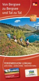
Nature Parks & Hik<strong>in</strong>g Tips Theme & Nature Trails Hik<strong>in</strong>g Trails & Hik<strong>in</strong>g ToursFlavor of <strong>the</strong> High Country Fabulous Hikes to Alp<strong>in</strong>e Tarns<br />
General Information<br />
30<br />
Anderleseen (2.080 m)<br />
The legend of <strong>the</strong> bloody meadow<br />
A lot of speculation among history experts<br />
Bundschuh nature preserve<br />
The smooth landscape of<br />
<strong>the</strong> Nockberge <strong>in</strong> <strong>the</strong> most<br />
sou<strong>the</strong>rn corner of Lungau<br />
was deforested by iron m<strong>in</strong><strong>in</strong>g.<br />
There are now green<br />
alp<strong>in</strong>e meadows as far as <strong>the</strong><br />
eye can see. Tumultuousness<br />
and stress are quickly forgotten<br />
here.<br />
How could <strong>the</strong> legend of <strong>the</strong><br />
bloody meadow unfold <strong>in</strong> such peaceful countryside? Yet, this story, a<br />
popular oral history <strong>in</strong> <strong>the</strong>se parts, is said to be ra<strong>the</strong>r true. This area has<br />
actually been attacked by warr<strong>in</strong>g factions three different times. The sett<strong>in</strong>g<br />
of this legend is a type of embankment, which surrounds an alp<strong>in</strong>e<br />
pla<strong>in</strong> on three sides. It is divided to <strong>the</strong> south by <strong>the</strong> Kremsbach and <strong>in</strong><br />
<strong>the</strong> east by <strong>the</strong> Bundschuhbach. The events of <strong>the</strong> war, however, can not<br />
be conf<strong>in</strong>ed to such a small space. But one th<strong>in</strong>g at a time:<br />
In <strong>the</strong> 7th century, <strong>the</strong> Slavs advanced from <strong>the</strong> south <strong>in</strong>to <strong>the</strong> Niedere<br />
and Hohe Tauern <strong>in</strong> search of more land to settle, and <strong>the</strong>re arose a<br />
fierce struggle for power with <strong>the</strong> Bajuwarii who were push<strong>in</strong>g from<br />
Bohemia towards <strong>the</strong> south. To <strong>the</strong> old settlements of <strong>the</strong> Alp<strong>in</strong>e Slavs<br />
such as Stranach (“side”), Göriach (“amongst <strong>the</strong> mounta<strong>in</strong> dwellers”),<br />
or Begöriach, <strong>the</strong>re were now added <strong>the</strong> names of Bavarian ones such<br />
as Oberbayrdorf, Mörtelsdorf, Seitl<strong>in</strong>g, etc. Under <strong>the</strong> Slavic k<strong>in</strong>g Samo,<br />
who died <strong>in</strong> 658, <strong>the</strong>se battles were said to have flared up especially<br />
<strong>in</strong>tensely. The Bajuwarii duke Diet along with his wife Gleistrada, accord<strong>in</strong>g<br />
to legend, died <strong>the</strong>re on this bloody meadow <strong>in</strong> Bundschuh,<br />
and <strong>the</strong>ir gravesite can be found at St. Michael’s parish church. So much<br />
blood shed <strong>in</strong> this beautiful alp<strong>in</strong>e world surround<strong>in</strong>g <strong>the</strong> Anderleseen.<br />
Today, <strong>the</strong> area is a bless<strong>in</strong>g for all those who consider <strong>the</strong> peace and<br />
quiet of nature a true gift.<br />
By bus or car you will take <strong>the</strong> ma<strong>in</strong> Bundschuh road (L 267) to<br />
<strong>the</strong> lift park<strong>in</strong>g lot <strong>in</strong> Schönfeld at an elevation of 1,740 m, <strong>the</strong> start<strong>in</strong>g<br />
po<strong>in</strong>t for this hike. Keep<strong>in</strong>g to <strong>the</strong> right, you will hike over <strong>the</strong><br />
Matehanshöhe, along <strong>the</strong> ridge, and over <strong>the</strong> Zechnerhöhe, Gaipahöhe<br />
and Kameritzhöhe to <strong>the</strong> Anderleseen lakes at an elevation of 2,080 m.<br />
Elevation change:<br />
Difficulty:<br />
Time on trail:<br />
Bus service:<br />
Park<strong>in</strong>g:<br />
Refreshments:<br />
340 m<br />
• <strong>in</strong>termediate<br />
ca. 3.0 hours<br />
no. 751 from St. Michael to Schönfeld<br />
Schönfeld lift park<strong>in</strong>g lot<br />
Dr. Josef Mehrlhütte<br />
Interactive Hik<strong>in</strong>g Map – http://karte.<strong>lungau</strong>.at<br />
Gruberalm (elev. 1,514m)<br />
Hut Highlights – “Wooden Tools & Toys”<br />
Ried<strong>in</strong>gtal Nature Park, Zederhaus<br />
An old pitchfork tells of <strong>the</strong><br />
former days of hay-mak<strong>in</strong>g<br />
here <strong>in</strong> <strong>the</strong> hill country. Every<br />
bushel of hay was valuable,<br />
essential to gett<strong>in</strong>g <strong>the</strong> dairy<br />
cows through <strong>the</strong> w<strong>in</strong>ter, while<br />
<strong>the</strong> wooden tools <strong>the</strong> farmers<br />
needed were manufactured<br />
right <strong>the</strong>re on <strong>the</strong> farm.<br />
Machln is what <strong>the</strong>y call it<br />
<strong>in</strong> <strong>the</strong> Lungau dialect, while<br />
<strong>the</strong> workshop is known as a Zeferhittn. Great maple, birch and spruce<br />
trees produce a lightweight wood and were <strong>the</strong>refore used to make<br />
rakes, pitchforks and o<strong>the</strong>r tools. If a more durable wood was needed,<br />
farmers turned to ash or barberry. Gischgalatznhoiz is what <strong>the</strong> Lungau<br />
locals called <strong>the</strong> latter. From its red berries, <strong>in</strong>cidentally, you can make<br />
a delicious and healthy juice. At <strong>the</strong> Gruberalm, your hosts still nurture<br />
ages-old <strong>in</strong>sights <strong>in</strong>to f<strong>in</strong>d<strong>in</strong>g <strong>the</strong> right wood for <strong>the</strong> right job. And your<br />
children can look forward to play<strong>in</strong>g with homemade wooden toys!<br />
Alp<strong>in</strong>e Flavor – Gruberalm<br />
Homemade <strong>in</strong>gredients from an organic farm <strong>in</strong> our meals and snacks.<br />
Home-baked bread with bacon and Tyrolean gray cheese to <strong>in</strong>vigorate<br />
hikers. If you have an appetite for a warm meal, order ahead for some<br />
tasty “Hasenöhrl” (unsweetened pastry) with sauerkraut.<br />
Open to <strong>the</strong> Public: June to October<br />
Overnight Accommodations: no<br />
Contact:<br />
Gottfried Gruber Family, Gruberbauer farm<br />
Telephone: 0043 (0)6478 390<br />
How to reach us<br />
As a start<strong>in</strong>g po<strong>in</strong>t for our hike, we would recommend <strong>the</strong> car park<br />
located near <strong>the</strong> south entrance to <strong>the</strong> Tauern Tunnel (elev. 1,345 m).<br />
The hik<strong>in</strong>g path will take us on a walk last<strong>in</strong>g about 1.5 hours to <strong>the</strong><br />
Gruberalm (elev. 1,514 m). For an alternative, take a ride on <strong>the</strong> valley<br />
bus or drive your own car (toll road/€ 8 fee, <strong>in</strong>cl. valley bus dur<strong>in</strong>g <strong>the</strong><br />
ma<strong>in</strong> vacation season) to <strong>the</strong> Schliereralm (elev. 1,495 m). From <strong>the</strong>re<br />
cont<strong>in</strong>ue on foot along <strong>the</strong> shores of <strong>the</strong> Schlierersee and <strong>the</strong> banks of<br />
a stream, or ride <strong>the</strong> valley bus to <strong>the</strong> Gruberalm. The walk from <strong>the</strong><br />
Schliereralm to <strong>the</strong> Gruberalm takes about 30 m<strong>in</strong>utes.<br />
Elevation Change:<br />
Difficulty:<br />
Time on Trail:<br />
Bus Service:<br />
Park<strong>in</strong>g:<br />
ca. 170 m<br />
• easy<br />
ca. 0.5 to 1.5 hours (depend<strong>in</strong>g on tour variant)<br />
No. 770 to Zederhaus – Wald – Schliereralm – Gruberalm<br />
near <strong>the</strong> Tauern Tunnel (south entrance), Schliereralm<br />
Interactive Hik<strong>in</strong>g Map – http://karte.<strong>lungau</strong>.at<br />
31<br />
General Information Fabulous Hikes to Alp<strong>in</strong>e Tarns Flavor of <strong>the</strong> High Country<br />
Hik<strong>in</strong>g Trails & Hik<strong>in</strong>g Tours Theme & Nature Trails Nature Parks & Hik<strong>in</strong>g Tips