CAST Fiscal Year 2004-2005 Annual Report - Center for Advanced ...
CAST Fiscal Year 2004-2005 Annual Report - Center for Advanced ...
CAST Fiscal Year 2004-2005 Annual Report - Center for Advanced ...

Create successful ePaper yourself
Turn your PDF publications into a flip-book with our unique Google optimized e-Paper software.
security, location-based decision support, and<br />
other identified research areas.<br />
• <strong>Center</strong> of Excellence in Mapping and<br />
Geo-Sciences by Intergraph<br />
Corporation.<br />
The Intergraph Corporation, a Fortune 500 firm<br />
and one of the world’s leading vendors of<br />
geographic in<strong>for</strong>mation systems software,<br />
selected <strong>CAST</strong> as one of only four National<br />
<strong>Center</strong>s of Excellence in Mapping and<br />
GeoSciences in 1994. As a result, <strong>CAST</strong> has to<br />
date received more than $5 million in hardware,<br />
software, and support services.<br />
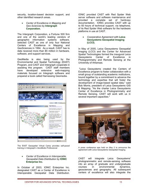
GeoMedia is also being used by the<br />
Environmental and Spatial Technology (EAST)<br />
Program, and <strong>CAST</strong> and Intergraph cooperate in<br />
assisting this program. <strong>CAST</strong> staff members<br />
have developed extensive web-mapping<br />
materials focused on Integraph software and<br />
prepared a book called Harnessing Geomedia.<br />
IONIC provided <strong>CAST</strong> with Red Spider Web<br />
server software and software maintenance and<br />
provided a complete set of hardcopy<br />
documentation. IONIC provides <strong>CAST</strong> with up<br />
to 60 hours of technical support, via telephone,<br />
of its Red Spider Web software <strong>for</strong> the hardware<br />
plat<strong>for</strong>ms in use at <strong>CAST</strong>.<br />
• Coorperative Agreement with Leica<br />
Geosystems Geospatial Imaging<br />
(LCCI).<br />
In May of <strong>2005</strong>, Leica Geosystems Geospatial<br />
Imaging (LCCI) and the <strong>Center</strong> <strong>for</strong> <strong>Advanced</strong><br />
Spatial Technologies <strong>for</strong>med the inaugural Leica<br />
Geosystems <strong>Center</strong> of Excellence in<br />
Photogrammetry and Remote Sensing at the<br />
University of Arkansas.<br />
"Leica Geosystems created the <strong>Center</strong>s of<br />
Excellence program to foster collaboration with a<br />
small group of outstanding academic institutions,<br />
bound together by a commitment to advance the<br />
technology and expertise that will foster the<br />
development of image-based spatial data," said<br />
Bob Morris, president of Leica Geosystems GIS<br />
& Mapping. "As the charter Leica Geosystems<br />
<strong>Center</strong> of Excellence in Photogrammetry and<br />
Remote Sensing, <strong>CAST</strong> will work with us in<br />
several important capacities."<br />
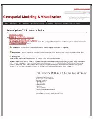
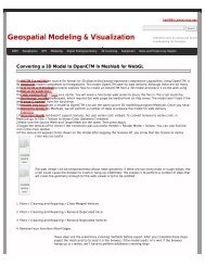
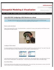
The EAST Geospatial Virtual Camp provides self-paced<br />
training in Intergraph’s GeoMedia Professional .<br />
A press conference was held on May 2 to announce the<br />
agreement with Leica Geosystems Geospatial Imaging.<br />
• <strong>Center</strong> of Excellence in Interoperable<br />
Geospatial Data Distribution by IONIC<br />
Enterprise Inc.<br />
In October of 2003, IONIC Enterprise Inc.<br />
designated <strong>CAST</strong> as a <strong>Center</strong> of Excellence in<br />
Interoperable Geospatial Data Distribution.<br />
<strong>CAST</strong> will integrate Leica Geosystems'<br />
photogrammetric and remote-sensing software<br />
into an array of graduate and undergraduate<br />
courses in environmental dynamics,<br />
geosciences and geography. All subsequent<br />
centers of excellence will also integrate the<br />
CENTER FOR ADVANCED SPATIAL TECHNOLOGIES 13