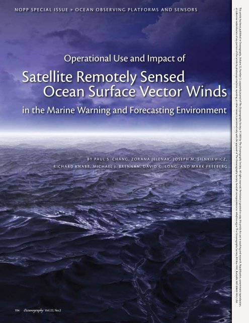
Satellite Remotely Sensed Ocean Surface Vector Winds
Satellite Remotely Sensed Ocean Surface Vector Winds
Satellite Remotely Sensed Ocean Surface Vector Winds

Create successful ePaper yourself
Turn your PDF publications into a flip-book with our unique Google optimized e-Paper software.
NOPP SPECIAL ISSUE » <strong>Ocean</strong> Observing Platforms and Sensors<br />
194<br />
<strong>Ocean</strong>ography Vol.22, No.2<br />
Operational Use and Impact of<br />
<strong>Satellite</strong> <strong>Remotely</strong> <strong>Sensed</strong><br />
<strong>Ocean</strong> <strong>Surface</strong> <strong>Vector</strong> <strong>Winds</strong><br />
in the Marine Warning and Forecasting Environment<br />
By Paul S. Chang, Zorana Jelenak, Joseph M. Sienkiewicz,<br />
Richard Knabb, Michael J. Brennan, David G. Long, and Mark Freeberg<br />
This article has been published in <strong>Ocean</strong>ography, Volume 22, Number 2, a quarterly journal of The <strong>Ocean</strong>ography Society. © 2009 by The <strong>Ocean</strong>ography Society. All rights reserved. Permission is granted to copy this article for use in teaching and research. Republication, systemmatic reproduction,<br />
or collective redistirbution of any portion of this article by photocopy machine, reposting, or other means is permitted only with the approval of The <strong>Ocean</strong>ography Society. Send all correspondence to: info@tos.org or Th e <strong>Ocean</strong>ography Society, PO Box 1931, Rockville, MD 20849-1931, USA.
Abstract. In 2002, a National <strong>Ocean</strong>ographic Partnership Program project was<br />
initiated with the ambitious objective of maximizing the use of currently and soonto-be-available<br />
satellite ocean surface vector wind (OSVW) data, such as NASA’s<br />
QuikSCAT scatterometer, in the operational weather forecasting and warning<br />
environment. This effort brought together people from the operational forecasting<br />
and satellite remote-sensing communities, academia, and the private sector. This<br />
diverse gathering of skill and experience yielded documentation of the impacts of<br />
these data in the operational short-term warning and forecasting environment of the<br />
National <strong>Ocean</strong>ic and Atmospheric Administration’s (NOAA’s) National Weather<br />
Service, improvement in the use of these data in the public and private sectors, and<br />
the transition of promising research results into the operational environment. This<br />
project helped create momentum that has continued to grow long after the formal<br />
effort ended; today, NOAA uses QuikSCAT operationally and is investigating how to<br />
best establish a sustained satellite OSVW observing capability.<br />
Introduction<br />
Aeronautics and Space Administration<br />
The ocean comprises over 70% of<br />
(NASA) launched QuikSCAT, a<br />
Earth’s surface, which makes satellite microwave radar system known as a<br />
remote sensing a logical and significant scatterometer, specifically designed to<br />
component of an overall effort to meet retrieve OSVW over the global ocean (Jet<br />
societal needs for weather and water Propulsion Laboratory, 2006). Prior to<br />
information; support commerce with launch, NASA’s Jet Propulsion Laboratory<br />
information for safe, efficient, and (JPL) and the National <strong>Ocean</strong>ic<br />
environmentally sound transportation; and Atmospheric Administration’s<br />
and provide information for better (NOAA’s) National Environmental<br />
coastal preparedness. <strong>Ocean</strong> surface <strong>Satellite</strong>, Data, and Information Service<br />
vector winds (OSVW) are crucial pieces (NESDIS) worked together to implement<br />
a near-real-time OSVW processing<br />
of information needed to understand<br />
and predict the short-term and longerterm<br />
processes that drive our planet’s allow QuikSCAT data to be used by<br />
and distribution system at NOAA to<br />
environment. As the largest source of the operational weather forecasting<br />
momentum for the ocean surface, winds and warning communities around the<br />
affect the full range of ocean movement,<br />
from individual surface waves to the first scatterometer launched into<br />
world. Although QuikSCAT was not<br />
complete current systems. <strong>Winds</strong> along space (Naderi et al., 1991; Stoffelen and<br />
the ocean surface regulate interaction Anderson, 1993; Gelsthorpe et al., 2000;<br />
between the atmosphere and the ocean Verhof and Stoffelen, 2008), its reliability,<br />
high quality, relatively fine spatial<br />
via modulation of air-sea exchanges of<br />
heat, moisture, gases, and particulates. resolution, and large daily geographical<br />
With the ocean covering almost three coverage resulted in its having the largest<br />
quarters of Earth’s surface, this interaction<br />
has significant influence on global in the operational marine weather<br />
impact of any scatterometry mission<br />
and regional climate.<br />
forecasting and warning world (Jelenak<br />
On June 19, 1999, the National<br />
and Chang, 2008).<br />
In 2002, a National <strong>Ocean</strong>ographic<br />
Partnership Program (NOPP) project<br />
was initiated to exploit the currently and<br />
soon-to-be-available satellite OSVW data<br />
in the operational weather forecasting<br />
and warning environment. This effort<br />
had three main objectives: (1) to quantify<br />
the impacts of QuikSCAT OSVW data in<br />
the operational short-term warnings and<br />
forecasts issued by the National Weather<br />
Service (NWS) <strong>Ocean</strong> Prediction Center<br />
(OPC) and National Hurricane Center<br />
(NHC), (2) to improve the use of satellite<br />
OSVW data in the public and private<br />
sector, and (3) to transition promising<br />
research products toward operational<br />
use. This project brought together<br />
people from the federal government,<br />
private industry, and academia and initiated<br />
what has become one of the most<br />
successful transitions of a research data<br />
stream (QuikSCAT OSVW) into operational<br />
use, where it continues to have<br />
a profound impact on marine weather<br />
warning and forecasting.<br />
Operational Use<br />
In the United States, NWS is responsible<br />
for providing marine weather<br />
warning and forecast information,<br />
and it has international obligations to<br />
provide the same within its areas of<br />
responsibility under the umbrella of the<br />
World Meteorological Organization.<br />
Additionally, the US military provides<br />
marine weather forecasting and warning<br />
services to support military operations.<br />
A combination of the NWS areas of<br />
responsibility with those of the military’s<br />
Joint Typhoon Warning Center (JTWC)<br />
provides coverage of much of the world’s<br />
ocean (Figure 1).<br />
With only a very limited number<br />
of open-ocean buoy and ship reports<br />
<strong>Ocean</strong>ography June 2009 195
available, remotely sensed satellite<br />
OSVW data are very important to<br />
accurate and systematic mapping<br />
of the global ocean wind field.<br />
QuikSCAT provides an almost complete<br />
OSVW map of the global ocean<br />
twice daily (Figure 2).<br />
To be fully used by operational forecasters,<br />
experimental data sets such as<br />
QuikSCAT must be delivered in a timely<br />
fashion and made available for display<br />
on forecasters’ operational workstations.<br />
Figure 1. Map showing the combined areas of responsibility of all National Weather Service offices<br />
with marine warning and forecasting responsibilities, as well as the US military’s Joint Typhoon<br />
Warning Center (JTWC). JTWC (orange), the National Hurricane Center (blue), and the Central Pacific<br />
Hurricane Center (green) share the warning responsibility for tropical cyclones.<br />
QuikSCAT vector winds were first<br />
introduced to NOAA forecasters in<br />
late 1999 via the near-real-time (NRT)<br />
QuikSCAT Web portal (http://manati.<br />
star.nesdis.noaa.gov/quikscat). This site<br />
provided forecasters with initial access<br />
to scatterometer wind data; however,<br />
its utility was limited to determining<br />
wind-warning categories. In early<br />
2000, QuikSCAT wind data were made<br />
available as image files on National<br />
Center for Environmental Prediction<br />
(NCEP) National Centers Advanced<br />
Weather Interactive Processing System<br />
(N-AWIPS) workstations. However,<br />
these images were static, with no capability<br />
to turn rain-flagged data on and<br />
off or to change the colors assigned to<br />
wind-speed ranges.<br />
The opportunity provided by the<br />
NOPP project significantly advanced<br />
display capability as forecasters worked<br />
with developers to optimize QuikSCAT<br />
displays on the N-AWIPS workstations.<br />
<strong>Ocean</strong> forecasters at OPC, NHC, and<br />
the Weather Forecast Office (WFO)<br />
in Honolulu can now view both<br />
the QuikSCAT 25-km and 12.5-km<br />
Figure 2. Typical daily coverage of ocean surface vector winds from NASA’s QuikSCAT, resulting in 90% daily coverage of the world’s ocean.<br />
196<br />
<strong>Ocean</strong>ography Vol.22, No.2
esolution wind fields, clearly display<br />
the data acquisition time, highlight<br />
potential areas of rain contamination,<br />
and customize the display to suit<br />
the forecaster and weather situation.<br />
Additionally, QuikSCAT vector winds<br />
have been provided through AWIPS<br />
to coastal WFOs in NWS’s Western<br />
Region since 2000 and the rest of the<br />
WFOs since April 2005. This transition<br />
into AWIPS permitted the widest<br />
distribution of QuikSCAT data within<br />
NWS offices. The successful use of<br />
QuikSCAT by NOAA ocean forecasters<br />
is due in part to data quality but also<br />
to rapid data delivery and the comprehensive<br />
display capabilities built into<br />
the N-AWIPS software.<br />
Our NOPP project provided an<br />
opportunity to place a person devoted<br />
solely to the transition of OSVW data<br />
from research to operations at both<br />
OPC and NHC. These unique positions<br />
created a bridge between the operational<br />
weather warning and forecasting world<br />
and the OSVW remote-sensing science/<br />
engineering world. Direct interaction<br />
with forecasters not only helped the<br />
remote-sensing specialists to understand<br />
the products forecasters were using<br />
and allow for more effective use of<br />
new data, but forecaster feedback also<br />
helped those processing the data to focus<br />
resources on the issues and products<br />
that would prove most useful to the<br />
operational community.<br />
The critical point in achieving proper<br />
feedback loops and maximizing the<br />
effective use of QuikSCAT data in<br />
the operational environment was the<br />
development and implementation of<br />
end-user training tools. The training<br />
investment was minimal at best when<br />
the QuikSCAT OSVW data were first<br />
made available. Very early on, we realized<br />
that the lack of documentation and<br />
training material significantly limited<br />
use of the data, and thus their impact<br />
on weather forecasting and warning<br />
products. To improve use of the data,<br />
unique QuikSCAT training presentations<br />
were created by combining the<br />
forecasters’ and remote-sensing specialists’<br />
different experiences and knowledge<br />
of the data tailored for specific weather<br />
phenomena, with emphasis on tropical<br />
and extratropical cyclones. The training<br />
material provided background information<br />
on microwave remote sensing with<br />
active sensors in general, and QuikSCAT<br />
specifics such as scanning strategy,<br />
viewing geometry, and its strengths<br />
and weakness for OSVW retrieval.<br />
The material also reviewed geographic<br />
coverage, orbits, and data latency issues.<br />
Training sessions were conducted at<br />
various NWS centers and offices, which<br />
resulted in significant increases in the<br />
understanding and use of the data. Our<br />
experience in transitioning QuikSCAT<br />
data from research to operations taught<br />
us that user training and education are<br />
keys to a successful outcome.<br />
Today, QuikSCAT OSVW data<br />
are used in the daily operations of all<br />
NWS offices with marine warning and<br />
forecasting responsibilities. Their uses<br />
include aiding decisions to initiate,<br />
continue, and terminate marine warnings,<br />
including advisories for tropical<br />
cyclones; adjustment of short-term<br />
marine forecasts for the intensity and<br />
geographic coverage of winds; identification<br />
of swell-generation areas for longerterm<br />
wave forecasts; identification of<br />
lows, highs, fronts, and convergence<br />
zones and examination of their intensity<br />
and trends; and real-time verification of<br />
numerical weather prediction analyses<br />
for winds, waves, and feature intensity.<br />
Operational Use of<br />
QuikSCAT Data for<br />
Tropical Cyclone Warning<br />
and Forecasting<br />
QuikSCAT OSVW have several uses in<br />
the tropical cyclone (TC) warning and<br />
forecasting mission of NHC, Central<br />
Pacific Hurricane Center, and JTWC.<br />
These data are used to help estimate<br />
intensity (maximum wind), especially<br />
for tropical storms, because QuikSCAT<br />
Paul S. Chang (paul.s.chang@noaa.gov) is <strong>Ocean</strong> <strong>Surface</strong> <strong>Winds</strong> Science Team Lead,<br />
National <strong>Ocean</strong>ic and Atmospheric Administration (NOAA)/National Environmental<br />
<strong>Satellite</strong>, Data and Information Service (NESDIS)/Center for <strong>Satellite</strong> Applications and<br />
Research, NOAA Science Center, Camp Springs, MD, USA. Zorana Jelenak is <strong>Ocean</strong> <strong>Surface</strong><br />
<strong>Winds</strong> Science Team Project Scientist, NOAA/NESDIS/Center for <strong>Satellite</strong> Applications<br />
and Research, NOAA Science Center, Camp Springs, MD, USA. Joseph M. Sienkiewicz<br />
is Science Operations Officer, NOAA/National Weather Service (NWS)/National Center<br />
for Environmental Prediction (NCEP)/<strong>Ocean</strong> Prediction Center, Camp Springs, MD, USA.<br />
Richard Knabb is Director of Operations, NOAA/NWS/Honolulu Weather Forecast Office,<br />
Honolulu, HI, USA. Michael J. Brennan is Senior Hurricane Specialist, NOAA/NWS/NCEP/<br />
National Hurricane Center, Miami, FL, USA. David G. Long is Professor, Department of<br />
Electrical & Computer Engineering, and Director, BYU Center for Remote Sensing, Brigham<br />
Young University, Provo, UT, USA. Mark Freeberg is President and CEO, <strong>Ocean</strong>s and Coastal<br />
Environmental Sensing (OCENS) Inc., Seattle, WA, USA.<br />
<strong>Ocean</strong>ography June 2009 197
has limitations in retrieving the very<br />
high winds in hurricanes and typhoons<br />
due to system design and resolution,<br />
and the impact of rain (Brennan et al.,<br />
in press). However, in TCs undergoing<br />
extratropical transition (e.g., Jones et al.,<br />
2003), QuikSCAT can provide valuable<br />
information on both the cyclone’s intensity<br />
and wind field size, as the coverage<br />
of heavy rainfall is typically reduced near<br />
the location of maximum winds. The<br />
broad geographic coverage of QuikSCAT<br />
OSVW often provides the only consistent<br />
source of information for the analysis of<br />
34-kt and 50-kt wind radii in TCs that are<br />
not sampled by aircraft reconnaissance<br />
(Figure 3). These wind radii are critical<br />
for defining ship avoidance areas and<br />
helping to refine the placement of coastal<br />
warnings. Emergency management officials<br />
often require that evacuation preparations<br />
be completed by the time that the<br />
34-kt winds reach the local coastline.<br />
The detection and location of surface<br />
circulation centers is another important<br />
use of QuikSCAT data, which have been<br />
used as justification to both initiate advisories<br />
for incipient cyclones and declare<br />
cyclones that no longer have well-defined<br />
centers dissipated. However, errors in<br />
the automated QuikSCAT wind solution,<br />
particularly in TCs, often require manual<br />
analysis of directional ambiguities for<br />
operational center fixing applications<br />
(e.g., Brennan et al., in press). Accurate<br />
TC center fixes are critical to determining<br />
the TC’s initial position and<br />
motion, which are important for accurate<br />
TC track forecasting. Additionally,<br />
information on the location of the TC<br />
surface center relative to the cyclone’s<br />
organized thunderstorm activity is vital<br />
to accurate satellite-derived intensity<br />
estimates; QuikSCAT is useful in this<br />
Figure 3. Thirty-four knot wind radii (blue line) as indicated by QuikSCAT in a pass over Hurricane<br />
Katrina (2005), with available ship and buoy observations (yellow barbs indicate wind speed in kt).<br />
The accuracy of the QuikSCAT analysis of the 34-kt radii in this situation provides forecasters with<br />
the confidence to use QuikSCAT for tropical cyclone 34-kt and sometimes 50-kt wind radii determination,<br />
especially in the open ocean where ship and buoy observations are sparse.<br />
Figure 4. The broad swath of QuikSCAT winds allows forecasters to examine the character<br />
of swell generation regions in cyclones. Also, despite frequent errors in tropical cyclone (TC)<br />
center location in the automated QuikSCAT solution, manual analysis of directional ambiguities<br />
can be performed to locate the TC centers using all the possible QuikSCAT solutions. This<br />
tool has been essential for detection and center location of Pacific TCs not sampled by aircraft<br />
reconnaissance flights. Courtesy of Roger Edson, Science and Operations Officer, NOAA/National<br />
Weather Service Office Guam<br />
198<br />
<strong>Ocean</strong>ography Vol.22, No.2
application for TCs where the center is<br />
not easily seen in geostationary satellite<br />
imagery (Figure 4). Forecasters use<br />
QuikSCAT wind fields to determine<br />
potential swell generation associated<br />
with TCs as shown in the left image of<br />
Figure 4. In this example, forecasters<br />
can estimate fetch lengths, average wind<br />
speed, and dispersion pattern for swell.<br />
The use of QuikSCAT at NHC has<br />
increased steadily since 2000, and has<br />
now reached the point where QuikSCAT<br />
is mentioned in 15–20% of NHC’s tropical<br />
cyclone discussions in the Atlantic<br />
and East Pacific basins (Figure 5).<br />
QuikSCAT winds are heavily used<br />
at NHC for daily marine analysis, forecasting,<br />
and warning activities. The best<br />
example of QuikSCAT’s high impact<br />
is in the Gulf of Tehuantepec in the<br />
northeastern tropical Pacific, a region<br />
that is frequently impacted by strong,<br />
cold-season gap wind events that occasionally<br />
reach hurricane-force intensity<br />
(Figure 6). Prior to QuikSCAT, it was<br />
very difficult to obtain any information<br />
on wind intensity and coverage during<br />
these events. Using QuikSCAT data,<br />
a multi-year climatology of gale- and<br />
storm-force Tehuantepec events was<br />
constructed (Brennan et al., 2007),<br />
allowing NHC marine forecasters to<br />
identify forecast model biases and issue<br />
more accurate and timely warnings<br />
for these events.<br />
Figure 5. Percentage of Atlantic (blue) and East Pacific (red) tropical cyclone discussions<br />
issued by the National Hurricane Center that mention QuikSCAT (2000–2007).<br />
Operational Use of<br />
QuikSCAT Data for the<br />
Detection, Warning,<br />
and Forecasting of<br />
Extratropical Cyclones<br />
Extratropical cyclones that reach hurricane<br />
force (HF) intensity are a significant<br />
threat to the safety of life at sea and a<br />
Figure 6. QuikSCAT 12.5-km-resolution wind retrievals in a hurricane-force Gulf of Tehuantepec gap<br />
wind event on November 22, 2006.<br />
<strong>Ocean</strong>ography June 2009 199
isk to cargo and vessels. Extratropical<br />
cyclones vary on scales from less than<br />
100 km in diameter to 3,000 km or<br />
even 4,000 km in diameter and have<br />
an average life cycle of five days from<br />
genesis to death. These cyclones intensify<br />
explosively (see description in Sanders<br />
and Gyakum, 1980) and are called<br />
meteorological “bombs.” Associated<br />
wind conditions can vary from only<br />
10 to 20 kts to gale force (33 to 47 kts),<br />
storm force (48 to 63 kts), or hurricane<br />
force (> 63 kts). <strong>Winds</strong> of gale or greater<br />
force can extend over several million<br />
square kilometers of open ocean. At any<br />
given time, there can be as many as five<br />
to eight individual cyclones impacting<br />
the North Atlantic and North Pacific<br />
basins. In the main extratropical storm<br />
tracks of the North Pacific and the<br />
Atlantic, the forward speed of these<br />
cyclones during development can exceed<br />
30 kts; the movement slows as the<br />
cyclones mature and the vortex deepens<br />
through the lower atmosphere.<br />
OPC is responsible for issuing<br />
warnings and forecasts for the North<br />
Atlantic and North Pacific waters most<br />
frequented by these extreme ocean<br />
storms. OPC generates and issues<br />
marine warnings and forecasts, continually<br />
monitors and analyzes maritime<br />
data, and provides guidance on marine<br />
atmospheric variables for the purposes<br />
of protecting life and property, ensuring<br />
safety at sea, and enhancing economic<br />
opportunity. OPC warning bulletins are<br />
required to be received and monitored<br />
by all commercial vessels of 300 or more<br />
gross tons operating over the North<br />
Atlantic and North Pacific high seas<br />
and offshore waters. Customers include<br />
commercial mariners, fishermen, recreational<br />
sailors, the US Coast Guard, the<br />
NOAA Emergency Response Division<br />
(formerly Hazardous Materials Response<br />
Division or NOAA HAZMAT), and<br />
the US military.<br />
QuikSCAT ocean vector winds have<br />
revolutionized short-term warning and<br />
forecasting over the expansive ocean<br />
areas for which OPC is responsible. The<br />
1800-km wide swath, large retrievable<br />
wind speed range, and rapid delivery of<br />
QuikSCAT data have changed the way<br />
forecasters make short-term warning<br />
and forecast decisions, especially<br />
those concerning the higher and more<br />
dangerous wind warning categories<br />
(Von Ahn et al., 2006). In essence, OPC<br />
forecasters have never before had such a<br />
high degree of situational awareness of<br />
weather conditions over the ocean.<br />
The most significant impact of<br />
QuikSCAT OSVW on NWS operations<br />
has been the ability to routinely<br />
and consistently observe winds of HF<br />
intensity in extratropical cyclones. This<br />
new capability gave forecasters at OPC<br />
and NWS the confidence to introduce a<br />
new wind-warning category for extratropical<br />
cyclones of HF intensity in<br />
December 2000 (see Figure 7). Prior to<br />
QuikSCAT, only two warning categories<br />
existed for extratropical wind sources:<br />
gale (33 to 47 kts) and storm (≥ 48 kts).<br />
Under the two-tier warning system, the<br />
most severe storms were included in the<br />
rather common storm warning category,<br />
making it difficult to highlight and<br />
adequately warn for their severity. OPC<br />
forecasters had long been uncomfortable<br />
with this two-tier warning system,<br />
but required a consistent observing<br />
capability to divide the common occurrence<br />
of winds of 48 to 63 kts and the<br />
less-common and more dangerous<br />
winds in excess of 63 kts; QuikSCAT<br />
winds provided that capability. The three<br />
warning categories are displayed on<br />
North Atlantic and North Pacific surface<br />
analyses that are broadcast via US Coast<br />
Guard radiofacsimile and are also available<br />
via the Internet at http://www.opc.<br />
ncep.noaa.gov/.<br />
From fall 2006 through spring 2007,<br />
OPC identified and issued warnings for<br />
115 separate extratropical cyclones that<br />
reached HF intensity (64 in the Atlantic<br />
and 51 in the Pacific; Figure 7). Although<br />
many of these cyclones spend their entire<br />
lives at sea, over the last several seasons,<br />
HF conditions produced by extratropical<br />
ocean storms have impacted the coasts of<br />
Alaska, the Pacific Northwest, and New<br />
England. For example, a mid-December<br />
2006 extratropical cyclone caused widespread<br />
damage across Washington and<br />
Oregon and resulted in power outages to<br />
1.5 million people (Figure 8). QuikSCAT<br />
winds have certainly raised the awareness<br />
of OPC forecasters as to the occurrence<br />
of HF intensity conditions. QuikSCAT<br />
has shown that HF winds in extratropical<br />
cyclones are: (1) much more frequent<br />
than thought; (2) occur most frequently<br />
in the late fall through winter months;<br />
(3) are short lived (on average 24 hours<br />
or less); (4) tend to occur in particular<br />
locations of the cyclone; and (5) can<br />
cover tens of thousands of square miles.<br />
HF cyclones occur across the heart of<br />
the North Atlantic and North Pacific<br />
great circle trade routes and can make<br />
landfall in areas such as Alaska, the<br />
Pacific Northwest, New England, and<br />
the mid-Atlantic coasts.<br />
Prior to the QuikSCAT era, no additional<br />
warning category existed for the<br />
most damaging of extratropical cyclones.<br />
Figure 7 clearly shows forecaster reliance<br />
on QuikSCAT winds—as data<br />
200<br />
<strong>Ocean</strong>ography Vol.22, No.2
C<br />
y<br />
c<br />
l<br />
o<br />
n<br />
e<br />
s<br />
70<br />
60<br />
50<br />
40<br />
30<br />
20<br />
10<br />
Atlantic<br />
Pacific<br />
244<br />
235<br />
Hurricane Force<br />
Wind Warning<br />
Initiated Dec 00<br />
QuikSCAT<br />
Launch<br />
Jun 99<br />
25 km QuikSCAT<br />
Available in N-AWIPS<br />
Oct 01<br />
11<br />
9<br />
23<br />
14<br />
12.5 km QuikSCAT<br />
available May 04<br />
24 23<br />
15<br />
22<br />
37<br />
Improved wind<br />
algorithm and<br />
rain flag Oct 06<br />
33 31 34 64<br />
51<br />
39<br />
49<br />
Figure 7. Bar graph showing the number<br />
of extratropical cyclones that reached<br />
hurricane force intensity for the eight cold<br />
seasons from December through May<br />
2000–2001 and September through May<br />
2001–2008. QuikSCAT winds are used<br />
heavily by forecasters to assess the wind<br />
conditions associated with extratropical<br />
cyclones. QuikSCAT milestones are<br />
shown by the yellow flags. Blue (maroon)<br />
bars show Atlantic (Pacific) cyclones.<br />
Total number of individual cyclones that<br />
reached hurricane force intensity is shown<br />
at left using the same color scheme.<br />
0<br />
1997-<br />
98<br />
1998-<br />
99<br />
1999-<br />
00<br />
2000-<br />
01<br />
2001-<br />
02<br />
2002-<br />
03<br />
2003-<br />
04<br />
2004-<br />
05<br />
2005-<br />
06<br />
2006-<br />
07<br />
2007-<br />
08<br />
Figure 8. The 2006 “Hanukkah Eve” wind storm occurred on the evening of December 14 and extended into the morning of December 15. The<br />
storm blew down thousands of trees, knocked power out for close to 1.5 million customers, damaged hundreds of structures and homes, and<br />
injured dozens of people in the US Pacific Northwest and British Columbia, Canada. Hospitals treated 275 people for carbon monoxide poisoning<br />
following the storm.<br />
<strong>Ocean</strong>ography June 2009 201
availability increased, algorithms were<br />
improved, and higher resolution with<br />
less horizontal averaging was introduced,<br />
forecasters observed an increasing<br />
number of extratropical cyclones with<br />
HF conditions each season.<br />
The loss of QuikSCAT would result<br />
in an 80% to 90% reduction in detection<br />
capability for HF winds from extratropical<br />
cyclones. To date, there is no other<br />
capability that provides the consistency<br />
in retrievable wind speed range and<br />
coverage for extreme winds as that<br />
available from QuikSCAT. Although the<br />
benefits of improved marine warning<br />
and forecasting for the coastal US<br />
regions seem clear, the need for accurate<br />
open-ocean warnings and forecasts<br />
might not be as obvious. However,<br />
ships sailing throughout the world’s<br />
ocean transport more than 95% of US<br />
international trade by volume. During<br />
the last 50 years, commercial ships have<br />
doubled in size, waterborne commerce<br />
has tripled, and the number of small<br />
boats and recreational watercraft has<br />
increased. To keep ships on schedule<br />
and safe from dangerous ocean storms,<br />
the $200 billion global marine shipping<br />
industry increasingly relies on<br />
accurate marine warnings and forecasts<br />
(Kite-Powell, 2000). Accurate wind and<br />
wave information helps marine traffic<br />
avoid hazardous weather and keeps<br />
the costs of goods down, thus making<br />
products more affordable. Maritime<br />
commerce results in a contribution of<br />
$78.6 billion annually and generates<br />
nearly 16 million jobs; one out of six jobs<br />
in the United States is marine related<br />
(Year of the ocean: The U.S. marine<br />
transportation system, 1998).<br />
As a result of QuikSCAT OSVW,<br />
today’s marine warning and<br />
forecast services out to 48 hours (for HF<br />
cyclones) provide an estimated savings<br />
of $135 million annually to North<br />
Pacific and North Atlantic dry bulk and<br />
container shipping alone by minimizing<br />
storm exposure (Kite-Powell, 2008).<br />
In general, better information about<br />
the spatial and temporal occurrence of<br />
severe winds and waves allows adjustment<br />
of ships’ routes to reduce exposure.<br />
In making decisions about route<br />
changes, ship operators must balance<br />
longer voyage times against expected<br />
(potential) losses due to storm exposure;<br />
more accurate forecast information can<br />
lead to better decision making.<br />
Knowledge of the winds and waves<br />
over the ocean is important not only for<br />
maritime transportation but also for the<br />
fishing industry, offshore energy industries,<br />
search and rescue (SAR) efforts,<br />
and the accurate tracking and management<br />
of marine hazards such as oil spills.<br />
The two SAR events detailed below were<br />
supported by OPC, and illustrate how<br />
important QuikSCAT is considered<br />
for situational awareness of the ocean<br />
surface wind field:<br />
First event: “On March 20 [2006], the<br />
OPC received a call from the US Coast<br />
Guard, Program Coordinator, Rescue &<br />
SARSAT [Search And Rescue <strong>Satellite</strong><br />
Aided Tracking] Operations asking for<br />
assistance in determining the weather<br />
situation in the Red Sea where the<br />
Al Salaam ferry sank in Egyptian waters<br />
on February 2, 2006. The Coast Guard<br />
was responding to the International<br />
Maritime Organization, which asked the<br />
U.S. Government to conduct an investigation<br />
and produce a report on the chain<br />
of events leading up to the sinking. The<br />
Coast Guard noted that they had tried<br />
to obtain the information from several<br />
federal agencies but with no success.<br />
Although OPC does not analyze or<br />
forecast for that area, Dave Feit was able<br />
to pull together a combination of ship<br />
observations, QuikSCAT wind retrievals<br />
[Figure 9], and appropriate model data<br />
to provide the necessary information.<br />
The Coast Guard expressed appreciation<br />
for OPC’s efforts.” (<strong>Ocean</strong> Prediction<br />
Center, 2006)<br />
Second event: “On February 16 [2007]<br />
the OPC received a call from NOAA<br />
HAZMAT requesting weather support<br />
for a factory ship for the Japanese<br />
whaling fleet, the Nisshin Maru, off<br />
Antarctica near 73.38 S and S 175.56 E.<br />
The support was requested to help the<br />
United States Coast Guard (USCG)<br />
assess the risk from an oil spill should it<br />
happen. OPC prepared a seven-day forecast<br />
for winds and seas at this location<br />
which was sent to NOAA HAZMAT.<br />
In addition, Joe Sienkiewicz, OPC<br />
Science and Operations Officer (SOO),<br />
provided QuikSCAT data and maps for<br />
the incident area to OPC forecasters.<br />
A total of two sets of forecasts were<br />
provided to HAZMAT who asked that<br />
OPC be prepared to continue to provide<br />
support, if needed. No further support to<br />
NOAA HAZMAT was required.” (<strong>Ocean</strong><br />
Prediction Center, 2007)<br />
Development of New<br />
QuikSCAT Products and<br />
Their Transition to<br />
Operations<br />
This NOPP project also transitioned<br />
into the operational processing system<br />
a sophisticated enhanced resolution<br />
processing scheme developed by the<br />
Microwave Earth Remote Sensing<br />
Laboratory (MERS) at Brigham Young<br />
University. The MERS processing<br />
202<br />
<strong>Ocean</strong>ography Vol.22, No.2
Figure 9. QuikSCAT provided measurements of wind speed and direction to help determine the cause for the sinking of a vessel<br />
in the Red Sea on February 2, 2006.<br />
scheme produces ultra-fine- or ultrahigh-resolution<br />
(UHR) wind speed<br />
and normalized radar-cross section<br />
(NRCS) images of Earth’s surface from<br />
QuikSCAT (Long, 2004). These ultrafine-resolution<br />
NRCS images reveal<br />
details of the wind structure in tropical<br />
cyclones, and together with the OSVW<br />
measurements have become an important<br />
tool in TC forecasting and warning,<br />
especially where aircraft reconnaissance<br />
is not available (Edson et al., 2002). The<br />
NOAA QuikSCAT NRT processing<br />
system now produces refined UHR,<br />
storm-centered, “postage-stamp” wind<br />
and NRCS products, which are posted to<br />
the NRT QuikSCAT storm page (http://<br />
manati.orbit.nesdis.noaa.gov/cgi-bin/<br />
qscat_storm.pl) (see Figure 10, where a<br />
land distance flag was recently added;<br />
Owen and Long, 2008a; Plagge et al.,<br />
2008). A careful study of eight years<br />
of QuikSCAT data revealed that UHR<br />
wind retrieval can accurately locate<br />
hurricane centers compared with best<br />
track locations, even in early stages of<br />
development (Said and Long, 2008).<br />
MERS has developed an experimental<br />
UHR simultaneous wind/rain wind<br />
retrieval algorithm along with a new<br />
wind direction ambiguity removal<br />
algorithm, both of which are currently<br />
undergoing validation experiments<br />
(Williams and Long, 2006, 2008a,b;<br />
Owen and Long, 2008b).<br />
Use in the Private Sector<br />
In addition to government agencies<br />
exploiting QuikSCAT OSVW, there are<br />
also a surprising number of users in the<br />
private sector and the general public.<br />
We have received emails from a wide<br />
range of folks, including the meteorologist<br />
aboard an aircraft carrier, the<br />
surfing community, recreational and<br />
racing vessels, and the offshore wind<br />
farm industry. Through its WeatherNet<br />
system, OCENS Inc. (a participant<br />
in this NOPP-funded effort) made<br />
QuikSCAT OSVW data available to its<br />
market base, which includes sail and<br />
power cruising, ocean racing, commercial<br />
and sport fishing, tug and barge<br />
operations, and shipping.<br />
<strong>Ocean</strong>ography June 2009 203
Figure 10. Early examples of ultra-high-resolution (UHR) processing of QuikSCAT data for Hurricane Katrina on August 27, 2005. (Left) UHR radar h-pol<br />
normalized radar-cross section image. High winds show up as lighter values, and lower wind speeds are darker. Land is colored green. (Right) QuikSCAT UHR<br />
wind speeds. Mesoscale structure and convective events are clearly visible.<br />
Surveys conducted by OCENS found<br />
most user feedback was very positive.<br />
A broad set of their users found that<br />
the QuikSCAT data are most beneficial<br />
in areas where the weather is generally<br />
stable and the data are used to locate<br />
slight variations in wind patterns to<br />
enable optimum vessel routing. More<br />
advanced users have taken advantage<br />
of the availability of the QuikSCAT<br />
data to “tune” GRIB (GRIdded Binary)<br />
wind forecasts produced by the NWS<br />
Global Forecast System model and/or<br />
WaveWatch III models. Most notably,<br />
this practice was employed to startling<br />
success by the Spirit of Sark, a racing<br />
yacht participating in the Global<br />
Challenge Around-the-World Race,<br />
which is detailed in the following quote<br />
from an email received from Simon Bell,<br />
Sark’s navigator:<br />
Cold-Front Dissection: I have<br />
attached a GRIB-Explorer Screen-Shot<br />
for our first Brazilian-cold front (CF)<br />
[shown in Figure 11].<br />
Using GRIB-Explorer we were able to<br />
calibrate our GFS Grib-file vs QuikSCAT<br />
and determine how far ahead/behind<br />
the GFS-Forecast was. From this, we<br />
could estimate our ETA at the Cold-<br />
Front. We were also able to “see” inside<br />
the Cold-Front and understand the<br />
structure of the Front and what conditions<br />
we could expect. We were able to<br />
see from the Screen-Shots that we could<br />
expect the wind to drop & back as we<br />
approached the CF and then jump to<br />
30 kts from the SW at the Front. Using<br />
this info we flew our Spinnaker to within<br />
30 seconds before the SW-Wind hit...and<br />
WOW did it hit.<br />
We were also able to understand<br />
the dynamics of the Cold-Front. The<br />
weather-forecasts reported a Cold-<br />
Front at Location XY heading SE and<br />
moving NE at 10knts. By observing the<br />
QuikSCAT Data over time, we understood<br />
that the situation was MUCH<br />
more complicated! The N-side of the CF<br />
is driven by the NW-Wind and features<br />
on the N-Side therefore drift SE along<br />
the Cold-Front with this Wind. Then<br />
the whole Cold-Front does indeed Track<br />
NE...and combining this with the Drift<br />
we understood that features drift West!<br />
On the S-Side of the CF the opposite is<br />
true...features on the S-Side are driven by<br />
SE-Wind and therefore drift NW along<br />
the CF. Then with the whole Cold-Front<br />
Tracking NE...and combining this with<br />
the Drift we understood that features drift<br />
North! This helped us understand (too<br />
late) how to line-up on Gates thru the<br />
Cold-Front when one presented itself.<br />
Spirit of Sark subsequently won the<br />
rugged Buenos Aires to Wellington<br />
Third Leg of the Global Challenge while<br />
making extensive use of QuikSCAT<br />
data acquired through WeatherNet<br />
and displayed in GRIB Explorer.<br />
Similar tuning techniques were<br />
employed by racers participating in<br />
204<br />
<strong>Ocean</strong>ography Vol.22, No.2
Figure 11. The GRIB-Explorer display of QuikSCAT wind vectors and wind speeds (color<br />
coded), depicting a cold front off the coast of Brazil on October 27, 2004.<br />
the Newport–Bermuda, Annapolis–<br />
Bermuda, Pacific Cup, and Vic–Maui<br />
races during the summer of 2004. Better<br />
testimony to the benefits and utility of<br />
QuikSCAT data to the marine market<br />
would be difficult to find. Creating<br />
a means of enabling less technically<br />
proficient users to tune their wind<br />
forecasts en route with QuikSCAT<br />
information is an area of clear<br />
development opportunity.<br />
Life After NOPP Funding<br />
The three years of NOPP support<br />
resulted in improved use of QuikSCAT<br />
OSVW data in the NWS operational<br />
environment, a measure of QuikSCAT<br />
impacts at the National Hurricane Center<br />
(NHC) and OPC. These years have also<br />
seen the transition of new QuikSCAT<br />
research products into operations and<br />
exploitation of these products by a<br />
commercial weather services company,<br />
which brought satellite OSVW data to<br />
individual users. An equally important<br />
outcome of this project was the development<br />
of partnerships among the<br />
participants that continue to this day, and<br />
these partnerships have played a critical<br />
role in NOAA’s pursuit of a QuikSCAT<br />
follow-on mission. Fortunately, we<br />
were able to sustain and build upon this<br />
effort with support from NOAA’s <strong>Ocean</strong><br />
Remote Sensing Program and Research<br />
to Operations (R2O) Program. Through<br />
the R2O program, the QuikSCAT OSVW<br />
impacts at local NWS Weather Forecast<br />
Offices were also captured (Millif and<br />
Stamus, 2008). With satellite OSVW data<br />
from QuikSCAT becoming such a wellused<br />
NWS tool, a workshop to define<br />
NOAA’s operational OSVW requirements<br />
was held at NHC in Miami, Florida, in<br />
June 2006 (Chang and Jelenak, 2006).<br />
The primary goals of this meeting were<br />
to: (1) document the use and impact<br />
of presently available satellite OSVW<br />
data in operational marine weather<br />
analysis, forecast, and warning activities<br />
at NOAA, (2) define the OSVW operational<br />
requirements within NOAA based<br />
on actual experience and phenomena<br />
observed, and (3) explore sensor/mission<br />
concepts capable of meeting the requirements.<br />
The desired outcome of the<br />
workshop was to help NOAA determine<br />
a course of action because there were no<br />
plans for a QuikSCAT follow-on mission.<br />
Over the following year, the National<br />
Research Council (NRC) conducted<br />
a decadal survey of satellite observations<br />
in support of climate change<br />
monitoring, and listed as one of their<br />
recommendations the need for an<br />
advanced OSVW mission to replace<br />
the aging NASA QuikSCAT in order to<br />
provide key insights into ocean circulation<br />
and global heat transfer, and their<br />
impacts on Earth’s climate (National<br />
Research Council, 2007). The NRC<br />
study also recommended that NOAA<br />
undertake this extended ocean vector<br />
wind mission (XOVWM) as a sustained<br />
operational capability.<br />
In 2007, NOAA initiated an Analysis<br />
of Alternatives (AOA) type study to<br />
assess observing system options to<br />
mitigate or replace the current NASA<br />
QuikSCAT OSVW capability. OSVW<br />
AOA concluded that a sustained operational<br />
satellite OSVW capability should<br />
be designed to better address the operational<br />
weather forecasting and warning<br />
requirements through a more advanced<br />
observing system such as XOVWM<br />
identified in the 2007 NRC decadal<br />
survey described above.<br />
Also in 2007, NOAA asked NASA JPL<br />
to conduct a NASA QuikSCAT followon<br />
mission study. The study showed<br />
that technology is currently available<br />
to improve scientific and operational<br />
<strong>Ocean</strong>ography June 2009 205
OSVW retrieval capability by an order<br />
of magnitude over that provided by<br />
QuikSCAT (Gaston and Rodriguez,<br />
2008). The primary improvements are:<br />
finer horizontal resolution of surface<br />
wind estimates, decreased sensitivity to<br />
the effects of rain in the wind estimates,<br />
the ability to retrieve much higher wind<br />
estimates (> 50 m s -1 ), and the ability<br />
to provide winds to within 5 km of the<br />
coast. In parallel, NOAA conducted a<br />
study assessing the impacts of both a<br />
QuikSCAT-equivalent and an improved<br />
OSVW capability, which resulted in the<br />
document QuikSCAT Follow-On Mission:<br />
User Impact Study Report (Jelenak<br />
and Chang, 2008).<br />
Finally, NOAA is working with<br />
international partners to leverage scatterometry<br />
data from foreign satellites<br />
in an attempt to provide uninterrupted<br />
continuity of these data. Currently,<br />
the European Organisation for the<br />
Exploitation of Meteorological <strong>Satellite</strong>s<br />
is flying an operational Advanced<br />
Scatterometer that will provide some<br />
OSVW data continuity, although it<br />
only provides approximately 55%<br />
of the coverage and twice as coarse<br />
spatial resolution wind retrievals as<br />
those provided by QuikSCAT. NOAA<br />
is also exploring access to data from<br />
Indian and Chinese satellites that will<br />
be launched in the next few years, as<br />
well as a partnership with the Japanese<br />
Exploration Space Agency (JAXA)<br />
to fly a QuikSCAT follow-on instrument<br />
as part of JAXA’s Global Climate<br />
Observation Mission program.<br />
Conclusion<br />
Our NOPP project established personnel<br />
resources at OPC, NHC, and NESDIS<br />
that significantly strengthened existing<br />
collaborations. Because of this enhanced<br />
partnership, QuikSCAT OSVW data<br />
were transitioned in an optimal and<br />
efficient manner into the operational<br />
NWS environment. Quantifying the<br />
impacts of these data allowed us to better<br />
understand the value of this observing<br />
system capability. Additionally, we were<br />
able to determine and justify the actual<br />
operational weather warning and forecasting<br />
requirements for satellite OSVW,<br />
which will be important for the design<br />
of a QuikSCAT follow-on mission to<br />
continue this now routinely used OSVW<br />
capability. Academic and private sector<br />
partnerships were also enabled by our<br />
NOPP project. Working with Brigham<br />
Young University, we transitioned new<br />
QuikSCAT products into operations,<br />
and we expanded the use of QuikSCAT<br />
OSVW products in collaboration<br />
with OCENS Inc. The partnerships<br />
enabled by this NOPP opportunity<br />
had a significant role in the successful<br />
transition of QuikSCAT OSVW data<br />
into the operational environment at<br />
NOAA and beyond.<br />
<strong>Ocean</strong> surface vector wind data<br />
received from NASA QuikSCAT have<br />
revolutionized operational marine<br />
weather warnings, analyses, and forecasting.<br />
QuikSCAT data give forecasters<br />
the ability to see the detailed wind<br />
field over vast ocean areas, to see the<br />
inner structure of ocean storms, and<br />
to identify areas of ocean wind wave<br />
generation. When issuing marine wind<br />
forecasts and warnings, these surface<br />
wind data give forecasters a higher level<br />
of situational awareness, providing a<br />
rich data source in areas not sampled<br />
by buoys and other wind platforms,<br />
ultimately resulting in improved forecasts<br />
and warnings. An impact study<br />
in the fall of 2002 by Von Ahn et al.<br />
(2006) demonstrated that the number<br />
of wind warnings issued for extratropical<br />
cyclones by OPC increased by<br />
30% in the North Atlantic and 22% in<br />
the North Pacific when QuikSCAT<br />
winds were used in the forecast process.<br />
Based on this improved detection capability,<br />
OPC introduced a new warning<br />
category for hurricane-force winds in<br />
nontropical ocean storms in late 2000.<br />
For tropical cyclones, QuikSCAT data<br />
have become an important analysis tool<br />
at the National Hurricane Center, the<br />
Central Pacific Hurricane Center, and<br />
the Joint Typhoon Warning Center,<br />
providing information on the intensity<br />
of tropical depressions and tropical<br />
storms; improving the identification<br />
and analysis of TC center locations,<br />
especially in developing systems; and<br />
providing critical information on<br />
TC wind field structure, especially<br />
in data-sparse open ocean areas<br />
(e.g., Brennan et al., in press).<br />
Today, QuikSCAT data are used<br />
around the world to help provide accurate<br />
marine weather warnings and forecasts.<br />
Users span government agencies,<br />
commercial companies (ship routing,<br />
offshore wind farms, weather information<br />
providers), and individual users<br />
(surfers, sailboat racers, recreational<br />
boaters). <strong>Satellite</strong> OSVW data from<br />
QuikSCAT impact many facets of daily<br />
life in marine and coastal communities.<br />
QuikSCAT OSVW data have successfully<br />
been transitioned to use in the operational<br />
environment. The next challenge<br />
will be to establish a sustained satellite<br />
OSVW observing capability that builds<br />
upon the knowledge gained from over<br />
nine years of QuikSCAT OSVW.<br />
206<br />
<strong>Ocean</strong>ography Vol.22, No.2
Acknowledgements<br />
The authors would like to acknowledge<br />
the National <strong>Ocean</strong>ographic Partnership<br />
Program, whose initial support of this<br />
collaborative effort helped make all this<br />
possible, and the NOAA Research to<br />
Operations Program and the NOAA<br />
<strong>Ocean</strong> Remote Sensing Program, which<br />
sustained and grew this effort beyond the<br />
initial three year project. We would also<br />
thank Scott Dunbar at JPL for his invaluable<br />
support with the NRT QuikSCAT<br />
processing system and his tireless monitoring<br />
of the QuikSCAT data flow.<br />
References<br />
Brennan, M.J., H.D. Cobb, III, and R.D. Knabb.<br />
2007. Observations of Gulf of Tehuantepec gap<br />
wind events from QuikSCAT: An updated event<br />
climatology and operational model evaluation,<br />
22 nd Conference on Weather Analysis and<br />
Forecasting/18 th Conference on Numerical<br />
Weather Prediction, Park City, UT, American<br />
Meteorological Society. Available online at: http://<br />
ams.confex.com/ams/pdfpapers/124096.pdf<br />
(accessed March 21, 2009).<br />
Brennan, M.J., C.C. Hennon, and R.D. Knabb. In press.<br />
The operational use of QuikSCAT ocean surface<br />
vector winds at the National Hurricane Center.<br />
Weather and Forecasting.<br />
Chang, P.S., and Z. Jelenek. 2006. NOAA Operational<br />
<strong>Ocean</strong> <strong>Surface</strong> <strong>Vector</strong> <strong>Winds</strong> Requirements<br />
Workshop Report, 52 pp. Available online at:<br />
http://manati.orbit.nesdis.noaa.gov/SVW_nextgen/<br />
SVW_workshop_report_final.pdf (accessed<br />
March 21, 2009).<br />
Edson, R.T., M.A. Lander, C.E. Cantrell, J.L. Franklin,<br />
P.S. Chang, and J.D. Hawkins. 2002. Operational<br />
use of QuikSCAT over tropical cyclones.<br />
Twenty-fifth Conference on Hurricanes and<br />
Tropical Meteorology, San Diego, CA, American<br />
Meteorological Society.<br />
Gaston, R., and E. Rodriguez. 2008. QuikSCAT<br />
Follow-On Concept Study. JPL Publication<br />
08-18, 66 pp. Available online at: http://winds.<br />
jpl.nasa.gov/publications/index.cfm (accessed<br />
March 25, 2009).<br />
Gelsthorpe, R., E. Schied, and J. Wilson. 2000. ASCAT-<br />
METOP’s advanced scatterometer. ESA Bulletin<br />
102:19–27.<br />
Jelenak, Z., and P. S. Chang. 2008. NOAA<br />
Operational <strong>Satellite</strong> <strong>Ocean</strong> <strong>Surface</strong> <strong>Vector</strong> <strong>Winds</strong><br />
- QuikSCAT Follow-On Mission. User Impact<br />
Study Report, 90 pp. Available online at: http://<br />
manati.orbit.nesdis.noaa.gov/SVW_nextgen/<br />
QFO_user_impact_study_final.pdf (accessed<br />
March 21, 2009).<br />
Jet Propulsion Laboratory. 2006. QuikSCAT Science<br />
Data Product User’s Manual. JPL Publication<br />
D-18053-RevA, 91 pp. Available online at: ftp://<br />
podaac.jpl.nasa.gov/ocean_wind/quikscat/L2B/<br />
doc/QSUG_v3.pdf (accessed March 25, 2009).<br />
Jones, S.C., P.A. Harr, J. Abraham, L.F. Bosart, P.J.<br />
Bowyer, J.L. Evans, D.E. Hanley, B.N. Hanstrum,<br />
R.E. Hart, F. Lalaurette, and others. 2003. The<br />
extratropical transition of tropical cyclones:<br />
Forecast challenges, current understanding,<br />
and future directions. Weather and Forecasting<br />
18:1,052–1,092.<br />
Kite-Powell, H. 2000. Benefits of NPOESS for<br />
Commercial Ship Routing: Travel Time Savings.<br />
Report to the National Polar-Orbiting Operational<br />
Environmental <strong>Satellite</strong> System (NPOESS)<br />
Integrated Program Office, Washington, DC.<br />
Available from the Woods Hole <strong>Ocean</strong>ographic<br />
Institution Marine Policy Center.<br />
Kite-Powell, H. 2008. Benefits to Maritime Commerce<br />
from <strong>Ocean</strong> <strong>Surface</strong> <strong>Vector</strong> Wind Observations<br />
and Forecasts.15 pp. Available online at: http://<br />
manati.orbit.nesdis.noaa.gov/SVW_nextgen/<br />
QuikSCAT_maritime_report_final.pdf (accessed<br />
March 21, 2009).<br />
Long, D.G. 2004. Reconstruction of high resolution<br />
ocean wind vectors from low resolution scatterometer<br />
measurements. Pp. 196–207 in Proceedings<br />
of SPIE Volume 5562 Image Reconstruction from<br />
Incomplete Data III. P.J. Bones, M.A. Fiddy, and<br />
R.P. Millane, eds, SPIE, Bellingham, WA.<br />
Milliff, R.F., and P.A. Stamus. 2008. QuikSCAT impacts<br />
on coastal forecasts and warnings: Operational<br />
utility of satellite ocean surface vector wind data.<br />
Weather And Forecasting 23:878–890.<br />
Naderi, F., M.H. Freilich, and D.G. Long. 1991.<br />
Spaceborne radar measurement of wind velocity<br />
over the ocean—An overview of the NSCAT<br />
scatterometer system. Proceedings of the IEEE<br />
79(6):850–866.<br />
National Research Council. 2007. Earth Science and<br />
Applications from Space: National Imperatives<br />
for the Next Decade and Beyond. The National<br />
Academies Press, Washington, DC, 456 pp.<br />
Available online at: http://www.nap.edu/<br />
catalog.php?record_id=11820#toc (accessed<br />
March 21, 2009).<br />
<strong>Ocean</strong> Prediction Center. 2006. 2006 Accomplishments.<br />
Available at: www.opc.ncep.noaa.<br />
gov/Accomplishments/2006.pdf (accessed<br />
March 25, 2009).<br />
<strong>Ocean</strong> Prediction Center. 2007. 2007 Accomplishments.<br />
Available at: www.opc.ncep.noaa.<br />
gov/Accomplishments/2007.pdf (accessed<br />
March 25, 2009).<br />
Owen, M.P., and D.G. Long. 2008a. Land<br />
Contamination Compensation for QuikSCAT<br />
Near-Coastal Wind Retrieval. Paper presented at<br />
the International Geoscience and Remote Sensing<br />
Symposium, July 6–11, 2008, Boston, MA.<br />
Owen, M.P., and D.G. Long. 2008b. Progress toward<br />
validation of QuikSCAT ultra-high-resolution<br />
rain rates using TRMM PR. Paper presented at<br />
the International Geoscience and Remote Sensing<br />
Symposium, July 6–11, 2008, Boston, MA.<br />
Plagge, A., D. Vandemark, and D. Long. 2008.<br />
Validation and evaluation of QuikSCAT ultra-high<br />
resolution wind retrieval in the Gulf of Maine.<br />
Paper presented at the International Geoscience<br />
and Remote Sensing Symposium, July 6–11, 2008,<br />
Boston, MA.<br />
Said, F., and D.G. Long. 2008. Effectiveness of<br />
QuikSCAT’s ultra high resolution Images in<br />
determining tropical storm eye location. Paper<br />
presented at the International Geoscience and<br />
Remote Sensing Symposium, July 6–11, 2008,<br />
Boston, MA.<br />
Sanders, F., and J.R. Gyakum. 1980. Synoptic–dynamic<br />
climatology of the “bomb.” Monthly Weather<br />
Review 108:1,590–1,606.<br />
Stoffelen, A., and D. Anderson.1993. ERS-1 scatterometer<br />
data characteristics and wind retrieval<br />
skill. Pp. 41–47 in Proceedings of the First ERS-1<br />
Symposium, Cannes, France, European Space<br />
Agency Special Publication, ESA SP-359.<br />
Verhoef, A., and A. Stoffelen. 2008. ERS Scatterometer<br />
Product User Manual version 1.6 Document<br />
external project, KNMI publication, 212f,<br />
EUMETSAT.<br />
Von Ahn, J.M., J.M. Sienkiewicz, and P.S. Chang.<br />
2006. Operational impact of QuikSCAT winds at<br />
the NOAA <strong>Ocean</strong> Prediction Center. Weather and<br />
Forecasting 21:523–539.<br />
Williams, B.A., and D.G. Long. 2008a. Estimation<br />
of hurricane winds from Sea<strong>Winds</strong> at ultra high<br />
resolution. IEEE Transactions on Geoscience and<br />
Remote Sensing 46(10):2,924–2,935.<br />
Williams, B.A., and D.G. Long. 2008b. Rain and<br />
wind estimation from Sea<strong>Winds</strong> in hurricanes<br />
at ultra high resolution. Paper presented at the<br />
International Geoscience and Remote Sensing<br />
Symposium, July 6–11, 2008, Boston, MA.<br />
Williams, B. A., and D.G. Long. 2006. An Improved<br />
High Resolution Wind Ambiguity Removal<br />
Procedure for Sea<strong>Winds</strong>. Pp. 2,643–2,646 in<br />
Proceedings of the International Geoscience and<br />
Remote Sensing Symposium, July 31–August 4,<br />
2006. Denver, CO.<br />
Year of the ocean: The U.S. marine transportation<br />
system. 1998. Year of the <strong>Ocean</strong> Discussion<br />
Papers, Office of the Chief Scientist, NOAA. 1998.<br />
Available online at: http://www.yoto98.noaa.gov/<br />
papers.htm (accessed March 21, 2009).<br />
<strong>Ocean</strong>ography June 2009 207