AP Human Geography â Summer Assignment
AP Human Geography â Summer Assignment
AP Human Geography â Summer Assignment
You also want an ePaper? Increase the reach of your titles
YUMPU automatically turns print PDFs into web optimized ePapers that Google loves.
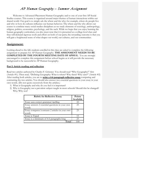
<strong>AP</strong> <strong>Human</strong> <strong>Geography</strong> – <strong>Summer</strong> <strong>Assignment</strong>Welcome to Advanced Placement <strong>Human</strong> <strong>Geography</strong> and to one of your first <strong>AP</strong> SocialStudies courses. This course is organized around major themes of human interactions within ourshared world. Our goal is to simply ask the where and the why; for example, where do people liveand why or how do cultures influence our human behavior. The where and the why allows ourcourse to combine many social studies disciplines as we study elements of sociology, anthropology,religion, politics, economics, psychology, and the such. While we hope that you enjoy learning thehuman geography curriculum, you also must note that it is presented as a college level class andthus will demand rigorous work and effort on both of our parts; the rewarding outcome is that youwill gain a heightened sense of what shapes our world, our cultures, and our communities.<strong>Assignment</strong>:Looking ahead to the fall, students enrolled in this class are asked to complete the followingassignment to prepare for <strong>AP</strong> <strong>Human</strong> <strong>Geography</strong>. THE ASSIGNMENT NEEDS TO BECOMPLETED BY THE FOURTH MEETING DATE OF <strong>AP</strong>HUG. You are stronglyencouraged to complete this assignment before school begins as it will provide the necessarybackground to be successful in <strong>AP</strong> <strong>Human</strong> <strong>Geography</strong>.Part I: Article reading and reflectionRead two articles authored by Charles F. Gritzner. You should read “Why <strong>Geography</strong>?” first(Article #1). Then read, “Defining <strong>Geography</strong>: What is where? Why there? Why care?” (Article #2)After reading both articles, you are to write a 4-6 paragraph reflective essay comparing andcontrasting the two articles. You should also answer two essential questions in your essay in yourown words. (Do not quote excessively from the articles.)1) What is <strong>Geography</strong> and why do you feel it is important?2) Why is <strong>Geography</strong> not a prevalent subject taught in most schools? Should this be changed?Why/Why not?Rubric for Reflective EssayPointsAvailableEssay uses correct grammar/spelling 10Essay answers 2 essential questions in your own 25wordsEssay compares/contrasts 2 articles in your own 25wordsEssay is Typed 15Essay is a minimum of 4-6 paragraphs long 25Total 100
Most Americans lack a well-developed "mental map" of Earth's surface, with its varied mosaic of physical andhuman conditions. To these geographic illiterates, our planet assumes the image of a vague, fragmented, andincredibly confusing hodgepodge of meaningless phenomena that are randomly scattered about on an all butbare tabula rasa.Theirs is a world inhabited by faceless peoples whose cultures lack a proud heritage, bonding institutions andcustoms, feelings and values, tools and technologies, and essential dimensions of space and time. Places, to thegeographic illiterate, are meaningless. They have no grasp of those unique physical and human features thatgive each spot on Earth's surface its own distinctive character, from which each draws its identity andimportance. And the spatial sorting of features into similar and dissimilar places using the geographer's conceptof region holds little meaning or relevance to those who are unaware of their location, nature, and significance.Their world is composed of vague physical features and life-sustaining environmental systems for which theylack valid mental images, appropriate terminology, or an understanding of their nature, origin, and importance.Those who are ignorant of basic geographic principles also have little knowledge of environmental potentialsand limitations. Under these circumstances, how can they possibly be expected to make enlightened decisionsrelating to the use and sustainability of our finite global natural endowment?A Spatial VacuumTo persons possessing a poorly developed mental map, historical events occurred in a spatial vacuum. "History"and "geography" remain spatially unlinked and unrelated, severely limiting the significance of one to the other.Such individuals, although constantly confronted by critical problems and issues, sadly lack the informationneeded to make rational analyses, sound judgments, or reasoned attempts at resolution. Further, to thegeographically insensitive, human differences often appear to be threatening and can lead to feelings ofprejudice and acts of discrimination. Such individuals are prisoners of their own ignorance and provincialism.As a result, they are poorly equipped to assume meaningful citizenship in an increasingly interdependent andmulticultural global community!It stands as a rather sad and somewhat inexplicable indictment of this country's priorities and approach toeducation that among the world's industrial nations, Americans rank among the least literate in geographicknowledge and, perhaps worse, geographic curiosity. Examples of this ignorance are numerous. So, too, are theincreasingly apparent, appalling, and often damaging consequences -- be they social, economic, political,military, or environmental -- that result from our failure to provide citizens with adequate geographicinstruction.In most countries of the Western urban-industrial world (and in many less-developed countries as well),geography constitutes the "core" of the social science curriculum. The United States is unique among thesenations in relegating geography to a relatively minor role in both the elementary and secondary curriculum.Some progress has been made in terms of enhancing geography's position in the curriculum during recent years,particularly through the various initiatives of the National Geographic Society. Despite these efforts and others,however, most of the world's educated people are much better informed about the world (and often about theUnited States!) than are the majority of our own citizens.In an increasingly complex, troubled, and closely intertwined world community of cultures and nations,Americans simply do not know much about our global neighbors (or, for that matter, about ourselves in ageographic sense). We have little understanding of, or feeling for, other lands and peoples. We are largelyignorant of their ways of living, environments and natural resources, human capabilities, and culturalattainments. We also know little about their similarities and differences, their hopes and dreams, or theirproblems and needs. Perhaps of greatest importance, we fail to understand how closely linked and important wehave become to one another. How can Americans possibly expect to maintain a position of respect andleadership in a world of cultures and nations about which we know – and seemingly care -- so little?Now, more than ever, citizens can ill afford to remain ignorant of the world about them. The compression oftime and space resulting from the technological "explosion" has placed even our most remote neighbors at ourvery doorstep. It is essential that all Americans understand and appreciate their role and responsibility in an
increasingly complex global community. Each of us must be aware of Earth's fundamental physical and culturalpatterns; of its key locations, distributions, patterns, and divisions; and of its primary linkages, movements,networks, and systems. We also must understand our planet's basic areas of production and consumption, itsmajor spatial interrelationships, and its causes and hot spots of conflict. A populace that remains largelyignorant of fundamental geographic knowledge surely limits a nation's ability to perform and competeeffectively on the global stage.The Necessity of Geographic Education<strong>Geography</strong> education is no longer a curricular luxury. It is an absolute necessity. If the United States is toendure, we must ensure that all students -- kindergarten through college -- be given the key to the future: anunderstanding of the world that only a rigorous geography curriculum can provide. Few people question theneed for history education; why, then, do so many question the importance of teaching geography? History,after all, is but a recording of past geography; a society that lives a "good geography" will surely leave a goodhistory. <strong>Geography</strong> has been described as "learning for living" and is a science with a strong futuristic emphasis.It is also the ancient and time-honored science that can best provide the essential knowledge needed to ensurethat our citizens are prepared to assume responsible and enlightened leadership in today's complex anddemanding global community. T. S. Eliot wrote, "We shall not cease from exploration, and the end of all ourexploring will be to arrive where we started and to know the place for the first time." Today, all citizenscertainly must be able to think globally, while continuing to act locally. By better knowing the world about us,we come to better know ourselves -- whether at home, or as members of the global community.Dr. Charles F. Gritzner is a professor of geography at South Dakota State University. This article firstappeared in Journal of <strong>Geography</strong> 102 (2003): 90-91; it appears on <strong>AP</strong> Central through a permissionagreement between the College Board and the National Council for Geographic Education.Article #2Defining <strong>Geography</strong>: What is Where, Why There, andWhy Care?by Charles F. GritznerSouth Dakota State UniversityThe Nature of <strong>Geography</strong>Most everyone knows that history is the study of events through time. Basically, historians ask "What happenedwhen and why then?" But many people, it seems, have a problem defining geography. One reason whygeography has languished in the curricula of many American schools is that so few people understand thenature of the discipline or its relevance to our everyday lives. What is geography? What is its uniqueperspective? What do geographers do? Why is geography important? Why should we teach (and learn)geography in the schools? These are questions that have gone largely unanswered in American education. Thisbrief essay presents an easily taught, understood, and remembered definition of geography. It has been usedwith great success by the author in his own teaching, public speaking, and professional writing for more than adecade. It works beautifully, and I believe that it will work for you and your students as well.Immanuel Kant, writing some two centuries ago, may have been the first scholar to identify clearly andsuccinctly the unique nature of both history and geography. In essence, he observed that history organizes andanalyzes events in terms of when they occurred (the temporal context, or time). <strong>Geography</strong>, on the other hand,focuses upon Earth's features and conditions through asking where they are found (the spatial context, orlocation). Both history and geography, then, are methodologies -- unique ways of thinking about our world andits events, conditions, patterns, and consequences. Following Kant's rationale, a simple definition of geographyemerges: if "When?" is the realm of history, then "Where?" is the primary focus of geographic inquiry.
If we can agree that the spatial method of organization and analysis is at the heart of geography and thegeographic perspective, then this reality must be reflected in any definition of the science. Here, however, astumbling block looms on the horizon: What is "spatial analysis"? When most people think of "space," after all,they associate it with astronomy, not geography. In a geographic context, "space" is defined as a portion ofEarth's surface. Location, place, area, region, territory, distribution, and pattern are all closely related spatialconcepts.A Concise DefinitionThe following definition incorporates all essential elements traditionally recognized as being fundamental togeography: it is the study, as I wrote in the Journal of <strong>Geography</strong>, of "what is where, why there, and whycare?"* To this foundation can be added further information. For example, at the college level I often add"pertaining to the various physical and human features of Earth's surface, including their conditions,interactions, spatial distributions, and patterns." The definition is flexible in that it can easily incorporate anyand all other perspectives on the nature of the discipline. The following diagram further amplifies each of thefour elements contained within the definition.What Is Where Why There and Why Care?(Phenomenological) (Spatial) (Analytical) (Implicational)All features of Earth'ssurface that occur in spatialdistribution:Location:AgentsImportance• Physical features(nature)• <strong>Human</strong> features(culture)• Site (specific)• Situation (relative)• Accessibility• IsolationDistribution Processes RelevancePattern Interrelationships Action/reactionScale:• Local• Regional• GlobalDescriptiveConceptualSome definitions of geography (including that developed by the National Geographic Society) emphasizecultural ecology -- the relationship humans establish with the natural environment. Both geographers andcultural ecologists are concerned with the ways in which humans culturally adapt to, use, and modify theenvironments they occupy. Geographers, however, are particularly interested in what kinds of ecologicalpractices occur within different cultures -- who is doing what, where, and why? The emphasis is on location andthe characteristics of place. For example, "What is?" might be a particular type of ecological relationship, suchas tropical shifting cultivation, pastoral nomadism, or mining. "Where?" then places the activity in a particularlocation and perhaps with a particular group, such as Amerindians of the Amazon Basin, Tuareg of the Western
Sahara, or residents of Minnesota's Iron Range. "Why there?" can be quite complex because in most instances,many factors are involved. Shifting cultivation, for example, might include such factors as heavily leached,hence infertile, tropical soils; cultural isolation and tradition; or sustainability. In the case of the Tuareg,certainly the region's arid environment, a longstanding pastoral tradition, and the consequences of overgrazingare important. A concentration of iron ore, the need for iron in an industrial society, and proximity to GreatLakes shipping lanes all help shed light on northern Minnesota mining activity. Finally, "Why care?" providesan opportunity to establish the importance of the foregoing activities in their particular location, as well as intheir natural and cultural geographic contexts.The Definition in PracticeThis definition of geography works well for several reasons. First, it emphasizes that geography is amethodology. It stresses the geographic way of organizing and analyzing information pertaining to the location,distribution, pattern, and interactions of the varied physical and human features of Earth's surface. Allgeographic inquiry should begin with the question, "Where?" Geographers and all other scientists ask "Why?"And, of course, most major Earth-bound events, features, and conditions can and often do have some impact onour lives, thereby begging the question, "Why care?"Second, the definition incorporates all traditional geographic subjects, themes, and traditions. In teaching, nomatter what topic is being stressed or approach being taken, it can be easily integrated into the definition.Third, the definition functions at all scales. In studying towns and cities, for example, site (specific location andcondition of a place) can often explain their presence. For example, New York City is located at the mouth ofthe Hudson River with a natural harbor protected by Long Island; San Diego and Seattle are on excellent naturalharbors; and Denver is at the eastern terminus of a pass through the Rocky Mountains. South Dakota's largestand fastest growing city, Sioux Falls, affords a splendid example to illustrate the importance of "Where?"When the city was settled in 1856, eastern South Dakota was inhabited by people of the Sioux culture. Thecity's name, itself, implies the importance of location and place: the falls on the Big Sioux River providedpower for a mill around which the city was originally established. Through time, the city grew primarilybecause of its location in the wettest, hence most agriculturally productive, area of the state. It also served as amajor highway and rail hub. Finally, rapid growth continued because of its location at the intersection of twointerstate highways. An example on the global scale, petroleum resources in the Middle East certainly havecontributed to a host of conflicts, and "petro-politics" surely will be a major issue for decades to come.Production, distribution, consumption, and trade all impact the lives of several billion people daily.<strong>Geography</strong> has projected a very fuzzy image of its content and methodology for far too long. The definitionpresented here is clear and concise. It places no limitation on what geographers study (literally anything foundon Earth's surface); it clearly identifies the discipline's unique methodology -- the spatial dimension of features,including where they are, in what patterns they occur, what important relationships exist between or amongfeatures, and so forth. If geography is to be taught as a science, the distribution of features must be explained --that is, we must address the question, "Why there?" Finally, all geographic teaching and learning should relateto the human need to know, emphasizing "Why care?" The definition presented here identifies in simple, easilytaught, and easily learned terms the extreme complexity of geography.* Charles F. Gritzner, "What Is Where, Why There, and Why Care?" Journal of <strong>Geography</strong>101, no. 1(January/February 2002), pp. 38-40.Charles F. "Fritz" Gritzner received his Ph.D. from Louisiana State University and is now midway in his fifthdecade of college teaching. Since 1980, he has been on the faculty of South Dakota State University, where heholds the rank of distinguished professor of geography. Gritzner is a past president of the National Council forGeographic Education (NCGE) and is a recipient of the council's George J Miller Award, which honors,according to the NCGE Web site, "a distinguished record of service to geography education."
Part II:Mapping the WorldPacketLONGJA 5/22/12 6:29 AMDeleted: Practice
Canada, the United States and Greenland map page 81. Do NOT label the 50 States or LABEL their Capitals!!!!!!2. Label and outline the 2 countries and 1 territory on the map (U.S.A., Canada, and Greenland) and label theircapital cities. Outline each nation in a different color so they are easy to recognize. Do not use blue to labelcounties near water.3. Label the 10 provinces and 3 territories of Canada, and their capital cities.4. Label the following physical features:• Appalachian Mountains• Rocky Mountains• Great Plains5. Shade in blue and label the following water features:Mississippi RiverRio GrandeSt. Lawrence River Atlantic OceanHudson BayGreat LakesPacific OceanGulf of MexicoMexico, Central America and the Caribbean map page 211. Label and outline the following countries and label their capital cities. Outline each nation a different colorso they are easy to recognize. Do not use blue to shade countries near water.BahamasHondurasBelizeJamaicaCosta RicaMexicoCubaNicaraguaDominican RepublicPanamaEl SalvadorGuatemalaHaiti2. Label the following physical features:Baja CaliforniaSierra Madre OrientalSierra Madre OccidentalYucatan Peninsula3. Shade blue and label the following water features:Rio GrandeAtlantic OceanCaribbean SeaGulf of CaliforniaGulf of MexicoPanama CanalPacific Ocean
South America map page 301. Label and outline the 12 countries and 3 dependencies of South America and label their capital cities.Outline each nation a different color so they are easy to recognize. Do not use blue to shade countries nearwater.2. Label the following physical features:Andes MountainsBrazilian HighlandsPampasAtacama DesertLlanos3. Shade blue and label the following water features:Amazon RiverAtlantic OceanCaribbean SeaPacific OceanWestern Europe map page 431. Label and outline the 24 countries and label their capital cities. Outline each nation a different color so theyare easy to recognize. Do not use blue to shade countries near water.2. Label the following physical features:Alps MountainsPyrenees Mountains3. Shade blue and label the following water features:Danube RiverAdriatic SeaAegean SeaArctic OceanAtlantic OceanBaltic SeaNorth SeaMediterranean SeaRhine RiverSeine RiverThames RiverStrait of GibraltarNorth SeaEastern Europe map page 551. Label and outline the 12 countries and label their capital cities. Outline each nation a different color so theyare easy to recognize. Do not use blue to shade countries near water.2. Label the following physical features:Carpathian Mountains3. Shade blue and label the following water features:Adriatic Sea Baltic Sea Black Sea
Northern Eurasia map page 671. Label and outline the 15 countries and label their capital cities. Outline each nation a different color so theyare easy to recognize. Do not use blue to shade countries near water.2. Label the following physical features:Caucasus MountainsUral MountainsAltai Mountains3. Shade blue and label the following water features:Amur RiverOb RiverAral SeaArctic OceanBaltic SeaBering StraightBlack SeaCaspian SeaLake BaikalSouthwest Asia map page 801. Label and outline the 15 countries and label their capital cities. Outline each nation a different color so theyare easy to recognize. Do not use blue to shade countries near water.2. Label the following physical features:Taurus MountainsZagros MountainsElburz Mountains3. Shade blue and label the following water features:Euphrates RiverTigris RiverAegean SeaArabian SeaPersian GulfRed SeaMediterranean SeaNorthern Africa map page 931. Label and outline the 5 countries and 1 territory of North Africa and label their capital cities. Outline eachnation a different color so they are easy to recognize. Do not use blue to shade countries near water.2. Label the following physical features:Atlas MountainsSinai PeninsulaSahara Desert3. Shade blue and label the following water features:Nile RiverRed SeaSuez CanalStraight of Gibraltar
West Africa map page 1021. Label and outline the 16 countries (and 1 island country) and label their capital cities. Outline each nation adifferent color so they are easy to recognize. Do not use blue to shade countries near water.2. Label the following physical features:Sahara Desert3. Shade blue and label the following water features:Atlantic OceanLake ChadCentral Africa map page 1111. Label and outline the 8 countries (1 is an island country) and label their capital cities. Outline each nation adifferent color so they are easy to recognize. Do not use blue to shade countries near water.2. Shade blue and label the following water features:Congo RiverEastern and Southern Africa map page 1201. Label and outline the 24 countries (3 are island nations) and label their capital cities. Outline each nation adifferent color so they are easy to recognize. Do not use blue to shade countries near water.2. Label the following physical features:Mt. KilimanjaroKalahari DesertNamib Desert3. Shade blue and label the following water features:Nile RiverAtlantic OceanIndian OceanLake VictoriaSouth Asia map page 1341. Label and outline the 8 countries (2 are island nations) and label their capital cities. Outline each nation adifferent color so they are easy to recognize. Do not use blue to shade countries near water.2. Label the following physical features:Himalaya MountainsEastern/Western GhatsMt. EverestDeccan PlateauHindu Kush Mountains3. Shade blue and label the following water features:Indus RiverGanges RiverBrahmaputra RiverIndian OceanBay of Bengal
Central and Eastern Europe map page 1471. Label and outline the 6 countries and label their capital cities. Outline each nation a different color so theyare easy to recognize. Do not use blue to shade countries near water.2. Label the 4 main island of Japan – Hokkaido, Honshu, Shikoku and Kyushu3. Label the following physical features:Gobi DesertMt. FujiAltai Mountains4. Shade blue and label the following water features:Huang He (yellow) RiverYangtze RiverEast China Sea Pacific Ocean Sea of JapanSouth China SeaSoutheast Asia map page 1591. Label and outline the 10 countries (1 is very small) and label their capital cities. Outline each nation adifferent color so they are easy to recognize. Do not use blue to shade countries near water.2. Shade blue and label the following water features:Mekong RiverCelebes SeaIndian OceanPacific OceanStraight of MalaccaPhilippine SeaAustralia and Oceania map page 1711. Label and outline Australia and New Zealand and label their capital cities. Outline each nation a differentcolor so they are easy to recognize. Do not use blue to shade countries near water.2. Label the 3 regions of Oceania, and the island groups within each regionMelanesia Micronesia PolynesiaFiji Guam HawaiiNew Caledonia Marshall Islands American SamoaPapua New GuineaSolomon Islands3. Label the following physical features:Great Barrier ReefGreat Dividing Range4. Shade blue and label the following water features:Indian OceanPacific OceanCoral SeaTimor Sea


