Octopus Harald - Marine Accident Investigation Branch
Octopus Harald - Marine Accident Investigation Branch
Octopus Harald - Marine Accident Investigation Branch

You also want an ePaper? Increase the reach of your titles
YUMPU automatically turns print PDFs into web optimized ePapers that Google loves.
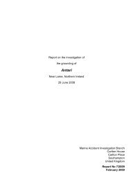
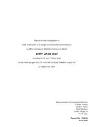
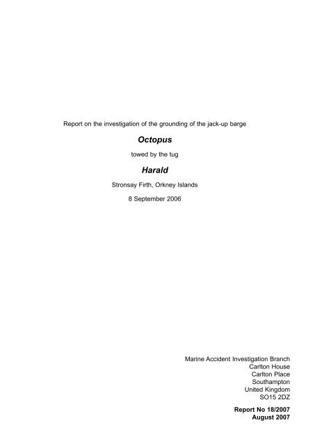
Report on the investigation of the grounding of the jack-up barge<strong>Octopus</strong>towed by the tug<strong>Harald</strong>Stronsay Firth, Orkney Islands8 September 2006<strong>Marine</strong> <strong>Accident</strong> <strong>Investigation</strong> <strong>Branch</strong>Carlton HouseCarlton PlaceSouthamptonUnited KingdomSO15 2DZReport No 18/2007August 2007
Extract fromThe United Kingdom Merchant Shipping(<strong>Accident</strong> Reporting and <strong>Investigation</strong>)Regulations 2005 – Regulation 5:“The sole objective of the investigation of an accident under the Merchant Shipping (<strong>Accident</strong>Reporting and <strong>Investigation</strong>) Regulations 2005 shall be the prevention of future accidentsthrough the ascertainment of its causes and circumstances. It shall not be the purpose of aninvestigation to determine liability nor, except so far as is necessary to achieve its objective, toapportion blame.”NOTEThis report is not written with litigation in mind and, pursuant to Regulation 13(9) of theMerchant Shipping (<strong>Accident</strong> Reporting and <strong>Investigation</strong>) Regulations 2005, shall beinadmissible in any judicial proceedings whose purpose, or one of whose purposes is toattribute or apportion liability or blame.Further printed copies can be obtained via our postal address, or alternatively by:Email: maib@dft.gsi.gov.ukTel: 023 8039 5500Fax: 023 8023 2459All reports can also be found at our website:www.maib.gov.uk
CONTENTSGLOSSARY OF ABBREVIATIONS AND ACRONYMSPageSYNOPSIS 1SECTION 1 - FACTUAL INFORMATION 21.1 Particulars of <strong>Harald</strong> and accident 21.2 Particulars of <strong>Octopus</strong> and accident 31.3 Narrative 31.3.1 Pre-voyage 31.3.2 The voyage 51.3.3 Post grounding actions 51.4 The project 91.5 Planning 91.6 The passage plan 91.6.1 The chart 91.6.2 The chart plotter 111.6.3 Category of Zone of Confidence 161.6.4 Passage guidance 161.6.5 Local knowledge 161.7 Hydrographic Survey in the UK Area 161.7.1 Hydrographic Responsibilities 161.7.2 Civil Hydrography Programme 171.7.3 Research 181.7.4 COSH action post grounding 191.7.5 Survey standards 191.7.6 CHP survey effort 201.7.7 Other surveying activity 201.8 International Hydrographic Organisation 221.9 Cruise Vessel traffic in the Orkney Islands 231.10 Previous accidents 23SECTION 2 - ANALYSIS 242.1 Aim 242.2 The accident 242.3 Fatigue 242.4 The voyage 242.4.1 The plan 242.4.2 BA Chart 2250 242.4.3 Local knowledge 252.4.4 Recognised shipping routes 252.4.5 Decision to divert west of Little Green Holm Island 262.4.6 The method statement 262.5 Standard of UK Survey 262.5.1 Orkney Islands Survey Standard 262.5.2 MCA survey progress 272.6 Electronic chart information 272.7 Cruise ships and other deep draught vessels 28
SECTION 3 - CONCLUSIONS 293.1 Safety issues directly contributing to the accident which have resultedin recommendations 293.2 Safety issues identified during the investigation also leading torecommendations 29SECTION 4 - ACTION TAKEN 29SECTION 5 - RECOMMENDATIONS 30Annex AAnnex BAnnex CAnnex DFindings from the University of Wales reportThe IHMC executive summaryIHO S-55: Summary Report on Status of Hydrographic Surveys for areasbetween 0 and 200mList of Invitees to the 2006 COSH MeetingGLOSSARY OF ABBREVIATIONS AND ACRONYMSAIS - Automatic Identification SystemCATZOC - Categorization of Zones of ConfidenceCHP - Civil Hydrography ProgrammeCHRC - Civil Hydrography Review CommitteeCOSH - Committee on Shipping HydrographyDETR - Department of the Environment, Transport and the RegionsDfT - Department for TransportDNSOM - Directorate of Naval Surveying, Oceanography and MeteorologyECDIS - Electronic Chart and Display Information SystemECS - Electronic Chart SystemEEZ - Exclusive Economic ZoneEMEC - European <strong>Marine</strong> Energy Centre Ltd.ETV - Emergency Towing VesselHMOG - Hydrographic and Meteorological GuidanceHSRB - Hydrographic Strategic Review Body
IHMC - International Hydrographic Management Consulting LimitedIHO - International Hydrographic Organisationkw - kilowattLEA - Limited European AreaLIDAR - Laser Induced Direction and Rangem - metresMCA - Maritime and Coastguard AgencyMoD - Ministry of DefenceNAVTEX - Navigational information telexSOLAS - International Convention for Safety of Life at SeaUKHO - United Kingdom Hydrographic OfficeUNCLOS - United Nations Convention on the Law of the SeaUTC - Universal Co-ordinated TimeVHF - Very High FrequencyWGS84 - World Geodetic System 1984
Figure 1<strong>Harald</strong>Figure 2Jack up-barge <strong>Octopus</strong>
SYNOPSISThe jack-up barge <strong>Octopus</strong> was being towed from Kirkwall to SealSkerry Bay in the Orkney Islands by the tug <strong>Harald</strong>, to act as a platformfor the installation of a prototype tidal turbine. The tug and tow alteredtheir route to pass to the west of Little Green Holm Island, due to thestrong tidal streams experienced during the passage, a route not usuallyused by deep draught vessels. As the tug and tow rounded the south ofLittle Green Holm Island the barge, which was being towed with its legsextended to a depth of 13m, grounded on an uncharted bank of 7.1m.<strong>Octopus</strong> sustained buckling damage to 4 barge legs, resulting insubstantial cost and project delays. There were no injuries and no damage to the tug <strong>Harald</strong>.The applicable Admiralty chart for the area indicated a depth of greater than 20m with theclosest sounding indicating a depth of 26m. The source data diagram on the chart indicatedthat the area was last surveyed, by leadline, in the 1840s.The MAIB report recommends that:The DfT and MCA:• Review the future work schedule for the UK Civil Hydrography survey programme,taking into account the priorities identified by MCA Research Project 512, theCommittee on Shipping Hydrography and the MCA, particularly in light of theincreasing use by large cruise vessels of sea areas not surveyed to modern standards.The UKHO and the MCA:• Agree wording and put forward to the IHO/IMO a proposal that the relevant workinggroups investigate ways of ensuring that ECDIS displays provide a clear warning orindication to the mariner whenever the survey data used to produce the electronicchart in use is of poor quality.Industry bodies responsible for vessels that operate in remote waters, such as cruise vessels,offshore supply vessels and vessels engaged in renewable energy installation:• Promulgate to the ship owners through their membership the safety lessons identifiedin this report, to emphasize to shipmasters and navigating officers, the need tocarefully consider chart source data and, in the case of Electronic Navigational Charts(ENC), “Category of Zone of Confidence” (CATZOC) when planning and executingnavigational passages.The marine consultants responsible for overseeing the marine aspects of the tidal turbineproject fully consider, when planning the passage of deep draught vessels:• The potential effect of tidal conditions.• The quality of survey data, available for the area concerned.1
SECTION 1 - FACTUAL INFORMATION1.1 PARTICULARS OF HARALD AND ACCIDENTVessel details (Figure 1)Registered owner : Orkney Towage CompanyManager(s) : Orkney Towage CompanyPort of registry : KirkwallFlag : BritishType : TugBuilt : 1992Classification society : Lloyd’s RegisterConstruction : SteelLength overall : 32.08mEngine power and/or type : 2 x Ruston 6RK270M 1492kw eachService speed : 12 knotsBollard Pull Ahead : 55 tonnesTow winch10 m/min at 30 ton pull<strong>Accident</strong> detailsTime and date : 1755 UTC 8 September 2006Location of incident : 59 09.5 N 002 49.3 W.Persons on board : SixInjuries/fatalities : NoneDamage : None2
1.2 PARTICULARS OF OCTOPUS AND ACCIDENTVessel details (Figure 2)Registered owner : Kello (Belgium)Manager(s) : Kello (Belgium)Type : Jack-up bargeConstruction : SteelDimensions : 30.4m x 15.5m x 2.4mCapacity : 550 tonnesLeg length : 26m<strong>Accident</strong> detailsDamage : 4 barge legs buckled causing substantial cost andproject delays.1.3 NARRATIVEAll times are UTC+11.3.1 Pre-voyageOn 7 September 2006, after 3 weeks on station, the jack-up barge <strong>Octopus</strong> had beenmoved by the tug <strong>Harald</strong> from her position in Seal Skerry Bay, west of Eday in theOrkney Islands, via the Falls of Warness, to Kirkwall.During the barge’s stay in Kirkwall, the crane stowed on the deck was unloaded, anda drilling rig loaded in its place. Also, the tug’s skipper, who had brought <strong>Octopus</strong>to Kirkwall, handed over command to the vessel’s other skipper for the return toSeal Skerry Bay. The barge’s departure was delayed by one tide due to unplannedmaintenance of <strong>Harald</strong>’s port main engine turbo charger, which failed during theprevious voyage.The tug and barge were initially planned to pass to the east of Shapinsay throughthe Falls of Warness, this route being considered preferable to the shorter shallowerroute west of Shapinsay. The east route also opened up the sub-options of passingeither east or west of the Green Holm islands. During route planning meetings beforethe voyage, the preference was to pass east of the Green Holm islands although theagreed method statement route (Figure 3) indicated a passage to the west.The tow master responsible for coordinating the voyage, and the tug skipper agreed touse the route they had taken from Seal Skerry Bay to Kirkwall in reverse, to return thebarge to her required position, a distance of 16 miles. The route east of Shapinsay wasagreed and the sub-options of passing either east or west of the Green Holm islandswere to be considered by the tug skipper and tow master depending upon the tide andwind conditions encountered en route.3
Reproduced from Admiralty Chart 2250 by permission ofthe Controller of HMSO and the UK Hydrographic OfficeFigure 3DeploymentlocationArea to avoidduring ebband NWArea toavoid duringflood and SEShorter route (11nm),shallow water.Est. 4 hoursLonger route (16nm),deeper water.Est. 6 hoursRoute options considered during initial project planning4
1.3.2 The voyageAt 1300 on 8 September 2006, the tug <strong>Harald</strong>, towing the jack-up barge <strong>Octopus</strong>,sailed from Kirkwall for Seal Skerry Bay. It was the day before spring tides, the visibilitywas good, and wind was light and variable. As planned, the tug Erlend escorted thetug and tow on passage. <strong>Harald</strong>’s skipper planned the voyage with Admiralty papercharts, and used the charts for navigation together with a Seatrack monochrome chartplotter. The echo sounder was running throughout the voyage, although the depthtrace prior to the grounding was illegible – possibly due to the turbulence caused by thefast flowing tides.Once clear of the approaches to Kirkwall, the tow master requested the tug skipper’sagreement to lower the barge legs from 5m to around 9m. This was to improve<strong>Octopus</strong>’s stability in the anticipated swell east of Shapinsay.The tow’s progress through the water was slightly reduced as the barge trimmedforward when the legs were extended. As the tug and tow approached the Falls ofWarness at 1730, the following spring ebb tide, flowing at about 6 knots, set the tugand barge to the west. The tug skipper was aware that the westerly set continuedthrough the Falls of Warness and would set them towards the Green Holm islands. Hetherefore discussed the situation with the tow master on the barge by VHF radio, andthey agreed to pass to the west of Little Green Holm Island, a route <strong>Harald</strong>’s skipperhad used many times before. As the tug and tow altered course to the west-northwestto pass west of the Green Holm islands, their speed increased to 8 knots over theground aided by the ebb tide (Figure 4).Following the decision to pass west of the Green Holm islands, the tow master and tugskipper agreed to lower the barge legs to 13m to reduce the expected rolling as theycrossed the tidal flow to the north of the Falls of Warness. They also agreed to havethe barge legs at the required depth for the installation on arrival in Seal Skerry Bay.At 1755, half an hour after low water, <strong>Octopus</strong> grounded on her forward two legs, 3cables south-south-west of Little Green Holm Island (Figure 5). The charted depthat the position of the grounding was assessed to be greater than 20m, the closestsounding indicating a depth of 26m. The force of the grounding caused some of thebarge personnel to fall, however no one was injured and neither the tug nor the bargedeck cargo was damaged.1.3.3 Post grounding actions<strong>Harald</strong>’s skipper reacted quickly to the grounding by using astern propulsion and payingout the towing cable. The escort tug Erlend promptly connected a tow to the stern of<strong>Octopus</strong> to relieve the strain on the barge legs and to hold her in position awaiting therising tide and reduction in the tidal flow.Erlend’s skipper informed Orkney Towage of the grounding but did not request anyassistance. The workboat Ailsa, awaiting the arrival of the tug and tow in Seal SkerryBay, headed for the grounding position.Shortly after the grounding, <strong>Octopus</strong>’s personnel were transferred to Ailsa. While theworkboat was alongside <strong>Octopus</strong>, her skipper confirmed the depth of water as 8m,which included a height of tide of 0.5m.5
ORKNEY ISLANDS -Northern PartGrounding positionFigure 4Reproduced from Admiralty Chart 2250 by permission ofthe Controller of HMSO and the UK Hydrographic Office1 Nautical milePassage 08/09/06Passage 07/09/06Approximate route taken by <strong>Harald</strong>/<strong>Octopus</strong> prior to groundingGrounding 1755 8/9/06Height of tide 0.5m6
Figure 5<strong>Octopus</strong> aground<strong>Octopus</strong> refloated 40 minutes after the grounding, and was returned to Hatston Pier inKirkwall where all four legs were found to be damaged. The damage to the barge costan estimated £1m to repair. The delay in returning <strong>Octopus</strong> to Seal Skerry Bay alsoresulted in extensive delays to the project when the seabed frame, constructed duringthe initial installation stage, collapsed in the strong tides.Following the grounding, the UKHO initiated NAVTEX warnings of the shoal danger inthe area. A week after the grounding, the Orkney Harbour Authority pilot boat carriedout a survey of the area, which confirmed the presence of an uncharted shoal area witha minimum depth of less than 8m, the bank covering an area of approximately 2.5 x 2.5cables.The MCA, UKHO and the Shetland Coastguard were advised of the survey’s findings,and the area of the grounding was subsequently re-surveyed by the MCA’s EmergencyTowing Vessel (ETV) Anglian Sovereign. The more accurate survey data obtainedduring this survey was used to generate the chart correction data issued in AdmiraltyNotices to <strong>Marine</strong>rs (NTM) Week 41, published on the UKHO Web site on 5 October2006 and in paper format on 12 October 2006. The revised charted depth in thelocation of the grounding was shown in the NTM as 7.1m (Figure 6).7
Figure 6Reproduced from Admiralty Chart 2250 by permission ofthe Controller of HMSO and the UK Hydrographic OfficeGrounding positionExtract from BA Chart 22508
Figure 7Admiralty Chart 2250 before and after the grounding10Reproduced from Admiralty Chart 2250 by permission ofthe Controller of HMSO and the UK Hydrographic Office
The source diagram for BA Chart 2250 (Figure 8) shows the area to have beensurveyed during British Government Survey (leadline) 1839-1848. LieutenantCommander George Thomas, master commanding, was on board HMS Mastiff whenthe survey of the grounding area was carried out in 1843 and 1844. The originalsurvey record fair sheet (Figure 9) showed that the survey results were correctlytransferred to the chart, and that the 7.1m bank was missed due to the sampling natureof the leadline survey undertaken.A note on BA Chart 2250 states that:Many of the depths in these areas have not been systematically surveyed. Depthsin these areas are from miscellaneous lines of passage sounding or old leadlinesurveys. Uncharted dangers may exist.The <strong>Marine</strong>rs Handbook, NP100, Chapter 2, guides the mariner in assessing thereliability of a chart, stating:No chart is infallible. Every chart is liable to be incomplete, either throughimperfections in the survey on which it is based, or through subsequent alterationsto the seabed. However, in the vicinity of the recognised shipping lanes charts maybe used with confidence for normal navigation needs. The mariner must be thefinal judge…Further guidance is given in Admiralty Sailing Directions, NP 52, North Coast ofScotland, which states that:Charts should be used with prudence: there are areas where the source data areold, incomplete or of poor quality.When the commercial survey vessel Ping surveyed the area north of the groundingposition in early 2006, the survey resulted in 69 NTM warning of changes to charteddepth, although none were of the exceptional nature of the shoal where <strong>Octopus</strong>’sgrounding occurred (Figure 10). The southern limit of the 2006 survey of the areaaround the Island of Eday was less than 200m north of the 7.1m shoal patch (Figure11).A survey was also completed of the area to the east of the Orkney Islands during 2006;much of this area was previously stated as un-surveyed, with miscellaneous lines ofsoundings from 1844 as the source data.1.6.2 The chart plotterThe chart plotter in use at the time of the accident used Seatrack software. The plotterwas used as an aid to navigation, the primary navigation being by paper chart. TheSeatrack system is primarily aimed at the leisure market, with the software installed onan owner supplied Personal Computer.The Seatrack chart plotter software in use at the time of the grounding was replacedshortly after the incident with a new computer and software.11
Reproduced from Admiralty Chart 2250 by permission ofthe Controller of HMSO and the UK Hydrographic OfficeFigure 812BA Chart 2250 Source data
Figure 9Extract of survey fair sheet of 1843/413
Figure 10MCA Survey following grounding2006 MCA survey results - with additional MCA survey following the grounding14
Figure 11Limit of 2006 MCA surveyMCA survey following grounding2006 MCA survey results - with additional MCA survey following the grounding15
1.6.3 Category of Zone of ConfidenceVector electronic charts require the addition of Category of Zone of Confidence(CATZOC) to allow the mariner the opportunity to gauge the reliability of the chartedinformation. The allocation of a value to the CATZOC attribute of the M_QUAL (qualityof data) object is mandatory. Possible values are: A1, A2, B, C, D and Not Assessed.The transfer of the traditional source data to CATZOC is being progressed, asresources permit, by national hydrographers.Progress in Scottish waters is further limited due to some coastal areas requiringtransfer to the geodetic system WGS84 prior to allocating a CATZOC. The area of theOrkney Islands had not yet been allocated a CATZOC by the UKHO.1.6.4 Passage guidanceAdmiralty Sailing Directions NP52 North Coast of Scotland – Sixth Edition notes:5.271 Despite the dangerous sea and Tidal conditions, described at 5.267 whichmay prevail in certain conditions in the vicinity of War Ness, and which shouldalways be anticipated, this channel is preferred to the passage W of Muckle GreenHolm.5.267 Tidal streams in the channels either side of Muckle Green Holm are verystrong….During both SE going and NW going tidal streams violent turbulenceextends across the entire East of Muckle Green Holm when the wind is against thetidal stream.1.6.5 Local knowledgeThe tugs <strong>Harald</strong> and Erlend were manned by longstanding local crews employedby the Orkney Towage Company. The skipper held a Certificate of Competence fortugs with Limited European Area (LEA) endorsement. Although the work of the tugswas primarily to the south of the Orkney Islands, operating with the tanker berthingand transfer operations of Scapa Flow, other towage work around the islands wasinfrequently undertaken. The skippers’ experience was based on this occasional workand their extensive previous knowledge working on smaller local craft and fishingvessels.1.7 HYDROGRAPHIC SURVEY IN THE UK AREA1.7.1 Hydrographic ResponsibilitiesThe United Kingdom has an obligation under the Safety of Life at Sea (SOLAS)Convention, Chapter V, Regulation 9, to survey its internal waters and territorial sea,to the best of its ability, using the most effective modern equipment available, and tothen produce nautical charting to international standards. The UK also has an obligationto ensure safe navigation, not only in its territorial sea and in close proximity to thecoast, but also within those areas beyond the territorial waters for which the UK hasobligations under the United Nations Convention on Law of the Sea (UNCLOS) toprotect the environment.On 31 March 2006, the DIJE 1 (Defence Intelligence Joint Environment) contract formanaging the Civil Hydrographic Programme (CHP) ceased by mutual consent, anddirect responsibility for managing the CHP passed to the MCA. At that time, the CHPhad an annual budget of £5.4m.1 DIJE had subsumed the former DNSOM (Directorate of Natural Surveying, Oceanography and16Meteorology)
1.7.2 Civil Hydrography ProgrammePrior to 1976, civil survey requirements were determined by the Royal Navy’s DirectorNaval Plans and the UK Hydrographer. Following a review by the Hydrographic StudyGroup, it was recommended that a wider consultation of civilian surveying and thesourcing of civilian funding were required.In May 1976, the first Hydrographic Strategic Review Body (HSRB) met 2 . At that time,the only civil-funded surveys, as part of a national programme, were funded by theDepartment of Energy but undertaken by the Royal Navy for oil-rig tow-out routes tothe North Sea. The HSRB set the civil survey work programme for the forthcoming 2years.In order to widen consultation further, a Department of Trade sub-committee of theHSRB was established in late 1976 which included organizations such as the GeneralLighthouse Authorities and the General Council of British Shipping. The first meeting ofthis committee, the Committee on Shipping Hydrography (COSH), took place on Friday15 October 1976, and was arranged and chaired by the Department of Trade. Thecommittee made recommendations for the period 1978-80. However, at that time, thecommittee had no budget and only made recommendations to the HSRB as to wheresurveys should be undertaken to support UK shipping safety.At the second COSH meeting in February 1978, a COSH Terms of Reference wasestablished “To consider the hydrographic survey requirements of UK Shipping andthe views of UK shipping interests on matters under consideration by the HydrographicStrategic Review Committee”.In 1979, after considerable lobbying, the Royal Navy obtained permission to increasethe size of the home waters survey fleet but, while the vessels were being built, civilhydrography was put out to commercial tender. The first record of such a tender beingawarded was in 1982, to Gardline.In 1982, the UK government decided that financial responsibility for civil hydrographyshould be borne fully by the Department of Trade instead of the MoD from 1984/85onwards. From 1982 to 1985, funding of between £5 million and £5.7 million per yearwas divided between the Department of Trade (later the Department for Transport) andthe Royal Navy.Since COSH now had a budget, its membership was extended to include the UKHydrographer, the British Ports Association and others. It also declared new Terms ofReference, “To consider, and keep under review, the need for hydrographic surveysaround the United Kingdom; to identify priorities; and to make recommendations”. In1982, it was also decided to form the Civil Hydrographic Review Committee, whichreceived these recommendations.In 1983, the responsibilities of the Department of Trade <strong>Marine</strong> Division passed to theDepartment of Transport <strong>Marine</strong> Division.Since the CHP’s inception the annual level of funding has fluctuated around the currentfigure of £5.4 million, but has largely remained unchanged.2 This comprised: the Ministry of Defence (MoD), Department of Trade, Department of Energy, Departmentof Environment, Foreign and Commonwealth Office, Department of Education and Science, and theTreasury.17
1.7.3 ResearchIn 1997, the Department of Maritime Studies of the University of Wales, Cardiff, wastasked by the Department of the Environment, Transport and the Regions (DETR) to:• Assess objectively the scope for establishing a limit to the depths at which theDETR should be responsible for hydrographic surveys, and to recommend what thedepths should be.• Apply any recommended limit to the existing set of survey priorities and establishthe impact of the new limit on those priorities.The University of Wales report defined a proposed outer limit of CHP responsibility andprovided an indication of survey priority within that area. The executive summary of thereport’s findings (Annex A) is attached.In April 2003, the MCA contracted International Hydrographic Management ConsultingLimited (IHMC) to carry out Research Project 512, titled “A Long Term Strategy for theUK Civil Hydrography Programme”. The primary objective of the project was to identifythe optimum level of annual surveying effort required to bring all surveys in UK watersup to full modern standards within an agreed timescale, and to identify the level offunding required to support the strategy. IHMC’s report was subsequently tabled andaccepted at the annual meeting of the Civil Hydrographic Review Committee 3 (CHRC)in January 2004.The IHMC executive summary (Annex B) noted.The total survey task has been examined for eight specific areas around the BritishIsles, totalling 723,181 km². Assuming an augmented rate of production accordingto the recommendations in various sections of the report, 6000 to 7000km² can besurveyed annually, if resurveys are not considered. With 14 % currently surveyed, theunsurveyed area is approximately 620,000 km². It is therefore estimated that evenusing the most modern methods currently available, with the existing budget allocationit will take 90 to 100 years to bring all the surveys to modern standards. The resultof a direct mathematical calculation requires considerable explanation, however, asmany of the more difficult areas are already surveyed and a considerable amount ofthe unsurveyed area is in deeper water. This is, nevertheless, counterbalanced bythe huge extents of coastline not surveyed and slow to survey from surface vessels.If LIDAR 4 surveys prove to be as effective as they have been demonstrated to be inother countries, then the time period could be reduced. It can also be assumed thatother survey methods will become more efficient.The present status of surveys and rate of progress in carrying out surveys is clearlyunacceptable, considering the reputation of the United Kingdom as a maritimestate. Based on the assumption that the task should be completed within 15 years,the MCA allocation needs to be increased by six times to achieve this objective.Although not mentioned elsewhere in the report, there are other alternatives thatcould be considered. One would be to double the budget on an urgent basis andschedule a review for five years hence to assess progress. These are issues thatcan only be decided upon by the respective organizations.3 CHRC comprises the MCA, UKHO, DfT and, previously, the MoD.4 Laser Induced Direction and Range18
The Report contained a total of 18 recommendations set out in high, medium and lowpriorities. Eight were identified as high priority, nine as medium and one as low.The recommendations contained in the report were accepted by the CHRC, inaccordance with the priorities set out in the report.1.7.4 COSH action post groundingAt the COSH meeting 5 minutes of October 2006 the MCA stated that:• It had now become critical that the uncharted area between the Sanday Soundand Approaches to Kirkwall should be surveyed. This was agreed by COSHMembers. However, as approximately 40 cruise ships as well as numerousinstallation companies would be utilising this area before the next survey seasoncommences in April/May 2007, it was agreed that more funding should besought in order to commence surveying immediately.• With the current funding for the Civil Hydrography Programme at £5.4m per annumit has been estimated that it will take 100 years to survey the UK coastline (source:independent research conducted by International Hydrographic ManagementConsultancy). An increasing number of vessels and installation companies operatingin areas where the current data is over 100 years old means that there is anincreased risk of incidents such as the “<strong>Octopus</strong>” occurring again.• In order to be proactive and decrease the risk in future, the Chairman, with the fullsupport of COSH Members, agreed to write to the MCA Executive Board and theDfT seeking further funding for the Civil Hydrography Programme in order to extendthe Programme to cover more high risk areas.• The Hydrography manager reported that there were a number of lessons to belearned from this incident. It had come to light that the fishermen had known aboutthe shoal but had not informed anyone. The MCA therefore needed to speakto appropriate local people in areas where surveys were being conducted, asinformation such as knowledge of shoals or other concerns may be highlighted.• It was agreed that the MCA Hydrography manager and the UKHO liaison officerwould develop a risk matrix, which would utilise AIS data, of survey priorities topresent to CHRC. However, this could not be taken forward without the ArchiveCatalogue data from the UKHO. It was agreed that the MCA would visit theUKHO to try to work together to resolve the technology problems that were beingexperienced in releasing the Archive data to the MCA.1.7.5 Survey standardsMCA and their commercial contractors survey to IHO S-44 Order 1 and Hydrographicand Meteorological Guidance (HMOG) standards.5 COSH membership is shown at Annex D19
1.7.6 CHP survey effortAll survey work is managed by the MCA, in close liaison with the UKHO. Using arisk based approach, survey priorities are divided between moving sea bed activity,mostly in the South East of England, and the survey and resurvey of prioritised areasto modern standards. The majority of the MCA budget is spent in commissioninghydrographic survey contracts with commercial surveying companies. Contracts areawarded following tenders, with between five and seven companies routinely bidding foreach contract.The current MCA methodology for survey prioritisation uses a risk based approach, asrecommended in the 1997 University of Wales Report. To assist in survey prioritisation,the MCA, in conjunction with the UKHO, intends to develop a risk matrix, whichcombines survey source data from the UKHO’s Archive Catalogue with information ofshipping movements derived from the Automatic Identification System (AIS). The MCAanticipated that, in time, AIS traffic data would replace the existing method of identifyingtrends in traffic density.The MCA’s own dedicated surveying resource is the Emergency Towing Vessel (ETV)Anglian Sovereign which has the ability to carry out modern multi-beam sonar surveywork when not engaged in her primary role as an ETV or conducting other operationalrequirements. Anglian Sovereign is normally available to carry out survey work on 120days annually.The current status of Civil Hydrography around the UK coast is shown on UKHO chartQ6090 (Figure 12).1.7.7 Other surveying activity1. The MoDThe MoD establishes survey requirements for naval operations and activities aroundthe UK coast. Defence priorities are not open to civil examination or discussion.The military survey programme operates separately from the CHP, although thetwo are interconnected. The Royal Navy’s Hydrographic vessels are deployedworldwide with the exception of HMS Gleaner, which surveys mainly the UK Coast.Data is supplied for use on Admiralty charts and publications where appropriate.The UKHO liaises closely with the MCA to ensure there is no duplication of surveyeffort where this is possible.2. Harbour AuthoritiesPort Authorities are responsible for survey data within their own Statutory HarbourAuthority areas. Bi-lateral agreements on sharing survey data exist between mostUK ports and the UKHO.3. Supplementary survey dataAdditional survey information is obtained from commercial operators, such as majoroil companies, and from reports sent by maritime users through HydrographicNotices.20
© Crown Copyright and/or database rights. Reproduced by permission of the Controllerof Her Majesty’s Stationery Office and the UK Hydrographic Office (www.ukho.gov.uk)Figure 1221
1.8 INTERNATIONAL HYDROGRAPHIC ORGANISATIONThe International Hydrographic Organisation (IHO) Special Publication No.55 (S-55),dated 26 October 2006, aims to present a clear picture of the worldwide coverage ofsurveys and nautical charts. The database covers the waters of 90% of the coastalstates of the world. The summary on ‘Status of Hydrographic Surveys for Areasbetween 0 and 200m’ published in IHO S-55 of October 2006 is attached at Annex C.The IHO table of survey status for depths up to 200m is reliant upon the accuracy ofinformation supplied by the national hydrographer.A sample of national survey records for depths up to 200m, drawn from IHO S-55, isshown in Table 1.A1 B1 C1Spain 95 5 0Denmark 95 5 0France 86 0 14Italy 67 26 7United Kingdom 45 24 31Japan 40 53 7A1 - Percentage adequately surveyed for depths of 0-200mB1 -C1 -Table 1Percentage requiring re-survey at larger scale or to modern standards fordepths of 0-200mPercentage which has never been systematically surveyed for depthsof 0-200mIn IHO S-55, the UK’s survey priorities are noted as:1. Top priority is a routine re-survey programme, principally in the south North Seaand Dover Strait2. Priorities elsewhere for modern survey are:a. International routes: gaps in West part of English Channel; tanker route fromFair Island Channel around the North of Scotlandb. Regional: approaches to the Firth of Forthc. Internal: areas on West coast of Scotland frequented by cruise liners.The IHO has stated as a major deficiency in survey standards worldwide, that:“Although coverage of both paper and electronic charts has increased, in manycases there has not been a concomitant improvement in the source data fromwhich they are derived. The appearance of deeper draught shipping has alsoexposed the inadequacy of navigational products in many areas.”22
1.9 CRUISE VESSEL TRAFFIC IN THE ORKNEY ISLANDSIn 2000, 57 cruise vessels, with a combined passenger capacity of around 15,000,called at the Orkney Islands.The Orkney Islands Council Annual Performance Report of 2004/2005 states:• A year on year rise of cruise liner traffic has been evident in the period 1st April2004 to 31st March 2005, with passenger numbers visiting Orkney increasing from22,916 to 30,708, an increase of 34%. This increase is due to a record numberof liners calling i.e. 75, and the fact that some of the larger liners had passengernumbers in excess of 2,000.• Figures published by Cruise Europe in January 2006 indicate that yet again Orkneyis the most popular destination in Scotland for Cruise liners and the 4th mostpopular call in the UK.In 2007, 69 cruise vessels were scheduled to call at the Orkney Islands, representing apassenger capacity of more than 39,000.1.10 PREVIOUS ACCIDENTSThe MAIB database has no record of any vessels grounding on uncharted banks in UKterritorial waters.On 11 December 2004, the UK registered tanker British Enterprise grounded in theapproaches to Istanbul. The vessel was aground for 5 days. There had been at leasttwo other groundings in the anchorage in previous years.Following the findings of the MAIB investigation into the grounding of British Enterprise,extensive areas of the Turkish coast were resurveyed.23
SECTION 2 - ANALYSIS2.1 AIMThe purpose of the analysis is to determine the contributory causes and circumstancesof the accident as a basis for making recommendations to prevent similar accidentsoccurring in the future.2.2 THE ACCIDENTThe grounding occurred when the jack-up barge <strong>Octopus</strong>, with a draught of 13m,grounded on an uncharted 7.1m shoal. The charted depth at the grounding position,based on a 19th Century leadline survey, was 26m.2.3 FATIGUEFatigue was not a factor in this accident. All personnel were apparently well rested priorto the voyage.2.4 THE VOYAGE2.4.1 The planThe plan for the movement of <strong>Octopus</strong> from Seal Skerry Bay to Kirkwall was containedin the combined method statement produced by OpenHydro and McClaughlin & Harvey,in agreement with Melbourne <strong>Marine</strong> Services’ marine consultant and the tug skippers.Passage planning considerations concentrated on the possibility of increased waveheights when wind and tide combined to cause excessive rolling of the barge, and onthe wave height limitations on jacking up the barge.Navigation planning was left to the knowledge and skill of the local tug skippers underthe supervision of the marine consultant. The passage plan relied on the accuracy ofthe chart survey data for planning routes where the operation of vessels with draughtsof up to 13m was untested. The local knowledge of the tug skippers did not lead themto comprehend that the area had not been systematically surveyed, or to anticipate thepossibility that depths significantly less than charted could exist. The tug skippers wereaware that discrepancies existed between actual and charted information close to theshore in some areas, but as no major depth reductions had been reported in recentyears, the possibility of an uncharted bank existing in the area was not considered.2.4.2 BA Chart 2250The information available on BA Chart 2250 in the vicinity of the grounding wasan accurate reflection of the information provided by the fair sheet from LieutenantCommander George Thomas’s survey of 1843 and 1844. The source diagram on thechart indicated the area to have been surveyed by British Government (leadline) 1839-1848. Additionally, the chart carried the warning that, many of the depths in these areashave not been systematically surveyed. Depths in these areas are from miscellaneouslines of passage sounding or old leadline surveys. Uncharted dangers may exist.Further warning about over reliance on old survey information was issued in NP 52 andNP 100.Had either the tow master, barge master, or the skippers of the tugs involved, beenable to see the 1840 survey fair sheet, it is possible that they would have been morecircumspect about the dangers implied by the limited survey information available.24
Had they been alert to the implication of the source data diagram they could then havemore fully considered the options for the safe movement of <strong>Octopus</strong> from Kirkwall toSeal Skerry Bay. These options might have included:• Surveying a deep draught route.• Routing only along the tried and tested shipping route of the Falls of Warness.• Limiting the maximum draught of <strong>Octopus</strong> while on passage.• Planning to transit the critical areas of the route during periods of slack tide andbenign weather.• Waiting for the tidal strength to reduce from spring tide values to ensure the Falls ofWarness route was achievable.2.4.3 Local knowledgeThe route to the east of the Green Holm islands through the Falls of Warness is thenormal route for deep draught vessels because it has greater recorded depths thanthe route west of the Green Holm islands. The westerly route was used mainly byferry traffic, with a draught of around 4m, and small fishing vessels. Although somelocal fishermen were apparently aware of the shoal 3 cables south-south-west of LittleGreen Holm Island, which they used for pot fishing during neap tides, its existencewas not more widely known and it had not been reported to the UKHO. Further, unlikethe close by Benlin Rock, charted depth of 8m, which produces a race in strong tides,the 7m shoal did not generate any effect that would draw mariners’ attention to it. It islikely, therefore, that the local traffic, which passed over the shoal patch on numerousoccasions, did so without being aware of its existence.<strong>Harald</strong>’s skipper felt he had extensive knowledge of the area, but he was unawareof the shoal’s existence. Had he heeded the warnings on BA Chart 2250 and in the<strong>Marine</strong>rs Handbook, he might have realised that his knowledge of traffic passing westof Little Green Holm Island pertained only to shallow draught vessels, and could not beapplied to the 13m draught <strong>Octopus</strong>.2.4.4 Recognised shipping routesThe guidance in the <strong>Marine</strong>rs Handbook, NP 100 (see Section 1.6) indicates that, in thevicinity of the recognised shipping lanes charts may be used with confidence for normalnavigation needs. NP 100 does not go on to quantify the term ‘vicinity’, nor does it addguidance on what constitutes a traffic lane.The North Coast of Scotland Pilot, NP 52, section 5.271 indicates that any vesseltransiting north-west into Westray Firth should use the preferred passage of theFalls of Warness to transit to the east of the Green Holm islands, although a mastercould choose the route to the west to avoid strong tidal streams or traffic, or simplyfor sightseeing. In this case, the route west of Little Green Holm Island cannot beconstrued as being in the vicinity of the ‘recognised shipping lane’ to the east of theisland, and therefore caution should have been applied.In judging whether or not an area is a ‘recognised shipping lane’, consideration shouldbe given as to whether the route is regularly used by vessels of the size and draught ofthe one whose passage is being planned. In this instance, traffic up to approximately8m draught regularly used the passage to the east of Little Green Holm Island, andvessels of up to 4m draught frequently used the passage to the west.25
2.4.5 Decision to divert west of Little Green Holm IslandThe minimum depths expected once clear of the port of Kirkwall were in excess of 20m,and the tow master’s decision to increase the draught of <strong>Octopus</strong> from 5m to 13m toincrease stability, reduce rolling, and save time at the destination, was based on thecharted information available and the advice of the tug skipper.The subsequent choice of routing to the west of Little Green Holm Island was madedue to the strength of tide being experienced on passage. Routes both east and westof Little Green Holm had been evaluated prior to the voyage, and both options wereconsidered to be acceptable, with the final decision being made on the tide and swellconditions encountered during the voyage.2.4.6 The method statementThe method statement did not identify the maximum permitted draught for the voyage,and the depth at which the legs were extended was left to the discretion of the towmasters and tug skippers. In using the routes either side of the Green Holm Islands, theplan did not take into account the limitations of the chart in use, and did not questionthe local tug skipper’s knowledge of operating deep draught vessels in the area. Duringthe planning stages, the option to pass to the west of little Green Holm Island did notacknowledge that this route was primarily used by shallow draught vessels, whereasthe route to the east had been tested by deeper draught vessels via the Falls ofWarness.As the hazard of incorrect charted depth had not been identified, the options outlined at2.4.2 were not considered.2.5 STANDARD OF UK SURVEY2.5.1 Orkney Islands Survey StandardMuch of the area in the Orkney Islands is surveyed to 19 th Century standards withleadline surveys still prevalent in the area. The area in the Falls of Warness wherethe grounding occurred was last surveyed more than 150 years ago. As MCA budgetsallow, the area is surveyed to modern standards. Surveying the waters to the east ofthe Islands was progressed in 2006, as was the area to the north of the grounding.However, this survey stopped 200m short of the shoal patch. The surveys had led tonumerous depth alterations and changes, although none of these corrections were ofthe same magnitude as the reduction in depth from 26m to 7.1m.That the UKHO was not aware of the shoal patch in the area was primarily due to thelack of hydrographic survey. However, the area was frequently transited by vesselsfitted with echo sounders and some of these could have been aware of the shoal patch.Also, the area to the south of the Green Holm Islands was infrequently used by localfishermen, and they might have been aware of its presence. While a depth of 7mmight be of little concern to the local user, it could have been catastrophic to a cruisevessel or tanker of sufficient draft. Had any of the local traffic reported the possibleexistence of an uncharted shoal in the area, either by Hydrographic Note or to the localCoastguard, earlier action could have been taken to accurately survey the hazard.26
2.5.2 MCA survey progressThe CHP budget in 1982 was around £5m. The 2003 IHMC report recommended, asa high priority, the doubling of the CHP budget to attempt to improve the rate at which19 th Century surveyed areas would be resurveyed to modern standards, yet in 2006the MCA’s budget for hydrographic survey was still only £5.4m.Since the setting of the budget for the CHP of around £5m in 1982, the real value ofthis figure has reduced considerably over the intervening period. While savings havebeen achieved by the use of modern survey methods and by the use of contractedsurveying in lieu of RN assets, the static budget still represents a significant reductionin funding over time.Although the IHMC’s 2003 report was tabled and accepted at the annual meeting of theCHRC in January 2004, no subsequent request for additional funding has been madeto DfT.Further, at the time of this investigation, work had still to start on the MCA’s new riskmatrix for identifying survey priority, by combining AIS data with survey source data.2.6 ELECTRONIC CHART INFORMATIONProgress in transferring chart survey source data into CATZOC for use with electroniccharts is being progressed worldwide as resources allow. At this early stage in theprocess, while the definitions of CATZOC are in the <strong>Marine</strong>rs Handbook, and the datais available to ECDIS users, the industry’s understanding of the system appears limited.While the modern British Admiralty metric-style colour charts might give a misleadingimpression of their accuracy to inexperienced mariners, the current system ofdisplaying source data, with its associated warnings, does ensure the information canbe read by those who know what they are looking for. Of more concern is that manyelectronic navigation and charting systems using vector chart presentations, eitherdo not display source data at all, or contain the information in sub-menus. MAIB’sexperience from previous accidents is that the training of watchkeepers in the use ofECDIS and ECS systems is, at best, patchy and that many are only able to use thesystems’ most basic functions. Specific concerns include:• CATZOCs do not provide the navigator with the detail currently shown in the sourcedata diagrams on paper chart.• On ECDIS displays, CATZOC data is available, but has to be operator selected.Depending on the make/model of the ECDIS, this selection could be in any of thesub-menus.• ECS displays that use official electronic charts, are not always able to displayCATZOC information, even when it is available, and basic ECS systems that useunapproved charts may not display CATZOC at all. Numerous vessels now carryECS as a supplementary aid to their approved paper charts, but by default it hasbecome the primary method of navigation for some navigators.In this accident, <strong>Harald</strong>’s skipper was navigating using both paper charts and amonochrome electronic vector chart plotter with Seatrack software. The Seatracksoftware system was primarily aimed at the leisure market and did not displayCATZOC.27
2.7 CRUISE SHIPS AND OTHER DEEP DRAUGHT VESSELSFor a cruise vessel to call into Kirkwall, from either the east or west, it must passthrough an area for which the chart is reliant on a 19 th Century leadline survey as itsdata source.The recent increase in size, draught and number of cruise vessels transiting areas of19th Century leadline survey is of concern. Had one of these deeper draught cruisevessels chosen to route west of Little Green Holm Island, the consequences could havebeen catastrophic.The increase in renewable and offshore traffic operating in the Orkney Islands alsoincreases the likelihood of previously uncharted hazards posing a risk to navigation.28
SECTION 3 – CONCLUSIONSThe following safety issues have been highlighted by this investigation. They are not listed inany order of priority.3.1 SAFETY ISSUES DIRECTLY CONTRIBUTING TO THE ACCIDENT WHICHHAVE RESULTED IN RECOMMENDATIONS• Melbourne <strong>Marine</strong> Services• The tug skipper and the tow master relied upon 19 th Century leadline surveyedcharts for the passage of a deep draught vessel outside of a recognised trafficroute. [2.4.1, 2.4.4]• The passage plan and execution underestimated the effect of tidal stream onthe tug and tow. [2.4.2, 2.4.6]• Surveys• Depths that are significantly less than charted might exist around the UKcoastline. The hazard of the bank was not identified as this was not charted.[2.4.2]3.2 SAFETY ISSUES IDENTIFIED DURING THE INVESTIGATION ALSOLEADING TO RECOMMENDATIONS• An increase in commercial activity, particularly of large cruise vessels, is noted inthe Orkney Islands. [2.4.4]• Electronic charts• The significance of CATZOC is not fully understood by many operators. [2.6]• The use of CATZOC is an ECDIS menu option and is therefore not immediatelyavailable to the navigator. [2.6]• CATZOC is unavailable on many unapproved ECS and chart plotters. [2.6]SECTION 4 - ACTION TAKENNone29
SECTION 5 – RECOMMENDATIONS2007/165 The Department for Transport and The Maritime and Coastguard Agencyare recommended to:• Review the future work schedule for the UK Civil Hydrography surveyprogramme, taking into account the priorities identified by MCA ResearchProject 512, the Committee on Shipping Hydrography and the MCA,particularly in light of the increasing use by large cruise vessels of sea areasnot surveyed to modern standards.2007/166 The United Kingdom Hydrographic Office and The Maritime andCoastguard Agency are recommended to:• Agree wording and put forward to the IHO/IMO a proposal that the relevantworking groups investigate ways of ensuring that ECDIS displays provide aclear warning or indication to the mariner whenever the survey data used toproduce the electronic chart in use is of poor quality.M2007/167 Cruise Lines International Association, Passenger Ship Association,International <strong>Marine</strong> Contractors Association and British Wind EnergyAssociation are recommended to:• Through its membership, promulgate to ship owners the safety lessonsidentified in this report in order for them to emphasize to their shipmastersand navigating officers the need to carefully consider chart source data and“Category of Zone of Confidence” (CATZOC) when planning and executingnavigational passages.2007/168 Melbourne <strong>Marine</strong> Services and Orkney Towage Limited are recommendedto fully consider, when planning the passage of deep draught vessels:• the quality of survey data.• the potential effect of tidal conditions.<strong>Marine</strong> <strong>Accident</strong> <strong>Investigation</strong> <strong>Branch</strong>August 2007Safety recommendations shall in no case create a presumption of blame or liability30