WETLAND DELINEATION REPORT - SRK Consulting
WETLAND DELINEATION REPORT - SRK Consulting
WETLAND DELINEATION REPORT - SRK Consulting

You also want an ePaper? Increase the reach of your titles
YUMPU automatically turns print PDFs into web optimized ePapers that Google loves.
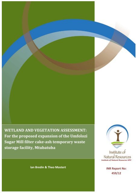
<strong>WETLAND</strong> AND VEGETATION ASSESSMENT:For the proposed expansion of the UmfoloziSugar Mill filter cake-ash temporary wastestorage facility, MtubatubaInstitute of Natural Resources NPCIan Bredin & Theo MostertINR Report No:459/121
<strong>WETLAND</strong> AND VEGETATION ASSESSMENT:For the proposed expansion of the Umfolozi Sugar Mill filter cake-ashtemporary waste storage facility, MtubatubaReport prepared for:<strong>SRK</strong> <strong>Consulting</strong>P.O. Box 1969Westville, 3630Umfolozi Sugar Mill (Pty) LtdPrivate Bag X12Mtubatuba, 3930Report prepared by:Institute of Natural Resources NPCP O Box 100396Scottsville, 3209September 2012Please direct any queries to:Ian BredinTel: 033 3460 796 Fax: 033 3460 895E-mail: ibredin@inr.org.zaDECLARATION OF INDEPENDENCEWe declare that Ian Bredin, Dr. Theo Mostert (Karos Environmental Services CC), and the Instituteof Natural Resources NPC (INR) have no financial or personal interest in the proposeddevelopment, nor its developers or any of its subsidiaries, apart from the provision of a wetlandand vegetation assessment report.
Wetland and Vegetation AssessmentCONTENTS1. INTRODUCTION ............................................................................................................................. 12. SCOPE OF WORK ........................................................................................................................... 13. PROJECT TEAM .............................................................................................................................. 14. STUDY AREA .................................................................................................................................. 24.1. Location ......................................................................................................................................... 24.2. Levels of Ecosystem Transformation ............................................................................................ 25. BACKGROUND INFORMATION FOR THE <strong>WETLAND</strong> ASSESSMENT .............................................. 46. METHODOLOGY ............................................................................................................................ 56.1. Wetland Assessment Methodology ............................................................................................. 56.2. Vegetation Assessment Methodology ......................................................................................... 76.3. Limitations of Study ...................................................................................................................... 97. <strong>WETLAND</strong> ASSESSMENT ................................................................................................................ 97.1. Transformation at the Study Site ................................................................................................. 97.2. Assessment of Wetland Indicators at the Study Site ................................................................. 127.3. Mfolozi Floodplain ...................................................................................................................... 148. VEGETATION ASSESSMENT ......................................................................................................... 158.1. Vegetation Units and Ecosystems .............................................................................................. 158.2. Plant Communities of the Study Area ........................................................................................ 178.3. Red Data Plant Species ............................................................................................................... 258.4. Invasive Alien Plant Species ........................................................................................................ 279. DISCUSSION & CONCLUSION ...................................................................................................... 2810. REFERENCE .................................................................................................................................. 3011. APPENDICES ................................................................................................................................ 3311.1. Appendix A: A list of Characteristics for each of the Sample Sites .......................................... 3311.2. Appendix B: Definition of Threatened Plant Species categories ............................................... 34List of FiguresFigure 1: Location of the study area, i.e. the proposed expansion area ................................................ 2Figure 2: Aerial photograph showing the study area, as well as the extent of agricultural and forestrytransformation of the surrounding natural vegetation and ecosystems ............................................... 3Figure 3: Evidence of extensive clearing operations of invasive alien plants on the study site ............. 4Figure 4: Cross section through a wetland, indicating how the soil wetness and vegetation indicatorschange as one moves along a gradient of decreasing wetness, from the middle to the edge of thewetland (Kotze, 1996; DWAF, 2005). ...................................................................................................... 6Figure 5: Half a meter contour data for the study site (Contour data supplied by <strong>SRK</strong>) ...................... 10INSTITUTE OF NATURAL RESOURCESi
Wetland and Vegetation AssessmentFigure 6: Historic 1: 50 000 topocadastral ............................................................................................ 11Figure 7: Historic aerial photographs of the area from 1975, 1995, 2000 and 2006 ........................... 12Figure 8: Field observations for the wetland assessment .................................................................... 13Figure 9: Mfolozi Floodplain (Grenfell, et al., 2009) ............................................................................. 14Figure 10: KZN wetland provincial inventory – Mfolozi Floodplain (i.e. recorded as a greatlytransformed floodplain) ........................................................................................................................ 15Figure 11: Regional vegetation types according to Mucina and Rutherford (2006) ............................ 16Figure 12: Some of the findings from the Ezemvelo KwaZulu-Natal Wildlife Strategic EnvironmentalAssessment (2000) taken into consideration for the vegetation assessment ...................................... 17Figure 13: Plant communities of the study area ................................................................................... 18Figure 14: Organic rich soils of the Ficus sycamorus–Trichilia emetica riverine woodland community.............................................................................................................................................................. 19Figure 15: Selected photographs illustrating the structure and composition the Ficus sycamorus–Trichilia emetica riverine woodland community .................................................................................. 20Figure 16: Highly leached nutrient poor soils of the Helichrysum krausii–Chrysanthemoidesmonilifera shrubland community ......................................................................................................... 22Figure 17: Helichrysum krausii–Chrysanthemoides monilifera shrubland community ........................ 22Figure 18: Lantana camara–Chromolaena odorata thickets ................................................................ 23Figure 19: Massive organic rich A-horizon along the south-eastern border of the study area............ 24Figure 20: Arundo donax–Pluchea dioscoridis reed thickets ................................................................ 25List of TablesTable 1: Project Team ............................................................................................................................. 1Table 2: Wetland classification to be applied to mapped wetlands ....................................................... 7Table 3: Plant species identified in Ficus sycamorus–Trichilia emetica Riverine Woodland during thetime of the survey ................................................................................................................................. 19Table 4: Plant species identified in Helichrysum krausii–Chrysanthemoides monilifera Shrublandduring the time of the survey ............................................................................................................... 21Table 5: Plant species identified in Lantana camara–Chromolaena odorata Thickets during the timeof the survey ......................................................................................................................................... 23Table 6: Plant species identified in Arundo donax–Pluchea dioscoridis Reed Thickets during the timeof the survey ......................................................................................................................................... 25Table 7: Red Data Plant Species recorded in the 2832AC Quarter Degree Grid .................................. 25Table 8: Species of concern in the Ficus sycamorus–Trichilia emetica riverine woodland community26Table 9: Species of concern in the Helichrysum krausii–Chrysanthemoides monilifera shrubland plantcommunity ............................................................................................................................................ 26Table 10: Species of concern in the Arundo donax–Pluchea dioscoridis reed thicket community ....... 27Table 11: Invasive alien species recorded at the study site .................................................................. 27INSTITUTE OF NATURAL RESOURCESii
Wetland and Vegetation AssessmentList of AcronymsBADDTDEADWAEIAEKZNWEAPGISGPSHGMINRNEMWANTNWASANBI<strong>SRK</strong>USMVUWRCBasic AssessmentData Deficient Taxonomically ProblematicDepartment of Environmental AffairsDepartment of Water AffairsEnvironmental Impact AssessmentEzemvelo KZN WildlifeEnvironmental Assessment PractitionerGeographical Information SystemGlobal Positioning SystemHydrogeomorphicInstitute of Natural Resources NPCNational Environmental Management Waste ActNear ThreatenedNational Water ActSouth African National Biodiversity Institute<strong>SRK</strong> <strong>Consulting</strong>Umfolozi Sugar MillVulnerableWater Research CommissionINSTITUTE OF NATURAL RESOURCESiii
Wetland and Vegetation Assessment1. INTRODUCTION<strong>SRK</strong> <strong>Consulting</strong> (<strong>SRK</strong>) appointed the Institute of Natural Resources (INR) to conduct a wetland andvegetation assessment for the Basic Assessment (BA) for the Waste Management License applicationfor the proposed expansion of the Umfolozi Sugar Mill (USM) filter cake-ash temporary wastestorage facility, in the Mtubatuba area.According to background information document for the BA (<strong>SRK</strong>, 2012), the USM obtained a WasteManagement License for their existing filter cake – ash temporary waste storage facility in June2011. In terms of National Environmental Management Waste Act (No. 59 of 2008) (NEMWA), theexpansion of the waste facility constitutes a “Category A” listed activity and therefore requires a BA,which is the process being undertaken by <strong>SRK</strong>. Relevant specialist studies are required to provide theEnvironmental Assessment Practitioner (EAP) with the necessary information to make informeddecisions when undertaking the BA. The wetland and vegetation assessment is one of thesespecialist studies.2. SCOPE OF WORKThe following scope of work was required to be carried out during the investigation: The delineation of wetland / riparian areas within the proposed site for theexpansion of the waste storage facility (12.72ha); A wetland functional and eco-services assessment; A vegetation assessment; and The compilation of an integrated report.3. PROJECT TEAMThe wetland and vegetation assessments was conducted and managed by the INR, with assistancefrom Dr Theo Mostert, who under took the vegetation assessment. The details of the project teamare included in Table 1.Table 1: Project TeamSPECIALIST ASPECT QUALIFICATIONSMSc – Veterinary Science (Pretoria)Mr. Ian Bredin (INR)Project ManagerPr.Sci.Nat. Registered – Ecology & ZoologyWetland Assessment DWA Accredited – Competent Wetland DelineationSpecialistDr. Theo Mostert (KarosEnvironmental Services CC)Vegetation Assessment Pr.Sci.Nat. Registered - Ecology, Botany & ZoologyDr. Chris Dickens (INR) Internal ReviewPhD – BotanyPr.Sci.Nat. RegisteredINSTITUTE OF NATURAL RESOURCES 1
Wetland and Vegetation Assessment4. STUDY AREA4.1. LocationLocation of the study area can roughly be described as situated south of the town Mtubatuba on theFarm Sugarlake 5954, south of the Umfolozi River, east of the N2 National highway, north of LakeEteza Nature Reserve, and north of the P389 Provincial Road (Figure 1).Figure 1: Location of the study area, i.e. the proposed expansion area4.2. Levels of Ecosystem TransformationThe surrounding landscape and terrain units have been transformed and modified extensively inorder to suit agricultural practices, in particular the sugarcane industry (Figure 2). A very largefraction of the surrounding land surfaces have been ploughed and reshaped to even out sharpINSTITUTE OF NATURAL RESOURCES 2
Wetland and Vegetation Assessmentcontours and to construct roads for farming purposes. In addition, historically many drainage ditcheshave been constructed to drain wet soils and to redirect water in order to create more favourableconditions for the commercial cultivation of sugarcane. Existing rivers and drainage lines havehistorically been dredged to form deeply eroded artificial channels and furrows to speed up waterdrainage away from wet areas.Figure 2: Aerial photograph showing the study area, as well as the extent of agricultural and forestrytransformation of the surrounding natural vegetation and ecosystemsAll ecosystems on the study site have been invaded aggressively by alien plant species. Many ofthese species are declared invasive alien species and should be controlled by law (Regulation 15 ofthe Conservation of Agricultural Resources Act, 1983 – Act 43 of 1983). Recently, an extensiveINSTITUTE OF NATURAL RESOURCES 3
Wetland and Vegetation Assessmentclearing operation has been undertaken in an attempt to remove and control these species at thestudy site (Figure 3).Figure 3: Evidence of extensive clearing operations of invasive alien plants on the study site5. BACKGROUND INFORMATION FOR THE <strong>WETLAND</strong> ASSESSMENTAs the custodians of the Nation’s water resources the Department of Water Affairs (DWA) assumespublic trusteeship of water resources, which includes watercourses, surface water, estuaries, oraquifers. The National Water Act (Act No. 36 of 1998) (NWA) allows for the protection of waterresources, which includes: The maintenance of the quality of the water resource to the extent that the waterresources may be used in an ecologically sustainable way; The prevention of the degradation of the water resource; and The rehabilitation of the water resource.A watercourse means: A river or spring; A natural channel in which water flows regularly or intermittently; A wetland, lake or dam into which, or from which, water flows; and Any collection of water which the Minister may, by notice in the Gazette, declare tobe a watercourse, and a reference to a watercourse includes, where relevant, its bedand banks.The word “wetland” is a name given to a variety of ecosystems that all share a common primarydriving force: water. Thus any part of the landscape where water accumulates for long enough andoften enough to influence the plants, animals and soils occurring in that area, is a wetland (DWAF,2005). In ecological, social and economic terms, wetlands are among the most valuable andproductive ecosystems on earth (Davies and Day, 1998). Despite these values, wetlands in SouthAfrica are rapidly being lost or degraded as a result of human activities (Kotze et al., 1994). Thestructure of any wetland is an expression of the relationship between the biotic and abioticenvironment, which function together and result in many ecosystem goods and services.INSTITUTE OF NATURAL RESOURCES 4
Wetland and Vegetation AssessmentThe NWA (Act No. 36 of 1998) defines a wetland as:“Land which is transitional between terrestrial and aquatic systems where the water table is usuallyat or near the surface, or the land is periodically covered with shallow water, and which land innormal circumstances supports or would support vegetation typically adapted to life in saturatedsoil”.Wetlands must have one or more of the following attributes (DWAF, 2005): Wetland (hydromorphic) soils that display characteristics resulting from prolongedsaturation; The presence, at least occasionally, of water loving plants (hydrophytes); and A high water table that results in saturation at or near the surface, leading toanaerobic conditions developing in the top 50cm of the soil.6. METHODOLOGY6.1. Wetland Assessment MethodologyA field investigation was undertaken on the 19 th and 20 th of July 2012, in order to confirm anddelineate the presence of wetland habitats within the demarcated study site, and also to assess thefunctioning and service provision of any wetlands 1 . Prior to the field investigation orthophotographs, 1:50 000 topographical maps, contour data, the provincial wetland inventory, andGoogle imagery were used as reference material to identify the presence of potential wetlands. Inaddition, a literature review was also undertaken, as there is extensive research that has beenundertaken for the Mfolozi floodplain wetland.Methods used in the assessment of wetland resources included:Wetland Delineation and MappingFor the purposes of this assessment, wetlands were considered as those ecosystems defined by theNational Water Act (No 36 of 1998). Furthermore, according to DWAF (2005), wetlands must haveone or more of the following attributes (Figure 4): Wetland (hydromorphic) soils that display characteristics resulting from prolongedsaturation; The presence, at least occasionally, of water loving plants (hydrophytes); and A high water table that results in saturation at or near the surface, leading to anaerobicconditions developing in the top 50cm of the soil.1 Note: A functional and ecoservice assessment was not undertaken for the study site. Reasons for not utilizingthese wetland assessment tools will be explained in Section 9.INSTITUTE OF NATURAL RESOURCES 5
Wetland and Vegetation AssessmentFigure 4: Cross section through a wetland, indicating how the soil wetness and vegetation indicatorschange as one moves along a gradient of decreasing wetness, from the middle to the edge of thewetland (Kotze, 1996; DWAF, 2005).An investigation for wetland boundaries located within the study was undertaken in accordance to‘A Practical Field Procedure for Identification and Delineation of Wetland and Riparian Areas’(DWAF, 2005). This involved the on-site assessment of wetland indicators, with a primary focus onwetland vegetation and soil wetness indicators. The latter was determined through soil samplingwith an auger to differentiate between permanent, seasonal, temporary and non-wetland soils.Sampling points were recorded with a Global Positioning System (GPS) and captured usingGeographical Information Systems (GIS) for further processing.The study site was traversed on foot. Soil samples, within the top 50cm of the soil profile, weretaken using a hand auger at random intervals along transect lines and at random points within thestudy site, and these were assessed for wetland characteristics. Each auger point sampled wasmarked with a handheld Global Positioning System (GPS) device (GPSMAP60CX), which has anaccuracy of between 3 to 5m.Mapping of the study site was carried out using ArcGIS 10 (the coordinates of sampling sites wererecorded as geographic projections, WGS 84 Datum). Mapping was based on the field data collected,and the interpretation of aerial photography and Google imagery of the area.Wetland ClassificationA draft wetland classification system was developed for the Water Research Commission (WRC) in2006 (Ewart-Smith, et al, 2006). Further development on the proposed National WetlandClassification System was completed 2009 (SANBI, 2009). Given that this is the classification likely tobe adopted for the National Wetland Inventory, this is the system that was used to inform wetlandclassification in this study. It was developed subsequent to the identification of HGM typesINSTITUTE OF NATURAL RESOURCES 6
Wetland and Vegetation Assessmentsupporting inland wetlands in South Africa (modified from Brinson, 1993; Kotze, 1999; andMarneweck and Batchelor, 2002) for the WET-Ecoservice tool (Kotze, et al., 2007), and is verysimilar. For the purposes of this study, wetlands have been assigned to landscape setting (Level 3)and hydrogeomorphic (HGM) unit (Level 4A) as described in Table 1.Table 2: Wetland classification to be applied to mapped wetlandsLEVEL 3LEVEL 4ALandscape SettingHGM TypeChannel (river)SLOPEHillslope seepChannel (river)Channelled valley-bottom wetlandUnchannelled valley-bottom wetlandVALLEY FLOORFloodplain wetlandDepressionValleyhead seepChannel (river)Floodplain wetlandPLAINUnchannelled valley-bottom wetlandDepressionFlatBENCHDepression(HILLTOP / SADDLE / SHELF) Flat6.2. Vegetation Assessment MethodologyA desktop and literature review was undertaken. Existing knowledge of the area was updatedthrough: using available scientific and popular literature; available datasets from government andacademic institutions; and the Internet. The review allowed for the identification of current speciesof concern in terms of international, national and provincial legislation. This information was thenused to create a profile of the species of concern with regards to their habitat preference and knownareas of distribution. The following small- and large-scale data sets were used: Topography – High resolution MapSource images; Geology – 1: 250 000 scale, Council for Geoscience; Landforms – 1: 250 000 scale, SANBI, BGIS; Land types (soil properties) – 1: 250 000 scale, Institute for Soil, Climate & Water; Regional vegetation – 1: 250 000 scale, VEGMAP – SANBI; Wetlands – 1: 250 000, National Wetland Inventory – SANBI, BGIS; Land Cover – 1: 50 000 scale: 1995, 2000, 2009 – CSIR, DEA, SANBI; Topocadastral – 1: 50 000 scale, Surveyor – General; and High resolution aerial imagery – supplied by client.Based on the available vegetation, soil, geology, land-type and topography maps, as well as aerialand satellite imagery, the study area was stratified and mapped into physiographic-physiognomicINSTITUTE OF NATURAL RESOURCES 7
Wetland and Vegetation Assessmentunits. Sampling plot localities were determined randomly within these units, and care was taking tosample representative examples with each of the units.Data Collection and AnalysisSchamineé & Stortelder (1996) emphasized the importance of standardized sampling and dataanalysis for comparative reasons. According to Werger (1974), the following are importantrequirements to be fulfilled by any ecological classification method concerning total floristiccomposition: The method should be scientifically sound. It should fulfil the necessity of classification at an appropriate level or scale. It should be efficient and versatile amongst comparable approaches.For these reasons, it was decided to use the Braun-Blanquet method (Braun-Blanquet 1932; Werger1973; Mueller-Dombois & Ellenberg 1974; Whittaker 1978) in order to classify the vegetation of thestudy area.The vegetation of the study area was stratified into homogeneous physiographic–physiognomicunits, using aerial photographs (scale 1: 10 000), as well as maps on the topography, geology, soilsand land types of the area. Sample plots were placed within each of these stratified units in such away that habitat was as uniform as possible within each vegetation stand. A field investigation wasundertaken on the 18 th of July 2012.The cover-abundance for every species present in a sample plot was assessed according to theBraun-Blanquet cover-abundance scale (Werger 1974, Mueller-Dombois & Ellenberg 1974): r Very rare and with a negligible cover (usually a single individual) + Present but not abundant, with a small cover value (
Wetland and Vegetation Assessmentdifferences in biological data. Although the reliability of the TWINSPAN approach has beenquestioned under certain conditions (Van Groenewoud 1992; Van Der Maarel 1996), it was chosenfor its proven combination of effectiveness, robustness, relative objectivity, speed and availability(Gauch & Whittaker 1981; Myklestad & Birks 1993). Due to the relative manageable size of thedataset, no subjective stratification of the data was performed before the numerical classificationwas done, as is suggested for large datasets (Van Der Maarel et al. 1987; Bredenkamp &Bezuidenhout 1995).The resulting vegetation units were mapped and classified based on their ecological functionalityand integrity.Lists of red data plant species for the study area and its surroundings were requested from the SouthAfrican Biodiversity Institute (SANBI) and Ezemvelo KZN Wildlife (EKZNW). At the time of data andreport compilation only data from SANBI were available an incorporated into the report. These lists,as well as other listed plants protected and regulated under various provincial ordinances, were usedto create a priority species list for the study area.6.3. Limitations of StudyThe wetland and vegetation assessments were conducted during winter, which is the seasonal dryseason. A more ideal timing for the field data collection phase would be middle to late summer. Atthis time more plants would be identifiable and signs of wetness in the landscape are moreaccurately detected and interpreted.7. <strong>WETLAND</strong> ASSESSMENT7.1. Transformation at the Study SiteBefore explaining the findings from the investigation for wetland indicators, one needs to have anunderstanding of the extent of transformation that has occurred at the site. As previously discussed,the extensive transformation of the surrounding landscape for agricultural purposes is obvious.Likewise, when you look at the extent of alien invasive species throughout the study site, it is alsoclear that extensive transformation as occurred at the study site. The assessment of detailedcontours (0.5m contours) for the study site supports this observation (Figure 5). The shape of thecontours suggests that the soil profile has been altered, and that should surface water occur it wouldflow in an easterly direction across the study site.INSTITUTE OF NATURAL RESOURCES 9
Wetland and Vegetation AssessmentFigure 5: Half a meter contour data for the study site (Contour data supplied by <strong>SRK</strong>)Further evidence of the reshaping of the contours of the study site is evident when assessing thehistoric 1: 50 000 topocadastral for the area (Figure 6), which indicates a watercourse runningthrough the study site. It appears that a watercourse drained surface water from the western edgeof the study site towards the south-eastern boundary.INSTITUTE OF NATURAL RESOURCES 10
Wetland and Vegetation AssessmentApproximate location of thestudy siteFigure 6: Historic 1: 50 000 topocadastralIn addition to the evidence provided by assessing vegetation and contour data, and the historictopocadastral, the assessment of historic aerial photographs of the area also provides valuableinsight into the transformation of the study site (Figure 7). Aerial photographs taken in 1975, i.e.prior to the Demoina floods in 1984, clearly indicate a watercourse traversing the area where thestudy site is located. Over ten years after the floods, i.e. aerial photo taken in 1995, there is clearevidence of the extensive sediment deposition across the majority of the study site. The assessmentof more recent aerial photos, i.e. photos taken in 2000 and 2006, reveal that through thesedimentation from flooding and extensive agriculture in the area, the study site has been largelytransformed.1975 1995Approximate location of thestudy siteINSTITUTE OF NATURAL RESOURCES 11
Wetland and Vegetation Assessment2000 2006Approximate location of thestudy siteFigure 7: Historic aerial photographs of the area from 1975, 1995, 2000 and 20067.2. Assessment of Wetland Indicators at the Study SiteThe investigation of wetland indicators revealed that:In terms of the terrain there was no apparent evidence of a wetland of any definable HGMtype or a watercourse for that matter, within the study site. The apparent alignment of Ficussycamorus trees appears to be the remnants of the watercourse that use to traverse thestudy site. The entire study site is, however, located on the Mfolozi flats. More specifically itis in the upper reaches of the Mfolozi floodplain, which is an extensive wetland system.The soil profile has been disturbed across the majority of the study site. Augered soilsamples of between 0.5 – 1m deep provided evidence of a largely thin layer of organicmaterial, which in some cases was mixed with filter cake-ash, in the topsoil followed by asandy horizon. This sandy layer can be described as alluvial soils, i.e. deposited throughfluvial processes, which are too sandy for morphological signs of wetness to be readilydetectable in the soil profile. The alluvial soils are likely the result of the Demoina floods (i.e.refer to Figure 7). Although no mottling was observed in the soil samples recorded, therewas evidence of wet soils in the western corner of the study site. However, this evidence ofsoil wetness could likely be the result of disturbances (i.e. the wet soil conditions could bethe result of adjacent roads confining water to a particular area).In terms of vegetation, as already mentioned, the majority of the site is extensively invadedby alien species. In some areas of the study site the alien vegetation has formedimpenetrable thickets. However, Phragmites australis, which is an obligate species 2 , wasrecorded at a number of the sampling sites.Figure 8 illustrates some observation made during the study site assessment. A list of characteristicsfor each of the sample sites is provided in Appendix A.2 Obligate species: Species almost always found in wetlands.INSTITUTE OF NATURAL RESOURCES 12
Wetland and Vegetation AssessmentA thicket of largely alien invasive speciesHelichrysum shrubland adjacent to theberm for the existing waste storagefacilityAlluvial depositsOrganic rich topsoil,mostly filter cake-ash,auger point close toexisting bermSandy soil sampleShoots of PhragmitesOrganic richFicus sycamorusaustralis in one of theclearings on siteA thicket of largely alien invasivespeciesRicinus communistopsoil oversandy horizonFigure 8: Field observations for the wetland assessmentINSTITUTE OF NATURAL RESOURCES 13
Wetland and Vegetation Assessment7.3. Mfolozi FloodplainThe Mfolozi floodplain is an extensive floodplain wetland system, which is approximately 19 000hectares in extent (Ellery, et al., 2009) (Figures 9 & 10). Extensive research has been undertaken onthe Mfolozi floodplain wetland system, particularly on the role it plays in supporting the functioningof the Greater St Lucia Wetland Park (Nomad Socio Economic Management and <strong>Consulting</strong>, 2010).The upper two-thirds of the floodplain have been transformed to cultivate sugar cane and to a lesserdegree Eucalyptus plantations. The remainder falls within the iSimangaliso Wetland Park but hasnevertheless been extensively cultivated by small-scale subsistence farmers (Grenfell, et al., 2009).According to Grenfell, et al. (2009), historically the floodplain was a mosaic of permanent andseasonal herbaceous wetlands, with Cyperus papyrus and Phragmites australis as the dominantplant species. Where vegetation has not been cleared, riverine vegetation such as Ficus trichopodaand Ficus sycamorus trees occur on the banks of abandoned and active channel courses.Figure 9: Mfolozi Floodplain (Grenfell, et al., 2009)Three large lakes occur on the floodplain periphery: Lake Teza toward the southwest, Lake Futululuin the north, and Lake St. Lucia in the northeast. In addition to the Mfolozi River, which flowseastward along the northern part of the floodplain, a second river (the Msunduze River) drains alocalized catchment, and flows along the southern margin before turning northward at theMaphelane dune cordon, and joining the Mfolozi River near its mouth. Occasionally, long shore driftforces the Mfolozi-Msunduze estuary to combine with the Lake St. Lucia estuary to the north, suchthat they share a common mouth (Grenfell, et al., 2009).INSTITUTE OF NATURAL RESOURCES 14
Wetland and Vegetation AssessmentFigure 10: KZN wetland provincial inventory – Mfolozi Floodplain (i.e. recorded as a greatlytransformed floodplain)According to Ellery, et al. (2009), the Mfolozi River is confined to an incised valley directly upstreamof the floodplain. After passing through the Lebombo Mountains, the valley widens considerablyfrom 915 m to over 6 km in just 1.15 km. This rapid change from confinement to a broad floodplainsetting also results in a reduction of carrying capacity of the Mfolozi River, creating a node of largescaledeposition at the floodplain head in the form of an alluvial fan. Deposition in this region causeslocal steepening of the valley’s longitudinal profile. During flood events, the Mfolozi River losesconfinement as inundation of the floodplain takes place, and stream capacity thus declines, resultingin deposition that has created a south eastward sloping lobe of sediment at the floodplain head(Grenfell, et al., 2009) (i.e. the alluvial deposits observed at the study site, which were depositedduring a flood event).In addition, Ellery, et al. (2009) indicate that an influx of sediment into the floodplain is vitallyimportant in maintaining the integrity of the wetland system. Without on-going sedimentation,natural subsidence of the floodplain would result in marine incursion. Therefore, they suggest thatall activities that disrupt sedimentation on the floodplain should be controlled.8. VEGETATION ASSESSMENT8.1. Vegetation Units and EcosystemsTerrestrial ecosystem diversity on a regional scale is driven by geology, climate and topography(Barbour et al 1980, Strahler & Strahler 1987), while on a local scale the drivers are altitude, slope,aspect, soil conditions and consumers, whether human or animal (De Frey 1999). The vegetationreflects this variation in the landscape with change in species composition and dominance. Thesechanges could be abrupt or gradual depending on the nature of the vegetation or the environmentalINSTITUTE OF NATURAL RESOURCES 15
Wetland and Vegetation Assessmentfactors involved (Mucina & Rutherford 2006). This variation in vegetation (plant communities)represents habitat (ecosystems) to a variety of animals at variable spatial and temporal scales(Bothma 1995, Turner et al 2001).Biodiversity loss is a global issue linked to habitat loss and fragmentation with subsequent loss inspecies (Lindenmayer & Fischer 2006, Van Andel & Aronson 2006). Transformation (habitatdestruction) and the spread of alien invasive species are considered key contributors to biodiversityloss.The study area falls within the regional vegetation type Maputaland Coastal Belt, which forms partof the Indian Ocean Coastal Belt Biome (Mucina and Rutherford 2006) (Figure 11). This vegetationtype is considered as Vulnerable to extinction, with only 15% statutorily conserved. Agriculture isone of the main drivers of transformation of this vegetation type (Mucina and Rutherford 2006).Figure 11: Regional vegetation types according to Mucina and Rutherford (2006)An integrated approach was followed during the assessment of the remaining natural ecosystems ofthe study area. Available information was combined with information gathered on site during thefield work phase. Some of the additional landscape and ecosystem geographic information systemsused during this assessment are shown in Figure 12.INSTITUTE OF NATURAL RESOURCES 16
Wetland and Vegetation AssessmentFigure 12: Some of the findings from the Ezemvelo KwaZulu-Natal Wildlife Strategic EnvironmentalAssessment (2000) taken into consideration for the vegetation assessment8.2. Plant Communities of the Study AreaBased on the acquired data the following plant communities and land cover units were identifiedand delineated within and adjacent to the study area (Figure 13): Ficus sycamorus–Trichilia emetica riverine woodland Helichrysum krausii–Chrysanthemoides monilifera shrubland Lantana camara–Chromolaena odorata thickets Arundo donax–Pluchea dioscoridis reed thicketsINSTITUTE OF NATURAL RESOURCES 17
Wetland and Vegetation Assessment12143Figure 13: Plant communities of the study areaPlant Community 1: Ficus sycamorus–Trichilia emetica Riverine WoodlandThe Ficus sycamorus–Trichilia emetica riverine woodland is situated along the remnants of awatercourse (Figure 13). The watercourse would have, and may still to some degree, drain surfacewater from the western edge of the study area towards the south-eastern boundary.Soils associated with this plant community have a top soil layer with a very high organic content,while the underlying horizon is generally nutrient poor, leached and mainly consist of alluvial sandydeposits (Figure 14).According to Edwards (1983) structural classification, the vegetation structure can be described as“Tall closed woodland” (Figure 15). Large trees range from 8 to 12 meters, while the normally denseshrub layer range from 0.5 to 5 meters. Recent attempts to clear invasive alien species have led todramatic disturbances to the shrub and herbaceous layer, resulting in a more open structure thanunder natural conditions.INSTITUTE OF NATURAL RESOURCES 18
Wetland and Vegetation AssessmentProminent and diagnostic tree and shrub species include typical riverine woodland species such asAcacia robusta, Bridelia cathartica, Celtis africana, Clausena anisata, Clerodendrum glabrum,Erythrina caffra, Ficus sycomorus, Gymnosporia senegalensis, Phyllanthus reticulates, Rauvolfiacaffra, Trema orientalis and Trichilia emetica. Prominent grass species include Oplismenus hirtellusand Panicum maximum. Prominent herbaceous species include Achyranthes aspera, Diclipteraheterostegia, Isoglossa woodii and Senecio deltoideus. The para-endemic (Zululand-Swaziland) (Hahn2006) species Cissampelos mucronata, occurs in relatively large numbers. Table 3 listed the plantspecies that were identified in this plant community during the time of the survey.Table 3: Plant species identified in Ficus sycamorus–Trichilia emetica Riverine Woodland during thetime of the surveyTREESGRASSESAcacia karroo HayneOplismenus hirtellus (L.) P.Beauv.Acacia robusta Burch. ssp. clavigera (E.Mey.) Brenan Panicum maximum Jacq.Acacia sieberiana DC.Bridelia cathartica Bertol.f.FORBSCeltis africana Burm.f. Achyranthes aspera L.Chrysanthemoides monilifera (L.) Norl.Cissampelos mucronata A.Rich.Dicliptera heterostegia C.Presl exClausena anisata (Willd.) Hook.f. ex Benth.NeesClerodendrum glabrum E.Mey.Isoglossa woodii C.B.ClarkeDeinbollia oblongifolia (E.Mey. ex Arn.) Radlk. Momordica balsamina L.Erythrina caffra Thunb.Senecio deltoideus Less.Ficus sycomorus L.Gymnosporia senegalensis (Lam.) Loes.REEDS AND SEDGESSchoenoplectus corymbosus (RothPhyllanthus reticulatus Poir.ex Roem. & Schult.) J.RaynalRauvolfia caffra Sond.Phragmites australis (Cav.) Steud.Rhus rigida Mill.Trema orientalis (L.) BlumeTrichilia emetica VahlFigure 14: Organic rich soils of the Ficus sycamorus–Trichilia emetica riverine woodland communityINSTITUTE OF NATURAL RESOURCES 19
Wetland and Vegetation AssessmentFigure 15: Selected photographs illustrating the structure and composition the Ficus sycamorus–Trichilia emetica riverine woodland communityPlant Community 2: Helichrysum krausii–Chrysanthemoides monilifera ShrublandThe Helichrysum krausii–Chrysanthemoides monilifera shrubland community occurs north of thefragmented remains of the watercourse, occupying the northern section of the study area (Figure13). The topography of the community is relatively flat. Recent attempts to remove invasive alienplant species have led to moderate disturbances to the vegetation. Several foot paths cut throughthe vegetation and many signs of cattle grazing were recorded during the vegetation survey.Soils of this plant community are generally without structure and texture can be described as sandy(Figure 16). These sandy soils are deep, highly leached and nutrient poor (>1.2 m) and show no clearhorizon formation.According to Edwards (1983) structural classification, the vegetation structure can be described as“Short closed shrubland” (Figure 17). Shrubs height ranges from 0.3 to 0.9 m. A relatively openherbaceous layer is dominated by short to medium length unpalatable grass species. Recentattempts to clear invasive alien species have led to dramatic disturbances to the shrub andherbaceous layer, resulting in a more open structure than under natural conditions.Due to numerous signs of historical disturbance, the vegetation is considered to be of a secondarynature. Prominent shrub species include Chrysanthemoides monilifera, Helichrysum kraussii andPluchea dioscoridis. Large numbers of invasive alien plant species have recently been removed fromthis community, such as Chromolaena odorata, Lantana camara and Solanum mauritianum.INSTITUTE OF NATURAL RESOURCES 20
Wetland and Vegetation AssessmentProminent grass species include Aristida junciformis and Melinis repens. Prominent forbs recordedinclude Chamaecrista comosa, Eriosema kraussianum, Helichrysum cephaloideum,Pseudognaphalium luteo-album, Senecio madagascariensis, Vernonia oligocephala andWahlenbergia krebsii. Table 4 listed the plant species that were identified in this plant communityduring the time of the survey.Table 4: Plant species identified in Helichrysum krausii–Chrysanthemoides monilifera Shrublandduring the time of the surveyTREESFORBSChromolaena odorata (L.) R.M.King & H.Rob. Amaranthus hybridus L.Chrysanthemoides monilifera (L.) Norl.Chamaecrista comosa E.Mey.Crotalaria monteiroi Taub. ex Baker f. Commelina erecta L.Helichrysum kraussii Sch.Bip.Eriosema kraussianum Meisn.Lantana camara L.Helichrysum cephaloideum DC.Melia azedarach L.Hewittia malabarica (L.) SureshPhyllanthus reticulatus Poir. Momordica balsamina L.Pseudognaphalium luteo-album (L.)Pluchea dioscoridis (L.) DC.Hilliard & B.L.BurttSolanum mauritianum Scop. Ricinus communis L.Senecio madagascariensis Poir.Vernonia oligocephala (DC.) Sch.Bip. exWalp.Wahlenbergia krebsii Cham.Zehneria scabra (L.f.) Sond.GRASSESREEDS AND SEDGESAristida diffusa Trin.Phragmites australis (Cav.) Steud.Aristida junciformis Trin. & Rupr.Cynodon dactylon (L.) Pers.Dactyloctenium aegyptium (L.) Willd.Eleusine coracana (L.) Gaertn.Melinis repens (Willd.) ZizkaPanicum maximum Jacq.INSTITUTE OF NATURAL RESOURCES 21
Wetland and Vegetation AssessmentFigure 16: Highly leached nutrient poor soils of the Helichrysum krausii–Chrysanthemoidesmonilifera shrubland communityFigure 17: Helichrysum krausii–Chrysanthemoides monilifera shrubland communityPlant Community 3: Lantana camara–Chromolaena odorata ThicketsThe Lantana camara–Chromolaena odorata thickets occur mainly south of the fragmentedwatercourse transversing the study area (Figure 13). Recent attempts to remove invasive alien plantspecies have led to sever disturbances to the vegetation. Due to the complete dominance of invasivealien plants within this community, removal of such species leaves the system with very littleremaining vegetation. In places where clearing operations have not yet been undertaken, invasivealien species form impenetrable thickets, smothering nearly all indigenous vegetation (Figure 18).Soils of this plant community are generally without structure and texture can be described as sandy.These sandy soils are deep, highly leached and nutrient poor (>1.2 m) and show no clear horizonformation. Along the eastern sections of this community, the topsoil appeared to have beenenriched with filter cake-ash (Figure 19).According to Edwards (1983) structural classification, the vegetation structure can be described as“Low thicket”. Shrubs height ranges from 1 to 3 m, while mean tree height is approximately 8 m. Theshrub layer forms impenetrable thickets. Recent attempts to clear invasive alien species have led todramatic changes in vegetation structure in some areas, leaving almost no live vegetation cover. InINSTITUTE OF NATURAL RESOURCES 22
Wetland and Vegetation Assessmentareas where these thickets are still in tack, practically all other vegetation is smothered, resulting ina non-existent herbaceous layer.Dominant and prominent woody species include Chromolaena odorata, Lantana camara, Meliaazedarach, Pluchea dioscoridis, Ricinus communis and Solanum mauritianum. Grass species arerestricted to the periphery of thickets and include Chloris pycnothrix, Cynodon dactylon,Dactyloctenium aegyptium, Eleusine coracana, Imperata cylindrica and Panicum maximum. The mostof the prominent herbaceous species recorded was the weedy exotic species Amaranthus hybridus.Table 5 listed the plant species that were identified in this plant community during the time of thesurvey.Table 5: Plant species identified in Lantana camara–Chromolaena odorata Thickets during the timeof the surveyTREESGRASSESChromolaena odorata (L.) R.M.King & H.Rob.Chloris pycnothrix Trin.Chrysanthemoides monilifera (L.) Norl.Cynodon dactylon (L.) Pers.Lantana camara L.Dactyloctenium aegyptium (L.) Willd.Melia azedarach L.Eleusine coracana (L.) Gaertn.Phyllanthus reticulatus Poir.Imperata cylindrica (L.) Raeusch.Pluchea dioscoridis (L.) DC.Panicum maximum Jacq.Ricinus communis L.Solanum mauritianum Scop.FORBSAmaranthus hybridus L.Solanum kwebense N.E.Br.Hewittia malabarica (L.) SureshFigure 18: Lantana camara–Chromolaena odorata thicketsINSTITUTE OF NATURAL RESOURCES 23
Wetland and Vegetation AssessmentFigure 19: Massive organic rich A-horizon along the south-eastern border of the study areaPlant Community 4: Arundo donax–Pluchea dioscoridis Reed ThicketsThe Arundo donax–Pluchea dioscoridis reed thickets occur mainly in the south-western corner of thestudy area (Figure 13). The soils of this area were relatively wet at the time of the field surveys,despite the fact that surveys were conducted during the winter amidst the seasonal dry season. Thewater logged condition of this section of the study site may possibly be a result of the roads alongthe western and southern boundaries restricting free drainage of water towards the wetlandshistorically situated south-east of the study area.Soils of this plant community are very similar to the soils along the eastern sections of the Lantanacamara–Chromolaena odorata thickets community.According to Edwards (1983) structural classification, the vegetation structure can be described as“Low thicket” (Figure 20). Shrubs height ranges from 1 to 3 m, while mean tree height isapproximately 8 m. The shrub layer forms impenetrable thickets. In addition, the exotic reed Arundodonax, contributes significantly to the structure of this plant community.Dominant and prominent woody species include Chromolaena odorata, Lantana camara, Meliaazedarach, Phyllanthus reticulates, Pluchea dioscoridis, Ricinus communis and Solanum mauritianum.Prominent grass species include Cynodon dactylon, Dactyloctenium aegyptium, Eleusine coracanaand Panicum maximum. Some of the dominant herbaceous species recorded are Amaranthushybridus, Hewittia malabarica, Vernonia oligocephala, Wahlenbergia krebsii and Zehneria scabra.Two reed species form a prominent component of the community, namely Phragmites australis andArundo donax. Table 6 listed the plant species that were identified in this plant community duringthe time of the survey.INSTITUTE OF NATURAL RESOURCES 24
Wetland and Vegetation AssessmentTable 6: Plant species identified in Arundo donax–Pluchea dioscoridis Reed Thickets during the timeof the surveyTREESFORBSChromolaena odorata (L.) R.M.King & H.Rob. Amaranthus hybridus L.Lantana camara L.Chamaecrista comosa E.Mey.Melia azedarach L. Commelina erecta L.Phyllanthus reticulatus Poir.Hewittia malabarica (L.) SureshPluchea dioscoridis (L.) DC. Momordica balsamina L.Ricinus communis L.Vernonia oligocephala (DC.) Sch.Bip. ex Walp.Solanum mauritianum Scop.Wahlenbergia krebsii Cham.Zehneria scabra (L.f.) Sond.GRASSESREEDS AND SEDGESCynodon dactylon (L.) Pers.Phragmites australis (Cav.) Steud.Dactyloctenium aegyptium (L.) Willd.Arundo donaxEleusine coracana (L.) Gaertn.Panicum maximum Jacq.Figure 20: Arundo donax–Pluchea dioscoridis reed thickets8.3. Red Data Plant SpeciesThe following red data plant species have historically been recorded in the 2832AC Quarter DegreeGrid according to SIBIS web data base (South African Biodiversity Institute) (Table 7).Table 7: Red Data Plant Species recorded in the 2832AC Quarter Degree GridFAMILY NAME SPECIES NAME CATEGORYAMARYLLIDACEAE Crinum acaule NTAMARYLLIDACEAE Crinum moorei VUAMARYLLIDACEAE Crinum stuhlmannii DecliningAPIACEAE Alepidea peduncularis DDTASPHODELACEAE Aloe cooperi subsp. pulchra DDTASPHODELACEAE Kniphofia littoralis NTHYACINTHACEAE Drimia elata DDTHYACINTHACEAE Eucomis autumnalis subsp. clavata DecliningHYPOXIDACEAE Hypoxis hemerocallidea DecliningORCHIDACEAE Eulophia speciosa DecliningINSTITUTE OF NATURAL RESOURCES 25
Wetland and Vegetation AssessmentFAMILY NAME SPECIES NAME CATEGORYPASSIFLORACEAE Adenia gummifera var. gummifera DecliningNote: For the definition of the categories refer to Appendix B.None of the above listed species were recorded as occurring naturally within the study area duringthe surveys. Although numerous of the species listed above may have occurred in the study areawhen suitable habitat still occurred, shrinking, disappearing and degrading of the availableremaining habitat have had a devastating impact on these plant populations. Severe infestation ofthe natural vegetation by invasive alien species and localised disturbances to the upper soil profileshave removed and killed many of the geophytic species.The Ficus sycamorus–Trichilia emetica riverine woodland community contains highly suitable habitatfor four Declining plant species, and marginally suitable habitat for one Near Threatened (NT) plantspecies and one Data Deficient species (Table 8).Table 8: Species of concern in the Ficus sycamorus–Trichilia emetica riverine woodland communitySUITABILITYFAMILY NAME SPECIES NAME CATEGORYOF FLOWERINGREMAINING SEASONHABITATAMARYLLIDACEAE Crinum acaule NT Medium Sep-JanHYACINTHACEAE Drimia elata DDT Medium Sep-JanHYACINTHACEAEEucomis autumnalissubsp. clavataDeclining High Dec-AprHYPOXIDACEAE Hypoxis hemerocallidea Declining High Aug-AprORCHIDACEAE Eulophia speciosa Declining High Aug-JanPASSIFLORACEAEAdenia gummifera var.gummiferaDeclining High Oct-JanThe Helichrysum krausii–Chrysanthemoides monilifera shrubland plant community contains highlysuitable habitat for two Declining plant species and marginally suitable habitat for one NT plantspecies (Table 9).Table 9: Species of concern in the Helichrysum krausii–Chrysanthemoides monilifera shrubland plantcommunitySUITABILITYFAMILY NAME SPECIES NAME CATEGORYOF FLOWERINGREMAINING SEASONHABITATAMARYLLIDACEAE Crinum acaule NT Medium Sep-JanHYPOXIDACEAE Hypoxis hemerocallidea Declining High Aug-AprORCHIDACEAE Eulophia speciosa Declining High Aug-JanThe Arundo donax–Pluchea dioscoridis reed thicket community contains marginally suitable habitatfor one declining species, but only in a rehabilitated state (Table 10).INSTITUTE OF NATURAL RESOURCES 26
Wetland and Vegetation AssessmentTable 10: Species of concern in the Arundo donax–Pluchea dioscoridis reed thicket communitySUITABILITYFAMILY NAME SPECIES NAME CATEGORYOF FLOWERINGREMAINING SEASONHABITATHYACINTHACEAEEucomis autumnalissubsp. clavataDeclining High Dec-AprExcept for Adenia gummifera var. gummifera, all of the above listed species are geophytic.Geophytes are generally very easy to remove and can be translocated successfully once they havebeen found. However, finding them outside of the flowering and growing seasons may be difficultdue to their cryptic life styles during the dry season. It is therefore recommended that the site bevisited during the growing season in order to identify and mark any individuals. Due to the highvisibility of the flowers of most of these species, the task of finding any occurring individuals will bemuch easier during the flowering seasons. In the case of Adenia gummifera var. gummifera searchesmay be conducted during any season, since this species is evergreen and never cryptic.Once all individuals of the listed species have been identified and marked, the applicant should applyfor relocation permits from Ezemvelo KZN Wildlife. During the application phase, from Ezemvelo KZNWildlife will guide the applicant in identifying and evaluating suitable relocation sites for individualplants. The nearby Lake Eteza Nature Reserve may be proposed and evaluated as suitable relocationsite.It is further recommended that the removal and relocation be done under the supervision of anexperienced horticulturist with knowledge of South Africa’s indigenous geophytes in order tomaximise survival rates.8.4. Invasive Alien Plant SpeciesA large number of invasive alien species were recorded (Table 11).Table 11: Invasive alien species recorded at the study siteSPECIES NAMECARA CATAGORYAchyranthes aspera 1Chromolaena odorata 1Lantana camara 1Melia azedarach 1Solanum mauritianum 1Ricinus communis 2Arundo donax 1High numbers of invasive alien plants occur on the study site, causing dramatic changes to thenatural vegetation (Figure 21). Recent attempts to clear invasive alien species have led to dramaticchanges in vegetation structure in some areas, leaving almost no live vegetation cover. In areaswhere these thickets are still in tack, practically all other vegetation is smothered, resulting in a non-INSTITUTE OF NATURAL RESOURCES 27
Wetland and Vegetation Assessmentexistent herbaceous layer. It is highly recommended that the further clearing operations beundertaken, as well as follow-up treatments to control re-sprouting and seedling growth.Figure 21: Thickets containing Lantana camara, Chromolaena odorata, Melia azadarach, Ricinuscommunis9. DISCUSSION & CONCLUSIONThe area proposed for the expansion of the USM filter cake-ash temporary waste storage facility islocated on the Mfolozi floodplain. The wetland and vegetation assessment was largely undertakento determine if there is sufficient evidence to confirm that a wetland HGM type traverses the studysite, or if not a wetland system then perhaps a watercourse. The findings from the assessmentsuggest that there are only remnants of a watercourse system traversing the study site. However,the whole study site is located within the greater Mfolozi floodplain wetland system.Grenfell, et al. (2009) provided a good description of the head of the Mfolozi floodplain wetland,which describes the area of the floodplain where the study site is located. At the floodplain head,avulsions occurs primarily during extremely infrequent, large flood events, where the stream flowcapacity of the channel is insufficient. For example, during Cyclone Demoina, discharges exceededthe channel's flow capacity, causing the river to overtop its banks and deposit sediment on thealluvial fan as it flowed southward toward the Msunduze River course. As a result, flow was forcedout of the channel and down the steepest slope, from the alluvial ridge to the surroundingfloodplain. The resulting avulsion was regional, and it affected the location of the channel from thefloodplain head to the river mouth. Deposits resulting from such avulsions contribute significantly tothe total volume of sediment stored in the floodplain, and tend to persist for long periods after theavulsion. Ellery, et al. (2009) further indicated that this influx of sediment into the floodplain is vitallyimportant in maintaining the integrity of the wetland system.As there is no apparent HGM wetland type traversing the study site a wetland health and ecoserviceassessment (i.e. Wet-health and Wet-Ecoservices) were not undertaken. These rapid assessmenttools would not provide any value when assessing the fragmented remnants of what was once awatercourse. In theory these assessments should be undertaken for the relevant HGM type, whichwould imply assessing the whole of the Mfolozi floodplain. Such an assessment would have providedlittle value for the purposes of this assessment.INSTITUTE OF NATURAL RESOURCES 28
Wetland and Vegetation AssessmentThe surrounding landscape and terrain units have been transformed and modified extensively inorder for agricultural practices, in particular the sugarcane industry. A very large fraction of thesurrounding land surface has been ploughed and reshaped to even out sharp contours and toconstruct roads for farming purposes. In addition, historically many drainage ditches have beenconstructed to drain wet soils and to redirect water in order to create more favourable conditionsfor the commercial cultivation of sugarcane. Existing rivers and drainage lines have historically beendredged to form deeply eroded artificial channels and furrows to speed up water drainage awayfrom wet areas.All ecosystems on the study site have been invaded aggressively by alien plant species. A total offour plant communities were identified and described: Ficus sycamorus–Trichilia emetica riverinewoodland, Helichrysum krausii–Chrysanthemoides monilifera shrubland, Lantana camara–Chromolaena odorata thickets, and Arundo donax–Pluchea dioscoridis reed thickets. Of these plantcommunities, only the Ficus sycamorus–Trichilia emetica riverine woodland community is regardedto have a high vegetation conservation value.None of the red data plant species listed for the region were recorded as occurring naturally withinthe study area during the surveys. The Ficus sycamorus–Trichilia emetica riverine woodlandcommunity contains highly suitable habitat for four Declining plant species, and marginally suitablehabitat for one NT plant species. The Helichrysum krausii–Chrysanthemoides monilifera shrublandplant community contains highly suitable habitat for two Declining plant species and marginallysuitable habitat for one NT plant species. The Arundo donax–Pluchea dioscoridis reed thicketcommunity contains marginally suitable habitat for one declining species, but only if it were in arehabilitated state. It is recommended that the study site be visited during the flowering season forthe plant species of concern, for identification and marking. The relocation of the plants should thenbe undertaken, after obtaining the relevant permits, and in consultation with Ezemvelo KZN Wildlife.All ecosystems on the study site have been invaded aggressively by alien plant species. An extensiveclearing operation has been undertaken in an attempt to remove and control these species. Many ofthese species are declared invasive alien species and should be controlled by law (Regulation 15 ofthe Conservation of Agricultural Resources Act, 1983 – Act 43 of 1983). It is recommended that theseeradication programmes be continued and that follow up programmes be undertaken.While the area for the proposed expansion of the filter cake-ash temporary storage facility is locatedwithin a large floodplain wetland system, it is unlikely to result in any significant impact to thewetland, which is already extensively transformed. Historic evidence suggests that only large floodevents, such as Demoina, will alter the area of the alluvial fan where the study site is located.Although the proposed expansion is unlikely to result in any significant additional impacts to analready extensively transformed wetland system the relevant authorities should still be made awareof the proposed development occurring within a wetland. Relevant authorities, such as the DWA,DEA, Ezemvelo, iSimangaliso Wetlands Park Authority, local municipality, etc., should be informed ofthe development in the wetland. All relevant licence applications, i.e. in particular water use licenceapplications should be investigated by the EAP undertaking the BA process.INSTITUTE OF NATURAL RESOURCES 29
Wetland and Vegetation Assessment10. REFERENCEACOCKS, J.P.H. 1988. Veld types of South Africa, 3rd Ed. Memoirs of the Botanical Survey of SouthAfrica No. 57:1-146.BARBOUR, M.G.BURK, J.H. & PITTS, W.D. 1980. Terrestrial Plant Ecology. Benjamin/CummingsPublishing Company, California.BOTHMA, J du P. 1995. Wildsplaasbestuur Nuwe uitgebreide uitgawe. 2de Uit. Struik UitgewersBRINSON MM., 1993. A hydrogeomorphic classification for wetlands. Technical Report WRP-DE-4, USArmy Engineer Waterways Experiment Station, Vicksburg, Massachusetts.DAVIES, B. & DAY, J. 1998. Vanishing Waters. University of Cape Town Press, Cape Town.DE FREY, W.H. 1999. Phytosociology Of Southeastern Mpumalanga High Altitude Grasslands. MScThesis, University of Pretoria.DWAF, 2005. A practical field procedure for identification and delineation of wetland riparian areas.DWAF, Pretoria.ELLERY WN, GRENFELL M, GRENFELL S, KOTZE DC, MCCARTHY TS, TOOTH S, GRUNDLING PL,BECKEDAHL H, LE MAITRE D AND RAMSAY L, 2008. WET-Origins: Controls on the distributionand dynamics of wetlands in South Africa. WRC Report No TT 334/08, Water ResearchCommission, Pretoria.EWART-SMITH JL, OLLIS DJ, DAY JA AND MALAN HL., 2006. National Wetland Inventory:Development of a Wetland Classification System for South Africa. WRC Report No. KV 174/06.Water Research Commission, Pretoria.FORMAN, R.T.T., SPERLING, D., BISSONETTE, J.A., CLEVENGER, A.P., CUTSHALL, C.D., DALE, V.H.,FAHRIG, L., FRANCE, R., GOLDMAN, C.R., HEANUE, K., JONES, J.A., SWANSON, F.J.,TURRENTINE, T., WINTER, T.C. 2003. ROAD ECOLOGY Science and Solutions. Island Press.GRENFELL, S.E., ELLERY, W.N., GRENFELL, M.C. 2009. Geomorphology and dynamics of the MfoloziRiver floodplain, KwaZulu-Natal, South Africa. Geomorphology 107: 226-240.HILTY, J.A., LIDICKER JR., W.Z. & MERENLENDER, A.M. 2006. CORRIDOR ECOLOGY The Science andPractice of Linking Landscapes for Biodiversity Conservation. Island Press.IUCN, 2000. International Union for Conservation of Nature and Natural Resources. IUCN Red ListCategories. WWW.redlist.org.JOHNSON, M.R., ANHAEUSSER, C.R. & THOMAS, R.J. (Eds) 2006. The Geology of South Africa.Geological Society of South Africa, Johannesburg/ Council of Geoscience, Pretoria, 691 pp.KOTZE DC, HUGHES JC, BREEN CM & KLUG JR. 1994. The development of a wetland classificationsystem for KwaZulu-Natal. WRC Report No. 501/4/94. Water Research Commission, Pretoria.KOTZE D.C. 1996. How wet is a wetland? <strong>WETLAND</strong>-USE booklet 2. Share-Net. Umgeni Valley.KOTZE, D.C., KIUG, J.R., HUGHES, IC. AND BREEN, C.M., 1996. Improved criteria for classifyinghydromorphic soils in South Africa. S.Ar. J. Plant and Soil, 13(3).KOTZE DC., 1999. A System for Supporting Wetland Management Decisions. PhD thesis, University ofNatal: Pietermaritzburg.KOTZE, D.C. AND MARNEWECK, G.C. 1999. Draft guidelines for delineating the boundaries of awetland and the zones within a wetland in terms of the South African Water Act. Departmentof Water Affairs and Forestry, South Africa.INSTITUTE OF NATURAL RESOURCES 30
Wetland and Vegetation AssessmentKOTZE, D.C, MARNEWECK, G.C, BATCHELOR, A.L., LINDLEY, D.S. AND COLLINS, N.B ., 2007. WET-EcoServices: A technique for rapidly assessing ecosystem services supplied by wetlands. WRCReport No TT 339/08, Water Research Commission, Pretoria.KZN STRATEGIC ENVIRONMENTAL ASSESSMENT 2000: Deportment of Water Affairs and Forestry,SABS ISO 14001 1996 ISBNO -626-11012.LOW, A.B. & REBELO, A.G. (eds) 1998. 2nd ed.Vegetation of South Africa, Lesotho and Swaziland.Dept. Environmental Affairs & Tourism, Pretoria.LINDENMAYER, D.B. & FISCHER, J. 2006. Habitat Fragmentation And Landscape Change An EcologicalAnd Conservation Synthesis. Island Press, USA.MARNEWECK GC AND BATCHELOR AL., 2002. Wetland classification, mapping and inventory.Chapter 5 in: Palmer RW, Turpie J, Marneweck GC and Batchelor AL (eds) Ecological andEconomic Evaluation of Wetlands in the Upper Olifants River Catchement. WRC Report No.K5/1162, Water Research Commission, Pretoria, pp. 55–67.McCARTHY, T. & RUBIDGE, B. 2005. The Story Of EARTH & LIFE A southern African perspective on a4.6-billion-year journey. Struik Publishers.MUCINA, L. & RUTHERFORD, M.C. (eds) 2006. The vegetation of South Africa, Lesotho andSwaziland. Strelitzia 19. South African National Biodiversity Insitute, Pretoria.NEL, J., MAREE, G., ROUX, D., MOOLMAN, J., KLEYNHANS, N., SILBERBAUER, M. & DRIVER, A. 2004.South African National Spatial Biodiversity Assessment 2004: Technical Report. Volume 2:River Component. CSIR Report Number ENV-S-I-2004-063. Council for Scientific Research.NOMAD SOCIO ECONOMIC MANAGEMENT AND CONSULTING, 2010. Scoping Study Lower UmfoloziRiver and St Lucia Mouth and Estuary Sediments, Hydrology, Ecosystem Functioning, Socio-Economics and Resource Economics (Tender No 2008/10 – GEF/EST) – Literature Review.iSimangaliso Wetlands Park Authority.NORMAN, N. & WHITFIELD, G. 2006. A traveller's guide to South Africa's rocks and landformsGeological Journeys. Struik Publishers.REED, 1988. U.S. Fish and Wildlife Service Indicator Categories.SOIL CLASSIFICATION WORKING GROUP, 1991. Soil Classification: A Taxonomic System for SouthAfrica. Department of Agriculture.TURNER, M.G., GARDNER, R.H., & O'NEILL, R.V. 2001. Landscape Ecology In Theory And PracticePattern And Process. Springer, USA.READ, H.H. & WATSON, J. 1983. Introduction to Geology Volume 1 PRINCIPLES. Macmillan Press Ltd,Hong Kong.SANBI. 2009. Further Development of a Proposed National Wetland Classification System for SouthAfrica. Primary Project Report. Prepared by the Freshwater <strong>Consulting</strong> Group (FCG) for theSouth African National Biodiversity Institute (SANBI).<strong>SRK</strong>. 2012. Background information document for the Basic Assessment for the expansion of theUmfolozi Sugar Mill’s temporary waste storage facility.STRAHLER, A.N. & STRAHLER, A.H. 1987. Modern Physical Geography Third Edition. Wiley & Sons,New York.STRAHLER, A.N. 1962. Physical Geography. John Wiley & Sons, New York.TAINTON, N. 1999. Veld Management in South Africa. University of Natal Press.INSTITUTE OF NATURAL RESOURCES 31
Wetland and Vegetation AssessmentVAN ANDEL, J & ARONSON, J (Eds). 2006. RESTORATION ECOLOGY - The New Frontier. BlackwellPublishing.VAN WYK, A.E. & SMITH, G.F. 2001. Regions of Floristic Endemism in Southern Africa. Umdaus Press,Hatfield.VILJOEN, M.J. & REIMOLD, W.U. 1999. An Introduction to South Africa's Geological and MiningHeritage. Mintek.WIENS, J.A., MOSS, M.R., TURNER, M.G. & MLADENOFF, D.J. 2006. Foundation Papers In LandscapeEcology. Columbia University Press, New York.INSTITUTE OF NATURAL RESOURCES 32
Wetland and Vegetation Assessment11. APPENDICES11.1. Appendix A: A list of Characteristics for each of the Sample SitesSAMPLENO.COORDINATESNOTES Photo point,172 S28 27.526 E32 10.244 Scattered Ficus trees – evidence of apossible drainage line Vegetation has been cleared Sandy soil sample173 S28 27.507 E32 10.261 Ficus trees No mottling no vegetation indicators No obvious channel Phragmites shoots174 S28 27.553 E32 10.274 Ficus trees Sandy soil, no mottling175 S28 27.577 E32 10.343 Photo point Extensive alien invasive vegetation Small depression High organic topsoil layer176 S28 27.570 E32 10.349 No mottling No vegetation indicators Disturbed soil profile – filter cake-ash177 S28 27.562 E32 10.352 Photo point178 S28 27.519 E32 10.338 Photo point – alongside the berm of theexisting waste storage facility179 S28 27.486 E32 10.343 Photo point – on top of the bermoverlooking the study site Sandy soil, no mottling180 S28 27.431 E32 10.277 Ficus tree Plantations adjacent to the site181 S28 27.446 E32 10.279 Sandy soils, no mottling Ficus trees182 S28 27.458 E32 10.264 Borrow area – soil profile Sandy layer >1m deep183 S28 27.338 E32 10.010 Sandy soils, no mottling Ficus trees184 S28 27.451 E32 09.920 Transect185 S28 27.406 E32 09.949 Transect186 S28 27.359 E32 09.976 Transect187 S28 27.311 E32 10.007 Transect188 S28 27.261 E32 10.036 Transect189 S28 27.215 E32 10.063 Transect190 S28 27.166 E32 10.092 Transect191 S28 27.118 E32 10.122 Transect192 S28 27.073 E32 10.153 Transect193 S28 27.024 E32 10.184 TransectINSTITUTE OF NATURAL RESOURCES 33
Wetland and Vegetation Assessment194 S28 26.971 E32 10.216 Transect195 S28 26.928 E32 10.224 Edge of the Mfolozi River196 S28 27.102 E32 10.426 Transect197 S28 27.154 E32 10.399 Transect198 S28 27.206 E32 10.377 Transect199 S28 27.253 E32 10.354 Transect200 S28 27.300 E32 10.332 Transect201 S28 27.351 E32 10.310 Transect202 S28 27.401 E32 10.287 Transect203 S28 27.451 E32 10.262 Transect Sandy soils, no mottling204 S28 27.499 E32 10.240 Transect Sandy soils, no mottling205 S28 27.550 E32 10.217 Transect Sandy soils, no mottling206 S28 27.606 E32 10.193 Transect Sandy soils, no mottling207 S28 27.656 E32 10.174 Transect Sandy soils, no mottling No vegetation indicators208 S28 27.733 E32 10.415 Photo point on the berm for the existingfacility209 S28 28.502 E32 10.017 Reference point - evidence of wetlandindicators at lake Eteza210 S28 28.349 E32 10.728 Photo point – Msunduzi River211 S28 27.211 E32 11.442 Reference point along the Mfolozi River –mottling and vegetation indicators11.2. Appendix B: Definition of Threatened Plant Species categoriesDEFINITIONS OF THE CATEGORIESEX (Extinct)EW (Extinct in the Wild)CR PE (Critically Endangered,Possibly Extinct)CR (Critically Endangered)EN (Endangered)A taxon is Extinct when there is no reasonable doubt that the lastindividual has died. Taxa should be listed as extinct only once exhaustivesurveys throughout the historic range have failed to record anindividual.A taxon is Extinct in the Wild when it is known to only survive incultivation or as a naturalised population (or populations) well outsidethe past range.Critically Endangered (possibly extinct) taxa are those that are, on thebalance of evidence, likely to be extinct, but for which there is a smallchance that they may be extant. Hence they should not be listed asExtinct until adequate surveys have be undertaken.A taxon is Critically Endangered when the best available evidenceindicates that it meets any of the five IUCN criteria for CriticallyEndangered, and is therefore facing an extremely high risk of extinctionin the wild.A taxon is Endangered when the best available evidence indicates that itINSTITUTE OF NATURAL RESOURCES 34
Wetland and Vegetation AssessmentVU (Vulnerable)NT (Near Threatened)Critically RareRareDecliningLC (Least Concern)DDD (Data Deficient -Insufficient Information)DDT (Data Deficient -Taxonomically Problematic)Thr*meets any of the five IUCN criteria for Endangered, and is thereforefacing a very high risk of extinction in the wild.A taxon is Vulnerable when the best available evidence indicates that itmeets any of the five IUCN criteria for Vulnerable, and is thereforefacing a high risk of extinction in the wild.A taxon is Near Threatened when available evidence indicates that itnearly meets any of the five IUCN criteria for Vulnerable, and istherefore likely to qualify for a threatened category in the near future.A taxon is Critically Rare when it is known to only occur at a single site,but is not exposed to any direct or plausible potential threat and do notqualify for a category of threat according to the five IUCN criteria.A taxon is Rare when it meets any of the four South African criteria forrarity, but is not exposed to any direct or plausible potential threat anddo not qualify for a category of threat according to the five IUCNcriteria.A taxon is Declining when it does not meet any of the five IUCN criteriaand does not qualify for the categories Critically Endangered,Endangered, Vulnerable or Near Threatened, but there are threateningprocesses causing a continuing decline in the population.A taxon is Least Concern when it has been evaluated against the fiveIUCN criteria and does not qualify for the categories CriticallyEndangered, Endangered, Vulnerable and Near Threatened, or theSouth African categories Critically Rare, Rare or Declining.A taxon is DDD when there is inadequate information to make anassessment of its risk of extinction. Data Deficient is not a category ofthreat, however, listing of taxa in this category indicates that moreinformation is required and that future researchA taxon is DDT when taxonomical problems hinder its distribution rangeand habitat from being well defined, so that an assessment of risk ofextinction is not possible.Taxa that have been identified as likely to be threatened during the finalstages of the compilation of this Red List. Their status has however notyet been finalized.INSTITUTE OF NATURAL RESOURCES 35