Small Towns and Settlements of the Moira Shire Settlement Strategy ...
Small Towns and Settlements of the Moira Shire Settlement Strategy ...
Small Towns and Settlements of the Moira Shire Settlement Strategy ...
- No tags were found...
You also want an ePaper? Increase the reach of your titles
YUMPU automatically turns print PDFs into web optimized ePapers that Google loves.
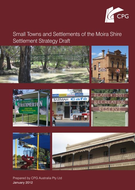
<strong>Small</strong> <strong>Towns</strong> <strong>and</strong> <strong><strong>Settlement</strong>s</strong> <strong>of</strong> <strong>the</strong> <strong>Moira</strong> <strong>Shire</strong><strong>Settlement</strong> <strong>Strategy</strong> DraftPrepared by CPG Australia Pty LtdJanuary 2012
Contents1 Introduction 1.1 Introduction 1.2 <strong>Settlement</strong> Vision 1.3 Guiding Themes <strong>of</strong> <strong>Settlement</strong> <strong>Strategy</strong> 2 Key Principles 2.1 Social <strong>and</strong> <strong>Settlement</strong> 2.2 Economic 2.3 Environment 2.4 Sustainable Communities 3 <strong>Settlement</strong> Hierarchy 4 Strategic Direction for Growth Capacity 5 Individual <strong>Settlement</strong> Strategies G:\13\133559\PL10 001 <strong>Moira</strong> <strong>Small</strong> <strong>Towns</strong> <strong>Strategy</strong> Report Rev E.doc Page 2
<strong>Small</strong> <strong>Towns</strong> <strong>and</strong> <strong><strong>Settlement</strong>s</strong> <strong>of</strong> <strong>the</strong> <strong>Moira</strong> <strong>Shire</strong><strong>Settlement</strong> <strong>Strategy</strong>1 Introduction1.1 IntroductionManaging future growth <strong>and</strong> development <strong>of</strong> settlements is a key strategy issuefor <strong>the</strong> <strong>Moira</strong> <strong>Shire</strong> Council. The Council has undertaken strategic planning for<strong>the</strong> four major centres <strong>of</strong> Yarrawonga, Cobram, Numurkah <strong>and</strong> Nathalia, <strong>and</strong> hasrecently completed a strategy for <strong>the</strong> rural <strong>and</strong> non-urban areas. This <strong>Strategy</strong>sets <strong>the</strong> overall direction for managing <strong>the</strong> sustainable development <strong>of</strong> <strong>the</strong>municipality’s small towns <strong>and</strong> settlements.CPG Australia has been engaged by <strong>the</strong> <strong>Moira</strong> <strong>Shire</strong> Council to prepare thisoverarching <strong>Small</strong> <strong>Towns</strong> <strong>Settlement</strong> <strong>Strategy</strong>. Recognising physical <strong>and</strong>environmental constraints, community aspirations, government policy directions<strong>and</strong> key issues <strong>of</strong> l<strong>and</strong> use planning, <strong>the</strong> <strong>Strategy</strong> presents a broad spatialstrategy identifying recommendations for <strong>the</strong> future management <strong>of</strong> <strong>the</strong> smalltowns <strong>of</strong> <strong>the</strong> <strong>Moira</strong> <strong>Shire</strong>.The <strong>Strategy</strong> is presented in two parts:− Context Report – provides <strong>the</strong> contextual information regarding current status<strong>and</strong> influences on <strong>the</strong> settlements in <strong>the</strong> <strong>Shire</strong>− <strong>Strategy</strong> Report (this document) – details <strong>the</strong> recommended strategy formanaging <strong>the</strong> small towns <strong>and</strong> settlements <strong>of</strong> <strong>the</strong> <strong>Moira</strong> <strong>Shire</strong>. The direction ispresented as a series <strong>of</strong> overall principles, <strong>and</strong> as social, economic <strong>and</strong>environmental objectives.1.2 <strong>Settlement</strong> VisionThe need for sustainability, achieved through well informed <strong>and</strong> collaborativeplanning, has underpinned <strong>the</strong> vision for <strong>the</strong> small towns <strong>and</strong> settlements <strong>of</strong> <strong>the</strong><strong>Moira</strong> <strong>Shire</strong>. Based on a consultative process <strong>the</strong> following vision has beendeveloped.The small settlements <strong>of</strong> <strong>Moira</strong> will be cohesive, inclusivecommunities with individual identities. These proud communitieswill work pro-actively <strong>and</strong> collaboratively to plan for a viable <strong>and</strong>sustainable future.They will be welcoming communities, integrating new residents,encouraging <strong>the</strong> participation <strong>of</strong> youth <strong>and</strong> embracing culturaldiversity.The environment <strong>and</strong> local history are recognised as communityassets which should be protected <strong>and</strong> promoted for <strong>the</strong> futurebenefit <strong>of</strong> <strong>the</strong> communities <strong>and</strong> visitors.The <strong>Moira</strong> <strong>Shire</strong> will have connected communities with <strong>the</strong> skills<strong>and</strong> resources to recognise, maintain <strong>and</strong> build upon <strong>the</strong>irindividual strengths <strong>and</strong> opportunities.G:\13\133559\PL10 001 <strong>Moira</strong> <strong>Small</strong> <strong>Towns</strong> <strong>Strategy</strong> Report Rev E.docPage 3
<strong>Small</strong> <strong>Towns</strong> <strong>and</strong> <strong><strong>Settlement</strong>s</strong> <strong>of</strong> <strong>the</strong> <strong>Moira</strong> <strong>Shire</strong><strong>Settlement</strong> <strong>Strategy</strong>1.3 Guiding Themes <strong>of</strong> <strong>Settlement</strong> <strong>Strategy</strong>The State Planning Policy Framework seeks to ensure <strong>the</strong> objectives <strong>of</strong> planningin Victoria (as set out in Section 4 <strong>of</strong> <strong>the</strong> Planning <strong>and</strong> Environment Act 1987) arefostered through appropriate l<strong>and</strong> use <strong>and</strong> development planning policies <strong>and</strong>practices which integrate relevant environmental, social <strong>and</strong> economic factors, in<strong>the</strong> interests <strong>of</strong> net community benefit <strong>and</strong> sustainable development.The State Planning Policy Framework (SPPF) has provided critical guidance in<strong>the</strong> development <strong>of</strong> <strong>the</strong> <strong>Moira</strong> <strong>Small</strong> <strong>Towns</strong> <strong>Strategy</strong>, particularly in regard tocreating sustainable communities.Themes <strong>of</strong> sustainability are echoed through planning policy. Regional planningstrategies <strong>and</strong> principles should develop regions <strong>and</strong> settlements which have astrong identity, are prosperous <strong>and</strong> are environmentally sustainable. In planningfor urban settlements, <strong>the</strong> SPPF states planning authorities should ensure asufficient supply <strong>of</strong> l<strong>and</strong> is available for residential, commercial, retail, industrial,recreational, institutional <strong>and</strong> o<strong>the</strong>r community uses. (SPPF, Clause 11)Networks <strong>of</strong> high-quality settlements should be delivered by:− Building on strengths <strong>and</strong> capabilities <strong>of</strong> each region across Victoria torespond sustainably to population growth <strong>and</strong> changing environments.− Developing networks <strong>of</strong> settlements that will support resilient communities <strong>and</strong><strong>the</strong> ability to adapt <strong>and</strong> change.− Balancing strategic objectives to achieve improved l<strong>and</strong>-use <strong>and</strong> developmentoutcomes at a regional, catchment <strong>and</strong> local level.− Preserving <strong>and</strong> protecting features <strong>of</strong> rural l<strong>and</strong> <strong>and</strong> natural resources <strong>and</strong>features to enhance <strong>the</strong>ir contribution to settlements <strong>and</strong> l<strong>and</strong>scapes.− Encouraging an integrated planning response between settlements withinregions <strong>and</strong> in adjoining regions <strong>and</strong> states.− Providing for appropriately located supplies <strong>of</strong> residential, commercial, <strong>and</strong>industrial l<strong>and</strong> across a region, sufficient to meet community needs.− Improving connections to regional <strong>and</strong> metropolitan transport services <strong>and</strong>urban connectivity.(Clause 11.05-1)Acknowledgement <strong>of</strong> <strong>the</strong> agricultural value <strong>of</strong> <strong>the</strong> l<strong>and</strong>, particularly in regard toclimate change implications will continue to increase in importance. Changingclimatic conditions may result in transition <strong>of</strong> l<strong>and</strong> uses <strong>and</strong> activities. Fur<strong>the</strong>rassociated issues include environmentally sustainable design, support for localproducts <strong>and</strong> produce <strong>and</strong> local service provision <strong>and</strong> <strong>the</strong> need to protectregionally significant natural assets <strong>of</strong> <strong>the</strong> <strong>Shire</strong> from inappropriate development.G:\13\133559\PL10 001 <strong>Moira</strong> <strong>Small</strong> <strong>Towns</strong> <strong>Strategy</strong> Report Rev E.docPage 4
<strong>Small</strong> <strong>Towns</strong> <strong>and</strong> <strong><strong>Settlement</strong>s</strong> <strong>of</strong> <strong>the</strong> <strong>Moira</strong> <strong>Shire</strong><strong>Settlement</strong> <strong>Strategy</strong>2 Key PrinciplesThe <strong>Strategy</strong> is based upon <strong>the</strong> following principles. The principles have beenderived from <strong>the</strong> contextual research <strong>and</strong> an appreciation <strong>of</strong> sustainablecommunities. These principles both drive <strong>the</strong> overall objectives <strong>and</strong> strategies,<strong>and</strong> provide direction to <strong>the</strong> strategies for individual towns.2.1 Social <strong>and</strong> <strong>Settlement</strong>Key principles in relation to Social <strong>and</strong> <strong>Settlement</strong> issues are:− Draw clear <strong>and</strong> consistent distinctions between <strong>the</strong> role <strong>and</strong> function <strong>of</strong>settlements when considering decisions about future l<strong>and</strong> use planning.− Guide population <strong>and</strong> development to those settlements <strong>and</strong> locations where<strong>the</strong> capacity to accommodate growth can be most effectively met, i.e. wherel<strong>and</strong> has been committed <strong>and</strong> zoned for residential purposes.− Guide population to settlements where a base framework <strong>of</strong> communityservices <strong>and</strong> facilities already exists.− Ensure that <strong>the</strong> housing in small towns is responsive to <strong>the</strong> emerging need fora greater proportion <strong>of</strong> housing that suits single person <strong>and</strong> older households.− Provide for diversity <strong>and</strong> choice in housing types.− <strong><strong>Settlement</strong>s</strong> suitable for growth are defined by boundaries. Boundaries arelonger-term techniques for containing housing <strong>and</strong> settlement growth.2.2 EconomicKey principles in relation to Economic issues are:− Steer growth to settlements which optimise use <strong>of</strong> existing utility services.− Foster <strong>the</strong> economic base <strong>of</strong> <strong>the</strong> <strong>Shire</strong>, <strong>and</strong> provide for/encourage <strong>the</strong>protection <strong>and</strong> growth <strong>of</strong> employment in small towns.− Facilitate appropriate economic development in areas <strong>of</strong> <strong>the</strong> <strong>Shire</strong> that havetourism, recreation or environmental attractions, including farming <strong>and</strong> ruralliving areas.− Protect l<strong>and</strong> used for agriculture activities which remains a significant l<strong>and</strong> use<strong>and</strong> economic function in <strong>the</strong> <strong>Shire</strong>.− Ensure sufficient business l<strong>and</strong> is provided to allow towns to play anappropriate retail role as <strong>the</strong>ir population increases, providing employment <strong>and</strong>reducing escape expenditure.2.3 EnvironmentKey principles in relation to Environment issues are:− Guide population <strong>and</strong> development to settlements where existingenvironmental <strong>and</strong> cultural assets <strong>and</strong> rural l<strong>and</strong>scapes will not be jeopardised.− Provide protection to declared water supply catchments through guidingdevelopment to settlements where reticulated sewer systems are available.− Provide for residential opportunities in settlements where <strong>the</strong>re is limited threatto people <strong>and</strong> property through flood or fire.G:\13\133559\PL10 001 <strong>Moira</strong> <strong>Small</strong> <strong>Towns</strong> <strong>Strategy</strong> Report Rev E.docPage 5
<strong>Small</strong> <strong>Towns</strong> <strong>and</strong> <strong><strong>Settlement</strong>s</strong> <strong>of</strong> <strong>the</strong> <strong>Moira</strong> <strong>Shire</strong><strong>Settlement</strong> <strong>Strategy</strong>2.4 Sustainable CommunitiesOne <strong>of</strong> <strong>the</strong> key <strong>the</strong>mes <strong>of</strong> this <strong>Strategy</strong> is <strong>the</strong> development <strong>of</strong> sustainablecommunities within <strong>the</strong> <strong>Moira</strong> <strong>Shire</strong>, giving regard to State Planning Policydirection. For <strong>the</strong> purposes <strong>of</strong> this <strong>Strategy</strong>, <strong>the</strong> following definition <strong>of</strong> ‘sustainablecommunities’ is appropriate:“Sustainable communities meet <strong>the</strong> diverse needs <strong>of</strong> existing <strong>and</strong> futureresidents, <strong>the</strong>ir children <strong>and</strong> o<strong>the</strong>r users, contribute to a high quality <strong>of</strong> life <strong>and</strong>provide opportunity <strong>and</strong> choice. They achieve this in ways that make effectiveuse <strong>of</strong> natural resources, enhance <strong>the</strong> environment, promote social cohesion<strong>and</strong> inclusion <strong>and</strong> streng<strong>the</strong>n economic prosperity 1 ”<strong>Small</strong> towns have an important contribution to make, <strong>and</strong> specifically to <strong>the</strong> <strong>Moira</strong><strong>Shire</strong> <strong>and</strong> this <strong>Strategy</strong>, sustainable settlements are viewed in <strong>the</strong> following terms:− An individual identity which is embraced by <strong>the</strong> local residents, who developshared goals for <strong>the</strong> settlement.− Build upon <strong>the</strong> strengths <strong>and</strong> opportunities available to each town in <strong>the</strong> areas<strong>of</strong> social, economic <strong>and</strong> environmental development.− Provide convenient access to a broad range <strong>of</strong> services.− Critical population <strong>and</strong> development mass to justify major capital investment inservices such as utility infrastructure.− Provide choice in a range <strong>of</strong> services <strong>and</strong> housing expectations; wherepossible, <strong>the</strong> towns provide employment opportunities.− Work collaboratively to determine <strong>the</strong> most effective <strong>and</strong> beneficial targets forcapital investment.− Awareness <strong>of</strong> <strong>the</strong> need to protect productive <strong>and</strong> versatile rural l<strong>and</strong> <strong>and</strong>environmental assets.− Accommodate change within <strong>the</strong> towns without short or long term materialimpact on <strong>the</strong> environment.1 Egan, J (2004) “The Egan Review: Skills for Sustainable Communities”http://www.communities.gov.uk/publications/communities/eganreviewG:\13\133559\PL10 001 <strong>Moira</strong> <strong>Small</strong> <strong>Towns</strong> <strong>Strategy</strong> Report Rev E.docPage 6
<strong>Small</strong> <strong>Towns</strong> <strong>and</strong> <strong><strong>Settlement</strong>s</strong> <strong>of</strong> <strong>the</strong> <strong>Moira</strong> <strong>Shire</strong><strong>Settlement</strong> <strong>Strategy</strong>3 <strong>Settlement</strong> HierarchyThis <strong>Strategy</strong> has reviewed 23 existing settlements ranging in size fromStrathmerton, a town with a variety <strong>of</strong> services, to small localities, many <strong>of</strong> whichcomprise a scattering <strong>of</strong> houses in relatively isolated locations.It recognised that <strong>the</strong>re are o<strong>the</strong>r small settlements within <strong>the</strong> <strong>Moira</strong> <strong>Shire</strong> (i.e.Marungi, Youanmite <strong>and</strong> Bathumi) that have not been included within this<strong>Strategy</strong>. These localities have recently been reviewed through <strong>the</strong> preparation <strong>of</strong>restructure plans. Bathumi now forms part <strong>of</strong> <strong>the</strong> broader Yarrawonga <strong>Towns</strong>hip.In order to provide for <strong>the</strong> continuing sustainability <strong>of</strong> <strong>the</strong> communities in <strong>the</strong> <strong>Moira</strong><strong>Shire</strong>, it is appropriate <strong>and</strong> necessary that some settlements be identified as beingpreferred locations for growth. The sustainable development principles <strong>of</strong> both<strong>the</strong> State Planning Policy Framework <strong>and</strong> this <strong>Strategy</strong> would not be satisfied bytreating each settlement equally capable <strong>of</strong> growth. As such, <strong>and</strong> as discussedbelow, a hierarchy <strong>of</strong> settlements has been identified.The Victorian Coastal <strong>Strategy</strong> (2008) presents a useful <strong>Settlement</strong> Role <strong>and</strong>Function framework to underst<strong>and</strong> <strong>the</strong> role <strong>of</strong> settlements <strong>and</strong> categorise <strong>the</strong>ircapacity for growth. The categorisation distinguishes Regional Centres, LargeDistrict <strong>Towns</strong>, District <strong>Towns</strong>, <strong>Small</strong> <strong>Towns</strong>, Villages, Hamlets <strong>and</strong> RuralDistricts/Localities. Indicative definitions for each <strong>of</strong> <strong>the</strong>se settlement types areprovided in Table 1 providing guidance on <strong>the</strong> most likely combination <strong>of</strong>population levels with service <strong>of</strong>fering.This <strong>Strategy</strong> has adopted <strong>and</strong> exp<strong>and</strong>ed this framework to apply to <strong>the</strong> 23 smalltowns <strong>and</strong> settlements in <strong>the</strong> <strong>Moira</strong> <strong>Shire</strong>. As such, <strong>the</strong> framework can be used toillustrate <strong>and</strong> compare <strong>the</strong> role <strong>of</strong> settlements in light <strong>of</strong> <strong>the</strong> services <strong>and</strong>infrastructure <strong>the</strong>y <strong>of</strong>fer. It is noted that as <strong>the</strong> focus <strong>of</strong> this <strong>Strategy</strong> is on smalltowns <strong>and</strong> settlements, <strong>the</strong> definitions <strong>of</strong> Regional Centres, Large District <strong>Towns</strong><strong>and</strong> District <strong>Towns</strong> have not been included.G:\13\133559\PL10 001 <strong>Moira</strong> <strong>Small</strong> <strong>Towns</strong> <strong>Strategy</strong> Report Rev E.docPage 7
<strong>Small</strong> <strong>Towns</strong> <strong>and</strong> <strong><strong>Settlement</strong>s</strong> <strong>of</strong> <strong>the</strong> <strong>Moira</strong> <strong>Shire</strong><strong>Settlement</strong> <strong>Strategy</strong>Table 1: <strong>Settlement</strong> Hierarchy DefinitionsHierarchy Indicative Definition IndicativePopulationUtilitiesConnectionsServices<strong>Small</strong> TownPopulation levels vary against general services but settlements <strong>of</strong> thistype tend to exhibit diversity <strong>of</strong> demography. All are connected toreticulated water <strong>and</strong> sewer services. <strong><strong>Settlement</strong>s</strong> in this categoryusually have strong employment relationships with larger settlementsnearby.500 – 2,000 ReticulatedWater, Sewer& ElectricityPost <strong>of</strong>fice / general storeCFAPolice StationAccommodationPrimary SchoolVillageVillages have small population levels. Access to services such as asmall primary school <strong>and</strong> a general store with postal facilities can befound in a small retail area. Connection to reticulated water <strong>and</strong>sewer connections vary.200 - 500 Electricity &PossibleReticulatedWaterPost <strong>of</strong>fice / general storeCFAAccommodationPrimary SchoolHamletLow population levels within <strong>the</strong> settlement. Possible access toreticulated water with predominantly no connection to reticulatedsewerage. No major services within settlement o<strong>the</strong>r than a possibleCFA service <strong>and</strong>/or primary school.100 - 200 Electricity &PossibleReticulatedWaterCFAAccommodationLocalitiesA locality comprises a cluster <strong>of</strong> housing located on smaller thanaverage rural sized allotments within non-urban zones. Reticulatedwater <strong>and</strong> / or sewer are generally not available. Usually no servicesare located within <strong>the</strong> settlement.
<strong>Small</strong> <strong>Towns</strong> <strong>and</strong> <strong><strong>Settlement</strong>s</strong> <strong>of</strong> <strong>the</strong> <strong>Moira</strong> <strong>Shire</strong><strong>Settlement</strong> <strong>Strategy</strong>4 Strategic Direction for Growth CapacityWith consideration <strong>of</strong> <strong>the</strong> key principles <strong>and</strong> <strong>the</strong> existing hierarchy <strong>and</strong> role <strong>of</strong>settlements as defined in previous sections, this <strong>Strategy</strong> extends <strong>the</strong>categorisation <strong>of</strong> settlement by growth capacity which has been based on <strong>the</strong>following criteria:− High Growth Capacity – settlements (generally <strong>Small</strong> <strong>Towns</strong> or Villages)which have capacity for growth as sustainable communities supporting a range<strong>of</strong> services, <strong>and</strong> accommodating higher dem<strong>and</strong> for development within <strong>and</strong> (insome cases) beyond existing zoned l<strong>and</strong>.− Moderate Growth Capacity – settlements (generally <strong>Small</strong> <strong>Towns</strong> or Villages)in which growth potential is not as high due to <strong>the</strong> opportunities <strong>and</strong> constraintspresented, such as environmental constraints.− Low Growth Capacity – settlements (generally Villages or Hamlets) whichmay have occasional opportunities for development, but will essentially retain<strong>the</strong> existing role, size, services <strong>and</strong> character.− Constrained Growth – settlements (generally Hamlets or Localities) wheregrowth is not encouraged because <strong>the</strong> capability to perform <strong>the</strong> role <strong>of</strong>sustainable communities is limited.Growth in smaller settlements is expected to be limited to infill, consistent wi<strong>the</strong>xisting zonings (Table 3). Generally speaking, <strong>the</strong> absence <strong>of</strong> sewer servicesmeans substantial growth in <strong>the</strong>se settlements is inappropriate. O<strong>the</strong>rinfrastructure is also typically limited.It is recommended a precautionary position is taken towards encouragingsubstantial fur<strong>the</strong>r growth in smaller settlements <strong>of</strong> <strong>the</strong> <strong>Shire</strong> as <strong>the</strong>y do not meetmany <strong>of</strong> <strong>the</strong> requirements <strong>of</strong> a sustainable community. Under State policy it ispreferable to instead consolidate growth around existing settlements strategicallyidentified as having capacity to cope with additional population growth in asustainable manner.These strategic directions for growth capacity are now explored <strong>and</strong> developed inmore detail in <strong>the</strong> following recommendations for each settlement.G:\13\133559\PL10 001 <strong>Moira</strong> <strong>Small</strong> <strong>Towns</strong> <strong>Strategy</strong> Report Rev E.doc
<strong>Small</strong> <strong>Towns</strong> <strong>and</strong> <strong><strong>Settlement</strong>s</strong> <strong>of</strong> <strong>the</strong> <strong>Moira</strong> <strong>Shire</strong><strong>Settlement</strong> <strong>Strategy</strong>Table 3: Summary <strong>of</strong> <strong>Settlement</strong> Role <strong>and</strong> Growth Capacity<strong>Settlement</strong> Role Growth Capacity Zoning/L<strong>and</strong> Supply (existing)<strong>Small</strong> Town Village Hamlet Locality High Moderate Low Constrained <strong>Towns</strong>hip Rural Living FarmingBarmah 14 lots* 8 lots*BeariiBundalong 115 lots** & 8ha 21 lots**BurramineInvergordonKaarimbaKatamatite 30ha***Katunga 15ha***KotupnaKoonoomooLake RowanLower <strong>Moira</strong>MuckatahNaringPicola 14ha***St James 4 lots**Strathmerton 40 lots & 44ha 15haTungamah 40 lots & 6haWaaia 50 lots**** & 13.5haWilby 35 lots**WunghnuYalca NorthYarroweyah* Vacant lots partly located outside <strong>of</strong> <strong>the</strong> Floodway Overlay** Potential for fur<strong>the</strong>r subdivision*** Includes infill l<strong>and</strong>**** Some lots contained within subdivisions that have not beenconstructed (many being crown allotments)G:\13\133559\PL10 001 <strong>Moira</strong> <strong>Small</strong> <strong>Towns</strong> <strong>Strategy</strong> Report Rev E.doc
<strong>Small</strong> <strong>Towns</strong> <strong>and</strong> <strong><strong>Settlement</strong>s</strong> <strong>of</strong> <strong>the</strong> <strong>Moira</strong> <strong>Shire</strong><strong>Settlement</strong> <strong>Strategy</strong>5 Individual <strong>Settlement</strong> StrategiesEach settlement has been appraised against a consistent framework <strong>of</strong>considerations. Recommendations for <strong>the</strong> future role <strong>of</strong> <strong>the</strong> settlement, <strong>the</strong>intended outcomes for <strong>the</strong> settlement, <strong>and</strong> implications for l<strong>and</strong> provision areoutlined on <strong>the</strong> following pages.G:\13\133559\PL10 001 <strong>Moira</strong> <strong>Small</strong> <strong>Towns</strong> <strong>Strategy</strong> Report Rev E.doc
<strong>Small</strong> <strong>Towns</strong> <strong>and</strong> <strong><strong>Settlement</strong>s</strong> <strong>of</strong> <strong>the</strong> <strong>Moira</strong> <strong>Shire</strong><strong>Settlement</strong> <strong>Strategy</strong><strong>Settlement</strong>BarmahRole − VillageMain Features − Population <strong>of</strong> 201 (2006 Census <strong>of</strong> Population <strong>and</strong> Housing)− 28 kilometres north west <strong>of</strong> Nathalia− Located on <strong>the</strong> Murray River <strong>and</strong> Barmah National Park RAMSAR Wetl<strong>and</strong>s− Highly flood prone− Home to <strong>the</strong> Dharnya Cultural Centre− Local tourism based businesses− Large number holiday home ownersExisting Infrastructure − Reticulated water (limitedcapacity)− No sewerage service− Post <strong>of</strong>fice/General store− Pre-schoolPolicy/<strong>Strategy</strong>ReferencesResidentialDem<strong>and</strong>/SupplyDevelopmentOpportunitiesDevelopmentConstraints−−−−− <strong>Settlement</strong> <strong>Strategy</strong> in Clause 21.04-4−−−−−Community hallCFAHotel MotelCaravan parks & camping groundsLow number <strong>of</strong> dwelling approvals issued in recent years (28 approvals 1998 – 2009, or2.3 approvals pa)There are approximately 20 existing lots within <strong>the</strong> <strong>Towns</strong>hip <strong>and</strong> Rural Living Zones thatcan cater for dem<strong>and</strong>There is some potential for re-subdivision within <strong>the</strong> townPotential for residential development to <strong>the</strong> south east <strong>of</strong> <strong>the</strong> town centre (l<strong>and</strong> will needto be rezoned, subject to flood investigations, l<strong>and</strong> capability assessment,supply/dem<strong>and</strong> analysis <strong>and</strong> <strong>the</strong> like).A large portion <strong>of</strong> <strong>the</strong> town is flood affected, <strong>and</strong> <strong>the</strong>refore <strong>the</strong> opportunity fordevelopment is limitedGrowth Capacity − Low, primarily due to flood constraintsExpected Outcomes − Negligible changeRecommendations − Define a <strong>Settlement</strong> Boundary− Identify an area that has potential to accommodate dwellings at higher densities than <strong>the</strong>current Rural Living Zone allowsJustification − <strong>Settlement</strong> Boundary to include l<strong>and</strong> within <strong>the</strong> <strong>Towns</strong>hip <strong>and</strong> Rural Living Zones as it isconsidered that <strong>the</strong>re is sufficient supply to cater for anticipated growth <strong>of</strong> approximately35 dwellings (2.3 dwellings pa for 15 years).− The area identified for potential development is to <strong>the</strong> south east <strong>of</strong> <strong>the</strong> town centre.This l<strong>and</strong> is less flood affected, being within <strong>the</strong> L<strong>and</strong> Subject to Inundation Overlayra<strong>the</strong>r than <strong>the</strong> Rural Floodway Overlay. The l<strong>and</strong> could be rezoned to <strong>Towns</strong>hip Zone,subject to flood investigations, l<strong>and</strong> capability assessment, supply/dem<strong>and</strong> analysis, etc.<strong>and</strong> tested against Ministerial Direction No. 6 if rezoned to <strong>the</strong> Low Density Residentialor Rural Living Zone.G:\13\133559\PL10 001 <strong>Moira</strong> <strong>Small</strong> <strong>Towns</strong> <strong>Strategy</strong> Report Rev E.doc
<strong>Small</strong> <strong>Towns</strong> <strong>and</strong> <strong><strong>Settlement</strong>s</strong> <strong>of</strong> <strong>the</strong> <strong>Moira</strong> <strong>Shire</strong><strong>Settlement</strong> <strong>Strategy</strong><strong>Settlement</strong>BeariiRole − HamletMain Features − 30 kilometres west <strong>of</strong> Cobram− Proximity to Ulupna Isl<strong>and</strong> & Murray River− Mixture <strong>of</strong> temporary <strong>and</strong> permanent dwelling types− Holiday makers/campers visiting Murray RiverExisting Infrastructure − No reticulated water <strong>and</strong> sewerage systems− Community hallPolicy/<strong>Strategy</strong>ReferencesResidentialDem<strong>and</strong>/SupplyDevelopmentOpportunitiesDevelopmentConstraints−−−−−−−−−−−NilGrowth Capacity − LowExpected Outcomes − Negligible changeLow number <strong>of</strong> dwelling approvals issued in recent years (17 approvals 1998 – 2009, or1.4 approvals pa)Adequate number <strong>of</strong> vacant allotments to cater for current dem<strong>and</strong>There is potential for re-subdivision within <strong>the</strong> settlementRetain/maintain <strong>the</strong> existing role, size <strong>and</strong> characterMay be some scope to develop tourism services (e.g. Murray River / Ulupna Isl<strong>and</strong>tours)Possible Home Businesses or all non-rural based commercial/industrial activities.Relatively isolated community without services or public transportLimited foundation <strong>of</strong> services on which to base growthCurrently within <strong>the</strong> Farming ZoneFlood affected areas limiting growth to north <strong>and</strong> westRecommendations − Define a <strong>Settlement</strong> Boundary− Rezone <strong>the</strong> smaller allotments to <strong>the</strong> east to <strong>the</strong> <strong>Towns</strong>hip Zone− Rezone <strong>the</strong> larger allotments to <strong>the</strong> west to <strong>the</strong> Rural Living ZoneJustification − The <strong>Settlement</strong> Boundary will generally follow <strong>the</strong> areas to be rezoned to <strong>Towns</strong>hip <strong>and</strong>Rural Living Zones, as it is within <strong>the</strong>se areas that future ‘urban’ development should beencouraged.− The area to be rezoned to <strong>Towns</strong>hip Zone generally comprises <strong>the</strong> smallerallotments/closer settlement area which has formed around a grid road layout. This areais mostly unaffected by flooding.− The area to be rezoned to Rural Living Zone is to <strong>the</strong> west <strong>of</strong> <strong>the</strong> smaller allotments, <strong>and</strong>comprises larger allotments fronting Mannions Road. Generally, <strong>the</strong>se are occupied bya dwelling, some also with an agricultural/rural l<strong>and</strong> use. The rezoning reflects existingconditions, <strong>and</strong> <strong>the</strong> fur<strong>the</strong>r subdivision <strong>of</strong> <strong>the</strong>se lots should be discouraged given <strong>the</strong>irexisting size <strong>and</strong> in some cases, <strong>the</strong> application <strong>of</strong> <strong>the</strong> Rural Flood Overlay.− Fur<strong>the</strong>r, it is considered that <strong>the</strong> current application <strong>of</strong> <strong>the</strong> Farming Zone to <strong>the</strong>se areasis inappropriate given <strong>the</strong> subdivision pattern <strong>and</strong> pre dominantly residential l<strong>and</strong> uses.G:\13\133559\PL10 001 <strong>Moira</strong> <strong>Small</strong> <strong>Towns</strong> <strong>Strategy</strong> Report Rev E.doc
<strong>Small</strong> <strong>Towns</strong> <strong>and</strong> <strong><strong>Settlement</strong>s</strong> <strong>of</strong> <strong>the</strong> <strong>Moira</strong> <strong>Shire</strong><strong>Settlement</strong> <strong>Strategy</strong><strong>Settlement</strong>BundalongRole − VillageMain Features − Population <strong>of</strong> 298 (2006 Census <strong>of</strong> Population <strong>and</strong> Housing)− 15 kilometres east <strong>of</strong> Yarrawonga− Located adjacent to Ovens River− Significant tourist destination with many dwellings being used as holiday homes− Fastest growing small town in <strong>the</strong> <strong>Moira</strong> <strong>Shire</strong>− Previously adopted Bundalong <strong>Strategy</strong> encouraged expansionExisting Infrastructure − Reticulated water - limitedcapacity (North East Waterproviding for increase supply)− Reticulated sewerage (lagoonbased treatment system)− Post <strong>of</strong>fice/General storePolicy/<strong>Strategy</strong>ReferencesResidentialDem<strong>and</strong>/SupplyDevelopmentOpportunitiesDevelopmentConstraints−−−−−− <strong>Settlement</strong> <strong>Strategy</strong> in Clause 21.04-4TavernCaravan parkCommunity hallPublic tennis courtTwo public boat ramps− Highest number <strong>of</strong> dwelling approvals issued in recent years (127 approvals 1998 –2009, or 10.6 approvals pa)− Based on current take up rates, <strong>the</strong>re is approximately 25 years supply <strong>of</strong> zoned l<strong>and</strong>.− In <strong>the</strong> existing <strong>Towns</strong>hip Zone <strong>the</strong>re is approx. 115 lots (some with subdivision potential)<strong>and</strong> 8 hectares <strong>of</strong> unsubdivided l<strong>and</strong>, <strong>and</strong> in <strong>the</strong> existing Low Density Residential Zone<strong>the</strong>re is approx. 20 lots (some with subdivision potential).− Anecdotal evidence suggests that dem<strong>and</strong> will significantly increase when North EastWater has upgraded <strong>the</strong> reticulated water system.−−−−−−Short to medium term development opportunities are for <strong>the</strong> subdivision <strong>of</strong> l<strong>and</strong> currentlyzoned ei<strong>the</strong>r <strong>Towns</strong>hip or Low Density Residential <strong>and</strong> rezoning <strong>of</strong> l<strong>and</strong> to <strong>the</strong> west thatis considered <strong>of</strong> a size that can generally not be productively farmed <strong>and</strong> has frontage to<strong>the</strong> River.There is longer term potential for residential development to continue south from existingdevelopment, between <strong>the</strong> highway <strong>and</strong> <strong>the</strong> Ovens River.There is also longer term potential for residential development west <strong>of</strong> <strong>the</strong> town, between<strong>the</strong> river <strong>and</strong> <strong>the</strong> highway, potentially for conventional subdivision to maximise proximityto <strong>the</strong> river.There is potential for an activity hub/centre adjacent to <strong>the</strong> General Store <strong>and</strong> withinclose proximity to <strong>the</strong> Tavern <strong>and</strong> caravan park.Large supply <strong>of</strong> zoned l<strong>and</strong>.Currently constrained by limited capacity <strong>of</strong> reticulated water supply, however North EastWater is currently working on <strong>the</strong> designs to upgrade <strong>the</strong> system to increase capacity.Growth Capacity − Moderate to high, depending on provision <strong>of</strong> improved reticulated water supply <strong>and</strong> <strong>of</strong>retail/tourism/community servicesExpected Outcomes − Future growth expected, potentially at higher rates than current experiencingRecommendations − Define a <strong>Settlement</strong> Boundary− Rezone <strong>the</strong> Bundalong Tavern <strong>and</strong> Caravan Park to <strong>Towns</strong>hip Zone− Apply an Environmental Significance Overlay to ‘Horseshoe Lagoon’ to <strong>the</strong> south west <strong>of</strong><strong>the</strong> townG:\13\133559\PL10 001 <strong>Moira</strong> <strong>Small</strong> <strong>Towns</strong> <strong>Strategy</strong> Report Rev E.doc
<strong>Small</strong> <strong>Towns</strong> <strong>and</strong> <strong><strong>Settlement</strong>s</strong> <strong>of</strong> <strong>the</strong> <strong>Moira</strong> <strong>Shire</strong><strong>Settlement</strong> <strong>Strategy</strong>−−−Rezone l<strong>and</strong> to <strong>the</strong> west to Low Density Residential Zone.Apply a Development Plan Overlay to future growth.Recognise existing developed subdivision to <strong>the</strong> south <strong>of</strong> <strong>the</strong> town by rezoning to LowDensity Residential Zone.Justification − The <strong>Settlement</strong> Boundary has been defined to include current <strong>and</strong> potential futuresettlement areas. Bundalong is <strong>the</strong> fastest growing small town within <strong>the</strong> <strong>Moira</strong> <strong>Shire</strong>,<strong>and</strong> whilst <strong>the</strong>re is sufficient l<strong>and</strong> to cater for <strong>the</strong> short to medium term growth, givenexpected growth rates, it is considered prudent to identify a settlement area that canaccommodate future needs.− The Bundalong Tavern <strong>and</strong> adjoining caravan park would be more appropriately zoned<strong>Towns</strong>hip. The current Farming Zone does not reflect <strong>the</strong>se existing uses.− The ‘Horseshoe Lagoon’ has been identified in <strong>the</strong> Bundalong <strong>Strategy</strong> as havingenvironmental significance. It is considered opportune to <strong>the</strong>refore include this areawithin an overlay which will protect <strong>and</strong> give effect to its significance.− As stated previously <strong>the</strong>re is sufficient zoned l<strong>and</strong> in Bundalong to cater for expectedgrowth over <strong>the</strong> next 20-30 years. It is proposed to rezone l<strong>and</strong> to Low DensityResidential Zone that has been predominantly developed as low density residential <strong>and</strong>l<strong>and</strong> with frontage to Ovens River <strong>and</strong> <strong>of</strong> a size that is unlikely to be productively used foragricultural. Fur<strong>the</strong>rmore, if North East Water upgrades services it is likely <strong>the</strong> dem<strong>and</strong>will significantly increase. However, it is considered appropriate to apply a DevelopmentPlan Overlay on l<strong>and</strong> than can reasonably be expected to be used <strong>and</strong> developed forresidential or town purposes in <strong>the</strong> future. The Development Plan Overlay can ensurethat l<strong>and</strong> is released in a logical manner, that subdivision patterns <strong>and</strong> lot sizes areappropriate <strong>and</strong> that <strong>the</strong> future residential development areas are connected <strong>and</strong>integrated.G:\13\133559\PL10 001 <strong>Moira</strong> <strong>Small</strong> <strong>Towns</strong> <strong>Strategy</strong> Report Rev E.doc
<strong>Small</strong> <strong>Towns</strong> <strong>and</strong> <strong><strong>Settlement</strong>s</strong> <strong>of</strong> <strong>the</strong> <strong>Moira</strong> <strong>Shire</strong><strong>Settlement</strong> <strong>Strategy</strong><strong>Settlement</strong>BurramineRole − LocalityMain Features − 12 kilometres west <strong>of</strong> Yarrawonga− Farming area− Murray Valley Highway traverses <strong>the</strong> area− Burramine historical homesteadExisting Infrastructure − No reticulated water supply or sewerPolicy <strong>Strategy</strong>ReferencesResidentialDem<strong>and</strong>/SupplyDevelopmentOpportunitiesDevelopmentConstraints−−−−−−−NilGrowth Capacity − ConstrainedExpected Outcomes − Negligible change−None, o<strong>the</strong>r than that associated with agriculture activities.<strong>Small</strong> area <strong>of</strong> LDRZ previously subdivided.To retain its current role <strong>and</strong> character as a locality.Recommendations − No changes recommendedNo reticulated potable water supply or sewer.No foundation <strong>of</strong> services on which to base growth.Limited subdivision/development options due to <strong>the</strong> Farming Zone <strong>and</strong> dominance <strong>of</strong>agricultural activities in <strong>the</strong> areaLimited opportunities for fur<strong>the</strong>r subdivision <strong>of</strong> LDRZ l<strong>and</strong>.Justification − Burramine is a farming area <strong>and</strong> should be retained as such. Development applicationsshould continue to be assessed against <strong>the</strong> provisions <strong>of</strong> <strong>the</strong> Farming Zone.G:\13\133559\PL10 001 <strong>Moira</strong> <strong>Small</strong> <strong>Towns</strong> <strong>Strategy</strong> Report Rev E.doc
<strong>Small</strong> <strong>Towns</strong> <strong>and</strong> <strong><strong>Settlement</strong>s</strong> <strong>of</strong> <strong>the</strong> <strong>Moira</strong> <strong>Shire</strong><strong>Settlement</strong> <strong>Strategy</strong><strong>Settlement</strong>Role − LocalityKaarimba (including South Waaia)Main Features − 14 kilometres south east <strong>of</strong> Nathalia− Farming area− Old Crown township adjacent to <strong>the</strong> Broken Creek with lots generally undevelopedExisting Infrastructure − No reticulated water supply or sewer− CFA− Community hallPolicy <strong>Strategy</strong>ReferencesResidentialDem<strong>and</strong>/SupplyDevelopmentOpportunitiesDevelopmentConstraints−−−−−−−NilLittle dem<strong>and</strong> evidentGrowth Capacity − ConstrainedExpected Outcomes − Negligible changeTo limit growth to retain its current role <strong>and</strong> character as a localityEncourage agricultural activityNo reticulated potable water supply or sewer.No foundation <strong>of</strong> services on which to base growth.Limited subdivision/development options due to <strong>the</strong> Farming Zone, dominance <strong>of</strong>agricultural activities in <strong>the</strong> area <strong>and</strong> flood impact.Recommendations − Rezone <strong>the</strong> Community hall to Public Use Zone 6.Justification − The hall is within Council ownership <strong>the</strong>refore should be rezoned to a Public Use Zone− Kaarimba is a farming area <strong>and</strong> should be retained as such. Development applicationsshould continue to be assessed against <strong>the</strong> provisions <strong>of</strong> <strong>the</strong> Farming Zone.G:\13\133559\PL10 001 <strong>Moira</strong> <strong>Small</strong> <strong>Towns</strong> <strong>Strategy</strong> Report Rev E.doc
<strong>Small</strong> <strong>Towns</strong> <strong>and</strong> <strong><strong>Settlement</strong>s</strong> <strong>of</strong> <strong>the</strong> <strong>Moira</strong> <strong>Shire</strong><strong>Settlement</strong> <strong>Strategy</strong><strong>Settlement</strong>KatamatiteRole − <strong>Small</strong> TownMain Features − Population <strong>of</strong> 212 (2006 Census <strong>of</strong> Population <strong>and</strong> Housing)− 24 kilometres east <strong>of</strong> Numurkah− Located on <strong>the</strong> Boosey Creek− Nearby to <strong>the</strong> Broken-Boosey State Park− Heritage buildingsExisting Infrastructure − Reticulated water – limitedcapacity− No reticulated sewerage− Post <strong>of</strong>fice/general store− Police station− CFA− Petrol station− HotelPolicy <strong>Strategy</strong>ReferencesResidentialDem<strong>and</strong>/SupplyDevelopmentOpportunitiesDevelopmentConstraints−−−−−−− <strong>Settlement</strong> <strong>Strategy</strong> in Clause 21.04-4Bakery <strong>and</strong> o<strong>the</strong>r assorted retail outletsPre-schoolPrimary SchoolMaternal/Child Health CentreRecreation reserve <strong>and</strong> playgroundsHorse trotting/training track− Medium number <strong>of</strong> dwelling approvals issued in recent years (36 approvals 1998 – 2009,or 3 approvals pa)− Approximately 30 hectares <strong>of</strong> l<strong>and</strong> within <strong>the</strong> <strong>Towns</strong>hip Zone that has residentialdevelopment potential− Adequate number <strong>of</strong> vacant allotments to cater for current dem<strong>and</strong>− There is potential for re-subdivision within <strong>the</strong> settlement−−−Vacant zoned allotments available for developmentFlood affected l<strong>and</strong> adjacent to <strong>the</strong> creekNo reticulated sewerageGrowth Capacity − Moderate growth expectedExpected Outcomes − Negligible change, growth expected to be accommodated through infill developmentRecommendations − Define a <strong>Settlement</strong> Boundary− Rezone <strong>the</strong> primary school to Public Use Zone 2 (Education)− Rezone recreation reserve to Public Park <strong>and</strong> Recreation Zone− Rezone trotting track to south east <strong>of</strong> <strong>the</strong> town to Public Park <strong>and</strong> Recreation Zone− Apply a Restructure Overlay to an area generally to <strong>the</strong> south east <strong>of</strong> <strong>the</strong> main town areaJustification − The <strong>Settlement</strong> Boundary has been defined around <strong>the</strong> existing <strong>Towns</strong>hip Zone l<strong>and</strong>.There is adequate l<strong>and</strong> to cater for expected growth (approximately 45 lots over <strong>the</strong> next15 years) <strong>and</strong> it is within this area that ‘urban’ development should be encouraged.− It is recommended to rezone both <strong>the</strong> primary school, <strong>the</strong> recreation reserve <strong>and</strong> <strong>the</strong>trotting track to more appropriate zones which better reflect <strong>the</strong>ir activities <strong>and</strong> purposesthan <strong>the</strong>ir current zones.− L<strong>and</strong> proposed to be included in <strong>the</strong> Restructure Overlay is currently within <strong>the</strong> FarmingZone <strong>and</strong> appears to be mostly used for farming in larger holdings. It comprises anumber <strong>of</strong> small titles which appear to be <strong>the</strong> original Crown town settlement subdivision.G:\13\133559\PL10 001 <strong>Moira</strong> <strong>Small</strong> <strong>Towns</strong> <strong>Strategy</strong> Report Rev E.doc
<strong>Small</strong> <strong>Towns</strong> <strong>and</strong> <strong><strong>Settlement</strong>s</strong> <strong>of</strong> <strong>the</strong> <strong>Moira</strong> <strong>Shire</strong><strong>Settlement</strong> <strong>Strategy</strong>One <strong>of</strong> <strong>the</strong> purposes <strong>of</strong> <strong>the</strong> Restructure Overlay is to identify old <strong>and</strong> inappropriatesubdivisions, <strong>and</strong> in this instance it is proposed to review ownership/l<strong>and</strong> use patternswith <strong>the</strong> view to restructuring <strong>the</strong> title boundaries to provide a more appropriate lotstructure given <strong>the</strong> farming <strong>and</strong> non-urban use <strong>of</strong> <strong>the</strong> l<strong>and</strong>. It is also noted that much <strong>of</strong>this area is within <strong>the</strong> Rural Floodway Overlay <strong>and</strong> cannot be fur<strong>the</strong>r subdivided.G:\13\133559\PL10 001 <strong>Moira</strong> <strong>Small</strong> <strong>Towns</strong> <strong>Strategy</strong> Report Rev E.doc
<strong>Small</strong> <strong>Towns</strong> <strong>and</strong> <strong><strong>Settlement</strong>s</strong> <strong>of</strong> <strong>the</strong> <strong>Moira</strong> <strong>Shire</strong><strong>Settlement</strong> <strong>Strategy</strong><strong>Settlement</strong>KatungaRole − VillageMain Features − 10 kilometres north <strong>of</strong> Numurkah− Stable ground water supply from deep bore− New classrooms recently constructed at <strong>the</strong> primary schoolExisting Infrastructure − Reticulated water (ground watersupply)− No reticulated sewerage− Post <strong>of</strong>fice/general store− CFAPolicy <strong>Strategy</strong>ReferencesResidentialDem<strong>and</strong>/SupplyDevelopmentOpportunitiesDevelopmentConstraints−−−−−− <strong>Settlement</strong> <strong>Strategy</strong> in Clause 21.04-4HotelRural supply storesPrimary SchoolRecreation reserve <strong>and</strong> playgroundsRural Industry− Medium number <strong>of</strong> dwelling approvals issued in recent years (35 approvals 1998 – 2009,or 2.9 approvals pa)− Approximately 15 hectares <strong>of</strong> l<strong>and</strong> within <strong>the</strong> <strong>Towns</strong>hip Zone that has residentialdevelopment potential− Adequate number <strong>of</strong> vacant allotments to cater for current dem<strong>and</strong>− There is potential for re-subdivision within <strong>the</strong> settlement−−−Growth Capacity − Moderate growth expectedVacant l<strong>and</strong> available for development (<strong>Towns</strong>hip Zone)No reticulated sewerage in KatungaActive farming operations adjacent to town boundariesExpected Outcomes − Negligible change, growth expected to be accommodated through infill developmentRecommendations − Define a <strong>Settlement</strong> Boundary− Rezone <strong>the</strong> primary school to Public Use Zone 2 (Education)− Rezone recreation reserve to Public Park <strong>and</strong> Recreation Zone− Rezone <strong>the</strong> Numurkah Road reserve to Farming Zone.− Rezone <strong>the</strong> railway reserve currently in <strong>the</strong> <strong>Towns</strong>hip Zone to <strong>the</strong> Farming ZoneJustification − The <strong>Settlement</strong> Boundary has been defined around <strong>the</strong> existing <strong>Towns</strong>hip Zone l<strong>and</strong>.There is adequate l<strong>and</strong> to cater for expected growth (approximately 44 lots over <strong>the</strong> next15 years) <strong>and</strong> it is within this area that ‘urban’ development should be encouraged.− It is recommended to rezone both <strong>the</strong> primary school <strong>and</strong> <strong>the</strong> recreation reserve to moreappropriate zones which better reflect <strong>the</strong>ir activities <strong>and</strong> purposes than <strong>the</strong>ir currentzones.− The Numurkah Road reserve <strong>and</strong> railway reserve is currently within <strong>the</strong> <strong>Towns</strong>hip Zone.It is proposed to rezone this to Farming Zone, consistent with adjoining road reserve,<strong>and</strong> to also rezone <strong>the</strong> area opposite <strong>the</strong> Katunga Post Office/General store (whichadjoins <strong>the</strong> road reserve) to Public Park <strong>and</strong> Recreation Zone. Council has recentlyundertaken l<strong>and</strong>scaping improvement works to establish this area as an attractiveaddition to Katunga.G:\13\133559\PL10 001 <strong>Moira</strong> <strong>Small</strong> <strong>Towns</strong> <strong>Strategy</strong> Report Rev E.doc
<strong>Small</strong> <strong>Towns</strong> <strong>and</strong> <strong><strong>Settlement</strong>s</strong> <strong>of</strong> <strong>the</strong> <strong>Moira</strong> <strong>Shire</strong><strong>Settlement</strong> <strong>Strategy</strong><strong>Settlement</strong>KoonoomooRole − HamletMain Features − 7 kilometres north west <strong>of</strong> Cobram− Close proximity to Murray River <strong>and</strong> Torgannah Lagoon− Located on major transport route to NSW− Established tourist attraction in <strong>the</strong> Big Strawberry Café− Known for its strawberry farms− Flood constraints associated with <strong>the</strong> lagoonExisting Infrastructure − No reticulated water or sewerage− General store with petrol− Big Strawberry Café− Recreation reserve with walking track <strong>and</strong> camp drafting facilitiesPolicy References − NilResidentialDem<strong>and</strong>/SupplyDevelopmentOpportunitiesDevelopmentConstraintsGrowth Capacity − Low growth expected−−−−−−Low number <strong>of</strong> dwelling approvals issued in recent years (5 approvals 1998 – 2009, or0.4 approvals pa)Limited l<strong>and</strong> available due to flood constraintsLimited infill opportunities availableTo limit growth <strong>and</strong> retain its current role, size <strong>and</strong> character as a hamletNo reticulated water or sewerageFlood constrained, especially north <strong>of</strong> Mywee RoadExpected Outcomes − Negligible change, growth expected to be accommodated through infill development <strong>of</strong>existing allotmentsRecommendations − Define a <strong>Settlement</strong> Boundary− Rezone an area generally located along <strong>the</strong> Highway <strong>and</strong> within proximity to <strong>the</strong> GeneralStore to Rural Living Zone− Rezone recreation reserve to Public Park <strong>and</strong> Recreation Zone− Rezone <strong>the</strong> Big Strawberry <strong>and</strong> <strong>the</strong> General Store to <strong>Towns</strong>hip ZoneJustification − The <strong>Settlement</strong> Boundary has been defined around <strong>the</strong> existing town settlement pattern<strong>and</strong> it is within this area that ‘urban’ development should be encouraged.− The area to be rezoned to Rural Living Zone is currently within <strong>the</strong> Farming Zone. Lotsare generally less than 5 hectares in area <strong>and</strong> are used predominantly for residentialpurposes, many with some associated agricultural activities. The Rural Living Zonereflects current subdivision patterns <strong>and</strong> l<strong>and</strong> uses <strong>and</strong> as such, is more appropriate than<strong>the</strong> Farming Zone.− It is recommended to rezone <strong>the</strong> recreation reserve to Public Park <strong>and</strong> Recreation, amore appropriate zone which better reflects its activities <strong>and</strong> purposes than <strong>the</strong> currentFarming Zone.− The General Store <strong>and</strong> Big Strawberry are both currently within <strong>the</strong> Farming Zone.Given <strong>the</strong> retail <strong>and</strong> tourist nature <strong>of</strong> <strong>the</strong>se activities, it is considered more appropriatethat <strong>the</strong>se sites be included in <strong>the</strong> <strong>Towns</strong>hip Zone.G:\13\133559\PL10 001 <strong>Moira</strong> <strong>Small</strong> <strong>Towns</strong> <strong>Strategy</strong> Report Rev E.doc
<strong>Small</strong> <strong>Towns</strong> <strong>and</strong> <strong><strong>Settlement</strong>s</strong> <strong>of</strong> <strong>the</strong> <strong>Moira</strong> <strong>Shire</strong><strong>Settlement</strong> <strong>Strategy</strong><strong>Settlement</strong>KotupnaRole − LocalityMain Features − 13 kilometres south west <strong>of</strong> Nathalia− Farming area− Located on <strong>the</strong> Murray Valley Highway− Proximate to <strong>the</strong> Goulburn River− Humerous street signsExisting Infrastructure − No reticulated water or sewerage services− CFA− Tennis courts <strong>and</strong> playgroundPolicy <strong>Strategy</strong>ReferencesResidentialDem<strong>and</strong>/SupplyDevelopmentOpportunitiesDevelopmentConstraints−−−−−−−NilLittle dem<strong>and</strong> evidentGrowth Capacity − ConstrainedExpected Outcomes − Negligible changeTo limit growth so as to retain its current role <strong>and</strong> character as a locality.No reticulated water or sewerage services.No foundation <strong>of</strong> services on which to base growth.Limited subdivision/development options due to <strong>the</strong> Farming Zone <strong>and</strong> dominance <strong>of</strong>agricultural activities in <strong>the</strong> areaAll l<strong>and</strong> within <strong>the</strong> L<strong>and</strong> Subject to Inundation OverlayRecommendations − Rezone <strong>the</strong> CFA site <strong>and</strong> recreation area to Public Park <strong>and</strong> Recreation− Rezone part <strong>of</strong> Barmah Kotupna Road <strong>and</strong> Hancocks Bridge Road from Road ZoneCategory 1 to Farming Zone.Justification − Koptuna is a farming area <strong>and</strong> should be retained as such. Development applicationsshould continue to be assessed against <strong>the</strong> provisions <strong>of</strong> <strong>the</strong> Farming Zone.− The recommended rezonings will enable an appropriate zone to be applied to both <strong>the</strong>recreation area <strong>and</strong> road reservations, ra<strong>the</strong>r than <strong>the</strong> current zones which do not bestreflect <strong>the</strong> l<strong>and</strong>’s purpose <strong>and</strong> use.G:\13\133559\PL10 001 <strong>Moira</strong> <strong>Small</strong> <strong>Towns</strong> <strong>Strategy</strong> Report Rev E.doc
<strong>Small</strong> <strong>Towns</strong> <strong>and</strong> <strong><strong>Settlement</strong>s</strong> <strong>of</strong> <strong>the</strong> <strong>Moira</strong> <strong>Shire</strong><strong>Settlement</strong> <strong>Strategy</strong><strong>Settlement</strong>InvergordonRole − HamletMain Features − 18 kilometres south east <strong>of</strong> Numurkah− Primary School servicing <strong>the</strong> surrounding areaExisting Infrastructure − No reticulated water supply or sewer− Recreation reserve with tennis courts− Community hall− Primary schoolPolicy <strong>Strategy</strong>ReferencesResidentialDem<strong>and</strong>/SupplyDevelopmentOpportunitiesDevelopmentConstraints−−−−−−−NilGrowth Capacity − LowLittle dem<strong>and</strong> evidentA number <strong>of</strong> vacant allotmentsExpected Outcomes − Negligible changeThere are some vacant lots <strong>and</strong> lots with subdivision potential to cater for growthNo foundation <strong>of</strong> services on which to base growthNo reticulated potable water supply or sewerCurrently within <strong>the</strong> Farming ZoneRecommendations − Define a <strong>Settlement</strong> Boundary− Rezone an area <strong>of</strong> smaller allotments to <strong>Towns</strong>hip Zone− Rezone <strong>the</strong> primary school to Public Use Zone 2 (Education)− Rezone <strong>the</strong> recreation reserve to Public Park <strong>and</strong> Recreation ZoneJustification − The <strong>Settlement</strong> Boundary will generally follow <strong>the</strong> area to be rezoned to <strong>Towns</strong>hip <strong>and</strong>Public Park <strong>and</strong> Recreation, as it is within this area that future ‘urban’ developmentshould be encouraged.− An existing industry/commercial operation on Centre Road, south <strong>of</strong> <strong>the</strong> recreationreserve has been included in <strong>the</strong> <strong>Settlement</strong> Boundary but retained in <strong>the</strong> Farming Zone.Subject to fur<strong>the</strong>r investigations into <strong>the</strong> nature <strong>of</strong> this operation it may be appropriate toalso include it in <strong>the</strong> <strong>Towns</strong>hip Zone.− The area to be rezoned to <strong>Towns</strong>hip Zone generally comprises <strong>the</strong> smallerallotments/closer settlement area which has formed around a grid road layout.− It is recommended to rezone both <strong>the</strong> primary school <strong>and</strong> <strong>the</strong> recreation reserve to moreappropriate zones which better reflect <strong>the</strong>ir activities <strong>and</strong> purposes than <strong>the</strong> currentFarming Zone.G:\13\133559\PL10 001 <strong>Moira</strong> <strong>Small</strong> <strong>Towns</strong> <strong>Strategy</strong> Report Rev E.doc
<strong>Small</strong> <strong>Towns</strong> <strong>and</strong> <strong><strong>Settlement</strong>s</strong> <strong>of</strong> <strong>the</strong> <strong>Moira</strong> <strong>Shire</strong><strong>Settlement</strong> <strong>Strategy</strong><strong>Settlement</strong>Lake RowanRole − LocalityMain Features − 28 kilometres south <strong>of</strong> Yarrawonga− Farming area− Adjacent to <strong>the</strong> Boosey Creek− Proximate to Rowan Swamp State Game Reserve− Relatively isolated location with few dwellings− Recently refurbished church <strong>and</strong> community hallExisting Infrastructure − No reticulated water or sewerage services− Community hallPolicy <strong>Strategy</strong>ReferencesResidentialDem<strong>and</strong>/SupplyDevelopmentOpportunitiesDevelopmentConstraints−−−−−−−NilLittle dem<strong>and</strong> evidentGrowth Capacity − ConstrainedExpected Outcomes − Negligible changeTo limit growth so as to retain its current role <strong>and</strong> character as a locality.No reticulated water or sewerage services.No foundation <strong>of</strong> services on which to base growth.Limited subdivision/development options due to <strong>the</strong> Farming Zone <strong>and</strong> dominance <strong>of</strong>agricultural activities in <strong>the</strong> areaDistant to service centres <strong>and</strong> larger townsRecommendations − Rezone part <strong>of</strong> <strong>the</strong> Yarrawonga Benalla Road, Lake Rowan Road <strong>and</strong> St James Road(as appropriate) reserve from Road Zone Category 1 to Farming Zone− Rezone part <strong>of</strong> <strong>the</strong> Yarrawonga Benalla Road reserve from Farming Zone to Road ZoneCategory 1− Apply a Restructure Overlay to l<strong>and</strong> where a number <strong>of</strong> lots within one ownership are<strong>and</strong> not developed.Justification − Rezoning parts <strong>of</strong> <strong>the</strong> Yarrawonga Benalla Road reserve will enable a more appropriatezone to be applied to <strong>the</strong> l<strong>and</strong>. It is a major transport route <strong>and</strong> should be recognised<strong>and</strong> protected through <strong>the</strong> application <strong>of</strong> <strong>the</strong> Road Zone− L<strong>and</strong> proposed to be included in <strong>the</strong> Restructure Overlay is currently within <strong>the</strong> FarmingZone <strong>and</strong> appears to be mostly used for farming in larger holdings. It comprises anumber <strong>of</strong> small titles which appear to be <strong>the</strong> original Crown town settlement subdivision.One <strong>of</strong> <strong>the</strong> purposes <strong>of</strong> <strong>the</strong> Restructure Overlay is to identify old <strong>and</strong> inappropriatesubdivisions, <strong>and</strong> in this instance it is proposed to review ownership/l<strong>and</strong> use patternswith <strong>the</strong> view to restructuring <strong>the</strong> title boundaries to provide a more appropriate lotstructure given <strong>the</strong> farming <strong>and</strong> rural living use <strong>of</strong> <strong>the</strong> l<strong>and</strong>.− Lake Rowan is a farming area <strong>and</strong> should be retained as such. Developmentapplications should continue to be assessed against <strong>the</strong> provisions <strong>of</strong> <strong>the</strong> Farming Zone.G:\13\133559\PL10 001 <strong>Moira</strong> <strong>Small</strong> <strong>Towns</strong> <strong>Strategy</strong> Report Rev E.doc
<strong>Small</strong> <strong>Towns</strong> <strong>and</strong> <strong><strong>Settlement</strong>s</strong> <strong>of</strong> <strong>the</strong> <strong>Moira</strong> <strong>Shire</strong><strong>Settlement</strong> <strong>Strategy</strong><strong>Settlement</strong>Lower <strong>Moira</strong>Role − LocalityMain Features − 20 kilometres west <strong>of</strong> Nathalia <strong>and</strong> adjacent to Deep Creek− Located on <strong>the</strong> Murray River− Rural residential subdivision s− Highly flood constrained− No services or facilitiesExisting Infrastructure − No reticulated water or sewerage servicesPolicy <strong>Strategy</strong>ReferencesResidentialDem<strong>and</strong>/SupplyDevelopmentOpportunitiesDevelopmentConstraints−−−−−−NilLittle dem<strong>and</strong> evidentGrowth Capacity − ConstrainedExpected Outcomes − Negligible changeRecommendations − No change.−To limit growth so as to retain its current role <strong>and</strong> character as a locality.No reticulated water or sewerage services.No foundation <strong>of</strong> services on which to base growth.Limited subdivision/development options due to <strong>the</strong> Farming Zone <strong>and</strong> dominance <strong>of</strong>agricultural <strong>and</strong> environmental activities in <strong>the</strong> areaAll l<strong>and</strong> heavily flood constrained <strong>and</strong> cannot be fur<strong>the</strong>r subdivided.Justification − Lower <strong>Moira</strong> is a farming area <strong>and</strong> should be retained as such. Developmentapplications should continue to be assessed against <strong>the</strong> provisions <strong>of</strong> <strong>the</strong> Farming Zone<strong>and</strong> <strong>the</strong> RFO.− The provisions <strong>of</strong> <strong>the</strong> Rural Flood Overlay prevent any fur<strong>the</strong>r subdivision <strong>of</strong> <strong>the</strong> l<strong>and</strong>.G:\13\133559\PL10 001 <strong>Moira</strong> <strong>Small</strong> <strong>Towns</strong> <strong>Strategy</strong> Report Rev E.doc
<strong>Small</strong> <strong>Towns</strong> <strong>and</strong> <strong><strong>Settlement</strong>s</strong> <strong>of</strong> <strong>the</strong> <strong>Moira</strong> <strong>Shire</strong><strong>Settlement</strong> <strong>Strategy</strong><strong>Settlement</strong>MuckatahRole − LocalityMain Features − 10 kilometres south west <strong>of</strong> Cobram− Farming area− Located on <strong>the</strong> Benalla Tocumwal Road− Parts are highly flood constrainedExisting Infrastructure − No reticulated water or sewerage servicesPolicy <strong>Strategy</strong>ReferencesResidentialDem<strong>and</strong>/SupplyDevelopmentOpportunitiesDevelopmentConstraints−−−−−−NilLittle dem<strong>and</strong> evidentGrowth Capacity − ConstrainedExpected Outcomes − Negligible change−To limit growth so as to retain its current role <strong>and</strong> character as a locality.No reticulated water or sewerage services.No foundation <strong>of</strong> services on which to base growth.Limited subdivision/development options due to <strong>the</strong> Farming Zone <strong>and</strong> dominance <strong>of</strong>agricultural activities in <strong>the</strong> areaParts affected by <strong>the</strong> Rural Floodway OverlayRecommendations − Apply a Restructure Overlay to l<strong>and</strong> to <strong>the</strong> east <strong>and</strong> west <strong>of</strong> <strong>the</strong> Benalla Tocumwal Road.Justification − Muckatah is a farming area <strong>and</strong> should be retained as such. Development applicationsshould continue to be assessed against <strong>the</strong> provisions <strong>of</strong> <strong>the</strong> Farming Zone <strong>and</strong> RFO (asappropriate).− L<strong>and</strong> proposed to be included in <strong>the</strong> Restructure Overlay is currently within <strong>the</strong> FarmingZone. It comprises a number <strong>of</strong> small titles which appear to be <strong>the</strong> original Crown townsettlement subdivision. One <strong>of</strong> <strong>the</strong> purposes <strong>of</strong> <strong>the</strong> Restructure Overlay is to identify old<strong>and</strong> inappropriate subdivisions, <strong>and</strong> in this instance it is proposed to reviewownership/l<strong>and</strong> use patterns with <strong>the</strong> view to restructuring <strong>the</strong> title boundaries to providea more appropriate lot structure given <strong>the</strong> farming <strong>and</strong> rural living use <strong>of</strong> <strong>the</strong> l<strong>and</strong>. It isnoted that parts <strong>of</strong> this area are within <strong>the</strong> Rural Floodway Overlay <strong>and</strong> cannot be fur<strong>the</strong>rsubdivided.G:\13\133559\PL10 001 <strong>Moira</strong> <strong>Small</strong> <strong>Towns</strong> <strong>Strategy</strong> Report Rev E.doc
<strong>Small</strong> <strong>Towns</strong> <strong>and</strong> <strong><strong>Settlement</strong>s</strong> <strong>of</strong> <strong>the</strong> <strong>Moira</strong> <strong>Shire</strong><strong>Settlement</strong> <strong>Strategy</strong><strong>Settlement</strong>NaringRole − LocalityMain Features − 8 kilometres north east <strong>of</strong> Numurkah− Farming areaExisting Infrastructure − No reticulated water or sewerage services− Community hall combined with CFAPolicy <strong>Strategy</strong>ReferencesResidentialDem<strong>and</strong>/SupplyDevelopmentOpportunitiesDevelopmentConstraints−−−−−−NilLittle dem<strong>and</strong> evidentGrowth Capacity − ConstrainedExpected Outcomes − Negligible changeRecommendations − No changes.To limit growth so as to retain its current role <strong>and</strong> character as a locality.No reticulated water or sewerage services.No foundation <strong>of</strong> services on which to base growth.Limited subdivision/development options due to <strong>the</strong> Farming Zone <strong>and</strong> dominance <strong>of</strong>agricultural activities in <strong>the</strong> areaJustification − Naring is a farming area <strong>and</strong> should be retained as such. Development applicationsshould continue to be assessed against <strong>the</strong> provisions <strong>of</strong> <strong>the</strong> Farming Zone.G:\13\133559\PL10 001 <strong>Moira</strong> <strong>Small</strong> <strong>Towns</strong> <strong>Strategy</strong> Report Rev E.doc
<strong>Small</strong> <strong>Towns</strong> <strong>and</strong> <strong><strong>Settlement</strong>s</strong> <strong>of</strong> <strong>the</strong> <strong>Moira</strong> <strong>Shire</strong><strong>Settlement</strong> <strong>Strategy</strong><strong>Settlement</strong>PicolaRole − HamletMain Features − Population <strong>of</strong> 110 (<strong>Moira</strong> <strong>Shire</strong> Council)− 11 kilometres north west <strong>of</strong> Nathalia− History associated with <strong>the</strong> railway <strong>and</strong> timber industryExisting Infrastructure − Reticulated water supply− No reticulated sewer services− Recreation reserve <strong>and</strong> playgrounds− General store− Hotel− Community hallPolicy <strong>Strategy</strong>ReferencesResidentialDem<strong>and</strong>/SupplyDevelopmentOpportunitiesDevelopmentConstraints−−−−−−NilGrowth Capacity − LowLow number <strong>of</strong> dwelling approvals issued in recent years (4 approvals 1998 – 2009, or0.3 approvals pa)There is approximately 14 hectares <strong>of</strong> l<strong>and</strong> in <strong>the</strong> <strong>Towns</strong>hip Zone available fordevelopment. It is expected that this supply can adequately cater for <strong>the</strong> expecteddem<strong>and</strong>.There are vacant lots <strong>and</strong> subdivided l<strong>and</strong> in <strong>the</strong> <strong>Towns</strong>hip Zone that are available toaccommodate expected development.Limited local community facilitiesNo reticulated sewer servicesExpected Outcomes − Negligible changeRecommendations − Define a <strong>Settlement</strong> Boundary− Rezone two parcels <strong>of</strong> l<strong>and</strong> to <strong>the</strong> west <strong>of</strong> <strong>the</strong> town to <strong>Towns</strong>hip Zone.− Rezone l<strong>and</strong> to <strong>the</strong> north <strong>of</strong> Recreation Reserve in <strong>the</strong> Public Park <strong>and</strong> Recreation Zoneto Farming Zone− Rezone l<strong>and</strong> to <strong>the</strong> east <strong>of</strong> <strong>the</strong> recreation reserve to Public Park <strong>and</strong> Recreation Zone.Justification − The <strong>Settlement</strong> Boundary will generally follow <strong>the</strong> area within <strong>the</strong> <strong>Towns</strong>hip <strong>and</strong> PublicPark <strong>and</strong> Recreation Zones, as it is within this area that future ‘urban’ developmentshould be encouraged.− It is recommended to rezone two parcels <strong>of</strong> l<strong>and</strong> to <strong>the</strong> west <strong>of</strong> <strong>the</strong> town to <strong>Towns</strong>hipZone to reflect its current use for residential purposes.− The area to <strong>the</strong> north <strong>of</strong> <strong>the</strong> recreation reserve is recommended for rezoning to FarmingZone. This area does not form part <strong>of</strong> <strong>the</strong> Picola Recreation Reserve <strong>and</strong> appears to beused for farming activities as part <strong>of</strong> a larger l<strong>and</strong> holding.− Rezone l<strong>and</strong> (to PPRZ) recently acquired by <strong>the</strong> crown to increase <strong>the</strong> l<strong>and</strong> area <strong>of</strong> <strong>the</strong>Recreation Reserve.G:\13\133559\PL10 001 <strong>Moira</strong> <strong>Small</strong> <strong>Towns</strong> <strong>Strategy</strong> Report Rev E.doc
<strong>Small</strong> <strong>Towns</strong> <strong>and</strong> <strong><strong>Settlement</strong>s</strong> <strong>of</strong> <strong>the</strong> <strong>Moira</strong> <strong>Shire</strong><strong>Settlement</strong> <strong>Strategy</strong><strong>Settlement</strong>St JamesRole − HamletMain Features − Population <strong>of</strong> 91 (<strong>Moira</strong> <strong>Shire</strong> Council)− 35 kilometres south west <strong>of</strong> Yarrawonga− Home to <strong>the</strong> original G.J.Coles storeExisting Infrastructure − Reticulated water supply− No reticulated sewer services− Recreation reserve <strong>and</strong> playgrounds− General store− Golf course− Public Hall− Public toilet− Hotel− Bowling clubPolicy <strong>Strategy</strong>ReferencesResidentialDem<strong>and</strong>/SupplyDevelopmentOpportunitiesDevelopmentConstraints− <strong>Settlement</strong> <strong>Strategy</strong> in Clause 21.04-4−−−−−Growth Capacity − LowLow number <strong>of</strong> dwelling approvals issued in recent years (5 approvals 1998 – 2009, or0.5 approvals pa)There are only approximately 4 lots in <strong>the</strong> <strong>Towns</strong>hip Zone available for development.Subject to dem<strong>and</strong> <strong>and</strong> l<strong>and</strong> capability <strong>the</strong>re may be an opportunity to provide somemore l<strong>and</strong> for future development to <strong>the</strong> north <strong>of</strong> St James.Limited local community facilitiesNo reticulated sewer servicesExpected Outcomes − Negligible changeRecommendations − Define a <strong>Settlement</strong> Boundary− Rezone <strong>the</strong> golf course to Public Park <strong>and</strong> Recreation Zone.− Rezone <strong>the</strong> CFA building to Public Use ZoneJustification − The <strong>Settlement</strong> Boundary will generally follow <strong>the</strong> area within <strong>the</strong> <strong>Towns</strong>hip <strong>and</strong> PublicPark <strong>and</strong> Recreation Zones, as it is within this area that future ‘urban’ developmentshould be encouraged.− If <strong>the</strong> golf course is publically owned it is more appropriately included in <strong>the</strong> Public Park<strong>and</strong> Recreation Zone ra<strong>the</strong>r than its current Farming Zone.− Opportunities for future growth is available on l<strong>and</strong> already zoned <strong>Towns</strong>hip.− The CFA building is within public ownership <strong>the</strong>refore should be appropriately zonedPublic Use.G:\13\133559\PL10 001 <strong>Moira</strong> <strong>Small</strong> <strong>Towns</strong> <strong>Strategy</strong> Report Rev E.doc
<strong>Small</strong> <strong>Towns</strong> <strong>and</strong> <strong><strong>Settlement</strong>s</strong> <strong>of</strong> <strong>the</strong> <strong>Moira</strong> <strong>Shire</strong><strong>Settlement</strong> <strong>Strategy</strong><strong>Settlement</strong>StrathmertonRole − <strong>Small</strong> TownMain Features − Population <strong>of</strong> 470 (2006 Census <strong>of</strong> Population <strong>and</strong> Housing)− 13 kilometres west <strong>of</strong> Cobram− Broad range <strong>of</strong> convenience services <strong>and</strong> community facilities− Local employment opportunities including Bega factory, <strong>and</strong> o<strong>the</strong>r industries in or closeto town− Proximity to Murray River <strong>and</strong> Ulupna Isl<strong>and</strong>− Located on Murray Valley HighwayExisting Infrastructure − Reticulated water <strong>and</strong> sewerageservices− Post <strong>of</strong>fice− General store− Bakery− Butcher− Petrol station− HotelPolicy References − <strong>Settlement</strong> <strong>Strategy</strong> in Clause 21.04-4ResidentialDem<strong>and</strong>/SupplyOpportunity forDevelopmentConstraints onDevelopment−−−−−−−−−−−−−−−−−−−Pre-schoolPrimary SchoolMaternal/Child healthSkate parkRecreation reserve <strong>and</strong> playgroundsO<strong>the</strong>r assorted retail outletsMunicipal swimming poolMotelHigh number <strong>of</strong> dwelling approvals issued in recent years (56 approvals 1998 – 2009, or4.7 approvals pa)Adequate number <strong>of</strong> vacant allotments to cater for current dem<strong>and</strong>Approximately 40 lots currently vacant <strong>and</strong> approximately 44 hectares <strong>of</strong> l<strong>and</strong> stillavailable to be developed.Potential for fur<strong>the</strong>r subdivision <strong>of</strong> some smaller lots.Opportunities for infill development <strong>of</strong> zoned l<strong>and</strong>Large areas <strong>of</strong> l<strong>and</strong> zoned for <strong>Towns</strong>hipVacant lots to <strong>the</strong> south <strong>of</strong> <strong>the</strong> Highway in <strong>Towns</strong>hip Zone, west <strong>of</strong> town centreUndeveloped l<strong>and</strong> north <strong>of</strong> Findlay Street in <strong>Towns</strong>hip ZonePotential opportunity for low density housing, south <strong>of</strong> Arthur StreetFarming Zone l<strong>and</strong> located to <strong>the</strong> north <strong>of</strong> Murray Valley Highway <strong>and</strong> between l<strong>and</strong>zoned <strong>Towns</strong>hip <strong>and</strong> Industrial has potential for rezoning to <strong>Towns</strong>hip Zone.Anecdotal evidence suggests that <strong>the</strong>re is dem<strong>and</strong> for residential allotments for newdwellings, however take up rates are slow due to <strong>the</strong> costs <strong>of</strong> infrastructure vs l<strong>and</strong>costs.Growth Capacity − Moderate to high growth expectedExpected Outcomes − Growth will occur in areas already zoned for residential <strong>and</strong> ‘urban’ development, givingaffect to a consolidated small townRecommendations − Define a <strong>Settlement</strong> Boundary− Apply a Development Plan Overlay to l<strong>and</strong> in <strong>the</strong> <strong>Towns</strong>hip Zone generally north <strong>of</strong>Findlay Street.− Rezone l<strong>and</strong> to <strong>the</strong> north <strong>of</strong> Murray Valley Highway between l<strong>and</strong> zoned <strong>Towns</strong>hip <strong>and</strong>Industrial from Farming Zone to <strong>Towns</strong>hip Zone, <strong>and</strong> apply a Development Plan Overlay− Rezone l<strong>and</strong> south <strong>of</strong> Arthur Street to township.Justification − The <strong>Settlement</strong> Boundary has been defined around <strong>the</strong> existing <strong>Towns</strong>hip, Public ParkG:\13\133559\PL10 001 <strong>Moira</strong> <strong>Small</strong> <strong>Towns</strong> <strong>Strategy</strong> Report Rev E.doc
<strong>Small</strong> <strong>Towns</strong> <strong>and</strong> <strong><strong>Settlement</strong>s</strong> <strong>of</strong> <strong>the</strong> <strong>Moira</strong> <strong>Shire</strong><strong>Settlement</strong> <strong>Strategy</strong><strong>and</strong> recreation <strong>and</strong> Industrial zoned l<strong>and</strong>. There is adequate l<strong>and</strong> to cater for expecteddem<strong>and</strong> (approximately 70 lots over <strong>the</strong> next 15 years) <strong>and</strong> it is within this area that‘urban’ development should be encouraged. The <strong>Settlement</strong> Boundary includes <strong>the</strong> areacurrently within <strong>the</strong> Farming Zone south <strong>of</strong> Arthur Street as this area has already beensubdivided into 2,000m² allotments. Whilst <strong>the</strong> rezoning <strong>of</strong> all <strong>of</strong> this l<strong>and</strong> cannot bejustified at this stage, it is likely that some time in <strong>the</strong> future this area will form part <strong>of</strong> <strong>the</strong>Strathmerton settlement.− It is considered appropriate to apply a Development Plan Overlay on <strong>the</strong> l<strong>and</strong> to <strong>the</strong>north that is reasonably expected to be used <strong>and</strong> developed for residential or townpurposes in <strong>the</strong> future. The Development Plan Overlay can ensure that l<strong>and</strong> is releasedin a logical manner, that subdivision patterns <strong>and</strong> lot sizes are appropriate <strong>and</strong> that <strong>the</strong>future residential development areas are connected <strong>and</strong> integrated. The Overlay canalso ensure that adequate attention is given to <strong>the</strong> provision <strong>of</strong> buffers betweenresidential <strong>and</strong> industrial l<strong>and</strong> uses, <strong>and</strong> can also be used to control subdivision sizes.− Council has received enquires in regard to <strong>the</strong> development <strong>of</strong> dwellings on <strong>the</strong> 2,000m 2allotments south <strong>of</strong> Arthur Street. It is considered appropriate for those lots fronting toArthur Street be rezoned to <strong>Towns</strong>hip Zone. The balance <strong>of</strong> this subdivision fur<strong>the</strong>rsouth should be identified as ‘future township’.G:\13\133559\PL10 001 <strong>Moira</strong> <strong>Small</strong> <strong>Towns</strong> <strong>Strategy</strong> Report Rev E.doc
<strong>Small</strong> <strong>Towns</strong> <strong>and</strong> <strong><strong>Settlement</strong>s</strong> <strong>of</strong> <strong>the</strong> <strong>Moira</strong> <strong>Shire</strong><strong>Settlement</strong> <strong>Strategy</strong><strong>Settlement</strong>TungamahRole − <strong>Small</strong> TownMain Features − Population <strong>of</strong> 355(2006 Census <strong>of</strong> Population <strong>and</strong> Housing)− 30 kilometres south west <strong>of</strong> Yarrawonga− Located along <strong>the</strong> Boosey Creek− Tungamah Court House (heritage listed)Existing Infrastructure − Reticulated water services− North East Water is currentlydesigning sewer system− Post <strong>of</strong>fice− General store (acts as agent forvarious business <strong>and</strong> services)− Hotel− CFA− Police stationPolicy <strong>Strategy</strong>ReferencesResidentialDem<strong>and</strong>/SupplyDevelopmentOpportunitiesDevelopmentConstraints−−−−−−−− <strong>Settlement</strong> <strong>Strategy</strong> in Clause 21.04-4Assorted retail outlets <strong>and</strong> businessesPre-schoolPrimary SchoolMaternal/Child healthCommunity hallRecreation reserve <strong>and</strong> playgroundsFormer municipal <strong>of</strong>fices− Low number <strong>of</strong> dwellings approvals issued in recent years (17 approvals 1998 – 2009,or 1.4approvals pa)− Approximately 40 lots <strong>and</strong> 6 hectares <strong>of</strong> l<strong>and</strong> in <strong>Towns</strong>hip Zone that has residentialdevelopment potential.− Adequate area to cater for current <strong>and</strong> expected dem<strong>and</strong>.−−−Growth Capacity − Moderate−Infill developmentVacant zoned allotments available for developmentResidential development rates may increase with <strong>the</strong> provision <strong>of</strong> reticulated sewerageto TungamahFlood affected l<strong>and</strong> adjacent to <strong>the</strong> Boosey Creek, especially to <strong>the</strong> south <strong>of</strong> <strong>the</strong> Creek.Expected Change − Little change due to moderate growthRecommendations − Define a <strong>Settlement</strong> Boundary− Rezone <strong>the</strong> primary school to Public Use Zone 2 (Education)− Apply a Restructure Overlay to an area to <strong>the</strong> south <strong>and</strong> an area to <strong>the</strong> east <strong>of</strong> <strong>the</strong>settlement− Rezone l<strong>and</strong> south <strong>of</strong> <strong>the</strong> settlement from <strong>Towns</strong>hip Zone to Farming ZoneJustification − The <strong>Settlement</strong> Boundary has been generally defined around <strong>the</strong> existing <strong>Towns</strong>hipZone l<strong>and</strong>. There is adequate l<strong>and</strong> to cater for expected growth (approximately 21 lotsover <strong>the</strong> next 15 years) <strong>and</strong> it is within this area that ‘urban’ development should beencouraged. It is noted that this should be reviewed if take up rates increase above<strong>the</strong> current rates following <strong>the</strong> introduction <strong>of</strong> reticulated sewerage. L<strong>and</strong> to <strong>the</strong> northwest has <strong>the</strong>refore been identified for potential future growth.− It is recommended to rezone <strong>the</strong> primary school to Public Use Zone 2 (Education) asthis zone better reflects <strong>the</strong> school’s activities <strong>and</strong> purposes than <strong>the</strong> current zone.G:\13\133559\PL10 001 <strong>Moira</strong> <strong>Small</strong> <strong>Towns</strong> <strong>Strategy</strong> Report Rev E.doc
<strong>Small</strong> <strong>Towns</strong> <strong>and</strong> <strong><strong>Settlement</strong>s</strong> <strong>of</strong> <strong>the</strong> <strong>Moira</strong> <strong>Shire</strong><strong>Settlement</strong> <strong>Strategy</strong>−−L<strong>and</strong> proposed to be included in <strong>the</strong> Restructure Overlay to <strong>the</strong> east <strong>and</strong> south <strong>of</strong>Tungamah is currently within <strong>the</strong> Farming Zone <strong>and</strong> appears to be mostly used forfarming in larger holdings. It comprises a number <strong>of</strong> small titles which appear to be<strong>the</strong> original Crown town settlement subdivision. One <strong>of</strong> <strong>the</strong> purposes <strong>of</strong> <strong>the</strong>Restructure Overlay is to identify old <strong>and</strong> inappropriate subdivisions, <strong>and</strong> in thisinstance it is proposed to review ownership/l<strong>and</strong> use patterns with <strong>the</strong> view torestructuring <strong>the</strong> title boundaries to provide a more appropriate lot structure given <strong>the</strong>farming use <strong>of</strong> <strong>the</strong> l<strong>and</strong>. Much <strong>of</strong> <strong>the</strong> l<strong>and</strong> to <strong>the</strong> south is flood affected, including someareas within <strong>the</strong> Rural Floodway Overlay.Following from above, it is considered appropriate that <strong>the</strong> area zoned <strong>Towns</strong>hiplocated south <strong>of</strong> Tungamah be rezoned to Farming Zone. The area appears to beused for farming purposes in larger holdings. The zone boundaries follow <strong>the</strong> L<strong>and</strong>Subject to Inundation Overlay, with <strong>the</strong> adjoining areas within <strong>the</strong> Farming Zone with aRural Floodway Overlay. Given <strong>the</strong> availability <strong>of</strong> l<strong>and</strong> in Tungamah for futuredevelopment <strong>and</strong> <strong>the</strong> flood constraints <strong>of</strong> l<strong>and</strong> south <strong>of</strong> <strong>the</strong> Boosey Creek, it isconsidered inappropriate to retain this l<strong>and</strong> for ‘urban development’.G:\13\133559\PL10 001 <strong>Moira</strong> <strong>Small</strong> <strong>Towns</strong> <strong>Strategy</strong> Report Rev E.doc
<strong>Small</strong> <strong>Towns</strong> <strong>and</strong> <strong><strong>Settlement</strong>s</strong> <strong>of</strong> <strong>the</strong> <strong>Moira</strong> <strong>Shire</strong><strong>Settlement</strong> <strong>Strategy</strong><strong>Settlement</strong>WilbyRole − HamletMain Features − 20 kilometres south <strong>of</strong> Yarrawonga− Characterised by low density development (lots approx 2 hectares in area)Existing Infrastructure − No reticulated water or sewerage services− Community hall− CFA− Tennis/recreation facilities− Motor sports tankPolicy <strong>Strategy</strong>ReferencesResidentialDem<strong>and</strong>/SupplyDevelopmentOpportunitiesDevelopmentConstraints−−−−−−−NilGrowth Capacity − LowExpected Outcomes − Negligible changeLow number <strong>of</strong> dwelling approvals issued in recent years (15 approvals 1998 – 2009, or1.3 approvals pa)Approximately 35 lots that have residential development potentialThere is potential for re-subdivision within <strong>the</strong> settlementInfill development on existing allotments.No reticulated water or sewerage services.No foundation <strong>of</strong> services on which to base growth.Recommendations − Define a <strong>Settlement</strong> Boundary.− Rezone <strong>the</strong> area characterised by small lot subdivision from Farming Zone to RuralLiving Zone with a Schedule specifying a minimum lot size.− Rezone <strong>the</strong> recreation reserve to Public Park <strong>and</strong> Recreation Zone <strong>and</strong> <strong>the</strong> cemetery toPublic Use Zone 5.Justification − The <strong>Settlement</strong> Boundary has been defined around <strong>the</strong> proposed Rural Living Zone l<strong>and</strong><strong>and</strong> includes <strong>the</strong> existing Public Park <strong>and</strong> Recreation Zone. There is adequate l<strong>and</strong> tocater for expected growth (approximately 20 lots over <strong>the</strong> next 15 years) <strong>and</strong> it is withinthis area that ‘urban’ development should be encouraged.− The area to be rezoned to Rural Living Zone is currently within <strong>the</strong> Farming Zone. Lotsare generally 2 hectares in area <strong>and</strong> are used predominantly for residential purposes.The Rural Living Zone reflects current subdivision patterns <strong>and</strong> l<strong>and</strong> uses <strong>and</strong> as such, ismore appropriate than <strong>the</strong> Farming Zone.− Unlike Bearii, Wilby is not constrained by flooding <strong>the</strong>refore it is considered appropriatelyto allow for smaller lots less than <strong>the</strong> default lot size <strong>of</strong> 8ha.G:\13\133559\PL10 001 <strong>Moira</strong> <strong>Small</strong> <strong>Towns</strong> <strong>Strategy</strong> Report Rev E.doc
<strong>Small</strong> <strong>Towns</strong> <strong>and</strong> <strong><strong>Settlement</strong>s</strong> <strong>of</strong> <strong>the</strong> <strong>Moira</strong> <strong>Shire</strong><strong>Settlement</strong> <strong>Strategy</strong>subdivision. One <strong>of</strong> <strong>the</strong> purposes <strong>of</strong> <strong>the</strong> Restructure Overlay is to identify old <strong>and</strong>inappropriate subdivisions, <strong>and</strong> in this instance it is proposed to review ownership/l<strong>and</strong>use patterns with <strong>the</strong> view to restructuring <strong>the</strong> title boundaries to provide a moreappropriate lot structure given <strong>the</strong> farming use <strong>of</strong> <strong>the</strong> l<strong>and</strong>. It is also noted that this areais within <strong>the</strong> Rural Floodway Overlay <strong>and</strong> cannot be fur<strong>the</strong>r subdivided.G:\13\133559\PL10 001 <strong>Moira</strong> <strong>Small</strong> <strong>Towns</strong> <strong>Strategy</strong> Report Rev E.doc
<strong>Small</strong> <strong>Towns</strong> <strong>and</strong> <strong><strong>Settlement</strong>s</strong> <strong>of</strong> <strong>the</strong> <strong>Moira</strong> <strong>Shire</strong><strong>Settlement</strong> <strong>Strategy</strong><strong>Settlement</strong>Yalca NorthRole − LocalityMain Features − 18 kilometres north <strong>of</strong> Nathalia− Farming areaExisting Infrastructure − No reticulated water or sewer service− Recreation Reserve− Community Hal− CFA ShedPolicy <strong>Strategy</strong>ReferencesResidentialDem<strong>and</strong>/SupplyDevelopmentOpportunitiesDevelopmentConstraints−−−−−−NilGrowth Capacity − ConstrainedExpected Outcomes − Negligible changeNone, o<strong>the</strong>r than that associated with agriculture activities.To retain its current role <strong>and</strong> character as a locality.Recommendations − No changes recommendedNo reticulated water or sewer servicesNo foundation <strong>of</strong> services on which to base growth.Limited subdivision/development options due to <strong>the</strong> Farming Zone <strong>and</strong> dominance <strong>of</strong>agricultural activities in <strong>the</strong> areaJustification − Yalca North is a farming area <strong>and</strong> should be retained as such. Development applicationsshould continue to be assessed against <strong>the</strong> provisions <strong>of</strong> <strong>the</strong> Farming Zone.G:\13\133559\PL10 001 <strong>Moira</strong> <strong>Small</strong> <strong>Towns</strong> <strong>Strategy</strong> Report Rev E.doc
<strong>Small</strong> <strong>Towns</strong> <strong>and</strong> <strong><strong>Settlement</strong>s</strong> <strong>of</strong> <strong>the</strong> <strong>Moira</strong> <strong>Shire</strong><strong>Settlement</strong> <strong>Strategy</strong><strong>Settlement</strong>YarroweyahRole − VillageMain Features − 6 kilometres west <strong>of</strong> Cobram− Located on <strong>the</strong> Murray Valley Highway− Location <strong>of</strong> Yarroweyah EngineeringExisting Infrastructure − Reticulated water services north <strong>of</strong> <strong>the</strong>Highway− No reticulated sewerage services− No reticulated water south <strong>of</strong> <strong>the</strong>HighwayPolicy References − NilResidentialDem<strong>and</strong>/SupplyDevelopmentOpportunitiesDevelopmentConstraintsGrowth Capacity − Low growth expected−−−−−−−−−−−CFACommunity hallRecreation reserve <strong>and</strong> playground<strong>Small</strong> businesses located on HighwayApproximately 40 dwellings approval were issued between 1998 <strong>and</strong> 2009, however thiswill include dwellings on farms located in <strong>the</strong> Yarroweyah area. Anecdotal evidencesuggests 1-2 dwellings per year in <strong>the</strong> Yarroweyah settlement area.Limited infill opportunities availableFuture development should occur adjacent to existing residential development, withinproximity to <strong>the</strong> recreation reserve <strong>and</strong> where reticulated water is available.Potential for future development to <strong>the</strong> north <strong>of</strong> <strong>the</strong> town, to infill between existingdevelopment <strong>and</strong> recreation reserve.No reticulated sewerageNo reticulated water services south <strong>of</strong> <strong>the</strong> Highway<strong>Settlement</strong> area in L<strong>and</strong> Subject to Inundation OverlayExpected Outcomes − Negligible change, short to medium term growth expected to be accommodated throughdevelopment <strong>of</strong> existing allotments.− L<strong>and</strong> may need to be rezoned in <strong>the</strong> future to accommodate longer term growthRecommendations − Define a <strong>Settlement</strong> Boundary− Rezone <strong>the</strong> main settlement area north <strong>of</strong> <strong>the</strong> Highway from Farming to <strong>Towns</strong>hip Zone− Rezone <strong>the</strong> existing residential dwellings adjacent to <strong>the</strong> south <strong>of</strong> <strong>the</strong> Highway fromFarming Zone to <strong>Towns</strong>hip Zone− Include an area to <strong>the</strong> north west <strong>of</strong> <strong>the</strong> settlement area in a Restructure OverlayJustification − The <strong>Settlement</strong> Boundary has been defined around <strong>the</strong> area proposed to be included in<strong>the</strong> <strong>Towns</strong>hip Zone. There is adequate l<strong>and</strong> to cater for expected growth.− The area to be rezoned to <strong>Towns</strong>hip Zone is currently within <strong>the</strong> Farming Zone. Lots aregenerally used for conventional residential purposes, <strong>and</strong> as such <strong>the</strong> <strong>Towns</strong>hip Zonebetter reflects current subdivision patterns <strong>and</strong> l<strong>and</strong> uses than <strong>the</strong> Farming Zone.− L<strong>and</strong> proposed to be included in <strong>the</strong> Restructure Overlay is currently within <strong>the</strong> FarmingZone <strong>and</strong> appears to be developed with an orchard <strong>and</strong> a parking shed. It comprises anumber <strong>of</strong> small titles which appear to be <strong>the</strong> original Crown town settlement subdivision.One <strong>of</strong> <strong>the</strong> purposes <strong>of</strong> <strong>the</strong> Restructure Overlay is to identify old <strong>and</strong> inappropriatesubdivisions, <strong>and</strong> in this instance it is proposed to review ownership/l<strong>and</strong> use patternswith <strong>the</strong> view to restructuring <strong>the</strong> title boundaries to provide a more appropriate lotstructure given <strong>the</strong> farming use <strong>of</strong> <strong>the</strong> l<strong>and</strong>.G:\13\133559\PL10 001 <strong>Moira</strong> <strong>Small</strong> <strong>Towns</strong> <strong>Strategy</strong> Report Rev E.doc
cpg-global.comBuildings | Communications | Energy | Industrial | Resources | Transport | Urban Development | Water


