The U.S. Integrated Ocean Observing System - Gulf of Mexico ...
The U.S. Integrated Ocean Observing System - Gulf of Mexico ...
The U.S. Integrated Ocean Observing System - Gulf of Mexico ...

You also want an ePaper? Increase the reach of your titles
YUMPU automatically turns print PDFs into web optimized ePapers that Google loves.
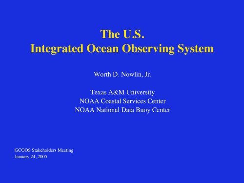
<strong>The</strong> U.S.<strong>Integrated</strong> <strong>Ocean</strong> <strong>Observing</strong> <strong>System</strong> Worth D. Nowlin, Jr. Texas A&M University NOAA Coastal Services Center NOAA National Data Buoy Center GCOOS Stakeholders Meeting January 24, 2005
<strong>The</strong> Global <strong>Ocean</strong> <strong>Observing</strong><strong>System</strong>
<strong>The</strong> <strong>Ocean</strong>.US Enterprise
Commission on <strong>Ocean</strong> Policy• Implement an <strong>Integrated</strong> <strong>Ocean</strong><strong>Observing</strong> <strong>System</strong>• Implement ecosystem–basedmanagement• Strengthen regional approach
National <strong>Ocean</strong>ographic Partnership Program (NOPP) Ten–Year Strategic Plan for the NOPP• Achieve & sustain an <strong>Integrated</strong> <strong>Ocean</strong><strong>Observing</strong> <strong>System</strong> (IOOS)• Promote lifelong ocean education• Modernize ocean infrastructure & enhancetechnology development• Foster interagency partnerships to increase& apply scientific knowledge
At the request <strong>of</strong> the U.S. Congress, the federal agencies<strong>of</strong> the NOPP are planning and developing a U.S.<strong>Integrated</strong> <strong>Ocean</strong> <strong>Observing</strong> <strong>System</strong> focused on: • Detecting and Forecasting <strong>Ocean</strong>ic Components <strong>of</strong> Climate Variability • Facilitating Safe and Efficient Marine Operations • Ensuring National Security • Managing Marine Resources • Preserving and Restoring Healthy Marine Ecosystems • Mitigating Natural Hazards • Ensuring Public Health
Dr. Jack KayeChair, Executive CommitteeThomas MaloneDirector, <strong>Ocean</strong>.US Office<strong>The</strong> National Office for <strong>Integrated</strong> and Sustained <strong>Ocean</strong> <strong>Observing</strong> and Predictionhttp://www.ocean.us
<strong>The</strong> U.S. <strong>Integrated</strong> <strong>Ocean</strong><strong>Observing</strong> <strong>System</strong>
U.S. IOOSTwo Interdependent ComponentsGlobal <strong>Ocean</strong>Climate ComponentGOOS/GCOSHIslLow HighResolutionNWGoACCalCoastal <strong>Ocean</strong>ComponentSCalGLsRegional<strong>Observing</strong><strong>System</strong>sNationalBackboneNECarribMABGoMexSE
Coastal ComponentRegional COOSs• Operated by RegionalAssociations• Involve private & publicsectors• Inform Federal Agencies<strong>of</strong> user needs• Enhance the backbonebased on user needs• Incorporate Sub–regionalsystemsNational Backbone• Operated by FederalAgencies• EEZ & Great Lakes• Core variables requiredby regions & Federal Agencies• Networks <strong>of</strong> sentinel &reference stations• Standards/Protocols
Status <strong>of</strong> the IOOS: theDevelopment Plan
2004 IOOS Development Plan 1 st Annual IOOSDevelopment Plan• Part I – Structure and Governance Ø Vision & IOOS design principles Ø Planning Implementing Bodies & Process • Part II – Fiscal Years 2005-2006 – Integrating Existing Assets Ø Integrate existing observing subsystem assets across agencies Ø Data management & communications Ø Coordinated regional development • Part III – Improving the IOOS Through Enhancements andResearch Ø Enhance the initial IOOS Ø R&D priorities
Part IIOOS GovernanceORAPAdviseNORLCEstablish Policies & ProceduresFederal Agencies Develop & Operate theGlobal Component & National BackboneInteragency Working GroupExecutive CommitteeApprove PlansProvide ResourcesNFRARepresent &CoordinateRAsDevelop &OperateRCOOSsUSGSCUser Input &Performance<strong>Ocean</strong>USPlan & Coordinate
Functions <strong>of</strong> <strong>Ocean</strong>.US Plan & Coordinate Ø Develop & maintain strategic plan Ø Ensure incorporation <strong>of</strong> elements into anintegrated system Ø Recommend enhancements Ø Recommend R&D priorities Ø Promote collaboration among participating NOPPAgencies & Regional Associations Ø Report regularly to the EXCOM which • Provides policy guidance, Ensures sustained agency support, &approves implementing documents
Four Stages <strong>of</strong> IOOS Elements 1. ResearchNew Knowledge & Technologies2. Pilot ProjectsDemonstrate Feasibility(community acceptance;standards & protocols)3. Pre-Operational ProjectsPro<strong>of</strong> <strong>of</strong> Concept(value added, cost-effective)4. Operational <strong>System</strong>(routine, sustained)
Part IIIOOS Global Component • Part <strong>of</strong> an intergovernmental, cooperativesystem • Designed to observe and predict global, oceaninfluencedphenomena (such as El Niños,extreme weather, or global warming) • Nearing operational, sustained status.
Global <strong>Ocean</strong>-Climate ComponentRequirements for In Situ ObservationsØ Full implementation• Argo• Water level network• Global ocean time seriesobservatoriesØ Successful completion• GODAEØ Optimize the global network<strong>of</strong> observationsØ Enhance ocean time seriesobservatories• key biological & chemicalsensors
Tide Gauges Surface Drifting Buoys Tropical Moored Buoys Ships <strong>of</strong> Opportunity Argo Floats Reference Stations Coastal Moorings <strong>Ocean</strong> Carbon Network Dedicated Ship Time <strong>System</strong> Evaluation 2000 2001 2002 2003 2004 2005 2006 2007 2008 2009 2010 34 343737807 671 779 810 7723772479267926200 310 544 9231 2 6 6 10 39 43124 24 340 370 370 497 497 0 1 1 23Milestones86 1050 1250 1250 1250 125079 82 85 89 10029 3645 45 451500 2300 300010 162027 29531 6407486 86 86 863000 300024 2960105 31 31730 8307 71250 1250115 11545 453000 300029 29105 10531 31830 830 7 7Operational GPS/DORISStationsNumber <strong>of</strong> buoysNumber <strong>of</strong> mooringsHigh resolution and frequentlyrepeated lines occupiedNumber <strong>of</strong> floatsNumber <strong>of</strong> flux mooringsMoorings with climate sensorsNumber <strong>of</strong> flux sites/lines,One inventory per 10 yearsDays at sea (NOAA contribution)Product evaluation andfeedback loops implementedInitial <strong>Ocean</strong> <strong>Observing</strong> <strong>System</strong> Milestones including international contributionsTotal <strong>System</strong>30 34 40 4588 94 99 10048 53772000 2001 2002 2003 2004 2005 2006 2007 2008 2009 2010 <strong>System</strong> % Complete
Part IINational BackboneCore Variables• PhysicalØ Sea surface windsØ Sea surface wavesØ Sea surface currentsØ Sea levelØ Stream flowsØ Temperature, SalinityØ High Res BathymetryØ Ice distribution• MultidisciplinaryØ Optical propertiesØ Bottom character/Benthichabitats• ChemicalØ Dissolved inorganicnutrientØ ContaminantsØ Dissolved oxygen• BiologicalØ Fish species, abundanceØ Zooplankton species,abundanceØ Phytoplankton species,biomass (ocean color)Ø Pathogens
Part II: <strong>The</strong> Initial IOOSFY 05 – 06 Highest Priorities• DMAC• Establish RAs & the NFRA• Coordinated Development<strong>of</strong> Global & Coastal
Part II – Coastal Component<strong>The</strong> Initial IOOS• Extend the global ocean component to the shoreline with higherresolution forØ improved regional weather & climate predictions,Ø more efficient and safer marine operations in coastal waters,Ø more accurate forecasts <strong>of</strong> natural hazards & their effects, &Ø improved homeland security.• Develop an integrated approach to water quality monitoring & livingresource assessments through more timely provision <strong>of</strong>Ø Surface & interior fields• nutrients & dissolved oxygen• phytoplankton biomass (Chl) & macrozooplankton abundanceØ Extent and condition <strong>of</strong> benthic habitats;Ø Abundance and distribution <strong>of</strong> living marine resources (includingprotected species); &Ø Land-sea freshwater flows & associated transports <strong>of</strong> sediments, nutrients& contaminants.
Part III – Enhancement Categories• Global <strong>Ocean</strong> – Climate Component• DMAC• Regional Coastal <strong>Ocean</strong> <strong>Observing</strong> <strong>System</strong>s• National Backbone Operational <strong>Observing</strong>Subsystem– Increase density <strong>of</strong> measurements– Incorporate additional sensors• Education
Part III – Enhancement CategoriesResearch & Pilot Projects• Product–Driven (end–to–end systems)Ø Surface current mapsØ Near shore bathy-topography maps• Target Specific Elements <strong>of</strong> the IOOSØ Modeling – Close gap between operational models for• marine meteorology & physical oceanography &• those that require biological & chemical dataØ Benthic habitat mappingØ In situ sensors for biological & chemical variablesØ Glider technologiesØ Improve spectral, spatial & temporal resolution <strong>of</strong> space–based remote sensing <strong>of</strong> coastal systems
Thank Youhttp://www.ocean.us