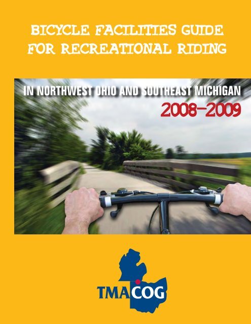
Bicycle Facilities Guide for Recreational Riding - Toledo ...
Bicycle Facilities Guide for Recreational Riding - Toledo ...
Bicycle Facilities Guide for Recreational Riding - Toledo ...

Create successful ePaper yourself
Turn your PDF publications into a flip-book with our unique Google optimized e-Paper software.
BICYCLE FACILITIES GUIDE<br />
FOR RECREATIONAL RIDING<br />
IN NORTHWEST OHIO AND SOUTHEAST MICHIGAN<br />
2008-2009
This guide includes three maps:<br />
A bicycle is an excellent option <strong>for</strong> both transportation<br />
and recreation – fun, inexpensive, and healthy <strong>for</strong> the<br />
environment and the rider. Our region offers some<br />
special bikeways – paths, bike lanes, and marked<br />
bike routes. This guide will introduce you to facilities<br />
<strong>for</strong> recreational riding in northwest Ohio and<br />
southeast Michigan. Use this guide to find new<br />
places to ride, to see how existing facilities are linked,<br />
and to learn the plans <strong>for</strong> the further development of<br />
our area’s bike facilities.<br />
• Existing <strong>Facilities</strong> highlights completed trails and lanes <strong>for</strong> riders.<br />
• Existing <strong>Facilities</strong>-<strong>Toledo</strong> Area shows more details in <strong>Toledo</strong>, Sylvania, Ross<strong>for</strong>d, Maumee,<br />
and Perrysburg.<br />
• Proposed <strong>Bicycle</strong> <strong>Facilities</strong> shows regional plans <strong>for</strong> expanding bike access through building new<br />
and linking existing paths. You can help to bring these plans to realization. See the list of cycling<br />
clubs and advocacy groups in this guide. Also check www.tmacog.org <strong>for</strong> activities of TMACOG’s<br />
Pedestrian & Bikeways Committee.<br />
Much more in<strong>for</strong>mation is available <strong>for</strong> interested<br />
riders. This recreational guide includes<br />
contact in<strong>for</strong>mation <strong>for</strong> various park districts,<br />
political jurisdictions and agencies that create<br />
bike infrastructure. Websites will connect you<br />
to updated in<strong>for</strong>mation and show links to many<br />
more resources.<br />
The <strong>Bicycle</strong> User’s Pocket <strong>Guide</strong> is a companion<br />
piece to this facilities guide. The pocket<br />
guide is designed to help a bicycle commuter<br />
design a route to match the rider’s skill level.<br />
It shows more details of city streets and traffic<br />
and will be useful as a reference guide and<br />
planning tool.<br />
1.<br />
While the laws of the state apply to all riders,<br />
individual cities and villages may have additional<br />
regulations. Please check with your<br />
jurisdiction to ensure that you are riding safely<br />
and legally.<br />
When planning your bicycle trips, please remember<br />
that the resources of the <strong>Toledo</strong> Area<br />
Regional Transit Authority (TARTA) are also<br />
available to assist you. All TARTA buses are<br />
equipped with bicycle racks and when you ride<br />
a TARTA bus, you can bring along your bike at<br />
no extra charge. Call 419.243.RIDE or go to<br />
www.TARTA.com <strong>for</strong> route and schedule in<strong>for</strong>mation.<br />
Happy cycling! And don’t <strong>for</strong>get to wear a helmet!
WHAT IS A “BIKE FACILITY?”<br />
This recreational guide lists a number of different types of bicycling facilities from paths and trails to<br />
lanes to signed bike routes. Descriptions of each follow.<br />
Signed<br />
Bike<br />
Route: A<br />
numbered or<br />
named route<br />
that cyclists<br />
can follow.<br />
It often connects<br />
to major<br />
destinations. A<br />
route may include<br />
streets,<br />
bike lanes,<br />
and paths.<br />
Bike Path or Trail:<br />
<strong>Facilities</strong> separate from the<br />
roadway are typically designed<br />
<strong>for</strong> two-way travel and are usually<br />
10- or 12-foot-wide, paved<br />
or unpaved. All paths in our<br />
region are multi-purpose trails<br />
<strong>for</strong> non-motorized uses (biking,<br />
running, walking, roller blading,<br />
etc.). The more rural trails usually<br />
permit horseback riding.<br />
Bike Lanes: Oneway<br />
specially marked<br />
lanes, usually 5-footwide,<br />
adjoining each<br />
side of the road.<br />
Please note bicycles are permitted on any<br />
public roadway that is not a limited access<br />
divided highway.<br />
2.
Consult the Existing <strong>Facilities</strong> maps <strong>for</strong> the number keys to<br />
locate the following facilities:<br />
1. SYLVANIA BIKE NETWORK<br />
The City of Sylvania and the Sylvania Area Joint Recreation District have developed the following bikeways to<br />
link neighborhoods with parks and other community facilities. (Also see section 2.)<br />
•Pacesetter Park Bike Path: 0.75-mile, 12-foot-wide paved bike path from Centennial Quarry to Pacesetter<br />
Park. Parking is available at both locations.<br />
•Monroe Street/Erie Street <strong>Bicycle</strong> Lanes: 2.1-mile, paved bike lanes, from Monroe Street at Silica<br />
Drive to Erie Street at Centennial Road.<br />
Contact: Sylvania Area Joint Recreation District, 419.882.1500 E-mail: sajrd.adm@sylvania.sev.org.<br />
2. OLANDER PARK SYSTEM<br />
The Olander Park System in Sylvania operates Olander Park that features a 1.1-mile paved bicycle and walking<br />
path around the park as well as numerous other facilities on the park grounds. 6930 Sylvania Avenue,<br />
Sylvania, OH. Contact: Website: www.olanderpk.com E-mail: olanderpk@sev.org 419.882.8313.<br />
3. UNIVERSITY/PARKS TRAIL and CONNECTORS<br />
3-1. University/Parks Trail 6.3 miles. The first rails-to-trails conversion in Lucas County, a 12-footwide<br />
paved path from the University of <strong>Toledo</strong> to King Road in Sylvania. Parking is at the UT lot at<br />
Secor & Dorr streets, the Ottawa Hills Municipal Building (2125 Richards Road at Bancroft), Wildwood<br />
Preserve Metropark (follow connecting path to the Trail), and at the McCord Road crossing in Sylvania.<br />
Access is also available by street from Westfield Shoppingtown at Franklin Park, Tam-O-Shanter,<br />
and Ottawa Park (see 3-3 below).<br />
Contact: Metroparks of the <strong>Toledo</strong> Area, 419.407.9700<br />
3-2. King Road/Sylvania Avenue Bikeway loop<br />
University<br />
Parks Trail<br />
•King Road bike lanes: 0.5 miles, from University/Parks Trail to Sylvania Avenue.<br />
•Sylvania Avenue Bikeway: 4 miles. Bike lanes from King Road to Holland-Sylvania Road; 8-footwide<br />
asphalt path from Holland-Sylvania Road to Talmadge Road.<br />
Contact: Lucas County Engineer, 419.213.4540.<br />
•Talmadge Road/Springbrook Dr: 1.2-mile signed route: from Sylvania Avenue, follow Talmadge<br />
Road south to Springbrook Drive, then west to Corey Road. This is the route to Wildwood Metropark.<br />
•Wildwood Metropark Ottawa River Trail: 1.8-mile paved path and boardwalk from Corey Road (at<br />
Springbrook Drive), through Wildwood Metropark and across Ottawa River flood plain to the University/Parks<br />
Trail. This trail crosses the Ottawa River with a covered bridge and connects with all other<br />
Wildwood park trails.
3-3. Connector to Ottawa Park: at the east end of the University/Parks Trail (on the UT campus), there<br />
are bike route signs on Oakwood Avenue and Westwood Avenue directing cyclists to the Ottawa Park<br />
bike path (see section 4).<br />
4. OTTAWA & BEATTY/JERMAIN PARKS PATH AND CONNECTORS<br />
Paved paths, 8-foot-wide. Connects three City of <strong>Toledo</strong> parks and the Scott Park Campus of UT.<br />
•Beatty/Jermain Parks Path: 1 mile. Begins at Ayers Avenue, parallels South Cove Boulevard; crosses<br />
Monroe Street to Upton Avenue, where it enters Ottawa Park.<br />
•Ottawa Park Path: 3-mile loop around the circumference of the park, adjacent to Bancroft, Douglas,<br />
Kenwood, North Cove, Upton. Connects to the Jermain path at South Cove and the Parkside Boulevard<br />
path at Bancroft.<br />
•Parkside Boulevard Bike Path: 1.8 miles. Located in the center median of Parkside Boulevard, provides<br />
connection from Ottawa Park to the University of <strong>Toledo</strong>’s Scott Park Campus. There are numerous<br />
roadway crossings that require care when crossing. Please pay careful attention when crossing the roads.<br />
Ends at Hill Avenue.<br />
Other City of <strong>Toledo</strong> <strong>Bicycle</strong> <strong>Facilities</strong><br />
• Highland Park Bike Path: 0.9 mile. Located in Highland Park off South Avenue in south <strong>Toledo</strong>.<br />
Highland Park also contains a skateboard facility.<br />
• Walbridge Park Bike Path: 1.0 mile. Located in Walbridge Park across Broadway Avenue from the<br />
<strong>Toledo</strong> Zoo in south <strong>Toledo</strong>.<br />
• International Park Rotary Trail: 2.5 miles. Located in International Park on the east bank of the<br />
Maumee River off Main Street. Park also contains the Willis Boyer Museum Ship Freighter. Path will<br />
connect to the Marina District Bikeway and Craig Bridge Trail as they are developed.<br />
• Bowman Park Bike Path: 1.0 mile. Located in Bowman Park between Laskey and Tremainsville<br />
roads in west <strong>Toledo</strong>.<br />
• Woodsdale Park Bike Path: 0.7 mile. Located in Woodsdale Park at the intersection of Woodsdale<br />
Avenue and the Anthony Wayne Trail in south <strong>Toledo</strong>.<br />
Contact: City of <strong>Toledo</strong> Division of Parks and Recreation, 419.936.2900.<br />
5. GREENBELT PARKWAY BIKE PATH<br />
1.5 mile. Parallels the Buckeye Basin Greenbelt Parkway (SR 25) from Cherry Street to I-280. 12-foot-wide paved<br />
path. Will be connected to the pathway adjacent to I-280 and crossing the Craig Bridge to East <strong>Toledo</strong>.<br />
Greenbelt<br />
Parkway<br />
Bike Path<br />
4.
6. OREGON BIKE NETWORK<br />
The City of Oregon is developing a network to create a route from the Maumee River to Maumee Bay State Park,<br />
with connections to many Oregon locations including schools, Pearson Metropark, and Oregon’s Municipal Complex.<br />
Currently constructed or funded parts:<br />
•Starr Avenue Bike Lanes: 1.9 miles. Paved bike lanes, from Wheeling Street to Pearson Park at the<br />
intersection of Lallendorf Road. (There are also paths in Pearson Park — see 14.)<br />
•Pearson Park Connector: 1.0-mile, 10-foot-wide paved path connecting from Starr Avenue Bikeway<br />
to the Municipal Complex Connector, running on the north side of Starr Avenue from Lallendorf Road to<br />
Wynn Road.<br />
•Municipal Complex Connector Phase 1: 0.8-mile, 10-foot-wide paved path from Wynn Road to City<br />
of Oregon Municipal & <strong>Recreational</strong> Complex along Starr Avenue and Wolf Creek. Parking to be available<br />
at Oregon Municipal Complex off Seaman Road.<br />
•Stadium Road Bikeway Phase 1: 0.6-mile, paved path. Starts at corner of Stadium & Bayshore roads<br />
(at South Shore Veterans Park), and runs to Eagle’s Landing Golf Course and Subdivision.<br />
•Bayshore Road Bike Path: 1.2-mile, paved bike path along Bayshore Road. Begins at Stadium Road<br />
at South Shore Veterans Park and the James A. Haley Boardwalk. The path continues east to Maumee<br />
Bay State Park, connecting to park roads and trails. (See 14.) Parking available at South Shore Park.<br />
Contact: City of Oregon Dept. of Public Service, 419.698.7047.<br />
7. WABASH CANNONBALL TRAIL<br />
One of the region’s largest trail systems, using two <strong>for</strong>mer Wabash Railroad rights-of-way plus a connector between<br />
them. Both <strong>for</strong>ks have their eastern trailheads on Jerome Road in Maumee, at the site of the future Fallen<br />
Timbers Battlefield Park. A bicycle/pedestrian overpass has been constructed to provide access from the Trail to<br />
the memorial on the south side of US24. Paving is completed in Lucas County and in the City of Wauseon (Fulton<br />
County). The rest is crushed stone with mountain bikes recommended.<br />
5.<br />
Wabash<br />
Cannnonball<br />
Trail<br />
7-1. North Fork: A 46-mile corridor from Jerome Road to Montpelier. Partly open. It passes through<br />
Lucas, Fulton, and Williams counties and several towns and villages including Delta and Wauseon. About<br />
21 miles are open, including 10 miles paved in Lucas County (Jerome Road through Oak Openings<br />
Metropark); 6.5 miles stone from Oak Openings to SR 109 in Fulton County; 1 mile paved plus 2 miles<br />
unpaved in Wauseon; and 2 miles unpaved in the West Unity area in Williams County.<br />
7-2. South Fork: 17 miles. All open, from Jerome Road to Liberty Center; passes through Lucas and<br />
Henry counties, and villages of Whitehouse, Neapolis, and Colton. There is a covered bridge on the trail<br />
just east of Neapolis. Asphalt pavement within Lucas County, the remainder is mostly stone.<br />
7-3. North-South Connector: 2 miles. Paved in Oak Openings Metropark, from North Fork to SR 64. In<br />
future will extend via a path and a signed route to South Fork; at present, follow local roads.<br />
Contact: Metroparks of the <strong>Toledo</strong> Area, 419.407.9700. City of Wauseon, 419.335.9022. Northwestern<br />
Ohio Rails-to-Trails Assoc., Inc. (NORTA Inc.), 800.951.4788, E-mail: pmgnorta@buckeye-express.com<br />
(volunteer organization that oversees most of trail in Fulton, Williams, and Henry counties).
8. PERRYSBURG AREA BIKEWAYS<br />
The following will help create the North Coast/Wabash Connector (connection between these two major trails).<br />
(See 9 and 9-3.)<br />
•Maumee-Perrysburg Bridge Bikeway: The new bridge spanning the Maumee River between Maumee<br />
and Perrysburg provides sidewalks plus a 10-foot-wide bike path.<br />
•City of Perrysburg Bikeways: 0.6-mile,10-foot-wide paved bike path from the Maumee-Perrysburg<br />
Bridge to W. Boundary Street (SR 25), ending at the Indiana Avenue (SR 65) intersection.<br />
Contact: City of Perrysburg, 419.872.8010.<br />
9. NORTH COAST INLAND TRAIL and CONNECTORS<br />
The North Coast Inland Trail (NCIT) is a rails-to-trails conversion. When complete, it will run about 75 miles from<br />
Elyria going west to Millbury. At present, a few sections are open to the public. Ef<strong>for</strong>ts are underway to link this<br />
trail with the Wabash Cannonball system. Below are the current open northwest Ohio sections of this trail.<br />
9-1. North Coast Inland Trail<br />
The Fremont to Clyde segment extends 8.5 miles including a new 2-mile segment in the heart of Fremont.<br />
The Fremont section includes stunning views from the 400-foot-long rehabilitated trestle over the Sandusky<br />
river in downtown Fremont. The bridge is the northernmost dedicated bicycle/pedestrian crossing<br />
of the Sandusky River and Sandusky Bay. The addition of the Fremont segment provides direct access to<br />
the Fremont Community Recreation Center at Biggs-Kettner Eastside Park, at Walsh Memorial Park, at<br />
Roger Young Park, and in downtown Fremont. The entire Fremont to Clyde segment provides a 10-footwide<br />
paved surface.<br />
The Sandusky County Park District is constructing a 10.5-mile segment extending from the City of Fremont<br />
in Sandusky County to the Village of Elmore in Ottawa County. This trail segment will also pass<br />
through the Village of Lindsey. Opening of this segment, funded through an ODOT Transportation Enhancement<br />
Grant and an ODNR Clean Ohio Trail Grant, is anticipated in fall 2008.<br />
Contact: Sandusky County Park District, 419.334.4495, Website: www.scpd-parks.org.<br />
In Huron County, significant progress has been made on segments of the North Coast Inland Trail. The<br />
corridor is owned by a coalition of park districts and construction and operation are provided by the nonprofit<br />
trail advocacy group, Firelands Rails to Trails.<br />
Contact: www.FirelandsRailsToTrails.org.<br />
(Not shown on the map:)<br />
•Eastern end of the NCIT, Elyria to Kipton in Lorain County, 14-mile, 10-foot-wide paved trail.<br />
Contact: Lorain Co. Metroparks, 440.458.5121.<br />
•Huron River Greenway. When completed, will run approximately 12 miles from Huron to Norwalk connecting<br />
with the NCIT. The northern portion is currently closed pending resolution of access issues.<br />
Contact: Erie Metroparks, 419.621.4220, Website: www.eriemetroparks.org.<br />
9-2. Village of Elmore: Approximately 2.5-mile section, which runs the width of the town. Crushed<br />
stone surface.<br />
Contact: Village of Elmore, 419.862.3362.<br />
9-3. North Coast/Wabash Connector: Phase One, approximately 6.5 miles total, begins in Millbury.<br />
Signed bike route from Main Street (Millbury Road) north to Ayers Road, west to Drouillard Road, north<br />
to Village of Walbridge parks. Bike lanes on Drouillard from Ayers south to Friendship Park, which has<br />
restrooms and a 0.25-mile paved path loop.<br />
Contact: Lake Township, 419.838.6536.<br />
City of Perrysburg is working on a second phase of the Connector. (See 8 above.)<br />
10. BOWLING GREEN SIGNED ROUTES<br />
The City of Bowling Green has signs on a number of streets to identify bicycle routes through the city. They provide<br />
<strong>for</strong> more than 20 miles of east-west and north-south travel, including connection to the Slippery Elm Trail.<br />
Contact: City of Bowling Green Parks & Recreation Department, 419.354.6223; bgparks@bgohio.org.<br />
6.
<strong>Bicycle</strong> <strong>Facilities</strong> <strong>Guide</strong><br />
Existing <strong>Facilities</strong><br />
ARCHBOLD<br />
DEFIANCE<br />
COUNTY<br />
£¤ 24<br />
OP 2<br />
£¤ 20A<br />
£¤ 6<br />
FLORIDA<br />
OP 120<br />
FULTON COUNTY<br />
OP 424<br />
OP 18<br />
HOLGATE<br />
OP 108<br />
NAPOLEON<br />
NEW BAVARIA<br />
0 2 4 6<br />
Miles I<br />
map<br />
§¨¦ 90 §¨¦ 80<br />
WAUSEON<br />
LYONS<br />
£¤ 20<br />
Wabash Cannonball Trail - North<br />
Mary Jane Thurston<br />
State Park<br />
HENRY COUNTY<br />
MALINTA<br />
HAMLER<br />
LIBERTY<br />
CENTER<br />
OP 109<br />
OP 109<br />
DELTA<br />
METAMORA<br />
7-2<br />
Maumee State<br />
Forest<br />
Oak Openings<br />
Metropark<br />
Wabash Cannonball Trail - South<br />
£¤ 24<br />
MCCLURE<br />
OP 65<br />
7-1<br />
OP 64<br />
SWANTON<br />
Maumee R.<br />
DESHLER<br />
<strong>Toledo</strong><br />
Metropolitan<br />
Area Council of<br />
Governments<br />
300 Martin Luther King Jr. Dr., <strong>Toledo</strong>, Ohio 43604<br />
Phone 419-241-9155, Fax 419-241-9116<br />
www.tmacog.org<br />
7-3<br />
Providence<br />
Metropark<br />
14-1<br />
Blue Creek<br />
Conservation<br />
Area<br />
£¤ 6<br />
BERKEY<br />
LUCAS COUNTY<br />
Bend View<br />
Metropark<br />
Towpath Trail<br />
GRAND RAPIDS<br />
1<br />
OP 2<br />
WHITEHOUSE<br />
WESTON<br />
OP 235<br />
MILTON CENTER<br />
CUSTAR<br />
£¤ 20A<br />
Farnsworth<br />
Metropark<br />
OP<br />
Otsego<br />
Park<br />
65<br />
WOOD COUNTY<br />
HOYTVILLE<br />
OP 18<br />
2<br />
OP 64<br />
WATERVILLE<br />
OP 281<br />
HOLLAND<br />
Side Cut<br />
Metropark<br />
TONTOGANY<br />
NORTH<br />
BALTIMORE<br />
MONROE COUNTY<br />
£¤ 23 £¤ 24<br />
TEMPERANCE<br />
OP 64<br />
11<br />
LAMBERTVILLE<br />
University<br />
3-2<br />
Swan Creek<br />
Metropark<br />
MAUMEE<br />
10<br />
OP 25<br />
PERRYSBURG<br />
HASKINS<br />
BOWLING GREEN<br />
PORTAGE<br />
SYLVANIA<br />
OP 25<br />
City Park<br />
8<br />
§¨¦ 75<br />
CYGNET<br />
Slippery Elm Trail /Parks Trail<br />
OP 582<br />
12<br />
TOLEDO<br />
Ç7 14<br />
ROSSFORD<br />
OP 199<br />
JERRY CITY<br />
ROSSFORD<br />
OP 105<br />
MICHIGAN<br />
OHIO<br />
OP 795<br />
§¨¦ 75<br />
WALBRIDGE<br />
§¨¦ 280<br />
Erie State<br />
Game Area<br />
NORTHWOOD<br />
LUCKEY<br />
OP 420<br />
PEMBERVILLE<br />
9-3<br />
£¤ 20<br />
WH Harrison Park<br />
WAYNE<br />
WEST MILLGROVE<br />
BRADNER<br />
OP 199<br />
BAIRDSTOWN BLOOMDALE<br />
FOSTORIA<br />
Woodtick<br />
Peninsula<br />
Park<br />
MILLBURY<br />
RISINGSUN<br />
LUNA PIER<br />
£¤ 23<br />
Maumee<br />
Bay<br />
OP 2<br />
£¤ 20<br />
§¨¦ 475<br />
Wildwood Metropark<br />
Maumee Bay<br />
Secor<br />
State Park<br />
Metropark<br />
Pearson<br />
Metropark<br />
Ç7 5 Ç7 20 Ç7 20<br />
4<br />
5<br />
13-1 3-1<br />
13-1<br />
OP 3-3<br />
6<br />
295<br />
HARBOR<br />
VIEW<br />
OTTAWA<br />
HILLS<br />
OREGON<br />
OP 51<br />
GENOA<br />
WOODVILLE<br />
£¤ 6<br />
OP 579<br />
CLAY CENTER<br />
GIBSONBURG<br />
Cedar Point National<br />
Wildlife Refuge<br />
9-2<br />
White Star<br />
Park<br />
Lake Erie<br />
Ottawa National<br />
Wildlife Area<br />
OTTAWA COUNTY<br />
OP 590<br />
OP 105<br />
ELMORE<br />
LINDSEY<br />
SANDUSKY COUNTY<br />
Legend<br />
HELENA<br />
BURGOON<br />
Existing Bike Path<br />
§¨¦ 80<br />
Magee Marsh National<br />
Wildlife Area<br />
ROCKY RIDGE<br />
Portage R.<br />
§¨¦ 90<br />
OP 19<br />
OP 53<br />
FREMONT<br />
Ottawa National<br />
Wildlife Area<br />
See <strong>Toledo</strong> Area map on page 13<br />
OP 2<br />
OAK HARBOR<br />
MICHIGAN<br />
OP 163<br />
Sandusky R.<br />
OP 412<br />
North Coast Inland Trail<br />
GREEN SPRINGS<br />
TOLEDO<br />
AREA �<br />
THIS MAP AREA<br />
Existing Bike Lane<br />
Signed Bike Route Ç7 20 Parks and Nature Preserves<br />
Municipal Boundaries<br />
9-1<br />
OP 53<br />
Pickerel Creek<br />
Wildlife Area<br />
OP 510<br />
OHIO<br />
PORT<br />
CLINTON<br />
Sandusky<br />
Bay<br />
£¤ 6<br />
CLYDE<br />
8-1 Bike Facility Number (see descriptions)<br />
Proposed Path Segment<br />
£¤ 20<br />
date: 5/15/08
11. SLIPPERY ELM TRAIL<br />
13 miles. 12-foot-wide, paved trail. Wood County’s premier trail, maintained by the Wood County Park District,<br />
this <strong>for</strong>mer B&O Railroad right-of-way links the Ohio communities of Bowling Green, Portage, Rudolph, and North<br />
Baltimore. Parking is available at BG City Park, at the Montessori School (during non-school hours) on Sand<br />
Ridge Road in Bowling Green, at the Portage Road crossing, at the rest area in the Village of Rudolph, and at the<br />
southern terminus in North Baltimore. Restrooms in North Baltimore.<br />
Contact: Wood County Park District, 419.353.1897; 800.321.1897; E-mail: email@wcparks.org. Website:<br />
www.wcparks.org.<br />
12. MONROE COUNTY, MICHIGAN<br />
Just north of <strong>Toledo</strong>, the three southernmost townships of Monroe County are part of the <strong>Toledo</strong> metropolitan<br />
transportation planning area. Bike lanes have been constructed on:<br />
•Douglas Road from Sterns Road to Summerfield Road, 0.5 miles;<br />
•Lewis Avenue from Erie Road to Dean Road in Temperance, 2 miles.<br />
For more in<strong>for</strong>mation about these and other Michigan bicycle facilities, contact Monroe County Road Commission<br />
at 734.240.5102, Southeast Michigan Council of Governments (SEMCOG) at 313.961.4266; or Michigan Department<br />
of Transportation’s website at www.michigan.gov/mdot.<br />
13. REGIONAL BIKE NETWORK<br />
As part of the regional 25-year transportation plan (the 2035 Plan), roads that provide good travel routes <strong>for</strong><br />
cyclists in the <strong>Toledo</strong> metropolitan area have been identified and placed on the TMACOG 2035 <strong>Bicycle</strong> Network<br />
Plan. (The plan includes all of Lucas and Wood counties and southern Monroe County in Michigan.) Most of the<br />
facilities described in this brochure are part of that network. As the network roads are repaired or modified, bike<br />
and pedestrian friendly improvements can be considered <strong>for</strong> inclusion in those projects.<br />
To help cyclists reach their destinations, a project is underway to sign and map the major regional routes. Bike<br />
Routes 5, 14 and 20 are all shown on the map in this guide. Signs are white rectangles with a green oval. The<br />
green oval has a bike symbol and the route number on it.<br />
9.<br />
Slippery<br />
Elm Trail<br />
13-1. Bike Route 20: 38-mile, signed east-west route, beginning on Bancroft Street at the Lucas-Fulton<br />
County line and leading to Maumee Bay State Park and Lake Erie (Reno Beach area) in eastern Lucas<br />
County. Route follows Bancroft, Cherry, Martin Luther King Jr. Bridge, Main, Front, Morrison, Ravine Park-<br />
way/Seaman, Whittlesey, Starr Avenue Bikeway, Stadium, Corduroy. Bike Route 20A continues north on<br />
Stadium to the Bayshore Road Bikeway. For more in<strong>for</strong>mation on the Regional Bike Network, contact<br />
TMACOG at 419.241.9155.
14. BIKE PATHS IN AREA PARKS<br />
•Maumee Bay State Park offers bike trails, bike lanes and park roads suitable <strong>for</strong> cycling. Contact the Park<br />
Administration at 419.836.7758.<br />
• Metroparks of the <strong>Toledo</strong> Area. In addition to the facilities described in sections 3 and 6 of this brochure, the<br />
following metroparks have bike trails within their grounds:<br />
Oak Openings (5 miles), Pearson (3 miles), Wildwood (2 miles), Secor (3 miles), Swan Creek (3 miles), and<br />
the 8-mile Towpath Trail from Farnsworth to Providence Metroparks (14-1 on map). Some are paved, some,<br />
not. For more in<strong>for</strong>mation, contact the Metroparks at 419.407.9700. Website: www.metroparkstoledo.com.<br />
•Wood County Park District. In addition to the Slippery Elm Trail, the following Wood County Parks have facilities<br />
of interest to cyclists:<br />
W.W. Knight Nature Preserve—restrooms, bike trail; William Henry Harrison Park—restrooms; Otsego<br />
Park—restrooms. For more in<strong>for</strong>mation, contact Wood County Park District, 419.353.1897; 800.321.1897;<br />
E-mail: email@wcparks.org. Website: www.wcparks.org.<br />
•Community Parks.<br />
<strong>Toledo</strong>, Bowling Green<br />
and several other area<br />
cities, villages, and<br />
townships have parks<br />
with bicycle paths,<br />
usually 10-foot-wide<br />
paved. Contact your<br />
local government <strong>for</strong><br />
in<strong>for</strong>mation, or <strong>for</strong> assistance<br />
call TMACOG<br />
at 419.241.9155.<br />
Village of Waterville.<br />
In 2008 the village is<br />
constructing a public<br />
restroom facility with<br />
drinking fountain at<br />
the intersection of the<br />
Anthony Wayne Trail,<br />
Farnsworth Road and<br />
Third Street adjacent to<br />
popular biking routes<br />
and downtown restaurants.<br />
Proposed <strong>Bicycle</strong><br />
<strong>Facilities</strong><br />
£¤ 20<br />
Oak Openings<br />
Metropark<br />
Wabash Trail - South<br />
Providence<br />
Metropark<br />
LUCAS<br />
COUNTY<br />
SWANTON<br />
£¤ 6<br />
OP 295<br />
GRAND RAPIDS<br />
<strong>Toledo</strong><br />
Metropolitan<br />
Area Council of<br />
Governments<br />
300 Martin Luther King Jr. Dr., <strong>Toledo</strong>, Ohio 43604<br />
Phone 419-241-9155, Fax 419-241-9116<br />
www.tmacog.org<br />
BERKEY<br />
Bend View<br />
Metropark<br />
Secor<br />
Metropark<br />
Wabash Trail - North<br />
Blue Creek<br />
Conservation Area<br />
WESTON<br />
WHITEHOUSE<br />
OP 235<br />
MILTON CENTER<br />
0 1 2 3<br />
Miles<br />
4<br />
I<br />
Farnsworth<br />
Metropark<br />
Otsego<br />
Park<br />
MONROE<br />
COUNTY<br />
OP 2<br />
HOLLAND<br />
Homecoming<br />
Park<br />
£¤ 20A<br />
OP 64<br />
WATERVILLE<br />
OP 65<br />
SYLVANIA<br />
OP 281<br />
TEMPERANCE<br />
23 £¤ £¤24<br />
§¨¦ 475<br />
Side Cut<br />
Metropark<br />
£¤ 24<br />
TONTOGANY<br />
HASKINS<br />
OP 64<br />
BOWLING GREEN<br />
LAMBERTVILLE<br />
Slippery Elm Trail<br />
Wildwood Metropark<br />
Swan Creek<br />
Metropark<br />
City<br />
Park<br />
MAUMEE<br />
OP 25<br />
MICHIGAN<br />
OHIO<br />
PERRYSBURG<br />
TOLEDO<br />
OTTAWA HILLS<br />
§¨¦ 75<br />
PORTAGE<br />
OP 582<br />
OP 199<br />
§¨¦ 75<br />
WOOD<br />
COUNTY<br />
OP 105<br />
Maumee R.<br />
Erie State<br />
Game Area<br />
OP 420<br />
Pearson<br />
Metropark<br />
NORTHWOOD<br />
§¨¦ 80 §¨¦ 90 §¨¦ 280<br />
OP<br />
ROSSFORD<br />
51<br />
OP 795<br />
ROSSFORD<br />
WALBRIDGE<br />
MILLBURY<br />
LUCKEY<br />
PEMBERVILLE<br />
LUNA<br />
PIER<br />
£¤ 20<br />
WH Harrison<br />
Park<br />
£¤ 6<br />
HARBOR<br />
VIEW<br />
Woodtick<br />
Peninsula<br />
Park<br />
Maumee<br />
Bay<br />
£¤ 23<br />
MICHIGAN<br />
Lake Erie<br />
Maumee Bay<br />
State Park<br />
OREGON<br />
OP 579<br />
MAP<br />
AREA<br />
North Coast Inland Trail<br />
GENOA<br />
Portage R.<br />
OHIO<br />
OP 2<br />
OTTAWA<br />
COUNTY<br />
CLAY CENTER<br />
WOODVILLE<br />
GIBSONBURG<br />
SANDUSKY<br />
COUNTY<br />
BRADNER<br />
Legend<br />
Existing Facility Segment<br />
Proposed Bike WAYNE Path<br />
Parks and Preserves<br />
Path Under Development<br />
Proposed Bike Facility<br />
Municipal Boundaries<br />
RISING SUN<br />
- type to be determined<br />
map date: 5/15/08<br />
10.
MORE OHIO BICYCLE FACILITY INFORMATION<br />
To find out more about area and statewide bikeways, contact the Ohio Department of Transportation’s office of bicycle<br />
planning at 614.752.4685, or check out the bikeway map and in<strong>for</strong>mation on their website at www.dot.state.<br />
oh.us/bike.<br />
FUTURE DEVELOPMENTS<br />
Many exciting future bike projects are planned <strong>for</strong> our region. From new trails and bridges, to more bike lanes and<br />
signed bike routes, to completing many of the facilities and networks described in this brochure, our northwest<br />
Ohio/southeast Michigan region will help to ensure that bikes belong as an integral component of our transportation<br />
options.<br />
For more in<strong>for</strong>mation on new and upcoming projects, see the Proposed <strong>Facilities</strong> Map. To find out how you can<br />
be involved in planning the region’s future, contact TMACOG and the TMACOG Pedestrian & Bikeways Committee<br />
at 419.241.9155, or e-mail public.info@tmacog.org. Please visit TMACOG’s website at www.tmacog.org.<br />
Resources <strong>for</strong> Bicyclists:<br />
BIKEWAYS:<br />
• Rails to Trails Conservancy www.railtrails.org<br />
• Firelands Rails to Trails www.firelandsrailstotrails.org<br />
• The Olander Park System www.olanderpk.com<br />
• The Sylvania Joint <strong>Recreational</strong> District www.sylvaniarecreation.org<br />
• City of Bowling Green Parks and Recreation www.bgohio.org/parks-and-recreation<br />
• Springfield Township www.springfieldtownship.net<br />
• City of Oregon www.ci.oregon.oh.us<br />
• City of <strong>Toledo</strong> www.ci.toledo.oh.us<br />
• Lucas County Engineer’s Office www.co.lucas.oh.us/engineer<br />
• Monroe County Planning Dept. and Commission www.co.monroe.mi.us<br />
BIKE SHOPS IN NORTHWEST OHIO<br />
The Bike Route Bike Works Cycle Werks<br />
5201 Monroe Street 5631 Alexis Road 248 South Main Street<br />
<strong>Toledo</strong>, OH 43623 Sylvania, OH 43560 Bowling Green, OH 43402<br />
419.885.3030 419.882.0800 419.352.9375<br />
Cycle Werks Reggie’s Cycling & Fitness Wersell’s Bike and Ski Shop<br />
116 East William Street 5934 Secor Road 2860 West Central Avenue<br />
Maumee, OH 43537 <strong>Toledo</strong>, OH 43623 <strong>Toledo</strong>, OH 43606<br />
419.893.9375 419.475.1585 419.474.7412<br />
Fremont Schwinn Cyclery Road Racer Mountain Man Ski Shop<br />
107 North Ohio Avenue 625 Eckel Road #4 2735 North Reynolds Road<br />
Fremont, OH 43420 Perrysburg, OH 43551 <strong>Toledo</strong>, OH 43615<br />
419.332.4481 419.874.7550 419.536.0001<br />
Memory Lane Classics<br />
24516 Third Street<br />
Grand Rapids, OH 43522<br />
419.832.3040<br />
11.
BICYCLE CLUBS, ORGANIZATIONS<br />
AND ADVOCACY GROUPS<br />
Hostelling International – <strong>Toledo</strong> Area<br />
Website: www.HI<strong>Toledo</strong>.org<br />
E-mail: <strong>Toledo</strong>AreaCouncil@ekit.com<br />
<strong>Toledo</strong> Area Bicyclists<br />
Website: <strong>Toledo</strong>AreaBicyclists.org<br />
Maumee Valley Alternative Transportation Alliance<br />
E-mail: rzipperer@ymcatoledo.org<br />
Contact: Robert Zipperer 419.251.9622<br />
Maumee Valley Wheelmen and Team Saturn Shell as well as<br />
other event in<strong>for</strong>mation can be accessed at<br />
Website: www.freewheel.com<br />
Northwestern Ohio Rails-to-Trails Association (NORTA)<br />
Website: www.Wabashcannonballtrail.org<br />
Ohio <strong>Bicycle</strong> Federation<br />
Website: www.ohiobike.org<br />
League of American Bicyclists<br />
Website: www.bikeleague.org<br />
Assistance in developing route directions<br />
Website: www.viamichelin.com<br />
BASIC BICYCLE SAFETY TIPS<br />
• Bicyclists are not allowed on Interstate and<br />
limited access highways in Ohio.<br />
• Use lights when riding in the rain and at<br />
night.<br />
• Always wear a helmet.<br />
• Be courteous, ride single file when appropriate.<br />
• When riding in a narrow lane, stay far enough<br />
from the right edge to discourage vehicles from<br />
passing dangerously close in the same lane.<br />
• When riding past parked cars, be alert <strong>for</strong> motorists<br />
opening doors or pulling out from parking<br />
spaces. Stay outside the “door zone.”<br />
• Allow extra braking distance in weather. <strong>Bicycle</strong><br />
brakes function poorly when wet.<br />
• Cross railroad tracks at a right angle and be<br />
especially cautious when tracks are wet or<br />
frosted as tracks are then very slippery.<br />
• Cross bridges with steel gratings very carefully,<br />
especially when gratings are wet.<br />
• Fasten all spare clothing, parcels, or equipment<br />
securely to rack or bicycle to prevent anything<br />
from falling into a wheel.<br />
• Lock your bike when it is left unattended.<br />
• Keep tires inflated to proper pressure and<br />
bicycle in good repair.<br />
• Ride defensively at all times. Never assume<br />
motorists know your intentions – make them<br />
clear through signals and your position in the<br />
lane.<br />
• Wear highly visible clothing during the day and<br />
reflective clothing at night.<br />
• Yield to pedestrians and emergency vehicles.<br />
• Be predictable – do not surprise a motorist or<br />
a pedestrian.<br />
• Beware of sand or gravel on the road when<br />
making turns – a bicycle can easily slide out<br />
from under you on sand or gravel.<br />
• Many motorists are unaware that bicyclists are<br />
legitimate users of the streets and highways,<br />
so ride courteously, exercise common sense,<br />
and obey all traffic signs, signals and rules of<br />
the road.<br />
• Occasionally a bicyclist will have no choice<br />
but to ride on a road or street judged unsuitable<br />
<strong>for</strong> bicyclists in order to access a suitable<br />
street/road. Use considerable caution when<br />
using such roads or streets, walking your bike<br />
if necessary.<br />
Ride Predictably,<br />
Legally, and Visibly.<br />
It’s Better to be Safe<br />
Than Sorry.<br />
12.
13.<br />
Wabash<br />
Trail<br />
Rt 24<br />
Bike<br />
Bridge<br />
§¨¦ 475<br />
Briarfield and<br />
Technology Paths<br />
£¤ 23<br />
SYLVANIA<br />
2<br />
Olander<br />
Park<br />
HOLLAND<br />
SYLVANIA<br />
3-1<br />
BANCROFT<br />
£¤ 20A<br />
Side Cut<br />
Metropark<br />
University<br />
£¤ 20<br />
REYNOLDS<br />
0 0.5 1 1.5<br />
Miles I<br />
Existing <strong>Facilities</strong> - <strong>Toledo</strong> Area<br />
3-2<br />
Wildwood<br />
Metropark<br />
OTTAWA HILLS<br />
!<br />
DORR<br />
/Parks Trail<br />
TOLEDO<br />
Swan Creek<br />
Metropark<br />
ALEXIS<br />
MONROE<br />
AIRPORT<br />
LUCAS CO.<br />
§¨¦ 80 §¨¦ 90 Ç7<br />
MAUMEE<br />
CENTRAL<br />
University of<br />
<strong>Toledo</strong><br />
Ottawa Park<br />
3-3<br />
Bowman<br />
Park<br />
PARKSIDE<br />
!<br />
Scott Park<br />
Campus<br />
Woodsdale<br />
! Park<br />
UT Health<br />
Science<br />
Campus<br />
PERRYSBURG<br />
8<br />
ECKEL JCT<br />
ROACHTON<br />
4<br />
14<br />
JACKMAN<br />
Highland<br />
Park<br />
ANTHONY WAYNE TR<br />
!<br />
WW Knight<br />
Nature<br />
Preserve<br />
DETROIT<br />
<strong>Toledo</strong> Zoo<br />
Walbridge<br />
Park<br />
ROSSFORD<br />
BROADWAY<br />
CHERRY<br />
Promenade Park<br />
Multi-Purpose Arena<br />
£¤ 20<br />
Fifth Third Field<br />
§¨¦ 75<br />
TELEGRAPH<br />
Ç7 20<br />
!<br />
!<br />
ROSSFORD<br />
Legend<br />
Ç7 20<br />
TOLEDO<br />
5<br />
Greenbelt<br />
Bike Path<br />
International<br />
Park Rotary Trail<br />
WOOD CO.<br />
OP 795<br />
Existing Bike Path<br />
Existing Bike Lane<br />
Signed Bike Route<br />
§¨¦ 75<br />
SUMMIT<br />
Jamie Farr<br />
Park<br />
Veterans'<br />
Glass City<br />
Skyway<br />
WOODVILLE<br />
NORTHWOOD<br />
WALBRIDGE<br />
8-1<br />
DROUILLARD<br />
BayView<br />
Park<br />
§¨¦ 280<br />
OP 2<br />
AYERS<br />
9-3<br />
Friendship<br />
Park<br />
Bike Facility Number<br />
Parks and Preserves<br />
Municipal Boundaries<br />
GENERAL INFORMATION:<br />
• <strong>Toledo</strong> Metropolitan Area Council of Governments www.tmacog.org<br />
• Ohio Department of Transportation www.dot.state.oh.us<br />
• Metroparks of the <strong>Toledo</strong> Area www.metroparkstoledo.com<br />
• Ohio Department of Natural Resources www.dnr.state.oh.us
SAFETY TIPS AT A GLANCE<br />
OBEY TRAFFIC SIGNS AND SIGNALS<br />
<strong>Bicycle</strong>s must drive like other vehicles if they are to be<br />
taken seriously by motorists.<br />
DON’T PASS ON THE RIGHT<br />
Motorists may not look <strong>for</strong> or see a bicycle passing on<br />
the right. Learn to scan the road behind you while riding.<br />
Look back over your shoulder without swerving to<br />
the left, or use a rearview mirror.<br />
RIDE IN MIDDLE OF LANE IN<br />
SLOW TRAFFIC<br />
Get in the middle of the lane at busy intersections and<br />
whenever you are moving at the same speed as traffic.<br />
SCAN THE ROAD BEHIND<br />
Learn to look back over your shoulder without losing your<br />
balance or swerving. Some riders use rearview mirrors.<br />
AVOID ROAD HAZARDS<br />
Watch out <strong>for</strong> parallel sewer grates, gravel or debris.<br />
Cross railroad tracks at right angles.<br />
KEEP BIKE IN GOOD REPAIR<br />
Adjust your bike to fit you and keep it working properly.<br />
Check brakes and tires regularly. Routine maintenance is<br />
simple and you can learn to do it yourself.<br />
HAND SIGNALS<br />
Hand signals tell motorists and pedestrians what you<br />
intend to do. Signal as a matter of law, of courtesy, and of<br />
self-protection.<br />
CHOOSE THE BEST WAY TO<br />
TURN LEFT<br />
There are two ways to make a left turn. (1) Like an auto:<br />
signal, move into the left-turn lane and turn left. (2) Like<br />
a pedestrian: ride straight to the far-side crosswalk. Walk<br />
your bike across.<br />
NEVER RIDE AGAINST TRAFFIC<br />
Motorists aren’t looking <strong>for</strong> bicyclists riding on the<br />
wrong side of the road.<br />
FOLLOW LANE MARKINGS<br />
Don’t turn left from the right lane. Don’t go straight in a<br />
lane marked “right-turn only.”<br />
MAKE EYE CONTACT<br />
WITH DRIVERS<br />
Assume that other drivers do not see you until you are<br />
sure that they do. Eye contact is important with any<br />
driver who might pose a threat to your safety.<br />
USE LIGHTS AT NIGHT<br />
The law requires a white headlight (visible from at<br />
least 500 feet ahead) and a red rear reflector or taillight<br />
(visible up to 300 feet from behind).<br />
DRESS APPROPRIATELY<br />
Avoid loose fitting clothing. Wear light visible colors.<br />
In inclement weather dress in layers. And always<br />
wear a helmet, preferably white <strong>for</strong> greater visibility.<br />
NEVER RIDE WITH HEADPHONES<br />
& ALWAYS WEAR A HELMET<br />
Never wear headphones while riding a bike. Always<br />
wear a helmet.<br />
DON’T WEAVE BETWEEN<br />
PARKED CARS<br />
Weaving between parked cars makes it difficult <strong>for</strong><br />
motorists to be aware of you on the road.<br />
KEEP BOTH HANDS READY<br />
TO BRAKE<br />
You may not stop in time if you brake one-handed.<br />
Allow extra distance <strong>for</strong> stopping in the rain, since<br />
brakes are less efficient when wet.<br />
14.
<strong>Toledo</strong> Metropolitan Area Council of Governments<br />
(TMACOG)<br />
300 Martin Luther King, Jr. Drive<br />
PO Box 9508<br />
<strong>Toledo</strong>, Ohio 43697<br />
419.241.9155<br />
fax 419.241.9116<br />
public.info@tmacog.org<br />
www.tmacog.org