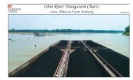
Ohio River Charts 10-15 (Lock 52 Pool) - Louisville District - U.S. Army
Ohio River Charts 10-15 (Lock 52 Pool) - Louisville District - U.S. Army
Ohio River Charts 10-15 (Lock 52 Pool) - Louisville District - U.S. Army
Create successful ePaper yourself
Turn your PDF publications into a flip-book with our unique Google optimized e-Paper software.
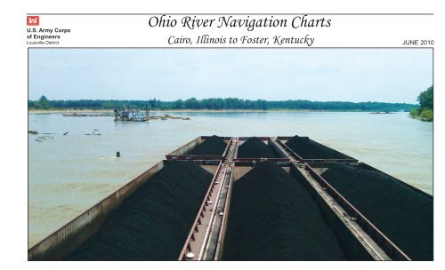
NAVIGATION CHARTS AND NOTICESNavigation charts for the OHIO RIVER,within the limits of the LOUISVILLEDISTRICT, are available on our websiteat http://www.lrl.usace.army.mil forviewing and printing. Spiral-boundbooks are also available for purchaseon the U.S. Government Printing Officewebsite: http://bookstore.gpo.gov .Notices to Navigation Interests,containing data on channel conditionsand location of dredges, are issued asoccasions demand. Request to be placedon the mailing list to receive thesenotices by writing to:U.S. <strong>Army</strong> Corps of EngineersAttn: CELRL-OP600 Dr. Martin Luther King, Jr. Place<strong>Louisville</strong>, KY 40202-0059<strong>Charts</strong> of the <strong>Ohio</strong> <strong>River</strong> are asfollows:PITTSBURGH DISTRICT:Mile 000.0 – 127.2HUNTINGTON DISTRICT:Mile 127.2 – 436.2LOUISVILLE DISTRICT:Mile 436.2 – 981.0MILE POINTSMile points are shown on the charts atone mile intervals beginning with Mile0 at Pittsburgh, PA (The Point).BUOYSBuoys used to mark channels in theMississippi <strong>River</strong> System conform to thestandard lateral system of buoyage onthe Western <strong>River</strong>s of the UnitedStates. Generally, the unlighted buoysin the <strong>Ohio</strong> <strong>River</strong> are equipped withradar reflectors. All buoys areequipped with reflective material.Buoys on the left descending side ofthe channel reflect red. Buoys on theright descending side of the channelreflect green.Buoys are set to mark maximumnavigation channel availableconsidering channel alignment, theprevailing river stage, andobstructions. Due to ever-changingenvironmental conditions, the locationand number of buoys on-site do notnecessarily coincide with these charts.The locations of printed buoys areapproximate.Buoys should always be given as wide aberth in passing as possible consistentwith the length and width of vessel ortow and the width of the bend orcrossing.Buoys should always be used withcaution. They may be carried offposition by high water, accumulation ofdrift, ice, or sunk by collision orother causes. When carried offposition, destroyed, or removed toprevent loss, buoys are replaced at theearliest opportunity.Navigation lights and daybeacons arealso shown in approximate locations.For additional information on lights,daymarks, daybeacons, and buoyage, seethe U.S Coast Guard Light List,COMDTINST M16502, current edition.FEDERAL MOORING BUOYSFederal mooring buoys are for emergencyuse only, except where noted. Thesebuoys shall not be used forrecreational use or fleetingoperations. Vessels using emergencybuoys shall contact the nearestdownstream lock upon mooring and againafter departure.DAMSThe height of the highest fixed pointson the various parts of the locks anddams are shown in feet above the zeroof the pass sill gage. Exceptions arenoted on pages facing the pagecontaining the dam to which they apply.UNITED STATES ARMY CORPS OF ENGINEERS – LOUISVILLE DISTRICTSHEET A
WARNINGTO PLEASURE BOATERS AND FISHERMENWHO NAVIGATE ON THE OHIO RIVERAreas immediately upstream and downstream of the navigation dams inthe <strong>Louisville</strong> <strong>District</strong> have been designated Restricted Areas. Seethe Legend Sheet for symbols that mark Restricted Areas and DangerAreas.In recent years, there have been several boating accidents andfatalities as a result of vessels, particularly small fishing craft,operating too closely to navigation structures. Most of theseaccidents have occurred when boats approach too near the downstreamside of a gated dam. Powerful reverse currents, commonly calledbacklash, draw boats in an upstream direction into the dam wherethere are capsized or smashed against the structure. Furthermore,an additional hazard exists in the vicinity of the lock dischargestructures, which are located adjacent to the downstream river wallof the lock chamber. When the water in the locks is released duringeach locking operation, sudden turbulent boils are created which cancapsize a boat venturing too near. This turbulence becomes moresevere as the downstream pool falls to lower elevations.On the upstream side of the dam, there is a strong undertow createdby the flow of water through the gated section of the dam. Boatsapproaching too closely from the upstream side are in danger ofbeing lodged against the dam or capsized by the undertow.The nature of these river conditions emphasizes the serious dangerto boaters and fishermen who operate their craft near either theupstream or downstream side of a dam. Vessel operators who enterthese areas risk their lives and property and often precludenecessary gate operations of the locks and dams. Fishermen oftenfish in the tailwaters below the dam gates because the fishing isgood. They must understand, however, that fishing from a boat inthese waters can be fatal.To supplement the restricted areas, the remaining area downstream ofeach dam, extending to the end of the long wall has been establishedas a Danger Area. All boaters and fishermen are urged to wearPersonal Floatation Devices (PFDs) within this area, since thesewaters are frequently turbulent. Vessel operators should also heedthe warning sirens which indicate that project personnel will beincreasing flow from the dam or releasing water within the lockdischarge areas. These sirens will be operated for a period of 30seconds, after which, there will be a 3-minute delay prior to arelease of water.Navigators should become fully aware of the Restricted and DangerArea boundaries prior to operating their craft within the vicinityof a lock and dam facility. The Restricted Areas are shown in thecurrent publication of the U.S. <strong>Army</strong> Corps of Engineers, <strong>Louisville</strong><strong>District</strong>, “<strong>Ohio</strong> <strong>River</strong> Navigation <strong>Charts</strong>; Cairo, IL to Foster, KY.”Navigators should also observe all warning signs or marker buoyslocated within the area of each locks and dam structure. The markerbuoys are illustrated with reflective orange bands and waterwaysymbols, and black wording on a white background. Buoys with thewords “KEEP OUT” have, as their symbol, a cross enclosed within adiamond. Buoys designated as “DANGER DAM” are denoted with adiamond symbol.The regulations pertaining to the Restricted Areas are containedwithin the U.S. <strong>Army</strong> Corps of Engineers’ “Regulations Prescribed bythe Secretary of the <strong>Army</strong> for <strong>Ohio</strong> <strong>River</strong>, Mississippi <strong>River</strong> aboveCairo, IL and their tributaries; Use, Administration, andNavigation” (Blue Book). These regulations are as follows:33 CFR 207.300 “(s) Restricted Areas at <strong>Lock</strong>s and Dams. All watersimmediately above and below each dam, as posted by the respective<strong>District</strong> Engineers, are hereby designated as Restricted Areas. Novessel or other floating craft shall enter any such Restricted areaat any time. The limits of the restricted areas at each dam will bedetermined by the responsible <strong>District</strong> Engineer and marked by signsand/or flashing red lights installed in conspicuous and appropriateplaces.”<strong>Lock</strong>masters will enforce adherence to these regulations and, ifrequired, solicit aid from local law enforcement officers. In theinterest of public safety, please tell other boaters or fishermenabout the dangers of boating near lock and dam structures.BE DAM CONSCIOUS!UNITED STATES ARMY CORPS OF ENGINEERS – LOUISVILLE DISTRICTWARNING - SHEET B
REGULATIONS PRESCRIBED BY THE SECRETARY OF THE ARMYFOR THE OHIO RIVER ABOVE CAIRO, IL AND ITS TRIBUTARIES;USE, ADMINISTRATION, AND NAVIGATION(iii) Painting will not be permitted inthe lock chamber during the lockingcycle.(iv) Tow speeds shall be reduced to arate of travel such that the tow can bestopped by checking should mechanicaldifficulties develop. Pilots shouldcheck with the individual lockmastersconcerning prevailing conditions. Itis also recommended that pilots checktheir ability to reverse their energiesprior to beginning an approach.Engines shall not be turned off in thelock until the tow has stopped and beenmade fast.(v) U.S. Coast Guard Regulationsrequire all vessels to have on boardlife saving devices for prevention ofdrowning. All crew members of vesselsrequired to carry work vests (lifejackets) shall wear them during alockage, except those persons in anarea enclosed with a handrail or otherdevice which would reasonably precludethe possibility of falling overboard.All deckhands handling lines duringlocking procedures shall wear a lifejacket. Vessels not required by CoastGuard Regulations to have work vestsaboard shall have at least theprescribed life saving devices, locatedfor ready access and use if needed.The lockmaster may refuse lockage toany vessel which fails to conform tothe above.c) Reporting of Navigation IncidentsIn furtherance of increased safety onwaterways the following safety rulesare hereby prescribed for allnavigation interests:I) Any incident resulting inuncontrolled barges shall immediatelybe reported to the nearest lock. Thereport shall include information as tothe number of loose barges, theircargo, and the time and location wherethey broke loose. The lockmaster orlocks shall be kept informed of theprogress being made in bringing thebarges under control so that he caninitiate whatever actions may bewarranted.II) Whenever barges are temporarilymoored at other than commercialterminals or established fleetingareas, and their breaking away couldendanger a lock, the nearest lock shallbe so notified, preferably thedownstream lock.III) Sunken or sinking barges shall bereported to the nearest lock bothdownstream and upstream of the locationin order that other traffic passingthese points may be advised of thehazards.IV) In the event of an oil spill,notify the nearest lock downstream,specifying the time and location of theincident, type of oil, amount of spill,and what recovery or controllingmeasures are being employed.V) Any other activity on the waterwaysthat could conceivably endangernavigation or a navigation structureshall be reported to the nearest lock.VI) Whenever it is necessary to reportan incident involving uncontrolled,sunken or sinking barges, the cargo inthe barges shall be accuratelyidentified.d) Precedence at <strong>Lock</strong>sI) The vessel arriving first at a lockshall normally be first to lockthrough, but precedence shall be givento vessels belonging to the UnitedStates. Licensed commercial passengervessels operating on a publishedschedule or regularly operating in the"for hire" trade shall have precedenceover cargo tows and like craft.Commercial cargo tows shall haveprecedence over recreational craft,except as described in paragraph (f).UNITED STATES ARMY CORPS OF ENGINEERS – LOUISVILLE DISTRICTREGULATIONS – BACK SHEET C
REGULATIONS PRESCRIBED BY THE SECRETARY OF THE ARMYFOR THE OHIO RIVER ABOVE CAIRO, IL AND ITS TRIBUTARIES;USE, ADMINISTRATION, AND NAVIGATIONII) Arrival posts or markers maybeestablished above and/ or below thelocks. Vessels arriving at or oppositesuch posts or markers will beconsidered as having arrived at thelocks within the meaning of thisparagraph. Precedence may beestablished visually or by radiocommunication. The lockmaster mayprescribe such departure from thenormal order of precedence as in hisjudgment is warranted to achieve bestlock utilization.e) Unnecessary Delay at <strong>Lock</strong>sMasters and pilots must use everyprecaution to prevent unnecessary delayin entering or leaving locks. Vesselsfailing to enter locks with reasonablepromptness when signaled to do so shalllose their turn. Rearranging orswitching of barges in the locks or inapproaches is prohibited unlessapproved or directed by the lockmaster.This is not meant to curtail"jackknifing" or set-overs wherenormally practiced.f) <strong>Lock</strong>age of Recreation CraftIn order to fully utilize the capacityof the lock, the lockage ofrecreational craft shall be expeditedby locking them through with commercialcraft, provided that both parties agreeto joint use of the chamber. Whenrecreational craft are lockedsimultaneously with commercial tows,the lockmaster will direct, wheneverpracticable, that the recreationalcraft enter the lock and depart whilethe tow is secured in the lock.Recreational craft will not be lockedthrough with vessels carrying volatilecargoes or other substances likely toemit toxic or explosive vapors. If thelockage of recreational craft can notbe accomplished within the timerequired for three other lockage ofrecreational craft shall be made.Recreational craft operators areadvised that many locks have a pullchain located at each end of the lockwhich signals the lockmaster thatlockage is desired.g) Simultaneous <strong>Lock</strong>age of Tows withDangerous CargoesSimultaneous lockage of other tows withtows carrying dangerous cargoes orcontaining flammable vapors normallywill only be permitted when there isagreement between the lockmaster andboth vessel masters that thesimultaneous lockage can be executedsafely. He shall make a separatedecision each time such action seemssafe and appropriate, provided:I) The first vessel, or tow in, and thelast vessel, or tow out, are securedbefore the other enters or leaves.II) Any vessel or tow carryingdangerous cargoes is not leaking.III) All masters involved have agreedto the joint use of the lock chamber.h) Stations While Awaiting <strong>Lock</strong>ageVessels awaiting their turn to lockshall remain sufficiently clear of thestructure to allow unobstructeddeparture for the vessel leaving thelock. However, to the extentpracticable under the prevailingconditions, vessels and tows shallposition themselves so as to minimizeapproach time when signaled to do so.i) Stations While Awaiting AccessThrough Navigable PassWhen navigable dams are up or are inthe process of being raised or lowered,vessels desiring to use the pass shallwait outside the limits of the approachpoints unless authorized otherwise bythe <strong>Lock</strong>master.j) SignalsSignals from vessels shallordinarily be by whistle; signalsfrom locks to vessels shall be bywhistle, another sound device, orvisual means.UNITED STATES ARMY CORPS OF ENGINEERS – LOUISVILLE DISTRICTREGULATIONS - SHEET D
When a whistle is used, long blastsof the whistle shall not exceed <strong>10</strong>seconds and short blasts of thewhistle shall not exceed 3 seconds.Where a lock is not provided with asound or visual signal installation,the lockmaster will indicate byvoice or by the wave of a hand whenthe vessels may enter or leave thelock. Vessels must approach thelocks with caution and shall notenter nor leave the lock untilsignaled to do so by the lockmaster.The following lockage signals areprescribed:I) Sound Signals by Means of aWhistleThese signals apply at either asingle lock or twin locks.(i) Vessels desiring lockage shallon approaching a lock give thefollowing signals at a distance ofnot more than one mile from thelock:(a) If a single lockage only isrequired: One long blast of thewhistle followed by one short blast.(b) If a double lockage is required:One long blast of the whistlefollowed by two short blasts.REGULATIONS PRESCRIBED BY THE SECRETARY OF THE ARMYFOR THE OHIO RIVER ABOVE CAIRO, IL AND ITS TRIBUTARIES;USE, ADMINISTRATION, AND NAVIGATION(ii) When the lock is ready forentrance, the lock will give thefollowing signals:(a) One long blast of the whistleindicates permission to enter thelock chamber in the case of a singlelock or to enter the landwardchamber in the case of twin locks.(b) Two long blasts of the whistleindicates permission to enter theriverward chamber in the case oftwin locks.(iii) Permission to leave the lockswill be indicated by the followingsignals given by the lock:(a) One short blast of the whistleindicates permission to leave thelock chamber in the case of a singlelock or to leave the landwardchamber in the case of twin locks.(b) Two short blasts of the whistleindicates permission to leave theriverward chamber in the case oftwin locks.(iv) Four or more short blasts ofthe lock whistle delivered in rapidsuccession will be used as a meansof attracting attention, to indicatecaution, and to signal danger. Thissignal will be used to attract theattention of the captain and crewsof vessels using or approaching thelock or navigating in its vicinityUNITED STATES ARMY CORPS OF ENGINEERS – LOUISVILLE DISTRICTREGULATIONS – BACK SHEET Dand to indicate that somethingunusual involving danger orrequiring special caution ishappening or is about to take place.When this signal is given by thelock, the captains and crew ofvessels in the vicinity shallimmediately become on the alert todetermine the reason for the signaland shall take the necessary stepsto cope with the situation.II) <strong>Lock</strong> Signal LightsAt locks where density of traffic orother local conditions make itadvisable, the sound signals fromthe lock will be supplemented bysignal lights. Flashing lights(showing a one-second flash followedby a two-second eclipse) will belocated on or near each end of theland wall to control use of a singlelock or of the landward lock ofdouble locks. In addition, atdouble locks, interrupted flashinglights (showing a one-second flash,a one-second eclipse and a onesecondflash, followed by a threesecondeclipse) will be located onor near each end of the intermediatewall to control use of the riverwardlock. Navigation will be governedas follows:
Red Light - <strong>Lock</strong> cannot be madeready immediately. Vessel shallstand clear.Amber Light - <strong>Lock</strong> is being madeready. Vessel may approach butunder full control.Green Light - <strong>Lock</strong> is ready forentrance.Green and Amber Lights - <strong>Lock</strong> isready for entrance but gates cannotbe recessed completely. Vessel mayenter under full control and withextreme caution.III) Radio CommunicationVHF-FM radios, operating in the FCCauthorized Maritime Band, have beeninstalled at all operational locks,(except those at <strong>Lock</strong> 3, Green<strong>River</strong>). Radio contact may be madeby any vessel desiring passage.Commercial tows are especiallyrequested to make contact at leastone half hour before arrival inorder that the pilot may be informedof current river and trafficconditions that may affect the safepassage of his tow.All locks monitor <strong>15</strong>6.8 MHz (Ch. 16)and <strong>15</strong>6.65 MHz (Ch. 13) and can work<strong>15</strong>6.65 MHz (Ch. 13) and <strong>15</strong>6.7 MHz(Ch. 14). Ch. 16 is the authorizedcall, reply and distress frequency,and locks are not permitted to workREGULATIONS PRESCRIBED BY THE SECRETARY OF THE ARMYFOR THE OHIO RIVER ABOVE CAIRO, IL AND ITS TRIBUTARIES;USE, ADMINISTRATION, AND NAVIGATIONon this frequency except in anemergency involving the risk ofimmediate loss of life or property.Vessels may call and work Ch. 13,without switching, but are cautionedthat vessel to lock traffic must notinterrupt or delay Bridge to Bridgetraffic which has priority at alltimes.k) RaftsRafts to be locked through shall bemoored in such manner as not toobstruct the entrance of the lock,and if to be locked in sections,shall be brought to the lock asdirected by the lockmaster. Afterpassing the lock the sections shallbe reassembled at such distancebeyond the lock as not to interferewith other vessels.l) Entrance to and Exit from <strong>Lock</strong>sIn case two or more boats or towsare to enter for the same lockage,their order of entry shall bedetermined by the lockmaster.Except as directed by thelockmaster, no boat shall passanother in the lock. In no casewill boats be permitted to enter orleave the locks until directed to doso by the lockmaster. The sides ofall craft passing through any lockUNITED STATES ARMY CORPS OF ENGINEERS – LOUISVILLE DISTRICTREGULATIONS - SHEET Eshall be free from projections ofany kind which might injure the lockwalls. All vessels shall beprovided with suitable fenders, andshall be used to protect the lockand guide walls until it has clearedthe lock and guide walls.m) MooringI) At <strong>Lock</strong>s(i) All vessels when in the locksshall be moored as directed by thelockmaster. Vessels shall be mooredwith bow and stern lines leading inopposite directions to prevent thevessel from "running" in the lock.All vessels will have one additionalline available on the head of thetow for emergency use. Thepilothouse shall be attended byqualified personnel during theentire locking procedure. When thevessel is securely moored, the pilotshall not cause movement of thepropellers except in emergency orunless directed by the lockmaster.Tying to lock ladders is strictlyprohibited.(ii) Mooring of unattended or nonpropelledvessels or small craft atthe upper or lower channelapproaches will not be permittedwithin 1200 feet of the lock.
REGULATIONS PRESCRIBED BY THE SECRETARY OF THE ARMYFOR THE OHIO RIVER ABOVE CAIRO, IL AND ITS TRIBUTARIES;USE, ADMINISTRATION, AND NAVIGATIONthe process of construction orrepair shall reduce their speed andnavigate with special caution whilein the vicinity of such work. Therestrictions and admonitionscontained in these regulations shallnot affect the liability of theowners and operators of floatingcraft for any damage to locks orother structures caused by theoperation such craft.r) Trespass on <strong>Lock</strong> PropertyTrespass on locks or dams or otherUnited States property pertaining tothe locks and dams is strictlyprohibited except in those areasspecifically permitted. Partiescommitting any injury to the locksand dams or to any part thereof willbe responsible therefore. Anyperson committing a willful injuryto any United States property willbe prosecuted. No fishing will bepermitted from lock walls, guidewalls, or guard walls of any lock orfrom any dam, except in areasdesignated and posted by theresponsible <strong>District</strong> Engineer asfishing areas. Personnel fromcommercial and recreational craftwill be allowed on the lockstructure for legitimate businessreasons; e.g., crew changes,emergency phone calls, etc.s) Restricted Areas at <strong>Lock</strong>s andDamsAll water immediately above andbelow each dam, as posted by therespective <strong>District</strong> Engineers, arehereby designated as restrictedareas. No vessel or other floatingcraft shall enter any suchrestricted area at any time. Thelimits of the restricted areas ateach dam will be determine by theresponsible <strong>District</strong> Engineer andmarked by signs and/or flashing redlights installed in conspicuous andappropriate places.t) Statistical InformationI) Masters of vessels shall furnishto the lockmaster such statistics ofpassengers or cargo as may berequested.II) The owners or masters of vesselssunk in the navigable waters of theUnited States shall provide theappropriate <strong>District</strong> Engineer with acopy of the sunken vessel reportfurnished to the U.S. Coast GuardMarine Inspection Office inaccordance with Code of FederalRegulations Title 33 Subpart 64.<strong>10</strong>-1.u) Operations during High Water andFloods in Designated VulnerableAreasVessels operating on these watersduring periods when river stagesexceed the level of "ordinary highwater," as designated on Corps ofEngineers navigation charts, shallexercise reasonable care to minimizethe effect of their bow waves andpropeller washes on river banks;submerged or partially submergedstructures or habitations;terrestrial growth such as trees andbushes; and manmade amenities thatmay be present. Vessels shalloperate carefully when passing closeto levees and other flood protectionworks, and shall observe minimumdistances from banks which may beprescribe from time to time inNotices to Navigation Interests.Pilots should exercise particularcare not to direct propeller wash atriver banks, levees, revetments,structures or other appurtenancessubject to damage from wave action.UNITED STATES ARMY CORPS OF ENGINEERS – LOUISVILLE DISTRICTREGULATIONS - SHEET F
REGULATIONS PRESCRIBED BY THE SECRETARY OF THE ARMYFOR THE OHIO RIVER ABOVE CAIRO, IL AND ITS TRIBUTARIES;USE, ADMINISTRATION, AND NAVIGATIONv) Navigation Lights for Use at All<strong>Lock</strong>s and DamsI) At locks at all fixed dams and atlocks at all movable dams when thedams are up so that there is nonavigable pass through the dam, thefollowing navigation lights will bedisplayed during hours of darkness:(i) Three green lights visiblethrough an arc of 360° arranged in avertical line on the upstream end ofthe river (guard) wall unless theintermediate wall extends fartherupstream. In the latter case, thelights will be placed on theupstream end of the intermediatewall.(ii) Two green lights visiblethrough an arc of 360° arranged in avertical line on the downstream endof the river (guard) wall unless theintermediate wall extends fartherdownstream. In the latter case, thelights will be placed on thedownstream end of the intermediatewall.(iii) A single red light, visiblethrough an arc of 360° on each end(upstream and downstream) of theland (guide) wall.II) At movable dams when the dam hasbeen lowered or partly lowered sothat there is an unobstructednavigable pass through the dam, thenavigation lights indicated in thefollowing paragraphs will bedisplayed during hours of darknessuntil lock walls and weir piers areawash.(i) Three red lights visible throughan arc of 360° arranged in avertical line on the upstream end ofthe river (guard) wall.(ii) Two red lights visible throughan arc of 360° arranged in avertical line on the downstream endof the river (guard) wall.(iii) A single red light visiblethrough an arc of 360° on each end(upstream and downstream) of theland (guide) wall.III) After lock walls and weir piersare awash they will be marked asprescribed in paragraph (x) below.IV) If one or more bear traps orweirs are open or partially open,and may cause a set in currentconditions at the upper approach tothe locks, this fact will beindicated by displaying a whitecircular disk 5 feet in diameter, onor near the light support on theupstream end of the land (guide)wall during the hours of daylight,and will be indicated during hoursof darkness by displaying a white(amber) light vertically under and 5feet below the red light on theupstream end of the land (guide)wall.V) At <strong>Lock</strong>s No. 1 and 2, Green<strong>River</strong>, when the locks are not inoperation because of high riverstages, a single red light visiblethrough an arc of 360° will bedisplayed on each end (upstream anddownstream) of the lock river(guard) wall at which time thelights referred to above will not bevisible.w) Navigation Lights for Use at<strong>Lock</strong>s and Dams on the Green <strong>River</strong>A single red light visible throughan arc of 360° shall be displayedduring hours of darkness at each endof the river wall or extending guardstructures until these structuresare awash.UNITED STATES ARMY CORPS OF ENGINEERS – LOUISVILLE DISTRICTREGULATIONS – BACK SHEET F
REGULATIONS PRESCRIBED BY THE SECRETARY OF THE ARMYFOR THE OHIO RIVER ABOVE CAIRO, IL AND ITS TRIBUTARIES;USE, ADMINISTRATION, AND NAVIGATIONx) Buoys at Movable DamsI) Whenever the river (guard) wallof the lock and any portion of thedam are awash, and until covered bya depth, the limits of the navigablepass through the dam will be markedby buoys located at the upstream anddownstream ends of the river (guard)wall, and by a single buoy over theend or ends of the portion orportions of the dam adjacent to thenavigable pass over which projectdepth is not available. A red nuntypebuoy will be used for suchstructures located on the left-handside (facing downstream) of theriver and a green can-type buoy forsuch structures located on theright-hand side. Buoys will belighted, if practicable.II) Where powerhouses or othersubstantial structures projectingconsiderably above the level of thelock wall are located on the river(guard) wall, a single red lightlocated on top of one of thesestructures maybe used instead ofriver wall buoys prescribed aboveuntil these structures are awash,after which they will be marked by abuoy of appropriate type and color(red nun or green can buoy) untilcovered by a depth of water equal tothe project depth. Buoys will belighted, if practicable.y) Vessels to Carry RegulationsA copy of these regulations shall bekept at all times on board eachvessel regularly engaged innavigating the rivers to which theseregulations apply. Copies may beobtained from any lock office or<strong>District</strong> Engineer’s office onrequest. Masters of such vesselsare encouraged to have on boardcopies of the current edition ofappropriate navigation charts.UNITED STATES ARMY CORPS OF ENGINEERS – LOUISVILLE DISTRICTREGULATIONS - SHEET G
EXTRACT FROM THE RIVER AND HARBOR ACT OF 1899SECTION <strong>15</strong>That it shall not be lawful to tie up or anchor vessels orother craft in navigable channels in such a manner as toprevent or obstruct the passage of other vessels or craft; orto sink, or permit or cause to be sunk, vessels or other craftin navigable channels; or to float loose timber and logs, orto float what is known as sack rafts of timber and logs instreams or channels actually navigated by steamboats in suchmanner as to obstruct, impede, or endanger navigation. Andwhenever a vessel, raft, or other craft is wrecked and sunk ina navigable channel, it shall be the duty of the owner,lessee, or operator of such sunken craft to immediately markit with a buoy or beacon during the day and a lighted lanternat night, and to maintain such marks until the sunken craft isremoved or abandoned, and the neglect or failure of the saidowner, lessee, or operator to do so shall be unlawful; and itshall be the duty of the owner, lessee, or operator of suchsunken craft to commence the immediate removal of the same,and prosecute such removal diligently, and failure to do soshall be considered as an abandonment of such craft, andsubject the same to removal by the United States ashereinafter provided for (30 St. 1<strong>15</strong>2; 33 U.S.C. §409).SECTION 16respectively, on board of any boat or vessel who shallknowingly engage in towing any scow, boat, or vessel loadedwith any material specified in section thirteen of this Act toany point or place or deposit or discharge in any harbor ornavigable water, elsewhere than within the limits defined andpermitted by the Secretary of War, or who shall willfullyinjure or destroy any work of the United States contemplatedin section fourteen of this Act, or who shall willfullyobstruct the channel of any waterway in the mannercontemplated in section fifteen of this Act, shall be deemedguilty of a violation of this Act, and shall upon convictionbe punished as hereinbefore provided in this section, andshall also have his license revoked or suspended for a term tobe fixed by the judge before whom tried and convicted. Andany boat, vessel, scow, raft, or other craft used or employedin violating any of the provisions of sections thirteen,fourteen, and fifteen of this Act shall be liable for thepecuniary penalties specified in this section, and in additionthereto for the amount of the damages done by said boat,vessel, scow, raft, or other craft, which latter sum of theharbor or waterway in which the damage occurred, and saidboat, vessel, scow, raft, or other craft may be proceededagainst summarily by way of libel in any district court of theUnited States having jurisdiction thereof (30 Stat. 1<strong>15</strong>3; 33U.S.C. §412).That every person and every corporation that shall violate, orthat shall knowingly aid, abet, authorize, or instigate aviolation of the provisions of sections thirteen, fourteen,and fifteen of this Act shall be guilty of a misdemeanor, andon conviction thereof shall be punished by a fine notexceeding twenty-five hundred dollars nor less than fivehundred dollars, or by imprisonment (in the case of a naturalperson) for not less than thirty days nor more than one year,or by both such fine and imprisonment, in the discretion ofthe court, one-half of said fine to be paid to the person orpersons giving information which shall lead to conviction (30Stat. 1<strong>15</strong>3; 33 U.S.C §411). And any and every master, pilot,and engineer, or person or persons acting in such capacity,SECTION 19UNITED STATES ARMY CORPS OF ENGINEERS – LOUISVILLE DISTRICTRIVER AND HARBOR ACT - SHEET H(a) That whenever the navigation of any river, lake, harbor,sound, bay, canal, or other navigable waters of the UnitedStates shall be obstructed or endangered by any sunken vessel,boat, watercraft, raft, or other similar obstruction, and suchobstruction has existed for a longer period than thirty days,or whenever the abandonment of such obstruction can be legallyestablished in a less space of time, the sunken vessel, boat,watercraft, raft, or other obstruction shall be subject to bebroken up, removed, sold, or otherwise disposed of by the
EXTRACT FROM THE RIVER AND HARBOR ACT OF 1899Secretary of War at his discretion, without liability for anydamage to the owners of the same; PROVIDED, That in hisdiscretion, the Secretary of War may cause reasonable noticeof such obstruction of not less than thirty days, unless thelegal abandonment of the obstruction can be established inless time, to be given by publication, addressed “To whom itmay concern”, in anewspaper published nearest to the locality of theobstruction, requiring the removal thereof; AND PROVIDED ALSO,That the Secretary of War may, in his discretion, at or afterthe time of giving such notice, cause sealed proposals to besolicited by public advertisement, giving reasonable notice ofless than ten days, for the removal of such obstruction assoon as possible after the expiration of the above specifiedthirty days’ notice, in case it has not in the meantime beenso removed, these proposals and contracts, at his discretion,to be conditioned that such vessel, boat, watercraft, raft, orother obstruction, and all cargo and property containedtherein, shall become the property of the contractor, and thecontract shall be awarded to the bidder making the propositionmost advantageous to the United States; PROVIDED, That suchbidder shall give satisfactory security to execute the work;PROVIDED FURTHER, That any money received from the sale of anysuch wreck, or from any contractor for the removal of wrecks,under this paragraph shall be covered into the Treasury of theUnited States (30 Stat. 1<strong>15</strong>4; 33 U.S.C. §414).(b) The owner, lessee, or operator of such vessel, boat,watercraft, raft, or other obstruction as described in thissection shall be liable to the United States for the cost ofremoval or destruction and disposal as described which exceedsthe costs recovered under subsection (a). Any amountrecovered from the owner, lessee, or operator of such vesselpursuant to this subsection to recover costs in excess of theproceeds from the sale or disposition of such vessel shall bedeposited in the general fund of the Treasury of the UnitedStates.SECTION 20(a) That under emergency, in the case of any vessel, boat,watercraft, raft, or similar obstruction, sinking orgrounding, or being unnecessarily delayed in any Governmentcanal or lock, or in any navigable waters mentioned in sectionnineteen, in such manner as to stop, seriously interfere with,or specially endanger navigation, in the opinion of theSecretary of War, or any agent of the United States to whomthe Secretary may delegate proper authority, the Secretary ofWar or any such agent shall have the right to take immediatepossession of such boat, vessel, or other watercraft, or raft,so far as to remove or to destroy it and to clear immediatelythe canal, lock, or navigable waters aforesaid of theobstruction thereby caused, using his best judgment to preventany unnecessary injury; and no one shall interfere with orprevent such removal or destruction; PROVIDED, That theofficer or agent charged with the removal or destruction of anobstruction under this section may in his discretion givenotice in writing to the owners of any such obstructionrequiring them to remove it; AND PROVIDED FURTHER, That theexpense of removing any such obstruction as aforesaid shall bea charge against such craft and cargo; and if the ownersthereof fall or refuse to reimburse the United States for suchexpense within thirty days after notification, then theofficer or agent aforesaid may sell the craft or cargo, or anypart thereof that may not have been destroyed in removal, andthe proceeds of such sale shall be covered into the Treasuryof the United States (30 Stat. 1<strong>15</strong>4; 33 U.S.C. §4<strong>15</strong>).(b) The owner, lessee, or operator of such vessel, boat,watercraft, raft, or other obstruction as described in thissection shall be liable to the United States for the cost ofremoval or destruction and disposal as described which exceedsthe costs recovered under subsection (a). Any amountrecovered from the owner, lessee, or operator of such vesselpursuant to this subsection to recover costs in excess of theproceeds from the sale of disposition of such vessel shall bedeposited in the general fund of the Treasury of the UnitedStates.UNITED STATES ARMY CORPS OF ENGINEERS – LOUISVILLE DISTRICTRIVER AND HARBOR ACT – BACK SHEET H
U.S. Navigation LightsDaybeaconsMile Board 437.0WATER WORKS LIGHT &DAYMARKS 792.0FL G4s SG(U), SG(D)BuoysCan (Green)Nun (Red)Junction (Red/Green)Hazard (Lighted)Arrival Point for <strong>Lock</strong>ageSpot ElevationsMile MarkerSailing LineSecondary Sailing LineAerial CrossingSubmarine Crossing:PipelineCableCommercial Docks:CellsIntakeDiffusion Outfall PipeDolphinRecreational Facilities:Launching RampDock or Marina+302Ordinary High Water Elevation: OHW 376.6Miscellaneous:Coast Guard StationTankTowerFerryCraneRegulated NavigationAreas: See NotesRestricted AreaNo Vessels AllowedGagesLand Features:Revetment/Rip RapSwampLevee/Flood WallRock WallDike (Top Elev. Shown)Wrecks:Visible WreckSubmerged WreckSubmerged Wreck(Depth Known)DIKEElev. 317-6.5Bottom Information:Land AboveProject <strong>Pool</strong>Water, with Less Than 9'Depth at Project <strong>Pool</strong>Water, with 9' or MoreDepth at Project <strong>Pool</strong>Drying Height, Area thatis Dry at Project <strong>Pool</strong>RockState BoundaryCounty BoundaryL E G EN DO H I O R I V E RL O U I S VI L L E DI ST R I C TSHEET I
OHIO RIVER NAVIGATION CHARTSUNITED STATES ARMY CORPS OF ENGINEERS – LOUISVILLE DISTRICTCHART INDEX - SHEET J
88°42' W88°41' W88°40' W37°9N24I L L I N O I SM A S S A C C O U N T YLOCKS & DAM <strong>52</strong>MILE 938.9TELEPHONE (618) 564-2842FOR LOCK INFORMATION USEMARINE RADIO CHANNEL 1388°39' W37°8' WM A S S A C C R E E KBELGRADE LIGHT &DAYMARKS 941.4FL G4s CG(D)G R E E N B U O Y O N T O P O FC E L L AT E L E V. 3 0 7 . 037°9' N941940939C O E G A G E88°43' WS A I L I N G L I N EPROJECT POOL D AM 53 E LE V. 2 90. 0942RES TR ICTEDAR EAPROJECT POOL D AM <strong>52</strong>EL EV. 30 2.01OHW 309.637°8' NMATCH LINE CHART 924MATCH LINE CHART 1188°39' WM A S S A C C R E E KK E N T U C K Y1I-24 HIGHWAY BRIDGE(See Back Chart <strong>10</strong>)O H I OR I V E R37°6' NM c C R A C K E N C O U N T Y0 1,000 2,000 4,000Feet88°43' W37°7' N88°42' W88°41' W37°6' NSC A L E : 1 " = 2 0 0 0 'RE V I S ED : J U N 2 0 1 0CHART NO. <strong>10</strong>
DAM <strong>52</strong>DRAFT RESTRICTIONS
88°34' W88°33' W88°32' W88°31' W37°6' N37°5' NAINGRAM BARGE CO.88°35' WBCCHEVRON USA, INC.TRANS MONTAIGNEI L L I N O I SM A S S A C C O U N T YDPADUCAH RIVER FUEL SERVICEMATCH LINE CHART 11EFGHIJBUZZI UNICEM USAPADUCAH RIVERPORT AUTHORITYSHELL OIL CO. (INACTIVE)MARQUETTE TRANSPORTATIONPADUCAH RIVERPORT AUTHORITYCONSOLIDATED GRAIN AND BARGE37°4' NMATCH LINE CHART 13934KINKAID LANDING LIGHT &DAYMARKS 932.2FL G4s CG(U), CG(D)933932S A I L I N G L I N E931930A1BI S L A N DC R E E KO W E N S I S L A N DCD E FGW.L. BERRY LIGHT &DAYMARKS 2.0FL G 4s SG(U), SG(D)H2C U B A T O W H E A DIJ3T E N N E S S E E R I V E RPROJECT POOL D AM <strong>52</strong> E LE V. 3 02. 0KINKAID UPPER LIGHT &DAYMARKS 930.4FL(2) R5s CR(U), TR(D)OHW 311.488°31' W37°3' NL I V I N G S T O N C O U N T Y37°4' N88°36' WPA D U C A H88°35' WLOUISVILLE DISTRICTNASHVILLE DISTR IC TK E N T U C K YM c C R A C K E N C O U N T Y88°34' W37°3' N88°33' WO H I OR I V E R0 1,000 2,000 4,000SC A L E : 1 " = 2 0 0 0 'RE V I S ED : J U N 2 0 1 0CHART NO. 12Feet
88°31' W37°5' N88°30' W88°29' W88°28' W37°6' NMATCH LINE CHART 12A IMI SOUTH (DELTA DIV.)B NATIONAL MAINTENANCE & REPAIRSC THREE RIVERS BOAT & BARGED INGRAM MATERIALS CO.I L L I N O I SM A S S A C C O U N T YP O P E C O U N T YMATCH LINE CHART 14930C O T T O N W O O D B A RA926B92937°3' NCD928PROJECT POOL D AM <strong>52</strong> E LE V. 3 02. 0927S A I L I N G L I N EBRICK HOUSE LIGHT &DAYMARKS 926.7FL(2) R5s TR(U), TR(D)88°31' WLEDBETTER LIGHT &DAYMARKS 928.4FL(2) R5s TR(U), TR(D)O H I OR I V E R0 1,000 2,000 4,00037°4' NFeet88°30' W88°29' WK E N T U C K YL I V I N G S T O N C O U N T Y37°3' N88°28' WSC A L E : 1 " = 2 0 0 0 'RE V I S ED : J U N 2 0 1 0CHART NO. 13
T O W H E A D I S L A N DDIKE88°28' W37°7' NI L L I N O I S88°27' W37°8' NP O P E C O U N T YHAMLETSBURG TOWHEAD LIGHT &DAYMARKS 921.5FL(2) R5s TR(D)88°26' W37°5' NELEV. 31388°28' WDIKEMATCH LINE CHART 13C O T T O N W O O D B A R924PROJECT POOL D AM <strong>52</strong> E LE V. 3 02. 0S A I L I N G L I N E923F E D E R A L M O O R I N G C E L L S0ELEV. 309DIKE922ELEV. 311DIKEC U M B E R L A N D I S L A N DMATCH LINE CHART <strong>15</strong>88°25' W925ELEV. 305.0DIKEELEV. 305.088°27' WOHW 312.737°8' ND AV I S C R E E KCUMBERLAND BAR LIGHT &DAYMARKS 925.5FL(2) R5s CR(U)T H R E L K E L D C R E E KK E N T U C K YL I V I N G S T O N C O U N T YCUMBERLAND ISLAND JUNCTION LIGHT &DAYMARKS 922.6FL(2+1) R6s CR(U), TR(D)88°24' WO H I OR I V E R88°26' W37°4' N37°5' N37°6' N 37°6' N88°25' W88°24' W0 1,000 2,000 4,000SC A L E : 1 " = 2 0 0 0 'RE V I S ED : J U N 2 0 1 0CHART NO. 14Feet
DIKEELEV. 309DIKEELEV. 31137°8' NH A M L E T S B U R GDIKEELEV. 313I L L I N O I SP O P E C O U N T YHAMLETSBURG TOWHEAD LIGHT& DAYMARK 921.5TR(D)37°9' N88°27' WSMITHLAND LOCKS & DAMMILE 918.5TELEPHONE (618) 564-23<strong>15</strong>MAXIMUM LOCKING STAGE27.4 FEET UPPER GAGEUPPER GAGE OHW 324.0LOWER GAGE OHW 3<strong>15</strong>.1FOR LOCK INFORMATION USEMARINE RADIO CHANNEL 1337°<strong>10</strong>' N37°11' N88°27' W921DIKEELEV. 316H A M L E T S B U R G I S L A N DDIKEELEV. 317DIKEELEV. 317ELEV. 317DIKE918920919S A I L I N G L I N EMATCH LINE CHART 16MATCH LINE CHART 14C U M B E R L A N D I S L A N DPROJECT POOL D AM <strong>52</strong> E LE V. 3 02. 0DIKE ELEV. 304DIKESELEV. 3<strong>10</strong>RESTRIC TEDAR EARESTRIC TEDAR EAPROJECT POOL S MI THLA ND DA M E LE V. 3 24 .0OHW 3<strong>15</strong>.72AC U M B E R L A N D R I V E R88°24' WS M I T H L A N DD Y E R H I L L C R E E KLOUISVILLE DISTRICTNASHVILLE DISTR IC TJOHN CAROLDAYMARK 2.3CUMBERLAND RIVERSG(U)ADYER CREEK PUBLICACCESS SITEO H I OR I V E R88°25' W0 1,000 2,000 4,000Feet88°23' W37°8' N37°9' NK E N T U C K YL I V I N G S T O N C O U N T Y37°<strong>10</strong>' N88°24' WSC A L E : 1 " = 2 0 0 0 'RE V I S ED : J U N 2 0 1 0CHART NO. <strong>15</strong>
MILE LOCATION OWNER or OPERATOR TYPE of FREIGHT SHELTER MECHANICAL APPLIANCES RAIL CONNECTION REMARKS871.2L Caseyville,KY Union Sand & Gravel, Inc. Sand & Gravel Shop Building NONE Open Storage Yard871.3L Caseyville,KY Pyro Mining Co. Coal NONE Conveyor With Hopper NONE 3 Cells & 3 Captive Barges871.9L Caseyville,KY Pyro Mining Old Dock INACTIVE879.0R Cave-In-Rock, IL Dravo Basic Materials Crushed Rock NONE Conveyor System NONE 8 Mooring Cells881.0R Cave-In-Rock, IL Crystal Produce Inc. Fluorspar & Zinc NONE Portable Conveyor With Hopper NONE881.3R Cave-In-Rock, IL Rigby & Barnard Quarry Coal & Crushed Stone NONE Conveyor NONE Mooring Cell882.2R Cave-In-Rock, IL Backhaul <strong>River</strong>port, Incorporated INACTIVE Crane NONE 3 Cells892.1R Rosiclare, IL American Minerals, Incorporated Manganese NONE Crane NONE892.6R Rosiclare, IL Williams Quarry INACTIVE896.0R Rosiclare, IL Empire Dock Co. Coal Scale House Conveyor With Crane NONE 5 Mooring Cells896.3R Shetlarville, IL Barter Enterprises Coal NONE Conveyor NONE927.8L Ledbeter, KY Ingram Materials Co. Construction NONE Temporary Dock NONE928.9L Ledbeter, KY Ingram Materials Co. Construction NONE NONE929.1L Ledbeter, KY Three <strong>River</strong>s Boat & Barge, Inc. Construction NONE NONE929.9L Ledbeter, KY National Maintance & Repair NONE929.9L Ledbeter, KY IMI SOUTH (DELTA DIV.) NONE934.4L TENNESSEE RIVER935.2L Paducah. KY Midwest terminal Petroleum Products Storage Tanks Pipelines NONE942.6R Metropolis, IL Metropolis Ready Mix Steel, Grain, Coal & NONE Crane On Portable Ramp NONEAggregateA-14
MILE LOCATION OWNER or OPERATOR TYPE of FREIGHT SHELTER MECHANICAL APPLIANCES RAIL CONNECTION REMARKS81.6L South Carrollton, KY Kentucky Utilities Coal NONE Conveyor NONE One Cell85.2L South Carrollton, KY <strong>River</strong> Queen Coal Co. Coal NONE Conveyor NONE Dredged Canal w/ Caissons Down center To Support( Peabody Coal ) Loading Facilities85.9L South Carrollton, KY Gibralter Coal Co. Coal NONE Conveyor NONE Dredged Canal w/ Caissons Down center To Support93.8R Rockport, KY Lewis Creek Coal Terminal Coal NONE Conveyor NONE94.0R Rockport, KY Pyramid Mining Co. Coal NONE Conveyor NONE Three Dolphins94.7R Rockport, KY Western Engineering Coal NONE Conveyor NONE97.7R Rockport, KY Ken Surface Mine Coal NONE Conveyor NONE 3 Mooring Cells & 4 Wood Pile Clusters w/ Captive barge(Peabody Coal Co.)<strong>10</strong>0.4L Paradise, KY Tennessee Valley Authority Coal NONE Conveyor CSX ( 23 ) Cells<strong>10</strong>5.7R Rochester, KY Peabody Coal Co. Coal NONE Conveyor NONE Three Captive Barges For Mooring<strong>10</strong>8.1L Rochester, KY Add West Mining Co. Coal NONE Conveyor NONE Captive Barge Foe MooringTENNESSEE RIVER0.1L Paducah, KY Ingram Barge Co. NONE Office Building Permanently Moored Dock Barge NONE Towing Company0.2L Paducah, KY Paducah Scrap INACTIVE NONE Floating Portable Crane CSX0.5L Paducah, KY James Marine Midstream Service Fuel Shop boat Warehouse Incline Ramp To Dock NONE Service To Floating Craft0.5L Paducah, KY MG Transportation Service NONE NONE Boat Office & Storage Barge NONE0.8L Paducah, KY Paducah <strong>River</strong> Service Fuel Shop boat Warehouse Dry Dock NONE Midstream fueling Service1.0L Paducah, KY Chevron USA, Inc. Petroleum Products Storage Tanks Pipelines With Boom CSX & IC RR One Steel Dolphin1.1L Paducah, KY Gulf Oil Co. Petroleum Products Storage Tanks Pipelines CSX & IC RR Two cell & One DolphinA-17
MILE LOCATION OWNER or OPERATOR TYPE of FREIGHT SHELTER MECHANICAL APPLIANCES RAIL CONNECTION REMARKS1.2L Paducah, KY James Marine Service NONE Shop Boat Dry Dock NONE Barge & Towboat Repair1.3L Paducah, KY Lone Star Industries, Incorp. Bulk Cement Silos Pipeline & Crane CSX Four Mooring Cells1.4L Paducah, KY Walker General Cargo Terminal Misc. - Freight Shop Boat Boat Office & Barge NONE1.5L Paducah, KY Shell Oil Co., Inc. Petroleum Products Storage Tanks Pipelines CSX & IC RR Two Dolphins1.8L Paducah, KY Bluegrass Marine NONE NONE Boat Office/Storage Barge NONE Towing Company2.1L Paducah, KY Ingram Materials, Co Sand & Gravel Warehouse Conveyor & Crane IC RR2.4L Paducah, KY Hutson Company Grain NONE Covered Conveyor NONEA-18


