Northern San Luis Obispo County Coastal Trail Master Plan
Northern San Luis Obispo County Coastal Trail Master Plan
Northern San Luis Obispo County Coastal Trail Master Plan

Create successful ePaper yourself
Turn your PDF publications into a flip-book with our unique Google optimized e-Paper software.
<strong>Northern</strong> <strong>San</strong> <strong>Luis</strong> <strong>Obispo</strong> <strong>County</strong> <strong>Coastal</strong> <strong>Trail</strong> <strong>Master</strong> <strong>Plan</strong><br />
desired trail amenities, and economic information. Refer to Appendix C, Stakeholder and Public Outreach for<br />
detailed documentation of survey results.<br />
1.5. Study Area<br />
The study area includes a 35-mile stretch of coastline<br />
between the Monterey <strong>County</strong> line and the<br />
community of Cayucos, shown in Figure 1-1. This<br />
area is characterized by steep to rolling hills and<br />
rocky outcrops of the Coast Range that, moving<br />
south, give way to gently sloping valleys, marine<br />
terraces, and coastal bluffs. The plain contains<br />
several substantial drainages including <strong>San</strong><br />
Carpoforo Creek, Arroyo de la Cruz Creek, Oak<br />
Knoll Creek, Little Pico Creek, Pico Creek, <strong>San</strong><br />
Simeon Creek, <strong>San</strong>ta Rosa Creek and Villa Creek,<br />
which run generally east-west and convey runoff<br />
towards the Pacific Ocean. Cattle grazing is the<br />
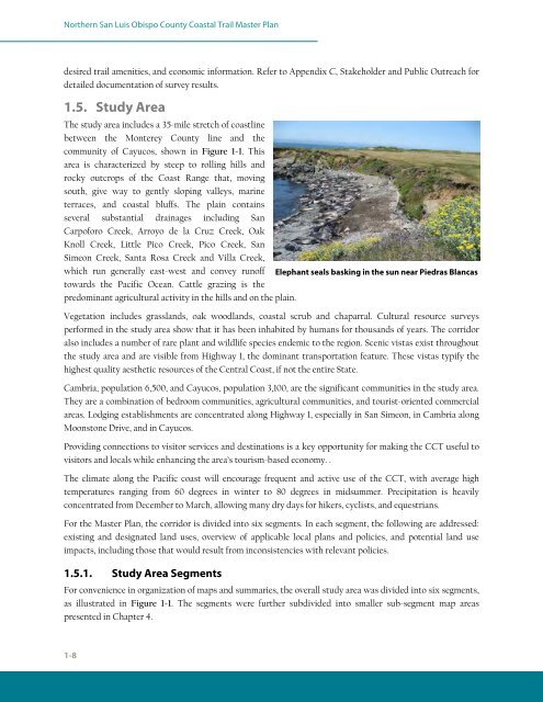
Elephant seals basking in the sun near Piedras Blancas<br />
predominant agricultural activity in the hills and on the plain.<br />
Vegetation includes grasslands, oak woodlands, coastal scrub and chaparral. Cultural resource surveys<br />
performed in the study area show that it has been inhabited by humans for thousands of years. The corridor<br />
also includes a number of rare plant and wildlife species endemic to the region. Scenic vistas exist throughout<br />
the study area and are visible from Highway 1, the dominant transportation feature. These vistas typify the<br />
highest quality aesthetic resources of the Central Coast, if not the entire State.<br />
Cambria, population 6,500, and Cayucos, population 3,100, are the significant communities in the study area.<br />
They are a combination of bedroom communities, agricultural communities, and tourist-oriented commercial<br />
areas. Lodging establishments are concentrated along Highway 1, especially in <strong>San</strong> Simeon, in Cambria along<br />
Moonstone Drive, and in Cayucos.<br />
Providing connections to visitor services and destinations is a key opportunity for making the CCT useful to<br />
visitors and locals while enhancing the area’s tourism-based economy. .<br />
The climate along the Pacific coast will encourage frequent and active use of the CCT, with average high<br />
temperatures ranging from 60 degrees in winter to 80 degrees in midsummer. Precipitation is heavily<br />
concentrated from December to March, allowing many dry days for hikers, cyclists, and equestrians.<br />
For the <strong>Master</strong> <strong>Plan</strong>, the corridor is divided into six segments. In each segment, the following are addressed:<br />
existing and designated land uses, overview of applicable local plans and policies, and potential land use<br />
impacts, including those that would result from inconsistencies with relevant policies.<br />
1.5.1. Study Area Segments<br />
For convenience in organization of maps and summaries, the overall study area was divided into six segments,<br />
as illustrated in Figure 1-1. The segments were further subdivided into smaller sub-segment map areas<br />
presented in Chapter 4.<br />
1-8