Create successful ePaper yourself
Turn your PDF publications into a flip-book with our unique Google optimized e-Paper software.
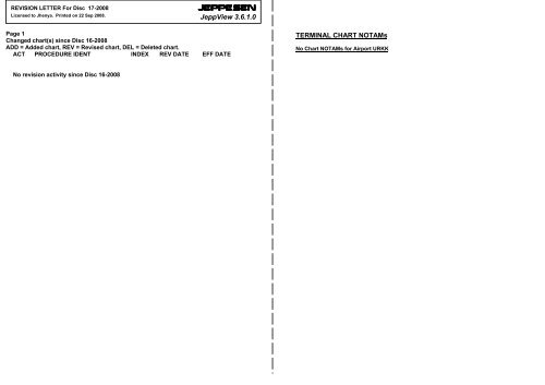
REVISION LETTER For Disc 17-2008Licensed to Jhenya. Printed on 22 Sep 2008.<strong>JEPPESEN</strong><strong>JeppView</strong> <strong>3.6.1.0</strong>Page 1Changed chart(s) since Disc 16-2008ADD = Added chart, REV = Revised chart, DEL = Deleted chart.ACT PROCEDURE IDENT INDEX REV DATE EFF DATETERMINAL CHART NOTAMsNo Chart NOTAMs for Airport URKKNo revision activity since Disc 16-2008
Airport InformationURKK (Pashkovskiy)<strong>JEPPESEN</strong><strong>JeppView</strong> <strong>3.6.1.0</strong>General InfoKrasnodar, RUSN 45° 02.1' E 39° 10.2' Mag Var: 5.5°EElevation: 118'Public, IFR, Control Tower, Customs, Landing FeeFuel: Jet A-1Repairs: Minor Airframe, Minor EngineTime Zone Info: GMT+3:00 uses DSTRunway InfoRunway 05L-23R 7218' x 161' asphaltRunway 05R-23L 9843' x 148' concreteRunway 05L (47.0°M) TDZE 107'Lights: Edge, ALS, TDZRunway 05R (47.0°M) TDZE 111'Lights: Edge, ALS, TDZRunway 23L (227.0°M) TDZE 118'Lights: Edge, ALS, TDZRunway 23R (227.0°M) TDZE 111'Lights: Edge, ALS, TDZCommunications InfoATIS 121.8 Non-EnglishKrasnodar Start Tower 120.6Krasnodar Start Tower 118.2Krasnodar Taxiing Ground Control 119.0Krasnodar West Approach Control 127.7 MFKrasnodar East Approach Control 129.6 MFKrasnodar East Approach Control 124.0Krasnodar Krug Radar 121.3Notebook Info
Licensed to Jhenya. Printed on 22 Sep 2008.NOTICE: PRINTED FROM AN EXPIRED REVISION. Disc 17-2008URKK/KRRPASHKOVSKIYATIS121.8034^001^Apt Elev118'FL CONVERSIONFL128 FL3900mFL69 FL2100mFL59 FL1800mFL49 FL1500mALT/HEIGHT CONVERSIONQNH (QFE)(2962'3080'1760'1440'-(1642' -(1322' -(IAF)BA(IAF)KRASNODAR*750 WPInterceptfinal at1760'(1642')Alt Set: MM (hPa on request) QNH on requestTrans level: FL49 Trans alt: 3080' (2962')900m)500m)400m)1 By ATC033^InterceptKRASNODAR final at*750 BA 1440'(1322')N45 03.8 E039 12.1N45 00.5 E039 06.2047^At FL49517 MAR 06213^N45 07.0 E039 18.4227^22XT 1D242^2016243^<strong>JEPPESEN</strong><strong>JeppView</strong> <strong>3.6.1.0</strong>KRASNODAR, RUSSIA10-2 .STAR.(IAF)330 NZNZ 2DXT 1A 272^1<strong>JEPPESEN</strong>XT 1A, XT 1D 1RWY 05L ARRIVALSNZ 2D, RF 4A, UH 4A, XT 2DRWY 23R ARRIVALSAt1760'(1642')FROM NORTH & EASTN44 54.7 E038 59.8HOLDINGOVERXTAt 1440'(1322')L2KRASNODAR*240 LN45 03.0 E039 13.0KKRASNODAR*240 KN45 01.2 E039 09.8UST-LABINSKN45 13.0 E039 40.0BetweenFL69 & FL49N45 06.5E039 21.6At 1440'(1322')XT 2DUHTIKHORETSKN45 50.0 E040 05.0RFLADOZHSKAYAN45 17.0 E039 55.02411UH 4ARF 4AXT12 309^(IAF)248^(QFE)*528 UH*324 RF070^1800'3100'41244^212^RYAZANSKAYA*312 XT290^MSAK Lctr(Rwy 05L)L Lctr(Rwy 23R)CORRIDOR 1N44 58.0 E039 34.0XT 1A, XT 1DBetweenFL128 & FL59XT 2DAt FL49201^Licensed to Jhenya. Printed on 22 Sep 2008.NOTICE: PRINTED FROM AN EXPIRED REVISION. Disc 17-2008URKK/KRRPASHKOVSKIYATIS121.8(IAF)KR035^<strong>JEPPESEN</strong><strong>JeppView</strong> <strong>3.6.1.0</strong>317^N44 51.9 E039 05.0At 1760'(1642')NOT TO SCALE009^Apt Elev118'FL CONVERSIONFL128 FL3900mFL69 FL2100mFL59 FL1800mFL49 FL1500mALT/HEIGHT CONVERSIONQNH (QFE)(2962'3080'1760'1440'-(1642' -(1322' -KRASNODARN45 00.2 E039 08.0Alt Set: MM (hPa on request) QNH on requestTrans level: FL49 Trans alt: 3080' (2962')1 By ATC900m)500m)400m)(IAF)LD033^213^KRASNODAR KRASNODARfinal at*240 L *493 LD 1440'N45 03.0 E039 13.0(1322')N45 03.9 E039 14.8*493 KR17 MAR 0618XT 3AXT 3D10-2AXT 3A, XT 3D 1RWY 05R ARRIVALSNZ 4D, RF 4A, UH 4A, XT 4DRWY 23L ARRIVALSLAt FL49N44 54.0E039 00.6At 1760'(1642')FROM NORTH & EASTInterceptfinal at1760'(1642')HOLDINGOVERXTIntercept1244^047^ 227^22<strong>JEPPESEN</strong>N45 07.3E039 21.2At 1440'(1322')KKRASNODAR*240 KN45 01.2 E039 09.8(IAF)330 NZ15 242^NZ 4D11XT 4DUST-LABINSKN45 13.0 E039 40.0272^318^248^KRASNODAR, RUSSIAUHTIKHORETSK*528 UH(QFE)N45 50.0 E040 05.0BetweenFL69 & FL49N45 06.7 E039 24.9At 1440'(1322')2411UH 4A41070^RF 4ARFCORRIDOR 11800'3100'244^212^(IAF)XT.STAR.201^LADOZHSKAYA*324 RFN45 17.0 E039 55.0RYAZANSKAYA*312 XT290^MSAK Lctr(Rwy 05R)L Lctr(Rwy 23L)N44 58.0 E039 34.0XT 3A, XT 3DBetweenFL128 & FL59XT 4DAt FL49317^4N44 51.9 E039 05.0At 1760'(1642')NOT TO SCALECHANGES: ATIS availability.| <strong>JEPPESEN</strong> SANDERSON, INC., 2003, 2006. ALL RIGHTS RESERVED.CHANGES: ATIS availability.| <strong>JEPPESEN</strong> SANDERSON, INC., 2003, 2006. ALL RIGHTS RESERVED.
13353^Licensed to Jhenya. Printed on 22 Sep 2008.NOTICE: PRINTED FROM AN EXPIRED REVISION. Disc 17-2008URKK/KRRPASHKOVSKIYApt Elev118'2 FEB 07QNH on request (QFE)Trans level: FL49 Trans alt: 3080'NZ 1C, SM 1C, UH 1C 1, XT 1CNZ 3C, SM 3C, UH 3C 1, XT 3C1 By ATC<strong>JEPPESEN</strong>RWY 05L DEPARTURESRWY 05R DEPARTURESUHTIKHORETSK*528 UHN45 50.0 E040 05.0<strong>JEPPESEN</strong><strong>JeppView</strong> <strong>3.6.1.0</strong>KRASNODAR, RUSSIA10-3 .Eff.15.Feb..SID.(2962')070^1800'3100'MSAK Lctr290^Licensed to Jhenya. Printed on 22 Sep 2008.NOTICE: PRINTED FROM AN EXPIRED REVISION. Disc 17-2008URKK/KRRPASHKOVSKIYApt Elev118'2 FEB 071 By ATC<strong>JEPPESEN</strong>10-3AQNH on request (QFE)Trans level: FL49 Trans alt: 3080'.Eff.15.Feb.(2962')SM 2C, UH 2C 1, XT 2CRWY 23R DEPARTURESSM 4C, UH 4C 1, XT 4CRWY 23L DEPARTURES<strong>JEPPESEN</strong><strong>JeppView</strong> <strong>3.6.1.0</strong>KRASNODAR, RUSSIAUHTIKHORETSK*528 UHN45 50.0 E040 05.0070^1800'3100'MSAL Lctr.SID.290^ALT/HEIGHT CONVERSIONQNH (QFE)780' (662' - 200m)3080' (2962' 900m)-FL CONVERSIONFL49FL69FL79NOT TO SCALEKKRASNODAR*240 KFL1500mFL2100mFL2400mN45 01.2 E039 09.8At 780'(662')32047^SM 1C034^047^33SM 3CAt 780'(662')032^UH 1C230^059^107^058^110^232^6012459NZ 1C17XT 3C19XT 1C1UH 3C21NZ 3C330 NZUST-LABINSKN45 13.0 E039 40.0At or aboveFL79XTRYAZANSKAYA*312 XTN44 58.0 E039 34.0At or aboveFL49ALT/HEIGHT CONVERSIONQNH (QFE)780' (662' - 200m)3080' (2962' 900m)FL CONVERSIONFL49FL5920-FL1500mFL1800mSM 2CAt 780'(662')21219^SM 4CBAKRASNODAR*750 BAN45 03.8 E039 12.1222^227^227^034^14082^032^359^083^159UH 2C25XT 2C24XT 4C581UH 4CLD*240 L LKRASNODAR*493 LDN45 03.9 E039 14.8KRASNODARN45 03.0 E039 13.0XTRYAZANSKAYA*312 XTN44 58.0 E039 34.0At or aboveFL59SMSMOLENSKAYA662 SMN44 47.0 E038 48.0At or aboveFL69These SIDs require minimum climb gradientsofNZ 1C: 322' per NM (5.3%) up to FL79.NZ 3C: 346' per NM (5.7%) up to FL79.XT 1C: 243' per NM (4%) up to FL49.XT 3C: 267' per NM (4.4%) up to FL49.Gnd speed-KT 75 100 150 200 250 300346' per NM 433 577 866 1155 1443 1732322' per NM 403 537 805 1073 1342 1610267' per NM 334 446 668 891 1114 1337243' per NM 304 405 608 810 1013 1215SMSMOLENSKAYA662 SMN44 47.0 E038 48.0At or aboveFL59NOT TO SCALEThese SIDs require minimum climb gradientsofSM 2C: 273' per NM (4.5%) up to FL59.SM 4C: 255' per NM (4.2%) up to FL59.XT 2C: 219' per NM (3.6%) up to FL59.XT 4C: 237' per NM (3.9%) up to FL59.Gnd speed-KT 75 100 150 200 250 300273' per NM 342 456 684 911 1139 1367255' per NM 319 425 638 851 1063 1276237' per NM 296 395 592 790 987 1185219' per NM 273 365 547 729 911 1094CHANGES: Crossing at UH withdrawn.| <strong>JEPPESEN</strong> SANDERSON, INC., 2003, 2007. ALL RIGHTS RESERVED.CHANGES: Crossing at UH withdrawn.| <strong>JEPPESEN</strong> SANDERSON, INC., 2003, 2007. ALL RIGHTS RESERVED.
Licensed to Jhenya. Printed on 22 Sep 2008.NOTICE: PRINTED FROM AN EXPIRED REVISION. Disc 17-2008URKK/KRRPASHKOVSKIY+ <strong>JEPPESEN</strong>28 APR 06 10-4 Eff.11.MayNOISE ABATEMENT<strong>JEPPESEN</strong><strong>JeppView</strong> <strong>3.6.1.0</strong>KRASNODAR, RUSSIANOISEGENERALNoise abatement procedures during take-off and approach phases shall be carried out bycrews of all aircraft. Deviation from these procedures may be permitted for flightsafety reasons or if these procedures do not comply with the Airplane Flight Manual forspecified aircraft.ARRIVALSDuring approach phase, all aircraft shall be operated with engines at the same powersetting and with flaps set at minimum safe position.It is recommended to use runway 05L/R when runway-in-use is runway 23 if a maximumallowable tail wind component does not exceed the restrictions established by theAirplane Flight Manual for the specific aircraft and the aircraft proceeding to land atKrasnodar/Pashkovsky AD are at a distance of not less than 54 NM. The decision oncarrying out the indicated take-off variant shall be taken by a flight dispatcher. TMAexit in this case shall be executed according to charts established for the runway-inuse.DEPARTURESTU-154, TU-134, IL-76, IL-62 aircraft shall take-off from beginning of runway 23R.When taking-off from runway 05R/23L all Russian-made aircraft shall apply the pilotingtechnique as in accordance with ‘Noise Abatement Take-Off’ section of the AirplaneFlight Manual. Noise abatement shall be achieved owing to climbing after lift-off alongthe steepest path with subsequent chop throttling of engines to power below thenominal condition and climbing under this power at constant speed (V 2 = 20) and withminimum permissible gradient.At a distance of 2.7 - 3 NM from the beginning of take-off run the crew shall throttlethe engines to power providing the vertical rate of climb is 10-13’/sec and after climbof 3080’-3290’ the crew shall add engines power to nominal condition and change to anormal flight profile. Other parameters of take-off technique shall be chosen accordingto the performance diagrams of the Airplane Flight Manual.All Russian-made aircraft for which there is no section on noise abatement take-off inthe Airplane Flight Manual relating to them, and aircraft of foreign types shall carryout take-off from runway 05R/23L using NADP 1 (ICAO Doc 8168, Vol I, Part V,Chap 3).After take-off of aircraft from runway 05R/23L with further passing NZ, SM or XT NDB,the change to flight profile using the climb gradients recommended on SID charts shallbe carried out at 4.9 NM after lift-off.After day or nighttime take-off of TU-154, TU-134, IL-76, IL-62 and also after take-offof other aircraft in the night-time from runway 05R the turn towards XT or SM NDBsshall be carried out at 4.9 NM from runway; turn radius to SM NDB shall be no less than2.4 NM.NIGHTTIME RESTRICTIONSBetween 2200-0700 LT it is prohibited to take-off from runway 23R and to land onrunway 05L.REVERSE THRUSTOn both runways during landing the crews, as far as possible, shall not apply reversethrust especially in the nighttime.Licensed to Jhenya. Printed on 22 Sep 2008.NOTICE: PRINTED FROM AN EXPIRED REVISION. Disc 17-2008URKK/KRRTreesup to118'Apt ElevN45 02.1 E039 10.2ATIS121.8194'05^EAt night and if visibility is less than 400m taxiing acft are metand escorted by "Follow-Me" vehicles.Taxiing along Twy A only allowed for CAT A & B acft.Taxiing of acft with max wingspan of 125'/38m along TwysA and B shall be carried out only under inner engines power.Entry to and exit from rwy 05L/23R via Twy A shall be carriedout strictly along twy centerline at minimum speed.Birds in vicinity of airport.KRASNODAR Taxiing (GND)23L227^23R227^HFOR PARKINGPOSITIONS SEE 10-9A220'BG10-9119.0 120.6Elev118'14 MAR 08Treesup to180'J46 48KRASNODAR Start (TWR)Rwy 05L/23R Rwy 05R/23L118.2Twy M Twy MAPRON 2Elev111'APRON 1<strong>JEPPESEN</strong>9843'3000mK45F44ARP7218'2200mECASOUTHAPRONElev107'D<strong>JEPPESEN</strong><strong>JeppView</strong> <strong>3.6.1.0</strong>KRASNODAR, RUSSIALEGENDA Taxiway44 Parking stand05LRwy 05L/23R120.650001000LctrTower200'Treesup to180'Treesup to187'Rwy 05R/23L118.2Treesup to174'0Elev111'047^2000 3000 4000Feet150010005000Meters05R047^PASHKOVSKIYCHANGES: New page.| <strong>JEPPESEN</strong> SANDERSON, INC., 2006. ALL RIGHTS RESERVED.CHANGES: Twy designations.| <strong>JEPPESEN</strong>, 1999, 2008. ALL RIGHTS RESERVED.
CHANGES: Twy designations.| <strong>JEPPESEN</strong>, 1999, 2008. ALL RIGHTS RESERVED.CHANGES: Minimums.| <strong>JEPPESEN</strong> SANDERSON, INC., 2004. ALL RIGHTS RESERVED.Licensed to Jhenya. Printed on 22 Sep 2008.NOTICE: PRINTED FROM AN EXPIRED REVISION. Disc 17-2008URKK/KRR1ABCDStands 1, 2, 6 thru 11, 22 thru 27and Grass stands 1 thru 5 availablefor helicopters.AIS + METTERMINALSVIP1SOUTHAPRONVIP2RWY05LRL(60m) ALS TDZ23R05R23LHIRL (60m) HIALS TDZ216 - 13Prohibited to all acft between 2200 - 0700.ALVP must be in forceRCLM (DAY only)or RL250m300m4514 MAR 08 10-9A424314 - 1828 - 415<strong>JEPPESEN</strong>TAKE-OFFAIR CARRIER (JAA)All RwysAPRON 219 - 2711RWY 05L/23R238824'2690m8754'2668m400mBRCLM (DAY only)or RL<strong>JEPPESEN</strong><strong>JeppView</strong> <strong>3.6.1.0</strong>KRASNODAR, RUSSIA5LEGENDADDITIONAL RUNWAY INFORMATIONUSABLE LENGTHSLANDING BEYONDThresholdGlide SlopeGrass parking standNOT TO SCALEINS COORDINATESSTAND No. COORDINATESRVRRVR22, 2324 thru 2627PASHKOVSKIYN45 02.2 E039 08.9N45 02.2 E039 09.0N45 02.3 E039 09.1TAKE-OFF1CWIDTH161'49m148'45mLicensed to Jhenya. Printed on 22 Sep 2008.NOTICE: PRINTED FROM AN EXPIRED REVISION. Disc 17-2008URKK/KRRSTRAIGHT-IN RWY05L05RNDB(with Radar)ALS outNDB(w/o Radar)ALS outLOC 1(Radar required)ALS out17 SEP 04.Eff.30.Sep.ILS2 NDB(with Radar)ALS out2 NDB(w/o Radar)ALS outKR LOM(with Radar)ALS outKR LOM(w/o Radar)ALS outK LMM(with Radar)ALS outK LMM 850'(739')(w/o Radar) R1200mALS out R1500m23LILS 318'(200')R550mALS out R1000mLOC 1(Radar required)470'(352')R900mALS out R1500m2 NDB 470'(352')(with Radar) R900mALS out R1500m2 NDB 870'(752')(w/o Radar) R1200mALS out R1500mLD LOM 630'(512')(with Radar) R1000mALS out R1500mLD LOM(w/o Radar)870' (752')R1200mALS out R1500m1 LMM out: NOT AUTHORIZED.A480'(373')R1300mR1500m880'(773')R1500m311'(200')R550mR1000m440'(329')R900mR1500m440'(329')R900mR1500m800'(689')R1200mR1500m480'(369')R900mR1500m850'(739')R1200mR1500m520'(409')R900mR1500m<strong>JEPPESEN</strong>10-9XB480'(373')R1400mR1500m880'(773')R1500m311'(200')R550mR1000m440' (329')R1000mR1500m440'(329')R1000mR1500m800'(689')R1400mR1500m480'(369')R1000mR1500m850'(739')R1400mR1500m520'(409')R1000mR1500m850'(739')R1400mR1500m318'(200')R550mR1000m470'(352')R1000mR1500m470'(352')R1000mR1500m870'(752')R1400mR1500m630'(512')R1200mR1500m870'(752')R1400mR1500mC<strong>JEPPESEN</strong><strong>JeppView</strong> <strong>3.6.1.0</strong>.JAA.MINIMUMS.KRASNODAR, RUSSIANOTAPPLICABLENOTAPPLICABLE311'(200')R550mR1000m440'(329')R1000mR1800m440'(329')R1000mR1800m800'(689')R1400mR2000m480'(369')R1000mR1800m850'(739')R1400mR2000m520'(409')R1000mR1800m850'(739')R1400mR2000m318'(200')R550mR1000m470'(352')R1000mR1800m470'(352')R1000mR1800m870'(752')R1400mR2000m630'(512')R1200mR2000m870'(752')R1400mR2000mPASHKOVSKIY520'D(409')R1400mR2000m850'(739')R1800mR2000m318'(200')R550mR1000m470'(352')R1400mR2000m470'(352')R1400mR2000m870'(752')R1800mR2000m630'(512')R1600mR2000m870'NOTAPPLICABLENOTAPPLICABLE311'(200')R550mR1000m440' (329')R1400mR2000m440'(329')R1400mR2000m800'(689')R1800mR2000m480'(369')R1400mR2000m850'(739')R1800mR2000m(752')R1800mR2000m
Licensed to Jhenya. Printed on 22 Sep 2008.ABCDABCDNOTICE: PRINTED FROM AN EXPIRED REVISION. Disc 17-2008URKK/KRRSTRAIGHT-IN RWY23L23RCIRCLE-TO-LANDCHANGES: Minimums.L LMM(with Radar)ALS outLVP must be in ForceRCLM (DAY only)or RL<strong>JEPPESEN</strong>17 SEP 0410-9X1.Eff.30.Sep.AB<strong>JEPPESEN</strong><strong>JeppView</strong> <strong>3.6.1.0</strong>.JAA.MINIMUMS.100 KT 135 KT 180 KT 205 KT710' (592') 710'(592') 850' (732') 1 850'(732') 121 To rwy 05L/23R: NOT APPLICABLE.2 CAT D widebody acft: MDA(H) 1110'(992'), CEIL-VIS 400m - 5000m.TAKE-OFF RWY 05L/23RTAKE-OFF RWY 05R/23LRCLM (DAY only)or RLNIL(DAY only)250m 400m 500mLVP must be in ForceRCLM (DAY only)or RL250m300m630'(512')R1000mR1500m630'(512')R1200mR1500mRCLM (DAY only)or RL400mKRASNODAR, RUSSIAC630'(512')R1200mR2000mNIL(DAY only)500mD630'(512')R1600mR2000m950'R1800mL LMM(w/o Radar)950'(832')R1200m950'(832')R1400m950'(832')R1400m(832')ALS out R1500m R1500m R2000m R2000mNDB 520'(409') 520'(409')NOTNOT(with Radar) R1300m R1400mAPPLICABLE APPLICABLEALS out R1500m R1500mNDB 880'(769') 880'(769') NOTNOT(w/o Radar) R1500m R1500m APPLICABLE APPLICABLECEIL 300m- CEIL 300m- CEIL 350m- CEIL 350m-V3000m V3000m V3000m V4000mNOT APPLICABLEPASHKOVSKIY| <strong>JEPPESEN</strong> SANDERSON, INC., 2004. ALL RIGHTS RESERVED.BRIEFING STRIP TMPANS OPSLicensed to Jhenya. Printed on 22 Sep 2008.NOTICE: PRINTED FROM AN EXPIRED REVISION. Disc 17-2008URKK/KRRPASHKOVSKIYATISRVRVISKRASNODAR Approach East(0500-1900) (1900-0500)010^-155^1 All Sectors<strong>JEPPESEN</strong>11-1KRASNODAR Approach West(0500-1900)155^-010^1KRASNODARKrug (R)UNDESIGNATEDPROHIBITEDAREA39-00 39-10<strong>JEPPESEN</strong><strong>JeppView</strong> <strong>3.6.1.0</strong>Ground121.8 129.6 129.6 127.7 121.3 118.2 118.2 119.0LOCGSILSIKRLOMDA(H)Final1800'110.7784'(673') 311'(200') Apt Elev 118'Apch CrsNDB047^Minimum Alt NDBMDA(H) RWY 111'KR5.8 NM to ARPRefer to3100'1760'(1649') chart 11-1AGnd speed-KtsILS GS 2.67^ orLOC or NDB Desc Grad 4.7%7033690432100480120576140671160767LOC: MAP at LMMSTRAIGHT-IN LANDING RWY 05RILSLOC (GS out)DA(H) 311'(200') MDA(H) 440'(329')ABCD493047^KRASNODAR, RUSSIAILS or 2 NDB Rwy 05RKRASNODARTowerMISSED APCH: Climb on 047^ to 770'(659'), then turn RIGHT onto227^ climbing to 1760'(1649'), then according to chart.(QFE)1 from SM NDB45-0044-5038-50FULLSMOLENSKAYA662 S MSMinterceptfinal720m800m5.8 NMto ARPRADAR FIXALS out1200mCHANGES: Communications.RVR 720mVIS 800m17 MAR 06047^262^7.05.8 NMto ARPRADAR FIXLMM out(IAF)K RLOM(673')GS 784'790' (679')ALS outRVR1500mVIS1600mN44 52.6E039 03.9at1760'(1649')at FL 49NDB770'(659')ALS out047^KRASNODARStart (TWR)Alt Set: MM (hPa on req) QNH on req Trans level: FL 49 Trans alt: 3080'(2969')Radar control required for LOC (GS out).at1760'(1649')ILS047^ I K 110.7 R IKR1760'(1649')744'1200mat1760'(1649')NDB w/oRadarLOC or NDB3.5NOTAUTHKRASNODAR493 KR2.2NDB withRadar1.6070^227^ALT/HEIGHT CONVERSIONQNH (QFE)3080' (2969' - 900m)1760' (1649' - 500m)790' (679' - 205m)770' (659' - 200m)330' (219' - 65m)RWY 05R047^ 227^111'290^1760'(1649')| <strong>JEPPESEN</strong> SANDERSON, INC., 1999, 2006. ALL RIGHTS RESERVED.RT39-20NDB apch: Pass LMM not below 330' (219').LMMGS 324' (213')HIALS0.6LOCFOR MINIMUMSSEE 11-1AKRASNODAR240 K KTCH49'0onMSAK Lctr
Licensed to Jhenya. Printed on 22 Sep 2008.NOTICE: PRINTED FROM AN EXPIRED REVISION. Disc 17-2008URKK/KRRPASHKOVSKIY2 NDBABCDKR LOMABCDABCDRVRVISK LMMMDA(H)1200mMDA(H)1200mMDA(H)1500m1900mCHANGES: None.1500m1600mwith Radar440'(329')ALS outRVRVIS1500m1600m17 MAR 06NDB Rwy 05R MINIMUMSSTRAIGHT-IN LANDING RWYRVR 1500mVIS 1600mwith Radar480'(369')ALS outwith Radar520'(409')ALS outSTRAIGHT-IN LANDING RWYRVR 1800mVIS 2000m<strong>JEPPESEN</strong>11-1AMDA(H)2400m3200mMDA(H)2400m3200mSTRAIGHT-IN LANDING RWY2300mMDA(H)2400m3200m05Rw/o Radar800'(689')ALS out05Rw/o Radar850'(739')ALS out05Rw/o Radar850'(739')ALS out<strong>JEPPESEN</strong><strong>JeppView</strong> <strong>3.6.1.0</strong>KRASNODAR, RUSSIA3200m3600m3200m3600m3200m3600m| <strong>JEPPESEN</strong> SANDERSON, INC., 2004. ALL RIGHTS RESERVED.BRIEFING STRIP TMPANS OPSLicensed to Jhenya. Printed on 22 Sep 2008.NOTICE: PRINTED FROM AN EXPIRED REVISION. Disc 17-2008URKK/KRRPASHKOVSKIYATISALT/HEIGHT CONVERSIONQNH (QFE)3080' (2962' - 900m)1440' (1322' - 400m)810' (692' - 210m)780' (662' - 200m)370' (252' - 75m)RVRVISKRASNODAR Approach East(0500-1900) (1900-0500)010^-155^1 All Sectors<strong>JEPPESEN</strong>11-2KRASNODAR Approach West(0500-1900)155^-010^1TCH49'RWY 23L118'1.60 0.62.2Gnd speed-KtsILS GS 2.67^ orLOC or NDB Desc Grad 4.7%7033690432100480120576140671160767LOC: MAP at LMMSTRAIGHT-IN LANDING RWYABCDILSDA(H) 318'(200')FULL ALS out23LLOC (GS out)470'(352')LMM out ALS outKRASNODARKrug (R)227^<strong>JEPPESEN</strong><strong>JeppView</strong> <strong>3.6.1.0</strong>KRASNODAR, RUSSIAILS or 2 NDB Rwy 23LKRASNODARTowerKRASNODARStart (TWR)Ground121.8 129.6 129.6 127.7 121.3 118.2 118.2 119.0LOCGSILSILDLOMDA(H)Final1800'109.5807'(689') 318'(200') Apt Elev 118'Apch CrsNDB 227^ Minimum Alt NDBMDA(H) RWY 118'LD5.9 NM to ARPRefer to3100'4931440'(1322') chart 11-2AMISSED APCH: Climb on 227^ to 780'(662'), then turn LEFT ontoMSA047^ climbing to 1440'(1322'), then according to chart.L LctrAlt Set: MM (hPa on req) QNH on req (QFE) Trans level: FL 49 Trans alt: 3080'(2962')Radar control required for LOC (GS out).45-00436'SMOLENSKAYA662 S MSM720m800mCHANGES: Communications.(IAF)L DKRASNODAR493 LD1200m227^RVRVIS45-10KRASNODAR240 L LMDA(H)17 MAR 065.9 NMto ARPRADAR FIX047^at FL 49RVR1500mVIS 1600mRVR1800mVIS 2000m7.0047^227^082^810' (692')HIALSNDBat1440'(1322')780'(662')ALS outon070^1 from SM NDBN45 04.7E039 26.0at1440'(1322')39-10 39-20 39-30NDB apch: Pass LMM not below 370' (252').5.9 NMto ARPLOMRADAR FIXLMM GS 807' (689')1440'GS 364' (246')NDB w/oRadar(1322')LOC720m800m1200mILS227^ I L 109.5 D ILDNOTAUTHNDB withRadarLOC or NDB2.2FOR MINIMUMSSEE 11-2Ainterceptfinal227^ 047^290^1440'(1322')| <strong>JEPPESEN</strong> SANDERSON, INC., 1999, 2006. ALL RIGHTS RESERVED.LT
Licensed to Jhenya. Printed on 22 Sep 2008.NOTICE: PRINTED FROM AN EXPIRED REVISION. Disc 17-2008URKK/KRRPASHKOVSKIY2 NDBABCDABCDABCDRVRVISLD LOML LMMMDA(H)1200m1500m1600mMDA(H)2100m2500mMDA(H)2100m2500mwith Radar470'(352')ALS out17 MAR 06STRAIGHT-IN LANDING RWYRVRVIS1900mwith Radar630' (512')ALS outwith Radar630'(512')ALS out<strong>JEPPESEN</strong>11-2ANDB Rwy 23L MINIMUMS1800m2000mMDA(H)2400m3600mSTRAIGHT-IN LANDING RWY2900mSTRAIGHT-IN LANDING RWY2900m2800mMDA(H)2400m2800m3600mMDA(H)2400m3200m4000m23Lw/o Radar870'(752')ALS out23Lw/o Radar870'(752')ALS out23Lw/o Radar950'(832')ALS out<strong>JEPPESEN</strong><strong>JeppView</strong> <strong>3.6.1.0</strong>KRASNODAR, RUSSIA3200m3600m4000m3200m3600m4000m3200m4000m4400mBRIEFING STRIP TMLicensed to Jhenya. Printed on 22 Sep 2008.NOTICE: PRINTED FROM AN EXPIRED REVISION. Disc 17-2008URKK/KRRPASHKOVSKIYATIS121.8NDBWP750<strong>JEPPESEN</strong>16-1 CAT A & BUNDESIGNATEDPROHIBITED39-00 AREA39-10<strong>JEPPESEN</strong><strong>JeppView</strong> <strong>3.6.1.0</strong>KRASNODAR, RUSSIANDB Rwy 05LKRASNODAR Approach East KRASNODAR Approach West KRASNODAR KRASNODAR KRASNODAR Ground(0500-1900) (1900-0500)(0500-1900)Krug (R) Tower Start (TWR)010^-155^1 All Sectors155^-010^1129.6 129.6 127.7 121.3 120.6 120.6 119.0Final Minimum Alt MDA(H)Apt Elev 118'Apch Crs 6.2 NM to ARP (CONDITIONAL)1800'047^ 1750'(1643') 480'(373') RWY 107'MISSED APCH: Climb on 047^ to 770'(663'), then turn RIGHT onto227^ climbing to 1750'(1643'), then according to chart.45-0044-501 from SM NDB38-50SMOLENSKAYA662 S MSM262^7.0(QFE)Gnd speed-Kts70 90 100 120 140 160Descent Gradient 5.2% 369 474 527 632 737 843AB17 MAR 06Alt Set: MM (hPa on req) QNH on req Trans level: FL 49 Trans alt: 3080'(2973')at1750'(1643')interceptfinal6.2 NMto ARPRADAR FIX1750'(1643')6.2 NMto ARPRADAR FIXN44 52.8E039 02.1at1750'(1643')770'(663')STRAIGHT-IN LANDING RWY 05Lwith Radarw/o RadarMDA(H) 480'(373') MDA(H) 880'(773')ALS outALS out3200m047^744'047^at1750'(1643')3.0(IAF)KRASNODARW P2.1at FL 49047^227^070^3100'290^Pass NDB not below 830' (723').047^227^RT39-20ALT/HEIGHT CONVERSIONQNH (QFE)3080' (2973' - 900m)1750' (1643' - 500m)830' (723' - 220m)770' (663' - 200m)on0MSA K Lctr750 WPKRASNODAR240 KWP NDBALS3200mKRWY 05L107'1750'(1643')PANS OPSCDNOT APPLICABLECHANGES: None.| <strong>JEPPESEN</strong> SANDERSON, INC., 2004. ALL RIGHTS RESERVED.CHANGES: Communications.| <strong>JEPPESEN</strong> SANDERSON, INC., 1999, 2006. ALL RIGHTS RESERVED.
BRIEFING STRIP TMLicensed to Jhenya. Printed on 22 Sep 2008.NOTICE: PRINTED FROM AN EXPIRED REVISION. Disc 17-2008URKK/KRRPASHKOVSKIY<strong>JEPPESEN</strong>16-2 CAT A & B<strong>JEPPESEN</strong><strong>JeppView</strong> <strong>3.6.1.0</strong>KRASNODAR, RUSSIANDB Rwy 23RATIS KRASNODAR Approach East KRASNODAR Approach West KRASNODAR KRASNODAR KRASNODAR Ground(0500-1900) (1900-0500)(0500-1900)Krug (R) Tower Start (TWR)010^-155^1 All Sectors155^-010^1121.8 129.6 129.6 127.7 121.3 120.6 120.6 119.0NDBFinal Minimum Alt MDA(H)Apt Elev 118'BAApch Crs 4.0 NM to ARP (CONDITIONAL)1800'750 227^ 1430'(1319') 520'(409') RWY 111'MISSED APCH: Climb on 227^ to 770'(659'), then turn LEFT onto047^ climbing to 1430'(1319'), then according to chart.ALT/HEIGHT CONVERSIONQNH (QFE)3080' (2969' - 900m)1430' (1319' - 400m)840' (729' - 220m)770' (659' - 200m)45-00SMOLENSKAYA662 S MSM(IAF)B A227^45-1017 MAR 06(QFE)Alt Set: MM (hPa on req) QNH on req Trans level: FL 49 Trans alt: 3080'(2969')436'at FL 49KRASNODAR750 BA1 from SM NDB4.0 NMto ARPRADAR FIX047^at1430'(1319')082^39-10 39-20 39-30Pass NDB not below 840' (729').4.0 NMto ARPBA NDBRADAR FIX7.0LKRASNODAR240 L227^047^227^070^N45 04.5E039 23.4at1430'(1319')1430'(1319')3100'290^MSA L LctrLicensed to Jhenya. Printed on 22 Sep 2008.NOTICE: PRINTED FROM AN EXPIRED REVISION. Disc 17-2008URKK/KRRApt ElevMaxKtsA 100BCD1135180205Overflying city ofKrasnodar is prohibited743'118'1at940'(822')MDA(H)313'435'CEIL-VIS202'7.6 NMto ARP710' (592') 300m - 3000mKLctr190'221'1195'376'850' (732') 350m - 3000m1 850' (732') 350m - 4000mCAT D widebody acft: MDA(H) 1110'(992'), CEIL-VIS 400m-5000m.at940' 1(822')<strong>JEPPESEN</strong><strong>JeppView</strong> <strong>3.6.1.0</strong>7.6 NMto ARPRADAR FIXCAT D widebody acft: at 1110' (992')RADAR FIXat or above1760'(1642')SMOLENSKAYA NDB179'MISSED APCH: Climb on 047^ to 780' (662'), then turn RIGHT onto 227^ climbing toCAT A thru D: 940' (822') CAT D widebody: 1110'(992')during VFR approach or1760'(1642') during IFR approach, then according to approach chart.14.0043^Rwy 05L133'NOT APPLICABLE123'<strong>JEPPESEN</strong>25 NOV 05 19-10CIRCLE-TO-LAND.CEILING.REQUIRED.MDA(H)136'Rwy 05R153'CEIL-VIS136'RWY710' (592') 300m - 3000m166'KRASNODAR, RUSSIA05L/R179'PASHKOVSKIY185'297'at or above1760'(1642')275^9.7RYAZANSKAYA NDBALT/HEIGHT CONVERSIONQNH (QFE)1760' (1642' - 500m)1110' (992' - 300m)940' (822' - 250m)780' (662' - 200m)02.0Gnd speed-Kts70 90 100 120 140 160Descent Gradient 5.2% 369 474 527 632 737 843ABRWY 23R111'770'(659')STRAIGHT-IN LANDING RWY 23Rwith Radarw/o RadarMDA(H) 520'(409') MDA(H) 880'(769')ALS outALS out3200mALS1.93200mon227^047^LTinterceptfinal1430'(1319')PANS OPSCDNOT APPLICABLECHANGES: Communications.| <strong>JEPPESEN</strong> SANDERSON, INC., 1999, 2006. ALL RIGHTS RESERVED.CHANGES: Chart reindexed. Procedure.| <strong>JEPPESEN</strong> SANDERSON, INC., 2004, 2005. ALL RIGHTS RESERVED.
Licensed to Jhenya. Printed on 22 Sep 2008.NOTICE: PRINTED FROM AN EXPIRED REVISION. Disc 17-2008URKK/KRRApt ElevOverflyingcity of Krasnodaris prohibitedOverflyingcity of Krasnodaris prohibited<strong>JEPPESEN</strong><strong>JeppView</strong> <strong>3.6.1.0</strong>SMOLENSKAYA NDB179'MISSED APCH: Climb on 227^ to 780'(662') , then turn LEFT onto 047^ climbing toCAT A thru D: 940'(822') CAT D widebody: 1110' (992') during VFR approach or1760'(1642') during IFR approach, then according to approach chart.Rwy 23L .CEILING.REQUIRED. Rwy 23RALT/HEIGHT CONVERSIONMDA(H) CEIL-VISMDA(H) CEIL-VIS(QFE)ABCD11760'(1642')SMOLENSKAYA NDB1at940'(822')MaxKts100135180205743'1at940'(822')743'14.0118'14.0041^043^RWY313'RWY313'435'435'710'(592')850'(732')23L23R133'133'202'7.6 NMto ARPRADAR FIX202'300m - 3000m350m - 3000m1 850'(732') 350m - 4000m221'1BANDB221'195'1LLctr376'CAT D widebody acft: MDA(H) 1110'(992'), CEIL-VIS 400m-5000m.CHANGES: Chart reindexed. Procedure.123'at or above123'7.6 NMto ARPRADAR FIXat or above1760'(1642')<strong>JEPPESEN</strong>25 NOV 05 19-11CIRCLE-TO-LAND136'1at940'(822')CAT D widebody acft: at136'153'153'195'376'136'1at940'(822')7.6 NMto ARPRADAR FIX7.6 NMto ARPRADAR FIXat or above1760'(1642')CAT D widebody acft: at710'(592') 300m - 3000mNOT APPLICABLE136'166'at or above1760'(1642')KRASNODAR, RUSSIAQNH1760'1110'940'780'16.2237^at940' 1(822')1110' (992')179'179'283^9.7UST-LABINSK NDBRYAZANSKAYA NDBUST-LABINSK NDB185'240^166' 179'16.2185'at940' 1(822')1110' (992')PASHKOVSKIY297'7.6 NMto ARPRADAR FIXat or above1760'(1642')297'7.6 NMto ARPRADAR FIXat or above1760'(1642')9.7285^RYAZANSKAYA NDB(1642' - 500m)(992' - 300m)(822' - 250m)(662' - 200m)| <strong>JEPPESEN</strong> SANDERSON, INC., 2004, 2005. ALL RIGHTS RESERVED.


