sharr/šar planina – korab – dešat/deshat - UNEP Vienna ISCC
sharr/šar planina – korab – dešat/deshat - UNEP Vienna ISCC
sharr/šar planina – korab – dešat/deshat - UNEP Vienna ISCC

Create successful ePaper yourself
Turn your PDF publications into a flip-book with our unique Google optimized e-Paper software.
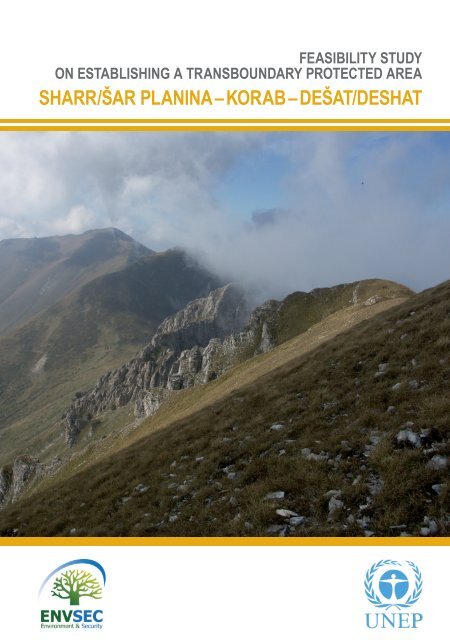
FEASIBILITY STUDYON ESTABLISHING A TRANSBOUNDARY PROTECTED AREASHARR/ŠAR PLANINA <strong>–</strong> KORAB <strong>–</strong> DEŠAT/DESHAT
FEASIBILITY STUDYON ESTABLISHING A TRANSBOUNDARY PROTECTED AREASHARR/ŠAR PLANINA <strong>–</strong> KORAB <strong>–</strong> DEŠAT/DESHAT
Table of ContentsEXECUTIVE SUMMARY 4BACKGROUND TO THE STUDY 9PART 1. LOCAL CONTEXT FOR TRANSBOUNDARY COOPERATION 171.1. Border context 171.2. Local socio-economic context 211.2.1. Local ethnic, cultural and religious context 211.2.2. Local demographic context 261.2.3. Local economic context 291.2.4. Transport infrastructure 331.2.5. State of the environment of the region, and potential threats 34PART 2. NATURE AND ITS PROTECTION IN THE AREA 472.1. Brief overview of the natural values of the area 47Sharr/Šar Planina Mountains 49Korab - Dešat/Deshat Mountains 542.2. Legal and administrative framework for protected area designation and management 58Albania 59Kosovo - UN administered territory under UN Security Council resolution 1244/99 61The Former Yugoslav Republic of Macedonia 632.3. Comparison of protected area networks 682.4. Protected areas in the region of the planned transboundary protected area 72Kosovo (Kosovo - UN administered territory under UN Security Council resolution 1244/99)- Sharr Mountains / Mali Sharr National Park 72The Former Yugoslav Republic of Macedonia - Mavrovo National Park 772.5. Connectivity and continuity of protected area network in the region 792.5.1. European context 792.5.2. Planned new protected areas in Sharr/Šar Planina <strong>–</strong> Korab <strong>–</strong> Dešat/Deshat region 80Albania - Korabi Protected Landscape 80Kosovo - UN administered territory under UN Security Council resolution 1244/99- planned extension of Mali Sharr / Sharr Mountains National Park 832Feasibility Study: SHARR/ ŠAR PLANINA - KORAB - DESHAT/DEŠAT
The Former Yugoslav Republic of Macedonia - Šar Planina National Park 842.5.3. Possible scenarios 89PART 3. TRANSBOUNDARY COOPERATION <strong>–</strong> PRIORITIES, CHALLENGES ANDOPPORTUNITIES 953.1. Priorities for conservation in the planned transboundary protected area 95Target habitats 96Target plant associations and species 97Target fungi species 99Target fauna species 99European context 1033.2. Priorities for transboundary cooperation in the planned transboundary protected areaidentified by participants of the ENVSEC workshop in June 2009. 1043.3. Conclusions - opportunities and challenges for transboundary cooperationin the planned transboundary protected area 107Opportunities 107Challenges 109MAIN SOURCES OF INFORMATION 122List of Tables 124List of Satellite Images 124List of Maps 125ACRONYMS AND ABBREVIATIONS 126ACKNOWLEDGEMENTS 1283
EXECUTIVE SUMMARYThe region of the proposed transboundary protected area “Sharr/Šar Planina <strong>–</strong> Korab <strong>–</strong> Dešat/Deshat” located in the border areas of Albania, Kosovo - UN administered territory under UNSecurity Council resolution 1244, and the Former Yugoslav Republic of Macedonia encompassesareas of unique landscape and natural values for Europe. This area harbours two mountain rangesof the alpine landscape, vast mountain grasslands and forests including primeval treestandsof the endemic Macedonian pine and Bosnian pine. The highest mountain of this area is Mt. Korab(2764 m, the highest peak of Albania and the Former Yugoslav Republic of Macedonia), whilethe highest summit of Šar Planina is Titov Vrv (2747 m). Thirty nine post-glacial lakes located ataltitudes up to 2340 m significantly contribute to the natural beauty of this trilateral border region,which also encompasses a considerable number of natural habitats and endemic, relic, rare andthreatened flora and fauna species, including species of the common European importance likethe brown bear, wolf and Balkan lynx, having their mainstays in habitats crossed by the state border.These unique values should be taken into account when deciding on the future of this regionand protecting its natural treasures for the next generations.In the light of their expected accession to the European Community in the future - involvedcountries are proceeding with the harmonization of their nature protection standards with theEU. The presence of habitats and species listed under relevant Annexes to the Council Directive92/43/EEC (“Habitats Directive”) whose protection in the Member States of the European Communityrequires the designation of special areas of conservation constituting the Natura 2000network, and bird species listed under Annex I to Council Directive 79/409/EEC of 2 April 1979 onthe conservation of wild birds (“Birds Directive”) should be a decisive argument for the extensionof existing and designation of new protected areas in the border areas of Albania, Kosovo - UNadministered territory under UN Security Council resolution 1244, and the Former Yugoslav Republicof Macedonia, in the proposed transboundary protected area.During the last two decades human impact and pressures on environment and biodiversity ofthe region has significantly increased. Different environmental threats such as the insuffi cientsewage treatment and urban solid waste management, fragmentation or loss of habitats or forestfi res are common for all involved countries of the region.Moreover, the recent wars and armed ethnic conflicts in this region, in particular in Kosovo in1999 and in the northern part of Macedonia in 2001 resulted in the situation when the control bythe state inspections in the remote mountain border areas became either impossible or ineffectivefor several years. As a consequence of the above situation <strong>–</strong> different illegal activities boosted atthat time in the border areas of the region, which included poaching on wildlife and illegal fi shing,illegal timber felling, overuse of medicinal plant species and uncontrolled land development, withadverse effects on the biodiversity of the region.4Feasibility Study: SHARR/ ŠAR PLANINA - KORAB - DESHAT/DEŠAT
One of the major threats to habitats and species populations and main causes of the declinein biological diversity in Europe is the fragmentation and isolation of habitats and the effect thiscan have on the viability of species populations. The favourable conservation status of differentspecies and natural habitats depends on the size of protected areas. Migration, dispersal and geneticexchange of wild species depends on the existence of ecological corridors linking particularprotected areas of different protective categories designated at national level. The continuity andconnectivity of habitats in the border areas requires transboundary linkages, ecological corridorswhich link protected area networks of neighbouring countries.This is why establishing large-scale transboundary protected areas seems to be a solutionmore acceptable for the South Eastern European countries. Such transboundary protected areasrepresent a commitment of two or more countries to common management of their frontier regionsand shared ecosystems, help to reduce possible tensions and are a symbol of peace withgreat political visibility.According to the best possible scenario for the further development of trilateral cooperationbetween the Governments and local stakeholders in Albania, Kosovo - UN administered territoryunder UN Security Council resolution 1244, and the Former Yugoslav Republic of Macedonia <strong>–</strong>the transboundary protected area “Sharr/Šar Planina <strong>–</strong> Korab <strong>–</strong> Dešat/Deshat” could potentiallycover the total area of up to some 255 306 ha, and become the largest protected area in South-Eastern Europe, and one of the largest in the whole Europe.The abandonment of traditional land-use practices ongoing on all three sides of the region isa common challenge for the further sustainability of the local economy in the Sharr/Šar Planina,Korab and Dešat/Deshat mountains. Sustainable tourism development in the region could bringnew employment opportunities and new sources of income, thus mitigating the economic reasonsfor the current exodus of mountain populations.The label of a ‘trilateral transboundary protected area of exceptional natural values and sustainabletourism development’ as well as of ‘the largest protected area in South-Eastern Europe’, andof ‘one of the largest protected areas in Europe’ could provide for the ‘unique selling point’ for thelocal or regional tourist packages, increase the tourist attractiveness of the region, facilitate thebroad recognition of the region and marketing of the regional tourist product abroad, and help tomitigate the adverse effects of the negative stereotypes still common among some Europeans,resulting from the past armed ethnic conflicts.EXECUTIVE SUMMARY5
But this will only be possible under the ‘direct trilateral connectivity and cooperation scenario’<strong>–</strong> in case when the initiatives on all three sides of the borders provide for the full ecological connectivityand continuity of the protected area network of the region.In other words <strong>–</strong> this ambitious vision would become true when the signifi cantly extended territoryof Mali Sharr National Park in Kosovo - UN administered territory under UN Security Councilresolution 1244 becomes spatially adjacent to the other three large scale protected areas in theregion: existing Mavrovo National Park and planned Šar Planina National Park in the Former YugoslavRepublic of Macedonia, and the planned Korabi Protected Landscape in Albania.Due to the fact that the main tourist attractions of this transboundary region are the exceptionallandscape and natural values of the Sharr/Šar Planina, Korab and Dešat/Deshat mountains <strong>–</strong> thedevelopment of sustainable tourism in the region would require close cooperation of the touristservices providers with the authorities of the protected areas in the region.The added value and possible benefits for all involved countries deriving from the establishmentof the proposed transboundary protected area are that the trilateral transboundary cooperation inthis region would largely facilitate:• Achievement of their nature protection and biodiversity conservation objectives,• Mitigation of the present threats to environment and nature of the shared region,• Promotion and implementation of sustainable development at local and regional level,• Establishing a long term transboundary cooperation mechanism serving the local stakeholders.The following feasibility study by <strong>UNEP</strong>-<strong>Vienna</strong> provides a brief overview on the local transboundarycontext for cooperation in the region, e.g. border context, socio-economic context (includingethnic and religious context, demography, land use, economic development and transportinfrastructure, the state of the environment of the region and potential threats).Further the study describes legal and administrative frameworks in the neighbouring countries,compares the development of their protected area networks, provides a brief overview of thenatural values and protected areas of the region, and initiatives aimed at improving the connectivityand continuity of protected area network.Finally, the study suggests priorities for biodiversity conservation and transboundary cooperationin the region, and concludes with the analysis of different opportunities and challenges fortransboundary cooperation in the proposed transboundary protected area “Sharr/Šar Planina <strong>–</strong>Korab <strong>–</strong> Dešat/Deshat”.6Feasibility Study: SHARR/ ŠAR PLANINA - KORAB - DESHAT/DEŠAT
EXECUTIVE SUMMARY7
Map 1: Mountains in the Dinaric Arc and Balkan Region© Wikipedia Commons; <strong>UNEP</strong> GRID
BACKGROUND TO THE STUDYThe programme of work on protected areasunder the Convention on Biological Diversity(CBD) recommends to “strengthen existing andestablish new TBPAs (transboundary protectedareas) to enhance conservation of biologicaldiversity, implement the ecosystem approach,and improve international cooperation” 1 , and inparticular to “enter into dialogue to establish,where appropriate, new TBPAs with adjacentParties and countries, bearing in mind the ecosystemapproach and the importance of ecologicalnetworks” 2 .The CBD work programme on mountains calls• To establish regional and transboundary collaborationand the establishment of cooperativeagreements for mountain ranges,• To promote the appreciation and conservationof mountain biological diversity asa means of reducing human conflict, i.e.,through peace parks”.• To promote integrated transboundary cooperation,strategies for sustainable activities onmountain ranges through mutually agreeduponarrangements by countries concerned.• To promote and strengthen regional and transboundarycooperation for research, adaptivemanagement, fair and appropriate allocationof water to ecosystems, and exchange of expertiseto improve the conservation and managementof mountain biodiversity.Europe, and in particular its Balkan regionis characterised by many borders that cutacross ecosystems and areas of high naturalvalues, often dividing the continent alongnatural barriers like mountain ranges. Borderareas are often the most favoured regions inbiodiversity terms, partly as a result of theirperipheral location or political factors banningin the past the development of areas adjacentto political borders.However, natural areas shared by neighbouringcountries are not only a commontreasure, but also a common responsibility.Ecological problems occurring in border areascan not be solved by one country alone,and require transboundary and regional cooperation.Since 2005, <strong>UNEP</strong> <strong>Vienna</strong> is coordinatingthe project entitled “Improving regional cooperationfor risk management from pollutionhotspots as well as the transboundary managementof shared natural resources” supportedby ADA (the Austrian DevelopmentAgency) and the Canadian DevelopmentAgency (CIDA), as a contribution to the Environmentand Security (ENVSEC) Initiative.The ENVSEC Initiative founded in 2003is a partnership between the United NationsEnvironment Programme (<strong>UNEP</strong>), theUnited Nations Development Programme(UNDP), the Organisation of Security andCo-operation in Europe (OSCE), the UnitedNations Economic Commission for Europe(UNECE), the Regional Environmental Centerfor Central and Eastern Europe (REC)1 Goal 1.4. (Transboundary protected areas), CBD programme on protected areas.2 Action 1.4.1., CBD programme on protected areas.BACKGROUND TO THE STUDY9
and the associated North Atlantic Treaty Organization(NATO).The ENVSEC programme area in South-Eastern Europe (SEE) includes Albania, Bosniaand Herzegovina, the Former YugoslavRepublic of Macedonia, Montenegro, Serbiaand Kosovo - UN administered territory underUN Security Council resolution 1244/99,which have been directly or indirectly involvedin the ethnic conflicts that escalated in thepast ten and more years in the Balkan region.These war-torn nations, where ethnic tensionsstill exist, have been also subject toeconomic crises as a result of their isolationfrom the global economy and the impacts ofthe transition from socialist economic policiesto free market economies. Simultaneouslybiodiversity loss was recognised asposing additional security risk in South EastEurope, whereas good technical cooperationin the fi eld of natural resource managementwould contribute to stability and prosperityof the region.Protecting larger parts of the most importantecosystems and habitats, and in particularviable populations of its wildlife is possibleonly in ‘large-scale’ (as for Europe) protectedareas of around 100 thousand hectares insize, while smaller areas are rather suitableonly for protection of e.g. landscape phenomenaor a single threatened plant species.Currently in the ENVSEC-SEE programmearea there are only ten national parks exceedingthe size of 10 thousand hectaresand only one nature park exceeding 100thousand hectares.Designation of a large-scale new protectedarea by one country alone is often not feasible,while concerted efforts of two or morepartners may result in a spectacular successfor biodiversity protection at the regional andEuropean levels.This is why establishing large-scale transboundaryprotected areas seems to be a solutionmore acceptable from the point of viewof the state budgets of particular countries ofthe South Eastern Europe.Such areas represent a commitment of twoor more countries to common managementof their frontier regions and shared ecosystems.Moreover, transboundary protectedareas help to reduce possible tensions andare a symbol of peace with great political visibility.Transboundary protected areas (TB-PAs) provide for the ecological continuumbeyond these virtual political boundaries anda tool for international cooperation.As stressed by the IUCN: “Natural systemsthat straddle political boundaries canbe most effectively managed as functionalunits at the scale of the regional landscapeand would therefore benefi t from appropriatemechanisms for long-term transboundaryco-operation. While the establishmentof TBPAs for integrated conservation anddevelopment can enhance environmentalprotection, it can also reinforce political securityand provide multiple benefi ts to localcommunities and indigenous peoples. Theexistence of TBPAs and their buffer zonescan help reduce tensions, rebuild dividedcommunities, promote freedom of movementand create new opportunities for sustainabledevelopment, including low-impactregional tourism. Such areas can also makean important contribution to regional biodiversityconservation programmes, especiallywhere they form part of a coherentecological network. Neighbouring States,which often have different levels of technicalexpertise, knowledge, capacity and fi nancial10Feasibility Study: SHARR/ ŠAR PLANINA - KORAB - DESHAT/DEŠAT
esources, can benefi t by combining theirrespective strengths through transboundaryco-operation.” 3This is why one of the aims of the ENVSECInitiative in SEE is to encourage and facilitate regionalcooperation on nature protection issues,with a particular emphasis on supporting transboundarycooperation and establishing new protectedareas in border regions, which could alsoserve as a tool to mitigate current tensions andre-establish friendly neighbour relations betweenformerly conflicted nations and ethnic groups.<strong>UNEP</strong> under the ENVSEC initiative promotesraising awareness on the common responsibilityfor the border regions, thus providing for thegreater European integration in nature protectionand translating the common European visioninto practice.As the first step, a rapid regional assessmentof the general state-of-environment, as wellas managerial problems experienced by theadministrative bodies responsible for the protectedareas’ management was carried out in2005-2006, based on country-specific reports.The resulting regional report “EnhancingTransboundary Biodiversity Management inSouth Eastern Europe” provides an overviewof the biological diversity, protected area system,legal and policy framework, existing andplanned institutional structures for nature protection,threats to biological diversity, examplesof transboundary cooperation as well as socioeconomicfactors, and recommendations foractions to be taken in particular countries of theregion and for the region as a whole.During the fi rst regional ENVSEC-SEE workshop“Enhancing Trans-boundary Biodiversityin Mountains of South Eastern Europe” organizedby <strong>UNEP</strong> in Podgorica (Montenegro) inJune 2006 representatives of the Governmentsof the region jointly identifi ed eight potentialtransboundary protected areas:• Sharr/Šar Planina <strong>–</strong> Korab <strong>–</strong> Dešat/Deshat(Albania, FYR Macedonia, Kosovo 4 )• Durmitor - Sutjeska (Bosnia and Herzegovina,Montenegro)• Prokletije / Bjeshkët e Nemuna Mountains(Albania, Montenegro, Kosovo 5 , Serbia)• Tara Mountains - Drina Gorge (Bosnia andHerzegovina, Serbia)• West Stara Planina (Bulgaria, Serbia)• Orjen / Sniježnica (Bosnia and Herzegovina,Croatia, Montenegro)• Vlahina / Maleševska / Belasica (Bulgaria,Greece, FYR Macedonia)• Osogovska Planina (Bulgaria, FYR Macedonia).and selected three of them as “priority areasin focus”, perceived as most urgent from thebiodiversity point of view.One of the three “priority areas in focus”identified during the 1st ENVSEC-SEE meetingis the proposed transboundary protected area“Sharr/Šar Planina <strong>–</strong> Korab <strong>–</strong> Dešat/Deshat”,expected to involve Albania, Kosovo 6 and theFormer Yugoslav Republic of Macedonia.As for June 2009 - legally designated protectedareas are present only in Kosovo 6 (Sharr Mountains/ Mali Sharr National Park at the border with3 IUCN Draft Code for Transboundary Protected Areas in Times of Peace and Armed Conflict [in:] Sandwith,T., Shine, C., Hamilton, L. and Sheppard, D. (2001). “Transboundary Protected Areas for Peace and Co-operation”.IUCN, Gland, Switzerland and Cambridge, UK4, 5, 6 Kosovo - UN administered territory under UN Security Council resolution 1244BACKGROUND TO THE STUDY 11
© <strong>UNEP</strong> / DEWA / GRID - EuropeMap 2: ENVSEC mountain biodiversity project: potential transboundary protected areas.12Feasibility Study: SHARR/ ŠAR PLANINA - KORAB - DESHAT/DEŠAT
© Zbigniew NiewiadomskiStakeholders consultation meeting, 12 Sept. 2007, Tetovo, FYR Macedonia.FYR Macedonia) and in the Former Yugoslav Republicof Macedonia (Mavrovo National Park borderingAlbania and Kosovo 7 . However, there areplans to establish new protected areas in Albaniaand in the Former Yugoslav Republic of Macedonia,as well as to extend the territory of the nationalpark in Kosovo 8 . In the best possible case,should all initiatives on all three sides described inthis study be successful - the transboundary protectedarea “Sharr/Šar Planina <strong>–</strong> Korab <strong>–</strong> Dešat/Deshat” could potentially cover the total area ofup to some 255’306 ha, and become the largestprotected area in South-Eastern Europe, and oneof the largest in Europe.In 2006 the Ministry of Environment andPhysical Planning of Macedonia requested<strong>UNEP</strong> <strong>Vienna</strong> <strong>ISCC</strong> for the assistance concerningthe establishment of a national parkin the Shara Mountains. The Balkan Foundationfor Sustainable Development (BFSD) wascontracted by <strong>UNEP</strong> to prepare the “FeasibilityStudy for the establishment of the National Parkon the Macedonian side of “Shara” Mountains”,completed in September 2006. As a follow up,a local stakeholder group and a lobby group inthe Parliament of the Former Yugoslav Republicof Macedonia were established, and in September2006 <strong>UNEP</strong> carried out a fi eld mission7, 8 Kosovo - UN administered territory under UN Security Council resolution 1244BACKGROUND TO THE STUDY 13
© Pier Carlo Sandei2nd sub-regional ENVSEC-SEE meeting, 16 <strong>–</strong> 17 June 2009, Podgorica, Montenegro.on the Macedonian side. Furthermore, <strong>UNEP</strong>attended meetings in Kosovo 9 concerning thepotential for extension of the existing SharrMountains / Mali Sharr National Park. In September2007 <strong>UNEP</strong> organised the StakeholdersConsultation Meeting on “Activities towardsproclamation of Shara National Park” held atthe State University of Tetovo, the Former YugoslavRepublic of Macedonia.In June 2009 within the framework of theENVSEC Initiative <strong>UNEP</strong> organized the 2. subregionalmeeting on “Transboundary Cooperationof Mountain Protected Areas in SouthEastern Europe: Towards the Dinaric Arc andBalkan Network of Mountain Protected Areas”with the objectives:9 Kosovo - UN administered territory under UN Security Council resolution 1244• To initiate and enhance exchange of experiencegathered under the Alpine and CarpathianConventions with the stakeholders fromthe South Eastern European region (SEE);• To support the initiatives of the Governmentstowards transboundary conservation of biodiversityin the mountain regions of the SEE, andtheir commitments expressed during the 9thConference of the Parties to the Convention onBiological Diversity (CBD COP9) in May 2008;• To foster partnerships on technical cooperationand capacity building for the stakeholdersfrom the SEE;• To promote, facilitate and encourage the establishmentof the sub-regional network ofmountain protected areas in the Balkans /Dinaric Arc;14Feasibility Study: SHARR/ ŠAR PLANINA - KORAB - DESHAT/DEŠAT
• To identify priority actions which shall beundertaken in proposed transboundary areasin SEE;• To facilitate synergies and build on projectsand activities of the partners of the ENVSECand Dinaric Arc Initiative (DAI), e.g. UNDP,UNESCO-BRESCE, <strong>UNEP</strong>, IUCN, SNV andthe WWF Mediterranean;• To foster working contacts for transboundaryand sub-regional cooperation on biodiversityissues in the Balkans / Dinaric Arc.The objective of this study on the potentialfor establishment of a proposed transboundaryprotected area “Sharr/Šar Planina <strong>–</strong> Korab <strong>–</strong>Dešat/Deshat” is to:• Provide for better understanding of the situationacross the border in the Sharr/ŠarPlanina <strong>–</strong> Korab <strong>–</strong> Dešat/Deshat” region,and identify possible added values of transboundarycooperation;• Analyse and evaluate the current status oftransboundary initiatives, identify currentshortcomings and impediments for cooperation,and recommend actions aimed at facilitatingtransboundary cooperation;• Assess the potential for success under thelocal conditions in the Sharr/Šar Planina <strong>–</strong>Korab <strong>–</strong> Dešat/Deshat” region;• Indicate what kind of external support is indispensablefor the success of this initiative.BACKGROUND TO THE STUDY 15
The interior of the older church in Lešok Monastery,left intact during the armed ethnic confl ict of 2001.© Zbigniew Niewiadomski
PART 1. LOCAL CONTEXT FORTRANSBOUNDARY COOPERATION1.1. Border contextThe region of the planned transboundary protectedarea “Sharr/Šar Planina <strong>–</strong> Korab <strong>–</strong> Dešat/Deshat” is located in the border areas of Albania,Kosovo - UN administered territory underUN Security Council resolution 1244/99, andthe Former Yugoslav Republic of Macedonia.The delineation of the state border betweenAlbania and the countries neighbouring Albaniafrom the North and East (which later formed theSocialist Federative Republic of Yugoslavia <strong>–</strong>SFRJ) was evolving after the fall of the OttomanEmpire during the Balkan wars, and finallyestablished by the Conference of Ambassadorsheld 1913 in London, with the participation ofGreat Britain, France and Russia. The presentdemarcation of this border in the terrain wascarried out after the World War 2 in 1945, afterthe break down of the SFRJ confi rmed by Albaniaand the independent Republic of Macedonia.Thus, the state border running along theKorab and Dešat/Deshat mountain ridges canbe considered as an “old border”, establishedas the result of a historical long-term process.Contrary to the above, the current state borderdividing Sharr/Šar Planina mountains intoKosovo (Kosovo - UN administered territoryunder UN Security Council resolution 1244/99)and Macedonian parts is much more a “newborder”. In the times of the SFRJ the administrativeborder between Serbia and Macedonia(parts of the Federation) passed along thismountain ridge. As this was very much a purelyinternal administrative and “virtual” border insidethe common country, no border infrastructurewas present there, no border regimes existed,and local populations paid little attentionto its exact demarcation. This situation changedafter the break down of the SFRJ, and Serbiapassed some border territories to the new independentRepublic of Macedonia. Later, duringthe war in Kosovo and Serbia this state borderwith the Former Yugoslav Republic of Macedoniahad unclear status for several years, untilits present shape was fi nally agreed betweenKosovo - UN administered territory under UNSecurity Council resolution 1244/99 and theFYR of Macedonia in September 2008. The delineationand demarcation in the terrain of theSharr/Šar Planina mountains basically followsthe division line previously agreed between theFYR of Macedonia and Serbia. In some 80 percent of its length the state border dividing theSharr/Šar Planina mountains follows the topsof the border mountain ridges, which was notpossible on the short section across the arealocated between Sharr/Šar Planina and Korabmountain ridges.Thus, as for 2009, there are neither remainingunresolved claims to land areas or waterbodies on either side of the present state border(in Korab and Dešat/Deshat mountainssince 1945, and in Sharr/Šar Planina mountainssince 2008), nor attempts to change itspresent route. The borders of Albania, Kosovo- UN administered territory under UN SecurityCouncil resolution 1244/99 and the Former YugoslavRepublic of Macedonia meet in the areaof Mt. Sherupa (2 092 m).PART 1. LOCAL CONTEXT FOR TRANSBOUNDARY COOPERATION17
The authorities responsible for border areacontrol and patrolling in Albania is the BorderPolice and Migration operating within the organisationalframework of the Ministry of Interior, inKosovo - UN administered territory under UNSecurity Council resolution 1244/99 the BorderPolice (part of the Kosovo Police, foundedin 1999) in cooperation with KFOR, and in theFormer Yugoslav Republic of Macedonia - theBorder Police operating within the organisationalframework of the Ministry of Interior Affairs.The border regimes include the veterinaryand phytosanitary regulations, and in somecases the visa regime (however the entry visasare either not required, depending on thenationality, or can be issued immediately at theborder crossing points), as well as several restrictionson e.g. hunting or fi shing in the nearvicinity of the border line (300 m wide zone)on the Albanian side without informing the BorderPolice and Migration 24 hours in advance(other human activities or presence in the borderareas may be additionally prohibited by theDecision of the Council of Ministers); or huntingin the near vicinity of the border line (500m wide zone) on the Macedonian side withoutprior written notifi cation to the responsible policestation at least 48 hours in advance. Crossingthe state borders in other locations than theoffi cial border crossing points is forbidden andthreatened by a fi nancial fi ne or even (in FYRof Macedonia) by the penalty of imprisonmentfor up to 60 days. However, according to personalcommunication sources - these strictborder regimes do not necessarily apply to e.g.shepherds, as people and sheep or cattle usuallycross the border illegally, in particular in thevast mountain areas of Sharr/Šar Planina, Koraband Dešat/Deshat.As for 2009, all official state border crossingpoints are located outside the areas plannedfor designation as parts of the proposed transboundaryprotected area “Sharr/Šar Planina <strong>–</strong>Korab <strong>–</strong> Dešat/Deshat”.The border crossing between Albania andKosovo - UN administered territory under UNSecurity Council resolution 1244/99 is locatedto the north from Sharr and Koritnik mountainsin the Beli Drim river valley, near Vermicë/Vronica on the main road linking the cities ofKukës and Prizren, with regular public buscommunication and increased traffic in thesummer, when the Kosovars traditionally visitthe Albanian side. There are no other bordercrossings in the mountains at the border betweenAlbania and Kosovo (Kosovo - UN administeredterritory under UN Security Councilresolution 1244/99).There are two border crossing points at theborder between Kosovo - UN administeredterritory under UN Security Council resolution1244/99 and the Former Yugoslav Republicof Macedonia, one in the Lepenac river valleyseparating Sharr/Šar Planina mountains fromthe Crna gora mountain ridge, at the internationaltransport corridor E65 linking Prishtinaand Skopje, with intensive traffic. The other oneis located on the easternmost slopes of Sharr/Šar Planina mountains, “Jažince-Blace” nearGlloboqicë/Globočica, on the local mountain asphaltedroad linking the Kosovo section of theroad E65 with Tetovo in the FYR of Macedonia,where the traffic is not particularly frequent.In the past there was another border crossingpoint in the very heart of the territory of theproposed transboundary protected area <strong>–</strong> “LukovoPole” in the area located between Sharr/Šar Planina and Korab mountain ridges, on thelocal unpaved mountain road connecting the GornaReka region in the FYR of Macedonia via themountain pass (approx. 1500 m above the sealevel) with the village of Rastelica in the Dragash/Dragaš community and Prizren region. When this18Feasibility Study: SHARR/ ŠAR PLANINA - KORAB - DESHAT/DEŠAT
order crossing was opened <strong>–</strong> the traffic intensitywas very low, currently this former border crossingpoint is no longer functional, since the conflictin 2001.The only border crossing point between Albaniaand the Former Yugoslav Republic ofMacedonia is “Blato”, located in the valley atthe southern limit of Dešat/Deshat mountains,to the south-west from Mavrovo National Parkarea, on the local road linking Debar in the FYRof Macedonia with Peshkopi in Albania, wherethe traffic is negligible, also due to the factthat the Albanian road section is not yet paved(some works begun in 2008). There are noborder crossing points in the Korab or Dešat/Deshat mountains, within the prooposed transboundaryprotected area.As already mentioned, in general the state bordersfollow natural physical features of the area,like mountain crests, and is demarcated in theterrain by the border stones, e.g. so called “pyramids”erected in 1 km distance from each otheralong the Albanian state border in Korab andDešat/Deshat mountains, or border stones andconcrete pillars/signposts along the “new” stateborder in Sharr/Šar Planina mountains. As for2009, there are no physical limits at the bordersin the Sharr/Šar Planina <strong>–</strong> Korab <strong>–</strong> Dešat/Deshatregion, often associated to the presence of thestate border in some other regions (e.g. barbedwire entanglements, wire or electric fences).In the past the border zone on the Albanianside had a several meters wide stripe ofploughed soil and sand cleared from vegetation,in order to show the traces of possible trespassers,but such is no longer maintained. However,there is some anxiety and distrust among thesociety concerning the possible presence of anti-personnellandmines on the Kosovo (Kosovo- UN administered territory under UN SecurityCouncil resolution 1244/99) side of the borders(in particular with Albania) considered to remainthere since the times of the war in 1999.Hence, the existence of the border does notprovide an obstacle to wildlife migrations andhas no negative influence on the connectivityand continuity of habitats present on both sidesof the border. Moreover, in general the presenceof the state border does not result in explicit legalobstacles limiting civilian access to the borderareas on either side of the state border.This is also why this border is to some extenta “soft” one, easy to cross in the afforestedmountain terrain without being noticed by borderpolice patrols. In result of the above, illegalactivities associated with the presence of thestate border were, and still are present. Themost frequent are those related to smugglingillegal immigrants and weapons, and illegal loggingin the forests across the state border.Moreover, smuggling drugs and contraband(incl. animals, tobacco and gasoline), cross-borderhuman trafficking and cross-border poaching,and crossing the state border in search for endangeredmedicinal plants (e.g. Gentiana lutea,mostly in Korab mountains) were, and most probablystill are, also a problem in this region.The above illegal activities boosted in thetimes of the recent wars and armed ethnic conflictsin the region, which resulted in the situationwhen the control by the state authorities inthe remote border areas became either impossibleor ineffective for several years. This is whysome of the border areas in this region gainedthe reputation of dangerous areas controlled bycriminal gangs, and potentially harbouring antipersonnellandmines.However, the above situation signifi cantlyimproved throughout the last few years. In thefuture, with the increased welfare of the inhab-PART 1. LOCAL CONTEXT FOR TRANSBOUNDARY COOPERATION 19
itants and stronger surveillance of the area bythe Border Police <strong>–</strong>some of the above illegalactivities would either no longer be profi tableor possible.The presence of the state border in this proposedtransboundary protected area seemsto have no adverse effect on the availabilityof information on the area, e.g. detailed mapsindispensable for e.g. mapping of the habitatsin border areas or planning common activities;the access to such information sources is notrestricted by security measures.Therefore, the state border in the proposedtransboundary protected area “Sharr/Šar Planina<strong>–</strong> Korab <strong>–</strong> Dešat/Deshat” is to some extent“soft” and its existence is not a factor whichcould prevent wildlife migrations across theborder or hamper the development of transboundarycooperation, for instance by limitingpossibilities for direct and regular contactsbetween cooperation partners, e.g. protectedarea managers or the representatives of municipalityauthorities from all involved neighbouringcountries.complicated, to say the least. Furthermore,the aerial distance between Mavrovi Anovi inthe Former Yugoslav Republic of Macedoniaand Peshkopi is approximately 26 km, but theroad distance is almost thrice bigger (73 km).Similarly, the aerial distance between Tetovoin the FYR of Macedonia and Prizren in Kosovo- UN administered territory under UNSecurity Council resolution 1244/99 (30 km) isthree times shorter than the road distance (91km). These distances may not seem to be areal impediment to visiting counterparts acrossthe borders, but one has to remember that insome cases these are either poor quality orunpaved mountain roads.The only reservation to the above is that thestate border regimes paired by the absence ofoffi cial border crossings inside the territory ofthe proposed transboundary protected areaand disparities in road network developmenton different sides of the mountain ranges resultin relatively long (at least for the local conditions)distances between the headquarters ofauthorities expected to become partners oftransboundary cooperation in the region.For instance, the city of Prizren in Kosovo -UN administered territory under UN SecurityCouncil resolution 1244/99 has relatively goodroad communication with the city of Kukës inAlbania (36 km), but traveling from Prizrento Peshkopi in Albania would be much more20Feasibility Study: SHARR/ ŠAR PLANINA - KORAB - DESHAT/DEŠAT
1.2. Local socio-economic context1.2.1. Local ethnic,cultural and religious contextIn general, the history of different nations inthe Balkans is a very sensitive issue, in particularissues related to their ethnicity or religion.Furthermore, in the region of the proposedtransboundary protected area “Sharr/Šar Planina <strong>–</strong> Korab <strong>–</strong> Dešat/Deshat” locatedin the border areas of Albania, Kosovo - UN administeredterritory under UN Security Councilresolution 1244/99 and the Former YugoslavRepublic of Macedonia <strong>–</strong> the above local contextsdiffer much, between the two ‘sub-regions’(either Sharr/Šar Planina mountains or Korab <strong>–</strong>Dešat/Deshat mountains) as well as betweenthe situation in particular countries involved.Although such delicate issues as ethnic or religiousdifferences are not the main topic of thisstudy <strong>–</strong> such differences resulting from the historyof the human settlement in the region haveto be briefly mentioned, as ethnic or religioustensions between the two traditionally antagonisticrites may potentially prevent, or becomea serious obstacle to developing transboundarycooperation on such ‘politically neutral’ issueas the conservation of the shared naturalvalues of this transboundary region.In general, the population in the Albanian partof the described region is much more homogenousin terms of the ethnicity and religious beliefs,while the former Socialist Federative Republicof Yugoslavia <strong>–</strong> SFRJ has always been amulti-ethnic state, and this is why these issueshave to be handled with particular care in thecase of the nowadays Kosovo and Macedonianparts of the region. However, also in the territoryof Albania (namely in its border areas of Koraband Dešat/Deshat mountains at the stateborder with the FYR of Macedonia) there is aconsiderable minority population of the Macedonianethnicity, while traditionally the regionslocated on the opposite sides of these mountainridges were antagonistic for centuries (incl.robberies and kidnapping by armed gangs). Asfor today this historical rivalry is not vital anymore,mostly due to the fact that the vast areasof Korab and Dešat/Deshat mountains on theside of the FYR of Macedonia (in Mavrovo NationalPark) are almost non-inhabited.The Former Yugoslav Republic of Macedoniaharbours a strong ethnic Albanian minority(some 8 per cent of the total population of thecountry), which had an infl uence on bilateralrelations between the two countries. However,the local population in Sharr/Šar Planina mountainrange on both sides of the state border isof prevailing Albanian ethnicity, which results instrong cultural links and prevents potential conflictissues. Moreover, the recent offi cial recognitionof Kosovo independence by the FormerYugoslav Republic of Macedonia had a strongpositive infl uence on both the relations of theFYR of Macedonia with neighbouring Albaniaand Kosovo - UN administered territory underUN Security Council resolution 1244/99, aswell as reduced, at least to some extent, thepast strong ethnic tensions in the northernmostborder region of the FYR of Macedonia.It should also be noted here, that both sidesof the central and northern parts of Sharr/Šar Planina mountain range are simultaneouslyinhabited by the Albanian Muslims andMacedonian Muslims, where only the nativelanguage makes the difference, while the customsand religion are shared by both abovepopulation groups. This should be an importantasset for the future development of trans-PART 1. LOCAL CONTEXT FOR TRANSBOUNDARY COOPERATION 21
oundary cooperation in Sharr/Šar Planinamountains, while such similarities do not existin the Korab <strong>–</strong> Dešat/Deshat ‘sub-region’.Ruins of the mountaineering hut Tri Vode(northern part of Šar Planina) destroyedduring the armed ethnic confl ict of 2001.© Ljupco MelovskiAnother positive aspect of the situation inSharr/Šar Planina mountains is that the Macedoniansin 1999 were not involved in the Kosovowar (which is since then highly appreciatedby the Kosovars). Moreover, the Macedonianshelped the refugees from Kosovo in a veryfriendly manner, which further improved the relationswith the Albanian ethnic minority, with Albaniaand with Kosovo - UN administered territoryunder UN Security Council resolution 1244.However, it has to be noted here that some ethnictensions still exist in the northernmost borderregion of the FYR of Macedonia, usually not developingspontaneously but rather provoked bydifferent interest groups, in particular since thearmed ethnic conflict which spread in 2001 tothe North from Tetovo.House in the mountain village (Tearce municipality),red “OK” sprayed on the wall means“checked, no landmines”.© Zbigniew NiewiadomskiThe armed ethnic conflict in 2001 had negativeimpact on the Macedonian side of the of theproposed transboundary protected area, wherethe mountain areas of Sharr/Šar Planina werethe place of the most intensive war activities.The conflict resulted not only in increased ethnictensions between the Macedonian and Albanianethnic groups, but also in damages to the infrastructureand cultural heritage objects, as wellas much more serious indirect consequences ofthe conflict in the post-conflict period.Direct damages to the infrastructure and culturalheritage objects on the Macedonian sideof Sharr/Šar Planina mountains include e.g.the destruction of almost all mountaineeringhuts in Šar Planina area in 2001 (except forthe famous Ljuboten hut, built in 1932 at the22Feasibility Study: SHARR/ ŠAR PLANINA - KORAB - DESHAT/DEŠAT
altitude of 1540 m), e.g. mountain huts Jelak,Lešnica and Tri Vode, which have not yet beenrebuilt until today, thus limiting the potential forsustainable tourism development in the borderareas. Another direct adverse result of the2001 conflict was the destruction of the importantLešok Monastery, where e.g. one of thetwo churches was blown up during the armedoperations (luckily, the older and much morevaluable church in Lešok was left intact, whilethe destroyed church and damaged monasteryhave recently been rebuilt).Due to the local character of the armed ethnicconfl ict in 2001 there were no damages tothe infrastructure or cultural heritage on theKosovo (Kosovo - UN administered territoryunder UN Security Council resolution 1244/99)side of Sharr/Šar Planina mountains.areas and discontinuation of the traditionalland-use agricultural practices, with all negativeconsequences to the landscape andbiological diversity.Furthermore, the armed confl ict resulted inthe situation when the control by the stateauthorities in the remote border mountain areasbecame either impossible or ineffective,either during the conflict or throughout thennext few years. The lack of police presencefacilitated the operations of crime gangs (inparticular in the Korab region), which includedrobberies and even murders, whilethe gangs immediately disappeared acrossthe state borders. This was another seriousreason for the exodus of the local population.Last, but not least, the either missing orIt should also be recalled here that the environmentdid not significantly suffer in thecourse of the civil war in 1999 (except for someillegal hunting on wildlife by the members ofeither the armed forces or resistance groups),while some minor damages to the environmenton the Albanian side resulted from the dispersionof the Kosovo refugees.However, the adverse impacts of the armedethnic confl ict in 2001 were much serious inthe post-confl ict period, both to the local populationand the environment of both Sharr/ŠarPlanina and Korab mountain regions. Damagesin village infrastructure and ethnic tensionsboosted in the time of the confl ict resulted insome re-settlements of some part of the localpopulation (solely in the northern part of ŠarPlanina mountains) paired by complete abandonmentof several mountain settlements(e.g. villages Tanuše, Grekaj and Ribnica inKorab mountains) by its former population,which led to abandonment of larger mountain© Zbigniew NiewiadomskiThe interior of the older church in Lešok Monastery,left in fact during the armed ethnic conflict of 2001.PART 1. LOCAL CONTEXT FOR TRANSBOUNDARY COOPERATION 23
ineffective control on the use of natural resourcesin the areas considered as dangerousresulted e.g. in increased illegal cuttingof forests in Sharr/Šar Planina mountains,increased poaching and almost uncontrolledhunting and fishing, illegal residential andrecreational housing development, illegalquarrying of gravel, dumping trash, and illegalwater extraction from pristine watercourses.Another delicate issue related to the ethniccomposition of the local populationsof the Sharr/Šar Planina mountains whichshould be treated with care are the currentethnic tensions on the Kosovo (Kosovo- UN administered territory under UNSecurity Council resolution 1244/99) sideresulting mostly from the adverse effectsof Kosovo war in 1999, e.g. those relatedto the recent tensions and animosities betweenthe native Albanian and native Serbethnic groups. For centuries all autochthonousethnic groups inhabiting the Sharr/Šar Planina mountains (Albanians, Gorans,Macedonians and Serbs) lived together inpeace. Since 1999 this is no longer the reality,and the above tensions are mostly visiblein the municipality of (Shtërpcë/Strpce),which in the past had the population of prevailingSerbian ethnicity 4 . This situationalso led to confl icts concerning the biodiversityconservation management in MaliSharr National Park, which area for severalyears was managed by two separate managementbodies, one offi cially designatedby the authorities of Kosovo - UN administeredterritory under UN Security Councilresolution 1244/99 (national park directoratein Prizren) and the second one basedin Strpce municipality (ethnically a Serbianenclave within the park area) contesting4Source: UNECE Performance Review© Zbigniew NiewiadomskiExamples of the common heritage and handicraftsof the region, gathered in the “smallest ethnomuseum in the world” (according to the“Guinness Book of World Records”).© Zbigniew Niewiadomski24Feasibility Study: SHARR/ ŠAR PLANINA - KORAB - DESHAT/DEŠAT
the legal mandate of Kosovo institutions tomanage the park area, and therefore consideredno longer legal.However, as for 2009, there are in generalno more potential confl ict issues betweenthe local populations in the proposedtransboundary protected area “Sharr/ŠarPlanina <strong>–</strong> Korab <strong>–</strong> Dešat/Deshat”. On thecontrary, the idea of establishing a commonprotected area is perceived as an importantfactor which could mitigate the adverseeffects of the past ethnic tension andcreate a much stronger sense of the commonregional identity. Furthermore, oncethe long lasting administrative barriers andpolitical obstacles for cooperation in theregion (imposed between 1945 <strong>–</strong> 1999 byeither the communist or post-communistregimes) disappeared <strong>–</strong> the local populationof all ethnic groups are willing to communicateand cooperate, which is anotherfactor which could largely facilitate thedevelopment of trilateral transboundarycooperation on ‘politically neutral’ conservationof the shared natural values of theshared transboundary region.Due to the ”ethnic mixture” which evolvedthroughout the history the local populationson each side of this transboundary regionshare numerous cultural values and traditions(in some cases also religion). Thereare also several local social events whichoften gather participants from different nationalparts of the proposed transboundaryprotected area. In particular the annual fairof shepherds and cheese producers (heldin the neighbouring Bistra mountains, tothe South of the Sharr/Šar Planina and tothe east of Korab <strong>–</strong> Dešat/Deshat). Anotherexample would be the “Galichnik” weddingevent in the Mavrovo area.PART 1. LOCAL CONTEXT FOR TRANSBOUNDARY COOPERATION 25
1.2.2. Local demographic contextThe region of the planned transboundaryprotected area “Sharr/Šar Planina <strong>–</strong> Korab <strong>–</strong>Dešat/Deshat” is located at the borders of Albania,Kosovo - UN administered territory underUN Security Council resolution 1244/99 andthe Former Yugoslav Republic of Macedonia,and encompasses:• Two prefectures in the northeastern regionof Albania - Dibra prefecture (bordering theFYR of Macedonia) and Kukës prefecture(bordering Kosovo (Kosovo - UN administeredterritory under UN Security Council resolution1244/99) and the FYR of Macedonia);• Five municipalities in the southernmost regionof Kosovo - UN administered territory underUN Security Council resolution 1244/99: Dragash/Dragaš,Prizren Suharekë/Suva Reka,Shtërpcë/Strpce and Kaçanik/Kacanik, fourout of these five municipalities are located atthe border with the FYR of Macedonia, whilethe Dragash/Dragaš municipality additionallyborders the Albanian territory;• Seven local municipalities in the northwesternregion of the FYR of Macedonia: Jegunovce,Tearce, Tetovo, Bogovinje, Vrapchište(located at the border with Kosovo - UN administeredterritory under UN Security Councilresolution), Gostivar (bordering Kosovoand Albania) and Mavrovo-Rostuše (locatedat the state border with Albania).The population size in the territory proposedfor inclusion into the planned transboundaryprotected area on the side of Albania(Korabi Protected Landscape area) isroughly estimated at approximately 19 000inhabitants in total (some 16 000 in DibraPrefecture and some 3 000 in Kukës Prefecture),thus a very small part of the populationof both prefectures concerned. For instance,the total population size of the Dibra Prefectureaccounts for 235 243 inhabitants (27.3per cent urban and 72.7 per cent rural population),thus only some 6.8 per cent of thepopulation of this prefecture inhabits areas ofthe planned Korabi Protected Landscape.The exact data on the population of the areaconcerned on the Kosovo (Kosovo - UN administeredterritory under UN Security Councilresolution 1244/99) side was not yet availablefor the purposes of his study, as the provisionalcensus was carried out in 2008/2009, and theofficial results are not yet published. Howeverthe demographic trends in the mountain areasare confirmed to be negative, due to migrationof the inhabitants to better developed regionsof Kosovo - UN administered territory underUN Security Council resolution 1244/99, withbetter infrastructure, and providing better accessto health services, education or employmentopportunities.The most accurate data on the populationsize and demographic trends is available for theterritory proposed for inclusion into the plannedtransboundary protected area on the side ofthe Former Yugoslav Republic of Macedonia,however it is not always the full or most updateinformation (according to the census of 2002).Therefore, the overall size and density ofthe population in either Šar Planina or Korab <strong>–</strong>Dešat regions of the Former Yugoslav Republicof Macedonia can not be precisely defi ned,as some numbers must have changed since2002, due to the rural depopulation demographictrends common for mountain regionsworldwide. According to the census of 2002 theoverall size of the population in the different‘sub-regions’ (including both mountain villagesand those located in the plain areas, but havinga signifi cant impact on the natural resources ofthe mountains) accounted for 81,740 inhabitantsin Tetovo and Polog sub-regions, while theKorab <strong>–</strong> Dešat foothills were inhabited by some7,600 people.26Feasibility Study: SHARR/ ŠAR PLANINA - KORAB - DESHAT/DEŠAT
The demographic trends within the ŠarPlanina mountains on the Macedonian sidesignifi cantly differ, depending on the location:the northern and southern parts of this mountainrange are getting almost abandoned,while the population of the central part of thismountain range is more or less stable, which isbeing explained by some scientists by the differentspatial distribution of different religiousrites within this mountain region, and resultingtraditions and customs. The population ofthe villages in the central part of Šar Planinamountains are predominantly Muslim, andthese villages are still large and mostly stablein terms of the number of inhabitants. The villagesin the northern and southern parts of ŠarPlanina mountains are predominantly inhabitedby the followers of the Orthodox Christianrite, and these villages are usually eithersmall (except for e.g. Vratnica or Belovište)in terms of the number of inhabitants, or gettingabandoned.© <strong>UNEP</strong> / DEWA / GRID - EuropeMap 3: Population density in South Eastern Europe.PART 1. LOCAL CONTEXT FOR TRANSBOUNDARY COOPERATION 27
The above disparities in the spatial distributionof the population among differentparts are well illustrated by the demographicdata and trends concerning the villages insidethe area proposed for the planned ŠarPlanina National Park. According to the previousproposal for the national park designationits territory was expected to encompassthe territories of seven municipalities,however all six still inhabited mountain settlementsin this area belonged to only threemunicipalities. These were the four relativelybig villages of Vejce (381 inhabitants), Bozovce(1 012), Brodec (553) and Vesala (1045) in the municipality Tetovo (thus locatedin the central part of Šar Planina mountains),only one village of Gorno Jelovce (only 2 inhabitantsin 1 household, while remaining 15houses were abandoned) in the municipalityof Gostivar (in the southern part of ŠarPlanina mountains), and one village of Duf(55 inhabitants in 11 households, while 64remaining houses were abandoned) in themunicipality of Mavrovo-Rostuše (again inthe southern part of Šar Planina mountains).In total the population of these six mountainvillages proposed for inclusion intothe planned Šar Planina National Park accountedfor 3 048 in 438 households (whileas many as 98 houses were abandoned).Over 98.1 per cent of the population inhabitingthis area concentrated in the centralpart of the Šar Planina mountains (in Tetovomunicipality), while the population belongingto the municipalities of Mavrovo-Rostušeand Gostivar located in the southern part ofthis mountain range accounted for only 1.8percent and some 0.06 per cent of the totalpopulation. The remaining four Macedonianmunicipalities (Jegunovce, Tearce, Bogovinjeand Vrapchište) were expected to contributeto the proposed national park solely withtheir uninhabited mountain areas.In the Korab - Dešat region the situationis different. During the second half of the20-th century almost all villages in the northernpart of Korab - Dešat region were eitherabandoned or not growing in size (thesevillages were geographically and culturallyconnected to the southernmost part of ŠarPlanina, therefore the demographic trendswere similar). At the same time the villagespredominantly inhabited by the MacedonianMuslims, who settled in the central part of theKorab mountain massif and in the southernpart of this region (Dešat mountains) wereinitially growing in size. However, during thelast two decades these villages experiencedthe same fate as in the case of their northernneighbours <strong>–</strong> the rapid exodus of the mountainrural population, and migration in searchfor employment, e.g. to Italy.It should be mentioned that the territory ofthis southernmost part of the proposed transboundaryprotected area in Mavrovo NationalPark is inhabited by a true mixture of peopleof different ethnic groups and religions: MacedonianMuslims, Albanian Muslims, MacedonianChristians and Albanian Christians.To summarise - in general, the demographicsituation of the local populationson each side of the state borders is similar,characterised by its low size and density ofpopulation, negative demographic trends,population ageing, migration to towns pairedby rural depopulation.28Feasibility Study: SHARR/ ŠAR PLANINA - KORAB - DESHAT/DEŠAT
1.2.3. Local economic contextThe land-use and economic developmentpattern on each side of the state borders inthe proposed transboundary protected area“Sharr/Šar Planina <strong>–</strong> Korab <strong>–</strong> Dešat/Deshat”is very similar. There is almost no industryin this mountain region (except for somemines, gravel quarries and the chromiumsmeltery in Jegunovce), and the main sectorof the local economy in the mountains isextensive agriculture. The inhabitants of thismountain region can be best described asthe predominantly rural population with lowincome, and seriously affected by structuralunemployment, while the situation in the adjacentplain or foothill areas is considerablybetter. Thus, the territories in the region ofthe proposed transboundary protected areabelong to the less developed and poorest regionsof Albania, Kosovo - UN administeredterritory under UN Security Council resolution1244/99 and the Former Yugoslav Republicof Macedonia.Moreover, the civil war and the breakdown of the former Socialist Federative Republicof Yugoslavia resulted in immediatetemporary decrease of welfare and livingstandards in Kosovo (Kosovo - UN administeredterritory under UN Security Councilresolution 1244/99) and Macedonia, due tothe overall unstable political situation affectingthe economy of almost all former parts ofthe SFRJ. Last, but not least, the economyin Kosovo was further disturbed in result ofthe war in 1999, while the armed ethnic conflict in the northernmost border region of theFYR of Macedonia in 2001 had its adverseeffect on the traditional land-use practices© Ljupco Melovski© Ljupco MelovskiSheep-fold Vakuf on Ceripašina, central part of Šar Planina (left) and the local breed of shepherdingdog <strong>–</strong> Šarplaninec (right).PART 1. LOCAL CONTEXT FOR TRANSBOUNDARY COOPERATION 29
© Google EarthSatellite view 1: Cultural landscape with the mosaic of pastures and forests in the central part of Šar Planinamountains on the Macedonian side.and settlement network on the Macedonianside. Last, but not least, a large part of thistrilateral border area has been abandonedand left out of management in result of theabove armed confl icts, and also due to thelong-term administrative trespassing banenforced in some parts of the region.The main sectors of the local economy inthese mountain border areas of Albania, Kosovo- UN administered territory under UNSecurity Council resolution 1244/99 and theFYR of Macedonia are forestry and extensiveagriculture, while the most importanttraditional land- and natural resource uses ofpredominant importance for subsistence andmeeting the economic demands of the local inhabitantsinclude sheep breeding and extensivegrazing of mountain meadows and pastures,hay mowing, farming and animal husbandry(sheep, cows and goats), fresh fruit, potato andvegetables production, beekeeping, medicinalplant and berry collection. The traditional localproducts are the “Sharr cheese”, milk and otherdiary products, meat products, honey, berriesand medical herbs; while the traditional skillsand crafts include shepherding, woodcarvingand wood and stone constructions.The official (either permanent or temporary)employment opportunities in the mountain areasare insignificant, compared to the size of population,and limited to teaching at local schools,civil service in local offices or sometimes alsotourist services (e.g. restaurants or tourist facilities).Thus, the unemployment rate is currentlyvery high, and the situation on the Macedonianside even worsened with the closure of the30Feasibility Study: SHARR/ ŠAR PLANINA - KORAB - DESHAT/DEŠAT
chromium smeltery in Jegunovce (previouslyemploying some inhabitants from the northernpart of Šar Planina) due to the recent worldwidefinancial crises. Due to the above, illegal activitiesare frequent, including illegal hunting andfishing, and illegal forest felling.The above activities can hardly meet thegrowing economic demands of the local populationand provide for the growth of welfare,therefore the emigration rate is high, and someof the inhabitants of the region are dependentof fi nancial support from their family membersworking either in towns and cities, or abroad,in the Western European countries (e.g. Germany,Italy), often in construction sector.Abandonment of traditional land-use practicesdue to the rural depopulation trend andabandonment of several mountain settlementsin result of the armed ethnic confl ictin 2001 resulted in decrease in the numberof sheep grazing in the mountain pastures ofthe region, with adverse effect on the localeconomy.The above adverse effects on the conditionof the local economy in this mountain regioncan not be mitigated in the near future by e.g.the rapid development of tourist services, nomatter the exceptional landscape and naturalvalues of these mountain ranges for mountaineering,nature-based tourism or recreation.The capacity of tourist accommodation, concentratedin few bigger summer holiday andwinter skiing resorts is limited, at least comparedto the size of the trilateral region and itsexceptionally high tourist attractiveness.© Google EarthSatellite view 2: Landscape of the afforested central part of Mavrovo National Park.PART 1. LOCAL CONTEXT FOR TRANSBOUNDARY COOPERATION 31
The holiday resorts of the region are: (1)Popova Šapka in the FYR of Macedonia, locatedat the altitude of 1750 m, the famousskiing resort with a cable car and ski lifts, twolarger hotels, several smaller tourist accommodationfacilities and a large number ofprivately-owned recreational houses; (2) thewinter and summer sports resort Brezovica-Shtrpce in Kosovo - UN administered territoryunder UN Security Council resolution1244/99, accompanied by a number of privately-ownedsmaller pensions and restaurants;(3) Mavrovo skiing resort in the FYRof Macedonia. The only remaining mountaineeringhut in Šar Planina is Ljuboten, whileall other mountain huts were destroyed duringthe confl ict of 2001, and several mountainsettlements were abandoned since thattime. In lower locations tourist services aredeveloping very slowly, also due to the drasticallydecreased number of both nationaland international visitors since 2001, as wellas the infrastructural limitations (e.g. underdevelopedroad network, diffi cult road conditionsin winter, problems with water supplies,sewage and waste management) and poormarketing of the natural and cultural valuesof the region.There are few marked tourist trails in themountains, currently almost non-visited, andthe tourist or mountaineering maps are avail-© Google EarthSatellite view 3: Alpine landscape <strong>–</strong> Lešnica valley in the central part of Šar Planina.32Feasibility Study: SHARR/ ŠAR PLANINA - KORAB - DESHAT/DEŠAT
able only for some smaller areas of the wholetransboundary region, while the common detailedtourist map including areas in all threeneighbouring countries does not exist. Theabove problems are even more striking inthe Korab - Dešat/Deshat mountains, with notourist infrastructure except the Mavrovo skiingresort located far from the Korab massif,commonly considered as a “wild, abandonedand forbidden border area”.The settlement pattern is very much thesame on each side of the state borders. Ithas to be noted that there are no settlements(towns or villages) located within the territoryof the proposed transboundary protectedarea which are either divided by the stateborder, or paired by an adjacent settlementacross the border. Thus, no present settlementcould be perceived as key for the developmentof the transboundary cooperation,to become e.g. the potential seat for commonconsultative bodies or location of a commonvisitor centre.1.2.4. Transport infrastructureThe transport infrastructure in the region is ingeneral not well developed and considered tobe insuffi cient on each side of the state borders,however the road network and road conditionson the Macedonian side are much better than inAlbania and Kosovo - UN administered territoryunder UN Security Council resolution 1244/99.Furthermore, remote rural areas close to theborder connected with the lowlands by thenarrow (and usually unpaved) local mountainroads are very hard to reach, while the situationin winter is even worse, when the local mountainroads are blocked by the snow.The main transport corridor of the region ofthe proposed transboundary protected areais the international transport corridor <strong>–</strong> roadE65 (road No 2 in Kosovo and road No M3in the FYR of Macedonia) between Prishtinaand Skopje, further continuing along the highwayM4 to Tetovo (located in the foothills ofthe central part of Šar Planina mountains) andGostivar (southern part of Polog plain, close tothe southern part of Šar Planina mountains),and further to the South towards Ohrid in theFYR of Macedonia and the junction with theroad E852 leading to the border crossing withAlbania located to the South from Jablanicamountains, and the road towards Tirana. Theterritory of Mali Sharr National Park is intersectedby the scenic main road running parallelto Sharr mountain range and connectingPrizren with the international transport corridor<strong>–</strong> road E65. This road across Mali SharrNational Park is also the shortest route connectingSkopje in the FYR of Macedonia across theterritory of Kosovo - UN administered territoryunder UN Security Council resolution 1244/99with the road No 25 connecting Prizren with thenorthern part of Albania, e.g. Kukës and Shkoder.Other roads on the Kosovo side of Sharr/Šar Planina mountains are of the local importance.Most recently the Kosovo Governmentstarted an investment programme includingconstruction of new roads and other rural infrastructure,with the objective to mitigate thedepopulation of remote rural areas. The onlypaved road across the Šar Planina mountainrange (or rather its easternmost slopes)is the local mountain asphalted road linkingthe Kosovo section of the road E65 acrossthe mountain pass (1090 m) on the Kosovoside with Tearce and Tetovo in the FYR ofMacedonia. The other road across this mountainridge leading to the former (closed since2001) border crossing point at Lukovo Polemountain pass (1500 m) and connecting theGorna Reka region in the FYR of Macedoniawith the village of Rastelica in the Dragash/Dragaš community and Prizren region is currentlyalmost not used.PART 1. LOCAL CONTEXT FOR TRANSBOUNDARY COOPERATION 33
The territory of Mavrovo National Park is intersectedby the scenic main road connecting theinternational transport corridor <strong>–</strong> road E65 withthe city of Debar and the nearby border crossingwith Albania. There are no roads (other thanunpaved forestry roads) across either the Korabmassif or Dešat/Deshat mountains, whichcould link the Macedonian part of this regionwith the Albanian part. In the Albanian part ofthe region the major road connect Kukës andShkoder (northwards from the area planned forKorabi Protected Landscape) and another onelinks Peshkopi with Burrel, Milot and Tirana (farto the South from Korabi P.L. area), while commutingbetween Kukës and Peshkopi is possibleonly along the local mountain roads connectingthe bigger villages, either the main road in theDrini i Zi river valley (westwards from Korabi P.L.area), or local mountain roads on the foothills ofthe Korab mountain massif, running along a verycomplicated route.The railway network in the region of the proposedtransboundary protected area consists ofthe local line linking Kičevo, Gostivar and Tetovoon the Macedonian side with Skopje, and partof the international railway corridor linking Skopjewith Prishtina in Kosovo - UN administeredterritory under UN Security Council resolution1244/99; there are no railways on the Albanianside of the region. The nearest airports are inSkopje and Kosovo Polje near Prishtina.1.2.5. State of the environment of theregion, and potential threatsThe region of the proposed transboundaryprotected area “Sharr/Šar Planina - Korab -Dešat/Deshat” in the border areas of Albania,Kosovo - UN administered territory under UNSecurity Council resolution 1244/99 and theFormer Yugoslav Republic of Macedonia is infact very homogenous from the natural and environmentalpoint of view. The natural environmentof the region is in general well preserved,mostly due to its peripheral location far from theurban centers, railroads or highways as wellas its natural character, presence of big forestcomplexes and inaccessibility of vast mountainareas. The above factors resulted in the lowlevel of urbanization, industrialization and economicdevelopment of the region.The two large-scale protected areas, namelyMavrovo National Park (73 088 ha) establishedalready in 1949 in the Macedonian part of theKorab - Dešat/Deshat region, and Mali SharrNational Park (39 000 ha) established in 1986in the Kosovo part of Sharr/Šar Planina regionalso contributed to the preservation of highbiological and landscape diversity of this transboundaryregion, still harbouring a large numberof important rare, endemic, relic, threatened orendangered species of fl ora and fauna. Thus,the general state of environment in the regionis relatively good, e.g. the air and water quality,according to the monitoring reports, meet boththe national and the EU standards.However, during the last two decades humanimpact and pressures on environment andbiodiversity of the region has signifi cantly increased.These are mainly problems related toe.g. the insuffi cient sewage treatment and urbansolid waste management, water supplies,uncontrolled land development, illegal timberfelling and unsustainable forest harvesting,34Feasibility Study: SHARR/ ŠAR PLANINA - KORAB - DESHAT/DEŠAT
fragmentation or loss of habitats, decrease ofnatural water retention capacity of deforestedareas, forest fires, quarrying gravel, overuseof medicinal plant species, illegal fishing andpoaching, abandonment of traditional land-usepractices in depopulating mountain areas, andthe recent climate changes. Last but not least,the low level of ecological awareness of the localpopulation is paired by insufficient capacitiesof the local municipal authorities to addressthe above environmental threats. Not much hasbeen done so far with the objective to mitigateor control different environmental threats in thelast years. On the contrary, the negative environmentaltrends seem to be stronger than inthe past, especially after the civil war in Kosovoas well as the armed ethnic conflict in the northernmostborder areas of the Former YugoslavRepublic of Macedonia in 2001.The direct adverse impact of armed ethnicconflicts on the environment was in generalrather small, limited e.g. to illegal hunting onwildlife by the members of either the armedforces or resistance groups. The most importantnegative effect of these conflicts was thelong-lasting hiatus in management or mismanagementof some areas, where the state controlpreventing illegal activities became ineffectivefor longer periods. The above situation waseven worse in the border areas considered forseveral years after the confl ict as dangerousdue to the operations of crime gangs or thepossible presence of landmines. The aboveresulted for instance in increased illegal cuttingof forests in Sharr/Šar Planina mountains,increased poaching and almost uncontrolledhunting and fishing, illegal residential and recreationalhousing development, illegal quarryingof gravel, dumping trash, and illegal waterextraction from pristine water courses. It hasto be emphasised that the above illegal activitieshad their adverse effects also on existingprotected areas in the region. After the conflictsthese problems were addressed in cooperationwith the local municipal authorities (in Kosovo(Kosovo - UN administered territory under UNSecurity Council resolution 1244/99) <strong>–</strong> also withKFOR), but the situation is still not satisfactory<strong>–</strong> although improving, but still quite fragile.In general, the level of air pollution is low,with very few remote ‘air pollution hot spots’ locatedfar away from the territory of the proposedtransboundary protected area. The presence ofthe chromium smeltery in Jegunovce (locatedclose to the northern part of Šar Planina) did notconsiderably threaten the air quality due to thedirection of predominant northern winds, transportingpolluting gases into the Polog plain tothe south; most recently this plant was closeddue to the worldwide fi nancial crises. Transportinfrastructure is in general underdeveloped andthe low traffi c intensity density in the whole regiondoes not signifi cantly contribute to air pollution.However, it should be mentioned that noair quality monitoring stations are present in theterritory proposed for the trilateral transboundaryprotected area.As for the water pollution <strong>–</strong> similarly toair pollution the local industry plants (locateddownstream) have no direct infl uence on thewater quality in mountain areas. All watercoursesin the Sharr/Šar Planina, Korab and Dešat/Deshat mountain ranges can be classified asmountain streams with clean water and mostlynatural status of the river bed and banks (exceptfor the fact that the water quality of somestreams is threatened by organic pollutantsfrom sheepfolds). But the major continuousthreat to the environment, and in particular tothe biodiversity along the watercourses of thewhole region is the generally missing sewagetreatment system paired by the underdevelopedand insufficient water supply system.This threat is particularly visible in the dry summerseason, when the watercourses of the re-PART 1. LOCAL CONTEXT FOR TRANSBOUNDARY COOPERATION 35
© Ljupco MelovskiBogovinsko Ezero - the largest glacial lake in the FYR of Macedonia, threatened by the organic pollutantsfrom the sheep-fold located above the lakegion carry a much smaller quantity of waterscompared to winter months, which results in amuch higher concentration of pollutants in riversand streams of the region during the summerseason. Sewage systems are present onlyin the larger municipality centers, while the villages(in particular the mountain ones) haveno sewage systems and wastewater treatmentplants, therefore in many areas untreated sewageis discharged directly into streams, tanks,and septic dumps. Furthermore, mountainstreams are sometimes polluted due to thepresence of sheep-folds in the mountains.However, there is no evidence of the eutrophicationof the mountain streams so far.However, the much larger threat to themountain streams in the region than pollution isthe water extraction. In 1950s many streamsin Sharr/Šar Planina and some streams in Korabmountains were captured at an elevationof about 1300-1400 m and directed to the MavrovoWater Reservoir system, including threehydroelectric power plants. At present the waterextraction (construction of water intakes andpipelines for the water supply systems) is illegallydone with the objective to provide waterfor some mountain villages. In result Lešnica,the most attractive location in Šar Planina, withthe confl uence of three pristine mountain rivers,tributaries to the Pena river, was partlydamaged by the construction of the water extractionfacilities.As for the soil pollution <strong>–</strong> no matter the generallymissing data and maps concerning soils36Feasibility Study: SHARR/ ŠAR PLANINA - KORAB - DESHAT/DEŠAT
and their potential pollution the conditions ofsoils in the mountains of Sharr/Šar Planina, Koraband Dešat/Deshat seem to be very closeto the natural state, in the absence of eitherindustry or intensive agricultural practices.Some areas of the insignificant size located inthe vicinity of sheep-folds are eutrophicated,but there is no evidence of e.g. chemical pollutionof soils in the mountains (the situation withchemical pollution is different in lower elevations,e.g. around mines).The much larger, continuous and still increasingcommon environmental threat resultsfrom the unsatisfactory collection and treatmentor disposal of solid urban waste, bothin towns and in rural areas of the region, regardlessof the location of particular settlementarea either in the territory of Albania, Kosovo- UN administered territory under UN SecurityCouncil resolution 1244/99 or the FYR of Macedonia,also in the mountain areas. The currentmanagement and local capacities to cope withthis challenge do not seem to be adequate. Inresult, dumping trash into the forest or a streamis a common practice in rural areas.Another serious threat to the environment ofthe Sharr/Šar Planina - Korab - Dešat/Deshatregion is the illegal forest felling and timberharvesting, currently the most visible effect ofthe human activities pressure on the environmentof the region, in particular around mountainvillages, where forests are illegally cut down forfire wood, or with the aim to extend the presentarea of the nearby pastures.These illegal practices are much more affectingthe forest ecosystems of Sharr/Šar Planinamountains than in the Korab - Dešat/Deshat region,due to the very low density of populationand settlement network in Korab area, as wellas the presence of the large-scale Mavrovo NationalPark in the Macedonian part of the Korab- Dešat/Deshat mountains. Illegal forest fellingoccurs also in protected areas, e.g. in 1999there was a case of illegal felling of the endemicBosnian pine (Pinus heldreichii) trees in the strict© Ljupco Melovski© Ljupco MelovskiIllegal forest felling: transportation of fuel timber (left), and the area of illegal clear-cut above Brodec villagein Kobilička Suma forestPART 1. LOCAL CONTEXT FOR TRANSBOUNDARY COOPERATION 37
© Ljupco MelovskiBurning of junipers - a traditional measure for pasture maintenance in Šar Planinanature reserve established within the Mali SharrNational Park boundaries, containing the bestpreserved primeval Bosnian pine treestands inSharr/Šar Planina mountains.The almost immediate adverse effects of illegalforest felling and timber harvesting are the habitatfragmentation, degradation or loss of foresthabitats, the drastic decrease of natural water retentioncapacity of deforested areas, and the disappearanceof several wildlife species. Changesin forest habitats resulting from intensive or illegalforest exploitation always result in the disappearanceof those animal and bird species, which requirelarger undisturbed forest complexes.Thus, illegal forest felling and timber harvestingshould be perceived as common potentialthreat to the ecosystems and their continuity insome parts of the region, thus a serious threatto the biodiversity of the Sharr/Šar Planina -Korab - Dešat/Deshat region.Another serious threat to the forest andmeadow habitats, and consequently to theirfl ora and fauna, resulting from the humaninfl uence are the human-induced fires inthe Sharr/Šar Planina - Korab - Dešat/Deshatregion. Burning the forest and pastureareas was considered in the region as atraditional management measure, in particularfor keeping the pasture areas openby burning down e.g. the juniper bushes inthe mountain meadows (common juniperJuniperus communis and mountain juniperJuniperus nana).In the seasons out of the main vegetationseason (e.g. in early spring or early autumn,but also in the summer) when the mountaingrasslands are dry such human-induced fi resmay easily develop beyond the controllablelimits, damage larger areas of mountain pasturesand also spread on forests. In resultlarge areas of meadow and forest habitats38Feasibility Study: SHARR/ ŠAR PLANINA - KORAB - DESHAT/DEŠAT
© Zbigniew NiewiadomskiEffects of forest fi res, west of Tetovo, FYR Macedonia.may seriously be damaged or completely destroyed,and their whole biodiversity is lost, insome cases irreversibly. Moreover, the landbecomes barren and exposed to increasingsoil erosion. Last, but not least, such fi res destroythe natural resources (e.g. timber) of theaffected areas.Most probably a human-induced fire was theoriginal reason for the much larger forest fi re in2001 which partially destroyed the already mentionedbest preserved primeval treestands ofthe endemic Bosnian pine (Pinus heldreichii) inSharr/Šar Planina mountains, protected in thestrict nature reserve inside Mali Sharr NationalPark (currently, eight years after the fi re, thesetreestands are in the stage of revitalization).It may be worthy to recall here the wave offorest fi res which spread all over the BalkanPeninsula couple of years ago. According tothe offi cial sources the ‘climate change’ wasthe reason blamed for those wildfi res, whichdestroyed a signifi cant portion of forests inthe South Eastern Europe, with obvious effectson the biodiversity of the region. However,according to some personal communicationsources <strong>–</strong> some of these fi res might havebeen the result of the human-induced fi res, inparticular in cases of the areas most suitablefor e.g. residential or recreational housing developmentin attractive mountain locations,where destroyed forest habitats could theneasily be excluded from the forestry use andoffered to developers.Other, probably the most direct threats tothe biological diversity of region of the proposedtransboundary protected area “Sharr/Šar Planina - Korab - Dešat/Deshat” are eitherillegal or uncontrolled activities which may leadto the extinction of the most rare and importantplant and animal species, most often those ofthe common European importance, thus listedPART 1. LOCAL CONTEXT FOR TRANSBOUNDARY COOPERATION 39
e excused by e.g. important subsistence needsof the local population, and targeted solely one.g. the common game species, like the wildboars or roe deer. However, by significantly decreasingthe population of such common gamespecies <strong>–</strong> the potential of the region for maintainingthe viable populations of other species, e.g.the large carnivores, would also decrease.Poachers’ trophy: stuffed brown bear decorating ahouse in Pečkovo village, southern part of ŠarPlaninaeither under Annex II to Council Directive 92/43EEC of 21 May 1992 on the conservation ofnatural habitats and of wild fauna and fl ora,or under Annex I to Council Directive 79/409/EEC of 2 April 1979 on the conservation of wildbirds; or incorporated into relevant nationalRed Lists, and subject to different internationaland global Conventions.One of such direct threats to biodiversity ofthe region is the overuse of species of medicinaland aromatic plants, collected either illegallyor beyond the control of relevant authorities.A good example of such species could beGentiana Lutea, but there are many other plantspecies collected in the region for commercialpurposes, and not exactly for private use.Other serious direct threats to the biologicaldiversity of the proposed transboundary protectedarea “Sharr/Šar Planina - Korab - Dešat/Deshat” resulting from illegal human activitiesare the uncontrolled hunting and fishing,but in particular poaching on wild animals andbirds. The situation would be less alerting in acase when such illegal practices could partiallyBut poaching in Sharr/Šar Planina, Korab,and Dešat/Deshat mountains is notlimited to e.g. the wild boars <strong>–</strong> the populationsof animals and birds of common Europeanimportance are also decreasing, asthe direct consequence of poaching activitiesin the region. Other animals particularlythreatened by poaching in the region are thebrown bear, lynx, wolf, and the rare Balkansubspecies of chamois, as well as some rarebird species. In result, According to the mostrecent fi eld researches and monitoring - thepopulation of the rare Balkan subspecies oflynx is most probably already extinct in mostof the mountain areas of Sharr/Šar Planina.Over-fi shing of trout in mountain streams isanother serious threat to biodiversity.Poaching on the brown bear, lynx, wolf, orsome rare bird species can not be ‘excused’by e.g. “important subsistence needs of thestarving local population”, as some of thoseanimals are hardly edible or tasty in the commonEuropean understanding, to say theleast.The main reasons for killing these rare orendangered animals are (1) the level of theirrarity in Europe, and (2) their high ‘decorative’values. In result, the stuffed dead corpsesof these internationally protected animalscurrently decorate private houses and publicplaces (e.g. restaurants) in some villages ofthe region.40Feasibility Study: SHARR/ ŠAR PLANINA - KORAB - DESHAT/DEŠAT
© Google Earth© Google EarthSatellite view 4: The city of Tetovo in FYR of Macedonia and the neighbouring part of Šar Planina mountains(top), with the Popova Šapka holiday resort (in the upper left corner) and rapidly developing recreationalhousing (above, enlarged)PART 1. LOCAL CONTEXT FOR TRANSBOUNDARY COOPERATION 41
“Uncontrolled hunting” is in fact illegal, andvery close to poaching, while poaching itselfis a crime, in all European countries. Furthermore,poaching on animals like the brown bear(Ursus arctos, listed as a “priority” species underHD Annex II), or wolf (Canis lupus, listed asa “priority” species under HD Annex II), or lynx(Lynx lynx, listed under HD Annex II), or therare Balkan subspecies of chamois (Rupicaprarupicapra balcanica, listed under HD Annex II) isin fact a crime against the common Europeanand global biodiversity conservation priorities.Therefore, proclaiming the legal protectionof new areas in the Sharr/Šar Planina,Korab, and Dešat/Deshat mountains pairedby increased operational capacities of theforestry and park rangers could possiblyprevent or mitigate further damages to thebiological diversity of the region, caused byhuman activities such as illegal forest fellingand timber harvesting, inducing forest fi res,dumping trash, overusing the resources ofmedicinal and aromatic plant species, or killingthe animal and bird species of the commonEuropean conservation importance.As for today, the tourist pressure on theSharr/Šar Planina, Korab and Dešat/Deshatmountains is for many reasons negligible. Firstly,the accommodation capacity of the very fewmountain resorts is limited, compared to thesize of the region. Additionally, the vast majorityof mountaineering huts in Sharr/Šar Planinamountains were destroyed in the times of therecent armed ethnic confl ict, while some previouslyinhabited mountain settlements and villagesremain abandoned until today. The commonfear of “criminal gangs and landmines” inthe border areas after the confl ict of 2001 considerablylimited the mountaineering activitiesand the number of both national and internationalvisitors to the most popular holiday resortsof the region (this is e.g. why the cable carto Popova Šapka skiing resort is out of operation,and many tourist accommodations havemainly the vacant rooms).Another potential threat to the environmentand biodiversity of the Sharr/Šar Planina - Korab- Dešat/Deshat region is the uncontrolledland development, either in the vicinity of thepresent settlements, or in the mountain locationsmost attractive for tourism and recreation.These illegal activities are to a large extentfacilitated in some areas of the region by theabsence of valid land development plans. Theuncontrolled land development in mountain areasof the region for the purposes of either residentialor recreational housing, or large touristinfrastructure projects would even acceleratethe current management problems and threatsto environment resulting from e.g. the adverseeffects of insuffi cient sewage treatment andsolid waste management, the limited capacitiesof the water supply systems, possible costsand negative effects of extracting even morewater from the mountain streams, underdevelopedroad network in the mountains, or thesoil erosion near the construction sites and onthe ski slopes.The pressure on uncontrolled land developmentis the highest in the vicinity of theexisting mountain holiday resorts, where thelocal inhabitants or external investors tryto develop either new overnight accommodationfacilities for tourists, or recreationalhouses for their own pleasure. Thus, thispressure is in general limited to the few locationsin areas already developed for tourismand recreation, namely the winter and summersports resort Brezovica-Shtrpce in Kosovo- UN administered territory under UNSecurity Council resolution 1244/99, PopovaShapka near Tetovo and Mavrovo in theFYR of Macedonia.42Feasibility Study: SHARR/ ŠAR PLANINA - KORAB - DESHAT/DEŠAT
However, there were also plans for newrecreational infrastructure developments,e.g. the proposed recreational zone Zaplluxhe-Dragashon the Kosovo (Kosovo - UNadministered territory under UN SecurityCouncil resolution 1244/99) side of Sharr/Šar Planina mountains. According to somesources, there were also plans for constructionof a huge tourist complex on themountain pass Prevalac and on the PopovoPrase mountain ridge, therefore in one ofthe strictly protected zones of Mali SharrNational Park. This project raised in 2006planned the development of two luxury “A”class hotels, 480 condominium buildingsand a swimming pool in the area of the strictnature reserve protecting the primeval treestandsof the endemic Bosnian pine (Pinusheldreichii).Therefore, the land management regulationis another challenge in the region. Sustainabletourism development would potentiallybring many more visitors to the region,also international visitors form the currentEU countries. This is why the tourist accommodationfacilities should also meet the Europeanenvironmental standards (concerninge.g. sewage and waste management),follow the local traditional architectural patterns,and be harmonised with the mountainlandscape. Last but not least, such facilitiesshould be located outside of the most fragileprotected areas.The last threat to the biological diversityof the proposed transboundary protectedarea “Sharr/Šar Planina - Korab - Dešat/Deshat” described here is the abandonment© Ljupco MelovskiShrubs taking over the abandoned villagePART 1. LOCAL CONTEXT FOR TRANSBOUNDARY COOPERATION 43
of traditional land use practices, resultingboth from the ongoing rural depopulation inmountain settlements and villages (commonfor the mountain areas worldwide) as wellas the abandonment of some previously inhabitedand cultivated areas in result of therecent armed ethnic confl icts in the region.It does not mean that this threat would resultin replacing the traditional extensive landuse practices with the intensive modern agriculturalpatterns, as the natural conditionsof the region would make such changes noteconomically sustainable. But the exodusof younger people from mountain villagesinto towns and cities results in ageing of thepopulation inhabiting these mountain areas.Therefore, older people remaining in thoseremotely located mountain settlements cannot continue the traditional management ofnearby pastures, meadows and orchards,which gradually become overgrown by thebushes and trees, in the course of the naturalforest succession to non-cultivated postagriculturalareas.In result, the former picturesque mosaic ofthe ‘agri-cultural’ mountain landscape wouldslowly fade away, and turn into a simpleforest landscape with the dominant forestvegetation, once the formerly cultivated ormanaged areas gradually turn into a denseforest. Thus, the landscape diversity in someof the mountain areas (in particular in Korabmountains) would decrease, with foreseeableadverse effect for the biological diversityof plant and animal species.The disappearance of the current pasturesand open spaces would not only meanthe disappearance of several plant speciesof the meadows and grasslands, but wouldalso limit the suitable hunting areas for severalbirds of prey, and decrease grazing areasfor the hoofed animals (ungulates), thuslimiting the current size of populations of e.g.the roe deer. In result, some of the importantbird and large carnivore species would becomeeven more rare in some parts of theregion.This is why due to the abandonment oftraditional land use practices in abandonedmountain rural areas - the composition of fl o-ra and fauna species contributing to the currentlyhigh biological diversity of the region,which evolved throughout the centuries ofpermanent human presence and managementof the mountain areas, may signifi cantlychange in the near future.Therefore, the management plans of protectedareas in the proposed transboundaryprotected area “Sharr/Šar Planina - Korab -Dešat/Deshat” (both the existing and plannedones) should carefully address the challengeof either supporting the traditional land usepractices of the inhabitants still remaining inthe mountain settlements, or implementingrelevant management measures substitutingthe traditional agricultural practice in theabandoned post-agricultural areas.44Feasibility Study: SHARR/ ŠAR PLANINA - KORAB - DESHAT/DEŠAT
PART 1. LOCAL CONTEXT FOR TRANSBOUNDARY COOPERATION 45
Satelite view 5: the region of planned transboundary protectedarea “Sharr/Šar Planina <strong>–</strong> Korab <strong>–</strong> Dešat/Deshat© Google Earth
PART 2.NATURE AND ITS PROTECTION IN THE AREA2.1. Brief overview of the natural values of the areaThe region of the planned transboundaryprotected area “Sharr/Šar Planina <strong>–</strong> Korab<strong>–</strong> Dešat/Deshat” is located at the bordersof Albania, Kosovo - UN administered territoryunder UN Security Council resolution1244/99 and the Former Yugoslav Republicof Macedonia, meeting at Mt. Sherupa(2 092 m). In Albania the areas currentlyplanned for nature protection are located intwo prefectures in the northeastern regionof Albania - Dibra prefecture (bordering theFYR of Macedonia) and Kukës prefecture(bordering Kosovo, and on the small sectionof the state border <strong>–</strong> also the FYR ofMacedonia). In Kosovo - UN administeredterritory under UN Security Council resolution1244/99 the areas either already protectedor proposed for protection are locatedwithin the territories of fi ve municipalities inthe southernmost region (Dragash/Dragaš,Prizren, Suharekë/Suva Reka, Shtërpcë/Strpce and Kaçanik/Kacanik), four of them(except Suharekë/Suva Reka) are located atthe border with the FYR of Macedonia, whilethe Dragash/Dragaš municipality additionallyborders the Albanian territory. On theMacedonian side the areas either plannedfor protection or already protected are withinthe boundaries of seven local municipalitiesin the northwestern region of the country:Jegunovce, Tearce, Tetovo, Bogovinje,Vrapchishte (located at the border with Kosovo),Gostivar (bordering both Kosovo andAlbania) and Mavrovo-Rostushe (located atthe state border with Albania).The region described in this study encompassestwo distinctive neighbouring mountainregions <strong>–</strong> the Sharr/Šar Planina mountainrange stretching along the border betweenthe FYR of Macedonia and Kosovo (Kosovo -UN administered territory under UN SecurityCouncil resolution 1244/99) , from the North-East towards the South-West, and the Korab<strong>–</strong> Dešat/Deshat mountain range stretchingalong the state border between Albaniaand the FYR of Macedonia, from the Northtowards the South; separated only by theRadika river canyon.© Ljupco MelovskiKabash and Kepi Bard in the Korab mountain ridgePART 2. NATURE AND ITS PROTECTION IN THE AREA47
© Dr. Slavsho Hristovski (Institute of Biology, St Cyril and Methodius University, Skopje)Map 4: Topography of the region of planned transboundary protected area and geographical borders of itssub-regions: Sharr/Šar Planina mountains (black line) and Korab <strong>–</strong> Dešat/Deshat mountains (red line).48Feasibility Study: SHARR/ ŠAR PLANINA - KORAB - DESHAT/DEŠAT
Sharr/Šar Planina MountainsSharr/Šar Planina is one of the largest andhighest mountain ranges of the Balkan Peninsula,stretching between the Prizren-Metohiavalley and the Polog valley in the border areasof the Former Yugoslav Republic of Macedoniaand Kosovo - UN administered territory underUN Security Council resolution 1244/99 is approx.70 kilometres long and up to 30 kilometreswide, with the territory almost equally dividedbetween the FYR of Macedonia and Kosovo.The name of this mountain range appears onthe ancient map by Ptolomeus as “Scardus”,which was later refl ected in the scientific terminologywhen giving names to local endemicplant species (e.g. Anthyllis scardica, Crocusscardicus, Narthecium scardicum, Onobrychismontana ssp. scardica, Sideritis scardica,Stachys scardica, Verbascum scardicolum,Viola schariensis). The valley of the river Penamarks the geographical division of the Sharr/Šar Planina mountains, between their northeasternand southern parts.The peak of Ljuboten (2499 m) marking thenorthernmost edge of the Šar Planina massifis famous for its impressive pyramidal shape.From the alpine landscape point of view themost attractive location in Sharr/Šar Planinamountain range is the Lešnica valley in theupper fl ow of Pena river, surrounded by fi f-teen peaks reaching over 2000 m and steeplimestone rocks towering over the valley to theheight of up to 600 metres. The Lešnica valleyis also rich in fl ora and fauna, and famous forits endemic and relic species.The Sharr/Šar Planina mountain range is locatedat the conjunction of the three large watercatchment areas, and is rich in springs, riversand waterfalls. The region is also rich in glacialrelief forms, e.g. morens, glacial shoulders, glacialcirques as well as 39 post-glacial lakes (27on the Macedonian side and 12 in Kosovo - UNadministered territory under UN Security Councilresolution 1244/99), either permanent or temporary,located at altitudes between 1936 m and2340 m above the sea level, e.g. SkakaličkoEzero (2340 m), Dobroški Ezera (2340 m andThe high mountain landscape of the Sharr/Šar Planina mountain range includes numeroussummits reaching over 2000 metres above thesea level, including twenty two peaks over 2500m a.s.l. The highest peak of the whole range isTitov Vrv / Golem Turčin (2 747 m) on the Macedonianside of the central part of Šar Planina.Other distinctive peaks over 2500 metresabove the sea level are Bakardan (2704), MalTurčin (2702 m), Borislavec (2675 m), Rudoka(2658 m), Peskovi (2651 m), Djinibeg (2610 m),Trapeznica (2590 m), Ezerska Čuka (2586 m),Crn Vrv (2585 m), Golema Vraca (2582 m), Bistra(2571 m), Vrtop (2555 m), Čelepino (2554m), Suva Dupka (2551 m), Sin Vrv (2550 m),Gabrovnica (2536 m), Mala Vraca (2536 m),Kobilica (2528 m), Kukinagledski Vrv (2524 m)Skakalo (2517 m) and Treta Karpa (2511m).Glacial geomorphology of Ezerski Rid (right)© Ljupco MelovskiPART 2. NATURE AND ITS PROTECTION IN THE AREA 49
© Ljupco Melovski© Ljupco MelovskiDedelbeshko Ezero in the southern part of Šar Planina - glacial lake turning into a bog2300 m), Belo Ezero (2280 m), KrivošijskoEzero (2250 m), Livadičko Ezero (2173 m),Karanikoličko Ezero (2180 m), Vračanski Ezera(2180 m), Crno Ezero (2122 m) and BogoviskoEzero (1960 m).The history of scientific research in the Sharr/Šar Planina mountains dates back to 1836, thefi rst research on the botany of this range wascarried out in 1890. The biodiversity value ofthis area is outstanding due to the combinationof both Balkan and Mediterranean characteristicsdetermining the richness of its flora andfauna including a large number of rare, endemicand endangered species.The size of the area, its geomorphologic,geological, soil and microclimatic conditions togetherwith the diversified mountain relief, highelevation difference and abundance of mountainstreams contributed to the diversity of habitatsand species. According to results of researcheson the floral diversity <strong>–</strong> this mountain rangeharbours over 2’000 vascular plant species, includinga high number of endemic, relic, rare orendangered species. Sharr/Šar Planina is theclassic occurrence (locus classicus <strong>–</strong> localitywhere the species was originally discovered) offifteen plant species.The fl ora of the Sharr/Šar Planina mountainrange includes approximately 150 endemicspecies, e.g. Cerinthe glabra, Silene graefferi,Cynanchum huteri, Onobrychis montana ssp.scardica, Cerastium decalvans ssp. dollineri,Asperula doerfleri, Pedicularis leucodon, Pedicularisbrachyodonta ssp. grisebachii, Anthyllisaurea, Saxifraga marginata var. karadzicensis,Saxifraga grisebachii ssp. montenegrina,Saxifraga sempervivum, Potentilla speciosa,Potentilla montenegrina, Viola aetolica, Violaorphanidis, Viola latisepala, Thymus rohlenae,Thymus albanus, Thymus zygiformis, Saxifragateygetea, Silene sendtneri, Sedum flexuosum,Doronicum orphanidis, Arabis alpina ssp. flavescens,Sesleria tenerrima, Veronica orsiniana,Gentianella bulgarica var. albanica, Achilleacanescens, Androsace hedraentha, Soldanelladimoniei, Campanula spatulata, Campanula epigea,Campanula moesiaca, Cirsium appendic-50Feasibility Study: SHARR/ ŠAR PLANINA - KORAB - DESHAT/DEŠAT
ulatum, Knautia dinarica, Knautia macedonicavar. lyrophylla, Knautia sarajevensis, Hieraciumgymnocephalum, Senecio wagneri, Erysimumpectinatum, Dianthus cruenthus var. baldaccii,Silene wjaldsteinii, Scabiosa dubia, Trifolium velenovskyi,Iris reichenbachii, Stachys scardica,Linum spathulatum, Pancicia serbica, Cicerbitapancicii, Cirsium appendiculatum. f. pantocsekii,Thlaspi kovatsii, Euphorbia montenegrina var.bertiscea, Allysum thessalum, Alyssum markgrafii,Alyssum janchenii, Micromeria cristata,Dactylorhiza cordigera, Corallorhiza trifida, Sesleriacoerulans, Dianthus petraeus ssp. integer,Hypericum umbellatum, Ranunculus sartorianus,Rhinanthus melampyroides, Melampyrumtrichocalycinum or Scabiosa dubia.Many of them have a Balkan distribution(e.g. Lilium albanicum, Pinus peuce, Ranunculusmontenegrinus, Thlaspi bellidifolium, Silenesendtneri, Geum coocineum, Trifolium noricum,Anthyllis scardica, Acer heldreichii, Saxifraga coryophilla,Centranthus junceus, Soldanela dimoniei,Sideritis scardica).Arabis alpina, Salix herbacea, Dryas octopetalla,Myricaria germanica, Primula minima, Loiseleuriaprocumbens, Empetrum nigrum, Linaria alpine,Campanula alpine, Aster alpinus.As many as 32 plant species present in theSharr/Šar Planina mountains are listed by theIUCN on the Red List of Threatened Plants,while 26 species are included into the EuropeanRed List. According to the field researches carriedout in the Sharr/Šar Planina mountain rangeand resulting species inventories developed bythe Institute for Nature Conservation of Serbia <strong>–</strong>plant species found in this mountain range whichare listed as internationally important for conservationinclude Cerinthe glabra, Silene graefferi,Cynanchum huteri, Onobrychis montana ssp.scardica, Cerastium decalvans ssp. dollineri, Asperuladoerfleri, Pedicularis leucodon, Pedicularisbrachyodonta ssp. grisebachii, Anthyllis aurea,Saxifraga marginata var. karadzicensis, Saxifragagrisebachii ssp. montenegrina, Saxifraga sempervivum,Potentilla speciosa, Potentilla montenegrina,Viola aetolica, Viola orphanidis, ViolaSome twenty of the endemic flora species ofthe Sharr/Šar Planina mountains are local endemicspecies, which range is solely limited tothis small region, e.g. Achillea alexandri-regis,Anthyllis scardica, Crocus scardicus, Onobrychismontana ssp. scardica, Sideritis scardica,Stachys scardica, Verbascum scardicolum (SaraMullein) or Viola schariensis.Other important plant species of Sharr/ŠarPlanina are the tertiary relic plant species, e.g.Picea excelsa, Pinus mugo var. mughus, Taxusbaccata, Ruscus hypolossum, Silene schmuckeri,Rhododendron ferrugineum, Arctostaphyllosuve ursi, Rhamnus pumila, Primula longiflora,Gentiana lutea, Sambucus racemosae, Artemisiapetrosa and the glacial relic plant species, e.g.Elyna myosuroides, Carex curvula, Listera cordata,Trolius europaeus, Anemone narcissiflora,Crocus scardicus - local endemic species of theSharr/Šar Planina mountains.© Elez KrasniqiPART 2. NATURE AND ITS PROTECTION IN THE AREA 51
ssp. integer, Hypericum umbellatum, Ranunculussartorianus, Rhinanthus melampyroides, Melampyrumtrichocalycinum, Scabiosa dubia.Landscapes of the southern part of Šar Planina:extensive sub-alpine and alpine pastureslatisepala, Thymus rohlenae, Thymus albanus,Thymus zygiformis, Saxifraga teygetea, Silenesendtneri, Sedum flexuosum, Doronicum orphanidis,Arabis alpina ssp. flavescens, Sesleria tenerrima,Veronica orsiniana, Gentianella bulgaricavar. albanica, Achillea canescens, Androsacehedraentha, Soldanella dimoniei, Campanulaspatulata, Campanula epigea, Campanula moesiaca,Cirsium appendiculatum, Knautia dinarica,Knautia macedonica var. lyrophylla, Knautia sarajevensis,Hieracium gymnocephalum, Seneciowagneri, Erysimum pectinatum, Dianthus cruenthusvar. baldaccii, Silene waldsteinii, Scabiosadubia, Trifolium velenovskyi, Iris reichenbachii,Stachys scardica, Linum spathulatum, Panciciaserbica, Cicerbita pancicii, Cirsium appendiculatum.f. pantocsekii, Thlaspi kovatsii, Euphorbiamontenegrina var. bertiscea, Allysum thessalum,Alyssum markgrafii, Alyssum janchenii, Micromeriacristata, Dactylorhiza cordigera, Corallorhizatrifida, Sesleria coerulans, Dianthus petraeus© Ljupco MelovskiAreas located above the upper forest limit harbourdiverse habitats (e.g. alpine and sub-alpinelimestone rocks and rocky habitats and screes,alpine and sub-alpine silicate rocks and rockyhabitats, alpine and sub-alpine meadows andpastures on either limestone or silicate bedrock,grasslands, peat bogs and marshy habitats) anddifferent plant communities relevant for particularvegetation belt, elevation, exposure to sunshine,soil conditions and rock substrate (e.g. limestoneor silicate rock vegetation communities).However, the true trademark of the Sharr/ŠarPlanina mountains are the relatively small areasharbouring primeval treestands of the endemicand relic Macedonian pine (Pinus peuce) andthe Bosnian pine (Pinus heldreichii ssp.leucodermis)which forms the oldest Tertiary plant communitiesSeslerio-Pinetum heldreichii and Luzulomaxime-Pinetum heldreichii.Forests of the Sharr/Šar Planina mountainsare predominantly deciduous beech treestands,however mixed and coniferous forests are alsopresent here. The main tree species in the compositionof Sharr/Šar Planina forests includebeech (Fagus sylvatica), black oak (Quercuspetraea), oriental hornbeam (Carpinus orientalis),black locust (Robinia pseudoacacia), silver fi r(Abies alba) and Norway spruce (Picea excelsa).Sharr/Šar Planina is the habitat for a largenumber of fauna species, which includes ahigh number of invertebrates, with many rare,relic and endemic species. Among 147 butterflyspecies most interesting are 12 Lepidopteraspecies. Endemics include 3 species ofthe hard-wing racers family (Carabidae), whilemany rare species belong to Plecoptera, Odonataand Heteroptera.52Feasibility Study: SHARR/ ŠAR PLANINA - KORAB - DESHAT/DEŠAT
The fauna of Sharr/Šar Planina includes approximately50 species of mammals, e.g. thebrown bear (Ursus arctos), European wild cat(Felis silvestris), the Balkan subspecies of lynx(Lynx lynx martinoi), wolf (Canis lupus), Eurasianbadger (Meles meles), fox (Vulpes vulpes),otter (Lutra lutra), pine marten (Martes martes),roe deer (Capreolus capreolus), the Balkansub-species of chamois (Rupicapra rupicaprabalcanica), wild boar (Sus scrofa), ermine(Mustela erminea), common shrew (Sorexaraneus), Eurasian water-shrew (Neomys foediens),mole (Talpa europaea), Mediterraneanmole (Talpa caeca), squirrel (Sciurus vulgaris),forest vole (Cletrionomys glareolus), Martino’ssnow vole microtus (Dinaromys bogdanovi),snow vole (Microtus nivalis), subterranean vole(Pitymis subterraneus), yellow-necked mouse(Apodemus fl avicollis), striped field mouse(Apodemus agrarius), brown hare (Lepus europaeus),weasel (Mustela nivalis), ferret (Mustelaputorius); many of the above are rare andendangered species of the common Europeanand global importance. Reptiles are representedhere by 17 species, and amphibiansby twelve species; the most interesting are theJuniper skink (Ablepharus kitaibelli), Bulgarianviper (Vipera ammodites) and Balkan streamfrog (Rana graeca).Landscapes of the southern part of Šar Planina:Mountain peaks of Mala Vraca (2536 m) andGolema Vraca (2582 m).All these wildlife species which have their habitatscrossed by the border between the FYR ofMacedonia and Kosovo - UN administered territoryunder UN Security Council resolution 1244/99,would largely benefit from transboundary cooperationon their protection.© Ljupco MelovskiDepending on the source of information thenumber of bird species nesting in the Sharr/ŠarPlanina mountains varies between 129 and 200,including the golden eagle (Aquila chrysaetos),griffon vulture (Gyps fulvus), peregrine falcon(Falco peregrinus), northern hobby (Falco subbuteo),rock partridge (Alectoris graeca), eagleowl (Bubo bubo), Alpine accentor (Prunella collaris),wallcreeper (Tichodroma muraria), alpinechough (Pyrrhocorax graculus), red-billedchough (Pyrrhocorax pyrrhocorax) and whitewingedsnow finch (Montifringilla nivalis).PART 2. NATURE AND ITS PROTECTION IN THE AREA 53
View from Bistra (Karbula) over Dešat/Deshat mountain ridge (left) and the crest of Korab (right).Korab - Dešat/Deshat MountainsKorab is a high mountain massif stretchingsome 40 kilometres to the South fromthe confl uence of borders of Albania, Kosovo- UN administered territory under UNSecurity Council resolution 1244/99 and theFormer Yugoslav Republic of Macedonia,thus very much a continuation of the Sharr/Šar Planina mountain range, separatedby the Radika river canyon. The mountainridge stretching southwards from Mt. Korabalong the state border between Albania andthe FYR of Macedonia is named Dešat/Deshat.The mountain range encompasses thearea of some 884 km 2 (562 km 2 or 63.5 percent of the total on the Albanian side, 322km 2 or 36.5 per cent in the Former YugoslavRepublic of Macedonia).Its northern part is characterized by typicalalpine landscape with steep rocky peakswhile the landscape of its southern partis gentler. The highest peak of the Korabmountain range, Mt. Golem Korab (2764 m)located at the state border is simultaneouslythe highest peak of Albania and of the FYRof Macedonia. The highest peaks of the54Feasibility Study: SHARR/ ŠAR PLANINA - KORAB - DESHAT/DEŠAT
© Ljupco MelovskiDešat/Deshat mountain ridge are Velivar(2,373 m) and Golem Krchin (2,341 m).The Korab <strong>–</strong> Dešat/Deshat region preservesa great variety of mountain landscapes,including postglacial relief shapes,deep gorges, and rock formations. The subalpine and alpine meadows are dominatedby Sesleria autumnalis and are rich in rareand endemic species like Primula halleri, Juniperusfoetidissima, Aconitum lamarckii, Trifoliumwetsteinii, Ranunculus degenni, Ranunculuswettssteinii, etc.The slopes below the mountain meadows aremostly covered with deciduous forests, mainlybeech (Fagus sylvatica), sometimes mixedwith Austrian pine (Pinus nigra), and verrucosebirch (Betula verrucosa); the Korab area is thelocation of the largest pure birch treestand inAlbania. Other tree species contributing to thediversity of forest ecosystems in this regionare silver fir (Abies alba), Bosnian pine (Pinusheldreichii ssp. leucodermis), Macedonian pine(Pinus peuce), and black alder (Alnus glutinosa).The oak forests (incl. Quercus cerris and Quercuspetraea) cover areas on lower altitudes.PART 2. NATURE AND ITS PROTECTION IN THE AREA 55
© Border delineation: Google EarthSatellite view 6: the Korab mountain massif.This border area constitutes an importanthabitat of several threatened fauna speciesof the common European importancewhich require large undisturbed forest ecosystems,including big mammals like thebrown bear (Ursus arctos), wolf (Canis lupus),lynx (Lynx lynx), the Balkan sub-species ofchamois (Rupicapra rupicapra balcanica) andbirds like the golden eagle (Aquila chrysaetos),western capercaillie (Tetrao urogallus),peregrine falcon (Falco peregrinus), goshawk(Accipiter gentiles), buzzard (Buteo buteo) andthe grey-headed woodpecker (Picus canus).their protection between the two countriesinvolved, and potentially also with Kosovo- UN administered territory under UN SecurityCouncil resolution 1244/99.All these wildlife species which have theirmainstays in habitats crossed by the stateborder between Albania and the Former YugoslavRepublic of Macedonia would largelybenefi t from transboundary cooperation on56Feasibility Study: SHARR/ ŠAR PLANINA - KORAB - DESHAT/DEŠAT
© Ljupčo Melovski© Ljupčo Melovski© Ljupčo MelovskiSmall connected lakes Gashevski Ezera(Deshat/ Dešat).Bosnian pine forest in the upper Radika valley(Korab).Brushtla - peat bogs below the Kepi Bard peak.PART 2. NATURE AND ITS PROTECTION IN THE AREA 57
2.2. Legal and administrative frameworkfor protected area designation and managementIn the times of the Socialist Federative Republicof Yugoslavia (SFRJ) numerous symposiumsand congresses focused on biodiversityconservation issues, and resulted inso-called “long-term projections” for natureprotection in the whole region, and recommendationsfor designation of new protectedareas. Many of these recommendations wereconsequently translated into different planningdocuments (e.g. physical plans, sector strategiesand policies) but very few of them werelater implemented.Since 1990’s, the times of the civil war andarmed ethnic confl icts in the Balkans, theprogress in establishing new protected areasconsiderably slowed down. Biodiversity conservationhas not been the priority for the newindependent countries which emerged after thebreak down of the SFRJ, confronted with manyother urgent needs and severe problems, inparticular those resulting from the economiccrises caused by war damages, several yearsof isolation of several countries of this regionfrom the global economy, and ongoing transitionfrom socialist economic policies to freemarket economies. Moreover, in some regionsof the South Eastern Europe the recent ethnictensions are still a possible obstacle for developingsub-regional and transboundary cooperationon biodiversity conservation issues.Once the political and economic situation becamemore stable - the climate for nature conservationbecame more favourable. This positivetrend is reflected in e.g. the Constitution of theRepublic of Macedonia of 1991, declaring that“Protection and promotion of the environmentand nature are fundamental values of the constitutionof the Republic. All the natural resourcesof the Republic of Macedonia, and the flora andfauna, are amenities of common interest for theRepublic and enjoy particular protection”.Secondly, several South Eastern Europeancountries demonstrated their commitment toprotect the biodiversity of their shared bioregionby the successful ratifi cation of multilateralenvironmental agreements (MEAs), includingthe Convention on biological diversity,the Convention on World Heritage Sites, theConvention on the international trade in endangeredspecies of wild fauna and fl ora, theConvention on wetlands of international importanceespecially as waterfowl habitat (RamsarConvention), the United Nations Convention tocombat desertifi cation and land degradation,and the United Nations Framework Conventionon climate change.Current legislation related to nature conservationissues in South Eastern European countriesis already to a large extent quite similarand compatible, and will become even morecompatible with the full incorporation of acquiscommunautaire, as the Council Directives concerningnature protection are currently transposedinto the national legislation of severalSEE countries, in the light of their expected accessionto the European Community.On the other hand <strong>–</strong> the legislative and institutionalframework for nature conservation in SEEcountries often remains relatively complicated,as the competencies of different Ministries andinstitutions are sometimes overlapping.In order to provide the most comprehensiveoverview on the legal and administrative frameworkfor protected area designation and management<strong>–</strong> the following part of this chaptercompiles information received from, or made58Feasibility Study: SHARR/ ŠAR PLANINA - KORAB - DESHAT/DEŠAT
available in different sources, in particular theresponses of <strong>UNEP</strong> local experts to questionnairesand the publication resulting from thecommon “Civil-military Cooperation for the Promotionof Transboundary Nature Conservationalong the European Green Belt” project of theGerman Federal Agency for Nature Conservation(BfN) and the IUCN, supported by EN-VSEC - the Environment and Security Initiative.AlbaniaThe legal framework in Albania directly relatedto, or relevant for protected area designationand management includes a numberof legal acts. The law “On protected areas”(No.8906, 2002), the law “On biodiversity protection”(2006) and the recently approved law“On wild fauna protection” are the main legalacts related to nature protection, supplementedby several Decrees adopted by the Councilof Ministers, in particular “On the proceduresof designation of Protected Areas andbuffer zones” (No.267, dated 24 April 2003,published in the Offi cial Journal No.35, dated21 May 2003, page 1228), “On the Administrationof Protected Areas (No.266, dated 24April 2003), “On the Protected Areas Committee”(No.81, October 2005) as well as “On theDesignation of Nature Monuments”, “On theRegulations of Cave Usage” and “On the Approvalof the List of Protected Albanian Floraand Fauna Species”. Other relevant legalacts are those related to e.g. environmentalprotection, transboundary lakes, and protectionof the marine environment from pollutionand damage.The thematic scope of the law “On protectedareas” (2002) includes proclamation,protection, administration, management andsustainable usage of protected areas and theirnatural and biological resources; facilitation ofconditions for the development of environmentaltourism; informing and educating the community,as well as direct and indirect economicincomes for the local community and businessentities. The goal of this legal act is to ensurespecial protection for specific important naturalassets of biodiversity and nature, by proclamationof protected areas for the protectionand regeneration of natural habitats, species,reserves and natural landscapes. This legal actalso distinguishes different protective managementlevels for protected areas, in accordanceto six IUCN categories of protected areas.The procedures for the designation of a protectedarea are set up by the Decree “On theprocedures of designation of Protected Areasand buffer zones” (2003). According to this decreethe Nature Protection Policies Directorate(NPPD) of the Ministry of Environment, Forestsand Water Administration (MEFWA) shall preparethe study for the proposed area, based onthe recommendations of the Biodiversity StrategicAction Plan (2000), and following the governmentalprogramme providing for extension ofthe protected area network in Albania. The studyshall include the GIS map and the detailed zoningof the proposed area. An important phase ofthis designation procedure is the presentation ofthe proposal to the local communities and localauthorities, for their comments and approval.Once the new protected area is offi ciallydesignated by a Government Decree (Decisionof the Council of Ministers) its administrationis established. Protected area administrationsoperate under the supervision of theMEFWA Directorate of Forestry Service, andof the management committee establishedaccording to the requirements of the decree“On the Protected Areas Committee”. Anotherauthority supervising the implementation ofactivities carried out in the protected area isthe Forestry Police of the regional ForestryService Directorate.PART 2. NATURE AND ITS PROTECTION IN THE AREA 59
The legal powers and duties delegated to theprotected area administration are defi ned bythe decree “On the Administration of ProtectedAreas” (2003). Pursuant to its Article 4 the administrationof the protected zone is chargedwith the following tasks and duties:a) Administration of the protected zones;b) Guarding of the protected zones;c) Oversight of the implementation of thezone’s management plan;d) Oversight of the implementation of annualmonitoring and bio monitoring plans in conjunctionwith institutes and structures specializedto monitor and publish environmentaldata;e) Designing regulation for the administrationand protection of the area, and the regulationfor local fishing and hunting; for the protectionof forests, pastures, and medicinalplants where such plants occur;f) In cases of infringements - administeringand collecting fines;g) Collecting fees for the use and exploitationof protected zones;h) Liaising with users of facilities and objects;i) Controlling visitors and users;j) Requesting the use of appropriate instrumentsfrom subject who use and/or utilizeprotected zones;k) Building the regional environmental index,as part of the national index;l) Ensuring the efficient use of funds allocatedfor the protected zone;m) Publishing annually the information on thecondition of the zone;n) Instituting effective book keeping on activities,investment and scientific research carriedout in the protected zone;o) Preparing the annual report on the conditionof the zone and submitting it to the Ministry ofthe Environment, Forests and Water Administration,the General Directorate of Forestsand Pastures and the local government structures;p) Interacting with scientifi c research institutions,environmental NGO-s and the communityfor the protection of the zone and theconservation of its biodiversity;q) Holding awareness and publicity campaignsand events in conjunction with the localgovernment, research institutions, educationaland cultural structures, environmentalNGO-s and local communities: preparationof publications aiming at promoting the valuesof the protected zone;r) Coordinating the celebration of environmentaldays and events that relate to the specific protected zone.Furthermore, according to the decree “Onthe Protected Areas Committee” protected areaadministrations are expected to supervise theimplementation of the management plan, whichcorresponds to Article 4/c of the decree “On theAdministration of Protected Areas”. Taking intoaccount that the land management in differentprotective zones is one of the components ofthe protected area management plan, it has tobe noted here that the land-ownership issues inAlbania still needs to be resolved, which couldmake this task of the protected area administrationeven harder to execute.The Ministry of Environment, Forests and WaterAdministration (MEFWA) of Albania is themain institution in charge for nature protection,including protected areas. The MEFWA NatureProtection Policies Directorate is responsible forthe development (in cooperation with the Directorateof Services - Legislation Sector) andimplementation of nature protection policiesand strategies, as well as for the implementationof the legal provisions related to natureprotection, one of which is the designation60Feasibility Study: SHARR/ ŠAR PLANINA - KORAB - DESHAT/DEŠAT
and extension of the protected area network.The executing agencies of the MEFWA includethe regional Environment Agenciesand Directorates of Forestry Service (DFS) ineach prefecture, which competencies includeprotected area administration.In the fi eld of nature conservation the ME-FWA cooperates with other Ministries, e.g.the Ministry of Agriculture, Food and ConsumerProtection on Agricultural Biodiversity;the Ministry of Public Works, Transport andTelecommunication (e.g. concerning landmanagement planning), the Ministry of Tourism,Culture, Youth and Sports (e.g. on tourismdevelopment issues), and the Ministry ofInterior (concerning the management of localnatural resources).Therefore, the Ministry of Environment,Forests and Water Administration (MEFWA)of Albania and the local municipal (prefecture)authorities are the decisive bodies forthe designation of new protected areas in Albania,while the bodies responsible for theirmanagement are the local prefecture administrationand Directorate of Forestry Services.Thus, in the case of the planned KorabiProtected Landscape the responsible authoritiesand the main partners for transboundarycooperation in the proposed transboundaryprotected area “Sharr/Šar Planina <strong>–</strong> Korab <strong>–</strong>Dešat/Deshat” on the side of Albania wouldbe the authorities of the Dibra Prefecture, incooperation with those of the Kukës Prefecture,and both concerned Directorate of ForestryServices.Kosovo - UN administered territory underUN Security Council resolution 1244/99In Kosovo (Kosovo - UN administered territoryunder UN Security Council resolution1244/99) the legal framework related to protectedarea designation and management includesthe Law on Nature Protection (a newlegal act is currently being drafted) and theLaw on Mali Sharr (Sharr Mountain) NationalPark, in correspondence with the Law on EnvironmentProtection (currently in the parliamentaryprocedure), the Law on Physical Planning,the Law on Waste, the Law on Forest, the Lawon Water, the Law on Hunting and the Law onFisheries and Aquaculture.The Law on Nature Protection lays down thebasic requirements for the conservation andsustainable use of nature, in particular:a) Conservation, renewal and sustainable utilizationof nature and renewable natural resources;b) Restoration of damaged nature conservationzones and of their natural habitatsand species;c) Maintenance and restoration of the ecologicalbalance of nature;d) Establishment of planning, management,information and funding systems for natureconservation;e) Accomplishment of the goals determinedwithin the policies on nature conservation;f) Reduction of the over-use of and damageto fl ora and fauna, especially important species,and their habitats;g) Public access to information and the right toparticipation in nature conservation;h) Ensuring the right of citizens to a healthyenvironment, and to natural amenities forrelaxation and recreation;i) Protecting biodiversity through the conservationof important natural habitats and importantspecies of wild fl ora and fauna, witha favourable conservation status;j) Bringing environmental standards in KosovoPART 2. NATURE AND ITS PROTECTION IN THE AREA 61
(Kosovo - UN administered territory underUN Security Council resolution 1244/99) inline with those of the European Union, pursuantto Section 5.7 of the ConstitutionalFramework for Provisional Self-Government.The Law on Nature Protection introduces“Nature Conservation Zones” as spatial conservationareas, designated with the purposeof protecting and maintaining the biodiversity,landscapes, natural characteristics and culturalheritage within, and of providing effectivemanagement through judicial and other means.Furthermore, this Law classifies protected areasaccordingly to the IUCN categories.Pursuant to the Law on Nature Protection,the categories of protected areas in Kosovo -UN administered territory under UN SecurityCouncil resolution 1244/99 are as follows:I. Strict nature reserve - protected zone primarilydesignated for scientific purposes;II. National park - protected zone mainly forthe purpose of protecting ecosystems or asa recreational area;III. Natural monument - protected zone mainlyfor the purpose of preserving specific naturalcharacteristics;IV. Managed zone of habitats or protected species- protected zone for preserving habitatsor protected species;V. Protected landscape - protected zone forthe purpose of preserving the landscape;VI. Protected zone of natural resources - protectedarea aiming to prohibit the unsustainable useof natural resources in natural ecosystems.The authorities decisive for the designationof a new protected area are the Ministryof Environment and Spatial Planning and localauthorities, while the fi nal ratifi cation of therelevant legal act is reserved for the KosovoAssembly. The designation procedure includesdeveloping the offi cial proposal with scientifi cjustifi cation for proclaiming the protected area,consultations with the local authorities andgroups of interest, adoption of the special legalact, its announcement, and ratifi cation by theKosovo Assembly.Once an area has been included on the listof proposed nature conservation zones, anydeterioration of the conservation status of anypart of that area is prohibited. The protectedarea authority responsible for managing thenational park, natural monuments or protectedlandscapes is then established by the Government,pursuant to Article 37 of the Law on NatureConservation.The Ministry of Environment and SpatialPlanning (MESP) of Kosovo (Kosovo - UN administeredterritory under UN Security Councilresolution 1244/99) is the main institutionresponsible for biodiversity conservation andmost aspects of environmental protection, includingnature protection and protected areas.The MESP Environment Department has divisionsresponsible for policy, environmentalprotection, and nature protection. The NatureProtection Division of the MESP EnvironmentDepartment has units responsible for biodiversityconservation, protection of natural values,soil protection, and consistent use of naturalresources. The unit responsible for protectionof natural values within the MESP NatureProtection Division is directly responsible formanagement of national parks, thus part ofits staff is based in Mali Sharr National Park(at present the only national park in Kosovo -UN administered territory under UN SecurityCouncil resolution 1244/99) forming the NationalPark Administration.Another central authority relevant for protectedarea management is the Ministry ofAgriculture, Forestry and Rural Development62Feasibility Study: SHARR/ ŠAR PLANINA - KORAB - DESHAT/DEŠAT
(MAFRD) and its Kosovo Forest Agency (KFA)managing all public forests (including forests inMali Sharr National Park) and responsible foroverseeing forest management on privatelyowned lands. Local authorities are in charge forthe municipal administration offices for natureconservation, cooperating with the MESP coordinators(in five regional offices).Additionally, the Kosovo Environment ProtectionAgency (KEPA), currently under development,will provide scientific and administrativesupport to the MESP concerning environment,biodiversity protection and hydrometeorology.Its responsibilities shall include supervising theimplementation of the Kosovo EnvironmentalProtection and Sustainable Development Strategy,preparation of reports on the state of theenvironment, evaluation of spatial plans, issuingopinions on environmental impact assessment(EIA) studies, and issuing opinions on areasproposed for nature protection.Therefore, the Kosovo Assembly, the Ministryof Environment and Spatial Planning (MESP),in particular its Nature Protection Division ofthe Environment Department, and the Ministryof Agriculture, Forestry and Rural Development(MAFRD) are the decisive bodies for the plannedterritorial extension of Mali Sharr National Park,while the main partners for transboundary cooperationin the proposed transboundary protectedarea “Sharr/Šar Planina <strong>–</strong> Korab <strong>–</strong> Dešat/Deshat” on the side of Kosovo (Kosovo - UNadministered territory under UN Security Councilresolution 1244/99) would be the Mali SharrNational Park Administration within the MESPorganisational structure, the Kosovo ForestAgency within the MAFRD structure, the municipaladministration offices for nature conservation(Dragash/Dragaš, Prizren, Suharekë/SuvaReka, Shtërpcë/Strpce and Kaçanik/Kacanik),the Kosovo Environment Protection Agency,and the University of Prishtina.The Former YugoslavRepublic of MacedoniaIn the Former Yugoslav Republic of Macedoniathe legal framework related to protectedarea designation and management includesthe Law on Nature Protection (Off. Gazetteof RM 67/2004), the Law on the Protection ofOhrid Lake, Prespa Lake and Dojran Lake, incorrespondence with the Law on Environment,as well as other relevant sectoral policy legislation:the Law on Forests, the Law on Fishing,the Law on Hunting, the Law on Plant Protection,the Law on Pastures Act, the Law on CattleBreeding, the Law on Veterinary Health, theLaw on Land Use and Development, the Lawon Fire Protection, and the Law on Mineral ResourceExploitation.The Law on Environment regulates the rightsand responsibilities of the Republic of Macedonia,municipalities, the City of Skopje and themunicipalities of the City of Skopje, and therights and responsibilities of legal entities andnatural persons in creating the required conditionsto ensure protection and improvement ofthe environment, and ensuring the right of citizensto a healthy environment. The objectivesof this Law are:I. Preservation, protection, restoration andimprovement of the quality of the environment;II. Protection of human life and health;III. Protection of biological diversity;IV. Rational and sustainable use of natural resources;V. Implementation and improvement of measuresaimed at addressing regional and globalenvironmental problems.The Law on Nature Protection regulates theconservation of nature through biological andPART 2. NATURE AND ITS PROTECTION IN THE AREA 63
landscape protection, and conservation insideand outside of protected areas. The objectivesof this Law are:• Assessment and monitoring of the state ofnature;• Conservation and restoration of the existingbiological and landscape diversity in a stateof natural balance;• Establishment of a network of protected areasfor the purpose of preservation of thesubjects of protection;• Providing for the sustainable use of naturalresources in the interests of present and futuredevelopment,• Without signifi cant damage to nature andwith the least possible disturbance of thenatural balance;• Prevention of detrimental activities by individualsand legal entities and disturbancesof nature resulting• From technological development and theperformance of activities, i.e. providing forthe best possible• Conditions for protection and developmentof nature;• Ensuring the citizens their right to a healthyenvironment.The Law on Nature Protection regulates theprocedures for the designation of new protectedareas, and their management. Articles 66-90 classify protected areas accordingly to thesix IUCN categories, and regulates their managementregimes in the way corresponding tothe respective IUCN category. However, thenames of protected area categories in somecases are not exactly translated, but adaptedto Macedonian conditions and terminology. Article72 (paragraphs 1 and 2) defi nes the NationalPark as a large, mainly unchanged areaof land or water with particular multiple naturalvalues, which encompasses one or more, preservedor insignifi cantly changed ecosystems,primarily designed for the conservation of theoriginal natural, cultural and spiritual wealth.The National Park shall be intended for scientific-research, cultural, pedagogic, educationaland tourist-recreational purposes.It should be mentioned here that Article 67 ofthe Law on Nature Protection provides for thepossibility to connect protected areas in borderregions with the corresponding protectedarea/s located across the state border in aneighbouring country.As for the designation of new protected areas<strong>–</strong> Article 66 para.3 states that the proclamationof new protected areas shall fi rst of all providefor a representative coverage of the habitattypes and ecosystems that exist on the territoryof the Former Yugoslav Republic of Macedonia.The fi rst, second and third category of protectedareas is proclaimed by the Law in aParliamentary procedure, while other protectivecategories (fourth, fi th and sixth) are proclaimedby the Government of the Republic ofMacedonia (Article 92, para. 1 and 2). The actfor proclamation of a new protected area shallcontain the basis for submitting the proposal,name of protected area, category of protection,geographical characteristics and other basicfeatures, cartographic overview, boundariesof the protected area and its zoning, regimeof protection, management entity and other issuesstipulated by the proclamation act (Article92, para. 4), with attached technical study justifyingthe proposal.The proposal for proclamation of all categoriesof protected areas may be submitted bye.g. the public administration bodies, organisations,scientifi c institutions or the relevantunits of the local self-government, while forthe categories 4-6 the proposal could be sub-64Feasibility Study: SHARR/ ŠAR PLANINA - KORAB - DESHAT/DEŠAT
mitted also by the individuals and legal entities(Article 94, para. 1 and 2). The proposal issubmitted to the Ministry of Environment andPhysical Planning (MEPP) and should containat least the main objectives for submission ofthe proposal, map of the area and scientifi cstudy for justifi cation of the proposal (Article94, para 3).The assessment and decision on proceedingwith the submitted proposal is in the scopeof responsibilities of the MEPP, based on therecommendations given by the National Councilfor Nature Protection. Then, the decision onadoption on the acceptability of the proposaland on the further procedure for proclamationshall be taken by the Government of theRepublic of Macedonia, based on the fi nalproposal prepared by the MEPP (Article 95,para.1), or by the Parliament for the fi rst threecategories of protected areas.Following the Decision of the Governmentof the Republic of Macedonia, the MEPP isobliged to carry out public hearing for the givenproposal for protection of certain area (Article95, para.2). After the completion of the publichearing for the proposal, the MEPP shall preparethe fi nal proposal for proclamation of theprotected area and shall submit it to the Governmentof the Republic of Macedonia (Article96, para.1). The fi nal proposal for proclaimingprotected area must include opinions resultingfrom the completed public hearing and aProclamation Act of protected area (Article 96,para.2). The Government of the Republic ofMacedonia shall consider and adopt the proposalfor proclamation of protected area, andshall decide on further actions (e.g. submittingthe adopted proposal to the Parliament) withregard to the proposal (Article 96, para.3).It should be emphasized here that accordingto Article 97, once the designation procedureis offi cially launched, the proposed areafor which the procedure for proclamation iscarried out, may become subject to the temporaryprotection (Article 97, para.1). The decisionfor placing the ‘parts of nature’ undertemporary protection shall be adopted by theGovernment of the Republic of Macedonia(Article 96, para.2). The temporary protectioncould last for one year from the date on whichthe decision on placing the parts of nature undertemporary protection was adopted, but nolonger than until the enforcement of the actfor proclamation of protected area (Article 96,para.3).By the act for proclamation referred to inArticle 92, the following zones may be establishedin the protected area: (1) the zone ofstrict protection, (2) the zone of active management,(3) the zone of sustainable use, and(4) the buffer zone. The activities and actionsthat may be carried out within the zones establishedin accordance with Article 92. para.1 of this article shall be stipulated by the ProclamationAct of the protected area referredto in Article 92 and the Management Plan forProtected Area.After enforcement of the act for proclamationof the national park, the management plan fornatural heritage shall be elaborated, in accordancewith the Spatial Plan of the Republic ofMacedonia and with the provisions of the Lawon Nature Protection. The Natural HeritageManagement Plan shall contain all prescribedmeasures and activities for nature protection,and be harmonised with the objectives, measuresand activities for protection and managementof the protected area determined by theLaw on Nature Protection, the act for protectedarea proclamation, and international standardsand international agreements ratifi ed by theRepublic of Macedonia, as well as the spatialplanning documentation.PART 2. NATURE AND ITS PROTECTION IN THE AREA 65
The spatial planning documentation is obligatoryfor national parks (Article 103, para.1).In accordance with the provisions of the Lawon Nature Protection (Article 103, para.2), thespatial plan shall include:1. Textual part describing:• Size, boundaries and geographical situationof the park;• Status of the natural environment;• Status of the existing spatial development,organization and protection;• Objectives and tasks concerning the spatialdevelopment;• Spatial distribution of the population, settlementsand tourist sites;• Spatial distribution of infrastructural systems;• Guidelines and measures for implementationof the plan;and2. Graphical part, depicting:• Relief and geomorphological forms;• Map of soils;• Vegetation map;• Hydrography;• Existing spatial organization; and• Extent to which the space is developed.The Parliament and the Government of theRepublic of Macedonia are the main bodies responsiblefor nature and biodiversity conservation.Within the Government, the Ministry of theEnvironment and Physical Planning (MEPP) isresponsible for nature protection issues, anddeveloping nature conservation policies. TheMEPP Administration for Environment is responsiblefor nature conservation issues. TheNational Council for Nature Protection wasestablished for monitoring and developmentof nature protection and as a advisory body ofthe MEPP. The Administration for Environmentconducts administrative work for the NationalCouncil for Nature Protection.As for the management of protected areas<strong>–</strong> the MEPP is directly responsible for administrationof strict nature reserves (however it canalso delegate this responsibility to other legalbody, e.g. SNR Ezerani to the NVO Society forthe Protection of Birds in Macedonia, and SNRTikves to the Public Enterprise “Vodostopanstvona Makedonija”), while national parks areadministrated and managed by the so called"public institution", which is supervised by thesteering committee composed of fi ve members,including one member delegated by thelocal municipality (Law on Nature Protection,Article 137, para.1).Administration of other categories is carriedout by the "subject", which is proposed with theapplication for proclaiming the protected area(Article 92, para.4; Article 134, para.1). TheMEPP Nature Sector from the Administrationfor Environment is performing only the inspectionon the implementation of the provisions ofthe management plan and implementation ofoverall protection (Article 163). According to theLaw on Nature Protection, local municipal selfgovernments have almost no competenciesconcerning administration of protected areasof category I and II (Article 134). The generalpublic can be involved only in the proclamationprocess (Article 96).The legal mandate for the Public Institutionadministering and carrying out the ‘integralmanagement’ of national parks (currently: Mavrovo,Pelister and Galicica) includes monitoringand direct protection (by ranger service) ofthe national park area, implementation of managementpractices stipulated in the managementplan, enabling and facilitating scientifi c66Feasibility Study: SHARR/ ŠAR PLANINA - KORAB - DESHAT/DEŠAT
esearch etc. Moreover, the national park administrationsmay carry out economic activitiesand get revenues deriving from such activities.This legal mandate for the Public Institutiondoes not include the land ownership rights (onbehalf of the State).The state-owned lands (e.g. pastures of forests)remaining outside protected areas aremanaged by Public Enterprises (e.g. the PublicEnterprise for Forest Management “MakedonskiSumi”) established within the organisationalframework of the Ministry of Agriculture, Forestryand Water Economy (MAFWE).Thus, in the case of areas planned for protection(e.g. in the case of the planned Šar PlaninaNational Park) - the decision on their legal designationwould to some extent depend on theopinion of the MAFWE, which could possiblybe opposing to the proposals excluding someacreage of mountain pastures and mountainforests from the management of the territoriallyrelevant Public Enterprises.municipalities concerned (Jegunovce, Tearce,Tetovo, Bogovinje, Vrapchishte, Gostivar, andMavrovo-Rostushe) are the main decisive bodiesfor the planned designation of Šar PlaninaNational Park.The main partners for transboundary cooperationin the proposed transboundary protectedarea “Sharr/Šar Planina <strong>–</strong> Korab <strong>–</strong> Dešat/Deshat” on the side of the Former YugoslavRepublic of Macedonia would be the Ministryof Environment and Physical Planning, thePublic Institution “National Park Mavrovo”,the possible future Public Institution “NationalPark Šar Planina”, the administrations of theabove local municipalities, and preferably alsothe Public Enterprise for Forest Management“Makedonski Sumi”.However, the opinion of the MAFWE shall notbe decisive, taking into account that the currentSpatial Plan of Macedonia (2004-2020) anticipatesthe increase in the share of protected areasfrom the current 7.32 per cent up to some12.5 per cent of the country area by 2015. Accordingto the valid Spatial Plan of Macedonia- one of the proposed new protected areas inthe Former Yugoslav Republic of Macedoniais the planned national park encompassingŠar Planina mountain range at the border withKosovo - UN administered territory under UNSecurity Council resolution 1244/99.Therefore, the Parliament of the Republicof Macedonia, the Ministry of Environmentand Physical Planning (MEPP), including theNature Sector of the MEPP Administration forEnvironment, and administrations of the localPART 2. NATURE AND ITS PROTECTION IN THE AREA 67
2.3. Comparison of protected area networksThe protected area network in Albania, Kosovo- UN administered territory under UNSecurity Council resolution 1244/99 and theFormer Yugoslav Republic of Macedonia canbe best described as having a large potentialto grow, due to the natural values remainingoutside the presently protected areas, and alsoin the light of the expected accession to theEuropean Community, requiring harmonizationof their nature protection legislation and standardswith those of the EU.As for June 2009 the protected area systemof Albania covers 361’569 ha (which accountsfor some 12.58 per cent of the country’s territory).Large-scale protected areas in Albaniainclude 14 national parks (of the total area of176’584 ha), managed nature reserves (82’530ha) and protected landscapes (95’884 ha),while some 200 nature monuments supplementthe ecological network of Albania.© Department of Public Information of the United Nations (UNDPI),© Ministry of Environment, Forests and Water Administration of AlbaniaMaps 5 and 6: Plans for protected area network development (left) and EMERALD network (right) in Albania.68Feasibility Study: SHARR/ ŠAR PLANINA - KORAB - DESHAT/DEŠAT
Throughout the last three years Albania hasmade a significant progress in developing itsprotected area network, compared to 2006 whenthe acreage of protected areas in Albania wasmore than twice smaller (166’691 ha, thus only5.8 per cent of the country’s territory). The aboveincrease resulted from the different initiatives recentlyundertaken by the Albanian Governmenttowards biodiversity conservation, including extensionof protected areas, database development,digital mapping, as well as GIS mappingof boundaries, habitats, threatened and endangeredflora and fauna species, land use; activitiestowards the development of the EMERALD networkof ASCI-s (so far 20 proposed sites covering410’197 ha); identification of core areas, bufferzones and ecological corridors; and preparatorywork for the implementation of Natura 2000.In Kosovo (Kosovo - UN administered territoryunder UN Security Council resolution 1244/99)the protected area system encompasses some46’504.6 hectares (which accounts for 4.27per cent of the territory). As for 2009 the onlynational park is Mali Sharr (Sharr Mountains)National Park, located in the southernmost regionof Kosovo at the border with the FYR ofMacedonia. The national park encompasses39’000 ha, which accounts for some 84 per centof the total acreage protected in Kosovo. Otherprotected areas are eleven small-scale naturereserves (covering together only 954.8 ha), 35nature monuments (covering together some4’868 ha), two protected landscapes - the MirushaRiver Gorge and the Germia Mountains(together covering only 1’681.8 ha), and twoforest parks. Natural Monuments and ProtectedLandscapes are declared and managed by thelocal municipalities.© Ministry of Environment and Spatial Planning of KosovoMap 7: Plans for protected area network development in Kosovo -UN administered territory under UN Security Council resolution 1244/99.PART 2. NATURE AND ITS PROTECTION IN THE AREA 69
© Ministry of Environment and Physical Planning of MacedoniaMap 8: Protected area network in the FYR of MacedoniaThe protected area system of the FormerYugoslav Republic of Macedonia in 2006 included77 areas covering an area of 188’154ha (which accounts for 7.32 per cent of its landsurface), in the following categories: nationalpark, strict natural reserve, natural monument,landscape with special natural characteristics,and area outside nature reserves containingcertain plant and animal species.The system includes three national parks(NP Galičica covering 22,750 ha, NP Mavrovo73’088 ha and NP Pelister 12’500 ha) togetherencompassing 108’338 ha (thus 4.21 percent of the country area), four strict nature reservestogether encompassing 12’855 ha, 53natural monuments covering together the areaof 61’978 ha, three areas classifi ed as ‘landscapewith special natural characteristics’ coveringtogether 2’338 ha, and 14 areas locatedoutside nature reserves and designated forprotection of certain plant and animal speciescovering together 2’645 ha.The new Law on Nature Protection adoptedin 2004 in the Former Yugoslav Republic ofMacedonia defi ned new legal categories ofprotected areas (in accordance with IUCN categorization),which are strict nature reserve, nationalpark, natural monument, park of nature,protected landscape and multipurpose area.Re-valorisation and re-categorization of the existingprotected areas is currently ongoing.As visible in the Table 1. below, protected areasin Albania constitute 60.64 per cent, protectedareas of the FYR of Macedonia accountfor 31.56 per cent, and those protected in Kos-70Feasibility Study: SHARR/ ŠAR PLANINA - KORAB - DESHAT/DEŠAT
ovo only for 7.8 per cent of the total acreage ofprotected areas in this region.Moreover, taking into account differences insize of land surfaces - the ‘spatial density ratio’of the protected area network in Albania is thehighest. The territory of Albania is only by some11.8 per cent bigger than of the FYR of Macedonia,but the acreage under legal protectionin Albania is almost twice bigger. Similarly,the territory of Albania is only 2.64 times biggerin size than of Kosovo - UN administeredterritory under UN Security Council resolution1244/99, but the acreage of areas protected inAlbania is almost eight (7.77) times bigger. Furthermore,these disparities may soon becomeeven stronger in the light of planned designationof numerous new protected areas in Albania,if not paired by similar efforts on the sideof Kosovo and the Former Yugoslav Republicof Macedonia.By the end of the year 2020 protected areasin Albania are expected to cover 588’817 ha,thus the share of protected areas in country’sterritory is expected to increase to some 20.48per cent. The designation of the new "Alps NationalPark" (77'458 ha), part of the plannedtransboundary area “Prokletije/Bjeshkët eNemuna Mountains”, expected to incorporatethree already existing protected areas on theAlbanian side (National Park “Thethi”, NationalPark “Lugina e Valbones” and a Strict NatureReserve “Lumi i Gashit” of the total area of13'630) is planned for 2010-2011. The designationof Korabi Protected Landscape (31’360.54ha) as part of the planned transboundary area“Sharr/Šar Planina <strong>–</strong> Korab <strong>–</strong> Dešat/Deshat” isplanned for 2012.In Kosovo - UN administered territory underUN Security Council resolution 1244/99, inthe region of the planned transboundary area“Sharr/Šar Planina <strong>–</strong> Korab <strong>–</strong> Dešat/Deshat”there were proposals to extend the territory ofMali Sharr / Sharr Mountains national park tothe South, along the border with the FYR ofMacedonia and towards the border with Albania,which would then establish a spatial linkagebetween Sharr National Park, the area ofKorabi Protected Landscape in Albania, andMavrovo National Park in the FYR of Macedonia.There was also a proposal to designate anew national park in Bjeshkët e Nemuna / ProkletijeMountains, with an area of some 50’000hectares, which would then more than doublethe size of areas protected in Kosovo (Kosovo- UN administered territory under UN SecurityTable 1. Share of protected areas in territories of Albania, Kosovo (Kosovo - UN administered territory under UNSecurity Council resolution 1244/99) and the FYR of Macedonia.Land surface (km2) Protected area (km 2 )Protected area sharein land surface(per cent)Albania 28,750 3,615.69 12.58Kosovo - UN administeredterritory underUN Security Councilresolution 1244/9910,887 465.05 4.27FYR of Macedonia 25,713 1,881.54 7.32Total: 65 350 5 962.28 average share 9.12PART 2. NATURE AND ITS PROTECTION IN THE AREA 71
Council resolution 1244/99). Unfortunately,the proposal concerning Bjeshkët e Nemuna /Prokletije was rejected in 2007 by the Parliamentof KosovoThe current Spatial Plan of Macedonia(2004-2020) anticipates the increase in theshare of protected areas from the current7.32 per cent up to some 12.5 per cent of thecountry area by 2015. One of the proposednew protected areas in the Former YugoslavRepublic of Macedonia is the planned nationalpark encompassing Šar Planina mountainrange at the border with Kosovo (Kosovo -UN administered territory under UN SecurityCouncil resolution 1244/99) .2.4. Protected areas in the regionof the planned transboundary protected areaAs for June 2009 there are only two legallydesignated large-scale protected areasin the region of the planned transboundaryprotected area “Sharr/Šar Planina <strong>–</strong> Korab<strong>–</strong> Dešat/Deshat", namely Sharr Mountains/ Mali Sharr National Park located in thesouthern part of Kosovo - UN administeredterritory under UN Security Council resolution1244/99 at the border with the FormerYugoslav Republic of Macedonia, and MavrovoNational Park bordering Albania andKosovo (Kosovo - UN administered territoryunder UN Security Council resolution1244/99) in the westernmost region of thecountry.Kosovo (Kosovo - UN administeredterritory under UN Security Councilresolution 1244/99) - Sharr Mountains/ Mali Sharr National ParkThe northwestern slopes of Sharr/ŠarPlanina mountain range are protected since1986, when the Provincial Assembly of theAutonomous Province of Kosovo withinthe former Socialist Federative Republic ofYugoslavia (SFRJ) proclaimed the establishmentof Sharr/Sara Mountain NationalPark, with the area of approx. 39’000 ha.Until today Sharr Mountains / Mali Sharr NationalPark remains the only national parkand the largest protected area in Kosovo- UN administered territory under UN SecurityCouncil resolution 1244/99. The nationalpark area encompasses lands of thefi ve municipalities, four of them (Dragash/Dragaš, Suharekë/Suva Reka, Prizren andKaçanik/Kacanik) are inhabited by predominantlyAlbanian population while the fi fthone (Shtërpcë/Strpce) in the past had thepopulation of prevailing Serbian ethnicity.The borders of the national park havebeen recently marked under the project supportedby the Ministry of Environment andSpatial Planning of Kosovo (MESP) and implementedin cooperation with the KosovoInstitute for Nature Protection.According to the IUCN categorization MaliSharr National Park is classifi ed as protectedarea of IUCN Category II, includingfour strict nature reserves of IUCN CategoryII. The national park area was listed as aninternationally Important Bird Area (IBA,BirdLife International, 1999) and ImportantPlant Area (IPA, Planta Europa, Plantlife,2005) as well as on the list of the Prime Butterfly Areas.72Feasibility Study: SHARR/ ŠAR PLANINA - KORAB - DESHAT/DEŠAT
© Ministry of Environment and Spatial Planning of KosovoMap 9: Strategic management planning for Mali Sharr National Park.The Protocol on cooperation between theMinistry for Protection of Environment of theRepublic of Serbia and the Ministry for SpacePlanning, Construction and Protection of theEnvironment of the Republic of Macedoniasigned in 1998 planned the preparation ofparallel applications to UNESCO-MaB Programmeconcerning the nomination of this areaas the common transboundary Biosphere Reserve,but this initiative was suspended due topolitical reasons. According to the UNECE PerformanceReview the national park was nominatedby the SFRJ government as the potentialUNESCO World Heritage Site, but this nominationwas deferred due to the uncertainty of thepolitical status of Kosovo. Similarly, offi cial consultationswith the FYR of Macedonia on thepossible coordination of protective measureswere suspended for the same reasons. Last,but not least, the SFRJ authorities planned thesignifi cant extension of the Sharr/Sara MountainNational Park territory by additional 80’000ha into the mountains to the south.Nature inventories of Mali Sharr NationalPark are mostly based on researches carriedout in the times of the former Socialist FederativeRepublic of Yugoslavia, in particular bythe Institute for Nature Conservation of Serbia(INCS), which had its local departmentin Prishtina. However, these researcheswere more oriented towards scientifi c studieson particular species and plant communitiesthan on nature conservation management.At the times of the SFRJ the protectivemeasures undertaken in the park area werebased on fi ve-year management plans, developedby INCS.PART 2. NATURE AND ITS PROTECTION IN THE AREA 73
© Ministry of Environment and Spatial Planning of KosovoMap 10: Functional zonation of Mali Sharr National ParkIn 2001 a preliminary assessment of thenatural values of Mali Sharr National Park followingthe internationally applied standardswas conducted with the fi nancial support of theSwedish International Development Agency(SIDA), which confi rmed the high conservationvalue of the park area in the Europeancontext. Most recently the experts from PrishtinaUniversity carried out the assessment ofnatural values of Sharr Mountains, which maysignifi cantly contribute to updating existing databasesand inventories, possible revision ofits functional zonation and developing the newmanagement plan for the national park.Mali Sharr National Park protects an outstandingbiological diversity and landscapevalues of the Sharr mountain range. The fl o-ral biodiversity in the park is considered to becomposed of more than 2’000 vascular plantspecies, representative for both Balkan andMediterranean bioregions, including numerousendemic, rare and threatened species as wellas fauna species of the common Europeanimportance. The mountain landscapes in thepark include several mountain peaks reachingover 2 000 metres above the sea level (thehighest peak in the national park is Mt. Bistra,2 641 m) with different postglacial relief formsand mountain ponds, intersected by river valleys,and mountain forests.The most important natural values of MaliSharr National Park are protected in strict naturereserves, including three nature reserves PopovoPrase (covering the area of 30 ha), Osljak(20 ha) and Golem Bor (35 ha) established on9 December 1960 with he objective to protectthe primeval treestands of the relic Bosnian pine(Pinus heldreichii ssp. leucodermis) and Mac-74Feasibility Study: SHARR/ ŠAR PLANINA - KORAB - DESHAT/DEŠAT
edonian pine (Pinus peuce). The Rusenica Nature(300 ha) protects habitats of the lynx. Thegorge of the Prizrenska Bistrica River (200 ha)was designated a Natural Monument on 25 November1976. In other zones of the national parktraditional uses such as summer grazing andcollection of wild plants, mushrooms, and berriesare permitted.The territory of Mali Sharr National Park is intersectedby the scenic main road running parallelto Sharr mountain range and connectingPrizren with the international transport corridor<strong>–</strong> road E65 (road No 2 in Kosovo and road NoM3 in the FYR of Macedonia) between Prishtinaand Skopje. This road across Mali SharrNational Park is also the shortest route connectingSkopje in the FYR of Macedonia across theterritory of Kosovo (Kosovo - UN administeredterritory under UN Security Council resolution1244/99) with the road No 25 connectingPrizren with the northern part of Albania, e.g.Kukës and Shkoder.Due to the above the park area and villageslocated either inside the national park or near itsborders are easily accessible, attracting mountaineersand families coming for picnics from thenearby Prizren. In winter months Mali Sharr NationalPark is also a popular destination for skitourism and downhill skiing (e.g. in the villageof Brezovica).The Mali Sharr National Park administrationbased in Prizren currently employs over20 staff, including a park director, a biologist,a forester, technicians, and park guards. Thepark administration has good relations with surroundingmunicipal governments, and their supportin dealing with threats to the park. The parkarea is also patrolled by the forest guards fromthe (mainly private) forestry enterprises in closecooperation with the park authority. The nationalpark administration has four specialisedsectors (departments) responsible for planningand development, for cooperation with the public,for park management operations and for humanresources. It has to be noted that somepart of the park staff has limited experience withe.g. conservation measures targeted at speciesand habitats, of the use of the GIS techniquesfor management planning, and would thereforeneed training and technical capacity building.It should also be recalled here that the recentpolitical conflict and ethnic tensions in Kosovoresulted in a situation when the national parkarea for several years was managed by twoseparate management bodies, one officiallydesignated by the authorities of Kosovo - UNadministered territory under UN Security Councilresolution 1244/99 (national park directoratein Prizren) and the second one based in Strpcemunicipality (ethnically a Serbian enclave withinthe park area) contesting the legal mandate ofKosovo institutions to manage the park area,and therefore considered no longer legal.As described few years ago in UNECE report:“Management of the park is currentlysplit. Approximately two-thirds of its area ismanaged by a Park Director who reports tothe Environment Department of MESP andone-third of the area is managed by an ethnicSerb management team that reports to theSerbian government in Belgrade. The Serbianmanagement group has a staff of morethan thirty people, originally assigned to managethe entire park”. For obvious reasonsworking contacts, communication, consultationsor coordination of measures undertakenin the Mali Sharr National Park area by bothmanagement bodies were rather diffi cult, tosay the least.PART 2. NATURE AND ITS PROTECTION IN THE AREA 75
© Mavrovo National Park websiteMap 11: Mavrovo National Park.76Feasibility Study: SHARR/ ŠAR PLANINA - KORAB - DESHAT/DEŠAT
The Former Yugoslav Republic ofMacedonia - Mavrovo National ParkThe largest protected area in the FYR ofMacedonia <strong>–</strong> Mavrovo National Park was designatedin 1949, in the region of the plannedtransboundary protected area “Sharr/ŠarPlanina <strong>–</strong> Korab <strong>–</strong> Dešat/Deshat" at the stateborder with Albania (the current park area bordersalso Kosovo (Kosovo - UN administeredterritory under UN Security Council resolution1244/99) on a small section of the currentstate border). The national park was initiallyestablished on the area of 11’750 ha, extendedin 1952 to the current size of 73 088 ha. Simultaneously,the legal act on park proclamationadopted by the National Assembly of Macedoniawas signifi cantly revised in 1952 enforcinga much stricter conservation regime, and thepark territory was divided into three functionalzones with different levels of protection.The territory of Mavrovo National Park is intersectedby the scenic main road connectingthe international transport corridor <strong>–</strong> road E65with the city of Debar and the nearby bordercrossing with Albania.Following the comprehensive descriptionof the park area by the IUCN Programme Officefor South Eastern Europe - Mavrovo NationalPark covers the southernmost part of theSharr/ Šar Planina mountains, and the Macedonianpart of the Korab and Deshat mountainranges, including a number of mountain peaksreaching over 2 000 meters, divided by deepgorges and canyons. The highest peak of boththe FYR of Macedonia and Albania located at© Ljupco MelovskiKjaf Kadis - Adzina Reka, limestone rocks with brown bear winter densPART 2. NATURE AND ITS PROTECTION IN THE AREA 77
the state border, at the boundary of MavrovoNational Park is Golem Korab (2 764 m). Thelowest elevation point in the park area is locatedat Boshkov Most (611 m) at the mouth of theMala Reka River in Radika.The tourist hotspot in Mavrovo National Parkis the Mavrovsko Ezero lake, surrounded byseveral villages. Other areas in the nationalpark territory with distinctive landscape valuesinclude the river canyons of Dlaboka Reka,Adzhina Reka and Radika; Proyfel waterfall(134 m), and the karst fields on Bistra Mountain.Other famous tourist destinations in the nationalpark are the viewpoints at the localities CarevaČešma and Tonivoda overlooking the sceneryof the Korab Massif, the caves at Alilica and KalinaDupka, waterfalls and natural cascades onthe Rostuška and Tresonečka Rivers, the landscapeof the villages of Galičnik, Lazaropole,Gari, and Tresonče, and the sheep grazing pastureson the Bistra and Dešat Mountains.The park contains cultural monuments suchas the Monastery of St. John Bigorski, built in1020 and rebuilt in 1743, which featuresan exceptional iconostasis. The culturaltradition includes the “Galichnik wedding”event that is traditionally held on St. Peter’sDay, on 12 July. The national parkhas a tourist office, which is engaged inpromoting the region, monitoring tourismactivities, marketing local products and organizingtours and events.Mountain landscape of Mavrovo National Park.© Mavrovo NP websiteThe hydrography in the national park is dominatedby glacial lakes and by the Radika Riverand its tributaries. The lowest glacial lake isLokuv Lake on Dešat Mountains at an elevationof 1565 m, while the highest lake is beneathGolem Korab peak, at 2,470 m. The RadikaRiver with its gorges, high slopes, rocks andcaves separates the Bistra, Korab and Sharr/Sara Mountains. The central part of the nationalpark is located in the river valley.The vegetation of the national park consistsof over 1,000 species of higher plants, includingendemic and rare species. The fauna of thenational park is also diverse. To date, 140 birdspecies have been recorded, including greyhawk, imperial eagle, golden eagle, forest owland big owl. Several amphibians and reptilesand 38 species of mammals have also been reported,e.g. lynx, brown bear and wild cat.78Feasibility Study: SHARR/ ŠAR PLANINA - KORAB - DESHAT/DEŠAT
2.5. Connectivity and continuity of protected area network in the regionOne of the major threats to habitats and speciespopulations and main causes of the declinein biological diversity in Europe is the fragmentationand isolation of habitats and the effect thiscan have on the viability of species populations.Fragmentation is the breaking-up of continuoustracts of ecosystems creating barriers to migrationor dispersal of organisms and reducing thesize of homogenous areas. Fragmentation maybe induced by human activities (e.g. road infrastructure)or by natural processes.The negative effects of habitats fragmentationcan be mitigated by establishing ecologicalnetworks: the fragmentation of habitats can becounteracted by creating buffer zones to protectthe surviving natural areas, and connectingthese core areas by stepping stones and corridors,which allow species to migrate or disperse.Numerous conventions and initiatives emphasisethe importance of ecological networksfor biodiversity conservation, e.g. the Pan-European Biological and Landscape DiversityStrategy, the Alpine and Carpathian Conventions,the Convention on Biological Diversity,the European Community Biodiversity Strategy(1998) and the EC Habitats Directive, or theIUCN “Countdown 2010” initiative.2.5.1. European contextThe Pan-European Ecological Network (PEEN)is an important implementation tool of the Pan-European Biological and Landscape DiversityStrategy. As declared during the 3rd Conferenceof Ministers “An Environment for Europe” in Sofia,on 25 October 1995: “The Pan-European EcologicalNetwork will contribute to achieving the maingoals of the Strategy by ensuring that a full rangeof ecosystems, habitats, species and their geneticdiversity, and landscapes of European importanceare conserved; habitats are large enoughto place species in a favourable conservationstatus; there are sufficient opportunities for thedispersal and migration”.The favourable conservation status of differentspecies and natural habitats depends onthe size of protected areas. Migration, dispersaland genetic exchange of wild species dependson the existence of ecological corridors linkingparticular protected areas of different protectivecategories designated at national level. Thecontinuity and connectivity of habitats in theborder areas requires transboundary linkages,corridors which link protected area networks ofneighbouring countries.The Habitats Directive in Article 3.3 aims atmaintaining and establishing spatial linkagesbetween the Natura 2000 sites: “Where theyconsider it necessary, Member States shall endeavourto improve the ecological coherenceof Natura 2000 by maintaining, and where appropriatedeveloping, features of the landscapewhich are of major importance for wild faunaand fl ora, as referred to in Article 10.”Article 10. of the Habitats Directive states that:“Member States shall endeavour, where theyconsider it necessary, in their land-use planningand development policies and, in particular, witha view to improving the ecological coherenceaf the Natura 2000 network, to encourage themanagement of features of the landscape whichare of major importance for wild fauna and flora.Such features are those which, by virtue of theirlinear and continuous structure (such as riverswith their banks or the traditional systemsfor marking field boundaries) or their functionas stepping stones (such as ponds or smallwoods), are essential for the migration, dispersaland genetic exchange of wild species.”PART 2. NATURE AND ITS PROTECTION IN THE AREA 79
2.5.2. Planned new protected areasin Sharr/Šar Planina <strong>–</strong> Korab <strong>–</strong>Dešat/Deshat regionAs for June 2009 <strong>–</strong> in the region of the plannedtransboundary protected area “Sharr/Šar Planina<strong>–</strong> Korab <strong>–</strong> Dešat/Deshat” legally designatedprotected areas are present only in Kosovo - UNadministered territory under UN Security Councilresolution 1244/99 (Sharr Mountains / MaliSharr National Park at the border with the FYRof Macedonia) and in the FYR of Macedonia(Mavrovo National Park bordering Albania andKosovo). Thus, the natural values of the Sharr/ Šar Planina mountains are legally protectedmainly on one side in Mali Sharr National Park,while the vast mountain areas across the borderwith the FYR of Macedonia, including the highestmountain peaks and ridges in the centralpart of Šar Planina mountains currently remainunprotected. Moreover, the southwestern partof the Sharr / Šar Planina mountains remainswell beyond the borders of existing protected areas,as the territory of Mali Sharr National Parkencompasses only the northern part of Sharrmountains, while Mavrovo National Park in theFYR of Macedonia encompasses only a smallpart of the southernmost slopes of Šar Planinamountain range. Similarly, the natural values ofthe Korab and Dešat/Deshat mountain rangeare currently protected only on the Macedonianside, in Mavrovo National Park (the largest protectedarea in the FYR of Macedonia).Therefore, adjacent border areas of highconservation values in Albania, Kosovo - UNadministered territory under UN Security Councilresolution 1244/99 and the FYR of Macedoniain the region of the proposed transboundaryprotected area “Sharr / Šar Planina <strong>–</strong> Korab <strong>–</strong>Dešat/Deshat” have, as for 2009, quite differentlegal protective status, being either includedinto the territory of a national park on one sideof the state border, or remaining without legalprotection on the other side. Furthermore, bothexisting national parks, isolated and distantfrom each other, operate very much as “separateislands”, being neither adjacent nor linkedto any other protected areas, located either incountryor across the state border. Therefore,the connectivity and continuity of protectedarea network in the Sharr/Šar Planina <strong>–</strong> Korab<strong>–</strong> Dešat/Deshat region currently remains anopen question.The mountain ranges of Sharr/Šar Planina,Korab and Dešat/Deshat form the natural ecologicalcorridors connecting the whole region,but at present the integrity and continuity ofthese corridors is not yet ensured by puttingthese connecting areas under any kind of natureand landscape protection, accordingly tonational legislations. However, there are plansto establish new protected areas in Albania andthe FYR of Macedonia, as well as extend theterritory of the national park in Kosovo - UN administeredterritory under UN Security Councilresolution 1244/99.In the best possible case, should all initiativeson all three sides described below be successful- the transboundary protected area “Sharr/Šar Planina <strong>–</strong> Korab <strong>–</strong> Dešat/Deshat" couldpotentially cover the total area of up to some255'306 ha, and become the largest protectedarea in South-Eastern Europe, and one of thelargest in Europe.Albania - Korabi Protected LandscapeThe Macedonian part of the Korab massif andDešat/Deshat mountain ridge is entirely withinthe boundaries of Mavrovo National Park, whilethe Albanian side is not yet protected, exceptfor a number of small scale natural monuments(‘bio-monuments’ and ‘geo-monuments’).80Feasibility Study: SHARR/ ŠAR PLANINA - KORAB - DESHAT/DEŠAT
The Government of Albania recently preparedthe proposal for the "Korabi ProtectedLandscape" (IUCN category V) of the totalarea of 31’360.54 ha, which legal designationis planned for 2012. It should be notedhere that few years ago (in 2005/2006) theproposed size of this new protected area wasthree times smaller, only some 10’000 ha. Theplanned new protected area on the Albanianside of the Korab - Dešat/Deshat region, “KorabiProtected Landscape”, will be adjacentto the borders with the FYR of Macedoniaand Kosovo - (Kosovo UN administered territoryunder UN Security Council resolution1244/99) . The area lies within the jurisdictionof the two prefectures, Dibra prefecture (borderingthe FYR of Macedonia) and Kukës prefecture(bordering Kosovo , and on the smallsection of the state border <strong>–</strong> also the FYR ofMacedonia).The major part of the proposed new protectedarea is planned in the territory of Dibraprefecture and its districts Peshkopi, Mat andBulqize, while the northern part of the proposedprotected area stretches in the southernmostpart of Kukës prefecture. Other localauthorities concerned are the communalauthorities of Klobcishta, Kercishti i Eperm,Pocesti, Ilnica, Rabdishti, Bellova, Zagradi,Cerjani, Rasdomira, Oshtani, Ploshtani, Shkinaku,Fshati dhe Gjegjet.The area of the planned “Korabi ProtectedLandscape” below the alpine vegetation zoneis highly afforested, closer to villages the predominantlandscape feature are pastures andhay meadows, due to the fact that the coldmountain microclimate with harsh wintersand short vegetation period is not favourablefor other more intensive agricultural uses ofthe area.Private land ownership is prevailing (some64 per cent of the total), while the currentstate land ownership extends over some 36© Border delineation: Google EarthSatelite view 7: the Albanian side of the Korab - Dešat/Deshat regionPART 2. NATURE AND ITS PROTECTION IN THE AREA 81
© Ministry of Environment, Forests and Water Administration of AlbaniaMap 12: Planned Korabi Protected Landscape area.82Feasibility Study: SHARR/ ŠAR PLANINA - KORAB - DESHAT/DEŠAT
per cent of the area. However, the aboveproportions may change in the near future,in case the land use and management rightsconcerning currently state-owned forests arepassed to local communities.Most probably the management of thisplanned protected area would be the responsibilityof Dibra Prefecture and RegionalForestry Service Directorate. The authoritiesof the Kukës prefecture and Kukës Directorateof Forestry Service are also supportiveto the plans of designating the Korabi ProtectedLandscape area, and would mostprobably be responsible for the managementof its northernmost part, located inKukës prefecture.As the planned “Korabi Protected Landscape”area (31’360.54 ha) will be adjacentto the existing Mavrovo National Park (73'088ha) in the FYR of Macedonia, its legal designationby Albania would provide for establishmentof a bilaterally protected transboundaryarea covering together over 104'448 ha.Kosovo - UN administered territoryunder UN Security Council resolution1244/99 - planned extension of MaliSharr / Sharr Mountains National ParkThe proposals for the spatial extension ofthe territory of Sharr Mountains (Šar Planina)National Park date back to the times ofthe former the Socialist Federative Republicof Yugoslavia (SFRJ). The former SFRJadministration proposed expanding the nationalpark by 80’000 ha into the mountainsto the south .Later, based on the protocol on cooperationsigned in 1995 - a joint proposal by theInstitute for Nature Conservation of Serbiaand the Macedonian scientists planned theextension of Šar Planina / Sharr NationalPark by additional 60’000 hectares, with theobjective to reach the desired size of 99’000ha in total, thus almost three times the actualsize (39’000 ha).According to the Institute for Nature Conservationof Serbia - the park area wasplanned to be signifi cantly extended to thenorth and southwest, and stretch in the Dragash/Dragašmunicipality along the borderMaps 13 and 14: Comparison <strong>–</strong> relevant section of the map by the Institute for Nature Conservation ofSerbia showing the previously planned extension of Šar Planina / Sharr National Park, and the enlargedsituation map of Mali Sharr / Sharr Mountains National Park.PART 2. NATURE AND ITS PROTECTION IN THE AREA 83
© Ljupčo MelovskiView from Kobilica (2526 m) towards Kosovo (Kosovo - UN administered territory under UN Security Councilresolution 1244/99)with Macedonia to the southernmost point ofthe Kosovo territory as well as westwards upto the Koritnik mountain ridge at the Yugoslavstate border with Albania. Such signifi cantextension of the national park territory wouldthen establish a direct spatial linkage betweenŠar Planina / Sharr National Park and MavrovoNational Park in the FYR of Macedonia(as well as the area currently planned for “KorabiProtected Landscape” in Albania).These proposals have not yet been fullyaccommodated by the Kosovo - (Kosovo- UN administered territory under UN SecurityCouncil resolution 1244/99) administration,however some maps recall or refl ect theabove ambitious past concept, like visible onthe enlarged small situation map supplementingthe zonation map of Mali Sharr NationalPark, where the area “1.2a” marked with lightgreen colour is located in the Dragash/Dragašmunicipality, previously proposed for incorporationinto the extended area of the ŠarPlanina / Sharr National Park, and “1.2b” areamarked with light blue colour is the Kosovo -(Kosovo - UN administered territory under UNSecurity Council resolution 1244/99) part ofKoritniku mountain ridge, stretching acrossthe border with Albania.Most recently the experts from PrishtinaUniversity carried out assessment of naturalvalues of Sharr Mountains. According to theMinistry of Environment and Spatial Planning<strong>–</strong> currently the possible extension of MaliSharr National Park area by 8’000 ha is beingconsidered. More detailed information onthe future spatial design of the park was notmade available for the purposes of this study.The Former Yugoslav Republic ofMacedonia - Šar Planina National ParkThe proposal for the legal designation of theŠar Planina National Park in Macedonia datesback to 1986 (same year as of the designationof the national park on the Kosovo side ofthe Sharr/Šar mountains), when some forestsof Šar Planina were declared as a forest reserveand a hunting ground. The reserve wasestablished on the territory of the upper fl ow ofthe river Pena, Ceripasino, Popova Sapka, andLeshnica, up to the Bogovinje Lake. Later, aprotocol on cooperation between the RepublicInstitute responsible for protection of the naturalrarities of the FYR of Macedonia (based in Skopje),and the Institute for Nature Conservationof Serbia (based in Belgrade) was signed on 16December 1994 in Novi Sad, with the objective84Feasibility Study: SHARR/ ŠAR PLANINA - KORAB - DESHAT/DEŠAT
to enhance implementation of the Conventionon Biological Diversity and transboundary cooperationfor the protection of natural values ofthe Šar/Sharr mountains.In 1998 this issue was also included into theProtocol on cooperation between the Ministryfor Protection of Environment of the Republicof Serbia and the Ministry for Space Planning,Construction and Protection of the Environmentof the Republic of Macedonia, providingfor a potential transboundary character of theinitiative. Both countries committed to launchjoint activities towards the valuation, delineationand promotion of the common transboundaryprotected area in Šar Planina mountains,and preparation of parallel applications toUNESCO-MaB Programme for the commontransboundary Biosphere Reserve nomination.Beginning from 1997, the proposal for a nationalpark designation became a subject forconsultations within the Government of theFYR of Macedonia. The Ministry for Urbanisation,Construction and Protection of the Environmentprepared a proposal of a legal act declaringpart of Šar Planina as a national park.The proposed resolution in this respect waswelcomed by different Macedonian Ministriesrelevant for foreign affairs, internal affairs, justice,culture, science, economy and defense,and supported by the non-governmental organisations.However, the Ministry of Agriculture,Forestry and Water Supply opposed tothe planned resolution proclaiming the ŠarPlanina National Park.Later, the Ministry of Environment and PhysicalPlanning (established in 1999) formulatedthe proposal for proclaiming the National Parkin Šar Planina (with the approx. area of 51’858ha), which was forwarded for evaluation bythe Government, together with the revised textof the planned resolution. The proposal wasapproved by the governmental commissionrelevant for sustainable development and economicpolicy, adopted by the Government andfurther forwarded to the Parliament. In December1999 the two parliamentary Commissions(the Commission for Youth, Sport and Environment,and the Juridical - Legislative Commission)adopted this proposal. It should be notedhere that the initiatives for developing the proposalfor the Šar Planina National Park, dueto its potential for developing transboundarycooperation with Mali Sharr / Sharr MountainsNational Park in Kosovo - (Kosovo - UN administeredterritory under UN Security Councilresolution 1244/99), were consulted also withthe Institute for Environment and Nature Protectionin Prishtina.Nevertheless, the proposed resolution proclaimingthe Šar Planina National Park was rejectedin the course of the public hearings carriedout in 2000, most probably due to the lackof involvement of the local municipal authoritiesin the early planning phase, and missingpublic awareness campaign, which togetherresulted in the lack of support by local communitiesconcerned, in particular those inhabitedby the strong Albanian minority. The legislativeprocess concerning the designation of thenational park was accused to be not enoughdemocratic and too fast.Furthermore, according to scientists andnon-governmental organisations promoting theecosystem approach towards protecting thenatural and landscape values of the Šar Planinamountains - this fi rst proposal for the legaldesignation of the Šar Planina National Parkrejected in 2000 did not adequately correspondto the biodiversity conservation requirements,as the proposed park borders were delineatedabove the upper forest vegetation zone limits,thus excluding other important habitats andmainstays of target animal species.PART 2. NATURE AND ITS PROTECTION IN THE AREA 85
© Ljupčo MelovskiTitov Vrv (2747 m) - the highest peak of Šar Planina mountainsThroughout the last years the political climateand public attitude towards establishingthe national park in the Šar Planina mountainsimproved, compared to 2000. Several activitiesaimed at raising public awareness on the potentialbenefits of the national park designationwere carried out by the Balkan Foundation forSustainable Development (BFSD). During thefi eld mission undertaken by <strong>UNEP</strong> in September2006 the mayors of local municipalities andcommunities were interviewed and consultedon this proposal, as well as local non-governmentalorganisations in the Tetovo region.Furthermore, in September 2007 <strong>UNEP</strong> organisedthe Stakeholders Consultation Meetingon “Activities towards proclamation ofShara National Park” held at the State Universityof Tetovo, the FYR of Macedonia, whichis the higher education institution of particularimportance for the local Albanian minority, anda prestigious venue potentially providing for ahigher credibility of the whole initiative.There were also some initiatives undertakenby the informal “Šar Planina lobby group”within the Macedonian Parliament (which gathersrepresentatives of different political parties,sometimes of the opposite orientations concerningother issues), but so far this supportby the Members of the Macedonian Parliamenthas not signifi cantly reversed the fate of theprevious proposal.Taking into account the above, most probablya new proposal for the designation of theplanned the Šar Planina National Park shouldbe prepared and submitted to the the Ministry ofEnvironment and Physical Planning of the FYRof Macedonia, or developed by this Ministry.86Feasibility Study: SHARR/ ŠAR PLANINA - KORAB - DESHAT/DEŠAT
© Ljupčo MelovskiThe rocks above Lešnica in the central part of Šar PlaninaSimultaneously, a public awareness campaigninvolving local non-governmental organisationsand enhanced consultations withthe local communities should be undertaken,with the objective to raise the public supportfor establishing the proposed national parkand to fi nd the compromise between the conservationrequirements and the developmentneeds of the local communities and stakeholdersconcerned.For obvious reasons, such new proposal fornational park designation should duly take intoaccount both the biodiversity conservation requirementsand the local conditions, e.g. theland ownership and current land use, whichshould result in a balanced and scientifi callysound and justifi ed functional zonation of theproposed protected area.Therefore, the possible new proposal forthe Šar Planina National Park should bebased on the most recent nature researchand inventories, and resource valorisation onone hand, but simultaneously take into accountthe economic development functions ofthis protected area.The division of the proposed area into differentfunctional zones should also take intoaccount the state budget funding potentiallyavailable for e.g. possible costs of land acquisitionand compensations to land ownersor users, resources necessary for the developmentof management plans as well as thefuture fi nancial sustainability of the nationalpark administration.Thus, the division of the proposed park areainto functional zones (strict/passive protection,PART 2. NATURE AND ITS PROTECTION IN THE AREA 87
partial/active protection, buffer and “transition/cooperation” zones) and the proportions betweenthe size of particular zones (e.g. thosestrictly protected and those where forestrymanagement operations would be continued)would be key for fi nding the proper balancebetween the needs for biodiversity conservationand the needs for sustainable use ofnatural resources of the region, and for localeconomic development.The decision on the division of the proposedpark area into functional zones should alsotake into account the size of the protectedarea. Excluding the area of some 50 thousandhectares from the economic use and enforcingmore or less strict nature protection oversuch large area would simply be unrealisticunder the South Eastern European conditions,and would also be quite challenging in case ofmany other bigger European countries.In a relatively small national park its strictlyprotected areas (e.g. nature reserves) wouldmost probably constitute a prevailing part ofthe whole park territory, which could automaticallylimit the financial sustainability of the parkadministration (operating as the Public Enterprise)thus limiting its operational capacitiesand strengthening the negative public perceptionof the protected area as an “area excludedfrom human use, imposing constraints andbanning the local economic development”.Contrary to the above situation, the designationof a larger national park where strict legal protectionis granted to the most valuable areas (naturereserves) while the active protection and transitionzones may constitute a significant portion ofthe national park territory would possibly allow fora different public perception of this initiative.Leaving much bigger areas of other functionalzones under management (e.g. traditionalagriculture or re-naturalisation of foresttreestands) would allow the continuation of thetraditional management practices (e.g. grazing)and provide employment in the national park(e.g. in the sustainable forest management andre-naturalisation of forests inside the nationalpark) for some part of the local population. Simultaneously,the park financial standing wouldbe much different, and possible Governmentalsubsidies for park operations could be lower.Last but not least <strong>–</strong> the local population wouldgain enough time to gradually re-orientate theireconomic activities towards sustainable landuses, including the development of naturebasedtourist services and facilities.Furthermore, the previous size of the area(51’858 ha) proposed for incorporation into theterritory of the planned national park should notbe perceived as ultimate, and should furtherbe consulted, with the involvement of the localstakeholders, e.g. local municipalities, privateland owners, the Public Enterprise "MacedonianForests" and the public enterprises for pasturesoperating in the framework of the Ministryof Agriculture, Forestry and Water Economy(MAFWE). Resulting from these consultationsthe area of the national park could either bedecreased (in case when the proposed parkmanagement regimes are strongly confl ictingwith the economic interests of the above keystakeholders) or even increased, responding tothe suggestions of several non-governmentalorganisations to incorporate additional areasworth protection, not yet proposed for inclusioninto the national park.Designation of new protected areas isalways a “several small versus one big” dilemma.For obvious reasons designation ofthe large-scale Šar Planina National Park withthe area of e.g. 51’858 ha (or more) wouldbe much more effective from the biodiversityconservation point of view.88Feasibility Study: SHARR/ ŠAR PLANINA - KORAB - DESHAT/DEŠAT
Furthermore, in case when the territoryof the proposed national park would borderMavrovo National Park in the FYR ofMacedonia <strong>–</strong> the potential for developingtransboundary cooperation on biodiversityconservation issues in a large transboundaryprotected area involving the FYR ofMacedonia, Kosovo - UN administered territoryunder UN Security Council resolution1244/99 and Albania would be high.On the other hand <strong>–</strong> a large-scale protectedarea can also mean stronger social conflicts,in case when the spatial design of the protectedarea does not respect the economicdevelopment needs of its inhabitants.2.5.3. Possible scenariosAs for June 2009 <strong>–</strong> no transboundary (eitherbi- or trilateral) protected area is present in theSharr/Šar Planina <strong>–</strong> Korab <strong>–</strong> Dešat/Deshat region.Therefore, the connectivity and continuityof protected area network in the whole regionremains an open question. This situation couldchange with the designation of Korabi ProtectedLandscape in Albania (planned for 2012)and/or the possible designation of Šar PlaninaNational Park in the Former Yugoslav Republicof Macedonia in the near future, and/or with thestill possible significant extension of the territoryof Mali Sharr / Sharr Mountains NationalPark in Kosovo - UN administered territory underUN Security Council resolution 1244/99.The designation of Korabi Protected Landscapein Albania would provide for supplementingthe protected area network in this regionand by establishing a potential partner forcooperation with Mavrovo National Park in theFYR of Macedonia. This would mean coveringboth sides of the Korab <strong>–</strong> Dešat/Deshat regionwith legal protection, thus improving the ecologicalconnectivity and continuity of protectedarea network. However, it should be noted herethat this legal designation would not providefor the similar protective status granted to areason both sides of the state border, as KorabiProtected Landscape would be managed accordinglyto the IUCN Category V objectives,in result the legal mandate, management prioritiesand operational capacities of both protectedareas could be different.Moreover, the effective biodiversity conservationin this bilaterally protected area of over104’448 ha would mainly depend on the operationalcapacities of both Mavrovo NationalPark in the FYR of Macedonia and the futureadministration of Korabi Protected Landscape,most probably hosted by either the authoritiesof Dibra Prefecture or Dibra Regional ForestryService Directorate.Last but not least, the effective cooperationbetween Albania and the FYR of Macedoniaon biodiversity and landscape conservation issuesin this bilaterally protected area “Korabi-Mavrovo” would largely depend on the legalbasis for transboundary cooperation in this region,and the capacities of both protected areaadministrations to cooperate with their counterpartacross the state border, develop jointstrategies and action plans and implementcommon research and nature conservationprojects, or launch joint actions towards thesustainable development of this region. However,as for 2009 <strong>–</strong> there is no available evidenceof working contacts e.g. between eitherthe management of Mavrovo National Parkin the FYR of Macedonia and Dibra RegionalForestry Service Directorate in Albania, or thelocal municipalities in both countries.The possible designation (irrespective of thedesignated area size) of Šar Planina NationalPark in the FYR of Macedonia at the borderwith Kosovo, adjacent to the existing Mali SharrPART 2. NATURE AND ITS PROTECTION IN THE AREA 89
© BFSD - Balkan Foundation for Sustainable DevelopmentMap 15: Potential transboundary protected area (bilateral)90Feasibility Study: SHARR/ ŠAR PLANINA - KORAB - DESHAT/DEŠAT
Sharr Mountains National Park in Kosovo -UN administered territory under UN SecurityCouncil resolution 1244/99 would provide forestablishing another bilaterally protected area“Šar <strong>–</strong> Sharr”. In case the Šar Planina NationalPark territory would stretch far towards southwest,up to the northeastern border of existingMavrovo National Park in the FYR of Macedonia<strong>–</strong> the ecological connectivity and continuityof protected area network in the region wouldsignifi cantly improve, in particular on the Macedonianside of Šar Planina mountains.Furthermore, by designating Šar Planina NationalPark adjacent to Mavrovo National Park- the potential for developing trilateral cooperationon biodiversity and landscape conservationissues would be much higher, by involvingboth neighbouring national parks in the FYRof Macedonia, the adjacent Korabi ProtectedLandscape in the western part of the Sharr/Šar Planina <strong>–</strong> Korab <strong>–</strong> Dešat/Deshat region(in Albania) and the adjacent Mali Sharr NationalPark on the northern slopes of Sharr/ŠarMountains in Kosovo .The potential effects of the still possible extensionof the Mali Sharr / Sharr Mountains NationalPark in Kosovo - UN administered territoryunder UN Security Council resolution 1244/99would depend on the spatial design and sizeof such territorial extension of the national parkarea. Extension of Sharr National Park area byadditional 8’000 ha (as currently consideredby the Government of Kosovo) would neitherprovide a spatial linkage with the existing MavrovoNational Park in the FYR of Macedonia,nor for the ecological corridor stretching alongthe Sharr Mountains and providing for a spatialconnectivity of Mali Sharr National Park withKorabi Protected Landscape in Albania.Taking into account the above <strong>–</strong> several differentscenarios are possible:“No progress” scenario <strong>–</strong> when noprogress is achieved in terms of improved ecologicalconnectivity of protected area networkand transboundary cooperation, particularlypossible in a hypothetical case when no newprotected areas are designated in the region.“Bilateral connectivity and cooperation”scenario <strong>–</strong> bilateral cooperation on biodiversityand landscape conservation issues resultingfrom “bilateral spatial connectivity”, when transboundarycooperation in the region would developirrespective of the still missing ecologicalconnectivity of protected area network in thewhole region, and be mostly based on bilateralcooperative arrangements (e.g. between KorabiPL and Mavrovo NP, or Mali Sharr NP andŠar Planina NP).“Intermediate trilateral connectivity and cooperation”scenario <strong>–</strong> limited trilateral cooperationresulting from the improved ecologicalconnectivity of protected area network in someparts of the region (e.g. Šar Planina NP functioningas a spatial link between Mali Sharr NP,Mavrovo NP and Korabi PL) would foster directworking contacts between protected areas inAlbania, the FYR of Macedonia and Kosovo -UN administered territory under UN SecurityCouncil resolution 1244/99.“Direct trilateral connectivity and cooperation”scenario <strong>–</strong> in the best possible case,when the initiatives on all three sides of theborders provide for the full ecological connectivityand continuity of the protected area networkof the region (thus when the signifi cantlyextended territory of Mali Sharr National Parkbecomes spatially adjacent to the other threelarge scale protected areas in the region: existingMavrovo National Park and planned ŠarPlanina National Park in the FYR of Macedonia,and the planned Korabi Protected Landscapein Albania), and working contacts inPART 2. NATURE AND ITS PROTECTION IN THE AREA 91
transboundary cooperation between all abovefour protected areas are established and continuouslymaintained.According to this last scenario the transboundaryprotected area “Sharr/Šar Planina <strong>–</strong> Korab <strong>–</strong>Dešat/Deshat” could potentially cover the totalarea of up to some 255’306 ha, and become thelargest protected area in South-Eastern Europe,and one of the largest in Europe.It should be emphasised here that protectedareas are centres of high biological and landscapediversity concentration, thus importantreservoirs of the genetic material. Protectedareas are in fact ‘banks’ where the highestnatural and biodiversity values are ‘saved’ andkept for the future generations.Each nation retains the full right to decide onthe current and future land use of the country’sterritory, also on the designation of protectedarea or, if need be, on the later withdrawal ofits protective status, either in a situation whenits natural values significantly deteriorate or inthe case when the use of its natural resources isperceived as an absolute necessity for the benefitof the whole nation.However, such strategic decision on safekeepingnational treasures, to be independentlyundertaken by each Government, has to betaken in the proper time, as ongoing degradationof biological diversity values is most oftenirreversible. For example, a protected forestcurrently excluded from commercial use canlater be harvested or turned into a residentialarea, but the recovery of its former biodiversityvalues would then become impossible.© Ljupčo MelovskiSuva Bara - wetland on the crest of Dešat/Deshat92Feasibility Study: SHARR/ ŠAR PLANINA - KORAB - DESHAT/DEŠAT
© Ministry of Environment and Physical Planning of the FYR of MacedoniaMap 16: Šar Planina NP (approx. 48’500 ha) borders proposal, 2010PART 2. NATURE AND ITS PROTECTION IN THE AREA 93
Brushtla - peat bogs below the Kepi Bard peak© Ljupco Melovski
PART 3. TRANSBOUNDARY COOPERATION <strong>–</strong>PRIORITIES, CHALLENGES AND OPPORTUNITIES3.1. Priorities for conservation in the plannedtransboundary protected areaOne of the main purposes for establishinga transboundary protected area is to facilitateprotection and sustainable use of its naturaland landscape values in the eco-regionalscale, perceived as one coherent natural unit.Harmonisation or coordination of nature andlandscape management practices on each sideof the border instead of managing natural andlandscape values of several smaller protectedareas in a conflicting or non-compatible modeis one of the major “added values” of establishinga transboundary protected area.A similar approach has been applied forthe mountain range of the Carpathians, underthe Framework Convention on the Protectionand Sustainable Development of theCarpathians (Kyiv, 2003). The 2. meeting ofthe Conference of the Parties (COP2) to theCarpathian Convention adopted the fi rst thematicProtocol to the Framework Convention- the Protocol on Conservation and SustainableUse of Biological and Landscape Diversity(Bucharest, 2009) already signed by allCarpathian countries, currently awaiting ratification. Pursuant to Article 16 of this Protocoleach Party to the Carpathian Conventionshall harmonise and coordinate measures,undertaken in its border area with the neighbouringParty, in particular in transboundaryprotected areas. Furthermore, the Partiesshall cooperate within existing transboundaryprotected areas and harmonise the managementobjectives and measures applied and, ifneed be, encourage the expansion of existingtransboundary protected areas or creation ofnew transboundary protected areas. In a casewhere the natural habitat of the endangeredspecies is located on both sides of the stateborder between the Parties, they shall cooperateon ensuring the conservation and, asmay be necessary, recovery of those speciesand their natural habitats.Ideally, resulting from harmonised or coordinatedmanagement practices in a transboundaryprotected area, protection of naturalhabitats located across or close to the stateborder should be enhanced, the migrationof species across the state border shouldbecome uninhibited, continuation of naturalevolutionary processes across the state bordershould be ensured, and common threatsto nature and transboundary environmentalhazards jointly identifi ed and controlled.Therefore, partners of transboundary cooperationin the proposed transboundaryprotected area should jointly identify habitats,plant associations, species, landscapesand other values, protection of which wouldgreatly benefi t from enhanced transboundarycooperation in this particular region. Oncesuch targets are agreed upon, the joint identification and assessment of present threats,and of possible common activities with the objectiveto mitigate and/or control such threatswould then allow for the joint identifi cation ofcommon priorities for transboundary cooperationon biodiversity protection in this region.PART 3. TRANSBOUNDARY COOPERATION <strong>–</strong> PRIORITIES, CHALLENGES AND OPPORTUNITIES 95
It should be noted here that none of the involvedcountries is not yet a Member State ofthe European Community. But in the light of expectedaccession to the European Communityin the future - the process of harmonization ofnational legislation and nature protection standardswith those of the EU is ongoing in SouthEastern Europe. Therefore, the identificationof priorities for transboundary cooperation onbiodiversity protection in the Sharr/Šar Planina<strong>–</strong> Korab <strong>–</strong> Dešat/Deshat region should alreadytake into account the Council Directive 92/43/EEC of 21 May 1992 on the conservation ofnatural habitats and of wild fauna and flora (the“Habitats Directive”) and the Council Directive79/409/EEC of 2 April 1979 on the conservationof wild birds, which would therefore prepareprotected areas of this region for the future implementationof the Natura 2000 concept.Last, but not least, it should be emphasisedthat relevant Annexes to the “Habitats Directive”as well as the apendices to the Bern Conventionwere elaborated without the inputs from e.g.Albania and the FYR of Macedonia. Thus, as for2009, the lists of habitats or species of the commonEuropean importance do not necessarilyinclude all important, rare, endemic or threatenedspecies of the Sharr/Šar Planina <strong>–</strong> Korab<strong>–</strong> Dešat/Deshat region. Therefore, the expertjudgment is currently the sole available basis fordefining conservation priorities, while the widelyaccepted European approach towards the evaluationof the biodiversity of this region can fullybe implemented here only after the incorporationof e.g. additional important plant species ofthe Sharr/Šar Planina, Korab and Dešat/Deshatmountain ranges into these lists.It should also be emphasized here thatneither updated nor common databases andmaps of habitats and species distribution forthe whole transboundary region of Sharr/ŠarPlanina, Korab and Dešat/Deshat mountainranges are available so far. Thus, developingsuch databases in trilateral cooperation remainsthe task for the near future.Taking all above into account <strong>–</strong> the identifi -cation of priorities for biodiversity conservationin the proposed transboundary protected area“Sharr/Šar Planina <strong>–</strong> Korab <strong>–</strong> Dešat/Deshat”,in cooperation between scientists from Albania,Kosovo - UN administered territory underUN Security Council resolution 1244/99 andthe Former Yugoslav Republic of Macedonia,should most probably combine three methodologicalapproaches:• Identifying habitats and species already listedin relevant Annexes to the Council Directives,Appendix II to the Bern Convention ornational and IUCN Red Lists;• Identifying “target species” (and possiblyalso habitats) of particular importance forbiodiversity conservation in the Sharr/ŠarPlanina <strong>–</strong> Korab <strong>–</strong> Dešat/Deshat region (e.g.local endemic, endemic and relic species)which are not yet included into internationallyrecognised lists;• Focusing on habitats and species occurringin the border areas on Sharr/Šar Planina,Korab and Dešat/Deshat mountain ranges,protection of which would greatly benefi tfrom enhanced transboundary cooperationin this particular region.Target habitatsFollowing the Habitats Directive approachthe rare or unique natural habitats are those“which either are in danger of disappearancein their natural range, or have a small naturalrange following their regression or by reasonof their intrinsically restricted area, or presentoutstanding examples of typical characteristicsof this particular region”, taking into account theuneven distribution of such habitats throughoutthis particular bio-geographic region.96Feasibility Study: SHARR/ ŠAR PLANINA - KORAB - DESHAT/DEŠAT
The majority of habitats in the border areasin the Sharr/Šar Planina, Korab and Dešat/Deshat region, thus shared by two or morecountries are those of the alpine or sub-alpinepastures on either limestone or silicate bedrock,alpine and sub-alpine limestone rocksand rocky habitats and screes, and alpineand sub-alpine silicate rocks and rocky habitats.Less frequent habitats in border areasare peat bogs and marshy habitats, beech orfi r forests, different types of oak forest habitats,or ruderal habitats around the sheep folds, orother habitats with insignificant area. Many ofthem are listed under Annex I to the HabitatsDirective, e.g. Juniperus communis formationson heaths or calcareous grasslands (5130),Siliceous alpine and boreal grasslands (6150),Alpine and subalpine calcareous grasslands(6170), Hydrophilous tall herb fringe communitiesof plains and of the montane to alpinelevels (6430), Siliceous scree of the montaneto snow levels (8110),Calcareous and calcshistscrees of the montane to alpine levels (8120),Eastern Mediterranean screes (8140), Medio-European calcareous scree of hill and montanelevels (*8160), or Calcareous rocky slopes withchasmophytic vegetation (8210).As for the forest habitats (which do not necessarilyoccur across the state borders) <strong>–</strong> specialattention and conservation would requirethe last remains of primeval forests of the endemicand relic Macedonian pine (Pinus peuce)and the Bosnian pine (Pinus heldreichii ssp.leucodermis),present in all countries sharing theSharr/Šar Planina, Korab and Dešat/Deshatregion. Other potential priority habitats of commoninterest could be those harbouring chestnuttreestands or termophyllous oak forests.Other target habitats for cooperation on biodiversityconservation in the region of Sharr/ŠarPlanina, Korab and Dešat/Deshat mountainscould e.g. be Alpine rivers and the herbaceousvegetation along their banks (3220), and AcidophilousPicea forests of the montane to alpinelevels (Vaccinio-Piceetea) (9410).Thus, the proposed transboundary protectedarea “Sharr/Šar Planina <strong>–</strong> Korab <strong>–</strong> Dešat/Deshat”encompasses a large diversity of naturalhabitats, including those of the European Communityinterest, whose conservation pursuantto the Council Directive 92/43/EEC of 21 May1992 on the conservation of natural habitatsand of wild fauna and fl ora (the “Habitats Directive”)requires the designation of special areasof conservation in the Member States of theEuropean Community. These habitats wouldgreatly benefi t from transboundary cooperationon biodiversity conservation issues in the proposedtransboundary protected area.Target plant associations and speciesAccording to the expert judgment - the proposedtarget plant associations which conservationcould become subject of transboundarycooperation in the proposed transboundaryprotected area “Sharr/Šar Planina <strong>–</strong> Korab <strong>–</strong>Dešat/Deshat” are as follows:• Asplenio cuneifolii-Ramondaetum nathaliae,• Bornmuellera dieckii-Seslerietum latifoliae,• Caricio-Narthecetum scardici,• Cetero-Achilleo aizoonis-Ramondaetumserbicae,• Cynancho-Saponarietum intemediae,• Empetro hermaphroditi-Vaccinietumuliginosum• Junipero nanae-Bruckenthalietum spicilifoliae,• Luzulo maxime-Pinetum heldreichii,• Pinetum heldreichii-peucis scardicum,• Potentillo doerfleri-Juncetum trifidi,• Ptilotricho-Bruckenthalio-Pinetum heldreichii,PART 3. TRANSBOUNDARY COOPERATION <strong>–</strong> PRIORITIES, CHALLENGES AND OPPORTUNITIES 97
• Rhododendro-Pinetum peucis,• Seslerio <strong>korab</strong>ensis-Juncetum trifidi,• Seslerio-Pinetum heldreichii,• Violo grisebachianae-Saxifragetum.The above list of plant associations does notyet include all important associations present inthe region, and the identification of priority targetones shall be subject to further consultations betweenpartners from all countries concerned, inthe course of their transboundary cooperation.As for the potential ‘target’ threatened or endemicplant species present in Sharr/Šar Planina,Korab and Dešat/Deshat mountains <strong>–</strong> it shouldbe recalled that at least 75 plant species are quiterare in SEE countries. Secondly, no less than 30plant species bear the name of either Sharr/ŠarPlanina (Scardus in Latin, e.g. Anthyllis scardica,Crocus scardicus, Narthecium scardicum, Onobrychismontana ssp. scardica, Sideritis scardica,Stachys scardica, Verbascum scardicolum, Violaschariensis) or Korab (e.g. Draba corabensis orOxytropis <strong>korab</strong>ensis), which means that theywere discovered here and described for the firsttime, thus such species could be perceived as“flagship species’ of the region. Many other speciesare already listed in Annexes to the “HabitatsDirective”, which is a sound argument for includingthem into the target species for cooperation.Furthermore, some experts suggest that suchtentative list of target plant species which conservationcould become subject of transboundarycooperation should include endemic, subendemic,and relic species, regardless whetherparticular species have already been listed inAnnexes to the “Habitats Directive” or not.Thus, the potential target plant species forconservation in the proposed transboundaryprotected area “Sharr/Šar Planina <strong>–</strong> Korab <strong>–</strong>Dešat/Deshat” could be as follows:Steno-endemic orophytes with Tertiary originor glacial relic species:• Achillea alexandri-regis,• Bornmullera dieckii,• Crocus scardicus• Dianthus scardicus,• Draba corabensis,• Potentilla doerfleri,• Oxytropis <strong>korab</strong>ensis.• Sedum flexuosum,• Silene schumuckeri.Endemic Tertiary relic species:• Acer heldreichii,• Anthyllis aurea,• Heracleum orphanidis,• Hesperis dinarica,• Iberis sempervirens,• Lilium albanicum,• Narthecium scardicum,• Oreoherzogia pumila,• Pinus peuce,• Potentilla montenegrina,• Ramonda serbica,• Ranunculus ingracillis,• Silene asterias,• Silene waldsteinii,• Soldanella dimoniei,• Tozzia alpina,• Veronica satureioides,• Viola grisebachiana.Sub-endemic Tertiary relic species:• Gymnadenia friwaldskyana,98Feasibility Study: SHARR/ ŠAR PLANINA - KORAB - DESHAT/DEŠAT
• Pinus heldreichii,• Ptilotrichum rupestre,• Saxifraga glabella,• Shievereckia doerfleri,• Silene larchefeldiana.Alpine Tertiary relic species:• Linaria alpinа,• Rhododendron ferrugineum.Glacial relic species with narrow-rangearcto-alpine distribution:• Carex foetida,• Cryptogramma crispa,• Diphasium alpinum,• Epilobium anagallidifolium,• Erigeron uniflorus,• Geum reptans,• Loisleuria procumbens,• Pedicularis oederi,• Rhodiola rosea,• Rumex nivalis,• Salix herbacea,• Salix reticulate,• Saussurea alpina,• Saxifraga bryoides,• Saxifraga androsacea,• Selaginella selaginoides,• Silene rupestris,• Veronica alpina,• Veronica aphylla.Of course, the above lists neither includeall threatened and endemic species requiringprotection, nor shall be perceived as the ultimatelist of target plant species. The decisionon selecting target plant species for commonconservation projects shall again be subjectto further consultations between partners fromall countries concerned, in the course of theirtransboundary cooperation.Target fungi speciesA number of globally important fungi species,e.g. those included into the Macedonian PreliminaryRed List (Karadelev 2000), could benefitfrom transboundary cooperation in the proposedtransboundary protected area “Sharr/Šar Planina <strong>–</strong> Korab <strong>–</strong> Dešat/Deshat”.Those species include:• Agaricus campestris,• Agaricus macrosporus,• Amanita caesarea,• Auricularia auricula-judae,• Basidiodendron caesiocinerea,• Boletus regius,• Boletus rhodoxanthus,• Boletus satanas,• Craterellus cornucopioides,• Exidia pythia,• Lopharia spadicea,• Macrolepiota procera,• Phlebia griseo-flavescens,• Sarcodon imbricatus,• Volvariella bombycina.Target fauna speciesThe proposed transboundary protected area“Sharr/Šar Planina <strong>–</strong> Korab <strong>–</strong> Dešat/Deshat”,with limited human pressures on the remoteand inaccessible vast mountain areas as well astraditional extensive land-use practices is still aPART 3. TRANSBOUNDARY COOPERATION <strong>–</strong> PRIORITIES, CHALLENGES AND OPPORTUNITIES 99
stronghold for several threatened fauna speciesof the common European importance, especiallythose which require large undisturbed forestecosystems, including big mammals such asthe brown bear, wolf, lynx, and chamois, listedunder Annex II to Council Directive 92/43 EECof 21 May 1992 on the conservation of naturalhabitats and of wild fauna and flora.All these important species which survivedin this region have their mainstays in habitatscrossed by the state borders, thus wouldgreatly benefit from transboundary cooperationon their protection in the proposed large-scaletransboundary protected area.However, the identification of the target speciesfor protection, which could become subjectof the common conservation projects would notalways be easy, due to the abundance of faunaand multitude of important wildlife species inSharr/Šar Planina, Korab and Dešat/Deshatmountains.For instance, among some 129 bird speciesnesting in the region there are 22 bird speciesof the common European importance, listed underAnnex I to Council Directive 79/409/EEC of2 April 1979 on the conservation of wild birds;and as many as 96 bird species listed in AppendixII to the Bern Convention.As for twelve reptile species of the region<strong>–</strong> only Vipera ursine is an “Annex II species”in the understanding of the Habitats Directive(simultaneously classified on the IUCN Red listas “endangered species”), but the remaining 11species are listed in Appendix II to the Bern Convention.Furthermore, invertebrates of Sharr/Šar Planina,Korab and Dešat/Deshat mountains includemany internationally important species (e.g.butterfl ies Pyrgus andromedae, Euphydryasmaturna, Erebia gorge, Erebia alberganus, Erebiarhodopensis, Plebeius (Vacciniina) optilete,Plebeius (Agriades) pyrenaica, Erebia pandrose,Maculinea arion, Zerynthia polyxena, ParnassiusApollo) while 41 ground beetle species (Carabidae)of the region are endemic.Thus, any possible tentative list of faunaspecies which have their mainstays in habitatscrossed by the state border in the plannedtransboundary protected area “Sharr/Šar Planina<strong>–</strong> Korab <strong>–</strong> Dešat/Deshat” proposed as targetsfor common conservation activities wouldnever be complete.For obvious reasons, including on such tentativelist species already listed in e.g. Annexes toboth Council Directives would result in increasedpotential for raising both public and political supportin particular countries, but also much broaderEuropean support, international partners andfunding for the possible future common projetcsto be jointly undertaken in the proposed transboundaryprotected area. Thus, the presence ofat least several “Annex species” on any possibleprovisional ‘target species list’ is obvious.Secondly, the “absolute priority among manydifferent priorities” should probably be given tospecies having their habitats in the border areason Sharr/Šar Planina, Korab and Dešat/Deshatmountain ranges, thus of common interest to allpartners of transboundary cooperation in thisparticular regionHowever, like in the case of plant species diversity,there are many other fauna species importantfor the biodiversity of Sharr/Šar Planina,Korab and Dešat/Deshat mountains which arenot yet listed in above Annexes, e.g. endemicinvertebrate species.Some animal species which may not necessarilybe considered to be important for conservation100Feasibility Study: SHARR/ ŠAR PLANINA - KORAB - DESHAT/DEŠAT
on the European or global scale (not listed in relevantAnnexes, Appendices or Red Lists) couldeither be rare in the Sharr/Šar Planina <strong>–</strong> Korab<strong>–</strong> Dešat/Deshat, or be crucial for the successfulprotection of the priority ‘target Annex species’.This is why the golden jackal Canis aureus occasionallyspotted on the foothills of the Deshatmountains appears on the tentative list in thetable below. The golden jackal may not be listedas a species of European importance, but is notparticularly common in the whole proposed transboundaryprotected area, and could therefore beconsidered as a rare species for this region.There are also other mammals and carnivores,e.g. the European wild cat Felis silvestris, badgerMeles meles or pine marten Martes martes <strong>–</strong> notlisted in Annexes to the European Council Directives,but already quite rare in numerous Europeancountries, moreover indispensable for maintainingthe fragile natural equilibrium (balance) ofwildlife in the habitats of the Sharr/Šar Planina,Korab and Dešat/Deshat mountains.Similarly, the permanent presence of the griffonvulture Gyps fulvus in e.g. Dešat/Deshatmountains is sometimes questioned (as probablyextinct throughout the last ten years) by some ofthe scientists, while other scientists consider it asthe native species still nesting there. This is whyputting the griffon vulture on the tentative list ofproposed ‘target fauna species’ could allow, in thecourse of the possible future common researchprojects, to intensify field research and monitoring,and clarification of the status of this particularspecies in the region. In case its permanentpresence or nesting in the region is confirmed <strong>–</strong> itwould then require protective measures, as listedin Birds Directive Annex I. In case no individualsand/or nests are spotted or found in a longer term<strong>–</strong> this species could then be deleted from the prioritylist, until new observations could confirm thereturn of this species to the region.Last, but not least, one could question the presenceof the roe deer Capreolus capreolus on thetentative list of proposed ‘target fauna species’.Roe deer is indeed quite common all over Europe,thus it is not particularly rare, threatened byextinction, or endangered. Roe deer is a populargame species for human beings, and thousandsof roe deer individuals are hunted all around Europeeach year. Thus, what is the reason of inscribingthe common roe deer on the tentative listof proposed ‘target fauna species’?The reason is very simple <strong>–</strong> roe deer is a preynot only for human hunters, but also a prey fore.g. the wolf, lynx or brown bear (in particularin autumn). Thus, the effective protection of theabove rare, threatened and endangered “AnnexII species” of the common European importance,and maintaining viable populations of the wolf,lynx, brown bear and many other smaller carnivorespresent in the Sharr/Šar Planina, Korab andDešat/Deshat mountains would never be possiblewithout protecting their main animal prey and importantfood basis. This is why, in case when the‘quite common roe deer’ is not protected at leastin some areas of the region <strong>–</strong> wolves or brownbears may sooner or later become extinct in thewhole region.The decision on selecting target fauna speciesfor common conservation projects shall be subjectto further consultations between partnersfrom both countries concerned, in the courseof their transboundary cooperation. Therefore,the Table 2. below neither includes all importantfauna species in need for protective measures inthe proposed transboundary protected area, norshall be perceived as the ultimate list of targetfauna species.As mentioned above - neither updated norcommon databases and maps of habitats andspecies distribution for the whole transboundaryregion are available so far. Therefore, up-PART 3. TRANSBOUNDARY COOPERATION <strong>–</strong> PRIORITIES, CHALLENGES AND OPPORTUNITIES 101
Table 2. Tentative list of proposed target fauna species for conservation in the proposedtransboundary protected area Sharr/Šar Planina <strong>–</strong> Korab <strong>–</strong> Dešat/Deshat.Group Scientific name English name RemarksMammalsReptilesAmphibiansBirdsCanis aureus Golden jackal range: Deshat foothillsCanis lupus wolf * HD Annex IICapreolus capreolusDinaromys bogdanoviFelis silvestrisroe deerMartino’s snow volemicrotusEuropean wild catIUCN Red List (vulnerable)Lutra lutra river otter HD Annex IILynx lynx / Lynx lynxmartinoiLynx / Balkan lynx HD Annex IIMartes martespine martenMeles melesEurasian badgerRupicapra rupicaprabalcanicachamois (Balkan ssp.) HD Annex IIUrsus arctos brown bear * HD Annex IIAblepharus kitaibelliVipera ammoditesJuniper skinkBulgarian viperVipera ursini Orsini’s viper HD Annex IIBombina variegata yellow-bellied toad HD Annex IIRana graecaBalkan stream frogTriturus cristatus carnifex crested newt HD Annex IIAlectoris graeca rock partridge BD Annex IAccipiter gentilisgoshawkBD Annex I (ssp. arrigonii)Aquila chrysaetos golden eagle BD Annex IBubo bubo eagle owl BD Annex IFalco peregrinus peregrine falcon BD Annex IGyps fulvus griffon vulture BD Annex I, extinct (?)Picus canus grey-headed woodpecker BD Annex IPrunella collarisPyrrhocorax graculusAlpine accentoralpine choughPyrrhocorax pyrrhocorax red-billed chough BD Annex ITetrao urogallus western capercaillie BD Annex I• “HD Annex II” indicates species listed under Annex II to Council Directive 92/43 EEC of 21 May1992 on the conservation of natural habitats and of wild fauna and fl ora• The asterisk “*” indicates priority species from those listed under Annex II to Council Directive92/43 EEC of 21 May 1992 on the conservation of natural habitats and of wild fauna and fl ora• “BD Annex I” indicates species listed under Annex I to Council Directive 79/409/EEC of 2 April1979 on the conservation of wild birds102Feasibility Study: SHARR/ ŠAR PLANINA - KORAB - DESHAT/DEŠAT
dating, development, harmonization and maintenanceof biodiversity-related databases, anddevelopment of the common database/s forthe proposed transboundary protected areaSharr/Šar Planina, Korab and Dešat/Deshat,in consultation and cooperation between bothinvolved countries seems to be the most urgenttask. This would require gathering and compilationof scientific data, national inventories andmaps concerning rare or endangered naturaland semi-natural habitat types, as well as plantcommunities and species, including endemicfl ora and fauna species native to the Sharr/ŠarPlanina, Korab and Dešat/Deshat mountains.In result of the above cooperation - areassignifi cant for biological and landscape diversityof the Sharr/Šar Planina, Korab and Dešat/Deshat region, in particular those encompassingendangered natural and semi-naturalhabitat types as well as mainstays, priorityconnecting corridors and migratory routes ofendangered migratory species should be delineated,and threats to their ecological functionsassessed. Only based on the analysis ofsuch information the cooperation priorities fortheir future cooperation on biodiversity conservationissues can jointly be decided. Thiswould later allow to develop common projectson e.g. coordinated protection of rare habitatsand restoration of natural linkages across thestate borders (ecological corridors) for migratoryspecies, exchange of specimens of animalor plant species, establishing common exsituseed/gene banks and/or nurseries of rareand threatened species.European contextAccording to the Council Directive 92/43/EEC of 21 May 1992 on the conservation ofnatural habitats and of wild fauna and flora thepresence of natural habitat types listed in AnnexI and habitats of the species listed in AnnexII is the criterion for the designation of specialareas of conservation constituting the Natura2000 network.According to the Council Directive 79/409/EEC of 2 April 1979 on the conservation of wildbirds Member States shall take the requisitemeasures to preserve, maintain or reestablisha suffi cient diversity and area of habitats forbird species, while according to Article 4 thespecies mentioned in Annex I shall be the subjectof special conservation measures concerningtheir habitat in order to ensure their survivaland reproduction in their area of distribution.Pursuant to Article 3 concerning the preservation,maintenance and re-establishment of biotopesand habitats for birds - “creation of protectedareas” is the fi rst among all measuresrecommended by this Directive.Thus, when deciding on the spatial plans forthe border territories, the relevant authorities of allinvolved countries should take into account that:• The region of the proposed transboundaryprotected area harbours a considerablenumber of natural habitats “shared” by countriesconcerned as well as numerous threatenedor endemic fl ora and fauna specieshaving their mainstays in habitats crossed bythe state border;• These habitats and species would greatlybenefit from transboundary cooperation betweenboth concerned countries on their conservation;• These habitats and species include thoselisted under relevant Annexes to the “Habitats”and “Birds” Directives, also priority speciesand habitat types;• Such habitat types, animal and plant speciesof Community interest require the designationof special areas of conservation in theMember States of the European Community.PART 3. TRANSBOUNDARY COOPERATION <strong>–</strong> PRIORITIES, CHALLENGES AND OPPORTUNITIES 103
Therefore, the presence of habitats and specieslisted under relevant Annexes to the CouncilDirective 92/43/EEC (“Habitats Directive”)whose protection in the Member States of theEuropean Community requires the designationof special areas of conservation, and bird specieslisted under Annex I to Council Directive79/409/EEC of 2 April 1979 on the conservationof wild birds which require special conservationmeasures concerning their habitats could becomea sound argument for the extension ofexisting or designation of new protected areasin the border areas of Albania, Kosovo - UN administeredterritory under UN Security Councilresolution 1244/99 and the Former YugoslavRepublic of Macedonia, in the proposed transboundaryprotected area Sharr/Šar Planina <strong>–</strong>Korab <strong>–</strong> Dešat/Deshat”.3.2. Priorities for transboundary cooperation in the plannedtransboundary protected area identified by participantsof the ENVSEC workshop in June 2009.There is a wide range of potential joint activities,which can become the subject of transboundarycooperation between protected areas,local authorities and non-governmental organisationson each side of the state border. The potentialfor implementation of such joint activitiesdepends to great extent on local conditions andidentified common needs in a particular region.As soon as both the legal and administrativeframeworks for transboundary cooperation arein place, relevant partners, stakeholders andprofessional are involved, and potential fundingsources are either made available or at leastidentified - the next important step is to decideon the priorities for cooperation which will laterallow implementation of the fi rst joint transboundaryprojects.Priority actions which shall be undertaken inproposed transboundary areas in South EasternEurope were one of the topics of the 2. sub-regionalmeeting on “Transboundary Cooperationof Mountain Protected Areas in South EasternEurope: Towards the Dinaric Arc and BalkanNetwork of Mountain Protected Areas” organizedin June 2009 within the framework of theENVSEC Initiative by <strong>UNEP</strong>, and financed bythe Austrian Development Agency (ADA).The meeting was held at Hotel Crna Gora inPodgorica, Montenegro, organised by <strong>UNEP</strong>through the <strong>Vienna</strong> Office, in cooperation with theMinistry of Tourism and Environmental Protectionof Montenegro, the Institute for Nature Protectionin Podgorica and the UNESCO Regional Bureaufor Science and Culture in Europe (BRESCE).The meeting brought together 59 participants,mainly from the SEE region: Albania, Bosnia andHerzegovina, Kosovo - UN administered territoryunder UN Security Council resolution 1244/99,the Former Yugoslav Republic of Macedonia,Montenegro and Serbia, but also from Austria,France, Italy, Slovenia and UK.The issue of priorities for common actionstransboundary cooperation was addressedduring the above meeting by organising a specialworkshop (Workshop 1: Priorities for commonactions in transboundary “areas in focus”),104Feasibility Study: SHARR/ ŠAR PLANINA - KORAB - DESHAT/DEŠAT
where participants from Albania, Kosovo (Kosovo- UN administered territory under UN SecurityCouncil resolution 1244/99) and the FYRof Macedonia were present.It has to be emphasized here, that this workshophad no legal mandate to e.g. decide onpriorities, and was rather the first occasion todiscuss such potential priorities in a group ofparticipants from different countries, of differentprofessional backgrounds and interests,in an informal manner. Much more intensive,and much more formal consultations on potentialpriorities should be conducted in the future,among the future key partners of transboundarycooperation, in particular the relevant Ministries,protected area administrations, and localmunicipalities.However, the tentative list of possible prioritiesresulting from this workshop could potentiallyserve as a material for consideration, anda ‘warm-up’ for the future discussions.Furthermore, the potential priorities identified in the course of this workshop prove thatthe representatives of nature conservation authorities,scientific institutions and non-governmentalorganizations understand the possiblebenefi ts of transboundary cooperation on theconservation and sustainable use of biodiversityof the Sharr/Šar Planina, Korab and Deshat/Dešatmountains, are willing to developthis cooperation, and have a clear vision for thepotential common activities.The outcomes of this informal workshop includethe following tentative list of priorities forcooperation in the Sharr/Šar Planina <strong>–</strong> Korab<strong>–</strong> Deshat/Dešat region, as follows:• Legal designation of protected areas on allthree sides as a precondition for developingtransboundary cooperation.• Common identifi cation of threats to natureand environment of the TBPA region.• Common management planning, incl. commonmaps and GIS database of habitats andendemic plant species distribution.• Development of the common nature monitoringsystem.• Enhancing direct personal working contactsbetween protected area managers and localstakeholders, by organizing stakeholdermeetings (either bi- or trilateral) and thematicworkshops.• Capacity building for protected areas.• Common research utilizing harmonizedmethodologies, allowing preparation of jointaction plans and common implementationof conservation activities, in particular thosetargeted at ‘fl agship’ large carnivore species(lynx, brown bear, wolf).• Development and implementation of the systemof compensations for damages in livestockcaused by large carnivores.• Development of common tourist hiking trailsin border areas of Shara mountains, withthe objective to facilitate provision of guidedtours in the TBPA region.• Common publication of promotional and informationmaterials on the region of the proposedTBPA.During the workshop, the proposed priorityconcerning the need for undertaking commonresearch activities was illustrated by its participant,Mr. Dime Melovski (Macedonian EcologicalSociety - MES), who presented the project“Strategic Planning for the Conservation of theBalkan Lynx” - a joint bilateral project of theMacedonian (MES) and Albanian (Protectionand Preservation of the Natural Environmentof Albania - PPNEA) partner non-governmentalorganizations. This project is implementedin cooperation with KORA, the Norwegian Institutefor Nature Research (NINA), EuroNaturPART 3. TRANSBOUNDARY COOPERATION <strong>–</strong> PRIORITIES, CHALLENGES AND OPPORTUNITIES 105
<strong>–</strong> Stiftung Europäisches Naturerbe and IUCN/SSC Cat Specialist Group; fi nancially supportedby the MAVA Foundation and the ResearchCouncil of Norway. The ultimate goalof this project aimed at the protection of theBalkan lynx species is the launch of the BalkanLynx Recovery Programme. Mr. Melovskidemonstrated the project outcomes achievedso far, e.g. the results of surveys and monitoringof the Balkan lynx habitats, camera trappingand methods of gathered data analysis.The pilot areas for the Balkan Lynx RecoveryProgramme are the Sharr/Šar Planina transboundarymountain region, the currently developingtransboundary protected area inJablanica mountains (AL/MK), and the Ilinska-Plakenska region in the FYR of Macedonia.It should be noted here, that the successfulachievement of several priorities from theabove tentative priority list is not feasible inshort term, and would require both intensivepreparatory works and consultations withinall concerned countries, and bi- or trilateralconsultations on e.g. inter-ministerial level.The majority of the above tentative prioritiesis addressed in detail as the challenges fortransboundary cooperation in the plannedtransboundary protected area in the next partof this study.Furthermore, the priority concerning “Developmentand implementation of the systemof compensations for damages in livestockcaused by large carnivores” perceived as apossible tool to mitigate confl icts between thelocal farmers and those who either manageprotected areas or advocate for the protectionof large carnivores could be consideredas a priority for transboundary cooperationonly in a case when ‘transfrontier damages’(e.g. livestock on one side of the state borderis attacked by carnivore populations from theneighbouring country) are offi cially confi rmed,and the neighbouring countries develop andconclude a relevant agreement in this respect,concerning their mutual responsibilityand compensations for such damages in theirborder areas.By the way: the system of fi nancial compensationsfor damages in livestock caused bylarge carnivores has already been implementedin may countries, but with limited success,due to the inherent weakness of this system.The problem is that in a case when the valueof the fi nancial compensation for livestock animalskilled or injured by e.g. a brown bear ofwolf is lower than the full market value of theanimal <strong>–</strong> the farmers would always complainthat their damage was not fully compensated,and accuse the Governments for carelesslyaddressing this confl ict. Contrary to the abovesituation, in a case when the fi nancial compensationis equal (or higher) than the averagemarket price <strong>–</strong> the farmers would not beparticularly motivated to protect their livestockfrom attacks by large carnivores by implementingdifferent (and sometimes costly) protectivemeasures. In the above case the farmerswould rather push their herds straight into theforest or into the protected area, with the clearobjective to be able to claim for such damages,and get the full market value of the animal/swithout undertaking other efforts on ‘marketingtheir products’. However, this second option,no matter how costly for the Governments,would signifi cantly help to feed the local carnivorepopulations.106Feasibility Study: SHARR/ ŠAR PLANINA - KORAB - DESHAT/DEŠAT
3.3. Conclusions - opportunities and challenges for transboundarycooperation in the planned transboundary protected areaAccording to the best possible scenario forthe further development of trilateral cooperationbetween the Governments and local stakeholdersin Albania, Kosovo - UN administeredterritory under UN Security Council resolution1244/99 and the Former Yugoslav Republic ofMacedonia <strong>–</strong> the transboundary protected area“Sharr/Šar Planina <strong>–</strong> Korab <strong>–</strong> Dešat/Deshat”could potentially cover the total area of up tosome 255 306 ha, and become the largest protectedarea in South-Eastern Europe, and oneof the largest in Europe.The abandonment of traditional land-usepractices ongoing on all three sides is a commonchallenge for the further sustainability of the localeconomy in the mountains. Sustainable tourismdevelopment in the region could bring newemployment opportunities and new sources ofincome, thus mitigating the economic reasonsfor the current exodus of mountain populations.The label of a ‘trilateral transboundary protectedarea of exceptional natural values andsustainable tourism development’ as well asof ‘the largest protected area in South-EasternEurope’, and of ‘one of the largest protectedareas in Europe’ could provide for the ‘uniqueselling point’ for the local or regional touristpackages, increase the tourist attractivenessof the region, facilitate the broad recognition ofthe region and marketing of the regional touristproduct abroad, and help to mitigate theadverse effects of the negative stereotypes stillcommon among some Europeans, resultingfrom the past armed ethnic conflicts.But this will only be possible in the “direct trilateralconnectivity and cooperation scenario” <strong>–</strong>in case when the initiatives on all three sides ofthe borders provide for the full ecological connectivityand continuity of the protected areanetwork of the region.In other words <strong>–</strong> this ambitious vision wouldbecome true when the significantly extendedterritory of Mali Sharr National Park in Kosovo- UN administered territory under UN SecurityCouncil resolution 1244/99 becomes spatiallyadjacent to the other three large scale protectedareas in the region: existing Mavrovo NationalPark and planned Šar Planina NationalPark in the FYR of Macedonia, and the plannedKorabi Protected Landscape in Albania, andworking contacts in transboundary cooperationbetween all above four protected areas are establishedand continuously maintained.Last, but not least, due to the fact that the maintourist attractions of this transboundary regionare the exceptional landscape and natural valuesof the Sharr/Šar Planina, Korab and Dešat/Deshatmountains <strong>–</strong> the development of sustainabletourism in the region would require close cooperationof the tourist services providers with theauthorities of the protected areas in the region.OpportunitiesThe achievement of the above vision for theSharr/Šar Planina <strong>–</strong> Korab <strong>–</strong> Dešat/Deshat regioncould largely be facilitated by numerous‘cross-border’ similarities.The settlement pattern, land-use and economicdevelopment pattern, and welfare of inhabitantson each side of the state borders inthe proposed transboundary protected areais very similar. All three sides face almost thesame infrastructural problems and commonenvironmental threats. The territories in theregion of the proposed transboundary pro-PART 3. TRANSBOUNDARY COOPERATION <strong>–</strong> PRIORITIES, CHALLENGES AND OPPORTUNITIES 107
tected area belong to the less developed andpoorest regions of their countries.Furthermore, the negative demographictrends, population ageing, and migration totowns paired by rural depopulation are commonchallenges for all three sides of the stateborders in Sharr/Šar Planina and Korab <strong>–</strong>Dešat/Deshat regions. The abandonment oftraditional land-use practices ongoing on allthree sides is a common challenge for the furthersustainability of the local economy in themountains, as these traditional practices haveso far been either the main or the sole sourceof incomes, and largely facilitated the subsistenceof the local inhabitants. Last, but notleast - the unemployment rate is currently veryhigh on all three sides of this mountain region.Hence, in general the local inhabitants donot have much to loose. They either haveto fi nd the way to generate new employmentopportunities for themselves and forthe younger generations, or the rural exodusfrom the mountain territories of the commontransboundary region would continue, andlead to further depopulation of the mountainareas, with negative consequences for thecurrently high biological and landscape diversityof the region.The possible and most welcomed solutioncould be the sustainable tourism developmentin the region, which could bring new employmentopportunities and new sources of income,thus mitigating the economic reasonsfor the current exodus of mountain populations.But the development of sustainable tourismin this region is still much more a futurechallenge (therefore described in the next partof this study), than the current opportunity.As for 2009, there are in general no more potentialconflict issues between the local populationsin the proposed transboundary protectedarea “Sharr/Šar Planina <strong>–</strong> Korab <strong>–</strong> Dešat/Deshat”.On the contrary, the idea of establishinga common protected area is perceived asan important factor which could mitigate theadverse effects of the past ethnic tension andcreate a much stronger sense of the commonregional identity.Furthermore, once the long lasting administrativebarriers and political obstacles for cooperationin the region disappeared <strong>–</strong> the localpopulation of all ethnic groups are willing to communicateand cooperate, which is another factorwhich could largely facilitate the development oftrilateral transboundary cooperation on ‘politicallyneutral’ conservation of the shared naturalvalues of the shared transboundary region.The existence of state borders in the proposedtransboundary protected area “Sharr/Šar Planina <strong>–</strong> Korab <strong>–</strong> Dešat/Deshat” does notprovide an obstacle to wildlife migrations andhas no negative infl uence on the connectivityand continuity of habitats present on both sidesof the border.Moreover, in general the presence of thestate border does not result in explicit legalobstacles limiting civilian access to the borderareas on either side of the state border, whichcould e.g. prevent the implementation of thecommon research or conservation projectsin habitats crossed by the state border. It isalso not a factor which could hamper the developmentof transboundary cooperation, forinstance by limiting possibilities for direct andregular contacts between cooperation partners,e.g. protected area managers or the representativesof municipality authorities from allinvolved neighbouring countries.The presence of the state border in this proposedtransboundary protected area seems to108Feasibility Study: SHARR/ ŠAR PLANINA - KORAB - DESHAT/DEŠAT
have no strong adverse effect on the availabilityof information on the area, like detailed maps indispensablefor e.g. mapping of the habitats inborder areas or planning common activities; theaccess to such information sources is in generalnot particularly restricted by security measures.Languages spoken in the Albanian and Kosovo(Kosovo - UN administered territory underUN Security Council resolution 1244/99) partsof the proposed transboundary protected areaare either the same or very similar. The possiblelanguage barrier in communication with theMacedonian partners would to a large extentbe facilitated by the presence of the significantMacedonian ethnic minority on the Albanianside, in the border areas of the Korab and Deshatmountain ranges, while the inhabitants ofMavrovo National Park area include AlbanianMuslims and Albanian Christians. Similarly, thepresence of the Macedonian Muslims on the Kosovo(Kosovo - UN administered territory underUN Security Council resolution 1244/99) side ofSharr mountains and a strong ethnic Albanianminority on the Macedonian side of the ŠarPlanina mountain range should be perceivedas an asset and opportunity, a factor facilitatingcommunication and fostering transboundary cooperationin the shared region.The objectives of protected area management,research methods and existing inventoriesand databases on the environment andnatural resources, and legislation on natureprotection are to a large extent compatible inall involved countries and territories.At present, the ongoing approximation of nationallegislation on nature protection to the EUlegislation and standards largely facilitates theuse of the same methodological approaches.Moreover, the relevant Ministries of Albaniaand the FYR of Macedonia gathered some experiencein transboundary cooperation.ChallengesThe legal designation of protected areason all three sides as a precondition for developingtransboundary cooperation was placedby the Podgorica workshop participants on topof this tentative priority list. It should be recalledhere that, as for June 2009, only a small part ofthe Sharr / Šar Planina mountains is protectedin Mali Sharr National Park on the side of Kosovo- UN administered territory under UN SecurityCouncil resolution 1244/99, and only theeastern side of the Korab and Dešat/Deshatmountain ranges is protected in Mavrovo NationalPark on the Macedonian side, while theremaining areas of the above mountain rangeslocated across the state borders remain outsidethe protected areas.Taking into account the above <strong>–</strong> this fi rstpriority is also a precondition for improvingthe currently missing connectivity and continuityof protected area network in the wholeregion, which would then enhance direct personalworking contacts between protected areamanagers and local stakeholders. As for today<strong>–</strong> both existing national parks are quite distantfrom each other, both in physical and mentalsense, and there is no evidence of direct contactsbetween the management teams of bothprotected areas available.By establishing new protected areas (KorabiProtected Landscape in Albania and ŠarPlanina National Park in the FYR of Macedonia),and possibly also by extending Mali SharrNational Park in Kosovo (Kosovo - UN administeredterritory under UN Security Council resolution1244/99) this connectivity and continuityof protected area network would be ensured,thus providing for a much stronger commonregional identity, and providing incentives forthe key stakeholders for developing and implementinga common vision for conservationPART 3. TRANSBOUNDARY COOPERATION <strong>–</strong> PRIORITIES, CHALLENGES AND OPPORTUNITIES 109
and sustainable development of their sharedtransboundary region. Thus, this first priority onthe list is also a precondition for establishing atransboundary protected area in the Sharr/ŠarPlanina <strong>–</strong> Korab <strong>–</strong> Dešat/Deshat region.However, it should be recalled here that thedesignation of Korabi Protected Landscape isplanned by the Albanian Government for 2012,while the establishment of Šar Planina NationalPark in the FYR of Macedonia and territorialextension of Mali Sharr National Park in Kosovo- UN administered territory under UN SecurityCouncil resolution 1244/99 would still requirepolitical decisions on the central level(undertaken in parallel to a possible trilateralagreement between involved Governments,concerning their cooperation in the region)which have to be based on updated and soundscientific basis as well as consensus with theauthorities of local municipalities, and other keystakeholders.Thus, the above ‘top priority’ can not beachieved in the near future, as the decisionmakingand legislation process for proclaimingnew protected areas in the region would requireseveral years for official consultationsand procedures, proceeded by developing requiredscientific justification, and consultationswith the authorities of local municipalities andamong local communities concerned.Undertaking the political decision concerningthe designation of new protected areas (orextension of the existing ones) would requireintensive preparatory works to be carried outin each country, utilising results of recent researches,e.g. update assessments of the naturalvalues of the areas proposed for protection,evaluation of the socio-economic factors andpossible benefits of establishing a protectedarea, spatial delineation of the boundaries ofterritories planned for protection as well as theirinternal functional zonation, digital mappingand developing the GIS database/s, as well asdesigning relevant organisational structures forthe administrations of the new protected areas,and assessing their financial sustainability.It is highly recommended that the above preparatoryworks are carried in consultation with thepartners from across the state borders, e.g. withrelevant Ministries of the neighbouring countries.All the above activities would additionally requireconsultations with relevant stakeholders(e.g. local municipalities, forest servicesadministrations and landowners) and launchingsound public awareness campaigns (both incountryand possibly also on the regional level)which would require developing informationand promotional materials targeted at differentaudiences and professional groups.Furthermore, in a case when such politicaldecisions on either extending the already existingprotected area in Kosovo (Kosovo - UN administeredterritory under UN Security Councilresolution 1244/99) or proclaiming the plannednew protected areas in Albania and Macedoniaare positive, the proposals for park managementplans would have to be developed.Last, but not least, the newly establishedprotected area administrations would requireoperational and professional/technical capacitybuilding, which could include somecommon trainings, study visits or organisingjoint thematic seminars gathering experts andmanagers from all involved countries.Consultations in Kosovo - UN administeredterritory under UN Security Councilresolution 1244/99 with relevant stakeholdersfor the planned territorial extension ofMali Sharr National Park area should officially be launched by the Nature Protec-110Feasibility Study: SHARR/ ŠAR PLANINA - KORAB - DESHAT/DEŠAT
tion Division of the Environment Departmentof the Ministry of Environment and SpatialPlanning (MESP), and carried out by eitherthe MESP itself, or by the Kosovo EnvironmentProtection Agency; in cooperation withthe Ministry of Agriculture, Forestry and RuralDevelopment (MAFRD) and its KosovoForest Agency, with the authorities of thelocal municipalities, in particular with theMunicipality of Dragash/Dragaš, but alsoof Prizren, Suharekë/Suva Reka, Shtërpcë/Strpce and Kaçanik/Kacanik). Of course, therepresentatives of Mali Sharr National ParkAdministration and experts from the Universityof Prishtina could largely facilitate suchconsultations. Last, but not least, accordingto some commonly expressed views, suchconsultations could to some extent be alsofacilitated by the involvement of the localenvironmental non-governmental organisations,and the presence of observers fromthe major international organisations, UnitedNations, and potential supporters to thisprocess, e.g. international or foreign nationalassistance organisations, as well as environmentaland development agencies.In case of the designation of Korabi ProtectedLandscape (planned by the AlbanianGovernment for 2012) the consultationswith stakeholders should further be continuedby the Ministry of Environment, Forestsand Water Administration (MEFWA) of Albaniawith the bodies responsible for the futuremanagement of this protected area, namelythe authorities of the Dibra Prefecture andKukës Prefecture, and both concerned Directorateof Forestry Services.As for the designation of National Park ŠarPlanina <strong>–</strong> the consultations with relevant Ministriesand local stakeholders should officiallybe launched by the Ministry of Environmentand Physical Planning (MEPP) of the Republicof Macedonia with the authorities of the localmunicipalities concerned, in particular of theMunicipalities of Tetovo, Mavrovo-Rostuše andGostivar (which are expected to bring inhabitedareas into the proposed national park area) aswell as the Municipalities of Bogovinje, Jegunovce,Tearce, and Vrapchište (which werepreviously expected to contribute to the proposednational park solely with their uninhabitedmountain areas), and the Public Enterprisefor Forest Management “Makedonski Sumi”.According to some commonly expressedviews, such consultations could to some extentbe also facilitated by the involvement ofthe local and international environmental nongovernmentalorganisations, and the presenceof observers from e.g. United Nations, and potentialsupporters.It should again be emphasized here, thatsuch broad consultations in all three countriesmust be based e.g. on sound scientific researchand justification for putting particularareas under the legal protection, analysis ofthe spatial planning documents, evaluationof the socio-economic factors and carefulassessment of the available resources andfinancial possibilities on each side.The priorities from the tentative priority list resultingfrom the ENVSEC workshop in Podgoricarelated to the above challenges were:• Common research utilizing harmonizedmethodologies, allowing preparation of jointaction plans, and common implementationof conservation activities, in particular thosetargeted at ‘fl agship’ large carnivore species(lynx, brown bear, wolf);• Common identification of threats to natureand environment of the shared transboundaryregion (which could potentially result in theelimination of e.g. illegal logging and hunting);PART 3. TRANSBOUNDARY COOPERATION <strong>–</strong> PRIORITIES, CHALLENGES AND OPPORTUNITIES 111
• Common management planning, includingdevelopment of common maps and GIS databaseof habitats and endemic plant speciesdistribution;• Development of the common nature monitoringsystem.Taking into account the possible different timingof planning activities on different sides ofthe state borders, the potential for developingan integrated management plan for the wholetransboundary protected area is limited. Forinstance, the new updated management plansfor Mavrovo National Park and Mali Sharr NationalPark are currently being prepared, whilethe Korabi Protected Landscape and NationalPark Šar Planina do not exist, as for June 2009.However, the development of harmonizedmanagement plans is possible, but subject tonecessary consultations between relevant authoritiesand scientific institutions of all countriesconcerned.The above relates to the need for developinga harmonised spatial design and internalfunctional zonation of the proposed transboundaryprotected area on each side of thestate borders.Most protected areas as well as UNESCObiosphere reserves implement zonationpattern fulfi lling nature and landscape conservation,and sustainable developmentobjectives. The most important natural andlandscape values are maintained in thestrictly protected “core zone” where humaninterventions or infl uence on natural processesare limited. Such core zones are usuallysurrounded and linked by areas (“bufferzones/areas”) remaining under partial protectionregime allowing management aimedat e.g. improving the current state of ecosystemsand/or habitats, and preventing negativeoutside pressures on the “core zone”.Furthermore, in case of biosphere reservesa “transition zone /area of cooperation” is establishedoutside the legally protected area,with the aim to harmonise sustainable developmentof the adjacent areas with protectionof nature in the inner two zones.In a case of a transboundary protectedarea <strong>–</strong> particular protected areas directlyadjoining each other across the state bordershould be designed in a way allowingharmonised, compatible and complementaryfunctional zonation. Preferably,both countries should implement the sameor compatible functional zonation pattern,which means that each functional zone onone side of the state border should have itsequivalent zone across the state border.Furthermore, the core zones on each sideof the state border should include all areasand habitats signifi cant for maintaining biologicaland landscape diversity of the region(e.g. target natural habitats, priority connectingcorridors in border areas, key mainstaysand migratory routes of target animalspecies). Functional zones should later beprecisely delineated with the use of the GIS(Geographic Information System) tools, andat least the core zones should be clearlysignposted in the terrain.The necessary ‘transboundary complementarity’of the zonation pattern in a transboundaryprotected area means that thezonation on each side of the state bordershould provide for the ecological coherenceof border areas, and grant similar protectivestatus to areas located on both sides of thestate border, with the objective to prevent thesituation when e.g. a strict nature reservedesignated on one side of the state borderis directly adjacent to areas intensively exploitedor developed across the border.112Feasibility Study: SHARR/ ŠAR PLANINA - KORAB - DESHAT/DEŠAT
Such harmonised spatial design and internalfunctional zonation of the proposed transboundaryprotected area should duly take intoaccount e.g. the landownership issues, theexisting settlement network and developmentpriorities of the municipalities on both sides ofthe state border, but also the conservation requirementsfor adjacent areas across the stateborder, the routes of the priority ecologicaltransboundary connecting corridors (e.g. wildlifemigration corridors) in the border areas.It should be recalled here that the priorityecological transboundary connecting corridors,e.g. wildlife migration corridors in the borderareas of the Sharr/Šar Planina, Korab andDešat/Deshat region are not yet adequately researched,clearly identified and delineated.As for June 2009 only the current zonation ofboth national parks (Mavrovo National Park andMali Sharr National Park) is known, but it wouldprobably change in result of the current managementplanning procedures, and thereforeshould rather be perceived as provisional, requiringrevision and improvements in the courseof the future planning activities, on the basis ofthe most update scientific studies and recentfield researches. The future spatial design andinternal functional zonation of the planned KorabiProtected Landscape in Albania and NationalPark Šar Planina in the FYR of Macedonia hasnot yet been elaborated and decided, thus theirinternal zonation could potentially be easily harmonizedwith the zonation of the already existingprotected areas across the state border.It has to be recalled here, that Korabi ProtectedLandscape is expected to be classifi edas a protected area of the IUCN Category V,thus the possible strictly protected zones ofthis area would most probably be relativelysmall, compared to those in the neighbouringMavrovo National Park on the Macedonianside of the mountain ridge. Nevertheless, it ishighly expected that the future zonation patternof Korabi Protected Landscape wouldcorrespond to the common conservation requirementsand match the protective status ofareas located in the border area of the partnerMavrovo National Park, and possibly also tothe updated zonation of Mali Sharr NationalPark, in case this national park is spatially extendedfar to the South, up to the border withAlbania.Similarly, in case of the expected territorialextension of Mali Sharr National Park in Kosovo- UN administered territory under UN SecurityCouncil resolution 1244/99 to the territory of thesouthernmost municipality of Dragash/Dragaš,along the state border of the FYR of Macedoniaand towards the state border of Albania <strong>–</strong> it ishighly expected that the future internal zonationpattern of this potential new part of the nationalpark territory would be harmonized withthe zonation of the existing Mavrovo NationalPark and planned Šar Planina National Park inthe FYR of Macedonia, as well as with the commonconservation requirements and zonationof Korabi Protected Landscape planned on theAlbanian side.Last, but not least, the future spatial designand internal functional zonation pattern of theplanned Šar Planina National Park in the FYRof Macedonia should be harmonized with theupdated zonation of Mavrovo National Park aswell as the future spatial design of Mali SharrNational Park.Therefore, intensive exchange of information,scientific data, methodological experienceand consultations between relevantauthorities and scientific institutions of all countriesconcerned are indispensable, in particularin the early phase of drafting relevant spatialplanning documents and proposals.PART 3. TRANSBOUNDARY COOPERATION <strong>–</strong> PRIORITIES, CHALLENGES AND OPPORTUNITIES 113
Developing the harmonised and compatiblezonation pattern for the whole transboundaryprotected area in consultations between all involvedcountries remains one of the most challengingtasks for the near future.This task can be even more challenging due tothe absence of common nature inventoriesor databases available for the whole region, includingthe territory of the proposed transboundaryprotected area. Moreover, the sources ofscientific information on natural values of severalareas in Kosovo (Kosovo - UN administeredterritory under UN Security Council resolution1244/99) and the Former Yugoslav Republic ofMacedonia is limited mainly to literature fromthe times of the former Socialist Federative Republicof Yugoslavia, thus containing not alwaysupdated information. Furthermore, scientific researchesin the times of the SFRJ were usuallyfocusing on specific areas, species or habitats,and even at the times of the SFRJ a commondatabase compiling available data and researchresults concerning this transboundary regionwas not elaborated. However, there is still muchinformation available, which could be used fordeveloping common nature inventories.Therefore, updating, development, harmonizationand maintenance of biodiversityrelateddatabases, and development of thecommon database/s for the proposed transboundaryprotected area Sharr/Šar Planina,Korab and Dešat/Deshat, in consultation andcooperation between all involved countriesseems to be the most urgent task. This wouldrequire gathering and compilation of scientificdata, national inventories and maps concerningrare or endangered natural and semi-naturalhabitat types, as well as plant communitiesand species, including endemic flora and faunaspecies native to the Sharr/Šar Planina, Koraband Dešat/Deshat mountains.In result of the above cooperation - areassignifi cant for biological and landscape diversityof the Sharr/Šar Planina, Korab andDešat/Deshat region, in particular those encompassingendangered natural and seminaturalhabitat types as well as mainstays,priority connecting corridors and migratoryroutes of endangered migratory speciesshould be delineated, and threats to theirecological functions assessed.Only based on the analysis of such informationthe selection of cooperation prioritiesfor the future cooperation on biodiversity conservationissues can jointly be decided. Thiswould later allow to develop common projectson e.g. coordinated protection of rare habitatsand restoration of natural linkages across thestate borders (ecological corridors) for migratoryspecies, exchange of specimens of animalor plant species, establishing common ex-situseed/gene banks and/or nurseries of rare andthreatened species.According to country experts <strong>–</strong> this wouldrequire launching joint scientific researchprojects, particularly those important for thebiodiversity of existing and planned protectedareas (e.g. baseline research for establishinginventories of important taxonomic groupsin the area, biodiversity mapping of importantspecies and habitats, preparation of regionalRed List/s of rare, endemic, threatened or endangeredspecies).Such common projects could largely benefi tfrom, or build upon several research projectsrecently undertaken in the region. For instance,the experts of the Museum of Natural Sciencesof Albania (Tirana University) are carryingsome research projects in the area. Moreover,several non governmental organisationsare also active in research in the region. Forinstance, the Macedonian Ecological Society114Feasibility Study: SHARR/ ŠAR PLANINA - KORAB - DESHAT/DEŠAT
(MES) implements the field research project(2006-2009) aimed at development of natureinventories and a species database for the ŠarPlanina mountain range, and a similar projectin the Korab region in cooperation with the Associationfor the Protection and Preservation ofthe Natural Environment of Albania (PPNEA)and the Albanian Society for Protection of Birdsand Mammals (ASPBM).There are also common research projectstargeted at particular species, e.g. the MAVAfunded project aiming at the “Balkan Lynx RecoveryProgramme” conducted by MES in cooperationwith their Albanian partner organisation(PPNEA) and Euronatur from Germany, orthe recently launched project for the protectionof the brown bear on the Macedonian side.Last, but not least, there are several other‘success stories’ in the region of the SouthEastern Europe in implementing commontransboundary projects, which could providegood practice examples and inspire the partnersof transboundary cooperation in the Sharr/Šar Planina, Korab and Dešat/Deshat region.First of all, the most relevant example oftransboundary cooperation is the successful cooperationbetween the Macedonian EcologicalSociety (MES) and the Association for the Protectionand Preservation of the Natural Environmentof Albania (PPNEA) focused on the establishmentof “Jablanica <strong>–</strong> Shebenik” bilateralnational park (located to the South from theSharr/Šar Planina, Korab and Dešat/Deshat region)by implementing a common project withinthe framework of the Green Belt initiative, supportedby the BfN (German Federal Agency forNature Conservation) and coordinated by theGerman foundation Euronatur. The original incentivefor establishing this new transboundaryprotected area was the need for conservation ofthe Balkan lynx population on both sides of theborder, where establishment of protected areason both sides of the state border was perceivedas a precondition and tool for successful conservationof the lynx.The project involved also the Ministry of Environmentand Physical Planning (MEPP) ofthe Republic of Macedonia and the Ministry ofEnvironment, Forests and Water Administration(MEFWA) of Albania, which representativescontributed to the success of this commoninitiative. As for June 2009 <strong>–</strong> the Jablanica-Shebenik area has already received a legalprotective designation on the Albanian side,while the procedure for the offi cial proclamationof a protected area on the Macedonianside is expected to be completed by MEPPstill in 2009, subject to some additional adjustmentsof the proposed boundaries and a fi eldinspection to be carried out together with theMEPP representatives and experts. Later theproposal would be forwarded to the Parliamentof the Republic of Macedonia.This common project was immediately followedby a new one, implemented by the samepartners from both involved countries, aiming onpublic relations aspects. In result several commoncommunication materials (poster, leaflets)were developed and printed, several meetingsof the local key stakeholders were organised, aswell as a study tour to Croatia (for the local mayors,administration representatives and activists)and a study tour to Germany (for e.g. the representativesof MEPP and forestry companies).The above success stories immediately resultedin increased support for the activitiesof the partner organizations, thus 14 moresmall projects are currently implemented in theJablanica-Shebenik region, mostly targeted atraising ecological awareness among the localcommunities as well as some small-scale developmentprojects.PART 3. TRANSBOUNDARY COOPERATION <strong>–</strong> PRIORITIES, CHALLENGES AND OPPORTUNITIES 115
It should be noted with concern that theoriginal project for the “Jablanica <strong>–</strong> Shebenik”bilateral national park also tried to facilitate thesignature of a Memorandum of Understandingbetween the Ministry of Environment, Forestsand Water Administration (MEFWA) ofAlbania and the Ministry of Environment andPhysical Planning (MEPP) of the Republicof Macedonia, both involved in the commonproject. However, this bilateral agreement hasnot been formalised until today.Other examples of similar transboundary‘success stories’ in the South EasternEuropean region could be the joint PrespaPark project aimed at sustainable managementof the Prespa basin, involving Albania,Greece and the Former Yugoslav Republicof Macedonia, the Shkodra Lake project involvingAlbania and Montenegro, or the jointinitiative of Albania and Kosovo - UN administeredterritory under UN Security Councilresolution 1244/99 aimed at protection of theendangered Gentiana lutea species in Koritnikuand Sharr mountains.Another serious obstacle to intensifyingtransboundary cooperation in the Sharr/ŠarPlanina, Korab and Dešat/Deshat mountains isthe absence of official agreements on transboundarycooperation between all involvedcountries concerning the proposed transboundaryprotected area. There are also noofficial initiatives or cooperative agreementsbetween local authorities and self-governmentsfrom either side of the borders concerningthe proposed transboundary protected area.In fact, there are some international agreementsconcluded between the Governmentsof Albania, Kosovo - UN administered territoryunder UN Security Council resolution1244/99 and the Former Yugoslav Republicof Macedonia. There are also bilateral agreementsbetween Albania and its neighbours,signed at the level of Ministries relevant forenvironmental issues, and related to theirintended cooperation on e.g. nature protectionand protected areas, spatial planning,sustainable use of natural and energy resources,and monitoring and control of thequality of air, water and soil. However, theimplementation of these agreements is stillvery much a challenge for the future. Moreover,such bilateral agreements targeted atthe broad scope of thematic fi elds of potentialcooperation are very general, and are notdirectly addressing the expected cooperationof the three involved countries in the Sharr/Šar Planina <strong>–</strong> Korab <strong>–</strong> Dešat/Deshat region.As for today, the transboundary cooperation inthis region is very limited, to say the least, whilethe exchange of data and information betweenpartners is mainly based on good personalworking contacts and strong voluntary informalcollaborative relationships. Of course, such informalrelationships are based on the initiativeand consensus of all involved local partners,require less bureaucracy and no reporting, andmay easily involve a wide range of partners includinglocal non-governmental organisations. Itis also true that friendly relations between partnersacross the borders may result in successfulcooperation, even with little or no political andfinancial support of the Governments.However, such informal relationships are notlegally enforceable, are often affected by personnelchanges (e.g. election of the new municipalitymayor or nomination of a new park director,less committed to transboundary cooperation),do not provide for adequate track record (e.g. nominutes of meetings), and not always result in thesupport from the side of the central Governments.This is why the success in transboundarycooperation requires both formal and informal116Feasibility Study: SHARR/ ŠAR PLANINA - KORAB - DESHAT/DEŠAT
cooperative agreements. Formal agreementsprovide complex interdisciplinary approach toconservation and sustainable development, arelegally enforceable, can prescribe the periodof agreement requiring re-commitment or renegotiation,can involve governmental administrationsand agencies, increase empowermentof protected area administrations and staff, areless affected by personnel changes, provide forregular reporting and evaluation of the cooperationprogress, provide for continuity of cooperation,can provide adequate funding from centralbudget for e.g. meetings, travel and communication,staff, joint activities and research, aswell as encourage agreements on the locallevel. Last, but not least, formal agreements areindispensable as the legal basis for receiving officialinstitutional and financial support as wellas for official recognition of a particular TBPAby international organisations, e.g. UNESCO-MaB Programme or the Europarc Federation.On the other hand - even an ‘official high-levelagreement’ will not initiate successful transboundarycooperation alone, unless clear andfeasible priorities and tasks for cooperation areidentified by the partners and agreed, relevantconsultative or governing structures established,and adequately budgeted.As for 2009 the transboundary cooperationin Sharr/Šar Planina, Korab and Dešat/Deshatmountains cannot legally be based on any regionalconvention or a bi- or trilateral agreement/ protocol on cooperation signed betweenthe countries concerned, signed either at thegovernmental or at the ministerial level. Thereare also no legal agreements between natureconservation authorities, administrations ofprotected areas, scientific institutions or localmunicipal administrations of the region.Preferably such agreement should clearlystate the common vision, priorities and fieldsof work for cooperation in the proposed transboundaryprotected area, allocate duties andresponsibilities among different cooperationpartners, delegate powers and designate authoritiesmandated to coordinate transboundarycooperation, authorise allocation of the partof the state budget funding for common transboundaryactivities.A possible agreement should also refer to thesocio-economic context and well-being of localcommunities, linking such with the protectionof common natural and cultural values. Last,but not least, such agreement should later officiallybe communicated to local stakeholderson each side of the state border.As suggested by the authors of the reportsused for this study - such agreement could alsoprovide a legal basis for the possible establishmentof a joint body coordinating transboundarycooperation (commission, committee), whichat the early stages of transboundary cooperationcould be a precondition for its successfulplanning and implementation.Maintaining direct personal working contactsbetween different partners would be substantialfor developing the future transboundarycooperation. As for today, these contacts arenot particularly frequent or regular, howeversuch are not restricted by e.g. the presence ofthe state border. However, probably due to thefact that cooperation has so far been developedmostly on informal basis <strong>–</strong> these meetings havenot been properly recorded and documented,thus no written record of such meetings (e.g.minutes, decisions, joint statements or declarations)are available.The lack of such records impairs the possibilityof recalling the outcomes of particular commonmeetings, or making such outcomes availableto other partners. Thus, documenting thePART 3. TRANSBOUNDARY COOPERATION <strong>–</strong> PRIORITIES, CHALLENGES AND OPPORTUNITIES 117
ongoing cooperation to e.g. the Governmentsand/or potential donors is currently not possible.Therefore, it is highly recommended thatthe future meetings in transboundary cooperationin the Sharr/Šar Planina <strong>–</strong> Korab <strong>–</strong> Dešat/Deshat region are properly documented in awritten form.Furthermore, due to the fact that the cooperationand meetings have so far been informal<strong>–</strong> the cooperation partners had to cover relatedexpenses (e.g. costs of travel, accommodationand communication) from their regular operationalbudgets. An offi cial agreement on cooperationcould help to properly justify such expenses,or even generate some support fromthe central budget for the meeting costs, whichwould then enhance the frequency (and possiblyalso the regularity) of meetings gatheringdifferent partners from all sides of the state borders,influencing the intensity and efficiency ofdirect personal working contacts.Last, but not least, it should be recalledthat the scarce network of roads and bordercrossing points in the mountains of Sharr/ŠarPlanina, Korab and Dešat/Deshat, and in particularthe absence of border crossing pointsin the territory of the proposed transboundaryprotected area could be a factor seriouslyimpairing the frequency of the direct personalcontacts between the authorities expected tobecome partners of transboundary cooperationin the region.As already mentioned, the transboundarycooperation would largely be facilitated by establishmentand designation of a special common‘coordinating body’ for transboundarycooperation in the Sharr/Šar Planina <strong>–</strong> Korab<strong>–</strong> Dešat/Deshat region, as an official forum forconsultations between all involved countries.Such common coordinating body shouldhave clearly defined range of competencies,tasks, rules of procedure allowing fair and balanceddecision making between all partners,operational modalities and adequate operationalbudget to fi nance its meetings and work. Asimilar common coordinating body was establishedin the framework of the transboundaryproject of Montenegro and Albania concerningthe protection of the Skadar Lake, based on theMemorandum of Understanding between responsibleMinistries from both countries, laterapproved by respective Governments.Different institutional, operational and technicalcapacities (e.g. imbalance in the numberof staff, in degree of professionalism and expertise)between the partners may cause seriousobstacles for developing transboundarycooperation, and result in need for mutual assistanceand support in implementing agreedmanagement objectives. Therefore, the capacitiesof different local partners for transboundarycooperation should be assessedand enhanced, in order to cumulate currentlyavailable resources and upgrade the professionalskills and expertise possessed by thestaff members of different institutions and authorities.Resources necessary for developingtransboundary cooperation would include e.g.premises (offi ces, libraries, conference andmeeting rooms), personnel (professional andadministrative staff), equipment (e.g. computers,cameras, vehicles, or scientifi c and professionalequipment).It has to be emphasised here that local partnerson both sides of the state border have littleor even no experience in common fund raising,while most probably the future capacity buildingprojects, trainings and exchanges for personnelof protected areas and local municipalitieswould be dependent on available externalfinancial assistance.118Feasibility Study: SHARR/ ŠAR PLANINA - KORAB - DESHAT/DEŠAT
Similarly, not all local partners on both sidesof the state border have the previous experiencein implementing and managing e.g. foreignassistance projects (such as the Prefectureof Dibra in Albania, which implemented partof the “Forestry Project”, funded by the WorldBank and the Swiss Government between 1995and 2002). Last, but not least, foreign languageskills (e.g. the knowledge of English or German)necessary for developing an application to foreignsources are scarce in the region.But it has to be emphasised that transboundaryco-operation can not be developed in longtermonly on the ‘project basis’, as the ‘projectdeadline’ may simultaneously become the ‘cooperationdeadline’ and the continuity of cooperationcould then be seriously threatened.Therefore providing a stabile source/s of fundingfor at least the core activities in transboundarycooperation is indispensable. The exampleof fund-raising activities for the transboundaryproject on the protection of the Skadar Lakeshowed that transboundary cooperation cannotsolely rely on international donors and initiatives,therefore national sources are perceivedas a more sustainable long-term solution. Potentially,a regional environmental trust fundssupporting transboundary cooperation in theregion of Sharr/Šar Planina <strong>–</strong> Korab <strong>–</strong> Dešat/Deshat could be perceived as a future solution,with the involvement and support of e.g. companiesbenefiting from the natural resources ofthe region, such as hydro power plants, watersupply companies or tourist operators.Furthermore, joint actions will hardly be possiblewithout allocating staff members as cooperationcontacts and focal points, with theresponsibility to facilitate transboundary cooperationfrom each cooperating side, of relevantcapacities and skills to work together, or if appropriate- without designating transboundarycooperation programme coordinator/s forthe whole transboundary protected area, or foreach of its constituent national parts.Some of the potential benefi ts of transboundarycooperation are crucial for nature andlandscape conservation of the transboundaryprotected area, therefore much more motivatingnature conservationists and scientists, whobetter understand the need for a coordinatedapproach in an eco-regional scale than the localinhabitants.Other potential benefi ts of transboundarycooperation, in particular those for sustainablelocal economic development, could bemore appealing and attractive for the localcommunities, thus potentially raising localsupport for establishing a transboundaryprotected area, perceived as a tool for improvingthe life standards and well-being ofthe area inhabitants.Sustainable tourism development couldprobably be the most promising developmentopportunity for the local economy, the sourceof income of growing importance providingemployment chances for the local inhabitants,and a factor which can mitigate or prevent thecurrent alarming rural depopulation trends, andlimit the ongoing migration of younger peopleto towns and cities.However, it is important to emphasise thatthe exceptional landscape and nature valuesof this region are not ‘eternal and granted forever’,and their maintenance depends on thecareful spatial planning providing for the wiseand sustainable use of natural resources, andtheir protection. In case tourism develops in anuncontrolled and unsustainable way <strong>–</strong> it canalso lead to e.g. the non-reversible changesof the pristine landscapes, degradation offragile mountain habitats, loss of biodiversity,increased problems of water supplies, wastePART 3. TRANSBOUNDARY COOPERATION <strong>–</strong> PRIORITIES, CHALLENGES AND OPPORTUNITIES 119
and sewage management, increased traffic onmountain roads and trails etc.Should the above mentioned unique landscape,natural and recreational values of theregion significantly deteriorate in result of e.g.uncontrolled development or illegal practices<strong>–</strong> the present high tourist attractiveness wouldimmediately decrease. In result no new visitors(in particular not the international ones) wouldbe attracted to come to the Sharr/Šar Planina,Korab and Dešat/Deshat mountains, whilesome part of the current visitors to the areamay decide to chose other holiday destinations,where adverse effects of human economyon environment, landscape and nature areeither none or better prevented, providing forbetter quality of recreation.The mountains of this region are indeed highlyattractive for mountain trekking and skiing <strong>–</strong> butthere are many other mountain ranges in Europeproviding similar recreation opportunities, oftenpaired by other attractions, e.g. historical towns,museums, spas, conference and wellness centers,and much better developed tourist, ski-lift androad infrastructure, like for instance in the Alps.Thus, foreign tourists do need a strong incentiveto choose Sharr/Šar Planina, Koraband Dešat/Deshat mountains as their holidaydestination, instead of traveling either to othermountain locations in Europe.In other words <strong>–</strong> should these natural valuesbe gone, a considerable number of currentcustomers, in particular the foreign ones,could simply disappear forever. With the decreasingnumber of visitors the local entrepreneursin tourist services sector could simultaneouslylose a corresponding part of theircurrent incomes, and chances for further developmentand employment in the future.Last, but not least, due to the fact that themain tourist attractions of this transboundaryregion are the exceptional landscape andnatural values of the Sharr/Šar Planina, Koraband Dešat/Deshat mountains <strong>–</strong> the developmentof sustainable tourism in the regionwould require close cooperation of thetourist services providers with the authoritiesof the protected areas in the region.Therefore, the future and sustainability ofthe tourist business in the whole region ofthe proposed transboundary protected areaSharr/Šar Planina <strong>–</strong> Korab <strong>–</strong> Dešat/Deshat isto a large extent dependant on the cooperationof nature conservation authoritiesand protected are administrations withlocal municipality authorities and thetourism sector, on the maintenance, conservationand if need be, also the restorationof its natural assets as the main source oftourist attractiveness of the region.Developing common tourist productsand packages including visits and varioustourist activities in different regions on eachside of the state borders should be based onthe commonly developed and implementedsustainable tourism development strategyfor the region, which should involve touristservices providers from different municipalitiesof the neighbouring countries, thus providingfor a more equal sharing of benefi tsand revenues from tourism by inhabitantsof different ‘national parts’ of the proposedtransboundary protected area, potentiallyresulting in a more harmonized and compatibledevelopment of services and facilities inthe whole transboundary region.Last, but not least, developing and publishingcommon promotional materialsand a common map for visitors is indispensable,taking into account that (as for 2009)120Feasibility Study: SHARR/ ŠAR PLANINA - KORAB - DESHAT/DEŠAT
tourist or mountaineering maps are availableonly for some smaller areas of the wholetransboundary region, while the commondetailed tourist map including areas in allthree neighbouring countries does not exist.PART 3. TRANSBOUNDARY COOPERATION <strong>–</strong> PRIORITIES, CHALLENGES AND OPPORTUNITIES 121
MAIN SOURCES OF INFORMATION1. Agency of Environment and Forests of Albania.State of the Environment Report 2005-2006 and2007.2. Albania National Biodiversity Strategy and ActionPlan. Tiranë, 2000.3. Albania National Environment Strategy. Tiranë,2007.4. Amidzic, L., Belij, S. The nature reservation inthe “Sar-<strong>planina</strong>” - National parks as a model offloristic diversity conservation. Balkan conference“National parks and their role in biodiversity protectionon Balkan peninsula”, Ohrid, 1996.5. Andonovski, V., Pop-Stojanov, D. Feasibility Studyfor the establishment of the National Park on theMacedonian side of Shara Mountains. BFSD <strong>–</strong>Balkan Foundation for Sustainable Development,Skopje, 2006.6. Belij, S., Zastita prirode na Sar-planini. Planinarskiglasnik R. Srbije, br. 6. Beograd, 1995.7. Biodiversity Enabling Activities Book <strong>–</strong> Albania.Article II and Article III. 2007.8. Buda, A. et al. Historia e popullit Shqiptar. Vëll. II(History of Albanian Nation /Book II), ASHSH (AlbanianAcademy of Science), Tiranë, 2002.9. Compendium of Environmental legislation of Albania(in English). Tiranë, 2004.10. Council of Europe. Emerald project for the settingupof the network of Areas of Special ConservationInterest in Albania (2nd Phase 2005-2006).11. Cvijic, J. Osnova za geografiju i geologiju Makedonijei Stare Srbije <strong>–</strong> Vol. III. Beograd, 1911.12. Dida et al, National Parks of Albania Book.13. Diku, A. Albania country report for <strong>UNEP</strong> <strong>Vienna</strong>on the feasibility of establishing a transboundaryprotected area. ILIRIA, Tiranë, 2008.14. Forest Ecosystems of the National Parks. Proceedingsof the International Scientific Conferencein Bajina Basta, Serbia, September 1996.15. Institute for Nature Conservation of Serbia andGeokarta d.o.o. Map Protected Natural Resourcesof Serbia (scale 1:880000), Beograd, 2005.16. Institute for Spatial Planning. Draft Spatial Plan forMali Sharr National Park. Prishtinë/Priština, 2009.17. Frasheri, K. Lidhja Shqiptare e Prizrenit 1878-1881 (Albanian League of Prizren 1878-1881),Tiranë, 1989.18. Krasniqi, E. Kosovo report for <strong>UNEP</strong> <strong>Vienna</strong> onthe feasibility of establishing a transboundaryprotected area. Department of Biology, Faculty ofNatural Sciences and Mathematics, University ofPrishtinë, Prishtinë/Priština, 2009.19. Krasniqi, R. Kongresi i Berlinit e verilindja e Shqipnisë(Congress of Berlin and north-east Albania),Tiranë, 2007.20. Mavrovo National Park Monograph (various authors),NP Mavrovo, Mavrovi Anovi.21. Melovski, Lj., et all. Evaluation of natural values ofShar Planina and estimation of their market value(in Macedonian language). MEPP, Skopje, 2008.22. Melovski, Lj. Macedonia country report for <strong>UNEP</strong><strong>Vienna</strong> on the feasibility of establishing a transboundaryprotected area. Institute of Biology, Facultyof Natural Sciences, University “St. Cyril andMethodius”, Skopje, 2009.23. Memorandum Mirkuptimi per bashkëpunimin nefushen e mbrojtjes se mjedisit dhe Zhvillimit te122Feasibility Study: SHARR/ ŠAR PLANINA - KORAB - DESHAT/DEŠAT
Qendrueshem. Nënshkruar ndermjet Ministris seMjedist dhe Planifikimit Hapësinor dhe Ministrisëse Mjedisit Pyjeve dhe Administrimit me Ujëra(Memorandum of understanding in the field ofenvironment protection and sustainable developmentbetween the Ministry of Environment andSpatial Planning of Kosovo and the Ministry ofEnvironment, Forestry and Water Administrationof Albania), Prishtinë/Priština, 4th July 2008.24. Millaku, F. Alpine and sub alpine flora in AlbanianAlps (Kosovo part) - dissertation. Prishtinë University,Prishtinë/Priština, 1999.25. Ministry of Environment, Forests and Water Administrationof Albania. Protected areas of AlbaniaBook. Tiranë, 2007.26. Ministry of Environment and Physical Planning ofRepublic of Macedonia. Biodiversity Strategy andAction Plan of the Republic of Macedonia. Skopje,2003.27. Ministry of Environment and Physical Planning ofRepublic of Macedonia. Elaborat za opravdanostaod proglasuvanjeto na del od Shar Planina zanacionalen park. Skopje, 1999.28. Ministry of Environment and Physical Planning ofRepublic of Macedonia. National Environment ActionPlan - Chapter 12. Biodiversity Protection inProtected Areas. Skopje.29. Ministry of Environment and Physical Planning ofRepublic of Macedonia. Physical Plan of Republicof Macedonia. Department Study: Natural HeritageProtection. Skopje, 2003.30. Ministry of Environment and Physical Planning ofRepublic of Macedonia. Predlog za donesuvanje naZakon za proglasuvanje na del od Shar Planina zanacionalen park so Predlog na Zakon. Skopje, 1999.31. Ministry of Environment and Physical Planning ofRepublic of Macedonia. State of Environment Report.Skopje, 2000.32. Ministry of Environment and Spatial Planning ofKosovo - KEPA. State of Environment Report2006 <strong>–</strong> 2007. KEPA, Prishtinë/Priština, 2008.33. Ministry of Environment and Spatial Planning ofKosovo - KEPA. State of Nature Report 2006 <strong>–</strong>2007. KEPA, Prishtinë/Priština, 2008.34. Ministry of Environment and Spatial Planningof Kosovo - Kosovo Institute on Nature Protection.Vlerat e Trshëgimisë natyrore të Kosovës(Kosovo heritage nature values book). Prishtinë/Priština, 2005.35. National Report on Biodiversity Conservationin Protected Areas in Republic of Macedonia.<strong>UNEP</strong>/ROE, Geneva.36. Niewiadomski, Z. (Ed.). Enhancing TransboundaryBiodiversity Management in South EasternEurope. Report prepared under the Environmentand Security Initiative. <strong>UNEP</strong> <strong>Vienna</strong>, 2006.37. REC (Regional Environmental Centre). Akte LigjoreMjedjore ne Shqiperi, Vol. 3 and 4.38. Red List of Albanian Fauna Book. Tiranë, 2007.39. Red List of Albanian Flora Book. Tiranë, 2006.40. Shehu, S. Udhëkryqet e vërteta dhe mashtrimet(True crossroads and fraudulence). Shkup, 1995.41. State Statistical Office of the Republic of Macedonia.Census of Population, Households andDwellings in the Republic of Macedonia. Skopje,2002.42. State Statistical Office of the Republic of Macedonia.Statistical Yearbook of the Republic of Macedonia<strong>–</strong> 2005.MAIN SOURCES OF INFORMATION 123
43. Stevanovic, V., Jovanovic, S., Jankovic, M.,Prilog rasprostranenja i ekologijhe visokoplaninskihborova na Sar planini, 91-101, Glasnik Inst.za Bot. i Botanicke baste <strong>–</strong> Vol. XXVII. Beograd,1994.44. Strauss, A. and Pezold, T. (compilers) (2009). AllAlong the Watchtowers: Field guide for the SouthEastern European Green Belt. IUCN ProgrammeOffice for South-Eastern Europe, Belgrade, 2009.45. UNECE. Environmental Performance Review ofthe Republic of Macedonia, 2003.46. UNECE. Environmental Performance Review ofKosovo, 2003.47. USAID / ARD-BIOFOR IQC Consortium. KosovoBiodiversity Assessment, Prishtinë/Priština, 2003.List of TablesTable 1. Share of protected areas in territories of Albania, Kosovo(Kosovo - UN administered territory under UN Security Council resolution 1244/99)and the FYR of Macedonia. 71Table 2. Tentative list of proposed target fauna species for conservation in theproposed transboundary protected area Sharr/Šar Planina <strong>–</strong> Korab <strong>–</strong> Dešat/Deshat. 102List of Satellite ImagesSatellite view 1: Cultural landscape with the mosaic of pastures and forests inthe central part of Šar Planina mountains on the Macedonian side. 30Satellite view 2: Landscape of the afforested central part of Mavrovo National Park. 31Satellite view 3: Alpine landscape <strong>–</strong> Lešnica valley in the central part of Šar Planina. 32Satellite view 4: The city of Tetovo in FYR of Macedonia and the neighbouring partof Šar Planina mountains 41Satelite view 5: the region of planned transboundary protected area“Sharr/Šar Planina <strong>–</strong> Korab <strong>–</strong> Dešat/Deshat 46Satellite view 6: the Korab mountain massif. 56Satelite view 7: the Albanian side of the Korab - Dešat/Deshat region 811 Kosovo - UN administered territory under UN Security Council resolution 1244124Feasibility Study: SHARR/ ŠAR PLANINA - KORAB - DESHAT/DEŠAT
List of MapsMap 1: Mountains in the Dinaric Arc and Balkan Region 8Map 2: ENVSEC mountain biodiversity project: potential transboundary protected areas. 12Map 3: Population density in South Eastern Europe. 27Map 4: Topography of the region of planned transboundary protected area andgeographical borders of its sub-regions: Sharr/Šar Planina mountains andKorab <strong>–</strong> Dešat/Deshat mountains. 48Maps 5 and 6: Plans for protected area network development and EMERALDnetwork in Albania. 68Map 7: Plans for protected area network development in Kosovo -UN administered territory under UN Security Council resolution 1244/99. 69Map 8: Protected area network in the FYR of Macedonia 70Map 9: Strategic management planning for Mali Sharr National Park. 73Map 10: Functional zonation of Mali Sharr National Park 74Map 11: Mavrovo National Park. 76Map 12: Planned Korabi Protected Landscape area. 82Maps 13 and 14:Šar Planina / Sharr National Park and its possible extension. 83Map 15: Potential transboundary protected area (bilateral) 90Map 16: Šar Planina NP (approx. 48’500 ha) borders proposal, 2010 93MAIN SOURCES OF INFORMATION 125
ACRONYMS AND ABBREVIATIONSADA Austrian Development AgencyAL AlbaniaASPBM Albanian Society for Protection of Birdsand MammalsBD Council Directive 79/409/EEC of 2 April 1979on the conservation of wild birdsBfN German Federal Agency for NatureConservationBFSD Balkan Foundation for SustainableDevelopmentCBD Convention on Biological DiversityCIDA Canadian Development AgencyCOP Conference of the PartiesDAI Dinaric Arc InitiativeDEWA Division of Early Warning and AssessmentDFS Directorate of Forestry Service (Albania)EIA Environmental Impact AssessmentENVSEC Environment and Security InitiativeEU European UnionEuroNatur Stiftung Europäisches NaturerbeFYR Former Yugoslav RepublicGIS Geographic Information SystemGRID Global Resource Information DatabaseHD Council Directive 92/43/EEC of 21 May 1992on the conservation of natural habitats andof wild fauna and floraIBA Important Bird AreaINCS Institute for Nature Conservation of SerbiaIUCN International Union for Conservation ofNatureKEPA Kosovo Environment Protection AgencyKFA Kosovo Forest AgencyKFOR NATO Kosovo ForceMAVA Fondation pour la Protection de la NatureMES Macedonian Ecological SocietyMK FYR of MacedoniaMoAFRD Ministry of Agriculture, Forestry andRural Development (Kosovo)MoAFWE Ministry of Agriculture, Forestry andWater Economy (FYR Macedonia)MoEFWA Ministry of Environment, Forests andWater Administration (Albania)MoEPP Ministry of Environment and PhysicalPlanning (FYR Macedonia)MoESP Ministry of Environment and SpatialPlanning (Kosovo)NATO North Atlantic Treaty OrganisationNGO Non-governmental OrganisationNINA Norwegian Institute for Nature ResearchOSCE Organisation of Security and Co-operationin EuropePEEN Pan-European Ecological NetworkPPNEA Association for the Protection andPreservation of the Natural Environment ofAlbaniaREC Regional Environmental Center for Centraland Eastern EuropeRM Republic of MacedoniaSEE South-Eastern EuropeSFRJ Socialist Federative Republic of YugoslaviaSIDA Swedish International Development Agency126Feasibility Study: SHARR/ ŠAR PLANINA - KORAB - DESHAT/DEŠAT
SNR Strict Nature ReserveSNV Netherlands Development OrganisationTBPA Transboundary Protected AreaUK United KingdomUN United NationsUNDP United Nations Development ProgrammeUNDPI United Nations Department of PublicInformationUNECE United Nations Economic Commissionfor Europe<strong>UNEP</strong> United Nations Environment Programme<strong>UNEP</strong> - <strong>ISCC</strong> <strong>UNEP</strong> Interim Secretariat of theCarpathian Framework ConventionUNESCO United Nations Educational, Scientificand Cultural OrganisationUNESCO-BRESCE UNESCO Regional Bureaufor Science and Culture in EuropeUNESCO-MaB UNESCO Man and BiosphereProgrammeUSAID United States Agency for InternationalDevelopmentWWF World Wide Fund for NatureACRONYMS AND ABBREVIATIONS 127
ACKNOWLEDGEMENTSThis study was prepared in 2009 by <strong>UNEP</strong> <strong>Vienna</strong> - <strong>ISCC</strong> under the project “Enhancing TransboundaryBiodiversity Management in South Eastern Europe” in the framework of the Environment and SecurityInitiative <strong>–</strong> SEE with support of the Austrian Development Agency (ADA) and the Canadian InternationalDevelopment Agency (CIDA), and published in 2010 with support of the Ministry of Foreign Affairs of Finland.A special “thank you” to the many members of the ENVSEC <strong>–</strong> SEE family and friends of the Balkanmountains who contributed throughout the years with passion and dedication to the research andconservation of exceptional natural values of the shared region, and to developing transboundaryinitiatives for establishment of protected areas in the South Eastern Europe.A particular “thank you” also to the colleagues and friends who contributed to the preparation of this study bycompleting country report questionnaires and providing additional information, materials and photos.SUPERVISION BY <strong>UNEP</strong> VIENNA:Harald Egerer - HeadandPier Carlo Sandei - Associate Programme OfficerAUTHORS:Study concept, selection, analysis and synthesis of information, editorial work, formulation of conclusions:Zbigniew Niewiadomski (consultant, <strong>UNEP</strong> <strong>Vienna</strong> <strong>–</strong> <strong>ISCC</strong>)Albania <strong>–</strong> country report / gap and opportunity analysis:Abdulla Diku (ILIRIA)Kosovo - UN administered territory under UN Security Council resolution 1244/99 - report / gap andopportunity analysis:Elez Krasniqi (Department of Biology, Faculty of Natural Sciences and Mathematics, University ofPrishtina)The Former Yugoslav Republic of Macedonia - country report / gap and opportunity analysis:Ljupčo Melovski (Institute of Biology, Faculty of Natural Sciences, University “St. Cyril andMethodius”, Skopje)MAP SOURCES:- Ministry of Environment, Forests and Water Administration of Albania- Ministry of Environment and Spatial Planning of Kosovo- Ministry of Environment and Physical Planning of Macedonia128Feasibility Study: SHARR/ ŠAR PLANINA - KORAB - DESHAT/DEŠAT
- Slavsho Hristovski (Institute of Biology, St Cyril and Methodius University, Skopje /Macedonian Ecological Society)- BFSD - Balkan Foundation for Sustainable Development- Institute for Nature Conservation of Serbia- Mavrovo National Park website- Department of Public Information of the United Nations (UNDPI), Cartographic Section, New York <strong>–</strong>- Biodiversity Strategy and Action Plan 1999, GEF/World Bank;- <strong>UNEP</strong> / DEWA / GRID Europe- Google EarthPHOTOS BY:Elez Krasniqi, Ljupčo Melovski, Zbigniew Niewiadomski, Pier Carlo Sandei, Mavrovo National ParkGRAPHIC CONCEPT AND ART DIRECTION:Maria Emilie LichemFORMATTING AND PRINT PREPARATION:Livia MataPUBLISHED BY THE UNITED NATIONS ENVIRONMENT PROGRAMMECOPYRIGHT © 2010 UNITED NATIONS ENVIRONMENT PROGRAMMECITATION:Feasibility Study on establishing a transboundary protected area Sharr/Šar Planina <strong>–</strong> Korab <strong>–</strong> Dešat/Deshat. <strong>UNEP</strong> <strong>Vienna</strong> - <strong>ISCC</strong>, 2010.This publication may be reproduced in whole or in part and in any form for educational or non-profitpurposes without special permission from the copyright holder, provided acknowledgement of thesource is made.<strong>UNEP</strong> would appreciate receiving a copy of any publication that uses this publication as a source.No use of this publication may be made for resale or for any other commercial purpose whatsoeverwithout prior permission in writing from the United Nations Environment Programme.ACKNOWLEDGEMENTS 129
DISCLAIMER:The contents of this volume do not necessarily reflect the views or policies of <strong>UNEP</strong> or contributoryorganizations. The designations employed and the presentations do not imply the expressions ofany opinion whatsoever on the part of <strong>UNEP</strong> or contributory organizations concerning the legalstatus of any country, territory or area or its authority, or concerning the delimitation of its frontiersor boundaries. For the purpose of this study the name Kosovo has been used to refer to UNadministered territory under UN Security Council resolution 1244 and the name Macedonia has beenused to refer to the Former Yugoslav Republic of Macedonia.PRODUCED BY:<strong>UNEP</strong>-<strong>Vienna</strong> <strong>–</strong> United Nations Environment ProgrammeRegional Office for Europe <strong>–</strong> Interim Secretariat of the Carpathian Convention, <strong>UNEP</strong> <strong>Vienna</strong> <strong>–</strong> <strong>ISCC</strong><strong>Vienna</strong> International Centre <strong>–</strong> Room E0481, PO Box 500, A 1400 <strong>Vienna</strong>, AustriaE-mail: unep@unvienna.orgWebsites: www.unep.atwww.envsec.orgPRINTED BY:PRINTEAMViale Europa, 5339100 Bolzano (Italy)www.printeam.itCOVER PHOTO:Treskavec (2 444 m) and Vrtop (2 555 m) mountain peaks in the northern part of Šar Planina,view from Mt. Kobilica (2 528 m). Photo by Ljupčo Melovski.130Feasibility Study: SHARR/ ŠAR PLANINA - KORAB - DESHAT/DEŠAT
The programme of work on mountain biological diversity under the Convention on BiologicalDiversity (CBD) recommends establishing new transboundary protected areas with the objectiveto enhance conservation of biological diversity, implement the ecosystem approach, and improveinternational cooperation.The feasibility study by <strong>UNEP</strong>-<strong>Vienna</strong> on the potential for establishing a transboundary protectedarea in the “Sharr/Šar Planina <strong>–</strong> Korab <strong>–</strong> Dešat/Deshat“ region• Provides a brief overview on the local context for transboundary cooperation, naturalvalues and protected areas of the region;• Describes the state of the environment and potential threats, legal and administrativeframeworks for the development and improving the connectivity and continuity of protectedarea networks in the region;• Identifi es priorities for biodiversity conservation and international cooperation in theproposed transboundary protected area.The objective of this study is to:• Provide for better understanding of the situation across the border in the region, and identifypossible added values of transboundary cooperation;• Analyse and evaluate the current status of transboundary initiatives, identify current shortcomingsand impediments for cooperation, and recommend actions aimed at facilitatingtransboundary cooperation;• Assess the potential for success under the local conditions;• Indicate what kind of external support is indispensable for the success of this initiative.The label of a transboundary protected area of exceptional natural values and sustainable tourismdevelopment as well as of one of the largest protected areas in Europe could provide for the‘unique selling point’ for the local and regional tourist packages, increase the tourist attractivenessof the region, facilitate the broad recognition of the region and marketing of the regional touristproduct abroad, and help to mitigate the adverse effects of the negative stereotypes resulting fromthe past armed ethnic confl icts.