EMIS - UN-Habitat
EMIS - UN-Habitat
EMIS - UN-Habitat

Create successful ePaper yourself
Turn your PDF publications into a flip-book with our unique Google optimized e-Paper software.
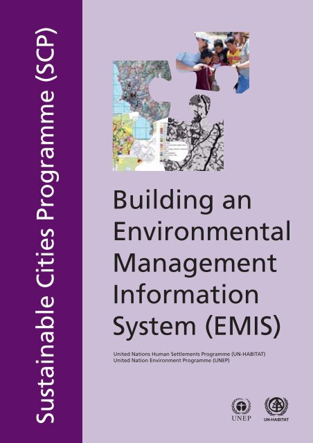
Sustainable Cities Programme (SCP)<br />
Building an<br />
Environmental<br />
Management<br />
Information<br />
System (<strong>EMIS</strong>)<br />
United Nations Human Settlements Programme (<strong>UN</strong>-HABITAT)<br />
United Nation Environment Programme (<strong>UN</strong>EP)<br />
<strong>UN</strong>EP -
Copyright © United Nations Human Settlements Programme (<strong>UN</strong>-HABITAT) 2008<br />
All rights reserved<br />
United Nations Human Settlements Programme (<strong>UN</strong>-HABITAT)<br />
P.O Box 30030 00100 Nairobi GPO KENYA<br />
Tel: 254-020-7623120 (Central Office)<br />
www.unhabitat.org<br />
DISCLAIMER<br />
The designations employed and the presentation of material in this report do not imply of any opinion whatsoever on<br />
the part of the Secretariat of the United Nations concerning the legal status of any country, territory, city or area or of its<br />
authorities, or concerning the delimitation of its frontiers or boundaries, or regarding its economic system or degree of<br />
development. The analysis conclusions and recommendations of this publication do not necessarily reflect the views of the<br />
United Nations Human Settlements Programme or its Governing Council.<br />
ACKNOWLEDGEMENTS<br />
Principal authors: Karin Buhren, Bernd Decker<br />
Contributors for the second edition: Luc Boerboom, Maike Christiansen, Monika Kuffer, Mike McCall, Wolfgang Qual, Jan<br />
Tukstra, Jeroen Verplanke<br />
Editor: Eleanor Cody<br />
Design and layout: <strong>UN</strong>ON Printshop<br />
Printer: <strong>UN</strong>ON Printshop
The SCP Source Book Series<br />
Building an Environmental Management<br />
Information System (<strong>EMIS</strong>)<br />
Handbook with Toolkit
2<br />
Building an Environmental Management Information System<br />
Table of Contents<br />
About the SCP Source Book Series.................................................... 6<br />
User’s Guide............................................................................................ 7<br />
Part A<br />
Introduction and Overview................................................................. 9<br />
A1 Cities and the environment ......................................................... 10<br />
A2 The role of information in planning and management ............ 10<br />
A3 How an Environmental Management<br />
Information System (<strong>EMIS</strong>) supports better<br />
urban management ..................................................................... 11<br />
A4 How does <strong>EMIS</strong> fit into the SCP project cycle?........................ 14<br />
A5 Specific Applications of <strong>EMIS</strong> .................................................... 16<br />
A6 How to set up an <strong>EMIS</strong> ............................................................... 19<br />
Part B<br />
The Guide: Building an Environmental Management<br />
Information System (<strong>EMIS</strong>) Step by Step ...................... 25<br />
B The Guide: Building an Environmental<br />
Management Information System (<strong>EMIS</strong>) Step by Step.......... 26<br />
B1 Setting up the <strong>EMIS</strong> .................................................................... 26<br />
B1.1 Finding a place............................................................................... 26<br />
B1.2 Placing and engaging staff............................................................. 28<br />
B1.3 Selecting and putting in place the hardware and software ............ 29<br />
B1.4 Linking stakeholders, users and producers:<br />
the Mapping Group........................................................................ 32<br />
B1.5 Getting Information and Taking the Inventory .............................. 33<br />
B2 Creating a Basic Map .................................................................. 38<br />
B2.1 Creating a Basic Map using existing<br />
topographical maps........................................................................ 43<br />
B2.2 Updating a Basic Map with Images............................................... 45<br />
B3 Using maps to analyse environmental issues ............................ 46<br />
B3.1 Mapping Facts: Thematic Maps .................................................... 47<br />
B3.2 Mapping Policies: Suitability Maps and<br />
Sensitivity Maps ............................................................................ 49<br />
B4 Applying mapping to decision making:<br />
Outputs through Overlaying ...................................................... 51<br />
B4.1 Hotspots and Action Plans............................................................. 52<br />
B4.2 Project design and investment at a specific site............................. 54<br />
B4.3 Site Selection ................................................................................. 54<br />
B4.4 <strong>EMIS</strong> and Urban Planning ............................................................ 55<br />
B4.5 Further use of the system: Using <strong>EMIS</strong> for<br />
monitoring and evaluation ............................................................ 57<br />
B5 Promoting public information .................................................... 57
Introduction and Overview<br />
B5.1 Exhibitions..................................................................................... 58<br />
B5.2 The Web......................................................................................... 59<br />
B5.3 Publications ................................................................................... 59<br />
B6 Maintaining the <strong>EMIS</strong>................................................................. 61<br />
B6.1 Updating the information in the <strong>EMIS</strong>.......................................... 62<br />
B6.2 Building and maintaining skills..................................................... 62<br />
B6.3 Making the system routine ............................................................ 63<br />
Part C<br />
The Toolkit: Key Steps in Building an Environmental<br />
Management Information System (<strong>EMIS</strong>).............................................. 67<br />
List of Tools<br />
Tool 1: Participatory Geographic Information Systems (PGIS) ............. 68<br />
Tool 2: Location for the <strong>EMIS</strong> unit......................................................... 80<br />
Tool 3: Terms of Reference for the <strong>EMIS</strong> Employees............................ 84<br />
Tool 4: <strong>EMIS</strong> Hardware.......................................................................... 88<br />
Tool 5: <strong>EMIS</strong> Software ........................................................................... 90<br />
Tool 6: Remote Sensing Data Sources for <strong>EMIS</strong>.................................... 94<br />
Tool 7: Setting up the Technical Support Unit........................................ 100<br />
Tool 8: The Mapping Group ................................................................... 102<br />
Tool 9: Finding Maps.............................................................................. 105<br />
Tool 10: Purchasing Maps....................................................................... 108<br />
Tool 11: Organising Maps – Data Filing System.................................... 110<br />
Tool 12: Metadata Database.................................................................... 119<br />
Tool 13: The Basic Map ......................................................................... 122<br />
Tool 14: Standard Layout........................................................................ 125<br />
Tool 15: Digitizing Maps ........................................................................ 130<br />
Tool 16: Standard Set of Thematic Maps................................................ 138<br />
Tool 17: Attribute Data ........................................................................... 140<br />
Tool 18: Collecting Data in the Field...................................................... 144<br />
Tool 19: Preparing Thematic Maps......................................................... 148<br />
Tool 20: Ranking Environmental Issues ................................................. 159<br />
Tool 21: Preparing a Suitability Map...................................................... 163<br />
Tool 22: Preparing a Sensitivity Map...................................................... 165<br />
Tool 23: Preparing a Service Delivery Map............................................ 168<br />
Tool 24: Overlaying Maps ...................................................................... 170<br />
Tool 25: Environmental Management .................................................... 176<br />
Tool 26: Monitoring the urban environment........................................... 183<br />
Tool 27: Information Outreach ............................................................... 185<br />
Tool 28: Mapservers................................................................................ 197<br />
Tool 29: Spatial planning or decision support system ............................ 200<br />
Tool 30: Backing up the <strong>EMIS</strong> ............................................................... 202<br />
Tool 31: Training..................................................................................... 205<br />
Tool 32: A budget for <strong>EMIS</strong> .................................................................. 210<br />
Reference 1: Further Reading ................................................................. 213<br />
Reference 2: Useful web sites................................................................. 216<br />
Reference 3: Sample Maps ..................................................................... 217<br />
3
4<br />
Building an Environmental Management Information System<br />
Table of Contents of CD-ROM<br />
What’s on the <strong>EMIS</strong> CD-ROM<br />
The <strong>EMIS</strong> CD ROM will contain the following:<br />
1. <strong>EMIS</strong> handbook<br />
2. Software<br />
3. Maplibrary<br />
4. Images and Logos<br />
5. <strong>EMIS</strong> presentations<br />
6. Background documents
List of Acronyms<br />
EMF Environmental Management Framework<br />
<strong>EMIS</strong> Environmental Management Information System<br />
EPM Environmental Planning and Management<br />
GIS Geographic Information System<br />
GPS Global Positioning System<br />
PGIS Participatory-GIS<br />
SCP Sustainable Cities Programme<br />
TSU Technical Support Unit<br />
Introduction and Overview<br />
5
1 In general, the SCP Source<br />
Books are developed based<br />
on city experiences or are<br />
developed as operational tools<br />
which will then be fine-tuned,<br />
adapted and applied in cities.<br />
An SCP Source Book can be<br />
process-specific (Volumes 1<br />
- 5), topic-specific (Volume<br />
6) or of a cross-cutting nature<br />
(Volumes 7, 8 and 9)<br />
6<br />
Building an Environmental Management Information System<br />
About the SCP Source Book Series<br />
The SCP Source Book Series provides detailed operational guidance for the benefit<br />
of people implementing city-level projects within the Sustainable Cities Programme.<br />
Each volume in the Series covers either an important part of the SCP process or an<br />
important topic which is central to urban environmental planning and management.<br />
The volumes currently being produced (1999) include the following:<br />
Volume 1: Preparing the SCP Environmental Profile<br />
Volume 2: Organising and Running the City Consultation<br />
Volume 3: Establishing and Supporting the Working Group Process<br />
Volume 4: Formulating Issue-Specific Strategies and Action Plans<br />
Volume 5: Institutionalising the EPM Process<br />
Volume 6: Urban Air Quality Management Handbook<br />
Volume 7: Building an Environmental Management Information Systems<br />
Volume 8: Integrating Gender Responsiveness in EPM<br />
Volume 9: Measuring Progress in EPM 1<br />
The emphasis in this Series is on relevance and realism These volumes are the product<br />
of experience - field-level experience gained over the past eight years in SCP city<br />
projects around the world. Precisely because it is drawn from the lessons of experience<br />
in so many different cities, the information contained in these volumes is not cityspecific<br />
but can readily be adapted and applied to the tasks of urban environmental<br />
planning and management (EPM) in virtually any city context.<br />
The Sustainable Cities Programme (SCP) is a global programme of the United Nations<br />
Centre for Human Settlements (<strong>UN</strong>CHS - <strong>Habitat</strong>) and the United Nations Environment<br />
Programme (<strong>UN</strong>EP). It is the leading technical cooperation programme in the field<br />
of urban environmental planning and management and is the principal activity of<br />
the United Nations system for operationalising sustainable urban development and<br />
thus contributing to implementation of the globally-agreed Agenda 21 and <strong>Habitat</strong><br />
Agenda.<br />
Further information about the SCP Source Book Series, or about the Sustainable Cities Programme<br />
itself, may be obtained from:<br />
The Sustainable Cities Programme, <strong>UN</strong>-HABITAT, P.O.Box 30030, Nairobi, Kenya<br />
Tel: +254 - 2 - 7623 225, Fax: +254 - 2 - 7623 715, E-mail: scp@unhabitat.org<br />
web-site: http://www.unhabitat.org/scp
User’s Guide<br />
Introduction and Overview<br />
This handbook is divided into three parts. Each part has a different purpose and is<br />
designed for a different audience.<br />
Part A – Introduction and Overview<br />
Part A provides a general description of the Environmental Management Information<br />
System (<strong>EMIS</strong>), explaining its role and purpose in urban management. Part A gives<br />
a brief overview of the various ways an <strong>EMIS</strong> can be used, focusing in particular on<br />
how the system can be used in the partner cities of the Sustainable Cities Programme<br />
(SCP). This section of the book is designed for decision-makers and urban managers<br />
involved in the Environmental Planning and Management (EPM) process and for<br />
readers with a general interest in the <strong>EMIS</strong> concept.<br />
Part B – The Guide: Building an Environmental<br />
Management Information System (<strong>EMIS</strong>) Step by Step<br />
Part B is the main body of the handbook. It explains how an <strong>EMIS</strong> is established, and<br />
gives step-by-step instructions for building the system. The explanation is detailed<br />
and systematic, and is aimed at the professionals and practitioners who will be using<br />
the <strong>EMIS</strong> on a daily basis. Part B also contains practical advice and tips drawn from<br />
experiences in SCP partner cities. Part B is designed as a reference guidebook which<br />
project staff and partners can consult again and again.<br />
Part C – Toolkit<br />
The Toolkit offers examples which can be applied immediately to the process of<br />
building the <strong>EMIS</strong>. For instance, Part C contains sample Terms of Reference for<br />
contractors and consultants, information on organising support for the system, and<br />
step-by-step descriptions for preparing databases and maps. This material is very useful<br />
during the <strong>EMIS</strong> development process. It is designed to save the time and energy of<br />
the project staff, and it also ensures a consistency of approach. Part C also includes<br />
useful suggestions for further reading, and names and addresses of useful contacts.<br />
The <strong>EMIS</strong> Handbook and Toolkit is also published on a CD-ROM, which you will<br />
find at the back of the <strong>EMIS</strong> book. This CD also contains additional tools, available<br />
in electronic format only.<br />
To get the best from this Handbook and Toolkit, users should have a good understanding<br />
of the overall Environmental Planning and Management (EPM) process, of which the<br />
<strong>EMIS</strong> is only a part. It is therefore strongly advised that users familiarise themselves<br />
with the SCP Process Source Books and related background material. These materials<br />
can be downloaded from the SCP website at www.unhabitat.org/scp, or ordered directly<br />
from the Programme.<br />
7
Building an Environmental Management Information System<br />
8
Part A<br />
Introduction and Overview<br />
Introduction and Overview<br />
Part A provides a general description of the Environmental Management<br />
Information System (<strong>EMIS</strong>), explaining its role and purpose in urban management.<br />
It gives a brief overview of the various ways an <strong>EMIS</strong> can be used, focusing in<br />
particular on how the system can be used in the partner cities of the Sustainable<br />
Cities Programme (SCP).<br />
9
Building an Environmental Management Information System<br />
A1<br />
Cities and the environment<br />
Cities play a vital role in social and economic development. Efficient and productive<br />
cities are essential for national economic growth, and, equally, strong urban economies<br />
are essential for generating the resources needed for public and private investments<br />
in infrastructure, education and health, improved living conditions and poverty<br />
alleviation.<br />
Unfortunately, the development potential of cities is all too often crippled by<br />
environmental deterioration. Aside from its obvious effects on human health and<br />
well being (especially of the poor), environmental degradation impedes economic<br />
development. For development achievements to be truly “sustainable”, cities must<br />
focus on balancing the needs and pressures of urban growth and development with<br />
the opportunities and constraints of the urban environment.<br />
Environmental deterioration is not inevitable. Although many cities – perhaps even<br />
most – are still suffering severe environmental and economic damage, there are<br />
encouraging signs. Some cities are learning how to better plan and more effectively<br />
manage the process of urban development, avoiding or alleviating environmental<br />
problems while realising the positive potentials of city growth and change.<br />
All development ultimately depends on environmental goods and services: the<br />
management of these resources is therefore an integral concern in urban development<br />
planning and management. However, the tools available to decision-makers for<br />
influencing development towards optimal and sustainable use of environmental<br />
resources are limited. To be effective, they must be applied in a consistent and<br />
co-ordinated fashion. Environmental resource management uses information to<br />
reconcile competing interests (i.e. environmental policy co-ordination) and to support<br />
development decision-making (i.e. policy implementation).<br />
A2<br />
The role of information in planning and management<br />
All planning and management activities require information. The challenge is (a) to<br />
determine what data and information is needed; (b) to find out if this already exists<br />
and where; (c) how to get hold of it if it exists, and how to collect it if it does not;<br />
(d) how to store this information in easily accessible and referenced form; (e) how<br />
to interpret the data, resolve questions of quality, contradictions and incompleteness;<br />
(f) how to determine who needs the information, when and in what form(s); and (g)<br />
how to disseminate it as required.<br />
If these steps are formalised, institutionalised and made sustainable, one can talk of<br />
an information system rather than an ad hoc data gathering exercise. By formalised,<br />
we mean standardised and explicit procedures and formats, which at the same time are<br />
flexible and not rigid; by institutionalised, we refer to the integration of the system into<br />
a permanent organisational structure, independent of any critical individual input; by<br />
sustained we mean that the system receives ongoing support in the form of necessary<br />
resources (funding, staffing, etc.) and “political” backing, that its services are actively<br />
sought, and that it satisfies this demand.<br />
Management Information Systems provide concise, to-the-point and timely information<br />
which is directly usable by decision-makers in making decisions or formulating<br />
actions. The key words are concise: a decision-maker usually is very busy, and does<br />
not have time to assimilate more than a page or two at any given time; to-the-point:<br />
the manager wants to know what the information means and what she or he can do<br />
10
Introduction and Overview<br />
with it; timely: if information is not available when decisions are taken, then it serves<br />
no purpose; it is better to provide partial information in time, rather than complete<br />
information which comes too late; and usable: the information has to be formulated<br />
in a way that the intended users can understand and relate to, especially as these users<br />
are generally non-specialists.<br />
A3<br />
How an Environmental Management Information System<br />
(<strong>EMIS</strong>) supports better urban management<br />
Urban managers are confronted almost on a daily basis with a number of recurring<br />
questions. These questions include: Which areas are available for city expansion?<br />
Where can we establish new housing areas? How can we revive certain parts of our<br />
city? How can we improve health and recreational conditions for our citizens? Where<br />
are the flood-prone areas? How can we stop air pollution in various parts of the city?<br />
To which areas shall we guide investors? What are the consequences of building<br />
a shopping centre at a particular site? Where can service delivery be improved or<br />
expanded?<br />
All these questions relate to the planning and management of space in the city, highlighting<br />
the importance of spatial information in urban planning and management. The answers<br />
have to be geographically linked. This Handbook aims to help urban managers to give<br />
more accurate answers to these typical questions, by improving their capacity to address<br />
the spatial aspects of an Environmental Planning and Management process.<br />
The questions have three typical characteristics. They<br />
• are asked frequently;<br />
• have long-term importance; and<br />
• are cross-sectoral in nature.<br />
Spatial information about a city is usually held in several different public institutions,<br />
according to their different work areas and specialisations. Data storage systems<br />
often differ from institution to institution, making it difficult to compare and combine<br />
information. In addition, while typical routine urban management questions refer to<br />
specific areas in the city, the way spatial data is stored often makes it impossible to<br />
relate the information to specific areas. This means that in answering routine urban<br />
management questions, usually only some of the information about the consequences<br />
of a management decision has been taken into consideration – only a few possible<br />
solutions are considered and assessed. Sometimes this approach works out nicely, but<br />
sometimes it turns out to be a very costly decision for developing the city. However,<br />
providing a comprehensive answer to typical routine questions may take several days,<br />
if not weeks, and in many cases potential investors will by then have turned around<br />
to look for better options by themselves.<br />
Example: Lack of spatial understanding leads to poor decision-making:<br />
During the 1970s, the city of Lagos built a road through a wetlands area. This route was chosen because the<br />
costs for the plots in that area were very low. This road opened up access to a whole new area in the wetlands,<br />
leading to the spontaneous development of housing areas. The city then had to provide more infrastructure<br />
such as power, water and a sewer system. This infrastructure was difficult to build, and therefore expensive.<br />
When these expenses were added to the initial cost of building the road, this road became by far the most<br />
expensive road ever built in Lagos. This example shows the importance of establishing a system of knowledge<br />
and information to help decision-makers to avoid making the wrong decisions.<br />
11
Building an Environmental Management Information System<br />
Some short definitions of a Geographic Information System (GIS)<br />
An Information System (IS) stores collected data. This data can be up-dated and manipulated and finally be<br />
displayed. In general, an IS stores data about one thematic area. A Bank Information System, for example,<br />
stores data about the bank’s customers, accounts and transactions.<br />
A Geographical Information Systems (GIS) works with spatial data. It is therefore a specific information<br />
system. A GIS has four components: Hardware, Software, Spatial data and Personnel.<br />
Hardware (i.e. Computer, GPS, Scanner, Digitizer, Printer)<br />
Software (i.e. ESRI’s ArcView, Integraph’s GeoMedia, MapInfo)<br />
Spatial data (i.e. satellite images, routes, rivers, land use data, position of landfill sites)<br />
Personnel (i.e. GIS Officer, GIS Assistant)<br />
As any Information System, a Geographical Information System consists of four phases, the EMAP<br />
phases:<br />
Entry (record, prepare, capture)<br />
Manage (store, maintain, update, integrate)<br />
Analyze (manipulate, model)<br />
Present (visualize, display)<br />
For more background<br />
information<br />
about GIS please<br />
use Reference<br />
Material A –<br />
Further Readings<br />
An Environmental Management Information System (<strong>EMIS</strong>) consists of formalised<br />
steps to capture environmental information, and fixed procedures to retrieve it. An<br />
<strong>EMIS</strong> includes the collection of information about the various environmental issues<br />
facing a particular city, supports the Issue-Specific Working Group process, continues<br />
by supporting strategy formulation and action planning, including mapping, and last<br />
but not least covers the gathering of information necessary for institutionalisation of<br />
the EPM process. To reach sound solutions in urban management, the EPM process<br />
offers an approach for inter-departmental and inter-institutional co-ordination of<br />
information through a participatory working method. Therefore, the <strong>EMIS</strong> is by its<br />
nature a participatory information system for managing the collective know-how of<br />
relevant stakeholders. Issue-specific Working Groups are the main providers and users<br />
of spatial information, and are supported by mapping professionals, cartographers,<br />
surveyors and experts in geographical information systems (GIS). <strong>EMIS</strong> information<br />
is stored in archives, databases and maps.<br />
<strong>EMIS</strong> is designed to link dispersed data about urban and environmental issues to a<br />
series of different types of maps about a particular area or even city-wide. This linkage<br />
allows users to combine, query and analyse all this information in an area-specific<br />
way and therefore to get more precise answers for routine questions. The proper setup<br />
and operation of the system will – ideally – generate a comprehensive response<br />
for a routine question within few hours. Using an <strong>EMIS</strong> to answer routine questions,<br />
many traditional drawbacks, such as dispersed data, incompatible data formats and<br />
the sheer volume of data can be overcome.<br />
As the <strong>EMIS</strong> is a tool for participatory urban environmental management, it<br />
concentrates on the interaction between environmental resources and hazards, and<br />
development activities. The system is designed to illustrate the various possible<br />
results of environment-development interactions. For example, establishing an <strong>EMIS</strong><br />
in a SCP partner city supports a better understanding of environment-development<br />
interaction throughout the various steps of the SCP process cycle. An <strong>EMIS</strong> can be<br />
12
Introduction and Overview<br />
operated by using a traditional manual system of storing and displaying information<br />
(library, manual drawing of maps). Today, however, a computerised <strong>EMIS</strong> usually<br />
uses a Geographic Information System (GIS) as a tool to handle and process the<br />
spatial and non-spatial data.<br />
Geomatics<br />
The rapid development of information technology has revolutionised surveying and mapping towards<br />
‘geomatics’. The definition of geomatics is evolving. A working definition might be “the art, science and<br />
technologies related to the management of geographically-referenced information.” Geomatics includes<br />
a wide range of activities, from the acquisition and analysis of site-specific spatial data in engineering<br />
and development surveys to the application of GIS and remote sensing technologies in environmental<br />
management. It includes cadastral surveying, hydrographic surveying and ocean mapping, and it plays an<br />
important role in land administration and land use management.<br />
Please be aware that there is a clear distinction between <strong>EMIS</strong> and GIS. <strong>EMIS</strong> is an<br />
information system for managing information on the urban environment according<br />
to the EPM process. An <strong>EMIS</strong> can be built incrementally at different levels of<br />
sophistication. A highly sophisticated <strong>EMIS</strong>, however, uses GIS as a state-of-the-art<br />
spatial management tool. This Handbook is not designed to give a comprehensive<br />
description of GIS. Rather, it concentrates on the concept of environmental planning<br />
and management (EPM), elaborating on the particular elements which are most relevant<br />
to a well-functioning <strong>EMIS</strong>.<br />
What makes <strong>EMIS</strong> special is its participatory approach. Very often a GIS is reserved for<br />
specialist use. The system is set up, but is not then fully exploited for urban management<br />
purposes afterwards, because the people querying the data are missing. The EPM<br />
process, however, uses a participatory approach, and many people are involved in<br />
gathering information and setting up the <strong>EMIS</strong>. All these people become users of the<br />
<strong>EMIS</strong>, and the system grows as they use it. By using the technical capacities of a<br />
modern GIS in a participatory way, city planners can draw on local spatial knowledge<br />
to understand how cities change over time. Often it can be difficult to establish how<br />
urban circumstances change, as issues like disappearing services (e.g. shops, utilities)<br />
happen over many years and for many reasons. Local spatial knowledge (which<br />
encompasses both local technical knowledge of hazards, problems, potentials, utility<br />
uses, and indigenous spatial concepts of culture and space) can provide the reasons.<br />
It is important that city planners can access this knowledge, so that they understand<br />
the origin of problems. It is equally important for neighbourhoods to ensure that this<br />
knowledge is shared and stored. Cities are dynamic and people are very mobile, so the<br />
risk of losing this kind of knowledge is quite high. An <strong>EMIS</strong> combines participatory<br />
GIS with the EPM process to create an information system which can provide ongoing<br />
decision-making support to urban managers.<br />
An overview of Participatory GIS (P-GIS)<br />
P-GIS is participatory spatial planning (PSP), making use of maps and GI output, especially GIS. Although<br />
participatory planning can take place without maps – for example, the development of a school curriculum<br />
or a cultural policy – spatial planning invariably includes maps. P-GIS is an emerging practice, developing out<br />
of both GIS technology and participatory approaches in planning and decision making. The essential issues<br />
are: what intensity of participation is there in the GIS construction, design and mapping activities? How<br />
participatory is Participatory Spatial Planning – what are the functions, processes, activities, measures,<br />
instruments and procedures of spatial planning which involve participation?<br />
13
Building an Environmental Management Information System<br />
A4<br />
How does <strong>EMIS</strong> fit into the SCP project cycle?<br />
The Sustainable Cities Programme (SCP) is a worldwide technical co-operation activity<br />
of the United Nations. It works at city level in collaboration with local partners to<br />
strengthen their capacities for environmental planning and management (EPM). Each<br />
city-level SCP project is adapted to the particular needs, priorities and circumstances<br />
of that city: nonetheless, all SCP partner cities follow a common approach and all are<br />
implemented based on the following principles:<br />
• concentrate on environment-development interactions;<br />
• broad-based participation by public, private and community sector groups;<br />
• concern for inter-sectoral and inter-organisational aspects;<br />
• reliance on bottom-up and demand-driven responses;<br />
• focus on process: problem-solving and “getting things done”; and<br />
• emphasis on local capacity building.<br />
The SCP process consists of a sequence of activities, which are logically and practically<br />
connected, together with a number of specific outputs, which are important for the<br />
progress of the project. By following the SCP project cycle, an effective environmental<br />
planning and management process – designed to be integrated into local government<br />
practices – is established.<br />
Each step in the <strong>EMIS</strong> is designed to provide support to specific stages in the<br />
Sustainable Cities Programme (SCP) process as outlined in the SCP Source Books,<br />
e.g. Environmental Profile (EP), Strategies and Action Plans, etc. You will find that<br />
the SCP Source Books refer directly to these <strong>EMIS</strong> steps. This Handbook supports all<br />
the stages of the SCP project cycle that use the mapping element of the information<br />
system.<br />
Figure 1: The SCP Project Cycle<br />
14
The SCP project cycle has three main phases:<br />
A4.1 Assessment and start-up<br />
Introduction and Overview<br />
The First Phase (Assessment and start-up) is a 6 to 9 month initial period, which<br />
normally includes the following main activities:<br />
• identification and mobilisation of project participants and partners;<br />
• familiarisation of project partners with the core EPM concept and SCP approach;<br />
• preparation of the Environmental Profile (EP) and initial identification of priority<br />
environmental issues;<br />
• a review of available resources, tools and information and the initial design of an<br />
environmental management information system (<strong>EMIS</strong>) specifically adapted to<br />
the city’s needs;<br />
• working out the organisational structure, work plan and operational procedures<br />
for the project;<br />
• organising and holding a City Consultation; and<br />
• establishing Issue-Specific Working Groups.<br />
The City Consultation is a major event that brings together the work of Phase One,<br />
consolidates social and political participation and support, and launches the SCP<br />
project into Phase Two.<br />
The <strong>EMIS</strong> provides considerable support to the first stage. A basic map, showing<br />
the location of the city and some additional thematic maps on environmental and<br />
development issues is included in the Environmental Profile (EP), and all the<br />
environmental data collected for the EP will be stored in the <strong>EMIS</strong>. During this period<br />
an inventory of existing maps and data is conducted. For the City Consultation, the<br />
<strong>EMIS</strong> can be used to prepare a map exhibition. These maps will help to identify,<br />
clarify and prioritise the environmental issues facing the city. The <strong>EMIS</strong> also supports<br />
and interacts with the Issue-Specific Working Groups. Information already compiled<br />
during the inventory period can be shared and new information from the members<br />
of the working groups can be collected for inclusion in the system. It is advisable<br />
to establish a Mapping Group (see Chapter B1.4) early in the first phase in order to<br />
have the first mapping outputs ready for the Environmental Profile (EP) and the City<br />
Consultation.<br />
A4.2 Strategy and action planning<br />
The project’s Second Phase (Strategy & Action Planning) is a 15 to 24 month period<br />
of intensive analysis, discussion and negotiation within the Issue-Specific Working<br />
Groups. The number, focus and membership of these Working Groups will change and<br />
evolve as the project proceeds, but they will remain the principal working mechanisms<br />
of the SCP project. During this period, each of the agreed priority issues is further<br />
elaborated and developed, in order to reach a consensus on appropriate strategies for<br />
that issue. The strategies are then developed into action plans which are agreed by<br />
the organisations and groups involved in implementation.<br />
It is likely that small-scale “demonstration” projects will be undertaken to test the<br />
approaches developed and to show what can be done through the SCP process. In<br />
addition, some of the first action plans will produce investment and/or technical assistance<br />
proposals which will be developed into properly formulated and “bankable” proposals. All<br />
of these Phase Two Working Group activities will be gradual, pragmatic and co-operative,<br />
reflecting the real-world conditions for strategy formulation and implementation. During<br />
the Second Phase, the main project activities aimed at institutional capacity-building<br />
and human resource development will also be carried out.<br />
15<br />
Volume 1 of the SCP<br />
Source Book Series<br />
– Preparing the SCP<br />
Environmental Profile<br />
– provides detailed<br />
guidance<br />
Volume 2 of the SCP<br />
Source Book Series<br />
– Organising, Conducting<br />
and Reporting<br />
the City Consultation<br />
– provides<br />
detailed guidance<br />
See The SCP Source<br />
Book Series, Volume<br />
3: Establishing<br />
and Supporting<br />
the Working Group<br />
Process<br />
And The SCP Source<br />
Book Series, Volume<br />
4: Formulating Issue-<br />
Specific Strategies<br />
and Action Plans
see The SCP Source<br />
Book Series, Volume<br />
5: Institutionalising<br />
the EPM Process<br />
Building an Environmental Management Information System<br />
During the Second Phase the <strong>EMIS</strong> supports the participatory decision-making<br />
process in a number of ways. The Working Groups will formulate their needs for<br />
specific maps and generate the data for new maps. During this stage a great deal of<br />
maps and data will accumulate and the <strong>EMIS</strong> will evolve rapidly as a functional tool.<br />
The system can produce many outputs, such as identifying environmentally sensitive<br />
areas (“hot spots”). It can also help to select sites for specific projects and can support<br />
project design for a specific site. With the help of the <strong>EMIS</strong>, detailed strategies can be<br />
formulated and action plans prepared and illustrated with maps. The Mapping Group<br />
and the Issue-Specific Working Groups will interact closely with each other in order<br />
to ensure genuinely participatory mapping.<br />
A4.3 Follow-up and consolidation<br />
The Third Phase of work (Follow-up & Consolidation) is an open-ended follow-up and<br />
implementation period, which begins towards the end of Phase Two and carries on for<br />
an extended time afterwards. The strategies and action plans coming out of the Working<br />
Groups are further elaborated, building towards an overall citywide environmental<br />
management and urban development strategy. Investment proposals are worked out<br />
in detail, subjected to rigorous analysis, and pursued vigorously with funding sources.<br />
The task of institutionalising the environmental planning and management (EPM)<br />
process, initiated during Phase Two, is undertaken in earnest. In addition, the remaining<br />
training and institutional development activities are implemented. Finally, regional<br />
and/or national workshops and meetings will be held to explore ways of extending<br />
SCP activities into other cities, building upon the experience gained in the project.<br />
At this stage, the <strong>EMIS</strong> is fully functional. A considerable amount of data has been<br />
gathered, allowing further analysis and the production of outputs such as a development<br />
pattern map, issue specific strategy maps and an environmental management<br />
framework. In addition, an <strong>EMIS</strong> can support the monitoring of the environment<br />
situation and the evaluation of the achievements of the EPM approach. However, the<br />
system still needs input on an on-going basis both to keep it up to date and to make it<br />
increasingly comprehensive. This ensures that it will continue to be a powerful urban<br />
management decision-making tool in the future.<br />
A5<br />
Specific Applications of <strong>EMIS</strong><br />
Different levels of city administration require different urban information. For<br />
example, the city assessor needs a detailed, large-scale land information system<br />
to improve the collection of property taxes. The water department requires precise<br />
spatial information on the water utilities for better operation, maintenance and revenue<br />
collection. The planning department is concerned about the expansion of the city, while<br />
the environment department needs to manage environmental resources and hazards<br />
better. Equally important is the issue of information outreach: for example, the mayor<br />
presents a easily-understood “snapshot” of the city’s environment and development<br />
situation at a conference in order to attract tourism, investors etc.<br />
The <strong>EMIS</strong> can support all these requirements. Colourful attractive maps make<br />
theoretical issues much more immediate for the lay person. They draw attention and<br />
can jump-start discussions. The <strong>EMIS</strong> supports different tasks in urban management<br />
decision-making such as project design, site selection or investment planning. It can<br />
be further used to attract donors and investors by providing maps which show the best<br />
locations for investment in the city.<br />
16
Supporting a new urban management approach<br />
Introduction and Overview<br />
Over the last decades, it has been recognised that traditional planning practices do not<br />
sufficiently address the urban management problems which cities face. The Charter<br />
of Athens considered the city as a “masterpiece of architecture” to which functions<br />
could be attached on the drawing board. In reality, this approach is unworkable,<br />
especially in cities with growth rates of five per cent and above. An open planning<br />
tool, however, is able to react quickly to rapid changes in city development. The<br />
<strong>EMIS</strong> complements (but does not necessarily replace) existing planning tools, such<br />
as Landuse Plans, Master Plans, Zoning Plans and so on. The strength of the system<br />
lies in its capacity for cross-sectoral analysis and the facility it offers for the overlay of<br />
multiple environment and development information sets. This approach also supports<br />
better urban governance, because it incorporates issues and norms into the decisionmaking<br />
process which will be otherwise ignored. The information stored in the <strong>EMIS</strong><br />
is a consensus interpretation of information, gathered and discussed in the working<br />
group process. The participatory nature of the <strong>EMIS</strong> responds to a gender responsive<br />
EPM by, for example, collecting data and information in a gender disaggregated way<br />
where applicable and necessary. The decision-making process is transparent and<br />
traceable through the map layers and through the documentation of the working group<br />
meetings. <strong>EMIS</strong> also helps better disaster prevention by providing policy makers with<br />
early warnings about hazardous situations regarding the environment.<br />
Which projects can be designed for a specific site?<br />
For project design, information from several maps is combined and the analysis<br />
provides options for selecting a site or area of interest. A table shows the information<br />
available about that site, including the findings of the working groups about the<br />
“rules and regulations” regarding the environmental and development conditions for<br />
this specific site. The next step is to prepare a report listing all the information and<br />
regulations, making suggestions for the best uses of this plot. If a project document<br />
already exists, the information gathered can be used to refine the project design<br />
according to the findings. With the inclusion of some more information it is even<br />
possible to estimate the costs of different investments at this specific site. Based on<br />
the report, the investor can decide on the type of investment she or he will make, or<br />
whether the design of the project has to be changed.<br />
Which sites can be selected for a particular project?<br />
Site selection requires some advance considerations and decisions. This is best<br />
explained with an example: A site suitable for a sewage plant is needed. The rules<br />
applying to a suitable site for a sewage plant are that it is best placed downwind<br />
from settlements, but still near housing areas. The site should be accessible by road<br />
and the area must have suitable soil conditions and a low water table. To find sites<br />
fitting these requirements, several <strong>EMIS</strong> maps will be queried to locate all the areas<br />
with suitable soil conditions, a low water table and good access to roads. From these<br />
areas, sites which lie downwind from settlements but not too far from them will be<br />
selected. Several sites will match this query. Not all of them will be available. The<br />
ones available will have different drawbacks. A report will be prepared describing the<br />
advantages and disadvantages of the different available sites.<br />
A city wide view: The Environmental Management Framework (EMF)<br />
An Environmental Management Framework (EMF) is a major <strong>EMIS</strong> output. It has<br />
three major components: spatial analysis; project and investment requirements; and<br />
a management framework for effective implementation of strategies. The spatial<br />
component refers to the geographic interpretation of competing interests in the use of<br />
space and the aggregation of potential strategies for solving those competing interests.<br />
17
Building an Environmental Management Information System<br />
By mapping and overlaying the geographic distribution of the critical environmental<br />
resources, areas can be classified or ranked by their degree of exposure to environmental<br />
risks, and their sensitivities to particular development activities. This ranking or<br />
categorisation of areas helps to determine which development activity is compatible<br />
with specific areas, and to articulate rules and principles applicable to development<br />
taking place in the different areas. Such rules and principles don’t necessarily exclude<br />
certain areas from development; but they do enable the incorporation of the long-term<br />
costs which should be considered in investment decisions.<br />
The spatial analysis component of an EMF allows the determination and prioritisation<br />
of potential development areas for city expansion and growth. The selection of areas<br />
for future urban expansion will depend on the interaction between push factors (growth<br />
deterring), pull factors (growth stimulating) and the environmental sensitivities<br />
prevailing in the different areas of the city. The exercise results in the selection of areas<br />
with least foregone opportunities (say in terms of loss of agricultural land), benign<br />
environmental risks, higher carrying capacity, least infrastructure development cost<br />
and high economic efficiency. The spatial analysis component of the EMF makes<br />
extensive use of maps and Geographic Information Systems (GIS).<br />
Land Information Systems (LIS)<br />
The <strong>EMIS</strong> can directly link into existing GIS applications such as Land Information<br />
Systems (LIS) or Utility Management Systems, as long as the different systems are<br />
compatible with each other. Those systems contain information about each plot in<br />
the city, such as details on houses, tenants, and owner. This information can then be<br />
used for property taxation and water and power supply charges.<br />
��������������������������������������������������������������<br />
<strong>EMIS</strong> GIS LIS<br />
An Environmental Management Information<br />
System is a participatory<br />
tool for urban environmental planning<br />
and management. It concentrates<br />
on the interaction between environment<br />
and development activities.<br />
Whole city, including peri-urban areas<br />
Scale: 1:10,000 to 1:100,000<br />
<strong>EMIS</strong> and ISO 14001<br />
The <strong>EMIS</strong> complements the voluntary environmental management system (EMS)<br />
defined through the ISO 14001 series. Used in conjunction with appropriate goals, and<br />
with a management commitment, the ISO 14001 series helps to improve environmental<br />
performance and reduce negative impacts. It provides an objective basis for verifying<br />
claims about a local government’s performance in its day-to-day operations. The<br />
ISO 14001 voluntary environmental management standards and guidelines address<br />
environmental management systems, environmental auditing, environmental labelling,<br />
environmental performance evaluation and life cycle assessment. These international<br />
standards are voluntary standards for the establishment of a common world-wide<br />
18<br />
A Geographic Information System<br />
helps to store and to manage large<br />
amounts of spatially referenced data.<br />
It provides analytical tools and therefore<br />
helps a better understanding of<br />
activities on the earth’s surface.<br />
Depends on the issue<br />
All scales<br />
A Land Information System<br />
focuses on land parcels as<br />
the primary unit of information.<br />
It maintains, analyses<br />
and disseminates information<br />
about land registration,<br />
land assessment and<br />
land evaluation.<br />
Mainly built-up areas<br />
Scale: 1:500 or 1:5000
Introduction and Overview<br />
approach to management systems that will lead to better urban environmental planning<br />
and management. Even though the standards do not prescribe performance levels,<br />
performance improvements will invariably be achieved by any entity if its commitment<br />
to environmental care is emphasised and employees are trained and are aware of the<br />
policies in place to protect the environment. The ISO 14001 voluntary environmental<br />
management standards and guidelines are intended to be practical, useful and usable<br />
for organisations of all sizes (Source: ANSI Online, www.soc.titech.ac.jp//uem/)<br />
A6<br />
How to set up an <strong>EMIS</strong><br />
Establishing a fully functional <strong>EMIS</strong> can take several years. The system can be built<br />
incrementally from a low-cost set-up to a sophisticated and complex system without<br />
compromising the value of the outputs (a bicycle gets you to your destination just as<br />
effectively as a car!). The basic <strong>EMIS</strong> is essentially no more than a set of checklists of<br />
questions that should be asked when making decisions, with “pigeonholes” to record<br />
and store the answers in simple formats that are directly usable, together with some<br />
advice on how to go about it.<br />
After the initial stage of <strong>EMIS</strong> establishment, a certain amount of information will<br />
have been gathered and good outputs may have been produced to improve urban<br />
environmental management. However, it must be remembered that the <strong>EMIS</strong> can<br />
never be regarded as final: it has to be continuously updated and maintained. Any<br />
new investment will change the pattern of the city’s fabric, and this has to be reflected<br />
in the <strong>EMIS</strong>. A city, therefore, has to commit itself to a long-term investment in its<br />
<strong>EMIS</strong>. This commitment includes not only providing the appropriate equipment,<br />
personnel and funding to run the system, but also providing clear policy guidelines<br />
for the purpose of the <strong>EMIS</strong> and the use of the results it produces.<br />
An <strong>EMIS</strong> works best if the following principles are accepted:<br />
An <strong>EMIS</strong> must be maintained and regularly updated<br />
An <strong>EMIS</strong> is a dynamic, learning system, and information has to be fed into the system<br />
continuously. “Rome was not built in a day”. An information system does not have<br />
to be complete to be useful, and in any case it takes significant time to assemble and<br />
fill. In the meantime, decisions on environmental issues must – and will – be taken.<br />
Provided that attention focuses on the priorities of the users, even modest, incremental<br />
improvements in knowledge of an issue can be very useful. This tends to be especially<br />
valid in the environmental area, where the major problem is not necessarily a complete<br />
lack of information, but a lack of awareness of its existence and whereabouts. This<br />
fragmentation and dispersal is a reflection of the fact that the environment is not<br />
generally recognised as a technical sector in its own right. Over time, as new issues<br />
crop up, the information system will increase its coverage and scope, through both<br />
“passive” and “active” collection efforts, provided that a framework is in place. In the<br />
beginning, the framework can be no more than a set of folders or “message boxes” in<br />
which to “pigeonhole” information under different headings. At an advanced stage,<br />
the framework can be a sophisticated computerised GIS. The important point is that<br />
the system receives regular maintenance and updating.<br />
Some information is better than none<br />
An <strong>EMIS</strong> accepts the best information available. It is tempting when defining systems<br />
to be too ambitious, and to attempt to be complete and all-encompassing. This, of<br />
course, can never be achieved, and is more often than not counter-productive, in that<br />
time and effort are diverted from content to form. The law of diminishing returns<br />
19
Building an Environmental Management Information System<br />
should be kept in mind: beyond a certain point additional information does not really<br />
contribute much to deciding one way or another on concrete actions and policies.<br />
However, projects can be often delayed or halted because essential information is<br />
missing, while time and resources do not allow in-depth research. In such cases, you<br />
may have to rely on estimated figures, common sense or community knowledge. The<br />
more the data is partial, missing, inconsistent, etc., the more judgmental expertise<br />
is required to convert it into meaningful and reliable information. This is especially<br />
likely to be the case for environmental issues (indeed, it is one of the reasons for<br />
introducing an EPM process). “Non-scientific” information may be used as long as<br />
the source is stated. There is usually a minimum critical mass of information needed<br />
to support well-founded conclusions. The challenge is to find the right balance. Of<br />
course the aim will be to replace this kind of information in a later stage of the <strong>EMIS</strong><br />
with more scientific data. But for the moment, what counts is that some information<br />
is better than none.<br />
Avoid the data trap<br />
It is important not to fall into the “data trap”, i.e. getting bogged down in a large,<br />
general purpose, open-ended and unfocused data collection exercise. Such an exercise<br />
is almost invariably unsuccessful and therefore largely irrelevant. The purpose of<br />
an <strong>EMIS</strong> is not to substitute for general purpose or even sectoral statistical services<br />
or research institutions. Nor is “information” synonymous with “data”: only with<br />
analysis, interpretation and synthesis does data turn into information. An example to<br />
illustrate the difference: a list of sample results – for example, values of “BOD5” from<br />
water quality tests – is data incomprehensible to the non-specialist. However, when<br />
interpreted, this data may reveal, for example, the information that the values exceed<br />
the legal health standards and render the water severely unfit for human consumption<br />
due to excessive organic contamination.<br />
An <strong>EMIS</strong> makes a clear distinction between factual information and policy<br />
information.<br />
Factual thematic maps show quantifiable or “countable” data, for example geology<br />
maps, soil maps, population density maps, etc. Policy maps show information about<br />
certain policy decisions such as national acts, laws and by-laws, global environmental<br />
standards or rules and conditions developed by stakeholders during the working group<br />
process. Policy maps can be classified as Suitability and Sensitivity Maps. Suitability<br />
and Sensitivity Maps interpret information from factual maps and rank areas as “more<br />
and less suitable”, “good and bad”, etc. according to specific rules and conditions.<br />
For example, a map on water pollution compares the chemical composition (facts)<br />
of the water and relates it to standards, rules and conditions (policies). If a certain<br />
chemical exceeds a certain level then we call it polluting. Policy maps are based on<br />
an intensive participatory process. They are subjective, as they show policy aims and<br />
represent different opinions which have been negotiated during the working group<br />
process. These maps will be always disputed and discussed.<br />
Maps must be consistent<br />
An <strong>EMIS</strong> sticks to a consistent mapping rationale, so that the maps produced are easy<br />
to interpret. Many similar maps will be produced, showing, for example, the suitability<br />
of areas for different development activities. It will be much easier for the user if all<br />
maps use the same pattern for land classed as very suitable.<br />
Information must be accessible to everyone<br />
Information in the <strong>EMIS</strong> has to be accessible for everyone in the public, private and<br />
popular sectors. This is an important principle, because an information system is<br />
20
Introduction and Overview<br />
derived from many users. The more people use the system, the more information<br />
enters the system. This principle addresses the typical “data bank syndrome”. The<br />
information system should not be viewed as a static hoard of “valuable” information,<br />
deposited by its owners to be carefully guarded from “unauthorised” access, like in<br />
the vaults of a bank. Rather it should be seen as a continual flow, like a newspaper,<br />
where information is continuously and actively sought out, quickly analysed and<br />
summarised, and rapidly distributed widely and without restriction. Information is<br />
like news, a perishable item that loses value over time. The usefulness and influence<br />
of a newspaper comes from immediately disseminating new information, not retaining<br />
it. An effective information outreach strategy is absolutely necessary for the success<br />
of the <strong>EMIS</strong>.<br />
Step 1: Setting up the <strong>EMIS</strong><br />
Setting up an <strong>EMIS</strong> unit takes considerable resources, and must be supported by<br />
an adequate number of personnel: at least a GIS officer and one GIS assistant. An<br />
<strong>EMIS</strong> system can be built without computer equipment, but it is much easier to use a<br />
computer-based Geographic Information System (GIS) to handle the amount of data the<br />
system will contain. The standard <strong>EMIS</strong> set-up requires a high-end desktop computer,<br />
an A0 inkjet printer, and input devices such as a digitizing board or a scanner. For<br />
fieldwork, a Global Positioning System (GPS) receiver will be essential. The office<br />
which contains the central <strong>EMIS</strong> set-up and the filing system (map filing cabinet)<br />
should be free of dust, cool and spacious enough to handle large printouts. A light<br />
table is essential for group discussions around particular maps printed on transparent<br />
material. If the <strong>EMIS</strong> unit is located where it can take advantage of the services of<br />
a nearby Technical Support Unit, this is even better. In any case, an <strong>EMIS</strong> unit must<br />
always be able to call on technical support.<br />
21<br />
���������������������������<br />
For online contacts<br />
please use<br />
Reference Material<br />
2 – Web Links
Building an Environmental Management Information System<br />
Step 2: Mapping Group<br />
A Mapping Group should be set up as soon as possible to link the <strong>EMIS</strong> with the<br />
stakeholders and users of the system. The major task of such a group is to backstop<br />
the <strong>EMIS</strong> unit and to make sure that minimum mapping standards are kept. This group<br />
has to solve problems and decide many things during the <strong>EMIS</strong>-building exercise. In<br />
Step 1 the Mapping Group can advise on purchasing equipment. In Step 3, they can<br />
provide information about existing maps and in Step 4 they can decide on the content<br />
and layout of the Basic Map. The Mapping Group facilitates the link between the<br />
Issue-Specific Working Groups and the <strong>EMIS</strong> unit. It is this group which discusses<br />
the needs of Thematic Maps, the mapping rationale for Suitability and Sensitivity<br />
Map, and the overlay procedures. Finally, the Mapping Group provides training<br />
during Step 9.<br />
Step 3: The Inventory<br />
The <strong>EMIS</strong> inventory stage covers finding existing data and maps, setting up a filing<br />
system for hardcopies, developing a filing system for the digital data, and establishing<br />
a database of all relevant maps and data. It is frequently surprising how many maps<br />
already exist, often even in digital format. It is not necessary to reinvent the wheel: it is<br />
better to acquire these maps. It is important to file hardcopies properly in a map filing<br />
cabinet. This makes the maps easy to find, and keeps them in good condition. It is even<br />
more important to create a logical filing system for the digital data. Otherwise it will<br />
be soon difficult to find the most recent maps and to be sure what kind of information<br />
is stored in a file named “lnsds.apr”. A well-designed meta-database stores information<br />
on the location, date, status, scale, etc. of the maps.<br />
Step 4: Basic Map<br />
A Basic Map includes the main features of the city such as major rivers, main roads<br />
and basic landforms. These basic features should be used in all subsequent maps to give<br />
some guidance and orientation on the location. The layers of the Basic Map function<br />
as master layers, so rivers, roads or boundaries will never be digitized again unless<br />
they undergo physical change. When printing the first Basic Maps, it is essential to<br />
decide on a standard layout which can be used for all the <strong>EMIS</strong> maps.<br />
Step 5: Thematic Maps<br />
In the <strong>EMIS</strong>, Thematic Maps show strictly factual information. Thematic Maps show,<br />
for example, height of water table level in metres underground, soil eroded each year in<br />
centimetres, population density per hectare for each administrative sub-unit, and so on.<br />
The input for these Thematic Maps will come from existing maps, scientific reports or<br />
existing data, which can be found in different city departments or research institutions,<br />
or which is generated by the Issue-Specific Working Groups. The information in the<br />
Thematic Maps will be displayed as symbols (e.g. location of ground water wells),<br />
unique codes (e.g. administrative areas), class ranges (e.g. population density) or<br />
charts (e.g. content of chemical substances in water).<br />
Step 6: Suitability and Sensitivity Maps<br />
Suitability and Sensitivity Maps are usually the main mapping outputs of the Issue-<br />
Specific Working Groups. To create a Suitability and Sensitivity Map the factual<br />
data found in Thematic Maps is interpreted and evaluated. The focus is on drawing<br />
conclusions about conditions in specific areas and defining and applying “rules and<br />
regulations” according to these conditions. The Issue-Specific Working Groups assign<br />
ranks to these “rules” and “conditions” according to the environmental impact on<br />
development or the impact of development on the environment. A Sensitivity Map<br />
22
The Guide: Building an Environmental Management Information System<br />
shows areas which are highly, moderately, less or not sensitive to an environmental<br />
issue, whereas a Suitability Map shows areas highly, moderately, less or not suitable<br />
for a development activity. At this point, it is crucial to link the map areas to the rules<br />
and regulations established by the Working Groups. Storing the “rule” and “condition”<br />
information in a database and linking the maps to it makes this possible.<br />
Step 7: Overlaying of fact and policy maps<br />
For some outputs of the <strong>EMIS</strong> it is necessary to combine information from several<br />
maps. The interaction between environment and development issues, meaning the<br />
identification of crucial “hotspots”, is simulated by overlaying a variety of maps.<br />
Meaningful combinations of overlays generate the necessary outputs which are crucial<br />
for urban environmental management. Typical outputs include strategy maps, land use<br />
maps, zoning maps and spatial management frameworks such as the Environmental<br />
Management Framework (EMF). These outputs are designed to answer routine<br />
questions in urban environmental planning and management.<br />
Step 8: Information Outreach<br />
Like the Environmental Planning and Management (EPM) process, the <strong>EMIS</strong> is based<br />
on a participatory approach. Therefore public information activities are an important<br />
part of the system. These can also bring new information into the system, and can be<br />
very effectively supported by the <strong>EMIS</strong> itself. The <strong>EMIS</strong> and the SCP process can be<br />
promoted through exhibitions, the internet, printed publications and map publications<br />
on CD-ROM.<br />
Step 9: Maintaining the System<br />
An <strong>EMIS</strong> is a learning system. Once the system design is complete, the data content<br />
will continue to grow and change over time. In order to maintain the system it is vital to<br />
anchor it in the most appropriate department or institution, ensure public involvement<br />
and acquire a regular budget on a long-term basis. The anchoring department has<br />
to commit itself to update the system continuously (including taking on the costs<br />
involved) and must provide an ongoing training programme for the <strong>EMIS</strong> users and<br />
operators.<br />
23
Building an Environmental Management Information System<br />
24
Part B<br />
The Guide: Building an Environmental Management Information System<br />
The Guide: Building an Environmental<br />
Management Information System<br />
(<strong>EMIS</strong>) Step by Step<br />
This section of the Handbook is a step-by-step guide to establishing,<br />
developing, using and maintaining an Environmental Management Information<br />
System (<strong>EMIS</strong>). The guide is designed for the immediate user of the <strong>EMIS</strong>. It<br />
concentrates mainly on the spatial presentation component (maps) of the<br />
system, and assumes that the reader has good mapping and cartography<br />
skills, computer knowledge and a basic understanding of GIS. It is important<br />
to read this section in full, as it gives a complete overview of the <strong>EMIS</strong><br />
process. Later, you can refer to the individual steps as required. The text<br />
contains many references to the toolkit which accompanies this Handbook.<br />
Additional tools are provided on the CD-ROM. The toolkit is designed to help<br />
the <strong>EMIS</strong> user to implement each step of the process.<br />
25
For more background<br />
on participation<br />
please check<br />
Tool 1:<br />
Participatory GIS<br />
Tool 2: Location of<br />
the <strong>EMIS</strong> unit is<br />
designed to help<br />
you identify the<br />
right location for<br />
the <strong>EMIS</strong> unit in<br />
your city.<br />
Building an Environmental Management Information System<br />
B<br />
The Guide: Building an Environmental Management<br />
Information System (<strong>EMIS</strong>) Step by Step<br />
Supporting the overall focus of Environmental Planning and Management (EPM),<br />
the information collected in an <strong>EMIS</strong> is concerned with natural resource systems,<br />
development activities, issues and actions. The <strong>EMIS</strong> does not define the specific<br />
resources, issues, etc. which it covers: these are established through the EPM/SCP<br />
process. The basic <strong>EMIS</strong> can be seen as a series of checklists to support this process.<br />
The checklists are set up with the EPM organising framework in mind, and cover<br />
basic knowledge and background information, issues, actions/development activities,<br />
instruments, stakeholders, resource persons and spatial presentation (maps).<br />
Here are some key points about the <strong>EMIS</strong> to keep in mind while you are reading the<br />
more technical descriptions:<br />
• The <strong>EMIS</strong> is part of the EPM process and it is designed to support every phase of<br />
the SCP project cycle.<br />
• The <strong>EMIS</strong> is, in itself, a tool for better urban management, because it ensures that<br />
data is collected and analysed in a participatory and gender responsive way.<br />
• The spatial scope of the <strong>EMIS</strong> can vary widely. It can cover a whole city, giving<br />
a more or less comprehensive picture of urban development. However, an <strong>EMIS</strong>,<br />
by its very nature, aims at connectivity rather than comprehensiveness. Therefore<br />
it is more often used to examine smaller “pilot” areas or specific issues from a<br />
cross-cutting perspective. It can focus on specific issues such as petty trading, or<br />
on specific locations, such as dealing with an urban lake.<br />
• Although the <strong>EMIS</strong> does not attempt to be comprehensive, it must have a basic<br />
set of data which includes information on the natural setting of the city, land use,<br />
ongoing development activities and the state of the environment.<br />
• The power of the <strong>EMIS</strong> lies in its visible outputs. Pinning large, colourful maps on<br />
the walls helps tremendously to deliver messages. Saving on printouts jeopardises<br />
the usefulness of the <strong>EMIS</strong>.<br />
B1<br />
Setting up the <strong>EMIS</strong><br />
Before you start drawing maps, some preparatory work is necessary. The <strong>EMIS</strong><br />
function has to be located somewhere suitable, committed operating staff have to be<br />
brought on board, equipment and software must be purchased, and you have to clarify<br />
what data you will collect and where it can be found.<br />
B1.1 Finding a place<br />
Locating the <strong>EMIS</strong> within an organization<br />
It is important to find the right location for the <strong>EMIS</strong>. It depends entirely on the<br />
situation in each individual city: is there already a Geographic Information System<br />
(GIS) unit within the city administrative structure, or another office or department<br />
with people who can support the <strong>EMIS</strong>?<br />
Initially, the <strong>EMIS</strong> unit is best located within the EPM unit. While the <strong>EMIS</strong> unit and<br />
the EPM unit do not necessarily have to be put in the same department, most cities start<br />
off with this structure to ensure that the <strong>EMIS</strong> is closely linked to the EPM Working<br />
Group process. If the <strong>EMIS</strong> unit is located separately from the EPM unit because a<br />
GIS unit already exists in another department, or because it has been decided to place<br />
the <strong>EMIS</strong> function in a particular department, it is still necessary to make sure that the<br />
<strong>EMIS</strong> is linked closely to the SCP process cycle. At the very least, the SCP project<br />
26
The Guide: Building an Environmental Management Information System<br />
has to be able both to use and input data into the <strong>EMIS</strong>. The final location of the<br />
<strong>EMIS</strong> unit is best discussed in connection with the institutionalisation phase. When<br />
setting up the <strong>EMIS</strong> unit, check what technical support is already in place in the host<br />
unit or department. It is important to have technical support available to ensure the<br />
smooth running of the <strong>EMIS</strong>.<br />
The <strong>EMIS</strong> system is often located in the planning department. The advantage of<br />
this solution is that it provides a pool of staff knowledgeable in urban planning and<br />
management and probably also skilled in using GIS. The linkage to the planning<br />
department can change the planning procedures in the long term. However, experiences<br />
have shown that planning departments can have a negative influence on the <strong>EMIS</strong>,<br />
using traditional static planning methods, or even replacing it with purely cadastral<br />
management, without implementing the EPM approach.<br />
The <strong>EMIS</strong> unit works cross-sectorally, so it may also make sense to place it directly<br />
under the head of the city, as a sort of a central information office of the municipality.<br />
This location underlines the importance of the system and gives the staff the opportunity<br />
to have direct access to all relevant information. Additionally the system would be<br />
linked closely to the decision-making process and therefore provide strong arguments<br />
for environmental planning and management in day-to-day politics. Being closely<br />
linked to the key decision-makers will also provide support to keep the system running.<br />
On the other hand, however, with the strong linkage to politics the system can be<br />
misused and priorities other than strengthening the EPM may take over. In addition,<br />
this position can result in a sense of distance, and the Working Groups, essential<br />
partners in the <strong>EMIS</strong>, could lose touch with the system.<br />
It is also possible to locate the <strong>EMIS</strong> function within the private sector. In some cases<br />
the efficiency of the private sector means that this can be a good solution. However,<br />
such a solution can also have serious pitfalls, as the private sector is profit oriented<br />
and not necessarily interested in feeding into the existing EPM structure. As a result,<br />
you might get little return on your investment.<br />
City Dar es Salaam Ibadan Ismailia Wuhan<br />
<strong>EMIS</strong> management <strong>EMIS</strong> is with the<br />
Sustainable Dar es<br />
Salaam Project.<br />
Physical office<br />
location<br />
Office is located in the<br />
building of the Urban<br />
Authorities Support<br />
Unit. It is being institutionalised<br />
into the<br />
new municipalities.<br />
Staffing Employees are seconded<br />
from the DSM<br />
City Council.<br />
Benefits Closely linked to the<br />
EPM Process<br />
Drawbacks Too much project<br />
set-up.<br />
<strong>EMIS</strong> is with the<br />
Technical Support<br />
Unit of the Sustainable<br />
Ibadan Project.<br />
Office is located in<br />
one of the local government<br />
offices.<br />
Employees are seconded<br />
from the municipality,<br />
supported<br />
by a mapping group.<br />
Closely linked to the<br />
EPM Process through<br />
the mapping group.<br />
Too much project<br />
set-up.<br />
Prone to brain-drain.<br />
<strong>EMIS</strong> is integrated in<br />
the Ismailia Governorate<br />
Administration.<br />
Office is located in the<br />
Ismailia governorate<br />
building.<br />
Employees are staff<br />
of the Governorate.<br />
Integrated in local<br />
administration.<br />
Depends on interest<br />
of decision maker.<br />
27<br />
<strong>EMIS</strong> is located<br />
with the GIS<br />
experts of the EnvironmentalProtection<br />
Bureau (EPB).<br />
Office is located in<br />
an existing GIS lab,<br />
separated from the<br />
EPM unit.<br />
Employees are part<br />
of the EPB office.<br />
Full technical knowledge<br />
in running GIS.<br />
Disconnected from<br />
the project, sometimes<br />
difficult to<br />
gain access to the<br />
data.
You may also wish<br />
to refer to the SCP<br />
Source Book Vol. 5:<br />
Institutionalising the<br />
Environmental<br />
Planning and<br />
Management (EPM)<br />
Process<br />
Building an Environmental Management Information System<br />
In the SCP Source Book Vol. 5 you will find two examples of the many possible<br />
solutions to the location of the <strong>EMIS</strong> unit, together with their advantages and<br />
disadvantages, presented with short descriptions of SCP city experiences.<br />
Physical location of the <strong>EMIS</strong><br />
Bear in mind that the <strong>EMIS</strong> unit must be physically accessible to the general public.<br />
The system is participatory, and it is important that people feel that they can have<br />
physical access if necessary. Perhaps a public room with a computer can be made<br />
available, or maybe the office can be opened to the public at a specific time or on a<br />
specific day. Remember that even if the <strong>EMIS</strong> is located in a purpose built office with<br />
full technical and political support, it loses a great deal of meaning if it is isolated<br />
from the general public.<br />
The office environment<br />
Just a few remarks about the office environment: the equipment for the <strong>EMIS</strong> needs<br />
to be kept in a place which is clean, dust-free, dry and cool. The technical equipment<br />
needs space, and you will be handling large sheets of paper, so you should choose a<br />
spacious office. The office should be easily accessible to the relevant stakeholders – it<br />
should not be a laboratory used only by few specialised technicians. As well as typical<br />
office equipment such as chairs and desks, it is useful to have at least one additional<br />
table, preferably a light table on which you can make overlays manually. You may<br />
choose to buy a tabletop light table, which is less expensive than a whole light table.<br />
However, it is fairly easy to get a light table built locally. You will also need a map<br />
filing cabinet. Vertical plan filing cabinets are more space efficient than horizontal<br />
cabinets. The size 52” high x 35” wide x 20” deep (for a maximum of 600 drawings,<br />
size 40”x 30”) is the most appropriate (don’t forget to order filing strips with it).<br />
Light table �������������������������� ����������������������������<br />
B1.2 Placing and engaging staff<br />
The <strong>EMIS</strong> unit is responsible for setting up, operating and maintaining the technical<br />
equipment, acquiring and analysing data, creating maps, maintaining the data, coordinating<br />
the process with the Issue-Specific Working Groups and the Mapping Group,<br />
and providing or organising sensitisation and training course in <strong>EMIS</strong>.<br />
Staff must be professionals with a technical background and knowledge of GIS and<br />
urban environmental management. They have to have good communication and<br />
organisational skills because they will be dealing closely with stakeholders – not only<br />
government departments and other institutions, but also at community level. Experience<br />
in document design and layout and information outreach strategies are also essential.<br />
People who combine all those qualifications are not so easy to find. However, most<br />
cities have at least one department where a GIS has been established, so there are<br />
people available within the municipal offices with some experience. Additionally,<br />
many universities provide basic training in GIS technology and applications. Resource<br />
28
The Guide: Building an Environmental Management Information System<br />
persons from training institutions or from the private sector can often help to find the<br />
right candidates and provide training to fill existing gaps.<br />
How many staff members are needed for a working <strong>EMIS</strong>? This will depend on the<br />
size of the city and the scope which the <strong>EMIS</strong> is expected to cover. The greater the<br />
number of Issue-Specific Working Groups established, the more comprehensive<br />
the <strong>EMIS</strong> will be, and therefore the more personnel will be needed. In most places,<br />
two <strong>EMIS</strong> staff members will be enough for the <strong>EMIS</strong> unit: an <strong>EMIS</strong> officer and an<br />
<strong>EMIS</strong> assistant. If a large amount of map digitizing is necessary, it may be useful to<br />
employ a second assistant, perhaps on a short-term basis. Briefly, the <strong>EMIS</strong> officer<br />
is responsible for the progress of the <strong>EMIS</strong>, for acquiring and analysing data and for<br />
the design of the databases. Additionally she or he functions as an important focal<br />
point to ensure that mapping is genuinely participatory: the <strong>EMIS</strong> officer will be the<br />
link to the decision-makers and politicians as well as to the Issue-Specific Working<br />
Groups. The officer will report directly to the EPM Unit Co-ordinator. The <strong>EMIS</strong><br />
assistant deals with the technical parts of the system: digitizing, inputting data and<br />
laying out maps and posters.<br />
All staff working in the <strong>EMIS</strong> unit should have – or be given – a thorough training in<br />
the <strong>EMIS</strong> concept, using the selected GIS software packages. They should also have<br />
a general overview of the functionality of a GIS and the most common applications.<br />
The <strong>EMIS</strong> officer will preferably have some working experience with GIS. The salary<br />
for the <strong>EMIS</strong> officer should be carefully considered, because these skills are in high<br />
demand, and quite often employment in the private sector is more financially attractive.<br />
If it is not possible to pay the same salary as in the private sector, other incentives such<br />
as training and duty travel could be used to attract and retain staff.<br />
B1.3 Selecting and putting in place the hardware and software<br />
If computer technology and expertise are not available a manual <strong>EMIS</strong> can be set up.<br />
Most of the <strong>EMIS</strong> functions described in this Handbook can be performed manually,<br />
and it is certainly not worth investing in inappropriate technology which may rot<br />
away idly in a storage corner. However, the function of this Handbook is to describe<br />
a computerised <strong>EMIS</strong>, since computers have now found their way into almost all<br />
government offices.<br />
Hardware<br />
Data input/output computer<br />
The key hardware for the <strong>EMIS</strong> is the data input/output computer. The specifications<br />
of desktop computers change rapidly, and it is difficult to recommend a certain type<br />
of computer. On average, the capacity of an average desktop computer doubles every<br />
two years. You are advised to review the market carefully and to purchase top-end<br />
equipment. The computer should have sufficient memory, a big hard disk, preferably<br />
fast SCSI interfaces, a reliable back-up system and a large monitor, preferably 19” or<br />
even 21” in size. If you use more than one <strong>EMIS</strong> computer in your unit, the computers<br />
should be networked in order to minimise the data confusion that can arise when data<br />
is stored in different places (“which was the latest file version again?”).<br />
Inkjet plotter<br />
The second important piece of <strong>EMIS</strong> equipment is an A0 size inkjet plotter. Good<br />
quality map displays are essential to the SCP project cycle and the EPM process.<br />
Traditional pen plotters are no longer suitable for producing full-colour thematic<br />
maps. The inkjet plotter should have enough internal memory to process complex<br />
maps, which can use up to several dozen megabytes of memory. The plotter should<br />
29<br />
see Tool 3 - Mapping<br />
Group<br />
For hardware<br />
specifications and<br />
costs, please refer<br />
to Tool 4 <strong>EMIS</strong><br />
Hardware
�����������������������<br />
Building an Environmental Management Information System<br />
also be able to process Postscript files since it will be used not only for maps but also<br />
for the production of high-quality, large scale posters. In case of financial limitations,<br />
it is also an option to make arrangements with a local printshop or another partner<br />
institution with a plotter.<br />
Digitizing board<br />
If you cannot purchase digitized data, or if there are no other digitizing facilities<br />
available, it is recommended that you purchase a digitizing board of a size from<br />
A3 to A0. Please note that the cost of a digitizing board can be considerable. It is<br />
worth assessing how much digitizing work really has to be done. In many cases<br />
only a few layers will need to be digitized from scratch, such as basic land forms,<br />
boundaries and utility networks. Much of the digitizing of thematic maps is better<br />
done onscreen. Smaller cities may consider buying an A3 digitizer only, which is<br />
much less expensive.<br />
Scanner<br />
Scanners can help to produce overview maps quickly and to update existing maps.<br />
For example, aerial photographs can be scanned and digitized on-screen. A4 size<br />
scanners are cheap and reliable. Do not consider purchasing scanners larger than A3<br />
in size. Such scanners are very expensive, and the technology in terms of storage and<br />
computer processing capacities still lags behind.<br />
Global Positioning System<br />
A Global Positioning System (GPS) helps for quick surveys in the field and is essential<br />
for up-dating maps. A GPS is an inexpensive and useful tool.<br />
Data collection Processing Output device<br />
���Digitizer (A3 to A0)<br />
���Scanner (A4 or A3)<br />
���Field survey equipment<br />
such as GPS receiver<br />
���Light table<br />
Software<br />
30<br />
��Two state of the art office<br />
computers, networked<br />
Mapping and GIS software<br />
� A0 plotter for large scale maps and<br />
posters<br />
� Tape, or CD or DVD writer for<br />
archiving of data<br />
� LCD projector for PowerPoint<br />
presentations<br />
Many mapping and GIS software packages have been developed over the past few<br />
years. They range from very simple mapping programmes with limited analytical<br />
tools to highly complex and powerful GIS programmes. Today, most of the software<br />
packages work on a Windows-based platform and are fairly easy to operate. The most<br />
common programmes are ArcGIS, ArcView GIS, Atlas GIS, MapInfo Professional,<br />
Idrisi, Map Maker Pro, TNT Mips and Intergraph. It is difficult to recommend a<br />
particular software package since each one has its advantages and disadvantages, and,<br />
of course, its price. Experience has shown that in many cities certain programmes<br />
are better known and therefore more user support is available. Traditionally, many<br />
institutions have built capacities and produced data in, for example, ArcInfo format or<br />
AutoCad. Today, the data produced in the various software packages are increasingly
The Guide: Building an Environmental Management Information System<br />
interchangeable so that choice of software is becoming less of an issue. However,<br />
before you decide which software package to order, you should still check what GIS<br />
packages other institutions in your city are using. It may make sense to use the same<br />
one, in order to exchange experiences and know-how.<br />
Most SCP partner cities use ArcView GIS as a good compromise between capabilities,<br />
expandability and cost. It is helpful if other SCP projects use the same package, so<br />
that lessons of experience can be exchanged easily. ArcView GIS can directly process<br />
ArcInfo and AutoCad data. It is a powerful tool, and it operates on the user-friendly<br />
MS Windows platform. ArcView GIS has a modular structure, and new “extensions”<br />
for more complex analysis requirements can be programmed, downloaded from the<br />
web, or purchased commercially. However, ArcView GIS is still rather complex, and<br />
requires powerful computers and a good knowledge and training in GIS in general.<br />
Alternatively, for small municipalities, NGOs or community organisations, lighter<br />
products such as Map Maker Pro could be a better choice. This product was developed<br />
in close co-operation with Asian and African municipalities and is therefore more<br />
adapted to the particular needs of users in developing countries (rather than the North<br />
American business-oriented application bias of the “big” brands). Map Maker Pro is<br />
a cheap but powerful tool, which runs on small computers and is easy to learn and<br />
to understand. Because of MapMaker Pro’s ability to convert many data formats and<br />
its extensive analytical capabilities, it complements the use of ArcView GIS. It is not<br />
recommended to use architectural or designer packages such as AutoCad or Micro<br />
Station. Those programmes are not real GIS programmes and do not allow certain<br />
analysis methods necessary for the <strong>EMIS</strong>. However, AutoCad, for example, does offer<br />
a module which can expand the programme into a GIS (AutoCad Map).<br />
Freeware and open source GIS software<br />
Open source and Free software (or software libre) both describe software which may<br />
be used, copied, studied, modified and redistributed without restriction”. Both terms<br />
are summarised by the term “FOSS” – Free and Open-Source Software. Free and<br />
Open-Source Software is increasingly used in both public sector and commercial<br />
organisations due to its very low cost, high reliability and advanced security features.<br />
While proprietary software in the GIS sector is usually very cost-intensive, free and<br />
open source products can save licensing costs. As a result, more and more people in<br />
developing nations can benefit from GIS technology. There are many different FOSS<br />
programmes which are designed to view, modify and publish geospatial content, e.g.<br />
GRASS GIS, Quantum GIS, GvSIG, UMN and Mapserver.<br />
Image processing<br />
This handbook does not go into the details of image processing. Most GIS programmes<br />
have basic image processing functions which will allow you to use scanned aerial<br />
photographs or satellite imagery for your existing maps. The use of images, including<br />
satellite images, is described in Chapter B2.2.<br />
Databases, desktop publishing and other presentation software<br />
The data management structure of the GIS programmes mentioned above is compatible<br />
with common data base programmes and spreadsheets such as dbase, Lotus, MS Excel<br />
or MS Access. If you plan to process very large amounts of data, network serverbased<br />
products such as Oracle or Sybase may be more appropriate. You may also find<br />
desktop publishing programmes such as Adobe Photoshop and Illustrator useful, in<br />
addition to GIS software and a database programme. Software for word-processing,<br />
slide presentation and web publishing is also necessary to prepare presentations.<br />
31<br />
For a detailed<br />
comparison of<br />
these two<br />
software<br />
packages refer to<br />
Tool 5 <strong>EMIS</strong><br />
software<br />
For more<br />
information refer<br />
to Tool 5 <strong>EMIS</strong><br />
software<br />
Please refer also to<br />
Tool 6: Remote<br />
Sensing.
�����������������������<br />
<strong>EMIS</strong>/ GIS/ Mapping<br />
��ArcView GIS Map<br />
Maker<br />
��Pro<br />
��ArcGIS<br />
��MapInfo<br />
��Atlas GIS<br />
��Idrisi<br />
��AutoCAD Map<br />
etc.<br />
See the <strong>EMIS</strong> CD for<br />
details on the <strong>EMIS</strong><br />
Status<br />
Report 2006<br />
See the checklist<br />
in Tool 7 to create<br />
such an “emergency<br />
contact list” and for<br />
a sample contract.<br />
Building an Environmental Management Information System<br />
Image Processing Database Publication Network<br />
��ILWIS<br />
��TNTmips<br />
��Erdas/Imagine<br />
��ENVI<br />
��ArcView Image<br />
Analyst<br />
etc.<br />
Technical Support<br />
32<br />
��Oracle<br />
��MS<br />
Access<br />
��Dbase<br />
etc.<br />
��Adobe Photoshop<br />
��Adobe Illustrator<br />
��Adobe Pagemaker<br />
��MS Powerpoint<br />
��HTML editor<br />
etc.<br />
��Novell<br />
��Windows NT<br />
��<strong>UN</strong>IX etc.<br />
A Technical Support Unit (TSU) takes care of the technical set up and maintenance<br />
of the <strong>EMIS</strong>. It ensures that the <strong>EMIS</strong> staff have the technical capacity to provide the<br />
information that is relevant for the EPM process and needed by the Mapping Group.<br />
A TSU can also provide useful technical advice when the hardware and software are<br />
being selected and installed.<br />
Ensuring appropriate technical support for the <strong>EMIS</strong> is very important. In the <strong>EMIS</strong><br />
Status Report for 2006 only a few <strong>EMIS</strong> cities reported that they had established a<br />
Technical Support Unit (TSU). However, many cities reported that their hardware<br />
broke down, and that they did not have the capacity to repair it. Their working process<br />
was interrupted – for example, due to the breakdown of a printer, they were no longer<br />
able to print maps. In such a case, how can the Working Groups operate without the<br />
spatial and thematic information provided by the <strong>EMIS</strong> unit? The TSU (Technical<br />
Support Unit) staff can solve these minor hardware and software problems to guarantee<br />
the flow of work in the <strong>EMIS</strong> unit.<br />
A TSU is not part of the Mapping Group, and doesn’t necessarily have to be part of<br />
the <strong>EMIS</strong>. Often, you will be able to use the services of the TSU which serves the<br />
department in which the <strong>EMIS</strong> is located – in fact, when choosing the <strong>EMIS</strong> location,<br />
the availability of technical support is an important consideration. Check if a TSU<br />
that you could collaborate with already exists in other sections or departments in your<br />
city. Identify technicians and people with technical expertise (for example, your local<br />
university, or your hardware/ software dealer) that you can contact in case of problems.<br />
When you use the technical expertise of an existing TSU in your department, you<br />
may not have to pay for it. Perhaps you can find someone who will maintain your<br />
hardware and software on a voluntary basis. Otherwise you should employ a contractor<br />
who will carry out tasks such as making regular back-ups of your data, and who will<br />
provide technical support when problems occur.<br />
B1.4 Linking stakeholders, users and producers: the Mapping Group<br />
If the <strong>EMIS</strong> is to be successful, it must be linked to its users right from the very<br />
beginning. The key users of the system are the men and women in the Issue-Specific<br />
Working Groups, who include decision-makers, citizens affected by or concerned<br />
with the issue, professionals, experts and scientists and the project team. A Mapping<br />
Group is a useful way to keep all these groups informed about the progress of the<br />
<strong>EMIS</strong>, and to get their input.
The Guide: Building an Environmental Management Information System<br />
The Mapping Group consists of representatives from various institutions with a<br />
connection to mapping: mapping and survey departments, local authority departments,<br />
planning and geography departments of research institutions, the private sector,<br />
working group co-ordinators, and, of course, the staff of the <strong>EMIS</strong> unit. While the<br />
Mapping Group can be an informal gathering of “mapping people”, it is best established<br />
as a formalised group with the status of an Issue-Specific Working Group. It is best to<br />
set up the Mapping Group when starting to put together the Environmental Profile.<br />
The main purpose of a Mapping Group is to ensure that information flows smoothly<br />
between the providers and the users of the information in the <strong>EMIS</strong>. The <strong>EMIS</strong> is a<br />
major data repository of the Issue-Specific Working Groups, and the Mapping Group<br />
acts as a liaison between the technicians and the users. Furthermore, the Mapping<br />
Group makes sure that the inputs into the system are sufficient and relevant to the<br />
EPM process and that the outputs of the <strong>EMIS</strong> are well understood and accepted<br />
– for example, that they follow certain required mapping standards. The Mapping<br />
Group also plays a role in providing the <strong>EMIS</strong> Unit with expert support at each stage<br />
of building the <strong>EMIS</strong>:<br />
• Overview of Mapping Activities – The Mapping Group can provide an overview<br />
of all mapping activities in the city/town and can explore possibilities for sharing<br />
information, data and certain hardware, such as digitizing boards.<br />
• Inventory – All members of the Mapping Group can provide information on existing<br />
maps, and where to find them, for the Inventory. The members of the Mapping<br />
Group know best about the quality and usability of different maps.<br />
• Community Sensitisation – Sensitisation and building capacities of community<br />
groups regarding data production and map reading is best organised by the<br />
Mapping Group (remember, the Mapping Group will include community group<br />
representatives).<br />
• Basic Map Preparation – The Mapping Group will advise on the scale, data, layout<br />
and layers to use for the Basic Maps. The group will also help the <strong>EMIS</strong> unit to<br />
formulate the right Terms of Reference when out-sourcing specific work.<br />
• Thematic Map Production – The Mapping Group will help to structure the major<br />
exercise of preparing Thematic Maps. They will discuss which maps will be needed<br />
and how they can best be produced with the working groups.<br />
• Suitability and Sensitivity Maps – The members of the Mapping Group will be<br />
involved in the development of the mapping rationale for Suitability and Sensitivity<br />
maps. They can also give some comments on how to link specific rules and<br />
conditions with the maps.<br />
• Overlaying – The Mapping Group will discuss the overlay procedures and will<br />
advise on which layers on environment and development issues are best combined<br />
in order to get meaningful results.<br />
• Training – Some members of the Mapping Group are potential trainers for other<br />
<strong>EMIS</strong> users. Mapping Group members also know of suitable training facilities.<br />
B1.5 Getting Information and Taking the Inventory<br />
Inventorying information in a meaningful way is key to transparency in the flow of<br />
information and avoids unnecessary duplication of work. Many offices already have a<br />
system in place for inventorying books, reports, maps and other documents. However,<br />
many offices store their maps rolled up in a heap in the corner of a room, or on top<br />
of a shelf, or in piles on an office desk. A very important task – even though it might<br />
seem dull – is to set up a filing structure that will let you find maps and information<br />
easily. Inventorying includes several tasks: (a) finding and purchasing existing data<br />
and maps; (b) arranging and filing them; (c) setting up a database; and (d) creating an<br />
index map or an atlas. Several tools are available to help you make your inventory.<br />
33<br />
Please refer to Tool<br />
8: Mapping Group for<br />
tips on who should be<br />
in your Mapping Group,<br />
and how it should be<br />
set up.
Building an Environmental Management Information System<br />
What information should you collect?<br />
With an <strong>EMIS</strong>, there is no set minimum level of information detail or disaggregation:<br />
the idea is to refine and develop information only as needed, according to priority<br />
issues. Nor is there an obligation to be complete and “fill in blanks”: a major purpose<br />
of the <strong>EMIS</strong> checklist approach is actually to clarify the lack of potentially relevant<br />
data. You must then decide if the missing information (or level of detail, coverage etc)<br />
is really critical and if the effort of generating it is worthwhile.<br />
There are two limitations to the scope of your information collection: area and time.<br />
Regarding area, “everything” concerning what happens in or affects the city in question<br />
is of potential interest, but it only becomes of actual interest if it is related to an issue<br />
under consideration. At the national level, outside the city, information related to any<br />
issues of city concern is of secondary interest, to explore commonalities or experiences.<br />
The definition of what exactly constitutes the “city area” for the purpose of SCP is<br />
decided at the start of the project.<br />
As a general rule, information, reports and so on that are more than five years old are<br />
of limited value. It is better to concentrate on collecting information from the last three<br />
years. The only exception to this rule concerns basic, fundamental compilations and<br />
studies such as census reports, master plans and topographic maps. These may not be<br />
updated more often than every five to ten years, but they are still valid as a basis for<br />
extrapolation and for seeing longer term trends. In addition, you should always try to<br />
assemble information about trends and changes over several years wherever possible,<br />
rather than just from one particular period (i.e. it is just as important to know that water<br />
quality is decreasing as it is to know the absolute level of pollution at a given time).<br />
When collecting information for the <strong>EMIS</strong>, ensure that data collection is not gender<br />
blind – make certain that it takes the needs and wants of both men and women into<br />
consideration. In some cases, it will be necessary to disaggregate information according<br />
to gender relevance and sensitivity.<br />
Finding existing data and maps<br />
From the point of view of those responsible for maintaining the information system,<br />
there are basically two methods of obtaining information for the <strong>EMIS</strong>. These could<br />
be called “wholesale” and “retail”. The “wholesale” approach commissions a study<br />
or report from resource persons (experts, consultants, researchers etc), according to set<br />
formats which are defined as part of the information system (e.g. the Environmental<br />
Profile). “Retail” is the day-to-day collection and recording of bits and pieces of<br />
information that are either useful in themselves or that may serve as inputs for other<br />
purposes (e.g. for working groups). In the “wholesale” case, the practical difficulties<br />
of obtaining information are left to the expert; in the “retail” case they have to be<br />
confronted directly. While there is no universal recipe, a systematic approach helps.<br />
This is all the more important when there is a strong tradition of bureaucratic secrecy<br />
and a reluctance to volunteer anything spontaneously.<br />
The most important thing to remember is that you cannot wait for information to<br />
come to you. Instead, you will have to search for it actively and continuously. Often<br />
direct personal visits to the source give the best results. Secondly, all channels should<br />
be used, official and informal, direct and indirect: the important thing is to get hold<br />
of the necessary information, not how and in what form. Personal relationships and<br />
introductions can be very useful. Sometimes it will be easier to acquire data or a<br />
map in another institution rather than at the source. You may not be allowed to take<br />
away a physical copy of a report, for example, but you may be allowed to study it<br />
on the spot – and even an informal chat may give you enough information about the<br />
report’s content. In general, people are less reluctant to talk about what is available<br />
and to show it in the security of their office, rather than to hand out a document<br />
34
The Guide: Building an Environmental Management Information System<br />
without “authorization”, particularly if it has not been officially finalised but is a draft.<br />
Remember that drafts are often the key versions, as final versions may only be made<br />
available when it is too late for them to be really useful.<br />
The same principles also apply when you are searching for maps. Before starting to<br />
prepare your own maps, take stock of the maps which already exist in paper and or<br />
digital format. You may be surprised at how many maps have already been produced<br />
by other people and organizations. Collect as many of these maps as you can. If it<br />
is not possible to get a physical copy of a map, make a note of where it can be found<br />
and what information it contains. The following list provides you with an idea of<br />
where to search for maps.<br />
• Mapping and survey departments will provide you with topographical maps.<br />
• Many ministries and central/local government departments have thematic maps<br />
focusing on their particular field of work.<br />
• Many maps can be found on the internet.<br />
• And never forget to contact the local university’s Geography or Cartography<br />
Department.<br />
Always note down any available information about the maps that you obtain, such<br />
as, for example, the date of the map, the quality of the map, the scale and the source<br />
of the data.<br />
Purchase of maps and digital data<br />
Sometimes you may have to pay for the maps you need; digital data has to be purchased<br />
most of the time. Before you start spending money, talk to the Mapping Group, to<br />
discuss whether or not the maps are really worth the money. For example, a city<br />
purchased a digital basemap in the scale of 1:2500 for USD 60 per square kilometre.<br />
The total area covered was 500 square kilometres, so the complete set cost USD 30,000<br />
in total. Only a small portion of about 80 square kilometres was actually relevant to<br />
the work of the issue specific working groups. The remaining data sat unused in a<br />
well locked drawer. The city could have saved USD 25,000 for other purposes.<br />
Arranging and filing maps<br />
Offices dealing with planning and mapping have a tendency to pile up maps<br />
everywhere. The people working there will know perfectly well where to find each<br />
map – at least most of the time – but for a newcomer it is a mess. It is also, obviously,<br />
not the best way to store maps over a long period of time. In order to be able to find<br />
your maps and to keep them in good condition, it is essential to file all hardcopy maps<br />
properly in a map filing cabinet. Maps should be labelled and ordered meaningfully<br />
before being put away.<br />
There are several ways to create a coding system for all maps. The basic classification of<br />
all information is by “topic” – the sections of the socio-economic/environmental profile<br />
– and by “issue” – the cross-cutting environmental and/or developmental problem<br />
areas identified for analysis and action. However, many institutions and departments<br />
already use a standard coding system for any document they produce: ask your local<br />
mapping and survey department about their system. Offices which do not have an<br />
appropriate filing system in place could use the structure proposed in this Handbook.<br />
This coding system follows the steps for creating maps for the <strong>EMIS</strong>. Codes are<br />
prepared for Basic Maps, Thematic Maps, Suitability and Sensitivity Maps.<br />
Whatever coding system you choose, you should always apply the coding to digital<br />
maps as well as to hardcopy maps. If you have ever tried to find a specific file on<br />
somebody else’s computer you will know how difficult they can be to locate. Before<br />
you even start to put any digital data onto your <strong>EMIS</strong> hard disc, you should prepare a<br />
35<br />
See Tool 9:<br />
Finding Maps<br />
See Tool 10:<br />
Purchase Maps<br />
See Tool 11a: Map<br />
Coding on <strong>EMIS</strong> CD
An example of a filing<br />
structure is given<br />
in Tool 11:Organising<br />
maps: Data Filing<br />
System<br />
For more information<br />
on Metadata, please<br />
refer to Tool 12: Metadata<br />
Urban Atlas of Ismailia<br />
Building an Environmental Management Information System<br />
filing structure. This filing structure encourages folders to be labelled with names that<br />
actually mean something. When setting up the disk filing system, remember to adjust it<br />
according to the local context, for example preparing folders for each Working Group<br />
active in your city. There are two main directories in the structure: a folder called<br />
“Working” and a folder called “Archive”. The “Working” folder is used for any current<br />
project under development. Once these are finished, the digital maps are transferred<br />
to the appropriate folders in the “Archive”. Only finalised layers and maps are stored<br />
in the “Archive”. The “Archive” will allow you to open a well-designed, ready-made<br />
map with just a couple of mouse clicks. Potential investors requesting a map on soil<br />
suitability for a certain area may not have the patience to watch you searching for<br />
files and building up the requested map. Whenever you need to update a “final” map<br />
or layer, copy the particular map or layer back into the “Working” directory, make<br />
your changes and bring it into the “Archive” once again.<br />
Metadata databases<br />
Setting up a metadata database is a major step of the inventory stage. Metadata refers<br />
to information about the maps and digital data. A metadata database stores information<br />
such as the title of a map, the map scale, or the location where that particular map<br />
is kept. The metadata database should also include, if possible, information on the<br />
source of the map, the reliability of the information used to prepare this map and the<br />
physical condition of the hardcopy. The database can be built using a spreadsheet<br />
or database programme. On the CD-ROM you will find a ready-to-use MS Access<br />
database (inventory.mdb) and a MS Excel file (inventory.xls), which you can adjust<br />
to your particular needs. This database allows you to keep track of existing maps and<br />
their origin. It also means that non-<strong>EMIS</strong> people can come to the office to query the<br />
database on existing maps in a specific area of the city, or for a specific topic such<br />
as waste management. The database has to be updated regularly. This can be on a<br />
weekly basis, or the information can be added each time a new map is finished. In<br />
any case, you should decide on the time schedule and on who is responsible for the<br />
database right now.<br />
Index Map and Atlas<br />
Once the <strong>EMIS</strong> is up and running, two other items will be helpful for your inventory:<br />
an Index Map and an Atlas of the City. An Index Map shows the entire spatial area<br />
covered by the <strong>EMIS</strong>. You just draw boxes on it indicating the areas covered by different<br />
maps, with the map’s code or file name and the scale noted in the relevant box. If<br />
anyone needs information about a specific area of the city, the Index Map provides an<br />
at-a-glance overview of what specific maps are available. An Atlas of the City collates<br />
the maps you have prepared. This can then be used by many institutions as an easy<br />
and accessible reference document. The City Atlas can even be an attractive for-sale<br />
publication. More information on the City Atlas is given in Chapter B 5.4.<br />
The Sustainable Ismailia Governorate Project established a unit to produce maps for its different working<br />
groups. First, a Basic Map of Ismailia was produced, using a satellite image and aerial photographs. AutoCAD<br />
was then used to make the Thematic Maps for the working groups from the Basic Map. However, the<br />
information was still difficult to understand, and was not suitable for presentation to decision-makers. The<br />
<strong>EMIS</strong> officer therefore prepared colourful but meaningful maps in CorelDraw, presenting the results of the<br />
working group in a simple way. The maps were compiled in a user-friendly Atlas of Ismailia. The Atlas uses<br />
impressive self-explanatory symbols such as differently sized farmhouses or bees and fish to illustrate<br />
urban agriculture and fisheries. The Atlas contains seventeen maps showing population density, development<br />
activities and the natural set-up of Ismailia. It is printed in full colour in A4 landscape. It has been very useful<br />
in informing the public about the environmental situation in Ismailia.<br />
36
The seven typical <strong>EMIS</strong> maps<br />
The Guide: Building an Environmental Management Information System<br />
After these initial steps you are ready to produce your own maps for the <strong>EMIS</strong>. The<br />
table below gives a brief description of the seven typical <strong>EMIS</strong> maps: Basic, Thematic,<br />
Suitability, Sensitivity, Service Delivery, Environmental Management Framework<br />
(EMF) and Action Planning. The table offers a short definition of each map, some<br />
details of the source maps or data needed for their preparation, and a thumbnail example<br />
of how they will look. Map preparation is described in detail in the following chapters.<br />
For more examples have a look at some of the maps prepared by SCP cities.<br />
������������������������������������������������������������<br />
Definition Source of data Example<br />
Basic Map<br />
A Basic Map includes the main features of a city, such as<br />
major rivers, main roads, basic landforms and administrative<br />
boundaries..<br />
Thematic Map<br />
A Thematic map focuses on a specific topic. Thematic<br />
Maps in the <strong>EMIS</strong> will strictly show facts..<br />
Suitability Maps<br />
Suitability Maps show evaluated information or policy rules<br />
and regulations for development issues. A Suitability Map<br />
might show areas which are highly, moderately, less or not<br />
suitable for a development activity like agriculture.<br />
Sensitivity Maps<br />
Sensitivity Maps show evaluated information or policy<br />
rules and regulations for an environmental issue. They show<br />
areas which are highly, moderately, less and not sensitive<br />
to an environmental issue like erosion.<br />
Service Delivery Map<br />
A Service Delivery Map shows the extent and type of<br />
infrastructure and services in the different parts in the<br />
city such as water, sewerage, solid waste, energy and<br />
transport.<br />
Use a topographical map<br />
with a scale of 1:20000,<br />
1:50000 or 1:100000.<br />
Information is provided<br />
by institutions or derived<br />
from research, and the<br />
Working Group process.<br />
Information is mainly<br />
generated through the<br />
Issue-Specific Working<br />
Groups and the Mapping<br />
Group. It includes national<br />
and international<br />
standards.<br />
IInformation is mainly<br />
generated through the<br />
Issue-Specific Working<br />
Groups and the Mapping<br />
Group. It includes national<br />
and international<br />
standards.<br />
Data on water distribution,<br />
types of sewerage,<br />
road conditions, public<br />
transport, management<br />
of solid waste, areas<br />
serviced by power<br />
37
Building an Environmental Management Information System<br />
An Environmental Management Framework (EMF)<br />
An EMF refers to the geographic interpretation and aggregation<br />
of strategies. By mapping and overlaying the geographic<br />
distribution of critical environmental resources, areas<br />
can be classified or ranked by their degree of exposure<br />
to environmental risks, and their sensitivities to particular<br />
development activities. This ranking or categorisation of<br />
areas allows the determination of development activities<br />
compatible with specific areas, and the articulation of rules<br />
and principles applicable to development taking place in the<br />
different areas.<br />
Action Plan Map<br />
An Action Plan Map shows the site where a demonstration<br />
project is planned which is intended to improve the environmental<br />
situation at this particular “hot spot”. These maps<br />
show clearly the existing situation of a particular site.<br />
To help you to keep<br />
track of your decisions<br />
for your Basic Maps,<br />
take a look at Tool 13:<br />
Creating a Basic Map.<br />
B2<br />
Creating a Basic Map<br />
38<br />
Suitability and Sensitivity<br />
Maps, refined by<br />
Service Delivery Maps<br />
The first map you will create in your <strong>EMIS</strong> is a Basic Map of your city. The Basic<br />
Map, as the name indicates, serves as a basis for any further maps developed in the<br />
<strong>EMIS</strong>. Therefore, the planning process for the Basic Map should be undertaken very<br />
carefully, as all the other maps in the <strong>EMIS</strong> will depend on it. A Basic Map includes<br />
main features such as major rivers, main roads, basic landforms and administrative<br />
boundaries. As you can see, a Basic Map is like a topographical map, but with only<br />
the key features shown.<br />
Before the Basic Map is digitized or purchased, several important decisions are<br />
necessary. First of all you should check on the existing national mapping standards<br />
which should be applied for the <strong>EMIS</strong>. Then you have to decide which area the system<br />
should cover and therefore what scale should be used. Many environmental issues are<br />
related to the surroundings of the city, as the source of the problem may lie outside<br />
the city boundaries. Therefore the area covered by the system has to be greater than<br />
the city per se. Also, the features of the Basic Map do not stop at the administrative<br />
boundaries, as rivers and roads extend beyond these artificial constraints.<br />
The production of any map is a small project in itself. A carefully structured planning<br />
process is necessary in order to avoid surprises while producing maps. When planning<br />
and creating maps, remember that a perfect map is not always the most useful map.<br />
Timing is important. If a perfect map comes too late to support a decision on a certain<br />
issue, it is useless.<br />
The project planning steps in Arc View GIS are as follows:<br />
• Give your ArcView Project a meaningful name (e.g. basicmap.apr)<br />
• Make a clear decision as to what the project will contain in terms of views, tables,<br />
charts, layouts and scripts<br />
• Do not overload your project, keep it simple and clear<br />
• Produce views and layouts both in colour and in black & white
�����������������������������������������<br />
Base Map - Basic Map?<br />
The Guide: Building an Environmental Management Information System<br />
The <strong>EMIS</strong> Basic Map should not be confused with the term “base map”. In many countries, the term “base<br />
map” means a very particular kind of map. For example, in Anglophone countries, planners use the term for<br />
large scale topographical maps (e.g. 1:2500). However, the scale of the Basic Map will probably be much<br />
smaller (1:10000 up to 1:50000) depending on the area the <strong>EMIS</strong> will cover..<br />
Features of the Basic Map<br />
The Mapping Group will decide which features are important and must be included<br />
in the Basic Map. As a rule of thumb, include all the features which are necessary<br />
for general orientation in the city: coastline, rivers, roads, landmarks, etc. Even a<br />
footpath in the outskirts of the city might be helpful, if there are no other features for<br />
orientation. On the other hand, however, do not add too much information, because<br />
this might cover up your additional thematic information.<br />
Master Layers<br />
The Basic Map includes landmarks such as a coastline or rivers, or major roads and<br />
administrative boundaries which do not change very often. These features are digitized<br />
on master layers, which are used to create both the Basic Map and other maps. The<br />
master layers are fixed and will only be updated and changed very carefully. Therefore,<br />
you never, ever digitize a river, a major road, the coastline or the boundaries of the<br />
city a second time. If a certain section of a river is needed for a new map, you make a<br />
copy of the master layer which contains the river network and, in the new layer, you<br />
delete all the rivers which you do not need. This approach ensures that landmarks<br />
and features match exactly in every map. Or another example: you have finalised<br />
digitizing the river network of your city. You start digitizing the layer which contains<br />
39
Building an Environmental Management Information System<br />
administrative boundaries. One boundary follows a river which you have digitized<br />
before. You want to make sure that both lines match exactly. Either you copy the river<br />
stretch into the boundary layer and you continue digitizing from there, or you use the<br />
tracing and snap functions of your GIS software.<br />
�������������������������<br />
Basic Maps and the digital data for Basic Maps<br />
It is important to be clear about the differences between a Basic Map (which will be<br />
printed and put on the wall or used for reports) and the digital data for a Basic Map.<br />
As mentioned in the previous section on master layers, the digital data may contain<br />
more information or features than those required for the Basic Map. For example,<br />
the Basic Map will show the main roads, but the road master layer from which these<br />
are taken will show all the roads. In order to be able to filter out the roads that are<br />
not needed for the Basic Map, it is important to add attribute data about the roads you<br />
digitize in the road layer.<br />
Using attribute data<br />
The attribute data you include on a feature depends on the nature of the feature itself.<br />
For example, Figures 9 and 10 show several columns with information about the roads<br />
in your maps, covering road type, width, surface and condition. This information can<br />
be used to prepare Thematic Maps (please refer to Chapter B31: Thematic Maps). The<br />
additional column labelled “Base” in the table refers to the Basic Map. All features<br />
with a number in this column will appear on the Basic Map. The different numbers<br />
indicate different line symbols. In this case all the major roads will be shown, but in<br />
the outskirts of the city some footpaths will also be added for a better orientation in<br />
sparsely populated areas.<br />
40
�����������������������������������������������������������<br />
The Guide: Building an Environmental Management Information System<br />
ID BASE LENGTH TYPE WIDTH SURFACE CONDITION<br />
56 1 Primary 10 Paved Good<br />
57 - Secondary 5 Paved Bad<br />
���������������������������������������������������������������������������<br />
About Basic Map Projections<br />
Since the earth is a three-dimensional sphere (more or less) and maps are twodimensional<br />
and flat, special techniques are required to represent the curved surface on<br />
a flat sheet. These techniques are called map projections. Map projections provide rules<br />
for converting the numeric values of latitude and longitude to the x and y co-ordinates<br />
of a rectangular grid. In this way the precise position of features on the Earth’s surface<br />
can be obtained from the map. All map projections necessarily make compromises, and<br />
distort shape, area, distance or direction to some extent. The impact of this distortion<br />
on your work depends on what you will be using your map for, and its scale.<br />
Ensuring the correct map projection for your Basic Map is essential, because<br />
otherwise problems will arise later on when you combine data from other sources<br />
such as other maps or GPS data. If you purchase your Basic Map from a survey and<br />
mapping department make sure the digital data is projected. Very often digital data is<br />
provided with UTM co-ordinates, but without a projection. If this is the case, find out<br />
which original projection was used and replicate the projection in your map using the<br />
conversion tools of ArcInfo or ArcView GIS, for example. Please read the chapter on<br />
map projections in the handbook that comes with your GIS software carefully.<br />
41
����������������������������������������������<br />
Building an Environmental Management Information System<br />
Map Projections and distortion<br />
All map projections distort shape, area, distance or direction to some degree. How this distortion<br />
affects your work will depend on what you will be using your map for, and its scale. On large-scale<br />
maps, such as street maps, the distortion caused by the map projection being used may be<br />
negligible because your map will typically cover only a small part of the Earth’s surface.<br />
On smaller scale maps, such as regional and world maps, where a small distance on the map may<br />
represent a considerable distance on the Earth, this distortion may have a bigger impact.<br />
Each national Government uses a particular projection for its official maps. A good topographic<br />
map contains the following information:<br />
Grid: UTM Zone 37<br />
Projection: Transverse Mercator<br />
Spheroid: Clarke 1880 (modified)<br />
Unit of measurement: metre<br />
Meridian of origin: 39°00’ East of Greenwich<br />
Latitude of origin: Equator<br />
Scale factor at origin: 0.9996<br />
False co-ords of origin: 500,000 m Easting 10,000,000 m Northing<br />
Datum: New (1960) Arc<br />
42
Universal Transverse Mercator System (UTM)<br />
The Guide: Building an Environmental Management Information System<br />
Universal Transverse Mercator (UTM) is a projection which tries to balance the distortion of shape, area,<br />
direction and distance with an accurate representation of small shapes and minimal distortion of larger<br />
shapes within the zone, while for the areas the distortion within each UTM zone is minimal. Local angles are<br />
true and the scale is constant along the central meridian, but at a scale factor of 0.9996 to reduce lateral<br />
distortion within each zone. UTM is designed for a scale error not exceeding 0.1 percent within each zone.<br />
The Universal Transverse Mercator System divides the globe into sixty zones, each spanning six degrees of<br />
longitude. Each zone has its own central meridian from which it spans 3 degrees west and 3 degrees east<br />
of that central meridian. X and Y co-ordinates are recorded in meters. To eliminate negative co-ordinates,<br />
the projection alters the co-ordinate values at the origin. The value given to the central meridian is the false<br />
easting, and the value assigned to the Equator is the false northing. For locations in the Northern Hemisphere,<br />
the origin is assigned a false easting of 500,000, and a false northing of 0. For locations in the Southern<br />
Hemisphere, the origin is assigned a false easting of 500,000 and a false northing of 10,000,000.<br />
Layout for the Basic Map<br />
Another important thing to decide on at the beginning is the appearance of your maps.<br />
The maps the <strong>EMIS</strong> unit produces should have a consistent “look”. This has several<br />
benefits. First of all, people will recognise these maps as coming from the <strong>EMIS</strong><br />
Unit. Secondly, it helps you not to forget any of the cartographic elements. Last but<br />
not least, a standard look saves time, because the layout does not have to be adjusted<br />
every time a new map is prepared. In Figure 12 you see a typical map layout.<br />
������������������������������<br />
B2.1 Creating a Basic Map using existing topographical maps<br />
To create the basic layers needed to map your city, most of the time it is best initially<br />
to stick to existing topographical maps, even though some of their information may<br />
be outdated. These errors can be corrected at a later stage. Once you have decided on<br />
the scale you will use, you should acquire the topographical map sheets of your city,<br />
ideally on textile or on film. Paper copies should be in perfect condition, and should<br />
not be torn or folded. They should only be rolled to transport them over short distances.<br />
Before you start digitizing, find out if the maps are already available in digital format.<br />
It may seem more costly, but you will save a great deal of time.<br />
If you decided to digitize the maps yourself, there are two ways to go about it:<br />
• Using a digitizing board, or<br />
• Scanning the sheets and digitizing on screen.<br />
Of course there are advantages and disadvantages to both methods. The choice you<br />
make may depend largely on the equipment available to you.<br />
43<br />
You can adjust<br />
these templates<br />
to your needs by<br />
referring to Tool 14:<br />
Standard Layout.
Building an Environmental Management Information System<br />
��������������������������������������������������������������������������<br />
DIGI-<br />
TISING<br />
BOARD<br />
ON-<br />
SCREEN<br />
DIGITIS-<br />
ING<br />
See Tool 15a Digitizing<br />
with a Digitizing<br />
Board provides<br />
instructions on<br />
digitizing using<br />
ArcView GIS on <strong>EMIS</strong><br />
CD-ROM.<br />
For the specific<br />
steps, please refer<br />
to Tool 15: Digitizing<br />
Maps<br />
PROS CONS<br />
���Allows highly<br />
accurate digitizing.<br />
���The entire map<br />
sheet can be placed on<br />
the board for a better<br />
overview.<br />
���Allows fast digitizing<br />
and the production of<br />
“quick & dirty” maps.<br />
���The output is visible<br />
immediately.<br />
Digitizing using a board<br />
44<br />
���Requires expensive equipment and space.<br />
���It’s necessary to cross-check continually between the digitizing<br />
board and the screen.<br />
���Takes more time to prepare.<br />
���With some GIS software, setting up a digitizing board is<br />
difficult or even impossible.<br />
���Requires a lot of computer memory (RAM), because the<br />
scanned files are very large.<br />
���Scanning can distort information.on<br />
���More effort is required to geographically reference the map.<br />
Using a topographical map sheet directly on the digitizing board or screen is confusing<br />
– after two hours of digitizing it becomes difficult to distinguish between contour<br />
lines, roads, rivers, utility lines and administrative boundaries. The possibility of<br />
digitizing errors increases. Therefore, the different features have to be separated by<br />
tracing them onto different sheets, ideally using film. For each digitized layer you<br />
prepare a new sheet showing only the features needed for that layer: for example, all<br />
rivers and streams, or all streets. Take the time to mark the features according to type<br />
(e.g. all major rivers are marked with 1, all perennial rivers with 2, the seasonal rivers<br />
3, and so on), as this will make the step of attaching attribute data to your drawings<br />
easier. Once the sheet has been prepared, fix it on the digitizing board using masking<br />
tape. Select at least four geographic reference points (which should be the same for<br />
all layers) for registering the map with the respective geographic co-ordinates. Refer<br />
to the handbook of your GIS software for information on registering your map. Now<br />
you can start digitizing.<br />
Onscreen digitizing<br />
To digitize onscreen, the map sheets must be scanned with a resolution of at least 150<br />
dpi (dots per inch), or, even better, 300 dpi. The maps can easily be scanned in several<br />
sections, using an A4 or A3 scanner. The next step is to attach geographical co-ordinates<br />
to your scanned maps. Open the scanned map with the GIS software and select the<br />
tool for geographically referencing maps. Generally it is necessary to select at least<br />
three points on the map, to which you attach the correct geographical co-ordinates.<br />
The image will be adjusted according to the correct geographic co-ordinates. Map<br />
Maker provides an additional tool, Rubber Map, which allows a basic rectification of<br />
your scanned images in order to fit them together with your existing layers.<br />
This procedure depends on the GIS software: with certain GIS software this procedure<br />
may be more difficult than it sounds, and errors, such as shifting of the co-ordinates, can<br />
occur. The Mapping Group will have to decide whether the errors are within the acceptable<br />
limits or whether other digitizing tools, such as using a digitizing board, have to be used.<br />
After preparations you can start to trace the features for each layer.<br />
Remember how important it is to keep track of additional information. If, for example,
The Guide: Building an Environmental Management Information System<br />
you have digitized all the rivers in the city, all you will see on your screen are connected<br />
lines. This is called the “geometry”. To make sure that all users will recognise these lines<br />
as rivers, you have to add this information to a database table connected to your geometry.<br />
This attribute data has already been mentioned in the earlier section on Basic Maps.<br />
Attribute data is added to layers for two reasons. First, it allows the data to be queried.<br />
If you click on a “geometry” line on your screen you should be able to read all the<br />
information about this specific road in a pop-up window.<br />
��������������������������������������������������<br />
Secondly, attribute data allows you to prepare attractive maps with different line<br />
symbols for the different types of elements, such as roads or rivers (see Figure 10).<br />
In a smaller municipality, the whole area will probably be covered by one topographical<br />
map sheet. However, with a larger town or city, it may be necessary to use several<br />
sheets of topographical maps. If you create, for example, six layers for each of the<br />
sheets, you will have to digitize quite a large number of maps. As you can imagine, this<br />
will take quite a lot of time and effort, especially if you are working on your own. If<br />
you decide to outsource the task of digitizing to an institution or to a private company,<br />
follow the digitizing progress closely to make sure you get the output you expect.<br />
As mentioned before, you may be lucky enough to find that the basic digitizing exercise<br />
has already been carried out. However, the data may need refining and processing.<br />
Mapping and Survey Departments usually store digital data in an AutoCad-like digital<br />
exchange format (dxf). The different layers are separated by colours (as they are used<br />
for printing plates in order to produce topographic maps) rather than by theme, so<br />
the layers will have to be separated. The data has to be transferred to another digital<br />
format suitable for your GIS software.<br />
B2.2 Updating a Basic Map with Images<br />
Images can be used in many different ways in the <strong>EMIS</strong>, but they are most useful for<br />
updating maps. Images allow you to add recently built-up areas, roads or to reflect<br />
the changes in the course of a river.<br />
Two different types of images are used for this task. Aerial photographs are taken by<br />
planes flying at a specific height. Aerial photographs offer very detailed pictures at<br />
high resolution. However, while a single aerial photograph is inexpensive, you might<br />
need quite a lot of them for full city coverage. In many cities, the available aerial<br />
photographs may be out of date, and the municipality may not have the resources<br />
to take and process their own. Satellite images can be a cheaper solution. Satellite<br />
images are taken from earth-orbital satellites. One “scene” will normally cover a<br />
45<br />
See also Figure 9:<br />
Typical attribute<br />
data table of a Basic<br />
map layer<br />
For more information<br />
on this, please<br />
read chapter B3.1:<br />
Mapping Facts: Thematic<br />
Map.<br />
Tool 10: Purchasing<br />
Maps has an<br />
example of a<br />
consultancy<br />
contract<br />
See Tool 10a: Data<br />
Conversion on <strong>EMIS</strong><br />
CD-ROM<br />
See Tool 6b: Aerial<br />
Photography on<br />
<strong>EMIS</strong> CD-ROM
Tool 6: Remote<br />
Sensing, you will<br />
find some<br />
addresses where<br />
you can start<br />
looking.<br />
<strong>EMIS</strong> and the Environmental Profile<br />
Building an Environmental Management Information System<br />
whole city. It is very useful to purchase satellite images on a regular basis every few<br />
years. This will allow maps to be updated regularly, and also allows you to detect<br />
changes in the city over time. To process satellite data you should consult an expert,<br />
or, better still, purchase imagery already customised to your specifications, which<br />
you provide when you order the images. Up until recently, the two major satellites<br />
for imagery were SPOT and LANDSAT TM. During last few years, however, more<br />
satellite images have become available from different sources. Images from SPOT<br />
and QUICKBIRD are very suitable for urban management purposes. Finding the right<br />
image for your city may take some time. In general, images can be ordered through<br />
the web, or by writing to the companies. Today, a single satellite image (covering<br />
up to 500 square kilometres) costs around 4,500 US Dollars (IKONOS) and 11,000<br />
US$ (QUICKBIRD).<br />
Satellite images and aerial photographs can be used in a similar way to scanned<br />
topographical maps. However, there are some important differences to bear in mind.<br />
It is possible to purchase a satellite image which is already geo-processed. If you<br />
don’t purchase geo-processed images, you will have to identify accurate locations<br />
to adjust your image to known co-ordinates. On a topographical map you will find<br />
points marked around the map itself which refer to the co-ordinates used. With images,<br />
you will have to identify suitable spots on the image, such as road crossings, specific<br />
buildings, airports etc. These locations should not change in the near future and should<br />
be easy to locate on the satellite image. Their co-ordinates should be available on a<br />
topographical map. After georeferencing your images you can add new streets to your<br />
street layer, define the built-up area of the city and even distinguish between different<br />
types of settlements. You can also use former digitized layers to adjust your images.<br />
However, georeferencing a picture can have drawbacks. The picture may be distorted<br />
and may not match entirely with your digital maps. For more specific instructions<br />
refer to your GIS software handbook.<br />
B3<br />
Using maps to analyse environmental issues<br />
Each Issue-Specific Working Group gathers a large amount of information about the<br />
environmental issue they are dealing with. Using maps can sharpen their understanding<br />
of the issue. Maps can clearly indicate areas where the situation for a particular<br />
environmental issue is hazardous. Analysing maps which show the development<br />
activities of the city can help to identify the activities causing or affecting the issue.<br />
With all these maps at hand, the working group can specify which areas are the best<br />
locations to start improving the environmental situation in the city.<br />
ideally take place at the same time. The <strong>EMIS</strong> can provide maps to illustrate the EP and make visible the<br />
current environmental and development situation and problems. On the other hand the EP provides a great<br />
deal of factual information for the <strong>EMIS</strong>.<br />
Generally the four main chapters of the EP can be illustrated with maps. Basic maps are used in the<br />
introduction to give an idea of the general city setting. The second chapter focuses on development activities<br />
and their location can be shown in maps. Their interaction can provide some ideas about the growth pattern<br />
of the city. In the third chapter, maps can be used to illustrate the natural setting of the city, highlighting<br />
natural resources and hazards. Even the fourth chapter of the EP, which discusses the main actors in<br />
urban management, can be illustrated by maps which, for example, show the location of community based<br />
organisations (CBOs). In fact, a map can be prepared for each subchapter. This sounds like a lot of work,<br />
but it means that you build an initial library of Thematic Maps for the <strong>EMIS</strong> and the Working Group process<br />
which follows.<br />
46
The Guide: Building an Environmental Management Information System<br />
An interesting example of an Environmental Profile which uses maps is the “Environmental Profile of Zanzibar<br />
Municipality”. The EP is 80 pages long and includes 21 maps. All maps are printed on one A4 page either in<br />
scale 1:100000 or 1:15000. The whole EP is printed in black and white, so that it can be copied. Therefore<br />
the maps are also in black and white, and use patterns to distinguish the different areas. The Basic Maps<br />
shows the settlement pattern and the different administrative boundaries. The Thematic Maps include<br />
topics such as population density, city expansion, tourist attractions, trade activities, fishing, the transport<br />
network, road conditions, drainage and sewer systems, the sanitary situation, waste collection points and<br />
open spaces. Regarding natural resources and hazards, there are maps showing marine resources, water<br />
distribution, land use and flood-prone areas.<br />
B3.1 Mapping Facts: Thematic Maps<br />
In general a Thematic Map focuses on one specific topic, rather than simply representing<br />
the earth’s surface. Unlike a Topographical Map, a Thematic Map shows issues such<br />
as traffic or population density. In the <strong>EMIS</strong>, thematic maps are divided in two types:<br />
Thematic Maps and Suitability or Sensitivity Maps. Thematic Maps in the <strong>EMIS</strong> show<br />
only facts, while Suitability or Sensitivity Maps show either evaluated information,<br />
or policy rules and regulations. It is useful to separate map types this way during the<br />
Working Group process, in order to distinguish the decisions and evaluations of the<br />
Working Group from facts derived from other sources.<br />
Just to give you an idea of what Thematic Maps can be about, they can cover topics<br />
such as the amount of waste generated in different communities, the height of the<br />
water table in metres beneath the ground, soil eroded each year in centimetres, types<br />
of crops planted 1997, city land use, population density per district, and so on.<br />
Thematic Maps are built on existing maps, existing data, research and fieldwork.<br />
Thematic Maps already exist in many government departments and research<br />
institutions, for example, geology maps or soil maps. Remember that factual<br />
information is often mixed with policy information in these maps. You will have to<br />
separate the relevant information and features from these maps and digitize them into<br />
new thematic layers.<br />
Where to find data for Thematic Maps<br />
Often, huge amounts of digital data are stored in centrally located database servers.<br />
These data are often collected through – and refer to – monitoring activities, such as<br />
air quality monitoring, cadastral information, or utility management. Socioeconomic<br />
data may be collected and stored in statistical institutions. This data is often related<br />
to existing administrative boundaries (districts, wards, arrondissements, etc.) and can<br />
easily be linked to the basic administrative boundary layer in your system. Remember<br />
that administrative boundaries only have to be digitized once. Afterwards several<br />
Thematic Maps can be prepared by linking the basic administrative boundary layer<br />
to the relevant database or spreadsheet. The attribute data of the administrative areas<br />
and the information from the database server require a matching column each. The<br />
information in these columns must match, either using names for areas or districts or<br />
special codes for them. This is normally either an ID or the name of the feature (a ward,<br />
a street, or a river). Just make sure that both columns are defined identically, either being<br />
Integer or Text. If you use text columns, the names should be spelled correctly.<br />
There are four ways to search for specific information:<br />
1. “Hunting”: inquire about particular information of interest (e.g. a water quality<br />
study of a particular lake).<br />
2. “Fishing”: ask what other information the informant has related to any of the specific<br />
issues or topics of concern (e.g. on water quality in general).<br />
47<br />
See Tool 16:<br />
Standard Set of<br />
Thematic Maps<br />
Refer to Ref 3:<br />
Sample Maps from<br />
SCP Partner Cities<br />
Tool 17: Attribute<br />
Data explains how<br />
to connect a database<br />
or spreadsheet<br />
with a map in<br />
greater detail.
See Tool 18:<br />
Collecting Data in<br />
the Field<br />
See Tool 18a:<br />
Global Positioning<br />
System (GPS)and<br />
Tool 18b: How to<br />
download GPS<br />
data<br />
Building an Environmental Management Information System<br />
These first couple of approaches could be called the active, specific part of the search,<br />
i.e. the contact is made for these purposes. In this context, one should not take anything<br />
for granted, but try to physically see what exists (e.g. the allegedly “complete” file of<br />
industrial polluters may in fact only contain an odd, outdated notice). The following<br />
two approaches can be called passive, incidental search, which would not justify a<br />
visit per se but might by chance turn up something worth pursuing.<br />
3. “Extending the chain”: asking if the informant knows of or could suggest anybody<br />
else worth contacting about the issues or topics raised.<br />
4. “Widening the net”: asking about what the informant’s organization has done, is<br />
doing or is planning to do in general and/or in the area of concern (the city).<br />
Information for a Thematic Map can also be drawn from an Issue-Specific Working<br />
Group. A great deal of “common sense” information can be gathered just by querying<br />
the Working Group members, who are experts in that particular environmental issue<br />
in the city. As explained earlier, it is more important for the <strong>EMIS</strong> to have some<br />
information than no information. This Handbook encourages you to include nonscientific<br />
information in the <strong>EMIS</strong>: information derived by rule of thumb. Of course,<br />
this source should always be mentioned in the inventory database and also, even more<br />
important, on the printed map. If information on in issue is lacking, always try to<br />
gather it in close co-operation with the Issue-Specific Working Group.<br />
If, however, the Working Group does not agree on borders between different areas,<br />
it may be necessary to go and check in the field. This kind of fieldwork must be<br />
done carefully, to ensure that the results can be used in the <strong>EMIS</strong>. To make sure the<br />
information gathered can be translated into maps, some preparation is needed:<br />
• The <strong>EMIS</strong> unit prepares “working maps” to trace and update the findings in the<br />
field. The “working map” will indicate clearly the specific survey areas and allocates<br />
the individual surveying teams accordingly. This makes it easier to add the new<br />
information into the system.<br />
• The data types to be collected should be defined in advance. It is best to prepare<br />
a model spreadsheet and to print out some sheets for the researchers to fill in.<br />
This means that the data will be consistent, and you will only have to type in the<br />
information later on.<br />
• A Global Positioning System (GPS) is useful, especially in remote areas. The<br />
researchers can keep track of their position while collecting data.<br />
• To co-ordinate the work of data collection, you will probably have to call at least<br />
three meetings with the Working Group members who will collect the data. The<br />
first meeting will discuss which area the research will cover, what kind of data<br />
will be collected, and so on. During the second meeting, the research maps and<br />
spreadsheets are distributed to the members of the surveying groups, and they are<br />
taught how to use a GPS. For complex surveys you should consider a test survey,<br />
so that you can adjust the questionnaire according to the problems encountered.<br />
The final meeting takes place after the research has been carried out to discuss<br />
the findings and to note any unexpected problems in data acquisition. Obviously,<br />
this type of data collection requires resources in terms of time, transport, and even<br />
fees. Therefore it is important to budget for this kind of activity well in advance.<br />
What is a Global Positioning System (GPS)?<br />
GPS is a navigation and positioning system on earth based on satellites. 24 satellites orbit the earth within<br />
12 hours at a distance of roughly 20,000 km. They send out radio signals. GPS receivers obtain the signals<br />
of satellites within reach. To calculate an exact position, the signal of at least four satellites is necessary<br />
(three satellites to calculate the x-, y- and z-position and a fourth one to minimize errors in time difference).<br />
Position is calculated by measuring the distances between the GPS receiver and the satellites through the<br />
travel time of the signal sent by the satellites. The GPS receiver compares the time when the signal was<br />
transmitted with the time it was actually received. The time difference shows the distance from the satellite<br />
to the user. The more satellites are in reach the more precise is the calculated position. Originally,<br />
48
The Guide: Building an Environmental Management Information System<br />
What is a Global Positioning System (GPS)...contd?<br />
GPS was designed by the US Department of Defense for military purposes only, to enhance the effectiveness<br />
of the US military forces and weapons. Today GPS is used in a broad range of civilian applications such as<br />
for traffic management, mapping or the navigation of airplanes and boats.<br />
Once the information has been collected and put into the system, you can prepare a<br />
Thematic Map in one of several different ways, depending on the type of data you<br />
have.<br />
• Symbols: The simplest way to display thematic information in a map is by using<br />
descriptive symbols, showing waste collection points, mining pits, ground water<br />
wells, museums, hotels, and so on. This provides useful basic information. In<br />
an <strong>EMIS</strong>, those points also need to be converted into areas of extent (e.g. the<br />
accessibility of waste collection points, etc.)<br />
• Codes: Certain areas or polygons in your map show different types of a topic<br />
representing unique values. Thematic Maps typically include land use maps,<br />
vegetation maps, soil maps or geological maps.<br />
• Classes: Certain areas or polygons in your map show a numerical figure for each<br />
area. The data is represented in classes using specific graduated ranges. Typical<br />
maps of this sort are population density maps, traffic flow maps, chemical contents<br />
in water, air and soil, etc. Most of the Suitability and Sensitivity Maps represent<br />
classes.<br />
• Charts: These maps show complex information such as changes over time or<br />
different chemical concentrations in water or air.<br />
A typical Thematic Map, which will probably be prepared in every <strong>EMIS</strong>, shows city<br />
expansion over a period of time. This map can be used for further analysis. You can<br />
examine why the city expanded in the directions it did. Analysing the growth pattern<br />
together with a map showing hazards or other environmental situations will show<br />
some areas where further expansion is unsuitable or even dangerous, and other parts<br />
where it is safe.<br />
B3.2 Mapping Policies: Suitability Maps and Sensitivity Maps<br />
In an <strong>EMIS</strong>, factual data should be strictly separated from policy information. To<br />
prepare a policy map you have to interpret factual data, evaluate your findings and<br />
come to a conclusion about conditions in different areas. Then rules and decisions<br />
about regulations for these areas according to the situation there have to be added.<br />
Factual Thematic Maps and Policy Thematic Maps in brief<br />
Air quality Monitoring Stations measure the concentration of various chemicals in the surrounding air (e.g.<br />
150 µ SO per cubic metre air). A factual Thematic Map will show areas with ranges of, for example 0-49 µ/m3,<br />
50-99 µ/m3, 100-149 µ/m3 and 150 and above µ/m3. This map does not show “pollution” yet. A pollution map,<br />
which is an environmental Sensitivity Map, is the interpretation of the factual Thematic Map. For example,<br />
the chemical concentration can be compared to international or national standards. If a concentration<br />
exceeds a certain value, then we call it “polluted”. If there are no official standards or rules, the issue specific<br />
working group will have to come up with standards, e.g. acceptable levels of air pollution.<br />
For development issues, policy maps are called Suitability Maps. A Suitability Map<br />
might show areas which are highly, moderately, less or not suitable for a development<br />
activity such as agriculture. For environmental issues these maps are called Sensitivity<br />
Maps. They show areas which are highly, moderately, less and not sensitive to an<br />
environmental issue, such as erosion. Policy maps can also show existing regulations<br />
49<br />
Tool 19: Preparing<br />
Thematic Maps<br />
provides a step-bystep<br />
description<br />
See Tool 20:<br />
Ranking<br />
Environmental<br />
Issues
Please refer to the<br />
text box on ranking<br />
and hotspots in<br />
Chapter B4.1 and to<br />
Tool 21: Preparing a<br />
Suitability Map and<br />
Tool 22: Preparing a<br />
Sensitivity Map).<br />
Tool 17: Attribute<br />
Data explains how<br />
to connect the map<br />
to the database.<br />
How to create a Suitability Map<br />
Building an Environmental Management Information System<br />
and rules such as the minimum distance for housing areas from dumpsites or water<br />
reserves. The suitable or sensitive areas will be ranked according to the level of the<br />
rule or condition for each area. The more suitable an area is for development or the<br />
more environmentally sensitive it is, the higher the number.<br />
The buffer function of your <strong>EMIS</strong> software is useful when creating policy maps. Many<br />
bylaws exist which refer to required distances to features such as points or lines. With<br />
the buffer function you can create maps showing these restricted areas. For example:<br />
A bylaw exists prohibiting building underneath a power line. If you have created a<br />
map showing all the power lines you can create buffers around these lines showing<br />
the areas where building is not allowed.<br />
In an <strong>EMIS</strong>, preparing Suitability or Sensitivity Maps is an even more important<br />
activity of the Working Group process than the preparation of Thematic Maps.<br />
Suitability and Sensitivity Maps synthesise the results of a Working Group process<br />
on a specific environmental issue in the form of a map. Developing and applying rules<br />
and regulations to the different areas on maps will help the Issue-Specific Working<br />
Groups to develop issue specific strategies and “bankable” investment projects. To<br />
get the right data for Suitability and Sensitivity Maps, it is important to work closely<br />
with the Issue-Specific Working Groups. They will provide essential information about<br />
existing rules, conditions and laws. The easiest way to create and discuss Suitability<br />
and Sensitivity Maps is by using a light table. Prepare printouts of all the Thematic<br />
Maps related to a specific topic, and the Working Group can examine the themes by<br />
overlaying the relevant maps on the light table.<br />
To create Suitability and Sensitivity Maps a few things should be kept in mind.<br />
• Decide on the number of ranks (e.g. four types of areas like highly, moderately,<br />
less and not suitable) and the intervals according to importance (e.g. 1 = good, 2<br />
= moderate, 3 = less, 4 = not suitable or 1 = good, 3 = moderate, 5 = less, 7 = not<br />
suitable).<br />
• Keep to one mapping rationale: always use the same pattern or level of brightness<br />
for the same type of areas across all issues (highly suitable or sensitive areas use<br />
a dark pattern, and areas not suitable or not sensitive use the lightest pattern). This<br />
makes overlaying easier.<br />
• Even though there may be several areas which are less suitable for agriculture, the<br />
reasons why these areas are less suitable are all different. Therefore the attached<br />
rules and regulations are also different: make this clear in your database.<br />
If you haven’t done so yet, it is high time to consolidate the Working Group results in<br />
a concise database. The various rules and regulations are mostly documented either<br />
using word processing software or by keeping them in a memo field in your database.<br />
For example, in MS Access the field type Memo can store up to 64,000 letters. This<br />
is equal to 16 pages of text. Apply an ID number to connect the data with the map.<br />
This ID number will allow you to link the different areas to the rules and regulations<br />
agreed upon by the working group. Once the map is linked to the database, clicking<br />
on an area on the map will show all information related to it.<br />
A Working Group on urban water quality will use some of the following Thematic Maps: watercourses and lakes,<br />
sanitation situation, solid waste situation, built up areas, land use, agricultural areas, drinking water availability,<br />
chemical elements in a water body. Using these maps, the current water quality situation can be captured<br />
and evaluated. Working Group discussions on these maps will also confirm whether or not the information<br />
they contain is valid. In addition, the Working Group members will be able to provide information<br />
50
How to create a Suitability Map<br />
The Guide: Building an Environmental Management Information System<br />
about existing rules and standards and create new maps showing river pollution, water reserves with<br />
restricted land use or areas along the rivers which have to be kept free from buildings. To ensure that maps<br />
are developed in a participatory way, the Working Groups should use a light table to overlay the various maps.<br />
This allows the whole group to identify conflicting uses of the water network, trace sources of water pollution,<br />
and see hazardous areas. The Working Group members examine the different areas, looking for areas with<br />
similar situations. They then discuss what has to be changed in these areas to improve the situation of the<br />
rivers and lakes, or examine which uses can be allowed to use existing environmental resources sustainably.<br />
During this discussion, the Working Group members can also decide where to start demonstration projects,<br />
basing their decision both on the degree to which the situation is threatening, and on the level of support from<br />
inhabitants and community based organisations. This process leads to the preparation of action plans<br />
A Service Delivery Map is a special type of a Suitability Map. This map combines<br />
Thematic Maps – such as infrastructure maps of power lines, sewerage system,<br />
water pipes and waste collection system – with the Suitability Maps for accessibility,<br />
sanitation and drinking water. This combined map therefore shows the overall situation<br />
of infrastructure and services in the city.<br />
Please remember to check with the Working Group representative of the particular<br />
utility department or company regarding their own “utility master plan” in terms of<br />
a particular utility extension or improvement. This information will be crucial for<br />
developing strategies for possible areas of city expansion.<br />
B4<br />
Applying mapping to decision making: Outputs through<br />
Overlaying<br />
An overlay is – to describe it simply – putting two sheets of paper with different<br />
maps on top of each other, analysing the interaction of the features and summarising<br />
the ranking from the individual Suitability or Sensitivity Maps. This is how overlays<br />
were done before digital mapping existed, and it is still a good idea to do overlays<br />
manually if you want to involve all the relevant stakeholders in the exercise: you<br />
prepare printouts of the maps and everyone gathers around a light-table; overlaying<br />
the maps and discussing the outcomes. The results can be traced on a new sheet and<br />
can even be digitized again. The same participatory principle must be applied when<br />
you use the computer for the overlays. All GIS software packages provide overlay<br />
tools. Certain overlay functions are quite powerful and several layers can be easily<br />
combined into one new layer with all the information from the overlaid layers. The<br />
map will probably look very scattered but it does allow you to query one single map<br />
to get all the necessary information about a specific site.<br />
Dar es Salaam, Tanzania<br />
51<br />
See also Chapter B<br />
4.4 Further use of<br />
the system: Using<br />
<strong>EMIS</strong> for monitoring<br />
and evaluation<br />
Please see also Tool<br />
24: Overlaying Maps<br />
for a further<br />
description.<br />
Sample Maps for<br />
practising manual<br />
overlays can be<br />
found in Tool 24:<br />
Overlaying Maps
Check Tool 19:<br />
Preparing Thematic<br />
Maps for more tips<br />
to produce clear<br />
and readable maps<br />
Possible queries<br />
Building an Environmental Management Information System<br />
An overlay only makes sense if you use the right layers for it. The Mapping Group<br />
will help you to decide which layers are appropriate. Only overlay polygon or area<br />
maps. Of course you can also overlay line or point features, but you will not be able<br />
to intersect other polygons with points and lines in order to get new polygons with<br />
certain characteristics. The main outputs of the <strong>EMIS</strong> are produced through the map<br />
overlaying process.<br />
The outputs of an <strong>EMIS</strong> will differ from city to city according to both the urban<br />
context and the selected focus – area-wide or area-specific, issue specific or more<br />
comprehensive. Therefore this chapter should be read carefully, and the descriptions<br />
taken as examples. You have to relate the different analysis tools of the <strong>EMIS</strong> to your<br />
own database. If your <strong>EMIS</strong> focuses mainly on specific areas or covers only some<br />
environmental issues, the outputs proposed in this Handbook will be fewer. Not<br />
every city needs to prepare, for example, a city-wide Environmental Management<br />
Framework.<br />
The <strong>EMIS</strong>, containing a great deal of data and information, is now powerful enough to<br />
provide multifaceted answers to complex questions. At the same time, it will be able to<br />
provide decision-makers with “simple” maps, so that they can defend their strategies<br />
and proposals by convincing the constituency with crisp and clear arguments. In order<br />
to provide maps for both purposes, the system calls upon the professional cartographic<br />
skills of the <strong>EMIS</strong> Officer to “tailor” and simplify complexity to produce clear and<br />
readable outputs. A highly sophisticated map which tries to give the ultimate answers<br />
to problems is useless if it is not easily understood. Remember that the Mapping Group<br />
plays an important role in advising on the readability of a map.<br />
� Example 1: An investor has bought a plot and wants to build a car repair centre. What consequences can<br />
be expected?<br />
� Example 2: The city needs to build a sewage treatment plant. Where is the best site?<br />
� Example 3: Data on population growth shows that new housing estates are needed. What areas of the<br />
city are available for expansion or densification?<br />
To answer more complicated questions, the <strong>EMIS</strong> uses your GIS software to provide<br />
you with a number of sophisticated spatial analysing tools. Some of them you have<br />
already used for preparing Thematic Maps (e.g. querying the tables and buffering<br />
features). Other GIS tools will help you to split areas, make complex queries and<br />
overlay maps. But before you start to use any of these tools you should analyse the<br />
type of problem you wish to address. Decide which data you need to answer the<br />
questions related to the problem and define the steps you will take.<br />
B4.1 Hotspots and Action Plans<br />
As maps capturing different issues and strategies are overlaid on each other, areas where<br />
conflicts are sharp, or where actions to remedy environmental damages are needed,<br />
will come into sharp focus immediately. These are the “hotspots”, which need to be<br />
addressed through immediate action plans and investment projects.<br />
Once the “hotspots” are identified, action is needed. The issue specific Working Groups<br />
will discuss the strategies for a bankable investment project. Demonstration projects to<br />
improve the environmental situation at this “hotspot” will be planned. The <strong>EMIS</strong> will<br />
be able to present a number of “hotspots” with similar characteristics. The Working<br />
Group’s aim is to start a demonstration project on a site where it will have the optimum<br />
impact at minimum cost. The <strong>EMIS</strong> will help you to identify this particular site. It<br />
will also identify similar sites for replication of the demonstration project.<br />
52
The Guide: Building an Environmental Management Information System<br />
This might also be the right time for a change of scale in your system. Up to now<br />
you have probably used a scale of 1:25000 or 1:50000. If you have started to prepare<br />
the first action plans, the scale you had to use was 1:1000 or 1:2500. You can build<br />
on these first maps in this latter scale to add more and more maps in this scale. This,<br />
over time, can link into a type of Land Information System, storing data on plots and<br />
houses (if this is not already done by a different department). Such detailed maps will<br />
show clearly the existing situation, and allow you to simulate the situation as it will<br />
look after the demonstration project has been implemented. As these maps illustrate<br />
strategic goals, their aim is to promote change, or the preservation of, for example,<br />
endangered natural and cultural features in an area. The maps will also help to describe<br />
the necessary steps to implement the strategy.<br />
Some examples for typical action plans are:<br />
• Network of new solid waste collection chambers;<br />
• River Basin Action Plan - How to improve polluted rivers;<br />
• Protection of the cultural heritage in the city centre;<br />
• Revitalisation of a neighbourhood, etc.<br />
Using Ranking and Identify Hotspots<br />
The higher the ranking value in an overlay is, the higher the competition is for development activities on that<br />
spot. We call these areas “hotspots”. Sort out overlapping conflicting strategies and competing issues<br />
to find out the most optimal pattern of development and to reconcile the strategies pertaining to the<br />
different issues. This can be done through overlaying the relevant strategy maps of the different issues.<br />
For example, the land determined as most suitable for urban agriculture may fall on the land determined as<br />
most suitable for mining, making further prioritisation of activities necessary. Or some of the land suitable<br />
for urban agriculture may overlap with hazardous land, making it necessary to qualify the type of agricultural<br />
practices permissible in such areas. To make the exercise straightforward and to get a sensible result out<br />
of it, the overlaying should proceed step-by-step, overlaying no more than two topics at a time, and should<br />
be confined to the issues and strategies whose combined interpretation is required to project an overall<br />
growth pattern. This step is best done on a light table, so that everybody involved in the negotiations can<br />
take part. The results can later be transferred back to digital format.<br />
From this exercise, area-specific rules and principles for each “hotspot” will evolve. Addressing the “hotspots”<br />
and resolving conflicting strategies requires an in-depth analysis of area-specific rules and principles.<br />
Strategies that were meant for a specific issue and area may need to be modified or modulated through a<br />
series of rules and development conditions to ensure the compatibility of different development activities in<br />
the different geographic areas. Overlaying a sewage network development strategy map over a ground water<br />
management strategy map may for example, highlight areas characterised by a lack of sewage networks<br />
and a high water table. Such areas need further prioritisation in sewage network development, and further<br />
specification of the type of sewage technologies which are appropriate for such areas.<br />
After all these maps have been overlaid, the results will be aggregated into one map. By overlaying the overlaid<br />
maps, including key service delivery maps, it is possible to generate an aggregate picture of suitability or<br />
development priority areas. In a situation where many variables or spatial attributes are involved in determining<br />
such an overall suitability map, it may be necessary to attach weight to each of the attributes on a given<br />
scale, so as to allow the generation of a composite. Areas with many rules or conflicting issues will pose many<br />
constraints to development and will rank lowest among the potential development areas, and vice versa.<br />
53
Mobility Action Plan in Bayamo Cuba<br />
Building an Environmental Management Information System<br />
54<br />
In 2002, a Localizing Agenda 21 project was launched in Bayamo, Cuba.<br />
Urban residents identified mobility as a key issue of concern. Traffic conflict<br />
points were increasing, and the 90s crisis had brought petrol shortages<br />
and a lack of spare parts for omnibuses. The public transport system had<br />
become very unreliable. As a result, all sorts of transport alternatives such<br />
as “all-purpose” bicycles and horse-drawn carriages were familiar parts of<br />
the transport system. These two modes of transport ultimately took care<br />
of 85% of local needs. However, the densely built northern part of the city<br />
was left out.<br />
The Environmental Profile pointed out this situation, so that it was debated during the city consultation.<br />
Several thematic maps had been prepared and the issue specific working group brought all the concerned<br />
stakeholders together to discuss ways to improve the transport situation. Following negotiations in which<br />
maps of different scenarios were used; an agreement was reached between the municipal authorities, police,<br />
private transport associations, informal sector representatives and community leaders.<br />
Appropriate lanes and signalling were set up to facilitate bicycle and pedestrian mobility. New lanes were<br />
inaugurated for horse-drawn carriages and bicycle carts, which now operate on a regulated fare system.<br />
B4.2 Project design and investment at a specific site<br />
This is the easiest type of querying an overlay map. After you have overlaid several<br />
Suitability and Sensitivity Maps, all you have to do is to query the site or area for<br />
which you plan an investment. The table of information will show you the links to all<br />
the rules and regulations for the different environmental and development issues. The<br />
next step is to prepare a report listing all these regulations and make to suggestions<br />
for the best use for this plot.<br />
If a project document for the use of this site already exists, the information gathered<br />
can be used to refine the project design according to the findings. Later on, when you<br />
have built up a more comprehensive database, it will even be possible to estimate the<br />
costs of different investments at this specific site. The report will help decision-makers<br />
to present well-prepared proposals to interested investors. Based on the report, the<br />
investor can decide on what kind of investment to make, and whether it might be better<br />
to change the design of the project in order to avoid additional external costs.<br />
B4.3 Site Selection<br />
This type of querying an overlay map requires some consideration in advance. This is<br />
best explained with an example: the task could be to find a site suitable for a sewage<br />
plant. To find such a site, you have to consider several questions.<br />
1) What are the rules for a site suitable for a sewage plant?<br />
• Downwind from a settlement in order to minimise negative effects (smell) on<br />
residents;<br />
• Near to the built-up area in order to reduce infrastructure costs;<br />
• Good access by road for supply and maintenance;<br />
• Low environmental sensitivity of the soil and geology in order to protect the<br />
groundwater table;<br />
• “Downhill” in order to reduce the need for pumping stations.<br />
2) What kind of data is therefore needed?<br />
• Built-up area and buffered map for distance;<br />
• Service Delivery Map (accessibility areas of the utility system);
The Drawbacks of a Traditional Master Plan<br />
The Guide: Building an Environmental Management Information System<br />
• Land use map for determining conflicting areas;<br />
• Sensitivity Maps on ground water table, soil, geology and terrain;<br />
• Contour line map<br />
3) How do you query your overlay of these maps?<br />
• Select all areas with low ground water table and least sensitive areas in terms of<br />
soil and geology;<br />
• From these areas select all areas in low terrain;<br />
• From these areas select all areas with high or moderate access to roads<br />
• From these search areas downwind from housing areas<br />
• From these, select sites in areas with no sewage treatment system, and there you are!<br />
You will find that several sites match this query. Not all of them will be available.<br />
The ones available have different obstacles. Your final step will be to prepare a report<br />
on the different sites, explaining their advantages and disadvantages, and the level of<br />
restrictions which will affect the cost of building a sewage plant there. Once given these<br />
sound technical arguments, it is now up to the decision-makers to choose a site.<br />
B4.4 <strong>EMIS</strong> and Urban Planning<br />
The main focus of the <strong>EMIS</strong>, as we said earlier, is to synthesise the outputs of the Issue-<br />
Specific Working Groups into a database structure, and to provide relevant maps in order<br />
to support the EPM process. Therefore the <strong>EMIS</strong> outputs will differ as the EPM process<br />
differs in every city. Consequently, this handbook does not provide a standard set of<br />
Although a master plan can provide a useful spatial framework for guiding the future growth and development<br />
of a city, its implementation is easily frustrated and limited by a number of issues. These include:<br />
• its seemingly comprehensive nature, which results in idealistic but unaffordable proposals for infrastructure,<br />
social services and development, often with no clear relation between planning, implementation options<br />
and resource availability;<br />
• its control orientation, with rigid standards and conditions which are very difficult to enforced in a context<br />
of rapid urbanisation;<br />
• its sectoral approach to development issues, which concentrates on land use activities and thereby<br />
undermines the need to strengthen management capacity through cross-sectoral co-ordinating<br />
arrangements;<br />
• its almost invariable dependence on expatriate preparation with limited national and local participation,<br />
thereby reducing the understanding of local conditions and lessening the commitment to implementation<br />
by the key agencies involved;<br />
• its limited strategic focus on operationalisation and implementation of its various proposals; and<br />
• its indifferent attention to environmental issues and the need for sustainable utilisation of natural<br />
resources and management of hazard-prone lands.<br />
<strong>EMIS</strong> outputs. Instead, it provides some synthesised lessons of experiences from cities<br />
applying the <strong>EMIS</strong>. Your own <strong>EMIS</strong> will be focused and adjusted to the expectations<br />
of those who take part in your local EPM and city management. Remember that an<br />
<strong>EMIS</strong> does not aim to be comprehensive, but rather connective.<br />
The simplest analysis of the overlays is a city-wide land use pattern of the existing<br />
uses and their impact on the environment. This map will give you a good overview<br />
of the status quo at a fixed time. It offers a basis for a framework for managing your<br />
city’s environment-development interaction.<br />
55
See Tool 1:<br />
Participatory GIS<br />
and Tool 25:<br />
Environmental<br />
Management<br />
Frameworks<br />
Building an Environmental Management Information System<br />
Many city administration planning departments have an office concerned with planning.<br />
Traditionally, urban planning has been carried out using a master planning approach.<br />
Nowadays, however, the drawbacks of the master planning approach have led to new<br />
developments in planning practices, such as Strategic Development Plans, “Open<br />
Planning”, participatory GIS and other concepts. The Environmental Management<br />
Framework (EMF), one output of the <strong>EMIS</strong>, is an alternative to traditional planning<br />
approaches. The participatory nature of the <strong>EMIS</strong> gives the EMF a strongly participatory<br />
character and therefore builds a high sense of ownership among the stakeholders.<br />
Developing an Environmental Management Framework<br />
If you decide to develop a city-wide EMF, ensure that your data and maps cover the<br />
entire city area, and that at the same time they cover a broad number of environmental<br />
and development issues. Before you feel overwhelmed by the amount of the work to<br />
be done and the complexity of the preparation, please check whether an EMF is really<br />
needed, supported and likely to be implemented. Otherwise it is not worth spending<br />
time on it. Some SCP partner cities, such as Wuhan and Shenyang in China, focus on<br />
a few carefully chosen environmental issues, such as air quality management. Other<br />
cities, among them Dar es Salaam, have decided on city-wide strategies for a variety of<br />
issues. Dar es Salaam has prepared an EMF, called the “Strategic Urban Development<br />
Plan”, which substitutes for the traditional master plan.<br />
The local EPM Unit is the main driving force for the management and co-ordination<br />
of the preparation of the EMF. The Mapping Group has a strong advisory role. It is<br />
important to keep key decision-makers, such as the director of the planning department<br />
and the city executive, regularly informed on the progress of the EMF. With their<br />
commitment and their constructive inputs, the EMF will become a powerful decision<br />
making tool.<br />
The EMF can be used to compile all the strategies and investment opportunities drawn<br />
up by the Issue-Specific Working Groups. Working Group findings can be compared,<br />
and contradicting strategies can be adjusted. Finally, a broad strategy for city growth<br />
and expansion can be developed.<br />
An Environmental Management Framework (EMF) has three major parts: (a) spatial<br />
analysis; (b) projects and investment requirements; and (c) a management framework<br />
for effective implementation of strategies.<br />
(a) The spatial component refers to the geographic interpretation and aggregation of<br />
strategies. By mapping and overlaying the geographic distribution of critical natural<br />
resources, areas can be classified by their degree of exposure to environmental risks<br />
and ranked by their sensitivities to particular development activities. This ranking of<br />
areas allows the determination of which development activities are compatible with<br />
specific areas. It also supports the articulation of rules and principles applicable<br />
to development taking place in the different areas. Such rules and principles may<br />
not necessarily exclude certain areas from development: rather they enable the<br />
incorporation of the necessary long-term costs in investment decisions.<br />
The spatial analysis part of the EMF allows potential development areas for city<br />
expansion and growth to be determined and prioritised. The selection of areas for<br />
future urban expansion will be the result of the interaction between push factors<br />
(growth deterring), pull factors (growth stimulating) and the environmental<br />
sensitivities prevailing in the different areas of the city. The exercise results in the<br />
selection of areas with the fewest foregone opportunities, with benign environmental<br />
risks, with a higher carrying capacity, with the least infrastructure development<br />
costs and with high economic efficiency.<br />
56
The Guide: Building an Environmental Management Information System<br />
(b) The section on projects and investment requirements includes the list of priority<br />
investment projects, with brief descriptions or profiles attached, and their estimated<br />
costs, including an estimation of investments required to scale up successful<br />
demonstration projects. It will also include a list of potential investment sources,<br />
together with strategies for mobilising resources.<br />
(c) As an aggregation of issue-specific strategies negotiated by the stakeholders<br />
concerned, the EMF provides a broad management framework which builds on<br />
the experience and achievements gained in creating a better understanding of<br />
issues, in co-ordinating implementation, and in establishing stronger linkages<br />
and connectivity between the different sectors and stakeholders. Based on this,<br />
the preparation of the EMF will be used:<br />
• to summarise the roles of the major stakeholders in implementing the proposed<br />
strategies;<br />
• to highlight co-ordination and implementation mechanisms that were tested and<br />
proven to work effectively; and<br />
• to synthesise the lessons of experience gained and principles developed through<br />
the implementation of demonstration projects, and from there, to develop a<br />
management framework and strategies which would allow further consolidation<br />
and up-scaling.<br />
Zoning<br />
The aggregated map can also be used to prepare different scenario maps, focusing on<br />
different political aims such as, for example, what are the development opportunities<br />
if all environmentally sensitive areas will be protected? Or, new housing estates are<br />
needed, but densification has priority to prevent further spreading of the city. These<br />
maps can evolve into Zoning Plans, but should not be promoted as final solutions<br />
(remember, the <strong>EMIS</strong> is an open-ended system). They can help to clarify the impact<br />
of different policy and strategy decisions.<br />
Technically, the EMF is an aggregate of relevant Suitability and Sensitivity Maps and<br />
makes intensive use of ranking.<br />
B4.5 Further use of the system: Using <strong>EMIS</strong> for monitoring and evaluation<br />
The <strong>EMIS</strong> can also be used as a monitoring and evaluation tool for measuring progress<br />
in EPM. Information about the status of different environmental issues and ongoing<br />
development activities should be fed into the system regularly. This gives you the<br />
opportunity to show how the situation is changing – for better or worse – over a certain<br />
period of time. Thematic Maps can be prepared showing the current status of the<br />
situation and the change over the last few months. It is very useful to make this kind of<br />
information available to the Working Group co-ordinators, perhaps by displaying the<br />
maps on a wall that everybody passes regularly. In this way, the information is publicly<br />
available and taken into consideration in making decisions on urban development.<br />
The UrbanInfo software developed by the Global Urban Observatory offers a useful<br />
tool to store your data and create indicators to measure progress in your city.<br />
B5<br />
Promoting public information<br />
Public information outreach activities are an important part of the EPM process and<br />
of the SCP project cycle. The <strong>EMIS</strong> can be used to support these activities.<br />
It is often said that a picture speaks a thousand words, and the same can be said of maps.<br />
Maps are eye-catching, and will add immensely to any information outreach activity.<br />
Whenever you plan a public information campaign (an exhibition, publications,<br />
57<br />
See Tool 21:<br />
Preparing a Suitability<br />
Map, Tool 22:<br />
Preparing a<br />
Sensitivity Map<br />
and Tool 25:<br />
Environmental<br />
Management<br />
Frameworks<br />
See Tool 26:<br />
Monitoring Urban Indicators<br />
(UrbanInfo)<br />
and Tool 26a: Cities<br />
State of the<br />
Environment on <strong>EMIS</strong><br />
CD-ROM (CEROI)
See the harmonic<br />
adjustable colour<br />
circle in Tool 19:<br />
Preparing Thematic<br />
Maps<br />
Tool 27: Information<br />
Outreach contains a<br />
detailed<br />
description of how<br />
to prepare a city<br />
panel based on the<br />
poster templates<br />
on the <strong>EMIS</strong> CD<br />
Building an Environmental Management Information System<br />
lectures, conferences) think about which maps can be used to support the topic. A<br />
map allows you to show complex interactions on one sheet of paper. However, even<br />
though some things may look obvious on a map, always have to bear in mind that<br />
reading a map needs some skill. It is always an interpretation of the features shown.<br />
Not everybody is used to reading a map. Therefore maps should be kept clear and<br />
simple. It is usually better to present several maps, rather than one overloaded one.<br />
Here are some rules you should be aware of when publishing a map, whether as a<br />
printed or digital image:<br />
• Always make sure that the map includes all the information necessary to read<br />
it, including cartographic elements like the scale, scale bar, north arrow, a clear<br />
legend, geographic co-ordinates and the source of the information.<br />
• The layout should be make visual sense:<br />
• The area covered by the <strong>EMIS</strong> goes beyond administrative boundaries, which means<br />
that there is a hinterland. For example, rivers or environmental issues do not stop<br />
at boundaries. Don’t produce maps which make the city look like an island.<br />
• Colours should be easy to tell apart.<br />
• Always check if the colours print out as you intend. Just a tip: Prepare a small<br />
printout with samples of all the colours you are using, so you can check how they<br />
are going to look.<br />
• In general show only one topic on each map.<br />
Besides being eye-catching, there is another purpose to showing maps in public. The<br />
<strong>EMIS</strong> follows a participatory approach, so maps should be used and reviewed by as<br />
many stakeholders as possible. Perhaps the condition of a road has changed during<br />
the last rainy season. The people who can tell you that are the people living in the<br />
neighbourhood of that particular road. As the <strong>EMIS</strong> includes maps derived from the<br />
Working Group process or from estimated data, feedback from the public is necessary.<br />
People have to verify the information. The process of publishing information will<br />
certainly improve your data.<br />
B5.1 Exhibitions<br />
During the SCP process cycle, several special events take place. It is useful to prepare<br />
an exhibition to support the launching of the project, the City Consultation and<br />
Working Group meetings. For public information outreach it is also useful to hold<br />
small exhibitions in the project office building or in other public buildings such as<br />
the local library or the city hall.<br />
A range of software is available to prepare posters and exhibition panels. You can<br />
use desktop publishing software such as Adobe Pagemaker, Photoshop or Illustrator,<br />
computer slide presentation software such as MS PowerPoint, or your GIS software<br />
package. Have a look at the city panels from Bayamo, Cuba (in Spanish), Saint-Louis,<br />
Senegal, (in French) and Lusaka, Zambia, (in English). These were all presented at the<br />
Global Meeting in Havana, Cuba, in 2005. They will give you an idea of how other cities<br />
have presented their SCP project and how they have modified this template creatively to<br />
meet specific local needs. It is also quite easy to prepare a poster in ArcView GIS, using<br />
the layout mode. Your poster can include several maps as well as pictures and text. The<br />
Shenyang Air Quality poster will give you an idea of the possibilities.<br />
A computer slide show offers plenty of possibilities for a presentation. The slides<br />
can be used to underline the main points of a speech, or it can be set to run by itself.<br />
In all cases, each slide should be self-explanatory – it should not need someone to<br />
explain what appears on the screen. Remember that if you are making a PowerPoint<br />
presentation for a computer slide show, you can reduce the resolution of the map JPEGs<br />
considerably, because most screens only have a low resolution. This will save you a<br />
good deal of storage space, and will ensure that the presentation will run smoothly.<br />
58
B5.2 The Web<br />
The Guide: Building an Environmental Management Information System<br />
A web site can be a very effective way to present your city’s <strong>EMIS</strong> to a wide audience.<br />
Perhaps the simplest approach is to give a brief explanation of the <strong>EMIS</strong>, a description<br />
of recent projects and to add some maps as images in JPEG format to illustrate the<br />
site.<br />
For a more sophisticated website, you can use clickable maps. These maps are saved<br />
as pictures, and contain several links to additional information, such as pictures, other<br />
maps, and written information. You could use your index map as your clickable map. If<br />
a reader clicks on one of the boxes on the index map, a list of all the existing maps in<br />
this area could appear. A Thematic Map could also be used, with information popping<br />
up for each selected area. If you intend to give details about ongoing projects, a map<br />
showing the hotspots and demonstration projects would work well with pictures and<br />
project descriptions attached. Of course it is not possible to prepare all your maps in<br />
this way. You can only offer some examples in the form of clickable maps.<br />
Alternatively, you can use the Interactive Map Publication approach, which gives<br />
selected people – in this case usually decision-makers – read-only access to the<br />
<strong>EMIS</strong> database. In this case, the data, maps and related tables are copied to the<br />
selected recipients’ computers, together with map viewing software such as the free<br />
ArcExplorer. The recipients are given a short introduction on how to use the software<br />
and open the maps. They can then explore the data by themselves to find out more<br />
about the city. This data should be updated regularly every two months. Interactive<br />
Map Publication makes the progress of the system very visible, and is therefore an<br />
excellent way to promote the <strong>EMIS</strong> among high-level decision-makers.<br />
The most sophisticated way to present an <strong>EMIS</strong> on a website is to give users access to<br />
your database to query and view the maps. This is quite a difficult task which requires<br />
additional resources and specialised expertise. Some GIS software developers provide<br />
web publishing tool of different levels of sophistication (e.g. ArcView Internet Map<br />
Server (IMS) of ESRI).<br />
B5.3 Publications<br />
Throughout the SCP project cycle, a number of key publications are produced. These<br />
include the Environmental Profile, reports from Consultations, Working Group reports,<br />
Urban Development Frameworks and investment plans. Several maps will probably be<br />
included in these publications, ranging from the Basic Map which gives an overview<br />
of the city to Thematic Maps and Overlays. For many publications it is wise to use<br />
black and white maps instead of coloured ones:<br />
• Black and white maps can be as neat as coloured ones. It is better to have sharp<br />
black and white maps rather than smeared coloured printouts.<br />
• A black and white layout forces you to prepare simple maps.<br />
• A black and white layout is much cheaper to have printed.<br />
The Sustainable City Atlas<br />
The Sustainable City Atlas is an important <strong>EMIS</strong> publication. A Sustainable City Atlas<br />
is useful for both public and private institutions, and can also be sold in bookshops. It<br />
is useful to have a short version to give to investors. The Atlas should combine maps<br />
with written information about the city. For example, a soil map of the city should be<br />
accompanied by text on the facing page which gives information on mining activities<br />
and agricultural usage.<br />
59<br />
Tool 27: Information<br />
Outreach gives you<br />
an example of how a<br />
web page might be<br />
structured.<br />
Please read<br />
Tool 28:<br />
Mapserver, for a<br />
description of how<br />
mapservers work.
Environmental Atlas of Lima<br />
Building an Environmental Management Information System<br />
Lima, capital city of Peru, home to more than 8 million people and the<br />
economic and cultural centre of the nation, is experiencing uncontrolled<br />
growth at an unprecedented pace. As a result, environmental concerns<br />
have become central to attempts to improve living conditions and direct<br />
the future development of the city. Unfortunately these attempts are<br />
hampered by a lack of complete and concise environmental information.<br />
The environmental atlas project facilitates the provision of such<br />
information.<br />
The principal aim of the atlas project was to build the capacity of<br />
relevant organisations at the national and local level to enable them<br />
develop a GIS-based system to access and exchange environmental<br />
information. An important concrete output of the project was the<br />
production of an environmental atlas in paper and digital format<br />
The project was carried out by public institutions in Peru that produce<br />
and use environmental information and that are responsible for<br />
environmental policy, planning and management. The various products<br />
in the atlas have been developed by experts from these organisations,<br />
working in various disciplines. This has ensured that the information used is of high quality and up to date.<br />
The project participants have acquired the skills necessary to develop the products of the atlas through<br />
training programmes in geographic information systems, spatial and environmental analysis, cartography,<br />
information system development and spatial data infrastructures.<br />
The atlas presents a wide variety of environmental themes covering the geographical area of the greater Lima<br />
region, grouped into the chapters Natural System (geology, geomorphology, hydrology, climate, the El Niño<br />
phenomenon, natural hazards, ecosystems), Human System (spatial development, demography, services,<br />
identity and economic activity), Man and the Environment (quality of water, soil, air and natural and human<br />
induced risk), and a section that discusses past, ongoing and planned projects and initiatives to protect<br />
the environment. It contains over 100 full colour maps at various scales, hundreds of photos and graphics<br />
and elaborate descriptions of the environmental phenomena occurring in the region.<br />
The atlas provides the first comprehensive high quality overview of environmental information in the Lima<br />
region. The information in the atlas is being used by professionals in urban environmental planning and<br />
management, policy makers, academics, students and the general public. It is helping to build the necessary<br />
understanding of a complex environmental reality and is helping to shape the future of the city.<br />
A sample chapter from the Atlas on air pollution (p.104-113 of the atlas, provided by ITC and IMP) can be<br />
found on the <strong>EMIS</strong> CD. The map gives an example on the concentration of lead in the air of Lima city. (www.<br />
munlima.gob.pe/imp)<br />
See Tool 27:<br />
Information<br />
Outreach for some<br />
general tips on<br />
the preparation of<br />
publications.<br />
Project Newsletters<br />
Project newsletters can be used to tell stakeholders and members of the Mapping<br />
and the Working Groups about the progress of the EMP process on a regular basis. A<br />
newsletter will also help to keep the general public and people interested in the work of<br />
the Sustainable Cities project in your city. A newsletter can be distributed in hardcopy<br />
or in electronic format via email or your web site. It can also be distributed in partner<br />
institutions and during exhibitions as well. However, be aware that the preparation of<br />
a newsletter – writing articles, asking Working Group members for input, laying it out<br />
and printing and distributing it – consumes a great deal of time and effort. You also<br />
have to be sure that the articles are newsworthy and interesting. A newsletter template<br />
(in Adobe Pagemaker format) is included on the <strong>EMIS</strong> CD-ROM.<br />
60
Project flyers<br />
The Guide: Building an Environmental Management Information System<br />
A flyer or a short brochure requires less work than a newsletter because it only needs<br />
to be prepared once, unless important changes take place. Flyers and brochures are<br />
easy to distribute, and can be used to inform a wide range of people about <strong>EMIS</strong> and<br />
the SCP project. Use the flyer prepared by Lusaka on the <strong>EMIS</strong> CD as an example.<br />
B6<br />
Maintaining the <strong>EMIS</strong><br />
To maintain an information system like the <strong>EMIS</strong>, you must consider several things.<br />
First of all, the <strong>EMIS</strong> is a learning system, so it will never be “finished”. Of course<br />
after you have taken all steps described in this Handbook, the major part of the work<br />
is done. The tasks will change. Beforehand, the most important task was to gather<br />
data, now it will be to analyse the data. The <strong>EMIS</strong> staff will now focus on updating<br />
the data, filling gaps, analysing the information and preparing different outputs. This<br />
chapter concentrates on the process of institutionalising the <strong>EMIS</strong> – of making it a<br />
routine part of the urban EPM process. This process includes updating the information<br />
of the system, training staff and users and fitting the system to the city structure.<br />
<strong>EMIS</strong> a spatial planning or decision support system<br />
61<br />
See Tool 29:<br />
Decision Support<br />
Systems.<br />
In the planning and decision making process we distinguish three phases, i.e. problem understanding,<br />
formulation of options, and choice amongst options. Models are often used to understand and experiment<br />
with these complex systems and generate information. Given the complexity of systems, the large volume of<br />
(spatial) data, the high variability of (spatial) judgment … AND the weak human cognitive capacity to process<br />
data and judgment, (computerized) planning and decision support systems are used in spatial planning and<br />
decision processes.<br />
Decision support systems are defined as “an interactive, flexible, and adaptable computer-based information<br />
system, especially developed for supporting the solution of a non-structured management problem for<br />
improved decision making. It utilizes data, provides an easy-to-use interface, and allows for the decision maker’s<br />
own insights.” It allows decision makers to express how they structure, value and trade-off various objectives<br />
and criteria. If we have decision support systems that support decisions about planned options, then we<br />
should consider planning support systems to be the tools to help us develop these planned options.<br />
For example, if a transport-air pollution model simulates different scenarios with different factual impacts on<br />
economic development and air pollution, the evaluation of what the most suitable location is for an air quality<br />
intervention will vary between people since they have different appreciation for economic development and<br />
air quality. Always when we use the <strong>EMIS</strong> we need to be aware whether we are supporting problem analysis,<br />
development of solutions, or choice between options and whether we support with factual assessment or<br />
subjective evaluation models.<br />
First of all, its data address relevant questions for these processes, in other words the data are informative<br />
or can be made informative. Second, it helps large amounts of data to become informative by structuring and<br />
aggregation of data. Third, it should facilitate resource analysis in the widest possible meaning (e.g. natural,<br />
human, financial, etc.) helping to understand characteristics of resources, and the processes through which<br />
they are allocated and utilized. Fourth, your <strong>EMIS</strong> should also allow different valuation of data in order for<br />
different stakeholders to express what the critical values are and what critical criteria are. Fifth, your <strong>EMIS</strong><br />
should support decision makers in structuring and analyzing trade-offs, where they may for instance express<br />
a trade-off between economic versus environmental development objectives, but just as well a trade-off<br />
between the impact of an intervention on its spatial environment and the impact of that same environment<br />
on the intervention. And finally, if you really want to make it supportive, think of the <strong>EMIS</strong> as a collaborative<br />
spatial planning and decision support system, since most processes require communication and negotiation<br />
between interest groups.
Building an Environmental Management Information System<br />
B6.1 Updating the information in the <strong>EMIS</strong><br />
Preparing the Thematic Maps and Suitability and Sensitivity Maps needed by the<br />
working groups provides the first opportunity to update the information in the <strong>EMIS</strong>.<br />
New development activities are taking place all the time, and the environmentdevelopment<br />
interaction changes continually. Each new road or sewerage plant will<br />
change the pattern of the Environmental Management Framework. Like the <strong>EMIS</strong>,<br />
an EMF is not static and will never be a “finished” document. Keeping track of the<br />
changes and updating the system will be the main challenge facing the mapping unit<br />
in the years following its establishment. For example, some information may go out<br />
of date or the system may still contain estimated data because of a previous lack of<br />
exact scientific data. This information will have to be replaced incrementally by more<br />
accurate and up to date information.<br />
One way to acquire new information is to work closely with your local university.<br />
You can make an arrangement whereby they can use your data for free, as long as<br />
they give you their results in exchange. It is probable that many students will prepare<br />
theses on all sorts of issues in your city. Keep in touch with them! Students will<br />
probably be as interested as you are in this relationship, as it adds value to their work<br />
if their findings are used.<br />
Investors or donors who do not agree with the findings of the <strong>EMIS</strong> may also be a means<br />
of updating the <strong>EMIS</strong> maps. They might argue that some of the information is not<br />
scientific. If this is the case, they are very welcome to provide additional information<br />
or funds for conducting detailed research, so make sure that your system is attractive<br />
enough for them to feed into it.<br />
It is important to save a backup version of the <strong>EMIS</strong> regularly. There are a variety of<br />
different ways to do this: CD-ROM or DVD-writers, tape drives, zip-drives or another<br />
hard disc. These devices have to be stored in a secure place, preferably not in the same<br />
office as your computer.<br />
B6.2 Building and maintaining skills<br />
Training is one of the main prerequisites for making the <strong>EMIS</strong> work. It is essential<br />
to provide sensitisation courses and training in the overall EPM process to all <strong>EMIS</strong><br />
users. These training sessions should not focus on particular GIS software, but should<br />
emphasise the general use of the <strong>EMIS</strong>, and how it can support the work of the trainees.<br />
It is more important to learn how an <strong>EMIS</strong> works and the possible applications of a GIS<br />
for urban planning purposes than to learn commands and software package menus.<br />
The <strong>EMIS</strong> has different users: decision-makers, planners and GIS administrators.<br />
All these users need to know about the EPM process, the principles of an <strong>EMIS</strong> and<br />
how they can use it effectively in their day-to-day business. The type and the extent<br />
of information needed differs from user to user:<br />
• The GIS administrator needs a broad knowledge of GIS and <strong>EMIS</strong> and their<br />
possible applications, as well as detailed technical knowledge of the hardware and<br />
software. GIS applications and software change rapidly, so the staff of the <strong>EMIS</strong><br />
unit will need regular training sessions and intensive exposure to information<br />
through relevant magazines/publications and Internet access.<br />
• Planners and other users of the data need training in GIS and applications, as well<br />
as basic knowledge in using the GIS software package for analysing data.<br />
• Decision-makers and other interested people need a general overview of the<br />
possibilities of the <strong>EMIS</strong> and its outputs, so they can use and support the<br />
system.<br />
The case example of Ibadan, Nigeria, offers a good example of a training agenda<br />
which takes different needs into consideration.<br />
62
Training of the <strong>EMIS</strong> staff in Ibadan, Nigeria<br />
The Guide: Building an Environmental Management Information System<br />
The introduction of Geographic Information Systems to management practices in Ibadan, Nigeria, required a<br />
comprehensive training programme. The workshops and training for sensitisation and for initial capacity building<br />
targeted two broad groups of people. The first group consisted of senior level government officials who needed<br />
to be aware of the role of GIS. The second group consisted of people for whom a GIS facility might actually be<br />
set up. ctually be setup.<br />
First Sensitisation Workshop<br />
Duration: One-day event<br />
Participants: sixty participants drawn from a cross-section of the stakeholders<br />
Objectives: The workshop aimed to sensitise the top level management of government offices<br />
and international donor agencies on the role of GIS in the management of the urban<br />
environment. Therefore, it was designed to provide a down-to-earth description of<br />
what GIS is, to show the relationship between the formulation of action plans and the<br />
attainment of sustainable management of the urban environment, and to demonstrate<br />
potential uses of GIS at the local level.<br />
Second Sensitisation Workshop<br />
Duration: two-day workshop, a follow-up to the previous workshop<br />
Participants: 54 participants consisting mainly of staff selected from the eleven Local Governments<br />
in Ibadan Metropolis.<br />
Objectives: he workshop aimed to demonstrate the GIS facility and to stimulate the interest of<br />
potential operators and users. It was also necessary to teach the basic principles of<br />
using GIS to produce maps, illustrate issues and support decision-making. The approach<br />
adopted by the workshop involved plenary sessions and smaller group meetings. In order<br />
to facilitate the interaction of participants with the facilitators and GIS equipment, four<br />
computers were provided, all equipped with GIS peripherals such as digitizers, printers<br />
and different GIS software.<br />
It is very important to prepare a long-term <strong>EMIS</strong> training strategy. First of all GIS is<br />
changing rapidly, so there is always something new to learn. Secondly, the “braindrain”<br />
of well-trained personnel is a very common problem for public administration.<br />
Several SCP partner cities have experienced the loss of well-trained staff members.<br />
Often, when people are well trained and have the opportunity, they will move to the<br />
private sector, as most of the time this offers better pay. The mapping group must<br />
develop a pool of potential <strong>EMIS</strong> experts in order to avoid a break-down in the <strong>EMIS</strong><br />
operations if the <strong>EMIS</strong> officer leaves.<br />
B6.3 Making the system routine<br />
The institutionalisation of the <strong>EMIS</strong> unit is an essential part of the institutionalisation<br />
of the SCP process. The unit needs an appropriate permanent location (see section<br />
B1.1), preferably integrated in an existing department. There are three things to be<br />
considered: the main focus of the <strong>EMIS</strong>, the key persons for the system and the existing<br />
structure of institutions in the city.<br />
What does the <strong>EMIS</strong> cost?<br />
An <strong>EMIS</strong> consists of four components: hardware, software, data and users, and with<br />
each of these components the costs increase. A full-fledged <strong>EMIS</strong> set-up is expensive.<br />
If you have budget constraints, build your <strong>EMIS</strong> incrementally. The beauty of the<br />
system is that it allows different levels of sophistication without losing the quality of<br />
63<br />
You will find a list<br />
of possible training<br />
institutions in Tool<br />
31: Training<br />
See Tool 32:<br />
Financing <strong>EMIS</strong>
Building an Environmental Management Information System<br />
the end products. Purchasing the hardware is actually the cheapest part of the set-up.<br />
Software, including regular updates, which are necessary, can cost up to ten times<br />
more. Data acquisition is also expensive. The costs include buying maps, acquiring<br />
rights to digitize data and purchase of digital data. The most expensive part of the<br />
system, however, will be employee salaries and training for users of the system. This<br />
is something you should keep in mind, if you intend to generate money from your<br />
<strong>EMIS</strong> to recover its costs. Because of the high level of financial inputs necessary it is<br />
essential for the <strong>EMIS</strong> to have strong political backing.<br />
Of course the costs for an <strong>EMIS</strong> can be lower. Most of the time software can be<br />
purchased at a cheaper rate for non-commercial projects. Also data cost will be<br />
considerably less, because a great deal of data can be provided free of charge by<br />
the different stakeholders from different government departments and ministries.<br />
It is in their own interest to provide the <strong>EMIS</strong> with data, because with better urban<br />
management all stakeholders will “win” from the combined information. The Working<br />
Group process also generates free data for the <strong>EMIS</strong>. However, funds are still - as<br />
always - crucial for the success of the <strong>EMIS</strong>, so you should start to lobby for funding<br />
for the <strong>EMIS</strong> from the very beginning. Try to get a realistic picture of the costs of the<br />
system for each year, translating donations into true costs.<br />
While the system should be kept open to the public, and everybody should have access<br />
to the data, this does not mean that the <strong>EMIS</strong> unit is obliged to give out printouts to<br />
everybody free of charge. Nor does it mean that the unit has to create maps or make<br />
changes to existing ones according to everybody’s wishes, as this can become very<br />
time consuming.<br />
It must be admitted that to run the <strong>EMIS</strong> as an open system is a real challenge. Accepting<br />
donated data carries with it the responsibility of providing access to this data for all users.<br />
Two things can help you to provide this access: a computer and a time schedule. You<br />
could make available a computer running ArcExplorer, be connected to the <strong>EMIS</strong>. Open<br />
access to this will allow all the users to view the data and make some queries. Maybe<br />
your budget even allows the users to make some black and white printouts of the maps.<br />
Of course, the people coming to query the data would need a short presentation on how<br />
to use ArcExplorer, but then they should be able to carry on by themselves. Another<br />
possibility to reduce pressure from outside visitors is to limit visits to specific times.<br />
The <strong>EMIS</strong> office could be open to the public perhaps two days a week.<br />
Monitoring effectiveness of the <strong>EMIS</strong><br />
The ultimate effectiveness of the <strong>EMIS</strong> cannot be judged independently from the<br />
effectiveness of the EPM and working group as a whole: “the proof of the pudding<br />
is in the eating”. Furthermore, as EPM/SCP is a learning process and contents and<br />
scope are progressively evolving, one cannot automatically use the criteria of concrete<br />
impact on the handling of environmental issues in general.<br />
To begin with, one can focus on the communication elements (particularly relevant to<br />
the <strong>EMIS</strong>): internally and subjectively through user satisfaction as expressed by the<br />
stakeholders: externally and “objectively” (or perhaps “normatively” might be more<br />
accurate) by evaluating whether the environmental and crosscutting nature of issues<br />
has been effectively made explicit.<br />
For the <strong>EMIS</strong>, a priority starting point for monitoring might be the former aspect,<br />
through the following indicative questions:<br />
• Are the <strong>EMIS</strong> contents updated regularly?<br />
• How many times have decision-makers or other stakeholders requested or received<br />
information presented in the EPM framework formats?<br />
64
The Guide: Building an Environmental Management Information System<br />
In these instances, did they:<br />
• find the information understandable?<br />
• find the information relevant and/or useful to their concerns/activities/decisions?<br />
If so, how?<br />
• gain a better comprehension of the issues in question?<br />
65
Building an Environmental Management Information System<br />
66
Part C<br />
The Toolkit: Key Steps in Building an Environmental Management Information System<br />
The Toolkit: Key Steps in Building an<br />
Environmental Management Information<br />
System (<strong>EMIS</strong>)<br />
67
Building an Environmental Management Information System<br />
Tool 1: Participatory Geographic Information<br />
Systems (PGIS)<br />
How to use participatory elements in the SCP process<br />
• PGIS and Environmental Planning and Management<br />
• Guidelines of ‘Good Practice’ for P-Mapping and PGIS (Tool 1a on<br />
<strong>EMIS</strong> CD-ROM)<br />
• Step-by-step to implementing P-Mapping and PGIS<br />
• PGIS case studies<br />
______________________________________________________________<br />
PGIS and Environmental Planning and Management<br />
Participatory GIS is an emerging practice, which has developed out of both<br />
GIS-technology and participatory approaches to planning and decision<br />
making.The essential issue is the intensity of participation in the GIS<br />
construction, design, and mapping activities.The key question relates to<br />
the idea of participation – which functions, processes, activities, measures,<br />
instruments, procedures of spatial planning involve participation?<br />
Participatory GIS is not about the popularisation and downscaling of<br />
GIS-technology. Nor is it ‘doing’ GIS (or mapping) with some degree of<br />
public participation in data collection, or some community involvement<br />
in choosing data sources, types of analysis or presentation of data. PGIS<br />
is participatory spatial planning (PSP) which uses maps and Geographic<br />
Information outputs, especially GIS. Although some participatory planning,<br />
such as planning a school curriculum, can take place without maps, it is<br />
virtually impossible for participatory spatial planning not to include maps.<br />
What is special about PGIS in the context of Urban Environmental<br />
Planning and Management?<br />
Eliciting Local Knowledge.<br />
City dwellers establish activities and lifestyles in their neighbourhoods<br />
that depend partly on adaptation to changing circumstances.The origin of<br />
these specific circumstances is often difficult to establish, as issues such<br />
as deteriorating services (shops, utilities) and environmental conditions<br />
happen slowly and for reasons which are not recorded in official planning<br />
documents.These reasons may however be deeply embedded in local<br />
(spatial) knowledge, which encompasses the local technical knowledge<br />
of hazards, problems, potentials and utility uses, as well as indigenous or<br />
local spatial concepts of culture and space. Bringing out this knowledge is<br />
important if urban planners are to understand the origin of problems, and<br />
it is equally important for communities to ensure that this knowledge is<br />
shared and stored. As cities change rapidly and people are very mobile, the<br />
risk of losing local knowledge is quite high.<br />
68
The Toolkit: Key Steps in Building an Environmental Management Information System<br />
Raising Awareness<br />
Discussions of many community issues<br />
can be facilitated by adding a visual,<br />
spatial component to participatory<br />
techniques. Working with participatory<br />
mapping and participatory GIS, or 3-D<br />
physical models, can create community<br />
bonding and awareness. The resulting<br />
visual impressions can motivate people<br />
to act on local issues like pollution or<br />
traffic hazards. Interactive maps provided<br />
by the authorities that show risks and<br />
hazard locations in cities, for instance, can Extracting local knowledge with the use of aerial photographs<br />
similarly raise citizen awareness.<br />
Environmental Planning and Management (EPM) and the SCP approach is<br />
an advantage. Experience with community work and participatory planning<br />
concepts is an asset.<br />
______________________________________________________________<br />
Case study<br />
Interactive Urban Watershed Model<br />
Stewardship & Education: Streamkeepers Community<br />
Outreach Program (SCOP)<br />
Non-point source pollution occurs when rainfall,snowmelt or irrigation runs<br />
over land or sub-surface,picks up pollutants,and deposits them into rivers,<br />
lakes and coastal waters,or introduces them into ground water. Agriculture,<br />
forestry,grazing,septic systems,boating,urban runoff,construction,physical<br />
changes to stream channels and habitat degradation are potential sources<br />
of non-point source pollution.<br />
Using satellite images of<br />
Vancouver Island and 1:20,000<br />
topographic maps of the local<br />
watersheds as well as a model<br />
of a local watershed, SCOP<br />
introduces children to their<br />
local environment and shows<br />
them how non-point source<br />
pollution affects the quality of<br />
water, air and the plants and<br />
animals that live there.<br />
Demonstration of runoff modelling<br />
during the 3rd World Urban Forum<br />
For more information please see<br />
www.pyr.ec.gc.ca/EN/_pdf/NPSP_English.pdf and www.iapad.org<br />
Source: www.pyr.ec.gc.ca<br />
69
SUITABLE APPLICATIONS<br />
TOOL OR METHOD<br />
Building an Environmental Management Information System<br />
Disseminating spatial information to citizens through the media of internet,<br />
newspapers, radio or television gives a degree of transparency to planning<br />
processes. But inclusion of local interests and priorities is better achieved, if<br />
communities can represent themselves to an actively ‘listening government’<br />
and its institutions. Making neighbourhood maps by combining maps (overlays)<br />
with aerial photos or satellite images can show local interests and thus<br />
motivate initiatives,e.g.websites like maps.google.com or software like Google<br />
Earth can be used to measure distances to services, healthcare or markets.<br />
Interactive information access and use of GIS through the internet can provide<br />
a two-way flow of ideas and knowledge.<br />
Please refer to table at page 75 for linkages between the SCP project stages<br />
and participatory GIS methods. A poster giving examples of participatory<br />
elements of <strong>EMIS</strong> can be found on CD-ROM.<br />
RRA & PRA methods (for spatial info) o o o o o<br />
P-mapping with: Sketch mapping o o o o<br />
P-mapping with:Topo maps o o o o o o<br />
P-mapping with: aerial photos o o o o o o o o o<br />
P-mapping with: satellite images o o o o o o o<br />
P3DM o o o o o<br />
Mobile GIS, GPS, Cyber Tracker o o o o o<br />
GIS o o o o o o o<br />
Visualisation, Graphics software o o o o o<br />
Digital camera,Video, Multi Media o o o<br />
Dynamic GIS (web-based GIS) o o o o<br />
Virtual reality o o o o<br />
Interactive Planning Tables o o o o o o<br />
70<br />
Boundary mapping<br />
Environmental<br />
issues<br />
Land allocations<br />
Land use planning<br />
Location marking<br />
Risks & Hazards<br />
Safety & security<br />
Service and utility<br />
planning<br />
Slum upgrading
The Toolkit: Key Steps in Building an Environmental Management Information System<br />
____________________________________________________<br />
Step-by-step to implementing P-Mapping and PGIS<br />
1. Make full use of participatory non-conventional information and knowledge acquisition<br />
– semi-structured interviews,open-ended discussions,stories,songs,pictures,<br />
chance meetings and the whole range of RRA/PRA methods,especially sketch<br />
maps, diagrams, historical time lines, time-space diagrams, etc.The table on<br />
Page 72 can assist in deciding on the appropriate tools and methods.<br />
A more elaborate overview of these tools and their strengths and<br />
weaknesses is given in the tables at the end of this tool.<br />
2. Acquire sufficient prior knowledge (but without striving to reach prior<br />
conclusions about the situation and problem.) Make a reconnaissance of<br />
the area in the company of local experts,before beginning the full process.<br />
Acquire professional geospatial information – base maps, aerial photos,<br />
remote sensing imagery, as well as conventional a-spatial information<br />
sources – documents, censuses, reports, etc.<br />
3. Identify and attempt to understand local (indigenous) spatial knowledge<br />
including: concepts of neighbourhoods, and of boundaries (property or<br />
cultural),conflict zones and risk zones,priority areas (e.g.for upgrading or<br />
rehabilitation),time-distance relations (e.g.between home and livelihood),<br />
dynamic spaces (e.g.empty or crowded streets or markets) and landscapes.<br />
Collaborative selection of the appropriate spatial scale for geo-data inputs,<br />
and especially for the map and GIS products, based on social and political<br />
as well as geographic criteria is important to gain the acceptance and<br />
interest of community people.<br />
4. Consider the pros and cons of using the following materials,where and when<br />
appropriate: See Table on Page 76.<br />
• Enlarged aerial photos or air photo mosaics; (great for detail, though<br />
difficult to acquire).<br />
• Topographic maps (1:10,000 scale);<br />
(very accurate,but showing only official<br />
information)<br />
• Satellite imagery; (easy to acquire,<br />
expensive at high resolution)<br />
• Ephemeral maps (drawn on the ground,in<br />
sand,etc.);(Great fun for group exercises,<br />
but it is hard to save them before the maps<br />
are walked or rained on).<br />
• Translation of the local spatial<br />
knowledge visualisations into mobile<br />
•<br />
GIS software, e.g.ArcPad.<br />
Physical three-dimensional models.<br />
Participatory mapping with enlarged aerial photographs<br />
5. Plan for, acquire, and gather together the field and office equipment, such as GPS,<br />
Personal DigitalAssistant (PDA) (Pocket PC for mobile GIS);and the necessary<br />
materials, such as paper, plastic overlays, coloured pencils, markers.<br />
71
Extracting local knowledge with the use of aerial photographs<br />
Building an Environmental Management Information System<br />
72<br />
6. Ensure that a broad (representative) range<br />
of local people are involved. Include women,<br />
children, elderly, people with specialised<br />
knowledge (such as local experts) and<br />
representatives of the power-deficient<br />
or marginalised and the inarticulate or<br />
disadvantaged. Thus,in an urban community<br />
these are property owners, the landless /<br />
homeless, renters, absentee landlords, local<br />
authorities,political representatives,NGOs,<br />
technical staff and business people will be<br />
among those included.<br />
7. “A picture says more than a thousand words”, thus, showing photos or<br />
sketches of damaged building fronts or waste dumps or leaking pipes<br />
makes for better arguments. Participatory maps can be transferred into<br />
appropriate graphics visualisation software like Macromedia Freehand<br />
FX or Adobe Illustrator which may be better attuned to local spatial<br />
knowledge characteristics of indeterminacy, fuzziness, and emotion,<br />
and which can show rich, qualitative, holistic information. Make use of<br />
interactive visualisation software for development and for participatory<br />
spatial planning with user groups. Supplement spatial information sources<br />
with digital photography, video or sound recordings, and with sketching if<br />
photography is ineffective.The results of this should be better presentation<br />
and visualisation, interpretation of outputs and understanding.<br />
8. Let the people do the activities – Keep the instructions and the interference to<br />
the necessary minimum. Do not over-emphasise details, or you risk losing<br />
the big picture. External professional experts should always have patience.<br />
Observe the P-mapping process to increase understanding on both sides.<br />
Ask questions, probe, ask for explanations, e.g. why are there regularities<br />
and why anomalies in the results? The process should be clearly useful to<br />
the local participants (in what way depends on the purpose!), but it should<br />
also be enjoyable, as well as being systematic, sensible and scientific.<br />
9. Make the fullest use of the spatial analysis functionalities of GIS,i.e.exploit the added<br />
value of using GIS.Such added value includes the ability to handle multiple data<br />
layers for analysis and presentation, the ability to work across multiple scales<br />
and topologies, and the spatial analysis capabilities e.g. proximity, threshold<br />
distances, routes, land uses, networks. GIS has major strengths in recording,<br />
protecting, exchanging and sharing spatial information.<br />
10. A key idea in PGIS is triangulation, which refers to checking and double-checking<br />
‘everything’ – the data sources, the opinions, the analysis, the conclusion, the<br />
recommendations – by using alternative sources and measurements and<br />
analytic methods. Cross-check local spatial knowledge visualisations and<br />
geo-referenced indigenous technical data with geo-information from standard<br />
maps, topographic maps, etc. But do not treat the local spatial knowledge<br />
maps or ‘mental maps’ simply as ‘games’. Do not take the standard official<br />
maps as the only authentic base against which to measure.
The Toolkit: Key Steps in Building an Environmental Management Information System<br />
11. Use the map products - take them on further in transect walks,etc. Show and<br />
discuss the groups’ maps in joint meetings – for triangulation,and for awareness,<br />
and for applications in conflict management, for empowerment, etc.<br />
12. The final outputs may be printed maps (of many scales),hardware models (e.g.<br />
3-D models),CD-ROMs (GIS),websites (e-maps),etc. Each type of output<br />
has specific and detailed requirements,and different‘ownership’ conditions.<br />
The delivery and dissemination of spatial information and other outputs<br />
should be pre-planned collaboratively so as to meet people’s expectations<br />
of transparency, accountability and equity. To encourage a clear sense of<br />
ownership, multiple, full-quality copies of the output & intermediate maps<br />
should remain in the community, preferably with several organisations.<br />
Copies should also go to local governments and local NGOs. Include the<br />
names of the contributors to the maps.<br />
13. Follow-ups, monitoring and evaluations should be designed into the PGIS process<br />
from the outset.The spatial information, the maps, are never final, static, they<br />
are not‘set in stone’ – they should be continuously triangulated and improved.<br />
Later they should be updated. Think about how to ensure updating when the<br />
activity is over – especially when it is an externally-set project.<br />
Tools and Methods<br />
RRA & PRA methods<br />
(spatial information)<br />
Participatory<br />
Mapping with:<br />
Stages in the SCP<br />
Project Cycle<br />
Start up Phase<br />
Awareness raising<br />
and Discussion<br />
Acquire & Record<br />
Spatial Knowledge<br />
Strategy &<br />
Action<br />
planning Phase<br />
** ** ** ** **<br />
Sketch maps ** ** ** **<br />
Topo maps ** ** ** ** ** **<br />
Aerial photos ** ** ** ** ** **<br />
Satellite images ** ** ** ** **<br />
3DM ** ** ** ** ** ** ** ** **<br />
Analyse Spatial<br />
Information<br />
Participatory<br />
Planning using<br />
PGIS<br />
Follow<br />
up,<br />
Implementation<br />
Phase<br />
Consensus<br />
building<br />
Mobile GIS, e.g. Cyber Tracker ** *<br />
GIS ** ** ** *<br />
Visualisation, Graphics software **<br />
73<br />
Consolidation<br />
&<br />
Replication<br />
Phase<br />
Scenario<br />
Assessment<br />
Conflict Analysis<br />
& Management<br />
Represent,<br />
Communicate &<br />
Visualise<br />
All Phases<br />
Preserving ILK
Tools and<br />
Methods<br />
RRA & PRA<br />
methods (for<br />
spatial info)<br />
P-mapping<br />
with:<br />
Sketch<br />
mapping<br />
P-mapping<br />
with:<br />
Topo maps<br />
Stages in the SCP<br />
Project Cycle<br />
Tools and Methods<br />
Summary<br />
description<br />
Sketch Mapping;<br />
Transects;<br />
Historical<br />
profiles;<br />
Time-space<br />
diagram semistructured<br />
interviews,<br />
discussions,<br />
stories, songs,<br />
pictures,<br />
serendipity<br />
Ephemeral<br />
maps are drawn<br />
in the sand or<br />
on blackboard<br />
(they don’t last)<br />
Sketch maps<br />
are done on<br />
more lasting<br />
media like<br />
paper or board.<br />
Topographic<br />
survey map as<br />
base map on<br />
top of which<br />
sketch maps or<br />
survey data are<br />
drawn with or<br />
without plastic<br />
overlay<br />
Building an Environmental Management Information System<br />
74<br />
Start up Phase<br />
Awareness raising<br />
and Discussion<br />
Specific<br />
Applications<br />
Safety &<br />
security<br />
Environmental<br />
issues<br />
Risks &<br />
Hazards<br />
Service and<br />
utility planning<br />
Environmental<br />
issues<br />
Risks &<br />
Hazards<br />
Slum upgrading<br />
Boundary<br />
mapping<br />
Service and<br />
utility planning<br />
Acquire & Record<br />
Spatial Knowledge<br />
Strategy &<br />
Action<br />
planning Phase<br />
Multi-media, Digital camera,Video, audio ** ** ** **<br />
Analyse Spatial<br />
Information<br />
Strong<br />
Points<br />
Participatory<br />
Planning using<br />
PGIS<br />
Dynamic GIS (web-based GIS) ** **<br />
Virtual reality ** ** ** **<br />
Interactive Planning Tables ** ** ** **<br />
Very<br />
participatory,<br />
based on well<br />
established<br />
methods<br />
Easily available<br />
materials<br />
Paper and<br />
felt pens<br />
(or anything<br />
available)<br />
Maps usually<br />
easy to obtain<br />
Follow<br />
up,<br />
Implementation<br />
Phase<br />
Consensus<br />
building<br />
Weak<br />
points<br />
Scenario<br />
Assessment<br />
Can be time<br />
consuming<br />
Crosschecking.<br />
Impermanent<br />
Maps are<br />
incomplete,<br />
inaccurate,<br />
Irrelevant<br />
Consolidation<br />
&<br />
Replication<br />
Phase<br />
Conflict Analysis<br />
& Management<br />
Represent,<br />
Communicate &<br />
Visualise<br />
Further Info<br />
All Phases<br />
World Bank, Book<br />
“21 steps” by<br />
Chambers<br />
Preserving ILK<br />
www.iapad.org<br />
www.greenmap.org<br />
www.CSDMS.in<br />
www.iapad.org<br />
www.greenmap.org<br />
www.greeninfo.org<br />
www.Orton.org<br />
www.CSDMS.in
Tools and<br />
Methods<br />
P-mapping<br />
with: aerial<br />
photos<br />
P-mapping<br />
with: satellite<br />
images<br />
The Toolkit: Key Steps in Building an Environmental Management Information System<br />
Summary<br />
description<br />
Aerial photos<br />
(AP); Photo<br />
mosaics.<br />
Small format<br />
oblique AP; can<br />
serve as base<br />
map with or<br />
without plastic<br />
overlay<br />
Satellite images<br />
can serve the<br />
same purpose<br />
as the above<br />
but are more<br />
suitable for<br />
large scale<br />
interpretations.<br />
P3DM A physical<br />
geo-referenced<br />
scale model<br />
made of<br />
cardboard or<br />
Styrofoam<br />
showing a three<br />
dimensional<br />
map of an area.<br />
Mobile GIS,<br />
e.g. Cyber<br />
Tracker<br />
Digital<br />
camera,<br />
Video, Audio<br />
Multi-media,<br />
GPS with PDA<br />
(Palm) and/or<br />
Tablet PC,<br />
Usually as<br />
supplementary<br />
source.<br />
Sound and<br />
(moving)<br />
images<br />
GIS Analysing<br />
spatial<br />
information<br />
using GIS<br />
Virtual<br />
reality<br />
Electronic 3D<br />
environment<br />
to visualise the<br />
surroundings<br />
Specific<br />
Applications<br />
Slum upgrading<br />
Boundary<br />
mapping<br />
Service and<br />
utility planning<br />
Safety &<br />
security<br />
Environmental<br />
issues<br />
Risks &<br />
Hazards<br />
Land use<br />
planning<br />
Risks &<br />
Hazards<br />
Environmental<br />
issues<br />
Boundary<br />
mapping<br />
Land use<br />
planning<br />
Slum upgrading<br />
Boundary<br />
mapping<br />
Service and<br />
utility planning<br />
Location<br />
marking<br />
Safety &<br />
Security<br />
Environmental<br />
issues<br />
Risks &<br />
Hazards<br />
Land use<br />
planning<br />
Boundaries<br />
Land allocations<br />
Safety &<br />
Security<br />
Environmental<br />
issues<br />
Land use<br />
planning, Slum<br />
upgrading<br />
Strong<br />
Points<br />
Very accurate,<br />
users can<br />
easily orient<br />
themselves<br />
May have<br />
higher<br />
frequency<br />
coverage than<br />
AP<br />
Participation<br />
during<br />
construction,<br />
as well as for<br />
analysis<br />
Easy to apply<br />
– for simple<br />
data recording<br />
(eg. using<br />
CyberTracker,<br />
no literacy<br />
requirement)<br />
Contains<br />
narratives<br />
and visuals of<br />
actual situation<br />
Designed to<br />
handle large<br />
datasets<br />
Strong visual<br />
impression<br />
Weak<br />
points<br />
APs:<br />
Infrequent<br />
Out of date<br />
Costly to fly<br />
new AP<br />
Weather<br />
Cost<br />
Image<br />
Resolution<br />
Colours<br />
Lots of<br />
construction<br />
materials<br />
needed<br />
Time<br />
consuming<br />
Many people<br />
Static<br />
Data link<br />
GPS to<br />
iPaq can be<br />
problem.<br />
Battery life<br />
Difficult to<br />
add spatial<br />
information<br />
Software<br />
Hardware<br />
Computer<br />
skills<br />
Fixed conventions<br />
on<br />
data use and<br />
representation<br />
Software,<br />
Expensive<br />
hardware,<br />
Computer<br />
skills<br />
75<br />
Further Info<br />
www.iapad.org<br />
www.CSDMS.in<br />
www.iapad.org<br />
www.greenmap.org<br />
www.greeninfo.org<br />
www.Orton.org<br />
www.CSDMS.in<br />
Rambaldi & Tallosa<br />
Carr,<br />
www.iapad.org<br />
www.Cybertracker.<br />
co.za<br />
Corbett<br />
www.CSDMS.in<br />
www.ESRI.com<br />
www.itc.nl<br />
www.greenmap.org<br />
www.greeninfo.org<br />
www.Orton.org<br />
www.CSDMS.in<br />
www.Txchange.nl
Dynamic GIS<br />
(web-based<br />
GIS)<br />
Visualisation,<br />
Graphics<br />
software<br />
Interactive<br />
Planning<br />
Tables<br />
Animated GIF,<br />
JPG<br />
MPEG, Quick<br />
Time<br />
Macromedia<br />
Flash, Javascript,<br />
SVG (scalable<br />
vector<br />
graphics)<br />
Using graphics<br />
software to<br />
create maps<br />
outside of the<br />
conventions of<br />
GIS<br />
Large screen or<br />
projection with<br />
touch sensitive<br />
surfaces that<br />
can be used to<br />
interactively<br />
work with<br />
digital maps and<br />
images<br />
Building an Environmental Management Information System<br />
P-GIS case studies<br />
Case study<br />
76<br />
Safety &<br />
Security<br />
Risks &<br />
Hazards<br />
Service and<br />
utility planning,<br />
Land use<br />
planning<br />
Environmental<br />
issues<br />
Safety &<br />
Security<br />
Risks &<br />
Hazards,<br />
Land use<br />
planning<br />
Slum upgrading<br />
Environmental<br />
issues<br />
Safety &<br />
Security<br />
Risks &<br />
Hazards<br />
Land use<br />
planning<br />
Slum upgrading<br />
‘Mapping the Neighbourhood’ exercise in Delhi<br />
Students of Standard 9 class were first trained to prepare maps on paper<br />
during surveying, then instructed on how to transform survey sketches<br />
into proper paper maps, and finally on digitization aspects.The exercise<br />
started with a few hours of presentation and the introduction of key<br />
concepts,and was then followed with a three day field survey.Each group<br />
was allotted part of a mainly residential area with a few open spaces like<br />
parks, and car parking.<br />
Some shops, water and<br />
electricity infrastructure,<br />
and temples were also in<br />
the vicinity.<br />
Representatives of<br />
CSDMS (Centre for<br />
Science Development<br />
and Media Studies,<br />
New Delhi) and school<br />
teachers assisted the<br />
Access to vast<br />
amount of info.<br />
Easily tailored<br />
to best<br />
representation<br />
(cultural<br />
values)<br />
Multi-player<br />
Interactive<br />
Collaborative<br />
Real time<br />
Fast internet<br />
connections<br />
Software<br />
Hardware<br />
Computer<br />
skills<br />
Expensive<br />
Equipment:<br />
4-8 Laptops,<br />
Projector,<br />
32” LCD<br />
screen with<br />
active display<br />
www.esri.comb<br />
www.macromedia.<br />
com<br />
www.adobe.com<br />
MapTalk table:<br />
www.maptalk.nl<br />
Diamond Touch:<br />
www.merl.com<br />
______________________________________________________________<br />
Explaining mobile GIS to neighbourhood kids
The Toolkit: Key Steps in Building an Environmental Management Information System<br />
students in conducting the mapping exercise.The students were asked<br />
to draw the outline of the selected area on graph paper at a predefined<br />
scale of 1:1000. Details and measured mapping of features were done<br />
in the field, marking roads and roadside features like the buildings, shops,<br />
car parking, etc.<br />
A majority of the students involved now have the concept of how a map<br />
is made and understand the features and elements that give shape and<br />
character to a place.They became proficient with the concepts of scale,<br />
direction and measurement, although the concept of direction had to be<br />
emphasized, as they faced difficulties with road directions at sharp bends.<br />
The students were quite successful in completing the survey within the<br />
fixed time.They became quite capable in carrying out the mapping exercise<br />
with precision.This sort of basic mapping exercise was very helpful to the<br />
secondary students,to help them in future to better recognize their locality.<br />
At the end of the exercise students learnt to appreciate both traditional<br />
mapping methods and mobile mapping with the use of GPS.<br />
Case study<br />
Source: www.csdms.in/NM/index.htm<br />
Mapping lost homes after the Tsunami<br />
Drawing “mental maps” of their former home and life spaces can have<br />
long-lasting benefits, especially for children.The physical neighbourhoods<br />
cannot be recovered materially as they were,but something might be done<br />
to reinforce and reinvigorate the spiritual life of the communities.<br />
Drawing Therapy<br />
Children can express feelings and emotions that are difficult to describe<br />
in words though drawings, paintings and other art forms. These forms of<br />
expression have no language barriers. The idea of children making paintings<br />
has been used with children after major traumatic events,such as after the<br />
Bam earthquake in Iran,the 9/11 attack in NewYork,earthquakes in China,<br />
civil wars and hostage atrocities in Serbia and Chechnya, etc.<br />
Home Maps as a Record<br />
Making‘mental maps’ of where they used to live has an additional important<br />
benefit. It would be the opportunity to re-create some life heritage for<br />
all the survivors of this tsunami generation, children and adults alike. In<br />
years to come, people will struggle to remember what the streets and<br />
community looked like in their neighbourhood which used to be so familiar.<br />
These reconstructed mental maps of their old home areas are like keeping<br />
photographs of loved ones.<br />
Making the Maps<br />
The basic ideas of drawing Home Maps are straightforward. However,they<br />
77
Building an Environmental Management Information System<br />
depend on the children being in a school or club group or with individual<br />
teachers in whom they have trust and confidence. Some children will just<br />
get on with it easily and will make the maps, but others will be shy and<br />
uncertain and will need some structured activity to get started. Children’s<br />
maps include mapping the positive happy side of their neighbourhood<br />
– play areas, gardens, areas for cricket or football and games, favourite<br />
shops and stands, or “secret places” where they play.The Maps can also<br />
include the less happy locations, places where children felt afraid for real<br />
reasons or just in their imagination.<br />
The children’s maps can be of many types. The simplest can be imaginative<br />
sketch maps made with crayons, paints, marker pens, colour pencils, on<br />
paper or card, or painted on children’s boxes. There is no necessity to<br />
make the sketch maps to a consistent scale, or to be concerned with<br />
geographical exactness or precision. Precision is not the point – what is<br />
essential is the content and how the child shows it. The children’s images<br />
can be drawn upon standard (topographic) maps of the locality, or on<br />
aerial photographs, if they are available, on which the children can mark<br />
their home areas, and their happy and unhappy places.<br />
It is important to record and (digitally) preserve the mental home maps<br />
that the children make, if they are to be kept as a record or memory for<br />
the future.<br />
Conclusion<br />
Of course pictures and maps are not everything, but, recorded and<br />
preserved, they can be one part of the survival and recovery process and<br />
of an inheritance. Local people’s (adults and children) participatory maps<br />
can also be used for participatory planning of preference areas and for<br />
making selection maps for the new settlement sites. These maps would<br />
allow local people to reconsider and rearrange any elements of the locality<br />
because the spatial layout is starting anew. se of GPS.<br />
Source and full text: http://www.gisdevelopment.net/magazine/years/2005/jun/<br />
homes.htm<br />
78
Building an Environmental Management Information System<br />
Tool 2: Location for the <strong>EMIS</strong> unit<br />
Where to place the <strong>EMIS</strong> unit: closely to the decision makers and<br />
connected to technical expertise in GIS<br />
• Checklist of institutions involved in the EPM process<br />
• Checklist of institutions working with GIS<br />
• Checklist of the office environment<br />
______________________________________________________________<br />
Checklist of institutions involved in the EPM process<br />
• City Government/ Municipal Departments<br />
(i.e. Planning Department)<br />
Contact person and address:<br />
__________________________________________________________<br />
__________________________________________________________<br />
__________________________________________________________<br />
• Regional/ Provincial Departments<br />
(i.e. Department for Regional Development, Department for Transportation )<br />
Contact person and address:<br />
__________________________________________________________<br />
__________________________________________________________<br />
__________________________________________________________<br />
• Ministries<br />
(i.e. the Ministries of Housing, Ministry of urban Development)<br />
Contact person(s) and address(es):<br />
__________________________________________________________<br />
__________________________________________________________<br />
__________________________________________________________<br />
• Private Sector Organisations<br />
(i.e. Chamber of Commerce,Trade Associations)<br />
Contact person and address:<br />
__________________________________________________________<br />
__________________________________________________________<br />
__________________________________________________________<br />
• Civil Societies (CBOs, NGOs)<br />
(Geography or cartography department)<br />
Contact person and address:<br />
__________________________________________________________<br />
__________________________________________________________<br />
__________________________________________________________<br />
80
The Toolkit: Key Steps in Building an Environmental Management Information System<br />
• Working Group Coordinators<br />
Contact person and address for each Working Group:<br />
__________________________________________________________<br />
__________________________________________________________<br />
__________________________________________________________<br />
• Members of the Working Group Steering Committee<br />
Contact person and address:<br />
__________________________________________________________<br />
__________________________________________________________<br />
__________________________________________________________<br />
• Members of the Working Groups<br />
Contact person and address:<br />
__________________________________________________________<br />
__________________________________________________________<br />
__________________________________________________________<br />
_____________________________________________________________<br />
Checklist of institutions working with GIS<br />
• Technical Support Unit (TSU)<br />
(i.e. the technical unit in the department in which the <strong>EMIS</strong> is located. Please<br />
refer also to Tool E:Technical Support Unit).<br />
Contact person(s) and address(es):<br />
__________________________________________________________<br />
__________________________________________________________<br />
__________________________________________________________<br />
• Survey and Mapping Department/Institution<br />
(or any other institution which is responsible for the survey and mapping<br />
function in the city or country).<br />
Contact person and address:<br />
__________________________________________________________<br />
__________________________________________________________<br />
__________________________________________________________<br />
• Municipal Departments, such as the Planning Department<br />
(Department in city or country which is responsible for urban planning)<br />
Contact person and address:<br />
__________________________________________________________<br />
__________________________________________________________<br />
__________________________________________________________<br />
• Ministry of Lands, Housing etc.<br />
Contact person and address:<br />
__________________________________________________________<br />
__________________________________________________________<br />
__________________________________________________________<br />
81
Building an Environmental Management Information System<br />
• Other Ministries, such as Energy, Water, Health, Environment<br />
(that might use GIS to design specific thematic maps)<br />
Contact person and address:<br />
__________________________________________________________<br />
__________________________________________________________<br />
__________________________________________________________<br />
• Universities and other research institutions<br />
(Geography or cartography departments using GIS)<br />
Contact person and address:<br />
__________________________________________________________<br />
__________________________________________________________<br />
__________________________________________________________<br />
• Private Sector<br />
(working with GIS, familiar with analyzing spatial data and data<br />
management)<br />
Contact person and address:<br />
__________________________________________________________<br />
__________________________________________________________<br />
__________________________________________________________<br />
When a GIS unit is identified, check:<br />
• which GIS software package they are using.<br />
(Collaboration and data exchange will be easier using the same software<br />
product. Also funds for buying extra software and training staff can be<br />
saved)<br />
__________________________________________________________<br />
__________________________________________________________<br />
__________________________________________________________<br />
• which hardware they have.<br />
(Computer, printer, scanner, light-table, etc. so it will be easier for you to get<br />
support in case of problems)<br />
__________________________________________________________<br />
__________________________________________________________<br />
__________________________________________________________<br />
• if the GIS unit knows about the SCP project, the EPM process<br />
and <strong>EMIS</strong>. Discuss how this GIS unit could be linked to the EPM<br />
process and how it can support the <strong>EMIS</strong> unit.<br />
__________________________________________________________<br />
__________________________________________________________<br />
__________________________________________________________<br />
82
The Toolkit: Key Steps in Building an Environmental Management Information System<br />
_____________________________________________________________<br />
Checklist of the office environment<br />
• clean, dust free, dry and cool<br />
__________________________________________________________<br />
__________________________________________________________<br />
__________________________________________________________<br />
• easy accessible by stakeholders<br />
__________________________________________________________<br />
__________________________________________________________<br />
__________________________________________________________<br />
• enough space for office equipment<br />
(desks, chairs, computer, printer, scanner, map filing cabinet, light-table etc)<br />
__________________________________________________________<br />
__________________________________________________________<br />
__________________________________________________________<br />
• further remarks<br />
__________________________________________________________<br />
__________________________________________________________<br />
__________________________________________________________<br />
83
Building an Environmental Management Information System<br />
Tool 3: Terms of Reference for the <strong>EMIS</strong><br />
Employees<br />
Qualifications and tasks of the employees of the <strong>EMIS</strong> unit<br />
• Sample Terms of Reference for the <strong>EMIS</strong> Officer<br />
• Sample Terms of Reference for the <strong>EMIS</strong> Assistant<br />
_____________________________________________________________<br />
Project title: <strong>EMIS</strong> Officer<br />
Duty Station: Sustainable Cities Project X<br />
Starting Date: immediately<br />
Duration: To support the establishment of the <strong>EMIS</strong><br />
(Environmental Management Information System) with<br />
expertise and knowledge. To coordinate the mapping task<br />
of the Sustainable Ibadan Project<br />
Purpose: to support the establishment and consolidation of an Environmental<br />
Management Information System (<strong>EMIS</strong>) in city<br />
x and other cities/towns in country x<br />
84<br />
Terms of Reference <strong>EMIS</strong> Officer<br />
Context<br />
An Environmental Management Information System (<strong>EMIS</strong>) is a fundamental<br />
tool for decision makers and planners in promoting sustainable urban<br />
development. <strong>EMIS</strong> supports effective urban environmental planning and<br />
management (EPM), including routine land use and investment decisionmaking,<br />
area specific action planning and overall monitoring of the state<br />
of, and improvements in, the physical environment. In the context of the<br />
Sustainable Cities Programme (SCP), <strong>EMIS</strong> is the system used for collecting,<br />
organising and applying information relevant to urban EPM in clarifying<br />
issues, formulating strategies, implementing action plans, monitoring<br />
progress and updating changes.<br />
Broadly, the <strong>EMIS</strong> includes two components: (a) mapping and GIS<br />
applications and (b) managing the database and information modules related<br />
to environmental resources/hazards and cross cutting issues affecting the<br />
long term growth and development of the cities.The <strong>EMIS</strong> Officer will be<br />
responsible for both components, and for the overall functionality of the<br />
<strong>EMIS</strong>.The <strong>EMIS</strong> Officer will work under the supervision of the local EPM<br />
unit co-ordinator.
The Toolkit: Key Steps in Building an Environmental Management Information System<br />
Activities<br />
The <strong>EMIS</strong> Officer will assist the local EPM unit with the EPM process and<br />
will ensure the step-by-step application of the <strong>EMIS</strong> within the process.The<br />
<strong>EMIS</strong> Officer will perform the following duties:<br />
1. SCP/EPM Process<br />
• support the local EPM unit in the preparation and updating of the<br />
Environmental Profile in terms of information capture and maps;<br />
• support the local EMP unit in the preparation and conducting of the<br />
City Consultation, through, for example, exhibitions and illustrations;<br />
• provide Issue-Specific Working Groups with the relevant information<br />
for the development and implementation of strategies and action plans;<br />
• gather relevant information from Issue-Specific Working Groups and<br />
other stakeholders;<br />
• provide substantive support in the institutionalisation of the <strong>EMIS</strong><br />
function within the local EPM unit and within the overall institutional<br />
structure.<br />
2. <strong>EMIS</strong> step-by-step<br />
• supervise and to work closely with the <strong>EMIS</strong> Assistant;<br />
• procure the hardware and software for the <strong>EMIS</strong>, install the equipment<br />
and keep it good running condition;<br />
• link the different stakeholders, including people from the community<br />
level, in the mapping process and create an enabling environment for<br />
constructive exchange of experiences;<br />
• take inventory of all institutions and specialised firms who have the<br />
relevant expertise in mapping, GIS, remote sensing and database<br />
management in the context of urban environmental planning and<br />
management;<br />
• set up and co-ordinate the <strong>EMIS</strong> Mapping Group;<br />
• develop a structure for the <strong>EMIS</strong> database, build an inventory of existing<br />
maps and non-spatial data on environment-development interaction<br />
and set up a meta-database;<br />
• together with the Issue-Specific Working Group co-ordinators, view<br />
the information used for the <strong>EMIS</strong> and develop a routine for updating it<br />
regularly;<br />
• acquire relevant data (spatial and non-spatial data on environmentdevelopment<br />
interaction) for the <strong>EMIS</strong>;<br />
• analyse the data in co-ordination with the issue-Specific Working Group<br />
co-ordinators and, if applicable, prepare an Environmental Management<br />
Framework;<br />
• together with the local EPM unit team, develop an information outreach<br />
strategy and contribute <strong>EMIS</strong> “products” to the various outputs of the<br />
local EPM unit including a website;<br />
• organise and conduct briefing sessions with decision-makers and<br />
stakeholders to familiarise them with the <strong>EMIS</strong>;<br />
• organise and, if necessary, execute practical training programmes on the<br />
<strong>EMIS</strong> use of mapping, including demonstrations on mapping analysis for<br />
urban development planning.<br />
85
Building an Environmental Management Information System<br />
Qualifications<br />
A degree in geography, urban or regional planning (with background in<br />
social sciences) is required with extensive working experience (at least 3<br />
years) in designing and operating participatory management information<br />
systems and in database management. General knowledge and experience<br />
at user level in GIS and experience in desktop publishing as well as web<br />
design is desirable. Knowledge of environmental management and familiarity<br />
with Environmental Planning and Management (EPM) and the SCP approach<br />
is an advantage. Experience with community work and participatory<br />
planning concepts is an asset.<br />
_____________________________________________________________<br />
86<br />
Terms of Reference <strong>EMIS</strong> Assistant<br />
Post title: <strong>EMIS</strong> Assistant<br />
Duty Station: Sustainable Cities Project X<br />
Starting Date: immediately<br />
Duration: one year (with possible extension)<br />
Purpose: to support the establishment and consolidation of an Environmental<br />
Management Information System (<strong>EMIS</strong>) in city<br />
x and other cities/towns in country x.<br />
Context<br />
An Environmental Management Information System (<strong>EMIS</strong>) is a fundamental<br />
tool for decision makers and planners in promoting sustainable urban<br />
development. <strong>EMIS</strong> supports effective urban environmental planning and<br />
management (EPM), including routine land use and investment decisionmaking,<br />
area specific action planning and overall monitoring of the state<br />
of, and improvements in, the physical environment. In the context of the<br />
Sustainable Cities Programme (SCP), <strong>EMIS</strong> is the system used for collecting,<br />
organising and applying information relevant to urban EPM in clarifying<br />
issues, formulating strategies, implementing action plans, monitoring<br />
progress and updating changes.<br />
Broadly, the <strong>EMIS</strong> includes two components: (a) mapping and GIS<br />
applications and (b) managing the database and information modules related<br />
to environmental resources/hazards and cross cutting issues affecting the<br />
long term growth and development of the cities.The <strong>EMIS</strong> Assistant will<br />
support both components.The <strong>EMIS</strong> Assistant will work under the direct<br />
supervision of the <strong>EMIS</strong> Officer.<br />
Activities<br />
The <strong>EMIS</strong> Assistant will assist the <strong>EMIS</strong> Officer in the step-by-step<br />
application of the <strong>EMIS</strong> within the environmental planning and management<br />
process.The <strong>EMIS</strong> Assistant will perform the following duties:<br />
• conduct an inventory of existing maps in close collaboration with the<br />
<strong>EMIS</strong> Officer.This task includes ordering, storing and labelling printout<br />
maps.The <strong>EMIS</strong> assistant will feed this information into the metadatabase<br />
together with information on the digital data available, and will
The Toolkit: Key Steps in Building an Environmental Management Information System<br />
update this database regularly;<br />
• prepare the maps of the <strong>EMIS</strong> while digitising or updating. He or she<br />
will also be responsible for the preparation of Thematic Maps for the<br />
working groups;<br />
• enter data to the database on specific themes, in particular on the<br />
priority environmental issues; continuously update information of the<br />
system and use the new data to prepare additional maps;<br />
• as part of the Information Outreach Strategy of the Sustainable<br />
Cities Project and especially the <strong>EMIS</strong>, prepare maps and posters<br />
for presentations and exhibitions; lay out digital maps and prepare<br />
printouts.<br />
Qualifications<br />
The <strong>EMIS</strong> Assistant should have a background as a cartographer, surveyor<br />
or in a related field. Considerable work experience in mapping and<br />
database management is necessary. Knowledge of the use of GIS software<br />
packages would be an advantage.<br />
87
Building an Environmental Management Information System<br />
Tool 4: <strong>EMIS</strong> Hardware<br />
What type of hardware to purchase<br />
_____________________________________________________________<br />
Computer hardware specifications change rapidly. The specifications given<br />
below reflect the situation in 2006 in Kenya and the US (note that prices vary<br />
considerably from country to country). For international procurement you<br />
must specify your local requirements such as voltage,frequency,plug type,etc.<br />
_____________________________________________________________<br />
1.Computer hardware: Desktop, HP computer<br />
Processor 800 MHz+ Intel Pentium IV processor or Intel Pentium D processor<br />
Memory 512 MB RAM (expandable)<br />
Graphics PCI local-bus 3D graphics accelerator with 512 MB RAM<br />
Frontside Bus Speed minimum 800 MHz<br />
Hard Drive minimum 40 GB<br />
DVD/CD-ROM 16-52x speed CD-RW Drive (Writer) or 16-18x DVD R/RW<br />
Expansion slots At least 2 USB slots and 2 PCI slots<br />
Ports USB, Parallel, Serial<br />
Monitor Colour SVAG, minimum size 19”, preferably flat screen<br />
Built-in Modem High-speed Modem (56K)<br />
Other Cards Network Card (if network planned),Audio Card and speakers<br />
Backup Internal Tape drive (optional) for regular backup<br />
Operating system and<br />
office software<br />
MS Windows XP Professional (Windows NT 4.0, if networked), MS Office 2003<br />
Costs approx. US$ 1,500-2,500<br />
2. Plotter: A0 Inkjet colour plotter<br />
e.g. Hewlett Packard HP DesignJet 1050C, or the cheaper HP DesignJet 800<br />
C7780B or 500 C7770B<br />
Size minimum A0 (36 inch wide) printable area<br />
Resolution 1200 dpi (black)/ 600 dpi (colour)<br />
Memory at least 64 MB<br />
Language Adobe PostScript Level 3<br />
Drivers AutoCAD 13, 14,AutoCAD 2000-2004,Windows (95, 98, NT 4.0, XP, 2000, Server<br />
2003, Me),<br />
Print Media sufficient ink cartridges (e.g. 4 each colour for first order);<br />
Paper: Heavy Weight Paper, Coated Paper, Clear Film, Matte Film<br />
Cost from US$ 5,000 (HP DesignJet 800 C7780B) to US$ 7,000 (HP DesignJet 1050C)<br />
(US prices only )<br />
3. Scanner A4 or A3 flatbed scanner<br />
A4 (or A3, if resources are available) flatbed, colour (48 bit) and greyscale, high<br />
resolution (3600 dpi optical), USB interface<br />
e.g. HP ScanJet 4370 Photo Scanner or HP ScanJet 4490 Photo Scanner<br />
Cost US$ 100-400 (A4)<br />
3. Printer A4 Inkjet colour printer<br />
88<br />
e.g. HP DeskJet 6000 Series
The Toolkit: Key Steps in Building an Environmental Management Information System<br />
Resolution 1200 dpi (black)/ 4800 (colour)<br />
Price US$ 200-300<br />
4. Digitiser A3 to A0<br />
Size active area from 12 in x 18 in to 44 in x 60 in<br />
Accuracy 0.005 in (0.127 mm)<br />
Device 16-button pointing device (cordless)<br />
Driver Windows 95, 98, ME, NT, 2000, XP,WinTab compliant<br />
e.g. Calcomp, Summagraphics (e.g.AccuTab II Series, Drawing Board V)<br />
Stand Manual Lift/Manual Tilt Base Model for large scale digitiser<br />
Cost A3: US$ 600;A0: US$ 3,000 (US price only)<br />
5. Global Positioning System Hand held GPS receiver<br />
(GPS)<br />
Compatible with PC mapping software, NMEA/DGPS data interface, with Combo<br />
PC Interface / Power Cable, with lighter adapter & 9 pin serial connector<br />
e.g. Garmin (eTrex Series), Magellan eXplorist 200,Trimble<br />
Cost: US$ 100-300 (US price only)<br />
6. Others Backup<br />
Backup Power for each computer, e.g. UPS 1.000VA or equivalent<br />
To be checked locally<br />
_____________________________________________________________<br />
Addresses<br />
For computer equipment:<br />
www.hp.com<br />
www.gateway.com<br />
www.compaq.com<br />
www.buymicro.com<br />
www.circuitcity.com<br />
www.dell.com<br />
For scanners and digitising boards<br />
www.gtcocalcomp.com/calcomproducts/default.htm<br />
For plotters (Hewlett Packard or Calcomp)<br />
www.hp.com<br />
www.budde.com/calcompsupplies/indes.htm<br />
For Global Positioning Systems:<br />
www.garmin.com<br />
www.magellangps.com/en/<br />
www.lowrance.com<br />
www.eaglegps.com<br />
www.trimble.com<br />
www.silva.se/<br />
www.brunton.com/catalog.php?subcat=16<br />
For digitisers<br />
sales.gtcocalcomp@atnet.at<br />
other inquiries office.gtcocalcomp@atnet.at<br />
http://www.gtcocalcomp.com/<br />
89
Building an Environmental Management Information System<br />
Tool 5: <strong>EMIS</strong> Software<br />
What are the typical software packages to run an <strong>EMIS</strong><br />
• Comparison between Map Maker Pro and ArcView GIS 9.1<br />
• Free and Open Source GIS Software<br />
• Addresses<br />
_____________________________________________________________<br />
Comparison between Map Maker Pro and ArcView GIS<br />
9.1:<br />
Map Maker Pro ArcView GIS 9.1<br />
Range Not so well known, developed for small scale<br />
applications in developing countries.<br />
Widespread and well known.<br />
System Requirements Windows 98/ME/NT4/2000/XP, 128Mb RAM, At least 1 GHz processor and<br />
512Mb recommended, min 800 x 600 display, 24 Windows 2000 or Windows XP, 512<br />
bit colour recommended.<br />
MB RAM, PC-platform.<br />
Purchasing Simple, inexpensive Map Maker Basic fits on Expensive: contact regional ESRI<br />
one diskette and can be obtained through<br />
the internet. Map Maker Gratis with basic<br />
functionality is downloadable from the internet<br />
for free.<br />
authorised dealer.<br />
User Interface Acceptable, menu is too extended. Icons to click and a menu, icons<br />
sometimes have unusual symbols.<br />
Handbook Handbook is easy to understand with additional<br />
information about mapping and surveying. Basic<br />
online help with links.<br />
Import ArcView Shp, MapInfo MIF,AutoCAD DXF,<br />
USGS DRG, Ordnance Survey NTF, Ordnance<br />
Survey MasterMap (GML) etc.<br />
Export SHP, MIF, DXF, BMP, JPG,TIF, Geo-Tiff, and ECW<br />
images.<br />
Table Data dBase,Access, Excel or edit in Map Maker Pro;<br />
limited connectivity to external databases (Map<br />
Maker’s weakest point).<br />
Images, Raster Data BMP,TIF, Geo-Tiff, JPG, and ECW raster data,<br />
view only, can be used as background.<br />
Digitising Concept: two digitising possibilities. Symbols,<br />
lines and polygons (can be drawn in one layer),<br />
or node and link drawing. It is very easy to<br />
change between both drawing modes – after<br />
each new object, you have to indicate which<br />
layout. You can change polygons to lines and<br />
vice versa.<br />
90<br />
Tutorial is easy to follow and<br />
explains more or less all the features<br />
included in ArcView GIS,as well as<br />
additional information about mapping<br />
and projections. Extensive online<br />
help.<br />
ArcInfo shp, e00, DXF, MapInfo<br />
Interchange Format, sdc, vpf, dwg.<br />
Latest version exports shapefiles to<br />
DXF, otherwise in graphic output<br />
(jpg, bmp, eps, tiff, pdf, png, svg, ai, gif,<br />
emf).<br />
Easy to handle, easy SQL<br />
connectivity to external databases,<br />
dBase,Access.<br />
BIP, Erdas, JPEG,Tiffs can be used and<br />
processed..<br />
Concept: point, line or polygons in<br />
one shapefile, can use screen as well<br />
as digitising board.
The Toolkit: Key Steps in Building an Environmental Management Information System<br />
Overlays No overlays. Possible with different options (split,<br />
merge, intersect), also offers a buffer<br />
option.<br />
Thematic maps Inheritance, data surface produce 3-D maps. Easily done with legend editor.<br />
Layout Different styles have to be saved in files, a little<br />
bit uncomfortable, but manageable.<br />
Printing Can print large formats on an A4 printer; printouts<br />
on several sheets possible (tiles).<br />
Others Live data capture (Garmin), download waypoints<br />
and tracks, ortho-rectify aerial photography<br />
using GPS control points.<br />
Strengths Low system requirements, low price, double<br />
concept for geometric data, import/export<br />
facilities; image registration; some useful<br />
extensions (e.g. rubber map); software can be<br />
tested free of charge for a limited period, free<br />
software for certain institutions in Africa.<br />
Weaknesses Not a nice user interface, sometimes requires<br />
commands to be typed, no overlay, no good<br />
database connectivity.<br />
_____________________________________________________________<br />
Free and Open Source GIS Software<br />
Open source software and free software are two terms for “software<br />
which comes with certain rights, or freedoms, for the user.They describe<br />
two approaches and philosophies towards free software. Open source<br />
and Free software (or software libre) both describe software which may<br />
be used, copied, studied, modified and redistributed without restriction.<br />
Both terms are summarised by the term “FOSS” – Free and Open-Source<br />
Software. Free and Open-Source Software is increasingly used in both<br />
public sector and commercial organisations due to its very low cost, high<br />
reliability and advanced security features.<br />
The principles of Free and Open-Source Software are guaranteed through<br />
licenses.Two well-known licenses are the GNU-GPL and the BSD license<br />
(http://www.opensource.org/licenses/).The original author of a program<br />
remains the copyright holder. It is important to point out that FOSS does<br />
not necessarily have to be cost free:“In fact, the freedom to sell copies is<br />
crucial: collections of Free Software sold on CD-ROMs are important for<br />
the community, and selling them is an important way to raise funds for<br />
further development” (http://www.gnu.org/gnu/thegnuproject.html).<br />
What makes FOSS so interesting?<br />
• FOSS is often less expensive than proprietary software<br />
• FOSS enables the tuning and improvement of a software product as the<br />
source is available<br />
• peer production“ can yield better results<br />
• FOSS is considered to be more secure than proprietary software<br />
Very easy to handle, offers the<br />
possibility to create your own<br />
symbols, can be a combination of<br />
several views, text and charts, but<br />
produces large files.<br />
Requires plotter for large formats.<br />
Avenue is the internal language<br />
to write scripts and design own<br />
symbols; good description.<br />
Easy to use, many people know<br />
it, many additional extensions for<br />
specific uses (however, expensive),<br />
good database connectivity.<br />
Expensive, sophisticated system<br />
requirements, no direct image<br />
registration.<br />
91
Building an Environmental Management Information System<br />
• Independence: not only one software company can produce updates<br />
• No black-boxes. Opportunity to understand the core aspects of the<br />
software that is used.<br />
While proprietary software in the GIS sector is usually very cost-intensive,<br />
free and open source products can save licensing costs.As a result, more and<br />
more people in developing nations can benefit from GIS technology.There<br />
are many different FOSS programmes which are designed to view, modify and<br />
publish geospatial content.The freegis-database (http://www.freegis.org/) lists<br />
about 213 packages. Only some examples should be mentioned here:<br />
GRASS GIS<br />
A very powerful and probably the most complete FOSS-GIS programme<br />
is GRASS GIS. GRASS is available for Linux as well as Mac OS/X,Windows<br />
and a variety of other unix flavours.<br />
http://grass.itc.it<br />
Quantum GIS<br />
Quantum GIS (or shortly QGIS) is a Desktop GIS, which can be used either<br />
as a standalone programme or as a user-friendly interface for GRASS GIS.<br />
http://www.qgis.org<br />
GvSIG<br />
A tool “for handling geographical information. It has a userfriendly interface, is<br />
capable to access several (raster and vector) formats. gvSIG is java-based and<br />
platform-independent.The programme is available forWindows, OS/X and Linux.<br />
http://www.freegis.org/database/viewobj?obj=896<br />
UMN Mapserver<br />
Mapserver of the University of Minnesota (UMN) provides internet map<br />
services for vector and raster data. It can read most geodata formats and<br />
is programmable through Application Programmer interfaces for C, perl,<br />
python, php and java.<br />
http://mapserver.gis.umn.edu/<br />
ILWIS<br />
ILWIS is a remote sensing and GIS software which integrates image, vector<br />
and thematic data in one unique and powerful package on the desktop.<br />
ILWIS delivers a wide range of features including import/export, digitizing,<br />
editing, analysis and display of data, as well as production of quality maps.<br />
In order to create better opportunities for the reuse and deployment of<br />
GIS functionality in a wider community, the closed source ILWIS software<br />
migrated to 52°North as open source software as of July 1, 2007.<br />
http://52north.org/index.php?option=com_content&task=view&id=131&Ite<br />
mid=155<br />
92
The Toolkit: Key Steps in Building an Environmental Management Information System<br />
_____________________________________________________________<br />
Addresses<br />
• ESRI ArcGIS, ArcView<br />
www.esri.com<br />
PC (Windows 2000 and XP only), developed by ESRI in USA, good in<br />
vector- and raster-based data analysis, widely used, expensive, basic<br />
functions (Arc Map,ArcCatalog,ArcToolbox), relatively expensive<br />
extensions (Networkanalyst, 3DAnalysis, etc)<br />
• Map Maker - Desktop Mapping: http://www.mapmaker.com/,<br />
info@mapmaker.com<br />
Map Maker Pro is a low-cost map making and Geographic Information<br />
System for Windows.The software is available for free for evaluation<br />
for 21 days and for projects in Africa. Extensive tools, data and further<br />
links.<br />
• MapInfo: http://mapinfo.com<br />
This mapping software comes in two packages: MapInfo Professional<br />
and the smaller package MapInfo MapX. Free trial versions are available<br />
for both packages.<br />
• IDRISI: http://www.clarklabs.org/, idrisi@clarku.edu<br />
Clark University in USA, PC, raster better than vector-based data, less<br />
expensive, used by universities worldwide<br />
• ILWIS: http://www.itc.nl/ilwis/default.asp, ilwis@itc.nl<br />
Developed by ITC in Netherlands, PC, better in raster-based data than<br />
vector-based, specialized in remote sensing data, less expensive<br />
• TNT - Microimages: http://www.microimages.com/, info@microimages.<br />
com<br />
GIS Software for all types of computer platforms (Windows, Linux/<br />
<strong>UN</strong>IX, Macintosh). Reduced Version available as downloadable free<br />
product.<br />
• Intergraph GIS: www.intergraph.com, services@intergraph.com<br />
Intergraph USA,Windows based and designed, good in raster- and<br />
vector-based data analysis, relatively expensive, widespread, C/C++<br />
Interface<br />
• Leica Geosystems: http://gis.leica-geosystems.com/default.asp<br />
Software designed especially for satellite and aerial image analysis in<br />
ArcGIS also 3D Analyst available.<br />
• ERDAS: http://www.erdas.com<br />
Software for remote sensing image processing.<br />
• FOSS GIS Software http://www.freegis.org/<br />
For a current overview of probably most of the, please refer to the<br />
FreeGIS-Database http://www.freegis.org/ on the internet.<br />
93
Building an Environmental Management Information System<br />
Tool 6: Remote Sensing Data Sources for <strong>EMIS</strong><br />
How to purchase and use Satellite Images for the system<br />
• Introduction<br />
• Remote Sensing in a nutshell (Tool 6a on CD-ROM)<br />
• Aerial Photography (Tool 6b on CD-ROM)<br />
• Overview of relevant remote sensing data sources for <strong>EMIS</strong><br />
• Level of object recognition<br />
• Principles of visual image interpretation<br />
_____________________________________________________________<br />
Introduction<br />
Satellite images and aerial photographs provide an excellent way to obtain or<br />
update basic maps for urban areas.With the introduction of high resolution<br />
imagery, remote sensing has become a very suitable method of data<br />
acquisition for urban areas. The main advantage of remotely sensed images is<br />
their ability to provide data for an entire area, or for areas that are difficult to<br />
access. In addition they offer the possibility of using time series (e.g. images<br />
of different years) which allows changes in the physical fabric of the city to<br />
be analysed, they can be reused for different projects, and they can be cost<br />
efficient (e.g. compared to detailed ground-surveys). One main limitation<br />
of remotely sensed images is that we can only obtain information about the<br />
actual land cover, and not about the land use. For example, when we see an<br />
industrial complex on an image we cannot be certain that it is still being used<br />
for industrial purposes (it could have been converted into another use).<br />
_____________________________________________________________<br />
Overview of relevant remote sensing data sources for<br />
<strong>EMIS</strong><br />
The selection of an appropriate remote sensing data type should be driven<br />
by three main criteria. First, the spatio-temporal characteristics of the<br />
phenomena to be studied is important, e.g. what level of spatial detail is<br />
required, are very-high resolution data that give information on individual<br />
objects (e.g. buildings) necessary or is a more general distinction between<br />
land-cover classes (such as areas of different vegetation cover or the general<br />
urban growth pattern) sufficient? For which time period are images required,<br />
e.g. several images for analysing changes, or images of a specific season? One<br />
main limiting factor here is the availability of cloud-free images.This leads to<br />
the second main criterion for selecting image data, the availability of image<br />
data. Plenty of image data are easily available as they area stored in archives/<br />
libraries and can be requested (some data can be also downloaded: see list<br />
of websites in table 2). Another limiting factor is the temporal availability of<br />
image data, e.g. the very-high resolution sensors have only been operating<br />
since the end of the 1990s (Ikonos since 1999 and QuickBird since 2001).And<br />
finally the third main criterion is the cost of image data.The costs of image<br />
data varies from free downloadable images (e.g. certain Landsat images) up to<br />
approximately 50 US$/km2 (for very high resolution images).The cost also<br />
increases when the requested data are so far not available in the archive.To<br />
request such recording of data is possible for high resolution sensors.<br />
94
System / Sensor<br />
& Internet link<br />
Launched in<br />
The Toolkit: Key Steps in Building an Environmental Management Information System<br />
The space-borne sensors commonly used in an <strong>EMIS</strong> context and their main<br />
image characteristics are listed below:<br />
QuickBird<br />
www.digitalglobe.<br />
com<br />
since 1997<br />
IKONOS<br />
OSA<br />
(Optical Sensor<br />
Assembly) www.<br />
spaceimaging.com<br />
since 1999<br />
IRS-1D - LISS 3<br />
(Linear Imaging Self<br />
Scanning System)<br />
www.isro.org<br />
IRS-1D since 1999<br />
(first IRS 1988)<br />
SPOT 5- HRG<br />
(High Resolution<br />
Geometric)<br />
www.spotimage.fr<br />
SPOT 5 since 1999<br />
(first SPOT 1986)<br />
Terra<br />
ASTER<br />
http://edcimswww.<br />
cr.usgs.gov/pub/<br />
imswelcome/<br />
since 1999<br />
Landsat 7 ETM<br />
(Enhanced Thematic<br />
Mapper)<br />
http://glovis.usgs.gov<br />
http://glcfapp.umiacs.<br />
umd.edu:8080/esdi/<br />
index.jsp<br />
Landsat 7 since<br />
1999<br />
(first Landsat 1972)<br />
Bands Swath<br />
width<br />
3 VIS<br />
1 NIR<br />
1PAN<br />
3 VIS<br />
1 NIR<br />
1PAN<br />
2 VIS<br />
1 NIR<br />
1 SWIR<br />
1PAN<br />
2 VIS<br />
1 NIR<br />
1 SWIR<br />
1PAN<br />
2 VIS<br />
2 NIR<br />
6 SWIR<br />
5 TIIR<br />
3 VIS<br />
1 NIR<br />
2 SWIR<br />
1 TIR<br />
1PAN<br />
Price 1 in US$<br />
per km2<br />
16.6 km Archive 2<br />
16<br />
Order 3<br />
21<br />
Bundle<br />
20 -45<br />
11 km Archive<br />
16<br />
Order<br />
21<br />
Bundle:<br />
21 - 27<br />
140km LISS<br />
70km PAN<br />
LISS: 0.22<br />
PAN: 0.84<br />
Spatial &<br />
Temporal<br />
Resolution<br />
PAN: 0.6/0.7 m<br />
MS: 2.4/2.8 m<br />
1-3 Days<br />
PAN: 1 m<br />
MS: 4 m<br />
1-3 Days<br />
LISS: 23.5 m<br />
PAN: 5.8 m<br />
24 (5) Days<br />
60 km 1.2 VNIR:10 m<br />
SWIR: 20 m<br />
PAN: 5 m<br />
5Days<br />
60 km 0.05 VNIR: 15 m<br />
SWIR: 30 m<br />
TIR: 90 m<br />
16 Days<br />
185 km 0.026<br />
some free<br />
images (GLC<br />
catalogs see<br />
link)<br />
Band 1-5,7: 30<br />
m (VNIR and<br />
SWIR)<br />
TIR: 60 m<br />
PAN: 15 m<br />
16 Days<br />
The list above does not claim to be complete – other sensors also might<br />
be of interest, such as another high-resolution sensor called OrbView-3.A<br />
comprehensive overview of satellites and sensors presently operating can<br />
be found on: http://www.itc.nl/research/products/sensordb/searchsat.aspx.<br />
Here a sensor database is provided besides a list of operating sensors. More<br />
details on prices e.g. the additional costs of a pansharpened image (where<br />
the high spatial resolution is combined with the multispectral bands) can be<br />
found on http://www.geoserve.nl/products.htm.<br />
1 The price refers to approximate costs of a geo-referenced image for one square kilometre.The prices can vary for different<br />
regions and depend if achieved images are available etc.<br />
2 Prices here refer to either MS image or PAN.The lowest price is given.<br />
3 PAN and MS together!<br />
95<br />
Sample Image
Building an Environmental Management Information System<br />
Steps to follow when obtaining an image:<br />
a) Decide on the required image data characteristics (spatiotemporal,<br />
availability and budget).<br />
b) Either search for available data in the image catalogues (use<br />
e.g. links to data provider above) or contact a national reseller<br />
(using a reseller can increase the costs).<br />
c) Check carefully if available image data fulfil the requirements, i.e.<br />
area coverage, no clouds over area of interest etc.<br />
d) Check level of pre-processing (e.g. geo-referencing), data format<br />
(without Remote Sensing try to get a Geo-TIFF).<br />
e) Download/order images, mostly one file per band will be<br />
downloaded, together with a metadata file (contains information<br />
like acquisition date, bands etc.)<br />
f) Import bands into a Remote Sensing software package and stack<br />
(combine) the individual bands to one image data file.<br />
g) Next steps would be now e.g. to enhance the contrast and<br />
decide on a certain colour composite.<br />
h) Finally geo-reference image if it was not already obtained as a<br />
geo-referenced image.<br />
It must be said that conventional vertical aerial photographs, at scales<br />
1:5,000 or larger, offer more visible details than the images of the veryhigh<br />
resolution sensors presently operating.Aerial photos can give detailed<br />
information on roof or street surface materials: false-colour infrared<br />
photos in particular give details about vegetation (types, health etc.).Aerial<br />
photographs in combination with airborne laser height measurements<br />
allow the building of detailed 3-dimenstional models of cities. But the<br />
costs of planning and executing a survey with aerial photographs should<br />
not be underestimated if no recent data can be acquired from, for<br />
example, national mapping agencies. In most cases such photos will be still<br />
be provided in analogue format. In order to use them in a GIS package<br />
together with other spatial data, these photos will have to be scanned at<br />
a sufficiently high resolution (e.g. 600 dpi), geo-referenced and resampled.<br />
This is possible with all standard GIS/Remote Sensing software packages.<br />
One relatively low cost image data source are ‘do-it-yourself’ small format<br />
oblique or vertical aerial photographs (SFAP), made from low-flying small<br />
airplanes with hand-held cameras.The<br />
resulting images are of high spatial<br />
resolution and give valuable details<br />
for large-scale urban basic maps (see<br />
figure 6 for an example of using SFAP<br />
to update building footprints). Using<br />
image processing software (or standard<br />
GIS packages) these photos can be<br />
georeferenced and resampled. Of<br />
course, depending on the degree of<br />
obliqueness of such images, they will<br />
96<br />
Figure 6: SFAP overlaid with outdated<br />
building footprints
The Toolkit: Key Steps in Building an Environmental Management Information System<br />
have geometric problems (distortions)<br />
which can be only partially corrected.<br />
One new source of information readily<br />
available is Google Earth (http://earth.<br />
google.com/index.html), which offers a<br />
freely downloadable ‘viewer software’<br />
and very-high resolution images of<br />
most cities. Figure 7 shows an example<br />
of a Google Earth image of the centre<br />
of Dar es Salaam. Such a view extent<br />
can be saved as a jpg. In principle, it<br />
would be possible to save the view of<br />
a small area and to use it pictures as an illustration, or also to import into<br />
a GIS software package. Of course this picture will only have the displayed<br />
resolution at the moment it was saved and has no geo-reference. Using<br />
Google Earth Plus (which can be purchased for $20) own data (e.g. GPS<br />
data) can be important. So far only the Pro-licence ($400) has a GIS data<br />
importing module.<br />
_____________________________________________________________<br />
Figure 7: Google Earth CBD of<br />
Dar es Salaam<br />
Level of object recognition<br />
Traditionally remote sensing has been used to classify areas of<br />
homogeneous land cover (surface material) and to relate this to a specific<br />
land use (function). However, urban areas are so complex that large areas<br />
of homogeneous land cover often cannot be detected, even when using<br />
high-resolution images. Most urban land uses contain combinations of<br />
buildings, vegetation, roads, water, bare soil etc. It is therefore not possible<br />
QuickBird<br />
(100 by 100m)<br />
showing a building<br />
complex<br />
QuickBird<br />
(100 by 100m)<br />
Showing residential<br />
buildings<br />
QuickBird<br />
(100 by 100m)<br />
Showing squatter<br />
development in a<br />
fringe area<br />
QuickBird<br />
(100 by 100m)<br />
Showing slum<br />
settlement into the<br />
sea<br />
to relate land cover to a<br />
specific land use with digital<br />
image classification techniques<br />
using digital techniques. Data<br />
extraction based on visual<br />
interpretation by trained<br />
human interpreters, who<br />
supplement spatial and<br />
spectral information with<br />
contextual information (such<br />
as local knowledge), is better.<br />
Given the availability of very<br />
high spatial resolution data,<br />
feature recognition and<br />
object based approaches<br />
for data extraction are<br />
becoming more important<br />
for urban applications.A<br />
basic consideration in these<br />
approaches is the ability to<br />
recognize and demarcate<br />
separate objects.An object<br />
with a discrete spatial extent<br />
such as a building can be<br />
97
Building an Environmental Management Information System<br />
detected and demarcated subject to the spatial resolution of the image<br />
(e.g. a large building of 50 x 50 m can be delineated in an image of 5 m<br />
spatial resolution but if spatial resolution is improved the accuracy and<br />
precision of the delineation will also improve). However the ability to<br />
detect and demarcate objects is also affected by other properties of the<br />
object (e.g. the complexity of its shape) and its surroundings, such as tree<br />
cover. One example displayed in figure 8 shows the limits of a very high<br />
resolution sensor to extract information in a very densely built-up urban<br />
environment. In the image showing a slum area, individual buildings cannot<br />
be distinguished accurately any more.<br />
Steps for updating a basic map:<br />
a) Make sure that the previous steps (Steps to follow when obtaining<br />
an image) have been successfully completed.<br />
b) Check if all data to be updated and the obtained image share the<br />
same spatial reference.<br />
c) Define interpretation rules (minimum mapping unit or minimum<br />
object size, consistent interpretation classes etc.).<br />
d) Overlay a copy of the outdated basic data (vector format). Do<br />
not modify the original data in order make an analysis of changes<br />
later.<br />
e) Update the outdated base data through digitising (follow the defined<br />
rules).<br />
f) Field checks might be necessary to obtain information that is not<br />
visible on an image.<br />
g) Ensure good documentation of the process in the form of metadata<br />
for future use.<br />
h) A final check of the accuracy using an independent sample data set<br />
is required.<br />
i) Visualise the output as a map with a comprehensive legend and<br />
information about the process.<br />
_____________________________________________________________<br />
Principles of visual image interpretation<br />
Usually, information in urban areas will be extracted by visual interpretation,<br />
e.g. for updating a land-use map.The urban environment is mostly too<br />
complex for (automatic) digital image classification. Still, digital image<br />
classification could give a first overview of the main urban growth pattern.<br />
Two images of different years could be used to derive, through an automatic<br />
change analysis, the major land cover changes (this requires REMOTE<br />
SENSING experience, software and has mostly relatively low resulting<br />
accuracy). Detailed analysis of urban changes requires visual interpretation.<br />
Before starting with the visual extraction of information from an image,<br />
several techniques can/ and should be applied to improve the ease of<br />
interpreting. For the case of MS images, the most suitable combination<br />
of bands must be decided: e.g. natural colour displays are more suitable<br />
for persons not used to working with remotely sensed images, while<br />
98
The Toolkit: Key Steps in Building an Environmental Management Information System<br />
false colour displays are more suitable to differentiate between areas<br />
of vegetation cover and roads or buildings. Secondly, the contrast of<br />
the individual bands has to be enhanced (various other enhancement<br />
techniques such as filtering can also be applied). One standard technique<br />
to assist visual interpretation is the combination of the panchromatic band<br />
(which has a higher spatial resolution) with the multispectral band called<br />
pansharpened (such enhanced images can be also ordered from providers<br />
for an additional fee).The technique is called image fusion (or resolution<br />
merge). This function can be found in Remote Sensing software packages.<br />
The example displayed in figure 8 is a pansharpened QuickBird, the<br />
resulting spatial resolution is 0.7m.<br />
The actual extraction of information depends very much on the purpose,<br />
it is important to define consistent interpretation guidelines in advance,<br />
e.g. minimum mapping units, or minimum size of objects to be mapped<br />
(e.g. minimum size of a building), classes of objects or uses and additional<br />
information required (e.g. ground-truth information). For detailed steps see<br />
the text box.<br />
As a final step, the quality of the visual interpretation should be given<br />
attention.The quality depends on several factors: the experience of<br />
the interpreter(s), the image data and the guidelines provided. Here a<br />
cross-check with ground-truth information is required. Finally, essential<br />
information on the data sources and the process of information extraction<br />
need to be well documented to assist data sharing.<br />
Hints to get started<br />
Several online-tutorials are available which provide more information on remote sensing.<br />
The Canadian Centre of Remote Sensing offers a quite well structured web tutorial:<br />
in French: http://cct.rncan.gc.ca/resource/index_f.php#tutor<br />
in English: http://ccrs.nrcan.gc.ca/resource/index_e.php#tutor<br />
Free downloads of basic Remote Sensing software:<br />
Chips software developed at University of Copenhagen offers basic satellite image<br />
processing tools and to some extent GIS tools such as vector editing: http://www.geogr.<br />
ku.dk/chips/<br />
Spring provides raster and vector data tools in a single environment. It is a product of Brazil’s<br />
National Institute for Space Research http://www.dpi.inpe.br/spring/english/<br />
Free downloads of Remote Sensing images:<br />
http://glcfapp.umiacs.umd.edu:8080/esdi/index.jsp<br />
99
Building an Environmental Management Information System<br />
Tool 7: Setting up the Technical Support Unit<br />
When setting up the <strong>EMIS</strong>, it is essential to identify technical support<br />
• Checklist of contacts for technical support<br />
• Sample Contract<br />
_____________________________________________________________<br />
Checklist of contacts for technical support<br />
• GIS unit in your city/ country, which could identify and solve your<br />
GIS-software related problems<br />
Contact person and address:<br />
__________________________________________________________<br />
__________________________________________________________<br />
__________________________________________________________<br />
• GIS/ Technical unit in your city/ country, which could identify and<br />
solve your hardware related problems<br />
Contact person and address:<br />
__________________________________________________________<br />
__________________________________________________________<br />
__________________________________________________________<br />
• GIS unit at the geography/ planning department of the local<br />
university/ college/ research institutions<br />
Contact person(s) and address(es):<br />
__________________________________________________________<br />
__________________________________________________________<br />
__________________________________________________________<br />
• Local software dealer<br />
(for GIS software, operating system, office software)<br />
Contact person and address:<br />
__________________________________________________________<br />
__________________________________________________________<br />
__________________________________________________________<br />
• Local hardware dealer<br />
(for computer, printer, scanner, plotter, light table etc)<br />
Contact person and address:<br />
__________________________________________________________<br />
__________________________________________________________<br />
__________________________________________________________<br />
• Private sector<br />
(Local electronic/ computer engineering consultants)<br />
Contact person and address:<br />
__________________________________________________________<br />
__________________________________________________________<br />
__________________________________________________________<br />
100
The Toolkit: Key Steps in Building an Environmental Management Information System<br />
• Internet support provided by the software/ hardware<br />
company<br />
Website and contact person:<br />
__________________________________________________________<br />
__________________________________________________________<br />
__________________________________________________________<br />
_____________________________________________________________<br />
Sample Contract<br />
between the <strong>EMIS</strong> unit of the Sustainable Cities Project X (hereafter<br />
called SCP X <strong>EMIS</strong>) and Company Y (hereafter called the contractor).<br />
The contractor will support the establishment of the SCP X <strong>EMIS</strong> unit,<br />
and will provide ongoing technical support and maintenance services<br />
(for both hardware and software) to the unit.<br />
The contractor will provide the following services to the SCP X <strong>EMIS</strong><br />
unit:<br />
• Install the hardware and software of the SCP X <strong>EMIS</strong><br />
unit, making sure that it meets the technical requirements<br />
necessary to fulfil the tasks of the <strong>EMIS</strong> unit<br />
• Advise the <strong>EMIS</strong> unit on the purchase of hardware and<br />
software<br />
• Back-up data on a weekly basis<br />
• Check hardware functional capacity once a month<br />
• Identify and solve problems with computer hardware,<br />
software and networks<br />
• Maintain the computer equipment<br />
• Collaborate with other TSUs within the city administration<br />
• Provide on-call emergency technical support as required<br />
The contract will start on DD/MM/YYY, for a duration of one year,<br />
with possible extension.The contractor will be on-call during normal<br />
working hours (8.30 am to 5.30 pm daily, Monday to Friday). The<br />
monthly contract fee will be XXX.<br />
Name:Y<br />
Address:<br />
Bank account:<br />
_______________________ _______________________<br />
<strong>EMIS</strong> Officer <strong>EMIS</strong> Unit SCP X Y<br />
101
Building an Environmental Management Information System<br />
Tool 8: The Mapping Group<br />
How to establish a Mapping Group<br />
• Checklist of Members of the Mapping Group<br />
• Sample Terms of Reference for a Mapping Group<br />
• Sample Meeting Invitation Letter<br />
_____________________________________________________________<br />
Checklist of Members of the Mapping Group<br />
• Survey and Mapping Institution/Department<br />
(or other institution which is responsible for mapping in the city or<br />
country)<br />
Contact person and address:<br />
__________________________________________________________<br />
__________________________________________________________<br />
__________________________________________________________<br />
• Planning Department<br />
(Department in city or country which is responsible for urban planning)<br />
Contact person and address:<br />
__________________________________________________________<br />
__________________________________________________________<br />
__________________________________________________________<br />
• Community Representatives<br />
(Relevant people who have a stake in participatory mapping and planning<br />
methods)<br />
Contact person(s) and address(es):<br />
__________________________________________________________<br />
__________________________________________________________<br />
__________________________________________________________<br />
• Representatives of the Issue-Specific Working Groups<br />
Contact person and address:<br />
__________________________________________________________<br />
__________________________________________________________<br />
__________________________________________________________<br />
• University and other research institutions<br />
(Geography or cartography department)<br />
Contact person and address:<br />
__________________________________________________________<br />
__________________________________________________________<br />
__________________________________________________________<br />
• <strong>EMIS</strong> Unit<br />
(staff working to build up the <strong>EMIS</strong>)<br />
__________________________________________________________<br />
__________________________________________________________<br />
__________________________________________________________<br />
102
The Toolkit: Key Steps in Building an Environmental Management Information System<br />
Sample Terms of Reference for a Mapping Group:<br />
Project title: Sustainable Ibadan Project<br />
Post title Sustainable Cities Project X<br />
Expected start: August 1998<br />
Purpose: To support the establishment of the <strong>EMIS</strong> (Environmental<br />
Information system) with expertise and knowledge. To<br />
coordinate the mapping tasks of the Sustainable Ibadan<br />
Project<br />
Expected Outputs<br />
Mapping Group<br />
• Ensure the establishment of the <strong>EMIS</strong> in line with accepted national<br />
mapping standards<br />
• Share knowledge of existing data<br />
• Support for training in GIS and <strong>EMIS</strong><br />
Duties & Tasks<br />
The Mapping Group will meet each month, and will hold additional<br />
meetings as needed. It will:<br />
• Advise on map coding (see Tool 6: Map Coding)<br />
• Define basic map (content, accuracy, intervals between up-dates)<br />
• Set standards for the layout of maps produced by the <strong>EMIS</strong> Unit<br />
• Set standards for spatial and non-spatial data<br />
• Discuss maps with the Issue-Specific Working Groups<br />
• Support participatory planning methods in demonstration areas<br />
• Make recommendations on the use of international and national<br />
standards, and on the rules and conditions developed by the Issue-<br />
Specific Working Groups<br />
• Make recommendations for outsourcing digitising, image interpretation,<br />
printing etc.<br />
• Ensure the establishment of the <strong>EMIS</strong> in line with accepted national<br />
mapping standards<br />
• Share knowledge of existing data<br />
• Support for training in GIS and <strong>EMIS</strong><br />
Qualification of Members<br />
Members of the mapping group should be familiar with mapping (producing<br />
and/or reading) and participatory planning methods, such as transects,<br />
Participatory Rapid/Urban Appraisals, etc.<br />
103
Building an Environmental Management Information System<br />
_____________________________________________________________<br />
Sample Contract<br />
104<br />
Sample Meeting Invitation Letter:<br />
To: Members of the Mapping Group<br />
From: <strong>EMIS</strong> Officer<br />
Date: 26 July 1999<br />
Subject: Invitation to Mapping Group Meeting, <strong>EMIS</strong> Unit,<br />
Sustainable Ibadan Project, 15 September 1999, 16:00.<br />
Dear Ms. Kamau,<br />
The next meeting of the Mapping Group will take place as planned on<br />
15 September 1999, in the <strong>EMIS</strong> office, Laikipia Road 15, room 12, at<br />
16:00. Please find attached the minutes of the last meeting.<br />
The agenda will be as follows:<br />
1) Approval of minutes of the last meeting<br />
2) Report on progress since the last meeting<br />
3) Data from the Ministry of Water has arrived: discussion on<br />
how to transfer this into the <strong>EMIS</strong> using ArcView GIS<br />
4) Discussion with Working Group on Waste Management<br />
- what maps should be prepared?<br />
- data collection<br />
5) Preparation of exhibition for public library<br />
6) <strong>EMIS</strong> Training<br />
7) Any Other Business<br />
Please notify me of any additional agenda items by [date].<br />
I look forward to seeing you at the meeting. Please let me know if you<br />
are unable to attend.<br />
Yours sincerely,<br />
<strong>EMIS</strong> Officer
The Toolkit: Key Steps in Building an Environmental Management Information System<br />
Tool 9: Finding Maps<br />
Where existing maps and/ or digital data can be found<br />
• Checklist of institutions<br />
_____________________________________________________________<br />
Checklist of institutions<br />
• Survey and Mapping Department/Institution<br />
(or other institution which is responsible for the survey and mapping function<br />
in the city or country).<br />
Contact person and address:<br />
__________________________________________________________<br />
__________________________________________________________<br />
__________________________________________________________<br />
• Municipal Departments, such as the Planning Department<br />
(Department in city or country which is responsible for urban<br />
planning)<br />
Contact person and address:<br />
__________________________________________________________<br />
__________________________________________________________<br />
__________________________________________________________<br />
• Ministry of Lands, Housing etc.<br />
Contact person and address:<br />
__________________________________________________________<br />
__________________________________________________________<br />
__________________________________________________________<br />
• Other Ministries, such as Energy, Water, Health, Environment<br />
(for specific thematic maps)<br />
Contact person and address:<br />
__________________________________________________________<br />
__________________________________________________________<br />
__________________________________________________________<br />
• Universities and other research institutions<br />
(Geography or cartography departments)<br />
Contact person and address:<br />
__________________________________________________________<br />
__________________________________________________________<br />
__________________________________________________________<br />
• Existing projects which might have relevant maps<br />
Contact person and address:<br />
__________________________________________________________<br />
__________________________________________________________<br />
__________________________________________________________<br />
105
Building an Environmental Management Information System<br />
• Private agencies<br />
(may deal with utilities,transportation networks or similar,and will therefore<br />
use maps)<br />
Contact person and address:<br />
__________________________________________________________<br />
__________________________________________________________<br />
__________________________________________________________<br />
• Internet resources such as map libraries or map server (see<br />
below)<br />
Additional websites and contact person:<br />
__________________________________________________________<br />
__________________________________________________________<br />
__________________________________________________________<br />
• Atlas of the city, province, country<br />
• Internet<br />
It is possible to locate maps on the internet. However, most of the maps<br />
are in small scale and serve as background and reference maps.A valuable<br />
source is the Digital Chart of the World (DCW) which was developed from<br />
satellite imagery in 1993.The base scale of the DCW is 1:1000000.<br />
Global Resource Information Database: GRID-Arendal’s Online<br />
Maps and Graphics Database: http://www.grida.no/db/index.htm<br />
The GISDataDepot at the Geo Community:<br />
http://www.gisdatadepot.com<br />
GISLinx - Over 1,700 Categorized GIS Links:<br />
http://www.gislinx.com/<br />
Multimap: http://www.multimap.com/world/places.cgi<br />
Green Map System: http://www.greenmap.com/<br />
CGRER NetSurfing- Maps and References:<br />
http://www.cgrer.uiowa.edu/servers/servers_references.html#mapforeign<br />
Hart Environmental Data - Search the Indicator Database:<br />
http://www.subjectmatters.com/indicators/HTMLSrc/KeySearch.html<br />
GISnet Geospatial Data. Sells CVGMAP worldwide map data<br />
and MapInfo software. Free downloads available:<br />
http://www.gisnet.com/catalog/data/ByGeography.htm<br />
Various old and current maps, city maps, thematic maps,<br />
historical maps downloadable:<br />
http://www.lib.utexas.edu/maps/<br />
Digital Chart of the World – national boundaries reflect the<br />
political situation of 1992: http://www.maproom.psu.edu/dcw/<br />
Map Libraries: http://www-map.lib.umn.edu/map_libraries.html<br />
Maps and Cartography:<br />
http://www.lib.berkeley.edu/EART/MapCollections.html#web<br />
106
The Toolkit: Key Steps in Building an Environmental Management Information System<br />
Best City Maps - sells various city maps in freehand,<br />
illustrator, corel data format: http://www.bestcitymaps.com/<br />
Map Quest: http://www.mapquest.com/<br />
Map Blast: http://www.mapblast.com/<br />
Links to World City Maps - University of Texas:<br />
http://www.lib.utexas.edu/maps/map_sites/cities_sites.html<br />
Earth Science and Map Collection. Various links to other<br />
map libraries:<br />
http://www.lib.berkeley.edu/EART/MapCollections.html#electronic<br />
Mapfacts. Results for Maps on search engine:<br />
http://www.mapfacts.com/lander/index2.php?name=mapfacts.<br />
com&term=mapfacts<br />
107
Building an Environmental Management Information System<br />
Tool 10: Purchasing Maps<br />
How to outsource map production<br />
• Sample Contract letter<br />
• Terms of Reference<br />
• Data conversion (10a on <strong>EMIS</strong> CD-ROM only)<br />
_____________________________________________________________<br />
Sample Contract<br />
To: Head of Department (e.g. local EPM Unit or Department in<br />
which the EPM Unit is located)<br />
From: <strong>EMIS</strong> Officer<br />
Date: 5 November 1999<br />
Subject: Recruitment of a consultant for the preparation of<br />
the Basic Map<br />
Further to discussions between the local EPM Unit and the Head<br />
of Department on the selection of the consulting firm, please find<br />
attached the terms of reference for the local consulting firm GEOMap<br />
Ltd. GEOMap Ltd. will support the preparation of a series of maps as an<br />
input to the preparation of the Environmental Management Framework<br />
(EMF).<br />
GEOMap Ltd. is undertaking development activities in the field of rural<br />
and urban development, management and natural resources and has<br />
worked with organisations including <strong>UN</strong>DP, Danida, the Netherlands<br />
Embassy and the European Unity (EU).<br />
The consultant(s) will undertake the following activities:<br />
1. Digitising of 4 sheets (incl one final print) US $ 2,600<br />
2. Printing of 50 A0 sheets (to be identified later) US $ 800<br />
3. 10 days of technical backstopping to<br />
the <strong>EMIS</strong> Officer US $ 2,000<br />
Total US $ 5,400<br />
Kindly authorise Finance Office to spend US$ 5,400, charging budget<br />
line xxx.<br />
With best regards<br />
<strong>EMIS</strong> Officer<br />
Local EPM Unit<br />
_____________________________________________________________<br />
108
The Toolkit: Key Steps in Building an Environmental Management Information System<br />
_____________________________________________________________<br />
Terms of Reference<br />
1) The consultant(s) will produce a set of 6 digital maps (in ArcView GIS<br />
format) of the following topographical maps in scale 1:50.000:<br />
Kawe, sheet 186/1 (1993); (full sheet)<br />
Dar es Salaam, sheet 186/4 (1993); (full sheet)<br />
Kisarawe, sheet 186/3 (1993); (full sheet)<br />
Shungubweni, sheet 204/2 (1993); (full sheet)<br />
All digital maps will show the situation as shown on the topographical maps<br />
listed above.The maps will be prepared in the following sequence and will<br />
contain the following layers:<br />
a) Digitise the coastline of sheets 186/1, 186/4 and 204/2 and prepare a<br />
map showing the coastline of Dar es Salaam region.<br />
b) Prepare a map showing the traffic network including streets and<br />
railroads.<br />
c) Prepare a map including the powerlines and pipelines.<br />
d) Digitise the river network and distinguish three types of rivers<br />
(perennial, seasonal, torrential).<br />
e) Prepare a map showing land use. For the different types of land use,<br />
please see attachment.<br />
f) Prepare a map showing height above sea level by digitising the<br />
contours and the trigonometrical stations. Use only sheets 186/1,<br />
1864/186/3.<br />
g) Use UTM grid,Transverse Mercator Projection, Clarke 1880<br />
(modified) Spheroid and New (1960) Arc Datum (as on original<br />
map).<br />
2) The consultant(s) will prepare a draft of the digital maps to facilitate<br />
discussion of the finalisation of the maps with the <strong>EMIS</strong> Officer.The<br />
consultant(s) will provide 2 copies of the data on CD-ROMs, and one<br />
final printout per layer.<br />
3) The consultant(s) will connect and set up the digitiser within the <strong>EMIS</strong><br />
Unit using the available software driver.<br />
4) The consultant(s) will print 50 supplementary colour sheets of maps<br />
(A0 size) to be identified later by the <strong>EMIS</strong> Unit.<br />
5) The consultant(s) will provide technical support to the <strong>EMIS</strong> Unit<br />
for GIS techniques, using the software used by the <strong>EMIS</strong> Unit.The<br />
programmes used by the <strong>EMIS</strong> Unit are ArcView GIS and Map Maker<br />
Pro.The support will be undertaken on request of the <strong>EMIS</strong> Unit and<br />
will be not less than 10 days, in minimum units of half a day, over a<br />
period of one year.<br />
109
Building an Environmental Management Information System<br />
Tool 11: Organising Maps – Data Filing System<br />
How to establish a system, where maps can be retrieved easily<br />
• Hardcopy map filing system<br />
• <strong>EMIS</strong> Inventory: overall structure<br />
• Structure of the <strong>EMIS</strong> map inventory<br />
• Coding for the <strong>EMIS</strong> map inventory (Tool 11a on <strong>EMIS</strong> CD-ROM)<br />
• Developing and updating the <strong>EMIS</strong> inventory structure<br />
• Using the template for the <strong>EMIS</strong> inventory (Tool 11b on <strong>EMIS</strong> CD-ROM)<br />
• Inventory Archive Folder Working Folder<br />
_____________________________________________________________<br />
Hardcopy Map Filing System<br />
You will need:<br />
• a map filing cabinet for A0 Maps<br />
• a hanging file for A3 maps<br />
• a wide backed ring binder for A4 maps<br />
Next steps:<br />
• Decide on a coding system to label your maps,for example according<br />
to the following proposed system:<br />
Images I - 1<br />
Basic Map BM-1<br />
Thematic Map TM-1<br />
Suitability Map SM-1<br />
Overlay Map OM-1<br />
(for further details see Tool 11 Map Coding, on the <strong>EMIS</strong> CD)<br />
• label all the map and layer folders properly<br />
e.g. Base Maps and Suitability Maps,A4 size<br />
• label the drawers of the mapping cabinet<br />
e.g.Thematic Maps<br />
• put the A4 maps in clear plastic folders or poly-pockets<br />
• attach hanging registry to large maps<br />
• attach information and code to map (pencilled note or post-it) and<br />
add this information to your Inventory Database<br />
• file the maps.<br />
_____________________________________________________________<br />
<strong>EMIS</strong> Inventory: overall structure<br />
Many GIS software programmes - and in particular ArcView GIS - ask you to<br />
save your information in two different formats:<br />
• layers, which contain the geographical information - in ArcView GIS<br />
these layers are also called themes or shape files<br />
• maps or projects, which contain information on the layout of a map, the<br />
appearance of the colours, the placement of objects, etc. - in ArcView<br />
GIS 9.0 maps are stored as ArcMap documents (.mxd-files), in ArcView<br />
GIS 3.2 data is stored as projects (apr-files).<br />
110
The Toolkit: Key Steps in Building an Environmental Management Information System<br />
Layers can be used in several maps and a map normally contains several layers.<br />
Therefore,it is important – especially when you save them in the same archive folder<br />
– to use unique and clear names to distinguish between them in the file system.<br />
_____________________________________________________________<br />
Structure of the <strong>EMIS</strong> Map Inventory<br />
� Aerial Photographs and Satellite Imagery<br />
� Aerial Photographs<br />
� Air Photos<br />
� Satellite Images<br />
� Scanned Images (e.g. maps)<br />
� Site Records (e.g. photographs)<br />
� Basic Maps Layers<br />
� Area<br />
� Background<br />
� Rivers<br />
� Streets<br />
� Topography<br />
� Thematic Maps Layers<br />
� Administrative Boundaries<br />
� Regional Boundaries<br />
� District Boundaries<br />
� Ward Boundaries<br />
� Infrastructure<br />
• Transport Systems<br />
� Road Network<br />
� Railways<br />
� Airports<br />
� Pedestrian and Cycle-ways<br />
• Energy and Power<br />
� Electricity<br />
� Renewable Energy<br />
• Water Supply<br />
� Water Distribution<br />
� Water Treatment<br />
• Drainage Systems<br />
• Waste Management<br />
� Liquid Waste<br />
� Sewerage Network<br />
111
Building an Environmental Management Information System<br />
• Solid Waste<br />
� Collection Points<br />
� Collection Pattern<br />
� Dump Sites<br />
� Recycling and Reusing<br />
• Telecommunications<br />
� Land Use<br />
• Primary Sector<br />
� Agriculture<br />
� Fishing<br />
� Mining<br />
• Industry<br />
� Light Industry<br />
� Heavy Industry<br />
� Informal Industry<br />
• Commercial<br />
� Central Business District<br />
� Consumer Services<br />
� Shopping<br />
� Markets<br />
� Restaurants<br />
� Petrol Stations<br />
� Banks<br />
� Wholesale and Storage Warehouses<br />
� Informal Business<br />
• Institutional<br />
� Public Administration Facilities<br />
� Government<br />
� Post Offices<br />
� Police<br />
� Military<br />
� Community Facilities<br />
� Health Facilities<br />
� Education Facilities<br />
� Cemeteries<br />
• Housing<br />
� Housing System<br />
� Legal Residential<br />
� Semi-legal Residential<br />
� Illegal Residential<br />
� Co-operative Housing<br />
� Housing Density<br />
� Housing Condition<br />
112
The Toolkit: Key Steps in Building an Environmental Management Information System<br />
• Recreation<br />
� Open Spaces<br />
� Playgrounds<br />
� Public Parks<br />
� Sport Facilities<br />
� Entertainment<br />
� Cinemas and Theatres<br />
� Leisure<br />
� Social Clubs<br />
� Tourism Facilities<br />
� Hotels<br />
• Conservation<br />
• Informal Sector<br />
• Urban Renewal<br />
� Up-grading<br />
� Replacement<br />
• Construction Categorisations<br />
� Building Codes<br />
� Building Economics<br />
� Building Materials<br />
� Building Maintenance<br />
� Building Systems<br />
� Socio-economic Patterns<br />
• Population<br />
� Absolute Population<br />
� Population Density<br />
� Population Growth<br />
� Age Distribution<br />
� Gender Distribution<br />
� Migration and Origin<br />
• Education<br />
� Formal Education<br />
� Informal Education<br />
� Training<br />
• Employment and Income<br />
� Public Sector<br />
� Private Sector<br />
� Informal Sector<br />
� Self-employment<br />
� Income Distribution<br />
• Health<br />
� Diseases<br />
� Sanitation<br />
113
Building an Environmental Management Information System<br />
• Land Issues<br />
� Ownership<br />
� Land Economics<br />
� Land Policy<br />
• Economy<br />
� GDP<br />
� Primary Sector<br />
� Secondary Sector<br />
� Tertiary Sector<br />
• Employment<br />
� Primary Sector<br />
� Secondary Sector<br />
� Tertiary Sector<br />
• Municipal Finance<br />
• Organisations<br />
� CBOs<br />
� NGOs<br />
� Political Organisations<br />
� Religions<br />
• Heritage / History<br />
� Cultural Heritage<br />
� Ethnic groupings<br />
� Natural Heritage<br />
� Ethnobotany<br />
� Ethnozoology<br />
� Natural Resources<br />
• Geology<br />
� Minerals<br />
• Geomorphology<br />
� Landforms<br />
� Dynamics<br />
� Unstable Slopes<br />
• Soil<br />
� Composition<br />
� Soil Types<br />
• Climate<br />
� Rainfall<br />
� Temperature<br />
� Humidity<br />
� Wind<br />
114
The Toolkit: Key Steps in Building an Environmental Management Information System<br />
• Hydrology<br />
� Ground Water<br />
� Rivers<br />
� Lakes<br />
� Swamps<br />
� Storm water and Flooding<br />
• Biodiversity<br />
� Vegetation (Flora)<br />
� Fauna<br />
� Ecotypes (Ecological Zones)<br />
� Natural Hazards<br />
• Degradation<br />
� Pollution<br />
� Air<br />
� Water<br />
� Soil<br />
� Noise<br />
� Erosion<br />
� Over-use<br />
• Depletion<br />
� Non-renewable Resources<br />
� Renewable Resources<br />
� Disasters<br />
� Flooding<br />
� Suitability Maps Layers<br />
• Environmental Issue One (e.g. Air Quality Sensitivity)<br />
� Environmental Sub-issue (e.g. Heavy Metal Air Pollution)<br />
• Environmental Issue Two (e.g. Quality of Water<br />
Resources)<br />
� Environmental Sub-issue (e.g. Suitable Areas for Drinking Water<br />
� Overlay Maps Layers<br />
� Environmental Management Framework<br />
� Service Delivery Map<br />
� Action Plans<br />
� Working Group Air Quality: One-Way Street System in the CBD<br />
� Working Group Water Resources: Protection of Water Intake Areas<br />
_____________________________________________________________<br />
115
Building an Environmental Management Information System<br />
Developing and Updating the <strong>EMIS</strong> Inventory Structure<br />
The template file <strong>EMIS</strong> Inventory Structure.dot on the <strong>EMIS</strong> CD allows you<br />
to create your own <strong>EMIS</strong> inventory<br />
Note: that the extension *.dot designates an MS Word template.<br />
The structure of your <strong>EMIS</strong> inventory will depend on the particular needs and<br />
uses of your city or organisation.You may find that maps you are creating do not<br />
fit into any of the groupings provided (default), and therefore you may need to<br />
add new subcategories or indeed to create new categories. On the other hand<br />
you may find that some categories are redundant or simply unnecessary, such<br />
as ‘Marine Resources’ in an inland city. For this reason the template file <strong>EMIS</strong><br />
Inventory Structure.dot is easy to edit.In addition,if you wish to start designing<br />
an inventory structure from scratch, you can use the template provided.<br />
You can base your inventory structure on the map coding system (for more<br />
details, see Tool 11a: Coding for the <strong>EMIS</strong> map inventory on the <strong>EMIS</strong> CD).<br />
However, the filing system will be easier to understand if you use full names,<br />
as shown in the <strong>EMIS</strong> Map Inventory structure above. This system has its<br />
limits, however, when several versions or similar topics are saved.Therefore,<br />
the contents of a file must be clear from its name – even for people who<br />
have never used this filing structure. The file name must be chosen carefully.<br />
It has to be precise and unique, so that it doesn’t get confused with other<br />
files of similar topics. For example, a project saved as population density.mxd<br />
can refer to the population density for the city as a whole, the density per<br />
district, ward or housing block. If you have information about the population<br />
density of different administrative units, this information has to be included<br />
in the file name. For example, the population density per district will then be<br />
named population density_district.mxd and the file with the population density<br />
per housing block: population density_houseblock.mxd. Under to the <strong>EMIS</strong><br />
Inventory Structure, these three maps (together with the population layers)<br />
will all be saved in the folderArchive/ Layers Maps/Thematic/ Socio-economic<br />
patterns/ Population/ Population Density.<br />
In the Inventory structure, layers and maps are saved in one folder.You can<br />
easily differentiate them by the file format (in ArcGIS .shp for layers and .mxd<br />
for maps/projects). But keep in mind that it is not only the file format which<br />
makes the difference: a map can combine several layers with different spatial<br />
information (i.e. roads, wards, rivers and railway lines). One layer includes<br />
the information of one spatial element only (i.e. roads). This difference in<br />
information has to be reflected in the file names as well. For example the<br />
layer that contains all the streets of your city is saved in the folder archive/<br />
maps layers/ basic/ streets and is named streets.shp.The map that shows all<br />
the streets in your city (streets.shp) and the boundary of your city (boundary.<br />
shp) will be saved in the same folder as the streets layer but called BM-streets.<br />
mxd (Basic Map-streets.mxd).<br />
An individual map or layer should not be assigned to more than one category.<br />
For this reason the <strong>EMIS</strong> team should decide from the beginning what factors<br />
determine and distinguish between basic, thematic and suitability maps.<br />
116
The Toolkit: Key Steps in Building an Environmental Management Information System<br />
e.g. A Street layer that only shows the different kinds of streets or<br />
roads (highways, secondary roads, dirt roads, tracks, etc.) and<br />
their names is a Basic Layer. If more sophisticated attributes are<br />
included to show what kind of surface the street has, or the<br />
amount of traffic found on each road and the noise pollution<br />
resulting from it, then this layer would be categorised separately<br />
as a Thematic Layer.<br />
_____________________________________________________________<br />
Inventory, Archive Folder, Working Folder<br />
The digital data will be stored in three main folders: inventory, archive and<br />
working.The inventory folder stores the meta-database of the <strong>EMIS</strong> (seeTool<br />
12 Meta data), the archive folder stores the up-to-date, finalised layers, maps<br />
and tables, and the working folder stores current projects and layers. Once a<br />
project or layer is finalised in the working folder it is transferred to the archive<br />
folder. In the same way, if a map or layer stored in the archive folder needs<br />
to be updated, this file is copied to the working folder, where the necessary<br />
changes are made. Once you are satisfied with the update, the old map or<br />
layer remaining in the archive is replaced with the updated one. Remember<br />
that the purpose of the archive folder is to allow you to open ready-to-use<br />
maps immediately without changing layout, scale or print size.<br />
Figure 1:<br />
As you can see in Figure 1, the archive folder has three subdirectories: Images,<br />
Layers/Maps andTables:Aerial photographs,satellite images and scanned maps are<br />
stored in Images.Tables contains the databases of environmental and development<br />
issues, ideally categorised according to each cities’ environmental priority issues.<br />
The spatial data and the ready-to-use maps (inArcView GIS:Project [*.mxd] files,<br />
in Map Maker Pro: Map files) are stored in the folders Layers/Maps.<br />
117
Building an Environmental Management Information System<br />
The difference between the data structure on the left (long names) and on the<br />
right (shortnms) is that the shortnms data structure uses names for folders and<br />
files which are no longer than eight letters (the MS DOS concept of eight plus<br />
three file names).This can be important if your system is still based on an MS<br />
DOS operating system or if you exchange data frequently with people using<br />
other systems such as <strong>UN</strong>IX.Also,ArcView’s internal file manager (“Manage<br />
Data Sources”) cannot handle long file names.<br />
Figure 2 shows an example of the file tree in more detail:<br />
118
The Toolkit: Key Steps in Building an Environmental Management Information System<br />
Tool 12: Metadata Database<br />
• Metadata<br />
• How to store metadata<br />
• Metadata standards<br />
• The Inventory database included in the <strong>EMIS</strong> CD<br />
_____________________________________________________________<br />
Metadata<br />
In Tool 11: Organising Maps – Data Filing System, the <strong>EMIS</strong> inventory<br />
structure also includes a folder called “Inventory”.What kind of information<br />
is stored in this folder? The map inventory gives an overview of the existing<br />
maps in the <strong>EMIS</strong> city and other institutions.Apart from the general<br />
information (such as the map title, the location where the map is filed and<br />
the date it was created), the inventory also contains detailed information<br />
about the data that was used to create the map.This includes the data<br />
format (raster or vector data), the geographic coordinate system and the<br />
projection of the map.This type of data is called metadata.<br />
Metadata is data that describes a set of data. It is basically “data about<br />
data”. Metadata gives information about the content, the structure and<br />
condition of the data set. It helps to standardize data.This leads to an<br />
increase in interoperability and therefore makes it easier to exchange data.<br />
Having more information about the available data also decreases the risk of<br />
collecting the same data set twice.<br />
A common example of a metadata base is a library catalogue.This<br />
catalogue stores information about all the books that can be found in a<br />
library. It contains information about the author and the content of the<br />
book, when it was published and also its location within the library.The<br />
Map Inventory of the <strong>EMIS</strong> section can be compared to this library<br />
catalogue, in the sense that the inventory file also contains metadata<br />
about all the maps and geospatial data of the <strong>EMIS</strong> section.<br />
_____________________________________________________________<br />
How to store Metadata<br />
The metadata is typically stored separately in a special database.This can<br />
be a simple MS Excel table or a relational database such as MS Access<br />
or Oracle. A relational database allows you to make complex queries<br />
within a short time.The <strong>EMIS</strong> CD-ROM contains a sample database on the<br />
Nairobi River Basin Programme and a template for developing a customised<br />
database.The database is best separated into two main sections: firstly,<br />
the map and layer database; and secondly, according to the environmental<br />
priority issues identified through the Environmental Profile and the City<br />
Consultation. Each Issue-Specific Working Group will have its own space to<br />
slot in information related to its priority issues. Much information can be<br />
extracted from the minutes of the working group meetings. Other tabular/<br />
119
Building an Environmental Management Information System<br />
numeric information can be directly linked to map layers.<br />
Regarding the geospatial data that will be stored in the metadata base in the<br />
inventory folder, it is important that the user has information about the data<br />
format (raster or vector) and the geographic coordinate system used, as<br />
well as the time period for which the data is relevant. It is also useful to have<br />
contact information for the person providing the data.The more detailed the<br />
metadata, the better the user can identity if the data meets his needs.<br />
_____________________________________________________________<br />
Metadata Standards<br />
Two standards for metadata have been developed. In 1998, the US FGDC<br />
(Federal Geographic Data Committee) published the Content Standard<br />
for Digital Geospatial Metadata (CSDGM).The standard is mandatory for<br />
all US departments filing geospatial data.The standard contains around 200<br />
metadata elements and fixed rules to describe the metadata. Five years<br />
later, the International Standard Organization developed ISO 19115, the<br />
Metadata Standard for Geospatial Datasets.This standard defines over<br />
400 metadata elements but not all of them have to be filled; only 20 are<br />
mandatory.<br />
Metadata base for geospatial data should contain, among others, the<br />
following information:<br />
1. General information about the metadata entry person (<strong>EMIS</strong><br />
section), filled in once:<br />
• Organization (i.e. <strong>EMIS</strong> section Sustainable Nairobi Project)<br />
• Contact person (i.e. Matthew Ngora)<br />
• Address (street, city, state, postal code, country, phone, E-mail<br />
address)<br />
2. Metadata elements regarding topic, title, storage location<br />
• Code (i.e. TM45)<br />
• Title of map (i.e. Status of Sanitation in Kibera – Nairobi, Kenya)<br />
• Type of map (Topographical Map, Suitability Map etc) (i.e. Thematic<br />
Map)<br />
• Date of Publication (YYYYMMDD) (i.e. 20060117)<br />
• Presentation form (digital, paper based etc) and format (.pdf, jpg, size<br />
of print-outs) (i.e. digital, .pdf, .jpg, print-out, A0)<br />
• Publication place, data storage information (location of the file on<br />
the computer, location of where the paper version is stored in the <strong>EMIS</strong><br />
section) (i.e.d:/maplibrary/Kenya_nairobi/maps/thematic/maps/TM45_<br />
sanitation_kibera.jpeg<br />
• Notes, explanations about the stored data (i.e. Map shows houses<br />
with access to sanitation, data was collected by Sanitation Working Group<br />
members)<br />
3. Metadata elements: geospatial information, dates<br />
• Geographic coordination system (i.e. WGS 84)<br />
• Projection (i.e. UTM)<br />
• Bounding lat/long coordinates east, west, north, south<br />
• Data format (vector, raster) (i.e. vector)<br />
120
The Toolkit: Key Steps in Building an Environmental Management Information System<br />
• Scale (i.e. 1:2500)<br />
• Data set maintenance and update frequency (i.e. every two years)<br />
• Time span for data capture (beginning YYYYMMDD and end<br />
YYYYMMDD) (i.e. beginning 20051007 end 20051124)<br />
• Attributes included in the data (map, layer) (i.e. roads.shp, rivers.shp,<br />
administration.shp, sanitation.shp, population.shp)<br />
4. Purchasing information (where did the <strong>EMIS</strong> section get the<br />
data from?)<br />
• Originator organization (private company, other department, Working<br />
Group member) (i.e. Ministry of Land and Physical Planning, Geography<br />
Department of the International University, Nairobi, Kenya)<br />
• Originator contact person (i.e. Katrina Smith)<br />
• Address (street, city, state, postal code, country, phone, E-mail address)<br />
• Dataset name as known by Originator (i.e. Nairobi_districts.shp,<br />
Nairobi_road network.shp)<br />
• Date of last metadata entry or update (YYYYMMDD) (i.e. 20050220)<br />
_____________________________________________________________<br />
The Inventory database included in the <strong>EMIS</strong> CD<br />
A template for a metadata base (in MS Access file format inventory.<br />
mdb) can be found on the <strong>EMIS</strong> CD.This database includes the following<br />
metadata:<br />
• Code (i.e. Basic Map: BM1)<br />
• Type (i.e. Topographical Map)<br />
• Title (i.e. Jang’ombe)<br />
• Area Cover (i.e. Jang’ombe)<br />
• Format (i.e. Print)<br />
• Scale (i.e. 1:2500)<br />
• Date (i.e. 01/01/1999)<br />
• Source (i.e. Aerial Photo)<br />
• Location (i.e. Commission of Lands)<br />
• Quality (i.e. Good)<br />
• Remarks (i.e. easy available)<br />
• Filename (i.e. d:\~files\mohammed\..)<br />
You can use this database to enter the metadata of your maps.This<br />
database can be customised to your local conditions.The <strong>EMIS</strong> CD also<br />
offers the option of an MS Excel table (inventory.xls) that you can fill in<br />
with the necessary data<br />
121
Building an Environmental Management Information System<br />
Tool 13: The Basic Map<br />
How to create the basic map layers for <strong>EMIS</strong><br />
• Checklist for creating a Basic Map<br />
• Examples of basic layers<br />
_____________________________________________________________<br />
Checklist for creating a Basic Map<br />
This checklist is used to identify which map source the Basic Map is based<br />
on, and to define which layers are produced and what the Basic Map will<br />
look like. For more information about the standard layout of <strong>EMIS</strong> maps,<br />
refer to Tool 14: Standard Layout.<br />
• Area to cover:_____________________________________<br />
(Which area should your maps and analysis cover? Indicate landmarks)<br />
• Scale:___________________________________________<br />
(If you want to use different scales, indicate which ones for which area/ purpose)<br />
• Source map(s): ___________________________________<br />
(Which sources will you use as a basis for your Basic Map?)<br />
• Projection:________________________________________<br />
(What projection and datum you will use in the Basic Map? Does this<br />
match other existing data?)<br />
• Layers<br />
(Which layers should be included in your Basic Map?)<br />
Rivers<br />
Roads/Streets<br />
Landforms<br />
Administrative boundaries<br />
Contour lines<br />
Built-up area<br />
• Layout<br />
(What will your standard map layout look like?)<br />
Paper size:___________________________<br />
Orientation: landscape ____ or portrait ____<br />
Cartographic features (layers or selected features of layers like major<br />
roads, major rivers and streams etc.)____________________________<br />
___________<br />
Typical title _______________________________________________<br />
Standard source___________________________________________<br />
Colour and/or black & white__________________________________<br />
• Images __________________________________________<br />
(Do you have to update layers with more recent images?)<br />
122
The Toolkit: Key Steps in Building an Environmental Management Information System<br />
_____________________________________________________________<br />
Typical Basic Map Layers<br />
Background, such as coastline, hinterland, ocean and islands.<br />
Note: all features are polygons which share a common boundary in the<br />
coastline:<br />
River network:<br />
123
Building an Environmental Management Information System<br />
Road network:<br />
Administrative boundaries:<br />
124
The Toolkit: Key Steps in Building an Environmental Management Information System<br />
Tool 14: Standard Layout<br />
How to use a template to lay out a map<br />
• Standard layout<br />
• How to create a layout template in ArcView 3.2<br />
• How to use a template in ArcView 3.2<br />
• How to create a template in ArcView GIS 9.0<br />
• How to use a template in ArcView GIS 9.0<br />
_____________________________________________________________<br />
Standard layout<br />
In Tool 13, Creating a Basic Map, we looked at some of the decisions to be<br />
taken in developing a standard map layout. Tool T9 provides greater detail<br />
on how to make these choices.<br />
All the maps prepared for the <strong>EMIS</strong> have the same standard layout and<br />
appearance.This will save you time when you are producing maps, and will<br />
also help to create a clear and recognisable visual identity for <strong>EMIS</strong> unit<br />
products.The <strong>EMIS</strong> CD contains customised templates, which look like this:<br />
Standard questions when developing a layout:<br />
• Paper size and orientation<br />
Which size will the map normally be printed? Which paper orientation is most suitable<br />
for the area to be shown on the map (landscape or portrait)?<br />
• Cartographic elements<br />
What will the north arrow look like?<br />
Where will the legend be placed,what will the title of the legend be,and which measuring<br />
units will be indicated?<br />
What type of scalebar will be used? It is best to use both a scalebar and the scale in 1:<br />
n (e.g. 1:50000)<br />
125
Building an Environmental Management Information System<br />
• Title of the map<br />
The map title should make the topic and the geographic area covered clear immediately<br />
(e.g.‘Landuse in Dar es Salaam’ or ‘OneWay Street System in the City Centre of Dar es<br />
Salaam’. Please use the same title properties (font, size, colour, etc.) for different maps.<br />
• Logo<br />
Usually the maps produced by the <strong>EMIS</strong> Unit contain the unit’s logo or the official logo<br />
of the municipality.<br />
• Disclaimer<br />
The disclaimer includes project name, map code, date of the map, author(s) of the map,<br />
source of the information and the data used (including date of the source information)<br />
projection used, and filename.<br />
For example:<br />
Project: Nairobi River Basin Project;TM4-3<br />
Cartography: Peter Kibe, Inti Trujillo<br />
Source of information: Mapping and Survey Department, Data from Issue-<br />
Specific Working Group on Sanitation<br />
Date: December 1999<br />
Projection: UTM Zone 37, Clarke 1880, New (1960) Arc<br />
File name and location: C:\nairobi\archive\maps\thematic\landuse.apr<br />
_____________________________________________________________<br />
How to create a layout template in ArcView GIS 3.2<br />
Any layout can be saved as a template.You can use the standard templates<br />
provided with the software to create your own customised <strong>EMIS</strong> layout<br />
template.<br />
1. Open the Project Dialog Box in ArcView GIS<br />
2. Click the Layout icon<br />
3. Click New Layout<br />
4. Go to menu Layout -> Use Template<br />
5. Choose the template you want to adjust<br />
6. Now you have to:<br />
• Define the page set-up<br />
• Type in a title<br />
• Type the disclaimer<br />
• Make any other changes necessary (frames, logos etc.)<br />
7. To save this layout as a template, go to menu Layout -> Store as<br />
Template<br />
8. In the Dialog Box, give your template a name and choose an icon to<br />
represent it<br />
9. Press OK<br />
126
The Toolkit: Key Steps in Building an Environmental Management Information System<br />
_____________________________________________________________<br />
How to use a template in ArcView GIS 3.2<br />
Once you have prepared a particular view in ArcView GIS, you publish this<br />
view using your customised layout template. Make sure you have defined<br />
the map projection and set the map units. Under the Theme Properties, you<br />
can customise the names of the individual themes in the way you want to<br />
see them appear in the legend.<br />
127
Building an Environmental Management Information System<br />
1. From the View menu choose Layout<br />
Select the template you want to use<br />
2. Check the scales<br />
There is a live link to the view to which your layout refers.You can<br />
adjust the scale in order to make the map extent fit on the page, or to<br />
show a ‘round’ scale, e.g. 1:20000.<br />
3. Adjust the legend<br />
You may have to simplify the legend to change the text and the<br />
arrangement of the symbols. If you want to change the size of the text<br />
and boxes evenly you have to select all boxes and text. Group them and<br />
resize them. Do not forget to mention the units of the measurement of<br />
what is shown on the map. Note: If you “simplify” objects on the layout<br />
they will loose the live link to your respective view.<br />
4. Type the title<br />
Change the title according to the subject of the map and the map<br />
extent.<br />
5. Change disclaimer<br />
Please type in the correct date and filename, and probably the source<br />
of the information. Do not forget to mention the year of the data<br />
shown on the map.<br />
6. Add gridlines<br />
Load Extension “graticules and measured grids”<br />
A new tool button appears on the right side of the icon bar<br />
Click on the button while you are in the layout and follow the<br />
instructions of the wizard.<br />
128
The Toolkit: Key Steps in Building an Environmental Management Information System<br />
_____________________________________________________________<br />
How to create a template in ArcView GIS 9.0<br />
ArcView 9.0 provides you with a number of ready-to-use templates.They<br />
include map elements such as legend title, north arrow, and scale bar.<br />
You can also design your own standard layout and save it as map template.<br />
Please note that once a project is saved as a map template (.mxt) it cannot<br />
be saved as a map document (.mxd).The next time you open the map<br />
template it will be opened as an untitled map document (.mxd).This means<br />
that you have the standard layout in the layout view but you can change,<br />
add or delete layers to design a new map, and then save this map either as a<br />
map document or a map template.<br />
1. Change from data view to layout view<br />
2. Click on Change layout button<br />
3. Choose the template you want to adjust<br />
4. Now you have to:<br />
• Type in a title<br />
• Type the disclaimer<br />
• Make any other changes necessary (frames, logos etc.)<br />
5. To save this layout as a template, go to File -> Save As<br />
6. In the Dialog Box, give your template a name and choose ArcMap<br />
template as the file type<br />
7. Press OK<br />
_____________________________________________________________<br />
How to use a template in ArcView GIS 9.0<br />
1. Change data view to layout view<br />
2. Click on Change layout button<br />
3. Under My Templates, click on the folder for browsing and select the<br />
template you want to use from your files<br />
4. Right click on the data frame -> Properties -> Data Frame to check the<br />
scales.You can adjust the scale, in order to make the map extent fit on the<br />
page (“automatic”) or to show a ‘round’ scale, e.g. 1:20000 (“fixed scale”).<br />
5. Adjust the legend by right clicking “convert to graphics” -> “ungroup”<br />
the legend to change the text and the arrangement of the symbols. If<br />
you want to change the size of the text and boxes evenly you have to<br />
select all boxes and text. Group them and resize them. Do not forget<br />
to mention the units of the measurement of what is shown on the map.<br />
6. Type the title: Change the title according to the subject of the map and<br />
the map extent.<br />
7. Change disclaimer: Please type in the correct date and filename, and<br />
probably the source of the information. Do not forget to mention the<br />
year of the data shown on the map.<br />
8. Save the map as a map document.To export the map as an image file go<br />
to File -> Export map and choose the folder and map name as well as<br />
the image format. Click ok.<br />
129
Building an Environmental Management Information System<br />
Tool 15: Digitizing Maps<br />
How to digitize maps using a digitizing board or onscreen using a<br />
scanned map or imagery<br />
• Digitizing with a digitizing board (Tools 15a on <strong>EMIS</strong> CD-ROM)<br />
• World file – GeoTiff (Tool 15b on <strong>EMIS</strong> CD-ROM)<br />
• Scanning existing maps or images<br />
• Georeferencing with Map Maker<br />
• Digitizing in MapMaker<br />
• Georeferencing with ArcView 3.2 GIS<br />
• Digitizing onscreen in ArcView 3.2 GIS<br />
• Digitizing in ArcView 9.0 GIS<br />
_____________________________________________________________<br />
Scanning existing maps or images<br />
1. Preparation<br />
a) Study and discuss the original map with the Mapping Group, regarding<br />
the quality of the original, acceptable errors, the area to be scanned and<br />
mechanisms for calibration.<br />
b) Determine the features (e.g. roads, rivers, houses, contour lines) which<br />
should be digitized and converted into points, lines and polygons after<br />
scanning.<br />
2. Scan paper map<br />
Note: You will have to find a good balance between good resolution<br />
and reasonable file size. An A4 map should have a minimum<br />
resolution of 100 dpi, and should fit on a diskette. GIF or JPG<br />
formats are compressed graphic formats.A 1MBTIFF file can be<br />
converted to a 100 KB JPG file.<br />
3. Rotate the scanned image to its original direction, if necessary.You<br />
can use a graphic programme, such as MS Photo Editor (part of MS<br />
Office).<br />
Note: Scanned images (maps, aerial photographs) can not be directly<br />
calibrated and adjusted to real world co-ordinates in ArcView<br />
GIS.Without calibration your final map will not have the right<br />
scale and will not show valid distance units. Use uncalibrated<br />
maps for producing “quick and dirty” maps only. Otherwise use<br />
ArcView extensions or Avenue scripts such as Register and<br />
Transform Tool (on CD-ROM), Image Warp, etc.<br />
130
The Toolkit: Key Steps in Building an Environmental Management Information System<br />
_____________________________________________________________<br />
Georeferencing with Map Maker<br />
Map Maker software offer a simple but useful tool for calibrating scanned<br />
images. In order to calibrate the scan, you need the following information:<br />
• a BMP or TIFF file;<br />
• one reference point;<br />
• the x-y co-ordinate of the reference point (in meters, such as UTM);<br />
• the original scale; and<br />
• dots per inch of the scanned image.<br />
You also have the option of inserting a value for rotation.<br />
1. Click on File - Clear screen to ensure that no file is loaded into<br />
the Live Layer.A bitmap file can only be calibrated if it is the only layer<br />
present in the Live Layer.<br />
2. Go to File - Open and select the bitmap file (BMP or TIFF) to<br />
be calibrated. Use the navigation tool, Pan by Dragging, to manoeuvre<br />
the image so that a location with known co-ordinates is visible on the<br />
screen. If you are using a scan of a paper map, for example, you might<br />
use a grid intersection as the known reference point.<br />
3. Select Tools - Calibrate scan. The cursor changes to crossed<br />
hairs. Locate the cursor over the known point. Click once with the<br />
left mouse button and release.A dialogue box appears. Enter the coordinates<br />
of your reference point, then the scale of the scan in the third<br />
field down.The next field down (dots per inch) should already show<br />
the resolution you chose when you made the scan.You may have an<br />
aerial photograph, which has not been produced to scale, a sketch map<br />
or a bitmap that you acquired digitally.You can use a known distance.To<br />
131
Building an Environmental Management Information System<br />
determine the scale in such cases, you must know the distance between<br />
two fixed points. Double-click on one known point. Now drag the<br />
cursor to the second point and click again.A dialogue box similar to<br />
the box described above will appear but here you enter the distance in<br />
metres between the reference point and the second point.<br />
4. Click OK.The scan automatically reloads in order to accommodate the<br />
scale. Now distances, areas, and co-ordinates should be correct.<br />
5. Choose an appropriate drawing tool and start digitizing the features<br />
you need.<br />
Map Maker offers an additional useful extension for more accurate image<br />
registration called Rubber Map.<br />
Briefly, this operates in two modes:“Four control points” and “Rubber<br />
sheet”.The four control points are self-explanatory, you simply locate four<br />
known points and enter their true co-ordinates.<br />
“Rubber sheet” requires Map Maker Pro from version 2.3 (dated after<br />
26th Oct 1998). Load the bitmap in Map Maker Pro and use the “calibrate<br />
bitmap” tool to approximately calibrate the image.Then overlay the correct<br />
vector data, which may be a few known points or the complete vector data<br />
of roads and boundaries etc. Load these vectors into the “live layer”. Go to<br />
the Live layer -Transform menu and click on “add rubber sheet”. Now use<br />
the “edit object” tool to drag the intersections of the rubber sheet grid to<br />
distort the vector data to make it fit the bitmap.When you have a good fit<br />
go back to the Transform menu and click on “save rubber sheet”.<br />
132
The Toolkit: Key Steps in Building an Environmental Management Information System<br />
Now go back to “Rubber Map”, choose your bitmap, choose rubber sheet<br />
distortions, and choose the rubber sheet data you just saved in Map Maker<br />
Pro.When you click on “generate bitmap” the bitmap will be distorted using<br />
the rubber sheet distortions in reverse to make it fit to the correct vectors.<br />
Those rectified images have a fairly high accuracy. Since ArcView GIS does<br />
not offer accurate image rectification, you can use Map Maker Pro for<br />
digitizing and then export the drawings to ArcView GIS.<br />
_____________________________________________________________<br />
Digitizing in Map Maker Pro<br />
Digitizing<br />
• Choose the drawing tool you need.<br />
• Digitize<br />
• Save Live Layer as a drawing (dra-file)<br />
Note: in some cases the digitized drawing does not appear on the screen<br />
while digitizing In this case, just draw one small polygon, save the live layer,<br />
clear the screen and open the saved drawing into the live layer. From now<br />
on, the objects are visible while digitizing.<br />
Clean your geometry<br />
Choose the edit tool to clean the geometry or use the various functions<br />
of the “live layer transforms” such as “Tidy Line Junctions”,“Tidy Common<br />
Boundaries” etc.<br />
Add information to the attribute table<br />
Adding attribute data to a table is easier in Map Maker than in ArcView GIS.<br />
After digitizing, follow these steps:<br />
1. Go to File>Data and choose “Generate data file”;<br />
2. Select the previously digitized dra-file;<br />
3. Choose “dBase III dbf” in the next dialogue box and specify the<br />
number of columns you intend to fill;<br />
4. Type a name for the new dbf file (take the same as the dra file);<br />
5. Click OK and the new Attribute Table to your drawing will appear.<br />
Once you have created the table, your Query Tool allows you to edit the<br />
attributes directly by clicking the particular object.<br />
_____________________________________________________________<br />
Georeferencing with ArcView 3.2 GIS<br />
ArcView 3.2 supports the following image formats as themes:ARC<br />
Digitized Raster Graphics (ADRG) (with extension), BMP, BSQ, BIL and BIP,<br />
Compressed ARC Digitized Raster Graphics (CADRG) (with extension),<br />
Controlled Image Base (CIB) (with extension), ERDAS, GRID, IMAGINE<br />
(with extension), IMPELL Bitmaps (Run-length compressed files), Image<br />
133
Building an Environmental Management Information System<br />
catalogues, JPEG (with extension), MrSID (with extension), National Image<br />
Transfer Format (NITF) (with extension), Sun raster files,TIFF,TIFF/LZW<br />
compressed.<br />
Note: ArcView GIS does not rotate, or warp, images. If your world file<br />
has non-zero rotation terms (D and B parameters), the image<br />
may change its position relative to vector data in the same view<br />
when you zoom or pan.<br />
To register an image in ArcView 3.2 the script “register.avx” can help.This<br />
extension can be found on the <strong>EMIS</strong> CD-ROM.This extension was created<br />
to register aerial photos that are already ortho-rectified.This extension<br />
works with jpg and bmp type images, as well as with tif, bsq, bip, bil and sun<br />
image types.<br />
This extension will create a world file for an image by picking control<br />
points between the image and a projected feature theme.The first order fit<br />
can shift the image up or down and stretch the image both vertically and<br />
horizontally. Keep this in mind, because it will not “warp” or “rubber sheet”<br />
the image.<br />
1. To use this extension place it in your ext32 directory and from the<br />
File -Extensions menu select the Image to Map World File Creator.<br />
2. You should see a blue diamond on the Project Button Bar. Press this<br />
button to begin and you will be asked for the name of the image you<br />
want to create a World File for and the name of the Feature Theme you<br />
want to register it to.<br />
3. On the left side of your tool bar you will see a new tool that looks like<br />
a flag. Choose this tool and with it pick Ground Control Points (GCP’s)<br />
that have the same spatial location for both the image and the feature<br />
theme,To do this, select a point on the image. Select a point on the<br />
feature theme that is the same location.This constitutes 1 GCP pair.<br />
4. Now continue: select a point on the image, select a point on the feature<br />
theme that is the same location.<br />
5. Continue doing this until you have at least 6 GCP pairs.<br />
For a first order fit you need a minimum of 3 pairs. However, it is<br />
recommended that you have twice the minimum, so the code is set<br />
up so that you have to pick 6 pairs.<br />
6. Once your GCP’s are chosen minimise the two views and open the<br />
table called Ground Control Point Table.<br />
This table has 6 fields:<br />
Use Pnts You will notice every record has this field ON<br />
Input x For the image x co-ordinate<br />
Input y For the image y co-ordinate<br />
Output x For the output x co-ordinate<br />
Output y For the output y co-ordinate<br />
rms Will display the Root Mean Square for each<br />
record<br />
134
The Toolkit: Key Steps in Building an Environmental Management Information System<br />
7. You will notice a new button “C” on the Table Button Bar.This button<br />
will calculate the fit and rms values for your control points. Press it<br />
and then look at the rms values in the RMS field.Typing OFF in the Use<br />
Pnts field can turn off any one record that gives you a high rms value.<br />
8. Keep calculating the rms and turning records off until you are satisfied<br />
with the total rms. Just keep in mind that you have to have 6 GCP pairs<br />
ON for it to work.<br />
9. Once you have completed this task you should see a new button on<br />
the Button Bar that looks like a pencil and paper.This button will write<br />
the world file. Press it and you will be ask where to save the file.You<br />
should save it in the same directory as the image itself.<br />
10. The next time you open the image and feature them into a new view,<br />
both will register correctly.<br />
Avenue Script programmers are continuously developing new scripts for<br />
georeferencing images in ArcView GIS (for example ImageWarp, Image<br />
Georeferencing, Rift).The scripts usually are in zip format and contain a<br />
text document explaining the tool and the installation procedure. Please<br />
check the ESRI homepage (http://www.esri.com/arcscripts), where you can<br />
download hundreds of scripts for free.<br />
_____________________________________________________________<br />
Digitizing onscreen in Arcview 3.2 GIS<br />
ArcView 3.2 GIS does not allow the calibration of scanned images.<br />
However, for producing “quick and dirty” maps, a scanned map can be<br />
loaded for digitizing in ArcView GIS.<br />
1. Activate your JPEG and/or TIFF image EXTENSION<br />
Under File> Extensions >; put a checkmark (�) on “Image Extension”<br />
2. Open your scanned image<br />
(Select IMAGE SOURCE, instead of FEATURE SOURCE)<br />
3. Create a NEW THEME<br />
Specify the type (POINT, LINE or POLYGON) and give it a meaningful<br />
name<br />
4. Start digitizing on-screen.<br />
SAVE EDITS while you are digitizing to avoid loss of data in case<br />
of computer problems.<br />
5. STOP EDITING when finished.<br />
Note: : for digitizing polygons, you can use three types of digitizing<br />
modes for:<br />
• normal polygon drawing<br />
• splitting existing polygons into smaller polygons<br />
• adding new polygons to existing polygons with<br />
common boundaries<br />
135
Building an Environmental Management Information System<br />
_____________________________________________________________<br />
Digitizing in Arcview 9.0 GIS<br />
1. Before you start digitizing, a new layer for the data has to be created.<br />
This will be done in ArcCatalog.<br />
On the left hand side choose the folder you want to store the new<br />
shape file in (in general this would be the “Working” folder in your<br />
inventory).<br />
2. Right-click on the mouse and go to New > Shape file.<br />
3. Set the parameter of this layer by giving it a meaningful name and<br />
selecting the feature type (point, line, polygon).Afterwards the spatial<br />
reference has to be set as well.This is done by selecting a co-ordinate<br />
system from the list and clicking ok.<br />
4. Now open ArcMap.The new shape file will appear in the folder in<br />
which you stored it and therefore can be added to the view.<br />
5. Load the scanned map to the view.<br />
6. For digitizing go to the Editor toolbar > Start editing<br />
7. On the editor toolbar, three settings have to be specified: the task, the<br />
136
screen.<br />
The Toolkit: Key Steps in Building an Environmental Management Information System<br />
target and the tool.The task is Create new feature and the target is the<br />
new shape file you created in ArcCatalog and added to the view.You<br />
can choose between 4 editing tools:<br />
Create new feature tool – draws point, line or polygon features.<br />
Distance-to-Distance tool – places a point at either of two<br />
locations made by the intersection of two circles<br />
Trace tool – creates features that follow the contours of selected<br />
lines or polygons<br />
Intersection tool – places a point at the location where two lines<br />
would cross if they extended far enough<br />
Choose the pencil – create new feature tool. Start digtizing on-<br />
SAVE EDITS while you are digitizing to avoid loss of data in case of<br />
computer problems.<br />
8. Click on Stop Editing (in the editor toolbar) when finished.<br />
137
Building an Environmental Management Information System<br />
Tool 16: Standard Set of Thematic Maps<br />
A non comprehensive list of Thematic Maps for the <strong>EMIS</strong><br />
• Standard set of Thematic Maps<br />
• Examples of additional Thematic Maps<br />
_____________________________________________________________<br />
This list offers some topics for <strong>EMIS</strong> Thematic Maps.The list is derived from<br />
the more comprehensive inventory list in Tool 11a: Map Coding.The first part<br />
of the list details a number of maps and topics, which provide the core of<br />
most <strong>EMIS</strong>.These maps are usually required to illustrate the Environmental<br />
Profile (EP).The second part of the list provides more map titles, just to give<br />
an idea of the topics which the Thematic Maps should cover.<br />
Standard Set of Thematic Maps<br />
Environmental Setting:<br />
Geology<br />
Typical landforms<br />
Soil composition and soil types<br />
Amount of yearly rainfall in mm<br />
Typical wind pattern during the year<br />
Ground water table in metres below the ground<br />
Rivers and lakes (usually part of the Basic Map layers)<br />
Natural vegetation (Flora) and surroundings<br />
Chemical content in the air<br />
Chemical content in water bodies<br />
Soil erosion in mm per year<br />
Flood prone areas<br />
Land-slide prone areas<br />
Other environmental hazards and time of occurring<br />
Development Setting:<br />
Administrative boundaries (usually part of the basic map layers)<br />
Land use pattern<br />
Industrial sites and type of industry<br />
Location and types of markets<br />
Health centre and hospitals<br />
Types of housing<br />
Age and condition of housing areas<br />
Road network (usually part of the Basic Map layers)<br />
Electricity and water supply network<br />
Sewerage network<br />
Waste collection points and schedule of collection<br />
Amount of solid waste in tons per week<br />
Population density per hectare (per administrative unit)<br />
Population growth (e.g. from 1990 to today)<br />
Land value<br />
Income distribution<br />
Distribution of CBOs, NGOs, political organisations and religious groups.<br />
138
The Toolkit: Key Steps in Building an Environmental Management Information System<br />
____________________________________________________<br />
Examples of additional Thematic Maps<br />
Geomorphology<br />
Temperature iso-hypses<br />
Ecological areas – ecotones and surroundings<br />
Urban agricultural land use<br />
Mining sites and amount of building material mined in tons<br />
Location of aggregation of informal activities<br />
Storm water drainage and flood control<br />
Open spaces and cemeteries<br />
Tourism facilities – location of hotels and number of visitors per year<br />
Traffic flow over the day<br />
Public transport – bus routes and areas serviced<br />
Age and gender distribution per administrative unit<br />
Migration between the administrative units over the last five years<br />
Students per school per administrative unit<br />
Number of patients per doctor per administrative unit<br />
Number of cases of cholera, malaria and other diseases per administrative<br />
unit per year<br />
Employment rates per administrative unit<br />
Example of a Thematic Map:<br />
139
Building an Environmental Management Information System<br />
Tool 17: Attribute Data<br />
How to connect information to a map<br />
• What are Attribute Data?<br />
• How to develop a Environmental Planning and Management (EPM)<br />
database<br />
• Linking an ArcView GIS attribute table with an external database<br />
_____________________________________________________________<br />
What are Attribute Data?<br />
A line on a map can be a road, a river or an administrative boundary.The<br />
lines are usually distinguished from each other by the use of different line<br />
styles and colours. In a Geographic Information System (GIS), however,<br />
each point, line or polygon has a unique identification number, automatically<br />
added during digitizing, which connects it to a specific record in a database<br />
of attribute data. In GIS, attribute data is commonly described as nonspatial<br />
data.An attribute data database allows information to be attached<br />
to a point, line or polygon.The database can be seen as an electronic card<br />
index in which one “card” – or record – contains a set of information<br />
and a reference number to link the card to a particular object. Over time,<br />
information in this attribute table is expanded and up-dated.<br />
Example of an attribute table in Map Maker Pro with a population map based on the attribute<br />
table:<br />
140
The Toolkit: Key Steps in Building an Environmental Management Information System<br />
_____________________________________________________________<br />
How to develop an Environmental Planning and<br />
Management (EPM) database<br />
Most of the information generated during the environmental planning and<br />
management (EPM) process, and in particular during the SCP process, is<br />
stored in reports (e.g. the Environmental Profile), minutes (from Issue-<br />
Specific Working Group meetings) and tables (e.g. statistical data from field<br />
research).The <strong>EMIS</strong> Officer supported by the Mapping Group, converts the<br />
relevant information into a format which can be used to prepare maps.<br />
For example, the Sanitation Working Group discusses the groundwater<br />
levels in the city. Since there is no scientific data available on the depth<br />
of the groundwater table, the Working Group contracts the Geology<br />
Department of the University to prepare a report on the geological<br />
situation in the city and the expected impact regarding the groundwater<br />
situation.At the same time, members of a community organisation complain<br />
about the difficulty of getting drinking water because it is too expensive to<br />
drill deep boreholes. In another area, a construction company is struggling<br />
with the construction of solid foundations because of the high water table.<br />
The <strong>EMIS</strong> Officer takes note of all these different fragments of information<br />
and enters them into the sanitation database.The compiled information<br />
already gives an idea of the different groundwater tables in the city which<br />
the <strong>EMIS</strong> Officer can convert into a map for the Sanitation Working Group.<br />
Another example:A Slum Up-grading Working Group plans a transect<br />
(walking through the area of concern and taking note of the observations<br />
of the community members) and a participatory rapid appraisal (PRA)<br />
in order to assess the problem of flooding during the rainy season.The<br />
members of the community gather underneath a tree and start developing<br />
a “map” of their neighbourhood in the sand.The <strong>EMIS</strong> Officer had been<br />
invited by the community to observe the PRA so that she/he can include<br />
the information in the municipal <strong>EMIS</strong> (for this, the <strong>EMIS</strong> Officer also<br />
takes the geographic co-ordinates of relevant points with a GPS during<br />
the transect).With both the GPS generated co-ordinates and the PRA<br />
discussion, the <strong>EMIS</strong> Officer is able to produce a detailed map of the<br />
problems in the specific neighbourhood and to match it with the existing<br />
<strong>EMIS</strong> maps for further overlays and analysis.<br />
_____________________________________________________________<br />
Linking an ArcView GIS attribute table with an external<br />
database<br />
Often, attribute information is already available in spread-sheet or database<br />
format. In order to avoid re-entering information into the attribute table<br />
of the GIS, techniques have been developed to link attribute tables to an<br />
external database.ArcView GIS provides a sophisticated way of linking<br />
various databases.<br />
141
Building an Environmental Management Information System<br />
Connecting to a database<br />
1) Open the map you want to link a database file with, and make the<br />
Project window active.<br />
2) Under Project menu > SQL Connect > the SQL Connect dialog box<br />
appears.<br />
SQL stands for “Standard Query Language.”<br />
3) Under the Connection title, choose the type of database file you wish<br />
to link up with (the application it was generated with) > press the<br />
Connect button > find the database file you wish to link to your map.<br />
4) In the SQL Connect dialog box you can now see the different tables<br />
in the database file > click on any one of them and you will see the<br />
columns within that given table > choose the columns you wish to link<br />
with > by pressing Enter or double clicking on them you transfer them<br />
to the Select box; if you want all columns linked, choose <br />
which is represented by an asterisk (*) in the Select box.<br />
5) When you have finished selecting the fields (columns) you want to link<br />
with, press the Query button.<br />
6) You now have the selected information from the database converted<br />
into an ArcView Theme Table. However, this method creates a table<br />
additional to the Attribute Table of your map, so you now have to<br />
combine the two.<br />
7) To work with the database in the source application (e.g. MS Access)<br />
again, press Disconnect in the SQL Connect dialog box.<br />
Combining two tables:<br />
1) Select the windows of the two tables you wish to combine, making sure<br />
you do two things:<br />
• click first on the table you want to extract information from (the<br />
“old” table), and then on the table you want to import information<br />
into, which will remain in the end (the “new” table);<br />
• highlight in each table the columns that correspond to each other,<br />
i.e. the “key” field which identifies each entry on an individual basis.<br />
Important: The tables will not join if the “key” field entries do not<br />
coincide or are not set as the same type of fields (e.g.<br />
numbers vs. text fields).<br />
The contents of the corresponding“key” field of each of the<br />
two tables must be identical (including lower case/upper<br />
case, and spelling) otherwise they won’t be recognised as<br />
being the same, even if only one of the entries (such as<br />
a name) is written differently.Those entries that do not<br />
match each other will not be included in the new table.<br />
142
The Toolkit: Key Steps in Building an Environmental Management Information System<br />
Hint: to avoid problems of given entries not being identical due to<br />
spelling errors or the like, it is useful to use codes (such as<br />
numbers) to represent the different entries.You can use these<br />
codes to link tables, thus reducing typing errors.<br />
2) Choose the Join tool from the toolbar.<br />
143
Building an Environmental Management Information System<br />
Tool 18: Collecting Data in the Field<br />
How to prepare for data collection in the field<br />
• Checklist of equipment to take to the field<br />
• Preparation of Data Sheets<br />
• Preparation of Working Maps<br />
• Global Positioning Systems (GPS) (Tool 18a on <strong>EMIS</strong> CD-ROM)<br />
• Using a GPS<br />
• How to download GPS data to your Computer using Ozi Explorer<br />
(Tool 18b on <strong>EMIS</strong> CD-ROM)<br />
_____________________________________________________________<br />
Checklist of equipment to take to the field<br />
� Pencil<br />
� Writing Tablet/Notepad<br />
� Working Maps<br />
� Paper, Data Sheets<br />
� Plastic document cover<br />
� Global Positioning System handheld receiver (GPS)<br />
� Laptop Computer (if available), including all wiring for connecting the<br />
GPS<br />
� Rubber boots<br />
� Chocolate<br />
_____________________________________________________________<br />
Preparation of Data Sheets<br />
The sheets for filling in the data collected depend on the type of data to be<br />
collected.The sheets will have at least three columns:<br />
• one to define the location,<br />
• one for the data measured, and<br />
• another one for any remarks and observations.<br />
There are several ways of fixing the location. Either the XY co-ordinates<br />
found on a map, or by using a Global Positioning System handheld receiver<br />
(GPS) are noted, or a map is used to mark the location and the number<br />
of this location is noted in the sheet. If none of these possibilities work<br />
(for example, because the map is not precise and the GPS doesn’t connect<br />
properly to the satellites) a detailed description of the location should be<br />
written down – ideally with a geographic to a known location (for example<br />
the distance in meters or a certain angle). Map Maker Pro provides you<br />
with some basic but very useful surveying instruments (angle measurer,<br />
distant estimator, clinometer, and a plane table base)<br />
144
The Toolkit: Key Steps in Building an Environmental Management Information System<br />
Example: Collection of water samples from a riverine system with<br />
a description of the state of the water:<br />
Greentown Municipal Sustainable<br />
Greentown<br />
Council Project<br />
Sanitation Working Group<br />
Water Quality Survey<br />
Surveyor Name: ……………….<br />
Date: ……………….<br />
Form No.: ……………….<br />
This data collection form is intended to assess the water quality<br />
of Green River. Please enter the location from where you take the<br />
water sample, describe the colour and the smell of the water and<br />
note down any other relevant information:<br />
No Location<br />
X,Y or figure<br />
1. y: 265343.70<br />
x: 9863611.54<br />
2. y: 265350.70<br />
x: 9863612.54<br />
Location<br />
Description<br />
3. Approximately<br />
20 meters from<br />
the junction of<br />
street a and b to<br />
the north, just<br />
underneath an<br />
acacia tree<br />
Data Remarks<br />
Water<br />
colour clear<br />
Water<br />
colour<br />
brown<br />
to grey,<br />
smelling<br />
Water<br />
colour dark<br />
with oil on<br />
surface<br />
Industrial<br />
complex nearby<br />
145
Building an Environmental Management Information System<br />
_____________________________________________________________<br />
Preparation of Working Maps<br />
The maps prepared for fieldwork are working maps. People will write on<br />
them, the maps will be folded and torn.Therefore the layout doesn’t have<br />
to be very attractive, but it does have to be practical and easy to read.A<br />
map in black and white showing the research area is fine.The layers shown<br />
should be mainly for orientation: for example streets, buildings, contour<br />
lines and rivers and, very importantly a grid with co-ordinates.The paper<br />
used should be heavier than normal, so it will last longer.<br />
_____________________________________________________________<br />
Using a GPS<br />
Many different companies supply GPS receivers, such as for example Trimble,<br />
Magellan, Garmin.Addresses can be found in the list at the end of this tool.<br />
If you have purchased a GPS receiver you will also receive a detailed<br />
description of how to use it.Take your time to learn how to use it properly.<br />
Here is just a short description of how to use one of the GPS receivers<br />
from Magellan to give you an idea of how a GPS works:<br />
You need to determine the extent of a flooded area during the rainy<br />
season. Put on your rubber boots and walk towards the water. Switch on<br />
your GPS and wait until it connects to the satellites.The screen will show<br />
you the latitude-longitude co-ordinates. Store this location with a unique<br />
name in the GPS memory (basic GPS receivers can save 100 locations,<br />
mid-range receivers up to 1000 locations). Now, walk around the flooded<br />
area, and repeat the storage of your position after every 20 meters (or less<br />
or more, depending on the desired accuracy) until you have returned to<br />
the point of origin. Back in your office, you can download the GPS data to<br />
your computer using a serial interface and the appropriate software (see<br />
software link list in this tool) or you can transfer the stored co-ordinates<br />
manually into an attribute table or a spreadsheet table such as MS Excel.<br />
ArcView GIS and Map Maker can translate those points into a map which<br />
can be overlaid with your existing maps. Some GPS software products allow<br />
you to export your GPS waypoints and tracks in text file or even in shape<br />
file format (see Ozi explorer as an example).<br />
Please note: In many cases, maps are projected in other projections than<br />
degrees of latitude-longitude (for example in UTM). Handheld receivers can<br />
switch to different projections.You have to make sure that the projection<br />
which you use for your GPS is exactly the same as the one you use for your<br />
maps. Otherwise you may get errors of up to several hundreds of meters.<br />
The same method can be used to assess the latest expansion of rapidly growing<br />
informal settlements. Some GPS receivers come with an external antenna<br />
which can be mounted of the roof of a car. If you have a portable computer, you<br />
can connect the GPS receiver to the computer and the GIS programme will<br />
draw the map while you are driving (usually with a position every second).<br />
146
The Toolkit: Key Steps in Building an Environmental Management Information System<br />
147
Building an Environmental Management Information System<br />
Tool 19: Preparing Thematic Maps<br />
How to create a Thematic Map<br />
• Types of data<br />
• Some basics about visualisation<br />
• A word on symbols and colours<br />
• Creating Thematic Maps with ArcView GIS<br />
• Creating Thematic Maps with Map Maker Pro<br />
_____________________________________________________________<br />
Types of data<br />
Spatial data: Quite a number of Thematic Maps can be created directly from<br />
the Basic Map layers of rivers, roads or administrative boundaries, by linking<br />
the objects on the map with the relevant data in the database. However,<br />
for certain thematic maps, the data needs to be collected from secondary<br />
sources such as soil or geology maps, or obtained from fieldwork (see Tool<br />
18: Collecting Data in the Field).<br />
Non-spatial data: Data in the attribute data table is stored as text (string),<br />
numbers, dates, or Boolean (yes/no). For example, a map showing the<br />
districts of a city can be presented as a political map with each district<br />
in a separate colour.The names of the districts are stored as text in the<br />
attribute table.To show the population in the different districts (which<br />
is stored as numbers in the attribute table) it is more useful to use<br />
classes instead of the absolute numeric value to show areas with denser<br />
population. Charts are used to add multiple pieces of information to your<br />
map, such as the amount of different chemicals in a river.<br />
_____________________________________________________________<br />
Some basics about visualisation<br />
Before you start designing your first maps, think about what you would<br />
like to visualize.What information is needed to make a certain topic<br />
understandable to the map user? In a map, all the information is visible at<br />
the same time, unlike a book, where one piece of information follows the<br />
next, sentence by sentence. Because a map presents a lot of information<br />
at the same time, you should avoid complexity and not overload it with<br />
unrelated material. A reader needs to be able to understand the topic of<br />
the map and its message easily. If you follow some basic cartographic rules,<br />
your maps will be easy to understand.<br />
148
Sample Map 1<br />
The Toolkit: Key Steps in Building an Environmental Management Information System<br />
Look at Sample Map 1.<br />
Can you identify any plot in the city that is used by a hospital? The legend<br />
goes into great detail, differentiating between hospitals, health institutions<br />
and mental hospitals. However, the range of colours used in the legend does<br />
not reflect this detailed classification. Hospitals, primary schools and areas<br />
for military use are all represented by the same red colour. In maps, colours<br />
should be used to make it easier to understand which spatial elements (or<br />
zones in this example) belong together or should be differentiated from<br />
each other.<br />
149
Building an Environmental Management Information System<br />
Sample Map 2<br />
In Sample Map 2, every zone is represented by a different colour to<br />
underline the different functions (i.e. one zone represents residential<br />
areas and another one primary schools). However, all zones with related<br />
functions are displayed in similar colour shades (i.e. all industrial zones are<br />
represented in purple colours, all water areas in different shades of blue).<br />
But is Sample Map 2 easier to understand than Sample Map 1? The legend<br />
is still very complex.To improve the quality of the map, the number of<br />
classes shown in the legend should be reduced. For instance, educational<br />
institutions, primary schools, secondary schools and universities could<br />
be joined into one class. For example, have a look at Sample Map 3. The<br />
number of classes overall has been cut by more than half – from 46 to<br />
19 classes. Map 3 includes less information, because the observer can no<br />
longer differentiate between the location of a primary and a secondary<br />
school. Sample Map 3<br />
150
Sample Map 3<br />
The Toolkit: Key Steps in Building an Environmental Management Information System<br />
At this point, map scale becomes important.A map with a small scale (i.e.<br />
1:100,000) cannot display information with the same detail as a map with<br />
a large scale (i.e. 1:5,000).Take a settlement for example: in a large scale<br />
map every single house can be displayed on the map.With a decrease<br />
in scale, generalization increases and the houses are no longer shown<br />
individually but as an area of settlement. On a world map –amapwith a<br />
very small scale (i.e. 1:25,000,000) – only the largest cities are visualized,<br />
as small points. Don’t try to overload your map with details that are not<br />
appropriate to the scale of the map.<br />
In Sample Map 3, the scale is too small to differentiate between the different<br />
types of schools. If you intend to show this differentiation, it might be useful<br />
to design additional maps at a larger scale, showing the centre of the city<br />
only. In these more detailed maps classes can be subdivided, so that, for<br />
instance, the different school types can be identified (see Sample Map 4).<br />
151
Building an Environmental Management Information System<br />
Sample Map 4<br />
In Sample Map 4, schools are all shown in different shades of red because<br />
they all belong to a single class: educational institutions.At the same time,<br />
the shading allows them to be ranked. On this map, a secondary school<br />
is considered to be ranked higher than a primary school and a university<br />
higher than a secondary school. Geospatial objects are ranked or ordered<br />
by using variations in the size of the geographic objects, the grade of hue<br />
(grey value) or the type of grain (texture). High hue and dense texture<br />
are used to visualize high quantities, while low grey values and transparent<br />
grain show low quantities.Therefore, the red colour of the primary school<br />
is lighter than the red chosen to display secondary schools and universities.<br />
Keep in mind that, in general, no colour is considered to be more important<br />
than any other on a map. However, there are some aspects to keep in<br />
mind when using colour in maps, and these are described in this tool in the<br />
section “A word on symbols and colours”.<br />
152
Sample Map 5<br />
The Toolkit: Key Steps in Building an Environmental Management Information System<br />
Variations in size underline different quantities, in contrast to variations<br />
in the shape of a geographic object.An example for the expression of<br />
quantities through differences in size can be found in Sample Map 5. In this<br />
map, the population per district is represented by circles.The larger the<br />
circle, the more people live in a district.The size of the circle represents a<br />
certain number of people.<br />
The table below sums up the cartographic rules described above. Just keep<br />
the variables and their visualizing effect in mind when designing a map and<br />
you cannot go too far wrong.<br />
Variable Graphical Element Visualization<br />
Point Line Area<br />
size to quantify<br />
data<br />
hue/ grey<br />
value<br />
to rank/<br />
order or<br />
quantify data<br />
153
Building an Environmental Management Information System<br />
grain/<br />
texture<br />
154<br />
to rank/<br />
order or<br />
quantify data<br />
colour to show<br />
similarities or<br />
differences in<br />
data<br />
orientation to show<br />
similarities or<br />
differences in<br />
data<br />
shape to show<br />
similarities or<br />
differences in<br />
data<br />
_____________________________________________________________<br />
A word on symbols and colours<br />
Using symbols and colours in a map is a science by itself. Maps have a highly<br />
political relevance – just imagine how maps have been used to push specific<br />
political agenda in the past.The choice of colours and symbols can radically<br />
change the power of a map. It is very important to consult the mapping<br />
group on the appearance of a map.<br />
The various GIS software packages offer a reasonably broad palette of<br />
symbols.You should choose symbols carefully, making sure neither to<br />
overload the map nor to reduce its readability. Efforts have been made to<br />
harmonise the use of symbols in cartography world-wide.This includes<br />
cartographic grids, isolines, the appearance of water bodies, the display of<br />
hill shading, geological-tectonic/morphological features, the representation<br />
of built-up areas, agricultural symbols and self-explanatory symbols.<br />
Producing multicoloured maps is a difficult area of cartography. Often, the<br />
map layouts are disappointing because they are colourful but ignore any law<br />
of colour compositions.The <strong>EMIS</strong> Officer must have the ability to assess<br />
the colour associations which the end user of the map can be expected to<br />
have. It is not the place of this Handbook to describe the chemical, physical,<br />
physiological and psychological aspects of colouring. However, there are<br />
some major colour aspects to bear in mind when producing maps.<br />
1. The choice of “close to nature” colours - over time, people have<br />
developed certain associations with particular colours: light green for<br />
open green land, dark green for forests, red for settlements, grey for<br />
dumpsites etc.<br />
2. The “sensitivity value” of the colours - we distinguish between “warm”<br />
and “cold” colours.The respective colours should be chosen according<br />
to the warm or cold areas (e.g. thermal effect of industrial effluent<br />
into a water body). Certain colours have collective or folkloristic<br />
associations (e.g. purple for the church), or some colours have symbolic<br />
associations (yellow for gold).
The Toolkit: Key Steps in Building an Environmental Management Information System<br />
3. “Harmonic adjustable” colours - there is no common law of colour<br />
harmony. However, various researchers have developed principles for<br />
different purposes.Two or more colours are considered as harmonic<br />
if they result in a neutral grey if mixed together.The colours linked by<br />
lines in the diagram below are harmonic.<br />
bg<br />
Y<br />
gy yo<br />
G o<br />
B R<br />
lb<br />
P<br />
rp<br />
ro<br />
Y<br />
yo<br />
or<br />
ro<br />
R<br />
rp<br />
pu<br />
lb<br />
B<br />
bg<br />
G<br />
gy<br />
-<br />
-<br />
-<br />
-<br />
-<br />
-<br />
-<br />
-<br />
-<br />
-<br />
-<br />
-<br />
yellow<br />
yellow-orange<br />
orange<br />
red-orange<br />
red<br />
red-purple<br />
purple<br />
light blue<br />
blue<br />
blue green<br />
green<br />
green-yellow<br />
There are many more factors which influence the appearance of a coloured<br />
map, such as (a) the mutual influence of two strong neighbouring colours; (b)<br />
the colour weight (e.g. the higher the value the greater weight of the colour<br />
- yellow is considered to have least weight, then orange, red/blue-green, redpurple,<br />
blue-purple and black); (c) the luminescence of the colour (yellow is the<br />
highest); (d) and the contrast effect of neighbouring bright and dark colours.<br />
_____________________________________________________________<br />
Thematic Maps with ArcView GIS<br />
Numeric data maps<br />
These maps are designed to illustrate numeric data with a progression or<br />
range of values such as temperature or number of tourists.The information<br />
is represented by a colour ramp.A colour ramp has a beginning and an<br />
end colour and a range of colours in between which show the intervening<br />
colours of the spectrum.<br />
1. Double click the theme in the Table of Contents to open the<br />
Legend Editor.<br />
2. Change the Legend Type to Graduated Colour.<br />
3. Select a Classification Field.<br />
4. Either select a Colour Ramp, click Ramp Colours, or double click<br />
Symbol to open the Symbol window.<br />
Codes Map<br />
UniqueValue maps display data values such that the symbol for one value is no<br />
more or less prominent than the symbols for any other value.To help make the<br />
seemingly confusing task of differentiating data in an anonymous way easy, each<br />
unique value in a theme is represented with a unique symbol.This is the most<br />
effective method for displaying categorical data like land use or soil-type.<br />
155
Building an Environmental Management Information System<br />
1. Double click the theme in the Table of Contents to open the<br />
Legend Editor.<br />
2. Change the Legend Type to Unique Value.<br />
3. Select a Values Field.<br />
4. Either click Random Colours, and select from the list of Colour<br />
Schemes, or doub lick Symbol to open the Symbol Window to change<br />
the colours of your feature’s symbols.<br />
Example of the legend of a codes map showing land use:<br />
Chart Map<br />
Certain kinds of information, such as a range of chemicals in a river, are<br />
displayed with a chart.The components of the chart correspond to data<br />
attributes which you specify, and the size of each section of the chart is<br />
determined by the value of each data attribute. Chart maps allow you to<br />
display the values of many data attributes at once.This is a particularly<br />
powerful tool because you can clearly show the relationships of different<br />
but related data with one clear symbol. For instance, you can map the<br />
income distribution by income ranges for a given population and clearly<br />
state which areas are dominated by a particular income.<br />
1. Bar Charts<br />
When you present information in bar charts, you can control the<br />
width, and minimum and maximum height of each chart symbol.You can<br />
change these properties in the properties window.<br />
2. Pie Charts<br />
Pie charts begin with the first field you have chosen and rotate counterclockwise<br />
from the three o’clock position.A size field can be set in the<br />
Pie Chart Properties window, the values of which control the size of each<br />
feature’s pie chart symbol.The minimum and maximum radius for the pie<br />
chart symbols can be set in the Pie Chart Properties window as well.<br />
156
The Toolkit: Key Steps in Building an Environmental Management Information System<br />
Note: :When you select a normalisation field,each field’s values within<br />
your chart map are normalised by that field.<br />
You cannot change where the chart symbol is positioned on the<br />
feature it represents.<br />
Remember to check the units the data are recorded in for each<br />
of your fields.You should not include a mix of percentages and<br />
raw counts.<br />
Example of creating a map with bar charts:<br />
_____________________________________________________________<br />
Creating Thematic Maps with Map Maker Pro<br />
Creating Thematic Maps with Map Maker Pro is less straightforward<br />
than with ArcView GIS. Opening a layer (dra-file) will prompt you with a<br />
dialogue box in which you choose “external data link”. In the “style link<br />
column”, select the desired column.This enables you to use the numerical<br />
values in one field of each database record to control the display style of<br />
the corresponding map object. Map Maker uses predefined style numbers<br />
which are linked to specific colours.You have to use “data bands” to link a<br />
range of values or bands of values to a style.With the option “data points<br />
from external data” you can create pie charts, histograms and other charts<br />
from data points. Map Maker allows you to create you own preferred style<br />
list with your own preferred colours.The legend for these Thematic Maps<br />
is created through Tools > Furniture Makers. For more details and a stepby-step<br />
description please refer to the chapter ‘Attaching Data’ in the book<br />
‘Teach yourself Map Maker’ which you will find on the <strong>EMIS</strong> CD-ROM.<br />
157
Building an Environmental Management Information System<br />
Further reading<br />
Slocum,T.A. et al. 2004.Thematic Cartography and Geographic Visualization.<br />
2nd ed. Prentice Hall<br />
Website to the book with further information on visualization. Includes<br />
weblinks and resources for further reading (2004).<br />
http://www.prenhall.com/slocum/<br />
Kraak, M.-J., and Ormeling, F., 2003. Cartography - Visualization of Geospatial<br />
Data. 2nd edition Prentice Hall<br />
SmartCart - A learning software tool and slides for cartographic design<br />
created by the University of Kansas. http://www.geog.ku.edu/smartcart/<br />
(can be found on the <strong>EMIS</strong> CD)<br />
Cartographic Communication – Website of the University of Austin,Texas<br />
(1995), providing information about mapping a geographic visualization.<br />
http://www.colorado.edu<br />
158
The Toolkit: Key Steps in Building an Environmental Management Information System<br />
Tool 20: Ranking Environmental Issues<br />
How to rank environmental issues manually and in a GIS<br />
• Examples of manual ranking<br />
• Example of ranking using the ArcView GIS attribute table<br />
_____________________________________________________________<br />
Example of manual ranking<br />
(from Eigen, J.: Information Management System for Environmental Planning<br />
and Management (EPM) in Cyprus, Nikosia 1987)<br />
Ranking of maps involves subjective value judgements, such as determining<br />
which areas pose a more severe constraint to development, for example,<br />
critical water catchment areas close to an intake for municipal supplies, or<br />
areas along the coast with unconsolidated dunes. Ideally, this ranking should<br />
be based on decisions made jointly by all co-operating agencies.<br />
The following example is derived from the EPM activities for the Metropolitan<br />
Lagos Master Plan, 1978, for establishing a common scale for overlaying<br />
resource and hazard maps.A pattern map was prepared in four steps:<br />
1 Overlay of all maps showing those environmental constraints that can<br />
normally be overcome with engineering measures (e.g. flood prone<br />
areas, unstable soils);<br />
2 Overlay of all maps showing those environmental constraints that<br />
relate to the preservation of resources and to often less tangible, but<br />
no less important environmental concerns (e.g. recreational areas,<br />
fishery resources)<br />
3 Overlay of the two resulting maps that show combined engineering and<br />
preservation constraints;<br />
4 Rank of constraints shown on the overall environmental constraint map<br />
so that it is possible to define for each rank of constraint a maximum<br />
permissible development intensity (e.g. natural state, recreation, or<br />
urban use.<br />
As shown in the following figure, maps were overlaid by sorting the levels<br />
of constraint shown on each suitability or sensitivity map on a common<br />
scale.This common scale was then the basis for establishing levels of<br />
constraint on the combined map resulting from the overlay. For example,<br />
in terms of engineering constraints (Map 11 in the following figure) the<br />
most severe development limitations were presented by floodplains that<br />
are close to existing intakes for municipal water supply.The second most<br />
serious constraints were present if the areas had either unconsolidated<br />
dunes or were in the floodplain of critical catchment areas, but not close<br />
to an existing or planned intake.The combined ranking on the combined<br />
resulting maps can no longer be associated with specific environmental<br />
features such as alluvial plains of flooded areas.The different ranks of<br />
constraints on these maps remain therefore un-named and are instead<br />
identified with symbols such as degrees of shading, only. In producing the<br />
overall constraint map (Map 13) a common scale is again introduced so that<br />
engineering and preservation constraint maps can be combined.<br />
159
Building an Environmental Management Information System<br />
Map 1<br />
Land<br />
Formation:<br />
Consolidation<br />
unconsolidated<br />
alluvial plain<br />
older dunes<br />
coastal<br />
plain sands<br />
Map 3<br />
Soils &<br />
Subsoils:<br />
Agriculture<br />
agriculture<br />
soils<br />
no signficance<br />
160<br />
Map 5<br />
Catchment<br />
Areas:<br />
Water<br />
Supply<br />
in floodplain<br />
near intake<br />
in critical<br />
catchment<br />
outside<br />
catchment<br />
Map 9<br />
Existing<br />
Agriculture:<br />
Agriculture<br />
forest<br />
reserves<br />
modern<br />
agriculture<br />
traditional<br />
agriculture<br />
no significance<br />
Map 2<br />
Soils &<br />
Subsoils:<br />
Stability<br />
serious<br />
constraint<br />
soils<br />
constraint<br />
no constraint<br />
Map 6<br />
Fauna-Flora:<br />
Fisheries<br />
wetlands<br />
subsistence<br />
fishing<br />
no significance<br />
Map 11<br />
Engineering<br />
Constraints<br />
Map 4<br />
Drainage:<br />
Flooding<br />
difficult to<br />
reclaim<br />
flooded<br />
reclaimed<br />
drylands<br />
Map 7<br />
Landforms,<br />
Fauna:<br />
Recreation<br />
urban<br />
recreation<br />
natural state<br />
and scenic<br />
natural state<br />
or scenic<br />
no significance<br />
Map 12<br />
Preservation<br />
Constraints<br />
Map 11<br />
Engineering Constraints<br />
Ranking Symbols<br />
5<br />
4<br />
3<br />
2<br />
1<br />
0<br />
Map 12<br />
Preservation Constraints<br />
Ranking Symbols<br />
4<br />
3<br />
2<br />
1<br />
0<br />
Map 13<br />
Overall Constraints<br />
Ranking Symbols<br />
In the final step, the levels of constraint on the overall constraint map<br />
can be translated into a ranking scale that can be associated with levels<br />
of development intensity.The process results in a reversal of the ranking<br />
rationale. In areas with high environmental constraints only low intensity<br />
development is permissible and vice versa.This makes the map immediately<br />
applicable to land use planning. Of course, the meaning of each rank of<br />
suitability should be documented in a report that explains and interprets<br />
the development pattern map.<br />
5<br />
4<br />
3<br />
2<br />
1<br />
0
The Toolkit: Key Steps in Building an Environmental Management Information System<br />
Transforming ranks of constraint into ranks of suitability:<br />
Permissible land use intensity<br />
Natural state<br />
Limited recreation<br />
Fisheries<br />
Limited agriculture<br />
Recreation<br />
Agriculture<br />
Limited urban use<br />
Intense urban recreation<br />
Urban use<br />
Ranks of<br />
Constraint<br />
5<br />
4<br />
3<br />
2<br />
1<br />
0<br />
Ranks of<br />
Suitability<br />
8<br />
7<br />
6<br />
5<br />
4<br />
3<br />
2<br />
1<br />
0<br />
_____________________________________________________________<br />
Example of ranking using the ArcView GIS attribute<br />
table:<br />
The ranking of a certain environmental or development issue is the result<br />
of an intensive working group process supported by the <strong>EMIS</strong> Officer.<br />
The method applies for Suitability Maps, Sensitivity Maps and for Service<br />
Delivery Maps.Areas with a certain condition receive a ranking number<br />
which refers to the importance of the issue.The rank will be entered as a<br />
number (with number characteristic) in the attribute table of the relevant<br />
map.This allows you to generate a thematic map using colour ramps. In<br />
Suitability Maps the rank is highest for most suitable areas for a certain<br />
activity. In Sensitivity Maps the rank is highest for most sensitive areas (e.g.<br />
high pollution).<br />
161
Building an Environmental Management Information System<br />
In some cases there is very little information regarding an issue which,<br />
however, is very relevant to the analysis of the environment-development<br />
interaction in a certain area. For example, the groundwater table plays<br />
an important role in city development strategies. But there may only<br />
be information available on areas with high groundwater tables and low<br />
groundwater tables.The <strong>EMIS</strong> Officer would probably classify the high<br />
groundwater table with the rank 1 and the low groundwater table with the<br />
rank 0. However, the working group might consider a high groundwater<br />
table as a serious environmental issue since people use it for drinking<br />
purpose and it is easily polluted though open car repair garages or pit<br />
latrines.Therefore the working group will probably decide on a rank of 5<br />
for the high groundwater table and the rank 1 for the low groundwater<br />
table.<br />
During overlays in a GIS programme the attribute tables of the various<br />
maps will be combined.The ranks of each individual map will be<br />
summarised into a new column (see Tool 24: Overlaying maps).<br />
162
The Toolkit: Key Steps in Building an Environmental Management Information System<br />
Tool 21: Preparing a Suitability Map<br />
How to prepare suitability maps<br />
_____________________________________________________________<br />
An Issue-Specific Working Group – for example on Urban Agriculture or<br />
on Mineral Resources and Mining – develops a suitability map which shows<br />
areas that are suitable for a particular usage.The proposed usage is based<br />
on the analysis of relevant thematic maps and on an intensive working<br />
group process.<br />
Suitability maps can be generated from data collected by survey teams<br />
in the field, who collect ground co-ordinates with a GPS (see Tool 18:<br />
Collecting Data in the Field, and Tool 18a: Global Positioning Systems).<br />
In most cases, however, the analysis necessary for the development of<br />
suitability maps can be done through the overlay of thematic maps (see<br />
Tool 24: Overlaying Maps) on a light table – for example, a certain type of<br />
soil in a certain type of micro-climate on a certain type of hazardous land<br />
can be classified as suitable for urban agriculture or not suitable for urban<br />
agriculture.The Suitability Map is then drafted manually and later digitised<br />
on a digitising board (see Tool 15: Digitizing Maps).<br />
The Issue-Specific Working Group should already have developed<br />
justifications for the standards, rules and regulations which will apply to the<br />
particular areas which the map describes as suitable or not suitable.Those<br />
standards, rules and regulations are recorded in the working group minutes<br />
or in external or internal reports.The Mapping Group will decide which<br />
163
Building an Environmental Management Information System<br />
information should be linked to maps and how the information should be<br />
stored to make it accessible for maps. Usually, a database programme, such<br />
as MS Access, will allow you to store an extensive range of information<br />
which can be directly linked to a map (see Tool 17:Attribute Data)<br />
164
The Toolkit: Key Steps in Building an Environmental Management Information System<br />
Tool 22: Preparing a Sensitivity Map<br />
How to prepare environmental sensitivity maps (using air quality as<br />
an example)<br />
_____________________________________________________________<br />
Sensitivity Maps show environmental constraints which can be overcome<br />
with engineering measures (e.g. unstable slopes, air quality problems) or<br />
which relate to preservation (e.g. areas with endangered species). Sensitivity<br />
Maps are developed through an analysis of the thematic maps relevant to<br />
this issue, and through an intensive working group process.<br />
Sensitivity Maps are prepared in the same way as Suitability Maps (see Tool<br />
21: Preparing a Suitability Map).This tool, therefore, will concentrate on the<br />
generation of a sensitivity map from point sources, focusing on air pollution.<br />
For example, an industrialised city monitors the air quality situation through<br />
monitoring stations.The data from the monitoring stations are continuously<br />
collected and entered into a database system.The most common analysis<br />
method is to compare recent values of certain chemicals in the air with<br />
values from previous years.This analysis shows if a situation is improving or<br />
worsening, and can also be displayed on maps.<br />
The <strong>EMIS</strong> uses this kind of monitoring data to determine areas of<br />
pollution, i.e. to show highly polluted areas and less polluted areas in the<br />
city.The process is closely connected to the working group process.The<br />
Issue-Specific Working Group on Air Quality sets the standards, rules<br />
and regulations which will apply for the particular areas which the map<br />
describes as suitable or not suitable.Those standards, rules and regulations<br />
165
Building an Environmental Management Information System<br />
can usually be found in the working group minutes or in external or internal<br />
reports.The Mapping Group decides which of the information should be<br />
linked to maps and how to store the information to make it accessible for<br />
maps. Usually, a database programme, such as MS Access, will allow you to<br />
store an extensive range of information which can be directly linked to a<br />
map (see Tool 17:Attribute Data)<br />
The SCP Handbook and Toolkit on Urban Air Quality Management<br />
describes appropriate air quality models for specific circumstances.The<br />
base module of ArcView GIS does not have the tools for translating<br />
these models directly into maps. However, many procedures can be done<br />
‘manually’ in ArcView GIS, or, even better, in Map Maker Pro.The ArcView<br />
extension Spatial Analyst allows you to perform simulations from the<br />
parameters you have derived from air quality management models.<br />
The following example shows areas of low to high air pollution in Shenyang,<br />
China.The working group on air quality derived an aggregated value of<br />
pollution from the concentration of various chemicals in the air which were<br />
measured through a monitoring exercise.<br />
This map was produced with ArcView GIS ver. 3.0a and Map Maker Pro.<br />
The working group on air quality derived an aggregated value of pollution<br />
from the concentration of various chemical in the air measured through a<br />
monitoring exercise.<br />
The <strong>EMIS</strong> team used the ‘Polygons from Seeds’ tool from Map Maker Pro in<br />
order to get polygons of equal distance around each monitoring station.The<br />
new geometry was exported to ArcView GIS and the attribute table of the<br />
166
The Toolkit: Key Steps in Building an Environmental Management Information System<br />
monitoring points was attached to the new shape-file.The aggregate value<br />
of air pollution was used to generate the colour ramp.<br />
ArcView’s Spatial Analyst (see next map) allows you generate a raster/grid<br />
map directly from points and it allows you to enter parameters which suit<br />
particular circumstances such as wind directions.<br />
This map creation mechanism can be used to build a range of sensitivity<br />
maps for issues such as water quality, soil pollution and biodiversity (e.g.<br />
habitats of endangered species).<br />
167
Building an Environmental Management Information System<br />
Tool 23: Preparing a Service Delivery Map<br />
How to prepare service delivery maps from utility networks<br />
_____________________________________________________________<br />
The Service Delivery Map is a special type of Suitability Map.A Service<br />
Delivery Map shows what services are available in an area in terms of utility<br />
supplies such as, for example, access to roads, sanitation coverage and<br />
electricity supply.<br />
Service Delivery Maps are based on thematic utility maps which show<br />
the road network, the sewerage network, the power grid and distribution<br />
points and others.Again, the Mapping Group will decide on which utilities<br />
are relevant to combine in a Service Delivery Map. If there is an Issue-<br />
Specific Working Group dealing with infrastructure issues, it will be<br />
requested to decide on acceptable standards in term of the accessibility of<br />
a certain utility.<br />
After the Mapping Group has decided on the utilities to be mapped, the<br />
<strong>EMIS</strong> unit prepares a buffer map for each utility. For example, a working<br />
group on transport decides that a distance of up to 300 m from a road<br />
is considered as good access, up to 600 m is considered as fair access, up<br />
to 900 m poor access and beyond 900 m unacceptable access. In ArcView<br />
GIS (release 3.1 and newer) you will find a simple tool for creating the<br />
necessary buffers along the roads. The map below shows the buffer zones<br />
of the road network of Dar es Salaam.<br />
168
The Toolkit: Key Steps in Building an Environmental Management Information System<br />
The various utility maps can be ranked according to their importance in the<br />
city development strategy. Individual utility maps are overlaid and combined<br />
in a Service Delivery Map, showing the areas of good, medium and poor<br />
utility supply. The map below shows service delivery in Dar es Salaam.<br />
169
Building an Environmental Management Information System<br />
Tool 24: Overlaying Maps<br />
How to manually and digitally overlay maps<br />
• Manual overlays<br />
• Overlaying functions in GIS applications<br />
• Overlay functions in ArcView 3.2<br />
• Overlay functions in ArcView GIS 9<br />
_____________________________________________________________<br />
Manual Overlays<br />
Overlaying maps is best done manually.The<br />
cartographer of the <strong>EMIS</strong> unit prepares<br />
the necessary maps on tracing paper, or<br />
the <strong>EMIS</strong> Officer prints digital Suitability,<br />
Sensitivity and Service Delivery Maps onto<br />
a transparent medium.Those maps are<br />
then discussed at a light table by the coordinators<br />
of the individual Issue-Specific<br />
Working Groups, together with the <strong>EMIS</strong><br />
Officer.The group starts by overlaying<br />
two environmental issues and traces the<br />
new boundaries onto a third, blank sheet<br />
of tracing paper.The group then adds a number code for each area and the<br />
summary of the ranks which are taken from the original maps.The third new<br />
map is then overlaid with another relevant environmental issue and another<br />
new map will be developed.This exercise can be repeated, ideally, for no more<br />
than six environmental issues, in order to produce a legible final map.The final<br />
map will be made up of small areas, each with its particular coding.<br />
The CD-ROM contains eight sample maps from Dar es Salaam,Tanzania:<br />
1. River network<br />
2. Road network<br />
3. Ward boundaries<br />
4. Soil map<br />
5. Land use<br />
6. Suitable mining areas<br />
7. Hazard sensitivity<br />
8. Population per Ward<br />
These maps can be printed on transparent material and used to practise<br />
manual overlaying.<br />
_____________________________________________________________<br />
170
The Toolkit: Key Steps in Building an Environmental Management Information System<br />
Overlaying functions in GIS applications<br />
Before you start overlaying maps with a GIS, please be very sure that the<br />
key representatives of the Issue-Specific Working<br />
Groups fully understand the process and the<br />
desired end result.The process follows the same<br />
steps as manual overlaying – the only difference<br />
is that the light table is replaced by the computer<br />
monitor.The overlaying will be carried out in a<br />
group which includes the relevant working group<br />
co-ordinators and the <strong>EMIS</strong> Officer, in front of the<br />
computer monitor. In some cases you will have to<br />
make a printout on transparent paper and go back<br />
to the light table in order to discuss complex areas<br />
of conflict.<br />
Overlaying maps is a core computational activity in<br />
many GIS applications.They are used to combine two or more data layers<br />
occupying the same location to obtain new information in a new layer.The<br />
following table gives a brief description of the different operations available<br />
in the ArcView Toolbox to overlay spatial data. Before choosing one of these<br />
functions for your data make sure you fully understood the process of each<br />
overlay operation.<br />
Function Process Description<br />
OVERLAY<br />
Union builds a new feature class by combining the features and attributes<br />
of each feature class. All features will be written to the Output<br />
Feature Class with the attributes from the Input Features which it<br />
overlaps. All inputs must be of a common geometry type and the<br />
output will be of that same geometry type. This means that a<br />
number of polygon feature classes and/or feature layers can be<br />
union-ed together. The output features will have the attributes of all<br />
the input features which they overlap.<br />
Intersect builds a new feature class (Output Feature Class) from the<br />
intersecting features common in both feature classes (point, line or<br />
polygon). The intersections are written as features (point, line or<br />
polygon) to the output. The input feature classes can be any<br />
combination of geometry types (point, multi-point, line, polygon).<br />
The output geometry type can only be of the same geometry or a<br />
geometry of lower dimension as the input feature class with the<br />
lowest dimension geometry (point = 0 dimension, line = 1<br />
dimension, poly = 2 dimension).<br />
The second graphic illustrates the result of intersecting a line and<br />
polygon feature classes with the Output Type parameter set to<br />
LINE. The output line features are where line from one of the input<br />
feature classes overlap a polygon from the other input feature class.<br />
EXTRACT<br />
Clip is used to cut out a piece of one feature class using one or more of<br />
the features in another feature class as a 'cookie cutter'. This is<br />
particularly useful for creating a new feature class that contains a<br />
geographic subset of the features in another larger feature class.<br />
The Output Feature Class will have the attributes of the Input<br />
Features. The feature class that is clipped can contain points, lines,<br />
or polygons. The clip feature class, however, must be a polygon<br />
feature class.For example, suppose you are studying the<br />
transportation needs of a particular county. You would like to work<br />
with a feature class that contains only the roads or segments of<br />
roads that fall inside this county boundary, but all you have is a<br />
feature class containing roads for the whole state. You can clip the<br />
roads in the state roads feature class using the county polygon as<br />
the 'cookie cutter' to create a new feature containing just the roads<br />
in the county. The output from the clip function will be in the same<br />
coordinate system as the input feature class.<br />
Illustration<br />
171
Building an Environmental Management Information System<br />
_____________________________________________________________<br />
Overlay functions in ArcView 3.2<br />
The technical procedure for making automatic overlays in ArcView 3.2 is<br />
straightforward and easy. First, you load the maps to be overlaid into your<br />
view and you activate the GeoProcessing extension.<br />
Under View you will find the GeoProcessing Wizard.The wizard contains<br />
six GeoProcessing operations. For overlaying we can choose the operation<br />
‘Intersect two themes’ or ‘Union two themes’.<br />
In the next step, the wizard will ask you which shape files to combine and<br />
what the new shape file should be called. Press the Finish button and ArcView<br />
GIS will generate the new geometry as shown in the following map.<br />
172
The Toolkit: Key Steps in Building an Environmental Management Information System<br />
ArcView 3.2 also combines the two individual attribute tables into one,<br />
putting the overlaid themes into sequence. Please note that you will<br />
have several columns containing the ranking of the individual Suitability /<br />
Sensitivity Maps.These will have to be summarised into a new column.<br />
ArcView 3.2 allows you to perform an automatic calculation of the new<br />
summary column. First, put your table into the editing mode (‘Start editing’),<br />
add a new field (with number characteristic) and select all records. Open<br />
the field calculator and type the formula which you would like to perform<br />
in the new field, for example the following:<br />
173
Building an Environmental Management Information System<br />
Press OK and the sum of the columns Rank_ and Rank will be calculated<br />
for each record in the new column.The new overlay map will use the new<br />
column to show areas of high conflict.<br />
_____________________________________________________________<br />
Overlay functions in ArcView GIS 9<br />
In ArcView GIS 9, the manipulating and analyzing functions have been<br />
broadened and structured in a different way. Now all tools and functions<br />
for geoprocessing can be found in the ArcToolbox.The overlay functions<br />
are part of the “Analysis Tools” (“Overlay” and “Extract”).The toolbox is<br />
embedded in ArcMap and ArcCatalog.<br />
174
The Toolkit: Key Steps in Building an Environmental Management Information System<br />
In the dialog box, select the shape files that should be “unioned” as input<br />
features.Then choose the folder and create a name for the output feature<br />
class with the unioned shape files to be saved as.The new layer will be<br />
added to the view as shown in the following example:<br />
175
Building an Environmental Management Information System<br />
Tool 25: Environmental Management<br />
Frameworks<br />
How to develop a map showing the future structure of the city<br />
• Strategic Urban Development Planning Framework (SUDPF) in Dar es<br />
Salaam<br />
_____________________________________________________________<br />
Strategic Urban Development Planning Framework<br />
(SUDPF) in Dar es Salaam<br />
Please note that all maps mentioned within this text relate to the<br />
document: Strategic Urban Development Plan - The Stakeholders’ Edition,<br />
UASU, Dar es Salaam, 2000.<br />
The Development of SUDPF in Dar es Salaam<br />
The City Council of Dar es Salaam has been strongly interested in<br />
developing a city wide strategic urban development planning framework<br />
(SUDPF) since 1992.This is one of the key objectives of the Sustainable Dar<br />
es Salaam Project (SDP).<br />
As one of the first SCP cities to develop a SUDPF using a participatory<br />
process, Dar es Salaam could not benefit from other practical urban<br />
experiences but instead took on the role of pioneer.The working groups<br />
analysed and processed the huge stock of issue-specific information they<br />
had collected into layers of areas with varying degrees of suitability for<br />
different activities.Although it was not an easy task to generate a composite<br />
land use pattern developed on the basis of coherent rules and principles,<br />
the aggregation of the strategies and the development of the SUDPF for<br />
Dar es Salaam followed more or less the steps outlined in this tool.<br />
176
The Toolkit: Key Steps in Building an Environmental Management Information System<br />
The development of the SUDPF took about two years and is based on local<br />
experiences and expertise.The SUDPF is well documented in a six volume<br />
report and in a ‘Stakeholders’ Edition’.<br />
STEP I: Preparation of Suitability Maps (city-wide)<br />
The Dar es Salaam Working Groups started by preparing suitability<br />
maps for issues relevant to determining urban expansion and growth in<br />
Dar es Salaam. These included urban agriculture, hazard lands, coastal<br />
resources, built up areas, transportation networks and the ground water<br />
table. Suitability maps, which integrate two issues at a time, were then<br />
prepared. All suitability maps for each environmental issue in relation to<br />
city expansion were compiled, such as<br />
1. Urban Agriculture<br />
2. Hazard lands<br />
3. Coastal resources (Building materials)<br />
4. Built up areas and transportation network<br />
5. Ground water table<br />
STEP II: Ranking the overlapping land use<br />
The suitability maps prepared in Step I were then overlaid, and the<br />
overlapping land uses were ranked. The ranking criteria depend on the level<br />
of conflicting uses to each layer.The higher the degree of conflicting uses<br />
in the area, the higher the rank or number, and the fewer conflicts of use in<br />
the area, the lower the number, as shown below.<br />
No Environment Issue Characteristic Classification & Ranking<br />
1 Hazard lands Erosion prone 3 - Highly erosion prone<br />
2 - Moderate erosion prone<br />
1 - Slightly erosion prone<br />
Flood prone 3 - Highly flood prone<br />
2 - Moderate flood prone<br />
1 - Slightly flood prone<br />
Beach erosion 3 - Highly beach erosion<br />
2 - Moderate beach erosion<br />
1 - Slightly beach erosion<br />
2 Urban Agriculture Availability 4 - Highly available<br />
3 - Moderately available<br />
2 - Less available<br />
1 - Not available<br />
3 Building Materials Potentiality 5 - Highly potential sand & limestone (quality)<br />
5 - Highly potential sand & limestone<br />
(quantity)<br />
4 - Potential mining (under exploitation)<br />
3 - Potential mining (future)<br />
2 - Potential mining built up)<br />
4 Ground Water Table Level of ground water 6 - Area with high water table<br />
0 - Area with low water table<br />
177
Building an Environmental Management Information System<br />
The exercise of overlaying the environmental issue suitability maps was<br />
done step-by-step. Two maps were overlaid in turn, as indicated below:<br />
Agriculture with building materials (mining) Map 1<br />
Mining with Hazard Lands Map 2<br />
Agriculture with Built up areas Map 3<br />
Built up with Hazard Lands Map 4<br />
Built up with Mining Map 5<br />
Agriculture with Hazard Lands Map 6<br />
The level of suitability was graded into six categories as indicated in<br />
the table below:<br />
LEVEL OF<br />
SUITABILITY OVERLAID ENVIRONMENTAL ISSUES<br />
A + M M + H A + B B + H B + M A + H<br />
1 2 3 4 5 6<br />
6<br />
5 X X X X X<br />
4 X X X X<br />
3 X X X X X<br />
2 X X X X<br />
1 X X X<br />
Key: A = Agriculture B = Built up areas H = Hazard lands M=Mining (building materials)<br />
By overlaying the resulting six maps, one composite map was generated<br />
on which areas were prioritised for development based on the degree of<br />
conflicts pertaining to them. For ease of classification, weights were given to<br />
the degree of conflict: the higher the number of issues prevailing in an area,<br />
178
The Toolkit: Key Steps in Building an Environmental Management Information System<br />
the more constraints for development and the more rules were required to<br />
regulate existing or future activities.<br />
STEP III: Production of Priority Area Map<br />
The maps produced in step II were again overlaid to produce one layer<br />
comprising all six environmental issues. In this layer areas with total<br />
weight ranging between 1-5wereconsidered as less conflicting and were<br />
identified as areas suitable or potential for city expansion.The output was a<br />
Priority Area map (map No. 7)<br />
STEP IV: Environmental Zoning<br />
In order to qualify the suitability of the potential areas identified for<br />
city expansion, map no. 7 was overlaid with the ground water table map<br />
in order to identify the limitations of urban development due to the<br />
ground water table.Areas with low ground water table were identified<br />
as most suitable for development.This exercise refined map no. 7 as an<br />
environmental zoning map (map No. 8).<br />
STEP V: Land available for city expansion<br />
This stage further refined map no 8 by overlaying it with the existing<br />
land use map to eliminate areas of land already committed. For example,<br />
major public institutions like hospital sites, army, schools and colleges, etc.<br />
were identified.These sites might otherwise cause conflicts and hinder<br />
future development or might not even be available for city expansion.This<br />
overlay produced the final map with a suitability level ranking between 1 -5,<br />
showing land available for city expansion map (map No. 9)<br />
STEP VI: Utilities<br />
It was necessary to overlay the map resulting from step V (showing free<br />
land for city expansion and with potential for development) with the<br />
utilities (power and water) map, and later on the road accessibility map to<br />
qualify areas with adequate utilities and accessibility as most suitable for<br />
city expansion and development.The ranking of areas was based on weights<br />
attached to the different levels of adequacy in utilities and accessibility.<br />
As a rule of the thumb, city expansion cannot take place in a co-ordinated<br />
manner without an adequate utility supply.Therefore the extent, quality and<br />
quantity of the supply of the main utilities were analysed to further support<br />
the potentiality of areas identified in map no 9 for future expansion.<br />
179
Building an Environmental Management Information System<br />
The main utilities considered here with their classification criteria and map<br />
numbers are:<br />
Map No Utility Classification & Ranking<br />
Map No 10 Water Supply 2 - Areas with adequate supply under phase I<br />
rehabilitation & upgrading<br />
1 - Areas with inadequate supply & under phase II<br />
service expansion<br />
0 - Areas without formal supply system and no<br />
immediate plans<br />
Map No 11 Electricity 2 - Areas with adequate supply<br />
1 - Areas with inadequate supply with proposal<br />
coverage to year 2000<br />
0 - Areas with no power and no immediate plans<br />
Accessibility: 2 - Areas with good roads<br />
1 - Areas with fair roads<br />
0 - Areas with poor or no roads<br />
The overlay of the two issues (water and electricity) was again overlaid<br />
with the accessibility situation map.<br />
After overlaying the three maps a utility map was produced indicating the<br />
level of services (Map No. 12).<br />
180
The Toolkit: Key Steps in Building an Environmental Management Information System<br />
STEP NO. VII: Overlay of Utility Map with City Expansion Map<br />
The next step was to overlay the utility map (no. 12) with the map of land<br />
available for city expansion (no. 9) in order to see the suitability of the potential<br />
land in terms of service availability. This resulted in Map No. 15 (the final map)<br />
which shows the potential areas for future development and investment with<br />
the fewest conflicts and the level of utility supply in each area.<br />
STEP VIII: Zoning<br />
Once areas were prioritised for city expansion and development,<br />
they were then sub-divided into zones.The city of Dar es Salaam was<br />
divided into 21 zones and 41 sub-zones, which were characterised by<br />
potential as well as by level of services, existing or planned.<br />
Following the production of map no.12, the potential areas for<br />
city expansion were classified into zones.The zones were then<br />
categorised as indicated below:<br />
ZONE CATEGORY/<br />
area<br />
CHARACTERISTICS<br />
1 a High potential + very good services in pos<br />
b High potential + very good services in built up areas<br />
c High potential + very good services in planned areas<br />
d High potential + very good services in unplanned areas<br />
e High potential + very good services in industrial areas<br />
2 a High potential + good services in possible city expansion<br />
areas<br />
b High potential + good services in built up areas<br />
c High potential + good services in planned areas<br />
d High potential + good services in unplanned areas<br />
3 a High Potential + Fair/moderate services in city expansion<br />
areas<br />
b High Potential + Fair/moderate services in built up areas<br />
c High Potential + Fair/moderate services in built up areas<br />
d High Potential + Fair/moderate services in unplanned areas<br />
4 a High potential + low services in city expansion areas<br />
5 a High potential + inadequate services in city expansion areas<br />
6 a Fair potential + Very good services in city expansion areas<br />
b Fair potential + Very good services in built up areas<br />
c Fair potential + Very good services in planned areas<br />
d Fair potential + Very good services in unplanned areas<br />
e Fair potential + Very good services in industrial areas<br />
7 a Fair potential + Good services in city expansion areas<br />
b Fair potential + Good services in built up areas<br />
c Fair potential + Good services in planned areas<br />
d Fair potential + Good services in unplanned areas<br />
8 a Fair potential + fair services in city expansion areas<br />
181
Building an Environmental Management Information System<br />
182<br />
b Fair potential + fair services in built up areas<br />
9 a Fair potential + low services in city expansion areas<br />
10 a Fair potential + inadequate services in city expansion areas<br />
ZONE CATEGORY/<br />
area<br />
CHARACTERISTICS<br />
b Fair potential + inadequate services in built up areas<br />
11 a Low potential + very good services in city expansion areas<br />
b Low potential + very good services in built up areas<br />
12 a Low potential + good services in city expansion areas<br />
13 a Low potential + good services in city expansion areas<br />
14 a Low potential + Inadequate services in city expansion areas<br />
15 a Very low potential + Very good services in city expansion<br />
areas<br />
16 conservation areas<br />
17 recreation areas<br />
18 Villages<br />
19 b Very low potential + Good services in city expansion areas<br />
20 a Low potential + Good services in city expansion areas<br />
21 a Low potential + Fair services in city expansion areas
The Toolkit: Key Steps in Building an Environmental Management Information System<br />
Tool 26: Monitoring the urban environment<br />
How to monitor urban environment indicators<br />
• <strong>UN</strong>-<strong>Habitat</strong> UrbanInfo Database Management System<br />
• UrbanInfo and <strong>EMIS</strong><br />
• The Cities Environment Reports on the Internet (CEROI) (26a on <strong>EMIS</strong><br />
CD-ROM)<br />
_____________________________________________________________<br />
<strong>UN</strong>-<strong>Habitat</strong> UrbanInfo Database Management System<br />
In 1993, <strong>UN</strong>-<strong>Habitat</strong>’s Housing Indicator Programme designed the<br />
Urban Indicators Programme (UIP) - an urban indicator database. Since<br />
2002, <strong>UN</strong>-<strong>Habitat</strong>’s monitoring and reporting function has undergone<br />
a transformation process in an effort to fulfil the requirements of new<br />
international mandates – primarily the Millennium Development Goals<br />
(MDGs).A new approach through the Monitoring Urban Inequities<br />
Programme (MUIP) produced the Global Urban Indicators Database<br />
III. In addition to addressing the needs of the <strong>Habitat</strong> Agenda, this<br />
database provides information on the MDGs, particularly Target 11<br />
– the improvement of the lives of slum dwellers.The data used in the<br />
development of the Global Urban Indicators Database III was collected<br />
from a range of sources: national censuses, demographic and health<br />
surveys (DHS), Multiple Indicators Cluster Surveys (MICS), various national<br />
household surveys, and other administrative sources.<br />
The Global Urban Indicator databases, the indicators from the <strong>Habitat</strong><br />
Agenda and the MDGs (particularly target 11) were combined in the<br />
UrbanInfo software.This software allows you to store, analyse and publish<br />
the data as tables, graphs and maps.The software package is included in the<br />
<strong>EMIS</strong> CD.<br />
183
Building an Environmental Management Information System<br />
Software requirements:<br />
Windows platform<br />
CPU Pentium II or higher<br />
Memory 128 MB or higher<br />
Hard disc space minimum 300 MB<br />
Microsoft Internet Explorer 5 or higher<br />
_____________________________________________________________<br />
UrbanInfo and <strong>EMIS</strong><br />
The UrbanInfo database is based on MS Access.The version included on the<br />
<strong>EMIS</strong> CD supports the standard indicators of the <strong>Habitat</strong> Agenda and the<br />
MDGs.The information in most cases is based on national or city level data.<br />
Not all information is available for all countries. However, the software can<br />
be adapted to <strong>EMIS</strong> and SCP city requirements. Once you attend the <strong>UN</strong>-<br />
<strong>Habitat</strong>/GUO training modules you will be able to enter the data collected<br />
by the <strong>EMIS</strong> team, the Mapping Group and Working Group members during<br />
the EPM process. UrbanInfo also allows you to create your own indicators<br />
to monitor the progress and impacts of the EPM process on your city and<br />
to export the results as shp-files to ArcGIS, or as graphs and tables to MS<br />
Word, MS Excel or MS PowerPoint. UrbanInfo is of particular interest to<br />
cities where no local database system exists to store digital data related to<br />
the city and the city environment. Furthermore, it offers a useful tool to<br />
design indicators that measure the impact of the EPM process.<br />
A web based version of UrbanInfo enables you to share your data with<br />
other cities and countries and to use their data as well:<br />
http://www.devinfo.info/urbaninfo/<br />
184
The Toolkit: Key Steps in Building an Environmental Management Information System<br />
Tool 27: Information Outreach<br />
How to prepare publications and posters for exhibitions and create<br />
an <strong>EMIS</strong> website<br />
• A word on publications<br />
• Preparing publications – a checklist<br />
• File compression and Image file formats<br />
• Save maps as images (in ArcView)<br />
• Exhibition: How to prepare a city/national panel<br />
• Web site development<br />
• Programming the website using HTML (Tool 34a on <strong>EMIS</strong> CD-ROM)<br />
_____________________________________________________________<br />
A word on publications<br />
Why is information outreach so important? The EPM process uses a<br />
participatory approach.As many people as possible should be informed<br />
about the Sustainable Cities Programme projects and take part in the<br />
decision-making process.This ensures that they support the project and feel<br />
a sense of ownership. However, the public can get involved only when they<br />
know what is going on. It’s up to you to tell them.<br />
Publications (such as posters, exhibition panels, flyers, newsletters and<br />
web sites) are also a useful way to give partners and possible donors an<br />
overview of your project and its achievements. Publications and other<br />
information materials can be used to exchange experience with other SCP<br />
cities and to present your city at exhibitions, meetings and conferences.<br />
Publications are meant to be read. However, even if you have a lot to say,<br />
keep it short.The longer a text is, the fewer people will actually read it<br />
through to its end.A poster or flyer consisting of nothing but text may<br />
describe your project in detail, but it is unlikely to be read. Readers of<br />
publicity material expect to get important information quickly, served in<br />
an interesting and appealing way. Maps, pictures and drawings can illustrate<br />
your message and save you many words.Try to use practical examples to<br />
liven up your text.<br />
Audience and context are closely bound to the message you want to send<br />
with the publication.What kind of information do you want the reader to<br />
take home? When you can answer the question “Who does/did what when<br />
where how and why?” after reading the text of a publication, you can be<br />
sure that you have included all the relevant information. However, before<br />
you start to prepare a publication, think about your audience and the<br />
message you want to send to them. For example, when you are preparing a<br />
poster for a Global SCP Meeting on how the EPM process was introduced<br />
in your city, you don’t need to describe the theory behind the process – the<br />
other SCP cities in the audience will already know about this. They will<br />
be much more interested in hearing about the particular challenges your<br />
city faced, and how these were overcome. However, if you are developing<br />
an exhibition on the same topic for an audience not familiar with the EPM<br />
process – say, the home population of your city, for example – you will need<br />
185
Building an Environmental Management Information System<br />
to add a short introduction about EPM and the SCP, as your audience may<br />
not know anything about either. They will need an overview of the process<br />
to understand the objectives of the City Consultation or the reasons for<br />
having Working Groups.<br />
_____________________________________________________________<br />
Preparing publications – a checklist<br />
� Decide on your audience and context<br />
� The exhibition is part of a consultation, e.g. a City Consultation,<br />
� The exhibition is part of an Issue-Specific Mini-Consultation,<br />
� It is a stand-alone exhibition, e.g. in the entrance of the town hall?<br />
� Decide about the message you wish to send<br />
� E.g.“participate in working groups”<br />
� “Your neighbourhood will be upgraded and this will happen”<br />
� “The great achievements of project x”<br />
� Decide on the content of the exhibition<br />
� Which maps will be helpful to underline the message?<br />
� Which additional illustrations such as photos, drawings, pictures can<br />
illustrate the message?<br />
� How much text will you include?<br />
� Which practical examples from the projects could be added to<br />
liven up the text?<br />
� Who should be credited?<br />
� Include the most important information<br />
� Can you answer all these questions when reading the text:Who?<br />
What? When? Where? Why? How?<br />
� Make a draft layout<br />
� Prepare a draft of the posters showing how the different parts of<br />
the posters will be arranged<br />
� Define characteristics such as page size, orientation, margins, font<br />
size and colours<br />
_____________________________________________________________<br />
File compression and Image file formats<br />
(PDF, TIFF, JPG, EPS)<br />
The PDF (portable document format) is a de-facto standard for electronic<br />
information exchange. Because PDF is a vectorscale format, the files are<br />
usually a lot smaller than the original file (ie. the original Word document<br />
or Powerpoint presentation, etc). Because of its smaller file size, a PDF is<br />
easily sent by email or downloaded from the internet.A free PDF-converter<br />
is included on the <strong>EMIS</strong> CD. PDF files do not encode information that is<br />
specific to the application software, hardware or operating system used<br />
to create or view the document.This feature ensures that a valid PDF will<br />
render exactly the same regardless of its origin or destination.While the<br />
PDF format can describe very simple one page documents, it may also be<br />
used for many pages, complex documents that use a variety of different<br />
fonts, graphics, colours and images.After converting a file into a PDF, the<br />
PDF can only be manipulated with special software (i.e.Adobe Acrobat). So<br />
make sure that you always keep the original file as well.<br />
186
The Toolkit: Key Steps in Building an Environmental Management Information System<br />
If you prepare a poster using desktop publishing software you will have<br />
to save the maps (including the cartographic elements) as a graphic file.<br />
Most of the GIS software packages allow you to export graphic files in a<br />
range of different formats. Bitmaps (BMP) and Windows Metafile formats<br />
(WMF) are better avoided because of their big file sizes - a full colour, highresolution<br />
screen-sized image in these formats may exceed 10 MB.When<br />
you scan an image, it is usually saved in “Tagged Image File Format” or TIFF<br />
format (*.tif). Because bitmap and tiff images require so much storage, many<br />
techniques have been developed for compressing image data.The most<br />
popular graphic formats are the Graphics Interchange Format (GIF) and the<br />
Joint Photographic Experts Group (JPEG) which can compress in a ratio of<br />
1:10 compared to bitmaps.The GIF89a format is a compression technique<br />
that compresses images without removing details, while the JPEG format<br />
compresses images by removing detail. GIF is mainly used for graphics<br />
with flat colours such as maps or logos, and JPEG is used for photographic<br />
images with graduated colours. Encapsulated Postscript formats (EPS)<br />
are also lossless formats which work best with Adobe Illustrator and a<br />
Postscript printer/plotter.When changing an image from *.tif format to *.jpg<br />
or *.gif format you lose some quality, but this is usually not noticeable.<br />
To save space you can also change the properties of the image. For<br />
example, using Microsoft Photo Editor you can access the properties from<br />
the File menu. In the properties dialog box you can change the colour<br />
format (True Colour, 265 Colours, etc.) and the resolution (pixels per inch).<br />
The difference between 256 and True Colour is hardly noticeable, but it is<br />
advisable to use 256 Colours because it saves a lot of memory. By reducing<br />
the resolution you also decrease the size of the image file.<br />
_____________________________________________________________<br />
Save maps as images in ArcView<br />
You can export a map layout to a graphic file, which allows you to use it in<br />
other programmes.ArcView GIS and MapMaker Pro support several output<br />
formats, such as *.jpg, bitmap and *.eps.To export a map in Arc View GIS, do<br />
the following:<br />
1. In the layout mode choose export from the file menu<br />
2. In the dialog box that appears, choose the file format you want<br />
3. Use the option button to change the resolution (according to your<br />
needs, highest quality for posters and EPS format for printing in<br />
publications)<br />
4. Press OK<br />
Another way to save maps as images is to make a screenshot, especially<br />
if you do not need high resolution files, for example when preparing<br />
presentations onscreen or very small pictures.This option is also useful for<br />
showing the different steps in preparing a map.<br />
1. If the screen shows what should be in the picture, press the<br />
Print Scrn button.The view of the screen will be saved on the<br />
computer’s clipboard.<br />
2. Open PhotoShop, MS Photo Editor or MS Word<br />
3. Choose new file<br />
187
Building an Environmental Management Information System<br />
4. Edit > Paste or press Crtl V<br />
5. Now you can clip the part of the image you need and save the file as in<br />
JPEG format<br />
If you wish to select only the active window on a screen, press ALT<br />
+ Print Scrn at the same time. Press CTRL+V to paste it into the<br />
destination document.<br />
You can also copy an existing map layout and place it in your new layout<br />
(i.e. add a map with the location of your city within the country to the basic<br />
map you created of your city).<br />
1. Open existing layout<br />
2. Select all elements and group them<br />
3. Copy or Crtl C<br />
4. Go to your new layout<br />
5. Paste or Crtl V<br />
If you wish to add any graphic elements, such as boxes or borders:<br />
1. Place the text you want in the text boxes<br />
2. Assign patterns, colours and fonts to the graphics by double-clicking<br />
any graphic in the layout<br />
3. Choose the style you like from ArcView’s Symbol Window<br />
When you have pasted all the graphics you want into the layout, you can<br />
use a number of different tools to arrange them as needed.Among the<br />
actions you can perform on layout graphics are the following: align, bring to<br />
front, group.<br />
The Shenyang Air Quality poster (on the <strong>EMIS</strong> CD) gives you an overview<br />
of the possibilities.<br />
188
The Toolkit: Key Steps in Building an Environmental Management Information System<br />
_____________________________________________________________<br />
Exhibition: How to prepare a city/national panel<br />
The city/national panels are multi-purpose and can be used in various ways,<br />
including:<br />
1. For display in the Programme offices<br />
2. As a means for sharing programme information with other projects and<br />
with partners<br />
3. For exchange of panels between different projects<br />
4. For the exhibition at SCP/LA21 Global Meetings<br />
These notes provide guidelines on preparing an SCP/LA21 City/National<br />
Panel based on the design of the templates that can be found on the <strong>EMIS</strong><br />
CD. Examples of other SCP city and country panels prepared for the Global<br />
Meeting in Havana in July 2005 are also included on the <strong>EMIS</strong> CD.The panel<br />
templates are of a fictitious city - Saripo and country - SKIMA.The Kenyan<br />
map has been used for illustrative purposes.These notes are intentionally<br />
quite detailed to help those who may not be too familiar with PowerPoint.<br />
Before you start:<br />
1. Make a copy of the template so that the original template remains<br />
intact. Give your template copy a different name, and use it as your<br />
working document.<br />
2. Make a printout of the template to guide you as you work on your<br />
panel.<br />
Text changes<br />
Please do not change the sub-headings.Take care not to delete all the text<br />
in the text box, as you may lose all the formatting, i.e. bullets, font size etc.<br />
Remember to save your work as you go along.<br />
189
Building an Environmental Management Information System<br />
Each paragraph is enclosed in a text box. Change the text step-by-step as<br />
indicated below:<br />
1. Place the cursor at the point at which you wish to insert your new<br />
text.<br />
2. Type in the text.<br />
3. Then highlight the unwanted text from the template and delete it.<br />
4. Go to the next point and repeat these steps.<br />
City/Country Name - text box<br />
In this text box, insert your city’s name by replacing ‘saripo city’ with your<br />
city name. (If you are preparing a country panel, replace ‘Skima’ with your<br />
country name.) To do this:<br />
1. Place the cursor at the S and type in your city name.<br />
2. Then delete ‘saripo city’.<br />
Concerns/Priority issues - text box<br />
In this text box, list the key concerns and priority issues of your city/<br />
country. Keep the text short and clear.These issues will probably have been<br />
articulated in the Environmental Profile.<br />
1. List a maximum of 4 issues.<br />
2. Insert the appropriate text and delete any unused bullets.<br />
Programme Activities - text box<br />
In this text box, list the key activities of the programme. Focus on activities<br />
that have taken place or are currently taking place. List a maximum of 4<br />
issues.<br />
Up-Close - text box<br />
This text box provides each city/country with an opportunity to share<br />
something unique. It could be a new insight, a lesson learned or a challenge<br />
overcome.The experience should relate to one of the key programme<br />
activities mentioned in the Programme Activities box.A photograph should<br />
be included to illustrate the experience.This box should have a maximum<br />
of 100 words.<br />
City/Country Background - text box<br />
In this box, give a brief description of the city/country.You may focus on<br />
one or two of the following: its geographic, economic, political, social or<br />
historic importance.The population and growth rate should be given in<br />
figures under the population sub-heading. List the key economic activities<br />
of your city/country under the appropriate sub-heading. For the country<br />
panel, list the cities participating in your programme.This box should have a<br />
maximum of 70 words.<br />
Key Partners - text box<br />
If possible, write out the organisation names in full. List up to four key<br />
partners.<br />
Contact Address - text box<br />
This box is important. Please provide complete contact information.Avoid<br />
giving names of individuals as these change over time.The box should<br />
contain the following information:<br />
190
• Title of contact person<br />
• Programme name<br />
• Postal address<br />
• Street address (if relevant)<br />
• City, city code<br />
• Country<br />
• Telephone number<br />
• Fax numbers<br />
• Email address<br />
• Web site<br />
The Toolkit: Key Steps in Building an Environmental Management Information System<br />
Date Printed - text box<br />
Finally, update the ‘date printed’ box to reflect the correct date (month and<br />
year) when the panel was printed.<br />
Graphics<br />
1. Photographs<br />
The top part of the panel is designed to hold 4 photographs.These should<br />
be photographs depicting some of the different faces of your city/country.<br />
These could include a skyline, a famous landmark, and pictures illustrating<br />
some of the city’s/country’s priority concerns. Because the template is<br />
produced in A4 size, and will have to be enlarged during printing, it is<br />
important that the pictures used should be in high resolution.The image<br />
size should be at least 3000 x 2400 pixels. Images should be 1.08 inches<br />
(2.74 cm) high.Arrange the images equally in the space provided. Do not<br />
distort the image.<br />
2. The arrow<br />
The arrow is a timeline that represents some of the key dates of the<br />
programme. It has space for up to 5 key dates.The first marker could be<br />
the city consultation.Think carefully about which dates you would like to<br />
include. If possible, relate the arrow to the Programme Activities box. Be<br />
191
Building an Environmental Management Information System<br />
careful while editing the arrow because there are many text boxes around<br />
it. Be careful not to distort the shape of the arrow.<br />
For ease, start editing the arrow from the left.<br />
1. First, edit the date and then the corresponding activity.<br />
2. Once you have finished inserting the key dates, delete any unused<br />
markers.<br />
3. You may need to realign the markers on your arrow.To do this: Click<br />
on the item you want to realign and move it in the desired direction.<br />
3. Country map<br />
In this space, insert a recent map of the country, pinpointing the city, or<br />
cities if relevant. If it is a city panel, you may use a map of the city. Select<br />
an outline map of your country/city.The map should be approximately 1.5<br />
inches high (3.81 cm) to fit in the space provided. Do not distort the image<br />
1. Scan and save the map on your computer.<br />
2. Copy and paste it into the panel.<br />
3. Mark the position of the city or cities with bullet points.<br />
4. Create a textbox next to the bullets and type in the city/country<br />
names.<br />
Printing<br />
Once you have completed your edits and saved your work, you are ready<br />
to print a copy of your panel in A4 size. Make sure that the print settings<br />
are appropriate.<br />
1. On the main menu bar, select File,gotopage setup.<br />
2. Under ‘slides sized for’, select paper size A4.<br />
3. Confirm that paper size orientation is Landscape. Exit.<br />
4. On the main menu bar, select print<br />
5. Go to print properties<br />
6. Click on graphics. Under resolutions, select 300 dpi (dots per inch).<br />
Exit.<br />
7. Print one copy.<br />
Read through and edit the panel. Print another copy to confirm that you<br />
have corrected everything. Now you are ready to print the larger panels.<br />
Unless you have a large plotter, you will have to take your panel to a<br />
commercial print shop or to a partner institution for the production of<br />
the A1 and A2 panels.When you visit the print shop, take an electronic<br />
copy (and an A4 hard copy) of the panel.Take these notes along with you<br />
because the technical details below – particularly the colour settings - may<br />
be required by the print shop.<br />
Technical Details<br />
1. Package<br />
The template has been designed using Microsoft PowerPoint.<br />
2. Fonts<br />
Only two different fonts are used:Arial and Comic Sans MS.<br />
192
The Toolkit: Key Steps in Building an Environmental Management Information System<br />
Regular text: Arial 11 pt, Normal, Font colour Black.<br />
Headings: Arial 12 pt, Bold, Font colour Beige.<br />
The Arrow: Arial 8pt, Normal, Font colour Black<br />
City/Country Name: Comic Sans MS 54 pt, Normal, Font colour – paper<br />
3. Colour settings<br />
Headings: (beige) Pantone 465 CVC (RGB R 210 G 164 B96 Hue 25 Sat<br />
143 Lum 153; CMYK 18% 30% 56% 0%)<br />
The Arrow, Border Strip and text box borderlines: (blue) Pantone<br />
2645 CVC (RGB R 147 G131 B191 Hue 181 Sat 81 Lum 161; CMYK 43%<br />
38% 0% 0%)<br />
4. Paper Layout<br />
Landscape<br />
5. Panel Size<br />
Template: Designed in A4 size (29.7cm high x 21.0cm wide/ 11.69in high x<br />
8.27in wide)<br />
Final panels: Print your panels in two sizes:<br />
A1 (84.1cm high x 59.4cm wide / 33.11in high x 23.39 in wide) – This is a<br />
large panel and is appropriate for large exhibition displays. Print 2 or more<br />
copies.<br />
A2 (59.4cm high x 42.0cm wide / 23.39in high x 16.54 in wide) – This is a<br />
medium sized panel. It is appropriate for putting up in offices. Print 5 or<br />
more copies.<br />
_____________________________________________________________<br />
Web site development<br />
Web Site Goals<br />
Before you begin, decide whether or not it would be helpful for the project<br />
to have a web site in the first place. Make a quick analysis of what is feasible<br />
and what is not possible and decide on who you want to reach, and how.<br />
Materials Checklist<br />
Gather the materials necessary for designing and administering the site.<br />
Also, have all the data you gathered close at hand.<br />
• HTML editing software (for example, Netscape Composer or HTMLed)<br />
• Image editors (Adobe PhotoShop, MS Photoeditor or others)<br />
• Browsers (for example, Netscape, Internet Explorer or Mozilla Firefox)<br />
• Flowchart programmes (for example, in MS PowerPoint)<br />
• Pencils<br />
• Paper<br />
Gather Information<br />
The next step is to collect data and information. Compile notes, maps, reports,<br />
charts, pictures, and all the other material you think you will need for the web<br />
site. Discuss the content of the site with the Mapping Group and with the EPM<br />
team.You will probably find a wide range of opinions and ideas, which is why<br />
it is particular important to remember just what a web site needs, and what it<br />
can and cannot offer in terms of maintenance needs and outreach ability.<br />
193
Building an Environmental Management Information System<br />
Sitemap<br />
There are several ways to go about designing a site layout.An effective way<br />
is to sketch out the site on paper. It can be useful to make a flowchartlike<br />
layout. It allows you to view the site as a whole and to identify any<br />
structural problems. Next, you rough out the actual content of the web<br />
pages.You may find yourself going back and forth between this and the<br />
overall layout design in order to make everything work well.You will decide<br />
where information goes and how it looks as well as positioning images,<br />
charts, graphs, etc.You should have a good idea of the structure before<br />
you do any coding so make sure the layouts are thorough. Remember that<br />
the information structure has to be easy for a casual reader to navigate<br />
through, and that download time must be kept to a minimum.A slow and<br />
confusing site doesn’t get many return visits.<br />
This flowchart indicates the site layout of the <strong>EMIS</strong> Tool on the Sustainable Cities Website.<br />
Content of the Website<br />
The website should provide precise and up-to-date information in a lively<br />
and interesting way.To avoid overloading it the information should be<br />
limited to one A4 page maximum.The following guideline helps you to<br />
describe the SCP/LA21 programme on local level. Basically, the information<br />
should be structured in three parts:<br />
194
Technical Information<br />
The Toolkit: Key Steps in Building an Environmental Management Information System<br />
1. descriptive text<br />
2. images<br />
3. attached documents for download<br />
Questions are provided below for each part. It is not necessary to<br />
answer all the questions, but they will give you an idea what to write<br />
about in the different sections.Try to give a general overview of the<br />
project in your city and write in an easy understandable way.<br />
1. Short presentation of the city (max. 70 words) + 2 images<br />
- Geographical location<br />
- Important historical events in your city<br />
- Urban structure and political context<br />
- Economic activities<br />
Image 1: Map of the city/ location of the city in its country<br />
Image 2: Picture of the key element of the city (monument, tourist<br />
sites)<br />
2. Short description of the project (50-70 words)<br />
- Why was this project initiated?<br />
- When did it start?<br />
- What are the main environmental problems identified in the<br />
city?<br />
- What are the main objectives of the programme?<br />
- Who are the stakeholders involved in the project?<br />
- Duration of the programme?<br />
Image 3: Area of intervention showing a specific problem<br />
3. Short presentation and description of the Environment Profile (EP)<br />
(max. 70 words)<br />
- How was information gathered?<br />
- How were problems identified?<br />
- Which strategies were prioritized for analysis?<br />
- How were the strategies developed?<br />
Image 4: one of the city’s priority environmental concerns<br />
Document: Environmental Profile (PDF version).<br />
4. Short presentation and description of the City Consultation (max.<br />
100 words)<br />
- Place and date<br />
- Number of participants<br />
- Context of the consultation<br />
- How were the different discussion forums arranged?<br />
- How were the environmental issues identified and prioritized?<br />
195
Building an Environmental Management Information System<br />
196<br />
- How were strategies defined?<br />
- What were the final commitments?<br />
Image 5: Photo of the city consultation<br />
Document: Summary of the consultation i.e. Urban Pact (PDF<br />
version)<br />
5. Short presentation of the Working Groups and demonstration<br />
projects (50-70 words)<br />
- Have demonstration projects already been implemented? If yes,<br />
which?<br />
- What kind of problems arose?<br />
- How could you solve these problems?<br />
- How was the implementation executed?<br />
- Who participates in the Working Groups and the demo projects?<br />
Document: Demonstration projects, strategy and action plans (PDF<br />
version)<br />
6. Other documents produced (articles, leaflets etc) (max. 100 words)<br />
- Which documents reflect the commitments?<br />
- Which evaluation documents were produced?<br />
- What kinds of documents were produced for information<br />
outreach?<br />
7. Up-Close. Short description of a particular experience<br />
It would be interesting to get an insight in a particular experience or<br />
important moment of the programme implementation.<br />
Pictures:The size of the images should be around 100 px by 100 px.<br />
However, in order to increase the quality they can be a maximum of 200px<br />
by 200px resolution.
The Toolkit: Key Steps in Building an Environmental Management Information System<br />
Tool 28: Mapservers<br />
How to build up a mapserver<br />
• MapServer Technology<br />
• What is the UMN MapServer?<br />
• The MILES MapServer Application<br />
_____________________________________________________________<br />
MapServer Technology<br />
Standard geodata output consists of maps plotted on paper. However,<br />
these plotted maps are expensive, and can only be used with small groups<br />
in single locations, due to their physical nature. In addition, map printouts<br />
are only up-to-date only for a limited time. Web-GIS solutions such as the<br />
UMN MapServer can complement plotted maps and overcome their local<br />
and temporal limitations. They allow virtual maps to be made available to<br />
the general public on the internet, maps which can be updated whenever<br />
necessary.<br />
Web-GIS allows the user to open a dynamic map in a web browser.<br />
The user can then zoom, pan, or select certain regions to examine<br />
the background data. (see figure 1 below for an example: mapserver_<br />
unhabitat_map.jpg).Web-GIS uses server-side architecture together with<br />
a wWebsServer programme (for example, the open source programme<br />
Apache wWebserver).<br />
Figure: A MapServer Application (the MapServer of the EU-Project MILES)<br />
197
Building an Environmental Management Information System<br />
_____________________________________________________________<br />
What is the UMN MapServer?<br />
The UMN MapServer is an open source development environment for<br />
building internet applications with dynamic maps.The UMN MapServer was<br />
originally developed by the University of Minnesota (UMN).<br />
The UMN MapServer programme is a CGI-script programme (Common<br />
Gateway Interface) which interacts with ais called by the web server (here<br />
Apache Web Server) to produce certain outputs for the client.The server<br />
passes requests from a client web browser to the external application,<br />
and the web server then returns the output from the application back to<br />
the web browser. Whenever a request to a matching URL is received, the<br />
corresponding programme is called, including any data that the client has<br />
sent as input. Output from the programme is collected by the wWeb server,<br />
augmented with appropriate headers, and sent back to the client.<br />
Up-to-date and accurate delivery of geographical information can thus<br />
enable a new dimension of quality in decision making. In short, the<br />
advantages of the UMN MapServer application are:<br />
• Inclusion of all user groups:The maps can be viewed with any browser,<br />
regard less its manufacturer or basic operating system.Thus, geospatial<br />
data is made available for nearly everybody.<br />
• A MapServer is platform-independent.<br />
• Viewing MapServer maps does not require expensive desktop GISsoftware.<br />
• Maximum security for the data: No raw data, but only rendered<br />
pictures are transported through the internet. This excludes improper<br />
usage of protected geodata<br />
• Optimization for slow connections: Carefull compression and specially<br />
selected image format yields small and fast-loading map pages.<br />
• The OGC standards conformity of the UMN MapServer ensures its<br />
functionality in a spatial database infrastructure (SDI)<br />
The UMN MapServer Software is available for various Operating Systems,<br />
including <strong>UN</strong>IX/Linux, Microsoft Windows and MacOS. The minimum<br />
configuration requires some extra libraries/programmes like Apache, GD<br />
and shapelib, and additional functionality can be added to the MapServer<br />
with the packages FreeType, Proj.4, GDAL/OGR and many more.<br />
_____________________________________________________________<br />
The MILES MapServer Application<br />
The EU MILES project (Managing Information for Local Environment in Sri<br />
Lanka) uses a mixture of proprietary and free/open source software for its<br />
internet map service. The standard desktop GIS ArcView 3.2 (TM ESRI) is<br />
used to produce basic geodata. At this stage the map projection and the<br />
map units have to be set correctly. The data files are transferred to the<br />
MapServer. Using standard shapefiles or tif rasters, no conversion of the<br />
geodata is needed.<br />
198
The Toolkit: Key Steps in Building an Environmental Management Information System<br />
A forms-based web interface allows the user to select basic settings such as<br />
classes, colours and scale ranges from the ArcView map for the MapServer,<br />
and enables the setting of special properties that are applicable only for<br />
internet usage (see figure 2: the interface, MapServer_unhabitat_frontend1.jpg).<br />
Figure : The web-based form for creating maps<br />
All map definition work is done over an encrypted connection to protect<br />
the administration forms. The UMN MapServer is integrated into the<br />
Apache web server by means of standardized interfaces. It is connected to<br />
a file or database repository of all the relevant geodata.<br />
Whenever a client in the network asks for a map, the MapServer reads<br />
the geodata and creates an image file of the requested area and layers.This<br />
image file is embedded in an html page with further information such as the<br />
map legend, together with functional elements for zooming or searching. It<br />
is then served to the client (see figure 3: mapserver_unhabitat.jpg;)<br />
199
Building an Environmental Management Information System<br />
Tool 29: Spatial planning or decision support<br />
system<br />
How to use <strong>EMIS</strong> as a planning and decision support system<br />
• The spatial multi-criteria evaluation (SMCE) module in the Integrated<br />
Land Water Information System (ILWIS)<br />
_____________________________________________________________<br />
The spatial multi-criteria evaluation (SMCE) module in<br />
the Integrated Land Water Information System (ILWIS)<br />
200<br />
The province of Bergamo in Northern Italy<br />
wants to halt urbanization processes by<br />
creating regional parks.A large number of<br />
spatial and non-spatial criteria are to be<br />
considered by stakeholders who structure<br />
trade-offs differently.<br />
The province of Bergamo in Northern Italy<br />
wants to halt urbanization processes by<br />
creating regional parks.A large number of<br />
spatial and non-spatial criteria are to be<br />
considered by stakeholders who structure<br />
trade-offs differently.<br />
A simple example of a criteria structure<br />
consists of a number of constraint maps such<br />
as location of existing parks, objectives such<br />
as restoration and mitigation and criteria<br />
maps such as distance from a new motorway.<br />
The values (e.g. distance or property values)<br />
and classes (e.g. land use) in maps are<br />
interpreted by planners and decision makers.<br />
For instance an optimum distance may exist.<br />
In the resulting evaluation map the more<br />
suitable locations are used in the design of<br />
four alternative parks
The Toolkit: Key Steps in Building an Environmental Management Information System<br />
_____________________________________________________________<br />
References<br />
Batty, M., 2002. Planning Support Systems:Technologies that are driving<br />
Planning. In Planning support systems in practice / ed. by S. Geertman and J.<br />
Stillwell. – Berlin, Springer, 2002. ISBN 3-540-43719-3 (Advances in spatial<br />
science).<br />
Boerboom, L.A. Sharifi, K. Shamsudin, and A. Kabir, 2004. Spatial multicriteria<br />
evaluation to enhance governance: changes in Malaysian planning. In:<br />
GISDECO 2004: proceedings of the 7th international seminar on GIS for<br />
developing countries : GIS capacity building and infrastructure : 10-12 May<br />
2004, Johor, Malaysia. 12 p.<br />
Finlay, P. N. (1994). Introducing decision support systems. Oxford, UK<br />
Cambridge, Mass., NCC Blackwell; Blackwell Publishers.<br />
Sharifi, M.A. and Rodriguez, E., 2002.A Planning Support System for Policy<br />
Formulation in Water Resource Rehabilitation,The case of Alcázar De<br />
San Juan District in the Aquifer 23, La Mancha, Spain. In Planning support<br />
systems in practice / ed. by S. Geertman and J. Stillwell. – Berlin, Springer,<br />
2002. ISBN 3-540-43719-3 (Advances in spatial science).<br />
Turban, E. (1995). Decision support and expert systems : management<br />
support systems. Englewood Cliffs, N.J., Prentice Hall.<br />
Then we change from the design of<br />
alternatives mode to the decision making<br />
mode in which we can compare the four<br />
different parks.This time other, for instance<br />
less technical and more political criteria can<br />
be considered.<br />
The four alternatives were ranked, where<br />
good and bad performing areas could be<br />
distinguished as well as overall performance<br />
of the alternatives. Decision makers were able<br />
to consider and structure large volumes of<br />
information and communicate their concerns.<br />
201
Building an Environmental Management Information System<br />
Tool 30: Backing up the <strong>EMIS</strong><br />
How to ensure the safety of the <strong>EMIS</strong> data<br />
• Why back up data?<br />
• What media to use for backups<br />
• Backup schedule<br />
• Backup software<br />
_____________________________________________________________<br />
Why back up data?<br />
The <strong>EMIS</strong> data is valuable. It will cost you time and effort to re-create it,<br />
and that costs money; sometimes it isn’t even possible to recreate the data.<br />
Since <strong>EMIS</strong> data is an investment, you should protect it and take steps to<br />
avoid losing it.<br />
Computers are fast, accurate, and indispensable: however, this is an<br />
imperfect world, and things can still go wrong.There are basically four<br />
reasons why you might lose data: hardware failures, software bugs, human<br />
action, or disasters such as fire.<br />
It is recommended that you back up the entire <strong>EMIS</strong> regularly.When a<br />
backup is performed, an exact copy of the system is copied onto a backup<br />
medium in compressed format (depending on the backup system). However,<br />
like everything else in the physical world, backups will fail sooner or later<br />
(physical depletion of the backup media over time).<br />
_____________________________________________________________<br />
What media to use for backups<br />
The most important decision regarding backups is the choice of backup<br />
medium.You need to consider cost, reliability, speed, availability and usability.<br />
Several media can be used to back up data:<br />
• Hard disks<br />
are generally used for backups in networked systems: the data is copied<br />
from the workstation’s local hard disk to a file server.You can also<br />
install a second hard disk (slave) in your computer and copy your files<br />
from the master hard disk to the slave. Size: up to 40 GB<br />
• Floppies<br />
are the cheapest medium, fairly reliable, very available, but unsuitable for<br />
large amounts of data.The software used is the MS Windows internal<br />
Backup System. Size: up to 1.4 MB.<br />
• Zip-Drives<br />
work like floppy drives but use media with more storage space.They<br />
can be fairly expensive. The accompanying software usually includes<br />
backup schedulers. Size: up to 250 MB.<br />
202
The Toolkit: Key Steps in Building an Environmental Management Information System<br />
• Tapes<br />
range from cheap to somewhat expensive, are very reliable, and quite<br />
available,.Access to individual files is slow. Internal and external tape<br />
drives are available. The accompanying software usually includes backup<br />
schedulers. Size: up to 3 GB.<br />
• CD-ROMs<br />
are becoming more popular as backup media. Recordable CD-<br />
ROMs are cheap and easily available. Internal and external CD-<br />
ROM writers are available.The rate of copying failures is still quite<br />
high (approximately 30%, depending on the copied files, network<br />
interruptions of hard disc activities during copying). Size: up to 700 MB.<br />
_____________________________________________________________<br />
Backup schedule<br />
Back up as much as possible.The major exception is software that can be easily<br />
reinstalled, but even software may have configuration files that are important to<br />
back up, lest you need to do all the work to configure them all over again.The<br />
obvious items to back up are user files and system configuration files.<br />
A simple backup scheme is to back up everything once, and then to back up<br />
everything that has been modified since the previous backup.The first backup<br />
is called a full backup, the subsequent ones are incremental backups.A full<br />
backup is often more laborious than incremental ones, since there is more data<br />
to write to the tape and a full backup might not fit onto one tape (or floppy).<br />
Restoration can be optimised so that you always back up everything since the<br />
previous full backup: this way, backups take a bit more work, but you should<br />
never need to restore more than a full backup and an incremental backup.<br />
If you want to make backups every day and have six tapes, you could use tape<br />
1 for the first full backup (say, on a Friday), and tapes 2 to 5 for the incremental<br />
backups (Monday throughThursday).Then you make a new full backup on tape<br />
6 (second Friday), and start making incremental ones with tapes 2-5 again.<br />
Note: You don’t want to overwrite tape 1 until you’ve got a new full<br />
backup, in case a disaster happens while you’re making the new<br />
full backup.After you’ve made a full backup on tape 6,you should<br />
keep tape 1 somewhere else, so that if your other backup tapes<br />
are destroyed in a disaster, you still have at least something left.<br />
When you make the next full backup, you use tape 1 and leave<br />
tape 6 in its place.<br />
For more heavy-duty use, multilevel backups are more appropriate.The<br />
method has two backup levels: full and incremental backups.This can be<br />
generalised to any number of levels.A full backup would be level 0, and the<br />
different levels of incremental backups levels 1, 2, 3... At each incremental<br />
backup level you back up everything that has changed since the previous<br />
backup at the same or a previous level.<br />
The purpose for doing this is that it allows a longer backup history. In the<br />
example given in the previous section, the backup history went back to the<br />
203
Building an Environmental Management Information System<br />
previous full backup.This could be extended by having more tapes.A longer<br />
backup history is useful, since deleted or corrupted files are often not<br />
noticed for a long time. Even a version of a file that is not very up to date is<br />
better than no file at all.<br />
With multiple levels, the backup history can be extended. For example, if<br />
we buy ten tapes, we could use tapes 1 and 2 for monthly backups (first<br />
Friday each month), tapes 3 to 6 for weekly backups (other Fridays; note<br />
that there can be five Fridays in one month, so we need four more tapes),<br />
and tapes 7 to 10 for daily backups (Monday to Thursday).<br />
Further readings:<br />
http://electron.phys.dal.ca/SAG/node96.html<br />
http://www.iesco.com/backup.htm<br />
Please also consult the manual of your backup system or refer to the<br />
tutorial or help function of the installation software.<br />
_____________________________________________________________<br />
Backup Software:<br />
Backup Software included in Windows XP<br />
How to back up your data is explained on http://www.argentuma.com/<br />
backup/software/windows-backup.html<br />
Genie-Soft Back-up Software<br />
Runs on Windows XP,Windows 2000 Professional,Windows NT<br />
Workstation 4.0. US$49.95 Home edition, US$69.95 Pro Edition. A free<br />
downloadable trial version is included on the <strong>EMIS</strong> CD.<br />
http://www.genie-soft.com/products/gbm/default.html?AfID=13778,<br />
Software review:<br />
http://www.backup-software-reviews.com/review-genie-backup-manager.htm<br />
New Tech Infosystems (“NTI”)<br />
Runs on Windows 98, ME, 2000, XP, US$ 69.99 (full version). A<br />
downloadable trial version is available on the web site, in various<br />
languages (English, French, Spanish, Chinese), a free trial version is available<br />
(registration necessary)<br />
http://www.ntius.com/default.asp?p=backupnow/bun_main, Software review:<br />
http://www.backup-software-reviews.com/review-nti-backnow!.htm<br />
Handy Back-up<br />
Runs on Windows 95, 98, ME, 2000, NT, XP, US$ 30, no free trial version<br />
available. http://www.handybackup.com/?AfID=13778<br />
Software review:<br />
http://www.backup-software-reviews.com/review-handy-backup.htm<br />
Argentum Back-up software<br />
is available on the Argentum web site. Price US$ 25, runs on Windows 95,<br />
98, ME, NT, 2000, XP and 2003. A free trial copy is also available on the web<br />
site, and is included on the <strong>EMIS</strong> CD. http://www.argentuma.com/backup/<br />
software/windows-backup.html<br />
204
Tool 31: Training<br />
The Toolkit: Key Steps in Building an Environmental Management Information System<br />
How to organise and structure training for <strong>EMIS</strong><br />
• Example of a training organised by the local Sustainable Cities Project<br />
Team in Ibadan, Nigeria<br />
• Example of Training of Trainers (ToT) on Environmental Management<br />
Information System (<strong>EMIS</strong>) (training material on <strong>EMIS</strong> CD-ROM)<br />
• Example of training schedules for <strong>EMIS</strong> (Tool 31a on <strong>EMIS</strong> CD-ROM)<br />
• Addresses for GIS and <strong>EMIS</strong> training courses<br />
_____________________________________________________________<br />
Example of a training organised by the local Sustainable<br />
Cities Project Team in Ibadan, Nigeria<br />
TThe introduction of Geographic Information Systems (GIS) to<br />
management practices requires a comprehensive training programme<br />
that pays significant attention to issues of technological and personnel<br />
development. Such a training programme should also address decisionmaking<br />
and the allocation of responsibilities.<br />
Three proposals on workshops and training, targeted at two broad classes<br />
of persons, were made for sensitisation and for initial capacity building. The<br />
first class of persons were senior level government officials who needed<br />
to be aware of the role GIS plays in decision-making and who could be<br />
influential in assisting its adoption. The second group of persons to whom<br />
a workshop was targeted consisted of middle level staff and of persons<br />
for whom a GIS facility might actually be established.Training for capacity<br />
building was targeted at those considered most likely to need to install GIS<br />
facilities within the next couple of years.<br />
First Sensitisation Workshop<br />
The aim of the Workshop was to sensitise the top level of management<br />
of government offices, parastatals and international donor agencies on the<br />
role of GIS in the management of the urban environment, and thereby to<br />
stimulate their interest in developing GIS facilities in relevant offices of<br />
government. The objectives were:<br />
1. to provide a down-to-earth description of what GIS is and to show<br />
the relationship between GIS, the formulation of action plans and the<br />
attainment of sustainable management of the urban environment;<br />
2. to demonstrate the potential uses of GIS in local level planning in the<br />
development of action plans for environmental management.<br />
The Workshop was a one-day event. It was attended by sixty participants<br />
drawn from a cross-section of the stakeholders in the Ibadan environmental<br />
development process.<br />
205
Building an Environmental Management Information System<br />
Second Sensitisation Workshop<br />
A two-day sensitisation workshop on GIS was organised by the Sustainable<br />
Ibadan Project. It was a follow-up to the previous workshop. Participants<br />
consisting mainly of people selected from the staff of the eleven Local<br />
Governments in Ibadan Metropolis, Oyo State and federal government<br />
parastatals, as well as people from the private sector. In all, 54 participants<br />
attended this Workshop.<br />
The aim of the Workshop was to demonstrate GIS and stimulate the<br />
interests of potential operators and users of the GIS facility. In order to do<br />
this, the following objectives were defined:<br />
1. provide a down-to-earth description of what GIS is and show the<br />
relationship between it, the formulation of action plans and the<br />
attainment of a sustainable management of the urban environment<br />
2. demonstrate potential uses of GIS in local level planning in the<br />
development of action plans for environmental management<br />
3. teach basic principles of using GIS for the purposes of map production,<br />
illustration and decision-making.<br />
The Workshop was organised on the basis of four major themes that<br />
pervade the use and application of GIS. The themes were<br />
(a) The Creation for Spatial Databases<br />
(b) Map Making<br />
(c) Analysis involving Overlays and Queries, and<br />
(d) Planning Applications.<br />
Each theme ran for the two days with the aim of allowing participants to<br />
acquire a reasonable grasp of the issues involved in GIS in general, and in<br />
the pursuit of the themes in particular. The discussion of the themes was<br />
preceded by an introduction to the scope and content of GIS.<br />
The approach adopted by the Workshop involved meetings at plenary<br />
sessions and in smaller groups. For the smaller group meetings, participants<br />
were divided into four groups and each group was assigned to the<br />
themes in sequential order. During the two-day Workshop, the themes<br />
were pursued in four presentations, each of approximately two hours.<br />
The presentations started with a description of the theme, and then an<br />
explanation of its theoretical and conceptual basis. This was then followed<br />
by a demonstration of how the theme could be made operational. Some<br />
time was then given to participants to try their hand at the process.<br />
In order to facilitate the interaction of participants with the facilitators and<br />
GIS equipment, four computer systems were provided, all of them equipped<br />
with GIS peripherals such as digitizers and printers. Different GIS software<br />
were also loaded into these computers for practical demonstrations of the<br />
utilities of GIS in decision-making and planning.<br />
206
The Toolkit: Key Steps in Building an Environmental Management Information System<br />
Initial Training and Capacity Building Workshop<br />
The objective was to train a small group of key core people from the<br />
Sustainable Ibadan Project, the <strong>UN</strong>ICEF Zonal Office, and certain key<br />
government offices, who would be able to operate the system. The focus<br />
was on training trainers. The Workshop lasted one week. The audience<br />
was made up of sixteen persons from various agencies of government.<br />
The aim was to provide core persons with knowledge of the application of<br />
Geographic Information Systems. Given the newness of GIS in the planning<br />
and development pricess, such training as presently practicable within<br />
the SIP can at best be described as basic. The training is basic from two<br />
perspectives. First, it is necessarily an elementary introduction to what<br />
GIS is and secondly, it can only strive to teach the basic principles. GIS is a<br />
constantly expanding subject that continues to benefit from developments<br />
in information technology, computer science, geography and spatial analysis.<br />
Furthermore, much longer periods of training and practice are required<br />
than are ordinarily available for this type of exercise. Consequently, this<br />
training programme cannot supplant more formal training programmes.<br />
_____________________________________________________________<br />
Example of Training of Trainers (ToT) on Environmental<br />
Management Information System (<strong>EMIS</strong>)<br />
The Sustainable Cities Programme (SCP) conducted the first Training of<br />
Trainers (ToT) on <strong>EMIS</strong> (Environmental Management Information System)<br />
from 21 to 23 November 2006 at the <strong>UN</strong>-headquarter in Nairobi.The<br />
workshop highlighted the linkages between the SCP’s environmental<br />
planning and management approach (EPM) and <strong>EMIS</strong>. Furthermore, it<br />
aimed to enable the participants to hold their own training sessions<br />
on <strong>EMIS</strong> addressing local decision-makers, municipal council staff and<br />
stakeholders.The training of trainers consisted of an introduction to GIS<br />
(Geographic Information Systems) and five modules describing the linkages<br />
of <strong>EMIS</strong> to the EPM steps (<strong>EMIS</strong> and Environmental Profile, <strong>EMIS</strong> and City<br />
Consultation, <strong>EMIS</strong> and Working Groups, <strong>EMIS</strong> and Strategies and Action<br />
Plans, and Maintaining <strong>EMIS</strong>).<br />
The official invitation included the timetable of the training session and<br />
background information on <strong>EMIS</strong> in order for the participants to prepare<br />
themselves. Requirements for participating in the <strong>EMIS</strong> ToT were basic<br />
knowledge of ArcView/ ARC GIS and understanding of the EPM approach.<br />
Nevertheless, Participants’ knowledge about GIS ranged from over ten years<br />
to just three weeks.This was similar with EPM and <strong>EMIS</strong>: some had only<br />
heard about it from the website recommended for course preparations and<br />
others had already been involved in SCP cities and EPM City Consultations.<br />
This wide range of knowledge made it difficult to find the right pace for the<br />
workshop without overwhelming or boring individual participants.<br />
Regarding the content of the Training of Trainers Session, a couple of<br />
PowerPoint presentations were prepared as well as detailed exercises for<br />
the five modules.The PowerPoint presentations, exercises and data for the<br />
exercises was compiled on a CD-ROM and in a training manual handed-out<br />
to the participants.<br />
207
� �����������������������������������<br />
���������<br />
� �<br />
Building an Environmental Management Information System<br />
�������������� ���������������������������������<br />
Topic Method Time Material Participants manual<br />
������������� ������������� ������� � ����������������<br />
����������� ��������������������� ������ ���������� �����������<br />
���������� ������������� ������� �������������������� �������������������������<br />
� ������������������������������� ������������ � ������ � ��������� �<br />
������������������������������������� ������������ ������� � �<br />
� � � �������������������� � � � � � � � � � � � �<br />
�������������� �����������������������������<br />
Topic Method Time Material Participants manual<br />
� ����������������������� ������������� ������� �������������������� ���������������es<br />
� ������������������������ ������������� ������� �������������������� ���������������es<br />
���������������������������������� ������������ ������� � �<br />
�������������� ������������������������������ �<br />
����������������������������<br />
�����������<br />
������������������������������<br />
����������������������������<br />
Topic Method Time Material Participants manual<br />
������������� ������� �������������������� ������������������<br />
������������� ������� �������������������� ������������������<br />
� � � ��������������������������� � � � � � � � � � � � �<br />
������������������������������� ���� ������������������� �������� ������������������� �<br />
����������������������������������<br />
�<br />
������������ �������� � �<br />
_____________________________________________________________<br />
Addresses for GIS and <strong>EMIS</strong> training courses<br />
International Institute for Geo-Information Science and Earth Observation<br />
(ITC), Hengelosestraat 99, P.O. Box 6, 7500 AA Enschede,The Netherlands;<br />
http://www.itc.nl/<br />
ITC provides a wide range of GIS training courses, both short-term and long-term.<br />
Sponsorships are available.<br />
UCLAS – The Geo-Information Centre (GIC), P.O.Box 35176, Dar es<br />
Salaam,Tanzania;Tel: +255-22-2775004; Fax: +255-22-2775391 or 2771272;<br />
uclas@uclas.ac.tz; http://www.uclas.ac.tz/cict.html<br />
UCLAS provides standard and tailored training courses in GIS and <strong>EMIS</strong> for<br />
people from the Eastern and Southern African region. Limited sponsorships<br />
are available.<br />
Web addresses for on-line training courses in GIS in general<br />
ESRI Software<br />
ESRI Virtual Campus, self-paced GIS Education in the World-Wide Web;<br />
several courses are for free, http://campus.esri.com/<br />
ESRI Software Training; contact local providers.<br />
http://www.esri.com/training_events.html<br />
ESRI E-mail lists offer you support from fellow ESRI users. E-mail Lists-<br />
ArcView-L and ESRI-L are available.<br />
http://forums.esri.com<br />
208
The Toolkit: Key Steps in Building an Environmental Management Information System<br />
In this dictionary terms are collected from ESRI software documentation<br />
and various course materials.<br />
http://support.esri.com/index.cfm?fa=knowledgebase.gisDictionary.gateway<br />
ESRI Virtual Campus - Course Catalog GIS Applications Courses:<br />
http://campus.esri.com/acb2000/Category.cfm?&DID=6&CATID=83&CFID<br />
=3340433&CFTOKEN=17705714<br />
USGS - Planetary GIS Web Server:<br />
http://webgis.wr.usgs.gov/gis_tutorials.htm<br />
US Geological Survey Collection of links to tutorials for ArcView and<br />
ArViewIMS.<br />
ESLARP - East St. Luis Action Research Project:<br />
http://www.eslarp.uiuc.edu/egrets/tutorials/<br />
Contains ArcView and ArcMap tips and techniques<br />
USGS Education - Trainings in ESRI Shape Format:<br />
http://rockyweb.cr.usgs.gov/outreach/giseduc.html<br />
Free downloads of Training Units on various topics. ESRI Shape Format.<br />
ArcView Avenue:<br />
http://www.sandia.gov/GIS/tech/avcsus.htm<br />
Introduction to Scripting in Avenue.<br />
Programming in Avenue:<br />
http://web.mit.edu/gis/www/demclass/scripts.html<br />
Short exercises on programming in Avenue for ArcView<br />
Map Maker Tutorials<br />
http://www.mapmaker.com/documents.htm<br />
Downloadable tutorials and technical papers about Map Maker.<br />
IDRISI Research Center Salzburg:<br />
http://www.sbg.ac.at/geo/idrisi/wwwtutor/tutindex.htm<br />
Detailed tutorials about working with the IDRISI GIS.<br />
GIS in general<br />
Geocommunity - Educational Material:<br />
http://spatialnews.geocomm.com/education/<br />
Provides links to educational GIS material and college listings.<br />
Web addresses for on-line training courses in GIS in general<br />
ESRI Virtual Campus, self-paced GIS Education in the World-Wide Web;<br />
several courses are for free, http://campus.esri.com/<br />
ESRI E-mail lists offer you support from fellow ESRI users. E-mail Lists-<br />
ArcView-L and ESRI-L are available.<br />
http://forums.esri.com/community/community.cfm<br />
209
1. <strong>EMIS</strong> set-up<br />
(hardware)<br />
DATA COLLECTION<br />
Building an Environmental Management Information System<br />
Tool 32: A budget for <strong>EMIS</strong><br />
What does an <strong>EMIS</strong> cost<br />
_____________________________________________________________<br />
Buying all the hardware, software and data to set up an <strong>EMIS</strong> costs a lot<br />
of money.You must also keep in mind that even after your <strong>EMIS</strong> office is<br />
fully equipped, you still have to spend a reasonable amount of money on<br />
hardware and software maintenance.Your computer or printer might break<br />
down. If you cannot identify the problem yourself, you have to have funds<br />
available to pay computer consultants to fix the problem. In some countries,<br />
the spare parts needed might not be available.When buying hardware, try<br />
to make sure that the hardware brands are available locally so that you will<br />
be able to get replacement parts for your hardware easily.You may also<br />
need to update your software or buy additional or up-to-date data after a<br />
while. Funds have to be available for this too.<br />
Many <strong>EMIS</strong> units manage to equip their office but don’t have enough<br />
funds left to fix the first problems that arise after they start to use their<br />
equipment. The table below gives you a broad idea how much the setup<br />
and maintenance of an <strong>EMIS</strong> unit will cost. The prices in the column<br />
on the left refer to the US market. Unfortunately, due to high taxes in<br />
many developing countries, the prices given (found in the internet) may<br />
not reflect the real price situation in your country.The example of Kitwe,<br />
Zambia given in the middle column underlines this.The empty column on<br />
the right can be use to calculate the funds needed to set up and maintain<br />
the <strong>EMIS</strong> in your city/ country.<br />
General costs Example Kitwe,<br />
Zambia<br />
US market prices<br />
Digitiser A3: US$ 600;<br />
A0: US$ 3,000<br />
Not yet acquired<br />
GPS Global Positioning<br />
System (i. i. e. Garmin eTrex)<br />
US$ 100-300 Not yet acquired<br />
Digital Camera (i. e. Sony) US$ 920.00<br />
Scanner A4 or A3 flatbed<br />
Scanner (i. e. HP)<br />
PROCESSING<br />
Computer #1 (HP Compaq<br />
dc7600,Windows platform,<br />
Microsoft Office 2003<br />
software included??)<br />
Computer #2 (HP Compaq<br />
dc7600,Windows platform,<br />
Microsoft Office 2003<br />
software included??)<br />
US$ 100-200 (A4) US$ 1,254.30<br />
US$ 1,558.25 (Nairobi) US$ 2,717.40<br />
US$ 1,558.25 (Nairobi) Only one computer<br />
210<br />
Your city
OUTPUT DEVICE<br />
Plotter A0 Inkjet colour<br />
plotter (HP DesignJet)<br />
Printer A4 Inkjet colour<br />
printer (i. e. HP DeskJet )<br />
LCD-Projector for<br />
Presentations<br />
2. <strong>EMIS</strong> set-up<br />
Operating system (Windows<br />
NT if networked)<br />
Office software (i. e. MS<br />
Office 2000, XP)<br />
GIS Software (ESRI ArcView<br />
9, MapMaker Pro)<br />
Image processing Software?<br />
(Adobe Photoshop or MS<br />
Photo Editor part of MS<br />
Office?)<br />
Database software (MS<br />
Access part of MS Office,<br />
Oracle)<br />
Internet Browser, Mozilla<br />
Firefox)<br />
The Toolkit: Key Steps in Building an Environmental Management Information System<br />
General costs Example Kitwe,<br />
Zambia<br />
US$ 5,000 – 7,000 Not yet acquired<br />
US$ 130 US$ 1,108.70<br />
Not yet acquired<br />
Included in computer price US$ 1,835.30<br />
Included in computer price Included in computer price<br />
MS Photoshop part of MS<br />
Office<br />
Not yet acquired<br />
Not yet acquired<br />
MS Access part of MS Office Not yet acquired<br />
(Internet Explorer part of MS<br />
Office)<br />
Not yet acquired<br />
Backup Software US$ 760.87<br />
3. <strong>EMIS</strong> set-up Spatial data<br />
Satellite Image Nairobi (800 km2): Quickbird<br />
resolution 0.6m, 22US$/km2<br />
= 18,000 US$<br />
Ikonos 1m resolution, 9US$/<br />
km2 = 7200 US$<br />
SPOT 5: 1200.50 Euros<br />
Spatial data<br />
Not yet acquired<br />
4. <strong>EMIS</strong> Set-up Office Equipment<br />
Tables, chairs US$ 2,174.00<br />
Map filing cabinet Not yet acquired<br />
Light table Not yet acquired<br />
Total costs for <strong>EMIS</strong><br />
set-up<br />
5. <strong>EMIS</strong> maintenance Costs roughly per year/<br />
month?<br />
Hardware repair US$ 1,304.35<br />
Software maintenance<br />
(contract-based?) fee<br />
Spare parts?<br />
New spatial data<br />
211<br />
Your city
Building an Environmental Management Information System<br />
General costs Example Kitwe,<br />
Zambia<br />
4. <strong>EMIS</strong> Set-up Office Equipment<br />
Tables, chairs US$ 2,174.00<br />
Map filing cabinet Not yet acquired<br />
Light table Not yet acquired<br />
Total costs for <strong>EMIS</strong><br />
set-up<br />
5. <strong>EMIS</strong> maintenance Costs roughly per year/<br />
month?<br />
Hardware repair US$ 1,304.35<br />
Software maintenance<br />
(contract-based?) fee<br />
Spare parts?<br />
New spatial data<br />
6. Staff Costs per month<br />
<strong>EMIS</strong> Officer US$ 1,052.00<br />
<strong>EMIS</strong> Assistant 1<br />
<strong>EMIS</strong> Assistant 2<br />
Consultant to enter data?<br />
Other staff<br />
Technical Support Unit<br />
Office rent<br />
Total costs for <strong>EMIS</strong><br />
maintenance per month/<br />
year<br />
212<br />
US$ 1,052.00<br />
Not yet engaged<br />
US$ 1,304.35<br />
Your city
The Toolkit: Key Steps in Building an Environmental Management Information System<br />
Reference 1: Further Reading<br />
Helpful books on GIS and <strong>EMIS</strong><br />
_____________________________________________________________<br />
The documents that will be most important to you are the handbooks<br />
which accompany your GIS software. For example,ArcInfo,ArcView GIS<br />
and Mapmaker Pro software each have very detailed handbooks which<br />
explain GIS in general and the specific software programme in particular. In<br />
addition, the following list of publications will be useful.<br />
Bannur,A.B.B. (1995): Designing a Geo-Information System to Support<br />
City Planning and Management Functions in Dar es Salaam City Council,<br />
Tanzania, Enschede.<br />
Belward,A.S.,Valenzuela, C.R. (Editors) (1991): Remote Sensing and<br />
Geographical Information Systems for Resource Management in Developing<br />
Countries, Kluwer Academic, Dordrecht,The Netherlands.<br />
Burrough, P.A., McDonell, R. (1998): Principles of Geographic Information<br />
Systems, Oxford University Press, Oxford, UK.<br />
Campbell, H., Masser, I. (1995): GIS and Organisations, Paperback,Taylor &<br />
Francis. ISBN: 0748402055.<br />
Dawson, N.A. (1996): Site Selection for the Relocation of Squatters:A Case<br />
of the Msimbazi River Valley Dar es Salaam, Enschede.<br />
De By, R.A. (Editor) (2004):The Principles of Geographic Information<br />
Systems, ITC Educational Textbook Series (third edition), ITC, Enschede,<br />
The Netherlands. ISBN: 9061642264.<br />
Dent, B. D. (1999): Cartography:Thematic Map Design, (fifth edition),WCB/<br />
McGraw-Hill, Boston.<br />
Editors of ESRI Press (Editor) (1999): Getting to Know ArcView GIS (Book<br />
& CD-ROM edition), ESRI Press. ISBN: 1879102463.<br />
Fleming, C. (Editor) (2005):The GIS Guide for Local Government Officials,<br />
ESRI Press. ISBN: 1589481410.<br />
Heholt, D. (1996):A Community Based Approach to Urban Data Gathering<br />
and Monitoring in Dar es Salaam,Tanzania, Enschede.<br />
Hohl, P. (Editor) (1998): GIS Data Conversion: Strategies,Techniques, and<br />
Management (first edition), OnWord Press. ISBN: 1566901758.<br />
Huxhold,W., Fowler, E.M., Parr, B. (2004):ArcGIS and the Digital City:A<br />
hands-on approach for local government, ESRI Press. ISBN: 1589480740.<br />
213
Building an Environmental Management Information System<br />
Hearnshaw, H.M., Unwin D.J. (Editors) (1994):Visualization in geographical<br />
Information Systems, John Wiley & Sons, London, UK.<br />
Iliffe, J. (2000): Datums and Map Projections for Remote Sensing, GIS and<br />
Surveying,Whittles Publishing, CRC Press.<br />
Kaiser, E.J., Godschalk, D.R., Klosterman, R., Esnard,A. -M. (1999):<br />
Hypothetical City Workbook: Exercises, Spreadsheets and GIS Data to<br />
Accompany Urban Land Use Planning (fourth edition, paperback), University<br />
of Illinois Pr. ISBN: 0252067711.<br />
Kerle, N., Janssen, L.F., Huurneman, G.C. (Editors) (2004): Principles of<br />
Remote Sensing (third edition), ITC Eductional Textbook Series, ITC,<br />
Enschede,The Netherlands. ISBN: 9061642272.<br />
Kennedy, M. (1996):The Global Positioning System and GIS:An Introduction<br />
(hardcover book and CD ROM edition),Ann Arbor Pr Inc. ISBN:<br />
1575040174.<br />
Korte, G. B. (1997):The GIS Book: Understanding the Value and<br />
Implementation of Geographic Information Systems (paperback, 4th<br />
edition), OnWord Press. ISBN: 1566901278.<br />
Kraak, M.-J., Brown,A. (Editors) (2000):Web cartography, developments and<br />
prospects,Taylor & Francis, London, UK.<br />
Kraak, M.-J., Ormeling, F.(2003): Cartography - Visualization of Geospatial<br />
Data (2nd edition), Prentice Hall<br />
Lillesand,T.M., Kiefer, R.W., Chipman, J.W. (2004): Remote Sensing and Image<br />
interpretation (fifth edition), John Wiley & Sons, New York.<br />
Maantay, J., Ziegler, J. (2006): GIS for the Urban Environment, ESRI Press.<br />
ISBN: 1589480821.<br />
McDonald Jampoler, S. (Editor) (1999): GIS in Practice (paperback),<br />
OnWord Press. ISBN: 1566901928.<br />
Mitchell,A. (1999):The ESRI Guide to GIS Analysis,Volume 1: Geographic<br />
Patterns & Relationships (paperback, first edition), ESRI Press. ISBN:<br />
1879102064.<br />
Ormsby,T.,Alvi, J. (1999): Extending ArcView GIS: with Network Analyst,<br />
Spatial Analyst and 3D Analyst (paperback book & CD ROM edition), ESRI<br />
Press. ISBN: 1879102056.<br />
Plewe, B. (1997): GIS Online: Information Retrieval, Mapping, and the<br />
Internet (paperback, first edition), OnWord Press. ISBN: 1566901375.<br />
Rambaldi, G., Corbett, J., Olsen, R., McCall, M., Muchemi, J., Kwaku Kyem,<br />
P.,Weiner, P., Chambers, R. (Editors) (2006): Mapping for change: practice,<br />
technologies and communication, in Participatory Learning and Action<br />
No.54,April 2006, IIED, CTA, London.<br />
214
The Toolkit: Key Steps in Building an Environmental Management Information System<br />
Ramrop, S. (1995): GIS Support for Upgrading Drainage and Road Networks<br />
in Unplanned settlements: Hanna Nassif, Dar es Salaam,Tanzania, Enschede.<br />
Razavi,A.H. (1999):ArcView GIS/Avenue Developer’s Guide (paperback,<br />
third edition, book and disk) OnWord Press. ISBN: 1566901677.<br />
Razavi,A.H.,Warwick,V., Razaui,A.H.,Alexander, J. (1997):ArcView GIS/<br />
Avenue Programmer’s Reference: Class Hierarchy Quick Reference and<br />
100+ Scripts (paperback, third edition), OnWord Press. ISBN: 1566901707.<br />
Richards, J.A., Jia, X. (1999): Remote Sensing. Digital Image Analysis (third<br />
edition), Springer, Berlin/ New York .<br />
Sliuzas, Richard (2004): Managing Informal Settlements.A study using geoinformation<br />
in Dar es Salaam,Tanzania.Thesis Utrecht University and ITC<br />
with summaries in Dutch and Swahili. ISBN: 906164223-X<br />
Slocum,T.A. et al. (2004):Thematic Cartography and Geographic<br />
Visualization (2nd edition), Prentice Hall<br />
Sumberg, J. (1996):A Bibliography on Peri-Urban and Urban Agriculture in<br />
Africa - with Particular Reference to Livestock and Tanzania, Norwich.<br />
Tafesse,A.G. (1995): Service Level Assessment of Public Health Facilities in<br />
Dar es Salaam Urban Area, Enschede.<br />
Timothy, H. (1995): Unplanned Urban Development: Spatial Growth and<br />
Typology of Unplanned Settlements, Enschede.<br />
Zabrano Gild, E.A. (no date): Utilisation of Public Health Care Facilities in<br />
Dar es Salaam,Tanzania, Enschede.<br />
215
Building an Environmental Management Information System<br />
Reference 2: Useful web sites<br />
Where to find more information about <strong>EMIS</strong> and GIS<br />
• Table of Content<br />
_____________________________________________________________<br />
Table of Content<br />
The most relevant entry point for information on <strong>EMIS</strong> is the <strong>EMIS</strong> web<br />
site on the Sustainable Cities Programme homepage:<br />
http://www.unhabitat.org/categories.asp?catid=369<br />
The collection of web sites on the CD-ROM is also useful.They are sorted<br />
as follows:<br />
Maps and digital data from the Web<br />
Map libraries<br />
Images<br />
Software<br />
GIS and Remote Sensing Software<br />
Open Source Software<br />
Web-mapping Software<br />
Hardware<br />
Computer, Printer, Scanner<br />
GPS<br />
Hardware<br />
Software<br />
GIS Tutorials and Training<br />
ESRI products<br />
MapMaker products<br />
IDRISI products<br />
GPS<br />
Remote Sensing Tutorials<br />
Professional GIS training providers<br />
GIS links<br />
Participatory GIS<br />
Programmes on Urban Issues<br />
<strong>UN</strong>-HABITAT/ <strong>UN</strong>EP programmes and initiatives<br />
MILES<br />
Miscellaneous programmes related to cities<br />
Please note that web sites are subject to change without notice.The<br />
authors have tried to list web sites which have been fairly stable in<br />
the past, but they are not responsible for the content of external<br />
web sites.<br />
216
The Toolkit: Key Steps in Building an Environmental Management Information System<br />
Reference 3: Sample Maps<br />
Sample maps from SCP partner cities<br />
_____________________________________________________________<br />
This tool presents a small collection of sample maps generated by the <strong>EMIS</strong><br />
units of various Sustainable Cities Programme partner cities from all over<br />
the world.<br />
Map 1: Ibadan Basemap<br />
The <strong>EMIS</strong> Unit of the Sustainable Ibadan Project (Nigeria) developed the<br />
Ibadan Basemap from old topographic maps at a scale of 1:25000, and<br />
updated them with satellite imagery (SPOT Image).A regional remote<br />
sensing institute provided the technical expertise in satellite interpretation<br />
and helped to convert the raster data into vector maps.The Basemap<br />
shows typical features such as the built-up areas, the agricultural areas,<br />
rivers, the road network and other features.The <strong>EMIS</strong> Unit uses ArcView<br />
GIS software on stand alone office computers.<br />
Map 2: Zanzibar Municipality – Base Map<br />
The <strong>EMIS</strong> Unit of the Sustainable Zanzibar Project (Tanzania) developed the<br />
base map by digitising existing topographic maps at a scale of 1:10000.The Unit<br />
is in the process of using recent aerial photographs to update parts of the Base<br />
Map which are relevant for specific action plans.The Unit applies a simple orthorectification<br />
process to fit the imagery together with the existing Base Map.The<br />
<strong>EMIS</strong> Unit uses ArcView GIS and MapMaker on a stand alone office computer.<br />
Map 3: Entebbe Basic Map<br />
A consultant sourced the Lands and Survey department digital data for<br />
Entebbe at scale of 1:25000 and converted it from AutoCAD to shapefile<br />
format.The annotation, which is the layer used to assign names on<br />
AutoCAD could not be imported and hence a topographic map sheet was<br />
used to assign names and contours values.As AutoCAD exports all features<br />
as polylines the data needed further conversion to attain the standard data<br />
types required in GIS of points, polygons, and polylines.<br />
Map 4: Issues on Health related to Non-Sewered Areas in the City<br />
of Colombo<br />
The <strong>EMIS</strong> Unit of the Sustainable Colombo Project (Sri Lanka) created<br />
overlays of environmental issues during a training course.This map shows<br />
the relationship between areas prone to water-borne diseases and the<br />
quality of the sewerage system.The areas in dark red are critical hotspots.<br />
The <strong>EMIS</strong> Unit uses ArcView GIS software.<br />
Map 5: Shenyang – Air Quality<br />
The <strong>EMIS</strong> Unit of the Sustainable Shenyang Project (China) developed a<br />
pollution map from point data (air quality monitoring stations).The data from<br />
the monitoring station was analysed and aggregated and converted into levels<br />
of pollution.The map gives additional information on the location of Shenyang<br />
within the province, an inset map shows the location of industries and bar<br />
charts show the type of chemicals measured in the air.The <strong>EMIS</strong> Unit uses<br />
ArcView GIS software on a stand alone office computer.<br />
217
Building an Environmental Management Information System<br />
Map 6: Maseru City – Location and Physical features<br />
The Sustainable Maseru project produced a number of thematic maps for<br />
the Environmental Profile using ArcGIS 9.The Location and Physical feature<br />
map combines the road layer with the contour lines.These contour lines<br />
are presented as 3-D-features, giving a clear indication of the elevation of<br />
the terrain.<br />
Map 7: Industry in Ismailia<br />
This map is part of an Atlas of Ismailia.The <strong>EMIS</strong> Unit of the Sustainable<br />
Ismailia Governorate Programme (Egypt) developed the Atlas as an<br />
information tool for decision-makers.The <strong>EMIS</strong> Officer used COREL Draw<br />
software for the design of the Atlas, into which he imported the map files.<br />
The well-chosen illustrations allow the maps to be read easily, even by<br />
people who do not read Arabic.The <strong>EMIS</strong> Unit uses AutoCad software and<br />
started converting maps into ArcView GIS format.<br />
Map 8: Wuhan – Surface Water Function Division and Water Plant<br />
Distribution Chart<br />
The GIS Unit of the Environmental Protection Bureau and the Sustainable<br />
Wuhan Project (China) developed a number of thematic maps showing air<br />
monitoring stations, and illustrating the groundwater situation and surface<br />
water issues.The GIS unit is well equipped, using server based ArcInfo,<br />
ArcView, image processing software and various database programmes.<br />
Map 9: Pollution of Nairobi Rivers<br />
A team of consultants developed the Nairobi River Basin Project<br />
Database (Kenya) from an existing roadmap with a scale of 1:20000 and a<br />
topographic map with a scale of 1:100000. Although the source material<br />
is quite outdated, it serves the purpose for which it is needed, illustrating<br />
the sampling points for river water testing and the resulting intensity of<br />
pollution along the rivers.The maps were produced in ArcInfo and ArcView<br />
GIS.<br />
Map 10: Lusaka – Development Plan<br />
The Lusaka City Council (Zambia) contracted an external consulting firm<br />
to develop the Lusaka Development Plan.This map shows some draft<br />
layers which are being consolidated into a tool for the Forward-Planning<br />
Unit of the Council. However, the Development Plan lacks close, local and<br />
long-term consultation and was not developed through an Issue-Specific<br />
Working Group approach.<br />
Map 11: Dar Es Salaam – Environmental Management Framework<br />
The Sustainable Dar es Salaam Project used an intensive consultative<br />
process to develop the Strategic Urban Development Plan (SUDP).The<br />
Environmental Management Framework is part of the SUDP and combines<br />
information on existing built-up areas, service delivery and development<br />
potential.The maps for the SUDP have been produced in Atlas GIS software<br />
and are being converted into ArcView GIS format.<br />
Map 12: Action Plan: Proposal for fares of bicycle taxis in Bayamo<br />
The Local Agenda 21 Project in Bayamo had built up an extensive <strong>EMIS</strong><br />
database using MapInfo. During the working group process the system was<br />
218
The Toolkit: Key Steps in Building an Environmental Management Information System<br />
mainly used for information outreach purposes, creating strategy and action<br />
plan posters illustrating the proposed changes with maps, pictures and text<br />
descriptions.The map “Proposal for fares of bicycle taxis” was used to start<br />
discussion about differentiating the fares for the bicycle taxis depending on<br />
the distance to the destination.<br />
219
Map 1<br />
Building an Environmental Management Information System<br />
220
Map 2<br />
The Toolkit: Key Steps in Building an Environmental Management Information System<br />
221
Map 4<br />
The Toolkit: Key Steps in Building an Environmental Management Information System<br />
223
Map 5<br />
Building an Environmental Management Information System<br />
224
Map 7<br />
Building an Environmental Management Information System<br />
226
Map 8<br />
The Toolkit: Key Steps in Building an Environmental Management Information System<br />
227
Map 9<br />
Building an Environmental Management Information System<br />
228
Map 10<br />
The Toolkit: Key Steps in Building an Environmental Management Information System<br />
229
Map 11<br />
Building an Environmental Management Information System<br />
230
Map 10<br />
The Toolkit: Key Steps in Building an Environmental Management Information System<br />
231
United Nations Human Settlements Programme<br />
<strong>UN</strong>-HABITAT, P.O. Box 30030, Nairobi 00100, Kenya<br />
Tel: +254 20 762 3120, Fax +254 20 762 3477<br />
infohabitat@unhabitat.org, www.unhabitat.org