

Biodiversity Guide - The Intertwine
Biodiversity Guide - The Intertwine
Biodiversity Guide - The Intertwine

Create successful ePaper yourself
Turn your PDF publications into a flip-book with our unique Google optimized e-Paper software.
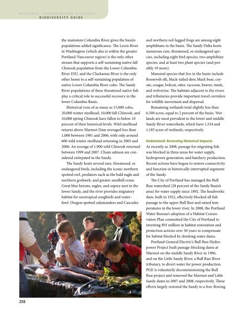
egional conservation strategybiodiversity guideAppendix I Watershedsthe mainstem Columbia River gives the basin’spopulations added significance. <strong>The</strong> Lewis Riverin Washington (which also is within the greaterPortland-Vancouver region) is the only otherstream that supports a self-sustaining native fallChinook population from the Lower ColumbiaRiver ESU, and the Clackamas River is the onlyother home to a self-sustaining population ofnative Lower Columbia River coho. <strong>The</strong> SandyRiver populations of these threatened native fishplay a critical role to successful recovery in thelower Columbia Basin.Historical runs of as many as 15,000 coho,20,000 winter steelhead, 10,000 fall Chinook, and10,000 spring Chinook have fallen to below 10percent of their historical levels. Wild steelheadreturns above Marmot Dam averaged less than1,000 between 1981 and 2006, with only around600 wild winter steelhead returning in 2005 and2006. An average of 1,900 wild Chinook returnedbetween 1999 and 2007. Chum salmon are consideredextirpated in the Sandy.<strong>The</strong> Sandy hosts several rare, threatened, orendangered birds, including the iconic northernspotted owl, predators such as the bald eagle andnorthern goshawk, and greater sandhill crane.Great blue herons, eagles, and osprey nest in thelower Sandy, and the river provides migratoryhabitat for neotropical songbirds and waterfowl.Oregon spotted salamanders and Cascadesand northern red-legged frogs are among eightamphibians in the basin. <strong>The</strong> Sandy Delta hostsnumerous rare, threatened, or endangered species,including eight bird species, two amphibianspecies, and at least two plant species (and possibly19 more).Mammal species that live in the basin includeRoosevelt elk, black-tailed deer, black bear, coyote,cougar, bobcat, otter, raccoon, beaver, mink,and wolverine. <strong>The</strong> habitats adjacent to the riversand tributaries provide important travel corridorsfor wildlife movement and dispersal.Remaining wetlands total slightly less than6,500 acres, equal to 2 percent of the basin. Wetlandsare most prevalent in the lower and middleSandy River watersheds, which have 1,534 and1,185 acres of wetlands, respectively.Undammed: Reversing Historical ImpactsAs recently as 2008, passage for migrating fishwas blocked in three areas for water supply,hydropower generation, and hatchery production.Recent actions have begun to restore connectivityand function in historically interrupted segmentsof the Sandy.<strong>The</strong> City of Portland has managed the BullRun watershed (28 percent of the Sandy Basin’sarea) for water supply since 1892. <strong>The</strong> headworksdam, built in 1922, effectively blocked all fishpassage to the upper Bull Run and raised temperaturesin the lower river. In 2008, the PortlandWater Bureau’s adoption of a Habitat ConservationPlan committed the City of Portland toinvesting $93 million in habitat restoration andprotection actions over 50 years to compensatefor habitat blocked by drinking water dams.Portland General Electric’s Bull Run HydropowerProject built passage-blocking dams atMarmot on the middle Sandy River in 1906,and on the Little Sandy River, a Bull Run Rivertributary, to divert water for power production.PGE is voluntarily decommissioning the BullRun project and removed the Marmot and LittleSandy dams in 2007 and 2008, respectively. <strong>The</strong>seefforts largely restored the Sandy to a free-flowingcondition, from the headwaters to the river’sconfluence with the Columbia River.Until 2010, when a program began to passwild fish, a state fish hatchery blocked passage forwild fish to the upper 10 miles of on Cedar Creek.On the Sandy Delta, a small dam constructed in1932 separates about 1 mile of the historical mainchannel to the northeast from the current mainchannel. This dam is scheduled for removal incoming years.Important ThreatsHatchery FishMarmot Dam allowed separation of wild andhatchery fish. Since its removal, the percentage ofhatchery-origin spawners has increased dramatically.In 2010, 70 percent of surveyed spawners onaverage were hatchery fish, and in some streamsthe number was 100 percent in some streams; thisfar exceeds the Oregon Department of Fish andWildlife’s target of 10 percent.Stream TemperatureStream shading is generally good in the middleand upper reaches of the Sandy River. Agriculturaland residential development activities havealtered or disturbed riparian habitat areas. <strong>The</strong>effects of those alterations are particularly markedin the lower river: TMDLs are in place for temperatureon the lower Sandy mainstem, GordonCreek, and Beaver Creek (which also has a TMDLfor bacteria).Invasive SpeciesNoxious weeds occur throughout much of theSandy Basin. Japanese and giant knotweed,English and Irish ivy, Scot’s broom, Himalayanblackberry, garlic mustard, and butterfly bush allcolonize riparian areas disturbed by logging ordevelopment and are widespread in the basin.Degraded Stream ReachesFollowing a large flood in 1964, the U.S. ArmyCorps of Engineers and local communities joinedefforts to channelize parts of the Salmon, Zigzag,and Sandy rivers and Still Creek. <strong>The</strong> workaffected the timing, variability, and duration offloodplain and wetland inundation in the areaand led to loss of spawning gravel from somereaches. <strong>The</strong> now degraded reaches were especiallyimportant for winter-rearing juvenile steelheadand Chinook salmon.Alteration of stream channels also alterednative vegetation in riparian areas. On the SandyDelta and elsewhere, wetlands were drained andfilled and forests cleared for agricultural production.Alteration of Columbia River flows forhydropower production also largely eliminatedWhat Are the Important Protected Areas?<strong>The</strong> Sandy Basin incorporates portions of theColumbia Gorge Scenic Area (at the Sandy Delta),state and federal wild and scenic waterways,federal wilderness, and numerous county, city,and Metro parks. More than 58 miles of streamswithin the basin are designated wild, scenic, orrecreational under the federal Wild and ScenicRivers Act; together, these designations protect18,626 acres of land within these corridors. <strong>The</strong>lower Sandy River Gorge is one of the great conservedareas near a major metropolitan region.Protection of the lower Sandy began in 1970when the Diack family donated 156 acres to <strong>The</strong>Nature Conservancy. A 12.5-mile segment of theSandy from Dodge Park downstream to DabneyState Recreation Area was designated a federalWild and Scenic River and a State Scenic Waterwayin 1972, and 58.4 stream miles in the basinwere designated wild, scenic, or recreational in1988 under the Wild and Scenic Rivers Act. Since1995, Metro has acquired 1,300 acres of naturalareas in the lower Sandy, adding to nearly 500acres owned by <strong>The</strong> Nature Conservancy andabout 14,000 acres owned by the BLM. Metro alsomanages the 1,200-acre Oxbow regional park,which is used for fishing, camping, and hiking,and education. Other state, municipal, andcounty parks are spread throughout the SandyBasin, from Lewis and Clark State Park near themouth to the upper tributaries.Land transfers associated with the decommissioningof Marmot Dam in the middle Sandyadded 1,500 acres to BLM’s landholdings that willbe managed as a BLM Area of Critical EnvironmentalConcern.258 259

