Ajax Transportation Master Plan Update - Town of Ajax
Ajax Transportation Master Plan Update - Town of Ajax
Ajax Transportation Master Plan Update - Town of Ajax
- No tags were found...

Create successful ePaper yourself
Turn your PDF publications into a flip-book with our unique Google optimized e-Paper software.
<strong>Ajax</strong> <strong>Transportation</strong> <strong>Master</strong> <strong>Plan</strong> <strong>Update</strong><strong>Town</strong> <strong>of</strong> <strong>Ajax</strong> <strong>Plan</strong>ningand Development Services®
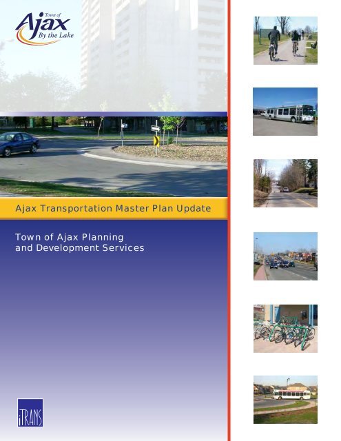
<strong>Town</strong> <strong>of</strong> <strong>Ajax</strong><strong>Transportation</strong> <strong>Master</strong> <strong>Plan</strong> <strong>Update</strong>Final Report<strong>Ajax</strong>, OntarioDecember 2007iTRANS Consulting Inc.100 York Blvd., Suite 300Richmond Hill, ON L4B 1J8Tel: (905) 882-4100Fax: (905) 882-1557Email: itrans@itransconsulting.comwww.itransconsulting.comProject # 3665
<strong>Town</strong> <strong>of</strong> <strong>Ajax</strong><strong>Transportation</strong> <strong>Master</strong> <strong>Plan</strong> <strong>Update</strong>Final ReportClient Project TeamProject ManagerAngela Gibson, MSc.Pl., MCIP, RPP<strong>Plan</strong>ning and DevelopmentiTRANS Project TeamPrincipalProject ManagerTechnical TeamTyrone Gan, P.Eng.Suzette Shiu, P.Eng.Steve Molloy, BARudy Sooklall, M.A.Sc.December 2007iTRANS
<strong>Town</strong> <strong>of</strong> <strong>Ajax</strong><strong>Transportation</strong> <strong>Master</strong> <strong>Plan</strong> <strong>Update</strong>Final ReportEXECUTIVE SUMMARYA. IntroductionIn 2000, the <strong>Town</strong> <strong>of</strong> <strong>Ajax</strong> approved its first <strong>Transportation</strong> <strong>Master</strong> <strong>Plan</strong> (TMP) to addressthe transportation requirements up to 2021, which coincided with the build-out <strong>of</strong> <strong>Ajax</strong>within its urban boundary. With recent legislative changes to growth, regional policy changesand recent development activity within the <strong>Town</strong>, an update <strong>of</strong> the TMP was required toaddress transportation needs for the 2021, 2026 and 2031 horizon years.Since the preparation <strong>of</strong> the 2000 <strong>Master</strong> <strong>Transportation</strong> Study, many key assumptions havechanged and new information is available:• Land use assumptions have been updated across Durham Region.• Provincial planning initiatives provide the broad planning context for the transportationmaster plan – Growth <strong>Plan</strong> for the Greater Golden Horseshoe and legislation such as theGreenbelt Act 2005 and Places to Grow Act 2005.• The 2003 Durham Region <strong>Transportation</strong> <strong>Master</strong> <strong>Plan</strong> which adopts a vision <strong>of</strong> abalanced road and transit infrastructure investment strategy will provide an overallregional transportation context for <strong>Ajax</strong>’s transportation master plan.• At the provincial level, MTO has carried out transportation planning studies for CentralOntario, which provides a GTA context. iTRANS has had a major role in this recentwork for the MTO, in inter-regional transit planning (Transit Protection Study for 400-Series Corridors), HOV planning (HOV Study for Central Ontario), and goodsmovement (Goods Movement in Central Ontario: Trends and Issues).B. Problem StatementBased on traffic forecasts and analysis <strong>of</strong> existing and future conditions, the transportationchallenges for <strong>Ajax</strong> are summarized below:• <strong>Ajax</strong> occupies a central location in Durham Region, and is therefore affected by overallgrowth in Durham Region. A large portion <strong>of</strong> traffic on the east-west arterial corridors in<strong>Ajax</strong> is through traffic originating and/or destined to other municipalities in the Regionand the GTA. As the Region and the <strong>Town</strong> grow, through traffic and traffic generated by<strong>Ajax</strong> will further increase.• Arterial roads in <strong>Ajax</strong> experience capacity and congestion problems today. Congestion onarterial roads also leads to traffic spilling over onto residential collector roads, raisingresidents concerns over traffic infiltration, safety, and speeding in residential areas.• Rapid population and employment growth are projected for the <strong>Town</strong> <strong>of</strong> <strong>Ajax</strong>. The<strong>Town</strong>’s population is projected to increase by 52% from 88,800 persons to 135,200persons in 2031. Employment is projected to increase by 117% from 26,150 jobs to56,900 jobs in 2031.December 2007 i iTRANS
<strong>Town</strong> <strong>of</strong> <strong>Ajax</strong><strong>Transportation</strong> <strong>Master</strong> <strong>Plan</strong> <strong>Update</strong>Final Report• <strong>Transportation</strong> requirements are closely related to economic activity. In economic terms,however, transportation is a “diseconomy” factor, meaning that the increase in cost <strong>of</strong>transportation is directly related to increases in cost <strong>of</strong> purchasing goods and services,and is subsequently passed onto consumers. Traffic congestion and delays will negativelyaffect the <strong>Town</strong>’s economic well-being and competitiveness.• Improved connectivity <strong>of</strong> pedestrian sidewalks and multi-use pathways are needed toencourage alternative modes <strong>of</strong> transportation.• Despite transit and road improvement strategies developed by the Region <strong>of</strong> Durham andthe <strong>Town</strong>, there will likely be some ongoing traffic congestion within the <strong>Town</strong> unlessnew strategies are developed. Although traffic congestion will not be completelyeliminated, it can be managed better.• The role and function <strong>of</strong> Harwood Avenue and Bayly Street through Downtown <strong>Ajax</strong> isgradually changing from strictly an arterial road function serving commuter throughtraffic to an urban street serving Downtown <strong>Ajax</strong>, with characteristics similar to otherdowntown streets – pedestrian-oriented, lower vehicular speeds, and closer intersectionspacings.• Environmental sustainability is becoming increasingly important for residents <strong>of</strong> <strong>Ajax</strong> – asustainable transportation system that promotes alternative modes <strong>of</strong> travel, supports landuses and development that are transit-supportive, and reduces the environmental impacts<strong>of</strong> transportation users and <strong>of</strong> transportation facilities.Based on the Problem Statement, we can conclude that the economic well-being <strong>of</strong> the <strong>Town</strong>,the provision <strong>of</strong> transportation choices for the residents <strong>of</strong> <strong>Ajax</strong>, and the management <strong>of</strong>transportation demand and congestion will require a sustainable transportation strategy thatintegrates transportation and land use planning, and encourages all modes <strong>of</strong> travel(carpooling, cycling, walking, and public transit).C. <strong>Transportation</strong> AlternativesLong-term strategic improvement options were considered to address future travel demandswithin <strong>Ajax</strong>, to support planning objectives, and to accommodate planned growth asexpressed in the Problem Statement.Alternative 1 – “Do Nothing”The “Do Nothing” strategy reflects the current condition <strong>of</strong> the roadway and transit networkscarried over to 2031 without any capacity improvements. There are no expansions oradditions to the arterial road network or the Provincial highway system. The transportationnetwork reflects the 2007 status quo.December 2007 ii iTRANS
<strong>Town</strong> <strong>of</strong> <strong>Ajax</strong><strong>Transportation</strong> <strong>Master</strong> <strong>Plan</strong> <strong>Update</strong>Final ReportAlternative 2 – Current <strong>Plan</strong>ning PathAlternative 2 is based on the transportation improvements in the <strong>Town</strong>’s 2007-2011 CapitalWorks Program, transit recommendations <strong>of</strong> the Durham Region Transit Improvement <strong>Plan</strong>(2003) and Transit Service Strategy (2005), the recommendations <strong>of</strong> the 2003 DurhamRegion <strong>Transportation</strong> <strong>Master</strong> <strong>Plan</strong>, the <strong>Ajax</strong> Development Charge (DC) study, and theCapital Projects work plan. The recommendations include extensive roadway and transitinfrastructure investments.Alternative 3 – Increase Road Network CapacityAlternative 3 builds upon the planned network in Alternative 2 with added infrastructure toprovide additional north-south network capacity at Highway 401 and east-west capacity atChurch Street that have been previously identified in other studies or plans. These networkadditions include, but are not limited to, the Audley Road and Notion Road crossings <strong>of</strong>Highway 401, Clements Road extension, and the completion <strong>of</strong> a 4-lane arterial roadnetwork.Alternative 4 – Proactive Multi-Modal StrategyThe Proactive Multi-modal Strategy includes the public transit improvements listed inAlternative 2 and envisions future road network infrastructure investments with a primaryfocus on transit and transit-dedicated facilities, <strong>Transportation</strong> Demand Management, cyclingand walking.D. Evaluation <strong>of</strong> AlternativesThe performance and impact <strong>of</strong> the <strong>Transportation</strong> <strong>Plan</strong>ning Alternatives were evaluatedusing a consistent set <strong>of</strong> evaluation criteria. They reflect community goals and objectives,and Regional and Provincial growth objectives. The six evaluation criteria were:1. Supporting sustainable development, compatibility with Official <strong>Plan</strong> goals.2. Providing high level <strong>of</strong> service on multi-modal transportation network.3. Socio-economic impact, support for economic development, industry and economicgrowth.4. Impact on natural environment and air quality.5. Public support.6. Capital cost.Based on the evaluation <strong>of</strong> the alternatives, the recommended long-term transportationstrategy for the <strong>Town</strong> <strong>of</strong> <strong>Ajax</strong> is Alternative 4 Proactive Multi-Modal Strategy.December 2007 iii iTRANS
<strong>Town</strong> <strong>of</strong> <strong>Ajax</strong><strong>Transportation</strong> <strong>Master</strong> <strong>Plan</strong> <strong>Update</strong>Final ReportThe key advantages <strong>of</strong> the preferred alternative are that it <strong>of</strong>fers the best opportunity to:• Support sustainable development and intensification policies• Provide an array <strong>of</strong> travel choices• Increase transit trips and reduce auto trips• Minimize congestion and the cost <strong>of</strong> congestion• Promote alternative travel modes and choices• Support goods movement and access to employment areasAlthough one <strong>of</strong> the more expensive strategies in terms <strong>of</strong> capital costs, Alternative 4 is theonly option that represents a sustainable, long-term transportation strategy for <strong>Ajax</strong>. It willmanage and reduce the growth in traffic congestion by proactively encouraging travel byother modes and making these other modes (in particular public transit) more attractive.E. Recommended <strong>Transportation</strong> <strong>Plan</strong> and StrategyLand Use and Sustainable DesignImplementation <strong>of</strong> the intensification directives and policies set out in the Provincial Growth<strong>Plan</strong> are the essential prerequisites for changing travel patterns, modal choices and theenvironmental conservation that are part <strong>of</strong> the recommended transportation strategy.The Regional TMP recognizes and supports the growth management framework in theRegional OP which promotes a more compact urban form, higher intensity and mixed-usenodes, linkages for pedestrians, cyclists and transit. The Regional TMP recommends thedevelopment <strong>of</strong> a detailed TDM-supportive Land Use Guideline to implement these land usepolicies and a Development Application Checklist to ensure proposed plans consider theguidelines, OP policies and the TMP.Intensification <strong>of</strong> the Kingston Road corridor will attract high density, transit-orienteddevelopment that encourages higher transit usage, lower auto dependency, and walking andcycling. In turn, it will reduce reliance on auto travel and relieve accompanying trafficpressures. To maximize the benefits <strong>of</strong> high density development along major corridors andimprove quality <strong>of</strong> living in low density residential areas, development planning and designprinciples should follow the Transit-Supportive guidelines prepared by the Province <strong>of</strong>Ontario.The <strong>Town</strong> should also protect designated Employment Lands for employment-baseddevelopment. Attracting jobs to the <strong>Town</strong> <strong>of</strong> <strong>Ajax</strong> will provide residents with localemployment choices that allow for shorter commutes and non-auto commutes.December 2007 iv iTRANS
<strong>Town</strong> <strong>of</strong> <strong>Ajax</strong><strong>Transportation</strong> <strong>Master</strong> <strong>Plan</strong> <strong>Update</strong>Final ReportTransitRecommended long-term transit strategy for the <strong>Town</strong> <strong>of</strong> <strong>Ajax</strong> consists <strong>of</strong> GO Transitservices, Durham Region Transit services, Kingston Road bus rapid transit, reserved buslanes and transit priority measures. In addition to the recommendations <strong>of</strong> the DurhamRegion Transit Improvement <strong>Plan</strong> and Transit Service Strategy, we recommend that SalemRoad also be designated as a Transit Spine in the base transit grid to reflect the importance <strong>of</strong>transit service to the developing employment lands and potential for connectivity with theHighway 407 Transitway.GO Transit has plans for extending its rail service easterly to new stations at Courtice andBowmanville. GO Transit has also proposed a bus rapid transit corridor from Oakville toPickering with linkages to the local transit network throughout the corridor and has long-termplans for a future commuter rail service on the CPR line.Bus Rapid Transit is a form <strong>of</strong> transit that combines the flexible service <strong>of</strong> buses and thequality <strong>of</strong> rail in dedicated or general traffic lanes. Durham Regional Transit is exploring busrapid transit on Kingston Road. The initial BRT service would operate on Reserved BusLanes on Kingston Road through most <strong>of</strong> <strong>Ajax</strong>, but with mixed-traffic through PickeringVillage. The ultimate BRT service would operate on an exclusive transitway on KingstonRoadThe planned and recommended 6-lane road widenings on Taunton Road, Bayly Street andWestney Road should be designed for HOV and/or reserved bus lanes for improved transitservice on these corridors. On 4-lane arterials such as Rossland Road, Salem Road, sections<strong>of</strong> Bayly Street and Westney Road, buses would operate in mixed traffic with transit prioritymeasures such as signal pre-emption and queue jumping at key intersections.The recommended transit strategy is presented in Exhibit ES-1.RoadsTo maximize capacity on the existing infrastructure, transportation system managementsolutions should be employed on the major corridors. <strong>Transportation</strong> system managementtools include the implementation <strong>of</strong> technology (Intelligent <strong>Transportation</strong> Systems) such asadaptive signal timings to meet real-time demand, changeable message signs to providedrivers with real-time information, and signal pre-emption for transit and/or emergencyvehicles.The Westney Road / Kingston Road and Salem Road / Kingston Road intersections aregateway intersections for access to and from Highway 401. In addition, Salem Road is thekey access route to new employment areas north <strong>of</strong> Kingston Road. The capacities <strong>of</strong>Westney Road and Salem Road are constrained by the capacities <strong>of</strong> these two intersections.Accordingly, both intersections should be monitored as to their performance, and intersectionimprovements should be implemented when warranted.December 2007 v iTRANS
<strong>Town</strong> <strong>of</strong> <strong>Ajax</strong><strong>Transportation</strong> <strong>Master</strong> <strong>Plan</strong> <strong>Update</strong>Final ReportRecommended improvements to the arterial road network focus on increasing personcapacity rather than single occupant vehicle capacity. Accordingly, the recommendationsemphasize the provision <strong>of</strong> transit lanes lanes or other measures to provide priority for transitvehicles, enhance transit service speeds and transit schedule reliability, support TDM basedride-sharing initiatives and discourage single-occupancy vehicle travel.The recommended road network is illustrated in Exhibit ES-2.December 2007 vi iTRANS
<strong>Town</strong> <strong>of</strong> <strong>Ajax</strong><strong>Transportation</strong> <strong>Master</strong> <strong>Plan</strong> <strong>Update</strong>Final ReportGoods MovementThe movement <strong>of</strong> goods within and through <strong>Ajax</strong> is closely related to the economic wellbeingand competitiveness <strong>of</strong> <strong>Ajax</strong>. Improving congestion and decreasing delays associatedwith the movement <strong>of</strong> goods and services will attract employment development to <strong>Ajax</strong>. Therecommended strategy includes the following:• Promote expansion <strong>of</strong> the Provincial highway network, specifically Highway 401widening. Highway 407 East Extension (with interchanges at Westney Road, Salem Roadand Lake Ridge Road), and the Durham West North-South Link (with interchanges atHighway 7, Taunton Road, Rossland Road, Kingston Road, and Highway 401).• Protect for the future Audley Road and Notion Road crossings <strong>of</strong> Highway 401.• Promote the designation <strong>of</strong> Taunton Road, Lake Ridge Road and Highway 401 as thedesignated goods movement corridors in <strong>Ajax</strong>.• Co-operate with the Region in implementing the use <strong>of</strong> traffic management tools such asCommercial Vehicle Operations (CVO), Intelligent <strong>Transportation</strong> System (ITS), andAdvanced Traffic Management Systems (ATMS).• In co-operation with the Region, assess the need and justification <strong>of</strong> implementing truckpriority lanes such as designated truck routes and dangerous goods movement routes.• Discourage truck traffic on Kingston Road by widening Highway 401 and Taunton Road.Active <strong>Transportation</strong> – Walking and CyclingActive transportation – cycling and walking – have evolved to become a practical, costeffective, environmentally friendly and healthy mode <strong>of</strong> travel for both recreational andutilitarian trips. They are recognized as an integral and necessary part <strong>of</strong> a community’stransportation system as an alternative to motorized travel. The underlining principle usedwhen considering implementation <strong>of</strong> cycling facilities is that, with the exception <strong>of</strong> freeways,all roads are cycling routes. In terms <strong>of</strong> pedestrians, it is vital that communities are designedto encourage walking and provide safe and attractive pedestrian facilities. Linkingneighbourhoods together through a network <strong>of</strong> sidewalks and trails will support walking as aviable transportation mode – an essential element to building healthy communities.Building from the existing and proposed trail network and in cooperation with the Region,the <strong>Town</strong> should develop its own pedestrian and cycling plan. The <strong>Plan</strong> should address thepedestrian and cycling needs for the <strong>Town</strong>, establish a formalized pedestrian and cyclingnetwork, identify connections with the regional network, and outline an implementationschedule. The <strong>Plan</strong> should include:• Recommendations for supportive programs to encourage the participation <strong>of</strong> cycling andwalking• Identification, evaluation and selection <strong>of</strong> pedestrian and cycling routes• Development <strong>of</strong> a maintenance and monitoring program• Development <strong>of</strong> implementation and funding strategies• Recommendations to facilitate safe walking and cycling – i.e. provision <strong>of</strong> painted andilluminated cross-walks• Identification <strong>of</strong> solutions to operational issues• Positive guidelines for cycling, signage and delineation <strong>of</strong> bicycle pathsDecember 2007 ix iTRANS
<strong>Town</strong> <strong>of</strong> <strong>Ajax</strong><strong>Transportation</strong> <strong>Master</strong> <strong>Plan</strong> <strong>Update</strong>Final ReportAll future road widenings or new road construction should have provisions for on-street bikelanes or <strong>of</strong>f-street bike paths. Roadway right-<strong>of</strong>-way should be allocated to bike facilitieswhere possible. We also recommend the <strong>Town</strong> adopt the design specifications provided inOntario Bikeways <strong>Plan</strong>ning and Design Guidelines (MTO, March 1996) and <strong>Transportation</strong>Association <strong>of</strong> Canada (TAC) Bikeway Traffic.In addition, it is recommended that the <strong>Town</strong> prepare child and youth-friendly transportationguidelines that integrate the needs <strong>of</strong> vulnerable road users such as children and youth withinthe <strong>Town</strong>’s <strong>Transportation</strong> <strong>Master</strong> <strong>Plan</strong>. Based on the Child and Youth-Friendly andTransport <strong>Plan</strong>ning Guidelines published in 2005, by the Centre for Sustainable<strong>Transportation</strong>, it is recommended that the <strong>Town</strong> determine the merits <strong>of</strong> putting children andyouth first in land-use and transportation planning, providing for children and youth aspedestrians, providing for children and youth as cyclists, providing for children and youth astransit users and providing for children traveling in school buses in order to meet theobjectives <strong>of</strong> the <strong>Transportation</strong> <strong>Master</strong> <strong>Plan</strong> <strong>Update</strong> <strong>of</strong> providing mobility for all residents.<strong>Transportation</strong> Demand ManagementIn June 2007, the Region <strong>of</strong> Durham endorsed a region-wide <strong>Transportation</strong> DemandManagement (TDM) program – Smart Commute Durham – aimed at promoting sustainablemeans <strong>of</strong> transportation. The program <strong>of</strong>fers pr<strong>of</strong>essional services to employers interested inpromoting carpooling, transit and other sustainable means <strong>of</strong> transportation to theiremployees for commuting purposes. Services <strong>of</strong>fered include:• Performing site assessments and surveys to understand the commuting behaviour <strong>of</strong> eachbusiness’ specific workforce.• Assisting with the development <strong>of</strong> a customized commuting options program for eachworkforce.• Offering exclusive ride-matching programs for employees.• Providing assistance in implementing emergency-ride-home programs; preferentialparking strategies; pedestrian and cycling facilities/services; and alternative workarrangements (such as teleworking – allows people to work away from the <strong>of</strong>fice, whilebeing remotely monitored, compressed work weeks, and flex hours).• Acting as a conduit with Durham Region Transit to examine improved transit services tothe workplace.• Providing workshops, lunch-and-learn sessions and seminars for employees to raiseawareness <strong>of</strong> alternative modes <strong>of</strong> transportation.December 2007 x iTRANS
<strong>Town</strong> <strong>of</strong> <strong>Ajax</strong><strong>Transportation</strong> <strong>Master</strong> <strong>Plan</strong> <strong>Update</strong>Final ReportWe recommend the <strong>Town</strong> <strong>of</strong> <strong>Ajax</strong> develop a <strong>Transportation</strong> Demand Management <strong>Master</strong><strong>Plan</strong> to address:• Development <strong>of</strong> an effective <strong>Town</strong>-wide promotion plan.• Development <strong>of</strong> a “TDM culture” for <strong>Ajax</strong>, including the consistent application <strong>of</strong> TDMprinciples within the <strong>Town</strong>’s administration processes. This should include: Reviewing and modifying transit, cycling and pedestrian-related Official <strong>Plan</strong> policiesto acknowledge their important role in <strong>Town</strong>-wide travel demand management.Reviewing and modifying site design guidelines, traffic impact study requirementsand site plan approval process to encourage applicants to adopt TDM initiatives.• Development <strong>of</strong> TDM supportive parking policy such as paid parking, shared parkingand other parking management strategies.Timing and FundingImprovements to Arterial roads and Collector roads are under the jurisdiction <strong>of</strong> the Regionand the <strong>Town</strong>. Improvements triggered by growth within the <strong>Town</strong> are eligible for fundingthrough <strong>Town</strong>’s Development Charge (DC) and the Regional Development Charge by-law.As identified in the <strong>Ajax</strong> 2003 DC Background Study, all internal subdivision roads are theresponsibility <strong>of</strong> the developer. All other road capacity expansions are potentially eligible fordevelopment charges. Expansion <strong>of</strong> pedestrian facilities, multi-use paths are also eligible forfunding through development charges.The <strong>Town</strong> <strong>of</strong> <strong>Ajax</strong> will be initiating an update <strong>of</strong> the DC program which will reflect therecommendations and improvements in this <strong>Transportation</strong> <strong>Master</strong> <strong>Plan</strong> as well asimprovement priorities.December 2007 xi iTRANS
<strong>Town</strong> <strong>of</strong> <strong>Ajax</strong><strong>Transportation</strong> <strong>Master</strong> <strong>Plan</strong> <strong>Update</strong>Final ReportTABLE OF CONTENTSExecutive Summary................................................................................................................. i1. Introduction ................................................................................................................... 11.1 <strong>Transportation</strong> <strong>Master</strong> <strong>Plan</strong> and Environmental Assessment Process................... 11.2 Study Organization ................................................................................................ 22. Background Documents................................................................................................ 32.1 <strong>Town</strong> and Regional Official <strong>Plan</strong>s......................................................................... 32.1.1 <strong>Town</strong> <strong>of</strong> <strong>Ajax</strong> Official <strong>Plan</strong>.......................................................................... 32.1.2 Region <strong>of</strong> Durham Official <strong>Plan</strong> .................................................................. 62.2 <strong>Town</strong> <strong>of</strong> <strong>Ajax</strong> Strategic <strong>Plan</strong>.................................................................................. 82.3 <strong>Transportation</strong> <strong>Master</strong> <strong>Plan</strong>s.................................................................................. 82.3.1 <strong>Town</strong> <strong>of</strong> <strong>Ajax</strong> <strong>Master</strong> <strong>Transportation</strong> Study, 2000 ...................................... 82.3.2 Region <strong>of</strong> Durham <strong>Transportation</strong> <strong>Master</strong> <strong>Plan</strong>......................................... 112.4 Regional Arterial Corridor Guidelines ................................................................ 133. Background.................................................................................................................. 173.1 Demographic Pr<strong>of</strong>ile............................................................................................ 173.2 Travel Demand .................................................................................................... 173.2.1 Total Trips.................................................................................................. 173.2.2 Origin-Destination Patterns........................................................................ 183.2.3 Mode <strong>of</strong> Travel........................................................................................... 193.2.4 Trip Purpose............................................................................................... 204. Existing Conditions ..................................................................................................... 214.1 Road Network...................................................................................................... 214.2 Traffic Control..................................................................................................... 294.3 Existing Traffic Volumes .................................................................................... 314.3.1 Existing Capacity Constraints.................................................................... 334.4 Transit Services ................................................................................................... 374.4.1 Durham Region Transit.............................................................................. 374.4.2 GO Transit.................................................................................................. 374.5 Active <strong>Transportation</strong> Network ........................................................................... 395. Downtown Subarea ..................................................................................................... 425.1 Traffic .................................................................................................................. 425.2 Transit.................................................................................................................. 425.3 Parking................................................................................................................. 465.4 Downtown Active <strong>Transportation</strong> Network ........................................................ 496. Future Travel Demand ............................................................................................... 506.1 Land Use.............................................................................................................. 506.1.1 Durham Region Forecasts.......................................................................... 506.1.2 <strong>Town</strong> <strong>of</strong> <strong>Ajax</strong> Projections .......................................................................... 516.1.3 <strong>Ajax</strong> TMP Land Use Forecasts .................................................................. 526.2 Future Traffic Volumes ....................................................................................... 536.2.1 Future Traffic Deficiencies ........................................................................ 546.2.2 Future Traffic Demand on <strong>Plan</strong>ned Network............................................. 566.3 Problem Statement............................................................................................... 59December 2007 xii iTRANS
<strong>Town</strong> <strong>of</strong> <strong>Ajax</strong><strong>Transportation</strong> <strong>Master</strong> <strong>Plan</strong> <strong>Update</strong>Final Report7. <strong>Transportation</strong> Alternatives....................................................................................... 607.1 Alternative 1 – “Do Nothing”.............................................................................. 607.2 Alternative 2 – Current <strong>Plan</strong>ning Path................................................................. 607.3 Alternative 3 – Increase Road Network Capacity ............................................... 627.4 Alternative 4 – Proactive Multi-Modal Strategy ................................................. 658. Evaluation <strong>of</strong> Alternatives .......................................................................................... 679. Recommended <strong>Transportation</strong> <strong>Plan</strong> and Strategy................................................... 709.1 Land Use and Sustainable Design ....................................................................... 709.2 Transit.................................................................................................................. 719.3 Roads ................................................................................................................... 739.3.1 <strong>Transportation</strong> System Management.......................................................... 739.3.2 Network...................................................................................................... 739.3.3 Road Classification .................................................................................... 779.4 Goods Movement................................................................................................. 809.5 Active <strong>Transportation</strong> – Walking and Cycling.................................................... 809.6 <strong>Transportation</strong> Demand Management ................................................................. 819.7 Timing and Funding ............................................................................................ 82AppendicesA. Glossary <strong>of</strong> TermsB. Public ConsultationC. Durham Region OP including Amendment 114D. Durham Region OP Recommended Land UseE. <strong>Ajax</strong> TMP Population and Employment ForecastsF. Travel Demand ForecastsDecember 2007 xiii iTRANS
<strong>Town</strong> <strong>of</strong> <strong>Ajax</strong><strong>Transportation</strong> <strong>Master</strong> <strong>Plan</strong> <strong>Update</strong>Final ReportTablesTable 1: Recommended Timing for Road Improvements (as per 2000 TMP)......................... 9Table 2: Arterial Road Classification (Schedule E, Table E7 <strong>of</strong> ROPA 114) ........................ 14Table 3: <strong>Ajax</strong>’s Population by Age Group ............................................................................. 17Table 4: Breakdown <strong>of</strong> Total Trips from 1986 to 2001.......................................................... 17Table 5: Origin – Destination Trends for AM Peak Period.................................................... 18Table 6: <strong>Transportation</strong> Mode – Trips Originating from <strong>Ajax</strong> ............................................... 19Table 7: <strong>Transportation</strong> Mode – Trips Destined to <strong>Ajax</strong>........................................................ 19Table 8: Trip Purpose – Trips made by Residents <strong>of</strong> <strong>Ajax</strong>..................................................... 20Table 9: Signalized Intersections in <strong>Ajax</strong> ............................................................................... 29Table 10: Traffic Count Summary.......................................................................................... 31Table 11: 2006 Existing Screenline Summary........................................................................ 35Table 12: Summary <strong>of</strong> Durham Region Transit Headways.................................................... 37Table 13: Summary <strong>of</strong> GO Transit Headways........................................................................ 39Table 14: Downtown Peak Parking Demand by Zone............................................................ 46Table 15: Downtown Parking Projections .............................................................................. 47Table 16: Land Use Summary – Durham Region Forecasts................................................... 51Table 17: Population and Employment for <strong>Ajax</strong> .................................................................... 52Table 18: Land Use Forecasts for <strong>Ajax</strong> TMP Study............................................................... 53Table 19: Future Travel Demand on Existing Road Network ................................................ 55Table 20: Future PM Travel Demand on “<strong>Plan</strong>ned Network”................................................ 58Table 21: Evaluation Criteria.................................................................................................. 67Table 22: Evaluation <strong>of</strong> <strong>Plan</strong>ning Alternatives....................................................................... 68December 2007 xiv iTRANS
<strong>Town</strong> <strong>of</strong> <strong>Ajax</strong><strong>Transportation</strong> <strong>Master</strong> <strong>Plan</strong> <strong>Update</strong>Final ReportExhibitsExhibit 1: <strong>Town</strong> <strong>of</strong> <strong>Ajax</strong> OP – Schedule C <strong>Transportation</strong> ...................................................... 5Exhibit 2: Region <strong>of</strong> Durham OP – Map B2 <strong>Transportation</strong> System ....................................... 7Exhibit 3: Existing Road Network.......................................................................................... 22Exhibit 4: Intersection Controls in the <strong>Town</strong> <strong>of</strong> <strong>Ajax</strong>............................................................. 30Exhibit 5: Screenline Locations.............................................................................................. 34Exhibit 6: Existing Capacity Constraints................................................................................ 36Exhibit 7: Durham Region Transit – <strong>Ajax</strong> Transit Routes ..................................................... 38Exhibit 8: Recreational Trails in the <strong>Town</strong> <strong>of</strong> <strong>Ajax</strong>................................................................ 40Exhibit 9: Regional Trails....................................................................................................... 41Exhibit 10: Downtown Subarea .............................................................................................. 43Exhibit 11: Downtown Lane Configurations.......................................................................... 44Exhibit 12: Downtown Link Traffic Volumes........................................................................ 45Exhibit 13: Downtown Parking Zones.................................................................................... 48Exhibit 14: Alternative 2 – Current <strong>Plan</strong>ning Path ................................................................. 63Exhibit 15: Alternative 3 – Increase Road Network Capacity................................................ 64Exhibit 16: Alternative 4 – Proactive Multi-modal Strategy.................................................. 66Exhibit 17: Recommended Transit Strategy........................................................................... 72Exhibit 18: Recommended Road Strategy.............................................................................. 76December 2007 xv iTRANS
<strong>Town</strong> <strong>of</strong> <strong>Ajax</strong><strong>Transportation</strong> <strong>Master</strong> <strong>Plan</strong> <strong>Update</strong>Final Report1. INTRODUCTIONIn 2000, the <strong>Town</strong> <strong>of</strong> <strong>Ajax</strong> approved its first <strong>Transportation</strong> <strong>Master</strong> <strong>Plan</strong> (TMP) to addressthe transportation requirements up to 2021, which coincided with the build-out <strong>of</strong> <strong>Ajax</strong>within its urban boundary. With recent legislative changes to growth, regional policy changesand recent development activity within the <strong>Town</strong>, an update <strong>of</strong> the TMP was required toaddress transportation needs for the 2021, 2026 and 2031 horizon years.Since the preparation <strong>of</strong> the 2000 <strong>Master</strong> <strong>Transportation</strong> Study, many key assumptions havechanged and new information is available:• Land use assumptions have been updated across Durham Region.• Provincial planning initiatives provide the broad planning context for the transportationmaster plan – Growth <strong>Plan</strong> for the Greater Golden Horseshoe and legislation such as theGreenbelt Act 2005 and Places to Grow Act 2005.• The 2003 Durham Region <strong>Transportation</strong> <strong>Master</strong> <strong>Plan</strong> which adopts a vision <strong>of</strong> abalanced road and transit infrastructure investment strategy will provide an overallregional transportation context for <strong>Ajax</strong>’s transportation master plan.• At the provincial level, MTO has carried out transportation planning studies for CentralOntario, which provides a GTA context. iTRANS has had a major role in this recentwork for the MTO, in inter-regional transit planning (Transit Protection Study for 400-Series Corridors), HOV planning (HOV Study for Central Ontario), and goodsmovement (Goods Movement in Central Ontario: Trends and Issues).1.1 <strong>Transportation</strong> <strong>Master</strong> <strong>Plan</strong> and EnvironmentalAssessment ProcessThe <strong>Ajax</strong> <strong>Transportation</strong> <strong>Master</strong> <strong>Plan</strong> has been conducted in accordance with the masterplanning process outlined in the Municipal Class Environmental Assessment process (June2000) as approved by the Minister <strong>of</strong> the Environment.The <strong>Ajax</strong> TMP study process addresses Phase 1 and Phase 2 <strong>of</strong> the environmental assessmentprocess. Phase 1 defines the problem or opportunity while Phase 2 identifies alternativesolutions, considers the full range <strong>of</strong> environmental implications <strong>of</strong> each solution, consultswith the public and affected agencies, and selects the preferred solution.Public consultation was designed to:• Provide information to the public as a basis for engaging in active dialogue with thepublic and ensuring public participation.• Seek the public’s input on the identification <strong>of</strong> issues, the development <strong>of</strong> alternativesolutions, and the selection <strong>of</strong> the preferred alternative.• Ensure that the plan has general support from the community.December 2007 1 iTRANS
<strong>Town</strong> <strong>of</strong> <strong>Ajax</strong><strong>Transportation</strong> <strong>Master</strong> <strong>Plan</strong> <strong>Update</strong>Final ReportPublic consultation in this study has involved:• Public notices <strong>of</strong> study commencement and <strong>of</strong> public open houses.• References to the study through the <strong>Town</strong> <strong>of</strong> <strong>Ajax</strong> web site.• Two public open houses held at <strong>Ajax</strong> <strong>Town</strong> Hall on April 26 th , 2007 and October 29 th ,2007.• Public meeting held at the Community Affairs and <strong>Plan</strong>ning Committee meeting onNovember 19, 2007.• Project website with a designated e-mail address.Details on the public consultation process are provided in Appendix B.1.2 Study OrganizationThe study was coordinated by Angela Gibson, Senior <strong>Transportation</strong> <strong>Plan</strong>ner for the <strong>Town</strong> <strong>of</strong><strong>Ajax</strong>.The Technical Advisory Committee consisted <strong>of</strong> the representatives <strong>of</strong> the followingagencies and departments:• <strong>Town</strong> <strong>of</strong> <strong>Ajax</strong> <strong>Plan</strong>ning Department• <strong>Town</strong> <strong>of</strong> <strong>Ajax</strong> Engineering Department• <strong>Town</strong> <strong>of</strong> <strong>Ajax</strong> Finance Department• Region <strong>of</strong> Durham Works• Region <strong>of</strong> Durham <strong>Plan</strong>ning• <strong>Town</strong> <strong>of</strong> Whitby Public Works• City <strong>of</strong> Pickering• GO Transit• Durham Region Transit• Ministry <strong>of</strong> <strong>Transportation</strong>December 2007 2 iTRANS
<strong>Town</strong> <strong>of</strong> <strong>Ajax</strong><strong>Transportation</strong> <strong>Master</strong> <strong>Plan</strong> <strong>Update</strong>Final Report2. BACKGROUND DOCUMENTS2.1 <strong>Town</strong> and Regional Official <strong>Plan</strong>sThe <strong>of</strong>ficial plan policies for the <strong>Town</strong> <strong>of</strong> <strong>Ajax</strong> and the Region <strong>of</strong> Durham were reviewed toassess municipal and regional objectives relevant to the study area.2.1.1 <strong>Town</strong> <strong>of</strong> <strong>Ajax</strong> Official <strong>Plan</strong>The <strong>Town</strong> <strong>of</strong> <strong>Ajax</strong> Official <strong>Plan</strong> provides policies, guidelines, and regulations for shaping thegrowth and development <strong>of</strong> the <strong>Town</strong>. The plan is based upon fundamental principles thatpromote protection <strong>of</strong> the natural heritage system, sustainable development, and healthycommunities.Relevant transportation-related goals and objectives under these principles in the <strong>Town</strong> <strong>of</strong><strong>Ajax</strong> Official <strong>Plan</strong> include:4.1.1 (a) Establish an integrated transportation system that safely and efficientlyaccommodates various modes <strong>of</strong> transportation including trains,automobiles, trucks, public transit, cycling, and walking.4.1.1 (c) Protect transportation corridors, including GO Rail stations that willfacilitate the development <strong>of</strong> a transportation system compatible withand supportive <strong>of</strong> existing and future land uses and is sensitive toenvironmental features.4.1.1 (e) Ensure that the transportation facilities, including public transit,required to serve the needs <strong>of</strong> the local residents are planned, or are inplace prior to, development.Schedule C <strong>of</strong> the <strong>Town</strong>’s Official <strong>Plan</strong> is shown in Exhibit 1. The <strong>Town</strong>’s Official <strong>Plan</strong> alsodefines the transportation system in terms <strong>of</strong> identifying roadways for future expansion,modifications, or speed reduction measures:4.1.2 (a) The transportation system consists <strong>of</strong> Highway 401 and interchanges,roads, railways, grade separations, inter-regional transit lines, GORail station, and two Regional Transit Spines, one along Highway 2and one along Taunton Road.4.1.4 (b) The <strong>Town</strong>, in consultation with the Region and the Province, will planfor the eventual construction <strong>of</strong> the future interchanges, in particular,the development <strong>of</strong> interchanges on Highway 401 at Carruthers CreekDrive (formerly Pickering Beach Road) and Lake Ridge Road.December 2007 3 iTRANS
<strong>Town</strong> <strong>of</strong> <strong>Ajax</strong><strong>Transportation</strong> <strong>Master</strong> <strong>Plan</strong> <strong>Update</strong>Final Report4.1.5 (b) Harwood Avenue shall serve as the <strong>Town</strong>’s ceremonial route from theLake Ontario waterfront to Taunton Road. It shall have a 36 metreright-<strong>of</strong>-way and an enhanced streetscape treatment including alandscaped centre median.4.1.5 (d) Certain Type ‘C’ Arterial Roads may be controlled by the <strong>Town</strong> bymeasures to reduce speeding and traffic operations withoutcompromising continuous movement and, therefore, these roads mayfunction in a similar way to Collector Roads. These roads include:- Audley Road South, south <strong>of</strong> Bayly Street East- Delaney Drive between Riverside Drive and Westney Road North- Elizabeth Street/Riverside Drive between Kingston Road West andRossland Road West- The East/West mid block road between Rossland Road and TauntonRoad, extending from new Harwood Avenue to the <strong>Ajax</strong>/PickeringMunicipal Boundary.Of note are several proposed roadway projects which are listed in the Official <strong>Plan</strong> asOutstanding Deferrals pending the outcome <strong>of</strong> the Durham Mobility Study. 1D3D4D5D6D7Designation <strong>of</strong> Clements Road, westerly from Green Court as a FutureType ‘C’ Arterial Road, pending the outcome <strong>of</strong> the Durham MobilityStudy.Designation <strong>of</strong> Lake Driveway East, as a Type ‘C’ Arterial Road,easterly from McClarnan Court pending the outcome <strong>of</strong> the DurhamMobility Study.Addition <strong>of</strong> a new east-west Type ‘C’ Arterial, between Taunton Roadand Rossland Road, extending from Salem Road to Audley Road,pending the outcome <strong>of</strong> the Durham Mobility Study.Addition <strong>of</strong> a new Type ‘C’ Arterial Road as an extension <strong>of</strong> KerrisonDrive, easterly from Salem Road to Audley Road pending the outcome<strong>of</strong> the Durham Mobility Study.Designation <strong>of</strong> Salem Road between Bayly Street and Emperor Streetfrom a Type ‘C’ Arterial to a Type ‘B’ Arterial pending the outcome <strong>of</strong>the Durham Mobility Study.These deferrals have been addressed in the Region’s <strong>Transportation</strong> <strong>Master</strong> <strong>Plan</strong> and Official<strong>Plan</strong> Amendment 114 as discussed in later sections <strong>of</strong> this report.1 The Durham Mobility Study later became the Durham Region <strong>Transportation</strong> <strong>Master</strong> <strong>Plan</strong>.December 2007 4 iTRANS
<strong>Town</strong> <strong>of</strong> <strong>Ajax</strong><strong>Transportation</strong> <strong>Master</strong> <strong>Plan</strong> <strong>Update</strong>Final Report2.1.2 Region <strong>of</strong> Durham Official <strong>Plan</strong>The Region <strong>of</strong> Durham’s Official <strong>Plan</strong> is a set <strong>of</strong> policies that defines the intention <strong>of</strong> theRegional Council in the guidance <strong>of</strong> growth and development in the Region. Amendment 114<strong>of</strong> the Regional OP was adopted by Regional Council on September 13, 2006. Amendment114 is subject to a number <strong>of</strong> appeals and is not in full force at this time. Relevanttransportation-related goals and policies in Durham Region’s Official <strong>Plan</strong> includingAmendment 114 are included in Appendix C.Relevant transportation-related goals and policies in Durham Region’s Official <strong>Plan</strong> (withoutAmendment 114) include:16.1.1 To develop an integrated, safe and efficient <strong>Transportation</strong> Systemfacilitating the movement <strong>of</strong> people and goods within the Region andbetween the Region and other areas.16.3.4 Regional Council supports the accelerated construction <strong>of</strong> Highway 407within the Region. In addition, Regional Council urges the ProvincialGovernment to investigate the staged implementation <strong>of</strong> Highway 407,specifically, its initial construction as an arterial road.16.3.5 Regional Council urges the Provincial Government to accelerate thewidening <strong>of</strong> Highway 401 through the Region, including advancedconstruction <strong>of</strong> interchanges.16.3.7 The Ministry <strong>of</strong> <strong>Transportation</strong> has initiated route location studies, asrequired under the Environmental Assessment Act, to determine thealignments <strong>of</strong> north/south freeway connections between Highways 401and 407 within a corridor generally adjacent to Regional Road 23.16.3.36 Notwithstanding Policy 16.3.13 (c), to enable the <strong>Town</strong> <strong>of</strong> <strong>Ajax</strong> toestablish Harwood Avenue (between Lake Ontario and Taunton Road)as a ceremonial route, the <strong>Town</strong> <strong>of</strong> <strong>Ajax</strong> may obtain a right-<strong>of</strong>-waywidth <strong>of</strong> up to 36 metres for the segment <strong>of</strong> Harwood avenue betweenHighway 2 and Taunton Road, provided that its function as a Type ‘C’Arterial road is maintained.Map B2 <strong>Transportation</strong> System from the Region’s OP is shown in Exhibit 2.December 2007 6 iTRANS
<strong>Town</strong> <strong>of</strong> <strong>Ajax</strong><strong>Transportation</strong> <strong>Master</strong> <strong>Plan</strong> <strong>Update</strong>December 2007Exhibit 2Durham OP - <strong>Transportation</strong> Map B2iTRANS
<strong>Town</strong> <strong>of</strong> <strong>Ajax</strong><strong>Transportation</strong> <strong>Master</strong> <strong>Plan</strong> <strong>Update</strong>Final Report2.2 <strong>Town</strong> <strong>of</strong> <strong>Ajax</strong> Strategic <strong>Plan</strong>The <strong>Town</strong> <strong>of</strong> <strong>Ajax</strong> 2007-2010 Corporate Strategic <strong>Plan</strong> and Community Vision providesguiding principles and corporate goals for the <strong>Town</strong>. With respect to transportation,principles and goals include:Guiding Principle: Strong Sense <strong>of</strong> Community1.2: Enjoyment <strong>of</strong> an Interconnected Network <strong>of</strong> Trails and Open SpacesGuiding Principle: Managing Growth3.4: Improve Traffic Management3.5: Promote the expansion <strong>of</strong> a Seamless <strong>Transportation</strong> System3.6: Support Infrastructure Development3.7: Promote Active <strong>Transportation</strong>2.3 <strong>Transportation</strong> <strong>Master</strong> <strong>Plan</strong>s2.3.1 <strong>Town</strong> <strong>of</strong> <strong>Ajax</strong> <strong>Master</strong> <strong>Transportation</strong> Study, 2000The <strong>Town</strong> <strong>of</strong> <strong>Ajax</strong> existing <strong>Master</strong> <strong>Transportation</strong> Study dated February 2000 analyzedexisting and future capacity deficiencies, downtown parking and traffic, transit, andrecommended road classification criteria and other road specific issues. An overalltransportation network for 2021 was also recommended for the <strong>Town</strong>.The study found existing east-west traffic demands approach or exceeded the capacity <strong>of</strong> thearterial and freeway network during the morning and afternoon peak periods. Projected 2021traffic volumes were found to approach or exceed the projected capacity <strong>of</strong> the arterial andfreeway network within <strong>Ajax</strong> during the AM peak hour, especially in the westbounddirection to Toronto.Road specific recommendations include:7.2 <strong>Transportation</strong> advantages <strong>of</strong> eliminating all <strong>of</strong> the Harwoodinterchange ramps once the Pickering Beach interchange isconstructed are provided.7.4 Two options to provide additional east-west capacity between <strong>Ajax</strong> andPickering south <strong>of</strong> Highway 401 are:- Widen Bayly Street to 6 lanes- Connect Clements Road across Duffins CreekDecember 2007 8 iTRANS
<strong>Town</strong> <strong>of</strong> <strong>Ajax</strong><strong>Transportation</strong> <strong>Master</strong> <strong>Plan</strong> <strong>Update</strong>Final Report7.5 to 7.17 Recommendations where made to reclassify, extend, or widen anumber <strong>of</strong> roadways to improve traffic operations. These roadwaysinclude:- Clements Road- Fairall Street / Station Street / Achilles Road- Elizabeth Street / Riverside Drive- Chambers Drive- Harman Drive- Shoal Point Road- Pearce Drive- Bennett Avenue- Ravenscr<strong>of</strong>t Road- Delaney Drive / Magill Drive / Kerrison Road- Ventris Drive / Griffiths Drive- Church Street- Pickering Beach Road / Salem RoadRecommended timings were provided for road improvements based on the road networkassumed in the transportation model, recommendations made, development chargesschedules for the <strong>Town</strong> and Region, and the Region’s 5-year capital budget. Therecommended timings from the 2000 TMP are shown in Table 1.Table 1: Recommended Timing for Road Improvements (as per 2000 TMP)Road Section Timing* RemarksModify HarwoodinterchangeNew interchangesAt Salem RoadAt Lake Ridge Road1-5 years (2) Harwood interchangedemolished in 2004 andreplaced with new bridge1-5 years (1)(2)1-5 years (1)(2)New interchange at SalemRoad in 2003.Taunton Road4 lanes - Brock to Lake Ridge6 lanes - Brock to Lake Ridge1-5 years (2)10-20 yearsWidening to 4 lanesunderway east <strong>of</strong> WestneyRoadBayly Street4 lanes - east <strong>of</strong> Pickering Beach toShoal Point4 lanes - Shoal Point to Lake Ridge1-5 years1-5 yearsWidening to Shoal PointRoad complete.EA for widening underway.6 lanes - Westney to Pickering Beach10-20 years (1)December 2007 9 iTRANS
<strong>Town</strong> <strong>of</strong> <strong>Ajax</strong><strong>Transportation</strong> <strong>Master</strong> <strong>Plan</strong> <strong>Update</strong>Final ReportTable 1: Recommended Timing for Road Improvements (cont.)Road Section Timing* RemarksRossland RoadWestney Road4 lanes - Old Harwood to NewHarwood4 lanes - New Harwood to PickeringBeach4 lanes - Ravenscr<strong>of</strong>t to Westney4 lanes - Salem to Carruthers Creek4 lanes - Carruthers Creek to Audley4 lanes - Highway 2 to Rossland4 lanes - Rossland to Taunton4 lanes - Taunton to 4071-5 years1-5 years5-10 years5-10 years5-10 years1-5 years (1)(2)5-10 years (1)10-20 yearsEA for widening betweenDelaney Drive and TauntonRoad underwayPickering Beach /Carruthers CreekDrive / Salem Road4 lanes - Rollo to Bayly5 lanes - Bayly to Highway 24 lanes - Highway 2 to Rossland1-5 years1-5 years (1)1-5 yearsPickering Beach Road. 4lanes Emperor to Bayly.Salem Road widened to 5lanes between RosslandRoad and Bayly Street4 lanes - Rossland to CPR4 lanes - CPR to Taunton5-10 years10-20 yearsChurch Street4 lanes – Highway 401 to Baylyextended south <strong>of</strong> Bayly to Clements10-20 years (1)10-20 yearsHarwood Avenue 4 lanes – Rossland to Taunton 1-5 years Partial completion. Widenedto 4 lanes from RosslandRoad to north <strong>of</strong> highschoolsHighway 2(Kingston Road)Audley6 lanes – Westney to Lake Ridge 10-20 years (1)extended from Highway 2 to BaylyHighway 2 to RosslandRossland to TauntonCPR grade separation10-20 years5-10 years10-20 years10-20 yearsNotion Road Overpass over Highway 401 10-20 years (1)E/W road betweenRossland andTaunton2 lanes – Church to Harwood4 lanes – Harwood to AudleyGrade separation over CPRStructure across Carruthers Creek5-10 years or asdevelopmentoccursNamed Williamson DriveSome sections completeothers under constructionStructure at CarruthersCreek completeKerrison Road 2-lanes – Harwood to Audley As developmentoccursSegment from Alexander’sCrossing to Audley RoadcompleteDecember 2007 10 iTRANS
<strong>Town</strong> <strong>of</strong> <strong>Ajax</strong><strong>Transportation</strong> <strong>Master</strong> <strong>Plan</strong> <strong>Update</strong>Final ReportTable 1: Recommended Timing for Road Improvements (cont.)Road Section Timing* RemarksChambers Drive 2 lanes – extended to Audley 5-10 years or asdevelopmentoccursAchilles RoadHunt StreetCommercialAvenue4 lanes – Harwood to Salem4 lanes – east <strong>of</strong> Salem RoadRealigned between Commercial andHarwoodRealigned between Hunt and Bayly1-5 yearsas developmentoccurs1-5 years or asdevelopmentoccurs1-5 years or asdevelopmentoccursComplete.EA completed in 2001recommended 2 lanesRealignment deletedthrough the previous <strong>Town</strong><strong>of</strong> <strong>Ajax</strong> <strong>of</strong> OP ReviewprocessPhase 1 – Hunt Street toStonewood Street completePhase 2 – <strong>Plan</strong>ned for 2008East / west capacitysouth <strong>of</strong> Highway401 into PickeringEnvironmental Assessment Study1-5 years* time periods as recommended in year 2000(1) as per Region <strong>of</strong> Durham Residential and Commercial Development Charge By-Law and Studies, July 30, 1999(2) as per Region <strong>of</strong> Durham Works Department Regional Road Program 1999 Capital Budget and Four Year Forecast2.3.2 Region <strong>of</strong> Durham <strong>Transportation</strong> <strong>Master</strong> <strong>Plan</strong>The vision <strong>of</strong> the <strong>Transportation</strong> <strong>Master</strong> <strong>Plan</strong> for Durham Region by the year 2021 is:The transportation system for the Region <strong>of</strong> Durham is integrated and balanced,using a range <strong>of</strong> transportation strategies to address the mobility and goodsmovement requirements <strong>of</strong> the entire community, to sustain investment in industry,agriculture and tourism, to maintain community “wellness”, and to integrate withthe environment.The three strategies in the TMP to support the <strong>Transportation</strong> Vision are:• Providing More Travel Choices• Improving the Road System• Mitigating Environmental and Community EffectsDecember 2007 11 iTRANS
<strong>Town</strong> <strong>of</strong> <strong>Ajax</strong><strong>Transportation</strong> <strong>Master</strong> <strong>Plan</strong> <strong>Update</strong>Final ReportRecommended actions relevant to the <strong>Town</strong> <strong>of</strong> <strong>Ajax</strong> include:1. Develop a <strong>Transportation</strong> Demand Management Program to reduceproject year 2021 peak period automobile driver trips by 15% belowforecasts based on current trends…13. Recognize Highway 2 as Durham’s most significant transit corridor and,subject to budget approval, develop the corridor to its fullest potential…14. Request GO Transit to expand bus services along Highways 401 and407…15. Request the Ministry <strong>of</strong> <strong>Transportation</strong> to consider the designation <strong>of</strong>reserved lanes on Highway 401 for Bus Rapid Transit, and the designation<strong>of</strong> a transitway on proposed Highway 407 to Highway 35/115, includeingthe two high-speed links with Highway 401.25. Petition the Provincial Government to improve the Provincial Highwaynetwork in Durham Region through: The extension <strong>of</strong> Highway 407 Highway 35/115, including two highspeedfreeway connections to Highway 401;The expansion <strong>of</strong> Highway 401, including the construction <strong>of</strong> new orimproved interchanges42. Designate a Strategic Goods Movement Network as part <strong>of</strong> the RegionalOfficial <strong>Plan</strong> after consultation with the Local Municipalities and keystakeholders.Proposed Regional Road expansion projects within <strong>Ajax</strong> include: Widen Bayly Street from 5 to 7 lanes from Brock Road to HarwoodAvenue [Note: within a 36 m ROW through Downtown <strong>Ajax</strong>, as approvedin <strong>Ajax</strong> OP Amendment 20] Widen Bayly Street from 2 to 4 lanes from Shoal Point Road to SeaboardGate Widen Westney Road from 5 to 6 lanes from Bayly Street to Hwy 401 Widen Westney Road from 4 to 6 lanes from Hwy 401 to Kingston Road Widen Westney Road from 3 to 4 lanes from Delaney Drive to RosslandRoad Widen Westney Road from 2 to 4 lanes from Rossland Road to TauntonRoad Widen Taunton Road from 2 to 5 lanes from west <strong>of</strong> Church Street toBrock Street and from 5 to 7 lanes from Brock Road to Brock Street Widen Lake Ridge Road from 2 to 5 lanes from Bayly Street to KingstonRoad Widen Lake Ridge Road from 2 to 5 lanes from Kingston Road to TauntonRoad Widen Kingston Road from 5 to 7 lanes from Westney Road to AudleyRoadDecember 2007 12 iTRANS
<strong>Town</strong> <strong>of</strong> <strong>Ajax</strong><strong>Transportation</strong> <strong>Master</strong> <strong>Plan</strong> <strong>Update</strong>Final ReportTable 2: Arterial Road Classification (Schedule E, Table E7 <strong>of</strong> ROPA 114)Criteria Type ‘A’ Arterials Type ‘B’ Arterials Type ‘C’ ArterialsTraffic ServiceTraffic movement primary consideration Traffic movement major considerationObjectiveLand Service/AccessPredominantly serves inter-regional andinter-municipal tripsRigid/Progressive access controlPredominantly serves inter and intramunicipaltripsIncremental/Progressive access controlTraffic movement slightly moreimportant than land accessPredominantly serves intra-municipaltripsLimited access controlPermit private access generally located aminimum <strong>of</strong> 200 metres apart in UrbanAreasPermit private access generally located aminimum <strong>of</strong> 80 metres apart in UrbanAreasPromote higher densities with shared orcombined access, or limit to singledetached dwelling unit frontageTypical Daily TrafficVolumeFlow CharacteristicsTravel SpeedPermit large scale commercial andindustrial developments, mixed usedevelopments and higher densitydevelopments with shared or combinedaccessPromote higher densities with shared orcombined access>10,000 AADT 5,000-40,000 AADT 4,000-20,000 AADTUninterrupted flow except at trafficcontrol signals70 km/h Urban Area, 80 km/h outsideUrban AreasUninterrupted flow except at trafficcontrol signals70 km/h Urban Area, 80 km/h outsideUrban AreasUninterrupted flow except at trafficcontrol signals and pedestrian crossings50-60 km/hGoods Movement Generally no restrictions Generally no restrictions Generally no restrictionsConnectivity Connects with freeways and arterials Connects with freeways, arterials andcollectorsConnects with arterials, collectors andlimited local road accessTransit May serve as regional transit spines May serve as regional transit spines May serve as local transit corridors andconnectors to regional transit spinesDecember 2007 14 iTRANS
<strong>Town</strong> <strong>of</strong> <strong>Ajax</strong><strong>Transportation</strong> <strong>Master</strong> <strong>Plan</strong> <strong>Update</strong>Final ReportTable 2: Arterial Road Classification (Schedule E, Table E7 <strong>of</strong> ROPA 114) (cont.)Criteria Type ‘A’ Arterials Type ‘B’ Arterials Type ‘C’ ArterialsCycling and PedestrianProvisionsCycling provisions to be determinedsubsequent to the completion <strong>of</strong> theRegional Cycling <strong>Plan</strong> StudySidewalk on both sides with separationfrom traffic lane preferred for pedestriansCycling provisions to be determinedsubsequent to the completion <strong>of</strong> theRegional Cycling <strong>Plan</strong>StudySidewalk on both sides for PedestriansCycling provisions to be determinedsubsequent to the completion <strong>of</strong> theRegional Cycling <strong>Plan</strong> StudySidewalks on both sides for pedestrians,however, may not be required inEmployment AreasParking Prohibited or peak hour restrictions Prohibited or peak hour Restrictions Prohibited or peak hour restrictionsMinimum Intersection300 m intersection spacingSpacing700 m intersection spacing in north-southdirection*300 m/500 m intersection spacing ineast-west directionSignalized intersections where required525 m major intersection spacing innorth-south direction*300 m/500 m major intersection spacingin east-west directionSome minor intersections (T-type) midblocksubject to possible future control, ifnecessary to maintain corridorprogressionSome minor intersections with futurecontrol provisions, if necessary due tocapacity and queuing considerations.Signalized intersections where requiredbut not at consecutive intersectionsRight-<strong>of</strong>-Way Width36-45 m right-<strong>of</strong>-way36 m for ultimate 2- 4 lane cross-section40 m for ultimate 4-lane cross-sectionwith channelized right turn lanes atintersections45 m for ultimate 6-lane cross-sectionSignalized intersections where required30-36 m**&*** right-<strong>of</strong>-way36 m for ultimate 4-lane cross-section4 lanes within the Urban Area and2-4 lanes outside the Urban Area26-30 m** right-<strong>of</strong>-way, dependent ontransit facilities, on street parking andestablished development (i.e. downtown)2-4 lane cross-section within the UrbanAreaMaintain width through corridor foralignment <strong>of</strong> utilities and boulevardfeatures4-6 lanes within the Urban Area and 2-4lanes outside the Urban AreaDecember 2007 15 iTRANS
<strong>Town</strong> <strong>of</strong> <strong>Ajax</strong><strong>Transportation</strong> <strong>Master</strong> <strong>Plan</strong> <strong>Update</strong>Final ReportTable 2: Arterial Road Classification (Schedule E, Table E7 <strong>of</strong> ROPA 114) (cont.)Criteria Type ‘A’ Arterials Type ‘B’ Arterials Type ‘C’ ArterialsContinuityCross Section FeaturesVehicle PriorityNetwork SpacingContinuous across regional areas orlarger municipal areasTypically continuous across severalmunicipalitiesTypically continuous within a singlemunicipality with few spanning two ormore; may be shorter and discontinuoussections when serving major trafficgeneratorsEnhanced through development <strong>of</strong> supporting circulation system, roadway widening, raised medians, coordination <strong>of</strong> trafficsignals consolidation <strong>of</strong> private accesses, reducing and controlling local residential street intersections, adding auxiliary lanes atintersections, channelized non-traversable medians, improved curb radii, and provision <strong>of</strong> right turn lanesTo be considered as part <strong>of</strong> strategicgoods movement networkConsideration may be given for transitpriority measures including dedicatedtransit lanes, queue jump lanes, andpriority signalsGenerally 6.5 km between north/southand east/west arterialsTo be considered for goods movementConsideration may be given for transitpriority measures including queue jumplanes, and priority signalsGenerally 1.6 km between north/southarterials and 2.0 km between east/westarterialsPredominantly passenger and servicevehicles, low to moderate trucktraffic(except in Centres andEmployment Areas)Generally, no less than 0.8 km betweennorth/south and east/west arterialsExceptions: * In some cases, spacing for east-west arterials can be reduced to 300 m if signals are "coupled" provided adjacent intersections are a minimum <strong>of</strong> 500 maway.** Reduced right-<strong>of</strong>-way widths will only be considered in locations identified as exceptions in the Area Municipal Official <strong>Plan</strong>s in accordance with Regionalpolicy.*** Wider rights-<strong>of</strong>-way may be required to accommodate intersection improvements and other facilities such as transit, utilities, noise attenuation installation,bikeways and landscaping. For new streets, the immediate provision <strong>of</strong> wider rights-<strong>of</strong>-way may be considered to accommodate such facilities.Unless otherwise identified by another appropriate comprehensive planning process or Official <strong>Plan</strong>, a corridor study or Environmental Assessment shall beundertaken to identify any exceptions to the right-<strong>of</strong>-way widths identified in this Table.Outside <strong>of</strong> Centres and Hamlets, the right-<strong>of</strong>-way widths, speeds and access spacing requirements shall generally apply to the arterial roads shown on Schedule‘C’ – Maps ‘C1' and 'C2'. However, if the intent <strong>of</strong> this <strong>Plan</strong> is adhered to, and following adequate study to the effect that such provisions areimpractical and cannot be implemented precisely, the authority having jurisdiction on such roads may deviate from these provisions without the needfor an amendment to this <strong>Plan</strong>. Within Centres and Hamlets, speed and access spacing requirements shall not apply to arterial roads. The right-<strong>of</strong>-waywidth requirements shall apply, unless it can be demonstrated, in consultation with the Region, that exceptions to the right-<strong>of</strong>-way widths areappropriate for specific sections <strong>of</strong> arterial roads. These exceptions shall be incorporated into the area municipal <strong>of</strong>ficial plan.December 2007 16 iTRANS
<strong>Town</strong> <strong>of</strong> <strong>Ajax</strong><strong>Transportation</strong> <strong>Master</strong> <strong>Plan</strong> <strong>Update</strong>Final Report3. BACKGROUND3.1 Demographic Pr<strong>of</strong>ileThe <strong>Town</strong> <strong>of</strong> <strong>Ajax</strong> population grew over 22% from 73,753 in 2001 to 90,167 in 2006according to Census data, a 5-year growth <strong>of</strong> 22%. A breakdown <strong>of</strong> <strong>Ajax</strong>’s 2006 populationby age is shown in Table 3. <strong>Ajax</strong> has a young population with a median age <strong>of</strong> 35 years andover 90% <strong>of</strong> the population is less than 65 years old.Table 3: <strong>Ajax</strong>’s Population by Age GroupAge Group Proportion <strong>of</strong> Population Percentage <strong>of</strong> Population0 – 14 years 20,355 22%15 – 24 years 13,205 15%25 – 64 years 49,565 55%65+ years 7,030 8%Total 90,170 100%Source: 2006 Census, Statistics Canada3.2 Travel DemandThe existing travel patterns for trips to and from <strong>Ajax</strong> are described under this section usingdata summarized by <strong>Transportation</strong> Tomorrow Survey (TTS) for 1986, 1996, and 2001 2 .3.2.1 Total TripsThe total number <strong>of</strong> trips made by residents <strong>of</strong> <strong>Ajax</strong> and to the <strong>Town</strong> on a 24-hour basis hasexperienced rapid growth since 1986. Trips made by residents increased from 75,300 in 1986to 162,700 in 2001 (a 116% increase) while trips made to the <strong>Town</strong> has increased from65,900 in 1986 to 145,300 in 2001 (a 120% increase). Table 4 summarizes the total tripsmade by residents <strong>of</strong> <strong>Ajax</strong> and to The <strong>Town</strong> from 1986 to 2001.Table 4: Breakdown <strong>of</strong> Total Trips from 1986 to 2001Total trips (24-hour) 1986 1996 2001By residents <strong>of</strong> <strong>Ajax</strong> 75,300 135,200 162,700To the <strong>Town</strong> <strong>of</strong> <strong>Ajax</strong> 65,900 115,200 145,300Total trips (6:00 AM – 9:00 AM)By residents <strong>of</strong> <strong>Ajax</strong> 18,800 33,400 39,600To the <strong>Town</strong> <strong>of</strong> <strong>Ajax</strong> 15,400 22,500 27,600Source: 1986, 1996, and 2001 <strong>Transportation</strong> Tomorrow Survey2 2006 TTS data is not yet available. Anticipated release is early 2008.December 2007 17 iTRANS
<strong>Town</strong> <strong>of</strong> <strong>Ajax</strong><strong>Transportation</strong> <strong>Master</strong> <strong>Plan</strong> <strong>Update</strong>Final Report3.2.2 Origin-Destination PatternsThe origin-destination patterns <strong>of</strong> work trips to and from <strong>Ajax</strong> are summarized in Table 5 forthe AM peak period (6:00 AM – 9:00 AM). The origins and destinations <strong>of</strong> work tripsoriginating from and destined to <strong>Ajax</strong> are provided from TTS surveys <strong>of</strong> 1986, 1996, and2001.Table 5: Origin – Destination Trends for AM Peak Period<strong>Ajax</strong>Rest <strong>of</strong>DurhamTorontoYorkRegionPeel RegionAll GTATo <strong>Ajax</strong> From:2001 2,600(27%)5,300(54%)1,400(14%)350(4%)150(1%)9,8001996 2,450(27%)5,150(57%)1,100(12%)250(3%)100(1%)9,0501986 2,250(31%)3,850(52%)1,100(15%)150(2%)0(0%)7,350From <strong>Ajax</strong> To:2001 2,600(14%)3,750(20%)9,850(53%)1,850(10%)550(3%)18,6001996 2,450(14%)3,300(19%)9,400(55%)1,600(9%)350(2%)17,1001986 2,250(21%)2,050(19%)5,950(55%)Source: 1986, 1996, and 2001 <strong>Transportation</strong> Tomorrow Survey350(3%)250(2%)10,850Changes in travel patterns from 1986 to 2001 are summarized below:• Trips to <strong>Ajax</strong> 4% fewer internal trips; trips from the rest <strong>of</strong> Durham have increased by 2%; trips from Toronto to <strong>Ajax</strong> have decreased by 1%; and trips from York and Peel Regions have increased by 2 and 1% respectively.• Trips from <strong>Ajax</strong> 7% fewer internal trips 7% more trips are destined to York Region and a 1% increase to Peel Region is alsonoted; there is a 2% decrease in trips to Toronto; and 1% more trips are destined the rest <strong>of</strong> Durham.December 2007 18 iTRANS
<strong>Town</strong> <strong>of</strong> <strong>Ajax</strong><strong>Transportation</strong> <strong>Master</strong> <strong>Plan</strong> <strong>Update</strong>Final Report3.2.3 Mode <strong>of</strong> TravelThe modal share for trips originating from the <strong>Town</strong> <strong>of</strong> <strong>Ajax</strong> is shown in Table 6 for theweekday AM peak (6:00 AM – 9:00 AM) and the 24-hour time periods. The auto drivermodal share from 1986 (63%) to 2001 (62%) showed a 1 percent drop during the weekdayAM peak period, however, the auto passenger modal share, increased from 9% in 1986 to13% in 2001 during the same period.Local transit usage during the AM peak period dropped from 9% in 1986 to 4% in 2001 butremained constant during a 24-hour period. GO Train usage during the AM peak periodincreased by 1 percent from 1986 (7%) to 2001 (8%). Overall transit usage (local transit +GO Transit) has been stable at 12% between 1996 and 2001.Table 6: <strong>Transportation</strong> Mode – Trips Originating from <strong>Ajax</strong>TimePeriodYearAutoDriverAutoPassengerLocalTransitGO TrainWalk &Cycle6 – 9 AM 2001 62% 13% 4% 8% 10% 3%Other1996 64% 13% 5% 7% 10% 3%1986 63% 9% 9% 7% 10% 3%24-hour 2001 69% 16% 3% 4% 6% 2%1996 71% 15% 3% 4% 5% 2%1986 66% 15% 3% 4% 7% 2%Source: 1986, 1996, and 2001 <strong>Transportation</strong> Tomorrow SurveyThe modal split for trips destined for the <strong>Town</strong> <strong>of</strong> <strong>Ajax</strong> is shown in Table 7 for the weekdayAM peak (6:00 AM – 9:00 AM) and the 24-hour time periods. The auto driver modal splitincreased from 56% in 1986 to 60% in 2001 during the AM peak period and the local transitusage dropped from 9% in 1986 to 4% in 2001 during the same period. Walking and cyclingto destinations within <strong>Ajax</strong> in 2001 showed a 2 percent increase from the 12% level in 1986.Table 7: <strong>Transportation</strong> Mode – Trips Destined to <strong>Ajax</strong>TimePeriodYearAutoDriverAutoPassengerLocalTransitGO TrainWalk &Cycle6 – 9 AM 2001 60% 15% 4% 0% 14% 6%Other1996 61% 15% 6% 0% 14% 4%1986 56% 12% 9% 0% 12% 12%24-hour 2001 68% 17% 2% 3% 7% 2%1996 70% 16% 3% 2% 7% 2%1986 64% 15% 6% 2% 8% 5%Source: 1986, 1996, and 2001 <strong>Transportation</strong> Tomorrow SurveyDecember 2007 19 iTRANS
<strong>Town</strong> <strong>of</strong> <strong>Ajax</strong><strong>Transportation</strong> <strong>Master</strong> <strong>Plan</strong> <strong>Update</strong>Final Report3.2.4 Trip PurposeTrip purpose statistics are shown in Table 8 for the weekday AM peak and the 24-hourperiod for all trips originating from <strong>Ajax</strong> for 1986, 1996, and 2001. Trip purpose data in TTSis divided into 4 different categories:• Home-based work trips (trips between home and work, i.e. commute trips)• Home-based school trips (trips between home and school)• Home-based discretionary trips• Non home-based tripsFrom Table 8 it can be seen that the number <strong>of</strong> home-based work trips has decreased whilethe number <strong>of</strong> home-based discretionary trips and non home-based trips have increasedduring both time period.Table 8: Trip Purpose – Trips made by Residents <strong>of</strong> <strong>Ajax</strong>TimePeriodYearHome-BasedWorkHome-BasedSchoolHome-BasedDiscretionaryNonHome-Based6 – 9 AM 2001 48% 23% 19% 11%1996 52% 21% 17% 10%1986 59% 19% 15% 6%24-hour 2001 31% 12% 40% 16%1996 35% 12% 38% 15%1986 36% 12% 37% 15%Source: 1986, 1996, and 2001 <strong>Transportation</strong> Tomorrow SurveyDecember 2007 20 iTRANS
<strong>Town</strong> <strong>of</strong> <strong>Ajax</strong><strong>Transportation</strong> <strong>Master</strong> <strong>Plan</strong> <strong>Update</strong>Final Report4. EXISTING CONDITIONS4.1 Road NetworkThe road network within the <strong>Town</strong> <strong>of</strong> <strong>Ajax</strong> is shown in Exhibit 3. The jurisdictions andclassification <strong>of</strong> the roads in <strong>Ajax</strong> are summarized below:Jurisdiction Roadway ClassificationMinistry <strong>of</strong> Highway 401Freeway<strong>Transportation</strong>Region <strong>of</strong>DurhamBayly Street (RR 22)Lake Ridge Road (RR 23)(northern <strong>Town</strong> limits to Bayly Street)Taunton Road (RR 4)Church Street (RR 24)(Kingston Road to Bayly Street)Kingston Road (Highway 2)Salem Road (RR 41)(Chambers Drive to Bayly Street)Westney Road (RR 31)Harwood Avenue (RR 44)(Kingston Road to Lake Driveway)Type ‘A’ ArterialType ‘A’ ArterialType ‘A’ ArterialType ‘B’ ArterialType ‘B’ ArterialType ‘B’ ArterialType ‘B’ & ‘C’ ArterialType ‘C’ Arterial<strong>Town</strong> <strong>of</strong> <strong>Ajax</strong> All remaining roads Types ‘B’ and ‘C’Arterials, CollectorRoads, and Local RoadsDecember 2007 21 iTRANS
<strong>Town</strong> <strong>of</strong> <strong>Ajax</strong><strong>Transportation</strong> <strong>Master</strong> <strong>Plan</strong> <strong>Update</strong>Final ReportA description <strong>of</strong> the major roads within <strong>Ajax</strong> is provided below.<strong>Town</strong> FacilitiesAshbury BoulevardAudley RoadAshbury Boulevard is a Type ‘C’ Arterial in southeast <strong>Ajax</strong> whichconnects Shoal Point Road and Audley Road South. AshburyBoulevard has a 2-lane cross-section.Audley Road is a north-south, arterial road located in east <strong>Ajax</strong> whichis discontinuous between Kingston Road and Bayly Street. FromTaunton Road to Bayly Street, it is classified as a Type ‘B’ Arterial.From south <strong>of</strong> Bayly Street to the waterfront at Lake Ontario it is aType ‘C’ Arterial. It currently has a 2-lane rural cross section with aposted speed limit <strong>of</strong> 60 km/h north <strong>of</strong> Kingston Road and a 50 km/hspeed limit south <strong>of</strong> Bayly Street.It is proposed to extend Audley Road from Bayly Street to theterminus <strong>of</strong> Achilles Road parallel to Hwy 401.Church Street(north <strong>of</strong> KingstonRoad)The <strong>Town</strong>’s portion <strong>of</strong> Church Street is a Type ‘B’ Arterial road fromthe <strong>Town</strong>’s northern limits (5 th Concession Road) to Kingston Road.Church Street serves residential development in the west end <strong>of</strong> <strong>Ajax</strong>,north <strong>of</strong> Highway 401.It currently has 2 travel lanes with posted speed limits ranging from 40km/h in school zones to 80 km/h in the northern sections.Clements Road WDelaney Drive-Magill Drive-Kerrison DriveClements Road West is a 2-lane east-west collector road that connectsWestney Road with Harwood Avenue through the industrial areasouth <strong>of</strong> Highway 401. It has a posted speed limit <strong>of</strong> 40 km/h betweenHarwood Avenue and Monarch Road, and 50 km/h west <strong>of</strong> MonarchRoad.Delaney Drive-Magill Drive-Kerrison Drive are east-west Type ‘C’Arterial roads running midblock between Rossland Road andKingston Road. Delaney Drive-Magill Drive-Kerrison Drive have 2-lane cross-sections and posted speed limits <strong>of</strong> 40-50 km/h.Currently, portions <strong>of</strong> the road are constructed from Alexander’sCrossing to Audley Road. The completion <strong>of</strong> Kerrison Drive betweenHarwood Avenue and Alexander’s Crossing will be dependent on thedevelopment <strong>of</strong> adjacent lands. The segment <strong>of</strong> Kerrison Drivebetween Salem Road and Alexander’s Crossing is planned for 2008.December 2007 23 iTRANS
<strong>Town</strong> <strong>of</strong> <strong>Ajax</strong>Doric Street-Mandrake Street-Chambers DriveElizabeth Street-Riverside DriveFairall Street-Station Street-Achilles Road<strong>Transportation</strong> <strong>Master</strong> <strong>Plan</strong> <strong>Update</strong>Final ReportDoric Street-Mandrake Street-Chambers Drive are east-west Type ‘C’Arterial roads located east <strong>of</strong> Harwood Avenue and immediately north<strong>of</strong> Highway 401. They each have 2-lane cross-sections and a postedspeed limits <strong>of</strong> 40-50 km/h.Elizabeth Street-Riverside Drive are connecting north-south Type ‘C’Arterial roads between Kingston Road to Rossland Road in the westend <strong>of</strong> <strong>Ajax</strong>. Elizabeth Street has a 2-lane cross-section and postedspeed limit <strong>of</strong> 40 km/h Riverside Drive has a 2-lane cross-section andposted speed limit <strong>of</strong> 50km/h.Fairall Street-Station Street-Achilles Road are east-west Type ‘C’Arterial roads between Westney Road and Salem Road immediatelysouth <strong>of</strong> Highway 401. They each have a 2-lane cross section and aposted speed limit <strong>of</strong> 50 km/h and serve the industrial area south <strong>of</strong>Highway 401 (between Westney Road and Harwood Avenue) and theinstitutional and residential uses east <strong>of</strong> Harwood Avenue. Together,they provide an east-west road link between Westney Road and SalemRoad, south <strong>of</strong> Highway 401 and north <strong>of</strong> Bayly Street. However, it isnoted that there is a jog in the connection at Dowty Road.Achilles Road currently extends east <strong>of</strong> Salem Road and it is proposedthat Achilles Road will link with a proposed extension <strong>of</strong> AudleyRoad.Harwood Avenue(Taunton Road toKingston Road)Harwood Avenue is a north-south Type ‘C’ Arterial road. Thesegment between Taunton Road and approximately WoodcockAvenue is a 2-lane cross section and changes to a 4-lane cross-sectionbetween Woodcock Avenue and Kingston Road. Harwood Avenuehas a posted speed limit <strong>of</strong> 60 km/h.Harwood Avenue is designated as a ceremonial route. HarwoodAvenue was first developed as a ceremonial route south <strong>of</strong> Highway401 in the 1950s, and has since been extended north <strong>of</strong> Highway 2 upto Rossland Road. The <strong>Town</strong> <strong>of</strong> <strong>Ajax</strong> has retained this designation forthe extension <strong>of</strong> Harwood Avenue north <strong>of</strong> Rossland Road to TauntonRoad.Pickering BeachRoadPickering Beach Road is a north-south Type ‘C’ Arterial road fromBayly Street to Lakeview Boulevard along the waterfront <strong>of</strong> LakeOntario. It has a 2-lane cross section and a posted speed limit <strong>of</strong> 50km/h.December 2007 24 iTRANS
<strong>Town</strong> <strong>of</strong> <strong>Ajax</strong>Range Line RoadRange RoadRossland Road<strong>Transportation</strong> <strong>Master</strong> <strong>Plan</strong> <strong>Update</strong>Final ReportRange Line Road is a Type ‘C’ Arterial connecting Pickering BeachRoad to Shoal Point Road. A recent Environmental Assessment hasbeen completed for traffic calming on Range Line Road includingmini roundabouts, curb extensions and median islands.Range Road is a collector road connecting Audley Road to LakeRidge Road in south <strong>Ajax</strong> close to the waterfront.Rossland Road is an east-west Type ‘B’ Arterial road located about2.8 km north <strong>of</strong> Highway 401.Rossland Road has an important role in serving existing and futureresidential development in <strong>Ajax</strong> north <strong>of</strong> Highway 401. It is generallylocated in the middle <strong>of</strong> the developing urbanized area north <strong>of</strong>Kingston Road.Within <strong>Ajax</strong>, Rossland Road currently has a 2 to 3-lane cross sectionand a posted speed limit <strong>of</strong> 60 km/h.The western portion <strong>of</strong> Rossland Road is currently being studied underan Environmental Assessment to confirm the need for widening. Theeastern portions <strong>of</strong> Rossland Road will be widened in the 2018-2021timeframe.Salem Road(north <strong>of</strong> ChambersDrive)Salem Road is a Type ‘B’ Arterial road and has a 5-lane cross-sectionfrom Chambers Drive to Rossland Road. Salem Road from RosslandRoad to Taunton Road is currently 2 lanes and is planned to bewidened to 4 lanes. Salem Road has a posted speed limit <strong>of</strong> 60 km/h.There is the potential for a future Highway 407 interchange at SalemRoad.Shoal Point RoadWilliamson DriveShoal Point Road is a north-south Type ‘C’ Arterial road betweenBayly Street and Lakeview Boulevard in the east end <strong>of</strong> the <strong>Town</strong>. Ithas a 2-lane cross section and a posted speed limit <strong>of</strong> 50 km/h.Williamson Drive is a mid-block Type ‘C’ Arterial road betweenTaunton Road and Rossland Road. Currently, Williamson Drive willremain discontinuous at the railway tracks east <strong>of</strong> Harwood Avenueuntil the 2018-2021 timeframe.December 2007 25 iTRANS
<strong>Town</strong> <strong>of</strong> <strong>Ajax</strong>Regional FacilitiesBayly Street(RR 22)<strong>Transportation</strong> <strong>Master</strong> <strong>Plan</strong> <strong>Update</strong>Final ReportBayly Street is an east-west Type ‘A’ Arterial road, parallel toHighway 401, approximately 1 km south <strong>of</strong> the freeway. Connectingwith Pickering in the west and Whitby in the east, it has a 5-lane crosssection between Westney Road and Salem Road. West <strong>of</strong> WestneyRoad, it has a 4-lane cross section and east <strong>of</strong> Shoal Point Road, BaylyStreet narrows to a 2-lane cross section.As the only east-west arterial road south <strong>of</strong> Highway 401, Bayly Streethas an important transportation function. It provides the primary eastwestarterial access to the major employment area in <strong>Ajax</strong> south <strong>of</strong>Highway 401. It also provides east-west arterial access to residentialdevelopment south <strong>of</strong> Highway 401.Bayly Street has a posted speed limit <strong>of</strong> 70 km/h between the westboundary <strong>of</strong> the <strong>Town</strong> and Westney Road, changing to 60 km/hbetween Westney Road and Pickering Beach Road, and then 70 km/hbetween Pickering Beach Road and the east limit <strong>of</strong> <strong>Ajax</strong>.Church Street(RR 24)(Kingston Road toBayly Street)Church Street is a Type ‘B’ Arterial road under the jurisdiction <strong>of</strong> theRegion <strong>of</strong> Durham for the section south <strong>of</strong> Kingston Road to BaylyStreet. Along with Westney Road, Salem Road and Harwood Avenue,Church Street is one <strong>of</strong> four continuous north-south arterial roadscrossing Highway 401 in <strong>Ajax</strong>.Church Street has 4-lane cross-section with a posted speed limit <strong>of</strong> 50km/h between Kingston Road and Kellino Street and 80 km/h betweenKellino Street and Bayly Street.Harwood Avenue(RR 44)(Kingston Road toLake Driveway)The segment <strong>of</strong> Harwood Avenue under the jurisdiction <strong>of</strong> the Region<strong>of</strong> Durham is a north-south Type ‘C’ Arterial road from LakeDriveway on the waterfront at Lake Ontario to Kingston Road.The section <strong>of</strong> Harwood Avenue south <strong>of</strong> Highway 401 ischaracterized by a 4-lane, divided cross section and a posted speedlimit <strong>of</strong> 50 km/h. A 5-15 m wide grassed median is located throughoutthis section <strong>of</strong> Harwood Avenue.Harwood Avenue between Highway 401 and Clements Road isconsidered the downtown area for the <strong>Town</strong> <strong>of</strong> <strong>Ajax</strong> and ischaracterized by higher density housing, commercial, institutional,and public buildings.North <strong>of</strong> Highway 401 to Kingston Road, Harwood Avenue has a 4-lane cross section and a posted speed limit <strong>of</strong> 50 km/h. This section ischaracterized by older houses and strip commercial development withdirect driveway access to Harwood Avenue.December 2007 26 iTRANS
<strong>Town</strong> <strong>of</strong> <strong>Ajax</strong>Kingston Road(Highway 2)<strong>Transportation</strong> <strong>Master</strong> <strong>Plan</strong> <strong>Update</strong>Final ReportKingston Road (Highway 2) is an east-west Type ‘B’ Arterialconnecting with Pickering in the west and Whitby in the east. Locatedabout 1 km north <strong>of</strong> Highway 401, it is one <strong>of</strong> only two existingcontinuous east-west arterials in <strong>Ajax</strong> north <strong>of</strong> Highway 401.In addition to its regional arterial function, Kingston Road serves the<strong>Ajax</strong> uptown core (near Harwood Avenue), the Pickering Villagecommercial area, and commercial development east <strong>of</strong> HarwoodAvenue (near Church Street).In <strong>Ajax</strong>, Kingston Road has 4 basic travel lanes with additionalauxiliary lanes in the vicinity <strong>of</strong> commercial development near SalemRoad. The posted speed limit on Kingston Road varies; it is posted at50 km/h between the west limit <strong>of</strong> the <strong>Town</strong> and Westney Road, 60km/h between Westney Road and Salem Road, and 70 km/h fromSalem Road to the east limit <strong>of</strong> <strong>Ajax</strong>.Lake Ridge Road(RR 23)(north <strong>of</strong> BaylyStreet)Salem Road(RR 41)(Chambers Drive toBayly Street)Lake Ridge Road is located in Whitby along the eastern municipalboundary <strong>of</strong> <strong>Ajax</strong> and is a Type A north-south arterial road.Potential interchanges on Lake Ridge Road are envisioned forHighways 401 and 407 and it is proposed to widen Lake Ridge Roadfrom 2 to 5 lanes between Taunton Road and Bayly Street.The segment <strong>of</strong> Salem Road under the jurisdiction <strong>of</strong> the Region isbetween Mandrake Road-Chambers Drive and Bayly Street. SalemRoad is a Type ‘B’ Arterial road with a 5-lane cross-section and aninterchange at Highway 401. Salem Road has a posted speed limit <strong>of</strong>60 km/h.The Highway 407 East EA identifies a future interchange at SalemRoad and the Highway 407 easterly extension.Taunton Road(RR 4)Located approximately 4.8 km north <strong>of</strong> Highway 401, Taunton Roadis an east-west Type ‘A’ Arterial road. Currently it provides 2 to 4lanes capacity with a posted speed limit <strong>of</strong> 80 km/h. Construction for a4-lane widening is underway east <strong>of</strong> Westney Road.Taunton Road and Kingston Road are the only continuous Arterialroads connecting with the arterial road system in Toronto. Asdevelopment proceeds in <strong>Ajax</strong> and the other parts <strong>of</strong> the Region,Taunton Road will assume an increasingly important role in carryinglong distance traffic within and outside the Region.December 2007 27 iTRANS
<strong>Town</strong> <strong>of</strong> <strong>Ajax</strong>Westney Road(RR 31)<strong>Transportation</strong> <strong>Master</strong> <strong>Plan</strong> <strong>Update</strong>Final ReportWestney Road is designated as a Type ‘B’ Arterial road north <strong>of</strong>Bayly Street and a Type ‘C’ Arterial road south <strong>of</strong> Bayly Street.Westney Road runs north-south through the <strong>Town</strong> <strong>of</strong> <strong>Ajax</strong>, swingingeast to meet Harwood Avenue south <strong>of</strong> Bayly Street.At the present time, Westney Road is one <strong>of</strong> only four continuousnorth-south arterial roads in <strong>Ajax</strong>. It serves the major employment /industrial area south <strong>of</strong> Highway 401, and existing and futureresidential development north <strong>of</strong> Highway 401. There is the potentialfor a future Highway 407 interchange at Westney Road.Within <strong>Ajax</strong>, Westney Road has a 2-lane cross-section from the<strong>Town</strong>’s north limits to Rossland Road, a 3-lane cross-section fromRossland Road to Delaney Road, a 4-lane cross-section from DelaneyRoad to Lake Driveway West, and a 2- lane cross section from LakeDriveway West to Harwood Avenue.The posted speed limit on Westney Road varies from 50 km/h to 60km/h between Taunton Road and Harwood Avenue. North <strong>of</strong> TauntonRoad, Westney Road has a 80 km/h posted speed limit.Provincial FacilitiesHighway 401Highway 401 crosses through <strong>Ajax</strong> in an east-west direction. Itcurrently serves as the major east-west freeway in the Region <strong>of</strong>Durham and the Province <strong>of</strong> Ontario. Highway 401 provides access toareas east and west <strong>of</strong> <strong>Ajax</strong>, including connection to the City <strong>of</strong>Toronto.Within the <strong>Town</strong> <strong>of</strong> <strong>Ajax</strong>, Highway 401 has been widened to 10 lanesfrom Pickering to east <strong>of</strong> Salem Road. East <strong>of</strong> Salem Road, Highway401 narrows first to 8 lanes and then to 6 lanes. The posted speed limitis 100 km/h.There are two Highway 401 interchanges within <strong>Ajax</strong> – one atWestney Road and one at Salem Road. A future interchange isconsidered at Lake Ridge Road (Regional Road 23) in Whitbypending the 407 East Individual Environmental Assessment study.December 2007 28 iTRANS
<strong>Town</strong> <strong>of</strong> <strong>Ajax</strong><strong>Transportation</strong> <strong>Master</strong> <strong>Plan</strong> <strong>Update</strong>Final Report4.2 Traffic ControlThe <strong>Town</strong> <strong>of</strong> <strong>Ajax</strong> has been on the leading edge <strong>of</strong> implementing roundabouts as analternative to all-way stop control at intersections. A roundabout is a circular intersectionwhere traffic flows in one direction around a centre island where the approaches are yieldcontrolled and the right-<strong>of</strong>-way is given to circulating vehicles. Roundabouts reduce thenumber <strong>of</strong> conflict points at the intersection thereby increasing safety performance.Roundabouts are also efficient, with higher capacities and reduced vehicle delays whencompared to all-way stops and signalized intersections.There are currently eight roundabouts on Type ‘C’ designated arterials such as KerrisonDrive, Pickering Beach Road, and Williamson Drive, and three roundabouts on collector andlocal roads within residential neighbourhoods. The locations <strong>of</strong> these existing roundaboutsare summarized below and shown in Exhibit 4.• Kerrison Drive at Alexander's Crossing and Turnerbury Avenue• Pickering Beach Road at Dreyer Drive and Beachview Street• Pickering Beach Road at Foord Road and Rollo Drive• Ryder Crescent at Stokes Drive and Boyd Crescent• Seggar Avenue at Goodhart Crescent• Seggar Avenue at Sabbe Avenue and Westacott Crescent• Williamson Drive at Bellinger Drive• Williamson Drive at Gillett Drive• Williamson Drive at Middlecote Drive• Williamson Drive at Seward Drive and Warner Drive• Williamson Drive at Thackery DriveTraffic signals within the <strong>Town</strong> are under the jurisdiction <strong>of</strong> the <strong>Town</strong> or the Region <strong>of</strong>Durham. As summarized in Table 9, Durham Region has jurisdiction for the majority (84%)<strong>of</strong> signalized intersections in <strong>Ajax</strong>.Table 9: Signalized Intersections in <strong>Ajax</strong>JurisdictionExisting SignalizedIntersections<strong>Plan</strong>ned / Potential SignalizedIntersections<strong>Town</strong> <strong>of</strong> <strong>Ajax</strong> 10 9Region <strong>of</strong> Durham 52 3Total 62 12Exhibit 4 presents the locations <strong>of</strong> all existing and proposed signalized intersections <strong>Ajax</strong>.December 2007 29 iTRANS
<strong>Town</strong> <strong>of</strong> <strong>Ajax</strong><strong>Transportation</strong> <strong>Master</strong> <strong>Plan</strong> <strong>Update</strong>Final Report4.3 Existing Traffic VolumesVolume Classification Speed (VCS) and intersection Turning Movement Count (TMC)surveys were conducted at key location by the <strong>Town</strong> <strong>of</strong> <strong>Ajax</strong> and Region <strong>of</strong> Durham. Thedata provided by the <strong>Town</strong> are summarized in Table 10.Table 10: Traffic Count SummaryDataTypeLocation Count Date SourceVCS Rossland Road west <strong>of</strong> Westney Rd. Tuesday October 10 2006 <strong>Ajax</strong>VCS Rossland Road west <strong>of</strong> Church St. Wednesday October 4 2006 <strong>Ajax</strong>VCS Rossland Road west <strong>of</strong> Riverside Dr. Wednesday October 4 2006 <strong>Ajax</strong>VCS Church St. north <strong>of</strong> Kingston Rd. Monday October 10 2006 <strong>Ajax</strong>VCS Williamson Dr. Chapperton Dr. to Dring St. Thursday October 5 2006 <strong>Ajax</strong>VCS Williamson Dr. Dring St.to Westney Rd. Thursday October 5 2006 <strong>Ajax</strong>VCS Williamson Dr. Seggar Ave.to Millward Cr. Thursday October 12 2006 <strong>Ajax</strong>VCS Williamson Dr. Millward Cr. to Morland Cr. Wednesday October 11 2006 <strong>Ajax</strong>VCS Williamson Dr. Warner Dr. to Stokes Dr. Wednesday October 4 2006 <strong>Ajax</strong>VCS Williamson Dr. Stokes Dr. to Audley Rd. Wednesday October 4 2006 <strong>Ajax</strong>VCS Warner Dr. Williamson Dr. to Fenton St. Wednesday October 4 2006 <strong>Ajax</strong>VCS Taunton Rd 200 m west <strong>of</strong> Westney Rd. Monday March 20 2006 DurhamVCS Taunton Rd. 380 m west <strong>of</strong> Lake Ridge Rd. Monday March 20 2006 DurhamVCS Kingston Rd. Hwy 2200 m west <strong>of</strong> Westney Rd.VCS Kingston Rd. Hwy 250 m west <strong>of</strong> Salem Rd.VCS Kingston Rd. Hwy 2500 m west <strong>of</strong> Lake Ridge Rd.VCS Kingston Rd. Hwy 2200 m west <strong>of</strong> Lake Ridge Rd.VCSVCSVCSVCSBayly St.400 m west <strong>of</strong> Westney Rd.Bayly St.200 m west <strong>of</strong> Harwood Ave.Bayly St.300 m east <strong>of</strong> Harwood Ave.Bayly St.200 m west <strong>of</strong> Lake Ridge Rd.Tuesday March 7 to ThursdayMarch 9 2006Tuesday March 7 to ThursdayMarch 9 2006Monday October 30 2006Tuesday March 7 to ThursdayMarch 9 2006Tuesday March 7 to ThursdayMarch 9 2006Tuesday March 7 to ThursdayMarch 9 2006Tuesday October 31 2006Tuesday March 7 to ThursdayMarch 9 2006DurhamDurhamDurhamDurhamDurhamDurhamDurhamDurhamTMC Harwood Ave. / Station St.-Achilles Rd. Tuesday May 3 2005 DurhamTMC Harwood Ave. / Hunt St. Wednesday May 11 2005 DurhamTMC Harwood Ave. / Bayly St. Wednesday October 25 2006 DurhamDecember 2007 31 iTRANS
<strong>Town</strong> <strong>of</strong> <strong>Ajax</strong><strong>Transportation</strong> <strong>Master</strong> <strong>Plan</strong> <strong>Update</strong>Final ReportTable 10: Traffic Count Summary (cont)DataTypeLocation Count Date SourceTMC Harwood Ave. / Emperor St. Thursday April 20 2006 DurhamTMC Harwood Ave. / Clements Rd. Wednesday April 19 2006 DurhamTMC Bayly St. / MacKenzie Ave. Tuesday May 20 2003 DurhamTMC Bayly St. / Monarch Ave. Thursday May 5 2005 DurhamTMC Bayly St. / Kitney Dr. Tuesday April 26 2006 DurhamTMC Bayly St. / Burcher Rd. Tuesday March 21 2006 DurhamVCS – Volume Classification Speed dataTMC – Turning Movement CountsDecember 2007 32 iTRANS
<strong>Town</strong> <strong>of</strong> <strong>Ajax</strong><strong>Transportation</strong> <strong>Master</strong> <strong>Plan</strong> <strong>Update</strong>Final Report4.3.1 Existing Capacity ConstraintsThe Region’s EMME/2 travel demand model was used to identify existing capacityconstraints and to provide a base in which to compare future travel demand and deficiencies.The Region provided auto driver trip matrices for the PM peak hour, zonal population andemployment forecasts, and road network files for the 2006 and 2021 horizon years.For our analysis, the EMME/2 road network was refined to include major collector roads in<strong>Ajax</strong> that were not detailed in the Region’s model. The regional network was reviewed toconfirm that all identified road network improvements in the Region’s 2003 DC backgroundreport were included in the 2021 network. The traffic assignment from the model wasvalidated against observed counts. It was not within the scope <strong>of</strong> this project to calibrate themodel, but where it was observed that the model was under assigning, minor adjustmentswere made to better replicate existing volumes.The existing transportation deficiencies were analyzed on a corridor and screenline basis. Ascreenline is an imaginary line along a geographical feature such as a road or municipalboundary used to measure traffic demand and capacity on road sections to assist inidentifying constraints and problem areas. Screenlines were defined along the major arterialswithin <strong>Ajax</strong> as illustrated in Exhibit 5. Screenline and link levels <strong>of</strong> service are measured interms <strong>of</strong> volume to capacity (v/c) ratios. Capacities <strong>of</strong> individual roads crossing eachscreenline were based on link capacities in the travel demand model.The following corridors and screenlines were identified as constrained base on observedtraffic counts and modelled travel demand:• Westney Road – capacity constraints north <strong>of</strong> Delaney Road where it is currentlya 2-lane cross-section• Kingston Road – capacity constraints throughout the <strong>Town</strong>• Highway 401 screenline – north-south crossings <strong>of</strong> Highway 401 are congested,including Westney Road, Harwood Avenue, and Salem Road• Church Street screenline – east-west traffic in the western portion <strong>of</strong> <strong>Ajax</strong> iscongested, including Taunton Road (2-lane section), Kingston Road at PickeringVillage, and Bayly Street• Lake Ridge screenline – east-west traffic in the eastern portion <strong>of</strong> <strong>Ajax</strong> iscongested, including Kingston Road and Bayly StreetA summary <strong>of</strong> the screenline analysis for the 2006 existing conditions are summarized inTable 11 and illustrated in Exhibit 6.December 2007 33 iTRANS
<strong>Town</strong> <strong>of</strong> <strong>Ajax</strong><strong>Transportation</strong> <strong>Master</strong> <strong>Plan</strong> <strong>Update</strong>Final ReportTable 11: 2006 Existing Screenline Summary2006 ExistingScreenline Capacity Volume v/c ratioSouth <strong>of</strong> Taunton Road Southbound 4,450 2,050 0.46Northbound 4,450 1,680 0.38North <strong>of</strong> Rossland Road Southbound 5,400 2,240 0.42Northbound 5,400 1,950 0.36South <strong>of</strong> Rossland Road Southbound 5,450 2,230 0.41Northbound 5,450 2,570 0.47North <strong>of</strong> Kingston Road Southbound 6,450 3,700 0.57Northbound 6.450 4.570 0.71North <strong>of</strong> Highway 401 Southbound 5,700 3,080 0.54Northbound 5,700 6,180 1.08South <strong>of</strong> Bayly Street Southbound 6,100 3,070 0.50Northbound 6,100 2,080 0.34East <strong>of</strong> Church Street Eastbound 14,950 15,890 1.06Westbound 14,950 7,230 0.48West <strong>of</strong> Westney Road Eastbound 16,950 15,560 0.92Westbound 16,950 7,890 0.47West <strong>of</strong> Salem Road Eastbound 14,750 13,790 0.94Westbound 14,750 6,640 0.45West <strong>of</strong> Lake Ridge Road Eastbound 10,800 11,370 1.05Westbound 10,800 5,290 0.49Bold – screenlines with v/c ratios > 0.85 (approaching capacity or at capacity)v/c ratio – Volume to capacity ratioDecember 2007 35 iTRANS
Church StreetWestney RoadHarwood AvenueSalem RoadAudley RoadLake Ridge RoadChurch StreetWestney RoadHarwood AvenueSalem RoadAudley RoadLake Ridge RoadHighway 401Highway 401<strong>Town</strong> <strong>of</strong> <strong>Ajax</strong> <strong>Transportation</strong> <strong>Master</strong> <strong>Plan</strong> <strong>Update</strong>Taunton RoadTaunton RoadRossland RoadRossland RoadKingston RoadKingston RoadBayly StreetBayly StreetLegendScreenline at Capacity Screenline Approaching CapacityDecember 2007Sources: Teranet Inc., 2005Regional Municipality <strong>of</strong> Durham, 2005<strong>Town</strong> <strong>of</strong> <strong>Ajax</strong>, 2005500 250 0 500MetresExhibit 6Existing Capacity Constraints - PM PeriodiTRANS
<strong>Town</strong> <strong>of</strong> <strong>Ajax</strong><strong>Transportation</strong> <strong>Master</strong> <strong>Plan</strong> <strong>Update</strong>Final Report4.4 Transit ServicesLocal and regional transit services in the <strong>Town</strong> <strong>of</strong> <strong>Ajax</strong> are provided by Durham RegionTransit and GO Transit.4.4.1 Durham Region TransitDurham Region Transit provides weekday and weekend bus service through <strong>Ajax</strong> asillustrated in Exhibit 7. The typical service levels for the weekday AM (6:00 – 9:00), PM(16:00 – 18:00), <strong>of</strong>f-peak peak and Saturday periods are summarized in Table 12. We notethat many routes have varying frequencies to coordinate with GO Rail arrivals and departuresat the <strong>Ajax</strong> GO Station. Limited evening and Sunday transit service are also provided at 60min headways.Table 12: Summary <strong>of</strong> Durham Region Transit HeadwaysServiceAM PeakPeriodFrequencyPM PeakPeriodFrequencyMiddayHeadwaySaturdayHeadwayRoute R10/M10 - <strong>Ajax</strong> 25-30 min 25-30 min 60 min 60 minRoute R18/M18 - Beach 28-32 min 30-32 min 22-60 min 60 minRoute R20/M20 - Westney 26-33 min 30-32 min 28-60 min 28-60 minRoute R22 - Audley South -Rush Only 28-33 min 28-32 min n/a n/aRoute R24/M24 - Harwood 27-33 min 28-32 min 24-60 min 60 minRoute R25 - Audley North -Rush Only 40 min 36-48 min n/a n/aRoute R26/M26 - Duffins 26-34 min 28-32 min 28-60 min 60 minRoute R32/M32 - Village 27-35 min 30-32 min 29-60 min 60 minRoute R35 Puckrin/M35 Puckrin/Elm 28-33 min 28-32 min 60 min 60 minRoute R40/M40 - Applecr<strong>of</strong>t 29-33 min 28-32 min 60 min 60 minFlag Buses (3 buses, 3 routes n/a n/a 60-120 min 60 minRoute 915 Taunton 20-25 min 20 min 20 min 30 minRoute 916 Rossland 15-30 min 20 min 20 min 30 min4.4.2 GO TransitGO Transit provides both rail and bus service through <strong>Ajax</strong>. The <strong>Ajax</strong> GO Station located atWestney Road immediately south <strong>of</strong> Highway 401 is served by the Lakeshore GO Train andBus services. Station Plaza on Harwood Avenue south <strong>of</strong> Achilles Road is also served by GOBus services.December 2007 37 iTRANS
<strong>Town</strong> <strong>of</strong> <strong>Ajax</strong><strong>Transportation</strong> <strong>Master</strong> <strong>Plan</strong> <strong>Update</strong>Source: Durham Region Transit websiteDecember 2007Exhibit 7Durham Region Transit - <strong>Ajax</strong> Rush Hour RoutesiTRANS
<strong>Town</strong> <strong>of</strong> <strong>Ajax</strong><strong>Transportation</strong> <strong>Master</strong> <strong>Plan</strong> <strong>Update</strong>Final ReportThe Lakeshore GO Rail provides access to Hamilton, Burlington, Oakville, Mississauga,Toronto, Scarborough, Pickering, Whitby, Oshawa, and via a bus connector to Clarington.The GO Bus routes connect Toronto to Oshawa along Highway 2 (Kingston Road) andHighway 401. GO Transit services are provided on weekdays, weekends and holidays. Asummary <strong>of</strong> weekday GO Transit headways during the AM (6:00 – 9:00), PM (16:00 –18:00) and <strong>of</strong>f-peak periods is shown in Table 13.Table 13: Summary <strong>of</strong> GO Transit HeadwaysServiceAM Peak Period(westbound)PM Peak Period(eastbound)Midday Off-peakLakeshore East GO Train and Bus 12-38 min 7-30 min 18-60 minOshawa – Highway 2 GO Bus 10-15 min 15 min 30 minOshawa – Highway 2 Express GO Bus 15 min 20 min 30 minOshawa – Highway 401 GO Bus 10-25 min 10-25 min n/a4.5 Active <strong>Transportation</strong> NetworkThe <strong>Town</strong> <strong>of</strong> <strong>Ajax</strong> has approximately 38 km <strong>of</strong> trails throughout the <strong>Town</strong> from the LakeOntario waterfront in the south to the Greenwood Conservation Area in the north. The mainrecreational trails in the <strong>Town</strong> are:• <strong>Ajax</strong> Discovery Bay Trail• Carruthers Creek Trail• Duffins North Trail• Duffins South Trail• Millers Creek Trail• Waterfront Trail• Greenwood Conservation AreaIn addition to the above recreational trails, the <strong>Town</strong> has been actively implementing anetwork <strong>of</strong> multi-use paths, as shown in coordination with road improvement projects. Theexisting and proposed recreational trail and path network is illustrated in Exhibit 8.The Region <strong>of</strong> Durham Trail Map for the <strong>Town</strong> shows that the Duffins Trail System isconnected to the Trans Canada Trail which passes through the Greenwood ConservationArea as shown in Exhibit 9. Additionally, Regional Council has approved a RecommendedRegional Trail Network which adds new trail links along the Hydro corridor and northernsections <strong>of</strong> Duffins Creek.The draft Regional Cycling <strong>Plan</strong> Study recommended a network <strong>of</strong> bike lanes, pavedshoulder bikeways, multi-use trails, and signed-only bike routes. These recommendations areunder consideration by the area municipalities.December 2007 39 iTRANS
<strong>Town</strong> <strong>of</strong> <strong>Ajax</strong><strong>Transportation</strong> <strong>Master</strong> <strong>Plan</strong> <strong>Update</strong>EXISTINGDecember 2007Exhibit 8<strong>Ajax</strong> Existing and Proposed Recreational TrailsiTRANS
<strong>Town</strong> <strong>of</strong> <strong>Ajax</strong><strong>Transportation</strong> <strong>Master</strong> <strong>Plan</strong> <strong>Update</strong>Final Report5. DOWNTOWN SUBAREAThe Downtown Sub-Area study area is defined by the “Downtown” area <strong>of</strong> Schedule ‘E’ <strong>of</strong>the <strong>Town</strong>’s Official <strong>Plan</strong>, as illustrated in Exhibit 10. This Downtown area is different ingeographic scope from the 2000 <strong>Transportation</strong> <strong>Master</strong> <strong>Plan</strong>, which focused upon coreemployment lands within the Harwood Avenue corridor.5.1 TrafficHarwood Avenue and Bayly Street represent the major north-south and east-west arteries thatbisect Downtown <strong>Ajax</strong>. Bayly Street as a Type ‘A’ Arterial road is the only continuous eastwestarterial road south <strong>of</strong> Highway 401 through Pickering, <strong>Ajax</strong>, Whitby and Oshawa, theBayly/Victoria/Bloor corridor carries high volumes <strong>of</strong> inter-municipal commuter andcommercial traffic. Through the Downtown, the <strong>Town</strong>’s OP Amendment 20 limits the BaylyStreet right-<strong>of</strong>-way to 36 m.There are six signalized intersections along the Harwood Avenue corridor at Station Street-Achilles Road, Hunt Street, Bayly Street, Falby Court, Emperor Street and Clements Road.Similarly, there are five signalized intersections along the Bayly Street corridor at MackenzieAvenue, Monarch Avenue, Kitney Drive, Harwood Avenue and Burcher Road.Traffic counts were made available from both the <strong>Town</strong> <strong>of</strong> <strong>Ajax</strong> and Region <strong>of</strong> Durham forthe years between 2003 and 2006. Overall, traffic volumes are higher during the PM peakperiod than the AM peak period. The lane configurations and link traffic volumes at eachapproach at key downtown intersections are illustrated in Exhibit 11 and Exhibit 12,respectively.As the downtown landscape evolves in the future so will the role and function <strong>of</strong> roadwaysthat traverse the <strong>Town</strong>’s core. Active transportation and transit will play key roles in the<strong>Town</strong>’s transportation demand management strategy, which will stabilize traffic volumes andthe need for additional transportation infrastructure downtown. The conversion <strong>of</strong> land usesto create live-work units and create mixed-use development will be supported by a multimodaltransportation system including an active transportation network, which will helptransform intersecting arterial roads from commuter traffic.5.2 TransitDowntown <strong>Ajax</strong> is the hub <strong>of</strong> the <strong>Town</strong>’s transit system. All <strong>of</strong> the <strong>Town</strong>’s local transitroutes traverse through the downtown and most routes pass through Plaza Station, which isalso served by GO Transit bus service. In addition, downtown <strong>Ajax</strong> is also served by theclose proximity <strong>of</strong> the GO Train Station, which is accessed by many local transit routes.Improvements to access between the GO station and the downtown have been made throughadded pedestrian and cycling facilities. Infrastructure and programming improvements willplay a role in increasing modal splits and promoting active living downtown.December 2007 42 iTRANS
<strong>Town</strong> <strong>of</strong> <strong>Ajax</strong><strong>Transportation</strong> <strong>Master</strong> <strong>Plan</strong> <strong>Update</strong>Final Report5.3 ParkingAn inventory <strong>of</strong> the existing parking supply in Downtown <strong>Ajax</strong> was undertaken, whichincluded both public and private parking lots plus all on-street parking within the downtownsub-area limits. A parking utilization survey was undertaken on Wednesday September 27,2006 between 12:00 PM and 6:00 PM at two-hour intervals and on Saturday September 30,2006 between 12:00 PM and 2:00 PM at one-hour intervals.In order to gain a geographic perspective to this study, the downtown was divided into 15zones as identified in Exhibit 13. Based on the utilization survey, it was identified that theoverall peak parking demand occurs during the weekday at approximately 2:00 PM, althoughthe peak parking demand for individual lots vary as indicated in Table 14, the overallparking system operates at 50% capacity during the peak period. The areas that experiencehigher parking demands in excess <strong>of</strong> 60% are located in area ‘B’ (69%) where the <strong>Town</strong> Halland Public Library is located, area ‘D’ and ‘I’ (62% and 61% respectively) where there areseveral commercial enterprises and area ‘M’ (73%) where the <strong>Ajax</strong>-Pickering Hospital islocated.Table 14: Downtown Peak Parking Demand by ZoneZone Parking Demand Parking Supply UtilizationA 59 158 37%B 124 181 69%C 84 364 23%D 454 737 62%E 119 310 38%F 225 398 57%G 480 1017 47%H 67 119 56%I 522 859 61%J 20 182 11%K 53 119 45%L 170 578 29%M 397 542 73%N 111 185 60%O 90 182 49%Total 2,975 5,931 50%December 2007 46 iTRANS
<strong>Town</strong> <strong>of</strong> <strong>Ajax</strong><strong>Transportation</strong> <strong>Master</strong> <strong>Plan</strong> <strong>Update</strong>Final ReportIn terms <strong>of</strong> projecting future parking demand, it is anticipated that parking demand willcorrelate with increased traffic growth in the downtown area. Given that existing trafficvolumes are approaching capacity in the Downtown area, there would appear to be limitedparking growth. However, it is envisioned that downtown <strong>Ajax</strong> will transform over time toprovide mixed-use developments including live-work units downtown with morearchitectural presence along road frontages in order to provide a friendlier pedestrianenvironment. Through traffic on Harwood Avenue and Bayly Street will gradually bereplaced by local trips destined to the Downtown, although through traffic demand on BaylyStreet will remain high. Accordingly, the parking needs – number <strong>of</strong> spaces, form andlocation <strong>of</strong> spaces – for the downtown will continue to evolve.For the purpose <strong>of</strong> this assessment, we have applied a 1% annual growth rate to forecastfuture demand and we have assumed that the parking supply in downtown <strong>Ajax</strong> will remainstable. Table 15 indicates that from an overall downtown parking system perspective theparking demand can be accommodated under future conditions.Table 15: Downtown Parking ProjectionsYear Demand Supply Utilization2006 2,975 5,931 50%2021 3,454 6,000 58%2026 4,214 6,000 70%2031 5,405 6,000 90%Since the parking demand can be accommodated under future conditions the need to provide<strong>of</strong>f-peak on-street parking on Harwood Avenue is not considered necessary from a parkingoperations perspective in the short- or medium-term. As stated above, the parking needs willchange as the Downtown continues to develop and parking needs should be revisited throughfuture TMP updates.December 2007 47 iTRANS
<strong>Town</strong> <strong>of</strong> <strong>Ajax</strong><strong>Transportation</strong> <strong>Master</strong> <strong>Plan</strong> <strong>Update</strong>Final Report5.4 Downtown Active <strong>Transportation</strong> NetworkThe existing Active <strong>Transportation</strong> network is represented in the <strong>Town</strong>’s recreational trailsmap and the Region <strong>of</strong> Durham’s Cycling <strong>Plan</strong>’s Background Paper Figure 5-1A, whichidentifies destinations within the <strong>Town</strong> and restates the existing facilities in the <strong>Town</strong>recreational trails map.In terms <strong>of</strong> the downtown Active <strong>Transportation</strong> network, there are currently three types <strong>of</strong>facilities; parks pathways, boulevard bike paths and other trails. In addition, there are severalexisting and proposed sidewalks located throughout the area, including the sidewalkconnection between the Sundial development (located between Mackenzie and MonarchAvenues north <strong>of</strong> Bayly Street) and the GO Transit station located west <strong>of</strong> Westney Avenue.The expansion <strong>of</strong> the Active <strong>Transportation</strong> network will occur as development andredevelopment projects present themselves in downtown <strong>Ajax</strong>. The above GO Transit link isan example <strong>of</strong> potential network expansion opportunities.Evaluation <strong>of</strong> cycling routes in particular will apply the Bicycle Compatibility Index, whichis used by the City <strong>of</strong> Toronto to determine the appropriateness <strong>of</strong> cycling facilities alongroadways. The parameters <strong>of</strong> the index include traffic volumes, operating speeds, trucktraffic, pavement widths and on-street parking characteristics plus other parameters.December 2007 49 iTRANS
<strong>Town</strong> <strong>of</strong> <strong>Ajax</strong><strong>Transportation</strong> <strong>Master</strong> <strong>Plan</strong> <strong>Update</strong>Final Report6. FUTURE TRAVEL DEMAND6.1 Land UseThe land use forecasts for the TMP were developed based on detailed developmentprojections within the <strong>Town</strong>'s boundary as provided by the <strong>Town</strong>'s <strong>Plan</strong>ning Department, theRegion's 2003 Official <strong>Plan</strong> (OP) Recommended Employment Forecasts and the Region's2006 Recommended Population Forecasts for <strong>Ajax</strong> and the surrounding municipalities. Itshould be noted that the population and employment forecasts for 2026 and 2031 are draftprojections and are subject to change upon the completion <strong>of</strong> the Region's conformityexercise with the Growth <strong>Plan</strong>. It is anticipated that the Region will complete its conformityexercise to the Growth <strong>Plan</strong> by December, 2008, and that the final projections for each areamunicipality may vary slightly from the draft projections contained in the TMP. Followingthe Region's work, the <strong>Town</strong> will review and allocate the Region's population andemployment forecasts for <strong>Ajax</strong> throughout the municipality.6.1.1 Durham Region ForecastsTwo sources <strong>of</strong> land use forecast from the Durham Region were reviewed. The first sourcewas the Region’s 2003 Official <strong>Plan</strong> Recommended population and employment forecasts bymunicipality which are the <strong>of</strong>ficially approved land use forecast for the Region. Theseforecasts were used by the Region for its 2003 Development Charge background study. Thesecond source <strong>of</strong> data is the Region’s 2006 Official <strong>Plan</strong> Review Recommended DirectionsReport which provided revised population forecasts by municipality.The Region’s 2006 Recommended Population Forecast provides the most recent populationdata at the area municipality level and, at the Regional level, these forecasts are the closest tothe Growth <strong>Plan</strong> targets. The Region’s 2003 OP Recommended Employment Forecastprovides the most recent employment data at the area municipality level.A summary <strong>of</strong> the Region’s population and employment forecasts are provided in Table 16.A detailed municipal breakdown <strong>of</strong> the Regional forecasts is included in Appendix D.December 2007 50 iTRANS
<strong>Town</strong> <strong>of</strong> <strong>Ajax</strong><strong>Transportation</strong> <strong>Master</strong> <strong>Plan</strong> <strong>Update</strong>Final ReportTable 16: Land Use Summary – Durham Region Forecasts<strong>Town</strong> <strong>of</strong> <strong>Ajax</strong>Rest <strong>of</strong> DurhamYearDurham 2006 RecommendedPopulationDurham 2003 OP RecommendedEmployment2006 88,800 26,1502021 128,500 45,6102026 131,850 a 58,1902031 135,200 68,7202006 500,155 162,7102021 713,200 262,9002026 814,250 a 307,4552031 915,300 353,930Durham Region (including <strong>Town</strong> <strong>of</strong> <strong>Ajax</strong>)2006 588,955 188,8702021 841,800 310,9902026 946,100 a 365,6452031 1,050,600 422,655a. Interpolation between 2021 and 20316.1.2 <strong>Town</strong> <strong>of</strong> <strong>Ajax</strong> ProjectionsThe purpose <strong>of</strong> the TMP <strong>Update</strong> is to address the <strong>Town</strong>’s transportation needs from 2021 to2031. The <strong>Town</strong>’s <strong>Plan</strong>ning Department provided projections for all current, proposed, andpotential developments within the <strong>Town</strong>.6.1.2.1 PopulationFrom mid-2007 to 2021, it is anticipated that 11,300 new residential units will be constructedin <strong>Ajax</strong>. The unit mix is estimated to be approximately 44% single-detached, 7% semidetached,26% townhouses, and 23% condominium/apartments. Using draft informationfrom CN Watson Associates, the average number <strong>of</strong> persons per household for the newhousing units is 3.6 persons per single or semi-detached residence, 3.2 person per townhouse,and 1.7 persons per apartment unit. The estimated 2021 population forecast for <strong>Ajax</strong> is125,600, 2% less than the Region’s 2006 OP Review forecasts <strong>of</strong> 128,500.The 2031 population target is based the Region’s 2006 OP Review forecast <strong>of</strong> 135,200. For2026, the population target is an interpolation between the 2021 and 2031 forecast.The population forecasts for the <strong>Town</strong> <strong>of</strong> <strong>Ajax</strong> are summarized in Table 17.December 2007 51 iTRANS
<strong>Town</strong> <strong>of</strong> <strong>Ajax</strong><strong>Transportation</strong> <strong>Master</strong> <strong>Plan</strong> <strong>Update</strong>Final Report6.1.2.2 EmploymentThe <strong>Town</strong> estimates that an additional <strong>of</strong> 444,500 m 2 <strong>of</strong> employment uses and 84,000 m 2 <strong>of</strong>commercial uses will be developed by 2021. The number <strong>of</strong> new employees estimated for the<strong>Town</strong> from the <strong>Town</strong>’s Development Charge study is 12,800 employees (an average <strong>of</strong> 54.3m 2 per employee in employment lands and 18.6 m 2 per employee in commercial lands) as perthe draft employment targets from CN Watson Associates.For 2031, the Growth <strong>Plan</strong>’s employment allocation for Durham Region is 350,000, 17% lessthan the Region’s 2003 OP Recommended forecast. Again, the Region is currently workingon updating its forecast in light <strong>of</strong> the Growth <strong>Plan</strong>. Given the significant difference in theemployment forecasts at the Regional level when compared to the Growth <strong>Plan</strong>, for thepurpose <strong>of</strong> the <strong>Ajax</strong> TMP, a proportional decrease in the Region’s 2031 employment targetfor <strong>Ajax</strong> <strong>of</strong> 68,720 was applied, resulting in a 2031 employment target <strong>of</strong> 56,910. We believethis reduced forecast is more in line with the intentions <strong>of</strong> the Growth <strong>Plan</strong> and would not besubstantially over-estimating employment-related traffic in <strong>Ajax</strong>.The employment forecasts for the <strong>Town</strong> <strong>of</strong> <strong>Ajax</strong> are summarized in Table 17.Table 17: Population and Employment for <strong>Ajax</strong><strong>Town</strong> <strong>of</strong> <strong>Ajax</strong><strong>Ajax</strong> TMP ForecastsYear Population Employment2006 88,800 26,1502021 125,589 a 43,244 a2026 130,395 b 50,077 b2031 135,200 c 56,910 da. Target from CN Watson Draft September 2007 documentb. Interpolation between 2021 and 2031c. Regional Official <strong>Plan</strong> Review, Recommended Directions Report, January 2006d. Reduced Regional 2003 OP Recommended Employment Forecast to reflect reduced Growth <strong>Plan</strong> allocation6.1.3 <strong>Ajax</strong> TMP Land Use ForecastsThe overall land use forecasts used for the travel demand forecasting for the <strong>Ajax</strong> TMP<strong>Update</strong> are summarized in Table 18.For the purposes <strong>of</strong> the TMP <strong>Update</strong> study, all land use forecasts for municipalities outside <strong>of</strong>the <strong>Ajax</strong> boundaries are consistent with the Region’s OP Recommended forecasts.It is noted that at the traffic zone level, the only available forecasts were the 2021 horizonyear forecasts from the 2003 OP Recommended Forecast. These forecasts by traffic zonewere factored proportionately to the municipal totals the 2006 OP Population Forecasts foreach <strong>of</strong> the 2021, 2026 and 2031 study horizons.December 2007 52 iTRANS
<strong>Town</strong> <strong>of</strong> <strong>Ajax</strong><strong>Transportation</strong> <strong>Master</strong> <strong>Plan</strong> <strong>Update</strong>Final ReportAs stated previously, the total employment for <strong>Ajax</strong> was reduced to reflect the Growth <strong>Plan</strong>and is closer in line to the <strong>Town</strong>’s projections. However, for the rest <strong>of</strong> Durham, the 2003 OPEmployment Forecasts were used directly. At this time there is a level <strong>of</strong> uncertaintyregarding the municipal allocation <strong>of</strong> employment within Durham and it is not within the<strong>Town</strong>’s scope to refine the employment forecasts for the other seven area municipalities inDurham.A detailed breakdown <strong>of</strong> the population and employment forecasts used for this study isincluded in Appendix E.Table 18: Land Use Forecasts for <strong>Ajax</strong> TMP StudyYear<strong>Town</strong> <strong>of</strong> <strong>Ajax</strong>Durham Region ForecastsPopulation(2006 OP Review)Employment(2003 OP Rec’d)Population<strong>Ajax</strong> TMP ForecastsEmployment2006 88,800 26,150 88,800 26,1502021 128,500 45,610 125,589 a 43,244 a2026 131,850 b 58,190 130,395 b 50,077 b2031 135,200 68,720 135,200 c 56,910 dRest <strong>of</strong> Durham2006 500,155 162,710 500,155 162,7102021 713,200 262,900 713,200 262,9002026 814,250 307,455 814,250 307,4552031 915,300 353,930 915,300 353,930Durham Region (including <strong>Town</strong> <strong>of</strong> <strong>Ajax</strong>)2006 588,955 188,870 588,955 188,8602021 841,800 310,990 838,789 308,1452026 946,100 b 365,645 944,645 357,5322031 1,050,600 422,655 1,050,500 410,840a. Target from CN Watson Draft documentb. Interpolation between 2021 and 2031c. Regional Official <strong>Plan</strong> Review, Recommended Directions Report, January 2006d. Reduced Regional 2003 OP Recommended Employment Forecast to reflect reduced Growth <strong>Plan</strong> allocation6.2 Future Traffic VolumesAs with the existing traffic volumes presented in Section 4.3.1, the Region’s EMME/2 traveldemand model was used to estimate future travel demand. New trip matrices were developedfor the future years based on the revised land use forecasts for the <strong>Ajax</strong> TMP. The newmatrices generated for 2021, 2026 and 2031 horizon year assume the same trip generationrates and distribution pattern <strong>of</strong> the 2021 trip matrix provided by the Region. That is, thechange in the new trip matrices is directly related to the change in land use, and there is not afundamental change to the trip rates or distribution pattern as developed by the Region.December 2007 53 iTRANS
<strong>Town</strong> <strong>of</strong> <strong>Ajax</strong><strong>Transportation</strong> <strong>Master</strong> <strong>Plan</strong> <strong>Update</strong>Final ReportIt is noted that the auto trip matrices provided by the Region are for the trends-base scenariowith a non-auto-driver mode split <strong>of</strong> approximately 28% (includes 6% transit and 22% forauto passenger plus other modes). It is envisioned that with a more balanced transportationsystem, the proportion <strong>of</strong> auto-driver trips would be reduced.6.2.1 Future Traffic DeficienciesThe 2021 and 2031 travel demand matrices were first assigned to the existing road network.Without improvements to the current road network, the anticipated traffic growth with theprojected population and employment for <strong>Ajax</strong> and Durham Region will exceed the availablecapacity. The screenline analyses for the 2021 and 2031 travel demand on the existing roadnetwork are summarized in Table 19. Detailed screenline analyses for the future years areprovided in Appendix F.December 2007 54 iTRANS
<strong>Town</strong> <strong>of</strong> <strong>Ajax</strong><strong>Transportation</strong> <strong>Master</strong> <strong>Plan</strong> <strong>Update</strong>Final ReportTable 19: Future Travel Demand on Existing Road Network2006 Existing Conditions2021 Demandon Existing Network2031 Demandon Existing NetworkScreenline Cap. Vol. v/c Cap. Vol. v/c Cap. Vol. v/cSouth <strong>of</strong> Taunton Road Southbound 4,450 2,050 0.46 4,450 3,884 0.87 4,450 4,173 0.94Northbound 4,450 1,680 0.38 4,450 4,338 0.97 4,450 5,659 1.27North <strong>of</strong> Rossland Road Southbound 5,400 2,240 0.42 5,400 4,991 0.86 5,400 5,276 0.98Northbound 5,400 1,950 0.36 5,400 4,655 0.81 5,400 5,402 1.00South <strong>of</strong> Rossland Road Southbound 5,450 2,230 0.41 5,450 3,700 0.68 5,450 4,220 0.77Northbound 5,450 2,570 0.47 5,450 5,160 0.95 5,450 6,250 1.15North <strong>of</strong> Kingston Road Southbound 6,450 3,700 0.57 6,450 5,186 0.80 6,450 6,303 0.98Northbound 6.450 4.570 0.71 6.450 7,189 1.11 6.450 8,250 1.28North <strong>of</strong> Highway 401 Southbound 5,700 3,080 0.54 5,700 4,896 0.86 5,700 6,183 1.08Northbound 5,700 6,180 1.08 5,700 8,369 1.47 5,700 9,466 1.66South <strong>of</strong> Bayly Street Southbound 6,100 3,070 0.50 6,100 4,341 0.71 6,100 4,466 0.73Northbound 6,100 2,080 0.34 6,100 2,556 0.42 6,100 3,367 0.55East <strong>of</strong> Church Street Eastbound 14,950 15,830 1.06 14,950 20,591 1.38 14,950 19,648 1.31Westbound 14,950 7,230 0.48 14,950 10,241 0.68 14,950 14,691 0.98West <strong>of</strong> Westney Road Eastbound 16,950 15,560 0.92 17,350 20,544 1.18 17,350 20,162 1.16Westbound 16,950 7,890 0.47 17,350 10,857 0.63 17,350 15,282 0.88West <strong>of</strong> Salem Road Eastbound 14,750 13,790 0.94 14,750 19,147 1.30 14,750 19,916 1.35Westbound 14,750 6,640 0.45 14,750 9,477 0.64 14,750 12,604 0.85West <strong>of</strong> Lake Ridge Road Eastbound 10,800 11,370 1.05 10,800 15,935 1.48 10,800 16,904 1.57Westbound 10,800 5,290 0.49 10,800 7,287 0.67 10,800 9,871 0.91Bold – screenlines with v/c ratios > 0.85 (approaching capacity or at capacity)v/c ratio – Volume to capacity ratioDecember 2007 55 iTRANS
<strong>Town</strong> <strong>of</strong> <strong>Ajax</strong><strong>Transportation</strong> <strong>Master</strong> <strong>Plan</strong> <strong>Update</strong>Final Report6.2.2 Future Traffic Demand on <strong>Plan</strong>ned NetworkRoad and transit network improvements are planned for the short and medium-term by the<strong>Town</strong> Region, and Province. A review <strong>of</strong> the current Capital Projects work plan, Regional<strong>Transportation</strong> <strong>Master</strong> <strong>Plan</strong>, and on-going environmental assessments (EA) identified thefollowing improvements by 2021:ProvincialHighway 401 • Widening to 12 lanes east <strong>of</strong> Westney Road through<strong>Ajax</strong> to the Durham West LinkHighway 407 • East Extension with interchanges at Westney Road,Salem Road, and Lake Ridge Road (as per TechnicallyRecommended Route <strong>of</strong> the 407 East EA)• Durham West North-South Link with interchanges atHighway 7, Taunton Road, Rossland Road, KingstonRoad, and Highway 401 (as per TechnicallyRecommended Route <strong>of</strong> the 407 East EA)RegionalBayly Street • Widening to 6 lanes from Brock Road to HarwoodAvenue, and to 4 lanes from Shoal Point Road to east<strong>of</strong> Lake Ridge Road. However, as per the intentions <strong>of</strong>OP Amendment 20 which limits the right-<strong>of</strong>-way <strong>of</strong>Bayly Street in Downtown <strong>Ajax</strong> to 36 m, the analysisassumed a 4-lane cross-section between MackenzieAvenue and Harwood Avenue.Kingston Road • Widening to 7 lanes from Westney Road to AudleyRoad.Lake Ridge Road • Widening to 4 lanes from Taunton Road to BaylyStreetTaunton Road • Widening to 6 lanes through <strong>Ajax</strong>.Westney Road • Widening to 6 lanes from Kingston Road to BaylyStreet• Widening to 4 lanes from Magill Drive to TauntonRoad<strong>Ajax</strong>Achilles Road • Extension to future Audley Road extensionAudley Road • Extension from Bayly Street to Achilles Road• Reconstruction from Taunton Road to Kingston Road• Structure at CPR• Widening to 4 lanes from Kerrison Drive to KingstonRoad• Extension from Kingston Road to future ChambersDrive extensionChambers Drive • Structure at Carruthers Creek• Extension to Audley RoadDecember 2007 56 iTRANS
<strong>Town</strong> <strong>of</strong> <strong>Ajax</strong><strong>Transportation</strong> <strong>Master</strong> <strong>Plan</strong> <strong>Update</strong>Final ReportChurch Street • Widening to 4 lanes from Rossland Road to KingstonRoadCommercial Avenue • Connection from Stonewood Street to Bayly StreetHarwood Avenue • Widening to 4 lanes from north <strong>of</strong> high schools toTaunton Road.Kerrison Drive • Structure at Carruthers Creek and extension fromAlexander’s Crossing to Harwood AvenueKitney Drive • Extension to Harwood AvenueRossland Road • Widening to 4 lanes from the <strong>Ajax</strong> west boundary toWestney Road including the elimination <strong>of</strong> theexisting jog at Church Street• Widening to 4 lanes from Westney Road to AudleyRoad.Salem Road • Widening to 5 lanes from Rossland Road to TauntonRoadWilliamson Drive • Underpass at CPR (east <strong>of</strong> Harwood Avenue)With the above noted network improvements, screenline capacity constraints within <strong>Ajax</strong> arereduced. However, additional north-south capacity is still needed at the Highway 401screenline and additional east-west capacity is still needed in the western <strong>Ajax</strong> at the East <strong>of</strong>Church Street screenline in the 2026 and 2031 horizons.The extension <strong>of</strong> Highway 407 East and the Durham West Link provides much needednetwork capacity. East-west traffic is diverted from Taunton Road and north-south traffic isdiverted from Salem Road and Lake Ridge Road to the new freeway facilities. The need foradditional capacity at the Highway 401 screenline could be deferred if 407 East facilities arein place.The screenline analyses for the 2021 and 2031 travel demand on the planned transportationnetwork are summarized in Table 20.December 2007 57 iTRANS
<strong>Town</strong> <strong>of</strong> <strong>Ajax</strong><strong>Transportation</strong> <strong>Master</strong> <strong>Plan</strong> <strong>Update</strong>Final ReportTable 20: Future PM Travel Demand on “<strong>Plan</strong>ned Network”2006 Existing Conditions2021 Demand on“<strong>Plan</strong>ned Network”2031 Demand on“<strong>Plan</strong>ned Network”Screenline Cap. Vol. v/c Cap. Vol. v/c Cap. Vol. v/cSouth <strong>of</strong> Taunton Road Southbound 4,450 2,050 0.46 7,800 2,894 0.37 7,800 3,173 0.41Northbound 4,450 1,680 0.38 7,800 2,751 0.35 7,800 4,623 0.59North <strong>of</strong> Rossland Road Southbound 5,400 2,241 0.42 7,900 3,692 0.47 7,900 4,322 0.55Northbound 5,400 1,952 0.36 7,900 3,565 0.45 7,900 5,161 0.65South <strong>of</strong> Rossland Road Southbound 5,450 2,230 0.41 8,650 3,700 0.43 8,650 3,980 0.46Northbound 5,450 2,570 0.47 8,650 4,400 0.51 8,650 6,100 0.71North <strong>of</strong> Kingston Road Southbound 6,450 3,702 0.57 9,900 5,287 0.53 9,900 5,953 0.60Northbound 6.450 4.568 0.71 9,900 6,297 0.64 9,900 7,717 0.78North <strong>of</strong> Highway 401 Southbound 5,700 3,082 0.54 7,400 4,817 0.65 7,400 5,755 0.78Northbound 5,700 6,183 1.08 7,400 7,075 0.96 7,400 8,563 1.16South <strong>of</strong> Bayly Street Southbound 6,100 3,074 0.50 6,300 4,322 0.69 6,300 4,476 0.71Northbound 6,100 2,077 0.34 6,300 2,437 0.39 6,300 3,428 0.54East <strong>of</strong> Church Street Eastbound 14,950 15,829 1.06 20,050 20,217 1.01 20,050 19,732 0.98Westbound 14,950 7,225 0.48 20,050 10,209 0.51 20,050 14,850 0.74West <strong>of</strong> Westney Road Eastbound 16,950 15,564 0.92 21,800 20,637 0.93 21,800 20,680 0.95Westbound 16,950 7,893 0.47 21,800 11,045 0.51 21,800 15,514 0.71West <strong>of</strong> Salem Road Eastbound 14,750 13,794 0.94 22,700 19,327 0.85 22,700 20,353 0.90Westbound 14,750 6,639 0.45 22,700 9,159 0.40 22,700 12,474 0.55West <strong>of</strong> Lake Ridge Road Eastbound 10,800 11,369 1.05 18,200 16,183 0.89 18,200 17,526 0.96Westbound 10,800 5,288 0.49 18,200 7,288 0.40 18,200 9,981 0.55Bold – screenlines with v/c ratios > 0.85 (approaching capacity or at capacity)v/c ratio – Volume to capacity ratioDecember 2007 58 iTRANS
<strong>Town</strong> <strong>of</strong> <strong>Ajax</strong><strong>Transportation</strong> <strong>Master</strong> <strong>Plan</strong> <strong>Update</strong>Final Report6.3 Problem StatementBased on traffic forecasts and analysis <strong>of</strong> existing and future conditions, the transportationchallenges for <strong>Ajax</strong> are summarized below:• <strong>Ajax</strong> occupies a central location in Durham Region, and is therefore affected by overallgrowth in Durham Region. A large portion <strong>of</strong> traffic on the east-west arterial corridors in<strong>Ajax</strong> is through traffic originating and/or destined to other municipalities in the Regionand the GTA. As the Region and the <strong>Town</strong> grow, through traffic and traffic generated by<strong>Ajax</strong> will further increase.• Arterial roads in <strong>Ajax</strong> experience capacity and congestion problems today. Congestion onarterial roads also leads to traffic spilling over onto residential collector roads, raisingresidents concerns over traffic infiltration, safety, and speeding in residential areas.• Rapid population and employment growth are projected for the <strong>Town</strong> <strong>of</strong> <strong>Ajax</strong>. The<strong>Town</strong>’s population is projected to increase by 52% from 88,800 persons to 135,200persons in 2031. Employment is projected to increase by 117% from 26,150 jobs to56,900 jobs in 2031.• <strong>Transportation</strong> requirements are closely related to economic activity. In economic terms,however, transportation is a “diseconomy” factor, meaning that the increase in cost <strong>of</strong>transportation is directly related to increases in cost <strong>of</strong> purchasing goods and services,and is subsequently passed onto consumers. Traffic congestion and delays will negativelyaffect the <strong>Town</strong>’s economic well-being and competitiveness.• Improved connectivity <strong>of</strong> pedestrian sidewalks and multi-use pathways are needed toencourage alternative modes <strong>of</strong> transportation.• Despite transit and road improvement strategies developed by the Region <strong>of</strong> Durham andthe <strong>Town</strong>, there will likely be some ongoing traffic congestion within the <strong>Town</strong> unlessnew strategies are developed. Although traffic congestion will not be completelyeliminated, it can be managed better.• The role and function <strong>of</strong> Harwood Avenue and Bayly Street through Downtown <strong>Ajax</strong> isgradually changing from strictly an arterial road function serving commuter throughtraffic to an urban street serving Downtown <strong>Ajax</strong>, with characteristics similar to otherdowntown streets – pedestrian-oriented, lower vehicular speeds, and closer intersectionspacings.• Environmental sustainability is becoming increasingly important for residents <strong>of</strong> <strong>Ajax</strong> – asustainable transportation system that promotes alternative modes <strong>of</strong> travel, supports landuses and development that are transit-supportive, and reduces the environmental impacts<strong>of</strong> transportation users and <strong>of</strong> transportation facilities.Based on the Problem Statement, we can conclude that the economic well-being <strong>of</strong> the <strong>Town</strong>,the provision <strong>of</strong> transportation choices for the residents <strong>of</strong> <strong>Ajax</strong>, and the management <strong>of</strong>transportation demand and congestion will require a sustainable transportation strategy thatintegrates transportation and land use planning, and encourages all modes <strong>of</strong> travel(carpooling, cycling, walking, and public transit).December 2007 59 iTRANS
<strong>Town</strong> <strong>of</strong> <strong>Ajax</strong><strong>Transportation</strong> <strong>Master</strong> <strong>Plan</strong> <strong>Update</strong>Final Report7. TRANSPORTATION ALTERNATIVESLong-term strategic improvement options were considered to address future travel demandswithin <strong>Ajax</strong>, to support planning objectives, and to accommodate planned growth, asexpressed in the Problem Statement. Screenline analyses for the Alternatives are provided inAppendix F. The travel forecasts for Alternatives 2 to 4 account for a reduction in auto use,an increase in transit use, and, for Alternative 4, a 5% shift in travel demand to other modessuch as walking and cycling.7.1 Alternative 1 – “Do Nothing”The “Do Nothing” strategy reflects the current condition <strong>of</strong> the roadway and transit networkscarried over to 2031 without any capacity improvements. There are no expansions oradditions to the arterial road network or the Provincial highway system. The transportationnetwork reflects the 2007 status quo.7.2 Alternative 2 – Current <strong>Plan</strong>ning PathAlternative 2 is based on the transportation improvements in the <strong>Town</strong>’s 2007-2011 CapitalWorks Program, transit recommendations <strong>of</strong> the Durham Region Transit Improvement <strong>Plan</strong>(2003) and Transit Service Strategy (2005), the recommendations <strong>of</strong> the 2003 DurhamRegion <strong>Transportation</strong> <strong>Master</strong> <strong>Plan</strong>, the <strong>Ajax</strong> Development Charge (DC) study, and CapitalProjects work plan. The recommendations include extensive roadway infrastructureinvestments to be made in parallel with the currently planned transit investments. Theinfrastructure investments include:• Transit Spines are Major or Minor Transit Corridors that facilitate inter-regional andinter-municipal service and connect with local services. Transit Spines relevant to<strong>Ajax</strong> include: Highway 407 and Durham West Link Transitway Taunton Road Rossland Road Kingston Road-Dundas Street-King Street-Bond Street Bayly Street-Victoria Street-Bloor Street Westney Road Harwood Avenue• <strong>Transportation</strong> Centres to facilitate inter-modal transfers <strong>Ajax</strong> GO Station Durham West Link stations• Short and mid-term improvements to Durham Transit services such as: Grid Route Expansion to address inter-municipal needs Route Extensions to Toronto Local Route Expansions to new growth areas Consistent Routings throughout the dayDecember 2007 60 iTRANS
<strong>Town</strong> <strong>of</strong> <strong>Ajax</strong><strong>Transportation</strong> <strong>Master</strong> <strong>Plan</strong> <strong>Update</strong>Final ReportRoad network improvements include as noted in current Capital Programs, DevelopmentCharge Programs, and on-going Environmental Assessments include the following:ProvincialHighway 401 • Widening to 12 lanes east <strong>of</strong> Westney Road through<strong>Ajax</strong> to at least the Durham West LinkHighway 407 • East Extension with interchanges at Westney Road,Salem Road, and Lake Ridge Road (as per TechnicallyRecommended Route <strong>of</strong> the 407 East EA)• Durham West North-South Link with interchanges atHighway 7, Taunton Road, Rossland Road, KingstonRoad, and Highway 401 (as per TechnicallyRecommended Route <strong>of</strong> the 407 East EA)RegionalBayly Street • Widening to 6 lanes from Brock Road to MackenzieAvenue,• Widening to 4 lanes from Shoal Point Road to east <strong>of</strong>Lake Ridge RoadKingston Road • Widening to 7 lanes from Westney Road to AudleyRoad.• Designated Major Transit CorridorLake Ridge Road • Widening to 4 lanes from Taunton Road to BaylyStreetTaunton Road • Widening to 6 lanes through <strong>Ajax</strong>.• Designated Major Transit CorridorWestney Road • Widening to 6 lanes from Kingston Road to BaylyStreet• Widening to 4 lanes from Magill Drive to TauntonRoad<strong>Ajax</strong>Achilles Road • Extend to future Audley Road extensionAudley Road • Extension from Bayly Street to Achilles Road• Reconstruction from Taunton Road to Kingston Road• Structure at CPR• Widening to 4 lanes from Kerrison Drive to KingstonRoad• Extension from Kingston Road to future ChambersDrive extensionChambers Drive • Structure at Carruthers Creek• Extension to future Audley RoadChurch Street • Widening to 4 lanes from Rossland Road to KingstonRoadCommercial Avenue • Connection from Stonewood Street to Bayly StreetHarwood Avenue • Widening to 4 lanes from north <strong>of</strong> high schools toTaunton Road.December 2007 61 iTRANS
<strong>Town</strong> <strong>of</strong> <strong>Ajax</strong><strong>Transportation</strong> <strong>Master</strong> <strong>Plan</strong> <strong>Update</strong>Final ReportKerrison Drive • Structure at Carruthers Creek and extension fromAlexander’s Crossing to Harwood AvenueKitney Drive • Extension to Harwood AvenueRossland Road • Widening to 4 lanes from the <strong>Ajax</strong> west boundary toWestney Road including elimination <strong>of</strong> the existingjog at Church Street• Widening to 4 lanes from Westney Road to LakeRidge RoadSalem Road • Widening to 5 lanes from Rossland Road to TauntonRoadWilliamson Drive • Underpass at CPR (east <strong>of</strong> Harwood Avenue)The road and transit improvements for Alternative 2 are illustrated in Exhibit 14.7.3 Alternative 3 – Increase Road Network CapacityAlternative 3 builds upon the planned network in Alternative 2 with added infrastructure toprovide additional north-south network capacity at Highway 401 and east-west capacity atChurch Street that have been previously identified in other studies or plans. These networkadditions include:Audley Road • Crossing <strong>of</strong> Highway 401• Widen 2-lane sections to 4 lanes from Taunton Road toKerrison Road, Kingston Road to Bayly StreetChurch Street • Widen 2-lane section to 4 lanes from Taunton Road toRossland Road, Highway 401 to Bayly StreetClements Road • Extension from Church Street to Westney Road• Crossing <strong>of</strong> Duffins CreekNotion Road • Crossing <strong>of</strong> Highway 401Rossland Road • Widen 2-lane section to 4 lanes from Audley Road to LakeRidge RoadShoal Point Road • Extend northerly from Bayly Street to Achilles RoadThe road and transit improvements for Alternative 3 are illustrated in Exhibit 15.December 2007 62 iTRANS
<strong>Town</strong> <strong>of</strong> <strong>Ajax</strong><strong>Transportation</strong> <strong>Master</strong> <strong>Plan</strong> <strong>Update</strong>Final Report7.4 Alternative 4 – Proactive Multi-Modal StrategyThe Proactive Multi-modal Strategy includes the public transit improvements listed inAlternative 2 and envisions future road network infrastructure investments with a primaryfocus on transit and dedicated transit facilities, <strong>Transportation</strong> Demand Management, cyclingand walking. It builds on Alternative 2, with the following modifications:Transit • Early implementation <strong>of</strong> the Kingston Road bus rapid transitservice.• The currently planned DRT transit investments will proceed onschedule with further increases in service frequencies.• Designate Salem Road as a Transit Spine• Early implementation <strong>of</strong> commuter rail on the CPR line.• <strong>Plan</strong>ned arterial road widenings to 6 lanes should be for transitsupportive solutions on a network-wide level, traversing <strong>Ajax</strong> (tobe reviewed and confirmed by Durham Region based on a regionwidereview)<strong>Transportation</strong>DemandManagementCycling andWalkingFacilities• <strong>Transportation</strong> Demand Management (TDM) tools applied <strong>Town</strong>widein coordination with Durham Region.• Development <strong>of</strong> cycling and walking facilities to support theauxiliary travel modes, recognizing the viability, importance andneeds <strong>of</strong> the “auxiliary” transportation modes – cycling, walking.Road Network • Incorporate transit lanes in the widening <strong>of</strong> Taunton road to 6 lanesthrough <strong>Ajax</strong> (curb lanes reserved buses).• Incorporate transit priority measures in the widening <strong>of</strong> RosslandRoad to 4 lanes through <strong>Ajax</strong>.• Early implementation <strong>of</strong> Bus Rapid Transit (BRT) service onReserved Bus Lanes with the widening <strong>of</strong> Kingston Road to 6lanes from Westney Road to Audley Road.• Incorporate transit lanes in the widening <strong>of</strong> Bayly Street to 6 lanesfrom Brock Road to Mackenzie Avenue (curb lanes reserved forbuses), and incorporate transit priority in the widening to 4 lanesfrom Shoal Point Road to east <strong>of</strong> Lake Ridge Road.• Incorporate transit lanes in the widening <strong>of</strong> Westney Road to 6lanes from Kingston Road to Bayly Street (curb lanes reserved forbuses), and transit priority measure in the widening to 4 lanes fromMagill Drive to Taunton Road.• Incorporate transit priority measures in the widening <strong>of</strong> SalemRoad to 4 lanes from Kingston Road to Taunton Road.The road and transit improvements for Alternative 4 are illustrated in Exhibit 16.December 2007 65 iTRANS
<strong>Town</strong> <strong>of</strong> <strong>Ajax</strong><strong>Transportation</strong> <strong>Master</strong> <strong>Plan</strong> <strong>Update</strong>Final Report8. EVALUATION OF ALTERNATIVESThe performance and impact <strong>of</strong> the <strong>Transportation</strong> <strong>Plan</strong>ning Alternatives were evaluatedusing a consistent set <strong>of</strong> evaluation criteria. They reflect community goals and objectives,and Regional and Provincial growth objectives. The six evaluation criteria were:1. Supporting sustainable development, compatibility with Official <strong>Plan</strong> goals.2. Providing high level <strong>of</strong> service on multi-modal transportation network.3. Socio-economic impact, support for economic development, industry and economicgrowth.4. Impact on natural environment and air quality.5. Public support.6. Capital cost.Table 21: Evaluation CriteriaCriteria1. Supportingsustainabledevelopment2. Providing highlevel <strong>of</strong> service onmulti-modaltransportationnetwork3. Socio-economicimpact4. Impact on naturalenvironmentRelation to Problem StatementMeets requirements <strong>of</strong> growth management strategies defined bythe <strong>Town</strong>, Region and the Province.Supports land use intensification along transit corridors (KingstonRoad) and the downtown areas.Provides for safe and efficient mobility to transit vehicles,passenger cars and trucks, cyclists and pedestrians.Promotes modal integration, supports goals <strong>of</strong> travel demandmanagement.Meets future travel demand at the acceptable level <strong>of</strong> service.Protects residential neighbourhoods from traffic infiltration andimproves access safety.Promotes economic viability and recognizes the transportationneeds <strong>of</strong> local businesses.Improves quality <strong>of</strong> life by reducing congestionPromotes live-work communities.Minimizes impact on the natural environment by improving airquality and reducing land lost to roadway construction.5. Public support Meets the needs and expectations <strong>of</strong> the residents <strong>of</strong> the <strong>Town</strong> <strong>of</strong><strong>Ajax</strong>.6. Capital cost Is affordable and has acceptable cost-to-benefit ratio.Provides funding to all modes <strong>of</strong> travel including transit,carpooling, cycling and walking.December 2007 67 iTRANS
<strong>Town</strong> <strong>of</strong> <strong>Ajax</strong><strong>Transportation</strong> <strong>Master</strong> <strong>Plan</strong> <strong>Update</strong>Final ReportTable 22: Evaluation <strong>of</strong> <strong>Plan</strong>ning AlternativesCriterion<strong>Transportation</strong> <strong>Plan</strong>ning AlternativesAlternative 1Do NothingAlternative 2Current <strong>Plan</strong>ning PathAlternative 3Increase Road Network CapacityAlternative 4Proactive Multimodal StrategySupportingsustainabledevelopmentNot supportive, will shiftthe inevitable costs <strong>of</strong>growth to futuregenerations.May prevent growth fromoccurring by lowering theattractiveness <strong>of</strong> the areato residential andindustrial investors andthe public.Supportive <strong>of</strong> sustainabledevelopment.Supports current OPpolicies for development.Not supportive <strong>of</strong>sustainable development.Not supportive <strong>of</strong>intensification targets.Preserves status-quo <strong>of</strong>auto dominance.Attracts additionaldemand <strong>of</strong> throughtravel.Fully supportingsustainable development.Supports intensificationpolicies and provides anarray <strong>of</strong> travel choices toresidents <strong>of</strong> <strong>Ajax</strong>.Providinghigh level <strong>of</strong>service on amulti-modaltransportationnetworkMany screenlines willexperience high level <strong>of</strong>congestion.Improvement overAlternative 1. Somescreenlines and corridorsexperience congestion.Highest level <strong>of</strong> servicefor road network.Highest level <strong>of</strong> servicefor multi-modal network– transit lanes / prioritymeasures, carpool lanes,pedestrian and cyclingnetwork.Few screenlines andcorridors experiencecongestionSocioeconomicimpactDoes not supporteconomic vitality andquality <strong>of</strong> living <strong>of</strong> the<strong>Town</strong>Provides additionalroadway capacity and issupportive to economicaldevelopment in the shortterm.Provides additionalroadway capacity and issupportive to economicdevelopment.Provides additionalroadway capacity forgoods movement byshifting person traveldemand to transit andTDM.Provides choice <strong>of</strong> traveloptions.December 2007 68 iTRANS
<strong>Town</strong> <strong>of</strong> <strong>Ajax</strong><strong>Transportation</strong> <strong>Master</strong> <strong>Plan</strong> <strong>Update</strong>Final ReportCriterion<strong>Transportation</strong> <strong>Plan</strong>ning AlternativesAlternative 1Do NothingAlternative 2Current <strong>Plan</strong>ning PathAlternative 3Increase Road Network CapacityAlternative 4Proactive Multimodal StrategyImpact onnaturalenvironmentAdverse impact on airquality and increasedhealth costs due tocongestion.Improvement to airquality in comparison toAlternative 1, however,some corridors /screenlines continue toexperience congestion.Adverse impact onnatural environment dueto crossings <strong>of</strong> DuffinsCreek. However, lesscongestion resulting inimproved air quality.Least adverse impact toair quality.PublicsupportLow supportSupport for plannedimprovements.Low supportSupport for increasedmulti-modal network.Capital costLimited costs <strong>of</strong> CapitalInfrastructureExpected fastdeterioration <strong>of</strong> theexisting roadways andintersections.Increased capital costsfor road networkimprovements.Increased capital andoperating costs necessaryto meet planned servicelevels <strong>of</strong> DRT.Will require extensiveinvestment forenvironmentalassessment studies andinfrastructureconstruction costs.Will require extensiveinfrastructure investmentdirected to support transitand other non-auto travelmodes.Increased capital andoperating costs necessaryfor transit enhancedtransit service.OverallRecommended StrategyLegendLeastPreferredMostPreferredDecember 2007 69 iTRANS
<strong>Town</strong> <strong>of</strong> <strong>Ajax</strong><strong>Transportation</strong> <strong>Master</strong> <strong>Plan</strong> <strong>Update</strong>Final Report9. RECOMMENDED TRANSPORTATION PLANAND STRATEGYThe recommended long-term (2031) <strong>Transportation</strong> <strong>Plan</strong> for the <strong>Town</strong> <strong>of</strong> <strong>Ajax</strong> focuses onimprovements to address existing and future transportation problems and needs.The recommended <strong>Transportation</strong> Strategy for the <strong>Town</strong> <strong>of</strong> <strong>Ajax</strong> integrates the followingelements:• Integrated land-use and transportation planning• Urban sustainable design standards• Arterial corridor guidelines• <strong>Transportation</strong> Demand Management• Transit service improvements involving Durham Region Transit and GO services, andtransit priority measures• Cycling and pedestrian network improvements• Designated basic right-<strong>of</strong>-way widths• Improvements to existing arterial and collector roads• Improvements to existing provincial highways• Extensions <strong>of</strong> arterial and collector roads• Responsibility <strong>of</strong> specific recommendations and improvementsThe components <strong>of</strong> the recommended transportation strategy are listed below and describedin the remainder <strong>of</strong> this section:• Land Use and Sustainable Design• Transit• Roads• Goods Movement• Walking and Cycling• Travel Demand Management (TDM)9.1 Land Use and Sustainable DesignImplementation <strong>of</strong> the intensification directives and policies set out in the Provincial Growth<strong>Plan</strong> are the essential prerequisites for changing travel patterns, modal choices and theenvironmental conservation that are part <strong>of</strong> the recommended transportation strategy.The Regional TMP recognizes and supports the growth management framework in theRegional OP which promotes a more compact urban form, higher intensity and mixed-usenodes, linkages for pedestrians, cyclists and transit. The Regional TMP recommends thedevelopment <strong>of</strong> a detailed TDM-supportive Land Use Guideline to implement these land usepolicies and a Development Application Checklist to ensure proposed plans consider theguidelines, OP policies and the TMP.December 2007 70 iTRANS
<strong>Town</strong> <strong>of</strong> <strong>Ajax</strong><strong>Transportation</strong> <strong>Master</strong> <strong>Plan</strong> <strong>Update</strong>Final ReportIntensification <strong>of</strong> the Kingston Road corridor will attract high density, transit-orienteddevelopment that encourages higher transit usage, lower auto dependency, and walking andcycling. In turn, it will reduce reliance on auto travel and relieve accompanying trafficpressures. To maximize the benefits <strong>of</strong> high density development along major corridors andimprove quality <strong>of</strong> living in low density residential areas, development planning and designprinciples should follow the Transit-Supportive guidelines prepared by the Province <strong>of</strong>Ontario.The <strong>Town</strong> should also protect designated Employment Lands for employment-baseddevelopment. Attracting jobs to the <strong>Town</strong> <strong>of</strong> <strong>Ajax</strong> will provide residents with localemployment choices that allow for shorter commutes and non-auto commutes.9.2 TransitRecommended long-term transit strategy for the <strong>Town</strong> <strong>of</strong> <strong>Ajax</strong> consists <strong>of</strong> GO Transitservices, Durham Region Transit services, Kingston Road bus rapid transit, reserved buslanes and transit priority measures. In addition to the recommendations <strong>of</strong> the DurhamRegion Transit Improvement <strong>Plan</strong> and Transit Service Strategy, we recommend that SalemRoad also be designated as a Transit Spine in the base transit grid to reflect the importance <strong>of</strong>transit service to the developing employment lands and potential for connectivity with theHighway 407 Transitway.GO Transit has plans for extending its rail service easterly to new stations at Courtice andBowmanville. GO Transit has also proposed a bus rapid transit corridor from Oakville toPickering with linkages to the local transit network throughout the corridor and has long-termplans for a future commuter rail service on the CPR line.Bus Rapid Transit is a form <strong>of</strong> transit that combines the flexible service <strong>of</strong> buses and thequality <strong>of</strong> rail in dedicated or general traffic lanes. Durham Regional Transit is exploring busrapid transit on Kingston Road. The initial BRT service would operate on Reserved BusLanes on Kingston Road through most <strong>of</strong> <strong>Ajax</strong>, but with mixed-traffic through PickeringVillage. The ultimate BRT service would operate on an exclusive transitway on KingstonRoad.The planned and recommended 6-lane road widenings on Taunton Road, Bayly Street andWestney Road should be designed for HOV and/or reserved bus lanes for improved transitservice on these corridors. On 4-lane arterials such as Rossland Road, Salem Road, sections<strong>of</strong> Bayly Street and Westney Road, buses would operate in mixed traffic with transit prioritymeasures such as signal pre-emption and queue jumping at key intersections.The recommended transit strategy is presented in Exhibit 17.December 2007 71 iTRANS
<strong>Town</strong> <strong>of</strong> <strong>Ajax</strong><strong>Transportation</strong> <strong>Master</strong> <strong>Plan</strong> <strong>Update</strong>Final Report9.3 Roads9.3.1 <strong>Transportation</strong> System ManagementTo maximize capacity on the existing infrastructure, transportation system managementsolutions should be employed on the major corridors. <strong>Transportation</strong> system managementtools include the implementation <strong>of</strong> technology (Intelligent <strong>Transportation</strong> Systems) such asadaptive signal timings to meet real-time demand, changeable message signs to providedrivers with real-time information, and signal pre-emption for transit and/or emergencyvehicles.The Westney Road / Kingston Road and Salem Road / Kingston Road intersections aregateway intersections for access to and from Highway 401. In addition, Salem Road is thekey access route to new employment areas north <strong>of</strong> Kingston Road. The capacities <strong>of</strong>Westney Road and Salem Road are constrained by the capacities <strong>of</strong> these two intersections.Accordingly, both intersections should be monitored as to their performance, and intersectionimprovements should be implemented when warranted.9.3.2 NetworkRoad-specific recommendations are summarized below and illustrated in Exhibit 18.Highway 401Highway 401 should be widened to 12 lanes through <strong>Ajax</strong> to atleast the Durham West Link in Whitby.Early implementation <strong>of</strong> the interchange at Lake Ridge Road wouldreduce east-west through traffic on Kingston Road in <strong>Ajax</strong>.Highway 407Achilles RoadAudley RoadBayly StreetThe proposed Highway 407 East Extension and Durham WestNorth-South Link as identified by the on-going 407 East EAprovides much needed capacity through Durham Region andcongestion relief for the regional and municipal road network in<strong>Ajax</strong>.Extend easterly to Audley Road.Extend Audley Road to future extension <strong>of</strong> Chambers Drive.Extend from Bayly Street to proposed Achilles Road extensionProtect for future crossing <strong>of</strong> Highway 401.Widen Bayly Street to 6 lanes from Brock Road to MackenzieAvenue for transit lanes (curb lanes reserved for buses).Widen Bayly Street to 4 lanes from Shoal Point Road to east <strong>of</strong>Lake Ridge Road incorporating transit priority measures.December 2007 73 iTRANS
<strong>Town</strong> <strong>of</strong> <strong>Ajax</strong><strong>Transportation</strong> <strong>Master</strong> <strong>Plan</strong> <strong>Update</strong>Final ReportChambers DriveChurch StreetClements RoadExtend easterly to Audley Road.Widen to 4 lanes from Rossland Road to Kingston Road.The Region’s TMP recognized that the extension <strong>of</strong> Clements Roadis not required if Bayly Street and Highway 401 are widened, butrecommended that the extension <strong>of</strong> Clements Road be retained untilan Environmental Assessment is completed.Clements Road does not provide significant congestion relief toBayly Street or the other parallel east-west corridors through <strong>Ajax</strong>.Additionally, the extension would be through the environmentallyprotected lands <strong>of</strong> Duffins Creek and the associated cost to designand construct the structure would be exceptionally high withlimited benefit to the transportation network.It is recommended that the extension <strong>of</strong> Clements Road be removedfrom the <strong>Town</strong> and Regional Official <strong>Plan</strong>s.Harwood AvenueKingston RoadWiden to 4 lanes from north <strong>of</strong> high schools to Taunton Road.Widen Kingston Road to 7 lanes from Westney Road to AudleyRoad for BRT service on reserved bus lanes in coordination withGO Transit. Reserved bus lanes will be the first step in the eventualimplementation <strong>of</strong> an exclusive transitway on Kingston Road inDurham Region.Pickering Village area – Pickering Village is centred alongKingston Road west <strong>of</strong> Church Street. With closely spacedintersections, and pedestrian activity, this section <strong>of</strong> Kingston Roadfunctions as an urban, lower speed, pedestrian-oriented street and isnot designed to serve high speed, high volume commuter traffic.The main functions <strong>of</strong> Kingston Road will be to serve downtowntraffic, downtown businesses dependent on the provision <strong>of</strong> onstreetparking, the Kingston Road BRT transit service (in mixedtraffic) and pedestrians. Pickering Village is a special area in <strong>Ajax</strong>,and the <strong>Town</strong> must pay special attention to its changing characterduring future Kingston Road BRT studies, assessing vehicular andpedestrian circulation in the area, and the proper integration <strong>of</strong>rapid transit.East <strong>of</strong> Pickering Village (from west <strong>of</strong> Westney Road to AudleyRoad) – Kingston Road will function as the east-west rapid transitspine for <strong>Ajax</strong> and Durham Region. As such, a maximum <strong>of</strong> 4travel lanes should be reserved for mixed traffic, with the 2December 2007 74 iTRANS
<strong>Town</strong> <strong>of</strong> <strong>Ajax</strong><strong>Transportation</strong> <strong>Master</strong> <strong>Plan</strong> <strong>Update</strong>Final Reportremaining lanes reserved for transit. With the Region’sintensification policies for Kingston Road, the vision for KingstonRoad involves transforming it from its current auto-oriented,suburban high-speed, arterial road design to an urban, lower-speed,pedestrian-oriented street serving transit, pedestrians, and cars.Lake Ridge RoadWiden Lake Ridge Road to 4 lanes from Bayly Street to TauntonRoad.Notion Road Protect for future crossing <strong>of</strong> Highway 401.Rossland RoadSalem RoadShoal Point RoadTaunton RoadWestney RoadWilliamson DriveWiden Rossland Road to 4 lanes through <strong>Ajax</strong> (incorporatingtransit priority measures) and eliminate the existing jog at ChurchStreet.Widen Salem Road to 4 lanes from Rossland Road to TauntonRoad (incorporating transit priority measures).Consider the extension <strong>of</strong> Shoal Point Road as a Type ‘C’ arterialnorth <strong>of</strong> Bayly Street to Achilles Road as development in the areaproceeds. The need for this connection and its alignment may befurther reassessed as future development occurs.Widen Taunton road to 6 lanes through <strong>Ajax</strong> for transit lanes (curblanes reserved for buses).Widen Westney Road to 6 lanes from Kingston Road to Bayly fortransit lanes (curb lanes reserved for buses), and to 4 lanes fromMagill to Taunton (incorporating transit priority measures).The extension <strong>of</strong> Williamson Drive from Ravenscr<strong>of</strong>t Road toconnect with the City <strong>of</strong> Pickering as per the Region’s OP willrequire the construction <strong>of</strong> two bridges to span over Duffins Creekand Urfe Creek. The associated costs to study, design and constructthese structures will be exceptionally high and the lands adjacent tothe extension are designated valley lands with no future developmentpermitted.With the future widening <strong>of</strong> Taunton Road, Rossland Road and theextension <strong>of</strong> Highway 407, there is sufficient capacity on theparallel corridors to accommodate future demand without theextension <strong>of</strong> Williamson Drive across Duffins Creek. It isrecommended that the extension <strong>of</strong> Williamson Drive west <strong>of</strong>Ravenscr<strong>of</strong>t Road be removed from the <strong>Town</strong> and RegionalOfficial <strong>Plan</strong>s.December 2007 75 iTRANS
<strong>Town</strong> <strong>of</strong> <strong>Ajax</strong><strong>Transportation</strong> <strong>Master</strong> <strong>Plan</strong> <strong>Update</strong>Final Report9.3.3 Road ClassificationIn addition to the form <strong>of</strong> the future road network, the role and function <strong>of</strong> several networkelements required further assessment. Roads under the jurisdiction <strong>of</strong> the <strong>Town</strong> <strong>of</strong> <strong>Ajax</strong> areclassified as Type ‘B’ Arterials, Type ‘C’ Arterials, Collector roads or Local roads. Roadsunder the jurisdiction <strong>of</strong> the Region <strong>of</strong> Durham are classified as either Type ‘A’, Type ‘B’, orType ‘C’ Arterials.As discussed in Section 2.4, the Region completed its Arterial Corridor Guidelines andArterial Road Classification Review in early 2007. The recommendations <strong>of</strong> theClassification Review were incorporated into the Schedule E <strong>of</strong> the Regional OP Amendment114.One <strong>of</strong> the issues address the Classification Review is the considerable differences in thecharacteristics <strong>of</strong> Type ‘C’ Arterials throughout the Region. The review identified Type ‘C’Arterials that were similar to collector roads as well as Type ‘C’ Arterials that were similar tomajor arterials.The designation <strong>of</strong> arterial roads within <strong>Ajax</strong> follows the classification system as defined bythe Region. For residential collectors and local roads, the <strong>Town</strong>’s OP provides the followingpolicies:4.1.6 Collector Roadsa) Collector Roads are under the jurisdiction <strong>of</strong> the <strong>Town</strong> and are shown on Schedule‘C’. They shall be designed to move moderate volumes <strong>of</strong> traffic over short distanceswithin a particular area <strong>of</strong> the <strong>Town</strong>.b) One <strong>of</strong> the primary functions <strong>of</strong> a Collector Road shall be to collect and distributetraffic among Local Roads, other Collector Roads, Arterial Roads and major trafficgenerators. Another primary function <strong>of</strong> a Collector Road shall be to provide transitservice routes within residential areas.c) Residential areas shall have a network <strong>of</strong> Collector Roads that will provideconnections with the adjacent Arterial Road network.d) Collector Roads shall be designed in accordance with the following principles: provide reasonably continuous movements; incorporate methods to prevent speeding without compromising continuousmovement; provide sidewalks on both sides; have generally accepted design standards and right-<strong>of</strong>-way widths toaccommodate public transit vehicles and transit stops; provide for cycling where possible; have a right-<strong>of</strong>-way width <strong>of</strong> between 20 to 26 metres; and allow for privateaccess to abutting properties.December 2007 77 iTRANS
<strong>Town</strong> <strong>of</strong> <strong>Ajax</strong><strong>Transportation</strong> <strong>Master</strong> <strong>Plan</strong> <strong>Update</strong>Final Report4.1.7 Local Roadsa) Local Roads are not shown on Schedule ‘C’. They are under the jurisdiction <strong>of</strong> the<strong>Town</strong>. The primary function <strong>of</strong> Local Roads shall be to provide access to individualabutting properties from the Collector and Arterial Road network. They shall bedesigned to carry low volumes <strong>of</strong> traffic.b) Local Roads shall generally be designed on the basis <strong>of</strong> a grid street pattern and maybe modified in certain circumstances to accommodate special siting or developmentcircumstances.c) Direct connections from a Local Road to Type ‘B’ and ‘C’ Arterial Roads may bepermitted provided such intersections do not affect the operating conditions <strong>of</strong> theArterial Road.d) Cul-de-sacs are discouraged, but may be permitted on a limited basis where no otherpractical solutions exist.e) Sidewalks on one or both sides <strong>of</strong> Local Roads shall be required, where warranted.f) The right-<strong>of</strong>-way width for Local Roads shall generally be between 16.5 and 23metres.g) Service roads shall be permitted to have a minimum right-<strong>of</strong>-way width <strong>of</strong> 15 metres.These policies are consistent with the characteristics <strong>of</strong> urban roads as defined in theGeometric Design Guide for Canadian Roads published by the <strong>Transportation</strong> Association <strong>of</strong>Canada.Based on the guideline and policies described, several Type ‘C’ Arterials were reviewed toconfirm the appropriateness <strong>of</strong> its classification. These roads are discussed below.RoadClements RoadDesignation RecommendationThe designation <strong>of</strong> the extension <strong>of</strong> Clements Road from Green Courtto the City <strong>of</strong> Pickering is identified in the <strong>Town</strong>’s Official <strong>Plan</strong> asDeferral 3.As discussed in Section 9.3.2, it is recommended that the extension <strong>of</strong>Clements Road from Green Court to the City <strong>of</strong> Pickering be removedfrom the <strong>Town</strong>’s Official <strong>Plan</strong>.Kerrison DriveThe designation <strong>of</strong> Kerrison Drive as a Type ‘C’ arterial is identified asDeferral 6 in the <strong>Town</strong>’s OP. It is recommended that Kerrison Drivefrom Harwood Avenue to Audley Road should retain its Type ‘C’arterial classification, consistent with the Regional Official <strong>Plan</strong>.Kerrison Drive provides a mid-block alternative to Rossland Road andKingston for local traffic to connect to Harwood Avenue, Salem Roador Audley Road. Kerrison Drive will also provide access to andmobility for the employment lands adjacent to Salem Road.December 2007 78 iTRANS
<strong>Town</strong> <strong>of</strong> <strong>Ajax</strong>Lake DrivewayEastPickering BeachRoad<strong>Transportation</strong> <strong>Master</strong> <strong>Plan</strong> <strong>Update</strong>Final ReportThe Type ‘C’ Arterial designation for Lake Driveway East fromHarwood Avenue to Pickering Beach Road, Deferral 4 in the <strong>Town</strong>’sOP, has been deleted as part <strong>of</strong> the Region’s Official <strong>Plan</strong> AmendmentNo. 114. The designation <strong>of</strong> Lake Driveway East as a collector road isappropriate for its role and function.Deferral 7 <strong>of</strong> the <strong>Town</strong>’s OP is the proposed change in designation <strong>of</strong>Pickering Beach Road between Bayly Street and Emperor Street from aType ‘C’ to Type ‘B’ Arterial.The Regional TMP recommended that the Type ‘C’ designationremain, as re-designation was not warranted from a network capacityperspective.This section <strong>of</strong> Pickering Beach Road is forecast to carryapproximately 1,200 vph during the peak hour, or 10,000-15,000vehicles per day. This is within the typical range for a Type ‘C’Arterial. It is also preferred to transition from a Type ‘C’ to Type ‘B’Arterial at Bayly Street rather than at Emperor Street which is acollector road.It is recommended that this section <strong>of</strong> Pickering Beach Road keep itsType ‘C’ Arterial designation.Riverside Drive-Elizabeth StreetIt is recommended that Elizabeth Street-Riverside Drive maintain itsType ‘C’ Arterial designation.Elizabeth Street-Riverside Drive extends from Rossland Road toKingston Road west <strong>of</strong> Church Street. Elizabeth Street-RiversideDrives is the only north-south road west <strong>of</strong> Church Street that providesan alternative to Church Street. Connecting Kingston Road to RosslandRoad via Riverside Drive-Elizabeth Street provides an alternativeaccess for local traffic to the higher-order arterials.Rotherglen RoadNorth <strong>of</strong> Kingston Road, Rotherglen Road has a Local Roaddesignation. South <strong>of</strong> Kingston Road, Rotherglen Road has a CollectorRoad designation.Based on its current role and function, it is recommended that thenorthern section <strong>of</strong> Rotherglen Road be classed as a Collector Road.This designation would be compatible with the existing traffic volumesand transit routing on Rotherglen Road.December 2007 79 iTRANS
<strong>Town</strong> <strong>of</strong> <strong>Ajax</strong>Williamson Drive<strong>Transportation</strong> <strong>Master</strong> <strong>Plan</strong> <strong>Update</strong>Final ReportIt is recommended that the current designation <strong>of</strong> Williamson Drive asa Type ‘C’ Arterial road be retained for the section east <strong>of</strong> Ravenscr<strong>of</strong>tRoad to Audley Road, consistent with the Regional Official <strong>Plan</strong>.As discussed in Section 8.3.2, it is recommended that the extension <strong>of</strong>Williamson Drive west <strong>of</strong> Ravenscr<strong>of</strong>t Road be deleted from the<strong>Town</strong>’s Official <strong>Plan</strong>.9.4 Goods MovementThe movement <strong>of</strong> goods within and through <strong>Ajax</strong> is closely related to the economic wellbeingand competitiveness <strong>of</strong> <strong>Ajax</strong>. Improving congestion and decreasing delays associatedwith the movement <strong>of</strong> goods and services will attract employment development to <strong>Ajax</strong>. Therecommended strategy includes the following:• Promote expansion <strong>of</strong> the Provincial highway network, specifically Highway 401widening. Highway 407 East Extension (with interchanges at Westney Road, Salem Roadand Lake Ridge Road), and the Durham West North-South Link (with interchanges atHighway 7, Taunton Road, Rossland Road, Kingston Road, and Highway 401).• Protect for the future Audley Road and Notion Road crossings <strong>of</strong> Highway 401.• Promote the designation <strong>of</strong> Taunton Road, Lake Ridge Road and Highway 401 as thedesignated goods movement corridors in <strong>Ajax</strong>.• Co-operate with the Region in implementing the use <strong>of</strong> traffic management tools such asCommercial Vehicle Operations (CVO), Intelligent <strong>Transportation</strong> System (ITS), andAdvanced Traffic Management Systems (ATMS).• In co-operation with the Region, assess the need and justification <strong>of</strong> implementing truckpriority lanes such as designated truck routes and dangerous goods movement routes.• Discourage truck traffic on Kingston Road by widening Highway 401 and Taunton Road.9.5 Active <strong>Transportation</strong> – Walking and CyclingActive transportation – cycling and walking – have evolved to become a practical, costeffective, environmentally friendly and healthy mode <strong>of</strong> travel for both recreational andutilitarian trips. They are recognized as an integral and necessary part <strong>of</strong> a community’stransportation system as an alternative to motorized travel. The underlining principle usedwhen considering implementation <strong>of</strong> cycling facilities is that, with the exception <strong>of</strong> freeways,all roads are cycling routes. In terms <strong>of</strong> pedestrians, it is vital that communities are designedto encourage walking and provide safe and attractive pedestrian facilities. Linkingneighbourhoods together through a network <strong>of</strong> sidewalks and trails will support walking as aviable transportation mode – an essential element to building healthy communities.Building from the existing and proposed trail network and in cooperation with the Region,the <strong>Town</strong> should develop its own pedestrian and cycling plan. The <strong>Plan</strong> should address thepedestrian and cycling needs for the <strong>Town</strong>, establish a formalized pedestrian and cyclingnetwork, identify connections with the regional network, and outline an implementationschedule. The <strong>Plan</strong> should include:December 2007 80 iTRANS
<strong>Town</strong> <strong>of</strong> <strong>Ajax</strong><strong>Transportation</strong> <strong>Master</strong> <strong>Plan</strong> <strong>Update</strong>Final Report• Recommendations for supportive programs to encourage the participation <strong>of</strong> cycling andwalking• Identification, evaluation and selection <strong>of</strong> pedestrian and cycling routes• Development <strong>of</strong> a maintenance and monitoring program• Development <strong>of</strong> implementation and funding strategies• Recommendations to facilitate safe walking and cycling – i.e. provision <strong>of</strong> painted andilluminated cross-walks• Identification <strong>of</strong> solutions to operational issues• Positive guidelines for cycling, signage and delineation <strong>of</strong> bicycle pathsAll future road widenings or new road construction should have provisions for on-street bikelanes or <strong>of</strong>f-street bike paths. Roadway right-<strong>of</strong>-way should be allocated to bike facilitieswhere possible. We also recommend the <strong>Town</strong> adopt the design specifications provided inOntario Bikeways <strong>Plan</strong>ning and Design Guidelines (MTO, March 1996) and <strong>Transportation</strong>Association <strong>of</strong> Canada (TAC) Bikeway Traffic.In addition, it is recommended that the <strong>Town</strong> prepare child and youth-friendly transportationguidelines that integrate the needs <strong>of</strong> vulnerable road users such as children and youth withinthe <strong>Town</strong>’s <strong>Transportation</strong> <strong>Master</strong> <strong>Plan</strong>. Based on the Child and Youth-Friendly andTransport <strong>Plan</strong>ning Guidelines published in 2005, by the Centre for Sustainable<strong>Transportation</strong>, it is recommended that the <strong>Town</strong> determine the merits <strong>of</strong> putting children andyouth first in land-use and transportation planning, providing for children and youth aspedestrians, providing for children and youth as cyclists, providing for children and youth astransit users and providing for children traveling in school buses in order to meet theobjectives <strong>of</strong> the <strong>Transportation</strong> <strong>Master</strong> <strong>Plan</strong> <strong>Update</strong> <strong>of</strong> providing mobility for all residents.9.6 <strong>Transportation</strong> Demand ManagementIn June 2007, the Region <strong>of</strong> Durham endorsed a region-wide <strong>Transportation</strong> DemandManagement (TDM) program – Smart Commute Durham – aimed at promoting sustainablemeans <strong>of</strong> transportation. The program <strong>of</strong>fers pr<strong>of</strong>essional services to employers interested inpromoting carpooling, transit and other sustainable means <strong>of</strong> transportation to theiremployees for commuting purposes. Services <strong>of</strong>fered include:• Performing site assessments and surveys to understand the commuting behaviour <strong>of</strong> eachbusiness’ specific workforce.• Assisting with the development <strong>of</strong> a customized commuting options program for eachworkforce.• Offering exclusive ride-matching programs for employees.• Providing assistance in implementing emergency-ride-home programs; preferentialparking strategies; pedestrian and cycling facilities/services; and alternative workarrangements (such as teleworking – allows people to work away from the <strong>of</strong>fice, whilebeing remotely monitored, compressed work weeks, and flex hours).• Acting as a conduit with Durham Region Transit to examine improved transit services tothe workplace.December 2007 81 iTRANS
<strong>Town</strong> <strong>of</strong> <strong>Ajax</strong><strong>Transportation</strong> <strong>Master</strong> <strong>Plan</strong> <strong>Update</strong>Final Report• Providing workshops, lunch-and-learn sessions and seminars for employees to raiseawareness <strong>of</strong> alternative modes <strong>of</strong> transportation.We recommend the <strong>Town</strong> <strong>of</strong> <strong>Ajax</strong> develop a <strong>Transportation</strong> Demand Management <strong>Master</strong><strong>Plan</strong> to address:• Development <strong>of</strong> an effective <strong>Town</strong>-wide promotion plan• Development <strong>of</strong> a “TDM culture” for <strong>Ajax</strong>, including the consistent application <strong>of</strong> TDMprinciples within the <strong>Town</strong>’s administration processes. This should include:• Reviewing and modifying transit, cycling and pedestrian-related Official <strong>Plan</strong> policiesto acknowledge their important role in <strong>Town</strong>-wide travel demand management• Reviewing and modifying site design guidelines, traffic impact study requirementsand site plan approval process to encourage applicants to adopt TDM initiatives• Development <strong>of</strong> TDM supportive parking policy such as paid parking, shared parkingand other parking management strategies9.7 Timing and FundingImprovements to Arterial roads and Collector roads are under the jurisdiction <strong>of</strong> the Regionand the <strong>Town</strong>. Improvements triggered by growth within the <strong>Town</strong> are eligible for fundingthrough <strong>Town</strong>’s Development Charge (DC) and the Regional Development Charge by-law.As identified in the <strong>Ajax</strong> 2003 DC Background Study, all internal subdivision roads are theresponsibility <strong>of</strong> the developer. All other road capacity expansions are potentially eligible fordevelopment charges. Expansion <strong>of</strong> pedestrian facilities, multi-use paths are also eligible forfunding through development charges.The <strong>Town</strong> <strong>of</strong> <strong>Ajax</strong> will be initiating an update <strong>of</strong> the DC program which will reflect therecommendations and improvements in this <strong>Transportation</strong> <strong>Master</strong> <strong>Plan</strong> as well asimprovement priorities.December 2007 82 iTRANS