Transmittal Letter and Request for Supplemental Materials
Transmittal Letter and Request for Supplemental Materials
Transmittal Letter and Request for Supplemental Materials
- No tags were found...
Create successful ePaper yourself
Turn your PDF publications into a flip-book with our unique Google optimized e-Paper software.
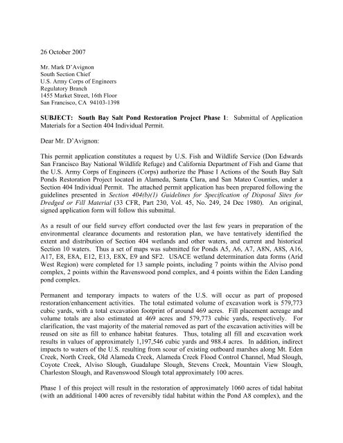
26 October 2007Mr. Mark D’AvignonSouth Section ChiefU.S. Army Corps of EngineersRegulatory Branch1455 Market Street, 16th FloorSan Francisco, CA 94103-1398SUBJECT: South Bay Salt Pond Restoration Project Phase 1: Submittal of Application<strong>Materials</strong> <strong>for</strong> a Section 404 Individual Permit.Dear Mr. D’Avignon:This permit application constitutes a request by U.S. Fish <strong>and</strong> Wildlife Service (Don EdwardsSan Francisco Bay National Wildlife Refuge) <strong>and</strong> Cali<strong>for</strong>nia Department of Fish <strong>and</strong> Game thatthe U.S. Army Corps of Engineers (Corps) authorize the Phase I Actions of the South Bay SaltPonds Restoration Project located in Alameda, Santa Clara, <strong>and</strong> San Mateo Counties, under aSection 404 Individual Permit. The attached permit application has been prepared following theguidelines presented in Section 404(b)(1) Guidelines <strong>for</strong> Specification of Disposal Sites <strong>for</strong>Dredged or Fill Material (33 CFR, Part 230, Vol. 45, No. 249, 24 Dec 1980). An original,signed application <strong>for</strong>m will follow this submittal.As a result of our field survey ef<strong>for</strong>t conducted over the last few years in preparation of theenvironmental clearance documents <strong>and</strong> restoration plan, we have tentatively identified theextent <strong>and</strong> distribution of Section 404 wetl<strong>and</strong>s <strong>and</strong> other waters, <strong>and</strong> current <strong>and</strong> historicalSection 10 waters. Thus a set of maps was submitted <strong>for</strong> Ponds A5, A6, A7, A8N, A8S, A16,A17, E8, E8A, E12, E13, E8X, E9 <strong>and</strong> SF2. USACE wetl<strong>and</strong> determination data <strong>for</strong>ms (AridWest Region) were completed <strong>for</strong> 13 sample points, including 7 points within the Alviso pondcomplex, 2 points within the Ravenswood pond complex, <strong>and</strong> 4 points within the Eden L<strong>and</strong>ingpond complex.Permanent <strong>and</strong> temporary impacts to waters of the U.S. will occur as part of proposedrestoration/enhancement activities. The total estimated volume of excavation work is 579,773cubic yards, with a total excavation footprint of around 469 acres. Fill placement acreage <strong>and</strong>volume totals are also estimated at 469 acres <strong>and</strong> 579,773 cubic yards, respectively. Forclarification, the vast majority of the material removed as part of the excavation activities will bereused on site as fill to enhance habitat features. Thus, totaling all fill <strong>and</strong> excavation workresults in values of approximately 1,197,546 cubic yards <strong>and</strong> 988.4 acres. In addition, indirectimpacts to waters of the U.S. resulting from scour of existing outboard marshes along Mt. EdenCreek, North Creek, Old Alameda Creek, Alameda Creek Flood Control Channel, Mud Slough,Coyote Creek, Alviso Slough, Guadalupe Slough, Stevens Creek, Mountain View Slough,Charleston Slough, <strong>and</strong> Ravenswood Slough total approximately 100 acres.Phase 1 of this project will result in the restoration of approximately 1060 acres of tidal habitat(with an additional 1400 acres of reversibly tidal habitat within the Pond A8 complex), <strong>and</strong> the
creation of 709 acres of high quality avian <strong>for</strong>aging <strong>and</strong> nesting habitat in managed ponds. Dueto the anticipated development of marsh habitats within tidal restoration ponds (E9/E8A/E8X,A6 <strong>and</strong>, reversibly, A8/A8S) resulting from the proposed activities <strong>and</strong> continued use of PondsE12/E13, A16, <strong>and</strong> SF2 as managed ponds <strong>for</strong> wildlife, there would be no mitigation measuresrequired with the exception of measures taken to minimize or avoid disturbance to sensitivehabitat areas.The project may affect several special-status species known from the SBSP Phase I projectvicinity, including seven federally listed species: the salt marsh harvest mouse (Reithrodontomysraviventris), Cali<strong>for</strong>nia Clapper Rail (Rallus longirostris obsoletus), Western Snowy Plover(Charadrius alex<strong>and</strong>rinus nivosus), Cali<strong>for</strong>nia Least Tern (Stern antillarum browni), Cali<strong>for</strong>niaBrown Pelican (Pelecanus occidentalis cali<strong>for</strong>nicus), Central Cali<strong>for</strong>nia Coast steelhead(Oncorhynchus mykiss) <strong>and</strong> its Critical Habitat, <strong>and</strong> green sturgeon (Acipenser medirostris).Thus, a Biological Assessment (BA) is being prepared <strong>and</strong> will be <strong>for</strong>warded upon completion<strong>and</strong> submittal to the USFWS. After receipt of the BA, as the federal permit lead, we then askthat a draft <strong>for</strong>mal Section 7 Consultation letter be <strong>for</strong>warded to the Service requestingconsultation.We fully acknowledge that Corps staff are currently overburdened with permit requests <strong>and</strong>greatly appreciate your timely consideration of our package. We have included a draft publicnotice along with this application <strong>for</strong> your use. If you or your staff has any questions, please feelfree to contact me (408.445.3221) or Patrick Boursier (408.458.3204) with any questions youmay have. Thank you <strong>for</strong> your assistance with our request.Sincerely,John A. Bourgeois, M.S.Senior Restoration EcologistCc:Steve Ritchie, Cali<strong>for</strong>nia Coastal ConservancyMendel Stewart <strong>and</strong> Clyde Morris, USFWS, Don Edwards RefugeCarl Wilcox <strong>and</strong> John Krause, CDFGMichelle Orr, PWAEnclosures:• Application <strong>for</strong> Department of the Army Permit (Form33 CFR 325)• South Bay Salt Pond Restoration Project: Phase 1: <strong>Request</strong> <strong>for</strong> JurisdictionalDetermination <strong>Supplemental</strong> <strong>Materials</strong>• Draft Public Notice
• South Bay Salt Ponds Restoration Project: Phase I Actions <strong>and</strong> On-going MaintenanceActivities—Analysis <strong>and</strong> Compliance with Section 404(b)(1) Guidelines: Submittal ofmaterials <strong>for</strong> Section 404 Individual Permit (including alternatives analysis)
26 October 2007Mr. Mark D’AvignonSouth Section ChiefU.S. Army Corps of EngineersRegulatory Branch1455 Market Street, 16th FloorSan Francisco, CA 94103-1398ATTENTION: Ms. Paula GillSUBJECT: South Bay Salt Pond Restoration Project, Phase 1 Actions: <strong>Request</strong> <strong>for</strong>Jurisdictional Determination <strong>Supplemental</strong> <strong>Materials</strong>Dear Mr. D’Avignon:On behalf of the U.S. Fish <strong>and</strong> Wildlife Service (Don Edwards San Francisco Bay NationalWildlife Refuge) <strong>and</strong> Cali<strong>for</strong>nia Department of Fish <strong>and</strong> Game please find attached our maps <strong>for</strong>Phase 1 of the South Bay Salt Pond Restoration Project. The project study area extends overseveral South Bay counties including Santa Clara, San Mateo, <strong>and</strong> Alameda. As a result of ourfield survey ef<strong>for</strong>t conducted over the last few years in preparation of the environmentalclearance documents <strong>and</strong> restoration plan, we have tentatively identified the extent <strong>and</strong>distribution of Section 404 wetl<strong>and</strong>s <strong>and</strong> other waters, <strong>and</strong> current <strong>and</strong> historical Section 10waters. Thus a set of maps is included with the transmittal <strong>for</strong> Ponds A5, A6, A7, A8N, A8S,A16, A17, E8, E8A, E12, E13, E8X, E9 <strong>and</strong> SF2.As per your request during our meeting of 25 September 2007 at your office with Paula Gill,Molly Martindale <strong>and</strong> Dan Martel, we have revised the Jurisdictional Determination maps. Inaddition, we include USACE wetl<strong>and</strong> determination data <strong>for</strong>ms (Arid West Region) that werecompleted <strong>for</strong> 13 sample points, including 7 points within the Alviso pond complex, 2 pointswithin the Ravenswood pond complex, <strong>and</strong> 4 points within the Eden L<strong>and</strong>ing pond complex.The habitats of the SBSP Restoration Project are broadly quantified <strong>and</strong> described below.Generally, salt ponds in the South Bay are characterized by expanses of non-tidal open water,bare mud, or bare salt flats surrounded by mostly barren levees. Vegetation is sparse <strong>and</strong> islimited primarily to some levees. Due to the paucity of vegetation, salt ponds provide little to nocover <strong>for</strong> small mammals or reptiles, <strong>and</strong> provide nesting habitat only <strong>for</strong> species that nest on thebare levees <strong>and</strong> the occasional isl<strong>and</strong>s that have been created (by breaching of levees ordeposition of material dredged from borrow ditches) within the ponds.The ponds within the SBSP Restoration Project area are, collectively, highly productive systems,supporting very high invertebrate biomass due to the abundance of a few key species <strong>and</strong>providing roosting, nesting, <strong>and</strong> <strong>for</strong>aging habitat <strong>for</strong> large numbers of waterbirds. However, withthe exception of the birds that move in <strong>and</strong> out of the ponds (as discussed below), <strong>and</strong> some fish<strong>and</strong> aquatic invertebrates that are drawn into intake ponds, the salt ponds are primarily a closed
system, with virtually no export of detritus, nutrients, or energy to the tidal marsh, sloughs,mudflats, or open waters of the Bay. Furthermore, much of the biomass produced by theseponds is unavailable to birds or fish due to water depths (<strong>for</strong> shorebirds) <strong>and</strong> salinities (<strong>for</strong> fish)that preclude these vertebrates’ use of most of the invertebrates in the deeper, higher-salinityponds.Eden L<strong>and</strong>ing. Mudflat <strong>and</strong> open water bay habitats are found in the Eden L<strong>and</strong>ing pondcomplex. Open-water habitat exists in OAC, North Creek, along Mt. Eden Creek <strong>and</strong> as internalmarsh ponds within the Whale’s Tail marsh, a marsh at the mouths of the Old Alameda <strong>and</strong> Mt.Eden Creeks along the western edge of the Eden L<strong>and</strong>ing pond complex (sample points E1-E4).Vegetation. The Eden L<strong>and</strong>ing pond complex includes salt marsh, brackish marsh, freshwatermarsh <strong>and</strong> peripheral halophyte marsh habitat. Open water borders the northeastern ponds.Mudflat borders the western edge of Whale’s Tail marsh. Developing cordgrass salt marsh inCargill Marsh borders Whale’s Tail marsh to the east. Large areas of pickleweed salt marsh lieto the west of the Eden L<strong>and</strong>ing pond complex within the Whale’s Tail marsh. The lowerreaches of Mt. Eden Creek, which intersect the northern ponds in the complex, consist ofpickleweed salt marsh (sample point E3). Pickleweed salt marsh also dominates the lower reachof the ACFCC along the southern boundary of the pond complex. Peripheral halophyte marshhabitat borders the northeastern ponds inl<strong>and</strong> along Mt. Eden Creek. Brackish marsh existsupstream in OAC <strong>and</strong> continues along the eastern boundary of the pond complex. In addition tothe habitats described above, small oyster shell beach ridges are found within the north end ofWhale’s Tail marsh <strong>and</strong> on the north end of the outboard marsh of Pond E2.Phase 1 Action Areas. Characteristics of individual ponds that were selected <strong>for</strong> Phase 1 of theSBSP Restoration Project are discussed below.Ponds E8A, E8X <strong>and</strong> E9.Pond E8A is approximately 240 acres in size <strong>and</strong> is bordered by OAC on the south, NorthCreek on the east, <strong>and</strong> by Ponds E9 <strong>and</strong> E8 on the north <strong>and</strong> east. The west side of PondE8A is bordered by tidal salt marsh extending outward to the Bay. Pond E8A is currentlymanaged under the ISP as a System Pond.Pond E8X is approximately 30 acres in size <strong>and</strong> is bordered by North Creek on the south <strong>and</strong>east <strong>and</strong> by Ponds E9 on the west <strong>and</strong> E14 on the north. Pond E8X is currently managedunder the ISP to receive water only during the highest tides, <strong>and</strong> is mostly mudflat <strong>and</strong>/orshallow water throughout much of the year.Pond E9 is approximately 360 acres in size <strong>and</strong> is bordered on the south by Pond E8A, on thewest by tidal salt marsh (sample points E1, E2) extending to the Bay, <strong>and</strong> on the north <strong>and</strong>east by Ponds E14 <strong>and</strong> E8X. Mt. Eden Creek borders the northwest edge of Pond E9. PondE9 is currently managed under the ISP as a System Pond.2H. T. HARVEY & ASSOCIATES
Ponds E12 <strong>and</strong> E13.Pond E12 is approximately 110 acres in size <strong>and</strong> is bordered on the south by Pond E13 <strong>and</strong>on the north <strong>and</strong> east by Mt. Eden Creek. Pond E12 is currently managed as a Seasonal Pond.Pond E13 is approximately 120 acres in size <strong>and</strong> is bordered by Pond E12 to the north, Mt.Eden Creek to the west <strong>and</strong> Pond E14 to the south. Pond E13 is currently managed as aSeasonal Pond (sample points E3, E4). Seasonal ponds provide different types of habitat,including aquatic habitat <strong>for</strong> waterfowl during winter, shallow water <strong>for</strong>aging during thespring <strong>and</strong> fall shorebird migration periods <strong>and</strong> salt panne habitat <strong>for</strong> nesting shorebirdsduring summer.Alviso. Large areas of mudflat <strong>and</strong> open water Bay habitats are found adjacent to the Alvisopond complex. Open water exists along Mountain View Slough, Stevens Creek, Alviso Slough,Artesian Slough, Guadalupe Slough, <strong>and</strong> in Coyote Creek. Large expanses of newly <strong>for</strong>medmudflat habitat exist downstream of the Isl<strong>and</strong> Ponds (A19, A20, <strong>and</strong> A21), including a largenewly <strong>for</strong>med mudflat isl<strong>and</strong> at the mouth of Alviso Slough adjacent to Pond A9. Mudflatoccurs at the mouth of Guadalupe Slough <strong>and</strong> along Charleston Slough. Advancing mudflatoccurs adjacent to Calaveras Point, <strong>and</strong> also at the mouths of Mountain View Slough <strong>and</strong> StevensCreek adjacent to Ponds A1 <strong>and</strong> A2W. Small areas of mudflat surrounded by open water areadjacent to Pond A12. Additional small areas of mudflat are surrounded by freshwater marsh atthe upper end of the reach to the south of the Isl<strong>and</strong> Ponds (sample points A1-A7).Vegetation. Marsh habitat adjacent to the Alviso pond complex includes salt marsh, brackishmarsh, freshwater marsh as well as areas of peripheral halophytes. Salt marsh habitat occurs onthe outboard levees along the extent of the Alviso pond complex. Salt marsh dominated bycordgrass is found at lower elevations bordering the mudflats <strong>and</strong> along the fringing lowerelevations of Coyote Creek. Cordgrass also borders Mountain View Slough, the mouth ofStevens Creek, Guadalupe Slough <strong>and</strong> Alviso Slough, the mouth of Mud Slough, <strong>and</strong> alsoincludes <strong>for</strong>mation of a new cordgrass salt marsh isl<strong>and</strong> at the mouth of Alviso Slough betweenPonds A9 <strong>and</strong> A6. Pickleweed marsh (sample point A6), is found at higher elevations just abovecordgrass dominated marsh <strong>and</strong> extends upstream into Mountain View Slough, Stevens Creek,Coyote Creek, Guadalupe Slough, Mud Slough, <strong>and</strong> Alviso Slough. Brackish marsh covers themarsh plain in the transition from salt to brackish marsh along Coyote Creek, <strong>and</strong> also dominatesthe outboard levees near the junction of Mud Slough <strong>and</strong> Coyote Creek. Brackish marshreplaces salt marsh moving upstream along Guadalupe Slough, Alviso Slough, Mountain ViewSlough, <strong>and</strong> Stevens Creek. To the east of the Artesian Slough junction, the brackish marshinitially contains patches of pickleweed salt marsh within the marsh plain, <strong>and</strong> then becomesprimarily brackish marsh. Brackish marsh dominates Triangle Marsh <strong>and</strong> extends into the lowerreaches of Artesian Slough. Artesian Slough becomes dominated by freshwater marsh upstream(south) of Pond A17. Levees separate many of the individual ponds in the Alviso pond complex.Upl<strong>and</strong> vegetation borders sections of the freshwater <strong>and</strong> brackish marshes. Unvegetated isl<strong>and</strong>sexist within several of the salt ponds.Phase 1 Action Areas. Characteristics of individual ponds that were chosen <strong>for</strong> Phase 1 of theSBSP Restoration Project are discussed below.3H. T. HARVEY & ASSOCIATES
Pond A6Pond A6 (also called the Knapp Tract) is approximately 330 acres in size <strong>and</strong> is bordered byGuadalupe Slough on the west <strong>and</strong> Alviso Slough on the east. The northern portion of PondA6 is bordered by Coyote Creek. Ponds A5 <strong>and</strong> A7 border Pond A6 on its southern edge.Pond A6 is currently managed as a Seasonal Pond. This pond is mostly dry through thesummer, but shallow water during winter provides <strong>for</strong>aging habitat <strong>for</strong> shorebirds <strong>and</strong> otherwaterbirds. Winter salinities are moderate (e.g., a low salinity of 46 ppt in January 2005),but summer salinities in the surrounding borrow channel are high (e.g., a high salinity of 329ppt in September 2004). A small amount of tidal salt marsh is present along the outboardlevees of Pond A6.Pond A8Pond A8 is approximately 410 acres in size <strong>and</strong> is located at the upstream extent of AlvisoSlough near the community of Alviso. Fringing tidal marsh borders the northern <strong>and</strong> easternedges of Pond A8. Ponds A5 <strong>and</strong> A7 border the western edge <strong>and</strong> Pond A8S borders thesouthern edge of the pond. Pond A8 is currently managed as a Seasonal Pond. Due toslightly deeper water, this pond has more moderate year-round salinities than Pond A6.Shallow water <strong>and</strong> patches of dry habitat provide <strong>for</strong>aging <strong>and</strong> roosting opportunities <strong>for</strong>shorebirds during summer <strong>and</strong> fall, <strong>and</strong> shallow to moderate water levels during winterprovide habitat <strong>for</strong> waterfowl <strong>and</strong> other waterbirds.Pond A16Pond A16 is approximately 240 acres in size <strong>and</strong> is located north of the Refuge’s AlvisoEducation Center <strong>and</strong> New Chicago Marsh <strong>and</strong> west of Artesian Slough. The railroad rightof-wayis west of Pond A16 <strong>and</strong> farther west are Ponds A13 <strong>and</strong> A15. Pond A16 is currentlymanaged as Muted Tidal, <strong>and</strong> provides <strong>for</strong>aging <strong>and</strong> roosting habitat <strong>for</strong> shorebirds, <strong>and</strong><strong>for</strong>aging habitat <strong>for</strong> waterfowl <strong>and</strong> other waterbirds.Ravenswood. Mudflat <strong>and</strong> open water bay habitats are found in the Ravenswood pondcomplex. Open-water habitat exists throughout the pond complex in the historic slough channels.Mudflat habitat has <strong>for</strong>med at the mouth of Ravenswood Slough. The pond complex primarilyincludes salt marsh <strong>and</strong> peripheral halophyte marsh habitats. A large expanse of mudflat lies tothe north <strong>and</strong> east of the pond complex (sample points R1, R2).Vegetation. The Ravenswood pond complex is surrounded by salt marsh, consisting of cordgrassmarsh along the lower elevation fringes of the marsh <strong>and</strong> pickleweed marsh (sample point R1) inthe higher elevation marsh plain. There are some patches of salt marsh dominated by otherspecies, particularly along the southern edge of the pond complex. Peripheral halophytevegetation borders the salt marsh in much of the transitional zone to upl<strong>and</strong> areas. Upl<strong>and</strong>vegetation is also found at higher elevations around the salt marsh boundary, often bordering thelevees. There is one small area of freshwater marsh along the southern boundary of theRavenswood pond complex.4H. T. HARVEY & ASSOCIATES
Phase 1 Action Areas. Characteristics of individual ponds that were chosen <strong>for</strong> Phase 1 of theSBSP Restoration Project are discussed below.Pond SF2Pond SF2 is approximately 240 acres in size <strong>and</strong> is adjacent to the Dumbarton Bridge <strong>and</strong>San Francisco Bay. Pond SF2 is bordered by diked marsh to the southwest <strong>and</strong> the southeast,<strong>and</strong> a small section of upl<strong>and</strong> habitat borders the pond to the south. The northeast portion ofthe pond borders narrow fringe marsh along the Bay. Pond SF2 is currently managed as aSeasonal Pond. Portions of this pond are dry during summer, providing nesting habitat <strong>for</strong>western snowy plovers.Please feel free to contact me (408.445.3221) or Patrick Boursier (408.458.3204) with anyquestions you may have. We look <strong>for</strong>ward to hearing from you soon to schedule our verificationfield surveys. I have also recently discussed the permitting timeline with Paula Gill <strong>and</strong> want tocontinue to keep an open dialogue about the desire <strong>for</strong> the project to receive permits in March2008. Thank you <strong>for</strong> your assistance with our request.Sincerely,John A. Bourgeois, M.S.Senior Restoration EcologistCc:Steve Ritchie, Cali<strong>for</strong>nia Coastal ConservancyMendel Stewart <strong>and</strong> Clyde Morris, USFWS, Don Edwards RefugeCarl Wilcox <strong>and</strong> John Krause, CDFGMichelle Orr, PWAMarie Galvin, EDAW5H. T. HARVEY & ASSOCIATES


