CONTEXT IN GEOGRAPHIC KNOWLEDGE REPRESENTATION
CONTEXT IN GEOGRAPHIC KNOWLEDGE REPRESENTATION
CONTEXT IN GEOGRAPHIC KNOWLEDGE REPRESENTATION
You also want an ePaper? Increase the reach of your titles
YUMPU automatically turns print PDFs into web optimized ePapers that Google loves.
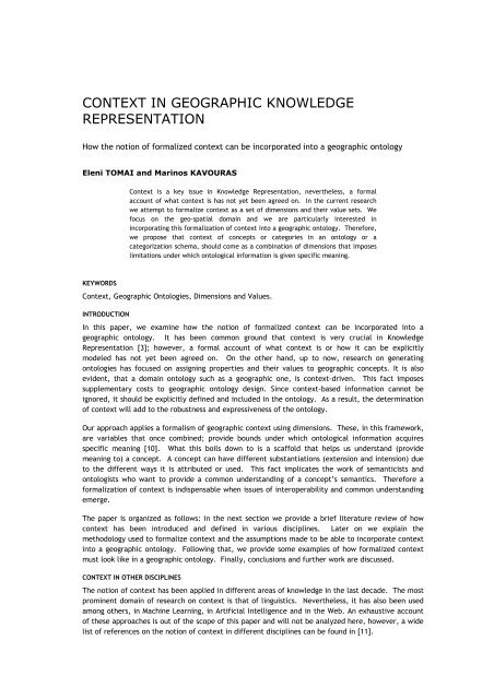
<strong>CONTEXT</strong> <strong>IN</strong> <strong>GEOGRAPHIC</strong> <strong>KNOWLEDGE</strong><strong>REPRESENTATION</strong>How the notion of formalized context can be incorporated into a geographic ontologyEleni TOMAI and Marinos KAVOURASContext is a key issue in Knowledge Representation, nevertheless, a formalaccount of what context is has not yet been agreed on. In the current researchwe attempt to formalize context as a set of dimensions and their value sets. Wefocus on the geo-spatial domain and we are particularly interested inincorporating this formalization of context into a geographic ontology. Therefore,we propose that context of concepts or categories in an ontology or acategorization schema, should come as a combination of dimensions that imposeslimitations under which ontological information is given specific meaning.KEYWORDSContext, Geographic Ontologies, Dimensions and Values.<strong>IN</strong>TRODUCTIONIn this paper, we examine how the notion of formalized context can be incorporated into ageographic ontology. It has been common ground that context is very crucial in KnowledgeRepresentation [3]; however, a formal account of what context is or how it can be explicitlymodeled has not yet been agreed on. On the other hand, up to now, research on generatingontologies has focused on assigning properties and their values to geographic concepts. It is alsoevident, that a domain ontology such as a geographic one, is context-driven. This fact imposessupplementary costs to geographic ontology design. Since context-based information cannot beignored, it should be explicitly defined and included in the ontology. As a result, the determinationof context will add to the robustness and expressiveness of the ontology.Our approach applies a formalism of geographic context using dimensions. These, in this framework,are variables that once combined; provide bounds under which ontological information acquiresspecific meaning [10]. What this boils down to is a scaffold that helps us understand (providemeaning to) a concept. A concept can have different substantiations (extension and intension) dueto the different ways it is attributed or used. This fact implicates the work of semanticists andontologists who want to provide a common understanding of a concept’s semantics. Therefore aformalization of context is indispensable when issues of interoperability and common understandingemerge.The paper is organized as follows: in the next section we provide a brief literature review of howcontext has been introduced and defined in various disciplines. Later on we explain themethodology used to formalize context and the assumptions made to be able to incorporate contextinto a geographic ontology. Following that, we provide some examples of how formalized contextmust look like in a geographic ontology. Finally, conclusions and further work are discussed.<strong>CONTEXT</strong> <strong>IN</strong> OTHER DISCIPL<strong>IN</strong>ESThe notion of context has been applied in different areas of knowledge in the last decade. The mostprominent domain of research on context is that of linguistics. Nevertheless, it has also been usedamong others, in Machine Learning, in Artificial Intelligence and in the Web. An exhaustive accountof these approaches is out of the scope of this paper and will not be analyzed here, however, a widelist of references on the notion of context in different disciplines can be found in [11].
In the field of linguistics we make reference herein, to the work by Bunt [4] who identifies a numberof communicative functions of dialogue control acts, very similar to our notion of dimensions forsetting context, that will be analyzed later on. The contextualization of ontologies has also beentreated in [2], and it resulted in introducing an extension of OWL, C-OWL, for providing formalcontext to ontologies.PROPOSED METHODOLOGYAs already mentioned we propose a framework for formalizing context using dimensions d i . Theconcept of dimensions has also been used in [10], for providing context to semi-structured data onthe web. Furthermore, they have been used in Intensional HTML [13], which allows a web page toappear in different forms, due to the use of variants.Dimensions in our approach, are specific variables that when combined give meaning to ontologicalinformation. These dimensions have a set of possible values v di that substantiate them. Therefore,a context C of a concept c, is given by the following equation:C c = {d 1 , d 2 , …, d n } ″ { v d1 , v d2 , …, v dn }, (Equation 1)To form a context C any number of dimensions that constitute its set D, is acceptable (even onlyone) as long as the intended meaning is adequately given. Even though, in theory, a geographicconcept’s context can be formed using only one dimension, in practice, it is very difficult toestablish context that way and include it in an ontology, due to the complexity and diversity of thedomain. Furthermore, as it will be articulated hereinafter, sometimes the dimensions of the contextare chosen based on specific requirements/ axioms of the ontology designer. It is important to stateat this point, that a context C, is not constituted only by a unique set of dimensions. To clarify this,the reader should consider what follows in the next sections of this manuscript.A Theory of All Possible WorldsLet us call D = {d 1 , d 2 , d 3 } and D’ = {d 1 , d 2 } two different sets of dimensions, with value sets: v d1 = {a,b, c}, v d2 = {e} and v d3 = {f, g} for d 1 , d 2 , and d 3 respectively, that constitute a context C underdifferent circumstances. The set {(d 1 , b), (d 2 , e), (d 3 , g)} is a world w in relation to D, while the set{(d 1 , a), (d 2 , e)} is a world w’ in relation to D’. The set of all possible worlds in relation to a set ofdimensions D is called the universe U of D. For instance, the universe U of D, for the previousexample is the set:U = {(d 1 , a), (d 1 , b), (d 1 , c), (d 2 , e), (d 3 , f), (d 3 , g)}, (Equation 2)This way, we view context through the notion of world, more specifically the notion of possibleworlds, which is widely used in different theories of semantics and logic (such as model theoreticsemantics and model logic respectively, for a discussion on these, the reader can refer to [9]) orintensional semantics [8].Assumptions over DimensionsTo be able to use this formalism of context, several assumptions over dimensions and their valuesets are made. These are:• Dimensions are orthogonal. This means that one dimension’s values do not affect those of theothers;• The sets of dimensions that form the context are considered non-empty and finite;• The values sets of the dimensions are considered non-empty and finite as well.SETT<strong>IN</strong>G THE <strong>CONTEXT</strong> FOR A <strong>GEOGRAPHIC</strong> CONCEPTTo establish context for a geographic concept we make use of the guidelines of geographicontological design presented in [12] and consider all properties of geographic concepts (therein
semantic relations and semantic properties) as dimensions.Therefore, in the current approach, the context of a geographic concept is provided by analyzing itsdefinitions into a set of dimensions that correspond to its semantic relations and semantic propertiesusing the terminology introduced by [7 and 6], further pursued by [12].This approach proves very useful when we want to compare between different definitions of ageographic concept, because each definition can provide us with a distinct set of dimensions andtheir values of the given concept. Thus, we end up with worlds of the concept, the union of whichconstitute its universe. In addition, because, we formalize context as a set, it becomes very easy toestablish operations between contexts, such as union or intersection, whenever this is necessary ordesired, during the generation of a geographic ontology. Every notion introduced at this point willbe clarified in the following sections, where examples of how to set context for a geographicconcept will given.To give an example of context in the form of a combination of dimensions and possible worlds inrelation to this set of dimensions, consider the following case. For reasons of economy we consideronly ontological information on the category/ concept canal coming from two of its definitions(WordNet [14] and DIGEST [5]), which are:• A long and narrow strip of water made for boats or for irrigation (WordNet);• A man-made or improved natural waterway used for transportation (DIGEST).Those two can be analyzed in dimensions and their value sets as follows:D CANAL = {hypernym, purpose, form/morphology, material/cover, nature}, with value sets:v HYPERNYM = {way, strip};v PURPOSE = {transportation, boats, irrigation};v FORM/ MORPHOLOGY = {long, narrow};v MATERIAL/ COVER = {water};v NATURE = {improved natural, manmade}.This constitutes the context C of canal, for the two definitions provided.Defining the Universe U for a geographic conceptTherefore the Universe of canal is, in relation to the above mentioned ontological information;U CANAL = {(hypernym, {way, strip}), (purpose, {transportation, boats, irrigation}), (form/morphology,{long, narrow}), (material/cover, {water}), (nature, {improved natural, manmade})}, (Example 1)Consequently, given these sets, an aspect of canal can be:• w CANAL1 = {(hypernym, strip), (purpose, irrigation), (material/cover, water), (form/morphology,long)}; (Example 2)This denotes a canal as a manmade water way for transportation, while a different aspect of thesame concept can be:• w CANAL2 = {(hypernym, way), (purpose, transportation), (material/cover, water), (nature,manmade)}; (Example 3)This denotes a canal as a long strip of water for irrigation. Both worlds of canal comply with theoriginal definitions provided by both WordNet’s terminological database (w CANAL1 ) and the featurecodes of DIGEST (w CANAL2 ), respectively. However, the following:
• w CANAL3 = {(hypernym, strip), (purpose, boats), (material/cover, water), (nature, manmade)};(Example 4)Which denotes a canal as a manmade strip of water for boats, does not fully comply with neither ofthe above definitions. Still, this does not mean that w CANAL3 of canal necessarily falls out of contextC of the given concept, only that in a possible world (other than the ones derived from each one ofthe definitions given), a canal could be defined likewise. To avoid implications or possible mishitswhen setting the context of a concept, we introduce at this point the notion of value specifier vs.Defining the value specifier (vs) for a geographic conceptThis index is used to provide constraints over the values that dimensions can take under specificcircumstances; in specific worlds.To give an example, for the previously defined canal a value specifier can be;vs = (purpose, {boats, irrigation}); (Example 5)This reads, canal is used for boats or irrigation and is true for the possible worlds that refer to thecontext of canal that complies with the definition of WordNet in relation to the dimension purpose.In the same way we set a specifier for a specific dimension, we can also, determine the union ofvalue specifiers, called hereinafter, Specifier (S), for the complete set of dimensions. Thus, for theconcept canal we can introduce the following:S CANAL1 = {(hypernym, {strip}), (purpose, {boats, irrigation}), (material/cover, {water}),(form/morphology, {long, narrow}), (nature, { })}; (Example 6)which not only provides the set of all possible worlds of canal that comply with the definition ofWordNet but also makes explicit the constraints under which the concept canal is defined in thecontext of the given terminological database. Notice that the empty set can also be part of S sinceall dimensions of context should be present therein even if their values are equal to zero. Similarly,the set of specifiers for the same concept as defined in DIGEST can be established as follows:S CANAL2 = {(hypernym, {way}), (purpose, {transportation}), (material/cover, {water}),(form/morphology, { }), (nature, {manmade, improved natural})}; (Example 7)OPERATIONS BETWEEN SPECIFIERSIn this section we introduce operations over Specifiers S which prove very useful for purposes ofontological reasoning, for semantic interoperability issues, for adequacy and completeness of theresulting ontologiesUnionWhy do we want the union of two or more Specifiers S? The answer is that, whenever we extend anontology, we incorporate knowledge from additional sources of information, therefore, the union ofSpecifiers S is useful in that sense. For the operation of union, we can state the following theorem:The union of Specifiers of a concept is equal to the Universe of that concept; (Th. 1).A proof of which can be given by:S CANAL1″ S CANAL2 = {(hypernym, {strip, way}), (purpose, {boats, irrigation, transportation}),(material/cover, {water}), (form/morphology, {long, narrow}), (nature, {manmade, improvednatural})}, (Example 8) / U CANAL (Example 1); (proof 1).Intersection
In ontologies’ integration, we are interested in determining the common features of a concept whichis ontologically defined in different ways. The intersection of Specifiers can give us the result ofsuch a comparison, returning a Specifier.For instance the intersection of examples 6 and 7, gives the following:S CANAL1 ≥ S CANAL2 = {(hypernym, { }), (purpose, { }), (material/cover, {water})}, (Example 9);Which shows that commonalities between the two definitions of canal can only be found in terms ofits cover or the material that it is made of; which is water, in this case. In addition, it should bepointed out that dimensions having the empty set as their values are not considered in theintersection since the determination of commonalities between the two definitions takes place notonly over values but also over dimensions.Except for its use in determining commonalities between two definitions, intersection over Specifierscan also be used in ontologies generation as a core Specifier, let us call it, which presents theminimum common ground of understanding over a concept’s attributes and substantiations. In otherwords it can present a point of reference for a concept’s definition in an ontology. It is obvious thatthe more semantically similar two definitions of the same concept are then the intersection of thetwo Specifiers includes more dimensions, which also have more common values.Equality – DifferenceIn accordance with intersection we can also define equality and difference between Specifiers andtherefore reason about similarity. It is obvious that equality holds when the set of dimensions andthe sets of their values of one Specifier are the same of the other;S 1 = S 2 when D 1 = D 2 , and v D1 = v D2Nonetheless, we propose a distinction between strong equality (SE) which is the one defined in theprevious definition, and weak equality (WE) which identifies common dimensions (semanticproperties and relations, according to our terminology; attributes), between Specifiers and does notinvolve common values;S 1 = S 2 when D 1 =D 2 ; weak equality (WE)Equality between Specifiers is quite uncommon because different communities use differentterminology for attributes and values.On the other hand, difference between Specifiers is quite common, due to different terminology anddistinct conceptualizations of the domain in questions. There is an interesting case of difference(SD), which holds when the intersection of two Specifiers returns the empty set. To give anexample, consider the following case:• Ditch is any small natural waterway (WordNet);• Ditch is a channel constructed for the purpose of irrigation or drainage (DIGEST).These definitions give the following Specifiers for WordNet and DIGEST, respectively:S DITCH1 = {(hypernym, {way}), (size, {small}), (material/cover, {water}), (nature, {natural})}; (Example10)S DITCH2 = {(hypernym, {channel}), (purpose, {irrigation, drainage})}; (Example 11)According to what is been defined previously, the intersection of the two Specifiers is:
S DITCH1 ≥ S DITCH2 = {(hypernym, { })} or simply, S DITCH1 ≥ S DITCH2 = { } (Example 12)Therefore, the difference between these two Specifiers is “total”, and we call these Specifiersdistinct. The existence of these Specifiers that derive from different sources of geographicinformation; definitions, categorizations schemata, and the like, impose all those difficulties andinconsistencies that emerge when integrating the diversity of geographic knowledge to built a newgeographic ontology. This falls into the case of naming heterogeneity [1].SubsetThe subset of Specifier (s φ S) returns at least a value specifier vs (as it was introduced in a previoussections) or a combination of them. A subset of Specifier S represents an aspect of the concept inquestion. To clarify this, consider the following:S φ S CANAL1 = {(hypernym, strip), (purpose, irrigation), (material/cover, water), (form/morphology,long)} (Example 13),This is the same as Example 2, giving an aspect of the concept canal, in the form of a possible world.In this framework, subsets are important to determine, because they formalize different aspects ofthe same concept under a specific definition, chunk of knowledge, knowledge base or categorizationschema. Aspects represent levels of detail in which a concept can be attributed.Knowing that an aspect is a part of a Specifier, we can reason about this part of knowledge, we canuse it as the minimum piece of information we want to record in the ontology to meet our (thedesigner’s) or the users’ purposes.CONCLUSIONS AND FURTHER WORKThe paper presented a framework for formalizing context of a geographic ontology. The rationale isto formalize it using a set of dimensions with value sets that substantiate it. The framework provesvery helpful when we want to use a diversity of sources of knowledge and information to generate ageographic ontology.Many new notions haven been introduced herein and need to be fully explored before they meetcertain requirements of ontology engineering. Our ongoing work focuses on that aspect of research,on providing ways to implement the framework using an ontology language so that formalizedcontext can be included in the designing process of a geo-ontology. In the future, several issueshave also to be taken into account that have not been touched upon yet herein, such as providingcontext that relate to the changing dimensions of geographic concepts.ACKNOWLEDGMENTSThis work has been partially supported by the Heraclitus Grant Program for Basic Research, 2.2.3.bof the Hellenic Ministry of National Education and the European Union.REFERENCES1. Bishr, Yaser, Overcoming the semantic and other barriers to GIS interoperability. InternationalJournal of Geographical Information Science Vol. 12, 1998, pp. 299-314.2. Bouquet Paolo et al., Contextualizing Ontologies. Journal of Web Semantics, Vol. 26, 2004, pp.1-19.3. Bouquet Paolo et al., Theories and Uses of Context in Knowledge Representation andReasoning. Journal of Pragmatics, Vol. 35, 2003, pp. 455-484.4. Bunt C. Harry, Context and Dialogue Control. TH<strong>IN</strong>K Quarterly, Vol. 3, Nr. 1, 1994, pp: 19--31.http://let.uvt.nl/general/people/bunt/docs/think.ps
5. DIGEST The Digital Geographic Information Exchange Standard: Part 4, Annex A, Feature CodesEdition 2.1, 2000, http://www.diffuse.org/gis.html#DIGEST6. Kavouras Marinos et al., Comparing Categories among geographic ontologies. Computers &Geosciences, Vol.31, Nr.2, Special Issue, Geospatial Research in Europe: AGILE 2003, MichaelGould (Ed.), March 2005, pp. 145-154.7. Kokla Margarita and Kavouras Marinos, Extracting Latent Semantic Relations from Definitionsto Disambiguate Geographic Ontologies, in GIScience 2002 Abstracts, 2nd InternationalConference on Geographic Information Science, Boulder, CO, USA, 2002, pp. 87-90.8. Nimtz Christian, Two-Dimensional Semantics –the Basics to appear in: Binder Marc D. et al.(eds.): The Encyclopedic Reference of Neuroscience, Berlin, Springer, 2005. http://www.unibielefeld.de/philosophie/personen/nimtz/NIMTZ_041005_2DSEMANTICS_LONG.pdf9. Perry John, Semantics, Possible-worlds, 1997, http://wwwcsli.stanford.edu/~john/PHILPAPERS/posswld.pdf.10. Stavrakas Yannis, Multidimensional Semistructured Data, PhD THESIS, NTUA, Athens, Greece,2003, http://www.dblab.ntua.gr/~ys/dnloads/MSSD_en.pdf11. Theodorakis Manolis et al., A Theory of Context in Information Bases. Information Systems, Vol.27, Nr. 3, 2002, pp. 151-191.12. Tomai Eleni and Kavouras Marinos, From "Onto-GeoNoesis" to "Onto-Genesis" The Design ofGeographic Ontologies. Geoinformatica Vol. 8, Nr.3, August 2004, pp. 285-302.13. Wadge W. William et al., Intensional HTML, in Proc. 4th International Workshop on Principles ofDigital Document Processing ’98 - Lecture Notes in Computer Science, Vol. 1481, 1998, pp. 128-139.14. WORDNET 2.0 - A Lexical Database for the English Language, Cognitive Science Laboratory,Princeton University, 2003, http://www.cogsci.princeton.edu/~wn/AUTHORS <strong>IN</strong>FORMATIONEleni TOMAIetomai@central.ntua.grNTUA – Cartography LaboratoryMarinos KAVOURASmkav@survey.ntua.grNTUA – Cartography Laboratory


