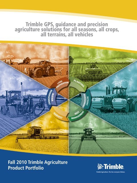
Trimble 2010 - GPS Ontario
Trimble 2010 - GPS Ontario
Trimble 2010 - GPS Ontario
- No tags were found...
You also want an ePaper? Increase the reach of your titles
YUMPU automatically turns print PDFs into web optimized ePapers that Google loves.
TRIMBLE PRECISION AGRICULTURETHE LINE EVERYONE FOLLOWSTable of Contents<strong>GPS</strong>Introduction to <strong>GPS</strong>What is <strong>GPS</strong>? 3Why use <strong>GPS</strong>? 4Correction Types 3-4Guidance Products and SolutionsGuidance Display Options 5-8EZ-Guide 250 system 6CFX-750 display 7FmX integrated display 8Steering Products and SolutionsVehicle Steering 9Implement Steering and Guidance 9EZ-Steer Assisted Steering System 10Autopilot Automated Steering System 11TrueGuide Implement Guidance System 12TrueTracker Implement Steering System 13Flow and Application ControlProducts and SolutionsField-IQ Crop Input Control System 14-21Tru Application Control System 15-21Automatic Section Control 16Variable Rate Application Control 16WeedSeeker Automatic Spot Spray System 18GreenSeeker Nitrogen Application System 19EZ-Boom <strong>2010</strong> System 19Flow and Application Control cont.ApplicationsPlanting 17Drilling 17Spraying 18-19Air Seeding 20Strip Till and Anhydrous 20Spreading 21Information Management SolutionsOffice 22Field 23Connected Farm 23Yield Monitoring 24Variable Rate Application 24Water Management Productsand Solutions<strong>GPS</strong> SolutionsOverview 25FieldLevel II System 26Laser Leveling SolutionsOverview 25AG401, GL500 and GL700 Series 27GCS100, GCS200 and GCS300/400 27You have no doubt heard how the use of <strong>GPS</strong> technology is revolutionizing the agricultureindustry by helping growers do things such as navigate through a field, spray their crops withoutfoam markers, and precisely map the elevation of their farms. But what exactly is <strong>GPS</strong> and whydo you need it on your farm?What is <strong>GPS</strong>?The Global Positioning System (<strong>GPS</strong>) is actually part of a larger system called the Global Navigation SatelliteSystem (GNSS). GNSS is the term for all the satellite constellation systems that provide positioning data.Currently only <strong>GPS</strong> and GLONASS fall under the GNSS umbrella. GLONASS is operated by the Russian Federationand <strong>GPS</strong> is operated by the US Department of Defense, but both are available to users worldwide. The GlobalPositioning System has been in existence longer, so its acronym has gained greater visibility and recognition. Infact, one could argue that <strong>GPS</strong> has become the common term for all satellite constellation systems, similar to theway we refer to Kleenex when we mean ‘tissue’.<strong>GPS</strong> is a space-based navigation system formed from a constellation of 24 satellites and their ground stations.<strong>GPS</strong> uses these satellites as reference points to calculate positions accurate to a matter of inches. In fact, withadvanced forms of <strong>GPS</strong> you can take measurements down to less than an inch. In a sense, it's like giving everysquare inch on the planet—or on your farm—a unique address.The signals generated by <strong>GPS</strong> alone are not accurate enough for use in agriculture. Therefore, corrections must bemade to <strong>GPS</strong> signals to improve their accuracy. There are three main correction services available today—SBAS,RTK and the VRS network.SBAS(SPACED BASED AUGMENTATION SYSTEM)SBAS is also known as D<strong>GPS</strong> (Differential <strong>GPS</strong>). SBAS or D<strong>GPS</strong> corrections can be obtained througha number of free satellite systems operated by various governments throughout the world. These freesystems include WAAS (US), EGNOS (Europe) and MSAS (Japan). SBAS uses L-band satellite correctionsto provide submeter accuracy from +/- 6–8 inches. There are also a variety of subscription correctionservices that provide satellite based SBAS corrections as accurate as +/- 2–5 inches. Two such optionsare the OmniSTAR HP and the OmniSTAR XP subscription services.INTRODUCTION TO <strong>GPS</strong>RTKOMNISTAR HPOMNISTAR XPOPTIONS0 1Inches1”+/-1 inch pass-to-pass+/-1 inch year-to-yearrepeatable1 2Inches2-4”+/-2–4 inch pass-to-pass+/-4 inch year-to-yearrepeatable3 4Inches53 43-5”+/-3–5 inch pass-to-pass+/-8 inch year-to-yearrepeatableSBAS (WAAS, EGNOS,MSAS), OMNISTAR VBSMany broadacre crop farms can benefit greatly from the submeter accuracy provided by SBAS signals.However, for certain precision agriculture applications such as row crop bed preparation and plantingor topographic map generation; submeter SBAS accuracy is not enough. In these applications, RTKcorrections can provide sub-inch accuracy, as well as huge savings in time and money.2 4 6 8Inches6-8”+/-6–8 inch pass-to-pass+/-3 feet year-to-yearrepeatable23
FmX INTEGRATED DISPLAYWhat precision ag functions do you want to control?GuIDANCEWith industry leading performance and reliability, the FmX ® integrated display can handle all your precision ag needs. From guidanceto steering, rate control to yield monitoring; the FmX integrated display has you covered. The versatility of the FmX integrateddisplay makes it the affordable choice to adopt as technology changes.LB25 lightbars can be attachedto the display or mountedseparatelyTwo <strong>GPS</strong>+GLONASSreceivers provide precisionwith the vehicle, as wellas the working implementbehind the tractor—whereyou really need itTransfer your day's coverageto your computer usingthe built-in USB port orwirelessly using ConnectedFarm from Farm WorksEasily perform prescriptionbased rate controlControl your implement with the TrueGuideimplement guidance and TrueTracker implement steering systemsAvailable accuracies for the FmX display:SBAS (WAAS)6-8 inch accuracy24 6 8OmniSTAR XP3-5 inch accuracy1 2 3 4 5OmniSTAR HP2-4 inch accuracy12 3 41 inch accuracy0RTK1Control up to 48 individual rows with theField-IQ crop input control system andeasy to install Tru Count clutchesAccurately monitor andmap harvested cropyield and moisturewith yield monitoringDeliver the correctamount of fertilizerreal-time with theGreenSeeker ® nitrogensensorControl your rate whenplanting, seeding, spraying,spreading and strip tilling withthe FmX integrated display andRawson variable rate driveManage field leveling andfield drainage with theFieldLevel II system.Steering OptionsIn addition to the manual guidance available withany of the <strong>Trimble</strong> guidance displays, <strong>Trimble</strong> offersassisted steering and automated steering optionsfor use on your farming vehicles. The EZ-Steer ®system is an assisted steering system that can beused on over 1000 vehicle models—old and new.It is mounted to your steering column and uses afriction wheel and motor to turn the wheel for you.The Autopilot automated steering system can beused on virtually any newer vehicle. The Autopilotsystem is connected directly to a vehicle’s hydraulicsystem and can deliver sub-inch repeatable steeringusing RTK corrected signals, delivered via radio froman RTK base station or via cellular modem from aVRS network.Implement Control OptionsImplement control is available from <strong>Trimble</strong> withboth the TrueGuide implement guidance systemand TrueTracker implement steering system. TheTrueGuide system is a passive guidance system. Itreduces the uncontrolled drift of the implement bymoving the tractor to keep the implement online.The TrueTracker system instantly communicatesguidance information between the implement andthe display in the tractor, adjusting the implement tofollow directly in the path of the tractor.EZ-STEER SYSTEMAssisted steering √Automated steering √EZ-Guide ® 250 system compatibility √EZ-Guide 500 system compatibility √ √CFX-750 display compatibility √ √FmX display compatibility √ √Guidance ready vehicle compatibility √STEERINGAuTOPILOT SYSTEMRequires Autopilot √ √FmX compatibility √ √Works on hilly, rolling or slopedterrainTRuEGuIDE SYSTEM TRuETRACKER SYSTEM√ √Works in variable soil conditions √ √Active steering technology √STEERINGAvailable satellite constellations for the FmX display:MULTI HEADLANDPIVOTA-B PATTERN IDENTICAL CURVE HEADLANDA+PATTERNFREEFORM <strong>GPS</strong>GLONASS8 9
AAEZ-STEER ASSISTED STEERING SYSTEMAUTOPILOT AUTOMATED STEERING SYSTEMSimple, portable hands-free farming for over 1000 vehicle models—old and new.The <strong>Trimble</strong> ® EZ-Steer ® assisted steering system turns the steering wheel for you by combining a friction wheel and a motor with<strong>GPS</strong> guidance from the EZ-Guide ® 250 system, EZ-Guide 500 system, CFX-750 display, or FmX ® integrated display. While theEZ-Steer system keeps your vehicle on line, you can relax and focus on other tasks in the tractor cab.RTK uPGRADEUpgrade the EZ-Steer system toRTK for repeatable one-inch <strong>GPS</strong>positioning accuracy. This optionrequires the use of the CFX-750display or FmX integrated display.T2 TERRAIN COMPENSATIONTECHNOLOGYImprovesaccuracywhen drivingstraightlines acrossslopingterrainPosition withoutterrain compensationAntennaPosition correctedby T2 ® technologyRollangleTRIMBLE JUNO SBHANDHELDIntegrated high accuracy steering for more than 700 vehicle makes and models.The <strong>Trimble</strong> Autopilot automated steering system provides one-inch repeatability from plant to harvest with any field pattern,and extends your operating hours with incredible precision.T3 TERRAIN COMPENSATIONTECHNOLOGYImprovesaccuracywhen drivingstraightlines acrossslopingterrainPosition withoutterrain compensationAntennaRollanglePosition correctedby T3 technologyfuLL STEERINGINTEGRATIONSTEERINGSTEERINGDISPLAY OPTIONSDISPLAY OPTIONSBENEFITS OF THE AUTOPILOT SYSTEM:EZ-GuIDE 250LIGHTBAREZ-GuIDE 500LIGHTBARCfX-750DISPLAYfmXINTEGRATED DISPLAYEZ-GuIDE 500LIGHTBARCfX-750DISPLAYfmXINTEGRATED DISPLAY√√Provides one-inch repeatability with each passReduces operator fatigue and extends youroperating hours√Works with the FmX integrated display, the CFX-750display, and the EZ-Guide 500 system√Eliminates overlaps and reduces input costs√Supports accuracy levels from WAAS to RTK10 11
TRUEGUIDE IMPLEMENT GUIDANCE SYSTEMTRUETRACKER IMPLEMENT STEERING SYSTEMLARGE IMPLEMENTSControl your large implementsand minimize the effects ofdraft with no additional steeringhardware.EASILY ADD IMPLEMENT CONTROLThe TrueGuide implement guidancesystem uses the existing Autopilot systemto improve implement accuracy. Thereis no need to hang additional steeringequipment on the implement just to getbetter control. Let the tractor guide theimplementTAKE FULL CONTROL OF YOUR IMPLEMENTThe TrueTracker system is an independentnavigation system that works with the Autopilotsystem to provide you the highest level of accuracy.The TrueTracker system independently steers theimplement using one of many hydraulic solutionsSTEERING COuLTERSUse steel coulters to steer.TONGuE STEERCONTOuRS AND TERRACESSTEERINGThe TrueGuide system can guidethe implement to the line, even inthe most difficult field patterns.Steer the tongue to change theimplement path.STEERINGLOAD BEARING WHEELROLLING TERRAINRolling terrain createsunpredictable implementmovements. Control the effects ofrolling terrain on the implementby adjusting on the go.CONTROL WHERE IT COUNTSIf the implement is moving, howeffective is the automated steering?Control the point that is doing allthe work—the implementUSE THE SECONDBUILT-IN RECEIVEROpen up the power of the FmX ® integrateddisplay by activating the built-in secondreceiver, and adding the TrueGuide system tothe guidance controlsTRIMBLE CORRECTION SERVICESUse <strong>Trimble</strong> RTK or VRS corrections for+/- 1 inch repeatable accuracy with boththe implement and tractorONE DISPLAY—COMPLETE CONTROLThe FmX integrated display in the tractorcommunicates guidance information tothe TrueTracker system, instantly adjustingimplements such as tillage tools, strip till,planters, cultivators and harvesters to followdirectly in the path of the tractorSteer the implement wheels.SIDESHIfTSOfTWAREHILLSIDESMinimize the effect of downdrafton severe hillsides. Let yourAutopilot system pull theimplement up the hill and holdthe line.Control where it counts.• The TrueGuide system is a “passive” guidance system that controls the implementusing the Autopilot automated steering system to move the tractor and keepthe implement on line• More control over your implement means more precision in seed and fertilizer placement, andconsistent guess rows• Adding the TrueGuide system to the Autopilot system typically reduces theuncontrolled drift of the implement by more than 50% over guiding the tractor alone• Supports accuracy levels from WAAS to RTKTake full control of your implement.• In the fall, place your fertilizer within an inch of where you will plant your seed in the spring• Improve seedbed and nutrient placement to enhance crop stand and yields• The TrueTracker system steers the implement on a repeatable path even on extreme slopesand variable soils• Maintain accuracy on rolling terrain using T3 terrain compensation technology mountedon the implementShift the 3-point laterally...ARTICuLATING THREE POINTRotate the 3-point to changethe direction.12 13
TRU APPLICATIONCONTROLTRU APPLICATION CONTROL SYSTEMThe Tru Application Control system provides complete automation of planting, seeding, spreading, spraying and strip-tilloperations. The system features multiple material variable rate control, seed monitoring and section control of up to 24 rows.It works on seed, liquid, granular and anhydrous materials. The Tru Application Control system is compatible with the FmXintegrated display.FLOW AND APPLICATION CONTROLPLANTING/DRILLING AIR SEEDING SPREADING STRIP TILL/ANHYDROUS SPRAYINGFIELD-IQ CROP INPUT CONTROL SYSTEMManage up to four Inputs Simultaneously• Control seed, liquid, granular and anhydrousapplication rates and fine tune what you’reputting in and on the ground• Monitor seed populations on up to 144 rows, in manycases using the sensors already installed in the planterPlanting Row Shutoff with Tru Application Control and TruCount Air Clutches• Automatically control up to 24 rows individually foraccurate shutoff• Avoid double planting in headlands and point rows tohelp increase yieldsSpraying Boom Section Control• Save on liquid fertilizer and chemicals withautomatic boom section control to reduce overlaps• Improve productivity by maintaining speed andautomatically turning off application at ends of rowsAnhydrous Ammonia Section Control• Save on expensive anhydrous ammonia usingautomatic section control to reduce overlaps• Utilize fast anhydrous shutoff valves for shut offThe Field-IQ crop input control system is a section control and variable rate application control system that is simple to install anduse. It prevents seed and fertilizer overlap and controls the rate of seed, liquid, NH3 anhydrous or granular materials. The Field-IQsystem runs on both the NEW! CFX-750 display and FmX ® integrated display.fLOW & APPLICATIONCONTROLPrevent Seed and fertilizer Overlap with field-IQ Section Control• Automatically control up to 48 rows individually formaximum savings in seed and increased yields• Eliminate seed overlap in your headlands and point rowswith Tru Count Meter Mount air clutches• Eliminate fertilizer overlap with the new Tru CountLiquiBlock valves that easily connect to clutch air linesVary Seed Population in Your field with field-IQ VariableRate Control• Adjust your seed population manually or using aprescription created using Farm Works ® office software• Apply a high population to fertile or well irrigated soilsto maximize yield potential while reducing the rate onless fertile or poorly irrigated soilsfLOWTRU&APPLICATIONAPPLICATIONCONTROLDISPLAY OPTIONSCfX-750DISPLAYfmXINTEGRATED DISPLAYVary the Rate of fertilizer or Lime, using field-IQ Variable RateControl and Rawson Drives• Use GreenSeeker ® sensors and apply the correct amountof fertilizer the plants need, or load a Variable Rate Applicationprescription created using Farm Works office software• Apply the correct amount of lime to manage your soil's PHin every locationfARM WORKSMOBILE SOfTWAREGATHER MORE INFORMATION FOR DECISION MAKINGWhile in your field, utilize the built-in <strong>GPS</strong> receiver and digital camera on the rugged <strong>Trimble</strong> ®Nomad ® or compact Juno ® SB handheld computers and Farm Works Mobile software to capturegeo-referenced pictures of problems such as weeds and insects.14 15
TRU APPLICATIONCONTROLAUTOMATIC SECTION CONTROL<strong>Trimble</strong>'s automatic section control shuts off rows or sections automatically, eliminating double applications and wasted inputs.Depending on the system you choose, it can manage seed, liquid and anhydrous, and features inch-level control from 24 to48 sections for savings that can exceed 5%. It’s the ideal upgrade for your guidance display from <strong>Trimble</strong> and it can be furtherupgraded to variable rate for even greater savings.PLANTING/DRILLINGField-IQ crop input control systemfIELD-IQ CROP INPuTCONTROL SYSTEM√ Control up to 48 individual rows automatically witheasy to install Tru Count Meter Mount air clutches√ Control both liquid and seed placementsimultaneously with the new Tru Count Meter Mountair clutch and new Tru Count LiquiBlock valves,which share the same air source√ Automatic overlap detection to track where you’vebeen and what you’ve doneTRu APPLICATIONCONTROL SYSTEM√ Control up to 24 individual rows automatically witheasy to install Tru Count Meter Mount air clutches√ Automatic overlap detection to track where you’vebeen and what you’ve doneThe planter function manages seed, liquid, orgranular application:• Prevent seed overlap by automatically controllingup to 48 individual rows• Eliminate liquid fertilizer overlap in yourheadlands and point rows with new Tru CountLiquiBlock valves• Vary seed population in your fields to match soilpotential with Rawson variable rate drives• Use a prescription map from Farm Works officesoftware to automatically set the rate of seed• Seed variety tracking forpost harvest performanceanalysisfLOW & APPLICATIONCONTROLVARIABLE RATE APPLICATION CONTROLIncrease yields and save money when planting, spraying, spreading or fertilizing. Adjust your rate manually or with a <strong>Trimble</strong> ®display to automatically vary the rate using prescriptions.√√√√√fIELD-IQ CROP INPuTCONTROL SYSTEMVariable rate application control for one material –either seed, liquid, anhydrous or granularUse PWM or Servo variable rate drives, in many casesre-using components already in your equipment, or usethe Rawson PAR 2 or 40 for more accurate controlAdjust the rate of application manually or using aprescription file from Farm Works ® office softwareUse GreenSeeker ® sensors to sidedress applications ofliquid or NH3 and efficiently manage the varied nitrogenneeds in your fieldUse the CFX-750 display or FmX ® integrated display√√√√√TRu APPLICATIONCONTROL SYSTEMVariable rate application control of up to 4 productsincluding seed, anhydrous, liquid and granularUse PWM or Servo variable rate drives, in many casesre-using components already in your equipmentAdjust the rate of application manually or using aprescription file from Farm Works office softwareUse the FmX integrated display or the FieldManager displayMonitor the seed population to detect plugged seedtubesTru Application Control systemThe planter function manages seed, liquid, and granular application:• Prevent seed overlap in your headlands, pointrows and waterways by automatically controllingup to 24 individual rows• Variable rate control for up to 4 products including seed,liquid and granular• Seed variety tracking for post harvest performance analysis• Monitor 1 hopper level sensor and 1 air pressure or 1RPM sensor• Compatible with Tru Count air clutches including the newTru Count Meter Mount clutchesfLOWTRU&APPLICATIONAPPLICATIONCONTROL16 17
TRU APPLICATIONCONTROLAIR SEEDINGSPREADINGTru Application Control systemField-IQ crop input control systemThe air seeding function on the Tru Application Control system managesseed, liquid, granular, and anhydrous ammonia (NH3) applications:The spreader function manages accurate granular application:• Manage up to 4 products using Variable Rate Application (VRA) control• Monitor up to 144 rows of blockage sensors• Monitor up to 4 hopper level sensors• Monitor up to 4 air pressure sensors and accessory RPM sensors• The choice of speed input (<strong>GPS</strong>, radar, or manual speed)• Advanced mapping with the ability to track varieties andlog attributes• Vary rates of fertilizer or lime with prescriptions to save money,increase yields and keep records of what was applied• Avoid overlap by shutting off spreading when going overpreviously-applied areas• Connect directly into the spreader manufacturers' existingcomponents with a Field-IQ system or usea Rawson PAR 40 variable rate drive tohandle high performance spreader boxes• Monitor gate height and spinner speed to bettermanage applicationSTRIP TILL AND ANHYDROUSTru Application Control systemField-IQ crop input control systemThe spreader function manages accurate granular application:• Variable Rate Application (VRA) controlfLOW & APPLICATIONCONTROLThe fertilizer control function manages accurate applications:• Avoid overlap in headlands and point rows using section control for up to48 sections in strip till, NH3, and sidedress toolbars• Control material applications more conveniently by connecting to existingvalves and flow meters already in the tool bar• Vary rates manually, using prescriptions, or GreenSeeker ®system sensors to increase yields while keepingrecords of what was appliedGreenSeeker RT200nitrogen application system• Monitor and control up to 4 products• The choice of speed input (<strong>GPS</strong>, radar, or manual speed)• Advanced mapping with the ability to track application ratesfLOWTRU&APPLICATIONAPPLICATIONCONTROLTru Application Control systemThe strip-till functionality allows for accurate anhydrous ammonia (NH3) granular and liquid application:• Advanced overlap control that automatically turns sections ON/OFFfor anhydrous application• Variable Rate Application (VRA) control for up to 2anhydrous channels and up to 2 liquid or granular channels• The choice of speed input (<strong>GPS</strong>, radar, or manual speed)• Advanced mapping with the ability to track NH3 applied ratesThe FmX ® integrated display now functions as the cab interface forthe GreenSeeker optical sensing system.• The GreenSeeker RT200 nitrogen application system offers a moreefficient and precise way to manage crop inputs such as nitrogen• Delivers the correct amount of fertilizer in real-time averaging anincrease in profits by $15 per acre• It verifies the amount of nitrogen the soil has made available inseason, then determines on-the-go a nitrogen prescription for theapplicator to instantly deliver. The result is optimum placement ofnitrogen, eliminating costly waste and extra field passesNEW20 21
When you are not in the office analyzing data, utilize <strong>GPS</strong> and handheld computers to perform field scouting and other importantjobs. Enter field records, map field boundaries, record soil sampling locations by grid or zone, and capture images of weeds orpests for scouting purposes.INFORMATION MANAGEMENT SOLUTIONSField SoftwareFarm Works, a division of <strong>Trimble</strong>, offers a complete range of solutions for the field and farm office. Office solutions include fieldrecord keeping, farm accounting, herd management, basic mapping, water management, and mapping analysis. Select from avariety of modules that can be integrated and customized to provide one management solution for your farm.MAP VIEWEROffice Software• Free map viewing software for precision ag displays• Build a list of clients, farms, field names and write the data to precision farming devicesfor data management• Print maps and guidance paths with legend• Can be upgraded to Farm Works ® office solutions for additional field reporting, layering,accounting, and mapping analysisMOBILE FIELD MANAGEMENT• Enter field records• Map field boundaries, drainage lines, pivots, ditches, andother points of interest• Capture digital images of pests using mobile devices with built incameras and <strong>GPS</strong>, such as a <strong>Trimble</strong> ® Juno ® handheld computer• Utilize grids or management zones for soil sampling• Use variable rate application maps with a wide range ofthird party controllersFIELD RECORDS• Set up any number of clients, farms, fields, and crop/year enterprises for quick access to fieldrecords• Enter crop plans for product ordering, budgeting, equipment usage, and employee allocation• Print reports for seed varieties, restricted use chemicals, fertilizer usage, fleet management, andfield profitabilityTo complete your farm management solution, Connected Farm utilizes wireless technology to transfer data and provide highaccuracy RTK. Easily send real-time information such as A-B lines, prescription maps, no spray zones, and yield maps between youroffice, vehicle display and handheld computer—saving you valuable time and enhancing your field records.ACCOUNTING• Assess the profitability of fields, livestock groups and equipment with detailed EnterpriseStatements• Print accounting reports for both cash and accrual general ledgers• Keep up-to-date inventory for supplies (seed, chemicals, fertilizer, feed, etc), harvested crops,and livestockConnected FarmINfORMATIONMANAGEMENTMAPPINGWATER MANAGEMENT• Read and write data for use with a wide range of precision farming devices• Create an unlimited number of mapping layers with easy-to-use drawing tools• Utilize Google Maps for drawing field boundaries or to display as background maps• Utilize soil types, yield maps, or other data in creating simple variable rate prescription maps• Create, edit, and manage guidance paths from popular guidance systems including all<strong>Trimble</strong> ® field displays• Display a Watershed zone map to view where the surface water will go and where it willpool on the existing surface• Analyze a 3D view of elevation data to easily understand the flow of water on a field• Map out surface ditches, mains, sub-mains, laterals and enter information such as the typeof material to be used, tile size and phaseDATA TRANSFER• Easy delivery of planned jobs, sampling points, guidance lines, yieldmaps, and prescription maps• Keep a backup of your raw data within your storage area, even after ithas been downloaded to your desktop softwareINfORMATIONMANAGEMENTANALYSIS• Utilize powerful yet easy to understand formulas to create prescription maps• Find out which parts of the field are more profitable by integrating your financial data withprecision maps• Average multiple years of yield maps together to discover consistently high and low yieldingareas of a field22 23
YIELD MONITORINGAccurately monitor and map harvested crop yield and moisture using the same <strong>Trimble</strong> ® FmX ® integrated display that you usefor all your farming operations. Guide with either the EZ-Steer ® assisted steering system or Autopilot automated steeringsystem for consistent passes and to keep your header at capacity. Use the recorded yield data to analyze performance andcreate variable rate prescription maps using Farm Works ® office software. Yield data stored on the FmX display can easily betransferred to the office using a USB storage device or upgrade to the Connected Farm solution and transfer data from field tooffice wirelessly. Farm Works software can help you evaluate field performance and identify problem areas.WATER MANAGEMENTVARIABLE RATE:SIMPLE INSTALLATION:• Just connect the FmX display to existingcombine sensors• Compatible with John Deere 9x60 and9x70 series combines• Able to collect data from the Ag Leader ® YM2000• Record yield data to analyze performance and then createvariable rate prescription maps using Farm Works software• Farm Works software allows formulas to be used toautomate prescription map creation• Apply customized amount of seed and fertilizerthroughout the field<strong>GPS</strong> AND LASER LEVELING SOLUTIONSThe term water management refers to leveling activities designed to optimize water use when it’s scarce, and theimplementation of drainage systems to remove water when it is in excess. Water management is becoming increasinglyimportant throughout the world due to various drought and rainy conditions, as well as governmental standards for waterconservation.MAPPING:• Accurately monitorand map harvestedcrop yield andmoistures to avoidharvesting highmoisture areas thatcould cause grainstorage problems• Identify drainage orweed pressure areasin the fieldTRANSFERABLE DATA:• Yield data stored on anFmX display can easily betransferred to the officeusing a USB storage device• Utilize Connected Farm fromFarm Works to transfer datawirelessly between the officeand field, such as yield dataor prescription maps• Farm Works Pro softwareadds profit analysis andmulti-year, averaging viewsof the yield dataThere are two types of water management products available for use in agriculture today—<strong>GPS</strong> and laser leveling solutions.Both solutions can be used to effectively increase crop yields and improve water usage. The operating principles of <strong>GPS</strong> andlaser equipment are very similar. Both include three steps—survey, design and grade—for water management optimization.The survey step requires the operator to survey the field to be leveled or drained. A design is then created basedon this survey to best optimize the leveling or drainage function to be performed. Finally, the field is graded to thepre-determined design through either laser or <strong>GPS</strong> guidance.INfORMATIONMANAGEMENTACCURATE AREA CALCULATIONS:• Integrated system also performs accuratearea calculations using auto cut widthwhen the header is not full, providing anadvantage for harvesting odd shapefields, point rows or areas already harvested• No need to manually adjust actual cutwidth when not harvesting a full swathSIMPLE USER INTERFACE:• Familiar FmX integrateddisplay used for steeringand guidance• Touchscreen provides largebuttons and map area<strong>GPS</strong> SOLuTIONS<strong>GPS</strong> solutions for water management include theFieldLevel II system from <strong>Trimble</strong>. The FieldLevel IIsystem represents cutting-edge <strong>GPS</strong> technology andsignificantly decreases the setup, survey, design, andgrading time for both leveling and drainage systemoperation. By utilizing <strong>GPS</strong> signals, the FieldLevelII system greatly diminishes the time required toperform leveling and drainage tasks, allowing theoperator to complete a large amount of field work ina fraction of the time.LASER LEVELINGLaser leveling is a low-cost way to get high-qualityleveling results in your field. Laser products requireadditional operational time, but they can be useful indifficult <strong>GPS</strong> environments or when cost is a majorfactor in an equipment purchase.WATERMANAGEMENT24 25
FIELDLEVEL II SYSTEM FOR WATER MANAGEMENTTRIMBLE LASER AND GRADE CONTROL SYSTEMSLand leveling and drainage tasks are made much easier with the addition of <strong>GPS</strong> signalsto the process. The FieldLevel II system uses the convenience of <strong>GPS</strong> and GLONASS RTKtechnology to streamline the survey, design and grade steps required to level fields or installdrainage systems. With the FieldLevel II system, there is no need to exit the tractor toreposition the laser transmitter or set stakes. A great deal of time is saved by performing allcalculations from inside the cab.TOPOGRAPHIC MAPPINGSPRECTRA PRECISION ® LASER AG401, GL500 AND GL700 SERIES BY TRIMBLEThe AG401 is <strong>Trimble</strong>’s entry level laser transmitter. This self-leveling laser is ideal for growers with zero-grade fields who do not needto adjust the grade, and can be used for automatic machine control at long ranges up to 1500 feet. Both the GL500 and GL700 areuseful for automatic machine control and in single or dual slope situations. The GL500 can be used for both short and long-rangeapplications, and the GL700 is better suited for long-range operation (within a 1500 foot radius). Both lasers include remote gradechanging technology so the user can control the laser via remote control. The GL500 and GL700 are also both equipped withactive temperature compensation for use during rainy or cold conditions. And, the Spectra line of laser products by <strong>Trimble</strong> offersunmatched beam stability so that you don't lose laser beam quality on uneven surfaces.RUGGED FIELD COMPUTERThe same FmX ® integrated display that you use with your precision guidance andcontrol applications can also be used for your water management operations.With data collection, design and control functionality built right into this powerfuldisplay, managing your leveling and drainage operations has never been easier ormore defined.Use the built-in survey function to recordfield elevations. There is no need to exit thetractor cab to reposition a laser transmitter.LEVEE MARKINGAG401 LASER TRANSMITTERGL500 SERIESGL700 SERIESSURVEY—DESIGN—GRADETopographic data can be collected via the FmX integrated display while using theAutopilot system, or by using the FmX display as a stand-alone. Using the collectedtopographic data, you can design the shape of the field, or slope and depth of yourdrainage structures, right on the FmX integrated display. With the completed design youcan immediately start leveling or installing drainage structures. If you need to explore morescenarios for field designs, simply take the topographic survey to the office and work withMultiPlane software. The finished MultiPlane design can quickly be loaded into the FmXintegrated display to shape the field surface.AUTOPLANEMULTIPLANEUse Contour guidance mode to mark ricelevees at a constant height with respect tothe Earth's gravity. This ensures the fieldscan be watered with the optimal amountof water, increasing yields and eliminatingany waste.TILE AND SuRfACE DRAINAGETRIMBLE GRADE CONTROL SYSTEMSThe automated machine control systems offered by <strong>Trimble</strong> are a cost-effective way to improve the productivityand accuracy of agricultural drainage and leveling equipment. These grade control system options can improve thefunctionality of a Spectra Precision laser from <strong>Trimble</strong> by up to 50%. <strong>Trimble</strong> offers entry and high level control boxesand laser receivers to fit all budgets and applications.Use Autoslope to survey, design, and gradeeither surface or subsurface drainage.Autoslope will optimize the depth of yourdrain while ensuring that it stays withinyour minimum slope requirement.GCS100GCS200GCS300/400WATERMANAGEMENTBest-fit designs can be created in the tractor cab andthen modified to your farm's specific needs. Thiseliminates the need to utilize office software for fielddesign creation.EXPAND YOUR PRODUCTIVITYComplex designs can be created in an office using thisdesktop software package.Upgrade to the Surface module of Farm Works ® office software for enhanced surface andsub-surface drainage water management. Surface software is a surface analysis and designtool that assists with the optimal placement of tile and surface drains.LAND LEVELINGThe <strong>Trimble</strong> FieldLevel II system providesthe complete solution for surveying,designing and leveling field surfaces toensure optimal water management. Itprovides vast improvements in yields, waterusage, and farm productivity.CB40 CONTROLBOXLR40 LASERRECEIVERCB60 CONTROLBOXLR410 LASERRECEIVERCB415uNIVERSALCONTROL BOXLR410 LASERRECEIVER ANDSR300 SuRVEYRECEIVERWATERMANAGEMENT26 27
NORTH & South AMERICA<strong>Trimble</strong> Agriculture Division10355 Westmoor Drive, Suite #100Westminster, CO 80021USA800-865-7438 Phone (US Toll Free)+1-913-495-2700 Phone+1-913-495-2750 Fax<strong>Trimble</strong> Navigation LimitedCorporate Headquarters935 Stewart DriveSunnyvale, CA 94085USA+1-408-481-8000 Phone+1-408-481-7740 FaxWater Management5475 Kellenburger RoadDayton, OH 45424USA+1-937-245-5154 Phone+1-937-233-9441 FaxEUROPE<strong>Trimble</strong> Germany GmbHAm Prime Parc 1165479 RaunheimGERMANY+49-6142-2100-226 Phone+49-6142-2100-140 FaxASIa-pacific<strong>Trimble</strong> Navigation Australia PTY LimitedLevel 1/120 Wickham StreetFortitude Valley, QLD 4006AUSTRALIA+61-7-3216-0044 Phone+61-7-3216-0088 Fax© 2005-<strong>2010</strong>, <strong>Trimble</strong> Navigation Limited. All rights reserved. <strong>Trimble</strong>, Farm Works, the Globe & Triangle logo, EZ-Boom, EZ-Guide, EZ-Steer, FmX, Juno,Nomad, Spectra Precision, T2, and Tru Count Air Clutch are trademarks of <strong>Trimble</strong> Navigation Limited, registered in the United States and in othercountries. Autopilot, CFX-750, Connected Farm, Field-IQ, FieldManager, FreeForm, Rawson, T3, Tru Application Control, Tru Count LiquiBlock, Tru CountMeter Mount, TrueGuide, TrueTracker and VRS are trademarks of <strong>Trimble</strong> Navigation Limited. All other trademarks are the property of their respectiveowners. PN 022503-078E-1 (07/10)www.trimble.com/agriculture


