Explanatory Report - Surf Coast Shire
Explanatory Report - Surf Coast Shire
Explanatory Report - Surf Coast Shire

Create successful ePaper yourself
Turn your PDF publications into a flip-book with our unique Google optimized e-Paper software.
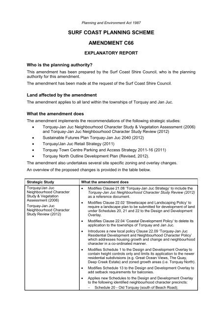
Planning and Environment Act 1987SURF COAST PLANNING SCHEMEAMENDMENT C66EXPLANATORY REPORTWho is the planning authority?This amendment has been prepared by the <strong>Surf</strong> <strong>Coast</strong> <strong>Shire</strong> Council, who is the planningauthority for this amendment.The amendment has been made at the request of the <strong>Surf</strong> <strong>Coast</strong> <strong>Shire</strong> Council.Land affected by the amendmentThe amendment applies to all land within the townships of Torquay and Jan Juc.What the amendment doesThe amendment implements the recommendations of the following strategic studies: Torquay-Jan Juc Neighbourhood Character Study & Vegetation Assessment (2006)and Torquay-Jan Juc Neighbourhood Character Study Review (2012) Sustainable Futures Plan Torquay-Jan Juc 2040 (2012) Torquay/Jan Juc Retail Strategy (2011) Torquay Town Centre Parking and Access Strategy 2011-16 (2011) Torquay North Outline Development Plan (Revised, 2012).The amendment also undertakes several site specific zoning and overlay changes.An overview of the proposed changes is provided in the table below.Strategic StudyTorquay/Jan JucNeighbourhood CharacterStudy & VegetationAssessment (2006)Torquay-Jan JucNeighbourhood CharacterStudy Review (2012)What the amendment doesModifies Clause 21.08 ‘Torquay-Jan Juc Strategy’ to include theTorquay-Jan Juc Neighbourhood Character Study Review (2012)as a reference document.Modifies Clause 22.02 ‘Streetscape and Landscaping Policy’ torequire a landscape plan to be submitted for development of landunder Schedules 20, 21 and 22 to the Design and DevelopmentOverlay.Modifies Clause 22.04 ‘<strong>Coast</strong>al Development Policy’ to delete itsapplication to the townships of Torquay and Jan Juc.Introduces a new local policy Clause 22.09 ‘Torquay-Jan JucResidential Development and Neighbourhood Character Policy’which addresses housing growth and change and neighbourhoodcharacter in a co-ordinated manner.Modifies Schedule 1 to the Design and Development Overlay tocontain height controls only and limits its application to the newerresidential subdivisions (e.g. Great Ocean Views, The Quay,Deep Creek Estate) and zoned growth areas (i.e. Torquay North).Modifies Schedule 13 to the Design and Development Overlay toadd setback requirements for balconies.Applies new Schedules to the Design and Development Overlayto the following identified neighbourhood character precincts: Schedule 20 - Old Torquay (south of Beach Road);
Strategic StudySustainable Futures PlanTorquay-Jan Juc 2040 (2012)Torquay/Jan Juc RetailStrategy (2011)Torquay Town Centre Parking& Access Strategy 2011-16(2011)What the amendment doesSchedule 21 - Old Torquay (north of Beach Road), WombahPark and Church Estate; andSchedule 22 - Jan Juc residential areas.Modifies Clause 21.06 ‘Rural Landscape’ to delete reference tothe Spring Creek corridor as an area identified for long termgrowth (Clause 21.06-8).Modifies Clause 21.07 ‘Rural Residential Living’ to:Delete discussion on the Spring Creek Corridor as an areaidentified for long term urban growth (Clause 21.07-2). Include the Sustainable Futures Plan Torquay Jan Juc 2040(2012) as a reference document.Modifies Clause 21.08 ‘Torquay-Jan Juc Strategy’ to:Incorporate the values and principles of the SFP2040 to helpmanage growth.Modify the Framework Map (Map 1 to Clause 21.08) byremoving reference to Spring Creek Valley as a future urbangrowth area / potential urban growth corridor and placing thesettlement boundary at Duffields Road.Recognise the potential for residential growth north-west ofMessmate Road.Introduce a possible option for longer term growth to occurin a limited area to the north-east of Torquay.Investigate other options for the Spring Creek area inrelation to rural uses/tourism as further strategic work. Include the Sustainable Futures Plan Torquay Jan Juc 2040(2012) as a reference document.Modifies Clause 21.02 ‘Settlement, Built Environment andHeritage’ to insert an objective and strategies under ‘ActivityCentre Planning’ (Clause 21.02-2) to give effect to the broaderstrategic directions of the Retail Strategy.Modifies Clause 21.08 ‘Torquay-Jan Juc Strategy’ to incorporatethe objectives and actions of the Retail Strategy and includes theRetail Strategy as a reference document.Rezones land in Torquay North identified in the approveddevelopment plan for 1160 Horseshoe Bend Road for theproposed Neighbourhood Activity Centre from Residential 1 Zoneto Business 1 Zone, removes Schedule 1 to the Design andDevelopment Overlay from the land, applies a new Schedule 23to the Design and Development Overlay to guide urban designoutcomes and applies Schedule 3 to the Parking Overlay. Rezones land at 132 Geelong Road, Torquay from Residential 1Zone to Business 1 Zone in recognition of its use as a local retailcentre.Modifies Clause 21.08 ‘Torquay-Jan Juc Strategy’ to incorporatethe key directions of the study.Includes the Torquay Town Centre Parking & Access Strategy2011-16 as a reference document at Clause 21.08 and inSchedule 6 to the Design and Development Overlay.Introduces the Parking Overlay Clause 45.09 and appliesSchedule 2 to the Parking Overlay to the Torquay Town Centre.Modifies the Schedule to Clause 52.06-6 to delete reference tothe Torquay Town Centre Parking Precinct Plan, October 2008and modifies the Schedule to Clause 81.01 to delete the parkingprecinct plan as an incorporated document.C66 <strong>Explanatory</strong> <strong>Report</strong> Page 2 of 13
Strategic StudyTorquay North OutlineDevelopment Plan (Updatedversion, 2012)What the amendment doesIncludes the Torquay North Outline Development Plan (Revised,2012) as a reference document at Clause 21.08.Modifies Schedule 8 to the Development Plan Overlay consistentwith the revised Torquay North Outline Development Plan.Miscellaneous changes Rezones land to the east of Strathmore Drive, Jan Juc from LowDensity Residential Zone to Residential 1 Zone to enableresidential development at conventional densities now watersupply limitations have been resolved by Barwon Water.Applies the Design and Development Overlay Schedule 1 to landat 175 Duffields Road, Torquay (Lot N on PS445088) to correctan anomaly.Rezones various public open space reserves that have beenvested in Council to Public Park and Recreation Zone.Applies Schedule 1 to the Parking Overlay to the <strong>Surf</strong> <strong>Coast</strong>Highway Precinct 1 and Precinct 3, modifies the Schedule toClause 52.06-6 to delete reference to the <strong>Surf</strong> <strong>Coast</strong> HighwayPrecinct 1 and Precinct 3 Parking Precinct Plan, August 2006and modifies the Schedule to Clause 81.01 to delete the parkingprecinct plan as an incorporated document.Strategic assessment of the amendment Why is the amendment required?The amendment is required to implement the recommendations of the strategic studiesreferred to above. The studies are related in that they help support growth anddevelopment in Torquay-Jan Juc in an integrated manner at various levels in comingyears, including residential growth and retail/commercial development. The rationalebehind the proposed planning scheme changes is explained as follows.Torquay-Jan Juc Neighbourhood Character Study & Vegetation Assessment (2006)and Torquay-Jan Juc Neighbourhood Character Study Review (2012)The Torquay-Jan Juc Neighbourhood Character Study & Vegetation Assessment (NCS)identifies the neighbourhood character elements that are particularly valued by thecommunity and the aspects of character that the community would like to see retained orenhanced.Three elements have been highlighted in the study as being of key importance tomaintaining and enhancing Torquay-Jan Juc’s coastal character: Retaining the low-rise character of Torquay-Jan Juc’s residential areas (maximumtwo-storey building height); Retaining a sense of space around buildings, allowing adequate space forlandscaping (in particular canopy trees and shrubs) which softens the visual presenceof buildings within the streetscape and from adjoining properties; and Encouraging architectural innovation and a high standard of design quality, with builtform that is reflective of Torquay-Jan Juc’s coastal character.A review of the NCS was undertaken internally by planning officers to provide an updateof the study and to develop implementation options. The review confirmed the existingcharacteristics of Torquay-Jan Juc’s residential areas and identifies six broad housingarea typologies, each of which relates to an anticipated intensity of development andability to accommodate change, including:Urban consolidation areas – These areas are within walking distance of major andneighbourhood activity centres, including part of Old Torquay which has beenidentified as suitable to undergo a relatively high level of change, considering therelatively large lot sizes, old housing stock and proximity to commercial facilities. TheC66 <strong>Explanatory</strong> <strong>Report</strong> Page 3 of 13
existing character will continue to evolve over time to contain a higher proportion ofresidential infill redevelopment in the form of well-designed medium and higherdensity housing up to two-storeys (three-storeys where appropriate), comprising avariety of housing types and sizes, including townhouses, units and apartments.General residential areas (mixed density) – These areas, covering Wombah Park,Church Estate and the northern part of Old Torquay, consist mainly of singledetached houses in a garden setting. The existing character will incrementally evolveover time with a greater proportion of well designed and site responsive infilldevelopment in the form of single and two-storey detached dwellings and dispersedmedium density developments, including second dwellings, dual occupancies andtownhouses.General residential areas (standard density) – These areas include the more recentlydeveloped residential estates, including The Quay in Torquay North and Great OceanViews Estate in Torquay West. The character is predominantly defined by single andtwo-storey detached houses, with only a limited number of multi-dwellingdevelopments. The areas are expected to undergo only a limited level of change,mainly in the form of exhaustion of remaining vacant lots for single dwellings andlimited multi-dwelling developments, where they are not prohibited by restrictivecovenants.Bush residential areas – These areas will provide for sensitively designed singledwellings and some dispersed medium density development (second dwellings, dualoccupancies, townhouses) that respect the valued attributes of the existing andpreferred neighbourhood character, with an emphasis on retaining and enhancingvegetation. It includes the majority of Jan Juc.Residential growth areas – These include zoned and identified broadhectareresidential subdivisions where the preferred character is yet to establish, such as thegrowth areas in Torquay North. It will be important to provide a mix of lot sizes toencourage housing diversity and to establish a landscaped and built form characterthat reflects Torquay’s preferred coastal character.Low density residential areas – These areas on the edge of the township providesingle dwellings at low densities. They perform as a transition zone on the urban andrural interface.In formulating recommendations for implementation of the NCS, Council has consideredthe current level of planning controls and how effective they have been in achieving thepreferred character for each precinct; the best practice approach to implementation ofneighbourhood character studies; and how implementation of neighbourhood charactercontrols will affect Council’s ability to achieve housing projections and manage growth.The 2012 Review report outlines the proposed changes, and the justification andrationale for the use of various controls.While some of the NCS was implemented through Amendment C37 (the amendment wasapproved with character controls relating to vegetation management and updatedcontrols along land abutting foreshore areas), the application of neighbourhood charactercontrols to the balance of the residential areas was delayed pending further study todetermine the most appropriate means of implementing the NCS.The current amendment proposes the application of Design and Development OverlaySchedules to the different neighbourhood character or housing precincts to guide the builtform outcome of development in a way that respects and contributes to the preferredcoastal character of Torquay-Jan Juc, whilst recognising the level of change that is to beexpected as part of a growing township. This links with outcomes in the adoptedSustainable Futures Plan Torquay-Jan Juc 2040.The amendment controls focus on design, building height, garage setbacks, private openspace and fencing to achieve the following outcomes:C66 <strong>Explanatory</strong> <strong>Report</strong> Page 4 of 13
Sufficient space around dwellings to retain or re-establish vegetation that softensbuildings, particularly within front setbacks;Built form that is designed and sited to be consistent with the preferredneighbourhood character and that displays a coastal style of architecture.Sustainable Futures Plan Torquay-Jan Juc 2040 (2012)The overall aim of the Sustainable Futures Plan (SFP) Torquay-Jan Juc 2040 is tosustainably manage growth by providing a clear direction for where growth is to occurand guidelines relating to its scale and timing over the next 30 years. The SFP seeks tobalance the environmental, social and economic aspirations of Torquay-Jan Juc’sstakeholders through five core values and principles:1. Places for People – The importance of a close knit community2. The Natural Environment – Protecting and enhancing the natural environment3. The Built Environment – Fostering the unique coastal look and feel4. Services and Infrastructure – Planning for services and infrastructure withdevelopment5. A Local Economy – Providing employment opportunities locally.The plan identifies land required to meet forecast population growth through greenfieldand infill development. The majority of growth will be focused in new growth areas inTorquay North (approximately 2,400 new lots and 5,700 new residents), Torquay Westeast of Duffields Road (approximately 610 new lots and 1,400 new residents) andnorthwest of Messmate Road up to the ridgeline (approx. 2,000 new lots and 4,500 newresidents), whilst urban infill in Central Torquay and Jan Juc will account forapproximately 800 new residents in Central Torquay and 670 in established Jan Juc by2030. The SFP aims to achieve a minimum density of 15 lots per hectare in new growthareas, consistent with state government policy.The SFP states that the people of Torquay-Jan Juc expressed a strong desire for a lessurban approach to development. This includes steering clear of suburban-typedevelopments and avoiding housing blocks of uniform colours or styles. The preferenceis instead for contemporary homes designed to reflect the coastal village feel and built onsustainability principles.Variations in density, lot size and housing stock (e.g. apartments, units, houses) wouldprovide greater capacity to cater for different life stages (e.g. first home buyer, growingfamily, empty nester, retiree, senior) and provide greater housing affordability. The SFPaims to deliver these values by ensuring planning and development policy focuses onencouraging a range of housing options at suitable densities to cater for the population’sdiverse needs and reflect the coastal look and feel, and by specifying a range ofguidelines for each new growth area.At its July 2011 Council meeting, <strong>Surf</strong> <strong>Coast</strong> <strong>Shire</strong> resolved to not include the SpringCreek Future Urban Growth Area within the SFP. Amendment C66 is required to alterthe settlement boundary to exclude the Spring Creek valley from future urban growth andto incorporate the values and principles of the SFP. Council has included a new FurtherInvestigation Area to the north-east beyond Horseshoe Bend Road, Torquay for futurelong-term growth.Torquay/Jan Juc Retail Strategy (2011)The Torquay/Jan Juc Retail Strategy takes into account the development projections ofthe Sustainable Futures Plan Torquay-Jan Juc 2040 and is designed to guide retailprovision and activity centre development over the next ten years. The strategy continuesto reinforce the role of the Torquay town centre as the key activity centre where higherorder retailing will be directed, and makes provision for a neighbourhood activity centre inTorquay North to service the growing community.The amendment is required to give effect to the objectives and actions of the RetailStrategy and to include the strategy as a reference document in the Planning Scheme.C66 <strong>Explanatory</strong> <strong>Report</strong> Page 5 of 13
The amendment also seeks to rezone land to Business 1 Zone in Torquay North tofacilitate development of the neighbourhood activity centre.Torquay Town Centre Parking and Access Strategy 2011-16 (2011)The Torquay Town Centre Parking & Access Strategy replaces the Torquay Town CentreCar Parking Strategy 2020 (2006) which was implemented through Amendment C37. Theupdated strategy reaffirms the key directions and initiatives of the 2006 Strategy andprovides a comprehensive assessment of car parking supply and demand in the towncentre based upon parking surveys undertaken in 2010. It projects future parking needsup to 2030 to meet expected expansion of retail and office floor space within that period.The strategy identifies potential locations for future provision of new parking in the towncentre on both public and private land. The aim is to ensure that parking is provided in anefficient and co-ordinated manner so that costs are reduced and parking is located toenhance the long term function and appearance of the town centre. The strategy outlinesthe recommended approach to parking provision, provides a basis for car parking ratesand continues the cash-in-lieu scheme for contributions from developers to fund theprovision of public parking where parking cannot be provided on private land.The amendment is required to include the Parking and Access Strategy as a referencedocument and to replace the current parking precinct plan for the town centre with aSchedule to the Parking Overlay.Torquay North Outline Development Plan (Revised, 2012)Since the adoption of the Outline Development Plan (ODP) for the Torquay North urbangrowth area in 2008, a number of regional and local studies have been undertaken andland use changes have taken place, necessitating an update to the Plan to ensure thereis alignment between current land use, approved development plans and sustainable andcommunity best practice design. The updated Plan takes into account:The Community and Civic Precinct – which includes the <strong>Shire</strong> offices and recreationreservePlanned education facilities, comprising both a primary and secondary schoolThe proposed neighbourhood activity centreOpportunities for medium density housingUrban arterial and collector street networkExisting and proposed bus routeDrainage reservesConservation areas featuring wetlands and patches of remnant vegetationOpen space linkages and local parks.Miscellaneous changesA number of site specific miscellaneous changes are also proposed. It is proposed torezone land to the east of Strathmore Drive, Jan Juc from Low Density Residential Zoneto Residential 1 Zone to enable residential development at conventional densities nowwater supply limitations have been resolved by Barwon Water after the upgrade of a highlevel water pump station. Rezoning will make efficient use of land within the settlementboundary.It is also proposed to apply the Design and Development Overlay Schedule 1 (DDO1) toland at 175 Duffields Road, Torquay (Lot N on PS445088) within the Great Ocean ViewsEstate. This 1.5 hectare parcel of land is zoned Residential 1 and for unknown reasonwas not overlaid by the DDO1. The amendment is required to correct this anomaly toensure future development is subject to the same controls as adjoining residential land.C66 <strong>Explanatory</strong> <strong>Report</strong> Page 6 of 13
How does the amendment implement the objectives of planning in Victoria?The Amendment implements the objectives of planning in Victoria (S.4 of the Planningand Environment Act 1987) by providing a clear policy framework for the fair, orderly,economic and sustainable use and development of land in Torquay-Jan Juc. How does the amendment address the environmental effects and anyrelevant social and economic effects?Torquay has a unique character that is highly valued by its residents and visitors. It isthis character that attracts people in the first place and provides an alternative lifestyledestination away from the more suburban built form and densities of metropolitanMelbourne and Geelong. The amendment seeks to introduce new controls that willprotect and enhance the low scale, vegetated, coastal character of Torquay and Jan Juc.Economic, social and environmental benefits will be derived from ensuring Torquay andJan Juc retain their unique character. Some of these benefits will include: Residents and visitors can continue to enjoy the relaxed coastal atmosphere Residential growth will lead to better community facilities and economic growth Tourism will continue to inject considerable money into the local economy More value placed on indigenous vegetation and its value to the community.The Retail Strategy provides a framework to encourage investment in retail and tourismdevelopment to provide local employment and to provide services for residents andvisitors. The Parking & Access Strategy seeks to facilitate the efficient development andfunctioning of the Torquay town centre, which is the main activity centre and retaildestination of the <strong>Shire</strong>, through the orderly provision of car parking. Does the amendment address relevant bushfire risk?The amendment does not rezone any land in identified high bushfire risk areas. Bushfirerisk is considered in the revised Clause 21.08. Does the amendment comply with the requirements of any Minister’sDirection applicable to the amendment?The amendment is not affected by any of the Minister’s Directions under section 12 of thePlanning and Environment Act 1987.The amendment is consistent with the Ministerial Direction on the Form and Content ofPlanning Schemes under section 7(5) of the Act.The amendment complies with the requirements of Minister’s Direction No. 11 StrategicAssessment of Amendments. How does the amendment support or implement the State Planning PolicyFramework?The amendment is consistent with and supports the objectives and strategies of theSPPF as follows:Clause 11 ‘Settlement’ outlines State policies for (amongst other matters) urban growth,regional development and coastal settlements.Activity centre planning for Torquay-Jan Juc, as espoused by the Retail Strategy andSFP2040, is consistent with Clause 11.01-1 ‘Activity centre network’, which aims to “buildup activity centres as a focus for high quality development, activity and living for thewhole community by developing a network of activity centres” and Clause 11.01-2‘Activity centre planning’ which encourages “the concentration of major retail, residential,commercial, administrative, entertainment and cultural developments into activity centresto provide a variety of land uses that are highly accessible to the community”.Strategies of particular relevance to Torquay-Jan Juc are to:C66 <strong>Explanatory</strong> <strong>Report</strong> Page 7 of 13
Undertake strategic planning for the use and development of land in and aroundthe activity centres.Give clear direction in relation to preferred locations for investment.Encourage a diversity of housing types at higher densities in and around activitycentres.Reduce the number of private motorised trips by concentrating activities thatgenerate high numbers of (non‐freight) trips in highly accessible activity centres.Improve access by walking, cycling and public transport to services and facilitiesfor local and regional populations.Broaden the mix of uses in activity centres to include a range of services overlonger hours appropriate to the type of centre and needs of the population served.Provide a focus for business, shopping, working, leisure and community facilities.Encourage economic activity and business synergies.Ensure Neighbourhood Activity Centres are located within convenient walkingdistance in the design of new subdivisions.Improve the social, economic and environmental performance and amenity of thecentre.Clause 11.02-1 ‘Supply of urban land’ directs Councils to “Plan to accommodateprojected population growth over at least a 15 year period and provide clear direction onlocations where growth should occur”. Planning for urban growth should consider:Opportunities for the consolidation, redevelopment and intensification of existingurban areas.Neighbourhood character and landscape considerations.The limits of land capability and natural hazards and environmental quality.Service limitations and the costs of providing infrastructure.The SFP2040 addresses these strategic directions by providing a long term frameworkfor growth, whilst the Neighbourhood Character Study considers neighbourhoodcharacter and landscape.The objective of Clause 11.05-5 ‘<strong>Coast</strong>al settlement’ is to plan for sustainable coastaldevelopment in the following manner:Support a network of diverse coastal settlements which provides for a broad rangeof housing types, economic opportunities and services.Encourage urban renewal and redevelopment opportunities within existingsettlements to reduce the demand for urban sprawl.Identify a clear settlement boundary around coastal settlements to ensure thatgrowth in coastal areas is planned and coastal values protected.Direct residential and other urban development and infrastructure within definedsettlement boundaries of existing settlements that are capable of accommodatinggrowth.Avoid linear urban sprawl along the coastal edge and ribbon development withinrural landscapes and protect areas between settlements for non-urban use.Avoid development on ridgelines, primary coastal dune systems and low lyingcoastal areas.Clause 12 ‘Environmental and Landscape Values’ recognises that planning should help toprotect and conserve areas with identified environmental and landscape values.Clause 12.02 ‘<strong>Coast</strong>al areas’ sets out a range of objectives and strategies for theprotection and appropriate development of coastal areas, the management of coastalCrown land, suitably located and designed coastal tourism opportunities, and sustainabledevelopment of the Great Ocean Road region. The Clause refers to the hierarchy ofprinciples for coastal planning and management as set out in the Victorian <strong>Coast</strong>alStrategy (2008). Strategies relevant to development include:C66 <strong>Explanatory</strong> <strong>Report</strong> Page 8 of 13
Ensure development is sensitively sited and designed and respects the characterof coastal settlements. (Clause 12.02-2)Ensure (tourism) developments are of an appropriate scale, use and intensityrelative to its location and minimises impacts on the surrounding natural visual,environmental and coastal character. (Clause 12.02-4)Ensure development responds to the identified landscape character of the area.Manage the impact of development on the environmental and cultural values ofthe area.Manage the growth of towns by: Respecting the character of coastal towns and promoting best practice designfor new development. Directing urban growth to strategically identified areas. (Clause 12.02-6).Clause 12.04 ‘Significant environments and landscapes’ seeks to protect environmentallysensitive areas and landscapes and significant open spaces that contribute to character,identity and sustainable environments. In support of this objective, the policy hasstrategies to ensure sensitive landscapes are protected and new development does notdetract from their natural quality, natural landscapes are recognised for their aestheticvalue and as a fully functioning system and natural features are protected and enhanced.Clause 15 ‘Built Environment and Heritage’ seeks to ensure that land use anddevelopment appropriately responds to its landscape, valued built form and culturalcontext, and protects places and sites with significant heritage, architectural, aesthetic,scientific and cultural value; and achieves high quality urban design and architecture that:Contributes positively to local urban character and sense of place.Reflects the particular characteristics, aspirations and cultural identity of thecommunity.Enhances liveability, diversity, amenity and safety of the public realm.Promotes attractiveness of towns and cities within broader strategic contexts.Minimises detrimental impact on neighbouring properties.The amendment is consistent with Clause 15.01 ‘Urban environment’, which includes thefollowing relevant objectives and strategies:To create urban environments that are safe, functional and provide good qualityenvironments with a sense of place and cultural identity. (Clause 15.01-1objective)To achieve architectural and urban design outcomes that contribute positively tolocal urban character and enhance the public realm while minimising detrimentalimpact on neighbouring properties. (Clause 15.01-2 objective)To ensure the design of subdivisions achieves attractive, liveable, walkable,cyclable diverse and sustainable neighbourhoods. (Clause 15.01-3 objective)To recognise and protect cultural identity, neighbourhood character and sense ofplace. (Clause 15.01-5 objective)Ensure development responds and contributes to existing sense of place andcultural identity.Ensure development recognises distinctive urban forms and layout and theirrelationship to landscape and vegetation.Ensure development responds to its context and reinforces special characteristicsof local environment and place by emphasising: The underlying natural landscape character. The heritage values and built form that reflect community identity. The values, needs and aspirations of the community. (Clause 15.01-5strategies).Clause 16 ‘Housing’ seeks to provide a diversity of well serviced housing with anincreasing proportion being located within the established urban area particularly in orC66 <strong>Explanatory</strong> <strong>Report</strong> Page 9 of 13
close to activity centres and employment corridors and at other strategic redevelopmentsites that offer good access to services and transport.Clause 16.01-4 ‘Housing diversity’ encourages the provision of a range of housing typesto meet increasingly diverse needs. It encourages the development of well-designedmedium-density housing which:Respects the neighbourhood character.Improves housing choice.Makes better use of existing infrastructure.Improves energy efficiency of housing.The aim of Clause 16.01-5 ‘Housing affordability’ is to deliver more affordable housingcloser to jobs, transport and services. This is to be achieved through:Ensuring land supply continues to be sufficient to meet demand.Increasing choice in housing type, tenure and cost to meet the needs ofhouseholds as they move through life cycle changes and to support diversecommunities.Promoting good housing and urban design to minimise negative environmentalimpacts and keep down costs for residents and the wider community.Encouraging a significant proportion of new development, including developmentat activity centres and strategic redevelopment sites to be affordable forhouseholds on low to moderate incomes.Clause 17 ‘Economic development’ sets objectives and strategies for commercial,industrial and tourism development.Clause 18.02-5 ‘Car parking’ encourages the provision of an adequate supply of carparking that is appropriately designed and located. It states that in, Councils should:Allocate or require land to be set aside for car parking subject to the existing andpotential modes of access including public transport, the demand for off-street carparking, road capacity and the potential for demand management of car parking.Encourage the efficient provision of car parking through the consolidation of carparking facilities.The SPPF also states that parking precinct plans should be prepared or required for thedesign and location of local car parking to:Protect the role and function of nearby roads, enable easy and efficient use andthe movement and delivery of goods.Achieve a high standard of urban design and protect the amenity of the locality,including the amenity of pedestrians and other road users.Create a safe environment, particularly at night.Facilitate the use of public transport.It further states that the amenity of residential land is to be protected from the effects ofroad congestion created by on-street parking, and that adequate provision for taxi ranksshould be planned for.The purpose of the Torquay Town Centre Parking and Access Strategy is to co-ordinatethe efficient provision of car parking in the town centre, taking into account the abovematters. How does the amendment support or implement the Local Planning PolicyFramework?The LPPF, including the Municipal Strategic Statement (MSS) and Local Policies,establishes a local context for the amendment. The amendment is consistent with andsupports the key provisions of the following clauses:Clause 21.01 – Profile and VisionC66 <strong>Explanatory</strong> <strong>Report</strong> Page 10 of 13
Clause 21.02 – Settlement, Built Environment and HeritageClause 21.03 – Environmental ManagementClause 21.08 – Torquay-Jan Juc Strategy.A recurring theme of the <strong>Surf</strong> <strong>Coast</strong> <strong>Shire</strong>’s MSS is balancing development against theenvironmental qualities of the <strong>Shire</strong> which provide the foundation of its attractiveness as aplace to live, to work and to visit. To achieve this, the <strong>Shire</strong> has adopted detailed policiesfor the coastal townships and their hinterland which direct new development into existingtown areas and limit development in areas of high scenic, environmental and agriculturalvalue.Clause 21.01 ‘Profile and Vision’ lists the following key issues and influences facing the<strong>Shire</strong> and in particular the coastal towns:Increasing popularity of the coast and coastal towns as permanent, holiday andtourist destinations.Reconciling coastal growth with the fragile natural environment, traditional coastaltown character and relaxed surfing culture.Rapid rate of growth of coastal towns and delivery of necessary infrastructure.The key strategic directions for sustainable land use and development as identified in theMunicipal Land Use Framework Plan at Clause 21.01-4 include:To manage population and tourist growth and development in an ecologicallysustainable manner.To concentrate urban growth predominantly in the towns of Torquay-Jan Juc andWinchelsea.To support and strengthen the individual character and role of the coastal andrural towns within the <strong>Shire</strong>.To protect the fragile coastal and forest environments and scenic landscapes thatseparates the coastal townships from urban sprawl and inappropriatedevelopment.Clause 21.02 ‘Settlement, Built Environment and Heritage’ recognises that Torquay,together with Winchelsea, has capacity to accommodate substantial growth but thatdevelopment pressure and insensitive suburban style development are threatening thecharacter valued by residents and visitors. The strategy at Clause 21.02-3 (SettlementPatterns) designates Torquay-Jan Juc and Winchelsea as the major growth centres forthe <strong>Shire</strong> and seeks to ensure the provision of at least 15 years supply of residential landwithin these townships.The objective of Clause 21.02-4 ‘Neighbourhood character’ is “to protect the individualcoastal township character values of low urban density, recessive built form, vegetatedcoastal landscapes and ecological values of the natural environment from inappropriateurban development” through the following strategies:Ensure residential development densities are compatible to the protection of theindigenous vegetation and the historic neighbourhood character of the <strong>Surf</strong> <strong>Coast</strong>settlements.Encourage a coastal style of urban form within all coastal towns and coastallocalities in all developments.Recognise the key role vegetation plays in defining township character and insoftening urban development.The Torquay-Jan Juc Strategy at Clause 21.08 describes Torquay-Jan Juc as follows:“Torquay-Jan Juc is the main urban growth centre of the <strong>Surf</strong> <strong>Coast</strong> <strong>Shire</strong>. It is apopular destination for surfers, tourists, holiday makers and retirees, and the seachangemovement has resulted in the town becoming increasingly popular forpermanent settlement.”C66 <strong>Explanatory</strong> <strong>Report</strong> Page 11 of 13
The Strategy again recognises the need to balance growth and development against acommunity desire to maintain the coastal character of Torquay-Jan Juc. The keyobjective in terms of settlement and housing is to “accommodate and manage theprojected population growth and demographic change of Torquay-Jan Juc in anenvironmentally sustainable manner that respects and celebrates the distinct surfingidentity and coastal character of the town”. This is to be achieved by:Containing and consolidating urban development within the defined settlementboundary.Facilitating new residential growth in Torquay North up to South Beach Road, andto the west in the Spring Creek Urban Growth Corridor.Retaining limited provision of low density residential development, containedwithin the settlement boundary.Encouraging the resubdivision of key low density residential sites (e.g. BriodyDrive Estate, Torquay Heights etc) at densities appropriate to their location andphysical characteristics.Encouraging innovative medium density housing solutions around the TorquayTown Centre and local activity nodes, ensuring such developments value add tothe neighbourhood character and are respectful of the urban form and heritagevalues of adjacent sites.Ensuring that residential development is guided by the coastal character ofTorquay-Jan Juc and assists in the protection or re-establishment of indigenousvegetation and vegetation that filters the appearance of development from publicspaces.The adopted Sustainable Futures Plan Torquay-Jan Juc 2040 no longer supports growthin the Spring Creek valley west of Duffields Road and the amendment is required toadjust the settlement boundary accordingly. Does the amendment make proper use of the Victoria Planning Provisions?The amendment makes proper use of the Victoria Planning Provisions. An assessmenthas been made of available VPP tools to implement the strategic studies and variousPractice Notes have been followed to draft the controls. How does the amendment address the views of any relevant agency?The views of the relevant agencies were considered as part of the preparation of thestrategic studies that underlie the amendment and any further views will be taken intoconsideration following exhibition of the amendment and the receipt of any submissions.The amendment does not contain any new referral provisions. Does the amendment address relevant requirements of the TransportIntegration Act 2010?The amendment encourages the establishment of a public transport link betweenArmstrong Creek (Geelong) and Torquay to improve transport connections in the region.Resource and administrative costs What impact will the new planning provisions have on the resource andadministrative costs of the responsible authority?The new planning provisions are considered to have limited impact on the resource andadministrative costs of Council.C66 <strong>Explanatory</strong> <strong>Report</strong> Page 12 of 13
Panel hearing datesIn accordance with clause 4(2) of Ministerial Direction No.15 the following panel hearingdates have been set for this amendment: Directions Hearing: to be held in the week beginning 3 rd June 2013 Panel Hearing: to commence in the week beginning 1 st July 2013.Where you may inspect this AmendmentThe amendment is available for public inspection, free of charge, during office hours at thefollowing places: <strong>Surf</strong> <strong>Coast</strong> <strong>Shire</strong> Municipal Office, 1 Merrijig Drive, Torquay.The amendment can also be inspected free of charge at the Department of Planning andCommunity Development website at www.dpcd.vic.gov.au/planning/publicinspection.C66 <strong>Explanatory</strong> <strong>Report</strong> Page 13 of 13