map of zagreb county
map of zagreb county
map of zagreb county

You also want an ePaper? Increase the reach of your titles
YUMPU automatically turns print PDFs into web optimized ePapers that Google loves.
Natural characteristics: Lowlands – Sava, Krapina, Lonja and Odra Rivers;<br />
Lowlands <strong>of</strong> the marsh areas – fish ponds Vukšinac, Pisarovina and the largest<br />
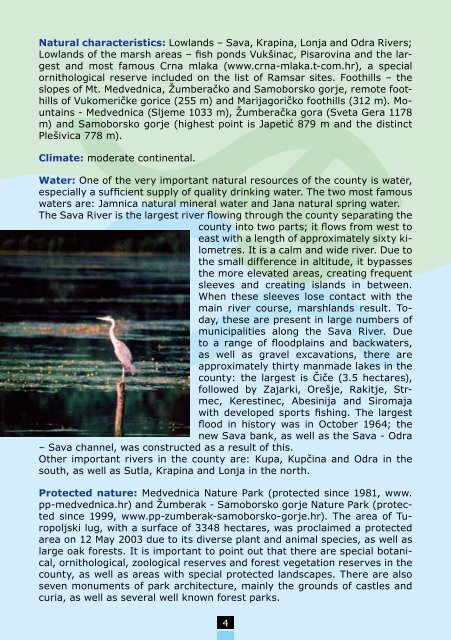
and most famous Crna mlaka (www.crna-mlaka.t-com.hr), a special<br />
ornithological reserve included on the list <strong>of</strong> Ramsar sites. Foothills – the<br />
slopes <strong>of</strong> Mt. Medvednica, Žumberačko and Samoborsko gorje, remote foothills<br />
<strong>of</strong> Vukomeričke gorice (255 m) and Marijagoričko foothills (312 m). Mountains<br />
- Medvednica (Sljeme 1033 m), Žumberačka gora (Sveta Gera 1178<br />
m) and Samoborsko gorje (highest point is Japetić 879 m and the distinct<br />
Plešivica 778 m).<br />
Climate: moderate continental.<br />
Water: One <strong>of</strong> the very important natural resources <strong>of</strong> the <strong>county</strong> is water,<br />
especially a sufficient supply <strong>of</strong> quality drinking water. The two most famous<br />
waters are: Jamnica natural mineral water and Jana natural spring water.<br />
The Sava River is the largest river flowing through the <strong>county</strong> separating the<br />
<strong>county</strong> into two parts; it flows from west to<br />
east with a length <strong>of</strong> approximately sixty kilometres.<br />
It is a calm and wide river. Due to<br />
the small difference in altitude, it bypasses<br />
the more elevated areas, creating frequent<br />
sleeves and creating islands in between.<br />
When these sleeves lose contact with the<br />
main river course, marshlands result. Today,<br />
these are present in large numbers <strong>of</strong><br />
municipalities along the Sava River. Due<br />
to a range <strong>of</strong> floodplains and backwaters,<br />
as well as gravel excavations, there are<br />
approximately thirty manmade lakes in the<br />
<strong>county</strong>: the largest is Čiče (3.5 hectares),<br />
followed by Zajarki, Orešje, Rakitje, Strmec,<br />
Kerestinec, Abesinija and Siromaja<br />
with developed sports fishing. The largest<br />
flood in history was in October 1964; the<br />
new Sava bank, as well as the Sava - Odra<br />
– Sava channel, was constructed as a result <strong>of</strong> this.<br />
Other important rivers in the <strong>county</strong> are: Kupa, Kupčina and Odra in the<br />
south, as well as Sutla, Krapina and Lonja in the north.<br />
Protected nature: Medvednica Nature Park (protected since 1981, www.<br />
pp-medvednica.hr) and Žumberak - Samoborsko gorje Nature Park (protected<br />
since 1999, www.pp-zumberak-samoborsko-gorje.hr). The area <strong>of</strong> Turopoljski<br />
lug, with a surface <strong>of</strong> 3348 hectares, was proclaimed a protected<br />
area on 12 May 2003 due to its diverse plant and animal species, as well as<br />
large oak forests. It is important to point out that there are special botanical,<br />
ornithological, zoological reserves and forest vegetation reserves in the<br />
<strong>county</strong>, as well as areas with special protected landscapes. There are also<br />
seven monuments <strong>of</strong> park architecture, mainly the grounds <strong>of</strong> castles and<br />
curia, as well as several well known forest parks.<br />
4