davenport - River Action
davenport - River Action
davenport - River Action

Create successful ePaper yourself
Turn your PDF publications into a flip-book with our unique Google optimized e-Paper software.
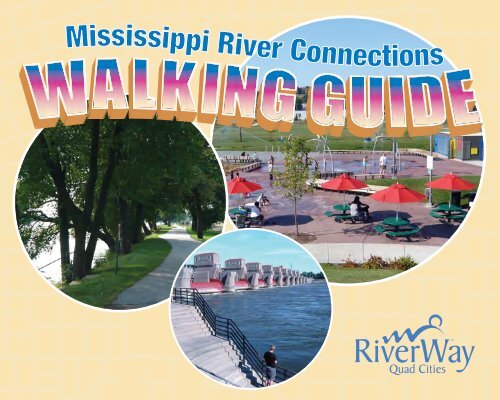
Mi sissippi <strong>River</strong> Connections
Take the Official Walking Guide Quiz!<br />
1. How far do you need to walk to burn off the calories in one piece of M&M candy?<br />
A. 50 feet B. The length of a football field C. One-half mile D. One mile<br />
2. Brisk walking (faster than 3.5 miles per hour) has been shown to:<br />
A. Reduce body fat B. Lower blood pressure C. Increase high-density lipoprotein<br />
D. Reduce risks of bone fractures E. All of the above<br />
3. A 150-pound person walking just one mile can exert a force of ?? on a single foot:<br />
A. 64 tons B. 64 pounds C. 6.4 tons D. 6.4 pounds<br />
4. What percentage of American workers walk to work:<br />
A. 1.24% B. 2.47% C. 10.62% D. 15.86%<br />
5. An average person takes how many step each day?<br />
A. 2,000 to 3,000 B. 3,000 to 5,0000<br />
C. 5,000 to 8,000 D. 8,000 to 10,000<br />
Answers on back page!<br />
Brought to you by
Legend<br />
480<br />
480<br />
Trail<br />
On-street with bike lane<br />
Shopping<br />
Parks<br />
Canoe/kayak rental<br />
Bicycle rental<br />
Restrooms<br />
Water<br />
Parking<br />
Playground<br />
<strong>River</strong>Way art<br />
Boat launch<br />
Marina<br />
<strong>River</strong> mile marker<br />
7<br />
Davenport<br />
27<br />
Rock Island<br />
8<br />
36<br />
28<br />
11<br />
Moline<br />
35<br />
31<br />
12<br />
Bettendorf<br />
32<br />
15<br />
40<br />
<strong>River</strong>dale<br />
Numbers indicate the page of enlarged maps inside.<br />
16<br />
39<br />
East Moline<br />
19<br />
Hampton<br />
20<br />
LeClaire<br />
23<br />
Rapids City<br />
Princeton<br />
Port Byron<br />
24<br />
Cordova
ROCK ISLAND<br />
Sunset Park and Marina is located on the banks of the<br />
Mississippi <strong>River</strong> at its confluence with the Rock<br />
<strong>River</strong>. This park, between 18th and 31st Avenue, is<br />
the southwest terminus of the Mississippi <strong>River</strong> Trail,<br />
which is part of the larger Great <strong>River</strong> Trail. Walkers<br />
can choose between two routes around Lake<br />
Potter – each are approximately one mile in length.<br />
Walkers and bikers also can use the trail to connect<br />
to downtown Rock Island, the Quad City Botanical<br />
Center, Sylvan Island, and<br />
the east-west American<br />
Discovery Trail crossing<br />
of the Mississippi<br />
<strong>River</strong> from Rock Island to<br />
Davenport. Amenities at Sunset Park include a<br />
picnic area, playground, benches, and parking for<br />
cars and boat trailers. Enjoy fishing from the banks<br />
of Lake Potter. Toilets and drinking fountains are<br />
available during summer months.<br />
6<br />
Nahant<br />
Marsh<br />
61<br />
Davenport <strong>River</strong>front Trail<br />
Credit Island Park<br />
479<br />
Iowa<br />
Davenport<br />
Mississippi <strong>River</strong><br />
Canal Rd.<br />
To downtown Davenport<br />
480<br />
Rock <strong>River</strong><br />
Sunset<br />
Marina<br />
7<br />
Sunset<br />
Park<br />
La k e<br />
P otte r<br />
Mississippi <strong>River</strong> Trail<br />
To downtown R.I.<br />
Centennial Express w a y<br />
18th Av e .<br />
Mill St.<br />
92<br />
Rock<br />
Island<br />
Illinois<br />
31st Av e .<br />
5th St.<br />
11th St.
Iowa<br />
To Sunset Park<br />
Sunset Park<br />
and Marina<br />
Davenport<br />
Centennial Park<br />
Davenport <strong>River</strong>front Trail<br />
Mill St.<br />
480 Mississippi <strong>River</strong><br />
Mi sissippi <strong>River</strong> Trail<br />
3rd Ave.<br />
Raush<br />
Family<br />
Park<br />
92<br />
11th St.<br />
Centennial Bridge<br />
15th St.<br />
Rock Island<br />
Illinois<br />
15th Ave. 11th St.<br />
Douglas<br />
Park<br />
18th Ave.<br />
17th St.<br />
Mark Schweibert<br />
<strong>River</strong>front Park<br />
17th St.<br />
1st Ave.<br />
3rd Ave.<br />
4th Ave.<br />
5th Ave.<br />
Longview<br />
Park<br />
20th St.<br />
Overlook<br />
Broadway<br />
Historic<br />
District<br />
9th Ave.<br />
Reservoir<br />
Park<br />
American Discovery<br />
Trail Crossing<br />
24th St.<br />
R.I. Viaduct Bridge<br />
Sylvan Slough<br />
Quad City<br />
Botanical<br />
Center<br />
To Moline<br />
Mississippi <strong>River</strong> Trail, adjacent to the riverfront,<br />
showcases a wide variety of culture, wildlife<br />
and local history. With ample street parking and a<br />
public parking lot at the southwest corner of 20th<br />
Street and Illinois 92, you can tailor your walk from<br />
as little as a few hundred feet to several miles.<br />
The trail, part of Illinois’ Great <strong>River</strong> Trail, extends<br />
60 miles along the Mississippi <strong>River</strong> between<br />
Rock Island (Sunset Park) and Savanna. The trail<br />
along the downtown Rock Island riverfront is within<br />
minutes of “The District,” the city’s downtown dining<br />
and entertainment area. The Mark Schweibert <strong>River</strong>front<br />
Park includes a popular water spray area and playground for<br />
children, restrooms, picnic areas and a beautiful river promenade.<br />
The park and nearby 20th Street Overlook provide excellent eagleviewing<br />
during the winter months and a scenic panorama of the river<br />
and Davenport skyline year round. Look for the <strong>River</strong> <strong>Action</strong> kiosk for<br />
more trail and historical information. Upstream from downtown is the<br />
Quad City Botanical Center, Quad City Expo Center and Sylvan Island Park.<br />
8 9<br />
ROCK ISLAND
ROCK ISLAND<br />
Augustana College was founded in Chicago in 1860 as<br />
Augustana College and Theological Seminary, and moved<br />
to Rock Island, where the first college building was dedicated<br />
in 1875. The school was the flagship educational institution of<br />
the Augustana Lutheran Synod, a national church body made up<br />
mostly of Swedish immigrants and their descendants. Augustana’s<br />
campus contains a variety of scenic walking paths, which pass<br />
some of the most historic structures in Rock Island.<br />
S<br />
ylvan Island Park lies just northeast of Augustana<br />
College along the Great <strong>River</strong> Trail. The small island,<br />
once home to a steel-rolling mill, is now a quiet natural area<br />
with an interpretive center, a river overlook, and hiking and<br />
biking trails. Wintering bald eagles, great blue herons and<br />
other water birds often can be seen along the Mississippi<br />
<strong>River</strong> channel known as Sylvan Slough. For additional mileage,<br />
continue west along the riverfront from Sylvan Island about<br />
1.5 miles to downtown Rock Island (The District) or head east<br />
to downtown Moline (John Deere Commons).<br />
30th St.<br />
To downtown Rock Island<br />
92<br />
18th Ave.<br />
Rock Island<br />
Arsenal<br />
14th Ave.<br />
Mississippi <strong>River</strong> Trail<br />
Augustana<br />
College<br />
38th St.<br />
6th Ave.<br />
44th St.<br />
Sylvan Island<br />
Park<br />
1st St.<br />
R o c k I s l a n d - M o l i n e b o r d e r<br />
Railroad Ave.<br />
4th Ave.<br />
7th Ave. 5th Ave.<br />
Lincoln<br />
Park<br />
Rock Island<br />
Illinois<br />
Sylvan Natural<br />
Area<br />
10 11<br />
Sylvan Gateway<br />
Park<br />
McCandless<br />
Park<br />
<strong>River</strong> Dr.<br />
16th Ave.<br />
Sylvan Slough<br />
Stephens<br />
Park<br />
To downtown Moline<br />
Moline<br />
6th St.<br />
7th St.<br />
Deere-Wiman<br />
Home<br />
Butterworth<br />
Center<br />
Rock Island Arsenal<br />
National Cemetery<br />
5th Ave.<br />
6th Ave.<br />
12th Ave.<br />
Velie<br />
Park
Sylvan<br />
Gateway<br />
Park<br />
Sylvan Island<br />
Park<br />
1st St.<br />
R o c k I s l a n d - M o l i n e b o r d e r<br />
Railroad Ave.<br />
4th Ave.<br />
McCandless<br />
Park<br />
5th Ave.<br />
To Rock Island<br />
<strong>River</strong> Dr.<br />
Missi si pi <strong>River</strong> Trail<br />
Stephens<br />
Park<br />
6th St.<br />
Rodman Avenue<br />
Rock Island Arsenal<br />
7th St.<br />
Deere-Wiman<br />
Home<br />
Butterworth<br />
Center<br />
National<br />
Cemetery<br />
Sylvan Slough<br />
MetroLINK<br />
Transit Center<br />
5th Ave.<br />
6th Ave.<br />
i wireless Center<br />
3rd Ave.<br />
12th Ave.<br />
16th Ave.<br />
Velie<br />
Park<br />
Arsenal Bike Trail<br />
Permission required<br />
Riders must wear helmets<br />
Channel Cat<br />
Water Taxi<br />
Dock<br />
John Deere Commons<br />
15th St.<br />
7th Ave.<br />
16th St.<br />
Interstate 74 Bridge to Bettendorf<br />
Bass Street<br />
Landing<br />
QC Convention<br />
& Visitors Bureau<br />
17th St.<br />
18th St.<br />
Channel Cat Water Taxi Route<br />
19th St.<br />
Moline<br />
Illinois<br />
74<br />
<strong>River</strong> Dr.<br />
To East Moline<br />
25th St.<br />
<strong>River</strong>side<br />
Park<br />
John Deere Commons along 3rd Avenue between<br />
17th and 15th Street has been restored to its<br />
1869-1889 era grandeur. John Deere Pavilion tells<br />
the story of John Deere and agriculture through<br />
displays and interactive exhibits. Nearby are<br />
a variety of retail shops, restaurants and<br />
the MetroLINK Centre Station bus terminal.<br />
Two blocks south is downtown Moline with<br />
additional shops and restaurants. The QC<br />
Convention and Visitors’ Bureau office at 1601<br />
<strong>River</strong> Drive rents bicycles during the summer<br />
months. A Channel Cat Water Taxi stop on the<br />
riverfront provides a water link to Bettendorf and<br />
Davenport. Steps away is the i wireless Center,<br />
a 10,000-seat entertainment and professional<br />
sports center. The ‘Spirit of Place’ sculpture,<br />
just west of the Radisson Hotel/TGI Friday’s<br />
Restaurant, marks the location of one of the first<br />
John Deere factories.<br />
12 13<br />
MOLINE
MOLINE<br />
Ben Butterworth Parkway along Moline’s Mississippi<br />
riverfront is among the most popular walking paths<br />
in the region. Begin your trip east of the Celebration<br />
Belle riverboat parking lot in the 2500 block of <strong>River</strong><br />
Drive. From here to the East Moline border is slightly<br />
more than two miles on a paved trail. Along the trail<br />
are an abundance of benches and picnic shelters, as<br />
well as playgrounds and restrooms.<br />
Look for <strong>River</strong> <strong>Action</strong>’s <strong>River</strong>Way locator signs<br />
and interpretive historical markers about the city’s<br />
early Belgian and Swedish immigrants and the<br />
historic Rock Island rapids that made river navigation<br />
difficult and dangerous before the lock and dam system.<br />
At the eastern end of the parkway on the East Moline<br />
border is a large picnic area and boat launch. Conveniently<br />
locatednear the Celebration Belle is the Channel Cat Water Taxi, which plies the<br />
Mississippi <strong>River</strong> between Davenport, Bettendorf and Moline during the summer months. Try<br />
this fun mode of transit for a unique “water leg” of your return trip. Bicycles are welcome.<br />
14<br />
Iowa<br />
Isle of Capri<br />
Channel Cat<br />
Hotel Casino<br />
Water Taxi<br />
Dock<br />
To downtown Moline<br />
Bettendorf<br />
487<br />
Channel Cat<br />
Water Taxi<br />
Dock<br />
Western Illinois<br />
University<br />
Quad Cities<br />
<strong>River</strong>side Park<br />
34th St.<br />
Mississippi <strong>River</strong><br />
Ben Butterworth Parkway<br />
<strong>River</strong> Dr.<br />
Peterson Park<br />
4th Ave.<br />
5th Ave.<br />
Mississippi <strong>River</strong> Trail<br />
41st St.<br />
15<br />
488<br />
Moline<br />
Illinois<br />
48th St.<br />
Ralph B. Birks Bikeway<br />
To East Moline<br />
55th St.<br />
M o l i n e - E a s t M o l i n e b o r d e r
Iowa<br />
490<br />
To Moline<br />
7th St.<br />
Mississippi <strong>River</strong><br />
Beacon Harbor Parkway<br />
Harvest Way<br />
The Quarter<br />
Mississippi <strong>River</strong> Trail<br />
13th Ave.<br />
East Pointe<br />
Metro Station<br />
Campbell’s<br />
Island<br />
13th St.<br />
Campbell Ave.<br />
Hereford<br />
Park<br />
16<br />
19th St.<br />
Empire<br />
Park<br />
N. 20th St.<br />
3rd Ave.<br />
To Hampton<br />
84<br />
20th Ave. North.<br />
Jacobs<br />
Park<br />
East Moline<br />
Illinois<br />
The Quarter in East Moline includes<br />
multi-family housing with recreational<br />
access to the Mississippi <strong>River</strong>, and a river<br />
overlook with restrooms. The development<br />
provides pedestrian- and bike-friendly<br />
paths between the river and downtown<br />
East Moline via a natural riparian area. The<br />
Metro East Pointe Station at 1201 14th<br />
Avenue provides easy access between the<br />
downtown and the riverfront recreation trail.<br />
Improvements along 7th Street between 12th<br />
and 15th Avenues have created a safer and<br />
more attractive crossing over the railroad tracks.<br />
When complete, The Quarter will include private<br />
docks, residential housing and a proposed sports<br />
complex. The <strong>River</strong> Connection also includes a<br />
Mississippi <strong>River</strong> Interpretive Center, interpretive<br />
trail and wetlands area.<br />
17<br />
EAST MOLINE
HAMPTON and SMITH’S ISLAND<br />
Hampton was an early wood supply stop for passing<br />
steamboats. Black’s Store, now an historical museum,<br />
was built in 1849, and still stands at 601 First Avenue – reached<br />
easily by foot from the river trail. Heritage Park includes a<br />
heritage center, picnic pavilions and family entertainment. Also<br />
on-site is a bioswale funded in part by <strong>River</strong> <strong>Action</strong>. This native<br />
planting technique is used to capture storm water and prevent<br />
flooding of adjacent areas. Illiniwek Forest Preserve is a mile<br />
upriver, and offers panoramic views of the Mississippi <strong>River</strong>.<br />
S<br />
mith Island’s – just upstream from Lock and Dam 14<br />
between Bettendorf and LeClaire, Iowa – offers a<br />
refreshing nature walk. Hikers can spot numerous species of<br />
wildlife and plants while traversing the 1.5-mile trail through<br />
upland and river bottom land. Visitors in the spring enjoy<br />
numerous wildflowers. Frequent sighting of turtles and ducks<br />
will treat everyone that walks the marsh side of the trail. A<br />
fishing pier is conveniently located next to the parking lot off<br />
Canal Shore Drive.<br />
18<br />
To Heritage Park/East Moline<br />
Iowa<br />
1st Ave.<br />
Black’s<br />
Store<br />
6th St..<br />
Future Trail<br />
67<br />
Canal Shore Drive<br />
492<br />
Hampton<br />
8th St..<br />
Lock & Dam 14<br />
Mississippi <strong>River</strong> Trail<br />
Illiniwek<br />
Forest<br />
Preserve<br />
Smith’s Island<br />
Nature Area<br />
493<br />
19<br />
84<br />
Mississippi <strong>River</strong><br />
Hubbard Rd.<br />
Lighthouse Ln.<br />
Fisherman’s<br />
Corner<br />
Campground<br />
Illinois<br />
To Rapids City
495<br />
To Hampton/East Moline<br />
Iowa<br />
Canal Shore Drive<br />
80<br />
Mississippi Rapids<br />
Visitors Center<br />
Future Trail<br />
496<br />
Mississippi <strong>River</strong><br />
Mississippi <strong>River</strong> Trail<br />
20<br />
LeClaire<br />
67<br />
1st Ave.<br />
17th St.<br />
Welcome<br />
Center<br />
84<br />
497<br />
<strong>River</strong>bend<br />
Park<br />
Shuler’s Shady<br />
Grove Park<br />
12th St.<br />
1st Ave.<br />
Rapids City<br />
Illinois<br />
To Port Byron<br />
21<br />
RAPIDS CITY<br />
Rapids City is located at the<br />
upper end of the “Rock Island<br />
rapids” which made river navigation<br />
difficult and dangerous before<br />
the lock and dam system. The<br />
original town site was settled<br />
around a grist mill and a<br />
saw mill. Neighboring coal<br />
mines employed a number<br />
of residents and helped the<br />
community thrive in the<br />
1870’s and 1880’s. Shuler’s<br />
Shady Grove, a riverfront<br />
park with a boat ramp, trail<br />
and restrooms, is named after<br />
the owner of one of the area’s<br />
first coal mines. Here you can enjoy<br />
a short network of trails around a<br />
restored stream and woodland.
LeCLAIRE and PORT BYRON<br />
LeClaire’s location – where the Mississippi <strong>River</strong> makes a<br />
sharp bend to the southwest – contributed to its early<br />
history as the home of many riverboat pilots. All of the homes and<br />
buildings included in the city’s historic district were built in the mid-<br />
19th century (mostly between 1850-1870) and many with historical<br />
landmark designation are along Cody Road and Second Street<br />
with a few between Wisconsin and Dodge Streets. Local shopkeepers<br />
can provide you with a brochure for a self-guided walking tour. Visit<br />
the Buffalo Bill Cody Museum (he was born in LeClaire), housed next to an<br />
original paddlerwheeler, the LoneStar, now enclosed in its own building for<br />
viewing and preservation. This small community has become a focal point for<br />
antique shops, art galleries and restaurants, and now includes a craft whiskey distillery.<br />
P<br />
ort Byron – named for the English poet Lord Byron – has a history<br />
of quarrying, coopers (barrel-makers), merchants, blacksmiths,<br />
grain dealers and manufacturing of construction lime. Established in<br />
1881, the Port Byron Academy was affiliated with the Congregational<br />
Church before becoming a college prep school for Beloit (Wisconsin)<br />
College. Enjoy a pleasant walk to the riverfront park, boat ramp,<br />
restaurants, shops and a bed-and-breakfast.<br />
Iowa<br />
Territorial Rd.<br />
To Princeton<br />
Oak St.<br />
Scout Park<br />
Holland St.<br />
Benton St.<br />
Ferry St.<br />
Jones St.<br />
Wisconsin St.<br />
Dodge St.<br />
To Bettendorf<br />
2nd St.<br />
67<br />
Cody Rd.<br />
Mississippi <strong>River</strong><br />
498<br />
Buffalo Bill<br />
Museum and<br />
LoneStar<br />
Paddlewheel<br />
Welcome<br />
Center<br />
22 23<br />
Future Trail<br />
497<br />
To Cordova<br />
Mississi pi <strong>River</strong> Trail<br />
Main St.<br />
High St.<br />
To Rapids City<br />
Agnes St.<br />
84<br />
Cherry St.<br />
Dorrance Park<br />
71st Ave. N<br />
94th Ave. N<br />
LeClaire Port<br />
Holly Hock<br />
Park<br />
Byron<br />
Illinois
Princeton<br />
Iowa<br />
Long Grove Rd.<br />
Chestnut St.<br />
To LeClaire<br />
City Park<br />
<strong>River</strong> Drive<br />
67<br />
Clemons<br />
Park<br />
To Princeton Wildlife Preserve<br />
Mississippi <strong>River</strong><br />
Future Trail<br />
502<br />
503<br />
24<br />
3rd St.<br />
Mississippi <strong>River</strong> Trail<br />
Main St.<br />
84<br />
Cordova Twp. Hall<br />
& Recreation Area<br />
To Port Byron To Albany<br />
11th St.<br />
Bicentennial<br />
Park<br />
84<br />
Cordova<br />
Illinois<br />
PRINCETON and CORDOVA<br />
Cordova was first settled in 1837 by farmers and is<br />
located on a wide floodplain. In 1871, the Chicago,<br />
Milwaukee, St. Paul and Pacific Railroad was built<br />
through the area and bypassed most of the town,<br />
giving Cordova a quieter riverfront than most river<br />
communities. Cordova’s downtown includes a marina<br />
and a bed-and-breakfast with a guest dock.<br />
Across the river is Princeton, a mecca<br />
for boaters with its riverfront restaurant<br />
and gas pumps. The town was founded around<br />
1835 and grew rapidly. It was<br />
incorporated in 1857. The decline in<br />
steamboat traffic and lack of a local railroad line until<br />
1899 made the town less attractive for industries and<br />
employment. Today, Princeton is a popular destination<br />
for boaters and canoe/kayak enthusiasts with its<br />
riverfront park, boat ramps and docks, canoe/kayak<br />
rentals as well as an ATM accessible by land or water.<br />
25
DAVENPORT<br />
To enjoy Davenport’s <strong>River</strong>front Trail, begin at LeClaire Park/Union Station (on the corner<br />
of <strong>River</strong> Dr. and Harrison St.) and head west. Bicycles are available to rent at the QC<br />
To<br />
Convention and Visitors’ Center in Union Station during the summer months. From<br />
Union Station, it’s about two miles to Credit Island. On the way, you’ll pass<br />
the renovated Modern Woodmen Park baseball stadium – home of the<br />
professional baseball QC <strong>River</strong> Bandits. Just past Centennial Bridge<br />
is Centennial Park with its river-themed children’s playground, water<br />
spray park, basketball courts, dog park and skatepark. Continuing<br />
downstream, the trail winds along the Mississippi <strong>River</strong> to Credit<br />
Island. A new bridge links the island to southwest Davenport and<br />
future trails to Buffalo and north Davenport. Canoes, kayaks and bikes<br />
are available to rent from an outfitter on the island. Look for the lifelike<br />
sculptures which recreate Georges Seurat’s “Sunday Afternoon on<br />
the Island of La Grande Jatte” painting. The art is one of many installations<br />
and conservation projects funded by <strong>River</strong> <strong>Action</strong>.<br />
B<br />
uffalo, less than 10 miles downstream from Davenport, was home to the pearl button<br />
industry in the late 1800’s. Mussels were harvested locally and elsewhere, shipped to<br />
Buffalo, where button blanks were punched out. The town boasted eight button factories, the<br />
largest of which was the Hawkeye Button Factory, located on Second Street.<br />
26<br />
Buffalo<br />
Buffalo Shores<br />
Park<br />
Rockingham Rd.<br />
Davenport<br />
To Buffalo<br />
<strong>River</strong> Dr.<br />
Iowa<br />
22<br />
Mississippi <strong>River</strong><br />
Schmidt Rd.<br />
Credit Island Park<br />
482<br />
95th Ave.<br />
Marietta<br />
Park<br />
115th Ave..<br />
Rockingham Rd.<br />
To Davenport<br />
61<br />
Centennial Park<br />
Davenport <strong>River</strong>front Trail<br />
Mississippi <strong>River</strong><br />
To Sunset Park<br />
Mill St.<br />
27<br />
3rd St.<br />
Duck Creek Recreation Trail<br />
92<br />
Marquette St.<br />
3rd St.<br />
2nd St.<br />
<strong>River</strong> Dr.<br />
<strong>River</strong>s Edge<br />
Sports Center<br />
Beiderbecke Dr.<br />
482<br />
Mississippi <strong>River</strong> Trail<br />
11th St.<br />
Gaines St.<br />
Figge Art<br />
Museum<br />
Farmers Market QC Convention<br />
& Visitors Bureau<br />
LeClaire Park<br />
Modern Woodmen<br />
Baseball Park<br />
To downtown Davenport/East Village<br />
92<br />
Centennial Bridge<br />
Rock Island<br />
Illinois<br />
To Moline<br />
15th St.<br />
Harrison St.<br />
1st Ave.
Gold Coast<br />
Historic Area<br />
Harrison St.<br />
QC Convention<br />
& Visitors Bureau<br />
LeClaire Park<br />
To Credit Island<br />
To Sunset Park<br />
To Duck Creek Recreation Trail<br />
Main St.<br />
Figge<br />
Art Museum<br />
Brady St.<br />
Sky Bridge<br />
Rhythm City<br />
Casino<br />
Mark Schweibert<br />
<strong>River</strong>front Park<br />
Illinois<br />
Pershing St.<br />
4th St.<br />
3rd St.<br />
2nd St.<br />
Lock & Dam<br />
observation<br />
overlook<br />
20th St.<br />
Overlook<br />
92<br />
Lock & Dam 15<br />
Government Bridge<br />
Iowa<br />
Davenport<br />
483<br />
<strong>River</strong> Dr.<br />
U.S. Army<br />
Corps of Engineers<br />
Visitors’ Center<br />
American Discovery<br />
Trail Crossing<br />
R.I. Viaduct Bridge<br />
Antoine<br />
LeClaire<br />
Home<br />
Bridge St.<br />
Davenport <strong>River</strong>front Trail<br />
Arsenal Bike Trail (Permis sion needed. Helmets required)<br />
Rodman Avenue<br />
Mississippi <strong>River</strong> Trail<br />
Prospect<br />
Park<br />
Mississippi <strong>River</strong><br />
Sylvan Slough<br />
28<br />
Col. George<br />
Davenport Home<br />
East<br />
Village<br />
67<br />
Mound St.<br />
Lindsay Park<br />
Rock Island Arsenal<br />
Channel Cat<br />
Water Taxi Dock<br />
To Bettendorf<br />
To Moline<br />
Sylvan<br />
Island<br />
Park<br />
Take the Davenport <strong>River</strong>front Trail east (upstream) from<br />
downtown to Bettendorf’s Leach Park. Begin your trip at<br />
LeClaire Park/Union Station, on the corner of <strong>River</strong> Dr. and<br />
Harrison St., in Davenport. From here, it’s about 1.5 miles<br />
upstream to the Village of East Davenport where there’s<br />
a Channel Cat Water Taxi stop just upstream from the<br />
Lindsay Park Boat Club. The water taxi operates on the<br />
half hour from Memorial Day through Labor Day, and plies<br />
the Mississippi <strong>River</strong> between Davenport, Bettendorf and<br />
Moline. Segway tours also are available from Union Station.<br />
On your way upstream, stop to view the roller dam used to<br />
maintain a 10-foot channel for navigation in Pool 15 of the river.<br />
An overlook and steps down to the river next to the dam offers<br />
a close-up view of the river’s force. For an interesting side trip,<br />
cross the Government Bridge – by foot or by bike – to the Rock<br />
Island Arsenal. Although access to the military facility currently<br />
is restricted, the U.S. Army Corps of Engineers Visitors’ Center<br />
is open to the public and provides a great view of tow boats<br />
locking barges through Lock & Dam 15.<br />
29<br />
DAVENPORT
DAVENPORT and BETTENDORF<br />
The Village of East Davenport was established in 1851 as<br />
a hub for sawmills fed by logging of northern forests.<br />
The first bridge to span the Mississippi <strong>River</strong> was built a short<br />
distance downstream in 1856 with the assistance from<br />
railroad lawyer Abraham Lincoln. A log trestle from the<br />
original bridge, dating back to the 1800’s, still stands in the<br />
village. At the start of the Civil War, a Union training camp –<br />
Camp McClellan – was built in the village. The area contains<br />
architectural styles from “frontier” to “Colonial Revival.” The<br />
former Camp McClellan site is now a beautiful tree-shaded area<br />
– Lindsay Park – with magnificent views of the river. Just upstream<br />
of the Lindsay Park Boat Club is a Channel Cat Water Taxi stop.<br />
From the Village of East Davenport, the trail connects to<br />
Bettendorf’s Leach Park (12th and State Streets), the Isle<br />
of Capri Hotel and Casino, and a Channel Cat Water Taxi dock<br />
at the marina next to the riverboat casino. The trail now extends<br />
through the village of <strong>River</strong>dale so trail users can connect with the<br />
Duck Creek Recreational Trail near State and S. Kensington Streets.<br />
30<br />
Lindsay<br />
Park<br />
Channel Cat<br />
Water Taxi<br />
Dock<br />
Iowa<br />
Locust St..<br />
Davenport<br />
Middle Road<br />
Davenport - Bettendorf border<br />
Duck Creek<br />
Park and<br />
Golf Course<br />
<strong>River</strong> Dr.<br />
Rock Island Arsenal Trail (Permission needed. Helmets required.)<br />
6th St.<br />
East Kimberly Rd.<br />
To downtown DavenportChannel Cat Water Taxi Route<br />
Rock Island Arsenal<br />
Bettendorf<br />
Meier<br />
Park<br />
Mississippi <strong>River</strong> Trail<br />
Duck Creek<br />
Plaza<br />
8th St.<br />
Middle Rd.<br />
Shoppes at<br />
Duck Creek<br />
Lincoln Rd.<br />
Mississippi Blvd.<br />
74<br />
Grant St.<br />
State St.<br />
McManus<br />
Park<br />
Leach Park<br />
14th St.<br />
I-74 Bridge to Moline<br />
Duck Creek Recreation Trail<br />
Central Ave.<br />
Mississippi <strong>River</strong><br />
31<br />
18th St.<br />
Lincoln Rd.<br />
Joseph<br />
Bettendorf<br />
Home<br />
67<br />
Isle of Capri<br />
Hotel and Casino<br />
Channel Cat<br />
Water Taxi<br />
Dock<br />
Middle Park<br />
Edgewood<br />
Park<br />
QC Waterfront<br />
Convention Center<br />
To <strong>River</strong>dale<br />
23rd St.
To Davenport<br />
18th St.<br />
To East Village / Davenport<br />
State St.<br />
Middle<br />
Park<br />
Lagoon<br />
Isle of Capri<br />
Hotel and Casino<br />
Middle<br />
Park<br />
Edgewood<br />
Park<br />
Central Ave.<br />
23rd St.<br />
Channel Cat<br />
Water Taxi<br />
Dock<br />
Palmer Hills<br />
Golf Course<br />
Duck Creek Recreati o nal Trail<br />
Bettendorf<br />
Hollowview<br />
Park<br />
32<br />
67<br />
Mississippi <strong>River</strong><br />
Devils Glen Rd.<br />
To Crow Creek Park<br />
Devils Glen Rd.<br />
Devils Glen<br />
Park<br />
Iowa<br />
S. Kensington St.<br />
S. Bellingham Rd.<br />
<strong>River</strong>dale<br />
33<br />
BETTENDORF<br />
Duck Creek Recreation Trail in Bettendorf affords many enjoyable walking or<br />
biking routes. A convenient start is Middle Park Lagoon with ample parking and<br />
restroom facilities. Head upstream (westerly) about 2.25 miles<br />
to the Kimberly Road underpass. This is a relatively flat, easy<br />
route on asphalt and concrete that runs alongside Duck<br />
Creek the entire way.<br />
For a more challenging 8-mile round-trip, start at the<br />
eastern terminus of the trail at the <strong>River</strong>dale turnaround<br />
(just off State Street at S. Kensington Street). This route<br />
takes an even more scenic route by a small waterfall,<br />
through Devils Glen and Middle Parks and past numerous<br />
limestone bluffs and native areas. The trail winds past<br />
playgrounds and the city’s Palmer Hills Golf Course. Along<br />
both routes, look for <strong>River</strong> <strong>Action</strong>’s <strong>River</strong>Way interpretive signs.<br />
Another route option along Duck Creek is to head easterly from<br />
Middle Park Lagoon (downstream) to Devil’s Glen Park, about<br />
1.75 miles one way. From the <strong>River</strong>dale turnaround users can<br />
connect with the riverfront trail in Bettendorf to provide a route<br />
to Davenport and other points downstream.
DAVENPORT<br />
For a westerly 4-mile round-trip along Duck Creek,<br />
begin at Duck Creek Park and head upstream<br />
(west), passing through a variety of parks, open space<br />
and playgrounds along the way. For your convenience,<br />
there are pedestrian crossing<br />
lights at Eastern,<br />
Division and<br />
Marquette Streets.<br />
The trail ends at<br />
Emeis Park, an<br />
approximate<br />
12-mile route<br />
out and back.<br />
As you head<br />
west from Duck<br />
Creek Park, a fork<br />
of the trail (on your<br />
right) will take you north<br />
and then east into Bettendorf.<br />
34<br />
To Brady St.<br />
Oak Ln.<br />
Tyler<br />
Park<br />
32nd St.<br />
Arlington Ave.<br />
Iowa<br />
E. High St.<br />
Garfield<br />
Park<br />
Bridge Ave.<br />
Genesis Medical<br />
Center East<br />
Campus<br />
33rd St.<br />
Eastern<br />
Park<br />
29th St.<br />
Eastern Ave. Eastern Ave.<br />
Davenport<br />
Elm St.<br />
Locust St.<br />
35<br />
Belle Ave.<br />
Kimberly Rd.<br />
Jersey Ridge Rd.<br />
Jersey Ridge Rd.<br />
32nd St.<br />
Geo. Washington Blvd.<br />
Duck Creek Recreational Trail<br />
To Bettendorf<br />
Marlo Ave.<br />
Elmore Ave.<br />
Duck Creek<br />
Park and<br />
Golf Course
Iowa<br />
To Emies Park<br />
Northwest<br />
Park<br />
Davenport<br />
Division St.<br />
Geo. Washington Blvd.<br />
To Mississippi <strong>River</strong> Trail<br />
Marquette<br />
Park<br />
Genesis Medical<br />
Center West<br />
Campus<br />
Marquette St.<br />
35th St.<br />
Kimberly Rd.<br />
W. Central Park Ave.<br />
Jungie<br />
Park<br />
Harrison St.<br />
Northpark<br />
Shopping Mall<br />
Duck Creek Recreation Trail To Duck Creek Park/Bettendorf<br />
36<br />
Vander<br />
Veer<br />
Park<br />
To Mississippi <strong>River</strong> Trail<br />
Brady St.<br />
Duck Creek Recreational Trail’s origin dates back to<br />
the 1930’s when it was initially planned as a road<br />
to connect Davenport’s city parks. During the 1970’s,<br />
it was redesigned to be a bicycle and pedestrian trail.<br />
The trail through the heart of Davenport and now<br />
Bettendorf has become a very popular destination<br />
for walkers and cyclists. For a 2-mile<br />
route (4-mile round trip), begin<br />
at Brady Street and travel<br />
west/upstream. To cross busy<br />
Marquette and Division<br />
Streets, there’s a pedestrian<br />
crossing light. Return to<br />
Brady Street to complete<br />
your round trip.<br />
For additional mileage,<br />
keep heading west. Emies Park,<br />
approximately 3.5 miles west, is near<br />
the western terminus of the 12-mile trail.<br />
37<br />
DAVENPORT
BETTENDORF<br />
T<br />
he entrance to Pigeon Creek Park is off Highway 67,<br />
just east (upriver) from the Alcoa plant. There is<br />
ample parking and handicapped accessible restroom<br />
facilities at the trail head. The length of trail is<br />
approximately one-half mile and includes<br />
a variety of woodland, savanna and<br />
riparian habitat. About 150 yards<br />
east of the parking area is a<br />
gazebo overlooking a cattail<br />
marsh. Walking toward the<br />
river from the parking area, the<br />
trail cuts through a wetland<br />
that is mostly submerged during<br />
high water, particularly in the<br />
spring of the year. The trail bends<br />
left and proceeds about one-fourth mile<br />
to Pigeon Creek. Once across the bridge, turn right<br />
and proceed directly ahead for a scenic view of the<br />
Mississippi <strong>River</strong>.<br />
38<br />
McLamarrah Park<br />
Iowa<br />
Valley Dr.<br />
67th St. Ct.<br />
State St.<br />
67<br />
Bettendorf<br />
Shoreline Dr.<br />
Eagle’s<br />
Landing<br />
Park<br />
Pigeon<br />
Creek<br />
Park<br />
Mississippi <strong>River</strong><br />
Campbell Ave.<br />
West Harbor Dr.<br />
East Harbor Dr.<br />
Campbell’s<br />
Island<br />
39<br />
245th Ave.<br />
492<br />
Empire<br />
Park<br />
To East Moline<br />
1st Ave.<br />
Heritage Park<br />
Mississippi <strong>River</strong> Trail<br />
N. 20th St.<br />
Black’s<br />
Store<br />
5th St.<br />
To Rapids City<br />
84<br />
Illinois<br />
8th St.<br />
Hampton
Ed Scheck<br />
Park<br />
Crow Creek Rd.<br />
Devils Glen Rd.<br />
53rd Avenue<br />
Crow Creek Park<br />
Tanglewood Rd.<br />
Tanglefoot Ln.<br />
Belmont Rd.<br />
Crow Creek<br />
Quarry.<br />
Bettendorf<br />
To riverfront / Duck Creek Trail<br />
Middle Rd.<br />
Iowa<br />
Crow Creek Rd.<br />
Crow Creek Park has a 3-mile route that<br />
winds through the park and includes<br />
several challenging hills. The course is<br />
primarily a well-maintained grass trail,<br />
and is popular with people of many<br />
ages and physical abilities. The route<br />
starts and finishes at the Crow Creek<br />
Park Soccer Field Complex. Along the<br />
path are athletic fields, picnic areas,<br />
playgrounds, natural areas and a scenic<br />
old stone quarry (now filled with water)<br />
with shaded overlooks and a dock for<br />
fishing. The trail now connects to a new<br />
recreational path north along Devils<br />
Glen Road, east on 53rd Avenue and<br />
south along Middle Road. A new trail<br />
south of Middle Road along Devils Glen<br />
Road connects with both the Duck Creek<br />
Recreation Trail and the Mississippi <strong>River</strong> Trail.<br />
40 41<br />
BETTENDORF
Fitness record<br />
Date Location<br />
Miles Notes<br />
42
Answers to the Walking Guide Quiz!<br />
1. B – You need to walk the length of a football field to burn the calories of ONE M&M!<br />
2. E – You will realize all of these health benefits from a brisk walk!<br />
3. A – 150-pound person exerts a force of nearly 64 tons while walking one mile!<br />
4. B – About 2.47%, or 3.2 million people, walk to work each day!<br />
5. D – An average person takes approximately 8,000 to 10,000 steps each day!<br />
Now that you’ve answered our questions, feel free to call us with your<br />
insurance and wellness plan questions at (866) 927-2200!<br />
Source street maps courtesy Bi-State Regional Commission<br />
2.5M 9.12