Wolf Bay Plan Final - Mobile Bay National Estuary Program
Wolf Bay Plan Final - Mobile Bay National Estuary Program
Wolf Bay Plan Final - Mobile Bay National Estuary Program
- No tags were found...

Create successful ePaper yourself
Turn your PDF publications into a flip-book with our unique Google optimized e-Paper software.
EXECUTIVE SUMMARYThe <strong>Wolf</strong> <strong>Bay</strong> area has been fortunate to have a number of citizens concerned with the waterquality of the watershed. In 1998, the <strong>Wolf</strong> <strong>Bay</strong> Watershed Watch (WBWW) formed “to promotethe conservation, protection and improvement of the natural resources within the <strong>Wolf</strong> <strong>Bay</strong>Watershed.” This group of individuals worked with the Alabama Department of EnvironmentalManagement (ADEM) and the Alabama Coastal Foundation (ACF) towards achieving theirobjectives. In November 2001, the Alabama Coastal Foundation (with considerable support fromWBWW) received an Environmental Protection Agency (EPA) 319 grant award from ADEM, toproduce a nonpoint source pollution management guide for the <strong>Wolf</strong> <strong>Bay</strong> watershed using broadbased stakeholder input.The Project hosted a community meeting kickoff in February 2002 at the Miflin CommunityCenter to encourage citizen input and participation. Flyers were posted throughout the watershed,along with additional support from the local newspapers. The purpose of the meeting was toexplain nonpoint source pollution, discuss the need for a watershed management plan, and discussperceived problems and threats in the watershed. Fifty-eight professional and citizen participantscame out to support the project and learn ways to involve themselves in the project.The project continued over the next 36 months to host monthly citizen advisory committeemeetings and periodic technical advisory committee meetings to refine the project documentand fully develop the following vision, mission, objectives and action plans.The watershed project is a dynamic process. This document has gone through technical andcitizen review but continually remains “in draft form” due to the ever constant alterations to ourland. The watershed project will update this plan as often as feasible to ensure the plan does notbecome outdated.VISIONThe <strong>Wolf</strong> <strong>Bay</strong> Watershed will be a clean vibrant ecological community with citizens dedicated tothe preservation, protection, and restoration of its vital natural resources.MISSIONThe purpose of the <strong>Wolf</strong> <strong>Bay</strong> Watershed Project is to develop and implement a plan to protectand improve the natural resources of the <strong>Wolf</strong> <strong>Bay</strong> Watershed.The strategy for improving the watershed is based on the following objectives (based in order ofimportance within each category):2
COOPERATIVE EFFORTS OBJECTIVESCooperative efforts are essential to the success of the action strategies. These objectives are specific toaction strategies which yield a pollutant reduction.1. To reduce nonpoint source pollution from:a. Agricultural activities, including sod farms, golf courses and nurseries.b. Constructionc. Land clearing and development activities, including the conversion of agricultural andsilvicultural lands to residential and urban uses.2. Decrease/reduce water pollution from stormwater, sewage and septic discharges fromresidential subdivisions and commercial areas.EDUCATION OBJECTIVES1. To make landowners/homeowners aware of their impacts on the watershed, includingtheir recreational impacts particularly sewage, petroleum products, nutrients, pesticides,boat wakes and litter.MONITORING OBJECTIVES1. To identify all research conducted within the watershed that will assist decision makers inpolicy decisions.2. To better understand the effects of nutrient runoff from golf courses, sod farms, andnurseries by developing a nutrient monitoring program.3. To better understand and research fish tissue samples for metal contamination.4. To better understand and research benthic, sediment and biotic samples to determine ifcontaminants such as pesticides are affecting aquatic or aquatic life dependent life.5. To determine sources and levels of bacterial contamination.ORGANIZATIONAL OBJECTIVES1. To keep the efforts of the watershed project ongoing, establish a watershed projectcoordinator.2. To establish an organizational committee with representatives from each Hydrologic UnitCode (HUC) watershed or creek (Miflin, <strong>Wolf</strong>, Hammock, Sandy, Graham, Owens) in theproject area.3. Establish an educational center for the community to learn about the watershed resources.PRESERVATION AND PROTECTION OBJECTIVES1. To classify <strong>Wolf</strong> <strong>Bay</strong> and its tributaries as an Outstanding Alabama Water (OAW).2. To acquire land in the watershed, including areas designated as open space and riparianbuffers.3
3. To protect groundwater resources as well as address the regulations of well water protectionin the watershed.4. Ensure protection of fish and wildlife habitats as well as sensitive habitats such as wetlands,marshes, bogs, grady ponds, long leaf pine flatwoods, and white cedar stands.5. To preserve family farms and the agricultural/rural heritage of the watershed whileprotecting water quality.PROGRAM PARTNERSHIPS OBJECTIVES<strong>Program</strong> Partnership Objectives are similar to Cooperative Efforts but the success of these action strategiesare dependent upon external partnerships.1. Cooperate and develop relationships with local municipalities, government officials,governmental agencies, large landowners and businesses.2. Develop better relationships with contractors, developers, utility companies, farmers,businesses and homeowners through the Clean Water Partnership, or any way possible.3. Promote planning and zoning that will protect ecologically significant areas.4. Work with Baldwin County to identify unpaved roads within the watershed and prioritizepaving schedule.The recommendations in this report are based on the best available data and factual informationprovided by the following agencies:Alabama Cooperative Extension System (ACES);Alabama Department of Conservation and Natural Resources, State Lands Division, CoastalSection (ADCNR);Alabama Department of Conservation and Natural Resources, Marine Resources Division (MRD);Alabama Department of Environmental Management (ADEM);Alabama Department of Public Health (ADPH);Baldwin County Commission/<strong>Plan</strong>ning and Zoning Department;City of Foley;City of Orange Beach, Community Development Department;Dauphin Island Sea Lab (DISL);Gulf Coast Convention and Visitors Bureau (CVB);Natural Resources Conservation Service (NRCS);South Alabama Regional <strong>Plan</strong>ning Commission (SARPC);U.S. Fish and Wildlife Service (FWS);United States Army Corps of Engineers (USACE);Weeks <strong>Bay</strong> Watershed Project;<strong>Wolf</strong> <strong>Bay</strong> Watershed Watch (WBWW).4
TABLE OF CONTENTS Page #EXECUTIVE SUMMARY ...........................................................................................................................................2Objectives ......................................................................................................................................................3I. INTRODUCTION ..............................................................................................................................................7A. Purpose of <strong>Plan</strong>................................................................................................................................7B. Overview of Report .........................................................................................................................8C. Perceptions or Why Do We Need a Watershed <strong>Plan</strong>? ......................................................................8II. DESCRIPTION OF THE WATERSHED ...............................................................................................................10A. Location ........................................................................................................................................10B. Environmental Importance ..............................................................................................................10C. Climate .................................................................................................................................................11D. Physical and Geologic Features .......................................................................................................13E. Soils ......................................................................................................................................................13F. Land Use and Population Growth ..................................................................................................15G. Economic Development ....................................................................................................................18H. Hydrology ...........................................................................................................................................20III.ENVIRONMENTAL CONCERNS ........................................................................................................................21A. Current Environmental Monitoring ................................................................................................22B. Needed Environmental Monitoring .................................................................................................24IV. CURRENT MANAGEMENT METHODS ...........................................................................................................25A. Non-Regulatory .................................................................................................................................251. Incentive <strong>Program</strong>s ........................................................................................................................252. Alabama Nonpoint Source Management <strong>Program</strong> ..................................................................273. Private Stewardship .......................................................................................................................284. Tax Incentives ..................................................................................................................................285. Citizen Involvement ......................................................................................................................296. Baldwin County Wetland Conservation <strong>Plan</strong> ............................................................................297. ADEM Source Water Assessment and Protection <strong>Plan</strong>.............................................................30B. Regulatory ...........................................................................................................................................301. <strong>National</strong> Pollutant Discharge Elimination System <strong>Program</strong> ..................................................302. Army Corps of Engineers Regulatory <strong>Program</strong>s ......................................................................313. Baldwin County Health Department Septic Tank Permits ......................................................324. Baldwin County Commission ......................................................................................................335. Municipal Separate Storm Sewer <strong>Program</strong> ................................................................................346. Coastal Zone Regulations .............................................................................................................357. Coastal Consistency .......................................................................................................................358. Section 401 Water Quality Certification ......................................................................................369. Wetland Conservation Provisions ...............................................................................................36V. ACTION STRATEGIES FOR PROTECTION ........................................................................................................37A. Objectives ............................................................................................................................................37B. Evaluative Criteria .............................................................................................................................395
C. Action Strategies for Protection1. Wastewater and Polluted Runoff ..........................................................................................402. Bulkheading .............................................................................................................................423. Recreation .................................................................................................................................434. Agriculture and Forestry .......................................................................................................445. Construction .............................................................................................................................476. Development and Enforcement of Regulations .................................................................507. Fisheries ......................................................................................................................................518. Human Health Issues .............................................................................................................519. Wetlands ...................................................................................................................................54VI. MANAGEMENT PLAN IMPLEMENTATION ..............................................................................................56VII. TABLESTable 1 Species of Concern in <strong>Wolf</strong> <strong>Bay</strong> ........................................................................58Table 2 OAW Current and Requested Use Classsifications ........................................59Table 3 <strong>Wolf</strong> <strong>Bay</strong> Watershed Watch Monitoring Stations ...........................................60Table 4 ADEM Water Use Classifications .....................................................................63Table 5 Sod Acreage in Baldwin County .......................................................................65Table 6 Soil Erosion Rates for Miflin and <strong>Wolf</strong> Creek Sub-Watersheds ...................66VIII.FIGURESFig. 1 Watershed Project Locator ....................................................................................67Fig. 2 Watershed Project Boundary .............................................................................68Fig. 3 USGS Topographic Data .....................................................................................69Fig. 4 USGS 11-Digit Hydrologic Units ......................................................................70Fig. 5 Proposed Hydrologic Units ...............................................................................71Fig. 6 Existing Land Use ...............................................................................................72Fig. 7 Water Quality Information ................................................................................73Fig. 8 Population (Census 2000) ....................................................................................74Fig. 9 1996 Aerial Photography ...................................................................................75Fig. 10 Building Development .......................................................................................76Fig. 11 County Zoning ......................................................................................................77Fig. 12 Impervious Surface .............................................................................................78Fig. 13 Marinas .................................................................................................................79Fig. 14 ADEM Monitoring Sites .....................................................................................80Fig. 15 Dirt roads ..............................................................................................................81Fig. 16 Large Landowners ..............................................................................................82IX. APPENDICESAppx. 1 Steering Committee Members ...........................................................................83Appx. 2 List of Abbreviations ..........................................................................................84Appx. 3 Glossary ................................................................................................................86Appx. 4 Action Strategies .................................................................................................88Appx. 5 Acknowledgements ................................................................................................946
I. INTRODUCTIONThe <strong>Wolf</strong> <strong>Bay</strong> area has been fortunate to have a number of citizens concerned with the waterquality of the watershed. In 1998, the <strong>Wolf</strong> <strong>Bay</strong> Watershed Watch (WBWW) was formed “topromote the conservation, protection and improvement of the natural resources within the <strong>Wolf</strong><strong>Bay</strong> watershed.” This group of individuals formed when residents along the bay and its tributariesbecame increasingly concerned about the sedimentation, odor and discoloration of the waterwithin the bay. <strong>Wolf</strong> <strong>Bay</strong> Watershed Watch worked with the Alabama Department ofEnvironmental Management (ADEM) and the Alabama Coastal Foundation (ACF) towardsachieving their objectives. In November 2001, ACF (with considerable support from WBWW) receivedan Environmental Protection Agency 319 grant award from ADEM for the <strong>Wolf</strong> <strong>Bay</strong> WatershedProject.The Project hosted a community meeting kickoff in February 2002 at the Miflin CommunityCenter to encourage citizen input and participation. Flyers were posted throughout the watershed,along with additional support from the local newspapers. The purpose of the meeting was toexplain nonpoint source pollution, discuss the need for a management problem, and discussperceived problems and threats in the watershed. Fifty-eight professional and citizen participantscame out to support the project and learn ways to involve themselves in the project.The <strong>Wolf</strong> <strong>Bay</strong> Stakeholder’s Guide is based on the result of two and one-half years of communitymeetings and technical workgroups in the <strong>Wolf</strong> <strong>Bay</strong> watershed by the <strong>Wolf</strong> <strong>Bay</strong> Watershed Project.The <strong>Wolf</strong> <strong>Bay</strong> Watershed Project was initiated to develop a plan for improving and protecting<strong>Wolf</strong> <strong>Bay</strong> by addressing nonpoint source pollution. Interagency coordination has assured thatthe project is technically consistent with the Coastal Zone Management Act ReauthorizationAmendments (CZARA) of 1990 and other Federal, State, and local regulations.The <strong>Wolf</strong> <strong>Bay</strong> Watershed Project is a multi-agency project directed by the Citizens AdvisoryCommittee (CAC) that is supported by a Technical Advisory Committee (TAC) (Appendix 1).A. Purpose of <strong>Plan</strong>The mission of the <strong>Wolf</strong> <strong>Bay</strong> Watershed Project is to develop and implement a plan to protect andimprove the natural resources of the <strong>Wolf</strong> <strong>Bay</strong> Watershed. This management plan describes thetwenty objectives from which strategies were based. The strategies have been developed througha series of community meetings and regularly scheduled Citizens Advisory Committee (CAC)meetings to solicit public input. In addition, technical assistance was provided by local, stateand federal agencies to ensure that the project meets their needs and objectives.7
B. Overview of ReportThis management plan was developed to serve as a planning and management tool for localdecision makers. The community has worked to provide the necessary information needed bycoastal decision makers to make environmentally sound judgments for the watershed. Section IIof the management plan provides a description of the watershed that includes its location,environmental importance, climate, physical and geologic features, soils, land use and populationgrowth, economic development and hydrology. Section III focuses on the issues that have beenidentified as environmental concerns by the watershed project. Issues include documented nonpointsource pollution problems as well as perceptions of local citizens. Section IV describes thecurrent management methods (regulatory and non-regulatory) that are available to help protectwater quality. Section V contains the Action Strategies for Protection, i.e., the specific actionstrategies that will need to be implemented to achieve the objectives of the Watershed Project.Section VI is Management <strong>Plan</strong> Implementation. Section VII& VIII are perhaps the most importantcomponents of the plan—the tables and figures that elected officials, agencies and watershedresidents will utilize to address nonpoint source pollution and make sound decisions based oncredible data.C. Perceptions or Why Do We Need a Watershed <strong>Plan</strong>?Whenever a grassroots organization or governmental agency initiate a project there is a perceptionthat something bad has happened or that someone is in trouble. During the early stages of thecommunity kickoff meetings there were a significant number of people that felt they knew whatthe problems were in the watershed. These concerns were noted and addressed in a nonjudgmentaland scientific approach. The following are those initial perceptions and how theywere addressed.WastewaterSignificant concerns were raised about the possible overflow of nutrients and bacteria from thewastewater treatment facility in Foley due to heavy odors after significant rainfall events.Presentations were made by Riviera Utilities representatives and data collected which did notsubstantiate this claim.Additional concerns were raised regarding citizen understanding of septic tanks and the needfor maintenance. The Baldwin County Health Department is working hard to address thesecitizen concerns and areas for improvement. In 2004, a new rule was passed which requires allnew onsite sewage disposal systems to have an effluent filter installed in the septic tank. Thefilter improves the treatment of the sewage and prolongs the life of the system. All new septictanks are recorded utilizing GPS, since 2004.
Lack of grease traps at businesses were also of concern because of the potential to cause sewageoverflows. In 1994, as part of the Standard Plumbing Code, the City of Foley passed an ordinancerequiring grease receptors.There is also a lack of understanding regarding the land application of sewage sludge.Erosion / Non-Point Source PollutionMany individuals expressed a concern of increases in erosion and sedimentation. There was alsoa concern to the effects on wildlife, habitat and water quality. Through long term data collectionand continued monitoring, the causes of erosion will be identified and plans developed tocounteract the problems to the greatest extent possible.Boat WakesMany residents expressed the belief that boat wakes and jet skis have created a loss of habitat forfisheries as well as eroded their property. Action items addressing these concerns were developedin the bulkheading and recreation sections.9
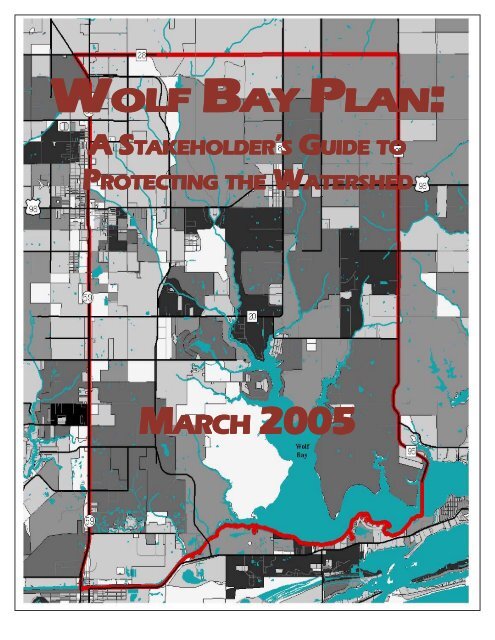
II. DESCRIPTION OF THE WATERSHEDThe <strong>Wolf</strong> <strong>Bay</strong> watershed encompasses a rich mosaic of upland and coastal habitats that supportthousands of plant and animal species. The beauty of this area continues to attract large numbersof new residents who seek to make their homes along the shores as well as in woodlands and onfarms in the watershed. Estuaries like <strong>Wolf</strong> <strong>Bay</strong>, where salt water and freshwater mix, are amongthe world’s most important and productive ecosystems. The resources within the <strong>Wolf</strong> <strong>Bay</strong>watershed include fresh and saltwater fish, crabs, shrimp, dolphin, birds and waterfowl. Thisestuary serves as a nursery area for many types of fish, crab, shrimp, and other organisms. Partsof the watershed also contain the following federally listed species: Red Cockaded Woodpeckerand the Bald Eagle. Imperiled habitats include Gulf Coast Pitcher <strong>Plan</strong>t Bogs, Atlantic WhiteCedar Swamps and Long Leaf Pine Savannahs. There are also active Osprey nests within thewatershed. Understanding, restoring, and preserving the watershed’s important habitats arecritical to protecting the long-term integrity of <strong>Wolf</strong> <strong>Bay</strong> (Table 1, Species of Concern).A. LOCATIONThe <strong>Wolf</strong> <strong>Bay</strong> Watershed Project area includes about 60,160 acres located in Alabama’s BaldwinCounty (Figures 1,2&3). <strong>Wolf</strong> <strong>Bay</strong> is a sub-estuary of Perdido <strong>Bay</strong> and has several tributaries,primarily <strong>Wolf</strong>, Sandy, Miflin and Hammock Creeks. Numerous municipalities exist within thewatershed, including: Foley, Elberta, Gulf Shores and Orange Beach.Watersheds do not follow geographical or jurisdictional boundaries. However, to take into accountthe political needs of this project, the watershed project area is bounded by County Road 28(north), the Intracoastal Waterway (south), County Road 95 (east), and US 59 (west). It is importantto note that this watershed incorporates portions of several Hydrologic Unit Codes (HUC):03140107-020, 03140107-030, and 03140107-040 (Figure 4). During the course of this watershedproject, the USGS has redefined the HUC codes for the watershed. These changes will alterprevious studies and boundaries and must be addressed as the plan is updated in the future(Figure 5).B. ENVIRONMENTAL IMPORTANCEWorldwide, greater than 40 percent of the population lives within 100 km of the coast. Thecontinental U.S. coastal zone represents 17 percent of the land area but contains greater than 50percent of the population and it is estimated that the coastal population will increase by another28 million people by 2015 (NOAA 1998). Increasing population and development threaten furtherimpairment of estuarine and coastal ecosystems. It is also clear that ecosystem protection andrestoration is inherent to cultivating and maintaining our coastal ecosystems’ health in the future.10
Oral histories taken of watershed residents indicate the <strong>Wolf</strong> <strong>Bay</strong> area has experienced a declinein its natural resources. These residents also profess coastal marshes and abundant shellfish,crustaceans, and finfish observed in the past have disappeared or are in rapid decline.The <strong>Wolf</strong> <strong>Bay</strong> area is becoming increasingly residential and has a long history of agriculturalusage. Land-use practices and population growth are primarily responsible for the perceiveddecline in this area’s estuarine and coastal living resources.<strong>Wolf</strong> <strong>Bay</strong> and its tributaries provide excellent sources of fishing, boating, sailing, canoeing,kayaking, skiing, bird watching, photography, swimming, and more. All of these recreationalactivities promote tourism — Baldwin County’s biggest economic resource.In March 2001, the <strong>Wolf</strong> <strong>Bay</strong> Watershed Watch requested ADEM upgrade portions of the watershedas an Outstanding Alabama Water (OAW). The OAW water use classification is defined “forhigh quality waters that constitute an outstanding Alabama resource, such as waters of stateparks and wildlife refuges and waters of exceptional recreational or ecological significance.”Currently, <strong>Wolf</strong> <strong>Bay</strong> holds three classifications: “Swimming and Whole Body Contact (S),”“Shellfish Harvesting (SH)” and “Fish and Wildlife (F&W).” An OAW classification is one of thefirst steps toward protecting the <strong>Wolf</strong> <strong>Bay</strong> watershed because the classification has higher standardsof water quality and protection measures such as required best management practices (Table 2,Current and requested use classification).C. CLIMATE (Paraphrased from Schroeder 1996)The <strong>Wolf</strong> <strong>Bay</strong> watershed lies in the humid subtropical climate region (Trewartha and Horn 1980),a climate that dominates the Gulf Coast states and Florida peninsula. Summers arecharacteristically warm while winters are relatively mild with occasional cold waves. In thecontiguous United States, this region is second only to the Pacific Northwest in total annualrainfall (Baldwin 1973), receiving precipitation from a combination of winter storms,thunderstorms and tropical systems.Summer ClimateHigh barometric pressure over the Atlantic Ocean is a dominant factor in the summer weatherpattern. This semi-permanent weather system, called the subtropical anticyclone, provides apersistent southerly flow of humid air from the Gulf of Mexico. This air is normally unstable andthus, is easily lifted and condensed through convective heating or sea breeze convergences. As aresult, thunderstorms are frequent and account for the major portion of summer rainfall. The11
frequency of thunderstorms over coastal Alabama is surpassed in the United States only by theFlorida peninsula.The influx of moisture from the Gulf of Mexico, in combination with numerous thunderstorms,produces a small diurnal temperature range during the summer. Average maximum airtemperatures during the summer months vary from the upper 80ºF to the low 90ºF range in thevicinity of the <strong>Wolf</strong> <strong>Bay</strong> watershed. Although temperatures may rise rapidly during the morninghours, the high frequency of thunderstorms usually limits the daily temperature peak at around90 to 92ºF (Williams 1973). Because of the high absolute humidity during this period, temperaturesof 100ºF or higher are occasionally observed in the bay area.Winter ClimateDuring the winter months, the Atlantic subtropical anticyclone retreats southward allowing thepolar front to make numerous incursions into the Gulf States region from September to May.The arrival of polar air is frequently marked by heavy rain and a strong wind shift from southerlyto northwesterly. When extremely low temperatures occur for at least two successive nights,freezing of the bay surface may take place near shore and up creeks.Winter StormsAlthough summer thunderstorms are numerous and greatly contribute to high annual rainfalltotals, winter storms also produce heavy downpours. Those winter storms with the greatestimpact upon the estuarine system originate in west Texas or along the Texas coast and are usuallyformed by upper atmosphere troughs that track across the southwestern U.S. Surface cyclonesdeveloping beneath these troughs either move eastward from Texas across the Gulf States oralong the coast. Storms of this type gain enormous energy from the contrast between warm Gulfwaters and cold polar air positioned over the Gulf States. The high frequency of winter stormsaccounts for a secondary rainfall maximum in March for many Gulf coast regions. For areasaround the <strong>Wolf</strong> <strong>Bay</strong> estuarine system, July slightly exceeds March as the wettest month with anaverage of more than 17.8 cm. (7 in.) of rain (Schroeder et al. 1990b).Tropical StormsThe central Gulf Coast had one of the highest frequencies of hurricane landfall in the UnitedStates for the period 1871 - 1990. The average occurrence of tropical storms from 1871 was 2.2storms making landfall along every 18.5 km (10 nautical miles) stretch of the Gulf Coast (Neumannet al. 1981). Tropical storms are capable of producing enormous rainfalls over the bay andsurrounding areas. Rainfalls of 13 to 25 cm (5 to 10 in.) are not unusual. However, hurricanerainfall totals vary considerably from storm to storm. When totals are high, the combination offlood runoff, erosion and the destruction of trees and buildings along the shoreline results in the12
transport of large amounts of sediment and debris into parts of <strong>Wolf</strong> <strong>Bay</strong> watershed and into<strong>Wolf</strong> <strong>Bay</strong> itself. This can have a profound post-storm impact on the ecosystem.D. PHYSICAL AND GEOLOGIC FEATURES (paraphrased from Chermock 1974)The <strong>Wolf</strong> <strong>Bay</strong> watershed lies within parts of the Southern Pine Hills and Coastal Lowlandssubdivisions of the East Gulf Coast section of the Coastal Plain physiographic province. TheSouthern Pine Hills subdivision is a moderately dissected, southward sloping plain developedon sediments of Miocene to Pleistocene age (Boone 1974). In coastal Alabama, the Southern PineHills range to 100 feet in elevation with numerous shallow saucer-like depressions. Thesedepressions are scattered over nearly level interfluves and hold water most of the year.The Coastal Lowlands subdivision is an essentially flat to gently undulating plain extendingalong the coast adjacent to Mississippi Sound, along the margins of the bays and behind thecoastal beaches. They merge inland with the alluvial-deltaic plains of the <strong>Mobile</strong>-Tensaw andPerdido fluvial systems and smaller streams of the area. The lowlands are inundated by manytidewater creeks and rivers and fringed by tidal marshes. Alluvial, deltaic, estuarine, and coastaldeposits of Pleistocene and Holocene age underlie the Coastal Lowlands.The Southern Pine Hills and Coastal Lowlands are separated by erosional escarpments withrelief up to 100 feet. At their seaward margin they are curvilinear to the coast. They curve andextend inland forming subparallel facing escarpments that parallel the streams of the area.Carlston (1950) has interpreted the southern parts of these erosional escarpments as marine wavecutscarps of Pamlico (Pleistocene) age. It is believed that the <strong>Wolf</strong> <strong>Bay</strong> embayment was formedduring the Pleistocene (Smith 1986).E. SOILSSoils are grouped according to common characteristics. Soils for the watershed are grouped intotwo major soil orders: ultisols and entisols.UltisolsThe zonal soils consist of soils having well-developed profile characteristics that reflect theinfluence of the active factors of soil formation. The active factors are climate, vegetation, andanimal life. The zonal soils have an alluviated A horizon that is underlain by a finer texturedalluviated B horizon. The C horizon varies in texture, but is generally coarser textured than theB horizon. These soils are well drained and acid. Zonal soils are considered to be the more13
productive agriculture soils. This group makes up 37% percent (22,259 acres) of the totalwatershed. The major soils are Norfolk-Klej-Goldsboro Association.Characteristics of the Norfolk Series:• Consists of deep, well drained soils that are strongly acidic• Developed in sandy loam and sandy clay loam and found on uplands of coastal plains• Mainly near Elberta• Natural vegetation is Longleaf Pine and Short Leaf PineCharacteristics of the Klej Series:• Consists of deep, moderately well drained soils—strongly acid• Developed in loamy sand and loamy fine sand on uplands• Mainly near Elberta• Natural vegetation is Longleaf Pine, Slash Pine, Scrub Oak, Gum and SassafrasCharacteristics of the Goldsboro Series:• Consists of deep, moderately well drained soils—very strongly acid• Developed in sandy loam and sandy clay loam on uplands of the Coastal Plains• Mainly near Elberta and Foley• Natural vegetation is Longleaf and Slash PineEntisolsThe entisols consist of soils that lack distinct genetically related horizons, generally because ofyouth, resistant parent material, or steep topography. These soils are normally well drained toexcessively well-drained and are sands and loamy sands. This group makes up 36% percent(21,657 acres) of the watershed area. The major soils are Lakeland-Plummer Association.Characteristics of the Lakeland Series:• Consisst of deep, excessively-drained soils that are strong acid to very strong acid• Developed in a thick sand and loamy sand and are found in uplands• Natural vegetation is Longleaf pine and Slash pineCharacteristics of the Plummer Series:• Consists of deep, poorly-drained soils that are very strongly acid• Developed on loamy sands and found in uplands• Found along drainage ways• Natural vegetation dominated by pitcher plant bogs and pine savannahs14
Hydric Soils (found in both Entisols and Ultisols)These poorly drained much to moderately fine textured soils occur in depressional areas andalong upland drainage ways within coastal plains flatwoods. The remaining acreage is in wateror the other 3 minor soil orders. Soil map to be added when made available by NRCS.F. LAND USE AND POPULATION GROWTHThe <strong>Wolf</strong> <strong>Bay</strong> Watershed Project area encompasses about 60,160 acres in Baldwin County insouthwest Alabama. Numerous municipalities exist within the watershed including: Foley,Elberta, Gulf Shores, and Orange Beach. The table below represents NRCS 1998 data for acreagein the Miflin and <strong>Wolf</strong> Creek Subwatersheds. This is larger than the project boundary but providesa fairly accurate portrayal of the watershed land use.LandUseTotalAcres% AcreageAgriculturalCropland: 9,000Pastureland: 1,60013%ForestLand38,27353%Urban Land15,00021%O ther13 %Total Land InWatershed71,733Note: the land use represented above is very different from the 1992 USGS land use map (Figure 6). It isimportant to understand the growth within the watershed during the period of time. Also, USGS andNRCS utilize different definitions of their land use classifications, thereby making the data difficult tocompare. The Watershed Project Technical Advisory Committee strongly suggests the developmentof a new land use map based on the 2004 Hydrologic Unit Codes (Figure 5). In the meantime, the<strong>Wolf</strong> <strong>Bay</strong> Watershed Project will continue to seek the best data for this plan and input as it becomesavailable.15
The watershed is primarily rural, but it is within commuting distance from the metropolitanareas of <strong>Mobile</strong>, Alabama and Pensacola, Florida. Baldwin County rallies with Shelby Countyfor the honor as the fastest growing county in Alabama.In 1998, the Natural Resources Conservation Service developed a Watershed Assessment andCharacterization. The characterization broke the county up utilizing the 11 digit HUC codes.Assessments included notations on land use, streams, wildlife, endangered species, and culturalresources (Figure 4).The Baldwin County Land Use <strong>Plan</strong> was designed as a general guide for long-range developmentin the county. The Baldwin County Land Use <strong>Plan</strong> indicates a likelihood of increased residentialgrowth, especially along waterbodies, for the area of Baldwin County that includes the <strong>Wolf</strong> <strong>Bay</strong>watershed. Recently, rapid commercial growth has occurred in the area, especially alongtransportation arteries. The implications of this growth, both short-term and long-term, indicatethat management of growth with regard to resource protection will be a challenge in the <strong>Wolf</strong><strong>Bay</strong> watershed.Relatively undisturbed wooded lands surround <strong>Wolf</strong> <strong>Bay</strong> and its tributaries. These include parcelsthat have a significant impact on the health and wellbeing of the natural resources (includingclean water) of our watershed. The majority of land in the watershed is owned by a few entities.The purchase and protection of these parcels would provide long term habitat for resident andmigratory wildlife, rare and protected species, and a substantial riparian buffer to protect waterquality (Figure 16).Other small landowners have key parcels that would provide public access to our bay forrecreational and educational uses. These landowners are very interested in making sure the landis protected and preserved but are pressured to sell out by developers. Two significant landparcels are on <strong>Wolf</strong> Creek and at the mouth of Hammock Creek. One parcel presently has a boatramp and wet slips and is for sale. This parcel would be a superb site to provide Foley with apark and public access to <strong>Wolf</strong> <strong>Bay</strong>. The other parcel landlocks 500 acres of the Brown Foundationbetween Hammock Creek and Baldwin Baptist Camp. The purchase or lease of both of theselands would allow the public a wonderful opportunity. These would be ideal for a naturalrecreational facility that would afford visitors the opportunity to canoe, sail, bird watch, hike,bike, etc. It would also provide substantial space for an educational and research facility whilepreserving one of the largest parcels of undisturbed land areas along the northern portion of<strong>Wolf</strong> <strong>Bay</strong> (Figure 16).16
Population DataCensus results for Baldwin County in 2000 put population numbers for Baldwin County at 140,415,up 43% from the 1990 population of 98,280. It is important to note the US Census Bureau doesnot include migratory residents or tourists in its population figures but the Gulf Shores Conventionand Visitor’s Bureau estimated 26,045 transient winter residents. Listed below are populationstatistics from the US Census Bureau, 2003.County/CityJuly-02July-01Census 2000Baldwin147,932144,787140,415Elberta563558552Foley8,7918,3367,590OrangeBeach 42034,0763,784(Figure 8, Population)17
G. ECONOMIC DEVELOPMENTCurrent Economic StatusGood environmental quality in the <strong>Wolf</strong> <strong>Bay</strong> watershed is essential to the economic health of theregion in many ways. Traditional land uses such as agriculture and silviculture continue tothrive in this portion of Baldwin County. Baldwin County leads all other counties in the state ofAlabama in revenues from tourism, an industry fueled in large part by the abundance of beachesand water-related recreational opportunities and charming rural character.Baldwin County’s beaches, bays and rivers promote an ever-increasing tourism industry.According to the Alabama Bureau of Travel and Tourism (ABTT), tourism-related expendituresfor 2001 in Baldwin County were $1.5 billion. Although nationally there has been a decline intourism the past three years, Alabama experienced a 1% increase. Recreational activities enjoyedby tourists include visiting beaches, fishing, boating, waterskiing, golfing, shopping, huntingand bird-watching.The Tanger Outlet in Foley, Alabama continues to draw visitors to the <strong>Wolf</strong> <strong>Bay</strong> watershed. TheCenter has exceeded $400 million in sales for each of the last three years. Retail expansion isexpected to impact the watershed environmentally and economically.“Snowbirds” is a term used by tourism agencies to define residents who live in cold climates andwinter in temperate areas. Coastal Alabama has a significant population of these winter residentswho contribute significantly to the economic status of the area. Also, many of these winterresidents become very involved in the community during their stay. In 1999, estimates generatedby the Gulf Coast Convention and Visitors Bureau indicate there were approximately 26,045transient winter residents.Baldwin County has established a reputation as a retirement community. Several magazines,including “Retirement Places Rated,” tout the area as one of the top retirement areas in the country.Census data from 2000 reflects that the “over 65” age group has grown by 45.8% in BaldwinCounty. New residents are attracted by the relaxed rural character of the area as well as itsproximity to the rivers and bays. As in many other communities, the real estate market is closelytied to aesthetic and environmental conditions such as land use and water quality.In addition to tourism, the economy of the <strong>Wolf</strong> <strong>Bay</strong> watershed is heavily dependent uponagriculture. Row crops and sod production are the major farm enterprises (Table 5, Sod Acreage).18
Listed below are the farming statistics for the <strong>Wolf</strong> <strong>Bay</strong> watershed.CropsAcres Harvestedin WatershedCorn525Soybeans1,000SmallGrain1,300Peanuts2,350Cotton3,550VegetableCrops200(Source: NRCS, 1998)Future Economic DevelopmentThe 2001 opening of the Foley Beach Express has made land in the watershed more accessible foreconomic development. Since its opening a plastics plant has located within the watershed anddiscussions continue regarding malls, car dealerships, bridges, marinas, an Indian casino, and awater park at the Foley Beach Express and Intracoastal Waterway.This management plan does not have any authority to abate development. However, it is ourintention for this management plan to be utilized by area decision-makers when looking at growthopportunities. As the watershed continues to be converted from agricultural land to residentialand commercial development and we increase the extent of impervious surface, it is imperativeour cities utilize the principles and tools provided in this management plan to develop responsibly(Figure 12, Impervious surface).The watershed project will continue to provide workshops to increase awareness and conservationopportunities for local stakeholders. Residents of the <strong>Wolf</strong> <strong>Bay</strong> watershed are also looking toutilize aerial photography to monitor local runoff (Figure 9, 1996 aerial photography).19
H. HYDROLOGYBaldwin County is dependent upon groundwater for its water needs. Groundwater is water thatsinks through the soil and is stored in underground reservoirs called aquifers. Aquifers are thelayers of underground substrate (limerock and sand) that contain the water and are capable ofproducing water from a well.The aquifer in the <strong>Wolf</strong> <strong>Bay</strong> watershed is the Miocene/Pliocene Aquifer, which is comprised ofover 500 feet of inter-layered sands, gravels and clays. Aquifers are recharged or replenishednaturally by precipitation, which percolates downward through soil and rock in what is called arecharge area. The recharge process is quite slow compared to the replenishment of surfacewater. Baldwin County is unique because the entire county serves as its recharge area.Groundwater also discharges to surface water and provides a high percentage of the base flow tostreams and creeks. Natural areas, like wetlands, are critical areas to protect for groundwaterrecharge.Residents in the <strong>Wolf</strong> <strong>Bay</strong> watershed obtain their water from either public water supply wells orprivate residential wells. Based on the 2000 ADEM and GSA document “Hydrogeology andVulnerability to Contamination of Major Aquifers in Alabama: Area 13” there are 11 publicwater supply wells located in the <strong>Wolf</strong> <strong>Bay</strong> watershed project area. One is owned by the Town ofElberta; three are owned by Riviera Utilities (Foley); four are owned by Gulf Shores, and threeare owned by Orange Beach. However, efforts have been made by local utilities to build morewells. Foley and Riviera Utilities have bought 484 acres on Graham creek to construct additionaldrinking wells.There are approximately 7,484 acres of designated Wellhead Protection Areas within the watershedproject boundary. This represents 12% of the total watershed area.Care for our groundwater must be addressed. Withdrawing large quantities of fresh water fordrinking or irrigation uses can lead to groundwater depletion or the intrusion of salt water intoour fresh groundwater supplies. Contamination of our groundwater supplies can lead to thecontamination of our surface water through groundwater discharge. See chart below for areawithdrawal rates. It is important to note individual and drinking water wells are not reflected inthese withdrawal rates. Although we believe a map of the water supply wells would be usefulinformation, the Office of Homeland Security has determined the location of these wells shouldnot be published.20
MunicipalityElbertaWithdrawal rateGallons per day (gpd)678,000 gpdFoley2,136,500 gpdOrangeBeach2, 836,600 gpd(Source: ADEM, Groundwater Unit, 2002)III. ENVIRONMENTAL CONCERNSThe <strong>Wolf</strong> <strong>Bay</strong> watershed is fortunate to be without significant environmental problems. However,the area is not without pollution.Point source pollution is an identifiable source that discharges pollutants into the environment.Examples include smokestacks and pipes. Point source discharges to area waterways are managedby ADEM through the <strong>National</strong> Pollutant Discharge Elimination System (NPDES) permittingprocess.There are no permitted point source discharges directly into <strong>Wolf</strong> <strong>Bay</strong>; however, a local wastewatertreatment plant discharges into <strong>Wolf</strong> Creek. In addition, there are two wastewater treatmentplants (Gulf Shores and Orange Beach) that discharge into the Intercoastal Waterway.Nonpoint source pollution is the #1 problem in Alabama’s coastal area (NEMO, 2002). Also knownas polluted runoff, this is caused when water washes over the land and picks up pollutants,sediments and other contaminants. Addressing nonpoint source pollution is a major focus of thewatershed project.Nutrients, including nitrogen and phosphorus, are needed for plant growth but cause problemsat elevated concentrations in surface waters. Sources include animal waste, fertilizers, detergents,and failing septic systems.21
Pathogens include disease-causing bacteria and viruses associated with the presence of fecalmatter. Sources include failing septic systems, wastewater treatment plant (WWTP) overflows,boat sewage and animal waste.Sediment is eroded soil or sand that is transported to waterbodies via stormwater and can smotheraquatic habitat. Sources include poorly managed agricultural practices, dirt roads and constructionsites (Figure 15, Dirt roads).Litter or debris is another problem that threatens aquatic life and is unsightly. Sources are directlyconnected to human activity including illegal dumping, boat waste or litter.Thermal Stress is an elevation in water temperature that can harm native aquatic species andencourage nonnative species to spread. Sources include runoff from impervious surfaces suchas roads, parking lots, and roofs and the removal of streamside vegetation space that providedshading (NEMO, 2002).The majority of these water quality problems can be attributed to wastewater, human impacts,agriculture and construction. Agricultural and residential runoff contributes sediment, nutrients,pesticides and bacteria to surface water.A. CURRENT ENVIRONMENTAL MONITORING1. Residents believe there may be nutrient problems, however there is not sufficient data todetermine these effects. A nutrient monitoring pilot project has been developed for the watershedby the ACF and is expected to commence in the Spring of 2005.2. The ADEM Fish Tissue Monitoring <strong>Program</strong> was initiated in 1991 as a cooperative agreementwith ADPH, ADCNR and the Tennessee Valley Authority (TVA) to monitor fish tissue throughoutthe state for bioaccumulative contaminants that can cause a risk to human health, e.g. mercury.Each year’s sampling locations are determined based upon information available to the ADEMand input from the cooperative agencies.In 2003, ADEM conducted fish tissue sampling at one location (north of Mulberry Point) in the<strong>Wolf</strong> <strong>Bay</strong> watershed. Three samples from two species of fish (speckled trout and ladyfish) wereanalyzed. None of the results recorded by ADEM exceeded FDA or EPA action levels. There arecurrently no advisories in place for <strong>Wolf</strong> <strong>Bay</strong> (ADEM Lab Report). There are, however, severaladvisories in place for mercury contamination within coastal Alabama (Figure 14, ADEMMonitoring Sites).22
3. For the last six years, the WBWW has provided consistent, reliable data to Alabama WaterWatch (AWW) at approximately 25 sites within the watershed. Although the number of sitesvary annually, these citizen volunteers monitor a variety of parameters including pH, dissolvedoxygen, turbidity, alkalinity, salinity, hardness, secchi depth, and air and water temperature.Currently, all sites are monitored for the presence of E. coli. All volunteers are certified accordingto the EPA approved Alabama Water Watch Quality Assurance/Quality Control <strong>Plan</strong>. This collectionof data has helped provide insight into the environmental health of <strong>Wolf</strong> <strong>Bay</strong> and its tributaries.Their monitoring has shown an increase in alkalinity and pH from 1998-2000. Scientists fromAWW believe this trend can be attributed to the drought cycle in south Alabama during thistime. Since the drought period is over, the alkalinity and pH have since decreased. This monitoringhas also shown the dissolved oxygen levels in <strong>Wolf</strong> Creek improve as it gets closer to the <strong>Bay</strong>(Table 3, <strong>Wolf</strong> <strong>Bay</strong> Watershed Watch monitoring stations).4. Enterococcus monitoring – In June 1999, ADEM, in cooperation with the ADPH, initiated aprogram to routinely monitor bacteria levels at selected swimming beaches on the Gulf Coast.The effort was later expanded to include additional sites along the Gulf Coast and <strong>Mobile</strong> <strong>Bay</strong>. InOctober of 2000 the federal Beaches Environmental Assessment and Coastal Health (BEACH)Act was signed into law. This act requires the monitoring and assessment of coastal recreational23
waters and the prompt notification to the public when sufficient water quality standards are notbeing met. This program now involves the routine collection of water samples from 24 high useand/or potentially high risk public recreational sites from Perdido <strong>Bay</strong> to Dauphin Island. (ADEMwebsite) Monitoring sites within the watershed include Orange Beach Waterfront Park on <strong>Wolf</strong><strong>Bay</strong>. Results may be downloaded at www.adem.state.al.us.5. ADEM has developed water quality criteria defined by each waterbody’s use classification.Watershed residents want to maintain or improve current water use classifications. Water useclassifications in the watershed include: Swimming and other Whole Body Water-Contact Sports,Shellfish Harvesting and Fish and Wildlife (Table 4, ADEM Water use classifications).6. Section 303(d) of the Clean Water Act (CWA) requires states to develop a list of impairedwaters that are not meeting, or not expected to meet, water quality standards. Federal regulationsrequire states to submit a new list at least every four years. The Intracoastal Waterway (ICW) isthe only 303(d) listed waterbody within the watershed (Figure 7, Water quality information).Intracoastal Waterway (5 Miles) Waterbody ID—AL/03140107-040-01This impaired segment, with a designated use of Fish and Wildlife, includes two wastewatertreatment facilities, two golf courses, fish hatchery facilities, restaurants and stormwater runofffrom businesses and residents. The waterbody is on the 303(d) list for exceeding water qualitystandards for Dissolved Oxygen and Organic Enrichment. The ICW has been on the list since atleast since 1996, and the TMDL is due 2003. Currently, there are efforts underway to delist thiswaterbody.Dissolved oxygen (DO) is utilized as a water quality indicator because most aquatic plants andanimals need oxygen to survive. These plants and animals obtain most of it from oxygen dissolvedin the water. Simplistically, dissolved oxygen decreases with increasing depth, temperature andsalinity. It also decreases in the presence of oxygen-demanding wastes, such as sewage. Organicenrichment (OE) occurs when organic matter exceeds the water’s capacity to maintain adequatelevels of dissolved oxygen (DO) for normal respiration and decomposition processes. Decay oforganic matter in organically enriched waterbodies can create DO depletion resulting in fishkills.B. NEEDED ENVIRONMENTAL MONITORING1. Additional fish tissue sampling is needed to see if there is a mercury problem in the fish thatinhabit <strong>Wolf</strong> <strong>Bay</strong> and its tributaries.24
2. Further bacteriological monitoring is needed in areas of high contact (swimming holes andpopular swimming creeks) to determine if the waters are safe for swimming and fishing.3. Benthic studiesa. Fishb. Macroc. Sediment samples need to be analyzed and routinely monitored for metal and pesticidescontamination, phosphorus and bacteria contamination. All of these can remain in the sedimentuntil disturbed.4. Total suspended solids (TSS) analysis is also needed.5. Nutrient/pesticide monitoring is needed to determine whether their sources and levels.Note: This list of monitoring needs is not based on any order of preference.IV. CURRENT MANAGEMENT METHODSThe <strong>Wolf</strong> <strong>Bay</strong> Watershed Project has developed this Stakeholder’s Guide for the citizens of <strong>Wolf</strong><strong>Bay</strong> to act as guidance in future project implementation to protect water quality. The success ofthis project rests solely on the participation of local governments and area residents.The strategies for protection are non-regulatory. The project is dependent upon the responsibleparties’ commitment to clean water to accomplish the objectives set forth. The plan also serves asa planning tool and resource guide for local experts and agencies.The two most successful management tools are citizen involvement and private stewardship.No regulation can substitute a landowner’s willingness to employ Best Management Practices(BMPs) on his land. Citizens working together are also an undeniable force in promotingenvironmental awareness. Incentive programs, which provide money on a cost share or grantbasis, will also help accomplish the management plan objectives. It is also important to understandexisting regulatory programs which affect development in the watershed.A. NON-REGULATORY1. Incentive <strong>Program</strong>sMany landowners do not have funds to initiate a restoration or preservation project without thesupport of incentive programs. These programs provide a match to encourage participation.25
a. Conservation Reserve <strong>Program</strong> (CRP)This program, administered by the Consolidated Farm Service Agency, was established as aconservation provision of the Farm Bill to encourage and assist farm producers willing to setaside highly erodible, riparian, and other environmentally sensitive land from crop productionfor a 10 or 15 year period. Producers may enroll in the program according to USDA rules. Theprogram is a 50-50 cost share.b. Wetlands Reserve <strong>Program</strong> (WRP)Another voluntary program is administered by NRCS with technical support from FWS.Participating landowners can establish conservation easements of either permanent or 30-yearduration, or can enter into restoration cost-share agreements where no easement is involved.NRCS and FWS assist private landowners with site selection and development of restorationplans for the site. Up to 100% of the cost of restoring the wetland can be provided for a permanenteasement by USDA.c. Grassland Reserve <strong>Program</strong> (GRP)GRP is another voluntary program offered by NRCS. This program offers landowners theopportunity to protect, restore and enhance grasslands on their property.d. Environmental Quality Incentives <strong>Program</strong> (EQIP)EQIP is another voluntary program administered by NRCS. EQIP works in locally identifiedconservation priority areas where there are significant problems with natural resources. Highpriority is given to areas where state or local governments offer financial, technical, or educationalassistance, and to areas where agricultural improvements will help meet water quality objectives.Landowners apply to the program for assistance in solving problems related to animal wastemanagement, erosion, and other environmental problems. EQIP will provide up to 60% costsharefor restoration.e. Forest Land Enhancement <strong>Program</strong> (FLEP)The Forest Land Enhancement <strong>Program</strong> (FLEP) was part of Title VIII of the 2002 Farm Bill. FLEPreplaces the Stewardship Incentives <strong>Program</strong> (SIP) and the Forestry Incentives <strong>Program</strong> (FIP).FLEP is optional in each State and is a voluntary program for non-industrial private forest (NIPF)landowners. It provides for technical, educational, and cost-share assistance to promotesustainability of the NIPF forests.State Forestry Agencies in coordination with their State Forest Stewardship CoordinatingCommittees will develop a State Priority <strong>Plan</strong> for FLEP. This <strong>Plan</strong> will provide the details for26
how the FLEP funds will be utilized, including minimum acres, maximum acres, aggregatepayment, use for technical, educational and cost-share assistance, and all other factors for theprogram. Landowners will have to have a forest management plan to be eligible for cost-share.The practices to be cost-shared and the cost-share rate will be described in the State Priority <strong>Plan</strong>.f. Wildlife Habitat Incentives <strong>Program</strong> (WHIP)Administered by NRCS, WHIP is a voluntary program for landowners who want to develop andimprove wildlife habitat on private lands. Participants work with NRCS to prepare a wildlifehabitat development plan. USDA provides technical assistance and cost-share payments up to50 % of the cost of installing the wildlife habitat practices.g. Partners for Fish and WildlifeAdministered by FWS, this program restores, improves and protects fish and wildlife habitat onprivate lands. Funds can not exceed $25,000 per project and the landowners must secure aminimum 10-year habitat development agreement. Landowners can receive up to 100% fundingfor project expenses, however, the overall goals of partners is a 50-50 cost share.h. Farm and Ranch Land Protection <strong>Program</strong> (FRPP)The Farm and Ranch Lands Protection <strong>Program</strong> (FRPP) is a voluntary program that helps farmersand ranchers keep their land in agriculture. The program provides matching funds to State,Tribal, or local governments and non-governmental organizations with existing farm and ranchland protection programs to purchase conservation easements. FRPP was reauthorized in theFarm Security and Rural Investment Act of 2002. USDA and NRCS manage the program.USDA works through State, Tribal, and local governments and non governmental organizationsto conduct FRPP. These entities acquire conservation easements from landowners. Participatinglandowners agree not to convert their land to non-agricultural uses and to develop and implementa conservation plan for any highly erodible land. All lands enrolled must have a conservationplan developed based on the standards in the NRCS Field Office Technical Guide and approvedby the local conservation district. Landowners retain all rights to use the property for agriculture.2. Alabama Nonpoint Source Management <strong>Program</strong>In 1987, Congress passed Section 319 of the Clean Water Act which established a national programto address the problems of nonpoint source pollution. Although each state enacts the programdifferently, the program was developed to highlight watershed approaches to nonpoint sourcepollution impacts. ADEM administers this program in Alabama.27
In 1990, the Coastal Zone Act and Reauthorization Amendments (CZARA) section 6217 waspromulgated to establish the Alabama Coastal Nonpoint Source Pollution <strong>Program</strong>, alsoadministered by ADEM.3. Private Stewardship<strong>Wolf</strong> <strong>Bay</strong> Watershed Landowners, particularly farmers, are interested in incorporatingconservation practices into management of their property. NRCS educates the landowners of theincentive programs and works with them to incorporate nonpoint source pollution controlmethods. Education and public participation are also an important part of private stewardship.The Private Stewardship <strong>Program</strong>, through NRCS, provides grants and other assistance on acompetitive basis to individuals and groups engaged in local, private, and voluntary conservationefforts that benefit federally listed, proposed, or candidate species, or other at-risk species. Diversepanels of representatives from state and federal government, conservation organizations,agriculture and development interests, and the science community assess applications and makerecommendations to the Secretary of the Interior, who awards the grants. The Private Stewardship<strong>Program</strong> was initiated during Fiscal Year 2002, with grants first awarded during FY 2003.For Fiscal Year 2004, NRCS will award more than $7 million in Federal funding under the PrivateStewardship <strong>Program</strong>. A ten percent (10%) match of cash or through in-kind contributions isrequired. The program is available to private landowners and their partners.4. Tax Incentivesa. Conservation EasementsA conservation easement is a legal agreement between a landowner and a land trust (orgovernment agency) that protects open space by limiting the amount and type of developmentthat can take place, but leaves the land in private ownership. Each easement restriction is tailoredto the individual landowner’s need. When a landowner donates or sells a conservation easementto a land trust, he can continue to live on or work the land - in accordance with the easement’sprovisions - and can sell the land or pass it on to heirs. Donating the easement can result inreduced income and estate taxes.b. Gift of Remainder InterestA gift of a remainder interest in a personal residence or farm provides one with an income taxcharitable deduction for the present value of the remainder interest and permits one to escapeany potential capital gain tax on the built-in appreciation. The property owner can continue tooccupy the residence or operate the farm without disruption. Such a gift provides a deduction28
that frees up tax dollars into spendable income without causing any disruption in lifestyle. Taxes,insurance, and normal maintenance remain ones responsibility.c. Gift by WillA charitable contribution of a conservation easement or gift of property can be made by will. Thefull value of the gift is deductible from estate taxes.There is a current move, primarily on behalf of media and civic groups, to promote constitutionalreform. A large portion of this movement is to do away with the current property tax assessmentwhich is based on current use and set tax rate based on potential use. Such a change could leavemany farmers unable to pay taxes and would increase the potential for conversion to urbandevelopment. The rules already require rollback taxes for the previous three years. Estate taxproblems also exist because many heirs are left farmland and sell because they can’t pay thetaxes.5. Citizen InvolvementThe <strong>Wolf</strong> <strong>Bay</strong> Watershed Project (WBWW) has developed a variety of education and publicparticipation programs to encourage stakeholders to take the steps necessary to protect theirwatershed. WBWW hosts an active volunteer water quality monitoring program. <strong>Program</strong>s,such as the Clean Water Guardian <strong>Program</strong> and Backyard Wildlife Habitat, are also recommendedto include a variety of audiences, namely agricultural interests, builders and contractors, educators,students, homeowners and elected officials.6. Baldwin County Wetland Conservation <strong>Plan</strong> (BCWCP)Baldwin County estimates 470 square miles of wetlands exist in Baldwin County. In 1995, BaldwinCounty began mapping and assessing wetlands as part of EPA’s Advance Identification (ADID)of wetlands program. The ADID project mapped portions of south Baldwin County based on its“suitability for fill.” In 1999, the Baldwin County Commission developed the Baldwin CountyWetland Conservation <strong>Program</strong> to:1. Further develop a Wetlands Protection Overlay District (WPOD) and incorporate into theBaldwin County <strong>Plan</strong>ning and Zoning Regulations.2. Develop a Geographic Information System (GIS) wetlands data layer containing informationon wetland locations, types, and functional capacity for wetlands in Baldwin County.3. Research, design, and implement wetland restoration/construction projects at selected sitesthroughout the County.4. Develop a wetlands education/outreach program for area stakeholders.29
7. ADEM Source Water Assessment and Protection <strong>Plan</strong>The Source Water Assessment and Protection <strong>Program</strong> was mandated by Congress in the 1996Amendment to the Safe Drinking Water Act. The Source Water Assessment <strong>Program</strong> is amandatory program in Alabama and requires that all public water supply utilities complete a 3-part assessment for all of their supply wells. The assessment must delineate the boundaries ofthe area that contribute groundwater and potential contaminants to the community water systems.The assessment must include a contamination source inventory and a susceptibility determinationto identify how prone the public water supply is to contamination. Lastly, the assessment mustinclude a public awareness program that informs the public about information gathered by theassessment. All public water supplies within the <strong>Wolf</strong> <strong>Bay</strong> watershed have completed the SourceWater Assessment <strong>Program</strong>.Once the assessment is completed, local authorities are encouraged to use the assessmentinformation to protect their water supplies and to develop a Source Water Protection <strong>Plan</strong>. Sourcewater protection efforts may involve corrective activities to remove contamination threats orpreventative actions through land use planning and education. Gulf Shores is the only communitywith an approved and active protection program in South Baldwin County.B. REGULATORY PROGRAMS1. <strong>National</strong> Pollutant Discharge Elimination System (NPDES) <strong>Program</strong>Under the Clean Water Act, most point source discharges of pollution require a permit. TheNPDES program is administered by ADEM. Point sources are direct discharges from factories,sewage treatment plants, mining and concentrated animal feedlot operations. Permittees arerequired to submit discharge monitoring reports (DMR) to ADEM. The DMR contains data forall parameters and monitoring frequency required by the NPDES permit.On Jan. 23, 2003 ADEM approved Administrative Code Chapter 335-6-12 which regulatesstormwater discharges from construction and mining activities. All construction sites greaterthan 1 acre and all mining activities greater than 5 acres are required to register under theregulations. The regulations require the implementation and maintenance of effective BMPs tocontrol pollutants in stormwater discharges. ADEM enforces the regulations through siteinspections and sampling.Note: The act specifically excludes “return flows from irrigated agriculture or agricultural stormwater runoff. This exempts many, but not all, agricultural activities from the NPDES program.30
2. Army Corps of Engineers Regulatory <strong>Program</strong>sThe Corps of Engineers has been involved in regulating activities by others in navigable waterwaysthrough the granting of permits since the passage of the Rivers and Harbors Act of 1899. At first,this program was meant to prevent obstructions to navigation, although an early 20th centurylaw gave regulatory authority over the dumping of trash and sewage. Passage of the CleanWater Act in 1972 greatly broadened this role by giving the Corps authority over dredging andfilling in the “waters of the United States,” including many wetlands.A major aspect of the Regulatory program is determining which areas qualify for protection aswetlands. In reaching these decisions, the Corps uses its 1987 Wetland Delineation Manual. Inmaking decisions on whether to grant, deny or set conditions on permits, District commandersare required to consider “all factors in the public interest,” including economic development andenvironmental protection.Numerous relatively minor activities in wetlands are covered by regional or nationwide generalpermits, allowing the regulatory staff to concentrate on more complex cases. Of the approximately1,100 people who carry out this mission, about 70% have academic backgrounds in biology andenvironmental sciences.The navigation program includes all of the nation’s deep draft harbors which are a vital link toseaborne commerce and handle much of the nation’s international trade each year, as well ashundreds of smaller harbors that serve a variety of recreational and commercial purposes. TheCorps has also built an intracoastal and inland network of commercial navigation channels, andlocks and dams for navigation.Section 404 of the Clean Water ActThe United States Army Corps of Engineers administers Section 404 of the Clean Water Act.Section 404 requires permits for dredging or filling a “water of the United States.” This permitrequires public input on the questions of need, alternatives and impacts. In theory, the law requiresthe permit applicant to prove the destruction of wetlands is necessary. If the proposed activitydoes not have to be conducted near the water, the permitting agency is to assume practicalalternatives exist.Section 10 of the Rivers and Harbors ActThe United States Army Corps of Engineers also administers Section 10 of the 1899 Rivers andHarbors Act. This act was enacted to protect and promote water navigation for commercialactivity. This act prohibits the unauthorized obstruction or alteration of any “navigable water of31
the United States” except by a Corps of Engineers permit. Regulated activities include dredging,placement of dredged or fill material, and construction in or over navigable waters.3. Baldwin County Health Department Septic Tank PermitsThe Baldwin County Health Department requires a permit for the installation of onsite sewagedisposal systems (OSDSs). The most common conventional OSDS is the septic tank, which isused to treat household and business waste. The septic tank receives liquid household wastes(soapy water from the laundry and bath, discarded food scraps and all body wastes) from thehouse plumbing. The solids settle to the bottom of the tank and the liquid passes into the seepagefield. The solids in the tank are subjected to decomposition by bacterial and natural processes.The tank is large enough to accumulate substantial amounts of solids at the bottom while bacteriawork to decompose the solid matter. Baffles are provided in the tank to prevent floating solids orscum from entering the seepage field.Permit receipt is dependent upon a soil percolation test which is performed by a licensed engineer,surveyor, or soil classifier. A site evaluation performed by a certified site evaluator from thehealth department can be used in lieu of a percolation test. These tests are used to determine thesuitability of a site for an onsite sewage disposal system. A percolation test or site evaluationdetermines the soil’s permeability and checks for any limiting factors, such as a seasonal highwater table. The percolation test procedures are designed to simulate conditions of the onsitesewage disposal system and the site evaluation uses soil texture to determine site suitability.As mentioned earlier in this document, all new onsite sewage disposal systems require theinstallation of an effluent filter in the septic tank. The filter is installed in the outlet tee and helpsprevent suspended solids from going out into the disposal field. Keeping the solids out of thedisposal field prevents the soil pores from becoming clogged, therefore prolonging the life of thesystem.Another advancement in the field of onsite sewage disposal was the passing of a legislative bill in1999, creating the Alabama Onsite Wastewater Board. The Board established rules that governthe onsite wastewater industry. All installers, pumpers, and manufactures, must obtain a licensebefore they can perform any work in the State of Alabama. They are required to attend a trainingcourse and pass an exam before they can become licensed. Continuing education hours arerequired each year in order to renew a license. The establishment of the Board and its rules hashelped to improve the onsite sewage disposal industry. The homeowner and the environmentcan only benefit from this improvement. The diagram on page 33 shows an effluent filter installedin a septic tank.32
Subdivision RegulationsIn 1996, subdivision regulations were adopted countywide which apply to “the division of a lot,tract, or parcel of land in two or more lots, plats, sites, or other division of land for the purpose,whether immediate or future, of sale or of building development.”Building PermitsAny construction activity in the county also requires a building permit. Land use certificates arealso required in zoned areas prior to issuance of building permits.Both the <strong>Plan</strong>ning and Zoning Department and the Building Department require that any permitor letters of release deem necessary be received before approval is granted. In each case, thecounty utilized GIS layers such as wetland and flood zone areas to insure that the appropriatemeasures are met. Lastly, county enforcement officers are required to notify the proper authorityof any perceived impact during the inspection process.5. Municipal Separate Storm Sewer System (MS 4 )A municipal separate storm sewer system (MS 4 ) is a conveyance or system of conveyances that isowned by a state, city, town, or other public entity that discharges to U.S. waters. Even thoughthe systems are designed and used for collecting storm water, they are not part of a PubliclyOwned Treatment Works (POTW).Phase 1 covers “large and medium sized cities” (as defined by the Bureau of the Census). Theseare cities which generally serve populations of 100,000 or greater. Phase II automatically coverson a nationwide basis all small MS 4 s located in “urbanized areas” (as defined by the Bureau ofthe Census), and on a case-by-case basis those small MS 4 s located outside of urbanized areas thatthe NPDES permitting authority designates. Phase II requires operators of small MS 4 s to designtheir programs to reduce the discharge pollutants to the “maximum extent practicable,” protectwater quality, and to satisfy appropriate water quality standards set forth by the Clean WaterAct. However, one can petition ADEM to include a town under Phase II if it is causing waterquality problems.The Phase II rule defines a small MS 4 management program with six elements that, whenimplemented, are expected to result in reduction of pollutants discharged into waterbodies. Thesix elements include: public education and outreach, public participation, illicit discharge detectionand elimination, construction site runoff control, post-construction runoff control, and pollutionprevention/good housekeeping. Sources: EPA, Office of Water, Fact Sheet 2.0-2.1, 200034
While there are no phase I or II municipalities in the <strong>Wolf</strong> <strong>Bay</strong> watershed, there will come a timein the future when a phase III will be implemented. Foley, Gulf Shores and Orange Beach willmost likely come under that phase and have similar requirements to meet the regulatory program.By coordinating and encouraging stormwater protection in this management plan, those citieswill be meeting requirements ahead of time.6. Coastal Zone RegulationsIn 1972, Congress passed the Coastal Zone Management Act (CZMA) in order to improve themanagement of our nation’s coastal resources. The Act created the Coastal Zone Management<strong>Program</strong> (CZM), which is administered by NOAA. The CZM provides coastal states theopportunity and financial support to develop coastal zone management programs to protectcoastal resources. Alabama joined the CZM program in 1979.Within Alabama’s designated Coastal Area (generally defined as the 10’ contour elevation of<strong>Mobile</strong> and Baldwin Counties seaward to the outer limit of the United States territorial sea)ADEM has certain regulatory, permitting, and enforcement functions that are established underthe Alabama Coastal Area Management <strong>Program</strong> (ACAMP). The specific regulatory requirementsand procedures can be found in ADEM Administrative Code R 335-8xx. In general terms, ADEMregulates certain activities in the coastal area, including beach and dune construction, commercialand residential developments greater than 1 acre, groundwater extraction of a certain capacity,siting, construction and operation of energy facilities, marina development, and wetland impacts,to name a few. Approximately the southern third of the <strong>Wolf</strong> <strong>Bay</strong> project area is in the coastalzone. Since many of these activities are also federally regulated, ADEM has developed proceduresfor joint review in order to avoid overlap. For more information on coastal zone permitting, visitwww.adem.state.al.us/FieldOps/Permitting/Coastal/coastal.htm.7. Coastal ConsistencyOne power granted to states by the CZMA gives states with federally approved coastal zonemanagement programs the authority to require federal agencies to carry out their activities withinthe coastal zone in ways that are consistent with the state’s coastal program’s policies. As such,activities occurring within the designated coastal area that require a federal permit must certifythat the proposed activity is consistent with the policies and regulations of the ACAMP. In reviewof coastal consistency, ADEM is granted the authority to deny or conditionally approve a projectthat is determined to be inconsistent with ADEM Division 8 Coastal <strong>Program</strong> Regulations. Federalactivities subject to coastal consistency determination include: US Army Corps of EngineersSection 10 (Navigation and Navigable waters) and Section 404 (wetland dredge and fill) permits;Federal Energy Regulatory Commission permits, and Environmental Protection Agency permitsfor air quality, water quality and solid waste disposal.35
8. Section 401 Water Quality CertificationUnder Section 401 of the Clean Water Act, the state water quality agency (ADEM) must certifythat adequate measures for water quality protection are to be implemented before a Federalagency can issue a permit that allows pollutant discharges into state waters. Like the coastalconsistency review, the water quality certification process allows the state to condition federalpermits in order to comply with state regulations and enforceable policies. Alabama water qualitycertifications issued by ADEM under section 401 are typically conditioned to require theimplementation of management measures, the avoidance of specific activities, and strict standardsfor certain types of discharges. Certification for wetland and riparian impact typically includesconditions for avoidance, minimization, and mitigation of impacts. Certification for dams andother impoundments typically includes conditions for maintaining minimum instream base flowsand minimizing impacts downstream. Certification for dredge impacts typically includesconditions for minimizing dredge quantity, protecting instream water quality and maximizingbeneficial use of dredge disposal. Certification for structural shoreline stabilization calls fordemonstration that nonstructural methods are not feasible and dissuades use of vertical bulkheads.9. Wetland Conservation Provisions (Swampbuster)Swampbuster has reduced the loss of wetlands due to agricultural activities to the lowest levelson record. Swampbuster helps preserve the environmental functions and values of wetlands,including flood control, sediment control, groundwater recharge, water quality, wildlife habitat,recreation, and aesthetics.The 1996 Farm Bill changed Swampbuster to give USDA participants greater flexibility to complywith wetland conservation requirements and to make wetlands more valuable and functional.The new Farm Bill changed the following Swampbuster provisions:Upon request, NRCS will determine if a producer’s land has areas subject to Swampbuster. Theagency maintains a list of the plants and combinations of soils and plants found in wetlands anduses these technical tools, along with the hydrology of the area, to conduct determinations. Thesedeterminations stay in effect as long as the land is used for agricultural purposes (unless a violationoccurs) or until the producer requests a review due to natural events. NRCS certifies previouswetland determinations upon request.36
V. ACTION STRATEGIES FOR PROTECTIONThe goal of the <strong>Wolf</strong> <strong>Bay</strong> Watershed Project is “to develop and implement a plan to protect andimprove the natural resources of the <strong>Wolf</strong> <strong>Bay</strong> Watershed.” Twenty objectives have been definedto assist the Watershed Project in addressing nonpoint source pollution impact.The Citizens Advisory Committee believed it was important to highlight the objectives of theplan. Therefore, rather than prioritize all goals, the committee decided to prioritize goals withineach objective.A. OBJECTIVESCOOPERATIVE EFFORTS OBJECTIVES1. To reduce nonpoint source pollution from:a. Agricultural activities, including sod farms, golf courses and nurseries.b. Constructionc. Land clearing and development activities, including the conversion of agricultural andsilvicultural lands to residential and urban uses.2. Decrease/reduce water pollution from stormwater, sewage and septic discharges fromresidential subdivisions and commercial areas.EDUCATION OBJECTIVES1. To make landowners/homeowners aware of their impacts on the watershed, includingtheir recreational impacts particularly sewage, petroleum products, nutrients, pesticides,boat wakes and litter.MONITORING OBJECTIVES1. To identify all research conducted within the watershed that will assist decision makers inpolicy decisions.2. To better understand the effects of nutrient runoff from golf courses, sod farms, andnurseries by developing a nutrient monitoring program.3. To better understand and research fish tissue samples for metal contamination.4. To better understand and research benthic, sediment and biotic samples to determine ifcontaminants such as pesticides are affecting aquatic or aquatic dependent life.5. To determine sources and levels of bacterial contamination.ORGANIZATIONAL OBJECTIVES1. To keep the efforts of the watershed project ongoing, establish a watershed projectcoordinator.37
2. To establish an organizational committee with representatives from each Hydrologic UnitCode (HUC) watershed or creek (Miflin, <strong>Wolf</strong>, Hammock, Sandy, Graham and OwensCreek) in the project area.3. Establish an educational center for the community to learn about the watershed resources.PRESERVATION AND PROTECTION OBJECTIVES1. To classify <strong>Wolf</strong> <strong>Bay</strong> and its tributaries as an Outstanding Alabama Water (OAW).2. To acquire land in the watershed, including areas designated as open space and riparianbuffers.3. To protect groundwater resources as well as address the regulations of well water protectionin the watershed.4. Ensure protection of fish and wildlife habitats and sensitive habitats such as wetlands,marshes, bogs, grady ponds, long leaf pine flatwoods and white cedar stands.5. To preserve family farms and the agricultural/rural heritage of the watershed whileprotecting water quality.PROGRAM PARTNERSHIPS OBJECTIVES1. Cooperate and develop relationships with local municipalities, government officials,governmental agencies, large land owners and businesses.2. Develop better relationships with contractors, developers, utility companies, farmers,businesses and homeowners through the Clean Water Partnership, or any way possible.3. Promote planning and zoning that will protect ecologically significant areas.4. Work with Baldwin County to identify unpaved roads within the watershed and prioritizepaving schedule.Each section that follows includes specific and measurable action strategies, a discussion of eachaction strategy, responsible parties and partners, potential funding sources, and a timeline. Thestrategies for each objective are listed in sequential order and should be viewed as a series ofsteps needed to accomplish the overall objective. Responsible parties are those agencies withregulatory or legal authority or a vested interest in the strategy. Partners are those who couldassist the responsible parties through shared resources and/or technical input. Potential fundingsources are grant programs where funds may be pursued, however, the list is not comprehensiveand does not guarantee that funds have been committed by those agencies. The timeline identifiesthe quarter of the year the activity will be initiated. The action strategies, responsible parties,partners, funding sources and timelines are recommendations only and are dependent on availablefunding resources and local support. As stated, the overall purpose of the following managementobjectives and action strategies is to coordinate and better utilize existing federal, state and localresources to improve and maintain water quality in <strong>Wolf</strong> <strong>Bay</strong>.38
B. EVALUATIVE CRITERIAIt is important to track the progress of the management plan and its effect to the improvement ofwater quality. Stakeholders and decision-makers need to know what makes this managementplan successful. Therefore, each one of these action strategies have an evaluation mechanism toaccurately assess each strategy. We will continually evaluate this mechanism based on theevolution of the plan and funding needs. Listed below are the evaluative criteria that will beutilized for the action strategies. In cases where these criteria are not applicable, the evaluationcriteria will be listed within that action strategy. Also, it is important to note that these actionstrategies will also develop an implementation strategy and develop criteria based on theevaluation mechanism. These are only suggested methods that can be applied when developinga program.EvaluationMethodStrategyEvaluatedEvaluation Mechanism1.Workshops,Conferences, HandoutsInformal presentationsPre and post tests# of attendees2.SurveysEvaluation sActor voteon recommendation s3.Adoption orImplementation# of attendee s4.Maps, Documents and<strong>Final</strong> Reports# documents returned vs. # of document sdistributed5.Propertyacquired6.Pollution reductio n# of municipalities# of acres# of permits applie d# of permits issuedvs. # of policies adopte d39
Reminder: The funding sources listed in the action strategies below are only potential and do not guarantee those agencies willallocate the funds.1. WASTEWATER AND POLLUTED RUNOFFWastewater is used water and includes substances such as human waste, food scraps, oils, soaps andchemicals. In homes, this includes water from sinks, showers, bathtubs, toilets, washing machines anddishwashers. Businesses and industries also contribute their share ofused water that must be cleaned.Wastewater also includes storm runoff from heavy rains. AlthoughCooperative EffortObjective #2: Decrease/reduce water pollutionfrom stormwater, sewageand septic dischargesfrom residentialsubdivisions andcommercial areas.some people assume that the rain that runs down the street during astorm is fairly clean, it isn’t. Harmful substances that wash off roads,parking lots, and rooftops can harm our rivers and lakes.Source: USGS, Water Science for SchoolsIssue: The public does not understand the basics of septic tankand sewer system care and maintenance or the potentialimpacts of improperly maintained septic systems.Education Objective #1:To make landowners/homeowners aware oftheir impacts on thewatershed, including theirrecreational impactsparticularly sewage,petroleum products,nutrients, pesticides, boatwakes and litter.<strong>Program</strong> PartnershipObjective#1: Cooperateand develop relationshipswith local municipalities,government officials,governmentalagencies,large landownersand businesses.Action Strategy 1: Develop or adopt educational programs to educateseptic tank owners and sewer system users. This program willhighlight the need for tank inspection and periodic pump out. Theprogram will also work to explain the reasons sewage systems fail,including our input of grease.Responsible Parties: BCHD, City of Foley, ADEM OEOPartners: Sewer utilities, MEE, ACESFunding Sources: Sewer Utilities, 319 Grants, other Grants, Septic TankCompanies, 306, 6217Timeline: 2 nd Quarter, 2004Evaluation method 2Action Strategy 2: Target all homeowner associations in the area andprovide them with educational presentations about septic systems.Responsible Parties: BCHDPartners: Homeowners/Homeowners Associations, Realtors,Mortgage Companies, MEE, WBWP, WBWW, ACFFunding Sources: no funding needs anticipatedTimeline: 3 rd Quarter, 2004Evaluation method 1Action Strategy 3: Develop a survey to determine how many houses within the watershed utilizeseptic tanks. Work with Baldwin County Health Department to have all existing septic tanks GPS’d.(This information is required by ADPH to classify waters, i.e. shellfish harvesting)Responsible Parties: BCHD, ADCNRPartners: WBWW, WBWPFunding Sources: NOAA (309/6217/306)Timeline: 3 rd Quarter, 2004Evaluation method 240
Issue: Homeowners, decision-makers, installers and many developers are not aware ofadvanced treatment systems for wastewater (residential or commercial).Action Strategy: Conduct workshops that compare advanced and decentralized wastewater treatmentsystems.Responsible Parties: BCHD, Baldwin County Commission, ADEM, USAPartners: WBWP, local citizens, ADEMFunding Sources: BCHD, ADEM 319Timeline: 3 rd Quarter, 2004Evaluation method 1Issue: Owners of waterfront properties do not always follow Best Management Practices andneed to be better educated on nonpoint source pollution.Action Strategy: Develop or adopt educational programs (e.g. Weeks <strong>Bay</strong>’s Greener by the Yard,NEMO, Clean Water Guardians) to educate waterfront residents about preventing polluted runofffrom their property.Responsible Parties: BCMG, WBWW, NEMOPartners: WBWP, ADEM, CACWP, AUMERCFunding Sources: Legacy, Inc., ADEM, ACES, CACWPTimeline: commence 2004Evaluation method 1Issue: Additional treatment of stormwater runoff is necessary to protect area waterways.Action Strategy 1: Encourage municipalities to develop and implement stormwater managementpolicies to control both the quantity and quality of stormwater runoff.Action Strategy 2: Determine impervious cover limits and its effect on water quality.Action Strategy 3: Work with Auburn University Marine Extension and Research Center to implementa storm drain stenciling program throughout the watershed.Responsible Parties: Towns of Elberta & Summerdale, Cities of Foley and Orange Beach, BaldwinCountyPartners: ADEM, ADCNR, AUMERC, Neighborhood AssociationsFunding Sources: OEO, NOAA, 6217Timeline: commence 2004Evaluation method 3 & number of storm drains stenciledIssue: Stormwater runoff is not monitored so the quality or quantity is not known.Action Strategy 1: Monitor stormwater in strategic locations to determine types and quantities ofcontaminants and quantity of runoff.Responsible Parties: Towns of Elberta & Summerdale, Cities of Foley and Orange Beach, BaldwinCounty, WBWWPartners: ACF, ADEM, ADCNR, AUMERC, AWW, Neighborhood Associations,Funding Sources: OEO, NOAA, 6217Timeline: commence 2004Evaluation method 641
2. BULKHEADINGSome watershed residents do not understand the impacts of bulkheads to the coastal community.Bulkheads are a popular erosion solution in Alabama’s coastal area. Although a well-built bulkhead willprotect the upland areas from wave erosion, it does not address the erosional dynamics that was causingthe problem in the first place. In addition, bulkheading causes more erosion on adjacent properties.In addition to the increased sediment load during seawall construction, many residents believe thebulkheads have decreased the population of breeding shrimp.The Alabama Department of Conservation and Natural Resources, State Lands Division Regulation 220-4-.09 Placement and Configuration of Piers and other Improvements on State Submerged Lands, approvedin September of 2003, states in section (b) Resources Management, (6) “To the maximum extent possible,shoreline stabilization should be accomplished by the establishment of appropriate native vegetation.Rip-rap materials, pervious interlocking brick systems, filter mats, and other similar stabilization methodsshould be utilized in lieu of vertical seawalls where ever feasible.“Also, bulkheads are not allowed to be placed below mean high tideand requirements can address adjacent property impacts.Education Objective #1:To make landowners/homeowners aware oftheir impacts on thewatershed, includingtheir recreationalimpacts particularlysewage, petroleumproducts, nutrients,pesticides, boat wakesand litter.Monitoring Objective #1:To identify all researchconducted within thewatershed that will assistdecision makers in policydecisions.Preservation andProtection Objective # 4:Ensure protection of fishand wildlife habitats andsensitive habitats such aswetlands, marshes, bogs,grady ponds, long leafpine flatwoods and whitecedar stands.Issue: Shoreline erosion; loss of habitat due to bulkheadconstruction.Action Strategy 1: Develop a mailing list of watershed waterfrontproperty owners and target an educational pamphlet on bulkheadingalternatives.Responsible Parties: WBWP, WBWW, ACFPartners: ADCNR Coastal, MRD; USACE; ADEMFunding Sources: In KindTimeline: 3 rd Quarter, 2004Evaluation method: length of list and pamphletAction Strategy 2: Develop or adopt a workshop on alternatives tobulkheading for citizens, elected officials, Corps of Engineers, andcontractors.Responsible Parties: ADCNR Coastal, USACEPartners: ADEM, USA, WBWW, WBWP, CACWPFunding Sources: ADCNRTimeline: 1 st Quarter, 2005Evaluation method 1Action Strategy 3: Develop an incentive program to help homeownersplan and build alternative structures to vertical seawalls.Responsible Parties: WBWP, WBWWPartners: ADCNR, USFWS,Funding Sources: WHIPTimeline: 2 nd Quarter, 2006Evaluation method 442
Action Strategy 4: Investigate effects of wake on shoreline erosion to determine the need for wakefree zones.Responsible Parties: ADCNR Coastal, USA, MRD, AMP, DISLPartners: WBWWFunding Sources: 306, 6217Timeline: 1 st Quarter, 2005Evaluation method 4Action Strategy 5: Map all existing hardened shoreline in the watershed.Responsible Parties: ADCNRPartners: WBWP, WBWWFunding Sources: NOAA, 306, 6217Timeline: 4 th Quarter, 2004Evaluation method 43. RECREATIONThe <strong>Wolf</strong> <strong>Bay</strong> watershed is rich in recreational opportunities. Residents and visitors fish, boat, sail,canoe, kayak, watch birds, swim, and much more in <strong>Wolf</strong> <strong>Bay</strong> and its tributaries. Significant concernregarding the lack of wake control was voiced during publicmeetings. In addition to safety issues, the public is concerned aboutEducation Objective #1: Tomake landowners /homeowners aware of theirimpacts on the watershed,including their recreationalimpacts particularly sewage,petroleum products,nutrients, pesticides, boatwakes and litter.Organizational Objective #3:Establish an educationalcenter for the community tolearn about the watershedresources.Preservation and ProtectionObjective #2: To acquireland in the watershed,including areas designatedas open space and riparianbuffers.the erosional effects of wakes. Residents also highlighted theywould like to see recreational opportunities expanded.Issue: There is a lack of public understanding on the impactof wakes and speed within the watershed.Action Strategy: Investigate effects of wake on shoreline for publicsafety and habitat loss.Responsible Parties: ADCNR, Coastal; MRDPartners: WBWP, DISLFunding Sources: NOAATimeline: 4 th Quarter, 2004Evaluation method 4Issue: There is a need for public recreational and educationfacilities within the watershed.Action Strategy: Identify areas for possible acquisitions orpartnerships to be used for a variety of uses including habitatprotection and restoration, as well as recreation.Responsible Parties: WBWPPartners: County, Municipalities, TNC, Private Landowners,WBWW, ADCNR, ACF, NEP, FWS, ADCNR, CoastalFunding Sources: ADCNR, Brown Foundation, <strong>National</strong> CoastalWetland Conservation Grants <strong>Program</strong>, CELCP, Forest Legacy, FWSTimeline: OngoingEvaluation method 543
Issue: There is a need for vessel pumpout facilities and boater awareness programs.Action Strategy 1: Develop public education and outreach tools about pump out locationsAction Strategy 2: Work with local marinas to acquire grants for pump out stations, recycled oilfacilities and fishing line collection facilities.Action Strategy 3: Promote the Clean Marinas <strong>Program</strong>.Responsible Parties: GCRCD, ADCNRPartners: AUMERC, Marina ROSE, WBWW, WBWP, ADEM, MASGC, MarinasFunding Sources: ADEM (Clean Vessel Act <strong>Program</strong>)Timeline: 2 nd Quarter, 2005Evaluation 1 & # of pumpouts, recycled oil and fishing line collection facilities.4. AGRICULTURE AND FORESTRYCooperative Efforts Objective #1: To reduce nonpoint source pollution from:• Agricultural activities including sod farms, golf courses, nurseries• Land clearing and development activities, including the conversion of agricultural andsilvicultural lands to residential and urban areas.Monitoring Objective #1: To identify all research conducted within the watershed that willassist decision makers in policy decisions.Monitoring Objective #2: To better understand the effects of nutrient runoff from golf coursesand sod farms by developing a nutrient monitoring program.Monitoring Objective #4: To better understand and research benthic, sediment and bioticsamples.Monitoring Objective #5: To determine sources and levels of bacterial contamination.<strong>Program</strong> Partnerships Objective #2: Develop better relationships with contractors, developers,utility companies, farmers, businesses and homeowners through the Clean Water Partnership,or any way possible.Preservation Objective #2: To acquire land in the watershed, including areas designated asopen space and riparian buffers.Education Objective #1: To make landowners/homeowners aware of their impacts on thewatershed, including their recreational impacts including sewage, petroleum products and litter.Issue: There is a lack of stakeholder understanding regarding effects of agriculture interactionsin the watershed.Action Strategy 1: Determine the number and types of farms, proximity to waterways and effects onland and water.Responsible Parties: NRCSPartners: Farmers, Elberta Co-Op, ADEM, WBWPFunding Sources: no funding anticipatedTimeline: 1 st Quarter, 2005Evaluation method 444
Action Strategy 2: Develop a bacteria, nutrient and pesticide monitoring program to determine effectsfrom agricultural and forestry sources including golf courses and sod farms.Responsible Parties: ACF, AWW, ADEM, WBWWPartners: Golf Courses, Sod Farms, Elberta Co-Op, GCRCD, CACWPFunding Sources: GCRCD, NEP, ADEM, CACWPTimeline: 1 st Quarter, 2005Evaluation method 4 & 6Action Strategy 3: Develop or adopt an education campaign about nutrient effects with turfmanagement specialists.Responsible Parties: ACF, WBWP, ACESPartners: Golf Courses, Sod Farms, Elberta Co-Op, WBWW, AUMERC, Auburn UniversityFunding Sources: CACWP, GCRCDTimeline: 2 nd Quarter, 2005Evaluation method 1Action Strategy 4: Develop Green Golf Initiative or Clean Water Guardian <strong>Program</strong> for water qualityprotection, e.g. an award program highlighting BMPs based on % pollutant reduction.Responsible Parties: WBWPPartners: Craft Farms, CACWP, ACF, AUMERC, Glen LakesFunding Sources: AUMERCTimeline: 1 st Quarter, 2005Evaluation method 6Action Strategy 5: Identify and encourage BMP demonstration projects on local farms within thewatershed.Responsible Parties: NRCS, SWCDPartners: Elberta Co-Op, FWS, Landowners, WBWPFunding Sources: Farm Bill Conservation <strong>Program</strong>s, 319 <strong>Program</strong>, Partners for Fish and Wildlife,FWSTimeline: 1 st Quarter, 2005Evaluation method 6Issue: There is limited information on monitoring runoff from agricultural activities.Action Strategy 1: Develop sediment and water column monitoring program, particularly totalsuspended solids.Responsible Parties: WBWW, ACF, AWWPartners: ADEM, GCRCD, NEP, NRCSFunding Sources: GCRCD, ADEM, NEPTimeline: 2 nd Quarter, 2005Evaluation method 6Action Strategy 2: Develop an aerial photography nonpoint source pollution monitoring program.Responsible Parties: WBWW, ACFPartners: CACWPFunding Sources:Timeline: 2 nd Quarter, 2005Evaluation method 2 & 445
Issue: Nonpoint source runoff from silviculture operationsAction Strategy 1: Determine % of watershed in timber, amount of $ raised, get list of timberingoperations.Action Strategy 2: Work with Forestry Commission to encourage and install BMPsAction Strategy 3: Encourage participation in Sustainable Forestry Initiative and ISO certifications.Responsible Parties: ADEM, Alabama Pulp and Paper Council, AFCPartners: WBWP, ACES, NRCS, SWCD, LandownersFunding Sources: Farm Bill Conservation <strong>Program</strong>s, 319 <strong>Program</strong>Timeline: 2 nd Quarter, 2005Evaluation method 4Issue: Conversion of agricultural and silvicultural land to residential landAction Strategy 1: Develop or adopt a workshop for estate attorneys, landowners, municipalities,etc. on incentives to preserve land.Responsible Parties: ACF, WBWPPartners: Hand Arendall, NRCS, farmers, Elberta Co-Op, attorneys, municipalities, CPAsFunding Sources: In KindTimeline: 2 nd Quarter, 2005Evaluation method 1Action Strategy 2: Work to develop an incentive based program to conserve land, i.e. riparian buffers,conservation easements, land trusts, etc.Responsible Parties: UnknownPartners: ACF, WBWP, Hand Arendall, NRCS, farmers, Elberta Co-op, Forever Wild, Coastal LandTrustFunding Sources: In KindTimeline: 1 st Quarter, 2005Evaluation method 1Action Strategy 3: Provide education and outreach to the general public on estate taxes, property taxassessments and conservation easements and its connection to land use.Responsible Parties: ACF, WBWPPartners: Hand Arendall, NRCS, farmers, Elberta Co-opFunding Sources: In KindTimeline: 3 rd Quarter, 2005Evaluation method 1Action Strategy 4: Work with community to develop and provide incentives to preserve familyfarms.Responsible Parties: ACF, WBWPPartners: NRCS, farmers, Elberta Co-opFunding Sources: In KindTimeline: 1 st Quarter, 2006Evaluation method 146
5. CONSTRUCTIONA survey of dirt roads was conducted by the volunteers of the <strong>Wolf</strong> <strong>Bay</strong> Watershed Watch and Figure 16illustrates the location and extent of unpaved roads in the <strong>Wolf</strong> <strong>Bay</strong> Watershed Project Area. Of the 250miles of roads, 49 miles are dirt or gravel and are maintained by the City of Gulf Shores, City of Foley,Town of Elberta, Baldwin County Commission and private citizens. Unpaved roads can be significantcontributors of water quality degradation if not properly designed and maintained. Discharges of sedimentladen waters into our waterways and wetland habitats diminishes channel capacity, causing more frequentand severe flooding; destroys aquatic and riparian habitat; and has other adverse effects on water qualityand water-related activities. Erosion of unpaved roads occurs when soil particles are loosened and carriedaway from the roadway base, ditch, or road bank by water, wind, or traffic. After being dislodged, erodedsoil particles are carried into the roadway drainage system. These systems should be designed to alloweroded particles to settle out before discharging into our waterways. Sediment control is usuallyaccomplished through gradients of slope and vegetative buffers. Over time, the particles that settle outbuild up and reduce the carrying capacity of the drainage system and can cause increased flooding,erosion, and discharges of sediment. Therefore, proper maintenance reduces both environmental impactsand maintenance costs.The Baldwin County Commission has implemented several programs and documents to combat theseenvironmental and monetary costs. In 1998 the Baldwin County Environmental Advisory Board (BCEAB)was charged by the County Commission to identify unpaved roads that caused the largest impacts.Using data collected as part of the County Road Maintenance Cost Records and site visits, The 25 MostEnvironmentally Damaging Dirt Roads in Baldwin County was developed to provide priority andrecommendations for county-maintained roads. From this list, Crawford Road was the only road listedfor the <strong>Wolf</strong> <strong>Bay</strong> Watershed Area. As a result of this study and the availability of adequate right-of-way,it was paved and stormwater management was addressed. Also, dirt roads are graded on a routine cycleand after prolonged rainy periods. Ongoing since 2001, the implementation of the Erosion and SedimentControl Initiative of the Coastal Impact Assistance <strong>Plan</strong> (CIAP) has provided funding to accomplish threeprimary goals at the county level: 1) Best Management Training (BMP) training and certification of staff,2) acquisition of alternative BMP technologies such as hydroseeders and hay bale shredders, and 3)paving of portions of dirt roads which cross sensitive habitats (Hill-top to Hill-top <strong>Program</strong>). In 2003 theBaldwin County Commission developed a BMP Policy document for construction and maintenance ofcounty-maintained roads. The result of these programs and documents has lead to a marked improvementin both water quality and transportation. As unpleasant and damaging as unpaved roads are, they providea necessary function for the residents and commerce of Baldwin County. Therefore, adaptation andexpansion of managing techniques by stakeholders will prove to be the most efficient way of tacklingimpacts and costs from unpaved roads.47
5. CONSTRUCTIONCooperative Efforts Objective #1: To reduce nonpoint source pollution from construction.<strong>Program</strong> Partnership Objective #1: Cooperate and develop relationships with local municipalities,government officials, government agencies, large landowners and businesses.<strong>Program</strong> Partnership Objective #2: Develop better relationships with contractors, developers, utilitycompanies, farmers, businesses and homeowners through the Clean Water Partnership, or any waypossible.<strong>Program</strong> Partnership Objective #3: Promote planning and zoning that will protect ecologicallysignificant areas.<strong>Program</strong> Partnership Objective #4: Work with Baldwin County to identify unpaved roads withinthe watershed and prioritize paving schedule.Monitoring Objective #1: To identify all research conducted within the watershed that will assistdecision makers in policy decisions.Monitoring Objective #4: To better understand and research benthic, sediment and biotic samplesto determine if contaminants such as pesticides are affecting aquatic or aquatic dependent life.Issue: Nonpoint source runoff from dirt roads, farms and commercial and residentialdevelopment.Action Strategy 1: Develop workshops to explain impacts of NPS pollution and the benefit of bettersite design for homeowners, design engineers, architects, municipalities and developers.Responsible Parties: WBECPartners: ADEM, ACF, WBWP, AGCA, HBBA, homeowner, engineers, architects, municipalitiesFunding Sources: No funding anticipatedTimeline: OngoingEvaluation method 1Action Strategy 2: Work with roadbuilders on implementation of BMPs.Responsible Parties: Baldwin CountyPartners: ADEM, ACF, WBWP, Roadbuilders AssociationFunding Sources: No funding anticipatedTimeline: OngoingEvaluation method 6Action Strategy 3: Work with Baldwin County Commission to prioritize paving of dirt roads withinthe watershed. Acquire list of dirt roads as well as cost to maintain these roads.Responsible Parties: Baldwin CountyPartners: WBWW, WBWPFunding Sources: No funding anticipatedTimeline: OngoingEvaluation method 4 & 648
Action Strategy 4: Encourage municipalities, county, and roadbuilders to hold interdepartmentaland inter-municipal pre-proposal conferences so all affected parties understand construction as wellas request a county-wide transportation master plan.Responsible Parties: WBWP, SWCSPartners: Municipalities, County, Roadbuilders, ADEM, SARPC, HBBAFunding Sources: UnknownTimeline: 1 st Quarter, 2005Evaluation method 3Action Strategy 5: Recognize contractors that are taking steps to protect the watershed by developinga builder rating system.Responsible Parties: ACFPartners: WBWW, WBWP, AGCA, HBBAFunding Sources: In KindTimeline: 3 rd Quarter, 2004Evaluation method: length of listAction Strategy 6: Support efforts to ensure that permits are obtained for one acre or largerdisturbances and BMPs are installed correctly.Responsible Parties: ADEMPartners: WBWP, AGCA, HBBAFunding Sources: No funding anticipatedTimeline: OngoingEvaluation method 3Action Strategy 7: Work with utility companies to continue installing and maintaining effective BMPs.Responsible Parties: WBWPPartners: Utility Companies, WBWWFunding Sources: In KindTimeline: 3 rd Quarter, 2004Evaluation method 649
6. DEVELOPMENT AND ENFORCEMENT OF REGULATIONSWatershed residents are confused about the roles varying agencies play for watershed protection. Thereis a fear that when jurisdictional lines are crossed, regulatory effectiveness is decreased. There is also thedesire to work for increased state and municipal budgets to provide the necessary people power to enforceexisting regulations.Issue: Varying levels of NPS enforcement make it difficult for residents and municipalities tounderstand and enforce codes.<strong>Program</strong> Partnership Objective #1:Cooperate and developrelationships with localmunicipalities, governmentofficials, government agencies,large landowners and businesses.<strong>Program</strong> Partnership Objective #2:Develop better relationships withcontractors, developers, utilitycompanies, farmers, businesses andhomeowners through the CleanWater Partnership, or any waypossible.<strong>Program</strong> Partnership Objective #3:Promote planning and zoning thatwill protect ecologically significantareas.Education Objective #1:.To makelandowners/homeowners aware oftheir impacts on the watershed,including their recreationalimpacts particularly sewage,petroleum products, nutrients,pesticides, boat wakes and litter.Action Strategy 1: Develop ordinances and NPS guidelinesthat may be used countywide that will identify similaritiesin each municipality and promote the adoption ofwatershed planning.Responsible Parties: Baldwin County <strong>Plan</strong>ning and ZoningDepartment, City of Foley, Town of Elberta and Town ofSummerdale, City of Orange Beach, County Engineer,ADEM, Contractors, EngineersPartners: Eastern Shore Chamber of Commerce,Environmental Committee, ADCNR CoastalFunding Sources: ADCNR, CoastalTimeline: 1 st Quarter, 2005Evaluation method 3Action Strategy 2: Develop, distribute and publicize aresponsibility matrix for residents to know what to do whena problem arises, who to call, etc.Responsible Parties: Baldwin County <strong>Plan</strong>ning and ZoningDepartment, ADCNR, CoastalPartners: WBWW, WBWP, ACF, City of Foley, Town ofElberta, Town of Summerdale, City of Orange Beach,ADEM, ADPH, COEFunding Sources: NOAA, ADCNRTimeline: 2 nd Quarter, 2005Evaluation method 450
7. FISHERIES:Fish and shellfish populations serve as easily understood measures of how well watershedmanagement efforts are working. Good water quality and adequate habitat result in sustainablefisheries when adequate fisheries management measures are in place.Monitoring Objective #3:To better understand andresearch fish tissuesamples for metalcontamination.Monitoring Objective #4:To better understand andresearch benthic,sediment and bioticsamples.Issue: Limited information exists on metal contamination inaquatic organisms.Action Strategy: Research available data and encourage applicableagencies to monitor mercury levels and sources within the watershed.Responsible Parties: USFWS, EPA, ADPH, MRDPartners: MBW, MASGC, The ForumFunding Sources: UnknownTimeline: OngoingEvaluation method 6Note: ADEM’s fish tissue monitoring program samples at one location within the watershed.8. HUMAN HEALTH ISSUES:With the continued increase in population, watershed residents are concerned about a variety of humanhealth issues including the presence of pathogenic bacteria in area waterways, the rate of groundwaterPreservation and Protection Objective #3:To protect groundwater resources as wellas address the regulations of well waterprotection in the watershed.withdrawal, sediment contamination, andhazardous waste.Issue: Limited information regardinggroundwater withdrawal and recharge.Education Objective #1: To makelandowners/homeowners aware of theirimpacts on the watershed, including theirrecreational impacts particularly sewage,petroleum products, nutrients, pesticides,boat wakes and litter.<strong>Program</strong> Partnership Objective #1:Cooperate and develop relationships withlocal municipalities, government officials,governmental agencies, large landownersand businesses.Monitoring Objective #1: To identify allresearch conducted within the watershedthat will assist decision makers in policydecisions.51Action Strategy 1: Assess groundwater withdrawalzones and rates within the watershed.Responsible Parties: Local municipalitiesPartners: GSA, USGS, OWR, ADEMFunding Sources: No funding anticipatedTimeline: 1 st Quarter, 2005Evaluation method 4Action Strategy 2: Encourage local municipalitiesto develop source water protection zones.Responsible Parties: Local MunicipalitiesPartners: ACF, ADEM, WBWW, WBWPFunding Sources: UnknownTimeline: 2 nd Quarter, 2005Evaluation method 4
Action Strategy 3: Partner with AWW to develop a volunteer ground water monitoring program.Responsible Parties: AWW, WBWW, WBWPPartners: CACWP, ADEM, AUMERC, ACF, municipalitiesFunding Sources: ADEM, EPATimeline: 3 rd Quarter, 2005Evaluation method 6Action Strategy 4: Encourage a countywide licensing requirement for all wells including well drillerlicensing.Responsible Parties: BCC, ADEMPartners: BCEAB, OWR, Municipalities, ResidentsFunding Sources: No funding anticipatedTimeline: commence 2004Evaluation method 3Note: In October, 2003, the Baldwin County exemption was lifted by court order. Now, Baldwin County WellDrillers are required to be licensed.Action Strategy 5: Provide citizen education on prevention of groundwater pollution and saltwaterintrusion.Responsible Parties: ADEM, ACESPartners: ACF, WBWP, NEPFunding Sources: NEPTimeline: OngoingEvaluation method 1Action Strategy 6: Develop a Groundwater Festival for watershed fourth graders.Responsible Parties: ADEMPartners: MEE, WBWP, ACF, OWR, municipalities, Board of Education, Weeks <strong>Bay</strong> Watershed ProjectFunding Sources: ADEM, municipalities, In KindTimeline: Annually, beginning April 2004.Evaluation methods 1 & 2Action Strategy 7: Develop incentive programs to encourage recycling of greywater and the use ofshallow water aquifers for irrigation.Responsible Parties: ADEMPartners: WBWP, ACF, OWR, ACES, municipalitiesFunding Sources: UnknownTimeline: 2 nd Quarter, 2006Evaluation methods 3 & 4Issue: Inadequate disposal facilities for hazardous wasteAction Strategy 1: Work with county and municipalities to sponsor HHW collection day.Action Strategy 2: Work to acquire funds for permanent HHW collection facility.Responsible Parties: Baldwin County Solid Waste DepartmentPartners: ACF, WBWP, ADCNR, Coastal; ADAIFunding Sources: ADCNR, NOAA (CIAP), BCCTimeline: OngoingEvaluation method: pounds of waste collected and number of people participating52
Issue: Homeowners are concerned about how to properly address nutrient and sediment runoff.Action Strategy 1: Develop a workshop for <strong>Wolf</strong> <strong>Bay</strong> Homeowners on stormwater runoff and BMPs.Responsible Parties: WBECPartners: Homeowners Associations, ACESFunding Sources: UnknownTimeline: 3 rd Quarter, 2004Issue: Bacteria levels may be unsafe after rain events.Action Strategy 1: Develop an enterococcus monitoring program.Responsible Parties: WBWW, WBWP, local citizensPartners: ACFFunding Sources: UnknownTimeline: Upon fundingAction Strategy 2: Develop a bacteria source tracking program.Responsible Parties: WBWW, WBWP, local citizensPartners: ACFFunding Sources: UnknownTimeline: Upon funding53
9. WETLANDSWetlands are a semi-aquatic lands that are either inundated or saturated by water for varying periods oftime. The three defining characteristics of wetlands include hydrology, hydrophytic vegetation and hydricsoils. Wetlands serve as a transitional zone between upland and aquatic systems and are typically veryproductive nursery areas. Wetlands serve additional functions including: pollution control, sedimentfiltering, groundwater recharge, flood protection, and shoreline buffering. Wetlands also providerecreational opportunities including boating and birding.The federal regulations implementing Section 404 of the Clean Water Act define wetlands as: “Those areasthat are inundated or saturated by surface or ground water (hydrology) at a frequency and duration sufficient tosupport, and that under normal circumstances do support, a prevalence of vegetation (hydrophytes) typically adaptedfor life in saturated soil conditions (hydric soils). Wetlands generally include swamps, marshes, bogs, and similarareas (40 CFR 232.2(r)).”Education Objective #1: To make landowners/homeowners aware of their impacts on thewatershed, including their recreational impacts including sewage, petroleum products,nutrients, pesticides, boat wakes and litter.Preservation and Protection Objective #1: To classify <strong>Wolf</strong> <strong>Bay</strong> and its tributaries as anOutstanding Alabama Water.Preservation and Protection Objective #2: To acquire land in the watershed, includingareas designated as open space and riparian buffers.Preservation and Protection Objective #3: To protect groundwater resources as well asaddress the regulations of well water protection in the watershed.Preservation and Protection Objective #4: Ensure protection of fish and wildlife habitats.<strong>Program</strong> Partnerships Objective #1: Cooperate and develop relationships with localmunicipalities, government officials, governmental agencies, large landowners andbusinesses.<strong>Program</strong> Partnerships Objective #3: Promote planning and zoning that will protectecologically significant areas.Issue: Current wetland regulations do not protect ecologically sensitive areas like isolatedwetlands (e.g. grady ponds).Action Strategy 1: Develop and implement a non-regulatory protection program similar to the ADIDprocess.Action Strategy 2: Identify isolated wetlands and have them mapped.Action Strategy 3: Restore isolated wetlands.Responsible Parties: Baldwin County <strong>Plan</strong>ning and Zoning Department, City of Foley, Town of Elbertaand Town of Summerdale.Partners: USACE, ADEM, ADCNR Coastal, BCC, WBWPFunding Sources: Baldwin CountyTimeline: UnderwayEvaluation method 454
Issue: There is a need for the general public to understand the benefits of wetlands.Action Strategy 1: Provide educational programs for the general public on the economic, social andenvironmental benefits of wetlands.Action Strategy 2: Provide information to the general public on tax incentives and other benefits thatcan be achieved through the use of conservation easements for land protection.Action Strategy 3: Partner with the Coastal Training Institute for Wetlands.Action Strategy 4: Develop an Adopt a Wetlands <strong>Program</strong>Responsible Parties: USACE, ADEM, ADCNR CoastalPartners: USACE, ADEM, ADCNR Coastal, BCC, WBWP, Hand Arendall, FWSFunding Sources: Baldwin CountyTimeline: OngoingEvaluation method 1Action Strategy 5: Utilize existing and pursue new programs to provide landowners witheconomically viable solutions for wetland habitat protection and restoration activities.Responsible Parties: USACE, ADEM, DCNR coastalPartners: BCC, WBWP, ACFFunding Sources: Baldwin County, City of Foley, City of Orange BeachTimeline: 1 st Quarter, 2005Evaluation method 4Issue: Need for coordinated plan to protect sensitive habitats including habitat acquisitionand protection.Action Strategy 1: Identify and map sensitive habitats and work with existing ranking systems toprioritize the acquisitions or other forms of protection.Responsible Parties: ACF, TNCPartners: FWS, NEP, ADCNR, USACE, Land Trusts, BCC, Wetland Resources, ACF, Baldwin County<strong>Plan</strong>ning Department, WBWP, Forever Wild, CLT, Forest LegacyFunding Sources: CELCP, ADCNR, FWS, Forest Legacy, Forever WildTimeline: UnderwayEvaluation method 4Action Strategy 2: Encourage local authority for overlay districts of riparian buffer zones for planningand zoning documents, countywide master plans, and subdivision regulations.Responsible Parties: Baldwin County, local legislators, municipalitiesPartners: ACF, WBWPFunding Sources: No funding anticipatedTimeline: UnknownEvaluation method 355
VI. MANAGEMENT PLAN IMPLEMENTATIONUpon completion of the management plan, funding for project implementation has yet to be secured.Although ACF and WBWW will do as much as possible to keep this stakeholder’s guide in front of thecommunity, it is inherent to have personnel dedicated to keep the momentum going during this communityprocess.A variety of organizational and monitoring objectives as well as action strategies have been identified tooutline the steps necessary to keep the plan afloat. The WBWP Citizens Advisory and Technical AdvisoryCommittees believe this process should address evaluative monitoring. This project was developed todecrease nonpoint source pollution. Therefore, background monitoring will be needed to highlight thesuccess of this plan. A Quality Assurance Protection <strong>Plan</strong> (QAPP) will be developed to address specificmonitoring needs that have not been addressed through action strategies included in this stakeholdersguide.Issue: Ensure support of all agencies and affected parties of watershed management planOrganizational Objective #1:To keep the efforts of thewatershed project ongoing,establish a watershedproject coordinator.Organizational Objective #2:To establish anorganizational committeewith representatives fromeach Hydrologic Unit Codes(HUC) watershed or creek(Miflin, <strong>Wolf</strong>, Hammock,Sandy, Graham, Ownes) inthe project area.Organizational Objective #3:Establish an educationalcenter for the community tolearn about the watershedresources.Action Strategy 1: Encourage agencies to sign memoranda ofunderstanding supporting management strategies.Responsible Parties: ACF, WBWPPartners: WBWW, ADEM, EPAFunding Sources: No funding anticipatedTimeline: OngoingAction Strategy 2: Host annual updates on management planimplementation to community and local officials and agencies.Responsible Parties: WBWPPartners: ACF, WBWW, ADEMFunding Sources: No funding anticipatedTimeline: Annually, commence 2004Action Strategy 3: Review watershed management plan and updateas necessary.Responsible Parties: WBWPPartners: ADEM, ACF, EPAFunding Sources: UnknownTimeline: As necessaryAction Strategy 4: Take local officials on tours of the watershed todiscuss needs and problems.Responsible Parties: WBWW, WBWPPartners: Local municipalities, ACFFunding Sources: None anticipatedTimeline: As necessary56
Issue: Watershed residents need support committee and coordinator to implement managementplan and continue education activities throughout the watershed.Action Strategy 1: Develop a committee based on the creeks and geography.Action Strategy 2: Solicit funding for full-time watershed project coordinator.Responsible Parties: ACF, WBWPPartners: ADCNR, Coastal, ADEM, WBWW, municipalities, residents of area, ADEM, Baldwin EMC,Volkert, Riviera UtilitiesFunding Sources: UnknownTimeline: As soon as possibleAction Strategy 3: Provide workshops and community events to keep watershed residents engaged.Responsible Parties: WBWPPartners: ACF, WBWWFunding Sources: UnknownTimeline: As necessaryAction Strategy 4: Publish semi-annual Watershed Project newsletter.Responsible Parties: WBWPPartners: municipalities, residents of area, ADEM, EMC, Volkert, RivieraFunding Sources: UnknownTimeline: semi-annually, commence 2004Monitoring Objective #1:To identify all researchconducted within thewatershed that will assistdecision makers in policydecisions.Issue: Limited information on water quality within <strong>Wolf</strong> <strong>Bay</strong>Watershed.Action Strategy 1: Continue to research and catalog water qualitysampling conducted by agencies and environmental groups.Responsible Parties: WBWPPartners: WBWW, ADEM, MRD, ADPH, DISL, USA, GSA, USGS, FWS,ACF, ADCNRFunding Sources: UnknownTimeline: OngoingAction Strategy 2: Establish volunteer water quality monitoring and encourage agency monitoring,in areas where little or no sampling has been conducted.Responsible Parties: WBWW, WBWPPartners: AWW, ACF, ADEMFunding Sources: AWW, ADCNR, Baldwin County, ADEMTimeline: OngoingAction Strategy 3: Submit data as part of statewide water quality database.Responsible Parties: WBWW, AWWPartners: ACF, WBWP, ADEMFunding Sources: No funding necessaryTimeline: Ongoing57
TABLE 1SPECIES OF CONCERN IN WOLF BAYSpeciesAlabamaAmerican EelBald EagleBrown PelicanDolphinsEstuariesRed Bellied Turtleand WhalesGopher TortoiseGulfManateeSturgeonNeotropical Migratory BirdsPitcher <strong>Plan</strong>tsRed Cockaded WoodpeckerSeaTurtlesWood StorkNotesEndangere dProtected asby NOAAan anadromous speciesFederally listed threatened speciesOne active nest site in watershedOne inactive nestFederally listed in MS but not ALMigratoryEcologically significant habitatFederally listed threatened species west ofthe <strong>Mobile</strong> RiverState listed in FloridaClosed season in Baldwin County, ALFederally listed threatened specie sEndangere dFederally protected by the Migratory BirdTreaty ActState listed in FloridaFound in ecologically significant habitatEndangere dEndangere dEndangere dSOURCE: USFWS,200458
TABLE 2OAW CURRENT AND REQUESTED USE CLASSIFICATION FROM WBWWWaterbodyRecommendedCurrentClassificationClassificationUpgradeArea Location<strong>Wolf</strong> <strong>Bay</strong>,connecting coves and bayousS/F&W/SHOAW<strong>Wolf</strong> <strong>Bay</strong>, connecting coves and bayous<strong>Bay</strong> La Launch,connecting coves and bayousS/F&W/SHOAW<strong>Bay</strong> La Launch, connecting coves andbayousArnica <strong>Bay</strong>,connecting coves and bayousS/F&W/SHOAWArnica <strong>Bay</strong>, connecting coves and bayousMiflin CreekS/F&WOAW<strong>Wolf</strong> <strong>Bay</strong> to limit of tidal effect sMiflin CreekF&WS/OAWLimit of tidal effects to its sourc eHammockCreekS/F&WOAW<strong>Wolf</strong> <strong>Bay</strong> to limit of tidal effect sHammockCreekF&WS/OAWLimit of tidal effects to its sourc e<strong>Wolf</strong>CreekF&WS/OAW<strong>Wolf</strong> <strong>Bay</strong> to its sourc eSandyCreekS/F&WOAW<strong>Wolf</strong> <strong>Bay</strong> to its sourc eGum BranchF&WS/OAWMiflin Creek to its sourc eGraham CreekF&WS/OAWGraham <strong>Bay</strong>ou to its sourc eOwensCreekF&WS/OAWOwens <strong>Bay</strong>ou to its sourc eIntracoastalWaterwayF&WS/OAWHwy. 59 to <strong>Wolf</strong> <strong>Bay</strong>Ingram CreekF&WS/OAWIngram <strong>Bay</strong>ou to its sourc eSoldierCreekS/F&WOAWPerdido <strong>Bay</strong> to its sourc eLEGENDS = Swimming & Whole BodyContact; F&W = Fish & Wildlife; SH = ShellfishHarvestingOAW = Outstanding Alabama Waters59
TABLE 3WOLF BAY WATERSHED WATCH MONITORING STATIONSAWW SiteCodeWaterbodySiteLocationLatitudeLongitude4012001Currently Inactive<strong>Wolf</strong>/SandyCreekClay docks30.3575-87.611394012002Miflin CreekMiflin Moorings, CR 20bridge(was 04011001) 30.36417-87.602634012003Owens<strong>Bay</strong>ou<strong>Bay</strong>Forest launch ramp30.3525-87.610834012004Currently InactiveHammockCreekBraswell's dock30.345-87.578894012005Currently InactiveGraham <strong>Bay</strong>ouMcArthur's dock30.36056-87.6154012006<strong>Wolf</strong><strong>Bay</strong>west shore @ Griggs' dock30.3425-87.603614012007Currently Inactive<strong>Wolf</strong><strong>Bay</strong>Danleypoint30.34333-87.60004012008Currently Inactive<strong>Wolf</strong><strong>Bay</strong>mouth of Portage Creek30.30043-87.606834012009SandyCreek4012010<strong>Wolf</strong>CreekN of confluenceCreekabove confluenceSandy Creekwith <strong>Wolf</strong>with30.36784-87.6209830.36791-87.621954012011HammockCreekBenton Branch30.35432-87.574284012012Miflin Creekat Gum Branch30.36952-87.5913660
TABLE 3WOLF BAY WATERSHED WATCH MONITORING STATIONSAWW SiteCodeWaterbodySiteLocationLatitudeLongitude4012013Roberts<strong>Bay</strong>ouatPirates Cove Marina30.32-87.533334012014PortageCreekOrange Beach WWTPdischarge pipe30.29619-87.630894012015<strong>Wolf</strong> <strong>Bay</strong>atMcCamish's dock 30.33469-87.578094012016Currently Inactive<strong>Wolf</strong>CreekPoplar Street, Foley30.40962-87.676654012017Currently Inactive<strong>Wolf</strong><strong>Bay</strong>Aspray's dock30.347941-87.5985744012018SoldiersCreekKnaebel's dock30.365409-87.5004954012019Currently InactiveSpringBranchPaletti dock30.34167-87.51954012020<strong>Wolf</strong>CreekCummings Dock30.355684-87.6096354012021Currently Inactive<strong>Bay</strong>La LaunchBoyce's Dock30.29745-87.570624012022HammockCreekCR 2030.36353-87.567974012023Graham <strong>Bay</strong>ou<strong>Bay</strong> View Dr boat ramp30.34078-87.612694012024Currently InactiveOld RiverCurrier Dock (28808 OnoBlvd.)30.28177-87.5336761
TABLE 3WOLF BAY WATERSHED WATCH MONITORING STATIONSAWW SiteCodeWaterbodySiteLocationLatitudeLongitude4012025<strong>Wolf</strong> Creekupstream from US98bridge30.40667-87.668334012026Currently InactiveRoberts<strong>Bay</strong>ouDouglas' dock30.32833-87.538334012027Currently Inactive<strong>Wolf</strong>CreekDoc McDuffie Road30.38855-87.653234012028Sandy Creekupstream of US Hwy 98bridge30.40667-87.634012029Miflin CreekUS Hwy 9830.41462-87.591684012030<strong>Wolf</strong> CreekFoley Beach Expresswaybridge30.38167-87.651674012031W olf CreekSwift Church Rd.30.373171-87.6326924012032StoneQuarry <strong>Bay</strong>ou285 Josephine Harbor30.31333-87.538894012033Currently InactiveSoldiers Creekend of Baldwin St.-PerdidoBch.30.35-87.498334012034Currently InactivePalmetto Creekend of Baldwin St.,PerdidoBeech.30.35-87.508894012035Perdido Rive rDuck Place Rd, BarrineauBridge30.68833-87.440284012036StyxRive rSR 87 - downstrea m30.60542-87.547114012037Currently InactiveLake ShelbyGulf State Park PicnicRiver30.25333-87.661114012038Currently InactiveIntracoastalWaterwayWaterway Inn30.27917-87.683064012039Perdido <strong>Bay</strong>4012040<strong>Wolf</strong><strong>Bay</strong>Lillian Bridge30.401677-87.426204DukesDock30.350-87.59862
TABLE 4 - ADEM WATER USE CLASSIFICATIONR ank Classificatio n*iOutstanding<strong>National</strong>Resource Water(ONRW)1OutstandingAlabama Water(OAWPublic2SupplyWater(PWS)3Swimming andOther WholeBody WaterContact Sports(S)4ShellfishHarvesting(SH)Sewage,Waste orIndustrialOther WasteNo new or expanded pointsource discharges shall beallowed.No new or expanded pointsource discharges shall beallowed, unless no otherfeasible alternative can bedemonstrated to thesatisfaction of theDepartment.Mustbetreated orcontrolled in accordancewith ADEM Rule 335-6-10-.08Mustbetreated orcontrolled in accordancewith ADEM Rule 335-6-10-.08Mustbetreated orcontrolled in accordancewith ADEM Rule 335-6-10-.08pH(s.u.)Temperature(F)DissolvedOxygen(mg/L)Bacteria(colonies/100-mL)Turbidity(NTU)Toxicity,ColorTaste,OdorandThe water quality criteria are contingent upon the use classification of the specific Waterbody that has beenassigned the ONRW designation. For example, Little River has been designated as an ONRW waterbody,however it has been classified by ADEM as a PWS, S, & F&W, therefore the applicable water quality criteriaassociated with the PWS,S, & F&W classification apply.6.0-8.5Shall not exceed9 0 F; (86 F) *i iMaximuminstream riseabove ambientconditions shallnot(4.0/1.5*iiiexceed 5F)F;Shall notthan 5.5belessFecal coliformgroup shall notexceed ageometric meanof 100 (coastalwaters) and 200(all otherwaters)Shallnotexceed 50NTUsabovebackgroundMust meet all toxicityrequirements, not affectpropagation or palatability offish/shellfish, or affect aestheticvalues6.0-8.5Shall90 F;not(86exceedF)Maximuminstream riseabove ambientconditions shallnot exceed 5(4.0/1.5 F)F;Shall notthan 5.0beless1000mean 2000max. singlesample (year-round)[100(coastalgeometricwaters)( all otherwaters) June-S ep] *i vand 200Shallnotexceed 50NTUsabovebackgroundShall not render waters unsafeor unsuitable for drinkingsupply or food processing;must meet all toxicityrequirements, & not affect fishpalatability6.0-8.5Shall90 F;not(86exceedF)Maximuminstream riseabove ambientconditions shallnot exceed 5(4.0/1.5 F)F;Shall notthan 5.0belessFecal coliformgroup shall notexceed ageometric meanof 100 (coastalwaters) and 200(all otherwaters)Shallnotexceed 50NTUsabovebackgroundShall not render the waterunsafe for water-contact;exhibit acute or chronictoxicity; not impair fishpalatability, or affect theaesthetic valuenot6.0-8.5Shall90 F;not(86exceedF)Maximuminstream riseabove ambientconditions shallnot exceed 5(4.0/1.5 F)F;Shall notthan 5.0belessFecal coliformgroup shall notexceed ageometric meanof 100 (coastaland 200waters)(all otherwaters) Notexceed FDAl imits * vtoShallnotexceed 50NTUsabovebackgroundShall not exhibitchronic toxicity;marketability orfish and shellfish,aesthetic valueacute ornot affectpalatability ofor affect the63
TABLE 4 - ADEM WATER USE CLASSIFICATIONR ank Classificatio nSewage,Industrialor OtherWasteWastepH(s.u.)Temperature(F)DissolvedOxygen(mg/L)Bacteria(colonies/100mL)Turbidity(NTU)Toxicity,Odor andTaste,Color5Fish and Wildlife(F&W)Mustbetreated orcontrolled inaccordance withADEM Rule 335-6-10-.086.0-8.5Shall not exceed90 F; (86 F)Maximuminstream riseabove ambientconditions shallnot exceed 5(4.0/1.5 F)F;Shalllessnot bethan 5.01000 geometric mean2000 maximum anysample (year-round)[100 (coastal waters)and 200 (all otherwaters) Jun-Sep]Shallnotexceed 50NTUs abovebackgroundShall not exhibitacute or chronictoxicity; not affectmarketability orpalatability of fishand shellfish, oraffect the aestheticvalue6LimitedWarmwaterFishery (LWF)Mustbetreated orcontrolled inaccordance withADEM Rule 335-6-10-.086.0-8.5Shall not exceed90 F; (86 F)Maximuminstream riseabove ambientconditions shallnot exceed 5(4.0/1.5 F)F;Shall not beless than 5.0(Dec-Apr)Shall not beless than 3.0(May-Nov)Fecal coliform groupshall not exceed ageometric mean on1000; nor exceed amaximum of 2000 forany single sampleShallnotexceed 50NTUs abovebackgroundShall not exhibitacute or chronictoxicity; Shall notrender watersunsuitable foragriculturalirrigation, livestockwatering, industrialcooling, industrialprocess water supply,fish survival, orinterfere withdownstream wateruses7Agricultural andIndustrial WaterSupply (A&I)Mustbetreated orcontrolled inaccordance withADEM Rule 335-6-10-.086.0-8.5Shall not exceed90 F; Max riseabove ambientconditions shallnot exceed 5 F)Shalllessnot bethan 3.0Fecal coliform groupshall not exceed ageometric mean on2000; nor exceed amaximum of 4000 forany single sampleShallnotexceed 50NTUs abovebackgroundShall not renderwaters unsuitable foragriculturalirrigation, livestockwatering, industrialcooling, industrialprocess water supply,fish survival, orinterfere withdownstream wateruses* i ONRW is a special designation and is not defined as a separate use classification. Specific water quality criteria are dependent upon the particular waterbody an dits associated use classification.* ii For streams, lakes and reservoirs in the Tennessee and Cahaba River Basins, and for specific segment of the Tallapossa River Basin, that has been designated b ythe Alabama Department of Conservation and Natural Resources as supporting smallmouth bass, saugher, or walleye, the instream temperature shall not exceed 86F.* iii The maximum instream temperature rise above ambient water temperature due to the addition of artificial heat by a discharger shall not exceed 4 F in coasta lestuarine waters during the period October through May, nor shall the rise exceed 1.5 F during the period June through September.* iv For incidental water contact and recreation during June through September, the bacterial quality of the water is acceptable when sanitary survey by th econtrolling health authority reveals no source of dangerous pollution and when the geometric mean fecal coliform organism density does not exceed 100 col/100 ml(coastal waters) and 200 col/100 ml (other waters).* v Not to exceed the limits specified in the latest edition of the <strong>National</strong> Shellfish Sanitation <strong>Program</strong> Manual of Operations, Sanitation of Shellfish Growing Area s(1965), published by the Food and Drug Administration, U.S. Department of Health and Human Services.64
TABLE 5SOD ACREAGE IN BALDWIN COUNTYYearGrowersAcres19782 25019884 4,2002001149,033SOURCE: JOHN ADRIAN, AUBURN UNIVERSITY, DEPARTMENT OF AGRICULTURE AND ECONOMY, 200365
TABLE 6SOIL EROSION RATES FOR MIFLIN AND WOLF CREEK SUB-WATERSHEDSSource of Erosionand SedimentAcres inWatershedEstimatedErosion(Ton/Acre)TotalErosion(Tons)DeliveryRatioSediment(Tons)Cropland8,0001456,000. 6 16,800Sand and Gravel Pits 1101,00055,0001.4 38,500DevelopingLandUrban4,450300667,500. 8 267,000CriticalAreas45030063,7501.0 33,750Gullies1051,20063,0001.4 44,100Streambank46204602.0 460Dirtroads andRoadbanks17050042,5001.2 25,500Woodland38,2732.038,273. 6 11,481Note: In doing this assessment, NRCS considered “critical areas” to be special areas in the watersheds that wouldneed particular attention other than gullies and streambanks. The column on critical areas includes calculationson tonnage for “our critical areas and our woodlands.” Pastures were not included since it was calculatedseparately.SOURCE: NRCS, 199866
67FIGURE 1
68FIGURE 2
69FIGURE 3
70FIGURE 4
<strong>Wolf</strong> <strong>Bay</strong> Watershed ProjectProposed Hydrologic Unit CodesFIGURE 5Source: USGS, 200471
72FIGURE 6
73FIGURE 7
74FIGURE 8
75FIGURE 9
76FIGURE 10
77FIGURE 11
78FIGURE 12
79FIGURE 13
<strong>Wolf</strong> <strong>Bay</strong> Watershed ProjectADEM Monitoring SitesFIGURE 1480
81FIGURE 15
82FIGURE 16
APPENDIX 1—STEERING COMMITTEE MEMBERSCitizens Advisory CommitteeKeeton BarnesDavid BittoCurtisCassebaumAnn CrawfordHenryGerryCummings& Jeanne DouglasTom & NancyJohn & TrixieChiefDukesFoleyGene GriffithJohn GriggsDavid HortonTom HutchingsEd JacksonGeorgeP. KaiserLiz LangstonRaymond LangleyDavid Lawren zKarl Muelle rDonRod PlattGreg& Sandra& JaneNevel sPrineLeo & Wanda RamosDavid SaurPaul SalzmanMike & Pat SianoBob& Poll yJames Wallac eJohn Woodha mSimpso nButch LambardTechnical Advisory CommitteeStan Arbaczauskas,Miriam Boutwell,Baldwin CountyCity of FoleyH ank Burch, ADCNR StateLands Div.ClarkCathey, ElbertaLarry Morris, NRCSRichard Petersen, Riviera Utilitie sEnid Probst, ADE MRandy Roach, USFWSTom Harrell, Elberta Co-Op Jody Scanlan, AUMERCStevePattiTeddyLeslieHeath, ADCNR, MRDHurley, ADEMKing, BCHDLassiter, ADEMMike Shelton, Weeks <strong>Bay</strong> WPCara Stallman, Baldwin CountyGena Todia, Wetland Resource sPhillip West, City of Orange BeachDavid Lawrenz, WBWP83
APPENDIX 2—LIST OF ABBREVIATIONS AND ACRONYMSA&IABTTACESACFADAIADCNRADECAADEMADIDADPHAFCAGCAAMPARAAUMERCAWWBCCBCEABBCEDABCHDBCMGBMPCACCACWPCELCPCIAPCLTCRPCVACZMACZARADISLDMRDOEPAEQIPF&WFDAFLEPFRPPFWSGBTYGCRCDGISGPSGRPGSAHBAAHHWAgriculture and Industry (water use classification)Alabama Bureau of Tourism and TravelAlabama Cooperative Extension SystemAlabama Coastal FoundationAlabama Department of Agriculture and IndustriesAlabama Department of Conservation and Natural ResourcesAlabama Department of Economic and Community AffairsAlabama Department of Environmental ManagementBaldwin County Wetland Advance IdentificationAlabama Department of Public HealthAlabama Forestry CommissionAssociated General Contractors of AlabamaAlabama Marine PoliceAlabama Rivers AllianceAuburn University Marine Extension and Research CenterAlabama Water WatchBaldwin County CommissionBaldwin County Environmental Advisory BoardBaldwin County Economic Development AllianceBaldwin County Health DepartmentBaldwin County Master GardenersBest Management PracticeCitizens Advisory CommitteeCoastal Alabama Clean Water PartnershipCoastal and Estuarine Land Conservation <strong>Program</strong>Coastal Impact Assistance <strong>Program</strong>Coastal Land TrustConservation Reserve <strong>Program</strong>Clean Vessel ActCoastal Zone Management ActCoastal Zone Act Reauthorization AmendmentsDauphin Island Sea LabDischarge Monitoring ReportsDissolved OxygenU.S. Environmental Protection AgencyEnvironmental Quality Incentives <strong>Program</strong>Fish and Wildlife (water use classification)U.S. Food and Drug AdministrationForestland Enhancement <strong>Program</strong>Farmland and Ranchland Protection <strong>Program</strong>U.S. Fish and Wildlife Service“Baldwin County Greener by the Yard”Gulf Coast Resource, Conservation and DevelopmentGeographic Information SystemGlobal Positioning SystemGrassland Reserve <strong>Program</strong>Geological Survey of AlabamaHomebuilders Association of AlabamaHousehold Hazardous Waste84
MASGCMBWMEEMOAMRDMS4NEMONEPNOAANPDESNPSNRCSOAWOEOEOONRWOSDSOWRPOTWPWSQA/QCSSARPCSAVSHSWCDTACTMDLTNCTVAUSAUSACEUSDAUSGSWBECWBWPWBWWWHIPWRPWWTPMississippi Alabama Sea Grant Consortium<strong>Mobile</strong> <strong>Bay</strong> WatchMaster Environmental EducatorsMemorandum of AgreementMarine Resources DivisionMunicipal Seperate Storm Sewer SystemsNonpoint Education for Municipal Officials<strong>Mobile</strong> <strong>Bay</strong> <strong>National</strong> <strong>Estuary</strong> <strong>Program</strong><strong>National</strong> Oceanic and Atmospheric Administration<strong>National</strong> Pollutant Discharge Elimination SystemNonpoint SourceNatural Resources Conservation ServiceOutstanding Alabama Water (water use classification)Organic EnrichmentOffice of Education and Outreach (ADEM)Outstanding <strong>National</strong> Resource Water (water use classification)Onsite Sewage Disposal SystemOffice of Water ResourcesPublic/Private Owned Treatment WorksPublic Water Supply (water use classification)Quality Assurance / Quality ControlSwimming and Other Whole Body Contact (water use classification)South Alabama Regional <strong>Plan</strong>ning CommissionSubmerged Aquatic VegetationShellfish Harvesting (water use classification)Soil and Water Conservation DistrictTechnical Advisory CommitteeTotal Maximum Daily LoadsThe Nature ConservancyTennessee Valley AuthorityUniversity of South AlabamaU.S. Army Corps of EngineersU.S. Department of AgricultureU.S. Geological Survey<strong>Wolf</strong> <strong>Bay</strong> Education Committee<strong>Wolf</strong> <strong>Bay</strong> Watershed Project<strong>Wolf</strong> <strong>Bay</strong> Watershed WatchWildlife Habitat Incentives <strong>Program</strong>Wetlands Reserve <strong>Program</strong>Wastewater Treatment <strong>Plan</strong>t85
APPENDIX 3—GLOSSARYAlluvial - Depsoits of soil made by flowing water washed away from one area and deposited inanother.Aquatic— Associated with water; living or growing in or near water.Aquifer— Aquifers are the layers of underground sediment that contain water and are capable ofproducing water from a well.Best Management Practice (BMP)— A conservation practice or technique which is implemented to addressa potential pollutant source or problem.Constructed Wetlands— Managed wetlands that are intentionally created on upland sites for the primarypurpose of treating wastewater or runoff.Cost share— Federal and/or state funds provided to a landowner for installation of a best managementpractice.Curvilinear - Formed, bounded, or characterized by curved lines.Discharge—The amount of water flowing past a given point per unit time.Erosion—Movement of soil from one place to another by wind or water. This process can be acceleratedby human activities that remove vegetation from the soil.Escarpment - A steep slope or long cliff that results from erosion or faulting and separates two relativelylevel areas of differing elevations.<strong>Estuary</strong>— Zone along the coastline where fresh water mixes with seawater.Eutrophication— Physical, chemical and biological changes that take place after a water body receivesinput of plant nutrients—mostly nitrates and phosphates.Fertilizer— Substance that adds inorganic or organic plant nutrient to soil and improves its ability togrow crops, trees, or other vegetation.Floodplain— Area along a waterbody that is periodically flooded when the waterbody overflows itsbanks.Groundwater— Water that sinks into the soil and is stored in aquifers.Habitat— Place or type of place when an organism or community of organisms lives and thrives.Herbicides— Chemicals used to kill selected vegetation.Impervious surface— A hard surface that either prevents or impedes natural infiltration of water intothe soil or causes water to runoff the surface in greater quantities or at an increased rate of flow thanunder natural conditions. Examples include rooftops, walkways, driveways, parking lots, gravel roadsand sod farms.Interfluve - The region of higher land between two rivers that are in the same drainage system.Land-use planning— Process for determining appropriate uses of land in an area, based on factors suchas infrastructure, population and environmnetal susceptibility.Leaching— Process in which various chemicals in upper layers of soil are dissolved and carried to lowerlayers of soil, and in some cases to groundwater.Nonbiodegradable— Substance that cannot be broken down in the environment by natural processes.Nonpoint source pollution— Polluted runoff that occurs when soil particles, plant nutrients, bacteria orchemicals are washed off of land into area waterways. Examples include runoff from parking lots,agricultural fields and homes.NPDES permit—<strong>National</strong> Pollutant Discharge Elimination System permit is required for all point sourcepollutant discharges to waters of the U.S.Onsite septage disposal or treatment system— A system designed to treat wastewater at a particularsite such as single family dwellings or small businesses not connected to municipal sewage treatmentsystems.Organism— Any form of life.Pathogens— Organism that produces disease.86
pH— Numeric value that indicates the relative acidity or alkalinity of a substance on a scale of 0 to 14,with the neutral point at 7. Acid solutions have pH values lower than 7, and basic solutions have pHvalues greater than 7.Physiographic - Of or pertaining to the study of physical features of the earth’s surface.Point source pollution— Pollution coming from an identifiable source such as the discharge from awastewater treatment facility.Pollution— A change in the physical, chemical, or biological characteristics of the air, water, or soil thatcan affect the health, survival, or activities of humans in an unwanted way.Recharge Area— Area in which an aquifer is replenished with water by the downward percolation throughsoil and rock.Resource—Anything obtained from the environment to meet human needs and wants.Runoff— Water from precipitation or other sources that flows off an impermeable or saturated surface.The water that flows off the surface of the land without infiltrating the soil is called surface runoff.Section 303 (d) list— A list of lakes or stream segments that do not meet one or more of their designateduses. Such waterbodies are required under Section 303(d) of the federal Clean Water Act to be includedon a list to be submitted to EPA by states every 2 years.Section 305 (b) Report— A biennial report required under Section 305(b) of the federal Clean Water Actused by EPA, Congress, and the public to identify the status and recent trends of the quality of the state’swaters and to assess the effectiveness of statewide pollution control efforts.Sediment— Insoluble particles of soil, silt and other solid inorganic and organic materials that becomesuspended in water and eventually fall to the bottom of a body of water.Silivculture - The care and cultivation of forest trees.Topography— The surface configuration of the landscape.Turbidity— A cloudy condition in water due to suspended silt or organic matter.Water quality standard— Standards for surface water quality that define goals for specific waterbodiesconsisting of three components: designated uses, criteria and antidegradation.Waters of the State— All waters of any river, stream, watercourse, pond, lake, coastal, ground or surfacewater, wholly or partially within the state, natural or artificial. This does not include waters which areentirely confined and retained completely upon the property of a single individual, partnership orcorporation unless such waters are used in interstate commerce.Watershed— Land area that delivers runoff water, sediment and dissolved substances to a major riverand its tributaries, often referred to as a drainage basin.Wetland— Land that stays flooded all or part of the year with fresh or salt water and has hydric soils andhydrophytic vegetation.87
APPENDIX 4 - ACTION STRATEGIESActionStrategyTimelineProgressWastewater/StormwaterDevelop or adopt approved educational programs toeducate septic tank owners and sewer system users.2nd Quarter, 2004 OngoingBulkheadingTarget all homeowner associations in the area andprovide them with educational presentations about septicsystems.Develop a survey to determine how many house withinthe watershed utilize septic tanks and work withBaldwin County Health Dept. to have all existing septictanks GPS'd.Conduct workshops that compare advanced anddecentralized waste water treatment systems.Develop or adopt an educational program (e.g. Weeks<strong>Bay</strong> Greener by the Yard, NEMO, Clean WaterGuardians) to educate waterfront residents aboutpreventingp ollute d runoff from their property .Encourage municipalities to develop and implementstormwater management policies to control both thequantity and quality of stormwater runoff.Determinequality.impervious cover limits and its effect on waterWork with Auburn Marine Center to implement a stormdrain stenciling program throughout the watershed.Monitor stormwater runoff in strategic locations todetermine types and quantities of contaminants andquantity of runoff.Develop a mailing list of watershed waterfront ownersand target an educational pamphlet on bulkheadingalternatives.Develop or adopt a workshop on alternatives tobulheading for citizens, elected officials, corps, andcontractors.Develop an incentive program to help homeowners planand build alternative structures to vertical seawalls.3rd Quarter, 20043rd Quarter, 20043rd Quarter, 2004commence 2004commence 2004commence 2004commence 2004commence 20043rd Quarter, 20041st Quarter, 20052nd Quarter, 200688
APPENDIX 4 - ACTION STRATEGIES (CONT.)ActionStrategyTimelineProgressBulkheading(cont.)Investigate effects of wake on shoreline erosion todeterminet he need forwake free zones.Map all existing hardened shoreline in the watershed.1st Quarter, 20052nd Quarter, 2004RecreationInvestigate effects of wake on shoreline for publicsafety and habitat loss.Identify areas for possible acquisitions or partnershipsto be used for a variety of uses including habitatprotection and restoration, as well as recreation.Developpubliceducation and outreach toolsaboutpump out locations.Work with local marinas to acquire grants for pumpout stations, recycled oil facilities and fishing linecollection facilities.4th Quarter, 2004Ongoing2nd Quarter, 20042nd Quarter, 2005Promotethe Clean Marinas <strong>Program</strong>.2nd Quarter, 2004Agriculture/ForestryDeterminethe number and types of farms, proximit yto waterways and effects on land and water.Develop a bacteria, nutrien and pesticide monitoringprogram to determine effects from agricultural andforestry sources including golf courses and sod farms.Develop or adopt an educational campaign aboutnutrient effects with turf management specialists.Develop Green Golf Initiative or Clean WaterGuardian <strong>Program</strong> for golf courses, i.e. an awardprogram highlighting BMP's based on % pollutantredu ction.Identify and encourage BMP demonstration projectson local farms within the watershed.Develop sediment and water column monitoringprogram, particularly total suspended solids.Develop an aerial photography nonpoint sourcepollution monitoring program.Determine % of watershed in timber, amount of $raised,get a list of timbering operations .891st Quarter, 20051st Quarter, 20052nd Quarter, 20051st Quarter, 20051st Quarter, 20052nd Quarter, 20052nd Quarter, 20052nd Quarter, 2005
APPENDIX 4 - ACTION STRATEGIES (CONT.)ActionStrategyTimelineProgressAgriculture/ForestryConstructionWork with the Forestry Commission to encourageand install BMPsEncourage participation in Sustainable ForestryInitiative and ISO certifications.Develop or adopt a workshop for estate attorneys,landowners, municipalities, etc. on incentives topreserve land.Work to develop an incentive based program toconserve land, i.e. riparian buffers, conservationeasement, land trusts, etc.Provideeducation and outreachto general publicon estate taxes,property tax assessment s andconservation easements and its connection to landuse.Work with community to develop and provideincentives to preserve family farms.Develop workshops to explain impacts of NPSpollution and the benefit of better site design forhomeowners, design engineers, architects,municipalities, and developers.Work with roadbuilders on implementation ofBMP's.Work with Baldwin County Commission toprioritizepaving of dirt ro adswithin the watershed .Acquire list of dirt roads as well as cost to maintainthese roads.Encouragemunicipalities, county, androadbuilder sto hold interdepartmental and inter-municipalpreproposal conferences so all affected areasunderstand construction, as well as request acounty-wide transportation master plan.Recognizecontractors that are taking steps toprotectthe watershed bydeveloping a builde rrating system.Support efforts to ensure that permits are applied forone acre or larger disturbances and BMPs areinstalled correctly.Work with utility companies to continue installingand maintaining effective BMPs.902nd Quarter, 20052nd Quarter, 20052nd Quarter, 20051st Quarter, 20053rd Quarter, 20051stQuarter, 2006OngoingOngoingOngoing1st Quarter, 20053rd Quarter, 2004Ongoing3rd Quarter, 2004
APPENDIX 4 - ACTION STRATEGIES (CONT.)ActionStrategyTimelineProgressDevelopment& Enforcementof RegulationsFisheriesHuman HealthDevelopordinancesandNPSguideline s thatmay be used countywide that will identifysimilarities in each municipality and promotet he adoption of watershed planning .Develop, distribute and publicize a responsibilitymatrix for residents to know what to do when aproblem arises, who to call, etc.Research available data and encourage applicableagenciesto monitor mercury levels and source swithin the watershed.Assessgroundwater withdrawa l zonesand rateswithin the watershed.Encourage local municipalities to develop sourcewaterprotection z ones.Partner with AWW to develop a groundwatermonitoring program.Encourage a countywide licensing requirement forall wells including well driller licensing.Providecitizen education onprevention ofgroundwater pollution and saltwater intrusion.Develop a Groundwater Festival for watershedfourth graders.Develop incentive programs to encouragerecycling of greywater and the use of shallowwateraquifers for ir rigation.Work with county and municipalities to sponsorHHW collection day.Work to acquire funds for permanent HHWcollection facility.Develop a workshop for <strong>Wolf</strong> <strong>Bay</strong> Homeownerson stormwater runoff and BMPs.Develop and EnterococusDevelop amonitoring program.bacteria source tracking program.1st Quarter 20052nd Quarter, 2005Ongoing1st Quarter, 20052nd Quarter, 20053rd Quarter, 20052004complete dOngoingAnnually, beginningApril 20042nd Quarter, 2006Ongoing2nd Quarter, 20063rdQuarter,2004Upon Fundin gUpon Fundin g91
APPENDIX 4 - ACTION STRATEGIES (CONT.)ActionStrategyTimelineProgressWetlandsDevelop a non-regulatory protection programsimilar to ADID process.IdentifyRestoreisolated wetlands and have them mapped.isolated wetlands.Provide educational programs for the generalpublic on the economic, social and environmentalbenefits of wetlands.Provide information to the general public ontax incentives and other benefits that can beachieved through the use of conservationeasements for land protection.Partner with the Coastal Training Institute forWetlands.DevelopanAdopt a Wetlands <strong>Program</strong>Utilize existing and pursue new programs toprovide landowners with economically viablesolutions for habitat protection and restorationactivities.Identify and map sensitive habitats and work withexisting ranking systems to prioritize theacquistions or other forms of protection.Encouragelocalauthorit y for overlay districts ofriparian buffer zones for planning and zoningdocuments, countywide master plans, andsubdivision regulations.UnderwayUnderwa yUpon Fundin gOngoingOngoingOngoingOngoing1st Quarter, 2005UnderwayUnknown92
APPENDIX 4 - ACTION STRATEGIES (CONT.)ActionStrategyTimelineProgressManagement<strong>Plan</strong>ImplementationEncourage agencies to sign memoranda orunderstanding supporting management strategies.Host annual updates on management planimplementation to community and local officialsand agencies.Review watershed management plan as necessary.OngoingAnnually,commence 2004As necessaryTake officials on tours of the watershed to discussneeds and problems.Develop a committee based on geography.As necessaryASAPSolicit funding for full-time watershed projectcoordinator.Provide workshops and community events to keepwatershed residents engaged.Publish a semi-annual Watershed Projectnewsletter.ASAPAs necessarysemi-annually,commence 2004Research and catalog water quality samplingconducted by agencies and environmental groups.Establish volunteer water quality monitoring, andencourage agency monitoring, in areas where littleor no sampling has been conducted.Submit data as part of statewide water qualitydatabase.OngoingOngoingOngoing93
APPENDIX 5 - ACKNOWLEDGEMENTSThis project was funded or partially funded by the Alabama Department of Environmental Managementthrough a Clean Water Act Section 319(h) nonpoint source grant provided by the U.S. EnvironmentalProtection Agency-Region IV.NOTE: THIS DOCUMENT HAS BEEN SUBMITTED FOR APPROVAL BYADEM AND USEPA. FOR QUESTIONS OR COMMENTS, PLEASE CONTACT THEALABAMA COASTAL FOUNDATION AT THE NUMBERS BELOW.Toll Free: (866) 990-6002Phone: (251) 990-6002Fax: (251) 990-0041Email: joinacf@bellsouth.netwww.joinacf.orgAbout the Alabama Coastal Foundation (ACF)Founded in the Spring of 1993, the Alabama Coastal Foundation has provided Alabama’s coastal area withmore than 12 years of innovative outreach programs with participation across the spectrum of socio-economicgroups. The ACF distinguishes itself among environmental protection advocates because of its goalto seek common ground among government, business/industry and citizens through the acknowledgedneed to maintain a balance between the conservation of our natural resources and the need for economicgrowth. The organization’s activities provide for citizen participation through issue resolution forums,volunteer water quality monitoring programs, public education seminars, household hazardous wastecollection days, habitat restoration projects and through direct participation in governmental planning.The Alabama Coastal Foundation is committed to factually addressing priority environmental issuesthroughout the region. These issues include habitat degradation, waste disposal, sedimentation, sustainablegrowth, water quality and public health.94