Fields Road North Wootton, Bedfordshire - IEMA
Fields Road North Wootton, Bedfordshire - IEMA
Fields Road North Wootton, Bedfordshire - IEMA

Create successful ePaper yourself
Turn your PDF publications into a flip-book with our unique Google optimized e-Paper software.
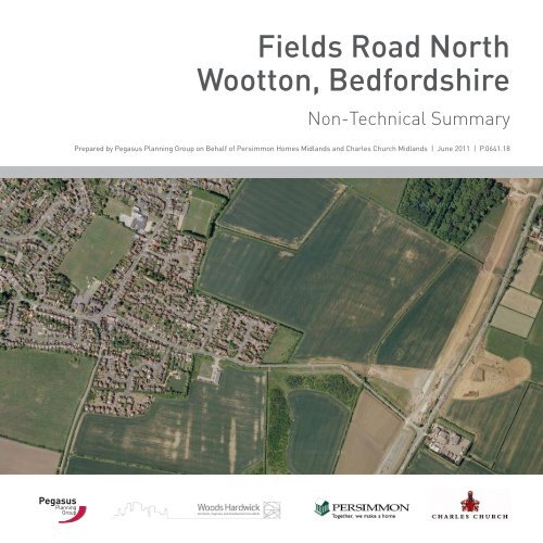
<strong>Fields</strong> <strong>Road</strong> <strong>North</strong><strong>Wootton</strong>, <strong>Bedfordshire</strong>Non-Technical SummaryPrepared by Pegasus Planning Group on Behalf of Persimmon Homes Midlands and Charles Church Midlands | June 2011 | P.0641.18PegasusPlanningGroup
2 page
<strong>Fields</strong> <strong>Road</strong> <strong>North</strong><strong>Wootton</strong>ContentsIntroduction 4Site Context and Location 4Proposed Development 6Planning Policy Context 8Landscape and Visual Issues 9Ecology and Nature Conservation 12Archaeology and Cultural Heritage 14Hydrology and Drainage 16Traffic and Transport 17Noise Environment 18Air Quality 19Socio-Economics 21Ground Conditions 22Conclusion 23PegasusPlanningGroupRef: P.0641.18Date: June 2011COPYRIGHT:The contents of this document must not be copied or reproduced in whole or in partwithout the written consent of Pegasus Planning Grouppage 3
IntroductionThis Non Technical Summary (NTS) summarisesthe findings of an Environmental Statement (ES)which accompanies a hybrid planning applicationcontaining elements of both a full planningapplication for the early phases of developmentand also an outline planning application for thesubsequent later phases. The application issubmitted by Pegasus Planning Group on behalfof Persimmon Homes Midlands and CharlesChurch Midlands to Bedford Borough Councilin connection with land at <strong>Fields</strong> <strong>Road</strong> <strong>North</strong>,<strong>Wootton</strong>.In terms of planning history a planningapplication at <strong>Fields</strong> <strong>Road</strong> <strong>North</strong> was submittedin March 2002 seeking outline planningpermission for mixed use development including17.5ha of residential development, 1,000 sqmgross local shopping facilities, land for a lowerschool and nursery and open space, outdoorplaying fields and children’s’ play facilities.The application was given reference number02/01013/OUT.Amendments were made to the applicationand ES in January 2004. The amendmentsincluded a corridor safeguarded for the A421improvement works, as potential route for thecanal, an additional emergency access link,minor changes to position of equipped children’s’play areas and additional ES appendices withan updated transport assessment, energystatement and retail impact assessment. Furtheramendments were made to the ES in October2004. Amendments comprised a cumulativereport which considered the combined effect ofthis application with the application at <strong>Fields</strong><strong>Road</strong> (south) and an addendum to the ES.The landscape framework and compositemasterplan were also revised. A revisedcomposite masterplan was submitted in June2005.A resolution to grant planning permission,subject to a Section 106 Agreement, for thisscheme was given by Bedford Borough Councilon October 2005.The current planning application proposesup to 610 residential dwellings on the landincorporating a variety of dwelling types, toinclude affordable housing, in addition to a newprimary school, local centre with communityfacilities, playing fields and public open space.Site Context and LocationThe site lies to the south and east of the village of<strong>Wootton</strong>, approximately 5km south west from thetown of Bedford. The proposed site lies adjacentto the newly constructed A421 dual carriagewayroad. The location of the application site isillustrated on page 5 and in the ES.The site is bounded by agricultural land tothe north, the A421 to the east and residentialproperties to the west. To the south lies Field<strong>Road</strong> which provides access between the villageand the old alignment of the A421.The site area extends to 38 hectares in total,comprising of agricultural use, predominantlyarable. The landscape context for the site is ofa generally flat topography although the siterises very generally in an east-west direction.The character is of arable fields interspersedwith hedgerows and hedgerow trees. A pondexists within the eastern portion of the site, anda further balancing pond lies off-site beyond thewestern boundary.4 page
<strong>Fields</strong> <strong>Road</strong> <strong>North</strong><strong>Wootton</strong>Site Context Planpage 5
Proposed DevelopmentThe site is anticipated to provide up to 610dwellings and the development of a new LocalCentre which will contain a new lower School,shops, community building with changing rooms,playing pitches, children and youth play areasand an alignment for a canal cut through theeastern part of the site together with landscapingproposals.It is proposed that the canal cut will beconstructed to link from Bedford to MiltonKeynes and the expected route passes throughthe <strong>Fields</strong> <strong>Road</strong> <strong>North</strong> site. The canal route isto be safeguarded through the developmentand although the future channel will not beconstructed at this time the alignment will bedefined by a shallow depression about 450mmdeep formed over the width of the final waterway.In summary the proposed developmentwill comprise:• Up to 610 residential dwellings (Class C3)of a variety of sizes and tenures, to includeaffordable housing and associated informalopen space;• Site for a new Lower School (Class D1);• A Local Centre comprising of a supermarket(Class A1) up to 500sq.m and up to 500sq.mof Class A1-A5 uses;• A community building (Class D1) includingchanging facilities;• Provision of playing pitches and publicopen space;• Construction of a canal corridor; and• Associated infrastructure works andlandscaping.• Broad features of the proposed developmentare illustrated on the ParametersAssessment Plan on page 7, the outlinescheme assessed in this ES.Planning Policy ContextRelevant planning policies at a national, regionaland local level have been identified. TheDevelopment is consistent with the broad thrustof national and regional policy, representing asustainable extension in an area which has beendetermined through the adopted developmentPlan as being suitable for residential growth.6 page
<strong>Fields</strong> <strong>Road</strong> <strong>North</strong><strong>Wootton</strong>Parameters Planpage 7
Landscape and Visual IssuesA comprehensive landscape and visual impactassessment has been carried out in accordancewith best practice and using a methodology thatadheres to accepted professional standards.The overall assessment demonstrates that theproposed development would be compliant withnational planning guidance and relevant regionaland local planning policy.Baseline ConditionsThe application site, which is located immediatelyadjacent to the existing eastern, urban, edgeof <strong>Wootton</strong> is generally level and comprises anumber of arable agricultural fields that arelargely defined by a network of hedgerows anddrainage ditches.<strong>Fields</strong> <strong>Road</strong> runs along the applicationsite’s southern boundary and the A421 dualcarriagewayis close to the eastern boundary.The landscape character context for theapplication site is described within theNational Character Area 88 ‘<strong>Bedfordshire</strong> andCambridgeshire Claylands and landscapecharacter area 5D: <strong>North</strong> Marston Vale of theBedford Borough Landscape Assessment FinalReport.There are no environmental designationscovering the application site or in close proximityto the site boundaries.Likely EffectsThe most substantial changes to the landscapeelements and features on the site would occurduring the construction phase of the proposeddevelopment. However, not all the effectswould be negative in nature and several wouldbe positive ones including the creation of newponds and the retention of most of the existinghedgerows and trees on the application site.During the operational phase, the creation oflarge areas of open space would have a positiveeffect on the area of grassland and herbaceousplants within the application site and the largeareas of new tree, shrub and hedgerow plantingwould have a significant beneficial effect.There would be a low magnitude of changeon both the National and Borough LandscapeCharacter during the construction phase ofthe proposed development resulting in a slightadverse effect and a moderate adverse effect onthe site’s Local Landscape Character. However,such effects would be temporary in nature.In respect of both the National and BoroughLandscape Character Areas there would be aslight adverse effect as a result of the proposeddevelopment during the operation phase at Year1. However, by year 15 the proposed developmentwill be perceived as an integral part of <strong>Wootton</strong>and the effect will diminish to become neutral.In terms of the effect on the local landscapecharacter of the application site, the generallayout design and the provision of extensiveareas of green infrastructure, together withthe inclusion and retention of many of theexisting hedges and their associated trees asan integral element of both the built areas andopen spaces of the proposed development, wouldhelp conserve two important elements that givethe site its current character. These would beenhanced by additional planting.8 page
Landscape and Visual Issues<strong>Fields</strong> <strong>Road</strong> <strong>North</strong><strong>Wootton</strong>Consequently, the moderate adverse effect ofthe proposed development on the existing sitecharacter would diminish as the form and patternof development, together with the continuedgrowth of retained vegetation and the maturing ofnew planting, would increasingly be perceived asa piece of the wider urban landscape of <strong>Wootton</strong>.At year 15 the proposed development would havea neutral effect.Views into and out of the site are limited by anumber of factors including existing interveningvegetation, built form and infrastructure andtopography. Where views of the site and theproposed development do occur they are typicallyseen in the context of the existing urban edgeof <strong>Wootton</strong> and/or surrounding developmentinfrastructure.A Zone of Theoretical Visibility for the proposeddevelopment has been produced that indicatesareas where the proposals might be visible and arange of representative visual receptors chosen,in consultation with the local planning authority,upon which to carry out a visual assessment.The assessment demonstrates the actualzone of visibility is in reality more limited, notextending much beyond 2 kilometres, owing tothe screening effect of intervening structures,vegetation, topography and the orientation ofreceptors.Visual effects of the proposals are most likelyto occur at close range to the application siteboundary. Activity will be evident from certainvisual receptors during the construction phase ofthe proposed development. However, any adverseeffects will be temporary in nature.During the operational phase, the careful sitingof the built form and the careful use of heightwill help to reduce the potential visual effects onthe proposed development so that the proposedbuilt form is of a similar scale and form to that ofsimilar existing areas of <strong>Wootton</strong>. The inclusionof extensive areas of green infrastructure andopen space as part of the proposed overall layoutalso helps to visually break up the built form andmassing of the residential, retail and educationalareas of the proposed development.Proposed planting within the open spaces anddevelopment areas will assist further in reducingthe visual effects of the proposed development.So that by year 15 of the operational phaseany adverse effects of the proposals wouldhave diminished to neutral, with the proposeddevelopment increasingly perceived as part of theurban fabric of <strong>Wootton</strong>, and, where the proposednew planting has matured, often becoming abeneficial effect.MitigationThe vision for the proposed development is tocreate a high quality multi-functional landscapewhich meets the requirements of its existingand future residents. The green infrastructureproposed which comprises the landscapeframework would form an integral part of theoverall development proposals. It also formseffective means of integrating appropriatemitigation to address both the landscapeand visual effects. The design of the greeninfrastructure associated with the schemeprovides the opportunity for not only mitigationbut also enhancement of the environment inlandscape terms.page 9
Landscape and Visual IssuesLandscape features would be generally enhancedwith the proposals in place. A limited number ofreceptors would be affected visually. However,the proposed residential development would beof high quality, set within a strong landscapeframework, and would be in character with theadjacent existing residential development.ConclusionThe landscape and visual assessmentdemonstrates that the site is capable ofaccommodating the proposed mainly residentialwith some mixed use scheme and associatedgreen infrastructure which in totality, would beeffectively assimilated into the existing urbanfringe environment to form a new greener,attractive and substantive landscaped urbanextension to <strong>Wootton</strong> that helps fulfil theaspirations of the local planning authorityfor creating new integral areas of greeninfrastructure.10 page
<strong>Fields</strong> <strong>Road</strong> <strong>North</strong><strong>Wootton</strong>Ecology and Nature ConservationAn ecological survey of the application site hasbeen undertaken, including a desk study, anextended Phase 1 survey and Phase 2 faunalsurvey.Baseline ConditionsA number of ecological designations are locatedin the nearby vicinity of the site. The neareststatutory designation is Hangar Wood Siteof Special Scientific Interest (SSSI) locatedapproximately 3.9km northwest of the site,whilst the closest non-statutory ecologicaldesignations are <strong>Wootton</strong> Wood County WildlifeSite (CWS) and Kempston Hardwick Pit CWS,located approximately 1km west and east ofthe site respectively. The application site itselfpredominantly comprises arable farmland,considered to be of negligible ecological value.Habitats of higher ecological value includehedgerows, ponds and a minor watercourse. Interms of faunal interest, the site is consideredto be of no particular ecological value for themajority of species. However, low populationsof Great Crested Newt were recorded to bepresent at a pond within the site and a furtherpond immediately offsite adjacent to the westernboundary, as such, the site is considered tobe of moderate value at the local level to thisfully protected species. The site also providessome limited opportunities for a number ofother faunal species such as birds, Brown Hare,Hedgehog, other amphibians and a range ofinvertebrates.Likely Effects and MitigationA range of potential effects have been identifiedon habitats and fauna within in the site (allecological designations are considered to beunaffected by the proposed development).Mitigation and enhancement measures aretherefore proposed, including habitat creationand provision of wildlife corridors, providingsignificant benefits to a wide variety of faunalspecies, and measures to avoid impacts resultingfrom construction activities, anthropogeniceffects, lighting and change to hydrology(including safeguards in relation to the EuropeanProtected Species Great Crested Newt).ConclusionThe development proposals and mitigationscheme have been designed to achievecompliance with relevant legislation and planningpolicy. In general, the development seeks toprotect, conserve and enhance biodiversity inline with policies such as CP25 from the BedfordCore Strategy and Rural Issues Plan, and savedpolicies from the Bedford Borough Local Plan.More specifically, measures are proposedto avoid an offence in relation to protectedspecies such as Great Crested Newt and birdsand reptiles (protected under the Wildlife andCountryside Act 1981, and the Conservationof Habitats and Species Regulations) andopportunities for enhancements to biodiversityare also proposed, in accordance with PPS9,the NERC Act 2006 and Policy CP25 from theBedford Core Strategy and Rural Issues Plan.The proposals also accord with UK and localBiodiversity Action Plan (BAP) objectives,specifically in relation to creation of new habitatssuch as ponds. Significant contributions to Greenpage 11
Ecology and Nature ConservationInfrastructure are also proposed, in line withPolicy CP22 from the Bedford Core Strategy andRural Issues Plan and <strong>Bedfordshire</strong> and LutonGreen Infrastructure Plan and Bedford GreenInfrastructure Plan.Following mitigation, it is considered that theproposed development would result in significantenhancements to the existing ecological interestof the application site, with substantial benefitsin respect of habitats, bats and other mammals,birds, amphibians and invertebrates, theseeffects being assessed as of overall moderatebeneficial significance at the local level.12 page
<strong>Fields</strong> <strong>Road</strong> <strong>North</strong><strong>Wootton</strong>Archaeology and Cultural HeritageIntroductionThe likely impact of the proposed developmenton archaeology and cultural heritage has beenassessed with reference to national policy asset out in Planning Policy Statement 5, regionalpolicy set out in the East of England Plan andlocal policy as set out in the Local DevelopmentFramework. The scope of the assessment wasagreed with English Heritage and the BedfordBorough Council’s Archaeological Officer.Baseline Conditions‘Heritage assets’ – that is features ofarchaeological, historical, architectural orartistic value – were identified by desk-basedassessment and archaeological field evaluation.The desk-based assessment identified all known‘heritage assets’ including any assets that layoutside the Site itself whose setting is likely tobe affected. It also identified those heritageassets whose importance is recognised bydesignation under one or more of the followingcategories: World Heritage Sites, ScheduledMonuments, Listed Buildings, Protected WreckSites, Conservation Areas, Registered Parks andGardens, Registered Battlefields and (in certaincircumstances) historic hedgerows.Field evaluation employed a combination ofsurface collection of artefacts, geophysical surveyand trial trenching to find out if the Site containsany hitherto unidentified heritage assets.Within the Site itself there are no designatedheritage assets of importance and the onlyknown features are of local interest only. Thesecomprise:• post-medieval field boundaries, none ofwhich predate Enclosure• scattered post-medieval and medievalartefacts within the cultivated soil• traces of medieval strip cultivation (ridge andfurrow) preserved as subsoil features, and• a small number of undated archaeologicalfeatures that are probably of agriculturalorigin.In the hinterland of the Site, <strong>Wootton</strong> villagecontains 31 listed buildings, including the Grade IChurch of St Mary and Grade II* <strong>Wootton</strong> House,and the Church End Conservation Area. Thenearest scheduled monument lies 1.2km to theeast of the Site, at Kempston Hardwick. As isto be expected anywhere in rural <strong>Bedfordshire</strong>,the area around the Site also contains a numberof undesignated assets of regional or localimportance – most of these date either from theIron Age/Roman period or the medieval/postmedievalperiod.page 13
Archaeology and Cultural HeritageLikely EffectsDevelopment may have a neutral or minordetrimental effect on significance of most of theassets contained within the Site. Any detrimentaleffects have already been offset to some extentby the investigation and recording undertaken aspart of the archaeological evaluation, becausethis has provided a record of the distributionof artefacts in the plough soil and a sample offeatures has been excavated.The effect of development on heritage assetsaround the Site has been assessed as an effecton their setting. Generally no effect is apparent.Any detrimental impacts on the wider ruralsetting of the listed buildings and ConservationArea are very slight or minor.MitigationNo mitigation is required to offset effects ofdevelopment on assets within the Site.Any slight or minor detrimental impacts onsetting of heritage assets are not significant andcan be further reduced by sympathetic design toreflect the historical context.ConclusionsThe development will have no significant adverseimpact on heritage assets.14 page
Hydrology and Drainage<strong>Fields</strong> <strong>Road</strong> <strong>North</strong><strong>Wootton</strong>The scheme has been described in the contextof its surroundings and constraints. Thesignificance of the effects relating to hydrologyand drainage have been determined, specificallyconsidering water base and hydrologicalinfluences. The magnitude of potential effects,and hence their significance, assumes thatmitigation measures are implemented.Baseline ConditionsThe base line scenario has been describedin identifying existing features and the effectthey have on the development site, specificallyhighlighting the availability of capacity in existinginfrastructure and the influence of any floodplain.Likely EffectsThe likely effects of the development have beenassessed and have considered the potentialimpacts on the land drainage system and watersupply and sewerage infrastructure with the aimof demonstrating potential impacts.The impact of the development on the foul watersewerage infrastructure has been considered inconjunction with Anglian Water Services Ltd. Theassessment concludes that with the provision ofnew major infrastructure to improve capacity in<strong>Wootton</strong> there will be no impact arising from thedevelopment and there will actually be significantbetterment achieved as a result of the creation offurther capacity for the benefit of the surroundingarea.The impact of the proposed development on thecurrent water supply arrangements have beenconsidered in consultation with Anglian WaterServices Ltd. It has been recognised that existinginfrastructure cannot supply the developmentwithout reinforcement but a scheme of strategicimprovements have already been identified. Theimprovements anticipate the development ofthe site which means the scheme will have noimpact on future water supply arrangements andthere will be a beneficial effect arising from thegeneral improvements which will reinforce theexisting water mains in the area amplified by theproposed use of low water usage fittings withinthe new dwellings.MitigationThe beneficial mitigation of the potential impactsinclude the strategic approach to dealing withsurface water runoff from all new developmentssouth and west of Bedford. The relationship withthese strategic facilities have been reviewed withthe conclusion being that there will be no impacton flood plain and that there will actually besignificant betterment achieved as a result of thestrategic solution which is being pursued.ConclusionIt can be concluded therefore that from ahydrological and drainage perspective there willbe no environmental impact arising from thedevelopment scheme.page 15
Traffic and TransportThe Traffic and Transport assessment describesand assess the likely significant effects of theproposed development on transport and access.Additionally a Transport Assessment (TA) reporthas been prepared which examines in detail thequantitative analysis of transport effects on theexisting transport system.Baseline ConditionsThe Local Highway Authority and the HighwaysAgency have requested that the impact ofthe development is assessed on specific keyjunctions on the local highway network and thestrategic road network respectively.Likely EffectsThe results of the modelling processdemonstrate that the development is predictedto have a minor impact on the junctions in thevicinity of the site; however, all of the junctionsare predicted to continue to operate within their(theoretical) capacities with development in placein 2021.The staggered priority junction is predicted tooperate slightly above its theoretical capacity inthe 2021 horizon with the Land <strong>North</strong> of <strong>Fields</strong><strong>Road</strong> and the proposed Land South of <strong>Fields</strong><strong>Road</strong> developments fully occupied. This impactshould, nonetheless be adequately mitigated withthe introduction of a link road which is proposedfrom Cranfield <strong>Road</strong>, south of the staggeredjunction, through the Land South of <strong>Fields</strong> <strong>Road</strong>development to the southern arm of the accessroundabout. This link road would solve anycapacity issues that might otherwise arise atthe Bedford <strong>Road</strong>/<strong>Fields</strong> <strong>Road</strong>/Cranfield <strong>Road</strong>/Church <strong>Road</strong> junction.MitigationThe measures included within the Travel Planwhich accompanies the application will assistin mitigating the traffic related impact of thedevelopment by encouraging the use of moresustainable modes including walking, cycling,public transport and car sharing. As part ofthe scheme proposals new cycle lanes andpedestrian footpaths have been incorporatedthroughout the development.ConclusionIn conclusion, following the introduction ofmitigation measures in the form of incentivesto using more sustainable alternatives, theproposed development will have a neutralimpact in terms of transport and access.16 page
Noise Environment<strong>Fields</strong> <strong>Road</strong> <strong>North</strong><strong>Wootton</strong>IntroductionA noise assessment has been carried out for theProposed Development to assess the suitability ofthe site for residential development, as well as aschool and play area.The assessment has taken account of potentialimpacts during the construction of thedevelopment and associated with the operation ofthe completed development.Baseline ConditionsNoise surveys have been carried out to determinethe existing noise environment within theproposed development.The results of the survey have been assessedagainst the principal guidance contained inPlanning Policy Guidance 24 (PPG 24), whichindicated that the site was within PPG 24 NoiseExposure Category (NEC) A/B and thereforesuitable for residential development.Likely EffectsThe construction of the Proposed Developmentmay give rise to short term noise effects uponexisting residents of <strong>Wootton</strong> living adjacentto the site. To minimise any potential impacts,appropriate control and mitigation measureswould be adopted.No noise effects have been identified atthe proposed residential elements of thedevelopment, with appropriate measuresimplemented to control noise from any fixed plantlocated within the local centre or school site.Whilst there would be increases in roadtraffic on the roads surrounding the proposedDevelopment, no adverse noise effects have beenidentified within this assessment.MitigationDuring the construction, the contractors wouldbe required to adopt best practice measures tominimise potential impacts, which would includecareful plant selection, control of working hoursand monitoring of levels whilst working close topotentially affected receptors. With appropriatemeasures adopted, potential adverse effectswould be minimised.Appropriate noise mitigation measures would beincorporated into the design of the developmentto protect future occupants against noise fromany proposed external plant located within thelocal centre or school site and the proposedplay facilities. With appropriate measuresimplemented in the design, which could besecured through a suitable planning condition,potential effects would be minimised.ConclusionsIn summary, with appropriate mitigationand control measures adopted during theconstruction and design of the development,potential noise effects would be minimised, thusensuring the site was suitable for residentialdevelopment.page 17
Air QualityThe air quality impacts associated with theconstruction and operation of the proposeddevelopment have been assessed.Baseline ConditionsExisting conditions within the study area showgood air quality, with concentrations all wellbelow the UK’s air quality objectives.The operational impacts of increased trafficemissions arising from the additional traffic onlocal roads, due to the development have beenassessed. Concentrations have been modelledfor seventeen receptors, representing existingproperties where impacts are expected to begreatest. In addition, the impacts of traffic fromlocal roads on the air quality for future occupantshave been assessed at seven locations within thenew development itself.In addition, the impacts of increased trafficemissions on local roads from the adjacent <strong>Fields</strong><strong>Road</strong> South development have been assessed.Likely EffectsThe impacts of local traffic on the air quality forresidents living in the proposed developmenthave been shown to be acceptable at all locationswithin the proposed development site, withconcentrations being well below the air qualityobjectives. The impacts of emissions fromsurrounding sources on the development aretherefore judged to be insignificant.The overall impacts during the constructionphase are judged to be slight adverse.MitigationThe construction works have the potential tocreate dust. During construction it will thereforebe necessary to apply a package of mitigationmeasures to minimise dust emission. Evenwith these measures in place, there remainsa risk that a small number of existing off-siteproperties might be affected by occasional dustsoilingimpacts. Any effects will be temporaryand relatively short lived, and will only ariseduring dry weather with the wind blowingtowards a receptor, at a time when dust is beinggenerated and mitigation measures are not beingfully effective.18 page
Air Quality<strong>Fields</strong> <strong>Road</strong> <strong>North</strong><strong>Wootton</strong>ConclusionIt is concluded that concentrations of nitrogendioxide (NO 2 ) and particulate matter (PM 10 andPM 2.5 ) at nearby existing receptors would remainwell below the objectives in both 2011 and 2015,whether the scheme is developed or not. Theproposed scheme would only increase trafficvolumes on local roads by a small amount. Anyincrease in concentrations of nitrogen dioxide,PM 10 and PM 2.5 would be imperceptible, and theimpacts are judged to be insignificant.It is concluded that concentrations of NO 2 , PM 10and PM 2.5 at nearby existing receptors wouldremain well below the objectives in both 2011and 2015, even if both schemes are developed.The increase in traffic volumes on local roadsassociated with these developments is predictedto bring about an imperceptible increase inconcentrations of NO 2 , PM 10 and PM 2.5 at themajority of receptors, and a small increase at asmall number of receptors. The overall impactsare judged to be insignificant.The impacts of traffic from the <strong>Fields</strong> <strong>Road</strong> Southdevelopment on air quality within the <strong>Fields</strong> <strong>Road</strong><strong>North</strong> site have been shown to be insignificant.It is concluded that road traffic emissions do notprovide any constraints to the proposed scheme.page 19
Socio-EconomicsBaseline ConditionsA range of information sources has been used toassess the effect of the Proposed Developmentupon social and economic factors at <strong>Wootton</strong>.A number of potential effects have beenidentified, including the temporary, short-term,substantial beneficial effect of constructiongenerated employment potentially on a local toregional scale.Likely EffectsFollowing the completion of the ProposedDevelopment, a range of predominantly beneficialeffects of local to regional scale have beenidentified, including employment opportunities,new open space, sports and recreation provision,community facilities and housing provision. TheProposed Development has therefore respondedappropriately in light of the strategic regenerationcontext within which the Application Site islocated. The Proposed Development meetsestablished regeneration strategies and wouldcontribute greatly to the realisation of a numberof planning and policy objectives, including theaspirations for a new canal connecting Bedfordwith Milton Keynes.MitigationIn light of the overall beneficial effect of theProposed Development upon the local andregional socio-economic climate, no additionalmitigation measures are required.ConclusionThe Proposed Development and consequentialinvestment would act as a catalyst forregeneration within the locality providing muchneeded financial contributions towards existingcommunity services and providing physicalimprovements to sports provision within theexisting settlement as well as the ApplicationSite.20 page
Ground Conditions<strong>Fields</strong> <strong>Road</strong> <strong>North</strong><strong>Wootton</strong>The main geo-environmental and geotechnicalissues with relation to the proposed developmenthave been considered together with any potentialeffect upon the environment both during andafter construction.The assessment was undertaken using aphased approach and combined both deskstudy information relating to the site history andsurrounding off-site usage, followed by on siteintrusive works to confirm ground conditions,undertake chemical analyses on recovered soilsamples and analysis of the results.All works were undertaken using best practiceprocedures and to current British Standards andlegislation at the time.Baseline ConditionsThe desk study shows that the site hasessentially had no former usage other than foragricultural purposes, comprising farmlanddissected by ditches and hedgerows, severalfields of which have been used as allotmentgardens in the past.There is a single recorded historical landfill, stillin use, located approximately 740m to the southof the site.The geological map for the area (BGS Sheet203, Bedford) indicates the site to be underlainby Oxford Clay of Jurassic age, which is locallycovered by Quaternary age glacial deposits,comprising Boulder Clay and Glacial Sand andGravel.Intrusive investigations undertaken on the sitein the form of machine excavated trial pits haveconfirmed the predicted geology to be presentincluding a surface covering of ploughed topsoil.No groundwater was encountered, althoughlocalised seepage was present in sand lenseswithin the predominantly clay subsoils.Likely EffectsOn the basis of the published geology andthe results of the intrusive investigations,development of the site should not present anysignificant geotechnical problems.Conventional construction techniques should beapplicable to all proposed development on thesite.On site arisings from excavations will be suitablefor re-use on the site as upfill material. Ifmaterials are to be exported off site, they arelikely to be classed as inert.Chemical analysis of recovered soil samplesidentified no significant elevations above currentguidance values.MitigationNo mitigation is required.ConclusionConsequently there appears no significant risk toend users and therefore there is no requirementto undertake any remediation on the site relatingto soil contamination.Due to the impermeable nature of the localnatural geology it is considered that the riskof migration of landfill gases from the existinglandfill (located 740m to the south) onto the siteis negligible.page 21
ConclusionThe Environmental Statement demonstrates thatthere are no significant harmful environmentaleffects resulting from the proposals for theapplication site at <strong>Fields</strong> <strong>Road</strong> <strong>North</strong> and thereare no overriding environmental constraintsor planning policies which would preclude thedevelopment of this application site.All aspects of the design have taken full accountof the likely significant environmental issuesand, where necessary, mitigation measuresform an integral part of the proposals to ensurethat the environment is suitably protected. Thiscomprehensive assessment demonstrateshow the proposed scheme would bring aboutsignificant benefits such as newly createdhabitats within the development area, positivelycontributing to Biodiversity Action Plan targetsand providing local amenities. The socioeconomic impact of the development would bepositive and would be of significant benefit to<strong>Wootton</strong> and the wider sub region.22 page
<strong>Fields</strong> <strong>Road</strong> <strong>North</strong><strong>Wootton</strong>page 23
www.pegasuspg.co.ukPegasus Planning GroupPegasus HouseQuerns Business CentreWhitworth <strong>Road</strong>CirencesterGloucestershireGL7 1RTTelephone: (01285) 641717Facsimile: (01285) 642348COPYRIGHT The contents of this document must not be copied or reproducedin whole or in part without the written consent of Pegasus Planning Group.Crown copyright. All rights reserved, Licence number 100042093.PegasusPlanningGroup