Using Remote Sensing to Map the Evolution of Marsh Vegetation in ...
Using Remote Sensing to Map the Evolution of Marsh Vegetation in ...
Using Remote Sensing to Map the Evolution of Marsh Vegetation in ...

Create successful ePaper yourself
Turn your PDF publications into a flip-book with our unique Google optimized e-Paper software.
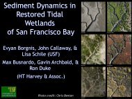
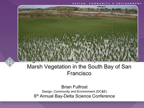
<strong>Us<strong>in</strong>g</strong> <strong>Remote</strong> <strong>Sens<strong>in</strong>g</strong> <strong>to</strong> <strong>Map</strong> <strong>the</strong> <strong>Evolution</strong> <strong>of</strong><strong>Marsh</strong> <strong>Vegetation</strong> <strong>in</strong> <strong>the</strong> South Bay <strong>of</strong> SanFranciscoBrian FulfrostDesign, Community and Environment (DC&E)6 th Annual Bay-Delta Science Conference
PROJECT TEAMGIS and <strong>Remote</strong> <strong>Sens<strong>in</strong>g</strong> <strong>of</strong> vegetation• Brian Fulfrost• Charlie LoyProject ManagerGIS Analyst<strong>Marsh</strong> Ecology• David ThomsonLead Biologist
OVERVIEW - Goals• 3 year pilot project (2009-2011) timedwith Phase One breaches Year One classification complete Year Two <strong>in</strong> progress• Goal was <strong>to</strong> build a semiau<strong>to</strong>mated“model” <strong>to</strong> trackevolution <strong>of</strong> marsh vegetation andsediment as part <strong>of</strong> adaptiveres<strong>to</strong>ration
OVERVIEW - Methods• Habitat Classification - CNPS RapidAssessment methodology <strong>to</strong>characterize spatial variability <strong>of</strong>dom<strong>in</strong>ant marsh vegetation• Habitat Model - Satellite ImageInterpretation and supervisedclassification <strong>of</strong> Ikonos 1 metermultispectral Imagery• Habitat Ground Truth<strong>in</strong>g (calibrationand validation) us<strong>in</strong>g sub meterTrimble GPS
HABITATS TO BE MAPPED
HABITATS TO BE MAPPEDExamples <strong>of</strong> Key Vegetative AlliancesPickleweedGumplantPepperweedInvad<strong>in</strong>g AlkaliBulrushAlkali HeathCordgrassAnnualPickleweed
HABITAT CLASSIFICATION - GPS BASED GROUND TRUTHING• Characterize commonand rare plantassociations based onsimple rules <strong>of</strong>dom<strong>in</strong>ance• Digital surveys withTrimble Terrasync
YEAR 1 HABITAT GROUND TRUTHING
CALIBRATE WITH A RANGE OF DATASETSHabitatGround Truth<strong>in</strong>gCity <strong>of</strong> San Jose‘08IKONOS TrueInvasive Spart<strong>in</strong>aProjectIKONOS FalseLIDAR (USGS)
HABITAT INTERPRETATION GUIDE OF MARSHESEX: Pickleweed /-Cordgrass• True colorsatellite image• False colorsatellite image• As seenon B<strong>in</strong>g<strong>Map</strong>s
CREATE TRAINING SITES FOR CLASSIFICATION• Po<strong>in</strong>t taken <strong>in</strong>field with GPS• Digitized atComputer <strong>to</strong> createtra<strong>in</strong><strong>in</strong>g site• Tra<strong>in</strong><strong>in</strong>g sites used <strong>to</strong> identifyhabitat classification (ERDASIMAGINE)
YEAR 1 DRAFT HABITAT CLASSIFICATION
HABITAT CLASSIFICATION ASSIGNMENT REVIEW
HABITAT CLASSIFICATION ASSIGNMENT REVIEW
HABITAT CLASSIFICATION ASSIGNMENT REVIEW
MISASSIGNMENT—ALGAE/BIOFILM INFLUENCERecently Breached Pond A21Pho<strong>to</strong> Credit: KAP cris’ (www.flickr.com/pho<strong>to</strong>s/kap_cris)
HABITAT CLASSIFICATION EXAMPLES
HABITAT CLASSIFICATION EXAMPLES
HABITAT CLASSIFICATION EXAMPLES
YEAR 1 VERIFICATION GROUND TRUTHING
VERIFICATION IN THE FIELD
INVASIVE PEPPERWEED EXAMPLE – GOOD ASSIGNMENTPho<strong>to</strong> Credit: KAP cris’ (www.flickr.com/pho<strong>to</strong>s/kap_cris)
YEAR ONE - GOOD VEGETATION ASSIGNMENTS• Island Ponds – Pickleweed and Spart<strong>in</strong>a new growth.2009 – False Aerial <strong>Vegetation</strong> Assignment
NATIVE PERENNIAL PICKLEWEED – GOOD ASSIGNMENTPho<strong>to</strong> Credit: KAP cris’ (www.flickr.com/pho<strong>to</strong>s/kap_cris)
YEAR ONE - GOOD VEGETATION ASSIGNMENT• Coyote Creek2009 – False Aerial <strong>Vegetation</strong> Assignment
INVASIVE PEPPERWEED EXAMPLE – GOOD ASSIGNMENTPho<strong>to</strong> Credit: KAP cris’ (www.flickr.com/pho<strong>to</strong>s/kap_cris)
SEDIMENT MAPPING ISSUES WITH SATELLITE IMAGE• Optimal Satellite Acquisition at low tide (MLLW)• Low tide NDVI <strong>in</strong>dex image captures mud <strong>in</strong>stead <strong>of</strong>water with suspended solids
HABITAT AND METHOD ISSUES1. Complex Levee Communities2. M<strong>in</strong>imum <strong>Map</strong>p<strong>in</strong>g Unit3. (MMU) Spectral Mix<strong>in</strong>gNew ZealandSp<strong>in</strong>achSlenderleafIceplantMustardSaltwortand Radish
YEAR TWO PROGRESS UPDATE• Data Acquisition IKONOS imagery year 2 New vegetative growth <strong>in</strong>breached ponds• Ref<strong>in</strong><strong>in</strong>g habitat tra<strong>in</strong><strong>in</strong>gsites• Ref<strong>in</strong><strong>in</strong>g habitatclassificationIsland Ponds Establish<strong>in</strong>g New <strong>Vegetation</strong> Post Levee BreachPho<strong>to</strong> Credit: KAP cris’ (www.flickr.com/pho<strong>to</strong>s/kap_cris)• Supplemental RapidAssessments
SATELLITE AQUISITION ISSUES FOR YEAR 2• Only 3 attempts at low tide (MLLW) with noon light<strong>in</strong>g June 18 th , optimal tide (Failed—<strong>to</strong>o much cloud cover—EXbelow) July 4 th , good tide (Success—see EX below) July 18 th , unnecessary
YEAR 2 HABITAT GROUND TRUTHING
YEAR TWO - VEGETATION GROWTH FROM 2009-2010• Coyote Creek2009 2010
YEAR TWO - VEGETATION GROWTH FROM 2009-2010• Island Ponds2009 2010
YEAR TWO - VEGETATION GROWTH FROM 2009-2010• Bair Island2009 2010
YEAR TWO - VEGETATION GROWTH FROM 2009-2010• Alviso Slough2009 2010
2010 – Phase One breaches and adapative management• SF22009 2010
ACKNOWLEDGEMENTS• Fund<strong>in</strong>g provided by:California State Coastal Conservancyand <strong>the</strong> US EPA, San Francisco BayWater Quality Improvement Fund <strong>in</strong>partnership with <strong>the</strong> San FranciscoEstuary Partnership (SFEP)/Association <strong>of</strong> Bay AreaGovernments (ABAG)
SOUTH BAY SALT PONDRESTORATION PROJECTQuestions?Email: brian@dceplann<strong>in</strong>g.com831-566-7686