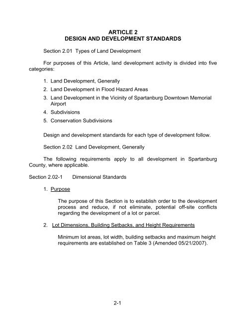
article 2 design and development standards - Spartanburg County
article 2 design and development standards - Spartanburg County
article 2 design and development standards - Spartanburg County
- No tags were found...

You also want an ePaper? Increase the reach of your titles
YUMPU automatically turns print PDFs into web optimized ePapers that Google loves.
EXHIBIT A Table 3b – Commercial & All Other Uses - Setbacks <strong>and</strong> Other Requirements (Amended 2/17/2014)UsesSectionReferenceMinimum Lot(Project Area-Square feet)Minimum LotFrontage(feet)Front Lot LineSee Footnote (Z)Arterial Collector MinorStreet Street StreetMinimum Setback (feet from)2-3RearLot LineSideLot LineResidential <strong>and</strong> Other UsesOneRes.25 ormore Res.Units (I)OtherUses(A)Spacingbetweenbuildings onsame lotAuction House/Barn 3.07 (87,120) 60(K) 50(L)/83(M) 40(L)/65(M) X 20(Z) 15(Z) 500(W) 500(W) NA 20(DD) (Y)Commercial Kennels <strong>and</strong>Certain Agricultural Uses3.08 (20,000) 60(K) 50(L)/83(M) 40(L)/65(M) X 50(Z) 25(Z) 500(W) 1000 (W) 1000 (W) 20(DD) (Y)Mining Operations 3.09 NONE 60(K) 50(L)/83(M) 40(L)/65(M) X 25 25 (B) (W) (B) (W) NA 20(DD) (Y)Motor Speedways <strong>and</strong>Testing Tracks3.10 NONE 60(K) 100(L)/133(M) 100(L)/125(M) X 100(Z) 100(Z) 1000 (W) 2000 (W) 2000 (W) 20(DD) (Y)Outdoor Gun or Skeet Range 3.11 NONE 60(K) 50(L)/83(M) 40(L)/65(M) X 50(Z) 25(Z) 1000 (W) 1000 (W) 1000 (W) 20(DD) (Y)Sexually Oriented Businesses 3.12 NONE 60(K) 50(L)/83(M) 40(L)/65(M) X 20(Z) 15(Z) 200(W) 1000 (W) (F) (W) 20(DD) (Y)Campgrounds & RV Parks 3.13 (217,800) 100(K) 50(L)/83(M) 40(L)/65(M) X 50(Z) 50(Z) NA NA NA 10 (Y)Fuel Products Bulk Storage <strong>and</strong>Distribution Facility3.14 NONE 60(K) Sec.3.14 Sec. 3.14) X Sec. 3.14 Sec. 3.14 Sec. 3.14 Sec. 3.14 Sec. 3.14 Sec. 3.14 Sec. 3.14Off-Site Hazardous Chemicals 3.15 (87,120) 60(K) Sec. 3.15 Sec. 3.15 X Sec. 3.15 Sec. 3.15 Sec. 3.15 Sec. 3.15 Sec. 3.15 20(DD) (Y)Coin-Operated Amusement,Cash Payouts3.16 NONE 60(K) 50(L)/83(M) 40(L)/65(M) X 20(Z) 15(Z) NA 500(W) 500(W) 20(DD) (Y)Waste Management Facilities 3.17 Sec. 3.17 60(K) See Sec. 3.17 See Sec. 3.17) X Sec. 3.17 Sec. 3.17 Sec. 3.17 Sec. 3.17 Sec. 3.17 20(DD) (Y)Communication Towers 3.18 NONE (V) (D)(E) (D)(E) (D)(E)(P) (D)(E)(Z) (D)(E)(Z) (D) (E) Sec. 3.18 20(DD) Sec 3.18Junk/Salvage Yards 3.19 (217,800) 100(K) 50(L)/83(M) 40(L)/65(M) X 50(Z) 50(Z) Sec. 3.19 Sec. 3.19 Sec. 3.19 20(DD) Sec. 3.19-4(3)Signs/Billboards 3.20 NONE NONE 20(L)/83(M) 20(L)/45(M) X 5(Z) 5(Z) Sec. 3.20 Sec. 3.20 NA NONE (CC)Accessory Buildings/Uses 3.21 NA NA 50(L)/83(M) 40(L)/65(M) 30(L)/55(M) 5(Z) 5(Z) NA NA NA NONE (Y)Temporary Uses 3.22 - - - - - - - - - - - Sec 3.22Nuclear & HazardousWaste Disposal3.23NOTPERMITTEDXX XX XX XX XX XX XX XX XX XX XXCertain Public Service Uses 3.24 Sec. 3.24 - - - - - - - - - - Sec. 3.24Tattoo Facility 3.26 Sec. 3.26 50(K) 50(L)/83(M) 40()/65(M) 30(L)/55(M) 20(Z) 15(Z) Sec 3.26 Sec 3.26 Sec 3.26 20(DD) (Y)Flea Markets, Swap Meets, Etc. 3.27 2 acres 60(K) 50(L)/83(M) 50(L)/83(M) X 30(Z) 30(Z) 200 200 NA 20(DD) (Y)Asphalt Plants 3.28 NONE 60(K) 50(L)/83(M) 40(L)/65(M) X 50(Z) 50(Z) 1000(W) 1000(W) 1000(W) 20(DD) (Y)Scrap Metal Processors 3.29 217,800 100(K) Sec 3.29 Sec 3.29 X Sec 3.29 Sec 3.29 Sec 3.29 Sec 3.29 Sec 3.29 20(DD) Sec 3.29All Other Commercial &30(L)55(M)3.25 NONE 60(K) 50(L)/83(M) 40(L)/65(M)Industrial Uses(BB)20(Z) 15(Z) NA NA NA 20(DD) (Y)ALL OTHER USES NONE 60(K) 50(L)/83(M) 40(L)/65(M) 30(L)55(M) 20(Z) 15(Z) NA NA NA 20(DD) (Y)(A) Other Uses include public parks, schools, religious institutions, hospitals, day care facilities, nursing homes.(B) 1,000 feet for mining involving explosives. 300 feet for mining not involving explosives.**In any case where this table does not match the text in the chapters, use the requirements in the text**(P) Upon a case-by-case review by Commission, a 25-foot or more easement may be substituted.(V) Minimum of a 25-foot recorded access easement to a publicly maintained road.(D) Height of tower minus 20 feet.(W) Setbacks shall be measured from the proposed structure to the nearest property line.(E) Setbacks from platted subdivisions with 25 lots or more or at least 50 dwelling units within 1,000 feet of a proposed tower shallbe 2 times the height of the tower (if the tower is less than 200 ft.) or 3 times the height of the tower if tower is 200 ft. or taller.(Y) Each additional foot above 35’ add 1’ to each side <strong>and</strong> rear yard setback OR IF DESIGN STANDARDS AREAPPLICABLE, SEE SECTION 2.02-9(4F)(F) 1,000 feet from another sexually oriented use <strong>and</strong> other uses listed in (A).X= Denied Access to Minor Street.(I) 25 or more units in a platted subdivision.XX= Not Permitted.(K) Nonresidential Developments must take access off a paved public or privately maintained road built to atleast the <strong>County</strong> st<strong>and</strong>ards other than Section 2.05-3-Private Road Developments. Other Uses require frontage on all weather orpaved public or privately maintained road built to at least the <strong>County</strong> St<strong>and</strong>ards other than Section 2.05-3 - Private RoadDevelopments.(Z) All setbacks on roads are front setbacks as required by the road classification.(BB) As allowed in Section 3.25(CC) 35 on non-interstate road; 50 on interstate. See Section 3.20 (5).(L) Setbacks shall be measured from the right-of-way line where dedicated. Setbacks may be modified by Section 2.02-2, Bufferyards.(M) Where there is no right-of-way, measure from the centerline of the road(DD) Spacing between non-residential buildings may be reduced if the requirements of the International Building Codeare met. Twenty-foot spacing requirement does not apply to communication equipment buildings.MaximumHeight(feet)
PAGE INSERTED FOR NUMBERING PURPOSES ONLY – IF YOU DELETE,IT WILL MESS UP THE REST OF THIS ARTICLE…2-4
Section 2.02-2Bufferyards1. PurposeThe purpose of a buffer area is to minimize any potential adverseimpact between adjacent l<strong>and</strong> uses <strong>and</strong> minor streets; <strong>and</strong> promotel<strong>and</strong> use compatibility.2. DefinitionA bufferyard is a portion of a yard, which contains fences, walls,berms <strong>and</strong> plantings located along the perimeter of a parcel of l<strong>and</strong> tolessen the impact of noise, l<strong>and</strong> use intensity, <strong>and</strong> light on adjoiningproperty. The area used in the bufferyard must be a portion of theproperty under <strong>development</strong> <strong>and</strong> may be a portion of the rear, side orfront yard setback requirements of Section 2.02-1. Bufferyards areinclusive of required setbacks. The yard depths shown in theBufferyard Illustrations are the minimum required.3. Specifications <strong>and</strong> OptionsTo determine the required bufferyard for a given use, refer to Table 4,<strong>and</strong> match the abutting use with a proposed use or expansion of anexisting use. Should a question arise as to the l<strong>and</strong> use classificationof a proposed or abutting use, Planning Department staff shalldetermine the classification. Next, refer to the Bufferyard Illustrationsto determine the amount of bufferyard required. After review of thepreliminary plan, the <strong>County</strong> staff shall determine the appropriatebufferyards. The requirements are given in 100-foot units asmeasured along the property line. Whenever a wall or fence <strong>and</strong>/orl<strong>and</strong>scaping is required, the location of the structure shall bedetermined by Planning Department staff. After site review, fencingrequirements may be changed by Planning Department staff. Therequired bufferyards must be installed before a Certificate ofOccupancy or Certificate of Completion is given. (Amended07/19/2004)The length of a bufferyard shall extend the length of the property lineseparating two uses, except for property lines in excess of 200 feet,where the bufferyard need only extend 100 feet beyond either end ofthe existing use to be buffered.However, if proposed use or its accessories are within the line ofsight, the buffer may be extended. Line of sight shall be taken from2-3
corner of existing use structure to corner of adjacent proposed usestructure <strong>and</strong>/or its accessory buildings, as shown. The above alsoapplies to any second existing residential use structure on the sameparcel.Property Line(s)(in excess of 200’)Line of SightProposedL<strong>and</strong> Use100 feetExistingL<strong>and</strong> UseRequired bufferyard100 feet Property LineRight-of-Way Line20 foot setback minimum4. Use of Existing Vegetation In Bufferyard AreasExisting vegetation shall be retained to the degree practical <strong>and</strong>feasible with special attention given to existing trees 18 inches indiameter or larger at DBH. If the existing vegetation provides ascreen equal to or greater than that which would be planted, no otherplant material shall be required. In case of open woods, an additionalplanting of eye level shrubs such as hemlock or pines may beneeded to improve screening.Site plans submitted for approval shall show location <strong>and</strong> extent ofexisting vegetation within bufferyard areas. Approved site plans canonly be altered or amended by the Planning Commission.5. MaterialsTo achieve the desired results, only evergreen plants, suitable forlocal conditions, shall be used, to achieve an opaque screen asrequired. Deciduous trees may be planted along with the evergreensto enhance the height of the screen. Lower story deciduous shrubsmay be used in front of evergreen screens as part of the required2-4
number of plants. Refer to Table 5 for plant suggestions. Whenstructures are used, the materials shall be durable <strong>and</strong> suitable forscreening, as outlined in 2.02-2.9.6. Plant Size <strong>and</strong> CaliperThe minimum tree at planting shall be 6 to 7 feet in height <strong>and</strong> 2 ormore inches in trunk diameter at a height of 18 inches above theground. The minimum shrub shall be 2 to 3 feet in height but shallalso be large enough to ensure an opaque screen within the specifiedtime period of four (4) years, in accord with Bufferyard Illustrationrequirements. Both trees <strong>and</strong> shrubs shall be nursery stock with welldevelopedroot systems unless comparable plants found in place canbe used.It is generally understood that the strict application of theseprovisions will apply. However, due to unique circumstances thePlanning Department staff may approve an alternative method.When determined appropriate by staff one of the followingalternatives may be used: (Amended 5/15/2000)7. Bermsa) Combination berms may be used to compensate for fences orwalls. A six (6) or eight (8) foot high opaque structure can be acombination of berm <strong>and</strong> fence or wall to total six (6) or eight (8)feet.b) Combination berms may be used to compensate for liveevergreen screens. A six (6) or eight (8) foot high opaque screencan be a combination of berm <strong>and</strong> evergreen plants to total six(6) or eight (8) feet.c) St<strong>and</strong>-alone berms may be used to compensate for fences, wallsor vegetative screens. A six (6) or eight (8) foot high opaquescreen can be a berm planted with grass if the slope is 3:1 orless, or with evergreen vegetative ground cover to preventerosion if the slope is greater than 3:1.Bufferyard width <strong>and</strong> site conditions will determine the proper sloperatio to be used for berms. All berms are to have compacted <strong>and</strong>stabilized dirt material.2-5
a)4' Wall Screening3:1 or 4:1 Max. Slope6’ or 8'Screening HeightAverage 4' Height Bermb)4' Live Evergreen Screen3:1 or 4:1 Max. Slope6’ or 8’8'Screening HeightAverage Average 4' Height 4' Berm Height BermBerm Screenc) Stabilizing Ground CoverTop of Berm2:1 Max. Slope6’ or 8'ScreeningHeightThis berm to be used within 50’ – 100’ depth (or 25’ with 6’ height) Bufferyards.Evergreen vegetation for stabilization must be used on slopes > 3:1. Walls,fences, or vegetation may be used to enhance height on top of berm if properstabilization is provided <strong>and</strong> width at top of berm is adequate.4' Live Evergreen Screen3:1 or 4:1 Max. Slope8' 8’Screening HeightAverage Average 4' Height 4' Berm Height Berm2-6
8. Fence <strong>and</strong> Wall SpecificationsWalls must be made of masonry materials including poured concrete,concrete block covered with stucco, <strong>and</strong> brick. See BufferyardIllustrations for placement options.Chain link fences with evergreen hedge on the outbound side may besubstituted for wooden fence of the same height, as approved byPlanning Department staff. Refer to Table 5 for hedge plants whichare among those acceptable. All plants must be sized <strong>and</strong> spaced toobscure the chain link fence within four (4) years of planting. Chainlink fences with wood, plastic, or metal strips are expresslyprohibited.Masonry WallSolid Fence9. Front Yard Plant Strip RequiredAll commercial, industrial, office, <strong>and</strong> institutional <strong>development</strong>s musthave at least a five (5) foot wide plant strip between the road right-ofway<strong>and</strong> any property <strong>development</strong>. The plant strip shall be grassedor mulched <strong>and</strong> may have plantings that do not interfere with sightdistance for egress <strong>and</strong> ingress. On expansion projects, therequirement for a five (5) foot plant strip may be waived if it can beshown that existing or new dimensions of the lot or buildings make itimpossible to comply.10. ResponsibilityIt shall be the responsibility of the proposed new use to provide thebufferyard where required by this Ordinance, except that no newdetached single-family dwelling or duplex shall be required to providesuch bufferyard.2-7
11. Required MaintenanceThe maintenance of required bufferyards shall be the responsibility ofthe property owner. All such areas shall be properly maintained soas to ensure continued buffering. Dead trees shall be removed <strong>and</strong>promptly replaced with correct sized plants; debris <strong>and</strong> litter shall becleaned; <strong>and</strong> berms, fences, <strong>and</strong> walls shall be maintained at alltimes. Failure to do so is a violation of this Ordinance, <strong>and</strong> may beremedied in the manner prescribed for other violations.12. Use of BufferyardsA bufferyard may be used for passive recreation <strong>and</strong> may beinterrupted by access driveways not exceeding 16 feet in width(exceptions for uses requiring wide curb cuts may be approved byPlanning Department staff). All other uses are prohibited, includingoff-street parking <strong>and</strong> accessory uses.13. Sight ClearanceBufferyards may not obscure a clear line of sight for vehicular traffic.Therefore, bufferyards should be placed no closer than 20 feet fromstreet/road right-of-way lines.BufferyardProperty Line20 feet Right-of-way Line<strong>County</strong>/State Highway2-8
14. Bufferyards for Industrial or Commercial ExpansionsWhen an industrial or commercial l<strong>and</strong> use exp<strong>and</strong>s in the directionof an existing adjacent l<strong>and</strong> use, it is required to provide a bufferyardagainst that adjacent l<strong>and</strong> use, as outlined in Table 4.Table 4 (Amended 08/28/2009)Side <strong>and</strong> Rear Bufferyard Requirements(Note: Check Design St<strong>and</strong>ards Section 2.08-9 for additional buffer yard requirements.)Existing Use (1)(2)Proposed Use (5)*Agricultural(with residence) (6)Single-family Home (3)All Other Residential (4)Office/InstitutionalLow IntensityCommercialMedium IntensityCommercialHigh IntensityCommercialLight IndustryHeavy IndustryOffice / Institutional 2 4 3 0 0 0 0 0 0Manufactured Home Park 3 5 4 0 0 0 0 0 0Multi-Family 1-3 units/acre 1 3 2 0 0 0 0 0 0Multi-Family 4-8 units/acre 2 4 3 0 0 0 0 0 0Multi-Family > 8 units/acre 3 5 4 0 0 0 0 0 0Townhouses 1-3 units/acre 1 2 1 0 0 0 0 0 0Townhouses 4-8 units/acre 2 3 2 0 0 0 0 0 0Townhouses > 8 units/acre 3 4 3 0 0 0 0 0 0Low Intensity Commercial 1 3 2 0 0 0 0 0 0Medium Intensity Commercial 2 5 4 1 1 0 0 0 0High Intensity Commercial 3 5 5 2 2 1 0 0 0Light Industry 3 6A 5 2 2 1 1 0 0Heavy Industry 4 6B 6 3 3 2 2 1 0Footnotes apply only where indicated in the table.(1) Buffer along minor streets as if the property were an adjacent parcel.(2) In determining buffer yard classification, adjacent vacant parcel(s) that total less than 100 feet in width shall bedisregarded, <strong>and</strong> the buffer applied shall be determined by the next adjacent property use.(3) Includes subdivision of 25 or more submitted for approval or recorded platted lots, or a single-family home ormanufactured home on a minor street.(4) Requirements may be reduced by one side buffer yard class where existing residential use is located on anarterial street.(5) Planning Department Staff shall determine appropriate buffer yard within the classes listed above.(6) To be considered, existing residence must be within 100 feet of property line adjacent to new use. Accessorystructures <strong>and</strong> uses are not to be considered.* If the proposed use is not stated on the site plan or plat, then the highest intensity buffer shall be required at perimeterof project boundary. If projects are phased, Buffer yard must be consistent with previous or other phases. (Amended07/19/2004)2-9
Bufferyard IllustrationsFollowing are examples of vegetation, fence, wall or berm layouts within eachBufferyard. “o,c,” means ‘on center’, or from the center of one plant to the centerof the next plant, indicating the possible spacing. The bottom border of eachbufferyard represents the existing use side. The scale used in the illustrations isapproximately 1”=20’-0”. See Legend for symbol representations.Bufferyard 1 Optionsa) 5 trees (20’ o.c.)100’5’b) 3 trees (33’ o.c.) & 6 shrubs100’5’c) 12 shrubs (8’ o.c.)100’5’d) 6’ fence100’5’2-10
Bufferyard 2 Optionsa) 10 trees (10’ o.c. single row)100’10’b) 6 trees (17’ o.c. single row) & 12 shrubs (8’ o.c. single row)100’10’c) 24 shrubs (5’-8’ o.c. two rows)100’10’d) 6’ fence100’10’2-11
Bufferyard 3 Optionsa) 15 trees (8’ o.c. staggered rows)100’15’b) 8 trees (12’ o.c.) & 24 shrubs (4’ o.c. single row; 8’ o.c. two rows)100’15’c) 48 shrubs (4’ o.c. two rows; 6’ o.c. three rows; or combine large <strong>and</strong> small)100’15’d) 6’ fence & 20 shrubs or trees (5’ o.c. single row; 8’ o.c. single row, staggered; or acombination)100’15’2-12
Bufferyard 4 Options(Opaque Screen)a) 25 trees (12’ o.c. three rows) & 30 shrubs (6’ o.c. two rows)100’25’b) 12 trees (17’ o.c. two rows) & 60 shrubs (5’ o.c. three rows)100’25’c) 8’ fence & 10 trees or shrubs (10’ o.c. single row, staggered; 20’ o.c. two rows)100’25’d) 3:1 Berm (4’ Height) or 2:1 Berm (6’ Height with stabilization vegetation)100’3:1or2:125’2-13
Bufferyard 5A Options(Opaque Screen)a) 30 trees (10’ o.c. three rows) & 40 shrubs (5’ o.c. two rows)100’50’b) 20 trees (10’ o.c. two rows) & 80 shrubs (5’ o.c. four rows)100’50’2-14
Bufferyard 5A Options(Opaque Screen)c) 8’ fence & 25 trees or shrubs (or a combination)100’50’d) Any Berm option 4:1, 3:1, or 2:1 (With stabilization vegetation)100’4:1 or 3:1or2:150’2-15
Bufferyard 5B Options(Opaque Screen)a) 6’ wall & 25 trees or shrubs (10’ o.c. three rows, staggered)100’25’b) 3:1 Berm (4’ Height) or 2:1 Berm (6’ Height with stabilization vegetation)100’3:1or2:125’Bufferyard 5C Option(Opaque Screen)a) 8’ wall100’5’2-16
Bufferyard 6A Options(Opaque Screen)a) 6’ wall & 25 trees (10’ o.c. three rows, staggered) & 100 shrubs (4’ o.c. four rows)100’25’b) 3:1 Berm (4’ Height) or 2:1 Berm (6’ Height with stabilization vegetation)100’3:12:125’Bufferyard 6B Options(Opaque Screen)a) 8’ fence & 45 trees (9’ o.c. four rows) & 80 shrubs (5’ o.c. four rows, staggered)100’50’2-17
Bufferyard 6B Optionsb) 30 trees (10’ o.c. three rows) & 120 shrubs (5’ o.c. six rows)(Opaque Screen)100’50’c) Any Berm option 4:1, 3:1, or 2:1 (With stabilization vegetation)100’4:1 or 3:1 or2:150’2-18
LegendLargeTree(Shown at25’ wide)MediumTree(Shown at15’ wide)SmallTree(Shown at10’ wide)LargeEvergreen orShrub(Shown at10’-12’ wide)MediumShrub(Shown at5’-8’ wide)SmallShrub(Shown at3’-5’ wide)Wall or FenceApprox. Scale: 1” = 20’-0”See Table 5 for Suggested L<strong>and</strong>scape Plants.2-19
PAGE INSERTED FOR NUMBERING PURPOSES ONLY – IF YOUDELETE, IT WILL MESS UP THE REST OF THIS ARTICLE…2-21
Section 2.02-3L<strong>and</strong>scaping1. PurposeThe purpose of l<strong>and</strong>scaping is to improve the appearance ofvehicular use areas <strong>and</strong> <strong>development</strong> abutting public rights-of-way;to protect, preserve, <strong>and</strong> promote the aesthetic appeal, scenicbeauty, character <strong>and</strong> value of l<strong>and</strong> in the <strong>County</strong>; to promote publichealth <strong>and</strong> safety through the reduction of noise pollution, stormwater runoff, air pollution, visual pollution, <strong>and</strong> artificial light glare.2. DefinitionL<strong>and</strong>scaping is a type of open space permanently devoted <strong>and</strong>maintained for the growing of shrubbery, grass, other plants <strong>and</strong>trees.3. Where RequiredNo proposed commercial, institutional, industrial or other nonresidentialuse shall hereafter be established <strong>and</strong> subsequently usedunless l<strong>and</strong>scaping is provided in accord with the provisions of thisSection. Expansions shall meet the minimum requirements of theexpansion area only. L<strong>and</strong>scaping is not required for existing uses.(Amended 5/15/2000)4. L<strong>and</strong>scaping PlanA l<strong>and</strong>scaping plan is required <strong>and</strong> the developer is responsible formeeting the l<strong>and</strong>scaping requirements of this Ordinance.5. L<strong>and</strong>scaping RequirementsRequired l<strong>and</strong>scaping shall be provided as follows:(1) Along the outer perimeter of a lot or parcel, where required bythe bufferyard provisions of this Article to buffer <strong>and</strong> separateincompatible l<strong>and</strong> uses. The amount specified shall be asprescribed by Section 2.02-2.(2) There is no l<strong>and</strong>scaping requirement for sites needing fewerthan 20 parking spaces. L<strong>and</strong>scaped areas shall be providedfor any open vehicular use area containing 20 or more parkingspaces, or fraction thereof. L<strong>and</strong>scaped areas shall be2-22
6. L<strong>and</strong>scaped Areaslocated in such a manner as to divide <strong>and</strong> break up theexpanse of paving <strong>and</strong> at strategic points, but shall contain notless than one canopy tree per 20 parking spaces, or fractionthereof. This will allow for clustering of trees. In no case shalla parking space be located more than 100 feet from the trunkof a canopy tree. Elsewhere, l<strong>and</strong>scaped areas shall be<strong>design</strong>ated to soften <strong>and</strong> compliment the building site.(Amended 5/15/2000)(1) All l<strong>and</strong>scaped areas in or adjacent to parking areas shall beprotected from vehicular damage by a raised concrete curb oran equivalent barrier of six (6) inches in height. The barrierneed not be continuous.(2) Interior l<strong>and</strong>scaped areas containing canopy trees must havea minimum area of eight (8) feet by eight (8) feet in size.(3) L<strong>and</strong>scaped areas adjacent to parking spaces shall bel<strong>and</strong>scaped so that no plant material greater than 12 inches inheight is located within two feet of the curb or other protectivebarrier. (Plant material greater than 12 inches in height wouldbe damaged by the automobile bumper overhang or by doorsswinging open over the l<strong>and</strong>scaped areas.)7. Required MaintenanceThe maintenance of required l<strong>and</strong>scaped areas shall be theresponsibility of the property owner. All such areas shall be properlymaintained so as to assure their survival <strong>and</strong> aesthetic value.Section 2.02-4Common Open Space1. PurposeThe purpose of this section is to ensure adequate open space forhigh density residential <strong>development</strong>; to integrate recreation,l<strong>and</strong>scaping, greenery <strong>and</strong>/or natural areas into such projects; topromote the health <strong>and</strong> safety of residents of such projects; <strong>and</strong> tocompensate for the loss of open space inherent in single-familyresidential projects.2-23
2. DefinitionCommon open space is l<strong>and</strong> <strong>and</strong>/or water bodies used forrecreation, amenity or buffer; it shall be freely accessible to allresidents <strong>and</strong> property owners of a <strong>development</strong>, where required bythis Ordinance. Open space shall not be occupied by buildings,structures, roads, or parking, other than those in conjunction with theuse of the open space. Nor shall it include the yards or lots ofresidential dwelling units required to meet minimum lot area orparking area requirements.3. Common Open Space PlanProposed uses/projects required by this Ordinance to have commonopen space shall be accompanied by an open space or l<strong>and</strong>scapingplan as part of the application. The plan shall:(a)(b)(c)Show natural areas of undisturbed vegetation or areasreplanted with vegetation construction. Woodl<strong>and</strong>s <strong>and</strong>wetl<strong>and</strong>s are specific types of natural areas.Designate the type of open space, which will be provided.Specify the manner in which common open space shall beperpetuated, maintained <strong>and</strong> administered.4. Types of Common Open Space <strong>and</strong> Required MaintenanceThe types of common open space which may be provided to satisfythe requirements of this Ordinance together with the maintenancerequired for each are as follows:(a)(b)(c)Maintenance is limited to removal of litter, dead trees, plantmaterials, <strong>and</strong> brush. Natural watercourses are to bemaintained as free flowing <strong>and</strong> devoid of debris. Streamchannels shall be maintained so as not to alter floodplainlevels.Recreational areas are <strong>design</strong>ed for specific activerecreational uses such as tot lots, tennis courts, swimmingpools, ballfields, <strong>and</strong> similar uses.Greenways are linear green belts linking residential areas with2-24
other open space areas. These greenways may containbicycle paths, footpaths, <strong>and</strong> bridle paths. Connectinggreenways between residences <strong>and</strong> recreational areas areencouraged.(d)L<strong>and</strong>scaped areas, lawns <strong>and</strong> required buffer areas, includingcreative l<strong>and</strong>scaped areas with gravel <strong>and</strong> tile, so long as thetile does not occupy more than two percent of the requiredopen space. Lawns, with or without trees <strong>and</strong> shrubs shall bewatered regularly to ensure survival, <strong>and</strong> mowed regularly toensure neatness.5. Preservation of Open SpaceL<strong>and</strong> <strong>design</strong>ated as open space may not be separately sold,subdivided or developed. Open space areas shall be maintained sothat their use <strong>and</strong> enjoyment as open space are not diminished ordestroyed. Open space areas may be owned, preserved <strong>and</strong>maintained as required by this section by any of the followingmechanisms or combinations thereof:(a)(b)(c)Dedication <strong>and</strong> acceptance by the <strong>County</strong>.Common ownership of the open space by a homeowner’sassociation, which assumes full responsibility for itsmaintenance.Deed-restricted, private ownership which shall prevent<strong>development</strong> <strong>and</strong>/or subsequent subdivision of the openspace l<strong>and</strong> <strong>and</strong> provide the maintenance.In the event that any private owner of open space fails to maintainsame, the <strong>County</strong> may in accordance with the Open Space Plan <strong>and</strong>following reasonable notice, dem<strong>and</strong> that deficiency of maintenancebe corrected, <strong>and</strong> enter the open space to maintain same. The costof such maintenance shall be charged to those persons having theprimary responsibility for maintenance of the open space.Section 2.02-5Off-Street Parking <strong>and</strong> Loading1. PurposeThe purposes of this Section are to ensure adequate provisionof on-site parking <strong>and</strong> loading space, to improve traffic2-25
circulation <strong>and</strong> minimize vehicular <strong>and</strong> pedestrian conflicts, toreduce the expense of paving, <strong>and</strong> to promote the aestheticappeal of parking lots.2. L<strong>and</strong> to Provide ParkingRequired off-street parking must be provided on the same lotor parcel as the principal use for which it is required; however,street separation is permissible.3. Numerical Requirements, Off-Street ParkingWhen any new <strong>development</strong> is commenced or when anyexisting <strong>development</strong> is enlarged by 10% or more, or the usechanged, provision shall be made for off-street vehicularparking facilities on the same lot in accordance with thest<strong>and</strong>ards of this Section.Off-street parking provided to comply with the provisions ofthis Section shall not be reduced below the requirementsherein. (Amended 07/19/2004)Table 6 (Amended 02/17/2014)Off-Street Parking RequirementsUseRequired Off-Street Parking SpacesAmusement-Coin Operated, Video 6.0 per 1,000 sq. ft. of GFAArcades, etc.Animal Shelter & Pounds1.0 per 1,000 sq. ft. of GFAAntique Store1.0 per 350 sq. ft. of GFAApartment Development1.5 per dwelling unit plus 1.0 per every 5 unitsfor visitor parkingApparel & Accessory Stores1.0 per 350 sq. ft. of GFAAquarium2.0 per 1,000 sq. ft. of GFAAttached Multi-Plex Dwelling Projects See Apartment Development, CondominiumDevelopment, or Townhouse DevelopmentAutomotive, Repair & Services1.0 per 300 sq. ft. of GFA plus 1.0 per 5,000 sq.ft. of gross l<strong>and</strong> areaAutomotive/Recreational Vehicle/BoatDealers2.0 per 1,000 sq .ft. of GFA plus 1.0 per every20 vehicle display spacesBarber/Beauty Shops/Tattoo Facilities 1.0 per each employee plus 2.0 per chairBed & Breakfast Inns1.0 per guestroom plus 1.0 per each employeeBillard/Pool Halls1.0 per 200 sq. ft. of GFABook Stores1.0 per 350 sq. ft. of GFABowling Centers5.0 per laneBroadcasting & Telecommunications 1.0 per 500 sq. ft. of GFABusiness Services1.0 per 350 sq. ft. of GFACamera & Photography Supply1.0 per 350 sq. ft. of GFACampgrounds, RV Parks 1.5 per RV / campsite or dwelling unit plus 1.02-26
per employeeCar Washes Mechanical: 1.0 per every 2 employees plus 1.0per manager / owner plus stacking spacesequal to 5 times the maximum capacity of autowashing unit. Self-Service: Stacking spacesequal to 5 times the maximum capacity.CemeteriesNoneChurches1.0 per every 4 seats in the main assemblyroomClubhouses – Development Specific 1.0 per 350 sq. ft. of GFACommunication Tower AntennaNoneCondominium Development2.0 per dwelling unitCorrectional Institution 1.0 per each employee on largest shift plus 1.0per 25 inmatesCrematoriesDay Care Services (Nursery School)1.0 per 500 sq. ft. of GFA1.0 per 300 sq. ft. of GFA with <strong>design</strong>ated dropoff& stacking.Depository Institutions, Banks 5 stacking spaces per drive-in window plus 1.0per each employee on largest shift plus 1.0 per300 s.f. of GFADrug Stores1.0 per 350 sq. ft. of GFADwelling, Single-Family & Duplex, Two- 2.0 per dwelling unitFamilyFairs, CarnivalsBy individual reviewFire Departments, EMS4.0 per bayFireworks1.0 per 350 sq. ft. of GFAFlea Markets1.5 per stallFlorists1.0 per 350 sq. ft. of GFAFuel Dealers1.0 per 500 sq. ft. of GFAFuneral Chapels (except crematories) 5 spaces plus 1.0 per every 2 seats in the mainassembly roomFurniture, Home Furnishings1.0 per 350 sq. ft. of GFAGasoline Service Stations-Full Service 1.0 per each employee on largest shift plus 3for each service rack or car washGasoline Service Stations-Self Service 1.0 per 600 sq. ft. of GFAGift, Novelty & Souvenir Shops1.0 per 350 sq. ft. of GFAGolf, Driving Range-only1.0 per tee plus 1.0 per each employee onlargest shiftGolf, Miniature, Putt-Putt1.0 per hole plus 1.0 per each employee onlargest shiftGolf, Par 3-only2.0 per hole plus 1.0 per each employee onlargest shiftGovernment, Executive, Legislative, 1.0 per 350 sq. ft. of GFAGeneralGravestones, Monuments1.0 per each employeeGrocery Store-Convenience, (i.e.7-11) 1.0 per 100 sq. ft. of GFAGrocery Store-Supermarket1.0 per 350 sq. ft. of GFAHardware Stores1.0 per 350 sq. ft. of GFAHealth Services-Urgent Care (No beds) 1.0 per 150 sq. ft. of GFAHealth, Home Care Services1.0 per 500 sq .ft. of GFAHobby, Toy & Game Shops1.0 per 350 sq. ft. of GFAHoldings, Investment Companies 1.0 per 350 sq. ft. of GFA2-27
Hospitals, Institutions-Medical (Beds) 1.0 per each bed plus 6.0 per 1000 s.f. of office& administrative areaHotels, Rooming Houses, Lodging, Motels 1.1 per room or suite plus 1.0 per every 3patrons of maximum capacity of eachmeeting/banquet room plus 50% of spacesotherwise required for accessory uses (i.e.restaurants, lounges, etc.)Industry-Heavy, Publishing,1.0 per company vehicle left on premises plusManufacturing, Distributing1.0 per each employee on largest shiftIndustry-Light2.0 per every 3 employeesJewelry Shops1.0 per 350 sq. ft. of GFAJunk Yards, Salvage Yards1.0 per each employee PLUS 1.0 per businessvehicle plus 1.0 per 350 sq. ft. GFALaundries/Dry-cleaning-Coin Operated 1.0 per 150 sq. ft. of GFALaundry, Cleaning & Garment Services 1.0 per 500 sq. ft. of GFALawn & Garden Equipment & Supply 1.0 per 350 sq. ft. of GFAStoresLibraries1.0 per 350 sq. ft. of GFA plus 1.0 per eachemployee on largest shiftLiquor Stores1.0 per 350 sq. tf. of GFAManufactured Home Parks2.0 per dwelling unitMarina/Marina with L<strong>and</strong>ing3.0 per every 4 slips plus 10% of spaces largeenough for cars with boat trailersMedical & Dental Laboratories1.0 per 500 sq. ft. of GFAMerch<strong>and</strong>ise Stores (General)1.0 per 350 sq. ft. of GFAMiningMobile Home Dealers2.0 per every 3 employees1.0 per every 10 mobile homes on display plus1.0 per 300 sq. ft. of office space with aminimum of 5 spacesMonasteries, Convents1.0 per every 6 residents plus 1.0 per eachemployee plus 1.0 per every 5 chapel seats (ifpossible)Motor Freight Transport 1.0 per each employee on largest shift plus 1.0Motorcycle DealersMulti-FamilyMuseums, Art GalleriesNight-Club, Cocktail Lounge, Tavern,Disco, Barper truck parked on site1.0 per 600 s.f. of GFASee Attached Multi-Plex Dwelling Projects1.0 per 350 s.f. of GFA1.0 per every 3 seating accommodations plus1.0 per every 2 employees on largest shift or1.0 per 100 s.f. of GFA, whichever requires thegreatest number of spacesNursing & Personal Care Facilities 1.0 per every 5 patient beds plus 1.0 per eachemployee on largest shiftOffice Administrative/Professional 1.0 per 350 s.f. of GFAServicesOffices & Clinics of Physicians1.0 per 150 s.f. of GFAPaint, Glass & Wallpaper1.0 per 350 s.f. of GFAParcel Delivery Services1.0 per 250 s.f. of GFAParks & Playgrounds, Public/Non-Athletic 1% of l<strong>and</strong> areaPatio Homes2.0 per dwelling unitPawn Shops1.0 per 350 s.f. of GFAPhotographic Studios, Portraits1.0 per 350 s.f. of GFA2-28
Physical Fitness FacilitiesProduce St<strong>and</strong>RacetracksRacquetball/H<strong>and</strong>ballRefuse Systems, Sanitary L<strong>and</strong>fills,DumpsRehabilitation, Vocational ServicesResidential Care, Congregate Care,Assisted LivingRestaurant/Food Service-with inside oroutside seatingRestaurant/Food Service- Drive-throughonlyRifle/Shooting Range-OutdoorScrap Metal ProcessorSchool, College, UniversitySchools, Elementary, SecondarySchools, Fine Art, Music, Dance, Vocal1.0 per 300 s.f. of GFA1.0 per 350 s.f. of GFA1.0 per every 4 seats provided1.0 per 200 s.f. of GFASee Waste Management Facilities(Section 3.17)1.0 per 350 s.f. of GFA1.0 per 500 s.f. of GFA1.0 per every 3 seats-including dining &drinking areas plus 2.0 for every 3 employeeson largest shift1.0 per 150 s.f. of GFA plus area for 8 stackingspaces for the first drive-in window & 6stacking spaces for the additional drive-inwindow1.0 per target area plus 1.0 per each employee1 per 40,000 square feet of gross l<strong>and</strong> area(inside screened area) not to exceed 12 spaces+ 1 per employee + 1 per company vehicle.5.0 per classroom plus 10 administrativespaces2.0 per classroom plus 5 administrative spaces1.0 per 200 s.f. of GFASchools, High Schools5.0 per classroom plus 10 administrativespacesSchools, Vocational, Commercial, Trade 5.0 per classroom plus 10 administrativespacesShopping Centers1.0 per 250 s.f. of GFASkating/Ice Rink1.0 per 200 s.f. of GFA or individual reviewSporting Goods & Bicycle Shops 1.0 per 350 s.f. of GFAStables, Horseback Riding, Boarding, etc. 1.0 per 200 s.f. of GFA or individual reviewStadium, Arena, Athletic FieldBy individual reviewSwimming Pool – Public2.0 per 100 s.f. of water surface areaSwimming Pool – Development Specific 1.0 per 100 s.f. of water surface areaTax Return Preparation Services1.0 per 350 s.f. of GFATaxation, Finance, Monetary-Public 1.0 per 350 s.f. of GFATennis Club2.0 per court plus 1.0 per 200 s.f. of clubhousefloor area in excess of 1,000 s.f.Tennis Courts2.0 per courtTerminal, Truck1.0 per 250 s.f. of floor area devoted to officespace plus 2.0 per company vehicle operatedfrom premisesTheaters-Indoor1.0 per every 4 seats providedTheaters-Outdoor1.0 per every 5 patrons at maximum capacity,or per individual reviewTownhouse Development2.0 per each unitTransportation Services1.0 per 500 s.f. of GFATransportation, Air1.0 per 250 s.f. of GFATransportation, Bus1.0 per 250 s.f. of GFA2-29
Travel Agency1.0 per 350 s.f. of GFATruck Stops1.0 per 600 s.f. of GFAVeterinary Services1.0 per 250 s.f. of GFAVideo Tape Rental1.0 per 250 s.f. of GFAWarehousing1.0 per 10,000 s.f. or minimum of 5 spacesWarehouses-Mini 1.0 per on-site employee with a minimum of 3spacesWaste Management Facility(Section 3.17) 1.0 per each employee plus 1.0 per businessvehicle plus 1.0 per 350 sq. ft. of office space*SPECIAL LAND USES*(unique l<strong>and</strong> uses)The minimum number of parking spacesrequired for a use not specifically mentioned inthis section shall be determined by PlanningDepartment staff.3. Numerical Requirements, Off-Street LoadingAll uses shall provide off-street loading space sufficient for theirrequirements. Such space shall be arranged so that no vehiclebeing loaded or unloaded in connection with normal operations shallst<strong>and</strong> in or project into a public street, walk or alley.4. Design St<strong>and</strong>ardsRequired off-street parking shall be <strong>design</strong>ed so that all movementonto a public street shall be in a forward motion, <strong>and</strong> meet thefollowing st<strong>and</strong>ards:(a)Parking DimensionsParking stalls shall be not less than nine (9) feet by 18 feet,except that a maximum of 30 percent of the total number ofstalls may be 8.5 feet by 18 feet. However, the dimensions ofall parallel parking stalls shall be not less than eight (8) feet by22 feet. Minimum isle width shall be as follows:90 degree parking 24 feet60 degree parking 18 feet45 degree parking 13 feet30 degree parking 11 feet(b)Construction, Paving(1) Parking lots with 20 or more spaces shall besurfaced with asphalt, concrete, porous asphalt,porous concrete, or brick pavers. However,expansive impervious surface parking lots shall beavoided. In their <strong>design</strong>, parking lots shall be broken2-30
down into sections as appropriate for the type <strong>and</strong>size of <strong>development</strong>, <strong>and</strong> shall be separated byl<strong>and</strong>scaped dividing strips, berms <strong>and</strong> similardevices.(2) Parking lots intended to provide for off-street parkingshall be improved with a minimum 6 inch stabilizedaggregate base course <strong>and</strong> a minimum 1½ inchasphalt or concrete surface course or equivalent. AProfessional Engineer may <strong>design</strong>, <strong>and</strong> submit forapproval, an alternate paving <strong>design</strong> of at leastequivalent durability. However, the surface coursemust be of the materials found in (1).(Amended 5/15/2013)(3) For parking provided in excess of the spacesrequired by Table 6, porous brick pavers or cellularconfinement systems that use grassing should beused. (Amended 5/15/2013)(c)DrainageParking lots shall be <strong>design</strong>ed so as not to drain into or acrosspublic sidewalks or on adjacent property, except into a naturalwatercourse or a drainage easement. In developed areaswhere this condition may be impossible to meet, the <strong>County</strong>may exempt the developer from this requirement, providedthat adequate provision is made for drainage.(d)Separation from Walkways <strong>and</strong> StreetsOff-street parking spaces shall be separated from walkways,sidewalks, streets, or alleys, <strong>and</strong> required yards <strong>and</strong> bufferareas by a wall, fence, curbing, or other protective deviceapproved by the Planning Department staff.(e)Entrances <strong>and</strong> ExitsL<strong>and</strong>scaping, curbing or other approved barriers shall beprovided along boundaries to control entrance <strong>and</strong> exit ofvehicles or pedestrians. All off-street parking areas shall be<strong>design</strong>ed so that all movement onto a public street is in aforward motion. Entrance <strong>and</strong> exit driveways to public streets<strong>and</strong> alleys in the vicinity of street intersections must be located2-31
at least forty (40) feet, measured along the curbline, from theintersection of the nearest curbline.(f)MarkingParking lots with 20 or more spaces shall be marked bypainted lines, curbs or other means to indicate individualspaces. Signs or markers, as approved, shall be used asnecessary to ensure efficient traffic operation of the lot.(g)Lighting5. MaintenanceAdequate lighting shall be provided if off-street parking spacesare to be used at night. Equipment for lighting parkingfacilities shall be arranged so that light does not interfere withtraffic or adjoining residential areas.All off-street parking areas shall be maintained in a clean, orderly,dust-free, <strong>and</strong> weed-free condition at the expense of the owner orlessee <strong>and</strong> not used for the sale, repair, or dismantling or servicingof any vehicles or equipment, except for service <strong>and</strong> auto repairstations.6. Parking Space for the Physically H<strong>and</strong>icappedWhen off-street parking is required for any building or use, except forresidential dwellings with fewer than 20 units, parking for theh<strong>and</strong>icapped shall be included when calculating the overall parkingrequirements for such building or use, based on the followingformula:Number ofRequired SpacesNumber of Spaces Reservedfor H<strong>and</strong>icapped PersonsUp to 25 126 to 50 251 to 75 376 to 100 4101 to 150 5151 to 200 6201 to 300 7301 to 400 8401 to 500 9Over 5002% of total required2-32
Parking spaces for the physically h<strong>and</strong>icapped shall measure 12 feetby 18 feet or 8 feet in width, with an adjacent access isle 8 feet inwidth, <strong>and</strong> shall be located as close as possible to ramps, walkways,<strong>and</strong> entrances. Parking spaces should be located so that physicallyh<strong>and</strong>icapped persons are not compelled to wheel or walk behindparked cars to reach entrances, ramps <strong>and</strong> walkways. (Refer toAppendix E-1)7. Stacking Lanes for Drive Through FacilitiesEach drive through facility shall provide stacking lanes long enoughto accommodate drive through traffic <strong>and</strong> ensure that on-sitecirculation will not interfere with traffic movement on adjacentstreets.8. Joint Use of Off-Street Parking LotsUp to 50 percent of the parking spaces required for (1) theaters,public auditoriums, bowling alleys, dance halls, clubs, churches <strong>and</strong>religious institutions may be provided <strong>and</strong> used jointly by (2) financialinstitutions, offices, retail stores, repair shops, serviceestablishments, <strong>and</strong> similar uses not normally open, used, oroperated during the same hours as those listed in (1); providedhowever, that written agreement assuring their retention for suchpurposes shall be properly drawn <strong>and</strong> executed by the partiesconcerned, approved as to form <strong>and</strong> content by the <strong>County</strong> Attorney,<strong>and</strong> shall be filed with the application for a building permit.9. Approval of Parking <strong>and</strong> Off-Street Loading Plans <strong>and</strong> LayoutsDesigns <strong>and</strong> plans for areas to be used for off-street parking <strong>and</strong> offstreetloading shall be subject to approval by the PlanningDepartment staff, who may withhold a permit or take other action ifthe layout of either would create avoidable safety or trafficcongestion problems, pending acceptable modification of the layout,or appeal to the Board of Appeals.Section 2.02-6 Multiple Buildings on a LotExcept for single-family, detached residential dwellings, includingmanufactured/mobile homes (as defined in Section 3.03-1), there is no limit onthe number of principal buildings or structures which may be built or located on alot or parcel; provided all applicable requirements of this Ordinance shall be met.2-33
Two single-family, detached residential dwellings, includingmanufactured/mobile homes (as defined in Section 3.03-1), or any combinationof two such dwellings may be established on a single lot or parcel; provided thedimensional requirements on Table 3 shall be met for both dwellings as if theywere established on separate lots, <strong>and</strong> so arranged to ensure public streetaccess, building setback <strong>and</strong> lot conformance with Section 2.05-4 in the eventthe property upon which the dwellings are located is subsequently subdivided forsale or transfer. For the purposes of this section, 25-foot flag lots shall not beallowed. The minimum public street frontage required for each dwelling is fifty(50) feet.Multiple dwelling units are prohibited on lots located on roads built inaccordance with the Private Street Design Section 2.05-3 or lots located on aRoad of any lesser st<strong>and</strong>ard. (Amended 10/21/2002)Single family dwellings may be located on non-residential parcels providedall applicable requirements of this ordinance are met. (Amended5/15/2000)(Amended 5/21/2012)Section 2.02-7Access to Property/Curb Cuts for Non-Residential Uses1. Street Access, GenerallyExcept as herein provided, no building shall hereafter be erected,constructed, moved, or relocated on a lot not located on a publiclydedicated, publicly accepted or maintained street, or private streetas provided for by Section 2.05-3.2. Curb Cuts, L<strong>and</strong> Developments (As defined by Article 6.)Entrances to <strong>and</strong> exits from l<strong>and</strong> <strong>development</strong> projects aredistinguished from curb cuts/other access points by the large amountof traffic they accommodate. As a result of these higher trafficvolumes, entrances <strong>and</strong> exits require higher <strong>design</strong> st<strong>and</strong>ards thanmore typical curb cuts, or be sufficient in number to h<strong>and</strong>le theestimated additional traffic volumes safely without imposing unduehardship on traffic flow on the adjacent streets. If the drivewayvolume is estimated to exceed 1000 vehicles/day, <strong>County</strong> staff mayrecommend that entrances <strong>and</strong> exits to these projects require twotwelve (12) foot exit lanes <strong>and</strong> a sixteen (16) foot entrance lane. Athirty (30) foot turning radius will be provided <strong>and</strong> one hundred (100)feet of right-of-way where the entrance/exit fronts with theintersecting street (See Street Illustration Type 4). Entrances/exits2-34
may not take access closer than one hundred twenty-five (125) feetfrom the centerline of an intersecting street.3. Curb Cuts And Access From And Along S.C. State MaintainedRoads:Ingress-egress openings in concrete, asphalt, rock, or other streetcurbing provisions, commonly referred to as "curb cuts" shall beregulated in accord with the South Carolina Department OfTransportation's Access And Roadside Management St<strong>and</strong>ards,Section 3a.4. Curb Cuts And Access From And Along <strong>Spartanburg</strong> <strong>County</strong>Maintained Roads:Ingress-egress openings in concrete, asphalt, rock, or other streetcurbing provisions, commonly referred to as "curb cuts". Allconstruction within the Right-of-way shall comply with the<strong>Spartanburg</strong> <strong>County</strong> St<strong>and</strong>ard Specifications for construction ofRoads.5. Individual LotsIn no case shall a curb cut or other access point be less than twenty(20) nor more than forty (40) feet in width. Turning radius of the curbshall be between 2.5 - 25 feet.6. Driveway Access (<strong>Spartanburg</strong> <strong>County</strong> Maintained Roads)a. The <strong>Spartanburg</strong> <strong>County</strong> Roads & Bridges Department willinspect the site <strong>and</strong> determine the pipe size. This informationwill then be forwarded to the Building Codes Department. Allquestions concerning pipe size should be addressed to theBuilding Codes Department.b. Property owner/contractor must place stakes where access isrequested. This will allow the inspector to verify the correctpipe size to be installed. It is the owner/contractorresponsibility to locate the driveway to achieve maximum sightdistance to avoid a traffic hazard.c. Reinforced Concrete Pipe (RCP) must be used.d. The pipe must be installed straight, bell upstream <strong>and</strong> jointsmust be sealed. The backfill must be compacted <strong>and</strong> an eight2-35
(8) inch crusher run base placed <strong>and</strong> compacted over thepipe.e. Installed asphalt or concrete aprons (optional) are theresponsibility of the property owner/contractor. Asphaltaprons should be two <strong>and</strong> a half (2 ½) inches compacted.Concrete aprons may be substituted.f. Driveway entrance must be approved by the Building Codesinspector along with electrical, plumbing, etc. prior to finalinspection being approved.g. Issuance of this permit does not imply or constitutecompliance with any other ordinances or regulations that maygovern this installation.7. Commercial / Industrial Developmentsa. All Commercial/Industrial <strong>development</strong>s must take accessfrom a paved State, <strong>County</strong> or Municipally maintainedroad.b. Turning radius of the curb for commercial <strong>and</strong> industrial<strong>development</strong> shall have a minimum of 30 feet.8. Curb Cut SpacingNo two curb cuts or other access points shall be closer than thefollowing (Table 7), measured between the beginning of turning radii:Table 7Required Distance Between Curb Cuts/Driveways(Determined by Street Type <strong>and</strong> Traffic Volume)Street Type Less than 3,000vehicles per day3,000 or morevehicles per dayArterial Streets 90 feet 110 feetCollector Streets 70 feet 90 feetMinor Streets 40 feet 60 feetDistances between adjacent one-way driveways/curb cuts can beone-half these distances if the inbound drive is upstream. <strong>County</strong>staff may recommend for approval lower spacing on streets for2-36
which the volume to capacity ratio is projected to be less than 0.3projected for the next twenty years. Distance of curb cuts fromadjoining property lines shall be five (5) feet measured from thebeginning of the turning radius.9. Adjacent or Separate LotsNo two curb cuts or other access points on adjacent or separate lotsshall be closer than the distances indicated in Table 7 above, unlessprohibited by narrow lot widths, in which case a minimum separationof thirty (30) feet shall be maintained.10. Access Points in the Vicinity of Street IntersectionsAt street intersections, no curb cuts or other access points shall belocated closer than fifty (50) feet measured from the beginning of theturning radius to the right-of-way line of the street intersection. Incases where there is no defined right-of-way on a State maintainedroad or where the distance from the centerline to the right-of-wayline is less than 33 feet, then 33 feet from the centerline shall be thereference point for establishing the measurement for entrancesetback. For <strong>County</strong> maintained roads that have either noestablished right-of-way or minimal rights-of-way, the reference pointfor establishing the measurement for entrance setback shall be 25feet.11. No curb cuts or other access points shall be located closer than thefollowing, measured between the beginning of the turning radius <strong>and</strong>the ROW line of the street intersection.State Roads with/ Min. 33' ROW ..................................... 50 ft.State Roads with no ROW-Assume 33' ROW ................ 50 ft.<strong>County</strong> Roads with/Min. 25' ROW ................................... 50 ft.<strong>County</strong> Roads with no ROW-Assume 25' ROW ............. 50 ft.2-37
Section 2.02-8WayRoad Improvements Within an Existing <strong>County</strong> Road Right-of-All road improvements within an existing <strong>County</strong> road right-of-way shallcomply with the <strong>County</strong>'s St<strong>and</strong>ard Specifications for Construction of Roads <strong>and</strong>shall be completed to the satisfaction of the <strong>County</strong> Engineer. As a condition ofapproval, the developer or other responsible party shall enter into an agreementwith <strong>Spartanburg</strong> <strong>County</strong> <strong>and</strong> at his own expense repair any <strong>and</strong> all defects inmaterials <strong>and</strong> workmanship which occur for a period of one year from the datesuch work is accepted by <strong>Spartanburg</strong> <strong>County</strong>.Section 2.02-9 Design St<strong>and</strong>ards for Certain NonresidentialDevelopment (Amended 09/28/2009)1. Purpose<strong>Spartanburg</strong> <strong>County</strong> provides an attractive environment for avariety of residential, institutional, commercial <strong>and</strong> industriall<strong>and</strong> uses. The <strong>County</strong>’s L<strong>and</strong> Development Ordinanceincludes a combination of buffers <strong>and</strong> setbacks intended to2-38
2. Applicabilityminimize conflicts between different uses. It is the <strong>County</strong>’sintent to adopt <strong>design</strong> st<strong>and</strong>ards that will enhance <strong>and</strong>improve the compatibility of new <strong>development</strong>s <strong>and</strong> uses withexisting properties. Thus the <strong>County</strong> has adopted these newst<strong>and</strong>ards <strong>and</strong> a review process to ensure that newcommercial <strong>and</strong> industrial <strong>development</strong> located within closeproximity to a residential neighborhood or use is <strong>design</strong>ed <strong>and</strong>built to enhance the compatibility of the uses <strong>and</strong> thecharacter of the area.A. GenerallyTriggers - The review process <strong>and</strong> <strong>design</strong> st<strong>and</strong>ards of thissection shall apply to any commercial or industrial<strong>development</strong> on a parcel which is:• within 250 feet of 3 or more parcels containing individualbuilding(s) used as single family residences havingbeen owner occupied within the last three years(measured lot line to lot line) unless separated by afour-lane roadway or rail line, or• within 500 feet of a property listed (measured lot line tolot line) on the National Register of Historic Placesunless separated by a four-lane roadway or rail line, or• within 500 feet of the closest lot line of any establishedresidential area (measured lot line to lot line) unlessseparated by a four-lane roadway or rail line, whichincludes:o any property line of an approved subdivision thatincludes 25 or more lots <strong>design</strong>ated for residentialuse provided that the subdivision is at least 50%occupied, or lots are being actively marketed, orconstruction activity has taken place in the pastthree years, or plat has been approved within thelast six months.B. Adequate Separation Exception - If, due to the configuration ofparcels <strong>and</strong> the improvements existing on or anticipated to bebuilt thereon, the commercial or industrial improvements(including driveways, parking lots <strong>and</strong> signage) will lie more than:2-39
D. Exceptions(1) 300 feet from closest individual building used primarily as asingle family residence (measured from the nearest point ofproposed improvement to the nearest point of existingresidential structure);(2) 300 feet of any lot line or more than 600 feet from thenearest point of an existing residential structure in anapproved subdivision of 25 or more lots <strong>design</strong>ated forresidential use (provided that the subdivision is at least50% occupied, or lots are being actively marketed, orconstruction activity has taken place in the past threeyears);then a showing may be made to the Administrator or theAdministrator’s <strong>design</strong>ee of the planned improvements <strong>and</strong> aconclusive showing that appropriate distances are maintainedas described above, then a waiver of these Design St<strong>and</strong>ardswill be granted by the Administrator or the Administrator’s<strong>design</strong>ee. In the future, if residential is built within the abovementionedzones of separation, such residences shall have nocause to complain, unless or until there is a change in use <strong>and</strong>intensity as provided below which would cause compliance bythe commercial/ industrial user with this Ordinance.C. Barns or Personal Use Structures Exceptions - This section doesnot apply to structures used in agriculture or to personal usestructures on residential parcels. If a residential parcel hasconstructed on it a shed, barn, auxiliary building or garage <strong>and</strong>the use of that structure is no longer associated with theoccupant of the residence as a supporting building to theresidence <strong>and</strong> the use of the building becomes eithercommercial or industrial in nature, then the property becomessubject to any applicable provisions of this section.The <strong>design</strong> st<strong>and</strong>ards shall not apply to any of the following:Change of Tenant Exception - A change of tenant oroccupants in a multi-user building if the use of the newoccupant is similar in intensity or less intense than any usewhich it replaces or to other uses in the building or complex;2-40
Expansion of Existing Building Exception - An expansion of anexisting commercial or industrial building which meets each ofthe following requirements:o The expansion will not violate applicable setbackrequirements or encroach into buffer areasestablished on the site.o The expansion does not involve a change in useto a use that is more intense than the existinguse;o And the expansion must meet either of thefollowing:• The expansion is in a direction away fromthe residential or other use which wouldtrigger the applicability of this section or theexpansion in the direction of such useprovided that the expansion remains 100feet off the property line <strong>and</strong> is buffered atleast to the st<strong>and</strong>ards found in Table 4.• An increase of not more than 30% in thefloor area of the building (however, shoulda Façade Wall be moved, the façade wallshall comply with the architecturalst<strong>and</strong>ards) or the cost of anticipatedimprovements as set forth in the buildingpermits is less than 75% of the existingappraised values of the propertyimprovements as established by the<strong>Spartanburg</strong> <strong>County</strong> Assessor’s Office.• Acceptable Use Change Exception - A change of use inan existing commercial or industrial building that doesnot involve a change to a use that is more intense thanthat which has lawfully occupied the premises withinany part of the previous 48 months or, if vacant morethan 36 months, the last known use;• “Surrounded” Exception - A proposed use on a parcelwhich adjoins in all directions by any combination ofcommercial or industrial uses, four lane roadways or raillines.2-41
• Predominant Use Exception for Existing IndustrialBuildings or Vacant Property - An existing or proposeduse located on the edge of at least 15 contiguous acrescurrently occupied by industrial uses which shall place abufferyard one classification higher than required byTable 4, (unless already at the maximum classification)between itself <strong>and</strong> the existing adjacent use.• Planned Industrial Park Exception - A proposedindustrial use on a parcel within a planned industrialpark with existing restrictive covenants for industrialuse.• Distressed Property Exception - A structure meeting thedefinition of a Distressed Property may have the DesignSt<strong>and</strong>ard requirements eliminated when the propertyowner/agent presents the Administrator or theAdministrator’s <strong>design</strong>ee with adequate documentationattesting to this fact.• Industrial/Distribution/Manufacturing Exception - Anindustrial, manufacturing, warehousing, or distributionuse that is 12,000 square feet of size or larger.E. Determining IntensityIntensity shall be determined by using the definedclassifications of low intensity commercial, medium intensitycommercial, high intensity commercial, light industry <strong>and</strong>heavy industry. Two uses that fall in the same classificationshall be considered to have the same intensity. The followingprinciples shall apply:• A low intensity commercial use is less intense than anyother commercial or industrial use;• A medium intensity commercial use is less intense thana high intensity commercial use or any industry use;• A high intensity commercial use is less intense thanlight industry or heavy industry;• A light industry is less intense than a heavy industry.2-42
3. Review ProcessThe review of <strong>design</strong> st<strong>and</strong>ards shall be assigned according tothe Review <strong>and</strong> Approval Authority Table in Article 1. Theowner or option holder must submit a complete applicationpackage to the Administrator or the Administrator’s <strong>design</strong>eeto be considered for each of the following steps:A. Sketch PlanFor purposes of confirming the applicability of thesest<strong>and</strong>ards, the owner or option holder may opt to submit aproject sketch plan as a part of their initial projectapplication prior to developing a full site plan, elevationdrawings, <strong>and</strong> l<strong>and</strong>scape plan.1. The sketch plan must be to scale <strong>and</strong> have adequatesite information for making the required distancedeterminations for the applicability of the <strong>design</strong>st<strong>and</strong>ards. It must describe the proposed use, show thelocation <strong>and</strong> orientation of proposed structures <strong>and</strong>improvements, show adjacent parcel information <strong>and</strong>include other relevant information about uses in thearea that may affect applicability. If the owner’sunderst<strong>and</strong>ing is that the proposed project is notrequired to meet these <strong>design</strong> st<strong>and</strong>ards, the sketchplan must contain a statement confirming that the sitedoes not trigger the applicability of this section (section2.A.) or identify the specific exception. The sketch planapplication will not be processed if a determinationcannot be clearly made.2. The Administrator or the Administrator’s <strong>design</strong>ee willvia letter either confirm or correct the underst<strong>and</strong>ing ofapplicability. If the owner then subsequently submits afull site plan <strong>and</strong> complete <strong>development</strong> applicationpackage consistent with the results of the sketch planreview within 90 days, changes on nearby propertiescannot alter the applicability during that 90 day period.3. A submitted sketch plan will not constitute a vestment.The project will be vested upon Site Plan Approval as2-43
stated in the <strong>Spartanburg</strong> <strong>County</strong> Vested RightsOrdinance.B. Site Plan1. For those who do not opt to begin their <strong>development</strong>project with a sketch plan application, an advisoryconference with the Administrator or the Administrator’s<strong>design</strong>ee is required.2. The Site Plan, applicable building elevations, <strong>and</strong> al<strong>and</strong>scape plan (all to scale) must be submitted with anapplication in order to be considered for final projectapproval. Minor l<strong>and</strong> <strong>development</strong> site plans shall beapproved administratively. The Planning <strong>and</strong>Development Commission shall approve major l<strong>and</strong><strong>development</strong> site plans.3. Within sixty days of the filing of a complete major l<strong>and</strong><strong>development</strong> application <strong>and</strong> within thirty days of filing acomplete minor l<strong>and</strong> <strong>development</strong> application, theAdministrator or the Administrator’s <strong>design</strong>ee shall doone of the following:C. Approvala. If the proposed use conforms with all of theapplicable st<strong>and</strong>ards, approve the project;b. If the proposed use substantially conforms with all ofthe applicable st<strong>and</strong>ards <strong>and</strong> can be made to conformwith all of the st<strong>and</strong>ards with minor modifications,approve the project conditioned on such modifications;c. If the proposed use does not substantially conformwith all of the applicable st<strong>and</strong>ards, deny the projectapproval, specifying in detail what aspects of the projectdo not conform with specific st<strong>and</strong>ards.Any person aggrieved may appeal the action of theAdministrator or the Administrator’s <strong>design</strong>ee to the<strong>Spartanburg</strong> <strong>County</strong> L<strong>and</strong> Management Board of Appeals. Onappeal, the Board of Appeals may:• Affirm the action;• If it finds error in the action, reverse that action;2-44
4. St<strong>and</strong>ardsThe following <strong>design</strong> st<strong>and</strong>ards shall apply to those structuresbuilt on l<strong>and</strong> to which this ordinance is applicable:A. Façade Wall - Materials - All exterior walls fronting onany public road or immediately facing an individualbuilding used primarily as a residence (“Facade Walls”)shall be constructed of brick, stone, wood, stucco, splitface or other architecturally detailed block, Hardie boardor similar cementitious planking material, architecturallydetailed heavy gauge vinyl siding, slate, limestone, tile,pre-stressed or tilt-up concrete wall panels (whichpanels are painted <strong>and</strong> have some rustification, b<strong>and</strong>ingor other architectural feature), glass, glass curtain wall<strong>and</strong> glass block features. Decorative metal panel (i.e.concealed fastener) may be used in a Façade Wall.B. Non-façade Wall - Materials - Metal siding <strong>and</strong> finishedconcrete block shall be limited to those walls notmeeting the definition of façade walls <strong>and</strong> having noexposure to residences within 200 feet (measuredcommercial structure to residential structure). In thoseinstances where block <strong>and</strong> metal siding are used onside walls, the first 25 feet of each side wall abutting afacade wall shall be a continuation of the same materialas on the facade wall.C. Façade Wall - Architecture - The façade wall or wallsmust include architectural variation of materials orfinishes of the same material <strong>and</strong>/or different elevationsto present architectural variety.D. Roofs - Façade walls with low slope (less than 3/12pitch) roofs shall have parapets; those roof sections thatare exposed to side streets shall have parapetscontinuing from the façade side wall along the side wallto a minimum run of 25 feet down the side wall.E. Wall <strong>and</strong> Roof Colors - Color shall be low reflectance,subtle, or neutral colors. However, if a property owneror tenant having multiple locations can show aconsistent pattern of using a specific color in multiplelocations outside the <strong>County</strong> so as to be recognized bythat color by the general public, such color may be used2-45
after an approximate showing of use to theAdministration.F. Height - For any building height greater than 24 feet, thebuilding must set back from side <strong>and</strong> rear lot lines thedistance required by Table 3(b) plus an additional onefoot for each one foot of height of the building over 24feet.G. Support Structures - Placement - No loading dock,storage area, trash receptacle or dumpster shall beallowed on a facade wall facing a street(s).H. Accessory Screening - Mechanical equipment, trashdumpsters, loading docks, <strong>and</strong> similar support facilitiesshall be clearly shown on the site plan <strong>and</strong> shall beplaced only as shown on the site plan; such facilitiesshall be screened from adjoining property <strong>and</strong> from thepublic street by opaque walls, fences or buildingextensions, in addition to required l<strong>and</strong>scaping.I. Parking Lot Screening - Parking lots visible from publicstreets <strong>and</strong> within 100 feet of such streets shall bescreened from public view with shrubs planted along theedge of the parking areas. Shrubbery will be arrangedin such a manner as not to obscure signage. Suchshrubs shall be evergreens 2 ft – 3 ft high at maturity<strong>and</strong> planted at a minimum of one row, five feet oncenter (maximum). It will be acceptable to install lowvoltage lighting on both sides of such screening shrubsfor safety concerns, including the traveling publicattempting to locate site entry.J. Buffers - Projects subject to these provisions shall havea buffer one classification higher than would otherwisebe required. Concrete or masonry walls shall berequired in place of wooden fencing. To ensurecontinuity of buffers with adjacent properties, staff mayrequire a continuation matching the existing buffer inlieu of what would otherwise be required. At theapproval of the Administrator or the Administrator’s<strong>design</strong>ee <strong>and</strong> subject to review by the Board ofAppeals, existing native trees <strong>and</strong> shrubs may be2-46
maintained in required buffer areas in lieu of or inaddition to the new l<strong>and</strong>scape planting required byTable 4 in the ULMO.K. Lighting - Exterior lighting shall use full cut out fixtureswhich give the property owner maximum directionalcontrol of site lighting to minimize any light shiningdirectly from a fixture onto adjoining property, unlesssuch light direction is dictated by safety concerns.Should a safety concern exist <strong>and</strong> the property ownerseeks a waiver to allow a wider dispersion light that willshine on an adjacent property, a waiver can be soughtfrom the <strong>County</strong>.L. Signs - A comprehensive sign ordinance will be adoptedby <strong>Spartanburg</strong> <strong>County</strong>. Until a comprehensive signordinance is adopted, sign height is limited to 25feet above road grade unless sign location is within1500 feet of the centerline of an interstate highway.Section 2.03 L<strong>and</strong> Development in Flood Hazard AreasAll <strong>development</strong> must conform to the <strong>Spartanburg</strong> <strong>County</strong> Flood DamagePrevention Ordinance, Ordinance # 0-04-01, adopted January 12, 2004.(Amended 07/19/2004)Section 2.04 L<strong>and</strong> Development in the Vicinity of the <strong>Spartanburg</strong>Downtown Memorial AirportSection 2.04-1PurposeThe purpose of this Section is to protect the dual interests of the airport<strong>and</strong> neighboring l<strong>and</strong> uses, <strong>and</strong> to:(1) Protect <strong>and</strong> promote the general health, safety, economy, <strong>and</strong>welfare of the airport environs;(2) Prevent the impairment <strong>and</strong> promote the utility <strong>and</strong> safety of theairport;(3) Promote l<strong>and</strong> use compatibility between the airport <strong>and</strong> surrounding<strong>development</strong>;2-47
(4) Protect the character <strong>and</strong> stability of existing l<strong>and</strong> uses in the vicinityof the airport; <strong>and</strong>(5) Enhance environmental conditions in the areas affected by airportoperations.Section 2.04-2ApplicabilityThis Section shall apply to all areas, referred to as zones, within anestablished Airport Environ District shown on the Airport District Map forthe <strong>Spartanburg</strong> Downtown Memorial Airport, which map is herebyadopted <strong>and</strong> declared to be a part of this Ordinance <strong>and</strong> is on file in the<strong>County</strong> Planning Department.Section 2.04-3Airport Zones DefinedThere are hereby created four Airport Environ Zones, defined as follows:Zone 1Zone 1 is defined by those areas exposed to an annual average noiselevel between 60 <strong>and</strong> 65 decibels as measured utilizing A-weighted daynightsound levels (Ldn) methodology.Zones 2 <strong>and</strong> 3Zones 2 <strong>and</strong> 3 are defined as being exposed to an annual average noiselevel in excess of 65, but not more than 75 decibels as measured utilizingA-weighted day-night sound level (Ldn) methodology.Zone 4Zone 4 is defined as being exposed to an annual average noise level inexcess of 75 decibels as measured utilizing A-weighted day-night soundlevel (Ldn) methodology.Section 2.04-4Prohibited UsesProhibited uses within any of the four zones include any use which would:(1) Create electrical interference with navigational signals or radiocommunication between the airport <strong>and</strong> aircraft;2-48
(2) Diminish the ability of pilots to distinguish between airport lights <strong>and</strong>other lights;(3) Result in glare in the eyes of pilots using the airport;(4) Impair visibility in the vicinity of the airport; <strong>and</strong> create bird strikehazards, or otherwise in any way endanger or interfere with thel<strong>and</strong>ing, takeoff, or maneuvering of aircraft using the airport.Section 2.04-5Use RestrictionsTable 8 establishes the types of l<strong>and</strong> uses which are compatible within <strong>and</strong>which may be permitted in each zone, based upon its respective tolerance fornoise.Future <strong>development</strong> within each zone shall be governed by Table 8, whichassigns use compatibility by zone, based on the following:(1) No New Development: A clear incompatibility exists between future<strong>development</strong> <strong>and</strong> unavoidable aircraft noise.(2) Noise Restrictions Applicable: Potential incompatibility exists due tonoise exposure from proximity to a runway which can be avoided ifcertain noise attenuation restrictions are met, as required by thissection.(3) No Use Restrictions: A clear compatibility exists between theproposed l<strong>and</strong> use <strong>and</strong> airport.Section 2.04-6Noise RestrictionsNoise restrictions shall apply within the zones identified by Table 8.Where permitted within such zones, residential dwellings <strong>and</strong> portions ofbuildings where the public will be received, shall be structurally <strong>design</strong>ed <strong>and</strong>constructed to achieve an outdoor to indoor Peak Noise Level Reduction (NLR)of at least 30 Db (decibels). All other permitted uses <strong>and</strong> structures shall beexempt from this Section.Normal construction can be expected to provide an NLR of 20 Db, thus theactual required reduction is only 10 Db. Lowering the NLR shall be achievedthrough incorporation into the <strong>design</strong> <strong>and</strong> construction of all proposed uses,sound insulation materials <strong>and</strong> methods for improving acoustic insulationperformance.2-49
A description of such methods <strong>and</strong> materials shall accompany all buildingapplications for uses affected by this Section, <strong>and</strong> shall be subject to approval bythe <strong>County</strong> prior to the issuance of a building permit.2-50
Table 8L<strong>and</strong> Use Compatibility Performance St<strong>and</strong>ardsL<strong>and</strong> UsesCompatible L<strong>and</strong> Use ZonesZone 4 Zone 3 Zone 2 Zone 1Ldn>75 Ldn 70-75 Ldn 65-70 Ldn
Section 2.04-7Lighting RegulationsNo use, subdivision, or project in the Airport District shall have outdoorlighting or illumination arranged <strong>and</strong>/or operated in such a manner as to bemisleading or pose a danger to aircraft operations.Section 2.04-8Regulations Applicable to Existing StructuresThe owner of any existing structure or vegetation that is currentlypenetrating any airport zone surface shall permit the installation, operation, <strong>and</strong>maintenance thereon of whatever markers <strong>and</strong> lights deemed necessary by theFederal Aviation Administration, or the South Carolina Aeronautics Commissionto indicate to the operators of aircraft in the vicinity of an airport the presence ofan airport obstruction. These markers <strong>and</strong> lights shall be installed, operated, <strong>and</strong>maintained at the expense of the Airport Operator.However, the regulations prescribed in this Section shall not be construedto require the removal, lowering, or other change or alteration of any existingstructure or tree not conforming to the regulations as of the effective date of thisOrdinance, or otherwise interfere with the continuance of an existing use.Nothing contained herein shall require any change in the construction,alternation, or intended use of any structure, the construction or alteration ofwhich was begun prior to the effective date of this Ordinance, <strong>and</strong> is diligentlyprosecuted.Section 2.04-9VariancesAny person desiring to erect or increase the height or size of any structurenot in accordance with the regulations prescribed in this Section may apply for avariance from such regulations to the Board of Appeals (the Board), in accordwith the provisions of Article 1. The Application for a variance shall beaccompanied by a determination from the Federal Aviation Administration as tothe effect of the proposal on the operation of air navigation facilities <strong>and</strong> the safe,efficient use of navigable airspace.Additionally, no application for a variance to the requirements of thisOrdinance may be considered by the Board unless a copy of the application hasbeen furnished to the Airport Operator for advice as to the aeronautical effects ofthe variance. If the Airport Operator does not respond to the application within15 days after receipt, the Board may act on its own to grant or deny theapplication for a variance.Any permit or variance granted, if such action is deemed advisable toeffectuate the purpose of this Ordinance <strong>and</strong> be reasonable in thecircumstances, may be so conditioned as to require the owner of the structure in2-52
question to install, operate, <strong>and</strong> maintain at the owner's expense, such markings<strong>and</strong> lights as may be deemed necessary by the Federal Aviation Administration,the South Carolina Aeronautics Commission, <strong>and</strong> the Airport Operator.Section 2.05 SubdivisionsSection 2.05-1Purpose of RegulationsThe process of converting raw l<strong>and</strong> into building sites is one of the mostimportant factors in the growth of <strong>Spartanburg</strong> <strong>County</strong>. There are few activitiesthat have a more lasting effect upon our community's environment <strong>and</strong>appearance. Once l<strong>and</strong> is developed <strong>and</strong> streets <strong>and</strong> buildings are constructed,the basic character of this addition to the <strong>County</strong> has become firmly established.It is then virtually impossible to exchange the character without substantialexpense, such as encountered in re<strong>development</strong> projects.• To encourage well planned subdivisions by establishing adequatest<strong>and</strong>ards for construction <strong>and</strong> <strong>design</strong>;• To discourage inferior <strong>development</strong>s which might adversely affectthe local tax-base;• To secure the rights for the public with respect to streets <strong>and</strong>Utilities;• To improve l<strong>and</strong> records by establishing st<strong>and</strong>ards for surveys <strong>and</strong>plats;• To provide common grounds of underst<strong>and</strong>ing between thedeveloper <strong>and</strong> local government agencies;• To safeguard the interests of the homeowner, the public, thedeveloper, <strong>and</strong> the various local government agencies.2-53
Section 2.05-2SubdivisionPublic Street Design <strong>and</strong> Improvements, Major1. Circulation System DesignThe street system shall be <strong>design</strong>ed to permit the safe, efficient, <strong>and</strong>orderly movement of traffic; to have a simple <strong>and</strong> logical pattern; torespect natural features <strong>and</strong> topography; to present an attractivestreetscape.2. Layout <strong>and</strong> AlignmentProposed streets shall be coordinated with the street system in thesurrounding area <strong>and</strong> where possible shall provide for thecontinuation of existing streets abutting the <strong>development</strong>. Saidstreets shall be extended at the same or greater width, but shall benot less than the minimum required width.3. Cul-de-sacsc. Dead-end streets shall not exceed 2,000 feet in lengthmeasured from the nearest residential street intersection. Culde-sacstreets may be allowed to extend beyond, 2000 feet,but may serve no more than 40 lots.d. Turnarounds shall be provided at the closed end of a street.The developer may choose from one of the alternativesillustrated on the following page, or a modification thereof,approved by the review officer. Temporary dead-end streets orstreets serving four, but not more than eight lots, may beprovided with a modified turn-around as depicted in theAlternative Cul-De-Sac Design Illustrations.2-54
2-55
2-56
4. Intersection Designa. Intersections shall be in substantial conformity with the <strong>design</strong>illustrations in this Section for the type of intersectionproposed.b. No more than two (2) streets shall intersect at any one point.c. All streets shall intersect as nearly as possible at 90-degreeright angles.d. When an off-set in alignment of a street occurs, a distance ofat least one hundred <strong>and</strong> twenty-five (125) feet shall separateopposing streets from centerline to centerline. (Amended5/15/2000)5. Intersection Spacinga. Streets entering upon opposite sides of a given street shall bein conformity with st<strong>and</strong>ards promulgated by the SouthCarolina DOT, Access <strong>and</strong> Roadside Management St<strong>and</strong>ards,Section 3-D.6. Sight Distance at Intersectionsa. Sight distances for street intersections shall include a sighteasement of ten (10) feet as shown on intersection diagramsshall be reserved by the developer <strong>and</strong> dedicated to<strong>Spartanburg</strong> <strong>County</strong> with the recording of the Final Plat. Thesight easement shall be sketched on the Final Plat before it isrecorded. (See Street Illustrations)b. No planting shall be placed or maintained <strong>and</strong> no fence,building, wall, or other structure shall be constructed at anypoint between a height of two <strong>and</strong> a half (2 ½) feet <strong>and</strong> ten(10) feet above the upper face of the nearest curb (or street2-57
center line if no curb exists) <strong>and</strong> within the sight easementarea. However, poles <strong>and</strong> support structures less than 12” indiameter may be permitted in such area.7. Right-of-Way <strong>and</strong> Pavement WidthsMinimum street right-of-way <strong>and</strong> pavement widths shall be asfollows: (See appendix B)Street Classification Pavement Width(feet)Right-of-Way Width(feet)Minor Street 20 50Industrial/CommercialCollector Streets24 60Arterial Street 30 80With Turning Lane 40 908. Isl<strong>and</strong>s/MediansIsl<strong>and</strong>s or medians are not allowed at entrances or along roadwaysunless the lanes on either side of the isl<strong>and</strong>s are a minimum of 20feet wide.9. Road GradesNo road shall have a grade less than 0.75 percent or greater than 15percent.Arterial HighwaysCollector StreetsIndustrial/Commercial StreetsMinor Streets4% maximum6% maximum7% maximum15% maximum2-58
2-59
10. Vertical (Crest-Sag) CurvesAll changes in vertical grade shall be connected by vertical (crestsag)curves of minimum length equal to 15 times the algebraicdifferences in rates of grade for marginal access or minor streets<strong>and</strong> 35 times the algebraic grade difference for arterial <strong>and</strong> collectorstreets.11. CurvesWhere a deflection angle of more than ten (10) degrees in thealignment of the street occurs, the right-of-way shall be curved. Theminimum horizontal radius of the curvature at the centerline of aproposed street right-of-way shall not be less than the following:Arterial HighwaysIndustrial/Commercial StreetsCollector StreetsMinor Streets800 feet450 feet300 feet150 feet12. Opposite CurvesWhere practical, a tangent of at least the following dimensions shallbe provided between reverse curves in opposite directions:Arterial HighwaysIndustrial/Commercial Collector Streets200 feet150 feet13. Traffic Control <strong>and</strong> Street SignsAll traffic control <strong>and</strong> street signs erected in the right-of-way ofstreets maintained by <strong>Spartanburg</strong> <strong>County</strong> must conform to the"South Carolina Manual on Uniform Traffic Control Devices forStreets <strong>and</strong> Highways".14. Street ImprovementsDepending on the proposed use <strong>and</strong> classification of a street,construction st<strong>and</strong>ards shall be as specified by the illustrations inAppendix B of this Ordinance. St<strong>and</strong>ards specified for type 1A, 1B,1C, 2, <strong>and</strong> 3, are for residential streets generally, <strong>and</strong> 4, 5 <strong>and</strong> 5A,are for commercial <strong>and</strong> industrial streets <strong>and</strong> 6A & 6B is for multifamilystreets. All streets shall comply with the <strong>County</strong>'s St<strong>and</strong>ardSpecifications for Construction of Roads; <strong>and</strong> shall be completed tothe satisfaction of the <strong>County</strong> Engineer. The developer may select2-60
from the list of illustrated st<strong>and</strong>ards the one best suited to his project,<strong>and</strong> shall be responsible for the cost of constructing the selectedst<strong>and</strong>ard.If, however, the soils upon which the street is to be constructed poseconstraints to street <strong>development</strong>, the <strong>County</strong> Engineer will require aGeotechnical Engineer to evaluate the soils <strong>and</strong> prepare arecommendation as to what would be required to ensure that thesubbase would be adequate. If the Geotechnical Engineerdetermines that the existing conditions are adequate, then the<strong>County</strong> will pay the costs of testing <strong>and</strong> if the conditions are requiredto be modified, then the costs will be incurred by the developer orcontractor.15. Street WarrantyAs a condition of receiving Final Plat Approval, the developer orother responsible party shall enter into an agreement with<strong>Spartanburg</strong> <strong>County</strong> to repair, upon written notification by the <strong>County</strong><strong>and</strong> at his own expense any <strong>and</strong> all defects in materials <strong>and</strong>workmanship which occur in any streets or drainage systemspursuant to the granting of Final Plat Approval for a period of oneyear from the date such work is accepted by <strong>Spartanburg</strong> <strong>County</strong><strong>and</strong> the Final Plat is recorded in the office of the Register of Deeds.Section 2.05-3Private Road Development in Minor (Residential) SubdivisionsThe <strong>development</strong>, use <strong>and</strong> maintenance of private streets <strong>and</strong> roads in<strong>Spartanburg</strong> <strong>County</strong> shall be governed by the following.Private streets in a Private Road Development shall:a. Have a maximum eight (8) lots with one (1) dwelling unit per lot;b. Have a cleared forty (40) foot right-of-way;c. Have a sixteen (16) foot wide driving surface with four (4) inchcompacted stone base <strong>and</strong> height clearance of 13.5 feet. SeeAppendix B for detail;d. Be maintained by a homeowner's association provided for by deedrestrictions;e. Be certified for compliance by a Civil Engineer or Tier B Surveyor,see Certificate of Compliance in appendix;2-61
f. Be provided with a cul-de-sac in accord with the provisions ofSection 2.05-2(3);g. Observe minimum street offsets for public streets. When an off-setin alignment of a street occurs, a distance of at least one hundred<strong>and</strong> twenty-five (125) feet shall separate opposing streets fromcenterline to centerline; (Amended 5/15/2000)h. Not connect to another private road or on both ends to a publiclymaintained road;i. Observe the sight distances for St<strong>and</strong>ard Street Intersection 3(shown on Street Illustrations);j. Be approved as to street name by the <strong>Spartanburg</strong> <strong>County</strong> PlanningDepartment staff;k. Meet the <strong>County</strong>'s Storm Water Management <strong>and</strong> SedimentReduction Regulations;l. Prior to recording, receive written approval of the Planning Directorwho shall determine that there is prominently printed in all capitalletters at least 3/8" upon the plat the following:"The road right-of-way easements shown on this plat shall be privateroads, not owned, maintained or supervised by <strong>Spartanburg</strong> <strong>County</strong><strong>and</strong> not constructed pursuant to any plan for future acceptance by<strong>Spartanburg</strong> <strong>County</strong>"“There shall be a maximum of eight (8) lots with one (1) dwelling unitper lot, <strong>and</strong> lots shall not be further subdivided unless all otherrequirements of this ordinance are met.”m. Be accompanied by the following deed restriction <strong>and</strong> said restrictionshall be approved by the Planning Director for recordation with thedeed, stating that:"Incorporation of these restrictions by reference in deeds of theproperty shall constitute in each deed a covenant running with thel<strong>and</strong> as follows: "As part of the consideration it shall be the duty ofthe grantee to maintain the private road rights-of-way easementsshown upon the plat referred to <strong>and</strong> this shall be covenant runningwith the title".2-62
Road right-of-way easements shown upon the plat shall not beaccepted for maintenance by <strong>Spartanburg</strong> <strong>County</strong> at any time in thefuture unless constructed in accordance with <strong>County</strong> Unified L<strong>and</strong>Management Ordinance at no expense to the <strong>County</strong>;n. Basic drainage plan (Refer to Section 1.06, Table 2).(Amended 10/21/2002)Section 2.05-4Lots1. DesignThe lot size, width, depth, shape, grade, <strong>and</strong> orientation shall be in properrelation to street <strong>and</strong> block <strong>design</strong>, to existing <strong>and</strong> proposed topographicalconditions, <strong>and</strong> for the type of <strong>development</strong> <strong>and</strong> use contemplated.2. DimensionsAll lots shall meet the minimum lot area <strong>and</strong> dimensional requirements ofTable 3, except as provided elsewhere by this Section. Specifically, thisshall not result in any portion of the original parcel becoming anonconformance with this ordinance except as specifically permitted by§6-29-1110, SC Code Annon.; provided, however, that all lots must be incompliance with Table 3 in order to receive a building permit. (Amended10/21/2002)3. Front Yard SetbackThe front yard setback shall be measured from the proposed newstructure/building to the property line <strong>and</strong> shall follow the requiredsetbacks shown in Table 3a Residential Setbacks <strong>and</strong> OtherRequirements <strong>and</strong> Table 3b - Non-Residential Setbacks <strong>and</strong> OtherRequirements.4. Rear Yard SetbackThe rear yard setback shall follow the required setbacks in Table 3a -Residential Setbacks <strong>and</strong> Other Requirements <strong>and</strong> Table 3b - Non-Residential Setbacks <strong>and</strong> Other Requirements.5. Subdivision of Lots with Existing Buildings <strong>and</strong> Other StructuresExisting buildings <strong>and</strong> structures must be shown on the plat <strong>and</strong> mustmeet the dimensional requirements of the ULMO in order to be approvedfor subdivision. Further, subdivisions will not be approved for existingstructures unless the septic systems are fully contained within the samelot.2-63
6. Flag Lotsa. Creation from Existing Lot of RecordA flag lot may be created from an existing lot of record to allow full<strong>and</strong> complete <strong>development</strong> thereof, provided:(1) The original lot shall meet all requirements of Table 3 aftersubdivision, <strong>and</strong> shall not result in any portion of theoriginal parcel becoming a nonconformance with thisOrdinance. (Amended 07/19/2004)(2) The "flag" section of the flag-shaped lot shall meet or exceedthe minimum lot area requirements specified by Table 3.The area of the pole section of the flag lot shall not beincluded in computing minimum lot area requirementsbut title to which must be conveyed by general warrantydeed in the same manner as title to the "flag" portion ofthe lot is conveyed. (Amended 07/19/2004)(3) The front yard setback shall be measured from the front ofthe proposed new residence to the property line that theproposed new residence faces <strong>and</strong> shall meet or exceed thesetback distance specified for minor streets. No portion ofthe pole section shall be used for setbackmeasurements. (Amended 07/19/2004)(4) The rear setback of a flag lot shall be twenty (20) feet.(5) The pole section of the flag lot shall be a minimum oftwenty-five (25) feet wide at the street line. (Amended07/19/2004)b. Creation in New SubdivisionFlag lots may be created in new subdivisions, provided:(1) The pole portion of the lot shall be not less than 25 feetwide, <strong>and</strong> shall front for at least 25 feet on a publicstreet or approved private road or street. (Amended07/19/2004)(2) Not more than two, twenty-five foot road frontages canconnect at any one point.2-64
(3) The area of a pole portion shall not be counted whencomputing the minimum area of a lot as required byTable 3. (Amended 07/19/2004)(4) When a lot has less than fifty (50) feet of road frontage,the pole portion of the lot cannot exceed the followinglengths, measured from the road right-of-way orproperty line at the road:Lot sizes 0 - 1.99 acres = 400 feet(5) Lot sizes two (2) acres or greater = no maximum lengthbut requires fifty (50) feet of road frontage. (Amended07/19/2004)EXISTING LOT OF RECORDSetbackBuildableAreaSetbackSetbackPROPOSEDFLAGLOT(Flag portion)SetbackACCESSDRIVEWAY(Pole portion)Minimum Lot Frontage 25'Table 37. Lot Access from <strong>and</strong> along S.C. State Maintained RoadsAll lots having ingress-egress, commonly referred to as “Curb Cuts”,from <strong>and</strong> along S. C. State Maintained Roads shall be regulated inaccordance with the South Carolina Department of Transportation.(Amended 10/21/2002)2-65
8. Double Frontage LotsDouble frontage lots can be accessed by only one street.9. AlignmentSide lot lines shall be aligned at approximately right angles tostraight street lines <strong>and</strong> radial to curved street lines.10. Residential Lots on Cul-de-sacsResidential lots on cul-de-sacs may have less than the minimumfrontage required by Table 3, but not less than the minimum widthrequirement at the setback line.11. Lots Subject to FloodingIf a lot, or any part thereof, is located within the boundary of a<strong>design</strong>ated Flood Plain, as delineated on FEMA Maps for<strong>Spartanburg</strong> <strong>County</strong>, panels No. 450176-0001-0275, a notation shallbe placed on all plats stating that the lot, or a portion of the lot, islocated within the boundary of a <strong>design</strong>ated Flood Plain.Any plat which contains lots subject to flooding shall meet therequirements of Section 2.03. (See <strong>County</strong> Code, Chapter 38.)12. Driveway Access (<strong>Spartanburg</strong> <strong>County</strong> Maintained Roads)a. The <strong>Spartanburg</strong> <strong>County</strong> Roads & Bridges Department willinspect the site <strong>and</strong> determine the pipe size. This informationwill then be forwarded to the Building Codes Department. Allquestions concerning pipe size should be addressed to theBuilding Codes Department.b. The property owner/contractor must place stakes 20 feet apartwhere access is requested. This will allow the inspector toverify the correct pipe size to be installed. It is theowner/contractor’s responsibility to locate the driveway toachieve maximum sight distance to avoid a traffic hazard.c. Reinforced Concrete Pipe (RCP) must be used. Twenty (20)feet of RCP is the st<strong>and</strong>ard width for residential access.2-66
d. The pipe must be installed straight, bell upstream <strong>and</strong> jointsmust be sealed. The backfill must be compacted <strong>and</strong> a six (6)inch crusher run base placed <strong>and</strong> compacted over the pipe.e. Installed asphalt or concrete aprons (optional) are theresponsibility of the property owner/contractor. Asphaltaprons should be two (2) inches compacted. Concrete apronsmay be substituted.f. Driveway entrance must be approved by the Building Codesinspector along with electrical, plumbing, etc. prior to finalinspection being approved.g. Issuance of this permit does not imply or constitutecompliance with any other ordinances or regulations that maygovern this installation.(Amended 10/21/2002)Section 2.05-5SidewalksSidewalks shall be minimum of four (4) feet wide <strong>and</strong> four (4) inches thickexcept at points of vehicular crossings, where they shall be <strong>design</strong>ed toh<strong>and</strong>le the loads imposed but will be a minimum of six (6) inches thick.The <strong>design</strong> of sidewalks at driveways shall be in accordance with theSt<strong>and</strong>ard Drawings numbered 720-5 <strong>and</strong> 720-5A. See Appendix B,St<strong>and</strong>ards 12 & 12A. Sidewalk curb ramps will be required <strong>and</strong> shall be<strong>design</strong>ed in accordance with St<strong>and</strong>ard Drawing 720-6. See Appendix B,St<strong>and</strong>ard 12B.1. Construction Requirements:The sidewalks shall be constructed in accordance with Section 720of the S.C.D.O.T St<strong>and</strong>ard Specifications for Highway Construction,Edition 2000. The materials shall be in accordance with Section 701of the S.C.D.O.T St<strong>and</strong>ard Specifications for Highway Construction,Edition 2000.2. Maintenance Requirements:<strong>Spartanburg</strong> <strong>County</strong> will not maintain sidewalks in subdivisions. AnAssociation shall be in place to maintain the sidewalks in the entire<strong>development</strong> or each individual property owner must be responsiblefor the maintenance of the sidewalk in front of their parcel. Ifmaintenance is required on a section of sidewalk, <strong>Spartanburg</strong><strong>County</strong> may notify in writing the Association or property owner ofneeded repairs. (Amended 10/21/2002)2-67
Section 2.05-6Water Supply1. DHEC Approval RequiredAll subdivisions shall be provided with water supplies <strong>and</strong> systemsconforming to the requirements, rules, <strong>and</strong> policies of the SouthCarolina Department of Health <strong>and</strong> Environmental Control (DHEC),<strong>and</strong> approved by said agency.2. System RequirementsThe water supply system shall be adequate to h<strong>and</strong>le domesticdem<strong>and</strong> including fire flow, based on complete <strong>development</strong>.Section 2.05-7Sanitary Sewerage Facilities1. DHEC Approval RequiredAll subdivisions shall be provided with septic tanks or sanitarysewerage facilities conforming to requirements, rules, <strong>and</strong> policies ofthe South Carolina Department of Health <strong>and</strong> Environmental Control(DHEC), <strong>and</strong> approved by said agency. Said facilities shall be"stubbed out" prior to road surfacing.2. System RequirementsThe sanitary sewer system shall be adequate to h<strong>and</strong>le thenecessary flow based on complete <strong>development</strong>.Section 2.05-8Storm DrainageStorm drainage materials <strong>and</strong> installation must conform to the <strong>Spartanburg</strong><strong>County</strong> St<strong>and</strong>ard Specifications for Construction of Roads. Pipe sizes will bedetermined using Manning’s Equation. Runoff shall be determined using a 10-year rainfall return frequency for areas less than 10 acres. A 25-year returnfrequency shall be used for areas of 10 acres <strong>and</strong> more. All culverts, to beplaced beneath streets, must be <strong>design</strong>ed to pass the peak rate runoff of at leasta 25-year rainfall return frequency. All storm drainage <strong>design</strong> must also conformto the Storm Water Management <strong>and</strong> Sediment Reduction Regulations,Ordinance #497 [This ordinance has been replaced by the Storm Water ManagementOrdinance of <strong>Spartanburg</strong> <strong>County</strong> (No. O-09-02). (See also <strong>County</strong> Code Chapter 30,Article IV.)] The <strong>Spartanburg</strong> <strong>County</strong> Storm Water Management Design Manualmay be used as a guide. (Amended 7/19/2004)2-68
Section 2.05-9Survey <strong>and</strong> MarkingsAll l<strong>and</strong> subdivisions within the jurisdiction of this Ordinance shall besurveyed, platted, <strong>and</strong> marked in accord with the Minimum St<strong>and</strong>ards Manual forthe Practice of L<strong>and</strong> Surveying in South Carolina, as promulgated by the Code ofLaws of South Carolina, 1976, Title 40, Chapter 21. This Manual is herebyadopted by reference <strong>and</strong> is as much a part of this Ordinance as if containedherein.Section 2.05-10 Fire HydrantsFire hydrants shall be installed <strong>and</strong> spaced throughout each subdivision toensure that all residences are within 1,000 ft. of hydrants, where public water <strong>and</strong>adequate fire flows are available. (Amended 06/18/2001)Section 2.06 Conservation SubdivisionsSection 2.06-1PurposeThe purpose of this Section is to promote <strong>development</strong> <strong>and</strong> subdivisionpractices which preserve <strong>and</strong> protect natural resources, sensitive areas <strong>and</strong> openspace, encourage the retention of agricultural pursuits, <strong>and</strong> balance theenvironment, providing for both rural <strong>and</strong> urban lifestyles.Section 2.06-2LocationConservation subdivisions are allowed county wide as an alternative toconventional subdivisions, but are especially encouraged in the areas <strong>design</strong>atedRural <strong>and</strong> Rural Residential on the <strong>County</strong>'s L<strong>and</strong> Use Plan Map, contained inthe Comprehensive Plan. (Amended 07/19/2004)Section 2.06-3IncentiveAs an incentive to develop conservation subdivisions in the <strong>design</strong>ated Rural<strong>and</strong> Rural Residential areas (only), the subdivision requirements of Section 2.05, <strong>and</strong>the dimensional requirements of Table 3 are hereby waived in exchange for the<strong>development</strong> st<strong>and</strong>ards of Section 2.06-4 through 2.06-6.As an incentive to develop conservation subdivisions within any <strong>design</strong>atedl<strong>and</strong> use other than Rural <strong>and</strong> Rural Residential, the subdivision requirements ofSection 2.05, <strong>and</strong> the dimensional requirements of Table 3 are hereby waived inexchange for the <strong>development</strong> st<strong>and</strong>ards of Section 2.06-4 through 2.06-6, exceptthat any streets contained in the conservation subdivision must be built to <strong>County</strong>road st<strong>and</strong>ards in Section 2.05-2. (Amended 07/19/2004)2-69
Section 2.06-4Resource IdentificationProposed conservation subdivisions shall include a survey <strong>and</strong> inventory ofon-site resources, including:forested areas <strong>and</strong> tree linesactive agricultural l<strong>and</strong>shistorical siteswetl<strong>and</strong>sflood hazard areaswildlife habitatsrare, threatened <strong>and</strong> endangered wildlife habitats <strong>and</strong> plantsscenic vistasl<strong>and</strong> slopes exceeding 25 percentThe <strong>County</strong> Planning Department may assist in the identification of theseresources relative to a given site but it is the responsibility of the applicantdeveloperto provide a full <strong>and</strong> complete inventory of on-site resources.Section 2.06-5General Design St<strong>and</strong>ardsProposed conservation subdivisions shall adhere to the following <strong>design</strong>st<strong>and</strong>ards.1. Resource Protection DesignIdentified on-site resources shall be avoided in the <strong>design</strong> of aconservation subdivision. The developer shall <strong>design</strong> around suchresources to the extent practical <strong>and</strong> feasible. While excluding suchareas from <strong>development</strong>, they shall nonetheless be incorporated intothe overall site <strong>design</strong>.2. Cluster Development DesignAll conservation subdivisions shall adhere to cluster <strong>development</strong><strong>design</strong> principles <strong>and</strong> practices. Clustering shall be done in such amanner as to meet the purposes of this Section.Section 2.06-6Specific Design St<strong>and</strong>ardsTo qualify as a conservation subdivision, the following <strong>design</strong> st<strong>and</strong>ardsmust be met.1. Not less than 40 percent of the site shall be reserved <strong>and</strong>permanently protected from <strong>development</strong> by:2-70
a. Conservation easements held by the <strong>County</strong> or recognizedl<strong>and</strong> trust or conservancy, orb. Deed restrictions <strong>and</strong> communal ownership, orc. Other means approved by the <strong>County</strong> Attorney <strong>and</strong> recordedin the <strong>County</strong> Register of Deeds office.No more than 25 percent of all trees over 12 inches DBH shall be felled,excluding pine trees.Scenic views shall remain unblocked from arterial streets.Roadway <strong>design</strong> <strong>and</strong> storm water drainage systems shall adhere toenvironmentally <strong>and</strong> aesthetically sensitive best managementpractices <strong>and</strong> <strong>development</strong> st<strong>and</strong>ards. Reference materials can beprovided by Planning Department staff.If roads are to be dedicated to <strong>Spartanburg</strong> <strong>County</strong>, they must be built tominimum <strong>County</strong> st<strong>and</strong>ards.Natural, undisturbed apron buffer strips, not less than 50 feet wide, shallextend along at least 75 percent of the contiguous street or road,<strong>and</strong> natural buffer strips not less than 30 feet wide shall extendalong all on-site or contiguous wetl<strong>and</strong>s, streams <strong>and</strong> waterways.Section 2.07 Family PropertySection 2.07-1 RequirementsFamilies, who cannot otherwise comply with the subdivision requirements of thisordinance without having to build new roads, may submit plats to distribute lotsamong members of the owner(s) immediate family for their use <strong>and</strong>/or to settleestate properties, in the manner detailed below. The following criteria must bemet in order to qualify for subdivision of family property under this section:1. Applicants must present a sworn affidavit that they are members of theimmediate family as defined in this ordinance <strong>and</strong> that this division is notbeing done as a basis for sale of property.2. This section shall not apply to businesses, corporations, or associations,etc., but only to individuals.2-71
3. This section shall apply only to legally-recorded conforming <strong>and</strong> nonconforminglots of record that were created prior to October 21, 2002.4. The total number of lots (parcels) resulting from this division of the originallot of record under this section of the ULMO shall not exceed three (3).Any remainder parcel is included in this total. (Amended 07/19/2004)5. Division of lots located in private road <strong>development</strong>s shall not be allowedunder this section.6. ANY <strong>and</strong> ALL plats approved under the Family Property Section of theULMO must contain the statement “THIS LOT (THESE LOTS) SHALLNOT BE FURTHER SUBDIVIDED UNTIL IT (THEY) CAN MEET ALLREQUIREMENTS OF SECTION 2.05 OF THE UNIFIED LANDMANAGEMENT ORDINANCE.” Deeds must make reference to the plat.The owner(s) of any remainder lot shall execute a Family PropertyRestriction (See Appendix G) form that acknowledges that the owner(s)knows that he/she is placing his property under such requirements,contains a legal description of the property, <strong>and</strong> makes reference to theplat. This document must be recorded with the plat <strong>and</strong> deed(s) for theconveyed lot(s). Any subsequent resurveys of any lot approved underFamily Property must also contain this language unless it meets therequirements of section 2.05 – Subdivisions. (Amended 07/19/2004)7. Only one residential structure will be allowed on each resulting lot.8. Any property divided under the provisions of this section will be subject toall setback requirements of Table 3.Section 2.07-2 Options for the Division of Family PropertyIf the requirements of Section 2.07-1 are met, the division of family property shallbe accomplished in the following manner:Option 1An initial lot of record with forty (40) or more feet of road frontage on a publiclymaintained road may be split into family lots with frontage of at least twenty (20)feet each, without regard to a maximum flag length. A three-lot maximum will beallowed if there is sixty (60) feet of frontage. All frontage, including the flags inflag lots, must be referenced in the deeds <strong>and</strong> the Family Property Restrictionform (See Appendix G). Any common driveway must be shown on the plat as aningress-egress easement to the publicly maintained road <strong>and</strong> this perpetualeasement that runs with the l<strong>and</strong> must be referenced in all deeds. Any such2-72
driveway shall remain the means by which all owners gain access to theirproperty. The plat, deed, <strong>and</strong> Family Property Restriction form (See Appendix G)shall contain the above statement that the property may not be further subdivideduntil such time as it can meet the requirements of Section 2.05 of the ordinancewhich deals with subdivisions. (Amended 07/19/2004)Option 2Up to a maximum of three (3) parcels per lot of record may be created <strong>and</strong>accessed by means of a legally-recorded, perpetual ingress-egress easementthat runs with the l<strong>and</strong>, a minimum of twenty (20) feet in width, which connects toa publicly maintained road. This easement shall be used for a common drivewayby which all owners gain access to their property. A plat shall be recordedshowing such easement, <strong>and</strong> there must be a deed of conveyance or a FamilyProperty Restriction form (See Appendix G) which references the perpetualeasement as shown on the plat in order to qualify as a duly-recorded, ingressegresseasement. The plat, deed, <strong>and</strong> Family Property Restriction form (SeeAppendix G) shall contain the above statement that the property may not befurther subdivided until such time as it can meet the requirements of Section 2.05of the ordinance which deals with subdivisions. (Amended 10/21/2002)(Amended07/19/2004)Section 2.07-3 Surveying Family Property TractsIn the event that the parcel history is readily traceable, the PlanningDepartment staff may allow the family members to have surveyed only the lot(s)being conveyed. The remainder lot, in this case, shall be depicted on the platwith dashed lines <strong>and</strong> numbered along with the other lot(s). The deed(s) shallreference conveyed lot(s) <strong>and</strong> a Family Property Restriction form (See AppendixG) shall reference the remainder lot. The Family Property Restriction form (SeeAppendix G) shall be executed by the owner(s) of the remainder lot <strong>and</strong> shall berecorded with the plat(s) <strong>and</strong> deed(s) for the conveyed lot(s) in order to providerecord notice of the restrictions affecting such property.In any case where all the property is not surveyed, the surveyor mustcertify the entire road frontage of the original parcel. (Amended 07/19/2004)2-73