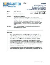
countryside villages community design guidelines - the City of ...
countryside villages community design guidelines - the City of ...
countryside villages community design guidelines - the City of ...

Create successful ePaper yourself
Turn your PDF publications into a flip-book with our unique Google optimized e-Paper software.
C<br />
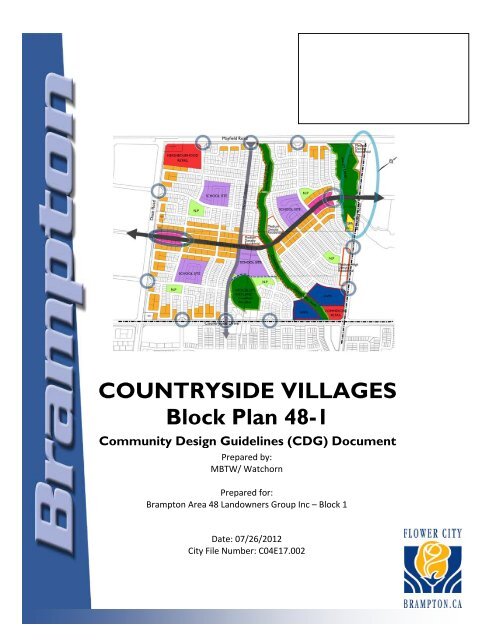
COUNTRYSIDE VILLAGES<br />
Block Plan 48-1<br />
Community Design Guidelines (CDG) Document<br />
Prepared by:<br />
MBTW/ Watchorn<br />
Prepared for:<br />
Brampton Area 48 Landowners Group Inc – Block 1<br />
Date: 07/26/2012<br />
<strong>City</strong> File Number: C04E17.002
Disclaimer:<br />
The text and images contained in this document reflect a<br />
conceptual representation <strong>of</strong> <strong>the</strong> intended vision and character <strong>of</strong><br />
<strong>the</strong> proposed development within this block plan area. These<br />
<strong>guidelines</strong> incorporate current <strong>City</strong> standards, or approved<br />
alternative <strong>design</strong> standards (ADS’s), as applicable at <strong>the</strong> time <strong>of</strong><br />
approval <strong>of</strong> this document. Final <strong>design</strong>s for block plan elements<br />
such as streetscapes, gateway features, pathways, bridges, street<br />
lighting, street signs, road cross-sections, utility locations, fencing<br />
and associated construction standards etc., may change over time.<br />
Changes may be permitted, subject to <strong>City</strong> approval, due to<br />
amendments to <strong>City</strong> standards, changes in technology, safety<br />
and/or construction codes, changes necessitated by <strong>the</strong> availability<br />
<strong>of</strong> identified materials or modifications to maintenance practices,<br />
etc.<br />
In addition, <strong>the</strong> built form/ architectural <strong>guidelines</strong> depicted in this<br />
document are for <strong>the</strong> use <strong>of</strong> <strong>the</strong> original residential developer(s)/<br />
builder(s). In this regard, <strong>the</strong> material represented in this<br />
document should not be construed or interpreted literally.<br />
Fur<strong>the</strong>rmore, this information may not, under any circumstances,<br />
be duplicated in promotional literature for marketing <strong>of</strong> <strong>the</strong><br />
<strong>community</strong> without <strong>the</strong> expressed approval <strong>of</strong> <strong>the</strong> <strong>City</strong> <strong>of</strong><br />
Brampton.<br />
For fur<strong>the</strong>r information or questions pertaining to <strong>the</strong> document<br />
or this disclaimer, <strong>the</strong> reader is encouraged to contact <strong>the</strong><br />
Planning, Design and Development, Community Design, Parks<br />
Planning and Development Division at (905) 874-2331.
COUNTRYSIDE VILLAGES COMMUNITY DESIGN GUIDELINES<br />
1.0 INTRODUCTION .......................................................................................................... 1<br />
1.1 Purpose ............................................................................................................................................................................................. 1<br />
1.1.1 Approval Context ................................................................................................................................................... 2<br />
1.2 Study Area Location & Context) ............................................................................................................................................... 3<br />
1.2.1 Land Ownership ...................................................................................................................................................... 4<br />
1.2.2 Cultural Heritage .................................................................................................................................................... 5<br />
1.2.3 Cultural Heritage (Section Prepared by <strong>City</strong> <strong>of</strong> Brampton Heritage Section, January 30th, 2012) .. 7<br />
1.3 Updates to <strong>the</strong> Community Design Framework .................................................................................................................... 8<br />
1.4 Design Vision & Design Objectives ........................................................................................................................................... 9<br />
1.5 Conformity to Development Design Guidelines (2003) ....................................................................................................11<br />
2.0 COMMUNITY DESIGN PLAN .................................................................................... 13<br />
2.1 Structuring Elements<br />
2.1.1 Transportation Network ....................................................................................................................................13<br />
2.1.2 Open Space System ..............................................................................................................................................16<br />
2.1.3 Neighbourhoods ....................................................................................................................................................18<br />
2.1.4 Land Use Mix and Distribution .........................................................................................................................19<br />
2.2 Special Character Areas ..........................................................................................................................................................21<br />
2.2.1 Inspire Boulevard (Main Street Spine) .............................................................................................................23<br />
2.2.2 Neighbourhood Parks .........................................................................................................................................26<br />
2.2.3 Natural Heritage Features ..................................................................................................................................26<br />
2.2.4 Village Core and <strong>City</strong> Park (Bramalea Road Edge)........................................................................................28<br />
3.0 LANDSCAPE GUIDELINES ........................................................................................ 30<br />
3.1 Inspire Boulevard (Main Street Spine) .................................................................................................................................30<br />
3.1.1 Inspire Boulevard at Live-Work Blocks...........................................................................................................30<br />
3.1.2 Inspire Boulevard (Transit Spine) at Medium Density and Laneway Townhouse Blocks ...................32<br />
3.2 Gateways .....................................................................................................................................................................................34<br />
3.2.1 A ‘Toolkit’ <strong>of</strong> Masonry Features........................................................................................................................34<br />
3.2.2 Primary Gateways..................................................................................................................................................36<br />
3.3.3 Secondary Gateways.............................................................................................................................................40<br />
3.3 Roundabouts ..............................................................................................................................................................................42<br />
3.4 Neighbourhood Parks .............................................................................................................................................................44<br />
3.4.1 Park 1 .......................................................................................................................................................................45<br />
3.4.2 Park 2 .......................................................................................................................................................................46<br />
3.4.3 Park 3 .......................................................................................................................................................................47<br />
3.4.4 Park 4 .......................................................................................................................................................................49<br />
3.4.5 Park 5 .......................................................................................................................................................................50<br />
3.4.6 Park 6 – Urban Parkette .....................................................................................................................................51<br />
3.4.7 Park Summary Table .............................................................................................................................................52<br />
3.5 Natural Heritage .......................................................................................................................................................................53<br />
3.5.1 10m Environmental Buffer ..................................................................................................................................53<br />
3.5.2 Woodlot/Wetland ................................................................................................................................................53<br />
3.5.3 Valleyland ................................................................................................................................................................54<br />
3.5.4 Channel Pedestrian Bridge Ceossing................................................................................................................54<br />
3.5.5 Trailheads and Open Space Trails .....................................................................................................................55<br />
3.6 Stormwater Management Facilities ......................................................................................................................................56<br />
3.7 Community Edges .....................................................................................................................................................................58<br />
3.8 Community Fencing...................................................................................................................................................................58<br />
3.9 Street Trees Master Plan.........................................................................................................................................................60
COUNTRYSIDE VILLAGES COMMUNITY DESIGN GUIDELINES<br />
4.0 BUILT FORM GUIDELINES ........................................................................................ 61<br />
4.1 Introduction ..................................................................................................................................................................................61<br />
4.2 Design Guidelines for Residential Development – Roundabout Lots ...........................................................................63<br />
4.3 Design Guidelines for Residential Development – Townhouses ....................................................................................64<br />
4.3.1 7.5m Wide Townhouses .....................................................................................................................................65<br />
4.3.2 Laneway Townhouses .........................................................................................................................................66<br />
4.3.3 Back-to Back Stacked Townhouses...................................................................................................................67<br />
4.3.4 Live-Work Townhouses ......................................................................................................................................68<br />
4.3.5 Roundabout Townhouses....................................................................................................................................70<br />
4.3.6 Interim Treatment Adjacent to Non-Participating Owner.........................................................................71<br />
4.4 Design Guidelines for Residential Development – Medium Density and Medium/High ............................................73<br />
4.4.1 Mid-rise Apartment Buildings ............................................................................................................................73<br />
4.4.2 Four-storey Flats....................................................................................................................................................75<br />
4.5 Design Guidelines for Institutional Development ................................................................................................................76<br />
4.6 Design Guidelines for Commercial Development................................................................................................................79<br />
4.6.1 Integration <strong>of</strong> <strong>the</strong> Heritage House on 4585 Mayfield Road........................................................................80<br />
5.0 IMPLEMENTATION .................................................................................................... 83<br />
5.1 Introduction ...................................................................................................................................................................................83<br />
5.1.1 Outstanding Work ...............................................................................................................................................83<br />
5.2 Conformity to <strong>the</strong> Community Design Guidelines .............................................................................................................83<br />
5.3 Cost Responsibility Matrix .........................................................................................................................................................84<br />
5.4 Builders Responsibilities .............................................................................................................................................................87<br />
5.5 Preliminary Review ......................................................................................................................................................................88<br />
5.6 Final Review and Approval .........................................................................................................................................................88<br />
5.7 Site Reviews ...................................................................................................................................................................................89<br />
5.8 Data Recording .............................................................................................................................................................................89<br />
5.9 Conclusions.....................................................................................................................................................................................89<br />
APPENDICES ...................................................................................................................... 90<br />
APPENDIX A – Approved Alternative Design Standards – Engineering Cross Sections<br />
APPENDIX B – Fencing Master Plan<br />
APPENDIX C – Street Trees Master Plan<br />
APPENDIX D – Priority Lot Plan
COUNTRYSIDE VILLAGES COMMUNITY DESIGN GUIDELINES<br />
1.0 INTRODUCTION<br />
The planning for <strong>the</strong> Countryside Villages Community Secondary Plan area 48 began in 2004 resulting in<br />
<strong>the</strong> Countryside Villages Design Brief and Countryside Villages Visions documents (prepared by <strong>the</strong> MBTW<br />
Group). Building upon previous work, in 2009 STLA Inc. completed <strong>the</strong> Countryside Villages Community<br />
Design and Open Space Study. This Study derived a set <strong>of</strong> core <strong>community</strong> <strong>design</strong> principles to inform and<br />
guide <strong>the</strong> framework plan.<br />
In 2009 <strong>the</strong> <strong>City</strong> <strong>of</strong> Brampton/BILD undertook a Development Process Review. Through this review<br />
process <strong>the</strong> <strong>City</strong> revised <strong>the</strong> terms <strong>of</strong> reference for <strong>the</strong> Secondary Plan and Block Plan <strong>design</strong> documents.<br />
The Community Design Framework (CDF) outlines <strong>the</strong> vision and core principles at <strong>the</strong> Secondary Plan<br />
level and forms <strong>the</strong> basis for preparation <strong>of</strong> <strong>the</strong> Community Design Guidelines (CDG) at <strong>the</strong> Block Plan<br />
level. Since <strong>the</strong> 2009 Community Design and Open Space Study and all preceding documents set forth <strong>the</strong><br />
vision and core <strong>design</strong> principles required under <strong>the</strong> CDF Terms <strong>of</strong> Reference it has been determined by<br />
<strong>the</strong> <strong>City</strong> that <strong>the</strong> 2009 Study will form <strong>the</strong> basis for <strong>the</strong> Countryside Villages 48-1 Residential Community<br />
Design Guidelines.<br />
Hereafter whenever a reference is made to <strong>the</strong> CDF it refers to <strong>the</strong> 2009 Countryside Villages Community<br />
Design and Open Space Study by STLA Inc.<br />
1.1 Purpose<br />
The Community Design Guideline document is a critical part <strong>of</strong> <strong>the</strong> <strong>design</strong> process. The CDG provide<br />
<strong>design</strong> guidance to implement <strong>the</strong> vision and intent <strong>of</strong> <strong>the</strong> CDF and Secondary Plan, and becomes a tool in<br />
<strong>the</strong> execution stages <strong>of</strong> Subdivision(s) and Site Plan(s). The specific <strong>design</strong> intent, both standard and nonstandard,<br />
describe <strong>the</strong> approach <strong>of</strong> structuring elements and special character areas that build upon <strong>the</strong><br />
groundwork provided by <strong>the</strong> Community Design Framework, Development Design Guidelines and o<strong>the</strong>r<br />
planning tools.<br />
This document conforms to <strong>the</strong> terms described within <strong>the</strong> CDF and incorporates specifications and<br />
<strong>guidelines</strong> outlined in <strong>the</strong> following civic initiatives:<br />
� Official Plan,<br />
� Development Design Guidelines,<br />
� Six Pillars,<br />
� Flower <strong>City</strong> Initiatives,<br />
� Pathways Master Plan,<br />
� Clean and Green Strategy,<br />
� Accessibility Advisory Committee and Technical Standards<br />
CDG form <strong>the</strong> foundation <strong>of</strong> architectural control review process, preparation <strong>of</strong> detailed landscape<br />
drawings and future development. Therefore, <strong>the</strong> level <strong>of</strong> details provided through demonstration plans is<br />
sufficient to guide detailed landscape <strong>design</strong>, architectural review process, and completion <strong>of</strong> Draft Plans <strong>of</strong><br />
Subdivision and future site plans.<br />
1
COUNTRYSIDE VILLAGES COMMUNITY DESIGN GUIDELINES<br />
This document is comprised <strong>of</strong> three supporting elements:<br />
1) Community Design Plan (Section 2.0)<br />
This section describes <strong>the</strong> overall structure <strong>of</strong> <strong>the</strong> <strong>community</strong> and Special Character Areas<br />
that are guided by <strong>the</strong> vision.<br />
2) Demonstration Plans<br />
Demonstration plans help illustrate <strong>the</strong> specific urban <strong>design</strong> principles within <strong>the</strong> special<br />
character areas. These plans show <strong>the</strong> criteria <strong>of</strong> organization, arrangement and treatment<br />
<strong>of</strong> <strong>the</strong>se vital areas within <strong>the</strong> public realm.<br />
3) Landscape Guidelines (Section 3.0) and Built Form (Section 4.0)<br />
These sections relate to specific <strong>guidelines</strong> that will help shape built form and landscape<br />
elements.<br />
1.1.1 Approval Context<br />
The CDG conforms to <strong>the</strong> principles and general intent <strong>of</strong> <strong>the</strong> CDF with numerous updates to <strong>the</strong><br />
Conceptual Land Use Framework Plan (Figure 9 <strong>of</strong> CDF) covered in section 1.3 <strong>of</strong> this document.<br />
Implementation <strong>of</strong> <strong>the</strong> CDG is dependent upon <strong>the</strong> completion <strong>of</strong> several supporting studies, including, but<br />
not limited to environmental, traffic and servicing studies. The final <strong>design</strong> for <strong>the</strong> Block Plan will have<br />
regard for <strong>the</strong>se studies and will not necessitate amendment to <strong>the</strong> CDG document. The Community<br />
Design Guidelines document may be approved in advance <strong>of</strong> <strong>the</strong> approval <strong>of</strong> supporting studies, including,<br />
but not limited to:<br />
• Functional Servicing Report (FSR), prepared by Schaeffers Consulting Engineers;<br />
• Environmental Impact Statement (EIR), prepared by Beacon Environmental; and<br />
• Cultural Heritage Impact Assessment, prepared by Scarlett Janusas Archaeological and Heritage<br />
Consulting and Education.<br />
This Community Design Guidelines Document supports an overarching vision and <strong>design</strong> guidance for <strong>the</strong><br />
complete Community <strong>of</strong> Countryside Villages Block 48-1. All development applications shall have regard<br />
for <strong>the</strong> requirements set out in this CDG document. If development applications significantly deviate from<br />
<strong>the</strong> requirements set out in this CDG document, amendments to <strong>the</strong> CDG will be provided by <strong>the</strong><br />
applicants, for approval by <strong>the</strong> <strong>City</strong>.<br />
All drawings in <strong>the</strong> CDG document represent <strong>the</strong> most current Block Plan as <strong>of</strong> April 2012.<br />
The following common terms used in this document regarding <strong>design</strong> criteria are: ‘shall/will’, ‘should’, and<br />
‘encouraged/discouraged/may’. These terms are intended to have <strong>the</strong> following meaning with respect to compliance:<br />
‘Shall’/ ‘Will’ – Guidelines using <strong>the</strong> words ‘shall’ or ‘will’ are mandatory and must be provided.<br />
‘Should’ – Guidelines using <strong>the</strong> word ‘should’ are intended to be applied as stated. However, an alternative<br />
measure may be considered if it meets or exceeds <strong>the</strong> intent <strong>of</strong> <strong>the</strong> guideline.<br />
‘Encouraged’/ ‘Discouraged’ / ‘May’ - Guidelines using <strong>the</strong> words ‘encouraged’, ‘discouraged’ or ‘may’ are<br />
desirable but not mandatory.<br />
2
COUNTRYSIDE VILLAGES COMMUNITY DESIGN GUIDELINES<br />
Figure 1 - Site Location<br />
1.2 Study Area Location & Context<br />
Countryside Villages Land Area, also known as Block Plan 48-1, is approximately 159.23ha (393.48ac) <strong>of</strong> <strong>the</strong><br />
total approximately 645ha (1,600ac) that comprise <strong>the</strong> Countryside Villages Community, located in northcentral<br />
Brampton. The site boundaries are Dixie Road to <strong>the</strong> West, Bramalea Road to <strong>the</strong> East, Mayfield Road<br />
to <strong>the</strong> North and Countryside Drive to <strong>the</strong> South. The Town <strong>of</strong> Caledon boundary lays to <strong>the</strong> north, adjacent<br />
to Mayfield Road, consisting <strong>of</strong> primarily agricultural land. The residential area <strong>of</strong> Sandringham-Wellington<br />
comprises <strong>the</strong> land to <strong>the</strong> south <strong>of</strong> Countryside Drive. Block 48-1 <strong>of</strong> <strong>the</strong> Countryside Villages Community is<br />
located adjacent to <strong>the</strong> Employment Lands (48-1) East, (immediately west <strong>of</strong> Dixie Road), and adjacent to a<br />
<strong>City</strong> wide park (Sesquicentennial Pak) east <strong>of</strong> Bramalea Road.<br />
A variety <strong>of</strong> natural heritage features are located within this area <strong>of</strong> Countryside Villages including a valley, a<br />
Woodlot/Wetland, and a naturalized channel intersecting <strong>the</strong> <strong>community</strong> north to south.<br />
3
COUNTRYSIDE VILLAGES COMMUNITY DESIGN GUIDELINES<br />
1.2.1 Land Ownership<br />
Figure 2 demonstrates ownership <strong>of</strong> lands bounded by Block Plan Area 48-1. Majority <strong>of</strong> <strong>the</strong> area is owned<br />
by Metrus Properties and Neamsby Investment Inc. Hereafter <strong>the</strong> participating owners will be referred to<br />
as Brampton Area 48 Landowners Group Inc – Block 1.<br />
The remaining lands are non-participating properties.<br />
Figure 2 - Land Ownership Map<br />
4
COUNTRYSIDE VILLAGES COMMUNITY DESIGN GUIDELINES<br />
1.2.2 Cultural Heritage<br />
The Countryside Villages Block Plan 48-1 Contains four properties that exhibit cultural heritage value (refer<br />
to Figure 3) and <strong>the</strong>y include:<br />
a. 4585 Mayfield Road ( a farmstead)<br />
b. 1115 Dixie Road ( a barn complex)<br />
c. A farmstead along Mayfield Rd. with no street address and<br />
d. 1544 Countryside Drive (a residents)<br />
A Cultural Heritage Impact Assessment for Block Plan 48-1 was prepared by E.R.A. Architects Inc. and<br />
Scarlett Janusas Archeological and Heritage Consulting and Education (March 2012). Based on this report and<br />
<strong>the</strong> accompanying recommendation made by <strong>City</strong> Heritage staff, Council approved <strong>the</strong> following (refer to<br />
Council Resolution HB043-2012):<br />
• Retention <strong>of</strong> <strong>the</strong> house at 4585 Mayfield Road in-situ and <strong>design</strong>ation under Part IV <strong>of</strong> <strong>the</strong> Ontario<br />
Heritage Act<br />
• Removal/demolition <strong>of</strong> <strong>the</strong> structures located on 1544 Countryside Drive, 1115 Dixie Road and <strong>the</strong><br />
farmstead on Mayfield Road<br />
• Reuse <strong>of</strong> salvaged materials into commemorative features<br />
• Reuse <strong>of</strong> vestigial farming equipment located on <strong>the</strong> subject site as a public art feature<br />
• Installation <strong>of</strong> heritage interpretive signage near Mayfield Road and Dixie Road commemorating <strong>the</strong><br />
former village Mayfield<br />
• Naming <strong>of</strong> local streets and public assets after <strong>the</strong> early settlers associated with <strong>the</strong> area<br />
The final site plan is subject to site plan review and approval.<br />
5
COUNTRYSIDE VILLAGES COMMUNITY DESIGN GUIDELINES<br />
Figure 3 - Subject Site Showing <strong>the</strong> Location <strong>of</strong> <strong>the</strong> Heritage Resources. Source: Cultural Heritage Impact Assessment (April 2012)<br />
6
COUNTRYSIDE VILLAGES COMMUNITY DESIGN GUIDELINES<br />
Cultural heritage resources provide an important link between <strong>the</strong> past and <strong>the</strong> present, act as focal points<br />
within <strong>the</strong> <strong>community</strong> and assist in establishing a ‘sense <strong>of</strong> place’.<br />
Brief Summary <strong>of</strong> 4585 Mayfield Road Heritage Resource:<br />
Heritage Status: Listed on <strong>the</strong> <strong>City</strong> <strong>of</strong> Brampton’s<br />
Municipal Register <strong>of</strong> Cultural Heritage Resources<br />
and is being <strong>design</strong>ated under Part IV <strong>of</strong> <strong>the</strong> Ontario<br />
Heritage Act..<br />
The house at 4585 Mayfield Road is a one-and-ahalf<br />
storey Gothic Revival farmhouse constructed<br />
between 1860 and 1880. It is characterized by a<br />
central-gabled dormer with decorative bargeboard,<br />
a finial, returned eaves, polychromatic brickwork,<br />
brick transoms, quoins and keystones. The<br />
property is located within an agricultural setting<br />
consisting <strong>of</strong> ploughed fields to <strong>the</strong> rear and mature<br />
trees at <strong>the</strong> front.<br />
The property exhibits historical/associative value due to its association with <strong>the</strong> Archdekin family. Thomas<br />
Archdekin was one <strong>of</strong> <strong>the</strong> first settlers in Mayfield, arriving in <strong>the</strong> area in 1829. The 1877 Historical Atlas<br />
<strong>of</strong> Peel County indicates that <strong>the</strong> property was owned by his son, Peter Archdeacon. The family remained<br />
in <strong>the</strong> area for many years, farming and pursuing o<strong>the</strong>r forms <strong>of</strong> business. The house is also a remaining<br />
vestige <strong>of</strong> <strong>the</strong> area once known as Mayfield Village, located at <strong>the</strong> intersection <strong>of</strong> <strong>the</strong> 3rd Line <strong>of</strong> Bramalea<br />
Road and Mayfield Road. In 1877 it contained 50 inhabitants, a brick schoolhouse, a general store, a post<br />
<strong>of</strong>fice, a blacksmith shop and a hotel.<br />
7
COUNTRYSIDE VILLAGES COMMUNITY DESIGN GUIDELINES<br />
1.3 Updates to <strong>the</strong> Community Design Framework<br />
Conclusions from <strong>the</strong> CDF:<br />
Community Framework defined <strong>the</strong> following eleven (11) key structural elements making up <strong>the</strong><br />
<strong>community</strong> <strong>of</strong> Countryside Villages Block Plan 48-1(per Figure 9 <strong>of</strong> CDF):<br />
� Main Street (Community Spine)<br />
� Neighbourhood Centres (Parks)<br />
� Gateways<br />
� Village Centre<br />
� Neighbourhood Retail<br />
� Convenience Retail<br />
� Mixed Use Blocks<br />
� Medium Density Blocks<br />
� Schools<br />
� Stormwater Management Ponds<br />
� Valleyland, Woodlot/Wetland and Channel<br />
The CDF and <strong>the</strong> vision for Countryside Villages called for <strong>the</strong> distribution <strong>of</strong> neighbourhood areas<br />
comprised <strong>of</strong> quadrants within each concession block. Each neighbourhood will be characterized by a<br />
neighbourhood centre (village square or a local park) located within a 400 meters (5 minutes) walk to<br />
neighbourhood residents. Similarly, schools to be located within each quadrant adjacent to village squares<br />
or parks to fur<strong>the</strong>r define <strong>the</strong> individual neighbourhoods.<br />
Updates to Community Design Framework (Updates to Figure 9 <strong>of</strong> CFD):<br />
1. Shifting <strong>of</strong> Neighbourhood Retail to <strong>the</strong> south-east corner <strong>of</strong> Mayfield Road and Dixie Road, and<br />
shifting <strong>of</strong> Motor Vehicle Centre (MVC) to future employment lands west <strong>of</strong> Dixie Road.<br />
Remaining area (south <strong>of</strong> Main Street, East <strong>of</strong> Dixie Road) is <strong>design</strong>ated residential.<br />
2. Addition <strong>of</strong> Mixed Use Blocks (live-work) along Main Street, west <strong>of</strong> Bramalea Road and east <strong>of</strong><br />
Dixie Road.<br />
3. Addition <strong>of</strong> Medium Density Block; along Bramalea Road, immediately south <strong>of</strong> <strong>the</strong> Valleyland, and<br />
two blocks north <strong>of</strong> Main Street, east and west <strong>of</strong> <strong>the</strong> Channel.<br />
4. Addition <strong>of</strong> Medium Density blocks along Bramalea Road, west <strong>of</strong> <strong>the</strong> <strong>City</strong>-wide Community Park<br />
(immediately north <strong>of</strong> <strong>the</strong> Stormwater Management pond).<br />
5. Shifting <strong>of</strong> gateway locations and scale (primary and secondary).<br />
6. Addition <strong>of</strong> an interpretation plan and/or a plaque commemorating <strong>the</strong> location <strong>of</strong> <strong>the</strong> former<br />
crossroads <strong>of</strong> Mayfield (at Mayfield Road and Dixie Road).<br />
7. Four Neighbourhood areas are defined with <strong>the</strong> Block Plan:<br />
a. North-west neighbourhood: north <strong>of</strong> Main Street and west <strong>of</strong> Channel;<br />
b. South-west neighbourhood: south <strong>of</strong> Main Street and west <strong>of</strong> Collector Road;<br />
c. South-east neighbourhood: south <strong>of</strong> Main Street and east <strong>of</strong> Collector Road; and<br />
d. North-east neighbourhood: north <strong>of</strong> Main Street and east <strong>of</strong> Channel.<br />
8
COUNTRYSIDE VILLAGES COMMUNITY DESIGN GUIDELINES<br />
1.4 Design Vision & Design Objectives<br />
Key Principles:<br />
� Countryside Villages Community is intended to be a visually attractive, pedestrian-oriented and<br />
new urbanism complex <strong>of</strong> neighbourhoods within <strong>the</strong> <strong>City</strong> <strong>of</strong> Brampton.<br />
� Support sustainable <strong>community</strong> <strong>design</strong> principles (such as smart location and reduced automobile<br />
dependence, school proximity and open spaces, compact development, and walkable streets).<br />
� Densities that are consistent with <strong>the</strong> provincial “Places to Grow” Act and a variety <strong>of</strong> housing<br />
types are included within <strong>the</strong> Villages, resulting in a gradual transition <strong>of</strong> higher densities and<br />
suitable built form located closer to major intersections and lower densities located within<br />
traditional neighbourhood areas.<br />
� The production <strong>of</strong> strong <strong>community</strong> character and a unique identity <strong>of</strong> <strong>the</strong> Village through <strong>the</strong><br />
relationship between balanced mixed land uses and well connected, animated streetscapes.<br />
� Special character areas are enhanced through <strong>the</strong> provision <strong>of</strong> modern transportation systems<br />
including a connective road network that supports public transit, and trails that facilitate greater<br />
pedestrian accessibility.<br />
� The integration and compatibility <strong>of</strong> various architectural and landscape components <strong>of</strong> <strong>the</strong><br />
Countryside Villages structure recognizes, preserves and enhances <strong>the</strong> natural heritage features<br />
within <strong>the</strong> <strong>community</strong> including <strong>the</strong> Woodlot/Wetland and Valleyland.<br />
� O<strong>the</strong>r open space features such as neighbourhood parks, parkettes, and open space blocks,<br />
encourage outdoor activity and provide residents with public space for recreational use, within a<br />
five minute walk from <strong>the</strong>ir home.<br />
Design Objectives:<br />
� Establish a sense <strong>of</strong> place and character through <strong>the</strong> development <strong>of</strong> special character areas;<br />
� Create a well connected and functional <strong>community</strong> that is considerate <strong>of</strong> and coordinated with<br />
adjacent land uses;<br />
� Develop an integrated and linked open space system;<br />
� Establish pedestrian scaled streetscapes with ease <strong>of</strong> access to <strong>community</strong> amenities and facilities;<br />
� Preserve and enhance natural features such as <strong>the</strong> Woodlot/Wetland, Valleyland, and Channel; and<br />
� Design a transit-supportive <strong>community</strong> with a central transit spine within walking distance to<br />
majority <strong>of</strong> homes, commercial uses, schools and parks.<br />
Figure 4 - Community Vision Images<br />
9
COUNTRYSIDE VILLAGES COMMUNITY DESIGN GUIDELINES<br />
Figure 5 – Community Structure Plan<br />
10
COUNTRYSIDE VILLAGES COMMUNITY DESIGN GUIDELINES<br />
1.5 CONFORMITY TO<br />
DEVELOPMENT DESIGN GUIDELINES<br />
Community Design Guidelines Area <strong>of</strong> Applicability<br />
In keeping with <strong>the</strong> <strong>City</strong> <strong>of</strong> Brampton Development Design process, <strong>the</strong> plan meets all applicable<br />
parameters to guide development as outlined in <strong>the</strong> Development Design Guidelines Manual (CDGs) and<br />
also serve as a supplement to <strong>the</strong> Architectural Control Guidelines (ACG) for Ground Related Residential<br />
Development. All <strong>guidelines</strong> found in this document are additional to <strong>the</strong> <strong>City</strong>’s DDG and are<br />
intended to improve or enhance <strong>the</strong> overall <strong>design</strong> <strong>of</strong> <strong>the</strong> plan.<br />
A. Areas that conform to <strong>the</strong> Development Design Guidelines include:<br />
� The entirety <strong>of</strong> <strong>the</strong> Countryside Villages Community will conform to <strong>the</strong> Development Design<br />
Guidelines for <strong>the</strong> <strong>City</strong> <strong>of</strong> Brampton.<br />
B. Areas subject to <strong>the</strong> Community Design Guidelines include:<br />
� Main Street, hereafter referred to as Inspire Boulevard<br />
• Main Street Gateways<br />
• Live-work Areas<br />
• Roundabouts<br />
• Urban Parkette<br />
� Neighbourhood Parks<br />
� Natural Heritage Areas<br />
• Channel<br />
• Pedestrian Crossings<br />
• Environmental Buffer Trail<br />
• Woodlot/Wetland<br />
• Valleyland<br />
� Village Core & <strong>City</strong> Park (Bramalea Road Edge)<br />
C. *Areas <strong>of</strong> Site Plan Approval include:<br />
� Areas <strong>of</strong> medium density<br />
� School sites<br />
� Neighbourhood retail<br />
� Community retail<br />
11
COUNTRYSIDE VILLAGES COMMUNITY DESIGN GUIDELINES<br />
Figure 6 – Areas <strong>of</strong> Conformity<br />
12
COUNTRYSIDE VILLAGES COMMUNITY DESIGN GUIDELINES<br />
2.0 COMMUNITY DESIGN PLAN<br />
The Community Design Plan is intended to describe/guide <strong>the</strong> overall structuring framework and indicate<br />
areas <strong>of</strong> special character that will make Countryside Villages a complete <strong>community</strong>.<br />
2.1 Structuring Elements<br />
2.1.1 Transportation Network<br />
The transportation network is used to define <strong>the</strong> physical structure and hierarchy <strong>of</strong> movement<br />
throughout <strong>the</strong> <strong>community</strong>. Roads are also proposed to create view connections to significant <strong>community</strong><br />
focal points that will be reinforced by streetscape <strong>design</strong> and site planning <strong>of</strong> built form in adjacent areas.<br />
Alternative Design Standards for road-right-ways for block 48-1 have been approved by <strong>the</strong> <strong>City</strong> <strong>of</strong><br />
Brampton and engineering cross sections are found in Appendix B <strong>of</strong> this document. Block 48-1 will<br />
accommodate <strong>the</strong> movement <strong>of</strong> vehicles, transit services, cyclists and pedestrians within reduced right-<strong>of</strong>way<br />
widths. Reduced ROW widths may be a traffic calming feature, encourage a compact urban form and<br />
are more appropriate for a pedestrian-scaled environment.<br />
2.1.1.1 Street Network (See Figure 7 and Appendix B)<br />
Collector Roads (Approved Alternative Design Standards)<br />
� Countryside Transit Spine Collector Road (Appendix B, Dwg. No. 202C) – Inspire Boulevard will<br />
develop as an enhanced pedestrian spine with alternative transportation methods through <strong>the</strong><br />
provision <strong>of</strong> two lay-by parking lanes, two bike lanes, public transit, two sidewalks and two treelined<br />
boulevards. The Transit Spine Collector Road ADS provides for a shared ROW by integrating<br />
multi-modal movement in a reduced, 29.0m ROW, with two lanes <strong>of</strong> traffic and a turning lane.<br />
� Minor Collector Road (DWG. No. 202A) – In addition to accommodating two travel lanes, a<br />
turning lane, two sidewalks and two tree-lined boulevards, <strong>the</strong> Minor Collector Road will support<br />
public transit and on-street parking within a 10.0m pavement width and a reduced, 21.5m ROW.<br />
Local Roads (Approved Alternative Design Standards)<br />
� Local Road (Appendix B, Dwg. No. 201A) – Two travel lanes, on-street parking, two sidewalks and<br />
two tree-lined boulevards are proposed to be developed within an 18.0m ROW and a 7.5m<br />
pavement width. The Local Road will accommodate vehicular travel and pedestrian movement<br />
within a reduced ROW.<br />
� Minor Local Road (Appendix B, DWG. No. 200A) – Two travel lanes, on-street parking, a single<br />
sidewalk, and two tree-lines boulevards will be accommodated with a reduced ROW <strong>of</strong> 16.5m and<br />
pavement width <strong>of</strong> 7.5m.<br />
� Buffer Road (Appendix B, Dwg. No. 201B) – Two travel lanes, a sidewalk, two tree-lined<br />
boulevards and a buffer make up <strong>the</strong> 18.5m ROW. Unique to Buffer Roads is <strong>the</strong> landscaped buffer<br />
strip dedicated to screening residential blocks from Arterial Roads.<br />
13
COUNTRYSIDE VILLAGES COMMUNITY DESIGN GUIDELINES<br />
Rear Laneways (Approved Alternative Design Standard)<br />
Laneways (Appendix B, Dwg. No.219A) help reduce <strong>the</strong> visual presence <strong>of</strong> garages and vehicles, eliminate<br />
<strong>the</strong> need for individual driveways, and enhance <strong>the</strong> pedestrian streetscape. The most prominent use <strong>of</strong><br />
laneways within Countryside Villages occurs parallel to Inspire Boulevard Special Character Area, and may<br />
also be located west <strong>of</strong> Bramalea Road, immediately north <strong>of</strong> <strong>the</strong> Stormwater Management pond.<br />
Laneways are proposed on an 8.0m ROW and a 6.0m concrete pavement width.<br />
2.1.1.2 Pedestrian Network Design Guidelines<br />
� Maximize connections and accessibility within <strong>the</strong> <strong>community</strong>.<br />
� Provide sidewalks on both sides <strong>of</strong> <strong>the</strong> street on collector roads, and on majority <strong>of</strong> local roads.<br />
� Provide connections from arterial roads to window streets (Buffer Roads) through walkways, as<br />
well as trails and pathways through neighbourhood parks and <strong>design</strong>ated natural features to<br />
maximize pedestrian movement and convenience.<br />
� Channel system to provide open space opportunities to connect with sidewalks on adjacent roads.<br />
2.1.1.3 Cycling Network Design Guidelines<br />
� Provide dedicated bike lanes on both sides <strong>of</strong> <strong>the</strong> road along <strong>the</strong> Community Collector road<br />
(Inspire Boulevard, Main Street Spine), at 1.5m in width.<br />
� Link <strong>the</strong> Main Street/Spine Road bike lanes to <strong>the</strong> <strong>City</strong> <strong>of</strong> Brampton Proposed Class I Pathway<br />
network, running along Bramalea Road and Countryside Drive (see Figure 7).<br />
14
COUNTRYSIDE VILLAGES COMMUNITY DESIGN GUIDELINES<br />
Figure 7 – Street Network<br />
Sesquicentennial<br />
Park<br />
15
COUNTRYSIDE VILLAGES COMMUNITY DESIGN GUIDELINES<br />
2.1.2 The Open Space System<br />
The open space system is an important structuring element used to enhance and balance <strong>the</strong> built<br />
environment by <strong>of</strong>fering areas for passive and active recreational activity while preserving <strong>the</strong> existing<br />
ecological communities.<br />
The setting and orientation <strong>of</strong> <strong>the</strong> open space system is shown in Figure 8. Areas that comprise <strong>the</strong> open<br />
space system are listed below and are described in fur<strong>the</strong>r detail in this document:<br />
� Woodlot/Wetland (<strong>the</strong> EIR identified a Wetland in <strong>the</strong> Woodlot area)<br />
� Valleyland<br />
� Channel<br />
� Five neighbourhood parks and one urban parkette<br />
� Four schools and related amenity space (Subject to Site Plan Approval)<br />
� Two Stormwater Management ponds<br />
� Trails<br />
Open Space Design Objectives:<br />
� Encourage <strong>the</strong> use <strong>of</strong> open space facilities and amenities to promote social interaction by providing<br />
a well connected <strong>community</strong>.<br />
� Create smooth transitions between public and private space through a highly integrated open space<br />
system.<br />
� Emphasize a pedestrian-oriented <strong>community</strong> through <strong>the</strong> provision <strong>of</strong> outdoor amenity spaces that<br />
create neighbourhood focal points that build <strong>community</strong> character. Neighbourhood parks will<br />
represent <strong>the</strong>se focal points.<br />
� Preserve and enhance natural heritage features (<strong>the</strong> Woodlot/Wetland and Valleyland) and<br />
associated ecological communities.<br />
� Differentiate between private spaces and public realm with landscaping treatments, architectural<br />
detailing, and o<strong>the</strong>r physical queues.<br />
Existing Woodlot/Wetland Existing Valleyland<br />
16
COUNTRYSIDE VILLAGES COMMUNITY DESIGN GUIDELINES<br />
Figure 8 – Open Space & Trails<br />
17
COUNTRYSIDE VILLAGES COMMUNITY DESIGN GUIDELINES<br />
2.1.3 Neighbourhoods<br />
The Countryside Villages Block Plan 48-1 <strong>community</strong> is made up <strong>of</strong> four neighbourhoods. Each<br />
neighbourhood is defined by:<br />
� A neighbourhood park (a Neighbourhood Centre), and<br />
� A school.<br />
The development <strong>of</strong> a walkable <strong>community</strong> supports <strong>the</strong> <strong>design</strong> <strong>of</strong> a compact urban form and <strong>the</strong> use <strong>of</strong><br />
short urban blocks to maximize connections and accessibility to desired destinations. Neighbourhood<br />
parks are centered within a 400m radius and school blocks are centered within an 800m radius <strong>of</strong> all<br />
dwellings, and are <strong>design</strong>ated as special character areas and areas <strong>of</strong> site plan approval, respectively.<br />
Figure 9 illustrates <strong>the</strong> proposed four neighbourhoods defined by schools and neighbourhood parks.<br />
Figure 9 - Neighbourhoods<br />
18
COUNTRYSIDE VILLAGES COMMUNITY DESIGN GUIDELINES<br />
2.1.4 Land Use Mix & Distribution<br />
Proposed Land Uses:<br />
• Residential<br />
• Low Density<br />
• Townhouses<br />
• Medium Density<br />
• Mixed Use<br />
• Commercial - Retail<br />
• Institutional – Schools Sites<br />
Residential neighbourhoods form <strong>the</strong> majority <strong>of</strong> land use within this portion <strong>of</strong> Countryside Villages.<br />
A gradual transition from low to medium density will help promote on-street activity closer to key public<br />
nodes. Key public nodes are:<br />
� Neighbourhood Retail at <strong>the</strong> intersection <strong>of</strong> Mayfield Road and Dixie Road;<br />
� Convenience Retail at <strong>the</strong> intersection <strong>of</strong> Bramalea Road and Countryside Drive, opposite <strong>the</strong><br />
<strong>City</strong> wide Park, and adjacent to laneway townhouses along Bramalea Road;<br />
� A medium density residential block located between <strong>the</strong> Valleyland and Bramalea Road; and<br />
� O<strong>the</strong>r areas <strong>of</strong> medium density residential and live-work units are located along Inspire<br />
Boulevard to distinguish <strong>the</strong> residential <strong>community</strong>’s transit spine.<br />
These nodes define <strong>the</strong> Countryside Villages <strong>community</strong> character.<br />
Medium density units are also located along <strong>the</strong> perimeter <strong>of</strong> <strong>the</strong> Block Plan to support a strong street<br />
edge along Arterial Roads, and higher density development along future transit routes.<br />
19
COUNTRYSIDE VILLAGES COMMUNITY DESIGN GUIDELINES<br />
Figure 10 – Land Use Distribution<br />
20
COUNTRYSIDE VILLAGES COMMUNITY DESIGN GUIDELINES<br />
2.2 Special Character Areas<br />
The Countryside Villages Community is intended to be a visually attractive, sustainable, and pedestrianoriented<br />
complex <strong>of</strong> neighbourhoods within <strong>the</strong> north central quadrant <strong>of</strong> <strong>the</strong> <strong>City</strong> <strong>of</strong> Brampton. This<br />
character is developed through a series <strong>of</strong> distinctive Special Character Areas that are considered to be<br />
key nodes for public activity and <strong>the</strong> foundation sites that will project <strong>the</strong> intended character and quality <strong>of</strong><br />
<strong>the</strong> <strong>community</strong> (see Figure 11).<br />
Special Character Areas within Countryside Villages are <strong>the</strong> following:<br />
2.2.1 Inspire Boulevard (Main Street Spine)<br />
2.2.1.1 Primary Gateways<br />
2.2.1.2 Live-work Areas<br />
2.2.1.3 Roundabouts<br />
2.2.1.4 Urban Parkette<br />
2.2.1.5 Vehicular & Pedestrian Crossings<br />
2.2.2 Neighbourhood Parks<br />
2.2.3 Natural Heritage Features<br />
2.2.3.1 Channel<br />
2.2.3.1.1 Pedestrian Crossings<br />
2.2.3.2 Woodlot/Wetland<br />
2.2.3.3 Valleyland<br />
2.2.4 Village Core<br />
21
COUNTRYSIDE VILLAGES COMMUNITY DESIGN GUIDELINES<br />
Figure 11 – Special Character Areas<br />
22
COUNTRYSIDE VILLAGES COMMUNITY DESIGN GUIDELINES<br />
2.2.1 Inspire Boulevard (Main Street Spine)<br />
Mixed uses and open space areas help define Main Street as a special character area. The residential<br />
portions <strong>of</strong> Inspire Boulevard will include built form typologies consisting <strong>of</strong> laneway decked townhouses,<br />
live-work laneway units, and medium density housing. O<strong>the</strong>r lane based products including semis and<br />
singles opportunities may be incorporated as well.<br />
Higher densities (e.g. townhouses and mid-rise apartments) along primary routes such as Inspire<br />
Boulevard, concentrate movement within key nodal areas that support an active streetscape, while<br />
laneway based products reduce <strong>the</strong> visual impact <strong>of</strong> garages and driveways within <strong>the</strong> streetscape. Livework<br />
units located east <strong>of</strong> Dixie Road and west <strong>of</strong> <strong>the</strong> Valleyland act as <strong>community</strong> nodes and develop<br />
convenient mixed use, service and retail opportunities at <strong>the</strong> <strong>community</strong>’s primary entrances. The street<br />
right-<strong>of</strong>-way in <strong>the</strong>se areas will accommodate lay-by parking to afford convenient parking for <strong>the</strong> work<br />
units and increased levels <strong>of</strong> pedestrian use. Bike lanes on ei<strong>the</strong>r side <strong>of</strong> <strong>the</strong> street will also be provided.<br />
An Alternative Design Standard road cross section for Inspire Boulevard was approved by <strong>the</strong> <strong>City</strong> <strong>of</strong><br />
Brampton.<br />
Where Inspire Boulevard crosses <strong>the</strong> Valleyland (immediately west <strong>of</strong> Bramalea Road) and <strong>the</strong> Channel, a<br />
vehicular bridge and a culvert, respectively, are envisioned to accommodate <strong>the</strong> crossings (subject to<br />
EIR/FSR review and approval). A trail that runs along <strong>the</strong> west side <strong>of</strong> <strong>the</strong> Channel will also connect to<br />
Inspire Boulevard.<br />
2.2.1.1 Primary Gateways<br />
Two primary gateways are envisioned along Inspire Boulevard, <strong>the</strong>se mark <strong>the</strong> primary entrances to <strong>the</strong><br />
Countryside Villages Community. These access points are intended to create a sense <strong>of</strong> arrival and form<br />
<strong>the</strong> initial character impression when entering <strong>the</strong> <strong>community</strong>. The first gateway, <strong>the</strong> West Gateway is<br />
located west <strong>of</strong> Dixie Road along Inspire Boulevard. The second gateway, <strong>the</strong> East Gateway, is located<br />
west <strong>of</strong> Bramalea Road and <strong>the</strong> Valleyland, along Inspire Boulevard.<br />
The West Gateway is a sequence <strong>of</strong> landscape and built form features envisioned to create an urban<br />
streetscape experience. West Gateway General Guideline (east <strong>of</strong> Dixie Road):<br />
� Distinguish <strong>the</strong> gateway by providing an extended sidewalk corner treatment and live-work<br />
units with architectural detail that honours a pedestrian oriented street corner.<br />
� Incorporate signage within <strong>the</strong> roundabout marking <strong>the</strong> name <strong>of</strong> <strong>the</strong> <strong>community</strong>.<br />
� Landscape and architectural treatment should reflect <strong>the</strong> East Gateway.<br />
For landscape and built form specific <strong>guidelines</strong> refer to Sections 3 and 4.<br />
The East Gateway is located along Inspire Boulevard, west <strong>of</strong> Bramalea Road to accentuate <strong>the</strong><br />
Valleyland as <strong>the</strong> central character feature. By locating <strong>the</strong> East Gateway features fur<strong>the</strong>r west along<br />
Inspire Boulevard <strong>the</strong> built form and streetscape elements (i.e. roundabout) become <strong>the</strong> dominant<br />
<strong>community</strong> identifiers. East Gateway General Guidelines (west <strong>of</strong> Bramalea Road):<br />
� Distinguish <strong>the</strong> gateway by providing an extended sidewalk corner treatment and live-work units<br />
with architectural detail that honours a pedestrian oriented street corner.<br />
� Landscape and architectural treatment should reflect <strong>the</strong> West Gateway.<br />
23
COUNTRYSIDE VILLAGES COMMUNITY DESIGN GUIDELINES<br />
� To distinguish <strong>the</strong> East Gateway as <strong>the</strong> gateway adjacent to <strong>the</strong> Valleyland, incorporate plant<br />
material suggestive <strong>of</strong> a Valleyland landscape.<br />
For landscape and built form <strong>guidelines</strong> refer to Sections 3 and 4<br />
2.2.1.2 Live-Work Areas<br />
The live-work areas are located along Inspire Boulevard<br />
adjacent to <strong>the</strong> West and East Primary Gateways; <strong>the</strong>se<br />
areas are intended to provide convenience services and<br />
shopping for residents, enhance street-side activity along<br />
Inspire Boulevard (Main Street Spine) and act as mixed use<br />
transitional areas to compliment adjacent <strong>community</strong> land<br />
uses.<br />
Live-work Areas Site General Guidelines:<br />
� Provide an enhanced pedestrian streetscape,<br />
including wider sidewalks, lay-by parking, and<br />
attractive store-front facades, to encourage<br />
pedestrian use and lend an identifiable character for<br />
<strong>the</strong> <strong>community</strong>.<br />
� Retail, service based, and <strong>of</strong>fice uses shall be<br />
located at grade and line both sides <strong>of</strong> <strong>the</strong> street.<br />
� Encourage pavement material from back <strong>of</strong> curb to<br />
building face, allowing for s<strong>of</strong>t landscaping by way<br />
<strong>of</strong> planters and trees in grates.<br />
� Incorporate <strong>the</strong>med street furnishings to<br />
accommodate transit/pedestrian needs, i.e.<br />
bollards, newspaper boxes, transit shelters, etc., a<br />
private patio should be considered as well.<br />
� All hard features such as bollards, newspaper<br />
boxes and patio furniture shall be located outside<br />
<strong>the</strong> road clear zone to meet safety requirements,<br />
including sight lines.<br />
Live-work Example<br />
For landscape and built form specific <strong>guidelines</strong> refer to Sections 3 and 4.<br />
24
COUNTRYSIDE VILLAGES COMMUNITY DESIGN GUIDELINES<br />
2.2.1.3 Roundabout<br />
Roundabouts are multi-purpose traffic calming<br />
features that provide great visual landmarks and<br />
landscaping opportunities within <strong>the</strong> transportation<br />
network to develop streetscape character. These<br />
important <strong>community</strong> structuring elements aid<br />
wayfinding and street orientation by developing<br />
identifiable key intersections that generate a sense<br />
<strong>of</strong> a special neighbourhood. Design fundamentals<br />
must include pedestrian and vehicle safety interface<br />
principles.<br />
West Roundabout is located where Inspire Boulevard<br />
transitions from an urban commercial live-work to a<br />
residential street fronted by townhouses. In <strong>the</strong> sou<strong>the</strong>ast<br />
quadrant <strong>of</strong> <strong>the</strong> roundabout is a small urban<br />
park/plaza. Both <strong>the</strong> roundabout and <strong>the</strong> parkette<br />
serve as transitions to <strong>the</strong> residential uses. The<br />
landscape <strong>design</strong> for both spaces must be<br />
considered as one mutually supportive element.<br />
Westerly Roundabout General Guidelines:<br />
� Both <strong>the</strong> roundabout and parkette should be <strong>design</strong>ed with formally arranged hard and s<strong>of</strong>t<br />
landscape elements and an appropriate selection <strong>of</strong> trees, shrubs and perennials plantings.<br />
� A gateway feature shall be provided within <strong>the</strong> roundabout to complete <strong>the</strong> West Gateway vision.<br />
East Roundabout General Guidelines (Located where Inspire Boulevard transitions from <strong>the</strong> Valleyland crossing<br />
context to a dense urban form <strong>of</strong> live-work units along Inspire Boulevard):<br />
� An informal landscape treatment is encouraged for <strong>the</strong> East roundabout<br />
For landscape and built form specific <strong>guidelines</strong> refer to Sections 3 and 4.<br />
2.2.1.4 Park 6<br />
An urban parkette (park 6) is situated on <strong>the</strong> sou<strong>the</strong>ast<br />
corner <strong>of</strong> <strong>the</strong> Westerly Roundabout. The <strong>design</strong> provides a<br />
pedestrian node and rest area that will compliment <strong>the</strong> livework<br />
area. The parkette provides separation, privacy, a<br />
landmark, and a meeting place. Materials, <strong>design</strong> solutions,<br />
and landscape elements must address all roles equally, as<br />
well as, provide for comfortable year round use and <strong>the</strong><br />
possibility for transit/pedestrian needs furnishing and<br />
seasoned, festive and special event uses.<br />
For landscape and built form specific <strong>guidelines</strong> refer to<br />
Sections 3 and 4.<br />
Roundabout Adjacent to a Parkette, Images are used to<br />
illustrate siting approach only, disregard surrounding built<br />
form.<br />
Example <strong>of</strong> a Seating Area/ Rest Area to be provided<br />
within <strong>the</strong> Urban Parkette Block.<br />
25
COUNTRYSIDE VILLAGES COMMUNITY DESIGN GUIDELINES<br />
2.2.1.5 Vehicular Bridge Crossings<br />
Two natural feature crossings are proposed along Inspire Boulevard. The first crossing is at <strong>the</strong> Valleyland,<br />
a typical vehicular bridge crossing with sidewalks. The second crossing is a culvert with vehicular access<br />
and sidewalk across <strong>the</strong> channel. Both <strong>the</strong> bridge crossing and <strong>the</strong> culvert are to be built to <strong>City</strong> <strong>of</strong><br />
Brampton typical standards if bridge crossing is recommended and approved by <strong>City</strong> staff, <strong>the</strong> TRCA.<br />
2.2.2 Neighbourhood Parks<br />
Neighbourhood Parks are located centrally within each<br />
neighbourhood are to be recognized as focal areas. The<br />
purpose <strong>of</strong> <strong>the</strong>se spaces is to provide public and passive<br />
recreation needs that promote social and active street<br />
activity. Park spaces also provide opportunity to plant larger<br />
classic deciduous shade tree species. A second row <strong>of</strong> street<br />
trees can also be located in parks along street frontages.<br />
General Park Design Guidelines:<br />
� Where residential lots flank a park, provide a 1.2m<br />
high chain link fence along <strong>the</strong> property lines adjacent<br />
to <strong>the</strong> park;<br />
� Provide a minimum <strong>of</strong> two street frontages onto <strong>the</strong> park; and<br />
� Housing will front onto <strong>the</strong>se parks to promote <strong>the</strong> park as <strong>the</strong> neighbourhood node and provide<br />
visually attractive ‘edges’.<br />
Parks are key facilitators <strong>of</strong> <strong>community</strong> social interaction and should provide comfortable seating (tables<br />
and benches) to encourage conversation and ga<strong>the</strong>ring. Park elements should be strategically located to<br />
reinforce <strong>community</strong> identity, and character. For landscape specific <strong>guidelines</strong> for parks 1 through 5 refer<br />
to Section 3.<br />
2.2.3 Natural Heritage Features<br />
Existing natural heritage features such as <strong>the</strong><br />
Valleyland, Channel, and Woodlot/Wetland are<br />
considered significant landscape features that<br />
necessitate protection and enhancement within <strong>the</strong><br />
<strong>community</strong> plan. Unique opportunities for outdoor<br />
experiences, recreation, and wildlife viewing within<br />
<strong>the</strong>se areas, require special <strong>design</strong> treatment to<br />
protect and enhance ecological function and health <strong>of</strong><br />
existing vegetation. Sections 2.2.3.1-2.2.3.3 list key<br />
<strong>design</strong> principles for each natural features. These<br />
principles form <strong>the</strong> landscape <strong>design</strong> <strong>guidelines</strong> found in<br />
Section 3 <strong>of</strong> <strong>the</strong> document.<br />
Neighbourhood Park Example<br />
Trail located in a 10m Environmental Buffer<br />
26
COUNTRYSIDE VILLAGES COMMUNITY DESIGN GUIDELINES<br />
2.2.3.1 Channel<br />
Design Principles:<br />
� Provides opportunities for a <strong>community</strong> trail within <strong>the</strong> 10m Environmental Buffer, forming an<br />
important corridor and a quality naturalized open space.<br />
� Protect and enhance <strong>the</strong> current state <strong>of</strong> <strong>the</strong> Channel and facilitate habitat enhancement while<br />
developing a large complex <strong>of</strong> green connections.<br />
� Design trail pathway to afford long views for user safety and surveillance from crossing or abutting<br />
streets.<br />
For landscape specific <strong>guidelines</strong> refer to Sections 3.<br />
2.2.3.1.1 Channel Pedestrian Bridges<br />
Two pedestrian Channel bridge crossings are proposed at <strong>the</strong> nor<strong>the</strong>rn and sou<strong>the</strong>rn portions <strong>of</strong> <strong>the</strong><br />
Block Plan linking neighbourhoods A and D and neighbourhoods B and C across <strong>the</strong> Channel.<br />
Pedestrian bridges shall be <strong>design</strong>ed and constructed to <strong>City</strong> <strong>of</strong> Brampton Standards, and are subject to<br />
review and approval by <strong>City</strong> staff, <strong>the</strong> TRCA, and EIR/FSR supporting studies.<br />
2.2.3.2 Woodlot/Wetland<br />
Design Principles:<br />
� Where Open Space blocks and Park 3 abut <strong>the</strong> Woodlot/Wetland provide for planting<br />
opportunities to extend <strong>the</strong> Woodlot/Wetland vegetation.<br />
� Incorporate appropriate vegetation planting in <strong>the</strong> 10m Environmental Buffer and <strong>the</strong> open space<br />
blocks abutting <strong>the</strong> Minor Collector Road and <strong>the</strong> Woodlot/Wetland to naturalize and support <strong>the</strong><br />
Woodlot/Wetland, and be seen as part <strong>of</strong> <strong>the</strong> Woodlot/Wetland area.<br />
� Incorporate a trail on <strong>the</strong> nor<strong>the</strong>rn portion <strong>of</strong> <strong>the</strong> Woodlot/Wetland environmental buffer to link<br />
to Park 3 and <strong>the</strong> pedestrian bridge across <strong>the</strong> Channel.<br />
For landscape specific <strong>guidelines</strong> refer to Section 3.<br />
2.2.3.3 Valleyland<br />
Design Principles:<br />
� Protect and enhance <strong>the</strong> Valleyland with <strong>the</strong><br />
possibility <strong>of</strong> residences backing onto <strong>the</strong> natural<br />
feature.<br />
� Restore <strong>the</strong> Valley/Bramalea Road interface to<br />
reinforce <strong>the</strong> natural qualities <strong>of</strong> <strong>the</strong> Valley.<br />
� Design <strong>the</strong> medium density development at <strong>the</strong><br />
corner <strong>of</strong> Mayfield Road and Bramalea Road to<br />
be sensitive to <strong>the</strong> Valleyland feature.<br />
For landscape <strong>guidelines</strong> refer to Sections 3 and 4.<br />
Valleyland, View from Bramalea Road,<br />
Source: Google Earth<br />
27
COUNTRYSIDE VILLAGES COMMUNITY DESIGN GUIDELINES<br />
2.2.4 Village Core<br />
The CDF plan envisioned <strong>the</strong> Village Core as a strategically located <strong>community</strong> centre with important<br />
connections to Mayfield Road, <strong>the</strong> Springdale Community and central Brampton. Development east <strong>of</strong><br />
Bramalea Road will consist <strong>of</strong> a commercial block, preserved natural heritage features, an existing church<br />
and a <strong>City</strong>-wide park. The CDF fur<strong>the</strong>r states that commercial development opposite to <strong>the</strong> park (northwest<br />
corner <strong>of</strong> Bramalea Road and Countryside Drive) will serve Park users and will result in a better<br />
integration <strong>of</strong> <strong>the</strong> park with <strong>the</strong> Community (CDF, page 30).<br />
In keeping with <strong>the</strong> principles set out in <strong>the</strong> CDF, development west <strong>of</strong> Bramalea Road is an important<br />
Special Character Area because it establishes a visual and a physical connection between Countryside<br />
Villages 48-1 Community, <strong>the</strong> <strong>City</strong> Park (Sesquicentennial Park) future Commercial Development to <strong>the</strong><br />
east, and support <strong>the</strong> vision for a Village Core for <strong>the</strong> greater <strong>community</strong> <strong>of</strong> Countryside Villages.<br />
Development West <strong>of</strong> Bramalea Road Design Principles:<br />
� The Village Core and <strong>City</strong> Park are envisioned as city-wide destinations supporting <strong>the</strong> provision <strong>of</strong><br />
diversity <strong>of</strong> land uses at higher intensity with gateways and open space amenity areas.<br />
� Locate medium density development in <strong>the</strong> form <strong>of</strong> mid-rise buildings, and/or laneway townhouses<br />
opposite future Neighbourhood Retail, (east <strong>of</strong> Bramalea Road, and south-west <strong>of</strong> Bramalea Road),<br />
future medium density (east <strong>of</strong> Bramalea Road) and existing <strong>City</strong>-wide Park to support a vibrant<br />
<strong>community</strong> destination.<br />
� Establish pedestrian connections to existing and proposed development to <strong>the</strong> east by linking <strong>the</strong><br />
Stormwater Management pond with <strong>the</strong> <strong>City</strong>-wide Park and neighbourhood retail.<br />
For landscape specific <strong>guidelines</strong> refer to Section 3 (Stormwater Management ponds, Trail and Trailheads,<br />
Edges and Gateways) for Built Form Guidelines refer to Section 4 (4.5 Laneway Townhouses on Bramalea<br />
Road, Medium Density Residential, and 4-storey Flats).<br />
28
COUNTRYSIDE VILLAGES COMMUNITY DESIGN GUIDELINES<br />
Figure 12 –Village Core and <strong>City</strong> Park Interface<br />
29
COUNTRYSIDE VILLAGES COMMUNITY DESIGN GUIDELINES<br />
3.0 LANDSCAPE GUIDELINES<br />
The Landscape Guidelines section <strong>of</strong> this document includes a standard <strong>of</strong> open space <strong>design</strong> that will<br />
reinforce <strong>the</strong> intended character <strong>of</strong> <strong>the</strong> Countryside Villages 48-1 Community and respect <strong>the</strong> existing<br />
natural and cultural heritage <strong>of</strong> <strong>the</strong> area. These <strong>guidelines</strong> will form <strong>the</strong> foundation for subsequent stages <strong>of</strong><br />
development such as Draft Plan Approval, Draft Plan <strong>of</strong> Subdivision, Site Plan Approval, and <strong>the</strong> basis for<br />
landscape control. This section should be read concurrently with <strong>the</strong> Development Design Guidelines<br />
outlined by <strong>the</strong> <strong>City</strong> <strong>of</strong> Brampton.<br />
3.1 Inspire Boulevard (Main Street Spine)<br />
Main Street (referred to as Inspire Boulevard in Block Plan 48-1) is <strong>the</strong> internal spine road that connects<br />
<strong>the</strong> entirety <strong>of</strong> Countryside Villages Community (Area 48). Land uses along this spine road address<br />
medium density housing, mixed use live-work units, laneway townhouses, schools, open space and natural<br />
heritage features. As such, Inspire Boulevard delivers a special and unique character for <strong>the</strong> <strong>community</strong><br />
and streetscape <strong>guidelines</strong> vary to respond to <strong>the</strong> respective flanking land uses.<br />
3.1.1 Inspire Boulevard at <strong>the</strong> Live-work Blocks (at Dixie Road and west <strong>of</strong> <strong>the</strong> Valleyland)<br />
The live-work blocks are envisioned to incorporate elements that will create a visually rich and detailed<br />
urban streetscape. An urban environment animated with paving colour and texture, street furniture and <strong>of</strong><br />
complementary style and colour to <strong>the</strong> street architecture. The following <strong>guidelines</strong> shall apply:<br />
� Curbside lay-by parking shall be provided to ensure convenience and accessibly, with appropriate<br />
signage indicating parking hours and locations.<br />
� Decorative pavement (hard surface) should be encouraged from curb to building face (subject to<br />
<strong>City</strong> <strong>of</strong> Brampton Works and Transportation department).<br />
� A decorative cross walk is encouraged (printed cross walk), subject to <strong>City</strong> <strong>of</strong> Brampton Works<br />
and Transportation department.<br />
� Tree lined boulevards with tree grates and an entry features shall be provided to create an urban<br />
shopping experience.<br />
� Tree grates with street trees shall<br />
be provided to animate <strong>the</strong><br />
streetscape and demarcate<br />
entrances.<br />
� All street trees shall be consistent<br />
in form.<br />
� Street furniture shall be provided<br />
within <strong>the</strong> street ROW.<br />
� Rain protection features are<br />
encouraged (e.g. building awning).<br />
� Generous provision <strong>of</strong> <strong>the</strong>med<br />
street furnishing to accommodate<br />
transit/pedestrian needs, i.e.<br />
bollards, newspaper boxes, transit<br />
shelters, etc. are encouraged.<br />
Key Map<br />
30
COUNTRYSIDE VILLAGES COMMUNITY DESIGN GUIDELINES<br />
Examples <strong>of</strong> live-work streetscape treatment with curb-to-building hardscape, trees in grates and minimal setbacks<br />
Figure 13 –Rendered<br />
Illustration <strong>of</strong> a Live-work<br />
Streetscape at Inspire Blvd. and<br />
Dixie Road<br />
31
COUNTRYSIDE VILLAGES COMMUNITY DESIGN GUIDELINES<br />
3.1.2 Inspire Boulevard (Transit Spine) at Medium Density<br />
and Laneway Townhouse Blocks<br />
The stretch <strong>of</strong> Inspire Boulevard between <strong>the</strong> east and west livework<br />
blocks is envisioned to be residential in character. This<br />
portion <strong>of</strong> Inspire Boulevard should provide for a safe and<br />
comfortable pedestrian environment with ample shade and<br />
visibility.<br />
� Sidewalks on both sides <strong>of</strong> <strong>the</strong> road shall be provided.<br />
� Curbside lay-by parking shall be provided on both sides <strong>of</strong><br />
<strong>the</strong> road to ensure convenience and accessibly, with<br />
appropriate signage indicating parking hours and locations.<br />
� Dedicated on-road bike lanes shall be provided (in both<br />
directions) with appropriate signage, 1.5m in width.<br />
� A minimum setback <strong>of</strong> 3.0m for <strong>the</strong> laneway townhouse<br />
blocks is encouraged.<br />
� Setbacks for medium density blocks are subject to Site<br />
Plan Approval.<br />
� A single row <strong>of</strong> street trees in sod boulevards shall be<br />
provided on ei<strong>the</strong>r side <strong>of</strong> <strong>the</strong> street.<br />
� All street trees should be deciduous, consistent in form<br />
and high crown.<br />
� Themed street furnishings will be provided to<br />
accommodate transit/pedestrian needs, i.e. bollards, and<br />
newspaper boxes, where bus shelters are located, to create a coordinated <strong>the</strong>med street image.<br />
� Street-facing landscape elements on privately owned townhouse blocks shall be consistent and shall<br />
compliment <strong>the</strong> public streetscape.<br />
Figure 14a – Rendered Illustration <strong>of</strong> a Laneway Townhouse Streetscape<br />
Examples <strong>of</strong> a Medium Density Apartment<br />
Style Development with Minimal Setback<br />
Examples <strong>of</strong> Laneway Townhouses with a<br />
Medium Density Block in <strong>the</strong> Foreground<br />
32
COUNTRYSIDE VILLAGES COMMUNITY DESIGN GUIDELINES<br />
3.1.2.1 Design <strong>guidelines</strong> for <strong>the</strong> treatment <strong>of</strong> 4.5m decked townhouses front yard setbacks:<br />
These <strong>guidelines</strong> are in addition to <strong>the</strong> <strong>guidelines</strong> provided in <strong>the</strong> previous section (3.1.2). These <strong>guidelines</strong> apply to<br />
<strong>the</strong> private landscape realm.<br />
� The minimum 3.0m front yard setback shall include a front porch with stairs (if required), a<br />
pedestrian pathway to <strong>the</strong> individual units, and a landscape zone.<br />
� The front porch shall encroach a maximum distance <strong>of</strong> 1.8m into <strong>the</strong> minimum setback.<br />
� Treatment <strong>of</strong> <strong>the</strong> landscape zone is subject to Site Plan Approval and shall include a combination <strong>of</strong><br />
multi-stem accent shrubs, evergreen shrubs, deciduous shrubs, perennials, ornamental grasses and<br />
groundcovers; no sod shall be provided in <strong>the</strong> front yard setback.<br />
� Where soil volumes permit adequate room for tree growth a single ornamental deciduous tree<br />
shall be provided for every two townhouse units.<br />
� Pedestrian pathways to individual corner units should be provided <strong>of</strong> local roads.<br />
� Landscape treatment <strong>of</strong> front yard setbacks shall be provided by <strong>the</strong> builder and maintained by <strong>the</strong><br />
home owner.<br />
Figure 14b - Front Yard Landscape Treatment <strong>of</strong> 4.5m Decked<br />
Townhouses along Inspire Boulevard<br />
Key Map<br />
Key Map<br />
33
COUNTRYSIDE VILLAGES COMMUNITY DESIGN GUIDELINES<br />
3.2 Gateways<br />
3.2.1 A ‘Toolkit’ <strong>of</strong> Masonry Features<br />
Gateways are intended to celebrate a sense <strong>of</strong> entry to <strong>the</strong> <strong>community</strong> through special <strong>design</strong><br />
considerations that encompass <strong>the</strong> desired character and image. A toolkit <strong>of</strong> masonry features are<br />
proposed for Countryside Villages Area 48-1. These features are recurring throughout <strong>the</strong> <strong>community</strong> at<br />
<strong>the</strong> primary and secondary gateways and trailheads with appropriate landscaping and signage.<br />
Figure 15a and 15b illustrate <strong>the</strong> proposed masonry features; <strong>the</strong> ‘kit’ includes columns and landscape<br />
walls. The columns vary in height depending on <strong>the</strong> location and intended use. A low column is envisioned<br />
to demarcate entrances and pathways. Medium columns in combination with ornamental fencing may be<br />
used as a decorative feature at window streets. Tall columns in combination with acoustic/screen fencing<br />
may be used at buffer blocks. Similarly, three wall heights with two options for thickness are proposed.<br />
The low wall is primarily used at roundabouts, <strong>design</strong>ed to allow for views across <strong>the</strong> roundabout. Medium<br />
and tall walls are envisioned at gateway blocks.<br />
� All masonry features are to be constructed using a combination <strong>of</strong> precast concrete coping, stone<br />
facing, a stone band, a granite band, and a concrete base.<br />
� Include a natural fieldstone face reflected in <strong>the</strong> heritage <strong>of</strong> <strong>the</strong> Countryside Villages site.<br />
� The corporate identifier, bronze ‘rose’ plaques shall be incorporated into <strong>the</strong> wall feature<br />
� The <strong>City</strong> <strong>of</strong> Brampton names shall be incorporated into <strong>the</strong> entry feature<br />
� Scale and font <strong>of</strong> lettering on <strong>the</strong> masonry landscape wall, reading Countryside Villages, is to be<br />
reviewed and approved by Landscape Architect at <strong>the</strong> Site Plan/Subdivision Plan Stage.<br />
� Final <strong>design</strong> <strong>of</strong> gateway features is subject to review and approval by a Landscape Architect at <strong>the</strong><br />
site Plan/Subdivision Plan Stage.<br />
Figure 15a – A Toolkit <strong>of</strong><br />
Masonry Features for Area<br />
48-1 – Low and Medium<br />
Columns<br />
34
COUNTRYSIDE VILLAGES COMMUNITY DESIGN GUIDELINES<br />
Figure 15b – A Toolkit <strong>of</strong> Masonry Features for Area 48-1 – Tall Columns and Landscape Walls<br />
35
COUNTRYSIDE VILLAGES COMMUNITY DESIGN GUIDELINES<br />
3.2.2 Primary Gateways (West & East Gateways)<br />
The primary gateways are made up <strong>of</strong> a series <strong>of</strong> sequential landscape and architectural treatments to<br />
create <strong>the</strong> overall heightened gateway character.<br />
East Gateways Design Guidelines:<br />
Landscape and Site Design Guidelines:<br />
� Built form at <strong>the</strong> corner <strong>of</strong> Inspire Boulevard and Street 7 and 15 will shape <strong>the</strong> gateway to <strong>the</strong><br />
<strong>community</strong><br />
� The East Roundabout Treatment will be <strong>the</strong> gateway to <strong>the</strong> <strong>community</strong><br />
Architectural Design Guidelines:<br />
� For roundabout live-work gateway blocks refer to section 4.2.5<br />
West Gateways Design Guidelines:<br />
Landscape and Site Design Guidelines:<br />
� Daylight triangles at Dixie Road and Inspire Boulevard shall be hardscaped from curb-to-building<br />
façade.<br />
� Built form at <strong>the</strong> corner <strong>of</strong> Inspire Boulevard and Dixie Road will shape <strong>the</strong> gateway to <strong>the</strong><br />
<strong>community</strong><br />
� The West Roundabout Treatment will be <strong>the</strong> gateway to <strong>the</strong> <strong>community</strong><br />
Architectural Design Guidelines:<br />
� For gateway live-work units refer to section 4.2.4<br />
Key Map<br />
Key Map<br />
36
COUNTRYSIDE VILLAGES COMMUNITY DESIGN GUIDELINES<br />
Figure 16 – Dixie Road Primary Gateway Concept, Example <strong>of</strong> a Primary Gateway Treatment at live Work Gateway Units<br />
37
COUNTRYSIDE VILLAGES COMMUNITY DESIGN GUIDELINES<br />
Figure 17a – Elevation A-A, West Gateway, Part A<br />
38
COUNTRYSIDE VILLAGES COMMUNITY DESIGN GUIDELINES<br />
Figure 17b – (Continued) West Gateway, Part B and C<br />
39
COUNTRYSIDE VILLAGES COMMUNITY DESIGN GUIDELINES<br />
3.2.3 Secondary Gateways<br />
Secondary gateways are located at all o<strong>the</strong>r secondary access points to <strong>the</strong> <strong>community</strong>. These gateways<br />
will be coordinated in <strong>design</strong> form, materials and colours that are displayed within primary gateways;<br />
however, <strong>the</strong>y will be <strong>of</strong> lesser scale. All entrances will include landscaping that provides year-round<br />
interest and respects <strong>the</strong> <strong>City</strong> <strong>of</strong> Brampton’s Gateway Beautification Program and Flower <strong>City</strong> initiatives.<br />
General Secondary Gateways Design Guidelines:<br />
� A medium masonry landscape wall shall be provided within <strong>the</strong> gateway blocks at <strong>design</strong>ated<br />
secondary gateways.<br />
� Two medium masonry columns shall be provided to frame <strong>the</strong> wall.<br />
� All masonry features are to be in keeping with <strong>the</strong> gateway ‘toolkit’ referenced in section 3.2.1.<br />
� Landscaping within <strong>the</strong> gateway block should include:<br />
o Low evergreen shrubs and perennials should be provided in front <strong>of</strong> masonry wall facing<br />
arterial roads; and<br />
o Large flowering shrubs should be situated between <strong>the</strong> wall and columns on each end.<br />
Figure 18a – Secondary Gateway Layout, Example at Mayfield<br />
Road and Russell Creek Drive<br />
Key Map<br />
40
COUNTRYSIDE VILLAGES COMMUNITY DESIGN GUIDELINES<br />
Figure 18b – Secondary Gateway Plan - Conceptual<br />
Figure 18b – Secondary Gateways Elevation - Conceptual<br />
41
COUNTRYSIDE VILLAGES COMMUNITY DESIGN GUIDELINES<br />
3.3 Roundabouts<br />
General Roundabout Landscape Design Guidelines:<br />
� Construct to <strong>City</strong> Standards.<br />
� Hard landscaping along <strong>the</strong> perimeter <strong>of</strong> <strong>the</strong> island will facilitate <strong>the</strong> movement <strong>of</strong> large vehicles and<br />
protect vegetation from ploughing and salt damage.<br />
� The transition area between <strong>the</strong> hardscaped perimeter strip and <strong>the</strong> elevated, landscaped area<br />
(clear zone) shall be hardscaped.<br />
� Decorative pavement or coloured concrete are recommended for <strong>the</strong> transition area.<br />
Landscape Design Guidelines West Roundabout<br />
(‘Urban Roundabout’):<br />
� A landscape low wall shall be placed on <strong>the</strong><br />
western half <strong>of</strong> <strong>the</strong> roundabout with signage –<br />
lettering to face traffic <strong>of</strong> Dixie Road along<br />
Inspire Boulevard.<br />
� Three low columns shall anchor <strong>the</strong> remaining<br />
three road frontages.<br />
� Landscape wall and columns <strong>design</strong> shall be in<br />
keeping with <strong>the</strong> Countryside Villages gateway<br />
<strong>the</strong>me.<br />
Key Map<br />
Landscape Design Guidelines East Roundabout<br />
(‘Natural Roundabout’):<br />
� An armourstone wall shall be placed on <strong>the</strong><br />
perimeter <strong>of</strong> <strong>the</strong> landscaped portion <strong>of</strong> <strong>the</strong><br />
roundabout<br />
� Formal landscaping shall be included in <strong>the</strong><br />
centre <strong>of</strong> <strong>the</strong> roundabout and may include<br />
conifers and low evergreen shrubs<br />
42
COUNTRYSIDE VILLAGES COMMUNITY DESIGN GUIDELINES<br />
Figure 19a – West Roundabout Landscape Treatment<br />
Figure 19b – East Roundabout Landscape Treatment<br />
43
COUNTRYSIDE VILLAGES COMMUNITY DESIGN GUIDELINES<br />
3.4 Neighbourhood Parks<br />
Figure 20 – Neighbourhood Parks and Parkettes Location Plan<br />
Schematic diagrams <strong>of</strong> parks are basic concepts only and subject to change.<br />
44
COUNTRYSIDE VILLAGES COMMUNITY DESIGN GUIDELINES<br />
3.4.1 Park I<br />
Park 1 Design Guidelines:<br />
� An entry feature and a seating area should<br />
be located at <strong>the</strong> terminus <strong>of</strong> Street 10<br />
with partial views <strong>of</strong> <strong>the</strong> mini soccer field.<br />
� Additional minor entry features with a<br />
bench and tree canopy are encouraged to<br />
be located at entrances at each street<br />
frontage, all linked through <strong>the</strong> Park’s<br />
main circulation route.<br />
� A centrally located ga<strong>the</strong>ring area shall be<br />
<strong>design</strong>ed with a shade structure, benches<br />
and lighting accessible through <strong>the</strong> Park’s<br />
main circulation route.<br />
‘DEGREW PARK’ HIGHLIGHTS<br />
Location: northwest quadrant, Neighbourhood A<br />
Size: 0.88ha (2.17ac)<br />
Type: Neighbourhood Park<br />
Street Frontage: three street side frontages.<br />
Amenities: a playground, a mini soccer field, an<br />
open play area and a shaded seating area.<br />
� A tot lot should be <strong>design</strong>ed as a focal element within <strong>the</strong> park, with access to and partial views <strong>of</strong><br />
<strong>the</strong> mini soccer field and open play area.<br />
� Provide picnic tables and waste containers adjacent to <strong>the</strong> field and open play area.<br />
Figure 21 – Park 1 Schematic Diagram<br />
45
COUNTRYSIDE VILLAGES COMMUNITY DESIGN GUIDELINES<br />
3.4.2 Park 2<br />
Park 2 Design Guidelines:<br />
� Two seating areas shall be provided at two<br />
entrances to <strong>the</strong> park; one seating area at a<br />
Local Road and <strong>the</strong> o<strong>the</strong>r seating area at a<br />
Minor Local Road.<br />
� Each seating area should incorporate an entry<br />
feature/signage.<br />
� Park’s main circulation route should be lined<br />
with deciduous trees, round in form.<br />
� Residential-park interface should also incorporate deciduous and coniferous trees for screening<br />
and buffering noise (in addition to a chain link fence).<br />
� A larger open, free play area with turf shall be provided at west end <strong>of</strong> <strong>the</strong> Parkette.<br />
� Locate a junior and senior playground facility adjacent, and with access to <strong>the</strong> open play area.<br />
� A ga<strong>the</strong>ring area shall be <strong>design</strong>ed between <strong>the</strong> open play area and <strong>the</strong> playground with benches<br />
and tree groupings for shade canopy, linked to <strong>the</strong> main circulation route.<br />
Figure 22 – Park 2 Schematic Diagram<br />
PARK HIGHLIGHTS<br />
Location: southwest quadrant, Neighbourhood B<br />
Size: 0.55ha (1.36ac)<br />
Type: Parkette<br />
Street Frontage: three street side frontages.<br />
Amenities: open play, active recreation area, a<br />
playground and seating areas.<br />
46
COUNTRYSIDE VILLAGES COMMUNITY DESIGN GUIDELINES<br />
3.4.3 Park 3<br />
Park 3 Design Guidelines:<br />
� Park three shall be linked, visually and physically<br />
with <strong>the</strong> naturalized open space block to <strong>the</strong><br />
east.<br />
� The pedestrian connection to <strong>the</strong> naturalized<br />
open space block should be established by<br />
creating a continuous, accessible and a visually<br />
defined pathway. The main circulation route<br />
should be lined with deciduous trees, round in<br />
form, and with a coordinated pavement<br />
treatment.<br />
� Plant material referencing <strong>the</strong> Woodlot/Wetland<br />
habitat shall be woven within <strong>the</strong> planting palette<br />
for <strong>the</strong> park, emphasizing native and drought<br />
tolerant species with formal accents (such as<br />
flower beds) adjacent to <strong>the</strong> Park three ga<strong>the</strong>ring<br />
area.<br />
PARK HIGHLIGHTS<br />
Location: sou<strong>the</strong>ast quadrant, east <strong>of</strong><br />
Woodlot/Wetland, Neighbourhood C<br />
Size: 0.74ha (1.83ac)<br />
Type: Neighbourhood Park<br />
Street Frontage: two street side frontages.<br />
Amenities: a playground with adjoining free play<br />
area.<br />
Linkages: tree-lined walkway connections are<br />
made available within <strong>the</strong> interior <strong>of</strong> <strong>the</strong> park to<br />
<strong>the</strong> east (a naturalized parkette across <strong>the</strong><br />
Local Road toward <strong>the</strong> Channel), and to <strong>the</strong><br />
west (a trail connection through <strong>the</strong><br />
Woodlot/Wetland).<br />
� A park entry feature shall be provided along <strong>the</strong> Local Road, with a seating area.<br />
� Two open play areas shall be provided with turf accessible through <strong>the</strong> Park’s main circulation<br />
route, linked to <strong>the</strong> naturalized parkette.<br />
� A ga<strong>the</strong>ring area shall be located in <strong>the</strong> centre <strong>of</strong> <strong>the</strong> park, between <strong>the</strong> two open play areas<br />
accessible through <strong>the</strong> Park’s main circulation route.<br />
� The ga<strong>the</strong>ring area should incorporate benches and lighting.<br />
� The interface <strong>of</strong> Park three with <strong>the</strong> Woodlot/Wetland should transition from maintained lawn to<br />
meadow to a dense shrub edge.<br />
� Pathway system internal to Park shall be coordinated to link to <strong>the</strong> Block Plan 48-1 overall trail<br />
network (i.e. trail within <strong>the</strong> environmental buffer <strong>of</strong> <strong>the</strong> Woodlot/Wetland).<br />
School / Park Interface Design Guidelines:<br />
� The dividing line between <strong>the</strong> school and park property should be defined with trees and shrubs,<br />
not a fence<br />
� The school open space area should seamlessly extend into <strong>the</strong> park area and vice versa<br />
47
COUNTRYSIDE VILLAGES COMMUNITY DESIGN GUIDELINES<br />
Figure 23 – Park 3 Schematic Diagram<br />
A portion <strong>of</strong> Neighbourhood Park Block 3 will serve as <strong>the</strong> tableland link for <strong>the</strong> movement <strong>of</strong> terrestrial wildlife<br />
between <strong>the</strong> woodlot and engineered drainage channel, West Humber Tributary A. Details <strong>of</strong> how this terrestrial<br />
link will be <strong>design</strong>ed will be determined through <strong>the</strong> review and approval <strong>of</strong> <strong>the</strong> Environmental Implementation<br />
Report (EIR) for this Block Plan Area. At this point, staff is satisfied to show a proposed corridor for use as a<br />
potential terrestrial link on <strong>the</strong> north side <strong>of</strong> <strong>the</strong> park block that may or may not be required, subject to approval <strong>of</strong><br />
<strong>the</strong> EIR. This park is located in Phase 2 <strong>of</strong> this Block Plan and <strong>the</strong> EIR for this 2nd phase, which will specifically<br />
address this environmental requirement, may not be completed prior to <strong>the</strong> approval <strong>of</strong> this CDG document.<br />
Therefore, staff is satisfied that <strong>the</strong> details for <strong>the</strong> <strong>design</strong> <strong>of</strong> <strong>the</strong> Park Block and Open Space Block located between<br />
<strong>the</strong> woodlot and channel blocks can be finalized at <strong>the</strong> detailed landscape plan review stage, to <strong>the</strong> satisfaction <strong>of</strong><br />
<strong>the</strong> <strong>City</strong>, in consultation with <strong>the</strong> TRCA.<br />
48
COUNTRYSIDE VILLAGES COMMUNITY DESIGN GUIDELINES<br />
3.4.4 Park 4<br />
Park 4 Design Guidelines:<br />
� Two entry features with seating areas<br />
should be provided opposite to <strong>the</strong><br />
townhouse block.<br />
� A large open, free play space shall be<br />
provided within <strong>the</strong> park with turf and trees<br />
to screen from abutting residential units.<br />
� A playground facility should be <strong>design</strong>ed as<br />
a focal element within <strong>the</strong> park, located<br />
across from <strong>the</strong> open play area and linked through <strong>the</strong> Park’s main circulation route.<br />
� A ga<strong>the</strong>ring area shall be located to face both <strong>the</strong> open play area and <strong>the</strong> playground, clearly visible<br />
and accessible along <strong>the</strong> Park’s main circulation route.<br />
Figure 24 – Park 4 Schematic Diagram<br />
PARK HIGHLIGHTS<br />
Location: sou<strong>the</strong>ast quadrant, Neighbourhood C<br />
Size: 0.61ha (01.51ac)<br />
Type: Parkette<br />
Street Frontage: three street side frontages<br />
Amenities: a playground, as well as a free play<br />
area.<br />
49
COUNTRYSIDE VILLAGES COMMUNITY DESIGN GUIDELINES<br />
3.4.5 Park 5<br />
Park 5 Design Guidelines:<br />
� Locate an entry feature at <strong>the</strong> corner <strong>of</strong> <strong>the</strong><br />
two street frontages with formal signage<br />
and a seating area.<br />
� Park’s main circulation route should<br />
incorporate night lighting, and connect with<br />
public sidewalks and entrances to individual<br />
townhouse units.<br />
� Main route should be lined with deciduous<br />
trees, round in form.<br />
� Planting within <strong>the</strong> park should allow views<br />
from <strong>the</strong> roads through to <strong>the</strong> fronting<br />
townhouse addresses.<br />
� Include a central meeting space, a cross roads for informal social meetings and ga<strong>the</strong>rings.<br />
� A shade structure should be provided within <strong>the</strong> central meeting space (<strong>the</strong> cross roads).<br />
� Locate three open play areas with turf, at <strong>the</strong> periphery <strong>of</strong> <strong>the</strong> park, surrounding <strong>the</strong> meeting space<br />
and senior playground.<br />
Figure 25 – Park 5 Schematic Diagram<br />
‘CATHERWOOD PARK’ HIGHLIGHTS<br />
Location: nor<strong>the</strong>ast quadrant, Neighbourhood D<br />
Size: 0.55ha (1.36ac)<br />
Type: Parkette<br />
Street Frontage: two street side frontages<br />
Amenities: a playground, areas for socializing and<br />
a shade structure.<br />
Linkages: multiple trail connections to<br />
surrounding streets are present to enhance<br />
linkages. The park is located abutting laneway<br />
townhouses, with direct access to individual<br />
townhouse units.<br />
50
COUNTRYSIDE VILLAGES COMMUNITY DESIGN GUIDELINES<br />
3.4.6 Park 6 – Urban Parkette<br />
Park 6 Design Guidelines:<br />
� Incorporate seating and a shade structure for<br />
pedestrians as a rest stop.<br />
� Shade structure should be a solid-ro<strong>of</strong> canopy<br />
with seating underneath.<br />
� Additional buffer planting to increase privacy<br />
shall be placed where privacy fences occur.<br />
� Park will be <strong>design</strong>ed and built to a high<br />
quality urban landscape condition, and any<br />
costs above <strong>the</strong> collected for by <strong>the</strong> <strong>City</strong> will<br />
be <strong>the</strong> developer’s responsibility.<br />
Figure 26 – Park 6 Schematic Diagram<br />
PARK HIGHLIGHTS<br />
Location: southwest quadrant, Neighbourhood B<br />
Size: 0.08ha (0.20ac)<br />
Type: Urban Parkette<br />
Street Frontage: two streets corner frontage<br />
Amenities: primarily passive recreation with<br />
seating area and shade structure.<br />
Linkages: a visual compliment to <strong>the</strong> adjacent<br />
roundabout landmark and <strong>the</strong> surrounding<br />
architecture. The Urban Parkette is a landmark<br />
end to <strong>the</strong> commercial live-work Main Street<br />
zone<br />
51
COUNTRYSIDE VILLAGES COMMUNITY DESIGN GUIDELINES<br />
3.4.7 Parks Summary Table<br />
Neighbourhood<br />
Type<br />
Location<br />
Park 1<br />
‘DEGREW PARK’<br />
Park 2<br />
Park 3<br />
Park 4<br />
Park 5<br />
‘CATHERWOOD<br />
PARK’<br />
Neighbourhood<br />
Park<br />
Neighbourhood A<br />
Parkette Neighbourhood B<br />
Neighbourhood<br />
Park<br />
Neighbourhood C<br />
Parkette Neighbourhood C<br />
Parkette Neighbourhood D<br />
Park 6 Parkette Neighbourhood B<br />
Totals<br />
Total Area Proposed Facilities<br />
0.88ha<br />
(2.17ac)<br />
0.55ha<br />
(1.36ac)<br />
0.81ha<br />
(2.00ac)<br />
0.61ha<br />
(1.51ac)<br />
0.55ha<br />
(1.36ac)<br />
0.08 ha<br />
(0.20ac)<br />
Two (2) Neighbourhood Parks, Three (3) Parkettes,<br />
One (1) Urban Parkette<br />
� Entry Feature with Seating Area<br />
� Minor Entry Feature<br />
� Ga<strong>the</strong>ring Area<br />
� Shade Structure<br />
� Separate Junior and Senior Play<br />
Equipment<br />
� Open Play Area<br />
� Mini Soccer Field<br />
� Picnic Tables<br />
� Waste Containers<br />
� Entry Feature with Seating Area<br />
� Ga<strong>the</strong>ring Area<br />
� Small Junior and Senior Play<br />
Equipment<br />
� Open Play Area – Turf Treatment<br />
� Entry Feature with Seating Area<br />
� Ga<strong>the</strong>ring Area<br />
� Separate Junior and Senior Play<br />
Equipment<br />
� Open Play Area – Turf Treatment<br />
� Entry Feature with Seating Area<br />
� Ga<strong>the</strong>ring Area<br />
� Small Junior and Senior Play<br />
Equipment<br />
� Open Play Area – Turf Treatment<br />
� Entry Feature with Seating Area<br />
� Ga<strong>the</strong>ring Area<br />
� Shade Structure<br />
� Separate Junior and Senior Play<br />
Equipment<br />
� Open Play Area – Turf Treatment<br />
� Seating & Shade Structure<br />
Grand Total:<br />
Total Projected Population 10,490 Persons<br />
Total Nbhd Park Dedicated 3.48 ha (8.60 ac)<br />
Total Nbhd. Park Required (ac.) (@0.5ha/1000) 5.24 ha (12.95 ac)<br />
Nbhd. Park Balance (ac.) 1.76 ha (4.34 ac)<br />
Total <strong>City</strong> Park Required (@0.35ha/1000)<br />
Community Located Adjacent<br />
Total <strong>City</strong> Park Dedicated (ac.)<br />
to <strong>City</strong> Park (Sesquicentennial Park)<br />
All calculations are rounded up to <strong>the</strong> nearest 0.01 <strong>of</strong> a hectare or acre<br />
Figure 27 – Countryside Villages Block Plan 48-1 Proposed Parkland Analysis<br />
52
COUNTRYSIDE VILLAGES COMMUNITY DESIGN GUIDELINES<br />
3.5 Natural Heritage<br />
3.5.1 10m Environmental Buffer<br />
A ten (10) meter buffer setback is required around all existing natural heritage features, including <strong>the</strong><br />
Valleyland, <strong>the</strong> Channel and <strong>the</strong> Woodlot/Wetland.<br />
Buffer Design Guidelines:<br />
� Planting approach should<br />
create visual privacy for<br />
abutting residential amenity<br />
areas without blocking<br />
visual surveillance.<br />
� Where views to <strong>the</strong> street<br />
and open space features<br />
are available <strong>the</strong> 10m buffer<br />
may incorporate<br />
interpretive signage.<br />
� Where grading permits,<br />
subject to <strong>City</strong> <strong>of</strong><br />
Brampton and EIR/FSR<br />
approval a trail should be<br />
integrated within <strong>the</strong> 10m<br />
buffer west <strong>of</strong> <strong>the</strong> Channel (not including <strong>the</strong><br />
portion abutting <strong>the</strong> Stormwater Management ponds, see figure 9.0)<br />
� Lighting within <strong>the</strong> buffer area should be kept at a minimum while ensuring safety and visibility<br />
where trail access is provided.<br />
� Buffer shall include a 2.4m maintenance strip adjacent to <strong>the</strong> residential lot line. The trail shall be<br />
kept as far from <strong>the</strong> residential lot lines as feasible.<br />
3.5.2 Woodlot/Wetland<br />
Woodlot/Wetland Design Guidelines:<br />
Example <strong>of</strong> an<br />
Interpretive Sign.<br />
Example <strong>of</strong> a Trail Passing through an Open Space Block,<br />
Nestled Against a Natural Heritage Feature, Opposite to<br />
Residential Development.<br />
� Provide a trail 3.0m in width within <strong>the</strong> Environmental Buffer, refer to Figure 8 for trail location on<br />
north portion <strong>of</strong> Woodlot/Wetland<br />
� The perimeter <strong>of</strong> <strong>the</strong> Woodlot/Wetland between <strong>the</strong> buffer block, which provides <strong>the</strong> trail, and<br />
<strong>the</strong> woodlot block, shall be fenced preferably with a split rail fence.<br />
� Use <strong>of</strong> cut tree trunks and branches positioned along <strong>the</strong> 10m Environmental Buffer is<br />
recommended to discourage wandering into <strong>the</strong> Woodlot/Wetland Block.<br />
� Tableland Woodlot/Wetlands within <strong>the</strong> <strong>community</strong> shall have an edge management plan prepared<br />
for <strong>the</strong>m.<br />
� Trail shall be hard surfaced (asphalt) and may provide light fixtures and be located well above <strong>the</strong><br />
flood line (trail location is subject to <strong>City</strong> <strong>of</strong> Brampton, TRCA and EIR/FSR approval).<br />
53
COUNTRYSIDE VILLAGES COMMUNITY DESIGN GUIDELINES<br />
3.5.3 Valleyland<br />
Valleyland Design Guidelines:<br />
� Homes backing on to <strong>the</strong> Valleyland shall have chain link fencing with no gates permitted.<br />
3.5.4 Channel<br />
Channel Design Guidelines:<br />
� Provide a 10m Environmental Buffer to line <strong>the</strong><br />
channel to minimize negative environmental<br />
impacts associated with development.<br />
� Provide a trail 3.0m in width within <strong>the</strong> 10m<br />
Environmental Buffer, refer to Figure 8 for trail<br />
locations, <strong>the</strong> trail shall be hard surfaced (asphalt)<br />
and may provide light fixtures and be located well<br />
above <strong>the</strong> flood line (trail location is subject to<br />
<strong>City</strong> <strong>of</strong> Brampton, TRCA and EIR/FSR approval).<br />
� Homes backing on to <strong>the</strong> channel shall have chain<br />
link fencing with no gates permitted.<br />
� Trail system shall be in accordance with <strong>the</strong><br />
objectives <strong>of</strong> <strong>the</strong> <strong>City</strong> <strong>of</strong> Brampton’s Pathways<br />
Master Plan.<br />
� Where channel interfaces with streets <strong>the</strong> open<br />
space landscape <strong>design</strong> should transition from a maintained residential streetscape to <strong>the</strong><br />
naturalized corridor, and hard surface trail connection should be provided to abutting streets.<br />
� Street tree species at channel crossings should be large crowned native species to create a<br />
functional wildlife bridge.<br />
� Native vegetation is required as a continuum through <strong>the</strong>se spaces.<br />
3.5.4.1 Channel Pedestrian Bridge Crossings<br />
Transition from Formal to Naturalized Landscape<br />
Treatment<br />
Channel Crossing Design Guidelines:<br />
� Detail <strong>design</strong> <strong>of</strong> two pedestrian bridge crossings will incorporate standard Brampton <strong>design</strong><br />
treatments; end piers, logo, rail types, colours, and parapet wall finishes and treatment.<br />
� Where opportunity exists coordinate <strong>the</strong> crossing <strong>design</strong> language with materials and language <strong>of</strong><br />
surrounding <strong>community</strong>; columns, fencing and colour.<br />
� Planting adjacent to crossing should seamlessly complement natural plantings along <strong>the</strong><br />
watercourse.<br />
� Trail leading to channel crossing shall be 3.0m in width with asphalt or granular surface. The bridge<br />
apron shall use asphalt.<br />
54
COUNTRYSIDE VILLAGES COMMUNITY DESIGN GUIDELINES<br />
3.5.5 Trail Heads and Open Space Trails<br />
Trail Heads and Open Space Trails Design Guidelines:<br />
� Trails and affiliated Trail Heads are to be located at entry to <strong>the</strong> pedestrian gravel path that is<br />
coordinated with <strong>the</strong> maintenance road, neighbourhood parks, parkettes, and open space<br />
‘environmental parks’.<br />
� Final trail head locations are to be determined by field walk with <strong>City</strong> <strong>of</strong> Brampton, TRCA and <strong>the</strong><br />
landowner team.<br />
� Trail Heads will be provided as primary entrance corridors to trails and should integrate decorative<br />
hard surface areas with benches that provide viewing opportunities.<br />
� To distinguish <strong>the</strong>se areas as entrances, low columns should flank <strong>the</strong> trail head.<br />
� Low column masonry features shall be <strong>design</strong>ed in keeping with <strong>the</strong> overall masonry ‘toolkit’ for<br />
<strong>the</strong> Community.<br />
Figure 28 – Trail Head - Conceptual<br />
55
COUNTRYSIDE VILLAGES COMMUNITY DESIGN GUIDELINES<br />
3.6 Stormwater Management Facilities<br />
Two Stormwater Management ponds are located on ei<strong>the</strong>r side <strong>of</strong> <strong>the</strong> Channel and are integrated with <strong>the</strong><br />
existing Channel system south <strong>of</strong> Countryside Drive. These ponds will help with <strong>the</strong> infiltration and<br />
regeneration <strong>of</strong> run-<strong>of</strong>f from within <strong>the</strong> development, and provide a visual amenity space at a key<br />
intersection. Opportunities for passive recreational activities should be considered if safety and<br />
accessibility issues allow.<br />
Stormwater Management Ponds Design Guidelines:<br />
� Design and planting will conform to <strong>the</strong> Conservation Authority and <strong>City</strong> <strong>of</strong> Brampton <strong>guidelines</strong><br />
for site <strong>design</strong> as well as authority species mix, sizing, and spacing requirements.<br />
� Slopes are to be graded at a maximum <strong>of</strong> 3:1, but should vary according to operational<br />
requirements as determined by <strong>the</strong> <strong>City</strong>.<br />
� Stormwater Management pond maintenance access road will include a pedestrian gravel trail per<br />
<strong>City</strong> <strong>of</strong> Brampton Standards.<br />
� Provide an amenity space with s<strong>of</strong>t and hard landscaping, adjacent to <strong>the</strong> Minor Gateway (at <strong>the</strong><br />
intersection <strong>of</strong> Bramalea Road and Street 3, and at <strong>the</strong> terminus <strong>of</strong> Street ‘6’, near <strong>the</strong> stormwater<br />
pond)<br />
� In <strong>the</strong> amenity areas include seating/lookout areas located at a distance from <strong>the</strong> arterial road edge<br />
and where views <strong>of</strong> <strong>the</strong> open space, and <strong>City</strong> Park are available.<br />
� Benches, waste containers, plantings for shade and flowering bulbs should be components <strong>of</strong> <strong>the</strong><br />
lookout area and to terminate <strong>the</strong> trail.<br />
� Signage within <strong>the</strong> east pond should highlight <strong>the</strong> <strong>City</strong> Park east <strong>of</strong> Bramalea Road; signs may be<br />
posted along <strong>the</strong> maintenance road/trail head, at <strong>the</strong> pond lookout, and <strong>the</strong> Commercial zone.<br />
� Locate commercial site service zones away from <strong>the</strong> pond.<br />
� Arrange tree and shrub planting in significant groups to frame views <strong>of</strong> <strong>the</strong> pond from <strong>the</strong> amenity<br />
areas.<br />
� Planting within pond area should include concentrated bulb planting, natural species with flower<br />
bulb, or/and structural interest, and good fall colour. A strong daffodil flower presence in <strong>the</strong><br />
visible areas, such as on <strong>the</strong> upper slopes and tablelands <strong>of</strong> <strong>the</strong> pond embankment, should be<br />
planted in accordance with <strong>the</strong> <strong>City</strong> <strong>of</strong> Brampton Flower <strong>City</strong> Strategy.<br />
� The pond edge should include fast growing wetland species <strong>of</strong> trees and shrubs that encourage<br />
rapid naturalization. This may include black willow, silver and red maples, alder, gray dogwood, etc.<br />
� Stormwater Management ponds shall be in accordance with <strong>the</strong> <strong>City</strong>’ Stormwater Management<br />
ponds standards.<br />
56
COUNTRYSIDE VILLAGES COMMUNITY DESIGN GUIDELINES<br />
Figure 29 – SWM Ponds Schematic Diagram<br />
57
COUNTRYSIDE VILLAGES COMMUNITY DESIGN GUIDELINES<br />
3.7 Community Edges<br />
Community Edge General Design Guidelines:<br />
� Effective visual screening and acoustic protection will be provided for residential lots.<br />
� Acoustic and/or decorative fencing should be integrated with tall decorative piers in accordance<br />
with <strong>City</strong> standards.<br />
� A 4.5m minimum landscaped buffer is required at rear and flankage lot locations along arterial<br />
roads and a 3.0m landscaped buffer is required at window streets, integrated within <strong>the</strong> internal<br />
road right-<strong>of</strong>-way.<br />
� Arterial road buffers should exhibit strong flowering bulb displays to exemplify <strong>the</strong> <strong>City</strong> <strong>of</strong><br />
Brampton’s Flower <strong>City</strong> Strategy.<br />
Window Streets Buffers Design Guidelines:<br />
� Provide coniferous planting along <strong>the</strong> street buffer<br />
� Provided a minimum <strong>of</strong> one pedestrian walkway connection to <strong>the</strong> public sidewalk from <strong>the</strong> arterial<br />
road, at each window street and in proximity to transit stops.<br />
� Provide one precast column on ei<strong>the</strong>r side <strong>of</strong> <strong>the</strong> pedestrian walkway connection.<br />
� Provide a 1.2m high black decorative metal fence to separate <strong>the</strong> local street and <strong>the</strong> arterial road.<br />
Flankage Lot Buffers Design Guidelines:<br />
� Coniferous planting and bulbs, per current <strong>City</strong> initiatives should be provided along <strong>the</strong> buffer edge<br />
� An acoustic fence along flankage lot lines and one tall masonry pier at each end <strong>of</strong> acoustic fencing<br />
will be provided.<br />
3.8 Community Fencing<br />
Design Guidelines:<br />
� Fencing visible from public realm shall be consistent and coordinated in <strong>design</strong><br />
� Consistency shall be achieved by using <strong>the</strong> same <strong>design</strong> or by a set <strong>of</strong> complimentary fence <strong>design</strong>s, colours<br />
and materials.<br />
� Fencing <strong>design</strong> shall also complement <strong>the</strong> gateway <strong>design</strong>s.<br />
� The noise attenuation fence shall be coordinated with <strong>the</strong> over all fencing <strong>design</strong> in terms <strong>of</strong> detail, colours<br />
and materials<br />
Proposed Fence Types:<br />
� 2.2m High Masonry Wall on Earth Berm<br />
� 2.2m High Masonry Wall<br />
� 2.0m High Masonry Wall<br />
� 2.2m High Acoustic Fence on Earth Berm<br />
� 2.0m High Light Duty Acoustic Fence<br />
� 1.8m High Potential Privacy Fence<br />
� 1.2m High Decorative Metal Fence<br />
� 1.8m High Chain Link Fence<br />
� 1.2m High Chain Link Fence<br />
For fencing plan refer to Appendix B<br />
58
COUNTRYSIDE VILLAGES COMMUNITY DESIGN GUIDELINES<br />
Figure 30a – Fencing Conceptual Design<br />
Figure 30b – Fencing Conceptual Design<br />
59
COUNTRYSIDE VILLAGES COMMUNITY DESIGN GUIDELINES<br />
3.9 Street Trees Master Plan<br />
Street trees help create aes<strong>the</strong>tically pleasing and comfortable streetscapes, providing for year-round interest and<br />
improve microclimatic conditions, such as helping to reduce heat island effect. Tree species should be appropriately<br />
selected to consider hardiness, road hierarchy, desired canopy and seasonal variety.<br />
Design Guidelines for <strong>the</strong> Selection and Placement <strong>of</strong> Trees:<br />
� Street trees should be located on both sides <strong>of</strong> <strong>the</strong> road throughout Block Plan 48-1.<br />
� Using <strong>the</strong> same street tree species over a large area should be avoided; similar tree species along local roads<br />
is acceptable.<br />
� Street trees with contrasting colour or foliage should be placed in areas <strong>of</strong> interest to enhance visual<br />
interest and surrounding built form and landscaping variations.<br />
� Aboveground utility boxes and light fixtures should be coordinated with <strong>the</strong> placement <strong>of</strong> street trees,<br />
where possible.<br />
� Suggested street tree species:<br />
For Street Trees Master Plan plan refer to Appendix C<br />
60
COUNTRYSIDE VILLAGES COMMUNITY DESIGN GUIDELINES<br />
4.0 BUILT FORM GUIDELINES<br />
4.1 Introduction<br />
The Built Form Guidelines is to be read in conjunction with <strong>the</strong> Council approved Architectural Control<br />
Guidelines for Ground-Related Residential Development (ACGGRRD) and <strong>the</strong> <strong>City</strong>-wide Development<br />
Design Guidelines (DDG). See Figure 32 for <strong>the</strong> proposed locations <strong>of</strong> <strong>the</strong> Built Form Typologies. All<br />
references to dimensions are preliminary only and will be finalized, to <strong>the</strong> satisfaction <strong>of</strong> <strong>the</strong> <strong>City</strong>, in <strong>the</strong><br />
final approved Zoning By-law.<br />
The following sections provide Architectural Design Criteria not covered in <strong>the</strong> ACGGRRD and DDG,<br />
and address <strong>the</strong> proposed built form typologies.<br />
Roundabout Lots – Section 4.2<br />
Townhouses – Section 4.3<br />
• 7.5m wide Townhouses – Section 4.3.1<br />
• 6.1m wide Laneway Townhouses – Section 4.3.2.1<br />
• Decked Townhouses – Section 4.3.2.2<br />
• Back-to-Back Stacked Townhouses – Section 4.3.3<br />
• Live-Work Townhouses – Section 4.3.4<br />
• Roundabout Townhouses – Section 4.3.5<br />
• Interim Block – Section 4.3.6<br />
Medium Density – Section 4.4<br />
• Low-rise Apartments – Section 4.4.1<br />
• Four-Storey Flats – Section 4.4.2<br />
Institutions – Section 4.5<br />
Commercial Buildings – Section 4.6<br />
61
COUNTRYSIDE VILLAGES COMMUNITY DESIGN GUIDELINES<br />
Figure 31 – Built Form Typologies<br />
62
COUNTRYSIDE VILLAGES COMMUNITY DESIGN GUIDELINES<br />
4.2 Design Guidelines for Residential Development – Roundabout Lots<br />
Roundabout lots are buildings located on corner lots that address <strong>the</strong> roundabouts/traffic circles. These<br />
lots are distinguished by a third curving frontage and provide a special opportunity for reinforcing <strong>the</strong><br />
<strong>community</strong> character through building orientation and <strong>design</strong>.<br />
There is a single detached house located nor<strong>the</strong>ast <strong>of</strong> <strong>the</strong> East Roundabout. Special <strong>design</strong>s should be<br />
provided to reinforce <strong>the</strong> roundabout, with <strong>the</strong> third curving frontage identified as <strong>the</strong> front elevation.<br />
In addition to characteristics established in typical<br />
corner lots, <strong>guidelines</strong> include:<br />
• Orientating or staggering <strong>the</strong> front<br />
elevation <strong>of</strong> <strong>the</strong> building to address <strong>the</strong><br />
roundabout;<br />
• Locating and orienting <strong>the</strong> main entrance<br />
to address <strong>the</strong> roundabout.<br />
• Increased fenestration facing <strong>the</strong><br />
roundabout.<br />
Example <strong>of</strong> orientation, level <strong>of</strong> quality and detailing <strong>of</strong> a building at<br />
a Roundabout<br />
63
COUNTRYSIDE VILLAGES COMMUNITY DESIGN GUIDELINES<br />
4.3 Design Guidelines for Residential Development – Townhouses<br />
General Architectural Design Guidelines for all Townhouse typologies include <strong>the</strong> following:<br />
• All townhouses shall have appropriate height/massing that are complementary to <strong>the</strong><br />
height/massing <strong>of</strong> <strong>the</strong> buildings in <strong>the</strong> immediate vicinity.<br />
• All buildings shall face and address <strong>the</strong> public street and be located close to <strong>the</strong> street to maintain a<br />
strong street edge.<br />
• All publicly exposed building façades shall be well articulated including flankage elevations at<br />
intersections.<br />
• Townhouse units may be paired to provide <strong>the</strong> appearance <strong>of</strong> larger units within blocks.<br />
• Main entrances shall be clearly identifiable and face <strong>the</strong> street.<br />
• Main entrances may be paired to increase <strong>the</strong> width <strong>of</strong> landscaped areas.<br />
• There shall be consistent detailing on all publicly exposed elevations in terms <strong>of</strong> exterior building<br />
materials, window treatment and architectural vernacular.<br />
• There shall be a high level <strong>of</strong> architectural quality for all publicly exposed elevations, including<br />
architectural elevations such as cornices, frieze boards, accents, wall projections, porches, and<br />
boxed out window bays to articulate walls and break up ro<strong>of</strong>/wall planes.<br />
• Frieze boards shall be provided on all publicly exposed façades and shall terminate logically at an<br />
inside corner, plan projection, etc.<br />
• Townhouse blocks shall be <strong>design</strong>ed to integrate firewalls, where required, into <strong>the</strong> overall building<br />
<strong>design</strong>.<br />
• Rainwater downspouts shall be integrated into <strong>the</strong> building architecture in terms <strong>of</strong> <strong>design</strong> and<br />
colour, and logically located within <strong>the</strong> elevation to coordinate with o<strong>the</strong>r façade elements.<br />
• All windows exposed to <strong>the</strong> public realm shall have <strong>the</strong> same window type, colour, quality and<br />
detailing.<br />
• Townhouse blocks shall be clad using one predominant material that is high quality and low<br />
maintenance clay brick, stone, or precast stone product. Additional materials including stucco and<br />
wood siding may be used in accent areas only beyond <strong>the</strong> tactile range.<br />
• False windows with black glass shall not be permitted.<br />
• Premium ro<strong>of</strong>ing materials are encouraged.<br />
• Utility service meters shall be located away from public view.<br />
64
COUNTRYSIDE VILLAGES COMMUNITY DESIGN GUIDELINES<br />
4.3.1 7.5m wide Townhouses<br />
Townhouse blocks that comprise <strong>of</strong> 7.5m wide units provide opportunities for wider porches and<br />
increased fenestration. When located at <strong>the</strong> ends <strong>of</strong> street blocks as Cap-End Townhouse Blocks, or<br />
“bookend” (cluster) blocks, <strong>the</strong>y provide a positive streetscape with townhouse units fronting and<br />
addressing <strong>the</strong> street, and sizeable wrap-around porches and increased fenestration at <strong>the</strong> corners to<br />
address <strong>the</strong> intersections.<br />
Corner units shall have:<br />
• Corner lot specific <strong>design</strong>s with architectural features such as ample fenestration, building<br />
projections, and distinctive gables.<br />
• The main entry located on <strong>the</strong> flankage side.<br />
• Wrap-around porches with a minimum porch depth <strong>of</strong> 1.5m.<br />
Figure 32 – Cap-End Townhouse Block with 7.5m units<br />
65
COUNTRYSIDE VILLAGES COMMUNITY DESIGN GUIDELINES<br />
4.3.2 Laneway Townhouses<br />
4.3.2.1 6.1m wide Laneway Townhouses<br />
6.1m wide townhouses are located along Inspire Boulevard (Main Street Spine) and behind <strong>the</strong> decked<br />
townhouses. The townhouse blocks shall be <strong>design</strong>ed to appear as a series <strong>of</strong> larger dwellings.<br />
4.3.2.2 Decked Townhouses<br />
Decked townhouses are located along Inspire Boulevard (Main Street Spine) adjacent to live-work units.<br />
Decked townhouses may also be located along Bramalea Road, north <strong>of</strong> <strong>the</strong> stormwater management<br />
pond (Blocks 268 & 129). Garage access is through rear lanes, with amenity spaces located above <strong>the</strong><br />
garage. The buildings should support <strong>the</strong> streetscape image <strong>of</strong> Main Street through building location,<br />
architecture and landscaping.<br />
The buildings shall be <strong>design</strong>ed to:<br />
• Be located close to <strong>the</strong> street, with a minimum front yard setback <strong>of</strong> 3.0m.<br />
• Have a minimum <strong>of</strong> three storey massing to form an appropriate transition to <strong>the</strong> adjacent livework<br />
units.<br />
• Have a singular architectural style on all exposed elevations <strong>of</strong> each block to appear as a series <strong>of</strong><br />
larger dwellings.<br />
• Have increased fenestration along Inspire Boulevard.<br />
• Include a variety <strong>of</strong> units widths and styles<br />
66
COUNTRYSIDE VILLAGES COMMUNITY DESIGN GUIDELINES<br />
4.3.3 Back-to-Back Stacked Townhouses<br />
This is an alternative option to built form fronting Bramalea Road, at Blocks 268 & 129. The townhouse<br />
blocks shall have dual frontages to address both streets, with garages located along <strong>the</strong> back and accessed<br />
from <strong>the</strong> local road, and outdoor amenity spaces in <strong>the</strong> form <strong>of</strong> balconies. The outdoor amenity space<br />
may also be in <strong>the</strong> form <strong>of</strong> ro<strong>of</strong>top terraces.<br />
This form <strong>of</strong> development shall be subject to a Site Plan Approval process.<br />
The townhouse blocks shall:<br />
• Have a minimum <strong>of</strong> three-storey massing for a strong street presence along arterial roads or to<br />
form an appropriate transition to <strong>the</strong> adjacent three-storey decked townhouses or live-work units.<br />
• Be <strong>design</strong>ed to appear as a series <strong>of</strong> larger dwellings.<br />
• Have clearly identifiable entrances face <strong>the</strong> street, and where possible, be close to <strong>the</strong> street line.<br />
• Encourage <strong>the</strong> pairing <strong>of</strong> main entrances to increase <strong>the</strong> width <strong>of</strong> landscaped areas.<br />
• Have parking areas in <strong>the</strong> form <strong>of</strong> private garages incorporated into <strong>the</strong> building, or as surface<br />
parking. Main parking areas should be located away from Bramalea Road, where feasible.<br />
• Have garages, parking spaces, and driving lanes at <strong>the</strong> back <strong>of</strong> <strong>the</strong> units.<br />
67
COUNTRYSIDE VILLAGES COMMUNITY DESIGN GUIDELINES<br />
4.3.4 Live-Work Townhouses<br />
Dual zoned live-work units form an appropriate transition and a link between commercial and residential<br />
land uses. This eliminates instances <strong>of</strong> single family houses adjacent to commercial uses, and emphasizes a<br />
sense <strong>of</strong> arrival and entry into <strong>the</strong> <strong>community</strong>. Live-work buildings are less private and have a high<br />
exposure from <strong>the</strong> arterial roads, requiring a higher level <strong>of</strong> detail than <strong>the</strong> Conventional Lots. They have<br />
retail, service based and <strong>of</strong>fice uses at ground level, with residential uses above. The retail/work<br />
component will help to animate streetscapes by encouraging pedestrian activities for local residents.<br />
Two live-work areas are located along Inspire Boulevard (Main Street Spine) and act as <strong>community</strong><br />
gateways. The live-work corner units, located at <strong>the</strong> Dixie Road/Inspire Boulevard intersection (West<br />
Gateway) and at <strong>the</strong> roundabout west <strong>of</strong> <strong>the</strong> Bramalea Road/Inspire Boulevard intersection (East<br />
Gateway), shall have Gateway architecture to emphasize a sense <strong>of</strong> arrival into <strong>the</strong> <strong>community</strong>. They<br />
should have special <strong>design</strong>s that address <strong>the</strong> high level <strong>of</strong> public exposure and coordinated with any<br />
adjacent landscaping in terms <strong>of</strong> main entry location and <strong>design</strong>, window placements, exterior materials<br />
and colours, and vernacular.<br />
Guidelines include <strong>the</strong> following:<br />
• There should be a minimum <strong>of</strong> 3.0m side<br />
yard setback to increase <strong>the</strong> landscaped<br />
area and delineate <strong>the</strong> gateway corner.<br />
• Distinctive architectural features, such as<br />
tower features and bay projections, <strong>of</strong> a<br />
contrasting but complementary colour<br />
shall address <strong>the</strong>se prominent locations.<br />
The distinctive architectural features for Examples <strong>of</strong> distinctive features for Gateway locations<br />
<strong>the</strong> live-work units at <strong>the</strong> East Gateway<br />
should be coordinated with <strong>the</strong> third<br />
curving frontage.<br />
• Retail/work component should face <strong>the</strong> higher order public streets.<br />
• The residential side <strong>of</strong> live-work units should have a 2-3 storey residential façade, compatible in<br />
massing, ro<strong>of</strong>line and detail with <strong>the</strong> adjacent built form.<br />
• A 0.6m front yard setback is encouraged for an urban street edge. A building recess <strong>of</strong> a<br />
maximum 5.0m front yard setback is permitted where it provides an outdoor seating area<br />
and/or landscaping.<br />
• Display windows, at grade glass doors, accent lighting and business signage should be integrated<br />
into <strong>the</strong> front face <strong>of</strong> <strong>the</strong> building along <strong>the</strong> commercial street edge.<br />
• Commercial signage may be provided directly above <strong>the</strong> storefront glazing, be integrated in <strong>the</strong><br />
overall <strong>design</strong>, and comply with <strong>the</strong> <strong>City</strong> <strong>of</strong> Brampton signage by-law.<br />
• Individual business identities are encouraged to be within a coordinated signage <strong>design</strong> system.<br />
• Commercial signage shall be illuminated using accent lighting complementary to <strong>the</strong> building<br />
façade. Backlit signage shall not be permitted.<br />
68
COUNTRYSIDE VILLAGES COMMUNITY DESIGN GUIDELINES<br />
Examples <strong>of</strong> Live-work Townhouses - Retail/Work Street Edge<br />
Examples <strong>of</strong> Live-work Townhouses – Residential Street Edge<br />
69
COUNTRYSIDE VILLAGES COMMUNITY DESIGN GUIDELINES<br />
4.3.5 Roundabout Townhouses<br />
Live-work units are located at <strong>the</strong> westerly edge <strong>of</strong> <strong>the</strong> West and East Roundabouts. A laneway<br />
townhouse is located at <strong>the</strong> nor<strong>the</strong>ast corner <strong>of</strong> <strong>the</strong> West Roundabout.<br />
In addition to characteristics established in Section 4.2 Roundabout Lots:<br />
• Residential built form at <strong>the</strong> roundabout should have a minimum 3.0m setback and may have <strong>the</strong>ir<br />
1 st floor levels a minimum distance above grade to maintain a degree <strong>of</strong> privacy;<br />
• The live-work units should be located close to <strong>the</strong> edge <strong>of</strong> <strong>the</strong> roundabout, with a minimum 0.6m<br />
setback for both front and flankage yards.<br />
Figure 33 - Concept<br />
<strong>of</strong> Roundabout<br />
Units Adjacent to<br />
Typical 4.5m wide<br />
Decked<br />
Townhouses<br />
Example <strong>of</strong> an appropriate Live-Work Townhome Treatment at a<br />
Roundabout<br />
Roundabout Townhouses with Architectural<br />
Modification (from a Typical 4.5m Decked<br />
Unit) Address <strong>the</strong> Corner and <strong>the</strong><br />
Roundabout<br />
A typical 4.5 m<br />
Decked Unit<br />
70
COUNTRYSIDE VILLAGES COMMUNITY DESIGN GUIDELINES<br />
4.3.6 Interim Treatment Adjacent to Non-Participating Owner (Block 772)<br />
Block 772 <strong>of</strong> <strong>the</strong> Draft Plan (refer to Figure 34b) is envisioned as an important anchor to <strong>the</strong> <strong>community</strong> <strong>of</strong><br />
Countryside Villages 48-1. The following two objectives guide <strong>the</strong> proposed development <strong>of</strong> blocks 772,<br />
147, 362 and 361:<br />
1. Corner treatment at gateway live-work blocks should incorporate a heightened palette <strong>of</strong> architectural<br />
and landscape features at entrances from Dixie Road and Bramalea Road (west <strong>of</strong> <strong>the</strong> Valleyland) to create<br />
gateways to <strong>the</strong> <strong>community</strong>; and<br />
2. In keeping with <strong>the</strong> vision for a continuous urban streetscape experience along Inspire Boulevard<br />
gateway live-work blocks are encouraged to be constructed early on in <strong>the</strong> development process to<br />
establish <strong>the</strong> <strong>community</strong> character.<br />
The nor<strong>the</strong>rn portion <strong>of</strong> block 772 is bounded by a non-participating owner located north <strong>of</strong> Inspire<br />
Boulevard and east <strong>of</strong> Dixie Road (see Figure 35). Currently <strong>the</strong> nor<strong>the</strong>rn portion <strong>of</strong> block 772 will be<br />
excluded from development as part <strong>of</strong> <strong>the</strong> Brampton Area 48 Landowners Group Inc. – Block 1 application.<br />
To achieve <strong>the</strong> objectives set forth for block 772 in context <strong>of</strong> <strong>the</strong> entire <strong>community</strong> (as listed above) an<br />
interim use is proposed for block 772 and portions <strong>of</strong> block 139 (north <strong>of</strong> <strong>the</strong> laneway). The proposed use<br />
is a sales centre and a parking area for visitors to <strong>the</strong> <strong>of</strong>fice, respectively. The sales centre will occupy<br />
block 772 and will be constructed in keeping with <strong>the</strong> built form <strong>guidelines</strong> and architectural details<br />
reflected in <strong>the</strong> gateway live-work block 147 (on opposite side <strong>of</strong> Inspire Boulevard). The sales centre will<br />
be converted to a live-work block, and <strong>the</strong> parking area will be redeveloped into a laneway townhouse<br />
block when <strong>the</strong> non-participating property is consolidated within <strong>the</strong> Brampton Area 48 Landowners Group<br />
Inc. – Block 1.<br />
At <strong>the</strong> preliminary <strong>design</strong> stage and prior to <strong>the</strong><br />
application for building permit, <strong>the</strong> townhouse block<br />
shall be reviewed in detail, in consultation with <strong>the</strong><br />
<strong>City</strong> <strong>of</strong> Brampton staff.<br />
Design <strong>guidelines</strong> for interim treatment:<br />
� Landscape, gateway and architectural treatment at<br />
<strong>the</strong> corner and front façade shall be in keeping with<br />
<strong>the</strong> <strong>guidelines</strong> set forth in sections 3.1.1, and 4.3.4<br />
� A pedestrian walkway from <strong>the</strong> parking area to <strong>the</strong><br />
sales <strong>of</strong>fice entrance is required, at a minimum width<br />
<strong>of</strong> 1.5m.<br />
� Street trees shall be planted within <strong>the</strong> perimeter <strong>of</strong><br />
<strong>the</strong> parking area to provide shade and visual relief<br />
from <strong>the</strong> large mass <strong>of</strong> paving.<br />
� An acoustic screen should be installed with buffer<br />
planting along <strong>the</strong> western edge <strong>of</strong> block 139 to<br />
screen from adjacent residential uses<br />
Figure 34a - Conceptual Rear Elevation <strong>of</strong> a Livework<br />
Unit Used as a Sales Centre (Interim Use)<br />
71
COUNTRYSIDE VILLAGES COMMUNITY DESIGN GUIDELINES<br />
Figure 34b – Rendered Illustration <strong>of</strong> an Interim Sales Office for Block 772, and an Interim Parking Area for Block 139<br />
72
COUNTRYSIDE VILLAGES COMMUNITY DESIGN GUIDELINES<br />
4.4 Design Guidelines for Residential Development –<br />
Medium Density & Medium/High Density Blocks<br />
Medium density buildings shall support <strong>the</strong> streetscape image through site planning, architecture and<br />
landscaping, and be compatible with adjacent low-density residential buildings through complementary<br />
detailing, materials and colours.<br />
All multi-storey, multi-unit buildings shall be subject to a Site Plan<br />
Approval process.<br />
These <strong>guidelines</strong> are intended to assist in integrating <strong>the</strong> medium<br />
density buildings with lower density housing and include <strong>the</strong> following<br />
requirements for <strong>the</strong>se options:<br />
• Mid-rise apartments<br />
• Four-storey flats<br />
4.4.1 Mid-rise Apartment Buildings<br />
Site Planning<br />
• Buildings should be located close to <strong>the</strong> street edge.<br />
• Buildings should be oriented so that <strong>the</strong>y maintain a strong<br />
street edge and architecturally address any street<br />
intersections.<br />
Building Massing and Ro<strong>of</strong> Lines<br />
• Buildings shall have a minimum <strong>of</strong> 4 storey massing and a<br />
maximum <strong>of</strong> 9 storey massing.<br />
• To ensure <strong>the</strong>ir appropriateness to <strong>the</strong> scale <strong>of</strong><br />
surrounding buildings and maintain a pedestrian scale at<br />
street level, taller buildings should have <strong>the</strong>ir upper levels<br />
stepped or set back;<br />
• Long continuous ro<strong>of</strong>scapes shall be divided and varied to<br />
provide visual interest and variety.<br />
• All ro<strong>of</strong>-top mechanical units<br />
shall be screened from public<br />
view.<br />
• Where an individual site is to<br />
be developed with more than<br />
one building, <strong>the</strong> collective<br />
architectural composition <strong>of</strong><br />
<strong>the</strong> buildings should be<br />
considered in terms <strong>of</strong>:<br />
massing, ro<strong>of</strong> lines, street<br />
relationships, and visual<br />
impact on adjacent low-rise<br />
housing.<br />
Low-rise Apartment Building Example<br />
Medium Scale Building Massing and<br />
Ro<strong>of</strong> Lines<br />
73
COUNTRYSIDE VILLAGES COMMUNITY DESIGN GUIDELINES<br />
• Well-proportioned buildings should be <strong>design</strong>ed to not accentuate <strong>the</strong>ir apparent scale.<br />
• Where possible, sloped-ro<strong>of</strong> elements should be incorporated to complement <strong>the</strong> surrounding<br />
residential building forms.<br />
Building Elevations<br />
• Façades should be articulated to provide relief and visual definition through <strong>the</strong> expression <strong>of</strong><br />
cornices and o<strong>the</strong>r architectural elements and details.<br />
• Where appropriate, elevations should have changes in plane and relief to divide long continuous<br />
stretches.<br />
• Balconies should be incorporated into <strong>the</strong> overall <strong>design</strong> <strong>of</strong> <strong>the</strong> massing <strong>of</strong> <strong>the</strong> buildings.<br />
• Vents and exhaust elements should be incorporated into <strong>the</strong> <strong>design</strong> <strong>of</strong> <strong>the</strong> façades, so as not to<br />
be visually disturbing.<br />
Consistency <strong>of</strong> Detail<br />
• Cladding materials and details shall not change from front to back due to <strong>the</strong> complete visibility<br />
<strong>of</strong> <strong>the</strong>se buildings.<br />
Building Entrances<br />
• Architecturally pronounced entry points should be provided on all public entries.<br />
• An entrance canopy should be provided covering all principal public entrances.<br />
• Clearly and visibly articulated building entrances should be provided with pedestrian walkway<br />
connections to <strong>the</strong> street or <strong>design</strong>ated vehicular drop-<strong>of</strong>f areas.<br />
Vehicular Access, Parking and Servicing<br />
• Surface parking areas between <strong>the</strong> buildings and <strong>the</strong> street should be limited and avoided,<br />
wherever possible. Where permitted, <strong>the</strong>y should be screened from public view.<br />
• Screens, where required, should have materials and colours that are consistent with <strong>the</strong><br />
building <strong>design</strong>. A combination <strong>of</strong> landscaping and architectural elements may be used.<br />
• There shall be no open, exterior, separate garbage enclosures.<br />
• All garbage storage and loading service areas should be screened from adjacent residential or<br />
public lands by placement <strong>of</strong> buildings, architectural screens and/ or landscaping. Where only<br />
s<strong>of</strong>t landscape materials are used for screening, <strong>the</strong>y will be <strong>design</strong>ed to maintain a year-round<br />
effect, and include a dominant evergreen component. In addition, <strong>the</strong>se areas should be located<br />
a sufficient distance from residential areas to provide an adequate buffer zone to adjacent<br />
developments and public streets.<br />
Lighting<br />
• Lighting for buildings and parking should be <strong>design</strong>ed and sited to minimize light distribution<br />
onto adjacent residential properties.<br />
Signage<br />
• Grade related signage should be integrated into <strong>the</strong> site plan, and integrated into entry features,<br />
architecture and landscape <strong>design</strong>.<br />
74
COUNTRYSIDE VILLAGES COMMUNITY DESIGN GUIDELINES<br />
4.4.2 Four- Storey Flats<br />
In addition to <strong>the</strong> <strong>guidelines</strong> outlined in Section 4.4.1, <strong>guidelines</strong> that apply to <strong>the</strong>se buildings include<br />
<strong>the</strong> following:<br />
• The garages should be located away from public view.<br />
• A combination <strong>of</strong> landscaping and architectural elements may be used to screen <strong>the</strong> garages.<br />
Where architectural screens are used, <strong>the</strong>y should be <strong>design</strong>ed using materials and colours that<br />
are complementary to <strong>the</strong> building <strong>design</strong>.<br />
4-Storey Flat Example – Under Construction, Ottawa<br />
75
COUNTRYSIDE VILLAGES COMMUNITY DESIGN GUIDELINES<br />
4.5 Design Guidelines for Institutional Development<br />
Schools shall support <strong>the</strong> streetscape image through site planning, architecture and landscaping, and be<br />
compatible with adjacent low-density residential buildings through complementary detailing, materials and<br />
colours.<br />
These <strong>guidelines</strong> are intended to assist in integrating <strong>the</strong> institutional buildings with lower density housing<br />
and shall be read in conjunction with <strong>the</strong> <strong>City</strong>-wide Development Design Guidelines (DDG).<br />
Site Planning<br />
• Buildings shall be located close to <strong>the</strong> street line and oriented to maintain a strong street edge,<br />
architecturally address any street intersections, and maximize <strong>the</strong> potential for <strong>the</strong>ir location<br />
within view corridors from surrounding neighbourhoods.<br />
Building Massing and Ro<strong>of</strong> Lines<br />
• Building scale and size should be sensitive to <strong>the</strong> scale <strong>of</strong> adjacent grade related buildings and<br />
appear not to dominate adjacent residential areas.<br />
• Ro<strong>of</strong>scapes should be <strong>design</strong>ed to screen all ro<strong>of</strong>top mechanical units from public view.<br />
Building Elevations<br />
• Elevations shall be <strong>of</strong> high quality <strong>design</strong>.<br />
• Where adjacent buildings have significant or desirable characteristics, institutional elevations<br />
should respond to those characteristics and complement <strong>the</strong>m.<br />
Building Entrances<br />
• All public entries should be covered for wea<strong>the</strong>r protection.<br />
• All major entrances shall be handicap accessible at grade thresholds.<br />
• All major entrances should allow for ease <strong>of</strong> movement through <strong>the</strong> doors and include an<br />
overflow and waiting space for pedestrians.<br />
• Building entrances should open onto an exterior area suitable for ga<strong>the</strong>ring or waiting.<br />
Pedestrian Circulation<br />
• Pedestrian walkways on institutional sites should be <strong>design</strong>ed to ensure a safe, comfortable, and<br />
attractive environment for walking.<br />
• Pedestrian connections should be <strong>design</strong>ed to accommodate high volumes <strong>of</strong> unencumbered<br />
movement at peak times.<br />
• Pedestrian connections should be planned to facilitate access to present and future transit<br />
stops.<br />
• Bus shelters should be provided in safe and visible locations along transit routes. The <strong>design</strong> <strong>of</strong><br />
<strong>the</strong>se structures should be compatible with <strong>the</strong> architectural styles in <strong>the</strong> <strong>community</strong>.<br />
• Pedestrian areas should be <strong>design</strong>ed to facilitate meeting and ga<strong>the</strong>ring by incorporating plazas<br />
with street furniture, seating areas, displays, trash/recycling receptacles, and landscaping.<br />
• Major public access points and routes should be clearly visible and identified using both ground<br />
oriented and upright hard and s<strong>of</strong>t elements.<br />
76
COUNTRYSIDE VILLAGES COMMUNITY DESIGN GUIDELINES<br />
Passenger Pick-Up and Drop-Off Areas<br />
• Lay-by lanes are encouraged along <strong>the</strong> street in front <strong>of</strong> institutions.<br />
• Bus pick-up and drop-<strong>of</strong>f areas should be on-lot and separated from o<strong>the</strong>r traffic.<br />
• Queuing areas should be <strong>design</strong>ed as to not impede <strong>the</strong> normal flow <strong>of</strong> traffic.<br />
Vehicular Access, Parking and Servicing<br />
• Major vehicular access points and routes should be clearly identified using both ground<br />
oriented and upright hard and s<strong>of</strong>t elements.<br />
• All garbage storage and loading service areas should be integrated into <strong>the</strong> building envelope,<br />
where possible, and screened from adjacent residential areas to provide adequate buffering.<br />
• Garbage areas should be located to a sufficient distance from residential lots to avoid creating a<br />
nuisance.<br />
• Utility structures should be integrated into <strong>the</strong> <strong>design</strong> <strong>of</strong> institutional buildings where possible;<br />
where not possible, <strong>the</strong>se structures should be screened from view from surrounding areas by<br />
buildings, screen walls or landscaping.<br />
• Site planning <strong>of</strong> institutional lots should make adequate allowance for snow storage.<br />
• Bicycle storage racks should be provided adjacent to main building entrances.<br />
Lighting<br />
• Lighting for outdoor areas should be <strong>design</strong>ed and located to provide defensible outdoor space<br />
for users at night, and to facilitate crime prevention.<br />
• Lighting for outdoor areas should be <strong>design</strong>ed and sited to minimize light spillage onto adjacent<br />
properties and <strong>the</strong> sky.<br />
• Lighting should be dark sky compliant and positioned to minimize glare, improve visibility and<br />
provide an efficient source <strong>of</strong> light.<br />
• Lighting for parking areas should reflect <strong>the</strong> architectural styles <strong>of</strong> <strong>the</strong> <strong>community</strong> in scale and<br />
pr<strong>of</strong>ile.<br />
Signage<br />
• Grade related signage is <strong>the</strong> preferred signage type for institutional sites.<br />
• Grade related signage should be integrated into <strong>the</strong> site plan, landscaping, and contribute to <strong>the</strong><br />
overall way finding strategy <strong>of</strong> <strong>the</strong> site.<br />
• Signage should contribute to <strong>the</strong> <strong>design</strong> vision for <strong>the</strong> building, site, and overall <strong>community</strong>.<br />
77
COUNTRYSIDE VILLAGES COMMUNITY DESIGN GUIDELINES<br />
School Fronting Street<br />
Figure 35 - Facility Fit – Elementary School<br />
78
COUNTRYSIDE VILLAGES COMMUNITY DESIGN GUIDELINES<br />
4.6 Design Guidelines for Commercial Development<br />
There are two commercial developments within <strong>the</strong> site. The first one is <strong>design</strong>ated as Neighbourhood<br />
Retail and located at <strong>the</strong> sou<strong>the</strong>ast corner <strong>of</strong> <strong>the</strong> Mayfield Road and Dixie Road intersection. The second<br />
one is a Commercial Retail and located at <strong>the</strong> northwest corner <strong>of</strong> <strong>the</strong> Bramalea Road and Countryside<br />
Drive intersection.<br />
Site Planning<br />
• Buildings shall be located close to <strong>the</strong> street line and oriented to maintain a strong street edge<br />
and architecturally address any street intersections.<br />
Building Massing and Ro<strong>of</strong> Lines<br />
• Buildings along major streets should be two storeys or greater in height.<br />
• Building scale and size should be sensitive to <strong>the</strong> scale <strong>of</strong> adjacent grade related buildings.<br />
• Where an individual site is to be developed with more than one building, <strong>the</strong> collective<br />
architectural composition <strong>of</strong> <strong>the</strong> buildings should be considered in terms <strong>of</strong> massing, ro<strong>of</strong> lines,<br />
street relationship, and visual impact on adjacent grade related housing.<br />
Building Elevations<br />
• Elevations shall be <strong>of</strong> high quality <strong>design</strong>.<br />
• There should be purposeful termination <strong>of</strong> building materials.<br />
Building Entrances<br />
• All public entries should be covered for wea<strong>the</strong>r protection.<br />
• All major entrances shall be handicap accessible at grade thresholds.<br />
• All major entrances should allow for ease <strong>of</strong> movement through <strong>the</strong> doors and include an<br />
overflow and waiting space for pedestrians.<br />
• Building entrances should open onto an exterior area suitable for ga<strong>the</strong>ring or waiting.<br />
Pedestrian Circulation<br />
• Pedestrian walkways should be <strong>design</strong>ed to ensure a safe, comfortable, and attractive<br />
environment for walking.<br />
• Pedestrian connections should be <strong>design</strong>ed to accommodate high volumes <strong>of</strong> unencumbered<br />
movement at peak times.<br />
• Pedestrian connections should be planned to facilitate access to present and future transit<br />
stops.<br />
• Bus shelters should be provided in safe and visible locations along transit routes. The <strong>design</strong> <strong>of</strong><br />
<strong>the</strong>se structures should be compatible with <strong>the</strong> architectural styles in <strong>the</strong> <strong>community</strong>.<br />
• Pedestrian areas should be <strong>design</strong>ed to facilitate meeting and ga<strong>the</strong>ring by incorporating plazas<br />
with street furniture, seating areas, displays, trash/recycling receptacles, and landscaping.<br />
• Major public access points and routes should be clearly visible and identified using both ground<br />
oriented and upright hard and s<strong>of</strong>t elements.<br />
• Commercial building fronts should have hard surface paving, within limits, along <strong>the</strong>ir frontages.<br />
79
COUNTRYSIDE VILLAGES COMMUNITY DESIGN GUIDELINES<br />
Vehicular Access, Parking and Servicing<br />
• Major vehicular access points and routes should be clearly identified using both ground<br />
oriented and upright hard and s<strong>of</strong>t elements.<br />
• Loading and service areas should be screened from public view through placement <strong>of</strong> buildings,<br />
screen walls, and landscaping.<br />
• All garbage storage and loading service areas should be integrated into <strong>the</strong> building envelope,<br />
where possible, and screened from adjacent residential areas to provide adequate buffering.<br />
• Utility structures should be integrated into <strong>the</strong> <strong>design</strong> <strong>of</strong> buildings where possible; where not<br />
possible, <strong>the</strong>se structures should be screened from view from surrounding areas by buildings,<br />
screen walls or landscaping.<br />
• Garbage and loading areas should be located to a sufficient distance from residential lots to<br />
avoid creating a nuisance.<br />
• Site planning should make adequate allowance for snow storage.<br />
• Bicycle storage racks should be provided adjacent to main building entrances.<br />
4.6.1 Integration <strong>of</strong> <strong>the</strong> Heritage House on 4585 Mayfield Road<br />
• Sufficient site area should be provided around heritage building to ensure that <strong>the</strong> general<br />
character <strong>of</strong> <strong>the</strong> landscape features surrounding <strong>the</strong> building are maintained;<br />
• The street and block pattern should be appropriately <strong>design</strong>ed to accommodate <strong>the</strong> building and<br />
reinforce <strong>the</strong>ir visual prominence and focal role within <strong>the</strong> <strong>community</strong>;<br />
• All development adjacent to, or incorporating a heritage building, must be respectful <strong>of</strong> <strong>the</strong> heritage<br />
building by having appropriate regard for scale, massing, orientation, setbacks, building material, and<br />
<strong>design</strong> <strong>the</strong>mes and features;<br />
• If feasible, heritage building should be maintained as functional structures within <strong>the</strong> <strong>community</strong>.<br />
Adaptive re-use <strong>of</strong> <strong>the</strong> building (i.e. use <strong>of</strong> <strong>the</strong> building for small shops, restaurants, or cafes) is<br />
encouraged, subject to compliance with applicable Zoning By-laws.<br />
• New development directly surrounding <strong>the</strong> house on 4585 Mayfield Road should be sensitive to<br />
and take inspiration from this heritage resource<br />
• Common Gothic Revival elements that should be incorporated include steeply pitched front facing<br />
gables, pointed arch windows, finials, decorative bargeboard, symmetrical front facades, and an<br />
overall emphasis on verticality/height.<br />
• New development should also include features such as dichromatic brick work, quoins, bands,<br />
return eaves, and transoms.<br />
• All commemorative feature and interpretive signage should be sensitively integrated into <strong>the</strong><br />
development and erected in highly visible locations that are easily accessible by <strong>the</strong> public<br />
• Signage should be produced to <strong>City</strong> standard for heritage interpretive signage.<br />
80
COUNTRYSIDE VILLAGES COMMUNITY DESIGN GUIDELINES<br />
Figure 36 – Countryside Drive and Bramalea Road Commercial Block<br />
Commercial Architecture with Heritage Features Buildings Oriented to Street Edge and Architecturally Address<br />
Street Intersection<br />
81
COUNTRYSIDE VILLAGES COMMUNITY DESIGN GUIDELINES<br />
Figure 37a - Dixie Road and Mayfield Commercial Block<br />
Defined Vehicular Circulation<br />
Figure 37b – Dixie Road and Mayfield Commercial block - Alternative Option<br />
Commercial Block Edge Treatment<br />
82
COUNTRYSIDE VILLAGES COMMUNITY DESIGN GUIDELINES<br />
5.0 IMPLEMENTATION<br />
5.1 Introduction<br />
The Community Design Guidelines are submitted at <strong>the</strong> Block Plan stage as a vital part <strong>of</strong> <strong>the</strong> development<br />
approval process. It will provide a base for detailed landscape drawings and <strong>design</strong> review process during<br />
<strong>the</strong> Draft Plans <strong>of</strong> Subdivision stage and site planting for medium and high density residential buildings,<br />
commercial and institutional uses for <strong>the</strong> Countryside Villages Block Plan 48-1.<br />
The Community Design Guidelines are expected to reflect and refine <strong>the</strong> <strong>community</strong> vision, structuring<br />
elements and special character areas that were set in place by <strong>the</strong> Community Design Framework and<br />
build upon <strong>the</strong> expectations provided through <strong>the</strong> <strong>City</strong> <strong>of</strong> Brampton’s Development Design Guidelines.<br />
5.1 .1 Outstanding Work<br />
Implementation <strong>of</strong> <strong>the</strong> CDG is dependent upon <strong>the</strong> completion <strong>of</strong> several supporting studies, including, but<br />
not limited to environmental, traffic and servicing studies. The final <strong>design</strong> for <strong>the</strong> Block Plan will have<br />
regard for <strong>the</strong>se studies and will not necessitate amendment to <strong>the</strong> CDG document. The Community<br />
Design Guidelines document may be approved in advance <strong>of</strong> <strong>the</strong> approval <strong>of</strong> supporting studies, including,<br />
but not limited to:<br />
• Functional Servicing Report (FSR), prepared by Schaeffers Consulting Engineers;<br />
• Environmental Impact Statement (EIR), prepared by Beacon Environmental; and<br />
5.2 Conformity to <strong>the</strong> Community Design Guidelines<br />
If it is determined, in <strong>the</strong> opinion <strong>of</strong> <strong>the</strong> <strong>City</strong>, that a site plan deviates from <strong>the</strong>se approved Community<br />
Design Guidelines, <strong>the</strong>n a Design Brief will be provided by <strong>the</strong> applicant for approval by <strong>the</strong> <strong>City</strong>. Prior to<br />
<strong>the</strong> first submission <strong>of</strong> <strong>the</strong> Design Brief, <strong>the</strong> Control Architect recommends that <strong>the</strong> document be<br />
reviewed by <strong>the</strong>m for conformity with <strong>the</strong> intent <strong>of</strong> <strong>the</strong> Community Design Guidelines, prior to<br />
submission to <strong>the</strong> <strong>City</strong>. In <strong>the</strong> case <strong>of</strong> site plan submissions, <strong>the</strong> Control Architect recommends that <strong>the</strong><br />
plans be reviewed for conformity with <strong>the</strong> intent <strong>of</strong> <strong>the</strong> Community Design Guidelines, prior to<br />
submission to <strong>the</strong> <strong>City</strong>. In both instances <strong>the</strong> Control Architect comments will be coordinated with <strong>the</strong><br />
<strong>City</strong>.<br />
This privately administered Design Review process coordinates <strong>the</strong> site planning, architecture and<br />
landscape <strong>design</strong> <strong>of</strong> <strong>the</strong> proposed development.<br />
Ground related residential development is subject to <strong>the</strong> provisions <strong>of</strong> “Architectural Control Guidelines<br />
for Ground Related Residential Development” Chapter 7 <strong>of</strong> <strong>the</strong> Development Design Guidelines added<br />
through Council approval on August 6 2008, and associated fees as per By-Law 177-2008 and associates<br />
fees as per By-Law 110-2010. As <strong>the</strong> DDG’s may evolve and be updated, developers and <strong>the</strong>ir consultants<br />
shall verify with Community Design Staff <strong>the</strong> latest version <strong>of</strong> <strong>the</strong> approved document in force.<br />
Figure 4 on page 6 identifies those blocks subject to requirements <strong>of</strong> this CDG. If <strong>the</strong> townhouse and livework<br />
blocks are subject to subdivision process, streetscape elevations preferably with relevant landscaping<br />
83
COUNTRYSIDE VILLAGES COMMUNITY DESIGN GUIDELINES<br />
and engineering elements should be submitted and reviewed by <strong>the</strong> Design Control Architect and <strong>the</strong> <strong>City</strong><br />
prior to building permit.<br />
5.3 Cost Responsibility Matrix<br />
The Cost Responsibility Matrix identifies cost responsibilities for proposed upgraded finishes, treatments<br />
and furnishings for site development elements <strong>of</strong> municipal and private ownership. The <strong>City</strong>’s DC<br />
(Development Charges) bylaw reimburses proponents for <strong>the</strong> <strong>design</strong> and construction <strong>of</strong> municipal works<br />
included in <strong>the</strong> DC bylaw and subdivision agreement. Cost reimbursement is based on current <strong>City</strong><br />
minimum development standards.<br />
Works proposed by this Community Design Guideline and agreed to by <strong>the</strong> proponents beyond <strong>the</strong><br />
minimum <strong>City</strong> standard are <strong>the</strong> proponents’ cost responsibility. The following matrix summarizes <strong>the</strong>se<br />
cost responsibilities.<br />
See following page for <strong>the</strong> Cost Responsibility Matrix<br />
84
COUNTRYSIDE VILLAGES COMMUNITY DESIGN GUIDELINES<br />
85
COUNTRYSIDE VILLAGES COMMUNITY DESIGN GUIDELINES<br />
86
COUNTRYSIDE VILLAGES COMMUNITY DESIGN GUIDELINES<br />
5.4 Builders Responsibilities<br />
An orientation meeting is to take place at <strong>the</strong> start <strong>of</strong> <strong>the</strong> project, which will ga<strong>the</strong>r all participants<br />
involved in this block, including <strong>City</strong> representatives, Design Control Architect, Landscape Architect,<br />
Developer, Builders, and House Designers.<br />
Builders or <strong>the</strong>ir Designers (<strong>the</strong> “Applicant”) shall submit drawings and schedules relating to proposed<br />
construction to <strong>the</strong> Design Control Architect (Watchorn Architect Inc.). The Design Control Architect<br />
will review all submissions for compliance with <strong>the</strong>se <strong>design</strong> <strong>guidelines</strong>. Where submittals are in<br />
compliance with <strong>the</strong>se <strong>guidelines</strong>, <strong>the</strong> Design Control Architect will apply a stamp for <strong>the</strong> sole purpose <strong>of</strong><br />
indicating such compliance. Submittals include:<br />
• Preliminary <strong>design</strong>s;<br />
• Working Drawings;<br />
• Material and colour schedule;<br />
• Site Plans and Streetscape drawings;<br />
Within <strong>the</strong> block plan, <strong>the</strong> Design Control Architect is to review all developments subject to Site Plan<br />
Approval from <strong>the</strong> perspective that <strong>the</strong>y are in conformity with <strong>the</strong> approved <strong>guidelines</strong> and contextually<br />
fit into <strong>the</strong> <strong>community</strong>. Detailed Design Review will be conducted through <strong>the</strong> Site Plan Approval Process<br />
by <strong>the</strong> <strong>City</strong> staff.<br />
Approvals by <strong>the</strong> Design Control Architect do not release <strong>the</strong> applicant from compliance with o<strong>the</strong>r<br />
approval agencies. The applicant is <strong>the</strong>refore responsible for ensuring compliance with:<br />
• Municipal zoning requirements;<br />
• Municipal development engineering standards;<br />
• Ontario Building Code regulations;<br />
• Grading requirements, as set out by <strong>the</strong> project engineer.<br />
Preliminary Approval <strong>of</strong> building elevations and exterior building materials and colours is required prior to<br />
marketing or sales <strong>of</strong> houses.<br />
The Applicant or any assigns or heirs must market and construct buildings in compliance with <strong>the</strong><br />
approvals and <strong>guidelines</strong> requirements. The Design Control Architect may charge a fee to <strong>the</strong> Applicant<br />
over and above any normally applicable Design Control fees, for work required to resolve non-compliance<br />
with this guideline, both in <strong>the</strong> drawing phase and during construction.<br />
The Design Review Process described in <strong>the</strong>se <strong>guidelines</strong> will apply to all land uses in <strong>the</strong> <strong>community</strong>,<br />
including parks and open spaces, and lots or blocks subject to Site Plan Approval by <strong>the</strong> Municipality.<br />
Approvals by <strong>the</strong> Design Control Architect do not release <strong>the</strong> applicant from compliance with o<strong>the</strong>r<br />
approval agencies. The applicant is <strong>the</strong>refore responsible for ensuring compliance with:<br />
• Municipal zoning requirements;<br />
• Municipal development engineering standards;<br />
• Ontario Building Code regulations;<br />
• Grading requirements, as set out by <strong>the</strong> project engineer.<br />
87
COUNTRYSIDE VILLAGES COMMUNITY DESIGN GUIDELINES<br />
5.5 Preliminary Review<br />
The Applicant shall submit <strong>the</strong> following information to <strong>the</strong> Design Control Architect for preliminary<br />
review and approval:<br />
• House Designs, including:<br />
o Master Sheet <strong>of</strong> Elevations;<br />
o Floor plans<br />
• Special House Designs for Priority Locations for:<br />
o Gateway Lots;<br />
o Corner Lots;<br />
o Side and Rear Elevation Upgrades, where applicable<br />
• Exterior Colours and Materials, including:<br />
o Preliminary Selection Chart;<br />
o Samples<br />
• Sitings, including:<br />
o Site Plan:<br />
o Streetscape drawing reflecting actual grading conditions<br />
The content presented for preliminary review need not be highly detailed, but should be sufficiently<br />
representative to assess how <strong>the</strong> submission addresses <strong>the</strong> requirements <strong>of</strong> <strong>the</strong>se <strong>guidelines</strong>. All items<br />
requiring review and approval should be discussed at this preliminary stage. This procedure will help<br />
reduce <strong>the</strong> possibility <strong>of</strong> <strong>design</strong> issues arising when detailed drawings are being prepared.<br />
Satisfactory submissions will be stamped “Preliminary Approval” after review by <strong>the</strong> Design Control<br />
Architect. The Design Control Architect will keep a copy on file. The Design Control Architect will notify<br />
<strong>the</strong> <strong>City</strong> <strong>of</strong> Brampton in writing, when <strong>the</strong> Applicant’s models have been Preliminary Approved.<br />
5.6 Final Review and Approval<br />
5.6.1 Working Drawings<br />
The Applicant shall submit Working Drawings to <strong>the</strong> Design Control Architect for final review and<br />
approval, prior to submitting to <strong>the</strong> <strong>City</strong> for Building Permit application.<br />
Satisfactory working drawing submissions will be stamped for Final Approval by <strong>the</strong> Design Control<br />
Architect. The Design Control Architect will keep a copy on file. The Design Control Architect will notify<br />
<strong>the</strong> <strong>City</strong> <strong>of</strong> Brampton in writing, when <strong>the</strong> Applicant’s working drawings have been final approved.<br />
5.6.2 Site Plans & Streetscape Drawings<br />
The Applicant shall submit site plans and streetscape drawings to <strong>the</strong> Design Control Architect for review<br />
and approval. Site plans and streetscape drawings shall identify <strong>the</strong> selected models and elevation type.<br />
Satisfactory Site Plan and Streetscape Drawing submissions will be stamped for Final Approval by <strong>the</strong><br />
Design Control Architect. The Design Control Architect will keep a copy on file. The Design Control<br />
Architect will notify <strong>the</strong> <strong>City</strong> <strong>of</strong> Brampton when <strong>the</strong> Applicant’s site plans and streetscape drawings have<br />
been final approved.<br />
88
COUNTRYSIDE VILLAGES COMMUNITY DESIGN GUIDELINES<br />
5.6.3 Master Sheet <strong>of</strong> Elevations<br />
After approval <strong>of</strong> working drawings, <strong>the</strong> Applicant shall submit a Master Sheet <strong>of</strong> Elevations Final Review<br />
and Approval. These Master Sheets are to show <strong>the</strong> front and flankage elevations (for corner houses) <strong>of</strong> all<br />
approved models, and are to be arranged by lot size and unit type. This submittal shall be made prior to<br />
<strong>the</strong> review and approval <strong>of</strong> Site Plans. Satisfactory Master Sheet submissions shall be stamped “Approved”<br />
by <strong>the</strong> Design Control Architect and returned to <strong>the</strong> Applicant. The Design Control Architect will keep a<br />
copy on file.<br />
5.6.4 Exterior Colour Packages<br />
The Applicant shall submit an Exterior Building Material and Colour Schedule along with material sample<br />
boards for review and approval. The sample boards are to be provided to supplement <strong>the</strong> review <strong>of</strong> <strong>the</strong><br />
exterior materials and colours selected. The Design Control Architect may comment and/or make<br />
suggestions to <strong>the</strong> applicant should <strong>the</strong> selections not comply with <strong>the</strong> intent <strong>of</strong> <strong>the</strong>se <strong>guidelines</strong>.<br />
Satisfactory colour and material schedules and boards will be stamped “Approved” by <strong>the</strong> Design Control<br />
Architect, and returned to <strong>the</strong> Applicant along with <strong>the</strong> submitted sample boards.<br />
5.6.5 Exterior Colour Selections<br />
The exterior colour selections for <strong>the</strong> individual lots and blocks should be submitted to <strong>the</strong> Design<br />
Control Architect by <strong>the</strong> time <strong>of</strong> final approval <strong>of</strong> <strong>the</strong> site plan. Failure to provide <strong>the</strong>se colour selections<br />
within 2 weeks, following <strong>the</strong> final approval <strong>of</strong> <strong>the</strong> site plan, entitles <strong>the</strong> Design Control Architect to refuse<br />
processing any submissions until <strong>the</strong> information has been provided.<br />
5.7 Site Reviews<br />
The Design Control Architect will conduct discretionary and periodic site reviews to monitor general<br />
compliance with <strong>the</strong> approved drawings. The Design Control Architect will also meet on site with <strong>the</strong><br />
<strong>City</strong>’s representative to review progress during <strong>the</strong> construction phases <strong>of</strong> <strong>the</strong> block.<br />
5.8 Data Recording<br />
The Design Control Architect will maintain a project binder that contains all pertinent information related<br />
to approvals, all correspondence, site reports, <strong>guidelines</strong> and any addendums, priority lot plan, and siting<br />
approval plan. This binder will be submitted to <strong>the</strong> <strong>City</strong> when all <strong>the</strong> work has been completed prior to<br />
assumption <strong>of</strong> plans <strong>of</strong> subdivision by <strong>the</strong> <strong>City</strong>.<br />
5.9 Conclusions<br />
The <strong>design</strong> and approval process is iterative, changing in response to new information and proponent<br />
objectives and standards plus process at <strong>the</strong> <strong>City</strong>. However, <strong>the</strong> intent and objectives <strong>of</strong> <strong>the</strong>se Community<br />
Design Guidelines remain a critical element <strong>of</strong> <strong>the</strong> approval process. The Control Architect/Landscape<br />
Architect authors <strong>of</strong> this CDG recommend <strong>the</strong>ir continued involvement in <strong>the</strong> review <strong>of</strong> required Design<br />
Briefs and /or site plan submissions prior to formal submission to <strong>the</strong> <strong>City</strong> <strong>of</strong> Brampton. The Control<br />
Architect will review <strong>the</strong> documents and provide timely comments to <strong>the</strong> proponents, consultants and <strong>the</strong><br />
<strong>City</strong>.<br />
89
COUNTRYSIDE VILLAGES COMMUNITY DESIGN GUIDELINES<br />
APPENDIX A<br />
Alternative Design Standards – Approved<br />
Engineering Cross Sections<br />
90
COUNTRYSIDE VILLAGES COMMUNITY DESIGN GUIDELINES<br />
APPENDIX B<br />
Fencing Master Plan<br />
91
COUNTRYSIDE VILLAGES COMMUNITY DESIGN GUIDELINES<br />
APPENDIX C<br />
Street Trees Master Plan<br />
92
COUNTRYSIDE VILLAGES COMMUNITY DESIGN GUIDELINES<br />
APPENDIX D<br />
Priority Lot Plan<br />
93