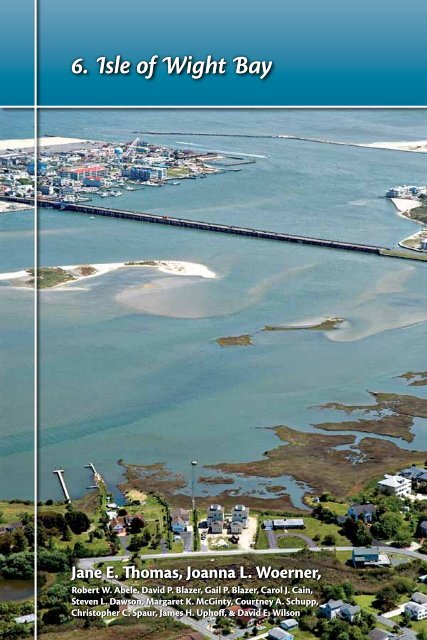
6. Isle of Wight Bay - The Coastal Bays Program
6. Isle of Wight Bay - The Coastal Bays Program
6. Isle of Wight Bay - The Coastal Bays Program

You also want an ePaper? Increase the reach of your titles
YUMPU automatically turns print PDFs into web optimized ePapers that Google loves.
shifting sandsConclusions<strong>The</strong> ecosystem health<strong>of</strong> <strong>Isle</strong> <strong>of</strong> <strong>Wight</strong> <strong>Bay</strong> is impacted<strong>Isle</strong> <strong>of</strong> <strong>Wight</strong> <strong>Bay</strong> ranked as impactedfor both estuarine and watershed health.Water quality was better in the well-flushedopen bay than in the tributaries, and goodscores for bay benthic communities andsediment quality were balanced by poorresults for brown tide, hard clams, seagrass,and stream benthic communities. Thisresulted in <strong>Isle</strong> <strong>of</strong> <strong>Wight</strong> <strong>Bay</strong>’s overallecosystem health ranking as fourth <strong>of</strong> the<strong>Coastal</strong> <strong>Bay</strong>s. For more information, seeChapter 2—Ecosystem Health Assessment.<strong>Isle</strong> <strong>of</strong> <strong>Wight</strong> <strong>Bay</strong> issuesAlthough the following issues arepresented here as pertaining to <strong>Isle</strong> <strong>of</strong><strong>Wight</strong> <strong>Bay</strong>, they also apply to other <strong>Coastal</strong><strong>Bay</strong>s subwatersheds.How healthy is <strong>Isle</strong> <strong>of</strong> <strong>Wight</strong> <strong>Bay</strong>?1.0HEALTHY<strong>6.</strong>6IMPACTED0.42Dead-end canalscan create ecological problems<strong>The</strong>re are at least 111 canals adjacent to the<strong>Coastal</strong> <strong>Bay</strong>s, 59 <strong>of</strong> which are in <strong>Isle</strong> <strong>of</strong><strong>Wight</strong> <strong>Bay</strong>. Most <strong>of</strong> these canals were builtbetween 1960 and 1980 by developmentprojects that dug the canals to createresidential waterfront lots. Dead-endcanals are problematic for several reasons.<strong>The</strong>y usually have only one opening. Mostwere dug through wetlands with the3.3DEGRADED0.0Jane ThomasAerial view <strong>of</strong> <strong>Isle</strong> <strong>of</strong> <strong>Wight</strong> <strong>Bay</strong>, with Ocean City and the inlet in the background.102
Chapter 6 • isle <strong>of</strong> wight bay<strong>Isle</strong> <strong>of</strong> <strong>Wight</strong> <strong>Bay</strong> & watershed factsWatershed area (km2) 51.8Average bay depth (m) 1.22Surface area <strong>of</strong> bay (km2) 21.1Watershed area : surface area 2.45<strong>Bay</strong> water volume (m3 × 106) 22.85Watershed area : water volume 2.27Flushing rate (days) 9.45Population 18,570Land use in <strong>Isle</strong> <strong>of</strong> <strong>Wight</strong> <strong>Bay</strong> subwatershedResidential2<strong>6.</strong>0%Wetlands5.2%Forest37.0%Agriculture18.5%Beaches& bareground
shifting sandspollution, and silting <strong>of</strong> canal mouths andends. <strong>The</strong> question <strong>of</strong> who is responsiblefor maintaining the canals is ambiguous.Most canals are stabilized withbulkheading (vertical walls that deflectall wave action and cause scouring<strong>of</strong> the canal bottom). Scouring canundermine the bulkhead and exacerbateerosion. Furthermore, bulkheading washistorically made with treated lumbercontaining toxic chemicals, includingcopper, chromium, and arsenic. A study <strong>of</strong>Maryland and Delaware bays found thatsome bay sediments were contaminatedwith metals (arsensic, copper, nickel,zinc), pesticides (chlordane, dieldrin, DDT[dichloro-diphenyl-trichloroethane]), andother chemicals (PCBs [polychlorinatedbiphenyls], PAHs [polycyclic aromatichydrocarbons]).3 <strong>The</strong> most severecontamination was found in areas withboating activity (such as marinas, whereboat paints and sacrificial anodes on boatsand crab pots are sources <strong>of</strong> pollution) andintense urbanization (bulkheads, auto-partwear, stormwater run<strong>of</strong>f, and atmosphericinputs). This same study found that morethan 55% <strong>of</strong> the area in dead-end canalshad bottom dissolved oxygen less than thestate standard <strong>of</strong> 5 mg L-1. Thirty percent <strong>of</strong>the dead-end canal area had concentrations<strong>of</strong> less than 2 mg L-1. Low oxygen stressesorganisms. When researchers examinedthe canals for marine life they found that78% had only two organisms—pollutiontolerantworms and algae.Although ecological conditionswithin the canals are degraded, theyeffectively function as an unintentionalbest management practice by preventingrelease <strong>of</strong> pollutants into the <strong>Coastal</strong><strong>Bay</strong>s themselves. Accordingly, correctingproblems within the canals wouldrequire the trade<strong>of</strong>f that these materialswould be exported into the bays. <strong>The</strong>recommendations below only addressimprovement <strong>of</strong> conditions withinthe canals, not how to limit impact<strong>of</strong> pollutants within the canals on the<strong>Coastal</strong> <strong>Bay</strong>s.Jane ThomasFenwick Island contains many dead-end canal developments.104
Chapter 6 • isle <strong>of</strong> wight bayPolicy recommendations• Determine who has jurisdiction and maintenanceresponsibilities for canals and non-federal channels.How <strong>of</strong>ten should maintenance be conducted?• Investigate the feasibility <strong>of</strong> a Navigation andDredging tax district.• Investigate the feasibility <strong>of</strong> replacing oldbulkheading using s<strong>of</strong>t shoreline stabilizationtechniques.• Provide best management practices for dredgingand maintaining canals. Discourage the practice <strong>of</strong>spot-dredging holes for boat docks and boat lifts.<strong>The</strong>se holes in shallower canals cause water qualityproblems.• Fill canal depressions with dredge material to meancanal depth. Maintain a depth and slope to meetnatural bay conditions. Remove sediment sills fromthe mouths <strong>of</strong> the canals to improve flushing andwater quality.• Direct ro<strong>of</strong> and road stormwater run<strong>of</strong>f awayfrom canals. Many canal-front homes have burieddownspout pipes that discharge ro<strong>of</strong>-top rainwaterdirectly into the adjacent canal. <strong>The</strong>se pipes shouldbe disconnected to allow water to soak into theground or be diverted to small rain gardens wherethe water can be absorbed by plants and shrubs.• Determine if dredge material is suitable for wetland/island creation projects.• Increase public education and involvement bymaking homeowners and associations aware <strong>of</strong> theimpact <strong>of</strong> their practices on water quality. Engagethem in seeking solutions and remediation practices.• Explore pollution prevention methods, particularlyin dead-end canals in residential areas.isle <strong>of</strong> wight bayNavigation & dredging activitiesshould be coordinatedResponsibility for navigation and dredging in the<strong>Coastal</strong> <strong>Bay</strong>s is shared by several federal, state, and localagencies as well as private communities, businesses, andindividuals. <strong>The</strong> lack <strong>of</strong> overall planning and coordinationin the past contributed to a variety <strong>of</strong> problems, includingpublic confusion about these issues, inadequateenvironmental safeguards, failure to make full beneficialuse <strong>of</strong> dredged material, and non-standard channelmaintenance and marking. Locally based planning,coordination, and vision was needed to enhance theCondominiums and amusement parks are a typical <strong>Isle</strong> <strong>of</strong> <strong>Wight</strong> <strong>Bay</strong> vista.Jane Thomas105
shifting sandsmanagement <strong>of</strong> navigation and dredgingand minimize adverse effects on the<strong>Coastal</strong> <strong>Bay</strong>s.Dredging <strong>of</strong> <strong>Isle</strong> <strong>of</strong> <strong>Wight</strong> <strong>Bay</strong> andOcean City Inlet aids boaters in navigatingthe sandy shoals that form behind theisland, and transforms the shoals from anavigation hassle into a key component <strong>of</strong>island restoration. <strong>The</strong> sand bodies—tidaldeltas—form seaward and landward <strong>of</strong>tidal inlets as a result <strong>of</strong> the sudden dropin water velocity that occurs where theflooding tide meets the bay and where theebbing tide joins the ocean.In order to restore sand transportprocesses, which were disrupted by thestabilization <strong>of</strong> the Ocean City Inlet withjetties, the Long-Term Sand Management<strong>Program</strong> dredges sand from portions <strong>of</strong>the tidal deltas within the bay, the inlet,and the nearshore areas <strong>of</strong> both OceanCity and Assateague Island. It is thendeposited <strong>of</strong>fshore <strong>of</strong> a sand-starvedsection <strong>of</strong> Assateague Island and severalerosional hotspots in Ocean City.This sand bypassing method attemptsto restore sand movement using naturalprocesses such as wave movement andlongshore currents. <strong>The</strong> restoration projectalso provides bathymetric surveys <strong>of</strong> theinlet and the tidal deltas every two years.This data quantifies changes in the locationand volume <strong>of</strong> sand bodies in the bays andaround the inlet. For more informationon the Long-Term Sand ManagementProject and the changes resulting from theconstruction <strong>of</strong> the Ocean City Inlet jetties,see Chapter 12—Dynamic Systems at theLand–Sea Interface.Due to the relatively shallow nature<strong>of</strong> the Maryland <strong>Coastal</strong> <strong>Bay</strong>s, themaintenance <strong>of</strong> navigable waterways tosupport recreational and commercialboating is a critical regional need. Improvedplanning and coordination between federal,state, local, and private interests is neededto enhance the economic and recreationalbenefits <strong>of</strong> navigation improvements anddredging while minimizing their adverseeffects on natural resources.Recreational boating is a popular pastime in the<strong>Coastal</strong> <strong>Bay</strong>s, requiring navigation and dredgingmaintenance.A Navigation and Dredging AdvisoryGroup was created to develop a MasterPlan to guide the management <strong>of</strong>navigation and dredging in the <strong>Coastal</strong><strong>Bay</strong>s, provide a forum for public input intorelated decision-making, and enhance andprotect natural resources either at risk orthat may benefit from navigation-relatedactivities. This committee developeda master plan that now needs to beimplemented.6 <strong>The</strong> committee needsto continue to organize as the forum <strong>of</strong>diverse <strong>Coastal</strong> <strong>Bay</strong>s users and agenciesresponsible for navigation and dredging ina way that allows concerns, needs, obstacles,and benefits to be highlighted, discussed,and coordinated. By doing so, navigationand dredging actions can be expedited andprovide the greatest benefits at least cost tobay users and the bay ecology. For moreinformation, see Chapter 3—Management<strong>of</strong> the <strong>Coastal</strong> <strong>Bay</strong>s & Watershed.Recommendations• Promote and implement therecommendations <strong>of</strong> the MasterPlan to guide the management <strong>of</strong>Andy Serrell106
Chapter 6 • isle <strong>of</strong> wight baynavigation and related activities inthe <strong>Coastal</strong> <strong>Bay</strong>s.• Provide an ongoing forumfor communication betweenagencies and organizations withresponsibilities for, or interest in,navigation and dredging to enhancecoordination and consistency.• Design and distribute a Navigationand Dredging Planning Guide toaddress the following issues:• Dredged materials management.• Use recent studies to identify andsecure dredge placement sites.• Prioritize areas that require dredging.• Link areas that require dredging toareas in need <strong>of</strong> fill material.• Track total dredge materialdisposal needs by volume, location,and sediment type.• Encourage citizen participation inproject monitoring.• Develop educational materials thatdescribe best management practicesfor dredging, including time-<strong>of</strong>-yearrestrictions, preferred methods,safeguards for sensitive areas, andcontaminated sites management.Ensure that these materials areavailable to the public and updatedperiodically.• Develop and distribute a mapidentifying federal and markedprivate navigation channels. Includeinformation regarding sensitivespecies areas and personal watercraftrestricted areas.• Prioritize areas to improve channelmarkers, especially small channelsleading to and from boat accesspoints and the federal channelin Chincoteague <strong>Bay</strong>. Using acoordinated effort, identify andsecure needed funding for markerupgrades and new installations.Provide the opportunity for publicreporting <strong>of</strong> marker and channelconditions via agency phonenumbers and websites.• Make timely updates to nauticalcharts. Determine the frequencyneeded to collect meaningfulbathymetry data. Identify long-termfunding sources and responsibleagencies.• Develop educational materialsoutlining permit details, includinginformation needed, permit reviewtime, contacts, appeals process, andpublic participation opportunities.Wetlands should be managed,preserved, & restored<strong>Isle</strong> <strong>of</strong> <strong>Wight</strong> <strong>Bay</strong> has incurred substantialloss <strong>of</strong> wetlands from developmentand agriculture. Although wetlandsregulations now serve to protect directloss <strong>of</strong> wetlands, permitted losses dooccur. <strong>The</strong> vast majority <strong>of</strong> permittedimpacts have been in the <strong>Isle</strong> <strong>of</strong> <strong>Wight</strong> <strong>Bay</strong>watershed, which has the smallest wetlandextent. For more information on wetlands,see Chapter 3—Management <strong>of</strong> the <strong>Coastal</strong>isle <strong>of</strong> wight baySubwatershedDrainage area(acres)Total wetlandarea (acres)Wetland extent(%)Assawoman <strong>Bay</strong> 6,104 2,746 45<strong>Isle</strong> <strong>of</strong> <strong>Wight</strong> <strong>Bay</strong> & St. Martin River 36,077 5,648 16Sinepuxent <strong>Bay</strong> 6,598 4,023 61Newport <strong>Bay</strong> 27,923 6,546 23Chincoteague <strong>Bay</strong> 34,842 15,530 45<strong>Coastal</strong> <strong>Bay</strong>s total 111,544 34,493 31Extend <strong>of</strong> wetlands in the <strong>Coastal</strong> <strong>Bay</strong>s watershed.10,12107
shifting sands<strong>Bay</strong>s & Watershed and Chapter 15—Habitats <strong>of</strong> the <strong>Coastal</strong> <strong>Bay</strong>s & Watershed.Permitted non-tidal wetland lossesand conversion impacts from 1991–2006totalled 89.34 acres in the <strong>Coastal</strong> <strong>Bay</strong>s:Losses ‒89.34State mitigation (gain) +25.20Landowner mitigation (gain) +57.56Additional voluntary gains +<strong>6.</strong>07Total backlog <strong>of</strong> non-tidal wetlands ‒0.51Mitigation<strong>The</strong> <strong>Coastal</strong> <strong>Bay</strong>s watershed has thelargest compensatory mitigation backlogin Maryland. Permittees can pay intothe state compensation fund wherewetland impacts are minor or when thelandowner has no other option (e.g.,residential developments). However,when the opportunity is available,permitees are required to replace lostwetlands. Completion <strong>of</strong> mitigationprojects and their success was not welldocumented until 2007, when MarylandDepartment <strong>of</strong> the Environment (MDE)completed a review <strong>of</strong> the effectiveness<strong>of</strong> its mitigation program. Mitigation hasgenerally been found to be successfuland MDE is increasing its monitoringand follow-up efforts. <strong>The</strong>re has been nopenalty applied to date for failing to carryout mitigation monitoring or file reports.In general, wetland scientists agree thatmitigation <strong>of</strong>ten fails to replace thefunction <strong>of</strong> the lost wetland, particularlyif the original wetland was not degraded.However, MDE’s program, whenadequately staffed, can document thatand oversee establishment <strong>of</strong> wetlandsthat are on the right path to replacing lostwetland functions.Preservation & restorationIn the cases <strong>of</strong> some new developments,when a permit is issued for wetlandimpacts, a deed restriction on theremaining wetland area on the property isapplied. Estimates run to a few thousandacres. <strong>The</strong>re are difficulties in enforcingthese restrictions—this is the job <strong>of</strong> thecompliance/enforcement divisions <strong>of</strong> theregulatory agencies. Deed restrictions arealso subject to reversal in the courts, andthus represent a somewhat tentative layer<strong>of</strong> protection.A goal to replace 4,050 ha (10,000 acres)has been adopted by the Maryland <strong>Coastal</strong>jane thomas<strong>The</strong> U.S. Army Corps <strong>of</strong> Engineers, Maryland Deparment <strong>of</strong> Natural Resources, and Worcester County worked togetherto restore approximately 4 ha (10 acres) <strong>of</strong> saltmarsh on the southern tip <strong>of</strong> the <strong>Isle</strong> <strong>of</strong> <strong>Wight</strong> Wildlife ManagementArea, seen in the foreground. For more information, see Chapter 3—Management <strong>of</strong> the <strong>Coastal</strong> <strong>Bay</strong>s & Watershed.108
Chapter 6 • isle <strong>of</strong> wight bay<strong>Bay</strong>s <strong>Program</strong>. Since 1999, nearly 809 ha(2,000 acres) <strong>of</strong> wetlands have beencreated or restored largely through theusda’s nrcs Wetland Reserve <strong>Program</strong>.6<strong>The</strong> <strong>Isle</strong> <strong>of</strong> <strong>Wight</strong> <strong>Bay</strong> subwatershedcontains a Non-tidal Wetland <strong>of</strong> SpecialState Concern—West Ocean City Pond.<strong>The</strong> primary management goal for thiswetland is to preserve the water quality <strong>of</strong>the pond by maintaining a 30-m (100-ft)forested buffer around the pond.9MDE has worked to prioritize wetlandsfor preservation, restoration, andmitigation in the subwatersheds <strong>of</strong> the<strong>Coastal</strong> <strong>Bay</strong>s, including assessing speciesand resources and identifying areas wherethe most benefit could be gained.7,8With their location at the land–waterinterface, wetlands are particularlyvulnerable to sea level rise, especiallyif they are prevented from migratinglandward by existing development. Formore information, see Chapter 15—Habitats <strong>of</strong> the <strong>Coastal</strong> <strong>Bay</strong>s & Watershed.ManagementProblems with wetland management arepresent within permitting, enforcement,and preservation. Confusion aboutrequirements and costs could bereduced by requiring an environmentalassessment or certified wetlanddelineation report submittal at the outsetfor large projects. Mapping <strong>of</strong> bothtidal and non-tidal wetlands is deficientand outdated, and accurate updates areneeded. Compliance suffers from a lack <strong>of</strong>immediate penalty for wetland violationsand lack <strong>of</strong> any imposed penaltiesfor failures in wetland mitigation.Preservation through deed restrictionssuffers from lack <strong>of</strong> oversight.Recommendations• Implement Worcester County’sComprehensive Plan.14• Regulation and enforcement:• Begin a large-scale publiceducation initiative with propertyowners.• Increase staffing resources t<strong>of</strong>ollow up on projects, violations,mitigation, etc.• Return to the system <strong>of</strong> ticketingviolators on the spot.• Establish monitoring/reporting<strong>of</strong> violations from the air byMaryland Department <strong>of</strong> NaturalResources during other flightmissions.• Permitting:• Institute a formalized process<strong>of</strong> environmental assessmentor certified wetland delineationreport submittal at the outset <strong>of</strong>each large or complex project.• Mapping:• Update the current tidal wetlandsmaps to reflect changes in sea level,shorelines, etc.• Revise the non-tidal wetland maps.• Mitigation:• Institute a bonding requirementand/or penalty to reduce noncompliancewith mitigationmonitoring requirement. MDE nowrequires that bonds be submittedbefore permits are issued.• Consider instituting a watershedwidemitigation banking system.• Establish a program <strong>of</strong> acquisitionor easement on lands for futureprogrammatic mitigation sites toavoid the current difficulties infinding sites in a reasonable timeframe.• Perform more detailed functionalloss assessments in determiningthe mitigation required,especially on larger projects—improvements to the assessmentprocedure for wetlands proposedfor impact are under developmentby MDE.• Raise the wetland compensationfund payment schedule to a morereasonable payment to reflectcurrent land values.• Wetland mitigation shouldbe conducted according toisle <strong>of</strong> wight bay109
shifting sandsrecommendations alreadypublished.7,8• Buffer mitigation:• Reconsider current buffermitigation exemption, especiallywhere a wetland remains after itsbuffer is destroyed.• Database/records management:• Tidal permits:• Improve form <strong>of</strong> records andclarify organization.• Non-tidal permits:• Make available subsets <strong>of</strong>databases, and more extensivedata analysis.• Document the time at whichwetland impacts begin in orderto ensure maximum overlap <strong>of</strong>functioning mitigation wetlandarea and to record projects thatdid not occur.• Add the following informationnot now collected: areaprotected via deed restriction;functional losses for Letter <strong>of</strong>Authorization permits; andcompletion/success <strong>of</strong> creation,restoration, and enhancementprojects for cases wheremitigation is not required.• Staffing:• Address staffing and funding needsto implement some <strong>of</strong> the aboverecommendations.<strong>The</strong>re are large amounts<strong>of</strong> impervious surfacesImpervious surfaces increase run<strong>of</strong>f,erosion, sedimentation, thermalpollution, excess nutrients, toxic metals,and detrimental organic compounds inaquatic systems.1,11 Impervious surfacesare any surfaces (pavement, ro<strong>of</strong>tops,and compacted soils) that prevent waterfrom penetrating into the ground. InChesapeake <strong>Bay</strong> tributaries, bottom-layerdissolved oxygen and fish communitiesdecreased significantly as impervioussurfaces increased.13 In addition, PCBcontamination in white perch increasedwith impervious surfaces.5jane thomasIncreasing development threatens wetlands along the shores <strong>of</strong> Turville (foreground) and Herring Creeks.110
Chapter 6 • isle <strong>of</strong> wight bayjane thomasisle <strong>of</strong> wight bay<strong>Isle</strong> <strong>of</strong> <strong>Wight</strong> <strong>Bay</strong> has a high proportion <strong>of</strong> impervious surfaces, as shown here on Fenwick Island.Impacts <strong>of</strong> agricultural practices andextensive stream channelization havedegraded and will continue to impactstream ecosystems in the <strong>Coastal</strong> <strong>Bay</strong>s.Future development could exacerbatethese problems, particularly in areas whereimpervious cover is likely to be substantial.Research from streams elsewhere in thestate indicates that significant biologicaldegradation can be expected to occurwhere stormwater run<strong>of</strong>f is not adequatelymanaged and impervious cover in awatershed exceeds 10%.11 Impervioussurface in the <strong>Isle</strong> <strong>of</strong> <strong>Wight</strong> <strong>Bay</strong> watershedis currently at this 10% threshold (seeChapter 2—Ecosystem Health Assessment).In the northern bays, where the greatestvolume <strong>of</strong> stormwater run<strong>of</strong>f fromdeveloped areas is received, frequentexchange with ocean water occurs, whichmay limit the impacts <strong>of</strong> stormwaterrun<strong>of</strong>f. Additionally, flat slopes and largeareas <strong>of</strong> sandy soils serve to somewhatlimit run<strong>of</strong>f impacts. Estuarine waters thatare not as well flushed may accumulatepollutants more readily.Land use planning is largely underlocal control and is <strong>of</strong>ten conducted ona project-by-project basis that does notconsider watershed-wide impervioussurface and its associated impacts onaquatic resources. It is not known ifstormwater or restoration technologycan negate or reverse these impacts,particularly on biological communitiesand their habitats. Because <strong>of</strong> theseuncertainties, effects <strong>of</strong> impervioussurfaces on aquatic systems should beconsidered in the planning process.Studies in similar habitats haverecommended avoiding the 10% thresholdby applying a safe margin <strong>of</strong> 2–3% lessthan 10% in order to reduce the risk<strong>of</strong> biological impairment.1,13 However,avoiding the 10% impervious threshold isunrealistic for some areas to be developed,but maximizing development density willreduce demand for rural land elsewhere.Studies have not been conducted todetermine impacts <strong>of</strong> impervious coveron the <strong>Coastal</strong> <strong>Bay</strong>s, but research onChesapeake <strong>Bay</strong> tributaries and SouthCarolina tidal creeks have indicatedthreshold effects and it is only prudentto consider those examples in planningfuture development in the <strong>Coastal</strong><strong>Bay</strong>s.4,5,13Maryland is among the mostprogressive states in the nation withregard to stormwater management. MDEregulations require new development inrural areas and redevelopment in alreadyexisting developed areas to mitigateimpacts <strong>of</strong> stormwater run<strong>of</strong>f. <strong>The</strong>regulations set goals for pollutant removal,maintenance <strong>of</strong> groundwater recharge, andcontrolling impacts to receiving streams.<strong>The</strong> latter considers reducing or preventingincreased channel erosion and streamoverbank flooding. Thus, redevelopment111
shifting sands<strong>of</strong> older areas in accordance with MDE’snew policies would be anticipated togradually reduce impacts <strong>of</strong> stormwaterrun<strong>of</strong>f from these older areas. Newdevelopment done in accordance withcurrent MDE stormwater managementguidelines will probably not cause thesevere problems that older developmentdone prior to modern guidelines/requirements did. However, in spite <strong>of</strong>the strength <strong>of</strong> these MDE requirements,the long-term effectiveness <strong>of</strong> stormwatermanagement measures is yet to bedetermined. Additionally, it is likely thatcumulative effects <strong>of</strong> large-scale newurbanization will gradually impair surfaceand groundwaters since their pollutiongeneration rate is greater per acre.Recommendations• Implement WorcesterCounty’s Comprehensive Planrecommendations regardingimpervious surfaces.14• Initiate research projects to definesuccessful measures for preventingor restoring degraded habitat inbrackish and marine waters. Formore information, see Chapter 3—Management <strong>of</strong> the <strong>Coastal</strong> <strong>Bay</strong>s &Watershed.Stormwater best managementpractices should be implementedin Ocean City<strong>of</strong> disturbance. <strong>The</strong>refore, 99% <strong>of</strong> alldevelopment/redevelopment in the townmust incorporate some sort <strong>of</strong> BMP thattreats stormwater.<strong>The</strong> choices <strong>of</strong> BMPs in Ocean City arevery limited. Lot size and value are themain restrictions. Buildings are locatedsetback to setback, and after parking andlandscaping requirements and location <strong>of</strong>utilities, stormwater management is thelast to be incorporated into the site plan.Another consideration in choosing BMPs isthe location <strong>of</strong> Ocean City. Ocean City isa flat barrier island with 100% urban landuse, and all <strong>of</strong> the storm drains empty intothe <strong>Coastal</strong> <strong>Bay</strong>s, not the ocean. <strong>The</strong> oceanside <strong>of</strong> the island is very sandy; however,the bay side is man-made land, usingdredge material. Soil infiltration rates,A summer thundershower floods the <strong>Coastal</strong> Highwayin Ocean City. Sitting only a few feet above sea level,Ocean City floods frequently, especially when rainevents occur at high tide.Gail BlazerMaryland Department <strong>of</strong> NaturalResources (DNR) and MDE have developedstormwater management proceduresfor Ocean City. MDE requires waterquality volume treatment and DNRrequires pro<strong>of</strong> <strong>of</strong> pollutant reductionand habitat enhancement. <strong>The</strong>refore,best management practices (BMPs)must be utilized on new developmentand redevelopment projects to meetthe intent <strong>of</strong> both regulations. <strong>The</strong> MDEstormwater regulations start at lots 460 m2(5,000 ft2) in size and DNR’s regulationsaffect anything over 23 m2 (250 ft2)A stormdrain lies under nine inches <strong>of</strong> water indowntown Ocean City during a nor’easter storm inFebruary, 1998.Dave Wilson112
Chapter 6 • isle <strong>of</strong> wight bayTown <strong>of</strong> Ocean Cityisle <strong>of</strong> wight bayPervious pavers used in a parking lot in Ocean City. <strong>The</strong>se pavers are used to reduce impervious surface and act as aninfiltration trench.Town <strong>of</strong> Ocean CityTown <strong>of</strong> Ocean CityBioretention in an urban environment. Bioretentionutilizes soils and plants to remove pollutants fromstormwater run<strong>of</strong>f.One way to reduce impervious surface is to havedriveway tracks, instead <strong>of</strong> paving the whole surface.VehicleexhaustPowerplantsTire andvehicleparts wearVehicleoil, grease& fuelRoadsurfaces &de-icing saltsHousehold,lawn, & gardenchemicalsLead • • • • •Zinc • • • •Arsenic•Copper • •Cadmium • • •Chromium • •Nickel • • • •Manganese • •Mercury • • •Iron•Cyanide•Nitrogen &phosphorus• • •Common pollutants and their sources. Many <strong>of</strong> these pollutants can be found in stormwater run<strong>of</strong>f.113
shifting sandsproperty slope, groundwater elevation,and other site requirements have to beconsidered in stormwater managementdesign. Designers are encouraged toutilize pervious paving techniques tojointly meet parking and stormwaterrequirements, and include bioretentiontechniques in landscaping plans to meetlandscaping requirements.With this in mind, the followingare the BMPs from the 2000 MarylandStormwater Design Manual that are viablein Ocean City:2• Infiltration:• Exfiltration trench (minimum tw<strong>of</strong>eet clearance to water table).• Pervious pavers can be designed asan infiltration trench.• Bioretention (as infiltration).• Filters:• Bioretention.• Sand filters.• Non-structural techniques:• Disconnection <strong>of</strong> ro<strong>of</strong>top run<strong>of</strong>f:• Swales, raingardens, and otherlandscaped areas.• Disconnection <strong>of</strong> non-ro<strong>of</strong>toprun<strong>of</strong>f:• Direct flow from impervioussurfaces to swales/bioretentionareas, etc.• Maximum impervious surfacerequirements.• Pervious paver, pervious deckdesign, pervious sidewalks,pervious concrete, and asphalt.• Ponds/wetlands:• Pocket ponds and wetlands.Features<strong>of</strong> <strong>Isle</strong> <strong>of</strong> <strong>Wight</strong> <strong>Bay</strong>& its watershed<strong>Isle</strong> <strong>of</strong> <strong>Wight</strong> <strong>Bay</strong> and its watershed arethe most heavily used <strong>of</strong> the <strong>Coastal</strong> <strong>Bay</strong>s.Bounded on the east by densely developedOcean City, it is also bounded on the westby very dense residential development.<strong>The</strong> north boundary is Route 90 withtwo in-line bridge spans leading from themainland to Cape <strong>Isle</strong> <strong>of</strong> <strong>Wight</strong> and thento north Ocean City. <strong>The</strong> south boundaryjane thomasUnlike the southern bays, seagrass distribution is relatively stable in <strong>Isle</strong> <strong>of</strong> <strong>Wight</strong> <strong>Bay</strong>.114
Chapter 6 • isle <strong>of</strong> wight bayis the Route 50 bridge, bringing traffic intosouth Ocean City.Flowing into <strong>Isle</strong> <strong>of</strong> <strong>Wight</strong> <strong>Bay</strong> arewaters from Herring Creek, Turville Creek,and St. Martin River, all with increasingresidential development.Skimmer Island is a haven for birdsJust north <strong>of</strong> the Route 50 bridge isSkimmer Island, a protected sanctuaryfor skimmers, ibis, egrets, herons, andterns. <strong>The</strong> shallows north and west <strong>of</strong>the island are reserved for recreationalclamming. Commercial and recreationalcrabbing and clamming are also activein the bay. For more information, seeChapter 14—Diversity <strong>of</strong> Life in the<strong>Coastal</strong> <strong>Bay</strong>s.<strong>Isle</strong> <strong>of</strong> <strong>Wight</strong> Wildlife ManagementArea has been restoredBetween the spans <strong>of</strong> the Route 90 bridgeis the <strong>Isle</strong> <strong>of</strong> <strong>Wight</strong> Wildlife ManagementArea, a restored, county-owned parkarea where 4 ha (10 acres) <strong>of</strong> salt marshwere created and where the publiccan enjoy a beautiful view in a naturalsetting. For more information, seeChapter 3—Management <strong>of</strong> the <strong>Coastal</strong><strong>Bay</strong>s & Watershed.From the bridge, anglers drop linesall day and even most <strong>of</strong> the night whenrockfish prowl the water for baitfish. Jetskis buzz between anglers and add to thefray with stops at Ocean City’s numerousbayside bars and restaurants. Waterskiingis also popular in Herring and TurvilleCreeks where ‘weekend warriors’ competefor water space with residents from Cape<strong>Isle</strong> <strong>of</strong> <strong>Wight</strong>, the Riddle Farm, and OceanPines—all on the bay’s western side. Partyfishing boats and scenic tours help add tothe bay’s multi-million-dollar contributionto the local economy.Seagrass is expandingin <strong>Isle</strong> <strong>of</strong> <strong>Wight</strong> <strong>Bay</strong>Seagrasses have been increasing theirdistribution in <strong>Isle</strong> <strong>of</strong> <strong>Wight</strong> <strong>Bay</strong>. Inspite <strong>of</strong> the many activities and growth,seagrasses have remained stable orincreased in the bay; however, they stillremain well below their potential in <strong>Isle</strong><strong>of</strong> <strong>Wight</strong> <strong>Bay</strong>. For more information, seeChapter 15—Habitats <strong>of</strong> the <strong>Coastal</strong> <strong>Bay</strong>s &Watershed.•isle <strong>of</strong> wight bay<strong>Isle</strong> <strong>of</strong> <strong>Wight</strong> <strong>Bay</strong>is a tourist destinationTourism in <strong>Isle</strong> <strong>of</strong> <strong>Wight</strong> <strong>Bay</strong> is bigbusiness. With some 300,000 weekendvisitors to its eastern flank, the bay hostsrecreational interests <strong>of</strong> all varieties fromOcean City. Personal watercraft, powerand sail boats, kayaks, and canoes frequentthe bay with users being both visitingtourists and residents. Near the Route50 bridge and along the thoroughfare,hundreds <strong>of</strong> boaters ply the bay forflounder, sea trout, and rockfish duringthe busy June–September tourist season.<strong>Isle</strong> <strong>of</strong> <strong>Wight</strong> <strong>Bay</strong> is where most <strong>of</strong> thefishing in the <strong>Coastal</strong> <strong>Bay</strong>s occurs.115
shifting sandsAcknowledgements<strong>The</strong> authors would like to thank CathyWazniak from the Maryland Department<strong>of</strong> Natural Resources for her commentshelpful in the completion <strong>of</strong> this chapter.ReferencesImpervious Surface as a Test Case. Chesapeake <strong>Bay</strong>Finfish/Habitat Investigations 2006, F-61-R-1, Project 3.Maryland Department <strong>of</strong> Natural Resources, Annapolis,Maryland.14. Worcester County Department <strong>of</strong> ComprehensivePlanning. 200<strong>6.</strong> Worcester County, MarylandComprehensive Plan. http://www.co.worcester.md.us/compplan.htm1. Beach, D. 2002. <strong>Coastal</strong> Sprawl: <strong>The</strong> Effects <strong>of</strong> UrbanDesign on Aquatic Ecosystems in the United States. PewOceans Commission, Arlington, Virginia.2. Center for Watershed Protection & MarylandDepartment <strong>of</strong> the Environment. 2000. MarylandStormwater Design Manual, Volumes I & II.3. Chaillou, J.C., S.B. Weisberg, F.W. Kutz, T.E. DeMoss,L. Mangiaracina, R. Magnien, R. Eskin, J. Maxted,K. Price, & J.K. Summers. 199<strong>6.</strong> Assessment <strong>of</strong> theEcological Condition <strong>of</strong> the Delaware & Maryland <strong>Coastal</strong><strong>Bay</strong>s. U.S. Environmental Protection Agency, Office<strong>of</strong> Research & Development, Washington, D.C. 20460EPA/620/R-96/004.4. Holland, A.F., D.M. Sanger, C.P. Gawle, S.B. Lerberg,M.S. Santiago, G.H.M. Riekerk, L.E. Zimmerman, &G.I. Scott. 2004. Linkages between tidal creek ecosystems& the landscape & demographic attributes <strong>of</strong> theirwatersheds. Journal <strong>of</strong> Experimental Marine Biology &Ecology 298: 151–178.5. King, R.S., J.R. Beaman, D.F. Whigham, A.H. Hines,M.E. Baker, & D.E. Weller. 2004. Watershed land use isstrongly linked to PCBs in white perch in Chesapeake<strong>Bay</strong> subestuaries. Environmental Science & Technology 38:6546-6552.<strong>6.</strong> Maryland <strong>Coastal</strong> <strong>Bay</strong>s <strong>Program</strong>, Navigation & DredgingAdvisory Group. Unpublished data.7. Maryland Department <strong>of</strong> the Environment. 2004. PriorityAreas for Wetland Restoration, Preservation, & Mitigationin Maryland’s <strong>Coastal</strong> <strong>Bay</strong>s. Wetlands & Waterways<strong>Program</strong>. Baltimore, Maryland.8. Maryland Department <strong>of</strong> the Environment. 200<strong>6.</strong>Prioritizing Sites for Wetland Restoration, Mitigation, &Preservation in Maryland. Baltimore, Maryland.9. Maryland Department <strong>of</strong> Natural Resources. 2004.Nontidal Wetlands <strong>of</strong> Special State Concern <strong>of</strong> Five CentralMaryland Counties & <strong>Coastal</strong> <strong>Bay</strong> Area <strong>of</strong> WorcesterCounty, Maryland. Maryland Department <strong>of</strong> NaturalResources, Natural Heritage <strong>Program</strong>, Annapolis,Maryland. Prepared for Maryland Department <strong>of</strong> theEnvironment.10. Maryland Department <strong>of</strong> Natural Resources.Unpublished data.11. Schueler, T.R., & H.K. Holland. 2000. <strong>The</strong> Practice <strong>of</strong>Watershed Protection. Center for Watershed Protection,Ellicott City, Maryland.12. Tiner, R., M. Starr, H. Bergquist, & J. Swords. 2000.Watershed-based Wetland Characterization for Maryland’sNanticoke River & <strong>Coastal</strong> <strong>Bay</strong>s Watersheds: A PreliminaryAssessment Report. U.S. Fish & Wildlife Service, NationalWetlands Inventory <strong>Program</strong>, Northeast Region, Hadley,Massachusetts. Prepared for the Maryland Department <strong>of</strong>Natural Resources, <strong>Coastal</strong> Zone Management <strong>Program</strong>(pursuant to NOAA award). Technical report.13. Uph<strong>of</strong>f, J., M. McGinty, R. Lukacovic, J. Mowrer, &B. Pyle. 2007. Development <strong>of</strong> Habitat Based ReferencePoints for Chesapeake <strong>Bay</strong> Fishes <strong>of</strong> Special Concern:116